

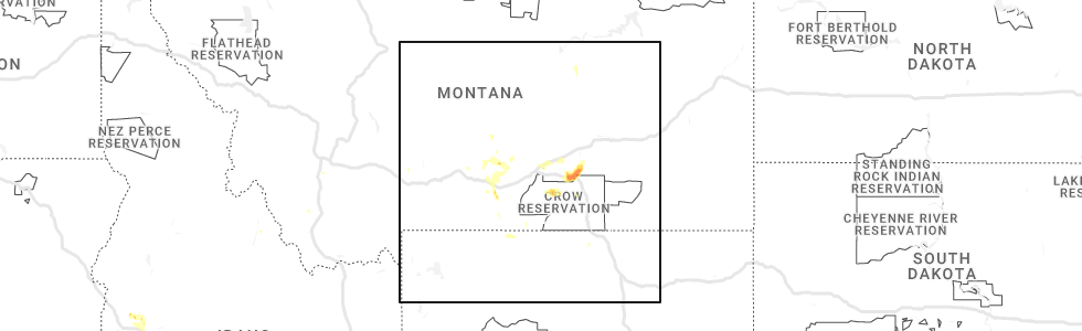
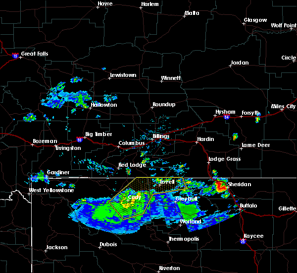
Hail Map for Frannie, WY
The Frannie, WY area has had 0 reports of on-the-ground hail by trained spotters, and has been under severe weather warnings 0 times during the past 12 months. Doppler radar has detected hail at or near Frannie, WY on 9 occasions, including 1 occasion during the past year.
| Name: | Frannie, WY |
| Where Located: | 56.5 miles S of Billings, MT |
| Map: | Google Map for Frannie, WY |
| Population: | 157 |
| Housing Units: | 77 |
| More Info: | Search Google for Frannie, WY |
0
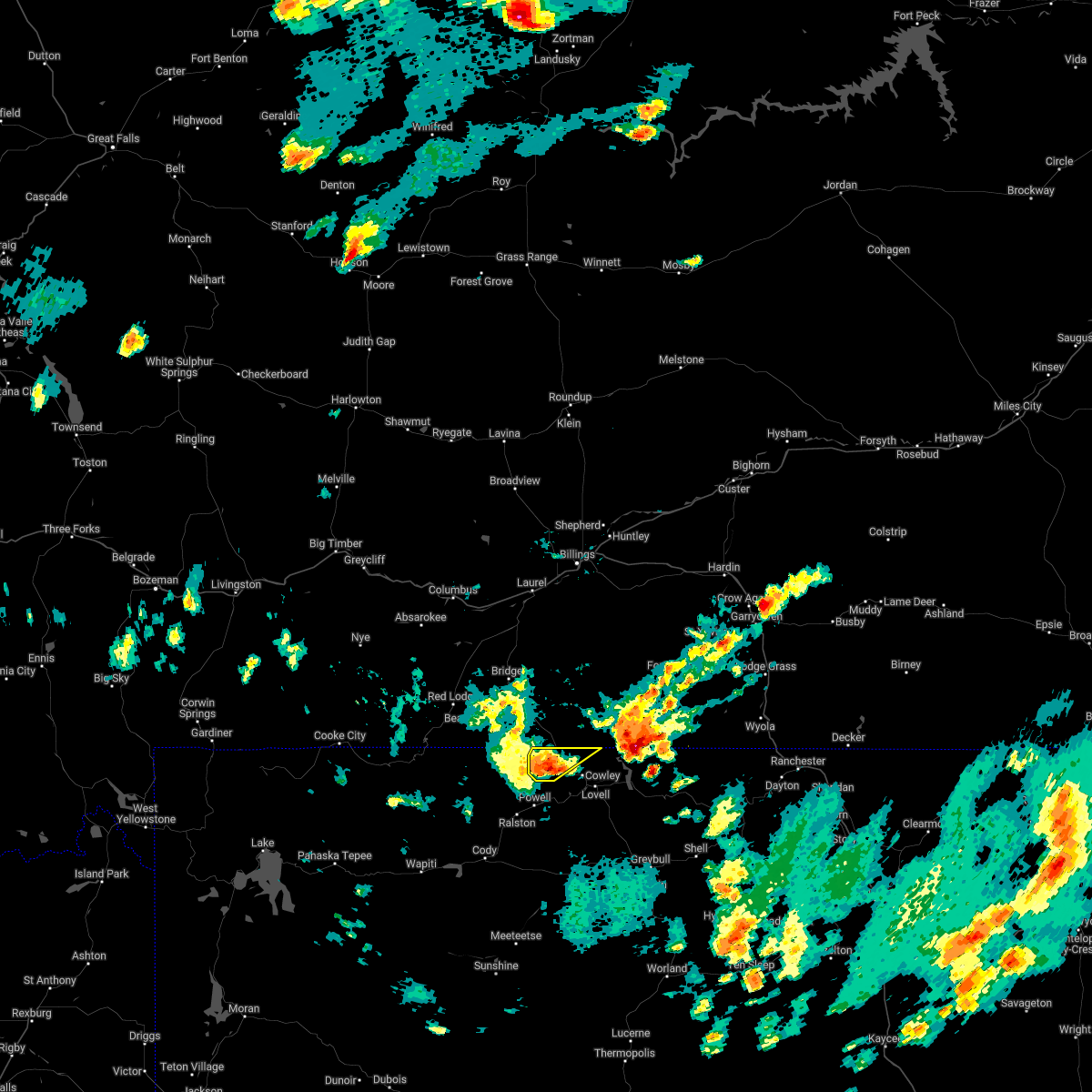
The Top Recent Hail Date for Frannie, WY is Tuesday, June 6, 2023 (9th out of 9)
Hail and Wind Damage Spotted near Frannie, WY
| Date / Time | Report Details |
|---|---|
| 7/24/2022 10:07 PM MDT |
 The severe thunderstorm warning for western big horn and northeastern park counties will expire at 1015 pm mdt, the storms which prompted the warning have weakened below severe limits, and have exited the warned area. therefore, the warning will be allowed to expire. however gusty winds are still possible with these thunderstorms. to report severe weather, contact your nearest law enforcement agency. they will relay your report to the national weather service riverton. The severe thunderstorm warning for western big horn and northeastern park counties will expire at 1015 pm mdt, the storms which prompted the warning have weakened below severe limits, and have exited the warned area. therefore, the warning will be allowed to expire. however gusty winds are still possible with these thunderstorms. to report severe weather, contact your nearest law enforcement agency. they will relay your report to the national weather service riverton.
|
| 7/24/2022 9:22 PM MDT |
 At 920 pm mdt, severe thunderstorms were located along a line extending from 8 miles northwest of shell to 8 miles south of ralston, moving southeast at 40 mph (radar indicated). Hazards include 70 mph wind gusts. the powell airport at 835 pm measured a wind gust of 68 mph. Expect considerable tree damage. damage is likely to mobile homes, roofs, and outbuildings. some power outages are likely. locations impacted include, shell. thunderstorm damage threat, considerable hail threat, radar indicated max hail size, <. 75 in wind threat, observed max wind gust, 70 mph. At 920 pm mdt, severe thunderstorms were located along a line extending from 8 miles northwest of shell to 8 miles south of ralston, moving southeast at 40 mph (radar indicated). Hazards include 70 mph wind gusts. the powell airport at 835 pm measured a wind gust of 68 mph. Expect considerable tree damage. damage is likely to mobile homes, roofs, and outbuildings. some power outages are likely. locations impacted include, shell. thunderstorm damage threat, considerable hail threat, radar indicated max hail size, <. 75 in wind threat, observed max wind gust, 70 mph.
|
| 7/24/2022 8:48 PM MDT |
 At 846 pm mdt, severe thunderstorm outflow winds from montana are pushing into the northern bighorn basin. this outflow was progressing south and southeast around 40 mph (radar indicated). Hazards include 70 mph wind gusts. Expect considerable tree damage. damage is likely to mobile homes, roofs, and outbuildings. severe thunderstorms will be near, horseshoe bend, bighorn lake and crooked creek natural area around 850 pm mdt. other locations in the path of these severe thunderstorms include ralston, powell and shell. thunderstorm damage threat, considerable hail threat, radar indicated max hail size, <. 75 in wind threat, radar indicated max wind gust, 70 mph. At 846 pm mdt, severe thunderstorm outflow winds from montana are pushing into the northern bighorn basin. this outflow was progressing south and southeast around 40 mph (radar indicated). Hazards include 70 mph wind gusts. Expect considerable tree damage. damage is likely to mobile homes, roofs, and outbuildings. severe thunderstorms will be near, horseshoe bend, bighorn lake and crooked creek natural area around 850 pm mdt. other locations in the path of these severe thunderstorms include ralston, powell and shell. thunderstorm damage threat, considerable hail threat, radar indicated max hail size, <. 75 in wind threat, radar indicated max wind gust, 70 mph.
|
| 7/6/2022 4:15 PM MDT |
 At 415 pm mdt, a severe thunderstorm was located over frannie, or 15 miles northwest of lovell, moving northeast at 25 mph (radar indicated). Hazards include 60 mph wind gusts. Expect damage to roofs, siding, and trees. this severe thunderstorm will remain over mainly rural areas of northwestern big horn and northeastern park counties. hail threat, radar indicated max hail size, <. 75 in wind threat, observed max wind gust, 60 mph. At 415 pm mdt, a severe thunderstorm was located over frannie, or 15 miles northwest of lovell, moving northeast at 25 mph (radar indicated). Hazards include 60 mph wind gusts. Expect damage to roofs, siding, and trees. this severe thunderstorm will remain over mainly rural areas of northwestern big horn and northeastern park counties. hail threat, radar indicated max hail size, <. 75 in wind threat, observed max wind gust, 60 mph.
|
| 7/6/2022 4:02 PM MDT |
 At 402 pm mdt, a severe thunderstorm was located near frannie, or 12 miles north of powell, moving northeast at 25 mph (radar indicated). Hazards include 60 mph wind gusts and penny size hail. Expect damage to roofs, siding, and trees. this severe thunderstorm will be near, deaver around 410 pm mdt. frannie around 415 pm mdt. hail threat, radar indicated max hail size, 0. 75 in wind threat, observed max wind gust, 60 mph. At 402 pm mdt, a severe thunderstorm was located near frannie, or 12 miles north of powell, moving northeast at 25 mph (radar indicated). Hazards include 60 mph wind gusts and penny size hail. Expect damage to roofs, siding, and trees. this severe thunderstorm will be near, deaver around 410 pm mdt. frannie around 415 pm mdt. hail threat, radar indicated max hail size, 0. 75 in wind threat, observed max wind gust, 60 mph.
|
| 7/26/2018 6:34 PM MDT |
 At 633 pm mdt, a severe thunderstorm was located over cowley, or near lovell, moving southeast at 45 mph (trained weather spotters. one inch size hail has been reported just west of cowley. in cowley, ping pong size hail was reported, along with strong wind and localized flooding). Hazards include ping pong ball size hail and 60 mph wind gusts. People and animals outdoors will be injured. expect hail damage to roofs, siding, windows, and vehicles. expect wind damage to roofs, siding, and trees. this severe storm will be near, lovell around 640 pm mdt. Other locations impacted by this severe thunderstorm include bighorn canyon national recreation area and cowley north big horn county airport. At 633 pm mdt, a severe thunderstorm was located over cowley, or near lovell, moving southeast at 45 mph (trained weather spotters. one inch size hail has been reported just west of cowley. in cowley, ping pong size hail was reported, along with strong wind and localized flooding). Hazards include ping pong ball size hail and 60 mph wind gusts. People and animals outdoors will be injured. expect hail damage to roofs, siding, windows, and vehicles. expect wind damage to roofs, siding, and trees. this severe storm will be near, lovell around 640 pm mdt. Other locations impacted by this severe thunderstorm include bighorn canyon national recreation area and cowley north big horn county airport.
|
| 7/26/2018 6:17 PM MDT |
 At 615 pm mdt, a severe thunderstorm was located near frannie, or 18 miles northwest of lovell, moving southeast at 45 mph (radar indicated. hail from one inch to one and three- quarter has been reported in montana. in addition, 50 to 60 mph wind gusts have been reported). Hazards include golf ball size hail and 60 mph wind gusts. People and animals outdoors will be injured. expect hail damage to roofs, siding, windows, and vehicles. expect wind damage to roofs, siding, and trees. this severe thunderstorm will be near, frannie around 620 pm mdt. deaver around 630 pm mdt. cowley and crooked creek natural area around 635 pm mdt. lovell and byron around 640 pm mdt. Other locations impacted by this severe thunderstorm include bighorn canyon national recreation area and cowley north big horn county airport. At 615 pm mdt, a severe thunderstorm was located near frannie, or 18 miles northwest of lovell, moving southeast at 45 mph (radar indicated. hail from one inch to one and three- quarter has been reported in montana. in addition, 50 to 60 mph wind gusts have been reported). Hazards include golf ball size hail and 60 mph wind gusts. People and animals outdoors will be injured. expect hail damage to roofs, siding, windows, and vehicles. expect wind damage to roofs, siding, and trees. this severe thunderstorm will be near, frannie around 620 pm mdt. deaver around 630 pm mdt. cowley and crooked creek natural area around 635 pm mdt. lovell and byron around 640 pm mdt. Other locations impacted by this severe thunderstorm include bighorn canyon national recreation area and cowley north big horn county airport.
|
| 5/27/2018 7:03 PM MDT |
 At 701 pm mdt, severe thunderstorms were located along a line extending from near deaver to around cody, moving northwest at 25 mph (automated weather station). Hazards include 60 to 70 mph wind gusts. Expect considerable tree damage. damage is likely to mobile homes, roofs, and outbuildings. Locations impacted include, cody, powell, garland, frannie, deaver, and buffalo bill state park. At 701 pm mdt, severe thunderstorms were located along a line extending from near deaver to around cody, moving northwest at 25 mph (automated weather station). Hazards include 60 to 70 mph wind gusts. Expect considerable tree damage. damage is likely to mobile homes, roofs, and outbuildings. Locations impacted include, cody, powell, garland, frannie, deaver, and buffalo bill state park.
|
| 5/27/2018 6:29 PM MDT |
 At 627 pm mdt, severe thunderstorms were located along a line extending from near medicine wheel to 7 miles south of byron to 10 miles west of meeteetse rim, moving northwest at 25 mph (radar indicated). Hazards include 70 mph wind gusts. Expect considerable tree damage. damage is likely to mobile homes, roofs, and outbuildings. severe thunderstorms will be near, byron around 640 pm mdt. cody, powell, and garland around 645 to 655 pm mdt. deaver around 700 pm mdt. frannie and buffalo bill state park around 700 to 710 pm mdt. elk basin around 715 pm mdt. this line of storms has a history of producing 66 to 76 mph wind gusts north of meeteetse shortly after 600 pm. Motorists on the powell highway between cody and powell should prepare for dangerous cross-winds from the south. At 627 pm mdt, severe thunderstorms were located along a line extending from near medicine wheel to 7 miles south of byron to 10 miles west of meeteetse rim, moving northwest at 25 mph (radar indicated). Hazards include 70 mph wind gusts. Expect considerable tree damage. damage is likely to mobile homes, roofs, and outbuildings. severe thunderstorms will be near, byron around 640 pm mdt. cody, powell, and garland around 645 to 655 pm mdt. deaver around 700 pm mdt. frannie and buffalo bill state park around 700 to 710 pm mdt. elk basin around 715 pm mdt. this line of storms has a history of producing 66 to 76 mph wind gusts north of meeteetse shortly after 600 pm. Motorists on the powell highway between cody and powell should prepare for dangerous cross-winds from the south.
|
Hail Maps for Frannie, WY


Connect with Interactive Hail Maps