

Hail Map for Ghent, WV
The Ghent, WV area has had 5 reports of on-the-ground hail by trained spotters, and has been under severe weather warnings 10 times during the past 12 months. Doppler radar has detected hail at or near Ghent, WV on 22 occasions.
| Name: | Ghent, WV |
| Where Located: | 58.4 miles SSE of Charleston, WV |
| Map: | Google Map for Ghent, WV |
| Population: | 457 |
| Housing Units: | 375 |
| More Info: | Search Google for Ghent, WV |
2
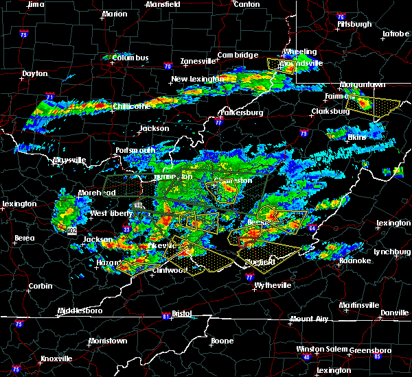
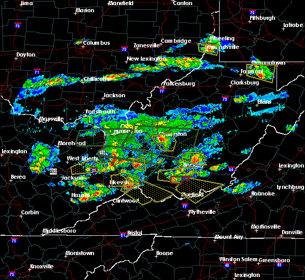
The Top Recent Hail Date for Ghent, WV is Tuesday, July 12, 2022 (3rd out of 22)

Hail and Wind Damage Spotted near Ghent, WV
| Date / Time | Report Details |
|---|---|
| 4/2/2024 12:22 PM EDT |
 The storms which prompted the warning have weakened below severe limits, and no longer pose an immediate threat to life or property. therefore, the warning will be allowed to expire. a tornado watch remains in effect until 100 pm edt for central, southern and southeastern west virginia. The storms which prompted the warning have weakened below severe limits, and no longer pose an immediate threat to life or property. therefore, the warning will be allowed to expire. a tornado watch remains in effect until 100 pm edt for central, southern and southeastern west virginia.
|
| 4/2/2024 11:46 AM EDT |
 Svrrlx the national weather service in charleston west virginia has issued a * severe thunderstorm warning for, northeastern mcdowell county in southern west virginia, southeastern mingo county in southern west virginia, raleigh county in southeastern west virginia, wyoming county in southern west virginia, southeastern logan county in southern west virginia, southern fayette county in southeastern west virginia, southern boone county in central west virginia, * until 1230 pm edt. * at 1146 am edt, severe thunderstorms were located along a line extending from mount hope to 7 miles west of dry creek to near r.d. bailey lake, moving southeast at 55 mph (radar indicated). Hazards include 60 mph wind gusts. expect damage to roofs, siding, and trees Svrrlx the national weather service in charleston west virginia has issued a * severe thunderstorm warning for, northeastern mcdowell county in southern west virginia, southeastern mingo county in southern west virginia, raleigh county in southeastern west virginia, wyoming county in southern west virginia, southeastern logan county in southern west virginia, southern fayette county in southeastern west virginia, southern boone county in central west virginia, * until 1230 pm edt. * at 1146 am edt, severe thunderstorms were located along a line extending from mount hope to 7 miles west of dry creek to near r.d. bailey lake, moving southeast at 55 mph (radar indicated). Hazards include 60 mph wind gusts. expect damage to roofs, siding, and trees
|
| 7/28/2023 5:13 PM EDT |
 The severe thunderstorm warning for giles, northwestern smyth, tazewell, bland, greenbrier, summers, mercer and monroe counties will expire at 515 pm edt, the storms which prompted the warning have moved out of the area. therefore, the warning will be allowed to expire. a severe thunderstorm watch remains in effect until 1100 pm edt for southwestern and west central virginia, and southeastern west virginia. The severe thunderstorm warning for giles, northwestern smyth, tazewell, bland, greenbrier, summers, mercer and monroe counties will expire at 515 pm edt, the storms which prompted the warning have moved out of the area. therefore, the warning will be allowed to expire. a severe thunderstorm watch remains in effect until 1100 pm edt for southwestern and west central virginia, and southeastern west virginia.
|
| 7/28/2023 4:31 PM EDT |
 At 431 pm edt, severe thunderstorms were located along a line extending from 6 miles northwest of bingham to near hix to pipestem resort state park to near amonate, moving southeast at 60 mph (radar indicated). Hazards include 60 mph wind gusts. Expect damage to roofs, siding, and trees. locations impacted include, alleghany, bluefield, bland, princeton, richlands, tazewell, and lewisburg. this includes the following locations the west virginia state fairgrounds and mercer county airport. hail threat, radar indicated max hail size, <. 75 in wind threat, radar indicated max wind gust, 60 mph. At 431 pm edt, severe thunderstorms were located along a line extending from 6 miles northwest of bingham to near hix to pipestem resort state park to near amonate, moving southeast at 60 mph (radar indicated). Hazards include 60 mph wind gusts. Expect damage to roofs, siding, and trees. locations impacted include, alleghany, bluefield, bland, princeton, richlands, tazewell, and lewisburg. this includes the following locations the west virginia state fairgrounds and mercer county airport. hail threat, radar indicated max hail size, <. 75 in wind threat, radar indicated max wind gust, 60 mph.
|
| 7/28/2023 4:25 PM EDT |
 The severe thunderstorm warning for northeastern mcdowell, raleigh, eastern wyoming and southeastern fayette counties will expire at 430 pm edt, the storms which prompted the warning are nivubg out of the area. therefore, the warning will be allowed to expire. a severe thunderstorm watch remains in effect until 800 pm edt for southern and southeastern west virginia. The severe thunderstorm warning for northeastern mcdowell, raleigh, eastern wyoming and southeastern fayette counties will expire at 430 pm edt, the storms which prompted the warning are nivubg out of the area. therefore, the warning will be allowed to expire. a severe thunderstorm watch remains in effect until 800 pm edt for southern and southeastern west virginia.
|
| 7/28/2023 4:03 PM EDT |
 At 402 pm edt, severe thunderstorms were located along a line extending from 6 miles south of burnwell to near sophia to near hanover, moving east at 30 mph (radar indicated). Hazards include 60 mph wind gusts. expect damage to roofs, siding, and trees At 402 pm edt, severe thunderstorms were located along a line extending from 6 miles south of burnwell to near sophia to near hanover, moving east at 30 mph (radar indicated). Hazards include 60 mph wind gusts. expect damage to roofs, siding, and trees
|
| 7/28/2023 3:59 PM EDT |
 At 359 pm edt, severe thunderstorms were located along a line extending from near dry creek to near pineville, moving east at 45 mph (radar indicated). Hazards include 60 mph wind gusts and nickel size hail. expect damage to roofs, siding, and trees At 359 pm edt, severe thunderstorms were located along a line extending from near dry creek to near pineville, moving east at 45 mph (radar indicated). Hazards include 60 mph wind gusts and nickel size hail. expect damage to roofs, siding, and trees
|
| 7/12/2022 6:42 PM EDT | Half Dollar sized hail reported 3.6 miles WNW of Ghent, WV |
| 7/12/2022 6:28 PM EDT |
 The severe thunderstorm warning for central raleigh, northeastern wyoming and southeastern boone counties will expire at 630 pm edt, the storm which prompted the warning has weakened below severe limits, and no longer poses an immediate threat to life or property. therefore, the warning will be allowed to expire. a severe thunderstorm watch remains in effect until 1000 pm edt for central, southern and southeastern west virginia. The severe thunderstorm warning for central raleigh, northeastern wyoming and southeastern boone counties will expire at 630 pm edt, the storm which prompted the warning has weakened below severe limits, and no longer poses an immediate threat to life or property. therefore, the warning will be allowed to expire. a severe thunderstorm watch remains in effect until 1000 pm edt for central, southern and southeastern west virginia.
|
| 7/12/2022 6:27 PM EDT | Tree down on flat top r in raleigh county WV, 0.8 miles S of Ghent, WV |
| 7/12/2022 5:59 PM EDT |
 At 558 pm edt, a severe thunderstorm was located near bald knob, or 13 miles north of pineville, moving east-southeast at 40 mph (radar indicated). Hazards include 60 mph wind gusts and nickel size hail. expect damage to roofs, siding, and trees At 558 pm edt, a severe thunderstorm was located near bald knob, or 13 miles north of pineville, moving east-southeast at 40 mph (radar indicated). Hazards include 60 mph wind gusts and nickel size hail. expect damage to roofs, siding, and trees
|
| 6/17/2022 2:30 PM EDT |
 At 230 pm edt, severe thunderstorms were located along a line extending from jenkins to near bald knob, moving southeast at 45 mph (radar indicated). Hazards include 60 mph wind gusts. expect damage to roofs, siding, and trees At 230 pm edt, severe thunderstorms were located along a line extending from jenkins to near bald knob, moving southeast at 45 mph (radar indicated). Hazards include 60 mph wind gusts. expect damage to roofs, siding, and trees
|
| 6/16/2022 7:42 PM EDT |
 At 742 pm edt, a severe thunderstorm was located over sophia, or 8 miles southwest of beckley, moving east at 20 mph (radar indicated). Hazards include 60 mph wind gusts and quarter size hail. Hail damage to vehicles is expected. Expect wind damage to roofs, siding, and trees. At 742 pm edt, a severe thunderstorm was located over sophia, or 8 miles southwest of beckley, moving east at 20 mph (radar indicated). Hazards include 60 mph wind gusts and quarter size hail. Hail damage to vehicles is expected. Expect wind damage to roofs, siding, and trees.
|
| 6/13/2022 10:36 PM EDT |
 The severe thunderstorm warning for southeastern nicholas, raleigh, southwestern webster, central wyoming and southeastern fayette counties will expire at 1045 pm edt, the storms which prompted the warning have weakened below severe limits, and have exited the warned area. therefore, the warning will be allowed to expire. however gusty winds and heavy rain are still possible with these thunderstorms. a severe thunderstorm watch remains in effect until 100 am edt for central, southern, southeastern and northeastern west virginia. The severe thunderstorm warning for southeastern nicholas, raleigh, southwestern webster, central wyoming and southeastern fayette counties will expire at 1045 pm edt, the storms which prompted the warning have weakened below severe limits, and have exited the warned area. therefore, the warning will be allowed to expire. however gusty winds and heavy rain are still possible with these thunderstorms. a severe thunderstorm watch remains in effect until 100 am edt for central, southern, southeastern and northeastern west virginia.
|
| 6/13/2022 10:27 PM EDT |
 At 1027 pm edt, severe thunderstorms were located along a line extending from near craigsville to near babcock state park to 8 miles north of twin falls state park, moving east at 45 mph (radar indicated). Hazards include 60 mph wind gusts and penny size hail. Expect damage to roofs, siding, and trees. locations impacted include, beckley, summersville, richwood, pineville, babcock state park, mullens, mabscott, oceana, sophia, crab orchard, dry creek, macarthur, bradley, shady spring, beaver, piney view, stanaford, coal city, prosperity and craigsville. hail threat, radar indicated max hail size, 0. 75 in wind threat, radar indicated max wind gust, 60 mph. At 1027 pm edt, severe thunderstorms were located along a line extending from near craigsville to near babcock state park to 8 miles north of twin falls state park, moving east at 45 mph (radar indicated). Hazards include 60 mph wind gusts and penny size hail. Expect damage to roofs, siding, and trees. locations impacted include, beckley, summersville, richwood, pineville, babcock state park, mullens, mabscott, oceana, sophia, crab orchard, dry creek, macarthur, bradley, shady spring, beaver, piney view, stanaford, coal city, prosperity and craigsville. hail threat, radar indicated max hail size, 0. 75 in wind threat, radar indicated max wind gust, 60 mph.
|
| 6/13/2022 10:01 PM EDT |
 The national weather service in charleston west virginia has issued a * severe thunderstorm warning for. nicholas county in southeastern west virginia. raleigh county in southeastern west virginia. southwestern webster county in northeastern west virginia. Southeastern logan county in southern west virginia. The national weather service in charleston west virginia has issued a * severe thunderstorm warning for. nicholas county in southeastern west virginia. raleigh county in southeastern west virginia. southwestern webster county in northeastern west virginia. Southeastern logan county in southern west virginia.
|
| 6/2/2022 1:32 PM EDT | Multiple trees down in the ellison area of summers count in summers county WV, 6.3 miles WNW of Ghent, WV |
| 5/19/2022 7:46 PM EDT |
 At 745 pm edt, a severe thunderstorm was located near wenonah, or 7 miles northwest of matoaka, moving northeast at 20 mph (radar indicated). Hazards include 60 mph wind gusts and quarter size hail. Hail damage to vehicles is expected. Expect wind damage to roofs, siding, and trees. At 745 pm edt, a severe thunderstorm was located near wenonah, or 7 miles northwest of matoaka, moving northeast at 20 mph (radar indicated). Hazards include 60 mph wind gusts and quarter size hail. Hail damage to vehicles is expected. Expect wind damage to roofs, siding, and trees.
|
| 6/13/2021 8:42 PM EDT |
 The severe thunderstorm warning for central raleigh and southwestern fayette counties will expire at 845 pm edt, the storm which prompted the warning has weakened below severe limits, and no longer poses an immediate threat to life or property. therefore, the warning will be allowed to expire. however heavy rain is still possible with this thunderstorm. a severe thunderstorm watch remains in effect until 1000 pm edt for southeastern west virginia. The severe thunderstorm warning for central raleigh and southwestern fayette counties will expire at 845 pm edt, the storm which prompted the warning has weakened below severe limits, and no longer poses an immediate threat to life or property. therefore, the warning will be allowed to expire. however heavy rain is still possible with this thunderstorm. a severe thunderstorm watch remains in effect until 1000 pm edt for southeastern west virginia.
|
| 6/13/2021 8:19 PM EDT |
 At 819 pm edt, a severe thunderstorm was located over beckley, moving southeast at 30 mph (radar indicated). Hazards include 60 mph wind gusts. Expect damage to roofs, siding, and trees. Locations impacted include, beckley, mount hope, mabscott, sophia, crab orchard, dry creek, macarthur, coal city, bradley, shady spring, prosperity, beaver, daniels, piney view, stanaford, lester, pax, ghent, glen daniel and josephine. At 819 pm edt, a severe thunderstorm was located over beckley, moving southeast at 30 mph (radar indicated). Hazards include 60 mph wind gusts. Expect damage to roofs, siding, and trees. Locations impacted include, beckley, mount hope, mabscott, sophia, crab orchard, dry creek, macarthur, coal city, bradley, shady spring, prosperity, beaver, daniels, piney view, stanaford, lester, pax, ghent, glen daniel and josephine.
|
| 6/13/2021 7:54 PM EDT |
 At 754 pm edt, a severe thunderstorm was located near bradley, or 10 miles northwest of beckley, moving southeast at 30 mph (radar indicated). Hazards include 60 mph wind gusts and quarter size hail. Hail damage to vehicles is expected. Expect wind damage to roofs, siding, and trees. At 754 pm edt, a severe thunderstorm was located near bradley, or 10 miles northwest of beckley, moving southeast at 30 mph (radar indicated). Hazards include 60 mph wind gusts and quarter size hail. Hail damage to vehicles is expected. Expect wind damage to roofs, siding, and trees.
|
| 3/18/2021 7:41 PM EDT |
 The severe thunderstorm warning for southeastern raleigh county will expire at 745 pm edt, the storm which prompted the warning has moved out of the area. therefore, the warning will be allowed to expire. The severe thunderstorm warning for southeastern raleigh county will expire at 745 pm edt, the storm which prompted the warning has moved out of the area. therefore, the warning will be allowed to expire.
|
| 3/18/2021 7:27 PM EDT |
 At 726 pm edt, a severe thunderstorm was located over jumping branch, or near hinton, moving east at 25 mph (radar indicated). Hazards include 60 mph wind gusts and penny size hail. Expect damage to roofs, siding, and trees. Locations impacted include, daniels, shady spring, beaver and ghent. At 726 pm edt, a severe thunderstorm was located over jumping branch, or near hinton, moving east at 25 mph (radar indicated). Hazards include 60 mph wind gusts and penny size hail. Expect damage to roofs, siding, and trees. Locations impacted include, daniels, shady spring, beaver and ghent.
|
| 3/18/2021 7:14 PM EDT |
 At 714 pm edt, a severe thunderstorm was located near shady spring, or 10 miles southeast of beckley, moving east at 25 mph (radar indicated). Hazards include 60 mph wind gusts and quarter size hail. Hail damage to vehicles is expected. Expect wind damage to roofs, siding, and trees. At 714 pm edt, a severe thunderstorm was located near shady spring, or 10 miles southeast of beckley, moving east at 25 mph (radar indicated). Hazards include 60 mph wind gusts and quarter size hail. Hail damage to vehicles is expected. Expect wind damage to roofs, siding, and trees.
|
| 3/18/2021 6:53 PM EDT |
 At 653 pm edt, a severe thunderstorm was located over coal city, or 9 miles south of beckley, moving east at 25 mph (radar indicated). Hazards include 60 mph wind gusts and quarter size hail. Hail damage to vehicles is expected. expect wind damage to roofs, siding, and trees. Locations impacted include, pineville, mullens, sophia, coal city, shady spring, twin falls state park, beaver, daniels, crab orchard, rhodell, ghent, wolf pen, josephine and maben. At 653 pm edt, a severe thunderstorm was located over coal city, or 9 miles south of beckley, moving east at 25 mph (radar indicated). Hazards include 60 mph wind gusts and quarter size hail. Hail damage to vehicles is expected. expect wind damage to roofs, siding, and trees. Locations impacted include, pineville, mullens, sophia, coal city, shady spring, twin falls state park, beaver, daniels, crab orchard, rhodell, ghent, wolf pen, josephine and maben.
|
| 3/18/2021 6:30 PM EDT |
 At 629 pm edt, a severe thunderstorm was located near twin falls state park, or 9 miles northeast of pineville, moving east at 25 mph (radar indicated). Hazards include 60 mph wind gusts and quarter size hail. Hail damage to vehicles is expected. Expect wind damage to roofs, siding, and trees. At 629 pm edt, a severe thunderstorm was located near twin falls state park, or 9 miles northeast of pineville, moving east at 25 mph (radar indicated). Hazards include 60 mph wind gusts and quarter size hail. Hail damage to vehicles is expected. Expect wind damage to roofs, siding, and trees.
|
| 4/9/2020 2:39 AM EDT |
 At 238 am edt, a severe thunderstorm was located near babcock state park, moving southeast at 35 mph (radar indicated). Hazards include 60 mph wind gusts. Expect considerable tree damage. wind damage is also likely to mobile homes, roofs, and outbuildings. Locations impacted include, shady spring, daniels, coal city, beaver, meadow bridge, ghent and josephine. At 238 am edt, a severe thunderstorm was located near babcock state park, moving southeast at 35 mph (radar indicated). Hazards include 60 mph wind gusts. Expect considerable tree damage. wind damage is also likely to mobile homes, roofs, and outbuildings. Locations impacted include, shady spring, daniels, coal city, beaver, meadow bridge, ghent and josephine.
|
| 4/9/2020 2:11 AM EDT |
 At 210 am edt, a severe thunderstorm was located near oak hill, or near fayetteville, moving southeast at 35 mph (radar indicated). Hazards include 70 mph wind gusts and quarter size hail. Hail damage to vehicles is expected. expect considerable tree damage. Wind damage is also likely to mobile homes, roofs, and outbuildings. At 210 am edt, a severe thunderstorm was located near oak hill, or near fayetteville, moving southeast at 35 mph (radar indicated). Hazards include 70 mph wind gusts and quarter size hail. Hail damage to vehicles is expected. expect considerable tree damage. Wind damage is also likely to mobile homes, roofs, and outbuildings.
|
| 4/9/2020 2:10 AM EDT |
 At 209 am edt, severe thunderstorms were located along a line extending from 7 miles east of sutton to 6 miles southeast of summersville to 8 miles north of bingham to piney view, moving southeast at 55 mph (radar indicated). Hazards include 70 mph wind gusts and quarter size hail. Hail damage to vehicles is expected. expect considerable tree damage. wind damage is also likely to mobile homes, roofs, and outbuildings. Locations impacted include, beckley, summersville, fayetteville, sutton, babcock state park, oak hill, mount hope, mabscott, ansted, sophia, gassaway, gauley bridge, piney view, coal city, birch river, prosperity, crab orchard, dry creek, macarthur and bradley. At 209 am edt, severe thunderstorms were located along a line extending from 7 miles east of sutton to 6 miles southeast of summersville to 8 miles north of bingham to piney view, moving southeast at 55 mph (radar indicated). Hazards include 70 mph wind gusts and quarter size hail. Hail damage to vehicles is expected. expect considerable tree damage. wind damage is also likely to mobile homes, roofs, and outbuildings. Locations impacted include, beckley, summersville, fayetteville, sutton, babcock state park, oak hill, mount hope, mabscott, ansted, sophia, gassaway, gauley bridge, piney view, coal city, birch river, prosperity, crab orchard, dry creek, macarthur and bradley.
|
| 4/9/2020 2:02 AM EDT |
 At 201 am edt, severe thunderstorms were located along a line extending from near gassaway to near summersville to 10 miles northeast of ansted to 7 miles northwest of bradley, moving east at 55 mph (radar indicated). Hazards include 70 mph wind gusts and quarter size hail. Hail damage to vehicles is expected. expect considerable tree damage. wind damage is also likely to mobile homes, roofs, and outbuildings. Locations impacted include, beckley, summersville, fayetteville, sutton, clay, babcock state park, oak hill, montgomery, mount hope, mabscott, ansted, sophia, gassaway, smithers, gauley bridge, piney view, coal city, birch river, prosperity and burnwell. At 201 am edt, severe thunderstorms were located along a line extending from near gassaway to near summersville to 10 miles northeast of ansted to 7 miles northwest of bradley, moving east at 55 mph (radar indicated). Hazards include 70 mph wind gusts and quarter size hail. Hail damage to vehicles is expected. expect considerable tree damage. wind damage is also likely to mobile homes, roofs, and outbuildings. Locations impacted include, beckley, summersville, fayetteville, sutton, clay, babcock state park, oak hill, montgomery, mount hope, mabscott, ansted, sophia, gassaway, smithers, gauley bridge, piney view, coal city, birch river, prosperity and burnwell.
|
| 4/9/2020 1:46 AM EDT |
 At 146 am edt, severe thunderstorms were located along a line extending from near arnoldsburg to near glen to 6 miles north of gauley bridge to 7 miles northeast of bald knob, moving east at 60 mph (radar indicated). Hazards include 70 mph wind gusts and quarter size hail. Hail damage to vehicles is expected. expect considerable tree damage. wind damage is also likely to mobile homes, roofs, and outbuildings. Locations impacted include, beckley, summersville, madison, fayetteville, sutton, clay, babcock state park, oak hill, montgomery, chesapeake, marmet, mount hope, mabscott, ansted, sophia, belle, clendenin, cedar grove, east bank and gassaway. At 146 am edt, severe thunderstorms were located along a line extending from near arnoldsburg to near glen to 6 miles north of gauley bridge to 7 miles northeast of bald knob, moving east at 60 mph (radar indicated). Hazards include 70 mph wind gusts and quarter size hail. Hail damage to vehicles is expected. expect considerable tree damage. wind damage is also likely to mobile homes, roofs, and outbuildings. Locations impacted include, beckley, summersville, madison, fayetteville, sutton, clay, babcock state park, oak hill, montgomery, chesapeake, marmet, mount hope, mabscott, ansted, sophia, belle, clendenin, cedar grove, east bank and gassaway.
|
| 4/9/2020 1:23 AM EDT |
 At 122 am edt, severe thunderstorms were located along a line extending from 6 miles south of spencer to marmet to near chesapeake to near logan, moving southeast at 85 mph (radar indicated). Hazards include 70 mph wind gusts and quarter size hail. Hail damage to vehicles is expected. expect considerable tree damage. Wind damage is also likely to mobile homes, roofs, and outbuildings. At 122 am edt, severe thunderstorms were located along a line extending from 6 miles south of spencer to marmet to near chesapeake to near logan, moving southeast at 85 mph (radar indicated). Hazards include 70 mph wind gusts and quarter size hail. Hail damage to vehicles is expected. expect considerable tree damage. Wind damage is also likely to mobile homes, roofs, and outbuildings.
|
| 4/8/2020 3:58 PM EDT | Quarter sized hail reported 0.4 miles ESE of Ghent, WV, reported blowing hail and that hail was covering the ground. |
| 4/8/2020 3:58 PM EDT |
 At 357 pm edt, severe thunderstorms were located along a line extending from near shady spring to near flat top to near mullens to near oceana, moving southeast at 45 mph (radar indicated). Hazards include 60 mph wind gusts and nickel size hail. expect damage to roofs, siding, and trees At 357 pm edt, severe thunderstorms were located along a line extending from near shady spring to near flat top to near mullens to near oceana, moving southeast at 45 mph (radar indicated). Hazards include 60 mph wind gusts and nickel size hail. expect damage to roofs, siding, and trees
|
| 4/8/2020 3:52 PM EDT |
 At 352 pm edt, severe thunderstorms were located along a line extending from beckley to near mullens to pineville to near oceana, moving south at 45 mph (radar indicated). Hazards include 70 mph wind gusts and quarter size hail. Hail damage to vehicles is expected. expect considerable tree damage. wind damage is also likely to mobile homes, roofs, and outbuildings. Locations impacted include, beckley, pineville, mullens, mabscott, oceana, sophia, crab orchard, dry creek, macarthur, bradley, shady spring, beaver, bald knob, stanaford, coal city, prosperity, amherstdale-robinette, twin falls state park, daniels and piney view. At 352 pm edt, severe thunderstorms were located along a line extending from beckley to near mullens to pineville to near oceana, moving south at 45 mph (radar indicated). Hazards include 70 mph wind gusts and quarter size hail. Hail damage to vehicles is expected. expect considerable tree damage. wind damage is also likely to mobile homes, roofs, and outbuildings. Locations impacted include, beckley, pineville, mullens, mabscott, oceana, sophia, crab orchard, dry creek, macarthur, bradley, shady spring, beaver, bald knob, stanaford, coal city, prosperity, amherstdale-robinette, twin falls state park, daniels and piney view.
|
| 4/8/2020 3:28 PM EDT |
 At 327 pm edt, severe thunderstorms were located along a line extending from 6 miles southeast of powellton to 11 miles northwest of dry creek to near bald knob to near van, moving south at 45 mph (radar indicated). Hazards include 70 mph wind gusts and quarter size hail. Hail damage to vehicles is expected. expect considerable tree damage. Wind damage is also likely to mobile homes, roofs, and outbuildings. At 327 pm edt, severe thunderstorms were located along a line extending from 6 miles southeast of powellton to 11 miles northwest of dry creek to near bald knob to near van, moving south at 45 mph (radar indicated). Hazards include 70 mph wind gusts and quarter size hail. Hail damage to vehicles is expected. expect considerable tree damage. Wind damage is also likely to mobile homes, roofs, and outbuildings.
|
| 10/31/2019 3:31 PM EDT |
 At 330 pm edt, severe thunderstorms were located along a line extending from 6 miles south of mill creek to near pulaski, moving northeast at 70 mph (law enforcement reported trees down in tazewell county). Hazards include 60 mph wind gusts. Expect damage to roofs, siding, and trees. locations impacted include, bluefield, bland, princeton, lewisburg, pearisburg, hinton, and white sulphur springs. this includes the following locations the west virginia state fairgrounds and mercer county airport. a tornado watch remains in effect until 700 pm edt for southwestern virginia, and southeastern west virginia. A tornado watch also remains in effect until 1100 pm edt for southwestern and west central virginia. At 330 pm edt, severe thunderstorms were located along a line extending from 6 miles south of mill creek to near pulaski, moving northeast at 70 mph (law enforcement reported trees down in tazewell county). Hazards include 60 mph wind gusts. Expect damage to roofs, siding, and trees. locations impacted include, bluefield, bland, princeton, lewisburg, pearisburg, hinton, and white sulphur springs. this includes the following locations the west virginia state fairgrounds and mercer county airport. a tornado watch remains in effect until 700 pm edt for southwestern virginia, and southeastern west virginia. A tornado watch also remains in effect until 1100 pm edt for southwestern and west central virginia.
|
| 10/31/2019 3:17 PM EDT |
 At 316 pm edt, severe thunderstorms were located along a line extending from 10 miles east of addison (webster springs) to near wytheville, moving east at 45 mph (law enforcement reported trees down in tazewell county). Hazards include 60 mph wind gusts. Expect damage to roofs, siding, and trees. locations impacted include, bluefield, wytheville, bland, princeton, lewisburg, pearisburg, and hinton. this includes the following locations the west virginia state fairgrounds and mercer county airport. a tornado watch remains in effect until 700 pm edt for northwestern north carolina, southwestern virginia, and southeastern west virginia. A tornado watch also remains in effect until 1100 pm edt for northwestern north carolina, and southwestern and west central virginia. At 316 pm edt, severe thunderstorms were located along a line extending from 10 miles east of addison (webster springs) to near wytheville, moving east at 45 mph (law enforcement reported trees down in tazewell county). Hazards include 60 mph wind gusts. Expect damage to roofs, siding, and trees. locations impacted include, bluefield, wytheville, bland, princeton, lewisburg, pearisburg, and hinton. this includes the following locations the west virginia state fairgrounds and mercer county airport. a tornado watch remains in effect until 700 pm edt for northwestern north carolina, southwestern virginia, and southeastern west virginia. A tornado watch also remains in effect until 1100 pm edt for northwestern north carolina, and southwestern and west central virginia.
|
| 10/31/2019 2:45 PM EDT |
 The national weather service in blacksburg has issued a * severe thunderstorm warning for. giles county in southwestern virginia. smyth county in southwestern virginia. tazewell county in southwestern virginia. Bland county in southwestern virginia. The national weather service in blacksburg has issued a * severe thunderstorm warning for. giles county in southwestern virginia. smyth county in southwestern virginia. tazewell county in southwestern virginia. Bland county in southwestern virginia.
|
| 10/31/2019 2:45 PM EDT |
 At 242 pm edt, severe thunderstorms were located along a line extending from camden on gauley to near marion, moving northeast at 70 mph (radar indicated). Hazards include 60 mph wind gusts. expect damage to roofs, siding, and trees At 242 pm edt, severe thunderstorms were located along a line extending from camden on gauley to near marion, moving northeast at 70 mph (radar indicated). Hazards include 60 mph wind gusts. expect damage to roofs, siding, and trees
|
| 5/29/2019 4:23 PM EDT |
 The severe thunderstorm warning for raleigh, southeastern wyoming and southern fayette counties will expire at 430 pm edt, the storm which prompted the warning has weakened below severe limits, and has exited the warned area. therefore, the warning will be allowed to expire. however gusty winds are still possible with this thunderstorm. a severe thunderstorm watch remains in effect until 700 pm edt for southern and southeastern west virginia. The severe thunderstorm warning for raleigh, southeastern wyoming and southern fayette counties will expire at 430 pm edt, the storm which prompted the warning has weakened below severe limits, and has exited the warned area. therefore, the warning will be allowed to expire. however gusty winds are still possible with this thunderstorm. a severe thunderstorm watch remains in effect until 700 pm edt for southern and southeastern west virginia.
|
| 5/29/2019 4:01 PM EDT |
 At 341 pm edt, a severe thunderstorm was located 10 miles southeast of bald knob, or 14 miles west of beckley, moving east at 50 mph (radar indicated). Hazards include 70 mph wind gusts and quarter size hail. Hail damage to vehicles is expected. expect considerable tree damage. Wind damage is also likely to mobile homes, roofs, and outbuildings. At 341 pm edt, a severe thunderstorm was located 10 miles southeast of bald knob, or 14 miles west of beckley, moving east at 50 mph (radar indicated). Hazards include 70 mph wind gusts and quarter size hail. Hail damage to vehicles is expected. expect considerable tree damage. Wind damage is also likely to mobile homes, roofs, and outbuildings.
|
| 5/29/2019 3:42 PM EDT |
 At 341 pm edt, a severe thunderstorm was located 10 miles southeast of bald knob, or 14 miles west of beckley, moving east at 50 mph (radar indicated). Hazards include 70 mph wind gusts and quarter size hail. Hail damage to vehicles is expected. expect considerable tree damage. Wind damage is also likely to mobile homes, roofs, and outbuildings. At 341 pm edt, a severe thunderstorm was located 10 miles southeast of bald knob, or 14 miles west of beckley, moving east at 50 mph (radar indicated). Hazards include 70 mph wind gusts and quarter size hail. Hail damage to vehicles is expected. expect considerable tree damage. Wind damage is also likely to mobile homes, roofs, and outbuildings.
|
| 5/17/2019 8:55 PM EDT |
 The severe thunderstorm warning for southeastern raleigh and south central fayette counties will expire at 900 pm edt, the storm which prompted the warning has weakened below severe limits, and no longer poses an immediate threat to life or property. therefore, the warning will be allowed to expire. however gusty winds of 40 to 50 mph are still possible with this thunderstorm. a severe thunderstorm watch remains in effect until 1100 pm edt for southeastern west virginia. The severe thunderstorm warning for southeastern raleigh and south central fayette counties will expire at 900 pm edt, the storm which prompted the warning has weakened below severe limits, and no longer poses an immediate threat to life or property. therefore, the warning will be allowed to expire. however gusty winds of 40 to 50 mph are still possible with this thunderstorm. a severe thunderstorm watch remains in effect until 1100 pm edt for southeastern west virginia.
|
| 5/17/2019 8:47 PM EDT |
 At 846 pm edt, a severe thunderstorm was located near jumping branch, or near hinton, moving southeast at 45 mph (radar indicated). Hazards include 60 mph wind gusts. Expect damage to roofs, siding, and trees. Locations impacted include, beckley, mabscott, dry creek, macarthur, shady spring, beaver, daniels, piney view and stanaford. At 846 pm edt, a severe thunderstorm was located near jumping branch, or near hinton, moving southeast at 45 mph (radar indicated). Hazards include 60 mph wind gusts. Expect damage to roofs, siding, and trees. Locations impacted include, beckley, mabscott, dry creek, macarthur, shady spring, beaver, daniels, piney view and stanaford.
|
| 5/17/2019 8:37 PM EDT |
 At 837 pm edt, a severe thunderstorm was located near beaver, or near beckley, moving southeast at 45 mph (radar indicated). Hazards include 60 mph wind gusts. expect damage to roofs, siding, and trees At 837 pm edt, a severe thunderstorm was located near beaver, or near beckley, moving southeast at 45 mph (radar indicated). Hazards include 60 mph wind gusts. expect damage to roofs, siding, and trees
|
| 4/14/2019 9:21 PM EDT |
 The severe thunderstorm warning for eastern raleigh and southeastern fayette counties will expire at 930 pm edt, the storms which prompted the warning have moved out of the area. therefore, the warning will be allowed to expire. a severe thunderstorm watch remains in effect until 200 am edt for southeastern west virginia. The severe thunderstorm warning for eastern raleigh and southeastern fayette counties will expire at 930 pm edt, the storms which prompted the warning have moved out of the area. therefore, the warning will be allowed to expire. a severe thunderstorm watch remains in effect until 200 am edt for southeastern west virginia.
|
| 4/14/2019 9:07 PM EDT |
 At 907 pm edt, severe thunderstorms were located along a line extending from near babcock state park to near camp creek state park, moving east at 30 mph (radar indicated). Hazards include 60 mph wind gusts. Expect damage to roofs, siding, and trees. Locations impacted include, beckley, fayetteville, babcock state park, oak hill, mount hope, bradley, shady spring, prosperity, beaver, daniels, piney view, stanaford, macarthur, meadow bridge, thurmond and ghent. At 907 pm edt, severe thunderstorms were located along a line extending from near babcock state park to near camp creek state park, moving east at 30 mph (radar indicated). Hazards include 60 mph wind gusts. Expect damage to roofs, siding, and trees. Locations impacted include, beckley, fayetteville, babcock state park, oak hill, mount hope, bradley, shady spring, prosperity, beaver, daniels, piney view, stanaford, macarthur, meadow bridge, thurmond and ghent.
|
| 4/14/2019 8:40 PM EDT |
 At 840 pm edt, severe thunderstorms were located along a line extending from near fayetteville to near mullens, moving east at 30 mph (radar indicated). Hazards include 60 mph wind gusts. expect damage to roofs, siding, and trees At 840 pm edt, severe thunderstorms were located along a line extending from near fayetteville to near mullens, moving east at 30 mph (radar indicated). Hazards include 60 mph wind gusts. expect damage to roofs, siding, and trees
|
| 4/14/2019 8:17 PM EDT |
 At 817 pm edt, severe thunderstorms were located along a line extending from near fayetteville to 6 miles west of sophia, moving east at 20 mph (radar indicated). Hazards include 60 mph wind gusts and penny size hail. Expect damage to roofs, siding, and trees. Locations impacted include, beckley, fayetteville, babcock state park, oak hill, mount hope, mabscott, oceana, sophia, crab orchard, dry creek, macarthur, bradley, shady spring, powellton, beaver, piney view, stanaford, coal city, prosperity and burnwell. At 817 pm edt, severe thunderstorms were located along a line extending from near fayetteville to 6 miles west of sophia, moving east at 20 mph (radar indicated). Hazards include 60 mph wind gusts and penny size hail. Expect damage to roofs, siding, and trees. Locations impacted include, beckley, fayetteville, babcock state park, oak hill, mount hope, mabscott, oceana, sophia, crab orchard, dry creek, macarthur, bradley, shady spring, powellton, beaver, piney view, stanaford, coal city, prosperity and burnwell.
|
| 4/14/2019 7:47 PM EDT |
 At 746 pm edt, severe thunderstorms were located along a line extending from near burnwell to 6 miles northeast of oceana, moving east at 30 mph (radar indicated). Hazards include 60 mph wind gusts and penny size hail. expect damage to roofs, siding, and trees At 746 pm edt, severe thunderstorms were located along a line extending from near burnwell to 6 miles northeast of oceana, moving east at 30 mph (radar indicated). Hazards include 60 mph wind gusts and penny size hail. expect damage to roofs, siding, and trees
|
| 3/1/2017 10:44 AM EST |
 At 1043 am est, severe thunderstorms were located along a line extending from 6 miles west of holly river state to near pineville, moving east at 65 mph (radar indicated). Hazards include 70 mph wind gusts. Expect considerable tree damage. Damage is likely to mobile homes, roofs, and outbuildings. At 1043 am est, severe thunderstorms were located along a line extending from 6 miles west of holly river state to near pineville, moving east at 65 mph (radar indicated). Hazards include 70 mph wind gusts. Expect considerable tree damage. Damage is likely to mobile homes, roofs, and outbuildings.
|
| 3/1/2017 10:35 AM EST |
 At 1034 am est, severe thunderstorms were located along a line extending from 6 miles northeast of ansted to near hanover, moving east at 70 mph (radar indicated). Hazards include 70 mph wind gusts. Expect considerable tree damage. damage is likely to mobile homes, roofs, and outbuildings. locations impacted include, beckley, fayetteville, pineville, babcock state park, oak hill, montgomery, mullens, mount hope, mabscott, ansted, oceana, sophia, smithers, man, gauley bridge, piney view, coal city, prosperity, mallory and crab orchard. this includes the following highways, west virginia turnpike between mile markers 30 and 66. Interstate 64 in west virginia between mile markers 120 and 135. At 1034 am est, severe thunderstorms were located along a line extending from 6 miles northeast of ansted to near hanover, moving east at 70 mph (radar indicated). Hazards include 70 mph wind gusts. Expect considerable tree damage. damage is likely to mobile homes, roofs, and outbuildings. locations impacted include, beckley, fayetteville, pineville, babcock state park, oak hill, montgomery, mullens, mount hope, mabscott, ansted, oceana, sophia, smithers, man, gauley bridge, piney view, coal city, prosperity, mallory and crab orchard. this includes the following highways, west virginia turnpike between mile markers 30 and 66. Interstate 64 in west virginia between mile markers 120 and 135.
|
| 3/1/2017 10:18 AM EST |
 At 1017 am est, severe thunderstorms were located along a line extending from near pratt to near hinch, moving east at 70 mph (radar indicated). Hazards include 70 mph wind gusts. Expect considerable tree damage. Damage is likely to mobile homes, roofs, and outbuildings. At 1017 am est, severe thunderstorms were located along a line extending from near pratt to near hinch, moving east at 70 mph (radar indicated). Hazards include 70 mph wind gusts. Expect considerable tree damage. Damage is likely to mobile homes, roofs, and outbuildings.
|
| 9/29/2016 3:07 PM EDT |
 At 306 pm edt, a severe thunderstorm was located over mullens, or near pineville, moving northeast at 35 mph (radar indicated). Hazards include 60 mph wind gusts and quarter size hail. Hail damage to vehicles is expected. Expect wind damage to roofs, siding, and trees. At 306 pm edt, a severe thunderstorm was located over mullens, or near pineville, moving northeast at 35 mph (radar indicated). Hazards include 60 mph wind gusts and quarter size hail. Hail damage to vehicles is expected. Expect wind damage to roofs, siding, and trees.
|
| 8/17/2016 3:25 PM EDT |
 The severe thunderstorm warning for southeastern raleigh county will expire at 330 pm edt, the storm which prompted the warning has weakened below severe limits, and no longer pose an immediate threat to life or property. therefore, the warning will be allowed to expire. a severe thunderstorm watch remains in effect until 800 pm edt for southeastern west virginia. The severe thunderstorm warning for southeastern raleigh county will expire at 330 pm edt, the storm which prompted the warning has weakened below severe limits, and no longer pose an immediate threat to life or property. therefore, the warning will be allowed to expire. a severe thunderstorm watch remains in effect until 800 pm edt for southeastern west virginia.
|
| 8/17/2016 3:12 PM EDT |
 At 311 pm edt, a severe thunderstorm was located near coal city, or 10 miles northwest of camp creek, moving east at 30 mph (radar indicated). Hazards include 60 mph wind gusts and quarter size hail. Hail damage to vehicles is expected. expect wind damage to roofs, siding, and trees. Locations impacted include, coal city, shady spring, rhodell, josephine and ghent. At 311 pm edt, a severe thunderstorm was located near coal city, or 10 miles northwest of camp creek, moving east at 30 mph (radar indicated). Hazards include 60 mph wind gusts and quarter size hail. Hail damage to vehicles is expected. expect wind damage to roofs, siding, and trees. Locations impacted include, coal city, shady spring, rhodell, josephine and ghent.
|
| 8/17/2016 2:54 PM EDT |
 At 253 pm edt, a severe thunderstorm was located over mullens, or 7 miles east of pineville, moving east at 30 mph (radar indicated). Hazards include 60 mph wind gusts and quarter size hail. Hail damage to vehicles is expected. Expect wind damage to roofs, siding, and trees. At 253 pm edt, a severe thunderstorm was located over mullens, or 7 miles east of pineville, moving east at 30 mph (radar indicated). Hazards include 60 mph wind gusts and quarter size hail. Hail damage to vehicles is expected. Expect wind damage to roofs, siding, and trees.
|
| 7/8/2016 4:00 PM EDT |
 At 359 pm edt, severe thunderstorms were located along a line extending from near piney view to near camp creek, moving east at 45 mph (radar indicated). Hazards include 60 mph wind gusts. Expect damage to roofs. siding. and trees. Locations impacted include, beckley, oak hill, mount hope, mabscott, daniels, shady spring, prosperity, piney view, macarthur, bradley, stanaford, beaver, meadow bridge, pax, thurmond and ghent. At 359 pm edt, severe thunderstorms were located along a line extending from near piney view to near camp creek, moving east at 45 mph (radar indicated). Hazards include 60 mph wind gusts. Expect damage to roofs. siding. and trees. Locations impacted include, beckley, oak hill, mount hope, mabscott, daniels, shady spring, prosperity, piney view, macarthur, bradley, stanaford, beaver, meadow bridge, pax, thurmond and ghent.
|
| 7/8/2016 3:35 PM EDT |
 At 334 pm edt, severe thunderstorms were located along a line extending from 11 miles northwest of dry creek to near mullens, moving east at 45 mph (radar indicated). Hazards include 60 mph wind gusts. Expect damage to roofs. siding. And trees. At 334 pm edt, severe thunderstorms were located along a line extending from 11 miles northwest of dry creek to near mullens, moving east at 45 mph (radar indicated). Hazards include 60 mph wind gusts. Expect damage to roofs. siding. And trees.
|
| 6/23/2016 7:12 PM EDT | The severe thunderstorm warning for southeastern raleigh and east central wyoming counties will expire at 715 pm edt, the storm which prompted the warning has moved out of the area. therefore, the warning will be allowed to expire. a tornado watch remains in effect until 1000 pm edt for southern and southeastern west virginia. |
| 6/23/2016 7:00 PM EDT |
 At 700 pm edt, a severe thunderstorm was located over dunns, or near camp creek, moving southeast at 45 mph (radar indicated). Hazards include 60 mph wind gusts. Expect damage to roofs. siding. and trees. locations impacted include, daniels, shady spring, beaver, coal city, rhodell, herndon, josephine and ghent. A tornado watch remains in effect until 1000 pm edt for southern and southeastern west virginia. At 700 pm edt, a severe thunderstorm was located over dunns, or near camp creek, moving southeast at 45 mph (radar indicated). Hazards include 60 mph wind gusts. Expect damage to roofs. siding. and trees. locations impacted include, daniels, shady spring, beaver, coal city, rhodell, herndon, josephine and ghent. A tornado watch remains in effect until 1000 pm edt for southern and southeastern west virginia.
|
| 6/23/2016 6:44 PM EDT |
 At 644 pm edt, a severe thunderstorm was located near coal city, or 11 miles southwest of beckley, moving southeast at 45 mph (radar indicated). Hazards include 60 mph wind gusts and penny size hail. Expect damage to roofs. siding. And trees. At 644 pm edt, a severe thunderstorm was located near coal city, or 11 miles southwest of beckley, moving southeast at 45 mph (radar indicated). Hazards include 60 mph wind gusts and penny size hail. Expect damage to roofs. siding. And trees.
|
| 6/23/2016 8:57 AM EDT | The severe thunderstorm warning for northeastern buchanan, raleigh, mingo, mcdowell, southwestern fayette, southeastern boone, logan, wyoming and south central kanawha counties will expire at 900 am edt, the storms which prompted the warning weakened below severe limits and exited the warned area. therefore, the warning will be allowed to expire. |
| 6/23/2016 8:57 AM EDT | The severe thunderstorm warning for northeastern buchanan, raleigh, mingo, mcdowell, southwestern fayette, southeastern boone, logan, wyoming and south central kanawha counties will expire at 900 am edt, the storms which prompted the warning weakened below severe limits and exited the warned area. therefore, the warning will be allowed to expire. |
| 6/23/2016 8:27 AM EDT |
 At 827 am edt, severe thunderstorms were located along a line extending from near hinton to mallory, moving south at 45 mph (radar indicated). Hazards include 60 mph wind gusts. Expect damage to roofs. siding. And trees. At 827 am edt, severe thunderstorms were located along a line extending from near hinton to mallory, moving south at 45 mph (radar indicated). Hazards include 60 mph wind gusts. Expect damage to roofs. siding. And trees.
|
| 6/23/2016 8:10 AM EDT |
 At 809 am edt, severe thunderstorms were located along a line extending from near burnwell to oppy, moving southeast at 50 mph (radar indicated). Hazards include 60 mph wind gusts. Expect damage to roofs. siding. and trees. locations impacted include, beckley, welch, logan, pineville, oak hill, mullens, mount hope, mabscott, oceana, sophia, gary, war, man, delbarton, northfork, shady spring, r. d. Bailey lake, wharton, holden and daniels. At 809 am edt, severe thunderstorms were located along a line extending from near burnwell to oppy, moving southeast at 50 mph (radar indicated). Hazards include 60 mph wind gusts. Expect damage to roofs. siding. and trees. locations impacted include, beckley, welch, logan, pineville, oak hill, mullens, mount hope, mabscott, oceana, sophia, gary, war, man, delbarton, northfork, shady spring, r. d. Bailey lake, wharton, holden and daniels.
|
| 6/23/2016 7:47 AM EDT |
 At 746 am edt, severe thunderstorms were located along a line extending from 8 miles south of chesapeake to coalpoint, moving southeast at 45 mph (radar indicated). Hazards include 60 mph wind gusts. Expect damage to roofs. siding. And trees. At 746 am edt, severe thunderstorms were located along a line extending from 8 miles south of chesapeake to coalpoint, moving southeast at 45 mph (radar indicated). Hazards include 60 mph wind gusts. Expect damage to roofs. siding. And trees.
|
| 6/16/2016 6:07 PM EDT |
 At 607 pm edt, a severe thunderstorm was located near twin falls state park, or 9 miles northeast of pineville, moving southeast at 35 mph (radar indicated). Hazards include 70 mph wind gusts and half dollar size hail. Hail damage to vehicles is expected. expect considerable tree damage. Wind damage is also likely to mobile homes, roofs, and outbuildings. At 607 pm edt, a severe thunderstorm was located near twin falls state park, or 9 miles northeast of pineville, moving southeast at 35 mph (radar indicated). Hazards include 70 mph wind gusts and half dollar size hail. Hail damage to vehicles is expected. expect considerable tree damage. Wind damage is also likely to mobile homes, roofs, and outbuildings.
|
| 6/15/2016 4:18 PM EDT |
 At 418 pm edt, a severe thunderstorm was located near shady spring, or 9 miles west of hinton, moving east at 30 mph (radar indicated). Hazards include 60 mph wind gusts and quarter size hail. Hail damage to vehicles is expected. expect wind damage to roofs, siding, and trees. Locations impacted include, shady spring and ghent. At 418 pm edt, a severe thunderstorm was located near shady spring, or 9 miles west of hinton, moving east at 30 mph (radar indicated). Hazards include 60 mph wind gusts and quarter size hail. Hail damage to vehicles is expected. expect wind damage to roofs, siding, and trees. Locations impacted include, shady spring and ghent.
|
| 6/15/2016 4:02 PM EDT |
 At 401 pm edt, a severe thunderstorm was located near sophia, or 10 miles southwest of beckley, moving east at 40 mph (radar indicated). Hazards include 60 mph wind gusts and quarter size hail. Hail damage to vehicles is expected. Expect wind damage to roofs, siding, and trees. At 401 pm edt, a severe thunderstorm was located near sophia, or 10 miles southwest of beckley, moving east at 40 mph (radar indicated). Hazards include 60 mph wind gusts and quarter size hail. Hail damage to vehicles is expected. Expect wind damage to roofs, siding, and trees.
|
| 5/1/2016 7:55 PM EDT |
 The severe thunderstorm warning for central raleigh county will expire at 800 pm edt, the severe thunderstorm which prompted the warning has moved out of the warned area. therefore the warning will be allowed to expire. The severe thunderstorm warning for central raleigh county will expire at 800 pm edt, the severe thunderstorm which prompted the warning has moved out of the warned area. therefore the warning will be allowed to expire.
|
| 5/1/2016 7:51 PM EDT |
 The tornado warning for southeastern raleigh county will expire at 800 pm edt, the storm which prompted the warning has weakened below severe limits, and have exited the warned area. therefore the warning will be allowed to expire. The tornado warning for southeastern raleigh county will expire at 800 pm edt, the storm which prompted the warning has weakened below severe limits, and have exited the warned area. therefore the warning will be allowed to expire.
|
| 5/1/2016 7:44 PM EDT |
 At 743 pm edt, a severe thunderstorm was located near daniels, or 7 miles south of beckley, moving east at 35 mph (radar indicated). Hazards include 60 mph wind gusts and quarter size hail. Hail damage to vehicles is expected. expect wind damage to roofs, siding, and trees. Locations impacted include, beckley, sophia, coal city, daniels, shady spring, beaver, macarthur, crab orchard, josephine and ghent. At 743 pm edt, a severe thunderstorm was located near daniels, or 7 miles south of beckley, moving east at 35 mph (radar indicated). Hazards include 60 mph wind gusts and quarter size hail. Hail damage to vehicles is expected. expect wind damage to roofs, siding, and trees. Locations impacted include, beckley, sophia, coal city, daniels, shady spring, beaver, macarthur, crab orchard, josephine and ghent.
|
| 5/1/2016 7:39 PM EDT |
 At 739 pm edt, a severe thunderstorm capable of producing a tornado was located over camp creek state park, or near camp creek, moving east at 35 mph (radar indicated rotation). Hazards include tornado and quarter size hail. Flying debris will be dangerous to those caught without shelter. mobile homes will be damaged or destroyed. damage to roofs, windows, and vehicles will occur. tree damage is likely. locations impacted include, coal city, josephine and ghent. please report severe weather to the national weather service by calling toll free, 800 401 9535, when you can do so safely. You may also report severe weather by posting your report to the charleston west virginia national weather service facebook page, or by using the twitter hashtag, nwsrlx. At 739 pm edt, a severe thunderstorm capable of producing a tornado was located over camp creek state park, or near camp creek, moving east at 35 mph (radar indicated rotation). Hazards include tornado and quarter size hail. Flying debris will be dangerous to those caught without shelter. mobile homes will be damaged or destroyed. damage to roofs, windows, and vehicles will occur. tree damage is likely. locations impacted include, coal city, josephine and ghent. please report severe weather to the national weather service by calling toll free, 800 401 9535, when you can do so safely. You may also report severe weather by posting your report to the charleston west virginia national weather service facebook page, or by using the twitter hashtag, nwsrlx.
|
| 5/1/2016 7:29 PM EDT |
 At 728 pm edt, a severe thunderstorm was located near sophia, or 11 miles southwest of beckley, moving east at 35 mph. this storm has produced quarter sized hail in central wyoming county (radar indicated). Hazards include 60 mph wind gusts and quarter size hail. Hail damage to vehicles is expected. expect wind damage to roofs, siding, and trees. Locations impacted include, beckley, mullens, mabscott, sophia, coal city, daniels, shady spring, macarthur, crab orchard, beaver, dry creek, stanaford, lester, rhodell, josephine, ghent and maben. At 728 pm edt, a severe thunderstorm was located near sophia, or 11 miles southwest of beckley, moving east at 35 mph. this storm has produced quarter sized hail in central wyoming county (radar indicated). Hazards include 60 mph wind gusts and quarter size hail. Hail damage to vehicles is expected. expect wind damage to roofs, siding, and trees. Locations impacted include, beckley, mullens, mabscott, sophia, coal city, daniels, shady spring, macarthur, crab orchard, beaver, dry creek, stanaford, lester, rhodell, josephine, ghent and maben.
|
| 5/1/2016 7:25 PM EDT |
 At 725 pm edt, a severe thunderstorm capable of producing a tornado was located near mullens, or 12 miles north of matoaka, moving east at 45 mph (radar indicated rotation). Hazards include tornado and quarter size hail. Flying debris will be dangerous to those caught without shelter. mobile homes will be damaged or destroyed. damage to roofs, windows, and vehicles will occur. tree damage is likely. This tornadic thunderstorm will remain over mainly rural areas of southeastern raleigh and east central wyoming counties, including the following locations: josephine, ghent and rhodell. At 725 pm edt, a severe thunderstorm capable of producing a tornado was located near mullens, or 12 miles north of matoaka, moving east at 45 mph (radar indicated rotation). Hazards include tornado and quarter size hail. Flying debris will be dangerous to those caught without shelter. mobile homes will be damaged or destroyed. damage to roofs, windows, and vehicles will occur. tree damage is likely. This tornadic thunderstorm will remain over mainly rural areas of southeastern raleigh and east central wyoming counties, including the following locations: josephine, ghent and rhodell.
|
| 5/1/2016 7:07 PM EDT |
 At 707 pm edt, a severe thunderstorm was located near pineville, moving east at 35 mph (radar indicated). Hazards include 60 mph wind gusts and quarter size hail. Hail damage to vehicles is expected. Expect wind damage to roofs, siding, and trees. At 707 pm edt, a severe thunderstorm was located near pineville, moving east at 35 mph (radar indicated). Hazards include 60 mph wind gusts and quarter size hail. Hail damage to vehicles is expected. Expect wind damage to roofs, siding, and trees.
|
| 7/14/2015 7:41 PM EDT |
 At 739 pm edt, doppler radar indicated a line of severe thunderstorms capable of producing damaging winds in excess of 60 mph. these storms were located along a line extending from near sandstone to near oceana to near buskirk, moving west at 15 mph. locations impacted include, beckley, welch, pineville, mullens, mabscott, oceana, sophia, gary, northfork, shady spring, r.d. bailey lake, twin falls state park, daniels, gilbert creek, buskirk, macarthur, crab orchard, paw paw, beaver and coal city. At 739 pm edt, doppler radar indicated a line of severe thunderstorms capable of producing damaging winds in excess of 60 mph. these storms were located along a line extending from near sandstone to near oceana to near buskirk, moving west at 15 mph. locations impacted include, beckley, welch, pineville, mullens, mabscott, oceana, sophia, gary, northfork, shady spring, r.d. bailey lake, twin falls state park, daniels, gilbert creek, buskirk, macarthur, crab orchard, paw paw, beaver and coal city.
|
| 7/14/2015 7:02 PM EDT |
 At 659 pm edt, severe thunderstorms were located along a line extending from 10 miles southeast of holly river state to 11 miles northwest of marlinton to quinwood to near madison, moving east at 45 mph. scattered showers and thunderstorms are forming ahead of line and moving east around 30 mph (radar indicated). Hazards include 60 mph wind gusts and quarter size hail. Hail damage to vehicles is expected. expect wind damage to roofs, siding and trees. locations impacted include, alleghany, bluefield, princeton, covington, and lewisburg. This includes the west virginia state fairgrounds and mercer county airport. At 659 pm edt, severe thunderstorms were located along a line extending from 10 miles southeast of holly river state to 11 miles northwest of marlinton to quinwood to near madison, moving east at 45 mph. scattered showers and thunderstorms are forming ahead of line and moving east around 30 mph (radar indicated). Hazards include 60 mph wind gusts and quarter size hail. Hail damage to vehicles is expected. expect wind damage to roofs, siding and trees. locations impacted include, alleghany, bluefield, princeton, covington, and lewisburg. This includes the west virginia state fairgrounds and mercer county airport.
|
| 7/14/2015 6:59 PM EDT |
 At 659 pm edt, doppler radar indicated a line of severe thunderstorms capable of producing damaging winds in excess of 60 mph. these storms were located along a line extending from babcock state park to 7 miles east of bald knob to davella, and moving south at 35 mph. At 659 pm edt, doppler radar indicated a line of severe thunderstorms capable of producing damaging winds in excess of 60 mph. these storms were located along a line extending from babcock state park to 7 miles east of bald knob to davella, and moving south at 35 mph.
|
| 7/14/2015 6:38 PM EDT |
 At 637 pm edt, severe thunderstorms were located along a line extending from 7 miles south of addison (webster springs) to 6 miles southeast of burnwell to near whitepost, moving southeast at 50 mph (radar indicated). Hazards include 60 mph wind gusts and quarter size hail. Hail damage to vehicles is expected. Expect wind damage to roofs, siding and trees. At 637 pm edt, severe thunderstorms were located along a line extending from 7 miles south of addison (webster springs) to 6 miles southeast of burnwell to near whitepost, moving southeast at 50 mph (radar indicated). Hazards include 60 mph wind gusts and quarter size hail. Hail damage to vehicles is expected. Expect wind damage to roofs, siding and trees.
|
| 7/13/2015 5:55 PM EDT |
 At 553 pm edt, doppler radar indicated a line of severe thunderstorms capable of producing damaging winds in excess of 60 mph. these storms were located along a line extending from near fayetteville to near flat top, and moving east at 30 mph. At 553 pm edt, doppler radar indicated a line of severe thunderstorms capable of producing damaging winds in excess of 60 mph. these storms were located along a line extending from near fayetteville to near flat top, and moving east at 30 mph.
|
| 7/13/2015 5:46 PM EDT |
 At 545 pm edt, doppler radar indicated a line of severe thunderstorms capable of producing damaging winds in excess of 60 mph. these storms were located along a line extending from near bradley to near mullens to near war, moving southeast at 40 mph. locations impacted include, beckley, fayetteville, welch, pineville, oak hill, mullens, mount hope, mabscott, sophia, gary, war, northfork, shady spring, prosperity, dry creek, twin falls state park, daniels, macarthur, crab orchard and bradley. At 545 pm edt, doppler radar indicated a line of severe thunderstorms capable of producing damaging winds in excess of 60 mph. these storms were located along a line extending from near bradley to near mullens to near war, moving southeast at 40 mph. locations impacted include, beckley, fayetteville, welch, pineville, oak hill, mullens, mount hope, mabscott, sophia, gary, war, northfork, shady spring, prosperity, dry creek, twin falls state park, daniels, macarthur, crab orchard and bradley.
|
| 7/13/2015 5:05 PM EDT |
 At 505 pm edt, doppler radar indicated a line of severe thunderstorms capable of producing damaging winds in excess of 60 mph. these storms were located along a line extending from 9 miles south of chesapeake to near amherstdale-robinette to majestic, and moving southeast at 40 mph. At 505 pm edt, doppler radar indicated a line of severe thunderstorms capable of producing damaging winds in excess of 60 mph. these storms were located along a line extending from 9 miles south of chesapeake to near amherstdale-robinette to majestic, and moving southeast at 40 mph.
|
| 6/29/2012 8:07 PM EDT | Large branches broken. event occurred between 752 pm in raleigh county WV, 0.6 miles NNW of Ghent, WV |
| 1/1/0001 12:00 AM | Quarter sized hail reported 2.4 miles SSE of Ghent, WV |
| 1/1/0001 12:00 AM | Half Dollar sized hail reported 0.4 miles ESE of Ghent, WV |
| 1/1/0001 12:00 AM | Golf Ball sized hail reported 2.8 miles NNE of Ghent, WV, golf ball sized hail falling in flat top at 415 pm. |
Hail Maps for Ghent, WV


Connect with Interactive Hail Maps