

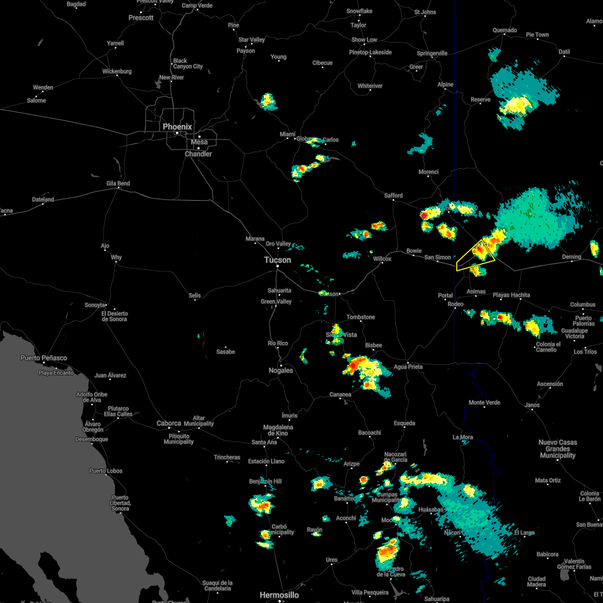
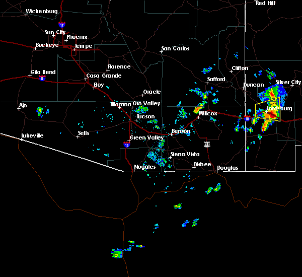
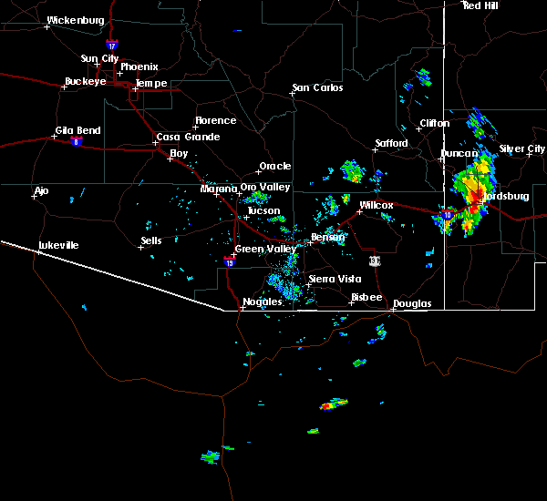
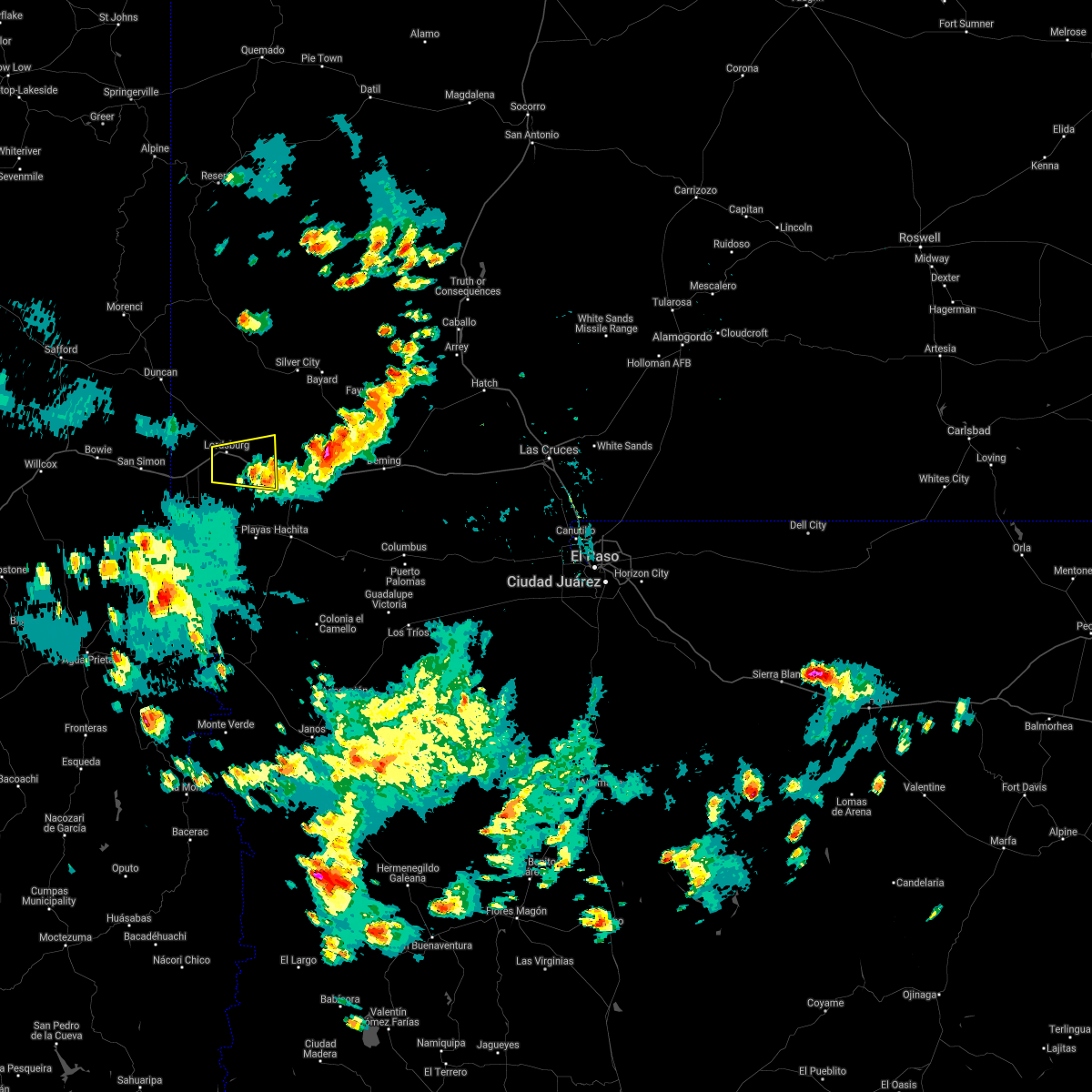
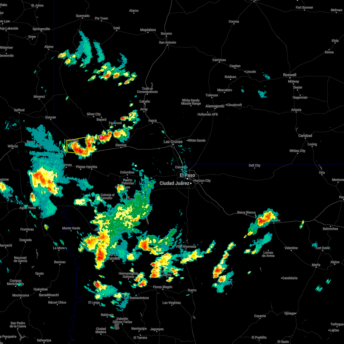
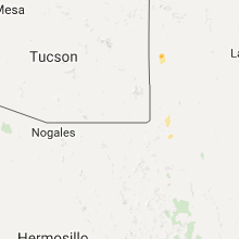
Hail Map for Glen Acres, NM
The Glen Acres, NM area has had 0 reports of on-the-ground hail by trained spotters, and has been under severe weather warnings 0 times during the past 12 months. Doppler radar has detected hail at or near Glen Acres, NM on 8 occasions.
| Name: | Glen Acres, NM |
| Where Located: | 37.5 miles SW of Silver City, NM |
| Map: | Google Map for Glen Acres, NM |
| Population: | 208 |
| Housing Units: | 93 |
| More Info: | Search Google for Glen Acres, NM |
5
The Top Recent Hail Date for Glen Acres, NM is Monday, August 23, 2021 (2nd out of 8)

Hail and Wind Damage Spotted near Glen Acres, NM
| Date / Time | Report Details |
|---|---|
| 8/2/2021 5:42 PM MDT |
 At 541 pm mdt, a severe thunderstorm was located near lordsburg, moving east at 10 mph. blowing dust from outflow winds is reducing visibility to less than a mile (radar indicated). Hazards include 60 mph wind gusts and blowing dust. expect damage to roofs, siding, and trees At 541 pm mdt, a severe thunderstorm was located near lordsburg, moving east at 10 mph. blowing dust from outflow winds is reducing visibility to less than a mile (radar indicated). Hazards include 60 mph wind gusts and blowing dust. expect damage to roofs, siding, and trees
|
| 9/15/2019 4:37 PM MDT |
 At 402 pm mdt, a severe thunderstorm was located near lordsburg, moving east at 25 mph (radar indicated). Hazards include 60 mph wind gusts and nickel size hail. expect damage to roofs, siding, and trees At 402 pm mdt, a severe thunderstorm was located near lordsburg, moving east at 25 mph (radar indicated). Hazards include 60 mph wind gusts and nickel size hail. expect damage to roofs, siding, and trees
|
| 9/15/2019 4:02 PM MDT |
 At 402 pm mdt, a severe thunderstorm was located near lordsburg, moving east at 25 mph (radar indicated). Hazards include 60 mph wind gusts and nickel size hail. expect damage to roofs, siding, and trees At 402 pm mdt, a severe thunderstorm was located near lordsburg, moving east at 25 mph (radar indicated). Hazards include 60 mph wind gusts and nickel size hail. expect damage to roofs, siding, and trees
|
| 9/1/2018 5:06 PM MDT |
 The severe thunderstorm warning for south central grant and central hidalgo counties will expire at 515 pm mdt, the storm which prompted the warning has weakened below severe limits, and no longer poses an immediate threat to life or property. therefore, the warning will be allowed to expire. however heavy rain is still possible with this thunderstorm. The severe thunderstorm warning for south central grant and central hidalgo counties will expire at 515 pm mdt, the storm which prompted the warning has weakened below severe limits, and no longer poses an immediate threat to life or property. therefore, the warning will be allowed to expire. however heavy rain is still possible with this thunderstorm.
|
| 9/1/2018 4:30 PM MDT |
 At 428 pm mdt, a severe thunderstorm was located near lordsburg, moving east at 10 mph (radar indicated). Hazards include 60 mph wind gusts, quarter size hail and blowing dust. Expect wind damage to roofs, siding, and trees. Visibility will lower to near zero in spots in blowing dust. At 428 pm mdt, a severe thunderstorm was located near lordsburg, moving east at 10 mph (radar indicated). Hazards include 60 mph wind gusts, quarter size hail and blowing dust. Expect wind damage to roofs, siding, and trees. Visibility will lower to near zero in spots in blowing dust.
|
| 6/6/2018 3:43 PM MDT |
 At 339 pm mdt, a severe thunderstorm was located near road forks, or 20 miles southwest of lordsburg, moving northeast at 35 mph (radar indicated). Hazards include 60 mph wind gusts and quarter size hail. Hail damage to vehicles is expected. expect wind damage to roofs, siding, and trees. The strong winds may produce blowing dust causing dangerous driving conditions from visibility less than a half mile. At 339 pm mdt, a severe thunderstorm was located near road forks, or 20 miles southwest of lordsburg, moving northeast at 35 mph (radar indicated). Hazards include 60 mph wind gusts and quarter size hail. Hail damage to vehicles is expected. expect wind damage to roofs, siding, and trees. The strong winds may produce blowing dust causing dangerous driving conditions from visibility less than a half mile.
|
| 9/29/2017 5:31 PM MDT |
 At 530 pm mdt, severe thunderstorms were located near the arizona border and near cotton city, moving northeast at 35 mph (radar indicated). Hazards include 60 mph wind gusts and quarter size hail. Hail damage to vehicles is expected. Expect wind damage to roofs, siding, and trees. At 530 pm mdt, severe thunderstorms were located near the arizona border and near cotton city, moving northeast at 35 mph (radar indicated). Hazards include 60 mph wind gusts and quarter size hail. Hail damage to vehicles is expected. Expect wind damage to roofs, siding, and trees.
|
| 9/27/2017 4:02 PM MDT |
 At 401 pm mdt, a severe thunderstorm was located 7 miles northwest of lordsburg, moving northeast at 20 mph (radar indicated). Hazards include 60 mph wind gusts and quarter size hail. Hail damage to vehicles is expected. Expect wind damage to roofs, siding, and trees. At 401 pm mdt, a severe thunderstorm was located 7 miles northwest of lordsburg, moving northeast at 20 mph (radar indicated). Hazards include 60 mph wind gusts and quarter size hail. Hail damage to vehicles is expected. Expect wind damage to roofs, siding, and trees.
|
| 7/19/2017 7:16 PM MDT |
 At 713 pm mdt, severe thunderstorm winds were producing wind damage amd widespread blowing dust across the area (trained weather spotters). Hazards include 60 mph wind gusts. Expect damage to roofs, siding, and trees. Blowing dust will lower the visibility to under a quarter mile over a few locations. At 713 pm mdt, severe thunderstorm winds were producing wind damage amd widespread blowing dust across the area (trained weather spotters). Hazards include 60 mph wind gusts. Expect damage to roofs, siding, and trees. Blowing dust will lower the visibility to under a quarter mile over a few locations.
|
| 7/19/2017 6:18 PM MDT |
 At 614 pm mdt, severe thunderstorms were moving to the west across the area at 40 mph (radar indicated). Hazards include 60 mph wind gusts and quarter size hail. Hail damage to vehicles is expected. expect wind damage to roofs, siding, and trees. Blowing dust may lower the visibility to less than a mile. At 614 pm mdt, severe thunderstorms were moving to the west across the area at 40 mph (radar indicated). Hazards include 60 mph wind gusts and quarter size hail. Hail damage to vehicles is expected. expect wind damage to roofs, siding, and trees. Blowing dust may lower the visibility to less than a mile.
|
| 10/5/2015 3:15 PM MDT |
 At 315 pm mdt, a severe thunderstorm was located 8 miles northeast of redrock, moving north at 40 mph (radar indicated). Hazards include ping pong ball size hail and 60 mph wind gusts. People and animals outdoors will be injured. expect hail damage to roofs, siding, windows and vehicles. expect wind damage to roofs, siding and trees. Locations impacted include, lordsburg, redrock, mangas springs, shakespeare, bill evans lake. At 315 pm mdt, a severe thunderstorm was located 8 miles northeast of redrock, moving north at 40 mph (radar indicated). Hazards include ping pong ball size hail and 60 mph wind gusts. People and animals outdoors will be injured. expect hail damage to roofs, siding, windows and vehicles. expect wind damage to roofs, siding and trees. Locations impacted include, lordsburg, redrock, mangas springs, shakespeare, bill evans lake.
|
| 10/5/2015 2:40 PM MDT |
 At 240 pm mdt, a severe thunderstorm was located 7 miles north of lordsburg, moving north at 40 mph (radar indicated). Hazards include ping pong ball size hail and 60 mph wind gusts. People and animals outdoors will be injured. expect hail damage to roofs, siding, windows and vehicles. Expect wind damage to roofs, siding and trees. At 240 pm mdt, a severe thunderstorm was located 7 miles north of lordsburg, moving north at 40 mph (radar indicated). Hazards include ping pong ball size hail and 60 mph wind gusts. People and animals outdoors will be injured. expect hail damage to roofs, siding, windows and vehicles. Expect wind damage to roofs, siding and trees.
|
| 10/5/2015 2:21 PM MDT |
 At 218 pm mdt, a severe thunderstorm was located near white signal, or 19 miles south of silver city, moving northeast at 25 mph (radar indicated). Hazards include ping pong ball size hail and 60 mph wind gusts. People and animals outdoors will be injured. expect hail damage to roofs, siding, windows and vehicles. expect wind damage to roofs, siding and trees. by 225 pm, the storm will cross interstate 10 between mile markers 25 and 30. Locations impacted include, lordsburg, animas, playas, separ, shakespeare, windmill. At 218 pm mdt, a severe thunderstorm was located near white signal, or 19 miles south of silver city, moving northeast at 25 mph (radar indicated). Hazards include ping pong ball size hail and 60 mph wind gusts. People and animals outdoors will be injured. expect hail damage to roofs, siding, windows and vehicles. expect wind damage to roofs, siding and trees. by 225 pm, the storm will cross interstate 10 between mile markers 25 and 30. Locations impacted include, lordsburg, animas, playas, separ, shakespeare, windmill.
|
| 10/5/2015 2:20 PM MDT |
 At 218 pm mdt, a severe thunderstorm was located near white signal, or 19 miles south of silver city, moving northeast at 80 mph (radar indicated). Hazards include ping pong ball size hail and 60 mph wind gusts. People and animals outdoors will be injured. expect hail damage to roofs, siding, windows and vehicles. expect wind damage to roofs, siding and trees. by 225 pm, the storm will cross interstate 10 between mile markers 25 and 30. Locations impacted include, lordsburg, animas, playas, separ, shakespeare, windmill. At 218 pm mdt, a severe thunderstorm was located near white signal, or 19 miles south of silver city, moving northeast at 80 mph (radar indicated). Hazards include ping pong ball size hail and 60 mph wind gusts. People and animals outdoors will be injured. expect hail damage to roofs, siding, windows and vehicles. expect wind damage to roofs, siding and trees. by 225 pm, the storm will cross interstate 10 between mile markers 25 and 30. Locations impacted include, lordsburg, animas, playas, separ, shakespeare, windmill.
|
| 10/5/2015 1:59 PM MDT |
 At 159 pm mdt, a severe thunderstorm was located 7 miles west of separ, or 15 miles southeast of lordsburg, moving northeast at 25 mph (radar indicated). Hazards include ping pong ball size hail and 60 mph wind gusts. People and animals outdoors will be injured. expect hail damage to roofs, siding, windows and vehicles. Expect wind damage to roofs, siding and trees. At 159 pm mdt, a severe thunderstorm was located 7 miles west of separ, or 15 miles southeast of lordsburg, moving northeast at 25 mph (radar indicated). Hazards include ping pong ball size hail and 60 mph wind gusts. People and animals outdoors will be injured. expect hail damage to roofs, siding, windows and vehicles. Expect wind damage to roofs, siding and trees.
|
Hail Maps for Glen Acres, NM


Connect with Interactive Hail Maps