

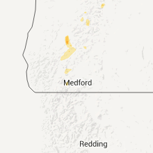
Hail Map for Gold Hill, OR
The Gold Hill, OR area has had 0 reports of on-the-ground hail by trained spotters, and has been under severe weather warnings 0 times during the past 12 months. Doppler radar has detected hail at or near Gold Hill, OR on 4 occasions.
| Name: | Gold Hill, OR |
| Where Located: | 11.8 miles NW of Medford, OR |
| Map: | Google Map for Gold Hill, OR |
| Population: | 1220 |
| Housing Units: | 552 |
| More Info: | Search Google for Gold Hill, OR |
0
The Top Recent Hail Date for Gold Hill, OR is Tuesday, August 2, 2022 (3rd out of 4)

Hail and Wind Damage Spotted near Gold Hill, OR
| Date / Time | Report Details |
|---|---|
| 8/8/2017 6:43 PM PDT |
 The severe thunderstorm warning for west central jackson county will expire at 645 pm pdt, the severe thunderstorm which prompted the warning has weakened. therefore, the warning will be allowed to expire. The severe thunderstorm warning for west central jackson county will expire at 645 pm pdt, the severe thunderstorm which prompted the warning has weakened. therefore, the warning will be allowed to expire.
|
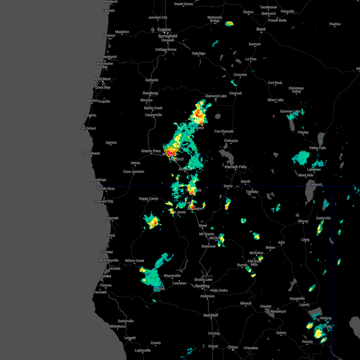
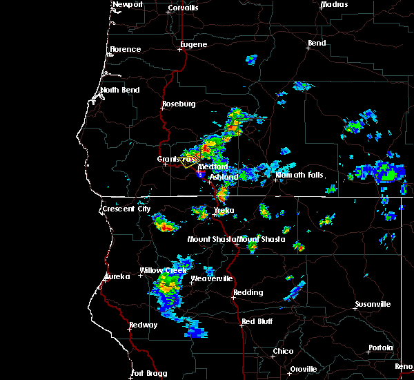
| 8/8/2017 6:34 PM PDT |
 At 633 pm pdt, a severe thunderstorm was located near central point, or 7 miles northwest of medford, moving southwest at 10 mph (radar indicated). Hazards include quarter size hail and wind gusts up to 50 mph. Damage to vehicles is expected. locations impacted include, medford, central point, gold hill, touvelle state park and lower table rock trailhead. this includes the following highways, highway 234 in oregon between mile markers 1 and 9. highway 238 in oregon between mile markers 35 and 38. Interstate 5 in oregon between mile markers 31 and 44. At 633 pm pdt, a severe thunderstorm was located near central point, or 7 miles northwest of medford, moving southwest at 10 mph (radar indicated). Hazards include quarter size hail and wind gusts up to 50 mph. Damage to vehicles is expected. locations impacted include, medford, central point, gold hill, touvelle state park and lower table rock trailhead. this includes the following highways, highway 234 in oregon between mile markers 1 and 9. highway 238 in oregon between mile markers 35 and 38. Interstate 5 in oregon between mile markers 31 and 44.
|
| 8/8/2017 6:28 PM PDT |
 The severe thunderstorm warning for west central jackson county will expire at 630 pm pdt, the severe thunderstorm which prompted the warning has moved out of the warned area. therefore, the warning will be allowed to expire. The severe thunderstorm warning for west central jackson county will expire at 630 pm pdt, the severe thunderstorm which prompted the warning has moved out of the warned area. therefore, the warning will be allowed to expire.
|
| 8/8/2017 6:21 PM PDT |
 At 620 pm pdt, a severe thunderstorm was located over lower table rock trailhead, or 7 miles northwest of medford, moving southwest at 10 mph (radar indicated). Hazards include quarter size hail and wind gusts up to 50 mph. damage to vehicles is expected At 620 pm pdt, a severe thunderstorm was located over lower table rock trailhead, or 7 miles northwest of medford, moving southwest at 10 mph (radar indicated). Hazards include quarter size hail and wind gusts up to 50 mph. damage to vehicles is expected
|
| 8/8/2017 6:17 PM PDT |
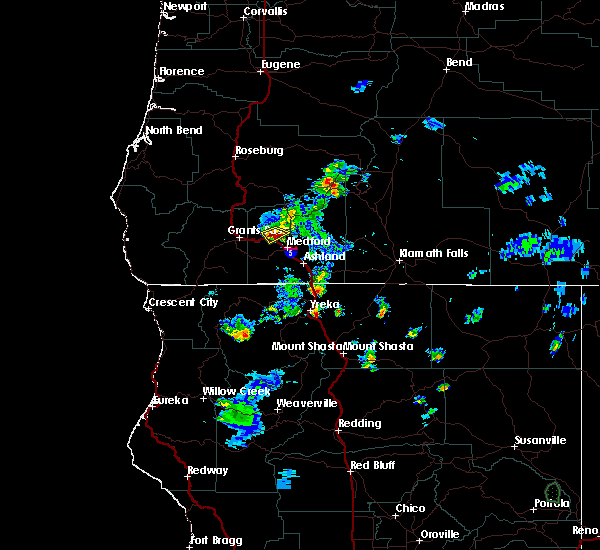 At 616 pm pdt, a severe thunderstorm was located near lower table rock trailhead, or 11 miles northwest of medford, moving southwest at 10 mph (radar indicated and gusty outflow winds up to 50 mph). Hazards include quarter size hail. Damage to vehicles is expected. locations impacted include, gold hill, lower table rock trailhead and upper table rock trailhead. this includes the following highways, highway 234 in oregon between mile markers 3 and 13. Interstate 5 in oregon between mile markers 37 and 40. At 616 pm pdt, a severe thunderstorm was located near lower table rock trailhead, or 11 miles northwest of medford, moving southwest at 10 mph (radar indicated and gusty outflow winds up to 50 mph). Hazards include quarter size hail. Damage to vehicles is expected. locations impacted include, gold hill, lower table rock trailhead and upper table rock trailhead. this includes the following highways, highway 234 in oregon between mile markers 3 and 13. Interstate 5 in oregon between mile markers 37 and 40.
|
| 8/8/2017 5:57 PM PDT |
 The national weather service in medford has issued a * severe thunderstorm warning for. west central jackson county in southwestern oregon. Until 630 pm pdt * at 556 pm pdt, a severe thunderstorm was located over lower table rock trailhead, or 11 miles northwest of medford, moving southwest. The national weather service in medford has issued a * severe thunderstorm warning for. west central jackson county in southwestern oregon. Until 630 pm pdt * at 556 pm pdt, a severe thunderstorm was located over lower table rock trailhead, or 11 miles northwest of medford, moving southwest.
|
| 12/11/2014 6:08 AM PST | Wind pushed a tree into a power line... causing a pole to fall onto the roof of a home... causing a house fire on hwy 23 in jackson county OR, 0.3 miles NNW of Gold Hill, OR |
Hail Maps for Gold Hill, OR


Connect with Interactive Hail Maps