

Hail Map for Golden Shores, AZ
The Golden Shores, AZ area has had 1 report of on-the-ground hail by trained spotters, and has been under severe weather warnings 2 times during the past 12 months. Doppler radar has detected hail at or near Golden Shores, AZ on 11 occasions.
| Name: | Golden Shores, AZ |
| Where Located: | 22.6 miles NNW of Lake Havasu City, AZ |
| Map: | Google Map for Golden Shores, AZ |
| Population: | 2047 |
| Housing Units: | 1637 |
| More Info: | Search Google for Golden Shores, AZ |
1
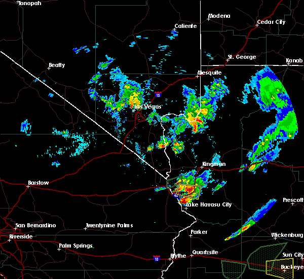
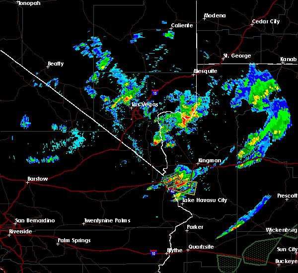
The Top Recent Hail Date for Golden Shores, AZ is Wednesday, March 15, 2023 (2nd out of 11)

Hail and Wind Damage Spotted near Golden Shores, AZ
| Date / Time | Report Details |
|---|---|
| 8/2/2023 9:02 AM MST |
 At 902 am pdt/902 am mst/, a severe thunderstorm was located over arizona village, or 13 miles northwest of topock, moving northeast at 25 mph (radar indicated). Hazards include 60 mph wind gusts. expect damage to roofs and trees At 902 am pdt/902 am mst/, a severe thunderstorm was located over arizona village, or 13 miles northwest of topock, moving northeast at 25 mph (radar indicated). Hazards include 60 mph wind gusts. expect damage to roofs and trees
|
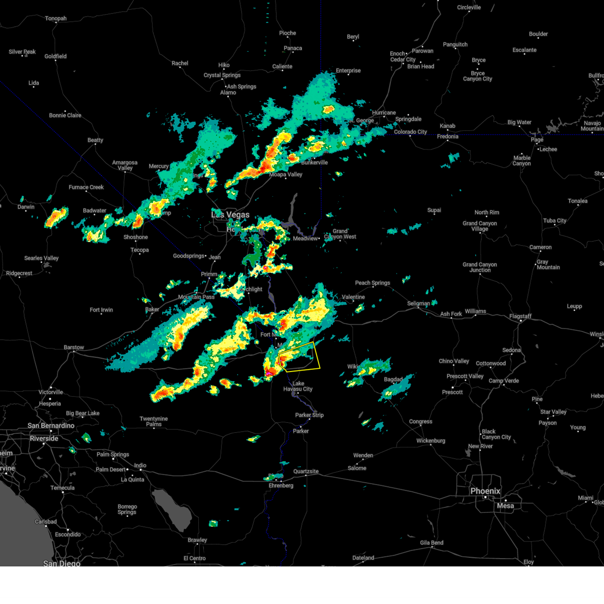
| 3/15/2023 5:36 PM MST |
 The tornado warning for southwestern mohave and east central san bernardino counties will expire at 545 pm pdt/545 pm mst/, the storm east of topock has weakened, and no longer appears capable of producing a tornado. therefore, the warning will be allowed to expire. however heavy rain and small hail are still possible with this thunderstorm. The tornado warning for southwestern mohave and east central san bernardino counties will expire at 545 pm pdt/545 pm mst/, the storm east of topock has weakened, and no longer appears capable of producing a tornado. therefore, the warning will be allowed to expire. however heavy rain and small hail are still possible with this thunderstorm.
|
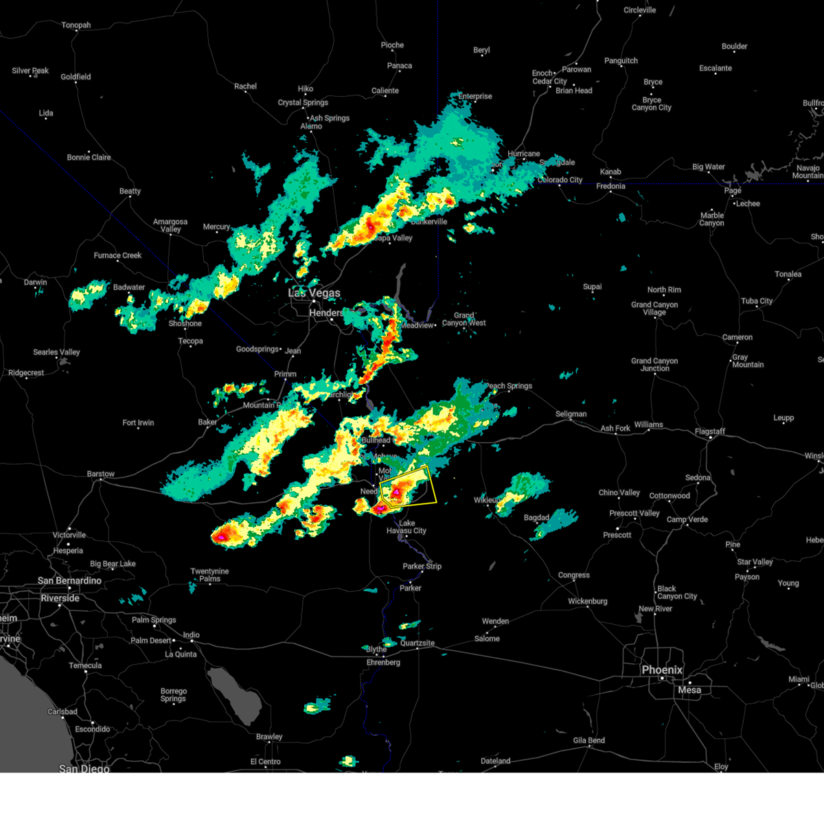
| 3/15/2023 5:15 PM MST |
 At 514 pm pdt/514 pm mst/, a severe thunderstorm capable of producing a tornado was located over topock, moving east at 20 mph (radar indicated rotation). Hazards include tornado and quarter size hail. Flying debris will be dangerous to those caught without shelter. mobile homes will be damaged or destroyed. damage to roofs, windows, and vehicles will occur. tree damage is likely. this tornadic thunderstorm will remain over mainly rural areas of southwestern mohave and east central san bernardino counties. this includes the following roads, interstate 40 in arizona between mile markers 0 and 16. Interstate 40 in california between mile markers 148 and 155. At 514 pm pdt/514 pm mst/, a severe thunderstorm capable of producing a tornado was located over topock, moving east at 20 mph (radar indicated rotation). Hazards include tornado and quarter size hail. Flying debris will be dangerous to those caught without shelter. mobile homes will be damaged or destroyed. damage to roofs, windows, and vehicles will occur. tree damage is likely. this tornadic thunderstorm will remain over mainly rural areas of southwestern mohave and east central san bernardino counties. this includes the following roads, interstate 40 in arizona between mile markers 0 and 16. Interstate 40 in california between mile markers 148 and 155.
|
| 3/15/2023 4:53 PM MST |
 The severe thunderstorm warning for southwestern mohave county will expire at 500 pm mst, this warning has been replaced by a new warning for southwestern mohave county, valid until 530 pm mst. The severe thunderstorm warning for southwestern mohave county will expire at 500 pm mst, this warning has been replaced by a new warning for southwestern mohave county, valid until 530 pm mst.
|
| 3/15/2023 4:51 PM MST |
 At 450 pm mst, one severe thunderstorm was located just east of topock, and another 5 miles southwest of yucca, both moving east at 20 mph (radar indicated). Hazards include 60 mph wind gusts and quarter size hail. Hail damage to vehicles is expected. Expect wind damage to roofs and trees. At 450 pm mst, one severe thunderstorm was located just east of topock, and another 5 miles southwest of yucca, both moving east at 20 mph (radar indicated). Hazards include 60 mph wind gusts and quarter size hail. Hail damage to vehicles is expected. Expect wind damage to roofs and trees.
|
| 3/15/2023 4:32 PM MST |
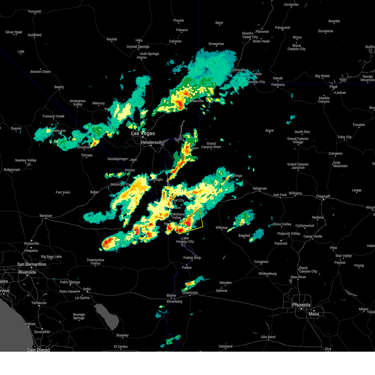
 At 431 pm mst, a severe thunderstorm was located 9 miles northeast of topock, moving east at 20 mph. a second severe storm will cross the colorado river near topock at about 440 pm mst (radar indicated). Hazards include 60 mph wind gusts and quarter size hail. Hail damage to vehicles is expected. expect wind damage to roofs and trees. locations impacted include, yucca, topock and mohave valley. this includes interstate 40 in arizona between mile markers 1 and 33. hail threat, radar indicated max hail size, 1. 00 in wind threat, radar indicated max wind gust, 60 mph. At 431 pm mst, a severe thunderstorm was located 9 miles northeast of topock, moving east at 20 mph. a second severe storm will cross the colorado river near topock at about 440 pm mst (radar indicated). Hazards include 60 mph wind gusts and quarter size hail. Hail damage to vehicles is expected. expect wind damage to roofs and trees. locations impacted include, yucca, topock and mohave valley. this includes interstate 40 in arizona between mile markers 1 and 33. hail threat, radar indicated max hail size, 1. 00 in wind threat, radar indicated max wind gust, 60 mph.
|
| 3/15/2023 4:14 PM MST |
 At 413 pm mst, a severe thunderstorm was located near topock, moving east at 20 mph (radar indicated). Hazards include 60 mph wind gusts and quarter size hail. Hail damage to vehicles is expected. Expect wind damage to roofs and trees. At 413 pm mst, a severe thunderstorm was located near topock, moving east at 20 mph (radar indicated). Hazards include 60 mph wind gusts and quarter size hail. Hail damage to vehicles is expected. Expect wind damage to roofs and trees.
|
| 9/4/2022 6:21 PM MST |
 The severe thunderstorm warning for southwestern mohave, east central san bernardino and southern clark counties will expire at 630 pm pdt/630 pm mst/, the storms from mohave valley to lake havasu city have weakened and no longer pose an immediate threat to life or property. therefore, the warning will be allowed to expire. The severe thunderstorm warning for southwestern mohave, east central san bernardino and southern clark counties will expire at 630 pm pdt/630 pm mst/, the storms from mohave valley to lake havasu city have weakened and no longer pose an immediate threat to life or property. therefore, the warning will be allowed to expire.
|
| 9/4/2022 6:02 PM MST |
 At 600 pm pdt/600 pm mst/, doppler radar indicated thunderstorms finally weakening as they reach the colorado river. however, very strong winds are persisting, so the warning remains in effect until 630 pm (radar indicated). Hazards include 60 mph wind gusts and quarter size hail. Hail damage to vehicles is expected. expect wind damage to roofs and trees. locations impacted include, lake havasu city, topock, needles, mesquite creek, desert hills, arizona village, mojave ranch estates, mohave valley, highway 95 and i-40 and willow valley. this includes the following highways, interstate 40 in arizona between mile markers 0 and 14. interstate 40 in california between mile markers 131 and 155. hail threat, radar indicated max hail size, 1. 00 in wind threat, observed max wind gust, 60 mph. At 600 pm pdt/600 pm mst/, doppler radar indicated thunderstorms finally weakening as they reach the colorado river. however, very strong winds are persisting, so the warning remains in effect until 630 pm (radar indicated). Hazards include 60 mph wind gusts and quarter size hail. Hail damage to vehicles is expected. expect wind damage to roofs and trees. locations impacted include, lake havasu city, topock, needles, mesquite creek, desert hills, arizona village, mojave ranch estates, mohave valley, highway 95 and i-40 and willow valley. this includes the following highways, interstate 40 in arizona between mile markers 0 and 14. interstate 40 in california between mile markers 131 and 155. hail threat, radar indicated max hail size, 1. 00 in wind threat, observed max wind gust, 60 mph.
|
| 9/4/2022 5:42 PM MST |
 The severe thunderstorm warning for southwestern mohave. east central san bernardino and southern clark counties will expire at 545 pm pdt/545 pm mst/. This warning has been replaced with a new severe thunderstorm warning valid until 630 pm pdt/mst. The severe thunderstorm warning for southwestern mohave. east central san bernardino and southern clark counties will expire at 545 pm pdt/545 pm mst/. This warning has been replaced with a new severe thunderstorm warning valid until 630 pm pdt/mst.
|
| 9/4/2022 5:42 PM MST |
 The severe thunderstorm warning for southwestern mohave, east central san bernardino and southern clark counties will expire at 545 pm pdt/545 pm mst/, this warning has been replaced with a new severe thunderstorm warning valid until 630 pm pdt/mst. The severe thunderstorm warning for southwestern mohave, east central san bernardino and southern clark counties will expire at 545 pm pdt/545 pm mst/, this warning has been replaced with a new severe thunderstorm warning valid until 630 pm pdt/mst.
|
| 9/4/2022 5:42 PM MST |
 The severe thunderstorm warning for southwestern mohave. east central san bernardino and southern clark counties will expire at 545 pm pdt/545 pm mst/. This warning has been replaced with a new severe thunderstorm warning valid until 630 pm pdt/mst. The severe thunderstorm warning for southwestern mohave. east central san bernardino and southern clark counties will expire at 545 pm pdt/545 pm mst/. This warning has been replaced with a new severe thunderstorm warning valid until 630 pm pdt/mst.
|
| 9/4/2022 5:38 PM MST |
 At 537 pm pdt/537 pm mst/, severe thunderstorms were located along a line extending from near mesquite creek to lake havasu city, moving west at 30 mph (radar indicated). Hazards include 60 mph wind gusts and quarter size hail. Hail damage to vehicles is expected. Expect wind damage to roofs and trees. At 537 pm pdt/537 pm mst/, severe thunderstorms were located along a line extending from near mesquite creek to lake havasu city, moving west at 30 mph (radar indicated). Hazards include 60 mph wind gusts and quarter size hail. Hail damage to vehicles is expected. Expect wind damage to roofs and trees.
|
| 9/4/2022 5:23 PM MST |
 At 522 pm pdt/522 pm mst/, severe thunderstorms were located along a line extending from 8 miles south of oatman to 9 miles north of three dunes campground, moving west at 30 mph (radar indicated). Hazards include 70 mph wind gusts and quarter size hail. Hail damage to vehicles is expected. expect considerable tree damage. wind damage is also likely to mobile homes, roofs, and outbuildings. locations impacted include, lake havasu city, topock, needles, mesquite creek, desert hills, arizona village, mojave ranch estates, mohave valley, highway 95 and i-40 and willow valley. this includes the following highways, interstate 40 in arizona between mile markers 0 and 20. interstate 40 in california between mile markers 131 and 155. thunderstorm damage threat, considerable hail threat, radar indicated max hail size, 1. 00 in wind threat, observed max wind gust, 70 mph. At 522 pm pdt/522 pm mst/, severe thunderstorms were located along a line extending from 8 miles south of oatman to 9 miles north of three dunes campground, moving west at 30 mph (radar indicated). Hazards include 70 mph wind gusts and quarter size hail. Hail damage to vehicles is expected. expect considerable tree damage. wind damage is also likely to mobile homes, roofs, and outbuildings. locations impacted include, lake havasu city, topock, needles, mesquite creek, desert hills, arizona village, mojave ranch estates, mohave valley, highway 95 and i-40 and willow valley. this includes the following highways, interstate 40 in arizona between mile markers 0 and 20. interstate 40 in california between mile markers 131 and 155. thunderstorm damage threat, considerable hail threat, radar indicated max hail size, 1. 00 in wind threat, observed max wind gust, 70 mph.
|
| 9/4/2022 5:04 PM MST |
 At 503 pm pdt/503 pm mst/, severe thunderstorms were located along a line extending from 9 miles west of yucca to 12 miles northeast of cattail cove state park, moving west at 30 mph (radar indicated). Hazards include 70 mph wind gusts and quarter size hail. Hail damage to vehicles is expected. expect considerable tree damage. Wind damage is also likely to mobile homes, roofs, and outbuildings. At 503 pm pdt/503 pm mst/, severe thunderstorms were located along a line extending from 9 miles west of yucca to 12 miles northeast of cattail cove state park, moving west at 30 mph (radar indicated). Hazards include 70 mph wind gusts and quarter size hail. Hail damage to vehicles is expected. expect considerable tree damage. Wind damage is also likely to mobile homes, roofs, and outbuildings.
|
| 8/26/2022 4:22 PM MST | The severe thunderstorm warning for southwestern mohave, east central san bernardino and southern clark counties will expire at 430 pm pdt/430 pm mst/, the storm which prompted the warning has moved out of the area. therefore, the warning will be allowed to expire. however gusty winds are still possible with this thunderstorm. |
| 8/26/2022 4:22 PM MST | The severe thunderstorm warning for southwestern mohave, east central san bernardino and southern clark counties will expire at 430 pm pdt/430 pm mst/, the storm which prompted the warning has moved out of the area. therefore, the warning will be allowed to expire. however gusty winds are still possible with this thunderstorm. |
| 8/26/2022 4:22 PM MST | The severe thunderstorm warning for southwestern mohave, east central san bernardino and southern clark counties will expire at 430 pm pdt/430 pm mst/, the storm which prompted the warning has moved out of the area. therefore, the warning will be allowed to expire. however gusty winds are still possible with this thunderstorm. |
| 8/26/2022 3:46 PM MST | At 345 pm pdt/345 pm mst/, a severe thunderstorm was located over needles, or 8 miles northwest of topock, moving southeast at 20 mph (radar indicated). Hazards include 60 mph wind gusts. Expect damage to roofs and trees. locations impacted include, needles, mesquite creek, arizona village, mojave ranch estates, mohave valley and willow valley. this includes interstate 40 in california between mile markers 134 and 152. hail threat, radar indicated max hail size, <. 75 in wind threat, radar indicated max wind gust, 60 mph. |
| 8/26/2022 3:46 PM MST | At 345 pm pdt/345 pm mst/, a severe thunderstorm was located over needles, or 8 miles northwest of topock, moving southeast at 20 mph (radar indicated). Hazards include 60 mph wind gusts. Expect damage to roofs and trees. locations impacted include, needles, mesquite creek, arizona village, mojave ranch estates, mohave valley and willow valley. this includes interstate 40 in california between mile markers 134 and 152. hail threat, radar indicated max hail size, <. 75 in wind threat, radar indicated max wind gust, 60 mph. |
| 8/26/2022 3:46 PM MST | At 345 pm pdt/345 pm mst/, a severe thunderstorm was located over needles, or 8 miles northwest of topock, moving southeast at 20 mph (radar indicated). Hazards include 60 mph wind gusts. Expect damage to roofs and trees. locations impacted include, needles, mesquite creek, arizona village, mojave ranch estates, mohave valley and willow valley. this includes interstate 40 in california between mile markers 134 and 152. hail threat, radar indicated max hail size, <. 75 in wind threat, radar indicated max wind gust, 60 mph. |
| 8/26/2022 3:23 PM MST | At 322 pm pdt/322 pm mst/, a severe thunderstorm was located near mohave valley, or 15 miles south of bullhead city, moving southeast at 15 mph (radar indicated). Hazards include 60 mph wind gusts. expect damage to roofs and trees |
| 8/26/2022 3:23 PM MST | At 322 pm pdt/322 pm mst/, a severe thunderstorm was located near mohave valley, or 15 miles south of bullhead city, moving southeast at 15 mph (radar indicated). Hazards include 60 mph wind gusts. expect damage to roofs and trees |
| 8/26/2022 3:23 PM MST | At 322 pm pdt/322 pm mst/, a severe thunderstorm was located near mohave valley, or 15 miles south of bullhead city, moving southeast at 15 mph (radar indicated). Hazards include 60 mph wind gusts. expect damage to roofs and trees |
| 8/21/2022 11:09 PM MST | The severe thunderstorm warning for southwestern mohave and southeastern san bernardino counties will expire at 1115 pm pdt/1115 pm mst/, the storm which prompted the warning has weakened below severe limits, and no longer poses an immediate threat to life or property. therefore, the warning will be allowed to expire. however gusty winds are still possible with this thunderstorm. |
| 8/21/2022 11:09 PM MST | The severe thunderstorm warning for southwestern mohave and southeastern san bernardino counties will expire at 1115 pm pdt/1115 pm mst/, the storm which prompted the warning has weakened below severe limits, and no longer poses an immediate threat to life or property. therefore, the warning will be allowed to expire. however gusty winds are still possible with this thunderstorm. |
| 8/21/2022 10:41 PM MST | At 1040 pm pdt/1040 pm mst/, a severe thunderstorm was located 10 miles northeast of desert hills, or 11 miles northeast of lake havasu city, moving southwest at 30 mph. wind gusts to 60 mph were observed at yucca with this storm earlier (radar indicated). Hazards include 60 mph wind gusts. Expect damage to roofs and trees. locations impacted include, lake havasu city, topock, parker dam, needles, three dunes campground, cattail cove state park, desert hills, black meadow landing campground, earp and big river. this includes the following highways, interstate 40 in arizona between mile markers 0 and 22. interstate 40 in california between mile markers 148 and 155. hail threat, radar indicated max hail size, <. 75 in wind threat, radar indicated max wind gust, 60 mph. |
| 8/21/2022 10:41 PM MST | At 1040 pm pdt/1040 pm mst/, a severe thunderstorm was located 10 miles northeast of desert hills, or 11 miles northeast of lake havasu city, moving southwest at 30 mph. wind gusts to 60 mph were observed at yucca with this storm earlier (radar indicated). Hazards include 60 mph wind gusts. Expect damage to roofs and trees. locations impacted include, lake havasu city, topock, parker dam, needles, three dunes campground, cattail cove state park, desert hills, black meadow landing campground, earp and big river. this includes the following highways, interstate 40 in arizona between mile markers 0 and 22. interstate 40 in california between mile markers 148 and 155. hail threat, radar indicated max hail size, <. 75 in wind threat, radar indicated max wind gust, 60 mph. |
| 8/21/2022 10:03 PM MST | At 1003 pm pdt/1003 pm mst/, a severe thunderstorm was located near yucca, moving south at 30 mph. this storm will approach lake havasu city through 11pm (radar indicated). Hazards include 60 mph wind gusts and quarter size hail. Hail damage to vehicles is expected. Expect wind damage to roofs and trees. |
| 8/21/2022 10:03 PM MST | At 1003 pm pdt/1003 pm mst/, a severe thunderstorm was located near yucca, moving south at 30 mph. this storm will approach lake havasu city through 11pm (radar indicated). Hazards include 60 mph wind gusts and quarter size hail. Hail damage to vehicles is expected. Expect wind damage to roofs and trees. |
| 8/17/2022 6:07 PM MST |
 The severe thunderstorm warning for southwestern mohave, east central san bernardino and south central clark counties will expire at 615 pm pdt/615 pm mst/, the storm which prompted the warning has weakened below severe limits, and no longer poses an immediate threat to life or property. therefore, the warning will be allowed to expire. however gusty winds are still possible with this thunderstorm. The severe thunderstorm warning for southwestern mohave, east central san bernardino and south central clark counties will expire at 615 pm pdt/615 pm mst/, the storm which prompted the warning has weakened below severe limits, and no longer poses an immediate threat to life or property. therefore, the warning will be allowed to expire. however gusty winds are still possible with this thunderstorm.
|
| 8/17/2022 5:45 PM MST |
 At 543 pm pdt/543 pm mst/, a severe thunderstorm was located near kingman, moving east at 25 mph (radar indicated). Hazards include 60 mph wind gusts. Expect damage to roofs and trees. wind gusts over 60 mph have been reported at needles. locations impacted include, bullhead city, kingman, laughlin, topock, yucca, katherine landing, needles, wild cow campground, oatman, mojave ranch estates, mohave valley, big bend rec area, golden valley, highway 95 and i-40, mesquite creek, dw ranch road, new kingman-butler, arizona village, hualapai mountain park and willow valley. this includes the following highways, interstate 40 in arizona between mile markers 0 and 8, and between mile markers 18 and 63. interstate 40 in california between mile markers 131 and 155. hail threat, radar indicated max hail size, <. 75 in wind threat, radar indicated max wind gust, 60 mph. At 543 pm pdt/543 pm mst/, a severe thunderstorm was located near kingman, moving east at 25 mph (radar indicated). Hazards include 60 mph wind gusts. Expect damage to roofs and trees. wind gusts over 60 mph have been reported at needles. locations impacted include, bullhead city, kingman, laughlin, topock, yucca, katherine landing, needles, wild cow campground, oatman, mojave ranch estates, mohave valley, big bend rec area, golden valley, highway 95 and i-40, mesquite creek, dw ranch road, new kingman-butler, arizona village, hualapai mountain park and willow valley. this includes the following highways, interstate 40 in arizona between mile markers 0 and 8, and between mile markers 18 and 63. interstate 40 in california between mile markers 131 and 155. hail threat, radar indicated max hail size, <. 75 in wind threat, radar indicated max wind gust, 60 mph.
|
| 8/17/2022 5:11 PM MST |
 At 510 pm pdt/510 pm mst/, a severe thunderstorm was located 7 miles north of oatman, or 11 miles east of bullhead city, moving east at 25 mph (radar indicated). Hazards include 60 mph wind gusts. expect damage to roofs and trees At 510 pm pdt/510 pm mst/, a severe thunderstorm was located 7 miles north of oatman, or 11 miles east of bullhead city, moving east at 25 mph (radar indicated). Hazards include 60 mph wind gusts. expect damage to roofs and trees
|
| 8/14/2022 3:21 PM PDT |
 At 320 pm pdt/320 pm mst/, a severe thunderstorm was located over arizona village, or 11 miles northwest of topock, moving south at 20 mph. this warning includes needles and the mohave valley (radar indicated). Hazards include 60 mph wind gusts. expect damage to roofs and trees At 320 pm pdt/320 pm mst/, a severe thunderstorm was located over arizona village, or 11 miles northwest of topock, moving south at 20 mph. this warning includes needles and the mohave valley (radar indicated). Hazards include 60 mph wind gusts. expect damage to roofs and trees
|
| 7/28/2022 5:46 PM PDT |
 At 546 pm pdt/546 pm mst/, a severe thunderstorm was located over lake havasu city, moving southwest at 20 mph (radar indicated). Hazards include 60 mph wind gusts. expect damage to roofs and trees At 546 pm pdt/546 pm mst/, a severe thunderstorm was located over lake havasu city, moving southwest at 20 mph (radar indicated). Hazards include 60 mph wind gusts. expect damage to roofs and trees
|
| 7/28/2022 5:33 PM MST |
 At 531 pm pdt/531 pm mst/, a severe thunderstorm was located over needles, or 10 miles northwest of topock, moving southwest at 20 mph. a wind gust of 58 mph was reported at the needles airport at 521 pm pdt/mst (radar indicated). Hazards include 60 mph wind gusts and quarter size hail. Hail damage to vehicles is expected. expect wind damage to roofs and trees. locations impacted include, lake havasu city, bullhead city, laughlin, topock, yucca, katherine landing, needles, oatman, desert hills, mojave ranch estates, mohave valley, big bend rec area, highway 95 and i-40, mesquite creek, arizona village and willow valley. this includes the following highways, interstate 40 in arizona between mile markers 0 and 28. interstate 40 in california between mile markers 122 and 155. hail threat, radar indicated max hail size, 1. 00 in wind threat, observed max wind gust, 60 mph. At 531 pm pdt/531 pm mst/, a severe thunderstorm was located over needles, or 10 miles northwest of topock, moving southwest at 20 mph. a wind gust of 58 mph was reported at the needles airport at 521 pm pdt/mst (radar indicated). Hazards include 60 mph wind gusts and quarter size hail. Hail damage to vehicles is expected. expect wind damage to roofs and trees. locations impacted include, lake havasu city, bullhead city, laughlin, topock, yucca, katherine landing, needles, oatman, desert hills, mojave ranch estates, mohave valley, big bend rec area, highway 95 and i-40, mesquite creek, arizona village and willow valley. this includes the following highways, interstate 40 in arizona between mile markers 0 and 28. interstate 40 in california between mile markers 122 and 155. hail threat, radar indicated max hail size, 1. 00 in wind threat, observed max wind gust, 60 mph.
|
| 7/28/2022 4:46 PM MST |
 At 445 pm pdt/445 pm mst/, a severe thunderstorm was located near oatman, or 14 miles southeast of bullhead city, moving southwest at 20 mph (radar indicated). Hazards include 60 mph wind gusts and quarter size hail. Hail damage to vehicles is expected. Expect wind damage to roofs and trees. At 445 pm pdt/445 pm mst/, a severe thunderstorm was located near oatman, or 14 miles southeast of bullhead city, moving southwest at 20 mph (radar indicated). Hazards include 60 mph wind gusts and quarter size hail. Hail damage to vehicles is expected. Expect wind damage to roofs and trees.
|
| 8/29/2021 6:25 PM MST |
 The severe thunderstorm warning for southwestern mohave county will expire at 630 pm mst, the storm which prompted the warning has weakened below severe limits, and has exited the warned area. therefore, the warning will be allowed to expire. The severe thunderstorm warning for southwestern mohave county will expire at 630 pm mst, the storm which prompted the warning has weakened below severe limits, and has exited the warned area. therefore, the warning will be allowed to expire.
|
| 8/29/2021 5:42 PM MST |
 At 541 pm mst, a severe thunderstorm was located 9 miles east of topock, moving northeast at 10 mph (radar indicated). Hazards include 60 mph wind gusts. expect damage to roofs and trees At 541 pm mst, a severe thunderstorm was located 9 miles east of topock, moving northeast at 10 mph (radar indicated). Hazards include 60 mph wind gusts. expect damage to roofs and trees
|
| 8/10/2021 6:43 PM PDT |
 At 641 pm pdt/641 pm mst/, severe thunderstorms were located along a line extending from 17 miles southwest of needles to near big river, moving southwest at 30 mph (radar indicated). Hazards include 60 mph wind gusts. expect damage to roofs and trees At 641 pm pdt/641 pm mst/, severe thunderstorms were located along a line extending from 17 miles southwest of needles to near big river, moving southwest at 30 mph (radar indicated). Hazards include 60 mph wind gusts. expect damage to roofs and trees
|
| 8/10/2021 6:31 PM MST |
 At 628 pm pdt/628 pm mst/, severe thunderstorms were located along a line extending from 8 miles south of needles to 4 miles west of lake havasu city to near parker, moving southwest at 25 mph (wind speeds of 59 mph have been observed in lake havasu city). Hazards include 60 mph wind gusts and near zero visibility due to blowing dust. Expect damage to roofs and trees. locations impacted include, lake havasu city, highway 95 at mile marker 29, topock, parker dam, alamo lake, needles, three dunes campground, alamo state park, desert hills, black meadow landing campground, mohave valley, cattail cove state park, arizona village, earp, vidal junction, big river, mesquite creek, mojave ranch estates and willow valley. this includes the following highways, interstate 40 in arizona between mile markers 0 and 17. interstate 40 in california between mile markers 140 and 155. hail threat, radar indicated max hail size, <. 75 in wind threat, observed max wind gust, 60 mph. At 628 pm pdt/628 pm mst/, severe thunderstorms were located along a line extending from 8 miles south of needles to 4 miles west of lake havasu city to near parker, moving southwest at 25 mph (wind speeds of 59 mph have been observed in lake havasu city). Hazards include 60 mph wind gusts and near zero visibility due to blowing dust. Expect damage to roofs and trees. locations impacted include, lake havasu city, highway 95 at mile marker 29, topock, parker dam, alamo lake, needles, three dunes campground, alamo state park, desert hills, black meadow landing campground, mohave valley, cattail cove state park, arizona village, earp, vidal junction, big river, mesquite creek, mojave ranch estates and willow valley. this includes the following highways, interstate 40 in arizona between mile markers 0 and 17. interstate 40 in california between mile markers 140 and 155. hail threat, radar indicated max hail size, <. 75 in wind threat, observed max wind gust, 60 mph.
|
| 8/10/2021 5:59 PM MST |
 At 557 pm pdt/557 pm mst/, severe thunderstorms were located along a line extending from near arizona village to desert hills to 2 miles east of lake havasu city to near parker dam, moving southwest at 25 mph (radar indicated). Hazards include 60 mph wind gusts. Expect damage to roofs and trees. locations impacted include, lake havasu city, highway 95 at mile marker 29, topock, parker dam, alamo lake, needles, three dunes campground, alamo state park, desert hills, black meadow landing campground, mohave valley, cattail cove state park, arizona village, earp, vidal junction, big river, mesquite creek, mojave ranch estates and willow valley. this includes the following highways, interstate 40 in arizona between mile markers 0 and 17. interstate 40 in california between mile markers 140 and 155. hail threat, radar indicated max hail size, <. 75 in wind threat, radar indicated max wind gust, 60 mph. At 557 pm pdt/557 pm mst/, severe thunderstorms were located along a line extending from near arizona village to desert hills to 2 miles east of lake havasu city to near parker dam, moving southwest at 25 mph (radar indicated). Hazards include 60 mph wind gusts. Expect damage to roofs and trees. locations impacted include, lake havasu city, highway 95 at mile marker 29, topock, parker dam, alamo lake, needles, three dunes campground, alamo state park, desert hills, black meadow landing campground, mohave valley, cattail cove state park, arizona village, earp, vidal junction, big river, mesquite creek, mojave ranch estates and willow valley. this includes the following highways, interstate 40 in arizona between mile markers 0 and 17. interstate 40 in california between mile markers 140 and 155. hail threat, radar indicated max hail size, <. 75 in wind threat, radar indicated max wind gust, 60 mph.
|
| 8/10/2021 5:35 PM MST |
 At 534 pm pdt/534 pm mst/, severe thunderstorms were located along a line extending from near arizona village to 6 miles northeast of lake havasu city to 14 miles east of parker dam to 13 miles south of alamo state park, moving southwest at 30 mph (radar indicated). Hazards include 60 mph wind gusts. Expect damage to roofs and trees. locations impacted include, lake havasu city, highway 95 at mile marker 29, topock, parker dam, alamo lake, needles, three dunes campground, alamo state park, desert hills, black meadow landing campground, mohave valley, cattail cove state park, arizona village, earp, vidal junction, big river, mesquite creek, mojave ranch estates and willow valley. this includes the following highways, interstate 40 in arizona between mile markers 0 and 17. interstate 40 in california between mile markers 140 and 155. hail threat, radar indicated max hail size, <. 75 in wind threat, radar indicated max wind gust, 60 mph. At 534 pm pdt/534 pm mst/, severe thunderstorms were located along a line extending from near arizona village to 6 miles northeast of lake havasu city to 14 miles east of parker dam to 13 miles south of alamo state park, moving southwest at 30 mph (radar indicated). Hazards include 60 mph wind gusts. Expect damage to roofs and trees. locations impacted include, lake havasu city, highway 95 at mile marker 29, topock, parker dam, alamo lake, needles, three dunes campground, alamo state park, desert hills, black meadow landing campground, mohave valley, cattail cove state park, arizona village, earp, vidal junction, big river, mesquite creek, mojave ranch estates and willow valley. this includes the following highways, interstate 40 in arizona between mile markers 0 and 17. interstate 40 in california between mile markers 140 and 155. hail threat, radar indicated max hail size, <. 75 in wind threat, radar indicated max wind gust, 60 mph.
|
| 8/10/2021 5:13 PM MST |
 At 509 pm pdt/509 pm mst/, severe thunderstorms were located along a line extending from near oatman to 11 miles south of yucca to the south to the la paz county line, moving southwest at 25 mph (radar indicated). Hazards include 60 mph wind gusts. expect damage to roofs and trees At 509 pm pdt/509 pm mst/, severe thunderstorms were located along a line extending from near oatman to 11 miles south of yucca to the south to the la paz county line, moving southwest at 25 mph (radar indicated). Hazards include 60 mph wind gusts. expect damage to roofs and trees
|
| 9/23/2019 5:22 PM MST |
 The severe thunderstorm warning for southwestern mohave county will expire at 530 pm mst, the storm which prompted the warning has weakened below severe limits, and no longer poses an immediate threat to life or property. therefore, the warning will be allowed to expire. however small hail is still possible with this thunderstorm. a severe thunderstorm watch remains in effect until 800 pm mst for northwestern arizona. The severe thunderstorm warning for southwestern mohave county will expire at 530 pm mst, the storm which prompted the warning has weakened below severe limits, and no longer poses an immediate threat to life or property. therefore, the warning will be allowed to expire. however small hail is still possible with this thunderstorm. a severe thunderstorm watch remains in effect until 800 pm mst for northwestern arizona.
|
| 9/23/2019 5:09 PM MST |
 At 506 pm mst, a severe thunderstorm was located near yucca, moving east at 20 mph. the thunderstorm no longer has signs of a possible tornado but quarter size hail is still possible (radar indicated). Hazards include quarter size hail. Damage to vehicles is expected. locations impacted include, yucca. This includes interstate 40 in arizona between mile markers 7 and 27. At 506 pm mst, a severe thunderstorm was located near yucca, moving east at 20 mph. the thunderstorm no longer has signs of a possible tornado but quarter size hail is still possible (radar indicated). Hazards include quarter size hail. Damage to vehicles is expected. locations impacted include, yucca. This includes interstate 40 in arizona between mile markers 7 and 27.
|
| 9/23/2019 4:46 PM MST |
 At 445 pm mst, a severe thunderstorm was located 9 miles northeast of topock, moving east at 25 mph. this storm is showing very strong indications of large hail, and may also produce a brief tornado (radar indicated). Hazards include golf ball size hail. People and animals outdoors will be injured. Expect damage to roofs, windows, and vehicles. At 445 pm mst, a severe thunderstorm was located 9 miles northeast of topock, moving east at 25 mph. this storm is showing very strong indications of large hail, and may also produce a brief tornado (radar indicated). Hazards include golf ball size hail. People and animals outdoors will be injured. Expect damage to roofs, windows, and vehicles.
|
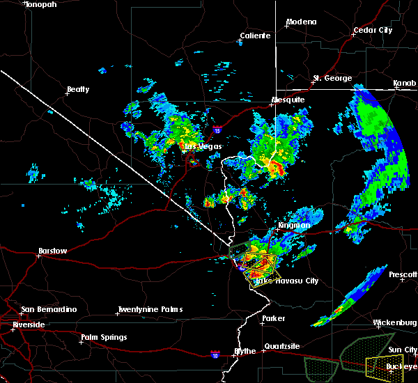
| 8/8/2019 6:09 PM MST | Trained spotters reported strong winds in topock... az. power outage reported in topock and utility company is responding to lines down. also received a video via socia in mohave county AZ, 0.9 miles NNE of Golden Shores, AZ |
| 9/5/2017 7:41 PM MST |
 The severe thunderstorm warning for southwestern mohave and south central clark counties will expire at 745 pm pdt/745 pm mst/, the storm which prompted the warning has moved out of the area. therefore the warning will be allowed to expire. however gusty winds of 45 to 55 mph are still possible with this thunderstorm. remember, a severe thunderstorm warning still remains in effect for the colorado river valley from lake mohave to lake mead. The severe thunderstorm warning for southwestern mohave and south central clark counties will expire at 745 pm pdt/745 pm mst/, the storm which prompted the warning has moved out of the area. therefore the warning will be allowed to expire. however gusty winds of 45 to 55 mph are still possible with this thunderstorm. remember, a severe thunderstorm warning still remains in effect for the colorado river valley from lake mohave to lake mead.
|
| 9/5/2017 7:30 PM MST |
 At 729 pm pdt/729 pm mst/, a severe thunderstorm was located 9 miles west of big bend rec area, or 10 miles south of katherine landing, moving west at 30 mph. winds around 60 mph have been reported with this storm at the bullhead city airport (radar indicated). Hazards include 60 mph wind gusts. Expect damage to roofs, siding, and trees. Locations impacted include, bullhead city, laughlin, needles, mesquite creek, arizona village, mojave ranch estates, mohave valley, big bend rec area and willow valley. At 729 pm pdt/729 pm mst/, a severe thunderstorm was located 9 miles west of big bend rec area, or 10 miles south of katherine landing, moving west at 30 mph. winds around 60 mph have been reported with this storm at the bullhead city airport (radar indicated). Hazards include 60 mph wind gusts. Expect damage to roofs, siding, and trees. Locations impacted include, bullhead city, laughlin, needles, mesquite creek, arizona village, mojave ranch estates, mohave valley, big bend rec area and willow valley.
|
| 9/5/2017 7:04 PM MST |
 At 703 pm pdt/703 pm mst/, a strong winds from a severe thunderstorm were moving west at 25 mph across bullhead city and laughlin (radar indicated). Hazards include 60 mph wind gusts. expect damage to roofs, siding, and trees At 703 pm pdt/703 pm mst/, a strong winds from a severe thunderstorm were moving west at 25 mph across bullhead city and laughlin (radar indicated). Hazards include 60 mph wind gusts. expect damage to roofs, siding, and trees
|
| 8/1/2017 6:38 PM MST |
 The severe thunderstorm warning for southwestern mohave and east central san bernardino counties will expire at 645 pm pdt/645 pm mst/, the storm which prompted the warning has weakened below severe limits, and no longer poses an immediate threat to life or property. therefore the warning will be allowed to expire. however gusty winds are still possible with this thunderstorm. remember, a severe thunderstorm warning still remains in effect for mohave valley, bullhead city, and lake mohave. The severe thunderstorm warning for southwestern mohave and east central san bernardino counties will expire at 645 pm pdt/645 pm mst/, the storm which prompted the warning has weakened below severe limits, and no longer poses an immediate threat to life or property. therefore the warning will be allowed to expire. however gusty winds are still possible with this thunderstorm. remember, a severe thunderstorm warning still remains in effect for mohave valley, bullhead city, and lake mohave.
|
| 8/1/2017 5:59 PM MST |
 At 558 pm pdt/558 pm mst/, a severe thunderstorm was located near lake havasu city, moving southwest at 25 mph (radar indicated). Hazards include 60 mph wind gusts and quarter size hail. Hail damage to vehicles is expected. expect wind damage to roofs, siding, and trees. locations impacted include, lake havasu city, topock, parker dam, yucca, needles, three dunes campground, cattail cove state park, desert hills and black meadow landing campground. this includes the following highways, interstate 40 in arizona between mile markers 0 and 29. Interstate 40 in california between mile markers 144 and 155. At 558 pm pdt/558 pm mst/, a severe thunderstorm was located near lake havasu city, moving southwest at 25 mph (radar indicated). Hazards include 60 mph wind gusts and quarter size hail. Hail damage to vehicles is expected. expect wind damage to roofs, siding, and trees. locations impacted include, lake havasu city, topock, parker dam, yucca, needles, three dunes campground, cattail cove state park, desert hills and black meadow landing campground. this includes the following highways, interstate 40 in arizona between mile markers 0 and 29. Interstate 40 in california between mile markers 144 and 155.
|
| 8/1/2017 5:30 PM MST |
 At 530 pm pdt/530 pm mst/, a severe thunderstorm was located 14 miles northeast of cattail cove state park, or 16 miles east of lake havasu city, moving southwest at 25 mph (radar indicated). Hazards include 60 mph wind gusts and quarter size hail. Hail damage to vehicles is expected. Expect wind damage to roofs, siding, and trees. At 530 pm pdt/530 pm mst/, a severe thunderstorm was located 14 miles northeast of cattail cove state park, or 16 miles east of lake havasu city, moving southwest at 25 mph (radar indicated). Hazards include 60 mph wind gusts and quarter size hail. Hail damage to vehicles is expected. Expect wind damage to roofs, siding, and trees.
|
| 4/3/2017 4:14 PM MST |
 At 411 pm pdt/411 pm mst/, damaging winds in excess of 60 mph remain possible along an outflow boundary as it pushes south down the lower colorado river valley and southern mohave county. locations impacted include, lake havasu city, bullhead city, kingman, laughlin, topock, yucca, needles, wild cow campground, oatman, desert hills, mojave ranch estates, mohave valley, diamond m ranch, blake ranch road, golden valley, mesquite creek, dw ranch road, new kingman-butler, valentine and arizona village. At 411 pm pdt/411 pm mst/, damaging winds in excess of 60 mph remain possible along an outflow boundary as it pushes south down the lower colorado river valley and southern mohave county. locations impacted include, lake havasu city, bullhead city, kingman, laughlin, topock, yucca, needles, wild cow campground, oatman, desert hills, mojave ranch estates, mohave valley, diamond m ranch, blake ranch road, golden valley, mesquite creek, dw ranch road, new kingman-butler, valentine and arizona village.
|
| 4/3/2017 3:40 PM MST |
 At 337 pm pdt/337 pm mst/, the radar detected a line of strong winds from thunderstorms pushing south through the colorado river valley and southern mohave county. public reported visibility less than a quarter mile to near zero visibility at time in the mohave valley and around kingman. damaging winds in excess of 60 mph are possible. these storms were located along a line extending from 8 miles southeast of valentine to arizona village, and moving southeast at 35 mph. At 337 pm pdt/337 pm mst/, the radar detected a line of strong winds from thunderstorms pushing south through the colorado river valley and southern mohave county. public reported visibility less than a quarter mile to near zero visibility at time in the mohave valley and around kingman. damaging winds in excess of 60 mph are possible. these storms were located along a line extending from 8 miles southeast of valentine to arizona village, and moving southeast at 35 mph.
|
| 8/26/2016 10:28 PM MST |
 At 1027 pm pdt/1027 pm mst/, doppler radar indicated a severe thunderstorm capable of producing quarter size hail and damaging winds in excess of 60 mph. this storm was located near mesquite creek, or 14 miles north of topock, moving northeast at 20 mph. locations impacted include, bullhead city, laughlin, needles, oatman, arizona village, mesquite creek, mohave valley, big bend rec area, mojave ranch estates and willow valley. At 1027 pm pdt/1027 pm mst/, doppler radar indicated a severe thunderstorm capable of producing quarter size hail and damaging winds in excess of 60 mph. this storm was located near mesquite creek, or 14 miles north of topock, moving northeast at 20 mph. locations impacted include, bullhead city, laughlin, needles, oatman, arizona village, mesquite creek, mohave valley, big bend rec area, mojave ranch estates and willow valley.
|
| 8/26/2016 10:07 PM MST |
 At 1007 pm pdt/1007 pm mst/, doppler radar indicated a severe thunderstorm producing large damaging hail up to golf ball size and destructive winds in excess of 80 mph. this storm was located over arizona village, or 10 miles northwest of topock, and moving northeast at 20 mph. this storm produced wind gusts above 80 mph and power outages in the town of needles. this replaces the previous severe thunderstorm warning in effect for the area. At 1007 pm pdt/1007 pm mst/, doppler radar indicated a severe thunderstorm producing large damaging hail up to golf ball size and destructive winds in excess of 80 mph. this storm was located over arizona village, or 10 miles northwest of topock, and moving northeast at 20 mph. this storm produced wind gusts above 80 mph and power outages in the town of needles. this replaces the previous severe thunderstorm warning in effect for the area.
|
| 8/26/2016 10:07 PM MST |
 The national weather service in las vegas has issued a * severe thunderstorm warning for. west central mohave county in northwestern arizona. east central san bernardino county in southern california. south central clark county in southern nevada. Until 1045 pm pdt/1045 pm mst/. The national weather service in las vegas has issued a * severe thunderstorm warning for. west central mohave county in northwestern arizona. east central san bernardino county in southern california. south central clark county in southern nevada. Until 1045 pm pdt/1045 pm mst/.
|
| 8/26/2016 9:58 PM MST |
 At 957 pm pdt/957 pm mst/, doppler radar indicated a severe thunderstorm capable of producing large damaging hail up to golf ball size and destructive winds in excess of 80 mph. this storm was located over needles, or 9 miles northwest of topock, moving northeast at 25 mph. at 943 pm, winds gusted to 86 mph at needles airport. this is a very dangerous storm. locations impacted include, bullhead city, needles, arizona village, mesquite creek, mohave valley, mojave ranch estates and willow valley. At 957 pm pdt/957 pm mst/, doppler radar indicated a severe thunderstorm capable of producing large damaging hail up to golf ball size and destructive winds in excess of 80 mph. this storm was located over needles, or 9 miles northwest of topock, moving northeast at 25 mph. at 943 pm, winds gusted to 86 mph at needles airport. this is a very dangerous storm. locations impacted include, bullhead city, needles, arizona village, mesquite creek, mohave valley, mojave ranch estates and willow valley.
|
| 8/26/2016 9:40 PM MST |
 At 939 pm pdt/939 pm mst/, doppler radar indicated a severe thunderstorm capable of producing quarter size hail. this storm was located near needles, or 10 miles west of topock, and moving north at 30 mph. At 939 pm pdt/939 pm mst/, doppler radar indicated a severe thunderstorm capable of producing quarter size hail. this storm was located near needles, or 10 miles west of topock, and moving north at 30 mph.
|
| 7/30/2016 1:44 AM MST |
 At 141 am pdt/141 am mst/, doppler radar indicated a severe thunderstorm capable of producing quarter size hail and damaging winds in excess of 60 mph. this storm was located near golden valley, moving east at 25 mph. strong thunderstorm winds continue to impact the surrounding areas, especially near bullhead city and laughlin. locations impacted include, bullhead city, kingman, laughlin, katherine landing, yucca, topock, needles, oatman, chloride, cottonwood cove campground, hualapai mountain park, new kingman-butler, and highway 95 and i-40. At 141 am pdt/141 am mst/, doppler radar indicated a severe thunderstorm capable of producing quarter size hail and damaging winds in excess of 60 mph. this storm was located near golden valley, moving east at 25 mph. strong thunderstorm winds continue to impact the surrounding areas, especially near bullhead city and laughlin. locations impacted include, bullhead city, kingman, laughlin, katherine landing, yucca, topock, needles, oatman, chloride, cottonwood cove campground, hualapai mountain park, new kingman-butler, and highway 95 and i-40.
|
| 7/30/2016 12:50 AM MST |
 At 1248 am pdt/1248 am mst/, doppler radar indicated severe thunderstorms capable of producing quarter size hail and damaging winds in excess of 60 mph. these storms were located near golden valley, or 15 miles west of kingman, and moving east at 35 mph. several other storms were developing in the areas nearby and may become severe shortly. At 1248 am pdt/1248 am mst/, doppler radar indicated severe thunderstorms capable of producing quarter size hail and damaging winds in excess of 60 mph. these storms were located near golden valley, or 15 miles west of kingman, and moving east at 35 mph. several other storms were developing in the areas nearby and may become severe shortly.
|
| 6/30/2016 6:14 PM PDT |
 At 611 pm pdt/611 pm mst/, doppler radar indicated a severe thunderstorm capable of producing destructive winds in excess of 70 mph. this storm was located near big bend rec area, or near laughlin, moving northeast at 15 mph. another severe storm was located 5 miles southwest of cal-nev-ari, moving southeast at 20 mph. this storm was also capable of producing winds to 70 mph. at 535 pm mst, a 62 mph wind gust was reported at bullhead city airport. locations impacted include, bullhead city, laughlin, katherine landing, topock, needles, arizona village, mesquite creek, big bend rec area, mojave ranch estates, cal-nev-ari, mohave valley, highway 95 and i-40 and willow valley. At 611 pm pdt/611 pm mst/, doppler radar indicated a severe thunderstorm capable of producing destructive winds in excess of 70 mph. this storm was located near big bend rec area, or near laughlin, moving northeast at 15 mph. another severe storm was located 5 miles southwest of cal-nev-ari, moving southeast at 20 mph. this storm was also capable of producing winds to 70 mph. at 535 pm mst, a 62 mph wind gust was reported at bullhead city airport. locations impacted include, bullhead city, laughlin, katherine landing, topock, needles, arizona village, mesquite creek, big bend rec area, mojave ranch estates, cal-nev-ari, mohave valley, highway 95 and i-40 and willow valley.
|
| 6/30/2016 5:48 PM PDT |
 At 546 pm pdt/546 pm mst/, doppler radar indicated a severe thunderstorm capable of producing destructive winds in excess of 70 mph. this storm was located over mesquite creek, or 11 miles south of bullhead city, and moving northeast at 25 mph. another severe storm was located 10 miles west of cal-nev-ari, moving southeast at 20 mph. At 546 pm pdt/546 pm mst/, doppler radar indicated a severe thunderstorm capable of producing destructive winds in excess of 70 mph. this storm was located over mesquite creek, or 11 miles south of bullhead city, and moving northeast at 25 mph. another severe storm was located 10 miles west of cal-nev-ari, moving southeast at 20 mph.
|
| 6/27/2016 5:55 PM MST |
 The severe thunderstorm warning for southwestern mohave and southeastern clark counties will expire at 600 pm pdt/600 pm mst/, the storm which prompted the warning has weakened below severe limits, and no longer poses an immediate threat to life or property. therefore the warning will be allowed to expire. however gusty windsand blowing dust are still possible with this thunderstorm. The severe thunderstorm warning for southwestern mohave and southeastern clark counties will expire at 600 pm pdt/600 pm mst/, the storm which prompted the warning has weakened below severe limits, and no longer poses an immediate threat to life or property. therefore the warning will be allowed to expire. however gusty windsand blowing dust are still possible with this thunderstorm.
|
| 6/27/2016 5:55 PM MST |
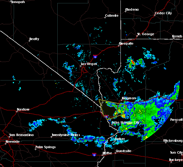 The severe thunderstorm warning for southwestern mohave and southeastern clark counties will expire at 600 pm pdt/600 pm mst/, the storm which prompted the warning has weakened below severe limits, and no longer poses an immediate threat to life or property. therefore the warning will be allowed to expire. however gusty windsand blowing dust are still possible with this thunderstorm. The severe thunderstorm warning for southwestern mohave and southeastern clark counties will expire at 600 pm pdt/600 pm mst/, the storm which prompted the warning has weakened below severe limits, and no longer poses an immediate threat to life or property. therefore the warning will be allowed to expire. however gusty windsand blowing dust are still possible with this thunderstorm.
|
| 6/27/2016 5:43 PM MST |
 At 541 pm pdt/541 pm mst/, doppler radar continued to indicate a severe thunderstorm capable of producing damaging winds in excess of 60 mph well ahead of the storm. this storm was located near yucca, moving west at 10 mph. locations impacted include, bullhead city, laughlin, yucca, topock, katherine landing, oatman, mesquite creek, mohave valley, mojave ranch estates and hualapai peak. At 541 pm pdt/541 pm mst/, doppler radar continued to indicate a severe thunderstorm capable of producing damaging winds in excess of 60 mph well ahead of the storm. this storm was located near yucca, moving west at 10 mph. locations impacted include, bullhead city, laughlin, yucca, topock, katherine landing, oatman, mesquite creek, mohave valley, mojave ranch estates and hualapai peak.
|
| 6/27/2016 5:43 PM MST |
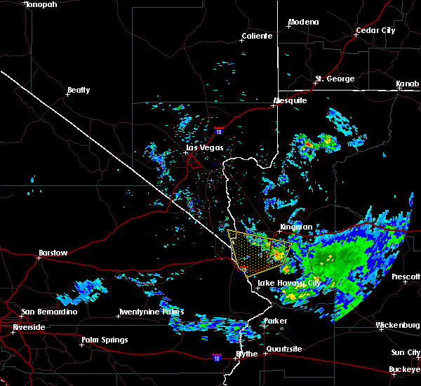 At 541 pm pdt/541 pm mst/, doppler radar continued to indicate a severe thunderstorm capable of producing damaging winds in excess of 60 mph well ahead of the storm. this storm was located near yucca, moving west at 10 mph. locations impacted include, bullhead city, laughlin, yucca, topock, katherine landing, oatman, mesquite creek, mohave valley, mojave ranch estates and hualapai peak. At 541 pm pdt/541 pm mst/, doppler radar continued to indicate a severe thunderstorm capable of producing damaging winds in excess of 60 mph well ahead of the storm. this storm was located near yucca, moving west at 10 mph. locations impacted include, bullhead city, laughlin, yucca, topock, katherine landing, oatman, mesquite creek, mohave valley, mojave ranch estates and hualapai peak.
|
| 6/27/2016 5:17 PM MST |
 At 516 pm pdt/516 pm mst/, doppler radar indicated a severe thunderstorm capable of producing damaging winds in excess of 60 mph. this storm was located 9 miles northeast of yucca, and moving west at 10 mph. this storm is also capable of producing small hail. At 516 pm pdt/516 pm mst/, doppler radar indicated a severe thunderstorm capable of producing damaging winds in excess of 60 mph. this storm was located 9 miles northeast of yucca, and moving west at 10 mph. this storm is also capable of producing small hail.
|
| 7/30/2015 4:11 PM PDT |
 The severe thunderstorm warning for southwestern mohave and east central san bernardino counties will expire at 415 pm pdt, the storm which prompted the warning has weakened below severe limits, and no longer poses an immediate threat to life or property. therefore the warning will be allowed to expire. however gusty winds are still possible with this thunderstorm. to report severe weather, contact your nearest law enforcement agency. they will relay your report to the national weather service las vegas. The severe thunderstorm warning for southwestern mohave and east central san bernardino counties will expire at 415 pm pdt, the storm which prompted the warning has weakened below severe limits, and no longer poses an immediate threat to life or property. therefore the warning will be allowed to expire. however gusty winds are still possible with this thunderstorm. to report severe weather, contact your nearest law enforcement agency. they will relay your report to the national weather service las vegas.
|
| 7/30/2015 3:53 PM PDT |
 At 352 pm pdt /352 pm mst/, doppler radar indicated a severe thunderstorm capable of producing damaging winds in excess of 60 mph. this storm was located 7 miles south of highway 95 and i-40, or 16 miles west of topock, moving northwest at 10 mph. locations impacted include, needles, arizona village, mesquite creek, highway 95 and i-40, mohave valley, mojave ranch estates and willow valley. this includes the following highways, interstate 40 in arizona between mile markers 4 and 8, and between mile markers 14 and 16. interstate 40 in california between mile markers 126 and 154. At 352 pm pdt /352 pm mst/, doppler radar indicated a severe thunderstorm capable of producing damaging winds in excess of 60 mph. this storm was located 7 miles south of highway 95 and i-40, or 16 miles west of topock, moving northwest at 10 mph. locations impacted include, needles, arizona village, mesquite creek, highway 95 and i-40, mohave valley, mojave ranch estates and willow valley. this includes the following highways, interstate 40 in arizona between mile markers 4 and 8, and between mile markers 14 and 16. interstate 40 in california between mile markers 126 and 154.
|
| 7/30/2015 3:20 PM PDT |
 At 320 pm pdt /320 pm mst/, doppler radar indicated a severe thunderstorm capable of producing damaging winds in excess of 60 mph. this storm was located near needles, or 9 miles west of topock, and moving north at 20 mph. At 320 pm pdt /320 pm mst/, doppler radar indicated a severe thunderstorm capable of producing damaging winds in excess of 60 mph. this storm was located near needles, or 9 miles west of topock, and moving north at 20 mph.
|
| 7/18/2015 1:55 PM PDT |
 At 152 pm pdt /152 pm mst/, thunderstorms continue to move northeast across the laughlin, bullhead city and mohave valley areas. a 58 mph wind gust was measured at the laughlin bullhead city international airport at 135 pm. this activity was moving northeast at 25 to 35 mph. locations impacted include, bullhead city, laughlin, topock, needles, oatman, arizona village, mesquite creek, highway 95 and i-40, mohave valley, big bend rec area, mojave ranch estates and willow valley. this includes the following highways, interstate 40 in arizona between mile markers 0 and 7. interstate 40 in california between mile markers 128 and 155. At 152 pm pdt /152 pm mst/, thunderstorms continue to move northeast across the laughlin, bullhead city and mohave valley areas. a 58 mph wind gust was measured at the laughlin bullhead city international airport at 135 pm. this activity was moving northeast at 25 to 35 mph. locations impacted include, bullhead city, laughlin, topock, needles, oatman, arizona village, mesquite creek, highway 95 and i-40, mohave valley, big bend rec area, mojave ranch estates and willow valley. this includes the following highways, interstate 40 in arizona between mile markers 0 and 7. interstate 40 in california between mile markers 128 and 155.
|
| 7/18/2015 1:27 PM PDT |
 At 126 pm pdt /126 pm mst/, a 61 mph wind gust was recently measured at the needles airport. this thunderstorm activity was located over mojave ranch estates, or 13 miles south of bullhead city, and moving northeast at 20 to 30 mph. At 126 pm pdt /126 pm mst/, a 61 mph wind gust was recently measured at the needles airport. this thunderstorm activity was located over mojave ranch estates, or 13 miles south of bullhead city, and moving northeast at 20 to 30 mph.
|
| 7/17/2015 6:18 PM PDT |
 At 617 pm pdt /617 pm mst/, doppler radar indicated a severe thunderstorm capable of producing quarter size hail and damaging winds in excess of 60 mph. this storm was located 8 miles west of yucca, moving northeast at 55 mph. at 605 pm pdt /605 pm mst/, a wind gust of 64 mph was recorded at needles airport. locations impacted include, topock, needles, arizona village, mesquite creek, mohave valley, mojave ranch estates and willow valley. this includes the following highways, interstate 40 in arizona between mile markers 0 and 9. interstate 40 in california between mile markers 140 and 155. At 617 pm pdt /617 pm mst/, doppler radar indicated a severe thunderstorm capable of producing quarter size hail and damaging winds in excess of 60 mph. this storm was located 8 miles west of yucca, moving northeast at 55 mph. at 605 pm pdt /605 pm mst/, a wind gust of 64 mph was recorded at needles airport. locations impacted include, topock, needles, arizona village, mesquite creek, mohave valley, mojave ranch estates and willow valley. this includes the following highways, interstate 40 in arizona between mile markers 0 and 9. interstate 40 in california between mile markers 140 and 155.
|
| 7/17/2015 5:54 PM PDT |
 At 554 pm pdt /554 pm mst/, doppler radar indicated a severe thunderstorm capable of producing quarter size hail and damaging winds in excess of 60 mph. this storm was located near needles, or 8 miles west of topock, and moving northeast at 30 mph. At 554 pm pdt /554 pm mst/, doppler radar indicated a severe thunderstorm capable of producing quarter size hail and damaging winds in excess of 60 mph. this storm was located near needles, or 8 miles west of topock, and moving northeast at 30 mph.
|
| 7/8/2014 7:55 PM MST | 30 year old mesquite tree uprooted. no estimated wind spee in mohave county AZ, 1.3 miles NE of Golden Shores, AZ |
| 10/11/2012 7:00 AM MST | Quarter sized hail reported 1.3 miles NE of Golden Shores, AZ, trained spotter in topock reported quarter sized hail. the hail lasted about 10 minutes. |
| 8/9/2012 6:50 PM MST | Power lines were reported down in golden shores and mohave valley. visibility between 50 and 500 fee in mohave county AZ, 1.3 miles NE of Golden Shores, AZ |
Hail Maps for Golden Shores, AZ


Connect with Interactive Hail Maps