

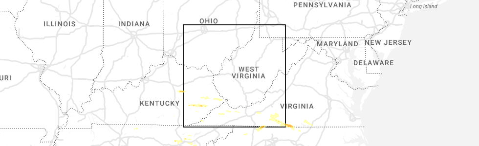
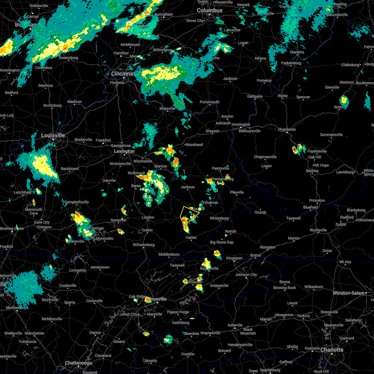
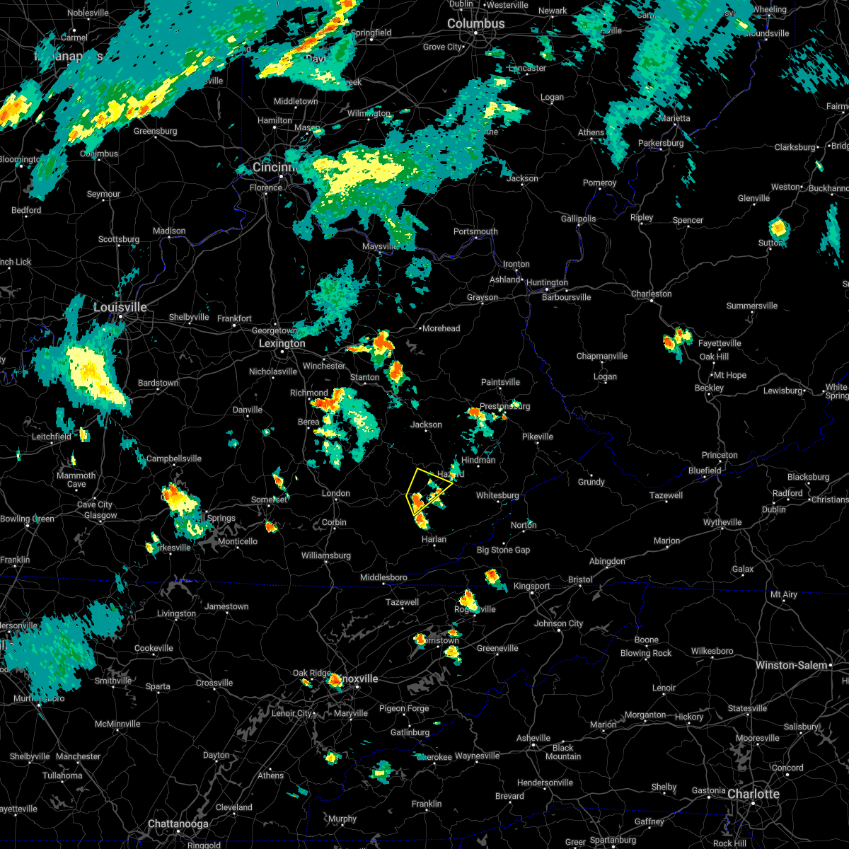
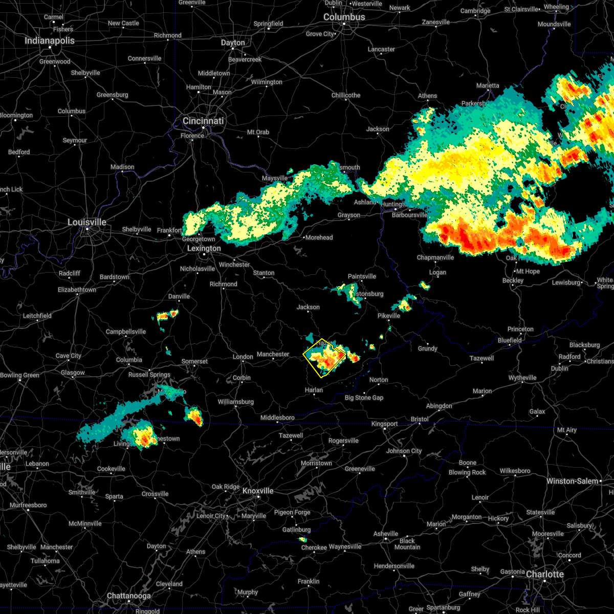
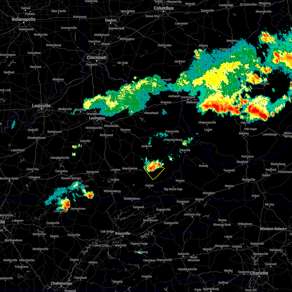
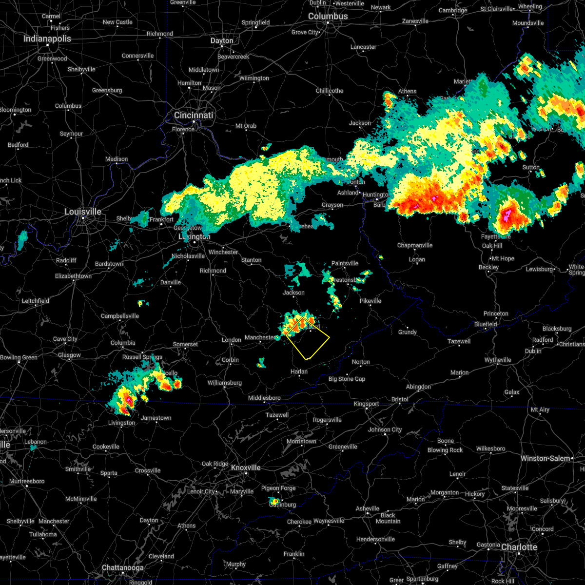
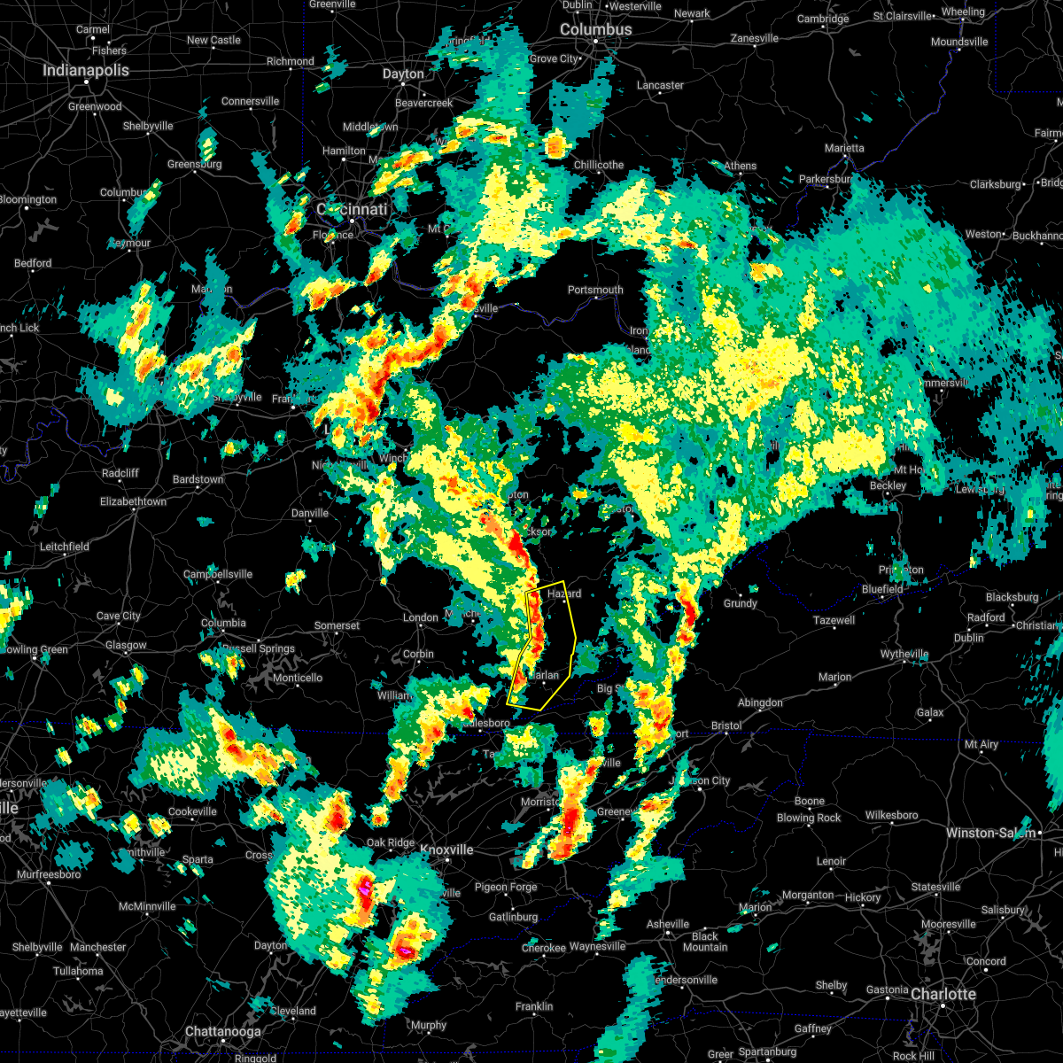
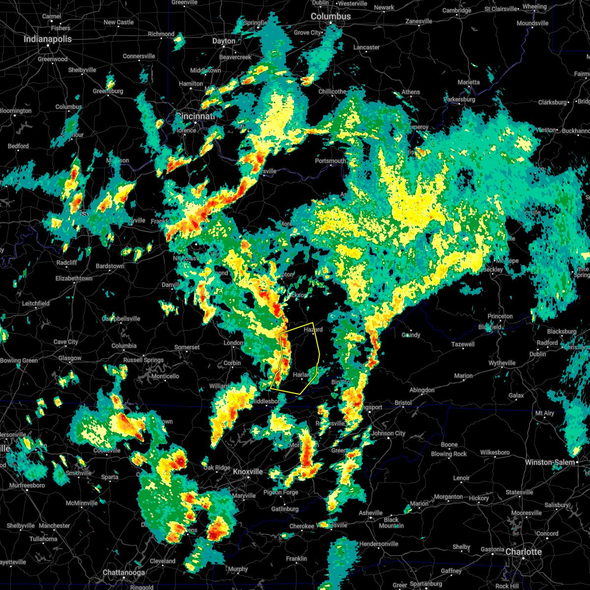
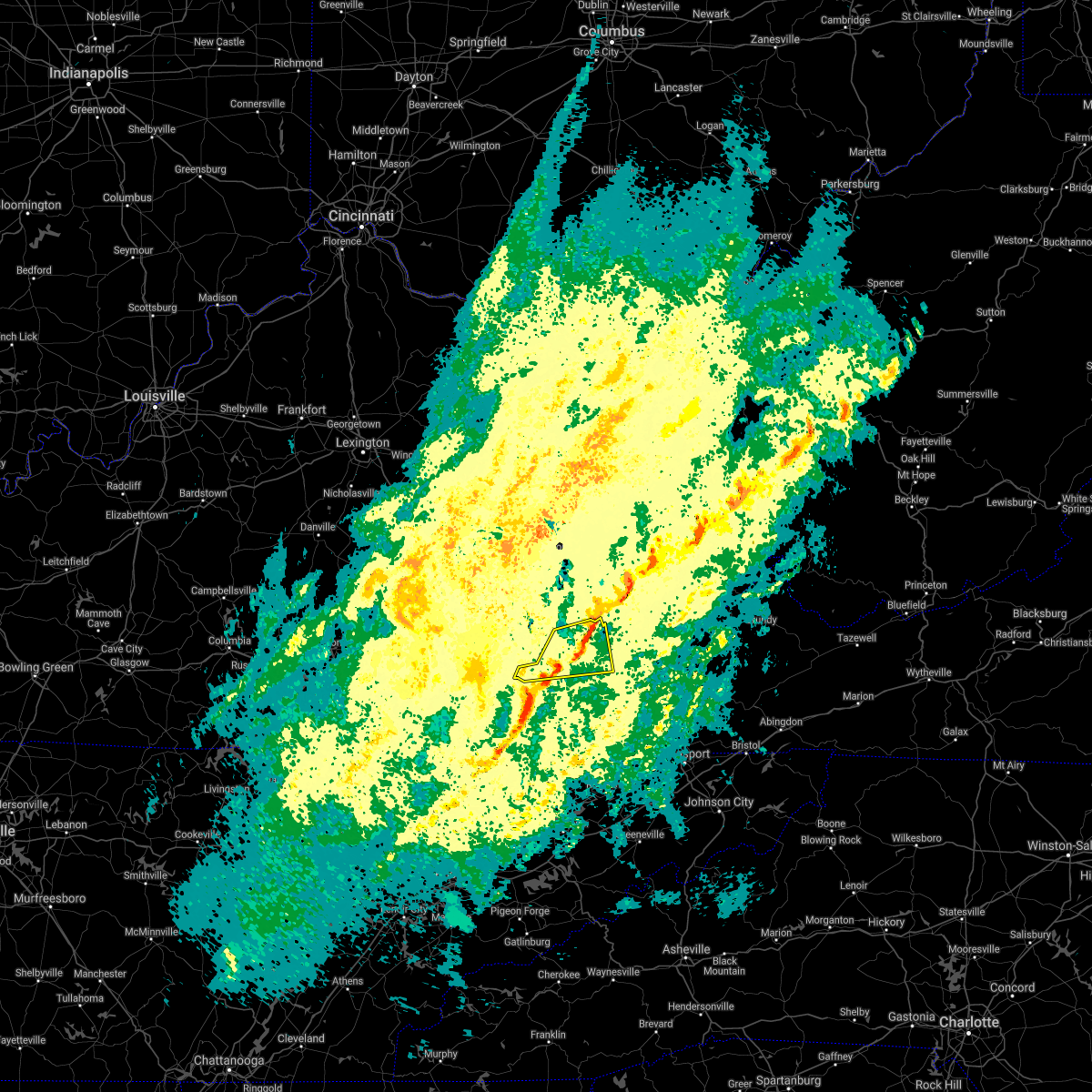
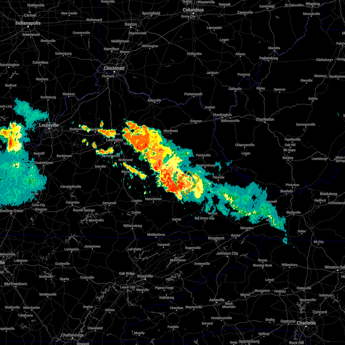
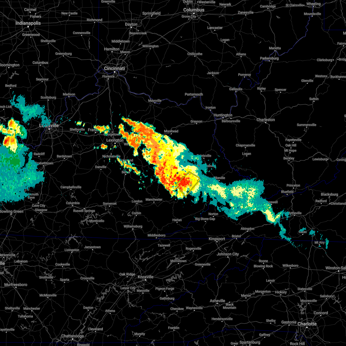
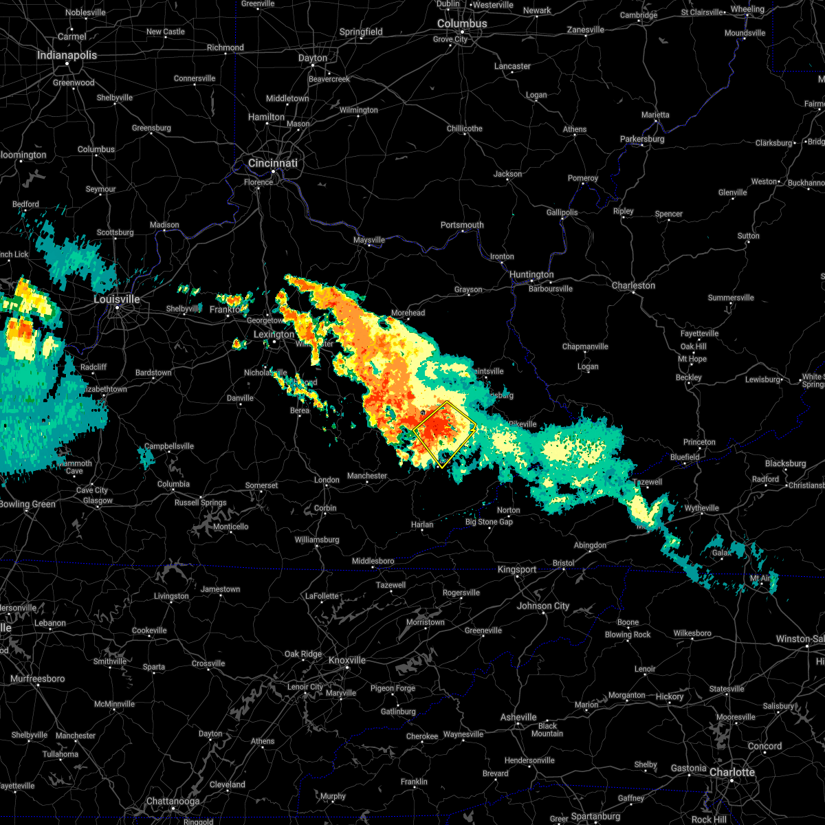
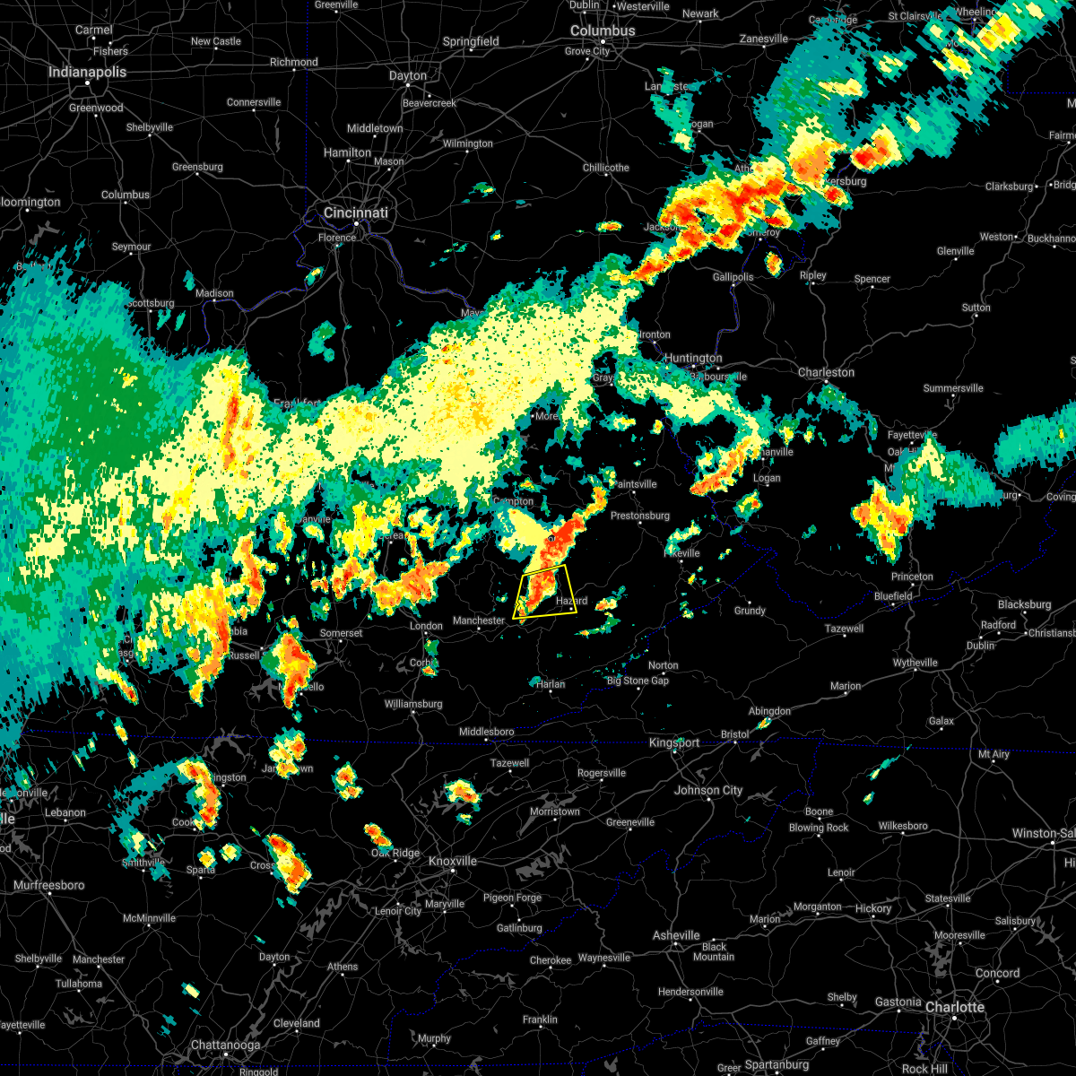
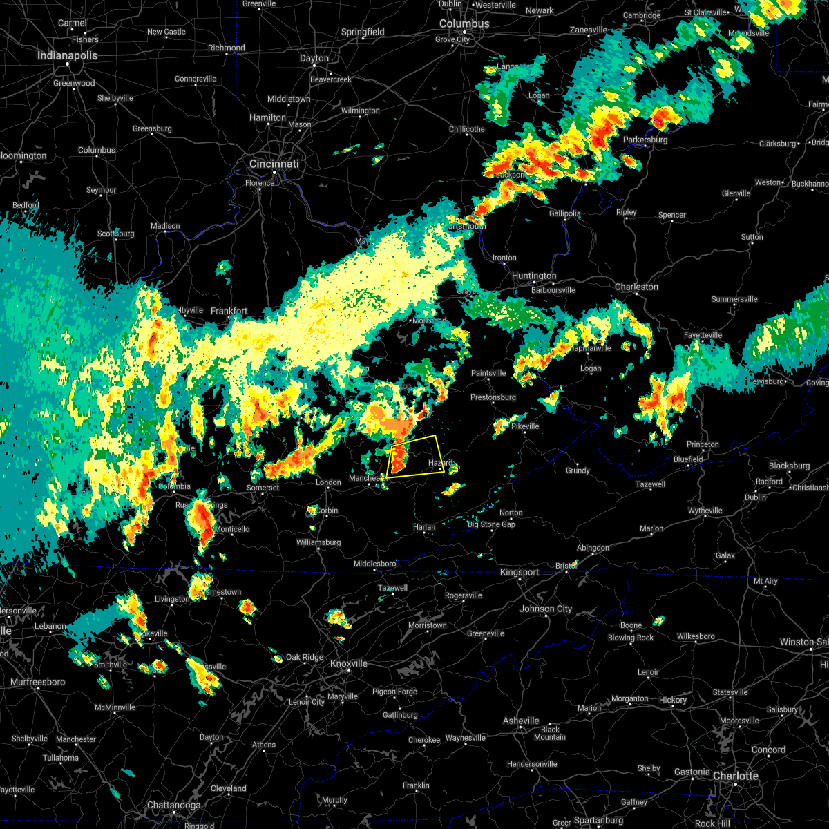
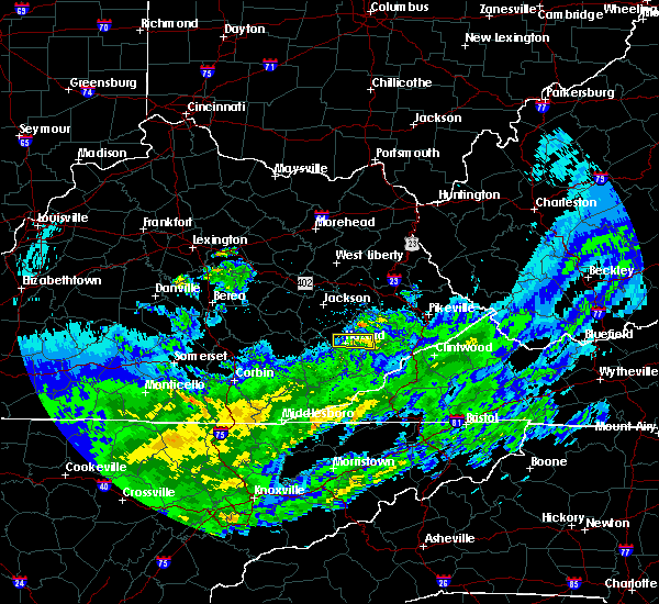
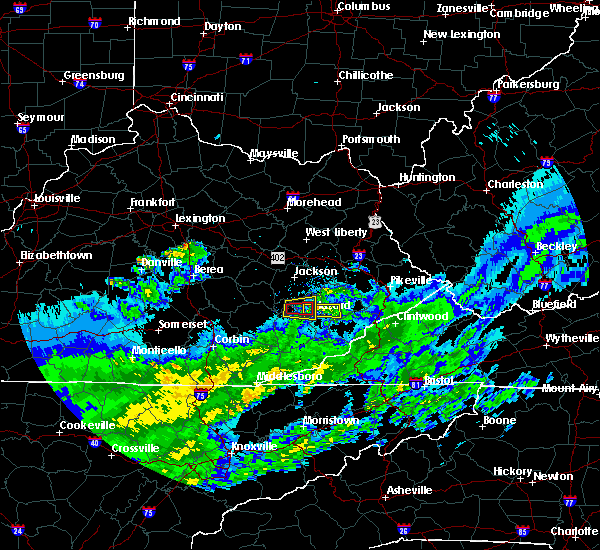
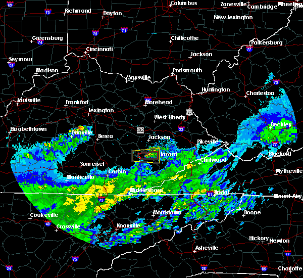
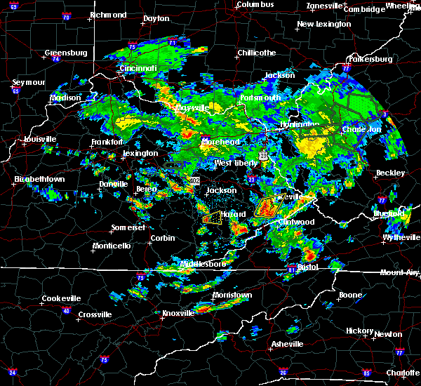
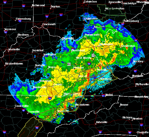
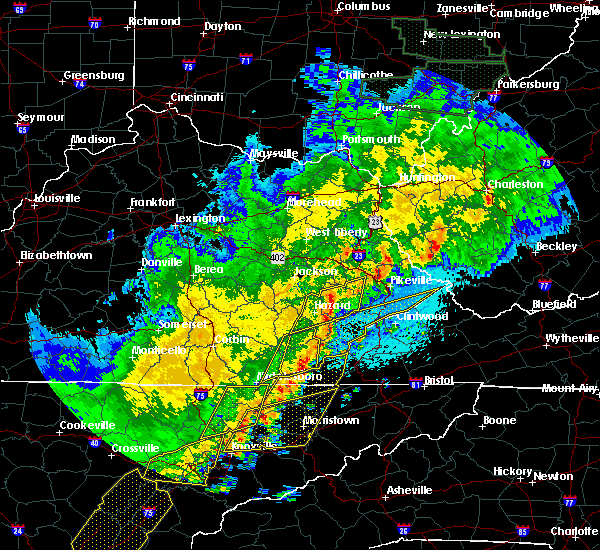
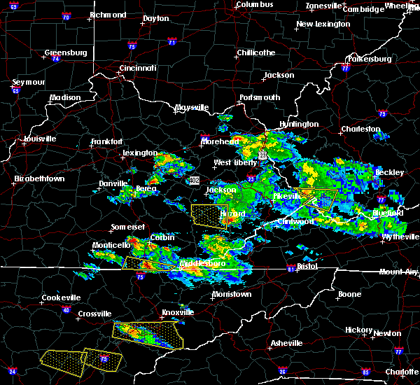
Hail Map for Hazard, KY
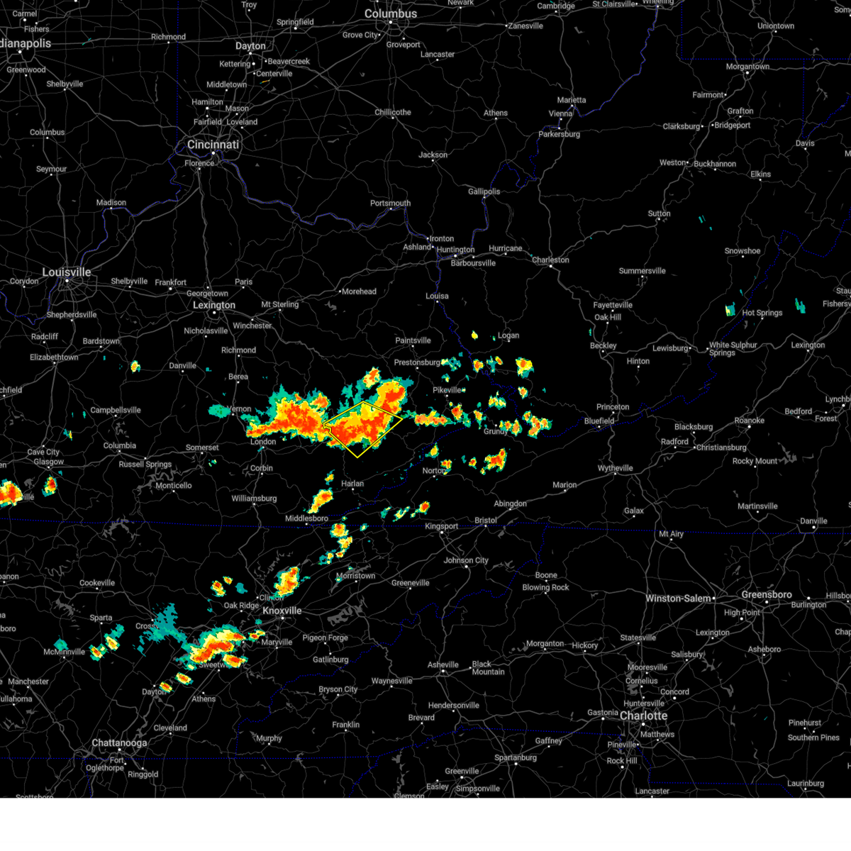
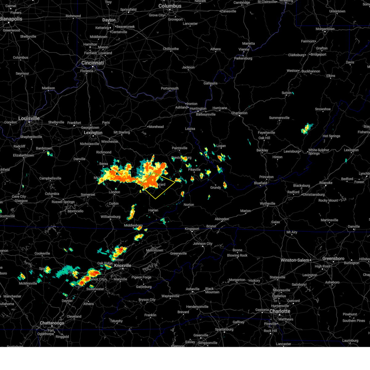
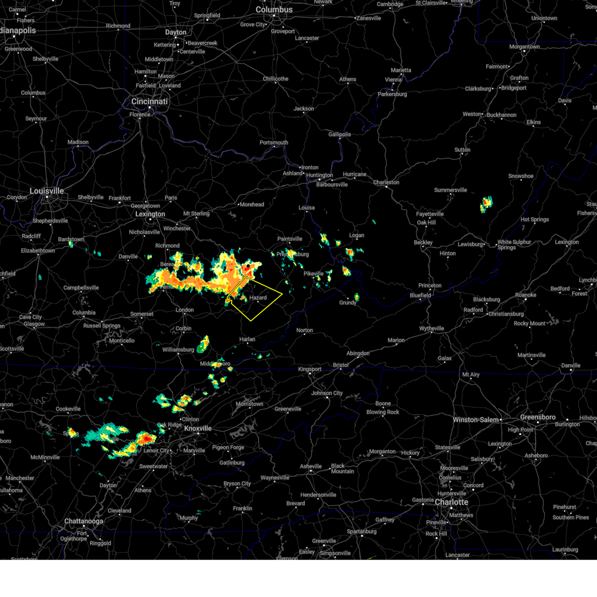
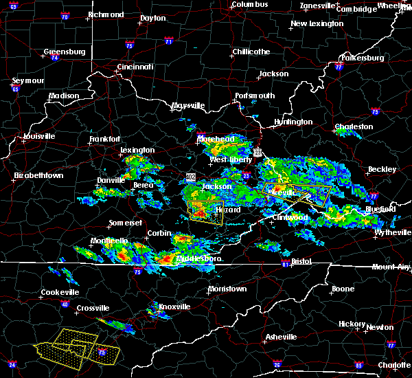
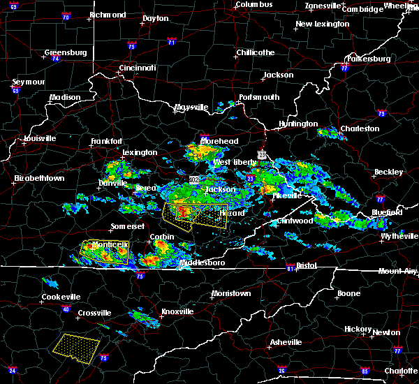
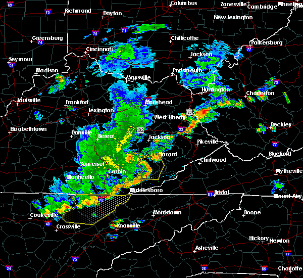
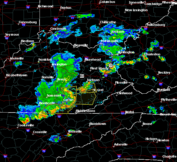
The Hazard, KY area has had 8 reports of on-the-ground hail by trained spotters, and has been under severe weather warnings 17 times during the past 12 months. Doppler radar has detected hail at or near Hazard, KY on 23 occasions, including 1 occasion during the past year.
| Name: | Hazard, KY |
| Where Located: | 53.2 miles SE of Irvine, KY |
| Map: | Google Map for Hazard, KY |
| Population: | 4456 |
| Housing Units: | 2172 |
| More Info: | Search Google for Hazard, KY |
0
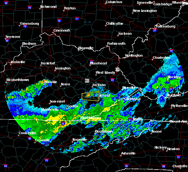
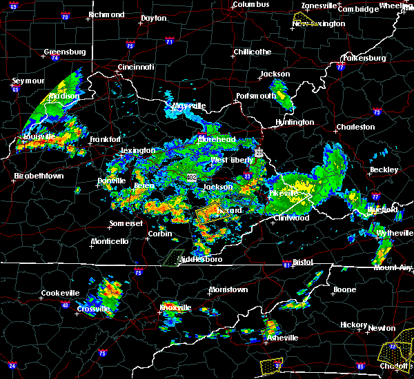
The Top Recent Hail Date for Hazard, KY is Tuesday, May 16, 2023 (13th out of 23)
Hail and Wind Damage Spotted near Hazard, KY
| Date / Time | Report Details |
|---|---|
| 3/6/2024 10:07 AM EST |
 Torjkl the national weather service in jackson ky has issued a * this is a test message. tornado warning for, montgomery county in east central kentucky, mccreary county in south central kentucky, rowan county in east central kentucky, morgan county in southeastern kentucky, bath county in east central kentucky, leslie county in southeastern kentucky, estill county in east central kentucky, pulaski county in south central kentucky, rockcastle county in south central kentucky, clay county in southeastern kentucky, elliott county in east central kentucky, wayne county in south central kentucky, harlan county in southeastern kentucky, knox county in southeastern kentucky, owsley county in southeastern kentucky, jackson county in southeastern kentucky, knott county in southeastern kentucky, floyd county in southeastern kentucky, whitley county in south central kentucky, menifee county in east central kentucky, lee county in southeastern kentucky, fleming county in east central kentucky, wolfe county in southeastern kentucky, powell county in east central kentucky, laurel county in south central kentucky, martin county in northeastern kentucky, bell county in southeastern kentucky, johnson county in northeastern kentucky, letcher county in southeastern kentucky, perry county in southeastern kentucky, breathitt county in southeastern kentucky, pike county in southeastern kentucky, magoffin county in southeastern kentucky, * this is a test message. until 1030 am est. * this is a test message. repeat, this is a test tornado warning message. there is no severe weather occuring at this time. this test warning message is part of the annual kentucky tornado drill. if this were an actual severe weather event, you would be given information about the hazard. the national weather service, kentucky emergency management angency, and the kentucky weather preparedness committee, encourges the use of this time to activate and review your severe weather safety plans. repeating, this has been a test tornado warning message for the 2024 kentucky tornado drill. this concludes the test. * this is a test message. Torjkl the national weather service in jackson ky has issued a * this is a test message. tornado warning for, montgomery county in east central kentucky, mccreary county in south central kentucky, rowan county in east central kentucky, morgan county in southeastern kentucky, bath county in east central kentucky, leslie county in southeastern kentucky, estill county in east central kentucky, pulaski county in south central kentucky, rockcastle county in south central kentucky, clay county in southeastern kentucky, elliott county in east central kentucky, wayne county in south central kentucky, harlan county in southeastern kentucky, knox county in southeastern kentucky, owsley county in southeastern kentucky, jackson county in southeastern kentucky, knott county in southeastern kentucky, floyd county in southeastern kentucky, whitley county in south central kentucky, menifee county in east central kentucky, lee county in southeastern kentucky, fleming county in east central kentucky, wolfe county in southeastern kentucky, powell county in east central kentucky, laurel county in south central kentucky, martin county in northeastern kentucky, bell county in southeastern kentucky, johnson county in northeastern kentucky, letcher county in southeastern kentucky, perry county in southeastern kentucky, breathitt county in southeastern kentucky, pike county in southeastern kentucky, magoffin county in southeastern kentucky, * this is a test message. until 1030 am est. * this is a test message. repeat, this is a test tornado warning message. there is no severe weather occuring at this time. this test warning message is part of the annual kentucky tornado drill. if this were an actual severe weather event, you would be given information about the hazard. the national weather service, kentucky emergency management angency, and the kentucky weather preparedness committee, encourges the use of this time to activate and review your severe weather safety plans. repeating, this has been a test tornado warning message for the 2024 kentucky tornado drill. this concludes the test. * this is a test message.
|
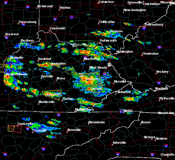
| 7/29/2023 3:47 PM EDT |
 At 347 pm edt, a severe thunderstorm was located over roxana, or near whitesburg, moving southeast at 25 mph (radar indicated). Hazards include 60 mph wind gusts. Expect damage to roofs, siding, and trees. locations impacted include, premium, oscaloosa, whitesburg, day and eolia. hail threat, radar indicated max hail size, <. 75 in wind threat, radar indicated max wind gust, 60 mph. At 347 pm edt, a severe thunderstorm was located over roxana, or near whitesburg, moving southeast at 25 mph (radar indicated). Hazards include 60 mph wind gusts. Expect damage to roofs, siding, and trees. locations impacted include, premium, oscaloosa, whitesburg, day and eolia. hail threat, radar indicated max hail size, <. 75 in wind threat, radar indicated max wind gust, 60 mph.
|
| 7/29/2023 3:34 PM EDT |
 At 334 pm edt, a severe thunderstorm was located over cordia, or near hazard, moving southeast at 30 mph (radar indicated). Hazards include 60 mph wind gusts. Expect damage to roofs, siding, and trees. locations impacted include, vicco and amburgey. hail threat, radar indicated max hail size, <. 75 in wind threat, radar indicated max wind gust, 60 mph. At 334 pm edt, a severe thunderstorm was located over cordia, or near hazard, moving southeast at 30 mph (radar indicated). Hazards include 60 mph wind gusts. Expect damage to roofs, siding, and trees. locations impacted include, vicco and amburgey. hail threat, radar indicated max hail size, <. 75 in wind threat, radar indicated max wind gust, 60 mph.
|
| 7/29/2023 3:20 PM EDT |
 At 319 pm edt, a severe thunderstorm was located over jeff, or near hazard, moving southeast at 25 mph (radar indicated). Hazards include 60 mph wind gusts. Expect damage to roofs, siding, and trees. this severe thunderstorm will be near, vicco around 325 pm edt. cornettsville around 330 pm edt. red star around 335 pm edt. other locations in the path of this severe thunderstorm include blackey, letcher and roxana. hail threat, radar indicated max hail size, <. 75 in wind threat, radar indicated max wind gust, 60 mph. At 319 pm edt, a severe thunderstorm was located over jeff, or near hazard, moving southeast at 25 mph (radar indicated). Hazards include 60 mph wind gusts. Expect damage to roofs, siding, and trees. this severe thunderstorm will be near, vicco around 325 pm edt. cornettsville around 330 pm edt. red star around 335 pm edt. other locations in the path of this severe thunderstorm include blackey, letcher and roxana. hail threat, radar indicated max hail size, <. 75 in wind threat, radar indicated max wind gust, 60 mph.
|
| 7/29/2023 3:18 PM EDT | Off-duty nws estimated winds of 60 mph in hazar in perry county KY, 1 miles SE of Hazard, KY |
| 7/29/2023 3:18 PM EDT | Social media report of metal awning damage near the 300 block of main street in hazard. time estimated from rada in perry county KY, 0.1 miles SSE of Hazard, KY |
| 7/29/2023 3:15 PM EDT | County dispatch reported powerlines blown down along whitaker fork rd. time estimated from rada in perry county KY, 4.3 miles NE of Hazard, KY |
| 7/29/2023 3:14 PM EDT | County dispatch reported powerlines blown down near the intersection of oakhurst avenue and brown street. time estimate from rada in perry county KY, 0.1 miles SSE of Hazard, KY |
| 7/29/2023 3:13 PM EDT | County dispatch reported power lines blown down along browns fork rd. time estimated from rada in perry county KY, 3.1 miles ENE of Hazard, KY |
| 7/29/2023 3:13 PM EDT | County dispatch reported a tree blown down in the 4300 block of ky-15 n in the vicinity of bonnyman. time estimated from rada in perry county KY, 4.5 miles SE of Hazard, KY |
| 7/29/2023 3:11 PM EDT |
 At 310 pm edt, a severe thunderstorm was located over lamont, or 7 miles northwest of hazard, moving southeast at 30 mph (radar indicated). Hazards include 60 mph wind gusts. Expect damage to roofs, siding, and trees. this severe storm will be near, dice around 315 pm edt. hazard around 320 pm edt. other locations in the path of this severe thunderstorm include bulan, cordia, elic and vicco. hail threat, radar indicated max hail size, <. 75 in wind threat, radar indicated max wind gust, 60 mph. At 310 pm edt, a severe thunderstorm was located over lamont, or 7 miles northwest of hazard, moving southeast at 30 mph (radar indicated). Hazards include 60 mph wind gusts. Expect damage to roofs, siding, and trees. this severe storm will be near, dice around 315 pm edt. hazard around 320 pm edt. other locations in the path of this severe thunderstorm include bulan, cordia, elic and vicco. hail threat, radar indicated max hail size, <. 75 in wind threat, radar indicated max wind gust, 60 mph.
|
| 7/29/2023 3:10 PM EDT | County dispatch reported powerlines blown down in the 2300 block of big willard rd. near busy. time estimated from rada in perry county KY, 6.7 miles E of Hazard, KY |
| 7/29/2023 3:10 PM EDT | County dispatch reported a tree blown down on coal harbor lane. time estimated from rada in perry county KY, 4.5 miles E of Hazard, KY |
| 7/29/2023 3:02 PM EDT |
 At 302 pm edt, a severe thunderstorm was located over barwick, or 11 miles northwest of hazard, moving southeast at 30 mph (radar indicated). Hazards include 60 mph wind gusts. Expect damage to roofs, siding, and trees. this severe thunderstorm will be near, lamont around 310 pm edt. dice around 315 pm edt. hazard around 320 pm edt. other locations in the path of this severe thunderstorm include bulan, diablock and cordia. hail threat, radar indicated max hail size, <. 75 in wind threat, radar indicated max wind gust, 60 mph. At 302 pm edt, a severe thunderstorm was located over barwick, or 11 miles northwest of hazard, moving southeast at 30 mph (radar indicated). Hazards include 60 mph wind gusts. Expect damage to roofs, siding, and trees. this severe thunderstorm will be near, lamont around 310 pm edt. dice around 315 pm edt. hazard around 320 pm edt. other locations in the path of this severe thunderstorm include bulan, diablock and cordia. hail threat, radar indicated max hail size, <. 75 in wind threat, radar indicated max wind gust, 60 mph.
|
| 7/6/2023 2:12 AM EDT | Large tree down on lost creek road near thomasville lane in perry county. utility lines are down with it. blocking entire roadway. likely down due to thunderstorms in a in perry county KY, 11.2 miles SSE of Hazard, KY |
| 7/2/2023 10:37 PM EDT |
 The severe thunderstorm warning for northwestern letcher, central leslie, northeastern perry, knott, southern floyd, west central pike and southeastern magoffin counties will expire at 1045 pm edt, the storms which prompted the warning have weakened below severe limits, and no longer pose an immediate threat to life or property. therefore, the warning will be allowed to expire. a severe thunderstorm watch remains in effect until midnight edt for southeastern kentucky. The severe thunderstorm warning for northwestern letcher, central leslie, northeastern perry, knott, southern floyd, west central pike and southeastern magoffin counties will expire at 1045 pm edt, the storms which prompted the warning have weakened below severe limits, and no longer pose an immediate threat to life or property. therefore, the warning will be allowed to expire. a severe thunderstorm watch remains in effect until midnight edt for southeastern kentucky.
|
| 7/2/2023 10:26 PM EDT |
 At 1026 pm edt, severe thunderstorms were located along a line extending from justell to mallie to smilax, moving east at 45 mph (radar indicated). Hazards include 60 mph wind gusts and penny size hail. Expect damage to roofs, siding, and trees. these severe storms will be near, pippa passes around 1030 pm edt. other locations in the path of these severe thunderstorms include pikeville, wheelwright, arminta, letcher and tillie. hail threat, radar indicated max hail size, 0. 75 in wind threat, radar indicated max wind gust, 60 mph. At 1026 pm edt, severe thunderstorms were located along a line extending from justell to mallie to smilax, moving east at 45 mph (radar indicated). Hazards include 60 mph wind gusts and penny size hail. Expect damage to roofs, siding, and trees. these severe storms will be near, pippa passes around 1030 pm edt. other locations in the path of these severe thunderstorms include pikeville, wheelwright, arminta, letcher and tillie. hail threat, radar indicated max hail size, 0. 75 in wind threat, radar indicated max wind gust, 60 mph.
|
| 7/2/2023 10:10 PM EDT |
 The severe thunderstorm warning for northern leslie, perry, northwestern knott, central breathitt and east central clay counties will expire at 1015 pm edt, the storms which prompted the warning have moved out of the area. therefore, the warning will be allowed to expire. a new warning has been issued. a severe thunderstorm watch remains in effect until midnight edt for southeastern kentucky. The severe thunderstorm warning for northern leslie, perry, northwestern knott, central breathitt and east central clay counties will expire at 1015 pm edt, the storms which prompted the warning have moved out of the area. therefore, the warning will be allowed to expire. a new warning has been issued. a severe thunderstorm watch remains in effect until midnight edt for southeastern kentucky.
|
| 7/2/2023 10:10 PM EDT |
 At 1010 pm edt, severe thunderstorms were located along a line extending from hippo to cordia to hosea, moving east at 45 mph (radar indicated). Hazards include 60 mph wind gusts and penny size hail. Expect damage to roofs, siding, and trees. severe thunderstorms will be near, hueysville around 1015 pm edt. hindman around 1020 pm edt. ivis around 1025 pm edt. pippa passes around 1030 pm edt. other locations in the path of these severe thunderstorms include pikeville and wheelwright. hail threat, radar indicated max hail size, 0. 75 in wind threat, radar indicated max wind gust, 60 mph. At 1010 pm edt, severe thunderstorms were located along a line extending from hippo to cordia to hosea, moving east at 45 mph (radar indicated). Hazards include 60 mph wind gusts and penny size hail. Expect damage to roofs, siding, and trees. severe thunderstorms will be near, hueysville around 1015 pm edt. hindman around 1020 pm edt. ivis around 1025 pm edt. pippa passes around 1030 pm edt. other locations in the path of these severe thunderstorms include pikeville and wheelwright. hail threat, radar indicated max hail size, 0. 75 in wind threat, radar indicated max wind gust, 60 mph.
|
| 7/2/2023 9:58 PM EDT |
 At 957 pm edt, severe thunderstorms were located along a line extending from carver to evanston to noble to dice to near avawam, moving east at 45 mph (radar indicated). Hazards include 60 mph wind gusts and penny size hail. Expect damage to roofs, siding, and trees. locations impacted include, evanston, elmrock and vail. hail threat, radar indicated max hail size, 0. 75 in wind threat, radar indicated max wind gust, 60 mph. At 957 pm edt, severe thunderstorms were located along a line extending from carver to evanston to noble to dice to near avawam, moving east at 45 mph (radar indicated). Hazards include 60 mph wind gusts and penny size hail. Expect damage to roofs, siding, and trees. locations impacted include, evanston, elmrock and vail. hail threat, radar indicated max hail size, 0. 75 in wind threat, radar indicated max wind gust, 60 mph.
|
| 7/2/2023 9:39 PM EDT |
 At 939 pm edt, severe thunderstorms were located along a line extending from bays to smith branch to canoe to buckhorn to sizerock, moving east at 45 mph (radar indicated). Hazards include 60 mph wind gusts and penny size hail. Expect damage to roofs, siding, and trees. severe thunderstorms will be near, sikes around 945 pm edt. toulouse around 950 pm edt. dice around 955 pm edt. other locations in the path of these severe thunderstorms include hazard, talcum and bearville. hail threat, radar indicated max hail size, 0. 75 in wind threat, radar indicated max wind gust, 60 mph. At 939 pm edt, severe thunderstorms were located along a line extending from bays to smith branch to canoe to buckhorn to sizerock, moving east at 45 mph (radar indicated). Hazards include 60 mph wind gusts and penny size hail. Expect damage to roofs, siding, and trees. severe thunderstorms will be near, sikes around 945 pm edt. toulouse around 950 pm edt. dice around 955 pm edt. other locations in the path of these severe thunderstorms include hazard, talcum and bearville. hail threat, radar indicated max hail size, 0. 75 in wind threat, radar indicated max wind gust, 60 mph.
|
| 5/16/2023 4:25 PM EDT | Golf Ball sized hail reported 6.5 miles SW of Hazard, KY, picture on social media show approximately golf-ball size hail south of fisty... ky. time estimated from radar. |
| 5/16/2023 4:20 PM EDT | Half Dollar sized hail reported 4.3 miles S of Hazard, KY, picture posted to social media shows approximately half dollar-sized hail at hazard animal shelter. time estimated from radar. |
| 5/16/2023 4:18 PM EDT |
 At 418 pm edt, a severe thunderstorm was located over bulan, or over hazard, moving east at 40 mph (radar indicated). Hazards include two inch hail and 60 mph wind gusts. People and animals outdoors will be injured. expect hail damage to roofs, siding, windows, and vehicles. expect wind damage to roofs, siding, and trees. this severe storm will be near, elic around 425 pm edt. vicco around 430 pm edt. amburgey around 435 pm edt. Other locations in the path of this severe thunderstorm include bath and may. At 418 pm edt, a severe thunderstorm was located over bulan, or over hazard, moving east at 40 mph (radar indicated). Hazards include two inch hail and 60 mph wind gusts. People and animals outdoors will be injured. expect hail damage to roofs, siding, windows, and vehicles. expect wind damage to roofs, siding, and trees. this severe storm will be near, elic around 425 pm edt. vicco around 430 pm edt. amburgey around 435 pm edt. Other locations in the path of this severe thunderstorm include bath and may.
|
| 5/16/2023 4:15 PM EDT |
 At 414 pm edt, a severe thunderstorm was located over hazard, moving east at 40 mph (radar indicated). Hazards include ping pong ball size hail and 60 mph wind gusts. People and animals outdoors will be injured. expect hail damage to roofs, siding, windows, and vehicles. expect wind damage to roofs, siding, and trees. this severe storm will be near, bulan around 420 pm edt. cordia around 425 pm edt. Other locations in the path of this severe thunderstorm include vicco, amburgey, spider and bath. At 414 pm edt, a severe thunderstorm was located over hazard, moving east at 40 mph (radar indicated). Hazards include ping pong ball size hail and 60 mph wind gusts. People and animals outdoors will be injured. expect hail damage to roofs, siding, windows, and vehicles. expect wind damage to roofs, siding, and trees. this severe storm will be near, bulan around 420 pm edt. cordia around 425 pm edt. Other locations in the path of this severe thunderstorm include vicco, amburgey, spider and bath.
|
| 5/16/2023 4:07 PM EDT |
 At 406 pm edt, a severe thunderstorm was located over krypton, or 7 miles northwest of hazard, moving east at 40 mph (radar indicated). Hazards include 60 mph wind gusts and half dollar size hail. Hail damage to vehicles is expected. expect wind damage to roofs, siding, and trees. this severe thunderstorm will be near, hazard around 415 pm edt. bulan around 420 pm edt. cordia around 425 pm edt. Other locations in the path of this severe thunderstorm include vicco, amburgey and bath. At 406 pm edt, a severe thunderstorm was located over krypton, or 7 miles northwest of hazard, moving east at 40 mph (radar indicated). Hazards include 60 mph wind gusts and half dollar size hail. Hail damage to vehicles is expected. expect wind damage to roofs, siding, and trees. this severe thunderstorm will be near, hazard around 415 pm edt. bulan around 420 pm edt. cordia around 425 pm edt. Other locations in the path of this severe thunderstorm include vicco, amburgey and bath.
|
| 5/16/2023 2:31 PM EDT |
 At 230 pm edt, a severe thunderstorm was located over smilax, or near hyden, moving east at 30 mph (radar indicated). Hazards include 60 mph wind gusts and quarter size hail. Hail damage to vehicles is expected. expect wind damage to roofs, siding, and trees. this severe thunderstorm will be near, daley around 235 pm edt. viper around 245 pm edt. cornettsville around 250 pm edt. other locations in the path of this severe thunderstorm include bluefield and blackey. hail threat, radar indicated max hail size, 1. 00 in wind threat, radar indicated max wind gust, 60 mph. At 230 pm edt, a severe thunderstorm was located over smilax, or near hyden, moving east at 30 mph (radar indicated). Hazards include 60 mph wind gusts and quarter size hail. Hail damage to vehicles is expected. expect wind damage to roofs, siding, and trees. this severe thunderstorm will be near, daley around 235 pm edt. viper around 245 pm edt. cornettsville around 250 pm edt. other locations in the path of this severe thunderstorm include bluefield and blackey. hail threat, radar indicated max hail size, 1. 00 in wind threat, radar indicated max wind gust, 60 mph.
|
| 8/29/2022 8:05 PM EDT | 2 trees were reported to have been blown down onto faulkner avenue with another tree reported to have been downed on nearby skyline drive. the time of the event is rada in perry county KY, 1 miles SSW of Hazard, KY |
| 8/29/2022 7:55 PM EDT | A tree was blown down on town mountain road... ky 451... just into the city limits of hazard. the time of the event is radar estimate in perry county KY, 1.3 miles ENE of Hazard, KY |
| 8/29/2022 7:39 PM EDT |
 At 739 pm edt, a severe thunderstorm was located over thousandsticks, or over hyden, moving northeast at 15 mph (radar indicated). Hazards include 60 mph wind gusts and nickel size hail. Expect damage to roofs, siding, and trees. this severe storm will be near, dryhill around 750 pm edt. other locations in the path of this severe thunderstorm include toulouse and mosley bend. hail threat, radar indicated max hail size, 0. 88 in wind threat, radar indicated max wind gust, 60 mph. At 739 pm edt, a severe thunderstorm was located over thousandsticks, or over hyden, moving northeast at 15 mph (radar indicated). Hazards include 60 mph wind gusts and nickel size hail. Expect damage to roofs, siding, and trees. this severe storm will be near, dryhill around 750 pm edt. other locations in the path of this severe thunderstorm include toulouse and mosley bend. hail threat, radar indicated max hail size, 0. 88 in wind threat, radar indicated max wind gust, 60 mph.
|
| 8/29/2022 7:31 PM EDT |
 At 731 pm edt, a severe thunderstorm was located over hosea, or near hyden, moving northeast at 15 mph (radar indicated). Hazards include 60 mph wind gusts and half dollar size hail. Hail damage to vehicles is expected. expect wind damage to roofs, siding, and trees. this severe thunderstorm will be near, hyden around 740 pm edt. dryhill around 750 pm edt. other locations in the path of this severe thunderstorm include toulouse and mosley bend. hail threat, radar indicated max hail size, 1. 25 in wind threat, radar indicated max wind gust, 60 mph. At 731 pm edt, a severe thunderstorm was located over hosea, or near hyden, moving northeast at 15 mph (radar indicated). Hazards include 60 mph wind gusts and half dollar size hail. Hail damage to vehicles is expected. expect wind damage to roofs, siding, and trees. this severe thunderstorm will be near, hyden around 740 pm edt. dryhill around 750 pm edt. other locations in the path of this severe thunderstorm include toulouse and mosley bend. hail threat, radar indicated max hail size, 1. 25 in wind threat, radar indicated max wind gust, 60 mph.
|
| 7/2/2022 4:49 PM EDT |
 At 449 pm edt, a severe thunderstorm was located over guerrant, or 8 miles southwest of jackson, moving east at 30 mph (radar indicated). Hazards include 60 mph wind gusts and penny size hail. Expect damage to roofs, siding, and trees. this severe thunderstorm will be near, sebastian`s branch around 455 pm edt. curt around 500 pm edt. howard creek around 505 pm edt. other locations in the path of this severe thunderstorm include lost creek, watts and hardshell. hail threat, radar indicated max hail size, 0. 75 in wind threat, radar indicated max wind gust, 60 mph. At 449 pm edt, a severe thunderstorm was located over guerrant, or 8 miles southwest of jackson, moving east at 30 mph (radar indicated). Hazards include 60 mph wind gusts and penny size hail. Expect damage to roofs, siding, and trees. this severe thunderstorm will be near, sebastian`s branch around 455 pm edt. curt around 500 pm edt. howard creek around 505 pm edt. other locations in the path of this severe thunderstorm include lost creek, watts and hardshell. hail threat, radar indicated max hail size, 0. 75 in wind threat, radar indicated max wind gust, 60 mph.
|
| 6/22/2022 8:55 PM EDT |
 The severe thunderstorm warning for northeastern leslie, northwestern letcher and southeastern perry counties will expire at 900 pm edt, the storm which prompted the warning has moved out of the area. therefore, the warning will be allowed to expire. however gusty winds are still possible with this thunderstorm. a severe thunderstorm watch remains in effect until midnight edt for southeastern kentucky. The severe thunderstorm warning for northeastern leslie, northwestern letcher and southeastern perry counties will expire at 900 pm edt, the storm which prompted the warning has moved out of the area. therefore, the warning will be allowed to expire. however gusty winds are still possible with this thunderstorm. a severe thunderstorm watch remains in effect until midnight edt for southeastern kentucky.
|
| 6/22/2022 8:39 PM EDT |
 At 839 pm edt, a severe thunderstorm was located over frew, or near hazard, moving southeast at 35 mph (radar indicated). Hazards include 60 mph wind gusts and penny size hail. Expect damage to roofs, siding, and trees. locations impacted include, daisy and slemp. hail threat, radar indicated max hail size, 0. 75 in wind threat, radar indicated max wind gust, 60 mph. At 839 pm edt, a severe thunderstorm was located over frew, or near hazard, moving southeast at 35 mph (radar indicated). Hazards include 60 mph wind gusts and penny size hail. Expect damage to roofs, siding, and trees. locations impacted include, daisy and slemp. hail threat, radar indicated max hail size, 0. 75 in wind threat, radar indicated max wind gust, 60 mph.
|
| 6/22/2022 8:27 PM EDT |
 At 827 pm edt, a severe thunderstorm was located over toulouse, or near hyden, moving southeast at 35 mph (radar indicated). Hazards include 60 mph wind gusts and penny size hail. Expect damage to roofs, siding, and trees. this severe thunderstorm will be near, avawam around 830 pm edt. frew around 835 pm edt. daley around 840 pm edt. viper around 845 pm edt. other locations in the path of this severe thunderstorm include daisy and slemp. hail threat, radar indicated max hail size, 0. 75 in wind threat, radar indicated max wind gust, 60 mph. At 827 pm edt, a severe thunderstorm was located over toulouse, or near hyden, moving southeast at 35 mph (radar indicated). Hazards include 60 mph wind gusts and penny size hail. Expect damage to roofs, siding, and trees. this severe thunderstorm will be near, avawam around 830 pm edt. frew around 835 pm edt. daley around 840 pm edt. viper around 845 pm edt. other locations in the path of this severe thunderstorm include daisy and slemp. hail threat, radar indicated max hail size, 0. 75 in wind threat, radar indicated max wind gust, 60 mph.
|
| 5/6/2022 4:37 PM EDT |
 The severe thunderstorm warning for southwestern letcher, northeastern perry, western knott, southeastern breathitt and southeastern magoffin counties will expire at 445 pm edt, the storms which prompted the warning have weakened below severe limits, and have exited the warned area. therefore, the warning will be allowed to expire. however small hail and gusty winds are still possible with these thunderstorms. a tornado watch remains in effect until 800 pm edt for southeastern kentucky. The severe thunderstorm warning for southwestern letcher, northeastern perry, western knott, southeastern breathitt and southeastern magoffin counties will expire at 445 pm edt, the storms which prompted the warning have weakened below severe limits, and have exited the warned area. therefore, the warning will be allowed to expire. however small hail and gusty winds are still possible with these thunderstorms. a tornado watch remains in effect until 800 pm edt for southeastern kentucky.
|
| 5/6/2022 4:24 PM EDT |
 At 423 pm edt, severe thunderstorms were located along a line extending from near daisydell to fisty to near jeff to slemp to putney to grays knob, moving northeast at 30 mph (radar indicated). Hazards include 60 mph wind gusts and quarter size hail. Hail damage to vehicles is expected. expect wind damage to roofs, siding, and trees. these severe storms will be near, vicco around 430 pm edt. other locations in the path of these severe thunderstorms include bluefield, blackey, letcher, brinkley and defeated creek. hail threat, radar indicated max hail size, 1. 00 in wind threat, radar indicated max wind gust, 60 mph. At 423 pm edt, severe thunderstorms were located along a line extending from near daisydell to fisty to near jeff to slemp to putney to grays knob, moving northeast at 30 mph (radar indicated). Hazards include 60 mph wind gusts and quarter size hail. Hail damage to vehicles is expected. expect wind damage to roofs, siding, and trees. these severe storms will be near, vicco around 430 pm edt. other locations in the path of these severe thunderstorms include bluefield, blackey, letcher, brinkley and defeated creek. hail threat, radar indicated max hail size, 1. 00 in wind threat, radar indicated max wind gust, 60 mph.
|
| 5/6/2022 4:12 PM EDT |
 At 411 pm edt, severe thunderstorms were located along a line extending from hardshell to bulan to near daley to leatherwood to coxton to near liggett, moving northeast at 30 mph (radar indicated). Hazards include 60 mph wind gusts and quarter size hail. Hail damage to vehicles is expected. expect wind damage to roofs, siding, and trees. severe thunderstorms will be near, hazard around 415 pm edt. slemp around 420 pm edt. nolansburg around 425 pm edt. vicco around 430 pm edt. Other locations in the path of these severe thunderstorms include red star and letcher. At 411 pm edt, severe thunderstorms were located along a line extending from hardshell to bulan to near daley to leatherwood to coxton to near liggett, moving northeast at 30 mph (radar indicated). Hazards include 60 mph wind gusts and quarter size hail. Hail damage to vehicles is expected. expect wind damage to roofs, siding, and trees. severe thunderstorms will be near, hazard around 415 pm edt. slemp around 420 pm edt. nolansburg around 425 pm edt. vicco around 430 pm edt. Other locations in the path of these severe thunderstorms include red star and letcher.
|
| 5/6/2022 4:05 PM EDT |
 At 404 pm edt, severe thunderstorms were located along a line extending from near toulouse to cutshin to rosspoint to kentenia, moving east at 30 mph. !** (radar indicated). Hazards include 60 mph wind gusts and quarter size hail. Hail damage to vehicles is expected. expect wind damage to roofs, siding, and trees. Locations impacted include, yeaddiss, hazard, lenarve and verda. At 404 pm edt, severe thunderstorms were located along a line extending from near toulouse to cutshin to rosspoint to kentenia, moving east at 30 mph. !** (radar indicated). Hazards include 60 mph wind gusts and quarter size hail. Hail damage to vehicles is expected. expect wind damage to roofs, siding, and trees. Locations impacted include, yeaddiss, hazard, lenarve and verda.
|
| 5/6/2022 3:46 PM EDT |
 At 346 pm edt, severe thunderstorms were located along a line extending from saul to essie to saylor to callaway, moving east at 35 mph (radar indicated). Hazards include 60 mph wind gusts and quarter size hail. Hail damage to vehicles is expected. expect wind damage to roofs, siding, and trees. severe thunderstorms will be near, hoskinston around 350 pm edt. confluence around 355 pm edt. harlan around 400 pm edt. rosspoint around 405 pm edt. Other locations in the path of these severe thunderstorms include teetersville and hazard. At 346 pm edt, severe thunderstorms were located along a line extending from saul to essie to saylor to callaway, moving east at 35 mph (radar indicated). Hazards include 60 mph wind gusts and quarter size hail. Hail damage to vehicles is expected. expect wind damage to roofs, siding, and trees. severe thunderstorms will be near, hoskinston around 350 pm edt. confluence around 355 pm edt. harlan around 400 pm edt. rosspoint around 405 pm edt. Other locations in the path of these severe thunderstorms include teetersville and hazard.
|
| 12/6/2021 9:42 AM EST |
 The severe thunderstorm warning for north central harlan, central leslie, southwestern letcher, southeastern perry and southeastern clay counties will expire at 945 am est, the storm which prompted the warning has weakened below severe limits, and no longer poses an immediate threat to life or property. therefore, the warning will be allowed to expire. The severe thunderstorm warning for north central harlan, central leslie, southwestern letcher, southeastern perry and southeastern clay counties will expire at 945 am est, the storm which prompted the warning has weakened below severe limits, and no longer poses an immediate threat to life or property. therefore, the warning will be allowed to expire.
|
| 12/6/2021 9:32 AM EST |
 At 931 am est, a severe thunderstorm was located over causey, or 8 miles southeast of hyden, moving east at 55 mph (radar indicated). Hazards include 60 mph wind gusts. Expect damage to roofs, siding, and trees. this severe storm will be near, yeaddiss around 935 am est. other locations in the path of this severe thunderstorm include slemp, ulvah and bluefield. hail threat, radar indicated max hail size, <. 75 in wind threat, radar indicated max wind gust, 60 mph. At 931 am est, a severe thunderstorm was located over causey, or 8 miles southeast of hyden, moving east at 55 mph (radar indicated). Hazards include 60 mph wind gusts. Expect damage to roofs, siding, and trees. this severe storm will be near, yeaddiss around 935 am est. other locations in the path of this severe thunderstorm include slemp, ulvah and bluefield. hail threat, radar indicated max hail size, <. 75 in wind threat, radar indicated max wind gust, 60 mph.
|
| 12/6/2021 9:15 AM EST |
 At 915 am est, a severe thunderstorm was located over queendale, or 13 miles southwest of hyden, moving east at 60 mph (radar indicated). Hazards include 60 mph wind gusts. Expect damage to roofs, siding, and trees. this severe thunderstorm will be near, essie around 920 am est. asher around 925 am est. causey around 930 am est. yeaddiss around 935 am est. Other locations in the path of this severe thunderstorm include slemp and ulvah. At 915 am est, a severe thunderstorm was located over queendale, or 13 miles southwest of hyden, moving east at 60 mph (radar indicated). Hazards include 60 mph wind gusts. Expect damage to roofs, siding, and trees. this severe thunderstorm will be near, essie around 920 am est. asher around 925 am est. causey around 930 am est. yeaddiss around 935 am est. Other locations in the path of this severe thunderstorm include slemp and ulvah.
|
| 9/22/2021 10:06 AM EDT | Kentucky state police reports tree down across yellow creek rd. at about the halfway point. time estimated from rada in knott county KY, 7.2 miles W of Hazard, KY |
| 9/22/2021 10:06 AM EDT |
 At 1006 am edt, severe thunderstorms were located along a line extending from fredville to hallie, moving northeast at 40 mph (radar indicated). Hazards include 60 mph wind gusts. Expect damage to roofs, siding, and trees. locations impacted include, fredville, carbon glow, isom, bath, democrat and deane. hail threat, radar indicated max hail size, <. 75 in wind threat, radar indicated max wind gust, 60 mph. At 1006 am edt, severe thunderstorms were located along a line extending from fredville to hallie, moving northeast at 40 mph (radar indicated). Hazards include 60 mph wind gusts. Expect damage to roofs, siding, and trees. locations impacted include, fredville, carbon glow, isom, bath, democrat and deane. hail threat, radar indicated max hail size, <. 75 in wind threat, radar indicated max wind gust, 60 mph.
|
| 9/22/2021 9:27 AM EDT |
 At 927 am edt, severe thunderstorms were located along a line extending from barwick to near bledsoe, moving northeast at 40 mph (radar indicated). Hazards include 60 mph wind gusts. Expect damage to roofs, siding, and trees. severe thunderstorms will be near, wolf coal around 930 am edt. ned around 935 am edt. hardshell around 940 am edt. big laurel around 945 am edt. other locations in the path of these severe thunderstorms include leatherwood and delphia. hail threat, radar indicated max hail size, <. 75 in wind threat, radar indicated max wind gust, 60 mph. At 927 am edt, severe thunderstorms were located along a line extending from barwick to near bledsoe, moving northeast at 40 mph (radar indicated). Hazards include 60 mph wind gusts. Expect damage to roofs, siding, and trees. severe thunderstorms will be near, wolf coal around 930 am edt. ned around 935 am edt. hardshell around 940 am edt. big laurel around 945 am edt. other locations in the path of these severe thunderstorms include leatherwood and delphia. hail threat, radar indicated max hail size, <. 75 in wind threat, radar indicated max wind gust, 60 mph.
|
| 7/30/2021 1:50 AM EDT |
 At 149 am edt, a severe thunderstorm was located over wooton, or near hyden, moving south at 15 mph (radar indicated). Hazards include 60 mph wind gusts. Expect damage to roofs, siding, and trees. this severe storm will be near, smilax around 200 am edt. daley around 205 am edt. Other locations in the path of this severe thunderstorm include cinda, cutshin and causey. At 149 am edt, a severe thunderstorm was located over wooton, or near hyden, moving south at 15 mph (radar indicated). Hazards include 60 mph wind gusts. Expect damage to roofs, siding, and trees. this severe storm will be near, smilax around 200 am edt. daley around 205 am edt. Other locations in the path of this severe thunderstorm include cinda, cutshin and causey.
|
| 7/30/2021 1:49 AM EDT |
 At 149 am edt, a severe thunderstorm was located over wooton, or near hyden, moving south at 15 mph (radar indicated). Hazards include 60 mph wind gusts. Expect damage to roofs, siding, and trees. Locations impacted include, smilax, daley, cinda, cutshin and causey. At 149 am edt, a severe thunderstorm was located over wooton, or near hyden, moving south at 15 mph (radar indicated). Hazards include 60 mph wind gusts. Expect damage to roofs, siding, and trees. Locations impacted include, smilax, daley, cinda, cutshin and causey.
|
| 7/30/2021 1:30 AM EDT |
 At 129 am edt, a severe thunderstorm was located over avawam, or near hazard, moving south at 10 mph (radar indicated). Hazards include 60 mph wind gusts. Expect damage to roofs, siding, and trees. this severe thunderstorm will be near, avawam around 145 am edt. Other locations in the path of this severe thunderstorm include wooton and smilax. At 129 am edt, a severe thunderstorm was located over avawam, or near hazard, moving south at 10 mph (radar indicated). Hazards include 60 mph wind gusts. Expect damage to roofs, siding, and trees. this severe thunderstorm will be near, avawam around 145 am edt. Other locations in the path of this severe thunderstorm include wooton and smilax.
|
| 7/30/2021 1:08 AM EDT |
 At 108 am edt, a severe thunderstorm was located over carrie, or over hindman, moving southeast at 35 mph (radar indicated). Hazards include 60 mph wind gusts. Expect damage to roofs, siding, and trees. This severe thunderstorm will remain over mainly rural areas of northeastern perry, northwestern knott, southeastern breathitt and southeastern magoffin counties, including the following locations, dwarf. At 108 am edt, a severe thunderstorm was located over carrie, or over hindman, moving southeast at 35 mph (radar indicated). Hazards include 60 mph wind gusts. Expect damage to roofs, siding, and trees. This severe thunderstorm will remain over mainly rural areas of northeastern perry, northwestern knott, southeastern breathitt and southeastern magoffin counties, including the following locations, dwarf.
|
| 7/30/2021 12:55 AM EDT |
 At 1255 am edt, a severe thunderstorm was located over buck, or 9 miles northwest of hindman, moving southeast at 35 mph (radar indicated). Hazards include 70 mph wind gusts. Expect considerable tree damage. damage is likely to mobile homes, roofs, and outbuildings. this severe storm will be near, talcum around 100 am edt. bearville around 105 am edt. Other locations in the path of this severe thunderstorm include ritchie. At 1255 am edt, a severe thunderstorm was located over buck, or 9 miles northwest of hindman, moving southeast at 35 mph (radar indicated). Hazards include 70 mph wind gusts. Expect considerable tree damage. damage is likely to mobile homes, roofs, and outbuildings. this severe storm will be near, talcum around 100 am edt. bearville around 105 am edt. Other locations in the path of this severe thunderstorm include ritchie.
|
| 7/30/2021 12:46 AM EDT |
 At 1246 am edt, a severe thunderstorm was located over noble, or 11 miles southeast of jackson, moving southeast at 35 mph (radar indicated). Hazards include 60 mph wind gusts. Expect damage to roofs, siding, and trees. this severe storm will be near, rowdy around 1250 am edt. buck around 1255 am edt. Other locations in the path of this severe thunderstorm include talcum, bearville and ritchie. At 1246 am edt, a severe thunderstorm was located over noble, or 11 miles southeast of jackson, moving southeast at 35 mph (radar indicated). Hazards include 60 mph wind gusts. Expect damage to roofs, siding, and trees. this severe storm will be near, rowdy around 1250 am edt. buck around 1255 am edt. Other locations in the path of this severe thunderstorm include talcum, bearville and ritchie.
|
| 7/30/2021 12:36 AM EDT |
 At 1236 am edt, a severe thunderstorm was located over wilstacy, or near jackson, moving southeast at 35 mph (radar indicated). Hazards include 60 mph wind gusts. Expect damage to roofs, siding, and trees. this severe thunderstorm will be near, hardshell around 1245 am edt. noble around 1250 am edt. buck around 1255 am edt. Other locations in the path of this severe thunderstorm include talcum, bearville and ritchie. At 1236 am edt, a severe thunderstorm was located over wilstacy, or near jackson, moving southeast at 35 mph (radar indicated). Hazards include 60 mph wind gusts. Expect damage to roofs, siding, and trees. this severe thunderstorm will be near, hardshell around 1245 am edt. noble around 1250 am edt. buck around 1255 am edt. Other locations in the path of this severe thunderstorm include talcum, bearville and ritchie.
|
| 6/21/2021 4:11 PM EDT |
 At 410 pm edt, a severe thunderstorm was located over mosley bend, or 7 miles north of hyden, moving east at 35 mph (radar indicated). Hazards include 60 mph wind gusts. Expect damage to roofs, siding, and trees. Locations impacted include, avawam, hazard and diablock. At 410 pm edt, a severe thunderstorm was located over mosley bend, or 7 miles north of hyden, moving east at 35 mph (radar indicated). Hazards include 60 mph wind gusts. Expect damage to roofs, siding, and trees. Locations impacted include, avawam, hazard and diablock.
|
| 6/21/2021 3:55 PM EDT |
 At 355 pm edt, a severe thunderstorm was located over panco, or 11 miles northwest of hyden, moving east at 35 mph (radar indicated). Hazards include 60 mph wind gusts. Expect damage to roofs, siding, and trees. this severe thunderstorm will be near, shoal around 405 pm edt. confluence around 410 pm edt. krypton around 415 pm edt. Other locations in the path of this severe thunderstorm include hazard. At 355 pm edt, a severe thunderstorm was located over panco, or 11 miles northwest of hyden, moving east at 35 mph (radar indicated). Hazards include 60 mph wind gusts. Expect damage to roofs, siding, and trees. this severe thunderstorm will be near, shoal around 405 pm edt. confluence around 410 pm edt. krypton around 415 pm edt. Other locations in the path of this severe thunderstorm include hazard.
|
| 6/4/2020 8:24 PM EDT | Tree down along right branch spencer r in perry county KY, 10.9 miles SE of Hazard, KY |
| 4/9/2020 1:55 AM EDT |
 The severe thunderstorm warning for letcher, perry, knott, floyd, southeastern breathitt, pike and southeastern magoffin counties will expire at 200 am edt, the storms which prompted the warning are still capable of producing damaging winds and hail. the warning will be allowed to expire at its designated time, but has been replaced with a new severe thunderstorm warning in effect until 6:15 am edt. a tornado watch remains in effect until 400 am edt for southeastern and northeastern kentucky. The severe thunderstorm warning for letcher, perry, knott, floyd, southeastern breathitt, pike and southeastern magoffin counties will expire at 200 am edt, the storms which prompted the warning are still capable of producing damaging winds and hail. the warning will be allowed to expire at its designated time, but has been replaced with a new severe thunderstorm warning in effect until 6:15 am edt. a tornado watch remains in effect until 400 am edt for southeastern and northeastern kentucky.
|
| 4/9/2020 1:52 AM EDT |
 At 152 am edt, severe thunderstorms were located along a line extending from hinch to near garden village to democrat to hoskinston, moving southeast at 55 mph (radar indicated). Hazards include 60 mph wind gusts and penny size hail. expect damage to roofs, siding, and trees At 152 am edt, severe thunderstorms were located along a line extending from hinch to near garden village to democrat to hoskinston, moving southeast at 55 mph (radar indicated). Hazards include 60 mph wind gusts and penny size hail. expect damage to roofs, siding, and trees
|
| 4/9/2020 1:42 AM EDT |
 At 141 am edt, severe thunderstorms were located along a line extending from near red jacket to osborn to soft shell to near hazard, moving southeast at 45 mph (radar indicated). Hazards include 60 mph wind gusts and penny size hail. Expect damage to roofs, siding, and trees. Locations impacted include, pikeville, hazard, prestonsburg, whitesburg, hindman, letcher, estill, bath, cumberland, jenkins, coal run village and elkhorn city. At 141 am edt, severe thunderstorms were located along a line extending from near red jacket to osborn to soft shell to near hazard, moving southeast at 45 mph (radar indicated). Hazards include 60 mph wind gusts and penny size hail. Expect damage to roofs, siding, and trees. Locations impacted include, pikeville, hazard, prestonsburg, whitesburg, hindman, letcher, estill, bath, cumberland, jenkins, coal run village and elkhorn city.
|
| 4/9/2020 1:18 AM EDT |
 At 118 am edt, severe thunderstorms were located along a line extending from near oppy to dotson to lunah to canoe, moving southeast at 45 mph (radar indicated). Hazards include 60 mph wind gusts and penny size hail. expect damage to roofs, siding, and trees At 118 am edt, severe thunderstorms were located along a line extending from near oppy to dotson to lunah to canoe, moving southeast at 45 mph (radar indicated). Hazards include 60 mph wind gusts and penny size hail. expect damage to roofs, siding, and trees
|
| 3/20/2020 4:40 PM EDT |
 At 440 pm edt, a severe thunderstorm was located over elic, or near hazard, moving east at 30 mph (radar indicated). Hazards include 60 mph wind gusts. Expect damage to roofs, siding, and trees. Locations impacted include, hazard, hindman, vicco, elic, smithsboro, cody, sassafras, ritchie, anco, carr creek, cordia and wiscoal. At 440 pm edt, a severe thunderstorm was located over elic, or near hazard, moving east at 30 mph (radar indicated). Hazards include 60 mph wind gusts. Expect damage to roofs, siding, and trees. Locations impacted include, hazard, hindman, vicco, elic, smithsboro, cody, sassafras, ritchie, anco, carr creek, cordia and wiscoal.
|
| 3/20/2020 4:25 PM EDT |
 The severe thunderstorm warning for northwestern perry and southern breathitt counties will expire at 430 pm edt, the storm which prompted the warning has moved out of the area. therefore, the warning will be allowed to expire. however gusty winds are still possible with this thunderstorm. The severe thunderstorm warning for northwestern perry and southern breathitt counties will expire at 430 pm edt, the storm which prompted the warning has moved out of the area. therefore, the warning will be allowed to expire. however gusty winds are still possible with this thunderstorm.
|
| 3/20/2020 4:24 PM EDT |
 The tornado warning for north central leslie and northwestern perry counties will expire at 430 pm edt, the storm which prompted the warning has weakened below severe limits, and no longer appears capable of producing a tornado. therefore, the warning will be allowed to expire. however gusty winds are still possible with this thunderstorm. to report severe weather, contact your nearest law enforcement agency. they will relay your report to the national weather service jackson ky. The tornado warning for north central leslie and northwestern perry counties will expire at 430 pm edt, the storm which prompted the warning has weakened below severe limits, and no longer appears capable of producing a tornado. therefore, the warning will be allowed to expire. however gusty winds are still possible with this thunderstorm. to report severe weather, contact your nearest law enforcement agency. they will relay your report to the national weather service jackson ky.
|
| 3/20/2020 4:23 PM EDT |
 At 423 pm edt, a severe thunderstorm was located near hazard, moving east at 30 mph (radar indicated). Hazards include 70 mph wind gusts. Expect considerable tree damage. Damage is likely to mobile homes, roofs, and outbuildings. At 423 pm edt, a severe thunderstorm was located near hazard, moving east at 30 mph (radar indicated). Hazards include 70 mph wind gusts. Expect considerable tree damage. Damage is likely to mobile homes, roofs, and outbuildings.
|
| 3/20/2020 4:08 PM EDT |
 At 407 pm edt, a severe thunderstorm was located over mosley bend, or 9 miles north of hyden, moving east at 30 mph (radar indicated). Hazards include 70 mph wind gusts and quarter size hail. Hail damage to vehicles is expected. expect considerable tree damage. wind damage is also likely to mobile homes, roofs, and outbuildings. Locations impacted include, hazard, avawam, dryhill, lamont, shoal, dice, toulouse, kaliopi, krypton, barwick, confluence and gays creek. At 407 pm edt, a severe thunderstorm was located over mosley bend, or 9 miles north of hyden, moving east at 30 mph (radar indicated). Hazards include 70 mph wind gusts and quarter size hail. Hail damage to vehicles is expected. expect considerable tree damage. wind damage is also likely to mobile homes, roofs, and outbuildings. Locations impacted include, hazard, avawam, dryhill, lamont, shoal, dice, toulouse, kaliopi, krypton, barwick, confluence and gays creek.
|
| 3/20/2020 4:06 PM EDT |
 At 405 pm edt, a severe thunderstorm capable of producing a tornado was located over confluence, or 8 miles north of hyden, moving east at 25 mph (radar indicated rotation). Hazards include tornado and quarter size hail. Flying debris will be dangerous to those caught without shelter. mobile homes will be damaged or destroyed. damage to roofs, windows, and vehicles will occur. tree damage is likely. this dangerous storm will be near, mosley bend around 410 pm edt. krypton around 415 pm edt. Hazard around 430 pm edt. At 405 pm edt, a severe thunderstorm capable of producing a tornado was located over confluence, or 8 miles north of hyden, moving east at 25 mph (radar indicated rotation). Hazards include tornado and quarter size hail. Flying debris will be dangerous to those caught without shelter. mobile homes will be damaged or destroyed. damage to roofs, windows, and vehicles will occur. tree damage is likely. this dangerous storm will be near, mosley bend around 410 pm edt. krypton around 415 pm edt. Hazard around 430 pm edt.
|
| 3/20/2020 3:53 PM EDT |
 At 352 pm edt, a severe thunderstorm capable of producing a tornado was located over saul, or 11 miles northwest of hyden, moving east at 30 mph (radar indicated rotation). Hazards include tornado. Flying debris will be dangerous to those caught without shelter. mobile homes will be damaged or destroyed. damage to roofs, windows, and vehicles will occur. tree damage is likely. this dangerous storm will be near, buckhorn lake s. p. around 400 pm edt. confluence around 405 pm edt. mosley bend around 410 pm edt. Hazard around 425 pm edt. At 352 pm edt, a severe thunderstorm capable of producing a tornado was located over saul, or 11 miles northwest of hyden, moving east at 30 mph (radar indicated rotation). Hazards include tornado. Flying debris will be dangerous to those caught without shelter. mobile homes will be damaged or destroyed. damage to roofs, windows, and vehicles will occur. tree damage is likely. this dangerous storm will be near, buckhorn lake s. p. around 400 pm edt. confluence around 405 pm edt. mosley bend around 410 pm edt. Hazard around 425 pm edt.
|
| 3/20/2020 3:45 PM EDT |
 At 345 pm edt, a severe thunderstorm was located over whoopflarea, or 13 miles southeast of booneville, moving east at 30 mph (radar indicated). Hazards include 70 mph wind gusts. Expect considerable tree damage. Damage is likely to mobile homes, roofs, and outbuildings. At 345 pm edt, a severe thunderstorm was located over whoopflarea, or 13 miles southeast of booneville, moving east at 30 mph (radar indicated). Hazards include 70 mph wind gusts. Expect considerable tree damage. Damage is likely to mobile homes, roofs, and outbuildings.
|
| 8/20/2019 5:30 PM EDT | Several trees down along lost creek road in northern perry count in perry county KY, 11.2 miles S of Hazard, KY |
| 6/28/2019 4:53 PM EDT | A couple of trees were downed near intersection of ky 28 and spencer fork road. public report via social media. the time of the event is radar estimate in perry county KY, 10.9 miles SE of Hazard, KY |
| 5/31/2019 3:54 PM EDT |
 The severe thunderstorm warning for central perry county will expire at 400 pm edt, the storm which prompted the warning has weakened below severe limits, and no longer poses an immediate threat to life or property. therefore, the warning will be allowed to expire. to report severe weather, contact your nearest law enforcement agency. they will relay your report to the national weather service jackson ky. The severe thunderstorm warning for central perry county will expire at 400 pm edt, the storm which prompted the warning has weakened below severe limits, and no longer poses an immediate threat to life or property. therefore, the warning will be allowed to expire. to report severe weather, contact your nearest law enforcement agency. they will relay your report to the national weather service jackson ky.
|
| 5/31/2019 3:46 PM EDT |
 At 346 pm edt, a severe thunderstorm was located near avawam, or near hazard, moving east at 20 mph (radar indicated). Hazards include 60 mph wind gusts and quarter size hail. Hail damage to vehicles is expected. expect wind damage to roofs, siding, and trees. Locations impacted include, hazard and avawam. At 346 pm edt, a severe thunderstorm was located near avawam, or near hazard, moving east at 20 mph (radar indicated). Hazards include 60 mph wind gusts and quarter size hail. Hail damage to vehicles is expected. expect wind damage to roofs, siding, and trees. Locations impacted include, hazard and avawam.
|
| 5/31/2019 3:39 PM EDT |
 At 339 pm edt, a severe thunderstorm was located over toulouse, or near hyden, moving east at 20 mph (radar indicated). Hazards include 60 mph wind gusts and quarter size hail. Hail damage to vehicles is expected. expect wind damage to roofs, siding, and trees. Locations impacted include, hazard, avawam, toulouse, mosley bend and dryhill. At 339 pm edt, a severe thunderstorm was located over toulouse, or near hyden, moving east at 20 mph (radar indicated). Hazards include 60 mph wind gusts and quarter size hail. Hail damage to vehicles is expected. expect wind damage to roofs, siding, and trees. Locations impacted include, hazard, avawam, toulouse, mosley bend and dryhill.
|
| 5/31/2019 3:32 PM EDT |
 At 332 pm edt, a severe thunderstorm was located over confluence, or near hyden, moving east at 20 mph (radar indicated). Hazards include quarter size hail. damage to vehicles is expected At 332 pm edt, a severe thunderstorm was located over confluence, or near hyden, moving east at 20 mph (radar indicated). Hazards include quarter size hail. damage to vehicles is expected
|
| 5/29/2019 2:00 PM EDT |
 At 200 pm edt, severe thunderstorms were located along a line extending from near hargis to hendricks to saldee, moving southeast at 40 mph (radar indicated). Hazards include 60 mph wind gusts and quarter size hail. Hail damage to vehicles is expected. Expect wind damage to roofs, siding, and trees. At 200 pm edt, severe thunderstorms were located along a line extending from near hargis to hendricks to saldee, moving southeast at 40 mph (radar indicated). Hazards include 60 mph wind gusts and quarter size hail. Hail damage to vehicles is expected. Expect wind damage to roofs, siding, and trees.
|
| 5/26/2019 7:40 PM EDT |
 The severe thunderstorm warning for west central letcher, north central leslie, perry, knott, west central floyd, breathitt and southeastern magoffin counties will expire at 745 pm edt, the storm which prompted the warning will move into a new warning area. therefore, the warning will be allowed to expire. however severe wind gusts are still possible with this thunderstorm. a severe thunderstorm watch remains in effect until 900 pm edt for southeastern kentucky. The severe thunderstorm warning for west central letcher, north central leslie, perry, knott, west central floyd, breathitt and southeastern magoffin counties will expire at 745 pm edt, the storm which prompted the warning will move into a new warning area. therefore, the warning will be allowed to expire. however severe wind gusts are still possible with this thunderstorm. a severe thunderstorm watch remains in effect until 900 pm edt for southeastern kentucky.
|
| 5/26/2019 7:32 PM EDT |
 At 731 pm edt, a severe thunderstorm was located over amburgey, or over hindman, moving east at 45 mph (radar indicated). Hazards include 60 mph wind gusts. expect damage to roofs, siding, and trees At 731 pm edt, a severe thunderstorm was located over amburgey, or over hindman, moving east at 45 mph (radar indicated). Hazards include 60 mph wind gusts. expect damage to roofs, siding, and trees
|
| 5/26/2019 7:19 PM EDT |
 A severe thunderstorm warning remains in effect until 745 pm edt for west central letcher. north central leslie. perry. knott. west central floyd. breathitt and southeastern magoffin counties. at 718 pm edt, a severe thunderstorm was located over ary, or 9 miles northwest of hindman, moving east at 55 mph. hazard. 60 mph wind gusts. A severe thunderstorm warning remains in effect until 745 pm edt for west central letcher. north central leslie. perry. knott. west central floyd. breathitt and southeastern magoffin counties. at 718 pm edt, a severe thunderstorm was located over ary, or 9 miles northwest of hindman, moving east at 55 mph. hazard. 60 mph wind gusts.
|
| 5/26/2019 6:56 PM EDT |
 At 656 pm edt, a severe thunderstorm was located over turkey, or 8 miles southwest of jackson, moving east at 55 mph (radar indicated). Hazards include 60 mph wind gusts. expect damage to roofs, siding, and trees At 656 pm edt, a severe thunderstorm was located over turkey, or 8 miles southwest of jackson, moving east at 55 mph (radar indicated). Hazards include 60 mph wind gusts. expect damage to roofs, siding, and trees
|
| 5/31/2018 2:40 PM EDT | Tree down on power lines on lost creek road...road is closed. time estimated off of rada in perry county KY, 8.9 miles SSE of Hazard, KY |
| 4/4/2018 1:36 AM EDT |
 The severe thunderstorm warning for northeastern perry, knott and west central floyd counties will expire at 145 am edt, a new warning has been issued for portions of the warned area. therefore, the warning will be allowed to expire. keep in mind that severe winds are still possible with these thunderstorms. a severe thunderstorm watch remains in effect until 300 am edt for southeastern kentucky. The severe thunderstorm warning for northeastern perry, knott and west central floyd counties will expire at 145 am edt, a new warning has been issued for portions of the warned area. therefore, the warning will be allowed to expire. keep in mind that severe winds are still possible with these thunderstorms. a severe thunderstorm watch remains in effect until 300 am edt for southeastern kentucky.
|
| 4/4/2018 1:30 AM EDT |
 At 130 am edt, severe thunderstorms were located along a line extending from garret to redfox, moving east at 65 mph (public reported mutiple trees down). Hazards include 60 mph wind gusts. Expect damage to roofs, siding, and trees. Locations impacted include, hazard, hindman, estill, bath, martin, pippa passes, wayland, vicco, elic, cody, buck, pine top, leburn, handshoe, viper, carr creek, emmalena, glo, printer and nealy. At 130 am edt, severe thunderstorms were located along a line extending from garret to redfox, moving east at 65 mph (public reported mutiple trees down). Hazards include 60 mph wind gusts. Expect damage to roofs, siding, and trees. Locations impacted include, hazard, hindman, estill, bath, martin, pippa passes, wayland, vicco, elic, cody, buck, pine top, leburn, handshoe, viper, carr creek, emmalena, glo, printer and nealy.
|
| 4/4/2018 1:20 AM EDT |
 At 119 am edt, severe thunderstorms were located along a line extending from near elmrock to near viper, moving east at 65 mph (radar indicated). Hazards include 60 mph wind gusts. Expect damage to roofs, siding, and trees. Locations impacted include, hazard, hindman, estill, bath, martin, pippa passes, wayland, vicco, elic, cody, buck, pine top, leburn, handshoe, viper, daley, carr creek, emmalena, glo and printer. At 119 am edt, severe thunderstorms were located along a line extending from near elmrock to near viper, moving east at 65 mph (radar indicated). Hazards include 60 mph wind gusts. Expect damage to roofs, siding, and trees. Locations impacted include, hazard, hindman, estill, bath, martin, pippa passes, wayland, vicco, elic, cody, buck, pine top, leburn, handshoe, viper, daley, carr creek, emmalena, glo and printer.
|
| 4/4/2018 12:59 AM EDT |
 At 1258 am edt, severe thunderstorms were located along a line extending from buckhorn lake s.p. to roark, moving east at 65 mph (radar indicated). Hazards include 60 mph wind gusts. expect damage to roofs, siding, and trees At 1258 am edt, severe thunderstorms were located along a line extending from buckhorn lake s.p. to roark, moving east at 65 mph (radar indicated). Hazards include 60 mph wind gusts. expect damage to roofs, siding, and trees
|
| 3/17/2018 7:08 PM EDT |
 The severe thunderstorm warning for northern leslie, perry, west central knott and southwestern breathitt counties will expire at 715 pm edt, the storm which prompted the warning has weakened below severe limits, and has exited the warned area. therefore, the warning will be allowed to expire. however gusty winds are still possible with this thunderstorm. a severe thunderstorm watch remains in effect until midnight edt for southeastern kentucky. The severe thunderstorm warning for northern leslie, perry, west central knott and southwestern breathitt counties will expire at 715 pm edt, the storm which prompted the warning has weakened below severe limits, and has exited the warned area. therefore, the warning will be allowed to expire. however gusty winds are still possible with this thunderstorm. a severe thunderstorm watch remains in effect until midnight edt for southeastern kentucky.
|
| 3/17/2018 6:44 PM EDT |
 At 643 pm edt, a severe thunderstorm was located over valjean, or 12 miles southeast of booneville, moving east at 45 mph (radar indicated). Hazards include 60 mph wind gusts and quarter size hail. Hail damage to vehicles is expected. expect wind damage to roofs, siding, and trees. locations impacted include, hazard, hyden, buckhorn, altro, bush branch, dryhill, lamont, shoal, viper, daley, kaliopi, ary, wolf coal, confluence, beech, dalesburg, mosley bend, chavies, thousandsticks and buckhorn lake s. P At 643 pm edt, a severe thunderstorm was located over valjean, or 12 miles southeast of booneville, moving east at 45 mph (radar indicated). Hazards include 60 mph wind gusts and quarter size hail. Hail damage to vehicles is expected. expect wind damage to roofs, siding, and trees. locations impacted include, hazard, hyden, buckhorn, altro, bush branch, dryhill, lamont, shoal, viper, daley, kaliopi, ary, wolf coal, confluence, beech, dalesburg, mosley bend, chavies, thousandsticks and buckhorn lake s. P
|
| 3/17/2018 6:26 PM EDT |
 At 626 pm edt, a severe thunderstorm was located over sourwood, or 11 miles southwest of booneville, moving east at 45 mph (radar indicated). Hazards include 60 mph wind gusts and quarter size hail. Hail damage to vehicles is expected. Expect wind damage to roofs, siding, and trees. At 626 pm edt, a severe thunderstorm was located over sourwood, or 11 miles southwest of booneville, moving east at 45 mph (radar indicated). Hazards include 60 mph wind gusts and quarter size hail. Hail damage to vehicles is expected. Expect wind damage to roofs, siding, and trees.
|
| 7/6/2017 7:01 PM EDT |
 At 701 pm edt, severe thunderstorms were located along a line extending from diablock to arthur to mary alice, moving east at 55 mph (radar indicated). Hazards include 60 mph wind gusts and quarter size hail. Hail damage to vehicles is expected. Expect wind damage to roofs, siding, and trees. At 701 pm edt, severe thunderstorms were located along a line extending from diablock to arthur to mary alice, moving east at 55 mph (radar indicated). Hazards include 60 mph wind gusts and quarter size hail. Hail damage to vehicles is expected. Expect wind damage to roofs, siding, and trees.
|
| 7/6/2017 6:47 PM EDT |
 At 647 pm edt, severe thunderstorms were located along a line extending from dryhill to near cinda to near warbranch, moving east at 50 mph (radar indicated). Hazards include 60 mph wind gusts and quarter size hail. Hail damage to vehicles is expected. expect wind damage to roofs, siding, and trees. Locations impacted include, hazard, hyden, evarts, big fork, sandy fork, leatherwood, hoskinston, bledsoe, arthur, viper, daley, beverly, saylor, thousandsticks, napier, stinnett, avawam, yeaddiss, warbranch and rosspoint. At 647 pm edt, severe thunderstorms were located along a line extending from dryhill to near cinda to near warbranch, moving east at 50 mph (radar indicated). Hazards include 60 mph wind gusts and quarter size hail. Hail damage to vehicles is expected. expect wind damage to roofs, siding, and trees. Locations impacted include, hazard, hyden, evarts, big fork, sandy fork, leatherwood, hoskinston, bledsoe, arthur, viper, daley, beverly, saylor, thousandsticks, napier, stinnett, avawam, yeaddiss, warbranch and rosspoint.
|
| 7/6/2017 6:45 PM EDT | Telephone/tv lines and/or pole down along ky 476 near godsey hollow roa in perry county KY, 5.4 miles SSW of Hazard, KY |
| 7/6/2017 6:45 PM EDT | Telephone/tv lines and/or pole down along ky 476 near godsey hollow roa in perry county KY, 5.4 miles SSW of Hazard, KY |
| 7/6/2017 6:22 PM EDT |
 At 622 pm edt, severe thunderstorms were located along a line extending from near boho to lipps to barnyard, moving east at 50 mph (radar indicated). Hazards include 60 mph wind gusts and quarter size hail. Hail damage to vehicles is expected. Expect wind damage to roofs, siding, and trees. At 622 pm edt, severe thunderstorms were located along a line extending from near boho to lipps to barnyard, moving east at 50 mph (radar indicated). Hazards include 60 mph wind gusts and quarter size hail. Hail damage to vehicles is expected. Expect wind damage to roofs, siding, and trees.
|
| 7/6/2017 6:15 PM EDT |
 At 615 pm edt, a severe thunderstorm was located over buckhorn, or 13 miles northwest of hyden, moving east at 30 mph (radar indicated). Hazards include 60 mph wind gusts and quarter size hail. Hail damage to vehicles is expected. Expect wind damage to roofs, siding, and trees. At 615 pm edt, a severe thunderstorm was located over buckhorn, or 13 miles northwest of hyden, moving east at 30 mph (radar indicated). Hazards include 60 mph wind gusts and quarter size hail. Hail damage to vehicles is expected. Expect wind damage to roofs, siding, and trees.
|
| 6/13/2017 5:34 PM EDT |
 At 534 pm edt, a severe thunderstorm was located near avawam, or near hazard, moving southeast at 15 mph (radar indicated). Hazards include 60 mph wind gusts and quarter size hail. Hail damage to vehicles is expected. expect wind damage to roofs, siding, and trees. Locations impacted include, hazard, hyden, avawam, elic, anco, dryhill, lamont, shoal, dice, toulouse, kaliopi, krypton, diablock, cordia, confluence, wiscoal, jeff, rowdy, wooton and mosley bend. At 534 pm edt, a severe thunderstorm was located near avawam, or near hazard, moving southeast at 15 mph (radar indicated). Hazards include 60 mph wind gusts and quarter size hail. Hail damage to vehicles is expected. expect wind damage to roofs, siding, and trees. Locations impacted include, hazard, hyden, avawam, elic, anco, dryhill, lamont, shoal, dice, toulouse, kaliopi, krypton, diablock, cordia, confluence, wiscoal, jeff, rowdy, wooton and mosley bend.
|
| 6/13/2017 5:21 PM EDT |
 At 521 pm edt, a severe thunderstorm was located over krypton, or 8 miles northwest of hazard, moving southeast at 15 mph (radar indicated). Hazards include 60 mph wind gusts and half dollar size hail. Hail damage to vehicles is expected. Expect wind damage to roofs, siding, and trees. At 521 pm edt, a severe thunderstorm was located over krypton, or 8 miles northwest of hazard, moving southeast at 15 mph (radar indicated). Hazards include 60 mph wind gusts and half dollar size hail. Hail damage to vehicles is expected. Expect wind damage to roofs, siding, and trees.
|
| 5/27/2017 5:48 PM EDT | Quarter sized hail reported 4.6 miles SSE of Hazard, KY, report via social media with event time estimated from radar data. |
| 5/27/2017 5:41 PM EDT |
 At 541 pm edt, a severe thunderstorm was located over dice, or near hazard, moving east at 25 mph (radar indicated). Hazards include 60 mph wind gusts and quarter size hail. Hail damage to vehicles is expected. Expect wind damage to roofs, siding, and trees. At 541 pm edt, a severe thunderstorm was located over dice, or near hazard, moving east at 25 mph (radar indicated). Hazards include 60 mph wind gusts and quarter size hail. Hail damage to vehicles is expected. Expect wind damage to roofs, siding, and trees.
|
| 5/5/2017 9:51 AM EDT | Tree down on highway 2021 at couchtow in perry county KY, 1.1 miles E of Hazard, KY |
| 3/1/2017 10:08 AM EST |
 At 1007 am est, severe thunderstorms were located along a line extending from delbarton to near fishtrap lake to skyline, moving east at 60 mph (radar indicated). Hazards include 70 mph wind gusts. Expect considerable tree damage. damage is likely to mobile homes, roofs, and outbuildings. Locations impacted include, pikeville, hazard, whitesburg, hyden, letcher, bath, cumberland, jenkins, elkhorn city, wheelwright, fleming-neon, lynch, pippa passes, benham, forest hills, vicco, blackey, big fork, cody and premium. At 1007 am est, severe thunderstorms were located along a line extending from delbarton to near fishtrap lake to skyline, moving east at 60 mph (radar indicated). Hazards include 70 mph wind gusts. Expect considerable tree damage. damage is likely to mobile homes, roofs, and outbuildings. Locations impacted include, pikeville, hazard, whitesburg, hyden, letcher, bath, cumberland, jenkins, elkhorn city, wheelwright, fleming-neon, lynch, pippa passes, benham, forest hills, vicco, blackey, big fork, cody and premium.
|
| 3/1/2017 9:56 AM EST |
 At 956 am est, severe thunderstorms were located along a line extending from hatfield station to shelbiana to near slemp, moving east at 60 mph (radar indicated). Hazards include 70 mph wind gusts. Expect considerable tree damage. damage is likely to mobile homes, roofs, and outbuildings. Locations impacted include, pikeville, hazard, whitesburg, hindman, hyden, letcher, bath, cumberland, jenkins, coal run village, elkhorn city, wheelwright, fleming-neon, lynch, pippa passes, benham, forest hills, vicco, warfield and blackey. At 956 am est, severe thunderstorms were located along a line extending from hatfield station to shelbiana to near slemp, moving east at 60 mph (radar indicated). Hazards include 70 mph wind gusts. Expect considerable tree damage. damage is likely to mobile homes, roofs, and outbuildings. Locations impacted include, pikeville, hazard, whitesburg, hindman, hyden, letcher, bath, cumberland, jenkins, coal run village, elkhorn city, wheelwright, fleming-neon, lynch, pippa passes, benham, forest hills, vicco, warfield and blackey.
|
| 3/1/2017 9:45 AM EST | Roof damage to a barn. this is a public report via social media. the time of the event is estimated from radar dat in perry county KY, 3.6 miles SW of Hazard, KY |
| 3/1/2017 9:25 AM EST |
 At 925 am est, severe thunderstorms were located along a line extending from ulysses to evanston to tanksley, moving east at 60 mph (radar indicated). Hazards include 70 mph wind gusts. Expect considerable tree damage. Damage is likely to mobile homes, roofs, and outbuildings. At 925 am est, severe thunderstorms were located along a line extending from ulysses to evanston to tanksley, moving east at 60 mph (radar indicated). Hazards include 70 mph wind gusts. Expect considerable tree damage. Damage is likely to mobile homes, roofs, and outbuildings.
|
| 7/4/2016 6:13 PM EDT | Large tree limbs down on antler drive in perry county KY, 6.7 miles SSW of Hazard, KY |
| 7/4/2016 6:11 PM EDT |
 At 610 pm edt, severe thunderstorms were located along a line extending from cornelia, to lunah, to talcum, to bulan, and were moving east at 45 mph (radar indicated). Hazards include 60 mph wind gusts. Expect damage to roofs. siding. And trees. At 610 pm edt, severe thunderstorms were located along a line extending from cornelia, to lunah, to talcum, to bulan, and were moving east at 45 mph (radar indicated). Hazards include 60 mph wind gusts. Expect damage to roofs. siding. And trees.
|
| 7/4/2016 5:59 PM EDT | Tree was blown down across a road in the coalfields regional industrial park and a mobile home nearby was damage in perry county KY, 9.3 miles SSE of Hazard, KY |
| 6/23/2016 8:58 PM EDT |
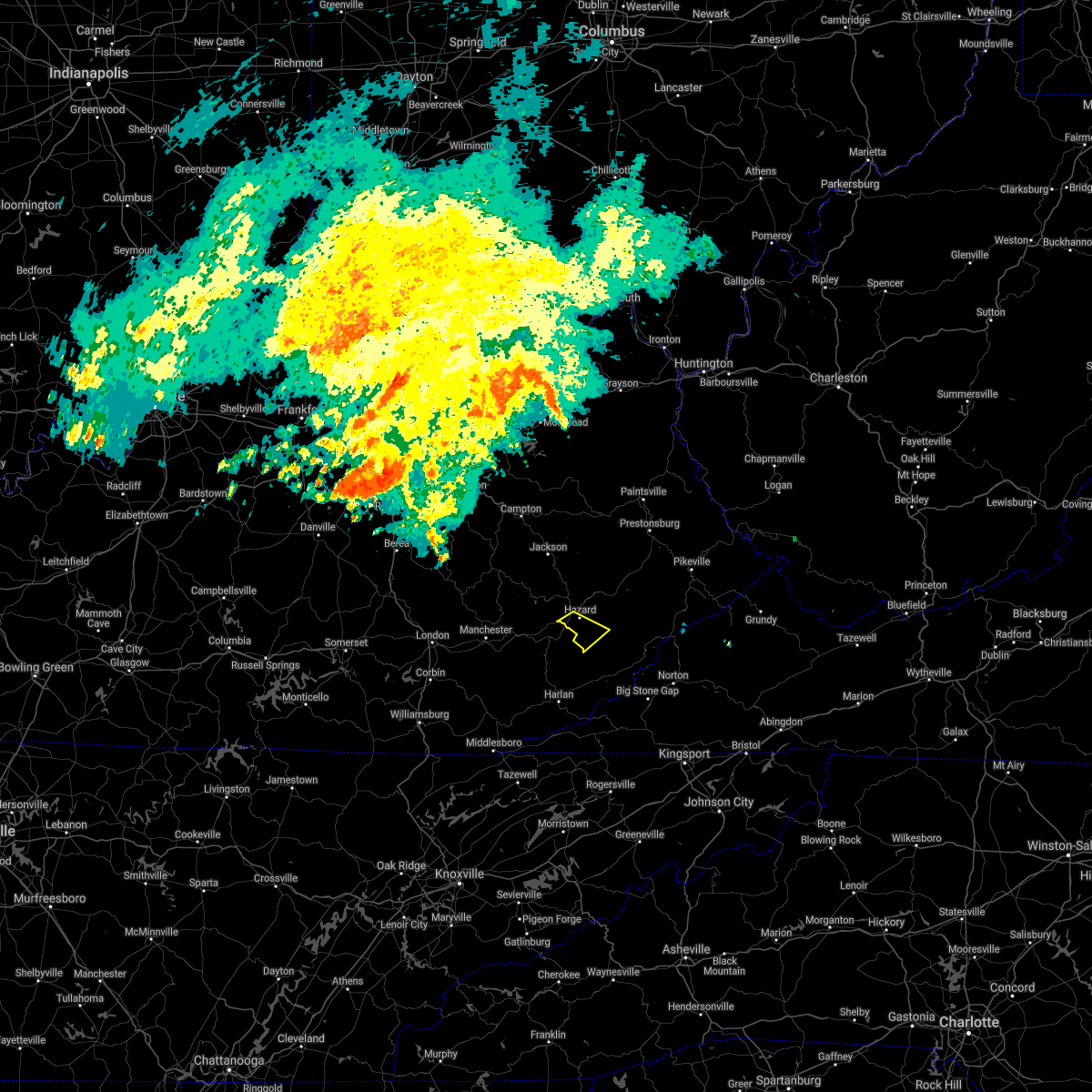 The severe thunderstorm warning for southeastern perry county will expire at 900 pm edt, the storm which prompted the warning has weakened below severe limits and exited the warned area. therefore the warning will be allowed to expire. a severe thunderstorm watch remains in effect until 100 am edt for southeastern kentucky. The severe thunderstorm warning for southeastern perry county will expire at 900 pm edt, the storm which prompted the warning has weakened below severe limits and exited the warned area. therefore the warning will be allowed to expire. a severe thunderstorm watch remains in effect until 100 am edt for southeastern kentucky.
|
| 6/23/2016 8:50 PM EDT |
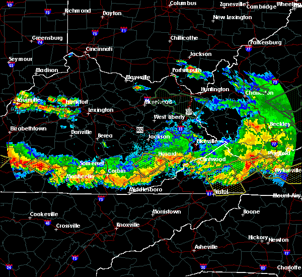 At 848 pm edt, a severe thunderstorm was located over jeff, or near (radar indicated). Hazards include moving east at 35 mph. Expect damage to roofs. siding. and trees. Locations impacted include,. At 848 pm edt, a severe thunderstorm was located over jeff, or near (radar indicated). Hazards include moving east at 35 mph. Expect damage to roofs. siding. and trees. Locations impacted include,.
|
| 6/23/2016 8:35 PM EDT |
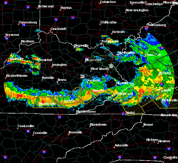 At 835 pm edt, a severe thunderstorm was located over smilax, or near hyden, moving southeast at 45 mph (radar indicated). Hazards include 60 mph wind gusts. Expect damage to roofs. siding. and trees. Locations impacted include,. At 835 pm edt, a severe thunderstorm was located over smilax, or near hyden, moving southeast at 45 mph (radar indicated). Hazards include 60 mph wind gusts. Expect damage to roofs. siding. and trees. Locations impacted include,.
|
| 6/23/2016 8:13 PM EDT |
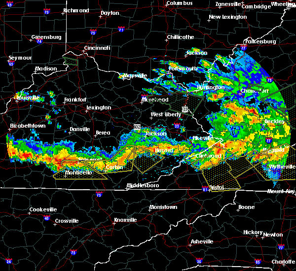 At 812 pm edt, a severe thunderstorm was located over brutus, or 12 miles northwest of hyden, moving southeast at 40 mph (radar indicated). Hazards include 60 mph wind gusts. Expect damage to roofs. siding. And trees. At 812 pm edt, a severe thunderstorm was located over brutus, or 12 miles northwest of hyden, moving southeast at 40 mph (radar indicated). Hazards include 60 mph wind gusts. Expect damage to roofs. siding. And trees.
|
| 6/23/2016 7:07 PM EDT |
 At 706 pm edt, a severe thunderstorm was located over elmrock, or 10 miles north of hindman, moving southeast at 55 mph (radar indicated). Hazards include 70 mph wind gusts. Expect considerable tree damage. Damage is likely to mobile homes, roofs, and outbuildings. At 706 pm edt, a severe thunderstorm was located over elmrock, or 10 miles north of hindman, moving southeast at 55 mph (radar indicated). Hazards include 70 mph wind gusts. Expect considerable tree damage. Damage is likely to mobile homes, roofs, and outbuildings.
|
| 6/22/2016 12:53 PM EDT |
 At 1253 pm edt, a severe thunderstorm was located over ritchie, or near hindman, moving southeast at 35 mph (radar indicated). Hazards include 60 mph wind gusts and penny size hail. Expect damage to roofs. siding. and trees. Locations impacted include,. At 1253 pm edt, a severe thunderstorm was located over ritchie, or near hindman, moving southeast at 35 mph (radar indicated). Hazards include 60 mph wind gusts and penny size hail. Expect damage to roofs. siding. and trees. Locations impacted include,.
|
| 6/22/2016 12:47 PM EDT | Tree down along ky 8 in perry county KY, 0.6 miles ESE of Hazard, KY |
| 6/22/2016 12:33 PM EDT |
 At 1232 pm edt, a severe thunderstorm was located over dice, or 8 miles northwest of hazard, moving southeast at 35 mph (radar indicated). Hazards include 60 mph wind gusts and quarter size hail. Hail damage to vehicles is expected. Expect wind damage to roofs, siding, and trees. At 1232 pm edt, a severe thunderstorm was located over dice, or 8 miles northwest of hazard, moving southeast at 35 mph (radar indicated). Hazards include 60 mph wind gusts and quarter size hail. Hail damage to vehicles is expected. Expect wind damage to roofs, siding, and trees.
|
| 5/2/2016 2:55 PM EDT | Quarter sized hail reported 11.9 miles S of Hazard, KY, via social media |
| 5/2/2016 2:30 PM EDT |
 At 229 pm edt, a severe thunderstorm was located over dalesburg, or 12 miles southeast of booneville, moving east at 40 mph (radar indicated). Hazards include golf ball size hail and 60 mph wind gusts. People and animals outdoors will be injured. expect hail damage to roofs, siding, windows, and vehicles. Expect wind damage to roofs, siding, and trees. At 229 pm edt, a severe thunderstorm was located over dalesburg, or 12 miles southeast of booneville, moving east at 40 mph (radar indicated). Hazards include golf ball size hail and 60 mph wind gusts. People and animals outdoors will be injured. expect hail damage to roofs, siding, windows, and vehicles. Expect wind damage to roofs, siding, and trees.
|
| 3/1/2016 4:02 PM EST |
 At 401 pm est, a severe thunderstorm was located over sizerock, or near hyden, moving east at 50 mph (law enforcement). Hazards include 60 mph wind gusts. Expect damage to roofs. siding. and trees. Locations impacted include,. At 401 pm est, a severe thunderstorm was located over sizerock, or near hyden, moving east at 50 mph (law enforcement). Hazards include 60 mph wind gusts. Expect damage to roofs. siding. and trees. Locations impacted include,.
|
| 3/1/2016 3:45 PM EST |
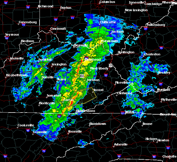 At 344 pm est, a severe thunderstorm was located over tanksley, or near manchester, moving east at 50 mph (law enforcement). Hazards include 60 mph wind gusts. Expect damage to roofs. siding. And trees. At 344 pm est, a severe thunderstorm was located over tanksley, or near manchester, moving east at 50 mph (law enforcement). Hazards include 60 mph wind gusts. Expect damage to roofs. siding. And trees.
|
| 7/14/2015 8:45 PM EDT |
 At 844 pm edt, severe thunderstorms were located along a line extending from elko to daley to enline, moving southeast at 35 mph (radar indicated). Hazards include 60 mph wind gusts and penny size hail. Expect damage to roofs. siding and trees. locations impacted include, harlan, hyden, cumberland, evarts, lynch, benham, daley, wendover, shields, mozelle, kenvir, hoskinston, ages, rex, blackjoe, rhea, panco, leonard, frew and enline. This includes hal rogers parkway between mile markers 32 and 51. At 844 pm edt, severe thunderstorms were located along a line extending from elko to daley to enline, moving southeast at 35 mph (radar indicated). Hazards include 60 mph wind gusts and penny size hail. Expect damage to roofs. siding and trees. locations impacted include, harlan, hyden, cumberland, evarts, lynch, benham, daley, wendover, shields, mozelle, kenvir, hoskinston, ages, rex, blackjoe, rhea, panco, leonard, frew and enline. This includes hal rogers parkway between mile markers 32 and 51.
|
| 7/14/2015 8:27 PM EDT |
 At 827 pm edt, severe thunderstorms were located along a line extending from near davenport to near wise to indian bottom to toulouse, moving southeast at 30 mph (radar indicated). Hazards include 60 mph wind gusts and penny size hail. Expect damage to roofs. siding and trees. Locations impacted include,. At 827 pm edt, severe thunderstorms were located along a line extending from near davenport to near wise to indian bottom to toulouse, moving southeast at 30 mph (radar indicated). Hazards include 60 mph wind gusts and penny size hail. Expect damage to roofs. siding and trees. Locations impacted include,.
|
| 7/14/2015 8:24 PM EDT |
 At 824 pm edt, severe thunderstorms were located along a line extending from diablock to kaliopi to thomas, moving southeast at 35 mph (radar indicated). Hazards include 60 mph wind gusts. Expect damage to roofs. Siding and trees. At 824 pm edt, severe thunderstorms were located along a line extending from diablock to kaliopi to thomas, moving southeast at 35 mph (radar indicated). Hazards include 60 mph wind gusts. Expect damage to roofs. Siding and trees.
|
| 7/14/2015 8:00 PM EDT | A tree was blown dow in perry county KY, 0.6 miles ESE of Hazard, KY |
| 7/14/2015 7:55 PM EDT | A tree was blown dow in perry county KY, 3.7 miles SSW of Hazard, KY |
| 7/14/2015 7:53 PM EDT |
 At 753 pm edt, severe thunderstorms were located along a line extending from near breaks interstate to speight to talcum to turkey, moving southeast at 35 mph (radar indicated). Hazards include 60 mph wind gusts and nickel size hail. Expect damage to roofs. Siding and trees. At 753 pm edt, severe thunderstorms were located along a line extending from near breaks interstate to speight to talcum to turkey, moving southeast at 35 mph (radar indicated). Hazards include 60 mph wind gusts and nickel size hail. Expect damage to roofs. Siding and trees.
|
| 7/14/2015 7:40 PM EDT |
 At 740 pm edt, severe thunderstorms were located along a line extending from tiptop to decoy to hardshell to pence, moving southeast at 45 mph (radar indicated). Hazards include half dollar size hail and 60 mph wind gusts. Hail damage to vehicles is expected. expect wind damage to roofs, siding and trees. Locations impacted include,. At 740 pm edt, severe thunderstorms were located along a line extending from tiptop to decoy to hardshell to pence, moving southeast at 45 mph (radar indicated). Hazards include half dollar size hail and 60 mph wind gusts. Hail damage to vehicles is expected. expect wind damage to roofs, siding and trees. Locations impacted include,.
|
| 7/14/2015 7:08 PM EDT |
 At 708 pm edt, severe thunderstorms were located along a line extending from mize to trent to high falls to near cat creek, moving southeast at 45 mph (radar indicated). Hazards include half dollar size hail and 60 mph wind gusts. Hail damage to vehicles is expected. Expect wind damage to roofs, siding and trees. At 708 pm edt, severe thunderstorms were located along a line extending from mize to trent to high falls to near cat creek, moving southeast at 45 mph (radar indicated). Hazards include half dollar size hail and 60 mph wind gusts. Hail damage to vehicles is expected. Expect wind damage to roofs, siding and trees.
|
| 7/13/2015 5:23 PM EDT |
 A severe thunderstorm warning remains in effect until 600 pm edt for letcher. eastern laurel. southeastern perry. southern clay. southern knott. southeastern floyd. northeastern knox. harlan. southwestern pike. leslie and eastern bell counties. at 521 pm edt. Severe thunderstorms were located along a line extending from near shelbiana to amburgey to jeff to near causey to. A severe thunderstorm warning remains in effect until 600 pm edt for letcher. eastern laurel. southeastern perry. southern clay. southern knott. southeastern floyd. northeastern knox. harlan. southwestern pike. leslie and eastern bell counties. at 521 pm edt. Severe thunderstorms were located along a line extending from near shelbiana to amburgey to jeff to near causey to.
|
| 7/13/2015 4:55 PM EDT |
 At 455 pm edt, severe thunderstorms were located along a line extending from near galveston to amburgey to diablock to near causey to cottongin, moving southeast at 45 mph (radar indicated). Hazards include 60 mph wind gusts and penny size hail. Expect damage to roofs. Siding and trees. At 455 pm edt, severe thunderstorms were located along a line extending from near galveston to amburgey to diablock to near causey to cottongin, moving southeast at 45 mph (radar indicated). Hazards include 60 mph wind gusts and penny size hail. Expect damage to roofs. Siding and trees.
|
| 7/13/2015 4:54 PM EDT | Downed trees in perry county KY, 0.6 miles ESE of Hazard, KY |
| 7/13/2015 4:49 PM EDT | Trees were reported to have been blown dow in perry county KY, 2.3 miles SE of Hazard, KY |
| 7/13/2015 4:47 PM EDT |
 At 446 pm edt, severe thunderstorms were located along a line extending from hueysville to mousie to talcum to kaliopi to high knob, moving southeast at 40 mph (radar indicated). Hazards include 60 mph wind gusts and penny size hail. Expect damage to roofs. siding and trees. Locations impacted include,. At 446 pm edt, severe thunderstorms were located along a line extending from hueysville to mousie to talcum to kaliopi to high knob, moving southeast at 40 mph (radar indicated). Hazards include 60 mph wind gusts and penny size hail. Expect damage to roofs. siding and trees. Locations impacted include,.
|
| 7/13/2015 4:45 PM EDT | Tree and large limbs blocking both lanes. power lines dow in perry county KY, 5.4 miles ENE of Hazard, KY |
| 7/13/2015 4:45 PM EDT | Large tree limbs and a tree were blown dow in perry county KY, 7.1 miles SSW of Hazard, KY |
| 7/13/2015 4:24 PM EDT |
 At 424 pm edt, severe thunderstorms were located along a line extending from ivyton to evanston to wilstacy to lucky fork to atkinstown, moving southeast at 40 mph (radar indicated). Hazards include half dollar size hail and 60 mph wind gusts. Hail damage to vehicles is expected. Expect wind damage to roofs, siding and trees. At 424 pm edt, severe thunderstorms were located along a line extending from ivyton to evanston to wilstacy to lucky fork to atkinstown, moving southeast at 40 mph (radar indicated). Hazards include half dollar size hail and 60 mph wind gusts. Hail damage to vehicles is expected. Expect wind damage to roofs, siding and trees.
|
| 7/13/2015 4:01 PM EDT |
 At 400 pm edt, severe thunderstorms were located along a line extending from hendricks to fillmore to near shirley, moving southeast at 60 mph (radar indicated). Hazards include quarter size hail and 70 mph wind gusts. Hail damage to vehicles is expected. Expect wind damage to roofs, siding and trees. At 400 pm edt, severe thunderstorms were located along a line extending from hendricks to fillmore to near shirley, moving southeast at 60 mph (radar indicated). Hazards include quarter size hail and 70 mph wind gusts. Hail damage to vehicles is expected. Expect wind damage to roofs, siding and trees.
|
| 6/25/2015 6:47 PM EDT |
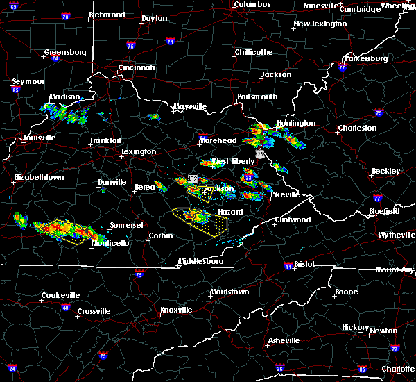 At 647 pm edt, a severe thunderstorm was located over sizerock, or 8 miles northwest of hyden, moving southeast at 30 mph (radar indicated). Hazards include ping pong size hail and 60 mph wind gusts. People and animals outdoors will be injured. expect hail damage to roofs, siding, windows and vehicles. Expect wind damage to roofs, siding and trees. At 647 pm edt, a severe thunderstorm was located over sizerock, or 8 miles northwest of hyden, moving southeast at 30 mph (radar indicated). Hazards include ping pong size hail and 60 mph wind gusts. People and animals outdoors will be injured. expect hail damage to roofs, siding, windows and vehicles. Expect wind damage to roofs, siding and trees.
|
| 6/21/2015 6:09 PM EDT |
 The severe thunderstorm warning for west central letcher, southeastern perry, southwestern knott and east central leslie counties will expire at 615 pm edt, the storm which prompted the warning has weakened below severe limits, and no longer pose an immediate threat to life or property. therefore the warning will be allowed to expire. however gusty winds are still possible with this thunderstorm. a severe thunderstorm watch remains in effect until 800 pm edt for southeastern kentucky. The severe thunderstorm warning for west central letcher, southeastern perry, southwestern knott and east central leslie counties will expire at 615 pm edt, the storm which prompted the warning has weakened below severe limits, and no longer pose an immediate threat to life or property. therefore the warning will be allowed to expire. however gusty winds are still possible with this thunderstorm. a severe thunderstorm watch remains in effect until 800 pm edt for southeastern kentucky.
|
| 6/21/2015 6:01 PM EDT |
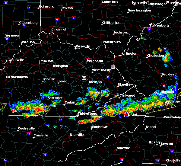 At 600 pm edt, a severe thunderstorm was located over arminta, or 10 miles southeast of hazard, moving southeast at 35 mph (radar indicated). Hazards include 60 mph wind gusts. Expect damage to roofs. siding and trees. Locations impacted include,. At 600 pm edt, a severe thunderstorm was located over arminta, or 10 miles southeast of hazard, moving southeast at 35 mph (radar indicated). Hazards include 60 mph wind gusts. Expect damage to roofs. siding and trees. Locations impacted include,.
|
| 6/21/2015 5:50 PM EDT |
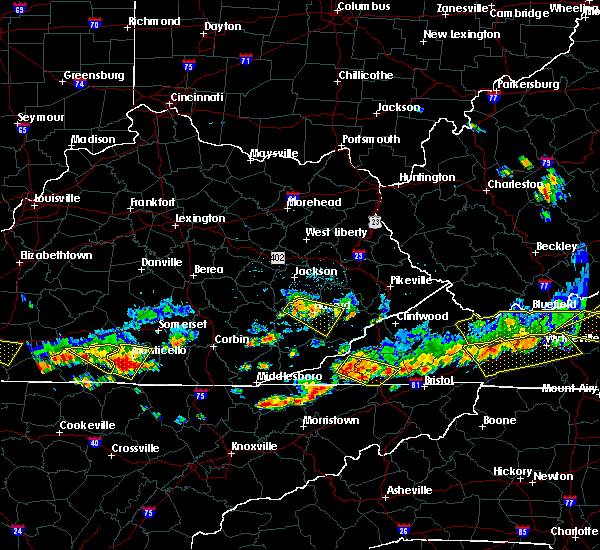 At 549 pm edt, a severe thunderstorm was located over avawam, or near hazard, moving southeast at 25 mph (radar indicated). Hazards include 60 mph wind gusts. Expect damage to roofs. siding and trees. Locations impacted include,. At 549 pm edt, a severe thunderstorm was located over avawam, or near hazard, moving southeast at 25 mph (radar indicated). Hazards include 60 mph wind gusts. Expect damage to roofs. siding and trees. Locations impacted include,.
|
| 6/21/2015 5:31 PM EDT |
 At 530 pm edt, a severe thunderstorm was located over buckhorn lake s.p, .or 11 miles north of hyden, moving southeast at 35 mph (radar indicated). Hazards include quarter size hail and 70 mph wind gusts. Hail damage to vehicles is expected. expect considerable tree damage. Wind damage is also likely to mobile homes, roofs and outbuildings. At 530 pm edt, a severe thunderstorm was located over buckhorn lake s.p, .or 11 miles north of hyden, moving southeast at 35 mph (radar indicated). Hazards include quarter size hail and 70 mph wind gusts. Hail damage to vehicles is expected. expect considerable tree damage. Wind damage is also likely to mobile homes, roofs and outbuildings.
|
| 6/21/2015 5:26 PM EDT |
 The severe thunderstorm warning for northern perry, west central knott and southwestern breathitt counties will expire at 530 pm edt, the severe thunderstorm which prompted the warning has weakened. however, another severe thunderstorm is moving into perry county from owsley county. a severe thunderstorm watch remains in effect until 800 pm edt for southeastern kentucky. remember, a severe thunderstorm warning still remains in effect for northwestern perry county names until time 545 pm edt. The severe thunderstorm warning for northern perry, west central knott and southwestern breathitt counties will expire at 530 pm edt, the severe thunderstorm which prompted the warning has weakened. however, another severe thunderstorm is moving into perry county from owsley county. a severe thunderstorm watch remains in effect until 800 pm edt for southeastern kentucky. remember, a severe thunderstorm warning still remains in effect for northwestern perry county names until time 545 pm edt.
|
| 6/21/2015 4:51 PM EDT |
 At 450 pm edt, a severe thunderstorm was located over beech, or 11 miles south of jackson, moving east at 25 mph (radar indicated). Hazards include quarter size hail and 60 mph wind gusts. Hail damage to vehicles is expected. Expect wind damage to roofs, siding and trees. At 450 pm edt, a severe thunderstorm was located over beech, or 11 miles south of jackson, moving east at 25 mph (radar indicated). Hazards include quarter size hail and 60 mph wind gusts. Hail damage to vehicles is expected. Expect wind damage to roofs, siding and trees.
|
| 6/21/2015 4:02 PM EDT |
 At 401 pm edt, severe thunderstorms were located along a line extending from premium to mills, moving southeast at 35 mph (radar indicated). Hazards include quarter size hail and 60 mph wind gusts. Hail damage to vehicles is expected. Expect wind damage to roofs, siding and trees. At 401 pm edt, severe thunderstorms were located along a line extending from premium to mills, moving southeast at 35 mph (radar indicated). Hazards include quarter size hail and 60 mph wind gusts. Hail damage to vehicles is expected. Expect wind damage to roofs, siding and trees.
|
| 4/25/2015 10:44 PM EDT | At 1043 pm edt, a severe thunderstorm was located over diablock, or near hazard, moving southeast at 40 mph (radar indicated). Hazards include quarter size hail and 60 mph wind gusts. Hail damage to vehicles is expected. Expect wind damage to roofs, siding and trees. |
| 4/25/2015 10:18 PM EDT | At 1017 pm edt, a severe thunderstorm was located over gays creek, or 10 miles north of hyden, moving east at 35 mph (radar indicated). Hazards include quarter size hail and 60 mph wind gusts. Hail damage to vehicles is expected. expect wind damage to roofs, siding and trees. Locations impacted include,. |
| 4/25/2015 9:45 PM EDT | Half Dollar sized hail reported 6.1 miles E of Hazard, KY |
| 4/25/2015 9:36 PM EDT | At 935 pm edt, a severe thunderstorm was located over valjean, or 12 miles southeast of booneville, moving east at 50 mph (radar indicated). Hazards include half dollar size hail and 60 mph wind gusts. Hail damage to vehicles is expected. Expect wind damage to roofs, siding and trees. |
| 4/25/2015 7:50 PM EDT | At 748 pm edt, a severe thunderstorm was located over wooton, or over hyden, moving east at 30 mph (radar indicated. at 7:45 pm...quarter sized hail was reported in hyden). Hazards include quarter size hail and 60 mph wind gusts. Hail damage to vehicles is expected. expect wind damage to roofs, siding and trees. Locations impacted include,. |
| 4/25/2015 7:36 PM EDT | At 735 pm edt, a severe thunderstorm was located over hosea, or near hyden, moving east at 35 mph (radar indicated). Hazards include quarter size hail and 60 mph wind gusts. Hail damage to vehicles is expected. Expect wind damage to roofs, siding and trees. |
| 4/10/2015 7:11 AM EDT | A severe thunderstorm warning remains in effect until 730 am edt for southeastern owsley. perry. southwestern breathitt and central leslie counties. at 710 am edt. a severe thunderstorm was located over krypton. or 8 miles west of hazard. moving northeast at 60 mph. hazard. 60 mph wind gusts. |
| 4/10/2015 6:57 AM EDT | A severe thunderstorm warning remains in effect until 730 am edt for southeastern owsley. perry. eastern clay. southwestern breathitt. northeastern knox and leslie counties. at 657 am edt. a severe thunderstorm was located over bear branch. or 9 miles west of hyden. moving east at 50 mph. hazard. 60 mph wind gusts. |
| 4/10/2015 6:45 AM EDT | The national weather service in jackson ky has issued a * severe thunderstorm warning for. southeastern laurel county in south central kentucky. southeastern owsley county in southeastern kentucky. perry county in southeastern kentucky. Clay county in southeastern kentucky. |
| 10/7/2014 5:45 PM EDT | A large tree limb was blown down onto a vehicle in downtown hazard. the time of the event is estimated from rada in perry county KY, 0.6 miles ESE of Hazard, KY |
| 8/20/2014 6:42 PM EDT | A couple of trees were reported to have been blown dow in perry county KY, 5.3 miles ESE of Hazard, KY |
| 7/14/2014 3:07 PM EDT | Tree down on coal ave in walkertow in perry county KY, 2.3 miles SSE of Hazard, KY |
| 7/14/2014 3:07 PM EDT | Tree down on browns fork r in perry county KY, 2.7 miles W of Hazard, KY |
| 7/14/2014 3:07 PM EDT | Tree down at lotts cree in perry county KY, 4.3 miles S of Hazard, KY |
| 5/21/2014 10:45 PM EDT | One tree was reported to have been blown down on a house near the old hazard high schoo in perry county KY, 0.6 miles ESE of Hazard, KY |
| 5/13/2014 6:37 PM EDT | Dispatch reported trees down in boone ledge. time estimated from rada in perry county KY, 9.1 miles S of Hazard, KY |
| 5/13/2014 6:28 PM EDT | Dispatch reports trees and power lines down just north of hazard in bonnyma in perry county KY, 1.6 miles SSE of Hazard, KY |
| 5/13/2014 6:28 PM EDT | Dispatch reports trees and power lines down just north of hazard in bonnyma in perry county KY, 5.7 miles S of Hazard, KY |
| 5/21/2013 6:18 PM EDT | Hwy 476 blocked by large tre in perry county KY, 9.3 miles SSW of Hazard, KY |
| 5/21/2013 6:15 PM EDT | Roof damage to homes near the airpor in perry county KY, 9.7 miles SSE of Hazard, KY |
| 5/21/2013 6:15 PM EDT | A three foot diameter beech tree was twisted and its top ripped off. the top was deposited 180 yards away. this happened near the intersection of hwy 15 and 8 in perry county KY, 2.3 miles SE of Hazard, KY |
| 8/1/2012 6:36 PM EDT | Quarter sized hail reported 0.6 miles ESE of Hazard, KY, hail lasted for about a half hour near cardinal chevrolet. |
| 7/19/2012 4:28 PM EDT | Trees down at chimney rock. time estimated from rada in perry county KY, 1.1 miles E of Hazard, KY |
| 7/19/2012 4:28 PM EDT | Trees down on lick branch at combs. time estimated from rada in perry county KY, 1.1 miles E of Hazard, KY |
| 7/19/2012 4:28 PM EDT | Trees down on briar fork at willard. time estimated from rada in perry county KY, 4.4 miles E of Hazard, KY |
| 7/19/2012 4:23 PM EDT | Trees down on laurel fork of lost creek. time estimated from radar in perry county KY, 5.7 miles S of Hazard, KY |
| 7/5/2012 3:13 PM EDT | Power lines down on couchtown roa in perry county KY, 5.3 miles SE of Hazard, KY |
| 7/5/2012 3:09 PM EDT | Tree fell on a house in the combs area in perry county KY, 1.6 miles SSE of Hazard, KY |
| 3/15/2012 4:15 PM EDT | Golf Ball sized hail reported 8.5 miles NNE of Hazard, KY, golf ball hail destroyed pickup. |
| 3/15/2012 3:25 PM EDT | Quarter sized hail reported 9.7 miles SE of Hazard, KY |
| 1/1/0001 12:00 AM | Trees down county wide including hwy 80 between mile markers 0 and in perry county KY, 6.1 miles E of Hazard, KY |
| 1/1/0001 12:00 AM | A tree was blown down near kentucky highway 15. time of event is estimated from rada in perry county KY, 10.7 miles SSE of Hazard, KY |
| 1/1/0001 12:00 AM | Tree blown down along highway 451 west of hazard. time of event is estimated from rada in perry county KY, 2.2 miles E of Hazard, KY |
| 1/1/0001 12:00 AM | Trees down on second for in leslie county KY, 6.5 miles NE of Hazard, KY |
| 1/1/0001 12:00 AM | One tree down on brown creek road near 451 and hal rogers parkway at mile marker 5 in perry county KY, 3.3 miles E of Hazard, KY |
| 1/1/0001 12:00 AM | Estimated 58 mph wind gust in ne in perry county KY, 11.2 miles SSE of Hazard, KY |
Hail Maps for Hazard, KY


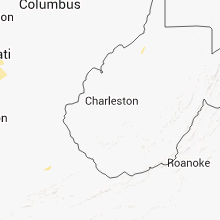


Connect with Interactive Hail Maps