

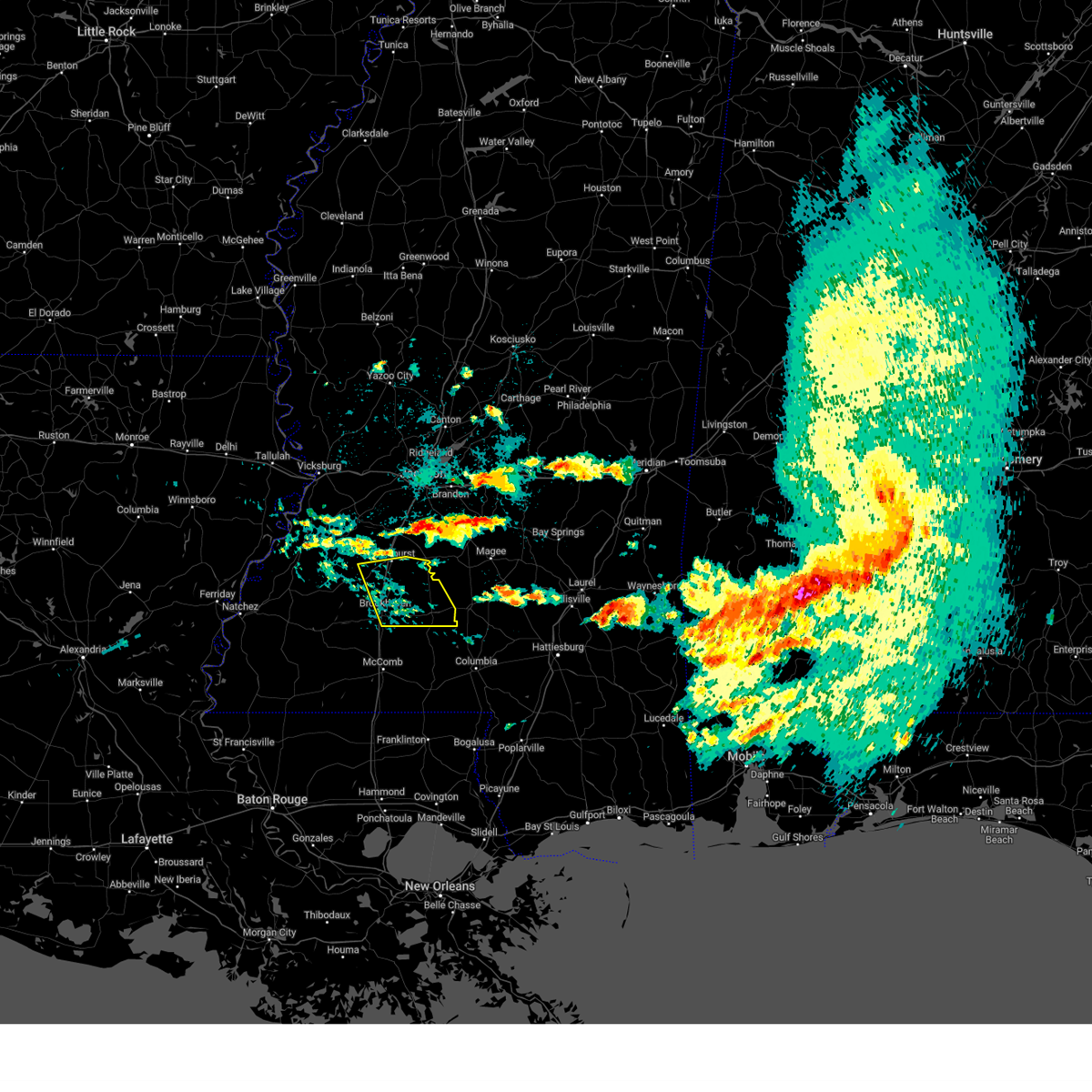
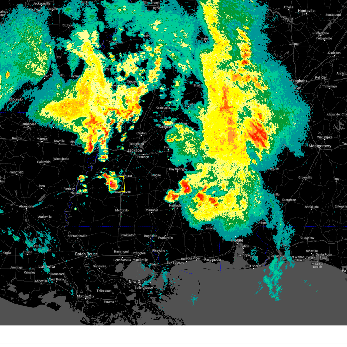
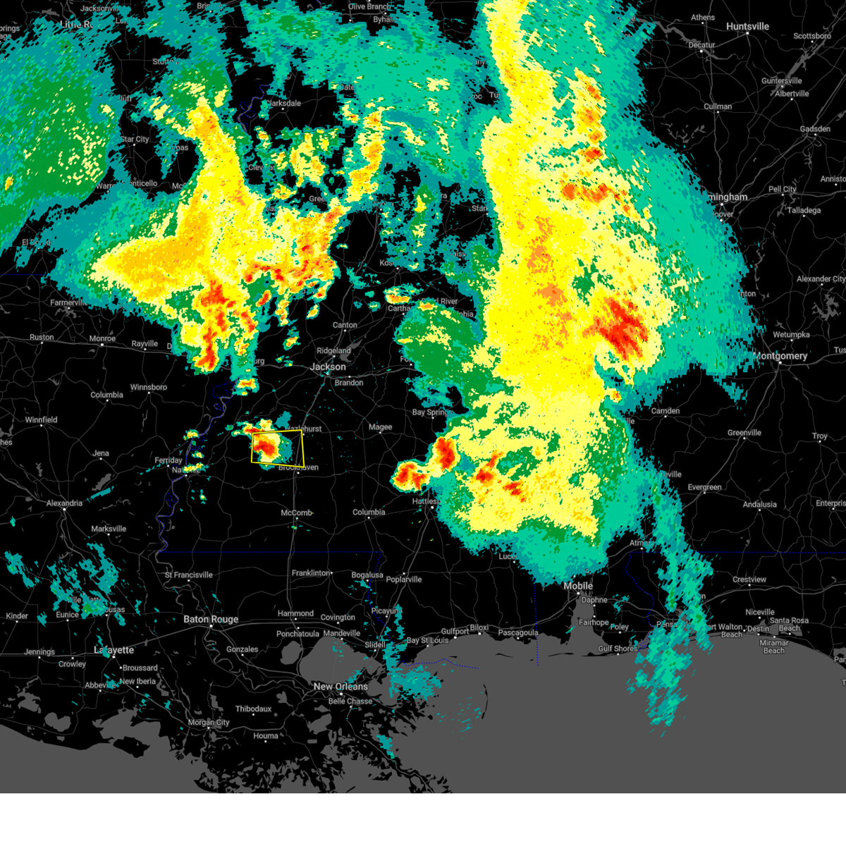
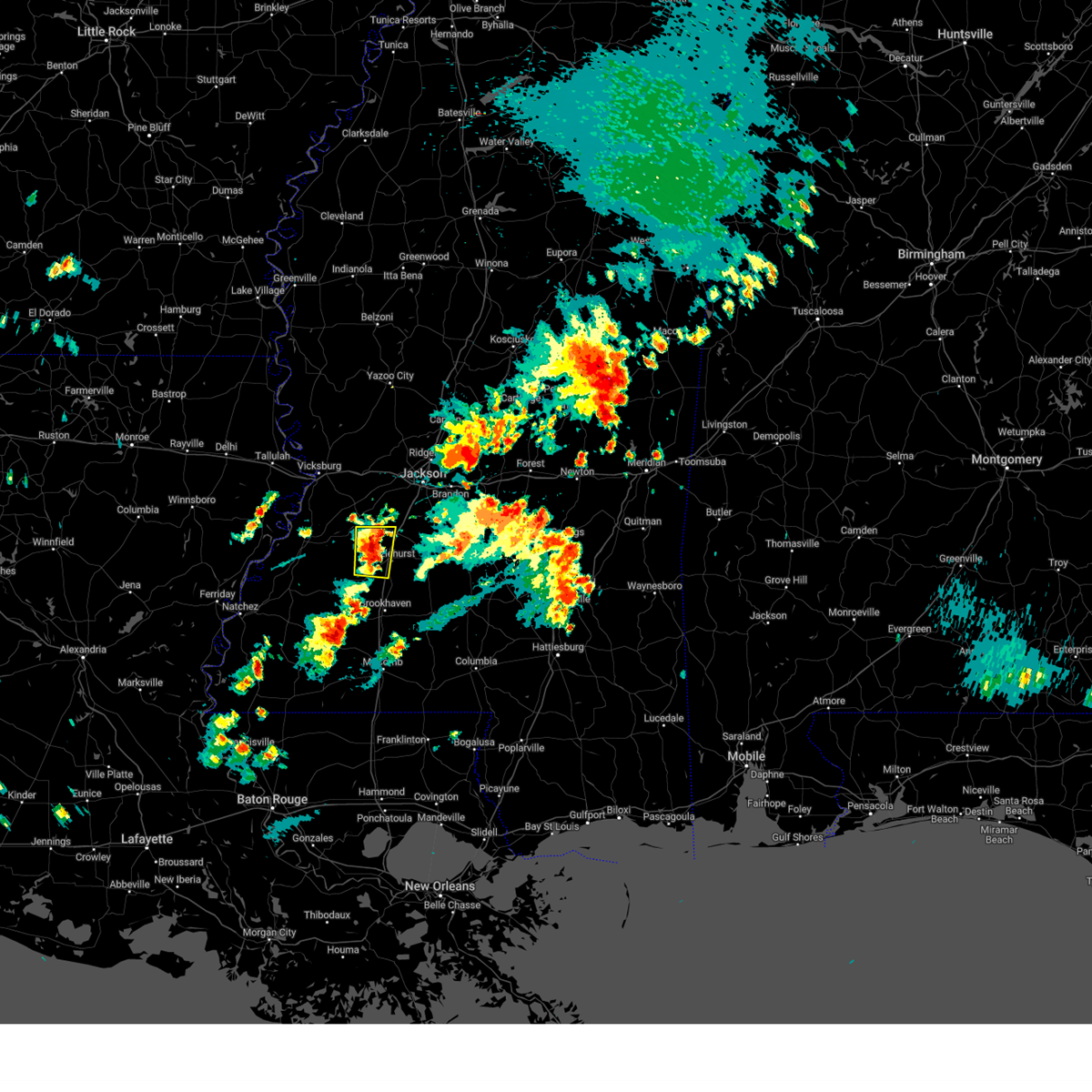
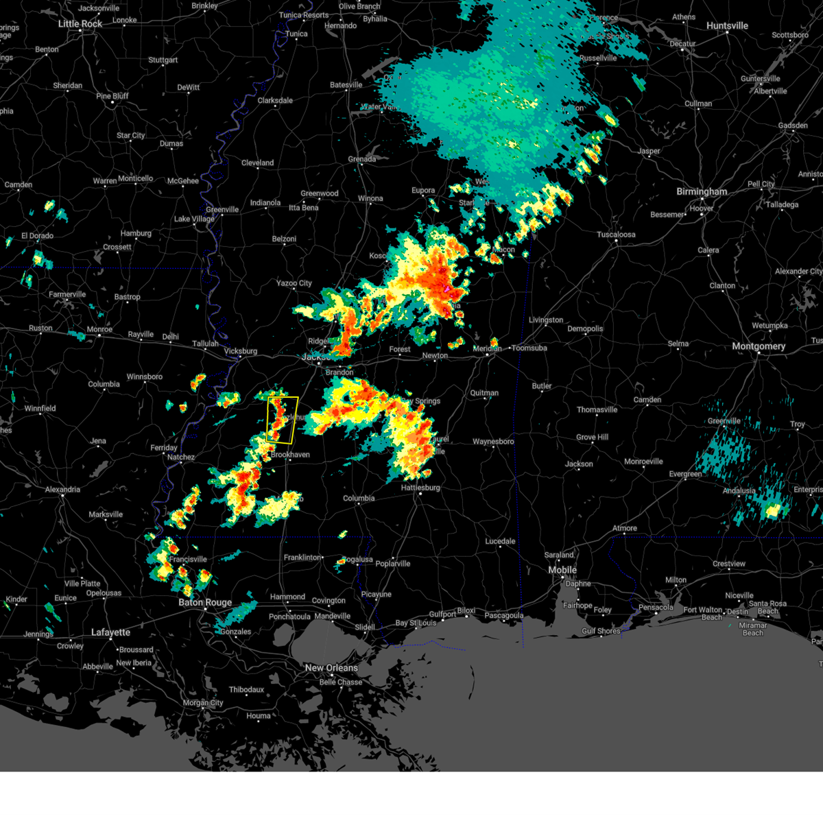
Hail Map for Hazlehurst, MS
The Hazlehurst, MS area has had 13 reports of on-the-ground hail by trained spotters, and has been under severe weather warnings 64 times during the past 12 months. Doppler radar has detected hail at or near Hazlehurst, MS on 41 occasions, including 8 occasions during the past year.
| Name: | Hazlehurst, MS |
| Where Located: | 32.4 miles SSW of Jackson, MS |
| Map: | Google Map for Hazlehurst, MS |
| Population: | 4009 |
| Housing Units: | 1549 |
| More Info: | Search Google for Hazlehurst, MS |
5
The Top Recent Hail Date for Hazlehurst, MS is Tuesday, April 2, 2024 (4th out of 41)

Hail and Wind Damage Spotted near Hazlehurst, MS
| Date / Time | Report Details |
|---|---|
| 4/2/2024 3:58 PM CDT |
 At 358 pm cdt, a severe thunderstorm was located near hazlehurst, moving northeast at 70 mph (radar indicated). Hazards include golf ball size hail and 60 mph wind gusts. People and animals outdoors will be injured. expect hail damage to roofs, siding, windows, and vehicles. expect wind damage to roofs, siding, and trees. This severe storm will be near, georgetown and hopewell around 405 pm cdt. At 358 pm cdt, a severe thunderstorm was located near hazlehurst, moving northeast at 70 mph (radar indicated). Hazards include golf ball size hail and 60 mph wind gusts. People and animals outdoors will be injured. expect hail damage to roofs, siding, windows, and vehicles. expect wind damage to roofs, siding, and trees. This severe storm will be near, georgetown and hopewell around 405 pm cdt.
|
| 4/2/2024 3:54 PM CDT | Quarter sized hail reported 4.1 miles NNE of Hazlehurst, MS, penny to quarter hail... lasted for 4 min with little to no rain. |
| 4/2/2024 3:54 PM CDT | Ping Pong Ball sized hail reported 4.5 miles N of Hazlehurst, MS |
| 4/2/2024 3:51 PM CDT |
 At 351 pm cdt, a severe thunderstorm was located over glancy, or near hazlehurst, moving northeast at 75 mph (radar indicated). Hazards include 60 mph wind gusts and half dollar size hail. Hail damage to vehicles is expected. expect wind damage to roofs, siding, and trees. this severe storm will be near, crystal springs, hazlehurst, martinsville, and gallman around 355 pm cdt. Georgetown and hopewell around 400 pm cdt. At 351 pm cdt, a severe thunderstorm was located over glancy, or near hazlehurst, moving northeast at 75 mph (radar indicated). Hazards include 60 mph wind gusts and half dollar size hail. Hail damage to vehicles is expected. expect wind damage to roofs, siding, and trees. this severe storm will be near, crystal springs, hazlehurst, martinsville, and gallman around 355 pm cdt. Georgetown and hopewell around 400 pm cdt.
|
| 4/2/2024 3:44 PM CDT |
 At 344 pm cdt, a severe thunderstorm was located near allen, or 14 miles southwest of hazlehurst, moving northeast at 75 mph (radar indicated). Hazards include 60 mph wind gusts and half dollar size hail. Hail damage to vehicles is expected. expect wind damage to roofs, siding, and trees. this severe storm will be near, hazlehurst, glancy, martinsville, and gallman around 350 pm cdt. crystal springs around 355 pm cdt. Georgetown and hopewell around 400 pm cdt. At 344 pm cdt, a severe thunderstorm was located near allen, or 14 miles southwest of hazlehurst, moving northeast at 75 mph (radar indicated). Hazards include 60 mph wind gusts and half dollar size hail. Hail damage to vehicles is expected. expect wind damage to roofs, siding, and trees. this severe storm will be near, hazlehurst, glancy, martinsville, and gallman around 350 pm cdt. crystal springs around 355 pm cdt. Georgetown and hopewell around 400 pm cdt.
|
| 4/2/2024 3:44 PM CDT |
 the severe thunderstorm warning has been cancelled and is no longer in effect the severe thunderstorm warning has been cancelled and is no longer in effect
|
| 4/2/2024 3:40 PM CDT | Quarter sized hail reported 22.2 miles ENE of Hazlehurst, MS |
| 4/2/2024 3:39 PM CDT |
 Svrjan the national weather service in jackson has issued a * severe thunderstorm warning for, northwestern lincoln county in south central mississippi, central copiah county in central mississippi, * until 445 pm cdt. * at 339 pm cdt, a severe thunderstorm was located over allen, or 18 miles northwest of brookhaven, moving northeast at 80 mph (radar indicated). Hazards include 60 mph wind gusts and half dollar size hail. Hail damage to vehicles is expected. expect wind damage to roofs, siding, and trees. this severe thunderstorm will be near, hazlehurst, glancy, martinsville, and barlow around 345 pm cdt. crystal springs and gallman around 350 pm cdt. hopewell around 355 pm cdt. Georgetown around 400 pm cdt. Svrjan the national weather service in jackson has issued a * severe thunderstorm warning for, northwestern lincoln county in south central mississippi, central copiah county in central mississippi, * until 445 pm cdt. * at 339 pm cdt, a severe thunderstorm was located over allen, or 18 miles northwest of brookhaven, moving northeast at 80 mph (radar indicated). Hazards include 60 mph wind gusts and half dollar size hail. Hail damage to vehicles is expected. expect wind damage to roofs, siding, and trees. this severe thunderstorm will be near, hazlehurst, glancy, martinsville, and barlow around 345 pm cdt. crystal springs and gallman around 350 pm cdt. hopewell around 355 pm cdt. Georgetown around 400 pm cdt.
|
| 3/25/2024 10:35 PM CDT |
 The storm which prompted the warning has weakened below severe limits, and no longer poses an immediate threat to life or property. therefore, the warning will be allowed to expire. however, gusty winds are still possible with this thunderstorm. a tornado watch remains in effect until 200 am cdt for central and south central mississippi. The storm which prompted the warning has weakened below severe limits, and no longer poses an immediate threat to life or property. therefore, the warning will be allowed to expire. however, gusty winds are still possible with this thunderstorm. a tornado watch remains in effect until 200 am cdt for central and south central mississippi.
|
| 3/25/2024 10:24 PM CDT |
 the severe thunderstorm warning has been cancelled and is no longer in effect the severe thunderstorm warning has been cancelled and is no longer in effect
|
| 3/25/2024 10:24 PM CDT |
 At 1023 pm cdt, a severe thunderstorm was located over martinsville, or near hazlehurst, moving northeast at 55 mph (radar indicated). Hazards include 60 mph wind gusts. Expect damage to roofs, siding, and trees. this severe storm will be near, hazlehurst and gallman around 1030 pm cdt. georgetown and hopewell around 1035 pm cdt. Rockport around 1040 pm cdt. At 1023 pm cdt, a severe thunderstorm was located over martinsville, or near hazlehurst, moving northeast at 55 mph (radar indicated). Hazards include 60 mph wind gusts. Expect damage to roofs, siding, and trees. this severe storm will be near, hazlehurst and gallman around 1030 pm cdt. georgetown and hopewell around 1035 pm cdt. Rockport around 1040 pm cdt.
|
| 3/25/2024 10:15 PM CDT |
 At 1014 pm cdt, a severe thunderstorm was located over glancy, or 7 miles southwest of hazlehurst, moving northeast at 60 mph (radar indicated). Hazards include 60 mph wind gusts. Expect damage to roofs, siding, and trees. this severe storm will be near, crystal springs, hazlehurst, beauregard, martinsville, and gallman around 1020 pm cdt. hopewell around 1025 pm cdt. Georgetown around 1030 pm cdt. At 1014 pm cdt, a severe thunderstorm was located over glancy, or 7 miles southwest of hazlehurst, moving northeast at 60 mph (radar indicated). Hazards include 60 mph wind gusts. Expect damage to roofs, siding, and trees. this severe storm will be near, crystal springs, hazlehurst, beauregard, martinsville, and gallman around 1020 pm cdt. hopewell around 1025 pm cdt. Georgetown around 1030 pm cdt.
|
| 3/25/2024 10:15 PM CDT |
 the severe thunderstorm warning has been cancelled and is no longer in effect the severe thunderstorm warning has been cancelled and is no longer in effect
|
| 3/25/2024 10:08 PM CDT |
 At 1007 pm cdt, a severe thunderstorm was located near allen, or 13 miles northwest of brookhaven, moving northeast at 60 mph (radar indicated). Hazards include 60 mph wind gusts. Expect damage to roofs, siding, and trees. this severe storm will be near, hazlehurst, wesson, beauregard, glancy, and martinsville around 1015 pm cdt. gallman around 1020 pm cdt. crystal springs around 1025 pm cdt. Georgetown and hopewell around 1030 pm cdt. At 1007 pm cdt, a severe thunderstorm was located near allen, or 13 miles northwest of brookhaven, moving northeast at 60 mph (radar indicated). Hazards include 60 mph wind gusts. Expect damage to roofs, siding, and trees. this severe storm will be near, hazlehurst, wesson, beauregard, glancy, and martinsville around 1015 pm cdt. gallman around 1020 pm cdt. crystal springs around 1025 pm cdt. Georgetown and hopewell around 1030 pm cdt.
|
| 3/25/2024 10:08 PM CDT |
 the severe thunderstorm warning has been cancelled and is no longer in effect the severe thunderstorm warning has been cancelled and is no longer in effect
|
| 3/25/2024 10:08 PM CDT |
 At 1008 pm cdt, a severe thunderstorm was located near allen, or 13 miles northwest of brookhaven, moving northeast at 60 mph (radar indicated). Hazards include 60 mph wind gusts. Expect damage to roofs, siding, and trees. this severe storm will be near, hazlehurst, wesson, beauregard, glancy, and martinsville around 1015 pm cdt. crystal springs and gallman around 1020 pm cdt. Georgetown and hopewell around 1030 pm cdt. At 1008 pm cdt, a severe thunderstorm was located near allen, or 13 miles northwest of brookhaven, moving northeast at 60 mph (radar indicated). Hazards include 60 mph wind gusts. Expect damage to roofs, siding, and trees. this severe storm will be near, hazlehurst, wesson, beauregard, glancy, and martinsville around 1015 pm cdt. crystal springs and gallman around 1020 pm cdt. Georgetown and hopewell around 1030 pm cdt.
|
| 3/25/2024 9:50 PM CDT |
 Svrjan the national weather service in jackson has issued a * severe thunderstorm warning for, northern lincoln county in south central mississippi, southeastern jefferson county in southwestern mississippi, northeastern franklin county in southwestern mississippi, copiah county in central mississippi, * until 1045 pm cdt. * at 950 pm cdt, a severe thunderstorm was located over new hope, or 8 miles north of meadville, moving northeast at 60 mph (radar indicated). Hazards include 60 mph wind gusts. Expect damage to roofs, siding, and trees. this severe thunderstorm will be near, pleasant hill, caseyville, and union church around 955 pm cdt. allen and mcbride around 1000 pm cdt. barlow and loyd star around 1005 pm cdt. glancy around 1010 pm cdt. hazlehurst, wesson, beauregard, and martinsville around 1015 pm cdt. gallman around 1020 pm cdt. crystal springs around 1025 pm cdt. Georgetown and hopewell around 1030 pm cdt. Svrjan the national weather service in jackson has issued a * severe thunderstorm warning for, northern lincoln county in south central mississippi, southeastern jefferson county in southwestern mississippi, northeastern franklin county in southwestern mississippi, copiah county in central mississippi, * until 1045 pm cdt. * at 950 pm cdt, a severe thunderstorm was located over new hope, or 8 miles north of meadville, moving northeast at 60 mph (radar indicated). Hazards include 60 mph wind gusts. Expect damage to roofs, siding, and trees. this severe thunderstorm will be near, pleasant hill, caseyville, and union church around 955 pm cdt. allen and mcbride around 1000 pm cdt. barlow and loyd star around 1005 pm cdt. glancy around 1010 pm cdt. hazlehurst, wesson, beauregard, and martinsville around 1015 pm cdt. gallman around 1020 pm cdt. crystal springs around 1025 pm cdt. Georgetown and hopewell around 1030 pm cdt.
|
| 3/5/2024 9:51 AM CST |
 At 951 am cst, severe thunderstorms were located along a line extending from dentville to near hazlehurst to near loyd star, moving east at 60 mph (radar indicated). Hazards include 60 mph wind gusts and quarter size hail. Hail damage to vehicles is expected. expect wind damage to roofs, siding, and trees. these severe storms will be near, brookhaven, crystal springs, hazlehurst, wesson, beauregard, martinsville, and gallman around 955 am cst. Georgetown, hopewell, and rockport around 1005 am cst. At 951 am cst, severe thunderstorms were located along a line extending from dentville to near hazlehurst to near loyd star, moving east at 60 mph (radar indicated). Hazards include 60 mph wind gusts and quarter size hail. Hail damage to vehicles is expected. expect wind damage to roofs, siding, and trees. these severe storms will be near, brookhaven, crystal springs, hazlehurst, wesson, beauregard, martinsville, and gallman around 955 am cst. Georgetown, hopewell, and rockport around 1005 am cst.
|
| 3/5/2024 9:45 AM CST |
 At 945 am cst, severe thunderstorms were located along a line extending from near dentville to glancy to loyd star, moving east at 60 mph (radar indicated). Hazards include 60 mph wind gusts and quarter size hail. Hail damage to vehicles is expected. expect wind damage to roofs, siding, and trees. these severe storms will be near, brookhaven, crystal springs, hazlehurst, wesson, beauregard, martinsville, dentville, and gallman around 950 am cst. georgetown and hopewell around 1000 am cst. Rockport around 1005 am cst. At 945 am cst, severe thunderstorms were located along a line extending from near dentville to glancy to loyd star, moving east at 60 mph (radar indicated). Hazards include 60 mph wind gusts and quarter size hail. Hail damage to vehicles is expected. expect wind damage to roofs, siding, and trees. these severe storms will be near, brookhaven, crystal springs, hazlehurst, wesson, beauregard, martinsville, dentville, and gallman around 950 am cst. georgetown and hopewell around 1000 am cst. Rockport around 1005 am cst.
|
| 3/5/2024 9:41 AM CST |
 At 941 am cst, severe thunderstorms were located along a line extending from near dentville to glancy to vaughn, moving east at 60 mph (radar indicated). Hazards include 60 mph wind gusts and quarter size hail. Hail damage to vehicles is expected. expect wind damage to roofs, siding, and trees. these severe storms will be near, brookhaven, hazlehurst, wesson, beauregard, glancy, martinsville, dentville, and loyd star around 945 am cst. crystal springs and gallman around 950 am cst. Georgetown, hopewell, and rockport around 1000 am cst. At 941 am cst, severe thunderstorms were located along a line extending from near dentville to glancy to vaughn, moving east at 60 mph (radar indicated). Hazards include 60 mph wind gusts and quarter size hail. Hail damage to vehicles is expected. expect wind damage to roofs, siding, and trees. these severe storms will be near, brookhaven, hazlehurst, wesson, beauregard, glancy, martinsville, dentville, and loyd star around 945 am cst. crystal springs and gallman around 950 am cst. Georgetown, hopewell, and rockport around 1000 am cst.
|
| 3/5/2024 9:32 AM CST |
 At 932 am cst, severe thunderstorms were located along a line extending from near peyton to barlow to near mccall creek, moving east at 60 mph (radar indicated). Hazards include 60 mph wind gusts and quarter size hail. Hail damage to vehicles is expected. expect wind damage to roofs, siding, and trees. these severe storms will be near, glancy, caseyville, allen, vaughn, barlow, and loyd star around 935 am cst. brookhaven, martinsville, and dentville around 940 am cst. hazlehurst, wesson, and beauregard around 945 am cst. crystal springs and gallman around 950 am cst. rockport around 955 am cst. Georgetown and hopewell around 1000 am cst. At 932 am cst, severe thunderstorms were located along a line extending from near peyton to barlow to near mccall creek, moving east at 60 mph (radar indicated). Hazards include 60 mph wind gusts and quarter size hail. Hail damage to vehicles is expected. expect wind damage to roofs, siding, and trees. these severe storms will be near, glancy, caseyville, allen, vaughn, barlow, and loyd star around 935 am cst. brookhaven, martinsville, and dentville around 940 am cst. hazlehurst, wesson, and beauregard around 945 am cst. crystal springs and gallman around 950 am cst. rockport around 955 am cst. Georgetown and hopewell around 1000 am cst.
|
| 3/5/2024 9:23 AM CST |
 At 923 am cst, severe thunderstorms were located along a line extending from near pattison to near mcbride to new hope, moving east at 60 mph (radar indicated). Hazards include 60 mph wind gusts and quarter size hail. Hail damage to vehicles is expected. expect wind damage to roofs, siding, and trees. these severe storms will be near, caseyville, allen, and barlow around 930 am cst. glancy, vaughn, dentville, and loyd star around 935 am cst. brookhaven, hazlehurst, wesson, and martinsville around 940 am cst. crystal springs, beauregard, and gallman around 945 am cst. Georgetown, hopewell, and rockport around 955 am cst. At 923 am cst, severe thunderstorms were located along a line extending from near pattison to near mcbride to new hope, moving east at 60 mph (radar indicated). Hazards include 60 mph wind gusts and quarter size hail. Hail damage to vehicles is expected. expect wind damage to roofs, siding, and trees. these severe storms will be near, caseyville, allen, and barlow around 930 am cst. glancy, vaughn, dentville, and loyd star around 935 am cst. brookhaven, hazlehurst, wesson, and martinsville around 940 am cst. crystal springs, beauregard, and gallman around 945 am cst. Georgetown, hopewell, and rockport around 955 am cst.
|
| 3/5/2024 9:00 AM CST |
 Svrjan the national weather service in jackson has issued a * severe thunderstorm warning for, southern claiborne county in southwestern mississippi, northern lincoln county in south central mississippi, jefferson county in southwestern mississippi, franklin county in southwestern mississippi, northeastern adams county in southwestern mississippi, copiah county in central mississippi, * until 1000 am cst. * at 859 am cst, severe thunderstorms were located along a line extending from near alcorn state to fayette to near roxie, moving east at 60 mph (radar indicated). Hazards include 60 mph wind gusts and quarter size hail. Hail damage to vehicles is expected. expect wind damage to roofs, siding, and trees. severe thunderstorms will be near, roxie, kirby, lorman, hamburg, red lick, and mcnair around 905 am cst. meadville and blue hill around 910 am cst. pattison, pleasant hill, union church, new hope, peyton, and mcbride around 915 am cst. allen and barlow around 920 am cst. mccall creek and caseyville around 925 am cst. glancy, vaughn, and loyd star around 930 am cst. brookhaven, hazlehurst, martinsville, and dentville around 935 am cst. Wesson, beauregard, and gallman around 940 am cst. Svrjan the national weather service in jackson has issued a * severe thunderstorm warning for, southern claiborne county in southwestern mississippi, northern lincoln county in south central mississippi, jefferson county in southwestern mississippi, franklin county in southwestern mississippi, northeastern adams county in southwestern mississippi, copiah county in central mississippi, * until 1000 am cst. * at 859 am cst, severe thunderstorms were located along a line extending from near alcorn state to fayette to near roxie, moving east at 60 mph (radar indicated). Hazards include 60 mph wind gusts and quarter size hail. Hail damage to vehicles is expected. expect wind damage to roofs, siding, and trees. severe thunderstorms will be near, roxie, kirby, lorman, hamburg, red lick, and mcnair around 905 am cst. meadville and blue hill around 910 am cst. pattison, pleasant hill, union church, new hope, peyton, and mcbride around 915 am cst. allen and barlow around 920 am cst. mccall creek and caseyville around 925 am cst. glancy, vaughn, and loyd star around 930 am cst. brookhaven, hazlehurst, martinsville, and dentville around 935 am cst. Wesson, beauregard, and gallman around 940 am cst.
|
| 1/25/2024 9:13 AM CST |
 At 913 am cst, severe thunderstorms were located along a line extending from near dry grove to near crystal springs to near beauregard, moving east at 50 mph (radar indicated). Hazards include 60 mph wind gusts. Expect damage to roofs, siding, and trees. these severe storms will be near, georgetown, hopewell, rockport, and oma around 920 am cst. hail threat, radar indicated max hail size, <. 75 in wind threat, radar indicated max wind gust, 60 mph. At 913 am cst, severe thunderstorms were located along a line extending from near dry grove to near crystal springs to near beauregard, moving east at 50 mph (radar indicated). Hazards include 60 mph wind gusts. Expect damage to roofs, siding, and trees. these severe storms will be near, georgetown, hopewell, rockport, and oma around 920 am cst. hail threat, radar indicated max hail size, <. 75 in wind threat, radar indicated max wind gust, 60 mph.
|
| 1/25/2024 8:54 AM CST |
 At 853 am cst, severe thunderstorms were located along a line extending from near carpenter to glancy to near brookhaven, moving east at 50 mph (radar indicated). Hazards include 60 mph wind gusts. Expect damage to roofs, siding, and trees. these severe storms will be near, brookhaven, crystal springs, hazlehurst, wesson, beauregard, martinsville, and gallman around 900 am cst. sontag around 905 am cst. georgetown, hopewell, rockport, oma, and wanilla around 910 am cst. monticello around 920 am cst. hail threat, radar indicated max hail size, <. 75 in wind threat, radar indicated max wind gust, 60 mph. At 853 am cst, severe thunderstorms were located along a line extending from near carpenter to glancy to near brookhaven, moving east at 50 mph (radar indicated). Hazards include 60 mph wind gusts. Expect damage to roofs, siding, and trees. these severe storms will be near, brookhaven, crystal springs, hazlehurst, wesson, beauregard, martinsville, and gallman around 900 am cst. sontag around 905 am cst. georgetown, hopewell, rockport, oma, and wanilla around 910 am cst. monticello around 920 am cst. hail threat, radar indicated max hail size, <. 75 in wind threat, radar indicated max wind gust, 60 mph.
|
| 1/25/2024 8:33 AM CST |
 At 833 am cst, severe thunderstorms were located along a line extending from near hermanville to near pleasant hill to near mccall creek, moving northeast at 50 mph (radar indicated). Hazards include 60 mph wind gusts. Expect damage to roofs, siding, and trees. severe thunderstorms will be near, caseyville, allen, vaughn, barlow, and loyd star around 840 am cst. brookhaven, glancy, and carpenter around 845 am cst. dentville around 850 am cst. hazlehurst, wesson, beauregard, and martinsville around 855 am cst. crystal springs and gallman around 900 am cst. hopewell around 910 am cst. georgetown and rockport around 915 am cst. hail threat, radar indicated max hail size, <. 75 in wind threat, radar indicated max wind gust, 60 mph. At 833 am cst, severe thunderstorms were located along a line extending from near hermanville to near pleasant hill to near mccall creek, moving northeast at 50 mph (radar indicated). Hazards include 60 mph wind gusts. Expect damage to roofs, siding, and trees. severe thunderstorms will be near, caseyville, allen, vaughn, barlow, and loyd star around 840 am cst. brookhaven, glancy, and carpenter around 845 am cst. dentville around 850 am cst. hazlehurst, wesson, beauregard, and martinsville around 855 am cst. crystal springs and gallman around 900 am cst. hopewell around 910 am cst. georgetown and rockport around 915 am cst. hail threat, radar indicated max hail size, <. 75 in wind threat, radar indicated max wind gust, 60 mph.
|
| 12/9/2023 3:50 PM CST |
 At 350 pm cst, a severe thunderstorm was located near georgetown, or 7 miles east of hazlehurst, moving northeast at 35 mph (radar indicated). Hazards include ping pong ball size hail and 60 mph wind gusts. People and animals outdoors will be injured. expect hail damage to roofs, siding, windows, and vehicles. expect wind damage to roofs, siding, and trees. this severe storm will be near, georgetown, hopewell, and union around 355 pm cst. harrisville around 400 pm cst. braxton around 410 pm cst. d`lo around 420 pm cst. hail threat, radar indicated max hail size, 1. 50 in wind threat, radar indicated max wind gust, 60 mph. At 350 pm cst, a severe thunderstorm was located near georgetown, or 7 miles east of hazlehurst, moving northeast at 35 mph (radar indicated). Hazards include ping pong ball size hail and 60 mph wind gusts. People and animals outdoors will be injured. expect hail damage to roofs, siding, windows, and vehicles. expect wind damage to roofs, siding, and trees. this severe storm will be near, georgetown, hopewell, and union around 355 pm cst. harrisville around 400 pm cst. braxton around 410 pm cst. d`lo around 420 pm cst. hail threat, radar indicated max hail size, 1. 50 in wind threat, radar indicated max wind gust, 60 mph.
|
| 12/9/2023 3:44 PM CST |
 At 344 pm cst, a severe thunderstorm was located near hazlehurst, moving northeast at 30 mph (radar indicated). Hazards include 60 mph wind gusts and quarter size hail. Hail damage to vehicles is expected. expect wind damage to roofs, siding, and trees. this severe thunderstorm will be near, georgetown and hopewell around 350 pm cst. union around 400 pm cst. harrisville around 405 pm cst. braxton around 415 pm cst. d`lo around 425 pm cst. hail threat, radar indicated max hail size, 1. 00 in wind threat, radar indicated max wind gust, 60 mph. At 344 pm cst, a severe thunderstorm was located near hazlehurst, moving northeast at 30 mph (radar indicated). Hazards include 60 mph wind gusts and quarter size hail. Hail damage to vehicles is expected. expect wind damage to roofs, siding, and trees. this severe thunderstorm will be near, georgetown and hopewell around 350 pm cst. union around 400 pm cst. harrisville around 405 pm cst. braxton around 415 pm cst. d`lo around 425 pm cst. hail threat, radar indicated max hail size, 1. 00 in wind threat, radar indicated max wind gust, 60 mph.
|
| 11/20/2023 6:28 PM CST | Tree and powerlines downed across ms highway 2 in copiah county MS, 8.4 miles W of Hazlehurst, MS |
| 11/20/2023 6:23 PM CST |
 At 622 pm cst, a severe thunderstorm capable of producing a tornado was located over hazlehurst, moving east at 35 mph (radar indicated rotation). Hazards include tornado. Flying debris will be dangerous to those caught without shelter. mobile homes will be damaged or destroyed. damage to roofs, windows, and vehicles will occur. tree damage is likely. this dangerous storm will be near, crystal springs, georgetown, and hopewell around 630 pm cst. harrisville and union around 640 pm cst. pinola around 650 pm cst. braxton around 655 pm cst. Mendenhall and d`lo around 700 pm cst. At 622 pm cst, a severe thunderstorm capable of producing a tornado was located over hazlehurst, moving east at 35 mph (radar indicated rotation). Hazards include tornado. Flying debris will be dangerous to those caught without shelter. mobile homes will be damaged or destroyed. damage to roofs, windows, and vehicles will occur. tree damage is likely. this dangerous storm will be near, crystal springs, georgetown, and hopewell around 630 pm cst. harrisville and union around 640 pm cst. pinola around 650 pm cst. braxton around 655 pm cst. Mendenhall and d`lo around 700 pm cst.
|
| 11/20/2023 6:22 PM CST | Metal roof blown off a building at ms 28 and bethesda r in copiah county MS, 1.4 miles WSW of Hazlehurst, MS |
| 11/20/2023 6:22 PM CST | Large trees down at bethesda rd and daniels l in copiah county MS, 1.7 miles SW of Hazlehurst, MS |
| 11/20/2023 6:22 PM CST | Powerlines down near hwy 28 east of hazlehurs in copiah county MS, 2 miles W of Hazlehurst, MS |
| 11/20/2023 6:20 PM CST | 60+ mph est gusts... debris blowing aroun in copiah county MS, 1 miles ESE of Hazlehurst, MS |
| 11/20/2023 6:19 PM CST | Tree downed on ms highway 28 near jackson s in copiah county MS, 1.1 miles S of Hazlehurst, MS |
| 11/20/2023 6:19 PM CST | Minor damage to a gas station at us 51 and ms 2 in copiah county MS, 1.1 miles SSE of Hazlehurst, MS |
| 11/20/2023 6:19 PM CST | Trees downed on magnolia s in copiah county MS, 0.5 miles SE of Hazlehurst, MS |
| 11/20/2023 6:19 PM CST | A tree fell on a home on gallatin s in copiah county MS, 0.5 miles NE of Hazlehurst, MS |
| 11/20/2023 6:09 PM CST |
 At 609 pm cst, a severe thunderstorm capable of producing a tornado was located near beauregard, or 8 miles southeast of hazlehurst, moving east at 45 mph (radar indicated rotation). Hazards include tornado and half dollar size hail. Flying debris will be dangerous to those caught without shelter. mobile homes will be damaged or destroyed. damage to roofs, windows, and vehicles will occur. tree damage is likely. This tornadic thunderstorm will remain over mainly rural areas of central copiah county. At 609 pm cst, a severe thunderstorm capable of producing a tornado was located near beauregard, or 8 miles southeast of hazlehurst, moving east at 45 mph (radar indicated rotation). Hazards include tornado and half dollar size hail. Flying debris will be dangerous to those caught without shelter. mobile homes will be damaged or destroyed. damage to roofs, windows, and vehicles will occur. tree damage is likely. This tornadic thunderstorm will remain over mainly rural areas of central copiah county.
|
| 11/20/2023 5:56 PM CST |
 At 556 pm cst, a severe thunderstorm capable of producing a tornado was located near martinsville, or 7 miles southwest of hazlehurst, moving east at 45 mph (radar indicated rotation). Hazards include tornado and half dollar size hail. Flying debris will be dangerous to those caught without shelter. mobile homes will be damaged or destroyed. damage to roofs, windows, and vehicles will occur. tree damage is likely. This dangerous storm will be near, hazlehurst, wesson, beauregard, and martinsville around 600 pm cst. At 556 pm cst, a severe thunderstorm capable of producing a tornado was located near martinsville, or 7 miles southwest of hazlehurst, moving east at 45 mph (radar indicated rotation). Hazards include tornado and half dollar size hail. Flying debris will be dangerous to those caught without shelter. mobile homes will be damaged or destroyed. damage to roofs, windows, and vehicles will occur. tree damage is likely. This dangerous storm will be near, hazlehurst, wesson, beauregard, and martinsville around 600 pm cst.
|
| 11/20/2023 5:43 PM CST |
 At 543 pm cst, a severe thunderstorm capable of producing a tornado was located over allen, or 15 miles northwest of brookhaven, moving east at 45 mph (radar indicated rotation). Hazards include tornado and half dollar size hail. Flying debris will be dangerous to those caught without shelter. mobile homes will be damaged or destroyed. damage to roofs, windows, and vehicles will occur. tree damage is likely. this dangerous storm will be near, glancy and martinsville around 550 pm cst. Hazlehurst, wesson, and beauregard around 555 pm cst. At 543 pm cst, a severe thunderstorm capable of producing a tornado was located over allen, or 15 miles northwest of brookhaven, moving east at 45 mph (radar indicated rotation). Hazards include tornado and half dollar size hail. Flying debris will be dangerous to those caught without shelter. mobile homes will be damaged or destroyed. damage to roofs, windows, and vehicles will occur. tree damage is likely. this dangerous storm will be near, glancy and martinsville around 550 pm cst. Hazlehurst, wesson, and beauregard around 555 pm cst.
|
| 11/20/2023 5:30 PM CST |
 At 529 pm cst, a severe thunderstorm capable of producing a tornado was located near mcbride, or 14 miles east of fayette, moving east at 45 mph (radar indicated rotation). Hazards include tornado and half dollar size hail. Flying debris will be dangerous to those caught without shelter. mobile homes will be damaged or destroyed. damage to roofs, windows, and vehicles will occur. tree damage is likely. this dangerous storm will be near, pleasant hill, caseyville, allen, barlow, and mcbride around 535 pm cst. glancy around 545 pm cst. martinsville around 550 pm cst. Hazlehurst, wesson, and beauregard around 555 pm cst. At 529 pm cst, a severe thunderstorm capable of producing a tornado was located near mcbride, or 14 miles east of fayette, moving east at 45 mph (radar indicated rotation). Hazards include tornado and half dollar size hail. Flying debris will be dangerous to those caught without shelter. mobile homes will be damaged or destroyed. damage to roofs, windows, and vehicles will occur. tree damage is likely. this dangerous storm will be near, pleasant hill, caseyville, allen, barlow, and mcbride around 535 pm cst. glancy around 545 pm cst. martinsville around 550 pm cst. Hazlehurst, wesson, and beauregard around 555 pm cst.
|
| 7/11/2023 3:09 PM CDT | Trees were reported down along hwy 2 in copiah county MS, 11.8 miles NE of Hazlehurst, MS |
| 6/25/2023 11:32 PM CDT |
 At 1131 pm cdt, severe thunderstorms were located along a line extending from near lena to near burns to near puckett to near hopewell, moving southeast at 60 mph (observed. a wind gust of 76 mph was observed reported at the jackson medgar evers wiley international airport). Hazards include 80 mph wind gusts and penny size hail. Flying debris will be dangerous to those caught without shelter. mobile homes will be heavily damaged. expect considerable damage to roofs, windows, and vehicles. extensive tree damage and power outages are likely. these severe storms will be near, martinville, burns and white oak around 1135 pm cdt. magee, raleigh, steele, rockport and sanatorium around 1140 pm cdt. forest, sylvarena, shivers, center ridge and pinola around 1145 pm cdt. mize around 1150 pm cdt. taylorsville and lake around 1155 pm cdt. thunderstorm damage threat, destructive hail threat, radar indicated max hail size, 0. 75 in wind threat, observed max wind gust, 80 mph. At 1131 pm cdt, severe thunderstorms were located along a line extending from near lena to near burns to near puckett to near hopewell, moving southeast at 60 mph (observed. a wind gust of 76 mph was observed reported at the jackson medgar evers wiley international airport). Hazards include 80 mph wind gusts and penny size hail. Flying debris will be dangerous to those caught without shelter. mobile homes will be heavily damaged. expect considerable damage to roofs, windows, and vehicles. extensive tree damage and power outages are likely. these severe storms will be near, martinville, burns and white oak around 1135 pm cdt. magee, raleigh, steele, rockport and sanatorium around 1140 pm cdt. forest, sylvarena, shivers, center ridge and pinola around 1145 pm cdt. mize around 1150 pm cdt. taylorsville and lake around 1155 pm cdt. thunderstorm damage threat, destructive hail threat, radar indicated max hail size, 0. 75 in wind threat, observed max wind gust, 80 mph.
|
| 6/25/2023 11:23 PM CDT |
 At 1123 pm cdt, severe thunderstorms were located along a line extending from near farmhaven to near pelahatchie to near johns to near whites, moving southeast at 45 mph (observed. a wind gust of 76 mph was observed reported at the jackson medgar evers wiley international airport). Hazards include 80 mph wind gusts and quarter size hail. Flying debris will be dangerous to those caught without shelter. mobile homes will be heavily damaged. expect considerable damage to roofs, windows, and vehicles. extensive tree damage and power outages are likely. these severe storms will be near, polkville and pulaski around 1130 pm cdt. georgetown, burns, harrisville, white oak, martinville and forkville around 1140 pm cdt. harperville and union around 1145 pm cdt. magee, raleigh, hillsboro, pinola and steele around 1150 pm cdt. forest and shivers around 1155 pm cdt. mize, sylvarena and center ridge around 1200 am cdt. taylorsville and lake around 1205 am cdt. thunderstorm damage threat, destructive hail threat, radar indicated max hail size, 1. 00 in wind threat, observed max wind gust, 80 mph. At 1123 pm cdt, severe thunderstorms were located along a line extending from near farmhaven to near pelahatchie to near johns to near whites, moving southeast at 45 mph (observed. a wind gust of 76 mph was observed reported at the jackson medgar evers wiley international airport). Hazards include 80 mph wind gusts and quarter size hail. Flying debris will be dangerous to those caught without shelter. mobile homes will be heavily damaged. expect considerable damage to roofs, windows, and vehicles. extensive tree damage and power outages are likely. these severe storms will be near, polkville and pulaski around 1130 pm cdt. georgetown, burns, harrisville, white oak, martinville and forkville around 1140 pm cdt. harperville and union around 1145 pm cdt. magee, raleigh, hillsboro, pinola and steele around 1150 pm cdt. forest and shivers around 1155 pm cdt. mize, sylvarena and center ridge around 1200 am cdt. taylorsville and lake around 1205 am cdt. thunderstorm damage threat, destructive hail threat, radar indicated max hail size, 1. 00 in wind threat, observed max wind gust, 80 mph.
|
| 6/25/2023 11:13 PM CDT |
 At 1112 pm cdt, severe thunderstorms were located along a line extending from near camden to near brandon to near byram, moving southeast at 60 mph (observed. a wind gust of 76 mph was observed reported at the jackson medgar evers wiley international airport). Hazards include 80 mph wind gusts and quarter size hail. Flying debris will be dangerous to those caught without shelter. mobile homes will be heavily damaged. expect considerable damage to roofs, windows, and vehicles. extensive tree damage and power outages are likely. these severe storms will be near, ludlow around 1125 pm cdt. lena, hopewell and tuscola around 1130 pm cdt. walnut grove, georgetown, harrisville, white oak, martinville and forkville around 1135 pm cdt. hillsboro, harperville, union and steele around 1140 pm cdt. shivers, pinola and center ridge around 1145 pm cdt. forest and mize around 1150 pm cdt. taylorsville and lake around 1155 pm cdt. thunderstorm damage threat, destructive hail threat, radar indicated max hail size, 1. 00 in wind threat, observed max wind gust, 80 mph. At 1112 pm cdt, severe thunderstorms were located along a line extending from near camden to near brandon to near byram, moving southeast at 60 mph (observed. a wind gust of 76 mph was observed reported at the jackson medgar evers wiley international airport). Hazards include 80 mph wind gusts and quarter size hail. Flying debris will be dangerous to those caught without shelter. mobile homes will be heavily damaged. expect considerable damage to roofs, windows, and vehicles. extensive tree damage and power outages are likely. these severe storms will be near, ludlow around 1125 pm cdt. lena, hopewell and tuscola around 1130 pm cdt. walnut grove, georgetown, harrisville, white oak, martinville and forkville around 1135 pm cdt. hillsboro, harperville, union and steele around 1140 pm cdt. shivers, pinola and center ridge around 1145 pm cdt. forest and mize around 1150 pm cdt. taylorsville and lake around 1155 pm cdt. thunderstorm damage threat, destructive hail threat, radar indicated max hail size, 1. 00 in wind threat, observed max wind gust, 80 mph.
|
| 6/25/2023 10:55 PM CDT |
 At 1055 pm cdt, severe thunderstorms were located along a line extending from near pickens to near ridgeland to near bolton, moving southeast at 60 mph (radar indicated). Hazards include 80 mph wind gusts and quarter size hail. Flying debris will be dangerous to those caught without shelter. mobile homes will be heavily damaged. expect considerable damage to roofs, windows, and vehicles. extensive tree damage and power outages are likely. severe thunderstorms will be near, ludlow around 1120 pm cdt. lena, hopewell and tuscola around 1125 pm cdt. georgetown, harrisville, martinville, white oak and forkville around 1130 pm cdt. hillsboro, harperville, union and steele around 1135 pm cdt. magee, shivers and pinola around 1140 pm cdt. forest and mize around 1145 pm cdt. taylorsville and lake around 1150 pm cdt. thunderstorm damage threat, destructive hail threat, radar indicated max hail size, 1. 00 in wind threat, radar indicated max wind gust, 80 mph. At 1055 pm cdt, severe thunderstorms were located along a line extending from near pickens to near ridgeland to near bolton, moving southeast at 60 mph (radar indicated). Hazards include 80 mph wind gusts and quarter size hail. Flying debris will be dangerous to those caught without shelter. mobile homes will be heavily damaged. expect considerable damage to roofs, windows, and vehicles. extensive tree damage and power outages are likely. severe thunderstorms will be near, ludlow around 1120 pm cdt. lena, hopewell and tuscola around 1125 pm cdt. georgetown, harrisville, martinville, white oak and forkville around 1130 pm cdt. hillsboro, harperville, union and steele around 1135 pm cdt. magee, shivers and pinola around 1140 pm cdt. forest and mize around 1145 pm cdt. taylorsville and lake around 1150 pm cdt. thunderstorm damage threat, destructive hail threat, radar indicated max hail size, 1. 00 in wind threat, radar indicated max wind gust, 80 mph.
|
| 6/19/2023 5:44 AM CDT |
 At 544 am cdt, a severe thunderstorm was located near beauregard, or 8 miles southeast of hazlehurst, moving southeast at 50 mph (radar indicated). Hazards include 60 mph wind gusts. Expect damage to roofs, siding, and trees. this severe thunderstorm will be near, rockport around 550 am cdt. sontag and oma around 555 am cdt. wanilla around 600 am cdt. monticello around 605 am cdt. silver creek around 610 am cdt. Arm around 615 am cdt. At 544 am cdt, a severe thunderstorm was located near beauregard, or 8 miles southeast of hazlehurst, moving southeast at 50 mph (radar indicated). Hazards include 60 mph wind gusts. Expect damage to roofs, siding, and trees. this severe thunderstorm will be near, rockport around 550 am cdt. sontag and oma around 555 am cdt. wanilla around 600 am cdt. monticello around 605 am cdt. silver creek around 610 am cdt. Arm around 615 am cdt.
|
| 6/18/2023 8:29 AM CDT |
 At 829 am cdt, a severe thunderstorm was located near allen, or 13 miles southwest of hazlehurst, moving east at 35 mph (radar indicated). Hazards include golf ball size hail and 60 mph wind gusts. People and animals outdoors will be injured. expect hail damage to roofs, siding, windows, and vehicles. expect wind damage to roofs, siding, and trees. this severe storm will be near, glancy around 840 am cdt. martinsville around 845 am cdt. wesson around 850 am cdt. thunderstorm damage threat, considerable hail threat, radar indicated max hail size, 1. 75 in wind threat, radar indicated max wind gust, 60 mph. At 829 am cdt, a severe thunderstorm was located near allen, or 13 miles southwest of hazlehurst, moving east at 35 mph (radar indicated). Hazards include golf ball size hail and 60 mph wind gusts. People and animals outdoors will be injured. expect hail damage to roofs, siding, windows, and vehicles. expect wind damage to roofs, siding, and trees. this severe storm will be near, glancy around 840 am cdt. martinsville around 845 am cdt. wesson around 850 am cdt. thunderstorm damage threat, considerable hail threat, radar indicated max hail size, 1. 75 in wind threat, radar indicated max wind gust, 60 mph.
|
| 6/18/2023 8:27 AM CDT |
 At 826 am cdt, a severe thunderstorm was located near allen, or 14 miles southwest of hazlehurst, moving east at 25 mph (radar indicated). Hazards include golf ball size hail and 60 mph wind gusts. People and animals outdoors will be injured. expect hail damage to roofs, siding, windows, and vehicles. expect wind damage to roofs, siding, and trees. this severe storm will be near, glancy around 840 am cdt. hazlehurst and martinsville around 855 am cdt. wesson around 900 am cdt. thunderstorm damage threat, considerable hail threat, radar indicated max hail size, 1. 75 in wind threat, radar indicated max wind gust, 60 mph. At 826 am cdt, a severe thunderstorm was located near allen, or 14 miles southwest of hazlehurst, moving east at 25 mph (radar indicated). Hazards include golf ball size hail and 60 mph wind gusts. People and animals outdoors will be injured. expect hail damage to roofs, siding, windows, and vehicles. expect wind damage to roofs, siding, and trees. this severe storm will be near, glancy around 840 am cdt. hazlehurst and martinsville around 855 am cdt. wesson around 900 am cdt. thunderstorm damage threat, considerable hail threat, radar indicated max hail size, 1. 75 in wind threat, radar indicated max wind gust, 60 mph.
|
| 6/18/2023 8:19 AM CDT |
 At 819 am cdt, a severe thunderstorm was located near allen, or 19 miles west of hazlehurst, moving east at 20 mph (radar indicated). Hazards include golf ball size hail and 60 mph wind gusts. People and animals outdoors will be injured. expect hail damage to roofs, siding, windows, and vehicles. expect wind damage to roofs, siding, and trees. this severe storm will be near, allen, barlow and caseyville around 830 am cdt. glancy around 900 am cdt. hazlehurst around 910 am cdt. wesson and martinsville around 915 am cdt. thunderstorm damage threat, considerable hail threat, radar indicated max hail size, 1. 75 in wind threat, radar indicated max wind gust, 60 mph. At 819 am cdt, a severe thunderstorm was located near allen, or 19 miles west of hazlehurst, moving east at 20 mph (radar indicated). Hazards include golf ball size hail and 60 mph wind gusts. People and animals outdoors will be injured. expect hail damage to roofs, siding, windows, and vehicles. expect wind damage to roofs, siding, and trees. this severe storm will be near, allen, barlow and caseyville around 830 am cdt. glancy around 900 am cdt. hazlehurst around 910 am cdt. wesson and martinsville around 915 am cdt. thunderstorm damage threat, considerable hail threat, radar indicated max hail size, 1. 75 in wind threat, radar indicated max wind gust, 60 mph.
|
| 6/18/2023 8:09 AM CDT |
 At 809 am cdt, a severe thunderstorm was located over mcbride, or 17 miles southeast of port gibson, moving east at 20 mph (radar indicated). Hazards include 60 mph wind gusts and quarter size hail. Hail damage to vehicles is expected. expect wind damage to roofs, siding, and trees. this severe thunderstorm will be near, pleasant hill around 815 am cdt. allen, barlow and caseyville around 830 am cdt. glancy around 855 am cdt. wesson and martinsville around 915 am cdt. hail threat, radar indicated max hail size, 1. 00 in wind threat, radar indicated max wind gust, 60 mph. At 809 am cdt, a severe thunderstorm was located over mcbride, or 17 miles southeast of port gibson, moving east at 20 mph (radar indicated). Hazards include 60 mph wind gusts and quarter size hail. Hail damage to vehicles is expected. expect wind damage to roofs, siding, and trees. this severe thunderstorm will be near, pleasant hill around 815 am cdt. allen, barlow and caseyville around 830 am cdt. glancy around 855 am cdt. wesson and martinsville around 915 am cdt. hail threat, radar indicated max hail size, 1. 00 in wind threat, radar indicated max wind gust, 60 mph.
|
| 6/18/2023 7:08 AM CDT |
 At 708 am cdt, a severe thunderstorm was located over silver creek, or 7 miles northeast of monticello, moving southeast at 40 mph (radar indicated). Hazards include 60 mph wind gusts and quarter size hail. Hail damage to vehicles is expected. expect wind damage to roofs, siding, and trees. this severe storm will be near, prentiss, progress and arm around 720 am cdt. oak vale and carson around 730 am cdt. bassfield around 735 am cdt. hail threat, radar indicated max hail size, 1. 00 in wind threat, radar indicated max wind gust, 60 mph. At 708 am cdt, a severe thunderstorm was located over silver creek, or 7 miles northeast of monticello, moving southeast at 40 mph (radar indicated). Hazards include 60 mph wind gusts and quarter size hail. Hail damage to vehicles is expected. expect wind damage to roofs, siding, and trees. this severe storm will be near, prentiss, progress and arm around 720 am cdt. oak vale and carson around 730 am cdt. bassfield around 735 am cdt. hail threat, radar indicated max hail size, 1. 00 in wind threat, radar indicated max wind gust, 60 mph.
|
| 6/18/2023 6:55 AM CDT |
 At 655 am cdt, a severe thunderstorm was located over oma, or 12 miles north of monticello, moving southeast at 40 mph (radar indicated). Hazards include golf ball size hail and 60 mph wind gusts. People and animals outdoors will be injured. expect hail damage to roofs, siding, windows, and vehicles. expect wind damage to roofs, siding, and trees. this severe storm will be near, wanilla around 700 am cdt. new hebron around 705 am cdt. monticello around 710 am cdt. silver creek around 715 am cdt. prentiss, progress and arm around 720 am cdt. carson and oak vale around 730 am cdt. bassfield around 735 am cdt. thunderstorm damage threat, considerable hail threat, radar indicated max hail size, 1. 75 in wind threat, radar indicated max wind gust, 60 mph. At 655 am cdt, a severe thunderstorm was located over oma, or 12 miles north of monticello, moving southeast at 40 mph (radar indicated). Hazards include golf ball size hail and 60 mph wind gusts. People and animals outdoors will be injured. expect hail damage to roofs, siding, windows, and vehicles. expect wind damage to roofs, siding, and trees. this severe storm will be near, wanilla around 700 am cdt. new hebron around 705 am cdt. monticello around 710 am cdt. silver creek around 715 am cdt. prentiss, progress and arm around 720 am cdt. carson and oak vale around 730 am cdt. bassfield around 735 am cdt. thunderstorm damage threat, considerable hail threat, radar indicated max hail size, 1. 75 in wind threat, radar indicated max wind gust, 60 mph.
|
| 6/18/2023 6:41 AM CDT |
 At 640 am cdt, a severe thunderstorm was located 7 miles west of rockport, or 7 miles southeast of hazlehurst, moving southeast at 40 mph. this is a destructive storm for eastern copiah county and northern lawrence county (radar indicated). Hazards include baseball size hail and 60 mph wind gusts. People and animals outdoors will be severely injured. expect shattered windows, extensive damage to roofs, siding, and vehicles. this severe thunderstorm will be near, rockport around 650 am cdt. oma and sontag around 655 am cdt. wanilla around 700 am cdt. monticello and silver creek around 710 am cdt. robinwood around 715 am cdt. arm and progress around 720 am cdt. oak vale around 725 am cdt. thunderstorm damage threat, destructive hail threat, radar indicated max hail size, 2. 75 in wind threat, radar indicated max wind gust, 60 mph. At 640 am cdt, a severe thunderstorm was located 7 miles west of rockport, or 7 miles southeast of hazlehurst, moving southeast at 40 mph. this is a destructive storm for eastern copiah county and northern lawrence county (radar indicated). Hazards include baseball size hail and 60 mph wind gusts. People and animals outdoors will be severely injured. expect shattered windows, extensive damage to roofs, siding, and vehicles. this severe thunderstorm will be near, rockport around 650 am cdt. oma and sontag around 655 am cdt. wanilla around 700 am cdt. monticello and silver creek around 710 am cdt. robinwood around 715 am cdt. arm and progress around 720 am cdt. oak vale around 725 am cdt. thunderstorm damage threat, destructive hail threat, radar indicated max hail size, 2. 75 in wind threat, radar indicated max wind gust, 60 mph.
|
| 6/18/2023 6:26 AM CDT |
 At 625 am cdt, a severe thunderstorm was located over gallman, or near hazlehurst, moving southeast at 45 mph. this is a destructive storm for crystal springs and hazlehurst (radar indicated). Hazards include baseball size hail and 60 mph wind gusts. People and animals outdoors will be severely injured. expect shattered windows, extensive damage to roofs, siding, and vehicles. this severe storm will be near, martinsville around 635 am cdt. thunderstorm damage threat, destructive hail threat, radar indicated max hail size, 2. 75 in wind threat, radar indicated max wind gust, 60 mph. At 625 am cdt, a severe thunderstorm was located over gallman, or near hazlehurst, moving southeast at 45 mph. this is a destructive storm for crystal springs and hazlehurst (radar indicated). Hazards include baseball size hail and 60 mph wind gusts. People and animals outdoors will be severely injured. expect shattered windows, extensive damage to roofs, siding, and vehicles. this severe storm will be near, martinsville around 635 am cdt. thunderstorm damage threat, destructive hail threat, radar indicated max hail size, 2. 75 in wind threat, radar indicated max wind gust, 60 mph.
|
| 6/18/2023 6:17 AM CDT |
 At 617 am cdt, a severe thunderstorm was located near gallman, or near crystal springs, moving southeast at 35 mph (radar indicated). Hazards include two inch hail and 60 mph wind gusts. People and animals outdoors will be injured. expect hail damage to roofs, siding, windows, and vehicles. expect wind damage to roofs, siding, and trees. this severe storm will be near, hazlehurst and glancy around 625 am cdt. martinsville around 635 am cdt. beauregard around 640 am cdt. wesson around 645 am cdt. thunderstorm damage threat, considerable hail threat, radar indicated max hail size, 2. 00 in wind threat, radar indicated max wind gust, 60 mph. At 617 am cdt, a severe thunderstorm was located near gallman, or near crystal springs, moving southeast at 35 mph (radar indicated). Hazards include two inch hail and 60 mph wind gusts. People and animals outdoors will be injured. expect hail damage to roofs, siding, windows, and vehicles. expect wind damage to roofs, siding, and trees. this severe storm will be near, hazlehurst and glancy around 625 am cdt. martinsville around 635 am cdt. beauregard around 640 am cdt. wesson around 645 am cdt. thunderstorm damage threat, considerable hail threat, radar indicated max hail size, 2. 00 in wind threat, radar indicated max wind gust, 60 mph.
|
| 6/18/2023 6:10 AM CDT |
 At 610 am cdt, a severe thunderstorm was located over dentville, or 9 miles west of crystal springs, moving southeast at 40 mph (radar indicated). Hazards include golf ball size hail and 60 mph wind gusts. People and animals outdoors will be injured. expect hail damage to roofs, siding, windows, and vehicles. expect wind damage to roofs, siding, and trees. this severe storm will be near, crystal springs, gallman and glancy around 620 am cdt. hazlehurst around 625 am cdt. martinsville around 630 am cdt. wesson and beauregard around 635 am cdt. thunderstorm damage threat, considerable hail threat, radar indicated max hail size, 1. 75 in wind threat, radar indicated max wind gust, 60 mph. At 610 am cdt, a severe thunderstorm was located over dentville, or 9 miles west of crystal springs, moving southeast at 40 mph (radar indicated). Hazards include golf ball size hail and 60 mph wind gusts. People and animals outdoors will be injured. expect hail damage to roofs, siding, windows, and vehicles. expect wind damage to roofs, siding, and trees. this severe storm will be near, crystal springs, gallman and glancy around 620 am cdt. hazlehurst around 625 am cdt. martinsville around 630 am cdt. wesson and beauregard around 635 am cdt. thunderstorm damage threat, considerable hail threat, radar indicated max hail size, 1. 75 in wind threat, radar indicated max wind gust, 60 mph.
|
| 6/18/2023 5:38 AM CDT |
 At 538 am cdt, a severe thunderstorm was located 7 miles southwest of yokena, or 12 miles north of port gibson, moving southeast at 60 mph (radar indicated). Hazards include 60 mph wind gusts and half dollar size hail. Hail damage to vehicles is expected. expect wind damage to roofs, siding, and trees. this severe thunderstorm will be near, rocky springs around 550 am cdt. hermanville around 555 am cdt. carpenter around 600 am cdt. dentville and barlow around 610 am cdt. hazlehurst, glancy and gallman around 620 am cdt. wesson, beauregard and martinsville around 625 am cdt. hail threat, radar indicated max hail size, 1. 25 in wind threat, radar indicated max wind gust, 60 mph. At 538 am cdt, a severe thunderstorm was located 7 miles southwest of yokena, or 12 miles north of port gibson, moving southeast at 60 mph (radar indicated). Hazards include 60 mph wind gusts and half dollar size hail. Hail damage to vehicles is expected. expect wind damage to roofs, siding, and trees. this severe thunderstorm will be near, rocky springs around 550 am cdt. hermanville around 555 am cdt. carpenter around 600 am cdt. dentville and barlow around 610 am cdt. hazlehurst, glancy and gallman around 620 am cdt. wesson, beauregard and martinsville around 625 am cdt. hail threat, radar indicated max hail size, 1. 25 in wind threat, radar indicated max wind gust, 60 mph.
|
| 6/16/2023 5:16 AM CDT |
 At 516 am cdt, severe thunderstorms were located along a line extending from near hopewell to near sontag, moving east at 60 mph (radar indicated). Hazards include 70 mph wind gusts and quarter size hail. Hail damage to vehicles is expected. expect considerable tree damage. wind damage is also likely to mobile homes, roofs, and outbuildings. these severe storms will be near, sontag around 520 am cdt. wanilla, oma and rockport around 525 am cdt. harrisville around 530 am cdt. new hebron, silver creek, braxton and pinola around 535 am cdt. mendenhall, prentiss and d`lo around 540 am cdt. clem and sanatorium around 545 am cdt. martinville around 550 am cdt. thunderstorm damage threat, considerable hail threat, radar indicated max hail size, 1. 00 in wind threat, radar indicated max wind gust, 70 mph. At 516 am cdt, severe thunderstorms were located along a line extending from near hopewell to near sontag, moving east at 60 mph (radar indicated). Hazards include 70 mph wind gusts and quarter size hail. Hail damage to vehicles is expected. expect considerable tree damage. wind damage is also likely to mobile homes, roofs, and outbuildings. these severe storms will be near, sontag around 520 am cdt. wanilla, oma and rockport around 525 am cdt. harrisville around 530 am cdt. new hebron, silver creek, braxton and pinola around 535 am cdt. mendenhall, prentiss and d`lo around 540 am cdt. clem and sanatorium around 545 am cdt. martinville around 550 am cdt. thunderstorm damage threat, considerable hail threat, radar indicated max hail size, 1. 00 in wind threat, radar indicated max wind gust, 70 mph.
|
| 6/16/2023 4:49 AM CDT |
 At 449 am cdt, severe thunderstorms were located along a line extending from carpenter to near caseyville, moving east at 55 mph (radar indicated). Hazards include 70 mph wind gusts and quarter size hail. Hail damage to vehicles is expected. expect considerable tree damage. wind damage is also likely to mobile homes, roofs, and outbuildings. severe thunderstorms will be near, loyd star around 455 am cdt. glancy around 505 am cdt. crystal springs, wesson, beauregard and martinsville around 510 am cdt. sontag around 520 am cdt. georgetown, rockport and oma around 525 am cdt. union and harrisville around 530 am cdt. new hebron, braxton and shivers around 535 am cdt. d`lo and pinola around 540 am cdt. thunderstorm damage threat, considerable hail threat, radar indicated max hail size, 1. 00 in wind threat, radar indicated max wind gust, 70 mph. At 449 am cdt, severe thunderstorms were located along a line extending from carpenter to near caseyville, moving east at 55 mph (radar indicated). Hazards include 70 mph wind gusts and quarter size hail. Hail damage to vehicles is expected. expect considerable tree damage. wind damage is also likely to mobile homes, roofs, and outbuildings. severe thunderstorms will be near, loyd star around 455 am cdt. glancy around 505 am cdt. crystal springs, wesson, beauregard and martinsville around 510 am cdt. sontag around 520 am cdt. georgetown, rockport and oma around 525 am cdt. union and harrisville around 530 am cdt. new hebron, braxton and shivers around 535 am cdt. d`lo and pinola around 540 am cdt. thunderstorm damage threat, considerable hail threat, radar indicated max hail size, 1. 00 in wind threat, radar indicated max wind gust, 70 mph.
|
| 6/14/2023 6:09 PM CDT |
 At 609 pm cdt, a severe thunderstorm was located over east lincoln, or 9 miles west of monticello, moving east at 55 mph (radar indicated). Hazards include golf ball size hail and 60 mph wind gusts. People and animals outdoors will be injured. expect hail damage to roofs, siding, windows, and vehicles. expect wind damage to roofs, siding, and trees. this severe storm will be near, topeka around 615 pm cdt. monticello and robinwood around 620 pm cdt. tilton and arm around 625 pm cdt. oak vale around 630 pm cdt. thunderstorm damage threat, considerable hail threat, radar indicated max hail size, 1. 75 in wind threat, radar indicated max wind gust, 60 mph. At 609 pm cdt, a severe thunderstorm was located over east lincoln, or 9 miles west of monticello, moving east at 55 mph (radar indicated). Hazards include golf ball size hail and 60 mph wind gusts. People and animals outdoors will be injured. expect hail damage to roofs, siding, windows, and vehicles. expect wind damage to roofs, siding, and trees. this severe storm will be near, topeka around 615 pm cdt. monticello and robinwood around 620 pm cdt. tilton and arm around 625 pm cdt. oak vale around 630 pm cdt. thunderstorm damage threat, considerable hail threat, radar indicated max hail size, 1. 75 in wind threat, radar indicated max wind gust, 60 mph.
|
| 6/14/2023 5:58 PM CDT | Report of multiple trees downed on hwy 2 in copiah county MS, 2.2 miles E of Hazlehurst, MS |
| 6/14/2023 5:58 PM CDT | Report of multiple trees and power lines downe in copiah county MS, 5.8 miles NNE of Hazlehurst, MS |
| 6/14/2023 5:58 PM CDT |
 At 558 pm cdt, a severe thunderstorm was located over brookhaven, moving east at 55 mph (radar indicated). Hazards include 60 mph wind gusts and half dollar size hail. Hail damage to vehicles is expected. expect wind damage to roofs, siding, and trees. this severe storm will be near, east lincoln around 605 pm cdt. monticello and topeka around 615 pm cdt. robinwood around 620 pm cdt. tilton and arm around 625 pm cdt. oak vale around 630 pm cdt. hail threat, radar indicated max hail size, 1. 25 in wind threat, radar indicated max wind gust, 60 mph. At 558 pm cdt, a severe thunderstorm was located over brookhaven, moving east at 55 mph (radar indicated). Hazards include 60 mph wind gusts and half dollar size hail. Hail damage to vehicles is expected. expect wind damage to roofs, siding, and trees. this severe storm will be near, east lincoln around 605 pm cdt. monticello and topeka around 615 pm cdt. robinwood around 620 pm cdt. tilton and arm around 625 pm cdt. oak vale around 630 pm cdt. hail threat, radar indicated max hail size, 1. 25 in wind threat, radar indicated max wind gust, 60 mph.
|
| 6/14/2023 5:40 PM CDT |
 At 539 pm cdt, a severe thunderstorm was located over allen, or 16 miles southwest of hazlehurst, moving east at 40 mph (radar indicated). Hazards include 60 mph wind gusts and half dollar size hail. Hail damage to vehicles is expected. expect wind damage to roofs, siding, and trees. this severe thunderstorm will be near, glancy around 550 pm cdt. martinsville around 600 pm cdt. wesson and beauregard around 605 pm cdt. sontag and rockport around 620 pm cdt. wanilla and oma around 625 pm cdt. new hebron and silver creek around 640 pm cdt. hail threat, radar indicated max hail size, 1. 25 in wind threat, radar indicated max wind gust, 60 mph. At 539 pm cdt, a severe thunderstorm was located over allen, or 16 miles southwest of hazlehurst, moving east at 40 mph (radar indicated). Hazards include 60 mph wind gusts and half dollar size hail. Hail damage to vehicles is expected. expect wind damage to roofs, siding, and trees. this severe thunderstorm will be near, glancy around 550 pm cdt. martinsville around 600 pm cdt. wesson and beauregard around 605 pm cdt. sontag and rockport around 620 pm cdt. wanilla and oma around 625 pm cdt. new hebron and silver creek around 640 pm cdt. hail threat, radar indicated max hail size, 1. 25 in wind threat, radar indicated max wind gust, 60 mph.
|
| 5/12/2023 5:26 PM CDT |
 At 526 pm cdt, severe thunderstorms were located along a line extending from near byram to hazlehurst, moving northeast at 15 mph (radar indicated). Hazards include 60 mph wind gusts and quarter size hail. Hail damage to vehicles is expected. expect wind damage to roofs, siding, and trees. locations impacted include, jackson, byram, crystal springs, hazlehurst, terry, dry grove and gallman. hail threat, radar indicated max hail size, 1. 00 in wind threat, radar indicated max wind gust, 60 mph. At 526 pm cdt, severe thunderstorms were located along a line extending from near byram to hazlehurst, moving northeast at 15 mph (radar indicated). Hazards include 60 mph wind gusts and quarter size hail. Hail damage to vehicles is expected. expect wind damage to roofs, siding, and trees. locations impacted include, jackson, byram, crystal springs, hazlehurst, terry, dry grove and gallman. hail threat, radar indicated max hail size, 1. 00 in wind threat, radar indicated max wind gust, 60 mph.
|
| 5/12/2023 5:06 PM CDT |
 At 505 pm cdt, severe thunderstorms were located along a line extending from near dry grove to near hazlehurst, moving northeast at 15 mph (radar indicated). Hazards include 60 mph wind gusts and quarter size hail. Hail damage to vehicles is expected. Expect wind damage to roofs, siding, and trees. At 505 pm cdt, severe thunderstorms were located along a line extending from near dry grove to near hazlehurst, moving northeast at 15 mph (radar indicated). Hazards include 60 mph wind gusts and quarter size hail. Hail damage to vehicles is expected. Expect wind damage to roofs, siding, and trees.
|
| 5/12/2023 4:43 PM CDT |
 At 443 pm cdt, a severe thunderstorm was located near dentville, or 8 miles northwest of hazlehurst, and is nearly stationary (radar indicated). Hazards include 60 mph wind gusts and quarter size hail. Hail damage to vehicles is expected. expect wind damage to roofs, siding, and trees. locations impacted include, hazlehurst, glancy and dentville. hail threat, radar indicated max hail size, 1. 00 in wind threat, radar indicated max wind gust, 60 mph. At 443 pm cdt, a severe thunderstorm was located near dentville, or 8 miles northwest of hazlehurst, and is nearly stationary (radar indicated). Hazards include 60 mph wind gusts and quarter size hail. Hail damage to vehicles is expected. expect wind damage to roofs, siding, and trees. locations impacted include, hazlehurst, glancy and dentville. hail threat, radar indicated max hail size, 1. 00 in wind threat, radar indicated max wind gust, 60 mph.
|
| 5/12/2023 4:30 PM CDT |
 At 430 pm cdt, a severe thunderstorm was located near dentville, or 8 miles northwest of hazlehurst, moving southeast at 10 mph (radar indicated). Hazards include 60 mph wind gusts and quarter size hail. Hail damage to vehicles is expected. Expect wind damage to roofs, siding, and trees. At 430 pm cdt, a severe thunderstorm was located near dentville, or 8 miles northwest of hazlehurst, moving southeast at 10 mph (radar indicated). Hazards include 60 mph wind gusts and quarter size hail. Hail damage to vehicles is expected. Expect wind damage to roofs, siding, and trees.
|
| 5/11/2023 2:47 PM CDT |
 At 247 pm cdt, severe thunderstorms were located along a line extending from near farmhaven to near pisgah to near pelahatchie to near hazlehurst, moving east at 40 mph (radar indicated). Hazards include 60 mph wind gusts. Expect damage to roofs, siding, and trees. these severe storms will be near, farmhaven, pisgah and goshen springs around 250 pm cdt. pelahatchie and leesburg around 255 pm cdt. hopewell around 300 pm cdt. georgetown and rockport around 305 pm cdt. union around 310 pm cdt. hail threat, radar indicated max hail size, <. 75 in wind threat, radar indicated max wind gust, 60 mph. At 247 pm cdt, severe thunderstorms were located along a line extending from near farmhaven to near pisgah to near pelahatchie to near hazlehurst, moving east at 40 mph (radar indicated). Hazards include 60 mph wind gusts. Expect damage to roofs, siding, and trees. these severe storms will be near, farmhaven, pisgah and goshen springs around 250 pm cdt. pelahatchie and leesburg around 255 pm cdt. hopewell around 300 pm cdt. georgetown and rockport around 305 pm cdt. union around 310 pm cdt. hail threat, radar indicated max hail size, <. 75 in wind threat, radar indicated max wind gust, 60 mph.
|
| 5/11/2023 2:30 PM CDT |
 At 230 pm cdt, severe thunderstorms were located along a line extending from near sharon to near goshen springs to near brandon to glancy, moving east at 40 mph (radar indicated). Hazards include 60 mph wind gusts. Expect damage to roofs, siding, and trees. these severe storms will be near, pearl, brandon, flowood, sharon, goshen springs, fannin and monterey around 235 pm cdt. pisgah around 240 pm cdt. farmhaven and leesburg around 250 pm cdt. pelahatchie around 255 pm cdt. georgetown and rockport around 300 pm cdt. union around 310 pm cdt. hail threat, radar indicated max hail size, <. 75 in wind threat, radar indicated max wind gust, 60 mph. At 230 pm cdt, severe thunderstorms were located along a line extending from near sharon to near goshen springs to near brandon to glancy, moving east at 40 mph (radar indicated). Hazards include 60 mph wind gusts. Expect damage to roofs, siding, and trees. these severe storms will be near, pearl, brandon, flowood, sharon, goshen springs, fannin and monterey around 235 pm cdt. pisgah around 240 pm cdt. farmhaven and leesburg around 250 pm cdt. pelahatchie around 255 pm cdt. georgetown and rockport around 300 pm cdt. union around 310 pm cdt. hail threat, radar indicated max hail size, <. 75 in wind threat, radar indicated max wind gust, 60 mph.
|
| 5/11/2023 2:16 PM CDT |
 At 216 pm cdt, severe thunderstorms were located along a line extending from 6 miles northwest of canton to madison to near richland to barlow, moving east at 40 mph (radar indicated). Hazards include 60 mph wind gusts. Expect damage to roofs, siding, and trees. these severe storms will be near, madison, ridgeland, canton, richland, gluckstadt and annandale around 220 pm cdt. pearl, flowood and monterey around 225 pm cdt. brandon and fannin around 230 pm cdt. hazlehurst, goshen springs and sharon around 235 pm cdt. pisgah and martinsville around 240 pm cdt. farmhaven around 245 pm cdt. pelahatchie and leesburg around 250 pm cdt. georgetown and rockport around 300 pm cdt. hail threat, radar indicated max hail size, <. 75 in wind threat, radar indicated max wind gust, 60 mph. At 216 pm cdt, severe thunderstorms were located along a line extending from 6 miles northwest of canton to madison to near richland to barlow, moving east at 40 mph (radar indicated). Hazards include 60 mph wind gusts. Expect damage to roofs, siding, and trees. these severe storms will be near, madison, ridgeland, canton, richland, gluckstadt and annandale around 220 pm cdt. pearl, flowood and monterey around 225 pm cdt. brandon and fannin around 230 pm cdt. hazlehurst, goshen springs and sharon around 235 pm cdt. pisgah and martinsville around 240 pm cdt. farmhaven around 245 pm cdt. pelahatchie and leesburg around 250 pm cdt. georgetown and rockport around 300 pm cdt. hail threat, radar indicated max hail size, <. 75 in wind threat, radar indicated max wind gust, 60 mph.
|
| 5/11/2023 2:00 PM CDT |
 At 200 pm cdt, severe thunderstorms were located along a line extending from bentonia to pocahontas to near raymond to near mcbride, moving east at 40 mph (radar indicated). Hazards include 60 mph wind gusts. Expect damage to roofs, siding, and trees. these severe storms will be near, jackson, clinton, raymond, flora, bentonia and pocahontas around 205 pm cdt. byram and annandale around 210 pm cdt. madison and ridgeland around 215 pm cdt. canton, richland, gluckstadt and glancy around 220 pm cdt. pearl, flowood and monterey around 225 pm cdt. brandon, hazlehurst, martinsville, fannin and gallman around 230 pm cdt. goshen springs around 235 pm cdt. pisgah and sharon around 240 pm cdt. hail threat, radar indicated max hail size, <. 75 in wind threat, radar indicated max wind gust, 60 mph. At 200 pm cdt, severe thunderstorms were located along a line extending from bentonia to pocahontas to near raymond to near mcbride, moving east at 40 mph (radar indicated). Hazards include 60 mph wind gusts. Expect damage to roofs, siding, and trees. these severe storms will be near, jackson, clinton, raymond, flora, bentonia and pocahontas around 205 pm cdt. byram and annandale around 210 pm cdt. madison and ridgeland around 215 pm cdt. canton, richland, gluckstadt and glancy around 220 pm cdt. pearl, flowood and monterey around 225 pm cdt. brandon, hazlehurst, martinsville, fannin and gallman around 230 pm cdt. goshen springs around 235 pm cdt. pisgah and sharon around 240 pm cdt. hail threat, radar indicated max hail size, <. 75 in wind threat, radar indicated max wind gust, 60 mph.
|
| 5/11/2023 1:55 PM CDT |
 At 155 pm cdt, severe thunderstorms were located along a line extending from near bentonia to near pocahontas to raymond to near mcbride, moving east at 45 mph (radar indicated). Hazards include 60 mph wind gusts. Expect damage to roofs, siding, and trees. these severe storms will be near, jackson, clinton, raymond, flora, bentonia and pocahontas around 200 pm cdt. byram around 205 pm cdt. ridgeland and annandale around 210 pm cdt. madison, canton, richland, gluckstadt and glancy around 215 pm cdt. pearl, flowood, hazlehurst, martinsville and monterey around 220 pm cdt. fannin around 225 pm cdt. brandon and goshen springs around 230 pm cdt. pisgah and sharon around 235 pm cdt. hail threat, radar indicated max hail size, <. 75 in wind threat, radar indicated max wind gust, 60 mph. At 155 pm cdt, severe thunderstorms were located along a line extending from near bentonia to near pocahontas to raymond to near mcbride, moving east at 45 mph (radar indicated). Hazards include 60 mph wind gusts. Expect damage to roofs, siding, and trees. these severe storms will be near, jackson, clinton, raymond, flora, bentonia and pocahontas around 200 pm cdt. byram around 205 pm cdt. ridgeland and annandale around 210 pm cdt. madison, canton, richland, gluckstadt and glancy around 215 pm cdt. pearl, flowood, hazlehurst, martinsville and monterey around 220 pm cdt. fannin around 225 pm cdt. brandon and goshen springs around 230 pm cdt. pisgah and sharon around 235 pm cdt. hail threat, radar indicated max hail size, <. 75 in wind threat, radar indicated max wind gust, 60 mph.
|
| 5/11/2023 1:42 PM CDT |
 At 142 pm cdt, severe thunderstorms were located along a line extending from satartia to near brownsville to near learned to near hermanville, moving east at 40 mph (radar indicated). Hazards include 60 mph wind gusts. Expect damage to roofs, siding, and trees. these severe storms will be near, learned and phoenix around 145 pm cdt. brownsville around 150 pm cdt. raymond, bolton and barlow around 155 pm cdt. flora, bentonia and pocahontas around 200 pm cdt. jackson, clinton and dentville around 205 pm cdt. byram, annandale and glancy around 210 pm cdt. madison, ridgeland, richland and hazlehurst around 215 pm cdt. canton, crystal springs, gluckstadt and gallman around 220 pm cdt. hail threat, radar indicated max hail size, <. 75 in wind threat, radar indicated max wind gust, 60 mph. At 142 pm cdt, severe thunderstorms were located along a line extending from satartia to near brownsville to near learned to near hermanville, moving east at 40 mph (radar indicated). Hazards include 60 mph wind gusts. Expect damage to roofs, siding, and trees. these severe storms will be near, learned and phoenix around 145 pm cdt. brownsville around 150 pm cdt. raymond, bolton and barlow around 155 pm cdt. flora, bentonia and pocahontas around 200 pm cdt. jackson, clinton and dentville around 205 pm cdt. byram, annandale and glancy around 210 pm cdt. madison, ridgeland, richland and hazlehurst around 215 pm cdt. canton, crystal springs, gluckstadt and gallman around 220 pm cdt. hail threat, radar indicated max hail size, <. 75 in wind threat, radar indicated max wind gust, 60 mph.
|
| 5/11/2023 1:25 PM CDT |
 At 125 pm cdt, severe thunderstorms were located along a line extending from 6 miles east of valley park to near oak ridge to near newman to near port gibson, moving east at 40 mph (radar indicated). Hazards include 70 mph wind gusts. Expect considerable tree damage. damage is likely to mobile homes, roofs, and outbuildings. severe thunderstorms will be near, bovina, newman, youngton, flowers and oak ridge around 130 pm cdt. edwards, learned, peyton and phoenix around 140 pm cdt. bolton around 150 pm cdt. raymond and barlow around 155 pm cdt. jackson, clinton, flora, bentonia and pocahontas around 200 pm cdt. thunderstorm damage threat, considerable hail threat, radar indicated max hail size, <. 75 in wind threat, radar indicated max wind gust, 70 mph. At 125 pm cdt, severe thunderstorms were located along a line extending from 6 miles east of valley park to near oak ridge to near newman to near port gibson, moving east at 40 mph (radar indicated). Hazards include 70 mph wind gusts. Expect considerable tree damage. damage is likely to mobile homes, roofs, and outbuildings. severe thunderstorms will be near, bovina, newman, youngton, flowers and oak ridge around 130 pm cdt. edwards, learned, peyton and phoenix around 140 pm cdt. bolton around 150 pm cdt. raymond and barlow around 155 pm cdt. jackson, clinton, flora, bentonia and pocahontas around 200 pm cdt. thunderstorm damage threat, considerable hail threat, radar indicated max hail size, <. 75 in wind threat, radar indicated max wind gust, 70 mph.
|
| 5/7/2023 6:39 PM CDT | Tree reported down on e gallman r in copiah county MS, 4.6 miles S of Hazlehurst, MS |
| 5/5/2023 1:51 PM CDT | Multiple trees down near poplar springs r in copiah county MS, 9.6 miles WNW of Hazlehurst, MS |
| 5/5/2023 1:48 PM CDT | Public reports of a few trees and powerlines down near great southern r in copiah county MS, 5.5 miles WNW of Hazlehurst, MS |
| 5/5/2023 1:45 PM CDT | Tree down across poplar springs r in copiah county MS, 10.9 miles WNW of Hazlehurst, MS |
| 5/5/2023 1:41 PM CDT | Reports of multiple trees down near shreby lane north of hwy 2 in copiah county MS, 2.2 miles WSW of Hazlehurst, MS |
| 5/5/2023 1:41 PM CDT |
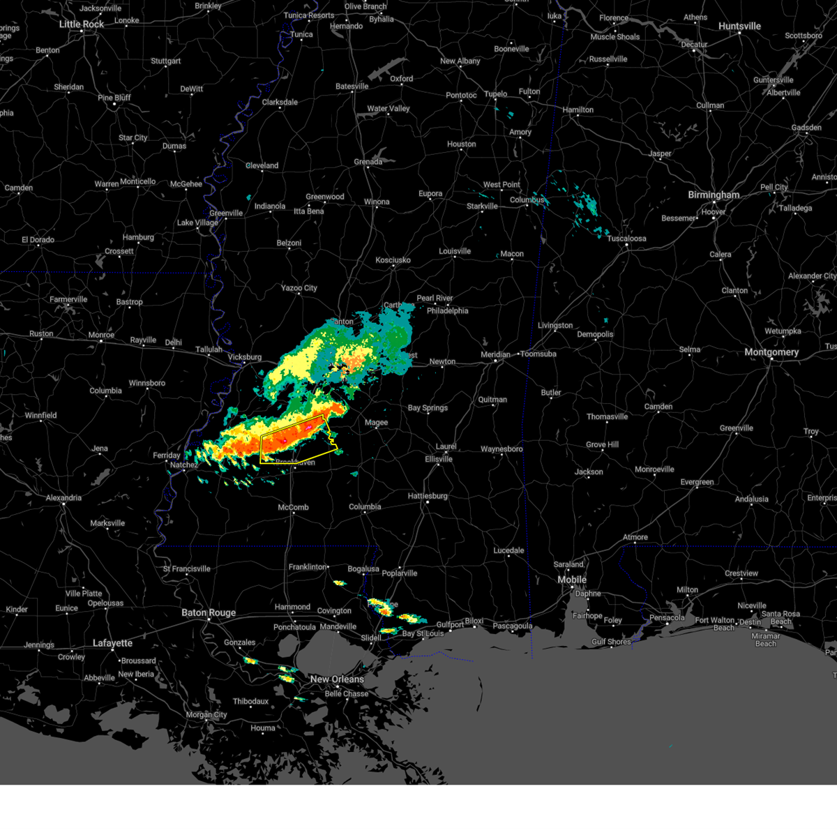 At 141 pm cdt, severe thunderstorms were located along a line extending from near hopewell to pleasant hill, moving southeast at 25 mph (radar indicated). Hazards include 60 mph wind gusts. Expect damage to roofs, siding, and trees. severe thunderstorms will be near, georgetown and caseyville around 155 pm cdt. rockport around 205 pm cdt. loyd star around 210 pm cdt. oma around 215 pm cdt. hail threat, radar indicated max hail size, <. 75 in wind threat, radar indicated max wind gust, 60 mph. At 141 pm cdt, severe thunderstorms were located along a line extending from near hopewell to pleasant hill, moving southeast at 25 mph (radar indicated). Hazards include 60 mph wind gusts. Expect damage to roofs, siding, and trees. severe thunderstorms will be near, georgetown and caseyville around 155 pm cdt. rockport around 205 pm cdt. loyd star around 210 pm cdt. oma around 215 pm cdt. hail threat, radar indicated max hail size, <. 75 in wind threat, radar indicated max wind gust, 60 mph.
|
| 5/5/2023 1:40 PM CDT | Public reports several trees along with a few powerlines down near jackson st... a few miles north of hwy 2 in copiah county MS, 1.1 miles S of Hazlehurst, MS |
| 5/5/2023 1:31 PM CDT | Reports of multiple trees down near lilly r in copiah county MS, 1.7 miles S of Hazlehurst, MS |
| 5/5/2023 1:31 PM CDT | Reports of a few trees down near may l in copiah county MS, 2.9 miles SSE of Hazlehurst, MS |
| 5/5/2023 1:31 PM CDT | Tree down on house on cola lane. trees down across i-55 in hazlehurs in copiah county MS, 0.4 miles NNW of Hazlehurst, MS |
| 5/5/2023 1:22 PM CDT | Several trees down near/in the gallman are in copiah county MS, 4.5 miles S of Hazlehurst, MS |
| 4/3/2023 4:32 AM CDT |
 At 432 am cdt, a severe thunderstorm was located near hopewell, or 11 miles west of pinola, moving east at 35 mph (radar indicated). Hazards include 60 mph wind gusts and half dollar size hail. Hail damage to vehicles is expected. expect wind damage to roofs, siding, and trees. this severe storm will be near, union and harrisville around 440 am cdt. pinola and shivers around 450 am cdt. mendenhall around 500 am cdt. other locations impacted by this severe thunderstorm include d`lo, braxton, puckett and georgetown. hail threat, radar indicated max hail size, 1. 25 in wind threat, radar indicated max wind gust, 60 mph. At 432 am cdt, a severe thunderstorm was located near hopewell, or 11 miles west of pinola, moving east at 35 mph (radar indicated). Hazards include 60 mph wind gusts and half dollar size hail. Hail damage to vehicles is expected. expect wind damage to roofs, siding, and trees. this severe storm will be near, union and harrisville around 440 am cdt. pinola and shivers around 450 am cdt. mendenhall around 500 am cdt. other locations impacted by this severe thunderstorm include d`lo, braxton, puckett and georgetown. hail threat, radar indicated max hail size, 1. 25 in wind threat, radar indicated max wind gust, 60 mph.
|
| 4/3/2023 4:15 AM CDT |
 At 414 am cdt, a severe thunderstorm was located over crystal springs, moving east at 35 mph (radar indicated). Hazards include ping pong ball size hail and 60 mph wind gusts. People and animals outdoors will be injured. expect hail damage to roofs, siding, windows, and vehicles. expect wind damage to roofs, siding, and trees. this severe thunderstorm will be near, hopewell around 425 am cdt. union and harrisville around 440 am cdt. pinola and shivers around 450 am cdt. mendenhall around 500 am cdt. other locations impacted by this severe thunderstorm include d`lo, braxton, puckett and georgetown. hail threat, radar indicated max hail size, 1. 50 in wind threat, radar indicated max wind gust, 60 mph. At 414 am cdt, a severe thunderstorm was located over crystal springs, moving east at 35 mph (radar indicated). Hazards include ping pong ball size hail and 60 mph wind gusts. People and animals outdoors will be injured. expect hail damage to roofs, siding, windows, and vehicles. expect wind damage to roofs, siding, and trees. this severe thunderstorm will be near, hopewell around 425 am cdt. union and harrisville around 440 am cdt. pinola and shivers around 450 am cdt. mendenhall around 500 am cdt. other locations impacted by this severe thunderstorm include d`lo, braxton, puckett and georgetown. hail threat, radar indicated max hail size, 1. 50 in wind threat, radar indicated max wind gust, 60 mph.
|
| 4/3/2023 3:59 AM CDT |
 At 359 am cdt, a severe thunderstorm was located over crystal springs, moving east at 40 mph (radar indicated). Hazards include two inch hail and 60 mph wind gusts. People and animals outdoors will be injured. expect hail damage to roofs, siding, windows, and vehicles. expect wind damage to roofs, siding, and trees. this severe storm will be near, hopewell around 410 am cdt. harrisville around 420 am cdt. union around 425 am cdt. other locations impacted by this severe thunderstorm include georgetown. thunderstorm damage threat, considerable hail threat, radar indicated max hail size, 2. 00 in wind threat, radar indicated max wind gust, 60 mph. At 359 am cdt, a severe thunderstorm was located over crystal springs, moving east at 40 mph (radar indicated). Hazards include two inch hail and 60 mph wind gusts. People and animals outdoors will be injured. expect hail damage to roofs, siding, windows, and vehicles. expect wind damage to roofs, siding, and trees. this severe storm will be near, hopewell around 410 am cdt. harrisville around 420 am cdt. union around 425 am cdt. other locations impacted by this severe thunderstorm include georgetown. thunderstorm damage threat, considerable hail threat, radar indicated max hail size, 2. 00 in wind threat, radar indicated max wind gust, 60 mph.
|
| 4/3/2023 3:30 AM CDT |
 At 330 am cdt, a severe thunderstorm was located over carpenter, or 16 miles west of crystal springs, moving east at 40 mph (radar indicated). Hazards include golf ball size hail and 60 mph wind gusts. People and animals outdoors will be injured. expect hail damage to roofs, siding, windows, and vehicles. expect wind damage to roofs, siding, and trees. this severe storm will be near, dentville around 340 am cdt. crystal springs, hazlehurst and gallman around 355 am cdt. hopewell around 410 am cdt. harrisville around 420 am cdt. union around 425 am cdt. other locations impacted by this severe thunderstorm include georgetown. thunderstorm damage threat, considerable hail threat, radar indicated max hail size, 1. 75 in wind threat, radar indicated max wind gust, 60 mph. At 330 am cdt, a severe thunderstorm was located over carpenter, or 16 miles west of crystal springs, moving east at 40 mph (radar indicated). Hazards include golf ball size hail and 60 mph wind gusts. People and animals outdoors will be injured. expect hail damage to roofs, siding, windows, and vehicles. expect wind damage to roofs, siding, and trees. this severe storm will be near, dentville around 340 am cdt. crystal springs, hazlehurst and gallman around 355 am cdt. hopewell around 410 am cdt. harrisville around 420 am cdt. union around 425 am cdt. other locations impacted by this severe thunderstorm include georgetown. thunderstorm damage threat, considerable hail threat, radar indicated max hail size, 1. 75 in wind threat, radar indicated max wind gust, 60 mph.
|
| 4/3/2023 3:16 AM CDT |
 At 316 am cdt, a severe thunderstorm was located over rocky springs, or 19 miles south of vicksburg, moving east at 40 mph (radar indicated). Hazards include ping pong ball size hail and 60 mph wind gusts. People and animals outdoors will be injured. expect hail damage to roofs, siding, windows, and vehicles. expect wind damage to roofs, siding, and trees. this severe thunderstorm will be near, carpenter around 325 am cdt. dentville around 340 am cdt. crystal springs, hazlehurst and gallman around 355 am cdt. hopewell around 410 am cdt. union and harrisville around 415 am cdt. other locations impacted by this severe thunderstorm include georgetown. hail threat, radar indicated max hail size, 1. 50 in wind threat, radar indicated max wind gust, 60 mph. At 316 am cdt, a severe thunderstorm was located over rocky springs, or 19 miles south of vicksburg, moving east at 40 mph (radar indicated). Hazards include ping pong ball size hail and 60 mph wind gusts. People and animals outdoors will be injured. expect hail damage to roofs, siding, windows, and vehicles. expect wind damage to roofs, siding, and trees. this severe thunderstorm will be near, carpenter around 325 am cdt. dentville around 340 am cdt. crystal springs, hazlehurst and gallman around 355 am cdt. hopewell around 410 am cdt. union and harrisville around 415 am cdt. other locations impacted by this severe thunderstorm include georgetown. hail threat, radar indicated max hail size, 1. 50 in wind threat, radar indicated max wind gust, 60 mph.
|
| 3/24/2023 5:45 PM CDT | Trees and power lines down along ashley roa in copiah county MS, 8.4 miles WNW of Hazlehurst, MS |
| 3/12/2023 4:23 PM CDT |
 At 423 pm cdt, a severe thunderstorm was located near hopewell, or near crystal springs, moving east at 55 mph (radar indicated). Hazards include half dollar size hail. Damage to vehicles is expected. this severe thunderstorm will be near, union and harrisville around 435 pm cdt. pinola around 445 pm cdt. mendenhall around 450 pm cdt. sanatorium around 455 pm cdt. magee and martinville around 500 pm cdt. other locations impacted by this severe thunderstorm include d`lo and georgetown. hail threat, radar indicated max hail size, 1. 25 in wind threat, radar indicated max wind gust, <50 mph. At 423 pm cdt, a severe thunderstorm was located near hopewell, or near crystal springs, moving east at 55 mph (radar indicated). Hazards include half dollar size hail. Damage to vehicles is expected. this severe thunderstorm will be near, union and harrisville around 435 pm cdt. pinola around 445 pm cdt. mendenhall around 450 pm cdt. sanatorium around 455 pm cdt. magee and martinville around 500 pm cdt. other locations impacted by this severe thunderstorm include d`lo and georgetown. hail threat, radar indicated max hail size, 1. 25 in wind threat, radar indicated max wind gust, <50 mph.
|
| 3/12/2023 7:57 AM CDT |
 At 756 am cdt, severe thunderstorms were located along a line extending from near gallman to near mccall creek to near kirby, moving southeast at 50 mph (radar indicated). Hazards include 60 mph wind gusts and quarter size hail. Hail damage to vehicles is expected. expect wind damage to roofs, siding, and trees. these severe storms will be near, crystal springs, hazlehurst, gallman, mccall creek, glancy and caseyville around 800 am cdt. vaughn, martinsville and loyd star around 805 am cdt. bude and west lincoln around 810 am cdt. rockport and little springs around 820 am cdt. other locations impacted by these severe thunderstorms include roxie, meadville, beauregard and georgetown. hail threat, radar indicated max hail size, 1. 00 in wind threat, radar indicated max wind gust, 60 mph. At 756 am cdt, severe thunderstorms were located along a line extending from near gallman to near mccall creek to near kirby, moving southeast at 50 mph (radar indicated). Hazards include 60 mph wind gusts and quarter size hail. Hail damage to vehicles is expected. expect wind damage to roofs, siding, and trees. these severe storms will be near, crystal springs, hazlehurst, gallman, mccall creek, glancy and caseyville around 800 am cdt. vaughn, martinsville and loyd star around 805 am cdt. bude and west lincoln around 810 am cdt. rockport and little springs around 820 am cdt. other locations impacted by these severe thunderstorms include roxie, meadville, beauregard and georgetown. hail threat, radar indicated max hail size, 1. 00 in wind threat, radar indicated max wind gust, 60 mph.
|
| 3/12/2023 7:41 AM CDT |
 At 740 am cdt, severe thunderstorms were located along a line extending from near dentville to 7 miles west of union church to cranfield, moving southeast at 50 mph (radar indicated). Hazards include 60 mph wind gusts and quarter size hail. Hail damage to vehicles is expected. expect wind damage to roofs, siding, and trees. these severe storms will be near, union church and new hope around 750 am cdt. hazlehurst, glancy, gallman and caseyville around 755 am cdt. kirby, martinsville and mccall creek around 800 am cdt. vaughn and loyd star around 805 am cdt. bude and west lincoln around 810 am cdt. rockport around 815 am cdt. little springs around 820 am cdt. other locations impacted by these severe thunderstorms include roxie, meadville, beauregard and georgetown. hail threat, radar indicated max hail size, 1. 00 in wind threat, radar indicated max wind gust, 60 mph. At 740 am cdt, severe thunderstorms were located along a line extending from near dentville to 7 miles west of union church to cranfield, moving southeast at 50 mph (radar indicated). Hazards include 60 mph wind gusts and quarter size hail. Hail damage to vehicles is expected. expect wind damage to roofs, siding, and trees. these severe storms will be near, union church and new hope around 750 am cdt. hazlehurst, glancy, gallman and caseyville around 755 am cdt. kirby, martinsville and mccall creek around 800 am cdt. vaughn and loyd star around 805 am cdt. bude and west lincoln around 810 am cdt. rockport around 815 am cdt. little springs around 820 am cdt. other locations impacted by these severe thunderstorms include roxie, meadville, beauregard and georgetown. hail threat, radar indicated max hail size, 1. 00 in wind threat, radar indicated max wind gust, 60 mph.
|
| 3/12/2023 7:30 AM CDT |
 At 730 am cdt, severe thunderstorms were located along a line extending from near hermanville to fayette to near natchez, moving southeast at 45 mph (radar indicated). Hazards include 60 mph wind gusts and quarter size hail. Hail damage to vehicles is expected. expect wind damage to roofs, siding, and trees. severe thunderstorms will be near, carpenter around 735 am cdt. blue hill around 740 am cdt. dentville and stampley around 745 am cdt. union church, hamburg, new hope and pleasant hill around 750 am cdt. glancy around 755 am cdt. crystal springs, hazlehurst, kirby, gallman, mccall creek and caseyville around 800 am cdt. martinsville around 805 am cdt. bude, vaughn, west lincoln and loyd star around 810 am cdt. other locations impacted by these severe thunderstorms include roxie, meadville, beauregard and georgetown. hail threat, radar indicated max hail size, 1. 00 in wind threat, radar indicated max wind gust, 60 mph. At 730 am cdt, severe thunderstorms were located along a line extending from near hermanville to fayette to near natchez, moving southeast at 45 mph (radar indicated). Hazards include 60 mph wind gusts and quarter size hail. Hail damage to vehicles is expected. expect wind damage to roofs, siding, and trees. severe thunderstorms will be near, carpenter around 735 am cdt. blue hill around 740 am cdt. dentville and stampley around 745 am cdt. union church, hamburg, new hope and pleasant hill around 750 am cdt. glancy around 755 am cdt. crystal springs, hazlehurst, kirby, gallman, mccall creek and caseyville around 800 am cdt. martinsville around 805 am cdt. bude, vaughn, west lincoln and loyd star around 810 am cdt. other locations impacted by these severe thunderstorms include roxie, meadville, beauregard and georgetown. hail threat, radar indicated max hail size, 1. 00 in wind threat, radar indicated max wind gust, 60 mph.
|
| 1/18/2023 10:32 PM CST |
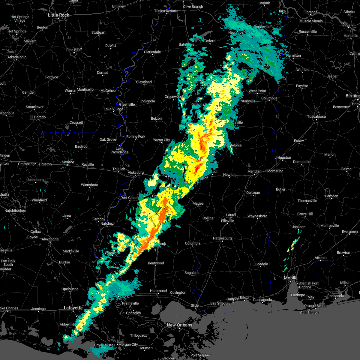 At 1020 pm cst, a severe thunderstorm was located near wesson, or near brookhaven, moving northeast at 35 mph (radar indicated). Hazards include 60 mph wind gusts. Expect damage to roofs, siding, and trees. this severe storm will be near, wesson around 1025 pm cst. martinsville around 1030 pm cst. Other locations impacted by this severe thunderstorm include beauregard. At 1020 pm cst, a severe thunderstorm was located near wesson, or near brookhaven, moving northeast at 35 mph (radar indicated). Hazards include 60 mph wind gusts. Expect damage to roofs, siding, and trees. this severe storm will be near, wesson around 1025 pm cst. martinsville around 1030 pm cst. Other locations impacted by this severe thunderstorm include beauregard.
|
| 1/18/2023 10:20 PM CST |
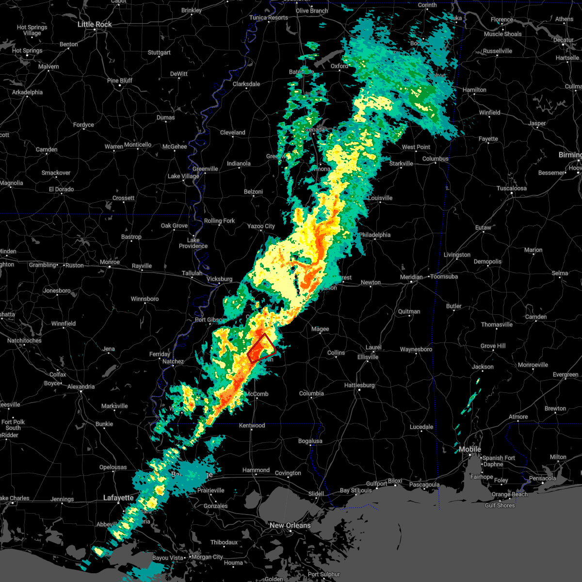 At 1019 pm cst, a severe thunderstorm capable of producing a tornado was located near wesson, or near brookhaven, moving northeast at 35 mph (radar indicated rotation). Hazards include tornado. Flying debris will be dangerous to those caught without shelter. mobile homes will be damaged or destroyed. damage to roofs, windows, and vehicles will occur. tree damage is likely. this dangerous storm will be near, wesson around 1025 pm cst. martinsville around 1030 pm cst. Other locations impacted by this tornadic thunderstorm include beauregard. At 1019 pm cst, a severe thunderstorm capable of producing a tornado was located near wesson, or near brookhaven, moving northeast at 35 mph (radar indicated rotation). Hazards include tornado. Flying debris will be dangerous to those caught without shelter. mobile homes will be damaged or destroyed. damage to roofs, windows, and vehicles will occur. tree damage is likely. this dangerous storm will be near, wesson around 1025 pm cst. martinsville around 1030 pm cst. Other locations impacted by this tornadic thunderstorm include beauregard.
|
| 1/18/2023 10:12 PM CST |
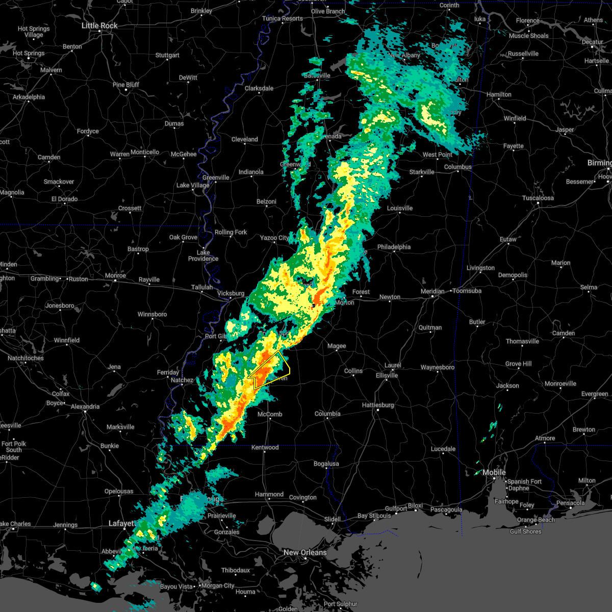 At 1012 pm cst, a severe thunderstorm was located over loyd star, or near brookhaven, moving east at 35 mph (radar indicated). Hazards include 60 mph wind gusts. Expect damage to roofs, siding, and trees. this severe storm will be near, brookhaven around 1020 pm cst. wesson around 1025 pm cst. Other locations impacted by this severe thunderstorm include beauregard. At 1012 pm cst, a severe thunderstorm was located over loyd star, or near brookhaven, moving east at 35 mph (radar indicated). Hazards include 60 mph wind gusts. Expect damage to roofs, siding, and trees. this severe storm will be near, brookhaven around 1020 pm cst. wesson around 1025 pm cst. Other locations impacted by this severe thunderstorm include beauregard.
|
| 1/18/2023 10:04 PM CST |
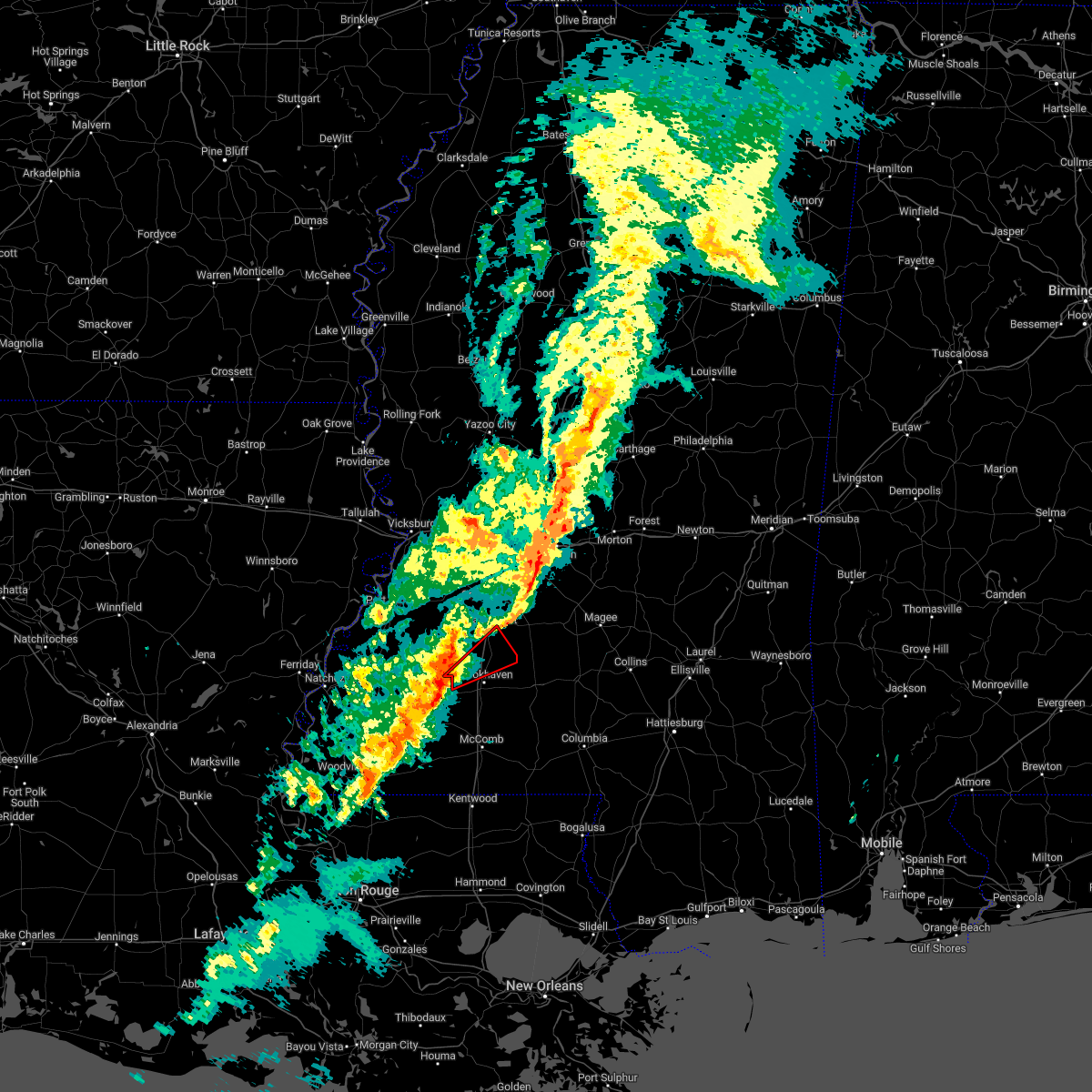 At 1004 pm cst, a severe thunderstorm capable of producing a tornado was located over vaughn, or 9 miles west of brookhaven, moving northeast at 35 mph (radar indicated rotation). Hazards include tornado. Flying debris will be dangerous to those caught without shelter. mobile homes will be damaged or destroyed. damage to roofs, windows, and vehicles will occur. tree damage is likely. this dangerous storm will be near, brookhaven around 1015 pm cst. wesson around 1025 pm cst. martinsville around 1030 pm cst. Other locations impacted by this tornadic thunderstorm include beauregard. At 1004 pm cst, a severe thunderstorm capable of producing a tornado was located over vaughn, or 9 miles west of brookhaven, moving northeast at 35 mph (radar indicated rotation). Hazards include tornado. Flying debris will be dangerous to those caught without shelter. mobile homes will be damaged or destroyed. damage to roofs, windows, and vehicles will occur. tree damage is likely. this dangerous storm will be near, brookhaven around 1015 pm cst. wesson around 1025 pm cst. martinsville around 1030 pm cst. Other locations impacted by this tornadic thunderstorm include beauregard.
|
| 1/18/2023 9:59 PM CST |
 At 959 pm cst, a severe thunderstorm was located near vaughn, or 11 miles west of brookhaven, moving northeast at 35 mph (radar indicated). Hazards include 60 mph wind gusts. Expect damage to roofs, siding, and trees. this severe thunderstorm will be near, loyd star around 1010 pm cst. brookhaven around 1015 pm cst. wesson around 1025 pm cst. martinsville around 1030 pm cst. Other locations impacted by this severe thunderstorm include beauregard. At 959 pm cst, a severe thunderstorm was located near vaughn, or 11 miles west of brookhaven, moving northeast at 35 mph (radar indicated). Hazards include 60 mph wind gusts. Expect damage to roofs, siding, and trees. this severe thunderstorm will be near, loyd star around 1010 pm cst. brookhaven around 1015 pm cst. wesson around 1025 pm cst. martinsville around 1030 pm cst. Other locations impacted by this severe thunderstorm include beauregard.
|
| 1/3/2023 9:37 AM CST |
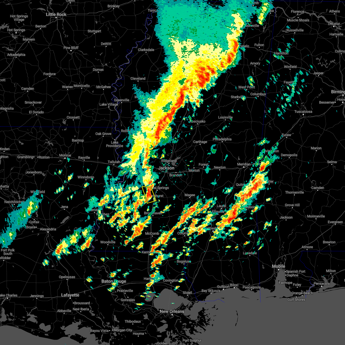 At 937 am cst, a severe thunderstorm was located near crystal springs, moving northeast at 55 mph (radar indicated). Hazards include 60 mph wind gusts and quarter size hail. Hail damage to vehicles is expected. expect wind damage to roofs, siding, and trees. locations impacted include, hazlehurst, glancy and dentville. hail threat, radar indicated max hail size, 1. 00 in wind threat, radar indicated max wind gust, 60 mph. At 937 am cst, a severe thunderstorm was located near crystal springs, moving northeast at 55 mph (radar indicated). Hazards include 60 mph wind gusts and quarter size hail. Hail damage to vehicles is expected. expect wind damage to roofs, siding, and trees. locations impacted include, hazlehurst, glancy and dentville. hail threat, radar indicated max hail size, 1. 00 in wind threat, radar indicated max wind gust, 60 mph.
|
| 1/3/2023 9:36 AM CST |
 At 936 am cst, a severe thunderstorm was located near gallman, or near hazlehurst, moving northeast at 45 mph (radar indicated). Hazards include 60 mph wind gusts and quarter size hail. Hail damage to vehicles is expected. expect wind damage to roofs, siding, and trees. this severe thunderstorm will be near, gallman around 940 am cst. crystal springs around 945 am cst. terry and hopewell around 955 am cst. whites around 1000 am cst. florence and harrisville around 1005 am cst. star and monterey around 1010 am cst. piney woods around 1015 am cst. cato around 1020 am cst. other locations impacted by this severe thunderstorm include d`lo, braxton, puckett and georgetown. hail threat, radar indicated max hail size, 1. 00 in wind threat, radar indicated max wind gust, 60 mph. At 936 am cst, a severe thunderstorm was located near gallman, or near hazlehurst, moving northeast at 45 mph (radar indicated). Hazards include 60 mph wind gusts and quarter size hail. Hail damage to vehicles is expected. expect wind damage to roofs, siding, and trees. this severe thunderstorm will be near, gallman around 940 am cst. crystal springs around 945 am cst. terry and hopewell around 955 am cst. whites around 1000 am cst. florence and harrisville around 1005 am cst. star and monterey around 1010 am cst. piney woods around 1015 am cst. cato around 1020 am cst. other locations impacted by this severe thunderstorm include d`lo, braxton, puckett and georgetown. hail threat, radar indicated max hail size, 1. 00 in wind threat, radar indicated max wind gust, 60 mph.
|
| 1/3/2023 9:25 AM CST |
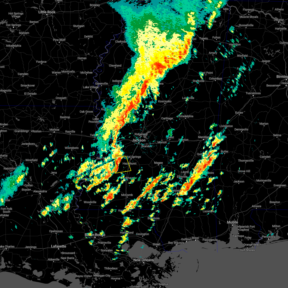 At 924 am cst, a severe thunderstorm was located over dentville, or 11 miles northwest of hazlehurst, moving northeast at 50 mph (radar indicated). Hazards include 60 mph wind gusts and quarter size hail. Hail damage to vehicles is expected. expect wind damage to roofs, siding, and trees. This severe thunderstorm will remain over mainly rural areas of western copiah county. At 924 am cst, a severe thunderstorm was located over dentville, or 11 miles northwest of hazlehurst, moving northeast at 50 mph (radar indicated). Hazards include 60 mph wind gusts and quarter size hail. Hail damage to vehicles is expected. expect wind damage to roofs, siding, and trees. This severe thunderstorm will remain over mainly rural areas of western copiah county.
|
| 1/3/2023 9:10 AM CST |
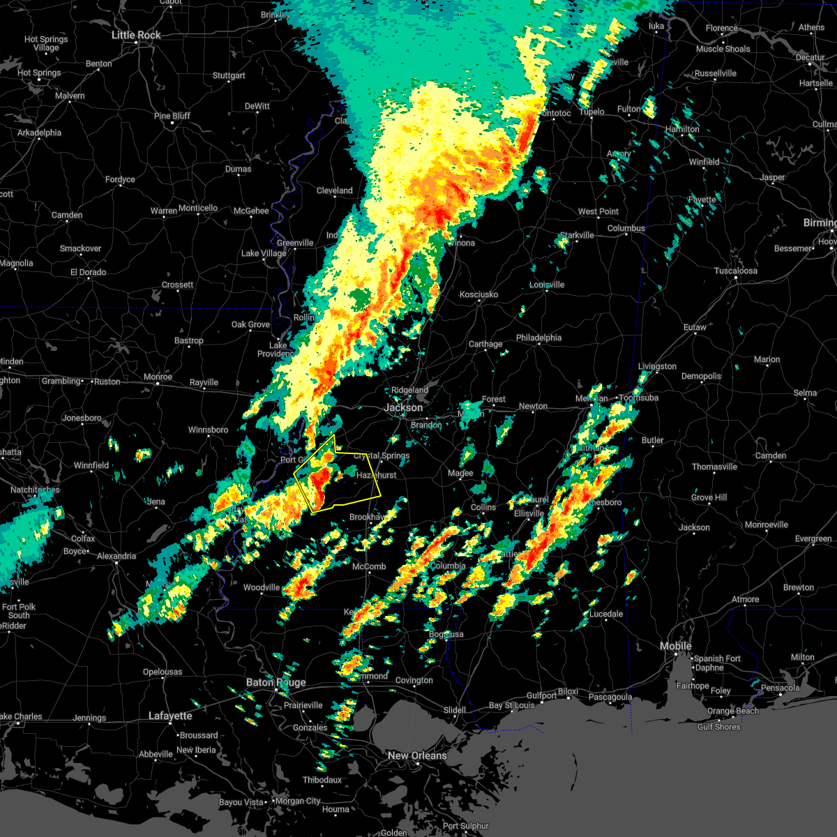 At 910 am cst, a severe thunderstorm was located over peyton, or 21 miles west of hazlehurst, moving northeast at 50 mph (radar indicated). Hazards include 60 mph wind gusts and quarter size hail. Hail damage to vehicles is expected. expect wind damage to roofs, siding, and trees. this severe storm will be near, barlow around 915 am cst. Dentville around 925 am cst. At 910 am cst, a severe thunderstorm was located over peyton, or 21 miles west of hazlehurst, moving northeast at 50 mph (radar indicated). Hazards include 60 mph wind gusts and quarter size hail. Hail damage to vehicles is expected. expect wind damage to roofs, siding, and trees. this severe storm will be near, barlow around 915 am cst. Dentville around 925 am cst.
|
| 1/3/2023 8:52 AM CST |
 At 852 am cst, a severe thunderstorm was located over red lick, or 30 miles northeast of natchez, moving northeast at 55 mph (radar indicated). Hazards include 60 mph wind gusts and quarter size hail. Hail damage to vehicles is expected. expect wind damage to roofs, siding, and trees. this severe thunderstorm will be near, pattison and mcbride around 900 am cst. peyton and hermanville around 905 am cst. barlow around 910 am cst. dentville and carpenter around 920 am cst. hail threat, radar indicated max hail size, 1. 00 in wind threat, radar indicated max wind gust, 60 mph. At 852 am cst, a severe thunderstorm was located over red lick, or 30 miles northeast of natchez, moving northeast at 55 mph (radar indicated). Hazards include 60 mph wind gusts and quarter size hail. Hail damage to vehicles is expected. expect wind damage to roofs, siding, and trees. this severe thunderstorm will be near, pattison and mcbride around 900 am cst. peyton and hermanville around 905 am cst. barlow around 910 am cst. dentville and carpenter around 920 am cst. hail threat, radar indicated max hail size, 1. 00 in wind threat, radar indicated max wind gust, 60 mph.
|
| 12/14/2022 5:16 AM CST |
 At 516 am cst, a severe thunderstorm capable of producing a tornado was located over wesson, or 9 miles south of hazlehurst, moving northeast at 35 mph (radar indicated rotation). Hazards include tornado and golf ball size hail. Flying debris will be dangerous to those caught without shelter. mobile homes will be damaged or destroyed. damage to roofs, windows, and vehicles will occur. tree damage is likely. this dangerous storm will be near, martinsville around 520 am cst. hazlehurst around 530 am cst. gallman around 535 am cst. union and hopewell around 550 am cst. harrisville and whites around 600 am cst. Other locations impacted by this tornadic thunderstorm include beauregard and georgetown. At 516 am cst, a severe thunderstorm capable of producing a tornado was located over wesson, or 9 miles south of hazlehurst, moving northeast at 35 mph (radar indicated rotation). Hazards include tornado and golf ball size hail. Flying debris will be dangerous to those caught without shelter. mobile homes will be damaged or destroyed. damage to roofs, windows, and vehicles will occur. tree damage is likely. this dangerous storm will be near, martinsville around 520 am cst. hazlehurst around 530 am cst. gallman around 535 am cst. union and hopewell around 550 am cst. harrisville and whites around 600 am cst. Other locations impacted by this tornadic thunderstorm include beauregard and georgetown.
|
| 12/14/2022 5:08 AM CST |
 At 508 am cst, a severe thunderstorm capable of producing a tornado was located near wesson, or near brookhaven, moving northeast at 35 mph (radar indicated rotation). Hazards include tornado and quarter size hail. Flying debris will be dangerous to those caught without shelter. mobile homes will be damaged or destroyed. damage to roofs, windows, and vehicles will occur. tree damage is likely. this dangerous storm will be near, wesson around 515 am cst. glancy around 520 am cst. martinsville around 525 am cst. hazlehurst around 530 am cst. hopewell around 550 am cst. harrisville and whites around 600 am cst. Other locations impacted by this tornadic thunderstorm include beauregard and georgetown. At 508 am cst, a severe thunderstorm capable of producing a tornado was located near wesson, or near brookhaven, moving northeast at 35 mph (radar indicated rotation). Hazards include tornado and quarter size hail. Flying debris will be dangerous to those caught without shelter. mobile homes will be damaged or destroyed. damage to roofs, windows, and vehicles will occur. tree damage is likely. this dangerous storm will be near, wesson around 515 am cst. glancy around 520 am cst. martinsville around 525 am cst. hazlehurst around 530 am cst. hopewell around 550 am cst. harrisville and whites around 600 am cst. Other locations impacted by this tornadic thunderstorm include beauregard and georgetown.
|
| 6/10/2022 12:03 PM CDT |
 At 1202 pm cdt, severe thunderstorms were located along a line extending from near florence to near glancy, moving east at 45 mph (radar indicated). Hazards include 60 mph wind gusts. Expect damage to roofs, siding, and trees. severe thunderstorms will be near, richland, star, florence and monterey around 1210 pm cdt. brandon around 1215 pm cdt. cato around 1225 pm cdt. rockport and johns around 1230 pm cdt. union and pelahatchie around 1235 pm cdt. pinola and shivers around 1245 pm cdt. magee and sanatorium around 100 pm cdt. Other locations impacted by these severe thunderstorms include d`lo, beauregard, braxton, puckett and georgetown. At 1202 pm cdt, severe thunderstorms were located along a line extending from near florence to near glancy, moving east at 45 mph (radar indicated). Hazards include 60 mph wind gusts. Expect damage to roofs, siding, and trees. severe thunderstorms will be near, richland, star, florence and monterey around 1210 pm cdt. brandon around 1215 pm cdt. cato around 1225 pm cdt. rockport and johns around 1230 pm cdt. union and pelahatchie around 1235 pm cdt. pinola and shivers around 1245 pm cdt. magee and sanatorium around 100 pm cdt. Other locations impacted by these severe thunderstorms include d`lo, beauregard, braxton, puckett and georgetown.
|
| 5/25/2022 11:05 AM CDT |
 At 1105 am cdt, a severe thunderstorm was located near hopewell, or near crystal springs, moving northeast at 50 mph (radar indicated). Hazards include 60 mph wind gusts. Expect damage to roofs, siding, and trees. this severe thunderstorm will remain over mainly rural areas of western simpson and eastern copiah counties, including the following locations, beauregard and georgetown. hail threat, radar indicated max hail size, <. 75 in wind threat, radar indicated max wind gust, 60 mph. At 1105 am cdt, a severe thunderstorm was located near hopewell, or near crystal springs, moving northeast at 50 mph (radar indicated). Hazards include 60 mph wind gusts. Expect damage to roofs, siding, and trees. this severe thunderstorm will remain over mainly rural areas of western simpson and eastern copiah counties, including the following locations, beauregard and georgetown. hail threat, radar indicated max hail size, <. 75 in wind threat, radar indicated max wind gust, 60 mph.
|
| 5/25/2022 10:55 AM CDT | A tree blocked the road on lake stree in copiah county MS, 0.5 miles SE of Hazlehurst, MS |
| 5/25/2022 10:51 AM CDT |
 At 1050 am cdt, a severe thunderstorm was located over martinsville, or near hazlehurst, moving northeast at 50 mph (radar indicated). Hazards include 60 mph wind gusts. Expect damage to roofs, siding, and trees. this severe storm will be near, hazlehurst around 1055 am cdt. gallman around 1100 am cdt. crystal springs around 1105 am cdt. hopewell around 1110 am cdt. other locations impacted by this severe thunderstorm include beauregard and georgetown. hail threat, radar indicated max hail size, <. 75 in wind threat, radar indicated max wind gust, 60 mph. At 1050 am cdt, a severe thunderstorm was located over martinsville, or near hazlehurst, moving northeast at 50 mph (radar indicated). Hazards include 60 mph wind gusts. Expect damage to roofs, siding, and trees. this severe storm will be near, hazlehurst around 1055 am cdt. gallman around 1100 am cdt. crystal springs around 1105 am cdt. hopewell around 1110 am cdt. other locations impacted by this severe thunderstorm include beauregard and georgetown. hail threat, radar indicated max hail size, <. 75 in wind threat, radar indicated max wind gust, 60 mph.
|
| 5/25/2022 10:38 AM CDT |
 At 1038 am cdt, a severe thunderstorm was located over loyd star, or near brookhaven, moving northeast at 50 mph (radar indicated). Hazards include 60 mph wind gusts. Expect damage to roofs, siding, and trees. this severe thunderstorm will be near, wesson and glancy around 1050 am cdt. martinsville around 1055 am cdt. hazlehurst around 1100 am cdt. union and hopewell around 1115 am cdt. other locations impacted by this severe thunderstorm include beauregard and georgetown. hail threat, radar indicated max hail size, <. 75 in wind threat, radar indicated max wind gust, 60 mph. At 1038 am cdt, a severe thunderstorm was located over loyd star, or near brookhaven, moving northeast at 50 mph (radar indicated). Hazards include 60 mph wind gusts. Expect damage to roofs, siding, and trees. this severe thunderstorm will be near, wesson and glancy around 1050 am cdt. martinsville around 1055 am cdt. hazlehurst around 1100 am cdt. union and hopewell around 1115 am cdt. other locations impacted by this severe thunderstorm include beauregard and georgetown. hail threat, radar indicated max hail size, <. 75 in wind threat, radar indicated max wind gust, 60 mph.
|
| 4/13/2022 7:45 PM CDT |
 At 745 pm cdt, a severe thunderstorm was located over hopewell, or 10 miles southeast of crystal springs, moving east at 55 mph (radar indicated). Hazards include 70 mph wind gusts. Expect considerable tree damage. damage is likely to mobile homes, roofs, and outbuildings. this severe storm will be near, union and harrisville around 755 pm cdt. pinola around 800 pm cdt. mendenhall around 805 pm cdt. magee, martinville and sanatorium around 815 pm cdt. other locations impacted by this severe thunderstorm include d`lo, beauregard, braxton and georgetown. thunderstorm damage threat, considerable hail threat, radar indicated max hail size, <. 75 in wind threat, radar indicated max wind gust, 70 mph. At 745 pm cdt, a severe thunderstorm was located over hopewell, or 10 miles southeast of crystal springs, moving east at 55 mph (radar indicated). Hazards include 70 mph wind gusts. Expect considerable tree damage. damage is likely to mobile homes, roofs, and outbuildings. this severe storm will be near, union and harrisville around 755 pm cdt. pinola around 800 pm cdt. mendenhall around 805 pm cdt. magee, martinville and sanatorium around 815 pm cdt. other locations impacted by this severe thunderstorm include d`lo, beauregard, braxton and georgetown. thunderstorm damage threat, considerable hail threat, radar indicated max hail size, <. 75 in wind threat, radar indicated max wind gust, 70 mph.
|
| 4/13/2022 7:26 PM CDT |
 At 726 pm cdt, a severe thunderstorm was located near gallman, or near hazlehurst, moving east at 60 mph (radar indicated). Hazards include 70 mph wind gusts. Expect considerable tree damage. damage is likely to mobile homes, roofs, and outbuildings. this severe thunderstorm will be near, crystal springs, hazlehurst and gallman around 730 pm cdt. hopewell around 740 pm cdt. union and harrisville around 750 pm cdt. pinola around 755 pm cdt. mendenhall around 800 pm cdt. sanatorium around 805 pm cdt. magee and martinville around 810 pm cdt. other locations impacted by this severe thunderstorm include d`lo, beauregard, braxton and georgetown. thunderstorm damage threat, considerable hail threat, radar indicated max hail size, <. 75 in wind threat, radar indicated max wind gust, 70 mph. At 726 pm cdt, a severe thunderstorm was located near gallman, or near hazlehurst, moving east at 60 mph (radar indicated). Hazards include 70 mph wind gusts. Expect considerable tree damage. damage is likely to mobile homes, roofs, and outbuildings. this severe thunderstorm will be near, crystal springs, hazlehurst and gallman around 730 pm cdt. hopewell around 740 pm cdt. union and harrisville around 750 pm cdt. pinola around 755 pm cdt. mendenhall around 800 pm cdt. sanatorium around 805 pm cdt. magee and martinville around 810 pm cdt. other locations impacted by this severe thunderstorm include d`lo, beauregard, braxton and georgetown. thunderstorm damage threat, considerable hail threat, radar indicated max hail size, <. 75 in wind threat, radar indicated max wind gust, 70 mph.
|
| 4/13/2022 3:08 AM CDT | Trees and powerlines down at us 51 and monticello r in copiah county MS, 1.1 miles NNE of Hazlehurst, MS |
| 4/5/2022 6:26 AM CDT |
 At 626 am cdt, severe thunderstorms were located along a line extending from near hopewell to near vaughn, moving east at 50 mph (radar indicated). Hazards include 60 mph wind gusts. Expect damage to roofs, siding, and trees. locations impacted include, brookhaven, crystal springs, hazlehurst, mendenhall, pinola, union, wesson, bude, enterprise, mccall creek, bogue chitto, west lincoln, little springs, center point, shivers, kirby, martinsville, sontag, new hope and wanilla. hail threat, radar indicated max hail size, <. 75 in wind threat, radar indicated max wind gust, 60 mph. At 626 am cdt, severe thunderstorms were located along a line extending from near hopewell to near vaughn, moving east at 50 mph (radar indicated). Hazards include 60 mph wind gusts. Expect damage to roofs, siding, and trees. locations impacted include, brookhaven, crystal springs, hazlehurst, mendenhall, pinola, union, wesson, bude, enterprise, mccall creek, bogue chitto, west lincoln, little springs, center point, shivers, kirby, martinsville, sontag, new hope and wanilla. hail threat, radar indicated max hail size, <. 75 in wind threat, radar indicated max wind gust, 60 mph.
|
| 4/5/2022 6:00 AM CDT |
 At 600 am cdt, severe thunderstorms were located along a line extending from near peyton to near hamburg, moving east at 60 mph (radar indicated). Hazards include 60 mph wind gusts. expect damage to roofs, siding, and trees At 600 am cdt, severe thunderstorms were located along a line extending from near peyton to near hamburg, moving east at 60 mph (radar indicated). Hazards include 60 mph wind gusts. expect damage to roofs, siding, and trees
|
| 4/5/2022 5:15 AM CDT |
 At 515 am cdt, a severe thunderstorm was located over crystal springs, moving northeast at 55 mph (radar indicated). Hazards include 60 mph wind gusts and quarter size hail. Hail damage to vehicles is expected. expect wind damage to roofs, siding, and trees. this severe storm will be near, terry around 525 am cdt. byram and whites around 530 am cdt. richland and florence around 535 am cdt. pearl, star and monterey around 540 am cdt. brandon around 550 am cdt. hail threat, radar indicated max hail size, 1. 00 in wind threat, radar indicated max wind gust, 60 mph. At 515 am cdt, a severe thunderstorm was located over crystal springs, moving northeast at 55 mph (radar indicated). Hazards include 60 mph wind gusts and quarter size hail. Hail damage to vehicles is expected. expect wind damage to roofs, siding, and trees. this severe storm will be near, terry around 525 am cdt. byram and whites around 530 am cdt. richland and florence around 535 am cdt. pearl, star and monterey around 540 am cdt. brandon around 550 am cdt. hail threat, radar indicated max hail size, 1. 00 in wind threat, radar indicated max wind gust, 60 mph.
|
| 4/5/2022 5:06 AM CDT |
 At 505 am cdt, a severe thunderstorm was located over dentville, or 9 miles northwest of hazlehurst, moving northeast at 55 mph (radar indicated). Hazards include 60 mph wind gusts and quarter size hail. Hail damage to vehicles is expected. expect wind damage to roofs, siding, and trees. this severe thunderstorm will be near, hazlehurst around 510 am cdt. crystal springs and gallman around 515 am cdt. terry around 525 am cdt. byram and whites around 530 am cdt. florence around 535 am cdt. richland, star and monterey around 540 am cdt. pearl around 545 am cdt. brandon around 550 am cdt. hail threat, radar indicated max hail size, 1. 00 in wind threat, radar indicated max wind gust, 60 mph. At 505 am cdt, a severe thunderstorm was located over dentville, or 9 miles northwest of hazlehurst, moving northeast at 55 mph (radar indicated). Hazards include 60 mph wind gusts and quarter size hail. Hail damage to vehicles is expected. expect wind damage to roofs, siding, and trees. this severe thunderstorm will be near, hazlehurst around 510 am cdt. crystal springs and gallman around 515 am cdt. terry around 525 am cdt. byram and whites around 530 am cdt. florence around 535 am cdt. richland, star and monterey around 540 am cdt. pearl around 545 am cdt. brandon around 550 am cdt. hail threat, radar indicated max hail size, 1. 00 in wind threat, radar indicated max wind gust, 60 mph.
|
| 3/30/2022 5:25 PM CDT |
 At 525 pm cdt, severe thunderstorms were located along a line extending from near hopewell to near west lincoln, moving east at 35 mph (radar indicated). Hazards include 60 mph wind gusts. Expect damage to roofs, siding, and trees. severe thunderstorms will be near, union around 540 pm cdt. east lincoln around 545 pm cdt. pinola around 555 pm cdt. sontag around 600 pm cdt. monticello and wanilla around 605 pm cdt. other locations impacted by these severe thunderstorms include beauregard, new hebron and georgetown. hail threat, radar indicated max hail size, <. 75 in wind threat, radar indicated max wind gust, 60 mph. At 525 pm cdt, severe thunderstorms were located along a line extending from near hopewell to near west lincoln, moving east at 35 mph (radar indicated). Hazards include 60 mph wind gusts. Expect damage to roofs, siding, and trees. severe thunderstorms will be near, union around 540 pm cdt. east lincoln around 545 pm cdt. pinola around 555 pm cdt. sontag around 600 pm cdt. monticello and wanilla around 605 pm cdt. other locations impacted by these severe thunderstorms include beauregard, new hebron and georgetown. hail threat, radar indicated max hail size, <. 75 in wind threat, radar indicated max wind gust, 60 mph.
|
| 3/30/2022 5:01 PM CDT |
 At 501 pm cdt, severe thunderstorms were located along a line extending from allen to mccall creek, moving northeast at 45 mph (radar indicated). Hazards include 60 mph wind gusts. Expect damage to roofs, siding, and trees. locations impacted include, brookhaven, hazlehurst, wesson, enterprise, caseyville, mccall creek, bogue chitto, west lincoln, allen, vaughn, barlow, east lincoln, little springs, glancy, loyd star, pleasant hill, center point, martinsville and beauregard. hail threat, radar indicated max hail size, <. 75 in wind threat, radar indicated max wind gust, 60 mph. At 501 pm cdt, severe thunderstorms were located along a line extending from allen to mccall creek, moving northeast at 45 mph (radar indicated). Hazards include 60 mph wind gusts. Expect damage to roofs, siding, and trees. locations impacted include, brookhaven, hazlehurst, wesson, enterprise, caseyville, mccall creek, bogue chitto, west lincoln, allen, vaughn, barlow, east lincoln, little springs, glancy, loyd star, pleasant hill, center point, martinsville and beauregard. hail threat, radar indicated max hail size, <. 75 in wind threat, radar indicated max wind gust, 60 mph.
|
| 3/30/2022 4:30 PM CDT |
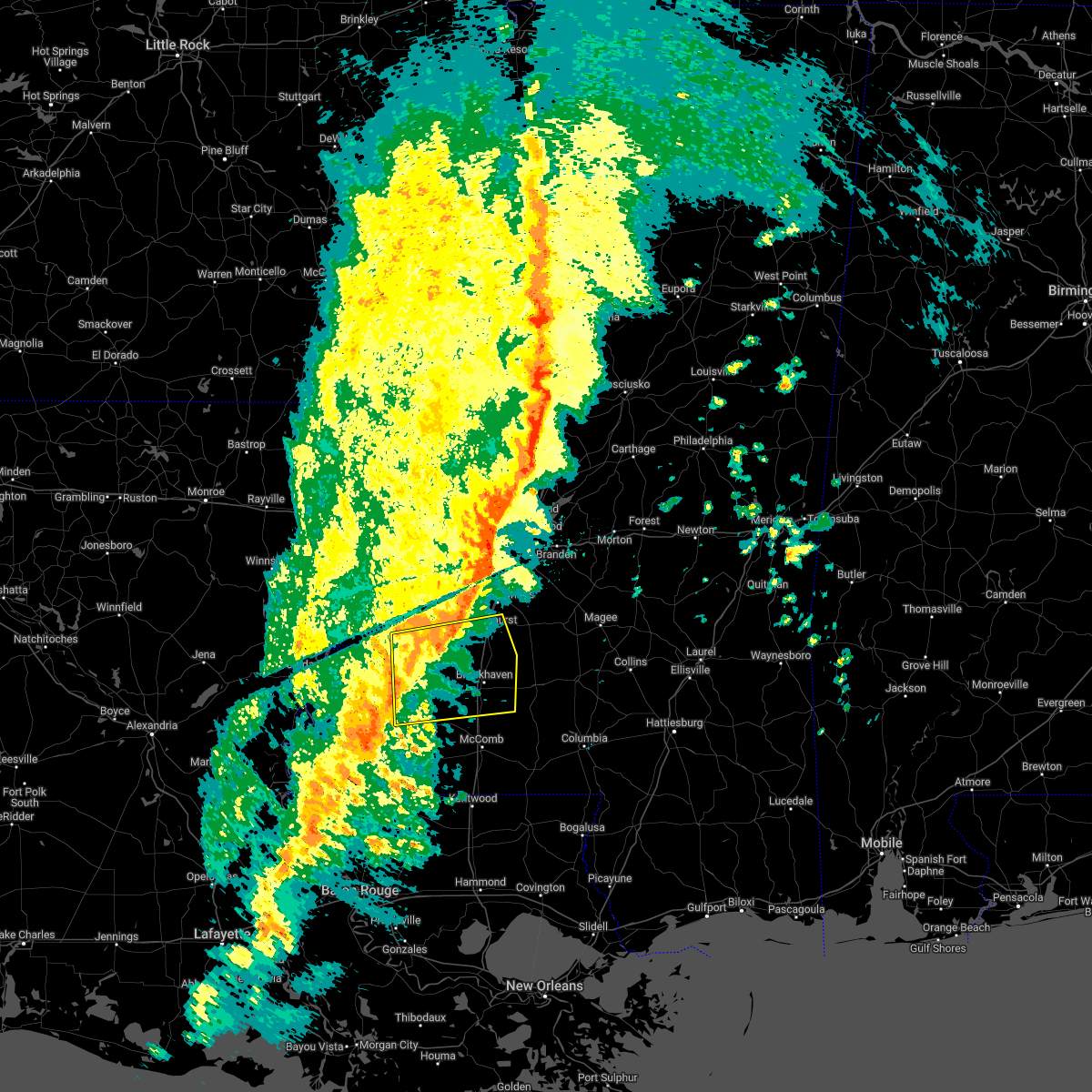 At 430 pm cdt, severe thunderstorms were located along a line extending from near fayette to near bude, moving east at 45 mph (radar indicated). Hazards include 60 mph wind gusts. expect damage to roofs, siding, and trees At 430 pm cdt, severe thunderstorms were located along a line extending from near fayette to near bude, moving east at 45 mph (radar indicated). Hazards include 60 mph wind gusts. expect damage to roofs, siding, and trees
|
| 3/22/2022 12:38 PM CDT |
 At 1237 pm cdt, severe thunderstorms were located along a line extending from near carpenter to allen, moving east at 55 mph (radar indicated). Hazards include 60 mph wind gusts and penny size hail. Expect damage to roofs, siding, and trees. these severe storms will be near, dentville around 1245 pm cdt. glancy around 1250 pm cdt. hazlehurst and martinsville around 1255 pm cdt. terry and gallman around 100 pm cdt. rockport and hopewell around 110 pm cdt. other locations impacted by these severe thunderstorms include beauregard and georgetown. hail threat, radar indicated max hail size, 0. 75 in wind threat, radar indicated max wind gust, 60 mph. At 1237 pm cdt, severe thunderstorms were located along a line extending from near carpenter to allen, moving east at 55 mph (radar indicated). Hazards include 60 mph wind gusts and penny size hail. Expect damage to roofs, siding, and trees. these severe storms will be near, dentville around 1245 pm cdt. glancy around 1250 pm cdt. hazlehurst and martinsville around 1255 pm cdt. terry and gallman around 100 pm cdt. rockport and hopewell around 110 pm cdt. other locations impacted by these severe thunderstorms include beauregard and georgetown. hail threat, radar indicated max hail size, 0. 75 in wind threat, radar indicated max wind gust, 60 mph.
|
| 3/22/2022 12:17 PM CDT |
 At 1217 pm cdt, severe thunderstorms were located along a line extending from port gibson to near red lick to near union church, moving east at 60 mph (radar indicated). Hazards include 60 mph wind gusts and penny size hail. Expect damage to roofs, siding, and trees. severe thunderstorms will be near, hermanville and pleasant hill around 1225 pm cdt. allen and barlow around 1230 pm cdt. carpenter around 1235 pm cdt. dentville and glancy around 1240 pm cdt. hazlehurst and martinsville around 1245 pm cdt. crystal springs and gallman around 1250 pm cdt. terry, hopewell and rockport around 100 pm cdt. other locations impacted by these severe thunderstorms include beauregard and georgetown. hail threat, radar indicated max hail size, 0. 75 in wind threat, radar indicated max wind gust, 60 mph. At 1217 pm cdt, severe thunderstorms were located along a line extending from port gibson to near red lick to near union church, moving east at 60 mph (radar indicated). Hazards include 60 mph wind gusts and penny size hail. Expect damage to roofs, siding, and trees. severe thunderstorms will be near, hermanville and pleasant hill around 1225 pm cdt. allen and barlow around 1230 pm cdt. carpenter around 1235 pm cdt. dentville and glancy around 1240 pm cdt. hazlehurst and martinsville around 1245 pm cdt. crystal springs and gallman around 1250 pm cdt. terry, hopewell and rockport around 100 pm cdt. other locations impacted by these severe thunderstorms include beauregard and georgetown. hail threat, radar indicated max hail size, 0. 75 in wind threat, radar indicated max wind gust, 60 mph.
|
| 10/5/2021 4:08 PM CDT |
 The severe thunderstorm warning for north central copiah county will expire at 415 pm cdt, the storm which prompted the warning has weakened below severe limits, and no longer poses an immediate threat to life or property. therefore, the warning will be allowed to expire. The severe thunderstorm warning for north central copiah county will expire at 415 pm cdt, the storm which prompted the warning has weakened below severe limits, and no longer poses an immediate threat to life or property. therefore, the warning will be allowed to expire.
|
| 10/5/2021 3:38 PM CDT |
 At 338 pm cdt, a severe thunderstorm was located near gallman, or near crystal springs, moving west at 5 mph (radar indicated). Hazards include 60 mph wind gusts and quarter size hail. Hail damage to vehicles is expected. expect wind damage to roofs, siding, and trees. this severe storm will be near, dentville around 430 pm cdt. hail threat, radar indicated max hail size, 1. 00 in wind threat, radar indicated max wind gust, 60 mph. At 338 pm cdt, a severe thunderstorm was located near gallman, or near crystal springs, moving west at 5 mph (radar indicated). Hazards include 60 mph wind gusts and quarter size hail. Hail damage to vehicles is expected. expect wind damage to roofs, siding, and trees. this severe storm will be near, dentville around 430 pm cdt. hail threat, radar indicated max hail size, 1. 00 in wind threat, radar indicated max wind gust, 60 mph.
|
| 10/5/2021 3:28 PM CDT |
 At 328 pm cdt, a severe thunderstorm was located near gallman, or near crystal springs, moving west at 5 mph (radar indicated). Hazards include quarter size hail. Damage to vehicles is expected. this severe thunderstorm will be near, dentville around 415 pm cdt. hail threat, radar indicated max hail size, 1. 00 in wind threat, radar indicated max wind gust, <50 mph. At 328 pm cdt, a severe thunderstorm was located near gallman, or near crystal springs, moving west at 5 mph (radar indicated). Hazards include quarter size hail. Damage to vehicles is expected. this severe thunderstorm will be near, dentville around 415 pm cdt. hail threat, radar indicated max hail size, 1. 00 in wind threat, radar indicated max wind gust, <50 mph.
|
| 9/1/2021 9:42 PM CDT |
 The severe thunderstorm warning for southeastern warren, claiborne, southwestern hinds and copiah counties will expire at 945 pm cdt, the storms which prompted the warning have weakened below severe limits, and no longer pose an immediate threat to life or property. therefore, the warning will be allowed to expire. The severe thunderstorm warning for southeastern warren, claiborne, southwestern hinds and copiah counties will expire at 945 pm cdt, the storms which prompted the warning have weakened below severe limits, and no longer pose an immediate threat to life or property. therefore, the warning will be allowed to expire.
|
| 9/1/2021 8:48 PM CDT |
 At 848 pm cdt, severe thunderstorms were located along a line extending from near edwards to near whites, moving southwest at 65 mph (radar indicated). Hazards include 60 mph wind gusts and nickel size hail. Expect damage to roofs, siding, and trees. severe thunderstorms will be near, newman around 855 pm cdt. crystal springs and reganton around 900 pm cdt. hazlehurst, rocky springs and gallman around 905 pm cdt. martinsville around 910 pm cdt. wesson, hermanville and glancy around 915 pm cdt. port gibson and pattison around 920 pm cdt. other locations impacted by these severe thunderstorms include beauregard and learned. hail threat, radar indicated max hail size, 0. 88 in wind threat, radar indicated max wind gust, 60 mph. At 848 pm cdt, severe thunderstorms were located along a line extending from near edwards to near whites, moving southwest at 65 mph (radar indicated). Hazards include 60 mph wind gusts and nickel size hail. Expect damage to roofs, siding, and trees. severe thunderstorms will be near, newman around 855 pm cdt. crystal springs and reganton around 900 pm cdt. hazlehurst, rocky springs and gallman around 905 pm cdt. martinsville around 910 pm cdt. wesson, hermanville and glancy around 915 pm cdt. port gibson and pattison around 920 pm cdt. other locations impacted by these severe thunderstorms include beauregard and learned. hail threat, radar indicated max hail size, 0. 88 in wind threat, radar indicated max wind gust, 60 mph.
|
| 5/4/2021 3:00 PM CDT | Several trees reported down in gallma in copiah county MS, 4.5 miles S of Hazlehurst, MS |
| 5/4/2021 2:40 PM CDT |
 At 240 pm cdt, severe thunderstorms were located along a line extending from near carpenter to 8 miles northeast of woodville, moving east at 60 mph (radar indicated). Hazards include 70 mph wind gusts and nickel size hail. Expect considerable tree damage. damage is likely to mobile homes, roofs, and outbuildings. severe thunderstorms will be near, dentville around 250 pm cdt. hazlehurst around 255 pm cdt. crystal springs and gallman around 300 pm cdt. hopewell around 310 pm cdt. union around 315 pm cdt. sanatorium around 335 pm cdt. other locations impacted by these severe thunderstorms include new hebron, silver creek, beauregard and georgetown. a tornado watch remains in effect until 400 pm cdt for central, south central and southeastern mississippi. A tornado watch also remains in effect until 600 pm cdt for southwestern mississippi. At 240 pm cdt, severe thunderstorms were located along a line extending from near carpenter to 8 miles northeast of woodville, moving east at 60 mph (radar indicated). Hazards include 70 mph wind gusts and nickel size hail. Expect considerable tree damage. damage is likely to mobile homes, roofs, and outbuildings. severe thunderstorms will be near, dentville around 250 pm cdt. hazlehurst around 255 pm cdt. crystal springs and gallman around 300 pm cdt. hopewell around 310 pm cdt. union around 315 pm cdt. sanatorium around 335 pm cdt. other locations impacted by these severe thunderstorms include new hebron, silver creek, beauregard and georgetown. a tornado watch remains in effect until 400 pm cdt for central, south central and southeastern mississippi. A tornado watch also remains in effect until 600 pm cdt for southwestern mississippi.
|
| 5/4/2021 12:47 PM CDT |
 At 1247 pm cdt, a severe thunderstorm was located near dentville, or 8 miles west of hazlehurst, moving northeast at 25 mph (radar indicated). Hazards include 60 mph wind gusts and half dollar size hail. Hail damage to vehicles is expected. expect wind damage to roofs, siding, and trees. this severe thunderstorm will be near, hazlehurst around 1255 pm cdt. gallman around 105 pm cdt. crystal springs around 110 pm cdt. A tornado watch remains in effect until 400 pm cdt for central mississippi. At 1247 pm cdt, a severe thunderstorm was located near dentville, or 8 miles west of hazlehurst, moving northeast at 25 mph (radar indicated). Hazards include 60 mph wind gusts and half dollar size hail. Hail damage to vehicles is expected. expect wind damage to roofs, siding, and trees. this severe thunderstorm will be near, hazlehurst around 1255 pm cdt. gallman around 105 pm cdt. crystal springs around 110 pm cdt. A tornado watch remains in effect until 400 pm cdt for central mississippi.
|
| 3/31/2021 11:55 AM CDT | The roof was blown off a business in hazlehurst. reported via social medi in copiah county MS, 0.4 miles NNW of Hazlehurst, MS |
| 3/17/2021 5:27 PM CDT |
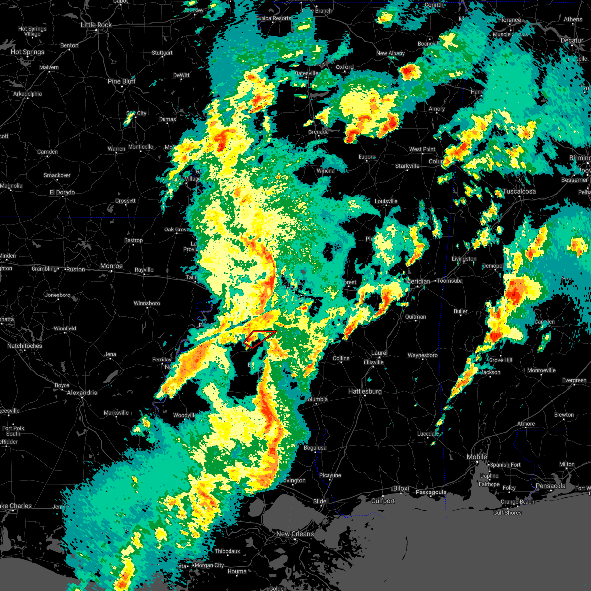 At 527 pm cdt, a severe thunderstorm capable of producing a tornado was located near glancy, or 9 miles west of hazlehurst, moving northeast at 40 mph (radar indicated rotation). Hazards include tornado. Flying debris will be dangerous to those caught without shelter. mobile homes will be damaged or destroyed. damage to roofs, windows, and vehicles will occur. tree damage is likely. this dangerous storm will be near, glancy around 530 pm cdt. hazlehurst around 540 pm cdt. Gallman around 545 pm cdt. At 527 pm cdt, a severe thunderstorm capable of producing a tornado was located near glancy, or 9 miles west of hazlehurst, moving northeast at 40 mph (radar indicated rotation). Hazards include tornado. Flying debris will be dangerous to those caught without shelter. mobile homes will be damaged or destroyed. damage to roofs, windows, and vehicles will occur. tree damage is likely. this dangerous storm will be near, glancy around 530 pm cdt. hazlehurst around 540 pm cdt. Gallman around 545 pm cdt.
|
| 3/17/2021 5:11 PM CDT |
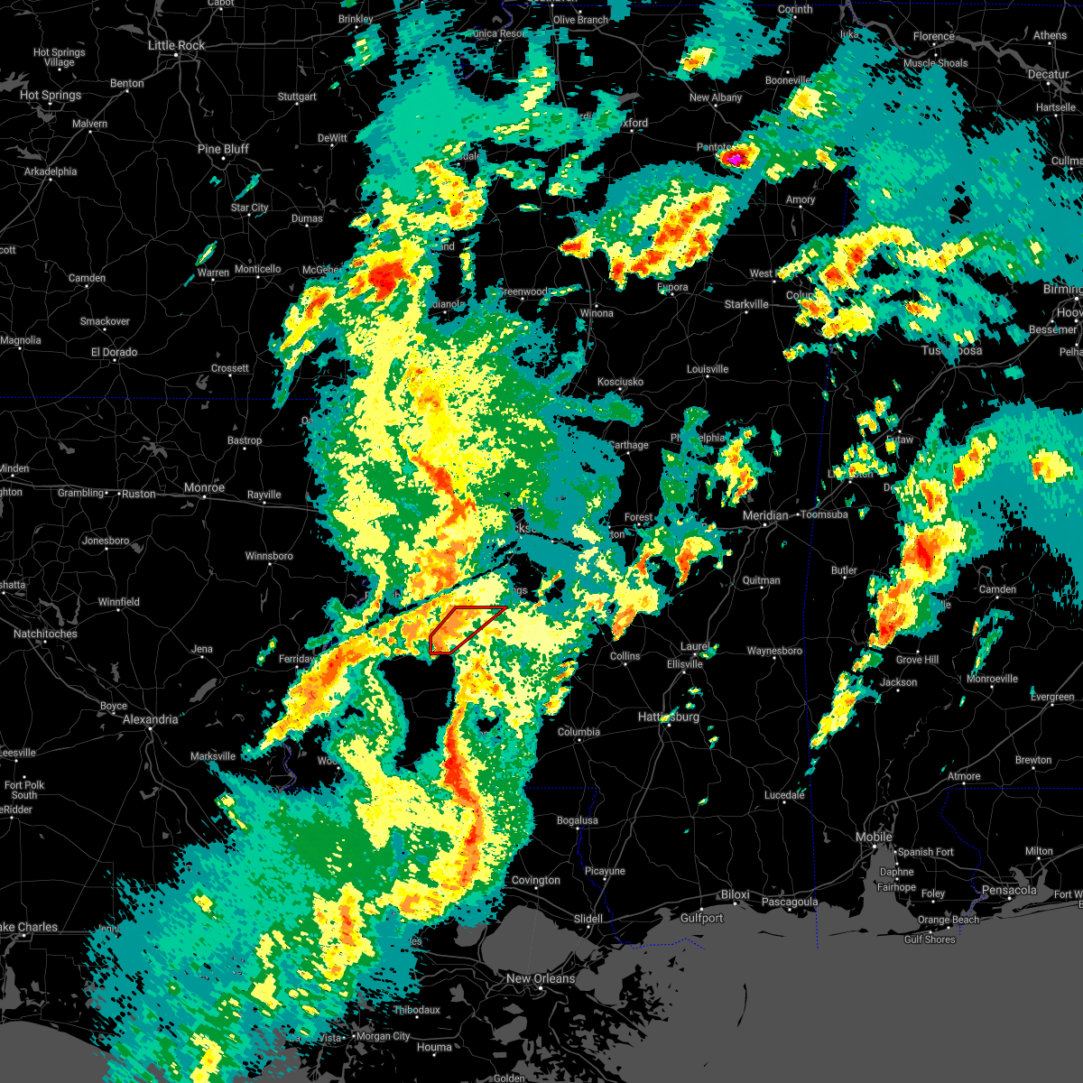 At 511 pm cdt, a severe thunderstorm capable of producing a tornado was located over allen, or 17 miles northwest of brookhaven, moving northeast at 50 mph (radar indicated rotation). Hazards include tornado. Flying debris will be dangerous to those caught without shelter. mobile homes will be damaged or destroyed. damage to roofs, windows, and vehicles will occur. tree damage is likely. this dangerous storm will be near, barlow around 520 pm cdt. glancy around 525 pm cdt. hazlehurst around 535 pm cdt. Gallman around 540 pm cdt. At 511 pm cdt, a severe thunderstorm capable of producing a tornado was located over allen, or 17 miles northwest of brookhaven, moving northeast at 50 mph (radar indicated rotation). Hazards include tornado. Flying debris will be dangerous to those caught without shelter. mobile homes will be damaged or destroyed. damage to roofs, windows, and vehicles will occur. tree damage is likely. this dangerous storm will be near, barlow around 520 pm cdt. glancy around 525 pm cdt. hazlehurst around 535 pm cdt. Gallman around 540 pm cdt.
|
| 3/17/2021 4:52 PM CDT |
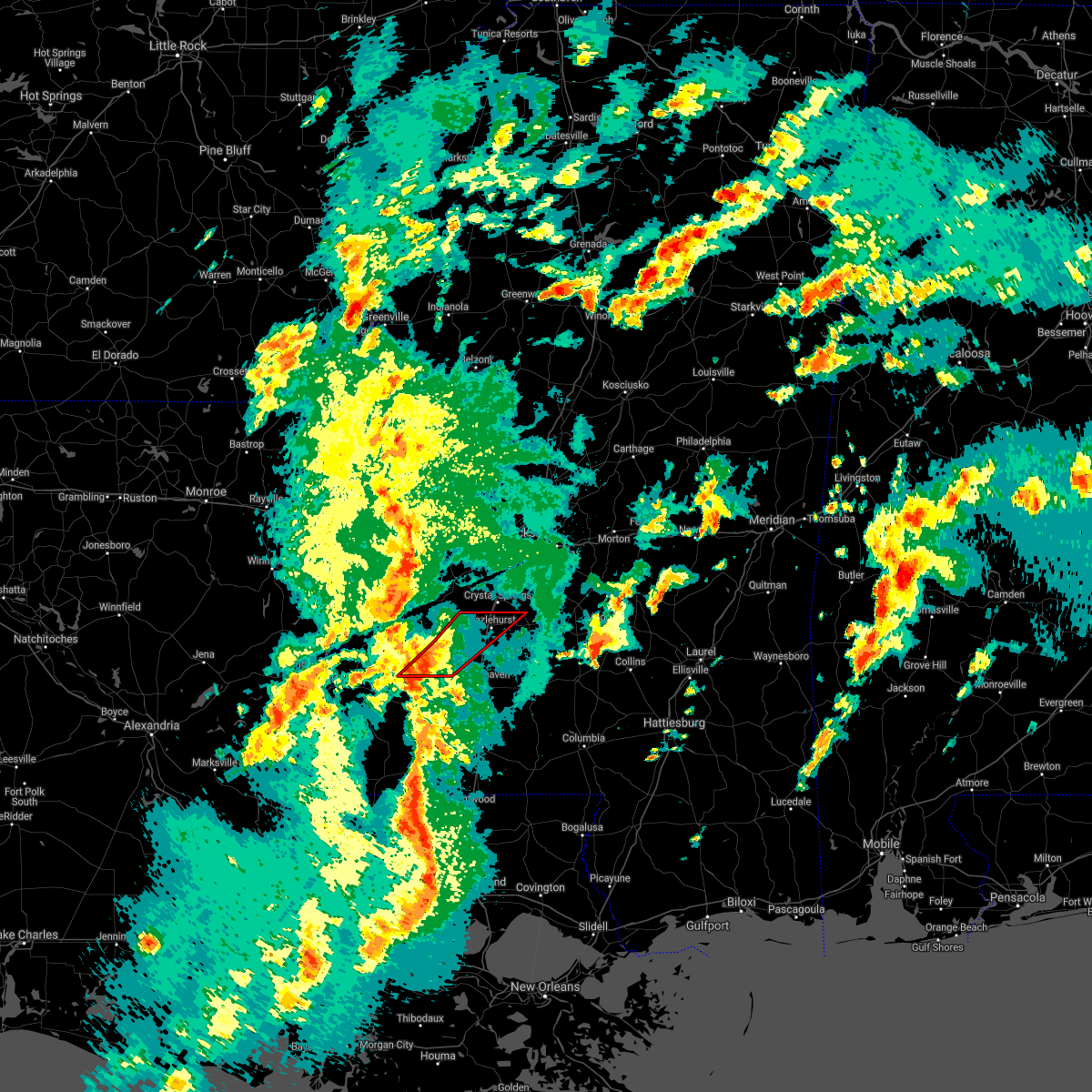 At 452 pm cdt, a severe thunderstorm capable of producing a tornado was located over new hope, or 24 miles west of brookhaven, moving northeast at 45 mph (radar indicated rotation). Hazards include tornado. Flying debris will be dangerous to those caught without shelter. mobile homes will be damaged or destroyed. damage to roofs, windows, and vehicles will occur. tree damage is likely. this dangerous storm will be near, union church around 505 pm cdt. pleasant hill and caseyville around 510 pm cdt. allen around 515 pm cdt. barlow around 520 pm cdt. glancy around 530 pm cdt. hazlehurst and martinsville around 535 pm cdt. Gallman around 540 pm cdt. At 452 pm cdt, a severe thunderstorm capable of producing a tornado was located over new hope, or 24 miles west of brookhaven, moving northeast at 45 mph (radar indicated rotation). Hazards include tornado. Flying debris will be dangerous to those caught without shelter. mobile homes will be damaged or destroyed. damage to roofs, windows, and vehicles will occur. tree damage is likely. this dangerous storm will be near, union church around 505 pm cdt. pleasant hill and caseyville around 510 pm cdt. allen around 515 pm cdt. barlow around 520 pm cdt. glancy around 530 pm cdt. hazlehurst and martinsville around 535 pm cdt. Gallman around 540 pm cdt.
|
| 3/16/2021 7:23 PM CDT | Hen Egg sized hail reported 8.8 miles WNW of Hazlehurst, MS, two inch hail fell along highway 472 before ashley road to the east of hazlehurst. |
| 3/16/2021 7:01 PM CDT |
 At 701 pm cdt, a severe thunderstorm capable of producing a tornado was located near martinsville, or 7 miles south of hazlehurst, moving east at 30 mph (radar indicated rotation). Hazards include tornado and half dollar size hail. Flying debris will be dangerous to those caught without shelter. mobile homes will be damaged or destroyed. damage to roofs, windows, and vehicles will occur. tree damage is likely. this dangerous storm will be near, rockport and oma around 725 pm cdt. union around 735 pm cdt. shivers around 745 pm cdt. pinola around 750 pm cdt. Other locations impacted by this tornadic thunderstorm include beauregard, new hebron and georgetown. At 701 pm cdt, a severe thunderstorm capable of producing a tornado was located near martinsville, or 7 miles south of hazlehurst, moving east at 30 mph (radar indicated rotation). Hazards include tornado and half dollar size hail. Flying debris will be dangerous to those caught without shelter. mobile homes will be damaged or destroyed. damage to roofs, windows, and vehicles will occur. tree damage is likely. this dangerous storm will be near, rockport and oma around 725 pm cdt. union around 735 pm cdt. shivers around 745 pm cdt. pinola around 750 pm cdt. Other locations impacted by this tornadic thunderstorm include beauregard, new hebron and georgetown.
|
| 3/16/2021 6:51 PM CDT | Golf Ball sized hail reported 2.9 miles NNE of Hazlehurst, MS, quarter to golfball size hail fell in and just south of hazlehurst. the golfball hail fell along i-55. |
| 3/16/2021 6:51 PM CDT |
 At 651 pm cdt, a severe thunderstorm was located near martinsville, or near hazlehurst, moving east at 30 mph (radar indicated). Hazards include two inch hail and 60 mph wind gusts. People and animals outdoors will be injured. expect hail damage to roofs, siding, windows, and vehicles. expect wind damage to roofs, siding, and trees. this severe storm will be near, hazlehurst around 655 pm cdt. gallman around 700 pm cdt. hopewell around 720 pm cdt. rockport around 725 pm cdt. Other locations impacted by this severe thunderstorm include georgetown. At 651 pm cdt, a severe thunderstorm was located near martinsville, or near hazlehurst, moving east at 30 mph (radar indicated). Hazards include two inch hail and 60 mph wind gusts. People and animals outdoors will be injured. expect hail damage to roofs, siding, windows, and vehicles. expect wind damage to roofs, siding, and trees. this severe storm will be near, hazlehurst around 655 pm cdt. gallman around 700 pm cdt. hopewell around 720 pm cdt. rockport around 725 pm cdt. Other locations impacted by this severe thunderstorm include georgetown.
|
| 3/16/2021 6:45 PM CDT | Ping Pong Ball sized hail reported 4.8 miles ENE of Hazlehurst, MS, hail ping pong ball size or slightly larger fell along highway 28. |
| 3/16/2021 6:45 PM CDT |
 At 645 pm cdt, a severe thunderstorm was located over glancy, or near hazlehurst, moving east at 30 mph (radar indicated). Hazards include 60 mph wind gusts and half dollar size hail. Hail damage to vehicles is expected. expect wind damage to roofs, siding, and trees. this severe thunderstorm will be near, martinsville around 650 pm cdt. hazlehurst around 655 pm cdt. gallman around 700 pm cdt. hopewell around 720 pm cdt. rockport around 725 pm cdt. Other locations impacted by this severe thunderstorm include georgetown. At 645 pm cdt, a severe thunderstorm was located over glancy, or near hazlehurst, moving east at 30 mph (radar indicated). Hazards include 60 mph wind gusts and half dollar size hail. Hail damage to vehicles is expected. expect wind damage to roofs, siding, and trees. this severe thunderstorm will be near, martinsville around 650 pm cdt. hazlehurst around 655 pm cdt. gallman around 700 pm cdt. hopewell around 720 pm cdt. rockport around 725 pm cdt. Other locations impacted by this severe thunderstorm include georgetown.
|
| 12/13/2020 8:28 PM CST |
 At 828 pm cst, severe thunderstorms were located along a line extending from gallman to near brookhaven to near center point, moving northeast at 45 mph (radar indicated). Hazards include 60 mph wind gusts. Expect damage to roofs, siding, and trees. severe thunderstorms will be near, wesson and gallman around 835 pm cst. hopewell and martinsville around 840 pm cst. enterprise, ruth and sontag around 850 pm cst. oma around 855 pm cst. rockport, east lincoln and topeka around 900 pm cst. union around 905 pm cst. monticello, robinwood and wanilla around 915 pm cst. Other locations impacted by these severe thunderstorms include beauregard and georgetown. At 828 pm cst, severe thunderstorms were located along a line extending from gallman to near brookhaven to near center point, moving northeast at 45 mph (radar indicated). Hazards include 60 mph wind gusts. Expect damage to roofs, siding, and trees. severe thunderstorms will be near, wesson and gallman around 835 pm cst. hopewell and martinsville around 840 pm cst. enterprise, ruth and sontag around 850 pm cst. oma around 855 pm cst. rockport, east lincoln and topeka around 900 pm cst. union around 905 pm cst. monticello, robinwood and wanilla around 915 pm cst. Other locations impacted by these severe thunderstorms include beauregard and georgetown.
|
| 9/23/2020 10:04 PM CDT |
 At 1004 pm cdt, a severe thunderstorm capable of producing a tornado was located over hazlehurst, moving north at 15 mph (radar indicated rotation). Hazards include tornado. Flying debris will be dangerous to those caught without shelter. mobile homes will be damaged or destroyed. damage to roofs, windows, and vehicles will occur. tree damage is likely. this dangerous storm will be near, gallman around 1015 pm cdt. crystal springs around 1025 pm cdt. Terry and dry grove around 1100 pm cdt. At 1004 pm cdt, a severe thunderstorm capable of producing a tornado was located over hazlehurst, moving north at 15 mph (radar indicated rotation). Hazards include tornado. Flying debris will be dangerous to those caught without shelter. mobile homes will be damaged or destroyed. damage to roofs, windows, and vehicles will occur. tree damage is likely. this dangerous storm will be near, gallman around 1015 pm cdt. crystal springs around 1025 pm cdt. Terry and dry grove around 1100 pm cdt.
|
| 6/25/2020 5:23 PM CDT |
 The severe thunderstorm warning for claiborne, simpson and copiah counties will expire at 530 pm cdt, the storms which prompted the warning have moved out of the area. therefore, the warning will be allowed to expire. however, gusty winds are still possible with these thunderstorms. The severe thunderstorm warning for claiborne, simpson and copiah counties will expire at 530 pm cdt, the storms which prompted the warning have moved out of the area. therefore, the warning will be allowed to expire. however, gusty winds are still possible with these thunderstorms.
|
| 6/25/2020 4:54 PM CDT |
 At 454 pm cdt, severe thunderstorms were located along a line extending from near hermanville to near harrisville to mendenhall to near mount olive, moving northeast at 60 mph (radar indicated). Hazards include 60 mph wind gusts. Expect damage to roofs, siding, and trees. these severe storms will be near, magee, mendenhall, martinville, harrisville and sanatorium around 500 pm cdt. Other locations impacted by these severe thunderstorms include d`lo, beauregard, braxton and georgetown. At 454 pm cdt, severe thunderstorms were located along a line extending from near hermanville to near harrisville to mendenhall to near mount olive, moving northeast at 60 mph (radar indicated). Hazards include 60 mph wind gusts. Expect damage to roofs, siding, and trees. these severe storms will be near, magee, mendenhall, martinville, harrisville and sanatorium around 500 pm cdt. Other locations impacted by these severe thunderstorms include d`lo, beauregard, braxton and georgetown.
|
| 6/25/2020 4:21 PM CDT |
 At 421 pm cdt, severe thunderstorms were located along a line extending from near church hill to near caseyville to near east lincoln to near salem, moving northeast at 40 mph (radar indicated). Hazards include 70 mph wind gusts. Expect considerable tree damage. damage is likely to mobile homes, roofs, and outbuildings. severe thunderstorms will be near, allen around 425 pm cdt. alcorn, glancy and martinsville around 440 pm cdt. hazlehurst around 450 pm cdt. port gibson, gallman and pattison around 455 pm cdt. crystal springs and rockport around 500 pm cdt. hermanville and hopewell around 505 pm cdt. union and shivers around 510 pm cdt. pinola and rocky springs around 515 pm cdt. Other locations impacted by these severe thunderstorms include d`lo, beauregard, braxton and georgetown. At 421 pm cdt, severe thunderstorms were located along a line extending from near church hill to near caseyville to near east lincoln to near salem, moving northeast at 40 mph (radar indicated). Hazards include 70 mph wind gusts. Expect considerable tree damage. damage is likely to mobile homes, roofs, and outbuildings. severe thunderstorms will be near, allen around 425 pm cdt. alcorn, glancy and martinsville around 440 pm cdt. hazlehurst around 450 pm cdt. port gibson, gallman and pattison around 455 pm cdt. crystal springs and rockport around 500 pm cdt. hermanville and hopewell around 505 pm cdt. union and shivers around 510 pm cdt. pinola and rocky springs around 515 pm cdt. Other locations impacted by these severe thunderstorms include d`lo, beauregard, braxton and georgetown.
|
| 6/5/2020 7:34 PM CDT |
 At 733 pm cdt, severe thunderstorms were located along a line extending from near glancy to rockport to 7 miles northwest of clem, moving south at 35 mph (radar indicated). Hazards include 60 mph wind gusts. Expect damage to roofs, siding, and trees. these severe storms will be near, glancy and martinsville around 740 pm cdt. barlow around 745 pm cdt. allen around 750 pm cdt. Other locations impacted by these severe thunderstorms include beauregard and georgetown. At 733 pm cdt, severe thunderstorms were located along a line extending from near glancy to rockport to 7 miles northwest of clem, moving south at 35 mph (radar indicated). Hazards include 60 mph wind gusts. Expect damage to roofs, siding, and trees. these severe storms will be near, glancy and martinsville around 740 pm cdt. barlow around 745 pm cdt. allen around 750 pm cdt. Other locations impacted by these severe thunderstorms include beauregard and georgetown.
|
| 6/5/2020 7:25 PM CDT | Several trees down across the county...reported by copiah s in copiah county MS, 0.5 miles NE of Hazlehurst, MS |
| 6/5/2020 7:20 PM CDT |
 At 720 pm cdt, severe thunderstorms were located along a line extending from near dentville to near union to sanatorium, moving south at 40 mph (radar indicated). Hazards include 60 mph wind gusts. Expect damage to roofs, siding, and trees. these severe storms will be near, hazlehurst around 725 pm cdt. rockport around 730 pm cdt. glancy and martinsville around 735 pm cdt. wesson around 745 pm cdt. Other locations impacted by these severe thunderstorms include beauregard and georgetown. At 720 pm cdt, severe thunderstorms were located along a line extending from near dentville to near union to sanatorium, moving south at 40 mph (radar indicated). Hazards include 60 mph wind gusts. Expect damage to roofs, siding, and trees. these severe storms will be near, hazlehurst around 725 pm cdt. rockport around 730 pm cdt. glancy and martinsville around 735 pm cdt. wesson around 745 pm cdt. Other locations impacted by these severe thunderstorms include beauregard and georgetown.
|
| 6/5/2020 7:04 PM CDT |
 At 704 pm cdt, severe thunderstorms were located along a line extending from near dry grove to near star to white oak, moving south at 35 mph (radar indicated). Hazards include 60 mph wind gusts. Expect damage to roofs, siding, and trees. these severe storms will be near, harrisville around 715 pm cdt. crystal springs and hopewell around 720 pm cdt. magee, union, gallman, sanatorium and dentville around 725 pm cdt. hazlehurst and shivers around 730 pm cdt. rockport around 735 pm cdt. glancy and martinsville around 740 pm cdt. wesson around 750 pm cdt. Other locations impacted by these severe thunderstorms include d`lo, beauregard, learned, braxton and georgetown. At 704 pm cdt, severe thunderstorms were located along a line extending from near dry grove to near star to white oak, moving south at 35 mph (radar indicated). Hazards include 60 mph wind gusts. Expect damage to roofs, siding, and trees. these severe storms will be near, harrisville around 715 pm cdt. crystal springs and hopewell around 720 pm cdt. magee, union, gallman, sanatorium and dentville around 725 pm cdt. hazlehurst and shivers around 730 pm cdt. rockport around 735 pm cdt. glancy and martinsville around 740 pm cdt. wesson around 750 pm cdt. Other locations impacted by these severe thunderstorms include d`lo, beauregard, learned, braxton and georgetown.
|
| 6/5/2020 6:41 PM CDT |
 At 641 pm cdt, severe thunderstorms were located along a line extending from near clinton to near pearl to 6 miles west of pulaski, moving south at 35 mph (radar indicated). Hazards include 60 mph wind gusts. Expect damage to roofs, siding, and trees. severe thunderstorms will be near, star around 700 pm cdt. dry grove and whites around 705 pm cdt. martinville and harrisville around 715 pm cdt. mendenhall and hopewell around 720 pm cdt. union and sanatorium around 725 pm cdt. dentville around 730 pm cdt. pinola and rockport around 735 pm cdt. glancy around 740 pm cdt. Other locations impacted by these severe thunderstorms include d`lo, beauregard, learned, braxton and georgetown. At 641 pm cdt, severe thunderstorms were located along a line extending from near clinton to near pearl to 6 miles west of pulaski, moving south at 35 mph (radar indicated). Hazards include 60 mph wind gusts. Expect damage to roofs, siding, and trees. severe thunderstorms will be near, star around 700 pm cdt. dry grove and whites around 705 pm cdt. martinville and harrisville around 715 pm cdt. mendenhall and hopewell around 720 pm cdt. union and sanatorium around 725 pm cdt. dentville around 730 pm cdt. pinola and rockport around 735 pm cdt. glancy around 740 pm cdt. Other locations impacted by these severe thunderstorms include d`lo, beauregard, learned, braxton and georgetown.
|
| 6/3/2020 2:50 PM CDT |
 The severe thunderstorm warning for eastern copiah county will expire at 300 pm cdt, the storm which prompted the warning has weakened below severe limits, and no longer poses an immediate threat to life or property. therefore, the warning will be allowed to expire. however heavy rain is still possible with this thunderstorm. The severe thunderstorm warning for eastern copiah county will expire at 300 pm cdt, the storm which prompted the warning has weakened below severe limits, and no longer poses an immediate threat to life or property. therefore, the warning will be allowed to expire. however heavy rain is still possible with this thunderstorm.
|
| 6/3/2020 2:39 PM CDT |
 At 239 pm cdt, a severe thunderstorm was located over hazlehurst, moving east at 10 mph (radar indicated). Hazards include 60 mph wind gusts. Expect damage to roofs, siding, and trees. this severe storm will be near, crystal springs around 250 pm cdt. Hopewell around 315 pm cdt. At 239 pm cdt, a severe thunderstorm was located over hazlehurst, moving east at 10 mph (radar indicated). Hazards include 60 mph wind gusts. Expect damage to roofs, siding, and trees. this severe storm will be near, crystal springs around 250 pm cdt. Hopewell around 315 pm cdt.
|
| 6/3/2020 2:30 PM CDT | Quarter sized hail reported 1 miles ESE of Hazlehurst, MS, a few stones to quarter size. |
| 6/3/2020 2:21 PM CDT |
 At 221 pm cdt, a severe thunderstorm was located over hazlehurst, moving east at 15 mph (radar indicated). Hazards include 60 mph wind gusts and quarter size hail. Hail damage to vehicles is expected. expect wind damage to roofs, siding, and trees. this severe thunderstorm will be near, hazlehurst around 225 pm cdt. gallman around 235 pm cdt. crystal springs around 245 pm cdt. Hopewell around 300 pm cdt. At 221 pm cdt, a severe thunderstorm was located over hazlehurst, moving east at 15 mph (radar indicated). Hazards include 60 mph wind gusts and quarter size hail. Hail damage to vehicles is expected. expect wind damage to roofs, siding, and trees. this severe thunderstorm will be near, hazlehurst around 225 pm cdt. gallman around 235 pm cdt. crystal springs around 245 pm cdt. Hopewell around 300 pm cdt.
|
| 5/27/2020 2:33 PM CDT |
 At 232 pm cdt, a severe thunderstorm was located near crystal springs, moving northeast at 30 mph (radar indicated). Hazards include 60 mph wind gusts and quarter size hail. Hail damage to vehicles is expected. expect wind damage to roofs, siding, and trees. This severe storm will be near, crystal springs around 240 pm cdt. At 232 pm cdt, a severe thunderstorm was located near crystal springs, moving northeast at 30 mph (radar indicated). Hazards include 60 mph wind gusts and quarter size hail. Hail damage to vehicles is expected. expect wind damage to roofs, siding, and trees. This severe storm will be near, crystal springs around 240 pm cdt.
|
| 5/27/2020 2:22 PM CDT |
 At 222 pm cdt, a severe thunderstorm was located near dentville, or 8 miles northwest of hazlehurst, moving northeast at 30 mph (radar indicated). Hazards include 60 mph wind gusts and quarter size hail. Hail damage to vehicles is expected. expect wind damage to roofs, siding, and trees. this severe storm will be near, hazlehurst around 225 pm cdt. gallman around 230 pm cdt. Crystal springs around 235 pm cdt. At 222 pm cdt, a severe thunderstorm was located near dentville, or 8 miles northwest of hazlehurst, moving northeast at 30 mph (radar indicated). Hazards include 60 mph wind gusts and quarter size hail. Hail damage to vehicles is expected. expect wind damage to roofs, siding, and trees. this severe storm will be near, hazlehurst around 225 pm cdt. gallman around 230 pm cdt. Crystal springs around 235 pm cdt.
|
| 5/27/2020 2:09 PM CDT |
 At 209 pm cdt, a severe thunderstorm was located near dentville, or 10 miles west of hazlehurst, moving northeast at 30 mph (radar indicated). Hazards include 60 mph wind gusts and quarter size hail. Hail damage to vehicles is expected. expect wind damage to roofs, siding, and trees. this severe thunderstorm will be near, dentville around 215 pm cdt. hazlehurst around 225 pm cdt. gallman around 230 pm cdt. Crystal springs around 235 pm cdt. At 209 pm cdt, a severe thunderstorm was located near dentville, or 10 miles west of hazlehurst, moving northeast at 30 mph (radar indicated). Hazards include 60 mph wind gusts and quarter size hail. Hail damage to vehicles is expected. expect wind damage to roofs, siding, and trees. this severe thunderstorm will be near, dentville around 215 pm cdt. hazlehurst around 225 pm cdt. gallman around 230 pm cdt. Crystal springs around 235 pm cdt.
|
| 5/8/2020 9:27 AM CDT |
 At 927 am cdt, severe thunderstorms were located along a line extending from near hazlehurst to 6 miles south of glancy to near mccall creek to near bude to garden city, moving southeast at 45 mph (radar indicated). Hazards include 60 mph wind gusts. Expect damage to roofs, siding, and trees. these severe storms will be near, crystal springs, hazlehurst, gallman, mccall creek, martinsville and glancy around 930 am cdt. brookhaven, vaughn, west lincoln and loyd star around 935 am cdt. wesson and center point around 940 am cdt. enterprise, rockport and bogue chitto around 950 am cdt. east lincoln around 955 am cdt. ruth around 1000 am cdt. Other locations impacted by these severe thunderstorms include beauregard and georgetown. At 927 am cdt, severe thunderstorms were located along a line extending from near hazlehurst to 6 miles south of glancy to near mccall creek to near bude to garden city, moving southeast at 45 mph (radar indicated). Hazards include 60 mph wind gusts. Expect damage to roofs, siding, and trees. these severe storms will be near, crystal springs, hazlehurst, gallman, mccall creek, martinsville and glancy around 930 am cdt. brookhaven, vaughn, west lincoln and loyd star around 935 am cdt. wesson and center point around 940 am cdt. enterprise, rockport and bogue chitto around 950 am cdt. east lincoln around 955 am cdt. ruth around 1000 am cdt. Other locations impacted by these severe thunderstorms include beauregard and georgetown.
|
| 5/8/2020 9:22 AM CDT |
 At 922 am cdt, severe thunderstorms were located along a line extending from near glancy to near allen to near mccall creek to bude to garden city, moving southeast at 50 mph (radar indicated). Hazards include 60 mph wind gusts. Expect damage to roofs, siding, and trees. these severe storms will be near, hazlehurst, martinsville, vaughn, mccall creek, glancy, loyd star and gallman around 930 am cdt. brookhaven, wesson and west lincoln around 935 am cdt. center point around 940 am cdt. bogue chitto and rockport around 945 am cdt. enterprise around 950 am cdt. east lincoln and ruth around 955 am cdt. Other locations impacted by these severe thunderstorms include beauregard and georgetown. At 922 am cdt, severe thunderstorms were located along a line extending from near glancy to near allen to near mccall creek to bude to garden city, moving southeast at 50 mph (radar indicated). Hazards include 60 mph wind gusts. Expect damage to roofs, siding, and trees. these severe storms will be near, hazlehurst, martinsville, vaughn, mccall creek, glancy, loyd star and gallman around 930 am cdt. brookhaven, wesson and west lincoln around 935 am cdt. center point around 940 am cdt. bogue chitto and rockport around 945 am cdt. enterprise around 950 am cdt. east lincoln and ruth around 955 am cdt. Other locations impacted by these severe thunderstorms include beauregard and georgetown.
|
| 5/8/2020 9:04 AM CDT |
 At 904 am cdt, severe thunderstorms were located along a line extending from 6 miles east of hermanville to mcbride to 6 miles east of mcnair to near sibley, moving southeast at 45 mph (radar indicated). Hazards include 60 mph wind gusts. Expect damage to roofs, siding, and trees. severe thunderstorms will be near, pleasant hill around 910 am cdt. allen, dentville and barlow around 915 am cdt. caseyville around 920 am cdt. glancy and mccall creek around 925 am cdt. hazlehurst, martinsville, loyd star and gallman around 930 am cdt. brookhaven, wesson, west lincoln and vaughn around 935 am cdt. bogue chitto around 945 am cdt. enterprise and rockport around 950 am cdt. Other locations impacted by these severe thunderstorms include beauregard and georgetown. At 904 am cdt, severe thunderstorms were located along a line extending from 6 miles east of hermanville to mcbride to 6 miles east of mcnair to near sibley, moving southeast at 45 mph (radar indicated). Hazards include 60 mph wind gusts. Expect damage to roofs, siding, and trees. severe thunderstorms will be near, pleasant hill around 910 am cdt. allen, dentville and barlow around 915 am cdt. caseyville around 920 am cdt. glancy and mccall creek around 925 am cdt. hazlehurst, martinsville, loyd star and gallman around 930 am cdt. brookhaven, wesson, west lincoln and vaughn around 935 am cdt. bogue chitto around 945 am cdt. enterprise and rockport around 950 am cdt. Other locations impacted by these severe thunderstorms include beauregard and georgetown.
|
| 4/22/2020 10:33 PM CDT | Trees dow in copiah county MS, 14.4 miles WNW of Hazlehurst, MS |
| 4/22/2020 10:19 PM CDT |
 At 1019 pm cdt, severe thunderstorms were located along a line extending from crystal springs to near wesson to near brookhaven, moving east at 55 mph (radar indicated). Hazards include golf ball size hail and 60 mph wind gusts. People and animals outdoors will be injured. expect hail damage to roofs, siding, windows, and vehicles. expect wind damage to roofs, siding, and trees. these severe storms will be near, hopewell around 1030 pm cdt. rockport around 1035 pm cdt. other locations impacted by these severe thunderstorms include beauregard and georgetown. A tornado watch remains in effect until 500 am cdt for central and south central mississippi. At 1019 pm cdt, severe thunderstorms were located along a line extending from crystal springs to near wesson to near brookhaven, moving east at 55 mph (radar indicated). Hazards include golf ball size hail and 60 mph wind gusts. People and animals outdoors will be injured. expect hail damage to roofs, siding, windows, and vehicles. expect wind damage to roofs, siding, and trees. these severe storms will be near, hopewell around 1030 pm cdt. rockport around 1035 pm cdt. other locations impacted by these severe thunderstorms include beauregard and georgetown. A tornado watch remains in effect until 500 am cdt for central and south central mississippi.
|
| 4/22/2020 10:11 PM CDT | Trees dow in copiah county MS, 7 miles ENE of Hazlehurst, MS |
| 4/22/2020 10:06 PM CDT |
 At 1006 pm cdt, severe thunderstorms were located along a line extending from near dentville to near allen to near caseyville, moving east at 60 mph (radar indicated). Hazards include 60 mph wind gusts and quarter size hail. Hail damage to vehicles is expected. expect wind damage to roofs, siding, and trees. these severe storms will be near, glancy around 1010 pm cdt. crystal springs, martinsville and gallman around 1015 pm cdt. brookhaven and wesson around 1020 pm cdt. hopewell around 1025 pm cdt. rockport around 1030 pm cdt. other locations impacted by these severe thunderstorms include beauregard and georgetown. A tornado watch remains in effect until 500 am cdt for central, south central and southwestern mississippi. At 1006 pm cdt, severe thunderstorms were located along a line extending from near dentville to near allen to near caseyville, moving east at 60 mph (radar indicated). Hazards include 60 mph wind gusts and quarter size hail. Hail damage to vehicles is expected. expect wind damage to roofs, siding, and trees. these severe storms will be near, glancy around 1010 pm cdt. crystal springs, martinsville and gallman around 1015 pm cdt. brookhaven and wesson around 1020 pm cdt. hopewell around 1025 pm cdt. rockport around 1030 pm cdt. other locations impacted by these severe thunderstorms include beauregard and georgetown. A tornado watch remains in effect until 500 am cdt for central, south central and southwestern mississippi.
|
| 4/22/2020 10:03 PM CDT | Trees dow in copiah county MS, 17.6 miles ENE of Hazlehurst, MS |
| 4/22/2020 9:58 PM CDT |
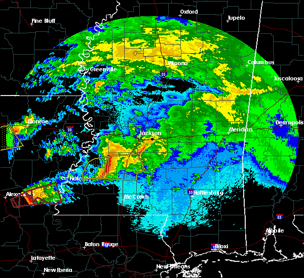 At 958 pm cdt, severe thunderstorms were located along a line extending from near carpenter to pleasant hill to near new hope, moving east at 55 mph (radar indicated). Hazards include 60 mph wind gusts and quarter size hail. Hail damage to vehicles is expected. expect wind damage to roofs, siding, and trees. severe thunderstorms will be near, dentville around 1005 pm cdt. hazlehurst, loyd star and glancy around 1015 pm cdt. crystal springs, wesson, gallman and martinsville around 1020 pm cdt. brookhaven around 1025 pm cdt. hopewell around 1030 pm cdt. rockport around 1035 pm cdt. other locations impacted by these severe thunderstorms include beauregard and georgetown. A tornado watch remains in effect until 500 am cdt for central, south central and southwestern mississippi. At 958 pm cdt, severe thunderstorms were located along a line extending from near carpenter to pleasant hill to near new hope, moving east at 55 mph (radar indicated). Hazards include 60 mph wind gusts and quarter size hail. Hail damage to vehicles is expected. expect wind damage to roofs, siding, and trees. severe thunderstorms will be near, dentville around 1005 pm cdt. hazlehurst, loyd star and glancy around 1015 pm cdt. crystal springs, wesson, gallman and martinsville around 1020 pm cdt. brookhaven around 1025 pm cdt. hopewell around 1030 pm cdt. rockport around 1035 pm cdt. other locations impacted by these severe thunderstorms include beauregard and georgetown. A tornado watch remains in effect until 500 am cdt for central, south central and southwestern mississippi.
|
| 4/22/2020 9:33 PM CDT |
 At 933 pm cdt, a severe thunderstorm was located near hazlehurst, moving east at 40 mph (law enforcement). Hazards include 60 mph wind gusts and penny size hail. Expect damage to roofs, siding, and trees. this severe storm will be near, gallman around 940 pm cdt. crystal springs around 945 pm cdt. hopewell around 955 pm cdt. union and harrisville around 1000 pm cdt. Other locations impacted by this severe thunderstorm include georgetown. At 933 pm cdt, a severe thunderstorm was located near hazlehurst, moving east at 40 mph (law enforcement). Hazards include 60 mph wind gusts and penny size hail. Expect damage to roofs, siding, and trees. this severe storm will be near, gallman around 940 pm cdt. crystal springs around 945 pm cdt. hopewell around 955 pm cdt. union and harrisville around 1000 pm cdt. Other locations impacted by this severe thunderstorm include georgetown.
|
| 4/22/2020 9:19 PM CDT |
 A severe thunderstorm warning remains in effect until 1000 pm cdt for western simpson and copiah counties. at 919 pm cdt, a severe thunderstorm was located near barlow, or 12 miles west of hazlehurst, moving east at 45 mph. hazard. 60 mph wind gusts and quarter size hail. source. Law enforcement. A severe thunderstorm warning remains in effect until 1000 pm cdt for western simpson and copiah counties. at 919 pm cdt, a severe thunderstorm was located near barlow, or 12 miles west of hazlehurst, moving east at 45 mph. hazard. 60 mph wind gusts and quarter size hail. source. Law enforcement.
|
| 4/22/2020 9:02 PM CDT |
 At 902 pm cdt, a severe thunderstorm was located over peyton, or 25 miles west of hazlehurst, moving east at 50 mph (radar indicated). Hazards include golf ball size hail and 60 mph wind gusts. People and animals outdoors will be injured. expect hail damage to roofs, siding, windows, and vehicles. expect wind damage to roofs, siding, and trees. this severe thunderstorm will be near, barlow and allen around 915 pm cdt. dentville around 920 pm cdt. glancy around 925 pm cdt. hazlehurst and martinsville around 930 pm cdt. crystal springs and gallman around 935 pm cdt. hopewell around 945 pm cdt. rockport around 950 pm cdt. union and harrisville around 955 pm cdt. Other locations impacted by this severe thunderstorm include georgetown. At 902 pm cdt, a severe thunderstorm was located over peyton, or 25 miles west of hazlehurst, moving east at 50 mph (radar indicated). Hazards include golf ball size hail and 60 mph wind gusts. People and animals outdoors will be injured. expect hail damage to roofs, siding, windows, and vehicles. expect wind damage to roofs, siding, and trees. this severe thunderstorm will be near, barlow and allen around 915 pm cdt. dentville around 920 pm cdt. glancy around 925 pm cdt. hazlehurst and martinsville around 930 pm cdt. crystal springs and gallman around 935 pm cdt. hopewell around 945 pm cdt. rockport around 950 pm cdt. union and harrisville around 955 pm cdt. Other locations impacted by this severe thunderstorm include georgetown.
|
| 4/19/2020 3:45 PM CDT | Tree brought down power line. reports of numerous power lines down in the are in copiah county MS, 6.8 miles SE of Hazlehurst, MS |
| 4/19/2020 3:11 PM CDT |
 At 311 pm cdt, severe thunderstorms were located along a line extending from near reganton to red lick, moving east at 45 mph (radar indicated). Hazards include 60 mph wind gusts. Expect damage to roofs, siding, and trees. severe thunderstorms will be near, reganton around 315 pm cdt. utica around 320 pm cdt. barlow and dry grove around 335 pm cdt. jackson and terry around 345 pm cdt. byram and glancy around 350 pm cdt. hazlehurst, martinsville and gallman around 355 pm cdt. rockport around 415 pm cdt. other locations impacted by these severe thunderstorms include learned and georgetown. A tornado watch remains in effect until 700 pm cdt for central, southwestern and west central mississippi. At 311 pm cdt, severe thunderstorms were located along a line extending from near reganton to red lick, moving east at 45 mph (radar indicated). Hazards include 60 mph wind gusts. Expect damage to roofs, siding, and trees. severe thunderstorms will be near, reganton around 315 pm cdt. utica around 320 pm cdt. barlow and dry grove around 335 pm cdt. jackson and terry around 345 pm cdt. byram and glancy around 350 pm cdt. hazlehurst, martinsville and gallman around 355 pm cdt. rockport around 415 pm cdt. other locations impacted by these severe thunderstorms include learned and georgetown. A tornado watch remains in effect until 700 pm cdt for central, southwestern and west central mississippi.
|
| 3/31/2020 5:57 AM CDT |
 At 557 am cdt, a severe thunderstorm was located near hopewell, or 11 miles southeast of crystal springs, moving east at 45 mph (radar indicated). Hazards include 60 mph wind gusts. Expect damage to roofs, siding, and trees. this severe storm will be near, rockport around 600 am cdt. union and harrisville around 605 am cdt. pinola and shivers around 615 am cdt. mendenhall around 625 am cdt. magee, sanatorium and martinville around 630 am cdt. Other locations impacted by this severe thunderstorm include d`lo, braxton and georgetown. At 557 am cdt, a severe thunderstorm was located near hopewell, or 11 miles southeast of crystal springs, moving east at 45 mph (radar indicated). Hazards include 60 mph wind gusts. Expect damage to roofs, siding, and trees. this severe storm will be near, rockport around 600 am cdt. union and harrisville around 605 am cdt. pinola and shivers around 615 am cdt. mendenhall around 625 am cdt. magee, sanatorium and martinville around 630 am cdt. Other locations impacted by this severe thunderstorm include d`lo, braxton and georgetown.
|
| 3/31/2020 5:41 AM CDT |
 At 541 am cdt, a severe thunderstorm was located over hazlehurst, moving east at 50 mph (radar indicated). Hazards include 60 mph wind gusts. Expect damage to roofs, siding, and trees. this severe thunderstorm will be near, crystal springs around 545 am cdt. hopewell around 555 am cdt. rockport around 600 am cdt. union and harrisville around 605 am cdt. shivers around 610 am cdt. pinola around 615 am cdt. mendenhall around 620 am cdt. sanatorium around 625 am cdt. Other locations impacted by this severe thunderstorm include d`lo, braxton and georgetown. At 541 am cdt, a severe thunderstorm was located over hazlehurst, moving east at 50 mph (radar indicated). Hazards include 60 mph wind gusts. Expect damage to roofs, siding, and trees. this severe thunderstorm will be near, crystal springs around 545 am cdt. hopewell around 555 am cdt. rockport around 600 am cdt. union and harrisville around 605 am cdt. shivers around 610 am cdt. pinola around 615 am cdt. mendenhall around 620 am cdt. sanatorium around 625 am cdt. Other locations impacted by this severe thunderstorm include d`lo, braxton and georgetown.
|
| 3/4/2020 3:44 AM CST |
 At 344 am cst, a severe thunderstorm was located over glancy, or near hazlehurst, moving east at 35 mph (radar indicated). Hazards include 60 mph wind gusts and half dollar size hail. Hail damage to vehicles is expected. expect wind damage to roofs, siding, and trees. this severe thunderstorm will be near, hazlehurst and martinsville around 350 am cst. wesson around 355 am cst. rockport and oma around 420 am cst. union around 425 am cst. shivers around 435 am cst. other locations impacted by this severe thunderstorm include beauregard, new hebron and georgetown. A tornado watch remains in effect until 1000 am cst for central and south central mississippi. At 344 am cst, a severe thunderstorm was located over glancy, or near hazlehurst, moving east at 35 mph (radar indicated). Hazards include 60 mph wind gusts and half dollar size hail. Hail damage to vehicles is expected. expect wind damage to roofs, siding, and trees. this severe thunderstorm will be near, hazlehurst and martinsville around 350 am cst. wesson around 355 am cst. rockport and oma around 420 am cst. union around 425 am cst. shivers around 435 am cst. other locations impacted by this severe thunderstorm include beauregard, new hebron and georgetown. A tornado watch remains in effect until 1000 am cst for central and south central mississippi.
|
| 1/11/2020 8:20 AM CST | Tree on hom in copiah county MS, 1.1 miles NNE of Hazlehurst, MS |
| 1/11/2020 8:08 AM CST |
 At 808 am cst, a severe thunderstorm capable of producing a tornado was located near wesson, or 7 miles north of brookhaven, moving northeast at 45 mph (radar indicated rotation). Hazards include tornado. Flying debris will be dangerous to those caught without shelter. mobile homes will be damaged or destroyed. damage to roofs, windows, and vehicles will occur. tree damage is likely. this dangerous storm will be near, martinsville around 820 am cst. hazlehurst around 825 am cst. rockport around 835 am cst. union and hopewell around 840 am cst. harrisville around 850 am cst. Other locations impacted by this tornadic thunderstorm include d`lo, beauregard, braxton and georgetown. At 808 am cst, a severe thunderstorm capable of producing a tornado was located near wesson, or 7 miles north of brookhaven, moving northeast at 45 mph (radar indicated rotation). Hazards include tornado. Flying debris will be dangerous to those caught without shelter. mobile homes will be damaged or destroyed. damage to roofs, windows, and vehicles will occur. tree damage is likely. this dangerous storm will be near, martinsville around 820 am cst. hazlehurst around 825 am cst. rockport around 835 am cst. union and hopewell around 840 am cst. harrisville around 850 am cst. Other locations impacted by this tornadic thunderstorm include d`lo, beauregard, braxton and georgetown.
|
| 1/11/2020 7:59 AM CST |
 At 759 am cst, severe thunderstorms were located along a line extending from near glancy to near center point, moving northeast at 45 mph (radar indicated). Hazards include 60 mph wind gusts. Expect damage to roofs, siding, and trees. these severe storms will be near, glancy around 805 am cst. hazlehurst and martinsville around 810 am cst. gallman, bogue chitto and loyd star around 815 am cst. crystal springs and enterprise around 820 am cst. brookhaven around 825 am cst. wesson and hopewell around 830 am cst. other locations impacted by these severe thunderstorms include beauregard. A tornado watch remains in effect until 900 am cst for central, south central and southwestern mississippi. At 759 am cst, severe thunderstorms were located along a line extending from near glancy to near center point, moving northeast at 45 mph (radar indicated). Hazards include 60 mph wind gusts. Expect damage to roofs, siding, and trees. these severe storms will be near, glancy around 805 am cst. hazlehurst and martinsville around 810 am cst. gallman, bogue chitto and loyd star around 815 am cst. crystal springs and enterprise around 820 am cst. brookhaven around 825 am cst. wesson and hopewell around 830 am cst. other locations impacted by these severe thunderstorms include beauregard. A tornado watch remains in effect until 900 am cst for central, south central and southwestern mississippi.
|
| 1/11/2020 7:30 AM CST |
 At 730 am cst, severe thunderstorms were located along a line extending from near union church to 8 miles northeast of gloster, moving northeast at 45 mph (radar indicated). Hazards include 60 mph wind gusts. Expect damage to roofs, siding, and trees. severe thunderstorms will be near, union church around 735 am cst. pleasant hill around 740 am cst. bude, allen and caseyville around 745 am cst. little springs and barlow around 750 am cst. glancy, center point and mccall creek around 800 am cst. west lincoln and martinsville around 805 am cst. hazlehurst, vaughn and bogue chitto around 810 am cst. gallman around 815 am cst. other locations impacted by these severe thunderstorms include beauregard and meadville. A tornado watch remains in effect until 900 am cst for central, south central and southwestern mississippi. At 730 am cst, severe thunderstorms were located along a line extending from near union church to 8 miles northeast of gloster, moving northeast at 45 mph (radar indicated). Hazards include 60 mph wind gusts. Expect damage to roofs, siding, and trees. severe thunderstorms will be near, union church around 735 am cst. pleasant hill around 740 am cst. bude, allen and caseyville around 745 am cst. little springs and barlow around 750 am cst. glancy, center point and mccall creek around 800 am cst. west lincoln and martinsville around 805 am cst. hazlehurst, vaughn and bogue chitto around 810 am cst. gallman around 815 am cst. other locations impacted by these severe thunderstorms include beauregard and meadville. A tornado watch remains in effect until 900 am cst for central, south central and southwestern mississippi.
|
| 12/29/2019 2:36 PM CST |
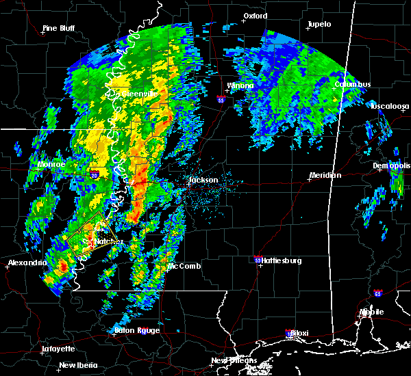 At 236 pm cst, a severe thunderstorm was located near peyton, or 23 miles west of hazlehurst, moving northeast at 50 mph (radar indicated). Hazards include 60 mph wind gusts and quarter size hail. Hail damage to vehicles is expected. expect wind damage to roofs, siding, and trees. this severe thunderstorm will be near, carpenter around 250 pm cst. utica and dentville around 255 pm cst. Other locations impacted by this severe thunderstorm include learned. At 236 pm cst, a severe thunderstorm was located near peyton, or 23 miles west of hazlehurst, moving northeast at 50 mph (radar indicated). Hazards include 60 mph wind gusts and quarter size hail. Hail damage to vehicles is expected. expect wind damage to roofs, siding, and trees. this severe thunderstorm will be near, carpenter around 250 pm cst. utica and dentville around 255 pm cst. Other locations impacted by this severe thunderstorm include learned.
|
| 12/16/2019 5:55 PM CST |
 At 554 pm cst, severe thunderstorms were located along a line extending from terry to brookhaven, moving northeast at 55 mph (radar indicated). Hazards include 60 mph wind gusts. Expect damage to roofs, siding, and trees. these severe storms will be near, terry around 600 pm cst. rockport around 620 pm cst. other locations impacted by these severe thunderstorms include beauregard and georgetown. A tornado watch remains in effect until 800 pm cst for central and south central mississippi. At 554 pm cst, severe thunderstorms were located along a line extending from terry to brookhaven, moving northeast at 55 mph (radar indicated). Hazards include 60 mph wind gusts. Expect damage to roofs, siding, and trees. these severe storms will be near, terry around 600 pm cst. rockport around 620 pm cst. other locations impacted by these severe thunderstorms include beauregard and georgetown. A tornado watch remains in effect until 800 pm cst for central and south central mississippi.
|
| 12/16/2019 5:30 PM CST |
 At 530 pm cst, severe thunderstorms were located along a line extending from carpenter to mccall creek, moving northeast at 65 mph (radar indicated). Hazards include 60 mph wind gusts and penny size hail. Expect damage to roofs, siding, and trees. severe thunderstorms will be near, brookhaven around 545 pm cst. wesson and glancy around 550 pm cst. martinsville around 555 pm cst. hazlehurst around 600 pm cst. rockport around 605 pm cst. hopewell around 610 pm cst. other locations impacted by these severe thunderstorms include beauregard and georgetown. A tornado watch remains in effect until 600 pm cst for central, south central and southwestern mississippi. At 530 pm cst, severe thunderstorms were located along a line extending from carpenter to mccall creek, moving northeast at 65 mph (radar indicated). Hazards include 60 mph wind gusts and penny size hail. Expect damage to roofs, siding, and trees. severe thunderstorms will be near, brookhaven around 545 pm cst. wesson and glancy around 550 pm cst. martinsville around 555 pm cst. hazlehurst around 600 pm cst. rockport around 605 pm cst. hopewell around 610 pm cst. other locations impacted by these severe thunderstorms include beauregard and georgetown. A tornado watch remains in effect until 600 pm cst for central, south central and southwestern mississippi.
|
| 11/26/2019 11:50 PM CST |
 At 1149 pm cst, severe thunderstorms were located along a line extending from clear branch to near martinsville, moving east at 40 mph (radar indicated). Hazards include 60 mph wind gusts. Expect damage to roofs, siding, and trees. these severe storms will be near, clear branch around 1155 pm cst. star, hopewell and piney woods around 1205 am cst. pinola, union, harrisville, johns and cato around 1215 am cst. Other locations impacted by these severe thunderstorms include d`lo, braxton and georgetown. At 1149 pm cst, severe thunderstorms were located along a line extending from clear branch to near martinsville, moving east at 40 mph (radar indicated). Hazards include 60 mph wind gusts. Expect damage to roofs, siding, and trees. these severe storms will be near, clear branch around 1155 pm cst. star, hopewell and piney woods around 1205 am cst. pinola, union, harrisville, johns and cato around 1215 am cst. Other locations impacted by these severe thunderstorms include d`lo, braxton and georgetown.
|
| 11/26/2019 11:32 PM CST |
 At 1132 pm cst, severe thunderstorms were located along a line extending from near crystal springs to near glancy, moving east at 40 mph (radar indicated). Hazards include 60 mph wind gusts. Expect damage to roofs, siding, and trees. severe thunderstorms will be near, crystal springs around 1135 pm cst. hazlehurst around 1145 pm cst. whites around 1150 pm cst. star around 1200 am cst. hopewell and piney woods around 1205 am cst. union around 1210 am cst. harrisville, johns and cato around 1215 am cst. pinola around 1220 am cst. Other locations impacted by these severe thunderstorms include d`lo, braxton and georgetown. At 1132 pm cst, severe thunderstorms were located along a line extending from near crystal springs to near glancy, moving east at 40 mph (radar indicated). Hazards include 60 mph wind gusts. Expect damage to roofs, siding, and trees. severe thunderstorms will be near, crystal springs around 1135 pm cst. hazlehurst around 1145 pm cst. whites around 1150 pm cst. star around 1200 am cst. hopewell and piney woods around 1205 am cst. union around 1210 am cst. harrisville, johns and cato around 1215 am cst. pinola around 1220 am cst. Other locations impacted by these severe thunderstorms include d`lo, braxton and georgetown.
|
| 7/2/2019 4:09 PM CDT |
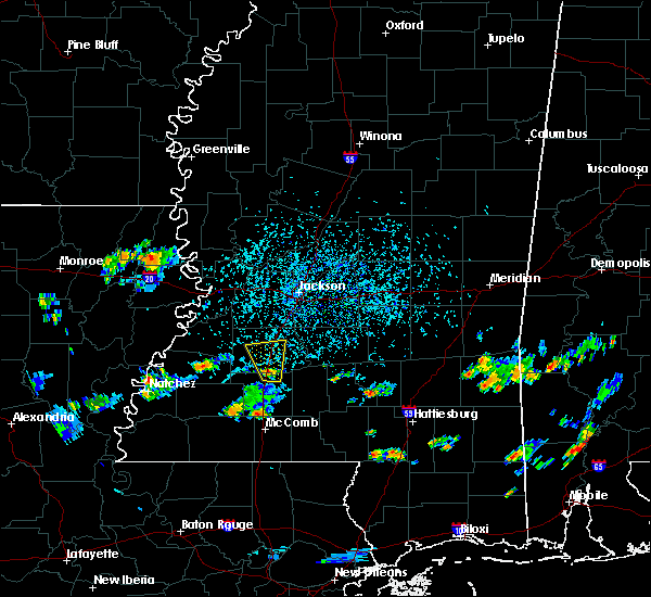 A severe thunderstorm warning remains in effect until 445 pm cdt for southwestern copiah county. at 408 pm cdt, a severe thunderstorm was located near wesson, or 9 miles south of hazlehurst, moving north at 15 mph. hazard. 60 mph wind gusts. source. Radar indicated. A severe thunderstorm warning remains in effect until 445 pm cdt for southwestern copiah county. at 408 pm cdt, a severe thunderstorm was located near wesson, or 9 miles south of hazlehurst, moving north at 15 mph. hazard. 60 mph wind gusts. source. Radar indicated.
|
| 7/2/2019 3:58 PM CDT |
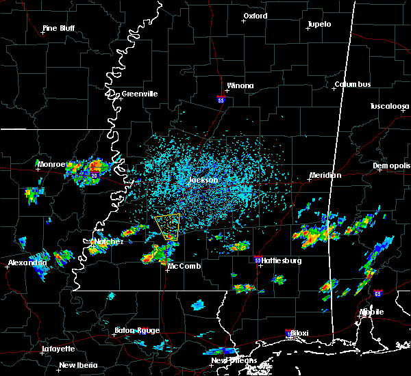 At 358 pm cdt, a severe thunderstorm was located over wesson, or 7 miles north of brookhaven, moving north at 15 mph (radar indicated). Hazards include 60 mph wind gusts and quarter size hail. Hail damage to vehicles is expected. expect wind damage to roofs, siding, and trees. this severe thunderstorm will be near, martinsville around 425 pm cdt. glancy around 435 pm cdt. hazlehurst and gallman around 445 pm cdt. Other locations impacted by this severe thunderstorm include beauregard. At 358 pm cdt, a severe thunderstorm was located over wesson, or 7 miles north of brookhaven, moving north at 15 mph (radar indicated). Hazards include 60 mph wind gusts and quarter size hail. Hail damage to vehicles is expected. expect wind damage to roofs, siding, and trees. this severe thunderstorm will be near, martinsville around 425 pm cdt. glancy around 435 pm cdt. hazlehurst and gallman around 445 pm cdt. Other locations impacted by this severe thunderstorm include beauregard.
|
| 6/28/2019 1:57 PM CDT | Multiple trees and power lines down on highway 28. there are also reports of trees blocking part of highway 2 in copiah county MS, 10.4 miles NE of Hazlehurst, MS |
| 6/28/2019 1:24 PM CDT | Multiple trees and power lines down on daneville roa in copiah county MS, 7.7 miles SE of Hazlehurst, MS |
| 6/24/2019 4:51 AM CDT |
 The severe thunderstorm warning for northeastern lincoln and central copiah counties will expire at 500 am cdt, the storms which prompted the warning have weakened below severe limits, and have exited the warned area. therefore, the warning will be allowed to expire. to report severe weather, contact your nearest law enforcement agency. they will relay your report to the national weather service jackson. The severe thunderstorm warning for northeastern lincoln and central copiah counties will expire at 500 am cdt, the storms which prompted the warning have weakened below severe limits, and have exited the warned area. therefore, the warning will be allowed to expire. to report severe weather, contact your nearest law enforcement agency. they will relay your report to the national weather service jackson.
|
| 6/24/2019 4:30 AM CDT |
 At 430 am cdt, severe thunderstorms were located along a line extending from gallman to near martinsville to brookhaven, moving east at 40 mph (radar indicated). Hazards include 60 mph wind gusts. Expect damage to roofs, siding, and trees. these severe storms will be near, crystal springs and gallman around 435 am cdt. hopewell around 445 am cdt. rockport around 455 am cdt. Other locations impacted by these severe thunderstorms include beauregard and georgetown. At 430 am cdt, severe thunderstorms were located along a line extending from gallman to near martinsville to brookhaven, moving east at 40 mph (radar indicated). Hazards include 60 mph wind gusts. Expect damage to roofs, siding, and trees. these severe storms will be near, crystal springs and gallman around 435 am cdt. hopewell around 445 am cdt. rockport around 455 am cdt. Other locations impacted by these severe thunderstorms include beauregard and georgetown.
|
| 6/24/2019 4:12 AM CDT |
 At 412 am cdt, severe thunderstorms were located along a line extending from near dentville to near allen to near vaughn, moving east at 40 mph (radar indicated). Hazards include 60 mph wind gusts. Expect damage to roofs, siding, and trees. these severe storms will be near, dentville around 415 am cdt. loyd star around 420 am cdt. hazlehurst, gallman and glancy around 425 am cdt. brookhaven and crystal springs around 430 am cdt. wesson and martinsville around 435 am cdt. hopewell around 440 am cdt. rockport around 455 am cdt. Other locations impacted by these severe thunderstorms include beauregard and georgetown. At 412 am cdt, severe thunderstorms were located along a line extending from near dentville to near allen to near vaughn, moving east at 40 mph (radar indicated). Hazards include 60 mph wind gusts. Expect damage to roofs, siding, and trees. these severe storms will be near, dentville around 415 am cdt. loyd star around 420 am cdt. hazlehurst, gallman and glancy around 425 am cdt. brookhaven and crystal springs around 430 am cdt. wesson and martinsville around 435 am cdt. hopewell around 440 am cdt. rockport around 455 am cdt. Other locations impacted by these severe thunderstorms include beauregard and georgetown.
|
| 6/24/2019 3:51 AM CDT |
 At 351 am cdt, severe thunderstorms were located along a line extending from near red lick to near union church to near new hope, moving east at 40 mph (radar indicated). Hazards include 60 mph wind gusts. Expect damage to roofs, siding, and trees. severe thunderstorms will be near, union church around 355 am cdt. pleasant hill and mcbride around 400 am cdt. peyton around 405 am cdt. allen and caseyville around 410 am cdt. barlow around 415 am cdt. vaughn and loyd star around 420 am cdt. brookhaven, wesson, glancy, martinsville and dentville around 430 am cdt. hazlehurst and gallman around 440 am cdt. Other locations impacted by these severe thunderstorms include beauregard and georgetown. At 351 am cdt, severe thunderstorms were located along a line extending from near red lick to near union church to near new hope, moving east at 40 mph (radar indicated). Hazards include 60 mph wind gusts. Expect damage to roofs, siding, and trees. severe thunderstorms will be near, union church around 355 am cdt. pleasant hill and mcbride around 400 am cdt. peyton around 405 am cdt. allen and caseyville around 410 am cdt. barlow around 415 am cdt. vaughn and loyd star around 420 am cdt. brookhaven, wesson, glancy, martinsville and dentville around 430 am cdt. hazlehurst and gallman around 440 am cdt. Other locations impacted by these severe thunderstorms include beauregard and georgetown.
|
| 6/23/2019 4:45 PM CDT |
 At 445 pm cdt, a severe thunderstorm was located 7 miles west of rockport, or 7 miles southeast of hazlehurst, moving north at 25 mph (radar indicated). Hazards include 60 mph wind gusts and penny size hail. Expect damage to roofs, siding, and trees. this severe thunderstorm will be near, gallman around 505 pm cdt. crystal springs and hopewell around 510 pm cdt. Other locations impacted by this severe thunderstorm include georgetown. At 445 pm cdt, a severe thunderstorm was located 7 miles west of rockport, or 7 miles southeast of hazlehurst, moving north at 25 mph (radar indicated). Hazards include 60 mph wind gusts and penny size hail. Expect damage to roofs, siding, and trees. this severe thunderstorm will be near, gallman around 505 pm cdt. crystal springs and hopewell around 510 pm cdt. Other locations impacted by this severe thunderstorm include georgetown.
|
| 6/17/2019 1:42 PM CDT |
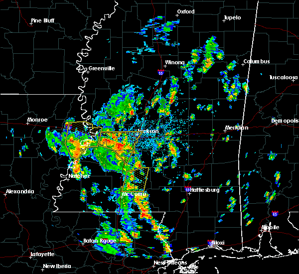 At 142 pm cdt, severe thunderstorms were located along a line extending from near newman to 7 miles southwest of raymond to near dry grove, moving northeast at 35 mph (radar indicated). Hazards include 60 mph wind gusts. Expect damage to roofs, siding, and trees. these severe storms will be near, dry grove around 145 pm cdt. terry around 150 pm cdt. raymond around 155 pm cdt. jackson, clinton, byram, edwards and bolton around 200 pm cdt. Other locations impacted by these severe thunderstorms include learned. At 142 pm cdt, severe thunderstorms were located along a line extending from near newman to 7 miles southwest of raymond to near dry grove, moving northeast at 35 mph (radar indicated). Hazards include 60 mph wind gusts. Expect damage to roofs, siding, and trees. these severe storms will be near, dry grove around 145 pm cdt. terry around 150 pm cdt. raymond around 155 pm cdt. jackson, clinton, byram, edwards and bolton around 200 pm cdt. Other locations impacted by these severe thunderstorms include learned.
|
| 6/17/2019 1:27 PM CDT |
 At 126 pm cdt, severe thunderstorms were located along a line extending from near reganton to near utica to near dentville, moving northeast at 40 mph (radar indicated). Hazards include 60 mph wind gusts. Expect damage to roofs, siding, and trees. these severe storms will be near, crystal springs around 135 pm cdt. newman around 140 pm cdt. terry and dry grove around 145 pm cdt. raymond around 150 pm cdt. byram, edwards and bolton around 155 pm cdt. jackson and clinton around 200 pm cdt. Other locations impacted by these severe thunderstorms include learned. At 126 pm cdt, severe thunderstorms were located along a line extending from near reganton to near utica to near dentville, moving northeast at 40 mph (radar indicated). Hazards include 60 mph wind gusts. Expect damage to roofs, siding, and trees. these severe storms will be near, crystal springs around 135 pm cdt. newman around 140 pm cdt. terry and dry grove around 145 pm cdt. raymond around 150 pm cdt. byram, edwards and bolton around 155 pm cdt. jackson and clinton around 200 pm cdt. Other locations impacted by these severe thunderstorms include learned.
|
| 6/17/2019 1:07 PM CDT |
 At 106 pm cdt, a severe thunderstorm was located near barlow, or 14 miles west of hazlehurst, moving northeast at 45 mph (radar indicated). Hazards include 60 mph wind gusts. Expect damage to roofs, siding, and trees. this severe thunderstorm will be near, dentville around 115 pm cdt. carpenter around 120 pm cdt. utica around 125 pm cdt. dry grove around 135 pm cdt. jackson and raymond around 145 pm cdt. bolton around 150 pm cdt. clinton around 155 pm cdt. Other locations impacted by this severe thunderstorm include learned. At 106 pm cdt, a severe thunderstorm was located near barlow, or 14 miles west of hazlehurst, moving northeast at 45 mph (radar indicated). Hazards include 60 mph wind gusts. Expect damage to roofs, siding, and trees. this severe thunderstorm will be near, dentville around 115 pm cdt. carpenter around 120 pm cdt. utica around 125 pm cdt. dry grove around 135 pm cdt. jackson and raymond around 145 pm cdt. bolton around 150 pm cdt. clinton around 155 pm cdt. Other locations impacted by this severe thunderstorm include learned.
|
| 5/19/2019 4:41 AM CDT |
 At 441 am cdt, severe thunderstorms were located along a line extending from near carpenter to peyton to near union church, moving east at 40 mph (radar indicated). Hazards include 60 mph wind gusts. Expect damage to roofs, siding, and trees. severe thunderstorms will be near, carpenter around 450 am cdt. barlow, pleasant hill and allen around 455 am cdt. caseyville and dentville around 500 am cdt. glancy around 505 am cdt. loyd star and vaughn around 510 am cdt. crystal springs, hazlehurst, martinsville and gallman around 515 am cdt. brookhaven around 520 am cdt. wesson around 525 am cdt. other locations impacted by these severe thunderstorms include beauregard and georgetown. A tornado watch remains in effect until 1000 am cdt for central, south central and southwestern mississippi. At 441 am cdt, severe thunderstorms were located along a line extending from near carpenter to peyton to near union church, moving east at 40 mph (radar indicated). Hazards include 60 mph wind gusts. Expect damage to roofs, siding, and trees. severe thunderstorms will be near, carpenter around 450 am cdt. barlow, pleasant hill and allen around 455 am cdt. caseyville and dentville around 500 am cdt. glancy around 505 am cdt. loyd star and vaughn around 510 am cdt. crystal springs, hazlehurst, martinsville and gallman around 515 am cdt. brookhaven around 520 am cdt. wesson around 525 am cdt. other locations impacted by these severe thunderstorms include beauregard and georgetown. A tornado watch remains in effect until 1000 am cdt for central, south central and southwestern mississippi.
|
| 5/8/2019 9:00 PM CDT |
 At 900 pm cdt, severe thunderstorms were located along a line extending from near crystal springs to near dentville to near barlow to near caseyville, moving east at 25 mph (radar indicated). Hazards include 60 mph wind gusts. Expect damage to roofs, siding, and trees. these severe storms will be near, brookhaven, crystal springs, hazlehurst, wesson, gallman, glancy and martinsville around 915 pm cdt. other locations impacted by these severe thunderstorms include beauregard and georgetown. A tornado watch remains in effect until midnight cdt for central, south central and southwestern mississippi. At 900 pm cdt, severe thunderstorms were located along a line extending from near crystal springs to near dentville to near barlow to near caseyville, moving east at 25 mph (radar indicated). Hazards include 60 mph wind gusts. Expect damage to roofs, siding, and trees. these severe storms will be near, brookhaven, crystal springs, hazlehurst, wesson, gallman, glancy and martinsville around 915 pm cdt. other locations impacted by these severe thunderstorms include beauregard and georgetown. A tornado watch remains in effect until midnight cdt for central, south central and southwestern mississippi.
|
| 5/8/2019 8:27 PM CDT |
 At 826 pm cdt, severe thunderstorms were located along a line extending from near hermanville to blue hill to near mcnair, moving east at 45 mph (radar indicated). Hazards include 60 mph wind gusts. Expect damage to roofs, siding, and trees. severe thunderstorms will be near, carpenter around 835 pm cdt. barlow around 840 pm cdt. dentville around 845 pm cdt. allen, glancy and caseyville around 855 pm cdt. crystal springs, hazlehurst and loyd star around 900 pm cdt. gallman around 905 pm cdt. wesson, martinsville and hopewell around 915 pm cdt. other locations impacted by these severe thunderstorms include beauregard and georgetown. A tornado watch remains in effect until midnight cdt for central, south central and southwestern mississippi. At 826 pm cdt, severe thunderstorms were located along a line extending from near hermanville to blue hill to near mcnair, moving east at 45 mph (radar indicated). Hazards include 60 mph wind gusts. Expect damage to roofs, siding, and trees. severe thunderstorms will be near, carpenter around 835 pm cdt. barlow around 840 pm cdt. dentville around 845 pm cdt. allen, glancy and caseyville around 855 pm cdt. crystal springs, hazlehurst and loyd star around 900 pm cdt. gallman around 905 pm cdt. wesson, martinsville and hopewell around 915 pm cdt. other locations impacted by these severe thunderstorms include beauregard and georgetown. A tornado watch remains in effect until midnight cdt for central, south central and southwestern mississippi.
|
| 4/18/2019 2:21 PM CDT |
 At 220 pm cdt, severe thunderstorms were located along a line extending from near bolton to near terry to near wesson, moving northeast at 40 mph. a tornado warning also remains in effect for much of hinds county (radar indicated). Hazards include 60 mph wind gusts. Expect damage to roofs, siding, and trees. locations impacted include, jackson, clinton, byram, crystal springs, hazlehurst, raymond, wesson, terry, edwards, bolton, dry grove, pocahontas, gallman, hopewell, brownsville, martinsville, rockport, beauregard and georgetown. A tornado watch remains in effect until 700 pm cdt for central and south central mississippi. At 220 pm cdt, severe thunderstorms were located along a line extending from near bolton to near terry to near wesson, moving northeast at 40 mph. a tornado warning also remains in effect for much of hinds county (radar indicated). Hazards include 60 mph wind gusts. Expect damage to roofs, siding, and trees. locations impacted include, jackson, clinton, byram, crystal springs, hazlehurst, raymond, wesson, terry, edwards, bolton, dry grove, pocahontas, gallman, hopewell, brownsville, martinsville, rockport, beauregard and georgetown. A tornado watch remains in effect until 700 pm cdt for central and south central mississippi.
|
| 4/18/2019 1:38 PM CDT |
 At 138 pm cdt, severe thunderstorms were located along a line extending from near yokena to near peyton to near union church, moving east at 45 mph (radar indicated). Hazards include 60 mph wind gusts. Expect damage to roofs, siding, and trees. severe thunderstorms will be near, barlow around 145 pm cdt. allen and carpenter around 150 pm cdt. dentville around 155 pm cdt. newman and bovina around 200 pm cdt. hazlehurst around 205 pm cdt. crystal springs, wesson, edwards, gallman and martinsville around 210 pm cdt. bolton and hopewell around 220 pm cdt. raymond around 225 pm cdt. other locations impacted by these severe thunderstorms include beauregard, learned and georgetown. A tornado watch remains in effect until 700 pm cdt for central, south central, southwestern and west central mississippi. At 138 pm cdt, severe thunderstorms were located along a line extending from near yokena to near peyton to near union church, moving east at 45 mph (radar indicated). Hazards include 60 mph wind gusts. Expect damage to roofs, siding, and trees. severe thunderstorms will be near, barlow around 145 pm cdt. allen and carpenter around 150 pm cdt. dentville around 155 pm cdt. newman and bovina around 200 pm cdt. hazlehurst around 205 pm cdt. crystal springs, wesson, edwards, gallman and martinsville around 210 pm cdt. bolton and hopewell around 220 pm cdt. raymond around 225 pm cdt. other locations impacted by these severe thunderstorms include beauregard, learned and georgetown. A tornado watch remains in effect until 700 pm cdt for central, south central, southwestern and west central mississippi.
|
| 4/13/2019 7:22 PM CDT |
 At 722 pm cdt, severe thunderstorms were located along a line extending from gluckstadt to terry to near wesson, moving northeast at 35 mph (radar indicated). Hazards include 60 mph wind gusts and quarter size hail. Hail damage to vehicles is expected. expect wind damage to roofs, siding, and trees. severe thunderstorms will be near, goshen springs around 735 pm cdt. richland, florence and pisgah around 740 pm cdt. star and monterey around 745 pm cdt. pearl and rockport around 750 pm cdt. brandon around 755 pm cdt. union around 800 pm cdt. harrisville and shivers around 805 pm cdt. pinola around 810 pm cdt. other locations impacted by these severe thunderstorms include d`lo, beauregard, braxton, puckett and georgetown. A tornado watch remains in effect until 900 pm cdt for central and south central mississippi. At 722 pm cdt, severe thunderstorms were located along a line extending from gluckstadt to terry to near wesson, moving northeast at 35 mph (radar indicated). Hazards include 60 mph wind gusts and quarter size hail. Hail damage to vehicles is expected. expect wind damage to roofs, siding, and trees. severe thunderstorms will be near, goshen springs around 735 pm cdt. richland, florence and pisgah around 740 pm cdt. star and monterey around 745 pm cdt. pearl and rockport around 750 pm cdt. brandon around 755 pm cdt. union around 800 pm cdt. harrisville and shivers around 805 pm cdt. pinola around 810 pm cdt. other locations impacted by these severe thunderstorms include d`lo, beauregard, braxton, puckett and georgetown. A tornado watch remains in effect until 900 pm cdt for central and south central mississippi.
|
| 1/19/2019 7:45 AM CST |
 At 745 am cst, severe thunderstorms were located along a line extending from near pelahatchie to near harrisville to 6 miles west of sontag, moving northeast at 65 mph (radar indicated). Hazards include 60 mph wind gusts. Expect damage to roofs, siding, and trees. these severe storms will be near, mendenhall and cato around 755 am cst. shivers around 805 am cst. other locations impacted by these severe thunderstorms include d`lo, beauregard, braxton, puckett and georgetown. A tornado watch remains in effect until 100 pm cst for central and south central mississippi. At 745 am cst, severe thunderstorms were located along a line extending from near pelahatchie to near harrisville to 6 miles west of sontag, moving northeast at 65 mph (radar indicated). Hazards include 60 mph wind gusts. Expect damage to roofs, siding, and trees. these severe storms will be near, mendenhall and cato around 755 am cst. shivers around 805 am cst. other locations impacted by these severe thunderstorms include d`lo, beauregard, braxton, puckett and georgetown. A tornado watch remains in effect until 100 pm cst for central and south central mississippi.
|
| 1/19/2019 7:31 AM CST | Tree downed at martinsville rd and broome r in copiah county MS, 6.8 miles NNW of Hazlehurst, MS |
| 1/19/2019 7:11 AM CST |
 At 711 am cst, severe thunderstorms were located along a line extending from near terry to near caseyville to near bude, moving northeast at 65 mph (radar indicated). Hazards include 60 mph wind gusts. Expect damage to roofs, siding, and trees. severe thunderstorms will be near, wesson and glancy around 720 am cst. hazlehurst, star, martinsville, mccall creek and center point around 725 am cst. west lincoln and vaughn around 730 am cst. rockport, hopewell, bogue chitto and johns around 735 am cst. brookhaven, union and enterprise around 740 am cst. pinola and harrisville around 745 am cst. sontag around 750 am cst. mendenhall, wanilla, oma and cato around 755 am cst. other locations impacted by these severe thunderstorms include d`lo, beauregard, braxton, puckett and georgetown. A tornado watch remains in effect until 100 pm cst for central, south central and southwestern mississippi. At 711 am cst, severe thunderstorms were located along a line extending from near terry to near caseyville to near bude, moving northeast at 65 mph (radar indicated). Hazards include 60 mph wind gusts. Expect damage to roofs, siding, and trees. severe thunderstorms will be near, wesson and glancy around 720 am cst. hazlehurst, star, martinsville, mccall creek and center point around 725 am cst. west lincoln and vaughn around 730 am cst. rockport, hopewell, bogue chitto and johns around 735 am cst. brookhaven, union and enterprise around 740 am cst. pinola and harrisville around 745 am cst. sontag around 750 am cst. mendenhall, wanilla, oma and cato around 755 am cst. other locations impacted by these severe thunderstorms include d`lo, beauregard, braxton, puckett and georgetown. A tornado watch remains in effect until 100 pm cst for central, south central and southwestern mississippi.
|
| 11/1/2018 3:30 AM CDT |
 At 330 am cdt, a severe thunderstorm capable of producing a tornado was located near loyd star, or 7 miles northwest of brookhaven, moving northeast at 40 mph (radar indicated rotation). Hazards include tornado. Flying debris will be dangerous to those caught without shelter. mobile homes will be damaged or destroyed. damage to roofs, windows, and vehicles will occur. tree damage is likely. this dangerous storm will be near, wesson around 340 am cdt. martinsville around 345 am cdt. Other locations impacted by this tornadic thunderstorm include beauregard. At 330 am cdt, a severe thunderstorm capable of producing a tornado was located near loyd star, or 7 miles northwest of brookhaven, moving northeast at 40 mph (radar indicated rotation). Hazards include tornado. Flying debris will be dangerous to those caught without shelter. mobile homes will be damaged or destroyed. damage to roofs, windows, and vehicles will occur. tree damage is likely. this dangerous storm will be near, wesson around 340 am cdt. martinsville around 345 am cdt. Other locations impacted by this tornadic thunderstorm include beauregard.
|
| 11/1/2018 3:24 AM CDT |
 At 304 am cdt, a severe thunderstorm capable of producing a tornado was located near new hope, or 20 miles west of brookhaven, moving northeast at 40 mph (radar indicated rotation). Hazards include tornado. Flying debris will be dangerous to those caught without shelter. mobile homes will be damaged or destroyed. damage to roofs, windows, and vehicles will occur. tree damage is likely. this dangerous storm will be near, pleasant hill around 315 am cdt. caseyville, allen and vaughn around 320 am cdt. loyd star around 325 am cdt. wesson and glancy around 340 am cdt. hazlehurst and martinsville around 345 am cdt. Other locations impacted by this tornadic thunderstorm include beauregard. At 304 am cdt, a severe thunderstorm capable of producing a tornado was located near new hope, or 20 miles west of brookhaven, moving northeast at 40 mph (radar indicated rotation). Hazards include tornado. Flying debris will be dangerous to those caught without shelter. mobile homes will be damaged or destroyed. damage to roofs, windows, and vehicles will occur. tree damage is likely. this dangerous storm will be near, pleasant hill around 315 am cdt. caseyville, allen and vaughn around 320 am cdt. loyd star around 325 am cdt. wesson and glancy around 340 am cdt. hazlehurst and martinsville around 345 am cdt. Other locations impacted by this tornadic thunderstorm include beauregard.
|
| 11/1/2018 3:05 AM CDT |
 At 304 am cdt, a severe thunderstorm capable of producing a tornado was located near new hope, or 20 miles west of brookhaven, moving northeast at 40 mph (radar indicated rotation). Hazards include tornado. Flying debris will be dangerous to those caught without shelter. mobile homes will be damaged or destroyed. damage to roofs, windows, and vehicles will occur. tree damage is likely. this dangerous storm will be near, pleasant hill around 315 am cdt. caseyville, allen and vaughn around 320 am cdt. loyd star around 325 am cdt. wesson and glancy around 340 am cdt. hazlehurst and martinsville around 345 am cdt. Other locations impacted by this tornadic thunderstorm include beauregard. At 304 am cdt, a severe thunderstorm capable of producing a tornado was located near new hope, or 20 miles west of brookhaven, moving northeast at 40 mph (radar indicated rotation). Hazards include tornado. Flying debris will be dangerous to those caught without shelter. mobile homes will be damaged or destroyed. damage to roofs, windows, and vehicles will occur. tree damage is likely. this dangerous storm will be near, pleasant hill around 315 am cdt. caseyville, allen and vaughn around 320 am cdt. loyd star around 325 am cdt. wesson and glancy around 340 am cdt. hazlehurst and martinsville around 345 am cdt. Other locations impacted by this tornadic thunderstorm include beauregard.
|
| 11/1/2018 2:34 AM CDT |
 At 233 am cdt, severe thunderstorms were located along a line extending from redwood to near garden city, moving east at 40 mph (radar indicated). Hazards include 60 mph wind gusts. expect damage to roofs, siding, and trees At 233 am cdt, severe thunderstorms were located along a line extending from redwood to near garden city, moving east at 40 mph (radar indicated). Hazards include 60 mph wind gusts. expect damage to roofs, siding, and trees
|
| 8/29/2018 4:22 PM CDT | Tree down along wesley chapel r in copiah county MS, 1.1 miles NNE of Hazlehurst, MS |
| 8/7/2018 6:45 PM CDT | Two trees down at intersection of highway 28 east and bailey road...one tree was blocking highway 28. reported by copiah em in copiah county MS, 7.5 miles WSW of Hazlehurst, MS |
| 6/18/2018 3:45 PM CDT |
 At 345 pm cdt, a severe thunderstorm was located near sontag, or 10 miles east of brookhaven, moving north at 15 mph (radar indicated). Hazards include 60 mph wind gusts and quarter size hail. Hail damage to vehicles is expected. expect wind damage to roofs, siding, and trees. this severe thunderstorm will be near, sontag around 350 pm cdt. wesson around 410 pm cdt. martinsville around 430 pm cdt. Other locations impacted by this severe thunderstorm include beauregard. At 345 pm cdt, a severe thunderstorm was located near sontag, or 10 miles east of brookhaven, moving north at 15 mph (radar indicated). Hazards include 60 mph wind gusts and quarter size hail. Hail damage to vehicles is expected. expect wind damage to roofs, siding, and trees. this severe thunderstorm will be near, sontag around 350 pm cdt. wesson around 410 pm cdt. martinsville around 430 pm cdt. Other locations impacted by this severe thunderstorm include beauregard.
|
| 4/14/2018 7:51 AM CDT |
 At 751 am cdt, severe thunderstorms were located along a line extending from near terry to near wesson to near little springs, moving east at 25 mph (emergency management). Hazards include 60 mph wind gusts. Expect damage to roofs, siding, and trees. these severe storms will be near, wesson and martinsville around 755 am cdt. hopewell around 800 am cdt. west lincoln around 815 am cdt. other locations impacted by these severe thunderstorms include beauregard. a tornado watch remains in effect until 800 am cdt for southwestern mississippi. A tornado watch also remains in effect until 200 pm cdt for central, south central and southwestern mississippi. At 751 am cdt, severe thunderstorms were located along a line extending from near terry to near wesson to near little springs, moving east at 25 mph (emergency management). Hazards include 60 mph wind gusts. Expect damage to roofs, siding, and trees. these severe storms will be near, wesson and martinsville around 755 am cdt. hopewell around 800 am cdt. west lincoln around 815 am cdt. other locations impacted by these severe thunderstorms include beauregard. a tornado watch remains in effect until 800 am cdt for southwestern mississippi. A tornado watch also remains in effect until 200 pm cdt for central, south central and southwestern mississippi.
|
| 4/14/2018 7:27 AM CDT |
 At 727 am cdt, severe thunderstorms were located along a line extending from 6 miles northwest of crystal springs to near caseyville to 8 miles south of bude, moving east at 25 mph (emergency management). Hazards include 60 mph wind gusts. Expect damage to roofs, siding, and trees. severe thunderstorms will be near, loyd star and gallman around 735 am cdt. crystal springs around 740 am cdt. glancy around 745 am cdt. brookhaven around 750 am cdt. wesson and martinsville around 755 am cdt. hopewell around 800 am cdt. center point around 805 am cdt. west lincoln around 815 am cdt. other locations impacted by these severe thunderstorms include beauregard. a tornado watch remains in effect until 800 am cdt for southwestern mississippi. A tornado watch also remains in effect until 200 pm cdt for central, south central and southwestern mississippi. At 727 am cdt, severe thunderstorms were located along a line extending from 6 miles northwest of crystal springs to near caseyville to 8 miles south of bude, moving east at 25 mph (emergency management). Hazards include 60 mph wind gusts. Expect damage to roofs, siding, and trees. severe thunderstorms will be near, loyd star and gallman around 735 am cdt. crystal springs around 740 am cdt. glancy around 745 am cdt. brookhaven around 750 am cdt. wesson and martinsville around 755 am cdt. hopewell around 800 am cdt. center point around 805 am cdt. west lincoln around 815 am cdt. other locations impacted by these severe thunderstorms include beauregard. a tornado watch remains in effect until 800 am cdt for southwestern mississippi. A tornado watch also remains in effect until 200 pm cdt for central, south central and southwestern mississippi.
|
| 4/6/2018 10:22 PM CDT |
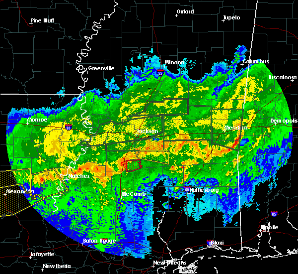 At 1021 pm cdt, a severe thunderstorm capable of producing a tornado was located near martinsville, or near hazlehurst, moving east at 35 mph (radar indicated rotation). Hazards include tornado. Flying debris will be dangerous to those caught without shelter. mobile homes will be damaged or destroyed. damage to roofs, windows, and vehicles will occur. tree damage is likely. this dangerous storm will be near, rockport around 1035 pm cdt. Other locations impacted by this tornadic thunderstorm include georgetown. At 1021 pm cdt, a severe thunderstorm capable of producing a tornado was located near martinsville, or near hazlehurst, moving east at 35 mph (radar indicated rotation). Hazards include tornado. Flying debris will be dangerous to those caught without shelter. mobile homes will be damaged or destroyed. damage to roofs, windows, and vehicles will occur. tree damage is likely. this dangerous storm will be near, rockport around 1035 pm cdt. Other locations impacted by this tornadic thunderstorm include georgetown.
|
| 4/6/2018 10:13 PM CDT | Tree or large limb downed on a power line along jackson s in copiah county MS, 0.4 miles SSW of Hazlehurst, MS |
| 4/6/2018 10:07 PM CDT |
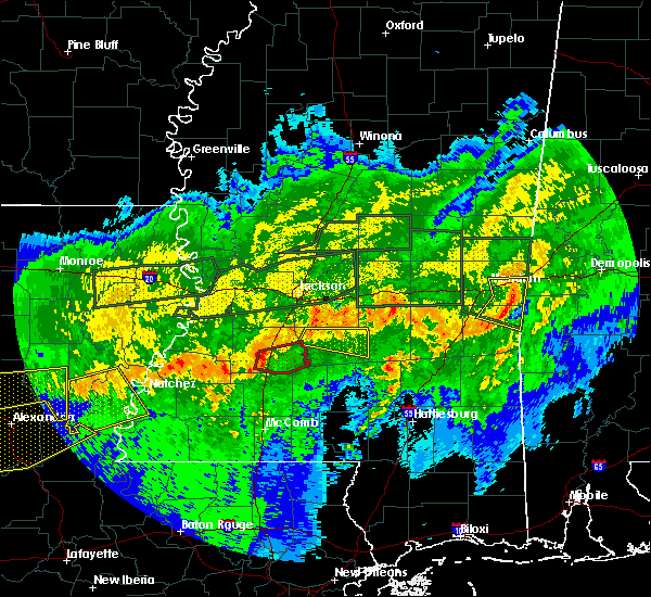 At 1007 pm cdt, a severe thunderstorm capable of producing a tornado was located over glancy, or near hazlehurst, moving east at 40 mph (radar indicated rotation). Hazards include tornado. Flying debris will be dangerous to those caught without shelter. mobile homes will be damaged or destroyed. damage to roofs, windows, and vehicles will occur. tree damage is likely. this dangerous storm will be near, hazlehurst and martinsville around 1010 pm cdt. rockport around 1030 pm cdt. Other locations impacted by this tornadic thunderstorm include beauregard and georgetown. At 1007 pm cdt, a severe thunderstorm capable of producing a tornado was located over glancy, or near hazlehurst, moving east at 40 mph (radar indicated rotation). Hazards include tornado. Flying debris will be dangerous to those caught without shelter. mobile homes will be damaged or destroyed. damage to roofs, windows, and vehicles will occur. tree damage is likely. this dangerous storm will be near, hazlehurst and martinsville around 1010 pm cdt. rockport around 1030 pm cdt. Other locations impacted by this tornadic thunderstorm include beauregard and georgetown.
|
| 4/6/2018 9:57 PM CDT |
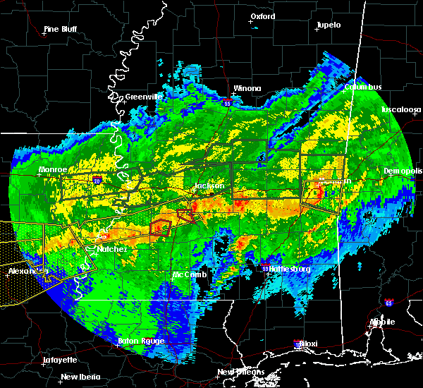 At 956 pm cdt, a severe thunderstorm capable of producing a tornado was located near glancy, or 10 miles west of hazlehurst, moving east at 35 mph (radar indicated rotation). Hazards include tornado. Flying debris will be dangerous to those caught without shelter. mobile homes will be damaged or destroyed. damage to roofs, windows, and vehicles will occur. tree damage is likely. this dangerous storm will be near, glancy around 1005 pm cdt. hazlehurst around 1010 pm cdt. martinsville around 1015 pm cdt. rockport around 1040 pm cdt. Other locations impacted by this tornadic thunderstorm include beauregard and georgetown. At 956 pm cdt, a severe thunderstorm capable of producing a tornado was located near glancy, or 10 miles west of hazlehurst, moving east at 35 mph (radar indicated rotation). Hazards include tornado. Flying debris will be dangerous to those caught without shelter. mobile homes will be damaged or destroyed. damage to roofs, windows, and vehicles will occur. tree damage is likely. this dangerous storm will be near, glancy around 1005 pm cdt. hazlehurst around 1010 pm cdt. martinsville around 1015 pm cdt. rockport around 1040 pm cdt. Other locations impacted by this tornadic thunderstorm include beauregard and georgetown.
|
| 4/6/2018 5:25 PM CDT |
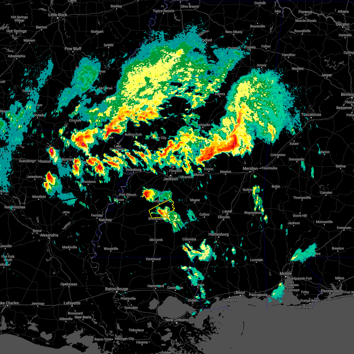 At 524 pm cdt, a severe thunderstorm was located near wesson, or 8 miles north of brookhaven, moving east at 35 mph (radar indicated). Hazards include 60 mph wind gusts and quarter size hail. Hail damage to vehicles is expected. expect wind damage to roofs, siding, and trees. this severe storm will be near, wesson around 530 pm cdt. martinsville around 535 pm cdt. rockport around 600 pm cdt. other locations impacted by this severe thunderstorm include beauregard and georgetown. A tornado watch remains in effect until 1100 pm cdt for central and south central mississippi. At 524 pm cdt, a severe thunderstorm was located near wesson, or 8 miles north of brookhaven, moving east at 35 mph (radar indicated). Hazards include 60 mph wind gusts and quarter size hail. Hail damage to vehicles is expected. expect wind damage to roofs, siding, and trees. this severe storm will be near, wesson around 530 pm cdt. martinsville around 535 pm cdt. rockport around 600 pm cdt. other locations impacted by this severe thunderstorm include beauregard and georgetown. A tornado watch remains in effect until 1100 pm cdt for central and south central mississippi.
|
| 4/6/2018 4:59 PM CDT |
 At 459 pm cdt, a severe thunderstorm was located over caseyville, or 11 miles northwest of brookhaven, moving east at 35 mph (radar indicated). Hazards include 60 mph wind gusts and quarter size hail. Hail damage to vehicles is expected. expect wind damage to roofs, siding, and trees. this severe thunderstorm will be near, loyd star around 505 pm cdt. brookhaven around 515 pm cdt. wesson and martinsville around 525 pm cdt. rockport around 555 pm cdt. other locations impacted by this severe thunderstorm include beauregard and georgetown. A tornado watch remains in effect until 1100 pm cdt for central, south central and southwestern mississippi. At 459 pm cdt, a severe thunderstorm was located over caseyville, or 11 miles northwest of brookhaven, moving east at 35 mph (radar indicated). Hazards include 60 mph wind gusts and quarter size hail. Hail damage to vehicles is expected. expect wind damage to roofs, siding, and trees. this severe thunderstorm will be near, loyd star around 505 pm cdt. brookhaven around 515 pm cdt. wesson and martinsville around 525 pm cdt. rockport around 555 pm cdt. other locations impacted by this severe thunderstorm include beauregard and georgetown. A tornado watch remains in effect until 1100 pm cdt for central, south central and southwestern mississippi.
|
| 4/3/2018 9:11 PM CDT |
 At 910 pm cdt, severe thunderstorms were located along a line extending from 7 miles southeast of pelahatchie to hazlehurst, moving southeast at 30 mph (emergency management). Hazards include 60 mph wind gusts. Expect damage to roofs, siding, and trees. severe thunderstorms will be near, white oak around 930 pm cdt. burns around 935 pm cdt. rockport around 940 pm cdt. oma and sontag around 945 pm cdt. raleigh around 950 pm cdt. wanilla around 955 pm cdt. center ridge around 1000 pm cdt. monticello around 1005 pm cdt. Other locations impacted by these severe thunderstorms include sylvarena, new hebron, mize, silver creek, beauregard, louin, puckett, polkville, d`lo and montrose. At 910 pm cdt, severe thunderstorms were located along a line extending from 7 miles southeast of pelahatchie to hazlehurst, moving southeast at 30 mph (emergency management). Hazards include 60 mph wind gusts. Expect damage to roofs, siding, and trees. severe thunderstorms will be near, white oak around 930 pm cdt. burns around 935 pm cdt. rockport around 940 pm cdt. oma and sontag around 945 pm cdt. raleigh around 950 pm cdt. wanilla around 955 pm cdt. center ridge around 1000 pm cdt. monticello around 1005 pm cdt. Other locations impacted by these severe thunderstorms include sylvarena, new hebron, mize, silver creek, beauregard, louin, puckett, polkville, d`lo and montrose.
|
| 8/7/2017 3:43 PM CDT |
 At 342 pm cdt, a severe thunderstorm was located over gallman, or near hazlehurst, moving northeast at 30 mph (radar indicated). Hazards include 60 mph wind gusts. Expect damage to roofs, siding, and trees. this severe thunderstorm will be near, hopewell around 400 pm cdt. whites around 410 pm cdt. harrisville around 415 pm cdt. Other locations impacted by this severe thunderstorm include georgetown. At 342 pm cdt, a severe thunderstorm was located over gallman, or near hazlehurst, moving northeast at 30 mph (radar indicated). Hazards include 60 mph wind gusts. Expect damage to roofs, siding, and trees. this severe thunderstorm will be near, hopewell around 400 pm cdt. whites around 410 pm cdt. harrisville around 415 pm cdt. Other locations impacted by this severe thunderstorm include georgetown.
|
| 7/24/2017 11:05 AM CDT | Tree down on damascus r in copiah county MS, 1.8 miles SSE of Hazlehurst, MS |
| 7/24/2017 11:05 AM CDT | Tree down on i-55 near mile marker 5 in copiah county MS, 3.5 miles NNE of Hazlehurst, MS |
| 7/24/2017 11:04 AM CDT | Tree down on county farm rd near i-5 in copiah county MS, 2 miles NNE of Hazlehurst, MS |
| 6/16/2017 9:20 PM CDT |
 At 920 pm cdt, severe thunderstorms were located along a line extending from near lone star to near arm to near brookhaven, moving south at 45 mph (radar indicated). Hazards include 60 mph wind gusts. Expect damage to roofs, siding, and trees. Locations impacted include, magee, hazlehurst, wesson, shivers, martinsville, rockport, allen, barlow, glancy and beauregard. At 920 pm cdt, severe thunderstorms were located along a line extending from near lone star to near arm to near brookhaven, moving south at 45 mph (radar indicated). Hazards include 60 mph wind gusts. Expect damage to roofs, siding, and trees. Locations impacted include, magee, hazlehurst, wesson, shivers, martinsville, rockport, allen, barlow, glancy and beauregard.
|
| 6/16/2017 8:59 PM CDT |
 At 858 pm cdt, severe thunderstorms were located along a line extending from near sanatorium to oma to near glancy, moving south at 50 mph (radar indicated). Hazards include 70 mph wind gusts and penny size hail. Expect considerable tree damage. damage is likely to mobile homes, roofs, and outbuildings. these severe storms will be near, wesson around 915 pm cdt. Other locations impacted by these severe thunderstorms include d`lo, beauregard, braxton and georgetown. At 858 pm cdt, severe thunderstorms were located along a line extending from near sanatorium to oma to near glancy, moving south at 50 mph (radar indicated). Hazards include 70 mph wind gusts and penny size hail. Expect considerable tree damage. damage is likely to mobile homes, roofs, and outbuildings. these severe storms will be near, wesson around 915 pm cdt. Other locations impacted by these severe thunderstorms include d`lo, beauregard, braxton and georgetown.
|
| 6/16/2017 8:41 PM CDT |
 At 841 pm cdt, severe thunderstorms were located along a line extending from piney woods to hopewell to near carpenter, moving south at 50 mph (radar indicated). Hazards include 70 mph wind gusts and penny size hail. Expect considerable tree damage. damage is likely to mobile homes, roofs, and outbuildings. these severe storms will be near, hopewell and harrisville around 845 pm cdt. mendenhall and union around 850 pm cdt. pinola and rockport around 855 pm cdt. hazlehurst, glancy, shivers and barlow around 900 pm cdt. martinsville around 905 pm cdt. wesson around 915 pm cdt. Other locations impacted by these severe thunderstorms include d`lo, beauregard, braxton and georgetown. At 841 pm cdt, severe thunderstorms were located along a line extending from piney woods to hopewell to near carpenter, moving south at 50 mph (radar indicated). Hazards include 70 mph wind gusts and penny size hail. Expect considerable tree damage. damage is likely to mobile homes, roofs, and outbuildings. these severe storms will be near, hopewell and harrisville around 845 pm cdt. mendenhall and union around 850 pm cdt. pinola and rockport around 855 pm cdt. hazlehurst, glancy, shivers and barlow around 900 pm cdt. martinsville around 905 pm cdt. wesson around 915 pm cdt. Other locations impacted by these severe thunderstorms include d`lo, beauregard, braxton and georgetown.
|
| 6/16/2017 8:24 PM CDT |
 At 824 pm cdt, severe thunderstorms were located along a line extending from near monterey to near byram to near newman, moving south at 45 mph (radar indicated). Hazards include 60 mph wind gusts and penny size hail. Expect damage to roofs, siding, and trees. severe thunderstorms will be near, crystal springs, carpenter and harrisville around 845 pm cdt. mendenhall and hopewell around 850 pm cdt. pinola and dentville around 855 pm cdt. shivers around 900 pm cdt. rockport and barlow around 905 pm cdt. glancy and allen around 910 pm cdt. wesson around 920 pm cdt. Other locations impacted by these severe thunderstorms include d`lo, beauregard, braxton and georgetown. At 824 pm cdt, severe thunderstorms were located along a line extending from near monterey to near byram to near newman, moving south at 45 mph (radar indicated). Hazards include 60 mph wind gusts and penny size hail. Expect damage to roofs, siding, and trees. severe thunderstorms will be near, crystal springs, carpenter and harrisville around 845 pm cdt. mendenhall and hopewell around 850 pm cdt. pinola and dentville around 855 pm cdt. shivers around 900 pm cdt. rockport and barlow around 905 pm cdt. glancy and allen around 910 pm cdt. wesson around 920 pm cdt. Other locations impacted by these severe thunderstorms include d`lo, beauregard, braxton and georgetown.
|
| 5/21/2017 4:06 PM CDT |
 At 405 pm cdt, severe thunderstorms were located along a line extending from near piney woods to near wesson, moving east at 45 mph (radar indicated). Hazards include 60 mph wind gusts and nickel size hail. Expect damage to roofs, siding, and trees. these severe storms will be near, piney woods around 410 pm cdt. mendenhall and cato around 415 pm cdt. rockport around 420 pm cdt. shivers around 430 pm cdt. Other locations impacted by these severe thunderstorms include d`lo, beauregard, braxton, puckett and georgetown. At 405 pm cdt, severe thunderstorms were located along a line extending from near piney woods to near wesson, moving east at 45 mph (radar indicated). Hazards include 60 mph wind gusts and nickel size hail. Expect damage to roofs, siding, and trees. these severe storms will be near, piney woods around 410 pm cdt. mendenhall and cato around 415 pm cdt. rockport around 420 pm cdt. shivers around 430 pm cdt. Other locations impacted by these severe thunderstorms include d`lo, beauregard, braxton, puckett and georgetown.
|
| 5/21/2017 3:43 PM CDT | Tree on monticello s in copiah county MS, 0.4 miles NNW of Hazlehurst, MS |
| 5/21/2017 3:43 PM CDT | Tree down on dentville r in copiah county MS, 1.9 miles SE of Hazlehurst, MS |
| 5/21/2017 3:31 PM CDT |
 At 331 pm cdt, severe thunderstorms were located along a line extending from near dry grove to caseyville, moving southeast at 30 mph (radar indicated). Hazards include 60 mph wind gusts and quarter size hail. Hail damage to vehicles is expected. expect wind damage to roofs, siding, and trees. severe thunderstorms will be near, gallman around 355 pm cdt. hazlehurst around 400 pm cdt. hopewell around 405 pm cdt. rockport around 430 pm cdt. Other locations impacted by these severe thunderstorms include d`lo, beauregard, braxton, puckett and georgetown. At 331 pm cdt, severe thunderstorms were located along a line extending from near dry grove to caseyville, moving southeast at 30 mph (radar indicated). Hazards include 60 mph wind gusts and quarter size hail. Hail damage to vehicles is expected. expect wind damage to roofs, siding, and trees. severe thunderstorms will be near, gallman around 355 pm cdt. hazlehurst around 400 pm cdt. hopewell around 405 pm cdt. rockport around 430 pm cdt. Other locations impacted by these severe thunderstorms include d`lo, beauregard, braxton, puckett and georgetown.
|
| 4/30/2017 8:10 AM CDT | Numerous trees and power lines blown down across the count in copiah county MS, 0.4 miles NNW of Hazlehurst, MS |
| 4/30/2017 8:01 AM CDT |
 At 801 am cdt, a severe thunderstorm capable of producing a tornado was located near gallman, or near crystal springs, moving northeast at 65 mph (radar indicated rotation). Hazards include tornado. Flying debris will be dangerous to those caught without shelter. mobile homes will be damaged or destroyed. damage to roofs, windows, and vehicles will occur. tree damage is likely. this dangerous storm will be near, crystal springs around 805 am cdt. terry around 815 am cdt. jackson, byram and whites around 820 am cdt. Richland, florence and monterey around 825 am cdt. At 801 am cdt, a severe thunderstorm capable of producing a tornado was located near gallman, or near crystal springs, moving northeast at 65 mph (radar indicated rotation). Hazards include tornado. Flying debris will be dangerous to those caught without shelter. mobile homes will be damaged or destroyed. damage to roofs, windows, and vehicles will occur. tree damage is likely. this dangerous storm will be near, crystal springs around 805 am cdt. terry around 815 am cdt. jackson, byram and whites around 820 am cdt. Richland, florence and monterey around 825 am cdt.
|
| 4/30/2017 7:35 AM CDT |
 At 734 am cdt, severe thunderstorms were located along a line extending from pleasant hill to near little springs, moving northeast at 60 mph. a tornado warning remains in effect for western portions of copiah county (radar indicated). Hazards include 60 mph wind gusts. Expect damage to roofs, siding, and trees. severe thunderstorms will be near, allen and caseyville around 740 am cdt. west lincoln around 745 am cdt. glancy, vaughn and loyd star around 750 am cdt. brookhaven, hazlehurst and martinsville around 755 am cdt. wesson around 800 am cdt. hopewell around 810 am cdt. rockport around 815 am cdt. other locations impacted by these severe thunderstorms include beauregard and georgetown. a tornado watch remains in effect until 900 am cdt for southwestern mississippi. A tornado watch also remains in effect until 300 pm cdt for central and south central mississippi. At 734 am cdt, severe thunderstorms were located along a line extending from pleasant hill to near little springs, moving northeast at 60 mph. a tornado warning remains in effect for western portions of copiah county (radar indicated). Hazards include 60 mph wind gusts. Expect damage to roofs, siding, and trees. severe thunderstorms will be near, allen and caseyville around 740 am cdt. west lincoln around 745 am cdt. glancy, vaughn and loyd star around 750 am cdt. brookhaven, hazlehurst and martinsville around 755 am cdt. wesson around 800 am cdt. hopewell around 810 am cdt. rockport around 815 am cdt. other locations impacted by these severe thunderstorms include beauregard and georgetown. a tornado watch remains in effect until 900 am cdt for southwestern mississippi. A tornado watch also remains in effect until 300 pm cdt for central and south central mississippi.
|
| 4/3/2017 1:28 AM CDT |
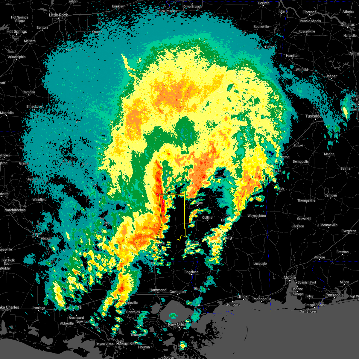 At 128 am cdt, severe thunderstorms were located along a line extending from near crystal springs to near hazlehurst to near east lincoln to near bogue chitto, moving east at 40 mph (radar indicated). Hazards include 60 mph wind gusts and quarter size hail. Hail damage to vehicles is expected. expect wind damage to roofs, siding, and trees. severe thunderstorms will be near, hopewell around 135 am cdt. rockport, sontag and oma around 140 am cdt. monticello and wanilla around 145 am cdt. union, jayess, topeka and harrisville around 150 am cdt. shivers and arm around 155 am cdt. robinwood around 200 am cdt. tilton around 205 am cdt. oak vale around 210 am cdt. other locations impacted by these severe thunderstorms include new hebron, silver creek, beauregard, braxton and georgetown. A tornado watch remains in effect until 200 am cdt for central and south central mississippi. At 128 am cdt, severe thunderstorms were located along a line extending from near crystal springs to near hazlehurst to near east lincoln to near bogue chitto, moving east at 40 mph (radar indicated). Hazards include 60 mph wind gusts and quarter size hail. Hail damage to vehicles is expected. expect wind damage to roofs, siding, and trees. severe thunderstorms will be near, hopewell around 135 am cdt. rockport, sontag and oma around 140 am cdt. monticello and wanilla around 145 am cdt. union, jayess, topeka and harrisville around 150 am cdt. shivers and arm around 155 am cdt. robinwood around 200 am cdt. tilton around 205 am cdt. oak vale around 210 am cdt. other locations impacted by these severe thunderstorms include new hebron, silver creek, beauregard, braxton and georgetown. A tornado watch remains in effect until 200 am cdt for central and south central mississippi.
|
| 4/3/2017 1:19 AM CDT | Trees dow in copiah county MS, 1 miles N of Hazlehurst, MS |
| 4/3/2017 1:09 AM CDT |
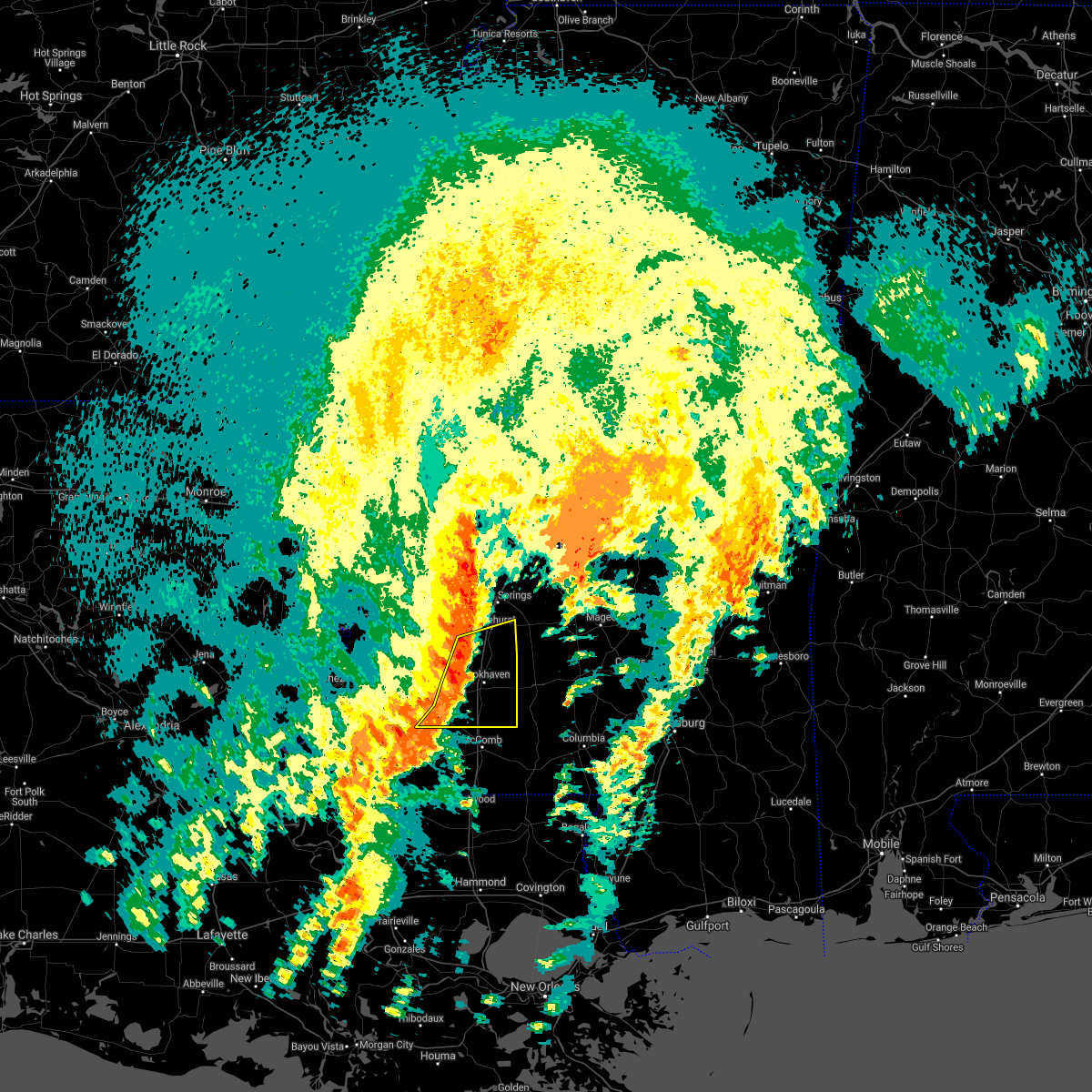 At 109 am cdt, severe thunderstorms were located along a line extending from glancy to near loyd star to near vaughn to near center point, moving northeast at 45 mph (radar indicated). Hazards include 60 mph wind gusts and penny size hail. Expect damage to roofs, siding, and trees. these severe storms will be near, hazlehurst, martinsville and glancy around 115 am cdt. brookhaven and wesson around 120 am cdt. bogue chitto around 125 am cdt. enterprise and east lincoln around 130 am cdt. other locations impacted by these severe thunderstorms include beauregard. A tornado watch remains in effect until 200 am cdt for central, south central and southwestern mississippi. At 109 am cdt, severe thunderstorms were located along a line extending from glancy to near loyd star to near vaughn to near center point, moving northeast at 45 mph (radar indicated). Hazards include 60 mph wind gusts and penny size hail. Expect damage to roofs, siding, and trees. these severe storms will be near, hazlehurst, martinsville and glancy around 115 am cdt. brookhaven and wesson around 120 am cdt. bogue chitto around 125 am cdt. enterprise and east lincoln around 130 am cdt. other locations impacted by these severe thunderstorms include beauregard. A tornado watch remains in effect until 200 am cdt for central, south central and southwestern mississippi.
|
| 4/3/2017 12:42 AM CDT |
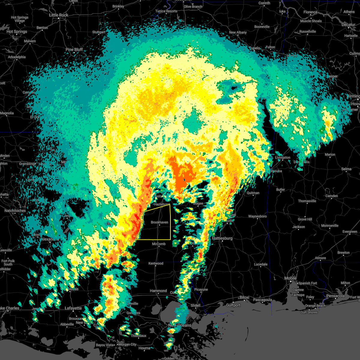 At 1241 am cdt, severe thunderstorms were located along a line extending from pleasant hill to near new hope to near bude to 7 miles southwest of little springs, moving east at 50 mph (radar indicated). Hazards include 60 mph wind gusts and penny size hail. Expect damage to roofs, siding, and trees. severe thunderstorms will be near, pleasant hill around 1245 am cdt. allen, mccall creek, little springs and caseyville around 1250 am cdt. west lincoln around 1255 am cdt. center point, vaughn, loyd star and glancy around 100 am cdt. brookhaven, hazlehurst, wesson and martinsville around 105 am cdt. enterprise and bogue chitto around 110 am cdt. east lincoln around 115 am cdt. ruth around 120 am cdt. other locations impacted by these severe thunderstorms include beauregard. A tornado watch remains in effect until 200 am cdt for central, south central and southwestern mississippi. At 1241 am cdt, severe thunderstorms were located along a line extending from pleasant hill to near new hope to near bude to 7 miles southwest of little springs, moving east at 50 mph (radar indicated). Hazards include 60 mph wind gusts and penny size hail. Expect damage to roofs, siding, and trees. severe thunderstorms will be near, pleasant hill around 1245 am cdt. allen, mccall creek, little springs and caseyville around 1250 am cdt. west lincoln around 1255 am cdt. center point, vaughn, loyd star and glancy around 100 am cdt. brookhaven, hazlehurst, wesson and martinsville around 105 am cdt. enterprise and bogue chitto around 110 am cdt. east lincoln around 115 am cdt. ruth around 120 am cdt. other locations impacted by these severe thunderstorms include beauregard. A tornado watch remains in effect until 200 am cdt for central, south central and southwestern mississippi.
|
| 4/2/2017 11:44 PM CDT |
 At 1144 pm cdt, severe thunderstorms were located along a line extending from rocky springs to near kirby, moving east at 40 mph (radar indicated). Hazards include 60 mph wind gusts and quarter size hail. Hail damage to vehicles is expected. expect wind damage to roofs, siding, and trees. severe thunderstorms will be near, rocky springs around 1150 pm cdt. carpenter around 1200 am cdt. loyd star around 1235 am cdt. brookhaven around 1245 am cdt. other locations impacted by these severe thunderstorms include beauregard. A tornado watch remains in effect until 200 am cdt for central, south central and southwestern mississippi. At 1144 pm cdt, severe thunderstorms were located along a line extending from rocky springs to near kirby, moving east at 40 mph (radar indicated). Hazards include 60 mph wind gusts and quarter size hail. Hail damage to vehicles is expected. expect wind damage to roofs, siding, and trees. severe thunderstorms will be near, rocky springs around 1150 pm cdt. carpenter around 1200 am cdt. loyd star around 1235 am cdt. brookhaven around 1245 am cdt. other locations impacted by these severe thunderstorms include beauregard. A tornado watch remains in effect until 200 am cdt for central, south central and southwestern mississippi.
|
| 3/30/2017 1:05 AM CDT |
 At 105 am cdt, a severe thunderstorm was located near brookhaven, moving northeast at 40 mph (radar indicated). Hazards include 60 mph wind gusts. Expect damage to roofs, siding, and trees. this severe storm will be near, hopewell around 140 am cdt. other locations impacted by this severe thunderstorm include beauregard and georgetown. A tornado watch remains in effect until 300 am cdt for central and south central mississippi. At 105 am cdt, a severe thunderstorm was located near brookhaven, moving northeast at 40 mph (radar indicated). Hazards include 60 mph wind gusts. Expect damage to roofs, siding, and trees. this severe storm will be near, hopewell around 140 am cdt. other locations impacted by this severe thunderstorm include beauregard and georgetown. A tornado watch remains in effect until 300 am cdt for central and south central mississippi.
|
| 3/30/2017 12:53 AM CDT |
 At 1253 am cdt, a severe thunderstorm was located over loyd star, or near brookhaven, moving northeast at 45 mph (radar indicated). Hazards include 60 mph wind gusts. Expect damage to roofs, siding, and trees. this severe storm will be near, wesson and glancy around 105 am cdt. martinsville around 110 am cdt. hazlehurst around 115 am cdt. gallman around 120 am cdt. crystal springs around 125 am cdt. hopewell around 130 am cdt. other locations impacted by this severe thunderstorm include beauregard and georgetown. A tornado watch remains in effect until 300 am cdt for central and south central mississippi. At 1253 am cdt, a severe thunderstorm was located over loyd star, or near brookhaven, moving northeast at 45 mph (radar indicated). Hazards include 60 mph wind gusts. Expect damage to roofs, siding, and trees. this severe storm will be near, wesson and glancy around 105 am cdt. martinsville around 110 am cdt. hazlehurst around 115 am cdt. gallman around 120 am cdt. crystal springs around 125 am cdt. hopewell around 130 am cdt. other locations impacted by this severe thunderstorm include beauregard and georgetown. A tornado watch remains in effect until 300 am cdt for central and south central mississippi.
|
| 3/30/2017 12:42 AM CDT |
 At 1242 am cdt, a severe thunderstorm was located over vaughn, or 9 miles west of brookhaven, moving northeast at 45 mph (radar indicated). Hazards include 60 mph wind gusts. Expect damage to roofs, siding, and trees. this severe thunderstorm will be near, caseyville around 1245 am cdt. loyd star around 1250 am cdt. brookhaven around 1255 am cdt. wesson around 100 am cdt. martinsville and glancy around 105 am cdt. hazlehurst around 110 am cdt. crystal springs and gallman around 120 am cdt. hopewell around 130 am cdt. other locations impacted by this severe thunderstorm include beauregard and georgetown. A tornado watch remains in effect until 300 am cdt for central, south central and southwestern mississippi. At 1242 am cdt, a severe thunderstorm was located over vaughn, or 9 miles west of brookhaven, moving northeast at 45 mph (radar indicated). Hazards include 60 mph wind gusts. Expect damage to roofs, siding, and trees. this severe thunderstorm will be near, caseyville around 1245 am cdt. loyd star around 1250 am cdt. brookhaven around 1255 am cdt. wesson around 100 am cdt. martinsville and glancy around 105 am cdt. hazlehurst around 110 am cdt. crystal springs and gallman around 120 am cdt. hopewell around 130 am cdt. other locations impacted by this severe thunderstorm include beauregard and georgetown. A tornado watch remains in effect until 300 am cdt for central, south central and southwestern mississippi.
|
| 3/7/2017 1:35 PM CST |
 At 134 pm cst, severe thunderstorms were located along a line extending from near terry to near dentville, moving east at 30 mph (radar indicated). Hazards include 60 mph wind gusts and quarter size hail. Hail damage to vehicles is expected. expect wind damage to roofs, siding, and trees. severe thunderstorms will be near, hazlehurst and gallman around 150 pm cst. crystal springs and whites around 155 pm cst. hopewell around 210 pm cst. Other locations impacted by these severe thunderstorms include georgetown. At 134 pm cst, severe thunderstorms were located along a line extending from near terry to near dentville, moving east at 30 mph (radar indicated). Hazards include 60 mph wind gusts and quarter size hail. Hail damage to vehicles is expected. expect wind damage to roofs, siding, and trees. severe thunderstorms will be near, hazlehurst and gallman around 150 pm cst. crystal springs and whites around 155 pm cst. hopewell around 210 pm cst. Other locations impacted by these severe thunderstorms include georgetown.
|
| 1/21/2017 2:05 AM CST |
 At 204 am cst, a severe thunderstorm was located over hazlehurst, moving northeast at 35 mph (radar indicated). Hazards include 60 mph wind gusts and quarter size hail. Hail damage to vehicles is expected. expect wind damage to roofs, siding, and trees. this severe storm will be near, crystal springs around 210 am cst. hopewell around 215 am cst. other locations impacted by this severe thunderstorm include georgetown. A tornado watch remains in effect until 700 am cst for central mississippi. At 204 am cst, a severe thunderstorm was located over hazlehurst, moving northeast at 35 mph (radar indicated). Hazards include 60 mph wind gusts and quarter size hail. Hail damage to vehicles is expected. expect wind damage to roofs, siding, and trees. this severe storm will be near, crystal springs around 210 am cst. hopewell around 215 am cst. other locations impacted by this severe thunderstorm include georgetown. A tornado watch remains in effect until 700 am cst for central mississippi.
|
| 1/21/2017 1:49 AM CST |
 At 149 am cst, a severe thunderstorm was located over gallman, or near hazlehurst, moving northeast at 45 mph (radar indicated). Hazards include ping pong ball size hail and 60 mph wind gusts. People and animals outdoors will be injured. expect hail damage to roofs, siding, windows, and vehicles. expect wind damage to roofs, siding, and trees. this severe storm will be near, crystal springs around 155 am cst. hopewell around 200 am cst. other locations impacted by this severe thunderstorm include georgetown and beauregard. A tornado watch remains in effect until 700 am cst for south central and central mississippi. At 149 am cst, a severe thunderstorm was located over gallman, or near hazlehurst, moving northeast at 45 mph (radar indicated). Hazards include ping pong ball size hail and 60 mph wind gusts. People and animals outdoors will be injured. expect hail damage to roofs, siding, windows, and vehicles. expect wind damage to roofs, siding, and trees. this severe storm will be near, crystal springs around 155 am cst. hopewell around 200 am cst. other locations impacted by this severe thunderstorm include georgetown and beauregard. A tornado watch remains in effect until 700 am cst for south central and central mississippi.
|
| 1/21/2017 1:40 AM CST |
 At 140 am cst, a severe thunderstorm was located near glancy, or near hazlehurst, moving northeast at 40 mph (radar indicated). Hazards include 60 mph wind gusts and half dollar size hail. Hail damage to vehicles is expected. expect wind damage to roofs, siding, and trees. this severe storm will be near, hazlehurst around 145 am cst. gallman around 150 am cst. crystal springs around 155 am cst. hopewell around 200 am cst. other locations impacted by this severe thunderstorm include georgetown and beauregard. A tornado watch remains in effect until 700 am cst for south central and central mississippi. At 140 am cst, a severe thunderstorm was located near glancy, or near hazlehurst, moving northeast at 40 mph (radar indicated). Hazards include 60 mph wind gusts and half dollar size hail. Hail damage to vehicles is expected. expect wind damage to roofs, siding, and trees. this severe storm will be near, hazlehurst around 145 am cst. gallman around 150 am cst. crystal springs around 155 am cst. hopewell around 200 am cst. other locations impacted by this severe thunderstorm include georgetown and beauregard. A tornado watch remains in effect until 700 am cst for south central and central mississippi.
|
| 1/21/2017 1:19 AM CST |
 At 118 am cst, a severe thunderstorm was located near mccall creek, or 15 miles west of brookhaven, moving northeast at 40 mph (radar indicated). Hazards include 60 mph wind gusts and quarter size hail. Hail damage to vehicles is expected. expect wind damage to roofs, siding, and trees. this severe thunderstorm will be near, caseyville and vaughn around 125 am cst. loyd star and allen around 130 am cst. wesson and glancy around 145 am cst. martinsville around 150 am cst. hazlehurst around 155 am cst. gallman around 200 am cst. crystal springs around 205 am cst. hopewell around 215 am cst. other locations impacted by this severe thunderstorm include georgetown and beauregard. A tornado watch remains in effect until 700 am cst for south central, southwestern and central mississippi. At 118 am cst, a severe thunderstorm was located near mccall creek, or 15 miles west of brookhaven, moving northeast at 40 mph (radar indicated). Hazards include 60 mph wind gusts and quarter size hail. Hail damage to vehicles is expected. expect wind damage to roofs, siding, and trees. this severe thunderstorm will be near, caseyville and vaughn around 125 am cst. loyd star and allen around 130 am cst. wesson and glancy around 145 am cst. martinsville around 150 am cst. hazlehurst around 155 am cst. gallman around 200 am cst. crystal springs around 205 am cst. hopewell around 215 am cst. other locations impacted by this severe thunderstorm include georgetown and beauregard. A tornado watch remains in effect until 700 am cst for south central, southwestern and central mississippi.
|
| 1/2/2017 1:30 PM CST | Tree split a mobile home in copiah county MS, 3.2 miles NE of Hazlehurst, MS |
| 1/2/2017 1:29 PM CST |
 At 128 pm cst, severe thunderstorms were located along a line extending from near barlow to brookhaven, moving northeast at 70 mph (radar indicated). Hazards include 70 mph wind gusts. Expect considerable tree damage. damage is likely to mobile homes, roofs, and outbuildings. these severe storms will be near, hazlehurst and dentville around 135 pm cst. crystal springs, gallman and martinsville around 140 pm cst. rockport around 145 pm cst. hopewell around 150 pm cst. other locations impacted by these severe thunderstorms include georgetown and beauregard. A tornado watch remains in effect until 800 pm cst for south central and central mississippi. At 128 pm cst, severe thunderstorms were located along a line extending from near barlow to brookhaven, moving northeast at 70 mph (radar indicated). Hazards include 70 mph wind gusts. Expect considerable tree damage. damage is likely to mobile homes, roofs, and outbuildings. these severe storms will be near, hazlehurst and dentville around 135 pm cst. crystal springs, gallman and martinsville around 140 pm cst. rockport around 145 pm cst. hopewell around 150 pm cst. other locations impacted by these severe thunderstorms include georgetown and beauregard. A tornado watch remains in effect until 800 pm cst for south central and central mississippi.
|
| 1/2/2017 1:13 PM CST |
 At 113 pm cst, severe thunderstorms were located along a line extending from near peyton to near mccall creek, moving east at 50 mph (radar indicated). Hazards include 60 mph wind gusts. Expect damage to roofs, siding, and trees. severe thunderstorms will be near, allen around 120 pm cst. west lincoln and vaughn around 125 pm cst. loyd star and bogue chitto around 130 pm cst. brookhaven, enterprise, glancy and dentville around 135 pm cst. hazlehurst around 140 pm cst. crystal springs, gallman and east lincoln around 145 pm cst. hopewell around 155 pm cst. other locations impacted by these severe thunderstorms include georgetown and beauregard. A tornado watch remains in effect until 800 pm cst for south central, southwestern and central mississippi. At 113 pm cst, severe thunderstorms were located along a line extending from near peyton to near mccall creek, moving east at 50 mph (radar indicated). Hazards include 60 mph wind gusts. Expect damage to roofs, siding, and trees. severe thunderstorms will be near, allen around 120 pm cst. west lincoln and vaughn around 125 pm cst. loyd star and bogue chitto around 130 pm cst. brookhaven, enterprise, glancy and dentville around 135 pm cst. hazlehurst around 140 pm cst. crystal springs, gallman and east lincoln around 145 pm cst. hopewell around 155 pm cst. other locations impacted by these severe thunderstorms include georgetown and beauregard. A tornado watch remains in effect until 800 pm cst for south central, southwestern and central mississippi.
|
| 11/28/2016 4:45 PM CST |
 At 444 pm cst, severe thunderstorms were located along a line extending from flowood to near mcbride, moving southeast at 20 mph (radar indicated). Hazards include 60 mph wind gusts and penny size hail. Expect damage to roofs. siding. and trees. severe thunderstorms will be near, pearl around 450 pm cst. pleasant hill around 455 pm cst. brandon and allen around 500 pm cst. monterey around 505 pm cst. star around 525 pm cst. A tornado watch remains in effect until 900 pm cst for central and southwestern mississippi. At 444 pm cst, severe thunderstorms were located along a line extending from flowood to near mcbride, moving southeast at 20 mph (radar indicated). Hazards include 60 mph wind gusts and penny size hail. Expect damage to roofs. siding. and trees. severe thunderstorms will be near, pearl around 450 pm cst. pleasant hill around 455 pm cst. brandon and allen around 500 pm cst. monterey around 505 pm cst. star around 525 pm cst. A tornado watch remains in effect until 900 pm cst for central and southwestern mississippi.
|
| 7/22/2016 4:20 PM CDT | A few trees and powerlines were knocked down in and around hazlehurs in copiah county MS, 0.4 miles NNW of Hazlehurst, MS |
| 7/14/2016 10:15 PM CDT |
 At 1013 pm cdt, severe thunderstorms were located along a line extending from near dentville to near brouillette, moving southeast at 40 mph (radar indicated). Hazards include 70 mph wind gusts. Expect considerable tree damage. damage is likely to mobile homes, roofs, and outbuildings. severe thunderstorms will be near, hazlehurst and glancy around 1020 pm cdt. martinsville around 1025 pm cdt. wesson around 1030 pm cdt. Other locations impacted by these severe thunderstorms include meadville, beauregard, ridgecrest and roxie. At 1013 pm cdt, severe thunderstorms were located along a line extending from near dentville to near brouillette, moving southeast at 40 mph (radar indicated). Hazards include 70 mph wind gusts. Expect considerable tree damage. damage is likely to mobile homes, roofs, and outbuildings. severe thunderstorms will be near, hazlehurst and glancy around 1020 pm cdt. martinsville around 1025 pm cdt. wesson around 1030 pm cdt. Other locations impacted by these severe thunderstorms include meadville, beauregard, ridgecrest and roxie.
|
| 3/31/2016 6:26 PM CDT |
 At 626 pm cdt, severe thunderstorms were located along a line extending from near pocahontas to near byram to gallman, moving east at 65 mph (radar indicated). Hazards include 60 mph wind gusts and quarter size hail. Hail damage to vehicles is expected. expect wind damage to roofs, siding and trees. these severe storms will be near, jackson around 630 pm cdt. other locations impacted by these severe thunderstorms include georgetown. A tornado watch remains in effect until 1000 pm cdt for central mississippi. At 626 pm cdt, severe thunderstorms were located along a line extending from near pocahontas to near byram to gallman, moving east at 65 mph (radar indicated). Hazards include 60 mph wind gusts and quarter size hail. Hail damage to vehicles is expected. expect wind damage to roofs, siding and trees. these severe storms will be near, jackson around 630 pm cdt. other locations impacted by these severe thunderstorms include georgetown. A tornado watch remains in effect until 1000 pm cdt for central mississippi.
|
| 3/31/2016 6:05 PM CDT |
 At 604 pm cdt, severe thunderstorms were located along a line extending from near edwards to near utica to near dentville, moving east at 50 mph (radar indicated). Hazards include 70 mph wind gusts and half dollar size hail. Hail damage to vehicles is expected. expect considerable tree damage. wind damage is also likely to mobile homes, roofs and outbuildings. these severe storms will be near, bolton and dry grove around 610 pm cdt. raymond around 615 pm cdt. jackson, clinton and gallman around 620 pm cdt. byram and crystal springs around 625 pm cdt. terry around 630 pm cdt. hopewell around 635 pm cdt. other locations impacted by these severe thunderstorms include learned and georgetown. A tornado watch remains in effect until 1000 pm cdt for west central mississippi. At 604 pm cdt, severe thunderstorms were located along a line extending from near edwards to near utica to near dentville, moving east at 50 mph (radar indicated). Hazards include 70 mph wind gusts and half dollar size hail. Hail damage to vehicles is expected. expect considerable tree damage. wind damage is also likely to mobile homes, roofs and outbuildings. these severe storms will be near, bolton and dry grove around 610 pm cdt. raymond around 615 pm cdt. jackson, clinton and gallman around 620 pm cdt. byram and crystal springs around 625 pm cdt. terry around 630 pm cdt. hopewell around 635 pm cdt. other locations impacted by these severe thunderstorms include learned and georgetown. A tornado watch remains in effect until 1000 pm cdt for west central mississippi.
|
| 3/31/2016 5:49 PM CDT |
 At 548 pm cdt, severe thunderstorms were located along a line extending from near bovina to near rocky springs to pattison, moving east at 50 mph (radar indicated). Hazards include 70 mph wind gusts and quarter size hail. Hail damage to vehicles is expected. expect considerable tree damage. wind damage is also likely to mobile homes, roofs and outbuildings. severe thunderstorms will be near, carpenter around 555 pm cdt. edwards, utica and newman around 600 pm cdt. bolton and dry grove around 610 pm cdt. raymond and dentville around 615 pm cdt. jackson around 620 pm cdt. clinton, byram, crystal springs and gallman around 625 pm cdt. terry and hopewell around 635 pm cdt. other locations impacted by these severe thunderstorms include learned and georgetown. A tornado watch remains in effect until 1000 pm cdt for southwestern mississippi. At 548 pm cdt, severe thunderstorms were located along a line extending from near bovina to near rocky springs to pattison, moving east at 50 mph (radar indicated). Hazards include 70 mph wind gusts and quarter size hail. Hail damage to vehicles is expected. expect considerable tree damage. wind damage is also likely to mobile homes, roofs and outbuildings. severe thunderstorms will be near, carpenter around 555 pm cdt. edwards, utica and newman around 600 pm cdt. bolton and dry grove around 610 pm cdt. raymond and dentville around 615 pm cdt. jackson around 620 pm cdt. clinton, byram, crystal springs and gallman around 625 pm cdt. terry and hopewell around 635 pm cdt. other locations impacted by these severe thunderstorms include learned and georgetown. A tornado watch remains in effect until 1000 pm cdt for southwestern mississippi.
|
| 3/17/2016 3:47 PM CDT |
 At 347 pm cdt, a severe thunderstorm was located near loyd star, or 10 miles northwest of brookhaven, moving east at 30 mph (radar indicated). Hazards include 60 mph wind gusts and half dollar size hail. Hail damage to vehicles is expected. expect wind damage to roofs, siding and trees. this severe thunderstorm will be near, brookhaven and glancy around 355 pm cdt. wesson and martinsville around 405 pm cdt. Other locations impacted by this severe thunderstorm include beauregard. At 347 pm cdt, a severe thunderstorm was located near loyd star, or 10 miles northwest of brookhaven, moving east at 30 mph (radar indicated). Hazards include 60 mph wind gusts and half dollar size hail. Hail damage to vehicles is expected. expect wind damage to roofs, siding and trees. this severe thunderstorm will be near, brookhaven and glancy around 355 pm cdt. wesson and martinsville around 405 pm cdt. Other locations impacted by this severe thunderstorm include beauregard.
|
| 3/3/2016 4:33 PM CST | Quarter sized hail reported 0.4 miles NNW of Hazlehurst, MS, dime size with a few quarters |
| 3/3/2016 4:30 PM CST |
 At 429 pm cst, a severe thunderstorm was located over hazlehurst, moving east at 45 mph (radar indicated). Hazards include 60 mph wind gusts and quarter size hail. Hail damage to vehicles is expected. expect wind damage to roofs, siding and trees. this severe storm will be near, rockport around 450 pm cst. Other locations impacted by this severe thunderstorm include georgetown. At 429 pm cst, a severe thunderstorm was located over hazlehurst, moving east at 45 mph (radar indicated). Hazards include 60 mph wind gusts and quarter size hail. Hail damage to vehicles is expected. expect wind damage to roofs, siding and trees. this severe storm will be near, rockport around 450 pm cst. Other locations impacted by this severe thunderstorm include georgetown.
|
| 3/3/2016 4:23 PM CST |
 At 423 pm cst, a severe thunderstorm was located near dentville, or 7 miles northwest of hazlehurst, moving east at 45 mph (radar indicated). Hazards include 60 mph wind gusts and quarter size hail. Hail damage to vehicles is expected. expect wind damage to roofs, siding and trees. this severe thunderstorm will be near, crystal springs, hazlehurst and gallman around 430 pm cst. martinsville around 435 pm cst. hopewell around 445 pm cst. rockport around 450 pm cst. Other locations impacted by this severe thunderstorm include georgetown. At 423 pm cst, a severe thunderstorm was located near dentville, or 7 miles northwest of hazlehurst, moving east at 45 mph (radar indicated). Hazards include 60 mph wind gusts and quarter size hail. Hail damage to vehicles is expected. expect wind damage to roofs, siding and trees. this severe thunderstorm will be near, crystal springs, hazlehurst and gallman around 430 pm cst. martinsville around 435 pm cst. hopewell around 445 pm cst. rockport around 450 pm cst. Other locations impacted by this severe thunderstorm include georgetown.
|
| 2/23/2016 9:40 PM CST |
 At 939 pm cst, severe thunderstorms were located along a line extending from near jackson to near hazlehurst, moving east at 40 mph (radar indicated). Hazards include 60 mph wind gusts and quarter size hail. Hail damage to vehicles is expected. expect wind damage to roofs, siding and trees. These severe storms will be near, hopewell around 1000 pm cst. At 939 pm cst, severe thunderstorms were located along a line extending from near jackson to near hazlehurst, moving east at 40 mph (radar indicated). Hazards include 60 mph wind gusts and quarter size hail. Hail damage to vehicles is expected. expect wind damage to roofs, siding and trees. These severe storms will be near, hopewell around 1000 pm cst.
|
| 2/23/2016 8:55 PM CST |
 At 854 pm cst, severe thunderstorms were located along a line extending from near reganton to blue hill, moving northeast at 40 mph (radar indicated). Hazards include 60 mph wind gusts and quarter size hail. Hail damage to vehicles is expected. expect wind damage to roofs, siding and trees. severe thunderstorms will be near, utica and newman around 905 pm cst. barlow around 915 pm cst. raymond and glancy around 925 pm cst. bolton and dentville around 930 pm cst. jackson and hazlehurst around 935 pm cst. clinton and gallman around 940 pm cst. crystal springs around 945 pm cst. hopewell around 950 pm cst. Other locations impacted by these severe thunderstorms include learned. At 854 pm cst, severe thunderstorms were located along a line extending from near reganton to blue hill, moving northeast at 40 mph (radar indicated). Hazards include 60 mph wind gusts and quarter size hail. Hail damage to vehicles is expected. expect wind damage to roofs, siding and trees. severe thunderstorms will be near, utica and newman around 905 pm cst. barlow around 915 pm cst. raymond and glancy around 925 pm cst. bolton and dentville around 930 pm cst. jackson and hazlehurst around 935 pm cst. clinton and gallman around 940 pm cst. crystal springs around 945 pm cst. hopewell around 950 pm cst. Other locations impacted by these severe thunderstorms include learned.
|
| 2/15/2016 1:27 PM CST |
 At 127 pm cst, severe thunderstorms were located along a line extending from near hazlehurst to near glancy to near wesson to near vaughn, moving east at 40 mph (radar indicated). Hazards include 60 mph wind gusts. Expect damage to roofs. siding and trees. these severe storms will be near, hazlehurst around 135 pm cst. hopewell around 145 pm cst. rockport, sontag and oma around 155 pm cst. wanilla around 200 pm cst. other locations impacted by these severe thunderstorms include georgetown and beauregard. A tornado watch remains in effect until 600 pm cst for south central mississippi. At 127 pm cst, severe thunderstorms were located along a line extending from near hazlehurst to near glancy to near wesson to near vaughn, moving east at 40 mph (radar indicated). Hazards include 60 mph wind gusts. Expect damage to roofs. siding and trees. these severe storms will be near, hazlehurst around 135 pm cst. hopewell around 145 pm cst. rockport, sontag and oma around 155 pm cst. wanilla around 200 pm cst. other locations impacted by these severe thunderstorms include georgetown and beauregard. A tornado watch remains in effect until 600 pm cst for south central mississippi.
|
| 2/15/2016 1:14 PM CST |
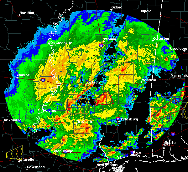 At 114 pm cst, severe thunderstorms were located along a line extending from near glancy to near allen to near caseyville to near mccall creek, moving east at 55 mph (radar indicated). Hazards include 60 mph wind gusts. Expect damage to roofs. siding and trees. these severe storms will be near, hazlehurst and glancy around 120 pm cst. martinsville and gallman around 125 pm cst. brookhaven and wesson around 130 pm cst. hopewell around 135 pm cst. rockport, sontag and oma around 145 pm cst. wanilla around 150 pm cst. other locations impacted by these severe thunderstorms include georgetown and beauregard. A tornado watch remains in effect until 600 pm cst for southwestern mississippi. At 114 pm cst, severe thunderstorms were located along a line extending from near glancy to near allen to near caseyville to near mccall creek, moving east at 55 mph (radar indicated). Hazards include 60 mph wind gusts. Expect damage to roofs. siding and trees. these severe storms will be near, hazlehurst and glancy around 120 pm cst. martinsville and gallman around 125 pm cst. brookhaven and wesson around 130 pm cst. hopewell around 135 pm cst. rockport, sontag and oma around 145 pm cst. wanilla around 150 pm cst. other locations impacted by these severe thunderstorms include georgetown and beauregard. A tornado watch remains in effect until 600 pm cst for southwestern mississippi.
|
| 2/15/2016 1:05 PM CST |
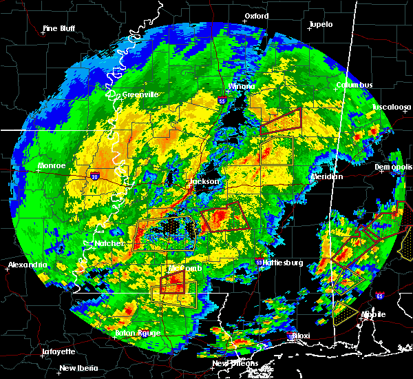 At 105 pm cst, severe thunderstorms were located along a line extending from near peyton to near mcbride to union church to new hope, moving east at 40 mph (radar indicated). Hazards include 60 mph wind gusts. Expect damage to roofs. siding and trees. severe thunderstorms will be near, pleasant hill around 110 pm cst. allen and barlow around 115 pm cst. caseyville around 120 pm cst. glancy and vaughn around 125 pm cst. loyd star around 130 pm cst. hazlehurst around 135 pm cst. brookhaven, martinsville and gallman around 140 pm cst. wesson around 145 pm cst. other locations impacted by these severe thunderstorms include georgetown and beauregard. A tornado watch remains in effect until 600 pm cst for southwestern mississippi. At 105 pm cst, severe thunderstorms were located along a line extending from near peyton to near mcbride to union church to new hope, moving east at 40 mph (radar indicated). Hazards include 60 mph wind gusts. Expect damage to roofs. siding and trees. severe thunderstorms will be near, pleasant hill around 110 pm cst. allen and barlow around 115 pm cst. caseyville around 120 pm cst. glancy and vaughn around 125 pm cst. loyd star around 130 pm cst. hazlehurst around 135 pm cst. brookhaven, martinsville and gallman around 140 pm cst. wesson around 145 pm cst. other locations impacted by these severe thunderstorms include georgetown and beauregard. A tornado watch remains in effect until 600 pm cst for southwestern mississippi.
|
| 2/2/2016 6:45 PM CST |
 At 644 pm cst, a severe thunderstorm was located near glancy, or 9 miles southwest of hazlehurst, moving northeast at 50 mph (radar indicated). Hazards include 60 mph wind gusts. Expect damage to roofs. siding and trees. this severe thunderstorm will be near, martinsville around 650 pm cst. hazlehurst around 655 pm cst. gallman around 700 pm cst. crystal springs around 705 pm cst. hopewell around 710 pm cst. A tornado watch remains in effect until 700 pm cst for central mississippi. At 644 pm cst, a severe thunderstorm was located near glancy, or 9 miles southwest of hazlehurst, moving northeast at 50 mph (radar indicated). Hazards include 60 mph wind gusts. Expect damage to roofs. siding and trees. this severe thunderstorm will be near, martinsville around 650 pm cst. hazlehurst around 655 pm cst. gallman around 700 pm cst. crystal springs around 705 pm cst. hopewell around 710 pm cst. A tornado watch remains in effect until 700 pm cst for central mississippi.
|
| 2/2/2016 2:45 PM CST |
 The national weather service in jackson has issued a * severe thunderstorm warning for. northeastern copiah county in central mississippi. rankin county in central mississippi. northwestern simpson county in central mississippi. Southeastern hinds county in central mississippi. The national weather service in jackson has issued a * severe thunderstorm warning for. northeastern copiah county in central mississippi. rankin county in central mississippi. northwestern simpson county in central mississippi. Southeastern hinds county in central mississippi.
|
| 1/21/2016 5:15 PM CST | Quarter sized hail reported 14.7 miles WNW of Hazlehurst, MS, cocorahs observer reports dime to quarter size hail in rockport. |
| 1/21/2016 4:39 PM CST | The national weather service in jackson has issued a * tornado warning for. eastern copiah county in central mississippi. western simpson county in central mississippi. until 545 pm cst * at 439 pm cst. A severe thunderstorm capable of producing a. |
| 1/21/2016 3:52 PM CST | At 352 pm cst, a severe thunderstorm was located over gallman, or near crystal springs, moving northeast at 35 mph (radar indicated). Hazards include 60 mph wind gusts and quarter size hail. Hail damage to vehicles is expected. expect wind damage to roofs, siding and trees. this severe storm will be near, crystal springs around 355 pm cst. hopewell around 405 pm cst. A tornado watch remains in effect until 1000 pm cst for central mississippi. |
| 1/21/2016 3:34 PM CST | At 334 pm cst, a severe thunderstorm was located over glancy, or near hazlehurst, moving northeast at 35 mph (radar indicated). Hazards include 60 mph wind gusts and quarter size hail. Hail damage to vehicles is expected. expect wind damage to roofs, siding and trees. this severe thunderstorm will be near, hazlehurst around 345 pm cst. gallman around 350 pm cst. crystal springs around 355 pm cst. hopewell around 405 pm cst. A tornado watch remains in effect until 1000 pm cst for central mississippi. |
| 12/28/2015 4:20 AM CST |
 At 420 am cst, a severe thunderstorm was located over crystal springs, moving north at 50 mph (radar indicated). Hazards include 60 mph wind gusts. Expect damage to roofs. siding and trees. this severe thunderstorm will remain over mainly rural areas of eastern copiah county, including the following locations, georgetown. A tornado watch remains in effect until 800 am cst for south central mississippi. At 420 am cst, a severe thunderstorm was located over crystal springs, moving north at 50 mph (radar indicated). Hazards include 60 mph wind gusts. Expect damage to roofs. siding and trees. this severe thunderstorm will remain over mainly rural areas of eastern copiah county, including the following locations, georgetown. A tornado watch remains in effect until 800 am cst for south central mississippi.
|
| 12/28/2015 3:58 AM CST |
 At 358 am cst, a severe thunderstorm was located over wesson, or 9 miles north of brookhaven, moving north at 50 mph (radar indicated). Hazards include 60 mph wind gusts. Expect damage to roofs. siding and trees. this severe thunderstorm will be near, hazlehurst around 410 am cst. gallman around 415 am cst. crystal springs and hopewell around 420 am cst. other locations impacted by this severe thunderstorm include georgetown and beauregard. A tornado watch remains in effect until 800 am cst for south central mississippi. At 358 am cst, a severe thunderstorm was located over wesson, or 9 miles north of brookhaven, moving north at 50 mph (radar indicated). Hazards include 60 mph wind gusts. Expect damage to roofs. siding and trees. this severe thunderstorm will be near, hazlehurst around 410 am cst. gallman around 415 am cst. crystal springs and hopewell around 420 am cst. other locations impacted by this severe thunderstorm include georgetown and beauregard. A tornado watch remains in effect until 800 am cst for south central mississippi.
|
| 12/27/2015 3:19 PM CST |
 At 318 pm cst, a severe thunderstorm capable of producing a tornado was located over hazlehurst, moving northeast at 25 mph (radar indicated rotation). Hazards include tornado. Flying debris will be dangerous to those caught without shelter. mobile homes will be damaged or destroyed. damage to roofs, windows and vehicles will occur. tree damage is likely. this dangerous storm will be near, gallman around 325 pm cst. Crystal springs around 330 pm cst. At 318 pm cst, a severe thunderstorm capable of producing a tornado was located over hazlehurst, moving northeast at 25 mph (radar indicated rotation). Hazards include tornado. Flying debris will be dangerous to those caught without shelter. mobile homes will be damaged or destroyed. damage to roofs, windows and vehicles will occur. tree damage is likely. this dangerous storm will be near, gallman around 325 pm cst. Crystal springs around 330 pm cst.
|
| 12/27/2015 2:55 PM CST |
 At 255 pm cst, a severe thunderstorm capable of producing a tornado was located near wesson, or 9 miles south of hazlehurst, moving north at 35 mph (radar indicated rotation). Hazards include tornado. Flying debris will be dangerous to those caught without shelter. mobile homes will be damaged or destroyed. damage to roofs, windows and vehicles will occur. tree damage is likely. this dangerous storm will be near, martinsville around 300 pm cst. glancy around 305 pm cst. hazlehurst around 310 pm cst. crystal springs and gallman around 320 pm cst. Other locations impacted by this tornadic thunderstorm include beauregard. At 255 pm cst, a severe thunderstorm capable of producing a tornado was located near wesson, or 9 miles south of hazlehurst, moving north at 35 mph (radar indicated rotation). Hazards include tornado. Flying debris will be dangerous to those caught without shelter. mobile homes will be damaged or destroyed. damage to roofs, windows and vehicles will occur. tree damage is likely. this dangerous storm will be near, martinsville around 300 pm cst. glancy around 305 pm cst. hazlehurst around 310 pm cst. crystal springs and gallman around 320 pm cst. Other locations impacted by this tornadic thunderstorm include beauregard.
|
| 12/27/2015 2:48 PM CST |
 At 248 pm cst, a severe thunderstorm was located near wesson, or 8 miles north of brookhaven, moving north at 50 mph (radar indicated). Hazards include 60 mph wind gusts. Expect damage to roofs. siding and trees. this severe thunderstorm will be near, martinsville around 255 pm cst. glancy around 300 pm cst. hazlehurst around 305 pm cst. crystal springs and gallman around 310 pm cst. Other locations impacted by this severe thunderstorm include beauregard. At 248 pm cst, a severe thunderstorm was located near wesson, or 8 miles north of brookhaven, moving north at 50 mph (radar indicated). Hazards include 60 mph wind gusts. Expect damage to roofs. siding and trees. this severe thunderstorm will be near, martinsville around 255 pm cst. glancy around 300 pm cst. hazlehurst around 305 pm cst. crystal springs and gallman around 310 pm cst. Other locations impacted by this severe thunderstorm include beauregard.
|
| 11/17/2015 10:37 PM CST |
 At 1037 pm cst, a severe thunderstorm was located near wesson, or 9 miles north of brookhaven, moving northeast at 60 mph (radar indicated). Hazards include 60 mph wind gusts. Expect damage to roofs. siding and trees. this severe thunderstorm will be near, hazlehurst around 1045 pm cst. gallman around 1050 pm cst. crystal springs around 1055 pm cst. hopewell around 1100 pm cst. harrisville around 1105 pm cst. other locations impacted by this severe thunderstorm include braxton, beauregard and georgetown. A tornado watch remains in effect until 300 am cst for south central mississippi. At 1037 pm cst, a severe thunderstorm was located near wesson, or 9 miles north of brookhaven, moving northeast at 60 mph (radar indicated). Hazards include 60 mph wind gusts. Expect damage to roofs. siding and trees. this severe thunderstorm will be near, hazlehurst around 1045 pm cst. gallman around 1050 pm cst. crystal springs around 1055 pm cst. hopewell around 1100 pm cst. harrisville around 1105 pm cst. other locations impacted by this severe thunderstorm include braxton, beauregard and georgetown. A tornado watch remains in effect until 300 am cst for south central mississippi.
|
| 7/30/2015 5:06 PM CDT |
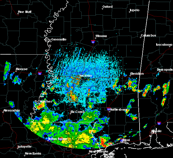 At 506 pm cdt, severe thunderstorms were located along a line extending from near gallman to near wesson, moving southwest at 20 mph (radar indicated). Hazards include 60 mph wind gusts. Expect damage to roofs. siding and trees. these severe storms will be near, wesson around 510 pm cdt. brookhaven around 525 pm cdt. glancy and martinsville around 540 pm cdt. Other locations impacted by these severe thunderstorms include beauregard. At 506 pm cdt, severe thunderstorms were located along a line extending from near gallman to near wesson, moving southwest at 20 mph (radar indicated). Hazards include 60 mph wind gusts. Expect damage to roofs. siding and trees. these severe storms will be near, wesson around 510 pm cdt. brookhaven around 525 pm cdt. glancy and martinsville around 540 pm cdt. Other locations impacted by these severe thunderstorms include beauregard.
|
| 7/30/2015 4:39 PM CDT |
 At 439 pm cdt, severe thunderstorms were located along a line extending from near terry to 6 miles southwest of rockport, moving southwest at 20 mph (radar indicated). Hazards include 60 mph wind gusts. Expect damage to roofs. siding and trees. severe thunderstorms will be near, wesson around 500 pm cdt. hazlehurst around 520 pm cdt. brookhaven around 525 pm cdt. martinsville around 535 pm cdt. glancy around 540 pm cdt. Other locations impacted by these severe thunderstorms include beauregard. At 439 pm cdt, severe thunderstorms were located along a line extending from near terry to 6 miles southwest of rockport, moving southwest at 20 mph (radar indicated). Hazards include 60 mph wind gusts. Expect damage to roofs. siding and trees. severe thunderstorms will be near, wesson around 500 pm cdt. hazlehurst around 520 pm cdt. brookhaven around 525 pm cdt. martinsville around 535 pm cdt. glancy around 540 pm cdt. Other locations impacted by these severe thunderstorms include beauregard.
|
| 6/29/2015 6:25 PM CDT |
 At 624 pm cdt, a severe thunderstorm was located over hazlehurst, moving east at 10 mph (radar indicated). Hazards include 60 mph wind gusts and quarter size hail. Hail damage to vehicles is expected. expect wind damage to roofs, siding and trees. This severe storm will be near, hazlehurst around 630 pm cdt. At 624 pm cdt, a severe thunderstorm was located over hazlehurst, moving east at 10 mph (radar indicated). Hazards include 60 mph wind gusts and quarter size hail. Hail damage to vehicles is expected. expect wind damage to roofs, siding and trees. This severe storm will be near, hazlehurst around 630 pm cdt.
|
| 6/29/2015 5:56 PM CDT |
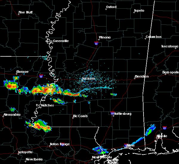 At 556 pm cdt, a severe thunderstorm was located over gallman, or over hazlehurst, moving southeast at 15 mph (radar indicated). Hazards include 60 mph wind gusts and quarter size hail. Hail damage to vehicles is expected. expect wind damage to roofs, siding and trees. this severe thunderstorm will be near, hazlehurst around 600 pm cdt. Hopewell around 635 pm cdt. At 556 pm cdt, a severe thunderstorm was located over gallman, or over hazlehurst, moving southeast at 15 mph (radar indicated). Hazards include 60 mph wind gusts and quarter size hail. Hail damage to vehicles is expected. expect wind damage to roofs, siding and trees. this severe thunderstorm will be near, hazlehurst around 600 pm cdt. Hopewell around 635 pm cdt.
|
| 6/24/2015 3:54 PM CDT |
 At 354 pm cdt, a severe thunderstorm was located near gallman, or near hazlehurst, moving west at 20 mph (radar indicated). Hazards include 60 mph wind gusts. Expect damage to roofs. siding and trees. Locations impacted include, crystal springs, hazlehurst, barlow, martinsville, gallman, dentville, glancy, carpenter and allen. At 354 pm cdt, a severe thunderstorm was located near gallman, or near hazlehurst, moving west at 20 mph (radar indicated). Hazards include 60 mph wind gusts. Expect damage to roofs. siding and trees. Locations impacted include, crystal springs, hazlehurst, barlow, martinsville, gallman, dentville, glancy, carpenter and allen.
|
| 6/24/2015 3:35 PM CDT | Numerous trees down around hazlehurst. reported by emergency management in copiah county MS, 0.4 miles NNW of Hazlehurst, MS |
| 6/24/2015 3:34 PM CDT |
 At 334 pm cdt, a severe thunderstorm was located over gallman, or near hazlehurst, moving west at 20 mph (radar indicated). Hazards include 60 mph wind gusts and quarter size hail. Hail damage to vehicles is expected. expect wind damage to roofs, siding and trees. Locations impacted include, crystal springs, hazlehurst, wesson, hopewell, barlow, martinsville, gallman, dentville, glancy, carpenter, allen and beauregard. At 334 pm cdt, a severe thunderstorm was located over gallman, or near hazlehurst, moving west at 20 mph (radar indicated). Hazards include 60 mph wind gusts and quarter size hail. Hail damage to vehicles is expected. expect wind damage to roofs, siding and trees. Locations impacted include, crystal springs, hazlehurst, wesson, hopewell, barlow, martinsville, gallman, dentville, glancy, carpenter, allen and beauregard.
|
| 6/24/2015 3:16 PM CDT |
 At 316 pm cdt, a severe thunderstorm was located near hopewell, or 9 miles southeast of crystal springs, moving west at 20 mph (radar indicated). Hazards include 60 mph wind gusts and quarter size hail. Hail damage to vehicles is expected. expect wind damage to roofs, siding and trees. this severe thunderstorm will be near, crystal springs and gallman around 340 pm cdt. hazlehurst around 345 pm cdt. glancy around 355 pm cdt. dentville around 410 pm cdt. Other locations impacted by this severe thunderstorm include beauregard. At 316 pm cdt, a severe thunderstorm was located near hopewell, or 9 miles southeast of crystal springs, moving west at 20 mph (radar indicated). Hazards include 60 mph wind gusts and quarter size hail. Hail damage to vehicles is expected. expect wind damage to roofs, siding and trees. this severe thunderstorm will be near, crystal springs and gallman around 340 pm cdt. hazlehurst around 345 pm cdt. glancy around 355 pm cdt. dentville around 410 pm cdt. Other locations impacted by this severe thunderstorm include beauregard.
|
| 5/30/2015 5:36 PM CDT | The severe thunderstorm warning for southwestern copiah and northern lincoln counties will expire at 545 pm cdt, the storm which prompted the warning has weakened below severe limits, and no longer pose an immediate threat to life or property. therefore the warning will be allowed to expire. |
| 5/30/2015 5:24 PM CDT | At 523 pm cdt, a severe thunderstorm was located over loyd star, or 9 miles northwest of brookhaven, moving northeast at 35 mph (radar indicated). Hazards include 60 mph wind gusts and quarter size hail. Hail damage to vehicles is expected. expect wind damage to roofs, siding and trees. this severe storm will be near, wesson, martinsville and glancy around 545 pm cdt. Other locations impacted by this severe thunderstorm include beauregard. |
| 5/30/2015 5:01 PM CDT | At 501 pm cdt, a severe thunderstorm was located over caseyville, or 12 miles northwest of brookhaven, moving northeast at 35 mph (radar indicated). Hazards include 60 mph wind gusts and quarter size hail. Hail damage to vehicles is expected. expect wind damage to roofs, siding and trees. this severe thunderstorm will be near, wesson and glancy around 520 pm cdt. martinsville around 525 pm cdt. hazlehurst around 530 pm cdt. Other locations impacted by this severe thunderstorm include beauregard. |
| 5/27/2015 12:35 PM CDT | At 1235 pm cdt, a severe thunderstorm was located over martinsville, or near hazlehurst, moving north at 25 mph (radar indicated). Hazards include 60 mph wind gusts. Expect damage to roofs. Siding and trees. |
| 5/26/2015 1:28 AM CDT | At 127 am cdt, severe thunderstorms were located along a line extending from edwards to near caseyville, moving east at 40 mph (radar indicated). Hazards include 60 mph wind gusts. Expect damage to roofs. siding and trees. these severe storms will be near, bolton around 140 am cdt. raymond and martinsville around 145 am cdt. other locations impacted by these severe thunderstorms include learned. A tornado watch remains in effect until 500 am cdt for west central mississippi. |
| 5/26/2015 12:54 AM CDT | At 1254 am cdt, severe thunderstorms were located along a line extending from le tourneau to near new hope, moving east at 45 mph (radar indicated). Hazards include 60 mph wind gusts. Expect damage to roofs. siding and trees. severe thunderstorms will be near, pleasant hill around 110 am cdt. newman around 115 am cdt. allen around 120 am cdt. edwards around 125 am cdt. bolton and glancy around 135 am cdt. martinsville around 140 am cdt. other locations impacted by these severe thunderstorms include learned. A tornado watch remains in effect until 500 am cdt for southwestern mississippi. |
| 5/18/2015 12:09 AM CDT | At 1209 am cdt, a severe thunderstorm was located near glancy, or 9 miles west of hazlehurst, moving east at 50 mph (radar indicated). Hazards include 60 mph wind gusts. Expect damage to roofs. siding and trees. this severe thunderstorm will be near, martinsville around 1215 am cdt. hazlehurst and gallman around 1220 am cdt. crystal springs around 1225 am cdt. hopewell around 1235 am cdt. other locations impacted by this severe thunderstorm include georgetown and beauregard. 75in. |
| 6/13/2014 3:25 AM CDT | Tree downed across ms highway 28 near barlow rd in copiah county MS, 8.3 miles ENE of Hazlehurst, MS |
| 4/8/2014 4:10 PM CDT | Ema reports strong winds blew a tree down across hwy 51 south and ripped the flag off the pole at the eoc in copiah county MS, 0.4 miles NNW of Hazlehurst, MS |
| 4/8/2014 4:10 PM CDT | Trees down at us hwy 51 and georgetown road in copiah county MS, 1.1 miles S of Hazlehurst, MS |
| 1/30/2013 3:45 AM CST | A few trees down in the southern part of the county. one along intersta in copiah county MS, 0.4 miles NNW of Hazlehurst, MS |
| 12/25/2012 3:15 PM CST | Reports of tree across highway 51 close to dixon roa in copiah county MS, 1.8 miles SSE of Hazlehurst, MS |
| 12/25/2012 2:40 PM CST | Reports of tree down on barlow road and awning ripped off home on highway 2 in copiah county MS, 13 miles E of Hazlehurst, MS |
| 7/4/2012 2:25 PM CDT | A couple of trees down across highway 51 just south of hazlehurst along with lots of branche in copiah county MS, 1.7 miles N of Hazlehurst, MS |
| 5/31/2012 3:31 PM CDT | Reports of trees and powerlines down throughout southern copiah count in copiah county MS, 4 miles ENE of Hazlehurst, MS |
| 5/31/2012 3:30 PM CDT | *** 4 inj *** numerous trees down in and southwest of hazlehurst. 4 people sustained minor injuries as a branch went through a homes windo in copiah county MS, 1.1 miles NNE of Hazlehurst, MS |
| 5/31/2012 3:27 PM CDT | Numerous trees down in and southwest of hazlehurst in copiah county MS, 1.1 miles NNE of Hazlehurst, MS |
| 5/30/2012 6:10 PM CDT | Trees down in crystal springs and hazlehurst on rhym in copiah county MS, 4.4 miles NW of Hazlehurst, MS |
| 4/2/2012 4:00 PM CDT | Trees down across interstate 55 and us highway 51 in copiah county MS, 1.7 miles S of Hazlehurst, MS |
| 4/2/2012 3:50 PM CDT | Trees down across many parts of copiah county in copiah county MS, 0.4 miles NNW of Hazlehurst, MS |
| 1/1/0001 12:00 AM | Quarter sized hail reported 14.7 miles WNW of Hazlehurst, MS, wall cloud also reported in the area |
| 1/1/0001 12:00 AM | Tree down on old highway 27 number 1 and a tree down on damascus roa in copiah county MS, 0.4 miles NNW of Hazlehurst, MS |
| 1/1/0001 12:00 AM | A very large tree fell on a shed and a 4 wheeler in copiah county MS, 15.4 miles ENE of Hazlehurst, MS |
| 1/1/0001 12:00 AM | Two trees were downed near hazlehurst in copiah county MS, 2.3 miles SE of Hazlehurst, MS |
| 1/1/0001 12:00 AM | Powerlines down. broadcast media reports much of city without powe in copiah county MS, 0.4 miles NNW of Hazlehurst, MS |
| 1/1/0001 12:00 AM | Trees and power lines were downed around hazlehurst. a power pole was snapped and several pieces of tin were thrown. damage photos indicate 70-80 mph wind in copiah county MS, 0.4 miles NNW of Hazlehurst, MS |
| 1/1/0001 12:00 AM | Trees and power lines were downed around hazlehurst in copiah county MS, 0.4 miles NNW of Hazlehurst, MS |
| 1/1/0001 12:00 AM | Quarter sized hail reported 4.5 miles S of Hazlehurst, MS |
| 1/1/0001 12:00 AM | Golf Ball sized hail reported 0.4 miles NNW of Hazlehurst, MS |
| 1/1/0001 12:00 AM | Golf Ball sized hail reported 1 miles N of Hazlehurst, MS |
Hail Maps for Hazlehurst, MS


Connect with Interactive Hail Maps