

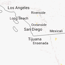
Hail Map for Hemet, CA
The Hemet, CA area has had 0 reports of on-the-ground hail by trained spotters, and has been under severe weather warnings 0 times during the past 12 months. Doppler radar has detected hail at or near Hemet, CA on 5 occasions.
| Name: | Hemet, CA |
| Where Located: | 41.8 miles SW of Yucca Valley, CA |
| Map: | Google Map for Hemet, CA |
| Population: | 78657 |
| Housing Units: | 35305 |
| More Info: | Search Google for Hemet, CA |
5
The Top Recent Hail Date for Hemet, CA is Thursday, August 16, 2012 (1st out of 5)

Hail and Wind Damage Spotted near Hemet, CA
| Date / Time | Report Details |
|---|---|
| 8/18/2020 1:15 PM PDT | Tree blown down... blocking all lanes near intersection of mayberry ave and lake st... in hemet. wind gusts ranged between 25 and 32 mph at nearby weather stations arou in riverside county CA, 3.8 miles W of Hemet, CA |
| 8/18/2020 1:05 PM PDT |
 At 104 pm pdt, a severe thunderstorm was located over east hemet, moving west at 5 mph (radar indicated). Hazards include 60 mph wind gusts and penny size hail. Expect damage to roofs, siding, and trees. Locations impacted include, moreno valley, hemet, san jacinto, southern beaumont, valle vista, east hemet, hwy 74 between hemet and mountain center, saboba indian reservation and winchester. At 104 pm pdt, a severe thunderstorm was located over east hemet, moving west at 5 mph (radar indicated). Hazards include 60 mph wind gusts and penny size hail. Expect damage to roofs, siding, and trees. Locations impacted include, moreno valley, hemet, san jacinto, southern beaumont, valle vista, east hemet, hwy 74 between hemet and mountain center, saboba indian reservation and winchester.
|
| 8/18/2020 12:28 PM PDT |
 At 1226 pm pdt, a severe thunderstorm was located near valle vista, or 7 miles east of hemet, moving northwest at 5 mph (radar indicated). Hazards include 70 mph wind gusts and penny size hail. Expect considerable tree damage. Damage is likely to mobile homes, roofs, and outbuildings. At 1226 pm pdt, a severe thunderstorm was located near valle vista, or 7 miles east of hemet, moving northwest at 5 mph (radar indicated). Hazards include 70 mph wind gusts and penny size hail. Expect considerable tree damage. Damage is likely to mobile homes, roofs, and outbuildings.
|
| 8/16/2018 3:21 PM PDT |
 At 317 pm pdt, a severe thunderstorm was located between lake elsinore and nuevo and moving southwest at about 10 mph. strong winds and blowing dust has been reported in nuevo (radar indicated). Hazards include 60 mph wind gusts. Expect damage to roofs, siding, and trees. Locations impacted include, moreno valley, lake elsinore, hemet, hwy 243 between banning and idyllwild, murrieta, perris, san jacinto, southeastern beaumont, menifee, sun city, temescal valley, lake mathews, wildomar, canyon lake, homeland, lake perris recreation area, lakeland village, saboba indian reservation, nuevo and lakeview. At 317 pm pdt, a severe thunderstorm was located between lake elsinore and nuevo and moving southwest at about 10 mph. strong winds and blowing dust has been reported in nuevo (radar indicated). Hazards include 60 mph wind gusts. Expect damage to roofs, siding, and trees. Locations impacted include, moreno valley, lake elsinore, hemet, hwy 243 between banning and idyllwild, murrieta, perris, san jacinto, southeastern beaumont, menifee, sun city, temescal valley, lake mathews, wildomar, canyon lake, homeland, lake perris recreation area, lakeland village, saboba indian reservation, nuevo and lakeview.
|
| 8/16/2018 2:34 PM PDT |
 At 231 pm pdt, a severe thunderstorm was located about 5 miles southwest of beaumont and moving southwest at about 15 mph (radar indicated). Hazards include 60 mph wind gusts. expect damage to roofs, siding, and trees At 231 pm pdt, a severe thunderstorm was located about 5 miles southwest of beaumont and moving southwest at about 15 mph (radar indicated). Hazards include 60 mph wind gusts. expect damage to roofs, siding, and trees
|
| 8/1/2017 3:33 PM PDT |
 At 331 pm pdt, a severe thunderstorm was between perris and lake elsinore, and is nearly stationary (radar indicated). Hazards include 60 mph wind gusts and nickel size hail. Expect damage to roofs, siding, powerlines and trees. Locations impacted include, riverside, moreno valley, western lake elsinore, perris, san jacinto, march airforce base, woodcrest, lake mathews, sun city, temescal valley, menifee and homeland. At 331 pm pdt, a severe thunderstorm was between perris and lake elsinore, and is nearly stationary (radar indicated). Hazards include 60 mph wind gusts and nickel size hail. Expect damage to roofs, siding, powerlines and trees. Locations impacted include, riverside, moreno valley, western lake elsinore, perris, san jacinto, march airforce base, woodcrest, lake mathews, sun city, temescal valley, menifee and homeland.
|
| 8/1/2017 3:01 PM PDT |
 At 259 pm pdt, a severe thunderstorm was located over perris, nuevo, and lakeview and is nearly stationary (radar indicated). Hazards include 60 mph wind gusts and nickel size hail. expect damage to roofs, siding,power lines and trees At 259 pm pdt, a severe thunderstorm was located over perris, nuevo, and lakeview and is nearly stationary (radar indicated). Hazards include 60 mph wind gusts and nickel size hail. expect damage to roofs, siding,power lines and trees
|
| 3/7/2016 7:58 AM PST |
 The national weather service in san diego has issued a * severe thunderstorm warning for. eastern orange county in southwestern california. san bernardino county in southern california. riverside county in southern california. Northwestern san diego county in southwestern california. The national weather service in san diego has issued a * severe thunderstorm warning for. eastern orange county in southwestern california. san bernardino county in southern california. riverside county in southern california. Northwestern san diego county in southwestern california.
|
| 3/7/2016 7:43 AM PST |
 At 740 am pst, doppler radar indicated a line of severe thunderstorms capable of producing damaging wind gusts of 45 to 60 mph over eastern orange county. this line of storms was located near canyon lake, moving east at 30 mph. the storms will progress eastward over the next hour, impacting the inland empire and northwest san diego county. locations impacted include but are not limited to, riverside, san bernardino, oceanside, ontario, irvine, moreno valley, corona, rialto, tustin, chino, redlands. At 740 am pst, doppler radar indicated a line of severe thunderstorms capable of producing damaging wind gusts of 45 to 60 mph over eastern orange county. this line of storms was located near canyon lake, moving east at 30 mph. the storms will progress eastward over the next hour, impacting the inland empire and northwest san diego county. locations impacted include but are not limited to, riverside, san bernardino, oceanside, ontario, irvine, moreno valley, corona, rialto, tustin, chino, redlands.
|
| 3/7/2016 7:10 AM PST |
 At 706 am pst, doppler radar indicated a line of severe thunderstorms capable of producing damaging wind gusts of 45 to 60 mph moving through central orange county. this line of storms was located near el toro, moving east at 35 mph. the stroms will progress eastward over the next hour, impacting the inland empire and northwest san diego county. locations impacted include, santa ana, anaheim, riverside, huntington beach, san bernardino, oceanside, ontario, irvine, fontana, orange, rancho cucamonga, corona, costa mesa, mission viejo, rialto. At 706 am pst, doppler radar indicated a line of severe thunderstorms capable of producing damaging wind gusts of 45 to 60 mph moving through central orange county. this line of storms was located near el toro, moving east at 35 mph. the stroms will progress eastward over the next hour, impacting the inland empire and northwest san diego county. locations impacted include, santa ana, anaheim, riverside, huntington beach, san bernardino, oceanside, ontario, irvine, fontana, orange, rancho cucamonga, corona, costa mesa, mission viejo, rialto.
|
| 3/7/2016 6:36 AM PST |
 At 635 am pst, doppler radar indicated a line of severe thunderstorms capable of producing damaging wind gusts of 45 to 60 mph approaching the orange county coast. the leading edge of the storms was located 5 miles southwest of seal beach, and moving east at 35 mph. At 635 am pst, doppler radar indicated a line of severe thunderstorms capable of producing damaging wind gusts of 45 to 60 mph approaching the orange county coast. the leading edge of the storms was located 5 miles southwest of seal beach, and moving east at 35 mph.
|
| 1/6/2016 1:24 PM PST |
 At 118 pm pst, doppler radar indicated a severe thunderstorm capable of producing damaging winds in excess of 60 mph. this storm was located near fallbrook, moving northeast at 20 mph. this severe storm will impact wildomar. another severe storm is producing a waterspout west of carlsbad. this storm will reach the immediate coast between encinitas and oceanside by 140 pm. locations impacted include, oceanside, vista, carlsbad, encinitas, temecula, san marcos, san clemente, san juan capistrano, fallbrook, wildomar, solana beach, camp pendleton south, canyon lake, camp pendleton north, lakeland village, murrieta, valley center, lake san marcos, hidden meadows and bonsall. At 118 pm pst, doppler radar indicated a severe thunderstorm capable of producing damaging winds in excess of 60 mph. this storm was located near fallbrook, moving northeast at 20 mph. this severe storm will impact wildomar. another severe storm is producing a waterspout west of carlsbad. this storm will reach the immediate coast between encinitas and oceanside by 140 pm. locations impacted include, oceanside, vista, carlsbad, encinitas, temecula, san marcos, san clemente, san juan capistrano, fallbrook, wildomar, solana beach, camp pendleton south, canyon lake, camp pendleton north, lakeland village, murrieta, valley center, lake san marcos, hidden meadows and bonsall.
|
| 1/6/2016 1:04 PM PST |
 At 100 pm pst, doppler radar indicated a cluster of severe thunderstorms capable of producing damaging winds in excess of 60 mph. one storm was located over northeastern camp pendleton, and moving northeast at 25 mph. another storm is moving towards fallbrook. a third cell is over open water moving towards oceanside. the potential for a waterspout or brief tornado is possible given the unstable environment. hail is possible with these storms. At 100 pm pst, doppler radar indicated a cluster of severe thunderstorms capable of producing damaging winds in excess of 60 mph. one storm was located over northeastern camp pendleton, and moving northeast at 25 mph. another storm is moving towards fallbrook. a third cell is over open water moving towards oceanside. the potential for a waterspout or brief tornado is possible given the unstable environment. hail is possible with these storms.
|
| 9/9/2015 2:23 PM PDT |
 The severe thunderstorm warning for riverside county will expire at 230 pm pdt, the storms which prompted the warning have moved out of the area. therefore the warning will be allowed to expire. The severe thunderstorm warning for riverside county will expire at 230 pm pdt, the storms which prompted the warning have moved out of the area. therefore the warning will be allowed to expire.
|
| 9/9/2015 2:03 PM PDT |
 At 154 pm pdt, doppler radar continued to indicate a cluster of severe thunderstorms capable of producing quarter size hail and damaging winds in excess of 60 mph. these storms were along a line from stretching from wildomar to san jacinto. these storms were moving slowly north northwest at 5 to 10 mph. locations impacted include, hemet, sun city, east hemet, valle vista, idyllwild-pine cove and winchester. At 154 pm pdt, doppler radar continued to indicate a cluster of severe thunderstorms capable of producing quarter size hail and damaging winds in excess of 60 mph. these storms were along a line from stretching from wildomar to san jacinto. these storms were moving slowly north northwest at 5 to 10 mph. locations impacted include, hemet, sun city, east hemet, valle vista, idyllwild-pine cove and winchester.
|
| 9/9/2015 1:30 PM PDT |
 At 128 pm pdt, doppler radar indicated a cluster of severe thunderstorms capable of producing quarter size hail and damaging winds in excess of 60 mph. these storms were located 15 miles east of temecula and were moving north northwest at 5 mph. At 128 pm pdt, doppler radar indicated a cluster of severe thunderstorms capable of producing quarter size hail and damaging winds in excess of 60 mph. these storms were located 15 miles east of temecula and were moving north northwest at 5 mph.
|
| 9/8/2015 5:26 PM PDT |
 The severe thunderstorm warning for riverside county will expire at 530 pm pdt, the storms which prompted the warning has weakened below severe limits, and no longer pose an immediate threat to life or property. therefore the warning will be allowed to expire. however small hail is still possible with these thunderstorms. The severe thunderstorm warning for riverside county will expire at 530 pm pdt, the storms which prompted the warning has weakened below severe limits, and no longer pose an immediate threat to life or property. therefore the warning will be allowed to expire. however small hail is still possible with these thunderstorms.
|
| 9/8/2015 5:13 PM PDT |
 At 504 pm pdt, doppler radar continued to indicate a cluster of severe thunderstorms capable of producing quarter size hail and damaging winds in excess of 60 mph. these storms were located along a line from sun city to beaumont and were nearly stationary. at 455 pm pdt, a nws spotter near san jacinto had reported dime sized hail. at 500 pm pdt, a member from the public reported quarter sized hail near beaumont. locations impacted include, hemet, perris, san jacinto, sun city, east hemet, wildomar, valle vista, canyon lake, nuevo, homeland, idyllwild-pine cove, sedco hills, romoland, winchester, quail valley and lakeview. At 504 pm pdt, doppler radar continued to indicate a cluster of severe thunderstorms capable of producing quarter size hail and damaging winds in excess of 60 mph. these storms were located along a line from sun city to beaumont and were nearly stationary. at 455 pm pdt, a nws spotter near san jacinto had reported dime sized hail. at 500 pm pdt, a member from the public reported quarter sized hail near beaumont. locations impacted include, hemet, perris, san jacinto, sun city, east hemet, wildomar, valle vista, canyon lake, nuevo, homeland, idyllwild-pine cove, sedco hills, romoland, winchester, quail valley and lakeview.
|
| 9/8/2015 4:35 PM PDT |
 At 433 pm pdt, doppler radar indicated a cluster of severe thunderstorms capable of producing quarter size hail and damaging winds in excess of 60 mph. these storms were located from sun city to idyllwild. At 433 pm pdt, doppler radar indicated a cluster of severe thunderstorms capable of producing quarter size hail and damaging winds in excess of 60 mph. these storms were located from sun city to idyllwild.
|
| 7/30/2015 5:52 PM PDT |
 The severe thunderstorm warning for san bernardino and riverside counties will expire at 600 pm pdt, the severe thunderstorm which prompted the warning has weakened and nearly moved out of the warned area. therefore the warning will be allowed to expire at 600 pm. The severe thunderstorm warning for san bernardino and riverside counties will expire at 600 pm pdt, the severe thunderstorm which prompted the warning has weakened and nearly moved out of the warned area. therefore the warning will be allowed to expire at 600 pm.
|
| 7/30/2015 5:12 PM PDT |
 At 505 pm pdt, doppler radar indicated a severe thunderstorm capable of producing quarter size hail and damaging winds in excess of 60 mph. this storm was located near beaumont, and moving to the northwest at 5 mph. locations impacted include, yucaipa, banning, beaumont, mentone, calimesa and cherry valley. At 505 pm pdt, doppler radar indicated a severe thunderstorm capable of producing quarter size hail and damaging winds in excess of 60 mph. this storm was located near beaumont, and moving to the northwest at 5 mph. locations impacted include, yucaipa, banning, beaumont, mentone, calimesa and cherry valley.
|
| 7/30/2015 4:59 PM PDT |
 At 458 pm pdt, doppler radar indicated a severe thunderstorm capable of producing damaging winds in excess of 60 mph. this storm was located over northern beaumont, or 7 miles south of yucaipa, and moving northwest at 5 mph. At 458 pm pdt, doppler radar indicated a severe thunderstorm capable of producing damaging winds in excess of 60 mph. this storm was located over northern beaumont, or 7 miles south of yucaipa, and moving northwest at 5 mph.
|
| 7/29/2015 4:43 PM PDT | The severe thunderstorm warning for riverside county will expire at 445 pm pdt, the storm which prompted the warning has weakened below severe limits, and no longer poses an immediate threat to life or property at this time. therefore the warning will be allowed to expire. |
| 7/29/2015 4:18 PM PDT |
 At 406 pm pdt, doppler radar continued to indicate a severe thunderstorm capable of producing damaging winds in excess of 60 mph. this storm was located near beaumont, moving northwest at 15 mph. penny size hail may also accompany the damaging winds. locations impacted include, moreno valley, hemet, hwy 243 between banning and idyllwild, san jacinto, beaumont, banning, east hemet, hwy 74 between hemet and mountain center and valle vista. At 406 pm pdt, doppler radar continued to indicate a severe thunderstorm capable of producing damaging winds in excess of 60 mph. this storm was located near beaumont, moving northwest at 15 mph. penny size hail may also accompany the damaging winds. locations impacted include, moreno valley, hemet, hwy 243 between banning and idyllwild, san jacinto, beaumont, banning, east hemet, hwy 74 between hemet and mountain center and valle vista.
|
| 7/29/2015 3:40 PM PDT |
 At 340 pm pdt, doppler radar indicated a severe thunderstorm capable of producing damaging winds in excess of 60 mph. this storm was located over valle vista, or near hwy 243 between banning and idyllwild, and moving northwest at 15 mph. penny size hail may also accompany the damaging winds. At 340 pm pdt, doppler radar indicated a severe thunderstorm capable of producing damaging winds in excess of 60 mph. this storm was located over valle vista, or near hwy 243 between banning and idyllwild, and moving northwest at 15 mph. penny size hail may also accompany the damaging winds.
|
| 7/19/2015 2:55 PM PDT |
 The severe thunderstorm warning for riverside county will expire at 300 pm pdt, the storm which prompted the warning has weakened below severe limits, and no longer pose an immediate threat to life or property. therefore the warning will be allowed to expire. to report severe weather, contact your nearest law enforcement agency. they will relay your report to the national weather service san diego. The severe thunderstorm warning for riverside county will expire at 300 pm pdt, the storm which prompted the warning has weakened below severe limits, and no longer pose an immediate threat to life or property. therefore the warning will be allowed to expire. to report severe weather, contact your nearest law enforcement agency. they will relay your report to the national weather service san diego.
|
| 7/19/2015 2:15 PM PDT |
 At 206 pm pdt, doppler radar continued to indicate a severe thunderstorm capable of producing damaging winds in excess of 60 mph. this storm was located over perris and was moving northwest at 10 to 15 mph. locations impacted include, hemet, perris, lake elsinore, san jacinto, sun city, wildomar, canyon lake, woodcrest, lakeland village, nuevo, homeland, sedco hills, romoland, winchester, quail valley and lakeview. At 206 pm pdt, doppler radar continued to indicate a severe thunderstorm capable of producing damaging winds in excess of 60 mph. this storm was located over perris and was moving northwest at 10 to 15 mph. locations impacted include, hemet, perris, lake elsinore, san jacinto, sun city, wildomar, canyon lake, woodcrest, lakeland village, nuevo, homeland, sedco hills, romoland, winchester, quail valley and lakeview.
|
| 7/19/2015 1:55 PM PDT |
 At 154 pm pdt, doppler radar indicated a severe thunderstorm capable of producing damaging winds in excess of 60 mph. this storm was located 5 miles east of sun city, and moving west northwest at 10 mph. At 154 pm pdt, doppler radar indicated a severe thunderstorm capable of producing damaging winds in excess of 60 mph. this storm was located 5 miles east of sun city, and moving west northwest at 10 mph.
|
| 8/16/2012 1:40 PM PDT | The buck fire base camp at diamond lake experienced strong winds...estimated to 60 mph...between 140 and 2 pm. the winds destroyed 2 large tents...a number of camping t in riverside county CA, 9.3 miles NNW of Hemet, CA |
| 8/16/2012 12:52 PM PDT | Winds gusting to 25 mph before the thunderstorm gust front moved through. estimated 60 mph winds...knocking over port-a-potties at the buck fire staging are in riverside county CA, 5.3 miles NNW of Hemet, CA |
| 4/11/2012 2:15 PM PDT | Winds from a thunderstorm ripped off a 30 foot section of a mobile home carport awning and damaged part of the roof near the intersection of gilbert and chambers street in riverside county CA, 1.2 miles NNW of Hemet, CA |
| 4/11/2012 1:40 PM PDT | Winds from a thunderstorm ripped off a 30 foot section of a mobile home carport awning and damaged part of the roof near the intersection of gilbert and chambers street in riverside county CA, 1.2 miles N of Hemet, CA |
| 4/11/2012 1:32 PM PDT | Relayed report from the public of wind damage to a roof at mcsweeny elementary school in hemet. extent of damage is unknown. time of the event is estimated based on ano in riverside county CA, 1.4 miles ENE of Hemet, CA |
Hail Maps for Hemet, CA


Connect with Interactive Hail Maps