

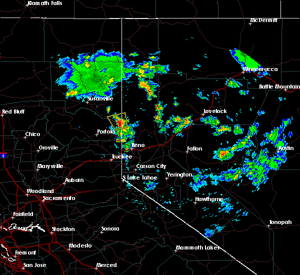
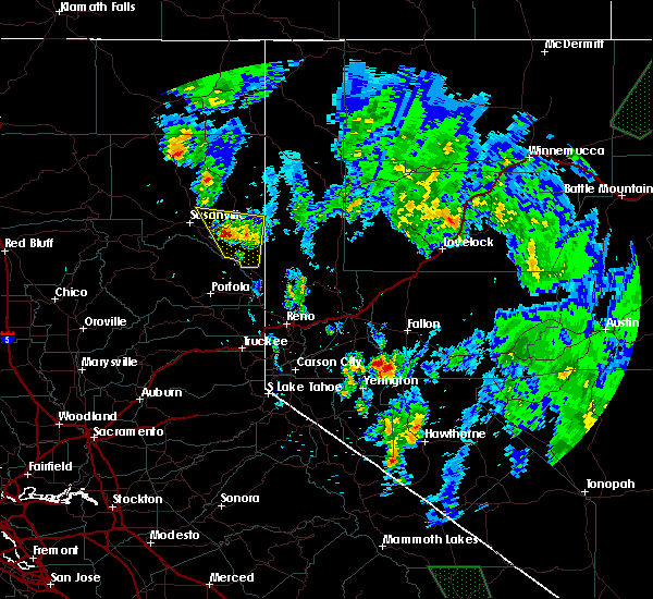
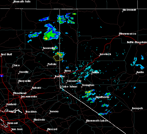
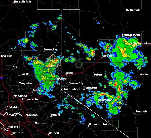
Hail Map for Herlong, CA
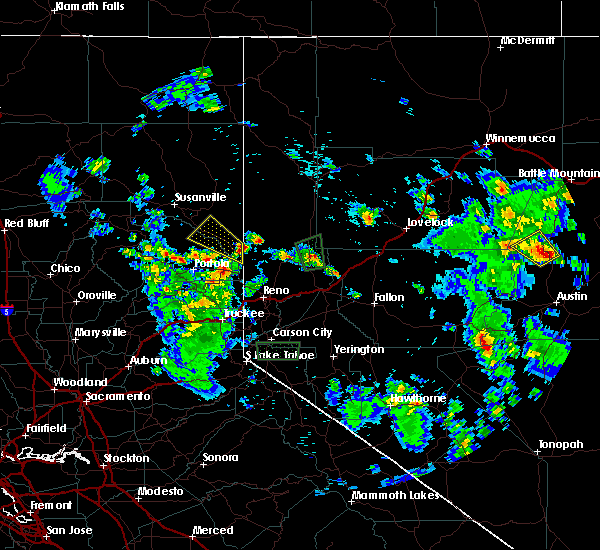
The Herlong, CA area has had 0 reports of on-the-ground hail by trained spotters, and has been under severe weather warnings 0 times during the past 12 months. Doppler radar has detected hail at or near Herlong, CA on 2 occasions.
| Name: | Herlong, CA |
| Where Located: | 45.8 miles NNW of Reno, NV |
| Map: | Google Map for Herlong, CA |
| Population: | 298 |
| Housing Units: | 139 |
| More Info: | Search Google for Herlong, CA |
5
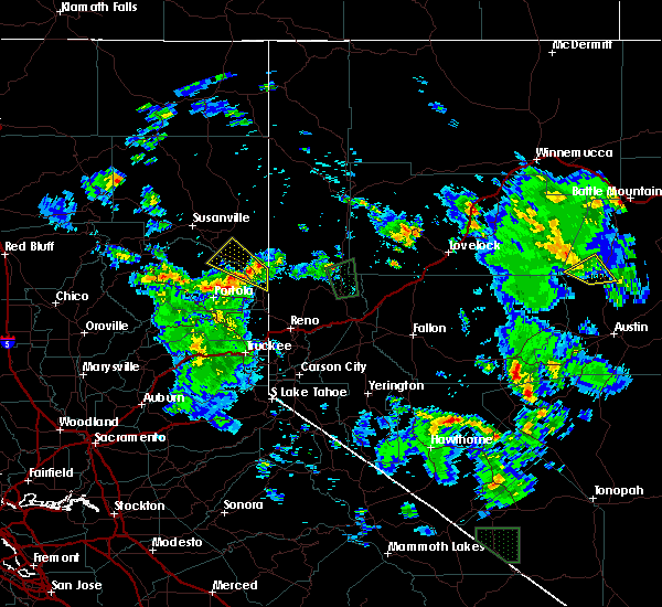
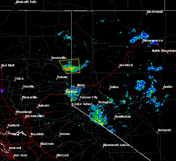
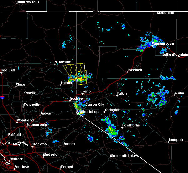
The Top Recent Hail Date for Herlong, CA is Monday, July 24, 2017 (1st out of 2)

Hail and Wind Damage Spotted near Herlong, CA
| Date / Time | Report Details |
|---|---|
| 8/9/2017 7:19 PM PDT |
 At 718 pm pdt, a severe thunderstorm was located near doyle, moving north at 10 mph (radar indicated). Hazards include 60 mph wind gusts and quarter size hail. hail damage to vehicles is expected At 718 pm pdt, a severe thunderstorm was located near doyle, moving north at 10 mph (radar indicated). Hazards include 60 mph wind gusts and quarter size hail. hail damage to vehicles is expected
|
| 7/24/2017 4:47 PM PDT |
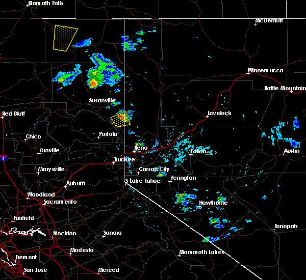
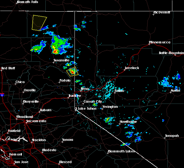
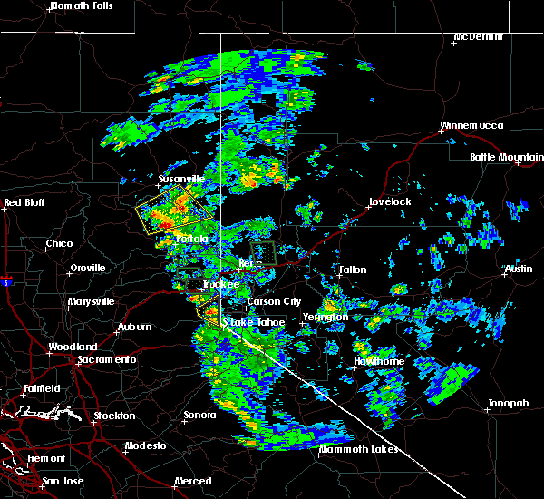
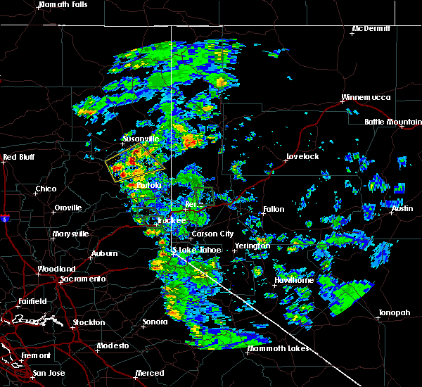
 At 446 pm pdt, a severe thunderstorm was located 10 miles north of herlong, moving north at 30 mph (radar indicated). Hazards include 60 mph wind gusts and quarter size hail. Hail damage to vehicles is expected. expect wind damage to roofs, siding, fencing, and trees. dust storms resulting in serious accidents. Locations impacted include, herlong, susanville, standish, wendel, honey lake and amedee army airfield. At 446 pm pdt, a severe thunderstorm was located 10 miles north of herlong, moving north at 30 mph (radar indicated). Hazards include 60 mph wind gusts and quarter size hail. Hail damage to vehicles is expected. expect wind damage to roofs, siding, fencing, and trees. dust storms resulting in serious accidents. Locations impacted include, herlong, susanville, standish, wendel, honey lake and amedee army airfield.
|
| 7/24/2017 4:23 PM PDT |
 At 423 pm pdt, a severe thunderstorm was located near herlong, moving north at 30 mph (radar indicated). Hazards include 60 mph wind gusts and quarter size hail. Hail damage to vehicles is expected. expect wind damage to roofs, siding, fencing, and trees. Dust storms resulting in serious accidents. At 423 pm pdt, a severe thunderstorm was located near herlong, moving north at 30 mph (radar indicated). Hazards include 60 mph wind gusts and quarter size hail. Hail damage to vehicles is expected. expect wind damage to roofs, siding, fencing, and trees. Dust storms resulting in serious accidents.
|
| 6/25/2017 5:06 PM PDT |
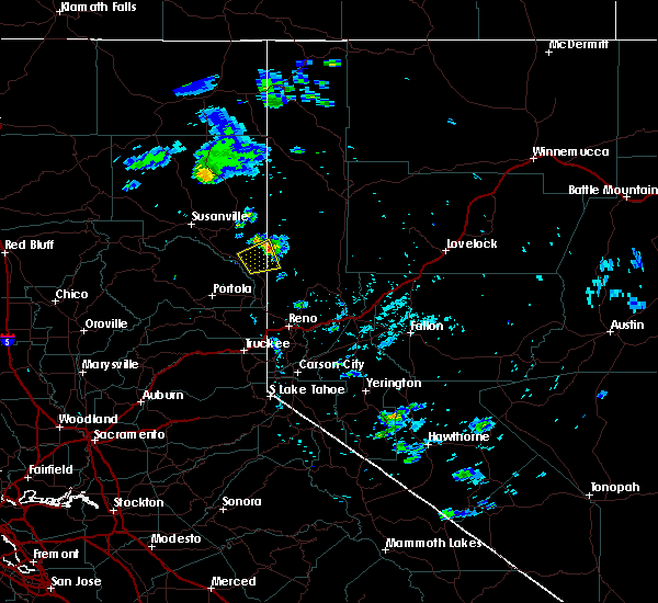 The severe thunderstorm warning for southeastern lassen and central washoe counties will expire at 515 pm pdt, the storm which prompted the warning has weakened below severe limits, and is exiting the warned area. therefore, the warning will be allowed to expire. The severe thunderstorm warning for southeastern lassen and central washoe counties will expire at 515 pm pdt, the storm which prompted the warning has weakened below severe limits, and is exiting the warned area. therefore, the warning will be allowed to expire.
|
| 6/25/2017 4:50 PM PDT |
 At 449 pm pdt, a severe thunderstorm was located near herlong, moving east at 5 mph (radar indicated). Hazards include 60 mph wind gusts and quarter size hail. Hail damage to vehicles is expected. expect wind damage to roofs, siding, fencing, and trees. dust storms resulting in serious accidents. Locations impacted include, herlong and state line peak. At 449 pm pdt, a severe thunderstorm was located near herlong, moving east at 5 mph (radar indicated). Hazards include 60 mph wind gusts and quarter size hail. Hail damage to vehicles is expected. expect wind damage to roofs, siding, fencing, and trees. dust storms resulting in serious accidents. Locations impacted include, herlong and state line peak.
|
| 6/25/2017 4:30 PM PDT |
 At 430 pm pdt, a severe thunderstorm was located near herlong, moving east at 5 mph (radar indicated). Hazards include 60 mph wind gusts and quarter size hail. Hail damage to vehicles is expected. expect wind damage to roofs, siding, fencing, and trees. Dust storms resulting in serious accidents. At 430 pm pdt, a severe thunderstorm was located near herlong, moving east at 5 mph (radar indicated). Hazards include 60 mph wind gusts and quarter size hail. Hail damage to vehicles is expected. expect wind damage to roofs, siding, fencing, and trees. Dust storms resulting in serious accidents.
|
| 7/21/2015 3:51 PM PDT |
 At 347 pm pdt, doppler radar indicated severe thunderstorms capable of producing quarter size hail and damaging winds in excess of 60 mph over northern plumas county and over lassen county near honey lake. the storms are moving east at 10 mph. locations impacted include, herlong, janesville, antelope lake, standish, genesee, long point campground, lone rock campground, boulder creek campground and honey lake. At 347 pm pdt, doppler radar indicated severe thunderstorms capable of producing quarter size hail and damaging winds in excess of 60 mph over northern plumas county and over lassen county near honey lake. the storms are moving east at 10 mph. locations impacted include, herlong, janesville, antelope lake, standish, genesee, long point campground, lone rock campground, boulder creek campground and honey lake.
|
| 7/21/2015 3:36 PM PDT |
 At 335 pm pdt, doppler radar indicated severe thunderstorms capable of producing quarter size hail and damaging winds in excess of 60 mph. the storms are over northern plumas county moving toward highway 395 near honey lake. At 335 pm pdt, doppler radar indicated severe thunderstorms capable of producing quarter size hail and damaging winds in excess of 60 mph. the storms are over northern plumas county moving toward highway 395 near honey lake.
|
| 7/9/2015 2:41 PM PDT |
 The severe thunderstorm warning for plumas and east central lassen counties will expire at 245 pm pdt, the storm which prompted the warning has weakened below severe limits, and no longer poses an immediate threat to life or property. therefore the warning will be allowed to expire. however small hail is still possible with this thunderstorm along hwy 395 from doyle to near honey lake. The severe thunderstorm warning for plumas and east central lassen counties will expire at 245 pm pdt, the storm which prompted the warning has weakened below severe limits, and no longer poses an immediate threat to life or property. therefore the warning will be allowed to expire. however small hail is still possible with this thunderstorm along hwy 395 from doyle to near honey lake.
|
| 7/9/2015 2:23 PM PDT |
 At 220 pm pdt, doppler radar indicated a severe thunderstorm capable of producing large amounts of small hail, damaging winds in excess of 60 mph, and very heavy rain. this storm was located over doyle, and moving northwest at 20 mph. hail accumulation along highway 395 will create slick driving conditions. expect heavy ponding and slow drainage of water along area roads. locations impacted include, doyle, herlong and honey lake. At 220 pm pdt, doppler radar indicated a severe thunderstorm capable of producing large amounts of small hail, damaging winds in excess of 60 mph, and very heavy rain. this storm was located over doyle, and moving northwest at 20 mph. hail accumulation along highway 395 will create slick driving conditions. expect heavy ponding and slow drainage of water along area roads. locations impacted include, doyle, herlong and honey lake.
|
| 7/9/2015 1:56 PM PDT |
 At 153 pm pdt, doppler radar indicated a severe thunderstorm capable of producing quarter size hail, damaging winds in excess of 60 mph, and very heavy rain. this storm was located over doyle, and moving northwest at 20 mph. * hail accumulation along highway 395 will create slick driving conditions. expect heavy ponding and slow drainage of water along area roads. At 153 pm pdt, doppler radar indicated a severe thunderstorm capable of producing quarter size hail, damaging winds in excess of 60 mph, and very heavy rain. this storm was located over doyle, and moving northwest at 20 mph. * hail accumulation along highway 395 will create slick driving conditions. expect heavy ponding and slow drainage of water along area roads.
|
| 6/27/2015 7:23 PM PDT |
 The severe thunderstorm warning for east central lassen county will expire at 730 pm pdt, the storms which prompted the warning have weakened below severe limits, and no longer poses an immediate threat to life or property. therefore the warning will be allowed to expire. however gusty winds to near 40 mph are still possible with these thunderstorms. The severe thunderstorm warning for east central lassen county will expire at 730 pm pdt, the storms which prompted the warning have weakened below severe limits, and no longer poses an immediate threat to life or property. therefore the warning will be allowed to expire. however gusty winds to near 40 mph are still possible with these thunderstorms.
|
| 6/27/2015 6:52 PM PDT |
 At 651 pm pdt, doppler radar indicated a line of severe thunderstorms capable of producing damaging winds in excess of 60 mph. these storms were located along a line extending from 8 miles northeast of doyle to near herlong, moving north at 25 mph. penny size hail may also accompany the damaging winds. locations impacted include, doyle, herlong, wendel and amedee army airfield. At 651 pm pdt, doppler radar indicated a line of severe thunderstorms capable of producing damaging winds in excess of 60 mph. these storms were located along a line extending from 8 miles northeast of doyle to near herlong, moving north at 25 mph. penny size hail may also accompany the damaging winds. locations impacted include, doyle, herlong, wendel and amedee army airfield.
|
| 6/27/2015 6:29 PM PDT |
 At 628 pm pdt, doppler radar indicated a line of severe thunderstorms capable of producing damaging winds in excess of 60 mph. these storms were located along a line extending from 11 miles northwest of sutcliffe to near doyle, and moving north at 25 mph. nickel size hail may also accompany the damaging winds. At 628 pm pdt, doppler radar indicated a line of severe thunderstorms capable of producing damaging winds in excess of 60 mph. these storms were located along a line extending from 11 miles northwest of sutcliffe to near doyle, and moving north at 25 mph. nickel size hail may also accompany the damaging winds.
|
Hail Maps for Herlong, CA
Connect with Interactive Hail Maps