

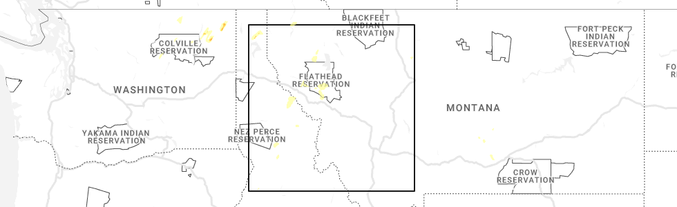
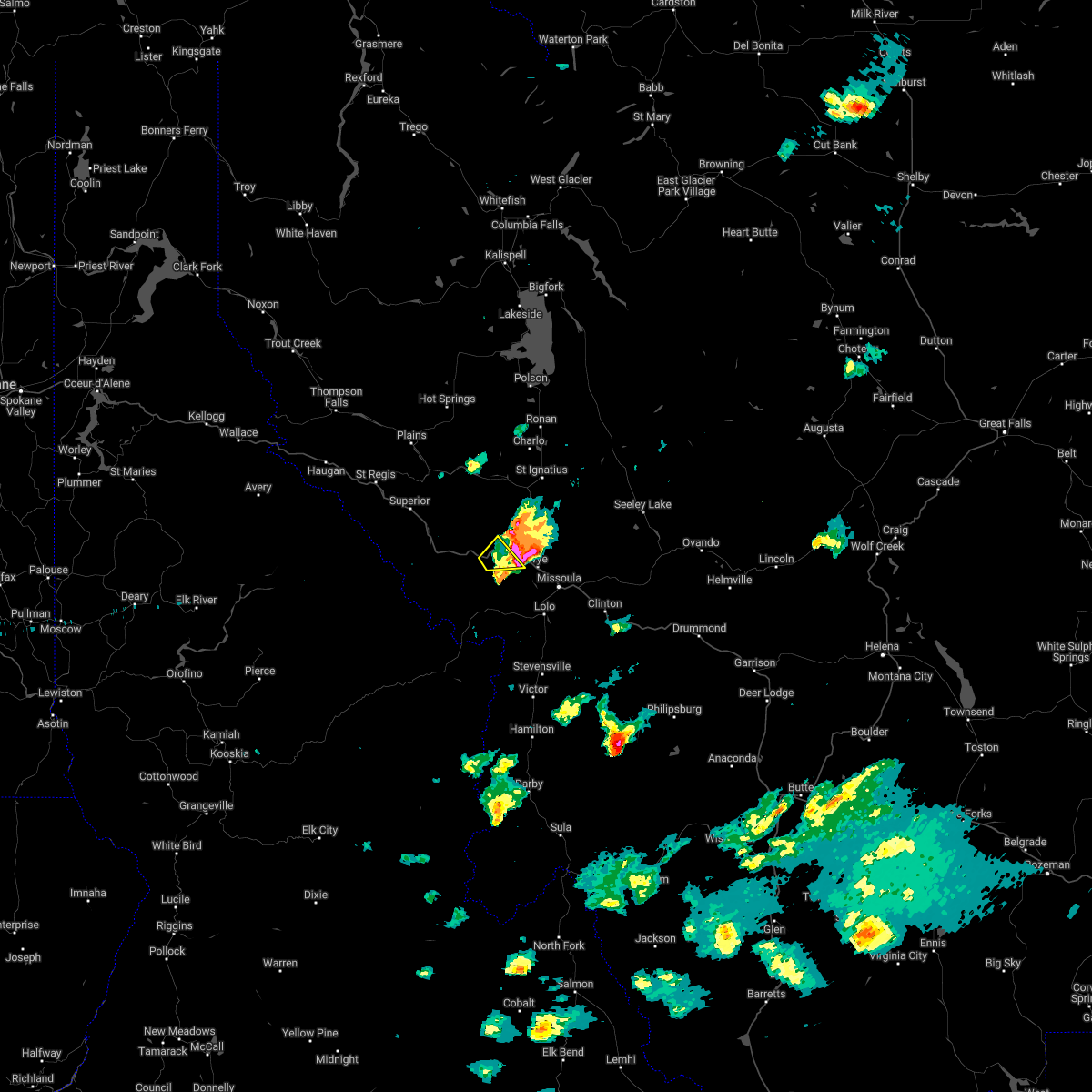
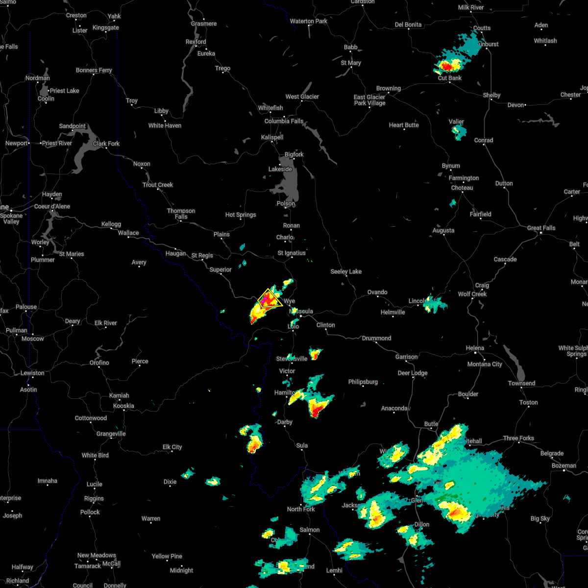
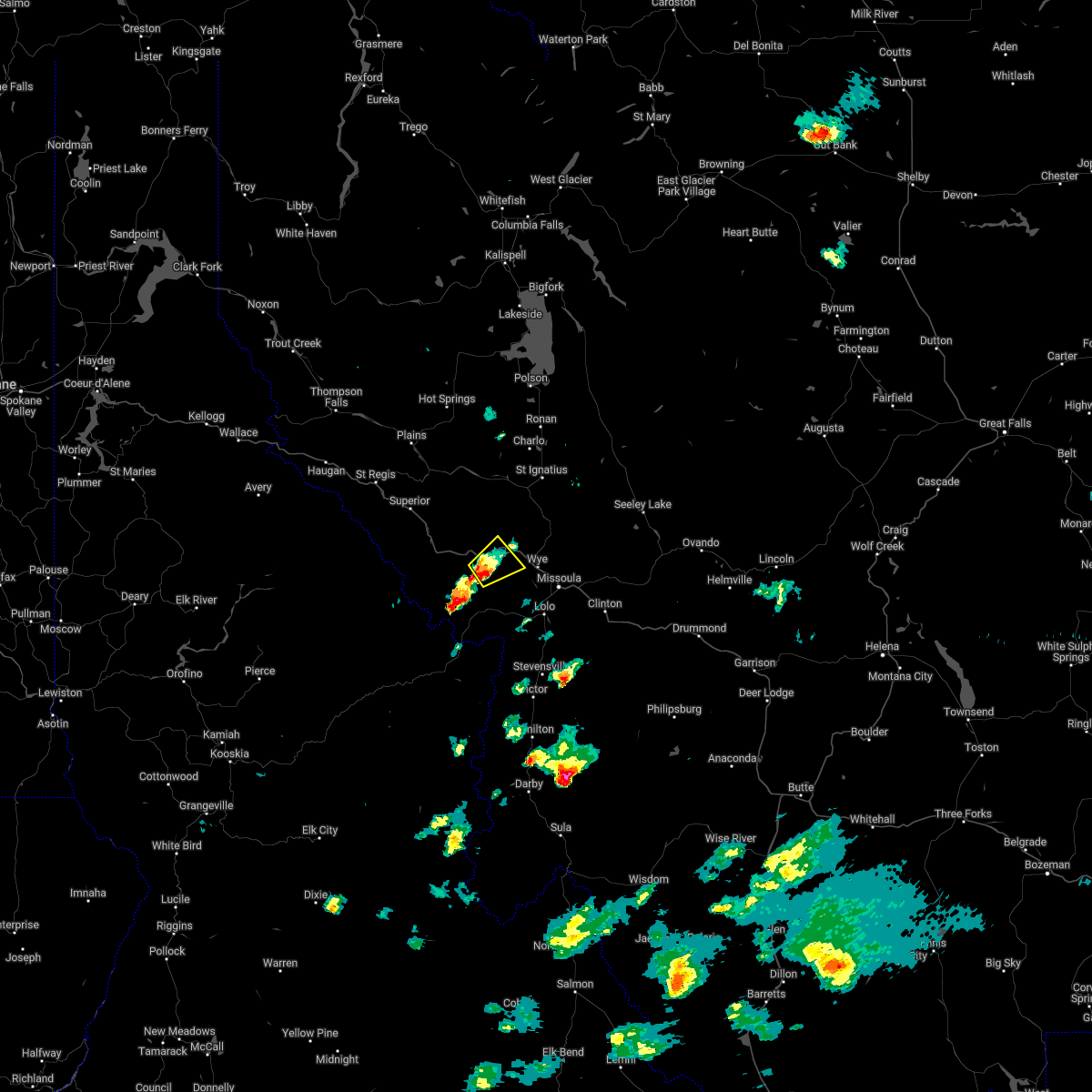
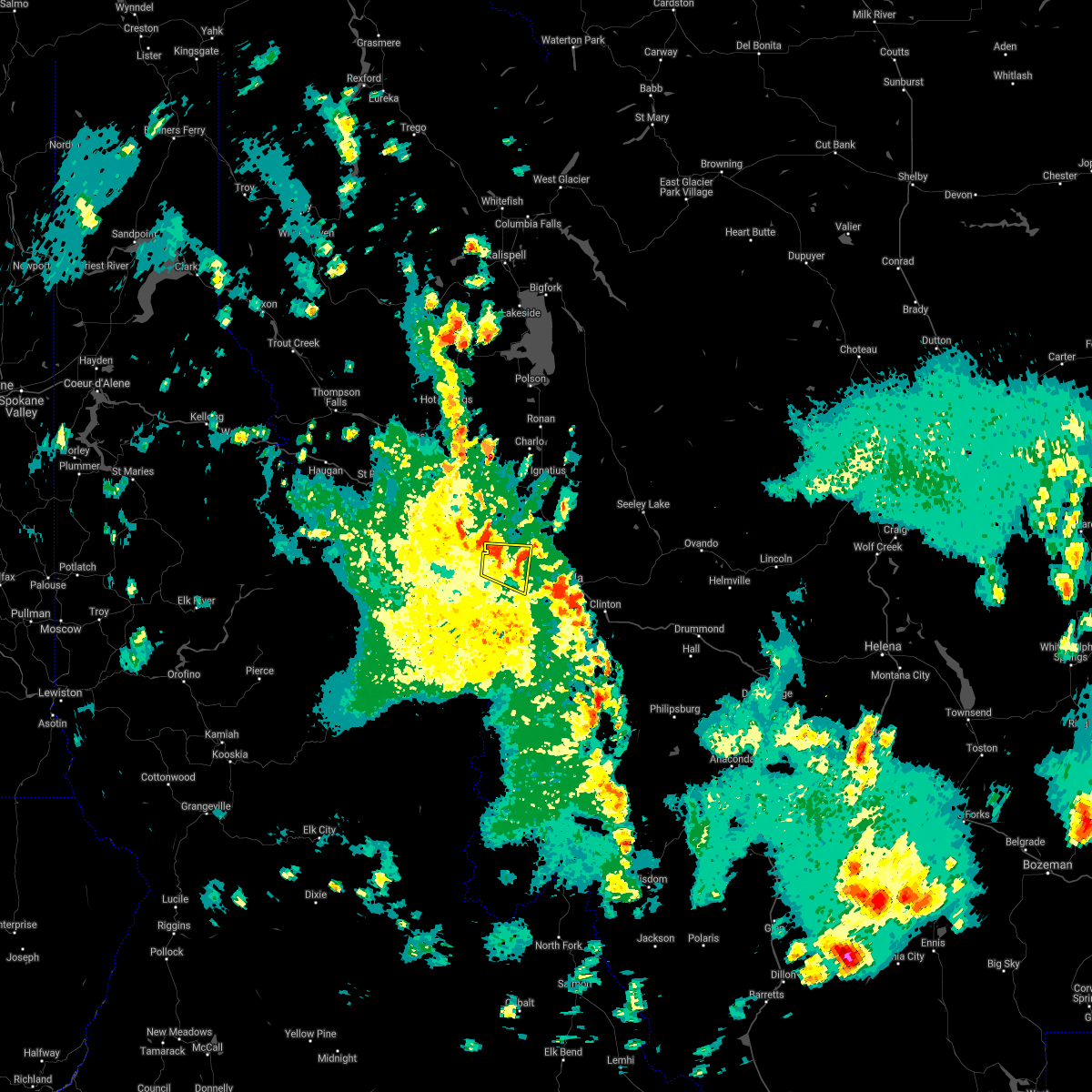
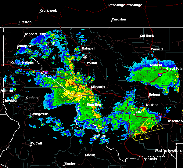
Hail Map for Huson, MT
The Huson, MT area has had 0 reports of on-the-ground hail by trained spotters, and has been under severe weather warnings 3 times during the past 12 months. Doppler radar has detected hail at or near Huson, MT on 7 occasions, including 1 occasion during the past year.
| Name: | Huson, MT |
| Where Located: | 19.8 miles WNW of Missoula, MT |
| Map: | Google Map for Huson, MT |
| Population: | 210 |
| Housing Units: | 87 |
| More Info: | Search Google for Huson, MT |
0
The Top Recent Hail Date for Huson, MT is Sunday, May 21, 2023 (7th out of 7)
Hail and Wind Damage Spotted near Huson, MT
| Date / Time | Report Details |
|---|---|
| 8/29/2023 4:38 PM MDT |
 The severe thunderstorm warning for east central mineral and southwestern missoula counties will expire at 445 pm mdt, the storms which prompted the warning have moved out of the area. therefore, the warning will be allowed to expire. a severe thunderstorm watch remains in effect until 900 pm mdt for west central montana. The severe thunderstorm warning for east central mineral and southwestern missoula counties will expire at 445 pm mdt, the storms which prompted the warning have moved out of the area. therefore, the warning will be allowed to expire. a severe thunderstorm watch remains in effect until 900 pm mdt for west central montana.
|
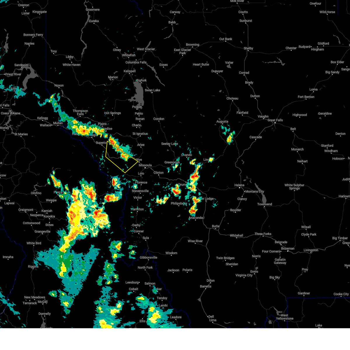
| 8/29/2023 4:14 PM MDT |
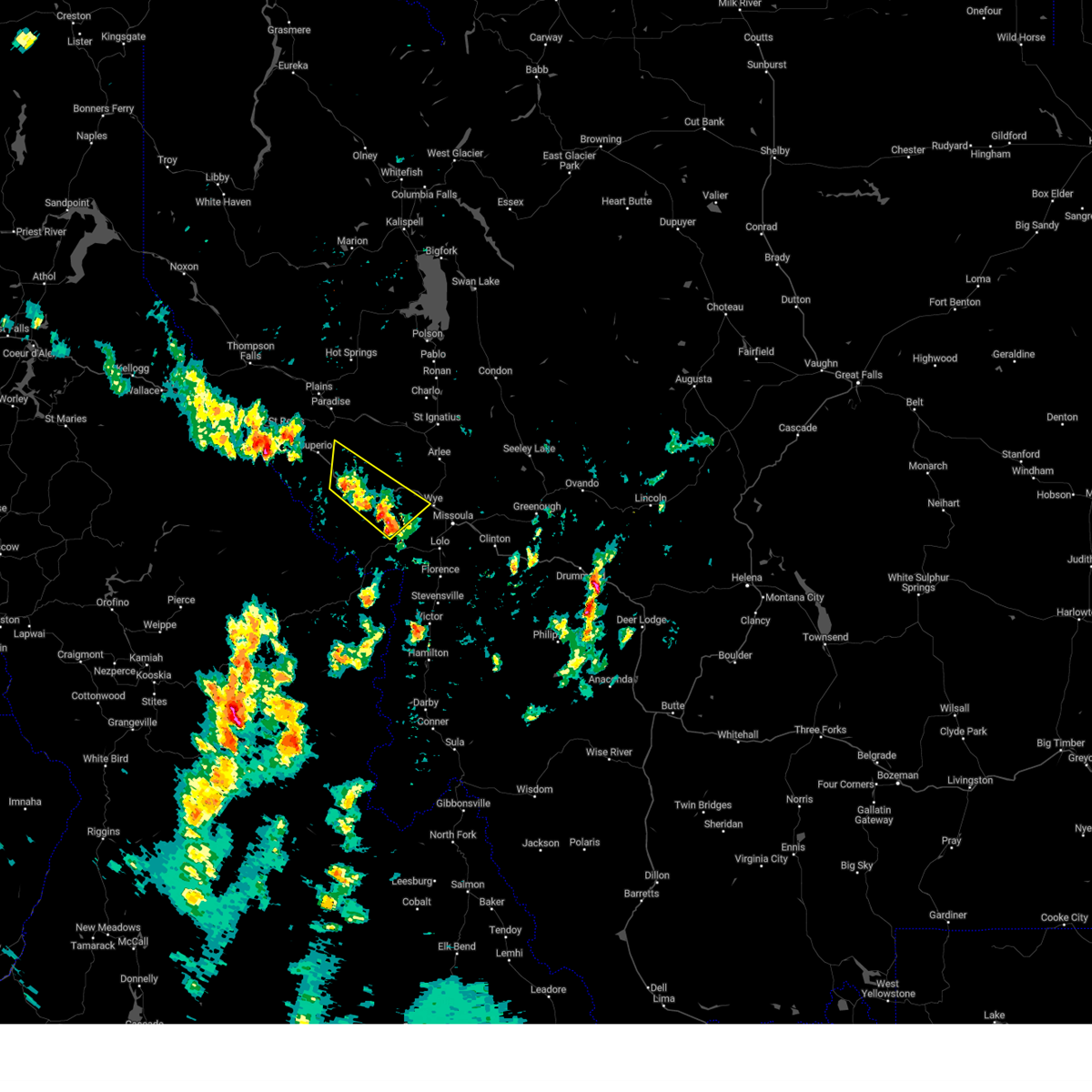 At 413 pm mdt, severe thunderstorms were located along a line extending from near tarkio to 12 miles west of lolo, moving north at 20 mph (radar indicated). Hazards include 60 mph wind gusts. Expect damage to roofs, siding, and trees. locations impacted include, alberton, tarkio, wye, riverbend, ninemile, lozeau, huson, quartz, cyr, and stark. hail threat, radar indicated max hail size, <. 75 in wind threat, radar indicated max wind gust, 60 mph. At 413 pm mdt, severe thunderstorms were located along a line extending from near tarkio to 12 miles west of lolo, moving north at 20 mph (radar indicated). Hazards include 60 mph wind gusts. Expect damage to roofs, siding, and trees. locations impacted include, alberton, tarkio, wye, riverbend, ninemile, lozeau, huson, quartz, cyr, and stark. hail threat, radar indicated max hail size, <. 75 in wind threat, radar indicated max wind gust, 60 mph.
|
| 8/29/2023 3:59 PM MDT |
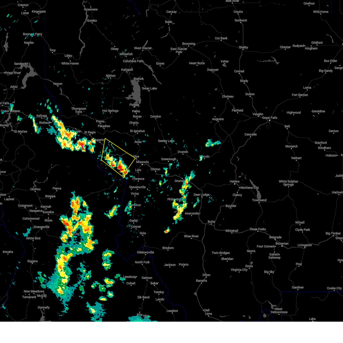 At 359 pm mdt, severe thunderstorms were located along a line extending from near tarkio to 13 miles west of florence, moving north at 20 mph (radar indicated). Hazards include 60 mph wind gusts and penny size hail. expect damage to roofs, siding, and trees At 359 pm mdt, severe thunderstorms were located along a line extending from near tarkio to 13 miles west of florence, moving north at 20 mph (radar indicated). Hazards include 60 mph wind gusts and penny size hail. expect damage to roofs, siding, and trees
|
| 8/25/2022 3:21 PM MDT | The severe thunderstorm warning for southeastern mineral, west central missoula and southeastern sanders counties will expire at 330 pm mdt, the storm which prompted the warning has weakened below severe limits, and no longer poses an immediate threat to life or property. therefore, the warning will be allowed to expire. |
| 8/25/2022 2:52 PM MDT | At 252 pm mdt, a severe thunderstorm was located near alberton, or 20 miles northwest of missoula, moving east at 10 mph (radar indicated). Hazards include 60 mph wind gusts and quarter size hail and very heavy rain. Hail damage to vehicles is expected. Expect wind damage to roofs, siding, and trees. |
| 7/8/2022 3:42 PM MDT |
 The severe thunderstorm warning for southeastern mineral and west central missoula counties will expire at 345 pm mdt, the severe thunderstorm which prompted the warning has moved out of the warned area. therefore, the warning will be allowed to expire. a severe thunderstorm watch remains in effect until 1000 pm mdt for west central montana. The severe thunderstorm warning for southeastern mineral and west central missoula counties will expire at 345 pm mdt, the severe thunderstorm which prompted the warning has moved out of the warned area. therefore, the warning will be allowed to expire. a severe thunderstorm watch remains in effect until 1000 pm mdt for west central montana.
|
| 7/8/2022 3:28 PM MDT |
 At 328 pm mdt, a severe thunderstorm was located near alberton, or 17 miles northwest of missoula, moving northeast at 15 mph (radar indicated). Hazards include ping pong ball size hail and 60 mph wind gusts. People and animals outdoors will be injured. expect hail damage to roofs, siding, windows, and vehicles. expect wind damage to roofs, siding, and trees. locations impacted include, huson and ninemile. hail threat, radar indicated max hail size, 1. 50 in wind threat, radar indicated max wind gust, 60 mph. At 328 pm mdt, a severe thunderstorm was located near alberton, or 17 miles northwest of missoula, moving northeast at 15 mph (radar indicated). Hazards include ping pong ball size hail and 60 mph wind gusts. People and animals outdoors will be injured. expect hail damage to roofs, siding, windows, and vehicles. expect wind damage to roofs, siding, and trees. locations impacted include, huson and ninemile. hail threat, radar indicated max hail size, 1. 50 in wind threat, radar indicated max wind gust, 60 mph.
|
| 7/8/2022 3:18 PM MDT |
 At 318 pm mdt, a severe thunderstorm was located near alberton, or 18 miles west of missoula, moving northeast at 15 mph (radar indicated). Hazards include 60 mph wind gusts and quarter size hail. Hail damage to vehicles is expected. Expect wind damage to roofs, siding, and trees. At 318 pm mdt, a severe thunderstorm was located near alberton, or 18 miles west of missoula, moving northeast at 15 mph (radar indicated). Hazards include 60 mph wind gusts and quarter size hail. Hail damage to vehicles is expected. Expect wind damage to roofs, siding, and trees.
|
| 8/11/2019 2:42 PM MDT | A tree fell on a powerline at the cross streets of wapiti road and 6 mile road. the call came in at 3:34 pm... but above lsr was estimated from rada in missoula county MT, 2.7 miles SSW of Huson, MT |
| 8/11/2019 2:42 PM MDT |
 The severe thunderstorm warning for southwestern missoula county will expire at 245 pm mdt, the severe thunderstorm which prompted the warning has moved out of the warned area. therefore, the warning will be allowed to expire. however gusty winds up to 55 mph are still possible with this thunderstorm. The severe thunderstorm warning for southwestern missoula county will expire at 245 pm mdt, the severe thunderstorm which prompted the warning has moved out of the warned area. therefore, the warning will be allowed to expire. however gusty winds up to 55 mph are still possible with this thunderstorm.
|
| 8/11/2019 2:30 PM MDT |
 At 230 pm mdt, a severe thunderstorm was located near frenchtown, or 13 miles west of missoula, moving north at 30 mph (radar indicated). Hazards include 60 mph wind gusts. expect damage to roofs, siding, and trees At 230 pm mdt, a severe thunderstorm was located near frenchtown, or 13 miles west of missoula, moving north at 30 mph (radar indicated). Hazards include 60 mph wind gusts. expect damage to roofs, siding, and trees
|
| 5/31/2018 1:41 PM MDT |
 At 141 pm mdt, a severe thunderstorm was located over missoula, moving northeast at 35 mph (radar indicated). Hazards include 60 mph wind gusts have been reported and penny size hail continues to be a threat as well. Expect damage to roofs, siding, and trees. Locations impacted include, missoula, lolo, bonner-west riverside, wye, east missoula, evaro, frenchtown, huson and turah. At 141 pm mdt, a severe thunderstorm was located over missoula, moving northeast at 35 mph (radar indicated). Hazards include 60 mph wind gusts have been reported and penny size hail continues to be a threat as well. Expect damage to roofs, siding, and trees. Locations impacted include, missoula, lolo, bonner-west riverside, wye, east missoula, evaro, frenchtown, huson and turah.
|
| 5/31/2018 1:20 PM MDT |
 At 120 pm mdt, a severe thunderstorm was located near lolo, or 11 miles southwest of missoula, moving northeast at 35 mph (radar indicated). Hazards include 60 mph wind gusts and penny size hail. expect damage to roofs, siding, and trees At 120 pm mdt, a severe thunderstorm was located near lolo, or 11 miles southwest of missoula, moving northeast at 35 mph (radar indicated). Hazards include 60 mph wind gusts and penny size hail. expect damage to roofs, siding, and trees
|
| 5/6/2018 7:06 PM MDT |
 The severe thunderstorm warning for southwestern missoula county will expire at 715 pm mdt, the severe thunderstorm which prompted the warning has weakened and is moving out of the warned area. therefore, the warning will be allowed to expire. strong winds near 40 mph, heavy rain, and small hail will continue for another 10 to 20 minutes. The severe thunderstorm warning for southwestern missoula county will expire at 715 pm mdt, the severe thunderstorm which prompted the warning has weakened and is moving out of the warned area. therefore, the warning will be allowed to expire. strong winds near 40 mph, heavy rain, and small hail will continue for another 10 to 20 minutes.
|
| 5/6/2018 6:40 PM MDT |
 At 640 pm mdt, a severe thunderstorm was located near missoula, moving north at 40 mph (radar indicated). Hazards include 60 mph wind gusts and nickel size hail. expect damage to roofs, siding, and trees At 640 pm mdt, a severe thunderstorm was located near missoula, moving north at 40 mph (radar indicated). Hazards include 60 mph wind gusts and nickel size hail. expect damage to roofs, siding, and trees
|
| 4/7/2017 12:24 PM MDT | Northwestern energy reported on twitter that a tree went thru a transmission line in the nine mile and has left about 3...000 customers without power around superior & in missoula county MT, 3.2 miles ENE of Huson, MT |
| 8/14/2015 4:08 PM MDT |
 At 408 pm mdt, doppler radar indicated a severe thunderstorm capable of producing quarter size hail and damaging winds in excess of 60 mph. this storm was located over evaro, or 13 miles northwest of missoula, moving northeast at 35 mph. locations impacted include, frenchtown, wye, ninemile and huson. At 408 pm mdt, doppler radar indicated a severe thunderstorm capable of producing quarter size hail and damaging winds in excess of 60 mph. this storm was located over evaro, or 13 miles northwest of missoula, moving northeast at 35 mph. locations impacted include, frenchtown, wye, ninemile and huson.
|
| 8/14/2015 3:47 PM MDT |
 At 347 pm mdt, doppler radar indicated a severe thunderstorm capable of producing quarter size hail and damaging winds in excess of 60 mph. this storm was located 9 miles southeast of alberton, or 16 miles west of missoula, and moving northeast at 35 mph. At 347 pm mdt, doppler radar indicated a severe thunderstorm capable of producing quarter size hail and damaging winds in excess of 60 mph. this storm was located 9 miles southeast of alberton, or 16 miles west of missoula, and moving northeast at 35 mph.
|
| 3/20/2013 5:45 PM MDT | Live tree snapped off 15 ft above ground with a 2 ft diameter at the breaking poin in missoula county MT, 1.6 miles W of Huson, MT |
Hail Maps for Huson, MT


Connect with Interactive Hail Maps