

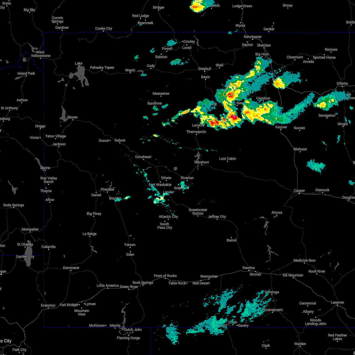
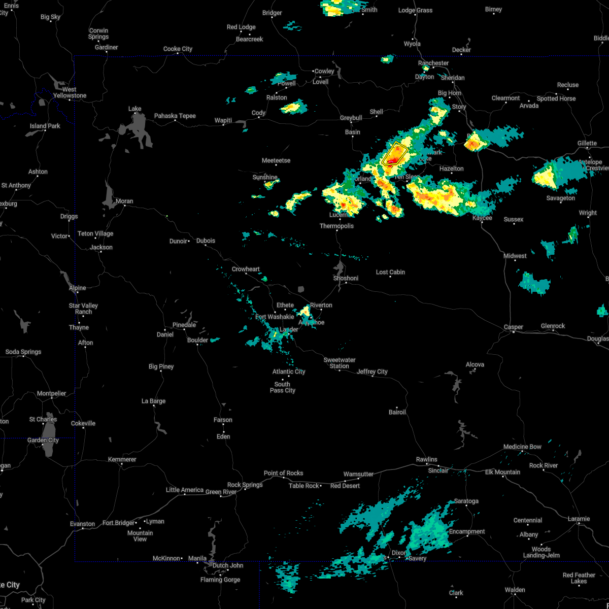
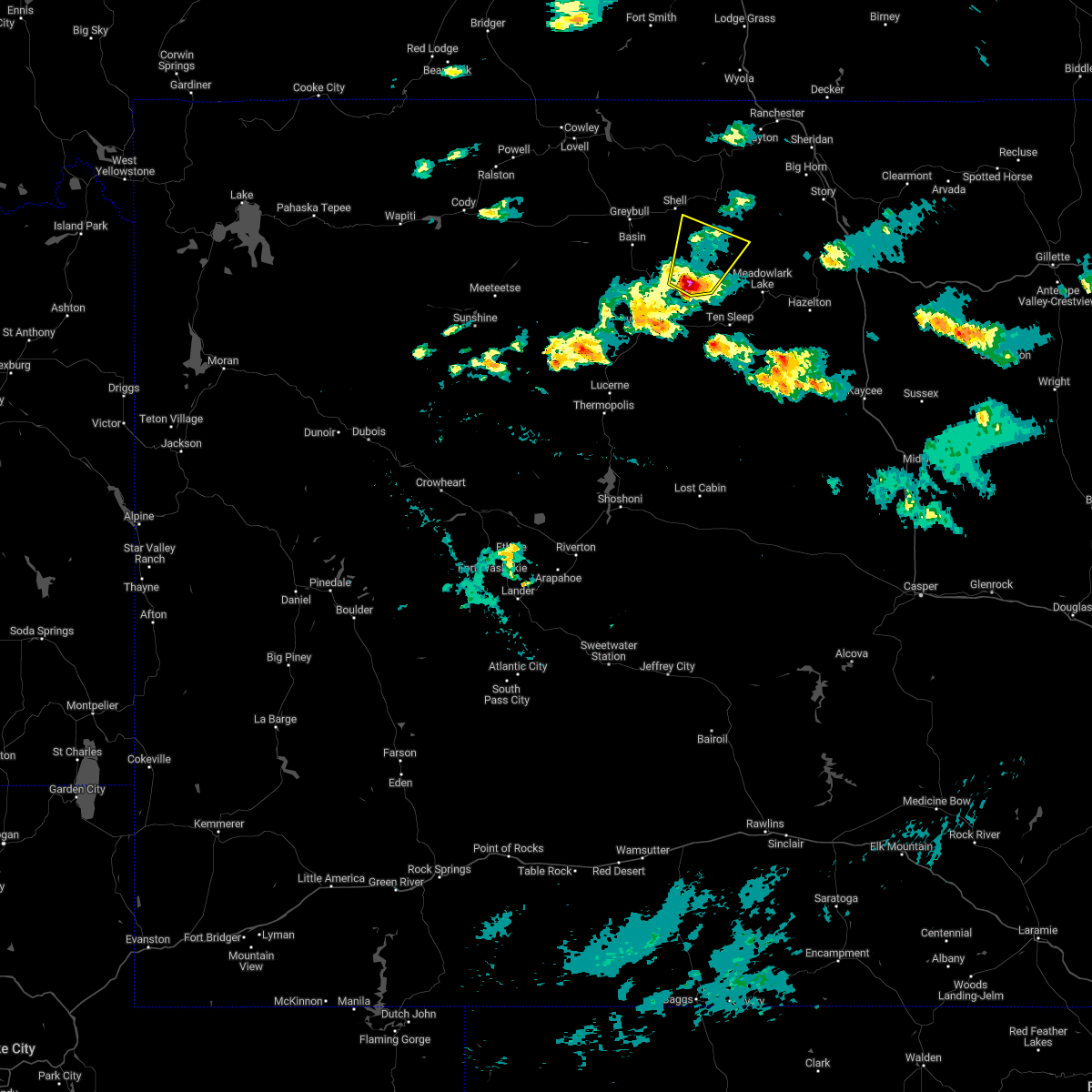
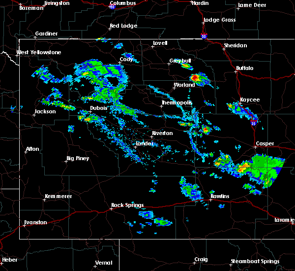
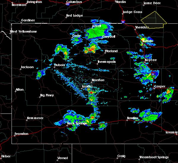
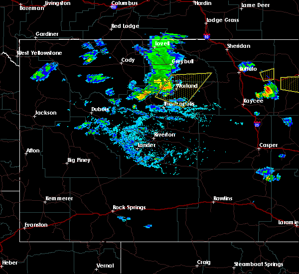
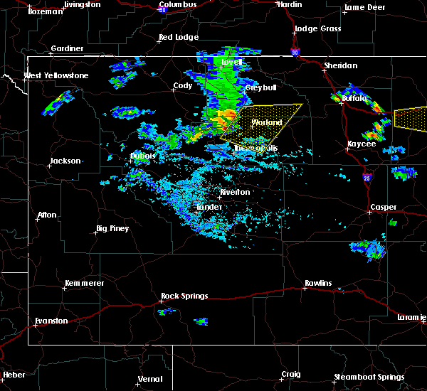
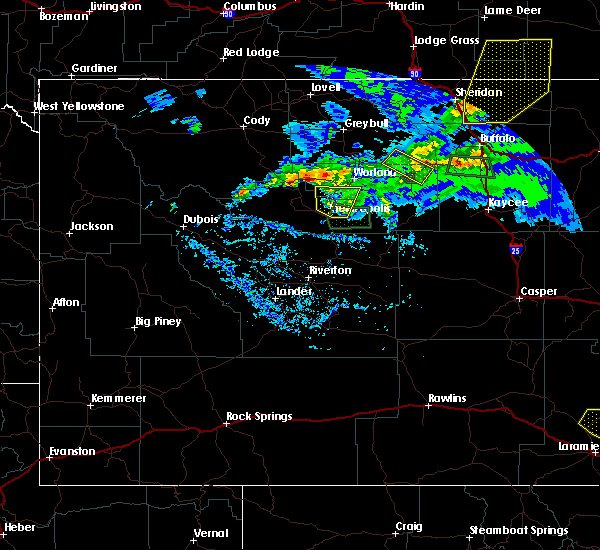
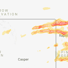
Hail Map for Hyattville, WY
The Hyattville, WY area has had 0 reports of on-the-ground hail by trained spotters, and has been under severe weather warnings 0 times during the past 12 months. Doppler radar has detected hail at or near Hyattville, WY on 11 occasions.
| Name: | Hyattville, WY |
| Where Located: | 92.9 miles NNE of Riverton, WY |
| Map: | Google Map for Hyattville, WY |
| Population: | 75 |
| Housing Units: | 68 |
| More Info: | Search Google for Hyattville, WY |
3
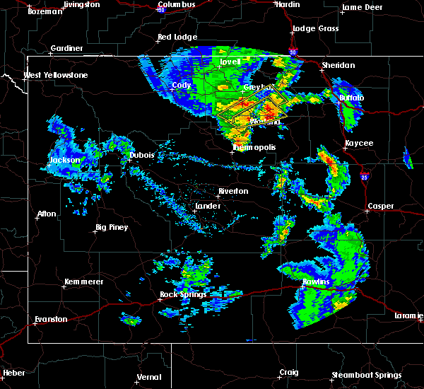
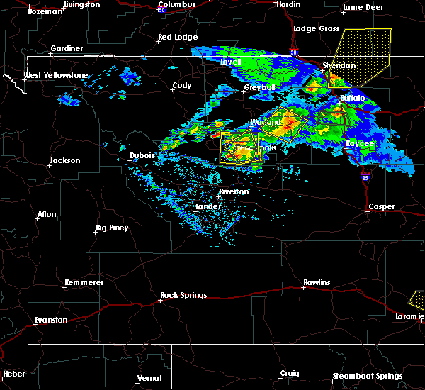
The Top Recent Hail Date for Hyattville, WY is Sunday, July 24, 2022 (2nd out of 11)

Hail and Wind Damage Spotted near Hyattville, WY
| Date / Time | Report Details |
|---|---|
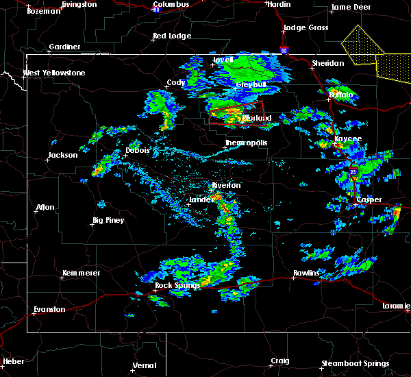
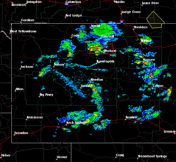
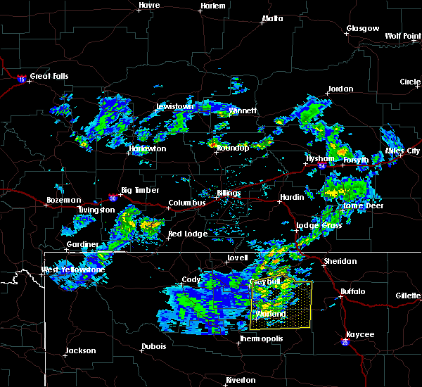
| 7/24/2022 4:21 PM MDT |
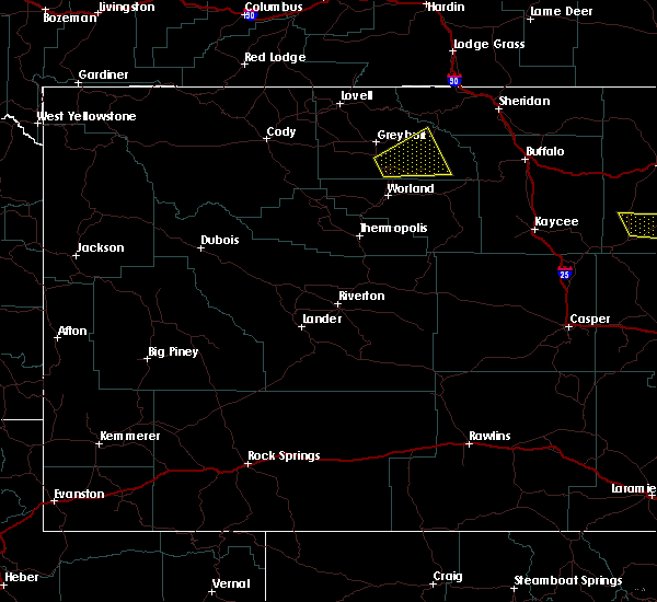
 The severe thunderstorm warning for south central big horn county will expire at 430 pm mdt, the storm which prompted the warning has weakened below severe limits, and has exited the warned area. therefore, the warning will be allowed to expire. however heavy rain is still possible with this thunderstorm. The severe thunderstorm warning for south central big horn county will expire at 430 pm mdt, the storm which prompted the warning has weakened below severe limits, and has exited the warned area. therefore, the warning will be allowed to expire. however heavy rain is still possible with this thunderstorm.
|
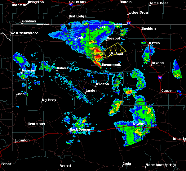
| 7/24/2022 4:11 PM MDT |
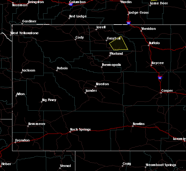
 At 410 pm mdt, a severe thunderstorm was located near medicine lodge archaeological site, or 22 miles east of basin, moving northeast at 20 mph (radar indicated). Hazards include 60 mph wind gusts and quarter size hail. Hail damage to vehicles is expected. expect wind damage to roofs, siding, and trees. this severe thunderstorm will remain over mainly rural areas of south central big horn county. hail threat, radar indicated max hail size, 1. 00 in wind threat, radar indicated max wind gust, 60 mph. At 410 pm mdt, a severe thunderstorm was located near medicine lodge archaeological site, or 22 miles east of basin, moving northeast at 20 mph (radar indicated). Hazards include 60 mph wind gusts and quarter size hail. Hail damage to vehicles is expected. expect wind damage to roofs, siding, and trees. this severe thunderstorm will remain over mainly rural areas of south central big horn county. hail threat, radar indicated max hail size, 1. 00 in wind threat, radar indicated max wind gust, 60 mph.
|
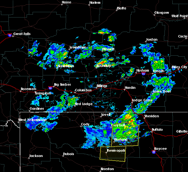
| 7/24/2022 3:44 PM MDT |
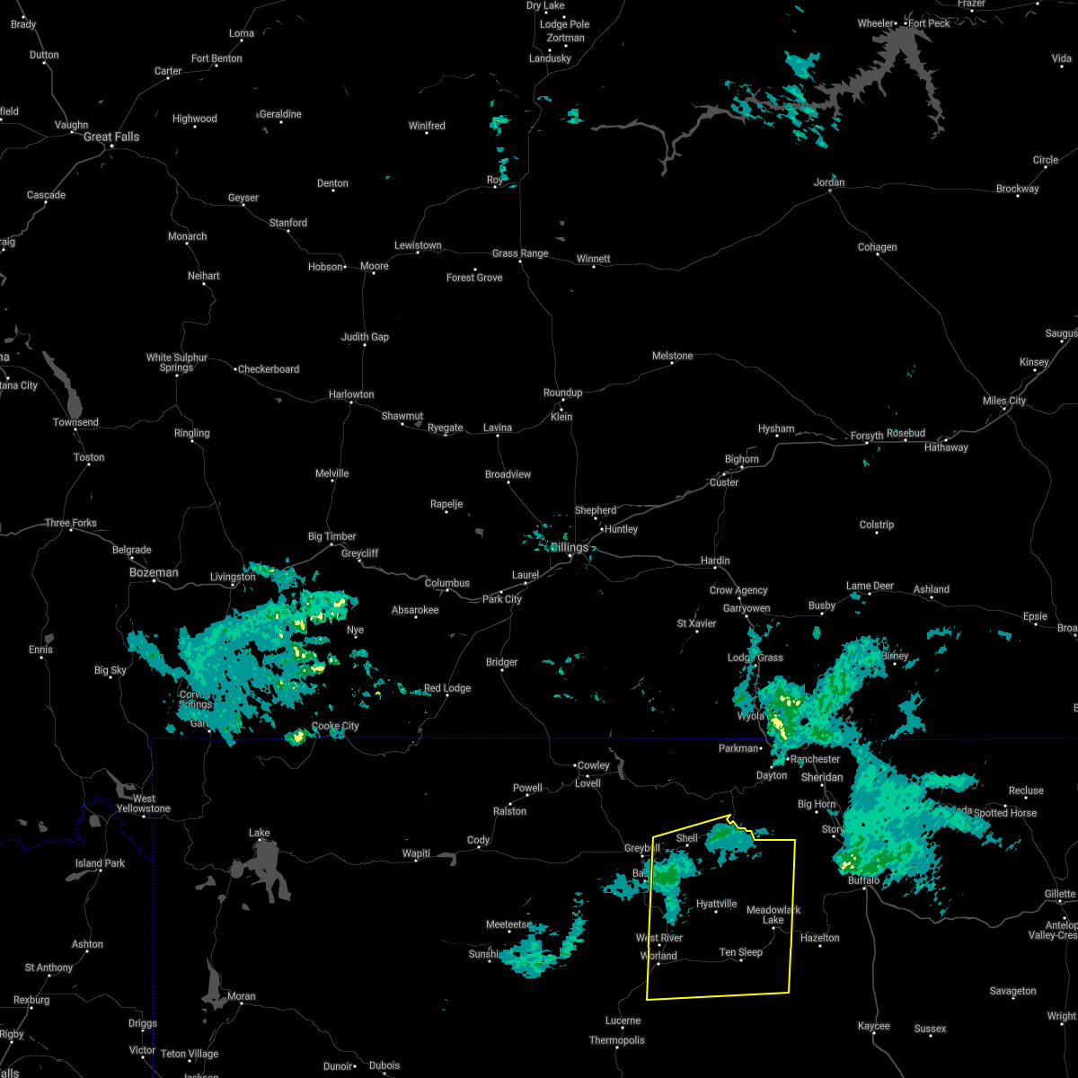
 At 343 pm mdt, a severe thunderstorm was located near hyattville, or 18 miles northwest of ten sleep, moving northeast at 20 mph (radar indicated). Hazards include 60 mph wind gusts and quarter size hail. Hail damage to vehicles is expected. expect wind damage to roofs, siding, and trees. this severe thunderstorm will be near, hyattville around 350 pm mdt. medicine lodge archaeological site around 400 pm mdt. other locations in the path of this severe thunderstorm include paintrock canyon and upper medicine lodge lake. hail threat, radar indicated max hail size, 1. 00 in wind threat, radar indicated max wind gust, 60 mph. At 343 pm mdt, a severe thunderstorm was located near hyattville, or 18 miles northwest of ten sleep, moving northeast at 20 mph (radar indicated). Hazards include 60 mph wind gusts and quarter size hail. Hail damage to vehicles is expected. expect wind damage to roofs, siding, and trees. this severe thunderstorm will be near, hyattville around 350 pm mdt. medicine lodge archaeological site around 400 pm mdt. other locations in the path of this severe thunderstorm include paintrock canyon and upper medicine lodge lake. hail threat, radar indicated max hail size, 1. 00 in wind threat, radar indicated max wind gust, 60 mph.
|
| 8/1/2020 5:21 PM MDT |
 At 521 pm mdt, a severe thunderstorm was located near hyattville, which is 13 miles north of ten sleep, moving southeast at 25 mph (radar indicated). Hazards include 60 mph wind gusts and quarter size hail. Hail damage to vehicles is expected. expect wind damage to roofs, siding, and trees. this severe thunderstorm will be near, ten sleep and tensleep canyon around 545 pm mdt. Other locations impacted by this severe thunderstorm include wigwam fish rearing station and leigh creek campground. At 521 pm mdt, a severe thunderstorm was located near hyattville, which is 13 miles north of ten sleep, moving southeast at 25 mph (radar indicated). Hazards include 60 mph wind gusts and quarter size hail. Hail damage to vehicles is expected. expect wind damage to roofs, siding, and trees. this severe thunderstorm will be near, ten sleep and tensleep canyon around 545 pm mdt. Other locations impacted by this severe thunderstorm include wigwam fish rearing station and leigh creek campground.
|
| 7/8/2019 5:16 PM MDT |
 At 514 pm mdt, severe thunderstorms were located along a line extending from near shell to hyattville, moving northeast at 50 mph. 68 mph gusts have been reported in greybull and tree limbs have been reported down in ten sleep (public). Hazards include 70 mph wind gusts and nickel size hail. Expect considerable tree damage. damage is likely to mobile homes, roofs, and outbuildings. severe thunderstorms will be near, shell around 520 pm mdt. shell canyon around 525 pm mdt. upper medicine lodge lake and shell falls around 530 pm mdt. Other locations impacted by these severe thunderstorms include shell creek campground. At 514 pm mdt, severe thunderstorms were located along a line extending from near shell to hyattville, moving northeast at 50 mph. 68 mph gusts have been reported in greybull and tree limbs have been reported down in ten sleep (public). Hazards include 70 mph wind gusts and nickel size hail. Expect considerable tree damage. damage is likely to mobile homes, roofs, and outbuildings. severe thunderstorms will be near, shell around 520 pm mdt. shell canyon around 525 pm mdt. upper medicine lodge lake and shell falls around 530 pm mdt. Other locations impacted by these severe thunderstorms include shell creek campground.
|
| 7/8/2019 4:55 PM MDT |
 At 454 pm mdt, a severe thunderstorm was located near manderson, which is 13 miles north of worland, moving northeast at 40 mph (radar indicated). Hazards include 60 mph wind gusts and quarter size hail. Hail damage to vehicles is expected. expect wind damage to roofs, siding, and trees. This severe storm will be near, hyattville around 515 pm mdt. At 454 pm mdt, a severe thunderstorm was located near manderson, which is 13 miles north of worland, moving northeast at 40 mph (radar indicated). Hazards include 60 mph wind gusts and quarter size hail. Hail damage to vehicles is expected. expect wind damage to roofs, siding, and trees. This severe storm will be near, hyattville around 515 pm mdt.
|
| 7/8/2019 4:26 PM MDT |
 At 425 pm mdt, a severe thunderstorm was located 10 miles northwest of wyoming boys school, which is 12 miles west of worland, moving northeast at 40 mph (radar indicated). Hazards include 60 mph wind gusts and quarter size hail. Hail damage to vehicles is expected. expect wind damage to roofs, siding, and trees. this severe thunderstorm will be near, worland around 440 pm mdt. manderson around 455 pm mdt. hyattville around 515 pm mdt. Other locations impacted by this severe thunderstorm include washakie county fairgrounds. At 425 pm mdt, a severe thunderstorm was located 10 miles northwest of wyoming boys school, which is 12 miles west of worland, moving northeast at 40 mph (radar indicated). Hazards include 60 mph wind gusts and quarter size hail. Hail damage to vehicles is expected. expect wind damage to roofs, siding, and trees. this severe thunderstorm will be near, worland around 440 pm mdt. manderson around 455 pm mdt. hyattville around 515 pm mdt. Other locations impacted by this severe thunderstorm include washakie county fairgrounds.
|
| 7/2/2019 2:11 PM MDT |
 The tornado warning for south central big horn and northwestern washakie counties will expire at 215 pm mdt, the storm which prompted the warning has weakened below severe limits, and no longer appears capable of producing a tornado. therefore, the warning will be allowed to expire. however gusty winds are still possible with this thunderstorm. a severe thunderstorm watch remains in effect until 900 pm mdt for central wyoming. The tornado warning for south central big horn and northwestern washakie counties will expire at 215 pm mdt, the storm which prompted the warning has weakened below severe limits, and no longer appears capable of producing a tornado. therefore, the warning will be allowed to expire. however gusty winds are still possible with this thunderstorm. a severe thunderstorm watch remains in effect until 900 pm mdt for central wyoming.
|
| 7/2/2019 2:02 PM MDT |
 At 202 pm mdt, a severe thunderstorm capable of producing a tornado was located 9 miles northwest of worland, moving east at 35 mph (radar indicated rotation). Hazards include tornado and quarter size hail. Flying debris will be dangerous to those caught without shelter. mobile homes will be damaged or destroyed. damage to roofs, windows, and vehicles will occur. tree damage is likely. Locations impacted include, worland and washakie county fairgrounds. At 202 pm mdt, a severe thunderstorm capable of producing a tornado was located 9 miles northwest of worland, moving east at 35 mph (radar indicated rotation). Hazards include tornado and quarter size hail. Flying debris will be dangerous to those caught without shelter. mobile homes will be damaged or destroyed. damage to roofs, windows, and vehicles will occur. tree damage is likely. Locations impacted include, worland and washakie county fairgrounds.
|
| 7/2/2019 1:46 PM MDT |
 At 146 pm mdt, a severe thunderstorm capable of producing a tornado was located 16 miles northwest of wyoming boys school, which is 17 miles west of worland, moving east at 35 mph (weather spotters reported funnel cloud). Hazards include tornado and ping pong ball size hail. Flying debris will be dangerous to those caught without shelter. mobile homes will be damaged or destroyed. damage to roofs, windows, and vehicles will occur. tree damage is likely. This tornadic thunderstorm will remain over mainly rural areas of south central big horn and northwestern washakie counties, including the following locations, washakie county fairgrounds. At 146 pm mdt, a severe thunderstorm capable of producing a tornado was located 16 miles northwest of wyoming boys school, which is 17 miles west of worland, moving east at 35 mph (weather spotters reported funnel cloud). Hazards include tornado and ping pong ball size hail. Flying debris will be dangerous to those caught without shelter. mobile homes will be damaged or destroyed. damage to roofs, windows, and vehicles will occur. tree damage is likely. This tornadic thunderstorm will remain over mainly rural areas of south central big horn and northwestern washakie counties, including the following locations, washakie county fairgrounds.
|
| 7/17/2018 4:37 PM MDT |
 At 436 pm mdt, severe thunderstorms were located along a line extending from near manderson to near kirby, moving east at 40 mph. however, strong outflow wind was already near worland around 435 pm (radar indicated). Hazards include 60 mph wind gusts. Expect damage to roofs, siding, and trees. these severe storms will be near, worland through 450 pm mdt. hyattville and medicine lodge archaeological site around 500 pm mdt. Other locations impacted by these severe thunderstorms include washakie county fairgrounds. At 436 pm mdt, severe thunderstorms were located along a line extending from near manderson to near kirby, moving east at 40 mph. however, strong outflow wind was already near worland around 435 pm (radar indicated). Hazards include 60 mph wind gusts. Expect damage to roofs, siding, and trees. these severe storms will be near, worland through 450 pm mdt. hyattville and medicine lodge archaeological site around 500 pm mdt. Other locations impacted by these severe thunderstorms include washakie county fairgrounds.
|
| 7/17/2018 4:23 PM MDT |
 The national weather service in riverton has issued a * severe thunderstorm warning for. east central hot springs county in central wyoming. southeastern big horn county in central wyoming. northwestern washakie county in central wyoming. Until 500 pm mdt. The national weather service in riverton has issued a * severe thunderstorm warning for. east central hot springs county in central wyoming. southeastern big horn county in central wyoming. northwestern washakie county in central wyoming. Until 500 pm mdt.
|
| 6/6/2018 7:16 PM MDT |
 At 715 pm mdt, a severe thunderstorm was located near tensleep canyon, or 8 miles northeast of ten sleep, moving northeast at 25 mph (public earlier reported ping pong ball sized hail). Hazards include 60 mph wind gusts and quarter size hail. Hail damage to vehicles is expected. expect wind damage to roofs, siding, and trees. This severe thunderstorm will remain over mainly rural areas of southeastern big horn and northeastern washakie counties, including the following locations, wigwam fish rearing station and leigh creek campground. At 715 pm mdt, a severe thunderstorm was located near tensleep canyon, or 8 miles northeast of ten sleep, moving northeast at 25 mph (public earlier reported ping pong ball sized hail). Hazards include 60 mph wind gusts and quarter size hail. Hail damage to vehicles is expected. expect wind damage to roofs, siding, and trees. This severe thunderstorm will remain over mainly rural areas of southeastern big horn and northeastern washakie counties, including the following locations, wigwam fish rearing station and leigh creek campground.
|
| 6/6/2018 6:56 PM MDT |
 At 655 pm mdt, a severe thunderstorm was located near ten sleep, moving northeast at 20 mph (public). Hazards include ping pong ball size hail. People and animals outdoors will be injured. expect damage to roofs, siding, windows, and vehicles. this severe storm will be near, ten sleep around 705 pm mdt. tensleep canyon around 720 pm mdt. Other locations impacted by this severe thunderstorm include wigwam fish rearing station and leigh creek campground. At 655 pm mdt, a severe thunderstorm was located near ten sleep, moving northeast at 20 mph (public). Hazards include ping pong ball size hail. People and animals outdoors will be injured. expect damage to roofs, siding, windows, and vehicles. this severe storm will be near, ten sleep around 705 pm mdt. tensleep canyon around 720 pm mdt. Other locations impacted by this severe thunderstorm include wigwam fish rearing station and leigh creek campground.
|
| 6/6/2018 6:43 PM MDT |
 At 642 pm mdt, a severe thunderstorm was located 7 miles southwest of ten sleep, moving northeast at 20 mph (radar indicated). Hazards include ping pong ball size hail. People and animals outdoors will be injured. expect damage to roofs, siding, windows, and vehicles. this severe thunderstorm will be near, ten sleep around 705 pm mdt. tensleep canyon around 720 pm mdt. Other locations impacted by this severe thunderstorm include wigwam fish rearing station and leigh creek campground. At 642 pm mdt, a severe thunderstorm was located 7 miles southwest of ten sleep, moving northeast at 20 mph (radar indicated). Hazards include ping pong ball size hail. People and animals outdoors will be injured. expect damage to roofs, siding, windows, and vehicles. this severe thunderstorm will be near, ten sleep around 705 pm mdt. tensleep canyon around 720 pm mdt. Other locations impacted by this severe thunderstorm include wigwam fish rearing station and leigh creek campground.
|
| 5/23/2018 4:06 PM MDT |
 The severe thunderstorm warning for southeastern big horn county will expire at 415 pm mdt, the storm which prompted the warning has weakened below severe limits, and no longer poses an immediate threat to life or property. therefore the warning will be allowed to expire. however small hail, gusty winds and heavy rain are still possible with this thunderstorm. to report severe weather, contact your nearest law enforcement agency. they will relay your report to the national weather service riverton. The severe thunderstorm warning for southeastern big horn county will expire at 415 pm mdt, the storm which prompted the warning has weakened below severe limits, and no longer poses an immediate threat to life or property. therefore the warning will be allowed to expire. however small hail, gusty winds and heavy rain are still possible with this thunderstorm. to report severe weather, contact your nearest law enforcement agency. they will relay your report to the national weather service riverton.
|
| 5/23/2018 3:46 PM MDT |
 At 345 pm mdt, a severe thunderstorm was located 9 miles northeast of manderson, which is 11 miles east of basin, moving northeast at 20 mph (radar indicated). Hazards include 60 mph wind gusts and quarter size hail. Hail damage to vehicles is expected. expect wind damage to roofs, siding, and trees. This severe thunderstorm will remain over mainly rural areas of southeastern big horn county. At 345 pm mdt, a severe thunderstorm was located 9 miles northeast of manderson, which is 11 miles east of basin, moving northeast at 20 mph (radar indicated). Hazards include 60 mph wind gusts and quarter size hail. Hail damage to vehicles is expected. expect wind damage to roofs, siding, and trees. This severe thunderstorm will remain over mainly rural areas of southeastern big horn county.
|
| 5/23/2018 3:28 PM MDT |
 At 327 pm mdt, a severe thunderstorm was located over manderson, which is 8 miles southeast of basin, moving east at 20 mph (radar indicated). Hazards include 60 mph wind gusts and quarter size hail. Hail damage to vehicles is expected. expect wind damage to roofs, siding, and trees. This severe thunderstorm will be near, medicine lodge archaeological site around 415 pm mdt. At 327 pm mdt, a severe thunderstorm was located over manderson, which is 8 miles southeast of basin, moving east at 20 mph (radar indicated). Hazards include 60 mph wind gusts and quarter size hail. Hail damage to vehicles is expected. expect wind damage to roofs, siding, and trees. This severe thunderstorm will be near, medicine lodge archaeological site around 415 pm mdt.
|
| 6/27/2017 8:57 AM MDT |
 The severe thunderstorm warning for northwestern johnson, southeastern big horn and northeastern washakie counties will expire at 300 pm mdt, the storms which prompted the warning have weakened below severe limits, and no longer pose an immediate threat to life or property. therefore the warning will be allowed to expire. however strong winds over 50 mph are still possible with these thunderstorms. The severe thunderstorm warning for northwestern johnson, southeastern big horn and northeastern washakie counties will expire at 300 pm mdt, the storms which prompted the warning have weakened below severe limits, and no longer pose an immediate threat to life or property. therefore the warning will be allowed to expire. however strong winds over 50 mph are still possible with these thunderstorms.
|
| 6/27/2017 8:45 AM MDT |
 At 242 pm mdt, severe thunderstorms were located along a line extending from 6 miles south of granite pass to near ten sleep, moving east at 50 mph (worland airport reported 69 mph at 202 pm and greybull airport reported 59 mph at 210 pm). Hazards include 60 mph wind gusts and up to one half inch hail. Expect damage to roofs, siding, and trees. These severe thunderstorms will remain over mainly rural areas of northwestern johnson, southeastern big horn and northeastern washakie counties, including the following locations: deer park campground, bull creek campground, lower paint rock lake campground, tensleep campground, cold springs campground, medicine lodge lake campground, lake geneva campground, spear o wigwam resort, coffeen park campground and ranger creek campground. At 242 pm mdt, severe thunderstorms were located along a line extending from 6 miles south of granite pass to near ten sleep, moving east at 50 mph (worland airport reported 69 mph at 202 pm and greybull airport reported 59 mph at 210 pm). Hazards include 60 mph wind gusts and up to one half inch hail. Expect damage to roofs, siding, and trees. These severe thunderstorms will remain over mainly rural areas of northwestern johnson, southeastern big horn and northeastern washakie counties, including the following locations: deer park campground, bull creek campground, lower paint rock lake campground, tensleep campground, cold springs campground, medicine lodge lake campground, lake geneva campground, spear o wigwam resort, coffeen park campground and ranger creek campground.
|
| 6/27/2017 8:14 AM MDT |
 At 213 pm mdt, severe thunderstorms were located along a line extending from near greybull to worland, moving east at 40 mph (radar indicated). Hazards include 60 mph wind gusts and up to one half inch hail. Expect damage to roofs, siding, and trees. severe thunderstorms will be near, shell around 230 pm mdt. shell canyon around 235 pm mdt. shell falls around 240 pm mdt. ten sleep around 255 pm mdt. Tensleep canyon around 300 pm mdt. At 213 pm mdt, severe thunderstorms were located along a line extending from near greybull to worland, moving east at 40 mph (radar indicated). Hazards include 60 mph wind gusts and up to one half inch hail. Expect damage to roofs, siding, and trees. severe thunderstorms will be near, shell around 230 pm mdt. shell canyon around 235 pm mdt. shell falls around 240 pm mdt. ten sleep around 255 pm mdt. Tensleep canyon around 300 pm mdt.
|
| 5/24/2016 5:50 PM MDT | Storm damage reported in big horn county WY, 0.8 miles W of Hyattville, WY |
| 6/5/2015 7:10 PM MDT | The severe thunderstorm warning for southeastern big horn and northeastern washakie counties will expire at 715 pm mdt, the storm which prompted the warning has weakened below severe limits, and no longer pose an immediate threat to life or property. therefore the warning will be allowed to expire. however small. |
| 6/5/2015 6:52 PM MDT | At 651 pm mdt, a severe thunderstorm was located near paintrock canyon, which is 18 miles north of ten sleep, moving northeast at 35 mph (radar indicated). Hazards include 60 mph wind gusts and quarter size hail. Hail damage to vehicles is expected. expect wind damage to roofs, siding and trees. this severe storm will be near, cloud peak around 710 pm mdt. other locations impacted by this severe thunderstorm include cold springs campground, lower paint rock lake campground, west tensleep campground, upper paint rock lake campground, boulder park campground, meadowlark lodge, deer park campground, medicine lodge lake campground, leigh creek campground and ranger creek campground. |
| 6/5/2015 6:33 PM MDT | At 632 pm mdt, a severe thunderstorm was located 7 miles north of ten sleep, moving north at 40 mph (radar indicated). Hazards include 60 mph wind gusts and quarter size hail. Hail damage to vehicles is expected. expect wind damage to roofs, siding and trees. this severe thunderstorm will be near, medicine lodge archaeological site around 645 pm mdt. Paintrock canyon around 650 pm mdt. |
| 8/1/2013 5:00 PM MDT | Strong winds estimated at 60 mph...plus 1/2 to 3/4 inch hail provided major crop damage to corn fields. hail was blowing sideway in big horn county WY, 4.2 miles E of Hyattville, WY |
Hail Maps for Hyattville, WY


Connect with Interactive Hail Maps