

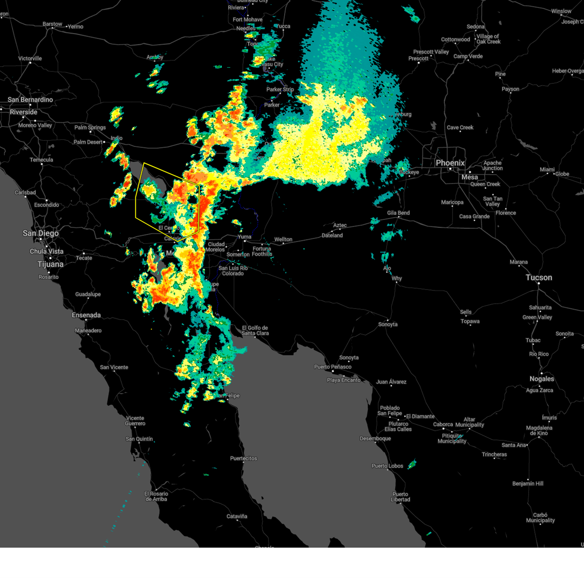
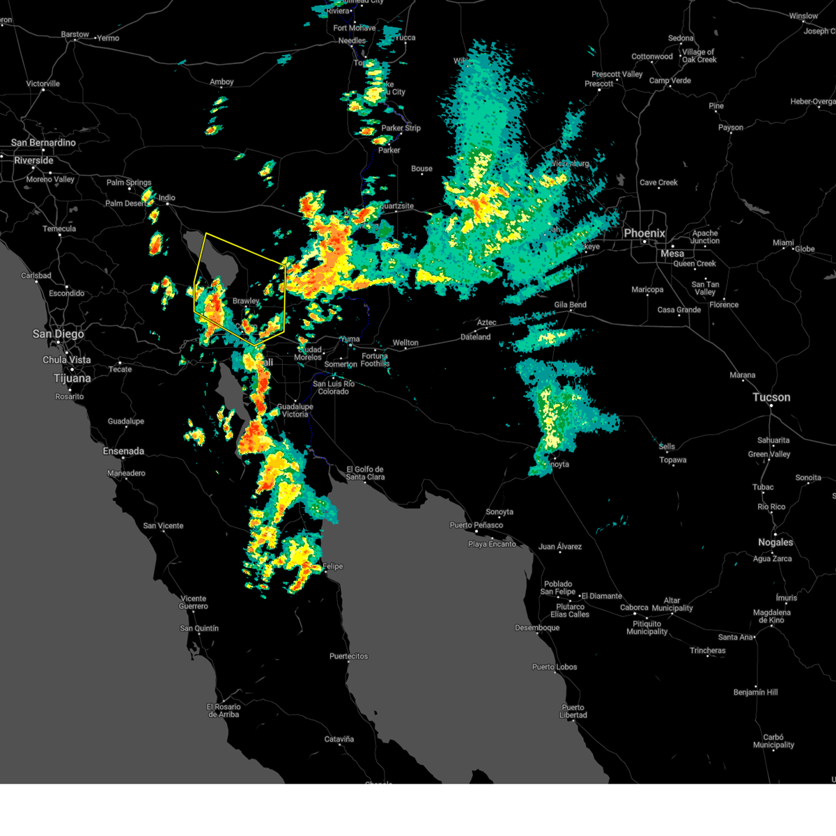
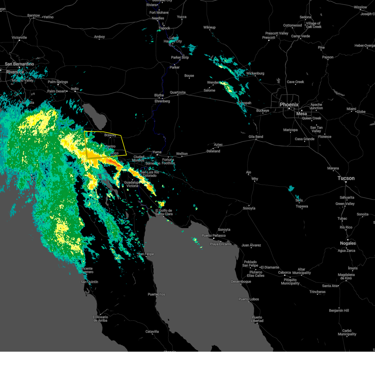
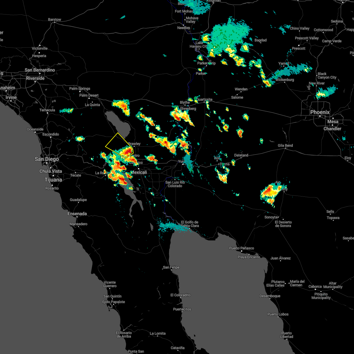
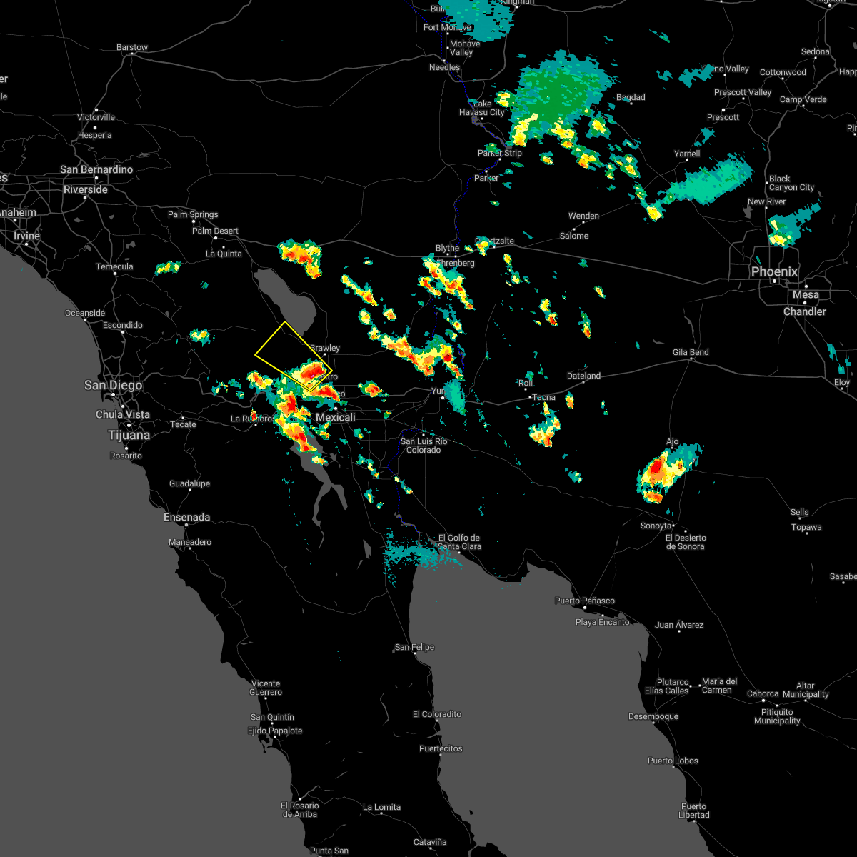
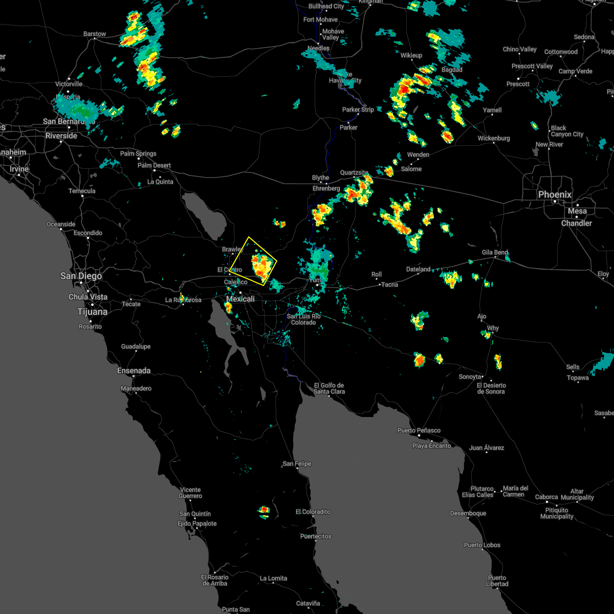
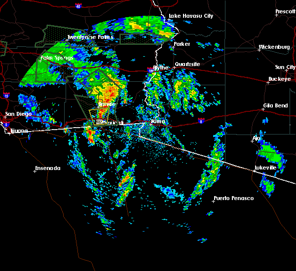
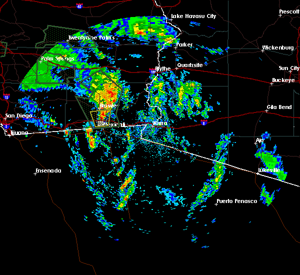
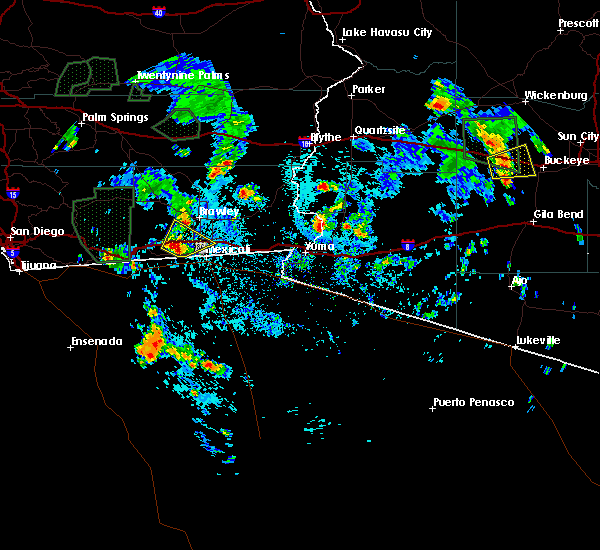
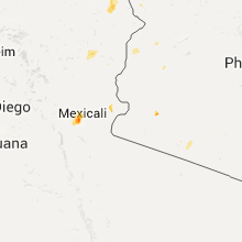
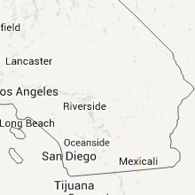
Hail Map for Imperial, CA
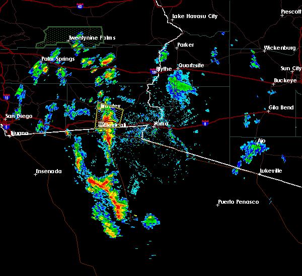
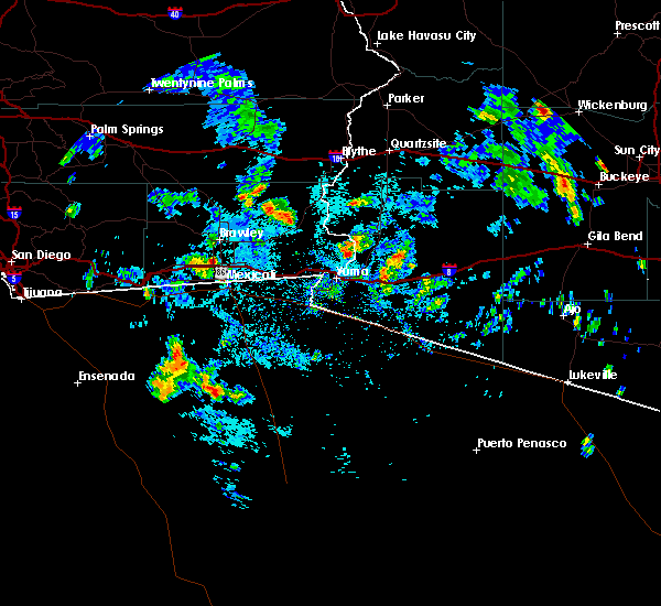
The Imperial, CA area has had 0 reports of on-the-ground hail by trained spotters, and has been under severe weather warnings 3 times during the past 12 months. Doppler radar has detected hail at or near Imperial, CA on 6 occasions, including 1 occasion during the past year.
| Name: | Imperial, CA |
| Where Located: | 56.1 miles W of Yuma, AZ |
| Map: | Google Map for Imperial, CA |
| Population: | 14758 |
| Housing Units: | 4751 |
| More Info: | Search Google for Imperial, CA |
0
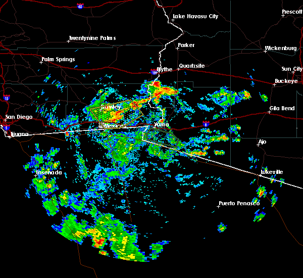
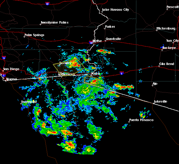
The Top Recent Hail Date for Imperial, CA is Friday, September 1, 2023 (3rd out of 6)

Hail and Wind Damage Spotted near Imperial, CA
| Date / Time | Report Details |
|---|---|
| 9/1/2023 2:37 PM PDT |
 The severe thunderstorm warning for western imperial and riverside counties will expire at 245 pm pdt, the storms which prompted the warning have weakened below severe limits, and no longer pose an immediate threat to life or property. therefore, the warning will be allowed to expire. however gusty winds and heavy rain are still possible with these thunderstorms. The severe thunderstorm warning for western imperial and riverside counties will expire at 245 pm pdt, the storms which prompted the warning have weakened below severe limits, and no longer pose an immediate threat to life or property. therefore, the warning will be allowed to expire. however gusty winds and heavy rain are still possible with these thunderstorms.
|
| 9/1/2023 2:12 PM PDT | Several power poles knocked over and nearly on the ground and in the roa in imperial county CA, 3.6 miles WSW of Imperial, CA |
| 9/1/2023 1:51 PM PDT | Semi truck flipped and on its sid in imperial county CA, 3 miles W of Imperial, CA |
| 9/1/2023 1:50 PM PDT |
 At 150 pm pdt, severe thunderstorms were located along a line extending from 10 miles west of westmorland to near imperial, moving north at 25 mph (radar indicated). Hazards include 60 mph wind gusts and penny size hail. expect damage to roofs, siding, and trees At 150 pm pdt, severe thunderstorms were located along a line extending from 10 miles west of westmorland to near imperial, moving north at 25 mph (radar indicated). Hazards include 60 mph wind gusts and penny size hail. expect damage to roofs, siding, and trees
|
| 8/20/2023 11:31 AM PDT |
 At 1130 am pdt, severe thunderstorms were located along a line extending from 6 miles west of mt. signal to near calexico, moving northwest at 60 mph (radar indicated). Hazards include 60 mph wind gusts. expect damage to roofs, siding, and trees At 1130 am pdt, severe thunderstorms were located along a line extending from 6 miles west of mt. signal to near calexico, moving northwest at 60 mph (radar indicated). Hazards include 60 mph wind gusts. expect damage to roofs, siding, and trees
|
| 7/31/2023 2:25 AM PDT | Measured wind gust of 57 kts at kipl (imperial airport) from thunderstorm outflow wind in imperial county CA, 0.8 miles NE of Imperial, CA |
| 10/15/2022 3:21 PM PDT |
 The severe thunderstorm warning for southwestern imperial county will expire at 330 pm pdt, the storm which prompted the warning has moved out of the area. therefore, the warning will be allowed to expire. however gusty winds and heavy rain are still possible with this thunderstorm. The severe thunderstorm warning for southwestern imperial county will expire at 330 pm pdt, the storm which prompted the warning has moved out of the area. therefore, the warning will be allowed to expire. however gusty winds and heavy rain are still possible with this thunderstorm.
|
| 10/15/2022 2:47 PM PDT |
 At 247 pm pdt, a severe thunderstorm was located 10 miles southeast of holtville, or 14 miles east of calexico, moving northwest at 15 mph (radar indicated). Hazards include 60 mph wind gusts and penny size hail. expect damage to roofs, siding, and trees At 247 pm pdt, a severe thunderstorm was located 10 miles southeast of holtville, or 14 miles east of calexico, moving northwest at 15 mph (radar indicated). Hazards include 60 mph wind gusts and penny size hail. expect damage to roofs, siding, and trees
|
| 10/15/2022 12:21 PM PDT |
 At 1221 pm pdt, a severe thunderstorm was located near el centro naval airfield, or near imperial, moving northwest at 20 mph (radar indicated). Hazards include 60 mph wind gusts and quarter size hail. Hail damage to vehicles is expected. expect wind damage to roofs, siding, and trees. locations impacted include, imperial, el centro naval airfield and seeley. this includes the following highways, ca route 78 between mile markers 11 and 13. Ca route 86 between mile markers 12 and 17, and between mile markers 31 and 46. At 1221 pm pdt, a severe thunderstorm was located near el centro naval airfield, or near imperial, moving northwest at 20 mph (radar indicated). Hazards include 60 mph wind gusts and quarter size hail. Hail damage to vehicles is expected. expect wind damage to roofs, siding, and trees. locations impacted include, imperial, el centro naval airfield and seeley. this includes the following highways, ca route 78 between mile markers 11 and 13. Ca route 86 between mile markers 12 and 17, and between mile markers 31 and 46.
|
| 10/15/2022 12:11 PM PDT |
 At 1211 pm pdt, a severe thunderstorm was located over el centro naval airfield, or near imperial, moving northwest at 25 mph (radar indicated). Hazards include 60 mph wind gusts and quarter size hail. Hail damage to vehicles is expected. Expect wind damage to roofs, siding, and trees. At 1211 pm pdt, a severe thunderstorm was located over el centro naval airfield, or near imperial, moving northwest at 25 mph (radar indicated). Hazards include 60 mph wind gusts and quarter size hail. Hail damage to vehicles is expected. Expect wind damage to roofs, siding, and trees.
|
| 10/15/2022 12:02 PM PDT |
 At 1202 pm pdt, a severe thunderstorm was located over el centro naval airfield, or near imperial, moving northwest at 30 mph (radar indicated). Hazards include 60 mph wind gusts and quarter size hail. Hail damage to vehicles is expected. expect wind damage to roofs, siding, and trees. locations impacted include, el centro, imperial, el centro naval airfield, dixieland and seeley. this includes the following highways, ca interstate 8 between mile markers 26 and 37. ca route 86 between mile markers 7 and 13. hail threat, radar indicated max hail size, 1. 00 in wind threat, radar indicated max wind gust, 60 mph. At 1202 pm pdt, a severe thunderstorm was located over el centro naval airfield, or near imperial, moving northwest at 30 mph (radar indicated). Hazards include 60 mph wind gusts and quarter size hail. Hail damage to vehicles is expected. expect wind damage to roofs, siding, and trees. locations impacted include, el centro, imperial, el centro naval airfield, dixieland and seeley. this includes the following highways, ca interstate 8 between mile markers 26 and 37. ca route 86 between mile markers 7 and 13. hail threat, radar indicated max hail size, 1. 00 in wind threat, radar indicated max wind gust, 60 mph.
|
| 10/15/2022 11:50 AM PDT | 10-15 powerlines down due to thunderstorm winds... timing based on rada in imperial county CA, 1.8 miles ENE of Imperial, CA |
| 10/15/2022 11:49 AM PDT |
 At 1149 am pdt, a severe thunderstorm was located over el centro, moving northwest at 25 mph (radar indicated). Hazards include ping pong ball size hail and 60 mph wind gusts. People and animals outdoors will be injured. expect hail damage to roofs, siding, windows, and vehicles. expect wind damage to roofs, siding, and trees. locations impacted include, el centro, imperial, plaster city, mt. signal, el centro naval airfield, heber, dixieland and seeley. this includes the following highways, ca interstate 8 between mile markers 20 and 41. ca route 111 between mile markers 3 and 9. ca route 86 between mile markers 1 and 13. hail threat, radar indicated max hail size, 1. 50 in wind threat, radar indicated max wind gust, 60 mph. At 1149 am pdt, a severe thunderstorm was located over el centro, moving northwest at 25 mph (radar indicated). Hazards include ping pong ball size hail and 60 mph wind gusts. People and animals outdoors will be injured. expect hail damage to roofs, siding, windows, and vehicles. expect wind damage to roofs, siding, and trees. locations impacted include, el centro, imperial, plaster city, mt. signal, el centro naval airfield, heber, dixieland and seeley. this includes the following highways, ca interstate 8 between mile markers 20 and 41. ca route 111 between mile markers 3 and 9. ca route 86 between mile markers 1 and 13. hail threat, radar indicated max hail size, 1. 50 in wind threat, radar indicated max wind gust, 60 mph.
|
| 10/15/2022 11:34 AM PDT |
 At 1133 am pdt, a severe thunderstorm was located over calexico, moving northwest at 25 mph (radar indicated). Hazards include 60 mph wind gusts and quarter size hail. Hail damage to vehicles is expected. Expect wind damage to roofs, siding, and trees. At 1133 am pdt, a severe thunderstorm was located over calexico, moving northwest at 25 mph (radar indicated). Hazards include 60 mph wind gusts and quarter size hail. Hail damage to vehicles is expected. Expect wind damage to roofs, siding, and trees.
|
| 8/13/2022 5:26 PM PDT |
 The severe thunderstorm warning for south central imperial county will expire at 530 pm pdt, the storm which prompted the warning has weakened below severe limits, and no longer poses an immediate threat to life or property. therefore, the warning will be allowed to expire. however heavy rain is still possible with this thunderstorm. The severe thunderstorm warning for south central imperial county will expire at 530 pm pdt, the storm which prompted the warning has weakened below severe limits, and no longer poses an immediate threat to life or property. therefore, the warning will be allowed to expire. however heavy rain is still possible with this thunderstorm.
|
| 8/13/2022 4:49 PM PDT |
 At 448 pm pdt, a severe thunderstorm was located near calexico, moving north at 5 mph (radar indicated). Hazards include 60 mph wind gusts. expect damage to roofs, siding, and trees At 448 pm pdt, a severe thunderstorm was located near calexico, moving north at 5 mph (radar indicated). Hazards include 60 mph wind gusts. expect damage to roofs, siding, and trees
|
| 8/8/2022 7:24 PM PDT |
 At 722 pm pdt, a severe thunderstorm was located over el centro, moving northeast at 15 mph (radar indicated). Hazards include 60 mph wind gusts. Expect damage to roofs, siding, and trees. locations impacted include, el centro, calexico, brawley, imperial, plaster city, ocotillo, mt. signal, el centro naval airfield, heber, coyote wells, dixieland and seeley. this includes the following highways, ca interstate 8 between mile markers 12 and 47. ca route 111 between mile markers 1 and 20. ca route 86 between mile markers 1 and 20. hail threat, radar indicated max hail size, <. 75 in wind threat, radar indicated max wind gust, 60 mph. At 722 pm pdt, a severe thunderstorm was located over el centro, moving northeast at 15 mph (radar indicated). Hazards include 60 mph wind gusts. Expect damage to roofs, siding, and trees. locations impacted include, el centro, calexico, brawley, imperial, plaster city, ocotillo, mt. signal, el centro naval airfield, heber, coyote wells, dixieland and seeley. this includes the following highways, ca interstate 8 between mile markers 12 and 47. ca route 111 between mile markers 1 and 20. ca route 86 between mile markers 1 and 20. hail threat, radar indicated max hail size, <. 75 in wind threat, radar indicated max wind gust, 60 mph.
|
| 8/8/2022 6:53 PM PDT |
 At 652 pm pdt, a severe thunderstorm was located near mt. signal, or near el centro, moving northeast at 15 mph (radar indicated). Hazards include 60 mph wind gusts. expect damage to roofs, siding, and trees At 652 pm pdt, a severe thunderstorm was located near mt. signal, or near el centro, moving northeast at 15 mph (radar indicated). Hazards include 60 mph wind gusts. expect damage to roofs, siding, and trees
|
| 7/30/2022 3:12 PM PDT |
 The severe thunderstorm warning for south central imperial county will expire at 315 pm pdt, the storm which prompted the warning has weakened below severe limits, and no longer poses an immediate threat to life or property. therefore, the warning will be allowed to expire. however gusty winds are still possible with this thunderstorm. The severe thunderstorm warning for south central imperial county will expire at 315 pm pdt, the storm which prompted the warning has weakened below severe limits, and no longer poses an immediate threat to life or property. therefore, the warning will be allowed to expire. however gusty winds are still possible with this thunderstorm.
|
| 7/30/2022 2:46 PM PDT |
 At 246 pm pdt, a severe thunderstorm was located 8 miles northeast of holtville, or 18 miles east of imperial, moving west at 20 mph (radar indicated). Hazards include 60 mph wind gusts. expect damage to roofs, siding, and trees At 246 pm pdt, a severe thunderstorm was located 8 miles northeast of holtville, or 18 miles east of imperial, moving west at 20 mph (radar indicated). Hazards include 60 mph wind gusts. expect damage to roofs, siding, and trees
|
| 8/31/2021 4:30 PM PDT |
 At 429 pm pdt, a severe thunderstorm was located near el centro naval airfield, or 7 miles northeast of plaster city, moving north at 25 mph (radar indicated). Hazards include 60 mph wind gusts and quarter size hail. Hail damage to vehicles is expected. Expect wind damage to roofs, siding, and trees. At 429 pm pdt, a severe thunderstorm was located near el centro naval airfield, or 7 miles northeast of plaster city, moving north at 25 mph (radar indicated). Hazards include 60 mph wind gusts and quarter size hail. Hail damage to vehicles is expected. Expect wind damage to roofs, siding, and trees.
|
| 3/12/2020 3:38 PM PDT |
 At 336 pm pdt, a severe thunderstorm was located near imperial, moving north at 20 mph (radar indicated). Hazards include quarter size hail. Damage to vehicles is expected. locations impacted include, el centro, imperial, holtville and heber. this includes the following highways, ca interstate 8 between mile markers 34 and 49. ca route 78 between mile markers 23 and 25. Ca route 111 between mile markers 2 and 20. At 336 pm pdt, a severe thunderstorm was located near imperial, moving north at 20 mph (radar indicated). Hazards include quarter size hail. Damage to vehicles is expected. locations impacted include, el centro, imperial, holtville and heber. this includes the following highways, ca interstate 8 between mile markers 34 and 49. ca route 78 between mile markers 23 and 25. Ca route 111 between mile markers 2 and 20.
|
| 3/12/2020 3:19 PM PDT |
 At 318 pm pdt, a severe thunderstorm was located near calexico, moving north at 20 mph (radar indicated). Hazards include quarter size hail. damage to vehicles is expected At 318 pm pdt, a severe thunderstorm was located near calexico, moving north at 20 mph (radar indicated). Hazards include quarter size hail. damage to vehicles is expected
|
| 9/25/2019 3:08 PM PDT |
 The severe thunderstorm warning for southeastern imperial county will expire at 315 pm pdt, the storm which prompted the warning has weakened below severe limits, and no longer poses an immediate threat to life or property. therefore, the warning will be allowed to expire. however gusty winds and heavy rain are still possible with this thunderstorm. The severe thunderstorm warning for southeastern imperial county will expire at 315 pm pdt, the storm which prompted the warning has weakened below severe limits, and no longer poses an immediate threat to life or property. therefore, the warning will be allowed to expire. however gusty winds and heavy rain are still possible with this thunderstorm.
|
| 9/25/2019 2:35 PM PDT |
 At 234 pm pdt, a severe thunderstorm was located 14 miles northeast of holtville, or 22 miles east of brawley, moving southwest at 30 mph (radar indicated). Hazards include 60 mph wind gusts and quarter size hail. Hail damage to vehicles is expected. expect wind damage to roofs, siding, and trees. locations impacted include, el centro, brawley, imperial, holtville, bonds corner, alamorio, glamis and wiest. this includes the following highways, ca interstate 8 between mile markers 40 and 63. ca route 78 between mile markers 14 and 50. Ca route 111 between mile markers 6 and 26. At 234 pm pdt, a severe thunderstorm was located 14 miles northeast of holtville, or 22 miles east of brawley, moving southwest at 30 mph (radar indicated). Hazards include 60 mph wind gusts and quarter size hail. Hail damage to vehicles is expected. expect wind damage to roofs, siding, and trees. locations impacted include, el centro, brawley, imperial, holtville, bonds corner, alamorio, glamis and wiest. this includes the following highways, ca interstate 8 between mile markers 40 and 63. ca route 78 between mile markers 14 and 50. Ca route 111 between mile markers 6 and 26.
|
| 9/25/2019 2:13 PM PDT |
 At 213 pm pdt, a severe thunderstorm was located 16 miles north of algodones dunes, or 28 miles northwest of yuma, moving west at 30 mph (radar indicated). Hazards include 60 mph wind gusts and quarter size hail. Hail damage to vehicles is expected. Expect wind damage to roofs, siding, and trees. At 213 pm pdt, a severe thunderstorm was located 16 miles north of algodones dunes, or 28 miles northwest of yuma, moving west at 30 mph (radar indicated). Hazards include 60 mph wind gusts and quarter size hail. Hail damage to vehicles is expected. Expect wind damage to roofs, siding, and trees.
|
| 9/30/2018 5:02 PM PDT |
 At 501 pm pdt, a severe thunderstorm was located near mt. signal, or near el centro, moving north at 25 mph (radar indicated). Hazards include 60 mph wind gusts. expect damage to roofs, siding, and trees At 501 pm pdt, a severe thunderstorm was located near mt. signal, or near el centro, moving north at 25 mph (radar indicated). Hazards include 60 mph wind gusts. expect damage to roofs, siding, and trees
|
| 9/8/2017 1:47 PM PDT |
 At 147 pm pdt, a severe thunderstorm was located near holtville, or 7 miles northeast of calexico, moving north at 10 mph (radar indicated). Hazards include 60 mph wind gusts. Expect damage to roofs, siding, and trees. Locations impacted include, el centro, calexico, brawley, imperial, holtville, bonds corner, heber, alamorio and wiest. At 147 pm pdt, a severe thunderstorm was located near holtville, or 7 miles northeast of calexico, moving north at 10 mph (radar indicated). Hazards include 60 mph wind gusts. Expect damage to roofs, siding, and trees. Locations impacted include, el centro, calexico, brawley, imperial, holtville, bonds corner, heber, alamorio and wiest.
|
| 9/8/2017 1:38 PM PDT |
 At 137 pm pdt, a severe thunderstorm was located near calexico, moving north at 10 mph (radar indicated). Hazards include 60 mph wind gusts. expect damage to roofs, siding, and trees At 137 pm pdt, a severe thunderstorm was located near calexico, moving north at 10 mph (radar indicated). Hazards include 60 mph wind gusts. expect damage to roofs, siding, and trees
|
| 8/3/2017 3:45 PM PDT |
 At 345 pm pdt, a severe thunderstorm was located over el centro naval airfield, or 7 miles west of el centro, moving northeast at 10 mph. storm has weakened, but is still capable of producing gusty winds, heavy rain, and frequent lightning (radar indicated). Hazards include 60 mph wind gusts and penny size hail. Expect damage to roofs, siding, and trees. locations impacted include, el centro, imperial, mt. Signal, el centro naval airfield, heber, dixieland and seeley. At 345 pm pdt, a severe thunderstorm was located over el centro naval airfield, or 7 miles west of el centro, moving northeast at 10 mph. storm has weakened, but is still capable of producing gusty winds, heavy rain, and frequent lightning (radar indicated). Hazards include 60 mph wind gusts and penny size hail. Expect damage to roofs, siding, and trees. locations impacted include, el centro, imperial, mt. Signal, el centro naval airfield, heber, dixieland and seeley.
|
| 8/3/2017 3:24 PM PDT |
 At 324 pm pdt, a severe thunderstorm was located near el centro naval airfield, or 8 miles east of plaster city, moving northeast at 10 mph (radar indicated). Hazards include 60 mph wind gusts and penny size hail. expect damage to roofs, siding, and trees At 324 pm pdt, a severe thunderstorm was located near el centro naval airfield, or 8 miles east of plaster city, moving northeast at 10 mph (radar indicated). Hazards include 60 mph wind gusts and penny size hail. expect damage to roofs, siding, and trees
|
| 7/18/2015 2:11 PM PDT | The severe thunderstorm warning for south central imperial county will expire at 215 pm pdt. the storm which prompted the warning has weakened below severe limits. and no longer poses an immediate threat to life or property. therefore the warning will be allowed to expire. However gusty winds and heavy rain are still possible with this thunderstorm. |
| 7/18/2015 1:53 PM PDT |
 At 153 pm pdt, doppler radar indicated a severe thunderstorm capable of producing large hail up to ping pong ball size and destructive winds in excess of 70 mph. this storm was located near calexico, moving north at 20 mph. locations impacted include, el centro, calexico, imperial, holtville and heber. At 153 pm pdt, doppler radar indicated a severe thunderstorm capable of producing large hail up to ping pong ball size and destructive winds in excess of 70 mph. this storm was located near calexico, moving north at 20 mph. locations impacted include, el centro, calexico, imperial, holtville and heber.
|
| 7/18/2015 1:43 PM PDT |
 At 143 pm pdt, doppler radar indicated a severe thunderstorm capable of producing quarter size hail and damaging winds in excess of 60 mph. this storm was located over calexico, and moving north at 20 mph. At 143 pm pdt, doppler radar indicated a severe thunderstorm capable of producing quarter size hail and damaging winds in excess of 60 mph. this storm was located over calexico, and moving north at 20 mph.
|
| 8/21/2014 2:00 PM PDT | Multiple telephone poles down along hwy 111 near worthington road. semi trailer also overturned on the road...emergency crews on scen in imperial county CA, 4.1 miles W of Imperial, CA |
Hail Maps for Imperial, CA


Connect with Interactive Hail Maps