

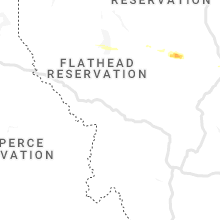
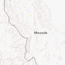
Hail Map for Jette, MT
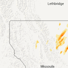
The Jette, MT area has had 0 reports of on-the-ground hail by trained spotters, and has been under severe weather warnings 0 times during the past 12 months. Doppler radar has detected hail at or near Jette, MT on 9 occasions.
| Name: | Jette, MT |
| Where Located: | 48.3 miles S of Whitefish, MT |
| Map: | Google Map for Jette, MT |
| Population: | 253 |
| Housing Units: | 163 |
| More Info: | Search Google for Jette, MT |
5
The Top Recent Hail Date for Jette, MT is Thursday, July 7, 2022 (1st out of 9)

Hail and Wind Damage Spotted near Jette, MT
| Date / Time | Report Details |
|---|---|
| 7/7/2022 8:31 PM MDT |
 At 831 pm mdt, a severe thunderstorm was located over kings point, or near polson, moving east at 30 mph (radar indicated). Hazards include golf ball size hail and 60 mph wind gusts. People and animals outdoors will be injured. expect hail damage to roofs, siding, windows, and vehicles. expect wind damage to roofs, siding, and trees. locations impacted include, polson, jette, rocky point, kings point, big arm and finley point. thunderstorm damage threat, considerable hail threat, radar indicated max hail size, 1. 75 in wind threat, radar indicated max wind gust, 60 mph. At 831 pm mdt, a severe thunderstorm was located over kings point, or near polson, moving east at 30 mph (radar indicated). Hazards include golf ball size hail and 60 mph wind gusts. People and animals outdoors will be injured. expect hail damage to roofs, siding, windows, and vehicles. expect wind damage to roofs, siding, and trees. locations impacted include, polson, jette, rocky point, kings point, big arm and finley point. thunderstorm damage threat, considerable hail threat, radar indicated max hail size, 1. 75 in wind threat, radar indicated max wind gust, 60 mph.
|
| 7/7/2022 8:25 PM MDT |
 At 824 pm mdt, a severe thunderstorm was located over kings point, or near polson, moving east at 30 mph (radar indicated). Hazards include ping pong ball size hail and 60 mph wind gusts. the storm continues to strengthen and is moving over flathead lake. this will be a dangerous storm for anyone on the lake. People and animals outdoors will be injured. expect hail damage to roofs, siding, windows, and vehicles. expect wind damage to roofs, siding, and trees. locations impacted include, polson, rocky point, jette, kings point, big arm, kerr and finley point. hail threat, radar indicated max hail size, 1. 50 in wind threat, radar indicated max wind gust, 60 mph. At 824 pm mdt, a severe thunderstorm was located over kings point, or near polson, moving east at 30 mph (radar indicated). Hazards include ping pong ball size hail and 60 mph wind gusts. the storm continues to strengthen and is moving over flathead lake. this will be a dangerous storm for anyone on the lake. People and animals outdoors will be injured. expect hail damage to roofs, siding, windows, and vehicles. expect wind damage to roofs, siding, and trees. locations impacted include, polson, rocky point, jette, kings point, big arm, kerr and finley point. hail threat, radar indicated max hail size, 1. 50 in wind threat, radar indicated max wind gust, 60 mph.
|
| 7/7/2022 8:19 PM MDT |
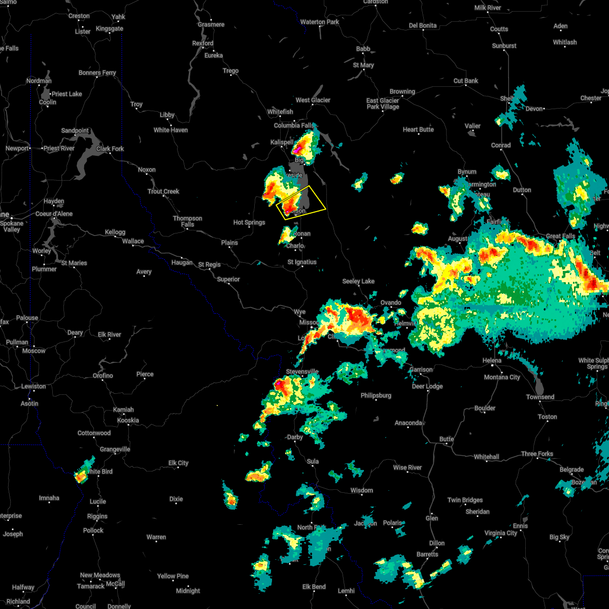 At 819 pm mdt, a severe thunderstorm was located over rocky point, or near polson, moving east at 30 mph (radar indicated). Hazards include golf ball size hail and 60 mph wind gusts. People and animals outdoors will be injured. expect hail damage to roofs, siding, windows, and vehicles. expect wind damage to roofs, siding, and trees. locations impacted include, polson, rocky point, jette, kerr, kings point, big arm and finley point. thunderstorm damage threat, considerable hail threat, radar indicated max hail size, 1. 75 in wind threat, radar indicated max wind gust, 60 mph. At 819 pm mdt, a severe thunderstorm was located over rocky point, or near polson, moving east at 30 mph (radar indicated). Hazards include golf ball size hail and 60 mph wind gusts. People and animals outdoors will be injured. expect hail damage to roofs, siding, windows, and vehicles. expect wind damage to roofs, siding, and trees. locations impacted include, polson, rocky point, jette, kerr, kings point, big arm and finley point. thunderstorm damage threat, considerable hail threat, radar indicated max hail size, 1. 75 in wind threat, radar indicated max wind gust, 60 mph.
|
| 7/7/2022 8:07 PM MDT |
 At 807 pm mdt, a severe thunderstorm was located near big arm, or 8 miles west of polson, moving east at 30 mph (radar indicated). Hazards include golf ball size hail and 60 mph wind gusts. People and animals outdoors will be injured. expect hail damage to roofs, siding, windows, and vehicles. Expect wind damage to roofs, siding, and trees. At 807 pm mdt, a severe thunderstorm was located near big arm, or 8 miles west of polson, moving east at 30 mph (radar indicated). Hazards include golf ball size hail and 60 mph wind gusts. People and animals outdoors will be injured. expect hail damage to roofs, siding, windows, and vehicles. Expect wind damage to roofs, siding, and trees.
|
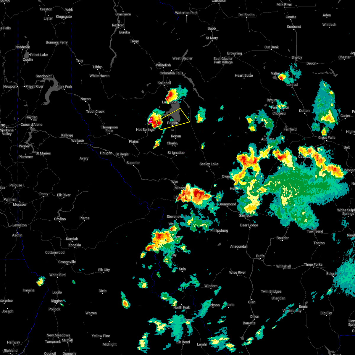
| 6/24/2020 4:25 PM MDT |
 The severe thunderstorm warning for central lake county will expire at 430 pm mdt, the severe thunderstorm which prompted the warning has weakened. therefore, the warning will be allowed to expire. however small hail, gusty winds and heavy rain are still possible with this thunderstorm. The severe thunderstorm warning for central lake county will expire at 430 pm mdt, the severe thunderstorm which prompted the warning has weakened. therefore, the warning will be allowed to expire. however small hail, gusty winds and heavy rain are still possible with this thunderstorm.
|
| 6/24/2020 4:18 PM MDT |
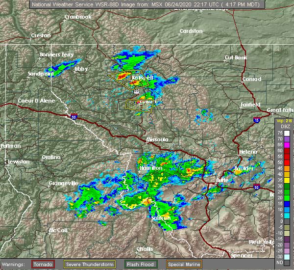 At 417 pm mdt, a severe thunderstorm was located over turtle lake, or near polson, moving east at 30 mph (radar indicated). Hazards include 60 mph wind gusts and quarter size hail. Hail damage to vehicles is expected. expect wind damage to roofs, siding, and trees. Locations impacted include, polson, rocky point, jette, kerr, turtle lake, kings point, big arm and finley point. At 417 pm mdt, a severe thunderstorm was located over turtle lake, or near polson, moving east at 30 mph (radar indicated). Hazards include 60 mph wind gusts and quarter size hail. Hail damage to vehicles is expected. expect wind damage to roofs, siding, and trees. Locations impacted include, polson, rocky point, jette, kerr, turtle lake, kings point, big arm and finley point.
|
| 6/24/2020 3:56 PM MDT |
 At 355 pm mdt, a severe thunderstorm was located near jette, or 7 miles west of polson, moving east at 30 mph (radar indicated). Hazards include 60 mph wind gusts and quarter size hail. Hail damage to vehicles is expected. Expect wind damage to roofs, siding, and trees. At 355 pm mdt, a severe thunderstorm was located near jette, or 7 miles west of polson, moving east at 30 mph (radar indicated). Hazards include 60 mph wind gusts and quarter size hail. Hail damage to vehicles is expected. Expect wind damage to roofs, siding, and trees.
|
| 6/8/2016 7:10 PM MDT |
 At 709 pm mdt, doppler radar indicated a severe thunderstorm capable of producing strong winds to 45 mph and quarter size hail. this storm was located near old agency, or 21 miles south of polson. this storm was nearly stationary. locations impacted include, polson, ronan, jette, pablo, kerr, turtle lake, finley point, fort connah, allentown, kicking horse, charlo and round butte. At 709 pm mdt, doppler radar indicated a severe thunderstorm capable of producing strong winds to 45 mph and quarter size hail. this storm was located near old agency, or 21 miles south of polson. this storm was nearly stationary. locations impacted include, polson, ronan, jette, pablo, kerr, turtle lake, finley point, fort connah, allentown, kicking horse, charlo and round butte.
|
| 6/8/2016 6:44 PM MDT |
 At 643 pm mdt, doppler radar indicated a severe thunderstorm capable of producing quarter size hail. this storm was located near old agency, or 20 miles south of polson. this storm was moving north - northeast at 20 miles an hour. At 643 pm mdt, doppler radar indicated a severe thunderstorm capable of producing quarter size hail. this storm was located near old agency, or 20 miles south of polson. this storm was moving north - northeast at 20 miles an hour.
|
Hail Maps for Jette, MT


Connect with Interactive Hail Maps