

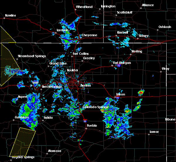
Hail Map for Keystone, CO
The Keystone, CO area has had 1 report of on-the-ground hail by trained spotters, and has been under severe weather warnings 0 times during the past 12 months. Doppler radar has detected hail at or near Keystone, CO on 1 occasion.
| Name: | Keystone, CO |
| Where Located: | 51.2 miles WSW of Denver, CO |
| Map: | Google Map for Keystone, CO |
| Population: | 1079 |
| Housing Units: | 3373 |
| More Info: | Search Google for Keystone, CO |
0
The Top Recent Hail Date for Keystone, CO is Monday, July 23, 2018 (1st out of 1)

Hail and Wind Damage Spotted near Keystone, CO
| Date / Time | Report Details |
|---|---|
| 8/29/2021 4:01 PM MDT | Half Dollar sized hail reported 15.8 miles NNW of Keystone, CO |
| 6/6/2020 2:33 PM MDT |
 At 232 pm mdt, severe thunderstorms were located along a line extending from near cowdrey to near berthoud pass to 10 miles northwest of guffey, or along a line extending from 51 miles southwest of laramie to 43 miles west of denver to 36 miles north of hayden pass burn scar, moving northeast at 65 mph. these are very dangerous storms (radar indicated). Hazards include 80 mph wind gusts. Flying debris will be dangerous to those caught without shelter. mobile homes will be heavily damaged. expect considerable damage to roofs, windows, and vehicles. Extensive tree damage and power outages are likely. At 232 pm mdt, severe thunderstorms were located along a line extending from near cowdrey to near berthoud pass to 10 miles northwest of guffey, or along a line extending from 51 miles southwest of laramie to 43 miles west of denver to 36 miles north of hayden pass burn scar, moving northeast at 65 mph. these are very dangerous storms (radar indicated). Hazards include 80 mph wind gusts. Flying debris will be dangerous to those caught without shelter. mobile homes will be heavily damaged. expect considerable damage to roofs, windows, and vehicles. Extensive tree damage and power outages are likely.
|
| 6/6/2020 1:51 PM MDT |
 At 150 pm mdt, severe thunderstorms were located along a line extending from near cherokee park to 3 miles north of highland park, or along a line extending from 26 miles south of laramie to 34 miles west of denver, moving east at 50 mph (radar indicated). Hazards include 70 mph wind gusts. Expect considerable tree damage. Damage is likely to mobile homes, roofs, and outbuildings. At 150 pm mdt, severe thunderstorms were located along a line extending from near cherokee park to 3 miles north of highland park, or along a line extending from 26 miles south of laramie to 34 miles west of denver, moving east at 50 mph (radar indicated). Hazards include 70 mph wind gusts. Expect considerable tree damage. Damage is likely to mobile homes, roofs, and outbuildings.
|
Hail Maps for Keystone, CO

Connect with Interactive Hail Maps