

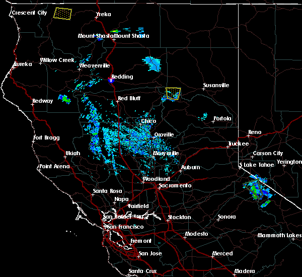
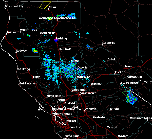
Hail Map for Lake Almanor West, CA
The Lake Almanor West, CA area has had 0 reports of on-the-ground hail by trained spotters, and has been under severe weather warnings 0 times during the past 12 months. Doppler radar has detected hail at or near Lake Almanor West, CA on 2 occasions.
| Name: | Lake Almanor West, CA |
| Where Located: | 67.4 miles ESE of Redding, CA |
| Map: | Google Map for Lake Almanor West, CA |
| Population: | 270 |
| Housing Units: | 475 |
| More Info: | Search Google for Lake Almanor West, CA |
0
The Top Recent Hail Date for Lake Almanor West, CA is Tuesday, July 7, 2015 (2nd out of 2)

Hail and Wind Damage Spotted near Lake Almanor West, CA
| Date / Time | Report Details |
|---|---|
| 6/5/2016 6:27 PM PDT |
 At 626 pm pdt, doppler radar indicated a severe thunderstorm capable of producing quarter size hail and damaging winds in excess of 60 mph. this storm was located over canyondam, or 9 miles southeast of chester, and moving southwest at 10 mph. At 626 pm pdt, doppler radar indicated a severe thunderstorm capable of producing quarter size hail and damaging winds in excess of 60 mph. this storm was located over canyondam, or 9 miles southeast of chester, and moving southwest at 10 mph.
|
| 7/7/2015 5:26 PM PDT |
 At 522 pm pdt, doppler radar indicated a severe thunderstorm capable of producing large hail, gusty winds and very heavy rainfall. this storm was located in the chester, lake almonor area, and moving to the west at 15 mph. locations impacted include, chester, lake almanor, lake almanor west, lake almanor peninsula and lake almanor country club. At 522 pm pdt, doppler radar indicated a severe thunderstorm capable of producing large hail, gusty winds and very heavy rainfall. this storm was located in the chester, lake almonor area, and moving to the west at 15 mph. locations impacted include, chester, lake almanor, lake almanor west, lake almanor peninsula and lake almanor country club.
|
| 7/7/2015 5:04 PM PDT |
 At 502 pm pdt, doppler radar indicated a severe thunderstorm capable of producing quarter size hail and damaging winds. this storm was located near chester, and moving west at 10 mph. At 502 pm pdt, doppler radar indicated a severe thunderstorm capable of producing quarter size hail and damaging winds. this storm was located near chester, and moving west at 10 mph.
|
Hail Maps for Lake Almanor West, CA


Connect with Interactive Hail Maps