

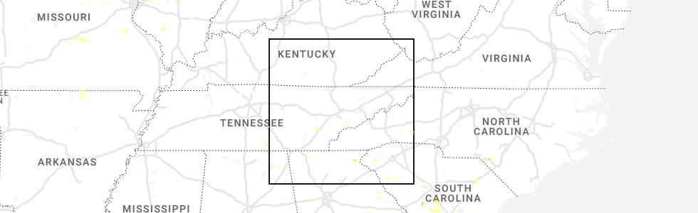
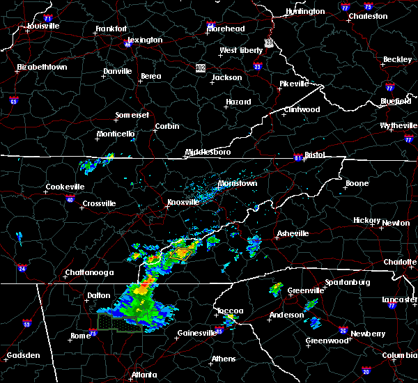
Hail Map for Lake Santeetlah, NC
The Lake Santeetlah, NC area has had 0 reports of on-the-ground hail by trained spotters, and has been under severe weather warnings 6 times during the past 12 months. Doppler radar has detected hail at or near Lake Santeetlah, NC on 14 occasions.
| Name: | Lake Santeetlah, NC |
| Where Located: | 41.3 miles S of Knoxville, TN |
| Map: | Google Map for Lake Santeetlah, NC |
| Population: | 45 |
| Housing Units: | 195 |
| More Info: | Search Google for Lake Santeetlah, NC |
0
The Top Recent Hail Date for Lake Santeetlah, NC is Wednesday, August 3, 2022 (7th out of 14)
Hail and Wind Damage Spotted near Lake Santeetlah, NC
| Date / Time | Report Details |
|---|---|
| 8/14/2023 11:22 PM EDT |
 At 1122 pm edt, a severe thunderstorm was located 11 miles west of robbinsville, or 8 miles west of town of santeetlah, moving east at 15 mph (radar indicated). Hazards include 60 mph wind gusts and quarter size hail. Minor hail damage to vehicles is expected. expect wind damage to trees and power lines. locations impacted include, robbinsville, town of santeetlah, fontana village, lake santeetlah, smoky mountains-twentymile creek, tapoco, cheoah, deals gap, fontana lake and smoky mountains-fontana area. hail threat, radar indicated max hail size, 1. 00 in wind threat, radar indicated max wind gust, 60 mph. At 1122 pm edt, a severe thunderstorm was located 11 miles west of robbinsville, or 8 miles west of town of santeetlah, moving east at 15 mph (radar indicated). Hazards include 60 mph wind gusts and quarter size hail. Minor hail damage to vehicles is expected. expect wind damage to trees and power lines. locations impacted include, robbinsville, town of santeetlah, fontana village, lake santeetlah, smoky mountains-twentymile creek, tapoco, cheoah, deals gap, fontana lake and smoky mountains-fontana area. hail threat, radar indicated max hail size, 1. 00 in wind threat, radar indicated max wind gust, 60 mph.
|
| 8/14/2023 11:01 PM EDT |
 At 1101 pm edt, a severe thunderstorm was located 16 miles north of murphy, or 14 miles west of town of santeetlah, moving east at 15 mph (radar indicated). Hazards include 60 mph wind gusts and quarter size hail. Minor hail damage to vehicles is expected. Expect wind damage to trees and power lines. At 1101 pm edt, a severe thunderstorm was located 16 miles north of murphy, or 14 miles west of town of santeetlah, moving east at 15 mph (radar indicated). Hazards include 60 mph wind gusts and quarter size hail. Minor hail damage to vehicles is expected. Expect wind damage to trees and power lines.
|
| 8/12/2023 3:56 PM EDT |
 At 356 pm edt, severe thunderstorms were located along a line extending from 7 miles southeast of maryville to 16 miles northwest of murphy, moving east at 35 mph (radar indicated). Hazards include 60 mph wind gusts. expect damage to trees and power lines At 356 pm edt, severe thunderstorms were located along a line extending from 7 miles southeast of maryville to 16 miles northwest of murphy, moving east at 35 mph (radar indicated). Hazards include 60 mph wind gusts. expect damage to trees and power lines
|
| 8/7/2023 3:05 PM EDT |
 At 305 pm edt, severe thunderstorms were located along a line extending from 13 miles east of gatlinburg to 7 miles west of bryson city to 8 miles northwest of andrews, moving east at 60 mph (radar indicated). Hazards include 70 mph wind gusts and quarter size hail. Minor hail damage to vehicles is expected. expect considerable tree damage. Wind damage is also likely to mobile homes, roofs, and outbuildings. At 305 pm edt, severe thunderstorms were located along a line extending from 13 miles east of gatlinburg to 7 miles west of bryson city to 8 miles northwest of andrews, moving east at 60 mph (radar indicated). Hazards include 70 mph wind gusts and quarter size hail. Minor hail damage to vehicles is expected. expect considerable tree damage. Wind damage is also likely to mobile homes, roofs, and outbuildings.
|
| 8/7/2023 2:57 PM EDT |
 At 257 pm edt, severe thunderstorms were located along a line extending from 6 miles south of gatlinburg to 7 miles west of robbinsville, moving east at 50 mph (radar indicated). Hazards include 60 mph wind gusts and quarter size hail. Minor hail damage to vehicles is expected. expect wind damage to trees and power lines. locations impacted include, robbinsville, town of santeetlah, smoky mountains-newfound gap, smoky mountains-fontana area, lake santeetlah, fontana lake, fontana village, smoky mountains-twentymile creek, stecoah and nantahala. hail threat, radar indicated max hail size, 1. 00 in wind threat, radar indicated max wind gust, 60 mph. At 257 pm edt, severe thunderstorms were located along a line extending from 6 miles south of gatlinburg to 7 miles west of robbinsville, moving east at 50 mph (radar indicated). Hazards include 60 mph wind gusts and quarter size hail. Minor hail damage to vehicles is expected. expect wind damage to trees and power lines. locations impacted include, robbinsville, town of santeetlah, smoky mountains-newfound gap, smoky mountains-fontana area, lake santeetlah, fontana lake, fontana village, smoky mountains-twentymile creek, stecoah and nantahala. hail threat, radar indicated max hail size, 1. 00 in wind threat, radar indicated max wind gust, 60 mph.
|
| 8/7/2023 2:42 PM EDT |
 At 242 pm edt, severe thunderstorms were located along a line extending from 14 miles west of gatlinburg to 16 miles west of robbinsville, moving east at 50 mph (radar indicated). Hazards include 60 mph wind gusts and quarter size hail. Minor hail damage to vehicles is expected. Expect wind damage to trees and power lines. At 242 pm edt, severe thunderstorms were located along a line extending from 14 miles west of gatlinburg to 16 miles west of robbinsville, moving east at 50 mph (radar indicated). Hazards include 60 mph wind gusts and quarter size hail. Minor hail damage to vehicles is expected. Expect wind damage to trees and power lines.
|
| 3/25/2023 3:44 AM EDT |
 At 343 am edt, severe thunderstorms were located along a line extending from 11 miles east of madisonville to 5 miles southwest of ducktown, moving east at 65 mph (radar indicated). Hazards include 60 mph wind gusts. expect damage to trees and power lines At 343 am edt, severe thunderstorms were located along a line extending from 11 miles east of madisonville to 5 miles southwest of ducktown, moving east at 65 mph (radar indicated). Hazards include 60 mph wind gusts. expect damage to trees and power lines
|
| 3/3/2023 3:34 PM EST |
 At 334 pm est, severe thunderstorms were located along a line extending from 9 miles northeast of robbinsville to 3 miles northwest of murphy, moving northeast at 75 mph (radar indicated). Hazards include 60 mph wind gusts. expect damage to trees and power lines At 334 pm est, severe thunderstorms were located along a line extending from 9 miles northeast of robbinsville to 3 miles northwest of murphy, moving northeast at 75 mph (radar indicated). Hazards include 60 mph wind gusts. expect damage to trees and power lines
|
| 2/27/2023 6:06 PM EST |
 The severe thunderstorm warning for northwestern jackson, swain, graham and northern haywood counties will expire at 615 pm est, the storms which prompted the warning have weakened below severe limits, and no longer pose an immediate threat to life or property. therefore, the warning will be allowed to expire. however, gusty winds to 40 mph are still possible with these showers and thunderstorms. The severe thunderstorm warning for northwestern jackson, swain, graham and northern haywood counties will expire at 615 pm est, the storms which prompted the warning have weakened below severe limits, and no longer pose an immediate threat to life or property. therefore, the warning will be allowed to expire. however, gusty winds to 40 mph are still possible with these showers and thunderstorms.
|
| 2/27/2023 5:46 PM EST |
 At 544 pm est, severe thunderstorms were located along a line extending from 13 miles east of gatlinburg to 10 miles northwest of bryson city to 10 miles northwest of murphy, moving east at 55 mph (radar indicated). Hazards include 60 mph wind gusts. Expect damage to trees and power lines. locations impacted include, bryson city, robbinsville, cherokee, maggie valley, town of santeetlah, smoky mountains-newfound gap, smoky mountains-fontana area, lake santeetlah, smoky mountains-balsam mountain and fontana lake. hail threat, radar indicated max hail size, <. 75 in wind threat, radar indicated max wind gust, 60 mph. At 544 pm est, severe thunderstorms were located along a line extending from 13 miles east of gatlinburg to 10 miles northwest of bryson city to 10 miles northwest of murphy, moving east at 55 mph (radar indicated). Hazards include 60 mph wind gusts. Expect damage to trees and power lines. locations impacted include, bryson city, robbinsville, cherokee, maggie valley, town of santeetlah, smoky mountains-newfound gap, smoky mountains-fontana area, lake santeetlah, smoky mountains-balsam mountain and fontana lake. hail threat, radar indicated max hail size, <. 75 in wind threat, radar indicated max wind gust, 60 mph.
|
| 2/27/2023 5:31 PM EST |
 At 530 pm est, severe thunderstorms were located along a line extending from 7 miles south of newport to 13 miles southwest of gatlinburg to 16 miles west of robbinsville, moving east at 40 mph (radar indicated). Hazards include 60 mph wind gusts. Expect damage to trees and power lines. locations impacted include, bryson city, robbinsville, cherokee, maggie valley, town of santeetlah, smoky mountains-newfound gap, smoky mountains-fontana area, lake santeetlah, smoky mountains-balsam mountain and fontana lake. hail threat, radar indicated max hail size, <. 75 in wind threat, radar indicated max wind gust, 60 mph. At 530 pm est, severe thunderstorms were located along a line extending from 7 miles south of newport to 13 miles southwest of gatlinburg to 16 miles west of robbinsville, moving east at 40 mph (radar indicated). Hazards include 60 mph wind gusts. Expect damage to trees and power lines. locations impacted include, bryson city, robbinsville, cherokee, maggie valley, town of santeetlah, smoky mountains-newfound gap, smoky mountains-fontana area, lake santeetlah, smoky mountains-balsam mountain and fontana lake. hail threat, radar indicated max hail size, <. 75 in wind threat, radar indicated max wind gust, 60 mph.
|
| 2/27/2023 5:10 PM EST |
 At 509 pm est, severe thunderstorms were located along a line extending from near sevierville to 11 miles south of maryville to 14 miles south of madisonville, moving east at 55 mph (radar indicated). Hazards include 60 mph wind gusts. expect damage to trees and power lines At 509 pm est, severe thunderstorms were located along a line extending from near sevierville to 11 miles south of maryville to 14 miles south of madisonville, moving east at 55 mph (radar indicated). Hazards include 60 mph wind gusts. expect damage to trees and power lines
|
| 1/3/2023 4:06 PM EST |
 The severe thunderstorm warning for west central swain and graham counties will expire at 415 pm est, the storms which prompted the warning have weakened below severe limits, and have exited the warned area. therefore, the warning will be allowed to expire. The severe thunderstorm warning for west central swain and graham counties will expire at 415 pm est, the storms which prompted the warning have weakened below severe limits, and have exited the warned area. therefore, the warning will be allowed to expire.
|
| 1/3/2023 3:23 PM EST |
 At 323 pm est, severe thunderstorms were located along a line extending from 9 miles south of maryville to 14 miles southeast of madisonville to 12 miles north of ducktown, moving east at 60 mph (radar indicated). Hazards include 60 mph wind gusts. expect damage to trees and power lines At 323 pm est, severe thunderstorms were located along a line extending from 9 miles south of maryville to 14 miles southeast of madisonville to 12 miles north of ducktown, moving east at 60 mph (radar indicated). Hazards include 60 mph wind gusts. expect damage to trees and power lines
|
| 8/3/2022 7:08 PM EDT | Multiple trees down in the northern part of the county. time/location estimated from rada in graham county NC, 5.9 miles SSW of Lake Santeetlah, NC |
| 8/3/2022 7:01 PM EDT |
 At 701 pm edt, a severe thunderstorm was located 5 miles north of robbinsville, or near fontana village, moving northwest at 10 mph (radar indicated). Hazards include 60 mph wind gusts and penny size hail. expect damage to trees and power lines At 701 pm edt, a severe thunderstorm was located 5 miles north of robbinsville, or near fontana village, moving northwest at 10 mph (radar indicated). Hazards include 60 mph wind gusts and penny size hail. expect damage to trees and power lines
|
| 6/17/2022 4:00 PM EDT |
 At 400 pm edt, a severe thunderstorm was located 6 miles north of robbinsville, or near fontana village, moving southeast at 25 mph (radar indicated). Hazards include 60 mph wind gusts and nickel size hail. expect damage to trees and power lines At 400 pm edt, a severe thunderstorm was located 6 miles north of robbinsville, or near fontana village, moving southeast at 25 mph (radar indicated). Hazards include 60 mph wind gusts and nickel size hail. expect damage to trees and power lines
|
| 6/17/2022 3:27 PM EDT |
 At 325 pm edt, severe thunderstorms were located along a line extending from 9 miles south of gatlinburg to 13 miles west of robbinsville, moving east at 35 mph (radar indicated, and this storm has a history of producing widespread trees down in monroe and blount counties in tennessee). Hazards include 60 mph wind gusts and quarter size hail. Minor hail damage to vehicles is expected. expect wind damage to trees and power lines. locations impacted include, robbinsville, cherokee, town of santeetlah, smoky mountains-deep creek, smoky mountains-newfound gap, smoky mountains-fontana area, lake santeetlah, smoky mountains-balsam mountain, fontana lake and fontana village. hail threat, radar indicated max hail size, 1. 00 in wind threat, radar indicated max wind gust, 60 mph. At 325 pm edt, severe thunderstorms were located along a line extending from 9 miles south of gatlinburg to 13 miles west of robbinsville, moving east at 35 mph (radar indicated, and this storm has a history of producing widespread trees down in monroe and blount counties in tennessee). Hazards include 60 mph wind gusts and quarter size hail. Minor hail damage to vehicles is expected. expect wind damage to trees and power lines. locations impacted include, robbinsville, cherokee, town of santeetlah, smoky mountains-deep creek, smoky mountains-newfound gap, smoky mountains-fontana area, lake santeetlah, smoky mountains-balsam mountain, fontana lake and fontana village. hail threat, radar indicated max hail size, 1. 00 in wind threat, radar indicated max wind gust, 60 mph.
|
| 6/17/2022 3:08 PM EDT |
 At 308 pm edt, severe thunderstorms were located along a line extending from 14 miles south of newport to 15 miles west of robbinsville, moving east at 30 mph (radar indicated). Hazards include 60 mph wind gusts and quarter size hail. Minor hail damage to vehicles is expected. Expect wind damage to trees and power lines. At 308 pm edt, severe thunderstorms were located along a line extending from 14 miles south of newport to 15 miles west of robbinsville, moving east at 30 mph (radar indicated). Hazards include 60 mph wind gusts and quarter size hail. Minor hail damage to vehicles is expected. Expect wind damage to trees and power lines.
|
| 8/10/2021 6:47 PM EDT |
 At 646 pm edt, severe thunderstorms were located along a line extending from 16 miles west of bryson city to 4 miles south of robbinsville, moving east at 30 mph (radar indicated). Hazards include 60 mph wind gusts and quarter size hail. Minor hail damage to vehicles is expected. expect wind damage to trees and power lines. locations impacted include, robbinsville, town of santeetlah, lake santeetlah, stecoah, cheoah and nantahala. hail threat, radar indicated max hail size, 1. 00 in wind threat, radar indicated max wind gust, 60 mph. At 646 pm edt, severe thunderstorms were located along a line extending from 16 miles west of bryson city to 4 miles south of robbinsville, moving east at 30 mph (radar indicated). Hazards include 60 mph wind gusts and quarter size hail. Minor hail damage to vehicles is expected. expect wind damage to trees and power lines. locations impacted include, robbinsville, town of santeetlah, lake santeetlah, stecoah, cheoah and nantahala. hail threat, radar indicated max hail size, 1. 00 in wind threat, radar indicated max wind gust, 60 mph.
|
| 8/10/2021 6:24 PM EDT |
 At 624 pm edt, severe thunderstorms were located along a line extending from 11 miles north of robbinsville to 7 miles west of andrews, moving east at 30 mph (radar indicated). Hazards include 60 mph wind gusts and quarter size hail. Minor hail damage to vehicles is expected. Expect wind damage to trees and power lines. At 624 pm edt, severe thunderstorms were located along a line extending from 11 miles north of robbinsville to 7 miles west of andrews, moving east at 30 mph (radar indicated). Hazards include 60 mph wind gusts and quarter size hail. Minor hail damage to vehicles is expected. Expect wind damage to trees and power lines.
|
| 6/21/2021 8:09 PM EDT |
 The severe thunderstorm warning for central swain and graham counties will expire at 815 pm edt, the storms which prompted the warning have weakened below severe limits, and no longer pose an immediate threat to life or property. therefore the warning will be allowed to expire. however heavy rain is still possible with these thunderstorms. if you observed large hail or wind damage, please report it to the national weather service greenville-spartanburg by calling toll free, 1, 800, 2 6 7, 8 1 0 1, or by posting on our facebook page, or tweet it using hashtag nwsgsp. your message should describe the event and the specific location where it occurred. The severe thunderstorm warning for central swain and graham counties will expire at 815 pm edt, the storms which prompted the warning have weakened below severe limits, and no longer pose an immediate threat to life or property. therefore the warning will be allowed to expire. however heavy rain is still possible with these thunderstorms. if you observed large hail or wind damage, please report it to the national weather service greenville-spartanburg by calling toll free, 1, 800, 2 6 7, 8 1 0 1, or by posting on our facebook page, or tweet it using hashtag nwsgsp. your message should describe the event and the specific location where it occurred.
|
| 6/21/2021 7:31 PM EDT |
 At 729 pm edt, severe thunderstorms were located along a line extending from 15 miles southeast of maryville to 11 miles northwest of murphy, moving east at 30 mph (radar indicated). Hazards include 60 mph wind gusts. expect damage to trees and power lines At 729 pm edt, severe thunderstorms were located along a line extending from 15 miles southeast of maryville to 11 miles northwest of murphy, moving east at 30 mph (radar indicated). Hazards include 60 mph wind gusts. expect damage to trees and power lines
|
| 5/4/2021 11:23 AM EDT |
 At 1122 am edt, severe thunderstorms were located along a line extending from 6 miles southeast of dandridge tennessee to 9 miles southeast of gatlinburg to 10 miles northeast of robbinsville to 11 miles northwest of andrews, moving southeast at 35 mph (radar indicated). Hazards include 60 mph wind gusts and penny size hail. Expect damage to trees and power lines. Locations impacted include, bryson city, robbinsville, cherokee, town of santeetlah, smoky mountains-newfound gap, lake santeetlah, smoky mountains-balsam mountain, smoky mountains-big creek, smoky mountains-deep creek and smoky mountains-oconaluftee. At 1122 am edt, severe thunderstorms were located along a line extending from 6 miles southeast of dandridge tennessee to 9 miles southeast of gatlinburg to 10 miles northeast of robbinsville to 11 miles northwest of andrews, moving southeast at 35 mph (radar indicated). Hazards include 60 mph wind gusts and penny size hail. Expect damage to trees and power lines. Locations impacted include, bryson city, robbinsville, cherokee, town of santeetlah, smoky mountains-newfound gap, lake santeetlah, smoky mountains-balsam mountain, smoky mountains-big creek, smoky mountains-deep creek and smoky mountains-oconaluftee.
|
| 5/4/2021 10:57 AM EDT |
 At 1056 am edt, severe thunderstorms were located along a line extending from 10 miles west of jefferson city to 12 miles west of gatlinburg to 13 miles northwest of robbinsville to 10 miles south of madisonville, moving east at 40 mph (radar indicated). Hazards include 60 mph wind gusts and quarter size hail. Minor hail damage to vehicles is expected. Expect wind damage to trees and power lines. At 1056 am edt, severe thunderstorms were located along a line extending from 10 miles west of jefferson city to 12 miles west of gatlinburg to 13 miles northwest of robbinsville to 10 miles south of madisonville, moving east at 40 mph (radar indicated). Hazards include 60 mph wind gusts and quarter size hail. Minor hail damage to vehicles is expected. Expect wind damage to trees and power lines.
|
| 4/25/2020 6:29 PM EDT |
 At 629 pm edt, a severe thunderstorm was located near robbinsville, moving east at 40 mph (radar indicated). Hazards include 60 mph wind gusts and penny size hail. expect damage to trees and power lines At 629 pm edt, a severe thunderstorm was located near robbinsville, moving east at 40 mph (radar indicated). Hazards include 60 mph wind gusts and penny size hail. expect damage to trees and power lines
|
| 4/25/2020 6:06 PM EDT |
 At 606 pm edt, a severe thunderstorm was located 13 miles west of robbinsville, or 10 miles west of town of santeetlah, moving northeast at 30 mph (radar indicated). Hazards include 60 mph wind gusts and quarter size hail. Minor hail damage to vehicles is expected. Expect wind damage to trees and power lines. At 606 pm edt, a severe thunderstorm was located 13 miles west of robbinsville, or 10 miles west of town of santeetlah, moving northeast at 30 mph (radar indicated). Hazards include 60 mph wind gusts and quarter size hail. Minor hail damage to vehicles is expected. Expect wind damage to trees and power lines.
|
| 4/9/2020 2:52 AM EDT |
 The severe thunderstorm warning for swain and graham counties will expire at 300 am edt, the storms which prompted the warning are weakening below severe limits as they move across graham and swain counties, and are not expected to pose an immediate threat to life or property after 3 am. therefore the warning will be allowed to expire. however gusty winds are still possible with these thunderstorms. a severe thunderstorm watch remains in effect until 600 am edt for western north carolina. The severe thunderstorm warning for swain and graham counties will expire at 300 am edt, the storms which prompted the warning are weakening below severe limits as they move across graham and swain counties, and are not expected to pose an immediate threat to life or property after 3 am. therefore the warning will be allowed to expire. however gusty winds are still possible with these thunderstorms. a severe thunderstorm watch remains in effect until 600 am edt for western north carolina.
|
| 4/9/2020 2:37 AM EDT |
 At 237 am edt, severe thunderstorms were located along a line extending from 13 miles southwest of gatlinburg to 11 miles northwest of andrews, moving east at 50 mph (radar indicated). Hazards include 60 mph wind gusts and penny size hail. Expect damage to trees and power lines. Locations impacted include, bryson city, robbinsville, town of santeetlah, smoky mountains-newfound gap, smoky mountains-deep creek, smoky mountains-fontana area, lake santeetlah, fontana lake, fontana village and smoky mountains-twentymile creek. At 237 am edt, severe thunderstorms were located along a line extending from 13 miles southwest of gatlinburg to 11 miles northwest of andrews, moving east at 50 mph (radar indicated). Hazards include 60 mph wind gusts and penny size hail. Expect damage to trees and power lines. Locations impacted include, bryson city, robbinsville, town of santeetlah, smoky mountains-newfound gap, smoky mountains-deep creek, smoky mountains-fontana area, lake santeetlah, fontana lake, fontana village and smoky mountains-twentymile creek.
|
| 4/9/2020 2:14 AM EDT |
 At 213 am edt, severe thunderstorms were located along a line extending from 9 miles south of maryville to 16 miles south of madisonville, moving east at 50 mph (radar indicated). Hazards include 60 mph wind gusts and penny size hail. expect damage to trees and power lines At 213 am edt, severe thunderstorms were located along a line extending from 9 miles south of maryville to 16 miles south of madisonville, moving east at 50 mph (radar indicated). Hazards include 60 mph wind gusts and penny size hail. expect damage to trees and power lines
|
| 1/11/2020 5:05 PM EST |
 At 504 pm est, a severe thunderstorm was located 10 miles west of robbinsville, or 6 miles west of town of santeetlah, moving northeast at 45 mph (radar indicated). Hazards include 60 mph wind gusts. expect damage to trees and power lines At 504 pm est, a severe thunderstorm was located 10 miles west of robbinsville, or 6 miles west of town of santeetlah, moving northeast at 45 mph (radar indicated). Hazards include 60 mph wind gusts. expect damage to trees and power lines
|
| 8/13/2019 9:06 PM EDT |
 The severe thunderstorm warning for southwestern swain and graham counties will expire at 915 pm edt, the storms which prompted the warning have weakened below severe limits, and no longer pose an immediate threat to life or property. therefore the warning will be allowed to expire. however gusty winds are still possible with these thunderstorms. if you observed large hail or wind damage, please report it to the national weather service greenville-spartanburg by calling toll free, 1, 800, 2 6 7, 8 1 0 1, or by posting on our facebook page, or tweet it using hashtag nwsgsp. your message should describe the event and the specific location where it occurred. The severe thunderstorm warning for southwestern swain and graham counties will expire at 915 pm edt, the storms which prompted the warning have weakened below severe limits, and no longer pose an immediate threat to life or property. therefore the warning will be allowed to expire. however gusty winds are still possible with these thunderstorms. if you observed large hail or wind damage, please report it to the national weather service greenville-spartanburg by calling toll free, 1, 800, 2 6 7, 8 1 0 1, or by posting on our facebook page, or tweet it using hashtag nwsgsp. your message should describe the event and the specific location where it occurred.
|
| 8/13/2019 8:29 PM EDT |
 At 829 pm edt, severe thunderstorms were located along a line extending from 10 miles east of madisonville to 4 miles west of ducktown, moving east at 35 mph (radar indicated). Hazards include 60 mph wind gusts. expect damage to trees and power lines At 829 pm edt, severe thunderstorms were located along a line extending from 10 miles east of madisonville to 4 miles west of ducktown, moving east at 35 mph (radar indicated). Hazards include 60 mph wind gusts. expect damage to trees and power lines
|
| 7/19/2019 7:07 PM EDT |
 The severe thunderstorm warning for central graham county will expire at 715 pm edt, the storm which prompted the warning has weakened below severe limits, and no longer poses an immediate threat to life or property. therefore the warning will be allowed to expire. however gusty winds are still possible with this thunderstorm. The severe thunderstorm warning for central graham county will expire at 715 pm edt, the storm which prompted the warning has weakened below severe limits, and no longer poses an immediate threat to life or property. therefore the warning will be allowed to expire. however gusty winds are still possible with this thunderstorm.
|
| 7/19/2019 6:38 PM EDT |
 At 637 pm edt, a severe thunderstorm was located 6 miles northeast of robbinsville, or 5 miles south of fontana lake, moving west at 5 mph (radar indicated). Hazards include 60 mph wind gusts and penny size hail. expect damage to trees and power lines At 637 pm edt, a severe thunderstorm was located 6 miles northeast of robbinsville, or 5 miles south of fontana lake, moving west at 5 mph (radar indicated). Hazards include 60 mph wind gusts and penny size hail. expect damage to trees and power lines
|
| 6/22/2019 12:55 AM EDT |
 The severe thunderstorm warning for western macon, northwestern jackson, swain, graham and northwestern haywood counties will expire at 100 am edt, the storm which prompted the warning has moved out of the area. therefore the warning will be allowed to expire. however gusty winds are still possible with this thunderstorm. a severe thunderstorm watch remains in effect until 500 am edt for western north carolina. The severe thunderstorm warning for western macon, northwestern jackson, swain, graham and northwestern haywood counties will expire at 100 am edt, the storm which prompted the warning has moved out of the area. therefore the warning will be allowed to expire. however gusty winds are still possible with this thunderstorm. a severe thunderstorm watch remains in effect until 500 am edt for western north carolina.
|
| 6/22/2019 12:29 AM EDT |
 At 1229 am edt, a severe thunderstorm was located 14 miles northwest of bryson city, or near smoky mountains-fontana area, moving east at 40 mph (radar indicated). Hazards include 60 mph wind gusts and nickel size hail. Expect damage to trees and power lines. Locations impacted include, franklin, bryson city, robbinsville, cherokee, town of santeetlah, smoky mountains-newfound gap, smoky mountains-fontana area, lake santeetlah, smoky mountains-balsam mountain and fontana lake. At 1229 am edt, a severe thunderstorm was located 14 miles northwest of bryson city, or near smoky mountains-fontana area, moving east at 40 mph (radar indicated). Hazards include 60 mph wind gusts and nickel size hail. Expect damage to trees and power lines. Locations impacted include, franklin, bryson city, robbinsville, cherokee, town of santeetlah, smoky mountains-newfound gap, smoky mountains-fontana area, lake santeetlah, smoky mountains-balsam mountain and fontana lake.
|
| 6/21/2019 11:57 PM EDT |
 At 1157 pm edt, a severe thunderstorm was located 16 miles south of maryville, or 9 miles west of smoky mountains-twentymile creek, moving east at 40 mph (radar indicated). Hazards include 60 mph wind gusts and nickel size hail. expect damage to trees and power lines At 1157 pm edt, a severe thunderstorm was located 16 miles south of maryville, or 9 miles west of smoky mountains-twentymile creek, moving east at 40 mph (radar indicated). Hazards include 60 mph wind gusts and nickel size hail. expect damage to trees and power lines
|
| 11/6/2018 6:07 AM EST |
 The severe thunderstorm warning for southwestern swain and graham counties will expire at 615 am est, the storms which prompted the warning have weakened below severe limits, and no longer pose an immediate threat to life or property. therefore the warning will be allowed to expire. however gusty winds are still possible with these thunderstorms. a tornado watch remains in effect until 900 am est for western north carolina. The severe thunderstorm warning for southwestern swain and graham counties will expire at 615 am est, the storms which prompted the warning have weakened below severe limits, and no longer pose an immediate threat to life or property. therefore the warning will be allowed to expire. however gusty winds are still possible with these thunderstorms. a tornado watch remains in effect until 900 am est for western north carolina.
|
| 11/6/2018 5:55 AM EST |
 At 554 am est, rain showers capable of producing damaging winds were located along a line extending from 14 miles northwest of bryson city to 7 miles west of andrews, moving east at 45 mph (radar indicated). Hazards include 60 mph wind gusts. Expect damage to trees and power lines. locations impacted include, bryson city, robbinsville, town of santeetlah, smoky mountains-fontana area, lake santeetlah, fontana lake, wesser, stecoah, nantahala and cheoah. A tornado watch remains in effect until 900 am est for western north carolina. At 554 am est, rain showers capable of producing damaging winds were located along a line extending from 14 miles northwest of bryson city to 7 miles west of andrews, moving east at 45 mph (radar indicated). Hazards include 60 mph wind gusts. Expect damage to trees and power lines. locations impacted include, bryson city, robbinsville, town of santeetlah, smoky mountains-fontana area, lake santeetlah, fontana lake, wesser, stecoah, nantahala and cheoah. A tornado watch remains in effect until 900 am est for western north carolina.
|
| 11/6/2018 5:26 AM EST |
 At 525 am est, a severe thunderstorm was located 15 miles west of robbinsville, or 11 miles west of town of santeetlah, moving east at 55 mph (radar indicated). Hazards include 60 mph wind gusts. expect damage to trees and power lines At 525 am est, a severe thunderstorm was located 15 miles west of robbinsville, or 11 miles west of town of santeetlah, moving east at 55 mph (radar indicated). Hazards include 60 mph wind gusts. expect damage to trees and power lines
|
| 7/6/2018 5:29 PM EDT |
 At 528 pm edt, a severe thunderstorm was located 8 miles northwest of robbinsville, or near fontana village, moving southwest at 10 mph (radar indicated). Hazards include 60 mph wind gusts and penny size hail. expect damage to trees and power lines At 528 pm edt, a severe thunderstorm was located 8 miles northwest of robbinsville, or near fontana village, moving southwest at 10 mph (radar indicated). Hazards include 60 mph wind gusts and penny size hail. expect damage to trees and power lines
|
| 6/26/2018 7:26 PM EDT |
 The severe thunderstorm warning for central swain and graham counties will expire at 730 pm edt, the storms which prompted the warning have weakened below severe limits, and no longer pose an immediate threat to life or property. therefore, the warning will be allowed to expire. however, gusty winds are still possible with these thunderstorms. The severe thunderstorm warning for central swain and graham counties will expire at 730 pm edt, the storms which prompted the warning have weakened below severe limits, and no longer pose an immediate threat to life or property. therefore, the warning will be allowed to expire. however, gusty winds are still possible with these thunderstorms.
|
| 6/26/2018 7:08 PM EDT |
 At 708 pm edt, severe thunderstorms were located along a line extending from near bryson city to 15 miles southeast of madisonville, moving south at 30 mph (radar indicated). Hazards include 60 mph wind gusts and quarter size hail. Minor hail damage to vehicles is expected. expect wind damage to trees and power lines. Locations impacted include, robbinsville, town of santeetlah, smoky mountains-fontana area, lake santeetlah, fontana lake, fontana village, smoky mountains-twentymile creek, wesser, stecoah and nantahala. At 708 pm edt, severe thunderstorms were located along a line extending from near bryson city to 15 miles southeast of madisonville, moving south at 30 mph (radar indicated). Hazards include 60 mph wind gusts and quarter size hail. Minor hail damage to vehicles is expected. expect wind damage to trees and power lines. Locations impacted include, robbinsville, town of santeetlah, smoky mountains-fontana area, lake santeetlah, fontana lake, fontana village, smoky mountains-twentymile creek, wesser, stecoah and nantahala.
|
| 6/26/2018 6:46 PM EDT |
 At 646 pm edt, a severe thunderstorm was located 11 miles northwest of robbinsville, or 7 miles northwest of town of santeetlah, moving southeast at 40 mph (radar indicated). Hazards include 60 mph wind gusts and quarter size hail. Minor hail damage to vehicles is expected. Expect wind damage to trees and power lines. At 646 pm edt, a severe thunderstorm was located 11 miles northwest of robbinsville, or 7 miles northwest of town of santeetlah, moving southeast at 40 mph (radar indicated). Hazards include 60 mph wind gusts and quarter size hail. Minor hail damage to vehicles is expected. Expect wind damage to trees and power lines.
|
| 6/25/2018 4:04 PM EDT |
 At 403 pm edt, severe thunderstorms were located along a line extending from 6 miles southeast of bryson city to 3 miles southeast of hayesville, moving east at 15 mph (radar indicated). Hazards include 60 mph wind gusts and quarter size hail. Minor hail damage to vehicles is expected. expect wind damage to trees and power lines. Locations impacted include, franklin, bryson city, robbinsville, cherokee, town of santeetlah, smoky mountains-newfound gap, smoky mountains-fontana area, lake santeetlah, fontana lake and nantahala lake. At 403 pm edt, severe thunderstorms were located along a line extending from 6 miles southeast of bryson city to 3 miles southeast of hayesville, moving east at 15 mph (radar indicated). Hazards include 60 mph wind gusts and quarter size hail. Minor hail damage to vehicles is expected. expect wind damage to trees and power lines. Locations impacted include, franklin, bryson city, robbinsville, cherokee, town of santeetlah, smoky mountains-newfound gap, smoky mountains-fontana area, lake santeetlah, fontana lake and nantahala lake.
|
| 6/25/2018 3:45 PM EDT |
 At 345 pm edt, severe thunderstorms were located along a line extending from 5 miles south of bryson city to 4 miles southwest of hayesville, moving east at 15 mph (radar indicated). Hazards include 60 mph wind gusts and quarter size hail. Minor hail damage to vehicles is expected. Expect wind damage to trees and power lines. At 345 pm edt, severe thunderstorms were located along a line extending from 5 miles south of bryson city to 4 miles southwest of hayesville, moving east at 15 mph (radar indicated). Hazards include 60 mph wind gusts and quarter size hail. Minor hail damage to vehicles is expected. Expect wind damage to trees and power lines.
|
| 6/25/2018 3:28 PM EDT |
 At 328 pm edt, a severe thunderstorm was located 11 miles northwest of robbinsville, or 6 miles southwest of smoky mountains-twentymile creek, moving east at 15 mph (radar indicated). Hazards include 60 mph wind gusts and quarter size hail. Minor hail damage to vehicles is expected. expect wind damage to trees and power lines. Locations impacted include, robbinsville, town of santeetlah, fontana lake, smoky mountains-fontana area, fontana village, lake santeetlah, smoky mountains-twentymile creek, stecoah, tapoco and cheoah. At 328 pm edt, a severe thunderstorm was located 11 miles northwest of robbinsville, or 6 miles southwest of smoky mountains-twentymile creek, moving east at 15 mph (radar indicated). Hazards include 60 mph wind gusts and quarter size hail. Minor hail damage to vehicles is expected. expect wind damage to trees and power lines. Locations impacted include, robbinsville, town of santeetlah, fontana lake, smoky mountains-fontana area, fontana village, lake santeetlah, smoky mountains-twentymile creek, stecoah, tapoco and cheoah.
|
| 6/25/2018 3:04 PM EDT |
 At 303 pm edt, a severe thunderstorm was located 16 miles northwest of robbinsville, or 10 miles west of smoky mountains-twentymile creek, moving east at 15 mph (radar indicated). Hazards include 60 mph wind gusts and quarter size hail. Minor hail damage to vehicles is expected. Expect wind damage to trees and power lines. At 303 pm edt, a severe thunderstorm was located 16 miles northwest of robbinsville, or 10 miles west of smoky mountains-twentymile creek, moving east at 15 mph (radar indicated). Hazards include 60 mph wind gusts and quarter size hail. Minor hail damage to vehicles is expected. Expect wind damage to trees and power lines.
|
| 6/24/2018 3:33 PM EDT |
 At 333 pm edt, severe thunderstorms were located along a line extending from 4 miles north of robbinsville to 19 miles southwest of bryson city to 5 miles east of andrews to 3 miles east of hayesville to near blairsville, moving east at 30 mph (radar indicated). Hazards include 60 mph wind gusts and penny size hail. expect damage to trees and power lines At 333 pm edt, severe thunderstorms were located along a line extending from 4 miles north of robbinsville to 19 miles southwest of bryson city to 5 miles east of andrews to 3 miles east of hayesville to near blairsville, moving east at 30 mph (radar indicated). Hazards include 60 mph wind gusts and penny size hail. expect damage to trees and power lines
|
| 6/23/2018 3:46 PM EDT |
 At 346 pm edt, severe thunderstorms were located along a line extending from 17 miles south of maryville to near robbinsville to 4 miles north of hayesville, moving east at 40 mph (radar indicated). Hazards include 60 mph wind gusts. Expect damage to trees and power lines. Locations impacted include, franklin, bryson city, robbinsville, town of santeetlah, smoky mountains-newfound gap, smoky mountains-fontana area, lake santeetlah, fontana lake, nantahala lake and fontana village. At 346 pm edt, severe thunderstorms were located along a line extending from 17 miles south of maryville to near robbinsville to 4 miles north of hayesville, moving east at 40 mph (radar indicated). Hazards include 60 mph wind gusts. Expect damage to trees and power lines. Locations impacted include, franklin, bryson city, robbinsville, town of santeetlah, smoky mountains-newfound gap, smoky mountains-fontana area, lake santeetlah, fontana lake, nantahala lake and fontana village.
|
| 6/23/2018 3:14 PM EDT |
 At 313 pm edt, severe thunderstorms were located along a line extending from 8 miles south of madisonville to 17 miles northwest of murphy to 9 miles east of ducktown, moving northeast at 45 mph (radar indicated). Hazards include 60 mph wind gusts. expect damage to trees and power lines At 313 pm edt, severe thunderstorms were located along a line extending from 8 miles south of madisonville to 17 miles northwest of murphy to 9 miles east of ducktown, moving northeast at 45 mph (radar indicated). Hazards include 60 mph wind gusts. expect damage to trees and power lines
|
| 6/3/2018 5:38 PM EDT |
 At 534 pm edt, a severe thunderstorm was located 9 miles northwest of robbinsville, or 5 miles west of town of santeetlah. another severe thunderstorm was located over extreme eastern monroe county in tennessee, and will likely move into graham county shortly. both storms were moving southeast at 10 mph (radar indicated). Hazards include 60 mph wind gusts and quarter size hail. Minor hail damage to vehicles is expected. expect wind damage to trees and power lines. Locations impacted include, robbinsville, fontana village, lake santeetlah, stecoah, tapoco, cheoah, deals gap and nantahala. At 534 pm edt, a severe thunderstorm was located 9 miles northwest of robbinsville, or 5 miles west of town of santeetlah. another severe thunderstorm was located over extreme eastern monroe county in tennessee, and will likely move into graham county shortly. both storms were moving southeast at 10 mph (radar indicated). Hazards include 60 mph wind gusts and quarter size hail. Minor hail damage to vehicles is expected. expect wind damage to trees and power lines. Locations impacted include, robbinsville, fontana village, lake santeetlah, stecoah, tapoco, cheoah, deals gap and nantahala.
|
| 6/3/2018 4:57 PM EDT |
 At 456 pm edt, severe thunderstorms were located along a line extending from 15 miles northwest of bryson city to 10 miles northwest of robbinsville to 12 miles east of madisonville, moving southeast at 20 mph (radar indicated). Hazards include 60 mph wind gusts and quarter size hail. Minor hail damage to vehicles is expected. Expect wind damage to trees and power lines. At 456 pm edt, severe thunderstorms were located along a line extending from 15 miles northwest of bryson city to 10 miles northwest of robbinsville to 12 miles east of madisonville, moving southeast at 20 mph (radar indicated). Hazards include 60 mph wind gusts and quarter size hail. Minor hail damage to vehicles is expected. Expect wind damage to trees and power lines.
|
| 5/27/2017 10:55 PM EDT |
 At 1054 pm edt, severe thunderstorms were located along a line extending from 4 miles northwest of sevierville to 14 miles southeast of maryville to 10 miles south of madisonville, moving southeast at 50 mph (radar indicated). Hazards include 60 mph wind gusts and quarter size hail. Minor hail damage to vehicles is expected. Expect wind damage to trees and power lines. At 1054 pm edt, severe thunderstorms were located along a line extending from 4 miles northwest of sevierville to 14 miles southeast of maryville to 10 miles south of madisonville, moving southeast at 50 mph (radar indicated). Hazards include 60 mph wind gusts and quarter size hail. Minor hail damage to vehicles is expected. Expect wind damage to trees and power lines.
|
| 5/24/2017 11:10 AM EDT |
 At 1110 am edt, a severe thunderstorm was located 12 miles north of murphy, or 11 miles southwest of town of santeetlah, moving northeast at 35 mph (radar indicated). Hazards include 60 mph wind gusts and penny size hail. expect damage to trees and power lines At 1110 am edt, a severe thunderstorm was located 12 miles north of murphy, or 11 miles southwest of town of santeetlah, moving northeast at 35 mph (radar indicated). Hazards include 60 mph wind gusts and penny size hail. expect damage to trees and power lines
|
| 3/21/2017 8:39 PM EDT |
 At 839 pm edt, severe thunderstorms were located along a line extending from 17 miles northwest of bryson city to 4 miles north of robbinsville to 8 miles north of murphy, moving east at 30 mph (radar indicated). Hazards include 60 mph wind gusts and penny size hail. Expect damage to roofs. siding and trees. Locations impacted include, bryson city, robbinsville, town of santeetlah, smoky mountains-newfound gap, smoky mountains-deep creek, smoky mountains-fontana area, lake santeetlah, fontana lake, fontana village and smoky mountains-twentymile creek. At 839 pm edt, severe thunderstorms were located along a line extending from 17 miles northwest of bryson city to 4 miles north of robbinsville to 8 miles north of murphy, moving east at 30 mph (radar indicated). Hazards include 60 mph wind gusts and penny size hail. Expect damage to roofs. siding and trees. Locations impacted include, bryson city, robbinsville, town of santeetlah, smoky mountains-newfound gap, smoky mountains-deep creek, smoky mountains-fontana area, lake santeetlah, fontana lake, fontana village and smoky mountains-twentymile creek.
|
| 3/21/2017 8:09 PM EDT |
 At 807 pm edt, severe thunderstorms were located along a line extending from 11 miles south of maryville to 14 miles southeast of madisonville to 13 miles north of ducktown, moving east at 55 mph (radar indicated). Hazards include 60 mph wind gusts and penny size hail. Expect damage to roofs. Siding and trees. At 807 pm edt, severe thunderstorms were located along a line extending from 11 miles south of maryville to 14 miles southeast of madisonville to 13 miles north of ducktown, moving east at 55 mph (radar indicated). Hazards include 60 mph wind gusts and penny size hail. Expect damage to roofs. Siding and trees.
|
| 3/1/2017 4:17 PM EST |
 At 417 pm est, a severe thunderstorm was located 16 miles northwest of robbinsville, or 12 miles northwest of town of santeetlah, moving east at 60 mph (radar indicated). Hazards include 60 mph wind gusts and nickel size hail. Expect damage to roofs. Siding and trees. At 417 pm est, a severe thunderstorm was located 16 miles northwest of robbinsville, or 12 miles northwest of town of santeetlah, moving east at 60 mph (radar indicated). Hazards include 60 mph wind gusts and nickel size hail. Expect damage to roofs. Siding and trees.
|
| 7/7/2016 7:11 PM EDT |
 At 711 pm edt, severe thunderstorms were located along a line extending from 7 miles southwest of sevierville to 14 miles southeast of maryville to 13 miles east of madisonville, moving southeast at 55 mph (radar indicated). Hazards include 60 mph wind gusts and penny size hail. Expect damage to roofs. Siding and trees. At 711 pm edt, severe thunderstorms were located along a line extending from 7 miles southwest of sevierville to 14 miles southeast of maryville to 13 miles east of madisonville, moving southeast at 55 mph (radar indicated). Hazards include 60 mph wind gusts and penny size hail. Expect damage to roofs. Siding and trees.
|
| 7/14/2015 5:31 PM EDT |
 At 529 pm edt, doppler radar indicated a line of severe thunderstorms capable of producing damaging winds in excess of 60 mph. these storms were located along a line extending from 9 miles north of bryson city to 6 miles west of robbinsville to 12 miles northeast of ducktown, moving southeast at 30 mph. penny size hail may also accompany the damaging winds. locations impacted include, franklin, sylva, bryson city, robbinsville, cherokee, fontana lake, cullowhee, maggie valley, balsam, webster and dillsboro. At 529 pm edt, doppler radar indicated a line of severe thunderstorms capable of producing damaging winds in excess of 60 mph. these storms were located along a line extending from 9 miles north of bryson city to 6 miles west of robbinsville to 12 miles northeast of ducktown, moving southeast at 30 mph. penny size hail may also accompany the damaging winds. locations impacted include, franklin, sylva, bryson city, robbinsville, cherokee, fontana lake, cullowhee, maggie valley, balsam, webster and dillsboro.
|
| 7/14/2015 5:17 PM EDT |
 At 515 pm edt, doppler radar indicated a line of severe thunderstorms capable of producing damaging winds in excess of 60 mph. these storms were located along a line extending from 11 miles northeast of bryson city to 13 miles north of robbinsville to 15 miles southeast of athens, moving southeast at 30 mph. penny size hail may also accompany the damaging winds. locations impacted include, franklin, sylva, bryson city, robbinsville, cherokee, fontana lake, cullowhee, maggie valley, balsam, webster and dillsboro. At 515 pm edt, doppler radar indicated a line of severe thunderstorms capable of producing damaging winds in excess of 60 mph. these storms were located along a line extending from 11 miles northeast of bryson city to 13 miles north of robbinsville to 15 miles southeast of athens, moving southeast at 30 mph. penny size hail may also accompany the damaging winds. locations impacted include, franklin, sylva, bryson city, robbinsville, cherokee, fontana lake, cullowhee, maggie valley, balsam, webster and dillsboro.
|
| 7/14/2015 4:45 PM EDT |
 At 444 pm edt, doppler radar indicated a line of severe thunderstorms capable of producing damaging winds in excess of 60 mph. these storms were located along a line extending from 15 miles southeast of sevierville to 5 miles southwest of sweetwater, and moving southeast at 40 mph. penny size hail may also accompany the damaging winds. At 444 pm edt, doppler radar indicated a line of severe thunderstorms capable of producing damaging winds in excess of 60 mph. these storms were located along a line extending from 15 miles southeast of sevierville to 5 miles southwest of sweetwater, and moving southeast at 40 mph. penny size hail may also accompany the damaging winds.
|
| 7/5/2012 6:30 PM EDT | Trees down all over graham county with the first trees falling with the gust front crossing fontana lake around 630 pm. gust front had crossed the county by 7 p in graham county NC, 5.9 miles SSW of Lake Santeetlah, NC |
| 7/2/2012 12:35 AM EDT | Several trees dow in graham county NC, 4.1 miles SW of Lake Santeetlah, NC |
| 1/1/0001 12:00 AM | At least a few trees down across graham county. first report was of a couple trees down on santeetlah road. a tree down on highway 143. a tree down on highway 29 but no in graham county NC, 1.8 miles WNW of Lake Santeetlah, NC |
| 1/1/0001 12:00 AM | At least a few trees down across graham county. first report was of a couple trees down on santeetlah road. a tree down on highway 143. a tree down on highway 29 but no in graham county NC, 1.8 miles WNW of Lake Santeetlah, NC |
Hail Maps for Lake Santeetlah, NC


Connect with Interactive Hail Maps