

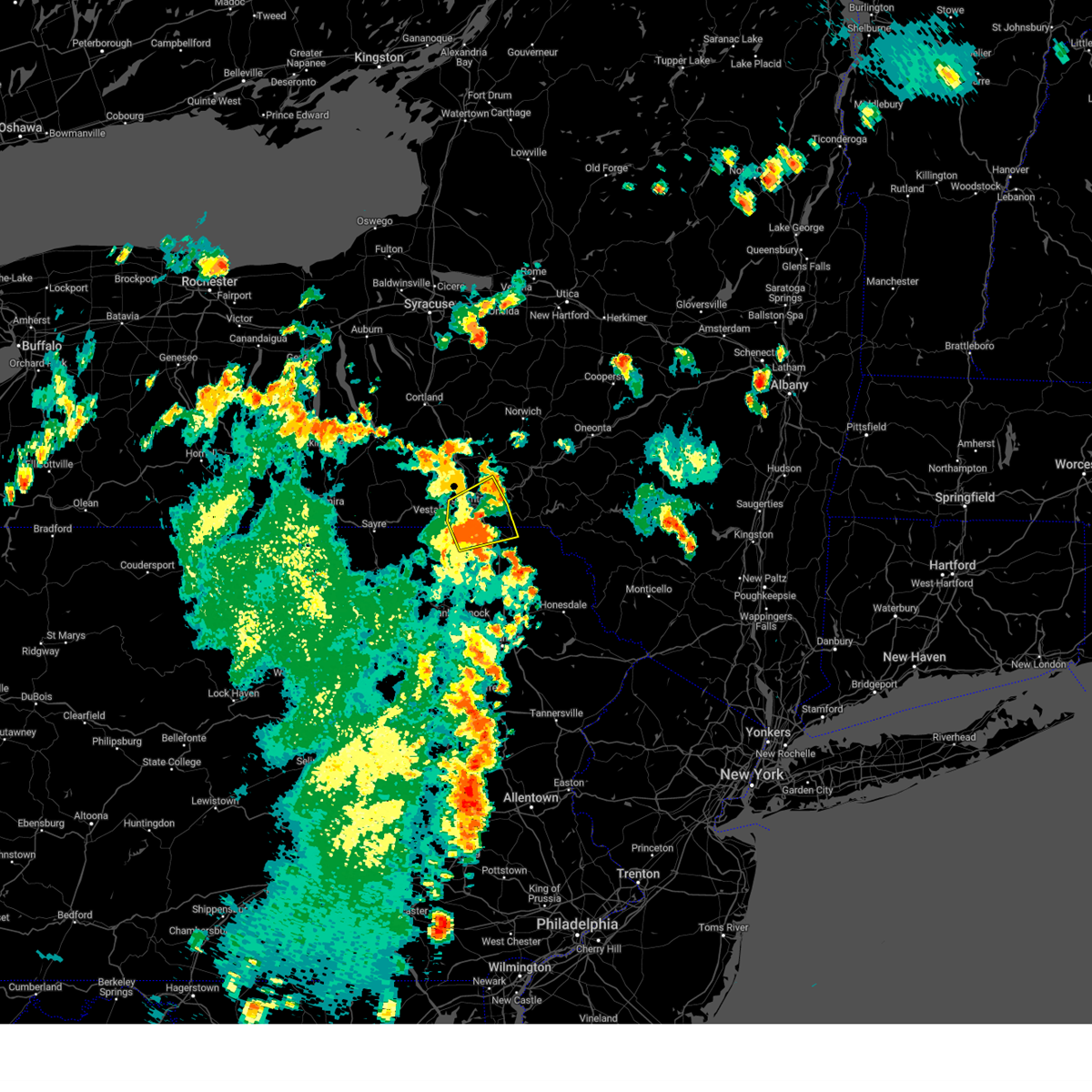
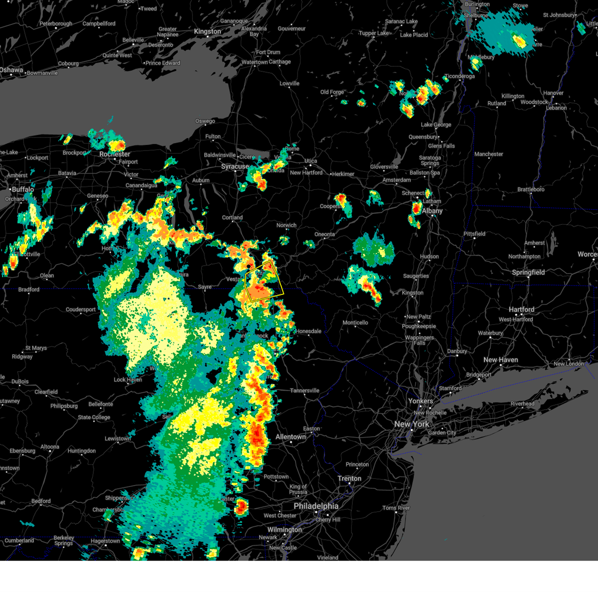
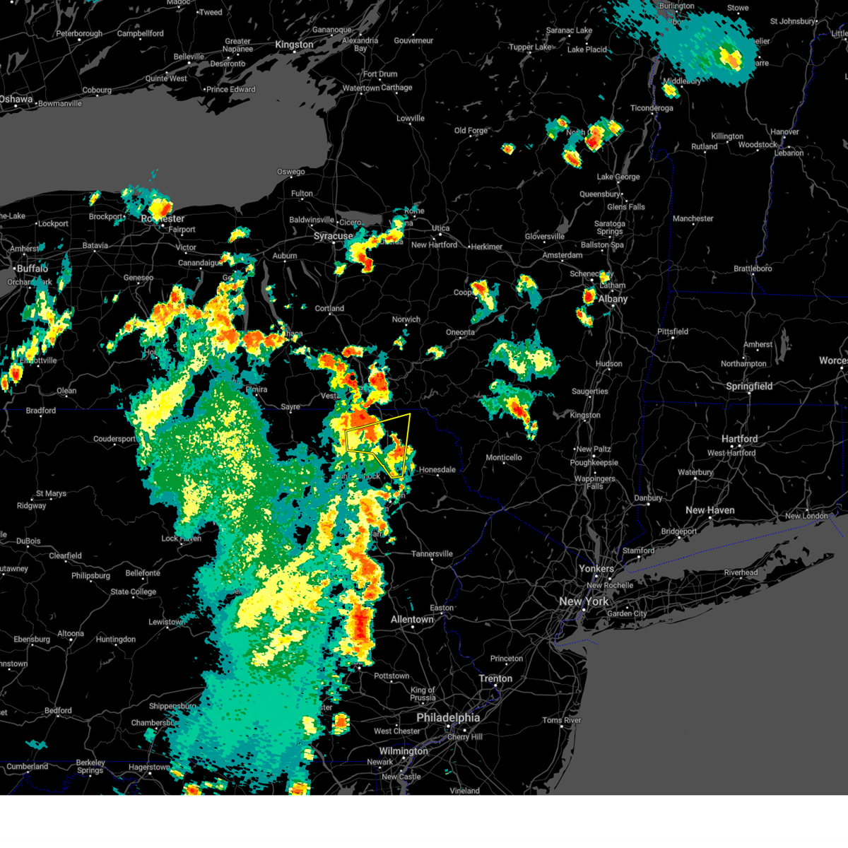
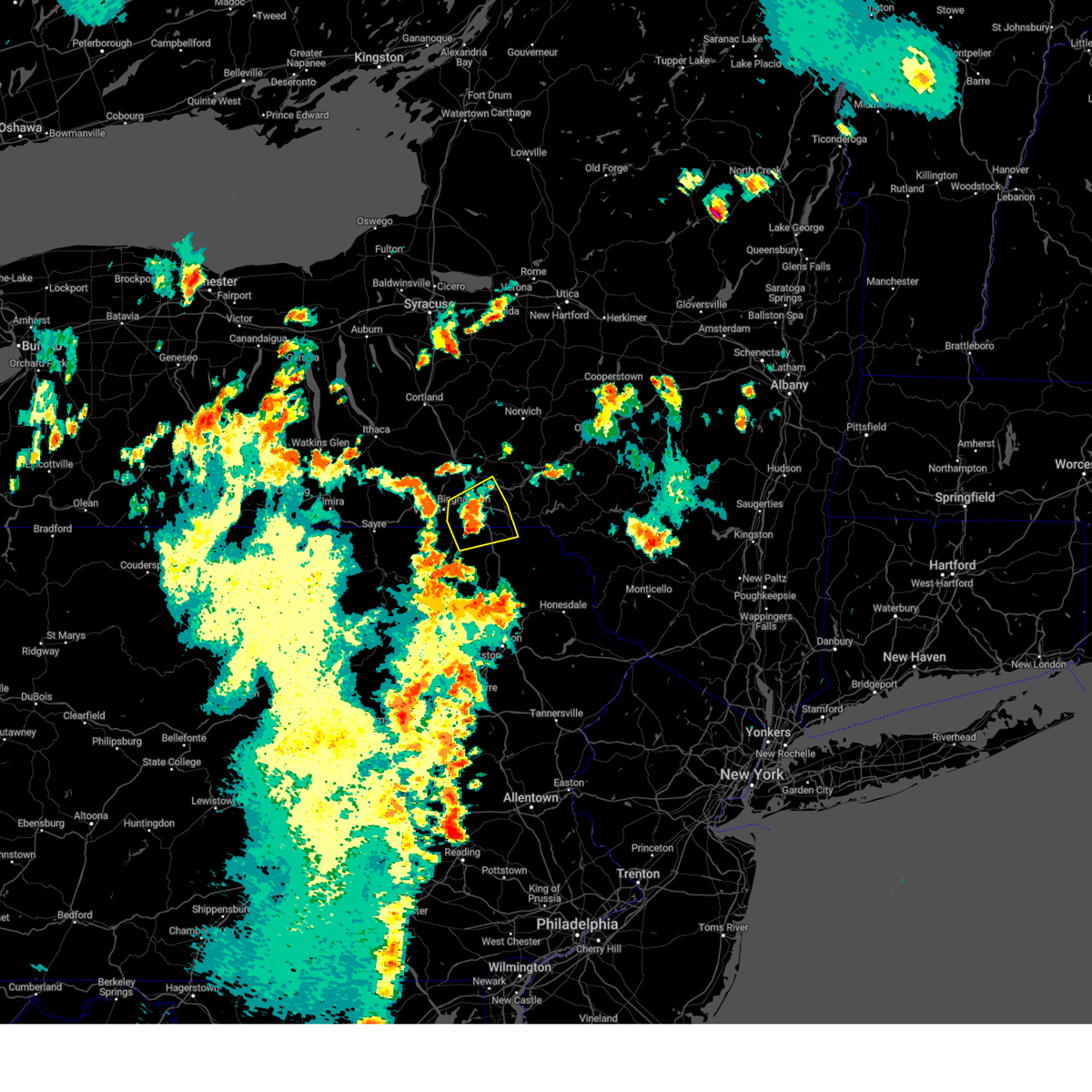
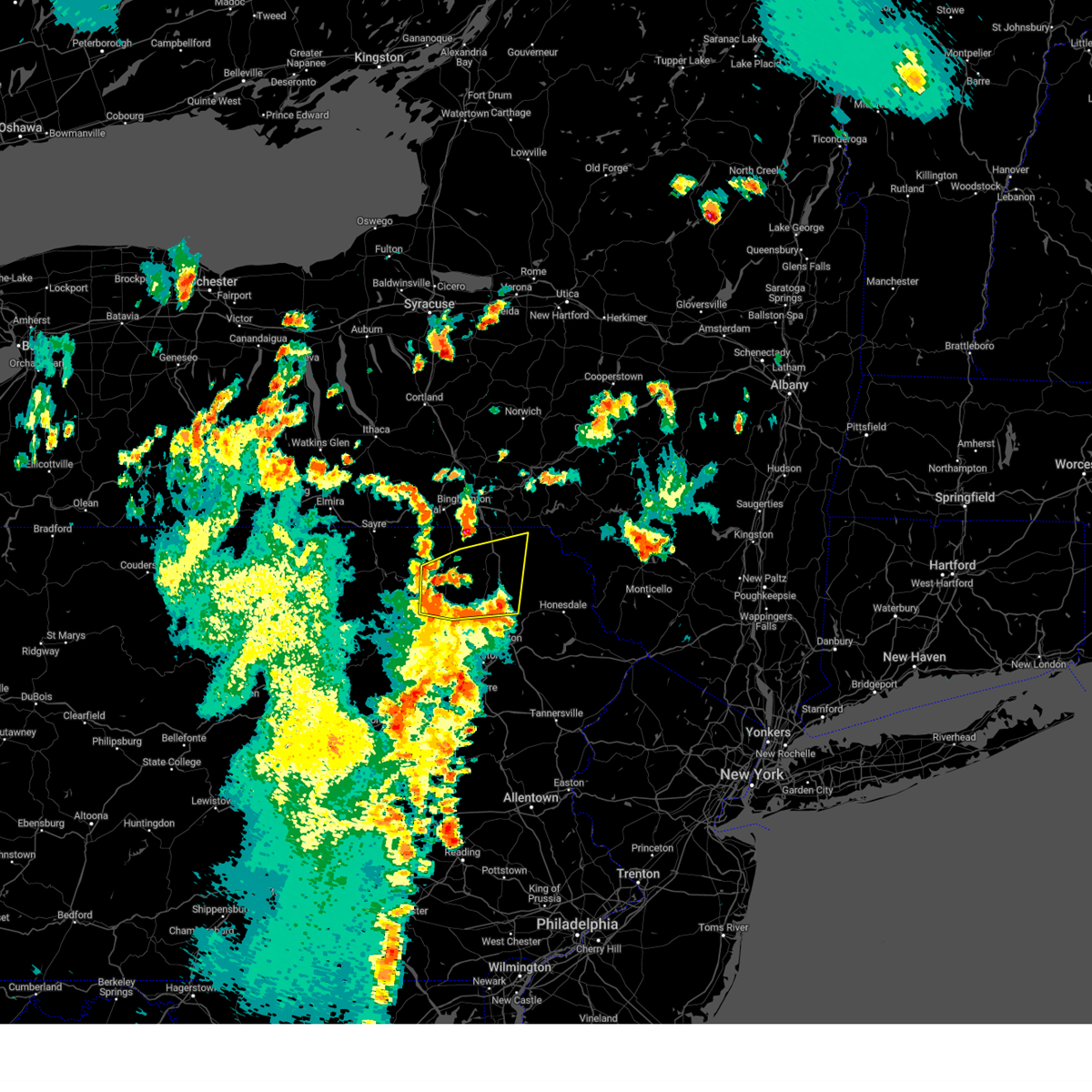
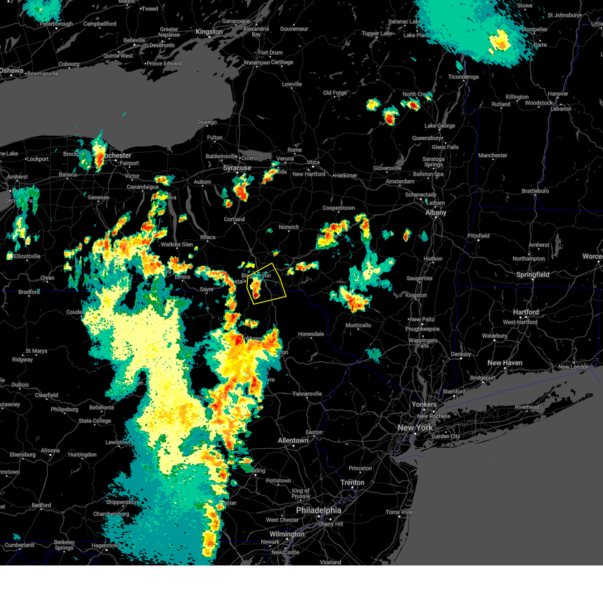
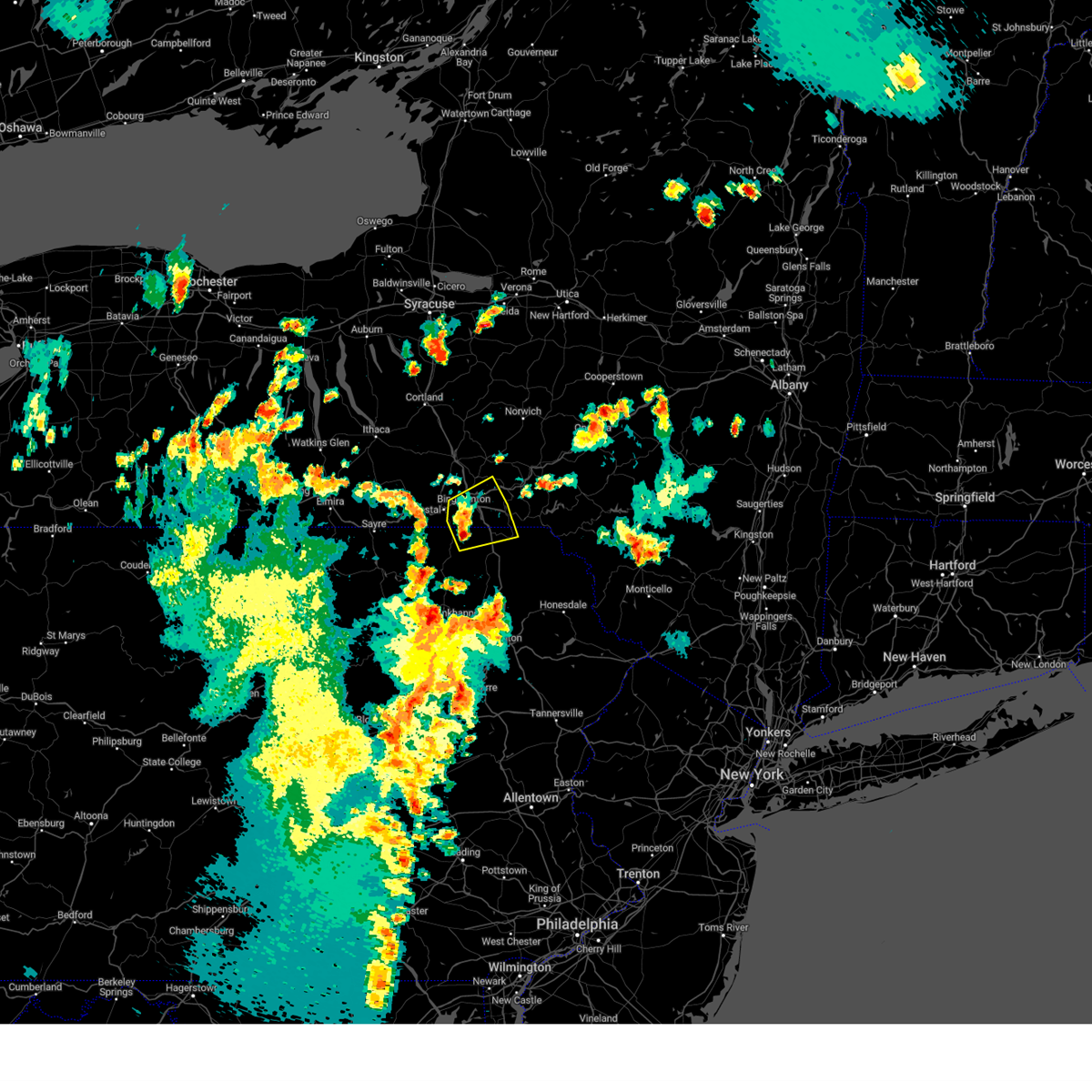
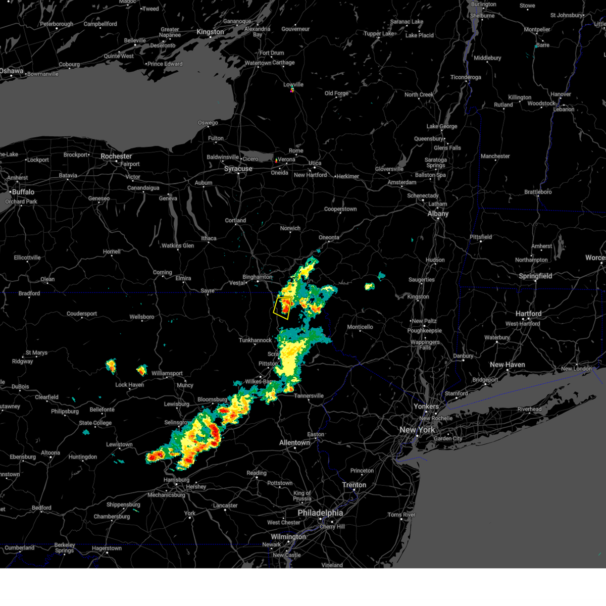
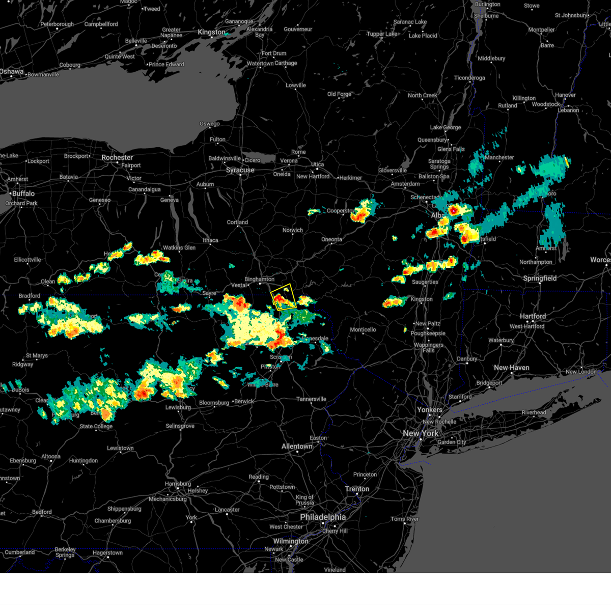
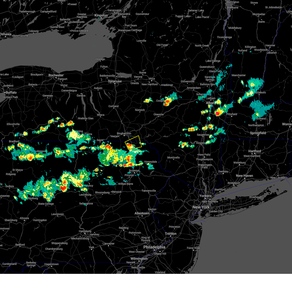
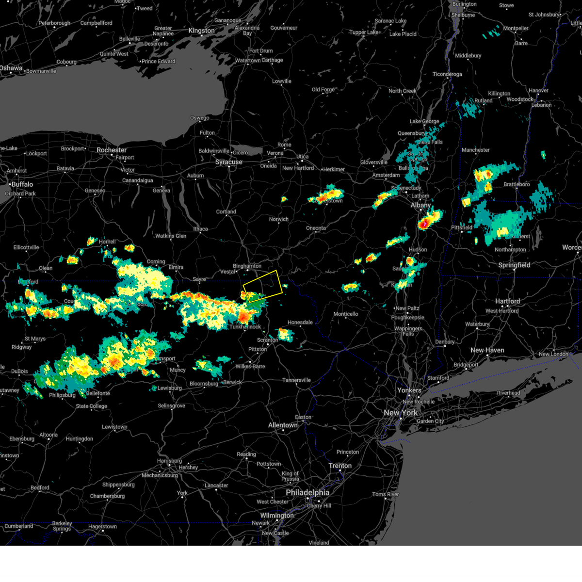
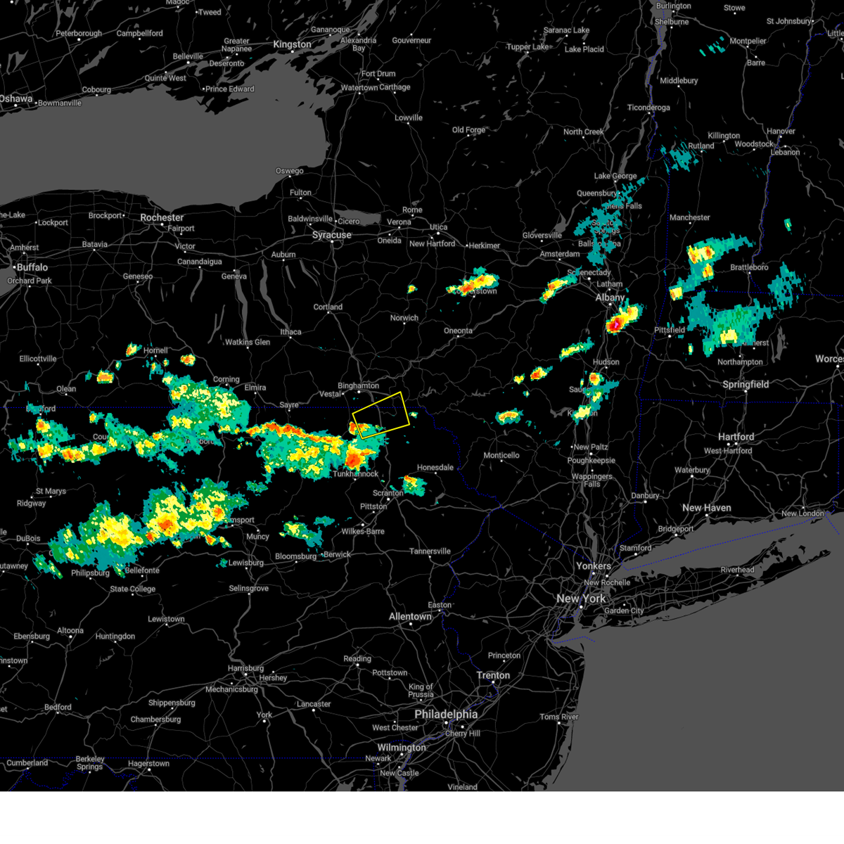
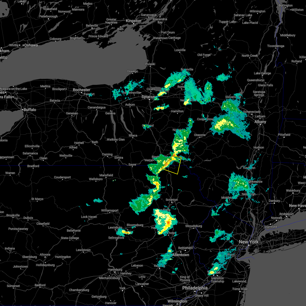
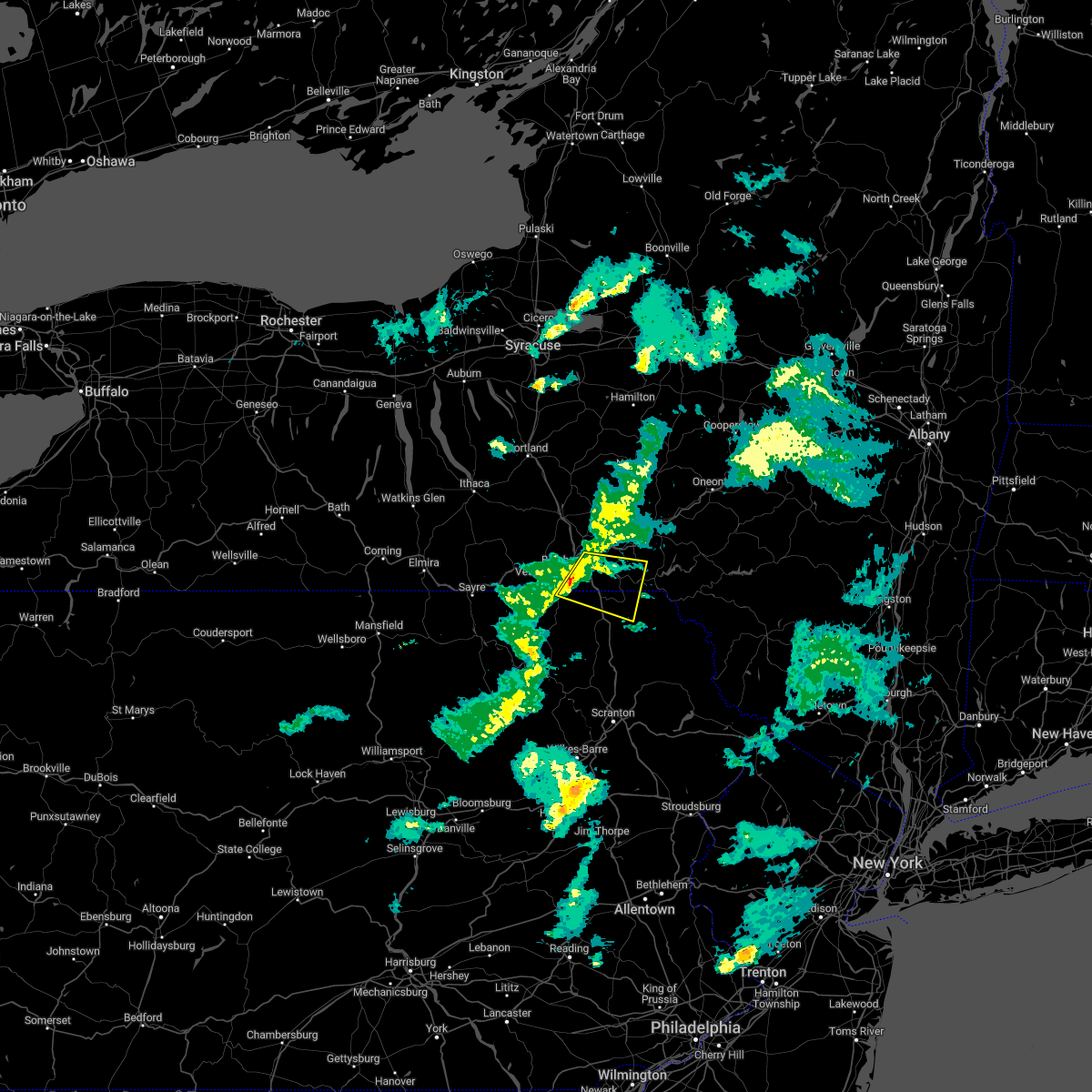
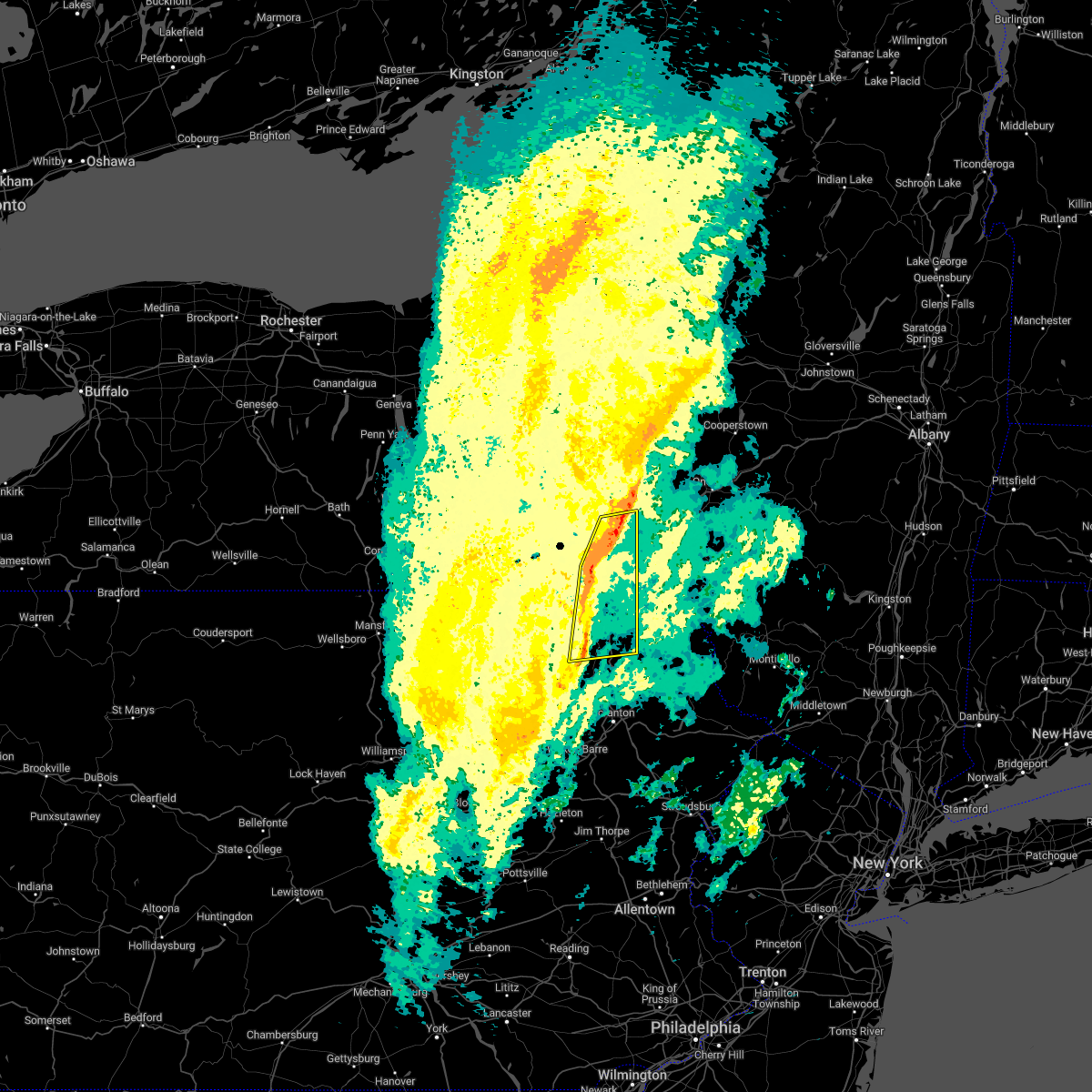
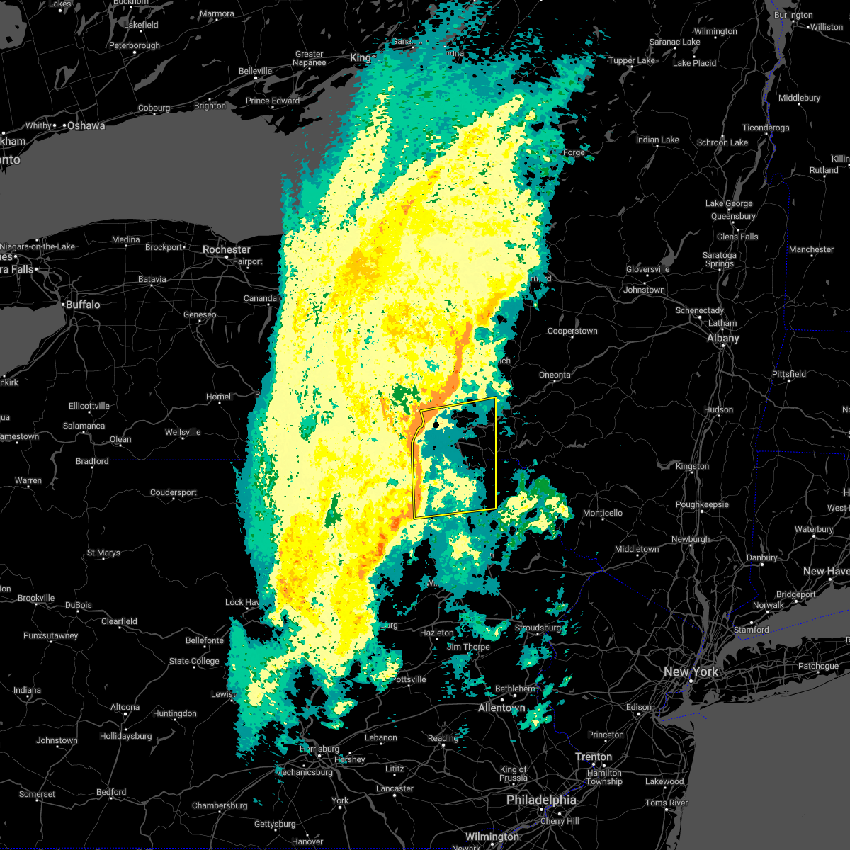
Hail Map for Lanesboro, PA
The Lanesboro, PA area has had 0 reports of on-the-ground hail by trained spotters, and has been under severe weather warnings 45 times during the past 12 months. Doppler radar has detected hail at or near Lanesboro, PA on 20 occasions, including 3 occasions during the past year.
| Name: | Lanesboro, PA |
| Where Located: | 38 miles N of Scranton, PA |
| Map: | Google Map for Lanesboro, PA |
| Population: | 506 |
| Housing Units: | 243 |
| More Info: | Search Google for Lanesboro, PA |
5
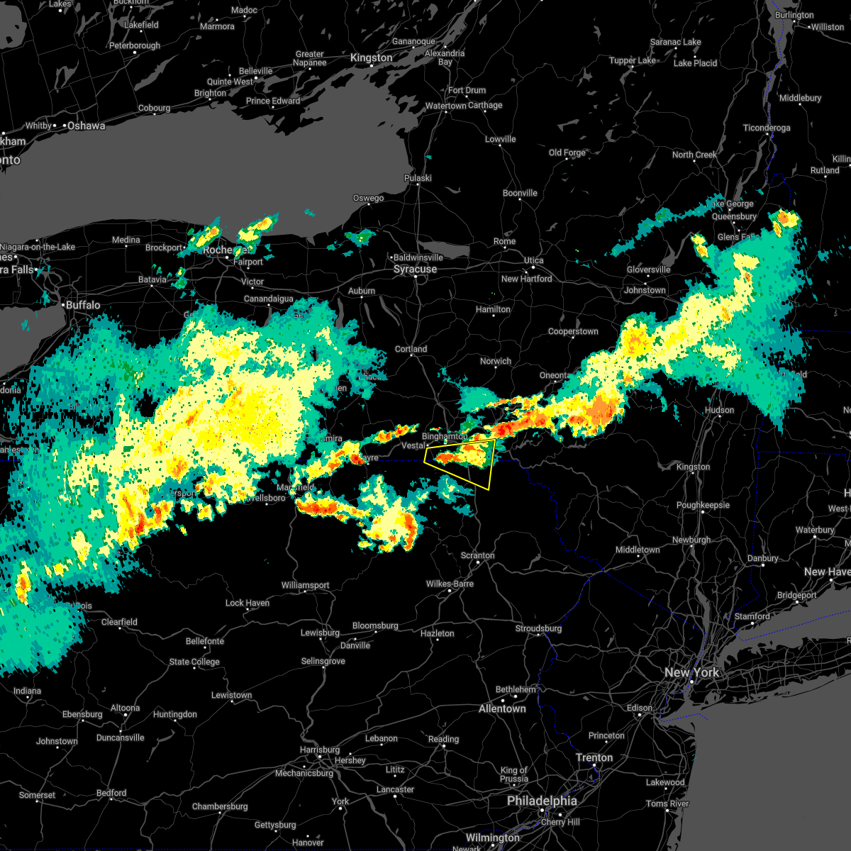
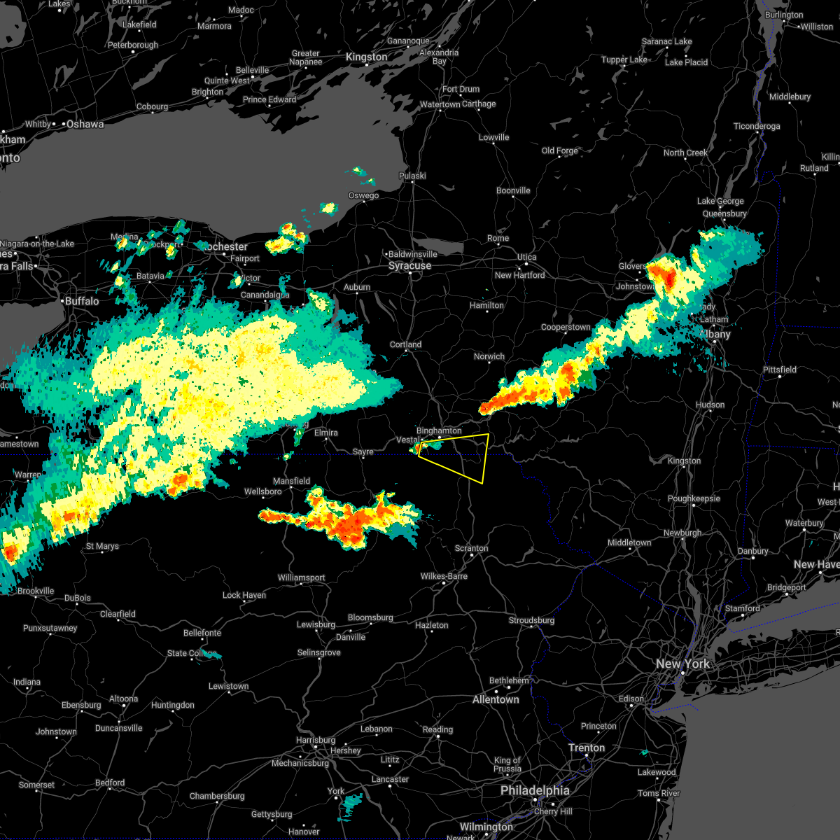
The Top Recent Hail Date for Lanesboro, PA is Friday, August 4, 2023 (2nd out of 20)

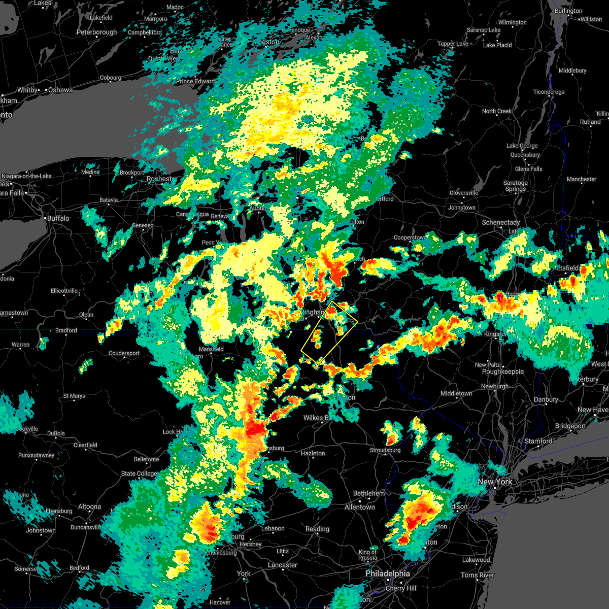
Hail and Wind Damage Spotted near Lanesboro, PA
| Date / Time | Report Details |
|---|---|
| 4/14/2024 1:56 PM EDT |
 the severe thunderstorm warning has been cancelled and is no longer in effect the severe thunderstorm warning has been cancelled and is no longer in effect
|
| 4/14/2024 1:45 PM EDT |
 the severe thunderstorm warning has been cancelled and is no longer in effect the severe thunderstorm warning has been cancelled and is no longer in effect
|
| 4/14/2024 1:45 PM EDT |
 At 144 pm edt, severe thunderstorms were located along a line extending from near bainbridge to brackney, moving east at 65 mph (radar indicated). Hazards include 60 mph wind gusts and penny size hail. Expect damage to roofs, siding, and trees. Locations impacted include, rockland, binghamton, kirkwood, conklin, honesdale, damascus, jackson, walton, callicoon, and sanford. At 144 pm edt, severe thunderstorms were located along a line extending from near bainbridge to brackney, moving east at 65 mph (radar indicated). Hazards include 60 mph wind gusts and penny size hail. Expect damage to roofs, siding, and trees. Locations impacted include, rockland, binghamton, kirkwood, conklin, honesdale, damascus, jackson, walton, callicoon, and sanford.
|
| 4/14/2024 1:31 PM EDT |
 Svrbgm the national weather service in binghamton has issued a * severe thunderstorm warning for, broome county in central new york, southern delaware county in central new york, southeastern tioga county in central new york, southern chenango county in central new york, northwestern sullivan county in central new york, northeastern susquehanna county in northeastern pennsylvania, wayne county in northeastern pennsylvania, * until 230 pm edt. * at 130 pm edt, severe thunderstorms were located along a line extending from near smithville flats to near owego, moving southeast at 65 mph (radar indicated). Hazards include 60 mph wind gusts and quarter size hail. Hail damage to vehicles is expected. Expect wind damage to roofs, siding, and trees. Svrbgm the national weather service in binghamton has issued a * severe thunderstorm warning for, broome county in central new york, southern delaware county in central new york, southeastern tioga county in central new york, southern chenango county in central new york, northwestern sullivan county in central new york, northeastern susquehanna county in northeastern pennsylvania, wayne county in northeastern pennsylvania, * until 230 pm edt. * at 130 pm edt, severe thunderstorms were located along a line extending from near smithville flats to near owego, moving southeast at 65 mph (radar indicated). Hazards include 60 mph wind gusts and quarter size hail. Hail damage to vehicles is expected. Expect wind damage to roofs, siding, and trees.
|
| 9/7/2023 5:14 PM EDT |
 At 514 pm edt, a severe thunderstorm was located over conklin, or near binghamton town, moving northeast at 35 mph (law enforcement). Hazards include 60 mph wind gusts. Expect damage to roofs, siding, and trees. locations impacted include, binghamton, johnson city, kirkwood, conklin, susquehanna depot, port dickinson, hallstead, windsor, great bend, and lanesboro. hail threat, radar indicated max hail size, <. 75 in wind threat, observed max wind gust, 60 mph. At 514 pm edt, a severe thunderstorm was located over conklin, or near binghamton town, moving northeast at 35 mph (law enforcement). Hazards include 60 mph wind gusts. Expect damage to roofs, siding, and trees. locations impacted include, binghamton, johnson city, kirkwood, conklin, susquehanna depot, port dickinson, hallstead, windsor, great bend, and lanesboro. hail threat, radar indicated max hail size, <. 75 in wind threat, observed max wind gust, 60 mph.
|
| 9/7/2023 5:12 PM EDT |
 At 512 pm edt, a severe thunderstorm was located near montrose, moving northeast at 30 mph (radar indicated). Hazards include 60 mph wind gusts. Expect damage to roofs, siding, and trees. locations impacted include, jackson, clifford, susquehanna, susquehanna depot, montrose, dimock, harford, new milford, ararat, and lanesboro. hail threat, radar indicated max hail size, <. 75 in wind threat, radar indicated max wind gust, 60 mph. At 512 pm edt, a severe thunderstorm was located near montrose, moving northeast at 30 mph (radar indicated). Hazards include 60 mph wind gusts. Expect damage to roofs, siding, and trees. locations impacted include, jackson, clifford, susquehanna, susquehanna depot, montrose, dimock, harford, new milford, ararat, and lanesboro. hail threat, radar indicated max hail size, <. 75 in wind threat, radar indicated max wind gust, 60 mph.
|
| 9/7/2023 4:58 PM EDT |
 At 457 pm edt, a severe thunderstorm was located over brackney, or 8 miles south of binghamton, moving northeast at 20 mph (law enforcement has reported tree damage in areas south and southeast of binghamton). Hazards include 60 mph wind gusts and quarter size hail. Hail damage to vehicles is expected. expect wind damage to roofs, siding, and trees. locations impacted include, binghamton, johnson city, kirkwood, conklin, susquehanna depot, port dickinson, hallstead, windsor, great bend, and lanesboro. hail threat, radar indicated max hail size, 1. 00 in wind threat, observed max wind gust, 60 mph. At 457 pm edt, a severe thunderstorm was located over brackney, or 8 miles south of binghamton, moving northeast at 20 mph (law enforcement has reported tree damage in areas south and southeast of binghamton). Hazards include 60 mph wind gusts and quarter size hail. Hail damage to vehicles is expected. expect wind damage to roofs, siding, and trees. locations impacted include, binghamton, johnson city, kirkwood, conklin, susquehanna depot, port dickinson, hallstead, windsor, great bend, and lanesboro. hail threat, radar indicated max hail size, 1. 00 in wind threat, observed max wind gust, 60 mph.
|
| 9/7/2023 4:48 PM EDT |
 At 448 pm edt, a severe thunderstorm was located over rush, or 9 miles southwest of montrose, moving northeast at 30 mph (radar indicated). Hazards include 60 mph wind gusts and penny size hail. expect damage to roofs, siding, and trees At 448 pm edt, a severe thunderstorm was located over rush, or 9 miles southwest of montrose, moving northeast at 30 mph (radar indicated). Hazards include 60 mph wind gusts and penny size hail. expect damage to roofs, siding, and trees
|
| 9/7/2023 4:43 PM EDT |
 At 443 pm edt, a severe thunderstorm was located near brackney, or 7 miles northwest of montrose, moving northeast at 20 mph (radar indicated). Hazards include 60 mph wind gusts and quarter size hail. Hail damage to vehicles is expected. Expect wind damage to roofs, siding, and trees. At 443 pm edt, a severe thunderstorm was located near brackney, or 7 miles northwest of montrose, moving northeast at 20 mph (radar indicated). Hazards include 60 mph wind gusts and quarter size hail. Hail damage to vehicles is expected. Expect wind damage to roofs, siding, and trees.
|
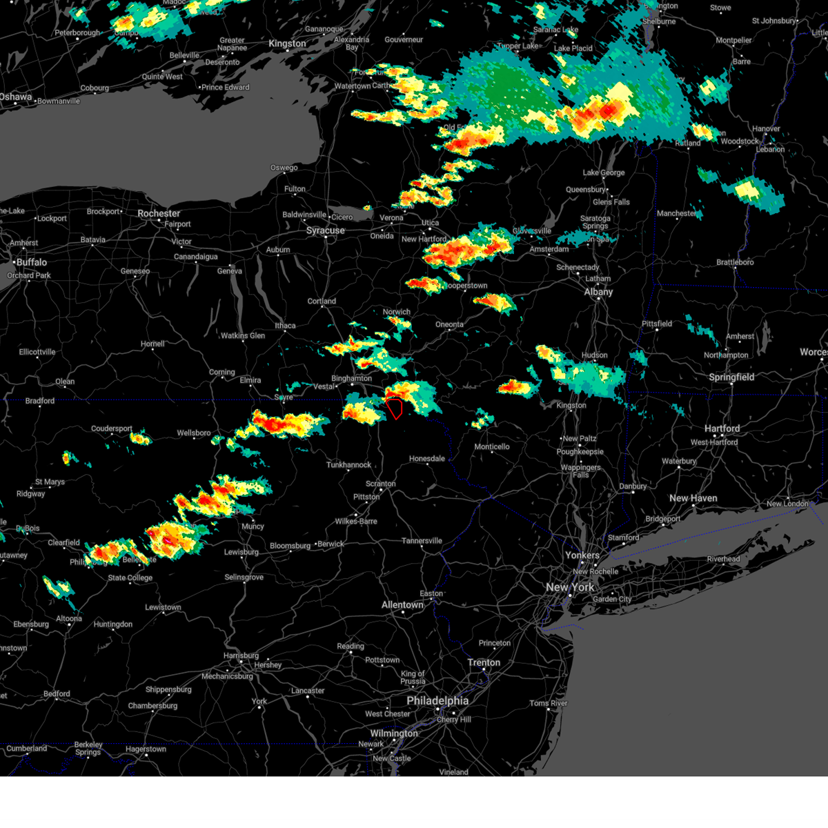
| 8/7/2023 6:18 PM EDT | Trees/wires down stevens point road possible tornado time estimated from rada in susquehanna county PA, 2.4 miles W of Lanesboro, PA |
| 8/7/2023 6:11 PM EDT |
 At 610 pm edt, a confirmed tornado was located over susquehanna, or 11 miles southwest of deposit, moving east at 20 mph (radar confirmed tornado). Hazards include damaging tornado. Flying debris will be dangerous to those caught without shelter. mobile homes will be damaged or destroyed. damage to roofs, windows, and vehicles will occur. tree damage is likely. this tornado will be near, starrucca and starruca around 620 pm edt. sherman around 630 pm edt. Hiawatha around 635 pm edt. At 610 pm edt, a confirmed tornado was located over susquehanna, or 11 miles southwest of deposit, moving east at 20 mph (radar confirmed tornado). Hazards include damaging tornado. Flying debris will be dangerous to those caught without shelter. mobile homes will be damaged or destroyed. damage to roofs, windows, and vehicles will occur. tree damage is likely. this tornado will be near, starrucca and starruca around 620 pm edt. sherman around 630 pm edt. Hiawatha around 635 pm edt.
|
| 8/7/2023 5:54 PM EDT |
 At 554 pm edt, a severe thunderstorm capable of producing a tornado was located near new milford, or 11 miles east of montrose, moving east at 25 mph (radar indicated rotation). Hazards include tornado. Flying debris will be dangerous to those caught without shelter. mobile homes will be damaged or destroyed. damage to roofs, windows, and vehicles will occur. tree damage is likely. this dangerous storm will be near, susquehanna, susquehanna depot and lanesboro around 605 pm edt. thompson around 615 pm edt. starrucca and starruca around 620 pm edt. Hiawatha, sherman and shehawken around 630 pm edt. At 554 pm edt, a severe thunderstorm capable of producing a tornado was located near new milford, or 11 miles east of montrose, moving east at 25 mph (radar indicated rotation). Hazards include tornado. Flying debris will be dangerous to those caught without shelter. mobile homes will be damaged or destroyed. damage to roofs, windows, and vehicles will occur. tree damage is likely. this dangerous storm will be near, susquehanna, susquehanna depot and lanesboro around 605 pm edt. thompson around 615 pm edt. starrucca and starruca around 620 pm edt. Hiawatha, sherman and shehawken around 630 pm edt.
|
| 8/7/2023 5:43 PM EDT |
 At 542 pm edt, a severe thunderstorm was located over susquehanna, or 13 miles northeast of montrose, moving northeast at 20 mph (radar indicated). Hazards include 60 mph wind gusts and quarter size hail. Hail damage to vehicles is expected. Expect wind damage to roofs, siding, and trees. At 542 pm edt, a severe thunderstorm was located over susquehanna, or 13 miles northeast of montrose, moving northeast at 20 mph (radar indicated). Hazards include 60 mph wind gusts and quarter size hail. Hail damage to vehicles is expected. Expect wind damage to roofs, siding, and trees.
|
| 8/4/2023 8:36 PM EDT |
 At 836 pm edt, a severe thunderstorm was located over starruca, or 9 miles south of deposit, moving southeast at 30 mph (radar indicated). Hazards include 60 mph wind gusts and quarter size hail. Hail damage to vehicles is expected. expect wind damage to roofs, siding, and trees. locations impacted include, susquehanna, deposit, susquehanna depot, hallstead, hancock, ararat, lanesboro, thompson, starrucca and hiawatha. hail threat, radar indicated max hail size, 1. 00 in wind threat, radar indicated max wind gust, 60 mph. At 836 pm edt, a severe thunderstorm was located over starruca, or 9 miles south of deposit, moving southeast at 30 mph (radar indicated). Hazards include 60 mph wind gusts and quarter size hail. Hail damage to vehicles is expected. expect wind damage to roofs, siding, and trees. locations impacted include, susquehanna, deposit, susquehanna depot, hallstead, hancock, ararat, lanesboro, thompson, starrucca and hiawatha. hail threat, radar indicated max hail size, 1. 00 in wind threat, radar indicated max wind gust, 60 mph.
|
| 8/4/2023 8:17 PM EDT |
 At 816 pm edt, a severe thunderstorm was located near great bend, or 12 miles southeast of binghamton, moving southeast at 30 mph (radar indicated). Hazards include 60 mph wind gusts and quarter size hail. Hail damage to vehicles is expected. Expect wind damage to roofs, siding, and trees. At 816 pm edt, a severe thunderstorm was located near great bend, or 12 miles southeast of binghamton, moving southeast at 30 mph (radar indicated). Hazards include 60 mph wind gusts and quarter size hail. Hail damage to vehicles is expected. Expect wind damage to roofs, siding, and trees.
|
| 8/4/2023 2:47 PM EDT |
 At 247 pm edt, a severe thunderstorm was located over lanesboro, or 8 miles southwest of deposit, moving southeast at 20 mph (radar indicated). Hazards include 60 mph wind gusts and quarter size hail. Hail damage to vehicles is expected. expect wind damage to roofs, siding, and trees. locations impacted include, deposit, susquehanna depot, lanesboro, thompson, starrucca and sherman. hail threat, radar indicated max hail size, 1. 00 in wind threat, radar indicated max wind gust, 60 mph. At 247 pm edt, a severe thunderstorm was located over lanesboro, or 8 miles southwest of deposit, moving southeast at 20 mph (radar indicated). Hazards include 60 mph wind gusts and quarter size hail. Hail damage to vehicles is expected. expect wind damage to roofs, siding, and trees. locations impacted include, deposit, susquehanna depot, lanesboro, thompson, starrucca and sherman. hail threat, radar indicated max hail size, 1. 00 in wind threat, radar indicated max wind gust, 60 mph.
|
| 8/4/2023 2:44 PM EDT |
 At 244 pm edt, a severe thunderstorm capable of producing a tornado was located over lanesboro, or 9 miles southwest of deposit, moving southeast at 15 mph (radar indicated rotation). Hazards include tornado and quarter size hail. Flying debris will be dangerous to those caught without shelter. mobile homes will be damaged or destroyed. damage to roofs, windows, and vehicles will occur. tree damage is likely. This tornadic thunderstorm will remain over mainly rural areas of northeastern susquehanna county. At 244 pm edt, a severe thunderstorm capable of producing a tornado was located over lanesboro, or 9 miles southwest of deposit, moving southeast at 15 mph (radar indicated rotation). Hazards include tornado and quarter size hail. Flying debris will be dangerous to those caught without shelter. mobile homes will be damaged or destroyed. damage to roofs, windows, and vehicles will occur. tree damage is likely. This tornadic thunderstorm will remain over mainly rural areas of northeastern susquehanna county.
|
| 8/4/2023 2:33 PM EDT |
 At 233 pm edt, a severe thunderstorm was located near windsor, or 11 miles west of deposit, moving southeast at 10 mph (radar indicated). Hazards include 60 mph wind gusts and quarter size hail. Hail damage to vehicles is expected. Expect wind damage to roofs, siding, and trees. At 233 pm edt, a severe thunderstorm was located near windsor, or 11 miles west of deposit, moving southeast at 10 mph (radar indicated). Hazards include 60 mph wind gusts and quarter size hail. Hail damage to vehicles is expected. Expect wind damage to roofs, siding, and trees.
|
| 7/27/2023 2:20 PM EDT |
 The severe thunderstorm warning for southern broome, southwestern delaware, susquehanna, northwestern wayne and northeastern bradford counties will expire at 230 pm edt, the storms which prompted the warning have weakened below severe limits, and no longer pose an immediate threat to life or property. therefore, the warning will be allowed to expire. a severe thunderstorm watch remains in effect until 800 pm edt for central new york, and northeastern pennsylvania. to report severe weather, contact your nearest law enforcement agency. they will relay your report to the national weather service binghamton. The severe thunderstorm warning for southern broome, southwestern delaware, susquehanna, northwestern wayne and northeastern bradford counties will expire at 230 pm edt, the storms which prompted the warning have weakened below severe limits, and no longer pose an immediate threat to life or property. therefore, the warning will be allowed to expire. a severe thunderstorm watch remains in effect until 800 pm edt for central new york, and northeastern pennsylvania. to report severe weather, contact your nearest law enforcement agency. they will relay your report to the national weather service binghamton.
|
| 7/27/2023 1:35 PM EDT |
 At 134 pm edt, severe thunderstorms were located along a line extending from 6 miles southeast of afton to near north towanda, moving southeast at 25 mph (radar indicated). Hazards include 60 mph wind gusts. expect damage to roofs, siding, and trees At 134 pm edt, severe thunderstorms were located along a line extending from 6 miles southeast of afton to near north towanda, moving southeast at 25 mph (radar indicated). Hazards include 60 mph wind gusts. expect damage to roofs, siding, and trees
|
| 7/24/2023 11:11 PM EDT |
 The severe thunderstorm warning for northeastern susquehanna county will expire at 1115 pm edt, the storm which prompted the warning has weakened below severe limits, and no longer poses an immediate threat to life or property. therefore, the warning will be allowed to expire. The severe thunderstorm warning for northeastern susquehanna county will expire at 1115 pm edt, the storm which prompted the warning has weakened below severe limits, and no longer poses an immediate threat to life or property. therefore, the warning will be allowed to expire.
|
| 7/24/2023 11:05 PM EDT |
 At 1104 pm edt, a severe thunderstorm was located over new milford, or 10 miles east of montrose, moving east at 5 mph (radar indicated). Hazards include 60 mph wind gusts and penny size hail. Expect damage to roofs, siding, and trees. locations impacted include, jackson, susquehanna, susquehanna depot, lanesboro, gibson, lakeview and lakeside. hail threat, radar indicated max hail size, 0. 75 in wind threat, radar indicated max wind gust, 60 mph. At 1104 pm edt, a severe thunderstorm was located over new milford, or 10 miles east of montrose, moving east at 5 mph (radar indicated). Hazards include 60 mph wind gusts and penny size hail. Expect damage to roofs, siding, and trees. locations impacted include, jackson, susquehanna, susquehanna depot, lanesboro, gibson, lakeview and lakeside. hail threat, radar indicated max hail size, 0. 75 in wind threat, radar indicated max wind gust, 60 mph.
|
| 7/24/2023 10:30 PM EDT |
 At 1030 pm edt, a severe thunderstorm was located over new milford, or 7 miles northeast of montrose, moving east at 5 mph (radar indicated). Hazards include 60 mph wind gusts and nickel size hail. expect damage to roofs, siding, and trees At 1030 pm edt, a severe thunderstorm was located over new milford, or 7 miles northeast of montrose, moving east at 5 mph (radar indicated). Hazards include 60 mph wind gusts and nickel size hail. expect damage to roofs, siding, and trees
|
| 7/24/2023 10:27 PM EDT |
 The severe thunderstorm warning for northeastern susquehanna and northwestern wayne counties will expire at 1030 pm edt, the storm which prompted the warning has weakened below severe limits, and no longer poses an immediate threat to life or property. therefore, the warning will be allowed to expire. however heavy rain is still possible with this thunderstorm. The severe thunderstorm warning for northeastern susquehanna and northwestern wayne counties will expire at 1030 pm edt, the storm which prompted the warning has weakened below severe limits, and no longer poses an immediate threat to life or property. therefore, the warning will be allowed to expire. however heavy rain is still possible with this thunderstorm.
|
| 7/24/2023 10:06 PM EDT |
 At 1006 pm edt, a severe thunderstorm was located near thompson, or 15 miles east of montrose, moving east at 15 mph (radar indicated). Hazards include 60 mph wind gusts and quarter size hail. Hail damage to vehicles is expected. expect wind damage to roofs, siding, and trees. locations impacted include, jackson, susquehanna, susquehanna depot, ararat, lanesboro, thompson, union dale, starrucca, shehawken and starlight. hail threat, radar indicated max hail size, 1. 00 in wind threat, radar indicated max wind gust, 60 mph. At 1006 pm edt, a severe thunderstorm was located near thompson, or 15 miles east of montrose, moving east at 15 mph (radar indicated). Hazards include 60 mph wind gusts and quarter size hail. Hail damage to vehicles is expected. expect wind damage to roofs, siding, and trees. locations impacted include, jackson, susquehanna, susquehanna depot, ararat, lanesboro, thompson, union dale, starrucca, shehawken and starlight. hail threat, radar indicated max hail size, 1. 00 in wind threat, radar indicated max wind gust, 60 mph.
|
| 7/24/2023 10:04 PM EDT | Tree down blocking the road. time estimated from rada in susquehanna county PA, 3.3 miles N of Lanesboro, PA |
| 7/24/2023 10:00 PM EDT |
 At 1000 pm edt, a severe thunderstorm was located near thompson, or 15 miles east of montrose, moving east at 20 mph (radar indicated). Hazards include 60 mph wind gusts and penny size hail. expect damage to roofs, siding, and trees At 1000 pm edt, a severe thunderstorm was located near thompson, or 15 miles east of montrose, moving east at 20 mph (radar indicated). Hazards include 60 mph wind gusts and penny size hail. expect damage to roofs, siding, and trees
|
| 7/24/2023 11:24 AM EDT |
 At 1122 am edt, multiple severe thunderstorms were located in susquehanna county near susquehanna depot, or 13 miles southwest of deposit, moving northeast at 40 mph (law enforcement. at 1020 am downed trees and wires were reported in jackson township and also near montrose). Hazards include 60 mph wind gusts and nickel size hail. expect damage to roofs, siding, and trees At 1122 am edt, multiple severe thunderstorms were located in susquehanna county near susquehanna depot, or 13 miles southwest of deposit, moving northeast at 40 mph (law enforcement. at 1020 am downed trees and wires were reported in jackson township and also near montrose). Hazards include 60 mph wind gusts and nickel size hail. expect damage to roofs, siding, and trees
|
| 7/12/2023 4:32 PM EDT |
 At 432 pm edt, a severe thunderstorm was located over lanesboro, or 11 miles southwest of deposit, moving east at 30 mph (radar indicated). Hazards include 60 mph wind gusts and quarter size hail. Hail damage to vehicles is expected. expect wind damage to roofs, siding, and trees. locations impacted include, susquehanna, susquehanna depot, hallstead, windsor, great bend, lanesboro, lakeside and hickory grove. hail threat, radar indicated max hail size, 1. 00 in wind threat, radar indicated max wind gust, 60 mph. At 432 pm edt, a severe thunderstorm was located over lanesboro, or 11 miles southwest of deposit, moving east at 30 mph (radar indicated). Hazards include 60 mph wind gusts and quarter size hail. Hail damage to vehicles is expected. expect wind damage to roofs, siding, and trees. locations impacted include, susquehanna, susquehanna depot, hallstead, windsor, great bend, lanesboro, lakeside and hickory grove. hail threat, radar indicated max hail size, 1. 00 in wind threat, radar indicated max wind gust, 60 mph.
|
| 7/12/2023 4:15 PM EDT |
 At 415 pm edt, a severe thunderstorm was located over hallstead, or 9 miles northeast of montrose, moving northeast at 30 mph (radar indicated). Hazards include 60 mph wind gusts and quarter size hail. Hail damage to vehicles is expected. expect wind damage to roofs, siding, and trees. locations impacted include, susquehanna, susquehanna depot, hallstead, windsor, new milford, great bend, lanesboro, lakeside and hickory grove. hail threat, radar indicated max hail size, 1. 00 in wind threat, radar indicated max wind gust, 60 mph. At 415 pm edt, a severe thunderstorm was located over hallstead, or 9 miles northeast of montrose, moving northeast at 30 mph (radar indicated). Hazards include 60 mph wind gusts and quarter size hail. Hail damage to vehicles is expected. expect wind damage to roofs, siding, and trees. locations impacted include, susquehanna, susquehanna depot, hallstead, windsor, new milford, great bend, lanesboro, lakeside and hickory grove. hail threat, radar indicated max hail size, 1. 00 in wind threat, radar indicated max wind gust, 60 mph.
|
| 7/12/2023 4:02 PM EDT |
 At 402 pm edt, a severe thunderstorm was located near montrose, moving east at 30 mph (radar indicated). Hazards include 60 mph wind gusts and quarter size hail. Hail damage to vehicles is expected. Expect wind damage to roofs, siding, and trees. At 402 pm edt, a severe thunderstorm was located near montrose, moving east at 30 mph (radar indicated). Hazards include 60 mph wind gusts and quarter size hail. Hail damage to vehicles is expected. Expect wind damage to roofs, siding, and trees.
|
| 4/22/2023 6:15 PM EDT |
 At 614 pm edt, a severe thunderstorm was located near thompson, or 16 miles north of carbondale, moving northeast at 25 mph (radar indicated). Hazards include 60 mph wind gusts and penny size hail. expect damage to roofs, siding, and trees At 614 pm edt, a severe thunderstorm was located near thompson, or 16 miles north of carbondale, moving northeast at 25 mph (radar indicated). Hazards include 60 mph wind gusts and penny size hail. expect damage to roofs, siding, and trees
|
| 4/1/2023 4:24 PM EDT |
 At 423 pm edt, severe thunderstorms were located along a line extending from near richford to meshoppen, moving east at 40 mph (radar indicated). Hazards include 60 mph wind gusts and penny size hail. expect damage to roofs, siding, and trees At 423 pm edt, severe thunderstorms were located along a line extending from near richford to meshoppen, moving east at 40 mph (radar indicated). Hazards include 60 mph wind gusts and penny size hail. expect damage to roofs, siding, and trees
|
| 2/21/2023 3:38 PM EST |
 At 338 pm est, severe thunderstorms were located along a line extending from near sanford to near hallstead, moving east at 45 mph (radar indicated). Hazards include 60 mph wind gusts and penny size hail. expect damage to roofs, siding, and trees At 338 pm est, severe thunderstorms were located along a line extending from near sanford to near hallstead, moving east at 45 mph (radar indicated). Hazards include 60 mph wind gusts and penny size hail. expect damage to roofs, siding, and trees
|
| 2/21/2023 3:33 PM EST |
 At 333 pm est, a severe thunderstorm was located near windsor, or 11 miles southeast of binghamton, moving east at 40 mph (radar indicated). Hazards include 60 mph wind gusts and penny size hail. Expect damage to roofs, siding, and trees. locations impacted include, sanford, susquehanna, susquehanna depot, hallstead, windsor, great bend, lanesboro, hickory grove and east windsor. hail threat, radar indicated max hail size, 0. 75 in wind threat, radar indicated max wind gust, 60 mph. At 333 pm est, a severe thunderstorm was located near windsor, or 11 miles southeast of binghamton, moving east at 40 mph (radar indicated). Hazards include 60 mph wind gusts and penny size hail. Expect damage to roofs, siding, and trees. locations impacted include, sanford, susquehanna, susquehanna depot, hallstead, windsor, great bend, lanesboro, hickory grove and east windsor. hail threat, radar indicated max hail size, 0. 75 in wind threat, radar indicated max wind gust, 60 mph.
|
| 2/21/2023 3:21 PM EST |
 At 321 pm est, a severe thunderstorm was located near conklin, or near binghamton, moving east at 40 mph (radar indicated). Hazards include 60 mph wind gusts and nickel size hail. Expect damage to roofs, siding, and trees. locations impacted include, binghamton, kirkwood, conklin, sanford, susquehanna, susquehanna depot, hallstead, windsor, great bend and lanesboro. hail threat, radar indicated max hail size, 0. 88 in wind threat, radar indicated max wind gust, 60 mph. At 321 pm est, a severe thunderstorm was located near conklin, or near binghamton, moving east at 40 mph (radar indicated). Hazards include 60 mph wind gusts and nickel size hail. Expect damage to roofs, siding, and trees. locations impacted include, binghamton, kirkwood, conklin, sanford, susquehanna, susquehanna depot, hallstead, windsor, great bend and lanesboro. hail threat, radar indicated max hail size, 0. 88 in wind threat, radar indicated max wind gust, 60 mph.
|
| 2/21/2023 3:08 PM EST |
 At 307 pm est, a severe thunderstorm was located over vestal, or over endicott, moving east at 40 mph (radar indicated). Hazards include 60 mph wind gusts and nickel size hail. expect damage to roofs, siding, and trees At 307 pm est, a severe thunderstorm was located over vestal, or over endicott, moving east at 40 mph (radar indicated). Hazards include 60 mph wind gusts and nickel size hail. expect damage to roofs, siding, and trees
|
| 11/12/2022 2:50 AM EST |
 At 250 am est, severe thunderstorms were located along a line extending from near sanitaria springs to near hop bottom, moving east at 30 mph (radar indicated). Hazards include 60 mph wind gusts. Expect damage to roofs, siding, and trees. locations impacted include, kirkwood, conklin, jackson, susquehanna, coventry, susquehanna depot, montrose, dimock, harford and hallstead. hail threat, radar indicated max hail size, <. 75 in wind threat, radar indicated max wind gust, 60 mph. At 250 am est, severe thunderstorms were located along a line extending from near sanitaria springs to near hop bottom, moving east at 30 mph (radar indicated). Hazards include 60 mph wind gusts. Expect damage to roofs, siding, and trees. locations impacted include, kirkwood, conklin, jackson, susquehanna, coventry, susquehanna depot, montrose, dimock, harford and hallstead. hail threat, radar indicated max hail size, <. 75 in wind threat, radar indicated max wind gust, 60 mph.
|
| 11/12/2022 2:29 AM EST |
 At 228 am est, severe thunderstorms were located along a line extending from near greater binghamton airport to springville, moving east at 30 mph (radar indicated). Hazards include 60 mph wind gusts. Expect damage to roofs, siding, and trees. locations impacted include, binghamton, vestal, johnson city, endicott, kirkwood, conklin, rush, jackson, susquehanna and coventry. hail threat, radar indicated max hail size, <. 75 in wind threat, radar indicated max wind gust, 60 mph. At 228 am est, severe thunderstorms were located along a line extending from near greater binghamton airport to springville, moving east at 30 mph (radar indicated). Hazards include 60 mph wind gusts. Expect damage to roofs, siding, and trees. locations impacted include, binghamton, vestal, johnson city, endicott, kirkwood, conklin, rush, jackson, susquehanna and coventry. hail threat, radar indicated max hail size, <. 75 in wind threat, radar indicated max wind gust, 60 mph.
|
| 11/12/2022 2:11 AM EST |
 At 211 am est, severe thunderstorms were located along a line extending from near union center to near auburn center, moving east at 30 mph (radar indicated). Hazards include 60 mph wind gusts. expect damage to roofs, siding, and trees At 211 am est, severe thunderstorms were located along a line extending from near union center to near auburn center, moving east at 30 mph (radar indicated). Hazards include 60 mph wind gusts. expect damage to roofs, siding, and trees
|
| 9/19/2022 2:20 PM EDT |
 At 220 pm edt, a severe thunderstorm was located over sherman, or near deposit, moving northeast at 40 mph (radar indicated). Hazards include 60 mph wind gusts and quarter size hail. Hail damage to vehicles is expected. Expect wind damage to roofs, siding, and trees. At 220 pm edt, a severe thunderstorm was located over sherman, or near deposit, moving northeast at 40 mph (radar indicated). Hazards include 60 mph wind gusts and quarter size hail. Hail damage to vehicles is expected. Expect wind damage to roofs, siding, and trees.
|
| 7/24/2022 5:48 PM EDT |
 At 548 pm edt, severe thunderstorms were located along a line extending from near brackney to near mehoopany to near danville, moving east at 30 mph (radar indicated). Hazards include 60 mph wind gusts. Expect damage to roofs, siding, and trees. severe thunderstorms will be near, tunkhannock, montrose and mehoopany around 555 pm edt. great bend and osterhout around 600 pm edt. falls, hallstead and new milford around 605 pm edt. factoryville, la plume and wallsville around 615 pm edt. waverly, clarks summit and susquehanna around 620 pm edt. scranton, nescopeck and east benton around 625 pm edt. dunmore, dickson city and nuremburg around 630 pm edt. archbald, olyphant and mayfield around 635 pm edt. hail threat, radar indicated max hail size, <. 75 in wind threat, radar indicated max wind gust, 60 mph. At 548 pm edt, severe thunderstorms were located along a line extending from near brackney to near mehoopany to near danville, moving east at 30 mph (radar indicated). Hazards include 60 mph wind gusts. Expect damage to roofs, siding, and trees. severe thunderstorms will be near, tunkhannock, montrose and mehoopany around 555 pm edt. great bend and osterhout around 600 pm edt. falls, hallstead and new milford around 605 pm edt. factoryville, la plume and wallsville around 615 pm edt. waverly, clarks summit and susquehanna around 620 pm edt. scranton, nescopeck and east benton around 625 pm edt. dunmore, dickson city and nuremburg around 630 pm edt. archbald, olyphant and mayfield around 635 pm edt. hail threat, radar indicated max hail size, <. 75 in wind threat, radar indicated max wind gust, 60 mph.
|
| 7/1/2022 10:08 PM EDT |
 The severe thunderstorm warning for southern broome and northeastern susquehanna counties will expire at 1015 pm edt, the storm which prompted the warning has moved out of the area. therefore, the warning will be allowed to expire but has been reissued. however gusty winds are still possible with this thunderstorm. remember, a severe thunderstorm warning still remains in effect for southern broome county and northern susquehanna county. The severe thunderstorm warning for southern broome and northeastern susquehanna counties will expire at 1015 pm edt, the storm which prompted the warning has moved out of the area. therefore, the warning will be allowed to expire but has been reissued. however gusty winds are still possible with this thunderstorm. remember, a severe thunderstorm warning still remains in effect for southern broome county and northern susquehanna county.
|
| 7/1/2022 9:27 PM EDT |
 At 927 pm edt, a severe thunderstorm was located over vestal center, or near binghamton, moving east at 30 mph (radar indicated). Hazards include 60 mph wind gusts and quarter size hail. Hail damage to vehicles is expected. Expect wind damage to roofs, siding, and trees. At 927 pm edt, a severe thunderstorm was located over vestal center, or near binghamton, moving east at 30 mph (radar indicated). Hazards include 60 mph wind gusts and quarter size hail. Hail damage to vehicles is expected. Expect wind damage to roofs, siding, and trees.
|
| 6/1/2022 1:39 PM EDT |
 At 139 pm edt, a severe thunderstorm was located over thompson, or 15 miles south of deposit, moving southeast at 25 mph (radar indicated). Hazards include 60 mph wind gusts and quarter size hail. Hail damage to vehicles is expected. Expect wind damage to roofs, siding, and trees. At 139 pm edt, a severe thunderstorm was located over thompson, or 15 miles south of deposit, moving southeast at 25 mph (radar indicated). Hazards include 60 mph wind gusts and quarter size hail. Hail damage to vehicles is expected. Expect wind damage to roofs, siding, and trees.
|
| 5/16/2022 2:24 PM EDT |
 At 224 pm edt, severe thunderstorms were located along a line extending from near sidney to near deposit to near stalker to prompton, moving northeast at 35 mph (radar indicated). Hazards include 60 mph wind gusts. expect damage to roofs, siding, and trees At 224 pm edt, severe thunderstorms were located along a line extending from near sidney to near deposit to near stalker to prompton, moving northeast at 35 mph (radar indicated). Hazards include 60 mph wind gusts. expect damage to roofs, siding, and trees
|
| 5/16/2022 2:07 PM EDT | Dispatch reports tree down blocking all of turnpike street... about 2 1/2 miles south of susquehanna. radar-estimated tim in susquehanna county PA, 3.3 miles N of Lanesboro, PA |
| 3/31/2022 5:26 PM EDT |
 At 526 pm edt, severe thunderstorms were located along a line extending from near franklin to near afton to near sherman to gibson, moving northeast at 65 mph (radar indicated). Hazards include 60 mph wind gusts and nickel size hail. Expect damage to roofs, siding, and trees. Locations impacted include, jackson, walton, sanford, colchester, susquehanna, deposit, susquehanna depot, springville, montrose and dimock. At 526 pm edt, severe thunderstorms were located along a line extending from near franklin to near afton to near sherman to gibson, moving northeast at 65 mph (radar indicated). Hazards include 60 mph wind gusts and nickel size hail. Expect damage to roofs, siding, and trees. Locations impacted include, jackson, walton, sanford, colchester, susquehanna, deposit, susquehanna depot, springville, montrose and dimock.
|
| 3/31/2022 4:56 PM EDT |
 At 456 pm edt, severe thunderstorms were located along a line extending from windsor to near brackney to near montrose to springville, moving northeast at 60 mph (radar indicated). Hazards include 60 mph wind gusts and nickel size hail. expect damage to roofs, siding, and trees At 456 pm edt, severe thunderstorms were located along a line extending from windsor to near brackney to near montrose to springville, moving northeast at 60 mph (radar indicated). Hazards include 60 mph wind gusts and nickel size hail. expect damage to roofs, siding, and trees
|
| 3/7/2022 7:26 PM EST |
 At 726 pm est, severe thunderstorms were located along a line extending from near west end to wallsville, moving east at 70 mph (radar indicated). Hazards include 60 mph wind gusts. Expect damage to roofs, siding, and trees. locations impacted include, scranton, binghamton, wilkes-barre, falls, muhlenberg, kingston, nanticoke, plains, old forge and pittston. hail threat, radar indicated max hail size, <. 75 in wind threat, radar indicated max wind gust, 60 mph. At 726 pm est, severe thunderstorms were located along a line extending from near west end to wallsville, moving east at 70 mph (radar indicated). Hazards include 60 mph wind gusts. Expect damage to roofs, siding, and trees. locations impacted include, scranton, binghamton, wilkes-barre, falls, muhlenberg, kingston, nanticoke, plains, old forge and pittston. hail threat, radar indicated max hail size, <. 75 in wind threat, radar indicated max wind gust, 60 mph.
|
| 3/7/2022 6:53 PM EST |
 At 652 pm est, severe thunderstorms were located along a line extending from near willet to new albany, moving east at 70 mph (radar indicated). Hazards include 60 mph wind gusts. expect damage to roofs, siding, and trees At 652 pm est, severe thunderstorms were located along a line extending from near willet to new albany, moving east at 70 mph (radar indicated). Hazards include 60 mph wind gusts. expect damage to roofs, siding, and trees
|
| 11/12/2021 7:16 AM EST |
 At 716 am est, a severe thunderstorm capable of producing a tornado was located near windsor, or 9 miles west of deposit, moving northeast at 45 mph (radar indicated rotation). Hazards include tornado. Flying debris will be dangerous to those caught without shelter. mobile homes will be damaged or destroyed. damage to roofs, windows, and vehicles will occur. tree damage is likely. this dangerous storm will be near, deposit, sanford and harpursville around 725 am est. nineveh around 730 am est. afton around 735 am est. Bainbridge around 740 am est. At 716 am est, a severe thunderstorm capable of producing a tornado was located near windsor, or 9 miles west of deposit, moving northeast at 45 mph (radar indicated rotation). Hazards include tornado. Flying debris will be dangerous to those caught without shelter. mobile homes will be damaged or destroyed. damage to roofs, windows, and vehicles will occur. tree damage is likely. this dangerous storm will be near, deposit, sanford and harpursville around 725 am est. nineveh around 730 am est. afton around 735 am est. Bainbridge around 740 am est.
|
| 7/27/2021 4:16 PM EDT |
 At 416 pm edt, severe thunderstorms were located along a line extending from near sherman to near rushville, moving southeast at 55 mph (law enforcement). Hazards include 60 mph wind gusts. Expect damage to roofs, siding, and trees. Locations impacted include, rush, jackson, clifford, susquehanna, susquehanna depot, springville, montrose, dimock, harford and hancock. At 416 pm edt, severe thunderstorms were located along a line extending from near sherman to near rushville, moving southeast at 55 mph (law enforcement). Hazards include 60 mph wind gusts. Expect damage to roofs, siding, and trees. Locations impacted include, rush, jackson, clifford, susquehanna, susquehanna depot, springville, montrose, dimock, harford and hancock.
|
| 7/27/2021 3:51 PM EDT |
 At 349 pm edt, severe thunderstorms were located along a line extending from near harpursville to near rome, moving southeast at 35 mph (law enforcement). Hazards include 60 mph wind gusts. expect damage to roofs, siding, and trees At 349 pm edt, severe thunderstorms were located along a line extending from near harpursville to near rome, moving southeast at 35 mph (law enforcement). Hazards include 60 mph wind gusts. expect damage to roofs, siding, and trees
|
| 7/20/2021 10:22 PM EDT |
 The severe thunderstorm warning for southeastern broome, southwestern delaware, northern susquehanna and northwestern wayne counties will expire at 1030 pm edt, the storms which prompted the warning have weakened below severe limits, and no longer pose an immediate threat to life or property. therefore, the warning will be allowed to expire. however gusty winds and heavy rain are still possible with these thunderstorms. a severe thunderstorm watch remains in effect until 1100 pm edt for central new york. The severe thunderstorm warning for southeastern broome, southwestern delaware, northern susquehanna and northwestern wayne counties will expire at 1030 pm edt, the storms which prompted the warning have weakened below severe limits, and no longer pose an immediate threat to life or property. therefore, the warning will be allowed to expire. however gusty winds and heavy rain are still possible with these thunderstorms. a severe thunderstorm watch remains in effect until 1100 pm edt for central new york.
|
| 7/20/2021 10:04 PM EDT |
 At 1003 pm edt, severe thunderstorms were located along a line extending from 8 miles southwest of sidney center to sanford to great bend, moving east at 45 mph (radar indicated). Hazards include 60 mph wind gusts. Expect damage to roofs, siding, and trees. Locations impacted include, jackson, susquehanna, deposit, susquehanna depot, montrose, harford, hallstead, hancock, windsor and new milford. At 1003 pm edt, severe thunderstorms were located along a line extending from 8 miles southwest of sidney center to sanford to great bend, moving east at 45 mph (radar indicated). Hazards include 60 mph wind gusts. Expect damage to roofs, siding, and trees. Locations impacted include, jackson, susquehanna, deposit, susquehanna depot, montrose, harford, hallstead, hancock, windsor and new milford.
|
| 7/20/2021 9:28 PM EDT |
 At 927 pm edt, severe thunderstorms were located along a line extending from near chenango bridge to near endwell to near windham, moving east at 45 mph (radar indicated). Hazards include 60 mph wind gusts and quarter size hail. Hail damage to vehicles is expected. Expect wind damage to roofs, siding, and trees. At 927 pm edt, severe thunderstorms were located along a line extending from near chenango bridge to near endwell to near windham, moving east at 45 mph (radar indicated). Hazards include 60 mph wind gusts and quarter size hail. Hail damage to vehicles is expected. Expect wind damage to roofs, siding, and trees.
|
| 7/17/2021 6:39 PM EDT |
 At 639 pm edt, severe thunderstorms were located along a line extending from near little meadows to near montrose, moving northeast at 40 mph (radar indicated). Hazards include 60 mph wind gusts and quarter size hail. Hail damage to vehicles is expected. Expect wind damage to roofs, siding, and trees. At 639 pm edt, severe thunderstorms were located along a line extending from near little meadows to near montrose, moving northeast at 40 mph (radar indicated). Hazards include 60 mph wind gusts and quarter size hail. Hail damage to vehicles is expected. Expect wind damage to roofs, siding, and trees.
|
| 7/17/2021 6:11 PM EDT |
 At 611 pm edt, a severe thunderstorm was located near gibson, or 12 miles north of carbondale, moving northeast at 30 mph (radar indicated). Hazards include 60 mph wind gusts and quarter size hail. Hail damage to vehicles is expected. expect wind damage to roofs, siding, and trees. Locations impacted include, scranton, falls, archbald, blakely, taylor, dickson city, clarks summit, throop, jackson and clifford. At 611 pm edt, a severe thunderstorm was located near gibson, or 12 miles north of carbondale, moving northeast at 30 mph (radar indicated). Hazards include 60 mph wind gusts and quarter size hail. Hail damage to vehicles is expected. expect wind damage to roofs, siding, and trees. Locations impacted include, scranton, falls, archbald, blakely, taylor, dickson city, clarks summit, throop, jackson and clifford.
|
| 7/17/2021 6:08 PM EDT |
 At 608 pm edt, a severe thunderstorm was located over sanitaria springs, or 11 miles northeast of binghamton, moving northeast at 30 mph (radar indicated). Hazards include 60 mph wind gusts and quarter size hail. Hail damage to vehicles is expected. expect wind damage to roofs, siding, and trees. Locations impacted include, binghamton, kirkwood, conklin, montrose, dimock, hallstead, windsor, new milford, great bend and friendsville. At 608 pm edt, a severe thunderstorm was located over sanitaria springs, or 11 miles northeast of binghamton, moving northeast at 30 mph (radar indicated). Hazards include 60 mph wind gusts and quarter size hail. Hail damage to vehicles is expected. expect wind damage to roofs, siding, and trees. Locations impacted include, binghamton, kirkwood, conklin, montrose, dimock, hallstead, windsor, new milford, great bend and friendsville.
|
| 7/17/2021 5:28 PM EDT |
 At 527 pm edt, a severe thunderstorm was located over clarks summit, or over waverly, moving northeast at 30 mph (radar indicated). Hazards include 60 mph wind gusts and quarter size hail. Hail damage to vehicles is expected. Expect wind damage to roofs, siding, and trees. At 527 pm edt, a severe thunderstorm was located over clarks summit, or over waverly, moving northeast at 30 mph (radar indicated). Hazards include 60 mph wind gusts and quarter size hail. Hail damage to vehicles is expected. Expect wind damage to roofs, siding, and trees.
|
| 7/17/2021 5:23 PM EDT |
 At 522 pm edt, a severe thunderstorm was located near montrose, moving northeast at 20 mph (radar indicated). Hazards include 60 mph wind gusts and quarter size hail. Hail damage to vehicles is expected. Expect wind damage to roofs, siding, and trees. At 522 pm edt, a severe thunderstorm was located near montrose, moving northeast at 20 mph (radar indicated). Hazards include 60 mph wind gusts and quarter size hail. Hail damage to vehicles is expected. Expect wind damage to roofs, siding, and trees.
|
| 7/17/2021 5:23 PM EDT |
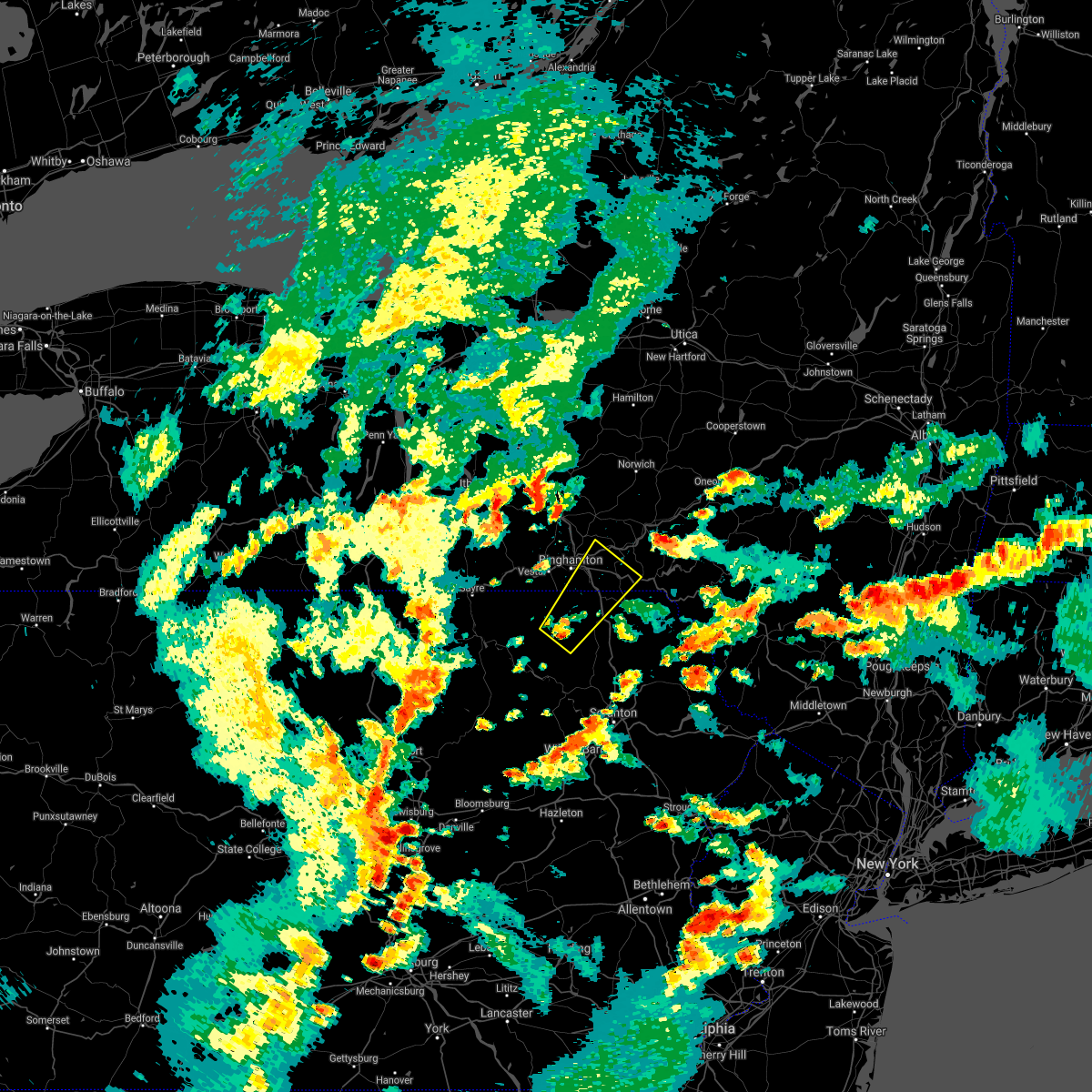 At 522 pm edt, a severe thunderstorm was located near montrose, moving northeast at 20 mph (radar indicated). Hazards include 60 mph wind gusts and quarter size hail. Hail damage to vehicles is expected. Expect wind damage to roofs, siding, and trees. At 522 pm edt, a severe thunderstorm was located near montrose, moving northeast at 20 mph (radar indicated). Hazards include 60 mph wind gusts and quarter size hail. Hail damage to vehicles is expected. Expect wind damage to roofs, siding, and trees.
|
| 7/12/2021 10:59 PM EDT |
 At 1035 pm edt, a severe thunderstorm was located over springville, or 8 miles south of montrose, moving northeast at 45 mph (radar indicated). Hazards include 60 mph wind gusts and quarter size hail. Hail damage to vehicles is expected. Expect wind damage to roofs, siding, and trees. At 1035 pm edt, a severe thunderstorm was located over springville, or 8 miles south of montrose, moving northeast at 45 mph (radar indicated). Hazards include 60 mph wind gusts and quarter size hail. Hail damage to vehicles is expected. Expect wind damage to roofs, siding, and trees.
|
| 7/12/2021 10:35 PM EDT |
 At 1035 pm edt, a severe thunderstorm was located over springville, or 8 miles south of montrose, moving northeast at 45 mph (radar indicated). Hazards include 60 mph wind gusts and quarter size hail. Hail damage to vehicles is expected. Expect wind damage to roofs, siding, and trees. At 1035 pm edt, a severe thunderstorm was located over springville, or 8 miles south of montrose, moving northeast at 45 mph (radar indicated). Hazards include 60 mph wind gusts and quarter size hail. Hail damage to vehicles is expected. Expect wind damage to roofs, siding, and trees.
|
| 7/12/2021 7:25 PM EDT |
 At 725 pm edt, a severe thunderstorm capable of producing a tornado was located over lanesboro, or 9 miles southwest of deposit, moving east at 20 mph (radar indicated rotation). Hazards include tornado. Flying debris will be dangerous to those caught without shelter. mobile homes will be damaged or destroyed. damage to roofs, windows, and vehicles will occur. tree damage is likely. this dangerous storm will be near, starrucca and starruca around 735 pm edt. Sherman around 740 pm edt. At 725 pm edt, a severe thunderstorm capable of producing a tornado was located over lanesboro, or 9 miles southwest of deposit, moving east at 20 mph (radar indicated rotation). Hazards include tornado. Flying debris will be dangerous to those caught without shelter. mobile homes will be damaged or destroyed. damage to roofs, windows, and vehicles will occur. tree damage is likely. this dangerous storm will be near, starrucca and starruca around 735 pm edt. Sherman around 740 pm edt.
|
| 7/12/2021 7:08 PM EDT |
 At 708 pm edt, a severe thunderstorm capable of producing a tornado was located over susquehanna depot, or 13 miles southwest of deposit, moving east at 20 mph (radar indicated rotation). Hazards include tornado. Flying debris will be dangerous to those caught without shelter. mobile homes will be damaged or destroyed. damage to roofs, windows, and vehicles will occur. tree damage is likely. this dangerous storm will be near, susquehanna and lanesboro around 715 pm edt. starrucca and starruca around 735 pm edt. Sherman around 740 pm edt. At 708 pm edt, a severe thunderstorm capable of producing a tornado was located over susquehanna depot, or 13 miles southwest of deposit, moving east at 20 mph (radar indicated rotation). Hazards include tornado. Flying debris will be dangerous to those caught without shelter. mobile homes will be damaged or destroyed. damage to roofs, windows, and vehicles will occur. tree damage is likely. this dangerous storm will be near, susquehanna and lanesboro around 715 pm edt. starrucca and starruca around 735 pm edt. Sherman around 740 pm edt.
|
| 7/9/2021 5:16 PM EDT |
 At 515 pm edt, severe thunderstorms were located along a line extending from near walton to royal, moving east at 35 mph (radar indicated). Hazards include 60 mph wind gusts. Expect damage to roofs, siding, and trees. Locations impacted include, jackson, walton, clifford, sanford, colchester, susquehanna, forest city, deposit, susquehanna depot and harford. At 515 pm edt, severe thunderstorms were located along a line extending from near walton to royal, moving east at 35 mph (radar indicated). Hazards include 60 mph wind gusts. Expect damage to roofs, siding, and trees. Locations impacted include, jackson, walton, clifford, sanford, colchester, susquehanna, forest city, deposit, susquehanna depot and harford.
|
| 7/9/2021 5:05 PM EDT |
 At 505 pm edt, severe thunderstorms were located along a line extending from near walton to near lenoxville, moving southeast at 35 mph (radar indicated). Hazards include 60 mph wind gusts. Expect damage to roofs, siding, and trees. Locations impacted include, sidney, jackson, walton, clifford, sanford, colchester, susquehanna, forest city, deposit and susquehanna depot. At 505 pm edt, severe thunderstorms were located along a line extending from near walton to near lenoxville, moving southeast at 35 mph (radar indicated). Hazards include 60 mph wind gusts. Expect damage to roofs, siding, and trees. Locations impacted include, sidney, jackson, walton, clifford, sanford, colchester, susquehanna, forest city, deposit and susquehanna depot.
|
| 7/9/2021 4:46 PM EDT |
 At 446 pm edt, severe thunderstorms were located along a line extending from near sidney to near montrose, moving southeast at 35 mph (radar indicated). Hazards include 60 mph wind gusts. expect damage to roofs, siding, and trees At 446 pm edt, severe thunderstorms were located along a line extending from near sidney to near montrose, moving southeast at 35 mph (radar indicated). Hazards include 60 mph wind gusts. expect damage to roofs, siding, and trees
|
| 7/9/2021 4:26 PM EDT |
 At 426 pm edt, a severe thunderstorm was located near montrose, moving southeast at 40 mph (radar indicated). Hazards include 60 mph wind gusts. Expect damage to roofs, siding, and trees. Locations impacted include, rush, susquehanna, susquehanna depot, springville, montrose, dimock, hallstead, new milford, herrick and great bend. At 426 pm edt, a severe thunderstorm was located near montrose, moving southeast at 40 mph (radar indicated). Hazards include 60 mph wind gusts. Expect damage to roofs, siding, and trees. Locations impacted include, rush, susquehanna, susquehanna depot, springville, montrose, dimock, hallstead, new milford, herrick and great bend.
|
| 7/9/2021 4:14 PM EDT |
 At 414 pm edt, a severe thunderstorm was located near rush, or 7 miles west of montrose, moving southeast at 40 mph (radar indicated). Hazards include 60 mph wind gusts and penny size hail. Expect damage to roofs, siding, and trees. Locations impacted include, rush, susquehanna, susquehanna depot, springville, montrose, dimock, hallstead, orwell, new milford and herrick. At 414 pm edt, a severe thunderstorm was located near rush, or 7 miles west of montrose, moving southeast at 40 mph (radar indicated). Hazards include 60 mph wind gusts and penny size hail. Expect damage to roofs, siding, and trees. Locations impacted include, rush, susquehanna, susquehanna depot, springville, montrose, dimock, hallstead, orwell, new milford and herrick.
|
| 7/9/2021 3:57 PM EDT |
 At 357 pm edt, a severe thunderstorm was located over warren center, or 13 miles south of owego, moving southeast at 40 mph (radar indicated). Hazards include 60 mph wind gusts and penny size hail. expect damage to roofs, siding, and trees At 357 pm edt, a severe thunderstorm was located over warren center, or 13 miles south of owego, moving southeast at 40 mph (radar indicated). Hazards include 60 mph wind gusts and penny size hail. expect damage to roofs, siding, and trees
|
| 7/9/2021 3:57 PM EDT |
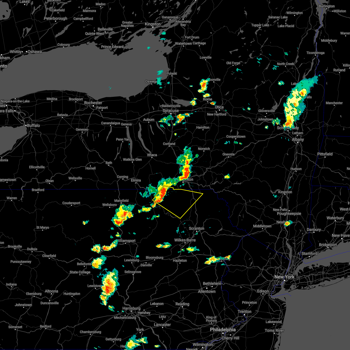 At 357 pm edt, a severe thunderstorm was located over warren center, or 13 miles south of owego, moving southeast at 40 mph (radar indicated). Hazards include 60 mph wind gusts and penny size hail. expect damage to roofs, siding, and trees At 357 pm edt, a severe thunderstorm was located over warren center, or 13 miles south of owego, moving southeast at 40 mph (radar indicated). Hazards include 60 mph wind gusts and penny size hail. expect damage to roofs, siding, and trees
|
| 7/7/2021 10:25 PM EDT |
 At 1023 pm edt, severe thunderstorms were located along a line extending from near whitney point to pleasant mount, moving northeast at 45 mph (law enforcement has reported numerous trees and wires down. widespread power outages in broome county from the microburst). Hazards include 70 mph wind gusts and quarter size hail. the highest winds will be with a dangerous microburst across northeastern broome and southern chenango counties. Hail damage to vehicles is expected. expect considerable tree damage. wind damage is also likely to mobile homes, roofs, and outbuildings. Locations impacted include, norwich, sidney, walton, guilford, sanford, colchester, susquehanna, deposit, coventry and susquehanna depot. At 1023 pm edt, severe thunderstorms were located along a line extending from near whitney point to pleasant mount, moving northeast at 45 mph (law enforcement has reported numerous trees and wires down. widespread power outages in broome county from the microburst). Hazards include 70 mph wind gusts and quarter size hail. the highest winds will be with a dangerous microburst across northeastern broome and southern chenango counties. Hail damage to vehicles is expected. expect considerable tree damage. wind damage is also likely to mobile homes, roofs, and outbuildings. Locations impacted include, norwich, sidney, walton, guilford, sanford, colchester, susquehanna, deposit, coventry and susquehanna depot.
|
| 7/7/2021 10:06 PM EDT |
 At 1004 pm edt, severe thunderstorms were located along a line extending from near berkshire to near royal, moving northeast at 45 mph (radar indicated). Hazards include 70 mph wind gusts and quarter size hail. 70 mph gusts with a danergrous microburst near binghamton airport moving northeast toward chenango forks and whitney point. elsewhere with 60 mph gusts, hail damage to vehicles is expected. expect considerable tree damage. Wind damage is also likely to mobile homes,roofs, and outbuildings. At 1004 pm edt, severe thunderstorms were located along a line extending from near berkshire to near royal, moving northeast at 45 mph (radar indicated). Hazards include 70 mph wind gusts and quarter size hail. 70 mph gusts with a danergrous microburst near binghamton airport moving northeast toward chenango forks and whitney point. elsewhere with 60 mph gusts, hail damage to vehicles is expected. expect considerable tree damage. Wind damage is also likely to mobile homes,roofs, and outbuildings.
|
| 7/6/2021 3:42 PM EDT |
 At 342 pm edt, severe thunderstorms were located along a line extending from near sanitaria springs to near susquehanna to near montrose, moving east at 50 mph (radar indicated). Hazards include 60 mph wind gusts and quarter size hail. Hail damage to vehicles is expected. Expect wind damage to roofs, siding, and trees. At 342 pm edt, severe thunderstorms were located along a line extending from near sanitaria springs to near susquehanna to near montrose, moving east at 50 mph (radar indicated). Hazards include 60 mph wind gusts and quarter size hail. Hail damage to vehicles is expected. Expect wind damage to roofs, siding, and trees.
|
| 7/6/2021 3:33 PM EDT |
 At 333 pm edt, severe thunderstorms were located along a line extending from jefferson to near delhi to near new milford, moving east at 60 mph (radar indicated). Hazards include 60 mph wind gusts and quarter size hail. Hail damage to vehicles is expected. expect wind damage to roofs, siding, and trees. Locations impacted include, binghamton, oneonta, kirkwood, conklin, sidney, walton, delhi, davenport, sanford and colchester. At 333 pm edt, severe thunderstorms were located along a line extending from jefferson to near delhi to near new milford, moving east at 60 mph (radar indicated). Hazards include 60 mph wind gusts and quarter size hail. Hail damage to vehicles is expected. expect wind damage to roofs, siding, and trees. Locations impacted include, binghamton, oneonta, kirkwood, conklin, sidney, walton, delhi, davenport, sanford and colchester.
|
| 7/6/2021 3:08 PM EDT |
 At 308 pm edt, severe thunderstorms were located along a line extending from laurens to bainbridge to near warren center, moving east at 60 mph (radar indicated). Hazards include 60 mph wind gusts and quarter size hail. Hail damage to vehicles is expected. Expect wind damage to roofs, siding, and trees. At 308 pm edt, severe thunderstorms were located along a line extending from laurens to bainbridge to near warren center, moving east at 60 mph (radar indicated). Hazards include 60 mph wind gusts and quarter size hail. Hail damage to vehicles is expected. Expect wind damage to roofs, siding, and trees.
|
| 6/30/2021 5:15 PM EDT |
 At 515 pm edt, severe thunderstorms were located along a line extending from meredith to brackney to near rome to near burlington, moving southeast at 15 mph (radar indicated). Hazards include 60 mph wind gusts and quarter size hail. Hail damage to vehicles is expected. expect wind damage to roofs, siding, and trees. Locations impacted include, binghamton, vestal, johnson city, endicott, kirkwood, conklin, sidney, athens, walton and towanda. At 515 pm edt, severe thunderstorms were located along a line extending from meredith to brackney to near rome to near burlington, moving southeast at 15 mph (radar indicated). Hazards include 60 mph wind gusts and quarter size hail. Hail damage to vehicles is expected. expect wind damage to roofs, siding, and trees. Locations impacted include, binghamton, vestal, johnson city, endicott, kirkwood, conklin, sidney, athens, walton and towanda.
|
| 6/30/2021 4:50 PM EDT |
 At 448 pm edt, severe thunderstorms were located along a line extending from near guilford to near brackney to near litchfield to wetona, moving southeast at 20 mph (radar indicated). Hazards include 60 mph wind gusts and quarter size hail. Hail damage to vehicles is expected. Expect wind damage to roofs, siding, and trees. At 448 pm edt, severe thunderstorms were located along a line extending from near guilford to near brackney to near litchfield to wetona, moving southeast at 20 mph (radar indicated). Hazards include 60 mph wind gusts and quarter size hail. Hail damage to vehicles is expected. Expect wind damage to roofs, siding, and trees.
|
| 5/26/2021 7:27 PM EDT |
 The severe thunderstorm warning for southwestern delaware, northeastern susquehanna and northern wayne counties will expire at 730 pm edt, the storm which prompted the warning has weakened below severe limits, and has exited the warned area. therefore, the warning will be allowed to expire. however gusty winds are still possible with this thunderstorm. a severe thunderstorm watch remains in effect until 800 pm edt for central new york, and northeastern pennsylvania. The severe thunderstorm warning for southwestern delaware, northeastern susquehanna and northern wayne counties will expire at 730 pm edt, the storm which prompted the warning has weakened below severe limits, and has exited the warned area. therefore, the warning will be allowed to expire. however gusty winds are still possible with this thunderstorm. a severe thunderstorm watch remains in effect until 800 pm edt for central new york, and northeastern pennsylvania.
|
| 5/26/2021 7:13 PM EDT |
 At 713 pm edt, a severe thunderstorm was located over hiawatha, or 9 miles south of deposit, moving east at 50 mph (radar indicated). Hazards include 60 mph wind gusts and penny size hail. Expect damage to roofs, siding, and trees. Locations impacted include, susquehanna, susquehanna depot, hancock, lanesboro, starrucca, hiawatha, shehawken, starlight, starruca and fishs eddy. At 713 pm edt, a severe thunderstorm was located over hiawatha, or 9 miles south of deposit, moving east at 50 mph (radar indicated). Hazards include 60 mph wind gusts and penny size hail. Expect damage to roofs, siding, and trees. Locations impacted include, susquehanna, susquehanna depot, hancock, lanesboro, starrucca, hiawatha, shehawken, starlight, starruca and fishs eddy.
|
| 5/26/2021 7:03 PM EDT |
 At 703 pm edt, a severe thunderstorm was located over lanesboro, or 10 miles southwest of deposit, moving east at 50 mph (radar indicated). Hazards include 60 mph wind gusts and nickel size hail. Expect damage to roofs, siding, and trees. Locations impacted include, susquehanna, susquehanna depot, hancock, new milford, ararat, lanesboro, thompson, starrucca, hiawatha and shehawken. At 703 pm edt, a severe thunderstorm was located over lanesboro, or 10 miles southwest of deposit, moving east at 50 mph (radar indicated). Hazards include 60 mph wind gusts and nickel size hail. Expect damage to roofs, siding, and trees. Locations impacted include, susquehanna, susquehanna depot, hancock, new milford, ararat, lanesboro, thompson, starrucca, hiawatha and shehawken.
|
| 5/26/2021 6:53 PM EDT |
 At 653 pm edt, a severe thunderstorm was located near hallstead, or 11 miles northeast of montrose, moving east at 45 mph (radar indicated). Hazards include 60 mph wind gusts and nickel size hail. expect damage to roofs, siding, and trees At 653 pm edt, a severe thunderstorm was located near hallstead, or 11 miles northeast of montrose, moving east at 45 mph (radar indicated). Hazards include 60 mph wind gusts and nickel size hail. expect damage to roofs, siding, and trees
|
| 10/7/2020 5:29 PM EDT |
 At 529 pm edt, severe thunderstorms were located along a line extending from near great bend to near deposit, moving southeast at 40 mph (radar indicated). Hazards include 60 mph wind gusts. Expect damage to roofs, siding, and trees. Locations impacted include, jackson, susquehanna, susquehanna depot, hallstead, hancock, new milford, great bend, lanesboro, thompson and starrucca. At 529 pm edt, severe thunderstorms were located along a line extending from near great bend to near deposit, moving southeast at 40 mph (radar indicated). Hazards include 60 mph wind gusts. Expect damage to roofs, siding, and trees. Locations impacted include, jackson, susquehanna, susquehanna depot, hallstead, hancock, new milford, great bend, lanesboro, thompson and starrucca.
|
| 10/7/2020 5:14 PM EDT |
 At 514 pm edt, severe thunderstorms were located along a line extending from near binghamton to near sanford, moving southeast at 40 mph (radar indicated). Hazards include 60 mph wind gusts. expect damage to roofs, siding, and trees At 514 pm edt, severe thunderstorms were located along a line extending from near binghamton to near sanford, moving southeast at 40 mph (radar indicated). Hazards include 60 mph wind gusts. expect damage to roofs, siding, and trees
|
| 8/27/2020 5:23 PM EDT |
 At 522 pm edt, a severe thunderstorm was located near hallstead, or 8 miles northeast of montrose, moving southeast at 55 mph (law enforcement). Hazards include 70 mph wind gusts and quarter size hail. Hail damage to vehicles is expected. expect considerable tree damage. Wind damage is also likely to mobile homes, roofs, and outbuildings. At 522 pm edt, a severe thunderstorm was located near hallstead, or 8 miles northeast of montrose, moving southeast at 55 mph (law enforcement). Hazards include 70 mph wind gusts and quarter size hail. Hail damage to vehicles is expected. expect considerable tree damage. Wind damage is also likely to mobile homes, roofs, and outbuildings.
|
| 8/27/2020 5:19 PM EDT |
 At 518 pm edt, severe thunderstorms were located along a line extending from sanitaria springs to near kirkwood to brackney, moving east at 50 mph (law enforcement. trees and powerlines have been blown down in the binghamton area with this line of thunderstorms). Hazards include 70 mph wind gusts and quarter size hail. Hail damage to vehicles is expected. expect considerable tree damage. wind damage is also likely to mobile homes, roofs, and outbuildings. Locations impacted include, binghamton, vestal, johnson city, endicott, kirkwood, conklin, maine, sanford, susquehanna and deposit. At 518 pm edt, severe thunderstorms were located along a line extending from sanitaria springs to near kirkwood to brackney, moving east at 50 mph (law enforcement. trees and powerlines have been blown down in the binghamton area with this line of thunderstorms). Hazards include 70 mph wind gusts and quarter size hail. Hail damage to vehicles is expected. expect considerable tree damage. wind damage is also likely to mobile homes, roofs, and outbuildings. Locations impacted include, binghamton, vestal, johnson city, endicott, kirkwood, conklin, maine, sanford, susquehanna and deposit.
|
| 8/27/2020 5:10 PM EDT |
 At 509 pm edt, severe thunderstorms were located along a line extending from castle creek to near binghamton to near tioga terrace, moving east at 45 mph (radar indicated). Hazards include 70 mph wind gusts and half dollar size hail. Hail damage to vehicles is expected. expect considerable tree damage. wind damage is also likely to mobile homes, roofs, and outbuildings. Locations impacted include, binghamton, vestal, johnson city, endicott, kirkwood, conklin, maine, sanford, susquehanna and deposit. At 509 pm edt, severe thunderstorms were located along a line extending from castle creek to near binghamton to near tioga terrace, moving east at 45 mph (radar indicated). Hazards include 70 mph wind gusts and half dollar size hail. Hail damage to vehicles is expected. expect considerable tree damage. wind damage is also likely to mobile homes, roofs, and outbuildings. Locations impacted include, binghamton, vestal, johnson city, endicott, kirkwood, conklin, maine, sanford, susquehanna and deposit.
|
| 8/27/2020 4:52 PM EDT |
 At 451 pm edt, clusters of a severe thunderstorm were located near newark valley, or 7 miles west of greater binghamton airport, moving southeast at 45 mph (radar indicated). Hazards include 70 mph wind gusts and half dollar size hail. Hail damage to vehicles is expected. expect considerable tree damage. Wind damage is also likely to mobile homes, roofs, and outbuildings. At 451 pm edt, clusters of a severe thunderstorm were located near newark valley, or 7 miles west of greater binghamton airport, moving southeast at 45 mph (radar indicated). Hazards include 70 mph wind gusts and half dollar size hail. Hail damage to vehicles is expected. expect considerable tree damage. Wind damage is also likely to mobile homes, roofs, and outbuildings.
|
| 8/25/2020 3:24 PM EDT |
 The severe thunderstorm warning for southwestern delaware, northeastern susquehanna and northwestern wayne counties will expire at 330 pm edt, the storm which prompted the warning has weakened below severe limits, and no longer poses an immediate threat to life or property. therefore, the warning will be allowed to expire. a severe thunderstorm watch remains in effect until 900 pm edt for central new york, and northeastern pennsylvania. to report severe weather, contact your nearest law enforcement agency. they will relay your report to the national weather service binghamton. The severe thunderstorm warning for southwestern delaware, northeastern susquehanna and northwestern wayne counties will expire at 330 pm edt, the storm which prompted the warning has weakened below severe limits, and no longer poses an immediate threat to life or property. therefore, the warning will be allowed to expire. a severe thunderstorm watch remains in effect until 900 pm edt for central new york, and northeastern pennsylvania. to report severe weather, contact your nearest law enforcement agency. they will relay your report to the national weather service binghamton.
|
| 8/25/2020 3:04 PM EDT |
 At 304 pm edt, a severe thunderstorm was located over starruca, or 9 miles south of deposit, moving southeast at 40 mph (radar indicated). Hazards include 60 mph wind gusts and quarter size hail. Hail damage to vehicles is expected. expect wind damage to roofs, siding, and trees. Locations impacted include, susquehanna, susquehanna depot, hancock, ararat, lanesboro, thompson, starrucca, hiawatha, shehawken and starlight. At 304 pm edt, a severe thunderstorm was located over starruca, or 9 miles south of deposit, moving southeast at 40 mph (radar indicated). Hazards include 60 mph wind gusts and quarter size hail. Hail damage to vehicles is expected. expect wind damage to roofs, siding, and trees. Locations impacted include, susquehanna, susquehanna depot, hancock, ararat, lanesboro, thompson, starrucca, hiawatha, shehawken and starlight.
|
| 8/25/2020 2:29 PM EDT |
 At 229 pm edt, a severe thunderstorm was located over sanitaria springs, or 7 miles northeast of binghamton, moving southeast at 40 mph (radar indicated). Hazards include 60 mph wind gusts and quarter size hail. Hail damage to vehicles is expected. Expect wind damage to roofs, siding, and trees. At 229 pm edt, a severe thunderstorm was located over sanitaria springs, or 7 miles northeast of binghamton, moving southeast at 40 mph (radar indicated). Hazards include 60 mph wind gusts and quarter size hail. Hail damage to vehicles is expected. Expect wind damage to roofs, siding, and trees.
|
| 7/23/2020 4:43 PM EDT |
 At 441 pm edt, severe thunderstorms were located along a line extending from near lanesboro, to thompson, to near gibson, to near harford, to near springville, moving southeast at 25 mph (law enforcement. trees and power lines have been blown down by this line of thunderstorms). Hazards include 60 mph wind gusts and quarter size hail. Hail damage to vehicles is expected. expect wind damage to roofs, siding, and trees. Locations impacted include, clarks summit, rush, jackson, clifford, susquehanna, forest city, susquehanna depot, springville, montrose, and dimock. At 441 pm edt, severe thunderstorms were located along a line extending from near lanesboro, to thompson, to near gibson, to near harford, to near springville, moving southeast at 25 mph (law enforcement. trees and power lines have been blown down by this line of thunderstorms). Hazards include 60 mph wind gusts and quarter size hail. Hail damage to vehicles is expected. expect wind damage to roofs, siding, and trees. Locations impacted include, clarks summit, rush, jackson, clifford, susquehanna, forest city, susquehanna depot, springville, montrose, and dimock.
|
| 7/23/2020 4:31 PM EDT |
 At 428 pm edt, severe thunderstorms were located along a line extending from near windsor, to near susquehanna, to near new milford, to montrose, to near rush, moving southeast at 30 mph (law enforcement. trees and power lines have been blown down by this line of thunderstorms). Hazards include 60 mph wind gusts and quarter size hail. Hail damage to vehicles is expected. expect wind damage to roofs, siding, and trees. Locations impacted include, clarks summit, rush, jackson, clifford, susquehanna, forest city, susquehanna depot, springville, montrose, and dimock. At 428 pm edt, severe thunderstorms were located along a line extending from near windsor, to near susquehanna, to near new milford, to montrose, to near rush, moving southeast at 30 mph (law enforcement. trees and power lines have been blown down by this line of thunderstorms). Hazards include 60 mph wind gusts and quarter size hail. Hail damage to vehicles is expected. expect wind damage to roofs, siding, and trees. Locations impacted include, clarks summit, rush, jackson, clifford, susquehanna, forest city, susquehanna depot, springville, montrose, and dimock.
|
| 7/23/2020 4:15 PM EDT |
 At 414 pm edt, severe thunderstorms were located along a line extending from near windsor, to near hallstead, to near great bend, to near friendsville to near rush, moving southeast at 30 mph (law enforcement. trees and power lines have been blown down by this line of thunderstorms). Hazards include 60 mph wind gusts and half dollar size hail. Hail damage to vehicles is expected. expect wind damage to roofs, siding, and trees. Locations impacted include, kirkwood, conklin, clarks summit, rush, jackson, clifford, susquehanna, forest city, deposit and susquehanna depot. At 414 pm edt, severe thunderstorms were located along a line extending from near windsor, to near hallstead, to near great bend, to near friendsville to near rush, moving southeast at 30 mph (law enforcement. trees and power lines have been blown down by this line of thunderstorms). Hazards include 60 mph wind gusts and half dollar size hail. Hail damage to vehicles is expected. expect wind damage to roofs, siding, and trees. Locations impacted include, kirkwood, conklin, clarks summit, rush, jackson, clifford, susquehanna, forest city, deposit and susquehanna depot.
|
| 7/23/2020 3:56 PM EDT |
 At 355 pm edt, severe thunderstorms were located along a line extending from near chenango bridge, to near conklin, to near brackney, to near little meadows, to near le raysville, moving southeast at 30 mph (law enforcement. trees and power lines have been blown down by this line of thunderstorms). Hazards include 60 mph wind gusts and nickel size hail. expect damage to roofs, siding, and trees At 355 pm edt, severe thunderstorms were located along a line extending from near chenango bridge, to near conklin, to near brackney, to near little meadows, to near le raysville, moving southeast at 30 mph (law enforcement. trees and power lines have been blown down by this line of thunderstorms). Hazards include 60 mph wind gusts and nickel size hail. expect damage to roofs, siding, and trees
|
| 7/19/2020 5:00 PM EDT | Trees and wires down in susquehanna county PA, 0.4 miles WSW of Lanesboro, PA |
| 4/13/2020 3:36 PM EDT |
 At 336 pm edt, severe thunderstorms were located along a line extending from near friendsville to lovelton, moving east at 50 mph (radar indicated). Hazards include 60 mph wind gusts. Expect damage to roofs, siding, and trees. Locations impacted include, rush, jackson, susquehanna, tunkhannock, susquehanna depot, springville, montrose, dimock, harford and hallstead. At 336 pm edt, severe thunderstorms were located along a line extending from near friendsville to lovelton, moving east at 50 mph (radar indicated). Hazards include 60 mph wind gusts. Expect damage to roofs, siding, and trees. Locations impacted include, rush, jackson, susquehanna, tunkhannock, susquehanna depot, springville, montrose, dimock, harford and hallstead.
|
| 4/13/2020 3:10 PM EDT |
 At 309 pm edt, severe thunderstorms were located along a line extending from milan to near lincoln falls, moving east-northeast at 40 mph (radar indicated). Hazards include 60 mph wind gusts. expect damage to roofs, siding, and trees At 309 pm edt, severe thunderstorms were located along a line extending from milan to near lincoln falls, moving east-northeast at 40 mph (radar indicated). Hazards include 60 mph wind gusts. expect damage to roofs, siding, and trees
|
| 10/31/2019 9:14 PM EDT |
 At 914 pm edt, severe thunderstorms were located along a line extending from lanesboro to wallsville, moving northeast at 60 mph (radar indicated). Hazards include 60 mph wind gusts. expect damage to roofs, siding, and trees At 914 pm edt, severe thunderstorms were located along a line extending from lanesboro to wallsville, moving northeast at 60 mph (radar indicated). Hazards include 60 mph wind gusts. expect damage to roofs, siding, and trees
|
| 10/31/2019 8:57 PM EDT |
 At 856 pm edt, gusty showers thunderstorms were located along a line extending from near smyrna to near kirkwood, moving northeast at 60 mph (radar indicated). Hazards include 60 mph wind gusts. expect damage to roofs, siding, and trees At 856 pm edt, gusty showers thunderstorms were located along a line extending from near smyrna to near kirkwood, moving northeast at 60 mph (radar indicated). Hazards include 60 mph wind gusts. expect damage to roofs, siding, and trees
|
| 10/31/2019 8:33 PM EDT |
 At 832 pm edt, severe thunderstorms were located along a line extending from near sugar run to near fairmount spgs, moving northeast at 50 mph (radar indicated). Hazards include 60 mph wind gusts. Expect damage to roofs, siding, and trees. Locations impacted include, falls, vernon, rush, jackson, lehman, harveys lake, susquehanna, tunkhannock, susquehanna depot and springville. At 832 pm edt, severe thunderstorms were located along a line extending from near sugar run to near fairmount spgs, moving northeast at 50 mph (radar indicated). Hazards include 60 mph wind gusts. Expect damage to roofs, siding, and trees. Locations impacted include, falls, vernon, rush, jackson, lehman, harveys lake, susquehanna, tunkhannock, susquehanna depot and springville.
|
| 10/31/2019 8:10 PM EDT |
 At 809 pm edt, severe thunderstorms were located along a line extending from near overton to biggertown, moving northeast at 65 mph (radar indicated). Hazards include 60 mph wind gusts. expect damage to roofs, siding, and trees At 809 pm edt, severe thunderstorms were located along a line extending from near overton to biggertown, moving northeast at 65 mph (radar indicated). Hazards include 60 mph wind gusts. expect damage to roofs, siding, and trees
|
| 9/4/2019 1:26 PM EDT |
 The severe thunderstorm warning for southeastern broome and northeastern susquehanna counties will expire at 130 pm edt, the storms which prompted the warning have weakened below severe limits, and no longer pose an immediate threat to life or property. therefore, the warning will be allowed to expire. however gusty winds are still possible with these thunderstorms. a severe thunderstorm watch remains in effect until 900 pm edt for northeastern pennsylvania. to report severe weather, contact your nearest law enforcement agency. they will relay your report to the national weather service binghamton. The severe thunderstorm warning for southeastern broome and northeastern susquehanna counties will expire at 130 pm edt, the storms which prompted the warning have weakened below severe limits, and no longer pose an immediate threat to life or property. therefore, the warning will be allowed to expire. however gusty winds are still possible with these thunderstorms. a severe thunderstorm watch remains in effect until 900 pm edt for northeastern pennsylvania. to report severe weather, contact your nearest law enforcement agency. they will relay your report to the national weather service binghamton.
|
| 9/4/2019 1:10 PM EDT |
 At 110 pm edt, severe thunderstorms were located along a line extending from near sanford to near kirkwood to near vestal center, moving east at 25 mph (radar indicated). Hazards include 60 mph wind gusts. Expect damage to roofs, siding, and trees. Locations impacted include, binghamton, kirkwood, conklin, sanford, susquehanna, deposit, susquehanna depot, hallstead, windsor and great bend. At 110 pm edt, severe thunderstorms were located along a line extending from near sanford to near kirkwood to near vestal center, moving east at 25 mph (radar indicated). Hazards include 60 mph wind gusts. Expect damage to roofs, siding, and trees. Locations impacted include, binghamton, kirkwood, conklin, sanford, susquehanna, deposit, susquehanna depot, hallstead, windsor and great bend.
|
| 9/4/2019 1:01 PM EDT |
 At 101 pm edt, severe thunderstorms were located along a line extending from near afton to near binghamton to vestal center, moving east at 50 mph (radar indicated). Hazards include 60 mph wind gusts. Expect damage to roofs, siding, and trees. Locations impacted include, binghamton, vestal, johnson city, endicott, kirkwood, conklin, sanford, susquehanna, deposit and susquehanna depot. At 101 pm edt, severe thunderstorms were located along a line extending from near afton to near binghamton to vestal center, moving east at 50 mph (radar indicated). Hazards include 60 mph wind gusts. Expect damage to roofs, siding, and trees. Locations impacted include, binghamton, vestal, johnson city, endicott, kirkwood, conklin, sanford, susquehanna, deposit and susquehanna depot.
|
| 9/4/2019 12:37 PM EDT |
 At 1237 pm edt, a severe thunderstorm was located over johnson city, moving east at 35 mph (radar indicated). Hazards include 60 mph wind gusts and penny size hail. expect damage to roofs, siding, and trees At 1237 pm edt, a severe thunderstorm was located over johnson city, moving east at 35 mph (radar indicated). Hazards include 60 mph wind gusts and penny size hail. expect damage to roofs, siding, and trees
|
| 8/18/2019 4:57 PM EDT |
 A severe thunderstorm warning remains in effect until 515 pm edt for northeastern susquehanna and northwestern wayne counties. at 456 pm edt, a severe thunderstorm was located over starlight, or 13 miles south of deposit, moving east at 50 mph. hazard. 60 mph wind gusts. source. Radar indicated. A severe thunderstorm warning remains in effect until 515 pm edt for northeastern susquehanna and northwestern wayne counties. at 456 pm edt, a severe thunderstorm was located over starlight, or 13 miles south of deposit, moving east at 50 mph. hazard. 60 mph wind gusts. source. Radar indicated.
|
| 8/18/2019 4:45 PM EDT | Tree and wires down across road... s main st in susquehanna county PA, 0.4 miles WSW of Lanesboro, PA |
| 8/18/2019 4:43 PM EDT |
 At 443 pm edt, a severe thunderstorm was located near thompson, or 13 miles southwest of deposit, moving east at 50 mph (radar indicated). Hazards include 60 mph wind gusts. Expect damage to roofs, siding, and trees. Locations impacted include, jackson, susquehanna, susquehanna depot, hallstead, new milford, great bend, ararat, lanesboro, thompson and starrucca. At 443 pm edt, a severe thunderstorm was located near thompson, or 13 miles southwest of deposit, moving east at 50 mph (radar indicated). Hazards include 60 mph wind gusts. Expect damage to roofs, siding, and trees. Locations impacted include, jackson, susquehanna, susquehanna depot, hallstead, new milford, great bend, ararat, lanesboro, thompson and starrucca.
|
| 8/18/2019 4:34 PM EDT |
 At 433 pm edt, a severe thunderstorm was located over new milford, or 9 miles northeast of montrose, moving east at 50 mph (radar indicated). Hazards include 60 mph wind gusts. expect damage to roofs, siding, and trees At 433 pm edt, a severe thunderstorm was located over new milford, or 9 miles northeast of montrose, moving east at 50 mph (radar indicated). Hazards include 60 mph wind gusts. expect damage to roofs, siding, and trees
|
| 8/17/2019 6:57 PM EDT |
 A severe thunderstorm warning remains in effect until 715 pm edt for susquehanna county. at 656 pm edt, a severe thunderstorm was located near montrose, moving east at 35 mph. hazard. 60 mph wind gusts and quarter size hail. source. Radar indicated. A severe thunderstorm warning remains in effect until 715 pm edt for susquehanna county. at 656 pm edt, a severe thunderstorm was located near montrose, moving east at 35 mph. hazard. 60 mph wind gusts and quarter size hail. source. Radar indicated.
|
| 8/17/2019 6:33 PM EDT |
 At 632 pm edt, a severe thunderstorm was located near le raysville, or 15 miles north of wyalusing, moving east at 35 mph (radar indicated). Hazards include 60 mph wind gusts and quarter size hail. Hail damage to vehicles is expected. Expect wind damage to roofs, siding, and trees. At 632 pm edt, a severe thunderstorm was located near le raysville, or 15 miles north of wyalusing, moving east at 35 mph (radar indicated). Hazards include 60 mph wind gusts and quarter size hail. Hail damage to vehicles is expected. Expect wind damage to roofs, siding, and trees.
|
| 8/8/2019 4:35 PM EDT |
 At 434 pm edt, severe thunderstorms were located along a line extending from stamford to near corbett to montrose, moving east at 50 mph (law enforcement has reported multiple trees and wires down in the area). Hazards include 60 mph wind gusts and penny size hail. Expect damage to roofs, siding, and trees. Locations impacted include, rush, jackson, delhi, colchester, susquehanna, west franklin, deposit, susquehanna depot, springville and montrose. At 434 pm edt, severe thunderstorms were located along a line extending from stamford to near corbett to montrose, moving east at 50 mph (law enforcement has reported multiple trees and wires down in the area). Hazards include 60 mph wind gusts and penny size hail. Expect damage to roofs, siding, and trees. Locations impacted include, rush, jackson, delhi, colchester, susquehanna, west franklin, deposit, susquehanna depot, springville and montrose.
|
| 8/8/2019 3:42 PM EDT |
 At 342 pm edt, severe thunderstorms were located along a line extending from bainbridge to near brackney to near le roy, moving east at 45 mph (radar indicated). Hazards include 60 mph wind gusts and penny size hail. expect damage to roofs, siding, and trees At 342 pm edt, severe thunderstorms were located along a line extending from bainbridge to near brackney to near le roy, moving east at 45 mph (radar indicated). Hazards include 60 mph wind gusts and penny size hail. expect damage to roofs, siding, and trees
|
| 8/8/2019 2:56 PM EDT |
 At 255 pm edt, severe thunderstorms were located along a line extending from near candor to tioga center to near wetona, moving east at 60 mph (radar indicated). Hazards include 60 mph wind gusts and penny size hail. expect damage to roofs, siding, and trees At 255 pm edt, severe thunderstorms were located along a line extending from near candor to tioga center to near wetona, moving east at 60 mph (radar indicated). Hazards include 60 mph wind gusts and penny size hail. expect damage to roofs, siding, and trees
|
| 7/19/2019 5:39 PM EDT |
 At 539 pm edt, a severe thunderstorm was located near sanford, or near deposit, moving east at 30 mph (radar indicated). Hazards include 60 mph wind gusts and nickel size hail. expect damage to roofs, siding, and trees At 539 pm edt, a severe thunderstorm was located near sanford, or near deposit, moving east at 30 mph (radar indicated). Hazards include 60 mph wind gusts and nickel size hail. expect damage to roofs, siding, and trees
|
| 6/29/2019 9:03 PM EDT |
 At 902 pm edt, a severe thunderstorm was located over sherman, or near deposit, moving east at 30 mph (radar indicated). Hazards include quarter size hail. Damage to vehicles is expected. Locations impacted include, susquehanna, deposit, susquehanna depot, hancock, lanesboro, starrucca, hiawatha, shehawken, starlight and starruca. At 902 pm edt, a severe thunderstorm was located over sherman, or near deposit, moving east at 30 mph (radar indicated). Hazards include quarter size hail. Damage to vehicles is expected. Locations impacted include, susquehanna, deposit, susquehanna depot, hancock, lanesboro, starrucca, hiawatha, shehawken, starlight and starruca.
|
| 6/29/2019 8:43 PM EDT |
 At 843 pm edt, a severe thunderstorm was located over lanesboro, or 10 miles southwest of deposit, moving east at 30 mph (radar indicated). Hazards include half dollar size hail. damage to vehicles is expected At 843 pm edt, a severe thunderstorm was located over lanesboro, or 10 miles southwest of deposit, moving east at 30 mph (radar indicated). Hazards include half dollar size hail. damage to vehicles is expected
|
| 6/29/2019 8:30 PM EDT |
 At 829 pm edt, a severe thunderstorm was located over hallstead, or 11 miles northeast of montrose, moving east at 30 mph (radar indicated). Hazards include quarter size hail. Damage to vehicles is expected. Locations impacted include, endicott, susquehanna, susquehanna depot, montrose, harford, hallstead, new milford, great bend, lanesboro and little meadows. At 829 pm edt, a severe thunderstorm was located over hallstead, or 11 miles northeast of montrose, moving east at 30 mph (radar indicated). Hazards include quarter size hail. Damage to vehicles is expected. Locations impacted include, endicott, susquehanna, susquehanna depot, montrose, harford, hallstead, new milford, great bend, lanesboro and little meadows.
|
| 6/29/2019 8:30 PM EDT |
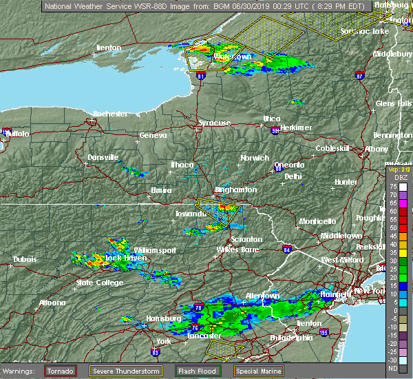 At 755 pm edt, a severe thunderstorm was located over little meadows, or 7 miles south of endicott, moving east at 25 mph (radar indicated). Hazards include quarter size hail. damage to vehicles is expected At 755 pm edt, a severe thunderstorm was located over little meadows, or 7 miles south of endicott, moving east at 25 mph (radar indicated). Hazards include quarter size hail. damage to vehicles is expected
|
| 6/29/2019 7:55 PM EDT |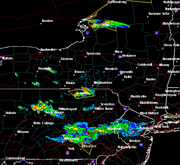
 At 755 pm edt, a severe thunderstorm was located over little meadows, or 7 miles south of endicott, moving east at 25 mph (radar indicated). Hazards include quarter size hail. damage to vehicles is expected At 755 pm edt, a severe thunderstorm was located over little meadows, or 7 miles south of endicott, moving east at 25 mph (radar indicated). Hazards include quarter size hail. damage to vehicles is expected
|
| 6/26/2019 6:45 PM EDT |
 At 645 pm edt, severe thunderstorms were located along a line extending from near hankins to near thompson to near susquehanna, moving east-southeast at 25 mph (radar indicated). Hazards include 60 mph wind gusts and penny size hail. expect damage to roofs, siding, and trees At 645 pm edt, severe thunderstorms were located along a line extending from near hankins to near thompson to near susquehanna, moving east-southeast at 25 mph (radar indicated). Hazards include 60 mph wind gusts and penny size hail. expect damage to roofs, siding, and trees
|
| 4/15/2019 1:59 AM EDT |
 At 158 am edt, severe thunderstorms were located along a line extending from 7 miles east of afton to near gibson to royal, moving east at 45 mph (radar indicated). Hazards include 60 mph wind gusts. expect damage to roofs, siding, and trees At 158 am edt, severe thunderstorms were located along a line extending from 7 miles east of afton to near gibson to royal, moving east at 45 mph (radar indicated). Hazards include 60 mph wind gusts. expect damage to roofs, siding, and trees
|
| 4/15/2019 1:47 AM EDT |
 At 147 am edt, severe thunderstorms were located along a line extending from near bainbridge to hallstead to near hop bottom, moving east at 50 mph (radar indicated). Hazards include 70 mph wind gusts. Expect considerable tree damage. damage is likely to mobile homes, roofs, and outbuildings. Locations impacted include, kirkwood, conklin, sidney, jackson, guilford, clifford, sanford, susquehanna, forest city and deposit. At 147 am edt, severe thunderstorms were located along a line extending from near bainbridge to hallstead to near hop bottom, moving east at 50 mph (radar indicated). Hazards include 70 mph wind gusts. Expect considerable tree damage. damage is likely to mobile homes, roofs, and outbuildings. Locations impacted include, kirkwood, conklin, sidney, jackson, guilford, clifford, sanford, susquehanna, forest city and deposit.
|
| 4/15/2019 1:27 AM EDT |
 At 127 am edt, severe thunderstorms were located along a line extending from chenango forks to near friendsville to near auburn center, moving east at 45 mph (radar indicated). Hazards include 70 mph wind gusts. Expect considerable tree damage. damage is likely to mobile homes, roofs, and outbuildings. Locations impacted include, binghamton, vestal, johnson city, endicott, kirkwood, conklin, rush, sidney, jackson and guilford. At 127 am edt, severe thunderstorms were located along a line extending from chenango forks to near friendsville to near auburn center, moving east at 45 mph (radar indicated). Hazards include 70 mph wind gusts. Expect considerable tree damage. damage is likely to mobile homes, roofs, and outbuildings. Locations impacted include, binghamton, vestal, johnson city, endicott, kirkwood, conklin, rush, sidney, jackson and guilford.
|
| 4/15/2019 1:10 AM EDT |
 At 110 am edt, severe thunderstorms were located along a line extending from near nanticoke to near le raysville to near new albany, moving east at 45 mph (radar indicated). Hazards include 70 mph wind gusts. Expect considerable tree damage. Damage is likely to mobile homes, roofs, and outbuildings. At 110 am edt, severe thunderstorms were located along a line extending from near nanticoke to near le raysville to near new albany, moving east at 45 mph (radar indicated). Hazards include 70 mph wind gusts. Expect considerable tree damage. Damage is likely to mobile homes, roofs, and outbuildings.
|
| 8/17/2018 4:03 PM EDT |
 At 402 pm edt, a severe thunderstorm was located near susquehanna, or 12 miles east of montrose, moving northeast at 25 mph (radar indicated). Hazards include quarter size hail. Damage to vehicles is expected. this severe storm will be near, susquehanna around 410 pm edt. lanesboro and thompson around 415 pm edt. starrucca and starruca around 420 pm edt. Deposit, sanford and sherman around 430 pm edt. At 402 pm edt, a severe thunderstorm was located near susquehanna, or 12 miles east of montrose, moving northeast at 25 mph (radar indicated). Hazards include quarter size hail. Damage to vehicles is expected. this severe storm will be near, susquehanna around 410 pm edt. lanesboro and thompson around 415 pm edt. starrucca and starruca around 420 pm edt. Deposit, sanford and sherman around 430 pm edt.
|
| 8/17/2018 3:49 PM EDT |
 At 349 pm edt, a severe thunderstorm was located over new milford, or 7 miles east of montrose, moving northeast at 25 mph (radar indicated). Hazards include quarter size hail. Damage to vehicles is expected. this severe thunderstorm will be near, gibson around 355 pm edt. hallstead and great bend around 400 pm edt. susquehanna and susquehanna depot around 410 pm edt. lanesboro and thompson around 415 pm edt. starrucca and starruca around 425 pm edt. Deposit, sanford and sherman around 430 pm edt. At 349 pm edt, a severe thunderstorm was located over new milford, or 7 miles east of montrose, moving northeast at 25 mph (radar indicated). Hazards include quarter size hail. Damage to vehicles is expected. this severe thunderstorm will be near, gibson around 355 pm edt. hallstead and great bend around 400 pm edt. susquehanna and susquehanna depot around 410 pm edt. lanesboro and thompson around 415 pm edt. starrucca and starruca around 425 pm edt. Deposit, sanford and sherman around 430 pm edt.
|
| 7/22/2018 6:41 PM EDT |
 At 641 pm edt, a severe thunderstorm was located over thompson, or 13 miles southwest of deposit, moving north at 30 mph (radar indicated). Hazards include 60 mph wind gusts. Expect damage to roofs, siding, and trees. this severe storm will be near, susquehanna around 650 pm edt. Susquehanna depot and lanesboro around 655 pm edt. At 641 pm edt, a severe thunderstorm was located over thompson, or 13 miles southwest of deposit, moving north at 30 mph (radar indicated). Hazards include 60 mph wind gusts. Expect damage to roofs, siding, and trees. this severe storm will be near, susquehanna around 650 pm edt. Susquehanna depot and lanesboro around 655 pm edt.
|
| 7/22/2018 6:19 PM EDT |
 At 618 pm edt, a severe thunderstorm was located over union dale, or 10 miles north of carbondale, moving north at 30 mph (radar indicated). Hazards include 60 mph wind gusts. Expect damage to roofs, siding, and trees. this severe thunderstorm will be near, gibson around 635 pm edt. thompson around 640 pm edt. susquehanna around 650 pm edt. Susquehanna depot and lanesboro around 655 pm edt. At 618 pm edt, a severe thunderstorm was located over union dale, or 10 miles north of carbondale, moving north at 30 mph (radar indicated). Hazards include 60 mph wind gusts. Expect damage to roofs, siding, and trees. this severe thunderstorm will be near, gibson around 635 pm edt. thompson around 640 pm edt. susquehanna around 650 pm edt. Susquehanna depot and lanesboro around 655 pm edt.
|
| 6/18/2018 4:44 PM EDT |
 At 444 pm edt, severe thunderstorms were located along a line extending from near susquehanna depot to near lenoxville to near factoryville to evans falls, moving southeast at 35 mph (radar indicated). Hazards include 60 mph wind gusts. Expect damage to roofs, siding, and trees. severe thunderstorms will be near, dalton, royal and lenoxville around 450 pm edt. waverly, clarks summit and clarks green around 455 pm edt. scranton, wilkes-barre and carbondale around 500 pm edt. moosic, waymart and union dale around 505 pm edt. moscow, elmhurst and prompton around 510 pm edt. honesdale, lake ariel and arlington around 515 pm edt. sterling, lehigh and rutledgedale around 520 pm edt. Damascus and greentown around 525 pm edt. At 444 pm edt, severe thunderstorms were located along a line extending from near susquehanna depot to near lenoxville to near factoryville to evans falls, moving southeast at 35 mph (radar indicated). Hazards include 60 mph wind gusts. Expect damage to roofs, siding, and trees. severe thunderstorms will be near, dalton, royal and lenoxville around 450 pm edt. waverly, clarks summit and clarks green around 455 pm edt. scranton, wilkes-barre and carbondale around 500 pm edt. moosic, waymart and union dale around 505 pm edt. moscow, elmhurst and prompton around 510 pm edt. honesdale, lake ariel and arlington around 515 pm edt. sterling, lehigh and rutledgedale around 520 pm edt. Damascus and greentown around 525 pm edt.
|
| 5/15/2018 2:43 PM EDT |
 At 243 pm edt, severe thunderstorms were located along a line extending from sherman to near harford to near lake carey, moving east at 55 mph (radar indicated). Hazards include 60 mph wind gusts and half dollar size hail. Hail damage to vehicles is expected. expect wind damage to roofs, siding, and trees. these severe storms will be near, starlight, hiawatha and sherman around 250 pm edt. thompson around 255 pm edt. union dale around 300 pm edt. pleasant mount around 305 pm edt. forest city around 310 pm edt. equinunk around 315 pm edt. A tornado watch remains in effect until 800 pm edt for central new york, and northeastern pennsylvania. At 243 pm edt, severe thunderstorms were located along a line extending from sherman to near harford to near lake carey, moving east at 55 mph (radar indicated). Hazards include 60 mph wind gusts and half dollar size hail. Hail damage to vehicles is expected. expect wind damage to roofs, siding, and trees. these severe storms will be near, starlight, hiawatha and sherman around 250 pm edt. thompson around 255 pm edt. union dale around 300 pm edt. pleasant mount around 305 pm edt. forest city around 310 pm edt. equinunk around 315 pm edt. A tornado watch remains in effect until 800 pm edt for central new york, and northeastern pennsylvania.
|
| 5/15/2018 2:31 PM EDT |
 At 231 pm edt, severe thunderstorms were located along a line extending from near montrose to near springville to near rush, moving east at 45 mph. these are very dangerous storms (radar indicated). Hazards include 80 mph wind gusts and two inch hail. Flying debris will be dangerous to those caught without shelter. mobile homes will be heavily damaged. expect considerable damage to roofs, windows, and vehicles. extensive tree damage and power outages are likely. locations impacted include, rush, jackson, clifford, susquehanna, forest city, susquehanna depot, springville, montrose, dimock and harford. A tornado watch remains in effect until 800 pm edt for central new york, and northeastern pennsylvania. At 231 pm edt, severe thunderstorms were located along a line extending from near montrose to near springville to near rush, moving east at 45 mph. these are very dangerous storms (radar indicated). Hazards include 80 mph wind gusts and two inch hail. Flying debris will be dangerous to those caught without shelter. mobile homes will be heavily damaged. expect considerable damage to roofs, windows, and vehicles. extensive tree damage and power outages are likely. locations impacted include, rush, jackson, clifford, susquehanna, forest city, susquehanna depot, springville, montrose, dimock and harford. A tornado watch remains in effect until 800 pm edt for central new york, and northeastern pennsylvania.
|
| 5/15/2018 2:21 PM EDT |
 At 209 pm edt, severe thunderstorms were located along a line extending from near warren center to near herrick, moving east at 50 mph (radar indicated). Hazards include 60 mph wind gusts and half dollar size hail. Hail damage to vehicles is expected. Expect wind damage to roofs, siding, and trees. At 209 pm edt, severe thunderstorms were located along a line extending from near warren center to near herrick, moving east at 50 mph (radar indicated). Hazards include 60 mph wind gusts and half dollar size hail. Hail damage to vehicles is expected. Expect wind damage to roofs, siding, and trees.
|
| 5/15/2018 2:10 PM EDT |
 At 209 pm edt, severe thunderstorms were located along a line extending from near warren center to near herrick, moving east at 50 mph (radar indicated). Hazards include 60 mph wind gusts and half dollar size hail. Hail damage to vehicles is expected. Expect wind damage to roofs, siding, and trees. At 209 pm edt, severe thunderstorms were located along a line extending from near warren center to near herrick, moving east at 50 mph (radar indicated). Hazards include 60 mph wind gusts and half dollar size hail. Hail damage to vehicles is expected. Expect wind damage to roofs, siding, and trees.
|
| 5/4/2018 7:32 PM EDT |
 At 731 pm edt, severe thunderstorms were located along a line extending from near springfield to near bowerstown to near west end to near montrose, moving east at 45 mph (radar indicated). Hazards include 70 mph wind gusts. Expect considerable tree damage. damage is likely to mobile homes, roofs, and outbuildings. these severe storms will be near, cooperstown, otego and cherry valley around 735 pm edt. oneonta, middlefield and maryland around 740 pm edt. worcester, colliersville and cooperstown junction around 745 pm edt. davenport, susquehanna and susquehanna depot around 750 pm edt. gibson around 755 pm edt. Stamford, hobart and thompson around 800 pm edt. At 731 pm edt, severe thunderstorms were located along a line extending from near springfield to near bowerstown to near west end to near montrose, moving east at 45 mph (radar indicated). Hazards include 70 mph wind gusts. Expect considerable tree damage. damage is likely to mobile homes, roofs, and outbuildings. these severe storms will be near, cooperstown, otego and cherry valley around 735 pm edt. oneonta, middlefield and maryland around 740 pm edt. worcester, colliersville and cooperstown junction around 745 pm edt. davenport, susquehanna and susquehanna depot around 750 pm edt. gibson around 755 pm edt. Stamford, hobart and thompson around 800 pm edt.
|
| 5/4/2018 7:06 PM EDT |
 At 703 pm edt, severe thunderstorms were located along a line extending from bridgewater to columbus to near oxford to near apalachin, moving southeast at 40 mph (radar indicated). Hazards include 70 mph wind gusts. Expect considerable tree damage. damage is likely to mobile homes, roofs, and outbuildings. severe thunderstorms will be near, norwich, oxford and new berlin around 710 pm edt. guilford, edmeston and pittsfield around 715 pm edt. richfield springs, morris and exeter center around 720 pm edt. sidney, gilbertsville and brackney around 725 pm edt. cooperstown, conklin and hartwick around 730 pm edt. oneonta, kirkwood and otego around 735 pm edt. middlefield, hallstead and great bend around 740 pm edt. maryland, new milford and elk creek around 745 pm edt. A severe thunderstorm watch remains in effect until 900 pm edt for central new york. At 703 pm edt, severe thunderstorms were located along a line extending from bridgewater to columbus to near oxford to near apalachin, moving southeast at 40 mph (radar indicated). Hazards include 70 mph wind gusts. Expect considerable tree damage. damage is likely to mobile homes, roofs, and outbuildings. severe thunderstorms will be near, norwich, oxford and new berlin around 710 pm edt. guilford, edmeston and pittsfield around 715 pm edt. richfield springs, morris and exeter center around 720 pm edt. sidney, gilbertsville and brackney around 725 pm edt. cooperstown, conklin and hartwick around 730 pm edt. oneonta, kirkwood and otego around 735 pm edt. middlefield, hallstead and great bend around 740 pm edt. maryland, new milford and elk creek around 745 pm edt. A severe thunderstorm watch remains in effect until 900 pm edt for central new york.
|
| 5/3/2018 4:28 PM EDT |
 The severe thunderstorm warning for broome, southwestern chenango and northern susquehanna counties will expire at 430 pm edt, the thunderstorms which prompted the warning have weakened below severe limits, and no longer poses an immediate threat to life or property. therefore, the warning will be allowed to expire. however, gusty winds of 35 to 40 mph will still be possible with this cluster of thunderstorms. additional statements will be issued as conditions warrant. The severe thunderstorm warning for broome, southwestern chenango and northern susquehanna counties will expire at 430 pm edt, the thunderstorms which prompted the warning have weakened below severe limits, and no longer poses an immediate threat to life or property. therefore, the warning will be allowed to expire. however, gusty winds of 35 to 40 mph will still be possible with this cluster of thunderstorms. additional statements will be issued as conditions warrant.
|
| 5/3/2018 4:08 PM EDT |
 At 405 pm edt, a cluster of severe thunderstorms was located over endicott, moving east at 45 mph (radar indicated). Hazards include 60 mph wind gusts. Expect damage to trees, and power lines. Locations impacted include, binghamton, vestal, johnson city, endicott, kirkwood, conklin, maine, sanford, nanticoke and deposit. At 405 pm edt, a cluster of severe thunderstorms was located over endicott, moving east at 45 mph (radar indicated). Hazards include 60 mph wind gusts. Expect damage to trees, and power lines. Locations impacted include, binghamton, vestal, johnson city, endicott, kirkwood, conklin, maine, sanford, nanticoke and deposit.
|
| 5/3/2018 3:52 PM EDT |
 At 351 pm edt, severe thunderstorms were located along a line extending from candor to owego to near little meadows, moving east at 45 mph (radar indicated). Hazards include 60 mph wind gusts. expect damage to trees, and power lines At 351 pm edt, severe thunderstorms were located along a line extending from candor to owego to near little meadows, moving east at 45 mph (radar indicated). Hazards include 60 mph wind gusts. expect damage to trees, and power lines
|
| 7/17/2017 4:38 PM EDT |
 At 437 pm edt, a severe thunderstorm was located over montrose, moving east at 25 mph (radar indicated). Hazards include 60 mph wind gusts and quarter size hail. Minor hail damage to vehicles is possible. expect wind to cause damage to trees, and power lines. this severe thunderstorm will be near, great bend around 500 pm edt. harford, hallstead and new milford around 505 pm edt. gibson around 510 pm edt. susquehanna, susquehanna depot and lanesboro around 520 pm edt. Thompson and starrucca around 530 pm edt. At 437 pm edt, a severe thunderstorm was located over montrose, moving east at 25 mph (radar indicated). Hazards include 60 mph wind gusts and quarter size hail. Minor hail damage to vehicles is possible. expect wind to cause damage to trees, and power lines. this severe thunderstorm will be near, great bend around 500 pm edt. harford, hallstead and new milford around 505 pm edt. gibson around 510 pm edt. susquehanna, susquehanna depot and lanesboro around 520 pm edt. Thompson and starrucca around 530 pm edt.
|
| 7/17/2017 1:56 PM EDT |
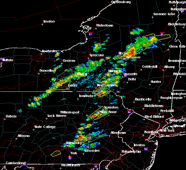 At 155 pm edt, a severe thunderstorm was located over hallstead, or 9 miles northeast of montrose, moving northeast at 15 mph (radar indicated). Hazards include 60 mph wind gusts and quarter size hail. Minor hail damage to vehicles is possible. expect wind to cause damage to trees, and power lines. this severe thunderstorm will be near, conklin, hallstead and great bend around 205 pm edt. kirkwood around 210 pm edt. susquehanna around 220 pm edt. susquehanna depot and lanesboro around 225 pm edt. Windsor around 245 pm edt. At 155 pm edt, a severe thunderstorm was located over hallstead, or 9 miles northeast of montrose, moving northeast at 15 mph (radar indicated). Hazards include 60 mph wind gusts and quarter size hail. Minor hail damage to vehicles is possible. expect wind to cause damage to trees, and power lines. this severe thunderstorm will be near, conklin, hallstead and great bend around 205 pm edt. kirkwood around 210 pm edt. susquehanna around 220 pm edt. susquehanna depot and lanesboro around 225 pm edt. Windsor around 245 pm edt.
|
| 7/17/2017 1:36 PM EDT |
 At 135 pm edt, a severe thunderstorm was located near hallstead, or near montrose, moving northeast at 15 mph (radar indicated). Hazards include quarter size hail. Minor damage to vehicles is possible. this severe storm will be near, new milford around 145 pm edt. Kirkwood, conklin and hallstead around 200 pm edt. At 135 pm edt, a severe thunderstorm was located near hallstead, or near montrose, moving northeast at 15 mph (radar indicated). Hazards include quarter size hail. Minor damage to vehicles is possible. this severe storm will be near, new milford around 145 pm edt. Kirkwood, conklin and hallstead around 200 pm edt.
|
| 7/17/2017 1:36 PM EDT |
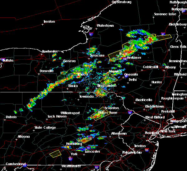 At 135 pm edt, a severe thunderstorm was located near hallstead, or near montrose, moving northeast at 15 mph (radar indicated). Hazards include quarter size hail. Minor damage to vehicles is possible. this severe storm will be near, new milford around 145 pm edt. Kirkwood, conklin and hallstead around 200 pm edt. At 135 pm edt, a severe thunderstorm was located near hallstead, or near montrose, moving northeast at 15 mph (radar indicated). Hazards include quarter size hail. Minor damage to vehicles is possible. this severe storm will be near, new milford around 145 pm edt. Kirkwood, conklin and hallstead around 200 pm edt.
|
| 7/17/2017 1:07 PM EDT |
 At 106 pm edt, a severe thunderstorm was located over montrose, moving northeast at 15 mph (radar indicated). Hazards include quarter size hail. Minor damage to vehicles is possible. this severe thunderstorm will be near, brackney around 135 pm edt. new milford around 145 pm edt. Kirkwood, conklin and susquehanna depot around 200 pm edt. At 106 pm edt, a severe thunderstorm was located over montrose, moving northeast at 15 mph (radar indicated). Hazards include quarter size hail. Minor damage to vehicles is possible. this severe thunderstorm will be near, brackney around 135 pm edt. new milford around 145 pm edt. Kirkwood, conklin and susquehanna depot around 200 pm edt.
|
| 5/31/2017 7:59 PM EDT |
 At 758 pm edt, severe thunderstorms were located along a line extending from near windsor to near lenoxville, moving east at 45 mph (radar indicated. this line of storms has a history of downed trees). Hazards include 60 mph wind gusts and quarter size hail. Hail damage to vehicles is expected. expect wind damage to roofs, siding, and trees. severe thunderstorms will be near, sanford around 805 pm edt. deposit and sherman around 810 pm edt. forest city and union dale around 815 pm edt. pleasant mount around 820 pm edt. harvard around 830 pm edt. walton, rutledgedale and equinunk around 835 pm edt. Hankins and stalker around 840 pm edt. At 758 pm edt, severe thunderstorms were located along a line extending from near windsor to near lenoxville, moving east at 45 mph (radar indicated. this line of storms has a history of downed trees). Hazards include 60 mph wind gusts and quarter size hail. Hail damage to vehicles is expected. expect wind damage to roofs, siding, and trees. severe thunderstorms will be near, sanford around 805 pm edt. deposit and sherman around 810 pm edt. forest city and union dale around 815 pm edt. pleasant mount around 820 pm edt. harvard around 830 pm edt. walton, rutledgedale and equinunk around 835 pm edt. Hankins and stalker around 840 pm edt.
|
| 5/31/2017 7:44 PM EDT |
 At 743 pm edt, a severe thunderstorm was located near hop bottom, or near montrose, moving east at 45 mph (radar indicated. large tree also reported down across road in auburn township). Hazards include 60 mph wind gusts and quarter size hail. Hail damage to vehicles is expected. expect wind damage to roofs, siding, and trees. Locations impacted include, jackson, clifford, susquehanna, forest city, susquehanna depot, springville, montrose, dimock, harford and hallstead. At 743 pm edt, a severe thunderstorm was located near hop bottom, or near montrose, moving east at 45 mph (radar indicated. large tree also reported down across road in auburn township). Hazards include 60 mph wind gusts and quarter size hail. Hail damage to vehicles is expected. expect wind damage to roofs, siding, and trees. Locations impacted include, jackson, clifford, susquehanna, forest city, susquehanna depot, springville, montrose, dimock, harford and hallstead.
|
| 5/31/2017 7:19 PM EDT |
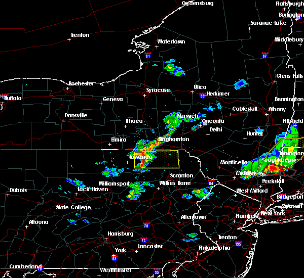 At 719 pm edt, a severe thunderstorm was located over rushville, or 9 miles northeast of wyalusing, moving east at 40 mph (radar indicated). Hazards include 60 mph wind gusts and quarter size hail. Hail damage to vehicles is expected. expect wind damage to roofs, siding, and trees. this severe thunderstorm will be near, rush and auburn center around 725 pm edt. springville around 735 pm edt. montrose around 740 pm edt. hop bottom around 745 pm edt. harford around 750 pm edt. gibson, lenoxville and royal around 755 pm edt. Thompson and union dale around 800 pm edt. At 719 pm edt, a severe thunderstorm was located over rushville, or 9 miles northeast of wyalusing, moving east at 40 mph (radar indicated). Hazards include 60 mph wind gusts and quarter size hail. Hail damage to vehicles is expected. expect wind damage to roofs, siding, and trees. this severe thunderstorm will be near, rush and auburn center around 725 pm edt. springville around 735 pm edt. montrose around 740 pm edt. hop bottom around 745 pm edt. harford around 750 pm edt. gibson, lenoxville and royal around 755 pm edt. Thompson and union dale around 800 pm edt.
|
| 5/1/2017 8:17 PM EDT | Wires down on car with occupants inside. radar estimated tim in susquehanna county PA, 0.4 miles WSW of Lanesboro, PA |
| 5/1/2017 7:49 PM EDT |
 At 748 pm edt, severe thunderstorms were located along a line extending from near vestal center to near rushville to lovelton to iola, moving east at 40 to 50 mph (radar indicated). Hazards include 60 mph wind gusts and penny size hail. Expect damage to roofs, siding, and trees. severe thunderstorms will be near, rush, noxen and mehoopany around 755 pm edt. springville, meshoppen and evans falls around 800 pm edt. tunkhannock, montrose and osterhout around 805 pm edt. falls, nescopeck and hallstead around 810 pm edt. muhlenberg, factoryville and shickshinny around 815 pm edt. waverly, clarks summit and susquehanna around 820 pm edt. scranton, dunmore and dickson city around 825 pm edt. carbondale, archbald and olyphant around 830 pm edt. A tornado watch remains in effect until 1000 pm edt for central new york, and northeastern pennsylvania. At 748 pm edt, severe thunderstorms were located along a line extending from near vestal center to near rushville to lovelton to iola, moving east at 40 to 50 mph (radar indicated). Hazards include 60 mph wind gusts and penny size hail. Expect damage to roofs, siding, and trees. severe thunderstorms will be near, rush, noxen and mehoopany around 755 pm edt. springville, meshoppen and evans falls around 800 pm edt. tunkhannock, montrose and osterhout around 805 pm edt. falls, nescopeck and hallstead around 810 pm edt. muhlenberg, factoryville and shickshinny around 815 pm edt. waverly, clarks summit and susquehanna around 820 pm edt. scranton, dunmore and dickson city around 825 pm edt. carbondale, archbald and olyphant around 830 pm edt. A tornado watch remains in effect until 1000 pm edt for central new york, and northeastern pennsylvania.
|
| 4/16/2017 5:12 PM EDT |
 At 511 pm edt, severe thunderstorms were located along a line extending from near sherman to near susquehanna to auburn center, moving east at 70 mph (radar indicated). Hazards include 60 mph wind gusts. Expect damage to trees. these severe storms will be near, susquehanna, susquehanna depot and lanesboro around 515 pm edt. hiawatha, starlight and shehawken around 520 pm edt. harford, hop bottom and glenwood around 525 pm edt. Gibson around 530 pm edt. At 511 pm edt, severe thunderstorms were located along a line extending from near sherman to near susquehanna to auburn center, moving east at 70 mph (radar indicated). Hazards include 60 mph wind gusts. Expect damage to trees. these severe storms will be near, susquehanna, susquehanna depot and lanesboro around 515 pm edt. hiawatha, starlight and shehawken around 520 pm edt. harford, hop bottom and glenwood around 525 pm edt. Gibson around 530 pm edt.
|
| 4/16/2017 4:54 PM EDT |
 At 454 pm edt, severe thunderstorms were located along a line extending from near conklin to near friendsville to wysox, moving east at 45 mph (radar indicated). Hazards include 60 mph wind gusts. Expect damage to trees. severe thunderstorms will be near, kirkwood, conklin and rush around 500 pm edt. hallstead, great bend and brushville around 505 pm edt. montrose and rushville around 510 pm edt. susquehanna, susquehanna depot and new milford around 515 pm edt. harford and auburn center around 520 pm edt. springville, starrucca and gibson around 525 pm edt. hiawatha and shehawken around 530 pm edt. Thompson and starlight around 535 pm edt. At 454 pm edt, severe thunderstorms were located along a line extending from near conklin to near friendsville to wysox, moving east at 45 mph (radar indicated). Hazards include 60 mph wind gusts. Expect damage to trees. severe thunderstorms will be near, kirkwood, conklin and rush around 500 pm edt. hallstead, great bend and brushville around 505 pm edt. montrose and rushville around 510 pm edt. susquehanna, susquehanna depot and new milford around 515 pm edt. harford and auburn center around 520 pm edt. springville, starrucca and gibson around 525 pm edt. hiawatha and shehawken around 530 pm edt. Thompson and starlight around 535 pm edt.
|
| 7/25/2016 4:12 PM EDT |
 At 411 pm edt, a severe thunderstorm was located near lanesboro, or 8 miles southwest of deposit, moving east at 60 mph (radar indicated). Hazards include 60 mph wind gusts. Expect damage to roofs. siding. and trees. this severe storm will be near, starrucca around 415 pm edt. deposit, sherman and hiawatha around 420 pm edt. hancock and starlight around 425 pm edt. These storms have downed numerous trees and caused power outages around the binghamton metro area. At 411 pm edt, a severe thunderstorm was located near lanesboro, or 8 miles southwest of deposit, moving east at 60 mph (radar indicated). Hazards include 60 mph wind gusts. Expect damage to roofs. siding. and trees. this severe storm will be near, starrucca around 415 pm edt. deposit, sherman and hiawatha around 420 pm edt. hancock and starlight around 425 pm edt. These storms have downed numerous trees and caused power outages around the binghamton metro area.
|
| 7/25/2016 3:50 PM EDT |
 At 349 pm edt, a severe thunderstorm was located over conklin, or near binghamton, moving east at 55 mph (radar indicated). Hazards include 60 mph wind gusts. Expect damage to roofs. siding. and trees. this severe thunderstorm will be near, hallstead and great bend around 355 pm edt. windsor around 400 pm edt. sanford, susquehanna and susquehanna depot around 405 pm edt. deposit, starrucca and sherman around 410 pm edt. hiawatha and shehawken around 415 pm edt. Hancock and starlight around 420 pm edt. At 349 pm edt, a severe thunderstorm was located over conklin, or near binghamton, moving east at 55 mph (radar indicated). Hazards include 60 mph wind gusts. Expect damage to roofs. siding. and trees. this severe thunderstorm will be near, hallstead and great bend around 355 pm edt. windsor around 400 pm edt. sanford, susquehanna and susquehanna depot around 405 pm edt. deposit, starrucca and sherman around 410 pm edt. hiawatha and shehawken around 415 pm edt. Hancock and starlight around 420 pm edt.
|
| 7/25/2016 11:52 AM EDT |
 At 1151 am edt, a severe thunderstorm was located over deposit, moving east at 50 mph (radar indicated). Hazards include 60 mph wind gusts. Expect damage to roofs. siding. and trees. this severe thunderstorm will be near, hancock around 1200 pm edt. harvard, east branch and fishs eddy around 1210 pm edt. corbett around 1215 pm edt. Downsville around 1220 pm edt. At 1151 am edt, a severe thunderstorm was located over deposit, moving east at 50 mph (radar indicated). Hazards include 60 mph wind gusts. Expect damage to roofs. siding. and trees. this severe thunderstorm will be near, hancock around 1200 pm edt. harvard, east branch and fishs eddy around 1210 pm edt. corbett around 1215 pm edt. Downsville around 1220 pm edt.
|
| 10/7/2013 12:29 PM EDT | Report of trees down on sr92 between lanesboro and oakland in oakland township in susquehanna county PA, 0.4 miles WSW of Lanesboro, PA |
| 5/22/2013 9:40 PM EDT | Trees down. in susquehanna county PA, 0.4 miles WSW of Lanesboro, PA |
Hail Maps for Lanesboro, PA


Connect with Interactive Hail Maps