

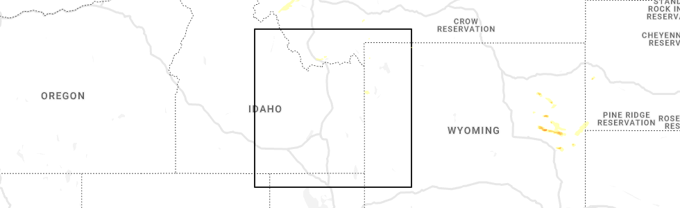
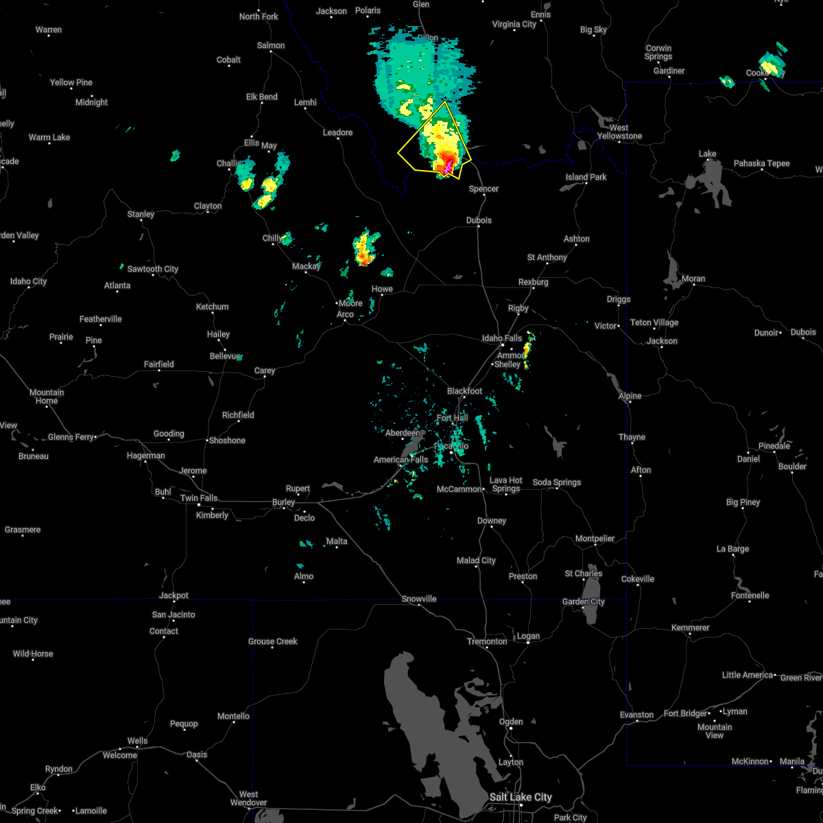
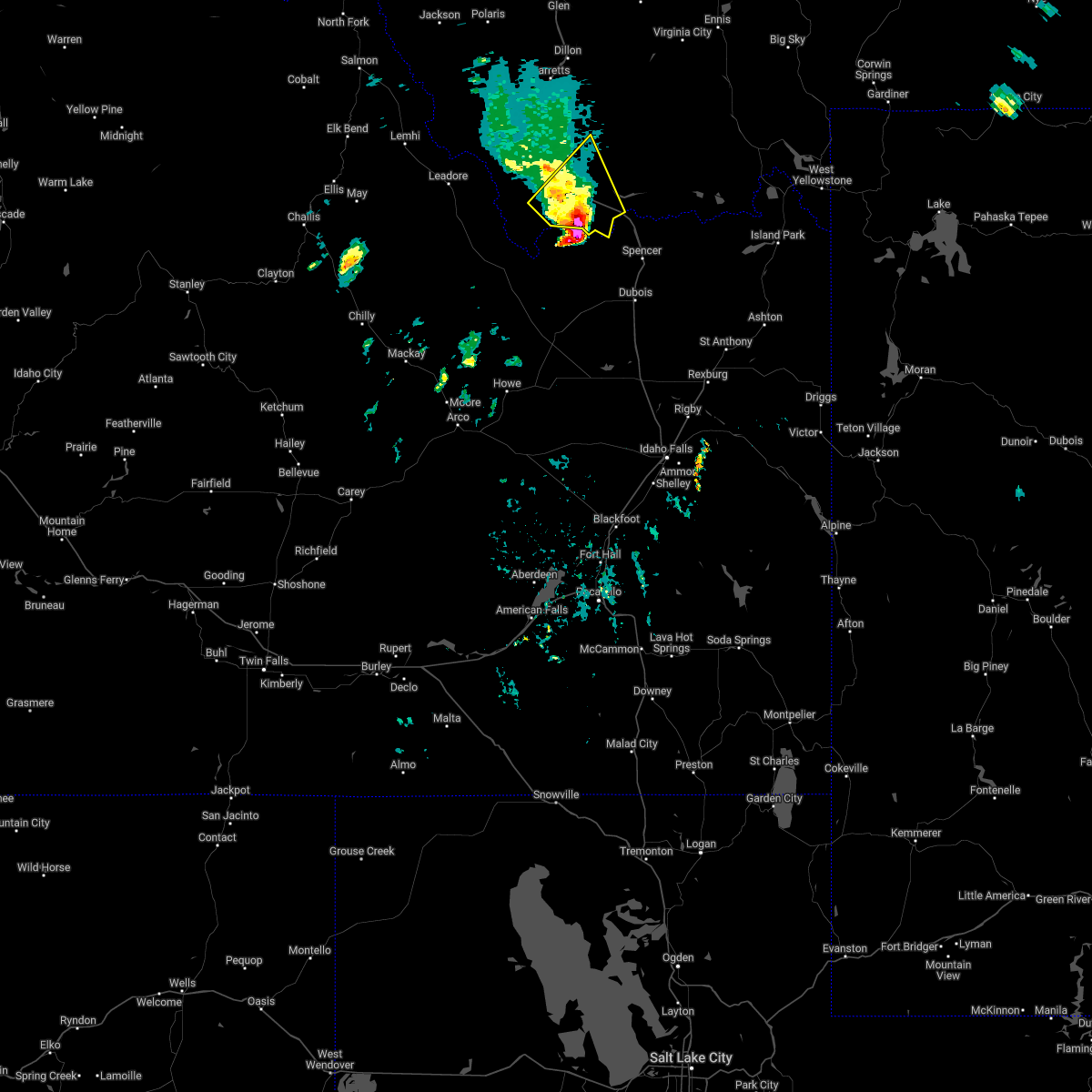
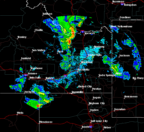
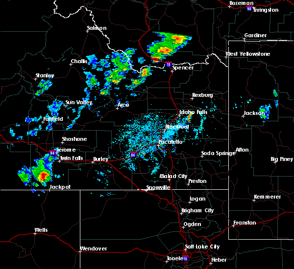
Hail Map for Lima, MT
The Lima, MT area has had 1 report of on-the-ground hail by trained spotters, and has been under severe weather warnings 4 times during the past 12 months. Doppler radar has detected hail at or near Lima, MT on 3 occasions.
| Name: | Lima, MT |
| Where Located: | 74.1 miles ESE of Salmon, ID |
| Map: | Google Map for Lima, MT |
| Population: | 221 |
| Housing Units: | 173 |
| More Info: | Search Google for Lima, MT |
1
The Top Recent Hail Date for Lima, MT is Thursday, August 25, 2022 (2nd out of 3)
Hail and Wind Damage Spotted near Lima, MT
| Date / Time | Report Details |
|---|---|
| 8/29/2023 7:49 PM MDT | Peak hourly gust as measured by station rrdm8 red rock raws. time of occurrence based on rada in beaverhead county MT, 37.6 miles W of Lima, MT |
| 8/29/2023 7:36 PM MDT | Corrected time. peak hourly gust as measured by station rrdm8 red rock raws. time of occurrence based on rada in beaverhead county MT, 37.6 miles W of Lima, MT |
| 8/29/2023 6:45 PM MDT |
 At 645 pm mdt, severe thunderstorms were located along a line extending from 15 miles southwest of dillon to 10 miles south of monida, moving northeast at 30 mph (radar indicated). Hazards include 60 mph wind gusts. Expect damage to roofs, siding, and trees. locations impacted include, dillon, lima, monida, dell, beaverhead rock state park, clark canyon, and snowline. hail threat, radar indicated max hail size, <. 75 in wind threat, radar indicated max wind gust, 60 mph. At 645 pm mdt, severe thunderstorms were located along a line extending from 15 miles southwest of dillon to 10 miles south of monida, moving northeast at 30 mph (radar indicated). Hazards include 60 mph wind gusts. Expect damage to roofs, siding, and trees. locations impacted include, dillon, lima, monida, dell, beaverhead rock state park, clark canyon, and snowline. hail threat, radar indicated max hail size, <. 75 in wind threat, radar indicated max wind gust, 60 mph.
|
| 8/29/2023 6:27 PM MDT |
 At 627 pm mdt, severe thunderstorms were located along a line extending from 22 miles southwest of dillon to 15 miles west of spencer, moving northeast at 30 mph (radar indicated). Hazards include 60 mph wind gusts. expect damage to roofs, siding, and trees At 627 pm mdt, severe thunderstorms were located along a line extending from 22 miles southwest of dillon to 15 miles west of spencer, moving northeast at 30 mph (radar indicated). Hazards include 60 mph wind gusts. expect damage to roofs, siding, and trees
|
| 7/1/2023 3:13 PM MDT |
 At 312 pm mdt, severe thunderstorms were located along a line extending from 12 miles west of clyde park to 12 miles southwest of livingston to 15 miles southeast of ennis to 14 miles east of gilmore, moving east at 40 mph (public). Hazards include 60 mph wind gusts. Expect damage to roofs, siding, and trees. locations impacted include, lima, monida, dell, big sky, bannack pass, lakeview, cameron, snowline and monida pass. hail threat, radar indicated max hail size, <. 75 in wind threat, observed max wind gust, 60 mph. At 312 pm mdt, severe thunderstorms were located along a line extending from 12 miles west of clyde park to 12 miles southwest of livingston to 15 miles southeast of ennis to 14 miles east of gilmore, moving east at 40 mph (public). Hazards include 60 mph wind gusts. Expect damage to roofs, siding, and trees. locations impacted include, lima, monida, dell, big sky, bannack pass, lakeview, cameron, snowline and monida pass. hail threat, radar indicated max hail size, <. 75 in wind threat, observed max wind gust, 60 mph.
|
| 7/1/2023 3:02 PM MDT |
 At 259 pm mdt, severe thunderstorms were located along a line extending from 10 miles northeast of belgrade to 7 miles southeast of bozeman to 9 miles southeast of ennis to 7 miles northeast of gilmore, moving east at 40 mph (public. at 2:54 pm multiple wind gusts to 60 mph were reported on the south side of bozeman. strong wind gusts are expected along the rest of this line). Hazards include 60 mph wind gusts. expect damage to roofs, siding, and trees At 259 pm mdt, severe thunderstorms were located along a line extending from 10 miles northeast of belgrade to 7 miles southeast of bozeman to 9 miles southeast of ennis to 7 miles northeast of gilmore, moving east at 40 mph (public. at 2:54 pm multiple wind gusts to 60 mph were reported on the south side of bozeman. strong wind gusts are expected along the rest of this line). Hazards include 60 mph wind gusts. expect damage to roofs, siding, and trees
|
| 7/1/2023 2:45 PM MDT | Mesonet station mtm16 6.6 n dell (mt-meso in beaverhead county MT, 13.5 miles SSE of Lima, MT |
| 7/15/2022 5:46 PM MDT | Mesonet station mtmqm monida pass (mt dot in beaverhead county MT, 14.9 miles WNW of Lima, MT |
| 7/3/2022 12:57 PM MDT |
 The severe thunderstorm warning for south central beaverhead county will expire at 100 pm mdt, the storm which prompted the warning has moved further to the east. a new severe thunderstorm warning has been posted. a severe thunderstorm watch remains in effect until 800 pm mdt for southwestern montana. remember, a severe thunderstorm warning still remains in effect for south central beaverhead county until 200 pm mdt. The severe thunderstorm warning for south central beaverhead county will expire at 100 pm mdt, the storm which prompted the warning has moved further to the east. a new severe thunderstorm warning has been posted. a severe thunderstorm watch remains in effect until 800 pm mdt for southwestern montana. remember, a severe thunderstorm warning still remains in effect for south central beaverhead county until 200 pm mdt.
|
| 7/3/2022 12:44 PM MDT |
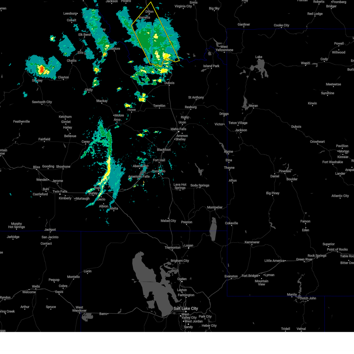
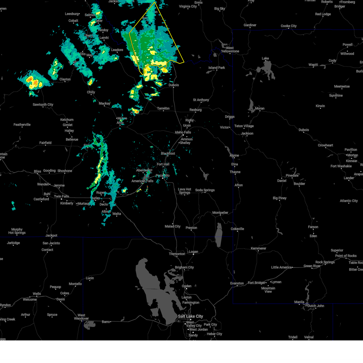
 At 1244 pm mdt, a severe thunderstorm was located over lima, or 34 miles northwest of dubois, moving northeast at 40 mph (radar indicated). Hazards include golf ball size hail and 70 mph wind gusts. People and animals outdoors will be injured. expect hail damage to roofs, siding, windows, and vehicles. expect considerable tree damage. wind damage is also likely to mobile homes, roofs, and outbuildings. locations impacted include, lima, monida, dell, snowline and monida pass. thunderstorm damage threat, considerable hail threat, radar indicated max hail size, 1. 75 in wind threat, radar indicated max wind gust, 70 mph. At 1244 pm mdt, a severe thunderstorm was located over lima, or 34 miles northwest of dubois, moving northeast at 40 mph (radar indicated). Hazards include golf ball size hail and 70 mph wind gusts. People and animals outdoors will be injured. expect hail damage to roofs, siding, windows, and vehicles. expect considerable tree damage. wind damage is also likely to mobile homes, roofs, and outbuildings. locations impacted include, lima, monida, dell, snowline and monida pass. thunderstorm damage threat, considerable hail threat, radar indicated max hail size, 1. 75 in wind threat, radar indicated max wind gust, 70 mph.
|
| 7/3/2022 12:20 PM MDT |
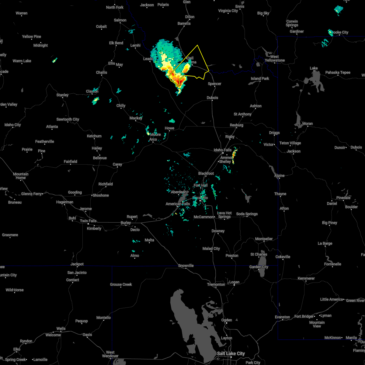 At 1219 pm mdt, a severe thunderstorm was located 19 miles southwest of lima, or 34 miles northwest of dubois, moving northeast at 40 mph (radar indicated). Hazards include 60 mph wind gusts and quarter size hail. Hail damage to vehicles is expected. Expect wind damage to roofs, siding, and trees. At 1219 pm mdt, a severe thunderstorm was located 19 miles southwest of lima, or 34 miles northwest of dubois, moving northeast at 40 mph (radar indicated). Hazards include 60 mph wind gusts and quarter size hail. Hail damage to vehicles is expected. Expect wind damage to roofs, siding, and trees.
|
| 9/10/2021 6:12 PM MDT |
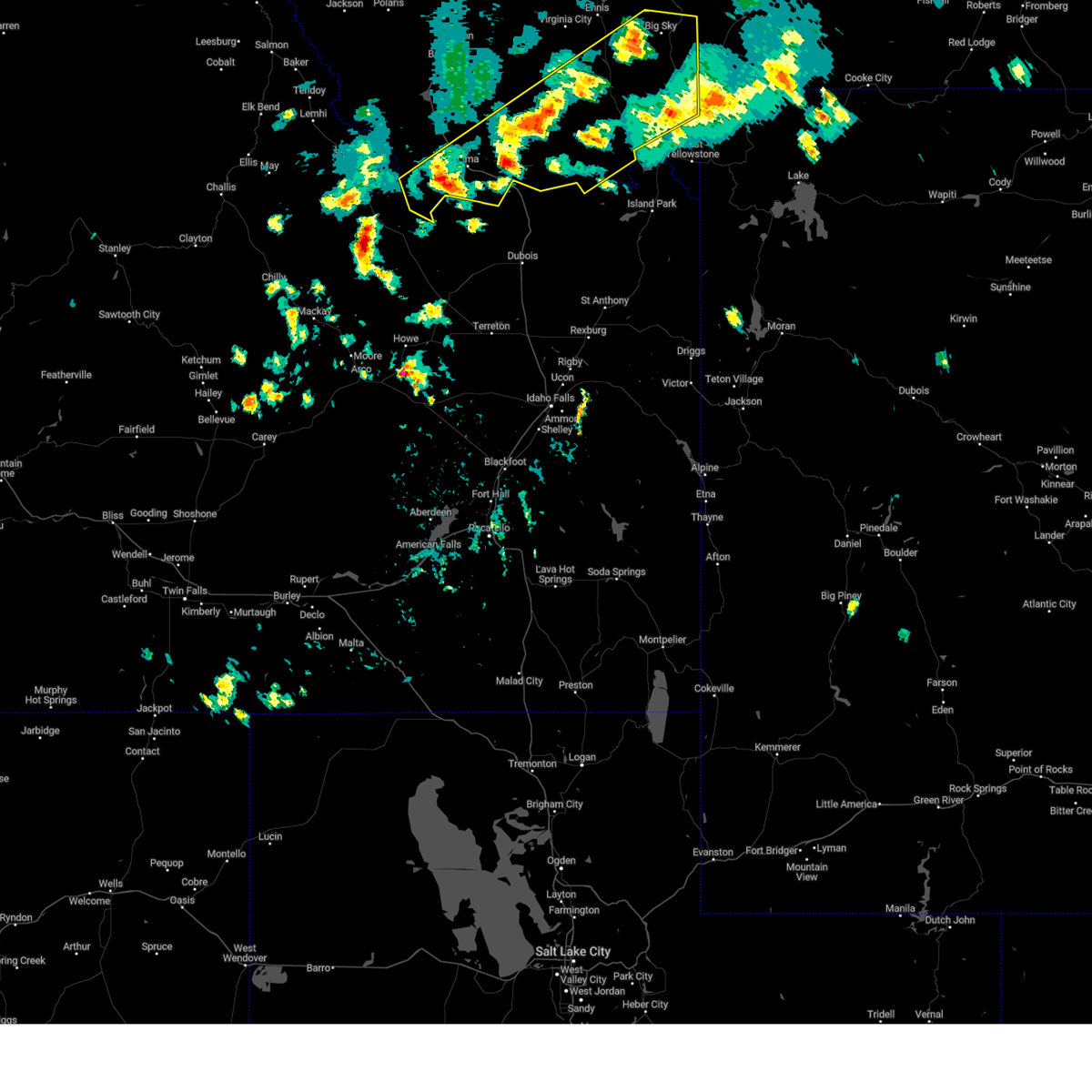
 At 612 pm mdt, severe thunderstorms were located along a line extending from 16 miles southeast of conner to near island park village, moving northeast at 50 mph (radar indicated). Hazards include 70 mph wind gusts. Expect considerable tree damage. Damage is likely to mobile homes, roofs, and outbuildings. At 612 pm mdt, severe thunderstorms were located along a line extending from 16 miles southeast of conner to near island park village, moving northeast at 50 mph (radar indicated). Hazards include 70 mph wind gusts. Expect considerable tree damage. Damage is likely to mobile homes, roofs, and outbuildings.
|
| 9/10/2021 5:59 PM MDT | Mesonet station lmrm8 antelope raw in beaverhead county MT, 4.4 miles SW of Lima, MT |
| 8/8/2021 5:04 PM MDT |
 At 501 pm mdt, sporadic areas of severe wind gusts continue across the warned area. many locations within the warned area have reported wind gusts of 50 to 55 mph over the last 30 minutes. a few gusts to around 60 mph are likely (trained weather spotters). Hazards include 60 mph wind gusts. Expect damage to roofs, siding, and trees. locations impacted include, bozeman, dillon, sheridan, virginia city, belgrade, three forks, manhattan, ennis, lima, pony, alder, harrison, dell, bannack pass, cameron, missouri headwaters state park, snowline, maudlow, four corners and amsterdam. hail threat, radar indicated max hail size, <. 75 in wind threat, radar indicated max wind gust, 60 mph. At 501 pm mdt, sporadic areas of severe wind gusts continue across the warned area. many locations within the warned area have reported wind gusts of 50 to 55 mph over the last 30 minutes. a few gusts to around 60 mph are likely (trained weather spotters). Hazards include 60 mph wind gusts. Expect damage to roofs, siding, and trees. locations impacted include, bozeman, dillon, sheridan, virginia city, belgrade, three forks, manhattan, ennis, lima, pony, alder, harrison, dell, bannack pass, cameron, missouri headwaters state park, snowline, maudlow, four corners and amsterdam. hail threat, radar indicated max hail size, <. 75 in wind threat, radar indicated max wind gust, 60 mph.
|
| 8/8/2021 4:29 PM MDT |
 At 429 pm mdt, areas of severe wind gusts were located along a line extending from 11 miles southeast of toston to 6 miles north of leadore, moving northeast at 45 mph (radar indicated). Hazards include 60 mph wind gusts. expect damage to roofs, siding, and trees At 429 pm mdt, areas of severe wind gusts were located along a line extending from 11 miles southeast of toston to 6 miles north of leadore, moving northeast at 45 mph (radar indicated). Hazards include 60 mph wind gusts. expect damage to roofs, siding, and trees
|
| 9/6/2019 4:17 PM MDT |
 At 413 pm mdt, a severe thunderstorm was located 7 miles south of lima, or 31 miles northwest of dubois, moving east at 40 mph (radar indicated. a weather station located west of clark canyon reservoir observed a wind gust to 71 mph with this storm). Hazards include 60 mph wind gusts along with frequent lightning, brief heavy rain hail up to 1/2 inch in diameter. expect damage to roofs, siding, and trees At 413 pm mdt, a severe thunderstorm was located 7 miles south of lima, or 31 miles northwest of dubois, moving east at 40 mph (radar indicated. a weather station located west of clark canyon reservoir observed a wind gust to 71 mph with this storm). Hazards include 60 mph wind gusts along with frequent lightning, brief heavy rain hail up to 1/2 inch in diameter. expect damage to roofs, siding, and trees
|
| 7/7/2019 3:13 PM MDT |
 At 312 pm mdt, severe thunderstorms were located along a line extending from 21 miles south of alder to near lima, moving northeast at 25 mph (spotter reported quarter-size hail in lima recently). Hazards include 60 mph wind gusts and quarter size hail. Hail damage to vehicles is expected. Expect wind damage to roofs, siding, and trees. At 312 pm mdt, severe thunderstorms were located along a line extending from 21 miles south of alder to near lima, moving northeast at 25 mph (spotter reported quarter-size hail in lima recently). Hazards include 60 mph wind gusts and quarter size hail. Hail damage to vehicles is expected. Expect wind damage to roofs, siding, and trees.
|
| 7/7/2019 2:30 PM MDT | Quarter sized hail reported 0.2 miles SSW of Lima, MT |
| 8/2/2018 3:59 PM MDT | Mesonet station lmrm8... antelope raw in beaverhead county MT, 4.4 miles SW of Lima, MT |
| 6/27/2017 6:25 AM MDT | Peak wind gust at monida pas in beaverhead county MT, 14.9 miles WNW of Lima, MT |
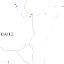
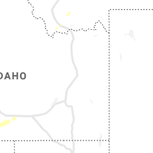
Hail Maps for Lima, MT

Connect with Interactive Hail Maps