| 8/12/2022 9:15 AM PDT |
Quarter sized hail reported 6.7 miles WSW of Lind, WA
|
| 8/12/2022 9:11 AM PDT |
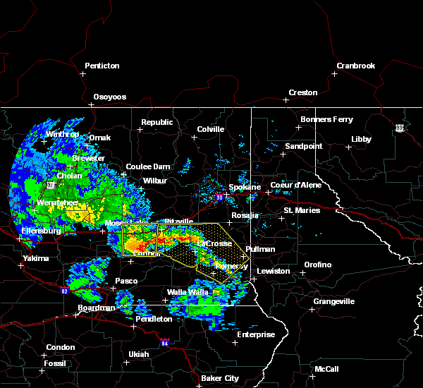
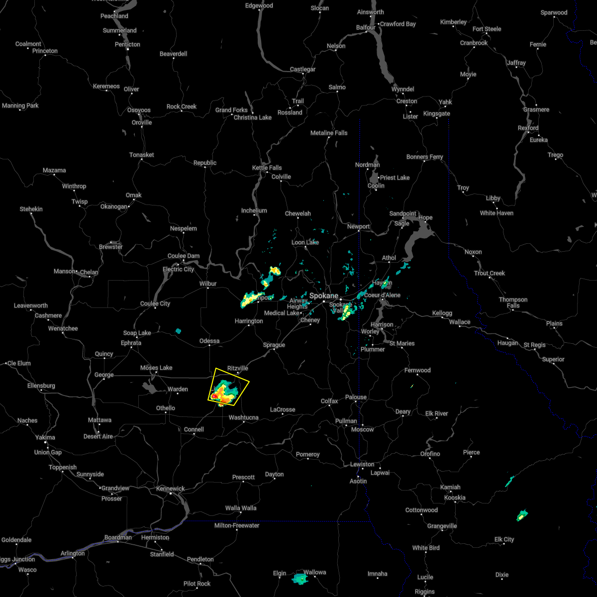 At 910 am pdt, a severe thunderstorm was located 16 miles southwest of ritzville, or 21 miles northeast of connell, moving north at 25 mph (radar indicated). Hazards include quarter size hail. Damage to vehicles is expected. locations impacted include, lind, ralston, pizzro and paha. this includes interstate 90 in washington between mile markers 208 and 218. hail threat, radar indicated max hail size, 1. 00 in wind threat, radar indicated max wind gust, <50 mph. At 910 am pdt, a severe thunderstorm was located 16 miles southwest of ritzville, or 21 miles northeast of connell, moving north at 25 mph (radar indicated). Hazards include quarter size hail. Damage to vehicles is expected. locations impacted include, lind, ralston, pizzro and paha. this includes interstate 90 in washington between mile markers 208 and 218. hail threat, radar indicated max hail size, 1. 00 in wind threat, radar indicated max wind gust, <50 mph.
|
| 8/12/2022 9:09 AM PDT |
Ping Pong Ball sized hail reported 0.4 miles E of Lind, WA, twitter report.
|
| 8/12/2022 8:46 AM PDT |
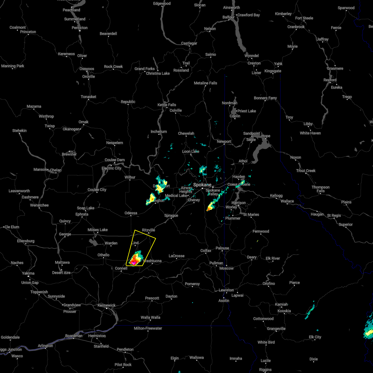 At 846 am pdt, a severe thunderstorm was located 10 miles north of kahlotus, or 12 miles northeast of connell, moving north at 25 mph (radar indicated). Hazards include half dollar size hail. damage to vehicles is expected At 846 am pdt, a severe thunderstorm was located 10 miles north of kahlotus, or 12 miles northeast of connell, moving north at 25 mph (radar indicated). Hazards include half dollar size hail. damage to vehicles is expected
|
| 5/30/2020 6:32 PM PDT |
 At 632 pm pdt, a severe thunderstorm was located 14 miles northeast of connell, moving north at 40 mph (radar indicated). Hazards include 70 mph wind gusts and quarter size hail. Hail damage to vehicles is expected. expect considerable tree damage. Wind damage is also likely to mobile homes, roofs, and outbuildings. At 632 pm pdt, a severe thunderstorm was located 14 miles northeast of connell, moving north at 40 mph (radar indicated). Hazards include 70 mph wind gusts and quarter size hail. Hail damage to vehicles is expected. expect considerable tree damage. Wind damage is also likely to mobile homes, roofs, and outbuildings.
|
| 5/30/2020 5:36 PM PDT |
 At 533 pm pdt, a severe thunderstorm was located near kahlotus, or 17 miles east of connell, moving northeast at 50 mph (radar indicated). Hazards include golf ball size hail and 70 mph wind gusts. Expect considerable tree damage. wind damage is also likely to mobile homes, roofs, and outbuildings. Isolated large hail is expected which may cause damage to roofs, siding, windows, and vehicles. At 533 pm pdt, a severe thunderstorm was located near kahlotus, or 17 miles east of connell, moving northeast at 50 mph (radar indicated). Hazards include golf ball size hail and 70 mph wind gusts. Expect considerable tree damage. wind damage is also likely to mobile homes, roofs, and outbuildings. Isolated large hail is expected which may cause damage to roofs, siding, windows, and vehicles.
|
| 8/25/2013 7:15 PM PDT |
Combined report from newspaper and public...as many as 8 large trees down around town. damage sustained to fences and power line in adams county WA, 0 miles WSW of Lind, WA
|
| 8/25/2013 7:15 PM PDT |
Three large trees blown down onto road in adams county WA, 0 miles WSW of Lind, WA
|


Connect with Interactive Hail Maps