

Hail Map for Logan Elm Village, OH
The Logan Elm Village, OH area has had 0 reports of on-the-ground hail by trained spotters, and has been under severe weather warnings 9 times during the past 12 months. Doppler radar has detected hail at or near Logan Elm Village, OH on 38 occasions, including 2 occasions during the past year.
| Name: | Logan Elm Village, OH |
| Where Located: | 27.2 miles S of Columbus, OH |
| Map: | Google Map for Logan Elm Village, OH |
| Population: | 1118 |
| Housing Units: | 440 |
| More Info: | Search Google for Logan Elm Village, OH |
3
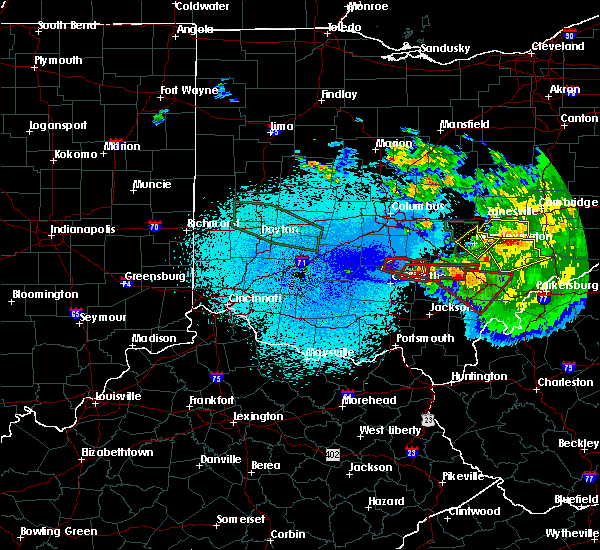
The Top Recent Hail Date for Logan Elm Village, OH is Wednesday, April 17, 2024 (2nd out of 38)

Hail and Wind Damage Spotted near Logan Elm Village, OH
| Date / Time | Report Details |
|---|---|
| 4/17/2024 7:07 PM EDT |
 At 706 pm edt, a severe thunderstorm was located 8 miles east of circleville, moving east at 35 mph (radar indicated). Hazards include 60 mph wind gusts and half dollar size hail. Minor hail damage to vehicles is possible. expect wind damage to trees and power lines. Locations impacted include, logan, logan elm village, stoutsville, laurelville, tarlton, aw marion state park, gibisonville, lake logan state park, whisler, pickaway county airport, enterprise, and rockbridge. At 706 pm edt, a severe thunderstorm was located 8 miles east of circleville, moving east at 35 mph (radar indicated). Hazards include 60 mph wind gusts and half dollar size hail. Minor hail damage to vehicles is possible. expect wind damage to trees and power lines. Locations impacted include, logan, logan elm village, stoutsville, laurelville, tarlton, aw marion state park, gibisonville, lake logan state park, whisler, pickaway county airport, enterprise, and rockbridge.
|
| 4/17/2024 6:52 PM EDT |
 At 651 pm edt, a severe thunderstorm was located over logan elm village, moving east at 30 mph (radar indicated). Hazards include 60 mph wind gusts and half dollar size hail. Minor hail damage to vehicles is possible. expect wind damage to trees and power lines. Locations impacted include, circleville, logan, logan elm village, stoutsville, laurelville, tarlton, aw marion state park, gibisonville, lake logan state park, whisler, pickaway county airport, enterprise, and rockbridge. At 651 pm edt, a severe thunderstorm was located over logan elm village, moving east at 30 mph (radar indicated). Hazards include 60 mph wind gusts and half dollar size hail. Minor hail damage to vehicles is possible. expect wind damage to trees and power lines. Locations impacted include, circleville, logan, logan elm village, stoutsville, laurelville, tarlton, aw marion state park, gibisonville, lake logan state park, whisler, pickaway county airport, enterprise, and rockbridge.
|
| 4/17/2024 6:40 PM EDT |
 Svriln the national weather service in wilmington has issued a * severe thunderstorm warning for, southwestern fairfield county in central ohio, northwestern hocking county in central ohio, southeastern pickaway county in central ohio, * until 730 pm edt. * at 639 pm edt, a severe thunderstorm was located near williamsport, moving east at 40 mph (radar indicated). Hazards include 60 mph wind gusts and quarter size hail. Minor hail damage to vehicles is possible. Expect wind damage to trees and power lines. Svriln the national weather service in wilmington has issued a * severe thunderstorm warning for, southwestern fairfield county in central ohio, northwestern hocking county in central ohio, southeastern pickaway county in central ohio, * until 730 pm edt. * at 639 pm edt, a severe thunderstorm was located near williamsport, moving east at 40 mph (radar indicated). Hazards include 60 mph wind gusts and quarter size hail. Minor hail damage to vehicles is possible. Expect wind damage to trees and power lines.
|
| 7/17/2023 9:40 PM EDT |
 At 939 pm edt, a severe thunderstorm was located near ashville, moving northeast at 20 mph (radar indicated). Hazards include 60 mph wind gusts and quarter size hail. Minor hail damage to vehicles is possible. Expect wind damage to trees and power lines. At 939 pm edt, a severe thunderstorm was located near ashville, moving northeast at 20 mph (radar indicated). Hazards include 60 mph wind gusts and quarter size hail. Minor hail damage to vehicles is possible. Expect wind damage to trees and power lines.
|
| 7/17/2023 5:40 PM EDT |
 The severe thunderstorm warning for southeastern pickaway and northeastern ross counties will expire at 545 pm edt, the storm which prompted the warning has weakened below severe limits, and no longer poses an immediate threat to life or property. therefore, the warning will be allowed to expire. please report previous wind damage or hail to the national weather service by going to our website at weather.gov/iln and submitting your report via social media. The severe thunderstorm warning for southeastern pickaway and northeastern ross counties will expire at 545 pm edt, the storm which prompted the warning has weakened below severe limits, and no longer poses an immediate threat to life or property. therefore, the warning will be allowed to expire. please report previous wind damage or hail to the national weather service by going to our website at weather.gov/iln and submitting your report via social media.
|
| 7/17/2023 5:31 PM EDT |
 At 531 pm edt, a severe thunderstorm was located near williamsport, moving east at 15 mph (radar indicated). Hazards include 60 mph wind gusts and quarter size hail. Minor hail damage to vehicles is possible. expect wind damage to trees and power lines. locations impacted include, circleville, kingston, logan elm village, frankfort, clarksburg, aw marion state park, pickaway county airport, state route 138 at us route 22 and andersonville. hail threat, radar indicated max hail size, 1. 00 in wind threat, radar indicated max wind gust, 60 mph. At 531 pm edt, a severe thunderstorm was located near williamsport, moving east at 15 mph (radar indicated). Hazards include 60 mph wind gusts and quarter size hail. Minor hail damage to vehicles is possible. expect wind damage to trees and power lines. locations impacted include, circleville, kingston, logan elm village, frankfort, clarksburg, aw marion state park, pickaway county airport, state route 138 at us route 22 and andersonville. hail threat, radar indicated max hail size, 1. 00 in wind threat, radar indicated max wind gust, 60 mph.
|
| 7/17/2023 5:23 PM EDT |
 At 523 pm edt, a severe thunderstorm was located near williamsport, moving east at 15 mph (radar indicated). Hazards include 60 mph wind gusts and half dollar size hail. Minor hail damage to vehicles is possible. expect wind damage to trees and power lines. locations impacted include, circleville, kingston, williamsport, new holland, logan elm village, frankfort, clarksburg, aw marion state park, andersonville, austin, pickaway county airport, state route 207 at us route 22, state route 138 at us route 22 and plano. hail threat, radar indicated max hail size, 1. 25 in wind threat, radar indicated max wind gust, 60 mph. At 523 pm edt, a severe thunderstorm was located near williamsport, moving east at 15 mph (radar indicated). Hazards include 60 mph wind gusts and half dollar size hail. Minor hail damage to vehicles is possible. expect wind damage to trees and power lines. locations impacted include, circleville, kingston, williamsport, new holland, logan elm village, frankfort, clarksburg, aw marion state park, andersonville, austin, pickaway county airport, state route 207 at us route 22, state route 138 at us route 22 and plano. hail threat, radar indicated max hail size, 1. 25 in wind threat, radar indicated max wind gust, 60 mph.
|
| 7/17/2023 5:12 PM EDT |
 At 512 pm edt, a severe thunderstorm was located near new holland, moving east at 15 mph (radar indicated). Hazards include ping pong ball size hail and 60 mph wind gusts. People and animals outdoors will be injured. expect hail damage to roofs, siding, windows, and vehicles. expect wind damage to trees and power lines. locations impacted include, circleville, kingston, williamsport, new holland, logan elm village, frankfort, clarksburg, aw marion state park, andersonville, austin, pickaway county airport, state route 207 at us route 22, state route 138 at us route 22 and plano. hail threat, radar indicated max hail size, 1. 50 in wind threat, radar indicated max wind gust, 60 mph. At 512 pm edt, a severe thunderstorm was located near new holland, moving east at 15 mph (radar indicated). Hazards include ping pong ball size hail and 60 mph wind gusts. People and animals outdoors will be injured. expect hail damage to roofs, siding, windows, and vehicles. expect wind damage to trees and power lines. locations impacted include, circleville, kingston, williamsport, new holland, logan elm village, frankfort, clarksburg, aw marion state park, andersonville, austin, pickaway county airport, state route 207 at us route 22, state route 138 at us route 22 and plano. hail threat, radar indicated max hail size, 1. 50 in wind threat, radar indicated max wind gust, 60 mph.
|
| 7/17/2023 5:08 PM EDT |
 At 508 pm edt, a severe thunderstorm was located near new holland, moving east at 15 mph (radar indicated). Hazards include 60 mph wind gusts and quarter size hail. Minor hail damage to vehicles is possible. Expect wind damage to trees and power lines. At 508 pm edt, a severe thunderstorm was located near new holland, moving east at 15 mph (radar indicated). Hazards include 60 mph wind gusts and quarter size hail. Minor hail damage to vehicles is possible. Expect wind damage to trees and power lines.
|
| 4/5/2023 5:21 PM EDT |
 The severe thunderstorm warning for southern pickaway and northwestern ross counties will expire at 530 pm edt, the storm which prompted the warning has weakened below severe limits, and no longer poses an immediate threat to life or property. therefore, the warning will be allowed to expire. however gusty winds and heavy rain are still possible with this thunderstorm. a severe thunderstorm watch remains in effect until 800 pm edt for central and southwestern ohio. please report previous wind damage or hail to the national weather service by going to our website at weather.gov/iln and submitting your report via social media. The severe thunderstorm warning for southern pickaway and northwestern ross counties will expire at 530 pm edt, the storm which prompted the warning has weakened below severe limits, and no longer poses an immediate threat to life or property. therefore, the warning will be allowed to expire. however gusty winds and heavy rain are still possible with this thunderstorm. a severe thunderstorm watch remains in effect until 800 pm edt for central and southwestern ohio. please report previous wind damage or hail to the national weather service by going to our website at weather.gov/iln and submitting your report via social media.
|
| 4/5/2023 5:15 PM EDT |
 At 514 pm edt, a severe thunderstorm was located near logan elm village, moving east at 70 mph (radar indicated). Hazards include 60 mph wind gusts and penny size hail. Expect damage to trees and power lines. locations impacted include, circleville, south bloomfield, kingston, williamsport, new holland, logan elm village, frankfort, fox, clarksburg, aw marion state park, east ringgold, deer creek lake, andersonville, austin, pickaway county airport, state route 207 at us route 22 and state route 138 at us route 22. hail threat, radar indicated max hail size, 0. 75 in wind threat, radar indicated max wind gust, 60 mph. At 514 pm edt, a severe thunderstorm was located near logan elm village, moving east at 70 mph (radar indicated). Hazards include 60 mph wind gusts and penny size hail. Expect damage to trees and power lines. locations impacted include, circleville, south bloomfield, kingston, williamsport, new holland, logan elm village, frankfort, fox, clarksburg, aw marion state park, east ringgold, deer creek lake, andersonville, austin, pickaway county airport, state route 207 at us route 22 and state route 138 at us route 22. hail threat, radar indicated max hail size, 0. 75 in wind threat, radar indicated max wind gust, 60 mph.
|
| 4/5/2023 4:50 PM EDT |
 At 449 pm edt, a severe thunderstorm was located near washington court house, moving east at 55 mph (radar indicated). Hazards include 60 mph wind gusts and penny size hail. Expect damage to trees and power lines. locations impacted include, chillicothe, washington court house, circleville, greenfield, south bloomfield, leesburg, jeffersonville, kingston, williamsport, bloomingburg, new holland, logan elm village, staunton, good hope, frankfort, fox, clarksburg, highland, south salem and east ringgold. hail threat, radar indicated max hail size, 0. 75 in wind threat, radar indicated max wind gust, 60 mph. At 449 pm edt, a severe thunderstorm was located near washington court house, moving east at 55 mph (radar indicated). Hazards include 60 mph wind gusts and penny size hail. Expect damage to trees and power lines. locations impacted include, chillicothe, washington court house, circleville, greenfield, south bloomfield, leesburg, jeffersonville, kingston, williamsport, bloomingburg, new holland, logan elm village, staunton, good hope, frankfort, fox, clarksburg, highland, south salem and east ringgold. hail threat, radar indicated max hail size, 0. 75 in wind threat, radar indicated max wind gust, 60 mph.
|
| 4/5/2023 4:39 PM EDT |
 At 439 pm edt, a severe thunderstorm was located near sabina, moving east at 55 mph (radar indicated). Hazards include 60 mph wind gusts and penny size hail. expect damage to trees and power lines At 439 pm edt, a severe thunderstorm was located near sabina, moving east at 55 mph (radar indicated). Hazards include 60 mph wind gusts and penny size hail. expect damage to trees and power lines
|
| 3/3/2023 6:51 PM EST |
 The severe thunderstorm warning for southeastern pickaway and eastern ross counties will expire at 700 pm est, the storm which prompted the warning has moved out of the area. therefore, the warning will be allowed to expire. however gusty winds are still likely after the storms pass. please report previous wind damage or hail to the national weather service by going to our website at weather.gov/iln and submitting your report via social media. The severe thunderstorm warning for southeastern pickaway and eastern ross counties will expire at 700 pm est, the storm which prompted the warning has moved out of the area. therefore, the warning will be allowed to expire. however gusty winds are still likely after the storms pass. please report previous wind damage or hail to the national weather service by going to our website at weather.gov/iln and submitting your report via social media.
|
| 3/3/2023 6:35 PM EST |
 At 635 pm est, a severe thunderstorm was located near circleville, moving northeast at 50 mph (radar indicated). Hazards include 60 mph wind gusts. Expect damage to trees and power lines. Locations impacted include, chillicothe, circleville, kingston, logan elm village, londonderry, laurelville, adelphi, aw marion state park, andersonville, mooresville, whisler, pickaway county airport, state route 138 at us route 22, massieville, hallsville and scioto trail state park. At 635 pm est, a severe thunderstorm was located near circleville, moving northeast at 50 mph (radar indicated). Hazards include 60 mph wind gusts. Expect damage to trees and power lines. Locations impacted include, chillicothe, circleville, kingston, logan elm village, londonderry, laurelville, adelphi, aw marion state park, andersonville, mooresville, whisler, pickaway county airport, state route 138 at us route 22, massieville, hallsville and scioto trail state park.
|
| 3/3/2023 6:25 PM EST |
 At 625 pm est, a severe thunderstorm was located near logan elm village, moving northeast at 50 mph (radar indicated). Hazards include 60 mph wind gusts. Expect damage to trees and power lines. Locations impacted include, chillicothe, circleville, kingston, bainbridge, logan elm village, north folk village, frankfort, londonderry, laurelville, clarksburg, adelphi, mooresville, austin, knockemstiff, massieville, aw marion state park, bourneville, andersonville, lattaville and whisler. At 625 pm est, a severe thunderstorm was located near logan elm village, moving northeast at 50 mph (radar indicated). Hazards include 60 mph wind gusts. Expect damage to trees and power lines. Locations impacted include, chillicothe, circleville, kingston, bainbridge, logan elm village, north folk village, frankfort, londonderry, laurelville, clarksburg, adelphi, mooresville, austin, knockemstiff, massieville, aw marion state park, bourneville, andersonville, lattaville and whisler.
|
| 3/3/2023 6:10 PM EST |
 At 609 pm est, a severe thunderstorm was located 9 miles east of greenfield, moving northeast at 50 mph (radar indicated). Hazards include 70 mph wind gusts. Expect considerable tree damage. Damage is likely to mobile homes, roofs, and outbuildings. At 609 pm est, a severe thunderstorm was located 9 miles east of greenfield, moving northeast at 50 mph (radar indicated). Hazards include 70 mph wind gusts. Expect considerable tree damage. Damage is likely to mobile homes, roofs, and outbuildings.
|
| 6/13/2022 6:47 PM EDT |
 At 647 pm edt, severe thunderstorms were located along a line extending from 6 miles north of bloomingburg to near leesburg, moving east at 40 mph (radar indicated). Hazards include 60 mph wind gusts. expect damage to trees and power lines At 647 pm edt, severe thunderstorms were located along a line extending from 6 miles north of bloomingburg to near leesburg, moving east at 40 mph (radar indicated). Hazards include 60 mph wind gusts. expect damage to trees and power lines
|
| 6/8/2022 6:43 PM EDT |
 At 643 pm edt, a severe thunderstorm was located 7 miles west of kingston, moving east at 40 mph (radar indicated). Hazards include 60 mph wind gusts and quarter size hail. Minor hail damage to vehicles is possible. expect wind damage to trees and power lines. Locations impacted include, chillicothe, kingston, logan elm village, stoutsville, laurelville, clarksburg, adelphi, tarlton, buena vista in hocking county, andersonville, whisler, pickaway county airport and hallsville. At 643 pm edt, a severe thunderstorm was located 7 miles west of kingston, moving east at 40 mph (radar indicated). Hazards include 60 mph wind gusts and quarter size hail. Minor hail damage to vehicles is possible. expect wind damage to trees and power lines. Locations impacted include, chillicothe, kingston, logan elm village, stoutsville, laurelville, clarksburg, adelphi, tarlton, buena vista in hocking county, andersonville, whisler, pickaway county airport and hallsville.
|
| 6/8/2022 6:34 PM EDT |
 At 634 pm edt, a severe thunderstorm was located 8 miles southeast of new holland, moving east at 40 mph (radar indicated). Hazards include 60 mph wind gusts and quarter size hail. Minor hail damage to vehicles is possible. Expect wind damage to trees and power lines. At 634 pm edt, a severe thunderstorm was located 8 miles southeast of new holland, moving east at 40 mph (radar indicated). Hazards include 60 mph wind gusts and quarter size hail. Minor hail damage to vehicles is possible. Expect wind damage to trees and power lines.
|
| 5/3/2022 4:59 PM EDT |
 At 459 pm edt, a severe thunderstorm was located near chillicothe, moving northeast at 45 mph (radar indicated). Hazards include 60 mph wind gusts and penny size hail. expect damage to trees and power lines At 459 pm edt, a severe thunderstorm was located near chillicothe, moving northeast at 45 mph (radar indicated). Hazards include 60 mph wind gusts and penny size hail. expect damage to trees and power lines
|
| 5/3/2022 2:49 PM EDT |
 At 249 pm edt, a severe thunderstorm was located near south bloomfield, moving northeast at 40 mph (radar indicated). Hazards include 60 mph wind gusts and quarter size hail. Minor hail damage to vehicles is possible. Expect wind damage to trees and power lines. At 249 pm edt, a severe thunderstorm was located near south bloomfield, moving northeast at 40 mph (radar indicated). Hazards include 60 mph wind gusts and quarter size hail. Minor hail damage to vehicles is possible. Expect wind damage to trees and power lines.
|
| 10/16/2021 2:12 AM EDT |
 The tornado warning for southwestern fairfield and southeastern pickaway counties will expire at 215 am edt, the storm which prompted the warning has weakened below severe limits, and no longer appears capable of producing a tornado. therefore, the warning will be allowed to expire. please report previous tornadoes, wind damage or hail to the national weather service by going to our website at weather.gov/iln and submitting your report via social media. The tornado warning for southwestern fairfield and southeastern pickaway counties will expire at 215 am edt, the storm which prompted the warning has weakened below severe limits, and no longer appears capable of producing a tornado. therefore, the warning will be allowed to expire. please report previous tornadoes, wind damage or hail to the national weather service by going to our website at weather.gov/iln and submitting your report via social media.
|
| 10/16/2021 2:03 AM EDT |
 At 203 am edt, a severe thunderstorm capable of producing a tornado was located near kingston, moving northeast at 55 mph (radar indicated rotation). Hazards include tornado. Flying debris will be dangerous to those caught without shelter. mobile homes will be damaged or destroyed. damage to roofs, windows, and vehicles will occur. tree damage is likely. Locations impacted include, circleville, logan elm village, amanda, stoutsville, tarlton, aw marion state park, clearport, pickaway county airport and whisler. At 203 am edt, a severe thunderstorm capable of producing a tornado was located near kingston, moving northeast at 55 mph (radar indicated rotation). Hazards include tornado. Flying debris will be dangerous to those caught without shelter. mobile homes will be damaged or destroyed. damage to roofs, windows, and vehicles will occur. tree damage is likely. Locations impacted include, circleville, logan elm village, amanda, stoutsville, tarlton, aw marion state park, clearport, pickaway county airport and whisler.
|
| 10/16/2021 1:48 AM EDT |
 At 148 am edt, a severe thunderstorm capable of producing a tornado was located near kingston, moving northeast at 60 mph (radar indicated rotation). Hazards include tornado. Flying debris will be dangerous to those caught without shelter. mobile homes will be damaged or destroyed. damage to roofs, windows, and vehicles will occur. Tree damage is likely. At 148 am edt, a severe thunderstorm capable of producing a tornado was located near kingston, moving northeast at 60 mph (radar indicated rotation). Hazards include tornado. Flying debris will be dangerous to those caught without shelter. mobile homes will be damaged or destroyed. damage to roofs, windows, and vehicles will occur. Tree damage is likely.
|
| 8/13/2021 4:21 PM EDT |
 At 421 pm edt, a severe thunderstorm was located over circleville, moving northeast at 20 mph (radar indicated). Hazards include 60 mph wind gusts and quarter size hail. Minor hail damage to vehicles is possible. expect wind damage to trees and power lines. locations impacted include, circleville, ashville, south bloomfield, williamsport, logan elm village, fox, aw marion state park and state route 138 at us route 22. hail threat, radar indicated max hail size, 1. 00 in wind threat, radar indicated max wind gust, 60 mph. At 421 pm edt, a severe thunderstorm was located over circleville, moving northeast at 20 mph (radar indicated). Hazards include 60 mph wind gusts and quarter size hail. Minor hail damage to vehicles is possible. expect wind damage to trees and power lines. locations impacted include, circleville, ashville, south bloomfield, williamsport, logan elm village, fox, aw marion state park and state route 138 at us route 22. hail threat, radar indicated max hail size, 1. 00 in wind threat, radar indicated max wind gust, 60 mph.
|
| 8/13/2021 4:03 PM EDT |
 At 403 pm edt, a severe thunderstorm was located over williamsport, moving northeast at 20 mph (radar indicated). Hazards include 60 mph wind gusts and quarter size hail. Minor hail damage to vehicles is possible. Expect wind damage to trees and power lines. At 403 pm edt, a severe thunderstorm was located over williamsport, moving northeast at 20 mph (radar indicated). Hazards include 60 mph wind gusts and quarter size hail. Minor hail damage to vehicles is possible. Expect wind damage to trees and power lines.
|
| 7/15/2021 6:13 PM EDT |
 At 613 pm edt, a severe thunderstorm was located near greenfield, moving east at 30 mph (radar indicated). Hazards include 60 mph wind gusts. expect damage to trees and power lines At 613 pm edt, a severe thunderstorm was located near greenfield, moving east at 30 mph (radar indicated). Hazards include 60 mph wind gusts. expect damage to trees and power lines
|
| 11/15/2020 12:12 PM EST |
 At 1211 pm est, severe thunderstorms were located along a line extending from south bloomfield to 6 miles north of bainbridge, moving east at 65 mph (radar indicated). Hazards include 60 mph wind gusts. Expect damage to trees and power lines. Locations impacted include, chillicothe, circleville, ashville, south bloomfield, kingston, williamsport, bainbridge, logan elm village, north folk village, frankfort, fox, stoutsville, clarksburg, darbyville, south salem, east ringgold, austin, slate run metro park, aw marion state park and bourneville. At 1211 pm est, severe thunderstorms were located along a line extending from south bloomfield to 6 miles north of bainbridge, moving east at 65 mph (radar indicated). Hazards include 60 mph wind gusts. Expect damage to trees and power lines. Locations impacted include, chillicothe, circleville, ashville, south bloomfield, kingston, williamsport, bainbridge, logan elm village, north folk village, frankfort, fox, stoutsville, clarksburg, darbyville, south salem, east ringgold, austin, slate run metro park, aw marion state park and bourneville.
|
| 11/15/2020 11:43 AM EST |
 At 1142 am est, severe thunderstorms were located along a line extending from near jeffersonville to near new vienna, moving east at 45 mph (radar indicated). Hazards include 60 mph wind gusts. expect damage to trees and power lines At 1142 am est, severe thunderstorms were located along a line extending from near jeffersonville to near new vienna, moving east at 45 mph (radar indicated). Hazards include 60 mph wind gusts. expect damage to trees and power lines
|
| 6/10/2020 6:52 PM EDT |
 At 651 pm edt, severe thunderstorms were located along a line extending from 7 miles south of canal winchester to 8 miles north of hocking hills state park to near waverly, moving east at 60 mph (radar indicated). Hazards include 70 mph wind gusts. Expect considerable tree damage. damage is likely to mobile homes, roofs, and outbuildings. Locations impacted include, chillicothe, circleville, logan, waverly, nelsonville, piketon, south bloomfield, kingston, hide-a-way hills, logan elm village, hocking hills state park, pike lake, north folk village, starr, fox, amanda, londonderry, stoutsville, laurelville and murray city. At 651 pm edt, severe thunderstorms were located along a line extending from 7 miles south of canal winchester to 8 miles north of hocking hills state park to near waverly, moving east at 60 mph (radar indicated). Hazards include 70 mph wind gusts. Expect considerable tree damage. damage is likely to mobile homes, roofs, and outbuildings. Locations impacted include, chillicothe, circleville, logan, waverly, nelsonville, piketon, south bloomfield, kingston, hide-a-way hills, logan elm village, hocking hills state park, pike lake, north folk village, starr, fox, amanda, londonderry, stoutsville, laurelville and murray city.
|
| 6/10/2020 6:39 PM EDT |
 The tornado warning for southeastern pickaway and northeastern ross counties will expire at 645 pm edt, the tornado threat has diminished and the tornado warning has been cancelled. however, large hail and damaging winds remain likely and a severe thunderstorm warning remains in effect for the area. a severe thunderstorm watch remains in effect until 1000 pm edt for central and southwestern ohio. please report previous tornadoes, wind damage or hail to the national weather service by going to our website at weather.gov/iln and submitting your report via social media. remember, a severe thunderstorm warning still remains in effect for the area. The tornado warning for southeastern pickaway and northeastern ross counties will expire at 645 pm edt, the tornado threat has diminished and the tornado warning has been cancelled. however, large hail and damaging winds remain likely and a severe thunderstorm warning remains in effect for the area. a severe thunderstorm watch remains in effect until 1000 pm edt for central and southwestern ohio. please report previous tornadoes, wind damage or hail to the national weather service by going to our website at weather.gov/iln and submitting your report via social media. remember, a severe thunderstorm warning still remains in effect for the area.
|
| 6/10/2020 6:35 PM EDT |
 At 635 pm edt, severe thunderstorms were located along a line extending from near south bloomfield to near kingston to 6 miles south of kincaid springs, moving east at 60 mph (radar indicated). Hazards include 70 mph wind gusts. Expect considerable tree damage. Damage is likely to mobile homes, roofs, and outbuildings. At 635 pm edt, severe thunderstorms were located along a line extending from near south bloomfield to near kingston to 6 miles south of kincaid springs, moving east at 60 mph (radar indicated). Hazards include 70 mph wind gusts. Expect considerable tree damage. Damage is likely to mobile homes, roofs, and outbuildings.
|
| 6/10/2020 6:31 PM EDT |
 At 631 pm edt, a severe thunderstorm capable of producing a tornado was located over kingston, moving northeast at 55 mph (radar indicated rotation). Hazards include tornado. Flying debris will be dangerous to those caught without shelter. mobile homes will be damaged or destroyed. damage to roofs, windows, and vehicles will occur. tree damage is likely. Locations impacted include, circleville, kingston, logan elm village and pickaway county airport. At 631 pm edt, a severe thunderstorm capable of producing a tornado was located over kingston, moving northeast at 55 mph (radar indicated rotation). Hazards include tornado. Flying debris will be dangerous to those caught without shelter. mobile homes will be damaged or destroyed. damage to roofs, windows, and vehicles will occur. tree damage is likely. Locations impacted include, circleville, kingston, logan elm village and pickaway county airport.
|
| 6/10/2020 6:27 PM EDT |
 At 627 pm edt, severe thunderstorms were located along a line extending from near mount sterling to near williamsport, moving northeast at 70 mph (radar indicated). Hazards include 70 mph wind gusts. Expect considerable tree damage. damage is likely to mobile homes, roofs, and outbuildings. Locations impacted include, chillicothe, circleville, greenfield, waverly, piketon, south bloomfield, kingston, marshall, williamsport, bainbridge, new holland, logan elm village, pike lake, kincaid springs, cynthiana, north folk village, good hope, frankfort, fox and clarksburg. At 627 pm edt, severe thunderstorms were located along a line extending from near mount sterling to near williamsport, moving northeast at 70 mph (radar indicated). Hazards include 70 mph wind gusts. Expect considerable tree damage. damage is likely to mobile homes, roofs, and outbuildings. Locations impacted include, chillicothe, circleville, greenfield, waverly, piketon, south bloomfield, kingston, marshall, williamsport, bainbridge, new holland, logan elm village, pike lake, kincaid springs, cynthiana, north folk village, good hope, frankfort, fox and clarksburg.
|
| 6/10/2020 6:23 PM EDT |
 At 623 pm edt, a severe thunderstorm capable of producing a tornado was located near north folk village, moving northeast at 55 mph (radar indicated rotation). Hazards include tornado. Flying debris will be dangerous to those caught without shelter. mobile homes will be damaged or destroyed. damage to roofs, windows, and vehicles will occur. Tree damage is likely. At 623 pm edt, a severe thunderstorm capable of producing a tornado was located near north folk village, moving northeast at 55 mph (radar indicated rotation). Hazards include tornado. Flying debris will be dangerous to those caught without shelter. mobile homes will be damaged or destroyed. damage to roofs, windows, and vehicles will occur. Tree damage is likely.
|
| 6/10/2020 6:14 PM EDT |
 At 614 pm edt, severe thunderstorms were located along a line extending from near bloomingburg to 6 miles north of bainbridge, moving northeast at 60 mph (radar indicated). Hazards include 70 mph wind gusts. Expect considerable tree damage. damage is likely to mobile homes, roofs, and outbuildings. Locations impacted include, chillicothe, washington court house, circleville, greenfield, waverly, piketon, south bloomfield, leesburg, kingston, marshall, williamsport, bloomingburg, bainbridge, new holland, highland holiday, logan elm village, pike lake, kincaid springs, rocky fork point and cynthiana. At 614 pm edt, severe thunderstorms were located along a line extending from near bloomingburg to 6 miles north of bainbridge, moving northeast at 60 mph (radar indicated). Hazards include 70 mph wind gusts. Expect considerable tree damage. damage is likely to mobile homes, roofs, and outbuildings. Locations impacted include, chillicothe, washington court house, circleville, greenfield, waverly, piketon, south bloomfield, leesburg, kingston, marshall, williamsport, bloomingburg, bainbridge, new holland, highland holiday, logan elm village, pike lake, kincaid springs, rocky fork point and cynthiana.
|
| 6/10/2020 5:58 PM EDT |
 At 557 pm edt, severe thunderstorms were located along a line extending from near leesburg to near marshall, moving northeast at 60 mph (radar indicated). Hazards include 70 mph wind gusts. Expect considerable tree damage. Damage is likely to mobile homes, roofs, and outbuildings. At 557 pm edt, severe thunderstorms were located along a line extending from near leesburg to near marshall, moving northeast at 60 mph (radar indicated). Hazards include 70 mph wind gusts. Expect considerable tree damage. Damage is likely to mobile homes, roofs, and outbuildings.
|
| 4/8/2020 5:06 AM EDT |
 The severe thunderstorm warning for southwestern fairfield, southwestern hocking, pickaway and northern ross counties will expire at 515 am edt, the storm which prompted the warning has weakened below severe limits, and no longer poses an immediate threat to life or property. therefore, the warning will be allowed to expire. a severe thunderstorm watch remains in effect until 600 am edt for central and southwestern ohio. please report previous wind damage or hail to the national weather service by going to our website at weather.gov/iln and submitting your report via social media. The severe thunderstorm warning for southwestern fairfield, southwestern hocking, pickaway and northern ross counties will expire at 515 am edt, the storm which prompted the warning has weakened below severe limits, and no longer poses an immediate threat to life or property. therefore, the warning will be allowed to expire. a severe thunderstorm watch remains in effect until 600 am edt for central and southwestern ohio. please report previous wind damage or hail to the national weather service by going to our website at weather.gov/iln and submitting your report via social media.
|
| 4/8/2020 4:56 AM EDT |
 At 455 am edt, a severe thunderstorm was located near kingston, moving southeast at 50 mph (radar indicated). Hazards include 60 mph wind gusts and quarter size hail. Minor hail damage to vehicles is possible. expect wind damage to trees and power lines. Locations impacted include, chillicothe, circleville, south bloomfield, kingston, williamsport, new holland, logan elm village, frankfort, fox, amanda, stoutsville, laurelville, clarksburg, adelphi, tarlton, darbyville, east ringgold, deer creek lake, mooresville and austin. At 455 am edt, a severe thunderstorm was located near kingston, moving southeast at 50 mph (radar indicated). Hazards include 60 mph wind gusts and quarter size hail. Minor hail damage to vehicles is possible. expect wind damage to trees and power lines. Locations impacted include, chillicothe, circleville, south bloomfield, kingston, williamsport, new holland, logan elm village, frankfort, fox, amanda, stoutsville, laurelville, clarksburg, adelphi, tarlton, darbyville, east ringgold, deer creek lake, mooresville and austin.
|
| 4/8/2020 4:36 AM EDT |
 At 436 am edt, a severe thunderstorm was located near new holland, moving east at 45 mph (radar indicated). Hazards include 60 mph wind gusts and half dollar size hail. Minor hail damage to vehicles is possible. Expect wind damage to trees and power lines. At 436 am edt, a severe thunderstorm was located near new holland, moving east at 45 mph (radar indicated). Hazards include 60 mph wind gusts and half dollar size hail. Minor hail damage to vehicles is possible. Expect wind damage to trees and power lines.
|
| 9/29/2019 7:22 PM EDT |
 The severe thunderstorm warning for southwestern fairfield, northwestern hocking and southeastern pickaway counties will expire at 730 pm edt, the storm which prompted the warning has weakened below severe limits, and no longer poses an immediate threat to life or property. therefore, the warning will be allowed to expire. however gusty winds are still possible with this thunderstorm. please report previous wind damage or hail to the national weather service by going to our website at weather.gov/iln and submitting your report via social media. The severe thunderstorm warning for southwestern fairfield, northwestern hocking and southeastern pickaway counties will expire at 730 pm edt, the storm which prompted the warning has weakened below severe limits, and no longer poses an immediate threat to life or property. therefore, the warning will be allowed to expire. however gusty winds are still possible with this thunderstorm. please report previous wind damage or hail to the national weather service by going to our website at weather.gov/iln and submitting your report via social media.
|
| 9/29/2019 7:06 PM EDT |
 At 705 pm edt, a severe thunderstorm was located near circleville, moving east at 25 mph (radar indicated). Hazards include 60 mph wind gusts and quarter size hail. Minor hail damage to vehicles is possible. expect wind damage to trees and power lines. Locations impacted include, lancaster, circleville, logan elm village, amanda, stoutsville, sugar grove, tarlton, aw marion state park, east ringgold, us route 22 at state route 159, buena vista in hocking county, gibisonville, clearport, state route 674 at state route 188 and rockbridge. At 705 pm edt, a severe thunderstorm was located near circleville, moving east at 25 mph (radar indicated). Hazards include 60 mph wind gusts and quarter size hail. Minor hail damage to vehicles is possible. expect wind damage to trees and power lines. Locations impacted include, lancaster, circleville, logan elm village, amanda, stoutsville, sugar grove, tarlton, aw marion state park, east ringgold, us route 22 at state route 159, buena vista in hocking county, gibisonville, clearport, state route 674 at state route 188 and rockbridge.
|
| 9/29/2019 6:46 PM EDT |
 At 645 pm edt, a severe thunderstorm was located over south bloomfield, moving east at 25 mph (radar indicated). Hazards include 60 mph wind gusts and quarter size hail. Minor hail damage to vehicles is possible. Expect wind damage to trees and power lines. At 645 pm edt, a severe thunderstorm was located over south bloomfield, moving east at 25 mph (radar indicated). Hazards include 60 mph wind gusts and quarter size hail. Minor hail damage to vehicles is possible. Expect wind damage to trees and power lines.
|
| 7/21/2019 3:12 PM EDT |
 The severe thunderstorm warning for southeastern franklin, southwestern fairfield and eastern pickaway counties will expire at 315 pm edt, the storm which prompted the warning has weakened below severe limits, and no longer poses an immediate threat to life or property. therefore, the warning will be allowed to expire. however heavy rain is still possible with this thunderstorm. please report previous wind damage or hail to the national weather service by going to our website at weather.gov/iln and submitting your report via social media. The severe thunderstorm warning for southeastern franklin, southwestern fairfield and eastern pickaway counties will expire at 315 pm edt, the storm which prompted the warning has weakened below severe limits, and no longer poses an immediate threat to life or property. therefore, the warning will be allowed to expire. however heavy rain is still possible with this thunderstorm. please report previous wind damage or hail to the national weather service by going to our website at weather.gov/iln and submitting your report via social media.
|
| 7/21/2019 3:04 PM EDT |
 At 304 pm edt, a severe thunderstorm was located near ashville, moving north at 40 mph (radar indicated). Hazards include 60 mph wind gusts. Expect damage to trees and power lines. Locations impacted include, circleville, canal winchester, ashville, logan elm village, royalton, lithopolis, amanda, stoutsville, carroll, aw marion state park, east ringgold, slate run metro park and state route 674 at state route 188. At 304 pm edt, a severe thunderstorm was located near ashville, moving north at 40 mph (radar indicated). Hazards include 60 mph wind gusts. Expect damage to trees and power lines. Locations impacted include, circleville, canal winchester, ashville, logan elm village, royalton, lithopolis, amanda, stoutsville, carroll, aw marion state park, east ringgold, slate run metro park and state route 674 at state route 188.
|
| 7/21/2019 2:48 PM EDT |
 At 248 pm edt, a severe thunderstorm was located over circleville, moving north at 40 mph (radar indicated). Hazards include 60 mph wind gusts. expect damage to trees and power lines At 248 pm edt, a severe thunderstorm was located over circleville, moving north at 40 mph (radar indicated). Hazards include 60 mph wind gusts. expect damage to trees and power lines
|
| 5/28/2019 1:55 AM EDT |
 The severe thunderstorm warning for west central hocking, southeastern pickaway and northeastern ross counties will expire at 200 am edt, the storm which prompted the warning has moved out of the area. therefore, the warning will be allowed to expire. please report previous wind damage or hail to the national weather service by going to our website at weather.gov/iln and submitting your report via social media. a tornado warning remains in effect for extreme southeast fairfield county, extreme northeast ross county and western hocking county, portions of which were in this warning. The severe thunderstorm warning for west central hocking, southeastern pickaway and northeastern ross counties will expire at 200 am edt, the storm which prompted the warning has moved out of the area. therefore, the warning will be allowed to expire. please report previous wind damage or hail to the national weather service by going to our website at weather.gov/iln and submitting your report via social media. a tornado warning remains in effect for extreme southeast fairfield county, extreme northeast ross county and western hocking county, portions of which were in this warning.
|
| 5/28/2019 1:39 AM EDT |
 At 139 am edt, a severe thunderstorm capable of producing a tornado was located over kingston, moving east at 55 mph (radar indicated rotation). Hazards include tornado. Flying debris will be dangerous to those caught without shelter. mobile homes will be damaged or destroyed. damage to roofs, windows, and vehicles will occur. Tree damage is likely. At 139 am edt, a severe thunderstorm capable of producing a tornado was located over kingston, moving east at 55 mph (radar indicated rotation). Hazards include tornado. Flying debris will be dangerous to those caught without shelter. mobile homes will be damaged or destroyed. damage to roofs, windows, and vehicles will occur. Tree damage is likely.
|
| 5/28/2019 1:34 AM EDT |
 At 134 am edt, a severe thunderstorm was located over kingston, moving east at 30 mph (radar indicated). Hazards include 60 mph wind gusts and quarter size hail. Minor hail damage to vehicles is possible. expect wind damage to trees and power lines. Locations impacted include, kingston, logan elm village, laurelville, adelphi, tarlton, pickaway county airport, hallsville and whisler. At 134 am edt, a severe thunderstorm was located over kingston, moving east at 30 mph (radar indicated). Hazards include 60 mph wind gusts and quarter size hail. Minor hail damage to vehicles is possible. expect wind damage to trees and power lines. Locations impacted include, kingston, logan elm village, laurelville, adelphi, tarlton, pickaway county airport, hallsville and whisler.
|
| 5/28/2019 1:27 AM EDT |
 The national weather service in wilmington has issued a * severe thunderstorm warning for. west central hocking county in central ohio. southeastern pickaway county in central ohio. northeastern ross county in southwestern ohio. Until 200 am edt. The national weather service in wilmington has issued a * severe thunderstorm warning for. west central hocking county in central ohio. southeastern pickaway county in central ohio. northeastern ross county in southwestern ohio. Until 200 am edt.
|
| 5/28/2019 1:12 AM EDT |
 At 111 am edt, a severe thunderstorm was located over williamsport, moving east at 55 mph (radar indicated). Hazards include 60 mph wind gusts and quarter size hail. Minor hail damage to vehicles is possible. expect wind damage to trees and power lines. locations impacted include, circleville, logan, kingston, williamsport, hocking hills state park, logan elm village, fox, stoutsville, laurelville, clarksburg, sugar grove, adelphi, tarlton, ilesboro, south bloomingville, clearport, aw marion state park, buena vista in hocking county, gibisonville and lake logan state park. A tornado watch remains in effect until 200 am edt for central and southwestern ohio. At 111 am edt, a severe thunderstorm was located over williamsport, moving east at 55 mph (radar indicated). Hazards include 60 mph wind gusts and quarter size hail. Minor hail damage to vehicles is possible. expect wind damage to trees and power lines. locations impacted include, circleville, logan, kingston, williamsport, hocking hills state park, logan elm village, fox, stoutsville, laurelville, clarksburg, sugar grove, adelphi, tarlton, ilesboro, south bloomingville, clearport, aw marion state park, buena vista in hocking county, gibisonville and lake logan state park. A tornado watch remains in effect until 200 am edt for central and southwestern ohio.
|
| 5/28/2019 12:59 AM EDT |
 At 1259 am edt, a confirmed tornado was located over logan elm village, near the south end of circleville, moving east at 30 mph (radar confirmed tornado. radar shows tornado debris in the air). Hazards include damaging tornado and quarter size hail. Flying debris will be dangerous to those caught without shelter. mobile homes will be damaged or destroyed. damage to roofs, windows, and vehicles will occur. tree damage is likely. Locations impacted include, circleville, kingston, hocking hills state park, logan elm village, stoutsville, laurelville, adelphi, tarlton, aw marion state park, buena vista in hocking county, gibisonville, whisler, south bloomingville, rockbridge and hallsville. At 1259 am edt, a confirmed tornado was located over logan elm village, near the south end of circleville, moving east at 30 mph (radar confirmed tornado. radar shows tornado debris in the air). Hazards include damaging tornado and quarter size hail. Flying debris will be dangerous to those caught without shelter. mobile homes will be damaged or destroyed. damage to roofs, windows, and vehicles will occur. tree damage is likely. Locations impacted include, circleville, kingston, hocking hills state park, logan elm village, stoutsville, laurelville, adelphi, tarlton, aw marion state park, buena vista in hocking county, gibisonville, whisler, south bloomingville, rockbridge and hallsville.
|
| 5/28/2019 12:49 AM EDT |
 At 1248 am edt, a severe thunderstorm capable of producing a tornado was located over logan elm village, moving southeast at 40 mph (radar indicated rotation). Hazards include tornado and quarter size hail. Flying debris will be dangerous to those caught without shelter. mobile homes will be damaged or destroyed. damage to roofs, windows, and vehicles will occur. Tree damage is likely. At 1248 am edt, a severe thunderstorm capable of producing a tornado was located over logan elm village, moving southeast at 40 mph (radar indicated rotation). Hazards include tornado and quarter size hail. Flying debris will be dangerous to those caught without shelter. mobile homes will be damaged or destroyed. damage to roofs, windows, and vehicles will occur. Tree damage is likely.
|
| 5/28/2019 12:45 AM EDT |
 At 1245 am edt, a severe thunderstorm was located near circleville, moving southeast at 40 mph (radar indicated). Hazards include 60 mph wind gusts and quarter size hail. Minor hail damage to vehicles is possible. Expect wind damage to trees and power lines. At 1245 am edt, a severe thunderstorm was located near circleville, moving southeast at 40 mph (radar indicated). Hazards include 60 mph wind gusts and quarter size hail. Minor hail damage to vehicles is possible. Expect wind damage to trees and power lines.
|
| 5/28/2019 12:31 AM EDT |
 At 1230 am edt, a severe thunderstorm capable of producing a tornado was located near williamsport, moving east at 45 mph (radar indicated rotation). Hazards include tornado and quarter size hail. Flying debris will be dangerous to those caught without shelter. mobile homes will be damaged or destroyed. damage to roofs, windows, and vehicles will occur. tree damage is likely. Locations impacted include, circleville, ashville, south bloomfield, williamsport, new holland, logan elm village, fox, clarksburg, darbyville, aw marion state park, deer creek lake and andersonville. At 1230 am edt, a severe thunderstorm capable of producing a tornado was located near williamsport, moving east at 45 mph (radar indicated rotation). Hazards include tornado and quarter size hail. Flying debris will be dangerous to those caught without shelter. mobile homes will be damaged or destroyed. damage to roofs, windows, and vehicles will occur. tree damage is likely. Locations impacted include, circleville, ashville, south bloomfield, williamsport, new holland, logan elm village, fox, clarksburg, darbyville, aw marion state park, deer creek lake and andersonville.
|
| 5/28/2019 12:12 AM EDT |
 At 1211 am edt, a severe thunderstorm capable of producing a tornado was located 10 miles north of washington court house, moving east at 40 mph (radar indicated rotation). Hazards include tornado and golf ball size hail. Flying debris will be dangerous to those caught without shelter. mobile homes will be damaged or destroyed. damage to roofs, windows, and vehicles will occur. Tree damage is likely. At 1211 am edt, a severe thunderstorm capable of producing a tornado was located 10 miles north of washington court house, moving east at 40 mph (radar indicated rotation). Hazards include tornado and golf ball size hail. Flying debris will be dangerous to those caught without shelter. mobile homes will be damaged or destroyed. damage to roofs, windows, and vehicles will occur. Tree damage is likely.
|
| 3/14/2019 8:15 PM EDT |
 At 815 pm edt, severe thunderstorms were located along a line extending from near heath to logan elm village, moving northeast at 115 mph (radar indicated). Hazards include 60 mph wind gusts. expect damage to trees and power lines At 815 pm edt, severe thunderstorms were located along a line extending from near heath to logan elm village, moving northeast at 115 mph (radar indicated). Hazards include 60 mph wind gusts. expect damage to trees and power lines
|
| 8/26/2018 7:03 PM EDT |
 At 703 pm edt, a severe thunderstorm was located near ashville, moving southeast at 20 mph (radar indicated). Hazards include 60 mph wind gusts. Expect damage to trees and power lines. Locations impacted include, circleville, ashville, south bloomfield, logan elm village, fox, aw marion state park, east ringgold and state route 674 at state route 188. At 703 pm edt, a severe thunderstorm was located near ashville, moving southeast at 20 mph (radar indicated). Hazards include 60 mph wind gusts. Expect damage to trees and power lines. Locations impacted include, circleville, ashville, south bloomfield, logan elm village, fox, aw marion state park, east ringgold and state route 674 at state route 188.
|
| 8/26/2018 6:49 PM EDT |
 At 648 pm edt, a severe thunderstorm was located near south bloomfield, moving southeast at 20 mph (radar indicated). Hazards include 60 mph wind gusts. expect damage to trees and power lines At 648 pm edt, a severe thunderstorm was located near south bloomfield, moving southeast at 20 mph (radar indicated). Hazards include 60 mph wind gusts. expect damage to trees and power lines
|
| 6/8/2018 2:19 PM EDT |
 At 219 pm edt, a severe thunderstorm was located near williamsport, moving east at 15 mph (radar indicated). Hazards include 60 mph wind gusts and quarter size hail. Minor hail damage to vehicles is possible. Expect wind damage to trees and power lines. At 219 pm edt, a severe thunderstorm was located near williamsport, moving east at 15 mph (radar indicated). Hazards include 60 mph wind gusts and quarter size hail. Minor hail damage to vehicles is possible. Expect wind damage to trees and power lines.
|
| 6/8/2018 2:10 PM EDT |
 The severe thunderstorm warning for central pickaway and north central ross counties will expire at 215 pm edt, the storm which prompted the warning has moved out of the area. therefore, the warning will be allowed to expire. a new warning has been issued for portions of eastern pickaway, ross and hocking counties until 3 00 pm edt. please report previous wind damage or hail to the national weather service by going to our website at weather.gov/iln and submitting your report via social media. The severe thunderstorm warning for central pickaway and north central ross counties will expire at 215 pm edt, the storm which prompted the warning has moved out of the area. therefore, the warning will be allowed to expire. a new warning has been issued for portions of eastern pickaway, ross and hocking counties until 3 00 pm edt. please report previous wind damage or hail to the national weather service by going to our website at weather.gov/iln and submitting your report via social media.
|
| 6/8/2018 2:07 PM EDT |
 At 207 pm edt, a severe thunderstorm was located over kingston, moving southeast at 25 mph (radar indicated). Hazards include 60 mph wind gusts and quarter size hail. Minor hail damage to vehicles is possible. Expect wind damage to trees and power lines. At 207 pm edt, a severe thunderstorm was located over kingston, moving southeast at 25 mph (radar indicated). Hazards include 60 mph wind gusts and quarter size hail. Minor hail damage to vehicles is possible. Expect wind damage to trees and power lines.
|
| 6/8/2018 1:40 PM EDT |
 At 140 pm edt, a severe thunderstorm was located near williamsport, moving southeast at 15 mph (radar indicated). Hazards include 60 mph wind gusts and quarter size hail. Minor hail damage to vehicles is possible. expect wind damage to trees and power lines. Locations impacted include, circleville, south bloomfield, williamsport, logan elm village, fox, darbyville, aw marion state park, pickaway county airport, state route 138 at us route 22 and east ringgold. At 140 pm edt, a severe thunderstorm was located near williamsport, moving southeast at 15 mph (radar indicated). Hazards include 60 mph wind gusts and quarter size hail. Minor hail damage to vehicles is possible. expect wind damage to trees and power lines. Locations impacted include, circleville, south bloomfield, williamsport, logan elm village, fox, darbyville, aw marion state park, pickaway county airport, state route 138 at us route 22 and east ringgold.
|
| 6/8/2018 1:28 PM EDT |
 At 128 pm edt, a severe thunderstorm was located near williamsport, moving southeast at 20 mph (radar indicated). Hazards include 60 mph wind gusts and quarter size hail. Minor hail damage to vehicles is possible. Expect wind damage to trees and power lines. At 128 pm edt, a severe thunderstorm was located near williamsport, moving southeast at 20 mph (radar indicated). Hazards include 60 mph wind gusts and quarter size hail. Minor hail damage to vehicles is possible. Expect wind damage to trees and power lines.
|
| 5/22/2018 6:23 PM EDT |
 At 623 pm edt, a severe thunderstorm was located near south bloomfield, moving southeast at 15 mph (radar indicated). Hazards include 60 mph wind gusts and quarter size hail. Minor hail damage to vehicles is possible. expect wind damage to trees and power lines. Locations impacted include, circleville, ashville, south bloomfield, logan elm village, commercial point, fox, darbyville, east ringgold and state route 138 at us route 22. At 623 pm edt, a severe thunderstorm was located near south bloomfield, moving southeast at 15 mph (radar indicated). Hazards include 60 mph wind gusts and quarter size hail. Minor hail damage to vehicles is possible. expect wind damage to trees and power lines. Locations impacted include, circleville, ashville, south bloomfield, logan elm village, commercial point, fox, darbyville, east ringgold and state route 138 at us route 22.
|
| 5/22/2018 6:16 PM EDT |
 At 616 pm edt, a severe thunderstorm was located near south bloomfield, moving southeast at 15 mph (radar indicated). Hazards include 60 mph wind gusts and quarter size hail. Minor hail damage to vehicles is possible. Expect wind damage to trees and power lines. At 616 pm edt, a severe thunderstorm was located near south bloomfield, moving southeast at 15 mph (radar indicated). Hazards include 60 mph wind gusts and quarter size hail. Minor hail damage to vehicles is possible. Expect wind damage to trees and power lines.
|
| 4/3/2018 6:17 PM EDT |
 At 617 pm edt, a severe thunderstorm was located near circleville, moving east at 60 mph (radar indicated). Hazards include 60 mph wind gusts and penny size hail. Expect damage to trees and power lines. locations impacted include, lancaster, circleville, bremen, logan elm village, hide-a-way hills, royalton, amanda, stoutsville, sugar grove, rushville, tarlton, west rushville, fairfield county airport, aw marion state park, east ringgold, buena vista in hocking county, hideaway hills, clearport and pickaway county airport. A tornado watch remains in effect until 800 pm edt for central and south central ohio. At 617 pm edt, a severe thunderstorm was located near circleville, moving east at 60 mph (radar indicated). Hazards include 60 mph wind gusts and penny size hail. Expect damage to trees and power lines. locations impacted include, lancaster, circleville, bremen, logan elm village, hide-a-way hills, royalton, amanda, stoutsville, sugar grove, rushville, tarlton, west rushville, fairfield county airport, aw marion state park, east ringgold, buena vista in hocking county, hideaway hills, clearport and pickaway county airport. A tornado watch remains in effect until 800 pm edt for central and south central ohio.
|
| 4/3/2018 5:57 PM EDT |
 At 556 pm edt, severe thunderstorms were located along a line extending from near lancaster to near kingston, moving east at 45 mph (radar indicated). Hazards include 60 mph wind gusts and penny size hail. Expect damage to trees and power lines. locations impacted include, lancaster, circleville, ashville, south bloomfield, bremen, williamsport, hide-a-way hills, logan elm village, commercial point, royalton, fox, amanda, stoutsville, sugar grove, rushville, tarlton, darbyville, west rushville, fairfield county airport and east ringgold. A tornado watch remains in effect until 800 pm edt for central and south central ohio. At 556 pm edt, severe thunderstorms were located along a line extending from near lancaster to near kingston, moving east at 45 mph (radar indicated). Hazards include 60 mph wind gusts and penny size hail. Expect damage to trees and power lines. locations impacted include, lancaster, circleville, ashville, south bloomfield, bremen, williamsport, hide-a-way hills, logan elm village, commercial point, royalton, fox, amanda, stoutsville, sugar grove, rushville, tarlton, darbyville, west rushville, fairfield county airport and east ringgold. A tornado watch remains in effect until 800 pm edt for central and south central ohio.
|
| 4/3/2018 5:44 PM EDT |
 At 544 pm edt, a severe thunderstorm was located over ashville, moving east at 50 mph (radar indicated). Hazards include 60 mph wind gusts and quarter size hail. Minor hail damage to vehicles is possible. Expect wind damage to trees and power lines. At 544 pm edt, a severe thunderstorm was located over ashville, moving east at 50 mph (radar indicated). Hazards include 60 mph wind gusts and quarter size hail. Minor hail damage to vehicles is possible. Expect wind damage to trees and power lines.
|
| 5/19/2017 6:12 PM EDT |
 The severe thunderstorm warning for southwestern fairfield, northeastern adams, southeastern pickaway, western pike, southeastern highland and ross counties will expire at 615 pm edt, the storms which prompted the warning have moved out of the area. therefore, the warning will be allowed to expire. a severe thunderstorm watch remains in effect until 1100 pm edt for central and southwestern ohio. please report previous wind damage or hail to the national weather service by going to our website at weather.gov/iln and submitting your report via social media. The severe thunderstorm warning for southwestern fairfield, northeastern adams, southeastern pickaway, western pike, southeastern highland and ross counties will expire at 615 pm edt, the storms which prompted the warning have moved out of the area. therefore, the warning will be allowed to expire. a severe thunderstorm watch remains in effect until 1100 pm edt for central and southwestern ohio. please report previous wind damage or hail to the national weather service by going to our website at weather.gov/iln and submitting your report via social media.
|
| 5/19/2017 6:05 PM EDT |
 At 605 pm edt, severe thunderstorms were located along a line extending from near williamsport to 6 miles south of marshall, moving east at 35 mph (radar indicated). Hazards include 60 mph wind gusts. Expect damage to roofs, siding, and trees. Locations impacted include, chillicothe, circleville, waverly, piketon, kingston, bainbridge, pike lake, kincaid springs, logan elm village, cynthiana, north folk village, frankfort, fox, amanda, stoutsville, tarlton, sinking spring, east ringgold, may hill and knockemstiff. At 605 pm edt, severe thunderstorms were located along a line extending from near williamsport to 6 miles south of marshall, moving east at 35 mph (radar indicated). Hazards include 60 mph wind gusts. Expect damage to roofs, siding, and trees. Locations impacted include, chillicothe, circleville, waverly, piketon, kingston, bainbridge, pike lake, kincaid springs, logan elm village, cynthiana, north folk village, frankfort, fox, amanda, stoutsville, tarlton, sinking spring, east ringgold, may hill and knockemstiff.
|
| 5/19/2017 5:59 PM EDT |
 At 559 pm edt, severe thunderstorms were located along a line extending from williamsport to near belfast, moving east at 35 mph (radar indicated). Hazards include 60 mph wind gusts. Expect damage to roofs, siding, and trees. Locations impacted include, chillicothe, circleville, waverly, piketon, kingston, marshall, williamsport, bainbridge, pike lake, kincaid springs, logan elm village, cynthiana, north folk village, frankfort, fox, amanda, stoutsville, clarksburg, tarlton and south salem. At 559 pm edt, severe thunderstorms were located along a line extending from williamsport to near belfast, moving east at 35 mph (radar indicated). Hazards include 60 mph wind gusts. Expect damage to roofs, siding, and trees. Locations impacted include, chillicothe, circleville, waverly, piketon, kingston, marshall, williamsport, bainbridge, pike lake, kincaid springs, logan elm village, cynthiana, north folk village, frankfort, fox, amanda, stoutsville, clarksburg, tarlton and south salem.
|
| 5/19/2017 5:50 PM EDT |
 At 549 pm edt, severe thunderstorms were located along a line extending from near new holland to belfast, moving east at 35 mph (radar indicated). Hazards include 60 mph wind gusts. expect damage to roofs, siding, and trees At 549 pm edt, severe thunderstorms were located along a line extending from near new holland to belfast, moving east at 35 mph (radar indicated). Hazards include 60 mph wind gusts. expect damage to roofs, siding, and trees
|
| 4/20/2017 6:56 PM EDT |
 The severe thunderstorm warning for southern pickaway and northern ross counties will expire at 700 pm edt, the storm which prompted the warning has weakened below severe limits, and has exited the warned area. therefore, the warning will be allowed to expire. however small hail, gusty winds and heavy rain are still possible with this thunderstorm. please report previous wind damage or hail to the national weather service by going to our website at weather.gov/iln and submitting your report via social media. The severe thunderstorm warning for southern pickaway and northern ross counties will expire at 700 pm edt, the storm which prompted the warning has weakened below severe limits, and has exited the warned area. therefore, the warning will be allowed to expire. however small hail, gusty winds and heavy rain are still possible with this thunderstorm. please report previous wind damage or hail to the national weather service by going to our website at weather.gov/iln and submitting your report via social media.
|
| 4/20/2017 6:44 PM EDT |
 At 644 pm edt, a severe thunderstorm was located 8 miles southeast of new holland, moving east at 45 mph (radar indicated). Hazards include 60 mph wind gusts and quarter size hail. Hail damage to vehicles is expected. expect wind damage to roofs, siding, and trees. Locations impacted include, chillicothe, circleville, kingston, logan elm village, north folk village, frankfort, clarksburg, south salem, andersonville, lattaville, austin, whisler, pickaway county airport and hallsville. At 644 pm edt, a severe thunderstorm was located 8 miles southeast of new holland, moving east at 45 mph (radar indicated). Hazards include 60 mph wind gusts and quarter size hail. Hail damage to vehicles is expected. expect wind damage to roofs, siding, and trees. Locations impacted include, chillicothe, circleville, kingston, logan elm village, north folk village, frankfort, clarksburg, south salem, andersonville, lattaville, austin, whisler, pickaway county airport and hallsville.
|
| 4/20/2017 6:34 PM EDT |
 At 633 pm edt, a severe thunderstorm was located 7 miles northeast of greenfield, moving east at 45 mph (radar indicated). Hazards include 60 mph wind gusts and quarter size hail. Hail damage to vehicles is expected. expect wind damage to roofs, siding, and trees. Locations impacted include, chillicothe, washington court house, circleville, greenfield, kingston, new holland, logan elm village, north folk village, good hope, frankfort, clarksburg, south salem, andersonville, lattaville, austin, whisler, pickaway county airport, rock mills, hallsville and plano. At 633 pm edt, a severe thunderstorm was located 7 miles northeast of greenfield, moving east at 45 mph (radar indicated). Hazards include 60 mph wind gusts and quarter size hail. Hail damage to vehicles is expected. expect wind damage to roofs, siding, and trees. Locations impacted include, chillicothe, washington court house, circleville, greenfield, kingston, new holland, logan elm village, north folk village, good hope, frankfort, clarksburg, south salem, andersonville, lattaville, austin, whisler, pickaway county airport, rock mills, hallsville and plano.
|
| 4/20/2017 6:17 PM EDT |
 At 616 pm edt, a severe thunderstorm was located near leesburg, moving east at 45 mph (radar indicated). Hazards include 60 mph wind gusts and quarter size hail. Hail damage to vehicles is expected. Expect wind damage to roofs, siding, and trees. At 616 pm edt, a severe thunderstorm was located near leesburg, moving east at 45 mph (radar indicated). Hazards include 60 mph wind gusts and quarter size hail. Hail damage to vehicles is expected. Expect wind damage to roofs, siding, and trees.
|
| 4/5/2017 8:15 PM EDT |
 At 815 pm edt, a severe thunderstorm was located near north folk village, moving northeast at 30 mph (radar indicated). Hazards include 60 mph wind gusts and quarter size hail. Hail damage to vehicles is expected. Expect wind damage to roofs, siding, and trees. At 815 pm edt, a severe thunderstorm was located near north folk village, moving northeast at 30 mph (radar indicated). Hazards include 60 mph wind gusts and quarter size hail. Hail damage to vehicles is expected. Expect wind damage to roofs, siding, and trees.
|
| 3/1/2017 3:04 AM EST |
 At 304 am est, severe thunderstorms were located along a line extending from near ashville to 6 miles northeast of pike lake, moving east at 50 mph (radar indicated). Hazards include 60 mph wind gusts and penny size hail. expect damage to roofs, siding, and trees At 304 am est, severe thunderstorms were located along a line extending from near ashville to 6 miles northeast of pike lake, moving east at 50 mph (radar indicated). Hazards include 60 mph wind gusts and penny size hail. expect damage to roofs, siding, and trees
|
| 7/15/2016 4:52 PM EDT |
 The severe thunderstorm warning for northwestern hocking, southeastern pickaway and southwestern fairfield counties will expire at 500 pm edt, the storm which prompted the warning has weakened below severe limits, and no longer poses an immediate threat to life or property. therefore the warning will be allowed to expire. however gusty winds and heavy rain are still possible with this thunderstorm. please report previous wind damage or hail to the national weather service by going to our website at weather.gov/iln and submitting your report via social media. The severe thunderstorm warning for northwestern hocking, southeastern pickaway and southwestern fairfield counties will expire at 500 pm edt, the storm which prompted the warning has weakened below severe limits, and no longer poses an immediate threat to life or property. therefore the warning will be allowed to expire. however gusty winds and heavy rain are still possible with this thunderstorm. please report previous wind damage or hail to the national weather service by going to our website at weather.gov/iln and submitting your report via social media.
|
| 7/15/2016 4:40 PM EDT |
 At 439 pm edt, a severe thunderstorm was located near circleville, moving northeast at 20 mph (radar indicated). Hazards include 60 mph wind gusts and quarter size hail. Hail damage to vehicles is expected. expect wind damage to roofs, siding, and trees. Locations impacted include, lancaster, circleville, logan elm village, amanda, stoutsville, laurelville, tarlton, aw marion state park, clearport, us route 22 at state route 159, whisler and buena vista in hocking county. At 439 pm edt, a severe thunderstorm was located near circleville, moving northeast at 20 mph (radar indicated). Hazards include 60 mph wind gusts and quarter size hail. Hail damage to vehicles is expected. expect wind damage to roofs, siding, and trees. Locations impacted include, lancaster, circleville, logan elm village, amanda, stoutsville, laurelville, tarlton, aw marion state park, clearport, us route 22 at state route 159, whisler and buena vista in hocking county.
|
| 7/15/2016 4:29 PM EDT |
 At 429 pm edt, a severe thunderstorm was located over logan elm village, moving northeast at 20 mph (radar indicated). Hazards include 60 mph wind gusts and quarter size hail. Hail damage to vehicles is expected. Expect wind damage to roofs, siding, and trees. At 429 pm edt, a severe thunderstorm was located over logan elm village, moving northeast at 20 mph (radar indicated). Hazards include 60 mph wind gusts and quarter size hail. Hail damage to vehicles is expected. Expect wind damage to roofs, siding, and trees.
|
| 7/6/2016 2:54 PM EDT |
 At 253 pm edt, a severe thunderstorm was located over williamsport, moving east at 40 mph (radar indicated). Hazards include 60 mph wind gusts. Expect damage to roofs. siding. And trees. At 253 pm edt, a severe thunderstorm was located over williamsport, moving east at 40 mph (radar indicated). Hazards include 60 mph wind gusts. Expect damage to roofs. siding. And trees.
|
| 6/27/2016 12:08 AM EDT |
 At 1208 am edt, a severe thunderstorm was located over logan elm village, moving east at 25 mph (radar indicated). Hazards include 60 mph wind gusts. Expect damage to roofs. siding. and trees. Locations impacted include, circleville, kingston, logan elm village, fox, amanda, stoutsville, laurelville, adelphi, tarlton, state route 674 at state route 188, aw marion state park, state route 138 at us route 22, hallsville, east ringgold, pickaway county airport and whisler. At 1208 am edt, a severe thunderstorm was located over logan elm village, moving east at 25 mph (radar indicated). Hazards include 60 mph wind gusts. Expect damage to roofs. siding. and trees. Locations impacted include, circleville, kingston, logan elm village, fox, amanda, stoutsville, laurelville, adelphi, tarlton, state route 674 at state route 188, aw marion state park, state route 138 at us route 22, hallsville, east ringgold, pickaway county airport and whisler.
|
| 6/26/2016 11:52 PM EDT |
 At 1151 pm edt, a severe thunderstorm was located near williamsport, moving east at 25 mph (radar indicated). Hazards include 60 mph wind gusts. Expect damage to roofs. siding. and trees. Locations impacted include, circleville, kingston, williamsport, logan elm village, fox, amanda, stoutsville, laurelville, adelphi, tarlton, state route 674 at state route 188, aw marion state park, state route 138 at us route 22, hallsville, east ringgold, pickaway county airport and whisler. At 1151 pm edt, a severe thunderstorm was located near williamsport, moving east at 25 mph (radar indicated). Hazards include 60 mph wind gusts. Expect damage to roofs. siding. and trees. Locations impacted include, circleville, kingston, williamsport, logan elm village, fox, amanda, stoutsville, laurelville, adelphi, tarlton, state route 674 at state route 188, aw marion state park, state route 138 at us route 22, hallsville, east ringgold, pickaway county airport and whisler.
|
| 6/26/2016 11:45 PM EDT |
 At 1144 pm edt, a severe thunderstorm was located over williamsport, moving east at 25 mph (radar indicated). Hazards include 60 mph wind gusts. Expect damage to roofs. siding. And trees. At 1144 pm edt, a severe thunderstorm was located over williamsport, moving east at 25 mph (radar indicated). Hazards include 60 mph wind gusts. Expect damage to roofs. siding. And trees.
|
| 6/23/2016 3:28 AM EDT | The severe thunderstorm warning for central pickaway and southwestern fairfield counties will expire at 330 am edt, the storm which prompted the warning has weakened below severe limits, and no longer poses an immediate threat to life or property. therefore the warning will be allowed to expire. another severe thunderstorm warning remains in effect for southwest pickaway county until 345 am edt. a tornado watch remains in effect until 500 am edt for central ohio. please report previous wind damage or hail to the national weather service by going to our website at weather.gov/iln and submitting your report via social media. |
| 6/23/2016 3:18 AM EDT |
 At 317 am edt, a severe thunderstorm was located near circleville, moving southeast at 25 mph (radar indicated). Hazards include 60 mph wind gusts. Expect damage to roofs. siding. and trees. locations impacted include, circleville, ashville, south bloomfield, williamsport, logan elm village, commercial point, fox, stoutsville, orient, darbyville, duvall, state route 674 at state route 188, aw marion state park, state route 138 at us route 22, east ringgold, whisler and slate run metro park. A tornado watch remains in effect until 500 am edt for central ohio. At 317 am edt, a severe thunderstorm was located near circleville, moving southeast at 25 mph (radar indicated). Hazards include 60 mph wind gusts. Expect damage to roofs. siding. and trees. locations impacted include, circleville, ashville, south bloomfield, williamsport, logan elm village, commercial point, fox, stoutsville, orient, darbyville, duvall, state route 674 at state route 188, aw marion state park, state route 138 at us route 22, east ringgold, whisler and slate run metro park. A tornado watch remains in effect until 500 am edt for central ohio.
|
| 6/23/2016 2:57 AM EDT |
 At 257 am edt, a severe thunderstorm was located near grove city, moving southeast at 45 mph (radar indicated). Hazards include 60 mph wind gusts. Expect damage to roofs. siding. And trees. At 257 am edt, a severe thunderstorm was located near grove city, moving southeast at 45 mph (radar indicated). Hazards include 60 mph wind gusts. Expect damage to roofs. siding. And trees.
|
| 3/31/2016 6:59 PM EDT |
 At 658 pm edt, radar indicated a severe thunderstorm located near circleville, moving northeast at 55 mph. storm hazards include, winds to 60 mph, penny size hail, locations impacted include, circleville, ashville, south bloomfield, williamsport, logan elm village, fox, darbyville, aw marion state park, state route 138 at us route 22 and slate run metro park. At 658 pm edt, radar indicated a severe thunderstorm located near circleville, moving northeast at 55 mph. storm hazards include, winds to 60 mph, penny size hail, locations impacted include, circleville, ashville, south bloomfield, williamsport, logan elm village, fox, darbyville, aw marion state park, state route 138 at us route 22 and slate run metro park.
|
| 3/31/2016 6:47 PM EDT |
 At 647 pm edt, radar indicated a severe thunderstorm located near new holland, moving northeast at 55 mph. storm hazards include, winds to 60 mph, penny size hail,. At 647 pm edt, radar indicated a severe thunderstorm located near new holland, moving northeast at 55 mph. storm hazards include, winds to 60 mph, penny size hail,.
|
| 7/14/2015 3:14 PM EDT |
 At 313 pm edt, radar indicated a severe thunderstorm located over new holland, moving east at 30 mph. storm hazards include, winds to 60 mph, quarter size hail, locations impacted include, washington court house, circleville, washington, kingston, williamsport, bloomingburg, new holland, logan elm village, fox, clarksburg, andersonville, aw marion state park, state route 138 at us route 22, plano, pancoastburg, deer creek lake, pickaway county airport and state route 207 at us route 22. At 313 pm edt, radar indicated a severe thunderstorm located over new holland, moving east at 30 mph. storm hazards include, winds to 60 mph, quarter size hail, locations impacted include, washington court house, circleville, washington, kingston, williamsport, bloomingburg, new holland, logan elm village, fox, clarksburg, andersonville, aw marion state park, state route 138 at us route 22, plano, pancoastburg, deer creek lake, pickaway county airport and state route 207 at us route 22.
|
| 7/14/2015 2:51 PM EDT |
 At 251 pm edt, radar indicated a severe thunderstorm located near bloomingburg, moving east at 40 mph. storm hazards include, winds to 60 mph, quarter size hail,. At 251 pm edt, radar indicated a severe thunderstorm located near bloomingburg, moving east at 40 mph. storm hazards include, winds to 60 mph, quarter size hail,.
|
| 5/11/2015 9:30 PM EDT | At 929 pm edt, radar continued to indicate a severe thunderstorm located near whisler, moving northeast at 60 mph. storm hazards include, winds to 60 mph, quarter size hail, locations impacted include, lancaster. in addition, tarlton, stoutsville, east ringgold, state route 674 at state route 188, buena vista, amanda, clearport and royalton are near the path of this storm. , 1.00in. |
| 5/11/2015 9:22 PM EDT | At 921 pm edt, radar indicated a severe thunderstorm located near andersonville, moving northeast at 60 mph. storm hazards include, winds to 60 mph,. |
| 5/11/2015 5:01 PM EDT | At 458 pm edt, radar indicated that the severe thunderstorms had strengthened. these storms were located along a line extending from ashville to kingston to pike county airport, moving east at 40 mph. storm hazards include, winds to 60 mph, quarter size hail, frequent cloud to ground lightning, locations impacted include, baltimore, lancaster and hocking hills state park. in addition, scioto trail state park, aw marion state park, slate run metro park, omega, pike county airport, east ringgold, state route 674 at state route 188 and lithopolis are near the path of these storms. , 1.00in. |
| 5/11/2015 4:51 PM EDT | At 448 pm edt, radar indicated severe thunderstorms located along a line extending from darbyville to pickaway county airport to buchanan, moving east at 40 mph. storm hazards include, winds to 60 mph, penny size hail, frequent cloud to ground lightning,. |
| 4/9/2015 3:23 PM EDT | The severe thunderstorm warning for central ross and central pickaway counties will expire at 330 pm edt. the storms have weakened below severe limits. therefore the severe thunderstorm warning will be allowed to expire. Additional thunderstorm development is possible and a severe thunderstorm watch remains in effect until 10 pm edt. |
| 4/9/2015 3:16 PM EDT | A severe thunderstorm warning remains in effect until 330 pm edt for central ross and central pickaway counties. at 315 pm edt. radar continued to indicate severe thunderstorms located along a line extending from ashville to logan elm village to north fork village. moving east at 45 mph. Storm hazards include. |
| 4/9/2015 2:58 PM EDT | The national weather service in wilmington has issued a * severe thunderstorm warning for. ross county in southwest ohio. pickaway county in central ohio. northeastern fayette county in central ohio. Until 330 pm edt. |
| 4/8/2015 12:13 PM EDT | The severe thunderstorm warning for pickaway and southern franklin counties in central ohio will expire at 1215 pm edt. the storms have weakened below severe limits. therefore the severe thunderstorm warning will be allowed to expire. gusty winds and heavy rain are still possible with these storms. Additional thunderstorm development is possible and a severe. |
| 4/8/2015 11:56 AM EDT | A severe thunderstorm warning remains in effect until 1215 pm edt for pickaway and southern franklin counties in central ohio. at 1155 am edt. radar indicated that the severe thunderstorms had weakened. these storms were located along a line extending from downtown columbus to commercial point to logan elm village. Moving northeast at 55 mph. |
| 4/8/2015 11:37 AM EDT | The national weather service in wilmington has issued a * severe thunderstorm warning for. pickaway county in central ohio. southeastern madison county in central ohio. southern franklin county in central ohio. Northeastern fayette county in central ohio. |
| 4/8/2015 11:37 AM EDT | The national weather service in wilmington has issued a * severe thunderstorm warning for. pickaway county in central ohio. southeastern madison county in central ohio. southern franklin county in central ohio. Northeastern fayette county in central ohio. |
Hail Maps for Logan Elm Village, OH


Connect with Interactive Hail Maps