

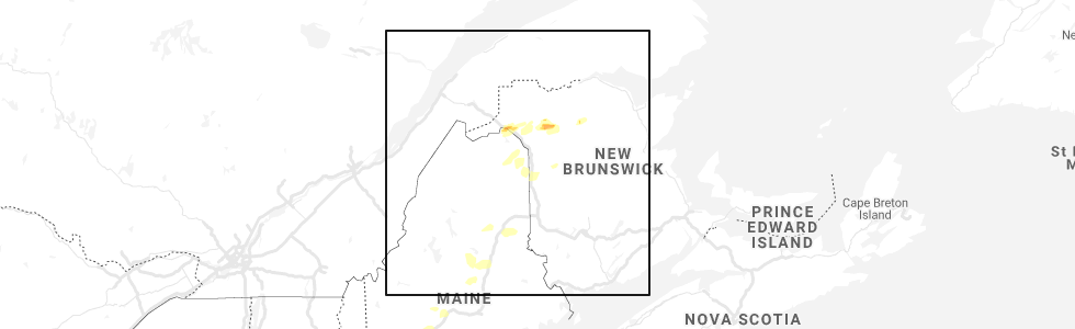
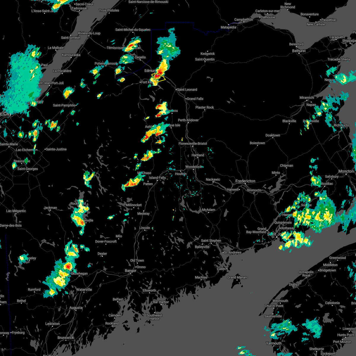
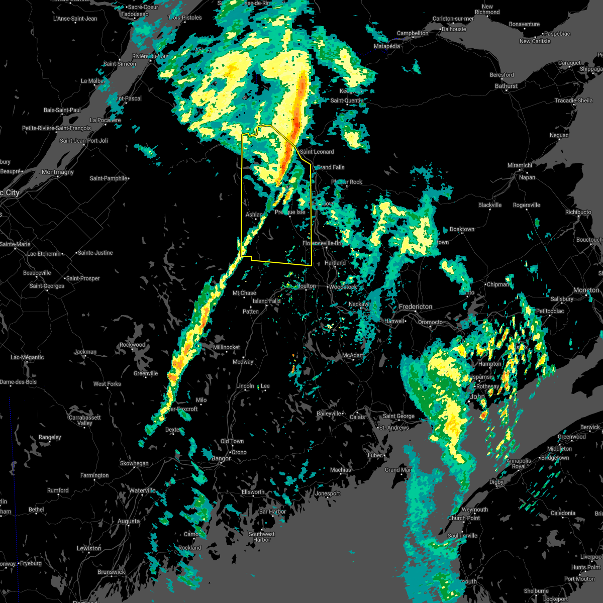
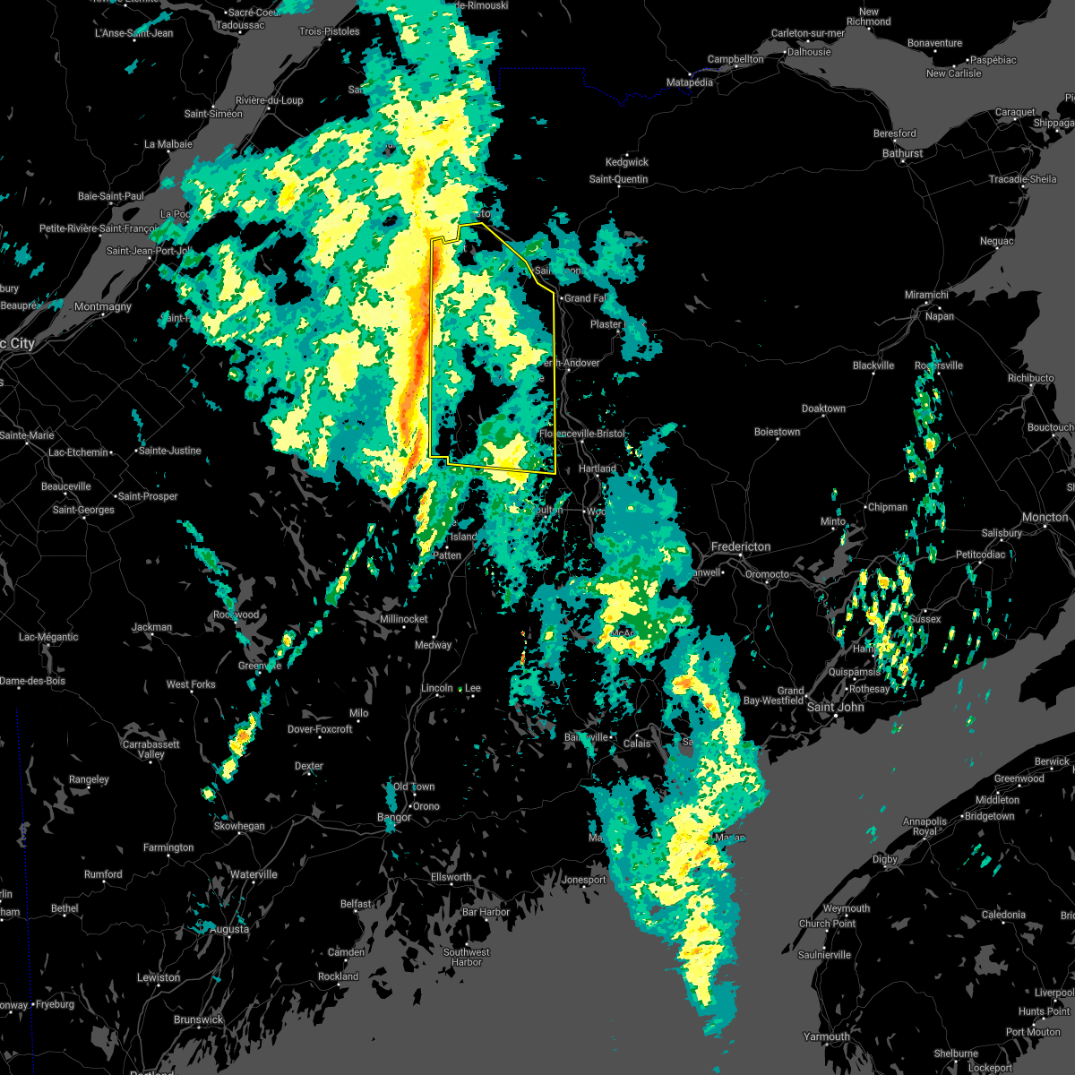
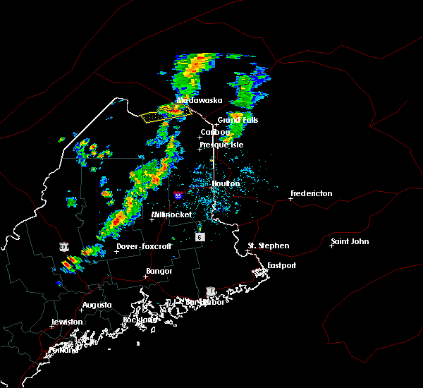
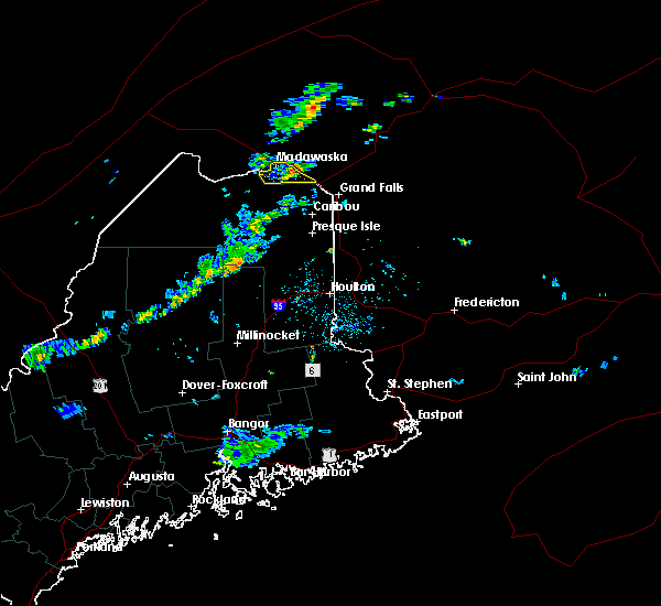
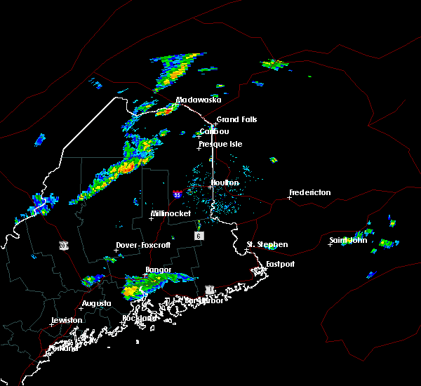
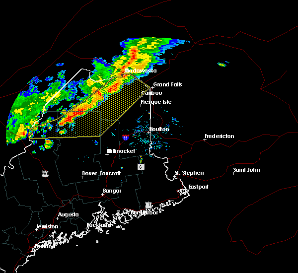
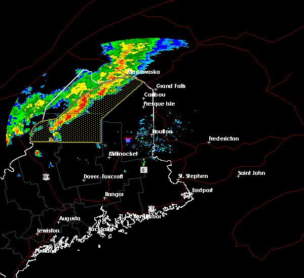
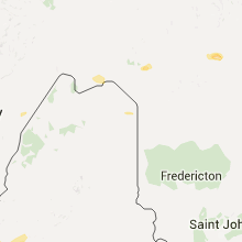
Hail Map for Madawaska, ME
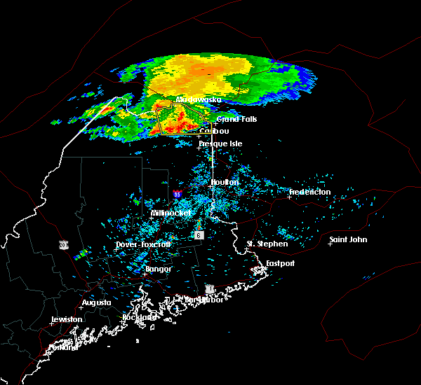
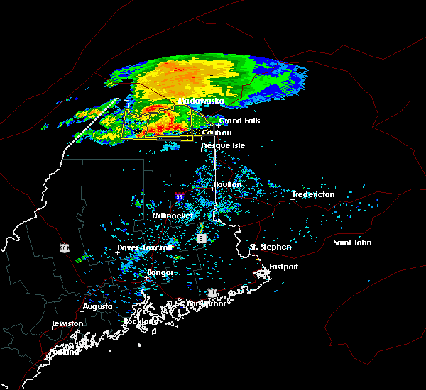
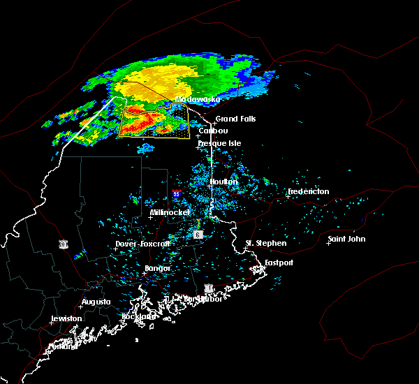
The Madawaska, ME area has had 3 reports of on-the-ground hail by trained spotters, and has been under severe weather warnings 0 times during the past 12 months. Doppler radar has detected hail at or near Madawaska, ME on 3 occasions.
| Name: | Madawaska, ME |
| Where Located: | 36.4 miles NNW of Caribou, ME |
| Map: | Google Map for Madawaska, ME |
| Population: | 2967 |
| Housing Units: | 1712 |
| More Info: | Search Google for Madawaska, ME |
5
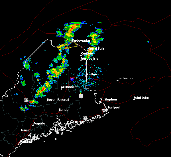
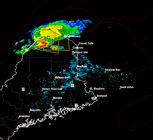
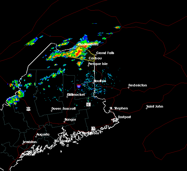
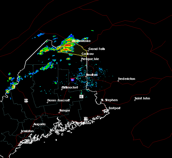
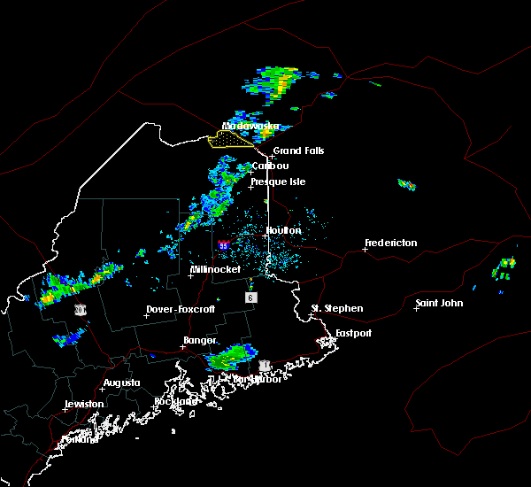
The Top Recent Hail Date for Madawaska, ME is Saturday, June 19, 2021 (1st out of 3)
Hail and Wind Damage Spotted near Madawaska, ME
| Date / Time | Report Details |
|---|---|
| 12/23/2022 6:58 PM EST | Storm damage reported in aroostook county ME, 3.6 miles N of Madawaska, ME |
| 8/11/2022 3:00 PM EDT | Tree down causing a power outage near madawask in aroostook county ME, 1.2 miles WSW of Madawaska, ME |
| 7/12/2022 7:30 PM EDT | Multiple midsized trees down or snapped midway. fishing shack destroye in aroostook county ME, 7.3 miles NNW of Madawaska, ME |
| 7/12/2022 7:29 PM EDT |
 At 729 pm edt, severe thunderstorms were located along a line extending from 29 miles northeast of lille to cross lake, moving northeast at 35 mph (radar indicated). Hazards include 60 mph wind gusts and quarter size hail. Minor hail damage to vehicles is possible. expect wind damage to trees and power lines. locations impacted include, fort kent, madawaska, van buren, eagle lake, frenchville, new canada, lille, cross lake, wallagrass, grand isle, sinclair, daigle, guerette, soldier pond and saint agatha. hail threat, radar indicated max hail size, 1. 00 in wind threat, radar indicated max wind gust, 60 mph. At 729 pm edt, severe thunderstorms were located along a line extending from 29 miles northeast of lille to cross lake, moving northeast at 35 mph (radar indicated). Hazards include 60 mph wind gusts and quarter size hail. Minor hail damage to vehicles is possible. expect wind damage to trees and power lines. locations impacted include, fort kent, madawaska, van buren, eagle lake, frenchville, new canada, lille, cross lake, wallagrass, grand isle, sinclair, daigle, guerette, soldier pond and saint agatha. hail threat, radar indicated max hail size, 1. 00 in wind threat, radar indicated max wind gust, 60 mph.
|
| 7/12/2022 6:54 PM EDT |
 At 653 pm edt, severe thunderstorms were located along a line extending from 17 miles north of madawaska to near eagle lake, moving east at 35 mph (radar indicated). Hazards include 60 mph wind gusts and quarter size hail. Minor hail damage to vehicles is possible. Expect wind damage to trees and power lines. At 653 pm edt, severe thunderstorms were located along a line extending from 17 miles north of madawaska to near eagle lake, moving east at 35 mph (radar indicated). Hazards include 60 mph wind gusts and quarter size hail. Minor hail damage to vehicles is possible. Expect wind damage to trees and power lines.
|
| 7/1/2022 5:11 PM EDT | Storm damage reported in aroostook county ME, 3.6 miles N of Madawaska, ME |
| 8/12/2021 8:15 PM EDT | Tree on rt 162 and tree on power lin in aroostook county ME, 12.6 miles N of Madawaska, ME |
| 6/19/2021 3:12 PM EDT | Half Dollar sized hail reported 2.1 miles WSW of Madawaska, ME, via social media report. |
| 6/19/2021 3:01 PM EDT |
 At 301 pm edt, a severe thunderstorm was located near madawaska, moving northeast at 20 mph (radar indicated). Hazards include 60 mph wind gusts and half dollar size hail. Minor hail damage to vehicles is possible. expect wind damage to trees and power lines. Locations impacted include, madawaska, frenchville and grand isle. At 301 pm edt, a severe thunderstorm was located near madawaska, moving northeast at 20 mph (radar indicated). Hazards include 60 mph wind gusts and half dollar size hail. Minor hail damage to vehicles is possible. expect wind damage to trees and power lines. Locations impacted include, madawaska, frenchville and grand isle.
|
| 6/19/2021 2:51 PM EDT |
 At 250 pm edt, a severe thunderstorm was located near madawaska, moving northeast at 30 mph (radar indicated). Hazards include 60 mph wind gusts and quarter size hail. Minor hail damage to vehicles is possible. Expect wind damage to trees and power lines. At 250 pm edt, a severe thunderstorm was located near madawaska, moving northeast at 30 mph (radar indicated). Hazards include 60 mph wind gusts and quarter size hail. Minor hail damage to vehicles is possible. Expect wind damage to trees and power lines.
|
| 9/30/2020 12:41 PM EDT |
 The severe thunderstorm warning for northeastern aroostook county will expire at 1245 pm edt, the line of showers which prompted the warning have moved out of the area. therefore, the warning will be allowed to expire. however gusty winds to 40 mph are still possible. The severe thunderstorm warning for northeastern aroostook county will expire at 1245 pm edt, the line of showers which prompted the warning have moved out of the area. therefore, the warning will be allowed to expire. however gusty winds to 40 mph are still possible.
|
| 9/30/2020 12:01 PM EDT |
 At 1159 am edt, intense showers with embedded thunder were located along a line extending from near frenchville to 7 miles southeast of moosehorn crossing, moving east at 50 mph (radar indicated). Hazards include 60 mph wind gusts. expect damage to trees and power lines At 1159 am edt, intense showers with embedded thunder were located along a line extending from near frenchville to 7 miles southeast of moosehorn crossing, moving east at 50 mph (radar indicated). Hazards include 60 mph wind gusts. expect damage to trees and power lines
|
| 7/28/2019 2:41 PM EDT |
 At 241 pm edt, a severe thunderstorm was located over frenchville, or near madawaska, moving northeast at 35 mph (radar indicated). Hazards include 60 mph wind gusts and quarter size hail. Minor hail damage to vehicles is possible. expect wind damage to trees and power lines. this severe storm will be near, madawaska around 300 pm edt. Other locations impacted by this severe thunderstorm include daigle, saint agatha and grand isle. At 241 pm edt, a severe thunderstorm was located over frenchville, or near madawaska, moving northeast at 35 mph (radar indicated). Hazards include 60 mph wind gusts and quarter size hail. Minor hail damage to vehicles is possible. expect wind damage to trees and power lines. this severe storm will be near, madawaska around 300 pm edt. Other locations impacted by this severe thunderstorm include daigle, saint agatha and grand isle.
|
| 7/28/2019 2:18 PM EDT |
 At 217 pm edt, a severe thunderstorm was located near fort kent, moving east at 25 mph (radar indicated). Hazards include 60 mph wind gusts and quarter size hail. Minor hail damage to vehicles is possible. expect wind damage to trees and power lines. this severe thunderstorm will be near, fort kent around 245 pm edt. madawaska and frenchville around 300 pm edt. Other locations impacted by this severe thunderstorm include daigle, saint john, wallagrass, grand isle, soldier pond, saint agatha and saint francis. At 217 pm edt, a severe thunderstorm was located near fort kent, moving east at 25 mph (radar indicated). Hazards include 60 mph wind gusts and quarter size hail. Minor hail damage to vehicles is possible. expect wind damage to trees and power lines. this severe thunderstorm will be near, fort kent around 245 pm edt. madawaska and frenchville around 300 pm edt. Other locations impacted by this severe thunderstorm include daigle, saint john, wallagrass, grand isle, soldier pond, saint agatha and saint francis.
|
| 8/7/2018 7:42 AM EDT |
 At 741 am edt, severe thunderstorms were located along a line extending from near frenchville to near madawaska lake, moving east at 40 mph (radar indicated). Hazards include ping pong ball size hail and 60 mph wind gusts. People and animals outdoors could be injured. possible hail damage to roofs, siding, windows, and vehicles. expect wind damage to trees and power lines. Locations impacted include, fort kent, madawaska, van buren, eagle lake, woodland, frenchville, new canada, lille, cross lake, loring, madawaska lake, new sweden, wallagrass, grand isle, connor, perham, caswell and stockholm. At 741 am edt, severe thunderstorms were located along a line extending from near frenchville to near madawaska lake, moving east at 40 mph (radar indicated). Hazards include ping pong ball size hail and 60 mph wind gusts. People and animals outdoors could be injured. possible hail damage to roofs, siding, windows, and vehicles. expect wind damage to trees and power lines. Locations impacted include, fort kent, madawaska, van buren, eagle lake, woodland, frenchville, new canada, lille, cross lake, loring, madawaska lake, new sweden, wallagrass, grand isle, connor, perham, caswell and stockholm.
|
| 8/7/2018 7:27 AM EDT |
 At 726 am edt, severe thunderstorms were located along a line extending from near fort kent to near madawaska lake, moving east northeast at 40 mph (radar indicated). Hazards include 60 mph wind gusts and half dollar size hail. Minor hail damage to vehicles is possible. Expect wind damage to trees and power lines. At 726 am edt, severe thunderstorms were located along a line extending from near fort kent to near madawaska lake, moving east northeast at 40 mph (radar indicated). Hazards include 60 mph wind gusts and half dollar size hail. Minor hail damage to vehicles is possible. Expect wind damage to trees and power lines.
|
| 8/7/2018 7:06 AM EDT |
 At 643 am edt, a severe thunderstorm was located near allagash, moving east at 45 mph (radar indicated). Hazards include 70 mph wind gusts and quarter size hail. Minor hail damage to vehicles is possible. expect considerable tree damage. Wind damage is also likely to mobile homes, roofs, and outbuildings. At 643 am edt, a severe thunderstorm was located near allagash, moving east at 45 mph (radar indicated). Hazards include 70 mph wind gusts and quarter size hail. Minor hail damage to vehicles is possible. expect considerable tree damage. Wind damage is also likely to mobile homes, roofs, and outbuildings.
|
| 8/7/2018 6:43 AM EDT |
 At 643 am edt, a severe thunderstorm was located near allagash, moving east at 45 mph (radar indicated). Hazards include 70 mph wind gusts and quarter size hail. Minor hail damage to vehicles is possible. expect considerable tree damage. Wind damage is also likely to mobile homes, roofs, and outbuildings. At 643 am edt, a severe thunderstorm was located near allagash, moving east at 45 mph (radar indicated). Hazards include 70 mph wind gusts and quarter size hail. Minor hail damage to vehicles is possible. expect considerable tree damage. Wind damage is also likely to mobile homes, roofs, and outbuildings.
|
| 6/29/2018 12:57 PM EDT |
 At 1256 pm edt, doppler radar indicated severe thunderstorms capable of producing quarter size hail and damaging winds in excess of 60 mph. these storms were located along a line extending from 7 miles east of cross lake to near madawaska lake to 10 miles southeast of eagle lake, moving southeast at 25 mph. additional storms behind this line will result in continued heavy downpours and gusty winds, particularly near eagle lake. locations impacted include, caribou, fort kent, madawaska, fort fairfield, limestone, van buren, eagle lake, woodland, frenchville, new canada, lille, cross lake, loring, madawaska lake, new sweden, wallagrass, grand isle, connor, perham and caswell. At 1256 pm edt, doppler radar indicated severe thunderstorms capable of producing quarter size hail and damaging winds in excess of 60 mph. these storms were located along a line extending from 7 miles east of cross lake to near madawaska lake to 10 miles southeast of eagle lake, moving southeast at 25 mph. additional storms behind this line will result in continued heavy downpours and gusty winds, particularly near eagle lake. locations impacted include, caribou, fort kent, madawaska, fort fairfield, limestone, van buren, eagle lake, woodland, frenchville, new canada, lille, cross lake, loring, madawaska lake, new sweden, wallagrass, grand isle, connor, perham and caswell.
|
| 6/29/2018 12:35 PM EDT |
 At 1235 pm edt, doppler radar indicated a severe thunderstorm capable of producing quarter size hail and damaging winds in excess of 60 mph. this storm was located near frenchville, or 8 miles east of fort kent, and moving east at 35 mph. At 1235 pm edt, doppler radar indicated a severe thunderstorm capable of producing quarter size hail and damaging winds in excess of 60 mph. this storm was located near frenchville, or 8 miles east of fort kent, and moving east at 35 mph.
|
| 7/21/2017 7:11 PM EDT |
 The severe thunderstorm warning for northeastern aroostook county will expire at 715 pm edt, the severe thunderstorm which prompted the warning has weakened and moved out of the warned area. therefore, the warning will be allowed to expire. however small hail is still possible with this thunderstorm. The severe thunderstorm warning for northeastern aroostook county will expire at 715 pm edt, the severe thunderstorm which prompted the warning has weakened and moved out of the warned area. therefore, the warning will be allowed to expire. however small hail is still possible with this thunderstorm.
|
| 7/21/2017 6:46 PM EDT |
 At 645 pm edt, a severe thunderstorms were located along and just south of the st. john valley moving east around 40 mph (trained weather spotters reported quarter sized hail and winds of 60 mph). Hazards include 60 mph wind gusts and quarter size hail. Minor hail damage to vehicles is possible. expect wind damage to trees and power lines. locations impacted include, caribou, fort kent, madawaska, fort fairfield, limestone, van buren, eagle lake, allagash, woodland, frenchville, new canada, allagash township, lille, cross lake, loring, madawaska lake, dickey, new sweden, wallagrass and grand isle. this includes the following highways, us highway 1 between van buren and grand isle, and between frenchville and fort kent. State highway 11 between eagle lake and fort kent. At 645 pm edt, a severe thunderstorms were located along and just south of the st. john valley moving east around 40 mph (trained weather spotters reported quarter sized hail and winds of 60 mph). Hazards include 60 mph wind gusts and quarter size hail. Minor hail damage to vehicles is possible. expect wind damage to trees and power lines. locations impacted include, caribou, fort kent, madawaska, fort fairfield, limestone, van buren, eagle lake, allagash, woodland, frenchville, new canada, allagash township, lille, cross lake, loring, madawaska lake, dickey, new sweden, wallagrass and grand isle. this includes the following highways, us highway 1 between van buren and grand isle, and between frenchville and fort kent. State highway 11 between eagle lake and fort kent.
|
| 7/21/2017 6:40 PM EDT |
 At 639 pm edt, scattered thunderstorms were located near and just south of the st. john valley moving east at 40 mph (trained weather spotters). Hazards include 60 mph wind gusts and quarter size hail. Minor hail damage to vehicles is possible. expect wind damage to trees and power lines. locations impacted include, caribou, fort kent, madawaska, fort fairfield, limestone, van buren, eagle lake, allagash, woodland, frenchville, new canada, allagash township, lille, cross lake, loring, madawaska lake, dickey, new sweden, wallagrass and grand isle. this includes the following highways, us highway 1 between van buren and grand isle, and between frenchville and fort kent. State highway 11 between eagle lake and fort kent. At 639 pm edt, scattered thunderstorms were located near and just south of the st. john valley moving east at 40 mph (trained weather spotters). Hazards include 60 mph wind gusts and quarter size hail. Minor hail damage to vehicles is possible. expect wind damage to trees and power lines. locations impacted include, caribou, fort kent, madawaska, fort fairfield, limestone, van buren, eagle lake, allagash, woodland, frenchville, new canada, allagash township, lille, cross lake, loring, madawaska lake, dickey, new sweden, wallagrass and grand isle. this includes the following highways, us highway 1 between van buren and grand isle, and between frenchville and fort kent. State highway 11 between eagle lake and fort kent.
|
| 7/21/2017 6:09 PM EDT |
 At 609 pm edt, a severe thunderstorm was located 12 miles northwest of dickey, or 13 miles south of estcourt station, moving southeast at 40 mph (trained weather spotters). Hazards include 60 mph wind gusts and quarter size hail. Minor hail damage to vehicles is possible. Expect wind damage to trees and power lines. At 609 pm edt, a severe thunderstorm was located 12 miles northwest of dickey, or 13 miles south of estcourt station, moving southeast at 40 mph (trained weather spotters). Hazards include 60 mph wind gusts and quarter size hail. Minor hail damage to vehicles is possible. Expect wind damage to trees and power lines.
|
| 7/21/2017 6:07 PM EDT | Quarter sized hail reported 1.3 miles S of Madawaska, ME, quarter inch hail and wind gusts to 35 mph were reported in madawaska. |
| 5/18/2017 9:57 PM EDT | 2 trees dow in aroostook county ME, 10.3 miles NNW of Madawaska, ME |
| 7/18/2016 9:56 PM EDT |
 The severe thunderstorm warning for northeastern aroostook county will expire at 1000 pm edt, the storm which prompted the warning has moved out of the area. therefore, the warning will be allowed to expire. The severe thunderstorm warning for northeastern aroostook county will expire at 1000 pm edt, the storm which prompted the warning has moved out of the area. therefore, the warning will be allowed to expire.
|
| 7/18/2016 9:31 PM EDT |
 At 930 pm edt, a severe thunderstorm was located near lille, or 7 miles southeast of madawaska, moving east at 40 mph (radar indicated). Hazards include 60 mph wind gusts and quarter size hail. Hail damage to vehicles is expected. expect wind damage to roofs, siding, and trees. Locations impacted include, fort kent, madawaska, van buren, frenchville, cross lake, grand isle and saint agatha. At 930 pm edt, a severe thunderstorm was located near lille, or 7 miles southeast of madawaska, moving east at 40 mph (radar indicated). Hazards include 60 mph wind gusts and quarter size hail. Hail damage to vehicles is expected. expect wind damage to roofs, siding, and trees. Locations impacted include, fort kent, madawaska, van buren, frenchville, cross lake, grand isle and saint agatha.
|
| 7/18/2016 9:13 PM EDT |
 At 912 pm edt, a severe thunderstorm was located near frenchville, or near fort kent, moving east at 40 mph (radar indicated). Hazards include 60 mph wind gusts and quarter size hail. Hail damage to vehicles is expected. Expect wind damage to roofs, siding, and trees. At 912 pm edt, a severe thunderstorm was located near frenchville, or near fort kent, moving east at 40 mph (radar indicated). Hazards include 60 mph wind gusts and quarter size hail. Hail damage to vehicles is expected. Expect wind damage to roofs, siding, and trees.
|
| 7/14/2016 5:20 PM EDT | Large barn flattened and vegetable stand picked up and turned ove in aroostook county ME, 8.6 miles WNW of Madawaska, ME |
| 7/14/2016 5:20 PM EDT | Large tree uprooted in st david cemetery in aroostook county ME, 2.1 miles WSW of Madawaska, ME |
| 7/14/2016 5:20 PM EDT | Large storage shed flattened and vegetable stand picked up and turned ove in aroostook county ME, 2.6 miles WSW of Madawaska, ME |
| 7/14/2016 5:19 PM EDT | Several trees down on gagnon road in aroostook county ME, 1.1 miles W of Madawaska, ME |
| 7/14/2016 5:15 PM EDT |
 At 514 pm edt, severe thunderstorms were located along a line extending from madawaska to 14 miles west of rockwood, moving east at 40 mph (radar indicated). Hazards include 60 mph wind gusts and quarter size hail. Expect wind damage to roofs. siding. And trees. At 514 pm edt, severe thunderstorms were located along a line extending from madawaska to 14 miles west of rockwood, moving east at 40 mph (radar indicated). Hazards include 60 mph wind gusts and quarter size hail. Expect wind damage to roofs. siding. And trees.
|
| 7/14/2016 4:50 PM EDT |
 At 449 pm edt, severe thunderstorms were located along a line extending from 26 miles northeast of lille to near kokadjo, moving southeast at 45 mph (radar indicated). Hazards include 60 mph wind gusts and quarter size hail. Expect wind damage to roofs. siding. and trees. Locations impacted include, fort kent, madawaska, van buren, eagle lake, deboullie mountain, clayton lake, baxter st park, frenchville, portage lake, new canada, madawaska lake, baker lake, chesuncook, chamberlain lake, churchill dam, baxter state park, billy-jack depot, tamway, russel crossing and south branch pond. At 449 pm edt, severe thunderstorms were located along a line extending from 26 miles northeast of lille to near kokadjo, moving southeast at 45 mph (radar indicated). Hazards include 60 mph wind gusts and quarter size hail. Expect wind damage to roofs. siding. and trees. Locations impacted include, fort kent, madawaska, van buren, eagle lake, deboullie mountain, clayton lake, baxter st park, frenchville, portage lake, new canada, madawaska lake, baker lake, chesuncook, chamberlain lake, churchill dam, baxter state park, billy-jack depot, tamway, russel crossing and south branch pond.
|
| 7/14/2016 4:21 PM EDT |
 At 420 pm edt, severe thunderstorms were located along a line extending from 26 miles north of madawaska to 14 miles west of seboomook, moving southeast at 45 mph (radar indicated). Hazards include 60 mph wind gusts and quarter size hail. Expect wind damage to roofs. siding. And trees. At 420 pm edt, severe thunderstorms were located along a line extending from 26 miles north of madawaska to 14 miles west of seboomook, moving southeast at 45 mph (radar indicated). Hazards include 60 mph wind gusts and quarter size hail. Expect wind damage to roofs. siding. And trees.
|
| 9/9/2015 4:49 PM EDT | Tree down on main street in aroostook county ME, 5 miles NNE of Madawaska, ME |
| 9/9/2015 4:49 PM EDT | Tree down in cyr cove in aroostook county ME, 3.6 miles N of Madawaska, ME |
| 9/9/2015 4:25 PM EDT |
 At 425 pm edt, severe thunderstorms were located along a line extending from 9 miles north of lille to near new canada, moving east at 40 mph (radar indicated). Hazards include 60 mph wind gusts and quarter size hail. Hail damage to vehicles is expected. expect wind damage to roofs, siding and trees. Locations impacted include, fort kent, madawaska, van buren, eagle lake, frenchville, new canada, madawaska lake, lille, cross lake, new sweden, wallagrass, grand isle, connor, caswell, stockholm, winterville, hamlin, westmanland, guerette and cyr plantation. At 425 pm edt, severe thunderstorms were located along a line extending from 9 miles north of lille to near new canada, moving east at 40 mph (radar indicated). Hazards include 60 mph wind gusts and quarter size hail. Hail damage to vehicles is expected. expect wind damage to roofs, siding and trees. Locations impacted include, fort kent, madawaska, van buren, eagle lake, frenchville, new canada, madawaska lake, lille, cross lake, new sweden, wallagrass, grand isle, connor, caswell, stockholm, winterville, hamlin, westmanland, guerette and cyr plantation.
|
| 9/9/2015 4:05 PM EDT |
 At 405 pm edt, severe thunderstorms were located along a line extending from near madawaska to 9 miles north of deboullie mountain, moving east at 40 mph (radar indicated). Hazards include 60 mph wind gusts and quarter size hail. Hail damage to vehicles is expected. Expect wind damage to roofs, siding and trees. At 405 pm edt, severe thunderstorms were located along a line extending from near madawaska to 9 miles north of deboullie mountain, moving east at 40 mph (radar indicated). Hazards include 60 mph wind gusts and quarter size hail. Hail damage to vehicles is expected. Expect wind damage to roofs, siding and trees.
|
| 8/3/2015 3:42 PM EDT | Many trees and power lines down. also nickel size hai in aroostook county ME, 8.4 miles NNW of Madawaska, ME |
| 8/3/2015 3:40 PM EDT | Roof blown off of potato house. picture posted on faceboo in aroostook county ME, 7 miles N of Madawaska, ME |
| 5/27/2015 5:50 PM EDT | Second strong wind event blew down many more trees around cross lak in aroostook county ME, 14.6 miles N of Madawaska, ME |
| 5/27/2015 5:30 PM EDT | Trees reported on power lines in aroostook county ME, 1.3 miles S of Madawaska, ME |
| 5/27/2015 5:30 PM EDT | Trees down on power lines in aroostook county ME, 7 miles N of Madawaska, ME |
| 5/27/2015 5:30 PM EDT | Power lines and trees down in sinclair in aroostook county ME, 12.5 miles N of Madawaska, ME |
| 5/27/2015 5:30 PM EDT | Trees down at intersection of 161 and 162. road blocked between cross lake and sinclai in aroostook county ME, 14.6 miles N of Madawaska, ME |
| 5/27/2015 5:20 PM EDT | Power lines and trees down in sinclair in aroostook county ME, 12.5 miles N of Madawaska, ME |
| 5/27/2015 5:20 PM EDT | Trees down at intersection of 161 and 162. road blocked in aroostook county ME, 14.6 miles N of Madawaska, ME |
| 5/26/2014 2:10 PM EDT | Quarter sized hail reported 1.3 miles S of Madawaska, ME, quarter sized hail.time is estimated. |
| 6/2/2013 3:30 PM EDT | Trees down along route in aroostook county ME, 5 miles NNE of Madawaska, ME |
| 6/2/2013 3:30 PM EDT | Trees down in town and along portions of route in aroostook county ME, 1.3 miles S of Madawaska, ME |
| 6/2/2013 3:15 PM EDT | Trees down along route 162 in sinclair. time is estimate in aroostook county ME, 9.9 miles N of Madawaska, ME |
| 5/31/2013 6:07 PM EDT | Trees were blocking route 162 near sinclair and along many of the dirt forest roads in the are in aroostook county ME, 12.1 miles NNW of Madawaska, ME |
| 1/1/0001 12:00 AM | Trees down...dock with boats over turned in aroostook county ME, 7 miles N of Madawaska, ME |
| 1/1/0001 12:00 AM | Wind estimated at 60 mph in aroostook county ME, 1.3 miles S of Madawaska, ME |
| 1/1/0001 12:00 AM | Large tree took down power line on main stee in aroostook county ME, 5 miles NNE of Madawaska, ME |
| 1/1/0001 12:00 AM | Large tree took down power line on main stree in aroostook county ME, 5 miles NNE of Madawaska, ME |
Hail Maps for Madawaska, ME


Connect with Interactive Hail Maps