

Hail Map for Mansfield, PA
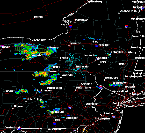
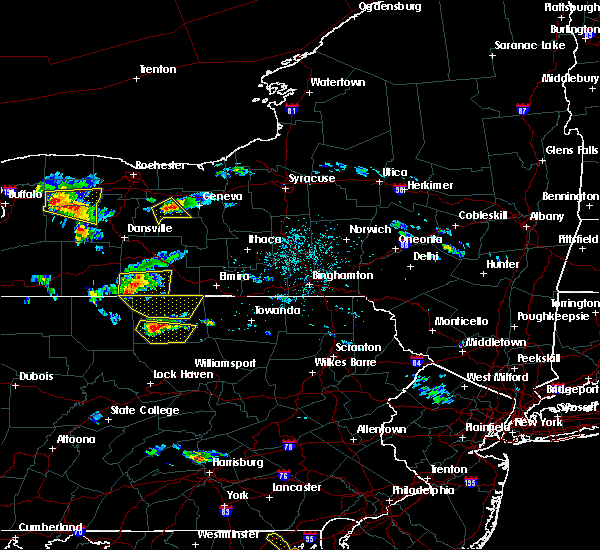
The Mansfield, PA area has had 0 reports of on-the-ground hail by trained spotters, and has been under severe weather warnings 1 time during the past 12 months. Doppler radar has detected hail at or near Mansfield, PA on 18 occasions, including 1 occasion during the past year.
| Name: | Mansfield, PA |
| Where Located: | 78.5 miles WNW of Scranton, PA |
| Map: | Google Map for Mansfield, PA |
| Population: | 3625 |
| Housing Units: | 1132 |
| More Info: | Search Google for Mansfield, PA |
0
The Top Recent Hail Date for Mansfield, PA is Thursday, September 7, 2023 (10th out of 18)

Hail and Wind Damage Spotted near Mansfield, PA
| Date / Time | Report Details |
|---|---|
| 7/20/2023 10:29 PM EDT | Trees down in mansfiel in tioga county PA, 0.4 miles SSW of Mansfield, PA |
| 7/20/2023 9:44 PM EDT |
 At 944 pm edt, a severe thunderstorm was located over ole bull state park, moving east at 30 mph (radar indicated). Hazards include 60 mph wind gusts. Expect damage to roofs, siding, and trees. this severe thunderstorm will be near, leetonia, cedar run and slate run around 1000 pm edt. morris around 1020 pm edt. arnot around 1030 pm edt. other locations impacted by this severe thunderstorm include ski sawmill ski area and mansfield university. hail threat, radar indicated max hail size, <. 75 in wind threat, radar indicated max wind gust, 60 mph. At 944 pm edt, a severe thunderstorm was located over ole bull state park, moving east at 30 mph (radar indicated). Hazards include 60 mph wind gusts. Expect damage to roofs, siding, and trees. this severe thunderstorm will be near, leetonia, cedar run and slate run around 1000 pm edt. morris around 1020 pm edt. arnot around 1030 pm edt. other locations impacted by this severe thunderstorm include ski sawmill ski area and mansfield university. hail threat, radar indicated max hail size, <. 75 in wind threat, radar indicated max wind gust, 60 mph.
|
| 4/1/2023 4:22 PM EDT |
 At 421 pm edt, severe thunderstorms were located along a line extending from erin to east smithfield to lincoln falls to loyalsockville, moving east at 65 mph (radar and automated observing system). Hazards include 70 mph wind gusts. Expect considerable tree damage. damage is likely to mobile homes, roofs, and outbuildings. locations impacted include, williamsport, montoursville, mansfield, muncy, elkland, blossburg, duboistown, covington, arnot, millerton, ralston and trout run. this includes interstate 180 from mile markers 14 to 29. thunderstorm damage threat, considerable hail threat, radar indicated max hail size, <. 75 in wind threat, radar indicated max wind gust, 70 mph. At 421 pm edt, severe thunderstorms were located along a line extending from erin to east smithfield to lincoln falls to loyalsockville, moving east at 65 mph (radar and automated observing system). Hazards include 70 mph wind gusts. Expect considerable tree damage. damage is likely to mobile homes, roofs, and outbuildings. locations impacted include, williamsport, montoursville, mansfield, muncy, elkland, blossburg, duboistown, covington, arnot, millerton, ralston and trout run. this includes interstate 180 from mile markers 14 to 29. thunderstorm damage threat, considerable hail threat, radar indicated max hail size, <. 75 in wind threat, radar indicated max wind gust, 70 mph.
|
| 4/1/2023 3:31 PM EDT |
 At 331 pm edt, severe thunderstorms were located along a line extending from greenwood to near galeton to near slate run to near keating, moving east at 65 mph (radar indicated). Hazards include 70 mph wind gusts. Expect considerable tree damage. Damage is likely to mobile homes, roofs, and outbuildings. At 331 pm edt, severe thunderstorms were located along a line extending from greenwood to near galeton to near slate run to near keating, moving east at 65 mph (radar indicated). Hazards include 70 mph wind gusts. Expect considerable tree damage. Damage is likely to mobile homes, roofs, and outbuildings.
|
| 7/24/2022 4:26 PM EDT |
 At 426 pm edt, severe thunderstorms were located along a line extending from mansfield to ogdensburg to trout run, moving east at 45 mph (radar indicated). Hazards include 60 mph wind gusts. Expect damage to roofs, siding, and trees. locations impacted include, mansfield, blossburg, covington, arnot, ralston, ogdensburg, cammal, english center, barbours, buttonwood, trout run and ski sawmill ski area. hail threat, radar indicated max hail size, <. 75 in wind threat, radar indicated max wind gust, 60 mph. At 426 pm edt, severe thunderstorms were located along a line extending from mansfield to ogdensburg to trout run, moving east at 45 mph (radar indicated). Hazards include 60 mph wind gusts. Expect damage to roofs, siding, and trees. locations impacted include, mansfield, blossburg, covington, arnot, ralston, ogdensburg, cammal, english center, barbours, buttonwood, trout run and ski sawmill ski area. hail threat, radar indicated max hail size, <. 75 in wind threat, radar indicated max wind gust, 60 mph.
|
| 7/24/2022 3:59 PM EDT |
 At 358 pm edt, severe thunderstorms were located along a line extending from leonard harrison state park to morris to slate run, moving east at 45 mph (radar indicated). Hazards include 60 mph wind gusts. expect damage to roofs, siding, and trees At 358 pm edt, severe thunderstorms were located along a line extending from leonard harrison state park to morris to slate run, moving east at 45 mph (radar indicated). Hazards include 60 mph wind gusts. expect damage to roofs, siding, and trees
|
| 3/7/2022 6:10 PM EST | Trees and wires down along route in tioga county PA, 2.9 miles WNW of Mansfield, PA |
| 3/7/2022 6:05 PM EST | Wires down on a ca in tioga county PA, 2.8 miles NNE of Mansfield, PA |
| 3/7/2022 5:59 PM EST |
 At 559 pm est, severe thunderstorms were located along a line extending from south corning to blanchard to williamsburg, moving east at 50 mph (radar indicated). Hazards include 60 mph wind gusts. expect damage to roofs, siding, and trees At 559 pm est, severe thunderstorms were located along a line extending from south corning to blanchard to williamsburg, moving east at 50 mph (radar indicated). Hazards include 60 mph wind gusts. expect damage to roofs, siding, and trees
|
| 3/7/2022 5:39 PM EST |
 At 538 pm est, severe thunderstorms were located along a line extending from bath to near keating to ogletown, moving northeast at 75 mph (radar indicated). Hazards include 60 mph wind gusts. Expect damage to roofs, siding, and trees. locations impacted include, state college, lock haven, bellefonte, mansfield, wellsboro, philipsburg, renovo, park forest village, boalsburg, wharton, keating, morris, pleasant gap, lamar, stormstown, lemont, zion, elkland, houserville and mill hall. for those driving on interstate 80, this includes areas between the kylertown and lock haven exits, specifically from mile markers 139 to 176. this includes interstate 99 from mile markers 56 to 85. hail threat, radar indicated max hail size, <. 75 in wind threat, radar indicated max wind gust, 60 mph. At 538 pm est, severe thunderstorms were located along a line extending from bath to near keating to ogletown, moving northeast at 75 mph (radar indicated). Hazards include 60 mph wind gusts. Expect damage to roofs, siding, and trees. locations impacted include, state college, lock haven, bellefonte, mansfield, wellsboro, philipsburg, renovo, park forest village, boalsburg, wharton, keating, morris, pleasant gap, lamar, stormstown, lemont, zion, elkland, houserville and mill hall. for those driving on interstate 80, this includes areas between the kylertown and lock haven exits, specifically from mile markers 139 to 176. this includes interstate 99 from mile markers 56 to 85. hail threat, radar indicated max hail size, <. 75 in wind threat, radar indicated max wind gust, 60 mph.
|
| 3/7/2022 5:22 PM EST |
 At 522 pm est, severe thunderstorms were located along a line extending from canisteo to near karthaus to near boswell, moving northeast at 60 mph (radar indicated). Hazards include 60 mph wind gusts. expect damage to roofs, siding, and trees At 522 pm est, severe thunderstorms were located along a line extending from canisteo to near karthaus to near boswell, moving northeast at 60 mph (radar indicated). Hazards include 60 mph wind gusts. expect damage to roofs, siding, and trees
|
| 7/13/2021 8:08 PM EDT | Trees down in richmond townshi in tioga county PA, 0.5 miles NE of Mansfield, PA |
| 7/13/2021 7:26 PM EDT |
 At 725 pm edt, a severe thunderstorm was located over cedar run, moving northeast at 35 mph (radar indicated). Hazards include 60 mph wind gusts and penny size hail. expect damage to roofs, siding, and trees At 725 pm edt, a severe thunderstorm was located over cedar run, moving northeast at 35 mph (radar indicated). Hazards include 60 mph wind gusts and penny size hail. expect damage to roofs, siding, and trees
|
| 7/7/2021 8:21 PM EDT |
 At 821 pm edt, a severe thunderstorm was located near leonard harrison state park, moving east at 45 mph (radar indicated). Hazards include 60 mph wind gusts and quarter size hail. Hail damage to vehicles is expected. expect wind damage to roofs, siding, and trees. this severe thunderstorm will be near, arnot around 830 pm edt. mansfield, covington and blossburg around 840 pm edt. Other locations impacted by this severe thunderstorm include tioga, roseville and mansfield university. At 821 pm edt, a severe thunderstorm was located near leonard harrison state park, moving east at 45 mph (radar indicated). Hazards include 60 mph wind gusts and quarter size hail. Hail damage to vehicles is expected. expect wind damage to roofs, siding, and trees. this severe thunderstorm will be near, arnot around 830 pm edt. mansfield, covington and blossburg around 840 pm edt. Other locations impacted by this severe thunderstorm include tioga, roseville and mansfield university.
|
| 8/27/2020 6:29 PM EDT |
 At 629 pm edt, severe thunderstorms were located along a line extending from near millerton to near cedar run, moving east at 60 mph (radar indicated). Hazards include 60 mph wind gusts. Expect damage to trees, roofs, and siding. these severe storms will be near, ogdensburg around 650 pm edt. Other locations impacted by these severe thunderstorms include roseville and mansfield university. At 629 pm edt, severe thunderstorms were located along a line extending from near millerton to near cedar run, moving east at 60 mph (radar indicated). Hazards include 60 mph wind gusts. Expect damage to trees, roofs, and siding. these severe storms will be near, ogdensburg around 650 pm edt. Other locations impacted by these severe thunderstorms include roseville and mansfield university.
|
| 8/27/2020 6:19 PM EDT |
 At 618 pm edt, severe thunderstorms were located along a line extending from near keeneyville to near ole bull state park, moving east at 60 mph (radar indicated). Hazards include 60 mph wind gusts. Expect damage to trees, roofs, and siding. these severe storms will be near, keeneyville and elkland around 620 pm edt. mansfield around 630 pm edt. Other locations impacted by these severe thunderstorms include knoxville, osceola, tioga, tioga junction, roseville and mansfield university. At 618 pm edt, severe thunderstorms were located along a line extending from near keeneyville to near ole bull state park, moving east at 60 mph (radar indicated). Hazards include 60 mph wind gusts. Expect damage to trees, roofs, and siding. these severe storms will be near, keeneyville and elkland around 620 pm edt. mansfield around 630 pm edt. Other locations impacted by these severe thunderstorms include knoxville, osceola, tioga, tioga junction, roseville and mansfield university.
|
| 8/27/2020 5:58 PM EDT |
 At 558 pm edt, severe thunderstorms were located along a line extending from harrison valley to wharton, moving east at 50 mph (radar indicated). Hazards include 70 mph wind gusts. Expect considerable tree damage. damage is likely to mobile homes, roofs, and outbuildings. severe thunderstorms will be near, westfield around 610 pm edt. wellsboro and keeneyville around 620 pm edt. mansfield, covington and blossburg around 640 pm edt. Other locations impacted by these severe thunderstorms include knoxville, osceola, tioga, tioga junction, roseville and mansfield university. At 558 pm edt, severe thunderstorms were located along a line extending from harrison valley to wharton, moving east at 50 mph (radar indicated). Hazards include 70 mph wind gusts. Expect considerable tree damage. damage is likely to mobile homes, roofs, and outbuildings. severe thunderstorms will be near, westfield around 610 pm edt. wellsboro and keeneyville around 620 pm edt. mansfield, covington and blossburg around 640 pm edt. Other locations impacted by these severe thunderstorms include knoxville, osceola, tioga, tioga junction, roseville and mansfield university.
|
| 5/15/2020 7:49 PM EDT |
 At 749 pm edt, a severe thunderstorm was located over harrison valley, moving east at 60 mph (radar indicated). Hazards include 60 mph wind gusts. Expect damage to trees, roofs, and siding. this severe thunderstorm will be near, westfield around 800 pm edt. keeneyville and elkland around 810 pm edt. mansfield around 820 pm edt. millerton around 830 pm edt. Other locations impacted by this severe thunderstorm include knoxville, osceola, tioga, roseville, tioga junction, mansfield university and ulysses. At 749 pm edt, a severe thunderstorm was located over harrison valley, moving east at 60 mph (radar indicated). Hazards include 60 mph wind gusts. Expect damage to trees, roofs, and siding. this severe thunderstorm will be near, westfield around 800 pm edt. keeneyville and elkland around 810 pm edt. mansfield around 820 pm edt. millerton around 830 pm edt. Other locations impacted by this severe thunderstorm include knoxville, osceola, tioga, roseville, tioga junction, mansfield university and ulysses.
|
| 8/18/2019 3:00 PM EDT | Multiple trees down in richmond township in tioga county PA, 1 miles ENE of Mansfield, PA |
| 8/18/2019 2:55 PM EDT | Trees down on pumpkin hill rd in tioga county PA, 7.7 miles SW of Mansfield, PA |
| 8/18/2019 2:54 PM EDT |
 A severe thunderstorm warning remains in effect until 330 pm edt for tioga county. at 252 pm edt, severe thunderstorms were located along a line extending from near millerton to near morris, moving east at 35 mph. hazard. 60 mph wind gusts and quarter size hail. source. Radar indicated. A severe thunderstorm warning remains in effect until 330 pm edt for tioga county. at 252 pm edt, severe thunderstorms were located along a line extending from near millerton to near morris, moving east at 35 mph. hazard. 60 mph wind gusts and quarter size hail. source. Radar indicated.
|
| 8/18/2019 2:09 PM EDT |
 The national weather service in state college pa has issued a * severe thunderstorm warning for. tioga county in north central pennsylvania. until 330 pm edt. At 209 pm edt, severe thunderstorms were located along a line extending from near woodhull to near ole bull state park, moving. The national weather service in state college pa has issued a * severe thunderstorm warning for. tioga county in north central pennsylvania. until 330 pm edt. At 209 pm edt, severe thunderstorms were located along a line extending from near woodhull to near ole bull state park, moving.
|
| 7/19/2019 6:13 PM EDT |
 At 613 pm edt, a severe thunderstorm was located near covington, moving southeast at 35 mph (radar indicated). Hazards include 60 mph wind gusts. Expect damage to trees, roofs, and siding. Locations impacted include, mansfield, wellsboro, morris, blossburg, covington, arnot, ogdensburg and mansfield university. At 613 pm edt, a severe thunderstorm was located near covington, moving southeast at 35 mph (radar indicated). Hazards include 60 mph wind gusts. Expect damage to trees, roofs, and siding. Locations impacted include, mansfield, wellsboro, morris, blossburg, covington, arnot, ogdensburg and mansfield university.
|
| 7/19/2019 6:05 PM EDT | Trees down on bailey creek road in tioga county PA, 6.9 miles SW of Mansfield, PA |
| 7/19/2019 5:42 PM EDT |
 At 541 pm edt, a severe thunderstorm was located near keeneyville, moving southeast at 35 mph (radar indicated). Hazards include 60 mph wind gusts. expect damage to trees, roofs, and siding At 541 pm edt, a severe thunderstorm was located near keeneyville, moving southeast at 35 mph (radar indicated). Hazards include 60 mph wind gusts. expect damage to trees, roofs, and siding
|
| 6/1/2019 6:03 PM EDT |
 At 602 pm edt, a severe thunderstorm was located near wellsboro, moving east at 25 mph (radar indicated). Hazards include 60 mph wind gusts and quarter size hail. Hail damage to vehicles is expected. expect wind damage to trees, roofs, and siding. Locations impacted include, mansfield, wellsboro, morris, blossburg, covington, arnot, leonard harrison state park and leetonia. At 602 pm edt, a severe thunderstorm was located near wellsboro, moving east at 25 mph (radar indicated). Hazards include 60 mph wind gusts and quarter size hail. Hail damage to vehicles is expected. expect wind damage to trees, roofs, and siding. Locations impacted include, mansfield, wellsboro, morris, blossburg, covington, arnot, leonard harrison state park and leetonia.
|
| 6/1/2019 5:39 PM EDT |
 At 539 pm edt, a severe thunderstorm was located near leonard harrison state park, moving east at 25 mph (radar indicated). Hazards include 60 mph wind gusts and quarter size hail. Hail damage to vehicles is expected. Expect wind damage to trees, roofs, and siding. At 539 pm edt, a severe thunderstorm was located near leonard harrison state park, moving east at 25 mph (radar indicated). Hazards include 60 mph wind gusts and quarter size hail. Hail damage to vehicles is expected. Expect wind damage to trees, roofs, and siding.
|
| 5/29/2019 2:18 PM EDT |
 At 218 pm edt, a severe thunderstorm capable of producing a tornado was located near covington, moving east at 35 mph (radar indicated rotation). Hazards include tornado and quarter size hail. Tree damage will occur. damage to roofs, windows, and vehicles is likely. flying debris will be dangerous to those caught without shelter. mobile homes will be damaged or destroyed. Locations impacted include, mansfield, blossburg, covington, arnot, ogdensburg and mansfield university. At 218 pm edt, a severe thunderstorm capable of producing a tornado was located near covington, moving east at 35 mph (radar indicated rotation). Hazards include tornado and quarter size hail. Tree damage will occur. damage to roofs, windows, and vehicles is likely. flying debris will be dangerous to those caught without shelter. mobile homes will be damaged or destroyed. Locations impacted include, mansfield, blossburg, covington, arnot, ogdensburg and mansfield university.
|
| 5/29/2019 1:57 PM EDT |
 At 157 pm edt, a severe thunderstorm capable of producing a tornado was located over wellsboro, moving east at 45 mph (radar indicated rotation). Hazards include tornado and quarter size hail. Tree damage will occur. damage to roofs, windows, and vehicles is likely. flying debris will be dangerous to those caught without shelter. mobile homes will be damaged or destroyed. this dangerous storm will be near, mansfield, covington, blossburg and arnot around 210 pm edt. Other locations impacted by this tornadic thunderstorm include mansfield university. At 157 pm edt, a severe thunderstorm capable of producing a tornado was located over wellsboro, moving east at 45 mph (radar indicated rotation). Hazards include tornado and quarter size hail. Tree damage will occur. damage to roofs, windows, and vehicles is likely. flying debris will be dangerous to those caught without shelter. mobile homes will be damaged or destroyed. this dangerous storm will be near, mansfield, covington, blossburg and arnot around 210 pm edt. Other locations impacted by this tornadic thunderstorm include mansfield university.
|
| 5/29/2019 1:54 PM EDT |
 At 153 pm edt, a severe thunderstorm was located over wellsboro, moving east at 45 mph (radar indicated). Hazards include 60 mph wind gusts and quarter size hail. Hail damage to vehicles is expected. Expect wind damage to trees, roofs, and siding. At 153 pm edt, a severe thunderstorm was located over wellsboro, moving east at 45 mph (radar indicated). Hazards include 60 mph wind gusts and quarter size hail. Hail damage to vehicles is expected. Expect wind damage to trees, roofs, and siding.
|
| 5/19/2019 3:33 PM EDT |
 At 332 pm edt, a severe thunderstorm was located over blossburg, moving east at 30 mph. another thunderstorm was developing near morris (radar indicated). Hazards include 60 mph wind gusts and quarter size hail. Hail damage to vehicles is expected. expect wind damage to trees, roofs, and siding. Locations impacted include, mansfield, morris, blossburg, covington and arnot. At 332 pm edt, a severe thunderstorm was located over blossburg, moving east at 30 mph. another thunderstorm was developing near morris (radar indicated). Hazards include 60 mph wind gusts and quarter size hail. Hail damage to vehicles is expected. expect wind damage to trees, roofs, and siding. Locations impacted include, mansfield, morris, blossburg, covington and arnot.
|
| 5/19/2019 3:10 PM EDT |
 At 309 pm edt, a severe thunderstorm was located over morris, moving east at 30 mph (radar indicated). Hazards include 60 mph wind gusts and quarter size hail. Hail damage to vehicles is expected. Expect wind damage to trees, roofs, and siding. At 309 pm edt, a severe thunderstorm was located over morris, moving east at 30 mph (radar indicated). Hazards include 60 mph wind gusts and quarter size hail. Hail damage to vehicles is expected. Expect wind damage to trees, roofs, and siding.
|
| 4/14/2019 11:46 PM EDT |
 At 1145 pm edt, severe thunderstorms were located along a line extending from near woodhull to 6 miles north of hyner, moving east at 35 mph (radar indicated). Hazards include 60 mph wind gusts. expect damage to roofs, siding, and trees At 1145 pm edt, severe thunderstorms were located along a line extending from near woodhull to 6 miles north of hyner, moving east at 35 mph (radar indicated). Hazards include 60 mph wind gusts. expect damage to roofs, siding, and trees
|
| 4/14/2019 10:50 PM EDT |
 At 1049 pm edt, a severe thunderstorm was located near denton hill state park, moving east at 35 mph (radar indicated). Hazards include 60 mph wind gusts and penny size hail. expect damage to roofs, siding, and trees At 1049 pm edt, a severe thunderstorm was located near denton hill state park, moving east at 35 mph (radar indicated). Hazards include 60 mph wind gusts and penny size hail. expect damage to roofs, siding, and trees
|
| 10/2/2018 4:00 PM EDT |
 At 400 pm edt, a severe thunderstorm was located near gaines, moving east at 35 mph (radar indicated). Hazards include 60 mph wind gusts and quarter size hail. Hail damage to vehicles is expected. expect wind damage to roofs, siding, and trees. this severe storm will be near, leonard harrison state park around 410 pm edt. wellsboro and morris around 420 pm edt. arnot around 430 pm edt. mansfield, blossburg and covington around 440 pm edt. other locations impacted by this severe thunderstorm include mansfield university. A tornado watch remains in effect until 1100 pm edt for north central pennsylvania. At 400 pm edt, a severe thunderstorm was located near gaines, moving east at 35 mph (radar indicated). Hazards include 60 mph wind gusts and quarter size hail. Hail damage to vehicles is expected. expect wind damage to roofs, siding, and trees. this severe storm will be near, leonard harrison state park around 410 pm edt. wellsboro and morris around 420 pm edt. arnot around 430 pm edt. mansfield, blossburg and covington around 440 pm edt. other locations impacted by this severe thunderstorm include mansfield university. A tornado watch remains in effect until 1100 pm edt for north central pennsylvania.
|
| 10/2/2018 3:24 PM EDT |
 At 324 pm edt, a severe thunderstorm was located near coudersport, moving east at 35 mph (radar indicated). Hazards include 60 mph wind gusts and quarter size hail. Hail damage to vehicles is expected. expect wind damage to roofs, siding, and trees. this severe thunderstorm will be near, lyman run state park, denton hill state park and cherry springs state park around 340 pm edt. galeton around 350 pm edt. gaines around 400 pm edt. leonard harrison state park around 410 pm edt. other locations impacted by this severe thunderstorm include sweden valley, mansfield university and ski denton ski area. A tornado watch remains in effect until 1100 pm edt for north central pennsylvania. At 324 pm edt, a severe thunderstorm was located near coudersport, moving east at 35 mph (radar indicated). Hazards include 60 mph wind gusts and quarter size hail. Hail damage to vehicles is expected. expect wind damage to roofs, siding, and trees. this severe thunderstorm will be near, lyman run state park, denton hill state park and cherry springs state park around 340 pm edt. galeton around 350 pm edt. gaines around 400 pm edt. leonard harrison state park around 410 pm edt. other locations impacted by this severe thunderstorm include sweden valley, mansfield university and ski denton ski area. A tornado watch remains in effect until 1100 pm edt for north central pennsylvania.
|
| 10/2/2018 3:06 PM EDT | Trees down near mansfiel in tioga county PA, 0.4 miles SSW of Mansfield, PA |
| 10/2/2018 3:03 PM EDT |
 At 303 pm edt, a severe thunderstorm was located over covington, moving east at 45 mph (radar indicated). Hazards include 60 mph wind gusts and nickel size hail. Expect damage to roofs, siding, and trees. this severe thunderstorm will remain over mainly rural areas of east central tioga county, including the following locations, mansfield university. A tornado watch remains in effect until 1100 pm edt for north central pennsylvania. At 303 pm edt, a severe thunderstorm was located over covington, moving east at 45 mph (radar indicated). Hazards include 60 mph wind gusts and nickel size hail. Expect damage to roofs, siding, and trees. this severe thunderstorm will remain over mainly rural areas of east central tioga county, including the following locations, mansfield university. A tornado watch remains in effect until 1100 pm edt for north central pennsylvania.
|
| 9/21/2018 9:23 PM EDT |
 A severe thunderstorm warning remains in effect until 945 pm edt for northwestern lycoming. southeastern potter and central tioga counties. At 922 pm edt, severe thunderstorms were located along a line extending from millerton to near mansfield to near leonard harrison state park to near slate run, moving east at 40 mph. A severe thunderstorm warning remains in effect until 945 pm edt for northwestern lycoming. southeastern potter and central tioga counties. At 922 pm edt, severe thunderstorms were located along a line extending from millerton to near mansfield to near leonard harrison state park to near slate run, moving east at 40 mph.
|
| 9/21/2018 8:58 PM EDT |
 At 856 pm edt, severe thunderstorms were located along a line extending from elkland to near westfield to near cherry springs state park to near wharton, moving east at 40 mph (radar indicated). Hazards include 60 mph wind gusts. expect damage to roofs, siding, and trees At 856 pm edt, severe thunderstorms were located along a line extending from elkland to near westfield to near cherry springs state park to near wharton, moving east at 40 mph (radar indicated). Hazards include 60 mph wind gusts. expect damage to roofs, siding, and trees
|
| 7/16/2018 10:38 PM EDT |
 The severe thunderstorm warning for eastern tioga county will expire at 1045 pm edt, the storms which prompted the warning have moved east and out of the warned area. therefore, the warning will be allowed to expire. The severe thunderstorm warning for eastern tioga county will expire at 1045 pm edt, the storms which prompted the warning have moved east and out of the warned area. therefore, the warning will be allowed to expire.
|
| 7/16/2018 10:04 PM EDT |
 At 1004 pm edt, severe thunderstorms were located along a line extending from lindley to near mansfield to ogdensburg, moving northeast at 30 mph (radar indicated). Hazards include 60 mph wind gusts and quarter size hail. Hail damage to vehicles is expected. Expect wind damage to roofs, siding, and trees. At 1004 pm edt, severe thunderstorms were located along a line extending from lindley to near mansfield to ogdensburg, moving northeast at 30 mph (radar indicated). Hazards include 60 mph wind gusts and quarter size hail. Hail damage to vehicles is expected. Expect wind damage to roofs, siding, and trees.
|
| 6/13/2018 7:46 PM EDT | Trees down on route 6... blocking one lane of traffic in tioga county PA, 3.2 miles W of Mansfield, PA |
| 6/13/2018 7:31 PM EDT |
 At 731 pm edt, severe thunderstorms were located along a line extending from near millerton to near galeton, moving east at 45 mph (radar indicated). Hazards include 60 mph wind gusts and quarter size hail. Hail damage to vehicles is expected. Expect wind damage to roofs, siding, and trees. At 731 pm edt, severe thunderstorms were located along a line extending from near millerton to near galeton, moving east at 45 mph (radar indicated). Hazards include 60 mph wind gusts and quarter size hail. Hail damage to vehicles is expected. Expect wind damage to roofs, siding, and trees.
|
| 5/15/2018 1:14 PM EDT |
 At 114 pm edt, severe thunderstorms were located along a line extending from near lawrenceville to near keeneyville to near leetonia, moving east at 45 mph (radar indicated). Hazards include 60 mph wind gusts and nickel size hail. expect damage to trees and power lines At 114 pm edt, severe thunderstorms were located along a line extending from near lawrenceville to near keeneyville to near leetonia, moving east at 45 mph (radar indicated). Hazards include 60 mph wind gusts and nickel size hail. expect damage to trees and power lines
|
| 5/4/2018 7:08 PM EDT |
 The severe thunderstorm warning for tioga county will expire at 715 pm edt, the storms which prompted the warning have moved out of the area. therefore the warning will be allowed to expire. a severe thunderstorm watch remains in effect until 900 pm edt for north central pennsylvania. The severe thunderstorm warning for tioga county will expire at 715 pm edt, the storms which prompted the warning have moved out of the area. therefore the warning will be allowed to expire. a severe thunderstorm watch remains in effect until 900 pm edt for north central pennsylvania.
|
| 5/4/2018 5:54 PM EDT |
 At 553 pm edt, severe thunderstorms were located along a line extending from near troupsburg to near sizerville, moving east at 50 mph (radar indicated). Hazards include 70 mph wind gusts. Expect considerable tree damage. Damage is likely to mobile homes, roofs, and outbuildings. At 553 pm edt, severe thunderstorms were located along a line extending from near troupsburg to near sizerville, moving east at 50 mph (radar indicated). Hazards include 70 mph wind gusts. Expect considerable tree damage. Damage is likely to mobile homes, roofs, and outbuildings.
|
| 8/22/2017 6:52 PM EDT |
 At 652 pm edt, severe thunderstorms were located along a line extending from near lawrenceville to near covington to near morris, moving east at 30 mph (radar indicated). Hazards include 60 mph wind gusts. Expect damage to trees and power lines. locations impacted include, mansfield, blossburg, lawrenceville, arnot, covington, millerton, tioga, roseville, liberty and tioga junction. A tornado watch remains in effect until 900 pm edt for north central pennsylvania. At 652 pm edt, severe thunderstorms were located along a line extending from near lawrenceville to near covington to near morris, moving east at 30 mph (radar indicated). Hazards include 60 mph wind gusts. Expect damage to trees and power lines. locations impacted include, mansfield, blossburg, lawrenceville, arnot, covington, millerton, tioga, roseville, liberty and tioga junction. A tornado watch remains in effect until 900 pm edt for north central pennsylvania.
|
| 8/22/2017 6:40 PM EDT |
 At 637 pm edt, severe thunderstorms were located along a line extending from near elkland to wellsboro to near cedar run, moving east at 30 mph (radar indicated). Hazards include 60 mph wind gusts. Expect localized damage to trees and power lines. Locations impacted include, mansfield, wellsboro, keeneyville, arnot, covington, blossburg, morris, lawrenceville, millerton and tioga. At 637 pm edt, severe thunderstorms were located along a line extending from near elkland to wellsboro to near cedar run, moving east at 30 mph (radar indicated). Hazards include 60 mph wind gusts. Expect localized damage to trees and power lines. Locations impacted include, mansfield, wellsboro, keeneyville, arnot, covington, blossburg, morris, lawrenceville, millerton and tioga.
|
| 8/22/2017 6:13 PM EDT |
 At 612 pm edt, severe thunderstorms were located along a line extending from near harrison valley to near galeton to near ole bull state park, moving east at 25 mph (radar indicated). Hazards include 60 mph wind gusts. expect damage to trees and power lines At 612 pm edt, severe thunderstorms were located along a line extending from near harrison valley to near galeton to near ole bull state park, moving east at 25 mph (radar indicated). Hazards include 60 mph wind gusts. expect damage to trees and power lines
|
| 8/22/2017 4:00 PM EDT |
 At 359 pm edt, severe thunderstorms were located along a line extending from near westfield to near gaines to near leonard harrison state park to near ole bull state park to near kettle creek state park, moving east at 55 mph (radar indicated). Hazards include 60 mph wind gusts. Expect damage to trees and power lines. locations impacted include, mansfield, wellsboro, cross fork, galeton, leonard harrison state park, covington, tamarack, cedar run, ole bull state park and blossburg. A tornado watch remains in effect until 900 pm edt for north central pennsylvania. At 359 pm edt, severe thunderstorms were located along a line extending from near westfield to near gaines to near leonard harrison state park to near ole bull state park to near kettle creek state park, moving east at 55 mph (radar indicated). Hazards include 60 mph wind gusts. Expect damage to trees and power lines. locations impacted include, mansfield, wellsboro, cross fork, galeton, leonard harrison state park, covington, tamarack, cedar run, ole bull state park and blossburg. A tornado watch remains in effect until 900 pm edt for north central pennsylvania.
|
| 8/22/2017 3:14 PM EDT |
 At 313 pm edt, severe thunderstorms were located along a line extending from near keating summit to near roulette to near coudersport to 8 miles east of sizerville to near wharton to near cameron to near benezette, moving east at 55 mph (radar indicated). Hazards include 70 mph wind gusts. Expect considerable tree damage. Damage is likely to mobile homes, roofs, and outbuildings. At 313 pm edt, severe thunderstorms were located along a line extending from near keating summit to near roulette to near coudersport to 8 miles east of sizerville to near wharton to near cameron to near benezette, moving east at 55 mph (radar indicated). Hazards include 70 mph wind gusts. Expect considerable tree damage. Damage is likely to mobile homes, roofs, and outbuildings.
|
| 8/4/2017 6:50 PM EDT | Trees snapped along lake road near hills creek state par in tioga county PA, 4.1 miles E of Mansfield, PA |
| 8/4/2017 6:44 PM EDT |
 At 644 pm edt, severe thunderstorms were located along a line extending from elkland to near arnot to near dunnstown, moving northeast at 40 mph (radar indicated). Hazards include one inch hail and 60 mph wind gusts. People and animals outdoors will be injured. expect hail damage to roofs, siding, windows, and vehicles. Expect wind damage to trees and power lines. At 644 pm edt, severe thunderstorms were located along a line extending from elkland to near arnot to near dunnstown, moving northeast at 40 mph (radar indicated). Hazards include one inch hail and 60 mph wind gusts. People and animals outdoors will be injured. expect hail damage to roofs, siding, windows, and vehicles. Expect wind damage to trees and power lines.
|
| 7/23/2017 4:44 PM EDT |
 At 443 pm edt, a severe thunderstorm was located near keeneyville, moving east at 15 mph (radar indicated). Hazards include 60 mph wind gusts. Expect damage to trees and power lines. Locations impacted include, mansfield, elkland, keeneyville, millerton, lawrenceville, osceola, tioga, tioga junction and mansfield university. At 443 pm edt, a severe thunderstorm was located near keeneyville, moving east at 15 mph (radar indicated). Hazards include 60 mph wind gusts. Expect damage to trees and power lines. Locations impacted include, mansfield, elkland, keeneyville, millerton, lawrenceville, osceola, tioga, tioga junction and mansfield university.
|
| 7/23/2017 3:40 PM EDT |
 At 339 pm edt, a severe thunderstorm was located near troupsburg, moving southeast at 25 mph (radar indicated). Hazards include 60 mph wind gusts and quarter size hail. Hail damage to vehicles is possible. expect wind damage to trees and power lines. this severe thunderstorm will be near, harrison valley around 340 pm edt. westfield around 400 pm edt. elkland around 420 pm edt. keeneyville around 430 pm edt. mansfield at 450 pm edt. other locations impacted by this severe thunderstorm include knoxville, osceola, tioga, tioga junction and mansfield university. this includes the following highways, route 6 near northwest of wellsboro, and from west of mansfield to mansfield. Route 15 from mansfield to lawrenceville. At 339 pm edt, a severe thunderstorm was located near troupsburg, moving southeast at 25 mph (radar indicated). Hazards include 60 mph wind gusts and quarter size hail. Hail damage to vehicles is possible. expect wind damage to trees and power lines. this severe thunderstorm will be near, harrison valley around 340 pm edt. westfield around 400 pm edt. elkland around 420 pm edt. keeneyville around 430 pm edt. mansfield at 450 pm edt. other locations impacted by this severe thunderstorm include knoxville, osceola, tioga, tioga junction and mansfield university. this includes the following highways, route 6 near northwest of wellsboro, and from west of mansfield to mansfield. Route 15 from mansfield to lawrenceville.
|
| 7/20/2017 4:13 PM EDT | Multiple large trees and wires down in mansfield in tioga county PA, 0.4 miles SSW of Mansfield, PA |
| 7/20/2017 3:31 PM EDT |
 At 330 pm edt, a severe thunderstorm was located near genesee, moving southeast at 40 mph (radar indicated). Hazards include 70 mph wind gusts and quarter size hail. Hail damage to vehicles is possible. Expect wind damage to trees and power lines. At 330 pm edt, a severe thunderstorm was located near genesee, moving southeast at 40 mph (radar indicated). Hazards include 70 mph wind gusts and quarter size hail. Hail damage to vehicles is possible. Expect wind damage to trees and power lines.
|
| 7/20/2017 2:49 PM EDT |
 The national weather service in state college pa has issued a * severe thunderstorm warning for. tioga county in north central pennsylvania. Until 345 pm edt * at 247 pm edt, severe thunderstorms were located along a line extending from troupsburg to near caton, moving southeast at 35. The national weather service in state college pa has issued a * severe thunderstorm warning for. tioga county in north central pennsylvania. Until 345 pm edt * at 247 pm edt, severe thunderstorms were located along a line extending from troupsburg to near caton, moving southeast at 35.
|
| 5/1/2017 6:17 PM EDT |
 At 617 pm edt, severe thunderstorms were located along a line extending from south corning to 6 miles north of english center, moving east at 40 mph (radar indicated). Hazards include 70 mph wind gusts. Expect considerable tree damage. damage is likely to mobile homes, roofs, and outbuildings. locations impacted include, mansfield, wellsboro, keeneyville, millerton, arnot, covington, ogdensburg, blossburg, morris and lawrenceville. A tornado watch remains in effect until 1000 pm edt for north central pennsylvania. At 617 pm edt, severe thunderstorms were located along a line extending from south corning to 6 miles north of english center, moving east at 40 mph (radar indicated). Hazards include 70 mph wind gusts. Expect considerable tree damage. damage is likely to mobile homes, roofs, and outbuildings. locations impacted include, mansfield, wellsboro, keeneyville, millerton, arnot, covington, ogdensburg, blossburg, morris and lawrenceville. A tornado watch remains in effect until 1000 pm edt for north central pennsylvania.
|
| 5/1/2017 5:25 PM EDT |
 At 525 pm edt, severe thunderstorms were located along a line extending from near jasper to near tamarack, moving east at 40 mph (radar indicated). Hazards include 60 mph wind gusts. expect damage to roofs, siding, and trees At 525 pm edt, severe thunderstorms were located along a line extending from near jasper to near tamarack, moving east at 40 mph (radar indicated). Hazards include 60 mph wind gusts. expect damage to roofs, siding, and trees
|
| 7/14/2015 6:38 PM EDT |
 At 637 pm edt, doppler radar indicated a line of severe thunderstorms capable of producing damaging winds in excess of 60 mph. these storms were located along a line extending from near lawrenceville to near covington to near waterville, moving east at 25 mph. penny size hail may also accompany the damaging winds. locations impacted include, mansfield, wellsboro, arnot, blossburg, buttonwood, cammal, cedar run, covington, english center, leetonia, little pine state park, millerton, morris, ogdensburg, ralston, slate run, waterville, liberty, roseville and tioga. At 637 pm edt, doppler radar indicated a line of severe thunderstorms capable of producing damaging winds in excess of 60 mph. these storms were located along a line extending from near lawrenceville to near covington to near waterville, moving east at 25 mph. penny size hail may also accompany the damaging winds. locations impacted include, mansfield, wellsboro, arnot, blossburg, buttonwood, cammal, cedar run, covington, english center, leetonia, little pine state park, millerton, morris, ogdensburg, ralston, slate run, waterville, liberty, roseville and tioga.
|
| 7/14/2015 6:02 PM EDT |
 At 601 pm edt, doppler radar indicated a line of severe thunderstorms capable of producing damaging winds in excess of 60 mph. these storms were located along a line extending from elkland to near morris to near cammal, moving east at 25 mph. locations impacted include, mansfield, wellsboro, arnot, blossburg, buttonwood, cammal, cedar run, covington, elkland, english center, keeneyville, lawrenceville, leetonia, leonard harrison state park, little pine state park, millerton, morris, ogdensburg, ralston and slate run. At 601 pm edt, doppler radar indicated a line of severe thunderstorms capable of producing damaging winds in excess of 60 mph. these storms were located along a line extending from elkland to near morris to near cammal, moving east at 25 mph. locations impacted include, mansfield, wellsboro, arnot, blossburg, buttonwood, cammal, cedar run, covington, elkland, english center, keeneyville, lawrenceville, leetonia, leonard harrison state park, little pine state park, millerton, morris, ogdensburg, ralston and slate run.
|
| 7/14/2015 5:30 PM EDT |
 At 530 pm edt, doppler radar indicated a line of severe thunderstorms capable of producing damaging winds around 60 mph. these storms were located along a line extending from near troupsburg to near leetonia to near slate run, and moving east at 25 mph. nickel size hail may also accompany the damaging winds. At 530 pm edt, doppler radar indicated a line of severe thunderstorms capable of producing damaging winds around 60 mph. these storms were located along a line extending from near troupsburg to near leetonia to near slate run, and moving east at 25 mph. nickel size hail may also accompany the damaging winds.
|
| 6/23/2015 7:19 AM EDT |
 At 719 am edt, doppler radar indicated a line of severe thunderstorms capable of producing destructive winds in excess of 70 mph. these storms were located along a line extending from near millerton to near morris to near cammal, moving east at 60 mph. locations impacted include, mansfield, wellsboro, arnot, blossburg, buttonwood, cammal, cedar run, covington, elkland, english center, gaines, glen union, hyner, keating, keeneyville, kettle creek state park, leetonia, leonard harrison state park, little pine state park and millerton. At 719 am edt, doppler radar indicated a line of severe thunderstorms capable of producing destructive winds in excess of 70 mph. these storms were located along a line extending from near millerton to near morris to near cammal, moving east at 60 mph. locations impacted include, mansfield, wellsboro, arnot, blossburg, buttonwood, cammal, cedar run, covington, elkland, english center, gaines, glen union, hyner, keating, keeneyville, kettle creek state park, leetonia, leonard harrison state park, little pine state park and millerton.
|
| 6/23/2015 6:36 AM EDT |
 At 635 am edt, doppler radar indicated a line of severe thunderstorms capable of producing damaging winds of 60 to 70 mph. these storms were located along a line extending from near genesee to near coudersport to near truman, and moving east at 60 mph. At 635 am edt, doppler radar indicated a line of severe thunderstorms capable of producing damaging winds of 60 to 70 mph. these storms were located along a line extending from near genesee to near coudersport to near truman, and moving east at 60 mph.
|
| 6/12/2015 7:39 PM EDT |
 At 738 pm edt, doppler radar indicated a line of severe thunderstorms capable of producing destructive winds in excess of 70 mph. these storms were located along a line extending from near genesee to near cherry springs state park to near wharton to near hicks run. these storms were nearly stationary. penny size hail may also accompany the damaging winds. locations impacted include, mansfield, wellsboro, arnot, blossburg, buttonwood, cammal, cedar run, covington, elkland, english center, keeneyville, lawrenceville, leetonia, leonard harrison state park, millerton, morris, ogdensburg, ralston, slate run and trout run. At 738 pm edt, doppler radar indicated a line of severe thunderstorms capable of producing destructive winds in excess of 70 mph. these storms were located along a line extending from near genesee to near cherry springs state park to near wharton to near hicks run. these storms were nearly stationary. penny size hail may also accompany the damaging winds. locations impacted include, mansfield, wellsboro, arnot, blossburg, buttonwood, cammal, cedar run, covington, elkland, english center, keeneyville, lawrenceville, leetonia, leonard harrison state park, millerton, morris, ogdensburg, ralston, slate run and trout run.
|
| 6/12/2015 6:40 PM EDT |
 At 638 pm edt, doppler radar indicated a line of severe thunderstorms capable of producing destructive winds greater than 70 mph. these storms were located along a line extending from near genesee to near cherry springs state park to near wharton to near hicks run, and moving east at 50 mph. penny size hail may also accompany the damaging winds. At 638 pm edt, doppler radar indicated a line of severe thunderstorms capable of producing destructive winds greater than 70 mph. these storms were located along a line extending from near genesee to near cherry springs state park to near wharton to near hicks run, and moving east at 50 mph. penny size hail may also accompany the damaging winds.
|
| 5/30/2015 7:24 PM EDT | At 723 pm edt, doppler radar indicated a line of severe thunderstorms capable of producing damaging winds around 60 mph. these storms were located along a line extending from near mansfield to near barbours, and moving northeast at 40 mph. |
| 9/11/2013 4:20 PM EDT | Tree down near mansfield in tioga county PA, 0.4 miles SSW of Mansfield, PA |
| 8/31/2013 8:08 PM EDT | Limbs reported dow in tioga county PA, 0.4 miles SSW of Mansfield, PA |
| 8/31/2013 8:08 PM EDT | Trees down along route 6 between mansfield and wellsbor in tioga county PA, 0.4 miles SSW of Mansfield, PA |
| 5/29/2012 2:40 PM EDT | Trees and wires down in tioga county PA, 1.2 miles WSW of Mansfield, PA |
| 1/1/0001 12:00 AM | Large tree limbs down. some roof damage in tioga county PA, 4.1 miles E of Mansfield, PA |
Hail Maps for Mansfield, PA


Connect with Interactive Hail Maps