

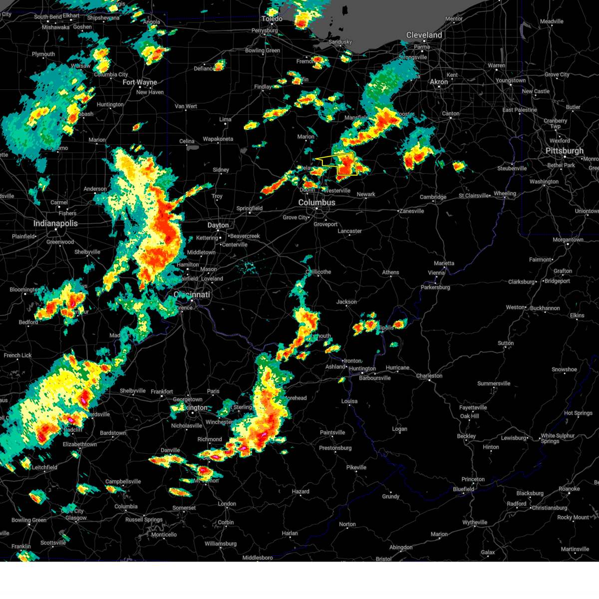
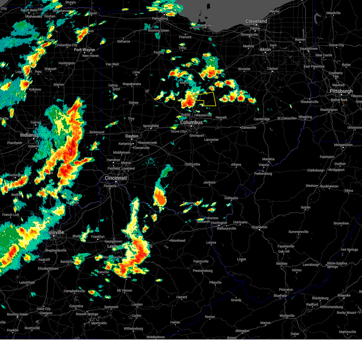
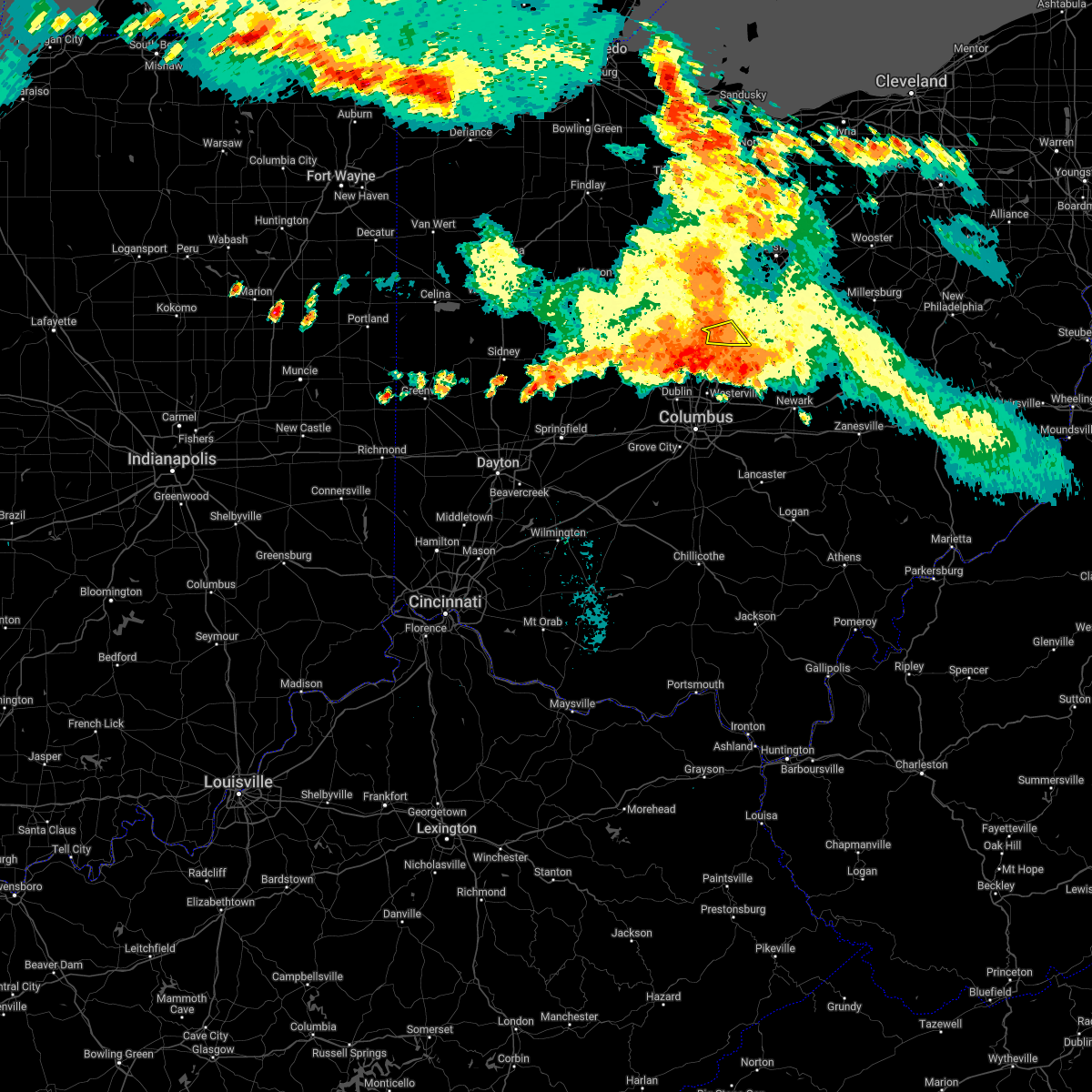
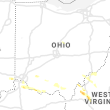
Hail Map for Marengo, OH
The Marengo, OH area has had 1 report of on-the-ground hail by trained spotters, and has been under severe weather warnings 18 times during the past 12 months. Doppler radar has detected hail at or near Marengo, OH on 30 occasions, including 3 occasions during the past year.
| Name: | Marengo, OH |
| Where Located: | 32 miles NNE of Columbus, OH |
| Map: | Google Map for Marengo, OH |
| Population: | 342 |
| Housing Units: | 148 |
| More Info: | Search Google for Marengo, OH |
0
The Top Recent Hail Date for Marengo, OH is Saturday, March 30, 2024 (19th out of 30)

Hail and Wind Damage Spotted near Marengo, OH
| Date / Time | Report Details |
|---|---|
| 4/17/2024 5:06 PM EDT |
 At 506 pm edt, severe thunderstorms were located along a line extending from near polk to near loudonville to near sparta, moving east at 45 mph (radar indicated). Hazards include 60 mph wind gusts and quarter size hail. Minor damage to vehicles is possible. expect damage to trees and power lines. Locations impacted include, mount vernon, loudonville, fredericktown, gambier, bellville, centerburg, danville, hayesville, chesterville, sparta, butler, perrysville, jeromesville, marengo, martinsburg, gann, north liberty, rowsburg, bladensburg, and mohicanville. At 506 pm edt, severe thunderstorms were located along a line extending from near polk to near loudonville to near sparta, moving east at 45 mph (radar indicated). Hazards include 60 mph wind gusts and quarter size hail. Minor damage to vehicles is possible. expect damage to trees and power lines. Locations impacted include, mount vernon, loudonville, fredericktown, gambier, bellville, centerburg, danville, hayesville, chesterville, sparta, butler, perrysville, jeromesville, marengo, martinsburg, gann, north liberty, rowsburg, bladensburg, and mohicanville.
|
| 4/17/2024 4:49 PM EDT |
 At 449 pm edt, severe thunderstorms were located along a line extending from near savannah to bellville to near ashley, moving east at 45 mph (radar indicated). Hazards include 60 mph wind gusts and quarter size hail. Minor damage to vehicles is possible. expect damage to trees and power lines. Locations impacted include, mansfield, ashland, mount vernon, mount gilead, lexington, loudonville, fredericktown, gambier, cardington, bellville, centerburg, ashley, danville, hayesville, savannah, polk, chesterville, sparta, waterford, and butler. At 449 pm edt, severe thunderstorms were located along a line extending from near savannah to bellville to near ashley, moving east at 45 mph (radar indicated). Hazards include 60 mph wind gusts and quarter size hail. Minor damage to vehicles is possible. expect damage to trees and power lines. Locations impacted include, mansfield, ashland, mount vernon, mount gilead, lexington, loudonville, fredericktown, gambier, cardington, bellville, centerburg, ashley, danville, hayesville, savannah, polk, chesterville, sparta, waterford, and butler.
|
| 4/17/2024 4:42 PM EDT |
 At 442 pm edt, severe thunderstorms were located along a line extending from 7 miles northeast of shelby to near lexington to near waldo, moving east at 45 mph (radar indicated). Hazards include 60 mph wind gusts and quarter size hail. Minor damage to vehicles is possible. expect damage to trees and power lines. Locations impacted include, mansfield, ashland, mount vernon, mount gilead, shelby, ontario, lexington, loudonville, fredericktown, gambier, cardington, bellville, centerburg, ashley, danville, hayesville, savannah, polk, chesterville, and sparta. At 442 pm edt, severe thunderstorms were located along a line extending from 7 miles northeast of shelby to near lexington to near waldo, moving east at 45 mph (radar indicated). Hazards include 60 mph wind gusts and quarter size hail. Minor damage to vehicles is possible. expect damage to trees and power lines. Locations impacted include, mansfield, ashland, mount vernon, mount gilead, shelby, ontario, lexington, loudonville, fredericktown, gambier, cardington, bellville, centerburg, ashley, danville, hayesville, savannah, polk, chesterville, and sparta.
|
| 4/17/2024 4:42 PM EDT |
 the severe thunderstorm warning has been cancelled and is no longer in effect the severe thunderstorm warning has been cancelled and is no longer in effect
|
| 4/17/2024 4:32 PM EDT |
 Svrcle the national weather service in cleveland has issued a * severe thunderstorm warning for, richland county in north central ohio, eastern marion county in north central ohio, ashland county in north central ohio, morrow county in north central ohio, southeastern crawford county in north central ohio, knox county in north central ohio, western holmes county in northeastern ohio, * until 530 pm edt. * at 432 pm edt, severe thunderstorms were located along a line extending from shelby to 6 miles northeast of mount gilead to 6 miles south of prospect, moving east at 45 mph (radar indicated). Hazards include 60 mph wind gusts and quarter size hail. Minor damage to vehicles is possible. Expect damage to trees and power lines. Svrcle the national weather service in cleveland has issued a * severe thunderstorm warning for, richland county in north central ohio, eastern marion county in north central ohio, ashland county in north central ohio, morrow county in north central ohio, southeastern crawford county in north central ohio, knox county in north central ohio, western holmes county in northeastern ohio, * until 530 pm edt. * at 432 pm edt, severe thunderstorms were located along a line extending from shelby to 6 miles northeast of mount gilead to 6 miles south of prospect, moving east at 45 mph (radar indicated). Hazards include 60 mph wind gusts and quarter size hail. Minor damage to vehicles is possible. Expect damage to trees and power lines.
|
| 8/25/2023 3:33 AM EDT |
 At 333 am edt, severe thunderstorms were located along a line extending from near danville to near delaware, moving southeast at 50 mph (radar indicated). Hazards include 70 mph wind gusts and penny size hail. Expect considerable tree damage. damage is likely to mobile homes, roofs, and outbuildings. locations impacted include, mount vernon, gambier, utica, centerburg, ashley, sparta, marengo, fulton, martinsburg and bladensburg. thunderstorm damage threat, considerable hail threat, radar indicated max hail size, 0. 75 in wind threat, radar indicated max wind gust, 70 mph. At 333 am edt, severe thunderstorms were located along a line extending from near danville to near delaware, moving southeast at 50 mph (radar indicated). Hazards include 70 mph wind gusts and penny size hail. Expect considerable tree damage. damage is likely to mobile homes, roofs, and outbuildings. locations impacted include, mount vernon, gambier, utica, centerburg, ashley, sparta, marengo, fulton, martinsburg and bladensburg. thunderstorm damage threat, considerable hail threat, radar indicated max hail size, 0. 75 in wind threat, radar indicated max wind gust, 70 mph.
|
| 8/25/2023 3:20 AM EDT |
 At 319 am edt, severe thunderstorms were located along a line extending from 7 miles northwest of danville to prospect, moving southeast at 35 mph (radar indicated). Hazards include 70 mph wind gusts and penny size hail. Expect considerable tree damage. damage is likely to mobile homes, roofs, and outbuildings. locations impacted include, marion, mount vernon, mount gilead, fredericktown, gambier, utica, cardington, centerburg, ashley, danville, waldo, chesterville, sparta, waterford, edison, marengo, fulton, martinsburg, north liberty and bladensburg. thunderstorm damage threat, considerable hail threat, radar indicated max hail size, 0. 75 in wind threat, radar indicated max wind gust, 70 mph. At 319 am edt, severe thunderstorms were located along a line extending from 7 miles northwest of danville to prospect, moving southeast at 35 mph (radar indicated). Hazards include 70 mph wind gusts and penny size hail. Expect considerable tree damage. damage is likely to mobile homes, roofs, and outbuildings. locations impacted include, marion, mount vernon, mount gilead, fredericktown, gambier, utica, cardington, centerburg, ashley, danville, waldo, chesterville, sparta, waterford, edison, marengo, fulton, martinsburg, north liberty and bladensburg. thunderstorm damage threat, considerable hail threat, radar indicated max hail size, 0. 75 in wind threat, radar indicated max wind gust, 70 mph.
|
| 8/25/2023 3:04 AM EDT |
 At 303 am edt, severe thunderstorms were located along a line extending from 8 miles northwest of danville to prospect, moving southeast at 45 mph (radar indicated). Hazards include 60 mph wind gusts and penny size hail. Expect damage to trees and power lines. locations impacted include, mansfield, marion, mount vernon, mount gilead, lexington, fredericktown, gambier, utica, cardington, bellville, centerburg, ashley, prospect, danville, waldo, chesterville, sparta, waterford, butler and caledonia. hail threat, radar indicated max hail size, 0. 75 in wind threat, radar indicated max wind gust, 60 mph. At 303 am edt, severe thunderstorms were located along a line extending from 8 miles northwest of danville to prospect, moving southeast at 45 mph (radar indicated). Hazards include 60 mph wind gusts and penny size hail. Expect damage to trees and power lines. locations impacted include, mansfield, marion, mount vernon, mount gilead, lexington, fredericktown, gambier, utica, cardington, bellville, centerburg, ashley, prospect, danville, waldo, chesterville, sparta, waterford, butler and caledonia. hail threat, radar indicated max hail size, 0. 75 in wind threat, radar indicated max wind gust, 60 mph.
|
| 8/25/2023 2:41 AM EDT |
 At 240 am edt, severe thunderstorms were located along a line extending from near lexington to near marseilles, moving southeast at 50 mph (radar indicated). Hazards include 60 mph wind gusts. expect damage to trees and power lines At 240 am edt, severe thunderstorms were located along a line extending from near lexington to near marseilles, moving southeast at 50 mph (radar indicated). Hazards include 60 mph wind gusts. expect damage to trees and power lines
|
| 8/24/2023 2:27 AM EDT |
 The severe thunderstorm warning for marion, wyandot, morrow, southwestern crawford and hancock counties will expire at 230 am edt, the storms which prompted the warning have moved out of the area. therefore, the warning will be allowed to expire. however gusty winds and heavy rain are still possible with these thunderstorms. The severe thunderstorm warning for marion, wyandot, morrow, southwestern crawford and hancock counties will expire at 230 am edt, the storms which prompted the warning have moved out of the area. therefore, the warning will be allowed to expire. however gusty winds and heavy rain are still possible with these thunderstorms.
|
| 8/24/2023 1:49 AM EDT |
 At 149 am edt, severe thunderstorms were located along a line extending from 7 miles northeast of marion to near upper sandusky to near arcadia, moving southwest at 40 mph (radar indicated). Hazards include 60 mph wind gusts. expect damage to trees and power lines At 149 am edt, severe thunderstorms were located along a line extending from 7 miles northeast of marion to near upper sandusky to near arcadia, moving southwest at 40 mph (radar indicated). Hazards include 60 mph wind gusts. expect damage to trees and power lines
|
| 7/29/2023 5:04 AM EDT |
 At 504 am edt, severe thunderstorms were located along a line extending from near new washington to near waldo, moving east at 45 mph (radar indicated). Hazards include 60 mph wind gusts. expect damage to trees and power lines At 504 am edt, severe thunderstorms were located along a line extending from near new washington to near waldo, moving east at 45 mph (radar indicated). Hazards include 60 mph wind gusts. expect damage to trees and power lines
|
| 7/28/2023 12:19 PM EDT |
 At 1219 pm edt, severe thunderstorms were located along a line extending from near shelby to sparta, moving east at 35 mph (radar indicated). Hazards include 60 mph wind gusts. expect damage to trees and power lines At 1219 pm edt, severe thunderstorms were located along a line extending from near shelby to sparta, moving east at 35 mph (radar indicated). Hazards include 60 mph wind gusts. expect damage to trees and power lines
|
| 7/23/2023 5:21 PM EDT |
 At 521 pm edt, severe thunderstorms were located along a line extending from near ashley to 6 miles north of sunbury to polaris, moving northeast at 35 mph (radar indicated). Hazards include 60 mph wind gusts and quarter size hail. Minor damage to vehicles is possible. Expect damage to trees and power lines. At 521 pm edt, severe thunderstorms were located along a line extending from near ashley to 6 miles north of sunbury to polaris, moving northeast at 35 mph (radar indicated). Hazards include 60 mph wind gusts and quarter size hail. Minor damage to vehicles is possible. Expect damage to trees and power lines.
|
| 7/20/2023 8:41 PM EDT |
 At 841 pm edt, a severe thunderstorm was located near sparta, or 10 miles south of mount gilead, moving east at 45 mph (radar indicated). Hazards include 60 mph wind gusts and penny size hail. Expect damage to trees and power lines. locations impacted include, mount vernon, mount gilead, fredericktown, gambier, utica, cardington, centerburg, ashley, danville, chesterville, sparta, waterford, edison, marengo, fulton, martinsburg, gann and bladensburg. hail threat, radar indicated max hail size, 0. 75 in wind threat, radar indicated max wind gust, 60 mph. At 841 pm edt, a severe thunderstorm was located near sparta, or 10 miles south of mount gilead, moving east at 45 mph (radar indicated). Hazards include 60 mph wind gusts and penny size hail. Expect damage to trees and power lines. locations impacted include, mount vernon, mount gilead, fredericktown, gambier, utica, cardington, centerburg, ashley, danville, chesterville, sparta, waterford, edison, marengo, fulton, martinsburg, gann and bladensburg. hail threat, radar indicated max hail size, 0. 75 in wind threat, radar indicated max wind gust, 60 mph.
|
| 7/20/2023 8:26 PM EDT |
 At 825 pm edt, a severe thunderstorm was located near ashley, or 9 miles north of delaware, moving east at 50 mph (radar indicated). Hazards include 60 mph wind gusts and quarter size hail. Minor damage to vehicles is possible. Expect damage to trees and power lines. At 825 pm edt, a severe thunderstorm was located near ashley, or 9 miles north of delaware, moving east at 50 mph (radar indicated). Hazards include 60 mph wind gusts and quarter size hail. Minor damage to vehicles is possible. Expect damage to trees and power lines.
|
| 7/2/2023 5:51 PM EDT |
 The severe thunderstorm warning for southern morrow and southwestern knox counties will expire at 600 pm edt, the storm which prompted the warning has weakened below severe limits, and no longer poses an immediate threat to life or property. therefore, the warning will be allowed to expire. however gusty winds and heavy rain are still possible with this thunderstorm. The severe thunderstorm warning for southern morrow and southwestern knox counties will expire at 600 pm edt, the storm which prompted the warning has weakened below severe limits, and no longer poses an immediate threat to life or property. therefore, the warning will be allowed to expire. however gusty winds and heavy rain are still possible with this thunderstorm.
|
| 7/2/2023 5:10 PM EDT |
 At 510 pm edt, a severe thunderstorm was located near delaware, moving east at 35 mph (radar indicated). Hazards include 60 mph wind gusts and quarter size hail. Minor damage to vehicles is possible. Expect damage to trees and power lines. At 510 pm edt, a severe thunderstorm was located near delaware, moving east at 35 mph (radar indicated). Hazards include 60 mph wind gusts and quarter size hail. Minor damage to vehicles is possible. Expect damage to trees and power lines.
|
| 4/21/2023 5:13 PM EDT |
 At 512 pm edt, severe thunderstorms were located along a line extending from near waldo to near ashley to near sunbury, moving northeast at 45 mph (radar indicated). Hazards include 60 mph wind gusts and penny size hail. Expect damage to trees and power lines. locations impacted include, mount vernon, mount gilead, lexington, fredericktown, gambier, cardington, bellville, centerburg, ashley, waldo, chesterville, sparta, waterford, caledonia, edison, marengo, fulton, iberia, shauck and state route 229 at us route 23. hail threat, radar indicated max hail size, 0. 75 in wind threat, radar indicated max wind gust, 60 mph. At 512 pm edt, severe thunderstorms were located along a line extending from near waldo to near ashley to near sunbury, moving northeast at 45 mph (radar indicated). Hazards include 60 mph wind gusts and penny size hail. Expect damage to trees and power lines. locations impacted include, mount vernon, mount gilead, lexington, fredericktown, gambier, cardington, bellville, centerburg, ashley, waldo, chesterville, sparta, waterford, caledonia, edison, marengo, fulton, iberia, shauck and state route 229 at us route 23. hail threat, radar indicated max hail size, 0. 75 in wind threat, radar indicated max wind gust, 60 mph.
|
| 4/21/2023 4:52 PM EDT |
 At 452 pm edt, a severe thunderstorm was located over delaware, moving northeast at 55 mph (radar indicated). Hazards include 60 mph wind gusts and quarter size hail. Minor damage to vehicles is possible. Expect damage to trees and power lines. At 452 pm edt, a severe thunderstorm was located over delaware, moving northeast at 55 mph (radar indicated). Hazards include 60 mph wind gusts and quarter size hail. Minor damage to vehicles is possible. Expect damage to trees and power lines.
|
| 4/1/2023 11:37 AM EDT | Multiple reports of trees and powerlines down in marengo. time estimated via rada in morrow county OH, 0.1 miles N of Marengo, OH |
| 4/1/2023 11:33 AM EDT |
 At 1132 am edt, severe thunderstorms were located along a line extending from near bucyrus to near richwood, moving east at 55 mph (radar indicated). Hazards include 60 mph wind gusts and penny size hail. expect damage to trees and power lines At 1132 am edt, severe thunderstorms were located along a line extending from near bucyrus to near richwood, moving east at 55 mph (radar indicated). Hazards include 60 mph wind gusts and penny size hail. expect damage to trees and power lines
|
| 7/23/2022 11:53 AM EDT |
 At 1152 am edt, severe thunderstorms were located along a line extending from near mansfield to near ashley, moving east at 45 mph (radar indicated). Hazards include 60 mph wind gusts. Expect damage to trees and power lines. locations impacted include, mount gilead, fredericktown, cardington, bellville, ashley, chesterville, sparta, waterford, butler, edison, marengo, fulton, north liberty, iberia and shauck. hail threat, radar indicated max hail size, <. 75 in wind threat, radar indicated max wind gust, 60 mph. At 1152 am edt, severe thunderstorms were located along a line extending from near mansfield to near ashley, moving east at 45 mph (radar indicated). Hazards include 60 mph wind gusts. Expect damage to trees and power lines. locations impacted include, mount gilead, fredericktown, cardington, bellville, ashley, chesterville, sparta, waterford, butler, edison, marengo, fulton, north liberty, iberia and shauck. hail threat, radar indicated max hail size, <. 75 in wind threat, radar indicated max wind gust, 60 mph.
|
| 7/23/2022 11:47 AM EDT | Several trees down in the marengo are in morrow county OH, 0.1 miles N of Marengo, OH |
| 7/23/2022 11:27 AM EDT |
 At 1126 am edt, severe thunderstorms were located along a line extending from near crestline to waldo, moving east at 40 mph (radar indicated). Hazards include 60 mph wind gusts. expect damage to trees and power lines At 1126 am edt, severe thunderstorms were located along a line extending from near crestline to waldo, moving east at 40 mph (radar indicated). Hazards include 60 mph wind gusts. expect damage to trees and power lines
|
| 7/5/2022 11:57 PM EDT |
 At 1157 pm edt, a severe thunderstorm was located near ashley, or 12 miles south of mount gilead, moving southeast at 30 mph (radar indicated). Hazards include 60 mph wind gusts. expect damage to trees and power lines At 1157 pm edt, a severe thunderstorm was located near ashley, or 12 miles south of mount gilead, moving southeast at 30 mph (radar indicated). Hazards include 60 mph wind gusts. expect damage to trees and power lines
|
| 6/16/2022 3:36 PM EDT |
 At 336 pm edt, severe thunderstorms were located along a line extending from millersburg to near ashley, moving east at 30 mph (radar indicated). Hazards include 60 mph wind gusts and quarter size hail. Minor damage to vehicles is possible. expect damage to trees and power lines. locations impacted include, mount vernon, millersburg, berlin, walnut creek, fredericktown, gambier, sugarcreek, centerburg, ashley, danville, killbuck, glenmont, chesterville, nashville, sparta, farmerstown, baltic, marengo, fulton and martinsburg. hail threat, radar indicated max hail size, 1. 00 in wind threat, radar indicated max wind gust, 60 mph. At 336 pm edt, severe thunderstorms were located along a line extending from millersburg to near ashley, moving east at 30 mph (radar indicated). Hazards include 60 mph wind gusts and quarter size hail. Minor damage to vehicles is possible. expect damage to trees and power lines. locations impacted include, mount vernon, millersburg, berlin, walnut creek, fredericktown, gambier, sugarcreek, centerburg, ashley, danville, killbuck, glenmont, chesterville, nashville, sparta, farmerstown, baltic, marengo, fulton and martinsburg. hail threat, radar indicated max hail size, 1. 00 in wind threat, radar indicated max wind gust, 60 mph.
|
| 6/16/2022 3:16 PM EDT |
 At 315 pm edt, severe thunderstorms were located along a line extending from nashville to near waldo, moving east-southeast at 30 mph (radar indicated). Hazards include 60 mph wind gusts and quarter size hail. Minor damage to vehicles is possible. Expect damage to trees and power lines. At 315 pm edt, severe thunderstorms were located along a line extending from nashville to near waldo, moving east-southeast at 30 mph (radar indicated). Hazards include 60 mph wind gusts and quarter size hail. Minor damage to vehicles is possible. Expect damage to trees and power lines.
|
| 6/14/2022 4:05 AM EDT |
 The severe thunderstorm warning for southeastern ashland, southeastern morrow, southern wayne, holmes and knox counties will expire at 415 am edt, the storms which prompted the warning have moved out of the area. therefore, the warning will be allowed to expire. a severe thunderstorm watch remains in effect until 700 am edt for north central ohio. The severe thunderstorm warning for southeastern ashland, southeastern morrow, southern wayne, holmes and knox counties will expire at 415 am edt, the storms which prompted the warning have moved out of the area. therefore, the warning will be allowed to expire. a severe thunderstorm watch remains in effect until 700 am edt for north central ohio.
|
| 6/14/2022 3:51 AM EDT |
 At 351 am edt, severe thunderstorms were located along a line extending from near wooster to near centerburg, moving southeast at 65 mph (radar indicated). Hazards include 60 mph wind gusts. Expect damage to trees and power lines. locations impacted include, wooster, mount vernon, millersburg, berlin, walnut creek, loudonville, fredericktown, gambier, centerburg, shreve, danville, killbuck, holmesville, glenmont, mount eaton, nashville, sparta, winesburg, farmerstown and apple creek. hail threat, radar indicated max hail size, <. 75 in wind threat, radar indicated max wind gust, 60 mph. At 351 am edt, severe thunderstorms were located along a line extending from near wooster to near centerburg, moving southeast at 65 mph (radar indicated). Hazards include 60 mph wind gusts. Expect damage to trees and power lines. locations impacted include, wooster, mount vernon, millersburg, berlin, walnut creek, loudonville, fredericktown, gambier, centerburg, shreve, danville, killbuck, holmesville, glenmont, mount eaton, nashville, sparta, winesburg, farmerstown and apple creek. hail threat, radar indicated max hail size, <. 75 in wind threat, radar indicated max wind gust, 60 mph.
|
| 6/14/2022 3:30 AM EDT |
 At 330 am edt, severe thunderstorms were located along a line extending from polk to cardington, moving southeast at 60 mph (radar indicated). Hazards include 60 mph wind gusts. expect damage to trees and power lines At 330 am edt, severe thunderstorms were located along a line extending from polk to cardington, moving southeast at 60 mph (radar indicated). Hazards include 60 mph wind gusts. expect damage to trees and power lines
|
| 6/13/2022 11:48 PM EDT |
 At 1148 pm edt, severe thunderstorms were located along a line extending from near glenmont to near utica, moving east at 75 mph (trained weather spotters). Hazards include 70 mph wind gusts and penny size hail. Expect considerable tree damage. damage is likely to mobile homes, roofs, and outbuildings. locations impacted include, mansfield, ashland, mount vernon, lexington, loudonville, fredericktown, gambier, bellville, centerburg, ashley, danville, hayesville, chesterville, sparta, butler, perrysville, lucas, jeromesville, marengo and martinsburg. thunderstorm damage threat, considerable hail threat, radar indicated max hail size, 0. 75 in wind threat, radar indicated max wind gust, 70 mph. At 1148 pm edt, severe thunderstorms were located along a line extending from near glenmont to near utica, moving east at 75 mph (trained weather spotters). Hazards include 70 mph wind gusts and penny size hail. Expect considerable tree damage. damage is likely to mobile homes, roofs, and outbuildings. locations impacted include, mansfield, ashland, mount vernon, lexington, loudonville, fredericktown, gambier, bellville, centerburg, ashley, danville, hayesville, chesterville, sparta, butler, perrysville, lucas, jeromesville, marengo and martinsburg. thunderstorm damage threat, considerable hail threat, radar indicated max hail size, 0. 75 in wind threat, radar indicated max wind gust, 70 mph.
|
| 6/13/2022 11:24 PM EDT |
 At 1124 pm edt, severe thunderstorms were located along a line extending from near lexington to near chesterville to near ashley, moving southeast at 75 mph (trained weather spotters). Hazards include 70 mph wind gusts and half dollar size hail. People and animals outdoors will be injured. expect hail damage to roofs, siding, windows, and vehicles. expect considerable tree damage. wind damage is also likely to mobile homes, roofs, and outbuildings. locations impacted include, mansfield, ashland, mount vernon, mount gilead, ontario, lexington, crestline, loudonville, fredericktown, gambier, cardington, bellville, centerburg, ashley, danville, hayesville, chesterville, sparta, waterford and butler. thunderstorm damage threat, considerable hail threat, radar indicated max hail size, 1. 25 in wind threat, radar indicated max wind gust, 70 mph. At 1124 pm edt, severe thunderstorms were located along a line extending from near lexington to near chesterville to near ashley, moving southeast at 75 mph (trained weather spotters). Hazards include 70 mph wind gusts and half dollar size hail. People and animals outdoors will be injured. expect hail damage to roofs, siding, windows, and vehicles. expect considerable tree damage. wind damage is also likely to mobile homes, roofs, and outbuildings. locations impacted include, mansfield, ashland, mount vernon, mount gilead, ontario, lexington, crestline, loudonville, fredericktown, gambier, cardington, bellville, centerburg, ashley, danville, hayesville, chesterville, sparta, waterford and butler. thunderstorm damage threat, considerable hail threat, radar indicated max hail size, 1. 25 in wind threat, radar indicated max wind gust, 70 mph.
|
| 6/13/2022 11:12 PM EDT |
 At 1111 pm edt, severe thunderstorms were located along a line extending from crestline to 7 miles northwest of mount gilead to near marion, moving southeast at 75 mph (radar indicated). Hazards include 70 mph wind gusts and quarter size hail. Minor damage to vehicles is possible. expect considerable tree damage. Wind damage is also likely to mobile homes, roofs, and outbuildings. At 1111 pm edt, severe thunderstorms were located along a line extending from crestline to 7 miles northwest of mount gilead to near marion, moving southeast at 75 mph (radar indicated). Hazards include 70 mph wind gusts and quarter size hail. Minor damage to vehicles is possible. expect considerable tree damage. Wind damage is also likely to mobile homes, roofs, and outbuildings.
|
| 6/8/2022 7:50 PM EDT |
 At 750 pm edt, a severe thunderstorm was located near chesterville, or 7 miles east of mount gilead, moving east at 35 mph (radar indicated). Hazards include 60 mph wind gusts. Expect damage to trees and power lines. Locations impacted include, mount gilead, cardington, edison, marengo and fulton. At 750 pm edt, a severe thunderstorm was located near chesterville, or 7 miles east of mount gilead, moving east at 35 mph (radar indicated). Hazards include 60 mph wind gusts. Expect damage to trees and power lines. Locations impacted include, mount gilead, cardington, edison, marengo and fulton.
|
| 6/8/2022 7:46 PM EDT | Sheriff reported a tree down on county road 24. time estimated from rada in morrow county OH, 2.9 miles ESE of Marengo, OH |
| 6/8/2022 7:37 PM EDT |
 At 736 pm edt, a severe thunderstorm was located over mount gilead, moving east at 50 mph (radar indicated). Hazards include 60 mph wind gusts. Expect damage to trees and power lines. locations impacted include, mount gilead, cardington, ashley, edison, marengo and fulton. hail threat, radar indicated max hail size, <. 75 in wind threat, radar indicated max wind gust, 60 mph. At 736 pm edt, a severe thunderstorm was located over mount gilead, moving east at 50 mph (radar indicated). Hazards include 60 mph wind gusts. Expect damage to trees and power lines. locations impacted include, mount gilead, cardington, ashley, edison, marengo and fulton. hail threat, radar indicated max hail size, <. 75 in wind threat, radar indicated max wind gust, 60 mph.
|
| 6/8/2022 7:16 PM EDT |
 At 716 pm edt, a severe thunderstorm was located over prospect, or 9 miles south of marion, moving east at 35 mph (radar indicated). Hazards include 60 mph wind gusts. expect damage to trees and power lines At 716 pm edt, a severe thunderstorm was located over prospect, or 9 miles south of marion, moving east at 35 mph (radar indicated). Hazards include 60 mph wind gusts. expect damage to trees and power lines
|
| 5/21/2022 4:18 PM EDT |
 At 418 pm edt, a severe thunderstorm was located near mount gilead, moving northeast at 30 mph (radar indicated). Hazards include 60 mph wind gusts and quarter size hail. Minor damage to vehicles is possible. Expect damage to trees and power lines. At 418 pm edt, a severe thunderstorm was located near mount gilead, moving northeast at 30 mph (radar indicated). Hazards include 60 mph wind gusts and quarter size hail. Minor damage to vehicles is possible. Expect damage to trees and power lines.
|
| 5/21/2022 3:09 PM EDT |
 At 309 pm edt, severe thunderstorms were located along a line extending from shelby to lexington to near chesterville, moving northeast at 30 mph (radar indicated). Hazards include 60 mph wind gusts and quarter size hail. Minor damage to vehicles is possible. expect damage to trees and power lines. locations impacted include, mansfield, mount gilead, shelby, ontario, lexington, crestline, fredericktown, bellville, chesterville, sparta, waterford, butler, lucas, marengo, fulton, north liberty, shauck, shenandoah and olivesburg. hail threat, radar indicated max hail size, 1. 00 in wind threat, radar indicated max wind gust, 60 mph. At 309 pm edt, severe thunderstorms were located along a line extending from shelby to lexington to near chesterville, moving northeast at 30 mph (radar indicated). Hazards include 60 mph wind gusts and quarter size hail. Minor damage to vehicles is possible. expect damage to trees and power lines. locations impacted include, mansfield, mount gilead, shelby, ontario, lexington, crestline, fredericktown, bellville, chesterville, sparta, waterford, butler, lucas, marengo, fulton, north liberty, shauck, shenandoah and olivesburg. hail threat, radar indicated max hail size, 1. 00 in wind threat, radar indicated max wind gust, 60 mph.
|
| 5/21/2022 2:48 PM EDT |
 At 248 pm edt, severe thunderstorms were located along a line extending from crestline to near mount gilead to near ashley, moving northeast at 30 mph (radar indicated). Hazards include 60 mph wind gusts and quarter size hail. Minor damage to vehicles is possible. Expect damage to trees and power lines. At 248 pm edt, severe thunderstorms were located along a line extending from crestline to near mount gilead to near ashley, moving northeast at 30 mph (radar indicated). Hazards include 60 mph wind gusts and quarter size hail. Minor damage to vehicles is possible. Expect damage to trees and power lines.
|
| 8/13/2021 12:16 AM EDT |
 At 1216 am edt, a severe thunderstorm was located near sparta, or 7 miles west of mount vernon, moving northeast at 20 mph (radar indicated). Hazards include 60 mph wind gusts and penny size hail. Expect damage to trees and power lines. locations impacted include, mount vernon, fredericktown, gambier, centerburg, sparta, marengo and north liberty. hail threat, radar indicated max hail size, 0. 75 in wind threat, radar indicated max wind gust, 60 mph. At 1216 am edt, a severe thunderstorm was located near sparta, or 7 miles west of mount vernon, moving northeast at 20 mph (radar indicated). Hazards include 60 mph wind gusts and penny size hail. Expect damage to trees and power lines. locations impacted include, mount vernon, fredericktown, gambier, centerburg, sparta, marengo and north liberty. hail threat, radar indicated max hail size, 0. 75 in wind threat, radar indicated max wind gust, 60 mph.
|
| 8/11/2021 5:11 PM EDT |
 At 511 pm edt, severe thunderstorms were located along a line extending from near savannah to bellville to near sunbury, moving east at 45 mph (radar indicated). Hazards include 60 mph wind gusts. Expect damage to trees and power lines. locations impacted include, mansfield, mount vernon, mount gilead, lexington, loudonville, fredericktown, gambier, utica, cardington, bellville, centerburg, ashley, danville, chesterville, sparta, waterford, butler, perrysville, lucas and marengo. hail threat, radar indicated max hail size, <. 75 in wind threat, radar indicated max wind gust, 60 mph. At 511 pm edt, severe thunderstorms were located along a line extending from near savannah to bellville to near sunbury, moving east at 45 mph (radar indicated). Hazards include 60 mph wind gusts. Expect damage to trees and power lines. locations impacted include, mansfield, mount vernon, mount gilead, lexington, loudonville, fredericktown, gambier, utica, cardington, bellville, centerburg, ashley, danville, chesterville, sparta, waterford, butler, perrysville, lucas and marengo. hail threat, radar indicated max hail size, <. 75 in wind threat, radar indicated max wind gust, 60 mph.
|
| 8/11/2021 4:30 PM EDT |
 At 429 pm edt, severe thunderstorms were located along a line extending from near bucyrus to near marion to near west mansfield, moving east at 40 mph (radar indicated). Hazards include 60 mph wind gusts. expect damage to trees and power lines At 429 pm edt, severe thunderstorms were located along a line extending from near bucyrus to near marion to near west mansfield, moving east at 40 mph (radar indicated). Hazards include 60 mph wind gusts. expect damage to trees and power lines
|
| 11/15/2020 12:08 PM EST |
 At 1208 pm est, severe thunderstorms were located along a line extending from near bellevue to near bucyrus, moving east at 55 mph (radar indicated). Hazards include 70 mph wind gusts. Expect considerable tree damage. damage is likely to mobile homes, roofs, and outbuildings. Locations impacted include, mansfield, sandusky, norwalk, western vermilion, mount gilead, galion, shelby, willard, ontario, lexington, crestline, new london, cardington, plymouth, northern milan, milan, ashley, wakeman, new washington and chesterville. At 1208 pm est, severe thunderstorms were located along a line extending from near bellevue to near bucyrus, moving east at 55 mph (radar indicated). Hazards include 70 mph wind gusts. Expect considerable tree damage. damage is likely to mobile homes, roofs, and outbuildings. Locations impacted include, mansfield, sandusky, norwalk, western vermilion, mount gilead, galion, shelby, willard, ontario, lexington, crestline, new london, cardington, plymouth, northern milan, milan, ashley, wakeman, new washington and chesterville.
|
| 11/15/2020 11:55 AM EST |
 At 1154 am est, severe thunderstorms were located along a line extending from near green springs to morral, moving northeast at 55 mph (radar indicated). Hazards include 70 mph wind gusts. Expect considerable tree damage. damage is likely to mobile homes, roofs, and outbuildings. Locations impacted include, mansfield, marion, sandusky, norwalk, bucyrus, western vermilion, mount gilead, kelleys island, put-in-bay, galion, shelby, bellevue, willard, ontario, lexington, crestline, new london, cardington, plymouth and northern milan. At 1154 am est, severe thunderstorms were located along a line extending from near green springs to morral, moving northeast at 55 mph (radar indicated). Hazards include 70 mph wind gusts. Expect considerable tree damage. damage is likely to mobile homes, roofs, and outbuildings. Locations impacted include, mansfield, marion, sandusky, norwalk, bucyrus, western vermilion, mount gilead, kelleys island, put-in-bay, galion, shelby, bellevue, willard, ontario, lexington, crestline, new london, cardington, plymouth and northern milan.
|
| 11/15/2020 11:38 AM EST |
 At 1138 am est, severe thunderstorms were located along a line extending from near tiffin to near la rue, moving northeast at 55 mph (radar indicated). Hazards include 70 mph wind gusts. Expect considerable tree damage. Damage is likely to mobile homes, roofs, and outbuildings. At 1138 am est, severe thunderstorms were located along a line extending from near tiffin to near la rue, moving northeast at 55 mph (radar indicated). Hazards include 70 mph wind gusts. Expect considerable tree damage. Damage is likely to mobile homes, roofs, and outbuildings.
|
| 9/7/2020 5:32 PM EDT |
 At 532 pm edt, a severe thunderstorm was located over mount vernon, moving east at 30 mph (radar indicated). Hazards include 60 mph wind gusts and quarter size hail. Minor damage to vehicles is possible. expect damage to trees and power lines. Locations impacted include, mount vernon, fredericktown, gambier, utica, centerburg, danville, chesterville, sparta, marengo, fulton, martinsburg, gann, north liberty and bladensburg. At 532 pm edt, a severe thunderstorm was located over mount vernon, moving east at 30 mph (radar indicated). Hazards include 60 mph wind gusts and quarter size hail. Minor damage to vehicles is possible. expect damage to trees and power lines. Locations impacted include, mount vernon, fredericktown, gambier, utica, centerburg, danville, chesterville, sparta, marengo, fulton, martinsburg, gann, north liberty and bladensburg.
|
| 9/7/2020 5:16 PM EDT |
 At 516 pm edt, a severe thunderstorm was located near sparta, or near mount vernon, moving east at 30 mph (radar indicated). Hazards include 60 mph wind gusts and quarter size hail. Minor damage to vehicles is possible. Expect damage to trees and power lines. At 516 pm edt, a severe thunderstorm was located near sparta, or near mount vernon, moving east at 30 mph (radar indicated). Hazards include 60 mph wind gusts and quarter size hail. Minor damage to vehicles is possible. Expect damage to trees and power lines.
|
| 8/28/2020 1:22 PM EDT |
 At 121 pm edt, severe thunderstorms were located along a line extending from 6 miles west of kenton to near utica, moving northeast at 35 mph (radar indicated). Hazards include 60 mph wind gusts. expect damage to trees and power lines At 121 pm edt, severe thunderstorms were located along a line extending from 6 miles west of kenton to near utica, moving northeast at 35 mph (radar indicated). Hazards include 60 mph wind gusts. expect damage to trees and power lines
|
| 7/10/2020 3:32 PM EDT |
 At 332 pm edt, a severe thunderstorm was located near sunbury, or 11 miles east of delaware, moving northeast at 35 mph (radar indicated). Hazards include 60 mph wind gusts. expect damage to trees and power lines At 332 pm edt, a severe thunderstorm was located near sunbury, or 11 miles east of delaware, moving northeast at 35 mph (radar indicated). Hazards include 60 mph wind gusts. expect damage to trees and power lines
|
| 7/10/2020 1:05 PM EDT |
 At 105 pm edt, severe thunderstorms were located along a line extending from cardington to near sparta to near johnstown, moving northeast at 35 mph (radar indicated). Hazards include 60 mph wind gusts and penny size hail. expect damage to trees and power lines At 105 pm edt, severe thunderstorms were located along a line extending from cardington to near sparta to near johnstown, moving northeast at 35 mph (radar indicated). Hazards include 60 mph wind gusts and penny size hail. expect damage to trees and power lines
|
| 6/21/2020 7:40 PM EDT |
 The severe thunderstorm warning for southeastern richland, southeastern morrow and knox counties will expire at 745 pm edt, the storm which prompted the warning has weakened below severe limits. therefore, the warning will be allowed to expire. however gusty winds and heavy rain are still possible with this thunderstorm. The severe thunderstorm warning for southeastern richland, southeastern morrow and knox counties will expire at 745 pm edt, the storm which prompted the warning has weakened below severe limits. therefore, the warning will be allowed to expire. however gusty winds and heavy rain are still possible with this thunderstorm.
|
| 6/21/2020 7:12 PM EDT |
 At 711 pm edt, a severe thunderstorm was located near fredericktown, or near mount vernon, moving northeast at 35 mph (radar indicated). Hazards include 60 mph wind gusts and penny size hail. torrential rainfall is also occurring with these storms, and may cause localized flooding. Expect damage to trees and power lines. Locations impacted include, mount vernon, mount gilead, fredericktown, gambier, danville, chesterville, sparta, waterford, marengo, fulton and north liberty. At 711 pm edt, a severe thunderstorm was located near fredericktown, or near mount vernon, moving northeast at 35 mph (radar indicated). Hazards include 60 mph wind gusts and penny size hail. torrential rainfall is also occurring with these storms, and may cause localized flooding. Expect damage to trees and power lines. Locations impacted include, mount vernon, mount gilead, fredericktown, gambier, danville, chesterville, sparta, waterford, marengo, fulton and north liberty.
|
| 6/21/2020 6:54 PM EDT |
 At 654 pm edt, a severe thunderstorm was located over centerburg, or 12 miles southwest of mount vernon, moving northeast at 35 mph (radar indicated). Hazards include 60 mph wind gusts and nickel size hail. expect damage to trees and power lines At 654 pm edt, a severe thunderstorm was located over centerburg, or 12 miles southwest of mount vernon, moving northeast at 35 mph (radar indicated). Hazards include 60 mph wind gusts and nickel size hail. expect damage to trees and power lines
|
| 6/10/2020 6:25 PM EDT |
 At 625 pm edt, severe thunderstorms were located along a line extending from near galion to chesterville to 6 miles west of sparta, moving northeast at 40 mph (radar indicated). Hazards include 70 mph wind gusts and quarter size hail. Minor damage to vehicles is possible. expect considerable tree damage. Wind damage is also likely to mobile homes, roofs, and outbuildings. At 625 pm edt, severe thunderstorms were located along a line extending from near galion to chesterville to 6 miles west of sparta, moving northeast at 40 mph (radar indicated). Hazards include 70 mph wind gusts and quarter size hail. Minor damage to vehicles is possible. expect considerable tree damage. Wind damage is also likely to mobile homes, roofs, and outbuildings.
|
| 6/4/2020 1:04 PM EDT |
 At 103 pm edt, a severe thunderstorm was located over sparta, or 11 miles southeast of mount gilead, moving east at 40 mph (radar indicated). Hazards include 60 mph wind gusts and quarter size hail. Minor damage to vehicles is possible. Expect damage to trees and power lines. At 103 pm edt, a severe thunderstorm was located over sparta, or 11 miles southeast of mount gilead, moving east at 40 mph (radar indicated). Hazards include 60 mph wind gusts and quarter size hail. Minor damage to vehicles is possible. Expect damage to trees and power lines.
|
| 5/14/2020 6:06 PM EDT |
 At 606 pm edt, severe thunderstorms were located along a line extending from near lexington to near sparta, moving southeast at 50 mph (radar indicated). Hazards include 60 mph wind gusts and quarter size hail. Minor damage to vehicles is possible. Expect damage to trees and power lines. At 606 pm edt, severe thunderstorms were located along a line extending from near lexington to near sparta, moving southeast at 50 mph (radar indicated). Hazards include 60 mph wind gusts and quarter size hail. Minor damage to vehicles is possible. Expect damage to trees and power lines.
|
| 9/1/2019 6:25 PM EDT |
 The national weather service in cleveland has issued a * severe thunderstorm warning for. southeastern morrow county in north central ohio. knox county in north central ohio. until 730 pm edt. At 625 pm edt, a severe thunderstorm was located near johnstown, or. The national weather service in cleveland has issued a * severe thunderstorm warning for. southeastern morrow county in north central ohio. knox county in north central ohio. until 730 pm edt. At 625 pm edt, a severe thunderstorm was located near johnstown, or.
|
| 8/18/2019 11:47 PM EDT |
 At 1146 pm edt, severe thunderstorms were located along a line extending from near cardington to bexley, moving east at 45 mph (radar indicated). Hazards include 60 mph wind gusts. expect damage to trees and power lines At 1146 pm edt, severe thunderstorms were located along a line extending from near cardington to bexley, moving east at 45 mph (radar indicated). Hazards include 60 mph wind gusts. expect damage to trees and power lines
|
| 7/2/2019 8:56 PM EDT |
 The severe thunderstorm warning for southern morrow and northwestern knox counties will expire at 900 pm edt, this warning will be allowed to expire. however, a severe thunderstorm warning still remains in effect for portions of morrow and knox counties until 945 pm edt. to report severe weather, contact your nearest law enforcement agency. they will relay your report to the national weather service cleveland. The severe thunderstorm warning for southern morrow and northwestern knox counties will expire at 900 pm edt, this warning will be allowed to expire. however, a severe thunderstorm warning still remains in effect for portions of morrow and knox counties until 945 pm edt. to report severe weather, contact your nearest law enforcement agency. they will relay your report to the national weather service cleveland.
|
| 7/2/2019 8:41 PM EDT |
 At 840 pm edt, severe thunderstorms were located along a line extending from near mount vernon to near sunbury, moving southeast at 35 mph (radar indicated). Hazards include 60 mph wind gusts and penny size hail. Expect damage to trees and power lines. Locations impacted include, mount vernon, mount gilead, fredericktown, cardington, centerburg, ashley, chesterville, sparta, waterford, marengo and fulton. At 840 pm edt, severe thunderstorms were located along a line extending from near mount vernon to near sunbury, moving southeast at 35 mph (radar indicated). Hazards include 60 mph wind gusts and penny size hail. Expect damage to trees and power lines. Locations impacted include, mount vernon, mount gilead, fredericktown, cardington, centerburg, ashley, chesterville, sparta, waterford, marengo and fulton.
|
| 7/2/2019 8:30 PM EDT |
 At 830 pm edt, severe thunderstorms were located along a line extending from near chesterville to near delaware, moving east at 25 mph (radar indicated). Hazards include 60 mph wind gusts and quarter size hail. Minor damage to vehicles is possible. Expect damage to trees and power lines. At 830 pm edt, severe thunderstorms were located along a line extending from near chesterville to near delaware, moving east at 25 mph (radar indicated). Hazards include 60 mph wind gusts and quarter size hail. Minor damage to vehicles is possible. Expect damage to trees and power lines.
|
| 7/2/2019 8:04 PM EDT |
 At 804 pm edt, severe thunderstorms were located along a line extending from near mount gilead to near prospect, moving southeast at 35 mph (radar indicated). Hazards include 60 mph wind gusts and quarter size hail. Minor damage to vehicles is possible. Expect damage to trees and power lines. At 804 pm edt, severe thunderstorms were located along a line extending from near mount gilead to near prospect, moving southeast at 35 mph (radar indicated). Hazards include 60 mph wind gusts and quarter size hail. Minor damage to vehicles is possible. Expect damage to trees and power lines.
|
| 7/2/2019 6:10 PM EDT |
 At 610 pm edt, severe thunderstorms were located along a line extending from 6 miles east of bellville to centerburg, moving east at 30 mph (radar indicated). Hazards include 60 mph wind gusts and quarter size hail. Minor damage to vehicles is possible. expect damage to trees and power lines. Locations impacted include, mount vernon, fredericktown, gambier, utica, bellville, centerburg, danville, chesterville, sparta, waterford, marengo, fulton, martinsburg, gann, north liberty and bladensburg. At 610 pm edt, severe thunderstorms were located along a line extending from 6 miles east of bellville to centerburg, moving east at 30 mph (radar indicated). Hazards include 60 mph wind gusts and quarter size hail. Minor damage to vehicles is possible. expect damage to trees and power lines. Locations impacted include, mount vernon, fredericktown, gambier, utica, bellville, centerburg, danville, chesterville, sparta, waterford, marengo, fulton, martinsburg, gann, north liberty and bladensburg.
|
| 7/2/2019 5:34 PM EDT |
 At 534 pm edt, severe thunderstorms were located along a line extending from near lexington to near ashley, moving southeast at 25 mph (radar indicated). Hazards include 60 mph wind gusts and quarter size hail. Minor damage to vehicles is possible. Expect damage to trees and power lines. At 534 pm edt, severe thunderstorms were located along a line extending from near lexington to near ashley, moving southeast at 25 mph (radar indicated). Hazards include 60 mph wind gusts and quarter size hail. Minor damage to vehicles is possible. Expect damage to trees and power lines.
|
| 6/5/2019 5:10 PM EDT |
 At 458 pm edt, a severe thunderstorm was located over sparta, or 11 miles southeast of mount gilead, moving east at 25 mph (radar indicated). Hazards include 60 mph wind gusts and penny size hail. Expect damage to trees and power lines. Locations impacted include, fredericktown, chesterville, sparta, marengo and fulton. At 458 pm edt, a severe thunderstorm was located over sparta, or 11 miles southeast of mount gilead, moving east at 25 mph (radar indicated). Hazards include 60 mph wind gusts and penny size hail. Expect damage to trees and power lines. Locations impacted include, fredericktown, chesterville, sparta, marengo and fulton.
|
| 6/5/2019 4:58 PM EDT |
 At 458 pm edt, a severe thunderstorm was located over sparta, or 11 miles southeast of mount gilead, moving east at 25 mph (radar indicated). Hazards include 60 mph wind gusts and penny size hail. Expect damage to trees and power lines. Locations impacted include, fredericktown, chesterville, sparta, marengo and fulton. At 458 pm edt, a severe thunderstorm was located over sparta, or 11 miles southeast of mount gilead, moving east at 25 mph (radar indicated). Hazards include 60 mph wind gusts and penny size hail. Expect damage to trees and power lines. Locations impacted include, fredericktown, chesterville, sparta, marengo and fulton.
|
| 6/5/2019 4:30 PM EDT |
 At 429 pm edt, a severe thunderstorm was located over cardington, or near mount gilead, moving east at 30 mph (radar indicated). Hazards include 60 mph wind gusts and quarter size hail. Minor damage to vehicles is possible. expect damage to trees and power lines. Locations impacted include, mount gilead, fredericktown, cardington, centerburg, ashley, chesterville, sparta, edison, marengo and fulton. At 429 pm edt, a severe thunderstorm was located over cardington, or near mount gilead, moving east at 30 mph (radar indicated). Hazards include 60 mph wind gusts and quarter size hail. Minor damage to vehicles is possible. expect damage to trees and power lines. Locations impacted include, mount gilead, fredericktown, cardington, centerburg, ashley, chesterville, sparta, edison, marengo and fulton.
|
| 6/5/2019 4:11 PM EDT |
 At 411 pm edt, a severe thunderstorm was located over waldo, or 7 miles southeast of marion, moving east at 30 mph (radar indicated). Hazards include 60 mph wind gusts and half dollar size hail. People and animals outdoors will be injured. expect hail damage to roofs, siding, windows, and vehicles. Expect damage to trees and power lines. At 411 pm edt, a severe thunderstorm was located over waldo, or 7 miles southeast of marion, moving east at 30 mph (radar indicated). Hazards include 60 mph wind gusts and half dollar size hail. People and animals outdoors will be injured. expect hail damage to roofs, siding, windows, and vehicles. Expect damage to trees and power lines.
|
| 6/2/2019 1:44 AM EDT |
 At 143 am edt, a severe thunderstorm was located near fredericktown, or 12 miles east of mount gilead, moving east at 45 mph (radar indicated). Hazards include 60 mph wind gusts and quarter size hail. Minor damage to vehicles is possible. Expect damage to trees and power lines. At 143 am edt, a severe thunderstorm was located near fredericktown, or 12 miles east of mount gilead, moving east at 45 mph (radar indicated). Hazards include 60 mph wind gusts and quarter size hail. Minor damage to vehicles is possible. Expect damage to trees and power lines.
|
| 6/1/2019 7:18 PM EDT |
 At 718 pm edt, a severe thunderstorm was located over ashley, or 9 miles southwest of mount gilead, moving east at 20 mph (radar indicated). Hazards include 60 mph wind gusts and quarter size hail. Minor damage to vehicles is possible. Expect damage to trees and power lines. At 718 pm edt, a severe thunderstorm was located over ashley, or 9 miles southwest of mount gilead, moving east at 20 mph (radar indicated). Hazards include 60 mph wind gusts and quarter size hail. Minor damage to vehicles is possible. Expect damage to trees and power lines.
|
| 5/26/2019 7:44 AM EDT |
 At 744 am edt, severe thunderstorms were located along a line extending from near new washington to crestline to near lexington to sparta, moving east at 50 mph (radar indicated). Hazards include 60 mph wind gusts. Expect damage to trees and power lines. Locations impacted include, mount gilead, galion, crestline, new washington, chesterville, sparta, marengo, tiro, fulton, north robinson, sulpher springs, iberia and shauck. At 744 am edt, severe thunderstorms were located along a line extending from near new washington to crestline to near lexington to sparta, moving east at 50 mph (radar indicated). Hazards include 60 mph wind gusts. Expect damage to trees and power lines. Locations impacted include, mount gilead, galion, crestline, new washington, chesterville, sparta, marengo, tiro, fulton, north robinson, sulpher springs, iberia and shauck.
|
| 5/26/2019 7:23 AM EDT |
 The national weather service in cleveland has issued a * severe thunderstorm warning for. morrow county in north central ohio. crawford county in north central ohio. until 815 am edt. At 723 am edt, severe thunderstorms were located along a line. The national weather service in cleveland has issued a * severe thunderstorm warning for. morrow county in north central ohio. crawford county in north central ohio. until 815 am edt. At 723 am edt, severe thunderstorms were located along a line.
|
| 5/4/2018 3:42 PM EDT |
 The severe thunderstorm warning for morrow county will expire at 345 pm edt, the storm which prompted the warning has moved out of the area. therefore the warning will be allowed to expire. a severe thunderstorm watch remains in effect until 700 pm edt for north central ohio. The severe thunderstorm warning for morrow county will expire at 345 pm edt, the storm which prompted the warning has moved out of the area. therefore the warning will be allowed to expire. a severe thunderstorm watch remains in effect until 700 pm edt for north central ohio.
|
| 5/4/2018 3:24 PM EDT |
 A severe thunderstorm warning remains in effect until 345 pm edt for morrow county. at 323 pm edt, a severe thunderstorm was located over mount gilead, moving east at 55 mph. hazard. 60 mph wind gusts and nickel size hail. source. Radar indicated. A severe thunderstorm warning remains in effect until 345 pm edt for morrow county. at 323 pm edt, a severe thunderstorm was located over mount gilead, moving east at 55 mph. hazard. 60 mph wind gusts and nickel size hail. source. Radar indicated.
|
| 5/4/2018 3:02 PM EDT |
 At 302 pm edt, a severe thunderstorm was located over prospect, or 9 miles southwest of marion, moving east at 55 mph (radar indicated). Hazards include 60 mph wind gusts and nickel size hail. expect damage to trees and power lines At 302 pm edt, a severe thunderstorm was located over prospect, or 9 miles southwest of marion, moving east at 55 mph (radar indicated). Hazards include 60 mph wind gusts and nickel size hail. expect damage to trees and power lines
|
| 7/22/2017 6:46 AM EDT |
 At 646 am edt, a severe thunderstorm was located near ashley, or 10 miles northeast of delaware, moving east at 25 mph (radar indicated). Hazards include 60 mph wind gusts. expect damage to trees and power lines At 646 am edt, a severe thunderstorm was located near ashley, or 10 miles northeast of delaware, moving east at 25 mph (radar indicated). Hazards include 60 mph wind gusts. expect damage to trees and power lines
|
| 7/7/2017 1:28 PM EDT |
 The severe thunderstorm warning for marion and morrow counties will expire at 130 pm edt, the storm which prompted the warning has weakened below severe limits, and has exited the warned area. therefore, the warning will be allowed to expire. however small hail and gusty winds are still possible with these thunderstorms across the southern parts of marion and morrow counties. a severe thunderstorm watch remains in effect until 500 pm edt for north central ohio. The severe thunderstorm warning for marion and morrow counties will expire at 130 pm edt, the storm which prompted the warning has weakened below severe limits, and has exited the warned area. therefore, the warning will be allowed to expire. however small hail and gusty winds are still possible with these thunderstorms across the southern parts of marion and morrow counties. a severe thunderstorm watch remains in effect until 500 pm edt for north central ohio.
|
| 7/7/2017 1:10 PM EDT |
 At 108 pm edt, a cluster of severe thunderstorms were located east to west across central marion and morrow counties moving southeast at 45 mph (radar indicated). Hazards include 60 mph wind gusts and quarter size hail. Minor damage to vehicles is possible. expect damage to trees and power lines. Locations impacted include, marion, mount gilead, cardington, ashley, prospect, la rue, waldo, chesterville, sparta, new bloomington, edison, green camp, marengo, fulton, shauck and state route 229 at us route 23. At 108 pm edt, a cluster of severe thunderstorms were located east to west across central marion and morrow counties moving southeast at 45 mph (radar indicated). Hazards include 60 mph wind gusts and quarter size hail. Minor damage to vehicles is possible. expect damage to trees and power lines. Locations impacted include, marion, mount gilead, cardington, ashley, prospect, la rue, waldo, chesterville, sparta, new bloomington, edison, green camp, marengo, fulton, shauck and state route 229 at us route 23.
|
| 7/7/2017 12:44 PM EDT |
 At 1242 pm edt, a severe thunderstorm was located near mount gilead, moving southeast at 30 mph (radar indicated). Hazards include 60 mph wind gusts and quarter size hail. Minor damage to vehicles is possible. expect damage to trees and power lines. Locations impacted include, marion, bucyrus, mount gilead, galion, crestline, cardington, ashley, prospect, la rue, morral, waldo, chesterville, sparta, caledonia, new bloomington, edison, green camp, marengo, fulton and north robinson. At 1242 pm edt, a severe thunderstorm was located near mount gilead, moving southeast at 30 mph (radar indicated). Hazards include 60 mph wind gusts and quarter size hail. Minor damage to vehicles is possible. expect damage to trees and power lines. Locations impacted include, marion, bucyrus, mount gilead, galion, crestline, cardington, ashley, prospect, la rue, morral, waldo, chesterville, sparta, caledonia, new bloomington, edison, green camp, marengo, fulton and north robinson.
|
| 7/7/2017 12:19 PM EDT |
 The national weather service in cleveland has issued a * severe thunderstorm warning for. marion county in north central ohio. southern wyandot county in northwestern ohio. morrow county in north central ohio. Crawford county in north central ohio. The national weather service in cleveland has issued a * severe thunderstorm warning for. marion county in north central ohio. southern wyandot county in northwestern ohio. morrow county in north central ohio. Crawford county in north central ohio.
|
| 6/13/2017 5:26 PM EDT |
 The severe thunderstorm warning for morrow county will expire at 530 pm edt, the storm which prompted the warning has weakened below severe limits, and no longer poses an immediate threat to life or property. therefore the warning will be allowed to expire. The severe thunderstorm warning for morrow county will expire at 530 pm edt, the storm which prompted the warning has weakened below severe limits, and no longer poses an immediate threat to life or property. therefore the warning will be allowed to expire.
|
| 6/13/2017 4:37 PM EDT |
 At 436 pm edt, a severe thunderstorm was located near mount gilead, moving southeast at 10 mph (radar indicated). Hazards include 60 mph wind gusts and quarter size hail. Minor damage to vehicles is possible. Expect damage to trees and power lines. At 436 pm edt, a severe thunderstorm was located near mount gilead, moving southeast at 10 mph (radar indicated). Hazards include 60 mph wind gusts and quarter size hail. Minor damage to vehicles is possible. Expect damage to trees and power lines.
|
| 3/1/2017 1:34 AM EST |
 At 134 am est, severe thunderstorms were located along a line extending from 8 miles northwest of vermilion to near medina to near orrville, moving northeast at 85 mph (radar indicated). Hazards include 60 mph wind gusts. Expect damage to roofs, siding, and trees. Locations impacted include, mansfield, ashland, mount vernon, mount gilead, shelby, ontario, lexington, loudonville, fredericktown, new london, gambier, bellville, centerburg, danville, hayesville, savannah, polk, chesterville, sparta and waterford. At 134 am est, severe thunderstorms were located along a line extending from 8 miles northwest of vermilion to near medina to near orrville, moving northeast at 85 mph (radar indicated). Hazards include 60 mph wind gusts. Expect damage to roofs, siding, and trees. Locations impacted include, mansfield, ashland, mount vernon, mount gilead, shelby, ontario, lexington, loudonville, fredericktown, new london, gambier, bellville, centerburg, danville, hayesville, savannah, polk, chesterville, sparta and waterford.
|
| 3/1/2017 12:55 AM EST |
 At 1254 am est, severe thunderstorms were located along a line extending from near fostoria to 6 miles northwest of crestline to near chesterville, moving northeast at 85 mph (radar indicated). Hazards include 60 mph wind gusts and quarter size hail. Hail damage to vehicles is expected. Expect wind damage to roofs, siding, and trees. At 1254 am est, severe thunderstorms were located along a line extending from near fostoria to 6 miles northwest of crestline to near chesterville, moving northeast at 85 mph (radar indicated). Hazards include 60 mph wind gusts and quarter size hail. Hail damage to vehicles is expected. Expect wind damage to roofs, siding, and trees.
|
| 1/10/2017 9:07 PM EST |
 At 907 pm est, a severe thunderstorm was located near vanlue, or 10 miles south of fostoria, moving east at 70 mph (radar indicated). Hazards include 60 mph wind gusts. expect damage to roofs, siding, and trees At 907 pm est, a severe thunderstorm was located near vanlue, or 10 miles south of fostoria, moving east at 70 mph (radar indicated). Hazards include 60 mph wind gusts. expect damage to roofs, siding, and trees
|
| 9/10/2016 5:12 PM EDT |
 At 511 pm edt, severe thunderstorms were located along a line extending from near strongsville to 6 miles southwest of lexington, moving northeast at 45 mph (radar indicated). Hazards include 60 mph wind gusts and nickel size hail. Expect damage to roofs. siding and trees. Locations impacted include, mansfield, medina, wooster, ashland, mount vernon, mount gilead, brunswick, wadsworth, rittman, ontario, lexington, lodi, loudonville, fredericktown, creston, cardington, bellville, centerburg, west salem and chippewa lake. At 511 pm edt, severe thunderstorms were located along a line extending from near strongsville to 6 miles southwest of lexington, moving northeast at 45 mph (radar indicated). Hazards include 60 mph wind gusts and nickel size hail. Expect damage to roofs. siding and trees. Locations impacted include, mansfield, medina, wooster, ashland, mount vernon, mount gilead, brunswick, wadsworth, rittman, ontario, lexington, lodi, loudonville, fredericktown, creston, cardington, bellville, centerburg, west salem and chippewa lake.
|
| 9/10/2016 4:44 PM EDT |
 At 442 pm edt, severe thunderstorms were located along a line extending from near wellington to ashley, moving northeast at 45 mph. another severe thunderstorm was located near mount gilead. this storm is also moving northeast at 45 mph (radar indicated). Hazards include 60 mph wind gusts and nickel size hail. Expect damage to roofs. Siding and trees. At 442 pm edt, severe thunderstorms were located along a line extending from near wellington to ashley, moving northeast at 45 mph. another severe thunderstorm was located near mount gilead. this storm is also moving northeast at 45 mph (radar indicated). Hazards include 60 mph wind gusts and nickel size hail. Expect damage to roofs. Siding and trees.
|
| 5/1/2016 3:39 PM EDT |
 The severe thunderstorm warning for southern morrow and northwestern knox counties will expire at 345 pm edt, the severe thunderstorm which prompted the warning has weakened. therefore the warning will be allowed to expire. The severe thunderstorm warning for southern morrow and northwestern knox counties will expire at 345 pm edt, the severe thunderstorm which prompted the warning has weakened. therefore the warning will be allowed to expire.
|
| 5/1/2016 3:24 PM EDT |
 At 324 pm edt, a severe thunderstorm was located near sparta, or 10 miles southeast of mount gilead, moving east at 30 mph (radar indicated). Hazards include 60 mph wind gusts and quarter size hail. Hail damage to vehicles is expected. expect wind damage to roofs, siding and trees. Locations impacted include, fredericktown, cardington, chesterville, sparta, waterford, marengo, fulton and north liberty. At 324 pm edt, a severe thunderstorm was located near sparta, or 10 miles southeast of mount gilead, moving east at 30 mph (radar indicated). Hazards include 60 mph wind gusts and quarter size hail. Hail damage to vehicles is expected. expect wind damage to roofs, siding and trees. Locations impacted include, fredericktown, cardington, chesterville, sparta, waterford, marengo, fulton and north liberty.
|
| 5/1/2016 3:09 PM EDT |
 At 308 pm edt, a line of severe thunderstorms stretched from near mt. gilead northeast into southern ashland county moving east at 25 mph (radar indicated). Hazards include 60 mph wind gusts and quarter size hail. Hail damage to vehicles is expected. expect wind damage to roofs, siding and trees. Locations impacted include, loudonville, fredericktown, cardington, bellville, chesterville, sparta, waterford, butler, perrysville, marengo, fulton, mohicanville and north liberty. At 308 pm edt, a line of severe thunderstorms stretched from near mt. gilead northeast into southern ashland county moving east at 25 mph (radar indicated). Hazards include 60 mph wind gusts and quarter size hail. Hail damage to vehicles is expected. expect wind damage to roofs, siding and trees. Locations impacted include, loudonville, fredericktown, cardington, bellville, chesterville, sparta, waterford, butler, perrysville, marengo, fulton, mohicanville and north liberty.
|
| 5/1/2016 2:46 PM EDT |
 At 246 pm edt, a severe thunderstorm was located near ashley, or 11 miles north of delaware, moving east at 25 mph. a second strong storm was located 5 miles ne of mount gilead (radar indicated). Hazards include 60 mph wind gusts and quarter size hail. Hail damage to vehicles is expected. Expect wind damage to roofs, siding and trees. At 246 pm edt, a severe thunderstorm was located near ashley, or 11 miles north of delaware, moving east at 25 mph. a second strong storm was located 5 miles ne of mount gilead (radar indicated). Hazards include 60 mph wind gusts and quarter size hail. Hail damage to vehicles is expected. Expect wind damage to roofs, siding and trees.
|
| 7/14/2015 2:09 PM EDT |
 The severe thunderstorm warning for southern morrow county will expire at 215 pm edt, the storm which prompted the warning has moved out of the area. therefore the warning will be allowed to expire. a severe thunderstorm watch remains in effect until 800 pm edt for north central ohio. The severe thunderstorm warning for southern morrow county will expire at 215 pm edt, the storm which prompted the warning has moved out of the area. therefore the warning will be allowed to expire. a severe thunderstorm watch remains in effect until 800 pm edt for north central ohio.
|
| 7/14/2015 2:00 PM EDT |
 At 158 pm edt, a severe thunderstorm was located near sparta, or 10 miles south of mount gilead, moving east at 35 mph. trees were downed from these storms as they moved through marion county into morrow county (radar indicated). Hazards include 60 mph wind gusts. Expect damage to roofs. siding and trees. Locations impacted include, cardington, ashley, chesterville, sparta, marengo and fulton. At 158 pm edt, a severe thunderstorm was located near sparta, or 10 miles south of mount gilead, moving east at 35 mph. trees were downed from these storms as they moved through marion county into morrow county (radar indicated). Hazards include 60 mph wind gusts. Expect damage to roofs. siding and trees. Locations impacted include, cardington, ashley, chesterville, sparta, marengo and fulton.
|
| 7/14/2015 1:27 PM EDT |
 At 127 pm edt, a severe thunderstorm was located over waldo, or 9 miles south of marion, moving east at 35 mph (radar indicated). Hazards include 60 mph wind gusts. Expect damage to roofs. Siding and trees. At 127 pm edt, a severe thunderstorm was located over waldo, or 9 miles south of marion, moving east at 35 mph (radar indicated). Hazards include 60 mph wind gusts. Expect damage to roofs. Siding and trees.
|
| 6/30/2015 9:35 PM EDT |
 At 933 pm edt, a severe thunderstorm was located near cardington, or near mount gilead, moving east at 30 mph. a trained spotter near cardington reported hail the size of nickels (radar indicated). Hazards include 60 mph wind gusts and quarter size hail. Hail damage to vehicles is expected. expect wind damage to roofs, siding and trees. Locations impacted include, mount gilead, cardington, chesterville, sparta, marengo and fulton. At 933 pm edt, a severe thunderstorm was located near cardington, or near mount gilead, moving east at 30 mph. a trained spotter near cardington reported hail the size of nickels (radar indicated). Hazards include 60 mph wind gusts and quarter size hail. Hail damage to vehicles is expected. expect wind damage to roofs, siding and trees. Locations impacted include, mount gilead, cardington, chesterville, sparta, marengo and fulton.
|
| 6/30/2015 9:09 PM EDT |
 At 908 pm edt, a severe thunderstorm was located over waldo, or 10 miles southeast of marion, moving east at 25 mph (radar indicated). Hazards include 60 mph wind gusts and quarter size hail. Hail damage to vehicles is expected. Expect wind damage to roofs, siding and trees. At 908 pm edt, a severe thunderstorm was located over waldo, or 10 miles southeast of marion, moving east at 25 mph (radar indicated). Hazards include 60 mph wind gusts and quarter size hail. Hail damage to vehicles is expected. Expect wind damage to roofs, siding and trees.
|
| 6/18/2015 7:25 PM EDT | Several limbs down in morrow county. power lines down on state route 229 in mareng in morrow county OH, 0.1 miles N of Marengo, OH |
| 6/18/2015 7:06 PM EDT | At 706 pm edt, severe thunderstorms were located along a line extending from near marseilles to near richwood to 7 miles southeast of west mansfield, moving east at 50 mph (radar indicated). Hazards include 70 mph wind gusts. Expect considerable tree damage. Damage is likely to mobile homes, roofs and outbuildings. |
| 5/27/2015 7:53 PM EDT | At 753 pm edt, severe thunderstorms were located along a line extending from near ontario to bellville to sparta, moving east at 35 mph (radar indicated). Hazards include 60 mph wind gusts and quarter size hail. Hail damage to vehicles is expected. Expect wind damage to roofs, siding and trees. |
| 5/26/2015 7:13 PM EDT | At 712 pm edt, a severe thunderstorm was located near cardington, or 7 miles south of mount gilead, moving northeast at 55 mph (radar indicated). Hazards include 60 mph wind gusts. Expect damage to roofs. Siding and trees. |
| 6/23/2013 8:30 PM EDT | Quarter sized hail reported 2.2 miles NW of Marengo, OH, quarter sized hail was observed. |
Hail Maps for Marengo, OH


Connect with Interactive Hail Maps