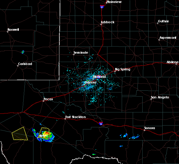
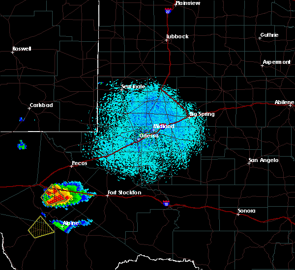
| 5/25/2023 5:31 PM CDT |
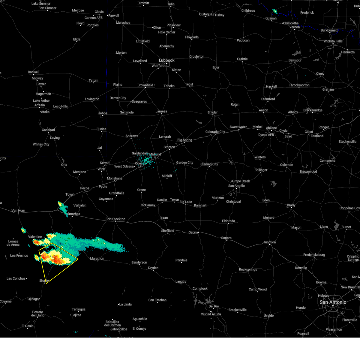 At 531 pm cdt, a severe thunderstorm was located 7 miles southwest of marfa, moving southeast at 25 mph (radar indicated). Hazards include 60 mph wind gusts and quarter size hail. Hail damage to vehicles is expected. expect wind damage to roofs, siding, and trees. locations impacted include, marfa, marfa municipal airport and paisano pass. hail threat, radar indicated max hail size, 1. 00 in wind threat, radar indicated max wind gust, 60 mph. At 531 pm cdt, a severe thunderstorm was located 7 miles southwest of marfa, moving southeast at 25 mph (radar indicated). Hazards include 60 mph wind gusts and quarter size hail. Hail damage to vehicles is expected. expect wind damage to roofs, siding, and trees. locations impacted include, marfa, marfa municipal airport and paisano pass. hail threat, radar indicated max hail size, 1. 00 in wind threat, radar indicated max wind gust, 60 mph.
|
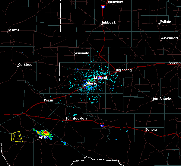
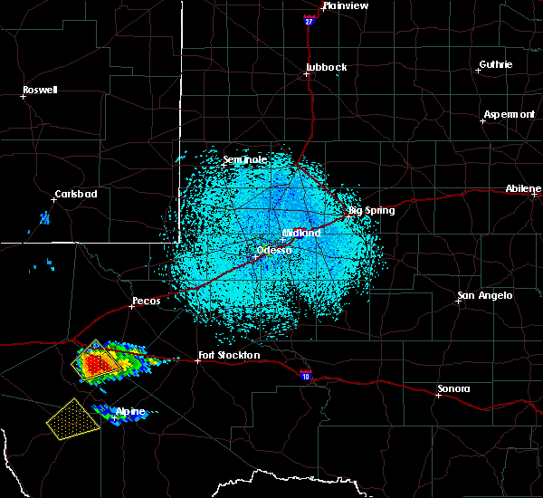
| 5/25/2023 4:57 PM CDT |
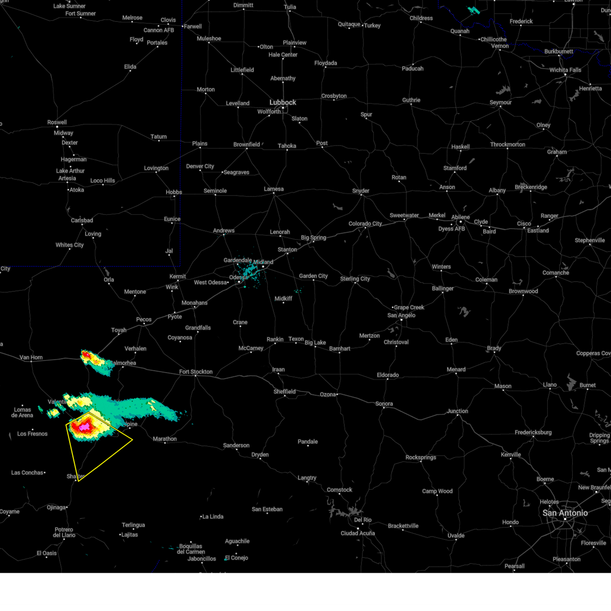 At 456 pm cdt, a severe thunderstorm was located 11 miles west of marfa municipal airport, or 11 miles west of marfa, moving southeast at 25 mph (radar indicated). Hazards include golf ball size hail and 70 mph wind gusts. People and animals outdoors will be injured. expect hail damage to roofs, siding, windows, and vehicles. expect considerable tree damage. Wind damage is also likely to mobile homes, roofs, and outbuildings. At 456 pm cdt, a severe thunderstorm was located 11 miles west of marfa municipal airport, or 11 miles west of marfa, moving southeast at 25 mph (radar indicated). Hazards include golf ball size hail and 70 mph wind gusts. People and animals outdoors will be injured. expect hail damage to roofs, siding, windows, and vehicles. expect considerable tree damage. Wind damage is also likely to mobile homes, roofs, and outbuildings.
|
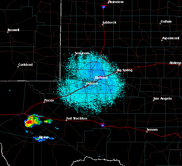
| 5/25/2023 4:21 PM CDT |
Mesonet station up400 4.0 nw ryan (upr in presidio county TX, 22.3 miles ESE of Marfa, TX
|
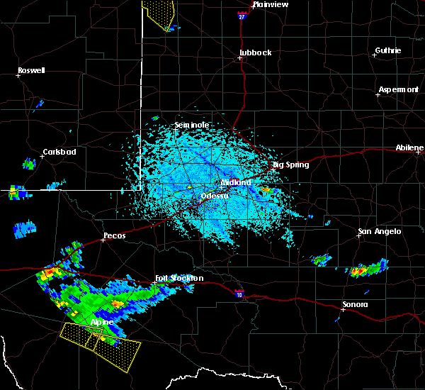
| 5/28/2020 6:36 PM CDT |
 At 636 pm cdt, a severe thunderstorm was located 8 miles west of marfa municipal airport, or 9 miles northwest of marfa, moving southeast at 15 mph (public). Hazards include 60 mph wind gusts and quarter size hail. Hail damage to vehicles is expected. expect wind damage to roofs, siding, and trees. Locations impacted include, marfa, bloys camp and marfa municipal airport. At 636 pm cdt, a severe thunderstorm was located 8 miles west of marfa municipal airport, or 9 miles northwest of marfa, moving southeast at 15 mph (public). Hazards include 60 mph wind gusts and quarter size hail. Hail damage to vehicles is expected. expect wind damage to roofs, siding, and trees. Locations impacted include, marfa, bloys camp and marfa municipal airport.
|
| 5/28/2020 6:11 PM CDT |
 At 609 pm cdt, a severe thunderstorm was located near ryan, 9 miles southwest of bloys camp, or 16 miles northwest of marfa, moving east at 15 mph (public). Hazards include golf ball size hail and 70 mph wind gusts. People and animals outdoors will be injured. expect hail damage to roofs, siding, windows, and vehicles. expect considerable tree damage. Wind damage is also likely to mobile homes, roofs, and outbuildings. At 609 pm cdt, a severe thunderstorm was located near ryan, 9 miles southwest of bloys camp, or 16 miles northwest of marfa, moving east at 15 mph (public). Hazards include golf ball size hail and 70 mph wind gusts. People and animals outdoors will be injured. expect hail damage to roofs, siding, windows, and vehicles. expect considerable tree damage. Wind damage is also likely to mobile homes, roofs, and outbuildings.
|
| 5/28/2020 6:00 PM CDT |
Golf Ball sized hail reported 19.5 miles ESE of Marfa, TX
|
| 6/18/2019 3:11 PM CDT |
 At 311 pm cdt, a severe thunderstorm was located near marfa, moving east at 15 mph (radar indicated). Hazards include 60 mph wind gusts and half dollar size hail. Hail damage to vehicles is expected. Expect wind damage to roofs, siding, and trees. At 311 pm cdt, a severe thunderstorm was located near marfa, moving east at 15 mph (radar indicated). Hazards include 60 mph wind gusts and half dollar size hail. Hail damage to vehicles is expected. Expect wind damage to roofs, siding, and trees.
|
| 6/18/2019 3:07 PM CDT |
Quarter sized hail reported 6.8 miles N of Marfa, TX
|
| 6/18/2019 2:55 PM CDT |
 At 254 pm cdt, a severe thunderstorm was located near marfa, moving east at 10 mph (radar indicated). Hazards include golf ball size hail and 60 mph wind gusts. People and animals outdoors will be injured. expect hail damage to roofs, siding, windows, and vehicles. expect wind damage to roofs, siding, and trees. Locations impacted include, marfa, marfa municipal airport and paisano pass. At 254 pm cdt, a severe thunderstorm was located near marfa, moving east at 10 mph (radar indicated). Hazards include golf ball size hail and 60 mph wind gusts. People and animals outdoors will be injured. expect hail damage to roofs, siding, windows, and vehicles. expect wind damage to roofs, siding, and trees. Locations impacted include, marfa, marfa municipal airport and paisano pass.
|
| 6/18/2019 2:37 PM CDT |
 At 208 pm cdt, a severe thunderstorm was located 8 miles west of marfa, moving northeast at 10 mph (radar indicated). Hazards include 60 mph wind gusts and half dollar size hail. Hail damage to vehicles is expected. Expect wind damage to roofs, siding, and trees. At 208 pm cdt, a severe thunderstorm was located 8 miles west of marfa, moving northeast at 10 mph (radar indicated). Hazards include 60 mph wind gusts and half dollar size hail. Hail damage to vehicles is expected. Expect wind damage to roofs, siding, and trees.
|
| 6/18/2019 2:08 PM CDT |
 At 208 pm cdt, a severe thunderstorm was located 8 miles west of marfa, moving northeast at 10 mph (radar indicated). Hazards include 60 mph wind gusts and half dollar size hail. Hail damage to vehicles is expected. Expect wind damage to roofs, siding, and trees. At 208 pm cdt, a severe thunderstorm was located 8 miles west of marfa, moving northeast at 10 mph (radar indicated). Hazards include 60 mph wind gusts and half dollar size hail. Hail damage to vehicles is expected. Expect wind damage to roofs, siding, and trees.
|
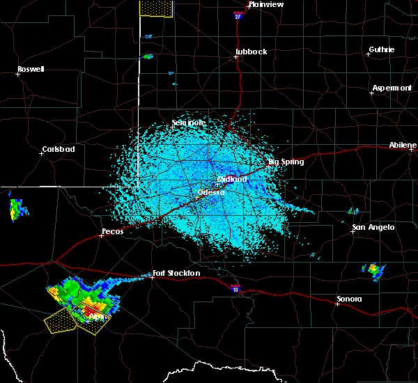
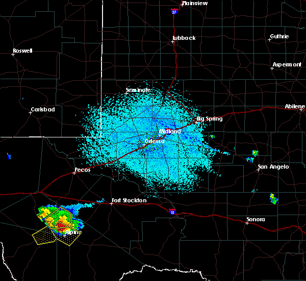
| 6/17/2019 5:29 PM CDT |
 At 529 pm cdt, a severe thunderstorm was located near marfa, moving east at 20 mph (radar indicated). Hazards include ping pong ball size hail and 60 mph wind gusts. People and animals outdoors will be injured. expect hail damage to roofs, siding, windows, and vehicles. Expect wind damage to roofs, siding, and trees. At 529 pm cdt, a severe thunderstorm was located near marfa, moving east at 20 mph (radar indicated). Hazards include ping pong ball size hail and 60 mph wind gusts. People and animals outdoors will be injured. expect hail damage to roofs, siding, windows, and vehicles. Expect wind damage to roofs, siding, and trees.
|
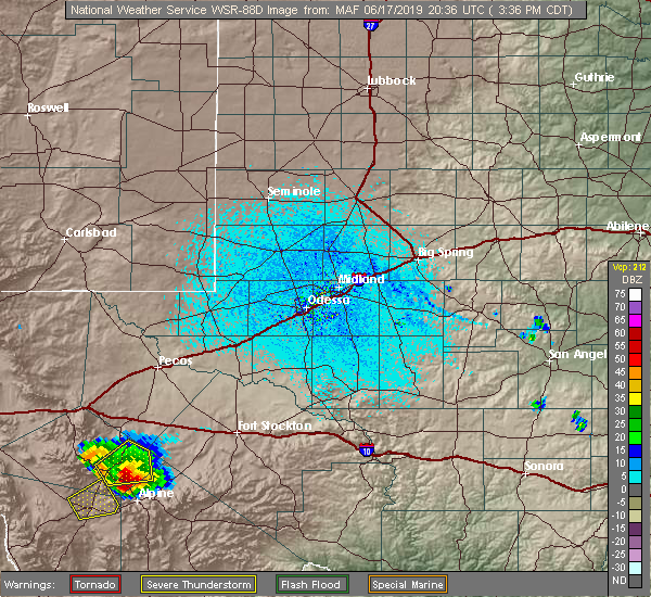
| 6/17/2019 4:01 PM CDT |
 At 400 pm cdt, a severe thunderstorm was located over marfa municipal airport, or near marfa, moving northeast at 10 mph. this storm was over state hwy 17 (radar indicated). Hazards include 60 mph wind gusts and quarter size hail. Hail damage to vehicles is expected. expect wind damage to roofs, siding, and trees. Locations impacted include, marfa and marfa municipal airport. At 400 pm cdt, a severe thunderstorm was located over marfa municipal airport, or near marfa, moving northeast at 10 mph. this storm was over state hwy 17 (radar indicated). Hazards include 60 mph wind gusts and quarter size hail. Hail damage to vehicles is expected. expect wind damage to roofs, siding, and trees. Locations impacted include, marfa and marfa municipal airport.
|
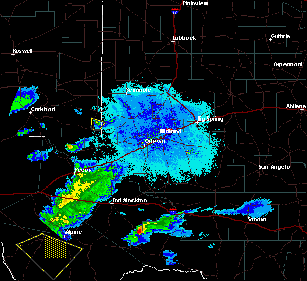
| 6/17/2019 3:45 PM CDT |
 At 345 pm cdt, a severe thunderstorm was located near marfa, moving northeast at 5 mph (radar indicated). Hazards include 60 mph wind gusts and quarter size hail. Hail damage to vehicles is expected. expect wind damage to roofs, siding, and trees. Locations impacted include, marfa and marfa municipal airport. At 345 pm cdt, a severe thunderstorm was located near marfa, moving northeast at 5 mph (radar indicated). Hazards include 60 mph wind gusts and quarter size hail. Hail damage to vehicles is expected. expect wind damage to roofs, siding, and trees. Locations impacted include, marfa and marfa municipal airport.
|
| 6/17/2019 3:35 PM CDT |
 At 335 pm cdt, a severe thunderstorm was located near marfa, moving northeast at 10 mph (radar indicated). Hazards include 60 mph wind gusts and quarter size hail. Hail damage to vehicles is expected. Expect wind damage to roofs, siding, and trees. At 335 pm cdt, a severe thunderstorm was located near marfa, moving northeast at 10 mph (radar indicated). Hazards include 60 mph wind gusts and quarter size hail. Hail damage to vehicles is expected. Expect wind damage to roofs, siding, and trees.
|
| 6/2/2019 7:47 PM CDT |
 At 747 pm cdt, a severe thunderstorm was located 7 miles north of marfa municipal airport, or 9 miles southwest of fort davis, and is nearly stationary (radar indicated). Hazards include 60 mph wind gusts and quarter size hail. Hail damage to vehicles is expected. expect wind damage to roofs, siding, and trees. Locations impacted include, alpine, marfa, fort davis, camp mitre peak, alpine-casparis municipal airport, davis mountains state park, marfa municipal airport, paisano pass, indian lodge and fort davis national historical site. At 747 pm cdt, a severe thunderstorm was located 7 miles north of marfa municipal airport, or 9 miles southwest of fort davis, and is nearly stationary (radar indicated). Hazards include 60 mph wind gusts and quarter size hail. Hail damage to vehicles is expected. expect wind damage to roofs, siding, and trees. Locations impacted include, alpine, marfa, fort davis, camp mitre peak, alpine-casparis municipal airport, davis mountains state park, marfa municipal airport, paisano pass, indian lodge and fort davis national historical site.
|
| 6/2/2019 7:11 PM CDT |
 At 711 pm cdt, a severe thunderstorm was located near bloys camp, or 11 miles north of marfa, moving east at 20 mph (radar indicated). Hazards include ping pong ball size hail and 60 mph wind gusts. People and animals outdoors will be injured. expect hail damage to roofs, siding, windows, and vehicles. Expect wind damage to roofs, siding, and trees. At 711 pm cdt, a severe thunderstorm was located near bloys camp, or 11 miles north of marfa, moving east at 20 mph (radar indicated). Hazards include ping pong ball size hail and 60 mph wind gusts. People and animals outdoors will be injured. expect hail damage to roofs, siding, windows, and vehicles. Expect wind damage to roofs, siding, and trees.
|
| 5/31/2019 10:32 PM CDT |
 At 1032 pm cdt, a severe thunderstorm was located 9 miles southeast of marfa, moving east at 25 mph (radar indicated). Hazards include 60 mph wind gusts and quarter size hail. Hail damage to vehicles is expected. expect wind damage to roofs, siding, and trees. Locations impacted include, marfa, marfa municipal airport, paisano pass, elephant mountain wildlife management area and elephant mountain. At 1032 pm cdt, a severe thunderstorm was located 9 miles southeast of marfa, moving east at 25 mph (radar indicated). Hazards include 60 mph wind gusts and quarter size hail. Hail damage to vehicles is expected. expect wind damage to roofs, siding, and trees. Locations impacted include, marfa, marfa municipal airport, paisano pass, elephant mountain wildlife management area and elephant mountain.
|
| 5/31/2019 10:25 PM CDT |
Quarter sized hail reported 3.7 miles NNE of Marfa, TX
|
| 5/31/2019 10:13 PM CDT |
 At 1013 pm cdt, a severe thunderstorm was located near marfa, moving southeast at 25 mph (radar indicated). Hazards include 60 mph wind gusts and half dollar size hail. Hail damage to vehicles is expected. Expect wind damage to roofs, siding, and trees. At 1013 pm cdt, a severe thunderstorm was located near marfa, moving southeast at 25 mph (radar indicated). Hazards include 60 mph wind gusts and half dollar size hail. Hail damage to vehicles is expected. Expect wind damage to roofs, siding, and trees.
|
| 5/31/2019 9:39 PM CDT |
 At 939 pm cdt, a severe thunderstorm was located 14 miles west of marfa, moving southeast at 25 mph (radar indicated). Hazards include golf ball size hail and 60 mph wind gusts. People and animals outdoors will be injured. expect hail damage to roofs, siding, windows, and vehicles. expect wind damage to roofs, siding, and trees. Locations impacted include, marfa and marfa municipal airport. At 939 pm cdt, a severe thunderstorm was located 14 miles west of marfa, moving southeast at 25 mph (radar indicated). Hazards include golf ball size hail and 60 mph wind gusts. People and animals outdoors will be injured. expect hail damage to roofs, siding, windows, and vehicles. expect wind damage to roofs, siding, and trees. Locations impacted include, marfa and marfa municipal airport.
|
| 5/31/2019 9:12 PM CDT |
 At 912 pm cdt, a severe thunderstorm was located 11 miles south of valentine, or 23 miles northeast of candelaria, moving east at 25 mph (radar indicated). Hazards include golf ball size hail and 60 mph wind gusts. People and animals outdoors will be injured. expect hail damage to roofs, siding, windows, and vehicles. Expect wind damage to roofs, siding, and trees. At 912 pm cdt, a severe thunderstorm was located 11 miles south of valentine, or 23 miles northeast of candelaria, moving east at 25 mph (radar indicated). Hazards include golf ball size hail and 60 mph wind gusts. People and animals outdoors will be injured. expect hail damage to roofs, siding, windows, and vehicles. Expect wind damage to roofs, siding, and trees.
|
| 5/31/2019 5:56 PM CDT |
 At 555 pm cdt, a severe thunderstorm was located near marfa, moving north at 40 mph (radar indicated). Hazards include golf ball size hail and 60 mph wind gusts. People and animals outdoors will be injured. expect hail damage to roofs, siding, windows, and vehicles. expect wind damage to roofs, siding, and trees. Locations impacted include, alpine, marfa, highway 67 east of marfa, camp mitre peak, alpine-casparis municipal airport, marfa municipal airport and paisano pass. At 555 pm cdt, a severe thunderstorm was located near marfa, moving north at 40 mph (radar indicated). Hazards include golf ball size hail and 60 mph wind gusts. People and animals outdoors will be injured. expect hail damage to roofs, siding, windows, and vehicles. expect wind damage to roofs, siding, and trees. Locations impacted include, alpine, marfa, highway 67 east of marfa, camp mitre peak, alpine-casparis municipal airport, marfa municipal airport and paisano pass.
|
| 5/31/2019 5:40 PM CDT |
 At 540 pm cdt, a severe thunderstorm was located 19 miles south of marfa, moving northeast at 35 mph (radar indicated). Hazards include ping pong ball size hail and 60 mph wind gusts. People and animals outdoors will be injured. expect hail damage to roofs, siding, windows, and vehicles. Expect wind damage to roofs, siding, and trees. At 540 pm cdt, a severe thunderstorm was located 19 miles south of marfa, moving northeast at 35 mph (radar indicated). Hazards include ping pong ball size hail and 60 mph wind gusts. People and animals outdoors will be injured. expect hail damage to roofs, siding, windows, and vehicles. Expect wind damage to roofs, siding, and trees.
|
| 3/12/2019 8:33 PM CDT |
Storm damage reported in presidio county TX, 0.3 miles ESE of Marfa, TX
|
|
|
| 6/3/2018 10:47 PM CDT |
 At 1046 pm cdt, severe thunderstorms were located along a line extending from 14 miles southeast of balmorhea state park to 12 miles south of alpine to 16 miles east of big bend ranch state park, moving east at 25 mph (radar indicated). Hazards include 70 mph wind gusts and half dollar size hail. Hail damage to vehicles is expected. expect considerable tree damage. wind damage is also likely to mobile homes, roofs, and outbuildings. Locations impacted include, alpine, marfa, fort davis, alpine-casparis municipal airport, davis mountains state park, mcdonald observatory, camp mitre peak, marfa municipal airport, black mountain, star mountain, paisano pass, indian lodge, casa piedra, fort davis national historical site and elephant mountain wildlife management area. At 1046 pm cdt, severe thunderstorms were located along a line extending from 14 miles southeast of balmorhea state park to 12 miles south of alpine to 16 miles east of big bend ranch state park, moving east at 25 mph (radar indicated). Hazards include 70 mph wind gusts and half dollar size hail. Hail damage to vehicles is expected. expect considerable tree damage. wind damage is also likely to mobile homes, roofs, and outbuildings. Locations impacted include, alpine, marfa, fort davis, alpine-casparis municipal airport, davis mountains state park, mcdonald observatory, camp mitre peak, marfa municipal airport, black mountain, star mountain, paisano pass, indian lodge, casa piedra, fort davis national historical site and elephant mountain wildlife management area.
|
| 6/3/2018 10:27 PM CDT |
 At 1027 pm cdt, severe thunderstorms were located along a line extending from 10 miles north of fort davis to 14 miles southwest of alpine to 7 miles northeast of big bend ranch state park, moving east at 20 mph (radar indicated). Hazards include 70 mph wind gusts and quarter size hail. Hail damage to vehicles is expected. expect considerable tree damage. Wind damage is also likely to mobile homes, roofs, and outbuildings. At 1027 pm cdt, severe thunderstorms were located along a line extending from 10 miles north of fort davis to 14 miles southwest of alpine to 7 miles northeast of big bend ranch state park, moving east at 20 mph (radar indicated). Hazards include 70 mph wind gusts and quarter size hail. Hail damage to vehicles is expected. expect considerable tree damage. Wind damage is also likely to mobile homes, roofs, and outbuildings.
|
| 6/3/2018 10:20 PM CDT |
 At 1020 pm cdt, severe thunderstorms were located along a line extending from 6 miles south of balmorhea state park to 17 miles south of balmorhea lake to 8 miles southwest of alpine-casparis municipal airport to 21 miles northeast of big bend ranch state park, moving northeast at 45 mph (radar indicated). Hazards include 60 mph wind gusts and quarter size hail. Hail damage to vehicles is expected. expect wind damage to roofs, siding, and trees. Locations impacted include, alpine, marfa, fort davis, bloys camp, adobes, alpine-casparis municipal airport, davis mountains state park, mcdonald observatory, camp mitre peak, marfa municipal airport, chinati mountains, black mountain, shafter, star mountain, paisano pass, buffalo trail scout camp, indian lodge, casa piedra and fort davis national historical site. At 1020 pm cdt, severe thunderstorms were located along a line extending from 6 miles south of balmorhea state park to 17 miles south of balmorhea lake to 8 miles southwest of alpine-casparis municipal airport to 21 miles northeast of big bend ranch state park, moving northeast at 45 mph (radar indicated). Hazards include 60 mph wind gusts and quarter size hail. Hail damage to vehicles is expected. expect wind damage to roofs, siding, and trees. Locations impacted include, alpine, marfa, fort davis, bloys camp, adobes, alpine-casparis municipal airport, davis mountains state park, mcdonald observatory, camp mitre peak, marfa municipal airport, chinati mountains, black mountain, shafter, star mountain, paisano pass, buffalo trail scout camp, indian lodge, casa piedra and fort davis national historical site.
|
| 6/3/2018 9:51 PM CDT |
 At 951 pm cdt, severe thunderstorms were located along a line extending from 15 miles north of bloys camp to near mcdonald observatory to 8 miles southwest of marfa to 11 miles north of presidio, moving east at 25 mph (radar indicated). Hazards include 60 mph wind gusts and quarter size hail. Hail damage to vehicles is expected. Expect wind damage to roofs, siding, and trees. At 951 pm cdt, severe thunderstorms were located along a line extending from 15 miles north of bloys camp to near mcdonald observatory to 8 miles southwest of marfa to 11 miles north of presidio, moving east at 25 mph (radar indicated). Hazards include 60 mph wind gusts and quarter size hail. Hail damage to vehicles is expected. Expect wind damage to roofs, siding, and trees.
|
| 5/29/2017 7:47 PM CDT |
 At 746 pm cdt, a severe thunderstorm was located 8 miles north of marfa on sh17, moving northeast at 10 mph (radar indicated). Hazards include 60 mph wind gusts and quarter size hail. Hail damage to vehicles is expected. expect wind damage to roofs, siding, and trees. Locations impacted include, marfa, marfa municipal airport and camp mitre peak. At 746 pm cdt, a severe thunderstorm was located 8 miles north of marfa on sh17, moving northeast at 10 mph (radar indicated). Hazards include 60 mph wind gusts and quarter size hail. Hail damage to vehicles is expected. expect wind damage to roofs, siding, and trees. Locations impacted include, marfa, marfa municipal airport and camp mitre peak.
|
| 5/29/2017 7:33 PM CDT |
 At 732 pm cdt, a severe thunderstorm was located 7 miles north of marfa, moving northeast at 10 mph. this storm may move across sh 17 (radar indicated). Hazards include 60 mph wind gusts and quarter size hail. Hail damage to vehicles is expected. Expect wind damage to roofs, siding, and trees. At 732 pm cdt, a severe thunderstorm was located 7 miles north of marfa, moving northeast at 10 mph. this storm may move across sh 17 (radar indicated). Hazards include 60 mph wind gusts and quarter size hail. Hail damage to vehicles is expected. Expect wind damage to roofs, siding, and trees.
|
| 5/29/2017 6:42 PM CDT |
 At 641 pm cdt, a severe thunderstorm was located 11 miles west of marfa, moving east at 10 mph (radar indicated). Hazards include 60 mph wind gusts and quarter size hail. Hail damage to vehicles is expected. expect wind damage to roofs, siding, and trees. Locations impacted include, marfa and marfa municipal airport. At 641 pm cdt, a severe thunderstorm was located 11 miles west of marfa, moving east at 10 mph (radar indicated). Hazards include 60 mph wind gusts and quarter size hail. Hail damage to vehicles is expected. expect wind damage to roofs, siding, and trees. Locations impacted include, marfa and marfa municipal airport.
|
| 5/29/2017 6:18 PM CDT |
 At 617 pm cdt, a severe thunderstorm was located 15 miles west of marfa, moving east at 10 mph (radar indicated). Hazards include 60 mph wind gusts and quarter size hail. Hail damage to vehicles is expected. Expect wind damage to roofs, siding, and trees. At 617 pm cdt, a severe thunderstorm was located 15 miles west of marfa, moving east at 10 mph (radar indicated). Hazards include 60 mph wind gusts and quarter size hail. Hail damage to vehicles is expected. Expect wind damage to roofs, siding, and trees.
|
| 4/16/2017 3:28 PM CDT |
 At 328 pm cdt, a severe thunderstorm was located 14 miles southeast of marfa, moving north at 15 mph (radar indicated). Hazards include 60 mph wind gusts and quarter size hail. Hail damage to vehicles is expected. Expect wind damage to roofs, siding, and trees. At 328 pm cdt, a severe thunderstorm was located 14 miles southeast of marfa, moving north at 15 mph (radar indicated). Hazards include 60 mph wind gusts and quarter size hail. Hail damage to vehicles is expected. Expect wind damage to roofs, siding, and trees.
|
| 4/13/2017 2:53 AM CDT |
 At 253 am cdt, a severe thunderstorm was located 7 miles west of marfa, moving east at 15 mph (radar indicated). Hazards include quarter size hail. Damage to vehicles is expected. Locations impacted include, marfa. At 253 am cdt, a severe thunderstorm was located 7 miles west of marfa, moving east at 15 mph (radar indicated). Hazards include quarter size hail. Damage to vehicles is expected. Locations impacted include, marfa.
|
| 4/13/2017 2:35 AM CDT |
 At 235 am cdt, a severe thunderstorm was located 11 miles west of marfa municipal airport, or 12 miles west of marfa, moving east at 15 mph (radar indicated). Hazards include quarter size hail. damage to vehicles is expected At 235 am cdt, a severe thunderstorm was located 11 miles west of marfa municipal airport, or 12 miles west of marfa, moving east at 15 mph (radar indicated). Hazards include quarter size hail. damage to vehicles is expected
|
| 5/30/2016 8:12 PM CDT |
 At 811 pm cdt, a severe thunderstorm was located near paisano pass, or 9 miles west of alpine, moving northeast at 35 mph (radar indicated). Hazards include 60 mph wind gusts and quarter size hail. Hail damage to vehicles is expected. expect wind damage to roofs, siding, and trees. Locations impacted include, alpine, marfa, alpine-casparis municipal airport, paisano pass and marfa municipal airport. At 811 pm cdt, a severe thunderstorm was located near paisano pass, or 9 miles west of alpine, moving northeast at 35 mph (radar indicated). Hazards include 60 mph wind gusts and quarter size hail. Hail damage to vehicles is expected. expect wind damage to roofs, siding, and trees. Locations impacted include, alpine, marfa, alpine-casparis municipal airport, paisano pass and marfa municipal airport.
|
| 5/30/2016 7:42 PM CDT |
 At 742 pm cdt, a severe thunderstorm was located 10 miles south of marfa, moving northeast at 35 mph (radar indicated). Hazards include 60 mph wind gusts and quarter size hail. Hail damage to vehicles is expected. Expect wind damage to roofs, siding, and trees. At 742 pm cdt, a severe thunderstorm was located 10 miles south of marfa, moving northeast at 35 mph (radar indicated). Hazards include 60 mph wind gusts and quarter size hail. Hail damage to vehicles is expected. Expect wind damage to roofs, siding, and trees.
|
| 5/30/2016 2:59 PM CDT |
 At 259 pm cdt, a severe thunderstorm was located 7 miles south of marfa, moving east at 25 mph (radar indicated). Hazards include 60 mph wind gusts and quarter size hail. Hail damage to vehicles is expected. expect wind damage to roofs, siding, and trees. Locations impacted include, marfa, paisano pass and marfa municipal airport. At 259 pm cdt, a severe thunderstorm was located 7 miles south of marfa, moving east at 25 mph (radar indicated). Hazards include 60 mph wind gusts and quarter size hail. Hail damage to vehicles is expected. expect wind damage to roofs, siding, and trees. Locations impacted include, marfa, paisano pass and marfa municipal airport.
|
| 5/30/2016 2:27 PM CDT |
 At 227 pm cdt, a severe thunderstorm was located 11 miles southwest of marfa, moving northeast at 15 mph (radar indicated). Hazards include 60 mph wind gusts and quarter size hail. Hail damage to vehicles is expected. Expect wind damage to roofs, siding, and trees. At 227 pm cdt, a severe thunderstorm was located 11 miles southwest of marfa, moving northeast at 15 mph (radar indicated). Hazards include 60 mph wind gusts and quarter size hail. Hail damage to vehicles is expected. Expect wind damage to roofs, siding, and trees.
|
| 5/17/2016 2:21 PM CDT |
 The severe thunderstorm warning for northeastern presidio county will expire at 230 pm cdt, the storm which prompted the warning has moved out of the area. therefore the warning will be allowed to expire. The severe thunderstorm warning for northeastern presidio county will expire at 230 pm cdt, the storm which prompted the warning has moved out of the area. therefore the warning will be allowed to expire.
|
| 5/17/2016 1:54 PM CDT |
 At 153 pm cdt, a severe thunderstorm was located near paisano pass, or near marfa, moving east at 20 mph. law enforcement in marfa reported penny size hail with this storm (radar indicated). Hazards include 60 mph wind gusts and quarter size hail. Hail damage to vehicles is expected. expect wind damage to roofs, siding, and trees. Locations impacted include, marfa and marfa municipal airport. At 153 pm cdt, a severe thunderstorm was located near paisano pass, or near marfa, moving east at 20 mph. law enforcement in marfa reported penny size hail with this storm (radar indicated). Hazards include 60 mph wind gusts and quarter size hail. Hail damage to vehicles is expected. expect wind damage to roofs, siding, and trees. Locations impacted include, marfa and marfa municipal airport.
|
| 5/17/2016 1:27 PM CDT |
 At 127 pm cdt, a severe thunderstorm was located over marfa, moving northeast at 15 mph (radar indicated). Hazards include 60 mph wind gusts and quarter size hail. Hail damage to vehicles is expected. Expect wind damage to roofs, siding, and trees. At 127 pm cdt, a severe thunderstorm was located over marfa, moving northeast at 15 mph (radar indicated). Hazards include 60 mph wind gusts and quarter size hail. Hail damage to vehicles is expected. Expect wind damage to roofs, siding, and trees.
|
| 10/21/2015 10:38 PM CDT |
 At 1038 pm cdt, a severe thunderstorm was located 13 miles southwest of ryan, or 26 miles west of marfa, moving northeast at 50 mph (radar indicated). Hazards include quarter size hail. Damage to vehicles is expected. Locations impacted include, marfa, ryan and marfa municipal airport. At 1038 pm cdt, a severe thunderstorm was located 13 miles southwest of ryan, or 26 miles west of marfa, moving northeast at 50 mph (radar indicated). Hazards include quarter size hail. Damage to vehicles is expected. Locations impacted include, marfa, ryan and marfa municipal airport.
|
| 10/21/2015 10:21 PM CDT |
 At 1021 pm cdt, doppler radar indicated a severe thunderstorm capable of producing quarter size hail and damaging winds in excess of 60 mph. this storm was located over candelaria, or 39 miles west of marfa, and moving northeast at 35 mph. At 1021 pm cdt, doppler radar indicated a severe thunderstorm capable of producing quarter size hail and damaging winds in excess of 60 mph. this storm was located over candelaria, or 39 miles west of marfa, and moving northeast at 35 mph.
|
| 6/14/2015 6:32 PM CDT |
 The national weather service in midland has issued a * severe thunderstorm warning for. north central presidio county in southwest texas. until 715 pm cdt * at 627 pm cdt. a severe thunderstorm was located 8 miles southwest of marfa. And moving northeast at 10 mph. The national weather service in midland has issued a * severe thunderstorm warning for. north central presidio county in southwest texas. until 715 pm cdt * at 627 pm cdt. a severe thunderstorm was located 8 miles southwest of marfa. And moving northeast at 10 mph.
|
| 6/21/2013 7:30 PM CDT |
4 inch diameter tree limbs knocked down from 50 to 60 mph winds in presidio county TX, 0.3 miles ESE of Marfa, TX
|
| 6/7/2013 7:05 PM CDT |
Ping Pong Ball sized hail reported 7.9 miles ENE of Marfa, TX, found partially melted hail on pinto canyon road
|
| 6/7/2013 6:15 PM CDT |
Ping Pong Ball sized hail reported 7.9 miles ENE of Marfa, TX, found partially melted hail on pinto canyon road
|
| 6/7/2013 6:15 PM CDT |
Golf Ball sized hail reported 6.8 miles ENE of Marfa, TX, amateur radio spotter reported nickle to golfball sized hail on fm 2810 7 miles wsw of marfa. spotter also reported dime to nickle sized hail at 625 pm cdt on u.s. 67 1
|
|
|
| 8/18/2012 6:06 PM CDT |
Quarter sized hail reported 0.3 miles ESE of Marfa, TX, law enforcement reported quarter sized hail in marfa.
|
| 5/14/2012 4:28 PM CDT |
Quarter sized hail reported 30 miles NNE of Marfa, TX
|
| 1/1/0001 12:00 AM |
Marfa awos measured 71 mph gus in presidio county TX, 0.3 miles ESE of Marfa, TX
|
| 1/1/0001 12:00 AM |
Storm damage reported in presidio county TX, 4.2 miles S of Marfa, TX
|
| 1/1/0001 12:00 AM |
Baseball sized hail reported 42.8 miles ENE of Marfa, TX, golfball to baseball sized hail reported at the chinati hot springs resort. time of 850 pm to 910 pm cdt estimated based on radar data. report relayed by news media.
|
| 1/1/0001 12:00 AM |
Ping Pong Ball sized hail reported 15.2 miles E of Marfa, TX
|


Connect with Interactive Hail Maps