

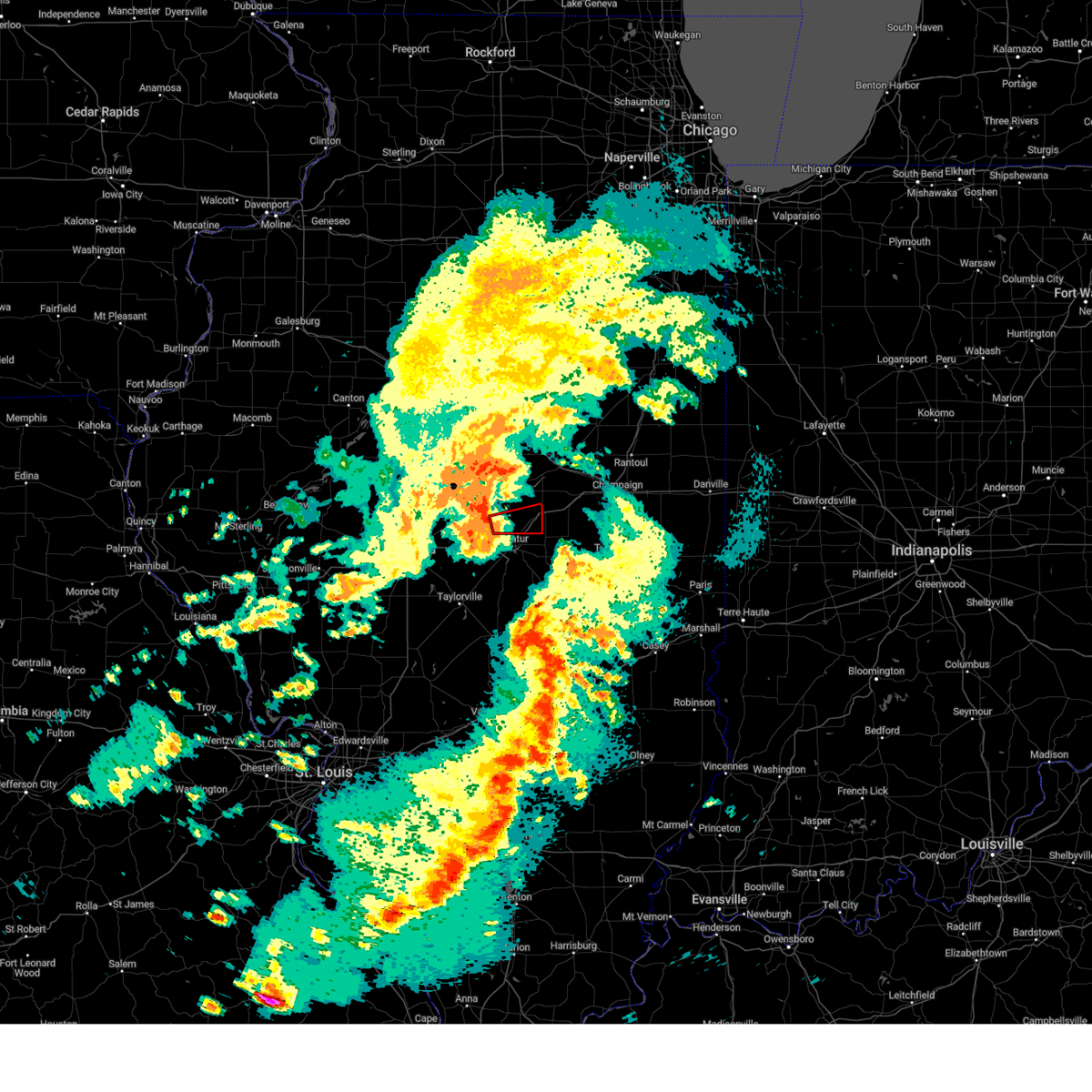
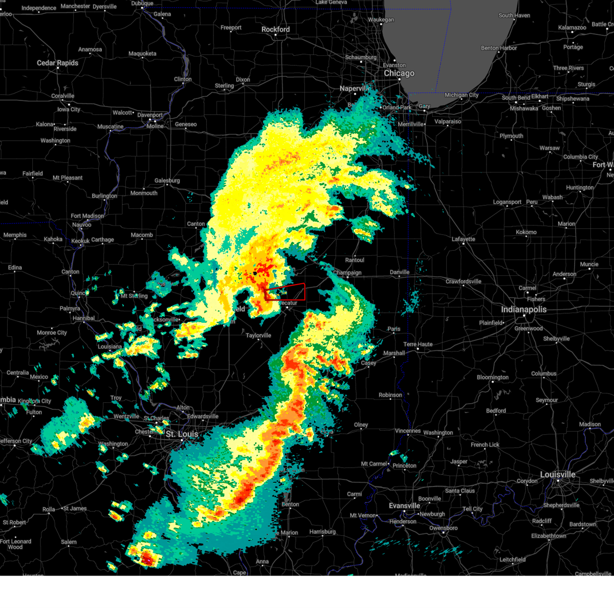
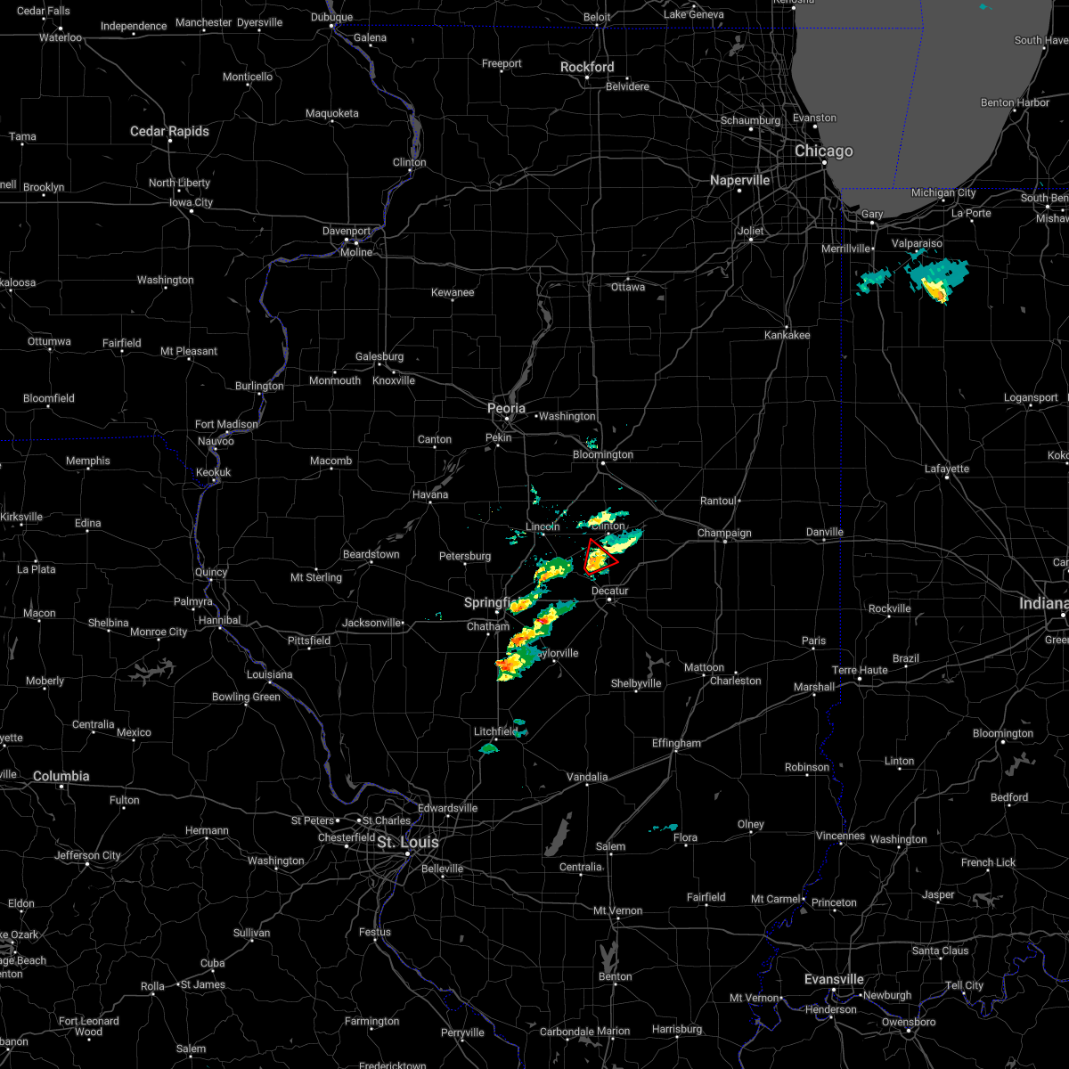
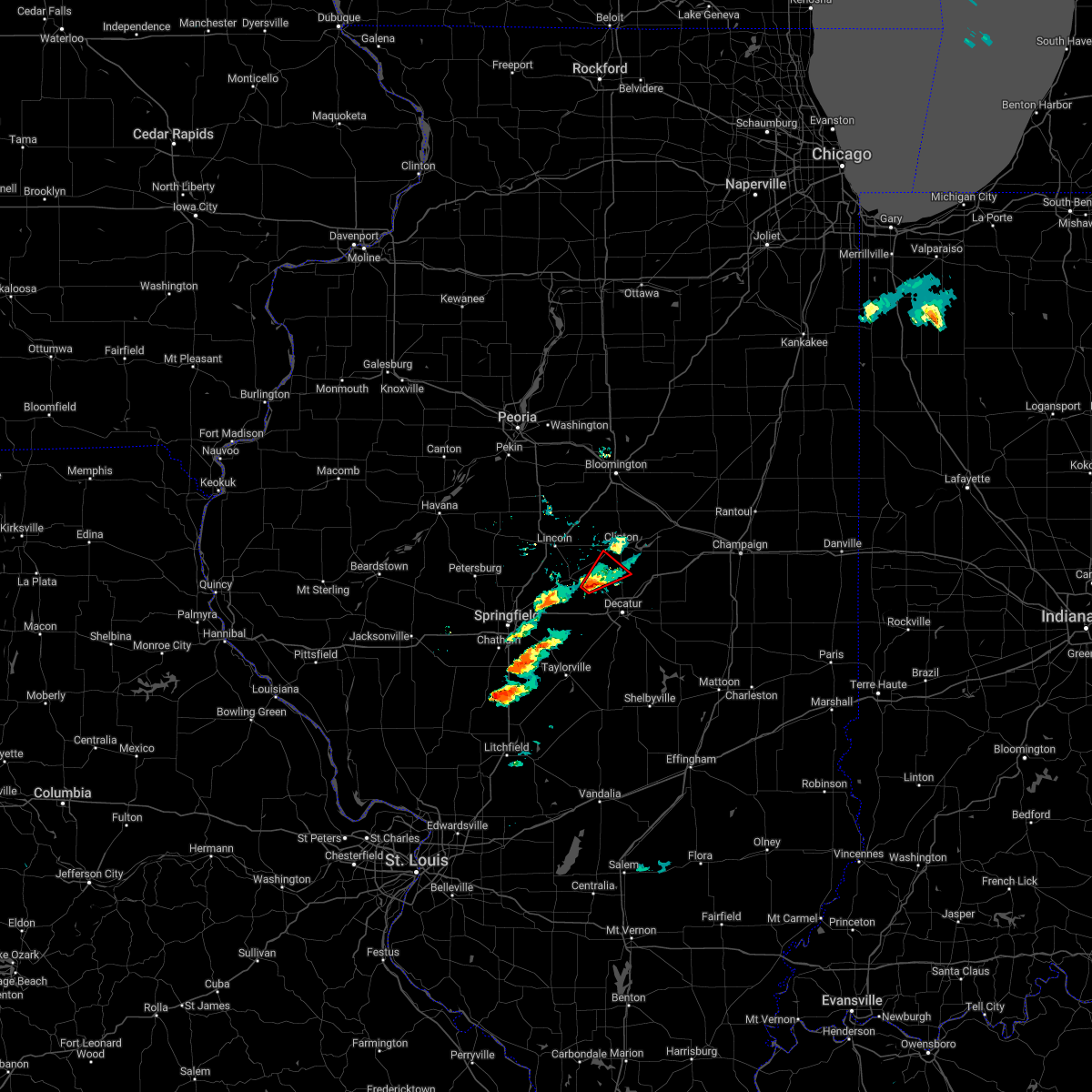
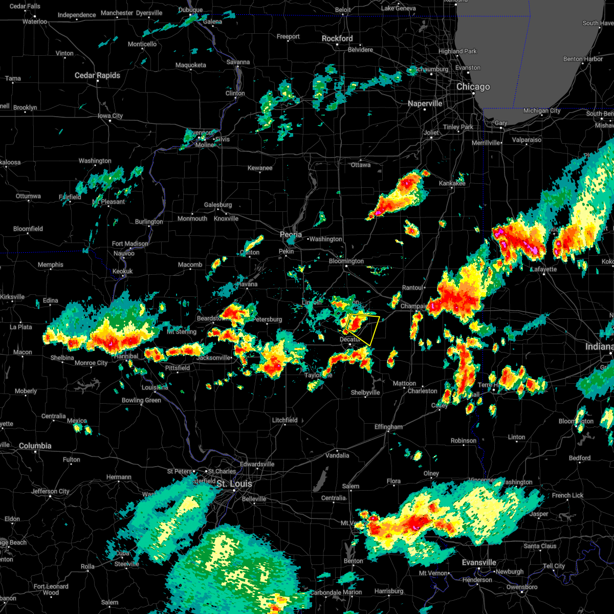
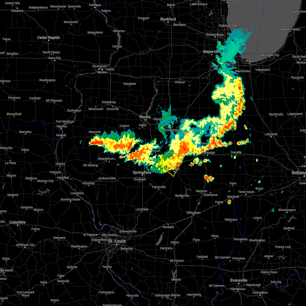
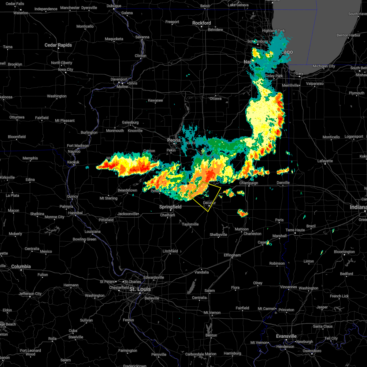
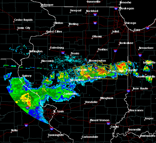
Hail Map for Maroa, IL
The Maroa, IL area has had 1 report of on-the-ground hail by trained spotters, and has been under severe weather warnings 12 times during the past 12 months. Doppler radar has detected hail at or near Maroa, IL on 50 occasions, including 5 occasions during the past year.
| Name: | Maroa, IL |
| Where Located: | 49.3 miles NW of Mattoon, IL |
| Map: | Google Map for Maroa, IL |
| Population: | 1801 |
| Housing Units: | 755 |
| More Info: | Search Google for Maroa, IL |
3
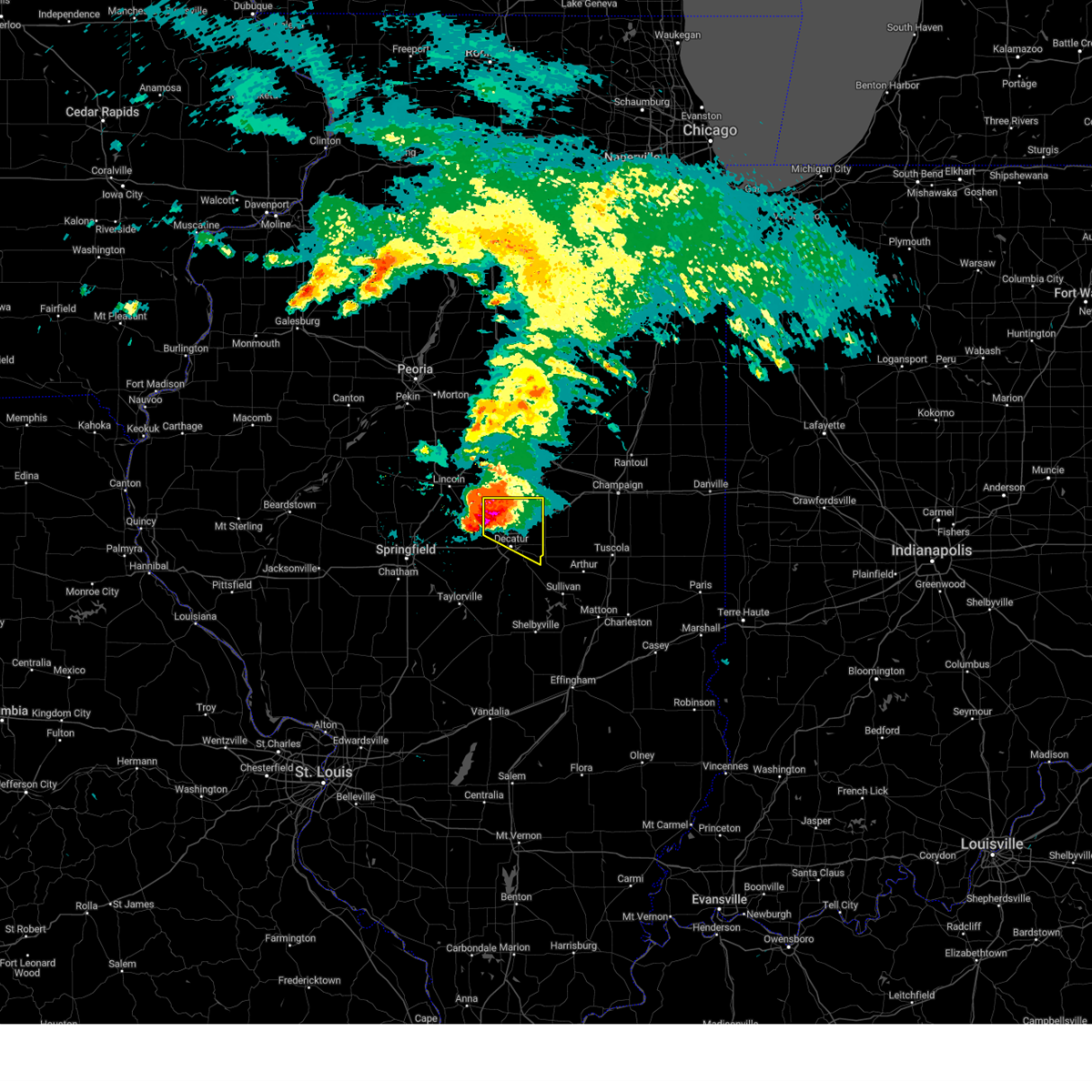
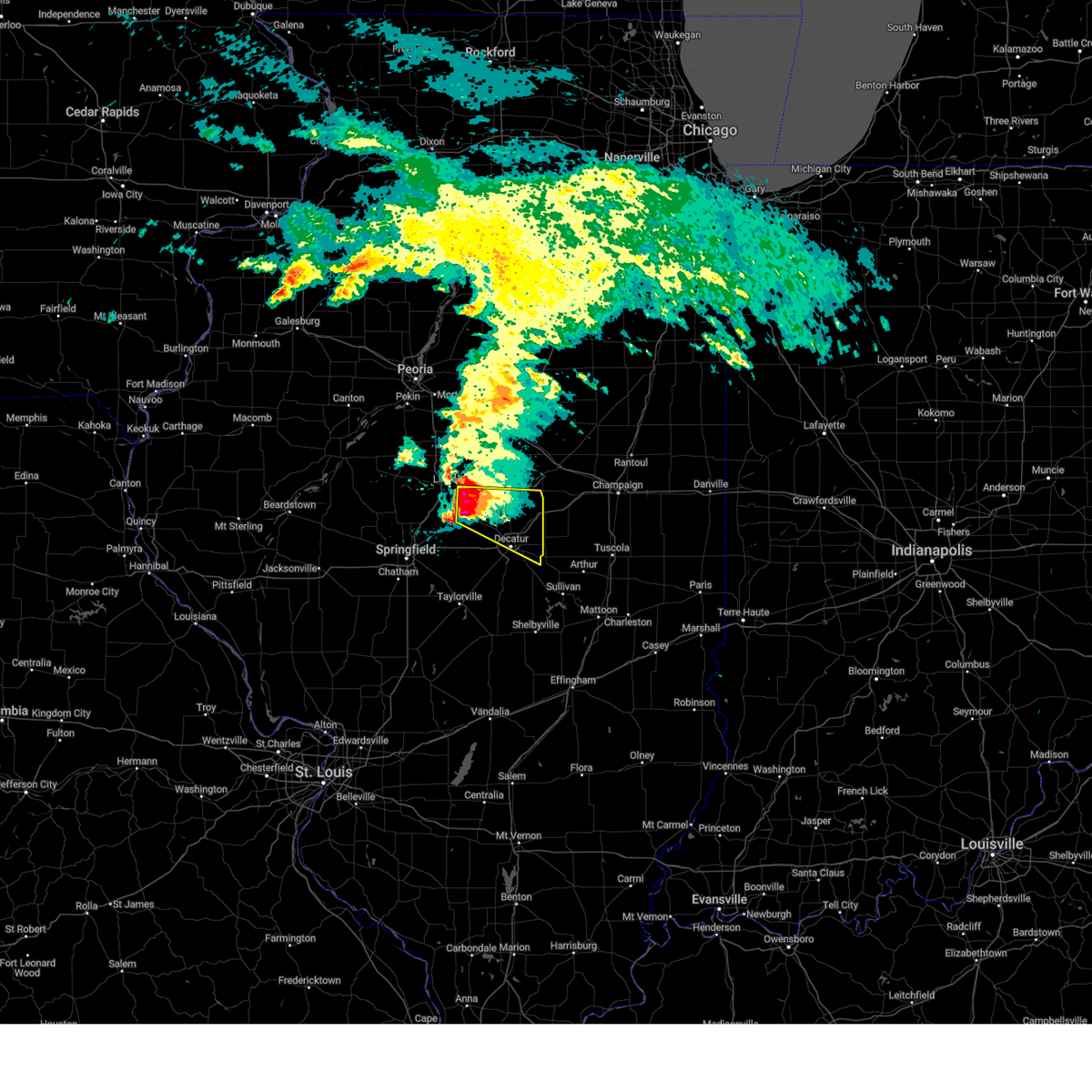
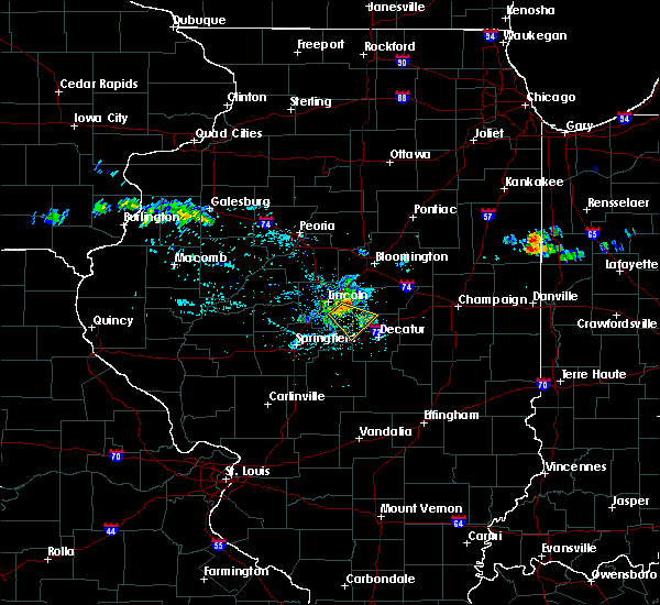
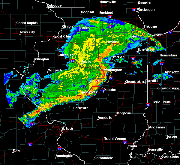
The Top Recent Hail Date for Maroa, IL is Sunday, March 31, 2024 (3rd out of 50)

Hail and Wind Damage Spotted near Maroa, IL
| Date / Time | Report Details |
|---|---|
| 4/18/2024 7:42 PM CDT |
 At 742 pm cdt, severe thunderstorms were located along a line extending from near maroa to near oreana to decatur, moving east at 45 mph (trained weather spotters). Hazards include 70 mph wind gusts. Expect considerable tree damage. damage is likely to mobile homes, roofs, and outbuildings. these severe storms will be near, decatur, maroa, argenta, oreana, and decatur airport around 745 pm cdt. cerro gordo and cisco around 750 pm cdt. weldon around 755 pm cdt. monticello, bement, and de land around 800 pm cdt. white heath around 810 pm cdt. other locations impacted by these severe thunderstorms include milmine, weldon springs state park, la place, lane, elwin, galesville, lodge, and oakley. This includes interstate 72 between mile markers 142 and 170. At 742 pm cdt, severe thunderstorms were located along a line extending from near maroa to near oreana to decatur, moving east at 45 mph (trained weather spotters). Hazards include 70 mph wind gusts. Expect considerable tree damage. damage is likely to mobile homes, roofs, and outbuildings. these severe storms will be near, decatur, maroa, argenta, oreana, and decatur airport around 745 pm cdt. cerro gordo and cisco around 750 pm cdt. weldon around 755 pm cdt. monticello, bement, and de land around 800 pm cdt. white heath around 810 pm cdt. other locations impacted by these severe thunderstorms include milmine, weldon springs state park, la place, lane, elwin, galesville, lodge, and oakley. This includes interstate 72 between mile markers 142 and 170.
|
| 4/18/2024 7:33 PM CDT |
 At 733 pm cdt, a severe squall line capable of producing both tornadoes and extensive straight line wind damage was located near warrensburg, or 9 miles northwest of decatur, moving east at 40 mph (radar indicated rotation). Hazards include tornado. Flying debris will be dangerous to those caught without shelter. mobile homes will be damaged or destroyed. damage to roofs, windows, and vehicles will occur. tree damage is likely. these dangerous storms will be near, forsyth and oreana around 740 pm cdt. argenta around 745 pm cdt. This includes interstate 72 between mile markers 144 and 155. At 733 pm cdt, a severe squall line capable of producing both tornadoes and extensive straight line wind damage was located near warrensburg, or 9 miles northwest of decatur, moving east at 40 mph (radar indicated rotation). Hazards include tornado. Flying debris will be dangerous to those caught without shelter. mobile homes will be damaged or destroyed. damage to roofs, windows, and vehicles will occur. tree damage is likely. these dangerous storms will be near, forsyth and oreana around 740 pm cdt. argenta around 745 pm cdt. This includes interstate 72 between mile markers 144 and 155.
|
| 4/18/2024 7:33 PM CDT |
 the tornado warning has been cancelled and is no longer in effect the tornado warning has been cancelled and is no longer in effect
|
| 4/18/2024 7:31 PM CDT |
 Svrilx the national weather service in lincoln has issued a * severe thunderstorm warning for, piatt county in central illinois, southern de witt county in central illinois, macon county in central illinois, * until 815 pm cdt. * at 731 pm cdt, severe thunderstorms were located along a line extending from kenney to warrensburg to near harristown, moving east at 45 mph (trained weather spotters). Hazards include 70 mph wind gusts. Expect considerable tree damage. damage is likely to mobile homes, roofs, and outbuildings. severe thunderstorms will be near, decatur, clinton, mount zion, forsyth, maroa, harristown, oreana, and kenney around 735 pm cdt. long creek, argenta, and decatur airport around 740 pm cdt. cerro gordo, weldon, and cisco around 750 pm cdt. monticello, bement, hammond, and de land around 800 pm cdt. white heath around 805 pm cdt. other locations impacted by these severe thunderstorms include boody, milmine, weldon springs state park, la place, lane, elwin, galesville, lodge, and oakley. This includes interstate 72 between mile markers 129 and 170. Svrilx the national weather service in lincoln has issued a * severe thunderstorm warning for, piatt county in central illinois, southern de witt county in central illinois, macon county in central illinois, * until 815 pm cdt. * at 731 pm cdt, severe thunderstorms were located along a line extending from kenney to warrensburg to near harristown, moving east at 45 mph (trained weather spotters). Hazards include 70 mph wind gusts. Expect considerable tree damage. damage is likely to mobile homes, roofs, and outbuildings. severe thunderstorms will be near, decatur, clinton, mount zion, forsyth, maroa, harristown, oreana, and kenney around 735 pm cdt. long creek, argenta, and decatur airport around 740 pm cdt. cerro gordo, weldon, and cisco around 750 pm cdt. monticello, bement, hammond, and de land around 800 pm cdt. white heath around 805 pm cdt. other locations impacted by these severe thunderstorms include boody, milmine, weldon springs state park, la place, lane, elwin, galesville, lodge, and oakley. This includes interstate 72 between mile markers 129 and 170.
|
| 4/18/2024 7:26 PM CDT |
 Torilx the national weather service in lincoln has issued a * tornado warning for, southeastern logan county in central illinois, northern macon county in central illinois, * until 800 pm cdt. * at 726 pm cdt, a severe thunderstorm capable of producing a tornado was located over latham, or 12 miles northwest of decatur, moving east at 40 mph (radar indicated rotation). Hazards include tornado. Flying debris will be dangerous to those caught without shelter. mobile homes will be damaged or destroyed. damage to roofs, windows, and vehicles will occur. tree damage is likely. this dangerous storm will be near, forsyth and warrensburg around 730 pm cdt. maroa around 735 pm cdt. oreana around 740 pm cdt. argenta around 745 pm cdt. This includes interstate 72 between mile markers 144 and 155. Torilx the national weather service in lincoln has issued a * tornado warning for, southeastern logan county in central illinois, northern macon county in central illinois, * until 800 pm cdt. * at 726 pm cdt, a severe thunderstorm capable of producing a tornado was located over latham, or 12 miles northwest of decatur, moving east at 40 mph (radar indicated rotation). Hazards include tornado. Flying debris will be dangerous to those caught without shelter. mobile homes will be damaged or destroyed. damage to roofs, windows, and vehicles will occur. tree damage is likely. this dangerous storm will be near, forsyth and warrensburg around 730 pm cdt. maroa around 735 pm cdt. oreana around 740 pm cdt. argenta around 745 pm cdt. This includes interstate 72 between mile markers 144 and 155.
|
| 3/31/2024 7:42 PM CDT |
 the severe thunderstorm warning has been cancelled and is no longer in effect the severe thunderstorm warning has been cancelled and is no longer in effect
|
| 3/31/2024 7:42 PM CDT |
 At 741 pm cdt, a severe thunderstorm was located over warrensburg, or 7 miles northwest of decatur, moving east at 40 mph (emergency management). Hazards include golf ball size hail and 60 mph wind gusts. People and animals outdoors will be injured. expect hail damage to roofs, siding, windows, and vehicles. expect wind damage to roofs, siding, and trees. this severe storm will be near, decatur, forsyth, and oreana around 745 pm cdt. cerro gordo around 800 pm cdt. other locations impacted by this severe thunderstorm include oakley. This includes interstate 72 between mile markers 136 and 156. At 741 pm cdt, a severe thunderstorm was located over warrensburg, or 7 miles northwest of decatur, moving east at 40 mph (emergency management). Hazards include golf ball size hail and 60 mph wind gusts. People and animals outdoors will be injured. expect hail damage to roofs, siding, windows, and vehicles. expect wind damage to roofs, siding, and trees. this severe storm will be near, decatur, forsyth, and oreana around 745 pm cdt. cerro gordo around 800 pm cdt. other locations impacted by this severe thunderstorm include oakley. This includes interstate 72 between mile markers 136 and 156.
|
| 3/31/2024 7:36 PM CDT |
 At 736 pm cdt, a severe thunderstorm was located over warrensburg, or 10 miles northwest of decatur, moving east at 40 mph (emergency management). Hazards include golf ball size hail and 60 mph wind gusts. People and animals outdoors will be injured. expect hail damage to roofs, siding, windows, and vehicles. expect wind damage to roofs, siding, and trees. this severe storm will be near, decatur, forsyth, and warrensburg around 740 pm cdt. oreana around 745 pm cdt. decatur airport around 755 pm cdt. cerro gordo around 800 pm cdt. other locations impacted by this severe thunderstorm include oakley. This includes interstate 72 between mile markers 136 and 156. At 736 pm cdt, a severe thunderstorm was located over warrensburg, or 10 miles northwest of decatur, moving east at 40 mph (emergency management). Hazards include golf ball size hail and 60 mph wind gusts. People and animals outdoors will be injured. expect hail damage to roofs, siding, windows, and vehicles. expect wind damage to roofs, siding, and trees. this severe storm will be near, decatur, forsyth, and warrensburg around 740 pm cdt. oreana around 745 pm cdt. decatur airport around 755 pm cdt. cerro gordo around 800 pm cdt. other locations impacted by this severe thunderstorm include oakley. This includes interstate 72 between mile markers 136 and 156.
|
| 3/31/2024 7:36 PM CDT |
 the severe thunderstorm warning has been cancelled and is no longer in effect the severe thunderstorm warning has been cancelled and is no longer in effect
|
| 3/31/2024 7:23 PM CDT |
 Svrilx the national weather service in lincoln has issued a * severe thunderstorm warning for, southeastern logan county in central illinois, southwestern de witt county in central illinois, northern macon county in central illinois, * until 830 pm cdt. * at 722 pm cdt, a severe thunderstorm was located over mount pulaski, or 12 miles southeast of lincoln, moving east at 40 mph (emergency management). Hazards include golf ball size hail and 60 mph wind gusts. People and animals outdoors will be injured. expect hail damage to roofs, siding, windows, and vehicles. expect wind damage to roofs, siding, and trees. this severe thunderstorm will be near, latham around 730 pm cdt. warrensburg around 735 pm cdt. decatur and forsyth around 740 pm cdt. other locations in the path of this severe thunderstorm include oreana, decatur airport and cerro gordo. This includes interstate 72 between mile markers 136 and 156. Svrilx the national weather service in lincoln has issued a * severe thunderstorm warning for, southeastern logan county in central illinois, southwestern de witt county in central illinois, northern macon county in central illinois, * until 830 pm cdt. * at 722 pm cdt, a severe thunderstorm was located over mount pulaski, or 12 miles southeast of lincoln, moving east at 40 mph (emergency management). Hazards include golf ball size hail and 60 mph wind gusts. People and animals outdoors will be injured. expect hail damage to roofs, siding, windows, and vehicles. expect wind damage to roofs, siding, and trees. this severe thunderstorm will be near, latham around 730 pm cdt. warrensburg around 735 pm cdt. decatur and forsyth around 740 pm cdt. other locations in the path of this severe thunderstorm include oreana, decatur airport and cerro gordo. This includes interstate 72 between mile markers 136 and 156.
|
| 6/29/2023 12:51 PM CDT |
 At 1250 pm cdt, severe thunderstorms were located along a line extending from near wapella to near pana, moving east at 65 mph. these are destructive storms for eastern de witt and northern piatt county (radar indicated). Hazards include 80 mph wind gusts and half dollar size hail. Flying debris will be dangerous to those caught without shelter. mobile homes will be heavily damaged. expect considerable damage to roofs, windows, and vehicles. extensive tree damage and power outages are likely. severe thunderstorms will be near, weldon around 1255 pm cdt. farmer city and de land around 100 pm cdt. shelbyville and cowden around 105 pm cdt. mansfield and seymour around 110 pm cdt. other locations in the path of these severe thunderstorms include mahomet, fisher, windsor, stewardson, bondville, lake of the woods, champaign, urbana, mattoon, rantoul, neoga, thomasboro, toledo, st. joseph, gifford, lerna and janesville. this includes the following highways, interstate 57 between mile markers 168 and 250. interstate 70 between mile markers 108 and 124. interstate 72 between mile markers 133 and 182. Interstate 74 between mile markers 155 and 200. At 1250 pm cdt, severe thunderstorms were located along a line extending from near wapella to near pana, moving east at 65 mph. these are destructive storms for eastern de witt and northern piatt county (radar indicated). Hazards include 80 mph wind gusts and half dollar size hail. Flying debris will be dangerous to those caught without shelter. mobile homes will be heavily damaged. expect considerable damage to roofs, windows, and vehicles. extensive tree damage and power outages are likely. severe thunderstorms will be near, weldon around 1255 pm cdt. farmer city and de land around 100 pm cdt. shelbyville and cowden around 105 pm cdt. mansfield and seymour around 110 pm cdt. other locations in the path of these severe thunderstorms include mahomet, fisher, windsor, stewardson, bondville, lake of the woods, champaign, urbana, mattoon, rantoul, neoga, thomasboro, toledo, st. joseph, gifford, lerna and janesville. this includes the following highways, interstate 57 between mile markers 168 and 250. interstate 70 between mile markers 108 and 124. interstate 72 between mile markers 133 and 182. Interstate 74 between mile markers 155 and 200.
|
| 6/29/2023 12:10 PM CDT |
 At 1209 pm cdt, severe thunderstorms were located along a line extending from san jose to near waverly, moving east at 70 mph (emergency management). Hazards include 70 mph wind gusts and half dollar size hail. Hail damage to vehicles is expected. expect considerable tree damage. wind damage is also likely to mobile homes, roofs, and outbuildings. severe thunderstorms will be near, san jose and emden around 1215 pm cdt. hartsburg around 1220 pm cdt. auburn and divernon around 1225 pm cdt. other locations in the path of these severe thunderstorms include pawnee, atlanta, waynesville, bulpitt, taylorville, kincaid, edinburg, jeisyville, stonington and moweaqua. this includes the following highways, interstate 155 between mile markers 0 and 11. interstate 55 between mile markers 77 and 141. Interstate 72 between mile markers 77 and 146. At 1209 pm cdt, severe thunderstorms were located along a line extending from san jose to near waverly, moving east at 70 mph (emergency management). Hazards include 70 mph wind gusts and half dollar size hail. Hail damage to vehicles is expected. expect considerable tree damage. wind damage is also likely to mobile homes, roofs, and outbuildings. severe thunderstorms will be near, san jose and emden around 1215 pm cdt. hartsburg around 1220 pm cdt. auburn and divernon around 1225 pm cdt. other locations in the path of these severe thunderstorms include pawnee, atlanta, waynesville, bulpitt, taylorville, kincaid, edinburg, jeisyville, stonington and moweaqua. this includes the following highways, interstate 155 between mile markers 0 and 11. interstate 55 between mile markers 77 and 141. Interstate 72 between mile markers 77 and 146.
|
| 1/3/2023 4:24 PM CST |
 At 423 pm cst, a confirmed tornado was located over mainly rural areas of northern macon county, moving northeast at 25 mph (weather spotters confirmed tornado). Hazards include damaging tornado and quarter size hail. Flying debris will be dangerous to those caught without shelter. mobile homes will be damaged or destroyed. damage to roofs, windows, and vehicles will occur. tree damage is likely. Locations impacted include, maroa and rowell. At 423 pm cst, a confirmed tornado was located over mainly rural areas of northern macon county, moving northeast at 25 mph (weather spotters confirmed tornado). Hazards include damaging tornado and quarter size hail. Flying debris will be dangerous to those caught without shelter. mobile homes will be damaged or destroyed. damage to roofs, windows, and vehicles will occur. tree damage is likely. Locations impacted include, maroa and rowell.
|
| 1/3/2023 4:10 PM CST |
 At 409 pm cst, a confirmed tornado was located near latham, moving northeast at 30 mph (weather spotters confirmed tornado). Hazards include damaging tornado and quarter size hail. Flying debris will be dangerous to those caught without shelter. mobile homes will be damaged or destroyed. damage to roofs, windows, and vehicles will occur. Tree damage is likely. At 409 pm cst, a confirmed tornado was located near latham, moving northeast at 30 mph (weather spotters confirmed tornado). Hazards include damaging tornado and quarter size hail. Flying debris will be dangerous to those caught without shelter. mobile homes will be damaged or destroyed. damage to roofs, windows, and vehicles will occur. Tree damage is likely.
|
| 8/29/2022 7:31 PM CDT |
 At 731 pm cdt, a severe thunderstorm was located over mainly rural areas of dewitt and macon counties moving southeast at 15 mph (radar indicated). Hazards include 60 mph wind gusts and quarter size hail. Hail damage to vehicles is expected. expect wind damage to roofs, siding, and trees. this severe thunderstorm will be near, oreana around 735 pm cdt. argenta around 745 pm cdt. other locations in the path of this severe thunderstorm include cerro gordo. this includes interstate 72 between mile markers 145 and 160. hail threat, radar indicated max hail size, 1. 00 in wind threat, radar indicated max wind gust, 60 mph. At 731 pm cdt, a severe thunderstorm was located over mainly rural areas of dewitt and macon counties moving southeast at 15 mph (radar indicated). Hazards include 60 mph wind gusts and quarter size hail. Hail damage to vehicles is expected. expect wind damage to roofs, siding, and trees. this severe thunderstorm will be near, oreana around 735 pm cdt. argenta around 745 pm cdt. other locations in the path of this severe thunderstorm include cerro gordo. this includes interstate 72 between mile markers 145 and 160. hail threat, radar indicated max hail size, 1. 00 in wind threat, radar indicated max wind gust, 60 mph.
|
| 8/2/2022 8:50 AM CDT |
 At 849 am cdt, a severe thunderstorm was located near chestnut, or 10 miles southwest of clinton, moving southeast at 60 mph (radar indicated). Hazards include 60 mph wind gusts. expect damage to roofs, siding, and trees At 849 am cdt, a severe thunderstorm was located near chestnut, or 10 miles southwest of clinton, moving southeast at 60 mph (radar indicated). Hazards include 60 mph wind gusts. expect damage to roofs, siding, and trees
|
| 8/2/2022 8:36 AM CDT |
 At 836 am cdt, a severe thunderstorm was located over waynesville, or 13 miles northwest of clinton, moving southeast at 45 mph (radar indicated). Hazards include 60 mph wind gusts. Expect damage to roofs, siding, and trees. locations impacted include, bloomington, lincoln, clinton, eureka, normal, le roy, heyworth, el paso, petersburg, lexington, farmer city, athens, hudson, chenoa, atlanta, mount pulaski, minier, danvers, colfax and downs. this includes the following highways, interstate 155 between mile markers 0 and 5. interstate 39 between mile markers 0 and 14. interstate 55 between mile markers 112 and 186. interstate 74 between mile markers 110 and 157. hail threat, radar indicated max hail size, <. 75 in wind threat, radar indicated max wind gust, 60 mph. At 836 am cdt, a severe thunderstorm was located over waynesville, or 13 miles northwest of clinton, moving southeast at 45 mph (radar indicated). Hazards include 60 mph wind gusts. Expect damage to roofs, siding, and trees. locations impacted include, bloomington, lincoln, clinton, eureka, normal, le roy, heyworth, el paso, petersburg, lexington, farmer city, athens, hudson, chenoa, atlanta, mount pulaski, minier, danvers, colfax and downs. this includes the following highways, interstate 155 between mile markers 0 and 5. interstate 39 between mile markers 0 and 14. interstate 55 between mile markers 112 and 186. interstate 74 between mile markers 110 and 157. hail threat, radar indicated max hail size, <. 75 in wind threat, radar indicated max wind gust, 60 mph.
|
| 8/2/2022 8:12 AM CDT |
 At 812 am cdt, a severe thunderstorm was located over hopedale, or 13 miles southeast of pekin, moving southeast at 55 mph (radar indicated). Hazards include 60 mph wind gusts. expect damage to roofs, siding, and trees At 812 am cdt, a severe thunderstorm was located over hopedale, or 13 miles southeast of pekin, moving southeast at 55 mph (radar indicated). Hazards include 60 mph wind gusts. expect damage to roofs, siding, and trees
|
| 8/1/2022 5:40 AM CDT |
 The severe thunderstorm warning for southeastern logan, southwestern de witt and northern macon counties will expire at 545 am cdt, the storm which prompted the warning has moved out of the area. therefore, the warning will be allowed to expire. The severe thunderstorm warning for southeastern logan, southwestern de witt and northern macon counties will expire at 545 am cdt, the storm which prompted the warning has moved out of the area. therefore, the warning will be allowed to expire.
|
| 8/1/2022 5:26 AM CDT |
 At 526 am cdt, a severe thunderstorm was located near kenney, or 10 miles southwest of clinton, moving southeast at 50 mph (radar indicated). Hazards include 60 mph wind gusts. Expect damage to roofs, siding, and trees. locations impacted include, decatur, clinton, forsyth, maroa, mount pulaski, harristown, warrensburg, argenta, oreana, latham, kenney, chestnut, weldon springs state park, rowell, elwin and hallsville. this includes interstate 72 between mile markers 132 and 145. hail threat, radar indicated max hail size, <. 75 in wind threat, radar indicated max wind gust, 60 mph. At 526 am cdt, a severe thunderstorm was located near kenney, or 10 miles southwest of clinton, moving southeast at 50 mph (radar indicated). Hazards include 60 mph wind gusts. Expect damage to roofs, siding, and trees. locations impacted include, decatur, clinton, forsyth, maroa, mount pulaski, harristown, warrensburg, argenta, oreana, latham, kenney, chestnut, weldon springs state park, rowell, elwin and hallsville. this includes interstate 72 between mile markers 132 and 145. hail threat, radar indicated max hail size, <. 75 in wind threat, radar indicated max wind gust, 60 mph.
|
| 8/1/2022 5:11 AM CDT |
 At 510 am cdt, a severe thunderstorm was located near lincoln, moving southeast at 50 mph (radar indicated). Hazards include 60 mph wind gusts. expect damage to roofs, siding, and trees At 510 am cdt, a severe thunderstorm was located near lincoln, moving southeast at 50 mph (radar indicated). Hazards include 60 mph wind gusts. expect damage to roofs, siding, and trees
|
| 3/5/2022 11:19 PM CST |
 At 1118 pm cst, a severe thunderstorm was located over warrensburg, or 8 miles west of decatur, moving northeast at 60 mph (radar indicated). Hazards include 60 mph wind gusts. Expect damage to roofs, siding, and trees. this severe thunderstorm will be near, decatur and forsyth around 1125 pm cst. maroa and oreana around 1130 pm cst. argenta around 1135 pm cst. other locations in the path of this severe thunderstorm include weldon, monticello and de land. this includes the following highways, interstate 72 between mile markers 128 and 169. interstate 74 near mile marker 160. hail threat, radar indicated max hail size, <. 75 in wind threat, radar indicated max wind gust, 60 mph. At 1118 pm cst, a severe thunderstorm was located over warrensburg, or 8 miles west of decatur, moving northeast at 60 mph (radar indicated). Hazards include 60 mph wind gusts. Expect damage to roofs, siding, and trees. this severe thunderstorm will be near, decatur and forsyth around 1125 pm cst. maroa and oreana around 1130 pm cst. argenta around 1135 pm cst. other locations in the path of this severe thunderstorm include weldon, monticello and de land. this includes the following highways, interstate 72 between mile markers 128 and 169. interstate 74 near mile marker 160. hail threat, radar indicated max hail size, <. 75 in wind threat, radar indicated max wind gust, 60 mph.
|
| 10/11/2021 5:18 PM CDT |
 At 518 pm cdt, severe thunderstorms were located along a line extending from maroa to near decatur, moving east at 40 mph (radar indicated). Hazards include 60 mph wind gusts. Expect damage to roofs, siding, and trees. locations impacted include, cerro gordo, argenta, weldon, bement, de land and monticello. This includes interstate 72 between mile markers 138 and 164. At 518 pm cdt, severe thunderstorms were located along a line extending from maroa to near decatur, moving east at 40 mph (radar indicated). Hazards include 60 mph wind gusts. Expect damage to roofs, siding, and trees. locations impacted include, cerro gordo, argenta, weldon, bement, de land and monticello. This includes interstate 72 between mile markers 138 and 164.
|
| 10/11/2021 4:56 PM CDT |
 At 456 pm cdt, severe thunderstorms were located along a line extending from near latham to near harristown, moving east at 40 mph (radar indicated). Hazards include 60 mph wind gusts. Expect damage to roofs, siding, and trees. severe thunderstorms will be near, harristown and warrensburg around 500 pm cdt. decatur around 505 pm cdt. forsyth and maroa around 515 pm cdt. other locations in the path of these severe thunderstorms include oreana, cerro gordo, argenta, weldon, bement, de land and monticello. This includes interstate 72 between mile markers 129 and 164. At 456 pm cdt, severe thunderstorms were located along a line extending from near latham to near harristown, moving east at 40 mph (radar indicated). Hazards include 60 mph wind gusts. Expect damage to roofs, siding, and trees. severe thunderstorms will be near, harristown and warrensburg around 500 pm cdt. decatur around 505 pm cdt. forsyth and maroa around 515 pm cdt. other locations in the path of these severe thunderstorms include oreana, cerro gordo, argenta, weldon, bement, de land and monticello. This includes interstate 72 between mile markers 129 and 164.
|
| 6/25/2021 9:23 PM CDT |
 The severe thunderstorm warning for central piatt, de witt, south central mclean and northern macon counties will expire at 930 pm cdt, the storms which prompted the warning have weakened below severe limits, and no longer pose an immediate threat to life or property. therefore, the warning will be allowed to expire. a severe thunderstorm watch remains in effect until 1100 pm cdt for central illinois. The severe thunderstorm warning for central piatt, de witt, south central mclean and northern macon counties will expire at 930 pm cdt, the storms which prompted the warning have weakened below severe limits, and no longer pose an immediate threat to life or property. therefore, the warning will be allowed to expire. a severe thunderstorm watch remains in effect until 1100 pm cdt for central illinois.
|
| 6/25/2021 8:49 PM CDT |
 At 849 pm cdt, severe thunderstorms were located along a line extending from near le roy to clinton to near kenney, moving southeast at 25 mph (radar indicated). Hazards include 60 mph wind gusts. Expect damage to roofs, siding, and trees. severe thunderstorms will be near, le roy around 855 pm cdt. farmer city around 905 pm cdt. other locations in the path of these severe thunderstorms include warrensburg, maroa, weldon, mansfield, de land, monticello, argenta and oreana. this includes the following highways, interstate 72 between mile markers 149 and 167. Interstate 74 between mile markers 151 and 166. At 849 pm cdt, severe thunderstorms were located along a line extending from near le roy to clinton to near kenney, moving southeast at 25 mph (radar indicated). Hazards include 60 mph wind gusts. Expect damage to roofs, siding, and trees. severe thunderstorms will be near, le roy around 855 pm cdt. farmer city around 905 pm cdt. other locations in the path of these severe thunderstorms include warrensburg, maroa, weldon, mansfield, de land, monticello, argenta and oreana. this includes the following highways, interstate 72 between mile markers 149 and 167. Interstate 74 between mile markers 151 and 166.
|
| 5/27/2021 1:55 PM CDT |
 The severe thunderstorm warning for southeastern christian, northwestern shelby and central macon counties will expire at 200 pm cdt, the storms which prompted the warning have weakened below severe limits, and no longer pose an immediate threat to life or property. therefore, the warning will be allowed to expire. a severe thunderstorm watch remains in effect until 700 pm cdt for central illinois. The severe thunderstorm warning for southeastern christian, northwestern shelby and central macon counties will expire at 200 pm cdt, the storms which prompted the warning have weakened below severe limits, and no longer pose an immediate threat to life or property. therefore, the warning will be allowed to expire. a severe thunderstorm watch remains in effect until 700 pm cdt for central illinois.
|
| 5/27/2021 1:41 PM CDT |
 At 141 pm cdt, severe thunderstorms were located along a line extending from maroa to near mount zion to near pana, moving east at 40 mph (radar indicated). Hazards include 60 mph wind gusts and quarter size hail. Hail damage to vehicles is expected. expect wind damage to roofs, siding, and trees. these severe storms will be near, mount zion, maroa and long creek around 145 pm cdt. assumption around 150 pm cdt. shelbyville and westervelt around 205 pm cdt. other locations impacted by these severe thunderstorms include rosamond, elwin, hervey city, decatur airport and owaneco. This includes interstate 72 between mile markers 137 and 146. At 141 pm cdt, severe thunderstorms were located along a line extending from maroa to near mount zion to near pana, moving east at 40 mph (radar indicated). Hazards include 60 mph wind gusts and quarter size hail. Hail damage to vehicles is expected. expect wind damage to roofs, siding, and trees. these severe storms will be near, mount zion, maroa and long creek around 145 pm cdt. assumption around 150 pm cdt. shelbyville and westervelt around 205 pm cdt. other locations impacted by these severe thunderstorms include rosamond, elwin, hervey city, decatur airport and owaneco. This includes interstate 72 between mile markers 137 and 146.
|
| 5/27/2021 1:28 PM CDT |
 At 127 pm cdt, severe thunderstorms were located along a line extending from near kenney to near macon to near nokomis, moving east at 40 mph (radar indicated). Hazards include 60 mph wind gusts and quarter size hail. Hail damage to vehicles is expected. expect wind damage to roofs, siding, and trees. these severe storms will be near, moweaqua, warrensburg, macon and kenney around 135 pm cdt. forsyth and maroa around 140 pm cdt. mount zion, long creek and oreana around 145 pm cdt. assumption around 150 pm cdt. tower hill around 155 pm cdt. westervelt around 205 pm cdt. shelbyville around 210 pm cdt. other locations impacted by these severe thunderstorms include boody, hervey city, weldon springs state park, vanderville, rosamond, rowell, elwin, owaneco and decatur airport. This includes interstate 72 between mile markers 126 and 146. At 127 pm cdt, severe thunderstorms were located along a line extending from near kenney to near macon to near nokomis, moving east at 40 mph (radar indicated). Hazards include 60 mph wind gusts and quarter size hail. Hail damage to vehicles is expected. expect wind damage to roofs, siding, and trees. these severe storms will be near, moweaqua, warrensburg, macon and kenney around 135 pm cdt. forsyth and maroa around 140 pm cdt. mount zion, long creek and oreana around 145 pm cdt. assumption around 150 pm cdt. tower hill around 155 pm cdt. westervelt around 205 pm cdt. shelbyville around 210 pm cdt. other locations impacted by these severe thunderstorms include boody, hervey city, weldon springs state park, vanderville, rosamond, rowell, elwin, owaneco and decatur airport. This includes interstate 72 between mile markers 126 and 146.
|
| 5/27/2021 1:05 PM CDT |
 At 103 pm cdt, severe thunderstorms were located along a line extending from near cornland to near edinburg to near nokomis, moving east at 40 mph (radar indicated). Hazards include 60 mph wind gusts and quarter size hail. Hail damage to vehicles is expected. expect wind damage to roofs, siding, and trees. severe thunderstorms will be near, mount auburn around 110 pm cdt. mount pulaski and stonington around 115 pm cdt. blue mound, latham and chestnut around 120 pm cdt. pana and moweaqua around 125 pm cdt. warrensburg, macon and kenney around 130 pm cdt. mount zion and tower hill around 135 pm cdt. forsyth, maroa and long creek around 140 pm cdt. shelbyville, oreana and westervelt around 145 pm cdt. other locations impacted by these severe thunderstorms include boody, willeys, weldon springs state park, sharpsburg, rowell, elwin, decatur airport, roby, hervey city and vanderville. This includes interstate 72 between mile markers 113 and 146. At 103 pm cdt, severe thunderstorms were located along a line extending from near cornland to near edinburg to near nokomis, moving east at 40 mph (radar indicated). Hazards include 60 mph wind gusts and quarter size hail. Hail damage to vehicles is expected. expect wind damage to roofs, siding, and trees. severe thunderstorms will be near, mount auburn around 110 pm cdt. mount pulaski and stonington around 115 pm cdt. blue mound, latham and chestnut around 120 pm cdt. pana and moweaqua around 125 pm cdt. warrensburg, macon and kenney around 130 pm cdt. mount zion and tower hill around 135 pm cdt. forsyth, maroa and long creek around 140 pm cdt. shelbyville, oreana and westervelt around 145 pm cdt. other locations impacted by these severe thunderstorms include boody, willeys, weldon springs state park, sharpsburg, rowell, elwin, decatur airport, roby, hervey city and vanderville. This includes interstate 72 between mile markers 113 and 146.
|
| 7/11/2020 9:23 PM CDT |
 At 923 pm cdt, severe thunderstorms were located along a line extending from 7 miles east of colfax to 6 miles west of farmer city to near mount pulaski, moving southeast at 45 mph (radar indicated). Hazards include 60 mph wind gusts. expect damage to roofs, siding, and trees At 923 pm cdt, severe thunderstorms were located along a line extending from 7 miles east of colfax to 6 miles west of farmer city to near mount pulaski, moving southeast at 45 mph (radar indicated). Hazards include 60 mph wind gusts. expect damage to roofs, siding, and trees
|
| 6/22/2020 4:34 PM CDT |
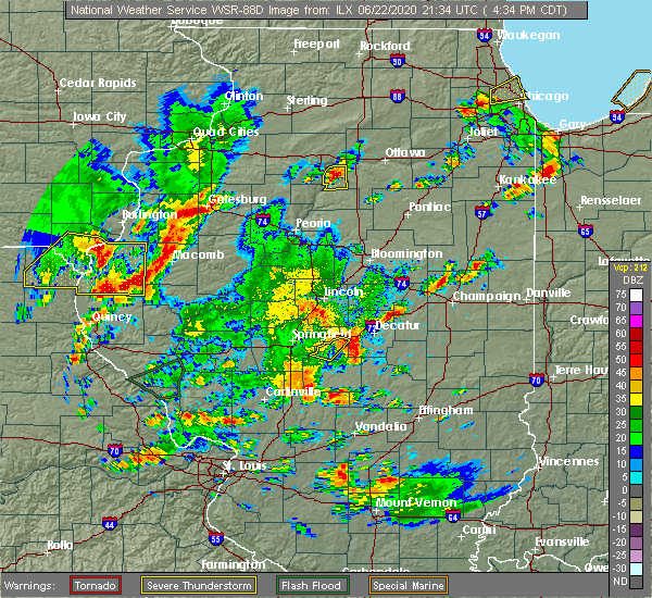 At 434 pm cdt, a severe thunderstorm was located near macon, or 9 miles southwest of decatur, moving northeast at 20 mph (radar indicated). Hazards include 60 mph wind gusts. expect damage to roofs, siding, and trees At 434 pm cdt, a severe thunderstorm was located near macon, or 9 miles southwest of decatur, moving northeast at 20 mph (radar indicated). Hazards include 60 mph wind gusts. expect damage to roofs, siding, and trees
|
| 6/22/2020 3:03 PM CDT |
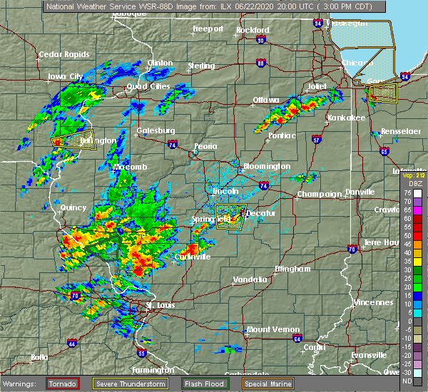 At 303 pm cdt, a severe thunderstorm was located near niantic, or 9 miles west of decatur, moving north at 20 mph (radar indicated). Hazards include 60 mph wind gusts. Expect damage to roofs, siding, and trees. locations impacted include, decatur, forsyth, maroa, mount pulaski, harristown, warrensburg, illiopolis, niantic and latham. This includes interstate 72 between mile markers 120 and 140. At 303 pm cdt, a severe thunderstorm was located near niantic, or 9 miles west of decatur, moving north at 20 mph (radar indicated). Hazards include 60 mph wind gusts. Expect damage to roofs, siding, and trees. locations impacted include, decatur, forsyth, maroa, mount pulaski, harristown, warrensburg, illiopolis, niantic and latham. This includes interstate 72 between mile markers 120 and 140.
|
| 6/22/2020 2:41 PM CDT |
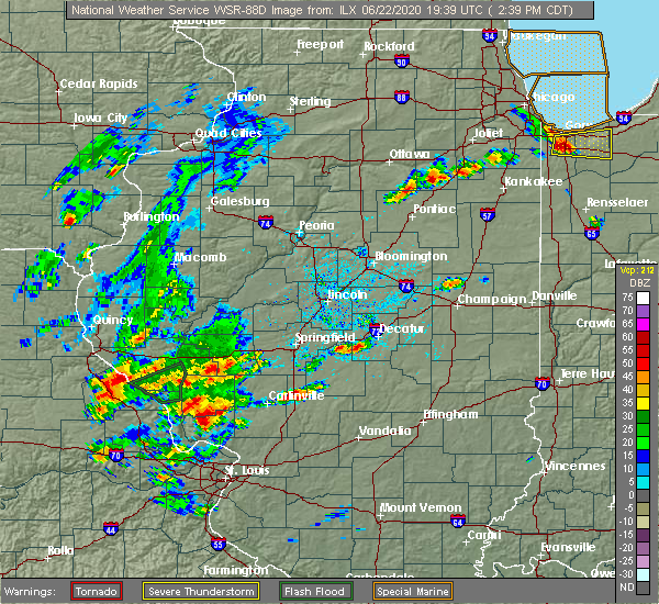 At 241 pm cdt, a severe thunderstorm was located near harristown, or 10 miles southwest of decatur, moving north at 20 mph (radar indicated). Hazards include 60 mph wind gusts and quarter size hail. Hail damage to vehicles is expected. Expect wind damage to roofs, siding, and trees. At 241 pm cdt, a severe thunderstorm was located near harristown, or 10 miles southwest of decatur, moving north at 20 mph (radar indicated). Hazards include 60 mph wind gusts and quarter size hail. Hail damage to vehicles is expected. Expect wind damage to roofs, siding, and trees.
|
| 4/8/2020 5:56 PM CDT | Trained spotter reported power poles dow in macon county IL, 0.1 miles WNW of Maroa, IL |
| 4/8/2020 5:45 PM CDT | A barn door was blown off and an old evergreen was uprooted. a neighboring residence had a large tree blown down as wel in macon county IL, 0.1 miles WNW of Maroa, IL |
| 4/8/2020 5:41 PM CDT | The topflight grain elevator was damaged between maroa and forsyt in macon county IL, 3.5 miles N of Maroa, IL |
| 4/8/2020 5:41 PM CDT | Barn roofing was blown off in macon county IL, 0.1 miles WNW of Maroa, IL |
| 4/8/2020 5:37 PM CDT |
 At 536 pm cdt, a severe thunderstorm was located near maroa, or 10 miles north of decatur, moving southeast at 70 mph. this is a very dangerous storm (radar indicated). Hazards include 80 mph wind gusts and quarter size hail. Flying debris will be dangerous to those caught without shelter. mobile homes will be heavily damaged. expect considerable damage to roofs, windows, and vehicles. extensive tree damage and power outages are likely. locations impacted include, decatur, clinton, monticello, mount zion, forsyth, maroa, mount pulaski, cerro gordo, harristown, long creek, warrensburg, argenta, mansfield, oreana, wapella, de land, weldon, latham, kenney and chestnut. This includes interstate 72 between mile markers 134 and 168. At 536 pm cdt, a severe thunderstorm was located near maroa, or 10 miles north of decatur, moving southeast at 70 mph. this is a very dangerous storm (radar indicated). Hazards include 80 mph wind gusts and quarter size hail. Flying debris will be dangerous to those caught without shelter. mobile homes will be heavily damaged. expect considerable damage to roofs, windows, and vehicles. extensive tree damage and power outages are likely. locations impacted include, decatur, clinton, monticello, mount zion, forsyth, maroa, mount pulaski, cerro gordo, harristown, long creek, warrensburg, argenta, mansfield, oreana, wapella, de land, weldon, latham, kenney and chestnut. This includes interstate 72 between mile markers 134 and 168.
|
| 4/8/2020 5:16 PM CDT |
 At 515 pm cdt, a severe thunderstorm was located near hartsburg, or near lincoln, moving east at 65 mph. this is a very dangerous storm (radar indicated). Hazards include 80 mph wind gusts and golf ball size hail. Flying debris will be dangerous to those caught without shelter. mobile homes will be heavily damaged. expect considerable damage to roofs, windows, and vehicles. Extensive tree damage and power outages are likely. At 515 pm cdt, a severe thunderstorm was located near hartsburg, or near lincoln, moving east at 65 mph. this is a very dangerous storm (radar indicated). Hazards include 80 mph wind gusts and golf ball size hail. Flying debris will be dangerous to those caught without shelter. mobile homes will be heavily damaged. expect considerable damage to roofs, windows, and vehicles. Extensive tree damage and power outages are likely.
|
| 8/20/2019 10:31 AM CDT |
 At 1030 am cdt, severe thunderstorms were located along a line extending from near lexington to wapella to near latham, moving east at 45 mph (radar indicated). Hazards include 60 mph wind gusts and quarter size hail. Hail damage to vehicles is expected. expect wind damage to roofs, siding, and trees. locations impacted include, bloomington, decatur, clinton, normal, le roy, forsyth, heyworth, lexington, farmer city, maroa, mount pulaski, warrensburg, colfax, downs, argenta, mansfield, oreana, saybrook, wapella and towanda. this includes the following highways, interstate 55 between mile markers 169 and 181. interstate 72 between mile markers 139 and 161. Interstate 74 between mile markers 135 and 166. At 1030 am cdt, severe thunderstorms were located along a line extending from near lexington to wapella to near latham, moving east at 45 mph (radar indicated). Hazards include 60 mph wind gusts and quarter size hail. Hail damage to vehicles is expected. expect wind damage to roofs, siding, and trees. locations impacted include, bloomington, decatur, clinton, normal, le roy, forsyth, heyworth, lexington, farmer city, maroa, mount pulaski, warrensburg, colfax, downs, argenta, mansfield, oreana, saybrook, wapella and towanda. this includes the following highways, interstate 55 between mile markers 169 and 181. interstate 72 between mile markers 139 and 161. Interstate 74 between mile markers 135 and 166.
|
| 8/20/2019 10:06 AM CDT |
 At 1005 am cdt, severe thunderstorms were located along a line extending from hudson to near atlanta to elkhart, moving east at 35 mph (radar indicated). Hazards include 60 mph wind gusts and quarter size hail. Hail damage to vehicles is expected. Expect wind damage to roofs, siding, and trees. At 1005 am cdt, severe thunderstorms were located along a line extending from hudson to near atlanta to elkhart, moving east at 35 mph (radar indicated). Hazards include 60 mph wind gusts and quarter size hail. Hail damage to vehicles is expected. Expect wind damage to roofs, siding, and trees.
|
| 6/5/2019 12:15 PM CDT |
 At 1214 pm cdt, a severe thunderstorm was located over chestnut, or 9 miles southeast of lincoln, moving southeast at 35 mph (emergency management. at 1148 am cdt six power poles were blown down 3 miles southwest of hartsburg). Hazards include 60 mph wind gusts and quarter size hail. Hail damage to vehicles is expected. expect wind damage to roofs, siding, and trees. Locations impacted include, maroa, mount pulaski, warrensburg, niantic, latham, kenney, chestnut and rowell. At 1214 pm cdt, a severe thunderstorm was located over chestnut, or 9 miles southeast of lincoln, moving southeast at 35 mph (emergency management. at 1148 am cdt six power poles were blown down 3 miles southwest of hartsburg). Hazards include 60 mph wind gusts and quarter size hail. Hail damage to vehicles is expected. expect wind damage to roofs, siding, and trees. Locations impacted include, maroa, mount pulaski, warrensburg, niantic, latham, kenney, chestnut and rowell.
|
| 6/5/2019 12:00 PM CDT |
 At 1159 am cdt, a severe thunderstorm was located over lincoln, moving southeast at 30 mph (emergency management. at 1153 am cdt trees were blown down 4 miles west of hartsburg). Hazards include 70 mph wind gusts and quarter size hail. Hail damage to vehicles is expected. expect considerable tree damage. Wind damage is also likely to mobile homes, roofs, and outbuildings. At 1159 am cdt, a severe thunderstorm was located over lincoln, moving southeast at 30 mph (emergency management. at 1153 am cdt trees were blown down 4 miles west of hartsburg). Hazards include 70 mph wind gusts and quarter size hail. Hail damage to vehicles is expected. expect considerable tree damage. Wind damage is also likely to mobile homes, roofs, and outbuildings.
|
| 5/26/2019 12:50 AM CDT |
 At 1250 am cdt, severe thunderstorms were located along a line extending from 6 miles northwest of weldon to near oreana, moving east at 45 mph (radar indicated). Hazards include 60 mph wind gusts and nickel size hail. expect damage to roofs, siding, and trees At 1250 am cdt, severe thunderstorms were located along a line extending from 6 miles northwest of weldon to near oreana, moving east at 45 mph (radar indicated). Hazards include 60 mph wind gusts and nickel size hail. expect damage to roofs, siding, and trees
|
| 5/23/2019 12:52 AM CDT |
 At 1251 am cdt, a severe thunderstorm was located near waynesville, or near clinton, moving east at 60 mph. this is a very dangerous storm (radar indicated). Hazards include 80 mph wind gusts and quarter size hail. brief tornados are possible with this storm. Flying debris will be dangerous to those caught without shelter. mobile homes will be heavily damaged. expect considerable damage to roofs, windows, and vehicles. extensive tree damage and power outages are likely. locations impacted include, bloomington, clinton, normal, forsyth, heyworth, maroa, williamsville, minier, warrensburg, argenta, oreana, mclean, stanford, wapella, waynesville, armington, kenney, cantrall, weldon springs state park and clinton lake dam. this includes the following highways, interstate 155 between mile markers 12 and 14. interstate 55 between mile markers 107 and 111, and between mile markers 142 and 163. interstate 72 between mile markers 148 and 156. Interstate 74 between mile markers 128 and 137. At 1251 am cdt, a severe thunderstorm was located near waynesville, or near clinton, moving east at 60 mph. this is a very dangerous storm (radar indicated). Hazards include 80 mph wind gusts and quarter size hail. brief tornados are possible with this storm. Flying debris will be dangerous to those caught without shelter. mobile homes will be heavily damaged. expect considerable damage to roofs, windows, and vehicles. extensive tree damage and power outages are likely. locations impacted include, bloomington, clinton, normal, forsyth, heyworth, maroa, williamsville, minier, warrensburg, argenta, oreana, mclean, stanford, wapella, waynesville, armington, kenney, cantrall, weldon springs state park and clinton lake dam. this includes the following highways, interstate 155 between mile markers 12 and 14. interstate 55 between mile markers 107 and 111, and between mile markers 142 and 163. interstate 72 between mile markers 148 and 156. Interstate 74 between mile markers 128 and 137.
|
| 5/23/2019 12:21 AM CDT |
 At 1220 am cdt, a severe thunderstorm was located near middletown, or 11 miles south of mason city, moving east at 60 mph. this is a very dangerous storm (radar indicated). Hazards include 80 mph wind gusts and quarter size hail. Flying debris will be dangerous to those caught without shelter. mobile homes will be heavily damaged. expect considerable damage to roofs, windows, and vehicles. Extensive tree damage and power outages are likely. At 1220 am cdt, a severe thunderstorm was located near middletown, or 11 miles south of mason city, moving east at 60 mph. this is a very dangerous storm (radar indicated). Hazards include 80 mph wind gusts and quarter size hail. Flying debris will be dangerous to those caught without shelter. mobile homes will be heavily damaged. expect considerable damage to roofs, windows, and vehicles. Extensive tree damage and power outages are likely.
|
| 5/8/2019 8:55 PM CDT | Tree down near intersection of us-51 and emery rd. relayed by wand-tv in macon county IL, 4.2 miles N of Maroa, IL |
| 12/1/2018 6:42 PM CST |
 At 642 pm cst, a severe thunderstorm capable of producing a tornado was located near clinton, moving north at 40 mph (radar indicated rotation). Hazards include tornado. Flying debris will be dangerous to those caught without shelter. mobile homes will be damaged or destroyed. damage to roofs, windows, and vehicles will occur. tree damage is likely. this dangerous storm will be near, wapella around 655 pm cst. le roy around 710 pm cst. other locations impacted by this tornadic thunderstorm include lane, clinton lake dam, de witt and weldon springs state park. This includes interstate 74 between mile markers 147 and 152. At 642 pm cst, a severe thunderstorm capable of producing a tornado was located near clinton, moving north at 40 mph (radar indicated rotation). Hazards include tornado. Flying debris will be dangerous to those caught without shelter. mobile homes will be damaged or destroyed. damage to roofs, windows, and vehicles will occur. tree damage is likely. this dangerous storm will be near, wapella around 655 pm cst. le roy around 710 pm cst. other locations impacted by this tornadic thunderstorm include lane, clinton lake dam, de witt and weldon springs state park. This includes interstate 74 between mile markers 147 and 152.
|
| 12/1/2018 6:13 PM CST |
 At 612 pm cst, a severe thunderstorm capable of producing a tornado was located over warrensburg, or near decatur, moving northeast at 35 mph (radar indicated rotation). Hazards include tornado and quarter size hail. Flying debris will be dangerous to those caught without shelter. mobile homes will be damaged or destroyed. damage to roofs, windows, and vehicles will occur. tree damage is likely. this dangerous storm will be near, forsyth around 620 pm cst. maroa around 630 pm cst. other locations impacted by this tornadic thunderstorm include rowell. This includes interstate 72 between mile markers 133 and 142. At 612 pm cst, a severe thunderstorm capable of producing a tornado was located over warrensburg, or near decatur, moving northeast at 35 mph (radar indicated rotation). Hazards include tornado and quarter size hail. Flying debris will be dangerous to those caught without shelter. mobile homes will be damaged or destroyed. damage to roofs, windows, and vehicles will occur. tree damage is likely. this dangerous storm will be near, forsyth around 620 pm cst. maroa around 630 pm cst. other locations impacted by this tornadic thunderstorm include rowell. This includes interstate 72 between mile markers 133 and 142.
|
| 8/7/2018 2:13 AM CDT |
 At 212 am cdt, severe thunderstorms were located along a line extending from near bloomington to atlanta to near beason to near cornland, moving east at 35 mph (radar indicated). Hazards include 60 mph wind gusts and nickel size hail. expect damage to roofs, siding, and trees At 212 am cdt, severe thunderstorms were located along a line extending from near bloomington to atlanta to near beason to near cornland, moving east at 35 mph (radar indicated). Hazards include 60 mph wind gusts and nickel size hail. expect damage to roofs, siding, and trees
|
| 6/28/2018 5:35 PM CDT |
 At 535 pm cdt, severe thunderstorms were located along a line extending from mount zion to near assumption to near pana, moving east at 50 mph (radar indicated). Hazards include 70 mph wind gusts. Expect considerable tree damage. damage is likely to mobile homes, roofs, and outbuildings. locations impacted include, decatur, shelbyville, pana, mount zion, forsyth, moweaqua, cerro gordo, harristown, bethany, long creek, warrensburg, assumption, macon, argenta, oreana, findlay, cowden, tower hill, dalton city and westervelt. This includes interstate 72 between mile markers 131 and 156. At 535 pm cdt, severe thunderstorms were located along a line extending from mount zion to near assumption to near pana, moving east at 50 mph (radar indicated). Hazards include 70 mph wind gusts. Expect considerable tree damage. damage is likely to mobile homes, roofs, and outbuildings. locations impacted include, decatur, shelbyville, pana, mount zion, forsyth, moweaqua, cerro gordo, harristown, bethany, long creek, warrensburg, assumption, macon, argenta, oreana, findlay, cowden, tower hill, dalton city and westervelt. This includes interstate 72 between mile markers 131 and 156.
|
| 6/28/2018 5:27 PM CDT |
 At 526 pm cdt, severe thunderstorms were located along a line extending from near decatur to near assumption to 6 miles northeast of nokomis, moving southeast at 45 mph (radar indicated). Hazards include 70 mph wind gusts. Expect considerable tree damage. damage is likely to mobile homes, roofs, and outbuildings. locations impacted include, decatur, shelbyville, pana, mount zion, forsyth, moweaqua, cerro gordo, harristown, bethany, long creek, warrensburg, assumption, blue mound, macon, argenta, oreana, findlay, cowden, tower hill and dalton city. This includes interstate 72 between mile markers 129 and 156. At 526 pm cdt, severe thunderstorms were located along a line extending from near decatur to near assumption to 6 miles northeast of nokomis, moving southeast at 45 mph (radar indicated). Hazards include 70 mph wind gusts. Expect considerable tree damage. damage is likely to mobile homes, roofs, and outbuildings. locations impacted include, decatur, shelbyville, pana, mount zion, forsyth, moweaqua, cerro gordo, harristown, bethany, long creek, warrensburg, assumption, blue mound, macon, argenta, oreana, findlay, cowden, tower hill and dalton city. This includes interstate 72 between mile markers 129 and 156.
|
| 6/28/2018 5:14 PM CDT |
 At 514 pm cdt, severe thunderstorms were located along a line extending from harristown to near stonington to 7 miles north of nokomis, moving east at 60 mph (radar indicated). Hazards include 70 mph wind gusts. Expect considerable tree damage. Damage is likely to mobile homes, roofs, and outbuildings. At 514 pm cdt, severe thunderstorms were located along a line extending from harristown to near stonington to 7 miles north of nokomis, moving east at 60 mph (radar indicated). Hazards include 70 mph wind gusts. Expect considerable tree damage. Damage is likely to mobile homes, roofs, and outbuildings.
|
| 6/10/2018 2:12 PM CDT |
 At 212 pm cdt, a severe thunderstorm was located over argenta, or 11 miles west of monticello, moving southeast at 45 mph (radar indicated). Hazards include 60 mph wind gusts. expect damage to roofs, siding, and trees At 212 pm cdt, a severe thunderstorm was located over argenta, or 11 miles west of monticello, moving southeast at 45 mph (radar indicated). Hazards include 60 mph wind gusts. expect damage to roofs, siding, and trees
|
| 7/11/2017 9:11 AM CDT |
 At 910 am cdt, a severe thunderstorm was located over chestnut, or 11 miles southeast of lincoln, moving east at 40 mph (radar indicated). Hazards include 60 mph wind gusts. Expect damage to roofs, siding, and trees. locations impacted include, clinton, maroa, atlanta, mount pulaski, argenta, wapella, waynesville, weldon, kenney, chestnut, beason, de witt, lawndale, weldon springs state park, lane, clinton lake dam, midland city, rowell and hallsville. this includes the following highways, interstate 55 between mile markers 133 and 140. Interstate 72 between mile markers 152 and 155. At 910 am cdt, a severe thunderstorm was located over chestnut, or 11 miles southeast of lincoln, moving east at 40 mph (radar indicated). Hazards include 60 mph wind gusts. Expect damage to roofs, siding, and trees. locations impacted include, clinton, maroa, atlanta, mount pulaski, argenta, wapella, waynesville, weldon, kenney, chestnut, beason, de witt, lawndale, weldon springs state park, lane, clinton lake dam, midland city, rowell and hallsville. this includes the following highways, interstate 55 between mile markers 133 and 140. Interstate 72 between mile markers 152 and 155.
|
| 7/11/2017 8:54 AM CDT |
 At 854 am cdt, a severe thunderstorm was located over lincoln, moving east at 40 mph (radar indicated). Hazards include 60 mph wind gusts. expect damage to roofs, siding, and trees At 854 am cdt, a severe thunderstorm was located over lincoln, moving east at 40 mph (radar indicated). Hazards include 60 mph wind gusts. expect damage to roofs, siding, and trees
|
| 7/10/2017 9:25 PM CDT |
 The severe thunderstorm warning for moultrie, southern piatt and macon counties will expire at 930 pm cdt, the storms which prompted the warning have weakened below severe limits, and no longer pose an immediate threat to life or property. therefore the warning will be allowed to expire. however gusty winds and heavy rain are still possible with these thunderstorms. a severe thunderstorm watch remains in effect until 1100 pm cdt for central illinois. The severe thunderstorm warning for moultrie, southern piatt and macon counties will expire at 930 pm cdt, the storms which prompted the warning have weakened below severe limits, and no longer pose an immediate threat to life or property. therefore the warning will be allowed to expire. however gusty winds and heavy rain are still possible with these thunderstorms. a severe thunderstorm watch remains in effect until 1100 pm cdt for central illinois.
|
| 7/10/2017 9:05 PM CDT |
 At 905 pm cdt, severe thunderstorms were located along a line extending from near monticello to near mount zion to near macon, moving southeast at 35 mph (radar indicated). Hazards include 60 mph wind gusts. Expect damage to roofs, siding, and trees. locations impacted include, decatur, monticello, sullivan, mount zion, forsyth, maroa, bement, cerro gordo, harristown, bethany, long creek, warrensburg, lovington, argenta, oreana, dalton city, hammond, oakley, cisco and lake city. This includes interstate 72 between mile markers 129 and 165. At 905 pm cdt, severe thunderstorms were located along a line extending from near monticello to near mount zion to near macon, moving southeast at 35 mph (radar indicated). Hazards include 60 mph wind gusts. Expect damage to roofs, siding, and trees. locations impacted include, decatur, monticello, sullivan, mount zion, forsyth, maroa, bement, cerro gordo, harristown, bethany, long creek, warrensburg, lovington, argenta, oreana, dalton city, hammond, oakley, cisco and lake city. This includes interstate 72 between mile markers 129 and 165.
|
| 7/10/2017 8:44 PM CDT |
 At 843 pm cdt, severe thunderstorms were located along a line extending from near weldon to near harristown to niantic, moving southeast at 55 mph (radar indicated). Hazards include 60 mph wind gusts. expect damage to roofs, siding, and trees At 843 pm cdt, severe thunderstorms were located along a line extending from near weldon to near harristown to niantic, moving southeast at 55 mph (radar indicated). Hazards include 60 mph wind gusts. expect damage to roofs, siding, and trees
|
| 7/10/2017 8:28 PM CDT |
 A severe thunderstorm warning remains in effect until 845 pm cdt for logan. western de witt and northern macon counties. at 827 pm cdt, a severe thunderstorm was located over chestnut, or 8 miles southeast of lincoln, moving southeast at 35 mph. hazard. 70 mph wind gusts and penny size hail. source. radar indicated. At 827 pm, winds continue to gust to over. A severe thunderstorm warning remains in effect until 845 pm cdt for logan. western de witt and northern macon counties. at 827 pm cdt, a severe thunderstorm was located over chestnut, or 8 miles southeast of lincoln, moving southeast at 35 mph. hazard. 70 mph wind gusts and penny size hail. source. radar indicated. At 827 pm, winds continue to gust to over.
|
| 7/10/2017 8:14 PM CDT |
 At 813 pm cdt, a severe thunderstorm was located from lincoln to beason, moving southeast at 40 mph (radar indicated. at 813 pm, multiple power lines were blown down in lincoln, and a 62 mph wind gust was reported at the national weather service office at the logan county airport). Hazards include 70 mph wind gusts and penny size hail. Expect considerable tree damage. damage is likely to mobile homes, roofs, and outbuildings. locations impacted include, decatur, lincoln, clinton, forsyth, maroa, atlanta, mount pulaski, warrensburg, mclean, emden, waynesville, latham, kenney, hartsburg, chestnut, beason, lawndale, broadwell, weldon springs state park and midland city. this includes the following highways, interstate 155 between mile markers 0 and 11. interstate 55 between mile markers 119 and 145. Interstate 72 between mile markers 136 and 140. At 813 pm cdt, a severe thunderstorm was located from lincoln to beason, moving southeast at 40 mph (radar indicated. at 813 pm, multiple power lines were blown down in lincoln, and a 62 mph wind gust was reported at the national weather service office at the logan county airport). Hazards include 70 mph wind gusts and penny size hail. Expect considerable tree damage. damage is likely to mobile homes, roofs, and outbuildings. locations impacted include, decatur, lincoln, clinton, forsyth, maroa, atlanta, mount pulaski, warrensburg, mclean, emden, waynesville, latham, kenney, hartsburg, chestnut, beason, lawndale, broadwell, weldon springs state park and midland city. this includes the following highways, interstate 155 between mile markers 0 and 11. interstate 55 between mile markers 119 and 145. Interstate 72 between mile markers 136 and 140.
|
| 7/10/2017 8:02 PM CDT |
 At 802 pm cdt, a severe thunderstorm was located near hartsburg, or 6 miles north of lincoln, moving southeast at 45 mph (radar indicated). Hazards include 70 mph wind gusts and penny size hail. Expect considerable tree damage. Damage is likely to mobile homes, roofs, and outbuildings. At 802 pm cdt, a severe thunderstorm was located near hartsburg, or 6 miles north of lincoln, moving southeast at 45 mph (radar indicated). Hazards include 70 mph wind gusts and penny size hail. Expect considerable tree damage. Damage is likely to mobile homes, roofs, and outbuildings.
|
| 5/10/2017 7:43 PM CDT |
 At 743 pm cdt, a severe thunderstorm capable of producing a tornado was located over oreana, or 7 miles north of decatur, moving east at 40 mph (radar indicated rotation). Hazards include tornado. Expect damage to mobile homes, roofs, and vehicles. this dangerous storm will be near, cerro gordo around 755 pm cdt. bement and hammond around 810 pm cdt. atwood around 815 pm cdt. other locations impacted by this tornadic thunderstorm include cisco, milmine, la place, oakley and ivesdale. This includes interstate 72 between mile markers 137 and 158. At 743 pm cdt, a severe thunderstorm capable of producing a tornado was located over oreana, or 7 miles north of decatur, moving east at 40 mph (radar indicated rotation). Hazards include tornado. Expect damage to mobile homes, roofs, and vehicles. this dangerous storm will be near, cerro gordo around 755 pm cdt. bement and hammond around 810 pm cdt. atwood around 815 pm cdt. other locations impacted by this tornadic thunderstorm include cisco, milmine, la place, oakley and ivesdale. This includes interstate 72 between mile markers 137 and 158.
|
| 4/29/2017 6:14 PM CDT |
 At 613 pm cdt, severe thunderstorms were located along a line extending from near maroa to near sullivan to near kinmundy, moving northeast at 40 mph (radar indicated). Hazards include 60 mph wind gusts and quarter size hail. Hail damage to vehicles is expected. Expect wind damage to roofs, siding, and trees. At 613 pm cdt, severe thunderstorms were located along a line extending from near maroa to near sullivan to near kinmundy, moving northeast at 40 mph (radar indicated). Hazards include 60 mph wind gusts and quarter size hail. Hail damage to vehicles is expected. Expect wind damage to roofs, siding, and trees.
|
| 3/7/2017 12:56 AM CST |
 At 1252 am cst, severe thunderstorms were located along a line extending from near kenney to white oak, moving east at 55 mph (radar indicated). Hazards include 70 mph wind gusts and quarter size hail. Hail damage to vehicles is expected. expect considerable tree damage. wind damage is also likely to mobile homes, roofs, and outbuildings. locations impacted include, springfield, decatur, taylorville, auburn, rochester, forsyth, pawnee, maroa, kincaid, harristown, warrensburg, divernon, blue mound, edinburg, morrisonville, stonington, illiopolis, niantic, mechanicsburg and mount auburn. this includes the following highways, interstate 55 between mile markers 77 and 85. interstate 72 between mile markers 112 and 144. A tornado watch remains in effect until 400 am cst for sangamon county, and a severe thunderstorm watch remains in effect until 500 am cst for logan county, christian county, macon county and dewitt county. At 1252 am cst, severe thunderstorms were located along a line extending from near kenney to white oak, moving east at 55 mph (radar indicated). Hazards include 70 mph wind gusts and quarter size hail. Hail damage to vehicles is expected. expect considerable tree damage. wind damage is also likely to mobile homes, roofs, and outbuildings. locations impacted include, springfield, decatur, taylorville, auburn, rochester, forsyth, pawnee, maroa, kincaid, harristown, warrensburg, divernon, blue mound, edinburg, morrisonville, stonington, illiopolis, niantic, mechanicsburg and mount auburn. this includes the following highways, interstate 55 between mile markers 77 and 85. interstate 72 between mile markers 112 and 144. A tornado watch remains in effect until 400 am cst for sangamon county, and a severe thunderstorm watch remains in effect until 500 am cst for logan county, christian county, macon county and dewitt county.
|
| 3/7/2017 12:30 AM CST |
 At 1229 am cst, severe thunderstorms were located along a line extending from near williamsville to near waverly, moving east at 65 mph (radar indicated). Hazards include 70 mph wind gusts and quarter size hail. Hail damage to vehicles is expected. expect considerable tree damage. Wind damage is also likely to mobile homes, roofs, and outbuildings. At 1229 am cst, severe thunderstorms were located along a line extending from near williamsville to near waverly, moving east at 65 mph (radar indicated). Hazards include 70 mph wind gusts and quarter size hail. Hail damage to vehicles is expected. expect considerable tree damage. Wind damage is also likely to mobile homes, roofs, and outbuildings.
|
| 11/2/2016 5:43 PM CDT |
 At 542 pm cdt, a severe squall line capable of producing both tornadoes and extensive straight line wind damage was located along a line extending from near maroa to near harristown, moving east at 35 mph. rotations are seen on radar about 3 miles southeast of maroa, between forsyth and oreana, and between harristown and elwin (radar indicated rotation). Hazards include tornado. Expect damage to mobile homes. roofs. and vehicles. these dangerous storms will be near, decatur and forsyth around 545 pm cdt. oreana around 550 pm cdt. mount zion and argenta around 555 pm cdt. other locations impacted by these tornadic storms include elwin. This includes interstate 72 between mile markers 133 and 154. At 542 pm cdt, a severe squall line capable of producing both tornadoes and extensive straight line wind damage was located along a line extending from near maroa to near harristown, moving east at 35 mph. rotations are seen on radar about 3 miles southeast of maroa, between forsyth and oreana, and between harristown and elwin (radar indicated rotation). Hazards include tornado. Expect damage to mobile homes. roofs. and vehicles. these dangerous storms will be near, decatur and forsyth around 545 pm cdt. oreana around 550 pm cdt. mount zion and argenta around 555 pm cdt. other locations impacted by these tornadic storms include elwin. This includes interstate 72 between mile markers 133 and 154.
|
| 11/2/2016 5:31 PM CDT |
 At 530 pm cdt, severe thunderstorms capable of producing both tornadoes and straight line wind damage were located along a line extending from near latham to near illiopolis, moving east at 35 mph (radar indicated rotation. at 528 pm...storm spotters south of latham reported a rain wrapped funnel cloud). Hazards include tornado. Expect damage to mobile homes. roofs. and vehicles. these dangerous storms will be near, warrensburg around 535 pm cdt. maroa and harristown around 540 pm cdt. forsyth around 545 pm cdt. decatur and oreana around 550 pm cdt. argenta around 555 pm cdt. mount zion around 600 pm cdt. other locations impacted by these tornadic storms include elwin. This includes interstate 72 between mile markers 125 and 154. At 530 pm cdt, severe thunderstorms capable of producing both tornadoes and straight line wind damage were located along a line extending from near latham to near illiopolis, moving east at 35 mph (radar indicated rotation. at 528 pm...storm spotters south of latham reported a rain wrapped funnel cloud). Hazards include tornado. Expect damage to mobile homes. roofs. and vehicles. these dangerous storms will be near, warrensburg around 535 pm cdt. maroa and harristown around 540 pm cdt. forsyth around 545 pm cdt. decatur and oreana around 550 pm cdt. argenta around 555 pm cdt. mount zion around 600 pm cdt. other locations impacted by these tornadic storms include elwin. This includes interstate 72 between mile markers 125 and 154.
|
| 8/25/2016 1:54 AM CDT |
 At 154 am cdt, a severe thunderstorm was located over cornland, or 12 miles south of lincoln, moving east at 45 mph (radar indicated). Hazards include 60 mph wind gusts and nickel size hail. Expect damage to roofs. siding. And trees. At 154 am cdt, a severe thunderstorm was located over cornland, or 12 miles south of lincoln, moving east at 45 mph (radar indicated). Hazards include 60 mph wind gusts and nickel size hail. Expect damage to roofs. siding. And trees.
|
| 7/13/2016 4:31 PM CDT |
 At 431 pm cdt, severe thunderstorms were located along a line extending from near mason city to near williamsville, moving east at 40 mph (radar indicated). Hazards include 60 mph wind gusts. Expect damage to roofs. siding. And trees. At 431 pm cdt, severe thunderstorms were located along a line extending from near mason city to near williamsville, moving east at 40 mph (radar indicated). Hazards include 60 mph wind gusts. Expect damage to roofs. siding. And trees.
|
| 6/22/2016 6:12 AM CDT | The severe thunderstorm warning for southeastern logan, northeastern sangamon, south central mclean, northwestern macon and de witt counties will expire at 615 am cdt, the storms which prompted the warning have weakened below severe limits, and no longer pose an immediate threat to life or property. therefore, the warning will be allowed to expire. however heavy rain is still possible with these thunderstorms. a severe thunderstorm watch remains in effect until 1000 am cdt for central illinois. |
| 6/22/2016 5:58 AM CDT |
 At 558 am cdt, severe thunderstorms were located along a line extending from near le roy to kenney to near mechanicsburg, moving southeast at 45 mph (radar indicated). Hazards include 60 mph wind gusts and penny size hail. Expect damage to roofs. siding. and trees. locations impacted include, clinton, heyworth, maroa, mount pulaski, illiopolis, wapella, latham, kenney, chestnut, cornland, beason, de witt, lane, midland city, hallsville, clinton lake dam, weldon springs state park and rowell. This includes interstate 72 between mile markers 119 and 124. At 558 am cdt, severe thunderstorms were located along a line extending from near le roy to kenney to near mechanicsburg, moving southeast at 45 mph (radar indicated). Hazards include 60 mph wind gusts and penny size hail. Expect damage to roofs. siding. and trees. locations impacted include, clinton, heyworth, maroa, mount pulaski, illiopolis, wapella, latham, kenney, chestnut, cornland, beason, de witt, lane, midland city, hallsville, clinton lake dam, weldon springs state park and rowell. This includes interstate 72 between mile markers 119 and 124.
|
| 6/22/2016 5:38 AM CDT |
 At 537 am cdt, severe thunderstorms were located along a line extending from near bloomington to near atlanta to near athens, moving southeast at 45 mph (radar indicated). Hazards include 60 mph wind gusts and penny size hail. Expect damage to roofs. siding. And trees. At 537 am cdt, severe thunderstorms were located along a line extending from near bloomington to near atlanta to near athens, moving southeast at 45 mph (radar indicated). Hazards include 60 mph wind gusts and penny size hail. Expect damage to roofs. siding. And trees.
|
| 6/20/2016 10:14 PM CDT |
 At 1012 pm cdt, a severe thunderstorm was located over sidney, or 10 miles southeast of champaign, moving east at 40 mph (champaign emergency manager reported a tree down across the intersection of mattis and healy, just south of springfield avenue in champaign). Hazards include 60 mph wind gusts and penny size hail. Expect damage to roofs. siding. and trees. locations impacted include, champaign, decatur, monticello, urbana, savoy, mahomet, st. joseph, forsyth, tolono, farmer city, fisher, maroa, bement, philo, sidney, warrensburg, homer, thomasboro, argenta and mansfield. this includes the following highways, interstate 57 between mile markers 219 and 246. interstate 72 between mile markers 145 and 182. Interstate 74 between mile markers 160 and 199. At 1012 pm cdt, a severe thunderstorm was located over sidney, or 10 miles southeast of champaign, moving east at 40 mph (champaign emergency manager reported a tree down across the intersection of mattis and healy, just south of springfield avenue in champaign). Hazards include 60 mph wind gusts and penny size hail. Expect damage to roofs. siding. and trees. locations impacted include, champaign, decatur, monticello, urbana, savoy, mahomet, st. joseph, forsyth, tolono, farmer city, fisher, maroa, bement, philo, sidney, warrensburg, homer, thomasboro, argenta and mansfield. this includes the following highways, interstate 57 between mile markers 219 and 246. interstate 72 between mile markers 145 and 182. Interstate 74 between mile markers 160 and 199.
|
| 6/20/2016 10:10 PM CDT |
 The severe thunderstorm warning for north central macon and central de witt counties will expire at 1015 pm cdt, the storm which prompted the warning has moved out of the area. therefore, the warning will be allowed to expire. however gusty winds and heavy rain are still possible with this thunderstorm. The severe thunderstorm warning for north central macon and central de witt counties will expire at 1015 pm cdt, the storm which prompted the warning has moved out of the area. therefore, the warning will be allowed to expire. however gusty winds and heavy rain are still possible with this thunderstorm.
|
| 6/20/2016 10:05 PM CDT |
 At 1005 pm cdt, a severe thunderstorm was located over maroa, or near clinton, moving east at 40 mph (radar indicated). Hazards include 60 mph wind gusts. Expect damage to roofs. siding. and trees. Locations impacted include, clinton, farmer city, maroa, wapella, kenney, de witt, lane, rowell, clinton lake dam and weldon springs state park. At 1005 pm cdt, a severe thunderstorm was located over maroa, or near clinton, moving east at 40 mph (radar indicated). Hazards include 60 mph wind gusts. Expect damage to roofs. siding. and trees. Locations impacted include, clinton, farmer city, maroa, wapella, kenney, de witt, lane, rowell, clinton lake dam and weldon springs state park.
|
| 6/20/2016 9:53 PM CDT |
 At 952 pm cdt, a severe thunderstorm was located over mahomet, or 8 miles northwest of champaign, moving east at 45 mph (radar indicated). Hazards include 60 mph wind gusts and nickel size hail. Expect damage to roofs. siding. and trees. locations impacted include, champaign, decatur, monticello, urbana, savoy, mahomet, st. joseph, forsyth, tolono, farmer city, fisher, maroa, bement, philo, sidney, warrensburg, homer, thomasboro, argenta and mansfield. this includes the following highways, interstate 57 between mile markers 219 and 246. interstate 72 between mile markers 145 and 182. Interstate 74 between mile markers 160 and 199. At 952 pm cdt, a severe thunderstorm was located over mahomet, or 8 miles northwest of champaign, moving east at 45 mph (radar indicated). Hazards include 60 mph wind gusts and nickel size hail. Expect damage to roofs. siding. and trees. locations impacted include, champaign, decatur, monticello, urbana, savoy, mahomet, st. joseph, forsyth, tolono, farmer city, fisher, maroa, bement, philo, sidney, warrensburg, homer, thomasboro, argenta and mansfield. this includes the following highways, interstate 57 between mile markers 219 and 246. interstate 72 between mile markers 145 and 182. Interstate 74 between mile markers 160 and 199.
|
| 6/20/2016 9:44 PM CDT |
 At 944 pm cdt, a severe thunderstorm was located over beason, or 8 miles east of lincoln, moving east at 40 mph (radar indicated). Hazards include 60 mph wind gusts. Expect damage to roofs. siding. And trees. At 944 pm cdt, a severe thunderstorm was located over beason, or 8 miles east of lincoln, moving east at 40 mph (radar indicated). Hazards include 60 mph wind gusts. Expect damage to roofs. siding. And trees.
|
| 6/20/2016 9:36 PM CDT |
 At 936 pm cdt, a severe thunderstorm was located near argenta, or 8 miles southeast of clinton, moving east at 35 mph (radar indicated). Hazards include 60 mph wind gusts and quarter size hail. Hail damage to vehicles is expected. Expect wind damage to roofs, siding, and trees. At 936 pm cdt, a severe thunderstorm was located near argenta, or 8 miles southeast of clinton, moving east at 35 mph (radar indicated). Hazards include 60 mph wind gusts and quarter size hail. Hail damage to vehicles is expected. Expect wind damage to roofs, siding, and trees.
|
| 5/13/2016 8:06 PM CDT |
 At 805 pm cdt, a severe thunderstorm was located over forsyth, or near decatur, moving east at 55 mph (radar indicated). Hazards include 60 mph wind gusts. Expect damage to roofs. siding. and trees. locations impacted include, decatur, mount zion, forsyth, cerro gordo, harristown, long creek, warrensburg, argenta, oreana, niantic, oakley and decatur airport. This includes interstate 72 between mile markers 125 and 156. At 805 pm cdt, a severe thunderstorm was located over forsyth, or near decatur, moving east at 55 mph (radar indicated). Hazards include 60 mph wind gusts. Expect damage to roofs. siding. and trees. locations impacted include, decatur, mount zion, forsyth, cerro gordo, harristown, long creek, warrensburg, argenta, oreana, niantic, oakley and decatur airport. This includes interstate 72 between mile markers 125 and 156.
|
| 5/13/2016 7:41 PM CDT |
 At 740 pm cdt, a severe thunderstorm was located over cornland, or 13 miles south of lincoln, moving east at 55 mph (trained weather spotters reported a 65 mph wind gust just north of williamsville in northern sangamon county at 732 pm cdt). Hazards include 60 mph wind gusts. Expect damage to roofs. siding. And trees. At 740 pm cdt, a severe thunderstorm was located over cornland, or 13 miles south of lincoln, moving east at 55 mph (trained weather spotters reported a 65 mph wind gust just north of williamsville in northern sangamon county at 732 pm cdt). Hazards include 60 mph wind gusts. Expect damage to roofs. siding. And trees.
|
| 5/11/2016 2:48 PM CDT |
 At 247 pm cdt, a severe thunderstorm was located near maroa, or 10 miles north of decatur, moving east at 30 mph (radar indicated). Hazards include 60 mph wind gusts. Expect damage to roofs. siding. And trees. At 247 pm cdt, a severe thunderstorm was located near maroa, or 10 miles north of decatur, moving east at 30 mph (radar indicated). Hazards include 60 mph wind gusts. Expect damage to roofs. siding. And trees.
|
| 6/20/2015 10:32 PM CDT |
 At 1032 pm cdt, severe thunderstorms were located along a line extending from near warrensburg to near stonington to 5 miles northeast of morrisonville, moving east at 45 mph (trained weather spotters). Hazards include 60 mph wind gusts. Expect damage to roofs. siding and trees. locations impacted include, decatur, taylorville, pana, mount zion, forsyth, moweaqua, maroa, harristown, long creek, warrensburg, assumption, blue mound, macon, morrisonville, argenta, stonington, oreana, niantic, dalton city and oakley. this includes interstate 72 between mile markers 127 and 156. A tornado watch remains in effect until 1100 pm cdt for central illinois. At 1032 pm cdt, severe thunderstorms were located along a line extending from near warrensburg to near stonington to 5 miles northeast of morrisonville, moving east at 45 mph (trained weather spotters). Hazards include 60 mph wind gusts. Expect damage to roofs. siding and trees. locations impacted include, decatur, taylorville, pana, mount zion, forsyth, moweaqua, maroa, harristown, long creek, warrensburg, assumption, blue mound, macon, morrisonville, argenta, stonington, oreana, niantic, dalton city and oakley. this includes interstate 72 between mile markers 127 and 156. A tornado watch remains in effect until 1100 pm cdt for central illinois.
|
| 6/20/2015 10:16 PM CDT |
 At 1016 pm cdt, severe thunderstorms were located along a line extending from near chestnut to near edinburg to 4 miles south of pawnee, moving east at 40 mph (trained weather spotters). Hazards include 60 mph wind gusts. Expect damage to roofs. Siding and trees. At 1016 pm cdt, severe thunderstorms were located along a line extending from near chestnut to near edinburg to 4 miles south of pawnee, moving east at 40 mph (trained weather spotters). Hazards include 60 mph wind gusts. Expect damage to roofs. Siding and trees.
|
| 5/24/2015 11:29 PM CDT | At 1129 pm cdt, a severe thunderstorm was located over blue mound, or 14 miles northeast of taylorville, moving northeast at 70 mph (radar indicated). Hazards include 70 mph wind gusts. Expect considerable tree damage. Damage is likely to mobile homes, roofs and outbuildings. |
| 5/10/2015 7:53 PM CDT | At 752 pm cdt, severe thunderstorms were located along a line extending from atlanta to clinton to near argenta, moving northeast at 50 mph (radar indicated). Hazards include 60 mph wind gusts and penny size hail. Expect damage to roofs. siding and trees. locations impacted include, clinton, maroa, atlanta, wapella, waynesville, kenney, midland city, rowell, hallsville, clinton lake dam and weldon springs state park. this includes interstate 55 between mile markers 139 and 140. 0. 75in. |
| 5/10/2015 7:42 PM CDT | At 741 pm cdt, severe thunderstorms were located along a line extending from near atlanta to near waynesville to near maroa, moving northeast at 50 mph (radar indicated). Hazards include 60 mph wind gusts and penny size hail. Expect damage to roofs. siding and trees. locations impacted include, lincoln, clinton, maroa, atlanta, mount pulaski, warrensburg, wapella, waynesville, latham, kenney, chestnut, beason, lawndale, midland city, hallsville, clinton lake dam, weldon springs state park and rowell. this includes interstate 55 between mile markers 130 and 140. 0. 75in. |
| 5/10/2015 7:32 PM CDT | At 732 pm cdt, severe thunderstorms were located along a line extending from lincoln to beason to latham, moving northeast at 50 mph (radar indicated). Hazards include 60 mph wind gusts and penny size hail. Expect damage to roofs. siding and trees. locations impacted include, lincoln, clinton, maroa, atlanta, mount pulaski, warrensburg, illiopolis, wapella, waynesville, latham, kenney, chestnut, beason, lawndale, broadwell, midland city, hallsville, clinton lake dam, weldon springs state park and rowell. this includes the following highways, interstate 55 between mile markers 118 and 125, and between mile markers 130 and 140. interstate 72 near mile marker 122. 0. 75in. |
| 5/10/2015 7:23 PM CDT | At 723 pm cdt, severe thunderstorms were located along a line extending from near elkhart to near mount pulaski to near illiopolis, moving northeast at 50 mph (radar indicated). Hazards include 60 mph wind gusts and penny size hail. Expect damage to roofs. siding and trees. locations impacted include, lincoln, clinton, maroa, atlanta, mount pulaski, warrensburg, illiopolis, wapella, waynesville, elkhart, latham, kenney, chestnut, cornland, beason, lawndale, broadwell, midland city, hallsville and clinton lake dam. this includes the following highways, interstate 55 between mile markers 112 and 125, and between mile markers 129 and 140. interstate 72 between mile markers 116 and 122. 0. 75in. |
| 5/10/2015 7:10 PM CDT | At 709 pm cdt, severe thunderstorms were located along a line extending from near elkhart to near mount pulaski to near illiopolis, moving northeast at 50 mph (radar indicated). Hazards include 60 mph wind gusts and penny size hail. Expect damage to roofs. Siding and trees. |
| 1/1/0001 12:00 AM | Half Dollar sized hail reported 0.1 miles WNW of Maroa, IL |
Hail Maps for Maroa, IL


Connect with Interactive Hail Maps