

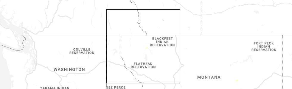
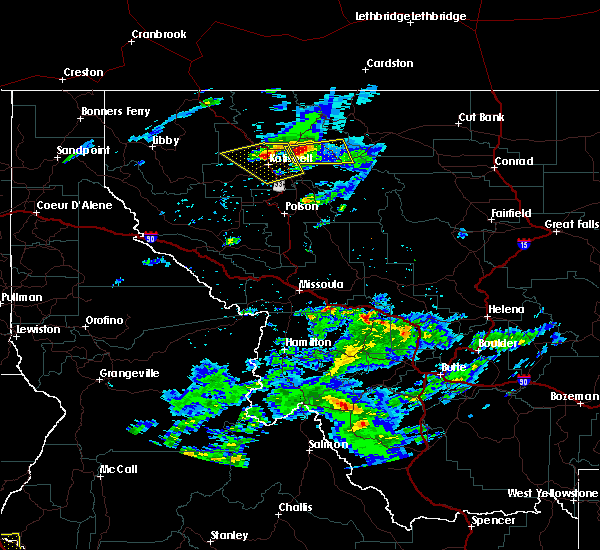
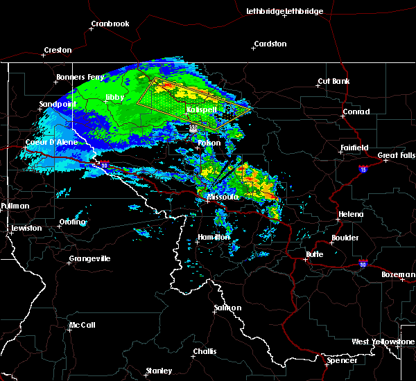
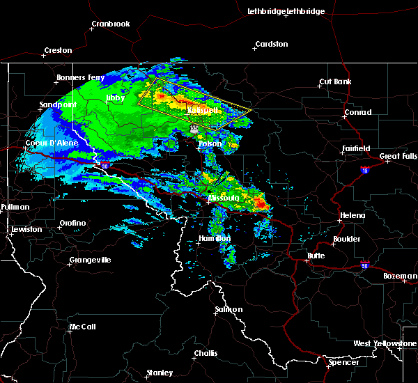
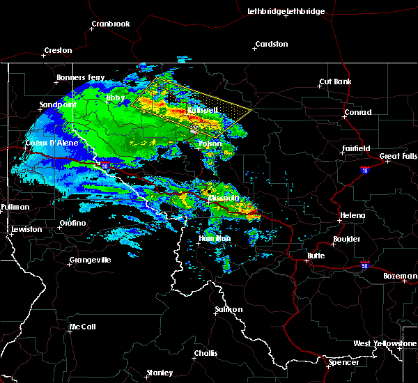
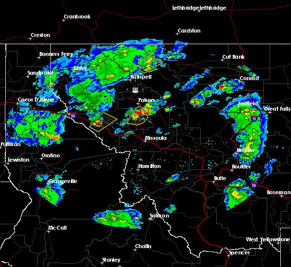
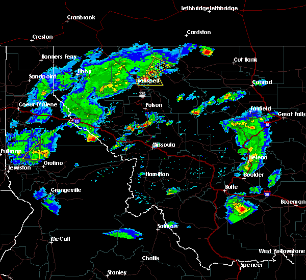
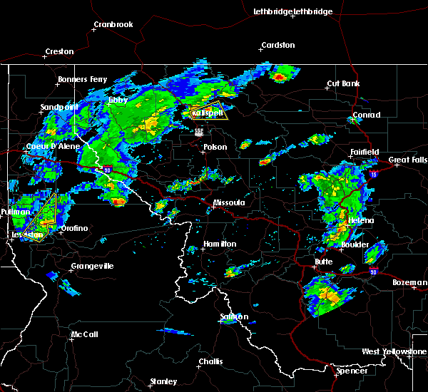
Hail Map for Martin City, MT
The Martin City, MT area has had 0 reports of on-the-ground hail by trained spotters, and has been under severe weather warnings 2 times during the past 12 months. Doppler radar has detected hail at or near Martin City, MT on 7 occasions.
| Name: | Martin City, MT |
| Where Located: | 14.2 miles E of Whitefish, MT |
| Map: | Google Map for Martin City, MT |
| Population: | 500 |
| Housing Units: | 265 |
| More Info: | Search Google for Martin City, MT |
5
The Top Recent Hail Date for Martin City, MT is Tuesday, June 28, 2022 (1st out of 7)
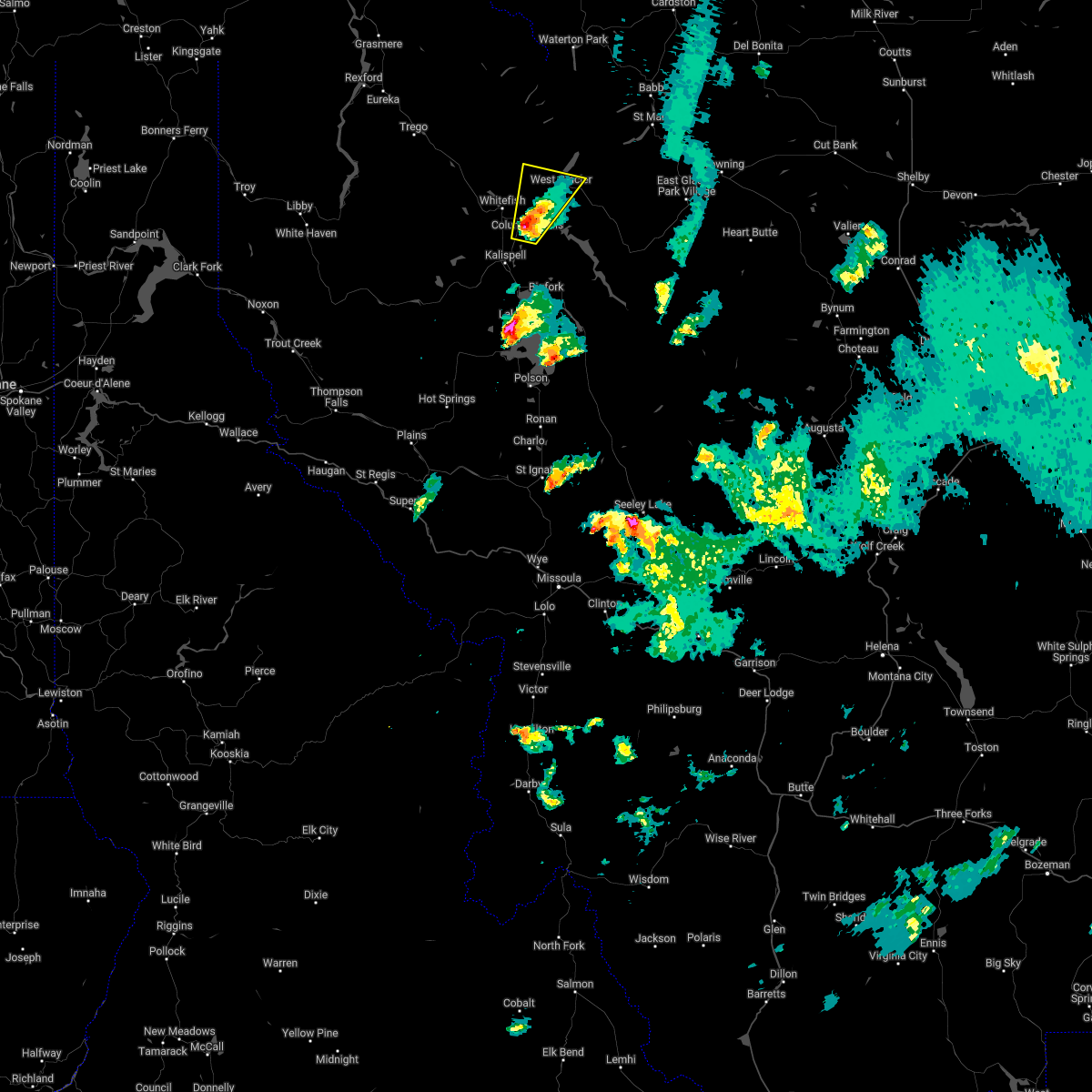
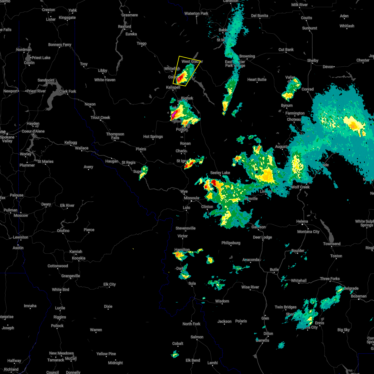
Hail and Wind Damage Spotted near Martin City, MT
| Date / Time | Report Details |
|---|---|
| 8/22/2023 4:40 PM MDT |
 The severe thunderstorm warning for central flathead county will expire at 445 pm mdt, the storm which prompted the warning has moved out of the area. therefore, the warning will be allowed to expire. The severe thunderstorm warning for central flathead county will expire at 445 pm mdt, the storm which prompted the warning has moved out of the area. therefore, the warning will be allowed to expire.
|
| 8/22/2023 4:22 PM MDT |
 At 422 pm mdt, a severe thunderstorm was located over columbia falls, or 7 miles northeast of evergreen, moving northeast at 25 mph (public). Hazards include 60 mph wind gusts and nickel size hail. expect damage to roofs, siding, and trees At 422 pm mdt, a severe thunderstorm was located over columbia falls, or 7 miles northeast of evergreen, moving northeast at 25 mph (public). Hazards include 60 mph wind gusts and nickel size hail. expect damage to roofs, siding, and trees
|
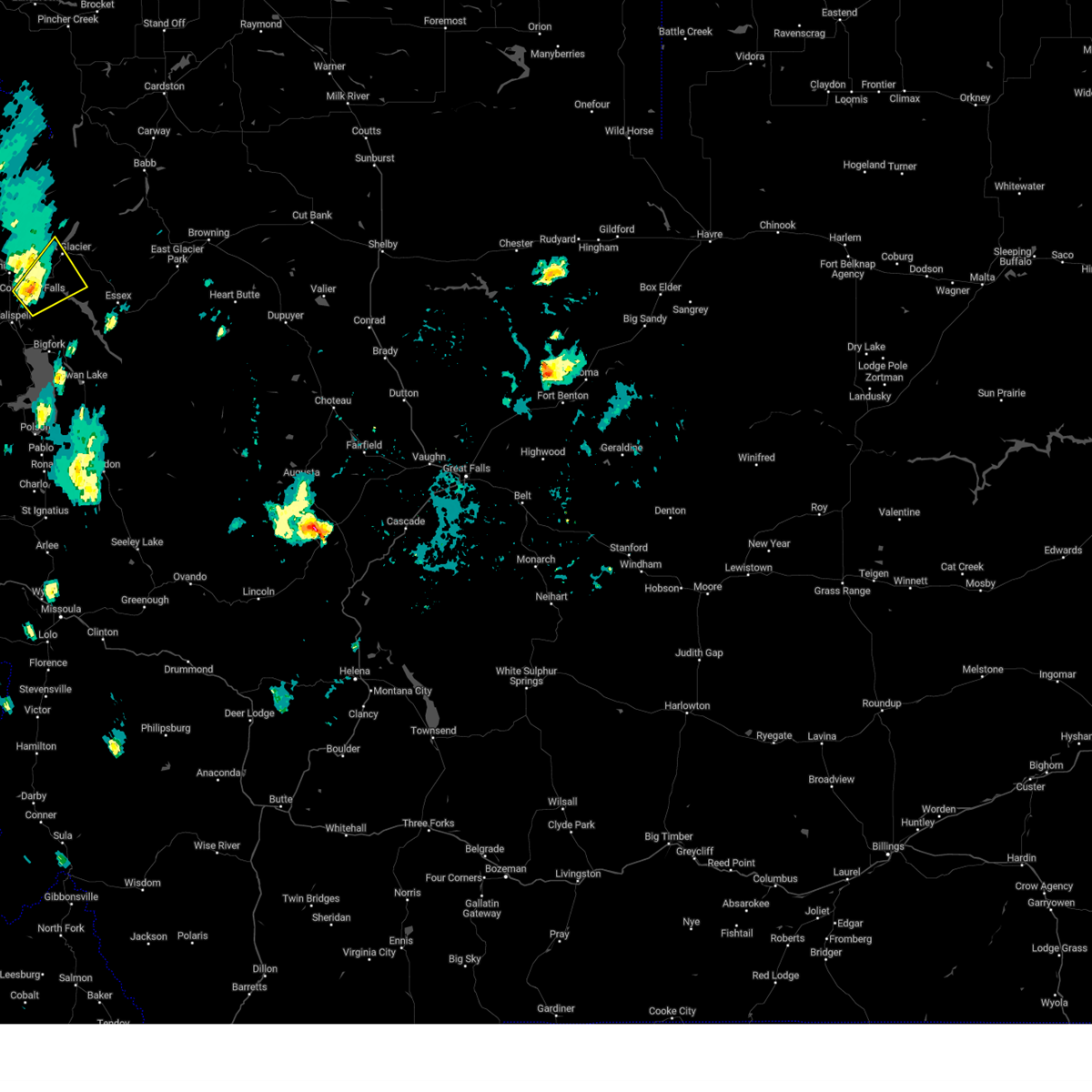
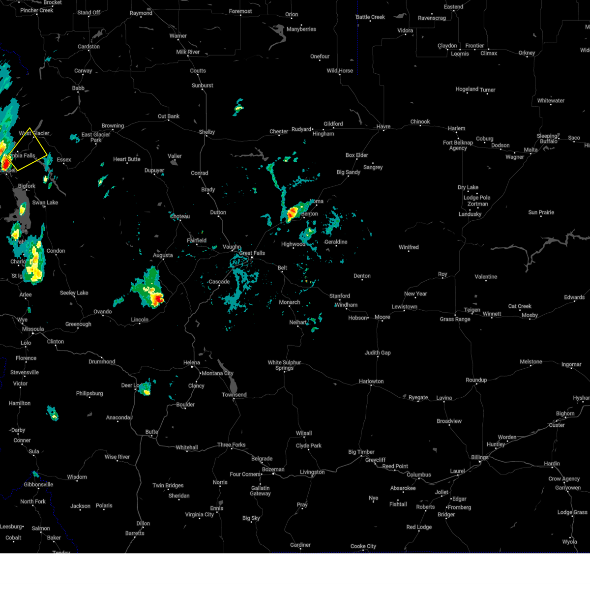
| 7/7/2022 9:58 PM MDT |
 At 958 pm mdt, a severe thunderstorm was located near columbia falls, or 15 miles north of evergreen, moving north at 25 mph (radar indicated). Hazards include 60 mph wind gusts and quarter size hail. Hail damage to vehicles is expected. expect wind damage to roofs, siding, and trees. locations impacted include, columbia falls, west glacier, apgar, hungry horse, martin city and coram. hail threat, radar indicated max hail size, 1. 00 in wind threat, radar indicated max wind gust, 60 mph. At 958 pm mdt, a severe thunderstorm was located near columbia falls, or 15 miles north of evergreen, moving north at 25 mph (radar indicated). Hazards include 60 mph wind gusts and quarter size hail. Hail damage to vehicles is expected. expect wind damage to roofs, siding, and trees. locations impacted include, columbia falls, west glacier, apgar, hungry horse, martin city and coram. hail threat, radar indicated max hail size, 1. 00 in wind threat, radar indicated max wind gust, 60 mph.
|
| 7/7/2022 9:47 PM MDT |
 At 947 pm mdt, a severe thunderstorm was located over columbia falls, or 10 miles north of evergreen, moving north at 25 mph (radar indicated). Hazards include 60 mph wind gusts and quarter size hail. Hail damage to vehicles is expected. expect wind damage to roofs, siding, and trees. locations impacted include, columbia falls, west glacier, apgar, martin city, coram, hungry horse and la salle. hail threat, radar indicated max hail size, 1. 00 in wind threat, radar indicated max wind gust, 60 mph. At 947 pm mdt, a severe thunderstorm was located over columbia falls, or 10 miles north of evergreen, moving north at 25 mph (radar indicated). Hazards include 60 mph wind gusts and quarter size hail. Hail damage to vehicles is expected. expect wind damage to roofs, siding, and trees. locations impacted include, columbia falls, west glacier, apgar, martin city, coram, hungry horse and la salle. hail threat, radar indicated max hail size, 1. 00 in wind threat, radar indicated max wind gust, 60 mph.
|
| 7/7/2022 9:42 PM MDT |
 At 942 pm mdt, a severe thunderstorm was located over columbia falls, or 8 miles north of evergreen, moving north at 25 mph (radar indicated). Hazards include ping pong ball size hail and 60 mph wind gusts. People and animals outdoors will be injured. expect hail damage to roofs, siding, windows, and vehicles. expect wind damage to roofs, siding, and trees. locations impacted include, columbia falls, west glacier, apgar, martin city, coram, hungry horse and la salle. hail threat, radar indicated max hail size, 1. 50 in wind threat, radar indicated max wind gust, 60 mph. At 942 pm mdt, a severe thunderstorm was located over columbia falls, or 8 miles north of evergreen, moving north at 25 mph (radar indicated). Hazards include ping pong ball size hail and 60 mph wind gusts. People and animals outdoors will be injured. expect hail damage to roofs, siding, windows, and vehicles. expect wind damage to roofs, siding, and trees. locations impacted include, columbia falls, west glacier, apgar, martin city, coram, hungry horse and la salle. hail threat, radar indicated max hail size, 1. 50 in wind threat, radar indicated max wind gust, 60 mph.
|
| 7/7/2022 9:35 PM MDT |
 At 935 pm mdt, a severe thunderstorm was located near columbia falls, or near evergreen, moving north at 25 mph (radar indicated). Hazards include golf ball size hail and 60 mph wind gusts. People and animals outdoors will be injured. expect hail damage to roofs, siding, windows, and vehicles. Expect wind damage to roofs, siding, and trees. At 935 pm mdt, a severe thunderstorm was located near columbia falls, or near evergreen, moving north at 25 mph (radar indicated). Hazards include golf ball size hail and 60 mph wind gusts. People and animals outdoors will be injured. expect hail damage to roofs, siding, windows, and vehicles. Expect wind damage to roofs, siding, and trees.
|
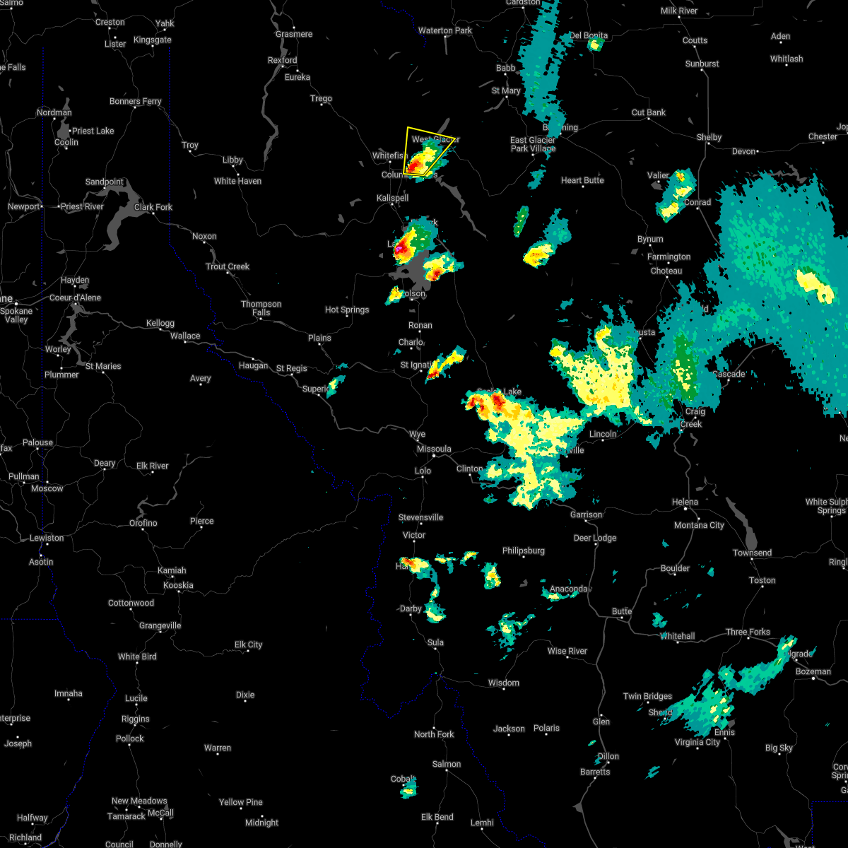
| 6/24/2020 4:42 PM MDT |
 The national weather service in missoula has issued a * severe thunderstorm warning for. central flathead county in northwestern montana. until 530 pm mdt. At 442 pm mdt, a severe thunderstorm was located 7 miles southeast of columbia falls, or 12 miles northeast of evergreen, moving east. The national weather service in missoula has issued a * severe thunderstorm warning for. central flathead county in northwestern montana. until 530 pm mdt. At 442 pm mdt, a severe thunderstorm was located 7 miles southeast of columbia falls, or 12 miles northeast of evergreen, moving east.
|
| 5/31/2020 8:42 AM MDT |
 The severe thunderstorm warning for north central lake and west central flathead counties will expire at 845 am mdt, the storms which prompted the warning have moved out of the area. therefore, the warning will be allowed to expire. The severe thunderstorm warning for north central lake and west central flathead counties will expire at 845 am mdt, the storms which prompted the warning have moved out of the area. therefore, the warning will be allowed to expire.
|
| 5/31/2020 8:41 AM MDT |
 At 840 am mdt, severe thunderstorms were located along a line extending from 22 miles southeast of eureka to 12 miles southeast of west glacier, moving northeast at 45 mph (radar indicated). Hazards include 60 mph wind gusts. expect damage to roofs, siding, and trees At 840 am mdt, severe thunderstorms were located along a line extending from 22 miles southeast of eureka to 12 miles southeast of west glacier, moving northeast at 45 mph (radar indicated). Hazards include 60 mph wind gusts. expect damage to roofs, siding, and trees
|
| 5/31/2020 8:30 AM MDT | Many large trees downed at lost johnny point campgroun in flathead county MT, 6.6 miles NNW of Martin City, MT |
| 5/31/2020 8:25 AM MDT |
 At 822 am mdt, severe thunderstorms were located along a line extending from 26 miles west of whitefish to 6 miles north of swan lake, moving northeast at 55 mph (widespread reports of tree damage and poweroutages have been recieved). Hazards include 60 mph wind gusts. Expect damage to roofs, siding, and trees. These severe thunderstorms will remain over mainly rural areas of north central lake and west central flathead counties, including the following locations, blacktail, stryker, olney, pinnacle, radnor, martin city, coram, creston, lupfer and essex. At 822 am mdt, severe thunderstorms were located along a line extending from 26 miles west of whitefish to 6 miles north of swan lake, moving northeast at 55 mph (widespread reports of tree damage and poweroutages have been recieved). Hazards include 60 mph wind gusts. Expect damage to roofs, siding, and trees. These severe thunderstorms will remain over mainly rural areas of north central lake and west central flathead counties, including the following locations, blacktail, stryker, olney, pinnacle, radnor, martin city, coram, creston, lupfer and essex.
|
| 5/31/2020 8:14 AM MDT |
 At 813 am mdt, severe thunderstorms were located along a line extending from 25 miles east of libby to near swan lake, moving northeast at 55 mph (radar indicated). Hazards include 60 mph wind gusts. expect damage to roofs, siding, and trees At 813 am mdt, severe thunderstorms were located along a line extending from 25 miles east of libby to near swan lake, moving northeast at 55 mph (radar indicated). Hazards include 60 mph wind gusts. expect damage to roofs, siding, and trees
|
| 6/8/2016 6:38 PM MDT |
 The severe thunderstorm warning for north central flathead county will expire at 645 pm mdt, the storm which prompted the warning has weakened below severe limits, and no longer poses an immediate threat to life or property. therefore the warning will be allowed to expire. however small hail and gusty winds are still possible with this thunderstorm. The severe thunderstorm warning for north central flathead county will expire at 645 pm mdt, the storm which prompted the warning has weakened below severe limits, and no longer poses an immediate threat to life or property. therefore the warning will be allowed to expire. however small hail and gusty winds are still possible with this thunderstorm.
|
| 6/8/2016 6:18 PM MDT |
 At 617 pm mdt, trained weather spotters reported a severe thunderstorm producing quarter size hail. this storm was located 7 miles east of evergreen, moving east-northeast at 30 mph. locations impacted include, la salle, hungry horse and martin city. At 617 pm mdt, trained weather spotters reported a severe thunderstorm producing quarter size hail. this storm was located 7 miles east of evergreen, moving east-northeast at 30 mph. locations impacted include, la salle, hungry horse and martin city.
|
| 6/8/2016 6:16 PM MDT |
 At 615 pm mdt, doppler radar indicated a severe thunderstorm capable of producing quarter size hail. this storm was located near west glacier, or 19 miles northeast of evergreen, and moving northeast at 40 mph. At 615 pm mdt, doppler radar indicated a severe thunderstorm capable of producing quarter size hail. this storm was located near west glacier, or 19 miles northeast of evergreen, and moving northeast at 40 mph.
|
| 6/8/2016 6:06 PM MDT |
 At 606 pm mdt, doppler radar indicated a severe thunderstorm capable of producing quarter size hail. this storm was located over evergreen, and moving east-northeast at 30 mph. At 606 pm mdt, doppler radar indicated a severe thunderstorm capable of producing quarter size hail. this storm was located over evergreen, and moving east-northeast at 30 mph.
|
| 6/8/2016 4:42 PM MDT |
 The national weather service in missoula has issued a * severe thunderstorm warning for. central flathead county in northwestern montana. until 515 pm mdt * at 441 pm mdt. doppler radar indicated a severe thunderstorm capable of producing quarter size hail. This storm was located near. The national weather service in missoula has issued a * severe thunderstorm warning for. central flathead county in northwestern montana. until 515 pm mdt * at 441 pm mdt. doppler radar indicated a severe thunderstorm capable of producing quarter size hail. This storm was located near.
|
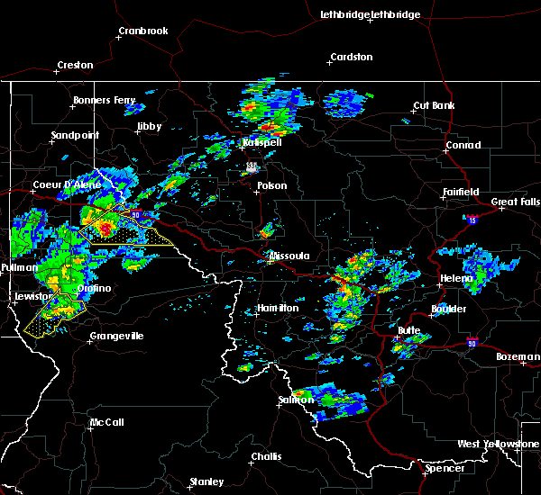
Hail Maps for Martin City, MT


Connect with Interactive Hail Maps