

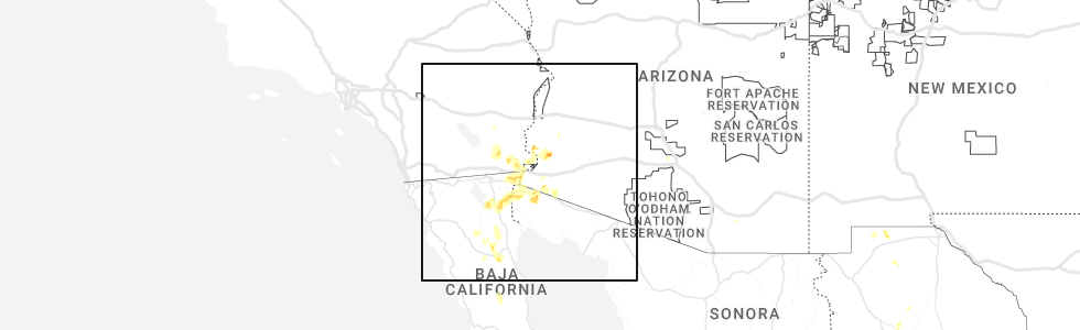
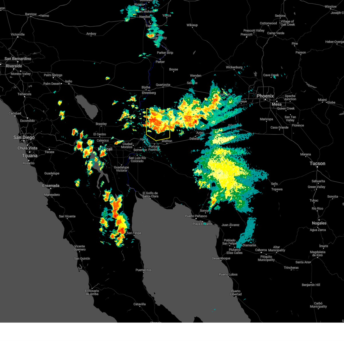
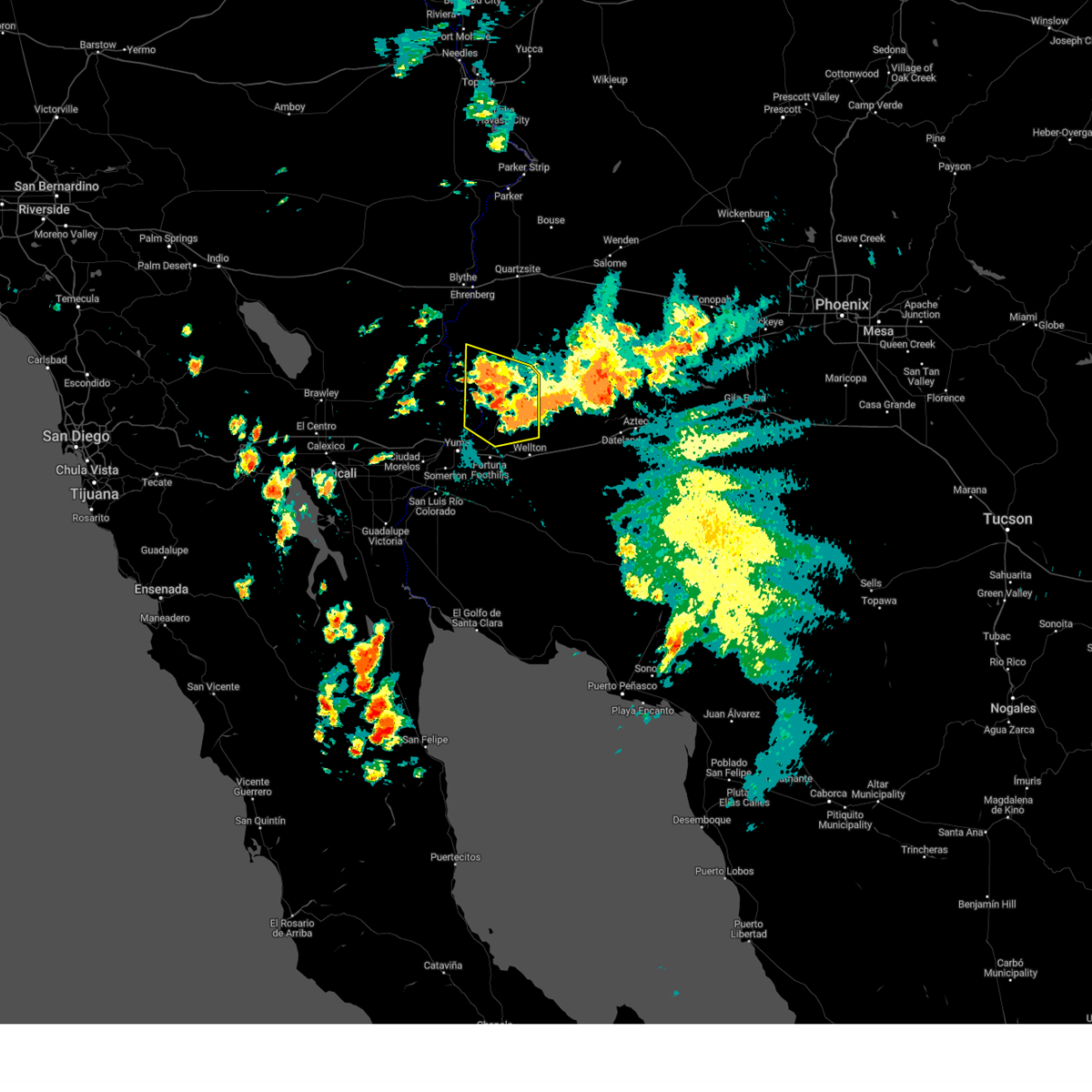
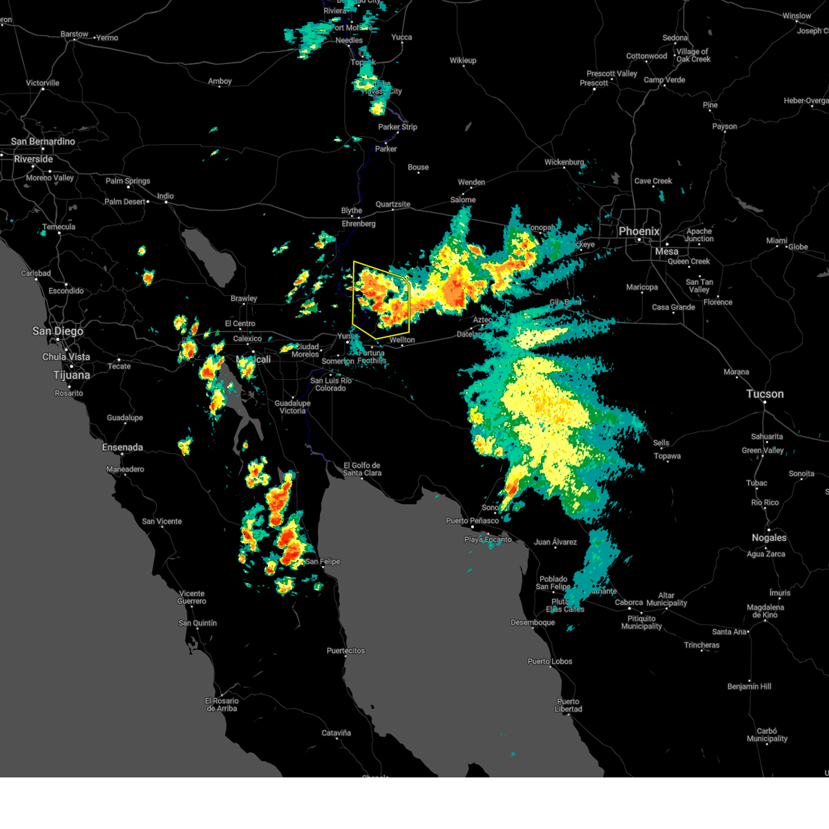
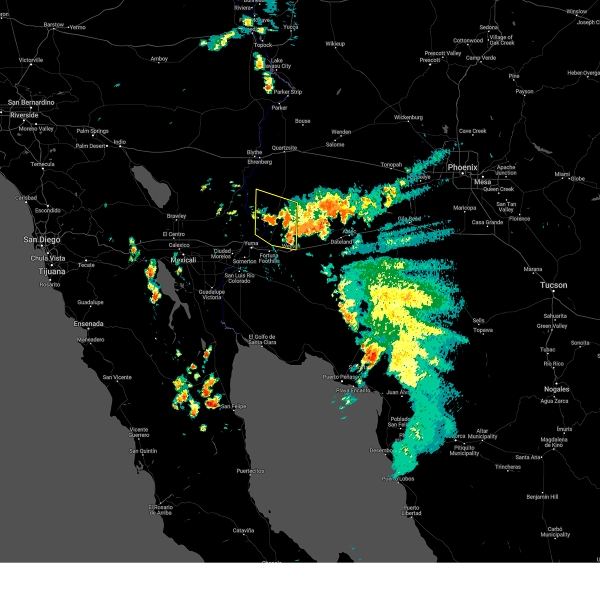
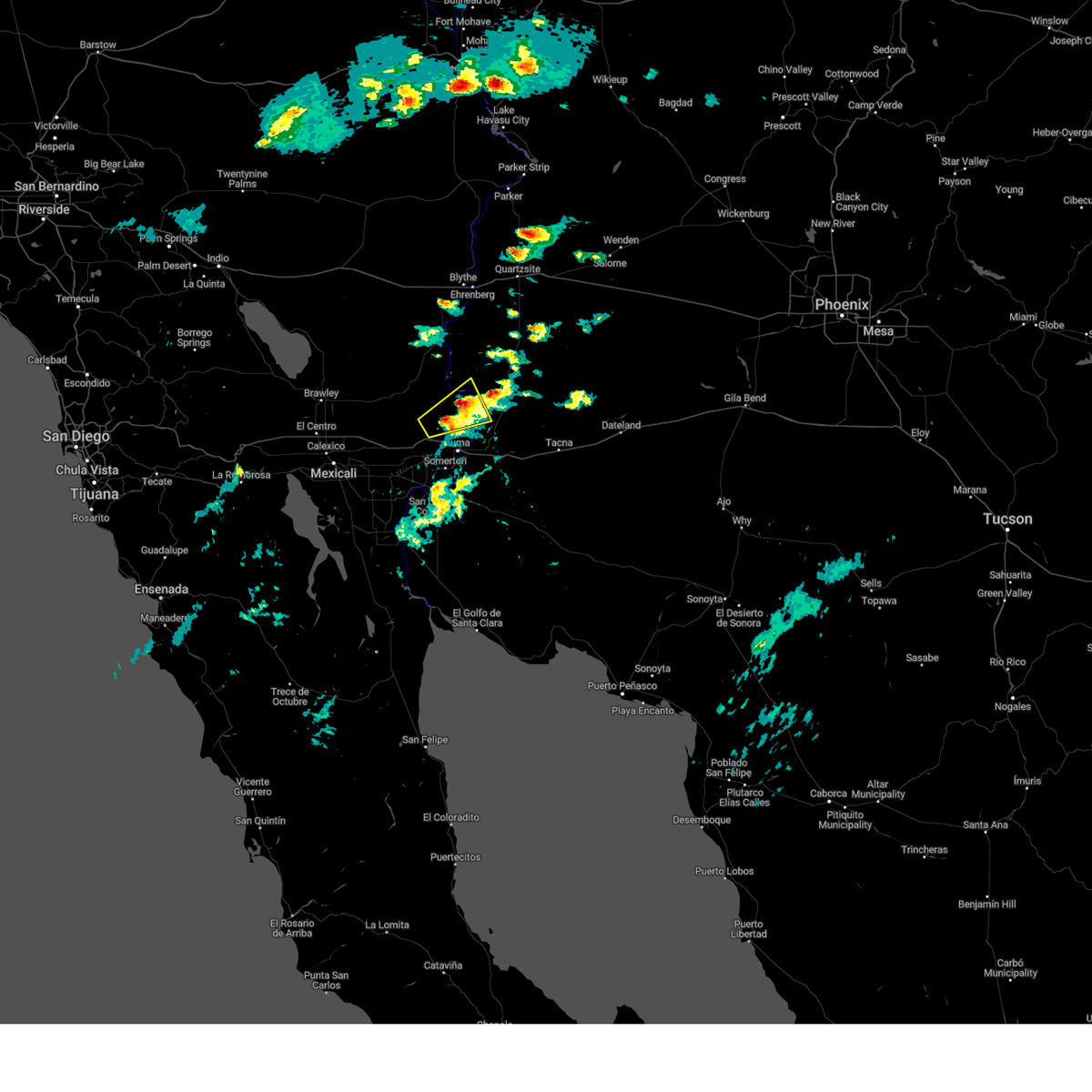
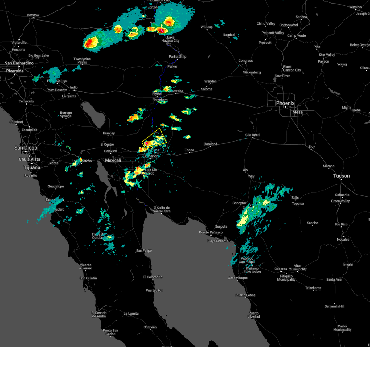
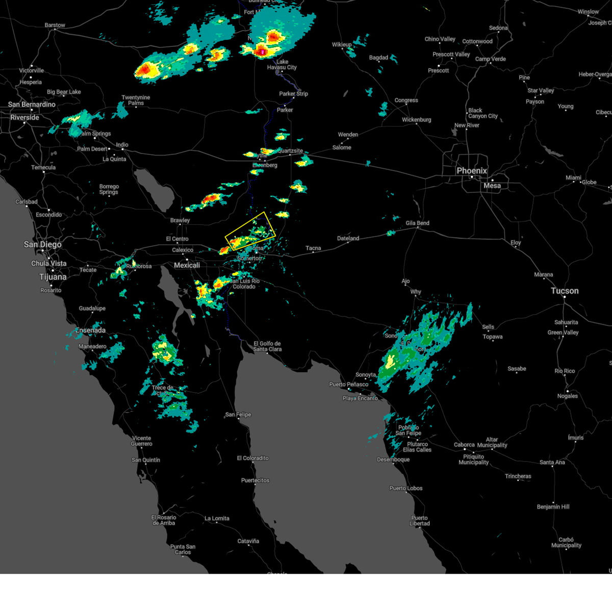
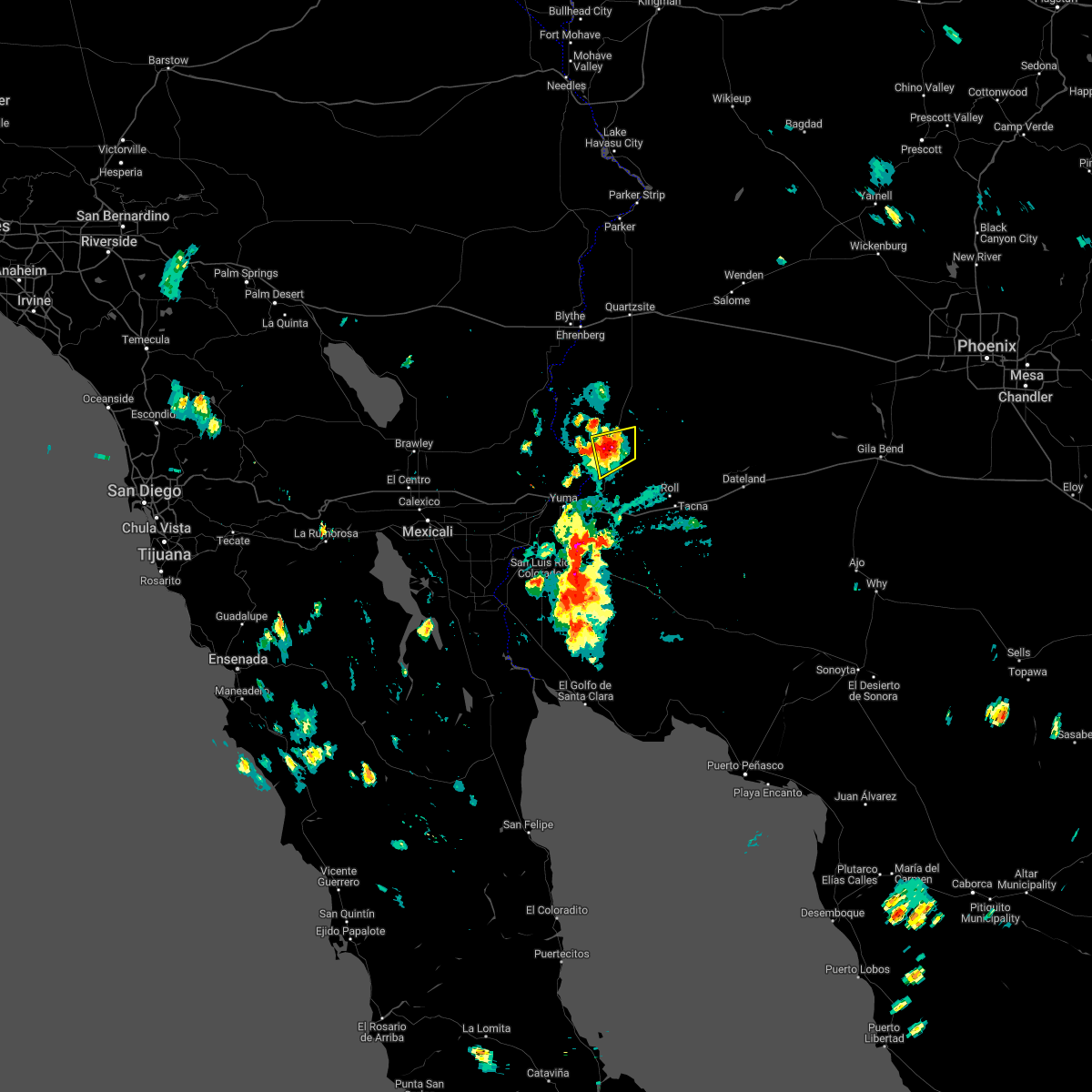
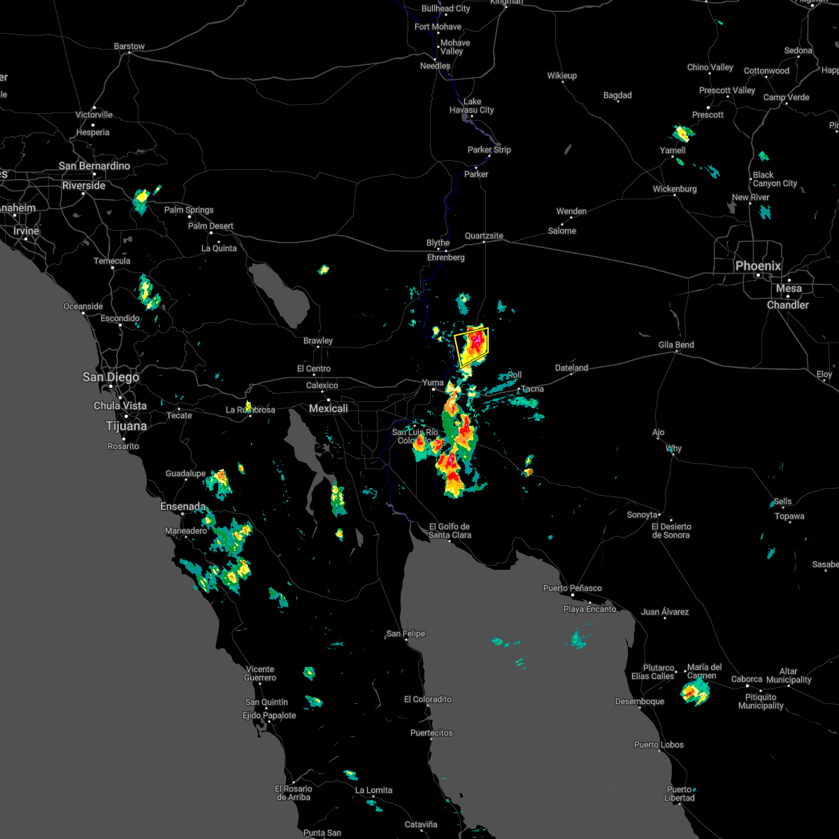
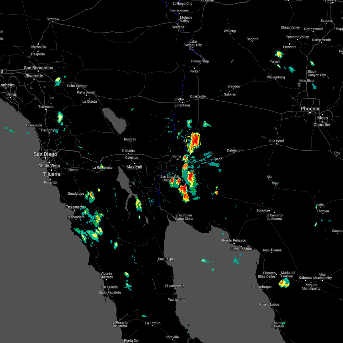
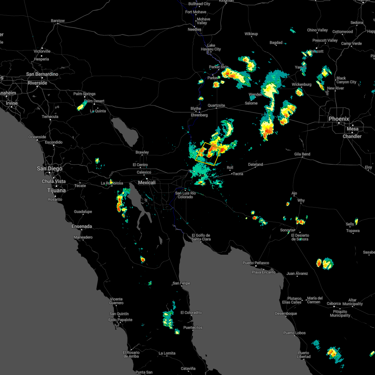
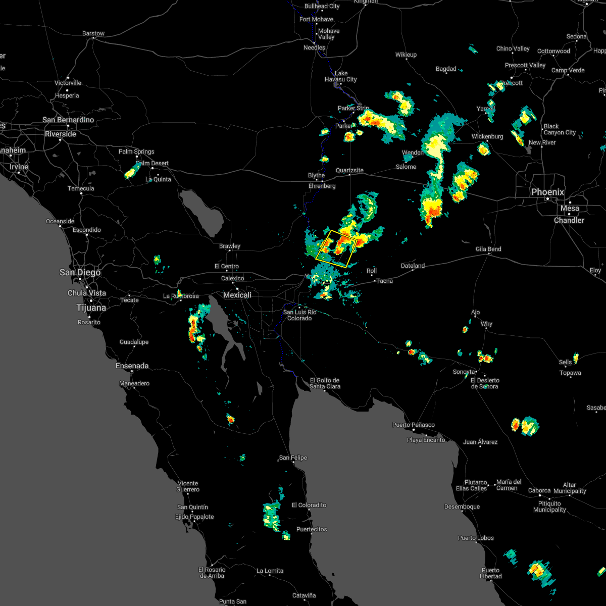
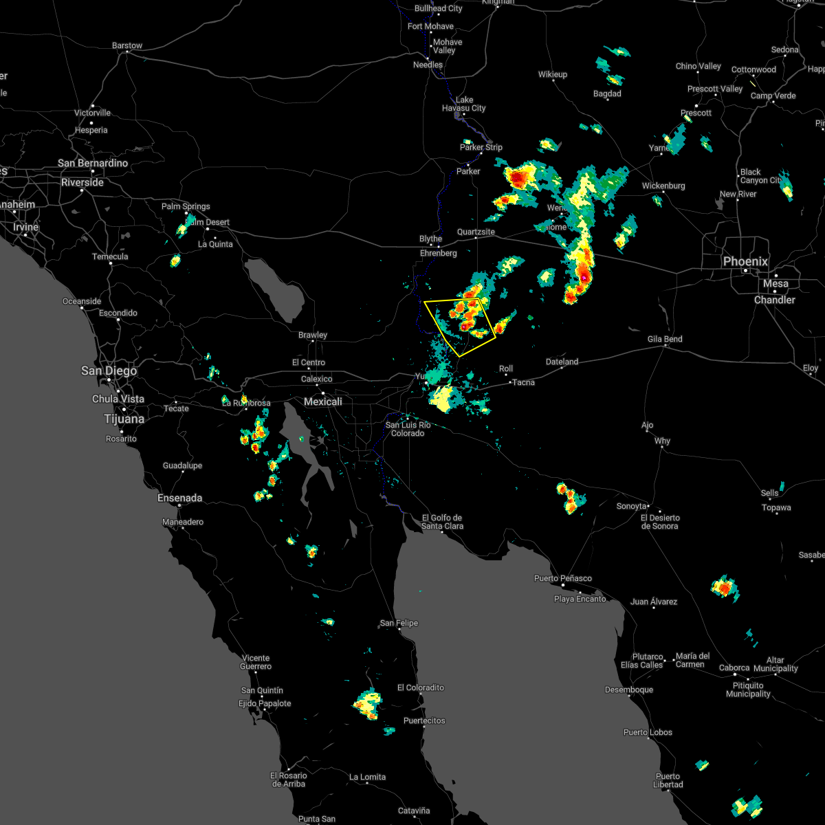
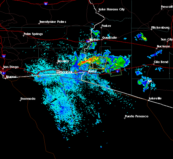
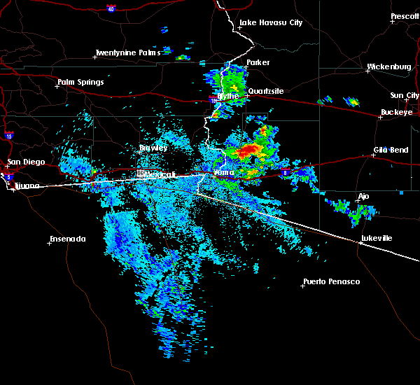
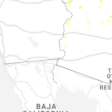
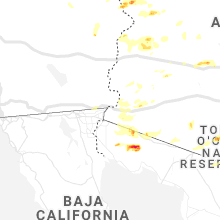
Hail Map for Martinez Lake, AZ
The Martinez Lake, AZ area has had 0 reports of on-the-ground hail by trained spotters, and has been under severe weather warnings 6 times during the past 12 months. Doppler radar has detected hail at or near Martinez Lake, AZ on 10 occasions.
| Name: | Martinez Lake, AZ |
| Where Located: | 21.9 miles NNE of Yuma, AZ |
| Map: | Google Map for Martinez Lake, AZ |
| Population: | 798 |
| Housing Units: | 510 |
| More Info: | Search Google for Martinez Lake, AZ |
5
The Top Recent Hail Date for Martinez Lake, AZ is Thursday, October 6, 2022 (1st out of 10)
Hail and Wind Damage Spotted near Martinez Lake, AZ
| Date / Time | Report Details |
|---|---|
| 9/1/2023 1:06 PM MST |
 The severe thunderstorm warning for southwestern la paz, central yuma and east central imperial counties will expire at 115 pm mst/115 pm pdt/, the storms which prompted the warning have weakened below severe limits, and no longer pose an immediate threat to life or property. therefore, the warning will be allowed to expire. however gusty winds and heavy rain are still possible with these thunderstorms. The severe thunderstorm warning for southwestern la paz, central yuma and east central imperial counties will expire at 115 pm mst/115 pm pdt/, the storms which prompted the warning have weakened below severe limits, and no longer pose an immediate threat to life or property. therefore, the warning will be allowed to expire. however gusty winds and heavy rain are still possible with these thunderstorms.
|
| 9/1/2023 12:50 PM MST |
 At 1249 pm mst/1249 pm pdt/, severe thunderstorms were located from near martinez lake to 10 miles northeast of kinter, moving north at 45 mph (radar indicated). Hazards include 60 mph wind gusts. Expect damage to roofs, siding, and trees. locations impacted include, martinez lake, kinter, and yuma proving ground. this includes az route 95 between mile markers 38 and 72. hail threat, radar indicated max hail size, <. 75 in wind threat, radar indicated max wind gust, 60 mph. At 1249 pm mst/1249 pm pdt/, severe thunderstorms were located from near martinez lake to 10 miles northeast of kinter, moving north at 45 mph (radar indicated). Hazards include 60 mph wind gusts. Expect damage to roofs, siding, and trees. locations impacted include, martinez lake, kinter, and yuma proving ground. this includes az route 95 between mile markers 38 and 72. hail threat, radar indicated max hail size, <. 75 in wind threat, radar indicated max wind gust, 60 mph.
|
| 9/1/2023 12:23 PM MST |
 At 1223 pm mst/1223 pm pdt/, severe thunderstorms were located from martinez lake to 10 miles north of wellton, moving north at 30 mph (radar indicated). Hazards include 60 mph wind gusts. expect damage to roofs, siding, and trees At 1223 pm mst/1223 pm pdt/, severe thunderstorms were located from martinez lake to 10 miles north of wellton, moving north at 30 mph (radar indicated). Hazards include 60 mph wind gusts. expect damage to roofs, siding, and trees
|
| 3/15/2023 4:55 PM PDT |
 The severe thunderstorm warning for southwestern la paz, northwestern yuma and southeastern imperial counties will expire at 500 pm mst/500 pm pdt/, the severe thunderstorm which prompted the warning has weakened. moved out of the warned area. therefore, the warning will be allowed to expire. however small hail and gusty winds are still possible with this thunderstorm. The severe thunderstorm warning for southwestern la paz, northwestern yuma and southeastern imperial counties will expire at 500 pm mst/500 pm pdt/, the severe thunderstorm which prompted the warning has weakened. moved out of the warned area. therefore, the warning will be allowed to expire. however small hail and gusty winds are still possible with this thunderstorm.
|
| 3/15/2023 4:34 PM PDT |
 At 434 pm mst/434 pm pdt/, a severe thunderstorm was located 10 miles north of andrade, or 18 miles west of martinez lake, moving northeast at 35 mph (radar indicated). Hazards include quarter size hail. Damage to vehicles is expected. locations impacted include, martinez lake. hail threat, radar indicated max hail size, 1. 00 in wind threat, radar indicated max wind gust, <50 mph. At 434 pm mst/434 pm pdt/, a severe thunderstorm was located 10 miles north of andrade, or 18 miles west of martinez lake, moving northeast at 35 mph (radar indicated). Hazards include quarter size hail. Damage to vehicles is expected. locations impacted include, martinez lake. hail threat, radar indicated max hail size, 1. 00 in wind threat, radar indicated max wind gust, <50 mph.
|
| 3/15/2023 4:26 PM PDT |
 At 426 pm mst/426 pm pdt/, a severe thunderstorm was located near algodones dunes, or 18 miles northwest of somerton, moving northeast at 35 mph (radar indicated). Hazards include quarter size hail. damage to vehicles is expected At 426 pm mst/426 pm pdt/, a severe thunderstorm was located near algodones dunes, or 18 miles northwest of somerton, moving northeast at 35 mph (radar indicated). Hazards include quarter size hail. damage to vehicles is expected
|
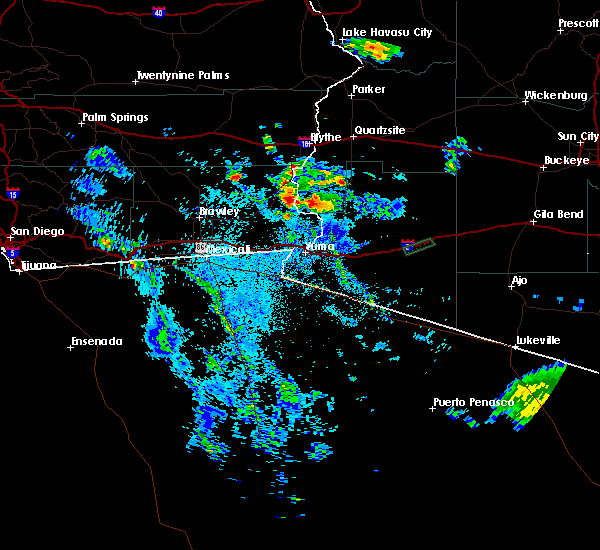
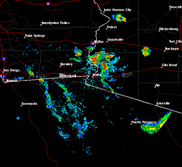
| 10/6/2022 2:25 PM MST |
 The severe thunderstorm warning for southwestern la paz and central yuma counties will expire at 230 pm mst, the storm which prompted the warning has weakened below severe limits, and no longer poses an immediate threat to life or property. therefore, the warning will be allowed to expire. however small hail is still possible with this thunderstorm. The severe thunderstorm warning for southwestern la paz and central yuma counties will expire at 230 pm mst, the storm which prompted the warning has weakened below severe limits, and no longer poses an immediate threat to life or property. therefore, the warning will be allowed to expire. however small hail is still possible with this thunderstorm.
|
| 10/6/2022 2:03 PM MST |
 At 203 pm mst, a severe thunderstorm was located 8 miles southeast of yuma proving ground, or 9 miles east of martinez lake, moving west at 10 mph (radar indicated). Hazards include 60 mph wind gusts and quarter size hail. Hail damage to vehicles is expected. expect wind damage to roofs, siding, and trees. this severe thunderstorm will remain over mainly rural areas of southwestern la paz and central yuma counties. this includes az route 95 between mile markers 48 and 63. hail threat, radar indicated max hail size, 1. 00 in wind threat, radar indicated max wind gust, 60 mph. At 203 pm mst, a severe thunderstorm was located 8 miles southeast of yuma proving ground, or 9 miles east of martinez lake, moving west at 10 mph (radar indicated). Hazards include 60 mph wind gusts and quarter size hail. Hail damage to vehicles is expected. expect wind damage to roofs, siding, and trees. this severe thunderstorm will remain over mainly rural areas of southwestern la paz and central yuma counties. this includes az route 95 between mile markers 48 and 63. hail threat, radar indicated max hail size, 1. 00 in wind threat, radar indicated max wind gust, 60 mph.
|
| 10/6/2022 1:54 PM MST |
 At 153 pm mst, a severe thunderstorm was located 9 miles southeast of yuma proving ground, or 11 miles east of martinez lake, moving west at 10 mph (radar indicated). Hazards include 60 mph wind gusts and quarter size hail. Hail damage to vehicles is expected. expect wind damage to roofs, siding, and trees. this severe thunderstorm will remain over mainly rural areas of southwestern la paz and central yuma counties. this includes az route 95 between mile markers 47 and 63. hail threat, radar indicated max hail size, 1. 00 in wind threat, radar indicated max wind gust, 60 mph. At 153 pm mst, a severe thunderstorm was located 9 miles southeast of yuma proving ground, or 11 miles east of martinez lake, moving west at 10 mph (radar indicated). Hazards include 60 mph wind gusts and quarter size hail. Hail damage to vehicles is expected. expect wind damage to roofs, siding, and trees. this severe thunderstorm will remain over mainly rural areas of southwestern la paz and central yuma counties. this includes az route 95 between mile markers 47 and 63. hail threat, radar indicated max hail size, 1. 00 in wind threat, radar indicated max wind gust, 60 mph.
|
| 10/6/2022 1:42 PM MST |
 At 142 pm mst, a severe thunderstorm was located 10 miles southeast of yuma proving ground, or 12 miles east of martinez lake, moving west at 10 mph (radar indicated). Hazards include 60 mph wind gusts and quarter size hail. Hail damage to vehicles is expected. expect wind damage to roofs, siding, and trees. this severe thunderstorm will remain over mainly rural areas of southwestern la paz and central yuma counties. this includes az route 95 between mile markers 43 and 63. hail threat, radar indicated max hail size, 1. 00 in wind threat, radar indicated max wind gust, 60 mph. At 142 pm mst, a severe thunderstorm was located 10 miles southeast of yuma proving ground, or 12 miles east of martinez lake, moving west at 10 mph (radar indicated). Hazards include 60 mph wind gusts and quarter size hail. Hail damage to vehicles is expected. expect wind damage to roofs, siding, and trees. this severe thunderstorm will remain over mainly rural areas of southwestern la paz and central yuma counties. this includes az route 95 between mile markers 43 and 63. hail threat, radar indicated max hail size, 1. 00 in wind threat, radar indicated max wind gust, 60 mph.
|
| 9/23/2022 3:05 PM MST |
 At 305 pm mst/305 pm pdt/, a severe thunderstorm was located near martinez lake, moving southwest at 10 mph (radar indicated). Hazards include 60 mph wind gusts. expect damage to roofs, siding, and trees At 305 pm mst/305 pm pdt/, a severe thunderstorm was located near martinez lake, moving southwest at 10 mph (radar indicated). Hazards include 60 mph wind gusts. expect damage to roofs, siding, and trees
|
| 9/23/2022 3:00 PM MST | Ham radio personnel reported that us-95 was impassable at around mile marker 69 due to overflowing wate in la paz county AZ, 17.4 miles SW of Martinez Lake, AZ |
| 9/23/2022 2:55 PM MST |
 The severe thunderstorm warning for southwestern la paz and north central yuma counties will expire at 300 pm mst, the storm which prompted the warning has weakened below severe limits, and no longer poses an immediate threat to life or property. therefore, the warning will be allowed to expire. The severe thunderstorm warning for southwestern la paz and north central yuma counties will expire at 300 pm mst, the storm which prompted the warning has weakened below severe limits, and no longer poses an immediate threat to life or property. therefore, the warning will be allowed to expire.
|
| 9/23/2022 2:20 PM MST |
 At 220 pm mst, a severe thunderstorm was located near yuma proving ground, or 11 miles northeast of martinez lake, and is nearly stationary (radar indicated). Hazards include 60 mph wind gusts. expect damage to roofs, siding, and trees At 220 pm mst, a severe thunderstorm was located near yuma proving ground, or 11 miles northeast of martinez lake, and is nearly stationary (radar indicated). Hazards include 60 mph wind gusts. expect damage to roofs, siding, and trees
|
| 8/22/2022 1:50 AM MST | At 150 am mst/150 am pdt/, severe thunderstorms were located along a line extending from araby to near winterhaven to near algodones dunes, and are nearly stationary (radar indicated). Hazards include 60 mph wind gusts. Expect damage to roofs, siding, and trees. locations impacted include, yuma, somerton, gadsden, fortuna foothills, san luis, blaisdell, algodones dunes, kinter, andrade, winterhaven and araby. this includes the following highways, az interstate 8 between mile markers 1 and 17. ca interstate 8 between mile markers 78 and 96. az route 95 between mile markers 29 and 56. hail threat, radar indicated max hail size, <. 75 in wind threat, radar indicated max wind gust, 60 mph. |
| 8/22/2022 1:50 AM MST | At 150 am mst/150 am pdt/, severe thunderstorms were located along a line extending from araby to near winterhaven to near algodones dunes, and are nearly stationary (radar indicated). Hazards include 60 mph wind gusts. Expect damage to roofs, siding, and trees. locations impacted include, yuma, somerton, gadsden, fortuna foothills, san luis, blaisdell, algodones dunes, kinter, andrade, winterhaven and araby. this includes the following highways, az interstate 8 between mile markers 1 and 17. ca interstate 8 between mile markers 78 and 96. az route 95 between mile markers 29 and 56. hail threat, radar indicated max hail size, <. 75 in wind threat, radar indicated max wind gust, 60 mph. |
| 8/22/2022 1:27 AM MST | At 127 am mst/127 am pdt/, severe thunderstorms were located along a line extending from near kinter to near winterhaven to near algodones dunes, moving southwest at 30 mph (radar indicated). Hazards include 60 mph wind gusts. expect damage to roofs, siding, and trees |
| 8/22/2022 1:27 AM MST | At 127 am mst/127 am pdt/, severe thunderstorms were located along a line extending from near kinter to near winterhaven to near algodones dunes, moving southwest at 30 mph (radar indicated). Hazards include 60 mph wind gusts. expect damage to roofs, siding, and trees |
| 8/22/2022 1:11 AM PDT | At 109 am mst/109 am pdt/, severe thunderstorms were located along a line extending from 21 miles northeast of brawley to 22 miles north of gordon`s well to 17 miles north of algodones dunes to near martinez lake, moving southwest at 25 mph (radar indicated). Hazards include 70 mph wind gusts. Expect considerable tree damage. damage is likely to mobile homes, roofs, and outbuildings. locations impacted include, yuma, somerton, martinez lake, gadsden, fortuna foothills, wellton, gordon`s well, algodones dunes, kinter, andrade, winterhaven, araby, yuma proving ground, blaisdell and ligurta. this includes the following highways, az interstate 8 between mile markers 1 and 32. ca interstate 8 between mile markers 55 and 96. az route 95 between mile markers 29 and 79. thunderstorm damage threat, considerable hail threat, radar indicated max hail size, <. 75 in wind threat, radar indicated max wind gust, 70 mph. |
| 8/22/2022 1:11 AM PDT | At 109 am mst/109 am pdt/, severe thunderstorms were located along a line extending from 21 miles northeast of brawley to 22 miles north of gordon`s well to 17 miles north of algodones dunes to near martinez lake, moving southwest at 25 mph (radar indicated). Hazards include 70 mph wind gusts. Expect considerable tree damage. damage is likely to mobile homes, roofs, and outbuildings. locations impacted include, yuma, somerton, martinez lake, gadsden, fortuna foothills, wellton, gordon`s well, algodones dunes, kinter, andrade, winterhaven, araby, yuma proving ground, blaisdell and ligurta. this includes the following highways, az interstate 8 between mile markers 1 and 32. ca interstate 8 between mile markers 55 and 96. az route 95 between mile markers 29 and 79. thunderstorm damage threat, considerable hail threat, radar indicated max hail size, <. 75 in wind threat, radar indicated max wind gust, 70 mph. |
| 8/22/2022 12:44 AM PDT | At 1243 am mst/1243 am pdt/, severe thunderstorms were located along a line extending from 22 miles west of palo verde to 12 miles south of cibola to 7 miles east of yuma proving ground, moving southwest at 30 mph (radar indicated). Hazards include 70 mph wind gusts. Expect considerable tree damage. damage is likely to mobile homes, roofs, and outbuildings. locations impacted include, yuma, somerton, martinez lake, gadsden, fortuna foothills, wellton, cibola, palo verde, gordon`s well, algodones dunes, kinter, andrade, winterhaven, araby and yuma proving ground. this includes the following highways, az interstate 8 between mile markers 1 and 32. ca interstate 8 between mile markers 55 and 96. az route 95 between mile markers 29 and 90. thunderstorm damage threat, considerable hail threat, radar indicated max hail size, <. 75 in wind threat, radar indicated max wind gust, 70 mph. |
| 8/22/2022 12:44 AM PDT | At 1243 am mst/1243 am pdt/, severe thunderstorms were located along a line extending from 22 miles west of palo verde to 12 miles south of cibola to 7 miles east of yuma proving ground, moving southwest at 30 mph (radar indicated). Hazards include 70 mph wind gusts. Expect considerable tree damage. damage is likely to mobile homes, roofs, and outbuildings. locations impacted include, yuma, somerton, martinez lake, gadsden, fortuna foothills, wellton, cibola, palo verde, gordon`s well, algodones dunes, kinter, andrade, winterhaven, araby and yuma proving ground. this includes the following highways, az interstate 8 between mile markers 1 and 32. ca interstate 8 between mile markers 55 and 96. az route 95 between mile markers 29 and 90. thunderstorm damage threat, considerable hail threat, radar indicated max hail size, <. 75 in wind threat, radar indicated max wind gust, 70 mph. |
| 8/22/2022 12:34 AM PDT | At 1234 am mst/1234 am pdt/, severe thunderstorms were located along a line extending from 20 miles west of palo verde to 9 miles south of cibola to 11 miles northeast of yuma proving ground, moving southwest at 30 mph (radar indicated). Hazards include 70 mph wind gusts. Expect considerable tree damage. Damage is likely to mobile homes, roofs, and outbuildings. |
| 8/22/2022 12:34 AM PDT | At 1234 am mst/1234 am pdt/, severe thunderstorms were located along a line extending from 20 miles west of palo verde to 9 miles south of cibola to 11 miles northeast of yuma proving ground, moving southwest at 30 mph (radar indicated). Hazards include 70 mph wind gusts. Expect considerable tree damage. Damage is likely to mobile homes, roofs, and outbuildings. |
| 8/18/2022 10:41 PM PDT |
 The severe thunderstorm warning for west central yuma and southeastern imperial counties will expire at 1045 pm mst/1045 pm pdt/, the storm which prompted the warning has weakened below severe limits, and no longer poses an immediate threat to life or property. therefore, the warning will be allowed to expire. however gusty winds and heavy rain are still possible with this thunderstorm. The severe thunderstorm warning for west central yuma and southeastern imperial counties will expire at 1045 pm mst/1045 pm pdt/, the storm which prompted the warning has weakened below severe limits, and no longer poses an immediate threat to life or property. therefore, the warning will be allowed to expire. however gusty winds and heavy rain are still possible with this thunderstorm.
|
| 8/18/2022 10:34 PM PDT |
 At 1033 pm mst/1033 pm pdt/, a severe thunderstorm was located 7 miles northwest of winterhaven, or 11 miles north of yuma, moving south at 20 mph (radar indicated). Hazards include 60 mph wind gusts. Expect damage to roofs, siding, and trees. locations impacted include, martinez lake and winterhaven. this includes ca interstate 8 between mile markers 90 and 94. hail threat, radar indicated max hail size, <. 75 in wind threat, radar indicated max wind gust, 60 mph. At 1033 pm mst/1033 pm pdt/, a severe thunderstorm was located 7 miles northwest of winterhaven, or 11 miles north of yuma, moving south at 20 mph (radar indicated). Hazards include 60 mph wind gusts. Expect damage to roofs, siding, and trees. locations impacted include, martinez lake and winterhaven. this includes ca interstate 8 between mile markers 90 and 94. hail threat, radar indicated max hail size, <. 75 in wind threat, radar indicated max wind gust, 60 mph.
|
| 8/18/2022 10:12 PM PDT |
 At 1012 pm mst/1012 pm pdt/, a severe thunderstorm was located 8 miles west of martinez lake, moving south at 20 mph (radar indicated). Hazards include 60 mph wind gusts. expect damage to roofs, siding, and trees At 1012 pm mst/1012 pm pdt/, a severe thunderstorm was located 8 miles west of martinez lake, moving south at 20 mph (radar indicated). Hazards include 60 mph wind gusts. expect damage to roofs, siding, and trees
|
| 8/10/2021 8:18 PM MST |
 At 816 pm mst/pdt, severe thunderstorms were located over central and southwest la paz county moving southwest at 20 mph (radar indicated). Hazards include 60 mph wind gusts. small hail. expect damage to roofs, siding, and trees At 816 pm mst/pdt, severe thunderstorms were located over central and southwest la paz county moving southwest at 20 mph (radar indicated). Hazards include 60 mph wind gusts. small hail. expect damage to roofs, siding, and trees
|
| 9/4/2019 8:01 PM MST |
 The national weather service in phoenix has issued a * severe thunderstorm warning for. southwestern la paz county in west central arizona. west central yuma county in southwestern arizona. northeastern imperial county in southeastern california. Until 845 pm mst/845 pm pdt/. The national weather service in phoenix has issued a * severe thunderstorm warning for. southwestern la paz county in west central arizona. west central yuma county in southwestern arizona. northeastern imperial county in southeastern california. Until 845 pm mst/845 pm pdt/.
|
| 9/4/2019 8:01 PM MST |
 At 801 pm mst/801 pm pdt/, a severe thunderstorm was located 10 miles west of yuma proving ground, or 10 miles northwest of martinez lake, moving northwest at 30 mph (radar indicated). Hazards include 60 mph wind gusts and quarter size hail. Hail damage to vehicles is expected. expect wind damage to roofs, siding, and trees. this severe thunderstorm will remain over mainly rural areas of southwestern la paz, west central yuma and northeastern imperial counties. This includes ca route 78 between mile markers 51 and 73. At 801 pm mst/801 pm pdt/, a severe thunderstorm was located 10 miles west of yuma proving ground, or 10 miles northwest of martinez lake, moving northwest at 30 mph (radar indicated). Hazards include 60 mph wind gusts and quarter size hail. Hail damage to vehicles is expected. expect wind damage to roofs, siding, and trees. this severe thunderstorm will remain over mainly rural areas of southwestern la paz, west central yuma and northeastern imperial counties. This includes ca route 78 between mile markers 51 and 73.
|
| 9/4/2019 7:26 PM MST |
 At 726 pm mst, a severe thunderstorm was located 8 miles southeast of yuma proving ground, or 9 miles east of martinez lake, moving northwest at 20 mph (radar indicated). Hazards include 60 mph wind gusts and nickel size hail. expect damage to roofs, siding, and trees At 726 pm mst, a severe thunderstorm was located 8 miles southeast of yuma proving ground, or 9 miles east of martinez lake, moving northwest at 20 mph (radar indicated). Hazards include 60 mph wind gusts and nickel size hail. expect damage to roofs, siding, and trees
|
| 9/7/2017 8:55 PM MST |
 The severe thunderstorm warning for southwestern la paz, central yuma and east central imperial counties will expire at 900 pm mst/900 pm pdt/, the severe thunderstorm which prompted the warning continues to weaken and move off towards the west and thus the warning will be allowed to expire. no reports of damage have been received. The severe thunderstorm warning for southwestern la paz, central yuma and east central imperial counties will expire at 900 pm mst/900 pm pdt/, the severe thunderstorm which prompted the warning continues to weaken and move off towards the west and thus the warning will be allowed to expire. no reports of damage have been received.
|
| 9/7/2017 8:16 PM MST | Mesonet station yp013... 5 ne martinez lake. delayed repor in la paz county AZ, 5.9 miles SW of Martinez Lake, AZ |
| 9/7/2017 8:06 PM MST |
 At 805 pm mst/805 pm pdt/, a severe thunderstorm was located 9 miles southeast of yuma proving ground, or 11 miles east of martinez lake, moving west at 20 mph (radar indicated). Hazards include 60 mph wind gusts and quarter size hail. dense blowing dust is also possible. Hail damage to vehicles is expected. Expect wind damage to roofs, siding, and trees. At 805 pm mst/805 pm pdt/, a severe thunderstorm was located 9 miles southeast of yuma proving ground, or 11 miles east of martinez lake, moving west at 20 mph (radar indicated). Hazards include 60 mph wind gusts and quarter size hail. dense blowing dust is also possible. Hail damage to vehicles is expected. Expect wind damage to roofs, siding, and trees.
|
| 7/5/2014 5:54 PM MST | Storm damage reported in yuma county AZ, 3.7 miles WNW of Martinez Lake, AZ |
| 1/1/0001 12:00 AM | Squaw lake raws. observation at 2227 local tim in imperial county CA, 4.6 miles NNE of Martinez Lake, AZ |
Hail Maps for Martinez Lake, AZ


Connect with Interactive Hail Maps