

Hail Map for McIntyre, GA
The McIntyre, GA area has had 3 reports of on-the-ground hail by trained spotters, and has been under severe weather warnings 18 times during the past 12 months. Doppler radar has detected hail at or near McIntyre, GA on 33 occasions, including 3 occasions during the past year.
| Name: | McIntyre, GA |
| Where Located: | 83.5 miles WSW of Augusta, GA |
| Map: | Google Map for McIntyre, GA |
| Population: | 650 |
| Housing Units: | 290 |
| More Info: | Search Google for McIntyre, GA |
0
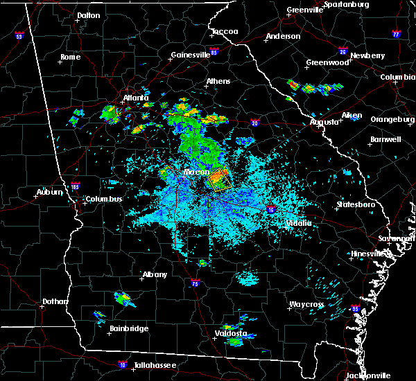
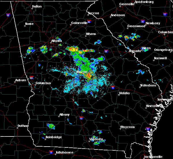
The Top Recent Hail Date for McIntyre, GA is Thursday, September 7, 2023 (27th out of 33)

Hail and Wind Damage Spotted near McIntyre, GA
| Date / Time | Report Details |
|---|---|
| 4/3/2024 4:06 AM EDT |
 The storm which prompted the warning has moved out of the area. therefore, the warning will be allowed to expire. a tornado watch remains in effect until 800 am edt for central and west central georgia. remember, a tornado warning still remains in effect!. The storm which prompted the warning has moved out of the area. therefore, the warning will be allowed to expire. a tornado watch remains in effect until 800 am edt for central and west central georgia. remember, a tornado warning still remains in effect!.
|
| 4/3/2024 3:25 AM EDT |
 Svrffc the national weather service in peachtree city has issued a * severe thunderstorm warning for, southwestern wilkinson county in central georgia, northeastern macon county in west central georgia, southern bibb county in central georgia, twiggs county in central georgia, northeastern bleckley county in central georgia, peach county in central georgia, northern houston county in central georgia, central crawford county in central georgia, east central taylor county in west central georgia, * until 415 am edt. * at 325 am edt, a severe thunderstorm was located over lee pope, or near fort valley, moving east at 55 mph (radar indicated). Hazards include 60 mph wind gusts and penny size hail. expect damage to roofs, siding, and trees Svrffc the national weather service in peachtree city has issued a * severe thunderstorm warning for, southwestern wilkinson county in central georgia, northeastern macon county in west central georgia, southern bibb county in central georgia, twiggs county in central georgia, northeastern bleckley county in central georgia, peach county in central georgia, northern houston county in central georgia, central crawford county in central georgia, east central taylor county in west central georgia, * until 415 am edt. * at 325 am edt, a severe thunderstorm was located over lee pope, or near fort valley, moving east at 55 mph (radar indicated). Hazards include 60 mph wind gusts and penny size hail. expect damage to roofs, siding, and trees
|
| 1/9/2024 11:43 AM EST |
 At 1143 am est, severe thunderstorms were located along a line extending from near hebron to near danville, moving northeast at 35 mph (radar indicated). Hazards include 60 mph wind gusts. expect damage to roofs, siding, and trees At 1143 am est, severe thunderstorms were located along a line extending from near hebron to near danville, moving northeast at 35 mph (radar indicated). Hazards include 60 mph wind gusts. expect damage to roofs, siding, and trees
|
| 1/9/2024 11:00 AM EST |
 At 1100 am est, severe thunderstorms were located along a line extending from pancras to near myricks mill to bullard, moving northeast at 70 mph (radar indicated). Hazards include 60 mph wind gusts. expect damage to roofs, siding, and trees At 1100 am est, severe thunderstorms were located along a line extending from pancras to near myricks mill to bullard, moving northeast at 70 mph (radar indicated). Hazards include 60 mph wind gusts. expect damage to roofs, siding, and trees
|
| 1/9/2024 10:27 AM EST |
 At 1027 am est, severe thunderstorms were located along a line extending from near gordon to myricks mill to near fitzpatrick to near marion to bullard, moving northeast at 45 mph (radar indicated). Hazards include 70 mph wind gusts. Expect considerable tree damage. damage is likely to mobile homes, roofs, and outbuildings. Locations impacted include, jeffersonville, irwinton, gordon, ivey, mcintyre, toomsboro, danville, deepstep, marion, bullard, fitzpatrick, ripley, district path, dry branch, myricks mill, and hebron. At 1027 am est, severe thunderstorms were located along a line extending from near gordon to myricks mill to near fitzpatrick to near marion to bullard, moving northeast at 45 mph (radar indicated). Hazards include 70 mph wind gusts. Expect considerable tree damage. damage is likely to mobile homes, roofs, and outbuildings. Locations impacted include, jeffersonville, irwinton, gordon, ivey, mcintyre, toomsboro, danville, deepstep, marion, bullard, fitzpatrick, ripley, district path, dry branch, myricks mill, and hebron.
|
| 1/9/2024 10:23 AM EST |
 At 1023 am est, severe thunderstorms were located along a line extending from near griswoldville to near huber to bullard, moving northeast at 50 mph (radar indicated). Hazards include 60 mph wind gusts. Expect damage to roofs, siding, and trees. Locations impacted include, jeffersonville, irwinton, gordon, ivey, mcintyre, toomsboro, danville, allentown, deepstep, marion, bullard, fitzpatrick, ripley, huber, district path, dry branch, myricks mill, and hebron. At 1023 am est, severe thunderstorms were located along a line extending from near griswoldville to near huber to bullard, moving northeast at 50 mph (radar indicated). Hazards include 60 mph wind gusts. Expect damage to roofs, siding, and trees. Locations impacted include, jeffersonville, irwinton, gordon, ivey, mcintyre, toomsboro, danville, allentown, deepstep, marion, bullard, fitzpatrick, ripley, huber, district path, dry branch, myricks mill, and hebron.
|
| 1/9/2024 10:17 AM EST |
 At 1016 am est, severe thunderstorms were located along a line extending from franklinton to near bullard to kathleen, moving northeast at 55 mph (radar indicated). Hazards include 60 mph wind gusts. expect damage to roofs, siding, and trees At 1016 am est, severe thunderstorms were located along a line extending from franklinton to near bullard to kathleen, moving northeast at 55 mph (radar indicated). Hazards include 60 mph wind gusts. expect damage to roofs, siding, and trees
|
| 9/7/2023 3:07 PM EDT |
 The severe thunderstorm warning for northwestern wilkinson, north central twiggs and southeastern jones counties will expire at 315 pm edt, the storm which prompted the warning has moved out of the area. therefore, the warning will be allowed to expire. remember, a severe thunderstorm warning still remains in effect for portions of southeastern jones, northern twiggs, and western wilkinson counties until 3:30 pm edt. The severe thunderstorm warning for northwestern wilkinson, north central twiggs and southeastern jones counties will expire at 315 pm edt, the storm which prompted the warning has moved out of the area. therefore, the warning will be allowed to expire. remember, a severe thunderstorm warning still remains in effect for portions of southeastern jones, northern twiggs, and western wilkinson counties until 3:30 pm edt.
|
| 9/7/2023 2:58 PM EDT |
 At 258 pm edt, a severe thunderstorm was located over ivey, or 11 miles northwest of irwinton, moving east at 15 mph (radar indicated). Hazards include 60 mph wind gusts and quarter size hail. Hail damage to vehicles is expected. expect wind damage to roofs, siding, and trees. locations impacted include, irwinton, gordon, ivey, mcintyre, postell, mountain springs, griswoldville, and greenberry crossroads. hail threat, radar indicated max hail size, 1. 00 in wind threat, radar indicated max wind gust, 60 mph. At 258 pm edt, a severe thunderstorm was located over ivey, or 11 miles northwest of irwinton, moving east at 15 mph (radar indicated). Hazards include 60 mph wind gusts and quarter size hail. Hail damage to vehicles is expected. expect wind damage to roofs, siding, and trees. locations impacted include, irwinton, gordon, ivey, mcintyre, postell, mountain springs, griswoldville, and greenberry crossroads. hail threat, radar indicated max hail size, 1. 00 in wind threat, radar indicated max wind gust, 60 mph.
|
| 9/7/2023 2:48 PM EDT |
 At 248 pm edt, a severe thunderstorm was located near gordon, or 11 miles southeast of gray, moving east at 15 mph (radar indicated). Hazards include 60 mph wind gusts and quarter size hail. Hail damage to vehicles is expected. expect wind damage to roofs, siding, and trees. locations impacted include, irwinton, gordon, ivey, mcintyre, postell, james, coopers, mountain springs, griswoldville, pancras, and greenberry crossroads. hail threat, radar indicated max hail size, 1. 00 in wind threat, radar indicated max wind gust, 60 mph. At 248 pm edt, a severe thunderstorm was located near gordon, or 11 miles southeast of gray, moving east at 15 mph (radar indicated). Hazards include 60 mph wind gusts and quarter size hail. Hail damage to vehicles is expected. expect wind damage to roofs, siding, and trees. locations impacted include, irwinton, gordon, ivey, mcintyre, postell, james, coopers, mountain springs, griswoldville, pancras, and greenberry crossroads. hail threat, radar indicated max hail size, 1. 00 in wind threat, radar indicated max wind gust, 60 mph.
|
| 9/7/2023 2:27 PM EDT |
 At 227 pm edt, a severe thunderstorm was located over greenberry crossroads, or near gray, moving east at 15 mph (radar indicated). Hazards include 60 mph wind gusts and quarter size hail. Hail damage to vehicles is expected. Expect wind damage to roofs, siding, and trees. At 227 pm edt, a severe thunderstorm was located over greenberry crossroads, or near gray, moving east at 15 mph (radar indicated). Hazards include 60 mph wind gusts and quarter size hail. Hail damage to vehicles is expected. Expect wind damage to roofs, siding, and trees.
|
| 8/7/2023 8:12 PM EDT |
 The severe thunderstorm warning for wilkinson and southern washington counties will expire at 815 pm edt, the storms which prompted the warning have weakened below severe limits, and have exited the warned area. therefore, the warning will be allowed to expire. a severe thunderstorm watch remains in effect until midnight edt for central and east central georgia. The severe thunderstorm warning for wilkinson and southern washington counties will expire at 815 pm edt, the storms which prompted the warning have weakened below severe limits, and have exited the warned area. therefore, the warning will be allowed to expire. a severe thunderstorm watch remains in effect until midnight edt for central and east central georgia.
|
| 8/7/2023 7:46 PM EDT |
 At 746 pm edt, severe thunderstorms were located along a line extending from sandersville to oconee to mcintyre, moving east at 65 mph (radar indicated). Hazards include 60 mph wind gusts and penny size hail. Expect damage to roofs, siding, and trees. locations impacted include, sandersville, irwinton, gordon, davisboro, tennille, ivey, mcintyre, harrison, toomsboro, oconee, deepstep, riddleville, and hebron. hail threat, radar indicated max hail size, 0. 75 in wind threat, radar indicated max wind gust, 60 mph. At 746 pm edt, severe thunderstorms were located along a line extending from sandersville to oconee to mcintyre, moving east at 65 mph (radar indicated). Hazards include 60 mph wind gusts and penny size hail. Expect damage to roofs, siding, and trees. locations impacted include, sandersville, irwinton, gordon, davisboro, tennille, ivey, mcintyre, harrison, toomsboro, oconee, deepstep, riddleville, and hebron. hail threat, radar indicated max hail size, 0. 75 in wind threat, radar indicated max wind gust, 60 mph.
|
| 8/7/2023 7:28 PM EDT |
 At 728 pm edt, severe thunderstorms were located along a line extending from near linton to near ivey to near mountain springs, moving east at 35 mph (radar indicated). Hazards include 60 mph wind gusts and penny size hail. expect damage to roofs, siding, and trees At 728 pm edt, severe thunderstorms were located along a line extending from near linton to near ivey to near mountain springs, moving east at 35 mph (radar indicated). Hazards include 60 mph wind gusts and penny size hail. expect damage to roofs, siding, and trees
|
| 8/3/2023 7:45 PM EDT |
 At 744 pm edt, severe thunderstorms were located along a line extending from 6 miles west of hebron to near potterville, moving southeast at 45 mph (radar indicated). Hazards include 60 mph wind gusts. expect damage to roofs, siding, and trees At 744 pm edt, severe thunderstorms were located along a line extending from 6 miles west of hebron to near potterville, moving southeast at 45 mph (radar indicated). Hazards include 60 mph wind gusts. expect damage to roofs, siding, and trees
|
| 8/3/2023 7:34 PM EDT |
 At 733 pm edt, severe thunderstorms were located along a line extending from district path to near nicklesville to near rosier, moving southeast at 60 mph (radar indicated). Hazards include 60 mph wind gusts and penny size hail. Expect damage to roofs, siding, and trees. locations impacted include, dublin, sandersville, louisville, wrightsville, jeffersonville, irwinton, wrens, wadley, gordon, davisboro, tennille, ivey, mcintyre, harrison, toomsboro, stapleton, bartow, oconee, avera, and danville. hail threat, radar indicated max hail size, 0. 75 in wind threat, radar indicated max wind gust, 60 mph. At 733 pm edt, severe thunderstorms were located along a line extending from district path to near nicklesville to near rosier, moving southeast at 60 mph (radar indicated). Hazards include 60 mph wind gusts and penny size hail. Expect damage to roofs, siding, and trees. locations impacted include, dublin, sandersville, louisville, wrightsville, jeffersonville, irwinton, wrens, wadley, gordon, davisboro, tennille, ivey, mcintyre, harrison, toomsboro, stapleton, bartow, oconee, avera, and danville. hail threat, radar indicated max hail size, 0. 75 in wind threat, radar indicated max wind gust, 60 mph.
|
| 8/3/2023 6:56 PM EDT |
 At 655 pm edt, severe thunderstorms were located along a line extending from arkwright to near pancras to near stapleton, moving southeast at 40 mph (radar indicated). Hazards include 60 mph wind gusts and penny size hail. expect damage to roofs, siding, and trees At 655 pm edt, severe thunderstorms were located along a line extending from arkwright to near pancras to near stapleton, moving southeast at 40 mph (radar indicated). Hazards include 60 mph wind gusts and penny size hail. expect damage to roofs, siding, and trees
|
| 6/20/2023 7:39 PM EDT |
 At 738 pm edt, severe thunderstorms were located along a line extending from mountain springs to near rutland to near lee pope, moving east at 25 mph (radar indicated). Hazards include 60 mph wind gusts and penny size hail. expect damage to roofs, siding, and trees At 738 pm edt, severe thunderstorms were located along a line extending from mountain springs to near rutland to near lee pope, moving east at 25 mph (radar indicated). Hazards include 60 mph wind gusts and penny size hail. expect damage to roofs, siding, and trees
|
| 3/27/2023 9:13 AM EDT |
 At 912 am edt, a severe thunderstorm was located over toomsboro, or near irwinton, moving east at 45 mph (radar indicated). Hazards include 60 mph wind gusts and quarter size hail. Hail damage to vehicles is expected. Expect wind damage to roofs, siding, and trees. At 912 am edt, a severe thunderstorm was located over toomsboro, or near irwinton, moving east at 45 mph (radar indicated). Hazards include 60 mph wind gusts and quarter size hail. Hail damage to vehicles is expected. Expect wind damage to roofs, siding, and trees.
|
| 3/27/2023 8:52 AM EDT |
 At 852 am edt, a severe thunderstorm capable of producing a tornado was located over mountain springs, or 11 miles southeast of gray, moving east at 20 mph (radar indicated rotation). Hazards include tornado and quarter size hail. Flying debris will be dangerous to those caught without shelter. mobile homes will be damaged or destroyed. damage to roofs, windows, and vehicles will occur. Tree damage is likely. At 852 am edt, a severe thunderstorm capable of producing a tornado was located over mountain springs, or 11 miles southeast of gray, moving east at 20 mph (radar indicated rotation). Hazards include tornado and quarter size hail. Flying debris will be dangerous to those caught without shelter. mobile homes will be damaged or destroyed. damage to roofs, windows, and vehicles will occur. Tree damage is likely.
|
| 3/27/2023 8:34 AM EDT |
 At 833 am edt, a severe thunderstorm was located over macon, moving east at 40 mph (radar indicated). Hazards include 60 mph wind gusts and quarter size hail. Hail damage to vehicles is expected. Expect wind damage to roofs, siding, and trees. At 833 am edt, a severe thunderstorm was located over macon, moving east at 40 mph (radar indicated). Hazards include 60 mph wind gusts and quarter size hail. Hail damage to vehicles is expected. Expect wind damage to roofs, siding, and trees.
|
| 3/27/2023 7:12 AM EDT |
 At 712 am edt, a severe thunderstorm was located over mountain springs, or 8 miles southeast of gray, moving east at 35 mph (radar indicated). Hazards include 60 mph wind gusts and quarter size hail. Hail damage to vehicles is expected. Expect wind damage to roofs, siding, and trees. At 712 am edt, a severe thunderstorm was located over mountain springs, or 8 miles southeast of gray, moving east at 35 mph (radar indicated). Hazards include 60 mph wind gusts and quarter size hail. Hail damage to vehicles is expected. Expect wind damage to roofs, siding, and trees.
|
| 1/12/2023 6:50 PM EST |
 The severe thunderstorm warning for wilkinson, southeastern bibb, twiggs, northeastern peach and northeastern houston counties will expire at 700 pm est, the storms which prompted the warning have weakened below severe limits, and no longer pose an immediate threat to life or property. therefore, the warning will be allowed to expire. however gusty winds are still possible with these thunderstorms. a tornado watch remains in effect until 900 pm est for central and east central georgia. The severe thunderstorm warning for wilkinson, southeastern bibb, twiggs, northeastern peach and northeastern houston counties will expire at 700 pm est, the storms which prompted the warning have weakened below severe limits, and no longer pose an immediate threat to life or property. therefore, the warning will be allowed to expire. however gusty winds are still possible with these thunderstorms. a tornado watch remains in effect until 900 pm est for central and east central georgia.
|
| 1/12/2023 6:15 PM EST |
 At 614 pm est, severe thunderstorms were located along a line extending from near cross keys to lakewood, moving east at 60 mph (radar indicated). Hazards include 60 mph wind gusts. expect damage to roofs, siding, and trees At 614 pm est, severe thunderstorms were located along a line extending from near cross keys to lakewood, moving east at 60 mph (radar indicated). Hazards include 60 mph wind gusts. expect damage to roofs, siding, and trees
|
| 6/17/2022 8:01 PM EDT |
 At 801 pm edt, a severe thunderstorm was located over underwood, or near milledgeville, moving southeast at 25 mph (radar indicated). Hazards include 60 mph wind gusts. expect damage to roofs, siding, and trees At 801 pm edt, a severe thunderstorm was located over underwood, or near milledgeville, moving southeast at 25 mph (radar indicated). Hazards include 60 mph wind gusts. expect damage to roofs, siding, and trees
|
| 5/6/2022 3:13 PM EDT |
 At 313 pm edt, a severe thunderstorm was located over danville, or 8 miles southeast of jeffersonville, moving northeast at 60 mph (radar indicated). Hazards include 60 mph wind gusts and quarter size hail. Hail damage to vehicles is expected. Expect wind damage to roofs, siding, and trees. At 313 pm edt, a severe thunderstorm was located over danville, or 8 miles southeast of jeffersonville, moving northeast at 60 mph (radar indicated). Hazards include 60 mph wind gusts and quarter size hail. Hail damage to vehicles is expected. Expect wind damage to roofs, siding, and trees.
|
| 4/6/2022 3:30 PM EDT |
 At 330 pm edt, a severe thunderstorm was located over toomsboro, or near irwinton, moving east at 25 mph (radar indicated). Hazards include golf ball size hail and 60 mph wind gusts. People and animals outdoors will be injured. expect hail damage to roofs, siding, windows, and vehicles. Expect wind damage to roofs, siding, and trees. At 330 pm edt, a severe thunderstorm was located over toomsboro, or near irwinton, moving east at 25 mph (radar indicated). Hazards include golf ball size hail and 60 mph wind gusts. People and animals outdoors will be injured. expect hail damage to roofs, siding, windows, and vehicles. Expect wind damage to roofs, siding, and trees.
|
| 4/5/2022 4:29 PM EDT |
 At 429 pm edt, a severe thunderstorm was located near nicklesville, or near irwinton, moving east at 50 mph (radar indicated). Hazards include 60 mph wind gusts and penny size hail. Expect damage to roofs, siding, and trees. locations impacted include, sandersville, irwinton, tennille, mcintyre, harrison, toomsboro, oconee, donovan, nicklesville and pringle. hail threat, radar indicated max hail size, 0. 75 in wind threat, radar indicated max wind gust, 60 mph. At 429 pm edt, a severe thunderstorm was located near nicklesville, or near irwinton, moving east at 50 mph (radar indicated). Hazards include 60 mph wind gusts and penny size hail. Expect damage to roofs, siding, and trees. locations impacted include, sandersville, irwinton, tennille, mcintyre, harrison, toomsboro, oconee, donovan, nicklesville and pringle. hail threat, radar indicated max hail size, 0. 75 in wind threat, radar indicated max wind gust, 60 mph.
|
| 4/5/2022 4:22 PM EDT | At 422 pm edt, a severe thunderstorm was located near irwinton, moving east at 50 mph (radar indicated). Hazards include 60 mph wind gusts and penny size hail. expect damage to roofs, siding, and trees |
| 5/3/2021 5:21 PM EDT |
 At 521 pm edt, a severe thunderstorm was located over mcintyre, or near irwinton, moving northeast at 40 mph (radar indicated). Hazards include 60 mph wind gusts. expect damage to roofs, siding, and trees At 521 pm edt, a severe thunderstorm was located over mcintyre, or near irwinton, moving northeast at 40 mph (radar indicated). Hazards include 60 mph wind gusts. expect damage to roofs, siding, and trees
|
| 5/3/2021 5:19 PM EDT |
 At 518 pm edt, a severe thunderstorm was located over irwinton, moving northeast at 35 mph (radar indicated). Hazards include 60 mph wind gusts. Expect damage to roofs, siding, and trees. Locations impacted include, irwinton, mcintyre and nicklesville. At 518 pm edt, a severe thunderstorm was located over irwinton, moving northeast at 35 mph (radar indicated). Hazards include 60 mph wind gusts. Expect damage to roofs, siding, and trees. Locations impacted include, irwinton, mcintyre and nicklesville.
|
| 5/3/2021 4:44 PM EDT |
 At 444 pm edt, a severe thunderstorm was located over bullard, or 9 miles southwest of jeffersonville, moving northeast at 35 mph (radar indicated). Hazards include 60 mph wind gusts. expect damage to roofs, siding, and trees At 444 pm edt, a severe thunderstorm was located over bullard, or 9 miles southwest of jeffersonville, moving northeast at 35 mph (radar indicated). Hazards include 60 mph wind gusts. expect damage to roofs, siding, and trees
|
| 3/28/2021 3:47 PM EDT |
 At 346 pm edt, a severe thunderstorm was located near irwinton, moving east at 30 mph (radar indicated). Hazards include 60 mph wind gusts. expect damage to roofs, siding, and trees At 346 pm edt, a severe thunderstorm was located near irwinton, moving east at 30 mph (radar indicated). Hazards include 60 mph wind gusts. expect damage to roofs, siding, and trees
|
| 3/28/2021 3:33 PM EDT |
 At 332 pm edt, severe thunderstorms were located along a line extending from near myricks mill to near jeffersonville to near ocmulgee public fishing area, moving east at 55 mph (radar indicated). Hazards include 60 mph wind gusts. Expect damage to roofs, siding, and trees. Locations impacted include, cochran, hawkinsville, jeffersonville, irwinton, chester, mcintyre, dexter, dudley, danville, montrose, allentown, marion, dubois, browndale, tarversville, empire, mobley crossing, roddy, nicklesville and baileys park. At 332 pm edt, severe thunderstorms were located along a line extending from near myricks mill to near jeffersonville to near ocmulgee public fishing area, moving east at 55 mph (radar indicated). Hazards include 60 mph wind gusts. Expect damage to roofs, siding, and trees. Locations impacted include, cochran, hawkinsville, jeffersonville, irwinton, chester, mcintyre, dexter, dudley, danville, montrose, allentown, marion, dubois, browndale, tarversville, empire, mobley crossing, roddy, nicklesville and baileys park.
|
| 3/28/2021 3:14 PM EDT |
 At 314 pm edt, severe thunderstorms were located along a line extending from dry branch to near bullard to grove park, moving east at 50 mph (radar indicated). Hazards include 60 mph wind gusts. Expect damage to roofs, siding, and trees. Locations impacted include, macon, perry, cochran, hawkinsville, jeffersonville, irwinton, warner robins, centerville, gordon, chester, mcintyre, dexter, dudley, danville, montrose, allentown, robins air force base, marion, hayneville and houston lake. At 314 pm edt, severe thunderstorms were located along a line extending from dry branch to near bullard to grove park, moving east at 50 mph (radar indicated). Hazards include 60 mph wind gusts. Expect damage to roofs, siding, and trees. Locations impacted include, macon, perry, cochran, hawkinsville, jeffersonville, irwinton, warner robins, centerville, gordon, chester, mcintyre, dexter, dudley, danville, montrose, allentown, robins air force base, marion, hayneville and houston lake.
|
| 3/28/2021 2:53 PM EDT |
 At 253 pm edt, severe thunderstorms were located along a line extending from near jack brown estates to near winchester, moving east at 65 mph (radar indicated). Hazards include 60 mph wind gusts. expect damage to roofs, siding, and trees At 253 pm edt, severe thunderstorms were located along a line extending from near jack brown estates to near winchester, moving east at 65 mph (radar indicated). Hazards include 60 mph wind gusts. expect damage to roofs, siding, and trees
|
| 8/10/2020 5:50 PM EDT |
 At 550 pm edt, severe thunderstorms were located along a line extending from near irwinton to near jeffersonville to district path to bullard, moving southeast at 25 mph (radar indicated). Hazards include 60 mph wind gusts and penny size hail. Expect damage to roofs, siding, and trees. Locations impacted include, jeffersonville, irwinton, mcintyre, toomsboro, danville, allentown, marion, district path, bullard, nicklesville and ripley. At 550 pm edt, severe thunderstorms were located along a line extending from near irwinton to near jeffersonville to district path to bullard, moving southeast at 25 mph (radar indicated). Hazards include 60 mph wind gusts and penny size hail. Expect damage to roofs, siding, and trees. Locations impacted include, jeffersonville, irwinton, mcintyre, toomsboro, danville, allentown, marion, district path, bullard, nicklesville and ripley.
|
| 8/10/2020 5:29 PM EDT |
 At 529 pm edt, severe thunderstorms were located along a line extending from near gordon to myricks mill to near huber to near rutland, moving southeast at 25 mph (radar indicated). Hazards include 60 mph wind gusts and penny size hail. expect damage to roofs, siding, and trees At 529 pm edt, severe thunderstorms were located along a line extending from near gordon to myricks mill to near huber to near rutland, moving southeast at 25 mph (radar indicated). Hazards include 60 mph wind gusts and penny size hail. expect damage to roofs, siding, and trees
|
| 6/24/2020 6:52 PM EDT |
 At 652 pm edt, a severe thunderstorm was located near toomsboro, or near irwinton, moving east at 45 mph (radar indicated). Hazards include 60 mph wind gusts. expect damage to roofs, siding, and trees At 652 pm edt, a severe thunderstorm was located near toomsboro, or near irwinton, moving east at 45 mph (radar indicated). Hazards include 60 mph wind gusts. expect damage to roofs, siding, and trees
|
| 6/22/2020 5:48 PM EDT |
 At 547 pm edt, severe thunderstorms were located along a line extending from near arkwright to huber to near meadowdale, moving east at 35 mph (radar indicated). Hazards include 60 mph wind gusts. expect damage to roofs, siding, and trees At 547 pm edt, severe thunderstorms were located along a line extending from near arkwright to huber to near meadowdale, moving east at 35 mph (radar indicated). Hazards include 60 mph wind gusts. expect damage to roofs, siding, and trees
|
| 4/13/2020 3:59 AM EDT |
 At 358 am edt, severe thunderstorms were located along a line extending from near sparta to danville, moving east at 55 mph (radar indicated). Hazards include 70 mph wind gusts. Expect considerable tree damage. damage is likely to mobile homes, roofs, and outbuildings. Locations impacted include, dublin, sandersville, wrightsville, jeffersonville, irwinton, east dublin, davisboro, tennille, mcintyre, dudley, harrison, toomsboro, oconee, danville, montrose, allentown, deepstep, riddleville, hamburg state park and spann. At 358 am edt, severe thunderstorms were located along a line extending from near sparta to danville, moving east at 55 mph (radar indicated). Hazards include 70 mph wind gusts. Expect considerable tree damage. damage is likely to mobile homes, roofs, and outbuildings. Locations impacted include, dublin, sandersville, wrightsville, jeffersonville, irwinton, east dublin, davisboro, tennille, mcintyre, dudley, harrison, toomsboro, oconee, danville, montrose, allentown, deepstep, riddleville, hamburg state park and spann.
|
| 4/13/2020 3:44 AM EDT |
 At 344 am edt, severe thunderstorms were located along a line extending from near oconee springs park to near bullard, and are nearly stationary (radar indicated). Hazards include 70 mph wind gusts. Expect considerable tree damage. damage is likely to mobile homes, roofs, and outbuildings. Locations impacted include, milledgeville, dublin, sandersville, wrightsville, jeffersonville, irwinton, east dublin, gordon, davisboro, tennille, ivey, mcintyre, dudley, harrison, toomsboro, oconee, danville, montrose, allentown and deepstep. At 344 am edt, severe thunderstorms were located along a line extending from near oconee springs park to near bullard, and are nearly stationary (radar indicated). Hazards include 70 mph wind gusts. Expect considerable tree damage. damage is likely to mobile homes, roofs, and outbuildings. Locations impacted include, milledgeville, dublin, sandersville, wrightsville, jeffersonville, irwinton, east dublin, gordon, davisboro, tennille, ivey, mcintyre, dudley, harrison, toomsboro, oconee, danville, montrose, allentown and deepstep.
|
| 4/13/2020 3:35 AM EDT |
 At 335 am edt, severe thunderstorms were located along a line extending from near oconee springs park to near bullard, moving east at 55 mph (radar indicated). Hazards include 60 mph wind gusts. expect damage to roofs, siding, and trees At 335 am edt, severe thunderstorms were located along a line extending from near oconee springs park to near bullard, moving east at 55 mph (radar indicated). Hazards include 60 mph wind gusts. expect damage to roofs, siding, and trees
|
| 4/13/2020 3:13 AM EDT |
 At 313 am edt, severe thunderstorms were located along a line extending from near willard to wayside to near postell to byron, moving east at 50 mph (radar indicated). Hazards include 60 mph wind gusts. Expect damage to roofs, siding, and trees. Locations impacted include, macon, milledgeville, eatonton, gray, jeffersonville, warner robins, centerville, byron, gordon, ivey, mcintyre, shady dale, robins air force base, phoenix, midway-hardwick, meriwether, marion, postell, wayside and allenwood. At 313 am edt, severe thunderstorms were located along a line extending from near willard to wayside to near postell to byron, moving east at 50 mph (radar indicated). Hazards include 60 mph wind gusts. Expect damage to roofs, siding, and trees. Locations impacted include, macon, milledgeville, eatonton, gray, jeffersonville, warner robins, centerville, byron, gordon, ivey, mcintyre, shady dale, robins air force base, phoenix, midway-hardwick, meriwether, marion, postell, wayside and allenwood.
|
| 4/13/2020 2:54 AM EDT |
 At 254 am edt, severe thunderstorms were located along a line extending from near mcelheneys crossroads to near bolingbroke to near lee pope, moving east at 45 mph (radar indicated). Hazards include 60 mph wind gusts. expect damage to roofs, siding, and trees At 254 am edt, severe thunderstorms were located along a line extending from near mcelheneys crossroads to near bolingbroke to near lee pope, moving east at 45 mph (radar indicated). Hazards include 60 mph wind gusts. expect damage to roofs, siding, and trees
|
| 3/31/2020 1:27 PM EDT |
 At 127 pm edt, a severe thunderstorm was located over scottsboro, or near milledgeville, moving east at 60 mph (radar indicated). Hazards include 60 mph wind gusts. Expect damage to roofs, siding, and trees. Locations impacted include, milledgeville, irwinton, gordon, ivey, mcintyre, toomsboro, midway-hardwick, postell, james, coopers, allenwood, mountain springs, griswoldville, haddock, pancras, greenberry crossroads, scottsboro, hardwick and browns crossing. At 127 pm edt, a severe thunderstorm was located over scottsboro, or near milledgeville, moving east at 60 mph (radar indicated). Hazards include 60 mph wind gusts. Expect damage to roofs, siding, and trees. Locations impacted include, milledgeville, irwinton, gordon, ivey, mcintyre, toomsboro, midway-hardwick, postell, james, coopers, allenwood, mountain springs, griswoldville, haddock, pancras, greenberry crossroads, scottsboro, hardwick and browns crossing.
|
| 3/31/2020 1:09 PM EDT |
 At 109 pm edt, a severe thunderstorm was located over clinton, or near gray, moving east at 60 mph (radar indicated). Hazards include 60 mph wind gusts. expect damage to roofs, siding, and trees At 109 pm edt, a severe thunderstorm was located over clinton, or near gray, moving east at 60 mph (radar indicated). Hazards include 60 mph wind gusts. expect damage to roofs, siding, and trees
|
| 1/11/2020 8:04 PM EST |
 At 803 pm est, a severe thunderstorm was located near ivey, or near irwinton, moving east at 55 mph (radar indicated). Hazards include 60 mph wind gusts. Expect damage to roofs, siding, and trees. Locations impacted include, milledgeville, jeffersonville, irwinton, gordon, ivey, mcintyre, toomsboro, oconee, deepstep, midway-hardwick, marion, coopers, pancras, scottsboro, ripley, myricks mill, hebron and fitzpatrick. At 803 pm est, a severe thunderstorm was located near ivey, or near irwinton, moving east at 55 mph (radar indicated). Hazards include 60 mph wind gusts. Expect damage to roofs, siding, and trees. Locations impacted include, milledgeville, jeffersonville, irwinton, gordon, ivey, mcintyre, toomsboro, oconee, deepstep, midway-hardwick, marion, coopers, pancras, scottsboro, ripley, myricks mill, hebron and fitzpatrick.
|
| 1/11/2020 7:43 PM EST |
 At 743 pm est, a severe thunderstorm was located over franklinton, or 7 miles east of macon, moving east at 55 mph (radar indicated). Hazards include 60 mph wind gusts. expect damage to roofs, siding, and trees At 743 pm est, a severe thunderstorm was located over franklinton, or 7 miles east of macon, moving east at 55 mph (radar indicated). Hazards include 60 mph wind gusts. expect damage to roofs, siding, and trees
|
| 6/29/2019 12:48 PM EDT |
 At 1248 pm edt, a severe thunderstorm was located near nicklesville, or 9 miles east of jeffersonville, moving north at 10 mph (radar indicated). Hazards include 60 mph wind gusts and quarter size hail. Hail damage to vehicles is expected. Expect wind damage to roofs, siding, and trees. At 1248 pm edt, a severe thunderstorm was located near nicklesville, or 9 miles east of jeffersonville, moving north at 10 mph (radar indicated). Hazards include 60 mph wind gusts and quarter size hail. Hail damage to vehicles is expected. Expect wind damage to roofs, siding, and trees.
|
| 6/23/2019 2:57 PM EDT |
 At 257 pm edt, a severe thunderstorm was located over bolingbroke, or 9 miles southeast of forsyth, moving north at 10 mph (radar indicated). Hazards include 60 mph wind gusts and quarter size hail. Hail damage to vehicles is expected. Expect wind damage to roofs, siding, and trees. At 257 pm edt, a severe thunderstorm was located over bolingbroke, or 9 miles southeast of forsyth, moving north at 10 mph (radar indicated). Hazards include 60 mph wind gusts and quarter size hail. Hail damage to vehicles is expected. Expect wind damage to roofs, siding, and trees.
|
| 6/22/2019 6:04 PM EDT |
 At 604 pm edt, severe thunderstorms were located along a line extending from near hephzibah to near beulah, moving southeast at 30 mph (radar indicated). Hazards include 60 mph wind gusts and quarter size hail. Hail damage to vehicles is expected. expect wind damage to roofs, siding, and trees. Locations impacted include, milledgeville, sandersville, louisville, sparta, gibson, irwinton, wrens, wadley, davisboro, tennille, mcintyre, harrison, toomsboro, stapleton, bartow, oconee, avera, mitchell, deepstep and riddleville. At 604 pm edt, severe thunderstorms were located along a line extending from near hephzibah to near beulah, moving southeast at 30 mph (radar indicated). Hazards include 60 mph wind gusts and quarter size hail. Hail damage to vehicles is expected. expect wind damage to roofs, siding, and trees. Locations impacted include, milledgeville, sandersville, louisville, sparta, gibson, irwinton, wrens, wadley, davisboro, tennille, mcintyre, harrison, toomsboro, stapleton, bartow, oconee, avera, mitchell, deepstep and riddleville.
|
| 6/22/2019 6:03 PM EDT |
 At 548 pm edt, a severe thunderstorm was located over griswoldville, or 10 miles east of macon, moving southeast at 15 mph (radar indicated). Hazards include 60 mph wind gusts and penny size hail. expect damage to roofs, siding, and trees At 548 pm edt, a severe thunderstorm was located over griswoldville, or 10 miles east of macon, moving southeast at 15 mph (radar indicated). Hazards include 60 mph wind gusts and penny size hail. expect damage to roofs, siding, and trees
|
| 6/22/2019 5:48 PM EDT |
 At 548 pm edt, a severe thunderstorm was located over griswoldville, or 10 miles east of macon, moving southeast at 15 mph (radar indicated). Hazards include 60 mph wind gusts and penny size hail. expect damage to roofs, siding, and trees At 548 pm edt, a severe thunderstorm was located over griswoldville, or 10 miles east of macon, moving southeast at 15 mph (radar indicated). Hazards include 60 mph wind gusts and penny size hail. expect damage to roofs, siding, and trees
|
| 6/22/2019 5:41 PM EDT |
 The national weather service in peachtree city has issued a * severe thunderstorm warning for. central wilkinson county in central georgia. baldwin county in central georgia. southern warren county in east central georgia. Hancock county in east central georgia. The national weather service in peachtree city has issued a * severe thunderstorm warning for. central wilkinson county in central georgia. baldwin county in central georgia. southern warren county in east central georgia. Hancock county in east central georgia.
|
| 6/20/2019 4:57 PM EDT |
 At 457 pm edt, a severe thunderstorm was located near hebron, or 9 miles northeast of irwinton, moving east at 30 mph (radar indicated). Hazards include 60 mph wind gusts and penny size hail. expect damage to roofs, siding, and trees At 457 pm edt, a severe thunderstorm was located near hebron, or 9 miles northeast of irwinton, moving east at 30 mph (radar indicated). Hazards include 60 mph wind gusts and penny size hail. expect damage to roofs, siding, and trees
|
| 6/20/2019 4:50 PM EDT |
 At 450 pm edt, a severe thunderstorm was located near hebron, or 9 miles northeast of irwinton, moving east at 55 mph (radar indicated). Hazards include 60 mph wind gusts. Expect damage to roofs, siding, and trees. Locations impacted include, milledgeville, irwinton, gordon, ivey, mcintyre, myricks mill and fitzpatrick. At 450 pm edt, a severe thunderstorm was located near hebron, or 9 miles northeast of irwinton, moving east at 55 mph (radar indicated). Hazards include 60 mph wind gusts. Expect damage to roofs, siding, and trees. Locations impacted include, milledgeville, irwinton, gordon, ivey, mcintyre, myricks mill and fitzpatrick.
|
| 6/20/2019 4:41 PM EDT |
 At 441 pm edt, a severe thunderstorm was located near coopers, or 9 miles south of milledgeville, moving east at 55 mph (radar indicated). Hazards include 60 mph wind gusts. Expect damage to roofs, siding, and trees. Locations impacted include, milledgeville, irwinton, gordon, ivey, mcintyre, midway-hardwick, coopers, allenwood, mountain springs, griswoldville, haddock, pancras, scottsboro, dry branch, myricks mill, hardwick, browns crossing, franklinton and greenberry crossroads. At 441 pm edt, a severe thunderstorm was located near coopers, or 9 miles south of milledgeville, moving east at 55 mph (radar indicated). Hazards include 60 mph wind gusts. Expect damage to roofs, siding, and trees. Locations impacted include, milledgeville, irwinton, gordon, ivey, mcintyre, midway-hardwick, coopers, allenwood, mountain springs, griswoldville, haddock, pancras, scottsboro, dry branch, myricks mill, hardwick, browns crossing, franklinton and greenberry crossroads.
|
| 6/20/2019 4:30 PM EDT |
 At 430 pm edt, a severe thunderstorm was located over greenberry crossroads, or 7 miles southeast of gray, moving east at 55 mph (radar indicated). Hazards include 60 mph wind gusts and penny size hail. Expect damage to roofs, siding, and trees. this storm has a history of producing damaging winds. Locations impacted include, macon, milledgeville, gray, irwinton, gordon, ivey, mcintyre, payne, payne city, midway-hardwick, postell, bradley, allenwood, mountain springs, griswoldville, hardwick, browns crossing, james, coopers and haddock. At 430 pm edt, a severe thunderstorm was located over greenberry crossroads, or 7 miles southeast of gray, moving east at 55 mph (radar indicated). Hazards include 60 mph wind gusts and penny size hail. Expect damage to roofs, siding, and trees. this storm has a history of producing damaging winds. Locations impacted include, macon, milledgeville, gray, irwinton, gordon, ivey, mcintyre, payne, payne city, midway-hardwick, postell, bradley, allenwood, mountain springs, griswoldville, hardwick, browns crossing, james, coopers and haddock.
|
| 6/20/2019 4:14 PM EDT |
 At 414 pm edt, a severe thunderstorm was located near arkwright, or 8 miles southwest of gray, moving east at 55 mph (radar indicated). Hazards include 70 mph wind gusts and penny size hail. Expect considerable tree damage. Damage is likely to mobile homes, roofs, and outbuildings. At 414 pm edt, a severe thunderstorm was located near arkwright, or 8 miles southwest of gray, moving east at 55 mph (radar indicated). Hazards include 70 mph wind gusts and penny size hail. Expect considerable tree damage. Damage is likely to mobile homes, roofs, and outbuildings.
|
| 6/8/2019 4:14 PM EDT |
 At 414 pm edt, a severe thunderstorm was located near myricks mill, or 9 miles north of jeffersonville, moving north at 40 mph (radar indicated). Hazards include 60 mph wind gusts. expect damage to roofs, siding, and trees At 414 pm edt, a severe thunderstorm was located near myricks mill, or 9 miles north of jeffersonville, moving north at 40 mph (radar indicated). Hazards include 60 mph wind gusts. expect damage to roofs, siding, and trees
|
| 5/4/2019 9:31 PM EDT |
 At 931 pm edt, a severe thunderstorm was located near coopers, or 10 miles southwest of milledgeville, moving northeast at 35 mph (radar indicated). Hazards include 60 mph wind gusts. expect damage to roofs, siding, and trees At 931 pm edt, a severe thunderstorm was located near coopers, or 10 miles southwest of milledgeville, moving northeast at 35 mph (radar indicated). Hazards include 60 mph wind gusts. expect damage to roofs, siding, and trees
|
| 4/14/2019 1:14 PM EDT |
 At 113 pm edt, a severe thunderstorm was located near scottsboro, or near milledgeville, moving northeast at 55 mph (radar indicated). Hazards include 60 mph wind gusts. Expect damage to roofs, siding, and trees. this storm has a history of downing several trees. Locations impacted include, milledgeville, ivey, mcintyre, midway-hardwick, hardwick, pancras and scottsboro. At 113 pm edt, a severe thunderstorm was located near scottsboro, or near milledgeville, moving northeast at 55 mph (radar indicated). Hazards include 60 mph wind gusts. Expect damage to roofs, siding, and trees. this storm has a history of downing several trees. Locations impacted include, milledgeville, ivey, mcintyre, midway-hardwick, hardwick, pancras and scottsboro.
|
| 4/14/2019 1:02 PM EDT |
 At 101 pm edt, a severe thunderstorm was located over ivey, or 8 miles northwest of irwinton, moving northeast at 55 mph (radar indicated). Hazards include 60 mph wind gusts. Expect damage to roofs, siding, and trees. this storm has a history of producing damage. Locations impacted include, milledgeville, gordon, ivey, mcintyre, midway-hardwick, myricks mill, coopers, hardwick, allenwood, pancras and scottsboro. At 101 pm edt, a severe thunderstorm was located over ivey, or 8 miles northwest of irwinton, moving northeast at 55 mph (radar indicated). Hazards include 60 mph wind gusts. Expect damage to roofs, siding, and trees. this storm has a history of producing damage. Locations impacted include, milledgeville, gordon, ivey, mcintyre, midway-hardwick, myricks mill, coopers, hardwick, allenwood, pancras and scottsboro.
|
| 4/14/2019 12:43 PM EDT |
 At 1241 pm edt, a severe thunderstorm was located over marion, or 7 miles west of jeffersonville, moving northeast at 55 mph (radar indicated. this storm has a history of producing damaging winds). Hazards include 60 mph wind gusts. expect damage to roofs, siding, and trees At 1241 pm edt, a severe thunderstorm was located over marion, or 7 miles west of jeffersonville, moving northeast at 55 mph (radar indicated. this storm has a history of producing damaging winds). Hazards include 60 mph wind gusts. expect damage to roofs, siding, and trees
|
| 3/3/2019 4:02 PM EST |
 At 401 pm est, a confirmed large and extremely dangerous tornado was located near myricks mill, or near irwinton, moving east at 50 mph. this is a particularly dangerous situation. take cover now! (weather spotters confirmed tornado). Hazards include damaging tornado. You are in a life-threatening situation. flying debris may be deadly to those caught without shelter. mobile homes will be destroyed. considerable damage to homes, businesses, and vehicles is likely and complete destruction is possible. Locations impacted include, irwinton, gordon, mcintyre, toomsboro and nicklesville. At 401 pm est, a confirmed large and extremely dangerous tornado was located near myricks mill, or near irwinton, moving east at 50 mph. this is a particularly dangerous situation. take cover now! (weather spotters confirmed tornado). Hazards include damaging tornado. You are in a life-threatening situation. flying debris may be deadly to those caught without shelter. mobile homes will be destroyed. considerable damage to homes, businesses, and vehicles is likely and complete destruction is possible. Locations impacted include, irwinton, gordon, mcintyre, toomsboro and nicklesville.
|
| 3/3/2019 3:48 PM EST |
 At 347 pm est, a confirmed large and extremely dangerous tornado was located over fitzpatrick, or west of jeffersonville, moving east at 50 mph. this is a particularly dangerous situation. take cover now! (weather spotters confirmed tornado). Hazards include damaging tornado. You are in a life-threatening situation. flying debris may be deadly to those caught without shelter. mobile homes will be destroyed. considerable damage to homes, businesses, and vehicles is likely and complete destruction is possible. Locations impacted include, jeffersonville, irwinton, mcintyre, toomsboro, marion, dry branch, myricks mill, fitzpatrick, nicklesville, ripley and huber. At 347 pm est, a confirmed large and extremely dangerous tornado was located over fitzpatrick, or west of jeffersonville, moving east at 50 mph. this is a particularly dangerous situation. take cover now! (weather spotters confirmed tornado). Hazards include damaging tornado. You are in a life-threatening situation. flying debris may be deadly to those caught without shelter. mobile homes will be destroyed. considerable damage to homes, businesses, and vehicles is likely and complete destruction is possible. Locations impacted include, jeffersonville, irwinton, mcintyre, toomsboro, marion, dry branch, myricks mill, fitzpatrick, nicklesville, ripley and huber.
|
| 3/3/2019 3:42 PM EST |
 At 341 pm est, a confirmed large and extremely dangerous tornado was located near huber, or southeast of macon, moving east at 50 mph. this is a particularly dangerous situation. take cover now! (weather spotters confirmed tornado). Hazards include damaging tornado. You are in a life-threatening situation. flying debris may be deadly to those caught without shelter. mobile homes will be destroyed. Considerable damage to homes, businesses, and vehicles is likely and complete destruction is possible. At 341 pm est, a confirmed large and extremely dangerous tornado was located near huber, or southeast of macon, moving east at 50 mph. this is a particularly dangerous situation. take cover now! (weather spotters confirmed tornado). Hazards include damaging tornado. You are in a life-threatening situation. flying debris may be deadly to those caught without shelter. mobile homes will be destroyed. Considerable damage to homes, businesses, and vehicles is likely and complete destruction is possible.
|
| 2/12/2019 3:56 PM EST | The severe thunderstorm warning for northwestern laurens, wilkinson, southeastern baldwin and northeastern bleckley counties will expire at 400 pm est, the storm which prompted the warning has weakened below severe limits, and has exited the warned area. therefore, the warning will be allowed to expire. however gusty winds are still possible with this thunderstorm. |
| 2/12/2019 3:48 PM EST |
 At 347 pm est, a severe thunderstorm was located near jeffersonville, moving east at 40 mph (radar indicated). Hazards include 60 mph wind gusts. Expect damage to roofs, siding, and trees. Locations impacted include, milledgeville, irwinton, ivey, mcintyre, dudley, toomsboro, montrose, allentown, midway-hardwick, coopers, pancras, nicklesville, scottsboro, goldsboro and rebie. At 347 pm est, a severe thunderstorm was located near jeffersonville, moving east at 40 mph (radar indicated). Hazards include 60 mph wind gusts. Expect damage to roofs, siding, and trees. Locations impacted include, milledgeville, irwinton, ivey, mcintyre, dudley, toomsboro, montrose, allentown, midway-hardwick, coopers, pancras, nicklesville, scottsboro, goldsboro and rebie.
|
| 2/12/2019 3:35 PM EST |
 At 335 pm est, a severe thunderstorm was located over ripley, or near jeffersonville, moving east at 40 mph (radar indicated). Hazards include 60 mph wind gusts. Expect damage to roofs, siding, and trees. Locations impacted include, milledgeville, gray, jeffersonville, irwinton, gordon, ivey, mcintyre, dudley, toomsboro, danville, montrose, allentown, midway-hardwick, marion, tarversville, postell, mountain springs, griswoldville, nicklesville and royal. At 335 pm est, a severe thunderstorm was located over ripley, or near jeffersonville, moving east at 40 mph (radar indicated). Hazards include 60 mph wind gusts. Expect damage to roofs, siding, and trees. Locations impacted include, milledgeville, gray, jeffersonville, irwinton, gordon, ivey, mcintyre, dudley, toomsboro, danville, montrose, allentown, midway-hardwick, marion, tarversville, postell, mountain springs, griswoldville, nicklesville and royal.
|
| 2/12/2019 3:14 PM EST |
 At 314 pm est, a severe thunderstorm was located over middle georgia regional airport, or 9 miles south of macon, moving east at 40 mph (trained weather spotters). Hazards include 60 mph wind gusts. expect damage to roofs, siding, and trees At 314 pm est, a severe thunderstorm was located over middle georgia regional airport, or 9 miles south of macon, moving east at 40 mph (trained weather spotters). Hazards include 60 mph wind gusts. expect damage to roofs, siding, and trees
|
| 11/7/2018 6:10 PM EST |
 At 610 pm est, a tornado producing storm was located near myricks mill, or 7 miles west of irwinton, moving east at 40 mph (radar confirmed tornado). Hazards include damaging tornado. Flying debris will be dangerous to those caught without shelter. mobile homes will be damaged or destroyed. damage to roofs, windows, and vehicles will occur. Tree damage is likely. At 610 pm est, a tornado producing storm was located near myricks mill, or 7 miles west of irwinton, moving east at 40 mph (radar confirmed tornado). Hazards include damaging tornado. Flying debris will be dangerous to those caught without shelter. mobile homes will be damaged or destroyed. damage to roofs, windows, and vehicles will occur. Tree damage is likely.
|
| 11/7/2018 5:58 PM EST |
 At 558 pm est, severe thunderstorms were located along a line extending from near gray to near dry branch to bullard, moving east at 40 mph (radar indicated). Hazards include 60 mph wind gusts. Expect damage to roofs, siding, and trees. Locations impacted include, dublin, gray, jeffersonville, irwinton, gordon, ivey, mcintyre, dudley, toomsboro, oconee, danville, montrose, allentown, marion, mountain springs, griswoldville, nicklesville, district path, james and coopers. At 558 pm est, severe thunderstorms were located along a line extending from near gray to near dry branch to bullard, moving east at 40 mph (radar indicated). Hazards include 60 mph wind gusts. Expect damage to roofs, siding, and trees. Locations impacted include, dublin, gray, jeffersonville, irwinton, gordon, ivey, mcintyre, dudley, toomsboro, oconee, danville, montrose, allentown, marion, mountain springs, griswoldville, nicklesville, district path, james and coopers.
|
| 7/17/2018 6:20 PM EDT |
 The severe thunderstorm warning for central wilkinson county will expire at 630 pm edt, the storm which prompted the warning has weakened below severe limits, and no longer poses an immediate threat to life or property. therefore, the warning will be allowed to expire. however gusty winds and heavy rain are still possible with this thunderstorm. The severe thunderstorm warning for central wilkinson county will expire at 630 pm edt, the storm which prompted the warning has weakened below severe limits, and no longer poses an immediate threat to life or property. therefore, the warning will be allowed to expire. however gusty winds and heavy rain are still possible with this thunderstorm.
|
| 7/17/2018 5:58 PM EDT |
 At 558 pm edt, a severe thunderstorm was located over irwinton, moving southeast at 10 mph (radar indicated). Hazards include 60 mph wind gusts and penny size hail. expect damage to roofs, siding, and trees At 558 pm edt, a severe thunderstorm was located over irwinton, moving southeast at 10 mph (radar indicated). Hazards include 60 mph wind gusts and penny size hail. expect damage to roofs, siding, and trees
|
| 8/4/2017 9:37 PM EDT |
 The tornado warning for wilkinson county will expire at 945 pm edt, the storm which prompted the warning has weakened below severe limits, and no longer appears capable of producing a tornado. therefore the warning will be allowed to expire. however gusty winds are still possible with this thunderstorm. The tornado warning for wilkinson county will expire at 945 pm edt, the storm which prompted the warning has weakened below severe limits, and no longer appears capable of producing a tornado. therefore the warning will be allowed to expire. however gusty winds are still possible with this thunderstorm.
|
| 8/4/2017 8:53 PM EDT |
 At 853 pm edt, a severe thunderstorm capable of producing a tornado was located near gordon, or 8 miles west of irwinton, moving east at 20 mph (radar indicated rotation). Hazards include tornado. Flying debris will be dangerous to those caught without shelter. mobile homes will be damaged or destroyed. damage to roofs, windows, and vehicles will occur. Tree damage is likely. At 853 pm edt, a severe thunderstorm capable of producing a tornado was located near gordon, or 8 miles west of irwinton, moving east at 20 mph (radar indicated rotation). Hazards include tornado. Flying debris will be dangerous to those caught without shelter. mobile homes will be damaged or destroyed. damage to roofs, windows, and vehicles will occur. Tree damage is likely.
|
| 8/4/2017 8:37 PM EDT |
 At 836 pm edt, a severe thunderstorm was located over myricks mill, or 9 miles north of jeffersonville, moving east at 20 mph (radar indicated). Hazards include 60 mph wind gusts. expect damage to roofs, siding, and trees At 836 pm edt, a severe thunderstorm was located over myricks mill, or 9 miles north of jeffersonville, moving east at 20 mph (radar indicated). Hazards include 60 mph wind gusts. expect damage to roofs, siding, and trees
|
| 7/7/2017 8:44 PM EDT |
 At 844 pm edt, a severe thunderstorm was located over mountain springs, or 10 miles southeast of gray, moving east at 20 mph (radar indicated). Hazards include 60 mph wind gusts and quarter size hail. Hail damage to vehicles is expected. Expect wind damage to roofs, siding, and trees. At 844 pm edt, a severe thunderstorm was located over mountain springs, or 10 miles southeast of gray, moving east at 20 mph (radar indicated). Hazards include 60 mph wind gusts and quarter size hail. Hail damage to vehicles is expected. Expect wind damage to roofs, siding, and trees.
|
| 4/23/2017 6:40 PM EDT |
 The severe thunderstorm warning for central wilkinson and northeastern twiggs counties will expire at 645 pm edt, the storm which prompted the warning has weakened below severe limits, and no longer poses an immediate threat to life or property. therefore the warning will be allowed to expire. however, gusty winds are still possible with this thunderstorm. The severe thunderstorm warning for central wilkinson and northeastern twiggs counties will expire at 645 pm edt, the storm which prompted the warning has weakened below severe limits, and no longer poses an immediate threat to life or property. therefore the warning will be allowed to expire. however, gusty winds are still possible with this thunderstorm.
|
| 4/23/2017 6:30 PM EDT |
 At 630 pm edt, a severe thunderstorm was located near jeffersonville, moving northeast at 35 mph (radar indicated). Hazards include 60 mph wind gusts and penny size hail. Expect damage to roofs, siding, and trees. Locations impacted include, jeffersonville, irwinton, gordon, ivey, mcintyre, toomsboro, myricks mill, fitzpatrick and ripley. At 630 pm edt, a severe thunderstorm was located near jeffersonville, moving northeast at 35 mph (radar indicated). Hazards include 60 mph wind gusts and penny size hail. Expect damage to roofs, siding, and trees. Locations impacted include, jeffersonville, irwinton, gordon, ivey, mcintyre, toomsboro, myricks mill, fitzpatrick and ripley.
|
| 4/23/2017 6:14 PM EDT |
 At 614 pm edt, a severe thunderstorm was located over marion, or near jeffersonville, moving northeast at 35 mph (radar indicated). Hazards include 60 mph wind gusts and penny size hail. expect damage to roofs, siding, and trees At 614 pm edt, a severe thunderstorm was located over marion, or near jeffersonville, moving northeast at 35 mph (radar indicated). Hazards include 60 mph wind gusts and penny size hail. expect damage to roofs, siding, and trees
|
| 4/3/2017 2:34 PM EDT |
 At 233 pm edt, severe thunderstorms were located along a line extending from shoulderbone to near underwood to near mcintyre, moving east at 35 mph (radar indicated). Hazards include 60 mph wind gusts and penny size hail. Expect damage to roofs, siding, and trees. locations impacted include, milledgeville, sparta, irwinton, mcintyre, toomsboro, deepstep, midway-hardwick, springfield, devereux, beulah, underwood, linton, oconee springs park, scottsboro, rockville, hebron, hardwick and shoulderbone. A tornado watch remains in effect until 900 pm edt for central and east central georgia. At 233 pm edt, severe thunderstorms were located along a line extending from shoulderbone to near underwood to near mcintyre, moving east at 35 mph (radar indicated). Hazards include 60 mph wind gusts and penny size hail. Expect damage to roofs, siding, and trees. locations impacted include, milledgeville, sparta, irwinton, mcintyre, toomsboro, deepstep, midway-hardwick, springfield, devereux, beulah, underwood, linton, oconee springs park, scottsboro, rockville, hebron, hardwick and shoulderbone. A tornado watch remains in effect until 900 pm edt for central and east central georgia.
|
| 4/3/2017 2:24 PM EDT |
 At 224 pm edt, severe thunderstorms capable of producing both tornadoes and extensive straight line wind damage were located near mcintyre, or 8 miles north of irwinton, moving northeast at 55 mph (radar indicated rotation). Hazards include tornado. Flying debris will be dangerous to those caught without shelter. mobile homes will be damaged or destroyed. damage to roofs, windows, and vehicles will occur. Tree damage is likely. At 224 pm edt, severe thunderstorms capable of producing both tornadoes and extensive straight line wind damage were located near mcintyre, or 8 miles north of irwinton, moving northeast at 55 mph (radar indicated rotation). Hazards include tornado. Flying debris will be dangerous to those caught without shelter. mobile homes will be damaged or destroyed. damage to roofs, windows, and vehicles will occur. Tree damage is likely.
|
| 4/3/2017 2:03 PM EDT |
 At 203 pm edt, severe thunderstorms were located along a line extending from eatonton to haddock to near dry branch, moving east at 35 mph (radar indicated). Hazards include 60 mph wind gusts and penny size hail. expect damage to roofs, siding, and trees At 203 pm edt, severe thunderstorms were located along a line extending from eatonton to haddock to near dry branch, moving east at 35 mph (radar indicated). Hazards include 60 mph wind gusts and penny size hail. expect damage to roofs, siding, and trees
|
| 1/21/2017 1:11 PM EST |
 At 110 pm est, a severe thunderstorm was located over coopers, or 7 miles southwest of milledgeville, moving east at 45 mph (radar indicated). Hazards include 60 mph wind gusts. expect damage to roofs, siding, and trees At 110 pm est, a severe thunderstorm was located over coopers, or 7 miles southwest of milledgeville, moving east at 45 mph (radar indicated). Hazards include 60 mph wind gusts. expect damage to roofs, siding, and trees
|
| 1/21/2017 1:05 PM EST |
 At 105 pm est, a severe thunderstorm was located near irwinton, moving east at 55 mph (radar indicated). Hazards include 70 mph wind gusts. Expect considerable tree damage. Damage is likely to mobile homes, roofs, and outbuildings. At 105 pm est, a severe thunderstorm was located near irwinton, moving east at 55 mph (radar indicated). Hazards include 70 mph wind gusts. Expect considerable tree damage. Damage is likely to mobile homes, roofs, and outbuildings.
|
| 7/9/2016 1:27 PM EDT |
 At 127 pm edt, a severe thunderstorm was located near toomsboro, or near irwinton, moving east at 15 mph (radar indicated). Hazards include 60 mph wind gusts and nickel size hail. Expect damage to roofs. siding. and trees. Other locations in the warning include but are not limited to irwinton, mcintyre, toomsboro and oconee. At 127 pm edt, a severe thunderstorm was located near toomsboro, or near irwinton, moving east at 15 mph (radar indicated). Hazards include 60 mph wind gusts and nickel size hail. Expect damage to roofs. siding. and trees. Other locations in the warning include but are not limited to irwinton, mcintyre, toomsboro and oconee.
|
| 7/6/2016 3:54 PM EDT |
 At 353 pm edt, severe thunderstorms were located along a line extending from near mcintyre to near jeffersonville to near robins air force base, moving east at 20 mph (radar indicated). Hazards include 60 mph wind gusts. Expect damage to roofs. siding. and trees. other locations in the warning include but are not limited to jeffersonville, irwinton, gordon, mcintyre, toomsboro, danville. Allentown, marion, district path, tarversville, myricks mill, bullard, fitzpatrick and ripley. At 353 pm edt, severe thunderstorms were located along a line extending from near mcintyre to near jeffersonville to near robins air force base, moving east at 20 mph (radar indicated). Hazards include 60 mph wind gusts. Expect damage to roofs. siding. and trees. other locations in the warning include but are not limited to jeffersonville, irwinton, gordon, mcintyre, toomsboro, danville. Allentown, marion, district path, tarversville, myricks mill, bullard, fitzpatrick and ripley.
|
| 7/6/2016 3:37 PM EDT |
 At 337 pm edt, severe thunderstorms were located along a line extending from near gordon to near jeffersonville to near robins air force base, moving east at 20 mph (radar indicated). Hazards include 60 mph wind gusts. Expect damage to roofs. siding. and trees. Other locations in the warning include but are not limited to jeffersonville, irwinton, warner robins, gordon, mcintyre, toomsboro, danville, allentown, robins air force base, marion, district path, bonaire, tarversville, myricks mill, bullard, fitzpatrick and ripley. At 337 pm edt, severe thunderstorms were located along a line extending from near gordon to near jeffersonville to near robins air force base, moving east at 20 mph (radar indicated). Hazards include 60 mph wind gusts. Expect damage to roofs. siding. and trees. Other locations in the warning include but are not limited to jeffersonville, irwinton, warner robins, gordon, mcintyre, toomsboro, danville, allentown, robins air force base, marion, district path, bonaire, tarversville, myricks mill, bullard, fitzpatrick and ripley.
|
| 6/17/2016 4:32 PM EDT |
 A severe thunderstorm warning remains in effect until 500 pm edt for eastern wilkinson. southwestern washington and northwestern johnson counties. at 432 pm edt. a severe thunderstorm was located near toomsboro. or 8 miles east of irwinton. moving east at 35 mph. hazard. 60 mph wind gusts and quarter size hail. A severe thunderstorm warning remains in effect until 500 pm edt for eastern wilkinson. southwestern washington and northwestern johnson counties. at 432 pm edt. a severe thunderstorm was located near toomsboro. or 8 miles east of irwinton. moving east at 35 mph. hazard. 60 mph wind gusts and quarter size hail.
|
| 6/17/2016 4:15 PM EDT |
 At 415 pm edt, a severe thunderstorm was located near mcintyre, or near irwinton, moving southeast at 35 mph (radar indicated). Hazards include 60 mph wind gusts and quarter size hail. Hail damage to vehicles is expected. expect wind damage to roofs, siding, and trees. Other locations in the warning include but are not limited to irwinton, gordon, ivey, mcintyre, toomsboro, oconee and nicklesville. At 415 pm edt, a severe thunderstorm was located near mcintyre, or near irwinton, moving southeast at 35 mph (radar indicated). Hazards include 60 mph wind gusts and quarter size hail. Hail damage to vehicles is expected. expect wind damage to roofs, siding, and trees. Other locations in the warning include but are not limited to irwinton, gordon, ivey, mcintyre, toomsboro, oconee and nicklesville.
|
| 6/2/2016 9:47 PM EDT |
 At 947 pm edt, a severe thunderstorm was located over mcintyre, or near irwinton, moving northeast at 10 mph (radar indicated). Hazards include 60 mph wind gusts. Expect damage to roofs. siding. and trees. Other locations in the warning include but are not limited to irwinton and mcintyre. At 947 pm edt, a severe thunderstorm was located over mcintyre, or near irwinton, moving northeast at 10 mph (radar indicated). Hazards include 60 mph wind gusts. Expect damage to roofs. siding. and trees. Other locations in the warning include but are not limited to irwinton and mcintyre.
|
| 6/2/2016 9:29 PM EDT |
 At 929 pm edt, a severe thunderstorm was located near irwinton, moving northeast at 10 mph (radar indicated). Hazards include 60 mph wind gusts. Expect damage to roofs. siding. and trees. Other locations in the warning include but are not limited to irwinton, mcintyre and myricks mill. At 929 pm edt, a severe thunderstorm was located near irwinton, moving northeast at 10 mph (radar indicated). Hazards include 60 mph wind gusts. Expect damage to roofs. siding. and trees. Other locations in the warning include but are not limited to irwinton, mcintyre and myricks mill.
|
| 8/23/2015 11:05 AM EDT |
 At 1105 am edt, severe thunderstorms were located extending from near macon to near robins afb to near unadilla, moving east at 40 mph (radar indicated). Hazards include 60 mph wind gusts. Expect damage to roofs. siding and trees. Other locations in the warning include but are not limited to macon, milledgeville, perry, cochran, jeffersonville, irwinton, gordon, ivey, mcintyre, toomsboro, danville, allentown, midway-hardwick, marion, scottsboro, ocmulgee public fishing area, royal, cary, griswoldville and myricks mill. At 1105 am edt, severe thunderstorms were located extending from near macon to near robins afb to near unadilla, moving east at 40 mph (radar indicated). Hazards include 60 mph wind gusts. Expect damage to roofs. siding and trees. Other locations in the warning include but are not limited to macon, milledgeville, perry, cochran, jeffersonville, irwinton, gordon, ivey, mcintyre, toomsboro, danville, allentown, midway-hardwick, marion, scottsboro, ocmulgee public fishing area, royal, cary, griswoldville and myricks mill.
|
| 8/6/2015 4:49 PM EDT |
 At 447 pm edt, a line of severe thunderstorms were located from gray through gordon to jeffersonville, moving east at 30 mph (radar indicated). Hazards include 60 mph wind gusts and quarter size hail. Hail damage to vehicles is expected. expect wind damage to roofs, siding and trees. Other locations in the warning include but are not limited to milledgeville, gray, irwinton, gordon, ivey, mcintyre, toomsboro, danville, allentown, midway-hardwick, coopers, scottsboro, james, hardwick, haddock, mountain springs, allenwood, greenberry crossroads, underwood and browns crossing. At 447 pm edt, a line of severe thunderstorms were located from gray through gordon to jeffersonville, moving east at 30 mph (radar indicated). Hazards include 60 mph wind gusts and quarter size hail. Hail damage to vehicles is expected. expect wind damage to roofs, siding and trees. Other locations in the warning include but are not limited to milledgeville, gray, irwinton, gordon, ivey, mcintyre, toomsboro, danville, allentown, midway-hardwick, coopers, scottsboro, james, hardwick, haddock, mountain springs, allenwood, greenberry crossroads, underwood and browns crossing.
|
| 7/20/2015 2:21 PM EDT |
 The severe thunderstorm warning for wilkinson county will expire at 230 pm edt, the storm which prompted the warning is weakening below severe limits. therefore the warning will be allowed to expire. however, gusty winds and heavy rain are still possible with this thunderstorm. The severe thunderstorm warning for wilkinson county will expire at 230 pm edt, the storm which prompted the warning is weakening below severe limits. therefore the warning will be allowed to expire. however, gusty winds and heavy rain are still possible with this thunderstorm.
|
| 7/20/2015 2:07 PM EDT |
 At 207 pm edt, a severe thunderstorm was located over irwinton, moving southeast at 25 mph (radar indicated). Hazards include 60 mph wind gusts and quarter size hail. Hail damage to vehicles is expected. expect wind damage to roofs, siding and trees. Other locations in the warning include but are not limited to irwinton, mcintyre, toomsboro and nicklesville. At 207 pm edt, a severe thunderstorm was located over irwinton, moving southeast at 25 mph (radar indicated). Hazards include 60 mph wind gusts and quarter size hail. Hail damage to vehicles is expected. expect wind damage to roofs, siding and trees. Other locations in the warning include but are not limited to irwinton, mcintyre, toomsboro and nicklesville.
|
| 7/20/2015 1:52 PM EDT |
 At 151 pm edt, a severe thunderstorm was located near gordon, or west of irwinton, moving southeast at 20 mph (radar indicated). Hazards include 60 mph wind gusts and quarter size hail. Hail damage to vehicles is expected. expect wind damage to roofs, siding and trees. Other locations in the warning include but are not limited to irwinton, gordon, ivey, mcintyre, toomsboro and nicklesville. At 151 pm edt, a severe thunderstorm was located near gordon, or west of irwinton, moving southeast at 20 mph (radar indicated). Hazards include 60 mph wind gusts and quarter size hail. Hail damage to vehicles is expected. expect wind damage to roofs, siding and trees. Other locations in the warning include but are not limited to irwinton, gordon, ivey, mcintyre, toomsboro and nicklesville.
|
| 7/10/2015 3:32 PM EDT |
 At 332 pm edt, a severe thunderstorm was located near ivey, or 8 miles southwest of milledgeville, and is nearly stationary (radar indicated). Hazards include 60 mph wind gusts and quarter size hail. Hail damage to vehicles is expected. expect wind damage to roofs, siding and trees. Other locations in the warning include but are not limited to milledgeville, irwinton, gordon, ivey, mcintyre, midway-hardwick, allenwood, coopers, scottsboro, hardwick, browns crossing and pancras. At 332 pm edt, a severe thunderstorm was located near ivey, or 8 miles southwest of milledgeville, and is nearly stationary (radar indicated). Hazards include 60 mph wind gusts and quarter size hail. Hail damage to vehicles is expected. expect wind damage to roofs, siding and trees. Other locations in the warning include but are not limited to milledgeville, irwinton, gordon, ivey, mcintyre, midway-hardwick, allenwood, coopers, scottsboro, hardwick, browns crossing and pancras.
|
| 7/8/2015 5:24 PM EDT |
 At 523 pm edt, a severe thunderstorm was located 7 miles southwest of gordon, or 7 miles northwest of jeffersonville, moving southwest at 25 mph (radar indicated). Hazards include 60 mph wind gusts and quarter size hail. Hail damage to vehicles is expected. expect wind damage to roofs, siding and trees. Other locations in the warning include but are not limited to jeffersonville, gordon, fitzpatrick, ripley, myricks mill and dry branch. At 523 pm edt, a severe thunderstorm was located 7 miles southwest of gordon, or 7 miles northwest of jeffersonville, moving southwest at 25 mph (radar indicated). Hazards include 60 mph wind gusts and quarter size hail. Hail damage to vehicles is expected. expect wind damage to roofs, siding and trees. Other locations in the warning include but are not limited to jeffersonville, gordon, fitzpatrick, ripley, myricks mill and dry branch.
|
| 7/3/2015 12:11 PM EDT |
 The severe thunderstorm warning for north central twiggs, southeastern jones, southern baldwin, wilkinson and washington counties will expire at 1215 pm edt, the storms which prompted the warning have weakened below severe limits, and no longer pose an immediate threat to life or property. therefore the warning will be allowed to expire. a severe thunderstorm watch remains in effect until 600 pm edt for east central georgia. The severe thunderstorm warning for north central twiggs, southeastern jones, southern baldwin, wilkinson and washington counties will expire at 1215 pm edt, the storms which prompted the warning have weakened below severe limits, and no longer pose an immediate threat to life or property. therefore the warning will be allowed to expire. a severe thunderstorm watch remains in effect until 600 pm edt for east central georgia.
|
| 7/3/2015 12:06 PM EDT |
 At 1205 pm edt, severe thunderstorms were located along a line extending from near edgehill to 6 miles southwest of deepstep to near gray, moving east at 40 mph (radar indicated). Hazards include 60 mph wind gusts. Expect damage to roofs. siding and trees. Other locations in the warning include but are not limited to sandersville, irwinton, gordon, davisboro, tennille, ivey, mcintyre, harrison, toomsboro, oconee, deepstep, riddleville, warthen, coopers, james, hebron, downs, mountain springs, greenberry crossroads and nicklesville. At 1205 pm edt, severe thunderstorms were located along a line extending from near edgehill to 6 miles southwest of deepstep to near gray, moving east at 40 mph (radar indicated). Hazards include 60 mph wind gusts. Expect damage to roofs. siding and trees. Other locations in the warning include but are not limited to sandersville, irwinton, gordon, davisboro, tennille, ivey, mcintyre, harrison, toomsboro, oconee, deepstep, riddleville, warthen, coopers, james, hebron, downs, mountain springs, greenberry crossroads and nicklesville.
|
| 7/3/2015 11:28 AM EDT |
 At 1128 am edt, a severe thunderstorm was located 9 miles west of midway-hardwick, or 9 miles west of milledgeville, moving southeast at 55 mph (radar indicated). Hazards include 60 mph wind gusts. Expect damage to roofs. siding and trees. Other locations in the warning include but are not limited to milledgeville, sandersville, gray, sparta, irwinton, gordon, davisboro, tennille, ivey, mcintyre, harrison, toomsboro, oconee, deepstep, riddleville, midway-hardwick, meriwether, warthen, scottsboro and jarrell plantation. At 1128 am edt, a severe thunderstorm was located 9 miles west of midway-hardwick, or 9 miles west of milledgeville, moving southeast at 55 mph (radar indicated). Hazards include 60 mph wind gusts. Expect damage to roofs. siding and trees. Other locations in the warning include but are not limited to milledgeville, sandersville, gray, sparta, irwinton, gordon, davisboro, tennille, ivey, mcintyre, harrison, toomsboro, oconee, deepstep, riddleville, midway-hardwick, meriwether, warthen, scottsboro and jarrell plantation.
|
| 7/2/2015 4:42 PM EDT |
 At 442 pm edt, a severe thunderstorm was located 9 miles east of wrightsville, and is moving east at 30 mph (radar indicated). Hazards include 60 mph wind gusts. Expect damage to roofs. siding and trees. Other locations in the warning include but are not limited to jeffersonville, irwinton, gordon, ivey, mcintyre, dudley, danville, montrose, allentown, marion, district path, tarversville, myricks mill, bullard, fitzpatrick and ripley. At 442 pm edt, a severe thunderstorm was located 9 miles east of wrightsville, and is moving east at 30 mph (radar indicated). Hazards include 60 mph wind gusts. Expect damage to roofs. siding and trees. Other locations in the warning include but are not limited to jeffersonville, irwinton, gordon, ivey, mcintyre, dudley, danville, montrose, allentown, marion, district path, tarversville, myricks mill, bullard, fitzpatrick and ripley.
|
| 7/2/2015 4:22 PM EDT |
 At 422 pm edt, a severe thunderstorm was located over robins afb, or 13 miles south of macon, moving east at 30 mph (radar indicated). Hazards include 60 mph wind gusts. Expect damage to roofs. siding and trees. Other locations in the warning include but are not limited to jeffersonville, irwinton, warner robins, centerville, gordon, ivey, mcintyre, dudley, danville, montrose, allentown, robins afb, marion, cary, myricks mill, bullard, fitzpatrick, elberta, ripley and middle georgia regional airport. At 422 pm edt, a severe thunderstorm was located over robins afb, or 13 miles south of macon, moving east at 30 mph (radar indicated). Hazards include 60 mph wind gusts. Expect damage to roofs. siding and trees. Other locations in the warning include but are not limited to jeffersonville, irwinton, warner robins, centerville, gordon, ivey, mcintyre, dudley, danville, montrose, allentown, robins afb, marion, cary, myricks mill, bullard, fitzpatrick, elberta, ripley and middle georgia regional airport.
|
| 6/27/2015 7:33 PM EDT |
 At 733 pm edt, a severe thunderstorm was located 7 miles northeast of allentown, or 9 miles south of irwinton, moving east at 40 mph (radar indicated). Hazards include 60 mph wind gusts. Expect damage to roofs. siding and trees. Other locations in the warning include but are not limited to irwinton, mcintyre, toomsboro and nicklesville. At 733 pm edt, a severe thunderstorm was located 7 miles northeast of allentown, or 9 miles south of irwinton, moving east at 40 mph (radar indicated). Hazards include 60 mph wind gusts. Expect damage to roofs. siding and trees. Other locations in the warning include but are not limited to irwinton, mcintyre, toomsboro and nicklesville.
|
| 6/27/2015 7:11 PM EDT |
 At 711 pm edt, a severe thunderstorm was located near jeffersonville, moving east at 40 mph (radar indicated). Hazards include 60 mph wind gusts. Expect damage to roofs. siding and trees. Other locations in the warning include but are not limited to jeffersonville, irwinton, mcintyre, toomsboro, danville, montrose, allentown, marion, district path, dry branch, myricks mill, bullard, fitzpatrick, ripley and nicklesville. At 711 pm edt, a severe thunderstorm was located near jeffersonville, moving east at 40 mph (radar indicated). Hazards include 60 mph wind gusts. Expect damage to roofs. siding and trees. Other locations in the warning include but are not limited to jeffersonville, irwinton, mcintyre, toomsboro, danville, montrose, allentown, marion, district path, dry branch, myricks mill, bullard, fitzpatrick, ripley and nicklesville.
|
| 6/24/2015 5:41 PM EDT |
 The severe thunderstorm warning for southwestern baldwin and northwestern wilkinson counties will expire at 545 pm edt, the storm which prompted the warning has weakened below severe limits. therefore the warning will be allowed to expire. however heavy rain and dangerous cloud to ground lightning are still possible through 600 pm edt with this thunderstorm. a severe thunderstorm watch remains in effect until 1000 pm edt for central georgia. The severe thunderstorm warning for southwestern baldwin and northwestern wilkinson counties will expire at 545 pm edt, the storm which prompted the warning has weakened below severe limits. therefore the warning will be allowed to expire. however heavy rain and dangerous cloud to ground lightning are still possible through 600 pm edt with this thunderstorm. a severe thunderstorm watch remains in effect until 1000 pm edt for central georgia.
|
| 6/24/2015 5:05 PM EDT |
 At 505 pm edt, a severe thunderstorm was located near ivey, or 9 miles southwest of milledgeville, moving south at 15 mph (radar indicated). Hazards include 60 mph wind gusts and quarter size hail. Hail damage to vehicles is expected. expect wind damage to roofs, siding and trees. Other locations in the warning include but are not limited to milledgeville, irwinton, gordon, ivey, mcintyre, midway-hardwick, allenwood, coopers, scottsboro, hardwick and pancras. At 505 pm edt, a severe thunderstorm was located near ivey, or 9 miles southwest of milledgeville, moving south at 15 mph (radar indicated). Hazards include 60 mph wind gusts and quarter size hail. Hail damage to vehicles is expected. expect wind damage to roofs, siding and trees. Other locations in the warning include but are not limited to milledgeville, irwinton, gordon, ivey, mcintyre, midway-hardwick, allenwood, coopers, scottsboro, hardwick and pancras.
|
| 6/3/2015 2:48 PM EDT | At 248 pm edt, a severe thunderstorm was located near jeffersonville, moving southeast at 10 mph (radar indicated). Hazards include 60 mph wind gusts and quarter size hail. Hail damage to vehicles is expected. expect wind damage to roofs, siding and trees. Other locations in the warning include but are not limited to jeffersonville, irwinton, mcintyre, danville, allentown, marion, district path and ripley. |
| 5/25/2014 9:59 PM EDT | Quarter sized hail reported 2.6 miles W of McIntyre, GA |
| 5/25/2014 8:49 PM EDT | Quarter sized hail reported 0.9 miles WSW of McIntyre, GA |
| 7/17/2013 7:45 PM EDT | County 911 center reported numerous trees and powerlines down across the county beginning around 745 p in wilkinson county GA, 0.9 miles WSW of McIntyre, GA |
| 7/1/2012 4:15 PM EDT | Quarter sized hail reported 3.8 miles SSE of McIntyre, GA |
| 1/1/0001 12:00 AM | Three trees dow in wilkinson county GA, 0.9 miles WSW of McIntyre, GA |
| 1/1/0001 12:00 AM | Several trees down just off highway 441 north of mcintyr in wilkinson county GA, 5.2 miles S of McIntyre, GA |
| 1/1/0001 12:00 AM | 6 trees down in mcintyre are in wilkinson county GA, 0.9 miles WSW of McIntyre, GA |
Hail Maps for McIntyre, GA


Connect with Interactive Hail Maps