

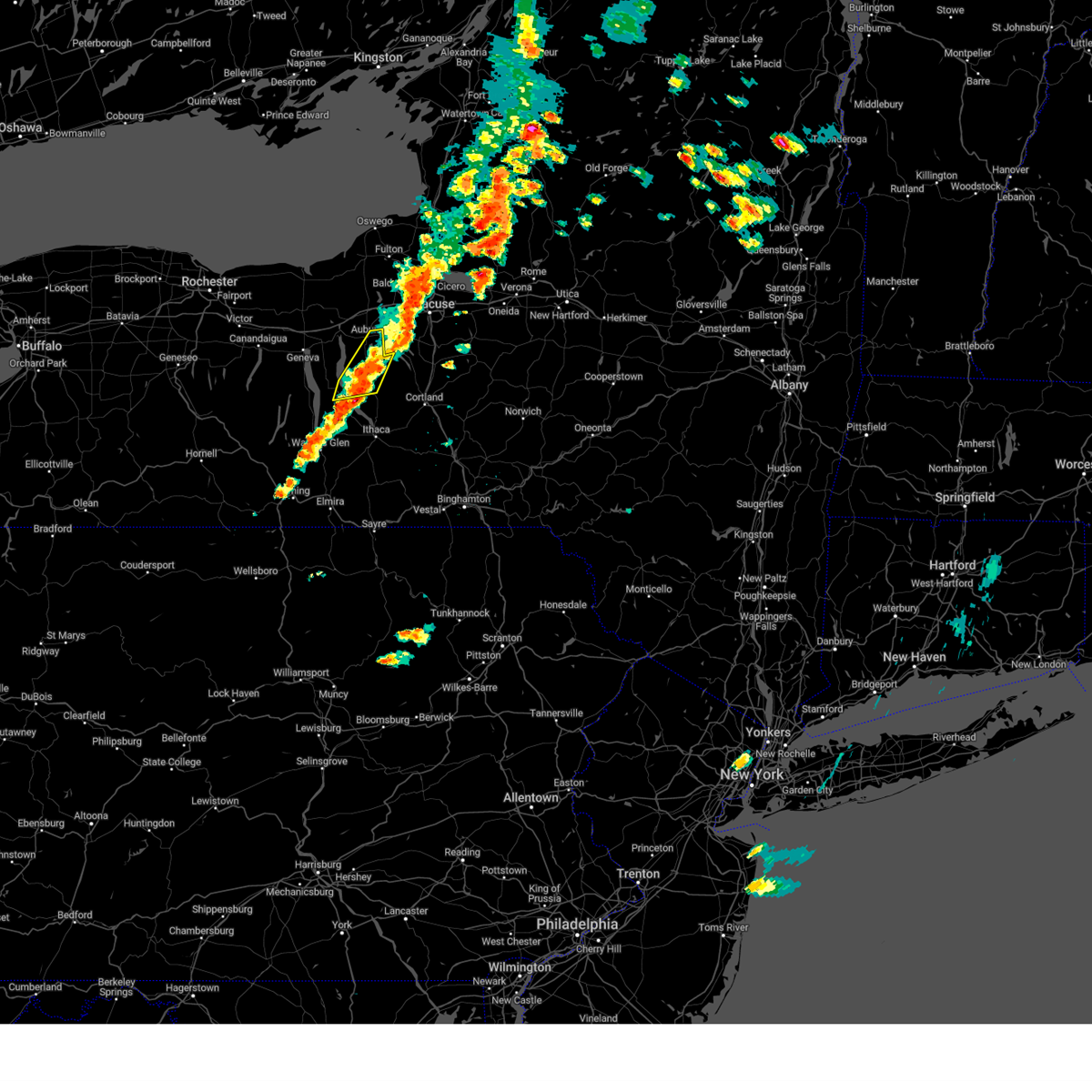
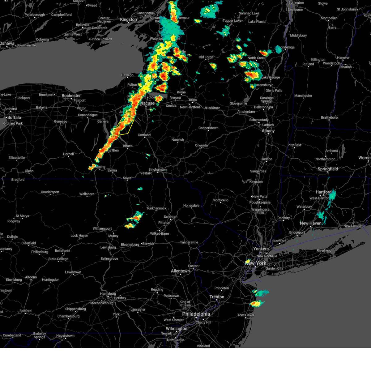
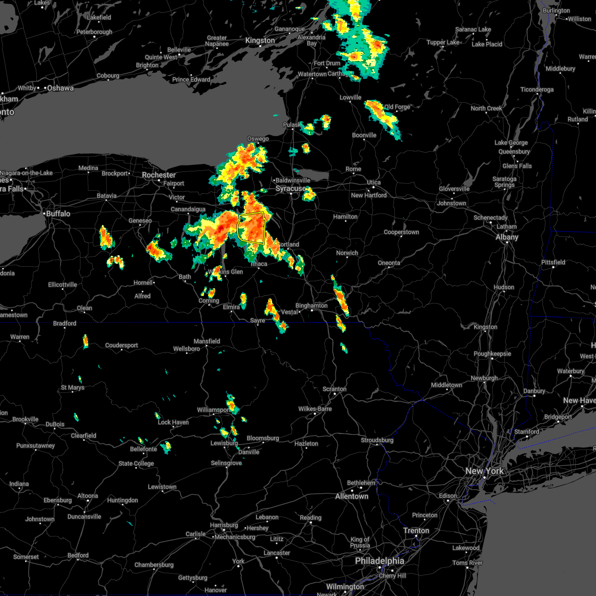
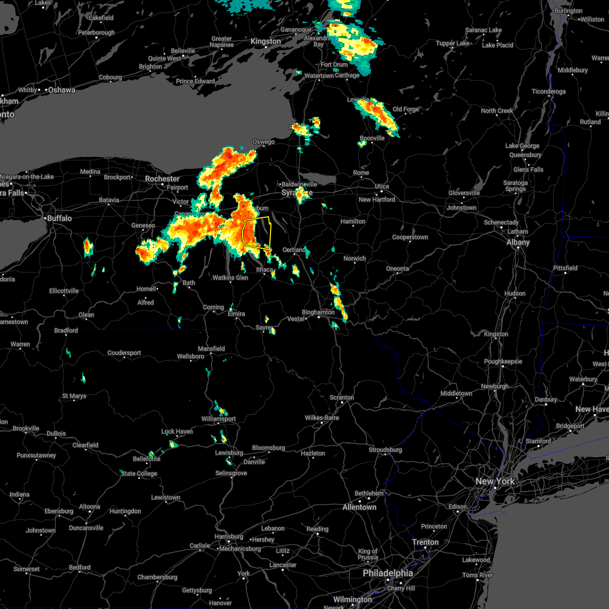
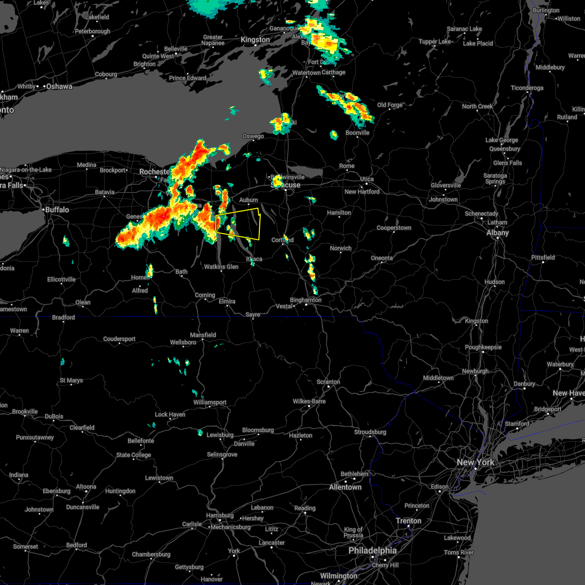
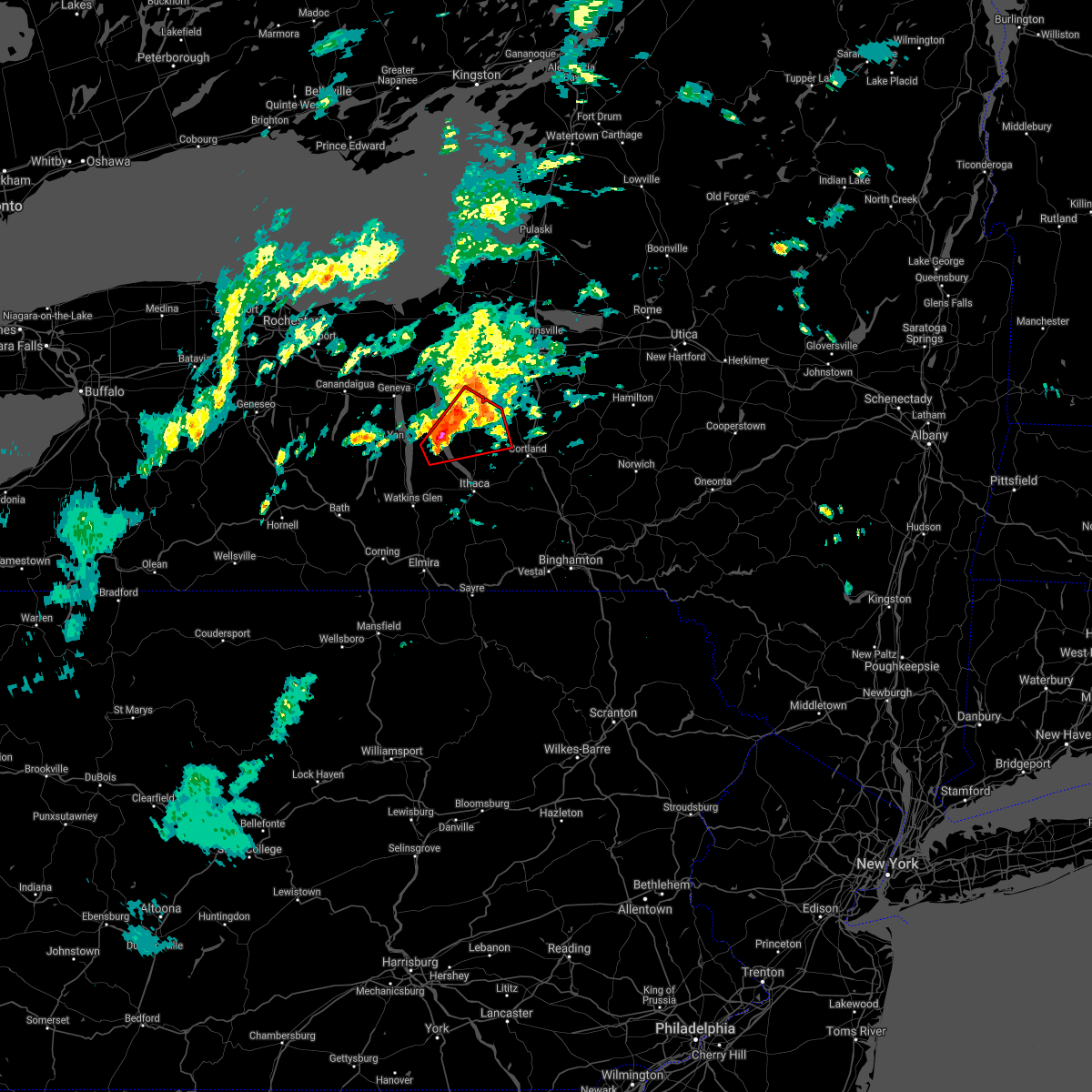
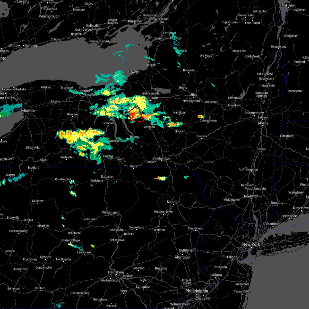
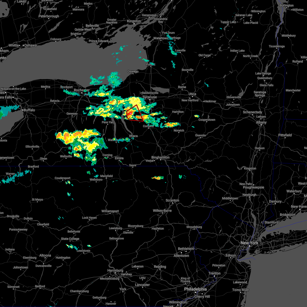
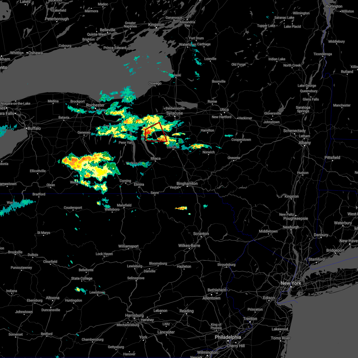
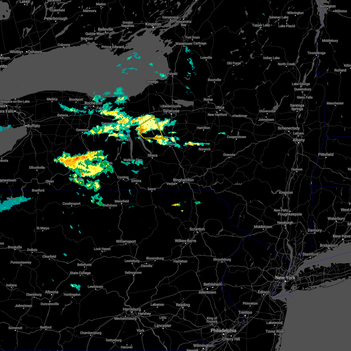
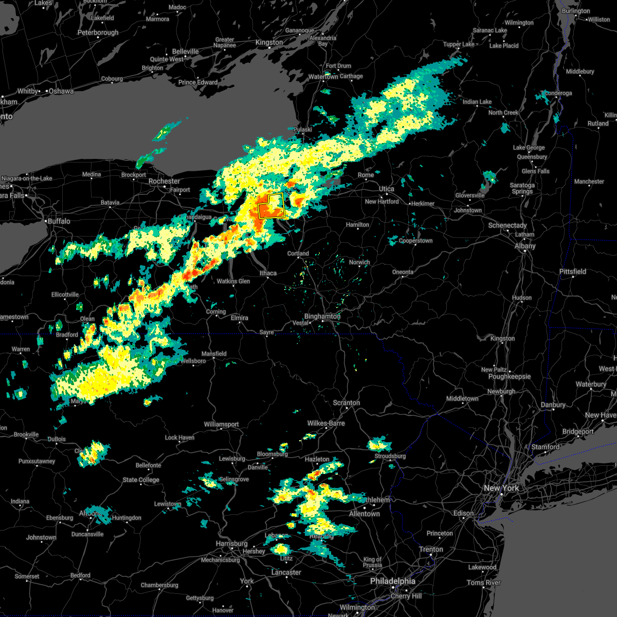
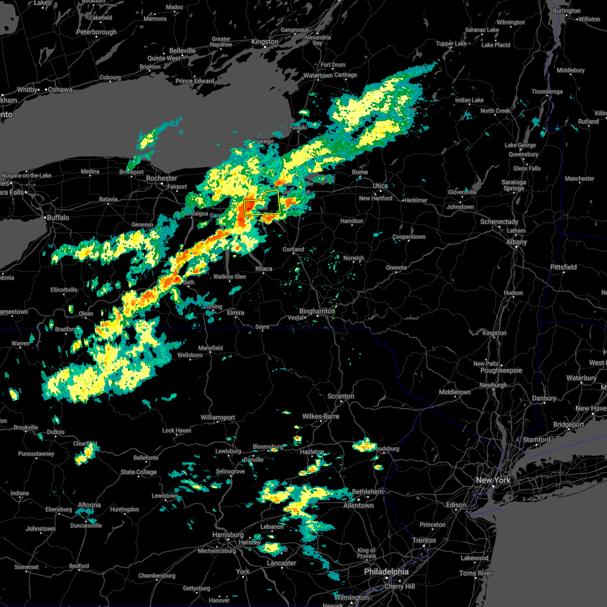
Hail Map for Melrose Park, NY
The Melrose Park, NY area has had 0 reports of on-the-ground hail by trained spotters, and has been under severe weather warnings 18 times during the past 12 months. Doppler radar has detected hail at or near Melrose Park, NY on 20 occasions.
| Name: | Melrose Park, NY |
| Where Located: | 21.6 miles WSW of Syracuse, NY |
| Map: | Google Map for Melrose Park, NY |
| Population: | 2294 |
| Housing Units: | 989 |
| More Info: | Search Google for Melrose Park, NY |
0
The Top Recent Hail Date for Melrose Park, NY is Thursday, June 16, 2022 (20th out of 20)

Hail and Wind Damage Spotted near Melrose Park, NY
| Date / Time | Report Details |
|---|---|
| 9/7/2023 6:18 PM EDT |
 At 617 pm edt, a severe thunderstorm was located near skaneateles, or 7 miles northeast of auburn, moving northeast at 35 mph (radar indicated). Hazards include 60 mph wind gusts and penny size hail. Expect damage to roofs, siding, and trees. locations impacted include, onondaga, syracuse, auburn, owasco, sennett, fleming, skaneateles, marcellus, jordan, and montezuma. hail threat, radar indicated max hail size, 0. 75 in wind threat, radar indicated max wind gust, 60 mph. At 617 pm edt, a severe thunderstorm was located near skaneateles, or 7 miles northeast of auburn, moving northeast at 35 mph (radar indicated). Hazards include 60 mph wind gusts and penny size hail. Expect damage to roofs, siding, and trees. locations impacted include, onondaga, syracuse, auburn, owasco, sennett, fleming, skaneateles, marcellus, jordan, and montezuma. hail threat, radar indicated max hail size, 0. 75 in wind threat, radar indicated max wind gust, 60 mph.
|
| 9/7/2023 6:01 PM EDT |
 At 600 pm edt, a severe thunderstorm was located over fleming, or near auburn, moving northeast at 35 mph (radar indicated). Hazards include 60 mph wind gusts and penny size hail. expect damage to roofs, siding, and trees At 600 pm edt, a severe thunderstorm was located over fleming, or near auburn, moving northeast at 35 mph (radar indicated). Hazards include 60 mph wind gusts and penny size hail. expect damage to roofs, siding, and trees
|
| 9/7/2023 5:49 PM EDT |
 At 549 pm edt, a severe thunderstorm was located near levanna, or 11 miles south of auburn, moving northeast at 35 mph (radar indicated). Hazards include 60 mph wind gusts and penny size hail. Expect damage to roofs, siding, and trees. locations impacted include, auburn, seneca falls, romulus, fayette, owasco, fleming, genoa, ledyard, moravia, and union springs. hail threat, radar indicated max hail size, 0. 75 in wind threat, radar indicated max wind gust, 60 mph. At 549 pm edt, a severe thunderstorm was located near levanna, or 11 miles south of auburn, moving northeast at 35 mph (radar indicated). Hazards include 60 mph wind gusts and penny size hail. Expect damage to roofs, siding, and trees. locations impacted include, auburn, seneca falls, romulus, fayette, owasco, fleming, genoa, ledyard, moravia, and union springs. hail threat, radar indicated max hail size, 0. 75 in wind threat, radar indicated max wind gust, 60 mph.
|
| 9/7/2023 5:30 PM EDT |
 At 530 pm edt, a severe thunderstorm was located over interlaken, or 14 miles northeast of dundee, moving northeast at 35 mph (radar indicated). Hazards include 60 mph wind gusts and penny size hail. expect damage to roofs, siding, and trees At 530 pm edt, a severe thunderstorm was located over interlaken, or 14 miles northeast of dundee, moving northeast at 35 mph (radar indicated). Hazards include 60 mph wind gusts and penny size hail. expect damage to roofs, siding, and trees
|
| 8/12/2023 2:01 PM EDT |
 At 201 pm edt, a severe thunderstorm was located near kendaia, or near geneva, moving east at 25 mph (radar indicated). Hazards include 60 mph wind gusts and quarter size hail. Hail damage to vehicles is expected. Expect wind damage to roofs, siding, and trees. At 201 pm edt, a severe thunderstorm was located near kendaia, or near geneva, moving east at 25 mph (radar indicated). Hazards include 60 mph wind gusts and quarter size hail. Hail damage to vehicles is expected. Expect wind damage to roofs, siding, and trees.
|
| 8/7/2023 7:08 PM EDT |
 At 708 pm edt, severe thunderstorms were located along a line extending from near pulaski to near brewerton to near skaneateles, moving northeast at 30 mph (radar indicated). Hazards include 60 mph wind gusts and penny size hail. expect damage to roofs, siding, and trees At 708 pm edt, severe thunderstorms were located along a line extending from near pulaski to near brewerton to near skaneateles, moving northeast at 30 mph (radar indicated). Hazards include 60 mph wind gusts and penny size hail. expect damage to roofs, siding, and trees
|
| 8/7/2023 6:37 PM EDT |
 At 636 pm edt, severe thunderstorms were located along a line extending from near mexico point state park to baldwinsville to near levanna, moving east at 20 mph (radar indicated). Hazards include 60 mph wind gusts and penny size hail. Expect damage to roofs, siding, and trees. locations impacted include, auburn, van buren, baldwinsville, fayette, sennett, fleming, jordan, port byron, union springs and elbridge. hail threat, radar indicated max hail size, 0. 75 in wind threat, radar indicated max wind gust, 60 mph. At 636 pm edt, severe thunderstorms were located along a line extending from near mexico point state park to baldwinsville to near levanna, moving east at 20 mph (radar indicated). Hazards include 60 mph wind gusts and penny size hail. Expect damage to roofs, siding, and trees. locations impacted include, auburn, van buren, baldwinsville, fayette, sennett, fleming, jordan, port byron, union springs and elbridge. hail threat, radar indicated max hail size, 0. 75 in wind threat, radar indicated max wind gust, 60 mph.
|
| 8/7/2023 6:01 PM EDT |
 At 601 pm edt, severe thunderstorms were located along a line extending from 6 miles east of fair haven beach state park to near weedsport to near kendaia, moving northeast at 30 mph (radar indicated). Hazards include 60 mph wind gusts and penny size hail. expect damage to roofs, siding, and trees At 601 pm edt, severe thunderstorms were located along a line extending from 6 miles east of fair haven beach state park to near weedsport to near kendaia, moving northeast at 30 mph (radar indicated). Hazards include 60 mph wind gusts and penny size hail. expect damage to roofs, siding, and trees
|
| 8/7/2023 5:25 PM EDT |
 At 525 pm edt, severe thunderstorms were located along a line extending from near chimney bluffs state park to near lyons to near potter, moving northeast at 35 mph (radar indicated). Hazards include 60 mph wind gusts and penny size hail. Expect damage to roofs, siding, and trees. locations impacted include, auburn, seneca falls, waterloo, fayette, sennett, benton, union springs, tyre, cayuga and canoga. hail threat, radar indicated max hail size, 0. 75 in wind threat, radar indicated max wind gust, 60 mph. At 525 pm edt, severe thunderstorms were located along a line extending from near chimney bluffs state park to near lyons to near potter, moving northeast at 35 mph (radar indicated). Hazards include 60 mph wind gusts and penny size hail. Expect damage to roofs, siding, and trees. locations impacted include, auburn, seneca falls, waterloo, fayette, sennett, benton, union springs, tyre, cayuga and canoga. hail threat, radar indicated max hail size, 0. 75 in wind threat, radar indicated max wind gust, 60 mph.
|
| 8/7/2023 5:05 PM EDT |
 At 505 pm edt, severe thunderstorms were located along a line extending from near marion to near clifton springs to near italy, moving northeast at 35 mph (radar indicated). Hazards include 60 mph wind gusts and penny size hail. expect damage to roofs, siding, and trees At 505 pm edt, severe thunderstorms were located along a line extending from near marion to near clifton springs to near italy, moving northeast at 35 mph (radar indicated). Hazards include 60 mph wind gusts and penny size hail. expect damage to roofs, siding, and trees
|
| 7/24/2023 2:35 PM EDT |
 At 235 pm edt, a severe thunderstorm was located near fleming, or near auburn, moving east at 30 mph (radar indicated). Hazards include 60 mph wind gusts and penny size hail. Expect damage to roofs, siding, and trees. locations impacted include, auburn, fleming, union springs, cayuga, melrose park, throopsville, wyckoff, mapleton and fosterville. hail threat, radar indicated max hail size, 0. 75 in wind threat, radar indicated max wind gust, 60 mph. At 235 pm edt, a severe thunderstorm was located near fleming, or near auburn, moving east at 30 mph (radar indicated). Hazards include 60 mph wind gusts and penny size hail. Expect damage to roofs, siding, and trees. locations impacted include, auburn, fleming, union springs, cayuga, melrose park, throopsville, wyckoff, mapleton and fosterville. hail threat, radar indicated max hail size, 0. 75 in wind threat, radar indicated max wind gust, 60 mph.
|
| 7/24/2023 2:20 PM EDT |
 At 219 pm edt, a severe thunderstorm was located over canoga, or near seneca falls, moving east at 15 mph (radar indicated). Hazards include 60 mph wind gusts and quarter size hail. Hail damage to vehicles is expected. Expect wind damage to roofs, siding, and trees. At 219 pm edt, a severe thunderstorm was located over canoga, or near seneca falls, moving east at 15 mph (radar indicated). Hazards include 60 mph wind gusts and quarter size hail. Hail damage to vehicles is expected. Expect wind damage to roofs, siding, and trees.
|
| 7/13/2023 2:52 PM EDT |
 The severe thunderstorm warning for southeastern seneca and central cayuga counties will expire at 300 pm edt, the storms which prompted the warning have moved out of the area. therefore, the warning will be allowed to expire. however small hail and gusty winds are still possible with these thunderstorms. a severe thunderstorm watch remains in effect until 800 pm edt for central new york. remember, a severe thunderstorm warning still remains in effect for caygua conuty until 345 pm. The severe thunderstorm warning for southeastern seneca and central cayuga counties will expire at 300 pm edt, the storms which prompted the warning have moved out of the area. therefore, the warning will be allowed to expire. however small hail and gusty winds are still possible with these thunderstorms. a severe thunderstorm watch remains in effect until 800 pm edt for central new york. remember, a severe thunderstorm warning still remains in effect for caygua conuty until 345 pm.
|
| 7/13/2023 2:40 PM EDT |
 At 239 pm edt, severe thunderstorms were located along a line extending from marcellus to near niles to king ferry, moving east at 30 mph (radar indicated). Hazards include 60 mph wind gusts and nickel size hail. Expect damage to roofs, siding, and trees. locations impacted include, auburn, owasco, fleming, genoa, ledyard, niles, aurora, levanna, venice center and king ferry. hail threat, radar indicated max hail size, 0. 88 in wind threat, radar indicated max wind gust, 60 mph. At 239 pm edt, severe thunderstorms were located along a line extending from marcellus to near niles to king ferry, moving east at 30 mph (radar indicated). Hazards include 60 mph wind gusts and nickel size hail. Expect damage to roofs, siding, and trees. locations impacted include, auburn, owasco, fleming, genoa, ledyard, niles, aurora, levanna, venice center and king ferry. hail threat, radar indicated max hail size, 0. 88 in wind threat, radar indicated max wind gust, 60 mph.
|
| 7/13/2023 2:28 PM EDT |
 At 227 pm edt, severe thunderstorms were located along a line extending from near skaneateles to scipio center to near lodi, moving east at 30 mph (radar indicated). Hazards include 60 mph wind gusts and nickel size hail. Expect damage to roofs, siding, and trees. locations impacted include, auburn, romulus, owasco, fleming, genoa, ledyard, union springs, niles, aurora and ovid. hail threat, radar indicated max hail size, 0. 88 in wind threat, radar indicated max wind gust, 60 mph. At 227 pm edt, severe thunderstorms were located along a line extending from near skaneateles to scipio center to near lodi, moving east at 30 mph (radar indicated). Hazards include 60 mph wind gusts and nickel size hail. Expect damage to roofs, siding, and trees. locations impacted include, auburn, romulus, owasco, fleming, genoa, ledyard, union springs, niles, aurora and ovid. hail threat, radar indicated max hail size, 0. 88 in wind threat, radar indicated max wind gust, 60 mph.
|
| 7/13/2023 2:14 PM EDT |
 At 213 pm edt, severe thunderstorms were located along a line extending from throopsville to near ovid, moving northeast at 75 mph (radar indicated). Hazards include 60 mph wind gusts and nickel size hail. Expect damage to roofs, siding, and trees. locations impacted include, auburn, seneca falls, waterloo, romulus, fayette, owasco, fleming, genoa, ledyard and union springs. hail threat, radar indicated max hail size, 0. 88 in wind threat, radar indicated max wind gust, 60 mph. At 213 pm edt, severe thunderstorms were located along a line extending from throopsville to near ovid, moving northeast at 75 mph (radar indicated). Hazards include 60 mph wind gusts and nickel size hail. Expect damage to roofs, siding, and trees. locations impacted include, auburn, seneca falls, waterloo, romulus, fayette, owasco, fleming, genoa, ledyard and union springs. hail threat, radar indicated max hail size, 0. 88 in wind threat, radar indicated max wind gust, 60 mph.
|
| 7/13/2023 2:00 PM EDT |
 At 200 pm edt, severe thunderstorms were located along a line extending from near waterloo to mays mills, moving east at 30 mph (radar indicated). Hazards include 60 mph wind gusts and nickel size hail. expect damage to roofs, siding, and trees At 200 pm edt, severe thunderstorms were located along a line extending from near waterloo to mays mills, moving east at 30 mph (radar indicated). Hazards include 60 mph wind gusts and nickel size hail. expect damage to roofs, siding, and trees
|
| 6/26/2023 6:40 PM EDT |
 At 638 pm edt, a severe thunderstorm was located near union springs, or near auburn, moving northeast at 25 mph (law enforcement. this storm has a history of producing wind damage with multiple reports of trees down). Hazards include 60 mph wind gusts and quarter size hail. Hail damage to vehicles is expected. Expect wind damage to roofs, siding, and trees. At 638 pm edt, a severe thunderstorm was located near union springs, or near auburn, moving northeast at 25 mph (law enforcement. this storm has a history of producing wind damage with multiple reports of trees down). Hazards include 60 mph wind gusts and quarter size hail. Hail damage to vehicles is expected. Expect wind damage to roofs, siding, and trees.
|
| 4/1/2023 4:43 PM EDT |
 At 442 pm edt, severe thunderstorms were located along a line extending from near camillus to marathon, moving east at 45 mph (radar indicated). Hazards include 60 mph wind gusts and penny size hail. expect damage to roofs, siding, and trees At 442 pm edt, severe thunderstorms were located along a line extending from near camillus to marathon, moving east at 45 mph (radar indicated). Hazards include 60 mph wind gusts and penny size hail. expect damage to roofs, siding, and trees
|
| 9/22/2022 2:31 AM EDT |
 At 230 am edt, a severe thunderstorm was located near cayuga, or near auburn, moving east at 40 mph (radar indicated). Hazards include 60 mph wind gusts and penny size hail. Expect damage to roofs, siding, and trees. locations impacted include, auburn, sennett, fleming, cayuga, melrose park, throopsville, wyckoff, mapleton and fosterville. hail threat, radar indicated max hail size, 0. 75 in wind threat, radar indicated max wind gust, 60 mph. At 230 am edt, a severe thunderstorm was located near cayuga, or near auburn, moving east at 40 mph (radar indicated). Hazards include 60 mph wind gusts and penny size hail. Expect damage to roofs, siding, and trees. locations impacted include, auburn, sennett, fleming, cayuga, melrose park, throopsville, wyckoff, mapleton and fosterville. hail threat, radar indicated max hail size, 0. 75 in wind threat, radar indicated max wind gust, 60 mph.
|
| 9/22/2022 2:04 AM EDT |
 At 204 am edt, a severe thunderstorm was located over phelps, or 7 miles north of geneva, moving east at 50 mph (radar indicated). Hazards include 60 mph wind gusts and quarter size hail. Hail damage to vehicles is expected. Expect wind damage to roofs, siding, and trees. At 204 am edt, a severe thunderstorm was located over phelps, or 7 miles north of geneva, moving east at 50 mph (radar indicated). Hazards include 60 mph wind gusts and quarter size hail. Hail damage to vehicles is expected. Expect wind damage to roofs, siding, and trees.
|
| 6/16/2022 5:26 PM EDT |
 At 526 pm edt, severe thunderstorms were located along a line extending from bridgeport to near levanna, moving southeast at 30 mph (radar indicated). Hazards include 60 mph wind gusts and quarter size hail. Hail damage to vehicles is expected. Expect wind damage to roofs, siding, and trees. At 526 pm edt, severe thunderstorms were located along a line extending from bridgeport to near levanna, moving southeast at 30 mph (radar indicated). Hazards include 60 mph wind gusts and quarter size hail. Hail damage to vehicles is expected. Expect wind damage to roofs, siding, and trees.
|
| 6/16/2022 5:20 PM EDT |
 At 520 pm edt, severe thunderstorms were located along a line extending from cayuga to near kirkville, moving east at 15 mph (radar indicated). Hazards include 60 mph wind gusts and quarter size hail. Hail damage to vehicles is expected. expect wind damage to roofs, siding, and trees. Locations impacted include, onondaga, syracuse, auburn, de witt, van buren, north syracuse, seneca falls, solvay, waterloo and chittenango. At 520 pm edt, severe thunderstorms were located along a line extending from cayuga to near kirkville, moving east at 15 mph (radar indicated). Hazards include 60 mph wind gusts and quarter size hail. Hail damage to vehicles is expected. expect wind damage to roofs, siding, and trees. Locations impacted include, onondaga, syracuse, auburn, de witt, van buren, north syracuse, seneca falls, solvay, waterloo and chittenango.
|
| 6/16/2022 4:50 PM EDT |
 At 450 pm edt, severe thunderstorms were located along a line extending from near waterloo to near liverpool, moving east at 15 mph (radar indicated). Hazards include 60 mph wind gusts and quarter size hail. Hail damage to vehicles is expected. Expect wind damage to roofs, siding, and trees. At 450 pm edt, severe thunderstorms were located along a line extending from near waterloo to near liverpool, moving east at 15 mph (radar indicated). Hazards include 60 mph wind gusts and quarter size hail. Hail damage to vehicles is expected. Expect wind damage to roofs, siding, and trees.
|
| 6/16/2022 1:58 AM EDT |
 The severe thunderstorm warning for southwestern cayuga county will expire at 200 am edt, the storm which prompted the warning has weakened below severe limits, and no longer poses an immediate threat to life or property. therefore, the warning will be allowed to expire. however, heavy rain is expected to continue with another round of thunderstorms. The severe thunderstorm warning for southwestern cayuga county will expire at 200 am edt, the storm which prompted the warning has weakened below severe limits, and no longer poses an immediate threat to life or property. therefore, the warning will be allowed to expire. however, heavy rain is expected to continue with another round of thunderstorms.
|
| 6/16/2022 1:35 AM EDT |
 At 134 am edt, a severe thunderstorm was located near scipio center, or 11 miles south of auburn, moving east at 30 mph (radar indicated). Hazards include 60 mph wind gusts and quarter size hail. Hail damage to vehicles is expected. expect wind damage to roofs, siding, and trees. locations impacted include, fleming, genoa, ledyard, union springs, aurora, levanna, venice center, king ferry, casowasco and scipio center. hail threat, radar indicated max hail size, 1. 00 in wind threat, radar indicated max wind gust, 60 mph. At 134 am edt, a severe thunderstorm was located near scipio center, or 11 miles south of auburn, moving east at 30 mph (radar indicated). Hazards include 60 mph wind gusts and quarter size hail. Hail damage to vehicles is expected. expect wind damage to roofs, siding, and trees. locations impacted include, fleming, genoa, ledyard, union springs, aurora, levanna, venice center, king ferry, casowasco and scipio center. hail threat, radar indicated max hail size, 1. 00 in wind threat, radar indicated max wind gust, 60 mph.
|
| 6/16/2022 1:13 AM EDT |
 At 112 am edt, a severe thunderstorm was located over romulus, or 9 miles south of waterloo, moving east at 35 mph (radar indicated). Hazards include 60 mph wind gusts and quarter size hail. Hail damage to vehicles is expected. Expect wind damage to roofs, siding, and trees. At 112 am edt, a severe thunderstorm was located over romulus, or 9 miles south of waterloo, moving east at 35 mph (radar indicated). Hazards include 60 mph wind gusts and quarter size hail. Hail damage to vehicles is expected. Expect wind damage to roofs, siding, and trees.
|
| 5/16/2022 1:07 PM EDT |
 At 104 pm edt, severe thunderstorms were located along a line extending from near montezuma to throopsville to skaneateles to near otisco, moving north at 30 mph (law enforcement). Hazards include 60 mph wind gusts and quarter size hail. Hail damage to vehicles is expected. expect wind damage to roofs, siding, and trees. locations impacted include, onondaga, syracuse, clay, auburn, lysander, van buren, baldwinsville, north syracuse, solvay and owasco. hail threat, radar indicated max hail size, 1. 00 in wind threat, radar indicated max wind gust, 60 mph. At 104 pm edt, severe thunderstorms were located along a line extending from near montezuma to throopsville to skaneateles to near otisco, moving north at 30 mph (law enforcement). Hazards include 60 mph wind gusts and quarter size hail. Hail damage to vehicles is expected. expect wind damage to roofs, siding, and trees. locations impacted include, onondaga, syracuse, clay, auburn, lysander, van buren, baldwinsville, north syracuse, solvay and owasco. hail threat, radar indicated max hail size, 1. 00 in wind threat, radar indicated max wind gust, 60 mph.
|
| 5/16/2022 1:05 PM EDT | Trees dow in cayuga county NY, 4.7 miles N of Melrose Park, NY |
| 5/16/2022 12:53 PM EDT | Tree and wires down. time estimated by rada in cayuga county NY, 4.7 miles N of Melrose Park, NY |
| 5/16/2022 12:36 PM EDT |
 At 1235 pm edt, severe thunderstorms were located along a line extending from near canoga to levanna to king ferry to near locke, moving north at 35 mph (radar indicated). Hazards include 60 mph wind gusts and quarter size hail. Hail damage to vehicles is expected. Expect wind damage to roofs, siding, and trees. At 1235 pm edt, severe thunderstorms were located along a line extending from near canoga to levanna to king ferry to near locke, moving north at 35 mph (radar indicated). Hazards include 60 mph wind gusts and quarter size hail. Hail damage to vehicles is expected. Expect wind damage to roofs, siding, and trees.
|
| 10/16/2021 5:55 AM EDT |
 At 554 am edt, a severe thunderstorm capable of producing a tornado was located over kidders, or 15 miles northeast of dundee, moving northeast at 50 mph (radar indicated rotation). Hazards include tornado. Flying debris will be dangerous to those caught without shelter. mobile homes will be damaged or destroyed. damage to roofs, windows, and vehicles will occur. tree damage is likely. this dangerous storm will be near, king ferry around 600 am edt. genoa, ledyard and levanna around 605 am edt. locke, venice center and scipio center around 610 am edt. moravia, cascade and casowasco around 615 am edt. Owasco, niles and sempronius around 620 am edt. At 554 am edt, a severe thunderstorm capable of producing a tornado was located over kidders, or 15 miles northeast of dundee, moving northeast at 50 mph (radar indicated rotation). Hazards include tornado. Flying debris will be dangerous to those caught without shelter. mobile homes will be damaged or destroyed. damage to roofs, windows, and vehicles will occur. tree damage is likely. this dangerous storm will be near, king ferry around 600 am edt. genoa, ledyard and levanna around 605 am edt. locke, venice center and scipio center around 610 am edt. moravia, cascade and casowasco around 615 am edt. Owasco, niles and sempronius around 620 am edt.
|
| 10/15/2021 4:27 PM EDT |
 At 427 pm edt, a severe thunderstorm was located over niles, or 11 miles southeast of auburn, moving east at 25 mph (radar indicated). Hazards include 60 mph wind gusts and quarter size hail. Hail damage to vehicles is expected. Expect wind damage to roofs, siding, and trees. At 427 pm edt, a severe thunderstorm was located over niles, or 11 miles southeast of auburn, moving east at 25 mph (radar indicated). Hazards include 60 mph wind gusts and quarter size hail. Hail damage to vehicles is expected. Expect wind damage to roofs, siding, and trees.
|
| 10/15/2021 4:17 PM EDT |
 At 417 pm edt, a severe thunderstorm capable of producing a tornado was located over scipio center, or 9 miles south of auburn, moving east at 20 mph (radar indicated rotation). Hazards include tornado and quarter size hail. Flying debris will be dangerous to those caught without shelter. mobile homes will be damaged or destroyed. damage to roofs, windows, and vehicles will occur. tree damage is likely. this dangerous storm will be near, cascade around 425 pm edt. owasco around 435 pm edt. niles around 440 pm edt. Sempronius and kelloggsville around 445 pm edt. At 417 pm edt, a severe thunderstorm capable of producing a tornado was located over scipio center, or 9 miles south of auburn, moving east at 20 mph (radar indicated rotation). Hazards include tornado and quarter size hail. Flying debris will be dangerous to those caught without shelter. mobile homes will be damaged or destroyed. damage to roofs, windows, and vehicles will occur. tree damage is likely. this dangerous storm will be near, cascade around 425 pm edt. owasco around 435 pm edt. niles around 440 pm edt. Sempronius and kelloggsville around 445 pm edt.
|
| 10/15/2021 4:10 PM EDT |
 At 409 pm edt, a severe thunderstorm capable of producing a tornado was located near scipio center, or 10 miles south of auburn, moving east at 20 mph (radar indicated rotation). Hazards include tornado and quarter size hail. Flying debris will be dangerous to those caught without shelter. mobile homes will be damaged or destroyed. damage to roofs, windows, and vehicles will occur. tree damage is likely. this dangerous storm will be near, venice center around 415 pm edt. fleming and scipio center around 420 pm edt. casowasco and cascade around 425 pm edt. Owasco, moravia and niles around 430 pm edt. At 409 pm edt, a severe thunderstorm capable of producing a tornado was located near scipio center, or 10 miles south of auburn, moving east at 20 mph (radar indicated rotation). Hazards include tornado and quarter size hail. Flying debris will be dangerous to those caught without shelter. mobile homes will be damaged or destroyed. damage to roofs, windows, and vehicles will occur. tree damage is likely. this dangerous storm will be near, venice center around 415 pm edt. fleming and scipio center around 420 pm edt. casowasco and cascade around 425 pm edt. Owasco, moravia and niles around 430 pm edt.
|
| 10/15/2021 4:03 PM EDT |
 At 403 pm edt, a severe thunderstorm capable of producing a tornado was located over levanna, or 10 miles south of auburn, moving east at 20 mph (radar indicated rotation). Hazards include tornado and quarter size hail. Flying debris will be dangerous to those caught without shelter. mobile homes will be damaged or destroyed. damage to roofs, windows, and vehicles will occur. tree damage is likely. this dangerous storm will be near, venice center around 415 pm edt. fleming and scipio center around 420 pm edt. casowasco and cascade around 425 pm edt. Owasco, moravia and niles around 430 pm edt. At 403 pm edt, a severe thunderstorm capable of producing a tornado was located over levanna, or 10 miles south of auburn, moving east at 20 mph (radar indicated rotation). Hazards include tornado and quarter size hail. Flying debris will be dangerous to those caught without shelter. mobile homes will be damaged or destroyed. damage to roofs, windows, and vehicles will occur. tree damage is likely. this dangerous storm will be near, venice center around 415 pm edt. fleming and scipio center around 420 pm edt. casowasco and cascade around 425 pm edt. Owasco, moravia and niles around 430 pm edt.
|
| 10/15/2021 3:58 PM EDT |
 At 357 pm edt, a severe thunderstorm was located over levanna, or 9 miles southwest of auburn, moving east at 25 mph (radar indicated). Hazards include 60 mph wind gusts and quarter size hail. Hail damage to vehicles is expected. expect wind damage to roofs, siding, and trees. Locations impacted include, auburn, owasco, fleming, skaneateles, moravia, union springs, niles, sempronius, aurora and levanna. At 357 pm edt, a severe thunderstorm was located over levanna, or 9 miles southwest of auburn, moving east at 25 mph (radar indicated). Hazards include 60 mph wind gusts and quarter size hail. Hail damage to vehicles is expected. expect wind damage to roofs, siding, and trees. Locations impacted include, auburn, owasco, fleming, skaneateles, moravia, union springs, niles, sempronius, aurora and levanna.
|
| 10/15/2021 3:45 PM EDT |
 At 345 pm edt, a severe thunderstorm was located near levanna, or 8 miles south of seneca falls, moving east at 25 mph (radar indicated). Hazards include 60 mph wind gusts and quarter size hail. Hail damage to vehicles is expected. Expect wind damage to roofs, siding, and trees. At 345 pm edt, a severe thunderstorm was located near levanna, or 8 miles south of seneca falls, moving east at 25 mph (radar indicated). Hazards include 60 mph wind gusts and quarter size hail. Hail damage to vehicles is expected. Expect wind damage to roofs, siding, and trees.
|
| 8/29/2021 4:19 PM EDT |
 At 418 pm edt, a severe thunderstorm was located over melrose park, or near auburn, moving east at 25 mph (radar indicated). Hazards include 60 mph wind gusts. expect damage to roofs, siding, and trees At 418 pm edt, a severe thunderstorm was located over melrose park, or near auburn, moving east at 25 mph (radar indicated). Hazards include 60 mph wind gusts. expect damage to roofs, siding, and trees
|
| 8/17/2021 5:30 PM EDT |
 At 530 pm edt, a severe thunderstorm was located over sennett, or near auburn, moving east at 20 mph (radar indicated). Hazards include 60 mph wind gusts. Expect damage to roofs, siding, and trees. locations impacted include, auburn, sennett, skaneateles, marcellus, jordan, elbridge, throopsville, marysville, bennetts corners and ionia. hail threat, radar indicated max hail size, <. 75 in wind threat, radar indicated max wind gust, 60 mph. At 530 pm edt, a severe thunderstorm was located over sennett, or near auburn, moving east at 20 mph (radar indicated). Hazards include 60 mph wind gusts. Expect damage to roofs, siding, and trees. locations impacted include, auburn, sennett, skaneateles, marcellus, jordan, elbridge, throopsville, marysville, bennetts corners and ionia. hail threat, radar indicated max hail size, <. 75 in wind threat, radar indicated max wind gust, 60 mph.
|
| 8/17/2021 5:12 PM EDT |
 At 512 pm edt, a severe thunderstorm was located over throopsville, or near auburn, moving east at 20 mph (radar indicated). Hazards include 60 mph wind gusts. expect damage to roofs, siding, and trees At 512 pm edt, a severe thunderstorm was located over throopsville, or near auburn, moving east at 20 mph (radar indicated). Hazards include 60 mph wind gusts. expect damage to roofs, siding, and trees
|
| 7/13/2021 9:33 PM EDT |
 At 932 pm edt, severe thunderstorms were located along a line extending from plainville to near owasco to near ithaca, moving east at 30 mph (radar indicated). Hazards include 70 mph wind gusts and nickel size hail. Expect considerable tree damage. damage is likely to mobile homes, roofs, and outbuildings. Locations impacted include, onondaga, syracuse, clay, cicero, ithaca, auburn, de witt, lysander, cortland and van buren. At 932 pm edt, severe thunderstorms were located along a line extending from plainville to near owasco to near ithaca, moving east at 30 mph (radar indicated). Hazards include 70 mph wind gusts and nickel size hail. Expect considerable tree damage. damage is likely to mobile homes, roofs, and outbuildings. Locations impacted include, onondaga, syracuse, clay, cicero, ithaca, auburn, de witt, lysander, cortland and van buren.
|
| 7/13/2021 9:01 PM EDT |
 At 900 pm edt, severe thunderstorms were located along a line extending from montezuma to near sheldrake to near odessa, moving northeast at 30 mph (radar indicated). Hazards include 70 mph wind gusts and nickel size hail. Expect considerable tree damage. Damage is likely to mobile homes, roofs, and outbuildings. At 900 pm edt, severe thunderstorms were located along a line extending from montezuma to near sheldrake to near odessa, moving northeast at 30 mph (radar indicated). Hazards include 70 mph wind gusts and nickel size hail. Expect considerable tree damage. Damage is likely to mobile homes, roofs, and outbuildings.
|
| 6/30/2021 2:35 PM EDT |
 At 235 pm edt, a severe thunderstorm was located over auburn, moving east at 35 mph (radar indicated). Hazards include 60 mph wind gusts and quarter size hail. Hail damage to vehicles is expected. expect wind damage to roofs, siding, and trees. Locations impacted include, auburn, owasco, sennett, fleming, union springs, cayuga, melrose park, throopsville, mapleton and fosterville. At 235 pm edt, a severe thunderstorm was located over auburn, moving east at 35 mph (radar indicated). Hazards include 60 mph wind gusts and quarter size hail. Hail damage to vehicles is expected. expect wind damage to roofs, siding, and trees. Locations impacted include, auburn, owasco, sennett, fleming, union springs, cayuga, melrose park, throopsville, mapleton and fosterville.
|
| 6/30/2021 2:07 PM EDT |
 At 206 pm edt, a severe thunderstorm was located near waterloo, moving east at 35 mph (radar indicated). Hazards include 60 mph wind gusts and quarter size hail. Hail damage to vehicles is expected. Expect wind damage to roofs, siding, and trees. At 206 pm edt, a severe thunderstorm was located near waterloo, moving east at 35 mph (radar indicated). Hazards include 60 mph wind gusts and quarter size hail. Hail damage to vehicles is expected. Expect wind damage to roofs, siding, and trees.
|
| 6/29/2021 5:47 PM EDT |
 At 546 pm edt, severe thunderstorms were located along a line extending from near otisco to urbana, moving east at 25 mph (trained weather spotters). Hazards include 60 mph wind gusts and quarter size hail. Hail damage to vehicles is expected. expect wind damage to roofs, siding, and trees. Locations impacted include, hector, owasco, starkey, skaneateles, covert, locke, genoa, ledyard, trumansburg and dundee. At 546 pm edt, severe thunderstorms were located along a line extending from near otisco to urbana, moving east at 25 mph (trained weather spotters). Hazards include 60 mph wind gusts and quarter size hail. Hail damage to vehicles is expected. expect wind damage to roofs, siding, and trees. Locations impacted include, hector, owasco, starkey, skaneateles, covert, locke, genoa, ledyard, trumansburg and dundee.
|
| 6/29/2021 5:45 PM EDT | Dispatch reports tree down blocking one lane of west lake road near wycoff road in town of flemin in cayuga county NY, 4.7 miles N of Melrose Park, NY |
| 6/29/2021 5:28 PM EDT |
 At 527 pm edt, a line of severe thunderstorms were located along a line extending from near owasco to near prattsburg, moving east at 25 mph (trained weather spotters reported downed trees and wires in penn yan). Hazards include 60 mph wind gusts and quarter size hail. Hail damage to vehicles is expected. Expect wind damage to roofs, siding, and trees. At 527 pm edt, a line of severe thunderstorms were located along a line extending from near owasco to near prattsburg, moving east at 25 mph (trained weather spotters reported downed trees and wires in penn yan). Hazards include 60 mph wind gusts and quarter size hail. Hail damage to vehicles is expected. Expect wind damage to roofs, siding, and trees.
|
| 6/21/2021 4:53 PM EDT |
 At 452 pm edt, a severe thunderstorm was located over cayuga, or near seneca falls, moving east at 40 mph (radar indicated). Hazards include 60 mph wind gusts and quarter size hail. Hail damage to vehicles is expected. Expect wind damage to roofs, siding, and trees. At 452 pm edt, a severe thunderstorm was located over cayuga, or near seneca falls, moving east at 40 mph (radar indicated). Hazards include 60 mph wind gusts and quarter size hail. Hail damage to vehicles is expected. Expect wind damage to roofs, siding, and trees.
|
| 5/26/2021 1:01 PM EDT |
 At 100 pm edt, severe thunderstorms were located along a line extending from cicero to townsendville, moving east at 45 mph (radar indicated). Hazards include 60 mph wind gusts and penny size hail. Expect damage to roofs, siding, and trees. Locations impacted include, onondaga, syracuse, clay, cicero, ithaca, auburn, de witt, van buren, baldwinsville and pompey. At 100 pm edt, severe thunderstorms were located along a line extending from cicero to townsendville, moving east at 45 mph (radar indicated). Hazards include 60 mph wind gusts and penny size hail. Expect damage to roofs, siding, and trees. Locations impacted include, onondaga, syracuse, clay, cicero, ithaca, auburn, de witt, van buren, baldwinsville and pompey.
|
| 5/26/2021 12:38 PM EDT |
 At 1238 pm edt, severe thunderstorms were located along a line extending from lysander to near keuka park, moving east at 45 mph (radar indicated). Hazards include 60 mph wind gusts and penny size hail. expect damage to roofs, siding, and trees At 1238 pm edt, severe thunderstorms were located along a line extending from lysander to near keuka park, moving east at 45 mph (radar indicated). Hazards include 60 mph wind gusts and penny size hail. expect damage to roofs, siding, and trees
|
| 10/7/2020 2:13 PM EDT |
 The national weather service in binghamton has issued a * severe thunderstorm warning for. southwestern madison county in central new york. cayuga county in central new york. cortland county in central new york. Onondaga county in central new york. The national weather service in binghamton has issued a * severe thunderstorm warning for. southwestern madison county in central new york. cayuga county in central new york. cortland county in central new york. Onondaga county in central new york.
|
| 8/27/2020 3:37 PM EDT |
 At 335 pm edt, a severe thunderstorm was located over montville, or 12 miles northwest of cortland, moving southeast at 40 mph (radar indicated). Hazards include 60 mph wind gusts and quarter size hail. Hail damage to vehicles is expected. expect wind damage to roofs, siding, and trees. Locations impacted include, auburn, seneca falls, waterloo, fayette, owasco, fleming, moravia, union springs, niles and sempronius. At 335 pm edt, a severe thunderstorm was located over montville, or 12 miles northwest of cortland, moving southeast at 40 mph (radar indicated). Hazards include 60 mph wind gusts and quarter size hail. Hail damage to vehicles is expected. expect wind damage to roofs, siding, and trees. Locations impacted include, auburn, seneca falls, waterloo, fayette, owasco, fleming, moravia, union springs, niles and sempronius.
|
| 8/27/2020 3:13 PM EDT |
 At 312 pm edt, a severe thunderstorm was located near geneva, moving east at 50 mph (radar indicated). Hazards include 60 mph wind gusts and half dollar size hail. Hail damage to vehicles is expected. Expect wind damage to roofs, siding, and trees. At 312 pm edt, a severe thunderstorm was located near geneva, moving east at 50 mph (radar indicated). Hazards include 60 mph wind gusts and half dollar size hail. Hail damage to vehicles is expected. Expect wind damage to roofs, siding, and trees.
|
| 7/19/2020 4:29 PM EDT |
 At 427 pm edt, severe thunderstorms were located along a line extending from near auburn to romulus to townsendville to near hornby, moving east at 40 mph. trees have been blown down with this line of thunderstorms (law enforcement). Hazards include 60 mph wind gusts and penny size hail. Expect damage to roofs, siding, and trees. Locations impacted include, ithaca, auburn, corning, big flats, seneca falls, horseheads, newfield, hector, romulus and fayette. At 427 pm edt, severe thunderstorms were located along a line extending from near auburn to romulus to townsendville to near hornby, moving east at 40 mph. trees have been blown down with this line of thunderstorms (law enforcement). Hazards include 60 mph wind gusts and penny size hail. Expect damage to roofs, siding, and trees. Locations impacted include, ithaca, auburn, corning, big flats, seneca falls, horseheads, newfield, hector, romulus and fayette.
|
| 7/19/2020 4:14 PM EDT |
 At 411 pm edt, severe thunderstorms were located along a line extending from near lehigh vallley junction to near benton to near himrod to campbell, moving east at 35 mph. trees have been blown down with this line of thunderstorms (law enforcement). Hazards include 60 mph wind gusts and penny size hail. Expect damage to roofs, siding, and trees. Locations impacted include, ithaca, auburn, corning, big flats, seneca falls, horseheads, newfield, waterloo, penn yan and hector. At 411 pm edt, severe thunderstorms were located along a line extending from near lehigh vallley junction to near benton to near himrod to campbell, moving east at 35 mph. trees have been blown down with this line of thunderstorms (law enforcement). Hazards include 60 mph wind gusts and penny size hail. Expect damage to roofs, siding, and trees. Locations impacted include, ithaca, auburn, corning, big flats, seneca falls, horseheads, newfield, waterloo, penn yan and hector.
|
| 7/19/2020 3:56 PM EDT |
 At 354 pm edt, severe thunderstorms were located along a line extending from near phelps to rushville to near branchport to west cameron, moving east at 35 mph. trees have been blown down in steuben county, in howard, with this line of thunderstorms (law enforcement). Hazards include 60 mph wind gusts and penny size hail. expect damage to roofs, siding, and trees At 354 pm edt, severe thunderstorms were located along a line extending from near phelps to rushville to near branchport to west cameron, moving east at 35 mph. trees have been blown down in steuben county, in howard, with this line of thunderstorms (law enforcement). Hazards include 60 mph wind gusts and penny size hail. expect damage to roofs, siding, and trees
|
| 5/15/2020 3:56 PM EDT |
 At 356 pm edt, a severe thunderstorm was located over canoga, or near seneca falls, moving east at 60 mph (radar indicated). Hazards include 60 mph wind gusts and half dollar size hail. Hail damage to vehicles is expected. Expect wind damage to roofs, siding, and trees. At 356 pm edt, a severe thunderstorm was located over canoga, or near seneca falls, moving east at 60 mph (radar indicated). Hazards include 60 mph wind gusts and half dollar size hail. Hail damage to vehicles is expected. Expect wind damage to roofs, siding, and trees.
|
| 8/18/2019 2:43 PM EDT |
 At 243 pm edt, a severe thunderstorm was located near skaneateles, or near auburn, moving northeast at 30 mph (radar indicated). Hazards include 60 mph wind gusts and quarter size hail. Hail damage to vehicles is expected. Expect wind damage to roofs, siding, and trees. At 243 pm edt, a severe thunderstorm was located near skaneateles, or near auburn, moving northeast at 30 mph (radar indicated). Hazards include 60 mph wind gusts and quarter size hail. Hail damage to vehicles is expected. Expect wind damage to roofs, siding, and trees.
|
| 8/16/2019 8:34 PM EDT |
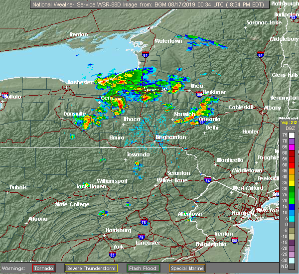 At 834 pm edt, a severe thunderstorm was located over fleming, or near auburn, moving northeast at 30 mph (radar indicated). Hazards include 60 mph wind gusts and penny size hail. Expect damage to roofs, siding, and trees. Locations impacted include, owasco, fleming, casowasco, scipio center, melrose park, ensenore, merrifield, wyckoff and mapleton. At 834 pm edt, a severe thunderstorm was located over fleming, or near auburn, moving northeast at 30 mph (radar indicated). Hazards include 60 mph wind gusts and penny size hail. Expect damage to roofs, siding, and trees. Locations impacted include, owasco, fleming, casowasco, scipio center, melrose park, ensenore, merrifield, wyckoff and mapleton.
|
| 8/16/2019 8:19 PM EDT |
 At 817 pm edt, a severe thunderstorm was located over union springs, or 8 miles southeast of seneca falls, moving northeast at 30 mph (radar indicated). Hazards include 60 mph wind gusts and penny size hail. Expect damage to roofs, siding, and trees. Locations impacted include, auburn, owasco, fleming, union springs, aurora, cayuga, levanna, melrose park, throopsville and casowasco. At 817 pm edt, a severe thunderstorm was located over union springs, or 8 miles southeast of seneca falls, moving northeast at 30 mph (radar indicated). Hazards include 60 mph wind gusts and penny size hail. Expect damage to roofs, siding, and trees. Locations impacted include, auburn, owasco, fleming, union springs, aurora, cayuga, levanna, melrose park, throopsville and casowasco.
|
| 8/16/2019 8:02 PM EDT |
 A severe thunderstorm warning remains in effect until 845 pm edt for seneca and cayuga counties. at 801 pm edt, a severe thunderstorm was located over romulus, or 9 miles south of seneca falls, moving northeast at 30 mph. hazard. 60 mph wind gusts and quarter size hail. source. Radar indicated. A severe thunderstorm warning remains in effect until 845 pm edt for seneca and cayuga counties. at 801 pm edt, a severe thunderstorm was located over romulus, or 9 miles south of seneca falls, moving northeast at 30 mph. hazard. 60 mph wind gusts and quarter size hail. source. Radar indicated.
|
| 8/16/2019 7:43 PM EDT |
 At 743 pm edt, a severe thunderstorm was located near dresden, or 7 miles northeast of penn yan, moving northeast at 30 mph (radar indicated). Hazards include 60 mph wind gusts and quarter size hail. Hail damage to vehicles is expected. Expect wind damage to roofs, siding, and trees. At 743 pm edt, a severe thunderstorm was located near dresden, or 7 miles northeast of penn yan, moving northeast at 30 mph (radar indicated). Hazards include 60 mph wind gusts and quarter size hail. Hail damage to vehicles is expected. Expect wind damage to roofs, siding, and trees.
|
| 8/8/2019 1:59 PM EDT |
 At 158 pm edt, severe thunderstorms were located along a line extending from near lysander to near scipio center to glenora, moving northeast at 45 mph (radar indicated). Hazards include 60 mph wind gusts and penny size hail. expect damage to roofs, siding, and trees At 158 pm edt, severe thunderstorms were located along a line extending from near lysander to near scipio center to glenora, moving northeast at 45 mph (radar indicated). Hazards include 60 mph wind gusts and penny size hail. expect damage to roofs, siding, and trees
|
| 8/8/2019 1:50 PM EDT |
 At 148 pm edt, severe thunderstorms were located along a line extending from near oswego to ovid, moving east at 50 mph (law enforcement has reported multiple trees and wires down in the penn yan area). Hazards include 60 mph wind gusts and penny size hail. Expect damage to roofs, siding, and trees. Locations impacted include, auburn, seneca falls, waterloo, hector, romulus, fayette, owasco, sennett, starkey and fleming. At 148 pm edt, severe thunderstorms were located along a line extending from near oswego to ovid, moving east at 50 mph (law enforcement has reported multiple trees and wires down in the penn yan area). Hazards include 60 mph wind gusts and penny size hail. Expect damage to roofs, siding, and trees. Locations impacted include, auburn, seneca falls, waterloo, hector, romulus, fayette, owasco, sennett, starkey and fleming.
|
| 8/8/2019 1:20 PM EDT |
 At 119 pm edt, severe thunderstorms were located along a line extending from 6 miles north of chimney bluffs state park to near italy, moving east at 40 mph (radar indicated). Hazards include 60 mph wind gusts and penny size hail. expect damage to roofs, siding, and trees At 119 pm edt, severe thunderstorms were located along a line extending from 6 miles north of chimney bluffs state park to near italy, moving east at 40 mph (radar indicated). Hazards include 60 mph wind gusts and penny size hail. expect damage to roofs, siding, and trees
|
| 7/30/2019 6:39 PM EDT |
 At 638 pm edt, severe thunderstorms were located along a line extending from niles to venice center to near kidders, moving northeast at 20 mph (radar indicated). Hazards include 60 mph wind gusts and penny size hail. expect damage to roofs, siding, and trees At 638 pm edt, severe thunderstorms were located along a line extending from niles to venice center to near kidders, moving northeast at 20 mph (radar indicated). Hazards include 60 mph wind gusts and penny size hail. expect damage to roofs, siding, and trees
|
| 7/30/2019 6:32 PM EDT |
 At 631 pm edt, severe thunderstorms were located along a line extending from owasco to near venice center, moving northeast at 30 mph (radar indicated). Hazards include 60 mph wind gusts and nickel size hail. Expect damage to roofs, siding, and trees. Locations impacted include, auburn, owasco, fleming, ledyard, union springs, niles, aurora, levanna, venice center and kelloggsville. At 631 pm edt, severe thunderstorms were located along a line extending from owasco to near venice center, moving northeast at 30 mph (radar indicated). Hazards include 60 mph wind gusts and nickel size hail. Expect damage to roofs, siding, and trees. Locations impacted include, auburn, owasco, fleming, ledyard, union springs, niles, aurora, levanna, venice center and kelloggsville.
|
| 7/30/2019 6:16 PM EDT |
 At 615 pm edt, severe thunderstorms were located along a line extending from scipio center to sheldrake, moving northeast at 25 mph (radar indicated). Hazards include 60 mph wind gusts. Expect damage to roofs, siding, and trees. Locations impacted include, auburn, owasco, fleming, ledyard, union springs, niles, aurora, levanna, venice center and canoga. At 615 pm edt, severe thunderstorms were located along a line extending from scipio center to sheldrake, moving northeast at 25 mph (radar indicated). Hazards include 60 mph wind gusts. Expect damage to roofs, siding, and trees. Locations impacted include, auburn, owasco, fleming, ledyard, union springs, niles, aurora, levanna, venice center and canoga.
|
| 7/30/2019 5:49 PM EDT |
 At 549 pm edt, a severe thunderstorm was located near aurora, or 13 miles south of seneca falls, moving northeast at 30 mph (radar indicated). Hazards include 60 mph wind gusts and penny size hail. expect damage to roofs, siding, and trees At 549 pm edt, a severe thunderstorm was located near aurora, or 13 miles south of seneca falls, moving northeast at 30 mph (radar indicated). Hazards include 60 mph wind gusts and penny size hail. expect damage to roofs, siding, and trees
|
| 7/20/2019 6:12 PM EDT |
 At 611 pm edt, a severe thunderstorm was located over melrose park, or near auburn, moving east at 25 mph (radar indicated). Hazards include 60 mph wind gusts and quarter size hail. Hail damage to vehicles is expected. Expect wind damage to roofs, siding, and trees. At 611 pm edt, a severe thunderstorm was located over melrose park, or near auburn, moving east at 25 mph (radar indicated). Hazards include 60 mph wind gusts and quarter size hail. Hail damage to vehicles is expected. Expect wind damage to roofs, siding, and trees.
|
| 6/20/2019 12:05 PM EDT |
 At 1204 pm edt, severe thunderstorms were located along a line extending from skaneateles to niles to scipio center, moving east at 40 mph (radar indicated). Hazards include 60 mph wind gusts. Expect damage to roofs, siding, and trees. Locations impacted include, onondaga, syracuse, de witt, pompey, chittenango, manlius, fayetteville, owasco, minoa and east syracuse. At 1204 pm edt, severe thunderstorms were located along a line extending from skaneateles to niles to scipio center, moving east at 40 mph (radar indicated). Hazards include 60 mph wind gusts. Expect damage to roofs, siding, and trees. Locations impacted include, onondaga, syracuse, de witt, pompey, chittenango, manlius, fayetteville, owasco, minoa and east syracuse.
|
| 6/20/2019 11:50 AM EDT |
 At 1150 am edt, severe thunderstorms were located along a line extending from melrose park to near fleming to near scipio center to aurora, moving east at 40 mph (radar indicated). Hazards include 60 mph wind gusts. expect damage to roofs, siding, and trees At 1150 am edt, severe thunderstorms were located along a line extending from melrose park to near fleming to near scipio center to aurora, moving east at 40 mph (radar indicated). Hazards include 60 mph wind gusts. expect damage to roofs, siding, and trees
|
| 5/25/2019 8:53 PM EDT |
 At 853 pm edt, severe thunderstorms were located along a line extending from near central square to near jordan, moving east at 45 mph (radar indicated). Hazards include 60 mph wind gusts. Expect damage to roofs, siding, and trees. Locations impacted include, onondaga, syracuse, clay, cicero, auburn, van buren, baldwinsville, north syracuse, solvay and owasco. At 853 pm edt, severe thunderstorms were located along a line extending from near central square to near jordan, moving east at 45 mph (radar indicated). Hazards include 60 mph wind gusts. Expect damage to roofs, siding, and trees. Locations impacted include, onondaga, syracuse, clay, cicero, auburn, van buren, baldwinsville, north syracuse, solvay and owasco.
|
| 5/25/2019 8:30 PM EDT |
 At 830 pm edt, severe thunderstorms were located along a line extending from near battle island state park to montezuma, moving east at 45 mph (radar indicated). Hazards include 60 mph wind gusts. expect damage to roofs, siding, and trees At 830 pm edt, severe thunderstorms were located along a line extending from near battle island state park to montezuma, moving east at 45 mph (radar indicated). Hazards include 60 mph wind gusts. expect damage to roofs, siding, and trees
|
| 9/21/2018 7:40 PM EDT |
 At 739 pm edt, severe thunderstorms were located along a line extending from near lehigh vallley junction to near canoga to near dresden to bluff point to near pulteney to near avoca to howard, moving east at 55 mph (radar indicated). Hazards include 60 mph wind gusts. Expect damage to roofs, siding, and trees. severe thunderstorms will be near, seneca falls, romulus and montezuma around 745 pm edt. auburn, sennett and ovid around 750 pm edt. dundee, starkey and fleming around 755 pm edt. hector, owasco and campbell around 800 pm edt. covert, genoa and marcellus around 805 pm edt. watkins glen, locke and moravia around 810 pm edt. Ithaca, montour falls and odessa around 815 pm edt. At 739 pm edt, severe thunderstorms were located along a line extending from near lehigh vallley junction to near canoga to near dresden to bluff point to near pulteney to near avoca to howard, moving east at 55 mph (radar indicated). Hazards include 60 mph wind gusts. Expect damage to roofs, siding, and trees. severe thunderstorms will be near, seneca falls, romulus and montezuma around 745 pm edt. auburn, sennett and ovid around 750 pm edt. dundee, starkey and fleming around 755 pm edt. hector, owasco and campbell around 800 pm edt. covert, genoa and marcellus around 805 pm edt. watkins glen, locke and moravia around 810 pm edt. Ithaca, montour falls and odessa around 815 pm edt.
|
| 9/21/2018 7:04 PM EDT |
 At 704 pm edt, severe thunderstorms were located along a line extending from near victor to bloomfield to honeoye to near conesus to dansville to 8 miles southeast of portageville to near belfast, moving east at 50 mph (radar indicated). Hazards include 60 mph wind gusts. Expect damage to roofs, siding, and trees. severe thunderstorms will be near, rushville and vine valley around 720 pm edt. middlesex and arkport around 725 pm edt. hornell, benton and potter around 730 pm edt. waterloo, penn yan and howard around 735 pm edt. seneca falls, montezuma and milo center around 740 pm edt. Auburn, dundee and bath around 745 pm edt. At 704 pm edt, severe thunderstorms were located along a line extending from near victor to bloomfield to honeoye to near conesus to dansville to 8 miles southeast of portageville to near belfast, moving east at 50 mph (radar indicated). Hazards include 60 mph wind gusts. Expect damage to roofs, siding, and trees. severe thunderstorms will be near, rushville and vine valley around 720 pm edt. middlesex and arkport around 725 pm edt. hornell, benton and potter around 730 pm edt. waterloo, penn yan and howard around 735 pm edt. seneca falls, montezuma and milo center around 740 pm edt. Auburn, dundee and bath around 745 pm edt.
|
| 7/25/2018 5:52 PM EDT |
 At 551 pm edt, severe thunderstorms were located along a line extending from scipio center to enfield, moving east at 25 mph (radar indicated). Hazards include 60 mph wind gusts. Expect damage to roofs, siding, and trees. severe thunderstorms will be near, casowasco and scipio center around 555 pm edt. owasco and cascade around 600 pm edt. ithaca, locke and moravia around 605 pm edt. danby around 610 pm edt. sempronius and kelloggsville around 615 pm edt. besemer and brooktondale around 620 pm edt. freeville and slaterville springs around 625 pm edt. Caroline, dryden and preble around 630 pm edt. At 551 pm edt, severe thunderstorms were located along a line extending from scipio center to enfield, moving east at 25 mph (radar indicated). Hazards include 60 mph wind gusts. Expect damage to roofs, siding, and trees. severe thunderstorms will be near, casowasco and scipio center around 555 pm edt. owasco and cascade around 600 pm edt. ithaca, locke and moravia around 605 pm edt. danby around 610 pm edt. sempronius and kelloggsville around 615 pm edt. besemer and brooktondale around 620 pm edt. freeville and slaterville springs around 625 pm edt. Caroline, dryden and preble around 630 pm edt.
|
| 10/15/2017 6:08 PM EDT |
 At 607 pm edt, severe thunderstorms were located along a line extending from 7 miles northwest of redfield to i-81 exit 33 to near phoenix to near camillus to sennett to cayuga, moving east at 45 mph (radar indicated). Hazards include 60 mph wind gusts. Expect damage to trees and power lines. severe thunderstorms will be near, brewerton around 615 pm edt. syracuse, cicero and galeville around 620 pm edt. owasco around 625 pm edt. camden, manlius and niles around 630 pm edt. kirkville around 635 pm edt. sullivan, chittenango and taberg around 640 pm edt. pompey, vienna and canastota around 645 pm edt. Boonville, lenox and tully around 650 pm edt. At 607 pm edt, severe thunderstorms were located along a line extending from 7 miles northwest of redfield to i-81 exit 33 to near phoenix to near camillus to sennett to cayuga, moving east at 45 mph (radar indicated). Hazards include 60 mph wind gusts. Expect damage to trees and power lines. severe thunderstorms will be near, brewerton around 615 pm edt. syracuse, cicero and galeville around 620 pm edt. owasco around 625 pm edt. camden, manlius and niles around 630 pm edt. kirkville around 635 pm edt. sullivan, chittenango and taberg around 640 pm edt. pompey, vienna and canastota around 645 pm edt. Boonville, lenox and tully around 650 pm edt.
|
| 8/22/2017 4:48 PM EDT |
 At 447 pm edt, a severe thunderstorm was located over throopsville, or near auburn, moving east at 55 mph (radar indicated). Hazards include 60 mph wind gusts. Expect damage to trees, and power lines. this severe thunderstorm will remain over mainly rural areas of north central seneca and northwestern cayuga counties. A tornado watch remains in effect until 900 pm edt for central new york. At 447 pm edt, a severe thunderstorm was located over throopsville, or near auburn, moving east at 55 mph (radar indicated). Hazards include 60 mph wind gusts. Expect damage to trees, and power lines. this severe thunderstorm will remain over mainly rural areas of north central seneca and northwestern cayuga counties. A tornado watch remains in effect until 900 pm edt for central new york.
|
| 8/22/2017 4:29 PM EDT |
 At 429 pm edt, a severe thunderstorm was located over new york thruway exit 42, moving east at 55 mph (radar indicated). Hazards include 60 mph wind gusts. Expect damage to trees, and power lines. this severe thunderstorm will be near, seneca falls around 435 pm edt. montezuma, cayuga and lehigh vly jct around 440 pm edt. auburn and throopsville around 445 pm edt. sennett and melrose park around 450 pm edt. A tornado watch remains in effect until 900 pm edt for central new york. At 429 pm edt, a severe thunderstorm was located over new york thruway exit 42, moving east at 55 mph (radar indicated). Hazards include 60 mph wind gusts. Expect damage to trees, and power lines. this severe thunderstorm will be near, seneca falls around 435 pm edt. montezuma, cayuga and lehigh vly jct around 440 pm edt. auburn and throopsville around 445 pm edt. sennett and melrose park around 450 pm edt. A tornado watch remains in effect until 900 pm edt for central new york.
|
| 8/22/2017 3:57 PM EDT |
 At 357 pm edt, a severe thunderstorm was located over venice center, or 15 miles south of auburn, moving east at 40 mph (radar indicated). Hazards include 60 mph wind gusts. Expect damage to trees, and power lines. this severe thunderstorm will be near, montville around 405 pm edt. niles, sempronius and kelloggsville around 410 pm edt. scott around 415 pm edt. otisco and preble around 425 pm edt. truxton, tully and la fayette around 430 pm edt. A tornado watch remains in effect until 900 pm edt for central new york. At 357 pm edt, a severe thunderstorm was located over venice center, or 15 miles south of auburn, moving east at 40 mph (radar indicated). Hazards include 60 mph wind gusts. Expect damage to trees, and power lines. this severe thunderstorm will be near, montville around 405 pm edt. niles, sempronius and kelloggsville around 410 pm edt. scott around 415 pm edt. otisco and preble around 425 pm edt. truxton, tully and la fayette around 430 pm edt. A tornado watch remains in effect until 900 pm edt for central new york.
|
| 8/4/2017 7:45 PM EDT |
 At 745 pm edt, severe thunderstorms were located along a line extending from near new york thruway exit 40 to aurora, moving northeast at 30 mph (radar indicated). Hazards include 60 mph wind gusts. expect damage to trees, and power lines At 745 pm edt, severe thunderstorms were located along a line extending from near new york thruway exit 40 to aurora, moving northeast at 30 mph (radar indicated). Hazards include 60 mph wind gusts. expect damage to trees, and power lines
|
| 8/4/2017 7:37 PM EDT |
 At 736 pm edt, severe thunderstorms were located along a line extending from 6 miles northeast of clyde to near romulus, moving northeast at 35 mph (radar indicated). Hazards include 60 mph wind gusts. Expect damage to trees, and power lines. Locations impacted include, auburn, seneca falls, waterloo, romulus, fayette, sennett, fleming, ledyard, montezuma and union springs. At 736 pm edt, severe thunderstorms were located along a line extending from 6 miles northeast of clyde to near romulus, moving northeast at 35 mph (radar indicated). Hazards include 60 mph wind gusts. Expect damage to trees, and power lines. Locations impacted include, auburn, seneca falls, waterloo, romulus, fayette, sennett, fleming, ledyard, montezuma and union springs.
|
| 8/4/2017 7:22 PM EDT |
 At 722 pm edt, severe thunderstorms were located along a line extending from near clyde to near mays mills, moving northeast at 50 mph (radar indicated). Hazards include 60 mph wind gusts. expect damage to trees, and power lines At 722 pm edt, severe thunderstorms were located along a line extending from near clyde to near mays mills, moving northeast at 50 mph (radar indicated). Hazards include 60 mph wind gusts. expect damage to trees, and power lines
|
| 7/1/2017 1:50 PM EDT |
 At 150 pm edt, a severe thunderstorm was located over kendaia, or 10 miles northeast of penn yan, moving east at 30 mph (radar indicated). Hazards include 60 mph wind gusts. Expect damage to trees, and power lines. this severe thunderstorm will be near, aurora and interlaken around 205 pm edt. levanna, sheldrake and kidders around 210 pm edt. ledyard and king ferry around 215 pm edt. venice center around 220 pm edt. genoa and scipio center around 225 pm edt. cascade and casowasco around 230 pm edt. owasco, locke and moravia around 235 pm edt. Niles and montville around 240 pm edt. At 150 pm edt, a severe thunderstorm was located over kendaia, or 10 miles northeast of penn yan, moving east at 30 mph (radar indicated). Hazards include 60 mph wind gusts. Expect damage to trees, and power lines. this severe thunderstorm will be near, aurora and interlaken around 205 pm edt. levanna, sheldrake and kidders around 210 pm edt. ledyard and king ferry around 215 pm edt. venice center around 220 pm edt. genoa and scipio center around 225 pm edt. cascade and casowasco around 230 pm edt. owasco, locke and moravia around 235 pm edt. Niles and montville around 240 pm edt.
|
| 6/18/2017 6:57 PM EDT |
 The national weather service in binghamton has issued a * severe thunderstorm warning for. southern seneca county in central new york. northern schuyler county in central new york. eastern yates county in central new york. Cayuga county in central new york. The national weather service in binghamton has issued a * severe thunderstorm warning for. southern seneca county in central new york. northern schuyler county in central new york. eastern yates county in central new york. Cayuga county in central new york.
|
| 6/18/2017 6:57 PM EDT |
 At 656 pm edt, severe thunderstorms were located along a line extending from near dresden to caywood to rock stream, moving east at 40 mph (radar indicated). Hazards include 60 mph wind gusts and penny size hail. Expect damage to trees, and power lines. severe thunderstorms will be near, lodi, caywood and lodi station around 700 pm edt. ovid, willard and townsendville around 705 pm edt. romulus, interlaken and reynoldsville around 710 pm edt. searsburg, kidders and sheldrake around 715 pm edt. covert, ledyard and trumansburg around 720 pm edt. genoa and taughannock falls around 725 pm edt. scipio center and venice center around 730 pm edt. Fleming, moravia and casowasco around 735 pm edt. At 656 pm edt, severe thunderstorms were located along a line extending from near dresden to caywood to rock stream, moving east at 40 mph (radar indicated). Hazards include 60 mph wind gusts and penny size hail. Expect damage to trees, and power lines. severe thunderstorms will be near, lodi, caywood and lodi station around 700 pm edt. ovid, willard and townsendville around 705 pm edt. romulus, interlaken and reynoldsville around 710 pm edt. searsburg, kidders and sheldrake around 715 pm edt. covert, ledyard and trumansburg around 720 pm edt. genoa and taughannock falls around 725 pm edt. scipio center and venice center around 730 pm edt. Fleming, moravia and casowasco around 735 pm edt.
|
| 6/18/2017 6:38 PM EDT |
 At 637 pm edt, severe thunderstorms were located along a line extending from 6 miles west of cato to near kendaia, moving east at 35 mph (radar indicated). Hazards include 60 mph wind gusts and quarter size hail. Minor hail damage to vehicles is possible. expect wind to cause damage to trees, and power lines. severe thunderstorms will be near, seneca falls around 655 pm edt. lysander, union springs and cayuga around 700 pm edt. baldwinsville around 705 pm edt. auburn, fleming and scipio center around 710 pm edt. melrose park and casowasco around 715 pm edt. owasco and sennett around 720 pm edt. skaneateles, niles and brewerton around 725 pm edt. Marcellus around 730 pm edt. At 637 pm edt, severe thunderstorms were located along a line extending from 6 miles west of cato to near kendaia, moving east at 35 mph (radar indicated). Hazards include 60 mph wind gusts and quarter size hail. Minor hail damage to vehicles is possible. expect wind to cause damage to trees, and power lines. severe thunderstorms will be near, seneca falls around 655 pm edt. lysander, union springs and cayuga around 700 pm edt. baldwinsville around 705 pm edt. auburn, fleming and scipio center around 710 pm edt. melrose park and casowasco around 715 pm edt. owasco and sennett around 720 pm edt. skaneateles, niles and brewerton around 725 pm edt. Marcellus around 730 pm edt.
|
| 5/18/2017 5:18 PM EDT | Storm damage reported in cayuga county NY, 4.7 miles N of Melrose Park, NY |
| 5/18/2017 5:13 PM EDT |
 At 513 pm edt, severe thunderstorms were located along a line extending from near fleming to venice center to near genoa to ledyard, moving east at 45 mph (radar indicated). Hazards include golf ball size hail and 70 mph wind gusts. People and animals outdoors will be injured. expect hail damage to roofs, siding, windows, and vehicles. expect considerable tree damage. wind damage is also likely to mobile homes, roofs, and outbuildings. severe thunderstorms will be near, owasco and niles around 520 pm edt. locke, moravia and kelloggsville around 525 pm edt. montville around 530 pm edt. otisco and sempronius around 535 pm edt. scott and la fayette around 540 pm edt. pompey, preble and tully around 545 pm edt. truxton and fabius around 555 pm edt. Cuyler around 600 pm edt. At 513 pm edt, severe thunderstorms were located along a line extending from near fleming to venice center to near genoa to ledyard, moving east at 45 mph (radar indicated). Hazards include golf ball size hail and 70 mph wind gusts. People and animals outdoors will be injured. expect hail damage to roofs, siding, windows, and vehicles. expect considerable tree damage. wind damage is also likely to mobile homes, roofs, and outbuildings. severe thunderstorms will be near, owasco and niles around 520 pm edt. locke, moravia and kelloggsville around 525 pm edt. montville around 530 pm edt. otisco and sempronius around 535 pm edt. scott and la fayette around 540 pm edt. pompey, preble and tully around 545 pm edt. truxton and fabius around 555 pm edt. Cuyler around 600 pm edt.
|
| 5/18/2017 4:49 PM EDT |
 At 449 pm edt, a severe thunderstorm was located over sennett, or near auburn, moving east at 35 mph (radar indicated). Hazards include golf ball size hail and 60 mph wind gusts. People and animals outdoors will be injured. expect hail damage to roofs, siding, windows, and vehicles. expect wind damage to roofs, siding, and trees. this severe thunderstorm will be near, jordan around 455 pm edt. skaneateles around 500 pm edt. marcellus and camillus around 510 pm edt. liverpool, new york state fairgrounds and galeville around 520 pm edt. syracuse around 525 pm edt. Manlius, lyndon and kirkville around 530 pm edt. At 449 pm edt, a severe thunderstorm was located over sennett, or near auburn, moving east at 35 mph (radar indicated). Hazards include golf ball size hail and 60 mph wind gusts. People and animals outdoors will be injured. expect hail damage to roofs, siding, windows, and vehicles. expect wind damage to roofs, siding, and trees. this severe thunderstorm will be near, jordan around 455 pm edt. skaneateles around 500 pm edt. marcellus and camillus around 510 pm edt. liverpool, new york state fairgrounds and galeville around 520 pm edt. syracuse around 525 pm edt. Manlius, lyndon and kirkville around 530 pm edt.
|
| 5/18/2017 4:09 PM EDT |
 At 409 pm edt, a severe thunderstorm was located near new york thruway exit 42, moving east at 45 mph (radar indicated). Hazards include 60 mph wind gusts and half dollar size hail. Hail damage to vehicles is expected. expect wind damage to roofs, siding, and trees. this severe thunderstorm will be near, waterloo around 420 pm edt. seneca falls and lehigh vly jct around 425 pm edt. montezuma, union springs and cayuga around 430 pm edt. auburn, fleming and throopsville around 440 pm edt. Sennett and melrose park around 445 pm edt. At 409 pm edt, a severe thunderstorm was located near new york thruway exit 42, moving east at 45 mph (radar indicated). Hazards include 60 mph wind gusts and half dollar size hail. Hail damage to vehicles is expected. expect wind damage to roofs, siding, and trees. this severe thunderstorm will be near, waterloo around 420 pm edt. seneca falls and lehigh vly jct around 425 pm edt. montezuma, union springs and cayuga around 430 pm edt. auburn, fleming and throopsville around 440 pm edt. Sennett and melrose park around 445 pm edt.
|
| 5/1/2017 6:30 PM EDT |
 At 630 pm edt, a severe thunderstorm was located over marcellus, or 11 miles west of syracuse, moving northeast at 50 mph (radar indicated). Hazards include 60 mph wind gusts. Expect damage to roofs, siding, and trees. this severe thunderstorm will be near, liverpool, new york state fairgrounds and galeville around 640 pm edt. syracuse and lyndon around 645 pm edt. cicero and kirkville around 650 pm edt. bridgeport around 655 pm edt. camden, vienna and sylvan beach around 710 pm edt. blossvale, taberg and new london around 715 pm edt. lee around 720 pm edt. rome around 725 pm edt. A tornado watch remains in effect until 1000 pm edt for central new york. At 630 pm edt, a severe thunderstorm was located over marcellus, or 11 miles west of syracuse, moving northeast at 50 mph (radar indicated). Hazards include 60 mph wind gusts. Expect damage to roofs, siding, and trees. this severe thunderstorm will be near, liverpool, new york state fairgrounds and galeville around 640 pm edt. syracuse and lyndon around 645 pm edt. cicero and kirkville around 650 pm edt. bridgeport around 655 pm edt. camden, vienna and sylvan beach around 710 pm edt. blossvale, taberg and new london around 715 pm edt. lee around 720 pm edt. rome around 725 pm edt. A tornado watch remains in effect until 1000 pm edt for central new york.
|
| 5/1/2017 6:08 PM EDT |
 At 607 pm edt, severe thunderstorms were located along a line extending from near clyde to near aurora, moving northeast at 55 mph (radar indicated). Hazards include 60 mph wind gusts. Expect damage to roofs, siding, and trees. these severe storms will be near, lehigh vly jct around 610 pm edt. union springs and cayuga around 615 pm edt. auburn, fleming and throopsville around 620 pm edt. sennett and melrose park around 625 pm edt. A tornado watch remains in effect until 1000 pm edt for central new york. At 607 pm edt, severe thunderstorms were located along a line extending from near clyde to near aurora, moving northeast at 55 mph (radar indicated). Hazards include 60 mph wind gusts. Expect damage to roofs, siding, and trees. these severe storms will be near, lehigh vly jct around 610 pm edt. union springs and cayuga around 615 pm edt. auburn, fleming and throopsville around 620 pm edt. sennett and melrose park around 625 pm edt. A tornado watch remains in effect until 1000 pm edt for central new york.
|
| 5/1/2017 5:42 PM EDT |
 At 542 pm edt, severe thunderstorms were located along a line extending from near ferguson corners to branchport, moving northeast at 55 mph (radar indicated). Hazards include 60 mph wind gusts. Expect damage to roofs, siding, and trees. severe thunderstorms will be near, benton and ferguson corners around 545 pm edt. penn yan and milo center around 550 pm edt. dresden and mays mills around 555 pm edt. waterloo, willard and kendaia around 600 pm edt. seneca falls, romulus and cayuga around 605 pm edt. aurora, levanna and canoga around 610 pm edt. auburn, sennett and union springs around 615 pm edt. fleming around 620 pm edt. A tornado watch remains in effect until 1000 pm edt for central new york. At 542 pm edt, severe thunderstorms were located along a line extending from near ferguson corners to branchport, moving northeast at 55 mph (radar indicated). Hazards include 60 mph wind gusts. Expect damage to roofs, siding, and trees. severe thunderstorms will be near, benton and ferguson corners around 545 pm edt. penn yan and milo center around 550 pm edt. dresden and mays mills around 555 pm edt. waterloo, willard and kendaia around 600 pm edt. seneca falls, romulus and cayuga around 605 pm edt. aurora, levanna and canoga around 610 pm edt. auburn, sennett and union springs around 615 pm edt. fleming around 620 pm edt. A tornado watch remains in effect until 1000 pm edt for central new york.
|
| 9/11/2016 12:09 AM EDT |
 At 1209 am edt, a severe thunderstorm was located over sennett, or near new york thruway exit 40, moving northeast at 45 mph (radar indicated). Hazards include 60 mph wind gusts and quarter size hail. Hail damage to vehicles is expected. expect wind damage to roofs, siding, and trees. this severe thunderstorm will be near, skaneateles and jordan around 1215 am edt. marcellus around 1220 am edt. camillus around 1225 am edt. baldwinsville around 1230 am edt. syracuse, liverpool and galeville around 1235 am edt. cicero and brewerton around 1245 am edt. Bridgeport around 1250 am edt. At 1209 am edt, a severe thunderstorm was located over sennett, or near new york thruway exit 40, moving northeast at 45 mph (radar indicated). Hazards include 60 mph wind gusts and quarter size hail. Hail damage to vehicles is expected. expect wind damage to roofs, siding, and trees. this severe thunderstorm will be near, skaneateles and jordan around 1215 am edt. marcellus around 1220 am edt. camillus around 1225 am edt. baldwinsville around 1230 am edt. syracuse, liverpool and galeville around 1235 am edt. cicero and brewerton around 1245 am edt. Bridgeport around 1250 am edt.
|
| 8/13/2016 8:10 PM EDT |
 At 809 pm edt, a severe thunderstorm was located near otisco, or 9 miles southwest of syracuse, moving east at 40 mph (radar indicated). Hazards include 60 mph wind gusts. Expect damage to roofs. siding. and trees. This severe thunderstorm will remain over mainly rural areas of central seneca, cayuga and southwestern onondaga counties. At 809 pm edt, a severe thunderstorm was located near otisco, or 9 miles southwest of syracuse, moving east at 40 mph (radar indicated). Hazards include 60 mph wind gusts. Expect damage to roofs. siding. and trees. This severe thunderstorm will remain over mainly rural areas of central seneca, cayuga and southwestern onondaga counties.
|
| 8/13/2016 7:34 PM EDT |
 At 733 pm edt, a severe thunderstorm was located over cayuga, or near seneca falls, moving east at 40 mph (radar indicated). Hazards include 60 mph wind gusts. Expect damage to roofs. siding. and trees. this severe thunderstorm will be near, auburn, fleming and throopsville around 745 pm edt. sennett and melrose park around 750 pm edt. owasco and skaneateles around 755 pm edt. niles around 800 pm edt. Marcellus around 805 pm edt. At 733 pm edt, a severe thunderstorm was located over cayuga, or near seneca falls, moving east at 40 mph (radar indicated). Hazards include 60 mph wind gusts. Expect damage to roofs. siding. and trees. this severe thunderstorm will be near, auburn, fleming and throopsville around 745 pm edt. sennett and melrose park around 750 pm edt. owasco and skaneateles around 755 pm edt. niles around 800 pm edt. Marcellus around 805 pm edt.
|
| 7/18/2016 2:05 PM EDT |
 At 205 pm edt, severe thunderstorms were located along a line extending from near plainville to near sennett to auburn, moving east at 45 mph (radar indicated). Hazards include 60 mph wind gusts. Damage to roofs. siding. and trees is possible. severe thunderstorms will be near, baldwinsville, skaneateles and marcellus around 215 pm edt. camillus around 220 pm edt. liverpool, galeville and new york state fairgrounds around 225 pm edt. Syracuse, cicero and manlius around 230 pm edt. At 205 pm edt, severe thunderstorms were located along a line extending from near plainville to near sennett to auburn, moving east at 45 mph (radar indicated). Hazards include 60 mph wind gusts. Damage to roofs. siding. and trees is possible. severe thunderstorms will be near, baldwinsville, skaneateles and marcellus around 215 pm edt. camillus around 220 pm edt. liverpool, galeville and new york state fairgrounds around 225 pm edt. Syracuse, cicero and manlius around 230 pm edt.
|
| 6/12/2015 6:24 PM EDT |
 At 624 pm edt, a severe thunderstorm was located over cascade, or 13 miles south of auburn, moving east at 65 mph (radar indicated). Hazards include 60 mph wind gusts. Expect damage to roofs. siding and trees. this severe thunderstorm will be near, sempronius and kelloggsville around 630 pm edt. A tornado watch remains in effect until 1100 pm edt for central new york. At 624 pm edt, a severe thunderstorm was located over cascade, or 13 miles south of auburn, moving east at 65 mph (radar indicated). Hazards include 60 mph wind gusts. Expect damage to roofs. siding and trees. this severe thunderstorm will be near, sempronius and kelloggsville around 630 pm edt. A tornado watch remains in effect until 1100 pm edt for central new york.
|
| 6/12/2015 3:15 PM EDT | Numerous trees and wires down niles to sempronious in cayuga county NY, 8.4 miles NW of Melrose Park, NY |
| 6/12/2015 2:59 PM EDT |
 At 258 pm edt, a severe thunderstorm was located over fleming, or near auburn, moving northeast at 30 mph (radar indicated). Hazards include 60 mph wind gusts and quarter size hail. Hail damage to vehicles is expected. expect wind damage to roofs, siding and trees. this severe thunderstorm will be near, owasco around 305 pm edt. niles around 310 pm edt. skaneateles around 315 pm edt. marcellus around 325 pm edt. otisco and camillus around 330 pm edt. la fayette and new york state fairgrounds around 340 pm edt. syracuse around 345 pm edt. Pompey around 350 pm edt. At 258 pm edt, a severe thunderstorm was located over fleming, or near auburn, moving northeast at 30 mph (radar indicated). Hazards include 60 mph wind gusts and quarter size hail. Hail damage to vehicles is expected. expect wind damage to roofs, siding and trees. this severe thunderstorm will be near, owasco around 305 pm edt. niles around 310 pm edt. skaneateles around 315 pm edt. marcellus around 325 pm edt. otisco and camillus around 330 pm edt. la fayette and new york state fairgrounds around 340 pm edt. syracuse around 345 pm edt. Pompey around 350 pm edt.
|
| 6/10/2015 10:43 PM EDT |
 The national weather service in binghamton has issued a * severe thunderstorm warning for. southern onondaga county in central new york. northwestern cortland county in central new york. northwestern seneca county in central new york. Cayuga county in central new york. The national weather service in binghamton has issued a * severe thunderstorm warning for. southern onondaga county in central new york. northwestern cortland county in central new york. northwestern seneca county in central new york. Cayuga county in central new york.
|
| 6/10/2015 10:33 PM EDT |
 At 1032 pm edt, a severe thunderstorm was located near canoga, or near seneca falls, moving east at 35 mph (radar indicated). Hazards include 70 mph wind gusts and quarter size hail. in addition expect very heavy rainfall with flooding of low lying and urban areas possible. Hail damage to vehicles is expected. expect considerable tree damage. wind damage is also likely to mobile homes, roofs and outbuildings. this severe storm will be near, cayuga and canoga around 1035 pm edt. union springs and aurora around 1040 pm edt. Fleming, ledyard and levanna around 1045 pm edt. At 1032 pm edt, a severe thunderstorm was located near canoga, or near seneca falls, moving east at 35 mph (radar indicated). Hazards include 70 mph wind gusts and quarter size hail. in addition expect very heavy rainfall with flooding of low lying and urban areas possible. Hail damage to vehicles is expected. expect considerable tree damage. wind damage is also likely to mobile homes, roofs and outbuildings. this severe storm will be near, cayuga and canoga around 1035 pm edt. union springs and aurora around 1040 pm edt. Fleming, ledyard and levanna around 1045 pm edt.
|
| 6/10/2015 9:54 PM EDT |
 At 953 pm edt, a severe thunderstorm was located over clifton springs, or over new york thruway exit 43, moving east at 50 mph (radar indicated). Hazards include 70 mph wind gusts and quarter size hail. Hail damage to vehicles is expected. expect considerable tree damage. wind damage is also likely to mobile homes, roofs and outbuildings. this severe thunderstorm will be near, waterloo around 1015 pm edt. seneca falls, cayuga and lehigh vallley junction around 1020 pm edt. union springs, aurora and canoga around 1025 pm edt. auburn and throopsville around 1030 pm edt. fleming, scipio center and melrose park around 1035 pm edt. Casowasco and cascade around 1040 pm edt. At 953 pm edt, a severe thunderstorm was located over clifton springs, or over new york thruway exit 43, moving east at 50 mph (radar indicated). Hazards include 70 mph wind gusts and quarter size hail. Hail damage to vehicles is expected. expect considerable tree damage. wind damage is also likely to mobile homes, roofs and outbuildings. this severe thunderstorm will be near, waterloo around 1015 pm edt. seneca falls, cayuga and lehigh vallley junction around 1020 pm edt. union springs, aurora and canoga around 1025 pm edt. auburn and throopsville around 1030 pm edt. fleming, scipio center and melrose park around 1035 pm edt. Casowasco and cascade around 1040 pm edt.
|
| 6/8/2015 1:15 PM EDT |
 At 113 pm edt, a severe thunderstorm was located over marcellus, or 10 miles east of auburn, moving northeast at 55 mph (radar indicated). Hazards include 60 mph wind gusts and heavy downpours. Expect damage to roofs. siding and trees. this severe storm will be near, galeville around 125 pm edt. syracuse, manlius and lyndon around 130 pm edt. cicero and kirkville around 135 pm edt. bridgeport around 140 pm edt. damaging wind gusts and heavy downpours will accompany these storms. Urbanized areas of syracuse may be particularly prone to minor flooding as these storms move across the area. At 113 pm edt, a severe thunderstorm was located over marcellus, or 10 miles east of auburn, moving northeast at 55 mph (radar indicated). Hazards include 60 mph wind gusts and heavy downpours. Expect damage to roofs. siding and trees. this severe storm will be near, galeville around 125 pm edt. syracuse, manlius and lyndon around 130 pm edt. cicero and kirkville around 135 pm edt. bridgeport around 140 pm edt. damaging wind gusts and heavy downpours will accompany these storms. Urbanized areas of syracuse may be particularly prone to minor flooding as these storms move across the area.
|
| 6/8/2015 12:59 PM EDT |
 At 1259 pm edt, a severe thunderstorm was located near fleming, or near auburn, moving northeast at 55 mph (radar indicated). Hazards include 60 mph wind gusts. Expect damage to roofs. siding and trees. this severe thunderstorm will be near, owasco around 105 pm edt. skaneateles around 110 pm edt. marcellus around 115 pm edt. galeville around 125 pm edt. syracuse and lyndon around 130 pm edt. cicero, manlius and kirkville around 135 pm edt. Bridgeport around 140 pm edt. At 1259 pm edt, a severe thunderstorm was located near fleming, or near auburn, moving northeast at 55 mph (radar indicated). Hazards include 60 mph wind gusts. Expect damage to roofs. siding and trees. this severe thunderstorm will be near, owasco around 105 pm edt. skaneateles around 110 pm edt. marcellus around 115 pm edt. galeville around 125 pm edt. syracuse and lyndon around 130 pm edt. cicero, manlius and kirkville around 135 pm edt. Bridgeport around 140 pm edt.
|
| 6/8/2015 12:31 PM EDT |
 At 1230 pm edt, a severe thunderstorm was located near montezuma, or 9 miles north of seneca falls, moving northeast at 55 mph (radar indicated). Hazards include 60 mph wind gusts. Expect damage to roofs. siding and trees. this severe thunderstorm will be near, jordan around 1240 pm edt. Baldwinsville, lysander and plainville around 1245 pm edt. At 1230 pm edt, a severe thunderstorm was located near montezuma, or 9 miles north of seneca falls, moving northeast at 55 mph (radar indicated). Hazards include 60 mph wind gusts. Expect damage to roofs. siding and trees. this severe thunderstorm will be near, jordan around 1240 pm edt. Baldwinsville, lysander and plainville around 1245 pm edt.
|
| 5/10/2015 5:05 PM EDT | The severe thunderstorm warning for southern cayuga county will expire at 515 pm edt, the storm which prompted the warning has moved out of the area. therefore the warning will be allowed to expire. |
| 5/10/2015 4:44 PM EDT | At 444 pm edt, a severe thunderstorm was located over cuyler, and is moving northeast (radar indicated). Hazards include quarter size hail. Damage to vehicles is expected. this severe thunderstorm will remain over mainly rural areas of southern cayuga county. 1. 00in. |
| 5/10/2015 4:15 PM EDT | At 415 pm edt, a severe thunderstorm was located over aurora, or 13 miles southeast of seneca falls, moving northeast at 20 mph (radar indicated). Hazards include quarter size hail. Damage to vehicles is expected. this severe thunderstorm will be near, genoa around 425 pm edt. venice center around 430 pm edt. scipio center around 435 pm edt. fleming, casowasco and cascade around 440 pm edt. moravia and montville around 445 pm edt. owasco around 450 pm edt. niles around 455 pm edt. sempronius and kelloggsville around 500 pm edt. 1. 00in. |
| 5/21/2013 6:40 PM EDT | Report of barn blown down and a large area of trees down in and around nile in cayuga county NY, 8.4 miles NW of Melrose Park, NY |
| 9/8/2012 12:48 PM EDT | Trees down in cayuga county NY, 0.6 miles NNE of Melrose Park, NY |
| 1/1/0001 12:00 AM | Trees down in cayuga county NY, 2.4 miles SW of Melrose Park, NY |
| 1/1/0001 12:00 AM | Trees down... telephone pole down in cayuga county NY, 2.9 miles NNE of Melrose Park, NY |
Hail Maps for Melrose Park, NY


Connect with Interactive Hail Maps