

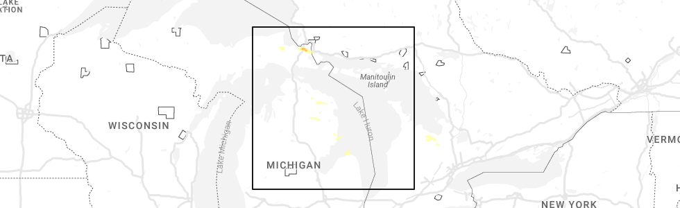
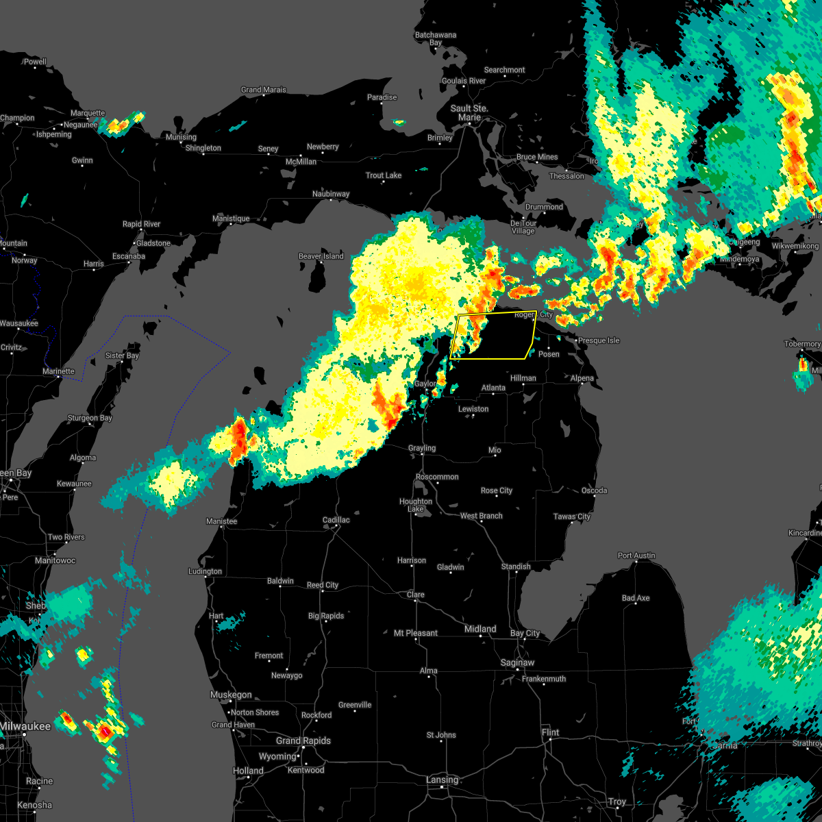
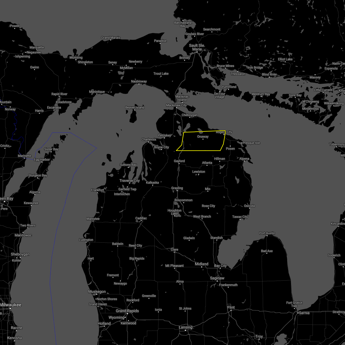
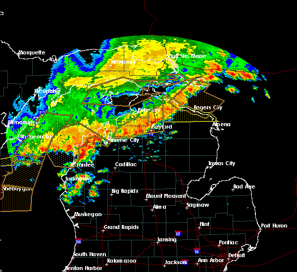
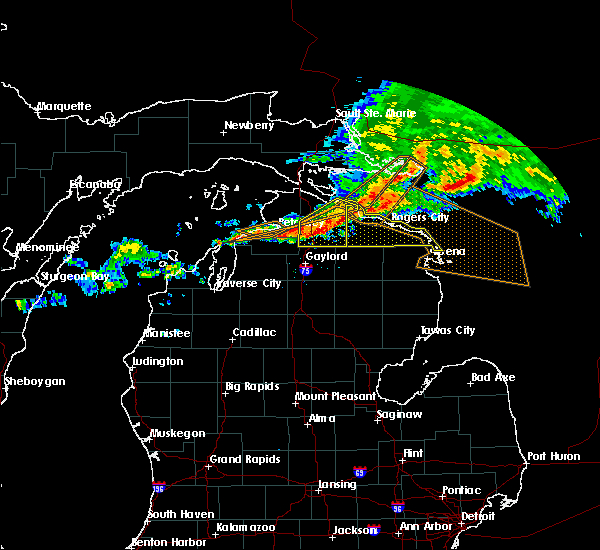
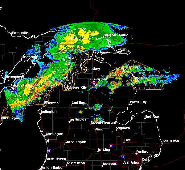
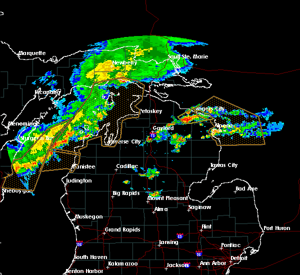
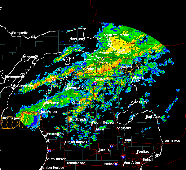
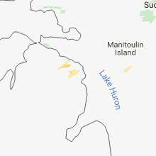
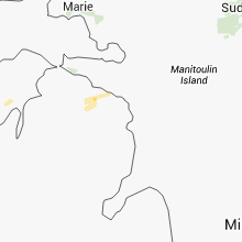
Hail Map for Millersburg, MI
The Millersburg, MI area has had 2 reports of on-the-ground hail by trained spotters, and has been under severe weather warnings 0 times during the past 12 months. Doppler radar has detected hail at or near Millersburg, MI on 12 occasions, including 1 occasion during the past year.
| Name: | Millersburg, MI |
| Where Located: | 35.4 miles WNW of Alpena, MI |
| Map: | Google Map for Millersburg, MI |
| Population: | 206 |
| Housing Units: | 114 |
| More Info: | Search Google for Millersburg, MI |
0
The Top Recent Hail Date for Millersburg, MI is Friday, June 30, 2023 (11th out of 12)
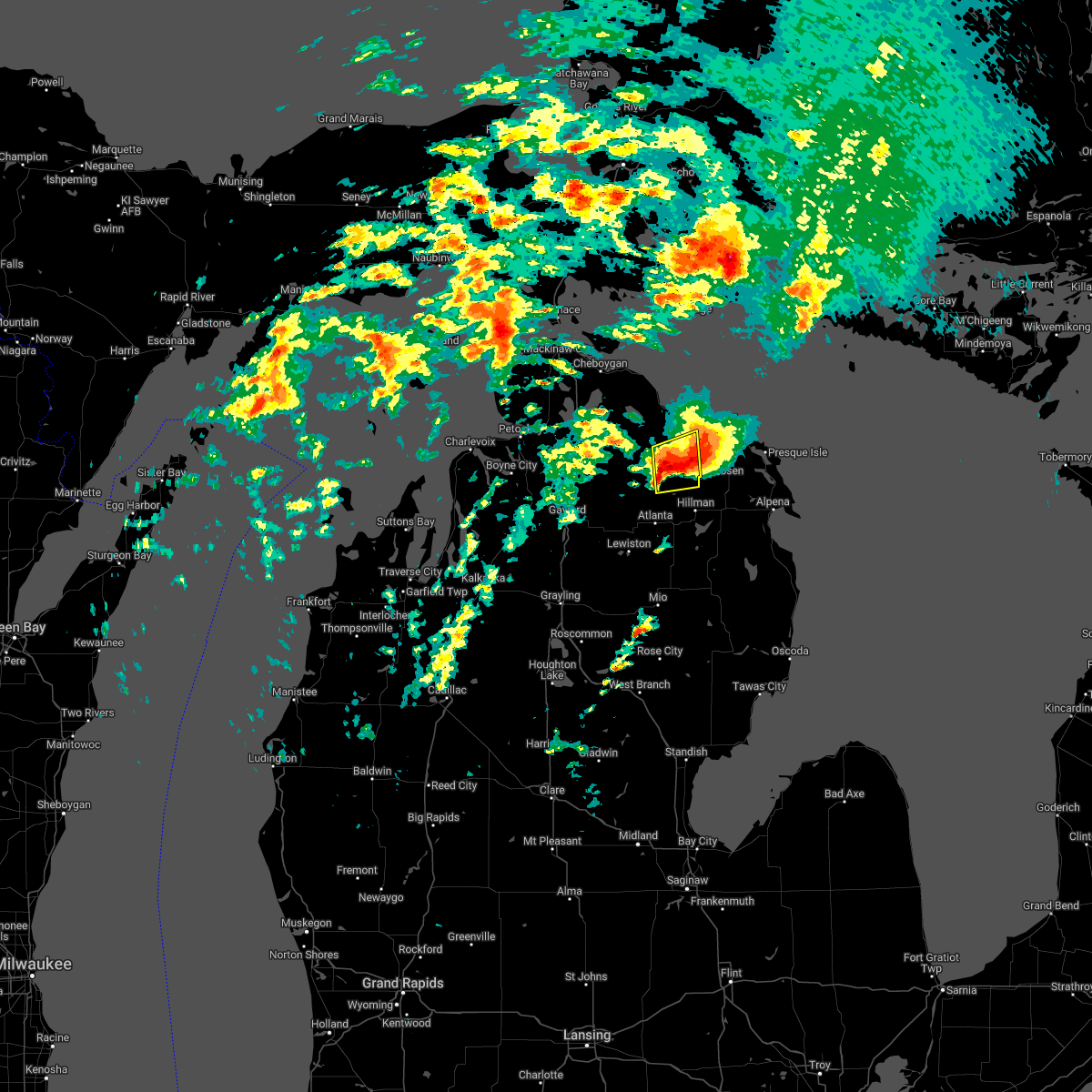
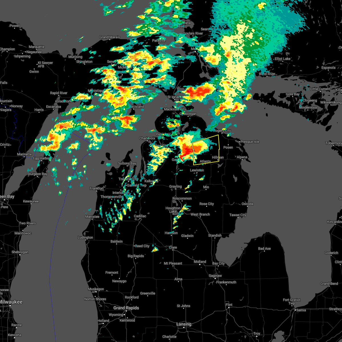
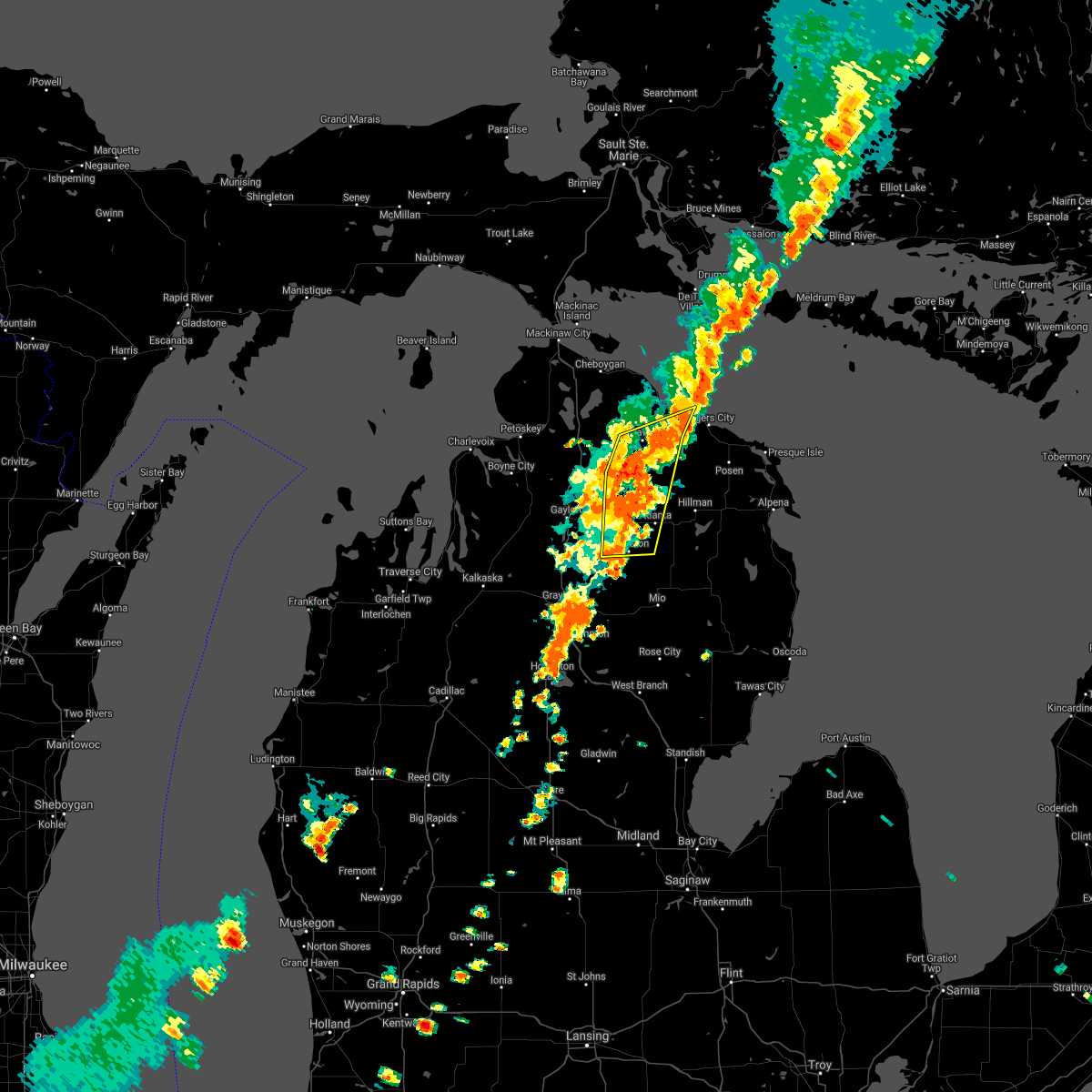
Hail and Wind Damage Spotted near Millersburg, MI
| Date / Time | Report Details |
|---|---|
| 5/20/2022 4:38 PM EDT | Hen Egg sized hail reported 8.1 miles WNW of Millersburg, MI, time estimated by radar. |
| 5/20/2022 4:25 PM EDT |
 At 425 pm edt, a severe thunderstorm was located over tomahawk creek flooding, or 11 miles south of onaway, moving east at 55 mph (radar indicated). Hazards include golf ball size hail and 70 mph wind gusts. People and animals outdoors will be injured. expect hail damage to roofs, siding, windows, and vehicles. expect considerable tree damage. wind damage is also likely to mobile homes, roofs, and outbuildings. Locations impacted include, millersburg, hawks and bisma township. At 425 pm edt, a severe thunderstorm was located over tomahawk creek flooding, or 11 miles south of onaway, moving east at 55 mph (radar indicated). Hazards include golf ball size hail and 70 mph wind gusts. People and animals outdoors will be injured. expect hail damage to roofs, siding, windows, and vehicles. expect considerable tree damage. wind damage is also likely to mobile homes, roofs, and outbuildings. Locations impacted include, millersburg, hawks and bisma township.
|
| 5/20/2022 3:53 PM EDT |
 At 353 pm edt, a severe thunderstorm was located near elmira, or near gaylord, moving east at 55 mph (radar indicated). Hazards include 70 mph wind gusts and ping pong ball size hail. People and animals outdoors will be injured. expect hail damage to roofs, siding, windows, and vehicles. expect considerable tree damage. Wind damage is also likely to mobile homes, roofs, and outbuildings. At 353 pm edt, a severe thunderstorm was located near elmira, or near gaylord, moving east at 55 mph (radar indicated). Hazards include 70 mph wind gusts and ping pong ball size hail. People and animals outdoors will be injured. expect hail damage to roofs, siding, windows, and vehicles. expect considerable tree damage. Wind damage is also likely to mobile homes, roofs, and outbuildings.
|
| 9/7/2021 2:00 PM EDT | Tree broken and heavy metal swing blown over. time estimated 2p in presque isle county MI, 1.7 miles N of Millersburg, MI |
| 8/29/2021 3:14 PM EDT |
 At 314 pm edt, severe thunderstorms were located along a line extending from near onaway state park to 6 miles west of allis township to near lewiston, moving east at 55 mph (radar indicated). Hazards include 60 mph wind gusts. Expect damage to roofs, siding, and trees. locations impacted include, onaway, allis township, ocqueoc, millersburg, tomahawk creek flooding, canada creek ranch and forty mile point. hail threat, radar indicated max hail size, <. 75 in wind threat, radar indicated max wind gust, 60 mph. At 314 pm edt, severe thunderstorms were located along a line extending from near onaway state park to 6 miles west of allis township to near lewiston, moving east at 55 mph (radar indicated). Hazards include 60 mph wind gusts. Expect damage to roofs, siding, and trees. locations impacted include, onaway, allis township, ocqueoc, millersburg, tomahawk creek flooding, canada creek ranch and forty mile point. hail threat, radar indicated max hail size, <. 75 in wind threat, radar indicated max wind gust, 60 mph.
|
| 8/29/2021 2:55 PM EDT |
 At 254 pm edt, severe thunderstorms were located along a line extending from near wolverine to near vanderbilt to near waters, moving northeast at 55 mph (radar indicated). Hazards include 60 mph wind gusts. Expect damage to roofs, siding, and trees. severe thunderstorms will be near, wolverine and afton around 300 pm edt. pickerel lake and eastern corwith township around 305 pm edt. johannesburg and tower around 310 pm edt. other locations in the path of these severe thunderstorms include hetherton, ocqueoc, allis township, tomahawk creek flooding, onaway, briley township, atlanta, millersburg, canada creek ranch and forty mile point. hail threat, radar indicated max hail size, <. 75 in wind threat, radar indicated max wind gust, 60 mph. At 254 pm edt, severe thunderstorms were located along a line extending from near wolverine to near vanderbilt to near waters, moving northeast at 55 mph (radar indicated). Hazards include 60 mph wind gusts. Expect damage to roofs, siding, and trees. severe thunderstorms will be near, wolverine and afton around 300 pm edt. pickerel lake and eastern corwith township around 305 pm edt. johannesburg and tower around 310 pm edt. other locations in the path of these severe thunderstorms include hetherton, ocqueoc, allis township, tomahawk creek flooding, onaway, briley township, atlanta, millersburg, canada creek ranch and forty mile point. hail threat, radar indicated max hail size, <. 75 in wind threat, radar indicated max wind gust, 60 mph.
|
| 8/11/2021 6:13 PM EDT |
 At 613 pm edt, severe thunderstorms were located along a line extending from near black lake to onaway to near tower, moving east at 60 mph (radar indicated). Hazards include 60 mph wind gusts. Expect damage to roofs, siding, and trees. locations impacted include, ocqueoc, millersburg, rogers city and hawks. hail threat, radar indicated max hail size, <. 75 in wind threat, radar indicated max wind gust, 60 mph. At 613 pm edt, severe thunderstorms were located along a line extending from near black lake to onaway to near tower, moving east at 60 mph (radar indicated). Hazards include 60 mph wind gusts. Expect damage to roofs, siding, and trees. locations impacted include, ocqueoc, millersburg, rogers city and hawks. hail threat, radar indicated max hail size, <. 75 in wind threat, radar indicated max wind gust, 60 mph.
|
| 8/11/2021 5:52 PM EDT |
 At 552 pm edt, severe thunderstorms were located along a line extending from near topinabee to wolverine to near vanderbilt, moving east at 60 mph (radar indicated). Hazards include 60 mph wind gusts. Expect damage to roofs, siding, and trees. severe thunderstorms will be near, koehler township around 555 pm edt. afton around 600 pm edt. tower around 605 pm edt. onaway and onaway state park around 610 pm edt. other locations in the path of these severe thunderstorms include allis township, tomahawk creek flooding, ocqueoc, millersburg, rogers city and hawks. hail threat, radar indicated max hail size, <. 75 in wind threat, radar indicated max wind gust, 60 mph. At 552 pm edt, severe thunderstorms were located along a line extending from near topinabee to wolverine to near vanderbilt, moving east at 60 mph (radar indicated). Hazards include 60 mph wind gusts. Expect damage to roofs, siding, and trees. severe thunderstorms will be near, koehler township around 555 pm edt. afton around 600 pm edt. tower around 605 pm edt. onaway and onaway state park around 610 pm edt. other locations in the path of these severe thunderstorms include allis township, tomahawk creek flooding, ocqueoc, millersburg, rogers city and hawks. hail threat, radar indicated max hail size, <. 75 in wind threat, radar indicated max wind gust, 60 mph.
|
| 7/19/2020 6:41 AM EDT |
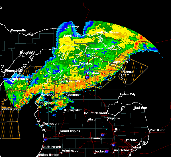 The severe thunderstorm warning for eastern cheboygan and presque isle counties will expire at 645 am edt, the storms which prompted the warning have moved out of the area. therefore, the warning will be allowed to expire. however gusty winds and heavy rain are still possible through 730 am. The severe thunderstorm warning for eastern cheboygan and presque isle counties will expire at 645 am edt, the storms which prompted the warning have moved out of the area. therefore, the warning will be allowed to expire. however gusty winds and heavy rain are still possible through 730 am.
|
| 7/19/2020 6:27 AM EDT |
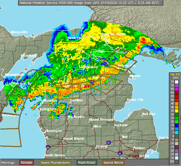 At 627 am edt, severe thunderstorms were located along a line extending from 7 miles north of thompsons harbor state park to near bisma township, moving east at 45 mph (radar indicated). Hazards include 60 mph wind gusts and quarter size hail. Hail damage to vehicles is expected. expect wind damage to roofs, siding, and trees. Locations impacted include, rogers city, onaway, presque isle light, presque isle, ocqueoc, metz, posen, millersburg, tomahawk creek flooding, hawks, thompsons harbor state park, bisma township, cheboygan state park, alverno, forty mile point, onaway state park, nine mile point, allis township, black lake and hagensville. At 627 am edt, severe thunderstorms were located along a line extending from 7 miles north of thompsons harbor state park to near bisma township, moving east at 45 mph (radar indicated). Hazards include 60 mph wind gusts and quarter size hail. Hail damage to vehicles is expected. expect wind damage to roofs, siding, and trees. Locations impacted include, rogers city, onaway, presque isle light, presque isle, ocqueoc, metz, posen, millersburg, tomahawk creek flooding, hawks, thompsons harbor state park, bisma township, cheboygan state park, alverno, forty mile point, onaway state park, nine mile point, allis township, black lake and hagensville.
|
| 7/19/2020 6:01 AM EDT |
 At 537 am edt, severe thunderstorms were located along a line extending from 12 miles northeast of nine mile point to near koehler township, moving east at 60 mph (radar indicated). Hazards include 60 mph wind gusts and quarter size hail. Hail damage to vehicles is expected. Expect wind damage to roofs, siding, and trees. At 537 am edt, severe thunderstorms were located along a line extending from 12 miles northeast of nine mile point to near koehler township, moving east at 60 mph (radar indicated). Hazards include 60 mph wind gusts and quarter size hail. Hail damage to vehicles is expected. Expect wind damage to roofs, siding, and trees.
|
| 7/19/2020 5:37 AM EDT |
 At 537 am edt, severe thunderstorms were located along a line extending from 12 miles northeast of nine mile point to near koehler township, moving east at 60 mph (radar indicated). Hazards include 60 mph wind gusts and quarter size hail. Hail damage to vehicles is expected. Expect wind damage to roofs, siding, and trees. At 537 am edt, severe thunderstorms were located along a line extending from 12 miles northeast of nine mile point to near koehler township, moving east at 60 mph (radar indicated). Hazards include 60 mph wind gusts and quarter size hail. Hail damage to vehicles is expected. Expect wind damage to roofs, siding, and trees.
|
| 7/18/2020 6:19 PM EDT |
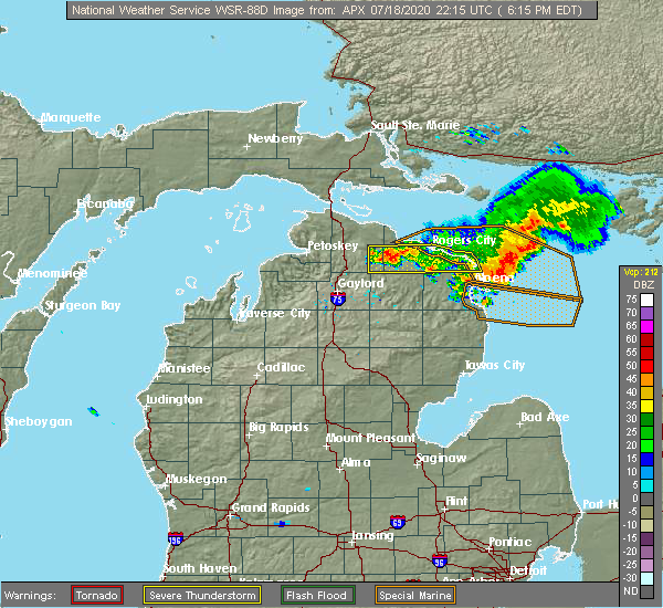 At 619 pm edt, a severe thunderstorm was located over millersburg, or 10 miles east of onaway, moving east at 45 mph (radar indicated). Hazards include 60 mph wind gusts. Expect damage to roofs, siding, and trees. Locations impacted include, rogers city, onaway, presque isle light, presque isle, ocqueoc, metz, posen, millersburg, tomahawk creek flooding, hawks, thompsons harbor state park, bisma township, onaway state park, allis township, hagensville and moltke township. At 619 pm edt, a severe thunderstorm was located over millersburg, or 10 miles east of onaway, moving east at 45 mph (radar indicated). Hazards include 60 mph wind gusts. Expect damage to roofs, siding, and trees. Locations impacted include, rogers city, onaway, presque isle light, presque isle, ocqueoc, metz, posen, millersburg, tomahawk creek flooding, hawks, thompsons harbor state park, bisma township, onaway state park, allis township, hagensville and moltke township.
|
| 7/18/2020 6:04 PM EDT |
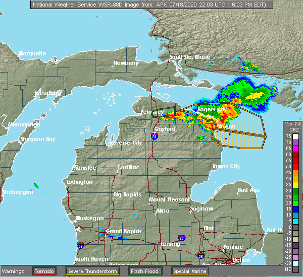 At 603 pm edt, a severe thunderstorm was located over onaway, moving east at 45 mph (radar indicated). Hazards include 60 mph wind gusts. expect damage to roofs, siding, and trees At 603 pm edt, a severe thunderstorm was located over onaway, moving east at 45 mph (radar indicated). Hazards include 60 mph wind gusts. expect damage to roofs, siding, and trees
|
| 7/18/2020 5:04 PM EDT |
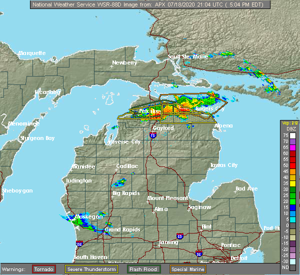 At 504 pm edt, a severe thunderstorm was located over afton, or 8 miles west of onaway, moving east at 55 mph (radar indicated). Hazards include 60 mph wind gusts and quarter size hail. Hail damage to vehicles is expected. Expect wind damage to roofs, siding, and trees. At 504 pm edt, a severe thunderstorm was located over afton, or 8 miles west of onaway, moving east at 55 mph (radar indicated). Hazards include 60 mph wind gusts and quarter size hail. Hail damage to vehicles is expected. Expect wind damage to roofs, siding, and trees.
|
| 7/18/2020 11:15 AM EDT | Trees blown down (snapped at the trunk). time approximate based on rada in presque isle county MI, 14.1 miles SE of Millersburg, MI |
| 9/30/2019 4:19 PM EDT |
 At 419 pm edt, severe thunderstorms were located along a line extending from 15 miles northeast of forty mile point to near wolverine, moving east at 70 mph (radar indicated). Hazards include 60 mph wind gusts and penny size hail. expect damage to roofs, siding, and trees At 419 pm edt, severe thunderstorms were located along a line extending from 15 miles northeast of forty mile point to near wolverine, moving east at 70 mph (radar indicated). Hazards include 60 mph wind gusts and penny size hail. expect damage to roofs, siding, and trees
|
| 8/5/2019 6:47 PM EDT |
 At 646 pm edt, severe thunderstorms were located along a line extending from near rogers city to near bisma township, moving northeast at 20 mph (radar indicated). Hazards include 60 mph wind gusts and penny size hail. Expect damage to roofs, siding, and trees. Locations impacted include, rogers city, presque isle light, presque isle, metz, posen, millersburg, hawks, thompsons harbor state park, hagensville, p h hoeft state park, bisma township and moltke township. At 646 pm edt, severe thunderstorms were located along a line extending from near rogers city to near bisma township, moving northeast at 20 mph (radar indicated). Hazards include 60 mph wind gusts and penny size hail. Expect damage to roofs, siding, and trees. Locations impacted include, rogers city, presque isle light, presque isle, metz, posen, millersburg, hawks, thompsons harbor state park, hagensville, p h hoeft state park, bisma township and moltke township.
|
| 8/5/2019 6:30 PM EDT |
 At 630 pm edt, a severe thunderstorm was located near millersburg, or 11 miles southeast of onaway, moving northeast at 30 mph (radar indicated). Hazards include 60 mph wind gusts and penny size hail. expect damage to roofs, siding, and trees At 630 pm edt, a severe thunderstorm was located near millersburg, or 11 miles southeast of onaway, moving northeast at 30 mph (radar indicated). Hazards include 60 mph wind gusts and penny size hail. expect damage to roofs, siding, and trees
|
| 10/4/2018 12:36 AM EDT |
 At 1235 am edt, a severe thunderstorm was located over afton, or 8 miles southeast of indian river, moving east at 65 mph (radar indicated). Hazards include 60 mph wind gusts. Expect damage to roofs, siding, and trees. Locations impacted include, rogers city, onaway, presque isle light, presque isle, ocqueoc, metz, posen, millersburg, tomahawk creek flooding, hawks, thompsons harbor state park, bisma township, onaway state park, allis township, hagensville, forty mile point, huron beach and moltke township. At 1235 am edt, a severe thunderstorm was located over afton, or 8 miles southeast of indian river, moving east at 65 mph (radar indicated). Hazards include 60 mph wind gusts. Expect damage to roofs, siding, and trees. Locations impacted include, rogers city, onaway, presque isle light, presque isle, ocqueoc, metz, posen, millersburg, tomahawk creek flooding, hawks, thompsons harbor state park, bisma township, onaway state park, allis township, hagensville, forty mile point, huron beach and moltke township.
|
| 10/4/2018 12:23 AM EDT |
 At 1222 am edt, a severe thunderstorm was located near reasoners corner, or 10 miles southeast of petoskey, moving east at 50 mph (radar indicated). Hazards include 60 mph wind gusts. expect damage to roofs, siding, and trees At 1222 am edt, a severe thunderstorm was located near reasoners corner, or 10 miles southeast of petoskey, moving east at 50 mph (radar indicated). Hazards include 60 mph wind gusts. expect damage to roofs, siding, and trees
|
| 8/28/2018 2:54 AM EDT |
 The severe thunderstorm warning for southeastern cheboygan and presque isle counties will expire at 300 am edt, the storms which prompted the warning have weakened below severe limits, and no longer pose an immediate threat to life or property. therefore, the warning will be allowed to expire. however, gusty winds are still possible with these thunderstorms. The severe thunderstorm warning for southeastern cheboygan and presque isle counties will expire at 300 am edt, the storms which prompted the warning have weakened below severe limits, and no longer pose an immediate threat to life or property. therefore, the warning will be allowed to expire. however, gusty winds are still possible with these thunderstorms.
|
| 8/28/2018 2:33 AM EDT |
 A severe thunderstorm warning remains in effect until 300 am edt for southeastern cheboygan and presque isle counties. at 233 am edt, severe thunderstorms were located along a line extending from 14 miles south of saint marys river to onaway state park to near atlanta, moving east at 45 mph. hazard. 60 mph wind gusts. A severe thunderstorm warning remains in effect until 300 am edt for southeastern cheboygan and presque isle counties. at 233 am edt, severe thunderstorms were located along a line extending from 14 miles south of saint marys river to onaway state park to near atlanta, moving east at 45 mph. hazard. 60 mph wind gusts.
|
| 8/28/2018 2:16 AM EDT |
 At 215 am edt, severe thunderstorms were located along a line extending from 10 miles southwest of saint marys river to near johannesburg, moving east at 60 mph (radar indicated. at 155 am, wind gusts to 59 mph were reported at harbor springs). Hazards include 60 mph wind gusts. Expect damage to roofs, siding, and trees. Locations impacted include, cheboygan, rogers city, onaway, mackinaw city, presque isle light, indian river, presque isle, aloha, ocqueoc, metz, wolverine, posen, millersburg, tomahawk creek flooding, aloha state park, hawks, thompsons harbor state park, bisma township, alverno and burt lake. At 215 am edt, severe thunderstorms were located along a line extending from 10 miles southwest of saint marys river to near johannesburg, moving east at 60 mph (radar indicated. at 155 am, wind gusts to 59 mph were reported at harbor springs). Hazards include 60 mph wind gusts. Expect damage to roofs, siding, and trees. Locations impacted include, cheboygan, rogers city, onaway, mackinaw city, presque isle light, indian river, presque isle, aloha, ocqueoc, metz, wolverine, posen, millersburg, tomahawk creek flooding, aloha state park, hawks, thompsons harbor state park, bisma township, alverno and burt lake.
|
| 8/28/2018 1:47 AM EDT |
 At 147 am edt, severe thunderstorms were located along a line extending from near mackinac island to near jordan township, moving east at 60 mph (radar indicated). Hazards include 60 mph wind gusts. expect damage to roofs, siding, and trees At 147 am edt, severe thunderstorms were located along a line extending from near mackinac island to near jordan township, moving east at 60 mph (radar indicated). Hazards include 60 mph wind gusts. expect damage to roofs, siding, and trees
|
| 6/11/2017 5:28 PM EDT |
 At 528 pm edt, severe thunderstorms were located along a line extending from near p h hoeft state park to bisma township, moving east at 50 mph (radar indicated). Hazards include 60 mph wind gusts and penny size hail. Expect damage to roofs, siding, and trees. Locations impacted include, rogers city, presque isle light, presque isle, metz, posen, millersburg, hawks, thompsons harbor state park, bisma township, hagensville, p h hoeft state park, forty mile point and moltke township. At 528 pm edt, severe thunderstorms were located along a line extending from near p h hoeft state park to bisma township, moving east at 50 mph (radar indicated). Hazards include 60 mph wind gusts and penny size hail. Expect damage to roofs, siding, and trees. Locations impacted include, rogers city, presque isle light, presque isle, metz, posen, millersburg, hawks, thompsons harbor state park, bisma township, hagensville, p h hoeft state park, forty mile point and moltke township.
|
| 6/11/2017 5:20 PM EDT | Public report of tree across the road. time estimate in presque isle county MI, 1.7 miles N of Millersburg, MI |
| 6/11/2017 5:16 PM EDT |
 At 515 pm edt, severe thunderstorms were located along a line extending from near huron beach to near allis township, moving east at 50 mph (radar indicated). Hazards include 60 mph wind gusts and penny size hail. Expect damage to roofs, siding, and trees. Locations impacted include, rogers city, onaway, presque isle light, presque isle, ocqueoc, metz, posen, millersburg, tomahawk creek flooding, hawks, thompsons harbor state park, bisma township, onaway state park, allis township, hagensville, p h hoeft state park, forty mile point, huron beach and moltke township. At 515 pm edt, severe thunderstorms were located along a line extending from near huron beach to near allis township, moving east at 50 mph (radar indicated). Hazards include 60 mph wind gusts and penny size hail. Expect damage to roofs, siding, and trees. Locations impacted include, rogers city, onaway, presque isle light, presque isle, ocqueoc, metz, posen, millersburg, tomahawk creek flooding, hawks, thompsons harbor state park, bisma township, onaway state park, allis township, hagensville, p h hoeft state park, forty mile point, huron beach and moltke township.
|
| 6/11/2017 5:03 PM EDT |
 At 503 pm edt, severe thunderstorms were located along a line extending from near nine mile point to near tower, moving east at 50 mph (radar indicated). Hazards include 60 mph wind gusts and penny size hail. expect damage to roofs, siding, and trees At 503 pm edt, severe thunderstorms were located along a line extending from near nine mile point to near tower, moving east at 50 mph (radar indicated). Hazards include 60 mph wind gusts and penny size hail. expect damage to roofs, siding, and trees
|
| 7/8/2016 1:28 PM EDT |
 At 127 pm edt, a severe thunderstorm was located near allis township, or near onaway, moving northeast at 35 mph (radar indicated). Hazards include 60 mph wind gusts and quarter size hail. Hail damage to vehicles is expected. expect wind damage to roofs, siding, and trees. Locations impacted include, rogers city, onaway, ocqueoc, metz, posen, millersburg, hagensville, onaway state park, allis township, hawks, huron beach, bisma township, tower, tomahawk creek flooding, thompsons harbor state park, canada creek ranch, clear lake state park, silver lake, pigeon river state forest and moltke township. At 127 pm edt, a severe thunderstorm was located near allis township, or near onaway, moving northeast at 35 mph (radar indicated). Hazards include 60 mph wind gusts and quarter size hail. Hail damage to vehicles is expected. expect wind damage to roofs, siding, and trees. Locations impacted include, rogers city, onaway, ocqueoc, metz, posen, millersburg, hagensville, onaway state park, allis township, hawks, huron beach, bisma township, tower, tomahawk creek flooding, thompsons harbor state park, canada creek ranch, clear lake state park, silver lake, pigeon river state forest and moltke township.
|
| 7/8/2016 1:01 PM EDT |
 At 100 pm edt, a severe thunderstorm was located near pickerel lake, or 14 miles southeast of indian river, moving east at 40 mph (radar indicated). Hazards include two inch hail and 60 mph wind gusts. People and animals outdoors will be injured. expect hail damage to roofs, siding, windows, and vehicles. Expect wind damage to roofs, siding, and trees. At 100 pm edt, a severe thunderstorm was located near pickerel lake, or 14 miles southeast of indian river, moving east at 40 mph (radar indicated). Hazards include two inch hail and 60 mph wind gusts. People and animals outdoors will be injured. expect hail damage to roofs, siding, windows, and vehicles. Expect wind damage to roofs, siding, and trees.
|
| 5/12/2016 6:43 PM EDT |
 At 643 pm edt, a severe thunderstorm was located over ocqueoc, or 8 miles northeast of onaway, moving northeast at 20 mph (radar indicated). Hazards include 60 mph wind gusts and quarter size hail. Hail damage to vehicles is expected. expect wind damage to roofs, siding, and trees. Locations impacted include, rogers city, onaway, ocqueoc, millersburg, forty mile point, huron beach, p h hoeft state park, onaway state park and moltke township. At 643 pm edt, a severe thunderstorm was located over ocqueoc, or 8 miles northeast of onaway, moving northeast at 20 mph (radar indicated). Hazards include 60 mph wind gusts and quarter size hail. Hail damage to vehicles is expected. expect wind damage to roofs, siding, and trees. Locations impacted include, rogers city, onaway, ocqueoc, millersburg, forty mile point, huron beach, p h hoeft state park, onaway state park and moltke township.
|
| 5/12/2016 6:26 PM EDT |
 At 625 pm edt, a severe thunderstorm was located over onaway, moving northeast at 15 mph (radar indicated). Hazards include 60 mph wind gusts and quarter size hail. Hail damage to vehicles is expected. Expect wind damage to roofs, siding, and trees. At 625 pm edt, a severe thunderstorm was located over onaway, moving northeast at 15 mph (radar indicated). Hazards include 60 mph wind gusts and quarter size hail. Hail damage to vehicles is expected. Expect wind damage to roofs, siding, and trees.
|
| 8/14/2015 3:40 PM EDT |
 At 340 pm edt, a severe thunderstorm was located near millersburg, or 10 miles southeast of onaway, moving southeast at 15 mph (radar indicated). Hazards include 60 mph wind gusts and quarter size hail. Hail damage to vehicles is expected. expect wind damage to roofs, siding and trees. Locations impacted include, millersburg and bisma township. At 340 pm edt, a severe thunderstorm was located near millersburg, or 10 miles southeast of onaway, moving southeast at 15 mph (radar indicated). Hazards include 60 mph wind gusts and quarter size hail. Hail damage to vehicles is expected. expect wind damage to roofs, siding and trees. Locations impacted include, millersburg and bisma township.
|
| 8/14/2015 3:24 PM EDT |
 At 324 pm edt, a severe thunderstorm was located over millersburg, or 7 miles east of onaway, moving southeast at 15 mph (radar indicated). Hazards include 60 mph wind gusts and quarter size hail. Hail damage to vehicles is expected. Expect wind damage to roofs, siding and trees. At 324 pm edt, a severe thunderstorm was located over millersburg, or 7 miles east of onaway, moving southeast at 15 mph (radar indicated). Hazards include 60 mph wind gusts and quarter size hail. Hail damage to vehicles is expected. Expect wind damage to roofs, siding and trees.
|
| 8/2/2015 10:34 AM EDT |
 At 1034 am edt, severe thunderstorms were located along a line extending from near nine mile point to near onaway state park to near wolverine, moving east at 70 mph (radar indicated). Hazards include 60 mph wind gusts and penny size hail. Expect damage to roofs. Siding and trees. At 1034 am edt, severe thunderstorms were located along a line extending from near nine mile point to near onaway state park to near wolverine, moving east at 70 mph (radar indicated). Hazards include 60 mph wind gusts and penny size hail. Expect damage to roofs. Siding and trees.
|
| 5/30/2013 4:51 PM EDT | Multiple trees down on county road 638 between millersburg and hawks...reported by rogers city police departmen in presque isle county MI, 4.2 miles NW of Millersburg, MI |
| 9/17/2012 1:52 PM EDT | Golf Ball sized hail reported 3.8 miles SW of Millersburg, MI, public reported golf ball sized hail on m 68 between rogers city and millersburg. time estimated from radar. |
| 1/1/0001 12:00 AM | Trees dow in presque isle county MI, 5.5 miles SSE of Millersburg, MI |
Hail Maps for Millersburg, MI


Connect with Interactive Hail Maps