

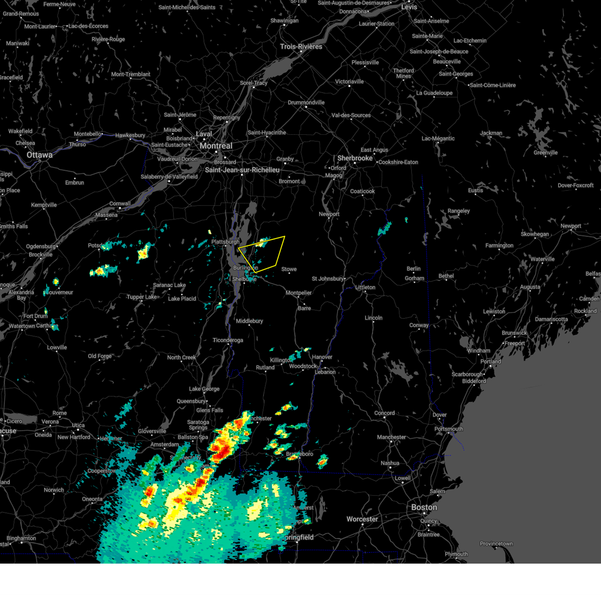
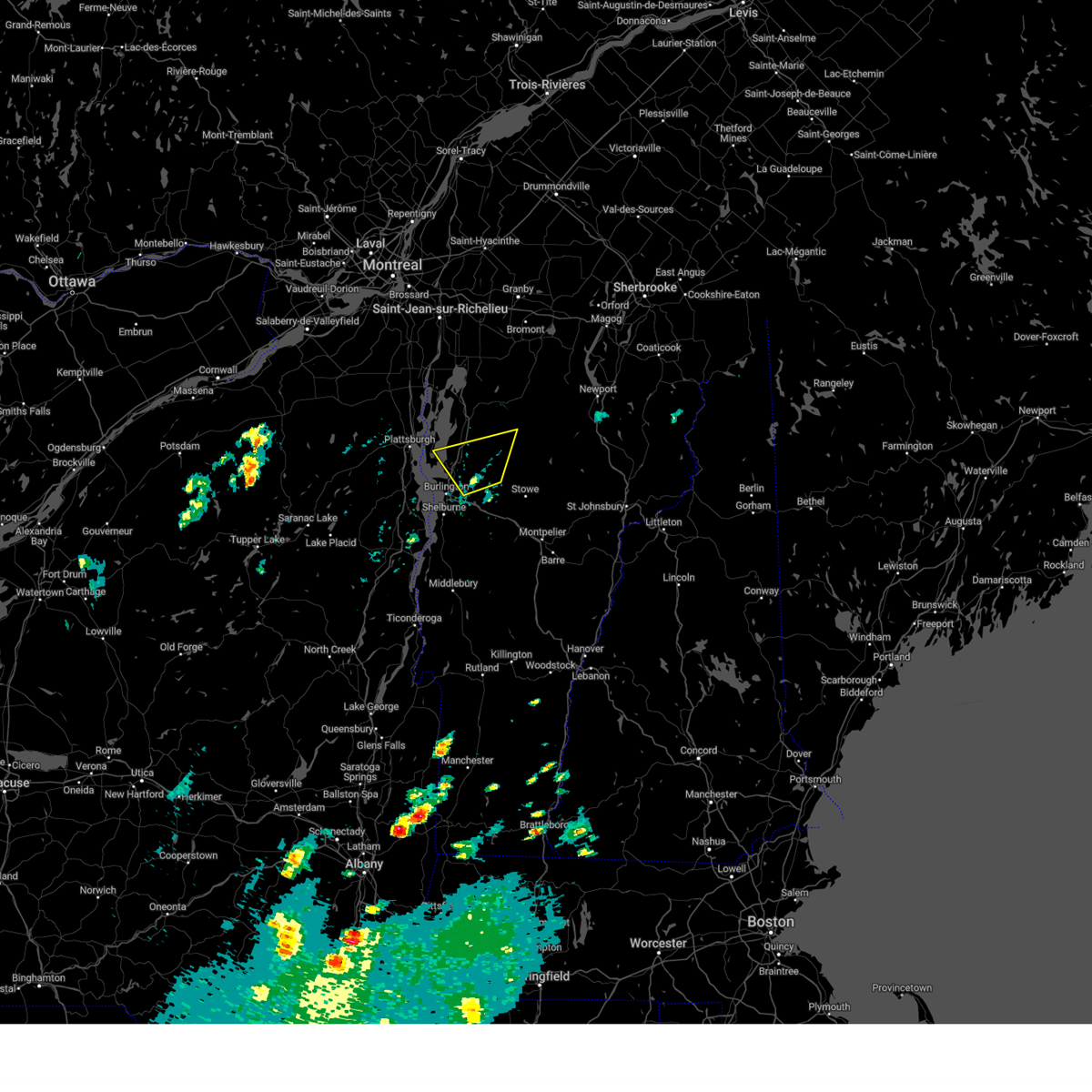
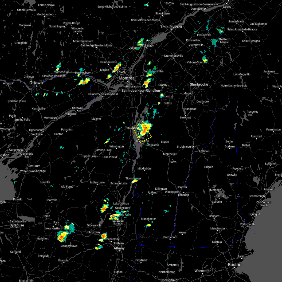
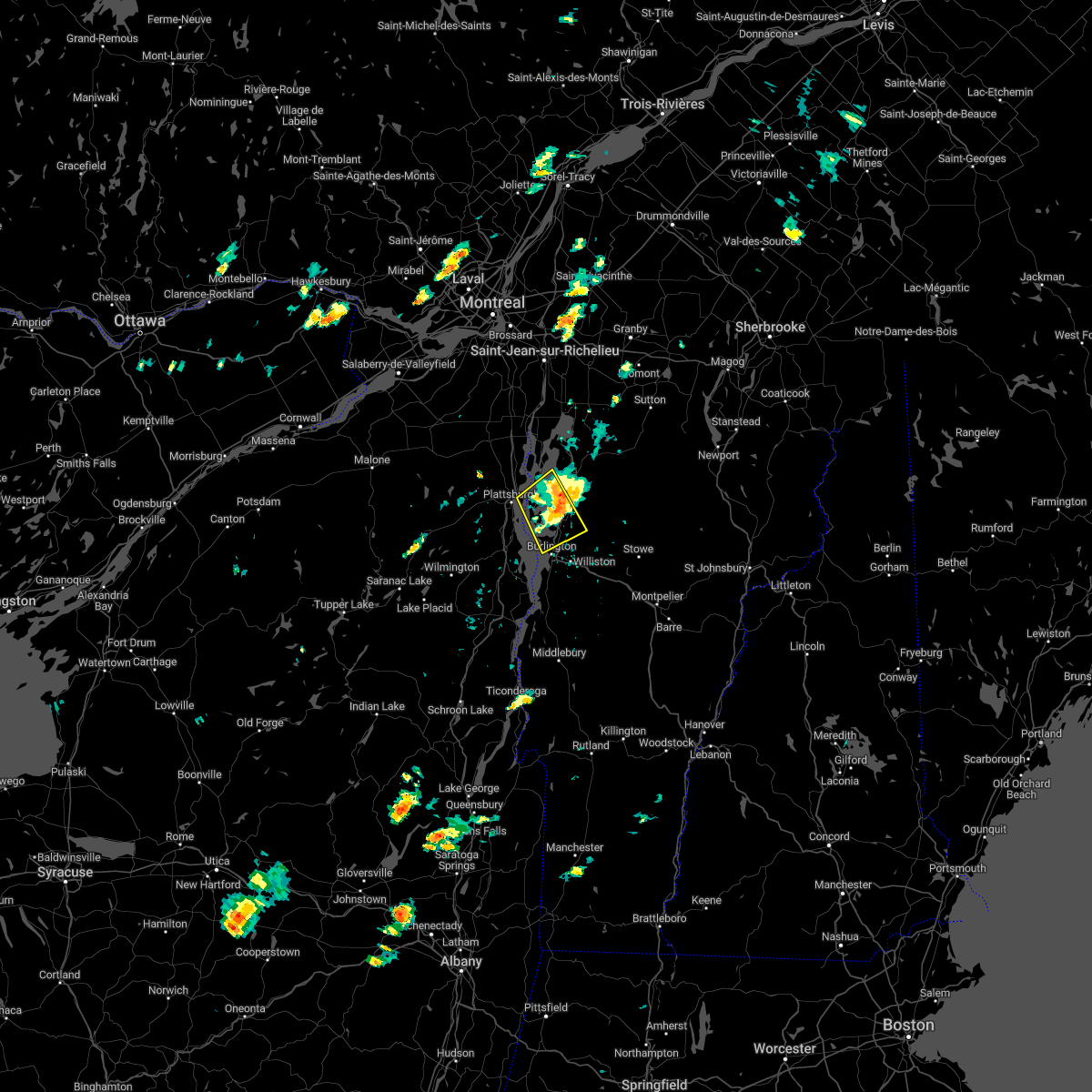
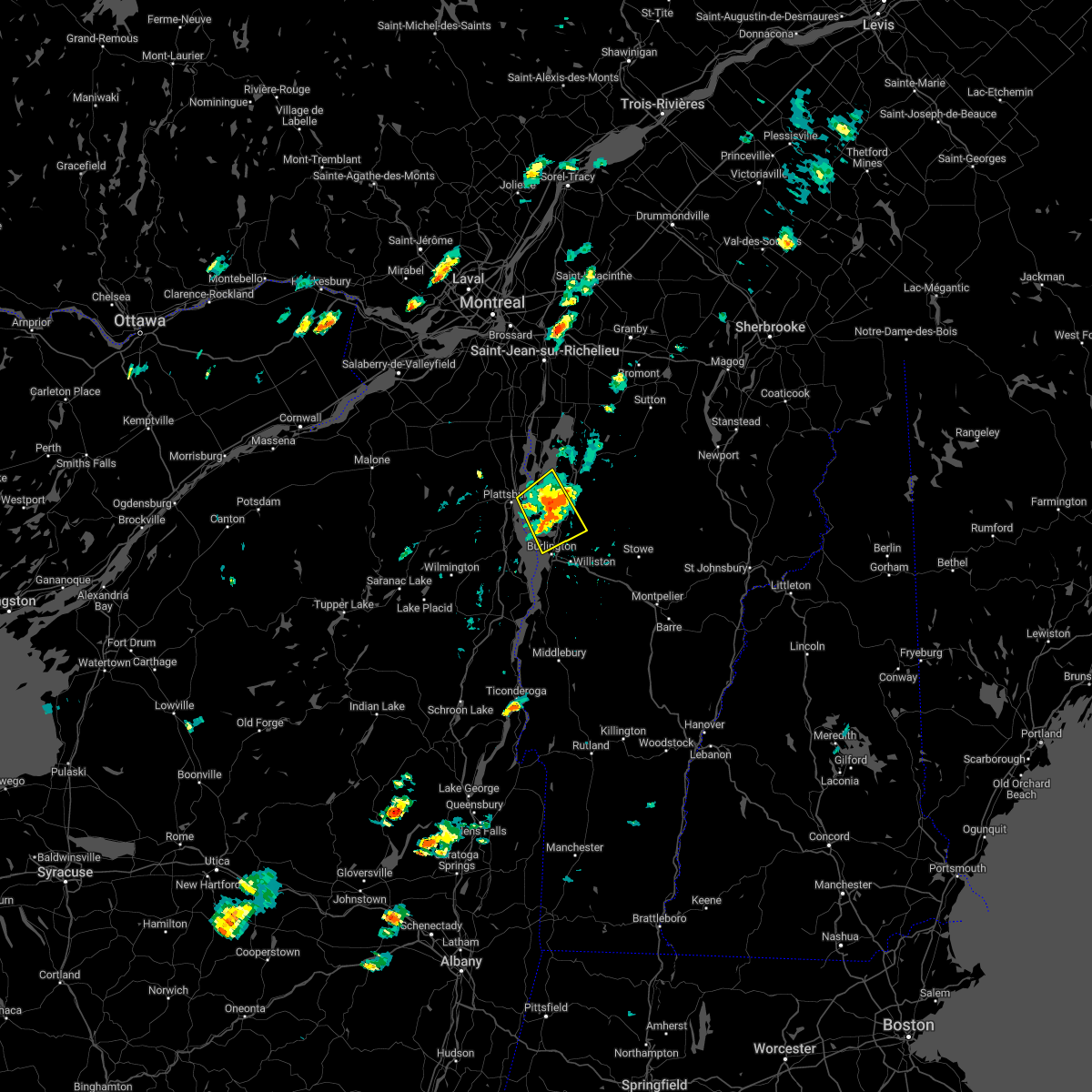
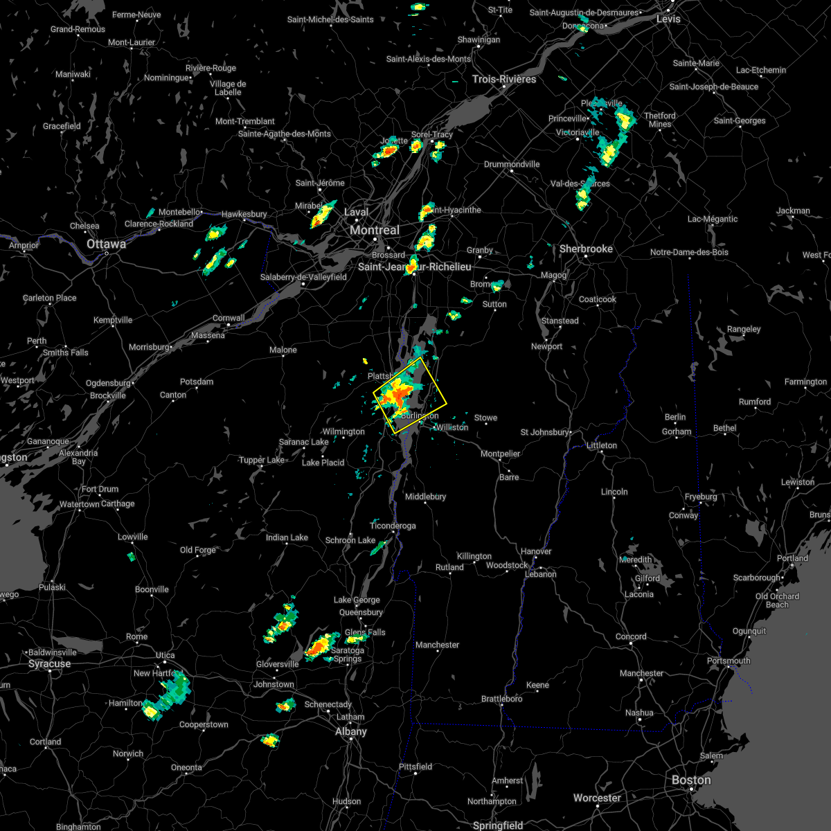
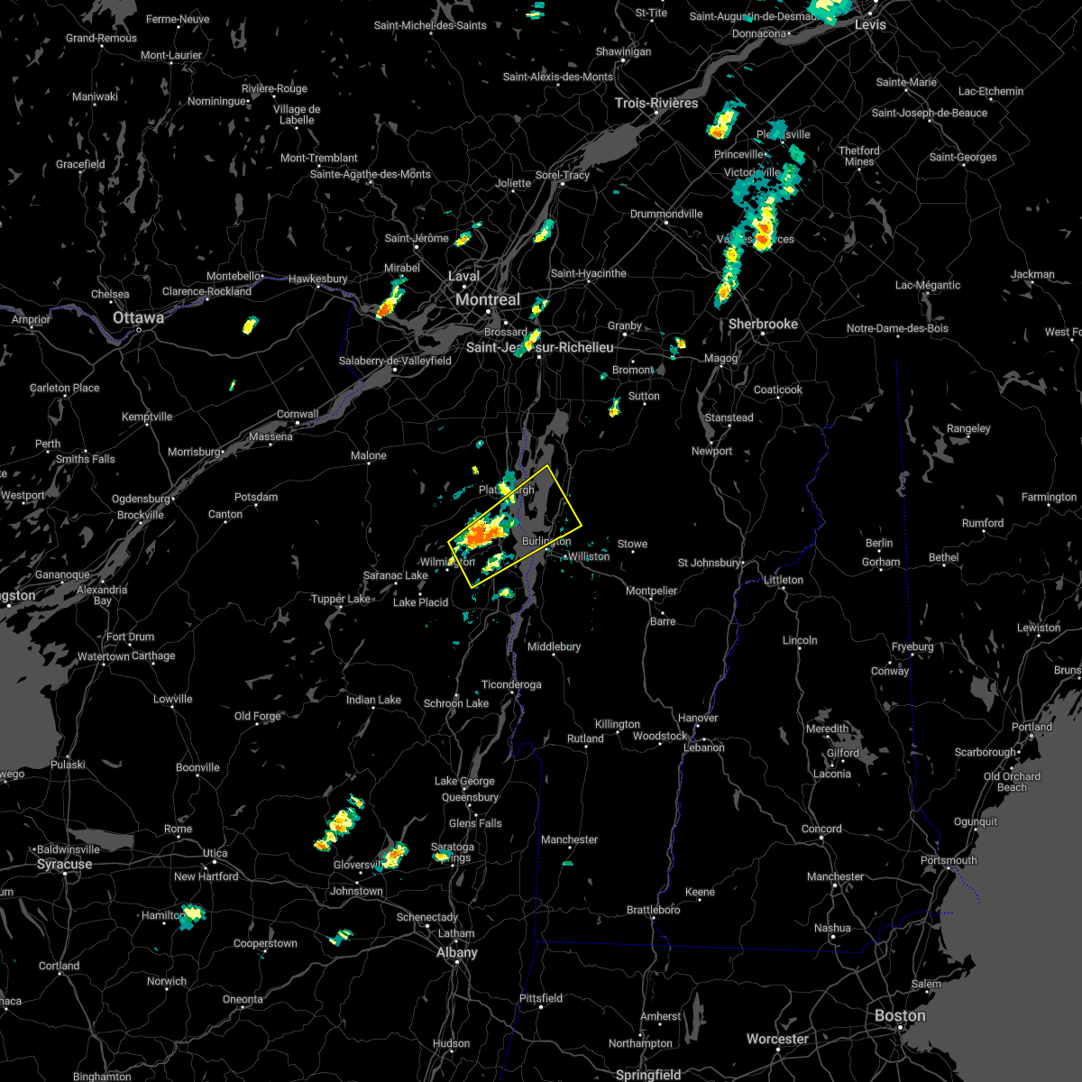
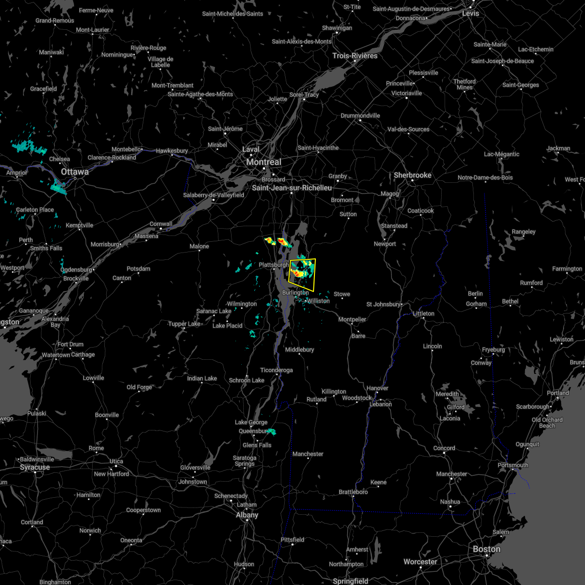
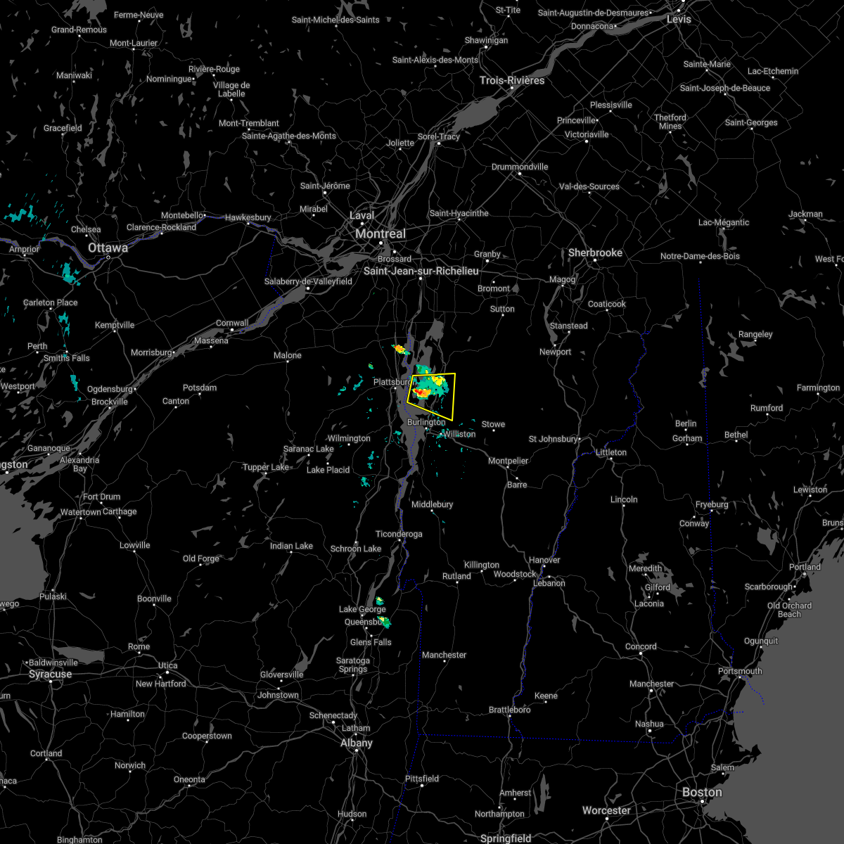
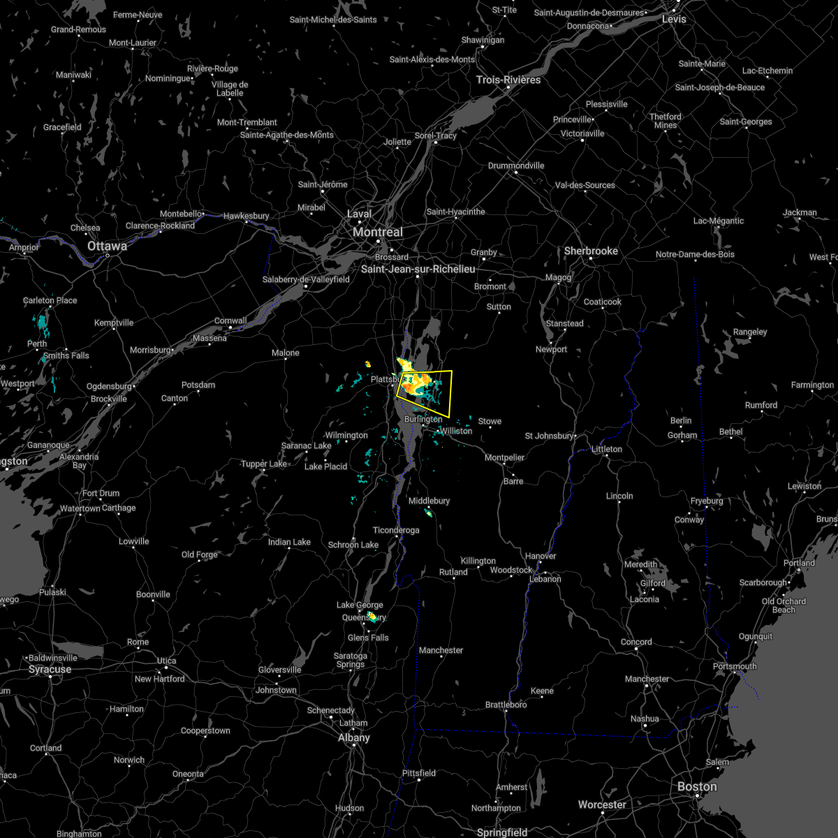
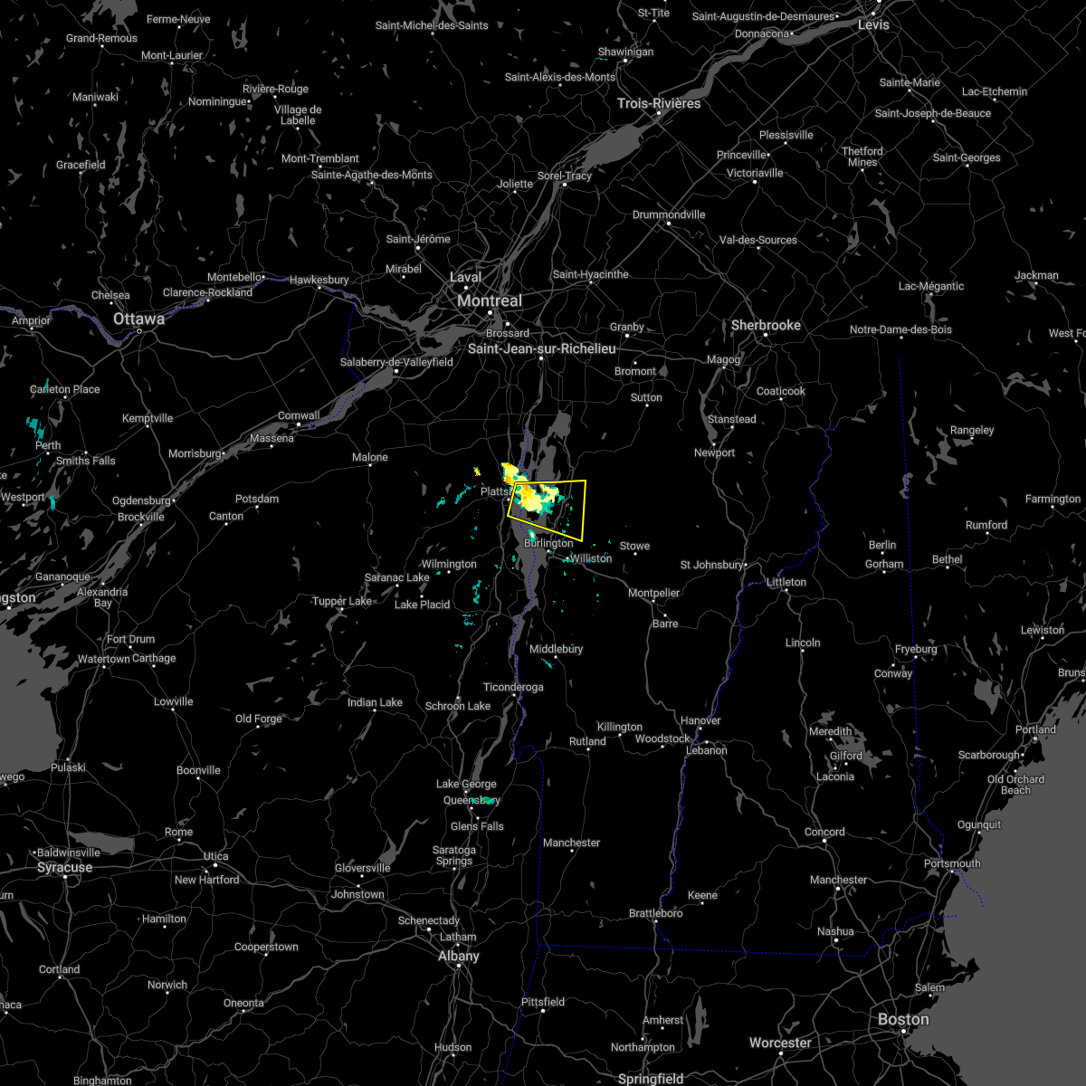
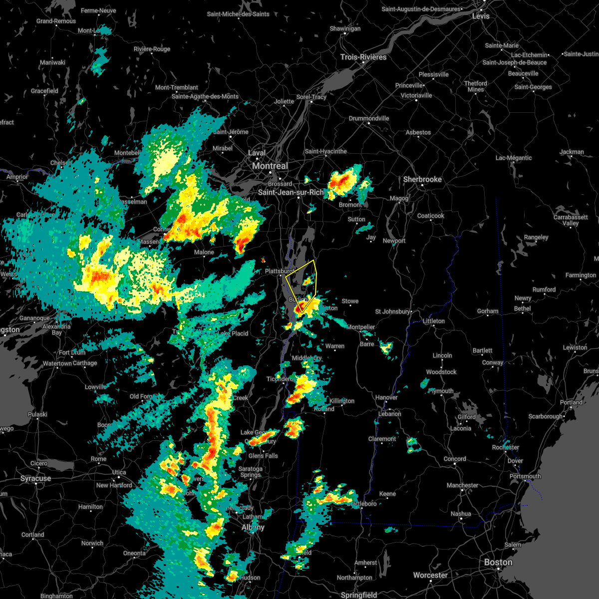
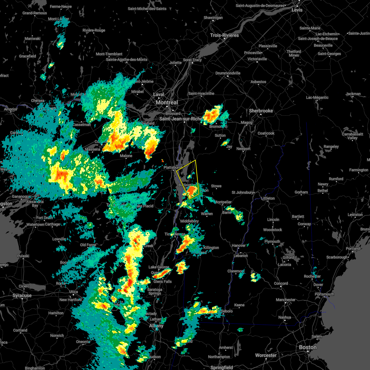
Hail Map for Milton, VT
The Milton, VT area has had 8 reports of on-the-ground hail by trained spotters, and has been under severe weather warnings 25 times during the past 12 months. Doppler radar has detected hail at or near Milton, VT on 11 occasions.
| Name: | Milton, VT |
| Where Located: | 12.5 miles NNE of Burlington, VT |
| Map: | Google Map for Milton, VT |
| Population: | 1861 |
| Housing Units: | 770 |
| More Info: | Search Google for Milton, VT |
5
The Top Recent Hail Date for Milton, VT is Thursday, May 26, 2011 (1st out of 11)

Hail and Wind Damage Spotted near Milton, VT
| Date / Time | Report Details |
|---|---|
| 4/12/2024 4:56 PM EDT |
 The storms which prompted the warning have weakened below severe limits, and have exited the warned area. therefore, the warning will be allowed to expire. however gusty winds are still possible with these thunderstorms. The storms which prompted the warning have weakened below severe limits, and have exited the warned area. therefore, the warning will be allowed to expire. however gusty winds are still possible with these thunderstorms.
|
| 4/12/2024 4:36 PM EDT |
 At 436 pm edt, severe thunderstorms were located along a line extending from peru to ferris rock to charlotte, moving north at 45 mph (radar indicated). Hazards include 60 mph wind gusts and quarter size hail. Minor hail damage to vehicles is possible. expect wind damage to trees and powerlines. locations impacted include, essex junction, plattsburgh international airport, south burlington, burlington international airport, burlington, plattsburgh, peru, schuyler falls, winooski, monkton ridge, monkton, westford, monkton boro, colchester, essex junction village, williston, hinesburg, st. George, grand isle, and keeseville. At 436 pm edt, severe thunderstorms were located along a line extending from peru to ferris rock to charlotte, moving north at 45 mph (radar indicated). Hazards include 60 mph wind gusts and quarter size hail. Minor hail damage to vehicles is possible. expect wind damage to trees and powerlines. locations impacted include, essex junction, plattsburgh international airport, south burlington, burlington international airport, burlington, plattsburgh, peru, schuyler falls, winooski, monkton ridge, monkton, westford, monkton boro, colchester, essex junction village, williston, hinesburg, st. George, grand isle, and keeseville.
|
| 4/12/2024 4:08 PM EDT |
 Svrbtv the national weather service in burlington has issued a * severe thunderstorm warning for, southeastern clinton county in northern new york, northeastern essex county in northern new york, northwestern addison county in central vermont, southern grand isle county in northwestern vermont, chittenden county in northwestern vermont, * until 500 pm edt. * at 408 pm edt, severe thunderstorms were located along a line extending from lewis to louis clearing bay to near weybridge, moving north at 45 mph (radar indicated). Hazards include 60 mph wind gusts and quarter size hail. Minor hail damage to vehicles is possible. Expect wind damage to trees and powerlines. Svrbtv the national weather service in burlington has issued a * severe thunderstorm warning for, southeastern clinton county in northern new york, northeastern essex county in northern new york, northwestern addison county in central vermont, southern grand isle county in northwestern vermont, chittenden county in northwestern vermont, * until 500 pm edt. * at 408 pm edt, severe thunderstorms were located along a line extending from lewis to louis clearing bay to near weybridge, moving north at 45 mph (radar indicated). Hazards include 60 mph wind gusts and quarter size hail. Minor hail damage to vehicles is possible. Expect wind damage to trees and powerlines.
|
| 9/7/2023 4:36 PM EDT |
 The severe thunderstorm warning for northeastern clinton, lamoille, northern addison, grand isle, chittenden, western washington and franklin counties will expire at 445 pm edt, the storms which prompted the warning have moved out of the warned area. therefore, the warning will be allowed to expire. The severe thunderstorm warning for northeastern clinton, lamoille, northern addison, grand isle, chittenden, western washington and franklin counties will expire at 445 pm edt, the storms which prompted the warning have moved out of the warned area. therefore, the warning will be allowed to expire.
|
| 9/7/2023 3:40 PM EDT | At 340 pm edt, severe thunderstorms were located along a line extending from near shad island to jericho village to near weybridge, moving east at 25 mph (radar indicated). Hazards include 60 mph wind gusts and quarter size hail. Minor hail damage to vehicles is possible. Expect wind damage to trees and powerlines. |
| 9/7/2023 3:40 PM EDT | At 340 pm edt, severe thunderstorms were located along a line extending from near shad island to jericho village to near weybridge, moving east at 25 mph (radar indicated). Hazards include 60 mph wind gusts and quarter size hail. Minor hail damage to vehicles is possible. Expect wind damage to trees and powerlines. |
| 9/7/2023 3:30 PM EDT |
 At 329 pm edt, severe thunderstorms were located along a line extending from grand isle to south burlington to weybridge, moving east at 25 mph (radar indicated). Hazards include 60 mph wind gusts and quarter size hail. Minor hail damage to vehicles is possible. expect wind damage to trees and powerlines. locations impacted include, essex junction, south burlington, burlington international airport, burlington, vergennes, middlebury, weybridge, winooski, monkton ridge, monkton, westford, monkton boro, colchester, essex junction village, fairfax, williston, new haven, georgia, hinesburg, and st. george. hail threat, radar indicated max hail size, 1. 00 in wind threat, radar indicated max wind gust, 60 mph. At 329 pm edt, severe thunderstorms were located along a line extending from grand isle to south burlington to weybridge, moving east at 25 mph (radar indicated). Hazards include 60 mph wind gusts and quarter size hail. Minor hail damage to vehicles is possible. expect wind damage to trees and powerlines. locations impacted include, essex junction, south burlington, burlington international airport, burlington, vergennes, middlebury, weybridge, winooski, monkton ridge, monkton, westford, monkton boro, colchester, essex junction village, fairfax, williston, new haven, georgia, hinesburg, and st. george. hail threat, radar indicated max hail size, 1. 00 in wind threat, radar indicated max wind gust, 60 mph.
|
| 9/7/2023 2:48 PM EDT |
 At 248 pm edt, severe thunderstorms were located along a line extending from morrisonville to near willsboro bay to moriah, moving east at 25 mph (radar indicated). Hazards include 60 mph wind gusts and quarter size hail. Minor hail damage to vehicles is possible. Expect wind damage to trees and powerlines. At 248 pm edt, severe thunderstorms were located along a line extending from morrisonville to near willsboro bay to moriah, moving east at 25 mph (radar indicated). Hazards include 60 mph wind gusts and quarter size hail. Minor hail damage to vehicles is possible. Expect wind damage to trees and powerlines.
|
| 9/7/2023 2:35 PM EDT |
 The severe thunderstorm warning for northeastern essex, central chittenden and southwestern franklin counties will expire at 245 pm edt, the storm which prompted the warning has weakened below severe limits, and no longer poses an immediate threat to life or property. therefore, the warning will be allowed to expire. to report severe weather, contact your nearest law enforcement agency. they will relay your report to the national weather service burlington. The severe thunderstorm warning for northeastern essex, central chittenden and southwestern franklin counties will expire at 245 pm edt, the storm which prompted the warning has weakened below severe limits, and no longer poses an immediate threat to life or property. therefore, the warning will be allowed to expire. to report severe weather, contact your nearest law enforcement agency. they will relay your report to the national weather service burlington.
|
| 9/7/2023 2:13 PM EDT |
 At 212 pm edt, a severe thunderstorm was located over winooski, moving northeast at 10 mph (radar indicated). Hazards include 60 mph wind gusts and quarter size hail. Minor hail damage to vehicles is possible. expect wind damage to trees and powerlines. locations impacted include, essex junction, south burlington, burlington international airport, burlington, jericho, st. george, winooski, essex, jericho village, colchester, essex junction village, williston, shelburne, richmond, westford, milton, bolton, charlotte, hinesburg, and georgia. hail threat, radar indicated max hail size, 1. 00 in wind threat, radar indicated max wind gust, 60 mph. At 212 pm edt, a severe thunderstorm was located over winooski, moving northeast at 10 mph (radar indicated). Hazards include 60 mph wind gusts and quarter size hail. Minor hail damage to vehicles is possible. expect wind damage to trees and powerlines. locations impacted include, essex junction, south burlington, burlington international airport, burlington, jericho, st. george, winooski, essex, jericho village, colchester, essex junction village, williston, shelburne, richmond, westford, milton, bolton, charlotte, hinesburg, and georgia. hail threat, radar indicated max hail size, 1. 00 in wind threat, radar indicated max wind gust, 60 mph.
|
| 9/7/2023 1:43 PM EDT |
 At 143 pm edt, a severe thunderstorm was located over burlington bay, moving northeast at 10 mph (radar indicated). Hazards include 60 mph wind gusts and quarter size hail. Minor hail damage to vehicles is possible. Expect wind damage to trees and powerlines. At 143 pm edt, a severe thunderstorm was located over burlington bay, moving northeast at 10 mph (radar indicated). Hazards include 60 mph wind gusts and quarter size hail. Minor hail damage to vehicles is possible. Expect wind damage to trees and powerlines.
|
| 7/21/2023 5:55 PM EDT |
 The severe thunderstorm warning for northeastern essex, southern grand isle, northwestern chittenden and southwestern franklin counties will expire at 600 pm edt, the storm which prompted the warning has weakened below severe limits, and no longer poses an immediate threat to life or property. therefore, the warning will be allowed to expire. however small hail, gusty winds and heavy rain are still possible with this thunderstorm. The severe thunderstorm warning for northeastern essex, southern grand isle, northwestern chittenden and southwestern franklin counties will expire at 600 pm edt, the storm which prompted the warning has weakened below severe limits, and no longer poses an immediate threat to life or property. therefore, the warning will be allowed to expire. however small hail, gusty winds and heavy rain are still possible with this thunderstorm.
|
| 7/21/2023 5:45 PM EDT |
 At 545 pm edt, a severe thunderstorm was located over west fletcher, moving northeast at 25 mph (radar indicated). Hazards include 60 mph wind gusts. Expect damage to trees and powerlines. locations impacted include, burlington, south burlington, colchester, fairfax, south hero, georgia, georgia center, fairfield, milton, fletcher, westford, enosburg falls village, enosburg, grand isle, bakersfield, sheldon, st. albans town, mallets bay state park, sunset island, and sand bar state park. hail threat, radar indicated max hail size, <. 75 in wind threat, radar indicated max wind gust, 60 mph. At 545 pm edt, a severe thunderstorm was located over west fletcher, moving northeast at 25 mph (radar indicated). Hazards include 60 mph wind gusts. Expect damage to trees and powerlines. locations impacted include, burlington, south burlington, colchester, fairfax, south hero, georgia, georgia center, fairfield, milton, fletcher, westford, enosburg falls village, enosburg, grand isle, bakersfield, sheldon, st. albans town, mallets bay state park, sunset island, and sand bar state park. hail threat, radar indicated max hail size, <. 75 in wind threat, radar indicated max wind gust, 60 mph.
|
| 7/21/2023 5:04 PM EDT |
 At 503 pm edt, a severe thunderstorm was located over allen point, moving northeast at 25 mph (radar indicated). Hazards include 60 mph wind gusts and quarter size hail. Minor hail damage to vehicles is possible. Expect wind damage to trees and powerlines. At 503 pm edt, a severe thunderstorm was located over allen point, moving northeast at 25 mph (radar indicated). Hazards include 60 mph wind gusts and quarter size hail. Minor hail damage to vehicles is possible. Expect wind damage to trees and powerlines.
|
| 7/9/2023 3:12 PM EDT |
 The severe thunderstorm warning for northwestern lamoille, southeastern grand isle, northeastern chittenden and southwestern franklin counties will expire at 315 pm edt, the storm which prompted the warning has weakened below severe limits, and no longer poses an immediate threat to life or property. therefore, the warning will be allowed to expire. however gusty winds and heavy rain are still possible with this thunderstorm. The severe thunderstorm warning for northwestern lamoille, southeastern grand isle, northeastern chittenden and southwestern franklin counties will expire at 315 pm edt, the storm which prompted the warning has weakened below severe limits, and no longer poses an immediate threat to life or property. therefore, the warning will be allowed to expire. however gusty winds and heavy rain are still possible with this thunderstorm.
|
| 7/9/2023 2:23 PM EDT |
 At 223 pm edt, a severe thunderstorm was located over essex, moving north at 10 mph (radar indicated). Hazards include 60 mph wind gusts and penny size hail. expect damage to trees and powerlines At 223 pm edt, a severe thunderstorm was located over essex, moving north at 10 mph (radar indicated). Hazards include 60 mph wind gusts and penny size hail. expect damage to trees and powerlines
|
| 8/30/2022 5:17 PM EDT |
 At 516 pm edt, a severe thunderstorm was located over east georgia, moving northeast at 40 mph (radar indicated). Hazards include 60 mph wind gusts. Expect damage to trees and powerlines. locations impacted include, enosburg falls, franklin, jay, montgomery center, westford, sheldon, georgia, waterville, grand isle, st. albans town, south alburgh, alburgh, enosburg falls village, alburgh dunes state park, north hero, milton, bakersfield, cambridge village, berkshire and jeffersonville village. hail threat, radar indicated max hail size, <. 75 in wind threat, observed max wind gust, 60 mph. At 516 pm edt, a severe thunderstorm was located over east georgia, moving northeast at 40 mph (radar indicated). Hazards include 60 mph wind gusts. Expect damage to trees and powerlines. locations impacted include, enosburg falls, franklin, jay, montgomery center, westford, sheldon, georgia, waterville, grand isle, st. albans town, south alburgh, alburgh, enosburg falls village, alburgh dunes state park, north hero, milton, bakersfield, cambridge village, berkshire and jeffersonville village. hail threat, radar indicated max hail size, <. 75 in wind threat, observed max wind gust, 60 mph.
|
| 8/30/2022 5:13 PM EDT | Tree down in chittenden county VT, 4.7 miles ENE of Milton, VT |
| 8/30/2022 5:01 PM EDT |
 At 500 pm edt, a severe thunderstorm was located over winooski, moving northeast at 40 mph (radar indicated). Hazards include 70 mph wind gusts and nickel size hail. Expect considerable tree damage. Damage is likely to mobile homes, roofs, and outbuildings. At 500 pm edt, a severe thunderstorm was located over winooski, moving northeast at 40 mph (radar indicated). Hazards include 70 mph wind gusts and nickel size hail. Expect considerable tree damage. Damage is likely to mobile homes, roofs, and outbuildings.
|
| 7/21/2022 11:54 AM EDT |
 The severe thunderstorm warning for east central clinton, southern grand isle, northwestern chittenden and southwestern franklin counties will expire at noon edt, the severe thunderstorm which prompted the warning has moved out of the warned area. therefore, the warning will be allowed to expire. a severe thunderstorm watch remains in effect until 800 pm edt for northern new york, and northwestern vermont. remember, a severe thunderstorm warning still remains in effect for grand isle, chittenden and franklin counties. The severe thunderstorm warning for east central clinton, southern grand isle, northwestern chittenden and southwestern franklin counties will expire at noon edt, the severe thunderstorm which prompted the warning has moved out of the warned area. therefore, the warning will be allowed to expire. a severe thunderstorm watch remains in effect until 800 pm edt for northern new york, and northwestern vermont. remember, a severe thunderstorm warning still remains in effect for grand isle, chittenden and franklin counties.
|
| 7/21/2022 11:49 AM EDT |
 At 1148 am edt, a severe thunderstorm was located over milton, moving northeast at 35 mph (radar indicated). Hazards include 60 mph wind gusts and quarter size hail. Minor hail damage to vehicles is possible. expect wind damage to trees and powerlines. locations impacted include, burlington, south burlington, colchester, south hero, georgia, grand isle, milton, georgia center, westford, north hero, st. albans town, essex, young island, wilcox point, mallets bay state park, burton island state park, hazen point, stave island, sand bar state park and west milton. hail threat, radar indicated max hail size, 1. 00 in wind threat, radar indicated max wind gust, 60 mph. At 1148 am edt, a severe thunderstorm was located over milton, moving northeast at 35 mph (radar indicated). Hazards include 60 mph wind gusts and quarter size hail. Minor hail damage to vehicles is possible. expect wind damage to trees and powerlines. locations impacted include, burlington, south burlington, colchester, south hero, georgia, grand isle, milton, georgia center, westford, north hero, st. albans town, essex, young island, wilcox point, mallets bay state park, burton island state park, hazen point, stave island, sand bar state park and west milton. hail threat, radar indicated max hail size, 1. 00 in wind threat, radar indicated max wind gust, 60 mph.
|
| 7/21/2022 11:47 AM EDT |
 At 1147 am edt, a severe thunderstorm was located over milton, moving northeast at 35 mph (radar indicated). Hazards include 60 mph wind gusts and quarter size hail. Minor hail damage to vehicles is possible. Expect wind damage to trees and powerlines. At 1147 am edt, a severe thunderstorm was located over milton, moving northeast at 35 mph (radar indicated). Hazards include 60 mph wind gusts and quarter size hail. Minor hail damage to vehicles is possible. Expect wind damage to trees and powerlines.
|
| 7/21/2022 11:34 AM EDT |
 At 1132 am edt, a severe thunderstorm was located over phelps point, moving northeast at 30 mph (radar indicated). Hazards include 60 mph wind gusts and quarter size hail. Minor hail damage to vehicles is possible. expect wind damage to trees and powerlines. locations impacted include, plattsburgh international airport, burlington, plattsburgh, south burlington, peru, schuyler falls, colchester, georgia, grand isle, milton, south hero, port kent, georgia center, keeseville, westford, winooski, north hero, st. albans town, essex and young island. hail threat, radar indicated max hail size, 1. 00 in wind threat, radar indicated max wind gust, 60 mph. At 1132 am edt, a severe thunderstorm was located over phelps point, moving northeast at 30 mph (radar indicated). Hazards include 60 mph wind gusts and quarter size hail. Minor hail damage to vehicles is possible. expect wind damage to trees and powerlines. locations impacted include, plattsburgh international airport, burlington, plattsburgh, south burlington, peru, schuyler falls, colchester, georgia, grand isle, milton, south hero, port kent, georgia center, keeseville, westford, winooski, north hero, st. albans town, essex and young island. hail threat, radar indicated max hail size, 1. 00 in wind threat, radar indicated max wind gust, 60 mph.
|
| 7/21/2022 11:12 AM EDT |
 At 1111 am edt, a severe thunderstorm was located over keeseville, moving northeast at 30 mph (radar indicated). Hazards include 60 mph wind gusts and quarter size hail. Minor hail damage to vehicles is possible. Expect wind damage to trees and powerlines. At 1111 am edt, a severe thunderstorm was located over keeseville, moving northeast at 30 mph (radar indicated). Hazards include 60 mph wind gusts and quarter size hail. Minor hail damage to vehicles is possible. Expect wind damage to trees and powerlines.
|
| 7/20/2022 3:22 PM EDT |
 At 322 pm edt, a severe thunderstorm was located over milton, moving east at 15 mph (radar indicated). Hazards include 60 mph wind gusts and quarter size hail. Minor hail damage to vehicles is possible. expect wind damage to trees and powerlines. locations impacted include, westford, fairfax, georgia center, georgia, milton, essex, grand isle, south hero, colchester, st. albans town, fairfield, fish bladder island, hyde point, mallets bay state park, georgia plains, sand bar state park, west milton, east georgia, ball island and cedar island. hail threat, radar indicated max hail size, 1. 00 in wind threat, radar indicated max wind gust, 60 mph. At 322 pm edt, a severe thunderstorm was located over milton, moving east at 15 mph (radar indicated). Hazards include 60 mph wind gusts and quarter size hail. Minor hail damage to vehicles is possible. expect wind damage to trees and powerlines. locations impacted include, westford, fairfax, georgia center, georgia, milton, essex, grand isle, south hero, colchester, st. albans town, fairfield, fish bladder island, hyde point, mallets bay state park, georgia plains, sand bar state park, west milton, east georgia, ball island and cedar island. hail threat, radar indicated max hail size, 1. 00 in wind threat, radar indicated max wind gust, 60 mph.
|
| 7/20/2022 3:12 PM EDT |
 At 311 pm edt, a severe thunderstorm was located over kibbe point, moving east at 15 mph (radar indicated). Hazards include 60 mph wind gusts and quarter size hail. Minor hail damage to vehicles is possible. expect wind damage to trees and powerlines. locations impacted include, westford, fairfax, south hero, georgia, grand isle, georgia center, milton, essex, colchester, st. albans town, fairfield, north hero, mallets bay state park, burton island state park, hazen point, sand bar state park, west milton, east georgia, kellogg island and grand isle state park. hail threat, radar indicated max hail size, 1. 00 in wind threat, radar indicated max wind gust, 60 mph. At 311 pm edt, a severe thunderstorm was located over kibbe point, moving east at 15 mph (radar indicated). Hazards include 60 mph wind gusts and quarter size hail. Minor hail damage to vehicles is possible. expect wind damage to trees and powerlines. locations impacted include, westford, fairfax, south hero, georgia, grand isle, georgia center, milton, essex, colchester, st. albans town, fairfield, north hero, mallets bay state park, burton island state park, hazen point, sand bar state park, west milton, east georgia, kellogg island and grand isle state park. hail threat, radar indicated max hail size, 1. 00 in wind threat, radar indicated max wind gust, 60 mph.
|
| 7/20/2022 2:59 PM EDT |
 At 259 pm edt, a severe thunderstorm was located over hoyt point, moving east at 15 mph (radar indicated). Hazards include 60 mph wind gusts and quarter size hail. Minor hail damage to vehicles is possible. expect wind damage to trees and powerlines. locations impacted include, westford, fairfax, south hero, georgia, grand isle, georgia center, milton, essex, colchester, st. albans town, fairfield, north hero, young island, wilcox point, mallets bay state park, burton island state park, hazen point, sand bar state park, west milton and east georgia. hail threat, radar indicated max hail size, 1. 00 in wind threat, radar indicated max wind gust, 60 mph. At 259 pm edt, a severe thunderstorm was located over hoyt point, moving east at 15 mph (radar indicated). Hazards include 60 mph wind gusts and quarter size hail. Minor hail damage to vehicles is possible. expect wind damage to trees and powerlines. locations impacted include, westford, fairfax, south hero, georgia, grand isle, georgia center, milton, essex, colchester, st. albans town, fairfield, north hero, young island, wilcox point, mallets bay state park, burton island state park, hazen point, sand bar state park, west milton and east georgia. hail threat, radar indicated max hail size, 1. 00 in wind threat, radar indicated max wind gust, 60 mph.
|
| 7/20/2022 2:49 PM EDT |
 At 249 pm edt, a severe thunderstorm was located over gordon landing, moving east at 10 mph (radar indicated). Hazards include 60 mph wind gusts and quarter size hail. Minor hail damage to vehicles is possible. Expect wind damage to trees and powerlines. At 249 pm edt, a severe thunderstorm was located over gordon landing, moving east at 10 mph (radar indicated). Hazards include 60 mph wind gusts and quarter size hail. Minor hail damage to vehicles is possible. Expect wind damage to trees and powerlines.
|
| 5/16/2022 3:50 PM EDT |
 At 350 pm edt, a severe thunderstorm was located over winooski, moving north at 20 mph (emergency management). Hazards include 60 mph wind gusts. Expect damage to trees and powerlines. locations impacted include, south burlington, burlington, burlington international airport, winooski, colchester, south hero, georgia, grand isle, georgia center, milton, st. albans city, essex junction village, st. albans town, essex, shelburne, fairfax, westford, wilcox point, mallets bay state park and sand bar state park. hail threat, radar indicated max hail size, <. 75 in wind threat, observed max wind gust, 60 mph. At 350 pm edt, a severe thunderstorm was located over winooski, moving north at 20 mph (emergency management). Hazards include 60 mph wind gusts. Expect damage to trees and powerlines. locations impacted include, south burlington, burlington, burlington international airport, winooski, colchester, south hero, georgia, grand isle, georgia center, milton, st. albans city, essex junction village, st. albans town, essex, shelburne, fairfax, westford, wilcox point, mallets bay state park and sand bar state park. hail threat, radar indicated max hail size, <. 75 in wind threat, observed max wind gust, 60 mph.
|
| 5/16/2022 3:41 PM EDT |
 At 340 pm edt, a severe thunderstorm was located over burlington international airport, moving north at 20 mph. reports of down trees on route 22a associated with this storm (emergency management). Hazards include 60 mph wind gusts. expect damage to trees and powerlines At 340 pm edt, a severe thunderstorm was located over burlington international airport, moving north at 20 mph. reports of down trees on route 22a associated with this storm (emergency management). Hazards include 60 mph wind gusts. expect damage to trees and powerlines
|
| 10/16/2021 3:03 PM EDT |
 At 302 pm edt, severe thunderstorms were located along a line extending from williston to near cornwall to shoreham, moving east at 45 mph. multiple reports of trees down have been reported with these storms (emergency management). Hazards include 60 mph wind gusts. Expect damage to trees and powerlines. Locations impacted include, essex junction, middlebury, vergennes, montpelier, south burlington, morrisville, johnson village, cornwall, braintree hill, weybridge, cambridge, salisbury, monkton ridge, waterbury village, lincoln, orwell, monkton, westford, monkton boro and hyde park. At 302 pm edt, severe thunderstorms were located along a line extending from williston to near cornwall to shoreham, moving east at 45 mph. multiple reports of trees down have been reported with these storms (emergency management). Hazards include 60 mph wind gusts. Expect damage to trees and powerlines. Locations impacted include, essex junction, middlebury, vergennes, montpelier, south burlington, morrisville, johnson village, cornwall, braintree hill, weybridge, cambridge, salisbury, monkton ridge, waterbury village, lincoln, orwell, monkton, westford, monkton boro and hyde park.
|
| 10/16/2021 3:00 PM EDT | Tree down on powerline on rollin irish road between milton and westfor in chittenden county VT, 4.5 miles NNW of Milton, VT |
| 10/16/2021 2:58 PM EDT | Tree down on power lines on brigham hill roa in chittenden county VT, 5 miles N of Milton, VT |
| 10/16/2021 2:55 PM EDT |
 At 255 pm edt, severe thunderstorms were located along a line extending from province point to st. albans city to west milton, moving northeast at 55 mph (radar indicated). Hazards include 60 mph wind gusts. expect damage to trees and powerlines At 255 pm edt, severe thunderstorms were located along a line extending from province point to st. albans city to west milton, moving northeast at 55 mph (radar indicated). Hazards include 60 mph wind gusts. expect damage to trees and powerlines
|
| 10/16/2021 2:40 PM EDT |
 At 239 pm edt, severe thunderstorms were located along a line extending from boquet river point to ironville to near pharoah mountain, moving east at 45 mph. there have been reports of downed trees near schroon lake in association with these storms (emergency management). Hazards include 60 mph wind gusts. expect damage to trees and powerlines At 239 pm edt, severe thunderstorms were located along a line extending from boquet river point to ironville to near pharoah mountain, moving east at 45 mph. there have been reports of downed trees near schroon lake in association with these storms (emergency management). Hazards include 60 mph wind gusts. expect damage to trees and powerlines
|
| 9/8/2021 5:49 PM EDT |
 At 548 pm edt, a severe thunderstorm was located over red rock point, moving northeast at 40 mph (radar indicated). Hazards include 60 mph wind gusts. expect damage to trees and powerlines At 548 pm edt, a severe thunderstorm was located over red rock point, moving northeast at 40 mph (radar indicated). Hazards include 60 mph wind gusts. expect damage to trees and powerlines
|
| 8/11/2021 5:37 PM EDT | 8 inch diameter branch down near route 7 and arrowhead lak in chittenden county VT, 0.1 miles N of Milton, VT |
| 7/20/2021 7:06 PM EDT |
 At 704 pm edt, a line of severe thunderstorms over northwest vermont and essex county new york was located along a line extending from shad island to south burlington to near chilson, new york moving east at 35 mph (radar indicated). Hazards include 60 mph wind gusts and quarter size hail. Expect wind damage to trees and powerlines. minor hail damage to vehicles is possible. Locations impacted include, essex junction, plattsburgh international airport, burlington, burlington international airport, plattsburgh, middlebury, south burlington, vergennes, peru, beekmantown, moriah, chazy, willsboro, crown point, morrisville, enosburg falls, westport, elizabethtown, champlain and waterbury village. At 704 pm edt, a line of severe thunderstorms over northwest vermont and essex county new york was located along a line extending from shad island to south burlington to near chilson, new york moving east at 35 mph (radar indicated). Hazards include 60 mph wind gusts and quarter size hail. Expect wind damage to trees and powerlines. minor hail damage to vehicles is possible. Locations impacted include, essex junction, plattsburgh international airport, burlington, burlington international airport, plattsburgh, middlebury, south burlington, vergennes, peru, beekmantown, moriah, chazy, willsboro, crown point, morrisville, enosburg falls, westport, elizabethtown, champlain and waterbury village.
|
| 7/20/2021 6:31 PM EDT |
 At 630 pm edt, a line of severe thunderstorms over northeast new york was located along a line extending from near perry mills to near harkness to 9 miles west of schroon falls, moving east at 40 mph (radar indicated). Hazards include 60 mph wind gusts and quarter size hail. Expect wind damage to trees and powerlines. Minor hail damage to vehicles is possible. At 630 pm edt, a line of severe thunderstorms over northeast new york was located along a line extending from near perry mills to near harkness to 9 miles west of schroon falls, moving east at 40 mph (radar indicated). Hazards include 60 mph wind gusts and quarter size hail. Expect wind damage to trees and powerlines. Minor hail damage to vehicles is possible.
|
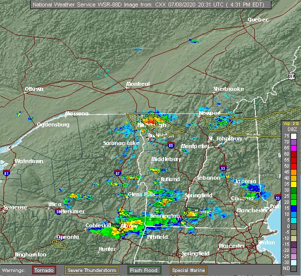
| 7/8/2020 5:27 PM EDT |
 The severe thunderstorm warning for east central clinton, northeastern essex, southwestern lamoille, southern grand isle, northern chittenden and southwestern franklin counties will expire at 530 pm edt, the storm which prompted the warning has moved out of the area. therefore, the warning will be allowed to expire. however gusty winds and heavy rain are still possible with this thunderstorm. a severe thunderstorm watch remains in effect until 1000 pm edt for northwestern vermont. to report severe weather, contact your nearest law enforcement agency. they will relay your report to the national weather service burlington. The severe thunderstorm warning for east central clinton, northeastern essex, southwestern lamoille, southern grand isle, northern chittenden and southwestern franklin counties will expire at 530 pm edt, the storm which prompted the warning has moved out of the area. therefore, the warning will be allowed to expire. however gusty winds and heavy rain are still possible with this thunderstorm. a severe thunderstorm watch remains in effect until 1000 pm edt for northwestern vermont. to report severe weather, contact your nearest law enforcement agency. they will relay your report to the national weather service burlington.
|
| 7/8/2020 5:04 PM EDT | Trees and powerline down on coon hill r in chittenden county VT, 4.9 miles NNE of Milton, VT |
| 7/8/2020 4:56 PM EDT |
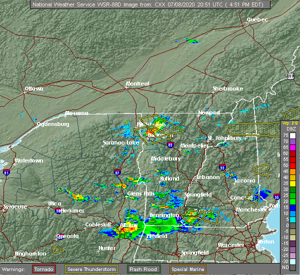 At 455 pm edt, a severe thunderstorm was located over north cambridge, moving southeast at 35 mph (radar indicated). Hazards include 70 mph wind gusts and quarter size hail. Minor hail damage to vehicles is possible. expect considerable tree damage. wind damage is also likely to mobile homes, roofs, and outbuildings. Locations impacted include, waterville, johnson village, cambridge, bakersfield, cambridge village, westford, johnson, jeffersonville village, hyde park, fairfax, georgia center, belvidere center, fletcher, fairfield, georgia, milton, belvidere, underhill, essex and eden. At 455 pm edt, a severe thunderstorm was located over north cambridge, moving southeast at 35 mph (radar indicated). Hazards include 70 mph wind gusts and quarter size hail. Minor hail damage to vehicles is possible. expect considerable tree damage. wind damage is also likely to mobile homes, roofs, and outbuildings. Locations impacted include, waterville, johnson village, cambridge, bakersfield, cambridge village, westford, johnson, jeffersonville village, hyde park, fairfax, georgia center, belvidere center, fletcher, fairfield, georgia, milton, belvidere, underhill, essex and eden.
|
| 7/8/2020 4:54 PM EDT | Tree and powerlines down on middle roa in chittenden county VT, 1.6 miles NNE of Milton, VT |
| 7/8/2020 4:50 PM EDT | Trees and powerlines down on lake roa in chittenden county VT, 2 miles SE of Milton, VT |
| 7/8/2020 4:43 PM EDT |
 At 443 pm edt, a severe thunderstorm was located over milton, moving southeast at 20 mph (radar indicated). Hazards include 70 mph wind gusts and quarter size hail. Minor hail damage to vehicles is possible. expect considerable tree damage. Wind damage is also likely to mobile homes, roofs, and outbuildings. At 443 pm edt, a severe thunderstorm was located over milton, moving southeast at 20 mph (radar indicated). Hazards include 70 mph wind gusts and quarter size hail. Minor hail damage to vehicles is possible. expect considerable tree damage. Wind damage is also likely to mobile homes, roofs, and outbuildings.
|
| 7/8/2020 4:40 PM EDT | Trees and powerlines down on georgia shore roa in franklin county VT, 8 miles SSE of Milton, VT |
| 7/8/2020 4:30 PM EDT |
 At 430 pm edt, a severe thunderstorm was located over swanton junction, moving southeast at 35 mph (radar indicated). Hazards include 60 mph wind gusts and quarter size hail. Minor hail damage to vehicles is possible. Expect wind damage to trees and powerlines. At 430 pm edt, a severe thunderstorm was located over swanton junction, moving southeast at 35 mph (radar indicated). Hazards include 60 mph wind gusts and quarter size hail. Minor hail damage to vehicles is possible. Expect wind damage to trees and powerlines.
|
| 5/29/2020 7:55 PM EDT |
 At 754 pm edt, a severe thunderstorm was located over westford, moving northeast at 50 mph (radar indicated). Hazards include 60 mph wind gusts and quarter size hail. Minor hail damage to vehicles is possible. expect wind damage to trees and powerlines. Locations impacted include, waterville, johnson village, cambridge, bakersfield, cambridge village, essex, westford, johnson, jeffersonville village, fairfax, fletcher, milton, fairfield, georgia, underhill, belvidere, enosburg, jeffersonville, east fletcher and binghamville. At 754 pm edt, a severe thunderstorm was located over westford, moving northeast at 50 mph (radar indicated). Hazards include 60 mph wind gusts and quarter size hail. Minor hail damage to vehicles is possible. expect wind damage to trees and powerlines. Locations impacted include, waterville, johnson village, cambridge, bakersfield, cambridge village, essex, westford, johnson, jeffersonville village, fairfax, fletcher, milton, fairfield, georgia, underhill, belvidere, enosburg, jeffersonville, east fletcher and binghamville.
|
| 5/29/2020 7:51 PM EDT | Trees down on power lines causing outages in chittenden county VT, 0.1 miles N of Milton, VT |
| 5/29/2020 7:39 PM EDT |
 At 739 pm edt, a severe thunderstorm was located over derway island, moving northeast at 50 mph (radar indicated). Hazards include 60 mph wind gusts and quarter size hail. Minor hail damage to vehicles is possible. Expect wind damage to trees and powerlines. At 739 pm edt, a severe thunderstorm was located over derway island, moving northeast at 50 mph (radar indicated). Hazards include 60 mph wind gusts and quarter size hail. Minor hail damage to vehicles is possible. Expect wind damage to trees and powerlines.
|
| 5/29/2020 3:56 PM EDT |
 At 356 pm edt, a severe thunderstorm was located over winooski, moving east at 40 mph (radar indicated). Hazards include 60 mph wind gusts and nickel size hail. Expect damage to trees and powerlines. This storm has a history of wind damage. At 356 pm edt, a severe thunderstorm was located over winooski, moving east at 40 mph (radar indicated). Hazards include 60 mph wind gusts and nickel size hail. Expect damage to trees and powerlines. This storm has a history of wind damage.
|
| 3/20/2020 3:43 PM EDT |
 At 343 pm edt, severe thunderstorms were located along a line extending from bluff point to mount marcy, moving east at 65 mph (radar indicated). Hazards include 60 mph wind gusts. expect damage to trees and powerlines At 343 pm edt, severe thunderstorms were located along a line extending from bluff point to mount marcy, moving east at 65 mph (radar indicated). Hazards include 60 mph wind gusts. expect damage to trees and powerlines
|
| 7/30/2019 4:25 PM EDT |
 The severe thunderstorm warning for northern chittenden and southwestern franklin counties will expire at 430 pm edt, the storm which prompted the warning has moved out of the area. therefore, the warning will be allowed to expire. however gusty winds are still possible with this thunderstorm as additional warning remains in effect. a severe thunderstorm watch remains in effect until 900 pm edt for northwestern vermont. The severe thunderstorm warning for northern chittenden and southwestern franklin counties will expire at 430 pm edt, the storm which prompted the warning has moved out of the area. therefore, the warning will be allowed to expire. however gusty winds are still possible with this thunderstorm as additional warning remains in effect. a severe thunderstorm watch remains in effect until 900 pm edt for northwestern vermont.
|
| 7/30/2019 4:06 PM EDT | 1/2 oak tree down on river st across from rene' in chittenden county VT, 1 miles NNE of Milton, VT |
| 7/30/2019 3:57 PM EDT |
 At 357 pm edt, a severe thunderstorm was located over colchester, moving northeast at 30 mph (nws employee reports trees down on power out on north end of burlington). Hazards include 60 mph wind gusts and penny size hail. Expect damage to trees and powerlines. Locations impacted include, essex junction, south burlington, burlington international airport, burlington, winooski, essex, westford, jericho village, colchester, essex junction village, fairfax, milton, underhill, georgia, jericho, williston, mallets bay state park, west milton, malletts bay and coates island. At 357 pm edt, a severe thunderstorm was located over colchester, moving northeast at 30 mph (nws employee reports trees down on power out on north end of burlington). Hazards include 60 mph wind gusts and penny size hail. Expect damage to trees and powerlines. Locations impacted include, essex junction, south burlington, burlington international airport, burlington, winooski, essex, westford, jericho village, colchester, essex junction village, fairfax, milton, underhill, georgia, jericho, williston, mallets bay state park, west milton, malletts bay and coates island.
|
| 7/30/2019 3:28 PM EDT |
 At 327 pm edt, a severe thunderstorm was located over frisbies point, moving northeast at 30 mph (radar indicated). Hazards include 60 mph wind gusts and penny size hail. expect damage to trees and powerlines At 327 pm edt, a severe thunderstorm was located over frisbies point, moving northeast at 30 mph (radar indicated). Hazards include 60 mph wind gusts and penny size hail. expect damage to trees and powerlines
|
| 6/29/2019 9:09 PM EDT |
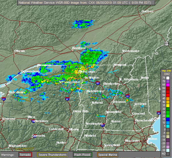 The severe thunderstorm warning for northern clinton, grand isle, northwestern chittenden and western franklin counties will expire at 915 pm edt, the storms which prompted the warning has exited western clinton county and has weakened below severe limits as it approves the champlain valley. therefore, the warning will be allowed to expire. however gusty winds are still possible with these thunderstorms as they move into the champlain valley and across lake champlain. boaters should seek shelter and be prepared for gusty winds in excess of 30-35 mph. The severe thunderstorm warning for northern clinton, grand isle, northwestern chittenden and western franklin counties will expire at 915 pm edt, the storms which prompted the warning has exited western clinton county and has weakened below severe limits as it approves the champlain valley. therefore, the warning will be allowed to expire. however gusty winds are still possible with these thunderstorms as they move into the champlain valley and across lake champlain. boaters should seek shelter and be prepared for gusty winds in excess of 30-35 mph.
|
| 6/29/2019 9:09 PM EDT |
 At 842 pm edt, a severe thunderstorm was located over jericho, moving east at 45 mph (radar indicated). Hazards include 60 mph wind gusts and penny size hail. Expect damage to trees and powerlines. locations impacted include, essex junction, plattsburgh, plattsburgh international airport, burlington, beekmantown, schuyler falls, chazy, mooers, altona, champlain, colchester, essex junction village, georgia, grand isle, st. Albans town, south alburgh, alburgh, alburgh dunes state park, north hero and milton. At 842 pm edt, a severe thunderstorm was located over jericho, moving east at 45 mph (radar indicated). Hazards include 60 mph wind gusts and penny size hail. Expect damage to trees and powerlines. locations impacted include, essex junction, plattsburgh, plattsburgh international airport, burlington, beekmantown, schuyler falls, chazy, mooers, altona, champlain, colchester, essex junction village, georgia, grand isle, st. Albans town, south alburgh, alburgh, alburgh dunes state park, north hero and milton.
|
| 6/29/2019 8:43 PM EDT |
 At 842 pm edt, a severe thunderstorm was located over jericho, moving east at 45 mph (radar indicated). Hazards include 60 mph wind gusts and penny size hail. Expect damage to trees and powerlines. locations impacted include, essex junction, plattsburgh, plattsburgh international airport, burlington, beekmantown, schuyler falls, chazy, mooers, altona, champlain, colchester, essex junction village, georgia, grand isle, st. Albans town, south alburgh, alburgh, alburgh dunes state park, north hero and milton. At 842 pm edt, a severe thunderstorm was located over jericho, moving east at 45 mph (radar indicated). Hazards include 60 mph wind gusts and penny size hail. Expect damage to trees and powerlines. locations impacted include, essex junction, plattsburgh, plattsburgh international airport, burlington, beekmantown, schuyler falls, chazy, mooers, altona, champlain, colchester, essex junction village, georgia, grand isle, st. Albans town, south alburgh, alburgh, alburgh dunes state park, north hero and milton.
|
| 6/29/2019 8:15 PM EDT |
 At 815 pm edt, a severe thunderstorm was located over brainardsville, moving east at 45 mph (radar indicated). Hazards include 60 mph wind gusts and quarter size hail. Minor hail damage to vehicles is possible. Expect wind damage to trees and powerlines. At 815 pm edt, a severe thunderstorm was located over brainardsville, moving east at 45 mph (radar indicated). Hazards include 60 mph wind gusts and quarter size hail. Minor hail damage to vehicles is possible. Expect wind damage to trees and powerlines.
|
| 6/26/2019 5:46 PM EDT |
 At 544 pm edt, severe thunderstorms were located along a line extending from cambridge junction to underhill to near jericho center, moving east at 45 mph (multiple sources. line of storms has knocked a tree onto vehicle in downtown burlington. additionally, a 62mph gust was measures at a ny state mesonet in essex, ny. reports from emergency management of power poles snapped and trees down in willisboro along the tree down along i-87 near lewiston). Hazards include 60 mph wind gusts and penny size hail. Expect damage to trees and powerlines. locations impacted include, essex junction, south burlington, burlington international airport, burlington, morrisville, johnson village, cambridge, winooski, monkton ridge, waterbury village, westford, monkton boro, hyde park, essex junction village, williston, worcester, middlesex, hinesburg, st. George and morrisville village. At 544 pm edt, severe thunderstorms were located along a line extending from cambridge junction to underhill to near jericho center, moving east at 45 mph (multiple sources. line of storms has knocked a tree onto vehicle in downtown burlington. additionally, a 62mph gust was measures at a ny state mesonet in essex, ny. reports from emergency management of power poles snapped and trees down in willisboro along the tree down along i-87 near lewiston). Hazards include 60 mph wind gusts and penny size hail. Expect damage to trees and powerlines. locations impacted include, essex junction, south burlington, burlington international airport, burlington, morrisville, johnson village, cambridge, winooski, monkton ridge, waterbury village, westford, monkton boro, hyde park, essex junction village, williston, worcester, middlesex, hinesburg, st. George and morrisville village.
|
| 6/26/2019 5:32 PM EDT |
 At 530 pm edt, severe thunderstorms were located along a line extending from near westford to essex to near st. george, moving east at 45 mph (new york state mesonet in essex, ny reported wind gusts of 54 knots. additionally, social media reports tree branch downed on vehicle in downtown burlington). Hazards include 60 mph wind gusts and penny size hail. Expect damage to trees and powerlines. Locations impacted include, essex junction, south burlington, burlington international airport, burlington, willsboro, morrisville, johnson village, cambridge, winooski, monkton ridge, waterbury village, westford, monkton boro, hyde park, colchester, essex junction village, williston, worcester, middlesex and belvidere center. At 530 pm edt, severe thunderstorms were located along a line extending from near westford to essex to near st. george, moving east at 45 mph (new york state mesonet in essex, ny reported wind gusts of 54 knots. additionally, social media reports tree branch downed on vehicle in downtown burlington). Hazards include 60 mph wind gusts and penny size hail. Expect damage to trees and powerlines. Locations impacted include, essex junction, south burlington, burlington international airport, burlington, willsboro, morrisville, johnson village, cambridge, winooski, monkton ridge, waterbury village, westford, monkton boro, hyde park, colchester, essex junction village, williston, worcester, middlesex and belvidere center.
|
| 6/26/2019 5:08 PM EDT |
 At 508 pm edt, severe thunderstorms were located along a line extending from allen point to near the four brothers to near reber, moving east at 45 mph (radar indicated). Hazards include 60 mph wind gusts and penny size hail. expect damage to trees and powerlines At 508 pm edt, severe thunderstorms were located along a line extending from allen point to near the four brothers to near reber, moving east at 45 mph (radar indicated). Hazards include 60 mph wind gusts and penny size hail. expect damage to trees and powerlines
|
| 6/26/2019 4:54 PM EDT |
 At 454 pm edt, severe thunderstorms were located along a line extending from day point to corlaer bay to willsboro bay, moving east at 40 mph (radar indicated). Hazards include 60 mph wind gusts and quarter size hail. Minor hail damage to vehicles is possible. expect wind damage to trees and powerlines. locations impacted include, essex junction, plattsburgh international airport, south burlington, burlington international airport, burlington, peru, schuyler falls, willsboro, winooski, colchester, essex junction village, williston, georgia, st. George, keeseville, milton, shelburne, south hero, port kent and essex. At 454 pm edt, severe thunderstorms were located along a line extending from day point to corlaer bay to willsboro bay, moving east at 40 mph (radar indicated). Hazards include 60 mph wind gusts and quarter size hail. Minor hail damage to vehicles is possible. expect wind damage to trees and powerlines. locations impacted include, essex junction, plattsburgh international airport, south burlington, burlington international airport, burlington, peru, schuyler falls, willsboro, winooski, colchester, essex junction village, williston, georgia, st. George, keeseville, milton, shelburne, south hero, port kent and essex.
|
| 6/26/2019 4:33 PM EDT |
 At 433 pm edt, severe thunderstorms were located along a line extending from near schuyler falls to clintonville to near deerhead, moving east at 40 mph (radar indicated). Hazards include 60 mph wind gusts and quarter size hail. Minor hail damage to vehicles is possible. expect wind damage to trees and powerlines. locations impacted include, essex junction, plattsburgh international airport, south burlington, burlington international airport, burlington, peru, schuyler falls, willsboro, winooski, colchester, essex junction village, williston, georgia, au sable forks, st. George, keeseville, jay in essex county, milton, shelburne and south hero. At 433 pm edt, severe thunderstorms were located along a line extending from near schuyler falls to clintonville to near deerhead, moving east at 40 mph (radar indicated). Hazards include 60 mph wind gusts and quarter size hail. Minor hail damage to vehicles is possible. expect wind damage to trees and powerlines. locations impacted include, essex junction, plattsburgh international airport, south burlington, burlington international airport, burlington, peru, schuyler falls, willsboro, winooski, colchester, essex junction village, williston, georgia, au sable forks, st. George, keeseville, jay in essex county, milton, shelburne and south hero.
|
| 6/26/2019 4:14 PM EDT |
 The national weather service in burlington has issued a * severe thunderstorm warning for. southeastern clinton county in northern new york. northeastern essex county in northern new york. southern grand isle county in northwestern vermont. Northwestern chittenden county in northwestern vermont. The national weather service in burlington has issued a * severe thunderstorm warning for. southeastern clinton county in northern new york. northeastern essex county in northern new york. southern grand isle county in northwestern vermont. Northwestern chittenden county in northwestern vermont.
|
| 6/26/2019 4:14 PM EDT |
 At 413 pm edt, severe thunderstorms were located along a line extending from near clayburg to near black brook to wilmington, moving east at 40 mph (radar indicated). Hazards include 60 mph wind gusts and penny size hail. expect damage to trees and powerlines At 413 pm edt, severe thunderstorms were located along a line extending from near clayburg to near black brook to wilmington, moving east at 40 mph (radar indicated). Hazards include 60 mph wind gusts and penny size hail. expect damage to trees and powerlines
|
| 5/4/2018 7:06 PM EDT | Trees down in chittenden county VT, 4.7 miles WNW of Milton, VT |
| 5/4/2018 6:44 PM EDT |
 At 643 pm edt, a severe thunderstorm was located over barney point, moving east at 60 mph. this is a very dangerous storm (radar indicated). Hazards include 80 mph wind gusts and ping pong ball size hail. Flying debris will be dangerous to those caught without shelter. mobile homes will be heavily damaged. expect considerable damage to roofs, windows, and vehicles. extensive tree damage and power outages are likely. locations impacted include, essex junction, burlington international airport, south burlington, burlington, vergennes, middlebury, willsboro, westport, elizabethtown, keene, westford, colchester, essex junction village, au sable forks, addison, jay in essex county, shelburne, charlotte, waltham and cambridge village. A tornado watch remains in effect until 1000 pm edt for northern new york, and central and northwestern vermont. At 643 pm edt, a severe thunderstorm was located over barney point, moving east at 60 mph. this is a very dangerous storm (radar indicated). Hazards include 80 mph wind gusts and ping pong ball size hail. Flying debris will be dangerous to those caught without shelter. mobile homes will be heavily damaged. expect considerable damage to roofs, windows, and vehicles. extensive tree damage and power outages are likely. locations impacted include, essex junction, burlington international airport, south burlington, burlington, vergennes, middlebury, willsboro, westport, elizabethtown, keene, westford, colchester, essex junction village, au sable forks, addison, jay in essex county, shelburne, charlotte, waltham and cambridge village. A tornado watch remains in effect until 1000 pm edt for northern new york, and central and northwestern vermont.
|
| 5/4/2018 6:24 PM EDT |
 At 623 pm edt, a severe thunderstorm was located near keene, moving east at 50 mph (radar indicated). Hazards include 60 mph wind gusts and quarter size hail. Minor hail damage to vehicles is possible. Expect wind damage to trees and powerlines. At 623 pm edt, a severe thunderstorm was located near keene, moving east at 50 mph (radar indicated). Hazards include 60 mph wind gusts and quarter size hail. Minor hail damage to vehicles is possible. Expect wind damage to trees and powerlines.
|
| 8/22/2017 6:00 PM EDT |
 At 600 pm edt, severe thunderstorms were located along a line extending from near appletree point to twilight bay to waltham, moving northeast at 35 mph (radar indicated). Hazards include 60 mph wind gusts. expect damage to trees and powerlines At 600 pm edt, severe thunderstorms were located along a line extending from near appletree point to twilight bay to waltham, moving northeast at 35 mph (radar indicated). Hazards include 60 mph wind gusts. expect damage to trees and powerlines
|
| 7/8/2017 7:55 AM EDT |
 The severe thunderstorm warning for southeastern clinton, northeastern essex, grand isle, northwestern chittenden and southwestern franklin counties will expire at 800 am edt, the storms which prompted the warning have weakened below severe limits, and no longer pose an immediate threat to life or property. therefore the warning will be allowed to expire. however gusty winds and heavy rain are still possible with these thunderstorms. The severe thunderstorm warning for southeastern clinton, northeastern essex, grand isle, northwestern chittenden and southwestern franklin counties will expire at 800 am edt, the storms which prompted the warning have weakened below severe limits, and no longer pose an immediate threat to life or property. therefore the warning will be allowed to expire. however gusty winds and heavy rain are still possible with these thunderstorms.
|
| 7/8/2017 7:27 AM EDT |
 At 727 am edt, severe thunderstorms were located along a line extending from deep bay to ausable point to near north jay, moving east at 30 mph (radar indicated). Hazards include 60 mph wind gusts. Expect damage to trees and powerlines. locations impacted include, essex junction, burlington international airport, plattsburgh, plattsburgh international airport, south burlington, burlington, peru, beekmantown, schuyler falls, willsboro, colchester, essex junction village, georgia, au sable forks, grand isle, st. Albans town, north hero, milton, shelburne and port kent. At 727 am edt, severe thunderstorms were located along a line extending from deep bay to ausable point to near north jay, moving east at 30 mph (radar indicated). Hazards include 60 mph wind gusts. Expect damage to trees and powerlines. locations impacted include, essex junction, burlington international airport, plattsburgh, plattsburgh international airport, south burlington, burlington, peru, beekmantown, schuyler falls, willsboro, colchester, essex junction village, georgia, au sable forks, grand isle, st. Albans town, north hero, milton, shelburne and port kent.
|
| 7/8/2017 7:15 AM EDT |
 At 715 am edt, severe thunderstorms were located along a line extending from beekmantown to laphams mills to north jay, moving east at 45 mph (radar indicated). Hazards include 60 mph wind gusts. Expect damage to trees and powerlines. locations impacted include, essex junction, burlington international airport, plattsburgh, plattsburgh international airport, south burlington, burlington, peru, beekmantown, schuyler falls, saranac, willsboro, colchester, essex junction village, georgia, au sable forks, grand isle, st. Albans town, jay in essex county, north hero and milton. At 715 am edt, severe thunderstorms were located along a line extending from beekmantown to laphams mills to north jay, moving east at 45 mph (radar indicated). Hazards include 60 mph wind gusts. Expect damage to trees and powerlines. locations impacted include, essex junction, burlington international airport, plattsburgh, plattsburgh international airport, south burlington, burlington, peru, beekmantown, schuyler falls, saranac, willsboro, colchester, essex junction village, georgia, au sable forks, grand isle, st. Albans town, jay in essex county, north hero and milton.
|
| 7/8/2017 7:04 AM EDT |
 At 703 am edt, severe thunderstorms were located along a line extending from jericho to near peasleeville to near wilmington, moving east at 30 mph (radar indicated). Hazards include 60 mph wind gusts. Expect damage to trees and powerlines. locations impacted include, essex junction, burlington international airport, adirondack regional airport, plattsburgh, plattsburgh international airport, south burlington, burlington, saranac lake, peru, beekmantown, schuyler falls, saranac, willsboro, wilmington, colchester, essex junction village, georgia, au sable forks, grand isle and st. Albans town. At 703 am edt, severe thunderstorms were located along a line extending from jericho to near peasleeville to near wilmington, moving east at 30 mph (radar indicated). Hazards include 60 mph wind gusts. Expect damage to trees and powerlines. locations impacted include, essex junction, burlington international airport, adirondack regional airport, plattsburgh, plattsburgh international airport, south burlington, burlington, saranac lake, peru, beekmantown, schuyler falls, saranac, willsboro, wilmington, colchester, essex junction village, georgia, au sable forks, grand isle and st. Albans town.
|
| 7/8/2017 6:29 AM EDT |
 At 628 am edt, severe thunderstorms were located along a line extending from merrill to near loon lake to adirondack regional airport, moving east at 30 mph (radar indicated). Hazards include 60 mph wind gusts and quarter size hail. Minor hail damage to vehicles is possible. Expect wind damage to trees and powerlines. At 628 am edt, severe thunderstorms were located along a line extending from merrill to near loon lake to adirondack regional airport, moving east at 30 mph (radar indicated). Hazards include 60 mph wind gusts and quarter size hail. Minor hail damage to vehicles is possible. Expect wind damage to trees and powerlines.
|
| 6/18/2017 11:27 PM EDT |
 At 1126 pm edt, a severe thunderstorm was located over cloverdale, moving northeast at 45 mph (radar indicated). Hazards include 60 mph wind gusts. expect damage to trees and powerlines At 1126 pm edt, a severe thunderstorm was located over cloverdale, moving northeast at 45 mph (radar indicated). Hazards include 60 mph wind gusts. expect damage to trees and powerlines
|
| 5/31/2017 2:55 PM EDT |
 At 254 pm edt, a severe thunderstorm was located over colchester, moving east at 30 mph (radar indicated). Hazards include 60 mph wind gusts and penny size hail. Expect damage to trees and powerlines. locations impacted include, essex junction, south burlington, burlington international airport, burlington, winooski, westford, colchester, essex junction village, williston, bolton, richmond, underhill, jericho, st. George, essex, jericho village, underhill state park, shelburne, south hero and milton. At 254 pm edt, a severe thunderstorm was located over colchester, moving east at 30 mph (radar indicated). Hazards include 60 mph wind gusts and penny size hail. Expect damage to trees and powerlines. locations impacted include, essex junction, south burlington, burlington international airport, burlington, winooski, westford, colchester, essex junction village, williston, bolton, richmond, underhill, jericho, st. George, essex, jericho village, underhill state park, shelburne, south hero and milton.
|
| 5/31/2017 2:30 PM EDT |
 At 230 pm edt, a severe thunderstorm was located over ferris rock, moving east at 35 mph (radar indicated). Hazards include 60 mph wind gusts and penny size hail. expect damage to trees and powerlines At 230 pm edt, a severe thunderstorm was located over ferris rock, moving east at 35 mph (radar indicated). Hazards include 60 mph wind gusts and penny size hail. expect damage to trees and powerlines
|
| 9/11/2016 5:31 AM EDT |
 At 531 am edt, a severe thunderstorm was located over montgomery center, moving northeast at 30 mph (radar indicated). Hazards include 60 mph wind gusts. Expect damage to roofs. siding. and trees. Locations impacted include, fairfax, richford, berkshire, troy, johnson, enosburg falls, bakersfield, fletcher, montgomery, waterville, westfield, jay, cambridge, montgomery center, belvidere center, jay in franklin county, jeffersonville, north troy, enosburg center and north enosburg. At 531 am edt, a severe thunderstorm was located over montgomery center, moving northeast at 30 mph (radar indicated). Hazards include 60 mph wind gusts. Expect damage to roofs. siding. and trees. Locations impacted include, fairfax, richford, berkshire, troy, johnson, enosburg falls, bakersfield, fletcher, montgomery, waterville, westfield, jay, cambridge, montgomery center, belvidere center, jay in franklin county, jeffersonville, north troy, enosburg center and north enosburg.
|
| 9/11/2016 4:49 AM EDT |
 At 449 am edt, a severe thunderstorm was located over fairfax, moving northeast at 30 mph (radar indicated). Hazards include 60 mph wind gusts. Expect damage to roofs. siding. And trees. At 449 am edt, a severe thunderstorm was located over fairfax, moving northeast at 30 mph (radar indicated). Hazards include 60 mph wind gusts. Expect damage to roofs. siding. And trees.
|
| 7/23/2016 3:38 PM EDT |
 At 338 pm edt, a severe thunderstorm was located over essex center, moving southeast at 40 mph (radar indicated). Hazards include 60 mph wind gusts and quarter size hail. Hail damage to vehicles is expected. expect wind damage to roofs, siding, and trees. locations impacted include, south burlington, colchester, essex junction, plattsburgh international airport, burlington international airport, williston, winooski, grand isle, jericho, hinesburg, fairfax, richmond, underhill, westford, huntington, south hero, bolton, st. George, underhill state park and georgia center. At 338 pm edt, a severe thunderstorm was located over essex center, moving southeast at 40 mph (radar indicated). Hazards include 60 mph wind gusts and quarter size hail. Hail damage to vehicles is expected. expect wind damage to roofs, siding, and trees. locations impacted include, south burlington, colchester, essex junction, plattsburgh international airport, burlington international airport, williston, winooski, grand isle, jericho, hinesburg, fairfax, richmond, underhill, westford, huntington, south hero, bolton, st. George, underhill state park and georgia center.
|
| 7/23/2016 3:38 PM EDT |
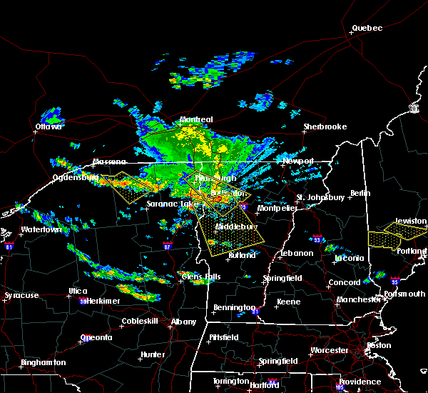 At 338 pm edt, a severe thunderstorm was located over essex center, moving southeast at 40 mph (radar indicated). Hazards include 60 mph wind gusts and quarter size hail. Hail damage to vehicles is expected. expect wind damage to roofs, siding, and trees. locations impacted include, south burlington, colchester, essex junction, plattsburgh international airport, burlington international airport, williston, winooski, grand isle, jericho, hinesburg, fairfax, richmond, underhill, westford, huntington, south hero, bolton, st. George, underhill state park and georgia center. At 338 pm edt, a severe thunderstorm was located over essex center, moving southeast at 40 mph (radar indicated). Hazards include 60 mph wind gusts and quarter size hail. Hail damage to vehicles is expected. expect wind damage to roofs, siding, and trees. locations impacted include, south burlington, colchester, essex junction, plattsburgh international airport, burlington international airport, williston, winooski, grand isle, jericho, hinesburg, fairfax, richmond, underhill, westford, huntington, south hero, bolton, st. George, underhill state park and georgia center.
|
| 7/23/2016 3:01 PM EDT |
 At 300 pm edt, a severe thunderstorm was located over treadwell bay, moving southeast at 40 mph (radar indicated). Hazards include 60 mph wind gusts and quarter size hail. Hail damage to vehicles is expected. Expect wind damage to roofs, siding, and trees. At 300 pm edt, a severe thunderstorm was located over treadwell bay, moving southeast at 40 mph (radar indicated). Hazards include 60 mph wind gusts and quarter size hail. Hail damage to vehicles is expected. Expect wind damage to roofs, siding, and trees.
|
| 7/22/2016 10:43 PM EDT |
 At 1041 pm edt, severe thunderstorms were located along a line extending from alburg vermont to burlington vermont, moving east at 35 to 40 mph. other strong to severe thunderstorms were located over northeast vermont moving east at 35 mph (radar indicated). Hazards include 60 mph wind gusts and quarter size hail. Hail damage to vehicles is expected. Expect wind damage to roofs, siding, and trees. At 1041 pm edt, severe thunderstorms were located along a line extending from alburg vermont to burlington vermont, moving east at 35 to 40 mph. other strong to severe thunderstorms were located over northeast vermont moving east at 35 mph (radar indicated). Hazards include 60 mph wind gusts and quarter size hail. Hail damage to vehicles is expected. Expect wind damage to roofs, siding, and trees.
|
| 7/22/2016 10:09 PM EDT |
 At 1008 pm edt, an area of strong to severe thunderstorms was located from east fletcher vermont westward to cumberland head new york, moving east at 30 mph (radar indicated). Hazards include 60 mph wind gusts and quarter size hail. Hail damage to vehicles is expected. expect wind damage to roofs, siding, and trees. Locations impacted include, colchester, essex junction, plattsburgh international airport, grand isle, beekmantown, jericho, fairfax, chazy, underhill, westford, south hero, johnson, fletcher, north hero, waterville, isle la motte, cambridge, underhill state park, georgia center and schuyler falls. At 1008 pm edt, an area of strong to severe thunderstorms was located from east fletcher vermont westward to cumberland head new york, moving east at 30 mph (radar indicated). Hazards include 60 mph wind gusts and quarter size hail. Hail damage to vehicles is expected. expect wind damage to roofs, siding, and trees. Locations impacted include, colchester, essex junction, plattsburgh international airport, grand isle, beekmantown, jericho, fairfax, chazy, underhill, westford, south hero, johnson, fletcher, north hero, waterville, isle la motte, cambridge, underhill state park, georgia center and schuyler falls.
|
| 7/22/2016 10:09 PM EDT |
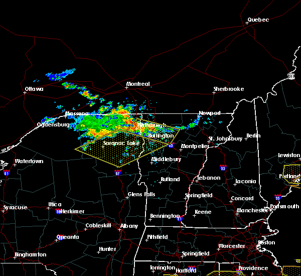 At 1008 pm edt, an area of strong to severe thunderstorms was located from east fletcher vermont westward to cumberland head new york, moving east at 30 mph (radar indicated). Hazards include 60 mph wind gusts and quarter size hail. Hail damage to vehicles is expected. expect wind damage to roofs, siding, and trees. Locations impacted include, colchester, essex junction, plattsburgh international airport, grand isle, beekmantown, jericho, fairfax, chazy, underhill, westford, south hero, johnson, fletcher, north hero, waterville, isle la motte, cambridge, underhill state park, georgia center and schuyler falls. At 1008 pm edt, an area of strong to severe thunderstorms was located from east fletcher vermont westward to cumberland head new york, moving east at 30 mph (radar indicated). Hazards include 60 mph wind gusts and quarter size hail. Hail damage to vehicles is expected. expect wind damage to roofs, siding, and trees. Locations impacted include, colchester, essex junction, plattsburgh international airport, grand isle, beekmantown, jericho, fairfax, chazy, underhill, westford, south hero, johnson, fletcher, north hero, waterville, isle la motte, cambridge, underhill state park, georgia center and schuyler falls.
|
| 7/22/2016 9:42 PM EDT |
 At 941 pm edt, a severe thunderstorm was located over allens bay in clinton county, moving east at 35 mph (radar indicated). Hazards include 60 mph wind gusts and quarter size hail. Hail damage to vehicles is expected. Expect wind damage to roofs, siding, and trees. At 941 pm edt, a severe thunderstorm was located over allens bay in clinton county, moving east at 35 mph (radar indicated). Hazards include 60 mph wind gusts and quarter size hail. Hail damage to vehicles is expected. Expect wind damage to roofs, siding, and trees.
|
| 7/18/2016 1:53 PM EDT |
 The severe thunderstorm warning for southeastern clinton, northeastern essex, lamoille, southern grand isle, northern chittenden and southwestern franklin counties will expire at 200 pm edt, the storm which prompted the warning has moved out of the area. therefore the warning will be allowed to expire. however gusty winds and heavy rain are still possible with this thunderstorm. a severe thunderstorm watch remains in effect until 800 pm edt for northern new york, and northeastern, central and northwestern vermont. The severe thunderstorm warning for southeastern clinton, northeastern essex, lamoille, southern grand isle, northern chittenden and southwestern franklin counties will expire at 200 pm edt, the storm which prompted the warning has moved out of the area. therefore the warning will be allowed to expire. however gusty winds and heavy rain are still possible with this thunderstorm. a severe thunderstorm watch remains in effect until 800 pm edt for northern new york, and northeastern, central and northwestern vermont.
|
| 7/18/2016 1:53 PM EDT |
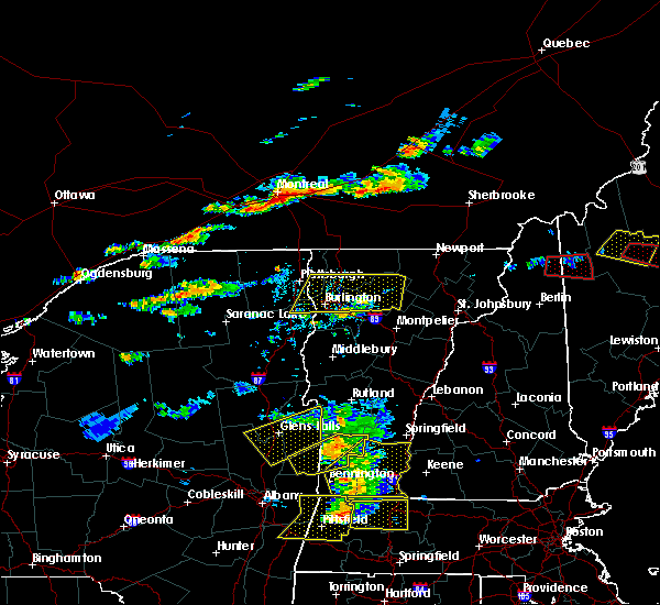 The severe thunderstorm warning for southeastern clinton, northeastern essex, lamoille, southern grand isle, northern chittenden and southwestern franklin counties will expire at 200 pm edt, the storm which prompted the warning has moved out of the area. therefore the warning will be allowed to expire. however gusty winds and heavy rain are still possible with this thunderstorm. a severe thunderstorm watch remains in effect until 800 pm edt for northern new york, and northeastern, central and northwestern vermont. The severe thunderstorm warning for southeastern clinton, northeastern essex, lamoille, southern grand isle, northern chittenden and southwestern franklin counties will expire at 200 pm edt, the storm which prompted the warning has moved out of the area. therefore the warning will be allowed to expire. however gusty winds and heavy rain are still possible with this thunderstorm. a severe thunderstorm watch remains in effect until 800 pm edt for northern new york, and northeastern, central and northwestern vermont.
|
| 7/18/2016 1:19 PM EDT |
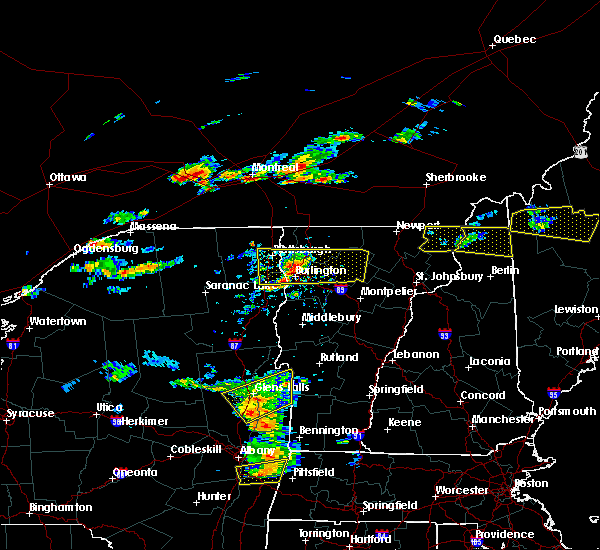 At 118 pm edt, a severe thunderstorm was located near colchester point, moving east at 55 mph (trained weather spotters reported trees downed in peru). Hazards include 60 mph wind gusts and quarter size hail. Hail damage to vehicles is expected. expect wind damage to roofs, siding, and trees. locations impacted include, south burlington, colchester, essex junction, burlington international airport, williston, winooski, grand isle, jericho, stowe, fairfax, underhill, westford, morrisville, south hero, johnson, eden, fletcher, waterville, hyde park and cambridge. At 118 pm edt, a severe thunderstorm was located near colchester point, moving east at 55 mph (trained weather spotters reported trees downed in peru). Hazards include 60 mph wind gusts and quarter size hail. Hail damage to vehicles is expected. expect wind damage to roofs, siding, and trees. locations impacted include, south burlington, colchester, essex junction, burlington international airport, williston, winooski, grand isle, jericho, stowe, fairfax, underhill, westford, morrisville, south hero, johnson, eden, fletcher, waterville, hyde park and cambridge.
|
| 7/18/2016 1:00 PM EDT |
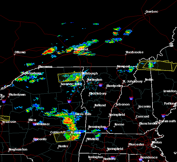 At 1259 pm edt, a severe thunderstorm was located over ausable point, moving east at 55 mph (radar indicated). Hazards include 60 mph wind gusts. Expect damage to roofs. siding. And trees. At 1259 pm edt, a severe thunderstorm was located over ausable point, moving east at 55 mph (radar indicated). Hazards include 60 mph wind gusts. Expect damage to roofs. siding. And trees.
|
| 7/7/2016 1:54 PM EDT |
 At 154 pm edt, a severe thunderstorm was located near fairfax, moving east at 20 mph (radar indicated). Hazards include quarter size hail. damage to vehicles is expected At 154 pm edt, a severe thunderstorm was located near fairfax, moving east at 20 mph (radar indicated). Hazards include quarter size hail. damage to vehicles is expected
|
| 6/28/2016 5:10 PM EDT |
 The severe thunderstorm warning for east central clinton, southern grand isle, northwestern chittenden and southwestern franklin counties will expire at 515 pm edt, the storm which prompted the warning has weakened below severe limits, and have exited the warned area. therefore the warning will be allowed to expire. to report severe weather, contact your nearest law enforcement agency. they will relay your report to the national weather service burlington. The severe thunderstorm warning for east central clinton, southern grand isle, northwestern chittenden and southwestern franklin counties will expire at 515 pm edt, the storm which prompted the warning has weakened below severe limits, and have exited the warned area. therefore the warning will be allowed to expire. to report severe weather, contact your nearest law enforcement agency. they will relay your report to the national weather service burlington.
|
| 6/28/2016 5:10 PM EDT |
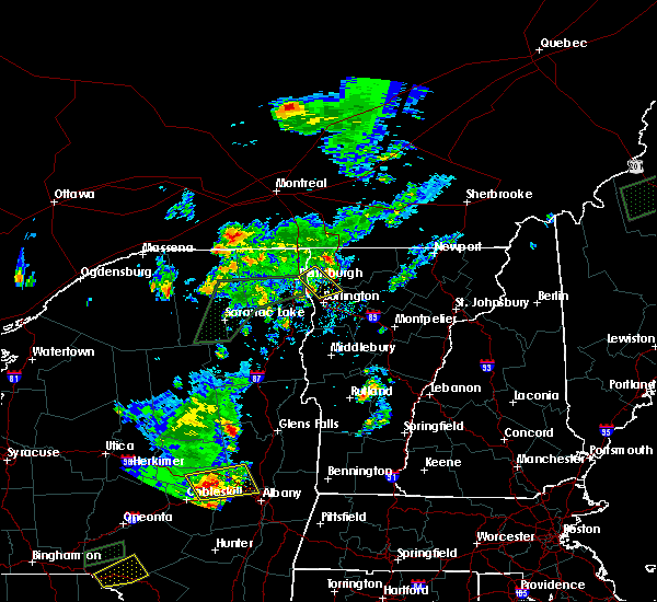 The severe thunderstorm warning for east central clinton, southern grand isle, northwestern chittenden and southwestern franklin counties will expire at 515 pm edt, the storm which prompted the warning has weakened below severe limits, and have exited the warned area. therefore the warning will be allowed to expire. to report severe weather, contact your nearest law enforcement agency. they will relay your report to the national weather service burlington. The severe thunderstorm warning for east central clinton, southern grand isle, northwestern chittenden and southwestern franklin counties will expire at 515 pm edt, the storm which prompted the warning has weakened below severe limits, and have exited the warned area. therefore the warning will be allowed to expire. to report severe weather, contact your nearest law enforcement agency. they will relay your report to the national weather service burlington.
|
| 6/28/2016 4:59 PM EDT |
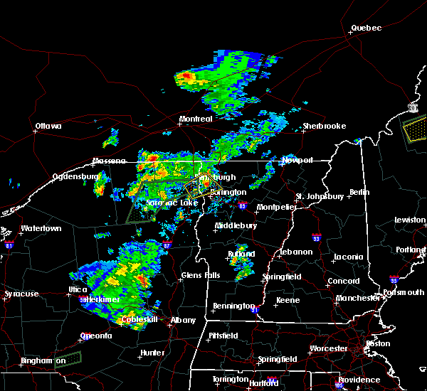 At 459 pm edt, a severe thunderstorm was located near grand isle, moving northeast at 25 mph (radar indicated). Hazards include 60 mph wind gusts and quarter size hail. Hail damage to vehicles is expected. expect wind damage to roofs, siding, and trees. locations impacted include, grand isle, south hero, north hero, mallets bay state park, monty point, west milton, short point, knight point state park, cumberland bay state park, mooney bay, knight point, ladd point, grand isle state park, marble island, hen island, beans point, malletts bay, allens bay in clinton county, treadwell bay and cooper bay. At 459 pm edt, a severe thunderstorm was located near grand isle, moving northeast at 25 mph (radar indicated). Hazards include 60 mph wind gusts and quarter size hail. Hail damage to vehicles is expected. expect wind damage to roofs, siding, and trees. locations impacted include, grand isle, south hero, north hero, mallets bay state park, monty point, west milton, short point, knight point state park, cumberland bay state park, mooney bay, knight point, ladd point, grand isle state park, marble island, hen island, beans point, malletts bay, allens bay in clinton county, treadwell bay and cooper bay.
|
| 6/28/2016 4:59 PM EDT |
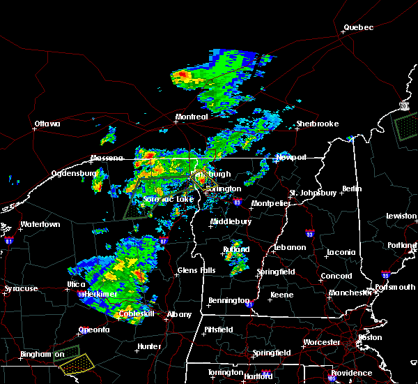 At 459 pm edt, a severe thunderstorm was located near grand isle, moving northeast at 25 mph (radar indicated). Hazards include 60 mph wind gusts and quarter size hail. Hail damage to vehicles is expected. expect wind damage to roofs, siding, and trees. locations impacted include, grand isle, south hero, north hero, mallets bay state park, monty point, west milton, short point, knight point state park, cumberland bay state park, mooney bay, knight point, ladd point, grand isle state park, marble island, hen island, beans point, malletts bay, allens bay in clinton county, treadwell bay and cooper bay. At 459 pm edt, a severe thunderstorm was located near grand isle, moving northeast at 25 mph (radar indicated). Hazards include 60 mph wind gusts and quarter size hail. Hail damage to vehicles is expected. expect wind damage to roofs, siding, and trees. locations impacted include, grand isle, south hero, north hero, mallets bay state park, monty point, west milton, short point, knight point state park, cumberland bay state park, mooney bay, knight point, ladd point, grand isle state park, marble island, hen island, beans point, malletts bay, allens bay in clinton county, treadwell bay and cooper bay.
|
| 6/28/2016 4:35 PM EDT |
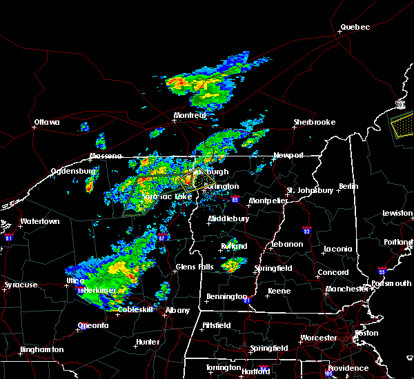 At 435 pm edt, a severe thunderstorm was located near south hero, moving east at 25 mph (radar indicated). Hazards include 60 mph wind gusts and quarter size hail. Hail damage to vehicles is expected. expect wind damage to roofs, siding, and trees. locations impacted include, plattsburgh international airport, peru, grand isle, south hero, north hero, port kent, schuyler falls, keeseville, ausable chasm, mallets bay state park, monty point, west milton, stave island, cumberland bay state park, grand isle state park, carleton prize, marble island, crab island, beans point and allens bay in clinton county. At 435 pm edt, a severe thunderstorm was located near south hero, moving east at 25 mph (radar indicated). Hazards include 60 mph wind gusts and quarter size hail. Hail damage to vehicles is expected. expect wind damage to roofs, siding, and trees. locations impacted include, plattsburgh international airport, peru, grand isle, south hero, north hero, port kent, schuyler falls, keeseville, ausable chasm, mallets bay state park, monty point, west milton, stave island, cumberland bay state park, grand isle state park, carleton prize, marble island, crab island, beans point and allens bay in clinton county.
|
| 6/28/2016 4:07 PM EDT |
 At 407 pm edt, a severe thunderstorm was located over peru, moving northeast at 25 mph (radar indicated). Hazards include quarter size hail. damage to vehicles is expected At 407 pm edt, a severe thunderstorm was located over peru, moving northeast at 25 mph (radar indicated). Hazards include quarter size hail. damage to vehicles is expected
|
| 6/21/2016 12:14 AM EDT |
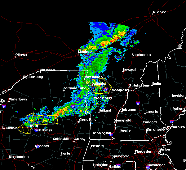 At 1213 am edt, severe thunderstorms were located along a line extending from near cambridge to stowe to near montpelier, moving east at 60 mph (radar indicated). Hazards include 60 mph wind gusts. Expect damage to roofs. siding. and trees. locations impacted include, south burlington, colchester, essex junction, burlington international airport, williston, winooski, jericho, hinesburg, stowe, fairfax, richmond, underhill, westford, huntington, middlesex, moretown, fletcher, bolton, st. george and waterville. At 1213 am edt, severe thunderstorms were located along a line extending from near cambridge to stowe to near montpelier, moving east at 60 mph (radar indicated). Hazards include 60 mph wind gusts. Expect damage to roofs. siding. and trees. locations impacted include, south burlington, colchester, essex junction, burlington international airport, williston, winooski, jericho, hinesburg, stowe, fairfax, richmond, underhill, westford, huntington, middlesex, moretown, fletcher, bolton, st. george and waterville.
|
| 6/20/2016 11:52 PM EDT |
 At 1152 pm edt, severe thunderstorms were located along a line extending from plattsburgh international airport to 6 miles northeast of willsboro to panton, moving east at 40 mph (radar indicated). Hazards include 60 mph wind gusts. Expect damage to roofs. siding. And trees. At 1152 pm edt, severe thunderstorms were located along a line extending from plattsburgh international airport to 6 miles northeast of willsboro to panton, moving east at 40 mph (radar indicated). Hazards include 60 mph wind gusts. Expect damage to roofs. siding. And trees.
|
| 7/21/2015 1:46 PM EDT |
 At 145 pm edt, doppler radar indicated a line of severe thunderstorms capable of producing quarter size hail and destructive winds in excess of 70 mph. these storms were located along a line extending from near colchester to near essex to near elizabethtown, moving east at 30 mph. locations impacted include, south burlington, colchester, essex junction, bristol, burlington international airport, essex, addison, williston, winooski, shelburne, jericho, hinesburg, fairfax, richmond, charlotte, underhill, ferrisburgh, westford, willsboro and monkton. At 145 pm edt, doppler radar indicated a line of severe thunderstorms capable of producing quarter size hail and destructive winds in excess of 70 mph. these storms were located along a line extending from near colchester to near essex to near elizabethtown, moving east at 30 mph. locations impacted include, south burlington, colchester, essex junction, bristol, burlington international airport, essex, addison, williston, winooski, shelburne, jericho, hinesburg, fairfax, richmond, charlotte, underhill, ferrisburgh, westford, willsboro and monkton.
|
| 7/21/2015 1:17 PM EDT |
 At 116 pm edt, doppler radar indicated a line of severe thunderstorms capable of producing quarter size hail and damaging winds in excess of 60 mph. these storms were located along a line extending from peru to near jay in essex county to near mount marcy, and moving east at 30 mph. * locations to be impacted include, south burlington, colchester, essex junction, bristol, plattsburgh international airport, burlington international airport, essex, addison, williston, winooski, shelburne, peru, jericho, hinesburg, fairfax, richmond, charlotte, underhill, ferrisburgh and westford. At 116 pm edt, doppler radar indicated a line of severe thunderstorms capable of producing quarter size hail and damaging winds in excess of 60 mph. these storms were located along a line extending from peru to near jay in essex county to near mount marcy, and moving east at 30 mph. * locations to be impacted include, south burlington, colchester, essex junction, bristol, plattsburgh international airport, burlington international airport, essex, addison, williston, winooski, shelburne, peru, jericho, hinesburg, fairfax, richmond, charlotte, underhill, ferrisburgh and westford.
|
| 5/27/2015 2:09 PM EDT | The severe thunderstorm warning for northern lamoille, southern grand isle, northern chittenden, southwestern orleans and franklin counties will expire at 215 pm edt, the storm which prompted the warning has weakened below severe limits, and no longer poses an immediate threat to life or property. therefore the warning will be allowed to expire. however gusty winds and heavy rain are still possible with this thunderstorm. |
| 5/27/2015 1:57 PM EDT | At 156 pm edt, doppler radar indicated a severe thunderstorm capable of producing quarter size hail and damaging winds in excess of 60 mph. this storm was located over georgia center, moving northeast at 40 mph. locations impacted include, south burlington, colchester, essex junction, burlington international airport, winooski, fairfax, underhill, richford, sheldon, westford, fairfield, berkshire, south hero, johnson, enosburg falls, eden, bakersfield, fletcher, montgomery and lowell. |
| 5/27/2015 1:43 PM EDT | At 141 pm edt, doppler radar indicated a severe thunderstorm capable of producing quarter size hail and damaging winds in excess of 60 mph. this storm was located over south hero, moving northeast at 35 mph. locations impacted include, south burlington, colchester, essex junction, burlington international airport, winooski, peru, fairfax, underhill, richford, sheldon, westford, fairfield, berkshire, south hero, johnson, enosburg falls, eden, bakersfield, fletcher and montgomery. |
| 5/27/2015 1:43 PM EDT | At 141 pm edt, doppler radar indicated a severe thunderstorm capable of producing quarter size hail and damaging winds in excess of 60 mph. this storm was located over south hero, moving northeast at 35 mph. locations impacted include, south burlington, colchester, essex junction, burlington international airport, winooski, peru, fairfax, underhill, richford, sheldon, westford, fairfield, berkshire, south hero, johnson, enosburg falls, eden, bakersfield, fletcher and montgomery. |
| 5/27/2015 1:21 PM EDT | At 121 pm edt, doppler radar indicated a severe thunderstorm capable of producing quarter size hail and damaging winds in excess of 60 mph. this storm was located near peru, and moving northeast at 40 mph. * locations to be impacted include, south burlington, colchester, essex junction, burlington international airport, winooski, peru, jericho, fairfax, underhill, richford, sheldon, westford, fairfield, berkshire, south hero, johnson, enosburg falls, eden, bakersfield and fletcher. |
| 5/27/2015 1:21 PM EDT | At 121 pm edt, doppler radar indicated a severe thunderstorm capable of producing quarter size hail and damaging winds in excess of 60 mph. this storm was located near peru, and moving northeast at 40 mph. * locations to be impacted include, south burlington, colchester, essex junction, burlington international airport, winooski, peru, jericho, fairfax, underhill, richford, sheldon, westford, fairfield, berkshire, south hero, johnson, enosburg falls, eden, bakersfield and fletcher. |
| 5/19/2015 3:12 PM EDT | The severe thunderstorm warning for southeastern grand isle, north central chittenden and franklin counties will expire at 315 pm edt, the storm which prompted the warning has weakened below severe limits, and no longer poses an immediate threat to life or property. therefore the warning will be allowed to expire. to report severe weather, contact your nearest law enforcement agency. they will relay your report to the national weather service burlington. |
| 5/19/2015 2:39 PM EDT | At 237 pm edt, doppler radar continued to indicated a severe thunderstorm capable of producing damaging winds in excess of 60 mph. this storm was located over georgia center, moving northeast at 45 mph. nickel size hail may also accompany the damaging winds. locations impacted include, grand isle, fairfax, richford, sheldon, fairfield, berkshire, enosburg falls, bakersfield, fletcher, montgomery, georgia center, montgomery center, lime rock point, enosburg center, beans point, knight point, st. albans bay, binghamville, savage island and lapans bay. |
| 5/19/2015 2:12 PM EDT | At 210 pm edt, doppler radar indicated a severe thunderstorm capable of producing damaging winds in excess of 60 mph. this storm was located near south hero, and moving northeast at 50 mph. nickel size hail may also accompany the damaging winds. * locations to be impacted include, peru, grand isle, fairfax, richford, sheldon, fairfield, berkshire, south hero, enosburg falls, bakersfield, fletcher, montgomery, lake carmi state park, montgomery center, georgia center, schuyler falls, keeseville, wilcox bay, paradise bay and martin bay. |
| 5/19/2015 2:12 PM EDT | At 210 pm edt, doppler radar indicated a severe thunderstorm capable of producing damaging winds in excess of 60 mph. this storm was located near south hero, and moving northeast at 50 mph. nickel size hail may also accompany the damaging winds. * locations to be impacted include, peru, grand isle, fairfax, richford, sheldon, fairfield, berkshire, south hero, enosburg falls, bakersfield, fletcher, montgomery, lake carmi state park, montgomery center, georgia center, schuyler falls, keeseville, wilcox bay, paradise bay and martin bay. |
| 7/8/2014 9:30 PM EDT | Large tree down on lake road in milton in chittenden county VT, 1.8 miles NNE of Milton, VT |
| 7/19/2013 7:18 PM EDT | Tree down on cambridge road in chittenden county VT, 5.4 miles WNW of Milton, VT |
| 7/19/2013 7:15 PM EDT | Numerous trees down in chittenden county VT, 1.8 miles NNE of Milton, VT |
| 7/19/2013 7:15 PM EDT | Shingles blown off roof of house on lamoille terrace in chittenden county VT, 1 miles NNE of Milton, VT |
| 6/25/2013 4:02 PM EDT | Tree down at exit 16 in milton in chittenden county VT, 3.3 miles ENE of Milton, VT |
| 6/25/2013 2:54 PM EDT | Several trees down in chittenden county VT, 4.4 miles NNE of Milton, VT |
| 6/1/2013 9:43 PM EDT | Tree down on buck hollow road in franklin county VT, 5.1 miles WSW of Milton, VT |
| 9/8/2012 4:41 PM EDT | Trees uprooted in chittenden county VT, 1.8 miles NNE of Milton, VT |
| 9/8/2012 4:39 PM EDT | Large tree blown down in chittenden county VT, 1.3 miles NE of Milton, VT |
| 9/8/2012 4:22 PM EDT | Numerous reports of trees and wires down on roads in franklin county VT, 5.3 miles WSW of Milton, VT |
| 5/29/2012 3:47 PM EDT | Trees down and street flooding in chittenden county VT, 1.8 miles NNE of Milton, VT |
| 5/29/2012 3:30 PM EDT | Trees down on route 7 and west milton road in chittenden county VT, 1.8 miles NNE of Milton, VT |
| 1/1/0001 12:00 AM | 10 inch diameter tree down in chittenden county VT, 1.8 miles NNE of Milton, VT |
| 1/1/0001 12:00 AM | Trees and power lines down- east road impassable in chittenden county VT, 1.8 miles NNE of Milton, VT |
| 1/1/0001 12:00 AM | Numerous trees down and roof silo blown off along rolling irish road in chittenden county VT, 4.3 miles N of Milton, VT |
| 1/1/0001 12:00 AM | Numerous trees down and roof silo blown off along rollin irish road in chittenden county VT, 4.3 miles N of Milton, VT |
| 1/1/0001 12:00 AM | Trees down and nickel-sized hail in franklin county VT, 5.3 miles WSW of Milton, VT |
| 1/1/0001 12:00 AM | Trees down and power outages in franklin county VT, 5.3 miles WSW of Milton, VT |
| 1/1/0001 12:00 AM | Trees down on power lines on route 7 in chittenden county VT, 2.4 miles NNE of Milton, VT |
| 1/1/0001 12:00 AM | Quarter sized hail reported 6 miles SE of Milton, VT, 10 inch diameter tree down on a car... 1 inch hail measured |
| 1/1/0001 12:00 AM | 10 inch diameter tree down on a car... 1 inch hail measured in chittenden county VT, 6 miles SE of Milton, VT |
| 1/1/0001 12:00 AM | Quarter sized hail reported 0.1 miles N of Milton, VT, quarter size hail reported on maplewood road. |
| 1/1/0001 12:00 AM | Quarter sized hail reported 1.3 miles NE of Milton, VT, quarter size hail reported. |
| 1/1/0001 12:00 AM | Quarter sized hail reported 1.8 miles NNE of Milton, VT, quarter size hail |
| 1/1/0001 12:00 AM | Quarter sized hail reported 1.3 miles NE of Milton, VT, quarter size hail reported. |
| 1/1/0001 12:00 AM | Quarter sized hail reported 1.8 miles NNE of Milton, VT, quarter size hail |
| 1/1/0001 12:00 AM | Quarter sized hail reported 0.1 miles N of Milton, VT |
| 1/1/0001 12:00 AM | Quarter sized hail reported 3 miles E of Milton, VT, quarter size hail as well as downed large trees on sanderson rd. |
Hail Maps for Milton, VT

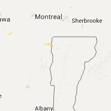


Connect with Interactive Hail Maps