

Hail Map for Minatare, NE
The Minatare, NE area has had 26 reports of on-the-ground hail by trained spotters, and has been under severe weather warnings 37 times during the past 12 months. Doppler radar has detected hail at or near Minatare, NE on 64 occasions, including 6 occasions during the past year.
| Name: | Minatare, NE |
| Where Located: | 9.2 miles ESE of Scottsbluff, NE |
| Map: | Google Map for Minatare, NE |
| Population: | 816 |
| Housing Units: | 355 |
| More Info: | Search Google for Minatare, NE |
3
The Top Recent Hail Date for Minatare, NE is Saturday, July 8, 2023 (3rd out of 64)

Hail and Wind Damage Spotted near Minatare, NE
| Date / Time | Report Details |
|---|---|
| 1/1/0001 12:00 AM | Quarter sized hail reported 4.1 miles W of Minatare, NE, emergency manager reports quarter size hail. |
| 7/13/2023 11:44 PM MDT |
 At 1144 pm mdt, a severe thunderstorm was located near minatare, or 12 miles southeast of scottsbluff, moving east at 10 mph (radar indicated). Hazards include quarter size hail. damage to vehicles is expected At 1144 pm mdt, a severe thunderstorm was located near minatare, or 12 miles southeast of scottsbluff, moving east at 10 mph (radar indicated). Hazards include quarter size hail. damage to vehicles is expected
|
| 7/12/2023 6:47 PM MDT | Hen Egg sized hail reported 7.6 miles SSW of Minatare, NE, lasted around 5 minutes. |
| 7/12/2023 6:45 PM MDT |
 At 644 pm mdt, a severe thunderstorm was located near moomaws corner, or 16 miles east of scottsbluff, moving southeast at 40 mph (law enforcement. at 644 pm...golf ball sized hail was reported at lake minatare). Hazards include golf ball size hail and 60 mph wind gusts. People and animals outdoors will be injured. expect hail damage to roofs, siding, windows, and vehicles. Expect wind damage to roofs, siding, and trees. At 644 pm mdt, a severe thunderstorm was located near moomaws corner, or 16 miles east of scottsbluff, moving southeast at 40 mph (law enforcement. at 644 pm...golf ball sized hail was reported at lake minatare). Hazards include golf ball size hail and 60 mph wind gusts. People and animals outdoors will be injured. expect hail damage to roofs, siding, windows, and vehicles. Expect wind damage to roofs, siding, and trees.
|
| 7/12/2023 6:44 PM MDT | Golf Ball sized hail reported 9.1 miles S of Minatare, NE |
| 7/8/2023 2:48 PM MDT | Quarter sized hail reported 3.1 miles W of Minatare, NE, picture from twitter of slightly larger than quarter sized hail 3 miles east of minatare. |
| 7/8/2023 2:37 PM MDT | Quarter sized hail reported 3.1 miles W of Minatare, NE, corrected time based on radar imagery. picture from twitter of slightly larger than quarter sized hail 3 miles east of minatare. |
| 7/8/2023 1:59 PM MDT |
 At 158 pm mdt, a severe thunderstorm was located near bayard, or 14 miles southeast of scottsbluff, moving southeast at 20 mph (radar indicated). Hazards include ping pong ball size hail and 60 mph wind gusts. People and animals outdoors will be injured. expect hail damage to roofs, siding, windows, and vehicles. Expect wind damage to roofs, siding, and trees. At 158 pm mdt, a severe thunderstorm was located near bayard, or 14 miles southeast of scottsbluff, moving southeast at 20 mph (radar indicated). Hazards include ping pong ball size hail and 60 mph wind gusts. People and animals outdoors will be injured. expect hail damage to roofs, siding, windows, and vehicles. Expect wind damage to roofs, siding, and trees.
|
| 7/8/2023 1:53 PM MDT | Golf Ball sized hail reported 4.1 miles W of Minatare, NE, corrects previous hail report from 3 ene gering. |
| 7/8/2023 1:49 PM MDT | Quarter sized hail reported 3.1 miles W of Minatare, NE |
| 7/8/2023 1:45 PM MDT |
 At 145 pm mdt, a severe thunderstorm was located near moomaws corner, or 13 miles east of scottsbluff, moving southeast at 25 mph (radar indicated). Hazards include golf ball size hail and 60 mph wind gusts. People and animals outdoors will be injured. expect hail damage to roofs, siding, windows, and vehicles. expect wind damage to roofs, siding, and trees. Locations impacted include, minatare, moomaws corner, melbeta and mcgrew. At 145 pm mdt, a severe thunderstorm was located near moomaws corner, or 13 miles east of scottsbluff, moving southeast at 25 mph (radar indicated). Hazards include golf ball size hail and 60 mph wind gusts. People and animals outdoors will be injured. expect hail damage to roofs, siding, windows, and vehicles. expect wind damage to roofs, siding, and trees. Locations impacted include, minatare, moomaws corner, melbeta and mcgrew.
|
| 7/8/2023 1:42 PM MDT | Quarter sized hail reported 7.8 miles SW of Minatare, NE |
| 7/8/2023 1:37 PM MDT | Quarter sized hail reported 3.1 miles W of Minatare, NE, corrects time of minatare 3 east report based on radar imagery. twitter post for quarter sized hail 3 miles east of minatare. |
| 7/8/2023 1:30 PM MDT |
 At 129 pm mdt, a severe thunderstorm was located over lake minatare campground, or 9 miles east of scottsbluff, moving southeast at 25 mph (radar indicated). Hazards include golf ball size hail and 60 mph wind gusts. People and animals outdoors will be injured. expect hail damage to roofs, siding, windows, and vehicles. Expect wind damage to roofs, siding, and trees. At 129 pm mdt, a severe thunderstorm was located over lake minatare campground, or 9 miles east of scottsbluff, moving southeast at 25 mph (radar indicated). Hazards include golf ball size hail and 60 mph wind gusts. People and animals outdoors will be injured. expect hail damage to roofs, siding, windows, and vehicles. Expect wind damage to roofs, siding, and trees.
|
| 7/3/2023 9:21 PM MDT |
 At 921 pm mdt, severe outflow winds from showers and thunderstorms were located along a line extending from near agate bed national monument to near lake alice to 7 miles east of albin, moving northeast at 15 mph (radar indicated). Hazards include 60 mph wind gusts. Expect damage to roofs, siding, and trees. locations impacted include, scottsbluff, gering, mitchell, terrytown, morrill, minatare, lyman, wildcat hills state recreation area, lake minatare campground, stegall, agate bed national monument, wildcat hills campground, scotts bluff national monument, hubbard hill, harrisburg, scottsbluff airport, lake minatare, lake alice, melbeta and henry. hail threat, radar indicated max hail size, <. 75 in wind threat, radar indicated max wind gust, 60 mph. At 921 pm mdt, severe outflow winds from showers and thunderstorms were located along a line extending from near agate bed national monument to near lake alice to 7 miles east of albin, moving northeast at 15 mph (radar indicated). Hazards include 60 mph wind gusts. Expect damage to roofs, siding, and trees. locations impacted include, scottsbluff, gering, mitchell, terrytown, morrill, minatare, lyman, wildcat hills state recreation area, lake minatare campground, stegall, agate bed national monument, wildcat hills campground, scotts bluff national monument, hubbard hill, harrisburg, scottsbluff airport, lake minatare, lake alice, melbeta and henry. hail threat, radar indicated max hail size, <. 75 in wind threat, radar indicated max wind gust, 60 mph.
|
| 7/3/2023 8:53 PM MDT |
 At 852 pm mdt, severe thunderstorms were located along a line extending from near agate bed national monument to near mitchell to near harrisburg, moving east at 25 mph. a second area of thunderstorm outflow winds was located over western goshen county in wyoming, and will track across areas along and east of highway 85 shortly (radar indicated). Hazards include 60 mph wind gusts. Expect damage to roofs, siding, and trees. locations impacted include, scottsbluff, torrington, gering, mitchell, terrytown, morrill, minatare, lingle, la grange, lyman, wildcat hills state recreation area, stegall, wildcat hills campground, hawk springs campground, hubbard hill, harrisburg, lake minatare, huntley, lake minatare campground and agate bed national monument. hail threat, radar indicated max hail size, <. 75 in wind threat, radar indicated max wind gust, 60 mph. At 852 pm mdt, severe thunderstorms were located along a line extending from near agate bed national monument to near mitchell to near harrisburg, moving east at 25 mph. a second area of thunderstorm outflow winds was located over western goshen county in wyoming, and will track across areas along and east of highway 85 shortly (radar indicated). Hazards include 60 mph wind gusts. Expect damage to roofs, siding, and trees. locations impacted include, scottsbluff, torrington, gering, mitchell, terrytown, morrill, minatare, lingle, la grange, lyman, wildcat hills state recreation area, stegall, wildcat hills campground, hawk springs campground, hubbard hill, harrisburg, lake minatare, huntley, lake minatare campground and agate bed national monument. hail threat, radar indicated max hail size, <. 75 in wind threat, radar indicated max wind gust, 60 mph.
|
| 7/3/2023 8:41 PM MDT |
 At 841 pm mdt, severe thunderstorms were located along a line extending from 6 miles southeast of prairie center to 6 miles northwest of morrill to 9 miles southeast of la grange, moving northeast at 20 mph (radar indicated). Hazards include 60 mph wind gusts. expect damage to roofs, siding, and trees At 841 pm mdt, severe thunderstorms were located along a line extending from 6 miles southeast of prairie center to 6 miles northwest of morrill to 9 miles southeast of la grange, moving northeast at 20 mph (radar indicated). Hazards include 60 mph wind gusts. expect damage to roofs, siding, and trees
|
| 6/29/2023 6:08 PM MDT |
 The severe thunderstorm warning for southern scotts bluff and banner counties will expire at 615 pm mdt, the storm which prompted the warning has weakened below severe limits, and no longer poses an immediate threat to life or property. therefore, the warning will be allowed to expire. however gusty winds are still possible with this thunderstorm. a tornado watch remains in effect until 900 pm mdt for the panhandle of nebraska. The severe thunderstorm warning for southern scotts bluff and banner counties will expire at 615 pm mdt, the storm which prompted the warning has weakened below severe limits, and no longer poses an immediate threat to life or property. therefore, the warning will be allowed to expire. however gusty winds are still possible with this thunderstorm. a tornado watch remains in effect until 900 pm mdt for the panhandle of nebraska.
|
| 6/29/2023 5:45 PM MDT |
 At 544 pm mdt, a severe thunderstorm was located 8 miles west of harrisburg, or 24 miles southwest of scottsbluff, moving east at 25 mph (radar indicated). Hazards include 60 mph wind gusts and quarter size hail. Hail damage to vehicles is expected. expect wind damage to roofs, siding, and trees. this severe storm will be near, harrisburg around 605 pm mdt. other locations impacted by this severe thunderstorm include mcgrew and melbeta. hail threat, radar indicated max hail size, 1. 00 in wind threat, radar indicated max wind gust, 60 mph. At 544 pm mdt, a severe thunderstorm was located 8 miles west of harrisburg, or 24 miles southwest of scottsbluff, moving east at 25 mph (radar indicated). Hazards include 60 mph wind gusts and quarter size hail. Hail damage to vehicles is expected. expect wind damage to roofs, siding, and trees. this severe storm will be near, harrisburg around 605 pm mdt. other locations impacted by this severe thunderstorm include mcgrew and melbeta. hail threat, radar indicated max hail size, 1. 00 in wind threat, radar indicated max wind gust, 60 mph.
|
| 6/29/2023 5:28 PM MDT |
 At 527 pm mdt, a severe thunderstorm was located 9 miles east of la grange, or 25 miles southwest of scottsbluff, moving east at 20 mph (radar indicated). Hazards include 60 mph wind gusts and quarter size hail. Hail damage to vehicles is expected. expect wind damage to roofs, siding, and trees. this severe storm will be near, harrisburg around 610 pm mdt. other locations impacted by this severe thunderstorm include mcgrew and melbeta. hail threat, radar indicated max hail size, 1. 00 in wind threat, radar indicated max wind gust, 60 mph. At 527 pm mdt, a severe thunderstorm was located 9 miles east of la grange, or 25 miles southwest of scottsbluff, moving east at 20 mph (radar indicated). Hazards include 60 mph wind gusts and quarter size hail. Hail damage to vehicles is expected. expect wind damage to roofs, siding, and trees. this severe storm will be near, harrisburg around 610 pm mdt. other locations impacted by this severe thunderstorm include mcgrew and melbeta. hail threat, radar indicated max hail size, 1. 00 in wind threat, radar indicated max wind gust, 60 mph.
|
| 6/29/2023 5:04 PM MDT |
 At 503 pm mdt, a severe thunderstorm was located near la grange, or 32 miles southwest of scottsbluff, moving east at 35 mph (radar indicated). Hazards include ping pong ball size hail and 60 mph wind gusts. People and animals outdoors will be injured. expect hail damage to roofs, siding, windows, and vehicles. expect wind damage to roofs, siding, and trees. this severe thunderstorm will be near, harrisburg around 545 pm mdt. wildcat hills state recreation area and wildcat hills campground around 550 pm mdt. other locations impacted by this severe thunderstorm include mcgrew and melbeta. hail threat, radar indicated max hail size, 1. 50 in wind threat, radar indicated max wind gust, 60 mph. At 503 pm mdt, a severe thunderstorm was located near la grange, or 32 miles southwest of scottsbluff, moving east at 35 mph (radar indicated). Hazards include ping pong ball size hail and 60 mph wind gusts. People and animals outdoors will be injured. expect hail damage to roofs, siding, windows, and vehicles. expect wind damage to roofs, siding, and trees. this severe thunderstorm will be near, harrisburg around 545 pm mdt. wildcat hills state recreation area and wildcat hills campground around 550 pm mdt. other locations impacted by this severe thunderstorm include mcgrew and melbeta. hail threat, radar indicated max hail size, 1. 50 in wind threat, radar indicated max wind gust, 60 mph.
|
| 6/23/2023 10:21 PM MDT |
 At 1020 pm mdt, a line of severe thunderstorms was located across the central and southern nebraska panhandle moving east at 30 mph (radar indicated). Hazards include ping pong ball size hail and 60 mph wind gusts. People and animals outdoors will be injured. expect hail damage to roofs, siding, windows, and vehicles. Expect wind damage to roofs, siding, and trees. At 1020 pm mdt, a line of severe thunderstorms was located across the central and southern nebraska panhandle moving east at 30 mph (radar indicated). Hazards include ping pong ball size hail and 60 mph wind gusts. People and animals outdoors will be injured. expect hail damage to roofs, siding, windows, and vehicles. Expect wind damage to roofs, siding, and trees.
|
| 6/23/2023 8:12 PM MDT | Baseball sized hail reported 5 miles SW of Minatare, NE |
| 6/23/2023 8:09 PM MDT |
 At 809 pm mdt, a severe thunderstorm was located over scottsbluff airport, or near scottsbluff, moving east at 15 mph (trained weather spotters). Hazards include two inch hail and 60 mph wind gusts. People and animals outdoors will be injured. expect hail damage to roofs, siding, windows, and vehicles. expect wind damage to roofs, siding, and trees. Locations impacted include, scottsbluff, gering, terrytown, minatare, lake minatare campground, scottsbluff airport, lake minatare, lake alice, melbeta and mcgrew. At 809 pm mdt, a severe thunderstorm was located over scottsbluff airport, or near scottsbluff, moving east at 15 mph (trained weather spotters). Hazards include two inch hail and 60 mph wind gusts. People and animals outdoors will be injured. expect hail damage to roofs, siding, windows, and vehicles. expect wind damage to roofs, siding, and trees. Locations impacted include, scottsbluff, gering, terrytown, minatare, lake minatare campground, scottsbluff airport, lake minatare, lake alice, melbeta and mcgrew.
|
| 6/23/2023 8:01 PM MDT |
 At 801 pm mdt, a severe thunderstorm was located over scottsbluff airport, or over scottsbluff, moving east at 15 mph (trained weather spotters). Hazards include ping pong ball size hail and 60 mph wind gusts. People and animals outdoors will be injured. expect hail damage to roofs, siding, windows, and vehicles. expect wind damage to roofs, siding, and trees. Locations impacted include, scottsbluff, gering, terrytown, minatare, lake minatare campground, scottsbluff airport, lake minatare, lake alice, melbeta and mcgrew. At 801 pm mdt, a severe thunderstorm was located over scottsbluff airport, or over scottsbluff, moving east at 15 mph (trained weather spotters). Hazards include ping pong ball size hail and 60 mph wind gusts. People and animals outdoors will be injured. expect hail damage to roofs, siding, windows, and vehicles. expect wind damage to roofs, siding, and trees. Locations impacted include, scottsbluff, gering, terrytown, minatare, lake minatare campground, scottsbluff airport, lake minatare, lake alice, melbeta and mcgrew.
|
| 6/23/2023 7:46 PM MDT |
 At 745 pm mdt, a confirmed large and destructive tornado was located 7 miles south of gering, or near scottsbluff, moving northeast at 25 mph. tornado emergency for gering and scottsbluff!. this is a particularly dangerous situation. take cover now! (radar confirmed tornado). Hazards include deadly tornado. You are in a life-threatening situation. flying debris may be deadly to those caught without shelter. mobile homes will be destroyed. considerable damage to homes, businesses, and vehicles is likely and complete destruction is possible. the tornado will be near, minatare around 750 pm mdt. Other locations in the path of this tornadic thunderstorm include lake minatare campground and lake minatare. At 745 pm mdt, a confirmed large and destructive tornado was located 7 miles south of gering, or near scottsbluff, moving northeast at 25 mph. tornado emergency for gering and scottsbluff!. this is a particularly dangerous situation. take cover now! (radar confirmed tornado). Hazards include deadly tornado. You are in a life-threatening situation. flying debris may be deadly to those caught without shelter. mobile homes will be destroyed. considerable damage to homes, businesses, and vehicles is likely and complete destruction is possible. the tornado will be near, minatare around 750 pm mdt. Other locations in the path of this tornadic thunderstorm include lake minatare campground and lake minatare.
|
| 6/23/2023 7:45 PM MDT |
 At 745 pm mdt, a severe thunderstorm was located over scotts bluff national monument, or over scottsbluff, moving east at 25 mph (radar indicated). Hazards include tennis ball size hail and 60 mph wind gusts. People and animals outdoors will be injured. expect hail damage to roofs, siding, windows, and vehicles. Expect wind damage to roofs, siding, and trees. At 745 pm mdt, a severe thunderstorm was located over scotts bluff national monument, or over scottsbluff, moving east at 25 mph (radar indicated). Hazards include tennis ball size hail and 60 mph wind gusts. People and animals outdoors will be injured. expect hail damage to roofs, siding, windows, and vehicles. Expect wind damage to roofs, siding, and trees.
|
| 6/23/2023 7:35 PM MDT |
 At 733 pm mdt, a severe thunderstorm was located near lake alice, or 7 miles northeast of scottsbluff, moving east at 35 mph. this is a destructive storm for scottsbluff, terrytown, gering (radar indicated). Hazards include softball size hail and 60 mph wind gusts. People and animals outdoors will be severely injured. expect shattered windows, extensive damage to roofs, siding, and vehicles. Locations impacted include, scottsbluff, gering, mitchell, terrytown, morrill, minatare, hubbard hill, scottsbluff airport, scotts bluff national monument and lake alice. At 733 pm mdt, a severe thunderstorm was located near lake alice, or 7 miles northeast of scottsbluff, moving east at 35 mph. this is a destructive storm for scottsbluff, terrytown, gering (radar indicated). Hazards include softball size hail and 60 mph wind gusts. People and animals outdoors will be severely injured. expect shattered windows, extensive damage to roofs, siding, and vehicles. Locations impacted include, scottsbluff, gering, mitchell, terrytown, morrill, minatare, hubbard hill, scottsbluff airport, scotts bluff national monument and lake alice.
|
| 6/23/2023 7:31 PM MDT |
 Tornado emergency for gering & scottsbluff, the national weather service in cheyenne has issued a * tornado warning for, eastern scotts bluff county in the panhandle of nebraska, northwestern morrill county in the panhandle of nebraska, southeastern sioux county in the panhandle of nebraska, * until 800 pm mdt. * at 730 pm mdt, a confirmed large and destructive tornado was observed over scotts bluff national monument, or near scottsbluff, moving northeast at 30 mph. tornado emergency for gering & scottsbluff. this is a particularly dangerous situation. take cover now! (weather spotters confirmed tornado). Hazards include deadly tornado. You are in a life-threatening situation. flying debris may be deadly to those caught without shelter. mobile homes will be destroyed. considerable damage to homes, businesses, and vehicles is likely and complete destruction is possible. the tornado will be near, terrytown around 735 pm mdt. scottsbluff and gering around 740 pm mdt. scottsbluff airport around 745 pm mdt. minatare and lake alice around 750 pm mdt. Other locations in the path of this tornadic thunderstorm include lake minatare campground and lake minatare. Tornado emergency for gering & scottsbluff, the national weather service in cheyenne has issued a * tornado warning for, eastern scotts bluff county in the panhandle of nebraska, northwestern morrill county in the panhandle of nebraska, southeastern sioux county in the panhandle of nebraska, * until 800 pm mdt. * at 730 pm mdt, a confirmed large and destructive tornado was observed over scotts bluff national monument, or near scottsbluff, moving northeast at 30 mph. tornado emergency for gering & scottsbluff. this is a particularly dangerous situation. take cover now! (weather spotters confirmed tornado). Hazards include deadly tornado. You are in a life-threatening situation. flying debris may be deadly to those caught without shelter. mobile homes will be destroyed. considerable damage to homes, businesses, and vehicles is likely and complete destruction is possible. the tornado will be near, terrytown around 735 pm mdt. scottsbluff and gering around 740 pm mdt. scottsbluff airport around 745 pm mdt. minatare and lake alice around 750 pm mdt. Other locations in the path of this tornadic thunderstorm include lake minatare campground and lake minatare.
|
| 6/23/2023 7:13 PM MDT |
 At 713 pm mdt, a severe thunderstorm was located over mitchell, or 8 miles northwest of scottsbluff, moving east at 35 mph. this is a destructive storm for scottsbluff, terrytown, gering (radar indicated). Hazards include softball size hail and 60 mph wind gusts. People and animals outdoors will be severely injured. expect shattered windows, extensive damage to roofs, siding, and vehicles. Locations impacted include, scottsbluff, gering, mitchell, terrytown, morrill, minatare, lyman, huntley, stegall, scotts bluff national monument, hubbard hill, scottsbluff airport, lake alice and henry. At 713 pm mdt, a severe thunderstorm was located over mitchell, or 8 miles northwest of scottsbluff, moving east at 35 mph. this is a destructive storm for scottsbluff, terrytown, gering (radar indicated). Hazards include softball size hail and 60 mph wind gusts. People and animals outdoors will be severely injured. expect shattered windows, extensive damage to roofs, siding, and vehicles. Locations impacted include, scottsbluff, gering, mitchell, terrytown, morrill, minatare, lyman, huntley, stegall, scotts bluff national monument, hubbard hill, scottsbluff airport, lake alice and henry.
|
| 6/23/2023 7:08 PM MDT |
 At 707 pm mdt, a severe thunderstorm was located near stegall, or 11 miles west of scottsbluff, moving east at 35 mph. this is a destructive storm for scottsbluff, gering, terrytown (radar indicated). Hazards include baseball size hail and 60 mph wind gusts. People and animals outdoors will be severely injured. expect shattered windows, extensive damage to roofs, siding, and vehicles. Locations impacted include, scottsbluff, gering, mitchell, terrytown, morrill, minatare, lyman, huntley, stegall, scotts bluff national monument, hubbard hill, scottsbluff airport, lake alice and henry. At 707 pm mdt, a severe thunderstorm was located near stegall, or 11 miles west of scottsbluff, moving east at 35 mph. this is a destructive storm for scottsbluff, gering, terrytown (radar indicated). Hazards include baseball size hail and 60 mph wind gusts. People and animals outdoors will be severely injured. expect shattered windows, extensive damage to roofs, siding, and vehicles. Locations impacted include, scottsbluff, gering, mitchell, terrytown, morrill, minatare, lyman, huntley, stegall, scotts bluff national monument, hubbard hill, scottsbluff airport, lake alice and henry.
|
| 6/23/2023 6:58 PM MDT |
 At 658 pm mdt, a severe thunderstorm was located over stegall, or 15 miles southeast of torrington, moving east at 35 mph (radar indicated). Hazards include two inch hail and 60 mph wind gusts. People and animals outdoors will be injured. expect hail damage to roofs, siding, windows, and vehicles. Expect wind damage to roofs, siding, and trees. At 658 pm mdt, a severe thunderstorm was located over stegall, or 15 miles southeast of torrington, moving east at 35 mph (radar indicated). Hazards include two inch hail and 60 mph wind gusts. People and animals outdoors will be injured. expect hail damage to roofs, siding, windows, and vehicles. Expect wind damage to roofs, siding, and trees.
|
| 6/21/2023 3:55 PM MDT |
 The severe thunderstorm warning for southeastern scotts bluff and north central banner counties will expire at 400 pm mdt, the storm which prompted the warning has weakened below severe limits, and no longer poses an immediate threat to life or property. therefore, the warning will be allowed to expire. however small hail, gusty winds and heavy rain are still possible with this thunderstorm. a tornado watch remains in effect until 800 pm mdt for the panhandle of nebraska. to report severe weather, contact your nearest law enforcement agency. they will relay your report to the national weather service cheyenne. The severe thunderstorm warning for southeastern scotts bluff and north central banner counties will expire at 400 pm mdt, the storm which prompted the warning has weakened below severe limits, and no longer poses an immediate threat to life or property. therefore, the warning will be allowed to expire. however small hail, gusty winds and heavy rain are still possible with this thunderstorm. a tornado watch remains in effect until 800 pm mdt for the panhandle of nebraska. to report severe weather, contact your nearest law enforcement agency. they will relay your report to the national weather service cheyenne.
|
| 6/21/2023 3:42 PM MDT |
 At 341 pm mdt, a severe thunderstorm was located near scotts bluff national monument, or 7 miles southwest of scottsbluff, moving west at 10 mph (trained weather spotters). Hazards include 60 mph wind gusts and quarter size hail. Hail damage to vehicles is expected. expect wind damage to roofs, siding, and trees. locations impacted include, scottsbluff, gering, terrytown, minatare, wildcat hills state recreation area, hubbard hill, scottsbluff airport, wildcat hills campground, scotts bluff national monument and melbeta. hail threat, radar indicated max hail size, 1. 00 in wind threat, radar indicated max wind gust, 60 mph. At 341 pm mdt, a severe thunderstorm was located near scotts bluff national monument, or 7 miles southwest of scottsbluff, moving west at 10 mph (trained weather spotters). Hazards include 60 mph wind gusts and quarter size hail. Hail damage to vehicles is expected. expect wind damage to roofs, siding, and trees. locations impacted include, scottsbluff, gering, terrytown, minatare, wildcat hills state recreation area, hubbard hill, scottsbluff airport, wildcat hills campground, scotts bluff national monument and melbeta. hail threat, radar indicated max hail size, 1. 00 in wind threat, radar indicated max wind gust, 60 mph.
|
| 6/21/2023 3:09 PM MDT |
 At 309 pm mdt, severe thunderstorms were located along a line extending from near minatare to near wildcat hills campground, moving northwest at 15 mph (radar indicated). Hazards include 60 mph wind gusts and quarter size hail. Hail damage to vehicles is expected. Expect wind damage to roofs, siding, and trees. At 309 pm mdt, severe thunderstorms were located along a line extending from near minatare to near wildcat hills campground, moving northwest at 15 mph (radar indicated). Hazards include 60 mph wind gusts and quarter size hail. Hail damage to vehicles is expected. Expect wind damage to roofs, siding, and trees.
|
| 6/2/2023 3:06 PM MDT | Quarter sized hail reported 4.1 miles W of Minatare, NE, report from mping: quarter (1.00 in.). |
| 6/2/2023 2:52 PM MDT | Quarter sized hail reported 0.5 miles W of Minatare, NE |
| 6/2/2023 2:51 PM MDT |
 At 251 pm mdt, a severe thunderstorm was located near minatare, or 12 miles southeast of scottsbluff, moving northeast at 15 mph (radar indicated). Hazards include 60 mph wind gusts and quarter size hail. Hail damage to vehicles is expected. Expect wind damage to roofs, siding, and trees. At 251 pm mdt, a severe thunderstorm was located near minatare, or 12 miles southeast of scottsbluff, moving northeast at 15 mph (radar indicated). Hazards include 60 mph wind gusts and quarter size hail. Hail damage to vehicles is expected. Expect wind damage to roofs, siding, and trees.
|
| 5/27/2023 6:15 PM MDT |
 At 615 pm mdt, severe thunderstorms were located along a line extending from 6 miles northeast of veteran to 9 miles east of albin to 8 miles east of panorama point, moving northeast at 35 mph (radar indicated). Hazards include 60 mph wind gusts and half dollar size hail. Hail damage to vehicles is expected. Expect wind damage to roofs, siding, and trees. At 615 pm mdt, severe thunderstorms were located along a line extending from 6 miles northeast of veteran to 9 miles east of albin to 8 miles east of panorama point, moving northeast at 35 mph (radar indicated). Hazards include 60 mph wind gusts and half dollar size hail. Hail damage to vehicles is expected. Expect wind damage to roofs, siding, and trees.
|
| 5/9/2023 11:20 PM MDT |
 At 1120 pm mdt, a severe thunderstorm was located near wildcat hills campground, or 8 miles south of scottsbluff, moving northeast at 20 mph (radar indicated). Hazards include 60 mph wind gusts and quarter size hail. Hail damage to vehicles is expected. expect wind damage to roofs, siding, and trees. locations impacted include, scottsbluff, gering, terrytown, minatare, wildcat hills state recreation area, lake minatare campground, scottsbluff airport, wildcat hills campground, lake minatare, scotts bluff national monument and lake alice. hail threat, radar indicated max hail size, 1. 00 in wind threat, radar indicated max wind gust, 60 mph. At 1120 pm mdt, a severe thunderstorm was located near wildcat hills campground, or 8 miles south of scottsbluff, moving northeast at 20 mph (radar indicated). Hazards include 60 mph wind gusts and quarter size hail. Hail damage to vehicles is expected. expect wind damage to roofs, siding, and trees. locations impacted include, scottsbluff, gering, terrytown, minatare, wildcat hills state recreation area, lake minatare campground, scottsbluff airport, wildcat hills campground, lake minatare, scotts bluff national monument and lake alice. hail threat, radar indicated max hail size, 1. 00 in wind threat, radar indicated max wind gust, 60 mph.
|
| 5/9/2023 10:57 PM MDT |
 At 1057 pm mdt, a severe thunderstorm was located near gering, or near scottsbluff, moving northeast at 15 mph (radar indicated). Hazards include 60 mph wind gusts and quarter size hail. Hail damage to vehicles is expected. Expect wind damage to roofs, siding, and trees. At 1057 pm mdt, a severe thunderstorm was located near gering, or near scottsbluff, moving northeast at 15 mph (radar indicated). Hazards include 60 mph wind gusts and quarter size hail. Hail damage to vehicles is expected. Expect wind damage to roofs, siding, and trees.
|
| 8/14/2022 8:00 PM MDT | Storm damage reported in scotts bluff county NE, 5.9 miles SW of Minatare, NE |
| 8/14/2022 7:56 PM MDT |
 At 755 pm mdt, severe thunderstorms were located along a line extending from lake minatare to 6 miles southwest of chimney rock state park to near redington, moving northeast at 15 mph (radar indicated). Hazards include 60 mph wind gusts and quarter size hail. Hail damage to vehicles is expected. Expect wind damage to roofs, siding, and trees. At 755 pm mdt, severe thunderstorms were located along a line extending from lake minatare to 6 miles southwest of chimney rock state park to near redington, moving northeast at 15 mph (radar indicated). Hazards include 60 mph wind gusts and quarter size hail. Hail damage to vehicles is expected. Expect wind damage to roofs, siding, and trees.
|
| 8/2/2022 3:55 PM MDT |
 At 355 pm mdt, severe thunderstorms were located along a line extending from near wildcat hills campground to near oliver reservoir, moving east at 30 mph (radar indicated). Hazards include 60 mph wind gusts. expect damage to roofs, siding, and trees At 355 pm mdt, severe thunderstorms were located along a line extending from near wildcat hills campground to near oliver reservoir, moving east at 30 mph (radar indicated). Hazards include 60 mph wind gusts. expect damage to roofs, siding, and trees
|
| 7/27/2022 10:26 PM MDT |
 The severe thunderstorm warning for northeastern scotts bluff county will expire at 1030 pm mdt, the storm which prompted the warning has weakened below severe limits, and no longer poses an immediate threat to life or property. therefore, the warning will be allowed to expire. however heavy rain is still possible with this thunderstorm. a severe thunderstorm watch remains in effect until 100 am mdt for the panhandle of nebraska. The severe thunderstorm warning for northeastern scotts bluff county will expire at 1030 pm mdt, the storm which prompted the warning has weakened below severe limits, and no longer poses an immediate threat to life or property. therefore, the warning will be allowed to expire. however heavy rain is still possible with this thunderstorm. a severe thunderstorm watch remains in effect until 100 am mdt for the panhandle of nebraska.
|
| 7/27/2022 10:14 PM MDT |
 At 1013 pm mdt, a severe thunderstorm was located over scottsbluff airport, or near scottsbluff, moving east at 25 mph (broadcast media. at 1014pm, scottsbluff radio station reported pea size hail and torrential rainfall). Hazards include 60 mph wind gusts and penny size hail. Expect damage to roofs, siding, and trees. locations impacted include, scottsbluff, gering, terrytown, minatare, lake minatare campground, scottsbluff airport, lake minatare, scotts bluff national monument and melbeta. hail threat, radar indicated max hail size, 0. 75 in wind threat, radar indicated max wind gust, 60 mph. At 1013 pm mdt, a severe thunderstorm was located over scottsbluff airport, or near scottsbluff, moving east at 25 mph (broadcast media. at 1014pm, scottsbluff radio station reported pea size hail and torrential rainfall). Hazards include 60 mph wind gusts and penny size hail. Expect damage to roofs, siding, and trees. locations impacted include, scottsbluff, gering, terrytown, minatare, lake minatare campground, scottsbluff airport, lake minatare, scotts bluff national monument and melbeta. hail threat, radar indicated max hail size, 0. 75 in wind threat, radar indicated max wind gust, 60 mph.
|
| 7/27/2022 9:47 PM MDT |
 At 946 pm mdt, a severe thunderstorm was located near mitchell, or near scottsbluff, moving southeast at 25 mph (radar indicated). Hazards include 60 mph wind gusts and quarter size hail. Hail damage to vehicles is expected. Expect wind damage to roofs, siding, and trees. At 946 pm mdt, a severe thunderstorm was located near mitchell, or near scottsbluff, moving southeast at 25 mph (radar indicated). Hazards include 60 mph wind gusts and quarter size hail. Hail damage to vehicles is expected. Expect wind damage to roofs, siding, and trees.
|
| 7/3/2022 6:06 PM MDT |
 The severe thunderstorm warning for southwestern box butte, northeastern scotts bluff, northwestern morrill and southeastern sioux counties will expire at 615 pm mdt, the severe thunderstorm which prompted the warning has weakened. therefore, the warning will be allowed to expire. a severe thunderstorm watch remains in effect until midnight mdt for the panhandle of nebraska. The severe thunderstorm warning for southwestern box butte, northeastern scotts bluff, northwestern morrill and southeastern sioux counties will expire at 615 pm mdt, the severe thunderstorm which prompted the warning has weakened. therefore, the warning will be allowed to expire. a severe thunderstorm watch remains in effect until midnight mdt for the panhandle of nebraska.
|
| 7/3/2022 5:41 PM MDT |
 At 540 pm mdt, a severe thunderstorm was located near lake minatare, or 14 miles northeast of scottsbluff, moving northeast at 35 mph (radar indicated). Hazards include 60 mph wind gusts and quarter size hail. this storm has caused a history of minor flooding as well with torrential rainfall. Hail damage to vehicles is expected. expect wind damage to roofs, siding, and trees. locations impacted include, minatare, kilpatrick lake, lake minatare campground, moomaws corner, scottsbluff airport, angora, lake minatare, lake alice and melbeta. hail threat, radar indicated max hail size, 1. 00 in wind threat, radar indicated max wind gust, 60 mph. At 540 pm mdt, a severe thunderstorm was located near lake minatare, or 14 miles northeast of scottsbluff, moving northeast at 35 mph (radar indicated). Hazards include 60 mph wind gusts and quarter size hail. this storm has caused a history of minor flooding as well with torrential rainfall. Hail damage to vehicles is expected. expect wind damage to roofs, siding, and trees. locations impacted include, minatare, kilpatrick lake, lake minatare campground, moomaws corner, scottsbluff airport, angora, lake minatare, lake alice and melbeta. hail threat, radar indicated max hail size, 1. 00 in wind threat, radar indicated max wind gust, 60 mph.
|
| 7/3/2022 5:19 PM MDT |
 At 519 pm mdt, a severe thunderstorm was located over lake minatare campground, or near scottsbluff, moving northeast at 35 mph (radar indicated). Hazards include 60 mph wind gusts and quarter size hail. Hail damage to vehicles is expected. Expect wind damage to roofs, siding, and trees. At 519 pm mdt, a severe thunderstorm was located over lake minatare campground, or near scottsbluff, moving northeast at 35 mph (radar indicated). Hazards include 60 mph wind gusts and quarter size hail. Hail damage to vehicles is expected. Expect wind damage to roofs, siding, and trees.
|
| 6/30/2022 7:42 PM MDT |
 The severe thunderstorm warning for west central box butte, scotts bluff, banner and southern sioux counties will expire at 745 pm mdt, the storms which prompted the warning have weakened below severe limits, and no longer pose an immediate threat to life or property. therefore, the warning will be allowed to expire. however gusty winds between 45 to 55 mph are still possible with these thunderstorms through 830 pm mdt. The severe thunderstorm warning for west central box butte, scotts bluff, banner and southern sioux counties will expire at 745 pm mdt, the storms which prompted the warning have weakened below severe limits, and no longer pose an immediate threat to life or property. therefore, the warning will be allowed to expire. however gusty winds between 45 to 55 mph are still possible with these thunderstorms through 830 pm mdt.
|
| 6/30/2022 7:30 PM MDT |
 At 730 pm mdt, severe thunderstorms were located along a line extending from 8 miles southwest of flahertys corner to harrisburg, moving east at 55 mph (radar indicated). Hazards include 70 mph wind gusts and penny size hail. Expect considerable tree damage. damage is likely to mobile homes, roofs, and outbuildings. locations impacted include, scottsbluff, gering, mitchell, terrytown, morrill, minatare, lyman, wildcat hills state recreation area, lake minatare campground, stegall, wildcat hills campground, scotts bluff national monument, hubbard hill, harrisburg, flahertys corner, scottsbluff airport, lake minatare, lake alice, melbeta and henry. thunderstorm damage threat, considerable hail threat, radar indicated max hail size, 0. 75 in wind threat, observed max wind gust, 70 mph. At 730 pm mdt, severe thunderstorms were located along a line extending from 8 miles southwest of flahertys corner to harrisburg, moving east at 55 mph (radar indicated). Hazards include 70 mph wind gusts and penny size hail. Expect considerable tree damage. damage is likely to mobile homes, roofs, and outbuildings. locations impacted include, scottsbluff, gering, mitchell, terrytown, morrill, minatare, lyman, wildcat hills state recreation area, lake minatare campground, stegall, wildcat hills campground, scotts bluff national monument, hubbard hill, harrisburg, flahertys corner, scottsbluff airport, lake minatare, lake alice, melbeta and henry. thunderstorm damage threat, considerable hail threat, radar indicated max hail size, 0. 75 in wind threat, observed max wind gust, 70 mph.
|
| 6/30/2022 7:12 PM MDT |
 At 711 pm mdt, severe thunderstorms were located along a line extending from 11 miles southwest of agate bed national monument to 9 miles northeast of albin, moving east at 50 mph (radar indicated). Hazards include 70 mph wind gusts and penny size hail. Expect tree damage. Damage is likely to mobile homes, roofs, and outbuildings. At 711 pm mdt, severe thunderstorms were located along a line extending from 11 miles southwest of agate bed national monument to 9 miles northeast of albin, moving east at 50 mph (radar indicated). Hazards include 70 mph wind gusts and penny size hail. Expect tree damage. Damage is likely to mobile homes, roofs, and outbuildings.
|
| 6/20/2022 3:10 PM MDT |
 At 309 pm mdt, a severe thunderstorm was located over bayard, or 16 miles southeast of scottsbluff, moving northeast at 40 mph (radar indicated). Hazards include 60 mph wind gusts and quarter size hail. Hail damage to vehicles is expected. Expect wind damage to roofs, siding, and trees. At 309 pm mdt, a severe thunderstorm was located over bayard, or 16 miles southeast of scottsbluff, moving northeast at 40 mph (radar indicated). Hazards include 60 mph wind gusts and quarter size hail. Hail damage to vehicles is expected. Expect wind damage to roofs, siding, and trees.
|
| 6/7/2022 2:27 PM MDT |
 The severe thunderstorm warning for southeastern scotts bluff and north central banner counties will expire at 230 pm mdt, the storm which prompted the warning has moved out of the area. therefore, the warning will be allowed to expire. a severe thunderstorm watch remains in effect until 700 pm mdt for the panhandle of nebraska. remember, a severe thunderstorm warning still remains in effect for portions of morrill and banner counties until 400 pm mdt. The severe thunderstorm warning for southeastern scotts bluff and north central banner counties will expire at 230 pm mdt, the storm which prompted the warning has moved out of the area. therefore, the warning will be allowed to expire. a severe thunderstorm watch remains in effect until 700 pm mdt for the panhandle of nebraska. remember, a severe thunderstorm warning still remains in effect for portions of morrill and banner counties until 400 pm mdt.
|
| 6/7/2022 2:10 PM MDT |
 At 209 pm mdt, a severe thunderstorm was located near minatare, or 13 miles southeast of scottsbluff, moving southeast at 40 mph (public). Hazards include ping pong ball size hail and 60 mph wind gusts. brief landspouts could be possible. People and animals outdoors will be injured. expect hail damage to roofs, siding, windows, and vehicles. expect wind damage to roofs, siding, and trees. Locations impacted include, scottsbluff, gering, minatare, wildcat hills state recreation area, wildcat hills campground and melbeta. At 209 pm mdt, a severe thunderstorm was located near minatare, or 13 miles southeast of scottsbluff, moving southeast at 40 mph (public). Hazards include ping pong ball size hail and 60 mph wind gusts. brief landspouts could be possible. People and animals outdoors will be injured. expect hail damage to roofs, siding, windows, and vehicles. expect wind damage to roofs, siding, and trees. Locations impacted include, scottsbluff, gering, minatare, wildcat hills state recreation area, wildcat hills campground and melbeta.
|
| 6/7/2022 1:57 PM MDT |
 At 156 pm mdt, a severe thunderstorm was located near gering, or 7 miles south of scottsbluff, moving southeast at 50 mph (spotter indicated. half dollar hail was reported 1 mile west of highway 71 at 155 pm mdt). Hazards include ping pong ball size hail and 60 mph wind gusts. People and animals outdoors will be injured. expect hail damage to roofs, siding, windows, and vehicles. expect wind damage to roofs, siding, and trees. locations impacted include, scottsbluff, gering, terrytown, minatare, wildcat hills state recreation area, scottsbluff airport, wildcat hills campground, scotts bluff national monument and melbeta. hail threat, radar indicated max hail size, 1. 50 in wind threat, radar indicated max wind gust, 60 mph. At 156 pm mdt, a severe thunderstorm was located near gering, or 7 miles south of scottsbluff, moving southeast at 50 mph (spotter indicated. half dollar hail was reported 1 mile west of highway 71 at 155 pm mdt). Hazards include ping pong ball size hail and 60 mph wind gusts. People and animals outdoors will be injured. expect hail damage to roofs, siding, windows, and vehicles. expect wind damage to roofs, siding, and trees. locations impacted include, scottsbluff, gering, terrytown, minatare, wildcat hills state recreation area, scottsbluff airport, wildcat hills campground, scotts bluff national monument and melbeta. hail threat, radar indicated max hail size, 1. 50 in wind threat, radar indicated max wind gust, 60 mph.
|
| 6/7/2022 1:43 PM MDT |
 At 142 pm mdt, a severe thunderstorm was located over hubbard hill, or 10 miles west of scottsbluff, moving east at 25 mph (radar indicated). Hazards include 60 mph wind gusts and quarter size hail. Hail damage to vehicles is expected. Expect wind damage to roofs, siding, and trees. At 142 pm mdt, a severe thunderstorm was located over hubbard hill, or 10 miles west of scottsbluff, moving east at 25 mph (radar indicated). Hazards include 60 mph wind gusts and quarter size hail. Hail damage to vehicles is expected. Expect wind damage to roofs, siding, and trees.
|
| 5/29/2022 3:38 PM MDT |
 At 337 pm mdt, severe thunderstorms were located along a line extending from 11 miles south of redbird to near mitchell to kimball airport, moving northeast at 40 mph (radar indicated). Hazards include 60 mph wind gusts and penny size hail. Expect damage to roofs, siding, and trees. locations impacted include, scottsbluff, torrington, kimball, gering, mitchell, bayard, terrytown, morrill, minatare, lyman, potter, dix, harrison, oliver campground, wildcat hills state recreation area, stegall, montrose, panorama point, wildcat hills campground and prairie center. this includes interstate 80 in nebraska between mile markers 2 and 42. hail threat, radar indicated max hail size, 0. 75 in wind threat, radar indicated max wind gust, 60 mph. At 337 pm mdt, severe thunderstorms were located along a line extending from 11 miles south of redbird to near mitchell to kimball airport, moving northeast at 40 mph (radar indicated). Hazards include 60 mph wind gusts and penny size hail. Expect damage to roofs, siding, and trees. locations impacted include, scottsbluff, torrington, kimball, gering, mitchell, bayard, terrytown, morrill, minatare, lyman, potter, dix, harrison, oliver campground, wildcat hills state recreation area, stegall, montrose, panorama point, wildcat hills campground and prairie center. this includes interstate 80 in nebraska between mile markers 2 and 42. hail threat, radar indicated max hail size, 0. 75 in wind threat, radar indicated max wind gust, 60 mph.
|
| 5/29/2022 3:36 PM MDT | Male teenager at lake minatare hit in chest with falling tree branch. victim is in hospital in good condition as of 455p in scotts bluff county NE, 8.4 miles S of Minatare, NE |
| 5/29/2022 3:11 PM MDT |
 At 311 pm mdt, severe thunderstorms were located along a line extending from 10 miles southeast of lance creek to near stegall to 7 miles northeast of panorama point, moving northeast at 40 mph (radar indicated). Hazards include 60 mph wind gusts and penny size hail. expect damage to roofs, siding, and trees At 311 pm mdt, severe thunderstorms were located along a line extending from 10 miles southeast of lance creek to near stegall to 7 miles northeast of panorama point, moving northeast at 40 mph (radar indicated). Hazards include 60 mph wind gusts and penny size hail. expect damage to roofs, siding, and trees
|
| 5/17/2022 5:57 PM MDT |
 The severe thunderstorm warning for eastern scotts bluff, northwestern morrill and southeastern sioux counties will expire at 600 pm mdt, the storm which prompted the warning has weakened below severe limits. therefore, the warning will be allowed to expire. however gusty winds and small hail are still possible with this thunderstorm. The severe thunderstorm warning for eastern scotts bluff, northwestern morrill and southeastern sioux counties will expire at 600 pm mdt, the storm which prompted the warning has weakened below severe limits. therefore, the warning will be allowed to expire. however gusty winds and small hail are still possible with this thunderstorm.
|
| 5/17/2022 5:47 PM MDT |
 At 547 pm mdt, a severe thunderstorm was located over moomaws corner, or 16 miles east of scottsbluff, moving southeast at 40 mph (radar indicated). Hazards include 60 mph wind gusts and quarter size hail. Hail damage to vehicles is expected. expect wind damage to roofs, siding, and trees. locations impacted include, bayard, minatare, chimney rock state park, moomaws corner, angora, south bayard junction, melbeta and mcgrew. hail threat, observed max hail size, 1. 00 in wind threat, radar indicated max wind gust, 60 mph. At 547 pm mdt, a severe thunderstorm was located over moomaws corner, or 16 miles east of scottsbluff, moving southeast at 40 mph (radar indicated). Hazards include 60 mph wind gusts and quarter size hail. Hail damage to vehicles is expected. expect wind damage to roofs, siding, and trees. locations impacted include, bayard, minatare, chimney rock state park, moomaws corner, angora, south bayard junction, melbeta and mcgrew. hail threat, observed max hail size, 1. 00 in wind threat, radar indicated max wind gust, 60 mph.
|
| 5/17/2022 5:28 PM MDT |
 At 528 pm mdt, a severe thunderstorm was located over lake minatare campground, or 7 miles northeast of scottsbluff, moving southeast at 40 mph (radar indicated). Hazards include 60 mph wind gusts and quarter size hail. Hail damage to vehicles is expected. Expect wind damage to roofs, siding, and trees. At 528 pm mdt, a severe thunderstorm was located over lake minatare campground, or 7 miles northeast of scottsbluff, moving southeast at 40 mph (radar indicated). Hazards include 60 mph wind gusts and quarter size hail. Hail damage to vehicles is expected. Expect wind damage to roofs, siding, and trees.
|
| 6/13/2021 5:33 PM MDT |
 At 533 pm mdt, a severe thunderstorm was located near hubbard hill, or 8 miles west of scottsbluff, moving east at 10 mph (radar indicated). Hazards include two inch hail. People and animals outdoors will be injured. expect damage to roofs, siding, windows, and vehicles. Locations impacted include, scottsbluff, gering, mitchell, terrytown, morrill, minatare, lake minatare campground, stegall, scotts bluff national monument, hubbard hill, scottsbluff airport, lake minatare and lake alice. At 533 pm mdt, a severe thunderstorm was located near hubbard hill, or 8 miles west of scottsbluff, moving east at 10 mph (radar indicated). Hazards include two inch hail. People and animals outdoors will be injured. expect damage to roofs, siding, windows, and vehicles. Locations impacted include, scottsbluff, gering, mitchell, terrytown, morrill, minatare, lake minatare campground, stegall, scotts bluff national monument, hubbard hill, scottsbluff airport, lake minatare and lake alice.
|
| 6/13/2021 5:13 PM MDT |
 At 512 pm mdt, severe thunderstorms were located along a line extending from 7 miles southwest of stegall to near scottsbluff, moving north at 10 mph (radar indicated). Hazards include golf ball size hail. People and animals outdoors will be injured. Expect damage to roofs, siding, windows, and vehicles. At 512 pm mdt, severe thunderstorms were located along a line extending from 7 miles southwest of stegall to near scottsbluff, moving north at 10 mph (radar indicated). Hazards include golf ball size hail. People and animals outdoors will be injured. Expect damage to roofs, siding, windows, and vehicles.
|
| 5/21/2021 6:07 PM MDT |
 The severe thunderstorm warning for western box butte, eastern scotts bluff, northwestern morrill and southeastern sioux counties will expire at 615 pm mdt, the severe thunderstorm which prompted the warning has weakened. therefore, the warning will be allowed to expire. a severe thunderstorm watch remains in effect until 1000 pm mdt for the panhandle of nebraska. The severe thunderstorm warning for western box butte, eastern scotts bluff, northwestern morrill and southeastern sioux counties will expire at 615 pm mdt, the severe thunderstorm which prompted the warning has weakened. therefore, the warning will be allowed to expire. a severe thunderstorm watch remains in effect until 1000 pm mdt for the panhandle of nebraska.
|
| 5/21/2021 5:49 PM MDT |
 At 549 pm mdt, a severe thunderstorm was located near kilpatrick lake, or 23 miles northeast of scottsbluff, moving north at 45 mph (radar indicated). Hazards include golf ball size hail and 60 mph wind gusts. People and animals outdoors will be injured. expect hail damage to roofs, siding, windows, and vehicles. expect wind damage to roofs, siding, and trees. Locations impacted include, bayard, minatare, kilpatrick lake, lake minatare campground, flahertys corner, moomaws corner, lake minatare, south bayard junction and mcgrew. At 549 pm mdt, a severe thunderstorm was located near kilpatrick lake, or 23 miles northeast of scottsbluff, moving north at 45 mph (radar indicated). Hazards include golf ball size hail and 60 mph wind gusts. People and animals outdoors will be injured. expect hail damage to roofs, siding, windows, and vehicles. expect wind damage to roofs, siding, and trees. Locations impacted include, bayard, minatare, kilpatrick lake, lake minatare campground, flahertys corner, moomaws corner, lake minatare, south bayard junction and mcgrew.
|
| 5/21/2021 5:30 PM MDT | Golf Ball sized hail reported 4.1 miles W of Minatare, NE, delayed report from media. |
| 5/21/2021 5:26 PM MDT |
 At 525 pm mdt, a severe thunderstorm was located near moomaws corner, or 14 miles east of scottsbluff, moving north at 45 mph (radar indicated). Hazards include golf ball size hail and 60 mph wind gusts. People and animals outdoors will be injured. expect hail damage to roofs, siding, windows, and vehicles. Expect wind damage to roofs, siding, and trees. At 525 pm mdt, a severe thunderstorm was located near moomaws corner, or 14 miles east of scottsbluff, moving north at 45 mph (radar indicated). Hazards include golf ball size hail and 60 mph wind gusts. People and animals outdoors will be injured. expect hail damage to roofs, siding, windows, and vehicles. Expect wind damage to roofs, siding, and trees.
|
| 7/19/2020 6:15 PM MDT | Large tree uprooted. social media pos in scotts bluff county NE, 8.9 miles SSW of Minatare, NE |
| 7/19/2020 6:09 PM MDT |
 At 554 pm mdt, a severe thunderstorm was located over minatare, or 9 miles east of scottsbluff, moving northeast at 40 mph. this is a very dangerous storm (trained weather spotters. this storm has a history of producing hail in excess of 2 inches in diameter!). Hazards include three inch hail and 60 mph wind gusts. People and animals outdoors will be severely injured. Expect shattered windows, extensive damage to roofs, siding, and vehicles. At 554 pm mdt, a severe thunderstorm was located over minatare, or 9 miles east of scottsbluff, moving northeast at 40 mph. this is a very dangerous storm (trained weather spotters. this storm has a history of producing hail in excess of 2 inches in diameter!). Hazards include three inch hail and 60 mph wind gusts. People and animals outdoors will be severely injured. Expect shattered windows, extensive damage to roofs, siding, and vehicles.
|
| 7/19/2020 6:04 PM MDT | Hen Egg sized hail reported 0.1 miles SSE of Minatare, NE |
| 7/19/2020 6:02 PM MDT | Golf Ball sized hail reported 1.3 miles SE of Minatare, NE |
| 7/19/2020 5:55 PM MDT |
 At 554 pm mdt, a severe thunderstorm was located over minatare, or 9 miles east of scottsbluff, moving northeast at 40 mph. this is a very dangerous storm (trained weather spotters. this storm has a history of producing hail in excess of 2 inches in diameter!). Hazards include three inch hail and 60 mph wind gusts. People and animals outdoors will be severely injured. Expect shattered windows, extensive damage to roofs, siding, and vehicles. At 554 pm mdt, a severe thunderstorm was located over minatare, or 9 miles east of scottsbluff, moving northeast at 40 mph. this is a very dangerous storm (trained weather spotters. this storm has a history of producing hail in excess of 2 inches in diameter!). Hazards include three inch hail and 60 mph wind gusts. People and animals outdoors will be severely injured. Expect shattered windows, extensive damage to roofs, siding, and vehicles.
|
| 7/19/2020 5:47 PM MDT |
 At 547 pm mdt, a severe thunderstorm was located near gering, or near scottsbluff, moving northeast at 25 mph. this is a very dangerous storm (radar indicated). Hazards include three inch hail and 60 mph wind gusts. People and animals outdoors will be severely injured. expect shattered windows, extensive damage to roofs, siding, and vehicles. Locations impacted include, scottsbluff, gering, terrytown, minatare, wildcat hills state recreation area, scottsbluff airport, wildcat hills campground, scotts bluff national monument, melbeta and mcgrew. At 547 pm mdt, a severe thunderstorm was located near gering, or near scottsbluff, moving northeast at 25 mph. this is a very dangerous storm (radar indicated). Hazards include three inch hail and 60 mph wind gusts. People and animals outdoors will be severely injured. expect shattered windows, extensive damage to roofs, siding, and vehicles. Locations impacted include, scottsbluff, gering, terrytown, minatare, wildcat hills state recreation area, scottsbluff airport, wildcat hills campground, scotts bluff national monument, melbeta and mcgrew.
|
| 7/19/2020 5:40 PM MDT |
 At 539 pm mdt, a severe thunderstorm was located near wildcat hills state recreation area, or 7 miles south of scottsbluff, moving northeast at 25 mph. this is a very dangerous storm (radar indicated). Hazards include baseball size hail and 60 mph wind gusts. People and animals outdoors will be severely injured. expect shattered windows, extensive damage to roofs, siding, and vehicles. Locations impacted include, scottsbluff, gering, terrytown, minatare, wildcat hills state recreation area, scottsbluff airport, wildcat hills campground, scotts bluff national monument, melbeta and mcgrew. At 539 pm mdt, a severe thunderstorm was located near wildcat hills state recreation area, or 7 miles south of scottsbluff, moving northeast at 25 mph. this is a very dangerous storm (radar indicated). Hazards include baseball size hail and 60 mph wind gusts. People and animals outdoors will be severely injured. expect shattered windows, extensive damage to roofs, siding, and vehicles. Locations impacted include, scottsbluff, gering, terrytown, minatare, wildcat hills state recreation area, scottsbluff airport, wildcat hills campground, scotts bluff national monument, melbeta and mcgrew.
|
| 7/19/2020 5:27 PM MDT |
 At 527 pm mdt, a severe thunderstorm was located near wildcat hills campground, or 13 miles south of scottsbluff, moving northeast at 25 mph (radar indicated). Hazards include golf ball size hail and 60 mph wind gusts. People and animals outdoors will be injured. expect hail damage to roofs, siding, windows, and vehicles. Expect wind damage to roofs, siding, and trees. At 527 pm mdt, a severe thunderstorm was located near wildcat hills campground, or 13 miles south of scottsbluff, moving northeast at 25 mph (radar indicated). Hazards include golf ball size hail and 60 mph wind gusts. People and animals outdoors will be injured. expect hail damage to roofs, siding, windows, and vehicles. Expect wind damage to roofs, siding, and trees.
|
| 6/6/2020 6:12 PM MDT |
 The severe thunderstorm warning for southwestern box butte, scotts bluff, northwestern morrill, eastern banner, southwestern dawes, southern sioux and east central goshen counties will expire at 615 pm mdt, the storms which prompted the warning have moved out of the area. therefore, the warning will be allowed to expire. however gusty winds and heavy rain are still possible with these thunderstorms. a severe thunderstorm watch remains in effect until 800 pm mdt for the panhandle of nebraska, and southeastern wyoming. The severe thunderstorm warning for southwestern box butte, scotts bluff, northwestern morrill, eastern banner, southwestern dawes, southern sioux and east central goshen counties will expire at 615 pm mdt, the storms which prompted the warning have moved out of the area. therefore, the warning will be allowed to expire. however gusty winds and heavy rain are still possible with these thunderstorms. a severe thunderstorm watch remains in effect until 800 pm mdt for the panhandle of nebraska, and southeastern wyoming.
|
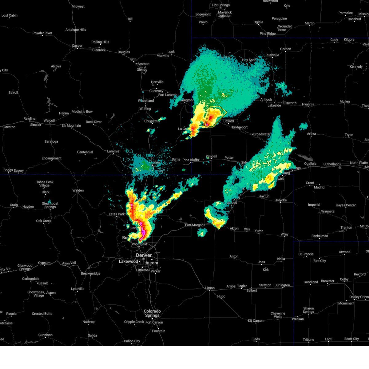
| 6/6/2020 5:32 PM MDT |
 At 531 pm mdt, severe thunderstorms were located along a line extending from near torrington to 6 miles southeast of harrisburg, moving east at 70 mph (radar indicated). Hazards include 70 mph wind gusts. Expect considerable tree damage. Damage is likely to mobile homes, roofs, and outbuildings. At 531 pm mdt, severe thunderstorms were located along a line extending from near torrington to 6 miles southeast of harrisburg, moving east at 70 mph (radar indicated). Hazards include 70 mph wind gusts. Expect considerable tree damage. Damage is likely to mobile homes, roofs, and outbuildings.
|
| 6/6/2020 5:32 PM MDT |
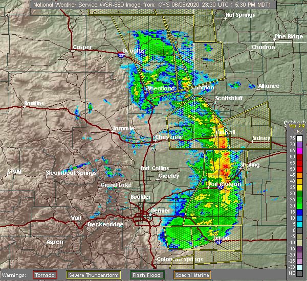 At 531 pm mdt, severe thunderstorms were located along a line extending from near torrington to 6 miles southeast of harrisburg, moving east at 70 mph (radar indicated). Hazards include 70 mph wind gusts. Expect considerable tree damage. Damage is likely to mobile homes, roofs, and outbuildings. At 531 pm mdt, severe thunderstorms were located along a line extending from near torrington to 6 miles southeast of harrisburg, moving east at 70 mph (radar indicated). Hazards include 70 mph wind gusts. Expect considerable tree damage. Damage is likely to mobile homes, roofs, and outbuildings.
|
| 8/20/2019 11:22 PM MDT |
 At 1121 pm mdt, severe thunderstorms were located along a line extending from near box butte dam to near hillsdale, moving east at 15 mph. a meteorologist at kneb reports large trees down in scotts bluff county. one tree had a diameter of 3 feet (trained weather spotters). Hazards include 70 mph wind gusts and half dollar size hail. Hail damage to vehicles is expected. expect considerable tree damage. wind damage is also likely to mobile homes, roofs, and outbuildings. locations impacted include, alliance, kimball, bridgeport, bayard, pine bluffs, minatare, hemingford, dix, albin, oliver campground, northport, angora, oliver reservoir, court house and jail rocks, harrisburg, berea, wild horse butte, chimney rock state park, bridgeport state recreation area and kilpatrick lake. this includes the following highways, interstate 80 in wyoming between mile markers 390 and 402. Interstate 80 in nebraska between mile markers 1 and 33. At 1121 pm mdt, severe thunderstorms were located along a line extending from near box butte dam to near hillsdale, moving east at 15 mph. a meteorologist at kneb reports large trees down in scotts bluff county. one tree had a diameter of 3 feet (trained weather spotters). Hazards include 70 mph wind gusts and half dollar size hail. Hail damage to vehicles is expected. expect considerable tree damage. wind damage is also likely to mobile homes, roofs, and outbuildings. locations impacted include, alliance, kimball, bridgeport, bayard, pine bluffs, minatare, hemingford, dix, albin, oliver campground, northport, angora, oliver reservoir, court house and jail rocks, harrisburg, berea, wild horse butte, chimney rock state park, bridgeport state recreation area and kilpatrick lake. this includes the following highways, interstate 80 in wyoming between mile markers 390 and 402. Interstate 80 in nebraska between mile markers 1 and 33.
|
| 8/20/2019 11:09 PM MDT |
 At 1108 pm mdt, severe thunderstorms were located along a line extending from near box butte dam to 6 miles west of hillsdale, moving south at 15 mph. at 11 pm mdt, a trained spotter reported half dollar size hail in albin (trained weather spotters). Hazards include 70 mph wind gusts and half dollar size hail. Hail damage to vehicles is expected. expect considerable tree damage. wind damage is also likely to mobile homes, roofs, and outbuildings. locations impacted include, scottsbluff, alliance, kimball, gering, bridgeport, bayard, terrytown, pine bluffs, minatare, hemingford, burns, dix, albin, oliver campground, wildcat hills state recreation area, northport, angora, wildcat hills campground, box butte dam and oliver reservoir. this includes the following highways, interstate 80 in wyoming between mile markers 388 and 402. Interstate 80 in nebraska between mile markers 1 and 33. At 1108 pm mdt, severe thunderstorms were located along a line extending from near box butte dam to 6 miles west of hillsdale, moving south at 15 mph. at 11 pm mdt, a trained spotter reported half dollar size hail in albin (trained weather spotters). Hazards include 70 mph wind gusts and half dollar size hail. Hail damage to vehicles is expected. expect considerable tree damage. wind damage is also likely to mobile homes, roofs, and outbuildings. locations impacted include, scottsbluff, alliance, kimball, gering, bridgeport, bayard, terrytown, pine bluffs, minatare, hemingford, burns, dix, albin, oliver campground, wildcat hills state recreation area, northport, angora, wildcat hills campground, box butte dam and oliver reservoir. this includes the following highways, interstate 80 in wyoming between mile markers 388 and 402. Interstate 80 in nebraska between mile markers 1 and 33.
|
| 8/20/2019 11:00 PM MDT |
 At 1059 pm mdt, severe thunderstorms were located along a line extending from 6 miles north of box butte campground to 7 miles west of hillsdale, moving south at 15 mph. at 1044 pm mdt, the scottsbluff airport asos measured a gust to 73 mph (radar indicated). Hazards include 70 mph wind gusts and quarter size hail. Hail damage to vehicles is expected. expect considerable tree damage. wind damage is also likely to mobile homes, roofs, and outbuildings. locations impacted include, scottsbluff, alliance, kimball, gering, mitchell, bridgeport, bayard, terrytown, pine bluffs, minatare, hemingford, la grange, burns, dix, albin, oliver campground, wildcat hills state recreation area, northport, angora and wildcat hills campground. this includes the following highways, interstate 80 in wyoming between mile markers 387 and 402. Interstate 80 in nebraska between mile markers 1 and 33. At 1059 pm mdt, severe thunderstorms were located along a line extending from 6 miles north of box butte campground to 7 miles west of hillsdale, moving south at 15 mph. at 1044 pm mdt, the scottsbluff airport asos measured a gust to 73 mph (radar indicated). Hazards include 70 mph wind gusts and quarter size hail. Hail damage to vehicles is expected. expect considerable tree damage. wind damage is also likely to mobile homes, roofs, and outbuildings. locations impacted include, scottsbluff, alliance, kimball, gering, mitchell, bridgeport, bayard, terrytown, pine bluffs, minatare, hemingford, la grange, burns, dix, albin, oliver campground, wildcat hills state recreation area, northport, angora and wildcat hills campground. this includes the following highways, interstate 80 in wyoming between mile markers 387 and 402. Interstate 80 in nebraska between mile markers 1 and 33.
|
| 8/20/2019 11:00 PM MDT |
 At 1050 pm mdt, severe thunderstorms were located along a line extending from 7 miles north of box butte campground to 8 miles northwest of hillsdale, moving south at 15 mph (radar indicated). Hazards include 70 mph wind gusts and quarter size hail. Hail damage to vehicles is expected. expect considerable tree damage. Wind damage is also likely to mobile homes, roofs, and outbuildings. At 1050 pm mdt, severe thunderstorms were located along a line extending from 7 miles north of box butte campground to 8 miles northwest of hillsdale, moving south at 15 mph (radar indicated). Hazards include 70 mph wind gusts and quarter size hail. Hail damage to vehicles is expected. expect considerable tree damage. Wind damage is also likely to mobile homes, roofs, and outbuildings.
|
| 8/20/2019 10:50 PM MDT |
 The national weather service in cheyenne has issued a * severe thunderstorm warning for. box butte county in the panhandle of nebraska. scotts bluff county in the panhandle of nebraska. northwestern cheyenne county in the panhandle of nebraska. Kimball county in the panhandle of nebraska. The national weather service in cheyenne has issued a * severe thunderstorm warning for. box butte county in the panhandle of nebraska. scotts bluff county in the panhandle of nebraska. northwestern cheyenne county in the panhandle of nebraska. Kimball county in the panhandle of nebraska.
|
| 8/20/2019 10:42 PM MDT |
 At 1039 pm mdt, severe thunderstorms were located along a line extending from near chadron to near whitaker, moving east at 10 mph. at 1032 pm, a meteorologist at kneb in scottsbluff, nebraska reported a gust to near 70 mph. the scottsbluff airport weather station also measured a gust to 58 mph (trained weather spotters). Hazards include 70 mph wind gusts and quarter size hail. Hail damage to vehicles is expected. expect considerable tree damage. wind damage is also likely to mobile homes, roofs, and outbuildings. Locations impacted include, scottsbluff, gering, mitchell, terrytown, morrill, minatare, hemingford, la grange, lyman, wildcat hills state recreation area, stegall, wildcat hills campground, hawk springs, box butte dam, hawk springs campground, hubbard hill, berea, flahertys corner, gun barrel and lake minatare. At 1039 pm mdt, severe thunderstorms were located along a line extending from near chadron to near whitaker, moving east at 10 mph. at 1032 pm, a meteorologist at kneb in scottsbluff, nebraska reported a gust to near 70 mph. the scottsbluff airport weather station also measured a gust to 58 mph (trained weather spotters). Hazards include 70 mph wind gusts and quarter size hail. Hail damage to vehicles is expected. expect considerable tree damage. wind damage is also likely to mobile homes, roofs, and outbuildings. Locations impacted include, scottsbluff, gering, mitchell, terrytown, morrill, minatare, hemingford, la grange, lyman, wildcat hills state recreation area, stegall, wildcat hills campground, hawk springs, box butte dam, hawk springs campground, hubbard hill, berea, flahertys corner, gun barrel and lake minatare.
|
| 8/20/2019 10:38 PM MDT |
 At 1037 pm mdt, severe thunderstorms were located along a line extending from near chadron to near whitaker, moving northeast at 10 mph (radar indicated). Hazards include 70 mph wind gusts and quarter size hail. Hail damage to vehicles is expected. expect considerable tree damage. wind damage is also likely to mobile homes, roofs, and outbuildings. Locations impacted include, scottsbluff, gering, mitchell, terrytown, morrill, minatare, hemingford, la grange, lyman, wildcat hills state recreation area, stegall, wildcat hills campground, hawk springs, box butte dam, hawk springs campground, hubbard hill, berea, flahertys corner, gun barrel and lake minatare. At 1037 pm mdt, severe thunderstorms were located along a line extending from near chadron to near whitaker, moving northeast at 10 mph (radar indicated). Hazards include 70 mph wind gusts and quarter size hail. Hail damage to vehicles is expected. expect considerable tree damage. wind damage is also likely to mobile homes, roofs, and outbuildings. Locations impacted include, scottsbluff, gering, mitchell, terrytown, morrill, minatare, hemingford, la grange, lyman, wildcat hills state recreation area, stegall, wildcat hills campground, hawk springs, box butte dam, hawk springs campground, hubbard hill, berea, flahertys corner, gun barrel and lake minatare.
|
| 8/20/2019 10:23 PM MDT |
 At 1023 pm mdt, severe thunderstorms were located along a line extending from near chadron campground to near whitaker, moving northeast at 10 mph (radar indicated). Hazards include 70 mph wind gusts and quarter size hail. Hail damage to vehicles is expected. expect considerable tree damage. wind damage is also likely to mobile homes, roofs, and outbuildings. locations impacted include, scottsbluff, torrington, chadron, gering, mitchell, terrytown, morrill, minatare, hemingford, la grange, lyman, yoder, wildcat hills state recreation area, stegall, wildcat hills campground, hawk springs, box butte dam, hawk springs campground, hubbard hill and chadron campground. This includes interstate 25 in wyoming between mile markers 38 and 41. At 1023 pm mdt, severe thunderstorms were located along a line extending from near chadron campground to near whitaker, moving northeast at 10 mph (radar indicated). Hazards include 70 mph wind gusts and quarter size hail. Hail damage to vehicles is expected. expect considerable tree damage. wind damage is also likely to mobile homes, roofs, and outbuildings. locations impacted include, scottsbluff, torrington, chadron, gering, mitchell, terrytown, morrill, minatare, hemingford, la grange, lyman, yoder, wildcat hills state recreation area, stegall, wildcat hills campground, hawk springs, box butte dam, hawk springs campground, hubbard hill and chadron campground. This includes interstate 25 in wyoming between mile markers 38 and 41.
|
| 8/20/2019 10:07 PM MDT |
 At 1006 pm mdt, severe thunderstorms were located along a line extending from near chadron campground to near whitaker, moving northeast at 10 mph (radar indicated). Hazards include 70 mph wind gusts and quarter size hail. Hail damage to vehicles is expected. expect considerable tree damage. Wind damage is also likely to mobile homes, roofs, and outbuildings. At 1006 pm mdt, severe thunderstorms were located along a line extending from near chadron campground to near whitaker, moving northeast at 10 mph (radar indicated). Hazards include 70 mph wind gusts and quarter size hail. Hail damage to vehicles is expected. expect considerable tree damage. Wind damage is also likely to mobile homes, roofs, and outbuildings.
|
| 8/16/2019 6:38 PM MDT |
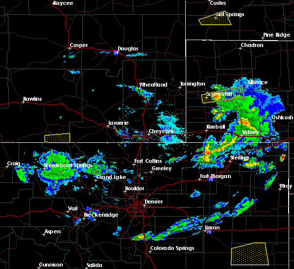 At 637 pm mdt, a severe thunderstorm was located over lake minatare campground, or 9 miles east of scottsbluff, moving east at 40 mph (radar indicated). Hazards include 60 mph wind gusts and quarter size hail. Hail damage to vehicles is expected. expect wind damage to roofs, siding, and trees. Locations impacted include, minatare, lake minatare campground, angora, scottsbluff airport and lake minatare. At 637 pm mdt, a severe thunderstorm was located over lake minatare campground, or 9 miles east of scottsbluff, moving east at 40 mph (radar indicated). Hazards include 60 mph wind gusts and quarter size hail. Hail damage to vehicles is expected. expect wind damage to roofs, siding, and trees. Locations impacted include, minatare, lake minatare campground, angora, scottsbluff airport and lake minatare.
|
| 8/16/2019 6:26 PM MDT |
 At 626 pm mdt, a severe thunderstorm was located over scottsbluff airport, or over scottsbluff, moving east at 50 mph (radar indicated). Hazards include 60 mph wind gusts and quarter size hail. Hail damage to vehicles is expected. Expect wind damage to roofs, siding, and trees. At 626 pm mdt, a severe thunderstorm was located over scottsbluff airport, or over scottsbluff, moving east at 50 mph (radar indicated). Hazards include 60 mph wind gusts and quarter size hail. Hail damage to vehicles is expected. Expect wind damage to roofs, siding, and trees.
|
| 8/16/2019 2:06 AM MDT |
 The severe thunderstorm warning for eastern scotts bluff, northeastern banner and southeastern sioux counties will expire at 215 am mdt, the storm which prompted the warning has moved out of the area. therefore, the warning will be allowed to expire. a severe thunderstorm watch remains in effect until 500 am mdt for the panhandle of nebraska. The severe thunderstorm warning for eastern scotts bluff, northeastern banner and southeastern sioux counties will expire at 215 am mdt, the storm which prompted the warning has moved out of the area. therefore, the warning will be allowed to expire. a severe thunderstorm watch remains in effect until 500 am mdt for the panhandle of nebraska.
|
| 8/16/2019 1:49 AM MDT | Golf Ball sized hail reported 0.1 miles SSE of Minatare, NE, received photo via facebook. |
| 8/16/2019 1:43 AM MDT |
 At 143 am mdt, a severe thunderstorm was located over scottsbluff airport, or near scottsbluff, moving east at 40 mph. this is a very dangerous storm (trained weather spotters have reported very large hail in scottsbluff). Hazards include baseball size hail and 70 mph wind gusts. People and animals outdoors will be severely injured. expect shattered windows, extensive damage to roofs, siding, and vehicles. Locations impacted include, scottsbluff, gering, terrytown, minatare, lake minatare campground, scottsbluff airport, lake minatare, lake alice, melbeta and mcgrew. At 143 am mdt, a severe thunderstorm was located over scottsbluff airport, or near scottsbluff, moving east at 40 mph. this is a very dangerous storm (trained weather spotters have reported very large hail in scottsbluff). Hazards include baseball size hail and 70 mph wind gusts. People and animals outdoors will be severely injured. expect shattered windows, extensive damage to roofs, siding, and vehicles. Locations impacted include, scottsbluff, gering, terrytown, minatare, lake minatare campground, scottsbluff airport, lake minatare, lake alice, melbeta and mcgrew.
|
| 8/16/2019 1:31 AM MDT |
 At 129 am mdt, a severe thunderstorm was located near scotts bluff national monument, or near scottsbluff, moving east at 40 mph. 3 inch diameter hail is imminent! prepare now for destructive hail! this is a very dangerous storm! (trained weather spotters). Hazards include three inch hail and 60 mph wind gusts. People and animals outdoors will be severely injured. expect shattered windows, extensive damage to roofs, siding, and vehicles. Locations impacted include, scottsbluff, gering, mitchell, terrytown, minatare, wildcat hills state recreation area, lake minatare campground, wildcat hills campground, scotts bluff national monument, hubbard hill, scottsbluff airport, lake minatare, lake alice, melbeta and mcgrew. At 129 am mdt, a severe thunderstorm was located near scotts bluff national monument, or near scottsbluff, moving east at 40 mph. 3 inch diameter hail is imminent! prepare now for destructive hail! this is a very dangerous storm! (trained weather spotters). Hazards include three inch hail and 60 mph wind gusts. People and animals outdoors will be severely injured. expect shattered windows, extensive damage to roofs, siding, and vehicles. Locations impacted include, scottsbluff, gering, mitchell, terrytown, minatare, wildcat hills state recreation area, lake minatare campground, wildcat hills campground, scotts bluff national monument, hubbard hill, scottsbluff airport, lake minatare, lake alice, melbeta and mcgrew.
|
| 8/16/2019 1:25 AM MDT |
 At 122 am mdt, a severe thunderstorm was located near mitchell, or 9 miles west of scottsbluff, moving east at 40 mph. this is an extremely dangerous storm. large destructive hail to baseball size is moving into mitchell scottsbluff and gering in the next 15 to 25 minutes! this storm has a history of producing large hail! move to an interior room away from windows! (trained weather spotters). Hazards include baseball size hail and 60 mph wind gusts. People and animals outdoors will be severely injured. expect shattered windows, extensive damage to roofs, siding, and vehicles. Locations impacted include, scottsbluff, gering, mitchell, terrytown, minatare, wildcat hills state recreation area, lake minatare campground, wildcat hills campground, scotts bluff national monument, hubbard hill, scottsbluff airport, lake minatare, lake alice, melbeta and mcgrew. At 122 am mdt, a severe thunderstorm was located near mitchell, or 9 miles west of scottsbluff, moving east at 40 mph. this is an extremely dangerous storm. large destructive hail to baseball size is moving into mitchell scottsbluff and gering in the next 15 to 25 minutes! this storm has a history of producing large hail! move to an interior room away from windows! (trained weather spotters). Hazards include baseball size hail and 60 mph wind gusts. People and animals outdoors will be severely injured. expect shattered windows, extensive damage to roofs, siding, and vehicles. Locations impacted include, scottsbluff, gering, mitchell, terrytown, minatare, wildcat hills state recreation area, lake minatare campground, wildcat hills campground, scotts bluff national monument, hubbard hill, scottsbluff airport, lake minatare, lake alice, melbeta and mcgrew.
|
| 8/16/2019 12:56 AM MDT |
 At 1255 am mdt, a severe thunderstorm was located near yoder, or 7 miles southwest of torrington, moving east at 40 mph. trained spotters have reported very large and destructive hail with this storm. large hail is likely, move to shelter now! (trained weather spotters). Hazards include two inch hail and 60 mph wind gusts. People and animals outdoors will be injured. expect hail damage to roofs, siding, windows, and vehicles. Expect wind damage to roofs, siding, and trees. At 1255 am mdt, a severe thunderstorm was located near yoder, or 7 miles southwest of torrington, moving east at 40 mph. trained spotters have reported very large and destructive hail with this storm. large hail is likely, move to shelter now! (trained weather spotters). Hazards include two inch hail and 60 mph wind gusts. People and animals outdoors will be injured. expect hail damage to roofs, siding, windows, and vehicles. Expect wind damage to roofs, siding, and trees.
|
| 8/15/2019 3:54 PM MDT | Golf Ball sized hail reported 0.1 miles SSE of Minatare, NE, marble to golf ball hail from 352-357pm. |
| 8/15/2019 3:51 PM MDT |
 At 347 pm mdt, the public reported two inch hail in scottsbluff. a severe thunderstorm was located near scottsbluff airport, or near scottsbluff, moving southeast at 40 mph (public). Hazards include two inch hail and 60 mph wind gusts. People and animals outdoors will be injured. expect hail damage to roofs, siding, windows, and vehicles. expect wind damage to roofs, siding, and trees. Locations impacted include, scottsbluff, gering, terrytown, minatare, scottsbluff airport and melbeta. At 347 pm mdt, the public reported two inch hail in scottsbluff. a severe thunderstorm was located near scottsbluff airport, or near scottsbluff, moving southeast at 40 mph (public). Hazards include two inch hail and 60 mph wind gusts. People and animals outdoors will be injured. expect hail damage to roofs, siding, windows, and vehicles. expect wind damage to roofs, siding, and trees. Locations impacted include, scottsbluff, gering, terrytown, minatare, scottsbluff airport and melbeta.
|
| 8/15/2019 3:44 PM MDT |
 At 342 pm mdt, a severe thunderstorm was located over scottsbluff airport, or near scottsbluff, moving southeast at 40 mph (trained weather spotters). Hazards include golf ball size hail and 60 mph wind gusts. People and animals outdoors will be injured. expect hail damage to roofs, siding, windows, and vehicles. expect wind damage to roofs, siding, and trees. Locations impacted include, scottsbluff, gering, terrytown, minatare, lake minatare campground, scottsbluff airport, lake minatare, lake alice and melbeta. At 342 pm mdt, a severe thunderstorm was located over scottsbluff airport, or near scottsbluff, moving southeast at 40 mph (trained weather spotters). Hazards include golf ball size hail and 60 mph wind gusts. People and animals outdoors will be injured. expect hail damage to roofs, siding, windows, and vehicles. expect wind damage to roofs, siding, and trees. Locations impacted include, scottsbluff, gering, terrytown, minatare, lake minatare campground, scottsbluff airport, lake minatare, lake alice and melbeta.
|
| 8/15/2019 3:32 PM MDT |
 At 326 pm mdt, trained spotters reported golf ball size hail 4 miles north-northeast of morrill. a severe thunderstorm was located near mitchell, or 9 miles northwest of scottsbluff, moving southeast at 40 mph (trained weather spotters). Hazards include two inch hail and 60 mph wind gusts. People and animals outdoors will be injured. expect hail damage to roofs, siding, windows, and vehicles. expect wind damage to roofs, siding, and trees. Locations impacted include, scottsbluff, gering, mitchell, terrytown, minatare, lake minatare campground, scottsbluff airport, lake minatare, lake alice and melbeta. At 326 pm mdt, trained spotters reported golf ball size hail 4 miles north-northeast of morrill. a severe thunderstorm was located near mitchell, or 9 miles northwest of scottsbluff, moving southeast at 40 mph (trained weather spotters). Hazards include two inch hail and 60 mph wind gusts. People and animals outdoors will be injured. expect hail damage to roofs, siding, windows, and vehicles. expect wind damage to roofs, siding, and trees. Locations impacted include, scottsbluff, gering, mitchell, terrytown, minatare, lake minatare campground, scottsbluff airport, lake minatare, lake alice and melbeta.
|
| 8/15/2019 3:25 PM MDT |
 At 324 pm mdt, a severe thunderstorm was located near mitchell, or 14 miles northwest of scottsbluff, moving southeast at 40 mph (radar indicated). Hazards include two inch hail and 60 mph wind gusts. People and animals outdoors will be injured. expect hail damage to roofs, siding, windows, and vehicles. expect wind damage to roofs, siding, and trees. Locations impacted include, scottsbluff, gering, mitchell, terrytown, minatare, lake minatare campground, scottsbluff airport, lake minatare, lake alice and melbeta. At 324 pm mdt, a severe thunderstorm was located near mitchell, or 14 miles northwest of scottsbluff, moving southeast at 40 mph (radar indicated). Hazards include two inch hail and 60 mph wind gusts. People and animals outdoors will be injured. expect hail damage to roofs, siding, windows, and vehicles. expect wind damage to roofs, siding, and trees. Locations impacted include, scottsbluff, gering, mitchell, terrytown, minatare, lake minatare campground, scottsbluff airport, lake minatare, lake alice and melbeta.
|
| 8/15/2019 3:18 PM MDT |
 At 317 pm mdt, a severe thunderstorm was located 10 miles north of morrill, or 16 miles east of torrington, moving southeast at 40 mph (radar indicated). Hazards include two inch hail and 60 mph wind gusts. People and animals outdoors will be injured. expect hail damage to roofs, siding, windows, and vehicles. Expect wind damage to roofs, siding, and trees. At 317 pm mdt, a severe thunderstorm was located 10 miles north of morrill, or 16 miles east of torrington, moving southeast at 40 mph (radar indicated). Hazards include two inch hail and 60 mph wind gusts. People and animals outdoors will be injured. expect hail damage to roofs, siding, windows, and vehicles. Expect wind damage to roofs, siding, and trees.
|
| 7/16/2019 5:10 PM MDT |
 At 509 pm mdt, a severe thunderstorm was located near minatare, or 13 miles southeast of scottsbluff, moving northeast at 35 mph (trained weather spotters reported 1 inch hail near mcgrew). Hazards include half dollar size hail. Damage to vehicles is expected. Locations impacted include, bridgeport, bayard, minatare, northport, chimney rock state park, bridgeport state recreation area, moomaws corner, south bayard junction, the intersection of highway 385 and l62, melbeta and mcgrew. At 509 pm mdt, a severe thunderstorm was located near minatare, or 13 miles southeast of scottsbluff, moving northeast at 35 mph (trained weather spotters reported 1 inch hail near mcgrew). Hazards include half dollar size hail. Damage to vehicles is expected. Locations impacted include, bridgeport, bayard, minatare, northport, chimney rock state park, bridgeport state recreation area, moomaws corner, south bayard junction, the intersection of highway 385 and l62, melbeta and mcgrew.
|
| 7/16/2019 4:58 PM MDT |
 At 457 pm mdt, a severe thunderstorm was located near wildcat hills state recreation area, or 11 miles southeast of scottsbluff, moving northeast at 35 mph (radar indicated). Hazards include quarter size hail. damage to vehicles is expected At 457 pm mdt, a severe thunderstorm was located near wildcat hills state recreation area, or 11 miles southeast of scottsbluff, moving northeast at 35 mph (radar indicated). Hazards include quarter size hail. damage to vehicles is expected
|
| 7/15/2019 6:48 PM MDT |
 At 648 pm mdt, a severe thunderstorm was located over minatare, or 8 miles east of scottsbluff, moving east at 20 mph (trained weather spotters). Hazards include 60 mph wind gusts and quarter size hail. Hail damage to vehicles is expected. expect wind damage to roofs, siding, and trees. Locations impacted include, bayard, minatare, moomaws corner, scottsbluff airport, melbeta and mcgrew. At 648 pm mdt, a severe thunderstorm was located over minatare, or 8 miles east of scottsbluff, moving east at 20 mph (trained weather spotters). Hazards include 60 mph wind gusts and quarter size hail. Hail damage to vehicles is expected. expect wind damage to roofs, siding, and trees. Locations impacted include, bayard, minatare, moomaws corner, scottsbluff airport, melbeta and mcgrew.
|
| 7/15/2019 6:47 PM MDT | Quarter sized hail reported 2.2 miles SE of Minatare, NE, mostly penny size hail with a few stones up to quarter size. |
| 7/15/2019 6:43 PM MDT |
 At 643 pm mdt, a severe thunderstorm was located over minatare, or near scottsbluff, moving east at 20 mph (radar indicated). Hazards include 60 mph wind gusts and nickel size hail. expect damage to roofs, siding, and trees At 643 pm mdt, a severe thunderstorm was located over minatare, or near scottsbluff, moving east at 20 mph (radar indicated). Hazards include 60 mph wind gusts and nickel size hail. expect damage to roofs, siding, and trees
|
| 7/15/2019 6:35 PM MDT |
 At 635 pm mdt, a severe thunderstorm was located over scottsbluff airport, or near scottsbluff, moving east at 20 mph (radar indicated). Hazards include 60 mph wind gusts and nickel size hail. Expect damage to roofs, siding, and trees. Locations impacted include, scottsbluff, minatare, scottsbluff airport, lake minatare campground and melbeta. At 635 pm mdt, a severe thunderstorm was located over scottsbluff airport, or near scottsbluff, moving east at 20 mph (radar indicated). Hazards include 60 mph wind gusts and nickel size hail. Expect damage to roofs, siding, and trees. Locations impacted include, scottsbluff, minatare, scottsbluff airport, lake minatare campground and melbeta.
|
| 7/15/2019 6:16 PM MDT |
 At 616 pm mdt, a severe thunderstorm was located over scotts bluff national monument, or over scottsbluff, moving east at 20 mph (radar indicated). Hazards include 60 mph wind gusts and nickel size hail. expect damage to roofs, siding, and trees At 616 pm mdt, a severe thunderstorm was located over scotts bluff national monument, or over scottsbluff, moving east at 20 mph (radar indicated). Hazards include 60 mph wind gusts and nickel size hail. expect damage to roofs, siding, and trees
|
| 7/6/2019 9:35 PM MDT |
 At 934 pm mdt, severe thunderstorms were located along a line extending from near lake minatare campground to chimney rock state park to 6 miles southwest of redington to near oliver reservoir, moving east at 40 mph. these are very dangerous storms capable of significant damage. seek shelter immediately! (trained weather spotters. significant structural and tree damage has been reported across scotts bluff county with these storms!). Hazards include 80 mph wind gusts. Flying debris will be dangerous to those caught without shelter. mobile homes will be heavily damaged. expect considerable damage to roofs, windows, and vehicles. extensive tree damage and power outages are likely. locations impacted include, scottsbluff, sidney, kimball, gering, mitchell, bridgeport, bayard, terrytown, minatare, potter, dalton, dix, gurley, oliver campground, wildcat hills state recreation area, brownson, northport, angora, wildcat hills campground and oliver reservoir. This includes interstate 80 in nebraska between mile markers 15 and 55. At 934 pm mdt, severe thunderstorms were located along a line extending from near lake minatare campground to chimney rock state park to 6 miles southwest of redington to near oliver reservoir, moving east at 40 mph. these are very dangerous storms capable of significant damage. seek shelter immediately! (trained weather spotters. significant structural and tree damage has been reported across scotts bluff county with these storms!). Hazards include 80 mph wind gusts. Flying debris will be dangerous to those caught without shelter. mobile homes will be heavily damaged. expect considerable damage to roofs, windows, and vehicles. extensive tree damage and power outages are likely. locations impacted include, scottsbluff, sidney, kimball, gering, mitchell, bridgeport, bayard, terrytown, minatare, potter, dalton, dix, gurley, oliver campground, wildcat hills state recreation area, brownson, northport, angora, wildcat hills campground and oliver reservoir. This includes interstate 80 in nebraska between mile markers 15 and 55.
|
| 7/6/2019 9:23 PM MDT |
 At 923 pm mdt, severe thunderstorms were located along a line extending from near scottsbluff airport to 6 miles west of chimney rock state park to 11 miles southwest of redington to near oliver campground, moving east at 40 mph (trained weather spotters). Hazards include 60 mph wind gusts. expect damage to roofs, siding, and trees At 923 pm mdt, severe thunderstorms were located along a line extending from near scottsbluff airport to 6 miles west of chimney rock state park to 11 miles southwest of redington to near oliver campground, moving east at 40 mph (trained weather spotters). Hazards include 60 mph wind gusts. expect damage to roofs, siding, and trees
|
| 7/6/2019 9:19 PM MDT |
 At 918 pm mdt, severe thunderstorms were located along a line extending from scottsbluff to near wildcat hills campground to near harrisburg to 8 miles northwest of oliver campground, moving east at 35 mph (trained weather spotters. wind gusts in excess of 60 mph have been observed along this line). Hazards include 60 mph wind gusts and penny size hail. Expect damage to roofs, siding, and trees. locations impacted include, scottsbluff, gering, terrytown, minatare, albin, oliver campground, wildcat hills state recreation area, lake minatare campground, wildcat hills campground, scotts bluff national monument, oliver reservoir, hubbard hill, harrisburg, scottsbluff airport, lake minatare, bushnell and melbeta. This includes interstate 80 in nebraska between mile markers 9 and 12. At 918 pm mdt, severe thunderstorms were located along a line extending from scottsbluff to near wildcat hills campground to near harrisburg to 8 miles northwest of oliver campground, moving east at 35 mph (trained weather spotters. wind gusts in excess of 60 mph have been observed along this line). Hazards include 60 mph wind gusts and penny size hail. Expect damage to roofs, siding, and trees. locations impacted include, scottsbluff, gering, terrytown, minatare, albin, oliver campground, wildcat hills state recreation area, lake minatare campground, wildcat hills campground, scotts bluff national monument, oliver reservoir, hubbard hill, harrisburg, scottsbluff airport, lake minatare, bushnell and melbeta. This includes interstate 80 in nebraska between mile markers 9 and 12.
|
| 7/6/2019 9:11 PM MDT |
 At 909 pm mdt, severe thunderstorms were located along a line extending from near scotts bluff national monument to near wildcat hills campground to near harrisburg to 8 miles north of pine bluffs, moving east at 35 mph (trained weather spotters. damaging). Hazards include 60 mph wind gusts and penny size hail. Expect damage to roofs, siding, and trees. locations impacted include, scottsbluff, gering, terrytown, minatare, lyman, albin, oliver campground, wildcat hills state recreation area, lake minatare campground, stegall, wildcat hills campground, scotts bluff national monument, oliver reservoir, hubbard hill, harrisburg, gun barrel, scottsbluff airport, lake minatare, bushnell and melbeta. This includes interstate 80 in nebraska between mile markers 9 and 12. At 909 pm mdt, severe thunderstorms were located along a line extending from near scotts bluff national monument to near wildcat hills campground to near harrisburg to 8 miles north of pine bluffs, moving east at 35 mph (trained weather spotters. damaging). Hazards include 60 mph wind gusts and penny size hail. Expect damage to roofs, siding, and trees. locations impacted include, scottsbluff, gering, terrytown, minatare, lyman, albin, oliver campground, wildcat hills state recreation area, lake minatare campground, stegall, wildcat hills campground, scotts bluff national monument, oliver reservoir, hubbard hill, harrisburg, gun barrel, scottsbluff airport, lake minatare, bushnell and melbeta. This includes interstate 80 in nebraska between mile markers 9 and 12.
|
| 7/6/2019 9:11 PM MDT |
 At 911 pm mdt, severe thunderstorms were located along a line extending from near scotts bluff national monument to near wildcat hills campground to near harrisburg to 8 miles north of pine bluffs, moving east at 35 mph (trained weather spotters. damaging winds up to 60 mph have been reported with this line of storms). Hazards include 60 mph wind gusts and penny size hail. Expect damage to roofs, siding, and trees. locations impacted include, scottsbluff, gering, terrytown, minatare, lyman, albin, oliver campground, wildcat hills state recreation area, lake minatare campground, stegall, wildcat hills campground, scotts bluff national monument, oliver reservoir, hubbard hill, harrisburg, gun barrel, scottsbluff airport, lake minatare, bushnell and melbeta. This includes interstate 80 in nebraska between mile markers 9 and 12. At 911 pm mdt, severe thunderstorms were located along a line extending from near scotts bluff national monument to near wildcat hills campground to near harrisburg to 8 miles north of pine bluffs, moving east at 35 mph (trained weather spotters. damaging winds up to 60 mph have been reported with this line of storms). Hazards include 60 mph wind gusts and penny size hail. Expect damage to roofs, siding, and trees. locations impacted include, scottsbluff, gering, terrytown, minatare, lyman, albin, oliver campground, wildcat hills state recreation area, lake minatare campground, stegall, wildcat hills campground, scotts bluff national monument, oliver reservoir, hubbard hill, harrisburg, gun barrel, scottsbluff airport, lake minatare, bushnell and melbeta. This includes interstate 80 in nebraska between mile markers 9 and 12.
|
| 7/6/2019 9:10 PM MDT |
 At 909 pm mdt, severe thunderstorms were located along a line extending from near scotts bluff national monument to near wildcat hills campground to near harrisburg to 8 miles north of pine bluffs, moving east at 35 mph (trained weather spotters. damaging). Hazards include 60 mph wind gusts and penny size hail. Expect damage to roofs, siding, and trees. locations impacted include, scottsbluff, gering, terrytown, minatare, lyman, albin, oliver campground, wildcat hills state recreation area, lake minatare campground, stegall, wildcat hills campground, scotts bluff national monument, oliver reservoir, hubbard hill, harrisburg, gun barrel, scottsbluff airport, lake minatare, bushnell and melbeta. This includes interstate 80 in nebraska between mile markers 9 and 12. At 909 pm mdt, severe thunderstorms were located along a line extending from near scotts bluff national monument to near wildcat hills campground to near harrisburg to 8 miles north of pine bluffs, moving east at 35 mph (trained weather spotters. damaging). Hazards include 60 mph wind gusts and penny size hail. Expect damage to roofs, siding, and trees. locations impacted include, scottsbluff, gering, terrytown, minatare, lyman, albin, oliver campground, wildcat hills state recreation area, lake minatare campground, stegall, wildcat hills campground, scotts bluff national monument, oliver reservoir, hubbard hill, harrisburg, gun barrel, scottsbluff airport, lake minatare, bushnell and melbeta. This includes interstate 80 in nebraska between mile markers 9 and 12.
|
| 7/6/2019 9:00 PM MDT |
 At 844 pm mdt, severe thunderstorms were located along a line extending from near stegall to 8 miles east of la grange to 7 miles north of albin to 7 miles south of gun barrel, moving east at 35 mph (radar indicated). Hazards include ping pong ball size hail and 60 mph wind gusts. People and animals outdoors will be injured. expect hail damage to roofs, siding, windows, and vehicles. expect wind damage to roofs, siding, and trees. locations impacted include, scottsbluff, gering, terrytown, minatare, la grange, lyman, albin, oliver campground, wildcat hills state recreation area, stegall, wildcat hills campground, hawk springs campground, oliver reservoir, hubbard hill, harrisburg, gun barrel, lake minatare, lake minatare campground, scotts bluff national monument and hawk springs recreation area. This includes interstate 80 in nebraska between mile markers 9 and 12. At 844 pm mdt, severe thunderstorms were located along a line extending from near stegall to 8 miles east of la grange to 7 miles north of albin to 7 miles south of gun barrel, moving east at 35 mph (radar indicated). Hazards include ping pong ball size hail and 60 mph wind gusts. People and animals outdoors will be injured. expect hail damage to roofs, siding, windows, and vehicles. expect wind damage to roofs, siding, and trees. locations impacted include, scottsbluff, gering, terrytown, minatare, la grange, lyman, albin, oliver campground, wildcat hills state recreation area, stegall, wildcat hills campground, hawk springs campground, oliver reservoir, hubbard hill, harrisburg, gun barrel, lake minatare, lake minatare campground, scotts bluff national monument and hawk springs recreation area. This includes interstate 80 in nebraska between mile markers 9 and 12.
|
| 7/6/2019 9:00 PM MDT |
 At 900 pm mdt, severe thunderstorms were located along a line extending from near hubbard hill to 7 miles northwest of harrisburg to 17 miles southwest of wildcat hills campground to 7 miles south of albin, moving east at 35 mph (radar indicated). Hazards include 60 mph wind gusts and quarter size hail. Hail damage to vehicles is expected. expect wind damage to roofs, siding, and trees. locations impacted include, scottsbluff, gering, terrytown, minatare, lyman, albin, oliver campground, wildcat hills state recreation area, lake minatare campground, stegall, wildcat hills campground, scotts bluff national monument, oliver reservoir, hubbard hill, harrisburg, gun barrel, scottsbluff airport, lake minatare, huntley and bushnell. This includes interstate 80 in nebraska between mile markers 9 and 12. At 900 pm mdt, severe thunderstorms were located along a line extending from near hubbard hill to 7 miles northwest of harrisburg to 17 miles southwest of wildcat hills campground to 7 miles south of albin, moving east at 35 mph (radar indicated). Hazards include 60 mph wind gusts and quarter size hail. Hail damage to vehicles is expected. expect wind damage to roofs, siding, and trees. locations impacted include, scottsbluff, gering, terrytown, minatare, lyman, albin, oliver campground, wildcat hills state recreation area, lake minatare campground, stegall, wildcat hills campground, scotts bluff national monument, oliver reservoir, hubbard hill, harrisburg, gun barrel, scottsbluff airport, lake minatare, huntley and bushnell. This includes interstate 80 in nebraska between mile markers 9 and 12.
|
| 7/6/2019 8:44 PM MDT |
 At 828 pm mdt, severe thunderstorms were located along a line extending from near hawk springs to hawk springs campground to near meriden rest area to 8 miles southwest of gun barrel, moving east at 35 mph (radar indicated). Hazards include ping pong ball size hail and 60 mph wind gusts. People and animals outdoors will be injured. expect hail damage to roofs, siding, windows, and vehicles. Expect wind damage to roofs, siding, and trees. At 828 pm mdt, severe thunderstorms were located along a line extending from near hawk springs to hawk springs campground to near meriden rest area to 8 miles southwest of gun barrel, moving east at 35 mph (radar indicated). Hazards include ping pong ball size hail and 60 mph wind gusts. People and animals outdoors will be injured. expect hail damage to roofs, siding, windows, and vehicles. Expect wind damage to roofs, siding, and trees.
|
| 7/6/2019 8:44 PM MDT |
 At 844 pm mdt, severe thunderstorms were located along a line extending from near stegall to 8 miles east of la grange to 7 miles north of albin to 7 miles south of gun barrel, moving east at 35 mph (radar indicated). Hazards include ping pong ball size hail and 60 mph wind gusts. People and animals outdoors will be injured. expect hail damage to roofs, siding, windows, and vehicles. expect wind damage to roofs, siding, and trees. locations impacted include, scottsbluff, gering, terrytown, minatare, la grange, lyman, albin, oliver campground, wildcat hills state recreation area, stegall, wildcat hills campground, hawk springs campground, oliver reservoir, hubbard hill, harrisburg, gun barrel, lake minatare, lake minatare campground, scotts bluff national monument and hawk springs recreation area. This includes interstate 80 in nebraska between mile markers 9 and 12. At 844 pm mdt, severe thunderstorms were located along a line extending from near stegall to 8 miles east of la grange to 7 miles north of albin to 7 miles south of gun barrel, moving east at 35 mph (radar indicated). Hazards include ping pong ball size hail and 60 mph wind gusts. People and animals outdoors will be injured. expect hail damage to roofs, siding, windows, and vehicles. expect wind damage to roofs, siding, and trees. locations impacted include, scottsbluff, gering, terrytown, minatare, la grange, lyman, albin, oliver campground, wildcat hills state recreation area, stegall, wildcat hills campground, hawk springs campground, oliver reservoir, hubbard hill, harrisburg, gun barrel, lake minatare, lake minatare campground, scotts bluff national monument and hawk springs recreation area. This includes interstate 80 in nebraska between mile markers 9 and 12.
|
| 7/6/2019 8:28 PM MDT |
 At 828 pm mdt, severe thunderstorms were located along a line extending from near hawk springs to hawk springs campground to near meriden rest area to 8 miles southwest of gun barrel, moving east at 35 mph (radar indicated). Hazards include ping pong ball size hail and 60 mph wind gusts. People and animals outdoors will be injured. expect hail damage to roofs, siding, windows, and vehicles. Expect wind damage to roofs, siding, and trees. At 828 pm mdt, severe thunderstorms were located along a line extending from near hawk springs to hawk springs campground to near meriden rest area to 8 miles southwest of gun barrel, moving east at 35 mph (radar indicated). Hazards include ping pong ball size hail and 60 mph wind gusts. People and animals outdoors will be injured. expect hail damage to roofs, siding, windows, and vehicles. Expect wind damage to roofs, siding, and trees.
|
| 6/30/2019 10:58 PM MDT |
 The severe thunderstorm warning for southern box butte, eastern scotts bluff, northern morrill and southeastern sioux counties will expire at 1100 pm mdt, the storms which prompted the warning have weakened below severe limits, and no longer pose an immediate threat to life or property. therefore, the warning will be allowed to expire. The severe thunderstorm warning for southern box butte, eastern scotts bluff, northern morrill and southeastern sioux counties will expire at 1100 pm mdt, the storms which prompted the warning have weakened below severe limits, and no longer pose an immediate threat to life or property. therefore, the warning will be allowed to expire.
|
| 6/30/2019 10:46 PM MDT |
 At 1044 pm mdt, severe thunderstorms were located along a line extending from near moomaws corner to 11 miles east of angora to 6 miles south of crescent lake national wildlife refuge, moving northeast at 40 mph. spotters have reported tree damage and strong wind gusts in bridgeport with these storms (radar and trained spotters). Hazards include 70 mph wind gusts. Expect considerable tree damage. damage is likely to mobile homes, roofs, and outbuildings. Locations impacted include, alliance, bayard, minatare, kilpatrick lake, alliance airport, moomaws corner, angora, the intersection of highway 385 and l62, melbeta and mcgrew. At 1044 pm mdt, severe thunderstorms were located along a line extending from near moomaws corner to 11 miles east of angora to 6 miles south of crescent lake national wildlife refuge, moving northeast at 40 mph. spotters have reported tree damage and strong wind gusts in bridgeport with these storms (radar and trained spotters). Hazards include 70 mph wind gusts. Expect considerable tree damage. damage is likely to mobile homes, roofs, and outbuildings. Locations impacted include, alliance, bayard, minatare, kilpatrick lake, alliance airport, moomaws corner, angora, the intersection of highway 385 and l62, melbeta and mcgrew.
|
| 6/30/2019 10:14 PM MDT |
 At 1013 pm mdt, severe thunderstorms were located along a line extending from 8 miles east of harrisburg to court house and jail rocks to 6 miles south of lisco, moving east at 40 mph (at 10:11 pm trained weather spotters reported tree damage and wind gusts of 65 to 70 mph near chimney rock). Hazards include 70 mph wind gusts. Expect considerable tree damage. damage is likely to mobile homes, roofs, and outbuildings. Locations impacted include, alliance, bridgeport, bayard, minatare, lake minatare campground, alliance airport, northport, chimney rock state park, bridgeport state recreation area, angora, kilpatrick lake, the intersection of highway 385 and 92, berea, moomaws corner, lake minatare, south bayard junction, the intersection of highway 385 and l62, broadwater, melbeta and mcgrew. At 1013 pm mdt, severe thunderstorms were located along a line extending from 8 miles east of harrisburg to court house and jail rocks to 6 miles south of lisco, moving east at 40 mph (at 10:11 pm trained weather spotters reported tree damage and wind gusts of 65 to 70 mph near chimney rock). Hazards include 70 mph wind gusts. Expect considerable tree damage. damage is likely to mobile homes, roofs, and outbuildings. Locations impacted include, alliance, bridgeport, bayard, minatare, lake minatare campground, alliance airport, northport, chimney rock state park, bridgeport state recreation area, angora, kilpatrick lake, the intersection of highway 385 and 92, berea, moomaws corner, lake minatare, south bayard junction, the intersection of highway 385 and l62, broadwater, melbeta and mcgrew.
|
| 6/30/2019 10:06 PM MDT |
 At 1006 pm mdt, severe thunderstorms were located along a line extending from 6 miles east of harrisburg to near court house and jail rocks to 9 miles south of lisco, moving northeast at 40 mph (radar indicated). Hazards include 60 mph wind gusts. expect damage to roofs, siding, and trees At 1006 pm mdt, severe thunderstorms were located along a line extending from 6 miles east of harrisburg to near court house and jail rocks to 9 miles south of lisco, moving northeast at 40 mph (radar indicated). Hazards include 60 mph wind gusts. expect damage to roofs, siding, and trees
|
| 6/26/2019 5:17 PM MDT |
 At 517 pm mdt, a severe thunderstorm was located over stegall, or 12 miles west of scottsbluff, moving east at 30 mph (trained weather spotters). Hazards include 60 mph wind gusts and quarter size hail. Hail damage to vehicles is expected. Expect wind damage to roofs, siding, and trees. At 517 pm mdt, a severe thunderstorm was located over stegall, or 12 miles west of scottsbluff, moving east at 30 mph (trained weather spotters). Hazards include 60 mph wind gusts and quarter size hail. Hail damage to vehicles is expected. Expect wind damage to roofs, siding, and trees.
|
| 6/7/2019 4:40 PM MDT |
 The severe thunderstorm warning for southwestern box butte, northeastern scotts bluff, northwestern morrill and southeastern sioux counties will expire at 445 pm mdt, the storm which prompted the warning has weakened below severe limits, and no longer poses an immediate threat to life or property. therefore, the warning will be allowed to expire. The severe thunderstorm warning for southwestern box butte, northeastern scotts bluff, northwestern morrill and southeastern sioux counties will expire at 445 pm mdt, the storm which prompted the warning has weakened below severe limits, and no longer poses an immediate threat to life or property. therefore, the warning will be allowed to expire.
|
| 6/7/2019 4:28 PM MDT |
 At 428 pm mdt, a severe thunderstorm was located near kilpatrick lake, or 20 miles northeast of scottsbluff, moving northeast at 20 mph (radar indicated). Hazards include 60 mph wind gusts and half dollar size hail. Hail damage to vehicles is expected. expect wind damage to roofs, siding, and trees. this severe storm will be near, kilpatrick lake around 440 pm mdt. Other locations impacted by this severe thunderstorm include melbeta and mcgrew. At 428 pm mdt, a severe thunderstorm was located near kilpatrick lake, or 20 miles northeast of scottsbluff, moving northeast at 20 mph (radar indicated). Hazards include 60 mph wind gusts and half dollar size hail. Hail damage to vehicles is expected. expect wind damage to roofs, siding, and trees. this severe storm will be near, kilpatrick lake around 440 pm mdt. Other locations impacted by this severe thunderstorm include melbeta and mcgrew.
|
| 6/7/2019 4:14 PM MDT |
 At 413 pm mdt, a severe thunderstorm was located near lake minatare, or 14 miles northeast of scottsbluff, moving northeast at 15 mph (radar indicated. at 409 pm mdt, half dollar size hail was reported at a location 6 miles north northeast of minatare). Hazards include 60 mph wind gusts and half dollar size hail. Hail damage to vehicles is expected. expect wind damage to roofs, siding, and trees. this severe storm will be near, kilpatrick lake around 445 pm mdt. Other locations impacted by this severe thunderstorm include melbeta and mcgrew. At 413 pm mdt, a severe thunderstorm was located near lake minatare, or 14 miles northeast of scottsbluff, moving northeast at 15 mph (radar indicated. at 409 pm mdt, half dollar size hail was reported at a location 6 miles north northeast of minatare). Hazards include 60 mph wind gusts and half dollar size hail. Hail damage to vehicles is expected. expect wind damage to roofs, siding, and trees. this severe storm will be near, kilpatrick lake around 445 pm mdt. Other locations impacted by this severe thunderstorm include melbeta and mcgrew.
|
| 6/7/2019 4:09 PM MDT | Half Dollar sized hail reported 6.6 miles SSW of Minatare, NE, hail falling for a few minutes. |
| 6/7/2019 3:59 PM MDT |
 The national weather service in cheyenne has issued a * severe thunderstorm warning for. southwestern box butte county in the panhandle of nebraska. eastern scotts bluff county in the panhandle of nebraska. northwestern morrill county in the panhandle of nebraska. Southeastern sioux county in the panhandle of nebraska. The national weather service in cheyenne has issued a * severe thunderstorm warning for. southwestern box butte county in the panhandle of nebraska. eastern scotts bluff county in the panhandle of nebraska. northwestern morrill county in the panhandle of nebraska. Southeastern sioux county in the panhandle of nebraska.
|
| 6/7/2019 2:18 PM MDT |
 At 217 pm mdt, a severe thunderstorm was located over scottsbluff, moving northeast at 10 mph (radar indicated. at 210 pm mdt, quarter size hail was reported by a spotter in scottsbluff). Hazards include 60 mph wind gusts and quarter size hail. Hail damage to vehicles is expected. expect wind damage to roofs, siding, and trees. this severe storm will be near, scottsbluff airport around 225 pm mdt. minatare around 235 pm mdt. lake alice around 250 pm mdt. Lake minatare and lake minatare campground around 300 pm mdt. At 217 pm mdt, a severe thunderstorm was located over scottsbluff, moving northeast at 10 mph (radar indicated. at 210 pm mdt, quarter size hail was reported by a spotter in scottsbluff). Hazards include 60 mph wind gusts and quarter size hail. Hail damage to vehicles is expected. expect wind damage to roofs, siding, and trees. this severe storm will be near, scottsbluff airport around 225 pm mdt. minatare around 235 pm mdt. lake alice around 250 pm mdt. Lake minatare and lake minatare campground around 300 pm mdt.
|
| 6/7/2019 2:04 PM MDT |
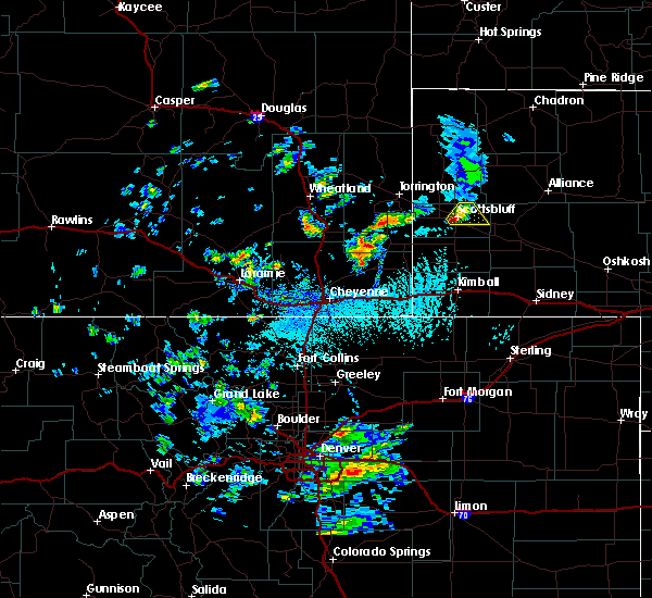 At 203 pm mdt, a severe thunderstorm was located over scotts bluff national monument, or over scottsbluff, moving northeast at 15 mph (radar indicated). Hazards include 60 mph wind gusts and quarter size hail. Hail damage to vehicles is expected. expect wind damage to roofs, siding, and trees. this severe thunderstorm will be near, terrytown around 210 pm mdt. scottsbluff around 215 pm mdt. scottsbluff airport around 230 pm mdt. minatare around 240 pm mdt. lake alice around 245 pm mdt. Lake minatare campground and lake minatare around 300 pm mdt. At 203 pm mdt, a severe thunderstorm was located over scotts bluff national monument, or over scottsbluff, moving northeast at 15 mph (radar indicated). Hazards include 60 mph wind gusts and quarter size hail. Hail damage to vehicles is expected. expect wind damage to roofs, siding, and trees. this severe thunderstorm will be near, terrytown around 210 pm mdt. scottsbluff around 215 pm mdt. scottsbluff airport around 230 pm mdt. minatare around 240 pm mdt. lake alice around 245 pm mdt. Lake minatare campground and lake minatare around 300 pm mdt.
|
| 4/26/2019 4:07 PM MDT |
 The severe thunderstorm warning for eastern scotts bluff and northwestern morrill counties will expire at 415 pm mdt, the storm which prompted the warning has weakened below severe limits, and no longer poses an immediate threat to life or property. therefore, the warning will be allowed to expire. however gusty winds and heavy rain are still possible with this thunderstorm. The severe thunderstorm warning for eastern scotts bluff and northwestern morrill counties will expire at 415 pm mdt, the storm which prompted the warning has weakened below severe limits, and no longer poses an immediate threat to life or property. therefore, the warning will be allowed to expire. however gusty winds and heavy rain are still possible with this thunderstorm.
|
| 4/26/2019 4:01 PM MDT |
 At 400 pm mdt, a severe thunderstorm was located over scottsbluff airport, or near scottsbluff, moving east at 45 mph (radar indicated). Hazards include 60 mph wind gusts. Expect damage to roofs, siding, and trees. Locations impacted include, scottsbluff, gering, bayard, terrytown, minatare, lake minatare campground, scotts bluff national monument, moomaws corner, scottsbluff airport, lake minatare, lake alice, melbeta and mcgrew. At 400 pm mdt, a severe thunderstorm was located over scottsbluff airport, or near scottsbluff, moving east at 45 mph (radar indicated). Hazards include 60 mph wind gusts. Expect damage to roofs, siding, and trees. Locations impacted include, scottsbluff, gering, bayard, terrytown, minatare, lake minatare campground, scotts bluff national monument, moomaws corner, scottsbluff airport, lake minatare, lake alice, melbeta and mcgrew.
|
| 4/26/2019 3:48 PM MDT |
 At 347 pm mdt, a severe thunderstorm was located near scottsbluff, moving east at 45 mph (trained weather spotters). Hazards include 60 mph wind gusts and penny size hail. Expect damage to roofs, siding, and trees. Locations impacted include, scottsbluff, gering, mitchell, bayard, terrytown, minatare, lake minatare campground, scotts bluff national monument, hubbard hill, moomaws corner, scottsbluff airport, lake minatare, lake alice, melbeta and mcgrew. At 347 pm mdt, a severe thunderstorm was located near scottsbluff, moving east at 45 mph (trained weather spotters). Hazards include 60 mph wind gusts and penny size hail. Expect damage to roofs, siding, and trees. Locations impacted include, scottsbluff, gering, mitchell, bayard, terrytown, minatare, lake minatare campground, scotts bluff national monument, hubbard hill, moomaws corner, scottsbluff airport, lake minatare, lake alice, melbeta and mcgrew.
|
| 4/26/2019 3:33 PM MDT |
 At 332 pm mdt, a severe thunderstorm was located over mitchell, or 10 miles northwest of scottsbluff, moving east at 45 mph (radar indicated). Hazards include 70 mph wind gusts and penny size hail. Expect considerable tree damage. Damage is likely to mobile homes, roofs, and outbuildings. At 332 pm mdt, a severe thunderstorm was located over mitchell, or 10 miles northwest of scottsbluff, moving east at 45 mph (radar indicated). Hazards include 70 mph wind gusts and penny size hail. Expect considerable tree damage. Damage is likely to mobile homes, roofs, and outbuildings.
|
| 4/26/2019 3:19 PM MDT |
 At 319 pm mdt, severe thunderstorms were located along a line extending from near hubbard hill to scotts bluff national monument to 9 miles west of wildcat hills campground, moving east at 60 mph (radar indicated). Hazards include 60 mph wind gusts and penny size hail. Expect damage to roofs, siding, and trees. Locations impacted include, scottsbluff, gering, terrytown, minatare, wildcat hills state recreation area, hubbard hill, harrisburg, wildcat hills campground, scotts bluff national monument, melbeta and mcgrew. At 319 pm mdt, severe thunderstorms were located along a line extending from near hubbard hill to scotts bluff national monument to 9 miles west of wildcat hills campground, moving east at 60 mph (radar indicated). Hazards include 60 mph wind gusts and penny size hail. Expect damage to roofs, siding, and trees. Locations impacted include, scottsbluff, gering, terrytown, minatare, wildcat hills state recreation area, hubbard hill, harrisburg, wildcat hills campground, scotts bluff national monument, melbeta and mcgrew.
|
| 4/26/2019 2:57 PM MDT |
 At 257 pm mdt, a severe thunderstorm was located near hawk springs campground, or 23 miles southwest of scottsbluff, moving east at 55 mph (radar indicated). Hazards include 60 mph wind gusts and penny size hail. expect damage to roofs, siding, and trees At 257 pm mdt, a severe thunderstorm was located near hawk springs campground, or 23 miles southwest of scottsbluff, moving east at 55 mph (radar indicated). Hazards include 60 mph wind gusts and penny size hail. expect damage to roofs, siding, and trees
|
| 7/29/2018 2:13 PM MDT |
 At 213 pm mdt, a severe thunderstorm was located over lake minatare, or 11 miles northeast of scottsbluff, moving southeast at 35 mph (radar indicated). Hazards include 60 mph wind gusts and quarter size hail. Hail damage to vehicles is expected. Expect wind damage to roofs, siding, and trees. At 213 pm mdt, a severe thunderstorm was located over lake minatare, or 11 miles northeast of scottsbluff, moving southeast at 35 mph (radar indicated). Hazards include 60 mph wind gusts and quarter size hail. Hail damage to vehicles is expected. Expect wind damage to roofs, siding, and trees.
|
| 7/24/2018 6:51 PM MDT |
 The severe thunderstorm warning for eastern scotts bluff and west central morrill counties will expire at 700 pm mdt, the storm which prompted the warning has weakened below severe limits, and no longer poses an immediate threat to life or property. therefore, the warning will be allowed to expire. however heavy rain is still possible with this thunderstorm. to report severe weather, contact your nearest law enforcement agency. they will relay your report to the national weather service cheyenne. The severe thunderstorm warning for eastern scotts bluff and west central morrill counties will expire at 700 pm mdt, the storm which prompted the warning has weakened below severe limits, and no longer poses an immediate threat to life or property. therefore, the warning will be allowed to expire. however heavy rain is still possible with this thunderstorm. to report severe weather, contact your nearest law enforcement agency. they will relay your report to the national weather service cheyenne.
|
| 7/24/2018 6:36 PM MDT |
 At 635 pm mdt, a severe thunderstorm was located over scottsbluff airport, or near scottsbluff, moving east at 30 mph (radar indicated). Hazards include 50 mph wind gusts and quarter size hail. Hail damage to vehicles is expected. expect wind damage to roofs, siding, and trees. Locations impacted include, scottsbluff, gering, bayard, terrytown, minatare, lake minatare campground, moomaws corner, scottsbluff airport, lake minatare, scotts bluff national monument, melbeta and mcgrew. At 635 pm mdt, a severe thunderstorm was located over scottsbluff airport, or near scottsbluff, moving east at 30 mph (radar indicated). Hazards include 50 mph wind gusts and quarter size hail. Hail damage to vehicles is expected. expect wind damage to roofs, siding, and trees. Locations impacted include, scottsbluff, gering, bayard, terrytown, minatare, lake minatare campground, moomaws corner, scottsbluff airport, lake minatare, scotts bluff national monument, melbeta and mcgrew.
|
| 7/24/2018 6:17 PM MDT |
 At 617 pm mdt, a severe thunderstorm was located over scotts bluff national monument, or near scottsbluff, moving east at 30 mph (radar indicated). Hazards include 60 mph wind gusts and half dollar size hail. Hail damage to vehicles is expected. Expect wind damage to roofs, siding, and trees. At 617 pm mdt, a severe thunderstorm was located over scotts bluff national monument, or near scottsbluff, moving east at 30 mph (radar indicated). Hazards include 60 mph wind gusts and half dollar size hail. Hail damage to vehicles is expected. Expect wind damage to roofs, siding, and trees.
|
| 7/16/2018 9:53 PM MDT |
 At 952 pm mdt, severe thunderstorms were located along a line extending from 11 miles north of lake alice to minatare to 6 miles southeast of harrisburg, moving east at 55 mph (radar indicated). Hazards include 60 mph wind gusts. expect damage to roofs, siding, and trees At 952 pm mdt, severe thunderstorms were located along a line extending from 11 miles north of lake alice to minatare to 6 miles southeast of harrisburg, moving east at 55 mph (radar indicated). Hazards include 60 mph wind gusts. expect damage to roofs, siding, and trees
|
| 6/7/2018 6:40 PM MDT |
 At 639 pm mdt, a severe thunderstorm was located near minatare, or 13 miles southeast of scottsbluff, moving east at 15 mph (radar indicated). Hazards include 60 mph wind gusts and quarter size hail. Hail damage to vehicles is expected. expect wind damage to roofs, siding, and trees. Locations impacted include, scottsbluff, gering, bayard, minatare, chimney rock state park, moomaws corner, south bayard junction, melbeta and mcgrew. At 639 pm mdt, a severe thunderstorm was located near minatare, or 13 miles southeast of scottsbluff, moving east at 15 mph (radar indicated). Hazards include 60 mph wind gusts and quarter size hail. Hail damage to vehicles is expected. expect wind damage to roofs, siding, and trees. Locations impacted include, scottsbluff, gering, bayard, minatare, chimney rock state park, moomaws corner, south bayard junction, melbeta and mcgrew.
|
| 6/7/2018 6:15 PM MDT |
 At 615 pm mdt, a severe thunderstorm was located near minatare, or 8 miles southeast of scottsbluff, moving east at 15 mph (radar indicated). Hazards include 60 mph wind gusts and quarter size hail. Hail damage to vehicles is expected. Expect wind damage to roofs, siding, and trees. At 615 pm mdt, a severe thunderstorm was located near minatare, or 8 miles southeast of scottsbluff, moving east at 15 mph (radar indicated). Hazards include 60 mph wind gusts and quarter size hail. Hail damage to vehicles is expected. Expect wind damage to roofs, siding, and trees.
|
| 5/28/2018 7:07 PM MDT |
 At 706 pm mdt, severe thunderstorms were located along a line extending from near stegall to near wildcat hills campground to 11 miles north of dix, moving northeast at 35 mph (radar indicated). Hazards include 60 mph wind gusts and nickel size hail. expect damage to roofs, siding, and trees At 706 pm mdt, severe thunderstorms were located along a line extending from near stegall to near wildcat hills campground to 11 miles north of dix, moving northeast at 35 mph (radar indicated). Hazards include 60 mph wind gusts and nickel size hail. expect damage to roofs, siding, and trees
|
| 5/27/2018 7:26 PM MDT |
 The severe thunderstorm warning for western box butte, scotts bluff, northwestern morrill, northern banner and southeastern sioux counties will expire at 730 pm mdt, the storms which prompted the warning have weakened below severe limits, and no longer pose an immediate threat to life or property. therefore the warning will be allowed to expire. however heavy rain is still possible with these thunderstorms. a severe thunderstorm watch remains in effect until 800 pm mdt for the panhandle of nebraska. to report severe weather, contact your nearest law enforcement agency. they will relay your report to the national weather service cheyenne. The severe thunderstorm warning for western box butte, scotts bluff, northwestern morrill, northern banner and southeastern sioux counties will expire at 730 pm mdt, the storms which prompted the warning have weakened below severe limits, and no longer pose an immediate threat to life or property. therefore the warning will be allowed to expire. however heavy rain is still possible with these thunderstorms. a severe thunderstorm watch remains in effect until 800 pm mdt for the panhandle of nebraska. to report severe weather, contact your nearest law enforcement agency. they will relay your report to the national weather service cheyenne.
|
| 5/27/2018 7:22 PM MDT |
 At 721 pm mdt, severe thunderstorms were located along a line extending from 6 miles south of flahertys corner to 7 miles west of kilpatrick lake to near lake minatare campground, moving northeast at 75 mph (radar indicated). Hazards include 60 mph wind gusts and quarter size hail. Hail damage to vehicles is expected. expect wind damage to roofs, siding, and trees. Locations impacted include, scottsbluff, gering, mitchell, bayard, terrytown, minatare, hemingford, wildcat hills state recreation area, lake minatare campground, chimney rock state park, scotts bluff national monument, kilpatrick lake, hubbard hill, moomaws corner, scottsbluff airport, lake minatare, south bayard junction, lake alice, wildcat hills campground and melbeta. At 721 pm mdt, severe thunderstorms were located along a line extending from 6 miles south of flahertys corner to 7 miles west of kilpatrick lake to near lake minatare campground, moving northeast at 75 mph (radar indicated). Hazards include 60 mph wind gusts and quarter size hail. Hail damage to vehicles is expected. expect wind damage to roofs, siding, and trees. Locations impacted include, scottsbluff, gering, mitchell, bayard, terrytown, minatare, hemingford, wildcat hills state recreation area, lake minatare campground, chimney rock state park, scotts bluff national monument, kilpatrick lake, hubbard hill, moomaws corner, scottsbluff airport, lake minatare, south bayard junction, lake alice, wildcat hills campground and melbeta.
|
| 5/27/2018 7:06 PM MDT |
 At 705 pm mdt, severe thunderstorms were located along a line extending from near mitchell to near lake minatare campground to south bayard junction, moving north at 35 mph (radar indicated). Hazards include 60 mph wind gusts and quarter size hail. Hail damage to vehicles is expected. expect wind damage to roofs, siding, and trees. Locations impacted include, scottsbluff, alliance, gering, mitchell, bayard, terrytown, minatare, hemingford, wildcat hills state recreation area, alliance airport, angora, wildcat hills campground, hubbard hill, berea, lake minatare, wild horse butte, lake minatare campground, chimney rock state park, scotts bluff national monument and kilpatrick lake. At 705 pm mdt, severe thunderstorms were located along a line extending from near mitchell to near lake minatare campground to south bayard junction, moving north at 35 mph (radar indicated). Hazards include 60 mph wind gusts and quarter size hail. Hail damage to vehicles is expected. expect wind damage to roofs, siding, and trees. Locations impacted include, scottsbluff, alliance, gering, mitchell, bayard, terrytown, minatare, hemingford, wildcat hills state recreation area, alliance airport, angora, wildcat hills campground, hubbard hill, berea, lake minatare, wild horse butte, lake minatare campground, chimney rock state park, scotts bluff national monument and kilpatrick lake.
|
| 5/27/2018 6:48 PM MDT |
 At 648 pm mdt, severe thunderstorms were located along a line extending from 8 miles west of wildcat hills campground to near wildcat hills state recreation area to near redington, moving northeast at 45 mph (radar indicated). Hazards include 60 mph wind gusts and quarter size hail. Hail damage to vehicles is expected. expect wind damage to roofs, siding, and trees. Locations impacted include, scottsbluff, alliance, gering, mitchell, bayard, terrytown, minatare, hemingford, wildcat hills state recreation area, alliance airport, angora, wildcat hills campground, hubbard hill, berea, lake minatare, wild horse butte, lake minatare campground, chimney rock state park, scotts bluff national monument and kilpatrick lake. At 648 pm mdt, severe thunderstorms were located along a line extending from 8 miles west of wildcat hills campground to near wildcat hills state recreation area to near redington, moving northeast at 45 mph (radar indicated). Hazards include 60 mph wind gusts and quarter size hail. Hail damage to vehicles is expected. expect wind damage to roofs, siding, and trees. Locations impacted include, scottsbluff, alliance, gering, mitchell, bayard, terrytown, minatare, hemingford, wildcat hills state recreation area, alliance airport, angora, wildcat hills campground, hubbard hill, berea, lake minatare, wild horse butte, lake minatare campground, chimney rock state park, scotts bluff national monument and kilpatrick lake.
|
| 5/17/2018 5:34 PM MDT |
 At 533 pm mdt, severe thunderstorms were located along a line extending from 8 miles northeast of lake alice to 6 miles south of hubbard hill, moving northeast at 20 mph (radar indicated). Hazards include 60 mph wind gusts and quarter size hail. Hail damage to vehicles is expected. expect wind damage to roofs, siding, and trees. these severe storms will be near, terrytown around 605 pm mdt. scottsbluff around 610 pm mdt. minatare and scottsbluff airport around 615 pm mdt. Other locations impacted by these severe thunderstorms include melbeta. At 533 pm mdt, severe thunderstorms were located along a line extending from 8 miles northeast of lake alice to 6 miles south of hubbard hill, moving northeast at 20 mph (radar indicated). Hazards include 60 mph wind gusts and quarter size hail. Hail damage to vehicles is expected. expect wind damage to roofs, siding, and trees. these severe storms will be near, terrytown around 605 pm mdt. scottsbluff around 610 pm mdt. minatare and scottsbluff airport around 615 pm mdt. Other locations impacted by these severe thunderstorms include melbeta.
|
| 5/17/2018 5:14 PM MDT |
 At 513 pm mdt, severe thunderstorms were located along a line extending from near lake alice to 11 miles west of wildcat hills campground, moving northeast at 20 mph (radar indicated). Hazards include 60 mph wind gusts and quarter size hail. Hail damage to vehicles is expected. expect wind damage to roofs, siding, and trees. severe thunderstorms will be near, lake alice around 520 pm mdt. wildcat hills campground, wildcat hills state recreation area and hubbard hill around 545 pm mdt. gering and scotts bluff national monument around 600 pm mdt. terrytown around 605 pm mdt. scottsbluff around 610 pm mdt. minatare, scottsbluff airport, lake minatare campground and lake minatare around 615 pm mdt. Other locations impacted by these severe thunderstorms include melbeta. At 513 pm mdt, severe thunderstorms were located along a line extending from near lake alice to 11 miles west of wildcat hills campground, moving northeast at 20 mph (radar indicated). Hazards include 60 mph wind gusts and quarter size hail. Hail damage to vehicles is expected. expect wind damage to roofs, siding, and trees. severe thunderstorms will be near, lake alice around 520 pm mdt. wildcat hills campground, wildcat hills state recreation area and hubbard hill around 545 pm mdt. gering and scotts bluff national monument around 600 pm mdt. terrytown around 605 pm mdt. scottsbluff around 610 pm mdt. minatare, scottsbluff airport, lake minatare campground and lake minatare around 615 pm mdt. Other locations impacted by these severe thunderstorms include melbeta.
|
| 7/27/2017 6:09 PM MDT |
 The severe thunderstorm warning for scotts bluff and northeastern banner counties will expire at 615 pm mdt, the storm which prompted the warning has weakened below severe limits, and no longer poses an immediate threat to life or property. therefore the warning will be allowed to expire. however gusty winds to near 50 mph are still possible with this thunderstorm. The severe thunderstorm warning for scotts bluff and northeastern banner counties will expire at 615 pm mdt, the storm which prompted the warning has weakened below severe limits, and no longer poses an immediate threat to life or property. therefore the warning will be allowed to expire. however gusty winds to near 50 mph are still possible with this thunderstorm.
|
| 7/27/2017 5:34 PM MDT |
 At 533 pm mdt, a severe thunderstorm was located over hubbard hill, or 8 miles west of scottsbluff, moving southeast at 25 mph. this is a very dangerous storm (radar indicated). Hazards include 80 mph wind gusts and half dollar size hail. Flying debris will be dangerous to those caught without shelter. mobile homes will be heavily damaged. expect considerable damage to roofs, windows, and vehicles. Extensive tree damage and power outages are likely. At 533 pm mdt, a severe thunderstorm was located over hubbard hill, or 8 miles west of scottsbluff, moving southeast at 25 mph. this is a very dangerous storm (radar indicated). Hazards include 80 mph wind gusts and half dollar size hail. Flying debris will be dangerous to those caught without shelter. mobile homes will be heavily damaged. expect considerable damage to roofs, windows, and vehicles. Extensive tree damage and power outages are likely.
|
| 6/27/2017 1:33 PM MDT |
 At 732 pm mdt, a severe thunderstorm was located near minatare, or 11 miles east of scottsbluff, moving east at 55 mph. this is a very dangerous storm (radar indicated. at 719 pm mdt, a 79 mph wind gust was reported at the scottsbluff airport). Hazards include 80 mph wind gusts and quarter size hail. Flying debris will be dangerous to those caught without shelter. mobile homes will be heavily damaged. expect considerable damage to roofs, windows, and vehicles. extensive tree damage and power outages are likely. this severe storm will be near, bayard and moomaws corner around 740 pm mdt. Other locations impacted by this severe thunderstorm include mcgrew and melbeta. At 732 pm mdt, a severe thunderstorm was located near minatare, or 11 miles east of scottsbluff, moving east at 55 mph. this is a very dangerous storm (radar indicated. at 719 pm mdt, a 79 mph wind gust was reported at the scottsbluff airport). Hazards include 80 mph wind gusts and quarter size hail. Flying debris will be dangerous to those caught without shelter. mobile homes will be heavily damaged. expect considerable damage to roofs, windows, and vehicles. extensive tree damage and power outages are likely. this severe storm will be near, bayard and moomaws corner around 740 pm mdt. Other locations impacted by this severe thunderstorm include mcgrew and melbeta.
|
| 6/27/2017 1:19 PM MDT |
 At 718 pm mdt, a severe thunderstorm was located over scottsbluff, moving east at 35 mph (radar indicated). Hazards include 60 mph wind gusts and quarter size hail. Hail damage to vehicles is expected. expect wind damage to roofs, siding, and trees. this severe thunderstorm will be near, scottsbluff airport around 725 pm mdt. minatare, lake minatare campground and lake minatare around 735 pm mdt. bayard and moomaws corner around 750 pm mdt. Other locations impacted by this severe thunderstorm include mcgrew and melbeta. At 718 pm mdt, a severe thunderstorm was located over scottsbluff, moving east at 35 mph (radar indicated). Hazards include 60 mph wind gusts and quarter size hail. Hail damage to vehicles is expected. expect wind damage to roofs, siding, and trees. this severe thunderstorm will be near, scottsbluff airport around 725 pm mdt. minatare, lake minatare campground and lake minatare around 735 pm mdt. bayard and moomaws corner around 750 pm mdt. Other locations impacted by this severe thunderstorm include mcgrew and melbeta.
|
| 6/12/2017 7:28 PM MDT |
 At 727 pm mdt, a severe thunderstorm capable of producing a tornado was located over moomaws corner, or 17 miles east of scottsbluff, moving northeast at 20 mph (radar indicated rotation. this large thunderstorm has a history of producing tornadoes!). Hazards include tornado and softball size hail. Flying debris will be dangerous to those caught without shelter. mobile homes will be damaged or destroyed. damage to roofs, windows, and vehicles will occur. tree damage is likely. this dangerous storm will be near, the intersection of highway 385 and l62 around 745 pm mdt. angora around 755 pm mdt. Other locations impacted by this tornadic thunderstorm include mcgrew and melbeta. At 727 pm mdt, a severe thunderstorm capable of producing a tornado was located over moomaws corner, or 17 miles east of scottsbluff, moving northeast at 20 mph (radar indicated rotation. this large thunderstorm has a history of producing tornadoes!). Hazards include tornado and softball size hail. Flying debris will be dangerous to those caught without shelter. mobile homes will be damaged or destroyed. damage to roofs, windows, and vehicles will occur. tree damage is likely. this dangerous storm will be near, the intersection of highway 385 and l62 around 745 pm mdt. angora around 755 pm mdt. Other locations impacted by this tornadic thunderstorm include mcgrew and melbeta.
|
| 6/12/2017 6:57 PM MDT |
 At 656 pm mdt, a severe thunderstorm capable of producing a tornado was located near minatare, or 9 miles east of scottsbluff, moving northeast at 20 mph (radar indicated rotation). Hazards include tornado and ping pong ball size hail. Flying debris will be dangerous to those caught without shelter. mobile homes will be damaged or destroyed. damage to roofs, windows, and vehicles will occur. tree damage is likely. this dangerous storm will be near, lake minatare campground and lake minatare around 700 pm mdt. Moomaws corner around 710 pm mdt. At 656 pm mdt, a severe thunderstorm capable of producing a tornado was located near minatare, or 9 miles east of scottsbluff, moving northeast at 20 mph (radar indicated rotation). Hazards include tornado and ping pong ball size hail. Flying debris will be dangerous to those caught without shelter. mobile homes will be damaged or destroyed. damage to roofs, windows, and vehicles will occur. tree damage is likely. this dangerous storm will be near, lake minatare campground and lake minatare around 700 pm mdt. Moomaws corner around 710 pm mdt.
|
| 6/12/2017 6:26 PM MDT |
 At 625 pm mdt, a severe thunderstorm capable of producing a tornado was located near wildcat hills state recreation area, or 7 miles south of scottsbluff, moving northeast at 20 mph (radar indicated rotation). Hazards include tornado and golf ball size hail. Flying debris will be dangerous to those caught without shelter. mobile homes will be damaged or destroyed. damage to roofs, windows, and vehicles will occur. tree damage is likely. this dangerous storm will be near, gering around 630 pm mdt. terrytown around 635 pm mdt. scottsbluff airport around 645 pm mdt. minatare around 650 pm mdt. lake minatare campground and lake minatare around 700 pm mdt. Other locations impacted by this tornadic thunderstorm include melbeta and mcgrew. At 625 pm mdt, a severe thunderstorm capable of producing a tornado was located near wildcat hills state recreation area, or 7 miles south of scottsbluff, moving northeast at 20 mph (radar indicated rotation). Hazards include tornado and golf ball size hail. Flying debris will be dangerous to those caught without shelter. mobile homes will be damaged or destroyed. damage to roofs, windows, and vehicles will occur. tree damage is likely. this dangerous storm will be near, gering around 630 pm mdt. terrytown around 635 pm mdt. scottsbluff airport around 645 pm mdt. minatare around 650 pm mdt. lake minatare campground and lake minatare around 700 pm mdt. Other locations impacted by this tornadic thunderstorm include melbeta and mcgrew.
|
| 6/12/2017 6:06 PM MDT |
 At 606 pm mdt, a severe thunderstorm capable of producing a tornado was located near wildcat hills campground, or 10 miles southwest of scottsbluff, moving northeast at 30 mph (radar indicated rotation). Hazards include tornado and golf ball size hail. Flying debris will be dangerous to those caught without shelter. mobile homes will be damaged or destroyed. damage to roofs, windows, and vehicles will occur. tree damage is likely. this dangerous storm will be near, wildcat hills campground and wildcat hills state recreation area around 610 pm mdt. gering and scotts bluff national monument around 620 pm mdt. scottsbluff and terrytown around 625 pm mdt. minatare and scottsbluff airport around 630 pm mdt. Other locations impacted by this tornadic thunderstorm include melbeta. At 606 pm mdt, a severe thunderstorm capable of producing a tornado was located near wildcat hills campground, or 10 miles southwest of scottsbluff, moving northeast at 30 mph (radar indicated rotation). Hazards include tornado and golf ball size hail. Flying debris will be dangerous to those caught without shelter. mobile homes will be damaged or destroyed. damage to roofs, windows, and vehicles will occur. tree damage is likely. this dangerous storm will be near, wildcat hills campground and wildcat hills state recreation area around 610 pm mdt. gering and scotts bluff national monument around 620 pm mdt. scottsbluff and terrytown around 625 pm mdt. minatare and scottsbluff airport around 630 pm mdt. Other locations impacted by this tornadic thunderstorm include melbeta.
|
| 9/4/2016 4:42 PM MDT |
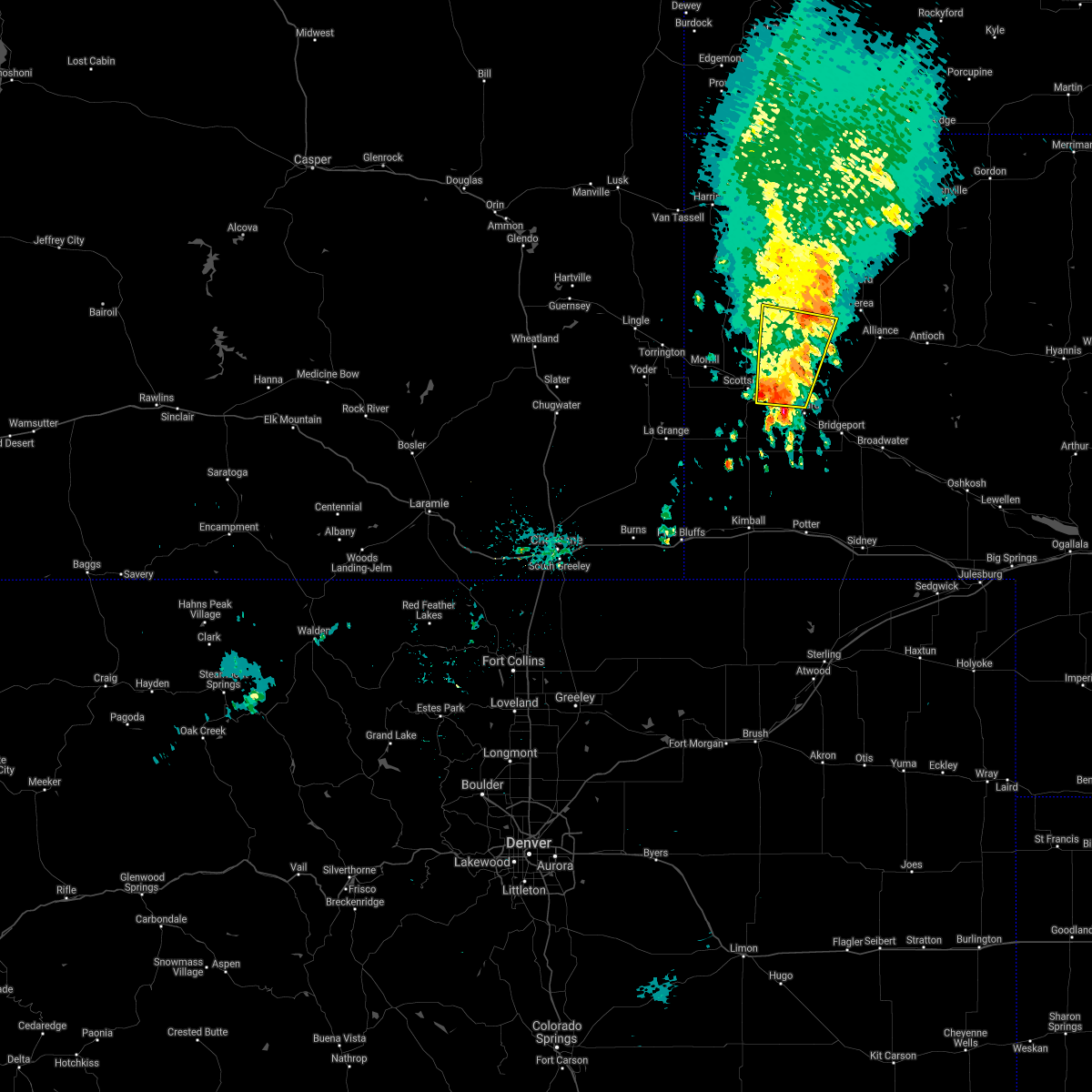 The severe thunderstorm warning for northwestern morrill, southeastern sioux, northeastern scotts bluff and southwestern box butte counties will expire at 445 pm mdt, the storm which prompted the warning has moved out of the area. therefore, the warning will be allowed to expire. however dime to nickle sized hail is still possible along with heavy rain. a severe thunderstorm watch remains in effect until 1000 pm mdt for the panhandle of nebraska. The severe thunderstorm warning for northwestern morrill, southeastern sioux, northeastern scotts bluff and southwestern box butte counties will expire at 445 pm mdt, the storm which prompted the warning has moved out of the area. therefore, the warning will be allowed to expire. however dime to nickle sized hail is still possible along with heavy rain. a severe thunderstorm watch remains in effect until 1000 pm mdt for the panhandle of nebraska.
|
| 9/4/2016 4:09 PM MDT |
 At 408 pm mdt, a severe thunderstorm was located near lake minatare campground, or 13 miles east of scottsbluff, moving north at 40 mph (radar indicated. one inch hail was reported west of mcgrew). Hazards include golf ball size hail and 60 mph wind gusts. People and animals outdoors will be injured. expect hail damage to roofs, siding, windows, and vehicles. Expect wind damage to roofs, siding, and trees. At 408 pm mdt, a severe thunderstorm was located near lake minatare campground, or 13 miles east of scottsbluff, moving north at 40 mph (radar indicated. one inch hail was reported west of mcgrew). Hazards include golf ball size hail and 60 mph wind gusts. People and animals outdoors will be injured. expect hail damage to roofs, siding, windows, and vehicles. Expect wind damage to roofs, siding, and trees.
|
| 9/4/2016 3:44 PM MDT |
 At 344 pm mdt, a severe thunderstorm was located near chimney rock state park, or 19 miles southeast of scottsbluff, moving north at 40 mph (radar indicated). Hazards include ping pong ball size hail and 60 mph wind gusts. People and animals outdoors will be injured. expect hail damage to roofs, siding, windows, and vehicles. expect wind damage to roofs, siding, and trees. Locations impacted include, bayard, minatare, redington, moomaws corner, south bayard junction, chimney rock state park, the intersection of highway 385 and l62 and mcgrew. At 344 pm mdt, a severe thunderstorm was located near chimney rock state park, or 19 miles southeast of scottsbluff, moving north at 40 mph (radar indicated). Hazards include ping pong ball size hail and 60 mph wind gusts. People and animals outdoors will be injured. expect hail damage to roofs, siding, windows, and vehicles. expect wind damage to roofs, siding, and trees. Locations impacted include, bayard, minatare, redington, moomaws corner, south bayard junction, chimney rock state park, the intersection of highway 385 and l62 and mcgrew.
|
| 9/4/2016 3:26 PM MDT |
 At 326 pm mdt, a severe thunderstorm was located 10 miles southwest of redington, or 20 miles northeast of kimball, moving north at 40 mph (radar indicated). Hazards include ping pong ball size hail and 60 mph wind gusts. People and animals outdoors will be injured. expect hail damage to roofs, siding, windows, and vehicles. Expect wind damage to roofs, siding, and trees. At 326 pm mdt, a severe thunderstorm was located 10 miles southwest of redington, or 20 miles northeast of kimball, moving north at 40 mph (radar indicated). Hazards include ping pong ball size hail and 60 mph wind gusts. People and animals outdoors will be injured. expect hail damage to roofs, siding, windows, and vehicles. Expect wind damage to roofs, siding, and trees.
|
| 8/11/2016 7:41 PM MDT |
 At 740 pm mdt, a severe thunderstorm was located near hubbard hill, or 8 miles southwest of scottsbluff, moving east at 40 mph (radar indicated). Hazards include 60 to 70 mph wind gusts and pea sized hail. Expect damage to roofs. siding. And trees. At 740 pm mdt, a severe thunderstorm was located near hubbard hill, or 8 miles southwest of scottsbluff, moving east at 40 mph (radar indicated). Hazards include 60 to 70 mph wind gusts and pea sized hail. Expect damage to roofs. siding. And trees.
|
| 7/29/2016 5:39 PM MDT |
 The severe thunderstorm warning for west central morrill and southeastern scotts bluff counties will expire at 545 pm mdt, the storm which prompted the warning has weakened below severe limits, and no longer pose an immediate threat to life or property. therefore the warning will be allowed to expire. however small hail and heavy rain are still possible with this thunderstorm. a severe thunderstorm watch remains in effect until 1000 pm mdt for the panhandle of nebraska. The severe thunderstorm warning for west central morrill and southeastern scotts bluff counties will expire at 545 pm mdt, the storm which prompted the warning has weakened below severe limits, and no longer pose an immediate threat to life or property. therefore the warning will be allowed to expire. however small hail and heavy rain are still possible with this thunderstorm. a severe thunderstorm watch remains in effect until 1000 pm mdt for the panhandle of nebraska.
|
| 7/29/2016 5:08 PM MDT |
 At 508 pm mdt, a severe thunderstorm was located near minatare, or 12 miles east of scottsbluff, moving east at 30 mph (radar indicated). Hazards include 60 mph wind gusts and quarter size hail. Hail damage to vehicles is expected. Expect wind damage to roofs, siding, and trees. At 508 pm mdt, a severe thunderstorm was located near minatare, or 12 miles east of scottsbluff, moving east at 30 mph (radar indicated). Hazards include 60 mph wind gusts and quarter size hail. Hail damage to vehicles is expected. Expect wind damage to roofs, siding, and trees.
|
| 7/28/2016 9:26 AM MDT |
 At 925 am mdt, a severe thunderstorm was located near minatare, or 10 miles east of scottsbluff, moving southeast at 30 mph (radar indicated). Hazards include 60 mph wind gusts and quarter size hail. Hail damage to vehicles is expected. expect wind damage to roofs, siding, and trees. this severe storm will be near, moomaws corner around 940 am mdt. bayard around 945 am mdt. Other locations impacted by this severe thunderstorm include melbeta and mcgrew. At 925 am mdt, a severe thunderstorm was located near minatare, or 10 miles east of scottsbluff, moving southeast at 30 mph (radar indicated). Hazards include 60 mph wind gusts and quarter size hail. Hail damage to vehicles is expected. expect wind damage to roofs, siding, and trees. this severe storm will be near, moomaws corner around 940 am mdt. bayard around 945 am mdt. Other locations impacted by this severe thunderstorm include melbeta and mcgrew.
|
| 7/28/2016 9:04 AM MDT |
 At 904 am mdt, a severe thunderstorm was located over lake alice, or 8 miles northeast of scottsbluff, moving southeast at 30 mph (radar indicated). Hazards include 60 mph wind gusts and half dollar size hail. Hail damage to vehicles is expected. expect wind damage to roofs, siding, and trees. this severe thunderstorm will be near, lake minatare campground, lake minatare and scottsbluff airport around 915 am mdt. minatare around 930 am mdt. moomaws corner around 940 am mdt. bayard around 945 am mdt. Other locations impacted by this severe thunderstorm include melbeta and mcgrew. At 904 am mdt, a severe thunderstorm was located over lake alice, or 8 miles northeast of scottsbluff, moving southeast at 30 mph (radar indicated). Hazards include 60 mph wind gusts and half dollar size hail. Hail damage to vehicles is expected. expect wind damage to roofs, siding, and trees. this severe thunderstorm will be near, lake minatare campground, lake minatare and scottsbluff airport around 915 am mdt. minatare around 930 am mdt. moomaws corner around 940 am mdt. bayard around 945 am mdt. Other locations impacted by this severe thunderstorm include melbeta and mcgrew.
|
| 7/27/2016 10:36 PM MDT |
 At 1036 pm mdt, a severe thunderstorm was located near minatare, or 13 miles southeast of scottsbluff, moving south at 40 mph (radar indicated). Hazards include 60 mph wind gusts and quarter size hail. Hail damage to vehicles is expected. Expect wind damage to roofs, siding, and trees. At 1036 pm mdt, a severe thunderstorm was located near minatare, or 13 miles southeast of scottsbluff, moving south at 40 mph (radar indicated). Hazards include 60 mph wind gusts and quarter size hail. Hail damage to vehicles is expected. Expect wind damage to roofs, siding, and trees.
|
| 7/27/2016 10:35 PM MDT | Golf Ball sized hail reported 0.1 miles SSE of Minatare, NE |
| 7/26/2016 6:21 PM MDT |
 At 620 pm mdt, severe thunderstorms were located along a line extending from near lake alice to near stegall, moving east at 30 mph (radar indicated). Hazards include 60 mph wind gusts and penny size hail. Expect damage to roofs. siding. and trees. Locations impacted include, scottsbluff, gering, mitchell, terrytown, minatare, lake alice, scotts bluff national monument, stegall, lake minatare, wildcat hills campground, hubbard hill, wildcat hills state recreation area, scottsbluff airport, lake minatare campground, melbeta and mcgrew. At 620 pm mdt, severe thunderstorms were located along a line extending from near lake alice to near stegall, moving east at 30 mph (radar indicated). Hazards include 60 mph wind gusts and penny size hail. Expect damage to roofs. siding. and trees. Locations impacted include, scottsbluff, gering, mitchell, terrytown, minatare, lake alice, scotts bluff national monument, stegall, lake minatare, wildcat hills campground, hubbard hill, wildcat hills state recreation area, scottsbluff airport, lake minatare campground, melbeta and mcgrew.
|
| 7/26/2016 6:14 PM MDT |
 At 613 pm mdt, severe thunderstorms were located along a line extending from near mitchell to stegall, moving east at 25 mph (radar indicated). Hazards include ping pong ball size hail and 60 mph wind gusts. People and animals outdoors will be injured. expect hail damage to roofs, siding, windows, and vehicles. Expect wind damage to roofs, siding, and trees. At 613 pm mdt, severe thunderstorms were located along a line extending from near mitchell to stegall, moving east at 25 mph (radar indicated). Hazards include ping pong ball size hail and 60 mph wind gusts. People and animals outdoors will be injured. expect hail damage to roofs, siding, windows, and vehicles. Expect wind damage to roofs, siding, and trees.
|
| 7/22/2016 2:25 PM MDT |
 At 224 pm mdt, a severe thunderstorm was located near minatare, or 10 miles east of scottsbluff, moving northeast at 15 mph (trained weather spotters. half dollar sized hail was reported 4 miles north of minatare with this storm). Hazards include golf ball size hail and 60 mph wind gusts. People and animals outdoors will be injured. expect hail damage to roofs, siding, windows, and vehicles. Expect wind damage to roofs, siding, and trees. At 224 pm mdt, a severe thunderstorm was located near minatare, or 10 miles east of scottsbluff, moving northeast at 15 mph (trained weather spotters. half dollar sized hail was reported 4 miles north of minatare with this storm). Hazards include golf ball size hail and 60 mph wind gusts. People and animals outdoors will be injured. expect hail damage to roofs, siding, windows, and vehicles. Expect wind damage to roofs, siding, and trees.
|
| 7/22/2016 2:23 PM MDT | Half Dollar sized hail reported 4.2 miles S of Minatare, NE, photo posted on twitter. |
| 6/23/2016 4:10 PM MDT |
 At 409 pm mdt, a severe thunderstorm was located over hubbard hill, or 7 miles west of scottsbluff, moving northeast at 25 mph (radar indicated). Hazards include ping pong ball size hail and 60 mph wind gusts. People and animals outdoors will be injured. expect hail damage to roofs, siding, windows, and vehicles. Expect wind damage to roofs, siding, and trees. At 409 pm mdt, a severe thunderstorm was located over hubbard hill, or 7 miles west of scottsbluff, moving northeast at 25 mph (radar indicated). Hazards include ping pong ball size hail and 60 mph wind gusts. People and animals outdoors will be injured. expect hail damage to roofs, siding, windows, and vehicles. Expect wind damage to roofs, siding, and trees.
|
| 6/12/2016 8:57 PM MDT | The severe thunderstorm warning for northwestern cheyenne, eastern banner, morrill, southeastern sioux, eastern scotts bluff, kimball, southern box butte and southeastern laramie counties will expire at 900 pm mdt, the storms which prompted the warning have weakened below severe limits, and no longer pose an immediate threat to life or property. therefore the warning will be allowed to expire. however heavy rain is still possible with these thunderstorms. to report severe weather, contact your nearest law enforcement agency. they will relay your report to the national weather service cheyenne. |
| 6/12/2016 8:57 PM MDT | The severe thunderstorm warning for northwestern cheyenne, eastern banner, morrill, southeastern sioux, eastern scotts bluff, kimball, southern box butte and southeastern laramie counties will expire at 900 pm mdt, the storms which prompted the warning have weakened below severe limits, and no longer pose an immediate threat to life or property. therefore the warning will be allowed to expire. however heavy rain is still possible with these thunderstorms. to report severe weather, contact your nearest law enforcement agency. they will relay your report to the national weather service cheyenne. |
| 6/12/2016 8:11 PM MDT |
 At 810 pm mdt, severe thunderstorms were located along a line extending from 8 miles east of flahertys corner to 6 miles east of lake minatare to near redington to 8 miles north of potter to 6 miles southwest of kimball airport, moving northeast at 25 mph (radar indicated). Hazards include 60 mph wind gusts and nickel size hail. Expect damage to roofs. siding. And trees. At 810 pm mdt, severe thunderstorms were located along a line extending from 8 miles east of flahertys corner to 6 miles east of lake minatare to near redington to 8 miles north of potter to 6 miles southwest of kimball airport, moving northeast at 25 mph (radar indicated). Hazards include 60 mph wind gusts and nickel size hail. Expect damage to roofs. siding. And trees.
|
| 6/12/2016 7:38 PM MDT |
 At 737 pm mdt, severe thunderstorms were located along a line extending from 7 miles west of hemingford to near kilpatrick lake to near moomaws corner to 8 miles southeast of harrisburg to near panorama point, moving east at 45 mph (radar indicated). Hazards include 60 mph wind gusts and nickel size hail. Expect damage to roofs. siding. And trees. At 737 pm mdt, severe thunderstorms were located along a line extending from 7 miles west of hemingford to near kilpatrick lake to near moomaws corner to 8 miles southeast of harrisburg to near panorama point, moving east at 45 mph (radar indicated). Hazards include 60 mph wind gusts and nickel size hail. Expect damage to roofs. siding. And trees.
|
| 6/12/2016 7:24 PM MDT |
 At 723 pm mdt, severe thunderstorms were located along a line extending from near flahertys corner to 7 miles northeast of lake alice to near minatare to 11 miles southwest of harrisburg, moving east at 40 mph (reports received from kneb of 60 to 69 mph winds west of scottsbluff arounf 705pm). Hazards include 60 mph wind gusts and nickel size hail. Expect damage to roofs. siding. and trees. Locations impacted include, scottsbluff, gering, bayard, terrytown, minatare, lake alice, redington, moomaws corner, harrisburg, angora, scotts bluff national monument, lake minatare, the intersection of highway 385 and l62, south bayard junction, berea, chimney rock state park, wildcat hills campground, kilpatrick lake, wildcat hills state recreation area and wild horse butte. At 723 pm mdt, severe thunderstorms were located along a line extending from near flahertys corner to 7 miles northeast of lake alice to near minatare to 11 miles southwest of harrisburg, moving east at 40 mph (reports received from kneb of 60 to 69 mph winds west of scottsbluff arounf 705pm). Hazards include 60 mph wind gusts and nickel size hail. Expect damage to roofs. siding. and trees. Locations impacted include, scottsbluff, gering, bayard, terrytown, minatare, lake alice, redington, moomaws corner, harrisburg, angora, scotts bluff national monument, lake minatare, the intersection of highway 385 and l62, south bayard junction, berea, chimney rock state park, wildcat hills campground, kilpatrick lake, wildcat hills state recreation area and wild horse butte.
|
| 6/12/2016 7:03 PM MDT |
 At 703 pm mdt, severe thunderstorms were located along a line extending from 9 miles southwest of flahertys corner to lake alice to near wildcat hills campground to near albin, moving east at 45 mph (radar indicated). Hazards include 60 mph wind gusts and nickel size hail. Expect damage to roofs. siding. And trees. At 703 pm mdt, severe thunderstorms were located along a line extending from 9 miles southwest of flahertys corner to lake alice to near wildcat hills campground to near albin, moving east at 45 mph (radar indicated). Hazards include 60 mph wind gusts and nickel size hail. Expect damage to roofs. siding. And trees.
|
| 4/25/2016 8:57 PM MDT | The severe thunderstorm warning for northeastern banner, west central morrill, south central sioux and scotts bluff counties will expire at 900 pm mdt, the storms which prompted the warning have weakened below severe limits, and no longer pose an immediate threat to life or property. therefore the warning will be allowed to expire. however, gusty winds of 30 to 40 mph may still accompany the storms. |
| 4/25/2016 8:35 PM MDT |
 At 834 pm mdt, severe thunderstorms were located along a line extending from near mitchell to near scottsbluff airport to near minatare, moving northeast at 30 mph (radar indicated). Hazards include 60 mph wind gusts and half inch hail. Expect damage to roofs. siding. and trees. Locations impacted include, scottsbluff, gering, mitchell, bayard, terrytown, minatare, lake alice, moomaws corner, scotts bluff national monument, lake minatare, south bayard junction, chimney rock state park, wildcat hills campground, hubbard hill, wildcat hills state recreation area, scottsbluff airport, lake minatare campground, melbeta and mcgrew. At 834 pm mdt, severe thunderstorms were located along a line extending from near mitchell to near scottsbluff airport to near minatare, moving northeast at 30 mph (radar indicated). Hazards include 60 mph wind gusts and half inch hail. Expect damage to roofs. siding. and trees. Locations impacted include, scottsbluff, gering, mitchell, bayard, terrytown, minatare, lake alice, moomaws corner, scotts bluff national monument, lake minatare, south bayard junction, chimney rock state park, wildcat hills campground, hubbard hill, wildcat hills state recreation area, scottsbluff airport, lake minatare campground, melbeta and mcgrew.
|
| 4/25/2016 8:15 PM MDT |
 At 815 pm mdt, severe thunderstorms were located along a line extending from near hubbard hill to scotts bluff national monument to 6 miles southeast of wildcat hills state recreation area, moving northeast at 25 mph (radar indicated). Hazards include 60 mph wind gusts and penny size hail. Expect damage to roofs. siding. And trees. At 815 pm mdt, severe thunderstorms were located along a line extending from near hubbard hill to scotts bluff national monument to 6 miles southeast of wildcat hills state recreation area, moving northeast at 25 mph (radar indicated). Hazards include 60 mph wind gusts and penny size hail. Expect damage to roofs. siding. And trees.
|
| 4/25/2016 7:52 PM MDT |
 At 750 pm mdt, severe thunderstorms were located along a line extending from near stegall to 7 miles south of hubbard hill to harrisburg, moving northeast at 25 mph (radar indicated). Hazards include 60 mph wind gusts and half inch hail. Expect damage to roofs. siding. and trees. Locations impacted include, scottsbluff, gering, mitchell, terrytown, minatare, harrisburg, scotts bluff national monument, stegall, wildcat hills campground, hubbard hill, wildcat hills state recreation area, scottsbluff airport, melbeta and mcgrew. At 750 pm mdt, severe thunderstorms were located along a line extending from near stegall to 7 miles south of hubbard hill to harrisburg, moving northeast at 25 mph (radar indicated). Hazards include 60 mph wind gusts and half inch hail. Expect damage to roofs. siding. and trees. Locations impacted include, scottsbluff, gering, mitchell, terrytown, minatare, harrisburg, scotts bluff national monument, stegall, wildcat hills campground, hubbard hill, wildcat hills state recreation area, scottsbluff airport, melbeta and mcgrew.
|
| 4/25/2016 7:35 PM MDT |
 At 734 pm mdt, severe thunderstorms were located along a line extending from 8 miles southwest of stegall to 11 miles south of hubbard hill to near harrisburg, moving northeast at 30 mph (radar indicated). Hazards include 60 mph wind gusts and half size hail. Expect damage to roofs. siding. And trees. At 734 pm mdt, severe thunderstorms were located along a line extending from 8 miles southwest of stegall to 11 miles south of hubbard hill to near harrisburg, moving northeast at 30 mph (radar indicated). Hazards include 60 mph wind gusts and half size hail. Expect damage to roofs. siding. And trees.
|
| 7/27/2015 6:15 PM MDT |
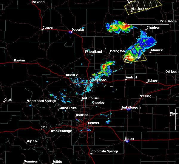 At 613 pm mdt, a severe thunderstorm was located over scottsbluff airport, or near scottsbluff, moving northeast at 30 mph (trained weather spotters and weather sensors). Hazards include 60 mph wind gusts and quarter size hail. Hail damage to vehicles is expected. Expect wind damage to roofs, siding and trees. At 613 pm mdt, a severe thunderstorm was located over scottsbluff airport, or near scottsbluff, moving northeast at 30 mph (trained weather spotters and weather sensors). Hazards include 60 mph wind gusts and quarter size hail. Hail damage to vehicles is expected. Expect wind damage to roofs, siding and trees.
|
| 7/27/2015 5:55 PM MDT |
 At 554 pm mdt, a severe thunderstorm was located over scotts bluff national monument, or over scottsbluff, moving east at 30 mph (trained weather spotters. quarter sized hail was reported 8 miles west of scottsbluff with this storm). Hazards include ping pong ball size hail and 60 mph wind gusts. People and animals outdoors will be injured. expect hail damage to roofs, siding, windows and vehicles. expect wind damage to roofs, siding and trees. Locations impacted include, scottsbluff, gering, mitchell, terrytown, minatare, lake alice, flahertys corner, moomaws corner, scotts bluff national monument, lake minatare, kilpatrick lake, hubbard hill, scottsbluff airport, lake minatare campground and melbeta. At 554 pm mdt, a severe thunderstorm was located over scotts bluff national monument, or over scottsbluff, moving east at 30 mph (trained weather spotters. quarter sized hail was reported 8 miles west of scottsbluff with this storm). Hazards include ping pong ball size hail and 60 mph wind gusts. People and animals outdoors will be injured. expect hail damage to roofs, siding, windows and vehicles. expect wind damage to roofs, siding and trees. Locations impacted include, scottsbluff, gering, mitchell, terrytown, minatare, lake alice, flahertys corner, moomaws corner, scotts bluff national monument, lake minatare, kilpatrick lake, hubbard hill, scottsbluff airport, lake minatare campground and melbeta.
|
| 7/27/2015 5:34 PM MDT |
 At 534 pm mdt, severe thunderstorms were located along a line extending from 15 miles north of morrill to near hubbard hill, moving northeast at 30 mph (radar indicated). Hazards include 60 mph wind gusts and quarter size hail. Hail damage to vehicles is expected. Expect wind damage to roofs, siding and trees. At 534 pm mdt, severe thunderstorms were located along a line extending from 15 miles north of morrill to near hubbard hill, moving northeast at 30 mph (radar indicated). Hazards include 60 mph wind gusts and quarter size hail. Hail damage to vehicles is expected. Expect wind damage to roofs, siding and trees.
|
| 7/17/2015 2:18 PM MDT |
 At 218 pm mdt, a severe thunderstorm was located over scottsbluff airport, or near scottsbluff, moving northeast at 20 mph (radar indicated). Hazards include quarter size hail and 60 mph wind gusts. Hail damage to vehicles is expected. Expect wind damage to roofs, siding and trees. At 218 pm mdt, a severe thunderstorm was located over scottsbluff airport, or near scottsbluff, moving northeast at 20 mph (radar indicated). Hazards include quarter size hail and 60 mph wind gusts. Hail damage to vehicles is expected. Expect wind damage to roofs, siding and trees.
|
| 7/5/2015 3:40 PM MDT | Windows broken out of house from large hail. hail size unknow in box butte county NE, 19.6 miles SSW of Minatare, NE |
| 7/4/2015 6:39 PM MDT |
 At 636 pm mdt, a severe thunderstorm was located near minatare, or 12 miles southeast of scottsbluff, moving south at 25 mph (trained weather spotters. quarter sized hail and wind gusts up to 60 mph were reported near minatare and melbeta with this storm). Hazards include ping pong size hail and 60 mph wind gusts. People and animals outdoors will be injured. expect hail damage to roofs, siding, windows and vehicles. expect wind damage to roofs, siding and trees. Locations impacted include, bayard, minatare, redington, south bayard junction, chimney rock state park, melbeta and mcgrew. At 636 pm mdt, a severe thunderstorm was located near minatare, or 12 miles southeast of scottsbluff, moving south at 25 mph (trained weather spotters. quarter sized hail and wind gusts up to 60 mph were reported near minatare and melbeta with this storm). Hazards include ping pong size hail and 60 mph wind gusts. People and animals outdoors will be injured. expect hail damage to roofs, siding, windows and vehicles. expect wind damage to roofs, siding and trees. Locations impacted include, bayard, minatare, redington, south bayard junction, chimney rock state park, melbeta and mcgrew.
|
| 7/4/2015 6:30 PM MDT | Dime sized hail as wel in scotts bluff county NE, 0.1 miles SSE of Minatare, NE |
| 7/4/2015 6:23 PM MDT |
 At 623 pm mdt, a severe thunderstorm was located over minatare, or 8 miles east of scottsbluff, moving southeast at 25 mph (trained weather spotters). Hazards include ping pong size hail and 60 mph wind gusts. People and animals outdoors will be injured. expect hail damage to roofs, siding, windows and vehicles. Expect wind damage to roofs, siding and trees. At 623 pm mdt, a severe thunderstorm was located over minatare, or 8 miles east of scottsbluff, moving southeast at 25 mph (trained weather spotters). Hazards include ping pong size hail and 60 mph wind gusts. People and animals outdoors will be injured. expect hail damage to roofs, siding, windows and vehicles. Expect wind damage to roofs, siding and trees.
|
| 7/4/2015 6:17 PM MDT |
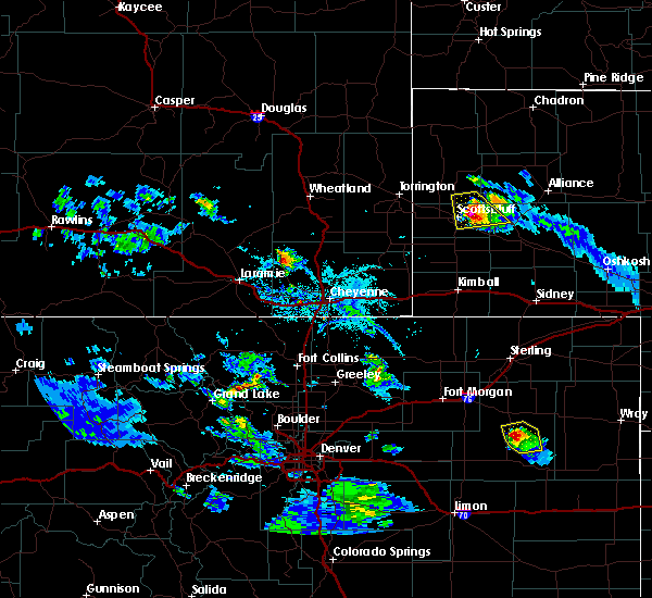 At 615 pm mdt, a severe thunderstorm was located over lake minatare campground, or 7 miles east of scottsbluff, moving southeast at 20 mph (trained weather spotters. wind gusts to 60 mph were reported south of lake minatare at 610 pm mdt). Hazards include ping pong size hail and 60 mph wind gusts. People and animals outdoors will be injured. expect hail damage to roofs, siding, windows and vehicles. expect wind damage to roofs, siding and trees. Locations impacted include, minatare, lake alice, moomaws corner, scottsbluff airport, lake minatare and lake minatare campground. At 615 pm mdt, a severe thunderstorm was located over lake minatare campground, or 7 miles east of scottsbluff, moving southeast at 20 mph (trained weather spotters. wind gusts to 60 mph were reported south of lake minatare at 610 pm mdt). Hazards include ping pong size hail and 60 mph wind gusts. People and animals outdoors will be injured. expect hail damage to roofs, siding, windows and vehicles. expect wind damage to roofs, siding and trees. Locations impacted include, minatare, lake alice, moomaws corner, scottsbluff airport, lake minatare and lake minatare campground.
|
| 7/4/2015 5:51 PM MDT |
 At 550 pm mdt, severe thunderstorms were located along a line extending from 7 miles north of lake minatare to near lake alice, moving southeast at 15 mph (radar indicated). Hazards include half dollar size hail and 60 mph wind gusts. Hail damage to vehicles is expected. Expect wind damage to roofs, siding and trees. At 550 pm mdt, severe thunderstorms were located along a line extending from 7 miles north of lake minatare to near lake alice, moving southeast at 15 mph (radar indicated). Hazards include half dollar size hail and 60 mph wind gusts. Hail damage to vehicles is expected. Expect wind damage to roofs, siding and trees.
|
| 6/17/2015 6:27 PM MDT | The severe thunderstorm warning for south central sioux and central scotts bluff counties will expire at 630 pm mdt, the storm which prompted the warning has weakened below severe limits and exited the warned area. therefore the warning will be allowed to expire. however small hail is still possible with this thunderstorm east of the city of scottsbluff. remember, a severe thunderstorm warning still remains in effect for northwest scottsbluff county. |
| 6/17/2015 6:15 PM MDT |
 At 614 pm mdt, a severe thunderstorm was located over scottsbluff, moving east at 25 mph (law enforcement. law enforcement reported golf ball sized hail and larger in the scottsbluff area). Hazards include golf ball size hail and 60 mph wind gusts. People and animals outdoors will be injured. expect hail damage to roofs, siding, windows and vehicles. expect wind damage to roofs, siding and trees. Locations impacted include, scottsbluff, gering, mitchell, terrytown, minatare, lake alice, scotts bluff national monument, stegall, hubbard hill, scottsbluff airport and melbeta. At 614 pm mdt, a severe thunderstorm was located over scottsbluff, moving east at 25 mph (law enforcement. law enforcement reported golf ball sized hail and larger in the scottsbluff area). Hazards include golf ball size hail and 60 mph wind gusts. People and animals outdoors will be injured. expect hail damage to roofs, siding, windows and vehicles. expect wind damage to roofs, siding and trees. Locations impacted include, scottsbluff, gering, mitchell, terrytown, minatare, lake alice, scotts bluff national monument, stegall, hubbard hill, scottsbluff airport and melbeta.
|
| 6/17/2015 5:57 PM MDT |
 At 556 pm mdt, a severe thunderstorm was located 7 miles west of scottsbluff, moving east at 25 mph. this storm has a history of producing large hail (radar indicated). Hazards include ping pong size hail and 60 mph wind gusts. People and animals outdoors will be injured. expect hail damage to roofs, siding, windows and vehicles. Expect wind damage to roofs, siding and trees. At 556 pm mdt, a severe thunderstorm was located 7 miles west of scottsbluff, moving east at 25 mph. this storm has a history of producing large hail (radar indicated). Hazards include ping pong size hail and 60 mph wind gusts. People and animals outdoors will be injured. expect hail damage to roofs, siding, windows and vehicles. Expect wind damage to roofs, siding and trees.
|
| 6/16/2015 6:59 PM MDT |
 At 658 pm mdt, trained weather spotters reported a severe thunderstorm producing half dollar size hail and damaging winds in excess of 60 mph. this storm was located over scottsbluff airport, or over scottsbluff, and moving southeast at 15 mph. At 658 pm mdt, trained weather spotters reported a severe thunderstorm producing half dollar size hail and damaging winds in excess of 60 mph. this storm was located over scottsbluff airport, or over scottsbluff, and moving southeast at 15 mph.
|
| 6/16/2015 6:34 PM MDT |
 At 633 pm mdt, severe thunderstorms were located along a line extending from near lake alice to near stegall, moving southeast at 30 mph (radar indicated). Hazards include tennis ball size hail and 60 mph wind gusts. People and animals outdoors will be injured. expect hail damage to roofs, siding, windows and vehicles. expect wind damage to roofs, siding and trees. Locations impacted include, scottsbluff, gering, mitchell, terrytown, morrill, minatare, lyman, scotts bluff national monument, stegall, wildcat hills campground, hubbard hill, wildcat hills state recreation area, scottsbluff airport and melbeta. At 633 pm mdt, severe thunderstorms were located along a line extending from near lake alice to near stegall, moving southeast at 30 mph (radar indicated). Hazards include tennis ball size hail and 60 mph wind gusts. People and animals outdoors will be injured. expect hail damage to roofs, siding, windows and vehicles. expect wind damage to roofs, siding and trees. Locations impacted include, scottsbluff, gering, mitchell, terrytown, morrill, minatare, lyman, scotts bluff national monument, stegall, wildcat hills campground, hubbard hill, wildcat hills state recreation area, scottsbluff airport and melbeta.
|
| 6/16/2015 6:23 PM MDT |
 At 622 pm mdt, severe thunderstorms were located along a line extending from near mitchell to near huntley, moving southeast at 30 mph (trained weather spotters). Hazards include tennis ball size hail and 60 mph wind gusts. People and animals outdoors will be injured. expect hail damage to roofs, siding, windows and vehicles. Expect wind damage to roofs, siding and trees. At 622 pm mdt, severe thunderstorms were located along a line extending from near mitchell to near huntley, moving southeast at 30 mph (trained weather spotters). Hazards include tennis ball size hail and 60 mph wind gusts. People and animals outdoors will be injured. expect hail damage to roofs, siding, windows and vehicles. Expect wind damage to roofs, siding and trees.
|
| 6/16/2015 5:29 PM MDT |
 At 529 pm mdt, a severe thunderstorm was located near hubbard hill, or 10 miles southwest of scottsbluff, moving east at 35 mph (radar indicated). Hazards include golf ball size hail and 60 mph wind gusts. People and animals outdoors will be injured. expect hail damage to roofs, siding, windows and vehicles. Expect wind damage to roofs, siding and trees. At 529 pm mdt, a severe thunderstorm was located near hubbard hill, or 10 miles southwest of scottsbluff, moving east at 35 mph (radar indicated). Hazards include golf ball size hail and 60 mph wind gusts. People and animals outdoors will be injured. expect hail damage to roofs, siding, windows and vehicles. Expect wind damage to roofs, siding and trees.
|
| 6/2/2015 6:20 PM MDT | Quarter sized hail reported 0.1 miles SSE of Minatare, NE |
| 6/3/2014 5:07 PM MDT | Grapefruit sized hail reported 5.9 miles SW of Minatare, NE, very jagged hail. |
| 6/22/2013 6:03 PM MDT | 50 to 60 mph wind gusts and nickel sized hail at the intersection of stonegate and highland road in scotts bluff county NE, 2.8 miles S of Minatare, NE |
| 6/17/2013 9:34 PM MDT | Quarter sized hail reported 0.1 miles SSE of Minatare, NE |
| 4/26/2012 4:37 PM MDT | Ping Pong Ball sized hail reported 12.5 miles S of Minatare, NE, estmated rainfall of 4 inches at lake minatare. |
| 1/1/0001 12:00 AM | Quarter sized hail reported 12.5 miles S of Minatare, NE |
Hail Maps for Minatare, NE


Connect with Interactive Hail Maps