

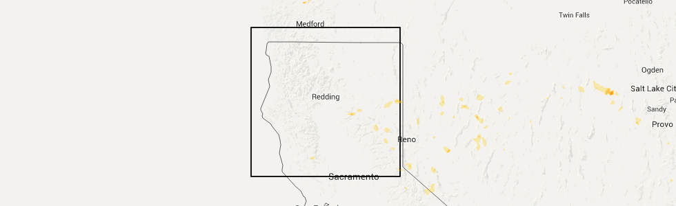
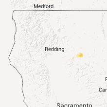
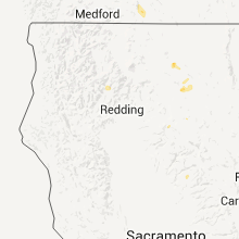
Hail Map for Mineral, CA
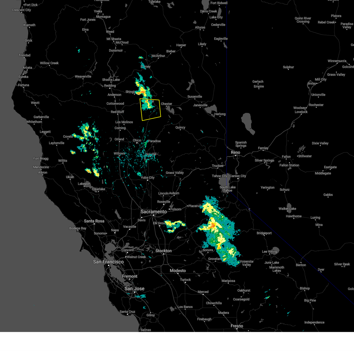
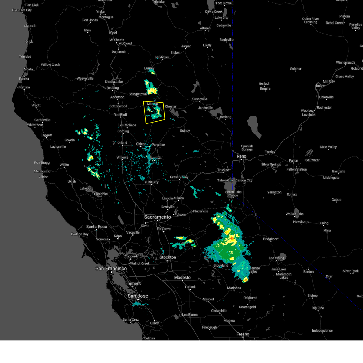
The Mineral, CA area has had 1 report of on-the-ground hail by trained spotters, and has been under severe weather warnings 2 times during the past 12 months. Doppler radar has detected hail at or near Mineral, CA on 5 occasions.
| Name: | Mineral, CA |
| Where Located: | 46.1 miles ESE of Redding, CA |
| Map: | Google Map for Mineral, CA |
| Population: | 123 |
| Housing Units: | 466 |
| More Info: | Search Google for Mineral, CA |
5
The Top Recent Hail Date for Mineral, CA is Wednesday, July 8, 2015 (1st out of 5)
Hail and Wind Damage Spotted near Mineral, CA
| Date / Time | Report Details |
|---|---|
| 6/10/2023 3:36 PM PDT |
 The severe thunderstorm warning for northwestern plumas, northeastern tehama and north central butte counties will expire at 345 pm pdt, the storm which prompted the warning has weakened below severe limits, and no longer poses an immediate threat to life or property. therefore, the warning will be allowed to expire. however hail and heavy rain are still possible with this thunderstorm. The severe thunderstorm warning for northwestern plumas, northeastern tehama and north central butte counties will expire at 345 pm pdt, the storm which prompted the warning has weakened below severe limits, and no longer poses an immediate threat to life or property. therefore, the warning will be allowed to expire. however hail and heavy rain are still possible with this thunderstorm.
|
| 6/10/2023 2:59 PM PDT |
 At 259 pm pdt, a severe thunderstorm was located 9 miles south of mineral, moving southwest at 15 mph (radar indicated). Hazards include half dollar size hail. damage to vehicles is expected At 259 pm pdt, a severe thunderstorm was located 9 miles south of mineral, moving southwest at 15 mph (radar indicated). Hazards include half dollar size hail. damage to vehicles is expected
|
| 7/8/2015 3:05 PM PDT |
 At 301 pm pdt, doppler radar indicated a possible severe thunderstorm capable of producing quarter size hail and damaging winds in excess of 60 mph. this storm was located about 9 miles northwest of chester, moving west at 20 mph towards mineral. the original cell near mineral which prompted the initial warning has weakened. earlier the public reported nickel size hail with this cell. locations impacted include, mineral, shingletown, manzanita lake, viola, lassen national park, lyonsville and manton. At 301 pm pdt, doppler radar indicated a possible severe thunderstorm capable of producing quarter size hail and damaging winds in excess of 60 mph. this storm was located about 9 miles northwest of chester, moving west at 20 mph towards mineral. the original cell near mineral which prompted the initial warning has weakened. earlier the public reported nickel size hail with this cell. locations impacted include, mineral, shingletown, manzanita lake, viola, lassen national park, lyonsville and manton.
|
| 7/8/2015 2:54 PM PDT |
 At 251 pm pdt, doppler radar indicated a severe thunderstorm capable of producing quarter size hail and damaging winds in excess of 60 mph. this storm was located near lyonsville, and mineral, moving to the west at 15 mph. in addition, at 235 pm, the public reported nickel size hail near mineral. locations impacted include, mineral, shingletown, manzanita lake, viola, lassen national park, lyonsville and manton. At 251 pm pdt, doppler radar indicated a severe thunderstorm capable of producing quarter size hail and damaging winds in excess of 60 mph. this storm was located near lyonsville, and mineral, moving to the west at 15 mph. in addition, at 235 pm, the public reported nickel size hail near mineral. locations impacted include, mineral, shingletown, manzanita lake, viola, lassen national park, lyonsville and manton.
|
| 7/8/2015 2:33 PM PDT |
 At 232 pm pdt, doppler radar indicated a severe thunderstorm capable of producing quarter size hail and damaging winds in excess of 60 mph. this storm was located near mineral, and moving west at 15 mph. At 232 pm pdt, doppler radar indicated a severe thunderstorm capable of producing quarter size hail and damaging winds in excess of 60 mph. this storm was located near mineral, and moving west at 15 mph.
|
| 8/21/2013 3:18 PM PDT | Quarter sized hail reported 12.4 miles S of Mineral, CA, a lot of 1" hail and heavy rain observed |
Hail Maps for Mineral, CA


Connect with Interactive Hail Maps