

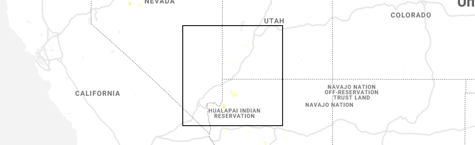
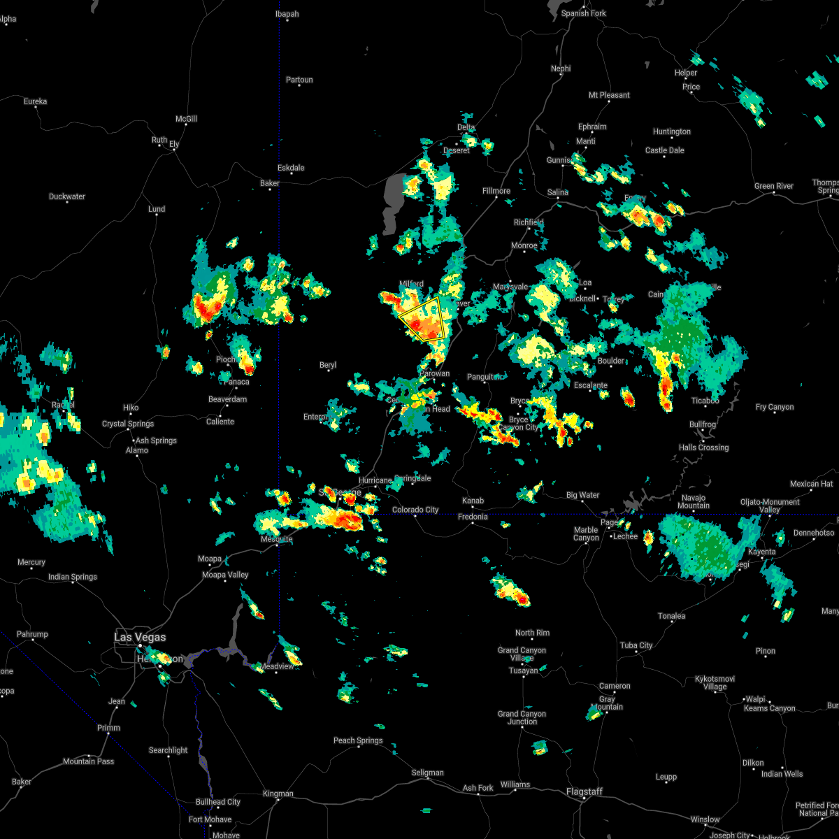
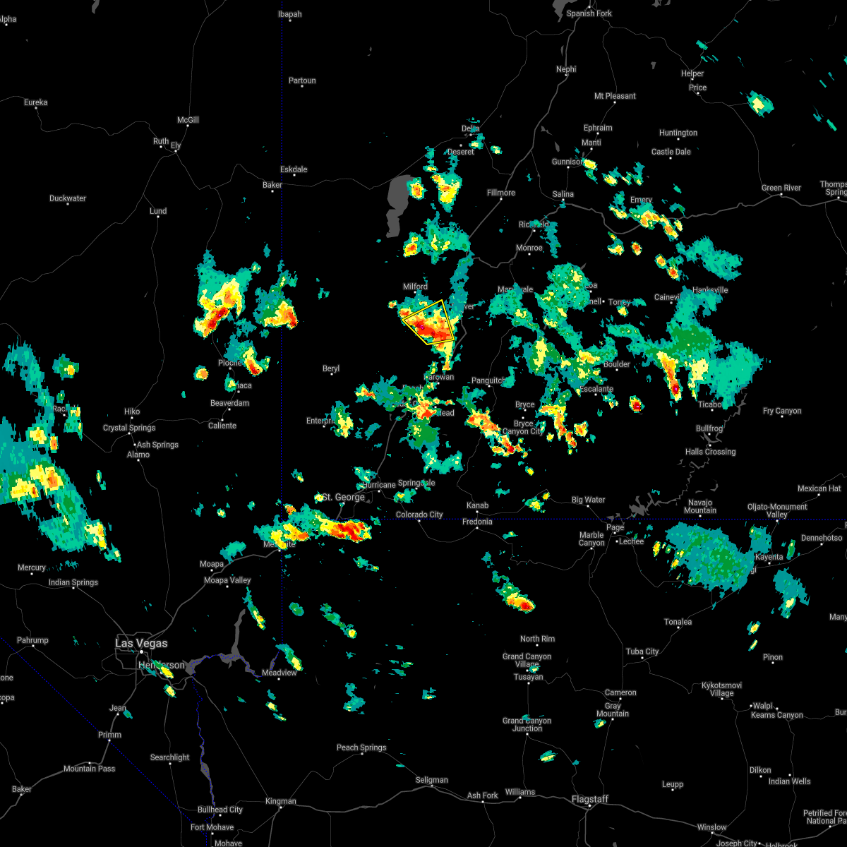
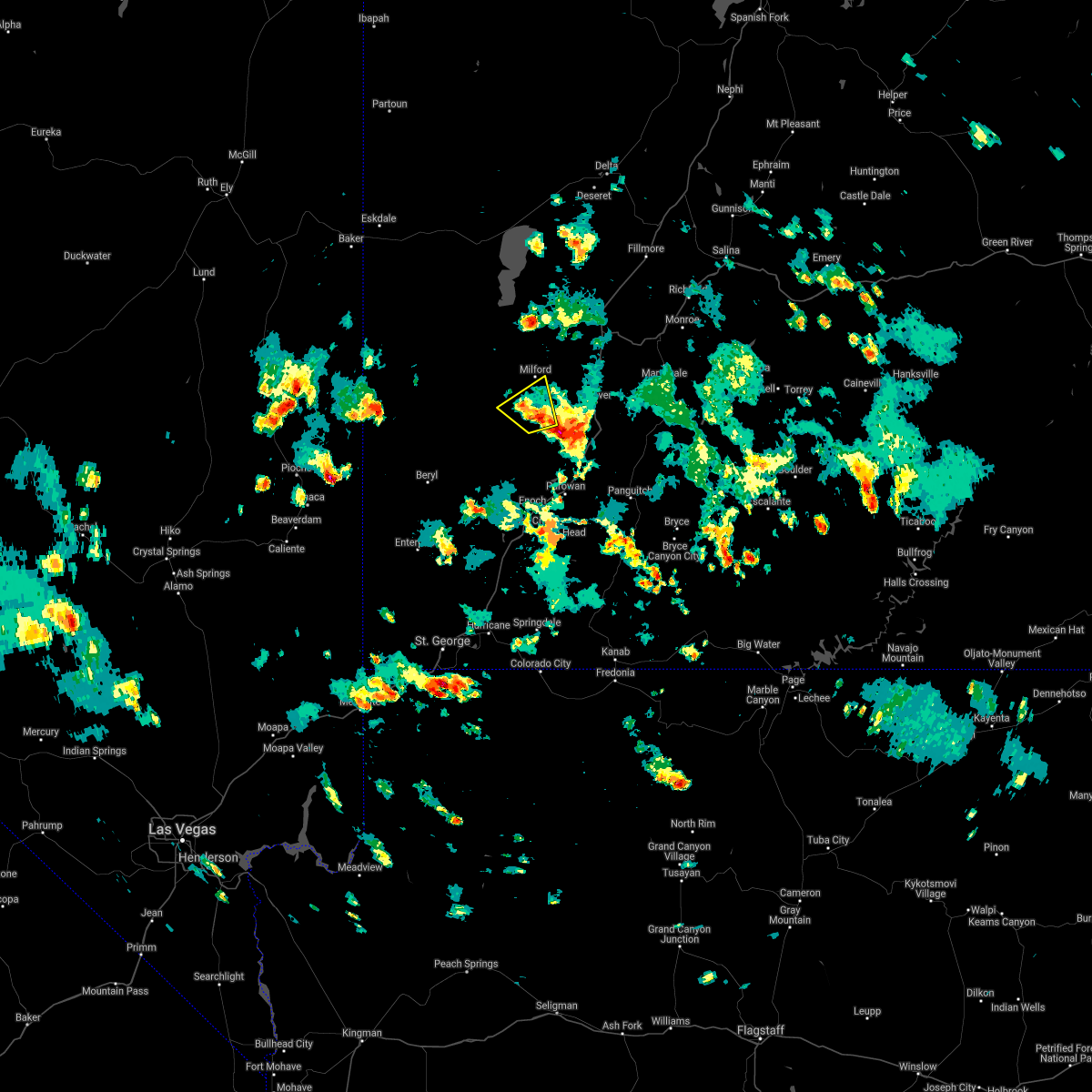
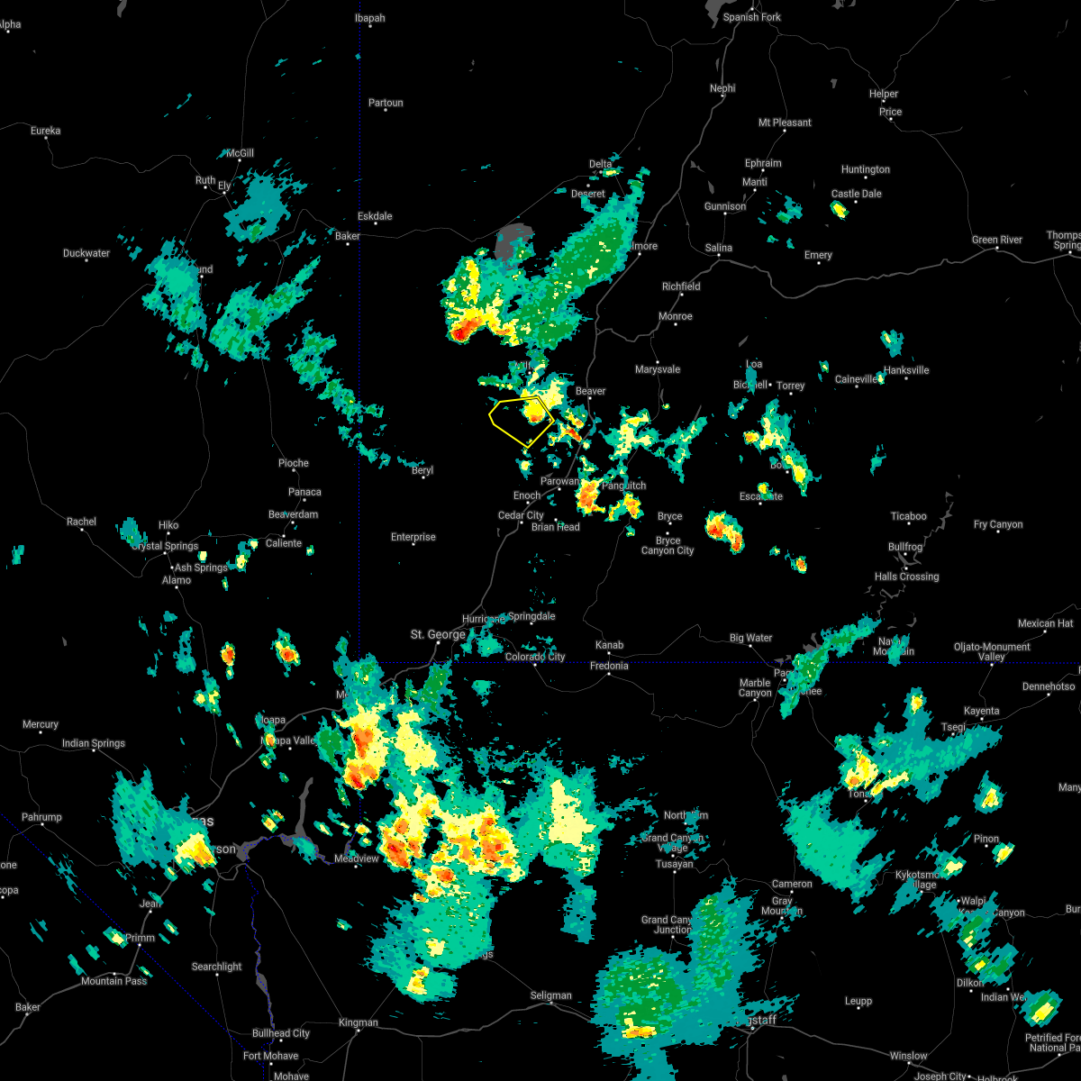
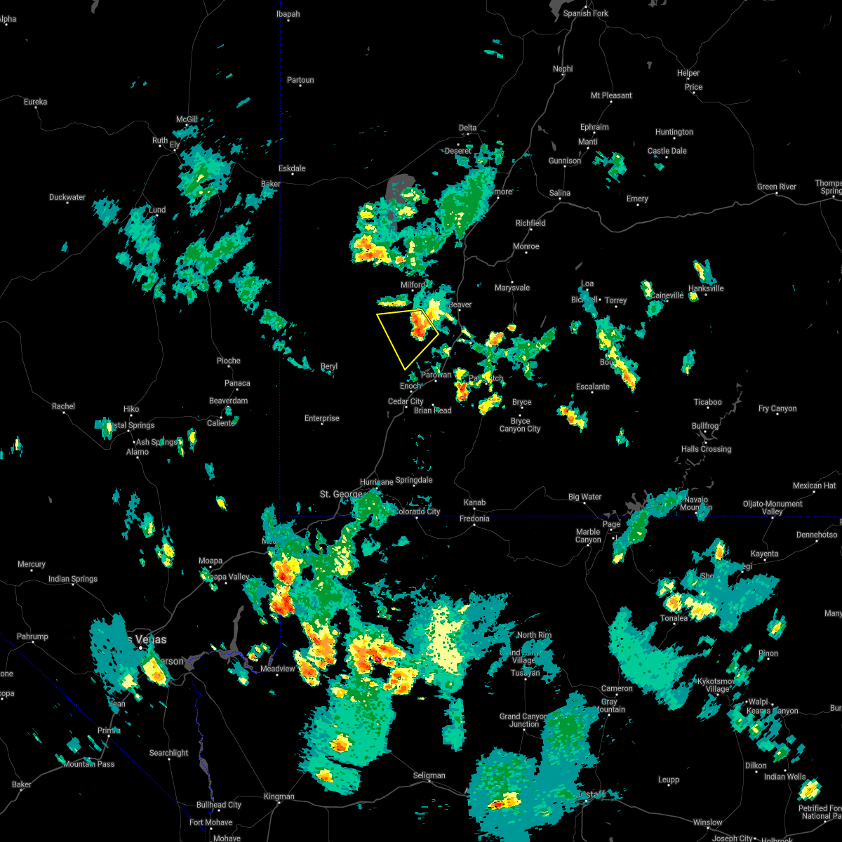
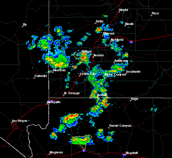
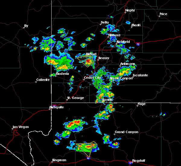
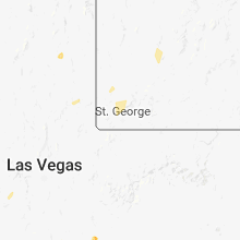
Hail Map for Minersville, UT
The Minersville, UT area has had 0 reports of on-the-ground hail by trained spotters, and has been under severe weather warnings 0 times during the past 12 months. Doppler radar has detected hail at or near Minersville, UT on 6 occasions.
| Name: | Minersville, UT |
| Where Located: | 52.3 miles WSW of Monroe, UT |
| Map: | Google Map for Minersville, UT |
| Population: | 907 |
| Housing Units: | 303 |
| More Info: | Search Google for Minersville, UT |
1
The Top Recent Hail Date for Minersville, UT is Tuesday, August 9, 2022 (2nd out of 6)
Hail and Wind Damage Spotted near Minersville, UT
| Date / Time | Report Details |
|---|---|
| 7/31/2021 3:55 PM MDT | Reports of a tree on a powerlin in beaver county UT, 0.4 miles NW of Minersville, UT |
| 7/26/2021 3:20 PM MDT |
 At 320 pm mdt, a severe thunderstorm was located 14 miles southwest of beaver, moving northwest at 10 mph (radar indicated). Hazards include 60 mph wind gusts and half dollar size hail. Hail damage to vehicles is expected. Expect wind damage to roofs, siding, and trees. At 320 pm mdt, a severe thunderstorm was located 14 miles southwest of beaver, moving northwest at 10 mph (radar indicated). Hazards include 60 mph wind gusts and half dollar size hail. Hail damage to vehicles is expected. Expect wind damage to roofs, siding, and trees.
|
| 7/26/2021 3:07 PM MDT |
 At 307 pm mdt, a severe thunderstorm was located 15 miles southwest of beaver, moving northwest at 10 mph (radar indicated). Hazards include 60 mph wind gusts and half dollar size hail. Hail damage to vehicles is expected. Expect wind damage to roofs, siding, and trees. At 307 pm mdt, a severe thunderstorm was located 15 miles southwest of beaver, moving northwest at 10 mph (radar indicated). Hazards include 60 mph wind gusts and half dollar size hail. Hail damage to vehicles is expected. Expect wind damage to roofs, siding, and trees.
|
| 7/26/2021 3:01 PM MDT |
 At 300 pm mdt, a severe thunderstorm was located 14 miles south of milford, moving northwest at 10 mph (radar indicated). Hazards include 60 mph wind gusts and half dollar size hail. Hail damage to vehicles is expected. Expect wind damage to roofs, siding, and trees. At 300 pm mdt, a severe thunderstorm was located 14 miles south of milford, moving northwest at 10 mph (radar indicated). Hazards include 60 mph wind gusts and half dollar size hail. Hail damage to vehicles is expected. Expect wind damage to roofs, siding, and trees.
|
| 7/18/2021 4:46 PM MDT |
 At 445 pm mdt, a severe thunderstorm was located 16 miles south of milford, moving northwest at 10 mph (radar indicated). Hazards include 60 mph wind gusts and penny size hail. Expect damage to roofs, siding, and trees. locations impacted include, minersville. This includes utah route 21 between mile markers 86 and 91. At 445 pm mdt, a severe thunderstorm was located 16 miles south of milford, moving northwest at 10 mph (radar indicated). Hazards include 60 mph wind gusts and penny size hail. Expect damage to roofs, siding, and trees. locations impacted include, minersville. This includes utah route 21 between mile markers 86 and 91.
|
| 7/18/2021 4:31 PM MDT |
 At 431 pm mdt, a severe thunderstorm was located 19 miles south of milford, moving west at 15 mph (radar indicated). Hazards include 60 mph wind gusts and penny size hail. expect damage to roofs, siding, and trees At 431 pm mdt, a severe thunderstorm was located 19 miles south of milford, moving west at 15 mph (radar indicated). Hazards include 60 mph wind gusts and penny size hail. expect damage to roofs, siding, and trees
|
| 8/11/2018 4:49 PM MDT |
 At 448 pm mdt, a severe thunderstorm was located 11 miles south of milford, moving west at 20 mph (radar indicated). Hazards include 60 mph wind gusts and quarter size hail. Hail damage to vehicles is expected. expect wind damage to roofs, siding, and trees. Locations impacted include, milford, minersville and adamsville. At 448 pm mdt, a severe thunderstorm was located 11 miles south of milford, moving west at 20 mph (radar indicated). Hazards include 60 mph wind gusts and quarter size hail. Hail damage to vehicles is expected. expect wind damage to roofs, siding, and trees. Locations impacted include, milford, minersville and adamsville.
|
| 8/11/2018 4:35 PM MDT |
 At 434 pm mdt, a severe thunderstorm was located 11 miles south of milford near srs 129 and 21, moving west at 20 mph (radar indicated). Hazards include 60 mph wind gusts and quarter size hail. Hail damage to vehicles is expected. Expect wind damage to roofs, siding, and trees. At 434 pm mdt, a severe thunderstorm was located 11 miles south of milford near srs 129 and 21, moving west at 20 mph (radar indicated). Hazards include 60 mph wind gusts and quarter size hail. Hail damage to vehicles is expected. Expect wind damage to roofs, siding, and trees.
|
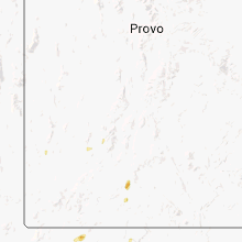
Hail Maps for Minersville, UT


Connect with Interactive Hail Maps