

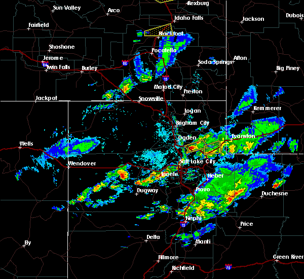
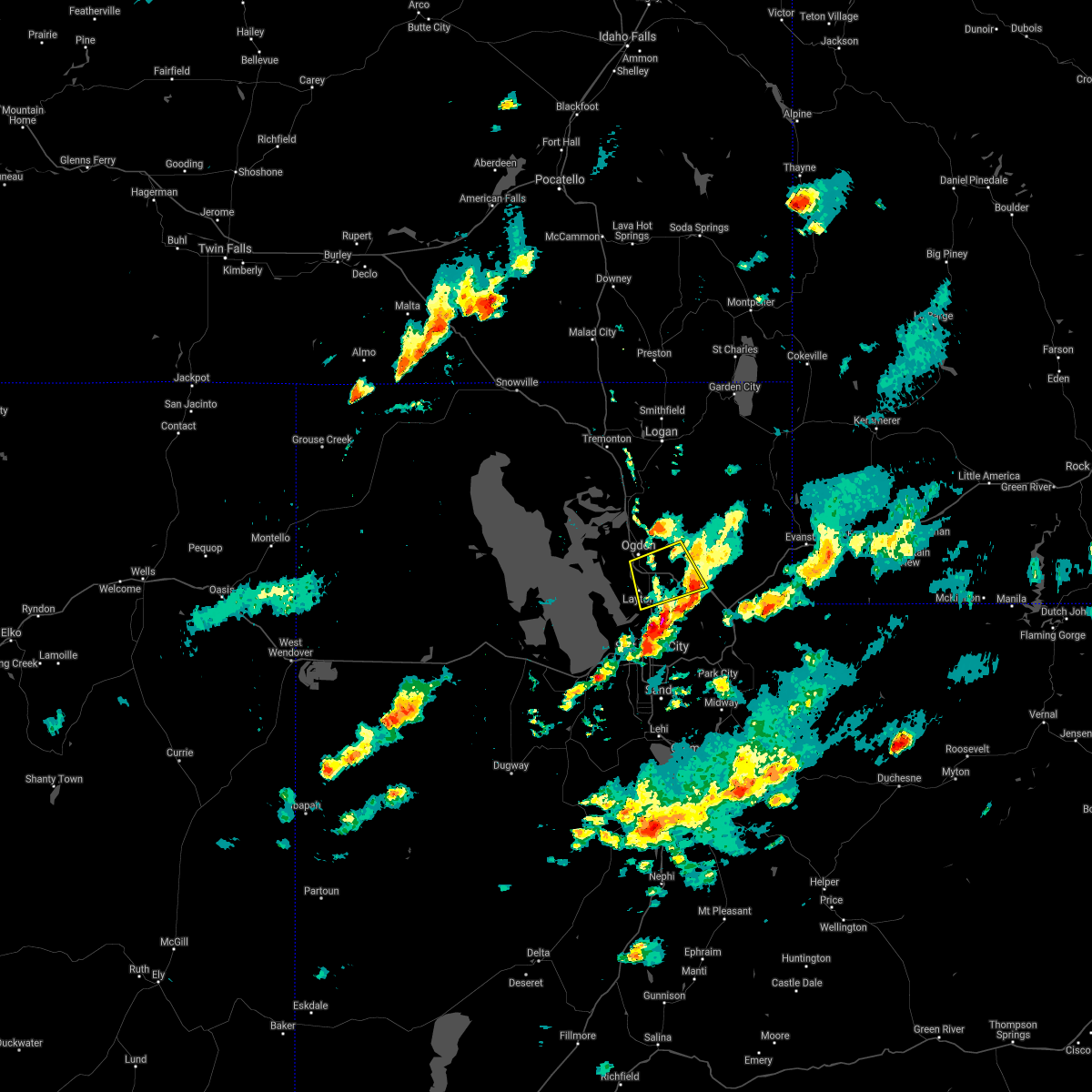
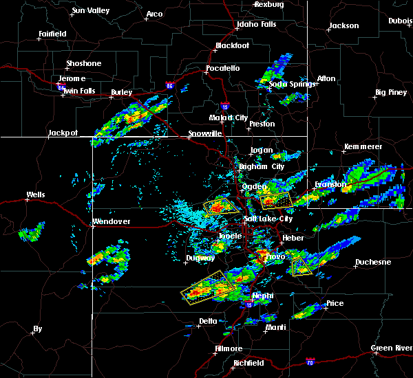
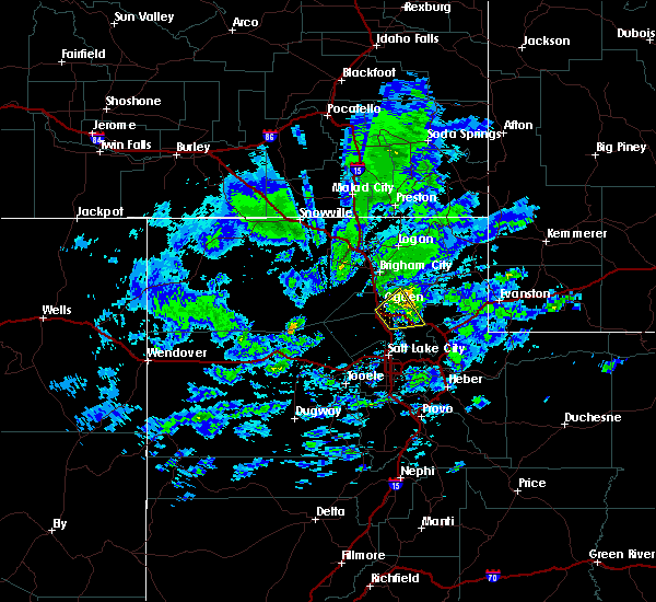
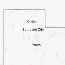
Hail Map for Morgan, UT
The Morgan, UT area has had 0 reports of on-the-ground hail by trained spotters, and has been under severe weather warnings 4 times during the past 12 months. Doppler radar has detected hail at or near Morgan, UT on 5 occasions.
| Name: | Morgan, UT |
| Where Located: | 22.1 miles NNE of Salt Lake City, UT |
| Map: | Google Map for Morgan, UT |
| Population: | 3687 |
| Housing Units: | 1215 |
| More Info: | Search Google for Morgan, UT |
5
The Top Recent Hail Date for Morgan, UT is Wednesday, August 22, 2018 (1st out of 5)

Hail and Wind Damage Spotted near Morgan, UT
| Date / Time | Report Details |
|---|---|
| 7/3/2023 6:20 PM MDT | Mesonet station pc298 the head station elevation: 8539 f in morgan county UT, 5.3 miles SSW of Morgan, UT |
| 7/3/2023 6:14 PM MDT |
 At 614 pm mdt, severe thunderstorms were located along a line extending from 8 miles north of morgan to 10 miles south of timber lakes, moving northeast at 40 mph (radar indicated). Hazards include 60 mph wind gusts. Expect damage to roofs, siding, and trees. locations impacted include, park city, morgan, coalville, heber city, heber, summit park, kamas, oakley, francis, daniel, wanship, wasatch mountain state park, south snyderville basin, samak, east canyon state park, north snyderville basin, timber lakes, emigration canyon, mill creek canyon and big cottonwood canyon. this includes the following highways, interstate 84 between mile markers 92 and 119. interstate 80 in utah between mile markers 136 and 177. us route 40 between mile markers 0 and 47. utah route 35 between mile markers 0 and 21. mirror lake highway between mile markers 0 and 14. hail threat, radar indicated max hail size, <. 75 in wind threat, observed max wind gust, 60 mph. At 614 pm mdt, severe thunderstorms were located along a line extending from 8 miles north of morgan to 10 miles south of timber lakes, moving northeast at 40 mph (radar indicated). Hazards include 60 mph wind gusts. Expect damage to roofs, siding, and trees. locations impacted include, park city, morgan, coalville, heber city, heber, summit park, kamas, oakley, francis, daniel, wanship, wasatch mountain state park, south snyderville basin, samak, east canyon state park, north snyderville basin, timber lakes, emigration canyon, mill creek canyon and big cottonwood canyon. this includes the following highways, interstate 84 between mile markers 92 and 119. interstate 80 in utah between mile markers 136 and 177. us route 40 between mile markers 0 and 47. utah route 35 between mile markers 0 and 21. mirror lake highway between mile markers 0 and 14. hail threat, radar indicated max hail size, <. 75 in wind threat, observed max wind gust, 60 mph.
|
| 7/3/2023 6:06 PM MDT | Power lines down in morga in morgan county UT, 0.8 miles W of Morgan, UT |
| 7/3/2023 5:52 PM MDT |
 At 552 pm mdt, severe thunderstorms were located along a line extending from layton to 9 miles northeast of mapleton, moving northeast at 40 mph (radar indicated). Hazards include 60 mph wind gusts. expect damage to roofs, siding, and trees At 552 pm mdt, severe thunderstorms were located along a line extending from layton to 9 miles northeast of mapleton, moving northeast at 40 mph (radar indicated). Hazards include 60 mph wind gusts. expect damage to roofs, siding, and trees
|
| 7/3/2023 5:40 PM MDT |
 At 539 pm mdt, a severe thunderstorm was located over west bountiful, or near bountiful, moving northeast at 40 mph (radar indicated). Hazards include 70 mph wind gusts. Expect considerable tree damage. damage is likely to mobile homes, roofs, and outbuildings. locations impacted include, salt lake city, west valley city, layton, bountiful, farmington, morgan, kaysville, north salt lake, centerville, woods cross, west bountiful, salt lake city international airport, magna, emigration canyon, great salt lake south of the causeway, fruit heights, portersville, stoddard, peterson and richville. this includes the following highways, interstate 15 between mile markers 308 and 331. interstate 84 between mile markers 94 and 102. interstate 80 in utah between mile markers 107 and 119. thunderstorm damage threat, considerable hail threat, radar indicated max hail size, <. 75 in wind threat, radar indicated max wind gust, 70 mph. At 539 pm mdt, a severe thunderstorm was located over west bountiful, or near bountiful, moving northeast at 40 mph (radar indicated). Hazards include 70 mph wind gusts. Expect considerable tree damage. damage is likely to mobile homes, roofs, and outbuildings. locations impacted include, salt lake city, west valley city, layton, bountiful, farmington, morgan, kaysville, north salt lake, centerville, woods cross, west bountiful, salt lake city international airport, magna, emigration canyon, great salt lake south of the causeway, fruit heights, portersville, stoddard, peterson and richville. this includes the following highways, interstate 15 between mile markers 308 and 331. interstate 84 between mile markers 94 and 102. interstate 80 in utah between mile markers 107 and 119. thunderstorm damage threat, considerable hail threat, radar indicated max hail size, <. 75 in wind threat, radar indicated max wind gust, 70 mph.
|
| 7/3/2023 5:23 PM MDT |
 At 523 pm mdt, a severe thunderstorm was located 8 miles west of salt lake city international airport, or 10 miles west of salt lake city, moving northeast at 40 mph (radar indicated). Hazards include 70 mph wind gusts. Expect considerable tree damage. Damage is likely to mobile homes, roofs, and outbuildings. At 523 pm mdt, a severe thunderstorm was located 8 miles west of salt lake city international airport, or 10 miles west of salt lake city, moving northeast at 40 mph (radar indicated). Hazards include 70 mph wind gusts. Expect considerable tree damage. Damage is likely to mobile homes, roofs, and outbuildings.
|
| 9/29/2022 5:50 PM MDT | State route 65 at big mountain pass in morgan county UT, 14.7 miles N of Morgan, UT |
| 7/22/2022 5:54 PM MDT |
 At 554 pm mdt, severe thunderstorms were located along a line extending from 7 miles southwest of kaysville to near american fork, moving east at 30 mph (radar indicated). Hazards include 60 mph wind gusts. Expect damage to roofs, siding, and trees. locations impacted include, salt lake city, west valley city, provo, sandy, ogden, layton, murray, bountiful, farmington, park city, morgan, hill air force base, heber city, west jordan, orem, taylorsville, south jordan, lehi, draper and riverton. this includes the following highways, interstate 15 between mile markers 257 and 336. interstate 84 between mile markers 85 and 109. interstate 80 in utah between mile markers 110 and 154. us route 40 between mile markers 0 and 22. hail threat, radar indicated max hail size, <. 75 in wind threat, observed max wind gust, 60 mph. At 554 pm mdt, severe thunderstorms were located along a line extending from 7 miles southwest of kaysville to near american fork, moving east at 30 mph (radar indicated). Hazards include 60 mph wind gusts. Expect damage to roofs, siding, and trees. locations impacted include, salt lake city, west valley city, provo, sandy, ogden, layton, murray, bountiful, farmington, park city, morgan, hill air force base, heber city, west jordan, orem, taylorsville, south jordan, lehi, draper and riverton. this includes the following highways, interstate 15 between mile markers 257 and 336. interstate 84 between mile markers 85 and 109. interstate 80 in utah between mile markers 110 and 154. us route 40 between mile markers 0 and 22. hail threat, radar indicated max hail size, <. 75 in wind threat, observed max wind gust, 60 mph.
|
| 7/22/2022 5:26 PM MDT |
 At 525 pm mdt, severe thunderstorms were located along a line extending from 8 miles southeast of great salt lake south of the causeway to near cedar fort, moving east at 30 mph (radar indicated). Hazards include 60 mph wind gusts. expect damage to roofs, siding, and trees At 525 pm mdt, severe thunderstorms were located along a line extending from 8 miles southeast of great salt lake south of the causeway to near cedar fort, moving east at 30 mph (radar indicated). Hazards include 60 mph wind gusts. expect damage to roofs, siding, and trees
|
| 7/17/2022 7:24 PM MDT |
 The severe thunderstorm warning for eastern weber, northern wasatch, northeastern salt lake, northeastern davis, morgan, western summit and north central utah counties will expire at 730 pm mdt, the storms which prompted the warning have weakened below severe limits, though wind gusts to 55 mph are still possible from mountain green to sundance and east. a special weather statement is now in effect. The severe thunderstorm warning for eastern weber, northern wasatch, northeastern salt lake, northeastern davis, morgan, western summit and north central utah counties will expire at 730 pm mdt, the storms which prompted the warning have weakened below severe limits, though wind gusts to 55 mph are still possible from mountain green to sundance and east. a special weather statement is now in effect.
|
| 7/17/2022 7:10 PM MDT |
 At 708 pm mdt, severe thunderstorms were located along a line extending from 14 miles east of weber state university to timber lakes, moving east at 35 mph (trained weather spotters). Hazards include 60 mph wind gusts. Expect damage to roofs, siding, and trees. locations impacted include, park city, morgan, coalville, heber city, heber, summit park, kamas, oakley, francis, daniel, wanship, south snyderville basin, mill creek canyon, samak, east canyon state park and emigration canyon. this includes the following highways, interstate 84 between mile markers 88 and 119. interstate 80 in utah between mile markers 131 and 179. us route 40 between mile markers 0 and 27. utah route 35 between mile markers 0 and 14. mirror lake highway between mile markers 0 and 17. hail threat, radar indicated max hail size, <. 75 in wind threat, radar indicated max wind gust, 60 mph. At 708 pm mdt, severe thunderstorms were located along a line extending from 14 miles east of weber state university to timber lakes, moving east at 35 mph (trained weather spotters). Hazards include 60 mph wind gusts. Expect damage to roofs, siding, and trees. locations impacted include, park city, morgan, coalville, heber city, heber, summit park, kamas, oakley, francis, daniel, wanship, south snyderville basin, mill creek canyon, samak, east canyon state park and emigration canyon. this includes the following highways, interstate 84 between mile markers 88 and 119. interstate 80 in utah between mile markers 131 and 179. us route 40 between mile markers 0 and 27. utah route 35 between mile markers 0 and 14. mirror lake highway between mile markers 0 and 17. hail threat, radar indicated max hail size, <. 75 in wind threat, radar indicated max wind gust, 60 mph.
|
| 7/17/2022 6:45 PM MDT |
 At 644 pm mdt, severe thunderstorms were located along a line extending from near weber state university to near daniel, moving east at 40 mph (trained weather spotters). Hazards include 60 mph wind gusts. expect damage to roofs, siding, and trees At 644 pm mdt, severe thunderstorms were located along a line extending from near weber state university to near daniel, moving east at 40 mph (trained weather spotters). Hazards include 60 mph wind gusts. expect damage to roofs, siding, and trees
|
| 7/17/2022 6:28 PM MDT |
 At 627 pm mdt, severe thunderstorms were located along a line extending from 12 miles northwest of hooper to near draper, moving northeast at 35 mph (trained weather spotters). Hazards include 60 mph wind gusts. Expect damage to roofs, siding, and trees. locations impacted include, salt lake city, west valley city, sandy, ogden, layton, murray, bountiful, farmington, brigham city, park city, morgan, hill air force base, west jordan, taylorsville, south jordan, draper, riverton, roy, cottonwood heights and clearfield. this includes the following highways, interstate 15 between mile markers 287 and 361. interstate 84 between mile markers 82 and 100. interstate 80 in utah between mile markers 107 and 146. hail threat, radar indicated max hail size, <. 75 in wind threat, radar indicated max wind gust, 60 mph. At 627 pm mdt, severe thunderstorms were located along a line extending from 12 miles northwest of hooper to near draper, moving northeast at 35 mph (trained weather spotters). Hazards include 60 mph wind gusts. Expect damage to roofs, siding, and trees. locations impacted include, salt lake city, west valley city, sandy, ogden, layton, murray, bountiful, farmington, brigham city, park city, morgan, hill air force base, west jordan, taylorsville, south jordan, draper, riverton, roy, cottonwood heights and clearfield. this includes the following highways, interstate 15 between mile markers 287 and 361. interstate 84 between mile markers 82 and 100. interstate 80 in utah between mile markers 107 and 146. hail threat, radar indicated max hail size, <. 75 in wind threat, radar indicated max wind gust, 60 mph.
|
| 7/17/2022 6:11 PM MDT |
 At 611 pm mdt, severe thunderstorms were located along a line extending from 14 miles north of great salt lake south of the causeway to near camp williams, moving northeast at 30 mph (trained weather spotters). Hazards include 60 mph wind gusts. Expect damage to roofs, siding, and trees. Blowing dust may reduce visibility to a mile or less. At 611 pm mdt, severe thunderstorms were located along a line extending from 14 miles north of great salt lake south of the causeway to near camp williams, moving northeast at 30 mph (trained weather spotters). Hazards include 60 mph wind gusts. Expect damage to roofs, siding, and trees. Blowing dust may reduce visibility to a mile or less.
|
| 5/2/2022 9:32 PM MDT |
 At 931 pm mdt, severe outflow winds from showers were located along a line extending from 6 miles east of uintah to taylorsville to near vernon, moving east at 30 mph (weather station observed). Hazards include 60 mph wind gusts. Expect damage to roofs, siding, and trees. locations impacted include, salt lake city, west valley city, sandy, layton, murray, bountiful, tooele, farmington, morgan, hill air force base, west jordan, taylorsville, south jordan, lehi, draper, riverton, roy, pleasant grove, cottonwood heights and clearfield. this includes the following highways, interstate 15 between mile markers 274 and 338. interstate 84 between mile markers 84 and 109. interstate 80 in utah between mile markers 103 and 140. hail threat, radar indicated max hail size, <. 75 in wind threat, radar indicated max wind gust, 60 mph. At 931 pm mdt, severe outflow winds from showers were located along a line extending from 6 miles east of uintah to taylorsville to near vernon, moving east at 30 mph (weather station observed). Hazards include 60 mph wind gusts. Expect damage to roofs, siding, and trees. locations impacted include, salt lake city, west valley city, sandy, layton, murray, bountiful, tooele, farmington, morgan, hill air force base, west jordan, taylorsville, south jordan, lehi, draper, riverton, roy, pleasant grove, cottonwood heights and clearfield. this includes the following highways, interstate 15 between mile markers 274 and 338. interstate 84 between mile markers 84 and 109. interstate 80 in utah between mile markers 103 and 140. hail threat, radar indicated max hail size, <. 75 in wind threat, radar indicated max wind gust, 60 mph.
|
| 5/2/2022 9:11 PM MDT |
 At 910 pm mdt, severe thunderstorms were located along a line extending from riverdale to near magna to near vernon, moving east at 30 mph (observed gusts to 67 mph at the salt lake airport). Hazards include 70 mph wind gusts. Expect considerable tree damage. Damage is likely to mobile homes, roofs, and outbuildings. At 910 pm mdt, severe thunderstorms were located along a line extending from riverdale to near magna to near vernon, moving east at 30 mph (observed gusts to 67 mph at the salt lake airport). Hazards include 70 mph wind gusts. Expect considerable tree damage. Damage is likely to mobile homes, roofs, and outbuildings.
|
| 9/10/2021 7:43 PM MDT |
 The severe thunderstorm warning for south central weber, northern salt lake, northeastern davis and west central morgan counties will expire at 745 pm mdt, the storm which prompted the warning has weakened below severe limits, and has exited the warned area. therefore, the warning will be allowed to expire. however gusty winds are still possible with this thunderstorm. The severe thunderstorm warning for south central weber, northern salt lake, northeastern davis and west central morgan counties will expire at 745 pm mdt, the storm which prompted the warning has weakened below severe limits, and has exited the warned area. therefore, the warning will be allowed to expire. however gusty winds are still possible with this thunderstorm.
|
| 9/10/2021 7:33 PM MDT |
 At 732 pm mdt, a severe thunderstorm was located near south weber, or near hill air force base, moving northeast at 40 mph (radar indicated). Hazards include 60 mph wind gusts. Expect damage to roofs, siding, and trees. locations impacted include, ogden, layton, bountiful, farmington, morgan, hill air force base, roy, clearfield, kaysville, syracuse, clinton, south ogden, centerville, woods cross, washington terrace, riverdale, hooper, south weber, west bountiful and uintah. this includes the following highways, interstate 15 between mile markers 317 and 343. interstate 84 between mile markers 82 and 103. hail threat, radar indicated max hail size, <. 75 in wind threat, radar indicated max wind gust, 60 mph. At 732 pm mdt, a severe thunderstorm was located near south weber, or near hill air force base, moving northeast at 40 mph (radar indicated). Hazards include 60 mph wind gusts. Expect damage to roofs, siding, and trees. locations impacted include, ogden, layton, bountiful, farmington, morgan, hill air force base, roy, clearfield, kaysville, syracuse, clinton, south ogden, centerville, woods cross, washington terrace, riverdale, hooper, south weber, west bountiful and uintah. this includes the following highways, interstate 15 between mile markers 317 and 343. interstate 84 between mile markers 82 and 103. hail threat, radar indicated max hail size, <. 75 in wind threat, radar indicated max wind gust, 60 mph.
|
| 9/10/2021 7:10 PM MDT |
 At 710 pm mdt, a severe thunderstorm was located near west bountiful, or 8 miles southwest of farmington, moving northeast at 40 mph (radar indicated). Hazards include 60 mph wind gusts and penny size hail. expect damage to roofs, siding, and trees At 710 pm mdt, a severe thunderstorm was located near west bountiful, or 8 miles southwest of farmington, moving northeast at 40 mph (radar indicated). Hazards include 60 mph wind gusts and penny size hail. expect damage to roofs, siding, and trees
|
| 9/10/2021 2:51 PM MDT |
 The severe thunderstorm warning for southeastern weber, northeastern davis and southwestern morgan counties will expire at 300 pm mdt, the storm which prompted the warning has weakened below severe limits, and no longer poses an immediate threat to life or property. therefore, the warning will be allowed to expire. however gusty winds are still possible with this thunderstorm. The severe thunderstorm warning for southeastern weber, northeastern davis and southwestern morgan counties will expire at 300 pm mdt, the storm which prompted the warning has weakened below severe limits, and no longer poses an immediate threat to life or property. therefore, the warning will be allowed to expire. however gusty winds are still possible with this thunderstorm.
|
| 9/10/2021 2:39 PM MDT |
 At 239 pm mdt, a severe thunderstorm was located over centerville, or near bountiful, moving northeast at 30 mph (radar indicated). Hazards include 60 mph wind gusts and penny size hail. Expect damage to roofs, siding, and trees. locations impacted include, layton, bountiful, farmington, morgan, kaysville, centerville, woods cross, south weber, west bountiful, uintah, fruit heights, mountain green, portersville, stoddard, peterson, richville, east layton and snowbasin. this includes the following highways, interstate 15 between mile markers 316 and 330. interstate 84 between mile markers 88 and 108. hail threat, radar indicated max hail size, 0. 75 in wind threat, radar indicated max wind gust, 60 mph. At 239 pm mdt, a severe thunderstorm was located over centerville, or near bountiful, moving northeast at 30 mph (radar indicated). Hazards include 60 mph wind gusts and penny size hail. Expect damage to roofs, siding, and trees. locations impacted include, layton, bountiful, farmington, morgan, kaysville, centerville, woods cross, south weber, west bountiful, uintah, fruit heights, mountain green, portersville, stoddard, peterson, richville, east layton and snowbasin. this includes the following highways, interstate 15 between mile markers 316 and 330. interstate 84 between mile markers 88 and 108. hail threat, radar indicated max hail size, 0. 75 in wind threat, radar indicated max wind gust, 60 mph.
|
| 9/10/2021 2:33 PM MDT |
 At 232 pm mdt, a severe thunderstorm was located over woods cross, or near bountiful, moving northeast at 25 mph (radar indicated). Hazards include 60 mph wind gusts and penny size hail. Expect damage to roofs, siding, and trees. locations impacted include, salt lake city, layton, bountiful, farmington, morgan, kaysville, north salt lake, centerville, woods cross, south weber, west bountiful, uintah, fruit heights, mountain green, portersville, stoddard, peterson, richville, east layton and snowbasin. this includes the following highways, interstate 15 between mile markers 312 and 330. interstate 84 between mile markers 88 and 108. hail threat, radar indicated max hail size, 0. 75 in wind threat, radar indicated max wind gust, 60 mph. At 232 pm mdt, a severe thunderstorm was located over woods cross, or near bountiful, moving northeast at 25 mph (radar indicated). Hazards include 60 mph wind gusts and penny size hail. Expect damage to roofs, siding, and trees. locations impacted include, salt lake city, layton, bountiful, farmington, morgan, kaysville, north salt lake, centerville, woods cross, south weber, west bountiful, uintah, fruit heights, mountain green, portersville, stoddard, peterson, richville, east layton and snowbasin. this includes the following highways, interstate 15 between mile markers 312 and 330. interstate 84 between mile markers 88 and 108. hail threat, radar indicated max hail size, 0. 75 in wind threat, radar indicated max wind gust, 60 mph.
|
| 9/10/2021 2:23 PM MDT |
 At 223 pm mdt, a severe thunderstorm was located over salt lake city international airport, or 7 miles northwest of salt lake city, moving northeast at 25 mph (radar indicated). Hazards include 60 mph wind gusts and penny size hail. expect damage to roofs, siding, and trees At 223 pm mdt, a severe thunderstorm was located over salt lake city international airport, or 7 miles northwest of salt lake city, moving northeast at 25 mph (radar indicated). Hazards include 60 mph wind gusts and penny size hail. expect damage to roofs, siding, and trees
|
| 8/21/2021 7:28 PM MDT |
 The severe thunderstorm warning for eastern weber, southern rich, salt lake, davis, morgan, northwestern summit and east central tooele counties will expire at 730 pm mdt, the storms which prompted the warning have moved out of the area. therefore, the warning will be allowed to expire. however gusty winds and heavy rain are still possible with these thunderstorms. The severe thunderstorm warning for eastern weber, southern rich, salt lake, davis, morgan, northwestern summit and east central tooele counties will expire at 730 pm mdt, the storms which prompted the warning have moved out of the area. therefore, the warning will be allowed to expire. however gusty winds and heavy rain are still possible with these thunderstorms.
|
| 8/21/2021 7:10 PM MDT |
 At 709 pm mdt, severe thunderstorms were located along a line extending from 6 miles southwest of randolph to 6 miles north of east canyon state park to near ophir, moving east at 40 mph (trained weather spotters). Hazards include 70 mph wind gusts and penny size hail. Expect considerable tree damage. damage is likely to mobile homes, roofs, and outbuildings. locations impacted include, salt lake city, west valley city, sandy, ogden, layton, murray, bountiful, tooele, farmington, park city, morgan, coalville, hill air force base, west jordan, taylorsville, south jordan, draper, riverton, roy and cottonwood heights. this includes the following highways, interstate 15 between mile markers 286 and 342. interstate 84 between mile markers 82 and 119. interstate 80 in utah between mile markers 92 and 196. us route 40 between mile markers 0 and 5. thunderstorm damage threat, considerable hail threat, radar indicated max hail size, 0. 75 in wind threat, observed max wind gust, 70 mph. At 709 pm mdt, severe thunderstorms were located along a line extending from 6 miles southwest of randolph to 6 miles north of east canyon state park to near ophir, moving east at 40 mph (trained weather spotters). Hazards include 70 mph wind gusts and penny size hail. Expect considerable tree damage. damage is likely to mobile homes, roofs, and outbuildings. locations impacted include, salt lake city, west valley city, sandy, ogden, layton, murray, bountiful, tooele, farmington, park city, morgan, coalville, hill air force base, west jordan, taylorsville, south jordan, draper, riverton, roy and cottonwood heights. this includes the following highways, interstate 15 between mile markers 286 and 342. interstate 84 between mile markers 82 and 119. interstate 80 in utah between mile markers 92 and 196. us route 40 between mile markers 0 and 5. thunderstorm damage threat, considerable hail threat, radar indicated max hail size, 0. 75 in wind threat, observed max wind gust, 70 mph.
|
| 8/21/2021 6:40 PM MDT |
 At 639 pm mdt, severe thunderstorms were located along a line extending from 12 miles east of hyrum to farmington to 7 miles southeast of skull valley, moving east at 40 mph (trained weather spotters reported wind gusts to 73 mph with widespread property damage). Hazards include 70 mph wind gusts and penny size hail. Expect considerable tree damage. Damage is likely to mobile homes, roofs, and outbuildings. At 639 pm mdt, severe thunderstorms were located along a line extending from 12 miles east of hyrum to farmington to 7 miles southeast of skull valley, moving east at 40 mph (trained weather spotters reported wind gusts to 73 mph with widespread property damage). Hazards include 70 mph wind gusts and penny size hail. Expect considerable tree damage. Damage is likely to mobile homes, roofs, and outbuildings.
|
| 8/21/2021 6:23 PM MDT |
 At 622 pm mdt, severe thunderstorms were located along a line extending from near hyrum to 7 miles south of syracuse to near skull valley, moving east at 40 mph (trained weather spotters have reported wind gusts to 65 mph and large branches down causing property damage). Hazards include 70 mph wind gusts. Expect considerable tree damage. damage is likely to mobile homes, roofs, and outbuildings. locations impacted include, salt lake city, west valley city, ogden, layton, murray, bountiful, tooele, farmington, brigham city, grantsville, morgan, randolph, hill air force base, dugway english village, west jordan, taylorsville, south jordan, roy, clearfield and midvale. this includes the following highways, interstate 15 between mile markers 299 and 371. interstate 84 between mile markers 82 and 113. interstate 80 in utah between mile markers 48 and 127. thunderstorm damage threat, considerable hail threat, radar indicated max hail size, <. 75 in wind threat, observed max wind gust, 70 mph. At 622 pm mdt, severe thunderstorms were located along a line extending from near hyrum to 7 miles south of syracuse to near skull valley, moving east at 40 mph (trained weather spotters have reported wind gusts to 65 mph and large branches down causing property damage). Hazards include 70 mph wind gusts. Expect considerable tree damage. damage is likely to mobile homes, roofs, and outbuildings. locations impacted include, salt lake city, west valley city, ogden, layton, murray, bountiful, tooele, farmington, brigham city, grantsville, morgan, randolph, hill air force base, dugway english village, west jordan, taylorsville, south jordan, roy, clearfield and midvale. this includes the following highways, interstate 15 between mile markers 299 and 371. interstate 84 between mile markers 82 and 113. interstate 80 in utah between mile markers 48 and 127. thunderstorm damage threat, considerable hail threat, radar indicated max hail size, <. 75 in wind threat, observed max wind gust, 70 mph.
|
| 8/21/2021 6:06 PM MDT |
 At 605 pm mdt, severe thunderstorms were located along a line extending from near wellsville to 7 miles east of great salt lake south of the causeway to 13 miles west of skull valley, moving east at 40 mph (trained weather spotters). Hazards include 70 mph wind gusts. Expect considerable tree damage. Damage is likely to mobile homes, roofs, and outbuildings. At 605 pm mdt, severe thunderstorms were located along a line extending from near wellsville to 7 miles east of great salt lake south of the causeway to 13 miles west of skull valley, moving east at 40 mph (trained weather spotters). Hazards include 70 mph wind gusts. Expect considerable tree damage. Damage is likely to mobile homes, roofs, and outbuildings.
|
| 7/4/2019 6:24 PM MDT |
 At 621 pm mdt, a severe thunderstorm was located near morgan, moving east at 50 mph (radar indicated). Hazards include 60 mph wind gusts. Expect damage to roofs, siding, and trees. Locations impacted include, salt lake city, west valley city, ogden, layton, bountiful, farmington, park city, morgan, coalville, roy, clearfield, kaysville, syracuse, south salt lake, clinton, north ogden, south ogden, north salt lake, centerville and woods cross. At 621 pm mdt, a severe thunderstorm was located near morgan, moving east at 50 mph (radar indicated). Hazards include 60 mph wind gusts. Expect damage to roofs, siding, and trees. Locations impacted include, salt lake city, west valley city, ogden, layton, bountiful, farmington, park city, morgan, coalville, roy, clearfield, kaysville, syracuse, south salt lake, clinton, north ogden, south ogden, north salt lake, centerville and woods cross.
|
| 7/4/2019 6:08 PM MDT |
 At 607 pm mdt, a severe thunderstorm was located over kaysville, or near layton, moving east at 50 mph (radar indicated). Hazards include 60 mph wind gusts. expect damage to roofs, siding, and trees At 607 pm mdt, a severe thunderstorm was located over kaysville, or near layton, moving east at 50 mph (radar indicated). Hazards include 60 mph wind gusts. expect damage to roofs, siding, and trees
|
| 6/6/2019 5:56 PM MDT |
 The severe thunderstorm warning for weber, central cache, eastern box elder, northeastern salt lake, eastern davis, morgan and west central summit counties will expire at 600 pm mdt, the storms which prompted the warning have weakened below severe limits, and no longer pose an immediate threat to life or property. therefore, the warning will be allowed to expire. however gusty winds and heavy rain are still possible with these thunderstorms. a severe thunderstorm watch remains in effect until 1100 pm mdt for northern utah. The severe thunderstorm warning for weber, central cache, eastern box elder, northeastern salt lake, eastern davis, morgan and west central summit counties will expire at 600 pm mdt, the storms which prompted the warning have weakened below severe limits, and no longer pose an immediate threat to life or property. therefore, the warning will be allowed to expire. however gusty winds and heavy rain are still possible with these thunderstorms. a severe thunderstorm watch remains in effect until 1100 pm mdt for northern utah.
|
| 6/6/2019 5:49 PM MDT |
 At 549 pm mdt, severe thunderstorms were located along a line extending from near clarkston to 10 miles north of summit park, moving east at 45 mph (radar indicated). Hazards include 60 mph wind gusts. Expect damage to roofs, siding, and trees. Locations impacted include, salt lake city, ogden, layton, logan, bountiful, farmington, morgan, cache, roy, clearfield, kaysville, syracuse, clinton, north ogden, south ogden, north salt lake, centerville, woods cross, smithfield and washington terrace. At 549 pm mdt, severe thunderstorms were located along a line extending from near clarkston to 10 miles north of summit park, moving east at 45 mph (radar indicated). Hazards include 60 mph wind gusts. Expect damage to roofs, siding, and trees. Locations impacted include, salt lake city, ogden, layton, logan, bountiful, farmington, morgan, cache, roy, clearfield, kaysville, syracuse, clinton, north ogden, south ogden, north salt lake, centerville, woods cross, smithfield and washington terrace.
|
| 6/6/2019 5:30 PM MDT |
 At 530 pm mdt, severe thunderstorms were located along a line extending from 9 miles northwest of plymouth to north salt lake, moving east at 45 mph (radar indicated). Hazards include 60 mph wind gusts. expect damage to roofs, siding, and trees At 530 pm mdt, severe thunderstorms were located along a line extending from 9 miles northwest of plymouth to north salt lake, moving east at 45 mph (radar indicated). Hazards include 60 mph wind gusts. expect damage to roofs, siding, and trees
|
| 8/22/2018 4:08 PM MDT |
 At 408 pm mdt, a severe thunderstorm was located near morgan, moving northeast at 35 mph (radar indicated). Hazards include 60 mph wind gusts and quarter size hail. Hail damage to vehicles is expected. Expect wind damage to roofs, siding, and trees. At 408 pm mdt, a severe thunderstorm was located near morgan, moving northeast at 35 mph (radar indicated). Hazards include 60 mph wind gusts and quarter size hail. Hail damage to vehicles is expected. Expect wind damage to roofs, siding, and trees.
|
| 8/22/2018 3:27 PM MDT |
 The severe thunderstorm warning for southeastern weber, northeastern davis and west central morgan counties will expire at 330 pm mdt, the storm which prompted the warning has weakened below severe limits, and no longer poses an immediate threat to life or property. therefore, the warning will be allowed to expire. a severe thunderstorm watch remains in effect until 900 pm mdt for northern utah. The severe thunderstorm warning for southeastern weber, northeastern davis and west central morgan counties will expire at 330 pm mdt, the storm which prompted the warning has weakened below severe limits, and no longer poses an immediate threat to life or property. therefore, the warning will be allowed to expire. a severe thunderstorm watch remains in effect until 900 pm mdt for northern utah.
|
| 8/22/2018 3:05 PM MDT |
 At 304 pm mdt, a severe thunderstorm was located near south weber, or near layton, moving northeast at 45 mph. this storm has previously produced hail to near golf ball size in layton (public). Hazards include ping pong ball size hail and 60 mph wind gusts. People and animals outdoors will be injured. expect hail damage to roofs, siding, windows, and vehicles. expect wind damage to roofs, siding, and trees. Locations impacted include, ogden, layton, farmington, morgan, roy, clearfield, kaysville, south ogden, washington terrace, riverdale, south weber, uintah, fruit heights, huntsville, mountain green, stoddard, peterson, hill air force base, east layton and snowbasin. At 304 pm mdt, a severe thunderstorm was located near south weber, or near layton, moving northeast at 45 mph. this storm has previously produced hail to near golf ball size in layton (public). Hazards include ping pong ball size hail and 60 mph wind gusts. People and animals outdoors will be injured. expect hail damage to roofs, siding, windows, and vehicles. expect wind damage to roofs, siding, and trees. Locations impacted include, ogden, layton, farmington, morgan, roy, clearfield, kaysville, south ogden, washington terrace, riverdale, south weber, uintah, fruit heights, huntsville, mountain green, stoddard, peterson, hill air force base, east layton and snowbasin.
|
| 8/22/2018 2:57 PM MDT |
 At 256 pm mdt, a severe thunderstorm was located over layton, moving northeast at 45 mph (radar indicated). Hazards include ping pong ball size hail and 60 mph wind gusts. People and animals outdoors will be injured. expect hail damage to roofs, siding, windows, and vehicles. Expect wind damage to roofs, siding, and trees. At 256 pm mdt, a severe thunderstorm was located over layton, moving northeast at 45 mph (radar indicated). Hazards include ping pong ball size hail and 60 mph wind gusts. People and animals outdoors will be injured. expect hail damage to roofs, siding, windows, and vehicles. Expect wind damage to roofs, siding, and trees.
|
| 8/22/2018 2:22 PM MDT |
 At 222 pm mdt, a severe thunderstorm was located 8 miles east of morgan over i-84, moving northeast at 35 mph (radar indicated). Hazards include 60 mph wind gusts and quarter size hail. Hail damage to vehicles is expected. Expect wind damage to roofs, siding, and trees. At 222 pm mdt, a severe thunderstorm was located 8 miles east of morgan over i-84, moving northeast at 35 mph (radar indicated). Hazards include 60 mph wind gusts and quarter size hail. Hail damage to vehicles is expected. Expect wind damage to roofs, siding, and trees.
|
| 5/24/2017 7:30 PM MDT |
 At 730 pm mdt, a severe thunderstorm was located 7 miles north of morgan, moving northeast at 50 mph (radar indicated). Hazards include 60 mph wind gusts. Expect damage to roofs, siding, and trees. Locations impacted include, ogden, layton, bountiful, farmington, morgan, roy, clearfield, kaysville, syracuse, clinton, north ogden, south ogden, centerville, woods cross, washington terrace, riverdale, hooper, south weber, west bountiful and marriott-slaterville. At 730 pm mdt, a severe thunderstorm was located 7 miles north of morgan, moving northeast at 50 mph (radar indicated). Hazards include 60 mph wind gusts. Expect damage to roofs, siding, and trees. Locations impacted include, ogden, layton, bountiful, farmington, morgan, roy, clearfield, kaysville, syracuse, clinton, north ogden, south ogden, centerville, woods cross, washington terrace, riverdale, hooper, south weber, west bountiful and marriott-slaterville.
|
| 5/24/2017 7:13 PM MDT |
 At 713 pm mdt, a severe thunderstorm was located near kaysville, or near layton, moving northeast at 60 mph. this storm has a history of producing gusts over 60 mph (radar indicated). Hazards include 70 mph wind gusts. Expect considerable tree damage. Damage is likely to mobile homes, roofs, and outbuildings. At 713 pm mdt, a severe thunderstorm was located near kaysville, or near layton, moving northeast at 60 mph. this storm has a history of producing gusts over 60 mph (radar indicated). Hazards include 70 mph wind gusts. Expect considerable tree damage. Damage is likely to mobile homes, roofs, and outbuildings.
|
| 4/8/2017 3:56 PM MDT |
 The severe thunderstorm warning for central weber, northeastern davis and west central morgan counties will expire at 400 pm mdt, the storm which prompted the warning has weakened below severe limits and exited the warned area. therefore the warning will be allowed to expire. The severe thunderstorm warning for central weber, northeastern davis and west central morgan counties will expire at 400 pm mdt, the storm which prompted the warning has weakened below severe limits and exited the warned area. therefore the warning will be allowed to expire.
|
| 4/8/2017 3:43 PM MDT |
 At 342 pm mdt, doppler radar indicated a severe thunderstorm capable of producing quarter size hail and damaging winds in excess of 60 mph. this storm was located near south ogden, or near ogden, moving northeast at 40 mph. locations impacted include, ogden, layton, morgan, roy, kaysville, south ogden, washington terrace, riverdale, south weber, uintah, fruit heights, huntsville, mountain green, eden, stoddard, liberty, peterson, hill air force base, pineview reservoir and east layton. at 342 pm hail to the size of quarters was reported in south weber. At 342 pm mdt, doppler radar indicated a severe thunderstorm capable of producing quarter size hail and damaging winds in excess of 60 mph. this storm was located near south ogden, or near ogden, moving northeast at 40 mph. locations impacted include, ogden, layton, morgan, roy, kaysville, south ogden, washington terrace, riverdale, south weber, uintah, fruit heights, huntsville, mountain green, eden, stoddard, liberty, peterson, hill air force base, pineview reservoir and east layton. at 342 pm hail to the size of quarters was reported in south weber.
|
| 4/8/2017 3:34 PM MDT |
 At 333 pm mdt, doppler radar indicated a severe thunderstorm capable of producing quarter size hail and damaging winds in excess of 60 mph. this storm was located over washington terrace, or near ogden, and moving northeast at 40 mph. At 333 pm mdt, doppler radar indicated a severe thunderstorm capable of producing quarter size hail and damaging winds in excess of 60 mph. this storm was located over washington terrace, or near ogden, and moving northeast at 40 mph.
|
| 12/16/2016 12:00 PM MST |
 At 1154 am mst, doppler radar indicated a line of severe thunderstorms capable of producing damaging winds in excess of 60 mph. these storms were located along a line extending from 8 mile northeast of morgan to 8 miles southwest of vernon, moving southeast at 45 mph. the strongest storms along this line will exist across salt lake, northwest utah and southeast tooele counties through 1215 pm mst. locations impacted include, salt lake city, west valley city, sandy, murray, bountiful, tooele, farmington, park city, morgan, coalville, west jordan, taylorsville, south jordan, lehi, draper, riverton, pleasant grove, cottonwood heights, midvale and kaysville. At 1154 am mst, doppler radar indicated a line of severe thunderstorms capable of producing damaging winds in excess of 60 mph. these storms were located along a line extending from 8 mile northeast of morgan to 8 miles southwest of vernon, moving southeast at 45 mph. the strongest storms along this line will exist across salt lake, northwest utah and southeast tooele counties through 1215 pm mst. locations impacted include, salt lake city, west valley city, sandy, murray, bountiful, tooele, farmington, park city, morgan, coalville, west jordan, taylorsville, south jordan, lehi, draper, riverton, pleasant grove, cottonwood heights, midvale and kaysville.
|
| 12/16/2016 11:40 AM MST |
 At 1138 am mst, doppler radar indicated a line of severe thunderstorms capable of producing damaging winds in excess of 60 mph. these storms were located along a line extending from 14 miles north of morgan to 12 miles south of dugway, and moving southeast at 45 mph. At 1138 am mst, doppler radar indicated a line of severe thunderstorms capable of producing damaging winds in excess of 60 mph. these storms were located along a line extending from 14 miles north of morgan to 12 miles south of dugway, and moving southeast at 45 mph.
|
| 12/16/2016 11:20 AM MST |
 At 1119 am mst, doppler radar indicated a line of severe thunderstorms capable of producing damaging winds in excess of 60 mph. these storms were located along a line extending from north ogden to 6 miles north of dugway, and moving east at 40 mph. At 1119 am mst, doppler radar indicated a line of severe thunderstorms capable of producing damaging winds in excess of 60 mph. these storms were located along a line extending from north ogden to 6 miles north of dugway, and moving east at 40 mph.
|
| 10/2/2016 9:40 PM MDT |
 The severe thunderstorm warning for east central davis, morgan and northwestern summit counties will expire at 945 pm mdt, the storm which prompted the warning has weakened below severe limits, and no longer poses an immediate threat to life or property. therefore the warning will be allowed to expire. The severe thunderstorm warning for east central davis, morgan and northwestern summit counties will expire at 945 pm mdt, the storm which prompted the warning has weakened below severe limits, and no longer poses an immediate threat to life or property. therefore the warning will be allowed to expire.
|
| 10/2/2016 9:16 PM MDT |
 At 915 pm mdt, doppler radar indicated a severe thunderstorm capable of producing destructive winds in excess of 70 mph. this storm was located near centerville, or near bountiful, and moving northeast at 55 mph. another similar storm was in eastern salt lake county moving northeast. penny size hail may also accompany the damaging winds. At 915 pm mdt, doppler radar indicated a severe thunderstorm capable of producing destructive winds in excess of 70 mph. this storm was located near centerville, or near bountiful, and moving northeast at 55 mph. another similar storm was in eastern salt lake county moving northeast. penny size hail may also accompany the damaging winds.
|
| 8/7/2015 7:58 PM MDT |
 At 757 pm mdt, doppler radar indicated a line of severe thunderstorms capable of producing destructive winds in excess of 70 mph. these storms were located along a line extending from 13 miles east of north ogden to 10 miles north of coalville to oakley, moving east at 45 mph. at 740pm, an 80 mph gust occured at sr-65 at big mountain pass. locations impacted include, park city, morgan, coalville, north ogden, summit park, kamas, oakley, francis, south snyderville basin, wanship, samak, north snyderville basin, henefer, huntsville, croydon, pineview reservoir, peterson, liberty, mountain green and echo reservoir. At 757 pm mdt, doppler radar indicated a line of severe thunderstorms capable of producing destructive winds in excess of 70 mph. these storms were located along a line extending from 13 miles east of north ogden to 10 miles north of coalville to oakley, moving east at 45 mph. at 740pm, an 80 mph gust occured at sr-65 at big mountain pass. locations impacted include, park city, morgan, coalville, north ogden, summit park, kamas, oakley, francis, south snyderville basin, wanship, samak, north snyderville basin, henefer, huntsville, croydon, pineview reservoir, peterson, liberty, mountain green and echo reservoir.
|
| 8/7/2015 7:45 PM MDT |
 At 744 pm mdt, doppler radar indicated a line of severe thunderstorms capable of producing destructive winds in excess of 70 mph. these storms were located along a line extending from near north ogden to near morgan to near park city, moving east at 35 mph. these storms have a long history of producing 70 mph winds, copious lightning, and a brief heavy rain. locations impacted include, ogden, park city, morgan, coalville, roy, clinton, north ogden, south ogden, washington terrace, riverdale, hooper, summit park, south weber, kamas, marriott-slaterville, oakley, uintah, francis, south snyderville basin and samak. At 744 pm mdt, doppler radar indicated a line of severe thunderstorms capable of producing destructive winds in excess of 70 mph. these storms were located along a line extending from near north ogden to near morgan to near park city, moving east at 35 mph. these storms have a long history of producing 70 mph winds, copious lightning, and a brief heavy rain. locations impacted include, ogden, park city, morgan, coalville, roy, clinton, north ogden, south ogden, washington terrace, riverdale, hooper, summit park, south weber, kamas, marriott-slaterville, oakley, uintah, francis, south snyderville basin and samak.
|
| 8/7/2015 7:18 PM MDT |
 At 717 pm mdt, doppler radar indicated a line of severe thunderstorms capable of producing destructive winds in excess of 70 mph. these storms were located along a line extending from 12 miles west of willard to near farmington to holladay, and moving northeast at 35 mph. At 717 pm mdt, doppler radar indicated a line of severe thunderstorms capable of producing destructive winds in excess of 70 mph. these storms were located along a line extending from 12 miles west of willard to near farmington to holladay, and moving northeast at 35 mph.
|
| 5/27/2015 8:35 PM MDT | At 835 pm mdt, doppler radar indicated a line of severe thunderstorms capable of producing damaging winds in excess of 60 mph. these storms were located along a line extending from 9 miles southeast of hyrum to 12 miles east of north ogden to near morgan, moving east at 30 mph. penny size hail may also accompany the damaging winds. locations impacted include, ogden, layton, bountiful, farmington, brigham city, morgan, kaysville, north ogden, south ogden, north salt lake, centerville, woods cross, south weber, west bountiful, uintah, mantua, pleasant view, harrisville, fruit heights and paradise. |
| 5/27/2015 8:11 PM MDT | At 811 pm mdt, doppler radar indicated a line of severe thunderstorms capable of producing damaging winds in excess of 60 mph. these storms were located along a line extending from near mantua to near ogden to farmington, and moving east at 30 mph. penny size hail may also accompany the damaging winds. |
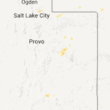
Hail Maps for Morgan, UT


Connect with Interactive Hail Maps