

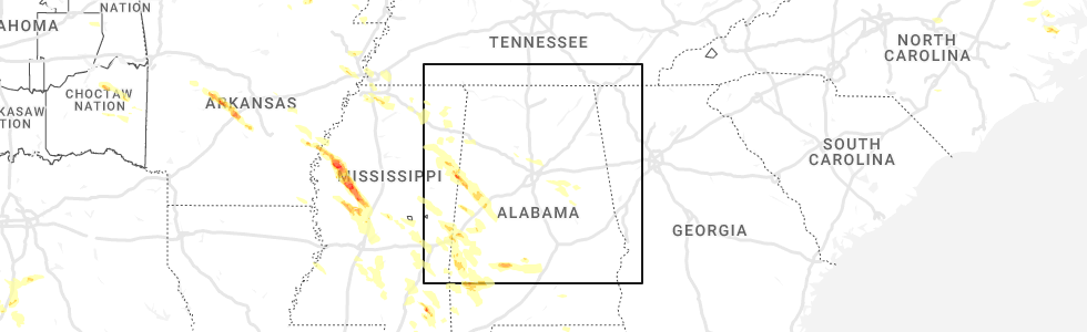
Hail Map for Morris, AL
The Morris, AL area has had 4 reports of on-the-ground hail by trained spotters, and has been under severe weather warnings 22 times during the past 12 months. Doppler radar has detected hail at or near Morris, AL on 48 occasions, including 7 occasions during the past year.
| Name: | Morris, AL |
| Where Located: | 15.8 miles N of Birmingham, AL |
| Map: | Google Map for Morris, AL |
| Population: | 1859 |
| Housing Units: | 762 |
| More Info: | Search Google for Morris, AL |
3
The Top Recent Hail Date for Morris, AL is Friday, June 16, 2023 (9th out of 48)
Hail and Wind Damage Spotted near Morris, AL
| Date / Time | Report Details |
|---|---|
| 12/9/2023 11:59 PM CST |
 At 1159 pm cst, severe thunderstorms were located along a line extending from near cardiff to mcdonald chapel to near hoover metropolitan stadium, moving northeast at 55 mph (radar indicated). Hazards include 60 mph wind gusts and quarter size hail. Hail damage to vehicles is expected. Expect wind damage to roofs, siding, and trees. At 1159 pm cst, severe thunderstorms were located along a line extending from near cardiff to mcdonald chapel to near hoover metropolitan stadium, moving northeast at 55 mph (radar indicated). Hazards include 60 mph wind gusts and quarter size hail. Hail damage to vehicles is expected. Expect wind damage to roofs, siding, and trees.
|
| 8/11/2023 3:38 AM CDT |
 At 338 am cdt, a severe thunderstorm was located over trafford, or 9 miles north of gardendale, moving east at 25 mph (radar indicated). Hazards include 60 mph wind gusts. expect damage to roofs, siding, and trees At 338 am cdt, a severe thunderstorm was located over trafford, or 9 miles north of gardendale, moving east at 25 mph (radar indicated). Hazards include 60 mph wind gusts. expect damage to roofs, siding, and trees
|
| 8/9/2023 7:24 PM CDT |
 At 724 pm cdt, a severe thunderstorm was located near county line, or 11 miles northeast of gardendale, moving east at 30 mph (radar indicated). Hazards include 60 mph wind gusts and quarter size hail. Hail damage to vehicles is expected. Expect wind damage to roofs, siding, and trees. At 724 pm cdt, a severe thunderstorm was located near county line, or 11 miles northeast of gardendale, moving east at 30 mph (radar indicated). Hazards include 60 mph wind gusts and quarter size hail. Hail damage to vehicles is expected. Expect wind damage to roofs, siding, and trees.
|
| 8/9/2023 6:12 PM CDT |
 At 611 pm cdt, a severe thunderstorm was located near county line, or 11 miles northeast of gardendale, moving east at 30 mph (radar indicated). Hazards include ping pong ball size hail and 60 mph wind gusts. People and animals outdoors will be injured. expect hail damage to roofs, siding, windows, and vehicles. Expect wind damage to roofs, siding, and trees. At 611 pm cdt, a severe thunderstorm was located near county line, or 11 miles northeast of gardendale, moving east at 30 mph (radar indicated). Hazards include ping pong ball size hail and 60 mph wind gusts. People and animals outdoors will be injured. expect hail damage to roofs, siding, windows, and vehicles. Expect wind damage to roofs, siding, and trees.
|
| 8/7/2023 3:37 PM CDT |
 At 336 pm cdt, severe thunderstorms were located along a line extending from argo to maytown to near samantha, moving southeast at 30 mph (radar indicated). Hazards include 60 mph wind gusts. Expect damage to roofs, siding, and trees. locations impacted include, northern birmingham, trussville, gardendale, fultondale, sumiton, dora, center point, clay, pinson, tarrant, adamsville, warrior, kimberly, graysville, morris, brookside, trafford, maytown, west jefferson and county line. hail threat, radar indicated max hail size, <. 75 in wind threat, radar indicated max wind gust, 60 mph. At 336 pm cdt, severe thunderstorms were located along a line extending from argo to maytown to near samantha, moving southeast at 30 mph (radar indicated). Hazards include 60 mph wind gusts. Expect damage to roofs, siding, and trees. locations impacted include, northern birmingham, trussville, gardendale, fultondale, sumiton, dora, center point, clay, pinson, tarrant, adamsville, warrior, kimberly, graysville, morris, brookside, trafford, maytown, west jefferson and county line. hail threat, radar indicated max hail size, <. 75 in wind threat, radar indicated max wind gust, 60 mph.
|
| 8/7/2023 3:26 PM CDT |
 At 326 pm cdt, severe thunderstorms were located along a line extending from clay to near west jefferson to 6 miles north of samantha, moving southeast at 30 mph (radar indicated). Hazards include 60 mph wind gusts. Expect damage to roofs, siding, and trees. locations impacted include, northern birmingham, trussville, jasper, gardendale, fultondale, fayette, sumiton, cordova, dora, reform, center point, clay, pinson, tarrant, adamsville, warrior, kimberly, graysville, morris and brookside. hail threat, radar indicated max hail size, <. 75 in wind threat, radar indicated max wind gust, 60 mph. At 326 pm cdt, severe thunderstorms were located along a line extending from clay to near west jefferson to 6 miles north of samantha, moving southeast at 30 mph (radar indicated). Hazards include 60 mph wind gusts. Expect damage to roofs, siding, and trees. locations impacted include, northern birmingham, trussville, jasper, gardendale, fultondale, fayette, sumiton, cordova, dora, reform, center point, clay, pinson, tarrant, adamsville, warrior, kimberly, graysville, morris and brookside. hail threat, radar indicated max hail size, <. 75 in wind threat, radar indicated max wind gust, 60 mph.
|
| 8/7/2023 3:07 PM CDT |
 At 307 pm cdt, severe thunderstorms were located along a line extending from near county line to gorgas to 8 miles northeast of ashcraft corner, moving southeast at 30 mph (radar indicated). Hazards include 60 mph wind gusts. Expect damage to roofs, siding, and trees. locations impacted include, northern birmingham, trussville, jasper, gardendale, fultondale, fayette, sumiton, cordova, dora, carbon hill, vernon, reform, millport, center point, clay, pinson, tarrant, adamsville, warrior and kimberly. hail threat, radar indicated max hail size, <. 75 in wind threat, radar indicated max wind gust, 60 mph. At 307 pm cdt, severe thunderstorms were located along a line extending from near county line to gorgas to 8 miles northeast of ashcraft corner, moving southeast at 30 mph (radar indicated). Hazards include 60 mph wind gusts. Expect damage to roofs, siding, and trees. locations impacted include, northern birmingham, trussville, jasper, gardendale, fultondale, fayette, sumiton, cordova, dora, carbon hill, vernon, reform, millport, center point, clay, pinson, tarrant, adamsville, warrior and kimberly. hail threat, radar indicated max hail size, <. 75 in wind threat, radar indicated max wind gust, 60 mph.
|
| 8/7/2023 2:47 PM CDT |
 At 246 pm cdt, severe thunderstorms were located along a line extending from near arkadelphia to oakman to belk, moving southeast at 30 mph (radar indicated). Hazards include 60 mph wind gusts. expect damage to roofs, siding, and trees At 246 pm cdt, severe thunderstorms were located along a line extending from near arkadelphia to oakman to belk, moving southeast at 30 mph (radar indicated). Hazards include 60 mph wind gusts. expect damage to roofs, siding, and trees
|
| 8/7/2023 2:29 PM CDT | Several trees down on glennwood rd near morri in jefferson county AL, 1.4 miles NNW of Morris, AL |
| 8/6/2023 3:26 PM CDT |
 At 325 pm cdt, severe thunderstorms were located along a line extending from near dallas to birmingham to near deerlick creek campgrounds, moving east at 45 mph (radar indicated). Hazards include 60 mph wind gusts. Expect damage to roofs, siding, and trees. locations impacted include, birmingham, hoover, vestavia hills, bessemer, homewood, northport, mountain brook, trussville, hueytown, gardendale, irondale, leeds, moody, fairfield, fultondale, center point, pleasant grove, clay, pinson and tarrant. hail threat, radar indicated max hail size, <. 75 in wind threat, radar indicated max wind gust, 60 mph. At 325 pm cdt, severe thunderstorms were located along a line extending from near dallas to birmingham to near deerlick creek campgrounds, moving east at 45 mph (radar indicated). Hazards include 60 mph wind gusts. Expect damage to roofs, siding, and trees. locations impacted include, birmingham, hoover, vestavia hills, bessemer, homewood, northport, mountain brook, trussville, hueytown, gardendale, irondale, leeds, moody, fairfield, fultondale, center point, pleasant grove, clay, pinson and tarrant. hail threat, radar indicated max hail size, <. 75 in wind threat, radar indicated max wind gust, 60 mph.
|
| 8/6/2023 3:15 PM CDT |
 At 315 pm cdt, severe thunderstorms were located along a line extending from near warrior to maytown to near holt, moving east at 50 mph (radar indicated). Hazards include 60 mph wind gusts. Expect damage to roofs, siding, and trees. locations impacted include, birmingham, hoover, vestavia hills, bessemer, homewood, northport, mountain brook, trussville, hueytown, gardendale, irondale, leeds, moody, fairfield, fultondale, sumiton, center point, pleasant grove, clay and pinson. hail threat, radar indicated max hail size, <. 75 in wind threat, radar indicated max wind gust, 60 mph. At 315 pm cdt, severe thunderstorms were located along a line extending from near warrior to maytown to near holt, moving east at 50 mph (radar indicated). Hazards include 60 mph wind gusts. Expect damage to roofs, siding, and trees. locations impacted include, birmingham, hoover, vestavia hills, bessemer, homewood, northport, mountain brook, trussville, hueytown, gardendale, irondale, leeds, moody, fairfield, fultondale, sumiton, center point, pleasant grove, clay and pinson. hail threat, radar indicated max hail size, <. 75 in wind threat, radar indicated max wind gust, 60 mph.
|
| 8/6/2023 2:59 PM CDT |
 At 259 pm cdt, severe thunderstorms were located along a line extending from near arkadelphia to gorgas steam plant to lake lurleen state park, moving east at 50 mph (radar indicated). Hazards include 60 mph wind gusts. expect damage to roofs, siding, and trees At 259 pm cdt, severe thunderstorms were located along a line extending from near arkadelphia to gorgas steam plant to lake lurleen state park, moving east at 50 mph (radar indicated). Hazards include 60 mph wind gusts. expect damage to roofs, siding, and trees
|
| 8/3/2023 2:53 PM CDT |
 At 253 pm cdt, severe thunderstorms were located along a line extending from margaret to near oakman, moving southeast at 35 mph (radar indicated). Hazards include 60 mph wind gusts and quarter size hail. Hail damage to vehicles is expected. expect wind damage to roofs, siding, and trees. locations impacted include, jasper, sumiton, cordova, dora, carbon hill, clay, pinson, warrior, kimberly, morris, parrish, oakman, trafford, sipsey, county line, kansas, rocky hollow, beloit, lynns park and burnwell. hail threat, radar indicated max hail size, 1. 00 in wind threat, radar indicated max wind gust, 60 mph. At 253 pm cdt, severe thunderstorms were located along a line extending from margaret to near oakman, moving southeast at 35 mph (radar indicated). Hazards include 60 mph wind gusts and quarter size hail. Hail damage to vehicles is expected. expect wind damage to roofs, siding, and trees. locations impacted include, jasper, sumiton, cordova, dora, carbon hill, clay, pinson, warrior, kimberly, morris, parrish, oakman, trafford, sipsey, county line, kansas, rocky hollow, beloit, lynns park and burnwell. hail threat, radar indicated max hail size, 1. 00 in wind threat, radar indicated max wind gust, 60 mph.
|
| 8/3/2023 2:53 PM CDT |
 At 253 pm cdt, severe thunderstorms were located along a line extending from near ragland to near harrisburg to birmingham to near oakman, moving southeast at 35 mph (radar indicated). Hazards include 60 mph wind gusts. Expect damage to roofs, siding, and trees. locations impacted include, birmingham, vestavia hills, homewood, mountain brook, trussville, hueytown, gardendale, pell city, irondale, leeds, moody, fairfield, rainbow city, fultondale, springville, odenville, dora, center point, pleasant grove and clay. hail threat, radar indicated max hail size, <. 75 in wind threat, radar indicated max wind gust, 60 mph. At 253 pm cdt, severe thunderstorms were located along a line extending from near ragland to near harrisburg to birmingham to near oakman, moving southeast at 35 mph (radar indicated). Hazards include 60 mph wind gusts. Expect damage to roofs, siding, and trees. locations impacted include, birmingham, vestavia hills, homewood, mountain brook, trussville, hueytown, gardendale, pell city, irondale, leeds, moody, fairfield, rainbow city, fultondale, springville, odenville, dora, center point, pleasant grove and clay. hail threat, radar indicated max hail size, <. 75 in wind threat, radar indicated max wind gust, 60 mph.
|
| 8/3/2023 2:38 PM CDT |
 At 238 pm cdt, severe thunderstorms were located along a line extending from near ashville to margaret to near graysville to near oakman, moving southeast at 40 mph (radar indicated). Hazards include 60 mph wind gusts. Expect damage to roofs, siding, and trees. locations impacted include, birmingham, vestavia hills, homewood, mountain brook, trussville, hueytown, gardendale, pell city, irondale, leeds, moody, fairfield, rainbow city, fultondale, springville, odenville, dora, center point, pleasant grove and clay. hail threat, radar indicated max hail size, <. 75 in wind threat, radar indicated max wind gust, 60 mph. At 238 pm cdt, severe thunderstorms were located along a line extending from near ashville to margaret to near graysville to near oakman, moving southeast at 40 mph (radar indicated). Hazards include 60 mph wind gusts. Expect damage to roofs, siding, and trees. locations impacted include, birmingham, vestavia hills, homewood, mountain brook, trussville, hueytown, gardendale, pell city, irondale, leeds, moody, fairfield, rainbow city, fultondale, springville, odenville, dora, center point, pleasant grove and clay. hail threat, radar indicated max hail size, <. 75 in wind threat, radar indicated max wind gust, 60 mph.
|
| 8/3/2023 2:29 PM CDT |
 At 229 pm cdt, severe thunderstorms were located along a line extending from near dallas to near carbon hill, moving southeast at 30 mph (radar indicated). Hazards include 60 mph wind gusts and quarter size hail. Hail damage to vehicles is expected. expect wind damage to roofs, siding, and trees. locations impacted include, jasper, sumiton, cordova, dora, carbon hill, clay, pinson, warrior, kimberly, morris, parrish, oakman, trafford, sipsey, county line, kansas, eldridge, rocky hollow, beloit and lynns park. hail threat, radar indicated max hail size, 1. 00 in wind threat, radar indicated max wind gust, 60 mph. At 229 pm cdt, severe thunderstorms were located along a line extending from near dallas to near carbon hill, moving southeast at 30 mph (radar indicated). Hazards include 60 mph wind gusts and quarter size hail. Hail damage to vehicles is expected. expect wind damage to roofs, siding, and trees. locations impacted include, jasper, sumiton, cordova, dora, carbon hill, clay, pinson, warrior, kimberly, morris, parrish, oakman, trafford, sipsey, county line, kansas, eldridge, rocky hollow, beloit and lynns park. hail threat, radar indicated max hail size, 1. 00 in wind threat, radar indicated max wind gust, 60 mph.
|
| 8/3/2023 2:21 PM CDT |
 At 220 pm cdt, severe thunderstorms were located along a line extending from susan moore to locust fork to near lynns park to eldridge, moving southeast at 35 mph (radar indicated). Hazards include 60 mph wind gusts. expect damage to roofs, siding, and trees At 220 pm cdt, severe thunderstorms were located along a line extending from susan moore to locust fork to near lynns park to eldridge, moving southeast at 35 mph (radar indicated). Hazards include 60 mph wind gusts. expect damage to roofs, siding, and trees
|
| 8/3/2023 2:08 PM CDT |
 At 207 pm cdt, severe thunderstorms were located along a line extending from hanceville to near lynn, moving southeast at 35 mph (radar indicated). Hazards include 60 mph wind gusts and quarter size hail. Hail damage to vehicles is expected. Expect wind damage to roofs, siding, and trees. At 207 pm cdt, severe thunderstorms were located along a line extending from hanceville to near lynn, moving southeast at 35 mph (radar indicated). Hazards include 60 mph wind gusts and quarter size hail. Hail damage to vehicles is expected. Expect wind damage to roofs, siding, and trees.
|
| 7/21/2023 5:04 PM CDT |
 At 504 pm cdt, a severe thunderstorm was located near argo, or near trussville, moving southeast at 30 mph (radar indicated). Hazards include 60 mph wind gusts and quarter size hail. Hail damage to vehicles is expected. expect wind damage to roofs, siding, and trees. locations impacted include, trussville, gardendale, springville, center point, clay, pinson, margaret, argo, kimberly, morris, chalkville, grayson valley, palmerdale, st. clair springs and village springs. hail threat, radar indicated max hail size, 1. 00 in wind threat, radar indicated max wind gust, 60 mph. At 504 pm cdt, a severe thunderstorm was located near argo, or near trussville, moving southeast at 30 mph (radar indicated). Hazards include 60 mph wind gusts and quarter size hail. Hail damage to vehicles is expected. expect wind damage to roofs, siding, and trees. locations impacted include, trussville, gardendale, springville, center point, clay, pinson, margaret, argo, kimberly, morris, chalkville, grayson valley, palmerdale, st. clair springs and village springs. hail threat, radar indicated max hail size, 1. 00 in wind threat, radar indicated max wind gust, 60 mph.
|
| 7/21/2023 4:45 PM CDT |
 At 444 pm cdt, severe thunderstorms were located along a line extending from near aurora to near oneonta to near pinson, moving southeast at 25 mph (radar indicated). Hazards include 60 mph wind gusts and quarter size hail. Hail damage to vehicles is expected. expect wind damage to roofs, siding, and trees. locations impacted include, trussville, gardendale, oneonta, springville, dallas, center point, clay, pinson, margaret, argo, warrior, kimberly, ashville, morris, sardis city, locust fork, steele, altoona, snead and susan moore. hail threat, radar indicated max hail size, 1. 00 in wind threat, radar indicated max wind gust, 60 mph. At 444 pm cdt, severe thunderstorms were located along a line extending from near aurora to near oneonta to near pinson, moving southeast at 25 mph (radar indicated). Hazards include 60 mph wind gusts and quarter size hail. Hail damage to vehicles is expected. expect wind damage to roofs, siding, and trees. locations impacted include, trussville, gardendale, oneonta, springville, dallas, center point, clay, pinson, margaret, argo, warrior, kimberly, ashville, morris, sardis city, locust fork, steele, altoona, snead and susan moore. hail threat, radar indicated max hail size, 1. 00 in wind threat, radar indicated max wind gust, 60 mph.
|
| 7/21/2023 4:30 PM CDT |
 At 430 pm cdt, severe thunderstorms were located along a line extending from mclarty to fairview to near kimberly, moving southeast at 25 mph (radar indicated). Hazards include 60 mph wind gusts and quarter size hail. Hail damage to vehicles is expected. Expect wind damage to roofs, siding, and trees. At 430 pm cdt, severe thunderstorms were located along a line extending from mclarty to fairview to near kimberly, moving southeast at 25 mph (radar indicated). Hazards include 60 mph wind gusts and quarter size hail. Hail damage to vehicles is expected. Expect wind damage to roofs, siding, and trees.
|
| 7/1/2023 4:00 PM CDT |
 At 400 pm cdt, severe thunderstorms were located along a line extending from near morris to shops of grand river, moving east at 10 mph (radar indicated). Hazards include 60 mph wind gusts and quarter size hail. Hail damage to vehicles is expected. Expect wind damage to roofs, siding, and trees. At 400 pm cdt, severe thunderstorms were located along a line extending from near morris to shops of grand river, moving east at 10 mph (radar indicated). Hazards include 60 mph wind gusts and quarter size hail. Hail damage to vehicles is expected. Expect wind damage to roofs, siding, and trees.
|
| 6/16/2023 5:50 PM CDT | Quarter sized hail reported 0.6 miles W of Morris, AL, quarter sized hail reported in morris. |
| 6/16/2023 5:50 PM CDT | Half Dollar sized hail reported 0.6 miles W of Morris, AL, corrects previous hail report from 1 e morris. quarter sized hail reported in morris. |
| 6/14/2023 1:25 PM CDT |
 At 124 pm cdt, a severe thunderstorm was located near dodge city, or 15 miles south of cullman, moving southeast at 60 mph (radar indicated). Hazards include 70 mph wind gusts and quarter size hail. Hail damage to vehicles is expected. expect considerable tree damage. Wind damage is also likely to mobile homes, roofs, and outbuildings. At 124 pm cdt, a severe thunderstorm was located near dodge city, or 15 miles south of cullman, moving southeast at 60 mph (radar indicated). Hazards include 70 mph wind gusts and quarter size hail. Hail damage to vehicles is expected. expect considerable tree damage. Wind damage is also likely to mobile homes, roofs, and outbuildings.
|
| 3/3/2023 12:08 PM CST |
 At 1207 pm cst, severe thunderstorms were located along a line extending from near strawberry to near woodstock, moving east at 50 mph (radar indicated). Hazards include 60 mph wind gusts. Expect damage to roofs, siding, and trees. locations impacted include, birmingham, hoover, vestavia hills, bessemer, homewood, mountain brook, trussville, hueytown, gardendale, irondale, leeds, moody, fairfield, fultondale, oneonta, centreville, blountsville, cleveland, dallas and center point. hail threat, radar indicated max hail size, <. 75 in wind threat, radar indicated max wind gust, 60 mph. At 1207 pm cst, severe thunderstorms were located along a line extending from near strawberry to near woodstock, moving east at 50 mph (radar indicated). Hazards include 60 mph wind gusts. Expect damage to roofs, siding, and trees. locations impacted include, birmingham, hoover, vestavia hills, bessemer, homewood, mountain brook, trussville, hueytown, gardendale, irondale, leeds, moody, fairfield, fultondale, oneonta, centreville, blountsville, cleveland, dallas and center point. hail threat, radar indicated max hail size, <. 75 in wind threat, radar indicated max wind gust, 60 mph.
|
| 3/3/2023 11:50 AM CST |
 At 1150 am cst, severe thunderstorms were located along a line extending from near hanceville to near low gap, moving east at 40 mph (radar indicated). Hazards include 60 mph wind gusts. Expect damage to roofs, siding, and trees. locations impacted include, birmingham, hoover, vestavia hills, bessemer, homewood, mountain brook, trussville, hueytown, gardendale, irondale, leeds, moody, fairfield, fultondale, oneonta, brent, centreville, blountsville, cleveland and dallas. hail threat, radar indicated max hail size, <. 75 in wind threat, radar indicated max wind gust, 60 mph. At 1150 am cst, severe thunderstorms were located along a line extending from near hanceville to near low gap, moving east at 40 mph (radar indicated). Hazards include 60 mph wind gusts. Expect damage to roofs, siding, and trees. locations impacted include, birmingham, hoover, vestavia hills, bessemer, homewood, mountain brook, trussville, hueytown, gardendale, irondale, leeds, moody, fairfield, fultondale, oneonta, brent, centreville, blountsville, cleveland and dallas. hail threat, radar indicated max hail size, <. 75 in wind threat, radar indicated max wind gust, 60 mph.
|
| 3/3/2023 11:31 AM CST |
 At 1131 am cst, severe thunderstorms were located along a line extending from near smith dam to holt, moving east at 40 mph (radar indicated). Hazards include 60 mph wind gusts. expect damage to roofs, siding, and trees At 1131 am cst, severe thunderstorms were located along a line extending from near smith dam to holt, moving east at 40 mph (radar indicated). Hazards include 60 mph wind gusts. expect damage to roofs, siding, and trees
|
| 11/30/2022 1:03 AM CST |
 At 103 am cst, severe thunderstorms were located along a line extending from near rosa to near pinson to near north johns, moving east at 55 mph (radar indicated). Hazards include 60 mph wind gusts. Expect damage to roofs, siding, and trees. locations impacted include, birmingham, hoover, vestavia hills, bessemer, homewood, mountain brook, trussville, hueytown, gardendale, irondale, leeds, moody, fairfield, fultondale, oneonta, cleveland, dallas, center point, pleasant grove and clay. hail threat, radar indicated max hail size, <. 75 in wind threat, radar indicated max wind gust, 60 mph. At 103 am cst, severe thunderstorms were located along a line extending from near rosa to near pinson to near north johns, moving east at 55 mph (radar indicated). Hazards include 60 mph wind gusts. Expect damage to roofs, siding, and trees. locations impacted include, birmingham, hoover, vestavia hills, bessemer, homewood, mountain brook, trussville, hueytown, gardendale, irondale, leeds, moody, fairfield, fultondale, oneonta, cleveland, dallas, center point, pleasant grove and clay. hail threat, radar indicated max hail size, <. 75 in wind threat, radar indicated max wind gust, 60 mph.
|
| 11/30/2022 12:45 AM CST |
 At 1245 am cst, severe thunderstorms were located along a line extending from near bangor to near cardiff to 6 miles southwest of bankhead lock and dam, moving east at 55 mph (radar indicated). Hazards include 60 mph wind gusts. Expect damage to roofs, siding, and trees. locations impacted include, birmingham, hoover, vestavia hills, bessemer, homewood, mountain brook, trussville, hueytown, gardendale, irondale, leeds, moody, fairfield, fultondale, oneonta, cleveland, dallas, center point, pleasant grove and clay. hail threat, radar indicated max hail size, <. 75 in wind threat, radar indicated max wind gust, 60 mph. At 1245 am cst, severe thunderstorms were located along a line extending from near bangor to near cardiff to 6 miles southwest of bankhead lock and dam, moving east at 55 mph (radar indicated). Hazards include 60 mph wind gusts. Expect damage to roofs, siding, and trees. locations impacted include, birmingham, hoover, vestavia hills, bessemer, homewood, mountain brook, trussville, hueytown, gardendale, irondale, leeds, moody, fairfield, fultondale, oneonta, cleveland, dallas, center point, pleasant grove and clay. hail threat, radar indicated max hail size, <. 75 in wind threat, radar indicated max wind gust, 60 mph.
|
| 11/30/2022 12:37 AM CST |
 At 1236 am cst, severe thunderstorms were located along a line extending from near dodge city to near binion creek landing, moving east at 55 mph (radar indicated). Hazards include 60 mph wind gusts. Expect damage to roofs, siding, and trees. locations impacted include, birmingham, hoover, vestavia hills, bessemer, homewood, mountain brook, trussville, hueytown, gardendale, irondale, leeds, moody, fairfield, fultondale, oneonta, cleveland, dallas, center point, pleasant grove and clay. hail threat, radar indicated max hail size, <. 75 in wind threat, radar indicated max wind gust, 60 mph. At 1236 am cst, severe thunderstorms were located along a line extending from near dodge city to near binion creek landing, moving east at 55 mph (radar indicated). Hazards include 60 mph wind gusts. Expect damage to roofs, siding, and trees. locations impacted include, birmingham, hoover, vestavia hills, bessemer, homewood, mountain brook, trussville, hueytown, gardendale, irondale, leeds, moody, fairfield, fultondale, oneonta, cleveland, dallas, center point, pleasant grove and clay. hail threat, radar indicated max hail size, <. 75 in wind threat, radar indicated max wind gust, 60 mph.
|
| 11/30/2022 12:27 AM CST |
 At 1226 am cst, severe thunderstorms were located along a line extending from near smith dam to near binion creek landing, moving east at 55 mph (radar indicated). Hazards include 60 mph wind gusts. expect damage to roofs, siding, and trees At 1226 am cst, severe thunderstorms were located along a line extending from near smith dam to near binion creek landing, moving east at 55 mph (radar indicated). Hazards include 60 mph wind gusts. expect damage to roofs, siding, and trees
|
| 7/21/2022 5:11 PM CDT |
 At 510 pm cdt, severe thunderstorms were located along a line extending from near margaret to forestdale to 7 miles northeast of bankhead lock and dam, moving south at 35 mph (radar indicated). Hazards include 70 mph wind gusts. Expect considerable tree damage. damage is likely to mobile homes, roofs, and outbuildings. locations impacted include, birmingham, hoover, vestavia hills, bessemer, homewood, mountain brook, trussville, hueytown, gardendale, irondale, leeds, moody, fairfield, fultondale, springville, odenville, center point, pleasant grove, clay and pinson. thunderstorm damage threat, considerable hail threat, radar indicated max hail size, <. 75 in wind threat, radar indicated max wind gust, 70 mph. At 510 pm cdt, severe thunderstorms were located along a line extending from near margaret to forestdale to 7 miles northeast of bankhead lock and dam, moving south at 35 mph (radar indicated). Hazards include 70 mph wind gusts. Expect considerable tree damage. damage is likely to mobile homes, roofs, and outbuildings. locations impacted include, birmingham, hoover, vestavia hills, bessemer, homewood, mountain brook, trussville, hueytown, gardendale, irondale, leeds, moody, fairfield, fultondale, springville, odenville, center point, pleasant grove, clay and pinson. thunderstorm damage threat, considerable hail threat, radar indicated max hail size, <. 75 in wind threat, radar indicated max wind gust, 70 mph.
|
| 7/21/2022 4:55 PM CDT |
 At 455 pm cdt, severe thunderstorms were located along a line extending from near springville to 8 miles north of bankhead lock and dam, moving south at 25 mph (radar indicated). Hazards include 70 mph wind gusts. Expect considerable tree damage. damage is likely to mobile homes, roofs, and outbuildings. locations impacted include, birmingham, hoover, vestavia hills, bessemer, homewood, mountain brook, trussville, hueytown, gardendale, irondale, leeds, moody, fairfield, fultondale, springville, odenville, sumiton, dora, dallas and center point. thunderstorm damage threat, considerable hail threat, radar indicated max hail size, <. 75 in wind threat, radar indicated max wind gust, 70 mph. At 455 pm cdt, severe thunderstorms were located along a line extending from near springville to 8 miles north of bankhead lock and dam, moving south at 25 mph (radar indicated). Hazards include 70 mph wind gusts. Expect considerable tree damage. damage is likely to mobile homes, roofs, and outbuildings. locations impacted include, birmingham, hoover, vestavia hills, bessemer, homewood, mountain brook, trussville, hueytown, gardendale, irondale, leeds, moody, fairfield, fultondale, springville, odenville, sumiton, dora, dallas and center point. thunderstorm damage threat, considerable hail threat, radar indicated max hail size, <. 75 in wind threat, radar indicated max wind gust, 70 mph.
|
| 7/21/2022 4:39 PM CDT |
 At 438 pm cdt, severe thunderstorms were located along a line extending from near inland lake to near oakman, moving southeast at 25 mph (radar indicated). Hazards include 60 mph wind gusts. Expect damage to roofs, siding, and trees. locations impacted include, birmingham, hoover, vestavia hills, bessemer, homewood, mountain brook, trussville, hueytown, jasper, gardendale, irondale, leeds, moody, fairfield, fultondale, oneonta, springville, odenville, sumiton and cordova. hail threat, radar indicated max hail size, <. 75 in wind threat, radar indicated max wind gust, 60 mph. At 438 pm cdt, severe thunderstorms were located along a line extending from near inland lake to near oakman, moving southeast at 25 mph (radar indicated). Hazards include 60 mph wind gusts. Expect damage to roofs, siding, and trees. locations impacted include, birmingham, hoover, vestavia hills, bessemer, homewood, mountain brook, trussville, hueytown, jasper, gardendale, irondale, leeds, moody, fairfield, fultondale, oneonta, springville, odenville, sumiton and cordova. hail threat, radar indicated max hail size, <. 75 in wind threat, radar indicated max wind gust, 60 mph.
|
| 7/21/2022 4:29 PM CDT |
 At 429 pm cdt, severe thunderstorms were located along a line extending from near oneonta to near oakman, moving south at 25 mph (radar indicated). Hazards include 60 mph wind gusts. expect damage to roofs, siding, and trees At 429 pm cdt, severe thunderstorms were located along a line extending from near oneonta to near oakman, moving south at 25 mph (radar indicated). Hazards include 60 mph wind gusts. expect damage to roofs, siding, and trees
|
| 4/13/2022 11:26 PM CDT |
 At 1126 pm cdt, a severe thunderstorm was located over brookside, or near fultondale, moving east at 40 mph (radar indicated). Hazards include 60 mph wind gusts. Expect damage to roofs, siding, and trees. locations impacted include, birmingham, mountain brook, gardendale, irondale, fairfield, fultondale, pleasant grove, tarrant, midfield, adamsville, kimberly, graysville, morris, sylvan springs, brookside, mulga, trafford, maytown, west jefferson and cardiff. hail threat, radar indicated max hail size, <. 75 in wind threat, radar indicated max wind gust, 60 mph. At 1126 pm cdt, a severe thunderstorm was located over brookside, or near fultondale, moving east at 40 mph (radar indicated). Hazards include 60 mph wind gusts. Expect damage to roofs, siding, and trees. locations impacted include, birmingham, mountain brook, gardendale, irondale, fairfield, fultondale, pleasant grove, tarrant, midfield, adamsville, kimberly, graysville, morris, sylvan springs, brookside, mulga, trafford, maytown, west jefferson and cardiff. hail threat, radar indicated max hail size, <. 75 in wind threat, radar indicated max wind gust, 60 mph.
|
| 4/13/2022 11:08 PM CDT |
 At 1108 pm cdt, a severe thunderstorm was located near west jefferson, or 9 miles south of dora, moving east at 40 mph (radar indicated). Hazards include 60 mph wind gusts. expect damage to roofs, siding, and trees At 1108 pm cdt, a severe thunderstorm was located near west jefferson, or 9 miles south of dora, moving east at 40 mph (radar indicated). Hazards include 60 mph wind gusts. expect damage to roofs, siding, and trees
|
| 2/17/2022 5:13 PM CST |
 At 513 pm cst, a severe thunderstorm capable of producing a tornado was located near county line, or 7 miles northeast of gardendale, moving northeast at 50 mph (radar indicated rotation). Hazards include tornado. Flying debris will be dangerous to those caught without shelter. mobile homes will be damaged or destroyed. damage to roofs, windows, and vehicles will occur. tree damage is likely. Locations impacted include, gardendale, clay, pinson, kimberly, morris, palmerdale and village springs. At 513 pm cst, a severe thunderstorm capable of producing a tornado was located near county line, or 7 miles northeast of gardendale, moving northeast at 50 mph (radar indicated rotation). Hazards include tornado. Flying debris will be dangerous to those caught without shelter. mobile homes will be damaged or destroyed. damage to roofs, windows, and vehicles will occur. tree damage is likely. Locations impacted include, gardendale, clay, pinson, kimberly, morris, palmerdale and village springs.
|
| 2/17/2022 5:02 PM CST |
 At 502 pm cst, a severe thunderstorm capable of producing a tornado was located near cardiff, or near gardendale, moving northeast at 45 mph (radar indicated rotation). Hazards include tornado. Flying debris will be dangerous to those caught without shelter. mobile homes will be damaged or destroyed. damage to roofs, windows, and vehicles will occur. tree damage is likely. Locations impacted include, gardendale, clay, pinson, kimberly, morris, brookside, cardiff, palmerdale and village springs. At 502 pm cst, a severe thunderstorm capable of producing a tornado was located near cardiff, or near gardendale, moving northeast at 45 mph (radar indicated rotation). Hazards include tornado. Flying debris will be dangerous to those caught without shelter. mobile homes will be damaged or destroyed. damage to roofs, windows, and vehicles will occur. tree damage is likely. Locations impacted include, gardendale, clay, pinson, kimberly, morris, brookside, cardiff, palmerdale and village springs.
|
| 2/17/2022 4:48 PM CST |
 At 448 pm cst, a severe thunderstorm capable of producing a tornado was located over west jefferson, or 8 miles south of dora, moving east at 65 mph (radar indicated rotation). Hazards include tornado. Flying debris will be dangerous to those caught without shelter. mobile homes will be damaged or destroyed. damage to roofs, windows, and vehicles will occur. tree damage is likely. Locations impacted include, northern birmingham, trussville, gardendale, fultondale, center point, clay, pinson, tarrant, adamsville, argo, kimberly, graysville, morris, brookside, maytown, west jefferson, cardiff, chalkville, grayson valley and forestdale. At 448 pm cst, a severe thunderstorm capable of producing a tornado was located over west jefferson, or 8 miles south of dora, moving east at 65 mph (radar indicated rotation). Hazards include tornado. Flying debris will be dangerous to those caught without shelter. mobile homes will be damaged or destroyed. damage to roofs, windows, and vehicles will occur. tree damage is likely. Locations impacted include, northern birmingham, trussville, gardendale, fultondale, center point, clay, pinson, tarrant, adamsville, argo, kimberly, graysville, morris, brookside, maytown, west jefferson, cardiff, chalkville, grayson valley and forestdale.
|
| 2/17/2022 4:38 PM CST |
 At 438 pm cst, a severe thunderstorm capable of producing a tornado was located near gorgas steam plant, or 13 miles south of cordova, moving east at 70 mph (radar indicated rotation). Hazards include tornado. Flying debris will be dangerous to those caught without shelter. mobile homes will be damaged or destroyed. damage to roofs, windows, and vehicles will occur. Tree damage is likely. At 438 pm cst, a severe thunderstorm capable of producing a tornado was located near gorgas steam plant, or 13 miles south of cordova, moving east at 70 mph (radar indicated rotation). Hazards include tornado. Flying debris will be dangerous to those caught without shelter. mobile homes will be damaged or destroyed. damage to roofs, windows, and vehicles will occur. Tree damage is likely.
|
| 8/21/2021 3:46 PM CDT |
 At 346 pm cdt, a severe thunderstorm was located over warrior, or 11 miles north of gardendale, moving east at 30 mph (radar indicated). Hazards include 60 mph wind gusts. Expect damage to roofs, siding, and trees. locations impacted include, gardendale, dallas, clay, pinson, warrior, kimberly, morris, locust fork, trafford, allgood, hayden, county line, blount springs, arkadelphia, inland lake, palmerdale, smoke rise, village springs, remlap and clear springs. hail threat, radar indicated max hail size, <. 75 in wind threat, radar indicated max wind gust, 60 mph. At 346 pm cdt, a severe thunderstorm was located over warrior, or 11 miles north of gardendale, moving east at 30 mph (radar indicated). Hazards include 60 mph wind gusts. Expect damage to roofs, siding, and trees. locations impacted include, gardendale, dallas, clay, pinson, warrior, kimberly, morris, locust fork, trafford, allgood, hayden, county line, blount springs, arkadelphia, inland lake, palmerdale, smoke rise, village springs, remlap and clear springs. hail threat, radar indicated max hail size, <. 75 in wind threat, radar indicated max wind gust, 60 mph.
|
| 8/21/2021 3:23 PM CDT |
 At 323 pm cdt, a severe thunderstorm was located over arkadelphia, or 11 miles northeast of sumiton, moving east at 35 mph (radar indicated). Hazards include 60 mph wind gusts. expect damage to roofs, siding, and trees At 323 pm cdt, a severe thunderstorm was located over arkadelphia, or 11 miles northeast of sumiton, moving east at 35 mph (radar indicated). Hazards include 60 mph wind gusts. expect damage to roofs, siding, and trees
|
| 7/31/2021 3:21 PM CDT |
 At 321 pm cdt, severe thunderstorms were located along a line extending from grayson valley to birmingham to maytown to oak grove, moving south at 55 mph (radar indicated). Hazards include 60 mph wind gusts. Expect damage to roofs, siding, and trees. Locations impacted include, birmingham, hoover, vestavia hills, bessemer, homewood, mountain brook, trussville, helena, hueytown, gardendale, irondale, leeds, fairfield, fultondale, center point, pleasant grove, clay, pinson, tarrant and midfield. At 321 pm cdt, severe thunderstorms were located along a line extending from grayson valley to birmingham to maytown to oak grove, moving south at 55 mph (radar indicated). Hazards include 60 mph wind gusts. Expect damage to roofs, siding, and trees. Locations impacted include, birmingham, hoover, vestavia hills, bessemer, homewood, mountain brook, trussville, helena, hueytown, gardendale, irondale, leeds, fairfield, fultondale, center point, pleasant grove, clay, pinson, tarrant and midfield.
|
| 7/31/2021 3:09 PM CDT |
 At 309 pm cdt, severe thunderstorms were located along a line extending from near county line to near gorgas, moving south at 35 mph (radar indicated). Hazards include 60 mph wind gusts. Expect damage to roofs, siding, and trees. Locations impacted include, birmingham, hoover, vestavia hills, bessemer, homewood, mountain brook, trussville, helena, hueytown, gardendale, irondale, leeds, fairfield, fultondale, sumiton, cordova, dora, dallas, center point and pleasant grove. At 309 pm cdt, severe thunderstorms were located along a line extending from near county line to near gorgas, moving south at 35 mph (radar indicated). Hazards include 60 mph wind gusts. Expect damage to roofs, siding, and trees. Locations impacted include, birmingham, hoover, vestavia hills, bessemer, homewood, mountain brook, trussville, helena, hueytown, gardendale, irondale, leeds, fairfield, fultondale, sumiton, cordova, dora, dallas, center point and pleasant grove.
|
| 7/31/2021 2:56 PM CDT |
 At 256 pm cdt, severe thunderstorms were located along a line extending from near dallas to parrish, moving south at 35 mph (radar indicated). Hazards include 60 mph wind gusts. expect damage to roofs, siding, and trees At 256 pm cdt, severe thunderstorms were located along a line extending from near dallas to parrish, moving south at 35 mph (radar indicated). Hazards include 60 mph wind gusts. expect damage to roofs, siding, and trees
|
| 5/4/2021 11:49 AM CDT |
 At 1148 am cdt, severe thunderstorms were located along a line extending from locust fork to near forestdale, moving east at 60 mph (radar indicated). Hazards include 60 mph wind gusts and quarter size hail. Hail damage to vehicles is expected. Expect wind damage to roofs, siding, and trees. At 1148 am cdt, severe thunderstorms were located along a line extending from locust fork to near forestdale, moving east at 60 mph (radar indicated). Hazards include 60 mph wind gusts and quarter size hail. Hail damage to vehicles is expected. Expect wind damage to roofs, siding, and trees.
|
| 4/24/2021 4:58 PM CDT |
 At 458 pm cdt, a severe thunderstorm was located over fultondale, moving east at 45 mph (radar indicated). Hazards include 60 mph wind gusts and quarter size hail. Hail damage to vehicles is expected. Expect wind damage to roofs, siding, and trees. At 458 pm cdt, a severe thunderstorm was located over fultondale, moving east at 45 mph (radar indicated). Hazards include 60 mph wind gusts and quarter size hail. Hail damage to vehicles is expected. Expect wind damage to roofs, siding, and trees.
|
| 4/9/2021 3:17 PM CDT |
 At 317 pm cdt, a severe thunderstorm was located over kimberly, or 7 miles north of gardendale, moving east at 20 mph (radar indicated). Hazards include 60 mph wind gusts and quarter size hail. Hail damage to vehicles is expected. expect wind damage to roofs, siding, and trees. Locations impacted include, gardendale, sumiton, warrior, kimberly, morris, trafford, county line, arkadelphia, empire, partridge crossroads and smoke rise. At 317 pm cdt, a severe thunderstorm was located over kimberly, or 7 miles north of gardendale, moving east at 20 mph (radar indicated). Hazards include 60 mph wind gusts and quarter size hail. Hail damage to vehicles is expected. expect wind damage to roofs, siding, and trees. Locations impacted include, gardendale, sumiton, warrior, kimberly, morris, trafford, county line, arkadelphia, empire, partridge crossroads and smoke rise.
|
| 4/9/2021 3:05 PM CDT |
 At 305 pm cdt, a severe thunderstorm was located near arkadelphia, or 9 miles northeast of sumiton, moving east at 20 mph (radar indicated). Hazards include 60 mph wind gusts and half dollar size hail. Hail damage to vehicles is expected. expect wind damage to roofs, siding, and trees. Locations impacted include, gardendale, sumiton, warrior, kimberly, morris, trafford, hayden, county line, rocky hollow, blount springs, arkadelphia, empire, smoke rise, rickwood caverns and partridge crossroads. At 305 pm cdt, a severe thunderstorm was located near arkadelphia, or 9 miles northeast of sumiton, moving east at 20 mph (radar indicated). Hazards include 60 mph wind gusts and half dollar size hail. Hail damage to vehicles is expected. expect wind damage to roofs, siding, and trees. Locations impacted include, gardendale, sumiton, warrior, kimberly, morris, trafford, hayden, county line, rocky hollow, blount springs, arkadelphia, empire, smoke rise, rickwood caverns and partridge crossroads.
|
| 4/9/2021 2:49 PM CDT |
 At 239 pm cdt, a severe thunderstorm was located near sipsey, or 8 miles north of sumiton, moving east at 20 mph (radar indicated). Hazards include two inch hail and 60 mph wind gusts. People and animals outdoors will be injured. expect hail damage to roofs, siding, windows, and vehicles. Expect wind damage to roofs, siding, and trees. At 239 pm cdt, a severe thunderstorm was located near sipsey, or 8 miles north of sumiton, moving east at 20 mph (radar indicated). Hazards include two inch hail and 60 mph wind gusts. People and animals outdoors will be injured. expect hail damage to roofs, siding, windows, and vehicles. Expect wind damage to roofs, siding, and trees.
|
| 4/9/2021 2:39 PM CDT |
 At 239 pm cdt, a severe thunderstorm was located near sipsey, or 8 miles north of sumiton, moving east at 20 mph (radar indicated). Hazards include two inch hail and 60 mph wind gusts. People and animals outdoors will be injured. expect hail damage to roofs, siding, windows, and vehicles. Expect wind damage to roofs, siding, and trees. At 239 pm cdt, a severe thunderstorm was located near sipsey, or 8 miles north of sumiton, moving east at 20 mph (radar indicated). Hazards include two inch hail and 60 mph wind gusts. People and animals outdoors will be injured. expect hail damage to roofs, siding, windows, and vehicles. Expect wind damage to roofs, siding, and trees.
|
| 4/9/2021 1:52 PM CDT |
 At 151 pm cdt, a severe thunderstorm was located near county line, or 9 miles northeast of gardendale, moving east at 15 mph (radar indicated). Hazards include 60 mph wind gusts and quarter size hail. Hail damage to vehicles is expected. Expect wind damage to roofs, siding, and trees. At 151 pm cdt, a severe thunderstorm was located near county line, or 9 miles northeast of gardendale, moving east at 15 mph (radar indicated). Hazards include 60 mph wind gusts and quarter size hail. Hail damage to vehicles is expected. Expect wind damage to roofs, siding, and trees.
|
| 4/9/2021 1:51 PM CDT | Quarter sized hail reported 0.6 miles W of Morris, AL, report from mping: quarter (1.00 in.). |
| 4/9/2021 1:37 PM CDT |
 At 137 pm cdt, a severe thunderstorm was located over sumiton, moving northeast at 10 mph (radar indicated). Hazards include 60 mph wind gusts and quarter size hail. Hail damage to vehicles is expected. expect wind damage to roofs, siding, and trees. Locations impacted include, sumiton, dora, warrior, kimberly, morris, trafford, county line, arkadelphia, sayre, empire, rickwood caverns, partridge crossroads and smoke rise. At 137 pm cdt, a severe thunderstorm was located over sumiton, moving northeast at 10 mph (radar indicated). Hazards include 60 mph wind gusts and quarter size hail. Hail damage to vehicles is expected. expect wind damage to roofs, siding, and trees. Locations impacted include, sumiton, dora, warrior, kimberly, morris, trafford, county line, arkadelphia, sayre, empire, rickwood caverns, partridge crossroads and smoke rise.
|
| 4/9/2021 1:22 PM CDT |
 At 122 pm cdt, a severe thunderstorm was located over sumiton, moving northeast at 10 mph (radar indicated). Hazards include 60 mph wind gusts and quarter size hail. Hail damage to vehicles is expected. Expect wind damage to roofs, siding, and trees. At 122 pm cdt, a severe thunderstorm was located over sumiton, moving northeast at 10 mph (radar indicated). Hazards include 60 mph wind gusts and quarter size hail. Hail damage to vehicles is expected. Expect wind damage to roofs, siding, and trees.
|
| 3/28/2021 7:00 AM CDT |
 At 700 am cdt, a severe thunderstorm was located over inland lake, or near springville, moving east at 50 mph (radar indicated). Hazards include 60 mph wind gusts. Expect damage to roofs, siding, and trees. Locations impacted include, northeastern birmingham, trussville, gardendale, fultondale, cleveland, dallas, center point, clay, pinson, tarrant, kimberly, graysville, morris, brookside, locust fork, trafford, allgood, fairview, nectar and rosa. At 700 am cdt, a severe thunderstorm was located over inland lake, or near springville, moving east at 50 mph (radar indicated). Hazards include 60 mph wind gusts. Expect damage to roofs, siding, and trees. Locations impacted include, northeastern birmingham, trussville, gardendale, fultondale, cleveland, dallas, center point, clay, pinson, tarrant, kimberly, graysville, morris, brookside, locust fork, trafford, allgood, fairview, nectar and rosa.
|
| 3/28/2021 6:53 AM CDT |
 At 653 am cdt, a severe thunderstorm was located near inland lake, or near springville, moving east at 50 mph (radar indicated). Hazards include 60 mph wind gusts. Expect damage to roofs, siding, and trees. Locations impacted include, northeastern birmingham, trussville, gardendale, fultondale, cleveland, dallas, center point, clay, pinson, tarrant, adamsville, warrior, kimberly, graysville, morris, brookside, locust fork, trafford, allgood and fairview. At 653 am cdt, a severe thunderstorm was located near inland lake, or near springville, moving east at 50 mph (radar indicated). Hazards include 60 mph wind gusts. Expect damage to roofs, siding, and trees. Locations impacted include, northeastern birmingham, trussville, gardendale, fultondale, cleveland, dallas, center point, clay, pinson, tarrant, adamsville, warrior, kimberly, graysville, morris, brookside, locust fork, trafford, allgood and fairview.
|
| 3/28/2021 6:44 AM CDT |
 At 644 am cdt, a severe thunderstorm was located over county line, or 9 miles northeast of gardendale, moving east at 50 mph (radar indicated). Hazards include 60 mph wind gusts. Expect damage to roofs, siding, and trees. Locations impacted include, northeastern birmingham, trussville, gardendale, fultondale, cleveland, dallas, center point, clay, pinson, tarrant, adamsville, warrior, kimberly, graysville, morris, brookside, locust fork, trafford, allgood and fairview. At 644 am cdt, a severe thunderstorm was located over county line, or 9 miles northeast of gardendale, moving east at 50 mph (radar indicated). Hazards include 60 mph wind gusts. Expect damage to roofs, siding, and trees. Locations impacted include, northeastern birmingham, trussville, gardendale, fultondale, cleveland, dallas, center point, clay, pinson, tarrant, adamsville, warrior, kimberly, graysville, morris, brookside, locust fork, trafford, allgood and fairview.
|
| 3/28/2021 6:32 AM CDT |
 At 632 am cdt, a severe thunderstorm was located near kimberly, or 7 miles east of sumiton, moving east at 50 mph (radar indicated). Hazards include 60 mph wind gusts. Expect damage to roofs, siding, and trees. Locations impacted include, northeastern birmingham, trussville, gardendale, fultondale, sumiton, cleveland, dallas, center point, clay, pinson, tarrant, adamsville, warrior, kimberly, graysville, morris, brookside, locust fork, trafford and allgood. At 632 am cdt, a severe thunderstorm was located near kimberly, or 7 miles east of sumiton, moving east at 50 mph (radar indicated). Hazards include 60 mph wind gusts. Expect damage to roofs, siding, and trees. Locations impacted include, northeastern birmingham, trussville, gardendale, fultondale, sumiton, cleveland, dallas, center point, clay, pinson, tarrant, adamsville, warrior, kimberly, graysville, morris, brookside, locust fork, trafford and allgood.
|
| 3/28/2021 6:13 AM CDT |
 At 613 am cdt, a severe thunderstorm was located over cordova, moving east at 50 mph (radar indicated). Hazards include 60 mph wind gusts. expect damage to roofs, siding, and trees At 613 am cdt, a severe thunderstorm was located over cordova, moving east at 50 mph (radar indicated). Hazards include 60 mph wind gusts. expect damage to roofs, siding, and trees
|
| 3/27/2021 5:20 PM CDT |
 At 520 pm cdt, a severe thunderstorm was located near morris, or near gardendale, moving northeast at 30 mph (radar indicated). Hazards include 60 mph wind gusts and half dollar size hail. Hail damage to vehicles is expected. expect wind damage to roofs, siding, and trees. Locations impacted include, northern birmingham, trussville, gardendale, fultondale, center point, clay, pinson, tarrant, argo, kimberly, morris, chalkville, grayson valley, palmerdale, village springs and new castle. At 520 pm cdt, a severe thunderstorm was located near morris, or near gardendale, moving northeast at 30 mph (radar indicated). Hazards include 60 mph wind gusts and half dollar size hail. Hail damage to vehicles is expected. expect wind damage to roofs, siding, and trees. Locations impacted include, northern birmingham, trussville, gardendale, fultondale, center point, clay, pinson, tarrant, argo, kimberly, morris, chalkville, grayson valley, palmerdale, village springs and new castle.
|
| 3/27/2021 5:06 PM CDT |
 At 506 pm cdt, a severe thunderstorm was located near brookside, or near gardendale, moving northeast at 30 mph (radar indicated). Hazards include 60 mph wind gusts and quarter size hail. Hail damage to vehicles is expected. Expect wind damage to roofs, siding, and trees. At 506 pm cdt, a severe thunderstorm was located near brookside, or near gardendale, moving northeast at 30 mph (radar indicated). Hazards include 60 mph wind gusts and quarter size hail. Hail damage to vehicles is expected. Expect wind damage to roofs, siding, and trees.
|
| 3/27/2021 4:58 PM CDT |
 At 458 pm cdt, a severe thunderstorm was located over cardiff, or 7 miles west of gardendale, moving northeast at 30 mph (radar indicated). Hazards include 60 mph wind gusts and half dollar size hail. Hail damage to vehicles is expected. expect wind damage to roofs, siding, and trees. Locations impacted include, gardendale, fultondale, adamsville, kimberly, graysville, morris, brookside, cardiff and new castle. At 458 pm cdt, a severe thunderstorm was located over cardiff, or 7 miles west of gardendale, moving northeast at 30 mph (radar indicated). Hazards include 60 mph wind gusts and half dollar size hail. Hail damage to vehicles is expected. expect wind damage to roofs, siding, and trees. Locations impacted include, gardendale, fultondale, adamsville, kimberly, graysville, morris, brookside, cardiff and new castle.
|
| 3/27/2021 4:45 PM CDT |
 At 445 pm cdt, a severe thunderstorm was located near west jefferson, or 8 miles southeast of dora, moving east at 25 mph (radar indicated). Hazards include 60 mph wind gusts and quarter size hail. Hail damage to vehicles is expected. expect wind damage to roofs, siding, and trees. Locations impacted include, gardendale, fultondale, adamsville, warrior, kimberly, graysville, morris, brookside, trafford, maytown, west jefferson, county line, cardiff, forestdale, sayre, new castle, miller steam plant and partridge crossroads. At 445 pm cdt, a severe thunderstorm was located near west jefferson, or 8 miles southeast of dora, moving east at 25 mph (radar indicated). Hazards include 60 mph wind gusts and quarter size hail. Hail damage to vehicles is expected. expect wind damage to roofs, siding, and trees. Locations impacted include, gardendale, fultondale, adamsville, warrior, kimberly, graysville, morris, brookside, trafford, maytown, west jefferson, county line, cardiff, forestdale, sayre, new castle, miller steam plant and partridge crossroads.
|
| 3/27/2021 4:25 PM CDT |
 At 425 pm cdt, severe thunderstorms were located along a line extending from near cordova to near gorgas steam plant, moving northeast at 35 mph (radar indicated). Hazards include 60 mph wind gusts and quarter size hail. Hail damage to vehicles is expected. Expect wind damage to roofs, siding, and trees. At 425 pm cdt, severe thunderstorms were located along a line extending from near cordova to near gorgas steam plant, moving northeast at 35 mph (radar indicated). Hazards include 60 mph wind gusts and quarter size hail. Hail damage to vehicles is expected. Expect wind damage to roofs, siding, and trees.
|
| 3/25/2021 8:35 PM CDT |
 At 835 pm cdt, a severe thunderstorm was located over pinson, or near gardendale, moving northeast at 75 mph (radar indicated). Hazards include 60 mph wind gusts and half dollar size hail. Hail damage to vehicles is expected. expect wind damage to roofs, siding, and trees. locations impacted include, northern birmingham, gardendale, oneonta, springville, center point, clay, pinson, argo, morris, allgood, inland lake, chalkville, grayson valley, highland lake, palmerdale, st. Clair springs, holly springs, village springs, caldwell and new castle. At 835 pm cdt, a severe thunderstorm was located over pinson, or near gardendale, moving northeast at 75 mph (radar indicated). Hazards include 60 mph wind gusts and half dollar size hail. Hail damage to vehicles is expected. expect wind damage to roofs, siding, and trees. locations impacted include, northern birmingham, gardendale, oneonta, springville, center point, clay, pinson, argo, morris, allgood, inland lake, chalkville, grayson valley, highland lake, palmerdale, st. Clair springs, holly springs, village springs, caldwell and new castle.
|
| 3/25/2021 8:28 PM CDT |
 At 828 pm cdt, a severe thunderstorm was located near fultondale, moving northeast at 75 mph (radar indicated). Hazards include 60 mph wind gusts and quarter size hail. Hail damage to vehicles is expected. Expect wind damage to roofs, siding, and trees. At 828 pm cdt, a severe thunderstorm was located near fultondale, moving northeast at 75 mph (radar indicated). Hazards include 60 mph wind gusts and quarter size hail. Hail damage to vehicles is expected. Expect wind damage to roofs, siding, and trees.
|
| 3/25/2021 11:54 AM CDT |
 At 1154 am cdt, a severe thunderstorm was located over clay, or 7 miles north of trussville, moving east at 55 mph (radar indicated). Hazards include 60 mph wind gusts and half dollar size hail. Hail damage to vehicles is expected. expect wind damage to roofs, siding, and trees. Locations impacted include, northern birmingham, trussville, gardendale, leeds, moody, rainbow city, fultondale, oneonta, springville, odenville, dallas, center point, clay, pinson, tarrant, margaret, argo, kimberly, ashville and riverside. At 1154 am cdt, a severe thunderstorm was located over clay, or 7 miles north of trussville, moving east at 55 mph (radar indicated). Hazards include 60 mph wind gusts and half dollar size hail. Hail damage to vehicles is expected. expect wind damage to roofs, siding, and trees. Locations impacted include, northern birmingham, trussville, gardendale, leeds, moody, rainbow city, fultondale, oneonta, springville, odenville, dallas, center point, clay, pinson, tarrant, margaret, argo, kimberly, ashville and riverside.
|
| 3/25/2021 11:25 AM CDT |
 At 1124 am cdt, a severe thunderstorm was located over gardendale, moving east at 60 mph (radar indicated). Hazards include 60 mph wind gusts and quarter size hail. Hail damage to vehicles is expected. expect wind damage to roofs, siding, and trees. Locations impacted include, northern birmingham, trussville, gardendale, leeds, moody, rainbow city, fultondale, oneonta, springville, odenville, dallas, center point, clay, pinson, tarrant, adamsville, margaret, argo, warrior and kimberly. At 1124 am cdt, a severe thunderstorm was located over gardendale, moving east at 60 mph (radar indicated). Hazards include 60 mph wind gusts and quarter size hail. Hail damage to vehicles is expected. expect wind damage to roofs, siding, and trees. Locations impacted include, northern birmingham, trussville, gardendale, leeds, moody, rainbow city, fultondale, oneonta, springville, odenville, dallas, center point, clay, pinson, tarrant, adamsville, margaret, argo, warrior and kimberly.
|
| 3/25/2021 11:14 AM CDT |
 At 1113 am cdt, a severe thunderstorm was located over graysville, or near dora, moving east at 60 mph (radar indicated). Hazards include 60 mph wind gusts and quarter size hail. Hail damage to vehicles is expected. Expect wind damage to roofs, siding, and trees. At 1113 am cdt, a severe thunderstorm was located over graysville, or near dora, moving east at 60 mph (radar indicated). Hazards include 60 mph wind gusts and quarter size hail. Hail damage to vehicles is expected. Expect wind damage to roofs, siding, and trees.
|
| 3/17/2021 5:27 PM CDT |
 The tornado warning for northeastern jefferson county will expire at 530 pm cdt, the storm which prompted the warning has moved out of the area. therefore, the warning will be allowed to expire. a tornado watch remains in effect until 700 pm cdt for central alabama. The tornado warning for northeastern jefferson county will expire at 530 pm cdt, the storm which prompted the warning has moved out of the area. therefore, the warning will be allowed to expire. a tornado watch remains in effect until 700 pm cdt for central alabama.
|
| 3/17/2021 5:18 PM CDT |
 At 518 pm cdt, a confirmed tornado was located over morris, or near gardendale, moving northeast at 25 mph (public confirmed tornado). Hazards include damaging tornado and quarter size hail. Flying debris will be dangerous to those caught without shelter. mobile homes will be damaged or destroyed. damage to roofs, windows, and vehicles will occur. tree damage is likely. Locations impacted include, warrior, kimberly, morris, trafford and county line. At 518 pm cdt, a confirmed tornado was located over morris, or near gardendale, moving northeast at 25 mph (public confirmed tornado). Hazards include damaging tornado and quarter size hail. Flying debris will be dangerous to those caught without shelter. mobile homes will be damaged or destroyed. damage to roofs, windows, and vehicles will occur. tree damage is likely. Locations impacted include, warrior, kimberly, morris, trafford and county line.
|
| 3/17/2021 4:55 PM CDT |
 At 454 pm cdt, a confirmed tornado was located over brookside, or near gardendale, moving northeast at 25 mph (radar confirmed tornado). Hazards include damaging tornado and quarter size hail. Flying debris will be dangerous to those caught without shelter. mobile homes will be damaged or destroyed. damage to roofs, windows, and vehicles will occur. tree damage is likely. Locations impacted include, northern birmingham, gardendale, fultondale, center point, clay, pinson, tarrant, adamsville, warrior, kimberly, graysville, morris, brookside, trafford, county line, cardiff, chalkville, sayre, palmerdale and village springs. At 454 pm cdt, a confirmed tornado was located over brookside, or near gardendale, moving northeast at 25 mph (radar confirmed tornado). Hazards include damaging tornado and quarter size hail. Flying debris will be dangerous to those caught without shelter. mobile homes will be damaged or destroyed. damage to roofs, windows, and vehicles will occur. tree damage is likely. Locations impacted include, northern birmingham, gardendale, fultondale, center point, clay, pinson, tarrant, adamsville, warrior, kimberly, graysville, morris, brookside, trafford, county line, cardiff, chalkville, sayre, palmerdale and village springs.
|
| 3/17/2021 4:36 PM CDT |
 At 435 pm cdt, a tornado producing storm was located over maytown, or 7 miles northwest of fairfield, moving northeast at 25 mph (radar confirmed tornado). Hazards include damaging tornado and quarter size hail. Flying debris will be dangerous to those caught without shelter. mobile homes will be damaged or destroyed. damage to roofs, windows, and vehicles will occur. Tree damage is likely. At 435 pm cdt, a tornado producing storm was located over maytown, or 7 miles northwest of fairfield, moving northeast at 25 mph (radar confirmed tornado). Hazards include damaging tornado and quarter size hail. Flying debris will be dangerous to those caught without shelter. mobile homes will be damaged or destroyed. damage to roofs, windows, and vehicles will occur. Tree damage is likely.
|
| 3/17/2021 3:25 PM CDT |
 At 324 pm cdt, a severe thunderstorm capable of producing a tornado was located over trafford, or 11 miles north of gardendale, moving northeast at 25 mph (radar indicated rotation). Hazards include tornado. Flying debris will be dangerous to those caught without shelter. mobile homes will be damaged or destroyed. damage to roofs, windows, and vehicles will occur. tree damage is likely. Locations impacted include, dallas, warrior, kimberly, morris, locust fork, trafford, hayden, nectar, county line, inland lake, remlap, clear springs and smoke rise. At 324 pm cdt, a severe thunderstorm capable of producing a tornado was located over trafford, or 11 miles north of gardendale, moving northeast at 25 mph (radar indicated rotation). Hazards include tornado. Flying debris will be dangerous to those caught without shelter. mobile homes will be damaged or destroyed. damage to roofs, windows, and vehicles will occur. tree damage is likely. Locations impacted include, dallas, warrior, kimberly, morris, locust fork, trafford, hayden, nectar, county line, inland lake, remlap, clear springs and smoke rise.
|
| 3/17/2021 2:58 PM CDT |
 At 257 pm cdt, a severe thunderstorm capable of producing a tornado was located near cardiff, or 7 miles northwest of gardendale, moving northeast at 25 mph (radar indicated rotation). Hazards include tornado. Flying debris will be dangerous to those caught without shelter. mobile homes will be damaged or destroyed. damage to roofs, windows, and vehicles will occur. Tree damage is likely. At 257 pm cdt, a severe thunderstorm capable of producing a tornado was located near cardiff, or 7 miles northwest of gardendale, moving northeast at 25 mph (radar indicated rotation). Hazards include tornado. Flying debris will be dangerous to those caught without shelter. mobile homes will be damaged or destroyed. damage to roofs, windows, and vehicles will occur. Tree damage is likely.
|
| 7/31/2020 2:42 PM CDT |
 At 241 pm cdt, severe thunderstorms were located along a line extending from near morris to hueytown to vance, moving east at 30 mph (radar indicated). Hazards include 60 mph wind gusts and quarter size hail. Hail damage to vehicles is expected. expect wind damage to roofs, siding, and trees. Locations impacted include, birmingham, hoover, vestavia hills, bessemer, homewood, mountain brook, trussville, hueytown, gardendale, irondale, leeds, moody, fairfield, fultondale, center point, pleasant grove, clay, pinson, tarrant and midfield. At 241 pm cdt, severe thunderstorms were located along a line extending from near morris to hueytown to vance, moving east at 30 mph (radar indicated). Hazards include 60 mph wind gusts and quarter size hail. Hail damage to vehicles is expected. expect wind damage to roofs, siding, and trees. Locations impacted include, birmingham, hoover, vestavia hills, bessemer, homewood, mountain brook, trussville, hueytown, gardendale, irondale, leeds, moody, fairfield, fultondale, center point, pleasant grove, clay, pinson, tarrant and midfield.
|
| 7/31/2020 2:24 PM CDT |
 At 224 pm cdt, severe thunderstorms were located along a line extending from near cardiff to near north johns to lake wildwood, moving east at 30 mph (radar indicated). Hazards include 60 mph wind gusts and quarter size hail. Hail damage to vehicles is expected. Expect wind damage to roofs, siding, and trees. At 224 pm cdt, severe thunderstorms were located along a line extending from near cardiff to near north johns to lake wildwood, moving east at 30 mph (radar indicated). Hazards include 60 mph wind gusts and quarter size hail. Hail damage to vehicles is expected. Expect wind damage to roofs, siding, and trees.
|
| 7/12/2020 12:49 PM CDT |
 At 1248 pm cdt, severe thunderstorms were located along a line extending from near warrior to near burnwell to near boley springs, moving southeast at 50 mph (radar indicated). Hazards include 60 mph wind gusts and quarter size hail. Hail damage to vehicles is expected. Expect wind damage to roofs, siding, and trees. At 1248 pm cdt, severe thunderstorms were located along a line extending from near warrior to near burnwell to near boley springs, moving southeast at 50 mph (radar indicated). Hazards include 60 mph wind gusts and quarter size hail. Hail damage to vehicles is expected. Expect wind damage to roofs, siding, and trees.
|
| 4/12/2020 9:15 PM CDT |
 At 914 pm cdt, severe thunderstorms were located along a line extending from 6 miles south of altoona to near ashville to near bald rock, moving east at 65 mph (radar indicated). Hazards include 60 mph wind gusts. Expect damage to roofs, siding, and trees. Locations impacted include, northern birmingham, trussville, gardendale, leeds, fultondale, oneonta, sumiton, blountsville, cleveland, dallas, center point, clay, pinson, tarrant, adamsville, warrior, kimberly, graysville, morris and brookside. At 914 pm cdt, severe thunderstorms were located along a line extending from 6 miles south of altoona to near ashville to near bald rock, moving east at 65 mph (radar indicated). Hazards include 60 mph wind gusts. Expect damage to roofs, siding, and trees. Locations impacted include, northern birmingham, trussville, gardendale, leeds, fultondale, oneonta, sumiton, blountsville, cleveland, dallas, center point, clay, pinson, tarrant, adamsville, warrior, kimberly, graysville, morris and brookside.
|
| 4/12/2020 8:36 PM CDT |
 At 835 pm cdt, severe thunderstorms were located along a line extending from smith dam to near sumiton to 6 miles south of gorgas steam plant, moving east at 65 mph (radar indicated). Hazards include 70 mph wind gusts. Expect considerable tree damage. Damage is likely to mobile homes, roofs, and outbuildings. At 835 pm cdt, severe thunderstorms were located along a line extending from smith dam to near sumiton to 6 miles south of gorgas steam plant, moving east at 65 mph (radar indicated). Hazards include 70 mph wind gusts. Expect considerable tree damage. Damage is likely to mobile homes, roofs, and outbuildings.
|
| 4/12/2020 5:50 PM CDT |
 The tornado warning for northeastern jefferson county will expire at 600 pm cdt, the storm which prompted the warning has moved out of the area. therefore, the warning will be allowed to expire. a tornado watch remains in effect until 1000 pm cdt for central alabama. a tornado watch also remains in effect until midnight cdt for central alabama. The tornado warning for northeastern jefferson county will expire at 600 pm cdt, the storm which prompted the warning has moved out of the area. therefore, the warning will be allowed to expire. a tornado watch remains in effect until 1000 pm cdt for central alabama. a tornado watch also remains in effect until midnight cdt for central alabama.
|
| 4/12/2020 5:38 PM CDT |
 At 538 pm cdt, a severe thunderstorm was located near clay, or 8 miles north of trussville, moving east at 65 mph (radar indicated). Hazards include 70 mph wind gusts. Expect considerable tree damage. damage is likely to mobile homes, roofs, and outbuildings. Locations impacted include, northeastern birmingham, trussville, gardendale, fultondale, center point, clay, pinson, tarrant, kimberly, morris, trafford, county line, chalkville, grayson valley, palmerdale, village springs and new castle. At 538 pm cdt, a severe thunderstorm was located near clay, or 8 miles north of trussville, moving east at 65 mph (radar indicated). Hazards include 70 mph wind gusts. Expect considerable tree damage. damage is likely to mobile homes, roofs, and outbuildings. Locations impacted include, northeastern birmingham, trussville, gardendale, fultondale, center point, clay, pinson, tarrant, kimberly, morris, trafford, county line, chalkville, grayson valley, palmerdale, village springs and new castle.
|
| 4/12/2020 5:38 PM CDT |
 At 538 pm cdt, a severe thunderstorm capable of producing a tornado was located over trafford, or 12 miles north of gardendale, moving northeast at 45 mph (radar indicated rotation). Hazards include tornado. Flying debris will be dangerous to those caught without shelter. mobile homes will be damaged or destroyed. damage to roofs, windows, and vehicles will occur. tree damage is likely. Locations impacted include, gardendale, clay, pinson, warrior, kimberly, morris, trafford, county line, palmerdale and village springs. At 538 pm cdt, a severe thunderstorm capable of producing a tornado was located over trafford, or 12 miles north of gardendale, moving northeast at 45 mph (radar indicated rotation). Hazards include tornado. Flying debris will be dangerous to those caught without shelter. mobile homes will be damaged or destroyed. damage to roofs, windows, and vehicles will occur. tree damage is likely. Locations impacted include, gardendale, clay, pinson, warrior, kimberly, morris, trafford, county line, palmerdale and village springs.
|
| 4/12/2020 5:30 PM CDT |
 At 530 pm cdt, a severe thunderstorm was located over pinson, or near gardendale, moving east at 60 mph (radar indicated). Hazards include 70 mph wind gusts. Expect considerable tree damage. damage is likely to mobile homes, roofs, and outbuildings. Locations impacted include, northern birmingham, trussville, gardendale, fultondale, center point, clay, pinson, tarrant, adamsville, kimberly, graysville, morris, brookside, trafford, county line, cardiff, chalkville, grayson valley, forestdale and ketona lakes. At 530 pm cdt, a severe thunderstorm was located over pinson, or near gardendale, moving east at 60 mph (radar indicated). Hazards include 70 mph wind gusts. Expect considerable tree damage. damage is likely to mobile homes, roofs, and outbuildings. Locations impacted include, northern birmingham, trussville, gardendale, fultondale, center point, clay, pinson, tarrant, adamsville, kimberly, graysville, morris, brookside, trafford, county line, cardiff, chalkville, grayson valley, forestdale and ketona lakes.
|
| 4/12/2020 5:29 PM CDT |
 At 529 pm cdt, a severe thunderstorm capable of producing a tornado was located over warrior, or 9 miles north of gardendale, moving northeast at 60 mph (radar indicated rotation). Hazards include tornado. Flying debris will be dangerous to those caught without shelter. mobile homes will be damaged or destroyed. damage to roofs, windows, and vehicles will occur. tree damage is likely. Locations impacted include, gardendale, clay, pinson, warrior, kimberly, graysville, morris, brookside, trafford, county line, cardiff, palmerdale, village springs and partridge crossroads. At 529 pm cdt, a severe thunderstorm capable of producing a tornado was located over warrior, or 9 miles north of gardendale, moving northeast at 60 mph (radar indicated rotation). Hazards include tornado. Flying debris will be dangerous to those caught without shelter. mobile homes will be damaged or destroyed. damage to roofs, windows, and vehicles will occur. tree damage is likely. Locations impacted include, gardendale, clay, pinson, warrior, kimberly, graysville, morris, brookside, trafford, county line, cardiff, palmerdale, village springs and partridge crossroads.
|
| 4/12/2020 5:17 PM CDT |
 At 517 pm cdt, a confirmed tornado was located over quinton, or near dora, moving northeast at 45 mph (radar confirmed tornado). Hazards include damaging tornado. Flying debris will be dangerous to those caught without shelter. mobile homes will be damaged or destroyed. damage to roofs, windows, and vehicles will occur. tree damage is likely. Locations impacted include, gardendale, sumiton, clay, pinson, adamsville, warrior, kimberly, graysville, morris, brookside, trafford, west jefferson, county line, cardiff, sayre, palmerdale, village springs, birmingport, miller steam plant and partridge crossroads. At 517 pm cdt, a confirmed tornado was located over quinton, or near dora, moving northeast at 45 mph (radar confirmed tornado). Hazards include damaging tornado. Flying debris will be dangerous to those caught without shelter. mobile homes will be damaged or destroyed. damage to roofs, windows, and vehicles will occur. tree damage is likely. Locations impacted include, gardendale, sumiton, clay, pinson, adamsville, warrior, kimberly, graysville, morris, brookside, trafford, west jefferson, county line, cardiff, sayre, palmerdale, village springs, birmingport, miller steam plant and partridge crossroads.
|
| 4/12/2020 5:17 PM CDT |
 At 517 pm cdt, a severe thunderstorm was located over cardiff, or 8 miles west of fultondale, moving east at 65 mph (radar indicated). Hazards include 70 mph wind gusts. Expect considerable tree damage. damage is likely to mobile homes, roofs, and outbuildings. Locations impacted include, northern birmingham, trussville, gardendale, fultondale, center point, clay, pinson, tarrant, adamsville, kimberly, graysville, morris, sylvan springs, brookside, mulga, trafford, maytown, west jefferson, county line and cardiff. At 517 pm cdt, a severe thunderstorm was located over cardiff, or 8 miles west of fultondale, moving east at 65 mph (radar indicated). Hazards include 70 mph wind gusts. Expect considerable tree damage. damage is likely to mobile homes, roofs, and outbuildings. Locations impacted include, northern birmingham, trussville, gardendale, fultondale, center point, clay, pinson, tarrant, adamsville, kimberly, graysville, morris, sylvan springs, brookside, mulga, trafford, maytown, west jefferson, county line and cardiff.
|
| 4/12/2020 5:07 PM CDT |
 At 506 pm cdt, a severe thunderstorm capable of producing a tornado was located over gorgas steam plant, or 7 miles southwest of dora, moving northeast at 45 mph (radar indicated rotation). Hazards include tornado. Flying debris will be dangerous to those caught without shelter. mobile homes will be damaged or destroyed. damage to roofs, windows, and vehicles will occur. Tree damage is likely. At 506 pm cdt, a severe thunderstorm capable of producing a tornado was located over gorgas steam plant, or 7 miles southwest of dora, moving northeast at 45 mph (radar indicated rotation). Hazards include tornado. Flying debris will be dangerous to those caught without shelter. mobile homes will be damaged or destroyed. damage to roofs, windows, and vehicles will occur. Tree damage is likely.
|
| 4/12/2020 5:01 PM CDT |
 At 501 pm cdt, a severe thunderstorm was located near gorgas steam plant, or 12 miles south of dora, moving east at 60 mph (radar indicated). Hazards include 60 mph wind gusts. Expect damage to roofs, siding, and trees. Locations impacted include, northern birmingham, trussville, gardendale, fultondale, sumiton, center point, clay, pinson, tarrant, adamsville, warrior, kimberly, graysville, morris, sylvan springs, brookside, mulga, trafford, maytown and west jefferson. At 501 pm cdt, a severe thunderstorm was located near gorgas steam plant, or 12 miles south of dora, moving east at 60 mph (radar indicated). Hazards include 60 mph wind gusts. Expect damage to roofs, siding, and trees. Locations impacted include, northern birmingham, trussville, gardendale, fultondale, sumiton, center point, clay, pinson, tarrant, adamsville, warrior, kimberly, graysville, morris, sylvan springs, brookside, mulga, trafford, maytown and west jefferson.
|
| 4/12/2020 4:50 PM CDT |
 At 450 pm cdt, a severe thunderstorm was located near bankhead lock and dam, or 19 miles northeast of holt, moving east at 60 mph (radar indicated). Hazards include 60 mph wind gusts. expect damage to roofs, siding, and trees At 450 pm cdt, a severe thunderstorm was located near bankhead lock and dam, or 19 miles northeast of holt, moving east at 60 mph (radar indicated). Hazards include 60 mph wind gusts. expect damage to roofs, siding, and trees
|
| 1/11/2020 1:02 PM CST |
 At 101 pm cst, severe thunderstorms were located along a line extending from near holly pond to leeds, moving northeast at 70 mph (radar indicated). Hazards include 70 mph wind gusts. Expect considerable tree damage. damage is likely to mobile homes, roofs, and outbuildings. Locations impacted include, northeastern birmingham, mountain brook, trussville, gardendale, irondale, leeds, moody, rainbow city, oneonta, springville, odenville, blountsville, cleveland, dallas, center point, clay, pinson, tarrant, margaret and argo. At 101 pm cst, severe thunderstorms were located along a line extending from near holly pond to leeds, moving northeast at 70 mph (radar indicated). Hazards include 70 mph wind gusts. Expect considerable tree damage. damage is likely to mobile homes, roofs, and outbuildings. Locations impacted include, northeastern birmingham, mountain brook, trussville, gardendale, irondale, leeds, moody, rainbow city, oneonta, springville, odenville, blountsville, cleveland, dallas, center point, clay, pinson, tarrant, margaret and argo.
|
| 1/11/2020 12:54 PM CST |
 At 1253 pm cst, severe thunderstorms were located along a line extending from near good hope to center point to near wilton, moving northeast at 60 mph (radar indicated). Hazards include 70 mph wind gusts. Expect considerable tree damage. damage is likely to mobile homes, roofs, and outbuildings. Locations impacted include, birmingham, hoover, vestavia hills, alabaster, bessemer, homewood, pelham, mountain brook, helena, hueytown, gardendale, fairfield, fultondale, montevallo, tarrant, midfield, brighton, kimberly, lipscomb and morris. At 1253 pm cst, severe thunderstorms were located along a line extending from near good hope to center point to near wilton, moving northeast at 60 mph (radar indicated). Hazards include 70 mph wind gusts. Expect considerable tree damage. damage is likely to mobile homes, roofs, and outbuildings. Locations impacted include, birmingham, hoover, vestavia hills, alabaster, bessemer, homewood, pelham, mountain brook, helena, hueytown, gardendale, fairfield, fultondale, montevallo, tarrant, midfield, brighton, kimberly, lipscomb and morris.
|
| 1/11/2020 12:47 PM CST |
 At 1247 pm cst, a severe thunderstorm capable of producing a tornado was located near cardiff, or 7 miles west of gardendale, moving northeast at 40 mph (radar indicated rotation). Hazards include tornado. Flying debris will be dangerous to those caught without shelter. mobile homes will be damaged or destroyed. damage to roofs, windows, and vehicles will occur. tree damage is likely. Locations impacted include, gardendale, warrior, kimberly, morris, brookside, trafford and county line. At 1247 pm cst, a severe thunderstorm capable of producing a tornado was located near cardiff, or 7 miles west of gardendale, moving northeast at 40 mph (radar indicated rotation). Hazards include tornado. Flying debris will be dangerous to those caught without shelter. mobile homes will be damaged or destroyed. damage to roofs, windows, and vehicles will occur. tree damage is likely. Locations impacted include, gardendale, warrior, kimberly, morris, brookside, trafford and county line.
|
| 1/11/2020 12:38 PM CST |
 At 1238 pm cst, severe thunderstorms were located along a line extending from 6 miles southeast of nesmith to birmingham, moving northeast at 80 mph (radar indicated). Hazards include 70 mph wind gusts. Expect considerable tree damage. Damage is likely to mobile homes, roofs, and outbuildings. At 1238 pm cst, severe thunderstorms were located along a line extending from 6 miles southeast of nesmith to birmingham, moving northeast at 80 mph (radar indicated). Hazards include 70 mph wind gusts. Expect considerable tree damage. Damage is likely to mobile homes, roofs, and outbuildings.
|
| 1/11/2020 12:38 PM CST |
 At 1238 pm cst, a severe thunderstorm capable of producing a tornado was located over adamsville, or 9 miles northwest of fairfield, moving northeast at 40 mph (radar indicated rotation). Hazards include tornado. Flying debris will be dangerous to those caught without shelter. mobile homes will be damaged or destroyed. damage to roofs, windows, and vehicles will occur. Tree damage is likely. At 1238 pm cst, a severe thunderstorm capable of producing a tornado was located over adamsville, or 9 miles northwest of fairfield, moving northeast at 40 mph (radar indicated rotation). Hazards include tornado. Flying debris will be dangerous to those caught without shelter. mobile homes will be damaged or destroyed. damage to roofs, windows, and vehicles will occur. Tree damage is likely.
|
| 1/11/2020 12:35 PM CST |
 At 1234 pm cst, severe thunderstorms were located along a line extending from near smith dam to mulga to near west blocton, moving northeast at 65 mph (radar indicated). Hazards include 70 mph wind gusts. Expect considerable tree damage. damage is likely to mobile homes, roofs, and outbuildings. Locations impacted include, birmingham, hoover, vestavia hills, alabaster, bessemer, homewood, pelham, mountain brook, helena, hueytown, jasper, gardendale, fairfield, fultondale, montevallo, sumiton, cordova, dora, pleasant grove and tarrant. At 1234 pm cst, severe thunderstorms were located along a line extending from near smith dam to mulga to near west blocton, moving northeast at 65 mph (radar indicated). Hazards include 70 mph wind gusts. Expect considerable tree damage. damage is likely to mobile homes, roofs, and outbuildings. Locations impacted include, birmingham, hoover, vestavia hills, alabaster, bessemer, homewood, pelham, mountain brook, helena, hueytown, jasper, gardendale, fairfield, fultondale, montevallo, sumiton, cordova, dora, pleasant grove and tarrant.
|
| 1/11/2020 12:19 PM CST |
 At 1219 pm cst, severe thunderstorms were located along a line extending from 6 miles south of camp mcdowell to near bull city to near low gap, moving northeast at 60 mph (radar indicated). Hazards include 70 mph wind gusts. Expect considerable tree damage. damage is likely to mobile homes, roofs, and outbuildings. Locations impacted include, birmingham, hoover, vestavia hills, alabaster, bessemer, homewood, pelham, mountain brook, helena, hueytown, jasper, gardendale, fairfield, fultondale, montevallo, sumiton, cordova, dora, pleasant grove and tarrant. At 1219 pm cst, severe thunderstorms were located along a line extending from 6 miles south of camp mcdowell to near bull city to near low gap, moving northeast at 60 mph (radar indicated). Hazards include 70 mph wind gusts. Expect considerable tree damage. damage is likely to mobile homes, roofs, and outbuildings. Locations impacted include, birmingham, hoover, vestavia hills, alabaster, bessemer, homewood, pelham, mountain brook, helena, hueytown, jasper, gardendale, fairfield, fultondale, montevallo, sumiton, cordova, dora, pleasant grove and tarrant.
|
| 1/11/2020 12:01 PM CST |
 At 1201 pm cst, severe thunderstorms were located along a line extending from near carbon hill to 6 miles southwest of bankhead lock and dam to 8 miles southeast of moundville, moving northeast at 65 mph (radar indicated). Hazards include 70 mph wind gusts. Expect considerable tree damage. Damage is likely to mobile homes, roofs, and outbuildings. At 1201 pm cst, severe thunderstorms were located along a line extending from near carbon hill to 6 miles southwest of bankhead lock and dam to 8 miles southeast of moundville, moving northeast at 65 mph (radar indicated). Hazards include 70 mph wind gusts. Expect considerable tree damage. Damage is likely to mobile homes, roofs, and outbuildings.
|
| 10/5/2019 4:50 PM CDT |
 The severe thunderstorm warning for northern jefferson county will expire at 500 pm cdt, the storm which prompted the warning has weakened below severe limits, and no longer poses an immediate threat to life or property. therefore, the warning will be allowed to expire. to report severe weather, contact your nearest law enforcement agency. they will relay your report to the national weather service birmingham. The severe thunderstorm warning for northern jefferson county will expire at 500 pm cdt, the storm which prompted the warning has weakened below severe limits, and no longer poses an immediate threat to life or property. therefore, the warning will be allowed to expire. to report severe weather, contact your nearest law enforcement agency. they will relay your report to the national weather service birmingham.
|
| 10/5/2019 4:22 PM CDT |
 At 421 pm cdt, a severe thunderstorm was located over kimberly, or 8 miles north of gardendale, and is nearly stationary (radar indicated). Hazards include 60 mph wind gusts and penny size hail. expect damage to roofs, siding, and trees At 421 pm cdt, a severe thunderstorm was located over kimberly, or 8 miles north of gardendale, and is nearly stationary (radar indicated). Hazards include 60 mph wind gusts and penny size hail. expect damage to roofs, siding, and trees
|
| 9/11/2019 2:01 PM CDT | Estimated wind speed 40 mph. tree down on morris majestic rd and stouts r in jefferson county AL, 0.6 miles E of Morris, AL |
| 8/27/2019 5:06 PM CDT |
 At 505 pm cdt, a severe thunderstorm was located over cardiff, or 7 miles west of gardendale, moving southeast at 15 mph (radar indicated). Hazards include 60 mph wind gusts and quarter size hail. Hail damage to vehicles is expected. expect wind damage to roofs, siding, and trees. Locations impacted include, western birmingham, gardendale, fultondale, adamsville, kimberly, graysville, morris, brookside, cardiff, forestdale, sayre and partridge crossroads. At 505 pm cdt, a severe thunderstorm was located over cardiff, or 7 miles west of gardendale, moving southeast at 15 mph (radar indicated). Hazards include 60 mph wind gusts and quarter size hail. Hail damage to vehicles is expected. expect wind damage to roofs, siding, and trees. Locations impacted include, western birmingham, gardendale, fultondale, adamsville, kimberly, graysville, morris, brookside, cardiff, forestdale, sayre and partridge crossroads.
|
| 8/27/2019 4:44 PM CDT |
 At 443 pm cdt, a severe thunderstorm was located over sumiton, moving southeast at 15 mph (radar indicated). Hazards include 60 mph wind gusts and quarter size hail. Hail damage to vehicles is expected. Expect wind damage to roofs, siding, and trees. At 443 pm cdt, a severe thunderstorm was located over sumiton, moving southeast at 15 mph (radar indicated). Hazards include 60 mph wind gusts and quarter size hail. Hail damage to vehicles is expected. Expect wind damage to roofs, siding, and trees.
|
| 8/1/2019 4:05 PM CDT | Trees down along hwy 31 with one on a structure. time estimated from rada in jefferson county AL, 0.6 miles E of Morris, AL |
| 6/22/2019 3:51 PM CDT |
 The severe thunderstorm warning for blount and northern jefferson counties will expire at 400 pm cdt, the storms which prompted the warning have exited the warned area. therefore, the warning will be allowed to expire. a severe thunderstorm watch remains in effect until 900 pm cdt for central and northeastern alabama. The severe thunderstorm warning for blount and northern jefferson counties will expire at 400 pm cdt, the storms which prompted the warning have exited the warned area. therefore, the warning will be allowed to expire. a severe thunderstorm watch remains in effect until 900 pm cdt for central and northeastern alabama.
|
| 6/22/2019 3:31 PM CDT |
 At 331 pm cdt, severe thunderstorms were located along a line extending from minor to near clay to near snead, moving east at 25 mph (radar indicated). Hazards include 60 mph wind gusts and nickel size hail. Expect damage to roofs, siding, and trees. Locations impacted include, northern birmingham, trussville, gardendale, irondale, leeds, fultondale, oneonta, blountsville, cleveland, dallas, center point, clay, pinson, tarrant, adamsville, warrior, kimberly, graysville, morris and brookside. At 331 pm cdt, severe thunderstorms were located along a line extending from minor to near clay to near snead, moving east at 25 mph (radar indicated). Hazards include 60 mph wind gusts and nickel size hail. Expect damage to roofs, siding, and trees. Locations impacted include, northern birmingham, trussville, gardendale, irondale, leeds, fultondale, oneonta, blountsville, cleveland, dallas, center point, clay, pinson, tarrant, adamsville, warrior, kimberly, graysville, morris and brookside.
|
| 6/22/2019 3:05 PM CDT |
 At 305 pm cdt, severe thunderstorms were located along a line extending from gorgas steam plant to near holly pond, moving east at 20 mph (radar indicated). Hazards include 60 mph wind gusts and quarter size hail. Hail damage to vehicles is expected. Expect wind damage to roofs, siding, and trees. At 305 pm cdt, severe thunderstorms were located along a line extending from gorgas steam plant to near holly pond, moving east at 20 mph (radar indicated). Hazards include 60 mph wind gusts and quarter size hail. Hail damage to vehicles is expected. Expect wind damage to roofs, siding, and trees.
|
| 6/20/2019 3:15 AM CDT |
 At 315 am cdt, severe thunderstorms were located along a line extending from near locust fork to oak mountain state park to near marion, moving east at 45 mph (radar indicated). Hazards include 60 mph wind gusts and penny size hail. Expect damage to roofs, siding, and trees. Locations impacted include, birmingham, hoover, vestavia hills, alabaster, bessemer, homewood, pelham, mountain brook, trussville, helena, hueytown, gardendale, irondale, leeds, moody, calera, fairfield, chelsea, fultondale and montevallo. At 315 am cdt, severe thunderstorms were located along a line extending from near locust fork to oak mountain state park to near marion, moving east at 45 mph (radar indicated). Hazards include 60 mph wind gusts and penny size hail. Expect damage to roofs, siding, and trees. Locations impacted include, birmingham, hoover, vestavia hills, alabaster, bessemer, homewood, pelham, mountain brook, trussville, helena, hueytown, gardendale, irondale, leeds, moody, calera, fairfield, chelsea, fultondale and montevallo.
|
| 6/20/2019 3:00 AM CDT |
 At 259 am cdt, severe thunderstorms were located along a line extending from near blount springs to near bessemer to near newbern, moving east at 45 mph (radar indicated). Hazards include 60 mph wind gusts and penny size hail. Expect damage to roofs, siding, and trees. Locations impacted include, birmingham, hoover, vestavia hills, alabaster, bessemer, homewood, pelham, mountain brook, trussville, helena, hueytown, gardendale, irondale, leeds, moody, calera, fairfield, chelsea, fultondale and montevallo. At 259 am cdt, severe thunderstorms were located along a line extending from near blount springs to near bessemer to near newbern, moving east at 45 mph (radar indicated). Hazards include 60 mph wind gusts and penny size hail. Expect damage to roofs, siding, and trees. Locations impacted include, birmingham, hoover, vestavia hills, alabaster, bessemer, homewood, pelham, mountain brook, trussville, helena, hueytown, gardendale, irondale, leeds, moody, calera, fairfield, chelsea, fultondale and montevallo.
|
| 6/20/2019 2:36 AM CDT |
 At 235 am cdt, severe thunderstorms were located along a line extending from near smith dam to near abernant to near arcola, moving east at 45 mph (radar indicated). Hazards include 60 mph wind gusts and penny size hail. Expect damage to roofs, siding, and trees. Locations impacted include, birmingham, hoover, vestavia hills, alabaster, bessemer, homewood, pelham, mountain brook, trussville, helena, hueytown, gardendale, irondale, leeds, moody, calera, fairfield, chelsea, fultondale and montevallo. At 235 am cdt, severe thunderstorms were located along a line extending from near smith dam to near abernant to near arcola, moving east at 45 mph (radar indicated). Hazards include 60 mph wind gusts and penny size hail. Expect damage to roofs, siding, and trees. Locations impacted include, birmingham, hoover, vestavia hills, alabaster, bessemer, homewood, pelham, mountain brook, trussville, helena, hueytown, gardendale, irondale, leeds, moody, calera, fairfield, chelsea, fultondale and montevallo.
|
| 6/20/2019 2:29 AM CDT |
 At 229 am cdt, severe thunderstorms were located along a line extending from near curry to near bull city to near forkland, moving east at 45 mph (radar indicated). Hazards include 60 mph wind gusts and penny size hail. expect damage to roofs, siding, and trees At 229 am cdt, severe thunderstorms were located along a line extending from near curry to near bull city to near forkland, moving east at 45 mph (radar indicated). Hazards include 60 mph wind gusts and penny size hail. expect damage to roofs, siding, and trees
|
| 5/16/2019 4:42 PM CDT |
 At 442 pm cdt, severe thunderstorms were located along a line extending from 6 miles northeast of odenville to near argo to near warrior, moving southeast at 20 mph (radar indicated). Hazards include 60 mph wind gusts and quarter size hail. Hail damage to vehicles is expected. Expect wind damage to roofs, siding, and trees. At 442 pm cdt, severe thunderstorms were located along a line extending from 6 miles northeast of odenville to near argo to near warrior, moving southeast at 20 mph (radar indicated). Hazards include 60 mph wind gusts and quarter size hail. Hail damage to vehicles is expected. Expect wind damage to roofs, siding, and trees.
|
| 5/16/2019 4:42 PM CDT |
 The national weather service in birmingham has issued a * severe thunderstorm warning for. north central talladega county in east central alabama. northeastern jefferson county in central alabama. southwestern st. clair county in central alabama. Until 530 pm cdt. The national weather service in birmingham has issued a * severe thunderstorm warning for. north central talladega county in east central alabama. northeastern jefferson county in central alabama. southwestern st. clair county in central alabama. Until 530 pm cdt.
|
| 5/9/2019 12:26 PM CDT |
 At 1139 am cdt, severe thunderstorms were located along a line extending from near jasper to tuscaloosa, moving east at 40 mph (radar indicated). Hazards include 60 mph wind gusts. expect damage to roofs, siding, and trees At 1139 am cdt, severe thunderstorms were located along a line extending from near jasper to tuscaloosa, moving east at 40 mph (radar indicated). Hazards include 60 mph wind gusts. expect damage to roofs, siding, and trees
|
| 5/9/2019 12:09 PM CDT |
 At 1139 am cdt, severe thunderstorms were located along a line extending from near jasper to tuscaloosa, moving east at 40 mph (radar indicated). Hazards include 60 mph wind gusts. expect damage to roofs, siding, and trees At 1139 am cdt, severe thunderstorms were located along a line extending from near jasper to tuscaloosa, moving east at 40 mph (radar indicated). Hazards include 60 mph wind gusts. expect damage to roofs, siding, and trees
|
| 5/9/2019 12:00 PM CDT |
 At 1139 am cdt, severe thunderstorms were located along a line extending from near jasper to tuscaloosa, moving east at 40 mph (radar indicated). Hazards include 60 mph wind gusts. expect damage to roofs, siding, and trees At 1139 am cdt, severe thunderstorms were located along a line extending from near jasper to tuscaloosa, moving east at 40 mph (radar indicated). Hazards include 60 mph wind gusts. expect damage to roofs, siding, and trees
|
| 5/9/2019 11:40 AM CDT |
 The national weather service in birmingham has issued a * severe thunderstorm warning for. jefferson county in central alabama. until 100 pm cdt. At 1139 am cdt, severe thunderstorms were located along a line extending from near jasper to tuscaloosa, moving east at 40 mph. The national weather service in birmingham has issued a * severe thunderstorm warning for. jefferson county in central alabama. until 100 pm cdt. At 1139 am cdt, severe thunderstorms were located along a line extending from near jasper to tuscaloosa, moving east at 40 mph.
|
| 4/18/2019 7:15 PM CDT |
 At 715 pm cdt, severe thunderstorms were located along a line extending from near west jefferson to birmingham to helena, moving northeast at 45 mph (radar indicated). Hazards include 60 mph wind gusts. Expect damage to roofs, siding, and trees. locations impacted include, birmingham, hoover, vestavia hills, bessemer, homewood, mountain brook, trussville, hueytown, gardendale, irondale, leeds, moody, fairfield, fultondale, center point, pleasant grove, clay, pinson, tarrant and midfield. A tornado watch remains in effect until 1100 pm cdt for central and west central alabama. At 715 pm cdt, severe thunderstorms were located along a line extending from near west jefferson to birmingham to helena, moving northeast at 45 mph (radar indicated). Hazards include 60 mph wind gusts. Expect damage to roofs, siding, and trees. locations impacted include, birmingham, hoover, vestavia hills, bessemer, homewood, mountain brook, trussville, hueytown, gardendale, irondale, leeds, moody, fairfield, fultondale, center point, pleasant grove, clay, pinson, tarrant and midfield. A tornado watch remains in effect until 1100 pm cdt for central and west central alabama.
|
| 4/18/2019 7:06 PM CDT |
 At 706 pm cdt, severe thunderstorms were located along a line extending from near west jefferson to hueytown to near tannehill ironworks state park, moving northeast at 45 mph (radar indicated). Hazards include 60 mph wind gusts. Expect damage to roofs, siding, and trees. locations impacted include, birmingham, hoover, vestavia hills, bessemer, homewood, mountain brook, trussville, hueytown, gardendale, irondale, leeds, moody, fairfield, fultondale, center point, pleasant grove, clay, pinson, tarrant and midfield. A tornado watch remains in effect until 1100 pm cdt for central and west central alabama. At 706 pm cdt, severe thunderstorms were located along a line extending from near west jefferson to hueytown to near tannehill ironworks state park, moving northeast at 45 mph (radar indicated). Hazards include 60 mph wind gusts. Expect damage to roofs, siding, and trees. locations impacted include, birmingham, hoover, vestavia hills, bessemer, homewood, mountain brook, trussville, hueytown, gardendale, irondale, leeds, moody, fairfield, fultondale, center point, pleasant grove, clay, pinson, tarrant and midfield. A tornado watch remains in effect until 1100 pm cdt for central and west central alabama.
|
| 4/18/2019 6:58 PM CDT |
 At 658 pm cdt, severe thunderstorms were located along a line extending from winfield to 6 miles south of bankston, moving east at 45 mph (radar indicated). Hazards include 70 mph wind gusts. Expect considerable tree damage. Damage is likely to mobile homes, roofs, and outbuildings. At 658 pm cdt, severe thunderstorms were located along a line extending from winfield to 6 miles south of bankston, moving east at 45 mph (radar indicated). Hazards include 70 mph wind gusts. Expect considerable tree damage. Damage is likely to mobile homes, roofs, and outbuildings.
|
| 4/18/2019 6:57 PM CDT |
 At 657 pm cdt, severe thunderstorms were located along a line extending from near gorgas steam plant to north johns to near tannehill ironworks state park, moving northeast at 45 mph (radar indicated). Hazards include 60 mph wind gusts. Expect damage to roofs, siding, and trees. locations impacted include, birmingham, hoover, vestavia hills, bessemer, homewood, mountain brook, trussville, hueytown, gardendale, irondale, leeds, moody, fairfield, fultondale, center point, pleasant grove, clay, pinson, tarrant and midfield. A tornado watch remains in effect until 1100 pm cdt for central and west central alabama. At 657 pm cdt, severe thunderstorms were located along a line extending from near gorgas steam plant to north johns to near tannehill ironworks state park, moving northeast at 45 mph (radar indicated). Hazards include 60 mph wind gusts. Expect damage to roofs, siding, and trees. locations impacted include, birmingham, hoover, vestavia hills, bessemer, homewood, mountain brook, trussville, hueytown, gardendale, irondale, leeds, moody, fairfield, fultondale, center point, pleasant grove, clay, pinson, tarrant and midfield. A tornado watch remains in effect until 1100 pm cdt for central and west central alabama.
|
| 4/18/2019 6:38 PM CDT |
 At 638 pm cdt, severe thunderstorms were located along a line extending from near bankhead lock and dam to near brookwood to near vance, moving northeast at 45 mph (radar indicated). Hazards include 70 mph wind gusts. Expect considerable tree damage. Damage is likely to mobile homes, roofs, and outbuildings. At 638 pm cdt, severe thunderstorms were located along a line extending from near bankhead lock and dam to near brookwood to near vance, moving northeast at 45 mph (radar indicated). Hazards include 70 mph wind gusts. Expect considerable tree damage. Damage is likely to mobile homes, roofs, and outbuildings.
|
| 3/14/2019 5:24 PM CDT |
 At 524 pm cdt, a severe thunderstorm was located near pinson, or 8 miles northwest of trussville, moving east at 45 mph (radar indicated). Hazards include 60 mph wind gusts and half dollar size hail. Hail damage to vehicles is expected. Expect wind damage to roofs, siding, and trees. At 524 pm cdt, a severe thunderstorm was located near pinson, or 8 miles northwest of trussville, moving east at 45 mph (radar indicated). Hazards include 60 mph wind gusts and half dollar size hail. Hail damage to vehicles is expected. Expect wind damage to roofs, siding, and trees.
|
| 3/14/2019 5:16 PM CDT |
 At 516 pm cdt, a severe thunderstorm was located over morris, or near gardendale, moving east at 35 mph (radar indicated). Hazards include 60 mph wind gusts and quarter size hail. Hail damage to vehicles is expected. expect wind damage to roofs, siding, and trees. locations impacted include, northeastern birmingham, gardendale, fultondale, center point, clay, pinson, tarrant, warrior, kimberly, morris, trafford, chalkville, palmerdale, village springs and new castle. A tornado watch remains in effect until 700 pm cdt for central alabama. At 516 pm cdt, a severe thunderstorm was located over morris, or near gardendale, moving east at 35 mph (radar indicated). Hazards include 60 mph wind gusts and quarter size hail. Hail damage to vehicles is expected. expect wind damage to roofs, siding, and trees. locations impacted include, northeastern birmingham, gardendale, fultondale, center point, clay, pinson, tarrant, warrior, kimberly, morris, trafford, chalkville, palmerdale, village springs and new castle. A tornado watch remains in effect until 700 pm cdt for central alabama.
|
| 3/14/2019 5:08 PM CDT |
 At 508 pm cdt, severe thunderstorms were located along a line extending from warrior to graysville, moving east at 40 mph (radar indicated). Hazards include 60 mph wind gusts and half dollar size hail. Hail damage to vehicles is expected. expect wind damage to roofs, siding, and trees. locations impacted include, northeastern birmingham, gardendale, fultondale, center point, clay, pinson, tarrant, adamsville, warrior, kimberly, graysville, morris, brookside, trafford, county line, cardiff, ketona lakes, chalkville, forestdale and sayre. A tornado watch remains in effect until 700 pm cdt for central alabama. At 508 pm cdt, severe thunderstorms were located along a line extending from warrior to graysville, moving east at 40 mph (radar indicated). Hazards include 60 mph wind gusts and half dollar size hail. Hail damage to vehicles is expected. expect wind damage to roofs, siding, and trees. locations impacted include, northeastern birmingham, gardendale, fultondale, center point, clay, pinson, tarrant, adamsville, warrior, kimberly, graysville, morris, brookside, trafford, county line, cardiff, ketona lakes, chalkville, forestdale and sayre. A tornado watch remains in effect until 700 pm cdt for central alabama.
|
| 3/14/2019 4:59 PM CDT |
 At 459 pm cdt, severe thunderstorms were located along a line extending from near warrior to west jefferson, moving east at 40 mph (radar indicated). Hazards include golf ball size hail and 60 mph wind gusts. People and animals outdoors will be injured. expect hail damage to roofs, siding, windows, and vehicles. expect wind damage to roofs, siding, and trees. locations impacted include, northern birmingham, gardendale, fultondale, sumiton, center point, clay, pinson, tarrant, adamsville, warrior, kimberly, graysville, morris, brookside, mulga, trafford, maytown, west jefferson, county line and cardiff. A tornado watch remains in effect until 700 pm cdt for central alabama. At 459 pm cdt, severe thunderstorms were located along a line extending from near warrior to west jefferson, moving east at 40 mph (radar indicated). Hazards include golf ball size hail and 60 mph wind gusts. People and animals outdoors will be injured. expect hail damage to roofs, siding, windows, and vehicles. expect wind damage to roofs, siding, and trees. locations impacted include, northern birmingham, gardendale, fultondale, sumiton, center point, clay, pinson, tarrant, adamsville, warrior, kimberly, graysville, morris, brookside, mulga, trafford, maytown, west jefferson, county line and cardiff. A tornado watch remains in effect until 700 pm cdt for central alabama.
|
| 3/14/2019 4:51 PM CDT |
 At 451 pm cdt, severe thunderstorms were located along a line extending from near sumiton to near gorgas steam plant, moving east at 40 mph (radar indicated). Hazards include 60 mph wind gusts and quarter size hail. Hail damage to vehicles is expected. Expect wind damage to roofs, siding, and trees. At 451 pm cdt, severe thunderstorms were located along a line extending from near sumiton to near gorgas steam plant, moving east at 40 mph (radar indicated). Hazards include 60 mph wind gusts and quarter size hail. Hail damage to vehicles is expected. Expect wind damage to roofs, siding, and trees.
|
| 3/14/2019 4:18 PM CDT |
 At 417 pm cdt, a severe thunderstorm was located over sipsey, or near sumiton, moving east at 40 mph (radar indicated). Hazards include 60 mph wind gusts. expect damage to roofs, siding, and trees At 417 pm cdt, a severe thunderstorm was located over sipsey, or near sumiton, moving east at 40 mph (radar indicated). Hazards include 60 mph wind gusts. expect damage to roofs, siding, and trees
|
| 2/23/2019 3:39 PM CST |
 At 339 pm cst, a severe thunderstorm was located near north johns, or near hueytown, moving northeast at 35 mph (radar indicated). Hazards include 60 mph wind gusts and quarter size hail. Hail damage to vehicles is expected. Expect wind damage to roofs, siding, and trees. At 339 pm cst, a severe thunderstorm was located near north johns, or near hueytown, moving northeast at 35 mph (radar indicated). Hazards include 60 mph wind gusts and quarter size hail. Hail damage to vehicles is expected. Expect wind damage to roofs, siding, and trees.
|
| 2/19/2019 5:51 PM CST |
 The severe thunderstorm warning for north central jefferson county will expire at 600 pm cst, the storm which prompted the warning has moved out of the area. therefore, the warning will be allowed to expire. The severe thunderstorm warning for north central jefferson county will expire at 600 pm cst, the storm which prompted the warning has moved out of the area. therefore, the warning will be allowed to expire.
|
| 2/19/2019 5:41 PM CST |
 At 541 pm cst, a severe thunderstorm was located over morris, or near gardendale, moving northeast at 75 mph (public). Hazards include quarter size hail. Damage to vehicles is expected. Locations impacted include, warrior, kimberly, morris, trafford and county line. At 541 pm cst, a severe thunderstorm was located over morris, or near gardendale, moving northeast at 75 mph (public). Hazards include quarter size hail. Damage to vehicles is expected. Locations impacted include, warrior, kimberly, morris, trafford and county line.
|
| 2/19/2019 5:34 PM CST |
 At 534 pm cst, a severe thunderstorm was located over graysville, or near sumiton, moving northeast at 70 mph (public). Hazards include quarter size hail. Damage to vehicles is expected. Locations impacted include, gardendale, adamsville, warrior, kimberly, graysville, morris, brookside, trafford, west jefferson, county line, cardiff, sayre, village springs, miller steam plant and partridge crossroads. At 534 pm cst, a severe thunderstorm was located over graysville, or near sumiton, moving northeast at 70 mph (public). Hazards include quarter size hail. Damage to vehicles is expected. Locations impacted include, gardendale, adamsville, warrior, kimberly, graysville, morris, brookside, trafford, west jefferson, county line, cardiff, sayre, village springs, miller steam plant and partridge crossroads.
|
| 2/19/2019 5:24 PM CST |
 At 524 pm cst, a severe thunderstorm was located near gorgas steam plant, or 10 miles south of dora, moving northeast at 65 mph (radar indicated). Hazards include quarter size hail. damage to vehicles is expected At 524 pm cst, a severe thunderstorm was located near gorgas steam plant, or 10 miles south of dora, moving northeast at 65 mph (radar indicated). Hazards include quarter size hail. damage to vehicles is expected
|
| 6/28/2018 2:23 PM CDT |
 At 223 pm cdt, severe thunderstorms were located along a line extending from near smith dam to margaret, moving southwest at 30 mph (radar indicated). Hazards include 60 mph wind gusts. expect damage to roofs, siding, and trees At 223 pm cdt, severe thunderstorms were located along a line extending from near smith dam to margaret, moving southwest at 30 mph (radar indicated). Hazards include 60 mph wind gusts. expect damage to roofs, siding, and trees
|
| 6/23/2018 8:08 AM CDT |
 The severe thunderstorm warning for northeastern jefferson county will expire at 815 am cdt, the storm which prompted the warning has weakened below severe limits, and no longer poses an immediate threat to life or property. therefore, the warning will be allowed to expire. to report severe weather, contact your nearest law enforcement agency. they will relay your report to the national weather service birmingham. The severe thunderstorm warning for northeastern jefferson county will expire at 815 am cdt, the storm which prompted the warning has weakened below severe limits, and no longer poses an immediate threat to life or property. therefore, the warning will be allowed to expire. to report severe weather, contact your nearest law enforcement agency. they will relay your report to the national weather service birmingham.
|
| 6/23/2018 7:27 AM CDT |
 At 727 am cdt, a severe thunderstorm was located near sumiton, moving southeast at 35 mph (radar indicated). Hazards include 60 mph wind gusts. expect damage to roofs, siding, and trees At 727 am cdt, a severe thunderstorm was located near sumiton, moving southeast at 35 mph (radar indicated). Hazards include 60 mph wind gusts. expect damage to roofs, siding, and trees
|
| 4/3/2018 10:52 PM CDT |
 At 1051 pm cdt, severe thunderstorms were located along a line extending from 7 miles east of falkville to dodge city to cordova, moving east at 55 mph (radar indicated). Hazards include 60 mph wind gusts and nickel size hail. expect damage to roofs, siding, and trees At 1051 pm cdt, severe thunderstorms were located along a line extending from 7 miles east of falkville to dodge city to cordova, moving east at 55 mph (radar indicated). Hazards include 60 mph wind gusts and nickel size hail. expect damage to roofs, siding, and trees
|
| 3/19/2018 1:50 PM CDT |
 At 149 pm cdt, a severe thunderstorm was located near dallas, or 9 miles west of springville, moving east at 50 mph (radar indicated). Hazards include 60 mph wind gusts and quarter size hail. Hail damage to vehicles is expected. expect wind damage to roofs, siding, and trees. Locations impacted include, gardendale, clay, pinson, argo, warrior, kimberly, morris, trafford, county line, chalkville, palmerdale and village springs. At 149 pm cdt, a severe thunderstorm was located near dallas, or 9 miles west of springville, moving east at 50 mph (radar indicated). Hazards include 60 mph wind gusts and quarter size hail. Hail damage to vehicles is expected. expect wind damage to roofs, siding, and trees. Locations impacted include, gardendale, clay, pinson, argo, warrior, kimberly, morris, trafford, county line, chalkville, palmerdale and village springs.
|
| 3/19/2018 1:36 PM CDT |
 At 135 pm cdt, a severe thunderstorm was located over morris, or near gardendale, moving east at 50 mph (radar indicated). Hazards include 60 mph wind gusts and quarter size hail. Hail damage to vehicles is expected. expect wind damage to roofs, siding, and trees. Locations impacted include, gardendale, clay, pinson, argo, warrior, kimberly, morris, trafford, county line, chalkville, palmerdale, village springs, partridge crossroads and sayre. At 135 pm cdt, a severe thunderstorm was located over morris, or near gardendale, moving east at 50 mph (radar indicated). Hazards include 60 mph wind gusts and quarter size hail. Hail damage to vehicles is expected. expect wind damage to roofs, siding, and trees. Locations impacted include, gardendale, clay, pinson, argo, warrior, kimberly, morris, trafford, county line, chalkville, palmerdale, village springs, partridge crossroads and sayre.
|
| 3/19/2018 1:22 PM CDT |
 At 121 pm cdt, a severe thunderstorm was located near sumiton, moving east at 30 mph (radar indicated). Hazards include 60 mph wind gusts and quarter size hail. Hail damage to vehicles is expected. Expect wind damage to roofs, siding, and trees. At 121 pm cdt, a severe thunderstorm was located near sumiton, moving east at 30 mph (radar indicated). Hazards include 60 mph wind gusts and quarter size hail. Hail damage to vehicles is expected. Expect wind damage to roofs, siding, and trees.
|
| 6/22/2017 12:42 PM CDT |
 At 1242 pm cdt, a confirmed tornado was located near forestdale, or near birmingham, moving northeast at 30 mph (weather spotters confirmed tornado). Hazards include damaging tornado. Flying debris will be dangerous to those caught without shelter. mobile homes will be damaged or destroyed. damage to roofs, windows, and vehicles will occur. Tree damage is likely. At 1242 pm cdt, a confirmed tornado was located near forestdale, or near birmingham, moving northeast at 30 mph (weather spotters confirmed tornado). Hazards include damaging tornado. Flying debris will be dangerous to those caught without shelter. mobile homes will be damaged or destroyed. damage to roofs, windows, and vehicles will occur. Tree damage is likely.
|
| 6/15/2017 2:47 PM CDT |
 At 246 pm cdt, severe thunderstorms were located along a line extending from albertville to 7 miles southwest of bankhead lock and dam, moving southeast at 35 mph. there have been a few reports of downed trees with these storms (radar indicated). Hazards include 60 mph wind gusts. expect damage to roofs, siding, and trees At 246 pm cdt, severe thunderstorms were located along a line extending from albertville to 7 miles southwest of bankhead lock and dam, moving southeast at 35 mph. there have been a few reports of downed trees with these storms (radar indicated). Hazards include 60 mph wind gusts. expect damage to roofs, siding, and trees
|
| 5/28/2017 3:11 AM CDT |
 At 311 am cdt, severe thunderstorms were located along a line extending from bull city to near clay, moving southeast at 35 mph (radar indicated). Hazards include 60 mph wind gusts. Expect damage to roofs, siding, and trees. Locations impacted include, birmingham, hoover, vestavia hills, bessemer, homewood, mountain brook, trussville, hueytown, gardendale, irondale, leeds, moody, fairfield, fultondale, sumiton, pinson-clay-chalkv, center point, pleasant grove, clay and pinson. At 311 am cdt, severe thunderstorms were located along a line extending from bull city to near clay, moving southeast at 35 mph (radar indicated). Hazards include 60 mph wind gusts. Expect damage to roofs, siding, and trees. Locations impacted include, birmingham, hoover, vestavia hills, bessemer, homewood, mountain brook, trussville, hueytown, gardendale, irondale, leeds, moody, fairfield, fultondale, sumiton, pinson-clay-chalkv, center point, pleasant grove, clay and pinson.
|
| 5/28/2017 2:53 AM CDT |
 At 253 am cdt, severe thunderstorms were located along a line extending from 6 miles northwest of oak grove to near morris, moving southeast at 40 mph (radar indicated). Hazards include 60 mph wind gusts. Expect damage to roofs, siding, and trees. Locations impacted include, birmingham, hoover, vestavia hills, bessemer, homewood, mountain brook, trussville, hueytown, gardendale, irondale, leeds, moody, fairfield, fultondale, sumiton, cordova, dora, pinson-clay-chalkv, center point and pleasant grove. At 253 am cdt, severe thunderstorms were located along a line extending from 6 miles northwest of oak grove to near morris, moving southeast at 40 mph (radar indicated). Hazards include 60 mph wind gusts. Expect damage to roofs, siding, and trees. Locations impacted include, birmingham, hoover, vestavia hills, bessemer, homewood, mountain brook, trussville, hueytown, gardendale, irondale, leeds, moody, fairfield, fultondale, sumiton, cordova, dora, pinson-clay-chalkv, center point and pleasant grove.
|
| 5/28/2017 2:28 AM CDT |
 At 228 am cdt, severe thunderstorms were located along a line extending from near oakman to near smith dam, moving southeast at 40 mph (radar indicated). Hazards include 60 mph wind gusts. expect damage to roofs, siding, and trees At 228 am cdt, severe thunderstorms were located along a line extending from near oakman to near smith dam, moving southeast at 40 mph (radar indicated). Hazards include 60 mph wind gusts. expect damage to roofs, siding, and trees
|
| 5/12/2017 11:43 AM CDT |
 At 1143 am cdt, a severe thunderstorm was located near pinson, or near pinson-clay-chalkv, moving east at 25 mph (radar indicated). Hazards include 60 mph wind gusts and quarter size hail. Hail damage to vehicles is expected. Expect wind damage to roofs, siding, and trees. At 1143 am cdt, a severe thunderstorm was located near pinson, or near pinson-clay-chalkv, moving east at 25 mph (radar indicated). Hazards include 60 mph wind gusts and quarter size hail. Hail damage to vehicles is expected. Expect wind damage to roofs, siding, and trees.
|
| 5/12/2017 11:27 AM CDT | Large limbs down and small hail covering portions of the ground in morris. time based on radar... and report relayed through social medi in jefferson county AL, 0.6 miles E of Morris, AL |
| 4/30/2017 2:32 PM CDT |
 At 232 pm cdt, severe thunderstorms were located along a line extending from near morgan city to the summit, moving northeast at 50 mph (radar indicated). Hazards include 60 mph wind gusts. Expect damage to roofs, siding, and trees. locations impacted include, birmingham, hoover, vestavia hills, bessemer, homewood, mountain brook, trussville, gardendale, irondale, leeds, moody, fultondale, oneonta, blountsville, cleveland, pinson-clay-chalkv, dallas, center point, clay and pinson. a tornado watch remains in effect until 700 pm cdt for alabama. A tornado watch also remains in effect until 700 pm cdt for northeastern alabama. At 232 pm cdt, severe thunderstorms were located along a line extending from near morgan city to the summit, moving northeast at 50 mph (radar indicated). Hazards include 60 mph wind gusts. Expect damage to roofs, siding, and trees. locations impacted include, birmingham, hoover, vestavia hills, bessemer, homewood, mountain brook, trussville, gardendale, irondale, leeds, moody, fultondale, oneonta, blountsville, cleveland, pinson-clay-chalkv, dallas, center point, clay and pinson. a tornado watch remains in effect until 700 pm cdt for alabama. A tornado watch also remains in effect until 700 pm cdt for northeastern alabama.
|
| 4/30/2017 2:15 PM CDT |
 At 214 pm cdt, severe thunderstorms were located along a line extending from 9 miles northwest of holly pond to near bessemer, moving northeast at 35 mph (radar indicated). Hazards include 60 mph wind gusts. Expect damage to roofs, siding, and trees. locations impacted include, birmingham, hoover, vestavia hills, bessemer, homewood, mountain brook, trussville, hueytown, gardendale, irondale, leeds, moody, fairfield, fultondale, oneonta, blountsville, cleveland, pinson-clay-chalkv, dallas and center point. a tornado watch remains in effect until 700 pm cdt for alabama. A tornado watch also remains in effect until 700 pm cdt for northeastern alabama. At 214 pm cdt, severe thunderstorms were located along a line extending from 9 miles northwest of holly pond to near bessemer, moving northeast at 35 mph (radar indicated). Hazards include 60 mph wind gusts. Expect damage to roofs, siding, and trees. locations impacted include, birmingham, hoover, vestavia hills, bessemer, homewood, mountain brook, trussville, hueytown, gardendale, irondale, leeds, moody, fairfield, fultondale, oneonta, blountsville, cleveland, pinson-clay-chalkv, dallas and center point. a tornado watch remains in effect until 700 pm cdt for alabama. A tornado watch also remains in effect until 700 pm cdt for northeastern alabama.
|
| 4/30/2017 1:45 PM CDT |
 At 145 pm cdt, severe thunderstorms were located along a line extending from 7 miles southeast of helicon to tannehill ironworks state park, moving northeast at 50 mph (radar indicated). Hazards include 70 mph wind gusts. Expect considerable tree damage. Damage is likely to mobile homes, roofs, and outbuildings. At 145 pm cdt, severe thunderstorms were located along a line extending from 7 miles southeast of helicon to tannehill ironworks state park, moving northeast at 50 mph (radar indicated). Hazards include 70 mph wind gusts. Expect considerable tree damage. Damage is likely to mobile homes, roofs, and outbuildings.
|
| 3/1/2017 3:44 PM CST |
 At 344 pm cst, severe thunderstorms were located along a line extending from near trafford to near cardiff, moving east at 40 mph (radar indicated). Hazards include 60 mph wind gusts and quarter size hail. Hail damage to vehicles is expected. expect wind damage to roofs, siding, and trees. locations impacted include, trussville, gardendale, center point, clay, pinson, adamsville, argo, warrior, kimberly, graysville, morris, brookside, trafford, county line, cardiff, chalkville, grayson valley, palmerdale, village springs and new castle. A tornado watch remains in effect until 600 pm cst for alabama. At 344 pm cst, severe thunderstorms were located along a line extending from near trafford to near cardiff, moving east at 40 mph (radar indicated). Hazards include 60 mph wind gusts and quarter size hail. Hail damage to vehicles is expected. expect wind damage to roofs, siding, and trees. locations impacted include, trussville, gardendale, center point, clay, pinson, adamsville, argo, warrior, kimberly, graysville, morris, brookside, trafford, county line, cardiff, chalkville, grayson valley, palmerdale, village springs and new castle. A tornado watch remains in effect until 600 pm cst for alabama.
|
| 3/1/2017 3:28 PM CST |
 At 328 pm cst, severe thunderstorms were located along a line extending from arkadelphia to quinton, moving east at 40 mph (radar indicated). Hazards include 60 mph wind gusts and quarter size hail. Hail damage to vehicles is expected. Expect wind damage to roofs, siding, and trees. At 328 pm cst, severe thunderstorms were located along a line extending from arkadelphia to quinton, moving east at 40 mph (radar indicated). Hazards include 60 mph wind gusts and quarter size hail. Hail damage to vehicles is expected. Expect wind damage to roofs, siding, and trees.
|
| 1/22/2017 1:18 AM CST |
 At 118 am cst, severe thunderstorms were located along a line extending from near arkadelphia to county line to near clay, moving northeast at 55 mph (radar indicated). Hazards include 70 mph wind gusts. Expect considerable tree damage. Damage is likely to mobile homes, roofs, and outbuildings. At 118 am cst, severe thunderstorms were located along a line extending from near arkadelphia to county line to near clay, moving northeast at 55 mph (radar indicated). Hazards include 70 mph wind gusts. Expect considerable tree damage. Damage is likely to mobile homes, roofs, and outbuildings.
|
| 1/2/2017 9:29 AM CST |
 At 929 am cst, a severe thunderstorm was located over northwestern birmingham, moving northeast at 35 mph (radar indicated). Hazards include quarter size hail. Damage to vehicles is expected. locations impacted include, birmingham, trussville, gardendale, fairfield, fultondale, center point, pleasant grove, clay, pinson, tarrant, midfield, adamsville, argo, kimberly, morris, brookside, mulga, county line, b. j. c. c. And birmingham airport. At 929 am cst, a severe thunderstorm was located over northwestern birmingham, moving northeast at 35 mph (radar indicated). Hazards include quarter size hail. Damage to vehicles is expected. locations impacted include, birmingham, trussville, gardendale, fairfield, fultondale, center point, pleasant grove, clay, pinson, tarrant, midfield, adamsville, argo, kimberly, morris, brookside, mulga, county line, b. j. c. c. And birmingham airport.
|
| 1/2/2017 9:13 AM CST |
 At 913 am cst, a severe thunderstorm was located over pleasant grove, or near fairfield, moving northeast at 40 mph (radar indicated). Hazards include quarter size hail. damage to vehicles is expected At 913 am cst, a severe thunderstorm was located over pleasant grove, or near fairfield, moving northeast at 40 mph (radar indicated). Hazards include quarter size hail. damage to vehicles is expected
|
| 4/29/2016 6:23 PM CDT |
 At 623 pm cdt, severe thunderstorms were located along a line extending from near pinson to near tannehill ironworks state park, moving east at 40 mph (trained weather spotters). Hazards include 60 mph wind gusts and quarter size hail. Hail damage to vehicles is expected. expect wind damage to roofs, siding, and trees. Locations impacted include, birmingham, hoover, vestavia hills, bessemer, homewood, mountain brook, trussville, hueytown, gardendale, irondale, leeds, fairfield, fultondale, center point, pleasant grove, clay, pinson, tarrant, midfield and adamsville. At 623 pm cdt, severe thunderstorms were located along a line extending from near pinson to near tannehill ironworks state park, moving east at 40 mph (trained weather spotters). Hazards include 60 mph wind gusts and quarter size hail. Hail damage to vehicles is expected. expect wind damage to roofs, siding, and trees. Locations impacted include, birmingham, hoover, vestavia hills, bessemer, homewood, mountain brook, trussville, hueytown, gardendale, irondale, leeds, fairfield, fultondale, center point, pleasant grove, clay, pinson, tarrant, midfield and adamsville.
|
| 4/29/2016 6:02 PM CDT |
 At 602 pm cdt, severe thunderstorms were located along a line extending from arkadelphia to abernant, moving east at 35 mph (trained weather spotters). Hazards include 60 mph wind gusts and quarter size hail. Hail damage to vehicles is expected. expect wind damage to roofs, siding, and trees. Locations impacted include, birmingham, hoover, vestavia hills, bessemer, homewood, mountain brook, trussville, hueytown, gardendale, irondale, leeds, fairfield, fultondale, sumiton, center point, pleasant grove, clay, pinson, tarrant and midfield. At 602 pm cdt, severe thunderstorms were located along a line extending from arkadelphia to abernant, moving east at 35 mph (trained weather spotters). Hazards include 60 mph wind gusts and quarter size hail. Hail damage to vehicles is expected. expect wind damage to roofs, siding, and trees. Locations impacted include, birmingham, hoover, vestavia hills, bessemer, homewood, mountain brook, trussville, hueytown, gardendale, irondale, leeds, fairfield, fultondale, sumiton, center point, pleasant grove, clay, pinson, tarrant and midfield.
|
| 4/29/2016 5:42 PM CDT |
 At 542 pm cdt, severe thunderstorms were located along a line extending from near smith dam to near deerlick creek campgrounds, moving east at 35 mph (radar indicated). Hazards include 60 mph wind gusts and quarter size hail. Hail damage to vehicles is expected. Expect wind damage to roofs, siding, and trees. At 542 pm cdt, severe thunderstorms were located along a line extending from near smith dam to near deerlick creek campgrounds, moving east at 35 mph (radar indicated). Hazards include 60 mph wind gusts and quarter size hail. Hail damage to vehicles is expected. Expect wind damage to roofs, siding, and trees.
|
| 3/31/2016 9:25 PM CDT |
 At 925 pm cdt, a severe thunderstorm capable of producing a tornado was located over warrior, or 9 miles north of gardendale, moving northeast at 35 mph (radar indicated rotation). Hazards include tornado. Flying debris will be dangerous to those caught without shelter. mobile homes will be damaged or destroyed. damage to roofs, windows, and vehicles will occur. tree damage is likely. this dangerous storm will be near, trafford around 930 pm cdt. county line around 935 pm cdt. dallas around 940 pm cdt. locust fork around 945 pm cdt. inland lake around 950 pm cdt. allgood around 955 pm cdt. oneonta around 1000 pm cdt. Other locations impacted by this tornadic thunderstorm include clear springs, remlap and holly springs. At 925 pm cdt, a severe thunderstorm capable of producing a tornado was located over warrior, or 9 miles north of gardendale, moving northeast at 35 mph (radar indicated rotation). Hazards include tornado. Flying debris will be dangerous to those caught without shelter. mobile homes will be damaged or destroyed. damage to roofs, windows, and vehicles will occur. tree damage is likely. this dangerous storm will be near, trafford around 930 pm cdt. county line around 935 pm cdt. dallas around 940 pm cdt. locust fork around 945 pm cdt. inland lake around 950 pm cdt. allgood around 955 pm cdt. oneonta around 1000 pm cdt. Other locations impacted by this tornadic thunderstorm include clear springs, remlap and holly springs.
|
| 3/31/2016 9:17 PM CDT |
 At 917 pm cdt, a severe thunderstorm capable of producing a tornado was located near morris, or 7 miles northwest of gardendale, moving east at 35 mph (radar indicated rotation). Hazards include tornado. Flying debris will be dangerous to those caught without shelter. mobile homes will be damaged or destroyed. damage to roofs, windows, and vehicles will occur. tree damage is likely. this dangerous storm will be near, trafford around 930 pm cdt. county line around 935 pm cdt. dallas around 940 pm cdt. locust fork around 945 pm cdt. inland lake around 950 pm cdt. allgood around 955 pm cdt. oneonta around 1000 pm cdt. Other locations impacted by this tornadic thunderstorm include clear springs, holly springs, remlap, village springs and mount olive. At 917 pm cdt, a severe thunderstorm capable of producing a tornado was located near morris, or 7 miles northwest of gardendale, moving east at 35 mph (radar indicated rotation). Hazards include tornado. Flying debris will be dangerous to those caught without shelter. mobile homes will be damaged or destroyed. damage to roofs, windows, and vehicles will occur. tree damage is likely. this dangerous storm will be near, trafford around 930 pm cdt. county line around 935 pm cdt. dallas around 940 pm cdt. locust fork around 945 pm cdt. inland lake around 950 pm cdt. allgood around 955 pm cdt. oneonta around 1000 pm cdt. Other locations impacted by this tornadic thunderstorm include clear springs, holly springs, remlap, village springs and mount olive.
|
| 8/10/2015 7:25 PM CDT |
 At 725 pm cdt, a severe thunderstorm was located over arkadelphia, or 9 miles northeast of sumiton, moving east at 15 mph (radar indicated). Hazards include 60 mph wind gusts. Expect damage to roofs. siding and trees. Locations impacted include, gardendale, warrior, kimberly, morris, trafford, hayden, nectar, county line, bangor, blount springs, arkadelphia, partridge crossroads, mount olive, rickwood caverns and smoke rise. At 725 pm cdt, a severe thunderstorm was located over arkadelphia, or 9 miles northeast of sumiton, moving east at 15 mph (radar indicated). Hazards include 60 mph wind gusts. Expect damage to roofs. siding and trees. Locations impacted include, gardendale, warrior, kimberly, morris, trafford, hayden, nectar, county line, bangor, blount springs, arkadelphia, partridge crossroads, mount olive, rickwood caverns and smoke rise.
|
| 8/10/2015 7:06 PM CDT |
 At 706 pm cdt, a severe thunderstorm was located near sipsey, or 9 miles north of sumiton, moving southeast at 15 mph (radar indicated). Hazards include 60 mph wind gusts and quarter size hail. Hail damage to vehicles is expected. Expect wind damage to roofs, siding and trees. At 706 pm cdt, a severe thunderstorm was located near sipsey, or 9 miles north of sumiton, moving southeast at 15 mph (radar indicated). Hazards include 60 mph wind gusts and quarter size hail. Hail damage to vehicles is expected. Expect wind damage to roofs, siding and trees.
|
| 7/14/2015 8:02 PM CDT |
 At 802 pm cdt, severe thunderstorms were located along a line extending from 6 miles northwest of ashville to near springville to center point to birmingham to near oak grove to near bankhead lock and dam, moving southeast at 50 mph (radar indicated). Hazards include 70 mph wind gusts and penny size hail. Expect considerable tree damage. damage is likely to mobile homes, roofs and outbuildings. Locations impacted include, birmingham, hoover, vestavia hills, bessemer, homewood, mountain brook, trussville, hueytown, gardendale, irondale, leeds, moody, fairfield, fultondale, oneonta, blountsville, cleveland, dallas, center point and pleasant grove. At 802 pm cdt, severe thunderstorms were located along a line extending from 6 miles northwest of ashville to near springville to center point to birmingham to near oak grove to near bankhead lock and dam, moving southeast at 50 mph (radar indicated). Hazards include 70 mph wind gusts and penny size hail. Expect considerable tree damage. damage is likely to mobile homes, roofs and outbuildings. Locations impacted include, birmingham, hoover, vestavia hills, bessemer, homewood, mountain brook, trussville, hueytown, gardendale, irondale, leeds, moody, fairfield, fultondale, oneonta, blountsville, cleveland, dallas, center point and pleasant grove.
|
| 7/14/2015 7:31 PM CDT |
 At 731 pm cdt, severe thunderstorms were located along a line extending from brooksville to near nectar to near blount springs to near arkadelphia to near parrish to 6 miles south of carbon hill, moving south at 50 mph (radar indicated). Hazards include 70 mph wind gusts and penny size hail. Expect considerable tree damage. Damage is likely to mobile homes, roofs and outbuildings. At 731 pm cdt, severe thunderstorms were located along a line extending from brooksville to near nectar to near blount springs to near arkadelphia to near parrish to 6 miles south of carbon hill, moving south at 50 mph (radar indicated). Hazards include 70 mph wind gusts and penny size hail. Expect considerable tree damage. Damage is likely to mobile homes, roofs and outbuildings.
|
| 3/31/2015 7:56 PM CDT | The national weather service in birmingham has issued a * severe thunderstorm warning for. jefferson county in central alabama. until 900 pm cdt * at 755 pm cdt. a severe thunderstorm was located over graysville. or 8 miles southeast of sumiton. Moving east at 30. |
| 1/1/0001 12:00 AM | Golf Ball sized hail reported 0.6 miles E of Morris, AL, hail up to the size of golf balls |
Hail Maps for Morris, AL


Connect with Interactive Hail Maps