

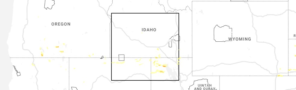
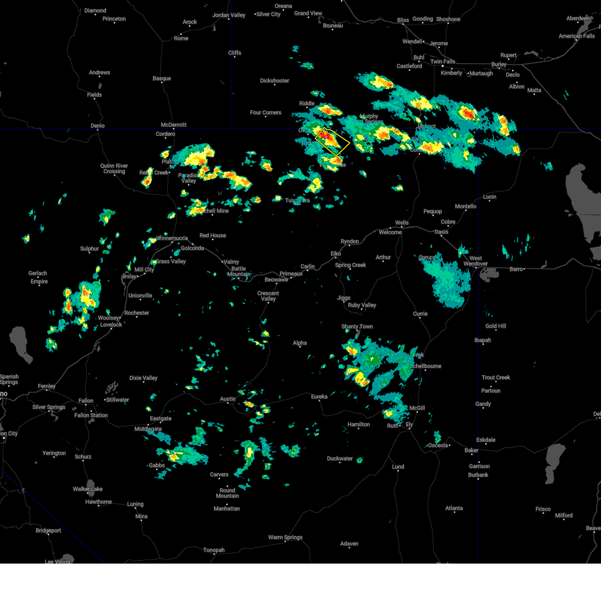
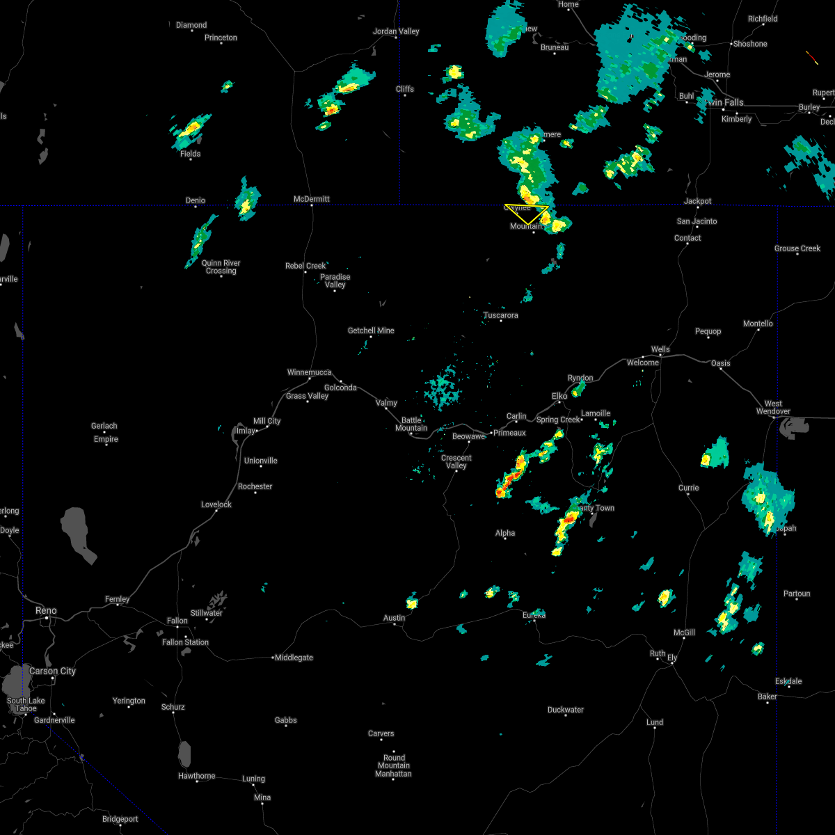
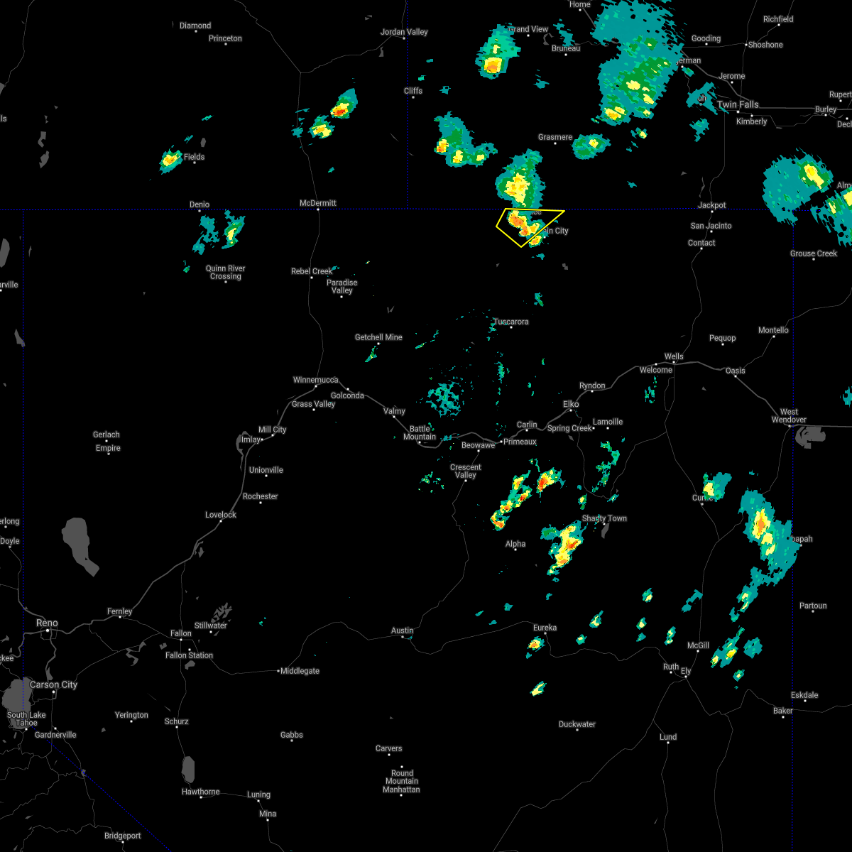
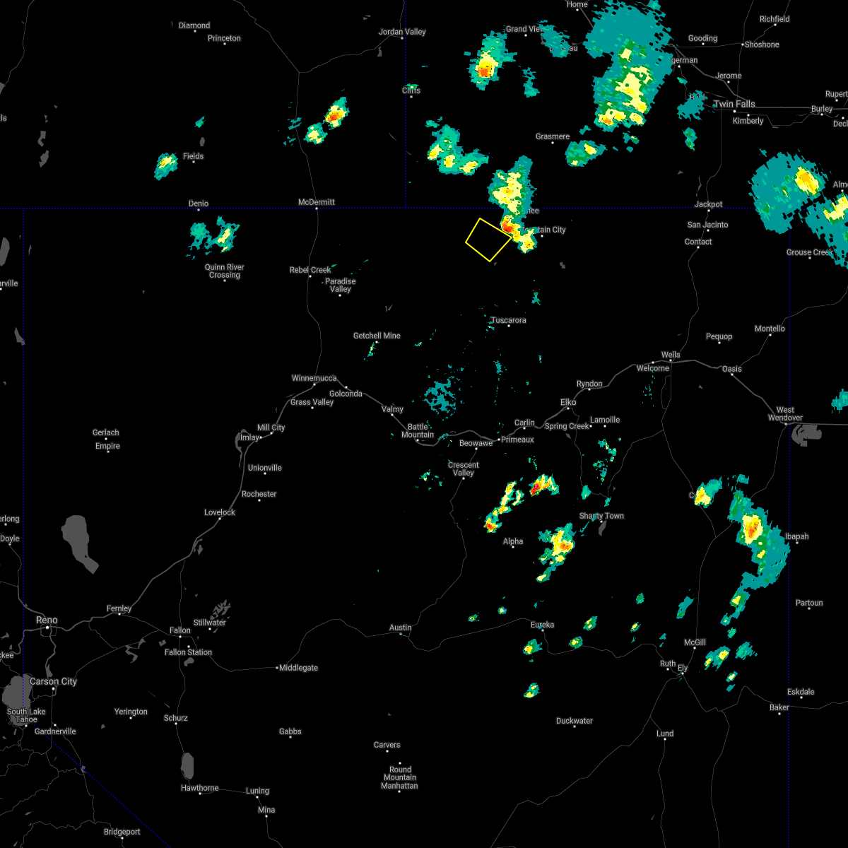
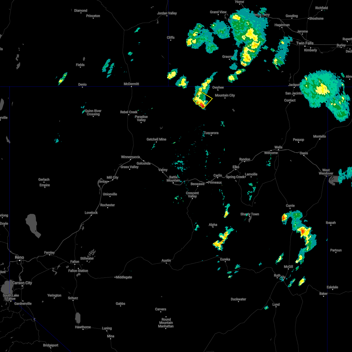
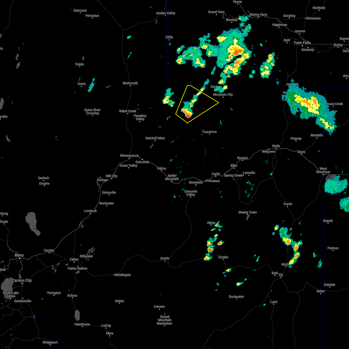
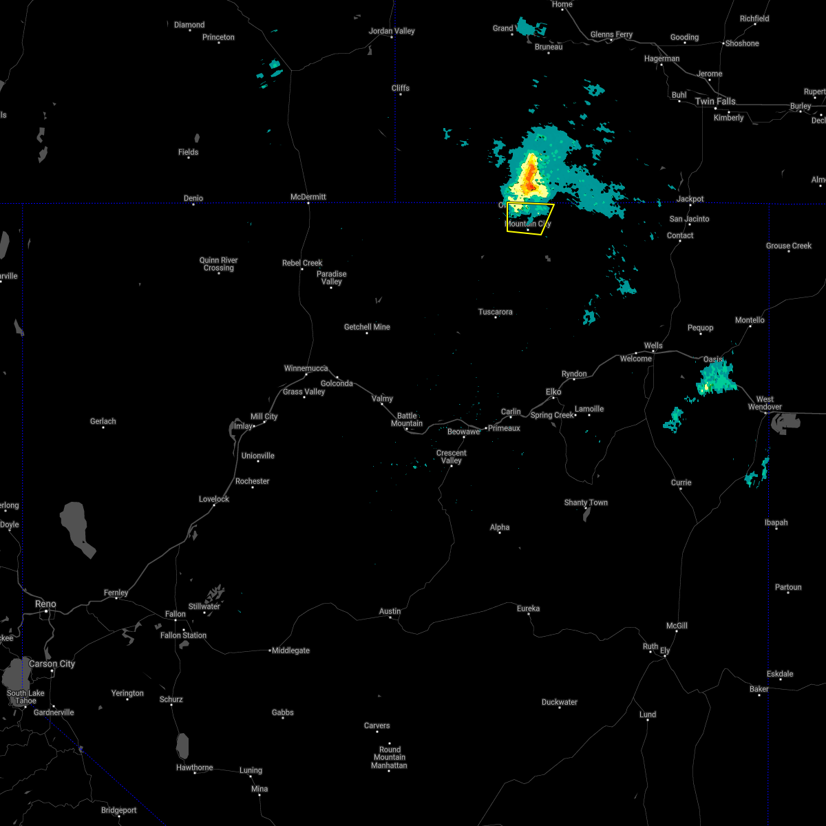
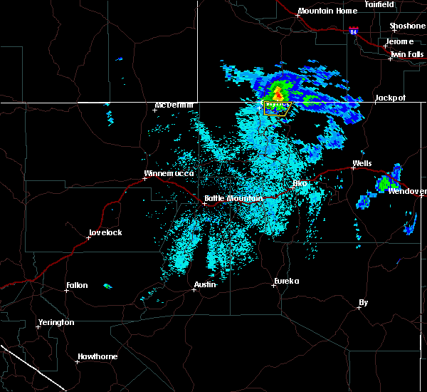
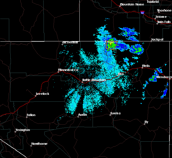
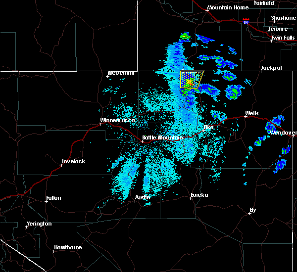
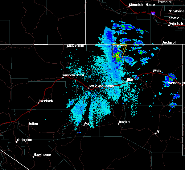
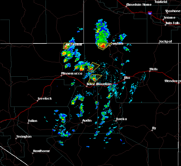
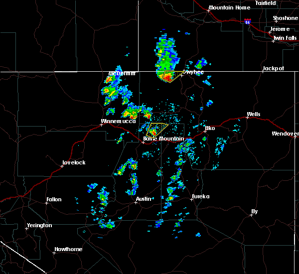
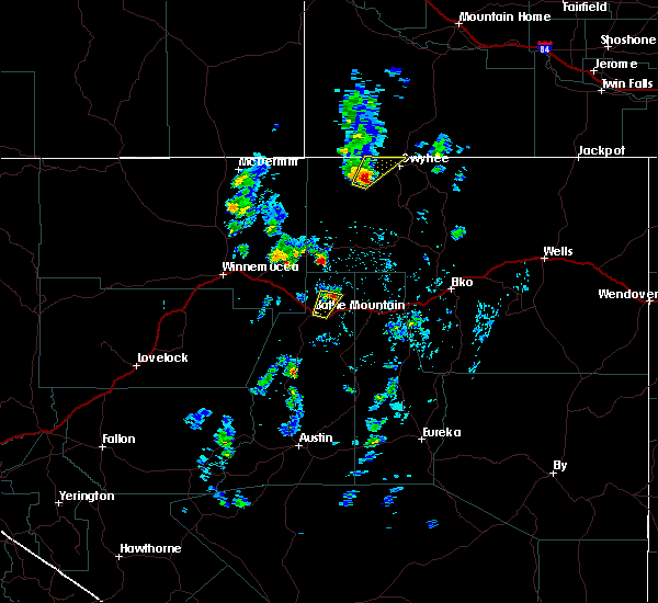
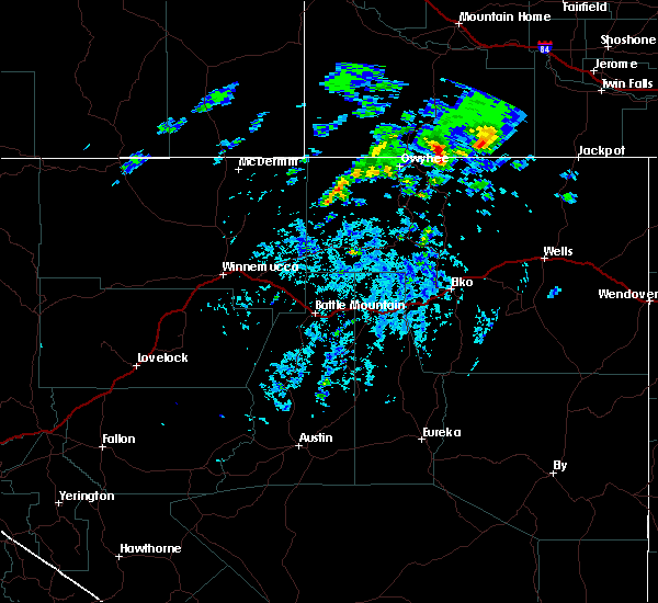
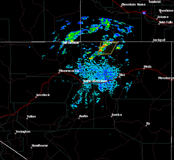
Hail Map for Owyhee, NV
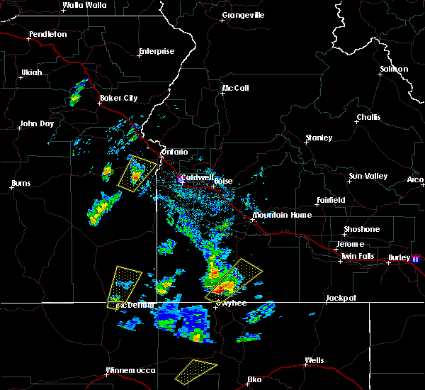
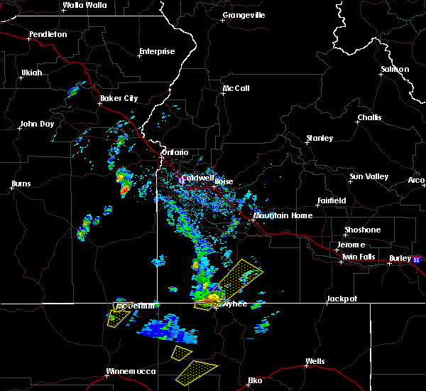
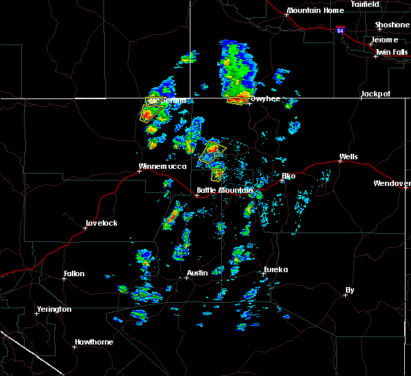
The Owyhee, NV area has had 0 reports of on-the-ground hail by trained spotters, and has been under severe weather warnings 1 time during the past 12 months. Doppler radar has detected hail at or near Owyhee, NV on 5 occasions, including 1 occasion during the past year.
| Name: | Owyhee, NV |
| Where Located: | 79.1 miles NNW of Elko, NV |
| Map: | Google Map for Owyhee, NV |
| Population: | 953 |
| Housing Units: | 393 |
| More Info: | Search Google for Owyhee, NV |
0
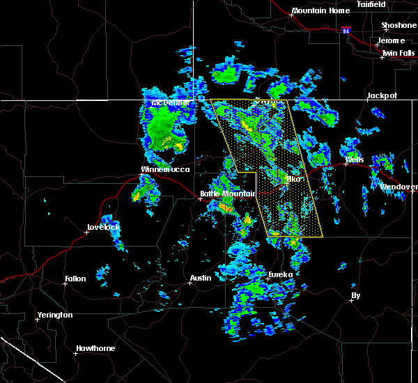
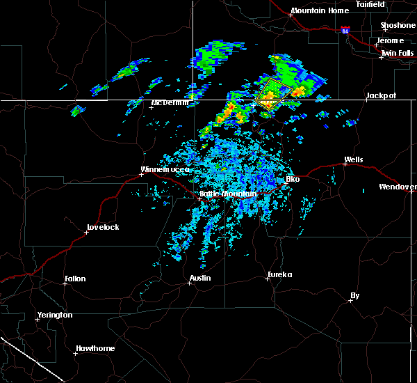
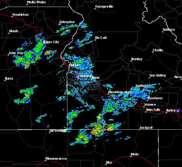
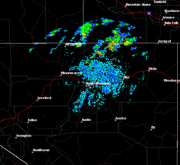
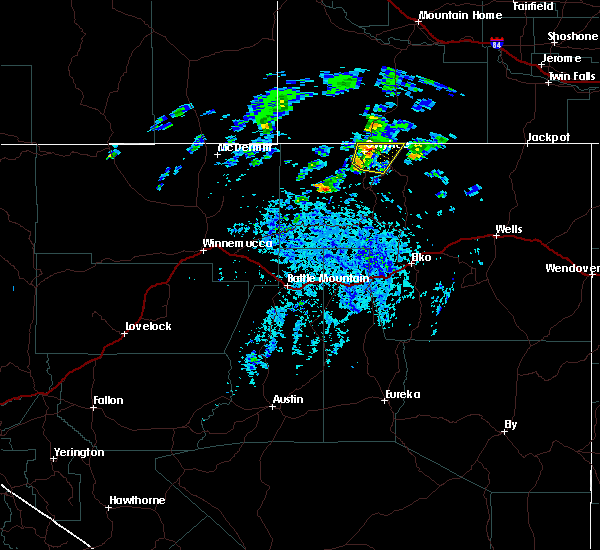
The Top Recent Hail Date for Owyhee, NV is Friday, August 4, 2023 (5th out of 5)
Hail and Wind Damage Spotted near Owyhee, NV
| Date / Time | Report Details |
|---|---|
| 6/8/2023 1:03 PM PDT |
 At 102 pm pdt, a severe thunderstorm was located 7 miles northeast of mountain city, and is nearly stationary (radar indicated). Hazards include 60 mph wind gusts and quarter size hail. Hail damage to vehicles is expected. expect wind damage to roofs, siding, and trees. this severe thunderstorm will remain over mainly rural areas of northwestern elko county. hail threat, radar indicated max hail size, 1. 00 in wind threat, radar indicated max wind gust, 60 mph. At 102 pm pdt, a severe thunderstorm was located 7 miles northeast of mountain city, and is nearly stationary (radar indicated). Hazards include 60 mph wind gusts and quarter size hail. Hail damage to vehicles is expected. expect wind damage to roofs, siding, and trees. this severe thunderstorm will remain over mainly rural areas of northwestern elko county. hail threat, radar indicated max hail size, 1. 00 in wind threat, radar indicated max wind gust, 60 mph.
|
| 9/21/2022 12:42 PM MDT | Mesonet station pcki1 pole cree in owyhee county ID, 20.7 miles WSW of Owyhee, NV |
| 6/12/2022 6:42 PM MDT | Mesonet station pcki1 pole cree in owyhee county ID, 20.7 miles WSW of Owyhee, NV |
| 8/25/2020 2:04 PM PDT |
 At 204 pm pdt, a severe thunderstorm was located near owyhee, moving northeast at 30 mph (radar indicated). Hazards include 60 mph wind gusts and nickel size hail. Expect damage to roofs, siding, and trees. Locations impacted include, owyhee. At 204 pm pdt, a severe thunderstorm was located near owyhee, moving northeast at 30 mph (radar indicated). Hazards include 60 mph wind gusts and nickel size hail. Expect damage to roofs, siding, and trees. Locations impacted include, owyhee.
|
| 8/25/2020 1:44 PM PDT |
 At 143 pm pdt, a severe thunderstorm was located 9 miles southwest of owyhee, moving northeast at 30 mph (radar indicated). Hazards include 60 mph wind gusts and nickel size hail. expect damage to roofs, siding, and trees At 143 pm pdt, a severe thunderstorm was located 9 miles southwest of owyhee, moving northeast at 30 mph (radar indicated). Hazards include 60 mph wind gusts and nickel size hail. expect damage to roofs, siding, and trees
|
| 8/25/2020 1:39 PM PDT |
 The severe thunderstorm warning for northern elko county will expire at 145 pm pdt, the storm which prompted the warning has moved out of the area. therefore, the warning will be allowed to expire. The severe thunderstorm warning for northern elko county will expire at 145 pm pdt, the storm which prompted the warning has moved out of the area. therefore, the warning will be allowed to expire.
|
| 8/25/2020 1:17 PM PDT |
 At 116 pm pdt, a severe thunderstorm was located 18 miles southwest of owyhee, moving northeast at 30 mph (radar indicated). Hazards include 60 mph wind gusts and quarter size hail. Hail damage to vehicles is expected. expect wind damage to roofs, siding, and trees. This severe thunderstorm will remain over mainly rural areas of northern elko county. At 116 pm pdt, a severe thunderstorm was located 18 miles southwest of owyhee, moving northeast at 30 mph (radar indicated). Hazards include 60 mph wind gusts and quarter size hail. Hail damage to vehicles is expected. expect wind damage to roofs, siding, and trees. This severe thunderstorm will remain over mainly rural areas of northern elko county.
|
| 8/25/2020 12:48 PM PDT |
 At 1248 pm pdt, a severe thunderstorm was located 31 miles north of midas, moving northeast at 30 mph (radar indicated). Hazards include 60 mph wind gusts and quarter size hail. Hail damage to vehicles is expected. Expect wind damage to roofs, siding, and trees. At 1248 pm pdt, a severe thunderstorm was located 31 miles north of midas, moving northeast at 30 mph (radar indicated). Hazards include 60 mph wind gusts and quarter size hail. Hail damage to vehicles is expected. Expect wind damage to roofs, siding, and trees.
|
| 4/27/2018 7:11 PM PDT |
 The severe thunderstorm warning for north central elko county will expire at 715 pm pdt, the severe thunderstorm which prompted the warning has moved out of the warned area. therefore, the warning will be allowed to expire. The severe thunderstorm warning for north central elko county will expire at 715 pm pdt, the severe thunderstorm which prompted the warning has moved out of the warned area. therefore, the warning will be allowed to expire.
|
| 4/27/2018 6:58 PM PDT |
 At 657 pm pdt, a severe thunderstorm was located near owyhee, moving north at 25 mph (radar indicated). Hazards include 70 mph wind gusts from dry micro-bursts. Expect considerable tree damage. damage is likely to mobile homes, roofs, and outbuildings. Locations impacted include, mountain city and owyhee. At 657 pm pdt, a severe thunderstorm was located near owyhee, moving north at 25 mph (radar indicated). Hazards include 70 mph wind gusts from dry micro-bursts. Expect considerable tree damage. damage is likely to mobile homes, roofs, and outbuildings. Locations impacted include, mountain city and owyhee.
|
| 4/27/2018 6:32 PM PDT |
 At 631 pm pdt, a severe thunderstorm was located near mountain city, moving north at 25 mph (radar indicated). Hazards include 70 mph wind gusts from dry micro-bursts. Expect considerable tree damage. Damage is likely to mobile homes, roofs, and outbuildings. At 631 pm pdt, a severe thunderstorm was located near mountain city, moving north at 25 mph (radar indicated). Hazards include 70 mph wind gusts from dry micro-bursts. Expect considerable tree damage. Damage is likely to mobile homes, roofs, and outbuildings.
|
| 4/27/2018 6:07 PM PDT |
 At 606 pm pdt, a severe thunderstorm was located 7 miles southwest of mountain city, moving north at 25 mph (radar indicated). Hazards include 70 mph wind gusts. Expect considerable tree damage. damage is likely to mobile homes, roofs, and outbuildings. Locations impacted include, mountain city and owyhee. At 606 pm pdt, a severe thunderstorm was located 7 miles southwest of mountain city, moving north at 25 mph (radar indicated). Hazards include 70 mph wind gusts. Expect considerable tree damage. damage is likely to mobile homes, roofs, and outbuildings. Locations impacted include, mountain city and owyhee.
|
| 4/27/2018 5:51 PM PDT |
 At 549 pm pdt, a severe thunderstorm was located 14 miles southwest of mountain city, moving north at 25 mph (radar indicated). Hazards include 70 mph wind gusts from dry micro-bursts. Expect considerable tree damage. Damage is likely to mobile homes, roofs, and outbuildings. At 549 pm pdt, a severe thunderstorm was located 14 miles southwest of mountain city, moving north at 25 mph (radar indicated). Hazards include 70 mph wind gusts from dry micro-bursts. Expect considerable tree damage. Damage is likely to mobile homes, roofs, and outbuildings.
|
| 5/6/2017 3:44 PM PDT |
 At 343 pm pdt, a severe thunderstorm was located 9 miles west of ryndon, moving north at 45 mph. this storm has produced winds of 57 mph at elko (radar indicated). Hazards include 60 mph wind gusts and penny size hail. Expect damage to roofs, siding, and trees. Winds could blow vehicles off roads. At 343 pm pdt, a severe thunderstorm was located 9 miles west of ryndon, moving north at 45 mph. this storm has produced winds of 57 mph at elko (radar indicated). Hazards include 60 mph wind gusts and penny size hail. Expect damage to roofs, siding, and trees. Winds could blow vehicles off roads.
|
| 5/5/2017 4:12 PM MDT |
 At 412 pm mdt, a severe thunderstorm was located near tindall ranch, or 25 miles north of owyhee, moving northeast at 45 mph (radar indicated). Hazards include quarter size hail. Damage to vehicles is expected. this severe storm will be near, grasmere around 420 pm mdt. Blackstone reservoir, monument butte and gedney butte around 430 pm mdt. At 412 pm mdt, a severe thunderstorm was located near tindall ranch, or 25 miles north of owyhee, moving northeast at 45 mph (radar indicated). Hazards include quarter size hail. Damage to vehicles is expected. this severe storm will be near, grasmere around 420 pm mdt. Blackstone reservoir, monument butte and gedney butte around 430 pm mdt.
|
| 5/5/2017 3:46 PM MDT |
 At 346 pm mdt, a severe thunderstorm was located over mountain view lake, or 9 miles northwest of owyhee, moving northeast at 45 mph (radar indicated). Hazards include quarter size hail. Damage to vehicles is expected. this severe thunderstorm will be near, riddle, otter reservoir, payne creek reservoir and buckhorn reservoir around 400 pm mdt. tindall ranch around 410 pm mdt. grasmere around 420 pm mdt. Blackstone reservoir, monument butte and gedney butte around 430 pm mdt. At 346 pm mdt, a severe thunderstorm was located over mountain view lake, or 9 miles northwest of owyhee, moving northeast at 45 mph (radar indicated). Hazards include quarter size hail. Damage to vehicles is expected. this severe thunderstorm will be near, riddle, otter reservoir, payne creek reservoir and buckhorn reservoir around 400 pm mdt. tindall ranch around 410 pm mdt. grasmere around 420 pm mdt. Blackstone reservoir, monument butte and gedney butte around 430 pm mdt.
|
| 5/5/2017 2:35 PM PDT |
 At 235 pm pdt, a severe thunderstorm was located 13 miles west of owyhee, moving north at 35 mph (radar indicated). Hazards include 60 mph wind gusts and quarter size hail. Hail damage to vehicles is expected. expect wind damage to roofs, siding, and trees. This severe thunderstorm will remain over mainly rural areas of northern elko county. At 235 pm pdt, a severe thunderstorm was located 13 miles west of owyhee, moving north at 35 mph (radar indicated). Hazards include 60 mph wind gusts and quarter size hail. Hail damage to vehicles is expected. expect wind damage to roofs, siding, and trees. This severe thunderstorm will remain over mainly rural areas of northern elko county.
|
| 5/5/2017 2:26 PM PDT |
 At 226 pm pdt, a severe thunderstorm was located 15 miles west of owyhee, moving north at 35 mph (radar indicated). Hazards include 60 mph wind gusts and quarter size hail. Hail damage to vehicles is expected. expect wind damage to roofs, siding, and trees. This severe thunderstorm will remain over mainly rural areas of northern elko county. At 226 pm pdt, a severe thunderstorm was located 15 miles west of owyhee, moving north at 35 mph (radar indicated). Hazards include 60 mph wind gusts and quarter size hail. Hail damage to vehicles is expected. expect wind damage to roofs, siding, and trees. This severe thunderstorm will remain over mainly rural areas of northern elko county.
|
| 5/5/2017 2:19 PM PDT |
 At 218 pm pdt, a severe thunderstorm was located 27 miles southwest of owyhee, moving northeast at 30 mph (radar indicated). Hazards include 60 mph wind gusts and quarter size hail. Hail damage to vehicles is expected. expect wind damage to roofs, siding, and trees. This severe thunderstorm will remain over mainly rural areas of northern elko county. At 218 pm pdt, a severe thunderstorm was located 27 miles southwest of owyhee, moving northeast at 30 mph (radar indicated). Hazards include 60 mph wind gusts and quarter size hail. Hail damage to vehicles is expected. expect wind damage to roofs, siding, and trees. This severe thunderstorm will remain over mainly rural areas of northern elko county.
|
| 5/5/2017 2:06 PM PDT |
 At 206 pm pdt, a severe thunderstorm was located 29 miles north of midas, moving northeast at 30 mph (radar indicated). Hazards include 60 mph wind gusts and quarter size hail. Hail damage to vehicles is expected. expect wind damage to roofs, siding, and trees. This severe thunderstorm will remain over mainly rural areas of northwestern elko county. At 206 pm pdt, a severe thunderstorm was located 29 miles north of midas, moving northeast at 30 mph (radar indicated). Hazards include 60 mph wind gusts and quarter size hail. Hail damage to vehicles is expected. expect wind damage to roofs, siding, and trees. This severe thunderstorm will remain over mainly rural areas of northwestern elko county.
|
| 7/14/2015 2:38 PM PDT |
 The severe thunderstorm warning for north central elko county will expire at 245 pm pdt, the storm which prompted the warning has moved out of the area. therefore the warning will be allowed to expire. however gusty winds are still possible with this thunderstorm. to report severe weather, contact your nearest law enforcement agency. they will relay your report to the national weather service elko. The severe thunderstorm warning for north central elko county will expire at 245 pm pdt, the storm which prompted the warning has moved out of the area. therefore the warning will be allowed to expire. however gusty winds are still possible with this thunderstorm. to report severe weather, contact your nearest law enforcement agency. they will relay your report to the national weather service elko.
|
| 7/14/2015 2:15 PM PDT |
 At 212 pm pdt, doppler radar indicated a severe thunderstorm capable of producing damaging winds in excess of 60 mph. this storm was located 8 miles northeast of owyhee, moving northeast at 35 mph. in addition, at 200 pm pdt, nickel size hail was reported in owyhee. also, accumulating hail and minor flooding was reported. do not drive through flooded roadways and slow down on hail covered roads. locations impacted include, owyhee. At 212 pm pdt, doppler radar indicated a severe thunderstorm capable of producing damaging winds in excess of 60 mph. this storm was located 8 miles northeast of owyhee, moving northeast at 35 mph. in addition, at 200 pm pdt, nickel size hail was reported in owyhee. also, accumulating hail and minor flooding was reported. do not drive through flooded roadways and slow down on hail covered roads. locations impacted include, owyhee.
|
| 7/14/2015 2:59 PM MDT |
 At 258 pm mdt, doppler radar indicated a severe thunderstorm capable of producing quarter size hail and damaging winds in excess of 60 mph. this storm was located near owyhee, and moving northeast at 15 mph. * this severe thunderstorm will be near, sugarloaf mountain around 320 pm mdt. buckhorn reservoir around 330 pm mdt. otter reservoir and black stone mountain around 340 pm mdt. At 258 pm mdt, doppler radar indicated a severe thunderstorm capable of producing quarter size hail and damaging winds in excess of 60 mph. this storm was located near owyhee, and moving northeast at 15 mph. * this severe thunderstorm will be near, sugarloaf mountain around 320 pm mdt. buckhorn reservoir around 330 pm mdt. otter reservoir and black stone mountain around 340 pm mdt.
|
| 7/14/2015 1:59 PM PDT |
 At 157 pm pdt, doppler radar indicated a severe thunderstorm capable of producing quarter size hail and damaging winds in excess of 60 mph. this storm was located over owyhee, and moving northeast at 35 mph. At 157 pm pdt, doppler radar indicated a severe thunderstorm capable of producing quarter size hail and damaging winds in excess of 60 mph. this storm was located over owyhee, and moving northeast at 35 mph.
|
| 7/14/2015 1:40 PM PDT |
 At 138 pm pdt, doppler radar continued to indicate a line of severe thunderstorms capable of producing quarter size hail and damaging winds in excess of 60 mph. these storms were located near owyhee. another storm was located south of sheep creek reservoir. these storms are moving northeast at 15 mph. locations impacted include, owyhee, mountain city and sheep creek reservoir. At 138 pm pdt, doppler radar continued to indicate a line of severe thunderstorms capable of producing quarter size hail and damaging winds in excess of 60 mph. these storms were located near owyhee. another storm was located south of sheep creek reservoir. these storms are moving northeast at 15 mph. locations impacted include, owyhee, mountain city and sheep creek reservoir.
|
| 7/14/2015 1:14 PM PDT |
 At 113 pm pdt, doppler radar indicated a line of severe thunderstorms capable of producing damaging winds in excess of 60 mph. these storms were located along a line extending from 7 miles west of owyhee to 12 miles west of mountain city to 21 miles north of tuscarora, and moving northeast at 15 mph. penny size hail may also accompany the damaging winds. At 113 pm pdt, doppler radar indicated a line of severe thunderstorms capable of producing damaging winds in excess of 60 mph. these storms were located along a line extending from 7 miles west of owyhee to 12 miles west of mountain city to 21 miles north of tuscarora, and moving northeast at 15 mph. penny size hail may also accompany the damaging winds.
|
| 4/22/2015 4:08 PM PDT | At 407 pm pdt, doppler radar indicated a severe thunderstorm capable of producing quarter size hail and damaging winds in excess of 60 mph. this storm was located 9 miles west of owyhee, moving northeast at 5 mph. locations impacted include, sheep creek reservoir. |
| 4/22/2015 3:52 PM PDT | At 351 pm pdt, doppler radar indicated a severe thunderstorm capable of producing quarter size hail and damaging winds in excess of 60 mph. this storm was located 11 miles west of owyhee, and moving northeast at 5 mph. |
| 8/13/2014 12:20 PM PDT | Hail slightly larger than pea size and strong winds took off a few shingle in elko county NV, 16.8 miles NW of Owyhee, NV |
Hail Maps for Owyhee, NV


Connect with Interactive Hail Maps