

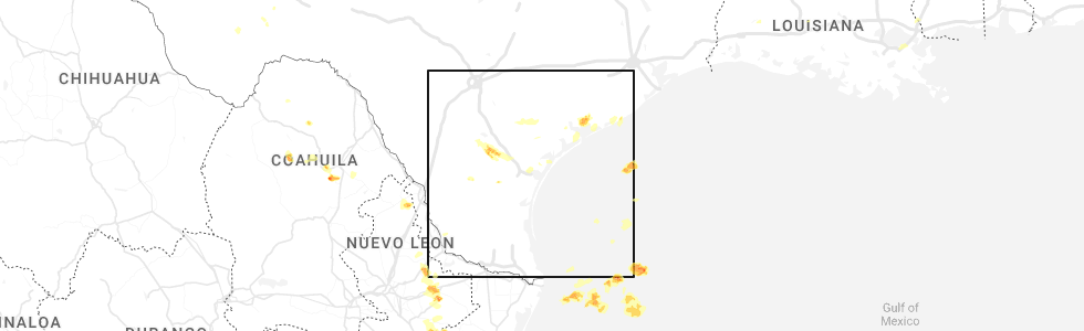
Hail Map for Paisano Park, TX
The Paisano Park, TX area has had 0 reports of on-the-ground hail by trained spotters, and has been under severe weather warnings 3 times during the past 12 months. Doppler radar has detected hail at or near Paisano Park, TX on 19 occasions, including 4 occasions during the past year.
| Name: | Paisano Park, TX |
| Where Located: | 34.6 miles NW of Corpus Christi, TX |
| Map: | Google Map for Paisano Park, TX |
| Population: | 130 |
| Housing Units: | 36 |
| More Info: | Search Google for Paisano Park, TX |
1
The Top Recent Hail Date for Paisano Park, TX is Tuesday, May 9, 2023 (5th out of 19)
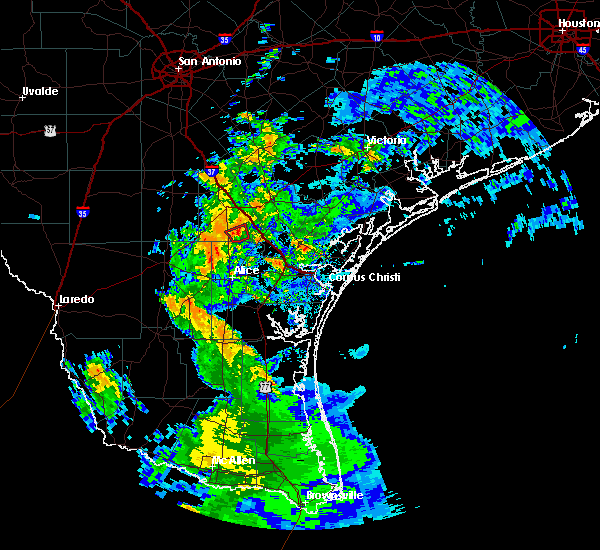
Hail and Wind Damage Spotted near Paisano Park, TX
| Date / Time | Report Details |
|---|---|
| 8/22/2023 11:23 AM CDT |
 At 1122 am cdt, a severe thunderstorm capable of producing a tornado was located over sinton, moving west at 55 mph (radar indicated rotation). Hazards include tornado. Flying debris will be dangerous to those caught without shelter. mobile homes will be damaged or destroyed. damage to roofs, windows, and vehicles will occur. tree damage is likely. this dangerous storm will be near, west sinton and edroy around 1135 am cdt. san patricio around 1140 am cdt. mathis and lake city around 1145 am cdt. sandia around 1150 am cdt. other locations impacted by this tornadic thunderstorm include lake corpus christi, pernitas point and lakeside. this includes the following highways, interstate 37 between mile markers 20 and 38. us highway 181 between mile markers 618 and 626. Us highway 77 between mile markers 642 and 652. At 1122 am cdt, a severe thunderstorm capable of producing a tornado was located over sinton, moving west at 55 mph (radar indicated rotation). Hazards include tornado. Flying debris will be dangerous to those caught without shelter. mobile homes will be damaged or destroyed. damage to roofs, windows, and vehicles will occur. tree damage is likely. this dangerous storm will be near, west sinton and edroy around 1135 am cdt. san patricio around 1140 am cdt. mathis and lake city around 1145 am cdt. sandia around 1150 am cdt. other locations impacted by this tornadic thunderstorm include lake corpus christi, pernitas point and lakeside. this includes the following highways, interstate 37 between mile markers 20 and 38. us highway 181 between mile markers 618 and 626. Us highway 77 between mile markers 642 and 652.
|
| 5/13/2023 5:03 AM CDT |
 At 502 am cdt, a severe thunderstorm was located near argenta, or 10 miles west of skidmore, moving northwest at 25 mph (radar indicated). Hazards include 60 mph wind gusts and penny size hail. Expect damage to roofs, siding, and trees. locations impacted include, beeville, mathis, skidmore, argenta, tynan and lakeside. this includes the following highways, interstate 37 between mile markers 30 and 41. us highway 59 between mile markers 698 and 704. hail threat, radar indicated max hail size, 0. 75 in wind threat, radar indicated max wind gust, 60 mph. At 502 am cdt, a severe thunderstorm was located near argenta, or 10 miles west of skidmore, moving northwest at 25 mph (radar indicated). Hazards include 60 mph wind gusts and penny size hail. Expect damage to roofs, siding, and trees. locations impacted include, beeville, mathis, skidmore, argenta, tynan and lakeside. this includes the following highways, interstate 37 between mile markers 30 and 41. us highway 59 between mile markers 698 and 704. hail threat, radar indicated max hail size, 0. 75 in wind threat, radar indicated max wind gust, 60 mph.
|
| 5/13/2023 4:39 AM CDT |
 At 439 am cdt, a severe thunderstorm was located over tynan, or near mathis, moving northwest at 25 mph (radar indicated). Hazards include 60 mph wind gusts. expect damage to roofs, siding, and trees At 439 am cdt, a severe thunderstorm was located over tynan, or near mathis, moving northwest at 25 mph (radar indicated). Hazards include 60 mph wind gusts. expect damage to roofs, siding, and trees
|
| 4/23/2023 10:11 AM CDT |
 The severe thunderstorm warning for northwestern san patricio, southeastern live oak and south central bee counties will expire at 1015 am cdt, the storms which prompted the warning have weakened below severe limits, and have exited the warned area. therefore, the warning will be allowed to expire. however small hail and gusty winds are still possible with these thunderstorms. a severe thunderstorm watch remains in effect until 200 pm cdt for south central texas. The severe thunderstorm warning for northwestern san patricio, southeastern live oak and south central bee counties will expire at 1015 am cdt, the storms which prompted the warning have weakened below severe limits, and have exited the warned area. therefore, the warning will be allowed to expire. however small hail and gusty winds are still possible with these thunderstorms. a severe thunderstorm watch remains in effect until 200 pm cdt for south central texas.
|
| 4/23/2023 9:49 AM CDT |
 At 948 am cdt, severe thunderstorms were located along a line extending from 6 miles southwest of beeville to near lake city to near westdale, moving east at 15 mph (radar indicated). Hazards include quarter size hail. Damage to vehicles is expected. locations impacted include, beeville, mathis, skidmore, lake city, argenta, lagarto, mount lucas, dinero, tynan, lakeside, lake corpus christi and pernitas point. this includes the following highways, interstate 37 between mile markers 31 and 53. us highway 181 between mile markers 592 and 600. us highway 59 between mile markers 694 and 708. hail threat, radar indicated max hail size, 1. 00 in wind threat, radar indicated max wind gust, <50 mph. At 948 am cdt, severe thunderstorms were located along a line extending from 6 miles southwest of beeville to near lake city to near westdale, moving east at 15 mph (radar indicated). Hazards include quarter size hail. Damage to vehicles is expected. locations impacted include, beeville, mathis, skidmore, lake city, argenta, lagarto, mount lucas, dinero, tynan, lakeside, lake corpus christi and pernitas point. this includes the following highways, interstate 37 between mile markers 31 and 53. us highway 181 between mile markers 592 and 600. us highway 59 between mile markers 694 and 708. hail threat, radar indicated max hail size, 1. 00 in wind threat, radar indicated max wind gust, <50 mph.
|
| 4/23/2023 9:29 AM CDT |
 At 929 am cdt, severe thunderstorms were located along a line extending from near beeville to near mount lucas to near midway, moving east at 40 mph (radar indicated). Hazards include quarter size hail. damage to vehicles is expected At 929 am cdt, severe thunderstorms were located along a line extending from near beeville to near mount lucas to near midway, moving east at 40 mph (radar indicated). Hazards include quarter size hail. damage to vehicles is expected
|
| 4/5/2022 6:36 PM CDT |
 At 636 pm cdt, severe thunderstorms were located along a line extending from three rivers to near george west to near clegg, moving east at 35 mph (radar indicated). Hazards include 60 mph wind gusts and penny size hail. expect damage to roofs, siding, and trees At 636 pm cdt, severe thunderstorms were located along a line extending from three rivers to near george west to near clegg, moving east at 35 mph (radar indicated). Hazards include 60 mph wind gusts and penny size hail. expect damage to roofs, siding, and trees
|
| 5/19/2021 6:41 AM CDT |
 The national weather service in corpus christi has issued a * severe thunderstorm warning for. northwestern san patricio county in south central texas. northeastern jim wells county in south central texas. southeastern live oak county in south central texas. South central bee county in south central texas. The national weather service in corpus christi has issued a * severe thunderstorm warning for. northwestern san patricio county in south central texas. northeastern jim wells county in south central texas. southeastern live oak county in south central texas. South central bee county in south central texas.
|
| 5/19/2021 1:13 AM CDT |
 At 113 am cdt, severe thunderstorms were located along a line extending from near crowther to near annarose, moving east at 35 mph (radar indicated). Hazards include 60 mph wind gusts and quarter size hail. Hail damage to vehicles is expected. expect wind damage to roofs, siding, and trees. locations impacted include, beeville, mathis, george west, three rivers, tilden, choke canyon, skidmore, lake city, midway, cross, river creek acres, tynan, calliham, annarose, argenta, karon, rancho de la parita, mount lucas, pawnee and simmons. this includes the following highways, interstate 37 between mile markers 36 and 83. us highway 281 between mile markers 618 and 656. Us highway 59 between mile markers 698 and 752. At 113 am cdt, severe thunderstorms were located along a line extending from near crowther to near annarose, moving east at 35 mph (radar indicated). Hazards include 60 mph wind gusts and quarter size hail. Hail damage to vehicles is expected. expect wind damage to roofs, siding, and trees. locations impacted include, beeville, mathis, george west, three rivers, tilden, choke canyon, skidmore, lake city, midway, cross, river creek acres, tynan, calliham, annarose, argenta, karon, rancho de la parita, mount lucas, pawnee and simmons. this includes the following highways, interstate 37 between mile markers 36 and 83. us highway 281 between mile markers 618 and 656. Us highway 59 between mile markers 698 and 752.
|
| 5/19/2021 1:01 AM CDT |
 At 1257 am cdt, severe thunderstorms were located along a line extending from cross to 9 miles east of seven sisters, moving northeast at 70 mph (radar indicated). Hazards include ping pong ball size hail and 60 mph wind gusts. People and animals outdoors will be injured. expect hail damage to roofs, siding, windows, and vehicles. Expect wind damage to roofs, siding, and trees. At 1257 am cdt, severe thunderstorms were located along a line extending from cross to 9 miles east of seven sisters, moving northeast at 70 mph (radar indicated). Hazards include ping pong ball size hail and 60 mph wind gusts. People and animals outdoors will be injured. expect hail damage to roofs, siding, windows, and vehicles. Expect wind damage to roofs, siding, and trees.
|
| 5/19/2021 12:58 AM CDT |
 At 1257 am cdt, severe thunderstorms were located along a line extending from cross to 9 miles east of seven sisters, moving northeast at 70 mph (radar indicated). Hazards include ping pong ball size hail and 60 mph wind gusts. People and animals outdoors will be injured. expect hail damage to roofs, siding, windows, and vehicles. Expect wind damage to roofs, siding, and trees. At 1257 am cdt, severe thunderstorms were located along a line extending from cross to 9 miles east of seven sisters, moving northeast at 70 mph (radar indicated). Hazards include ping pong ball size hail and 60 mph wind gusts. People and animals outdoors will be injured. expect hail damage to roofs, siding, windows, and vehicles. Expect wind damage to roofs, siding, and trees.
|
| 5/18/2021 2:40 AM CDT |
 At 240 am cdt, severe thunderstorms were located along a line extending from 7 miles east of beeville to 6 miles west of bonnie view to near gregory, moving east at 50 mph (radar indicated). Hazards include 60 mph wind gusts and penny size hail. Expect damage to roofs, siding, and trees. these severe thunderstorms will remain over mainly rural areas of northwestern nueces, san patricio, northeastern jim wells, southeastern live oak and south central bee counties, including the following locations, pernitas point, lake corpus christi, taft southwest and lakeside. this includes the following highways, interstate 37 between mile markers 11 and 49. us highway 281 between mile markers 644 and 646. us highway 181 between mile markers 600 and 630. Us highway 77 between mile markers 642 and 658. At 240 am cdt, severe thunderstorms were located along a line extending from 7 miles east of beeville to 6 miles west of bonnie view to near gregory, moving east at 50 mph (radar indicated). Hazards include 60 mph wind gusts and penny size hail. Expect damage to roofs, siding, and trees. these severe thunderstorms will remain over mainly rural areas of northwestern nueces, san patricio, northeastern jim wells, southeastern live oak and south central bee counties, including the following locations, pernitas point, lake corpus christi, taft southwest and lakeside. this includes the following highways, interstate 37 between mile markers 11 and 49. us highway 281 between mile markers 644 and 646. us highway 181 between mile markers 600 and 630. Us highway 77 between mile markers 642 and 658.
|
| 5/18/2021 2:16 AM CDT |
 At 216 am cdt, severe thunderstorms were located along a line extending from near dinero to west sinton to near annaville, moving northeast at 50 mph (radar indicated). Hazards include 60 mph wind gusts and penny size hail. Expect damage to roofs, siding, and trees. severe thunderstorms will be near, odem around 220 am cdt. st. paul, papalote and tynan around 225 am cdt. sinton, taft and skidmore around 230 am cdt. other locations impacted by these severe thunderstorms include pernitas point, lake corpus christi, north san pedro, taft southwest and lakeside. this includes the following highways, interstate 37 between mile markers 11 and 49. us highway 281 between mile markers 644 and 646. us highway 181 between mile markers 600 and 630. Us highway 77 between mile markers 642 and 658. At 216 am cdt, severe thunderstorms were located along a line extending from near dinero to west sinton to near annaville, moving northeast at 50 mph (radar indicated). Hazards include 60 mph wind gusts and penny size hail. Expect damage to roofs, siding, and trees. severe thunderstorms will be near, odem around 220 am cdt. st. paul, papalote and tynan around 225 am cdt. sinton, taft and skidmore around 230 am cdt. other locations impacted by these severe thunderstorms include pernitas point, lake corpus christi, north san pedro, taft southwest and lakeside. this includes the following highways, interstate 37 between mile markers 11 and 49. us highway 281 between mile markers 644 and 646. us highway 181 between mile markers 600 and 630. Us highway 77 between mile markers 642 and 658.
|
| 5/15/2021 7:33 PM CDT |
 At 732 pm cdt, a severe thunderstorm was located over midway, or 17 miles west of mathis, moving southeast at 15 mph (radar indicated). Hazards include ping pong ball size hail and 60 mph wind gusts. People and animals outdoors will be injured. expect hail damage to roofs, siding, windows, and vehicles. expect wind damage to roofs, siding, and trees. this severe storm will be near, westdale around 810 pm cdt. orange grove and alfred around 820 pm cdt. alfred-south la paloma and sandia around 825 pm cdt. other locations impacted by this severe thunderstorm include pernitas point and lakeside. This includes us highway 281 between mile markers 644 and 660. At 732 pm cdt, a severe thunderstorm was located over midway, or 17 miles west of mathis, moving southeast at 15 mph (radar indicated). Hazards include ping pong ball size hail and 60 mph wind gusts. People and animals outdoors will be injured. expect hail damage to roofs, siding, windows, and vehicles. expect wind damage to roofs, siding, and trees. this severe storm will be near, westdale around 810 pm cdt. orange grove and alfred around 820 pm cdt. alfred-south la paloma and sandia around 825 pm cdt. other locations impacted by this severe thunderstorm include pernitas point and lakeside. This includes us highway 281 between mile markers 644 and 660.
|
| 5/15/2021 7:25 PM CDT |
 The national weather service in corpus christi has issued a * severe thunderstorm warning for. west central san patricio county in south central texas. northwestern jim wells county in south central texas. south central live oak county in south central texas. Until 815 pm cdt. The national weather service in corpus christi has issued a * severe thunderstorm warning for. west central san patricio county in south central texas. northwestern jim wells county in south central texas. south central live oak county in south central texas. Until 815 pm cdt.
|
| 5/11/2021 9:08 PM CDT |
 At 908 pm cdt, a severe thunderstorm was located over westdale, or 14 miles southwest of mathis, moving east at 20 mph (radar indicated). Hazards include 60 mph wind gusts and quarter size hail. Hail damage to vehicles is expected. expect wind damage to roofs, siding, and trees. locations impacted include, alice, robstown, mathis, san diego, driscoll, orange grove, lake city, san patricio, midway, edroy, banquete, sandia, west sinton, tecalote, annarose, rancho de la parita, alfred-south la paloma, bluntzer, westdale and alice acres. this includes the following highways, interstate 37 between mile markers 21 and 35. us highway 281 between mile markers 648 and 678. Us highway 77 between mile markers 678 and 682. At 908 pm cdt, a severe thunderstorm was located over westdale, or 14 miles southwest of mathis, moving east at 20 mph (radar indicated). Hazards include 60 mph wind gusts and quarter size hail. Hail damage to vehicles is expected. expect wind damage to roofs, siding, and trees. locations impacted include, alice, robstown, mathis, san diego, driscoll, orange grove, lake city, san patricio, midway, edroy, banquete, sandia, west sinton, tecalote, annarose, rancho de la parita, alfred-south la paloma, bluntzer, westdale and alice acres. this includes the following highways, interstate 37 between mile markers 21 and 35. us highway 281 between mile markers 648 and 678. Us highway 77 between mile markers 678 and 682.
|
| 5/11/2021 8:52 PM CDT |
 At 851 pm cdt, a severe thunderstorm was located over midway, or 16 miles north of alice, moving east at 20 mph (radar indicated). Hazards include 60 mph wind gusts and quarter size hail. Hail damage to vehicles is expected. Expect wind damage to roofs, siding, and trees. At 851 pm cdt, a severe thunderstorm was located over midway, or 16 miles north of alice, moving east at 20 mph (radar indicated). Hazards include 60 mph wind gusts and quarter size hail. Hail damage to vehicles is expected. Expect wind damage to roofs, siding, and trees.
|
| 8/18/2020 5:18 PM CDT |
 At 518 pm cdt, severe thunderstorms were located along a line extending from near mathis to sinton, moving southwest at 10 mph (radar indicated). Hazards include 60 mph wind gusts and quarter size hail. Hail damage to vehicles is expected. expect wind damage to roofs, siding, and trees. locations impacted include, sinton, mathis, taft, odem, st. Paul, lake city, san patricio, edroy, tynan, sandia, west sinton, papalote, lakeside, lake corpus christi, taft southwest and pernitas point. At 518 pm cdt, severe thunderstorms were located along a line extending from near mathis to sinton, moving southwest at 10 mph (radar indicated). Hazards include 60 mph wind gusts and quarter size hail. Hail damage to vehicles is expected. expect wind damage to roofs, siding, and trees. locations impacted include, sinton, mathis, taft, odem, st. Paul, lake city, san patricio, edroy, tynan, sandia, west sinton, papalote, lakeside, lake corpus christi, taft southwest and pernitas point.
|
| 8/18/2020 4:52 PM CDT |
 At 451 pm cdt, severe thunderstorms were located along a line extending from tynan to near sinton, moving southwest at 10 mph (radar indicated). Hazards include 60 mph wind gusts and quarter size hail. Hail damage to vehicles is expected. Expect wind damage to roofs, siding, and trees. At 451 pm cdt, severe thunderstorms were located along a line extending from tynan to near sinton, moving southwest at 10 mph (radar indicated). Hazards include 60 mph wind gusts and quarter size hail. Hail damage to vehicles is expected. Expect wind damage to roofs, siding, and trees.
|
| 8/18/2020 4:26 PM CDT |
 At 426 pm cdt, a severe thunderstorm was located near papalote, or 7 miles south of skidmore, moving southwest at 15 mph (radar indicated). Hazards include 60 mph wind gusts and quarter size hail. Hail damage to vehicles is expected. Expect wind damage to roofs, siding, and trees. At 426 pm cdt, a severe thunderstorm was located near papalote, or 7 miles south of skidmore, moving southwest at 15 mph (radar indicated). Hazards include 60 mph wind gusts and quarter size hail. Hail damage to vehicles is expected. Expect wind damage to roofs, siding, and trees.
|
| 7/25/2020 10:38 PM CDT |
 At 1036 pm cdt, a severe thunderstorm capable of producing a tornado was located near george west, moving northwest at 40 mph. doppler radar indicates a second possible tornado just east of lake city moving northwest at 40 mph (radar indicated rotation). Hazards include tornado. Flying debris will be dangerous to those caught without shelter. mobile homes will be damaged or destroyed. damage to roofs, windows, and vehicles will occur. tree damage is likely. This tornadic thunderstorm will remain over mainly rural areas of northwestern san patricio and southeastern live oak counties, including the following locations, lake corpus christi and lakeside. At 1036 pm cdt, a severe thunderstorm capable of producing a tornado was located near george west, moving northwest at 40 mph. doppler radar indicates a second possible tornado just east of lake city moving northwest at 40 mph (radar indicated rotation). Hazards include tornado. Flying debris will be dangerous to those caught without shelter. mobile homes will be damaged or destroyed. damage to roofs, windows, and vehicles will occur. tree damage is likely. This tornadic thunderstorm will remain over mainly rural areas of northwestern san patricio and southeastern live oak counties, including the following locations, lake corpus christi and lakeside.
|
| 7/25/2020 10:12 PM CDT |
 At 1011 pm cdt, a severe thunderstorm capable of producing a tornado was located over argenta, or near mathis, moving northwest at 40 mph (radar indicated rotation). Hazards include tornado. Flying debris will be dangerous to those caught without shelter. mobile homes will be damaged or destroyed. damage to roofs, windows, and vehicles will occur. tree damage is likely. this dangerous storm will be near, lagarto around 1015 pm cdt. mount lucas and dinero around 1020 pm cdt. river creek acres around 1030 pm cdt. george west around 1040 pm cdt. Other locations impacted by this tornadic thunderstorm include lake corpus christi and lakeside. At 1011 pm cdt, a severe thunderstorm capable of producing a tornado was located over argenta, or near mathis, moving northwest at 40 mph (radar indicated rotation). Hazards include tornado. Flying debris will be dangerous to those caught without shelter. mobile homes will be damaged or destroyed. damage to roofs, windows, and vehicles will occur. tree damage is likely. this dangerous storm will be near, lagarto around 1015 pm cdt. mount lucas and dinero around 1020 pm cdt. river creek acres around 1030 pm cdt. george west around 1040 pm cdt. Other locations impacted by this tornadic thunderstorm include lake corpus christi and lakeside.
|
| 7/25/2020 9:49 PM CDT |
 At 947 pm cdt, a severe thunderstorm capable of producing a tornado was located near west sinton, or 8 miles west of sinton, moving west at 45 mph (radar indicated rotation). Hazards include tornado. Flying debris will be dangerous to those caught without shelter. mobile homes will be damaged or destroyed. damage to roofs, windows, and vehicles will occur. tree damage is likely. this dangerous storm will be near, tynan around 1000 pm cdt. mathis, lake city and argenta around 1005 pm cdt. lagarto around 1015 pm cdt. Other locations impacted by this tornadic thunderstorm include lake corpus christi, lakeside and pernitas point. At 947 pm cdt, a severe thunderstorm capable of producing a tornado was located near west sinton, or 8 miles west of sinton, moving west at 45 mph (radar indicated rotation). Hazards include tornado. Flying debris will be dangerous to those caught without shelter. mobile homes will be damaged or destroyed. damage to roofs, windows, and vehicles will occur. tree damage is likely. this dangerous storm will be near, tynan around 1000 pm cdt. mathis, lake city and argenta around 1005 pm cdt. lagarto around 1015 pm cdt. Other locations impacted by this tornadic thunderstorm include lake corpus christi, lakeside and pernitas point.
|
| 7/25/2020 9:15 PM CDT |
 At 915 pm cdt, a severe thunderstorm capable of producing a tornado was located over sinton, moving west at 45 mph (radar indicated rotation). Hazards include tornado. Flying debris will be dangerous to those caught without shelter. mobile homes will be damaged or destroyed. damage to roofs, windows, and vehicles will occur. tree damage is likely. this dangerous storm will be near, west sinton around 925 pm cdt. tynan around 935 pm cdt. Mathis around 940 pm cdt. At 915 pm cdt, a severe thunderstorm capable of producing a tornado was located over sinton, moving west at 45 mph (radar indicated rotation). Hazards include tornado. Flying debris will be dangerous to those caught without shelter. mobile homes will be damaged or destroyed. damage to roofs, windows, and vehicles will occur. tree damage is likely. this dangerous storm will be near, west sinton around 925 pm cdt. tynan around 935 pm cdt. Mathis around 940 pm cdt.
|
| 6/26/2020 6:32 AM CDT |
 At 631 am cdt, a severe thunderstorm capable of producing a tornado was located over lake city, or near mathis, moving northwest at 20 mph (radar indicated rotation). Hazards include tornado. Flying debris will be dangerous to those caught without shelter. mobile homes will be damaged or destroyed. damage to roofs, windows, and vehicles will occur. tree damage is likely. This tornadic thunderstorm will remain over mainly rural areas of western san patricio and southeastern live oak counties, including the following locations, lake corpus christi and lakeside. At 631 am cdt, a severe thunderstorm capable of producing a tornado was located over lake city, or near mathis, moving northwest at 20 mph (radar indicated rotation). Hazards include tornado. Flying debris will be dangerous to those caught without shelter. mobile homes will be damaged or destroyed. damage to roofs, windows, and vehicles will occur. tree damage is likely. This tornadic thunderstorm will remain over mainly rural areas of western san patricio and southeastern live oak counties, including the following locations, lake corpus christi and lakeside.
|
| 6/26/2020 6:15 AM CDT |
 At 615 am cdt, a severe thunderstorm capable of producing a tornado was located over sandia, or near mathis, moving northwest at 20 mph (radar indicated rotation). Hazards include tornado. Flying debris will be dangerous to those caught without shelter. mobile homes will be damaged or destroyed. damage to roofs, windows, and vehicles will occur. tree damage is likely. this dangerous storm will be near, mathis and lake city around 625 am cdt. Other locations impacted by this tornadic thunderstorm include lake corpus christi, lakeside and pernitas point. At 615 am cdt, a severe thunderstorm capable of producing a tornado was located over sandia, or near mathis, moving northwest at 20 mph (radar indicated rotation). Hazards include tornado. Flying debris will be dangerous to those caught without shelter. mobile homes will be damaged or destroyed. damage to roofs, windows, and vehicles will occur. tree damage is likely. this dangerous storm will be near, mathis and lake city around 625 am cdt. Other locations impacted by this tornadic thunderstorm include lake corpus christi, lakeside and pernitas point.
|
| 5/16/2020 1:22 AM CDT |
 At 121 am cdt, severe thunderstorms were located along a line extending from near westdale to near benavides, moving east at 50 mph (radar indicated). Hazards include 60 mph wind gusts and penny size hail. Expect damage to roofs, siding, and trees. Locations impacted include, alice, mathis, san diego, benavides, orange grove, lake city, san patricio, midway, tynan, san jose, sandia, west sinton, tecalote, annarose, argenta, rancho de la parita, rosita, lagarto, alfred-south la paloma and bluntzer. At 121 am cdt, severe thunderstorms were located along a line extending from near westdale to near benavides, moving east at 50 mph (radar indicated). Hazards include 60 mph wind gusts and penny size hail. Expect damage to roofs, siding, and trees. Locations impacted include, alice, mathis, san diego, benavides, orange grove, lake city, san patricio, midway, tynan, san jose, sandia, west sinton, tecalote, annarose, argenta, rancho de la parita, rosita, lagarto, alfred-south la paloma and bluntzer.
|
| 5/16/2020 12:54 AM CDT |
 At 1254 am cdt, severe thunderstorms were located along a line extending from 9 miles east of seven sisters to 7 miles northeast of bruni, moving east at 50 mph (radar indicated). Hazards include 60 mph wind gusts and penny size hail. expect damage to roofs, siding, and trees At 1254 am cdt, severe thunderstorms were located along a line extending from 9 miles east of seven sisters to 7 miles northeast of bruni, moving east at 50 mph (radar indicated). Hazards include 60 mph wind gusts and penny size hail. expect damage to roofs, siding, and trees
|
| 5/16/2020 12:32 AM CDT |
 At 1232 am cdt, severe thunderstorms were located along a line extending from near kenedy to 7 miles southeast of karon to near clegg, moving east at 35 mph (radar indicated). Hazards include 60 mph wind gusts and penny size hail. expect damage to roofs, siding, and trees At 1232 am cdt, severe thunderstorms were located along a line extending from near kenedy to 7 miles southeast of karon to near clegg, moving east at 35 mph (radar indicated). Hazards include 60 mph wind gusts and penny size hail. expect damage to roofs, siding, and trees
|
| 6/6/2019 6:20 PM CDT |
 At 620 pm cdt, a severe thunderstorm was located near westdale, or 12 miles southwest of mathis, moving east at 20 mph (radar indicated). Hazards include 60 mph wind gusts and quarter size hail. Hail damage to vehicles is expected. expect wind damage to roofs, siding, and trees. Locations impacted include, orange grove, lake city, midway, sandia, lagarto, alfred-south la paloma, alfred, westdale, lakeside, lake corpus christi and pernitas point. At 620 pm cdt, a severe thunderstorm was located near westdale, or 12 miles southwest of mathis, moving east at 20 mph (radar indicated). Hazards include 60 mph wind gusts and quarter size hail. Hail damage to vehicles is expected. expect wind damage to roofs, siding, and trees. Locations impacted include, orange grove, lake city, midway, sandia, lagarto, alfred-south la paloma, alfred, westdale, lakeside, lake corpus christi and pernitas point.
|
| 6/6/2019 6:03 PM CDT |
 At 602 pm cdt, a severe thunderstorm was located over midway, or 17 miles west of mathis, moving east at 20 mph (radar indicated). Hazards include 60 mph wind gusts and quarter size hail. Hail damage to vehicles is expected. Expect wind damage to roofs, siding, and trees. At 602 pm cdt, a severe thunderstorm was located over midway, or 17 miles west of mathis, moving east at 20 mph (radar indicated). Hazards include 60 mph wind gusts and quarter size hail. Hail damage to vehicles is expected. Expect wind damage to roofs, siding, and trees.
|
| 5/3/2019 9:25 AM CDT |
 The severe thunderstorm warning for nueces, san patricio and northeastern jim wells counties will expire at 930 am cdt, the storm which prompted the warning has weakened below severe limits, and no longer poses an immediate threat to life or property. therefore, the warning will be allowed to expire. however gusty winds are still possible. a severe thunderstorm watch remains in effect until 100 pm cdt for south central texas. The severe thunderstorm warning for nueces, san patricio and northeastern jim wells counties will expire at 930 am cdt, the storm which prompted the warning has weakened below severe limits, and no longer poses an immediate threat to life or property. therefore, the warning will be allowed to expire. however gusty winds are still possible. a severe thunderstorm watch remains in effect until 100 pm cdt for south central texas.
|
| 5/3/2019 9:14 AM CDT |
 At 914 am cdt, a severe thunderstorm was located 7 miles northwest of corpus christi north beach, or 7 miles southwest of taft, moving northeast at 40 mph (radar indicated). Hazards include 60 mph wind gusts. Expect damage to roofs, siding, and trees. locations impacted include, corpus christi, portland, robstown, sinton, mathis, port aransas, taft, driscoll, corpus christi international airport, ingleside, aransas pass, bishop, odem, gregory, orange grove, st. Paul, ingleside on the bay, san patricio, christus spohn hospital south and corpus christi north beach. At 914 am cdt, a severe thunderstorm was located 7 miles northwest of corpus christi north beach, or 7 miles southwest of taft, moving northeast at 40 mph (radar indicated). Hazards include 60 mph wind gusts. Expect damage to roofs, siding, and trees. locations impacted include, corpus christi, portland, robstown, sinton, mathis, port aransas, taft, driscoll, corpus christi international airport, ingleside, aransas pass, bishop, odem, gregory, orange grove, st. Paul, ingleside on the bay, san patricio, christus spohn hospital south and corpus christi north beach.
|
| 5/3/2019 9:02 AM CDT |
 At 902 am cdt, a severe thunderstorm was located over annaville, or near robstown, moving northeast at 40 mph (radar indicated). Hazards include 70 mph wind gusts. Expect considerable tree damage. damage is likely to mobile homes, roofs, and outbuildings. locations impacted include, corpus christi, kingsville, alice, portland, robstown, sinton, mathis, port aransas, taft, driscoll, corpus christi international airport, skidmore, ingleside, aransas pass, bishop, odem, gregory, orange grove, st. Paul and ingleside on the bay. At 902 am cdt, a severe thunderstorm was located over annaville, or near robstown, moving northeast at 40 mph (radar indicated). Hazards include 70 mph wind gusts. Expect considerable tree damage. damage is likely to mobile homes, roofs, and outbuildings. locations impacted include, corpus christi, kingsville, alice, portland, robstown, sinton, mathis, port aransas, taft, driscoll, corpus christi international airport, skidmore, ingleside, aransas pass, bishop, odem, gregory, orange grove, st. Paul and ingleside on the bay.
|
| 5/3/2019 8:26 AM CDT |
 At 825 am cdt, a severe thunderstorm was located 8 miles southeast of alice, moving northeast at 40 mph. this is a very dangerous storm (radar indicated). Hazards include 80 mph wind gusts. Flying debris will be dangerous to those caught without shelter. mobile homes will be heavily damaged. expect considerable damage to roofs, windows, and vehicles. Extensive tree damage and power outages are likely. At 825 am cdt, a severe thunderstorm was located 8 miles southeast of alice, moving northeast at 40 mph. this is a very dangerous storm (radar indicated). Hazards include 80 mph wind gusts. Flying debris will be dangerous to those caught without shelter. mobile homes will be heavily damaged. expect considerable damage to roofs, windows, and vehicles. Extensive tree damage and power outages are likely.
|
| 4/24/2019 6:35 PM CDT |
 At 633 pm cdt, severe thunderstorms were located along a line extending from near beeville to near tecalote, moving east at 35 mph (radar indicated). Hazards include 70 mph wind gusts and quarter size hail. Hail damage to vehicles is expected. expect considerable tree damage. Wind damage is also likely to mobile homes, roofs, and outbuildings. At 633 pm cdt, severe thunderstorms were located along a line extending from near beeville to near tecalote, moving east at 35 mph (radar indicated). Hazards include 70 mph wind gusts and quarter size hail. Hail damage to vehicles is expected. expect considerable tree damage. Wind damage is also likely to mobile homes, roofs, and outbuildings.
|
| 4/7/2019 7:14 AM CDT |
 At 713 am cdt, severe thunderstorms were located along a line extending from argenta to 6 miles east of alice to premont, moving east at 40 mph (radar indicated). Hazards include 70 mph wind gusts and quarter size hail. Hail damage to vehicles is expected. expect considerable tree damage. wind damage is also likely to mobile homes, roofs, and outbuildings. Locations impacted include, kingsville, alice, robstown, mathis, san diego, premont, george west, driscoll, skidmore, bishop, orange grove, lake city, san patricio, midway, edroy, river creek acres, banquete, tynan, san jose and sandia. At 713 am cdt, severe thunderstorms were located along a line extending from argenta to 6 miles east of alice to premont, moving east at 40 mph (radar indicated). Hazards include 70 mph wind gusts and quarter size hail. Hail damage to vehicles is expected. expect considerable tree damage. wind damage is also likely to mobile homes, roofs, and outbuildings. Locations impacted include, kingsville, alice, robstown, mathis, san diego, premont, george west, driscoll, skidmore, bishop, orange grove, lake city, san patricio, midway, edroy, river creek acres, banquete, tynan, san jose and sandia.
|
| 4/7/2019 6:51 AM CDT |
 At 650 am cdt, severe thunderstorms were located along a line extending from near river creek acres to near tecalote to rios, moving east at 45 mph (radar indicated). Hazards include 60 mph wind gusts and nickel size hail. expect damage to roofs, siding, and trees At 650 am cdt, severe thunderstorms were located along a line extending from near river creek acres to near tecalote to rios, moving east at 45 mph (radar indicated). Hazards include 60 mph wind gusts and nickel size hail. expect damage to roofs, siding, and trees
|
| 4/14/2018 2:14 AM CDT |
 At 213 am cdt, severe thunderstorms were located along a line extending from point comfort to 9 miles west of blanconia to near san patricio, moving southeast at 50 mph (radar indicated). Hazards include 60 mph wind gusts. Expect damage to roofs, siding, and trees. locations impacted include, portland, port lavaca, rockport, sinton, mathis, taft, refugio, woodsboro, seadrift, skidmore, lamar, ingleside, aransas pass, gregory, st. Paul, point comfort, lake city, bayside, quintana and palm harbor. At 213 am cdt, severe thunderstorms were located along a line extending from point comfort to 9 miles west of blanconia to near san patricio, moving southeast at 50 mph (radar indicated). Hazards include 60 mph wind gusts. Expect damage to roofs, siding, and trees. locations impacted include, portland, port lavaca, rockport, sinton, mathis, taft, refugio, woodsboro, seadrift, skidmore, lamar, ingleside, aransas pass, gregory, st. Paul, point comfort, lake city, bayside, quintana and palm harbor.
|
| 4/14/2018 2:07 AM CDT |
 At 207 am cdt, severe thunderstorms were located along a line extending from near point comfort to 7 miles south of berclair to san patricio, moving southeast at 50 mph (radar indicated). Hazards include 60 mph wind gusts. Expect damage to roofs, siding, and trees. Locations impacted include, victoria, portland, beeville, port lavaca, rockport, sinton, mathis, taft, refugio, goliad, woodsboro, seadrift, mcfaddin, port oconnor, skidmore, guadalupe, lamar, fannin, ingleside and aransas pass. At 207 am cdt, severe thunderstorms were located along a line extending from near point comfort to 7 miles south of berclair to san patricio, moving southeast at 50 mph (radar indicated). Hazards include 60 mph wind gusts. Expect damage to roofs, siding, and trees. Locations impacted include, victoria, portland, beeville, port lavaca, rockport, sinton, mathis, taft, refugio, goliad, woodsboro, seadrift, mcfaddin, port oconnor, skidmore, guadalupe, lamar, fannin, ingleside and aransas pass.
|
| 4/14/2018 1:45 AM CDT |
 At 144 am cdt, severe thunderstorms were located along a line extending from near inez to pettus to near mount lucas, moving southeast at 50 mph (radar indicated). Hazards include 60 mph wind gusts and penny size hail. expect damage to roofs, siding, and trees At 144 am cdt, severe thunderstorms were located along a line extending from near inez to pettus to near mount lucas, moving southeast at 50 mph (radar indicated). Hazards include 60 mph wind gusts and penny size hail. expect damage to roofs, siding, and trees
|
| 3/29/2018 12:56 AM CDT |
 At 1255 am cdt, severe thunderstorms were located along a line extending from near oak village to near sinton to near driscoll, moving east at 45 mph (radar indicated). Hazards include 70 mph wind gusts and penny size hail. Expect considerable tree damage. Damage is likely to mobile homes, roofs, and outbuildings. At 1255 am cdt, severe thunderstorms were located along a line extending from near oak village to near sinton to near driscoll, moving east at 45 mph (radar indicated). Hazards include 70 mph wind gusts and penny size hail. Expect considerable tree damage. Damage is likely to mobile homes, roofs, and outbuildings.
|
| 3/29/2018 12:47 AM CDT |
 At 1247 am cdt, severe thunderstorms were located along a line extending from near schroeder to sinton to 9 miles east of ben bolt, moving east at 45 mph (radar indicated). Hazards include 70 mph wind gusts and penny size hail. Expect considerable tree damage. damage is likely to mobile homes, roofs, and outbuildings. Locations impacted include, corpus christi, victoria, portland, robstown, sinton, mathis, taft, refugio, goliad, woodsboro, driscoll, mcfaddin, corpus christi international airport, skidmore, guadalupe, fannin, bishop, odem, gregory and orange grove. At 1247 am cdt, severe thunderstorms were located along a line extending from near schroeder to sinton to 9 miles east of ben bolt, moving east at 45 mph (radar indicated). Hazards include 70 mph wind gusts and penny size hail. Expect considerable tree damage. damage is likely to mobile homes, roofs, and outbuildings. Locations impacted include, corpus christi, victoria, portland, robstown, sinton, mathis, taft, refugio, goliad, woodsboro, driscoll, mcfaddin, corpus christi international airport, skidmore, guadalupe, fannin, bishop, odem, gregory and orange grove.
|
| 3/29/2018 12:33 AM CDT |
 At 1232 am cdt, severe thunderstorms were located along a line extending from near weesatche to near west sinton to near alice acres, moving east at 45 mph (radar indicated). Hazards include 70 mph wind gusts and penny size hail. Expect considerable tree damage. damage is likely to mobile homes, roofs, and outbuildings. Locations impacted include, corpus christi, victoria, alice, portland, beeville, robstown, sinton, mathis, san diego, taft, refugio, george west, goliad, woodsboro, driscoll, mcfaddin, corpus christi international airport, skidmore, guadalupe and fannin. At 1232 am cdt, severe thunderstorms were located along a line extending from near weesatche to near west sinton to near alice acres, moving east at 45 mph (radar indicated). Hazards include 70 mph wind gusts and penny size hail. Expect considerable tree damage. damage is likely to mobile homes, roofs, and outbuildings. Locations impacted include, corpus christi, victoria, alice, portland, beeville, robstown, sinton, mathis, san diego, taft, refugio, george west, goliad, woodsboro, driscoll, mcfaddin, corpus christi international airport, skidmore, guadalupe and fannin.
|
| 3/29/2018 12:14 AM CDT |
 At 1213 am cdt, severe thunderstorms were located along a line extending from near charco to near sandia to near benavides, moving east at 45 mph (radar indicated). Hazards include 70 mph wind gusts. Expect considerable tree damage. Damage is likely to mobile homes, roofs, and outbuildings. At 1213 am cdt, severe thunderstorms were located along a line extending from near charco to near sandia to near benavides, moving east at 45 mph (radar indicated). Hazards include 70 mph wind gusts. Expect considerable tree damage. Damage is likely to mobile homes, roofs, and outbuildings.
|
| 6/4/2017 8:49 PM CDT |
 At 847 pm cdt, a severe thunderstorm was located over west sinton, or 9 miles west of sinton, moving southeast at 25 mph (radar indicated). Hazards include 60 mph wind gusts and quarter size hail. Hail damage to vehicles is expected. expect wind damage to roofs, siding, and trees. Locations impacted include, sinton, mathis, odem, san patricio, west sinton, edroy, tynan, lakeside and lake corpus christi. At 847 pm cdt, a severe thunderstorm was located over west sinton, or 9 miles west of sinton, moving southeast at 25 mph (radar indicated). Hazards include 60 mph wind gusts and quarter size hail. Hail damage to vehicles is expected. expect wind damage to roofs, siding, and trees. Locations impacted include, sinton, mathis, odem, san patricio, west sinton, edroy, tynan, lakeside and lake corpus christi.
|
| 6/4/2017 8:26 PM CDT |
 At 825 pm cdt, a severe thunderstorm was located over tynan, or near mathis, moving southeast at 25 mph (radar indicated). Hazards include 60 mph wind gusts and quarter size hail. Hail damage to vehicles is expected. Expect wind damage to roofs, siding, and trees. At 825 pm cdt, a severe thunderstorm was located over tynan, or near mathis, moving southeast at 25 mph (radar indicated). Hazards include 60 mph wind gusts and quarter size hail. Hail damage to vehicles is expected. Expect wind damage to roofs, siding, and trees.
|
| 3/19/2016 12:58 AM CDT |
 At 1257 am cdt, severe thunderstorms were located along a line extending from near papalote to downtown corpus christi, moving east at 40 mph. wind gusts in excess of 60 mph has been reported with these storms (radar indicated). Hazards include 60 mph wind gusts and penny size hail. Expect damage to roofs. siding. and trees. locations impacted include, rockport, sinton, mathis, taft, lamar, aransas pass, gregory, st. Paul, bayside, palm harbor, copano village, west sinton, holiday beach, key allegro, tynan, ingleside--aransas pass, fulton, lakeside, taft southwest and lake corpus christi. At 1257 am cdt, severe thunderstorms were located along a line extending from near papalote to downtown corpus christi, moving east at 40 mph. wind gusts in excess of 60 mph has been reported with these storms (radar indicated). Hazards include 60 mph wind gusts and penny size hail. Expect damage to roofs. siding. and trees. locations impacted include, rockport, sinton, mathis, taft, lamar, aransas pass, gregory, st. Paul, bayside, palm harbor, copano village, west sinton, holiday beach, key allegro, tynan, ingleside--aransas pass, fulton, lakeside, taft southwest and lake corpus christi.
|
| 3/19/2016 12:27 AM CDT |
 At 1227 am cdt, severe thunderstorms were located along a line extending from near bluntzer to near robstown, moving east at 55 mph (radar indicated). Hazards include 60 mph wind gusts and penny size hail. Expect damage to roofs. siding. And trees. At 1227 am cdt, severe thunderstorms were located along a line extending from near bluntzer to near robstown, moving east at 55 mph (radar indicated). Hazards include 60 mph wind gusts and penny size hail. Expect damage to roofs. siding. And trees.
|
| 10/24/2015 12:48 PM CDT |
 At 1247 pm cdt, severe thunderstorms were located along a line extending from near skidmore to near alfred, moving east at 25 mph (radar indicated). Hazards include 60 mph wind gusts. Expect damage to roofs. Siding and trees. At 1247 pm cdt, severe thunderstorms were located along a line extending from near skidmore to near alfred, moving east at 25 mph (radar indicated). Hazards include 60 mph wind gusts. Expect damage to roofs. Siding and trees.
|
| 5/15/2015 12:02 PM CDT | At 1202 pm cdt, doppler radar indicated a line of severe thunderstorms capable of producing damaging winds in excess of 60 mph. these storms were located along a line extending from near mount lucas to near alfred to near alice, and moving northeast at 50 mph. |
| 5/15/2015 12:02 PM CDT | At 1202 pm cdt, doppler radar indicated a line of severe thunderstorms capable of producing damaging winds in excess of 60 mph. these storms were located along a line extending from near mount lucas to near alfred to near alice, and moving northeast at 50 mph. |
| 5/15/2015 12:02 PM CDT | At 1202 pm cdt, doppler radar indicated a line of severe thunderstorms capable of producing damaging winds in excess of 60 mph. these storms were located along a line extending from near mount lucas to near alfred to near alice, and moving northeast at 50 mph. |
| 5/13/2015 9:56 AM CDT | At 955 am cdt, doppler radar indicated a severe thunderstorm capable of producing a tornado. this dangerous storm was located over sandia, or 8 miles southwest of mathis, and moving north at 15 mph. |
| 5/11/2015 11:57 PM CDT | At 1156 pm cdt, doppler radar indicated a severe thunderstorm capable of producing quarter size hail and damaging winds in excess of 60 mph. this storm was located just west of tynan, or 6 miles southwest of skidmore, moving northeast at 15 mph. locations impacted include, beeville, mathis, skidmore, argenta, tynan and papalote. |
| 5/11/2015 11:38 PM CDT | At 1138 pm cdt, doppler radar indicated a severe thunderstorm capable of producing quarter size hail and damaging winds in excess of 60 mph. this storm was located over argenta, or near mathis, and moving east at 25 mph. |
| 4/14/2015 5:22 AM CDT | The national weather service in corpus christi has issued a * severe thunderstorm warning for. northwestern san patricio county in south central texas. south central bee county in south central texas. southeastern live oak county in south central texas. Until 600 am cdt. |
| 4/12/2015 11:51 PM CDT | The national weather service in corpus christi has issued a * severe thunderstorm warning for. central nueces county in south central texas. san patricio county in south central texas. southwestern aransas county in south central texas. Northeastern jim wells county in south central texas. |
Hail Maps for Paisano Park, TX


Connect with Interactive Hail Maps