

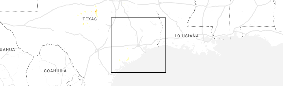
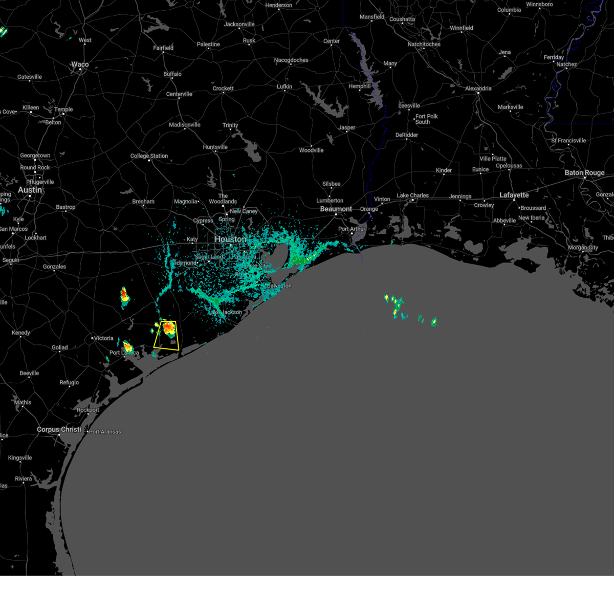
Hail Map for Palacios, TX
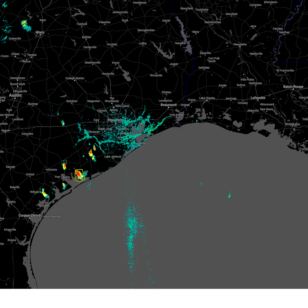
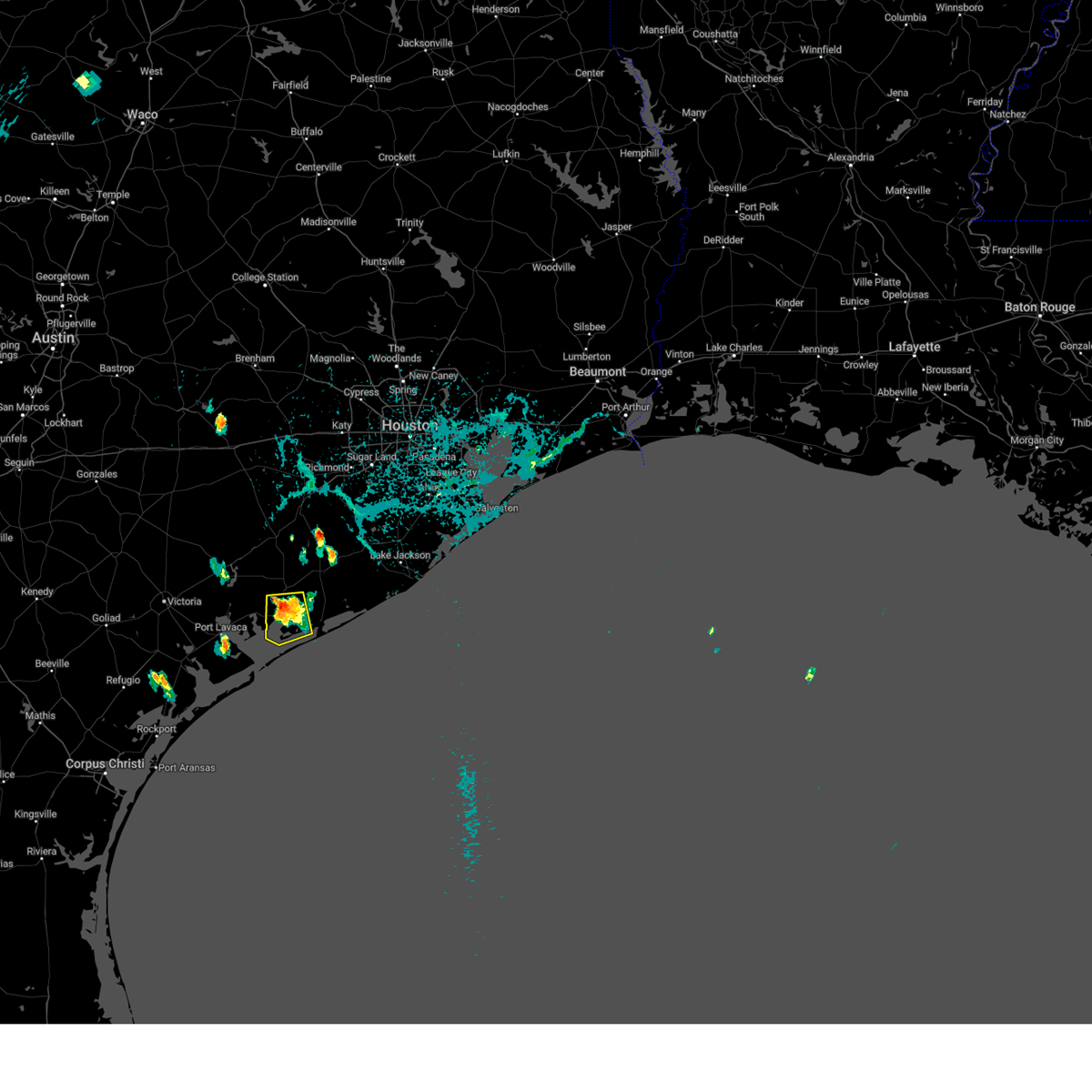
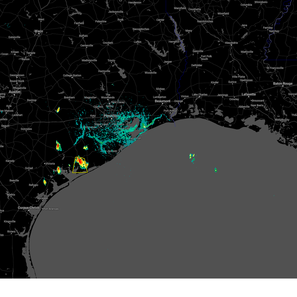
The Palacios, TX area has had 0 reports of on-the-ground hail by trained spotters, and has been under severe weather warnings 7 times during the past 12 months. Doppler radar has detected hail at or near Palacios, TX on 24 occasions, including 5 occasions during the past year.
| Name: | Palacios, TX |
| Where Located: | 88.5 miles SW of Houston, TX |
| Map: | Google Map for Palacios, TX |
| Population: | 4718 |
| Housing Units: | 1987 |
| More Info: | Search Google for Palacios, TX |
4
The Top Recent Hail Date for Palacios, TX is Saturday, September 9, 2023 (2nd out of 24)
Hail and Wind Damage Spotted near Palacios, TX
| Date / Time | Report Details |
|---|---|
| 10/5/2023 9:51 AM CDT |
 At 950 am cdt, severe thunderstorms were located along a line extending from 10 miles south of galveston state park to 17 miles south of freeport to 6 miles southeast of schicke point, moving southeast at 35 mph (radar indicated). Hazards include 70 mph wind gusts. Expect considerable tree damage. damage is likely to mobile homes, roofs, and outbuildings. locations impacted include, galveston island west end, matagorda, lake jackson, freeport, clute, hitchcock, palacios, surfside beach, south texas nuclear plant, richwood, brazoria, jones creek, oyster creek, jamaica beach, galveston state park, sargent, san luis pass, and wadsworth. thunderstorm damage threat, considerable hail threat, radar indicated max hail size, <. 75 in wind threat, observed max wind gust, 70 mph. At 950 am cdt, severe thunderstorms were located along a line extending from 10 miles south of galveston state park to 17 miles south of freeport to 6 miles southeast of schicke point, moving southeast at 35 mph (radar indicated). Hazards include 70 mph wind gusts. Expect considerable tree damage. damage is likely to mobile homes, roofs, and outbuildings. locations impacted include, galveston island west end, matagorda, lake jackson, freeport, clute, hitchcock, palacios, surfside beach, south texas nuclear plant, richwood, brazoria, jones creek, oyster creek, jamaica beach, galveston state park, sargent, san luis pass, and wadsworth. thunderstorm damage threat, considerable hail threat, radar indicated max hail size, <. 75 in wind threat, observed max wind gust, 70 mph.
|
| 10/5/2023 9:37 AM CDT |
 At 936 am cdt, severe thunderstorms were located along a line extending from near jamaica beach to 11 miles southeast of sargent to schicke point, moving southeast at 35 mph. palacios reported a wind gust of 75 mph at 929 am cdt (radar indicated). Hazards include 70 mph wind gusts. Expect considerable tree damage. Damage is likely to mobile homes, roofs, and outbuildings. At 936 am cdt, severe thunderstorms were located along a line extending from near jamaica beach to 11 miles southeast of sargent to schicke point, moving southeast at 35 mph. palacios reported a wind gust of 75 mph at 929 am cdt (radar indicated). Hazards include 70 mph wind gusts. Expect considerable tree damage. Damage is likely to mobile homes, roofs, and outbuildings.
|
| 10/5/2023 9:35 AM CDT | Storm damage reported in matagorda county TX, 2.3 miles ESE of Palacios, TX |
| 10/5/2023 9:15 AM CDT | Storm damage reported in gmz330 county TX, 12.9 miles E of Palacios, TX |
| 9/9/2023 5:46 PM CDT |
 At 546 pm cdt, a severe thunderstorm was located over palacios, moving southwest at 20 mph (radar indicated). Hazards include 60 mph wind gusts and nickel size hail. Expect damage to roofs, siding, and trees. locations impacted include, palacios. hail threat, radar indicated max hail size, 0. 88 in wind threat, radar indicated max wind gust, 60 mph. At 546 pm cdt, a severe thunderstorm was located over palacios, moving southwest at 20 mph (radar indicated). Hazards include 60 mph wind gusts and nickel size hail. Expect damage to roofs, siding, and trees. locations impacted include, palacios. hail threat, radar indicated max hail size, 0. 88 in wind threat, radar indicated max wind gust, 60 mph.
|
| 9/9/2023 5:29 PM CDT |
 At 528 pm cdt, a severe thunderstorm was located near palacios, moving southwest at 15 mph (radar indicated). Hazards include 60 mph wind gusts and quarter size hail. Hail damage to vehicles is expected. Expect wind damage to roofs, siding, and trees. At 528 pm cdt, a severe thunderstorm was located near palacios, moving southwest at 15 mph (radar indicated). Hazards include 60 mph wind gusts and quarter size hail. Hail damage to vehicles is expected. Expect wind damage to roofs, siding, and trees.
|
| 9/9/2023 4:58 PM CDT |
 At 457 pm cdt, a severe thunderstorm was located near blessing, or near south texas nuclear plant, moving south at 20 mph (radar indicated). Hazards include 60 mph wind gusts and quarter size hail. Hail damage to vehicles is expected. Expect wind damage to roofs, siding, and trees. At 457 pm cdt, a severe thunderstorm was located near blessing, or near south texas nuclear plant, moving south at 20 mph (radar indicated). Hazards include 60 mph wind gusts and quarter size hail. Hail damage to vehicles is expected. Expect wind damage to roofs, siding, and trees.
|
| 9/9/2023 4:44 PM CDT |
 At 444 pm cdt, a severe thunderstorm was located near south texas nuclear plant, moving south at 20 mph (radar indicated). Hazards include 60 mph wind gusts and quarter size hail. Hail damage to vehicles is expected. expect wind damage to roofs, siding, and trees. locations impacted include, palacios, south texas nuclear plant, blessing and markham. hail threat, radar indicated max hail size, 1. 00 in wind threat, radar indicated max wind gust, 60 mph. At 444 pm cdt, a severe thunderstorm was located near south texas nuclear plant, moving south at 20 mph (radar indicated). Hazards include 60 mph wind gusts and quarter size hail. Hail damage to vehicles is expected. expect wind damage to roofs, siding, and trees. locations impacted include, palacios, south texas nuclear plant, blessing and markham. hail threat, radar indicated max hail size, 1. 00 in wind threat, radar indicated max wind gust, 60 mph.
|
| 9/9/2023 4:23 PM CDT |
 At 423 pm cdt, a severe thunderstorm was located near markham, or 8 miles northwest of south texas nuclear plant, moving south at 20 mph (radar indicated). Hazards include 60 mph wind gusts and quarter size hail. Hail damage to vehicles is expected. Expect wind damage to roofs, siding, and trees. At 423 pm cdt, a severe thunderstorm was located near markham, or 8 miles northwest of south texas nuclear plant, moving south at 20 mph (radar indicated). Hazards include 60 mph wind gusts and quarter size hail. Hail damage to vehicles is expected. Expect wind damage to roofs, siding, and trees.
|
| 5/25/2022 2:02 AM CDT |
 At 201 am cdt, severe thunderstorms were located along a line extending from near speaks to near olivia to 21 miles southwest of matagorda island state park, moving east at 30 mph (radar indicated). Hazards include 60 mph wind gusts. expect damage to roofs, siding, and trees At 201 am cdt, severe thunderstorms were located along a line extending from near speaks to near olivia to 21 miles southwest of matagorda island state park, moving east at 30 mph (radar indicated). Hazards include 60 mph wind gusts. expect damage to roofs, siding, and trees
|
| 5/19/2021 3:25 AM CDT |
 At 325 am cdt, severe thunderstorms located near ganado, or near edna, moving east at 50-60 mph (radar indicated). Hazards include 60 mph wind gusts and penny size hail. expect damage to roofs, siding, and trees At 325 am cdt, severe thunderstorms located near ganado, or near edna, moving east at 50-60 mph (radar indicated). Hazards include 60 mph wind gusts and penny size hail. expect damage to roofs, siding, and trees
|
| 5/9/2019 11:46 PM CDT |
 At 1146 pm cdt, severe thunderstorms were located along a line extending from near salem to inez to near port lavaca to near seadrift, moving east at 40 mph (radar indicated). Hazards include 60 mph wind gusts. expect damage to roofs, siding, and trees At 1146 pm cdt, severe thunderstorms were located along a line extending from near salem to inez to near port lavaca to near seadrift, moving east at 40 mph (radar indicated). Hazards include 60 mph wind gusts. expect damage to roofs, siding, and trees
|
| 3/29/2018 2:20 AM CDT |
 At 219 am cdt, severe thunderstorms were located along a line extending from near west columbia to 6 miles southwest of south texas nuclear plant, moving east at 45 mph (radar indicated). Hazards include 60 mph wind gusts and quarter size hail. Hail damage to vehicles is expected. expect wind damage to roofs, siding, and trees. Locations impacted include, matagorda, northwestern lake jackson, angleton, bay city, palacios, west columbia, sweeny, south texas nuclear plant, brazoria, holiday lakes, bailey`s prairie, bonney, sargent, wild peach village, van vleck, damon, wadsworth and rosharon. At 219 am cdt, severe thunderstorms were located along a line extending from near west columbia to 6 miles southwest of south texas nuclear plant, moving east at 45 mph (radar indicated). Hazards include 60 mph wind gusts and quarter size hail. Hail damage to vehicles is expected. expect wind damage to roofs, siding, and trees. Locations impacted include, matagorda, northwestern lake jackson, angleton, bay city, palacios, west columbia, sweeny, south texas nuclear plant, brazoria, holiday lakes, bailey`s prairie, bonney, sargent, wild peach village, van vleck, damon, wadsworth and rosharon.
|
| 3/29/2018 1:52 AM CDT |
 At 151 am cdt, severe thunderstorms were located along a line extending from near boling-iago to near point comfort, moving east at 45 mph (radar indicated). Hazards include 60 mph wind gusts and quarter size hail. Hail damage to vehicles is expected. Expect wind damage to roofs, siding, and trees. At 151 am cdt, severe thunderstorms were located along a line extending from near boling-iago to near point comfort, moving east at 45 mph (radar indicated). Hazards include 60 mph wind gusts and quarter size hail. Hail damage to vehicles is expected. Expect wind damage to roofs, siding, and trees.
|
| 4/17/2017 2:10 PM CDT |
 At 209 pm cdt, a severe thunderstorm was located over olivia, or 10 miles northeast of port lavaca, moving northeast at 15 mph (radar indicated). Hazards include 60 mph wind gusts and quarter size hail. Hail damage to vehicles is expected. Expect wind damage to roofs, siding, and trees. At 209 pm cdt, a severe thunderstorm was located over olivia, or 10 miles northeast of port lavaca, moving northeast at 15 mph (radar indicated). Hazards include 60 mph wind gusts and quarter size hail. Hail damage to vehicles is expected. Expect wind damage to roofs, siding, and trees.
|
| 2/14/2017 7:25 AM CST |
 At 724 am cst, severe thunderstorms were located along a line extending from near wallis to near lolita, moving east at 30 mph (radar indicated). Hazards include 60 mph wind gusts. expect damage to roofs, siding, and trees At 724 am cst, severe thunderstorms were located along a line extending from near wallis to near lolita, moving east at 30 mph (radar indicated). Hazards include 60 mph wind gusts. expect damage to roofs, siding, and trees
|
| 5/27/2016 7:28 PM CDT |
 At 728 pm cdt, a severe thunderstorm was located 8 miles northwest of palacios, moving northeast at 35 mph (radar indicated). Hazards include quarter size hail. damage to vehicles is possible At 728 pm cdt, a severe thunderstorm was located 8 miles northwest of palacios, moving northeast at 35 mph (radar indicated). Hazards include quarter size hail. damage to vehicles is possible
|
| 5/24/2015 4:20 AM CDT | At 419 am cdt, doppler radar indicated a line of severe thunderstorms capable of producing damaging winds in excess of 60 mph. these storms were located along a line extending from near weimar to 7 miles west of eagle lake to 13 miles northwest of wharton to 8 miles southwest of el campo to 17 miles east of port oconnor, and moving east northeast at 40 mph. |
| 5/24/2015 3:39 AM CDT | At 338 am cdt, doppler radar indicated a line of severe thunderstorms capable of producing damaging winds in excess of 60 mph. these storms were located along a line extending from near speaks to 6 miles north of la ward to near alamo beach, and moving northeast at 45 mph. |
| 4/16/2015 5:35 PM CDT | The national weather service in league city has issued a * tornado warning for. jackson county in south central texas. matagorda county in southeastern texas. until 615 pm cdt * at 534 pm cdt. Doppler radar indicated a severe thunderstorm. |
| 4/16/2015 5:04 PM CDT | At 503 pm cdt, doppler radar indicated a severe thunderstorm capable of producing quarter size hail and damaging winds in excess of 60 mph. this storm was located near port alto, or 11 miles northeast of port lavaca, and moving northeast at 20 mph. |
| 1/1/0001 12:00 AM | Power lines downed. transformer on fir in matagorda county TX, 1.3 miles E of Palacios, TX |
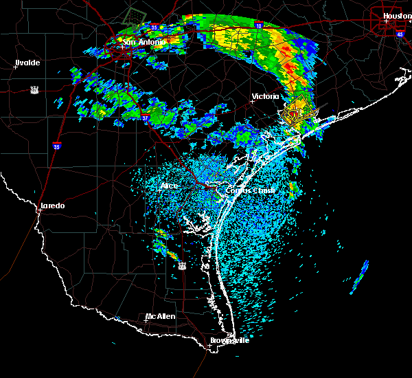
Hail Maps for Palacios, TX


Connect with Interactive Hail Maps