

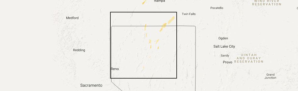
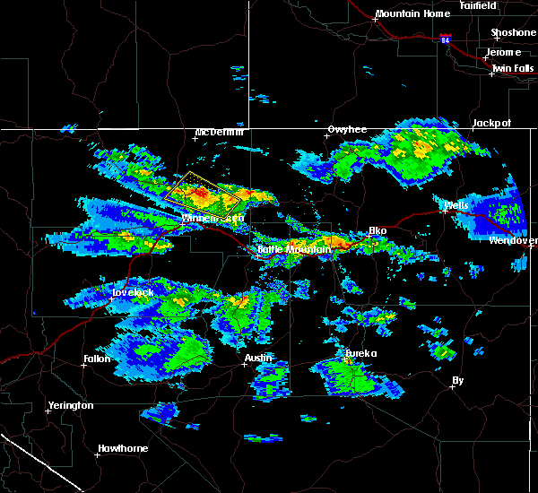
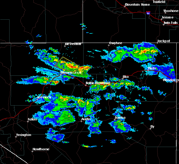
Hail Map for Paradise Valley, NV
The Paradise Valley, NV area has had 0 reports of on-the-ground hail by trained spotters, and has been under severe weather warnings 0 times during the past 12 months. Doppler radar has detected hail at or near Paradise Valley, NV on 1 occasion.
| Name: | Paradise Valley, NV |
| Where Located: | 38.3 miles NNE of Winnemucca, NV |
| Map: | Google Map for Paradise Valley, NV |
| Population: | 109 |
| Housing Units: | 92 |
| More Info: | Search Google for Paradise Valley, NV |
5
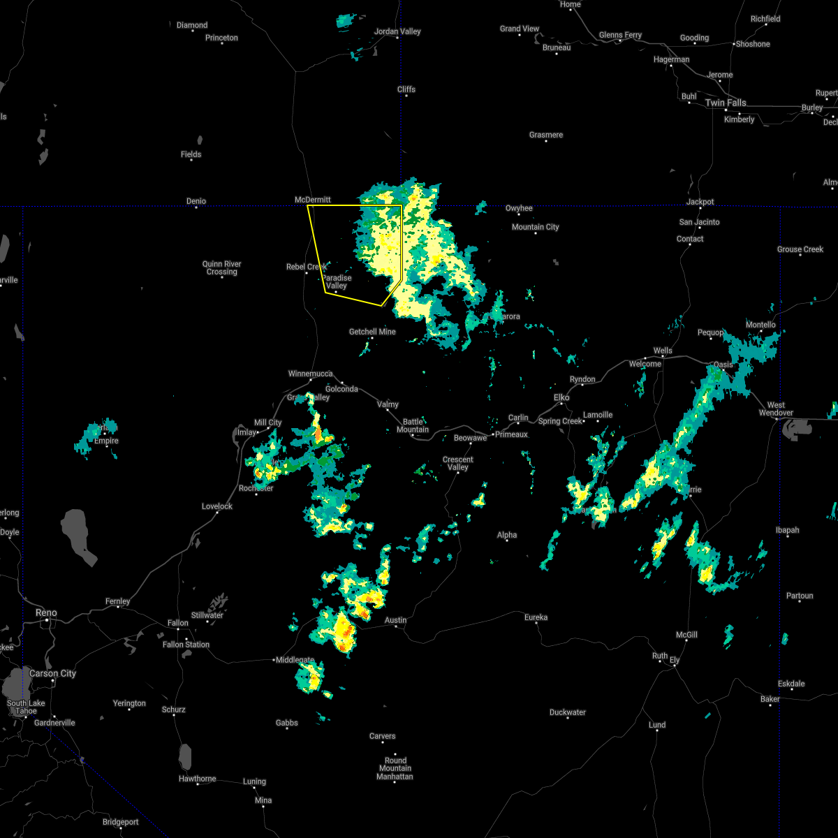
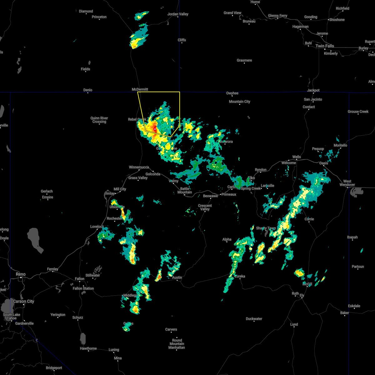
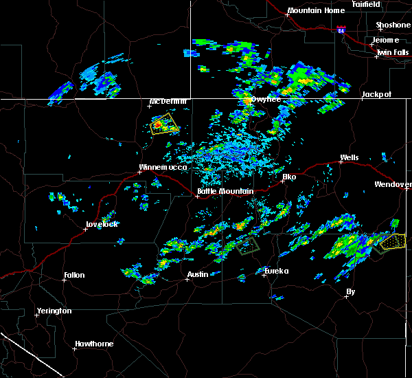
The Top Recent Hail Date for Paradise Valley, NV is Friday, May 5, 2017 (1st out of 1)
Hail and Wind Damage Spotted near Paradise Valley, NV
| Date / Time | Report Details |
|---|---|
| 8/3/2023 12:43 PM PDT | Martin creek raws (mpvn2)... elevation 6439 fee in humboldt county NV, 16.7 miles SW of Paradise Valley, NV |
| 8/1/2022 6:43 PM PDT | Mesonet station mpvn2 martin creek station elevation: 6438 f in humboldt county NV, 16.7 miles SW of Paradise Valley, NV |
| 8/24/2020 10:07 PM PDT |
 The severe thunderstorm warning for northeastern humboldt county will expire at 1015 pm pdt, the storm which prompted the warning has has weakened and moved out of the area. herefore, the warning will be allowed to expire. note that some gusty winds and lightning will continue until about 1015 pm pdt (1100 pm mdt). The severe thunderstorm warning for northeastern humboldt county will expire at 1015 pm pdt, the storm which prompted the warning has has weakened and moved out of the area. herefore, the warning will be allowed to expire. note that some gusty winds and lightning will continue until about 1015 pm pdt (1100 pm mdt).
|
| 8/24/2020 9:18 PM PDT |
 At 917 pm pdt, a severe thunderstorm was located near paradise valley, moving north at 45 mph (radar indicated). Hazards include 60 mph wind gusts. Expect damage to roofs, siding, and trees. Small hail is also possible. At 917 pm pdt, a severe thunderstorm was located near paradise valley, moving north at 45 mph (radar indicated). Hazards include 60 mph wind gusts. Expect damage to roofs, siding, and trees. Small hail is also possible.
|
| 8/9/2017 1:44 PM PDT |
 At 143 pm pdt, a severe thunderstorm was located 8 miles northeast of paradise valley, moving northeast at 10 mph (radar indicated). Hazards include 60 mph wind gusts and quarter size hail. Hail damage to vehicles is expected. Expect wind damage to roofs, siding, and trees. At 143 pm pdt, a severe thunderstorm was located 8 miles northeast of paradise valley, moving northeast at 10 mph (radar indicated). Hazards include 60 mph wind gusts and quarter size hail. Hail damage to vehicles is expected. Expect wind damage to roofs, siding, and trees.
|
| 5/6/2016 1:49 PM PDT |
 At 149 pm pdt, doppler radar indicated a severe thunderstorm capable of producing quarter size hail and damaging winds in excess of 60 mph. this storm was located 14 miles south of paradise valley, moving northwest at 30 mph. locations impacted include, adam peak, twin creeks mine and paradise hill summit. At 149 pm pdt, doppler radar indicated a severe thunderstorm capable of producing quarter size hail and damaging winds in excess of 60 mph. this storm was located 14 miles south of paradise valley, moving northwest at 30 mph. locations impacted include, adam peak, twin creeks mine and paradise hill summit.
|
| 5/6/2016 1:32 PM PDT |
 At 132 pm pdt, doppler radar indicated a severe thunderstorm capable of producing quarter size hail and damaging winds in excess of 60 mph. this storm was located 21 miles northeast of golconda, and moving northwest at 25 mph. At 132 pm pdt, doppler radar indicated a severe thunderstorm capable of producing quarter size hail and damaging winds in excess of 60 mph. this storm was located 21 miles northeast of golconda, and moving northwest at 25 mph.
|
| 4/26/2012 1:37 PM PDT | Morey creek raws site 5500 ft amsl in humboldt county NV, 5.9 miles NE of Paradise Valley, NV |
Hail Maps for Paradise Valley, NV

Connect with Interactive Hail Maps