

Hail Map for Pasadena, MD
The Pasadena, MD area has had 6 reports of on-the-ground hail by trained spotters, and has been under severe weather warnings 37 times during the past 12 months. Doppler radar has detected hail at or near Pasadena, MD on 64 occasions, including 5 occasions during the past year.
| Name: | Pasadena, MD |
| Where Located: | 10.3 miles SSE of Baltimore, MD |
| Map: | Google Map for Pasadena, MD |
| Population: | 24287 |
| Housing Units: | 8911 |
| More Info: | Search Google for Pasadena, MD |
0
The Top Recent Hail Date for Pasadena, MD is Wednesday, April 3, 2024 (55th out of 64)
Hail and Wind Damage Spotted near Pasadena, MD
| Date / Time | Report Details |
|---|---|
| 9/12/2023 11:22 PM EDT |
 At 1121 pm edt, a severe thunderstorm was located over brooklyn park, or near riviera beach, moving northeast at 45 mph (radar indicated). Hazards include 60 mph wind gusts and quarter size hail. Damaging winds will cause some trees and large branches to fall. this could injure those outdoors, as well as damage homes and vehicles. roadways may become blocked by downed trees. localized power outages are possible. unsecured light objects may become projectiles. Locations impacted include, severn, elkridge, riviera beach, baltimore-washington airport, glen burnie, severna park, odenton, laurel, pasadena, lake shore, ferndale, brooklyn park, fort meade, green haven, south gate, pumphrey, savage-guilford, scaggsville, ilchester, and linthicum. At 1121 pm edt, a severe thunderstorm was located over brooklyn park, or near riviera beach, moving northeast at 45 mph (radar indicated). Hazards include 60 mph wind gusts and quarter size hail. Damaging winds will cause some trees and large branches to fall. this could injure those outdoors, as well as damage homes and vehicles. roadways may become blocked by downed trees. localized power outages are possible. unsecured light objects may become projectiles. Locations impacted include, severn, elkridge, riviera beach, baltimore-washington airport, glen burnie, severna park, odenton, laurel, pasadena, lake shore, ferndale, brooklyn park, fort meade, green haven, south gate, pumphrey, savage-guilford, scaggsville, ilchester, and linthicum.
|
| 9/12/2023 11:00 PM EDT |
 At 1100 pm edt, a severe thunderstorm was located over laurel, or near beltsville, moving northeast at 45 mph (radar indicated). Hazards include 60 mph wind gusts and quarter size hail. Damaging winds will cause some trees and large branches to fall. this could injure those outdoors, as well as damage homes and vehicles. roadways may become blocked by downed trees. localized power outages are possible. Unsecured light objects may become projectiles. At 1100 pm edt, a severe thunderstorm was located over laurel, or near beltsville, moving northeast at 45 mph (radar indicated). Hazards include 60 mph wind gusts and quarter size hail. Damaging winds will cause some trees and large branches to fall. this could injure those outdoors, as well as damage homes and vehicles. roadways may become blocked by downed trees. localized power outages are possible. Unsecured light objects may become projectiles.
|
| 9/8/2023 4:37 AM EDT |
 The severe thunderstorm warning for northeastern anne arundel and southeastern baltimore counties and southeastern baltimore city will expire at 445 am edt, the storm which prompted the warning has weakened below severe limits, and no longer poses an immediate threat to life or property. therefore, the warning will be allowed to expire. The severe thunderstorm warning for northeastern anne arundel and southeastern baltimore counties and southeastern baltimore city will expire at 445 am edt, the storm which prompted the warning has weakened below severe limits, and no longer poses an immediate threat to life or property. therefore, the warning will be allowed to expire.
|
| 9/8/2023 4:22 AM EDT |
 At 422 am edt, a severe thunderstorm was located over severna park, or near riviera beach, moving northeast at 25 mph (radar indicated). Hazards include 60 mph wind gusts and quarter size hail. Damaging winds will cause some trees and large branches to fall. this could injure those outdoors, as well as damage homes and vehicles. roadways may become blocked by downed trees. localized power outages are possible. Unsecured light objects may become projectiles. At 422 am edt, a severe thunderstorm was located over severna park, or near riviera beach, moving northeast at 25 mph (radar indicated). Hazards include 60 mph wind gusts and quarter size hail. Damaging winds will cause some trees and large branches to fall. this could injure those outdoors, as well as damage homes and vehicles. roadways may become blocked by downed trees. localized power outages are possible. Unsecured light objects may become projectiles.
|
| 8/7/2023 6:11 PM EDT |
 At 611 pm edt, severe thunderstorms were located along a line extending from near fort smallwood state park to near arnold to mitchellville, moving east at 45 mph (radar indicated). Hazards include 60 mph wind gusts. Damaging winds will cause some trees and large branches to fall. this could injure those outdoors, as well as damage homes and vehicles. roadways may become blocked by downed trees. localized power outages are possible. unsecured light objects may become projectiles. locations impacted include, baltimore, bowie, severn, annapolis, crofton, elkridge, riviera beach, mayo, naval academy, baltimore-washington airport, severn river, south river, fort smallwood state park, gibson island, sillery bay, bodkin point, millers island, rhode river, magothy river and dobbins island. hail threat, radar indicated max hail size, <. 75 in wind threat, radar indicated max wind gust, 60 mph. At 611 pm edt, severe thunderstorms were located along a line extending from near fort smallwood state park to near arnold to mitchellville, moving east at 45 mph (radar indicated). Hazards include 60 mph wind gusts. Damaging winds will cause some trees and large branches to fall. this could injure those outdoors, as well as damage homes and vehicles. roadways may become blocked by downed trees. localized power outages are possible. unsecured light objects may become projectiles. locations impacted include, baltimore, bowie, severn, annapolis, crofton, elkridge, riviera beach, mayo, naval academy, baltimore-washington airport, severn river, south river, fort smallwood state park, gibson island, sillery bay, bodkin point, millers island, rhode river, magothy river and dobbins island. hail threat, radar indicated max hail size, <. 75 in wind threat, radar indicated max wind gust, 60 mph.
|
| 8/7/2023 5:42 PM EDT |
 At 541 pm edt, severe thunderstorms were located along a line extending from ellicott city to near laurel to potomac, moving east at 45 mph (radar indicated). Hazards include 60 mph wind gusts. Damaging winds will cause some trees and large branches to fall. this could injure those outdoors, as well as damage homes and vehicles. roadways may become blocked by downed trees. localized power outages are possible. Unsecured light objects may become projectiles. At 541 pm edt, severe thunderstorms were located along a line extending from ellicott city to near laurel to potomac, moving east at 45 mph (radar indicated). Hazards include 60 mph wind gusts. Damaging winds will cause some trees and large branches to fall. this could injure those outdoors, as well as damage homes and vehicles. roadways may become blocked by downed trees. localized power outages are possible. Unsecured light objects may become projectiles.
|
| 8/7/2023 5:06 PM EDT |
 At 505 pm edt, severe thunderstorms were located along a line extending from hampstead to near ellicott city to near north potomac, moving east at 55 mph (radar indicated). Hazards include 60 mph wind gusts. Damaging winds will cause some trees and large branches to fall. this could injure those outdoors, as well as damage homes and vehicles. roadways may become blocked by downed trees. localized power outages are possible. Unsecured light objects may become projectiles. At 505 pm edt, severe thunderstorms were located along a line extending from hampstead to near ellicott city to near north potomac, moving east at 55 mph (radar indicated). Hazards include 60 mph wind gusts. Damaging winds will cause some trees and large branches to fall. this could injure those outdoors, as well as damage homes and vehicles. roadways may become blocked by downed trees. localized power outages are possible. Unsecured light objects may become projectiles.
|
| 7/29/2023 5:04 PM EDT |
 At 503 pm edt, severe thunderstorms were located along a line extending from pinehurst to near crofton to anacostia, moving east at 30 mph (radar indicated). Hazards include 70 mph wind gusts and quarter size hail. Damaging winds will cause some trees and large branches to fall. this could injure those outdoors, as well as damage homes and vehicles. roadways may become blocked by downed trees. localized power outages are possible. unsecured light objects may become projectiles. locations impacted include, arlington, bethesda, bowie, severn, annapolis, college park, crofton, greenbelt, langley park, beltsville, riviera beach, forestville, falls church, largo, coral hills, bladensburg, mayo, pimmit hills, shady side and deale. thunderstorm damage threat, considerable hail threat, radar indicated max hail size, 1. 00 in wind threat, radar indicated max wind gust, 70 mph. At 503 pm edt, severe thunderstorms were located along a line extending from pinehurst to near crofton to anacostia, moving east at 30 mph (radar indicated). Hazards include 70 mph wind gusts and quarter size hail. Damaging winds will cause some trees and large branches to fall. this could injure those outdoors, as well as damage homes and vehicles. roadways may become blocked by downed trees. localized power outages are possible. unsecured light objects may become projectiles. locations impacted include, arlington, bethesda, bowie, severn, annapolis, college park, crofton, greenbelt, langley park, beltsville, riviera beach, forestville, falls church, largo, coral hills, bladensburg, mayo, pimmit hills, shady side and deale. thunderstorm damage threat, considerable hail threat, radar indicated max hail size, 1. 00 in wind threat, radar indicated max wind gust, 70 mph.
|
| 7/29/2023 4:47 PM EDT |
 At 447 pm edt, a severe thunderstorm was located over severn, moving east at 30 mph. this is a destructive storm for northern anne arundel county (radar indicated). Hazards include 80 mph wind gusts and quarter size hail. Expect considerable damage to trees and power lines. your life is at significant risk if outdoors. in addition to some trees falling into homes, wind damage is possible to roofs, sheds, open garages, and mobile homes. locations impacted include, severn, glen burnie, severna park, odenton, pasadena, arnold, lake shore, fort meade, millersville, south gate, gambrills, herald harbor, crownsville, chelsea beach, sherwood forest and belvedere heights. thunderstorm damage threat, destructive hail threat, radar indicated max hail size, 1. 00 in wind threat, radar indicated max wind gust, 80 mph. At 447 pm edt, a severe thunderstorm was located over severn, moving east at 30 mph. this is a destructive storm for northern anne arundel county (radar indicated). Hazards include 80 mph wind gusts and quarter size hail. Expect considerable damage to trees and power lines. your life is at significant risk if outdoors. in addition to some trees falling into homes, wind damage is possible to roofs, sheds, open garages, and mobile homes. locations impacted include, severn, glen burnie, severna park, odenton, pasadena, arnold, lake shore, fort meade, millersville, south gate, gambrills, herald harbor, crownsville, chelsea beach, sherwood forest and belvedere heights. thunderstorm damage threat, destructive hail threat, radar indicated max hail size, 1. 00 in wind threat, radar indicated max wind gust, 80 mph.
|
| 7/29/2023 4:41 PM EDT |
 At 441 pm edt, severe thunderstorms were located along a line extending from baltimore-washington airport to near goddard to pimmit hills, moving east at 35 mph (radar indicated). Hazards include 70 mph wind gusts and quarter size hail. Damaging winds will cause some trees and large branches to fall. this could injure those outdoors, as well as damage homes and vehicles. roadways may become blocked by downed trees. localized power outages are possible. unsecured light objects may become projectiles. locations impacted include, arlington, columbia, bethesda, reston, bowie, severn, annapolis, college park, crofton, greenbelt, langley park, beltsville, vienna, elkridge, riviera beach, forestville, falls church, largo, coral hills and bladensburg. thunderstorm damage threat, considerable hail threat, radar indicated max hail size, 1. 00 in wind threat, radar indicated max wind gust, 70 mph. At 441 pm edt, severe thunderstorms were located along a line extending from baltimore-washington airport to near goddard to pimmit hills, moving east at 35 mph (radar indicated). Hazards include 70 mph wind gusts and quarter size hail. Damaging winds will cause some trees and large branches to fall. this could injure those outdoors, as well as damage homes and vehicles. roadways may become blocked by downed trees. localized power outages are possible. unsecured light objects may become projectiles. locations impacted include, arlington, columbia, bethesda, reston, bowie, severn, annapolis, college park, crofton, greenbelt, langley park, beltsville, vienna, elkridge, riviera beach, forestville, falls church, largo, coral hills and bladensburg. thunderstorm damage threat, considerable hail threat, radar indicated max hail size, 1. 00 in wind threat, radar indicated max wind gust, 70 mph.
|
| 7/29/2023 4:35 PM EDT |
 At 434 pm edt, a severe thunderstorm was located over savage-guilford, or near elkridge, moving east at 35 mph. this is a destructive storm for eastern howard county and northern anne arundel county (radar indicated). Hazards include 80 mph wind gusts and quarter size hail. Expect considerable damage to trees and power lines. your life is at significant risk if outdoors. In addition to some trees falling into homes, wind damage is possible to roofs, sheds, open garages, and mobile homes. At 434 pm edt, a severe thunderstorm was located over savage-guilford, or near elkridge, moving east at 35 mph. this is a destructive storm for eastern howard county and northern anne arundel county (radar indicated). Hazards include 80 mph wind gusts and quarter size hail. Expect considerable damage to trees and power lines. your life is at significant risk if outdoors. In addition to some trees falling into homes, wind damage is possible to roofs, sheds, open garages, and mobile homes.
|
| 7/29/2023 4:24 PM EDT |
 At 424 pm edt, severe thunderstorms were located along a line extending from savage-guilford to hillandale to reston, moving east at 35 mph (radar indicated). Hazards include 70 mph wind gusts and quarter size hail. Damaging winds will cause some trees and large branches to fall. this could injure those outdoors, as well as damage homes and vehicles. roadways may become blocked by downed trees. localized power outages are possible. Unsecured light objects may become projectiles. At 424 pm edt, severe thunderstorms were located along a line extending from savage-guilford to hillandale to reston, moving east at 35 mph (radar indicated). Hazards include 70 mph wind gusts and quarter size hail. Damaging winds will cause some trees and large branches to fall. this could injure those outdoors, as well as damage homes and vehicles. roadways may become blocked by downed trees. localized power outages are possible. Unsecured light objects may become projectiles.
|
| 7/28/2023 9:08 PM EDT |
 At 907 pm edt, severe thunderstorms were located along a line extending from severna park to annapolis to near rhode river, moving east at 25 mph (radar indicated). Hazards include 60 mph wind gusts and quarter size hail. Damaging winds will cause some trees and large branches to fall. this could injure those outdoors, as well as damage homes and vehicles. roadways may become blocked by downed trees. localized power outages are possible. unsecured light objects may become projectiles. locations impacted include, annapolis, crofton, riviera beach, mayo, shady side, naval academy, magothy river, dobbins island, severn river, south river, fort smallwood state park, pinehurst, gibson island, sillery bay, bodkin point, rhode river, glen burnie, severna park, odenton and pasadena. hail threat, radar indicated max hail size, 1. 00 in wind threat, radar indicated max wind gust, 60 mph. At 907 pm edt, severe thunderstorms were located along a line extending from severna park to annapolis to near rhode river, moving east at 25 mph (radar indicated). Hazards include 60 mph wind gusts and quarter size hail. Damaging winds will cause some trees and large branches to fall. this could injure those outdoors, as well as damage homes and vehicles. roadways may become blocked by downed trees. localized power outages are possible. unsecured light objects may become projectiles. locations impacted include, annapolis, crofton, riviera beach, mayo, shady side, naval academy, magothy river, dobbins island, severn river, south river, fort smallwood state park, pinehurst, gibson island, sillery bay, bodkin point, rhode river, glen burnie, severna park, odenton and pasadena. hail threat, radar indicated max hail size, 1. 00 in wind threat, radar indicated max wind gust, 60 mph.
|
| 7/28/2023 9:00 PM EDT |
 At 900 pm edt, severe thunderstorms were located along a line extending from millersville to londontowne to near upper marlboro, moving east at 25 mph (radar indicated). Hazards include 60 mph wind gusts and quarter size hail. Damaging winds will cause some trees and large branches to fall. this could injure those outdoors, as well as damage homes and vehicles. roadways may become blocked by downed trees. localized power outages are possible. Unsecured light objects may become projectiles. At 900 pm edt, severe thunderstorms were located along a line extending from millersville to londontowne to near upper marlboro, moving east at 25 mph (radar indicated). Hazards include 60 mph wind gusts and quarter size hail. Damaging winds will cause some trees and large branches to fall. this could injure those outdoors, as well as damage homes and vehicles. roadways may become blocked by downed trees. localized power outages are possible. Unsecured light objects may become projectiles.
|
| 7/28/2023 7:34 PM EDT |
 At 733 pm edt, severe thunderstorms were located along a line extending from near jarrettsville to near carney to elkridge, moving northeast at 45 mph (emergency management). Hazards include 70 mph wind gusts and quarter size hail. Damaging winds will cause some trees and large branches to fall. this could injure those outdoors, as well as damage homes and vehicles. roadways may become blocked by downed trees. localized power outages are possible. unsecured light objects may become projectiles. locations impacted include, baltimore, columbia, bowie, severn, pikesville, college park, crofton, middle river, greenbelt, cockeysville, langley park, beltsville, elkridge, riviera beach, baltimore-washington airport, fort smallwood state park, gibson island, sillery bay, millers island and north point state park. thunderstorm damage threat, considerable hail threat, radar indicated max hail size, 1. 00 in wind threat, observed max wind gust, 70 mph. At 733 pm edt, severe thunderstorms were located along a line extending from near jarrettsville to near carney to elkridge, moving northeast at 45 mph (emergency management). Hazards include 70 mph wind gusts and quarter size hail. Damaging winds will cause some trees and large branches to fall. this could injure those outdoors, as well as damage homes and vehicles. roadways may become blocked by downed trees. localized power outages are possible. unsecured light objects may become projectiles. locations impacted include, baltimore, columbia, bowie, severn, pikesville, college park, crofton, middle river, greenbelt, cockeysville, langley park, beltsville, elkridge, riviera beach, baltimore-washington airport, fort smallwood state park, gibson island, sillery bay, millers island and north point state park. thunderstorm damage threat, considerable hail threat, radar indicated max hail size, 1. 00 in wind threat, observed max wind gust, 70 mph.
|
| 7/28/2023 7:00 PM EDT |
 At 659 pm edt, severe thunderstorms were located along a line extending from near sykesville to near columbia to forest glen, moving east at 30 mph (emergency management has reported numerous instance of damage with these severe thunderstorms as they moved across montogmery county). Hazards include 60 mph wind gusts and quarter size hail. Damaging winds will cause some trees and large branches to fall. this could injure those outdoors, as well as damage homes and vehicles. roadways may become blocked by downed trees. localized power outages are possible. Unsecured light objects may become projectiles. At 659 pm edt, severe thunderstorms were located along a line extending from near sykesville to near columbia to forest glen, moving east at 30 mph (emergency management has reported numerous instance of damage with these severe thunderstorms as they moved across montogmery county). Hazards include 60 mph wind gusts and quarter size hail. Damaging winds will cause some trees and large branches to fall. this could injure those outdoors, as well as damage homes and vehicles. roadways may become blocked by downed trees. localized power outages are possible. Unsecured light objects may become projectiles.
|
| 7/25/2023 12:07 PM EDT |
 At 1207 pm edt, a severe thunderstorm was located over sparrows point, moving east at 10 mph (radar indicated). Hazards include 60 mph wind gusts and quarter size hail. Damaging winds will cause some trees and large branches to fall. this could injure those outdoors, as well as damage homes and vehicles. roadways may become blocked by downed trees. localized power outages are possible. Unsecured light objects may become projectiles. At 1207 pm edt, a severe thunderstorm was located over sparrows point, moving east at 10 mph (radar indicated). Hazards include 60 mph wind gusts and quarter size hail. Damaging winds will cause some trees and large branches to fall. this could injure those outdoors, as well as damage homes and vehicles. roadways may become blocked by downed trees. localized power outages are possible. Unsecured light objects may become projectiles.
|
| 7/2/2023 7:28 PM EDT | Multiple trees down from lake shore to arcadi in anne arundel county MD, 4.7 miles NW of Pasadena, MD |
| 7/2/2023 7:21 PM EDT |
 At 721 pm edt, a severe thunderstorm was located over pasadena, or over riviera beach, moving east at 15 mph (radar indicated). Hazards include 60 mph wind gusts. Damaging winds will cause some trees and large branches to fall. this could injure those outdoors, as well as damage homes and vehicles. roadways may become blocked by downed trees. localized power outages are possible. unsecured light objects may become projectiles. locations impacted include, riviera beach, fort smallwood state park, pinehurst, gibson island, bodkin point, glen burnie, severna park, pasadena, lake shore, green haven and chelsea beach. hail threat, radar indicated max hail size, <. 75 in wind threat, radar indicated max wind gust, 60 mph. At 721 pm edt, a severe thunderstorm was located over pasadena, or over riviera beach, moving east at 15 mph (radar indicated). Hazards include 60 mph wind gusts. Damaging winds will cause some trees and large branches to fall. this could injure those outdoors, as well as damage homes and vehicles. roadways may become blocked by downed trees. localized power outages are possible. unsecured light objects may become projectiles. locations impacted include, riviera beach, fort smallwood state park, pinehurst, gibson island, bodkin point, glen burnie, severna park, pasadena, lake shore, green haven and chelsea beach. hail threat, radar indicated max hail size, <. 75 in wind threat, radar indicated max wind gust, 60 mph.
|
| 7/2/2023 7:19 PM EDT |
 At 719 pm edt, a severe thunderstorm was located over green haven, or near riviera beach, moving east at 20 mph (radar indicated). Hazards include 60 mph wind gusts. Damaging winds will cause some trees and large branches to fall. this could injure those outdoors, as well as damage homes and vehicles. roadways may become blocked by downed trees. localized power outages are possible. Unsecured light objects may become projectiles. At 719 pm edt, a severe thunderstorm was located over green haven, or near riviera beach, moving east at 20 mph (radar indicated). Hazards include 60 mph wind gusts. Damaging winds will cause some trees and large branches to fall. this could injure those outdoors, as well as damage homes and vehicles. roadways may become blocked by downed trees. localized power outages are possible. Unsecured light objects may become projectiles.
|
| 7/2/2023 7:16 PM EDT | At least five trees down in paseden in anne arundel county MD, 1.3 miles N of Pasadena, MD |
| 7/2/2023 7:13 PM EDT |
 At 713 pm edt, a severe thunderstorm was located over glen burnie, or near riviera beach, moving east at 15 mph (radar indicated). Hazards include 70 mph wind gusts. Damaging winds will cause some trees and large branches to fall. this could injure those outdoors, as well as damage homes and vehicles. roadways may become blocked by downed trees. localized power outages are possible. unsecured light objects may become projectiles. locations impacted include, baltimore, riviera beach, fort smallwood state park, pinehurst, north point state park, sparrows point, gibson island, bodkin point, millers island, glen burnie, severna park, pasadena, lake shore, green haven, edgemere, fort howard and chelsea beach. thunderstorm damage threat, considerable hail threat, radar indicated max hail size, <. 75 in wind threat, radar indicated max wind gust, 70 mph. At 713 pm edt, a severe thunderstorm was located over glen burnie, or near riviera beach, moving east at 15 mph (radar indicated). Hazards include 70 mph wind gusts. Damaging winds will cause some trees and large branches to fall. this could injure those outdoors, as well as damage homes and vehicles. roadways may become blocked by downed trees. localized power outages are possible. unsecured light objects may become projectiles. locations impacted include, baltimore, riviera beach, fort smallwood state park, pinehurst, north point state park, sparrows point, gibson island, bodkin point, millers island, glen burnie, severna park, pasadena, lake shore, green haven, edgemere, fort howard and chelsea beach. thunderstorm damage threat, considerable hail threat, radar indicated max hail size, <. 75 in wind threat, radar indicated max wind gust, 70 mph.
|
| 7/2/2023 7:06 PM EDT |
 At 705 pm edt, a severe thunderstorm was located over glen burnie, or over baltimore-washington airport, moving east at 15 mph (radar indicated). Hazards include 60 mph wind gusts. Damaging winds will cause some trees and large branches to fall. this could injure those outdoors, as well as damage homes and vehicles. roadways may become blocked by downed trees. localized power outages are possible. Unsecured light objects may become projectiles. At 705 pm edt, a severe thunderstorm was located over glen burnie, or over baltimore-washington airport, moving east at 15 mph (radar indicated). Hazards include 60 mph wind gusts. Damaging winds will cause some trees and large branches to fall. this could injure those outdoors, as well as damage homes and vehicles. roadways may become blocked by downed trees. localized power outages are possible. Unsecured light objects may become projectiles.
|
| 6/30/2023 4:57 PM EDT |
 At 457 pm edt, severe thunderstorms were located along a line extending from woodlawn to arbutus to severn, moving east at 15 mph (radar indicated). Hazards include 60 mph wind gusts. Damaging winds will cause some trees and large branches to fall. this could injure those outdoors, as well as damage homes and vehicles. roadways may become blocked by downed trees. localized power outages are possible. unsecured light objects may become projectiles. locations impacted include, baltimore, elkridge, glen burnie, dundalk, catonsville, pasadena, arbutus, ferndale, brooklyn park, pumphrey, linthicum, edgemere, lansdowne, halethorpe, turners station and linthicum heights. hail threat, radar indicated max hail size, <. 75 in wind threat, radar indicated max wind gust, 60 mph. At 457 pm edt, severe thunderstorms were located along a line extending from woodlawn to arbutus to severn, moving east at 15 mph (radar indicated). Hazards include 60 mph wind gusts. Damaging winds will cause some trees and large branches to fall. this could injure those outdoors, as well as damage homes and vehicles. roadways may become blocked by downed trees. localized power outages are possible. unsecured light objects may become projectiles. locations impacted include, baltimore, elkridge, glen burnie, dundalk, catonsville, pasadena, arbutus, ferndale, brooklyn park, pumphrey, linthicum, edgemere, lansdowne, halethorpe, turners station and linthicum heights. hail threat, radar indicated max hail size, <. 75 in wind threat, radar indicated max wind gust, 60 mph.
|
| 6/30/2023 4:50 PM EDT |
 At 449 pm edt, severe thunderstorms were located along a line extending from woodlawn to elkridge to fort meade, moving east at 15 mph (radar indicated). Hazards include 60 mph wind gusts. Damaging winds will cause some trees and large branches to fall. this could injure those outdoors, as well as damage homes and vehicles. roadways may become blocked by downed trees. localized power outages are possible. unsecured light objects may become projectiles. locations impacted include, baltimore, columbia, severn, elkridge, riviera beach, baltimore-washington airport, fort smallwood state park, historic ellicott city, glen burnie, ellicott city, dundalk, towson, catonsville, woodlawn, pasadena, arbutus, ferndale, brooklyn park, fort meade and south gate. hail threat, radar indicated max hail size, <. 75 in wind threat, radar indicated max wind gust, 60 mph. At 449 pm edt, severe thunderstorms were located along a line extending from woodlawn to elkridge to fort meade, moving east at 15 mph (radar indicated). Hazards include 60 mph wind gusts. Damaging winds will cause some trees and large branches to fall. this could injure those outdoors, as well as damage homes and vehicles. roadways may become blocked by downed trees. localized power outages are possible. unsecured light objects may become projectiles. locations impacted include, baltimore, columbia, severn, elkridge, riviera beach, baltimore-washington airport, fort smallwood state park, historic ellicott city, glen burnie, ellicott city, dundalk, towson, catonsville, woodlawn, pasadena, arbutus, ferndale, brooklyn park, fort meade and south gate. hail threat, radar indicated max hail size, <. 75 in wind threat, radar indicated max wind gust, 60 mph.
|
| 6/30/2023 4:41 PM EDT |
 At 441 pm edt, severe thunderstorms were located along a line extending from ellicott city to near elkridge to laurel, moving east at 15 mph (radar indicated). Hazards include 60 mph wind gusts. Damaging winds will cause some trees and large branches to fall. this could injure those outdoors, as well as damage homes and vehicles. roadways may become blocked by downed trees. localized power outages are possible. Unsecured light objects may become projectiles. At 441 pm edt, severe thunderstorms were located along a line extending from ellicott city to near elkridge to laurel, moving east at 15 mph (radar indicated). Hazards include 60 mph wind gusts. Damaging winds will cause some trees and large branches to fall. this could injure those outdoors, as well as damage homes and vehicles. roadways may become blocked by downed trees. localized power outages are possible. Unsecured light objects may become projectiles.
|
| 6/27/2023 4:23 PM EDT |
 The severe thunderstorm warning for northeastern anne arundel, eastern howard, south central harford and southeastern baltimore counties and baltimore city will expire at 430 pm edt, the storms which prompted the warning have weakened below severe limits, and have exited the warned area. therefore, the warning will be allowed to expire. however gusty winds and heavy rain are still possible with these thunderstorms. to report severe weather, contact your nearest law enforcement agency. they will relay your report to the national weather service sterling virginia. The severe thunderstorm warning for northeastern anne arundel, eastern howard, south central harford and southeastern baltimore counties and baltimore city will expire at 430 pm edt, the storms which prompted the warning have weakened below severe limits, and have exited the warned area. therefore, the warning will be allowed to expire. however gusty winds and heavy rain are still possible with these thunderstorms. to report severe weather, contact your nearest law enforcement agency. they will relay your report to the national weather service sterling virginia.
|
| 6/27/2023 3:52 PM EDT |
 At 352 pm edt, severe thunderstorms were located along a line extending from near parkville to odenton, moving east at 20 mph (radar indicated). Hazards include 60 mph wind gusts and quarter size hail. Damaging winds will cause some trees and large branches to fall. this could injure those outdoors, as well as damage homes and vehicles. roadways may become blocked by downed trees. localized power outages are possible. Unsecured light objects may become projectiles. At 352 pm edt, severe thunderstorms were located along a line extending from near parkville to odenton, moving east at 20 mph (radar indicated). Hazards include 60 mph wind gusts and quarter size hail. Damaging winds will cause some trees and large branches to fall. this could injure those outdoors, as well as damage homes and vehicles. roadways may become blocked by downed trees. localized power outages are possible. Unsecured light objects may become projectiles.
|
| 6/27/2023 3:33 PM EDT |
 At 333 pm edt, a severe thunderstorm was located over severna park, or near dobbins island, moving east at 15 mph (trained weather spotters). Hazards include 60 mph wind gusts and quarter size hail. Damaging winds will cause some trees and large branches to fall. this could injure those outdoors, as well as damage homes and vehicles. roadways may become blocked by downed trees. localized power outages are possible. unsecured light objects may become projectiles. locations impacted include, severn, crofton, glen burnie, severna park, odenton, pasadena, arnold, lake shore, parole, fort meade, millersville, south gate, green haven, gambrills, herald harbor, crownsville, chelsea beach, sherwood forest and belvedere heights. hail threat, observed max hail size, 1. 00 in wind threat, radar indicated max wind gust, 60 mph. At 333 pm edt, a severe thunderstorm was located over severna park, or near dobbins island, moving east at 15 mph (trained weather spotters). Hazards include 60 mph wind gusts and quarter size hail. Damaging winds will cause some trees and large branches to fall. this could injure those outdoors, as well as damage homes and vehicles. roadways may become blocked by downed trees. localized power outages are possible. unsecured light objects may become projectiles. locations impacted include, severn, crofton, glen burnie, severna park, odenton, pasadena, arnold, lake shore, parole, fort meade, millersville, south gate, green haven, gambrills, herald harbor, crownsville, chelsea beach, sherwood forest and belvedere heights. hail threat, observed max hail size, 1. 00 in wind threat, radar indicated max wind gust, 60 mph.
|
| 6/27/2023 3:12 PM EDT |
 At 311 pm edt, a severe thunderstorm was located over millersville, or near crofton, moving east at 15 mph (trained weather spotter reported quarter sized hail near odenton). Hazards include 60 mph wind gusts and quarter size hail. Damaging winds will cause some trees and large branches to fall. this could injure those outdoors, as well as damage homes and vehicles. roadways may become blocked by downed trees. localized power outages are possible. unsecured light objects may become projectiles. locations impacted include, severn, annapolis, crofton, riviera beach, magothy river, dobbins island, sillery bay, glen burnie, severna park, odenton, pasadena, arnold, lake shore, parole, fort meade, millersville, green haven, south gate, cape st. claire and gambrills. hail threat, observed max hail size, 1. 00 in wind threat, radar indicated max wind gust, 60 mph. At 311 pm edt, a severe thunderstorm was located over millersville, or near crofton, moving east at 15 mph (trained weather spotter reported quarter sized hail near odenton). Hazards include 60 mph wind gusts and quarter size hail. Damaging winds will cause some trees and large branches to fall. this could injure those outdoors, as well as damage homes and vehicles. roadways may become blocked by downed trees. localized power outages are possible. unsecured light objects may become projectiles. locations impacted include, severn, annapolis, crofton, riviera beach, magothy river, dobbins island, sillery bay, glen burnie, severna park, odenton, pasadena, arnold, lake shore, parole, fort meade, millersville, green haven, south gate, cape st. claire and gambrills. hail threat, observed max hail size, 1. 00 in wind threat, radar indicated max wind gust, 60 mph.
|
| 6/27/2023 3:02 PM EDT |
 At 301 pm edt, a severe thunderstorm was located over odenton, or near crofton, moving east at 15 mph (radar indicated). Hazards include 60 mph wind gusts and quarter size hail. Damaging winds will cause some trees and large branches to fall. this could injure those outdoors, as well as damage homes and vehicles. roadways may become blocked by downed trees. localized power outages are possible. Unsecured light objects may become projectiles. At 301 pm edt, a severe thunderstorm was located over odenton, or near crofton, moving east at 15 mph (radar indicated). Hazards include 60 mph wind gusts and quarter size hail. Damaging winds will cause some trees and large branches to fall. this could injure those outdoors, as well as damage homes and vehicles. roadways may become blocked by downed trees. localized power outages are possible. Unsecured light objects may become projectiles.
|
| 4/22/2023 2:47 PM EDT |
 At 247 pm edt, severe thunderstorms were located along a line extending from near reisterstown to elkridge to near upper marlboro, moving northeast at 45 mph (radar indicated). Hazards include 60 mph wind gusts. Damaging winds will cause some trees and large branches to fall. this could injure those outdoors, as well as damage homes and vehicles. roadways may become blocked by downed trees. localized power outages are possible. Unsecured light objects may become projectiles. At 247 pm edt, severe thunderstorms were located along a line extending from near reisterstown to elkridge to near upper marlboro, moving northeast at 45 mph (radar indicated). Hazards include 60 mph wind gusts. Damaging winds will cause some trees and large branches to fall. this could injure those outdoors, as well as damage homes and vehicles. roadways may become blocked by downed trees. localized power outages are possible. Unsecured light objects may become projectiles.
|
| 8/10/2022 5:32 PM EDT |
 At 532 pm edt, a severe thunderstorm was located over millersville, or over crofton, moving east at 20 mph (radar indicated). Hazards include 60 mph wind gusts. Damaging winds will cause some trees and large branches to fall. this could injure those outdoors, as well as damage homes and vehicles. roadways may become blocked by downed trees. localized power outages are possible. unsecured light objects may become projectiles. locations impacted include, severn, annapolis, crofton, riviera beach, mayo, naval academy, magothy river, dobbins island, severn river, pinehurst, gibson island, bodkin point, sillery bay, fort smallwood state park, glen burnie, severna park, odenton, pasadena, arnold and lake shore. hail threat, radar indicated max hail size, <. 75 in wind threat, radar indicated max wind gust, 60 mph. At 532 pm edt, a severe thunderstorm was located over millersville, or over crofton, moving east at 20 mph (radar indicated). Hazards include 60 mph wind gusts. Damaging winds will cause some trees and large branches to fall. this could injure those outdoors, as well as damage homes and vehicles. roadways may become blocked by downed trees. localized power outages are possible. unsecured light objects may become projectiles. locations impacted include, severn, annapolis, crofton, riviera beach, mayo, naval academy, magothy river, dobbins island, severn river, pinehurst, gibson island, bodkin point, sillery bay, fort smallwood state park, glen burnie, severna park, odenton, pasadena, arnold and lake shore. hail threat, radar indicated max hail size, <. 75 in wind threat, radar indicated max wind gust, 60 mph.
|
| 8/10/2022 5:19 PM EDT |
 At 518 pm edt, a severe thunderstorm was located over crofton, moving east at 20 mph (radar indicated). Hazards include localized 65 mph wind gusts. Damaging winds will cause some trees and large branches to fall. this could injure those outdoors, as well as damage homes and vehicles. roadways may become blocked by downed trees. localized power outages are possible. unsecured light objects may become projectiles. locations impacted include, bowie, severn, annapolis, crofton, riviera beach, mayo, naval academy, severn river, gibson island, bodkin point, sillery bay, magothy river, dobbins island, pinehurst, fort smallwood state park, glen burnie, severna park, odenton, laurel and pasadena. hail threat, radar indicated max hail size, <. 75 in wind threat, radar indicated max wind gust, 60 mph. At 518 pm edt, a severe thunderstorm was located over crofton, moving east at 20 mph (radar indicated). Hazards include localized 65 mph wind gusts. Damaging winds will cause some trees and large branches to fall. this could injure those outdoors, as well as damage homes and vehicles. roadways may become blocked by downed trees. localized power outages are possible. unsecured light objects may become projectiles. locations impacted include, bowie, severn, annapolis, crofton, riviera beach, mayo, naval academy, severn river, gibson island, bodkin point, sillery bay, magothy river, dobbins island, pinehurst, fort smallwood state park, glen burnie, severna park, odenton, laurel and pasadena. hail threat, radar indicated max hail size, <. 75 in wind threat, radar indicated max wind gust, 60 mph.
|
| 8/10/2022 5:04 PM EDT |
 At 504 pm edt, a severe thunderstorm was located over goddard, or near greenbelt, moving east at 20 mph (radar indicated). Hazards include 60 mph wind gusts. Damaging winds will cause some trees and large branches to fall. this could injure those outdoors, as well as damage homes and vehicles. roadways may become blocked by downed trees. localized power outages are possible. Unsecured light objects may become projectiles. At 504 pm edt, a severe thunderstorm was located over goddard, or near greenbelt, moving east at 20 mph (radar indicated). Hazards include 60 mph wind gusts. Damaging winds will cause some trees and large branches to fall. this could injure those outdoors, as well as damage homes and vehicles. roadways may become blocked by downed trees. localized power outages are possible. Unsecured light objects may become projectiles.
|
| 8/4/2022 6:28 PM EDT |
 At 628 pm edt, a severe thunderstorm was located over south gate, or over baltimore-washington airport, moving northeast at 20 mph (radar indicated). Hazards include 60 mph wind gusts and quarter size hail. Damaging winds will cause some trees and large branches to fall. this could injure those outdoors, as well as damage homes and vehicles. roadways may become blocked by downed trees. localized power outages are possible. unsecured light objects may become projectiles. locations impacted include, baltimore, bowie, severn, riviera beach, baltimore-washington airport, fort smallwood state park, glen burnie, severna park, odenton, pasadena, lake shore, ferndale, brooklyn park, fort meade, millersville, south gate, green haven, pumphrey, glenn dale and linthicum. hail threat, radar indicated max hail size, 1. 00 in wind threat, radar indicated max wind gust, 60 mph. At 628 pm edt, a severe thunderstorm was located over south gate, or over baltimore-washington airport, moving northeast at 20 mph (radar indicated). Hazards include 60 mph wind gusts and quarter size hail. Damaging winds will cause some trees and large branches to fall. this could injure those outdoors, as well as damage homes and vehicles. roadways may become blocked by downed trees. localized power outages are possible. unsecured light objects may become projectiles. locations impacted include, baltimore, bowie, severn, riviera beach, baltimore-washington airport, fort smallwood state park, glen burnie, severna park, odenton, pasadena, lake shore, ferndale, brooklyn park, fort meade, millersville, south gate, green haven, pumphrey, glenn dale and linthicum. hail threat, radar indicated max hail size, 1. 00 in wind threat, radar indicated max wind gust, 60 mph.
|
| 8/4/2022 5:58 PM EDT |
 At 558 pm edt, a severe thunderstorm was located near fort meade, or near crofton, moving northeast at 20 mph (radar indicated). Hazards include 60 mph wind gusts and quarter size hail. Damaging winds will cause some trees and large branches to fall. this could injure those outdoors, as well as damage homes and vehicles. roadways may become blocked by downed trees. localized power outages are possible. Unsecured light objects may become projectiles. At 558 pm edt, a severe thunderstorm was located near fort meade, or near crofton, moving northeast at 20 mph (radar indicated). Hazards include 60 mph wind gusts and quarter size hail. Damaging winds will cause some trees and large branches to fall. this could injure those outdoors, as well as damage homes and vehicles. roadways may become blocked by downed trees. localized power outages are possible. Unsecured light objects may become projectiles.
|
| 7/12/2022 6:40 PM EDT |
 At 640 pm edt, a severe thunderstorm was located over annapolis, moving east at 35 mph (radar indicated). Hazards include 70 mph wind gusts and quarter size hail. Damaging winds will cause some trees and large branches to fall. this could injure those outdoors, as well as damage homes and vehicles. roadways may become blocked by downed trees. localized power outages are possible. Unsecured light objects may become projectiles. At 640 pm edt, a severe thunderstorm was located over annapolis, moving east at 35 mph (radar indicated). Hazards include 70 mph wind gusts and quarter size hail. Damaging winds will cause some trees and large branches to fall. this could injure those outdoors, as well as damage homes and vehicles. roadways may become blocked by downed trees. localized power outages are possible. Unsecured light objects may become projectiles.
|
| 7/12/2022 6:35 PM EDT |
 At 634 pm edt, a severe thunderstorm was located over severna park, or near dobbins island, moving east at 40 mph (radar indicated). Hazards include 70 mph wind gusts and quarter size hail. Damaging winds will cause some trees and large branches to fall. this could injure those outdoors, as well as damage homes and vehicles. roadways may become blocked by downed trees. localized power outages are possible. unsecured light objects may become projectiles. locations impacted include, severn, annapolis, crofton, naval academy, magothy river, dobbins island, severn river, pinehurst, gibson island, sillery bay, glen burnie, severna park, odenton, pasadena, arnold, lake shore, parole, fort meade, millersville and south gate. thunderstorm damage threat, considerable hail threat, radar indicated max hail size, 1. 00 in wind threat, radar indicated max wind gust, 70 mph. At 634 pm edt, a severe thunderstorm was located over severna park, or near dobbins island, moving east at 40 mph (radar indicated). Hazards include 70 mph wind gusts and quarter size hail. Damaging winds will cause some trees and large branches to fall. this could injure those outdoors, as well as damage homes and vehicles. roadways may become blocked by downed trees. localized power outages are possible. unsecured light objects may become projectiles. locations impacted include, severn, annapolis, crofton, naval academy, magothy river, dobbins island, severn river, pinehurst, gibson island, sillery bay, glen burnie, severna park, odenton, pasadena, arnold, lake shore, parole, fort meade, millersville and south gate. thunderstorm damage threat, considerable hail threat, radar indicated max hail size, 1. 00 in wind threat, radar indicated max wind gust, 70 mph.
|
| 7/12/2022 6:22 PM EDT |
 At 622 pm edt, a severe thunderstorm was located over odenton, or near severn, moving east at 40 mph (radar indicated). Hazards include 70 mph wind gusts and quarter size hail. Damaging winds will cause some trees and large branches to fall. this could injure those outdoors, as well as damage homes and vehicles. roadways may become blocked by downed trees. localized power outages are possible. unsecured light objects may become projectiles. locations impacted include, columbia, bowie, severn, annapolis, crofton, greenbelt, naval academy, magothy river, dobbins island, severn river, pinehurst, gibson island, sillery bay, glen burnie, severna park, odenton, laurel, pasadena, arnold and lake shore. thunderstorm damage threat, considerable hail threat, radar indicated max hail size, 1. 00 in wind threat, radar indicated max wind gust, 70 mph. At 622 pm edt, a severe thunderstorm was located over odenton, or near severn, moving east at 40 mph (radar indicated). Hazards include 70 mph wind gusts and quarter size hail. Damaging winds will cause some trees and large branches to fall. this could injure those outdoors, as well as damage homes and vehicles. roadways may become blocked by downed trees. localized power outages are possible. unsecured light objects may become projectiles. locations impacted include, columbia, bowie, severn, annapolis, crofton, greenbelt, naval academy, magothy river, dobbins island, severn river, pinehurst, gibson island, sillery bay, glen burnie, severna park, odenton, laurel, pasadena, arnold and lake shore. thunderstorm damage threat, considerable hail threat, radar indicated max hail size, 1. 00 in wind threat, radar indicated max wind gust, 70 mph.
|
| 7/12/2022 6:10 PM EDT |
 At 609 pm edt, a severe thunderstorm was located over laurel, or near beltsville, moving east at 40 mph (radar indicated). Hazards include 70 mph wind gusts and quarter size hail. Damaging winds will cause some trees and large branches to fall. this could injure those outdoors, as well as damage homes and vehicles. roadways may become blocked by downed trees. localized power outages are possible. unsecured light objects may become projectiles. locations impacted include, columbia, bowie, severn, annapolis, crofton, greenbelt, beltsville, naval academy, severn river, gibson island, sillery bay, magothy river, dobbins island, pinehurst, glen burnie, severna park, odenton, laurel, pasadena and fairland. thunderstorm damage threat, considerable hail threat, radar indicated max hail size, 1. 00 in wind threat, radar indicated max wind gust, 70 mph. At 609 pm edt, a severe thunderstorm was located over laurel, or near beltsville, moving east at 40 mph (radar indicated). Hazards include 70 mph wind gusts and quarter size hail. Damaging winds will cause some trees and large branches to fall. this could injure those outdoors, as well as damage homes and vehicles. roadways may become blocked by downed trees. localized power outages are possible. unsecured light objects may become projectiles. locations impacted include, columbia, bowie, severn, annapolis, crofton, greenbelt, beltsville, naval academy, severn river, gibson island, sillery bay, magothy river, dobbins island, pinehurst, glen burnie, severna park, odenton, laurel, pasadena and fairland. thunderstorm damage threat, considerable hail threat, radar indicated max hail size, 1. 00 in wind threat, radar indicated max wind gust, 70 mph.
|
| 7/12/2022 6:00 PM EDT |
 At 559 pm edt, a severe thunderstorm was located over colesville, or near olney, moving east at 40 mph (radar indicated). Hazards include 60 mph wind gusts and quarter size hail. Damaging winds will cause some trees and large branches to fall. this could injure those outdoors, as well as damage homes and vehicles. roadways may become blocked by downed trees. localized power outages are possible. Unsecured light objects may become projectiles. At 559 pm edt, a severe thunderstorm was located over colesville, or near olney, moving east at 40 mph (radar indicated). Hazards include 60 mph wind gusts and quarter size hail. Damaging winds will cause some trees and large branches to fall. this could injure those outdoors, as well as damage homes and vehicles. roadways may become blocked by downed trees. localized power outages are possible. Unsecured light objects may become projectiles.
|
| 6/8/2022 6:25 PM EDT |
 At 624 pm edt, a severe thunderstorm was located over laurel, or near beltsville, moving northeast at 25 mph (radar indicated). Hazards include 60 mph wind gusts and quarter size hail. Damaging winds will cause some trees and large branches to fall. this could injure those outdoors, as well as damage homes and vehicles. roadways may become blocked by downed trees. localized power outages are possible. Unsecured light objects may become projectiles. At 624 pm edt, a severe thunderstorm was located over laurel, or near beltsville, moving northeast at 25 mph (radar indicated). Hazards include 60 mph wind gusts and quarter size hail. Damaging winds will cause some trees and large branches to fall. this could injure those outdoors, as well as damage homes and vehicles. roadways may become blocked by downed trees. localized power outages are possible. Unsecured light objects may become projectiles.
|
| 6/2/2022 4:43 PM EDT |
 At 443 pm edt, a severe thunderstorm was located near crofton, moving east at 30 mph (radar indicated). Hazards include 60 mph wind gusts and quarter size hail. Damaging winds will cause some trees and large branches to fall. this could injure those outdoors, as well as damage homes and vehicles. roadways may become blocked by downed trees. localized power outages are possible. Unsecured light objects may become projectiles. At 443 pm edt, a severe thunderstorm was located near crofton, moving east at 30 mph (radar indicated). Hazards include 60 mph wind gusts and quarter size hail. Damaging winds will cause some trees and large branches to fall. this could injure those outdoors, as well as damage homes and vehicles. roadways may become blocked by downed trees. localized power outages are possible. Unsecured light objects may become projectiles.
|
| 6/2/2022 4:26 PM EDT |
 At 425 pm edt, a severe thunderstorm was located over laurel, or near beltsville, moving east at 25 mph (radar indicated). Hazards include 60 mph wind gusts. Damaging winds will cause some trees and large branches to fall. this could injure those outdoors, as well as damage homes and vehicles. roadways may become blocked by downed trees. localized power outages are possible. unsecured light objects may become projectiles. locations impacted include, bowie, severn, college park, crofton, greenbelt, beltsville, glen burnie, severna park, odenton, laurel, fairland, white oak, adelphi, colesville, kemp mill, fort meade, forest glen, hillandale, millersville and south gate. hail threat, radar indicated max hail size, <. 75 in wind threat, radar indicated max wind gust, 60 mph. At 425 pm edt, a severe thunderstorm was located over laurel, or near beltsville, moving east at 25 mph (radar indicated). Hazards include 60 mph wind gusts. Damaging winds will cause some trees and large branches to fall. this could injure those outdoors, as well as damage homes and vehicles. roadways may become blocked by downed trees. localized power outages are possible. unsecured light objects may become projectiles. locations impacted include, bowie, severn, college park, crofton, greenbelt, beltsville, glen burnie, severna park, odenton, laurel, fairland, white oak, adelphi, colesville, kemp mill, fort meade, forest glen, hillandale, millersville and south gate. hail threat, radar indicated max hail size, <. 75 in wind threat, radar indicated max wind gust, 60 mph.
|
| 6/2/2022 4:02 PM EDT |
 At 402 pm edt, a severe thunderstorm was located over fairland, or near beltsville, moving east at 30 mph (radar indicated). Hazards include 60 mph wind gusts and quarter size hail. Damaging winds will cause some trees and large branches to fall. this could injure those outdoors, as well as damage homes and vehicles. roadways may become blocked by downed trees. localized power outages are possible. Unsecured light objects may become projectiles. At 402 pm edt, a severe thunderstorm was located over fairland, or near beltsville, moving east at 30 mph (radar indicated). Hazards include 60 mph wind gusts and quarter size hail. Damaging winds will cause some trees and large branches to fall. this could injure those outdoors, as well as damage homes and vehicles. roadways may become blocked by downed trees. localized power outages are possible. Unsecured light objects may become projectiles.
|
| 6/2/2022 3:37 PM EDT |
 At 337 pm edt, a severe thunderstorm was located over sillery bay, moving northeast at 30 mph (radar indicated). Hazards include 60 mph wind gusts and quarter size hail. Damaging winds will cause some trees and large branches to fall. this could injure those outdoors, as well as damage homes and vehicles. roadways may become blocked by downed trees. localized power outages are possible. unsecured light objects may become projectiles. locations impacted include, pinehurst, dobbins island, gibson island, sillery bay, bodkin point, severna park, pasadena, arnold, lake shore, cape st. claire, herald harbor, chelsea beach and belvedere heights. hail threat, radar indicated max hail size, 1. 00 in wind threat, radar indicated max wind gust, 60 mph. At 337 pm edt, a severe thunderstorm was located over sillery bay, moving northeast at 30 mph (radar indicated). Hazards include 60 mph wind gusts and quarter size hail. Damaging winds will cause some trees and large branches to fall. this could injure those outdoors, as well as damage homes and vehicles. roadways may become blocked by downed trees. localized power outages are possible. unsecured light objects may become projectiles. locations impacted include, pinehurst, dobbins island, gibson island, sillery bay, bodkin point, severna park, pasadena, arnold, lake shore, cape st. claire, herald harbor, chelsea beach and belvedere heights. hail threat, radar indicated max hail size, 1. 00 in wind threat, radar indicated max wind gust, 60 mph.
|
| 6/2/2022 3:27 PM EDT |
 At 327 pm edt, a severe thunderstorm was located over arnold, or near naval academy, moving northeast at 20 mph (radar indicated). Hazards include 60 mph wind gusts and quarter size hail. Damaging winds will cause some trees and large branches to fall. this could injure those outdoors, as well as damage homes and vehicles. roadways may become blocked by downed trees. localized power outages are possible. Unsecured light objects may become projectiles. At 327 pm edt, a severe thunderstorm was located over arnold, or near naval academy, moving northeast at 20 mph (radar indicated). Hazards include 60 mph wind gusts and quarter size hail. Damaging winds will cause some trees and large branches to fall. this could injure those outdoors, as well as damage homes and vehicles. roadways may become blocked by downed trees. localized power outages are possible. Unsecured light objects may become projectiles.
|
| 5/27/2022 1:10 PM EDT |
 The tornado warning for north central anne arundel and southeastern baltimore counties and southeastern baltimore city will expire at 115 pm edt, the circulation which prompted the warning has weakened, and no longer appears capable of producing a tornado. therefore, the tornado warning will be allowed to expire. however, gusty winds are still possible with this thunderstorm. a tornado watch remains in effect until 200 pm edt for central and northern maryland. The tornado warning for north central anne arundel and southeastern baltimore counties and southeastern baltimore city will expire at 115 pm edt, the circulation which prompted the warning has weakened, and no longer appears capable of producing a tornado. therefore, the tornado warning will be allowed to expire. however, gusty winds are still possible with this thunderstorm. a tornado watch remains in effect until 200 pm edt for central and northern maryland.
|
| 5/27/2022 1:01 PM EDT |
 At 101 pm edt, a severe thunderstorm capable of producing a tornado was located over south gate, or over severn, moving northeast at 35 mph (radar indicated rotation). Hazards include tornado. For those in the direct path of a tornado touchdown, flying debris will be dangerous to those caught without shelter. damage to roofs, siding, and windows may occur. mobile homes may be damaged or destroyed. tree damage is likely. this dangerous storm will be near, severna park around 105 pm edt. ferndale and green haven around 110 pm edt. riviera beach, sparrows point, fort smallwood state park, north point state park, glen burnie, dundalk, pasadena, lake shore and brooklyn park around 115 pm edt. Other locations impacted by this tornadic thunderstorm include fort howard, gambrills, edgemere and turners station. At 101 pm edt, a severe thunderstorm capable of producing a tornado was located over south gate, or over severn, moving northeast at 35 mph (radar indicated rotation). Hazards include tornado. For those in the direct path of a tornado touchdown, flying debris will be dangerous to those caught without shelter. damage to roofs, siding, and windows may occur. mobile homes may be damaged or destroyed. tree damage is likely. this dangerous storm will be near, severna park around 105 pm edt. ferndale and green haven around 110 pm edt. riviera beach, sparrows point, fort smallwood state park, north point state park, glen burnie, dundalk, pasadena, lake shore and brooklyn park around 115 pm edt. Other locations impacted by this tornadic thunderstorm include fort howard, gambrills, edgemere and turners station.
|
| 5/27/2022 12:53 PM EDT |
 At 1253 pm edt, severe thunderstorms were located along a line extending from reisterstown to near historic ellicott city to upper marlboro, moving east at 30 mph (radar indicated). Hazards include 60 mph wind gusts. Damaging winds will cause some trees and large branches to fall. this could injure those outdoors, as well as damage homes and vehicles. roadways may become blocked by downed trees. localized power outages are possible. unsecured light objects may become projectiles. Locations impacted include, baltimore, columbia, bowie, severn, annapolis, pikesville, crofton, middle river, cockeysville, elkridge, riviera beach, largo, mayo, naval academy, upper marlboro, baltimore-washington airport, fort smallwood state park, gibson island, sillery bay and millers island. At 1253 pm edt, severe thunderstorms were located along a line extending from reisterstown to near historic ellicott city to upper marlboro, moving east at 30 mph (radar indicated). Hazards include 60 mph wind gusts. Damaging winds will cause some trees and large branches to fall. this could injure those outdoors, as well as damage homes and vehicles. roadways may become blocked by downed trees. localized power outages are possible. unsecured light objects may become projectiles. Locations impacted include, baltimore, columbia, bowie, severn, annapolis, pikesville, crofton, middle river, cockeysville, elkridge, riviera beach, largo, mayo, naval academy, upper marlboro, baltimore-washington airport, fort smallwood state park, gibson island, sillery bay and millers island.
|
| 5/27/2022 12:29 PM EDT |
 At 1229 pm edt, severe thunderstorms were located along a line extending from near sykesville to near columbia to beltsville, moving northeast at 40 mph (radar indicated). Hazards include 60 mph wind gusts. Damaging winds will cause some trees and large branches to fall. this could injure those outdoors, as well as damage homes and vehicles. roadways may become blocked by downed trees. localized power outages are possible. Unsecured light objects may become projectiles. At 1229 pm edt, severe thunderstorms were located along a line extending from near sykesville to near columbia to beltsville, moving northeast at 40 mph (radar indicated). Hazards include 60 mph wind gusts. Damaging winds will cause some trees and large branches to fall. this could injure those outdoors, as well as damage homes and vehicles. roadways may become blocked by downed trees. localized power outages are possible. Unsecured light objects may become projectiles.
|
| 5/22/2022 8:19 PM EDT |
 At 818 pm edt, severe thunderstorms were located along a line extending from near baltimore to near crofton to near shady side to near saint clements bay, moving east at 25 mph (radar indicated). Hazards include 60 mph wind gusts. Damaging winds will cause some trees and large branches to fall. this could injure those outdoors, as well as damage homes and vehicles. roadways may become blocked by downed trees. localized power outages are possible. unsecured light objects may become projectiles. locations impacted include, baltimore, columbia, bowie, severn, annapolis, pikesville, crofton, middle river, greenbelt, elkridge, riviera beach, forestville, largo, bladensburg, mayo, shady side, chesapeake beach, deale, naval academy and leonardtown. hail threat, radar indicated max hail size, <. 75 in wind threat, observed max wind gust, 60 mph. At 818 pm edt, severe thunderstorms were located along a line extending from near baltimore to near crofton to near shady side to near saint clements bay, moving east at 25 mph (radar indicated). Hazards include 60 mph wind gusts. Damaging winds will cause some trees and large branches to fall. this could injure those outdoors, as well as damage homes and vehicles. roadways may become blocked by downed trees. localized power outages are possible. unsecured light objects may become projectiles. locations impacted include, baltimore, columbia, bowie, severn, annapolis, pikesville, crofton, middle river, greenbelt, elkridge, riviera beach, forestville, largo, bladensburg, mayo, shady side, chesapeake beach, deale, naval academy and leonardtown. hail threat, radar indicated max hail size, <. 75 in wind threat, observed max wind gust, 60 mph.
|
| 5/22/2022 7:26 PM EDT |
 At 725 pm edt, severe thunderstorms were located along a line extending from near milford mill to 7 miles east of massaponax, moving east at 40 mph (radar indicated). Hazards include 60 mph wind gusts. Damaging winds will cause some trees and large branches to fall. this could injure those outdoors, as well as damage homes and vehicles. roadways may become blocked by downed trees. localized power outages are possible. Unsecured light objects may become projectiles. At 725 pm edt, severe thunderstorms were located along a line extending from near milford mill to 7 miles east of massaponax, moving east at 40 mph (radar indicated). Hazards include 60 mph wind gusts. Damaging winds will cause some trees and large branches to fall. this could injure those outdoors, as well as damage homes and vehicles. roadways may become blocked by downed trees. localized power outages are possible. Unsecured light objects may become projectiles.
|
| 5/22/2022 6:07 PM EDT |
 The severe thunderstorm warning for northern anne arundel and northeastern prince georges counties will expire at 615 pm edt, the storm which prompted the warning has weakened below severe limits, and no longer poses an immediate threat to life or property. therefore, the warning will be allowed to expire. a severe thunderstorm watch remains in effect until 900 pm edt for central maryland. The severe thunderstorm warning for northern anne arundel and northeastern prince georges counties will expire at 615 pm edt, the storm which prompted the warning has weakened below severe limits, and no longer poses an immediate threat to life or property. therefore, the warning will be allowed to expire. a severe thunderstorm watch remains in effect until 900 pm edt for central maryland.
|
| 5/22/2022 6:06 PM EDT |
 At 605 pm edt, severe thunderstorms were located along a line extending from pleasant hill to fort smallwood state park, moving east at 25 mph (radar indicated). Hazards include 60 mph wind gusts and quarter size hail. Damaging winds will cause some trees and large branches to fall. this could injure those outdoors, as well as damage homes and vehicles. roadways may become blocked by downed trees. localized power outages are possible. unsecured light objects may become projectiles. locations impacted include, newark, middle river, elkton, aberdeen, havre de grace, riviera beach, aberdeen proving ground, fort smallwood state park, millers island, north point state park, sparrows point, back river, calvert, dundalk, bel air south, essex, pasadena, bowleys quarters, riverside and north east. hail threat, radar indicated max hail size, 1. 00 in wind threat, radar indicated max wind gust, 60 mph. At 605 pm edt, severe thunderstorms were located along a line extending from pleasant hill to fort smallwood state park, moving east at 25 mph (radar indicated). Hazards include 60 mph wind gusts and quarter size hail. Damaging winds will cause some trees and large branches to fall. this could injure those outdoors, as well as damage homes and vehicles. roadways may become blocked by downed trees. localized power outages are possible. unsecured light objects may become projectiles. locations impacted include, newark, middle river, elkton, aberdeen, havre de grace, riviera beach, aberdeen proving ground, fort smallwood state park, millers island, north point state park, sparrows point, back river, calvert, dundalk, bel air south, essex, pasadena, bowleys quarters, riverside and north east. hail threat, radar indicated max hail size, 1. 00 in wind threat, radar indicated max wind gust, 60 mph.
|
| 5/22/2022 5:52 PM EDT |
 At 552 pm edt, severe thunderstorms were located along a line extending from farmington to pasadena, moving east at 25 mph (radar indicated). Hazards include 60 mph wind gusts. Damaging winds will cause some trees and large branches to fall. this could injure those outdoors, as well as damage homes and vehicles. roadways may become blocked by downed trees. localized power outages are possible. unsecured light objects may become projectiles. locations impacted include, baltimore, newark, middle river, elkton, aberdeen, havre de grace, riviera beach, aberdeen proving ground, fort smallwood state park, millers island, north point state park, sparrows point, back river, calvert, glen burnie, dundalk, bel air south, essex, parkville and bel air north. hail threat, radar indicated max hail size, <. 75 in wind threat, radar indicated max wind gust, 60 mph. At 552 pm edt, severe thunderstorms were located along a line extending from farmington to pasadena, moving east at 25 mph (radar indicated). Hazards include 60 mph wind gusts. Damaging winds will cause some trees and large branches to fall. this could injure those outdoors, as well as damage homes and vehicles. roadways may become blocked by downed trees. localized power outages are possible. unsecured light objects may become projectiles. locations impacted include, baltimore, newark, middle river, elkton, aberdeen, havre de grace, riviera beach, aberdeen proving ground, fort smallwood state park, millers island, north point state park, sparrows point, back river, calvert, glen burnie, dundalk, bel air south, essex, parkville and bel air north. hail threat, radar indicated max hail size, <. 75 in wind threat, radar indicated max wind gust, 60 mph.
|
| 5/22/2022 5:51 PM EDT |
 At 551 pm edt, a severe thunderstorm was located over severna park, or near riviera beach, moving east at 25 mph (radar indicated). Hazards include 60 mph wind gusts. Damaging winds will cause some trees and large branches to fall. this could injure those outdoors, as well as damage homes and vehicles. roadways may become blocked by downed trees. localized power outages are possible. unsecured light objects may become projectiles. locations impacted include, bowie, severn, annapolis, college park, crofton, greenbelt, beltsville, riviera beach, naval academy, baltimore-washington airport, magothy river, dobbins island, severn river, pinehurst, gibson island, sillery bay, bodkin point, fort smallwood state park, glen burnie and severna park. hail threat, radar indicated max hail size, <. 75 in wind threat, radar indicated max wind gust, 60 mph. At 551 pm edt, a severe thunderstorm was located over severna park, or near riviera beach, moving east at 25 mph (radar indicated). Hazards include 60 mph wind gusts. Damaging winds will cause some trees and large branches to fall. this could injure those outdoors, as well as damage homes and vehicles. roadways may become blocked by downed trees. localized power outages are possible. unsecured light objects may become projectiles. locations impacted include, bowie, severn, annapolis, college park, crofton, greenbelt, beltsville, riviera beach, naval academy, baltimore-washington airport, magothy river, dobbins island, severn river, pinehurst, gibson island, sillery bay, bodkin point, fort smallwood state park, glen burnie and severna park. hail threat, radar indicated max hail size, <. 75 in wind threat, radar indicated max wind gust, 60 mph.
|
| 5/22/2022 5:36 PM EDT |
 At 536 pm edt, severe thunderstorms were located along a line extending from richardsmere to baltimore-washington airport, moving east at 25 mph (radar indicated). Hazards include 60 mph wind gusts. Damaging winds will cause some trees and large branches to fall. this could injure those outdoors, as well as damage homes and vehicles. roadways may become blocked by downed trees. localized power outages are possible. Unsecured light objects may become projectiles. At 536 pm edt, severe thunderstorms were located along a line extending from richardsmere to baltimore-washington airport, moving east at 25 mph (radar indicated). Hazards include 60 mph wind gusts. Damaging winds will cause some trees and large branches to fall. this could injure those outdoors, as well as damage homes and vehicles. roadways may become blocked by downed trees. localized power outages are possible. Unsecured light objects may become projectiles.
|
| 5/22/2022 5:30 PM EDT |
 At 530 pm edt, a severe thunderstorm was located over fort meade, or near severn, moving east at 25 mph (radar indicated). Hazards include 60 mph wind gusts. Damaging winds will cause some trees and large branches to fall. this could injure those outdoors, as well as damage homes and vehicles. roadways may become blocked by downed trees. localized power outages are possible. Unsecured light objects may become projectiles. At 530 pm edt, a severe thunderstorm was located over fort meade, or near severn, moving east at 25 mph (radar indicated). Hazards include 60 mph wind gusts. Damaging winds will cause some trees and large branches to fall. this could injure those outdoors, as well as damage homes and vehicles. roadways may become blocked by downed trees. localized power outages are possible. Unsecured light objects may become projectiles.
|
| 5/22/2022 5:22 PM EDT |
 At 521 pm edt, a severe thunderstorm was located over savage-guilford, or near elkridge, moving east at 30 mph (radar indicated). Hazards include 60 mph wind gusts. Damaging winds will cause some trees and large branches to fall. this could injure those outdoors, as well as damage homes and vehicles. roadways may become blocked by downed trees. localized power outages are possible. unsecured light objects may become projectiles. locations impacted include, columbia, severn, elkridge, glen burnie, severna park, odenton, laurel, pasadena, lake shore, fort meade, green haven, savage-guilford, south gate, scaggsville, ilchester, burtonsville, jessup, savage, gambrills and herald harbor. hail threat, radar indicated max hail size, <. 75 in wind threat, radar indicated max wind gust, 60 mph. At 521 pm edt, a severe thunderstorm was located over savage-guilford, or near elkridge, moving east at 30 mph (radar indicated). Hazards include 60 mph wind gusts. Damaging winds will cause some trees and large branches to fall. this could injure those outdoors, as well as damage homes and vehicles. roadways may become blocked by downed trees. localized power outages are possible. unsecured light objects may become projectiles. locations impacted include, columbia, severn, elkridge, glen burnie, severna park, odenton, laurel, pasadena, lake shore, fort meade, green haven, savage-guilford, south gate, scaggsville, ilchester, burtonsville, jessup, savage, gambrills and herald harbor. hail threat, radar indicated max hail size, <. 75 in wind threat, radar indicated max wind gust, 60 mph.
|
| 5/22/2022 5:00 PM EDT |
 At 459 pm edt, a severe thunderstorm was located near columbia, moving east at 25 mph (radar indicated). Hazards include 60 mph wind gusts. Damaging winds will cause some trees and large branches to fall. this could injure those outdoors, as well as damage homes and vehicles. roadways may become blocked by downed trees. localized power outages are possible. unsecured light objects may become projectiles. locations impacted include, columbia, severn, elkridge, glen burnie, severna park, odenton, laurel, pasadena, lake shore, fort meade, green haven, savage-guilford, south gate, scaggsville, ilchester, burtonsville, jessup, savage, gambrills and herald harbor. hail threat, radar indicated max hail size, <. 75 in wind threat, radar indicated max wind gust, 60 mph. At 459 pm edt, a severe thunderstorm was located near columbia, moving east at 25 mph (radar indicated). Hazards include 60 mph wind gusts. Damaging winds will cause some trees and large branches to fall. this could injure those outdoors, as well as damage homes and vehicles. roadways may become blocked by downed trees. localized power outages are possible. unsecured light objects may become projectiles. locations impacted include, columbia, severn, elkridge, glen burnie, severna park, odenton, laurel, pasadena, lake shore, fort meade, green haven, savage-guilford, south gate, scaggsville, ilchester, burtonsville, jessup, savage, gambrills and herald harbor. hail threat, radar indicated max hail size, <. 75 in wind threat, radar indicated max wind gust, 60 mph.
|
| 5/22/2022 4:46 PM EDT |
 At 445 pm edt, a severe thunderstorm was located near columbia, moving east at 30 mph (radar indicated). Hazards include 60 mph wind gusts. Damaging winds will cause some trees and large branches to fall. this could injure those outdoors, as well as damage homes and vehicles. roadways may become blocked by downed trees. localized power outages are possible. Unsecured light objects may become projectiles. At 445 pm edt, a severe thunderstorm was located near columbia, moving east at 30 mph (radar indicated). Hazards include 60 mph wind gusts. Damaging winds will cause some trees and large branches to fall. this could injure those outdoors, as well as damage homes and vehicles. roadways may become blocked by downed trees. localized power outages are possible. Unsecured light objects may become projectiles.
|
| 9/1/2021 2:27 PM EDT |
 At 227 pm edt, a tornado producing storm was located over arnold, moving north at 30 mph (radar confirmed tornado). Hazards include damaging tornado. For those in the direct path of a tornado touchdown, flying debris will be dangerous to those caught without shelter. damage to roofs, siding, and windows may occur. mobile homes may be damaged or destroyed. tree damage is likely. this tornadic storm will be near, arnold around 235 pm edt. lake shore around 240 pm edt. Riviera beach and fort smallwood state park around 245 pm edt. At 227 pm edt, a tornado producing storm was located over arnold, moving north at 30 mph (radar confirmed tornado). Hazards include damaging tornado. For those in the direct path of a tornado touchdown, flying debris will be dangerous to those caught without shelter. damage to roofs, siding, and windows may occur. mobile homes may be damaged or destroyed. tree damage is likely. this tornadic storm will be near, arnold around 235 pm edt. lake shore around 240 pm edt. Riviera beach and fort smallwood state park around 245 pm edt.
|
| 9/1/2021 4:50 AM EDT |
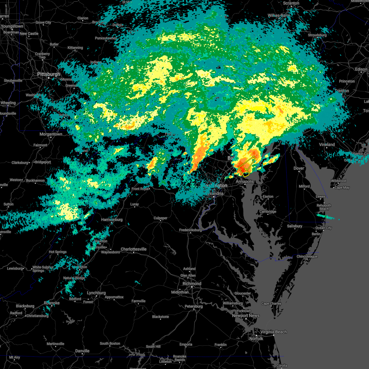 At 450 am edt, a severe thunderstorm was located over riviera beach, moving northeast at 30 mph (radar indicated). Hazards include 60 mph wind gusts and quarter size hail. Damaging winds will cause some trees and large branches to fall. this could injure those outdoors, as well as damage homes and vehicles. roadways may become blocked by downed trees. localized power outages are possible. Unsecured light objects may become projectiles. At 450 am edt, a severe thunderstorm was located over riviera beach, moving northeast at 30 mph (radar indicated). Hazards include 60 mph wind gusts and quarter size hail. Damaging winds will cause some trees and large branches to fall. this could injure those outdoors, as well as damage homes and vehicles. roadways may become blocked by downed trees. localized power outages are possible. Unsecured light objects may become projectiles.
|
| 9/1/2021 4:46 AM EDT |
 At 445 am edt, a severe thunderstorm was located over green haven, or near riviera beach, moving northeast at 30 mph (radar indicated). Hazards include 60 mph wind gusts and quarter size hail. Damaging winds will cause some trees and large branches to fall. this could injure those outdoors, as well as damage homes and vehicles. roadways may become blocked by downed trees. localized power outages are possible. unsecured light objects may become projectiles. locations impacted include, baltimore, severn, riviera beach, baltimore-washington airport, fort smallwood state park, pinehurst, dobbins island, gibson island, sillery bay, bodkin point, glen burnie, severna park, pasadena, arnold, lake shore, ferndale, brooklyn park, south gate, green haven and edgemere. hail threat, radar indicated max hail size, 1. 00 in wind threat, radar indicated max wind gust, 60 mph. At 445 am edt, a severe thunderstorm was located over green haven, or near riviera beach, moving northeast at 30 mph (radar indicated). Hazards include 60 mph wind gusts and quarter size hail. Damaging winds will cause some trees and large branches to fall. this could injure those outdoors, as well as damage homes and vehicles. roadways may become blocked by downed trees. localized power outages are possible. unsecured light objects may become projectiles. locations impacted include, baltimore, severn, riviera beach, baltimore-washington airport, fort smallwood state park, pinehurst, dobbins island, gibson island, sillery bay, bodkin point, glen burnie, severna park, pasadena, arnold, lake shore, ferndale, brooklyn park, south gate, green haven and edgemere. hail threat, radar indicated max hail size, 1. 00 in wind threat, radar indicated max wind gust, 60 mph.
|
| 9/1/2021 4:23 AM EDT |
 At 423 am edt, a severe thunderstorm was located over millersville, or near crofton, moving northeast at 30 mph (radar indicated). Hazards include 60 mph wind gusts and quarter size hail. Damaging winds will cause some trees and large branches to fall. this could injure those outdoors, as well as damage homes and vehicles. roadways may become blocked by downed trees. localized power outages are possible. unsecured light objects may become projectiles. locations impacted include, bowie, severn, crofton, riviera beach, baltimore-washington airport, magothy river, dobbins island, fort smallwood state park, pinehurst, gibson island, sillery bay, bodkin point, glen burnie, severna park, odenton, pasadena, arnold, lake shore, ferndale and parole. hail threat, radar indicated max hail size, 1. 00 in wind threat, radar indicated max wind gust, 60 mph. At 423 am edt, a severe thunderstorm was located over millersville, or near crofton, moving northeast at 30 mph (radar indicated). Hazards include 60 mph wind gusts and quarter size hail. Damaging winds will cause some trees and large branches to fall. this could injure those outdoors, as well as damage homes and vehicles. roadways may become blocked by downed trees. localized power outages are possible. unsecured light objects may become projectiles. locations impacted include, bowie, severn, crofton, riviera beach, baltimore-washington airport, magothy river, dobbins island, fort smallwood state park, pinehurst, gibson island, sillery bay, bodkin point, glen burnie, severna park, odenton, pasadena, arnold, lake shore, ferndale and parole. hail threat, radar indicated max hail size, 1. 00 in wind threat, radar indicated max wind gust, 60 mph.
|
| 9/1/2021 4:00 AM EDT |
 At 400 am edt, a severe thunderstorm was located over lanham-seabrook, or over greenbelt, moving northeast at 30 mph (radar indicated). Hazards include 60 mph wind gusts and quarter size hail. Damaging winds will cause some trees and large branches to fall. this could injure those outdoors, as well as damage homes and vehicles. roadways may become blocked by downed trees. localized power outages are possible. Unsecured light objects may become projectiles. At 400 am edt, a severe thunderstorm was located over lanham-seabrook, or over greenbelt, moving northeast at 30 mph (radar indicated). Hazards include 60 mph wind gusts and quarter size hail. Damaging winds will cause some trees and large branches to fall. this could injure those outdoors, as well as damage homes and vehicles. roadways may become blocked by downed trees. localized power outages are possible. Unsecured light objects may become projectiles.
|
| 8/27/2021 4:59 PM EDT |
 The national weather service in sterling virginia has issued a * severe thunderstorm warning for. northeastern anne arundel county in central maryland. until 545 pm edt. At 459 pm edt, severe thunderstorms were located along a line extending from glen burnie to near severna park, moving northeast. The national weather service in sterling virginia has issued a * severe thunderstorm warning for. northeastern anne arundel county in central maryland. until 545 pm edt. At 459 pm edt, severe thunderstorms were located along a line extending from glen burnie to near severna park, moving northeast.
|
| 8/13/2021 6:01 PM EDT |
 At 601 pm edt, severe thunderstorms were located along a line extending from odenton to near upper marlboro, moving east at 15 mph (radar indicated). Hazards include 60 mph wind gusts and quarter size hail. Damaging winds will cause some trees and large branches to fall. this could injure those outdoors, as well as damage homes and vehicles. roadways may become blocked by downed trees. localized power outages are possible. Unsecured light objects may become projectiles. At 601 pm edt, severe thunderstorms were located along a line extending from odenton to near upper marlboro, moving east at 15 mph (radar indicated). Hazards include 60 mph wind gusts and quarter size hail. Damaging winds will cause some trees and large branches to fall. this could injure those outdoors, as well as damage homes and vehicles. roadways may become blocked by downed trees. localized power outages are possible. Unsecured light objects may become projectiles.
|
| 8/13/2021 4:49 PM EDT |
 At 448 pm edt, severe thunderstorms were located along a line extending from near ellicott city to near columbia to fairland, moving southeast at 35 mph (radar indicated). Hazards include 70 mph wind gusts. Damaging winds will cause some trees and large branches to fall. this could injure those outdoors, as well as damage homes and vehicles. roadways may become blocked by downed trees. localized power outages are possible. Unsecured light objects may become projectiles. At 448 pm edt, severe thunderstorms were located along a line extending from near ellicott city to near columbia to fairland, moving southeast at 35 mph (radar indicated). Hazards include 70 mph wind gusts. Damaging winds will cause some trees and large branches to fall. this could injure those outdoors, as well as damage homes and vehicles. roadways may become blocked by downed trees. localized power outages are possible. Unsecured light objects may become projectiles.
|
| 8/11/2021 5:57 PM EDT |
 At 556 pm edt, severe thunderstorms were located along a line extending from near pleasant hills to glen burnie, moving southeast at 15 mph (radar indicated). Hazards include 60 mph wind gusts and quarter size hail. Damaging winds will cause some trees and large branches to fall. this could injure those outdoors, as well as damage homes and vehicles. roadways may become blocked by downed trees. localized power outages are possible. unsecured light objects may become projectiles. locations impacted include, baltimore, severn, middle river, aberdeen, havre de grace, riviera beach, aberdeen proving ground, baltimore-washington airport, fort smallwood state park, gibson island, sillery bay, bodkin point, millers island, north point state park, magothy river, sparrows point, dobbins island, pinehurst, back river and glen burnie. hail threat, radar indicated max hail size, 1. 00 in wind threat, radar indicated max wind gust, 60 mph. At 556 pm edt, severe thunderstorms were located along a line extending from near pleasant hills to glen burnie, moving southeast at 15 mph (radar indicated). Hazards include 60 mph wind gusts and quarter size hail. Damaging winds will cause some trees and large branches to fall. this could injure those outdoors, as well as damage homes and vehicles. roadways may become blocked by downed trees. localized power outages are possible. unsecured light objects may become projectiles. locations impacted include, baltimore, severn, middle river, aberdeen, havre de grace, riviera beach, aberdeen proving ground, baltimore-washington airport, fort smallwood state park, gibson island, sillery bay, bodkin point, millers island, north point state park, magothy river, sparrows point, dobbins island, pinehurst, back river and glen burnie. hail threat, radar indicated max hail size, 1. 00 in wind threat, radar indicated max wind gust, 60 mph.
|
| 8/11/2021 5:32 PM EDT |
 At 532 pm edt, severe thunderstorms were located along a line extending from near fallston to near baltimore-washington airport, moving southeast at 15 mph (radar indicated). Hazards include 60 mph wind gusts and quarter size hail. Damaging winds will cause some trees and large branches to fall. this could injure those outdoors, as well as damage homes and vehicles. roadways may become blocked by downed trees. localized power outages are possible. Unsecured light objects may become projectiles. At 532 pm edt, severe thunderstorms were located along a line extending from near fallston to near baltimore-washington airport, moving southeast at 15 mph (radar indicated). Hazards include 60 mph wind gusts and quarter size hail. Damaging winds will cause some trees and large branches to fall. this could injure those outdoors, as well as damage homes and vehicles. roadways may become blocked by downed trees. localized power outages are possible. Unsecured light objects may become projectiles.
|
| 8/10/2021 7:12 PM EDT |
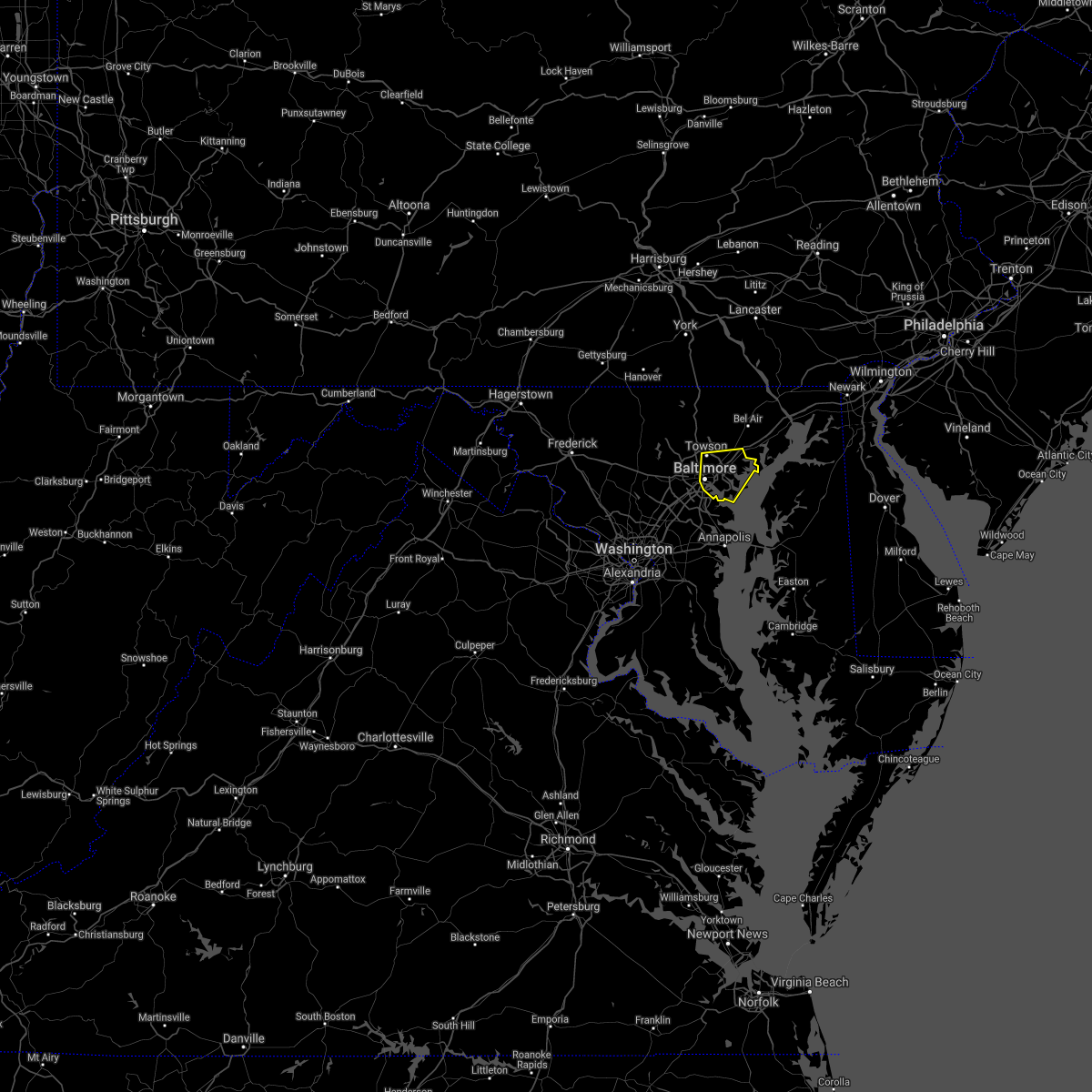 The severe thunderstorm warning for southeastern baltimore county and baltimore city will expire at 715 pm edt, the storms which prompted the warning have weakened below severe limits, and no longer pose an immediate threat to life or property. therefore, the warning will be allowed to expire. The severe thunderstorm warning for southeastern baltimore county and baltimore city will expire at 715 pm edt, the storms which prompted the warning have weakened below severe limits, and no longer pose an immediate threat to life or property. therefore, the warning will be allowed to expire.
|
| 8/10/2021 6:53 PM EDT |
 At 653 pm edt, severe thunderstorms were located along a line extending from white marsh to essex, moving east at 30 mph (radar indicated). Hazards include 60 mph wind gusts. Damaging winds will cause some trees and large branches to fall. this could injure those outdoors, as well as damage homes and vehicles. roadways may become blocked by downed trees. localized power outages are possible. unsecured light objects may become projectiles. locations impacted include, baltimore, middle river, north point state park, sparrows point, back river, millers island, dundalk, towson, essex, parkville, carney, perry hall, pasadena, rosedale, rossville, white marsh, bowleys quarters, hampton, kingsville and joppatowne. hail threat, radar indicated max hail size, <. 75 in wind threat, radar indicated max wind gust, 60 mph. At 653 pm edt, severe thunderstorms were located along a line extending from white marsh to essex, moving east at 30 mph (radar indicated). Hazards include 60 mph wind gusts. Damaging winds will cause some trees and large branches to fall. this could injure those outdoors, as well as damage homes and vehicles. roadways may become blocked by downed trees. localized power outages are possible. unsecured light objects may become projectiles. locations impacted include, baltimore, middle river, north point state park, sparrows point, back river, millers island, dundalk, towson, essex, parkville, carney, perry hall, pasadena, rosedale, rossville, white marsh, bowleys quarters, hampton, kingsville and joppatowne. hail threat, radar indicated max hail size, <. 75 in wind threat, radar indicated max wind gust, 60 mph.
|
| 8/10/2021 6:29 PM EDT |
 At 629 pm edt, severe thunderstorms were located along a line extending from near towson to near arbutus, moving east at 30 mph (radar indicated). Hazards include 60 mph wind gusts. Damaging winds will cause some trees and large branches to fall. this could injure those outdoors, as well as damage homes and vehicles. roadways may become blocked by downed trees. localized power outages are possible. Unsecured light objects may become projectiles. At 629 pm edt, severe thunderstorms were located along a line extending from near towson to near arbutus, moving east at 30 mph (radar indicated). Hazards include 60 mph wind gusts. Damaging winds will cause some trees and large branches to fall. this could injure those outdoors, as well as damage homes and vehicles. roadways may become blocked by downed trees. localized power outages are possible. Unsecured light objects may become projectiles.
|
| 7/29/2021 5:36 PM EDT |
 At 536 pm edt, a severe thunderstorm was located over glen burnie, or near riviera beach, moving east at 20 mph (radar indicated). Hazards include 60 mph wind gusts. Damaging winds will cause some trees and large branches to fall. this could injure those outdoors, as well as damage homes and vehicles. roadways may become blocked by downed trees. localized power outages are possible. unsecured light objects may become projectiles. locations impacted include, severn, riviera beach, pinehurst, magothy river, dobbins island, gibson island, sillery bay, bodkin point, glen burnie, severna park, pasadena, arnold, lake shore, green haven, south gate, cape st. Claire, gambrills, chelsea beach and belvedere heights. At 536 pm edt, a severe thunderstorm was located over glen burnie, or near riviera beach, moving east at 20 mph (radar indicated). Hazards include 60 mph wind gusts. Damaging winds will cause some trees and large branches to fall. this could injure those outdoors, as well as damage homes and vehicles. roadways may become blocked by downed trees. localized power outages are possible. unsecured light objects may become projectiles. locations impacted include, severn, riviera beach, pinehurst, magothy river, dobbins island, gibson island, sillery bay, bodkin point, glen burnie, severna park, pasadena, arnold, lake shore, green haven, south gate, cape st. Claire, gambrills, chelsea beach and belvedere heights.
|
| 7/29/2021 5:26 PM EDT |
 At 526 pm edt, a severe thunderstorm was located over south gate, or over baltimore-washington airport, moving southeast at 20 mph (radar indicated). Hazards include 60 mph wind gusts and quarter size hail. Damaging winds will cause some trees and large branches to fall. this could injure those outdoors, as well as damage homes and vehicles. roadways may become blocked by downed trees. localized power outages are possible. unsecured light objects may become projectiles. Locations impacted include, baltimore, severn, riviera beach, baltimore-washington airport, magothy river, dobbins island, fort smallwood state park, pinehurst, gibson island, sillery bay, bodkin point, glen burnie, severna park, pasadena, arnold, lake shore, ferndale, brooklyn park, green haven and south gate. At 526 pm edt, a severe thunderstorm was located over south gate, or over baltimore-washington airport, moving southeast at 20 mph (radar indicated). Hazards include 60 mph wind gusts and quarter size hail. Damaging winds will cause some trees and large branches to fall. this could injure those outdoors, as well as damage homes and vehicles. roadways may become blocked by downed trees. localized power outages are possible. unsecured light objects may become projectiles. Locations impacted include, baltimore, severn, riviera beach, baltimore-washington airport, magothy river, dobbins island, fort smallwood state park, pinehurst, gibson island, sillery bay, bodkin point, glen burnie, severna park, pasadena, arnold, lake shore, ferndale, brooklyn park, green haven and south gate.
|
| 7/29/2021 5:13 PM EDT |
 At 513 pm edt, a severe thunderstorm was located over pumphrey, or near baltimore-washington airport, moving east at 20 mph (radar indicated). Hazards include 65 mph wind gusts and half dollar size hail. Damaging winds will cause some trees and large branches to fall. this could injure those outdoors, as well as damage homes and vehicles. roadways may become blocked by downed trees. localized power outages are possible. unsecured light objects may become projectiles. Locations impacted include, baltimore, columbia, severn, elkridge, riviera beach, baltimore-washington airport, north point state park, magothy river, sparrows point, dobbins island, fort smallwood state park, pinehurst, gibson island, sillery bay, bodkin point, back river, millers island, historic ellicott city, glen burnie and ellicott city. At 513 pm edt, a severe thunderstorm was located over pumphrey, or near baltimore-washington airport, moving east at 20 mph (radar indicated). Hazards include 65 mph wind gusts and half dollar size hail. Damaging winds will cause some trees and large branches to fall. this could injure those outdoors, as well as damage homes and vehicles. roadways may become blocked by downed trees. localized power outages are possible. unsecured light objects may become projectiles. Locations impacted include, baltimore, columbia, severn, elkridge, riviera beach, baltimore-washington airport, north point state park, magothy river, sparrows point, dobbins island, fort smallwood state park, pinehurst, gibson island, sillery bay, bodkin point, back river, millers island, historic ellicott city, glen burnie and ellicott city.
|
| 7/29/2021 5:04 PM EDT |
 At 503 pm edt, a severe thunderstorm was located over catonsville, or near historic ellicott city, moving east at 20 mph (radar indicated). Hazards include 65 mph wind gusts and half dollar size hail. Damaging winds will cause some trees and large branches to fall. this could injure those outdoors, as well as damage homes and vehicles. roadways may become blocked by downed trees. localized power outages are possible. unsecured light objects may become projectiles. Locations impacted include, baltimore, columbia, severn, middle river, elkridge, riviera beach, baltimore-washington airport, fort smallwood state park, gibson island, sillery bay, bodkin point, millers island, north point state park, magothy river, sparrows point, dobbins island, pinehurst, back river, historic ellicott city and glen burnie. At 503 pm edt, a severe thunderstorm was located over catonsville, or near historic ellicott city, moving east at 20 mph (radar indicated). Hazards include 65 mph wind gusts and half dollar size hail. Damaging winds will cause some trees and large branches to fall. this could injure those outdoors, as well as damage homes and vehicles. roadways may become blocked by downed trees. localized power outages are possible. unsecured light objects may become projectiles. Locations impacted include, baltimore, columbia, severn, middle river, elkridge, riviera beach, baltimore-washington airport, fort smallwood state park, gibson island, sillery bay, bodkin point, millers island, north point state park, magothy river, sparrows point, dobbins island, pinehurst, back river, historic ellicott city and glen burnie.
|
| 7/29/2021 4:59 PM EDT |
 At 459 pm edt, a severe thunderstorm capable of producing a tornado was located over columbia, moving east at 25 mph (radar indicated rotation). Hazards include tornado. For those in the direct path of a tornado touchdown, flying debris will be dangerous to those caught without shelter. damage to roofs, siding, and windows may occur. mobile homes may be damaged or destroyed. tree damage is likely. this dangerous storm will be near, catonsville around 505 pm edt. severn, elkridge and arbutus around 515 pm edt. baltimore-washington airport and pumphrey around 520 pm edt. ferndale, brooklyn park, brooklyn park and south gate around 525 pm edt. glen burnie and severna park around 530 pm edt. Other locations impacted by this tornadic thunderstorm include hanover, linthicum, harmans, ilchester, halethorpe, lansdowne, linthicum heights, gambrills and jessup. At 459 pm edt, a severe thunderstorm capable of producing a tornado was located over columbia, moving east at 25 mph (radar indicated rotation). Hazards include tornado. For those in the direct path of a tornado touchdown, flying debris will be dangerous to those caught without shelter. damage to roofs, siding, and windows may occur. mobile homes may be damaged or destroyed. tree damage is likely. this dangerous storm will be near, catonsville around 505 pm edt. severn, elkridge and arbutus around 515 pm edt. baltimore-washington airport and pumphrey around 520 pm edt. ferndale, brooklyn park, brooklyn park and south gate around 525 pm edt. glen burnie and severna park around 530 pm edt. Other locations impacted by this tornadic thunderstorm include hanover, linthicum, harmans, ilchester, halethorpe, lansdowne, linthicum heights, gambrills and jessup.
|
| 7/29/2021 4:50 PM EDT |
 At 450 pm edt, a severe thunderstorm was located over ellicott city, or over historic ellicott city, moving east at 20 mph (radar indicated). Hazards include 60 mph wind gusts and quarter size hail. Damaging winds will cause some trees and large branches to fall. this could injure those outdoors, as well as damage homes and vehicles. roadways may become blocked by downed trees. localized power outages are possible. Unsecured light objects may become projectiles. At 450 pm edt, a severe thunderstorm was located over ellicott city, or over historic ellicott city, moving east at 20 mph (radar indicated). Hazards include 60 mph wind gusts and quarter size hail. Damaging winds will cause some trees and large branches to fall. this could injure those outdoors, as well as damage homes and vehicles. roadways may become blocked by downed trees. localized power outages are possible. Unsecured light objects may become projectiles.
|
| 7/17/2021 4:58 PM EDT |
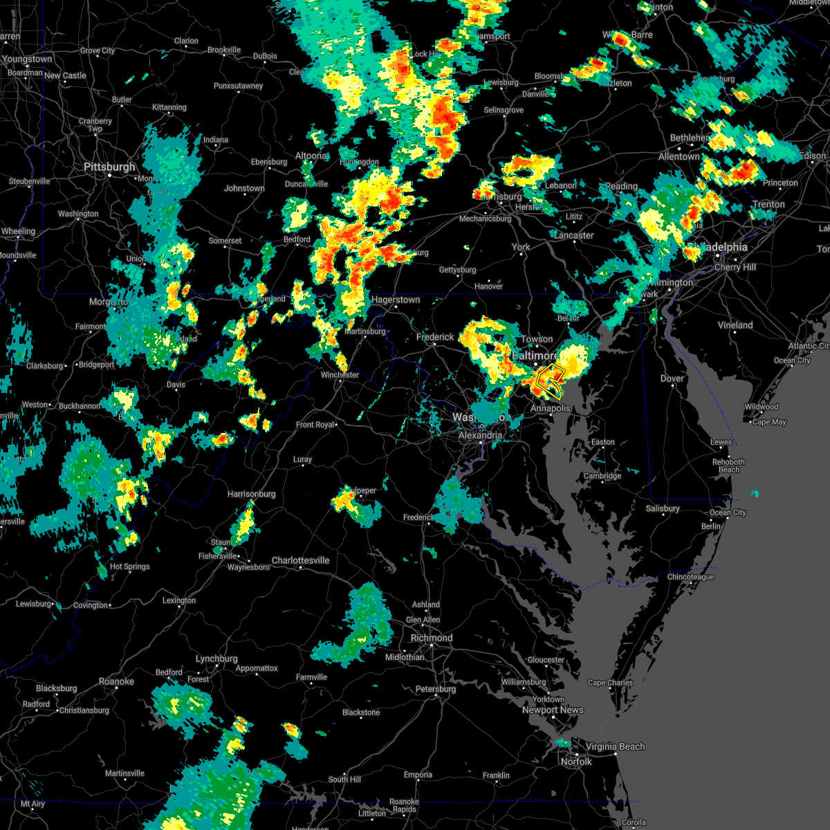 At 458 pm edt, severe thunderstorms were located along a line extending from near bowleys quarters to back river, moving northeast at 15 mph (radar indicated). Hazards include 60 mph wind gusts and quarter size hail. Damaging winds will cause some trees and large branches to fall. this could injure those outdoors, as well as damage homes and vehicles. roadways may become blocked by downed trees. localized power outages are possible. unsecured light objects may become projectiles. Locations impacted include, baltimore, riviera beach, fort smallwood state park, pinehurst, north point state park, sparrows point, gibson island, bodkin point, back river, millers island, glen burnie, dundalk, pasadena, lake shore, green haven, edgemere, fort howard and turners station. At 458 pm edt, severe thunderstorms were located along a line extending from near bowleys quarters to back river, moving northeast at 15 mph (radar indicated). Hazards include 60 mph wind gusts and quarter size hail. Damaging winds will cause some trees and large branches to fall. this could injure those outdoors, as well as damage homes and vehicles. roadways may become blocked by downed trees. localized power outages are possible. unsecured light objects may become projectiles. Locations impacted include, baltimore, riviera beach, fort smallwood state park, pinehurst, north point state park, sparrows point, gibson island, bodkin point, back river, millers island, glen burnie, dundalk, pasadena, lake shore, green haven, edgemere, fort howard and turners station.
|
| 7/17/2021 4:41 PM EDT |
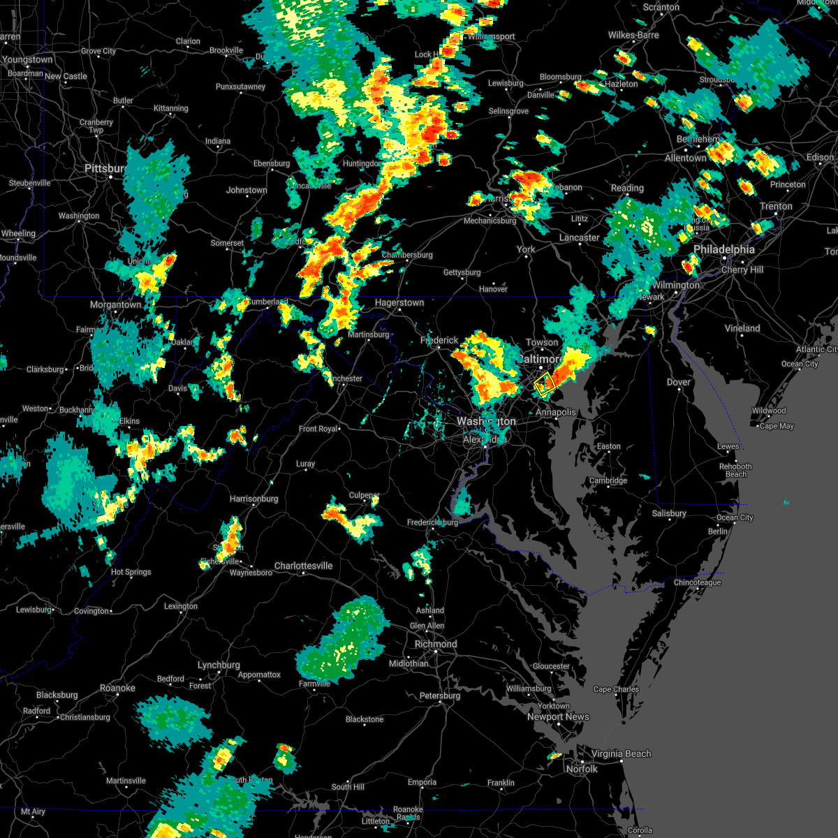 The severe thunderstorm warning for north central anne arundel county and southeastern baltimore city will expire at 445 pm edt, the storm which prompted the warning has moved out of the area. therefore, the warning will be allowed to expire. however gusty winds are still possible with this thunderstorm. a severe thunderstorm watch remains in effect until 1100 pm edt for central and northern maryland. remember, a severe thunderstorm warning still remains in effect for portions of far northern anne arunedl county and into southeastern baltimore county. The severe thunderstorm warning for north central anne arundel county and southeastern baltimore city will expire at 445 pm edt, the storm which prompted the warning has moved out of the area. therefore, the warning will be allowed to expire. however gusty winds are still possible with this thunderstorm. a severe thunderstorm watch remains in effect until 1100 pm edt for central and northern maryland. remember, a severe thunderstorm warning still remains in effect for portions of far northern anne arunedl county and into southeastern baltimore county.
|
| 7/17/2021 4:33 PM EDT |
 At 432 pm edt, severe thunderstorms were located along a line extending from bowleys quarters to sparrows point, moving northeast at 15 mph. the most intense part of this storm is located over extreme northeast anne arundel county, moving into the baltimore harbor. the entire line is sever, but this portion is producing stronger winds up to 70 mph and ping pong ball size hail (radar indicated). Hazards include 70 mph wind gusts and ping pong ball size hail. Damaging winds will cause some trees and large branches to fall. this could injure those outdoors, as well as damage homes and vehicles. roadways may become blocked by downed trees. localized power outages are possible. Unsecured light objects may become projectiles. At 432 pm edt, severe thunderstorms were located along a line extending from bowleys quarters to sparrows point, moving northeast at 15 mph. the most intense part of this storm is located over extreme northeast anne arundel county, moving into the baltimore harbor. the entire line is sever, but this portion is producing stronger winds up to 70 mph and ping pong ball size hail (radar indicated). Hazards include 70 mph wind gusts and ping pong ball size hail. Damaging winds will cause some trees and large branches to fall. this could injure those outdoors, as well as damage homes and vehicles. roadways may become blocked by downed trees. localized power outages are possible. Unsecured light objects may become projectiles.
|
| 7/17/2021 4:31 PM EDT |
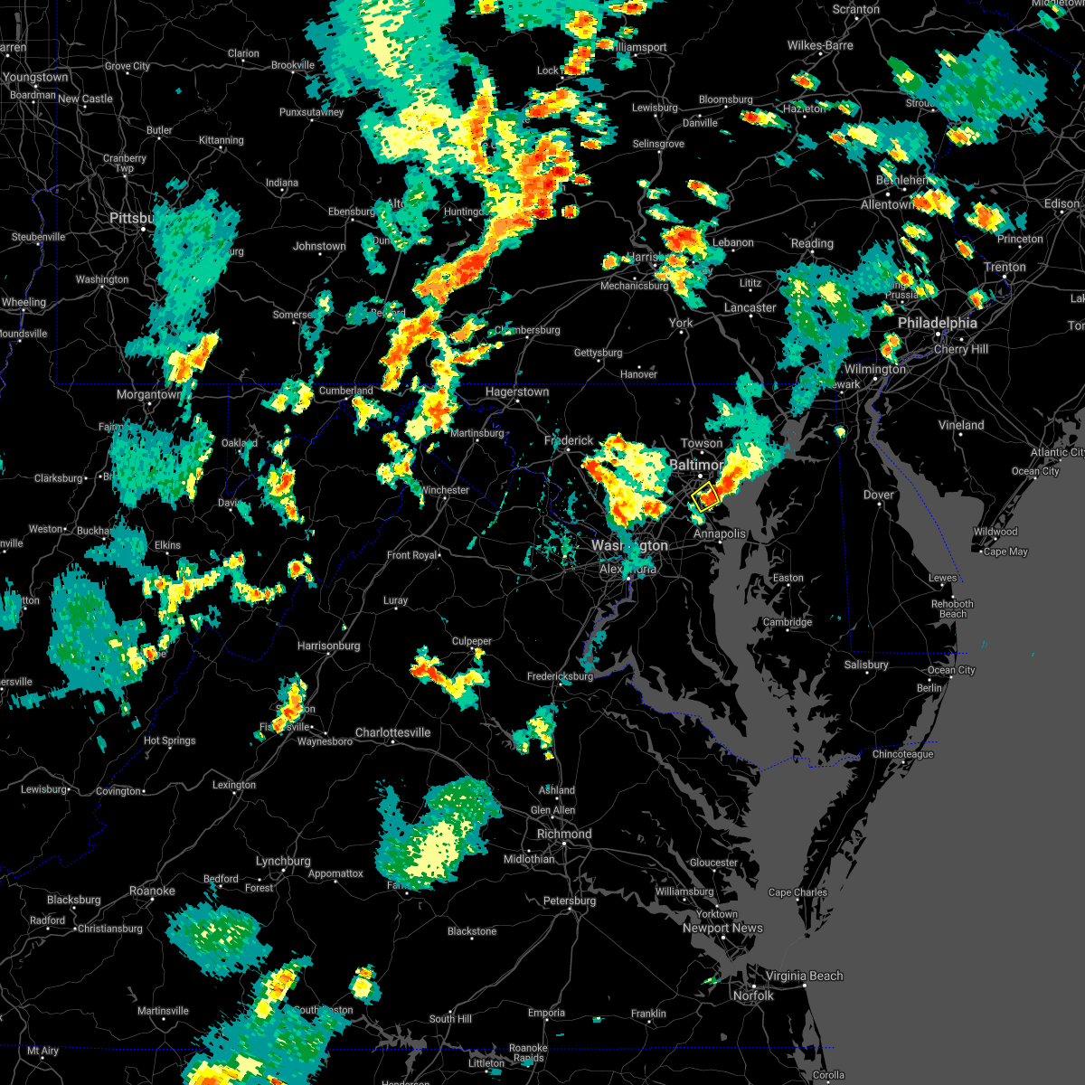 At 431 pm edt, a severe thunderstorm was located over sparrows point, moving northeast at 15 mph (radar indicated). Hazards include 70 mph wind gusts and ping pong ball size hail. Damaging winds will cause some trees and large branches to fall. this could injure those outdoors, as well as damage homes and vehicles. roadways may become blocked by downed trees. localized power outages are possible. unsecured light objects may become projectiles. Locations impacted include, baltimore, riviera beach, glen burnie, pasadena, ferndale, brooklyn park and linthicum. At 431 pm edt, a severe thunderstorm was located over sparrows point, moving northeast at 15 mph (radar indicated). Hazards include 70 mph wind gusts and ping pong ball size hail. Damaging winds will cause some trees and large branches to fall. this could injure those outdoors, as well as damage homes and vehicles. roadways may become blocked by downed trees. localized power outages are possible. unsecured light objects may become projectiles. Locations impacted include, baltimore, riviera beach, glen burnie, pasadena, ferndale, brooklyn park and linthicum.
|
| 7/17/2021 4:28 PM EDT |
 At 428 pm edt, severe thunderstorms were located along a line extending from bowleys quarters to near sparrows point, moving northeast at 15 mph (radar indicated). Hazards include 60 mph wind gusts and quarter size hail. Damaging winds will cause some trees and large branches to fall. this could injure those outdoors, as well as damage homes and vehicles. roadways may become blocked by downed trees. localized power outages are possible. Unsecured light objects may become projectiles. At 428 pm edt, severe thunderstorms were located along a line extending from bowleys quarters to near sparrows point, moving northeast at 15 mph (radar indicated). Hazards include 60 mph wind gusts and quarter size hail. Damaging winds will cause some trees and large branches to fall. this could injure those outdoors, as well as damage homes and vehicles. roadways may become blocked by downed trees. localized power outages are possible. Unsecured light objects may become projectiles.
|
| 7/17/2021 4:16 PM EDT |
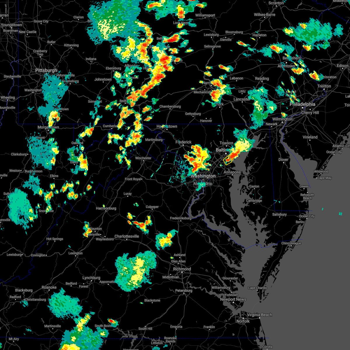 At 416 pm edt, a severe thunderstorm was located near riviera beach, moving northeast at 15 mph (radar indicated). Hazards include 60 mph wind gusts and quarter size hail. Damaging winds will cause some trees and large branches to fall. this could injure those outdoors, as well as damage homes and vehicles. roadways may become blocked by downed trees. localized power outages are possible. unsecured light objects may become projectiles. Locations impacted include, baltimore, riviera beach, glen burnie, pasadena, ferndale, brooklyn park and linthicum. At 416 pm edt, a severe thunderstorm was located near riviera beach, moving northeast at 15 mph (radar indicated). Hazards include 60 mph wind gusts and quarter size hail. Damaging winds will cause some trees and large branches to fall. this could injure those outdoors, as well as damage homes and vehicles. roadways may become blocked by downed trees. localized power outages are possible. unsecured light objects may become projectiles. Locations impacted include, baltimore, riviera beach, glen burnie, pasadena, ferndale, brooklyn park and linthicum.
|
| 7/17/2021 3:59 PM EDT |
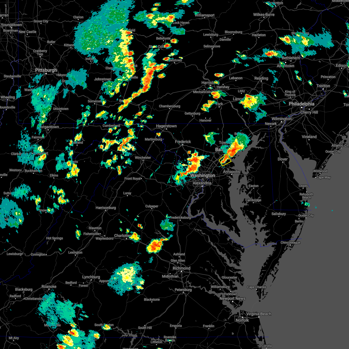 At 359 pm edt, a severe thunderstorm was located over ferndale, or over baltimore-washington airport, moving northeast at 15 mph (radar indicated). Hazards include 60 mph wind gusts and quarter size hail. Damaging winds will cause some trees and large branches to fall. this could injure those outdoors, as well as damage homes and vehicles. roadways may become blocked by downed trees. localized power outages are possible. Unsecured light objects may become projectiles. At 359 pm edt, a severe thunderstorm was located over ferndale, or over baltimore-washington airport, moving northeast at 15 mph (radar indicated). Hazards include 60 mph wind gusts and quarter size hail. Damaging winds will cause some trees and large branches to fall. this could injure those outdoors, as well as damage homes and vehicles. roadways may become blocked by downed trees. localized power outages are possible. Unsecured light objects may become projectiles.
|
| 7/8/2021 3:00 PM EDT |
 At 259 pm edt, a severe thunderstorm was located over ferndale, or over baltimore-washington airport, moving northeast at 25 mph (radar indicated). Hazards include 60 mph wind gusts and quarter size hail. Damaging winds will cause some trees and large branches to fall. this could injure those outdoors, as well as damage homes and vehicles. roadways may become blocked by downed trees. localized power outages are possible. unsecured light objects may become projectiles. Locations impacted include, baltimore, severn, middle river, elkridge, riviera beach, baltimore-washington airport, sparrows point, back river, glen burnie, dundalk, towson, catonsville, essex, parkville, pasadena, arbutus, rosedale, ferndale, rossville and brooklyn park. At 259 pm edt, a severe thunderstorm was located over ferndale, or over baltimore-washington airport, moving northeast at 25 mph (radar indicated). Hazards include 60 mph wind gusts and quarter size hail. Damaging winds will cause some trees and large branches to fall. this could injure those outdoors, as well as damage homes and vehicles. roadways may become blocked by downed trees. localized power outages are possible. unsecured light objects may become projectiles. Locations impacted include, baltimore, severn, middle river, elkridge, riviera beach, baltimore-washington airport, sparrows point, back river, glen burnie, dundalk, towson, catonsville, essex, parkville, pasadena, arbutus, rosedale, ferndale, rossville and brooklyn park.
|
| 7/8/2021 2:36 PM EDT |
 At 236 pm edt, a severe thunderstorm was located over odenton, or near crofton, moving northeast at 25 mph (radar indicated). Hazards include 60 mph wind gusts and quarter size hail. Damaging winds will cause some trees and large branches to fall. this could injure those outdoors, as well as damage homes and vehicles. roadways may become blocked by downed trees. localized power outages are possible. Unsecured light objects may become projectiles. At 236 pm edt, a severe thunderstorm was located over odenton, or near crofton, moving northeast at 25 mph (radar indicated). Hazards include 60 mph wind gusts and quarter size hail. Damaging winds will cause some trees and large branches to fall. this could injure those outdoors, as well as damage homes and vehicles. roadways may become blocked by downed trees. localized power outages are possible. Unsecured light objects may become projectiles.
|
| 7/7/2021 4:09 PM EDT |
 At 408 pm edt, a severe thunderstorm was located over towson, or near baltimore, moving northeast at 15 mph (radar indicated). Hazards include 60 mph wind gusts and quarter size hail. Damaging winds will cause some trees and large branches to fall. this could injure those outdoors, as well as damage homes and vehicles. roadways may become blocked by downed trees. localized power outages are possible. Unsecured light objects may become projectiles. At 408 pm edt, a severe thunderstorm was located over towson, or near baltimore, moving northeast at 15 mph (radar indicated). Hazards include 60 mph wind gusts and quarter size hail. Damaging winds will cause some trees and large branches to fall. this could injure those outdoors, as well as damage homes and vehicles. roadways may become blocked by downed trees. localized power outages are possible. Unsecured light objects may become projectiles.
|
| 7/1/2021 4:03 PM EDT |
 At 403 pm edt, severe thunderstorms were located along a line extending from green haven to near severn river to near shady side, moving northeast at 30 mph (radar indicated). Hazards include 60 mph wind gusts and quarter size hail. Damaging winds will cause some trees and large branches to fall. this could injure those outdoors, as well as damage homes and vehicles. roadways may become blocked by downed trees. localized power outages are possible. unsecured light objects may become projectiles. locations impacted include, annapolis, naval academy, pinehurst, magothy river, dobbins island, gibson island, sillery bay, bodkin point, severn river, glen burnie, severna park, pasadena, arnold, lake shore, parole, green haven, cape st. Claire, herald harbor, crownsville and chelsea beach. At 403 pm edt, severe thunderstorms were located along a line extending from green haven to near severn river to near shady side, moving northeast at 30 mph (radar indicated). Hazards include 60 mph wind gusts and quarter size hail. Damaging winds will cause some trees and large branches to fall. this could injure those outdoors, as well as damage homes and vehicles. roadways may become blocked by downed trees. localized power outages are possible. unsecured light objects may become projectiles. locations impacted include, annapolis, naval academy, pinehurst, magothy river, dobbins island, gibson island, sillery bay, bodkin point, severn river, glen burnie, severna park, pasadena, arnold, lake shore, parole, green haven, cape st. Claire, herald harbor, crownsville and chelsea beach.
|
| 7/1/2021 3:48 PM EDT |
 At 348 pm edt, severe thunderstorms were located along a line extending from near severna park to south river to near deale, moving east at 40 mph (radar indicated). Hazards include 70 mph wind gusts and quarter size hail. Damaging winds will cause some trees and large branches to fall. this could injure those outdoors, as well as damage homes and vehicles. roadways may become blocked by downed trees. localized power outages are possible. unsecured light objects may become projectiles. Locations impacted include, bowie, severn, annapolis, crofton, mayo, shady side, deale, naval academy, severn river, south river, gibson island, sillery bay, bodkin point, rhode river, magothy river, dobbins island, pinehurst, glen burnie, severna park and odenton. At 348 pm edt, severe thunderstorms were located along a line extending from near severna park to south river to near deale, moving east at 40 mph (radar indicated). Hazards include 70 mph wind gusts and quarter size hail. Damaging winds will cause some trees and large branches to fall. this could injure those outdoors, as well as damage homes and vehicles. roadways may become blocked by downed trees. localized power outages are possible. unsecured light objects may become projectiles. Locations impacted include, bowie, severn, annapolis, crofton, mayo, shady side, deale, naval academy, severn river, south river, gibson island, sillery bay, bodkin point, rhode river, magothy river, dobbins island, pinehurst, glen burnie, severna park and odenton.
|
| 7/1/2021 3:20 PM EDT |
 At 320 pm edt, severe thunderstorms were located along a line extending from greenbelt to forestville to clinton, moving east at 35 mph (radar indicated). Hazards include 70 mph wind gusts and quarter size hail. Damaging winds will cause some trees and large branches to fall. this could injure those outdoors, as well as damage homes and vehicles. roadways may become blocked by downed trees. localized power outages are possible. Unsecured light objects may become projectiles. At 320 pm edt, severe thunderstorms were located along a line extending from greenbelt to forestville to clinton, moving east at 35 mph (radar indicated). Hazards include 70 mph wind gusts and quarter size hail. Damaging winds will cause some trees and large branches to fall. this could injure those outdoors, as well as damage homes and vehicles. roadways may become blocked by downed trees. localized power outages are possible. Unsecured light objects may become projectiles.
|
| 7/1/2021 3:01 PM EDT |
 At 301 pm edt, a severe thunderstorm was located over lochearn, or near pikesville, moving east at 35 mph (radar indicated). Hazards include 60 mph wind gusts. Damaging winds will cause some trees and large branches to fall. this could injure those outdoors, as well as damage homes and vehicles. roadways may become blocked by downed trees. localized power outages are possible. unsecured light objects may become projectiles. Locations impacted include, baltimore, pikesville, middle river, sparrows point, back river, glen burnie, ellicott city, dundalk, towson, catonsville, essex, woodlawn, randallstown, parkville, carney, milford mill, perry hall, lochearn, pasadena and arbutus. At 301 pm edt, a severe thunderstorm was located over lochearn, or near pikesville, moving east at 35 mph (radar indicated). Hazards include 60 mph wind gusts. Damaging winds will cause some trees and large branches to fall. this could injure those outdoors, as well as damage homes and vehicles. roadways may become blocked by downed trees. localized power outages are possible. unsecured light objects may become projectiles. Locations impacted include, baltimore, pikesville, middle river, sparrows point, back river, glen burnie, ellicott city, dundalk, towson, catonsville, essex, woodlawn, randallstown, parkville, carney, milford mill, perry hall, lochearn, pasadena and arbutus.
|
| 7/1/2021 2:41 PM EDT |
 At 241 pm edt, a severe thunderstorm was located near ellicott city, or near historic ellicott city, moving east at 35 mph (radar indicated). Hazards include 60 mph wind gusts and quarter size hail. Damaging winds will cause some trees and large branches to fall. this could injure those outdoors, as well as damage homes and vehicles. roadways may become blocked by downed trees. localized power outages are possible. Unsecured light objects may become projectiles. At 241 pm edt, a severe thunderstorm was located near ellicott city, or near historic ellicott city, moving east at 35 mph (radar indicated). Hazards include 60 mph wind gusts and quarter size hail. Damaging winds will cause some trees and large branches to fall. this could injure those outdoors, as well as damage homes and vehicles. roadways may become blocked by downed trees. localized power outages are possible. Unsecured light objects may become projectiles.
|
| 6/21/2021 7:12 PM EDT |
 The severe thunderstorm warning for northern anne arundel, southeastern harford and southeastern baltimore counties and southeastern baltimore city will expire at 715 pm edt, the storms which prompted the warning have moved out of the area. therefore, the warning will be allowed to expire. a severe thunderstorm watch remains in effect until 1000 pm edt for central and northern maryland. to report severe weather, contact your nearest law enforcement agency. they will relay your report to the national weather service sterling virginia. The severe thunderstorm warning for northern anne arundel, southeastern harford and southeastern baltimore counties and southeastern baltimore city will expire at 715 pm edt, the storms which prompted the warning have moved out of the area. therefore, the warning will be allowed to expire. a severe thunderstorm watch remains in effect until 1000 pm edt for central and northern maryland. to report severe weather, contact your nearest law enforcement agency. they will relay your report to the national weather service sterling virginia.
|
| 6/21/2021 6:46 PM EDT |
 At 646 pm edt, severe thunderstorms were located along a line extending from near riverside to back river to near south gate, moving east at 35 mph (radar indicated). Hazards include 60 mph wind gusts. Damaging winds will cause some trees and large branches to fall. this could injure those outdoors, as well as damage homes and vehicles. roadways may become blocked by downed trees. localized power outages are possible. unsecured light objects may become projectiles. Locations impacted include, baltimore, severn, middle river, riviera beach, aberdeen proving ground, north point state park, sparrows point, fort smallwood state park, bodkin point, back river, millers island, glen burnie, dundalk, essex, severna park, odenton, pasadena, lake shore, ferndale and fort meade. At 646 pm edt, severe thunderstorms were located along a line extending from near riverside to back river to near south gate, moving east at 35 mph (radar indicated). Hazards include 60 mph wind gusts. Damaging winds will cause some trees and large branches to fall. this could injure those outdoors, as well as damage homes and vehicles. roadways may become blocked by downed trees. localized power outages are possible. unsecured light objects may become projectiles. Locations impacted include, baltimore, severn, middle river, riviera beach, aberdeen proving ground, north point state park, sparrows point, fort smallwood state park, bodkin point, back river, millers island, glen burnie, dundalk, essex, severna park, odenton, pasadena, lake shore, ferndale and fort meade.
|
| 6/21/2021 6:28 PM EDT |
 At 628 pm edt, severe thunderstorms were located along a line extending from near hampton to near dundalk to severn, moving east at 40 mph (radar indicated). Hazards include 60 mph wind gusts. Damaging winds will cause some trees and large branches to fall. this could injure those outdoors, as well as damage homes and vehicles. roadways may become blocked by downed trees. localized power outages are possible. Unsecured light objects may become projectiles. At 628 pm edt, severe thunderstorms were located along a line extending from near hampton to near dundalk to severn, moving east at 40 mph (radar indicated). Hazards include 60 mph wind gusts. Damaging winds will cause some trees and large branches to fall. this could injure those outdoors, as well as damage homes and vehicles. roadways may become blocked by downed trees. localized power outages are possible. Unsecured light objects may become projectiles.
|
| 6/14/2021 10:50 PM EDT |
 The severe thunderstorm warning for northeastern anne arundel county will expire at 1100 pm edt, the storm which prompted the warning has weakened below severe limits, and has exited the warned area. therefore, the warning will be allowed to expire. a severe thunderstorm watch remains in effect until 200 am edt for central maryland. The severe thunderstorm warning for northeastern anne arundel county will expire at 1100 pm edt, the storm which prompted the warning has weakened below severe limits, and has exited the warned area. therefore, the warning will be allowed to expire. a severe thunderstorm watch remains in effect until 200 am edt for central maryland.
|
| 6/14/2021 10:42 PM EDT |
 At 1041 pm edt, a severe thunderstorm was located near millers island, moving east at 35 mph (radar indicated). Hazards include 60 mph wind gusts and quarter size hail. Damaging winds will cause some trees and large branches to fall. this could injure those outdoors, as well as damage homes and vehicles. roadways may become blocked by downed trees. localized power outages are possible. unsecured light objects may become projectiles. Locations impacted include, riviera beach, pinehurst, gibson island, sillery bay, bodkin point, dobbins island, severna park, pasadena, lake shore, green haven and chelsea beach. At 1041 pm edt, a severe thunderstorm was located near millers island, moving east at 35 mph (radar indicated). Hazards include 60 mph wind gusts and quarter size hail. Damaging winds will cause some trees and large branches to fall. this could injure those outdoors, as well as damage homes and vehicles. roadways may become blocked by downed trees. localized power outages are possible. unsecured light objects may become projectiles. Locations impacted include, riviera beach, pinehurst, gibson island, sillery bay, bodkin point, dobbins island, severna park, pasadena, lake shore, green haven and chelsea beach.
|
| 6/14/2021 10:36 PM EDT |
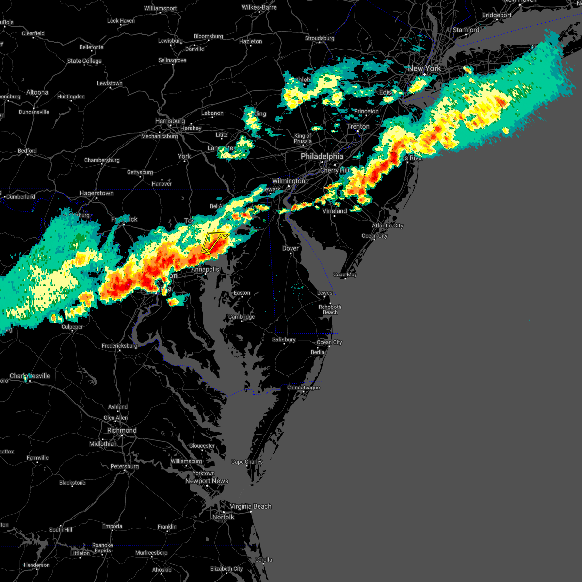 At 1012 pm edt, a severe thunderstorm was located over back river, moving east at 25 mph (radar indicated). Hazards include 60 mph wind gusts and half dollar size hail. Damaging winds will cause some trees and large branches to fall. this could injure those outdoors, as well as damage homes and vehicles. roadways may become blocked by downed trees. localized power outages are possible. Unsecured light objects may become projectiles. At 1012 pm edt, a severe thunderstorm was located over back river, moving east at 25 mph (radar indicated). Hazards include 60 mph wind gusts and half dollar size hail. Damaging winds will cause some trees and large branches to fall. this could injure those outdoors, as well as damage homes and vehicles. roadways may become blocked by downed trees. localized power outages are possible. Unsecured light objects may become projectiles.
|
| 6/14/2021 10:16 PM EDT |
 At 1016 pm edt, a severe thunderstorm was located over pumphrey, or over baltimore-washington airport, moving east at 35 mph (radar indicated). Hazards include 60 mph wind gusts and quarter size hail. Damaging winds will cause some trees and large branches to fall. this could injure those outdoors, as well as damage homes and vehicles. roadways may become blocked by downed trees. localized power outages are possible. Unsecured light objects may become projectiles. At 1016 pm edt, a severe thunderstorm was located over pumphrey, or over baltimore-washington airport, moving east at 35 mph (radar indicated). Hazards include 60 mph wind gusts and quarter size hail. Damaging winds will cause some trees and large branches to fall. this could injure those outdoors, as well as damage homes and vehicles. roadways may become blocked by downed trees. localized power outages are possible. Unsecured light objects may become projectiles.
|
| 6/14/2021 10:12 PM EDT |
 At 1012 pm edt, a severe thunderstorm was located over back river, moving east at 25 mph (radar indicated). Hazards include 60 mph wind gusts and half dollar size hail. Damaging winds will cause some trees and large branches to fall. this could injure those outdoors, as well as damage homes and vehicles. roadways may become blocked by downed trees. localized power outages are possible. Unsecured light objects may become projectiles. At 1012 pm edt, a severe thunderstorm was located over back river, moving east at 25 mph (radar indicated). Hazards include 60 mph wind gusts and half dollar size hail. Damaging winds will cause some trees and large branches to fall. this could injure those outdoors, as well as damage homes and vehicles. roadways may become blocked by downed trees. localized power outages are possible. Unsecured light objects may become projectiles.
|
| 6/14/2021 10:04 PM EDT |
 At 1004 pm edt, severe thunderstorms were located along a line extending from near betterton to newtown to 7 miles east of millers island, moving east at 45 mph (trained weather spotters). Hazards include 60 mph wind gusts and half dollar size hail. Damaging winds will cause some trees and large branches to fall. this could injure those outdoors, as well as damage homes and vehicles. roadways may become blocked by downed trees. localized power outages are possible. unsecured light objects may become projectiles. Locations impacted include, baltimore, middle river, riviera beach, fort smallwood state park, north point state park, sparrows point, back river, millers island, glen burnie, dundalk, essex, pasadena, rosedale, rossville, brooklyn park, white marsh, bowleys quarters, edgemere, nottingham and fort howard. At 1004 pm edt, severe thunderstorms were located along a line extending from near betterton to newtown to 7 miles east of millers island, moving east at 45 mph (trained weather spotters). Hazards include 60 mph wind gusts and half dollar size hail. Damaging winds will cause some trees and large branches to fall. this could injure those outdoors, as well as damage homes and vehicles. roadways may become blocked by downed trees. localized power outages are possible. unsecured light objects may become projectiles. Locations impacted include, baltimore, middle river, riviera beach, fort smallwood state park, north point state park, sparrows point, back river, millers island, glen burnie, dundalk, essex, pasadena, rosedale, rossville, brooklyn park, white marsh, bowleys quarters, edgemere, nottingham and fort howard.
|
| 6/14/2021 9:49 PM EDT |
 At 948 pm edt, severe thunderstorms were located along a line extending from near bowleys quarters to essex to near dundalk, moving east at 45 mph (trained weather spotters). Hazards include 70 mph wind gusts and ping pong ball size hail. Damaging winds will cause some trees and large branches to fall. this could injure those outdoors, as well as damage homes and vehicles. roadways may become blocked by downed trees. localized power outages are possible. unsecured light objects may become projectiles. Locations impacted include, baltimore, middle river, riviera beach, north point state park, sparrows point, fort smallwood state park, back river, millers island, glen burnie, dundalk, essex, pasadena, rosedale, ferndale, rossville, brooklyn park, white marsh, bowleys quarters, pumphrey and linthicum. At 948 pm edt, severe thunderstorms were located along a line extending from near bowleys quarters to essex to near dundalk, moving east at 45 mph (trained weather spotters). Hazards include 70 mph wind gusts and ping pong ball size hail. Damaging winds will cause some trees and large branches to fall. this could injure those outdoors, as well as damage homes and vehicles. roadways may become blocked by downed trees. localized power outages are possible. unsecured light objects may become projectiles. Locations impacted include, baltimore, middle river, riviera beach, north point state park, sparrows point, fort smallwood state park, back river, millers island, glen burnie, dundalk, essex, pasadena, rosedale, ferndale, rossville, brooklyn park, white marsh, bowleys quarters, pumphrey and linthicum.
|
| 6/14/2021 9:45 PM EDT |
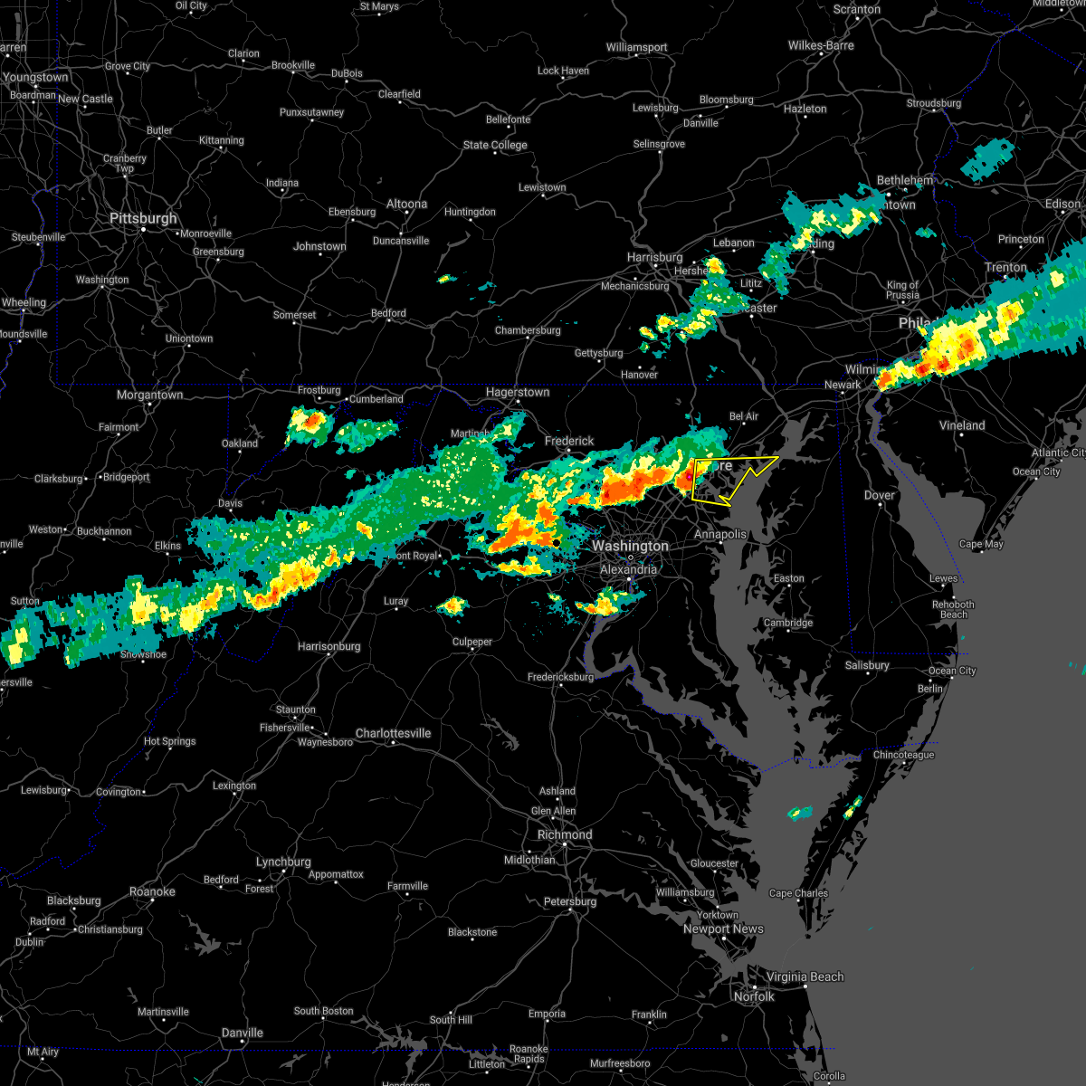 At 944 pm edt, severe thunderstorms were located along a line extending from near middle river to essex to near brooklyn park, moving east at 45 mph (trained weather spotters reported quarter sized hail in baltimore city, and the storm has since strengthened). Hazards include 60 mph wind gusts and half dollar size hail. Damaging winds will cause some trees and large branches to fall. this could injure those outdoors, as well as damage homes and vehicles. roadways may become blocked by downed trees. localized power outages are possible. unsecured light objects may become projectiles. Locations impacted include, baltimore, middle river, riviera beach, north point state park, sparrows point, fort smallwood state park, back river, millers island, glen burnie, dundalk, essex, pasadena, rosedale, ferndale, rossville, brooklyn park, white marsh, bowleys quarters, pumphrey and linthicum. At 944 pm edt, severe thunderstorms were located along a line extending from near middle river to essex to near brooklyn park, moving east at 45 mph (trained weather spotters reported quarter sized hail in baltimore city, and the storm has since strengthened). Hazards include 60 mph wind gusts and half dollar size hail. Damaging winds will cause some trees and large branches to fall. this could injure those outdoors, as well as damage homes and vehicles. roadways may become blocked by downed trees. localized power outages are possible. unsecured light objects may become projectiles. Locations impacted include, baltimore, middle river, riviera beach, north point state park, sparrows point, fort smallwood state park, back river, millers island, glen burnie, dundalk, essex, pasadena, rosedale, ferndale, rossville, brooklyn park, white marsh, bowleys quarters, pumphrey and linthicum.
|
| 6/14/2021 9:29 PM EDT |
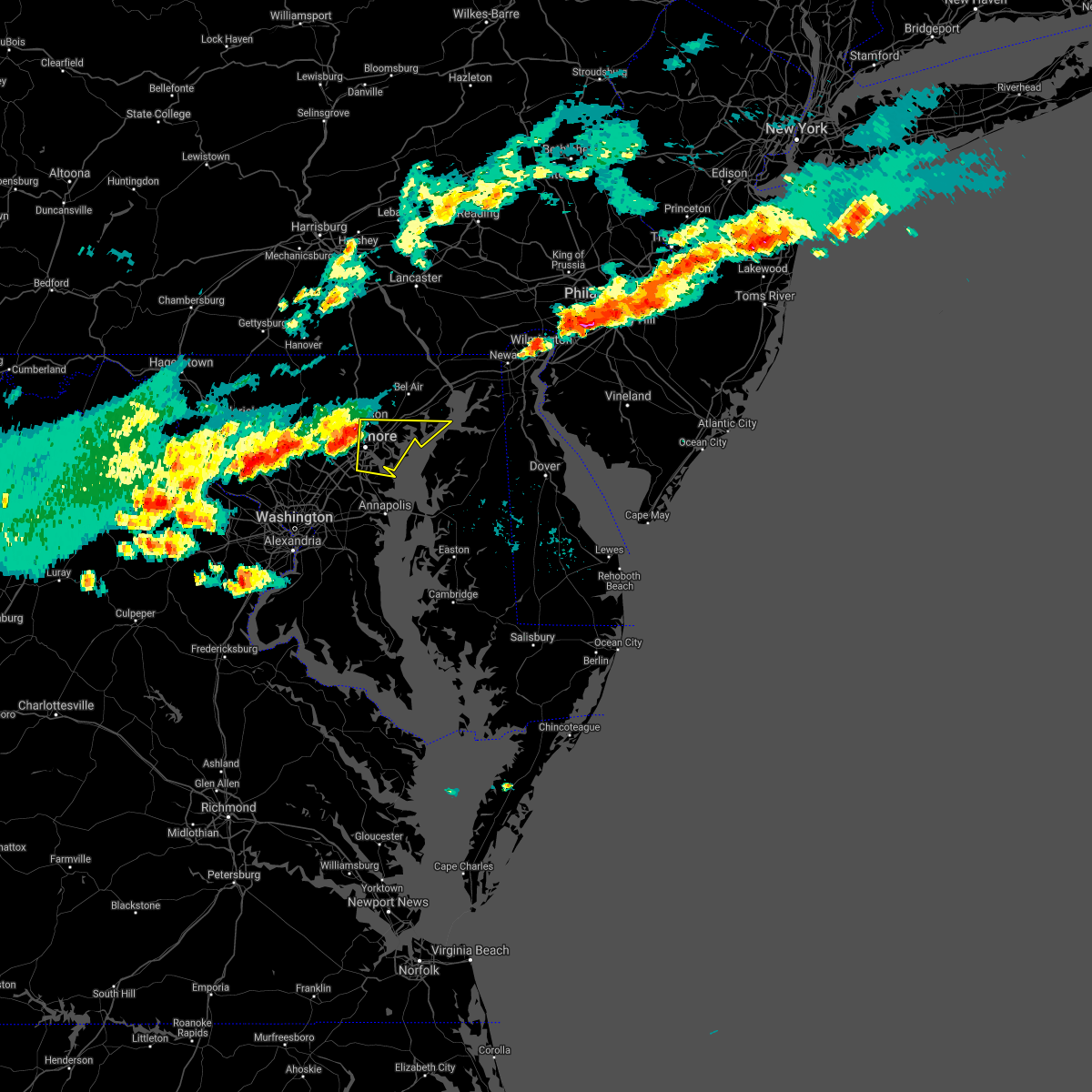 At 929 pm edt, severe thunderstorms were located along a line extending from towson to near baltimore to catonsville, moving east at 45 mph (radar indicated). Hazards include 60 mph wind gusts and quarter size hail. Damaging winds will cause some trees and large branches to fall. this could injure those outdoors, as well as damage homes and vehicles. roadways may become blocked by downed trees. localized power outages are possible. Unsecured light objects may become projectiles. At 929 pm edt, severe thunderstorms were located along a line extending from towson to near baltimore to catonsville, moving east at 45 mph (radar indicated). Hazards include 60 mph wind gusts and quarter size hail. Damaging winds will cause some trees and large branches to fall. this could injure those outdoors, as well as damage homes and vehicles. roadways may become blocked by downed trees. localized power outages are possible. Unsecured light objects may become projectiles.
|
| 5/26/2021 6:05 PM EDT |
 At 605 pm edt, severe thunderstorms were located along a line extending from baltimore to near sparrows point to glen burnie, moving east at 35 mph (radar indicated). Hazards include 60 mph wind gusts. Damaging winds will cause some trees and large branches to fall. this could injure those outdoors, as well as damage homes and vehicles. roadways may become blocked by downed trees. localized power outages are possible. unsecured light objects may become projectiles. Locations impacted include, baltimore, severn, riviera beach, north point state park, sparrows point, fort smallwood state park, bodkin point, back river, millers island, glen burnie, dundalk, essex, pasadena, lake shore, ferndale, brooklyn park, bowleys quarters, green haven, pumphrey and south gate. At 605 pm edt, severe thunderstorms were located along a line extending from baltimore to near sparrows point to glen burnie, moving east at 35 mph (radar indicated). Hazards include 60 mph wind gusts. Damaging winds will cause some trees and large branches to fall. this could injure those outdoors, as well as damage homes and vehicles. roadways may become blocked by downed trees. localized power outages are possible. unsecured light objects may become projectiles. Locations impacted include, baltimore, severn, riviera beach, north point state park, sparrows point, fort smallwood state park, bodkin point, back river, millers island, glen burnie, dundalk, essex, pasadena, lake shore, ferndale, brooklyn park, bowleys quarters, green haven, pumphrey and south gate.
|
| 5/26/2021 5:54 PM EDT |
 At 554 pm edt, severe thunderstorms were located along a line extending from near catonsville to brooklyn park to baltimore-washington airport, moving east at 35 mph (radar indicated). Hazards include 60 mph wind gusts and quarter size hail. Damaging winds will cause some trees and large branches to fall. this could injure those outdoors, as well as damage homes and vehicles. roadways may become blocked by downed trees. localized power outages are possible. unsecured light objects may become projectiles. Locations impacted include, baltimore, severn, middle river, elkridge, riviera beach, baltimore-washington airport, fort smallwood state park, bodkin point, millers island, north point state park, sparrows point, back river, pinehurst, glen burnie, dundalk, catonsville, essex, severna park, odenton and perry hall. At 554 pm edt, severe thunderstorms were located along a line extending from near catonsville to brooklyn park to baltimore-washington airport, moving east at 35 mph (radar indicated). Hazards include 60 mph wind gusts and quarter size hail. Damaging winds will cause some trees and large branches to fall. this could injure those outdoors, as well as damage homes and vehicles. roadways may become blocked by downed trees. localized power outages are possible. unsecured light objects may become projectiles. Locations impacted include, baltimore, severn, middle river, elkridge, riviera beach, baltimore-washington airport, fort smallwood state park, bodkin point, millers island, north point state park, sparrows point, back river, pinehurst, glen burnie, dundalk, catonsville, essex, severna park, odenton and perry hall.
|
| 5/26/2021 5:45 PM EDT |
 At 545 pm edt, severe thunderstorms were located along a line extending from catonsville to pumphrey to near severn, moving east at 35 mph (radar indicated). Hazards include 60 mph wind gusts. Damaging winds will cause some trees and large branches to fall. this could injure those outdoors, as well as damage homes and vehicles. roadways may become blocked by downed trees. localized power outages are possible. unsecured light objects may become projectiles. Locations impacted include, baltimore, severn, pikesville, middle river, elkridge, riviera beach, baltimore-washington airport, fort smallwood state park, sillery bay, bodkin point, millers island, north point state park, sparrows point, pinehurst, back river, glen burnie, dundalk, towson, catonsville and essex. At 545 pm edt, severe thunderstorms were located along a line extending from catonsville to pumphrey to near severn, moving east at 35 mph (radar indicated). Hazards include 60 mph wind gusts. Damaging winds will cause some trees and large branches to fall. this could injure those outdoors, as well as damage homes and vehicles. roadways may become blocked by downed trees. localized power outages are possible. unsecured light objects may become projectiles. Locations impacted include, baltimore, severn, pikesville, middle river, elkridge, riviera beach, baltimore-washington airport, fort smallwood state park, sillery bay, bodkin point, millers island, north point state park, sparrows point, pinehurst, back river, glen burnie, dundalk, towson, catonsville and essex.
|
| 5/26/2021 5:26 PM EDT |
 At 526 pm edt, severe thunderstorms were located along a line extending from near ellicott city to columbia to near fairland, moving east at 35 mph (radar indicated). Hazards include 60 mph wind gusts. Damaging winds will cause some trees and large branches to fall. this could injure those outdoors, as well as damage homes and vehicles. roadways may become blocked by downed trees. localized power outages are possible. Unsecured light objects may become projectiles. At 526 pm edt, severe thunderstorms were located along a line extending from near ellicott city to columbia to near fairland, moving east at 35 mph (radar indicated). Hazards include 60 mph wind gusts. Damaging winds will cause some trees and large branches to fall. this could injure those outdoors, as well as damage homes and vehicles. roadways may become blocked by downed trees. localized power outages are possible. Unsecured light objects may become projectiles.
|
| 3/28/2021 6:07 PM EDT |
 At 607 pm edt, severe thunderstorms were located along a line extending from near aberdeen to near bowleys quarters, moving east at 55 mph (radar indicated). Hazards include 60 mph wind gusts. Damaging winds will cause some trees and large branches to fall. this could injure those outdoors, as well as damage homes and vehicles. roadways may become blocked by downed trees. localized power outages are possible. unsecured light objects may become projectiles. Locations impacted include, baltimore, middle river, aberdeen, havre de grace, aberdeen proving ground, north point state park, sparrows point, back river, millers island, dundalk, bel air south, essex, bel air north, pasadena, rosedale, white marsh, bowleys quarters, riverside, kingsville and pleasant hills. At 607 pm edt, severe thunderstorms were located along a line extending from near aberdeen to near bowleys quarters, moving east at 55 mph (radar indicated). Hazards include 60 mph wind gusts. Damaging winds will cause some trees and large branches to fall. this could injure those outdoors, as well as damage homes and vehicles. roadways may become blocked by downed trees. localized power outages are possible. unsecured light objects may become projectiles. Locations impacted include, baltimore, middle river, aberdeen, havre de grace, aberdeen proving ground, north point state park, sparrows point, back river, millers island, dundalk, bel air south, essex, bel air north, pasadena, rosedale, white marsh, bowleys quarters, riverside, kingsville and pleasant hills.
|
| 3/28/2021 5:56 PM EDT |
 At 555 pm edt, severe thunderstorms with a history of producing wind damage and measured wind gusts to near 60 mph were located along a line extending from near bel air north to rosedale, moving east at 55 mph (radar indicated and observed wind). Hazards include 60 mph wind gusts. Damaging winds will cause some trees and large branches to fall. this could injure those outdoors, as well as damage homes and vehicles. roadways may become blocked by downed trees. localized power outages are possible. unsecured light objects may become projectiles. Locations impacted include, baltimore, middle river, aberdeen, havre de grace, aberdeen proving ground, millers island, north point state park, sparrows point, back river, dundalk, towson, bel air south, essex, parkville, bel air north, carney, perry hall, pasadena, rosedale and rossville. At 555 pm edt, severe thunderstorms with a history of producing wind damage and measured wind gusts to near 60 mph were located along a line extending from near bel air north to rosedale, moving east at 55 mph (radar indicated and observed wind). Hazards include 60 mph wind gusts. Damaging winds will cause some trees and large branches to fall. this could injure those outdoors, as well as damage homes and vehicles. roadways may become blocked by downed trees. localized power outages are possible. unsecured light objects may become projectiles. Locations impacted include, baltimore, middle river, aberdeen, havre de grace, aberdeen proving ground, millers island, north point state park, sparrows point, back river, dundalk, towson, bel air south, essex, parkville, bel air north, carney, perry hall, pasadena, rosedale and rossville.
|
| 3/28/2021 5:37 PM EDT |
 At 535 pm edt, severe thunderstorms with a history of producing wind damage and measured wind gusts to near 60 mph were located along a line extending from near cockeysville to ellicott city, moving east at 55 mph (radar indicated). Hazards include 60 mph wind gusts. Damaging winds will cause some trees and large branches to fall. this could injure those outdoors, as well as damage homes and vehicles. roadways may become blocked by downed trees. localized power outages are possible. Unsecured light objects may become projectiles. At 535 pm edt, severe thunderstorms with a history of producing wind damage and measured wind gusts to near 60 mph were located along a line extending from near cockeysville to ellicott city, moving east at 55 mph (radar indicated). Hazards include 60 mph wind gusts. Damaging winds will cause some trees and large branches to fall. this could injure those outdoors, as well as damage homes and vehicles. roadways may become blocked by downed trees. localized power outages are possible. Unsecured light objects may become projectiles.
|
| 11/30/2020 1:47 PM EST |
 At 147 pm est, severe thunderstorms were located along a line extending from near crofton to near londontowne to near upper marlboro, moving northeast at 55 mph (radar indicated). Hazards include 60 mph wind gusts. Damaging winds will cause some trees and large branches to fall. this could injure those outdoors, as well as damage homes and vehicles. roadways may become blocked by downed trees. localized power outages are possible. unsecured light objects may become projectiles. Locations impacted include, bowie, severn, annapolis, crofton, mayo, glen burnie, severna park, odenton, pasadena, parole, londontowne, millersville, south gate, edgewater, riva, gambrills, herald harbor, crownsville, harwood and sherwood forest. At 147 pm est, severe thunderstorms were located along a line extending from near crofton to near londontowne to near upper marlboro, moving northeast at 55 mph (radar indicated). Hazards include 60 mph wind gusts. Damaging winds will cause some trees and large branches to fall. this could injure those outdoors, as well as damage homes and vehicles. roadways may become blocked by downed trees. localized power outages are possible. unsecured light objects may become projectiles. Locations impacted include, bowie, severn, annapolis, crofton, mayo, glen burnie, severna park, odenton, pasadena, parole, londontowne, millersville, south gate, edgewater, riva, gambrills, herald harbor, crownsville, harwood and sherwood forest.
|
| 11/30/2020 1:39 PM EST |
 At 138 pm est, severe thunderstorms were located along a line extending from near woodmore to upper marlboro to near marlton, moving northeast at 55 mph (radar indicated). Hazards include 60 mph wind gusts. Damaging winds will cause some trees and large branches to fall. this could injure those outdoors, as well as damage homes and vehicles. roadways may become blocked by downed trees. localized power outages are possible. unsecured light objects may become projectiles. Locations impacted include, bowie, severn, annapolis, crofton, largo, mayo, upper marlboro, glen burnie, severna park, odenton, pasadena, ferndale, parole, brooklyn park, kettering, mitchellville, lake arbor, marlton, woodmore and millersville. At 138 pm est, severe thunderstorms were located along a line extending from near woodmore to upper marlboro to near marlton, moving northeast at 55 mph (radar indicated). Hazards include 60 mph wind gusts. Damaging winds will cause some trees and large branches to fall. this could injure those outdoors, as well as damage homes and vehicles. roadways may become blocked by downed trees. localized power outages are possible. unsecured light objects may become projectiles. Locations impacted include, bowie, severn, annapolis, crofton, largo, mayo, upper marlboro, glen burnie, severna park, odenton, pasadena, ferndale, parole, brooklyn park, kettering, mitchellville, lake arbor, marlton, woodmore and millersville.
|
| 11/30/2020 1:28 PM EST |
 At 128 pm est, severe thunderstorms were located along a line extending from andrews air force base to near clinton to waldorf, moving northeast at 55 mph (radar indicated). Hazards include 60 mph wind gusts. Damaging winds will cause some trees and large branches to fall. this could injure those outdoors, as well as damage homes and vehicles. roadways may become blocked by downed trees. localized power outages are possible. Unsecured light objects may become projectiles. At 128 pm est, severe thunderstorms were located along a line extending from andrews air force base to near clinton to waldorf, moving northeast at 55 mph (radar indicated). Hazards include 60 mph wind gusts. Damaging winds will cause some trees and large branches to fall. this could injure those outdoors, as well as damage homes and vehicles. roadways may become blocked by downed trees. localized power outages are possible. Unsecured light objects may become projectiles.
|
| 11/15/2020 7:58 PM EST |
 The severe thunderstorm warning for northwestern anne arundel, southeastern harford and southeastern baltimore counties and southeastern baltimore city will expire at 800 pm est, the storms which prompted the warning have moved out of the area. therefore, the warning will be allowed to expire. a severe thunderstorm watch remains in effect until 1100 pm est for central, northern and northeastern maryland. The severe thunderstorm warning for northwestern anne arundel, southeastern harford and southeastern baltimore counties and southeastern baltimore city will expire at 800 pm est, the storms which prompted the warning have moved out of the area. therefore, the warning will be allowed to expire. a severe thunderstorm watch remains in effect until 1100 pm est for central, northern and northeastern maryland.
|
| 11/15/2020 7:44 PM EST |
 At 744 pm est, severe thunderstorms were located along a line extending from green haven to near severna park to near mitchellville, moving southeast at 30 mph (radar indicated). Hazards include 60 mph wind gusts. Damaging winds will cause some trees and large branches to fall. this could injure those outdoors, as well as damage homes and vehicles. roadways may become blocked by downed trees. localized power outages are possible. unsecured light objects may become projectiles. Locations impacted include, bowie, annapolis, crofton, greenbelt, mayo, shady side, naval academy, magothy river, dobbins island, severn river, south river, pinehurst, gibson island, sillery bay, bodkin point, rhode river, glen burnie, severna park, odenton and pasadena. At 744 pm est, severe thunderstorms were located along a line extending from green haven to near severna park to near mitchellville, moving southeast at 30 mph (radar indicated). Hazards include 60 mph wind gusts. Damaging winds will cause some trees and large branches to fall. this could injure those outdoors, as well as damage homes and vehicles. roadways may become blocked by downed trees. localized power outages are possible. unsecured light objects may become projectiles. Locations impacted include, bowie, annapolis, crofton, greenbelt, mayo, shady side, naval academy, magothy river, dobbins island, severn river, south river, pinehurst, gibson island, sillery bay, bodkin point, rhode river, glen burnie, severna park, odenton and pasadena.
|
| 11/15/2020 7:38 PM EST |
 At 737 pm est, severe thunderstorms were located along a line extending from north east to near bowleys quarters to south gate, moving southeast at 40 mph (radar indicated). Hazards include 60 mph wind gusts. Damaging winds will cause some trees and large branches to fall. this could injure those outdoors, as well as damage homes and vehicles. roadways may become blocked by downed trees. localized power outages are possible. unsecured light objects may become projectiles. Locations impacted include, baltimore, severn, middle river, aberdeen, havre de grace, riviera beach, aberdeen proving ground, north point state park, sparrows point, fort smallwood state park, back river, millers island, glen burnie, dundalk, essex, severna park, odenton, pasadena, lake shore and ferndale. At 737 pm est, severe thunderstorms were located along a line extending from north east to near bowleys quarters to south gate, moving southeast at 40 mph (radar indicated). Hazards include 60 mph wind gusts. Damaging winds will cause some trees and large branches to fall. this could injure those outdoors, as well as damage homes and vehicles. roadways may become blocked by downed trees. localized power outages are possible. unsecured light objects may become projectiles. Locations impacted include, baltimore, severn, middle river, aberdeen, havre de grace, riviera beach, aberdeen proving ground, north point state park, sparrows point, fort smallwood state park, back river, millers island, glen burnie, dundalk, essex, severna park, odenton, pasadena, lake shore and ferndale.
|
| 11/15/2020 7:20 PM EST |
 At 720 pm est, a severe thunderstorm was located near fort meade, or near severn, moving east at 30 mph (radar indicated). Hazards include 60 mph wind gusts. Damaging winds will cause some trees and large branches to fall. this could injure those outdoors, as well as damage homes and vehicles. roadways may become blocked by downed trees. localized power outages are possible. Unsecured light objects may become projectiles. At 720 pm est, a severe thunderstorm was located near fort meade, or near severn, moving east at 30 mph (radar indicated). Hazards include 60 mph wind gusts. Damaging winds will cause some trees and large branches to fall. this could injure those outdoors, as well as damage homes and vehicles. roadways may become blocked by downed trees. localized power outages are possible. Unsecured light objects may become projectiles.
|
| 11/15/2020 7:17 PM EST |
 At 716 pm est, severe thunderstorms were located along a line extending from rock springs to white marsh to savage-guilford, moving southeast at 40 mph (radar indicated). Hazards include 60 mph wind gusts. Damaging winds will cause some trees and large branches to fall. this could injure those outdoors, as well as damage homes and vehicles. roadways may become blocked by downed trees. localized power outages are possible. unsecured light objects may become projectiles. Locations impacted include, baltimore, columbia, severn, middle river, elkridge, aberdeen, havre de grace, riviera beach, aberdeen proving ground, baltimore-washington airport, fort smallwood state park, millers island, north point state park, sparrows point, back river, glen burnie, dundalk, towson, bel air south and catonsville. At 716 pm est, severe thunderstorms were located along a line extending from rock springs to white marsh to savage-guilford, moving southeast at 40 mph (radar indicated). Hazards include 60 mph wind gusts. Damaging winds will cause some trees and large branches to fall. this could injure those outdoors, as well as damage homes and vehicles. roadways may become blocked by downed trees. localized power outages are possible. unsecured light objects may become projectiles. Locations impacted include, baltimore, columbia, severn, middle river, elkridge, aberdeen, havre de grace, riviera beach, aberdeen proving ground, baltimore-washington airport, fort smallwood state park, millers island, north point state park, sparrows point, back river, glen burnie, dundalk, towson, bel air south and catonsville.
|
| 11/15/2020 7:00 PM EST |
 At 700 pm est, severe thunderstorms were located along a line extending from near delta to cockeysville to near ellicott city, moving east at 40 mph (radar indicated). Hazards include 60 mph wind gusts. Damaging winds will cause some trees and large branches to fall. this could injure those outdoors, as well as damage homes and vehicles. roadways may become blocked by downed trees. localized power outages are possible. unsecured light objects may become projectiles. Locations impacted include, baltimore, columbia, severn, pikesville, middle river, cockeysville, elkridge, aberdeen, havre de grace, riviera beach, aberdeen proving ground, baltimore-washington airport, fort smallwood state park, millers island, north point state park, sparrows point, back river, historic ellicott city, glen burnie and ellicott city. At 700 pm est, severe thunderstorms were located along a line extending from near delta to cockeysville to near ellicott city, moving east at 40 mph (radar indicated). Hazards include 60 mph wind gusts. Damaging winds will cause some trees and large branches to fall. this could injure those outdoors, as well as damage homes and vehicles. roadways may become blocked by downed trees. localized power outages are possible. unsecured light objects may become projectiles. Locations impacted include, baltimore, columbia, severn, pikesville, middle river, cockeysville, elkridge, aberdeen, havre de grace, riviera beach, aberdeen proving ground, baltimore-washington airport, fort smallwood state park, millers island, north point state park, sparrows point, back river, historic ellicott city, glen burnie and ellicott city.
|
| 11/15/2020 6:28 PM EST |
 At 628 pm est, severe thunderstorms were located along a line extending from glen rock to near westminster to green valley, moving east at 30 mph (radar indicated). Hazards include 60 mph wind gusts. Damaging winds will cause some trees and large branches to fall. this could injure those outdoors, as well as damage homes and vehicles. roadways may become blocked by downed trees. localized power outages are possible. Unsecured light objects may become projectiles. At 628 pm est, severe thunderstorms were located along a line extending from glen rock to near westminster to green valley, moving east at 30 mph (radar indicated). Hazards include 60 mph wind gusts. Damaging winds will cause some trees and large branches to fall. this could injure those outdoors, as well as damage homes and vehicles. roadways may become blocked by downed trees. localized power outages are possible. Unsecured light objects may become projectiles.
|
| 9/3/2020 6:07 PM EDT |
 At 607 pm edt, severe thunderstorms were located along a line extending from near magothy river to near south river to near kettering, moving east at 35 mph (radar indicated). Hazards include 70 mph wind gusts and quarter size hail. Damaging winds will cause some trees and large branches to fall. this could injure those outdoors, as well as damage homes and vehicles. roadways may become blocked by downed trees. localized power outages are possible. unsecured light objects may become projectiles. Locations impacted include, bowie, annapolis, crofton, forestville, largo, mayo, shady side, deale, naval academy, severn river, south river, gibson island, sillery bay, fedex field, rhode river, magothy river, dobbins island, pinehurst, glen burnie and severna park. At 607 pm edt, severe thunderstorms were located along a line extending from near magothy river to near south river to near kettering, moving east at 35 mph (radar indicated). Hazards include 70 mph wind gusts and quarter size hail. Damaging winds will cause some trees and large branches to fall. this could injure those outdoors, as well as damage homes and vehicles. roadways may become blocked by downed trees. localized power outages are possible. unsecured light objects may become projectiles. Locations impacted include, bowie, annapolis, crofton, forestville, largo, mayo, shady side, deale, naval academy, severn river, south river, gibson island, sillery bay, fedex field, rhode river, magothy river, dobbins island, pinehurst, glen burnie and severna park.
|
| 9/3/2020 5:35 PM EDT |
 At 535 pm edt, severe thunderstorms were located along a line extending from fort meade to near bowie to bladensburg, moving east at 30 mph (radar indicated). Hazards include 70 mph wind gusts and quarter size hail. Damaging winds will cause some trees and large branches to fall. this could injure those outdoors, as well as damage homes and vehicles. roadways may become blocked by downed trees. localized power outages are possible. unsecured light objects may become projectiles. Locations impacted include, bowie, severn, annapolis, college park, crofton, greenbelt, langley park, beltsville, forestville, largo, bladensburg, mayo, shady side, deale, naval academy, gibson island, sillery bay, fedex field, magothy river and pinehurst. At 535 pm edt, severe thunderstorms were located along a line extending from fort meade to near bowie to bladensburg, moving east at 30 mph (radar indicated). Hazards include 70 mph wind gusts and quarter size hail. Damaging winds will cause some trees and large branches to fall. this could injure those outdoors, as well as damage homes and vehicles. roadways may become blocked by downed trees. localized power outages are possible. unsecured light objects may become projectiles. Locations impacted include, bowie, severn, annapolis, college park, crofton, greenbelt, langley park, beltsville, forestville, largo, bladensburg, mayo, shady side, deale, naval academy, gibson island, sillery bay, fedex field, magothy river and pinehurst.
|
| 9/3/2020 5:24 PM EDT |
 At 524 pm edt, severe thunderstorms were located along a line extending from laurel to greenbelt to fort totten, moving east at 30 mph. these are very dangerous storms (radar indicated). Hazards include widespread damaging wind gusts up to 80 mph. Expect considerable damage to trees and power lines. your life is at significant risk if outdoors. in addition to some trees falling into homes, wind damage is possible to roofs, sheds, open garages, and mobile homes. Locations impacted include, bowie, severn, annapolis, college park, crofton, greenbelt, langley park, beltsville, forestville, largo, bladensburg, mayo, shady side, deale, naval academy, gibson island, sillery bay, fedex field, magothy river and pinehurst. At 524 pm edt, severe thunderstorms were located along a line extending from laurel to greenbelt to fort totten, moving east at 30 mph. these are very dangerous storms (radar indicated). Hazards include widespread damaging wind gusts up to 80 mph. Expect considerable damage to trees and power lines. your life is at significant risk if outdoors. in addition to some trees falling into homes, wind damage is possible to roofs, sheds, open garages, and mobile homes. Locations impacted include, bowie, severn, annapolis, college park, crofton, greenbelt, langley park, beltsville, forestville, largo, bladensburg, mayo, shady side, deale, naval academy, gibson island, sillery bay, fedex field, magothy river and pinehurst.
|
| 9/3/2020 5:16 PM EDT |
 At 516 pm edt, severe thunderstorms were located along a line extending from near laurel to college park to friendship village, moving east at 30 mph (radar indicated). Hazards include 70 mph wind gusts. Damaging winds will cause some trees and large branches to fall. this could injure those outdoors, as well as damage homes and vehicles. roadways may become blocked by downed trees. localized power outages are possible. Unsecured light objects may become projectiles. At 516 pm edt, severe thunderstorms were located along a line extending from near laurel to college park to friendship village, moving east at 30 mph (radar indicated). Hazards include 70 mph wind gusts. Damaging winds will cause some trees and large branches to fall. this could injure those outdoors, as well as damage homes and vehicles. roadways may become blocked by downed trees. localized power outages are possible. Unsecured light objects may become projectiles.
|
| 8/24/2020 3:22 PM EDT |
 The severe thunderstorm warning for northern anne arundel county will expire at 330 pm edt, the storm which prompted the warning has weakened below severe limits, and no longer poses an immediate threat to life or property. therefore, the warning will be allowed to expire. however heavy rain is still possible with this thunderstorm. The severe thunderstorm warning for northern anne arundel county will expire at 330 pm edt, the storm which prompted the warning has weakened below severe limits, and no longer poses an immediate threat to life or property. therefore, the warning will be allowed to expire. however heavy rain is still possible with this thunderstorm.
|
| 8/24/2020 3:08 PM EDT |
 At 308 pm edt, a severe thunderstorm was located over severna park, or near riviera beach, moving east at 35 mph (radar indicated). Hazards include 60 mph wind gusts and quarter size hail. Damaging winds will cause some trees and large branches to fall. this could injure those outdoors, as well as damage homes and vehicles. roadways may become blocked by downed trees. localized power outages are possible. unsecured light objects may become projectiles. Locations impacted include, severn, annapolis, crofton, riviera beach, naval academy, magothy river, dobbins island, severn river, pinehurst, gibson island, bodkin point, sillery bay, glen burnie, severna park, odenton, pasadena, arnold, lake shore, parole and fort meade. At 308 pm edt, a severe thunderstorm was located over severna park, or near riviera beach, moving east at 35 mph (radar indicated). Hazards include 60 mph wind gusts and quarter size hail. Damaging winds will cause some trees and large branches to fall. this could injure those outdoors, as well as damage homes and vehicles. roadways may become blocked by downed trees. localized power outages are possible. unsecured light objects may become projectiles. Locations impacted include, severn, annapolis, crofton, riviera beach, naval academy, magothy river, dobbins island, severn river, pinehurst, gibson island, bodkin point, sillery bay, glen burnie, severna park, odenton, pasadena, arnold, lake shore, parole and fort meade.
|
| 8/24/2020 2:51 PM EDT |
 At 251 pm edt, a severe thunderstorm was located over fort meade, or near severn, moving east at 35 mph (radar indicated). Hazards include 60 mph wind gusts and quarter size hail. Damaging winds will cause some trees and large branches to fall. this could injure those outdoors, as well as damage homes and vehicles. roadways may become blocked by downed trees. localized power outages are possible. Unsecured light objects may become projectiles. At 251 pm edt, a severe thunderstorm was located over fort meade, or near severn, moving east at 35 mph (radar indicated). Hazards include 60 mph wind gusts and quarter size hail. Damaging winds will cause some trees and large branches to fall. this could injure those outdoors, as well as damage homes and vehicles. roadways may become blocked by downed trees. localized power outages are possible. Unsecured light objects may become projectiles.
|
| 8/12/2020 5:35 PM EDT |
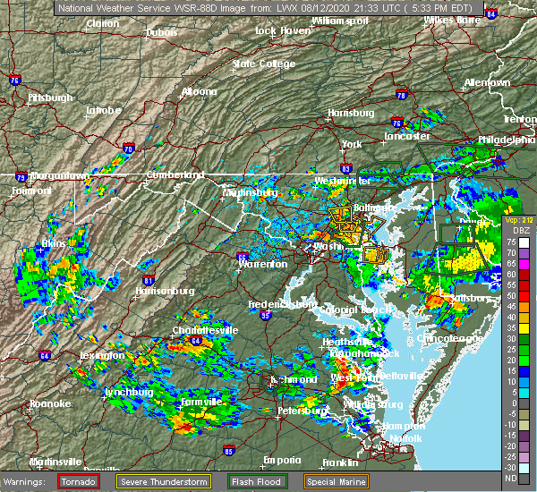 At 535 pm edt, a severe thunderstorm was located over baltimore-washington airport, and is nearly stationary (radar indicated). Hazards include 60 mph wind gusts. Damaging winds will cause some trees and large branches to fall. this could injure those outdoors, as well as damage homes and vehicles. roadways may become blocked by downed trees. localized power outages are possible. unsecured light objects may become projectiles. Locations impacted include, elkridge, glen burnie, catonsville, arbutus, ferndale, brooklyn park, pumphrey, ilchester, linthicum, lansdowne, hanover and linthicum heights. At 535 pm edt, a severe thunderstorm was located over baltimore-washington airport, and is nearly stationary (radar indicated). Hazards include 60 mph wind gusts. Damaging winds will cause some trees and large branches to fall. this could injure those outdoors, as well as damage homes and vehicles. roadways may become blocked by downed trees. localized power outages are possible. unsecured light objects may become projectiles. Locations impacted include, elkridge, glen burnie, catonsville, arbutus, ferndale, brooklyn park, pumphrey, ilchester, linthicum, lansdowne, hanover and linthicum heights.
|
| 8/12/2020 5:05 PM EDT |
 At 505 pm edt, a severe thunderstorm was located over baltimore-washington airport, and is nearly stationary (radar indicated). Hazards include 60 mph wind gusts. Damaging winds will cause some trees and large branches to fall. this could injure those outdoors, as well as damage homes and vehicles. roadways may become blocked by downed trees. localized power outages are possible. Unsecured light objects may become projectiles. At 505 pm edt, a severe thunderstorm was located over baltimore-washington airport, and is nearly stationary (radar indicated). Hazards include 60 mph wind gusts. Damaging winds will cause some trees and large branches to fall. this could injure those outdoors, as well as damage homes and vehicles. roadways may become blocked by downed trees. localized power outages are possible. Unsecured light objects may become projectiles.
|
| 8/6/2020 5:25 AM EDT |
 At 525 am edt, a severe thunderstorm was located over magothy river, moving east at 20 mph (radar indicated). Hazards include 60 mph wind gusts. Damaging winds will cause some trees and large branches to fall. this could injure those outdoors, as well as damage homes and vehicles. roadways may become blocked by downed trees. localized power outages are possible. Unsecured light objects may become projectiles. At 525 am edt, a severe thunderstorm was located over magothy river, moving east at 20 mph (radar indicated). Hazards include 60 mph wind gusts. Damaging winds will cause some trees and large branches to fall. this could injure those outdoors, as well as damage homes and vehicles. roadways may become blocked by downed trees. localized power outages are possible. Unsecured light objects may become projectiles.
|
| 8/6/2020 5:06 AM EDT |
 The severe thunderstorm warning for northeastern anne arundel county will expire at 515 am edt, the storm which prompted the warning has weakened below severe limits, and no longer poses an immediate threat to life or property. therefore, the warning will be allowed to expire. however gusty winds and heavy rain are still possible with this thunderstorm. The severe thunderstorm warning for northeastern anne arundel county will expire at 515 am edt, the storm which prompted the warning has weakened below severe limits, and no longer poses an immediate threat to life or property. therefore, the warning will be allowed to expire. however gusty winds and heavy rain are still possible with this thunderstorm.
|
| 8/6/2020 4:56 AM EDT |
 At 456 am edt, a severe thunderstorm was located over lake shore, or near dobbins island, moving east at 25 mph (radar indicated). Hazards include 60 mph wind gusts and quarter size hail. Damaging winds will cause some trees and large branches to fall. this could injure those outdoors, as well as damage homes and vehicles. roadways may become blocked by downed trees. localized power outages are possible. unsecured light objects may become projectiles. Locations impacted include, severn, crofton, riviera beach, magothy river, dobbins island, fort smallwood state park, pinehurst, gibson island, bodkin point, sillery bay, glen burnie, severna park, odenton, pasadena, arnold, lake shore, ferndale, parole, millersville and green haven. At 456 am edt, a severe thunderstorm was located over lake shore, or near dobbins island, moving east at 25 mph (radar indicated). Hazards include 60 mph wind gusts and quarter size hail. Damaging winds will cause some trees and large branches to fall. this could injure those outdoors, as well as damage homes and vehicles. roadways may become blocked by downed trees. localized power outages are possible. unsecured light objects may become projectiles. Locations impacted include, severn, crofton, riviera beach, magothy river, dobbins island, fort smallwood state park, pinehurst, gibson island, bodkin point, sillery bay, glen burnie, severna park, odenton, pasadena, arnold, lake shore, ferndale, parole, millersville and green haven.
|
| 8/6/2020 4:33 AM EDT |
 At 432 am edt, a severe thunderstorm was located over odenton, or near crofton, moving east at 25 mph (radar indicated). Hazards include 60 mph wind gusts and quarter size hail. Damaging winds will cause some trees and large branches to fall. this could injure those outdoors, as well as damage homes and vehicles. roadways may become blocked by downed trees. localized power outages are possible. Unsecured light objects may become projectiles. At 432 am edt, a severe thunderstorm was located over odenton, or near crofton, moving east at 25 mph (radar indicated). Hazards include 60 mph wind gusts and quarter size hail. Damaging winds will cause some trees and large branches to fall. this could injure those outdoors, as well as damage homes and vehicles. roadways may become blocked by downed trees. localized power outages are possible. Unsecured light objects may become projectiles.
|
| 7/30/2020 9:01 PM EDT |
 At 901 pm edt, severe thunderstorms were located along a line extending from brooklyn park to near langford, moving northeast at 30 mph (radar indicated). Hazards include 60 mph wind gusts. Damaging winds will cause some trees and large branches to fall. this could injure those outdoors, as well as damage homes and vehicles. roadways may become blocked by downed trees. localized power outages are possible. unsecured light objects may become projectiles. Locations impacted include, baltimore, riviera beach, north point state park, sparrows point, millers island, glen burnie, dundalk, pasadena, arbutus, brooklyn park, linthicum, edgemere, lansdowne, fort howard, turners station and halethorpe. At 901 pm edt, severe thunderstorms were located along a line extending from brooklyn park to near langford, moving northeast at 30 mph (radar indicated). Hazards include 60 mph wind gusts. Damaging winds will cause some trees and large branches to fall. this could injure those outdoors, as well as damage homes and vehicles. roadways may become blocked by downed trees. localized power outages are possible. unsecured light objects may become projectiles. Locations impacted include, baltimore, riviera beach, north point state park, sparrows point, millers island, glen burnie, dundalk, pasadena, arbutus, brooklyn park, linthicum, edgemere, lansdowne, fort howard, turners station and halethorpe.
|
| 7/30/2020 8:50 PM EDT |
 At 850 pm edt, severe thunderstorms were located along a line extending from severn to near overton, moving northeast at 25 mph (radar indicated). Hazards include 60 mph wind gusts. Damaging winds will cause some trees and large branches to fall. this could injure those outdoors, as well as damage homes and vehicles. roadways may become blocked by downed trees. localized power outages are possible. unsecured light objects may become projectiles. Locations impacted include, baltimore, severn, elkridge, riviera beach, baltimore-washington airport, north point state park, magothy river, sparrows point, dobbins island, fort smallwood state park, pinehurst, gibson island, bodkin point, sillery bay, millers island, glen burnie, dundalk, severna park, odenton and pasadena. At 850 pm edt, severe thunderstorms were located along a line extending from severn to near overton, moving northeast at 25 mph (radar indicated). Hazards include 60 mph wind gusts. Damaging winds will cause some trees and large branches to fall. this could injure those outdoors, as well as damage homes and vehicles. roadways may become blocked by downed trees. localized power outages are possible. unsecured light objects may become projectiles. Locations impacted include, baltimore, severn, elkridge, riviera beach, baltimore-washington airport, north point state park, magothy river, sparrows point, dobbins island, fort smallwood state park, pinehurst, gibson island, bodkin point, sillery bay, millers island, glen burnie, dundalk, severna park, odenton and pasadena.
|
| 7/30/2020 8:27 PM EDT |
 At 826 pm edt, severe thunderstorms were located along a line extending from near goddard to near severn river, moving northeast at 25 mph (radar indicated). Hazards include 60 mph wind gusts. Damaging winds will cause some trees and large branches to fall. this could injure those outdoors, as well as damage homes and vehicles. roadways may become blocked by downed trees. localized power outages are possible. Unsecured light objects may become projectiles. At 826 pm edt, severe thunderstorms were located along a line extending from near goddard to near severn river, moving northeast at 25 mph (radar indicated). Hazards include 60 mph wind gusts. Damaging winds will cause some trees and large branches to fall. this could injure those outdoors, as well as damage homes and vehicles. roadways may become blocked by downed trees. localized power outages are possible. Unsecured light objects may become projectiles.
|
| 7/24/2020 6:06 PM EDT |
 At 606 pm edt, a severe thunderstorm was located over rossville, or near middle river, moving south at 10 mph (radar indicated). Hazards include 60 mph wind gusts and quarter size hail. Damaging winds will cause some trees and large branches to fall. this could injure those outdoors, as well as damage homes and vehicles. roadways may become blocked by downed trees. localized power outages are possible. Unsecured light objects may become projectiles. At 606 pm edt, a severe thunderstorm was located over rossville, or near middle river, moving south at 10 mph (radar indicated). Hazards include 60 mph wind gusts and quarter size hail. Damaging winds will cause some trees and large branches to fall. this could injure those outdoors, as well as damage homes and vehicles. roadways may become blocked by downed trees. localized power outages are possible. Unsecured light objects may become projectiles.
|
| 7/22/2020 5:21 PM EDT |
 The severe thunderstorm warning for central harford and southeastern baltimore counties and baltimore city will expire at 530 pm edt, the storms which prompted the warning are exiting the warned area. therefore, the warning will be allowed to expire. however heavy rain is still possible with these thunderstorms. a severe thunderstorm watch remains in effect until 700 pm edt for central and northern maryland. to report severe weather, contact your nearest law enforcement agency. they will relay your report to the national weather service sterling virginia. The severe thunderstorm warning for central harford and southeastern baltimore counties and baltimore city will expire at 530 pm edt, the storms which prompted the warning are exiting the warned area. therefore, the warning will be allowed to expire. however heavy rain is still possible with these thunderstorms. a severe thunderstorm watch remains in effect until 700 pm edt for central and northern maryland. to report severe weather, contact your nearest law enforcement agency. they will relay your report to the national weather service sterling virginia.
|
| 7/22/2020 5:10 PM EDT |
 At 510 pm edt, severe thunderstorms were located along a line extending from near bel air south to near baltimore, moving east at 15 mph (radar indicated). Hazards include damaging wind gusts up to 65 mph and isolated large hail up to quarter size. Damaging winds will cause some trees and large branches to fall. this could injure those outdoors, as well as damage homes and vehicles. roadways may become blocked by downed trees. localized power outages are possible. unsecured light objects may become projectiles. Locations impacted include, baltimore, middle river, aberdeen, havre de grace, aberdeen proving ground, millers island, north point state park, sparrows point, back river, dundalk, towson, bel air south, essex, parkville, bel air north, carney, perry hall, rosedale, rossville and brooklyn park. At 510 pm edt, severe thunderstorms were located along a line extending from near bel air south to near baltimore, moving east at 15 mph (radar indicated). Hazards include damaging wind gusts up to 65 mph and isolated large hail up to quarter size. Damaging winds will cause some trees and large branches to fall. this could injure those outdoors, as well as damage homes and vehicles. roadways may become blocked by downed trees. localized power outages are possible. unsecured light objects may become projectiles. Locations impacted include, baltimore, middle river, aberdeen, havre de grace, aberdeen proving ground, millers island, north point state park, sparrows point, back river, dundalk, towson, bel air south, essex, parkville, bel air north, carney, perry hall, rosedale, rossville and brooklyn park.
|
| 7/22/2020 4:52 PM EDT |
 The severe thunderstorm warning for anne arundel, northwestern calvert, eastern prince georges and northeastern charles counties will expire at 500 pm edt, the storms which prompted the warning have weakened below severe limits, and have exited the warned area. therefore, the warning will be allowed to expire. a severe thunderstorm watch remains in effect until 700 pm edt for central, northern and southern maryland. to report severe weather, contact your nearest law enforcement agency. they will relay your report to the national weather service sterling virginia. The severe thunderstorm warning for anne arundel, northwestern calvert, eastern prince georges and northeastern charles counties will expire at 500 pm edt, the storms which prompted the warning have weakened below severe limits, and have exited the warned area. therefore, the warning will be allowed to expire. a severe thunderstorm watch remains in effect until 700 pm edt for central, northern and southern maryland. to report severe weather, contact your nearest law enforcement agency. they will relay your report to the national weather service sterling virginia.
|
| 7/22/2020 4:52 PM EDT |
 At 451 pm edt, severe thunderstorms were located along a line extending from pleasant hills to baltimore, moving east at 15 mph (radar indicated). Hazards include damaging wind gusts up to 65 mph and isolated hail up to quarter size. Damaging winds will cause some trees and large branches to fall. this could injure those outdoors, as well as damage homes and vehicles. roadways may become blocked by downed trees. localized power outages are possible. Unsecured light objects may become projectiles. At 451 pm edt, severe thunderstorms were located along a line extending from pleasant hills to baltimore, moving east at 15 mph (radar indicated). Hazards include damaging wind gusts up to 65 mph and isolated hail up to quarter size. Damaging winds will cause some trees and large branches to fall. this could injure those outdoors, as well as damage homes and vehicles. roadways may become blocked by downed trees. localized power outages are possible. Unsecured light objects may become projectiles.
|
| 7/22/2020 4:46 PM EDT |
 At 420 pm edt, developing severe thunderstorms were located along a line extending from near bel air north to towson to near elkridge, moving east at 15 mph (radar indicated). Hazards include 60 mph wind gusts. Damaging winds will cause some trees and large branches to fall. this could injure those outdoors, as well as damage homes and vehicles. roadways may become blocked by downed trees. localized power outages are possible. Unsecured light objects may become projectiles. At 420 pm edt, developing severe thunderstorms were located along a line extending from near bel air north to towson to near elkridge, moving east at 15 mph (radar indicated). Hazards include 60 mph wind gusts. Damaging winds will cause some trees and large branches to fall. this could injure those outdoors, as well as damage homes and vehicles. roadways may become blocked by downed trees. localized power outages are possible. Unsecured light objects may become projectiles.
|
| 7/22/2020 4:45 PM EDT |
 At 444 pm edt, severe thunderstorms were located along a line extending from severn to near upper marlboro to 7 miles east of waldorf, moving east at 20 mph (radar indicated). Hazards include 60 mph wind gusts. Damaging winds will cause some trees and large branches to fall. this could injure those outdoors, as well as damage homes and vehicles. roadways may become blocked by downed trees. localized power outages are possible. unsecured light objects may become projectiles. Locations impacted include, baltimore, bowie, severn, annapolis, crofton, elkridge, riviera beach, mayo, shady side, chesapeake beach, deale, naval academy, prince frederick, baltimore-washington airport, severn river, south river, fort smallwood state park, gibson island, bodkin point and sillery bay. At 444 pm edt, severe thunderstorms were located along a line extending from severn to near upper marlboro to 7 miles east of waldorf, moving east at 20 mph (radar indicated). Hazards include 60 mph wind gusts. Damaging winds will cause some trees and large branches to fall. this could injure those outdoors, as well as damage homes and vehicles. roadways may become blocked by downed trees. localized power outages are possible. unsecured light objects may become projectiles. Locations impacted include, baltimore, bowie, severn, annapolis, crofton, elkridge, riviera beach, mayo, shady side, chesapeake beach, deale, naval academy, prince frederick, baltimore-washington airport, severn river, south river, fort smallwood state park, gibson island, bodkin point and sillery bay.
|
| 7/22/2020 4:27 PM EDT |
 At 426 pm edt, doppler radar indicated severe thunderstorms located along a line extending from fort meade to upper marlboro to waldorf, moving east at 20 mph (observed wind damage, measured wind gusts and doppler radar). Hazards include 60 mph wind gusts. Damaging winds will cause some trees and large branches to fall. this could injure those outdoors, as well as damage homes and vehicles. roadways may become blocked by downed trees. localized power outages are possible. unsecured light objects may become projectiles. Locations impacted include, baltimore, waldorf, bowie, severn, annapolis, clinton, crofton, elkridge, riviera beach, forestville, largo, la plata, mayo, shady side, chesapeake beach, deale, naval academy, prince frederick, upper marlboro and baltimore-washington airport. At 426 pm edt, doppler radar indicated severe thunderstorms located along a line extending from fort meade to upper marlboro to waldorf, moving east at 20 mph (observed wind damage, measured wind gusts and doppler radar). Hazards include 60 mph wind gusts. Damaging winds will cause some trees and large branches to fall. this could injure those outdoors, as well as damage homes and vehicles. roadways may become blocked by downed trees. localized power outages are possible. unsecured light objects may become projectiles. Locations impacted include, baltimore, waldorf, bowie, severn, annapolis, clinton, crofton, elkridge, riviera beach, forestville, largo, la plata, mayo, shady side, chesapeake beach, deale, naval academy, prince frederick, upper marlboro and baltimore-washington airport.
|
| 7/22/2020 4:21 PM EDT |
 At 420 pm edt, developing severe thunderstorms were located along a line extending from near bel air north to towson to near elkridge, moving east at 15 mph (radar indicated). Hazards include 60 mph wind gusts. Damaging winds will cause some trees and large branches to fall. this could injure those outdoors, as well as damage homes and vehicles. roadways may become blocked by downed trees. localized power outages are possible. Unsecured light objects may become projectiles. At 420 pm edt, developing severe thunderstorms were located along a line extending from near bel air north to towson to near elkridge, moving east at 15 mph (radar indicated). Hazards include 60 mph wind gusts. Damaging winds will cause some trees and large branches to fall. this could injure those outdoors, as well as damage homes and vehicles. roadways may become blocked by downed trees. localized power outages are possible. Unsecured light objects may become projectiles.
|
| 7/22/2020 4:05 PM EDT |
 At 404 pm edt, severe thunderstorms with a history of producing wind damage were located along a line extending from near fairland to marlow heights to near la plata, moving east at 20 mph (observed wind damage and doppler radar). Hazards include damaging wind gusts up to 70 mph and isolated hail up to quarter size. Damaging winds will cause some trees and large branches to fall. this could injure those outdoors, as well as damage homes and vehicles. roadways may become blocked by downed trees. localized power outages are possible. Unsecured light objects may become projectiles. At 404 pm edt, severe thunderstorms with a history of producing wind damage were located along a line extending from near fairland to marlow heights to near la plata, moving east at 20 mph (observed wind damage and doppler radar). Hazards include damaging wind gusts up to 70 mph and isolated hail up to quarter size. Damaging winds will cause some trees and large branches to fall. this could injure those outdoors, as well as damage homes and vehicles. roadways may become blocked by downed trees. localized power outages are possible. Unsecured light objects may become projectiles.
|
| 7/6/2020 7:25 PM EDT |
 The severe thunderstorm warning for northern anne arundel and southeastern baltimore counties and eastern baltimore city will expire at 730 pm edt, the storms which prompted the warning have weakened below severe limits, and have exited the warned area. therefore, the warning will be allowed to expire. however heavy rain is still possible with these thunderstorms. a severe thunderstorm watch remains in effect until 1100 pm edt for central and northern maryland. to report severe weather, contact your nearest law enforcement agency. they will relay your report to the national weather service sterling virginia. The severe thunderstorm warning for northern anne arundel and southeastern baltimore counties and eastern baltimore city will expire at 730 pm edt, the storms which prompted the warning have weakened below severe limits, and have exited the warned area. therefore, the warning will be allowed to expire. however heavy rain is still possible with these thunderstorms. a severe thunderstorm watch remains in effect until 1100 pm edt for central and northern maryland. to report severe weather, contact your nearest law enforcement agency. they will relay your report to the national weather service sterling virginia.
|
| 7/6/2020 7:15 PM EDT |
 At 714 pm edt, severe thunderstorms with a history of producing damaging winds and large hail were located along a line extending from rosedale to sparrows point, and are nearly stationary (radar indicated). Hazards include 60 mph wind gusts. Damaging winds will cause some trees and large branches to fall. this could injure those outdoors, as well as damage homes and vehicles. roadways may become blocked by downed trees. localized power outages are possible. unsecured light objects may become projectiles. Locations impacted include, baltimore, middle river, north point state park, sparrows point, back river, millers island, glen burnie, dundalk, towson, essex, parkville, carney, perry hall, pasadena, rosedale, rossville, white marsh, bowleys quarters, kingsville and joppatowne. At 714 pm edt, severe thunderstorms with a history of producing damaging winds and large hail were located along a line extending from rosedale to sparrows point, and are nearly stationary (radar indicated). Hazards include 60 mph wind gusts. Damaging winds will cause some trees and large branches to fall. this could injure those outdoors, as well as damage homes and vehicles. roadways may become blocked by downed trees. localized power outages are possible. unsecured light objects may become projectiles. Locations impacted include, baltimore, middle river, north point state park, sparrows point, back river, millers island, glen burnie, dundalk, towson, essex, parkville, carney, perry hall, pasadena, rosedale, rossville, white marsh, bowleys quarters, kingsville and joppatowne.
|
| 7/6/2020 7:07 PM EDT |
 At 707 pm edt, severe thunderstorms with a history of producing damaging winds and large hail were located along a line extending from rosedale to sparrows point, and are nearly stationary (radar indicated). Hazards include 70 mph wind gusts and quarter size hail. Damaging winds will cause some trees and large branches to fall. this could injure those outdoors, as well as damage homes and vehicles. roadways may become blocked by downed trees. localized power outages are possible. unsecured light objects may become projectiles. Locations impacted include, baltimore, middle river, north point state park, sparrows point, back river, millers island, glen burnie, dundalk, towson, essex, parkville, carney, perry hall, pasadena, rosedale, rossville, white marsh, bowleys quarters, kingsville and joppatowne. At 707 pm edt, severe thunderstorms with a history of producing damaging winds and large hail were located along a line extending from rosedale to sparrows point, and are nearly stationary (radar indicated). Hazards include 70 mph wind gusts and quarter size hail. Damaging winds will cause some trees and large branches to fall. this could injure those outdoors, as well as damage homes and vehicles. roadways may become blocked by downed trees. localized power outages are possible. unsecured light objects may become projectiles. Locations impacted include, baltimore, middle river, north point state park, sparrows point, back river, millers island, glen burnie, dundalk, towson, essex, parkville, carney, perry hall, pasadena, rosedale, rossville, white marsh, bowleys quarters, kingsville and joppatowne.
|
| 7/6/2020 6:44 PM EDT |
 At 644 pm edt, severe thunderstorms were located along a line extending from rosedale to sparrows point, and are nearly stationary (radar indicated). Hazards include 60 mph wind gusts and quarter size hail. Damaging winds will cause some trees and large branches to fall. this could injure those outdoors, as well as damage homes and vehicles. roadways may become blocked by downed trees. localized power outages are possible. Unsecured light objects may become projectiles. At 644 pm edt, severe thunderstorms were located along a line extending from rosedale to sparrows point, and are nearly stationary (radar indicated). Hazards include 60 mph wind gusts and quarter size hail. Damaging winds will cause some trees and large branches to fall. this could injure those outdoors, as well as damage homes and vehicles. roadways may become blocked by downed trees. localized power outages are possible. Unsecured light objects may become projectiles.
|
| 7/6/2020 6:25 PM EDT |
 At 625 pm edt, a severe thunderstorm was located over millersville, or near crofton, moving east at 5 mph (radar indicated). Hazards include 60 mph wind gusts. Damaging winds will cause some trees and large branches to fall. this could injure those outdoors, as well as damage homes and vehicles. roadways may become blocked by downed trees. localized power outages are possible. Unsecured light objects may become projectiles. At 625 pm edt, a severe thunderstorm was located over millersville, or near crofton, moving east at 5 mph (radar indicated). Hazards include 60 mph wind gusts. Damaging winds will cause some trees and large branches to fall. this could injure those outdoors, as well as damage homes and vehicles. roadways may become blocked by downed trees. localized power outages are possible. Unsecured light objects may become projectiles.
|
| 7/5/2020 5:40 PM EDT |
 The severe thunderstorm warning for northeastern anne arundel county will expire at 545 pm edt, the storm which prompted the warning has weakened and moved out of the area. therefore, the warning will be allowed to expire. The severe thunderstorm warning for northeastern anne arundel county will expire at 545 pm edt, the storm which prompted the warning has weakened and moved out of the area. therefore, the warning will be allowed to expire.
|
| 7/5/2020 5:29 PM EDT |
 At 529 pm edt, a severe thunderstorm was located over parole, or over annapolis, moving south at 20 mph (radar indicated). Hazards include 60 mph wind gusts and quarter size hail. Damaging winds will cause some trees and large branches to fall. this could injure those outdoors, as well as damage homes and vehicles. roadways may become blocked by downed trees. localized power outages are possible. unsecured light objects may become projectiles. locations impacted include, annapolis, riviera beach, naval academy, magothy river, dobbins island, severn river, pinehurst, gibson island, bodkin point, sillery bay, glen burnie, severna park, pasadena, arnold, lake shore, parole, green haven, cape st. Claire, herald harbor and crownsville. At 529 pm edt, a severe thunderstorm was located over parole, or over annapolis, moving south at 20 mph (radar indicated). Hazards include 60 mph wind gusts and quarter size hail. Damaging winds will cause some trees and large branches to fall. this could injure those outdoors, as well as damage homes and vehicles. roadways may become blocked by downed trees. localized power outages are possible. unsecured light objects may become projectiles. locations impacted include, annapolis, riviera beach, naval academy, magothy river, dobbins island, severn river, pinehurst, gibson island, bodkin point, sillery bay, glen burnie, severna park, pasadena, arnold, lake shore, parole, green haven, cape st. Claire, herald harbor and crownsville.
|
| 7/5/2020 5:05 PM EDT | *** 19 inj *** large tree fell on a detached outbuilding causing it to collapse. 19 people taking shelter inside were injured... 1 criticall in anne arundel county MD, 4.7 miles NW of Pasadena, MD |
| 7/5/2020 5:05 PM EDT |
 At 505 pm edt, a severe thunderstorm was located over lake shore, or near dobbins island, moving south at 20 mph (radar indicated). Hazards include 60 mph wind gusts and quarter size hail. Damaging winds will cause some trees and large branches to fall. this could injure those outdoors, as well as damage homes and vehicles. roadways may become blocked by downed trees. localized power outages are possible. Unsecured light objects may become projectiles. At 505 pm edt, a severe thunderstorm was located over lake shore, or near dobbins island, moving south at 20 mph (radar indicated). Hazards include 60 mph wind gusts and quarter size hail. Damaging winds will cause some trees and large branches to fall. this could injure those outdoors, as well as damage homes and vehicles. roadways may become blocked by downed trees. localized power outages are possible. Unsecured light objects may become projectiles.
|
| 7/5/2020 4:52 PM EDT |
 At 452 pm edt, a severe thunderstorm was located over riviera beach, moving south at 10 mph (radar indicated). Hazards include 60 mph wind gusts and half dollar size hail. Damaging winds will cause some trees and large branches to fall. this could injure those outdoors, as well as damage homes and vehicles. roadways may become blocked by downed trees. localized power outages are possible. unsecured light objects may become projectiles. Locations impacted include, baltimore, severn, riviera beach, fort smallwood state park, pinehurst, sparrows point, dobbins island, gibson island, bodkin point, sillery bay, glen burnie, dundalk, severna park, pasadena, lake shore, brooklyn park, south gate, green haven, edgemere and gambrills. At 452 pm edt, a severe thunderstorm was located over riviera beach, moving south at 10 mph (radar indicated). Hazards include 60 mph wind gusts and half dollar size hail. Damaging winds will cause some trees and large branches to fall. this could injure those outdoors, as well as damage homes and vehicles. roadways may become blocked by downed trees. localized power outages are possible. unsecured light objects may become projectiles. Locations impacted include, baltimore, severn, riviera beach, fort smallwood state park, pinehurst, sparrows point, dobbins island, gibson island, bodkin point, sillery bay, glen burnie, dundalk, severna park, pasadena, lake shore, brooklyn park, south gate, green haven, edgemere and gambrills.
|
| 7/5/2020 4:26 PM EDT |
 The severe thunderstorm warning for northern anne arundel and southeastern baltimore counties and eastern baltimore city will expire at 430 pm edt, the storm which prompted the warning has moved out of the area. therefore, the warning will be allowed to expire. remember, a severe thunderstorm warning still remains in effect for extreme southeastern baltimore city, southeastern baltimore county and northern anne arundel county until 515 pm edt. The severe thunderstorm warning for northern anne arundel and southeastern baltimore counties and eastern baltimore city will expire at 430 pm edt, the storm which prompted the warning has moved out of the area. therefore, the warning will be allowed to expire. remember, a severe thunderstorm warning still remains in effect for extreme southeastern baltimore city, southeastern baltimore county and northern anne arundel county until 515 pm edt.
|
| 7/5/2020 4:24 PM EDT |
 At 424 pm edt, a severe thunderstorm was located over dundalk, or over sparrows point, moving south at 10 mph (radar indicated). Hazards include 60 mph wind gusts and quarter size hail. Damaging winds will cause some trees and large branches to fall. this could injure those outdoors, as well as damage homes and vehicles. roadways may become blocked by downed trees. localized power outages are possible. Unsecured light objects may become projectiles. At 424 pm edt, a severe thunderstorm was located over dundalk, or over sparrows point, moving south at 10 mph (radar indicated). Hazards include 60 mph wind gusts and quarter size hail. Damaging winds will cause some trees and large branches to fall. this could injure those outdoors, as well as damage homes and vehicles. roadways may become blocked by downed trees. localized power outages are possible. Unsecured light objects may become projectiles.
|
| 7/5/2020 3:51 PM EDT |
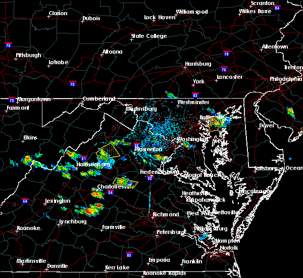 At 351 pm edt, a severe thunderstorm was located over essex, or over middle river, moving west at 15 mph (radar indicated). Hazards include 60 mph wind gusts and quarter size hail. Damaging winds will cause some trees and large branches to fall. this could injure those outdoors, as well as damage homes and vehicles. roadways may become blocked by downed trees. localized power outages are possible. Unsecured light objects may become projectiles. At 351 pm edt, a severe thunderstorm was located over essex, or over middle river, moving west at 15 mph (radar indicated). Hazards include 60 mph wind gusts and quarter size hail. Damaging winds will cause some trees and large branches to fall. this could injure those outdoors, as well as damage homes and vehicles. roadways may become blocked by downed trees. localized power outages are possible. Unsecured light objects may become projectiles.
|
| 7/1/2020 3:30 PM EDT |
 At 330 pm edt, a severe thunderstorm was located over green haven, or over riviera beach, moving southeast at 20 mph (radar indicated). Hazards include 60 mph wind gusts and quarter size hail. Damaging winds will cause some trees and large branches to fall. this could injure those outdoors, as well as damage homes and vehicles. roadways may become blocked by downed trees. localized power outages are possible. Unsecured light objects may become projectiles. At 330 pm edt, a severe thunderstorm was located over green haven, or over riviera beach, moving southeast at 20 mph (radar indicated). Hazards include 60 mph wind gusts and quarter size hail. Damaging winds will cause some trees and large branches to fall. this could injure those outdoors, as well as damage homes and vehicles. roadways may become blocked by downed trees. localized power outages are possible. Unsecured light objects may become projectiles.
|
| 6/25/2020 7:39 PM EDT |
 The severe thunderstorm warning for anne arundel and northeastern prince georges counties will expire at 745 pm edt, the storms which prompted the warning have weakened below severe limits, and no longer pose an immediate threat to life or property. therefore, the warning will be allowed to expire. The severe thunderstorm warning for anne arundel and northeastern prince georges counties will expire at 745 pm edt, the storms which prompted the warning have weakened below severe limits, and no longer pose an immediate threat to life or property. therefore, the warning will be allowed to expire.
|
| 6/25/2020 7:29 PM EDT |
 At 728 pm edt, severe thunderstorms were located along a line extending from severna park to near parole to near kettering, moving east at 25 mph (radar indicated). Hazards include 60 mph wind gusts and quarter size hail. Damaging winds will cause some trees and large branches to fall. this could injure those outdoors, as well as damage homes and vehicles. roadways may become blocked by downed trees. localized power outages are possible. unsecured light objects may become projectiles. Locations impacted include, bowie, severn, annapolis, crofton, riviera beach, forestville, largo, mayo, shady side, deale, naval academy, upper marlboro, baltimore-washington airport, severn river, south river, fort smallwood state park, gibson island, bodkin point, sillery bay and rhode river. At 728 pm edt, severe thunderstorms were located along a line extending from severna park to near parole to near kettering, moving east at 25 mph (radar indicated). Hazards include 60 mph wind gusts and quarter size hail. Damaging winds will cause some trees and large branches to fall. this could injure those outdoors, as well as damage homes and vehicles. roadways may become blocked by downed trees. localized power outages are possible. unsecured light objects may become projectiles. Locations impacted include, bowie, severn, annapolis, crofton, riviera beach, forestville, largo, mayo, shady side, deale, naval academy, upper marlboro, baltimore-washington airport, severn river, south river, fort smallwood state park, gibson island, bodkin point, sillery bay and rhode river.
|
| 6/25/2020 6:53 PM EDT |
 At 652 pm edt, severe thunderstorms were located along a line extending from near savage-guilford to hyattsville, moving east at 30 mph (radar indicated). Hazards include 60 mph wind gusts and quarter size hail. Damaging winds will cause some trees and large branches to fall. this could injure those outdoors, as well as damage homes and vehicles. roadways may become blocked by downed trees. localized power outages are possible. Unsecured light objects may become projectiles. At 652 pm edt, severe thunderstorms were located along a line extending from near savage-guilford to hyattsville, moving east at 30 mph (radar indicated). Hazards include 60 mph wind gusts and quarter size hail. Damaging winds will cause some trees and large branches to fall. this could injure those outdoors, as well as damage homes and vehicles. roadways may become blocked by downed trees. localized power outages are possible. Unsecured light objects may become projectiles.
|
| 6/4/2020 9:21 PM EDT |
 The severe thunderstorm warning for eastern anne arundel, northwestern calvert and southeastern prince georges counties will expire at 930 pm edt, the storms which prompted the warning have moved out of the area. therefore, the warning will be allowed to expire. a severe thunderstorm watch remains in effect until 1000 pm edt for central and northern maryland. The severe thunderstorm warning for eastern anne arundel, northwestern calvert and southeastern prince georges counties will expire at 930 pm edt, the storms which prompted the warning have moved out of the area. therefore, the warning will be allowed to expire. a severe thunderstorm watch remains in effect until 1000 pm edt for central and northern maryland.
|
| 6/4/2020 9:12 PM EDT |
 At 911 pm edt, severe thunderstorms were located along a line extending from riviera beach to rhode river to near dunkirk, moving east at 30 mph (radar indicated). Hazards include 60 mph wind gusts. Damaging winds will cause some trees and large branches to fall. this could injure those outdoors, as well as damage homes and vehicles. roadways may become blocked by downed trees. localized power outages are possible. unsecured light objects may become projectiles. Locations impacted include, annapolis, riviera beach, mayo, shady side, chesapeake beach, deale, naval academy, severn river, south river, fort smallwood state park, gibson island, bodkin point, sillery bay, breezy point, rhode river, magothy river, dobbins island, pinehurst, glen burnie and severna park. At 911 pm edt, severe thunderstorms were located along a line extending from riviera beach to rhode river to near dunkirk, moving east at 30 mph (radar indicated). Hazards include 60 mph wind gusts. Damaging winds will cause some trees and large branches to fall. this could injure those outdoors, as well as damage homes and vehicles. roadways may become blocked by downed trees. localized power outages are possible. unsecured light objects may become projectiles. Locations impacted include, annapolis, riviera beach, mayo, shady side, chesapeake beach, deale, naval academy, severn river, south river, fort smallwood state park, gibson island, bodkin point, sillery bay, breezy point, rhode river, magothy river, dobbins island, pinehurst, glen burnie and severna park.
|
| 6/4/2020 8:50 PM EDT |
 At 850 pm edt, severe thunderstorms were located along a line extending from baltimore-washington airport to near upper marlboro to near waldorf, moving east at 30 mph (radar indicated). Hazards include 60 mph wind gusts. Damaging winds will cause some trees and large branches to fall. this could injure those outdoors, as well as damage homes and vehicles. roadways may become blocked by downed trees. localized power outages are possible. Unsecured light objects may become projectiles. At 850 pm edt, severe thunderstorms were located along a line extending from baltimore-washington airport to near upper marlboro to near waldorf, moving east at 30 mph (radar indicated). Hazards include 60 mph wind gusts. Damaging winds will cause some trees and large branches to fall. this could injure those outdoors, as well as damage homes and vehicles. roadways may become blocked by downed trees. localized power outages are possible. Unsecured light objects may become projectiles.
|
| 4/13/2020 3:06 PM EDT |
 The severe thunderstorm warning for northeastern anne arundel and southeastern baltimore counties will expire at 315 pm edt, the storms which prompted the warning have moved out of the area. therefore, the warning will be allowed to expire. a tornado watch remains in effect until 600 pm edt for central and northern maryland. to report severe weather, contact your nearest law enforcement agency. they will relay your report to the national weather service sterling virginia. The severe thunderstorm warning for northeastern anne arundel and southeastern baltimore counties will expire at 315 pm edt, the storms which prompted the warning have moved out of the area. therefore, the warning will be allowed to expire. a tornado watch remains in effect until 600 pm edt for central and northern maryland. to report severe weather, contact your nearest law enforcement agency. they will relay your report to the national weather service sterling virginia.
|
| 4/13/2020 2:58 PM EDT |
 At 257 pm edt, severe thunderstorms with a history of producing widespread wind damage and measured wind gusts in excess of 70 mph were located along a line extending from near newtown to near severn river, moving east at 50 mph. these are very dangerous storms (radar indicated and observed wind). Hazards include 80 mph wind gusts. Expect considerable damage to trees and power lines. your life is at significant risk if outdoors. in addition to some trees falling into homes, wind damage is possible to roofs, sheds, open garages, and mobile homes. locations impacted include, annapolis, riviera beach, naval academy, fort smallwood state park, pinehurst, north point state park, magothy river, dobbins island, gibson island, bodkin point, sillery bay, millers island, severna park, pasadena, arnold, lake shore, parole, bowleys quarters, cape st. Claire and edgemere. At 257 pm edt, severe thunderstorms with a history of producing widespread wind damage and measured wind gusts in excess of 70 mph were located along a line extending from near newtown to near severn river, moving east at 50 mph. these are very dangerous storms (radar indicated and observed wind). Hazards include 80 mph wind gusts. Expect considerable damage to trees and power lines. your life is at significant risk if outdoors. in addition to some trees falling into homes, wind damage is possible to roofs, sheds, open garages, and mobile homes. locations impacted include, annapolis, riviera beach, naval academy, fort smallwood state park, pinehurst, north point state park, magothy river, dobbins island, gibson island, bodkin point, sillery bay, millers island, severna park, pasadena, arnold, lake shore, parole, bowleys quarters, cape st. Claire and edgemere.
|
| 4/13/2020 2:51 PM EDT |
 At 251 pm edt, severe thunderstorms were located along a line extending from near bowleys quarters to near arnold, moving east at 60 mph (numerous reports of trees, branches and wires down and measured wind gusts of around 60 mph). Hazards include 60 mph wind gusts. Damaging winds will cause some trees and large branches to fall. this could injure those outdoors, as well as damage homes and vehicles. roadways may become blocked by downed trees. localized power outages are possible. unsecured light objects may become projectiles. Locations impacted include, bowie, severn, annapolis, college park, crofton, middle river, beltsville, riviera beach, naval academy, fort smallwood state park, gibson island, bodkin point, sillery bay, millers island, north point state park, magothy river, sparrows point, dobbins island, pinehurst and back river. At 251 pm edt, severe thunderstorms were located along a line extending from near bowleys quarters to near arnold, moving east at 60 mph (numerous reports of trees, branches and wires down and measured wind gusts of around 60 mph). Hazards include 60 mph wind gusts. Damaging winds will cause some trees and large branches to fall. this could injure those outdoors, as well as damage homes and vehicles. roadways may become blocked by downed trees. localized power outages are possible. unsecured light objects may become projectiles. Locations impacted include, bowie, severn, annapolis, college park, crofton, middle river, beltsville, riviera beach, naval academy, fort smallwood state park, gibson island, bodkin point, sillery bay, millers island, north point state park, magothy river, sparrows point, dobbins island, pinehurst and back river.
|
| 4/13/2020 2:45 PM EDT |
 At 243 pm edt, severe thunderstorms with a history of producing widespread wind damage were located along a line extending from essex to millersville, moving east at 60 mph (numerous reports of trees, branches and wires down and several wind gusts of around 60 mph measured). Hazards include 60 to 70 mph wind gusts. Damaging winds will cause some trees and large branches to fall. this could injure those outdoors, as well as damage homes and vehicles. roadways may become blocked by downed trees. localized power outages are possible. unsecured light objects may become projectiles. Locations impacted include, baltimore, bowie, severn, annapolis, college park, crofton, middle river, beltsville, riviera beach, naval academy, baltimore-washington airport, fort smallwood state park, gibson island, bodkin point, sillery bay, millers island, north point state park, magothy river, sparrows point and dobbins island. At 243 pm edt, severe thunderstorms with a history of producing widespread wind damage were located along a line extending from essex to millersville, moving east at 60 mph (numerous reports of trees, branches and wires down and several wind gusts of around 60 mph measured). Hazards include 60 to 70 mph wind gusts. Damaging winds will cause some trees and large branches to fall. this could injure those outdoors, as well as damage homes and vehicles. roadways may become blocked by downed trees. localized power outages are possible. unsecured light objects may become projectiles. Locations impacted include, baltimore, bowie, severn, annapolis, college park, crofton, middle river, beltsville, riviera beach, naval academy, baltimore-washington airport, fort smallwood state park, gibson island, bodkin point, sillery bay, millers island, north point state park, magothy river, sparrows point and dobbins island.
|
| 4/13/2020 2:42 PM EDT | Gazebo blown over near the intersection of woodlawn ave. and middlegate ct. several branches reported down in the area as wel in anne arundel county MD, 1.3 miles WNW of Pasadena, MD |
| 4/13/2020 2:24 PM EDT |
 At 223 pm edt, severe thunderstorms with a history of producing widespread wind damage were located along a line extending from near woodlawn to kemp mill, moving east at 60 mph (measured wind and radar indicated). Hazards include 60 to 70 mph wind gusts. Damaging winds will cause some trees and large branches to fall. this could injure those outdoors, as well as damage homes and vehicles. roadways may become blocked by downed trees. localized power outages are possible. Unsecured light objects may become projectiles. At 223 pm edt, severe thunderstorms with a history of producing widespread wind damage were located along a line extending from near woodlawn to kemp mill, moving east at 60 mph (measured wind and radar indicated). Hazards include 60 to 70 mph wind gusts. Damaging winds will cause some trees and large branches to fall. this could injure those outdoors, as well as damage homes and vehicles. roadways may become blocked by downed trees. localized power outages are possible. Unsecured light objects may become projectiles.
|
| 4/13/2020 1:18 PM EDT |
 At 117 pm edt, a severe thunderstorm with a history of producing quarter size hail was located over lake arbor, or over largo, moving northeast at 40 mph (trained spotters and radar indicated). Hazards include 60 mph wind gusts and quarter size hail. Damaging winds will cause some trees and large branches to fall. this could injure those outdoors, as well as damage homes and vehicles. roadways may become blocked by downed trees. localized power outages are possible. Unsecured light objects may become projectiles. At 117 pm edt, a severe thunderstorm with a history of producing quarter size hail was located over lake arbor, or over largo, moving northeast at 40 mph (trained spotters and radar indicated). Hazards include 60 mph wind gusts and quarter size hail. Damaging winds will cause some trees and large branches to fall. this could injure those outdoors, as well as damage homes and vehicles. roadways may become blocked by downed trees. localized power outages are possible. Unsecured light objects may become projectiles.
|
| 4/8/2020 3:53 AM EDT |
 At 353 am edt, severe thunderstorms were located along a line extending from near hampstead to near gamber to mount airy, moving southeast at 45 mph (radar indicated). Hazards include 60 mph wind gusts and quarter size hail. Damaging winds will cause some trees and large branches to fall. this could injure those outdoors, as well as damage homes and vehicles. roadways may become blocked by downed trees. localized power outages are possible. Unsecured light objects may become projectiles. At 353 am edt, severe thunderstorms were located along a line extending from near hampstead to near gamber to mount airy, moving southeast at 45 mph (radar indicated). Hazards include 60 mph wind gusts and quarter size hail. Damaging winds will cause some trees and large branches to fall. this could injure those outdoors, as well as damage homes and vehicles. roadways may become blocked by downed trees. localized power outages are possible. Unsecured light objects may become projectiles.
|
| 3/4/2020 12:08 AM EST |
 At 1208 am est, severe thunderstorms were located along a line extending from 6 miles northeast of bowleys quarters to severna park, moving east at 60 mph (radar indicated). Hazards include 60 mph wind gusts. Damaging winds will cause some trees and large branches to fall. this could injure those outdoors, as well as damage homes and vehicles. roadways may become blocked by downed trees. localized power outages are possible. unsecured light objects may become projectiles. Locations impacted include, middle river, riviera beach, aberdeen proving ground, north point state park, sparrows point, pinehurst, gibson island, bodkin point, back river, millers island, dundalk, bel air south, essex, severna park, pasadena, lake shore, bowleys quarters, kingsville, perryman and green haven. At 1208 am est, severe thunderstorms were located along a line extending from 6 miles northeast of bowleys quarters to severna park, moving east at 60 mph (radar indicated). Hazards include 60 mph wind gusts. Damaging winds will cause some trees and large branches to fall. this could injure those outdoors, as well as damage homes and vehicles. roadways may become blocked by downed trees. localized power outages are possible. unsecured light objects may become projectiles. Locations impacted include, middle river, riviera beach, aberdeen proving ground, north point state park, sparrows point, pinehurst, gibson island, bodkin point, back river, millers island, dundalk, bel air south, essex, severna park, pasadena, lake shore, bowleys quarters, kingsville, perryman and green haven.
|
| 3/3/2020 11:58 PM EST |
 At 1158 pm est, severe thunderstorms were located along a line extending from near white marsh to fort meade, moving east at 60 mph (radar indicated). Hazards include 60 mph wind gusts. Damaging winds will cause some trees and large branches to fall. this could injure those outdoors, as well as damage homes and vehicles. roadways may become blocked by downed trees. localized power outages are possible. unsecured light objects may become projectiles. Locations impacted include, baltimore, severn, middle river, elkridge, riviera beach, aberdeen proving ground, baltimore-washington airport, fort smallwood state park, gibson island, bodkin point, sillery bay, millers island, north point state park, magothy river, sparrows point, dobbins island, pinehurst, back river, glen burnie and dundalk. At 1158 pm est, severe thunderstorms were located along a line extending from near white marsh to fort meade, moving east at 60 mph (radar indicated). Hazards include 60 mph wind gusts. Damaging winds will cause some trees and large branches to fall. this could injure those outdoors, as well as damage homes and vehicles. roadways may become blocked by downed trees. localized power outages are possible. unsecured light objects may become projectiles. Locations impacted include, baltimore, severn, middle river, elkridge, riviera beach, aberdeen proving ground, baltimore-washington airport, fort smallwood state park, gibson island, bodkin point, sillery bay, millers island, north point state park, magothy river, sparrows point, dobbins island, pinehurst, back river, glen burnie and dundalk.
|
| 3/3/2020 11:49 PM EST |
 At 1148 pm est, severe thunderstorms were located along a line extending from lutherville-timonium to near laurel, moving east at 60 mph (radar indicated). Hazards include 60 mph wind gusts. Damaging winds will cause some trees and large branches to fall. this could injure those outdoors, as well as damage homes and vehicles. roadways may become blocked by downed trees. localized power outages are possible. Unsecured light objects may become projectiles. At 1148 pm est, severe thunderstorms were located along a line extending from lutherville-timonium to near laurel, moving east at 60 mph (radar indicated). Hazards include 60 mph wind gusts. Damaging winds will cause some trees and large branches to fall. this could injure those outdoors, as well as damage homes and vehicles. roadways may become blocked by downed trees. localized power outages are possible. Unsecured light objects may become projectiles.
|
| 2/7/2020 9:02 AM EST | Tree down near intersection of eaglehill rd and n shore rd in anne arundel county MD, 4.7 miles NW of Pasadena, MD |
| 2/7/2020 8:59 AM EST |
 The national weather service in sterling virginia has issued a * severe thunderstorm warning for. eastern anne arundel county in central maryland. until 930 am est. At 859 am est, severe thunderstorms were located along a line extending from near lake shore to rhode river, moving northeast at. The national weather service in sterling virginia has issued a * severe thunderstorm warning for. eastern anne arundel county in central maryland. until 930 am est. At 859 am est, severe thunderstorms were located along a line extending from near lake shore to rhode river, moving northeast at.
|
| 2/7/2020 8:52 AM EST | Tree branch down onto road at 188 mountain rd in anne arundel county MD, 1.6 miles NE of Pasadena, MD |
| 1/12/2020 1:21 AM EST |
 At 121 am est, severe thunderstorms were located along a line extending from dobbins island to annapolis, moving east at 55 mph (radar indicated). Hazards include 60 mph wind gusts. Damaging winds will cause some trees and large branches to fall. this could injure those outdoors, as well as damage homes and vehicles. roadways may become blocked by downed trees. localized power outages are possible. unsecured light objects may become projectiles. Locations impacted include, annapolis, riviera beach, mayo, shady side, deale, naval academy, magothy river, dobbins island, severn river, south river, fort smallwood state park, pinehurst, gibson island, bodkin point, sillery bay, rhode river, severna park, pasadena, arnold and lake shore. At 121 am est, severe thunderstorms were located along a line extending from dobbins island to annapolis, moving east at 55 mph (radar indicated). Hazards include 60 mph wind gusts. Damaging winds will cause some trees and large branches to fall. this could injure those outdoors, as well as damage homes and vehicles. roadways may become blocked by downed trees. localized power outages are possible. unsecured light objects may become projectiles. Locations impacted include, annapolis, riviera beach, mayo, shady side, deale, naval academy, magothy river, dobbins island, severn river, south river, fort smallwood state park, pinehurst, gibson island, bodkin point, sillery bay, rhode river, severna park, pasadena, arnold and lake shore.
|
| 1/12/2020 1:05 AM EST |
 At 104 am est, severe thunderstorms were located along a line extending from fort meade to near mitchellville to near upper marlboro, moving east at 50 mph (radar indicated). Hazards include 60 mph wind gusts. Damaging winds will cause some trees and large branches to fall. this could injure those outdoors, as well as damage homes and vehicles. roadways may become blocked by downed trees. localized power outages are possible. Unsecured light objects may become projectiles. At 104 am est, severe thunderstorms were located along a line extending from fort meade to near mitchellville to near upper marlboro, moving east at 50 mph (radar indicated). Hazards include 60 mph wind gusts. Damaging winds will cause some trees and large branches to fall. this could injure those outdoors, as well as damage homes and vehicles. roadways may become blocked by downed trees. localized power outages are possible. Unsecured light objects may become projectiles.
|
| 10/31/2019 11:22 PM EDT |
 The severe thunderstorm warning for central anne arundel county will expire at 1130 pm edt, the storms which prompted the warning have moved out of the area. therefore, the warning will be allowed to expire. a tornado watch remains in effect until midnight edt for central and northern maryland. to report severe weather, contact your nearest law enforcement agency. they will relay your report to the national weather service sterling virginia. The severe thunderstorm warning for central anne arundel county will expire at 1130 pm edt, the storms which prompted the warning have moved out of the area. therefore, the warning will be allowed to expire. a tornado watch remains in effect until midnight edt for central and northern maryland. to report severe weather, contact your nearest law enforcement agency. they will relay your report to the national weather service sterling virginia.
|
| 10/31/2019 11:05 PM EDT |
 At 1104 pm edt, severe thunderstorms were located along a line extending from near newtown to near severn river, moving east at 45 mph (radar indicated). Hazards include 60 mph wind gusts. Damaging winds will cause some trees and large branches to fall. this could injure those outdoors, as well as damage homes and vehicles. roadways may become blocked by downed trees. localized power outages are possible. unsecured light objects may become projectiles. Locations impacted include, bowie, annapolis, crofton, riviera beach, mayo, shady side, naval academy, north point state park, magothy river, dobbins island, severn river, south river, fort smallwood state park, pinehurst, gibson island, sillery bay, millers island, rhode river, glen burnie and severna park. At 1104 pm edt, severe thunderstorms were located along a line extending from near newtown to near severn river, moving east at 45 mph (radar indicated). Hazards include 60 mph wind gusts. Damaging winds will cause some trees and large branches to fall. this could injure those outdoors, as well as damage homes and vehicles. roadways may become blocked by downed trees. localized power outages are possible. unsecured light objects may become projectiles. Locations impacted include, bowie, annapolis, crofton, riviera beach, mayo, shady side, naval academy, north point state park, magothy river, dobbins island, severn river, south river, fort smallwood state park, pinehurst, gibson island, sillery bay, millers island, rhode river, glen burnie and severna park.
|
| 10/31/2019 11:01 PM EDT |
 A severe thunderstorm warning remains in effect until 1130 pm edt for anne arundel and east central prince georges counties. at 1101 pm edt, severe thunderstorms were located along a line extending from 6 miles southwest of newtown to annapolis, moving east at 45 mph. hazard. 60 mph wind gusts. A severe thunderstorm warning remains in effect until 1130 pm edt for anne arundel and east central prince georges counties. at 1101 pm edt, severe thunderstorms were located along a line extending from 6 miles southwest of newtown to annapolis, moving east at 45 mph. hazard. 60 mph wind gusts.
|
| 10/31/2019 10:41 PM EDT |
 At 1041 pm edt, severe thunderstorms were located along a line extending from near sparrows point to woodmore, moving east at 45 mph (radar indicated). Hazards include 60 mph wind gusts. Damaging winds will cause some trees and large branches to fall. this could injure those outdoors, as well as damage homes and vehicles. roadways may become blocked by downed trees. localized power outages are possible. Unsecured light objects may become projectiles. At 1041 pm edt, severe thunderstorms were located along a line extending from near sparrows point to woodmore, moving east at 45 mph (radar indicated). Hazards include 60 mph wind gusts. Damaging winds will cause some trees and large branches to fall. this could injure those outdoors, as well as damage homes and vehicles. roadways may become blocked by downed trees. localized power outages are possible. Unsecured light objects may become projectiles.
|
| 8/22/2019 9:28 PM EDT |
 A severe thunderstorm warning remains in effect until 1000 pm edt for northern anne arundel county. at 928 pm edt, severe thunderstorms were located along a line extending from near millers island to millersville, moving east at 20 mph. hazard. 60 mph wind gusts. A severe thunderstorm warning remains in effect until 1000 pm edt for northern anne arundel county. at 928 pm edt, severe thunderstorms were located along a line extending from near millers island to millersville, moving east at 20 mph. hazard. 60 mph wind gusts.
|
| 8/22/2019 9:10 PM EDT |
 At 909 pm edt, severe thunderstorms were located along a line extending from dundalk to millersville, moving east at 25 mph (radar indicated). Hazards include 60 mph wind gusts. Damaging winds will cause some trees and large branches to fall. this could injure those outdoors, as well as damage homes and vehicles. roadways may become blocked by downed trees. localized power outages are possible. Unsecured light objects may become projectiles. At 909 pm edt, severe thunderstorms were located along a line extending from dundalk to millersville, moving east at 25 mph (radar indicated). Hazards include 60 mph wind gusts. Damaging winds will cause some trees and large branches to fall. this could injure those outdoors, as well as damage homes and vehicles. roadways may become blocked by downed trees. localized power outages are possible. Unsecured light objects may become projectiles.
|
| 8/22/2019 9:10 PM EDT |
 The national weather service in sterling virginia has issued a * severe thunderstorm warning for. southeastern baltimore city in northern maryland. northern anne arundel county in central maryland. southeastern baltimore county in northern maryland. Until 1000 pm edt. The national weather service in sterling virginia has issued a * severe thunderstorm warning for. southeastern baltimore city in northern maryland. northern anne arundel county in central maryland. southeastern baltimore county in northern maryland. Until 1000 pm edt.
|
| 8/18/2019 2:32 PM EDT |
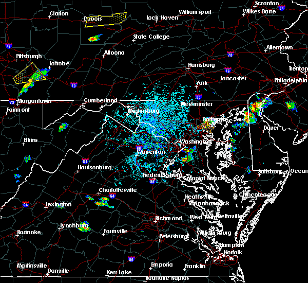 At 231 pm edt, a severe thunderstorm was located over brooklyn park, or near sparrows point, moving southeast at 10 mph (radar indicated). Hazards include 60 mph wind gusts and half dollar size hail. Damaging winds will cause some trees and large branches to fall. this could injure those outdoors, as well as damage homes and vehicles. roadways may become blocked by downed trees. localized power outages are possible. unsecured light objects may become projectiles. Locations impacted include, baltimore, severn, riviera beach, glen burnie, catonsville, pasadena, arbutus, ferndale, brooklyn park, south gate, pumphrey, linthicum, lansdowne, halethorpe and linthicum heights. At 231 pm edt, a severe thunderstorm was located over brooklyn park, or near sparrows point, moving southeast at 10 mph (radar indicated). Hazards include 60 mph wind gusts and half dollar size hail. Damaging winds will cause some trees and large branches to fall. this could injure those outdoors, as well as damage homes and vehicles. roadways may become blocked by downed trees. localized power outages are possible. unsecured light objects may become projectiles. Locations impacted include, baltimore, severn, riviera beach, glen burnie, catonsville, pasadena, arbutus, ferndale, brooklyn park, south gate, pumphrey, linthicum, lansdowne, halethorpe and linthicum heights.
|
| 8/18/2019 2:12 PM EDT |
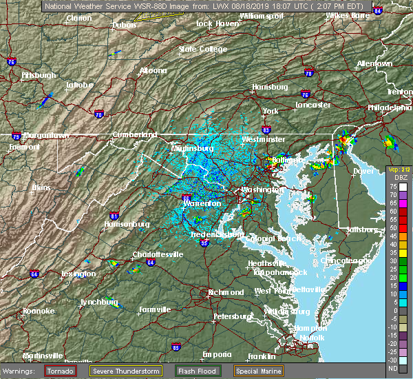 At 212 pm edt, a severe thunderstorm was located over baltimore, moving southeast at 10 mph (radar indicated). Hazards include 60 mph wind gusts and half dollar size hail. Damaging winds will cause some trees and large branches to fall. this could injure those outdoors, as well as damage homes and vehicles. roadways may become blocked by downed trees. localized power outages are possible. Unsecured light objects may become projectiles. At 212 pm edt, a severe thunderstorm was located over baltimore, moving southeast at 10 mph (radar indicated). Hazards include 60 mph wind gusts and half dollar size hail. Damaging winds will cause some trees and large branches to fall. this could injure those outdoors, as well as damage homes and vehicles. roadways may become blocked by downed trees. localized power outages are possible. Unsecured light objects may become projectiles.
|
| 8/17/2019 3:31 PM EDT |
 At 330 pm edt, a severe thunderstorm was located over severna park, or near dobbins island, moving southeast at 15 mph (radar indicated). Hazards include 60 mph wind gusts and quarter size hail. Damaging winds will cause some trees and large branches to fall. this could injure those outdoors, as well as damage homes and vehicles. roadways may become blocked by downed trees. localized power outages are possible. unsecured light objects may become projectiles. locations impacted include, riviera beach, magothy river, dobbins island, sillery bay, glen burnie, severna park, pasadena, arnold, lake shore, parole, green haven, cape st. Claire, herald harbor, crownsville, chelsea beach, sherwood forest and belvedere heights. At 330 pm edt, a severe thunderstorm was located over severna park, or near dobbins island, moving southeast at 15 mph (radar indicated). Hazards include 60 mph wind gusts and quarter size hail. Damaging winds will cause some trees and large branches to fall. this could injure those outdoors, as well as damage homes and vehicles. roadways may become blocked by downed trees. localized power outages are possible. unsecured light objects may become projectiles. locations impacted include, riviera beach, magothy river, dobbins island, sillery bay, glen burnie, severna park, pasadena, arnold, lake shore, parole, green haven, cape st. Claire, herald harbor, crownsville, chelsea beach, sherwood forest and belvedere heights.
|
| 8/17/2019 3:29 PM EDT | Quarter sized hail reported 0.6 miles N of Pasadena, MD |
| 8/17/2019 3:14 PM EDT |
 The national weather service in sterling virginia has issued a * severe thunderstorm warning for. southeastern baltimore city in northern maryland. northeastern anne arundel county in central maryland. until 400 pm edt. At 314 pm edt, a severe thunderstorm was located over south gate,. The national weather service in sterling virginia has issued a * severe thunderstorm warning for. southeastern baltimore city in northern maryland. northeastern anne arundel county in central maryland. until 400 pm edt. At 314 pm edt, a severe thunderstorm was located over south gate,.
|
| 8/7/2019 4:34 PM EDT |
 At 434 pm edt, a severe thunderstorm was located near crofton, moving northeast at 20 mph (radar indicated). Hazards include 60 mph wind gusts and quarter size hail. Damaging winds will cause some trees and large branches to fall. this could injure those outdoors, as well as damage homes and vehicles. roadways may become blocked by downed trees. localized power outages are possible. Unsecured light objects may become projectiles. At 434 pm edt, a severe thunderstorm was located near crofton, moving northeast at 20 mph (radar indicated). Hazards include 60 mph wind gusts and quarter size hail. Damaging winds will cause some trees and large branches to fall. this could injure those outdoors, as well as damage homes and vehicles. roadways may become blocked by downed trees. localized power outages are possible. Unsecured light objects may become projectiles.
|
| 8/7/2019 3:44 PM EDT |
 At 344 pm edt, severe thunderstorms were located along a line extending from near bel air north to back river, moving northeast at 30 mph (radar indicated). Hazards include 60 mph wind gusts and quarter size hail. Damaging winds will cause some trees and large branches to fall. this could injure those outdoors, as well as damage homes and vehicles. roadways may become blocked by downed trees. localized power outages are possible. Unsecured light objects may become projectiles. At 344 pm edt, severe thunderstorms were located along a line extending from near bel air north to back river, moving northeast at 30 mph (radar indicated). Hazards include 60 mph wind gusts and quarter size hail. Damaging winds will cause some trees and large branches to fall. this could injure those outdoors, as well as damage homes and vehicles. roadways may become blocked by downed trees. localized power outages are possible. Unsecured light objects may become projectiles.
|
| 8/6/2019 6:52 PM EDT |
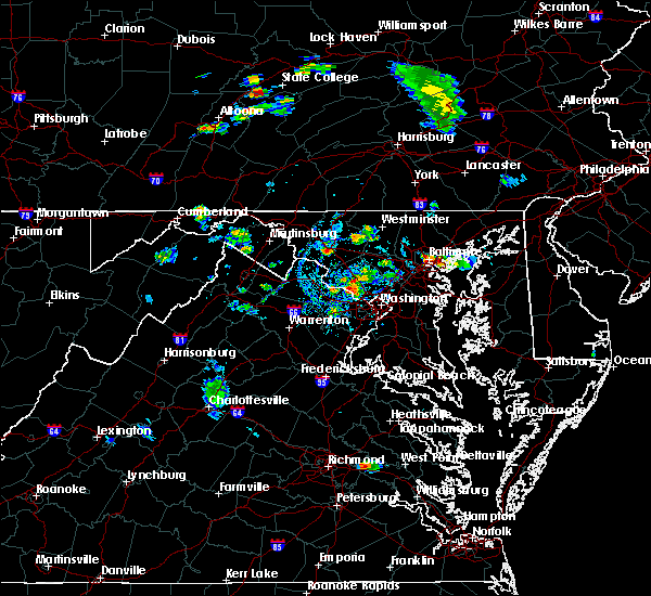 At 652 pm edt, a severe thunderstorm was located near baltimore, and is nearly stationary (radar indicated). Hazards include 60 mph wind gusts and quarter size hail. Damaging winds will cause some trees and large branches to fall. this could injure those outdoors, as well as damage homes and vehicles. roadways may become blocked by downed trees. localized power outages are possible. Unsecured light objects may become projectiles. At 652 pm edt, a severe thunderstorm was located near baltimore, and is nearly stationary (radar indicated). Hazards include 60 mph wind gusts and quarter size hail. Damaging winds will cause some trees and large branches to fall. this could injure those outdoors, as well as damage homes and vehicles. roadways may become blocked by downed trees. localized power outages are possible. Unsecured light objects may become projectiles.
|
| 8/1/2019 3:14 PM EDT |
 At 314 pm edt, a severe thunderstorm was located over millersville, or near crofton, moving south at 30 mph (radar indicated). Hazards include 60 mph wind gusts and quarter size hail. Damaging winds will cause some trees and large branches to fall. this could injure those outdoors, as well as damage homes and vehicles. roadways may become blocked by downed trees. localized power outages are possible. Unsecured light objects may become projectiles. At 314 pm edt, a severe thunderstorm was located over millersville, or near crofton, moving south at 30 mph (radar indicated). Hazards include 60 mph wind gusts and quarter size hail. Damaging winds will cause some trees and large branches to fall. this could injure those outdoors, as well as damage homes and vehicles. roadways may become blocked by downed trees. localized power outages are possible. Unsecured light objects may become projectiles.
|
| 8/1/2019 3:07 PM EDT |
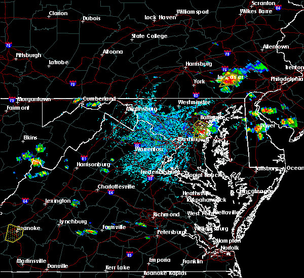 The severe thunderstorm warning for north central anne arundel and south central baltimore counties and central baltimore city will expire at 315 pm edt, the storm which prompted the warning has moved out of the area. therefore, the warning will be allowed to expire. remember, a severe thunderstorm warning still remains in effect for north central anne arundel county. The severe thunderstorm warning for north central anne arundel and south central baltimore counties and central baltimore city will expire at 315 pm edt, the storm which prompted the warning has moved out of the area. therefore, the warning will be allowed to expire. remember, a severe thunderstorm warning still remains in effect for north central anne arundel county.
|
| 8/1/2019 2:51 PM EDT |
 At 250 pm edt, a severe thunderstorm was located over glen burnie, or near baltimore-washington airport, moving south at 20 mph (radar indicated). Hazards include 60 mph wind gusts and quarter size hail. Damaging winds will cause some trees and large branches to fall. this could injure those outdoors, as well as damage homes and vehicles. roadways may become blocked by downed trees. localized power outages are possible. Unsecured light objects may become projectiles. At 250 pm edt, a severe thunderstorm was located over glen burnie, or near baltimore-washington airport, moving south at 20 mph (radar indicated). Hazards include 60 mph wind gusts and quarter size hail. Damaging winds will cause some trees and large branches to fall. this could injure those outdoors, as well as damage homes and vehicles. roadways may become blocked by downed trees. localized power outages are possible. Unsecured light objects may become projectiles.
|
| 8/1/2019 2:29 PM EDT |
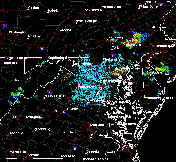 At 229 pm edt, a severe thunderstorm was located over brooklyn park, or near baltimore, moving southeast at 10 mph (radar indicated). Hazards include 60 mph wind gusts and quarter size hail. Damaging winds will cause some trees and large branches to fall. this could injure those outdoors, as well as damage homes and vehicles. roadways may become blocked by downed trees. localized power outages are possible. Unsecured light objects may become projectiles. At 229 pm edt, a severe thunderstorm was located over brooklyn park, or near baltimore, moving southeast at 10 mph (radar indicated). Hazards include 60 mph wind gusts and quarter size hail. Damaging winds will cause some trees and large branches to fall. this could injure those outdoors, as well as damage homes and vehicles. roadways may become blocked by downed trees. localized power outages are possible. Unsecured light objects may become projectiles.
|
| 7/22/2019 4:10 PM EDT |
 The severe thunderstorm warning for northeastern anne arundel county will expire at 415 pm edt, the storm which prompted the warning has moved out of the area. therefore, the warning will be allowed to expire. a severe thunderstorm watch remains in effect until 1000 pm edt for central and northern maryland. The severe thunderstorm warning for northeastern anne arundel county will expire at 415 pm edt, the storm which prompted the warning has moved out of the area. therefore, the warning will be allowed to expire. a severe thunderstorm watch remains in effect until 1000 pm edt for central and northern maryland.
|
| 7/22/2019 4:03 PM EDT |
 At 403 pm edt, a severe thunderstorm was located over green haven, or near riviera beach, moving east at 30 mph (radar indicated). Hazards include 60 mph wind gusts. Damaging winds will cause some trees and large branches to fall. this could injure those outdoors, as well as damage homes and vehicles. roadways may become blocked by downed trees. localized power outages are possible. unsecured light objects may become projectiles. Locations impacted include, riviera beach, fort smallwood state park, bodkin point, glen burnie, severna park, pasadena, lake shore, ferndale, brooklyn park and green haven. At 403 pm edt, a severe thunderstorm was located over green haven, or near riviera beach, moving east at 30 mph (radar indicated). Hazards include 60 mph wind gusts. Damaging winds will cause some trees and large branches to fall. this could injure those outdoors, as well as damage homes and vehicles. roadways may become blocked by downed trees. localized power outages are possible. unsecured light objects may become projectiles. Locations impacted include, riviera beach, fort smallwood state park, bodkin point, glen burnie, severna park, pasadena, lake shore, ferndale, brooklyn park and green haven.
|
| 7/22/2019 3:48 PM EDT |
 At 348 pm edt, a severe thunderstorm was located over severn, moving east at 30 mph (radar indicated). Hazards include 60 mph wind gusts. Damaging winds will cause some trees and large branches to fall. this could injure those outdoors, as well as damage homes and vehicles. roadways may become blocked by downed trees. localized power outages are possible. unsecured light objects may become projectiles. Locations impacted include, severn, riviera beach, baltimore-washington airport, fort smallwood state park, pinehurst, gibson island, bodkin point, sillery bay, glen burnie, severna park, odenton, pasadena, arnold, lake shore, ferndale, brooklyn park, fort meade, millersville, green haven and south gate. At 348 pm edt, a severe thunderstorm was located over severn, moving east at 30 mph (radar indicated). Hazards include 60 mph wind gusts. Damaging winds will cause some trees and large branches to fall. this could injure those outdoors, as well as damage homes and vehicles. roadways may become blocked by downed trees. localized power outages are possible. unsecured light objects may become projectiles. Locations impacted include, severn, riviera beach, baltimore-washington airport, fort smallwood state park, pinehurst, gibson island, bodkin point, sillery bay, glen burnie, severna park, odenton, pasadena, arnold, lake shore, ferndale, brooklyn park, fort meade, millersville, green haven and south gate.
|
| 7/22/2019 3:42 PM EDT |
 At 342 pm edt, a severe thunderstorm was located over fort meade, or near severn, moving east at 30 mph (radar indicated). Hazards include 60 mph wind gusts. Damaging winds will cause some trees and large branches to fall. this could injure those outdoors, as well as damage homes and vehicles. roadways may become blocked by downed trees. localized power outages are possible. unsecured light objects may become projectiles. Locations impacted include, severn, elkridge, riviera beach, baltimore-washington airport, fort smallwood state park, pinehurst, gibson island, bodkin point, sillery bay, glen burnie, severna park, odenton, laurel, pasadena, arnold, lake shore, ferndale, brooklyn park, fort meade and millersville. At 342 pm edt, a severe thunderstorm was located over fort meade, or near severn, moving east at 30 mph (radar indicated). Hazards include 60 mph wind gusts. Damaging winds will cause some trees and large branches to fall. this could injure those outdoors, as well as damage homes and vehicles. roadways may become blocked by downed trees. localized power outages are possible. unsecured light objects may become projectiles. Locations impacted include, severn, elkridge, riviera beach, baltimore-washington airport, fort smallwood state park, pinehurst, gibson island, bodkin point, sillery bay, glen burnie, severna park, odenton, laurel, pasadena, arnold, lake shore, ferndale, brooklyn park, fort meade and millersville.
|
| 7/22/2019 3:36 PM EDT |
 At 336 pm edt, a severe thunderstorm was located over laurel, or near beltsville, moving east at 30 mph (radar indicated). Hazards include 60 mph wind gusts. Damaging winds will cause some trees and large branches to fall. this could injure those outdoors, as well as damage homes and vehicles. roadways may become blocked by downed trees. localized power outages are possible. unsecured light objects may become projectiles. Locations impacted include, severn, crofton, greenbelt, beltsville, elkridge, riviera beach, baltimore-washington airport, fort smallwood state park, pinehurst, gibson island, bodkin point, sillery bay, glen burnie, severna park, odenton, laurel, pasadena, arnold, lake shore and ferndale. At 336 pm edt, a severe thunderstorm was located over laurel, or near beltsville, moving east at 30 mph (radar indicated). Hazards include 60 mph wind gusts. Damaging winds will cause some trees and large branches to fall. this could injure those outdoors, as well as damage homes and vehicles. roadways may become blocked by downed trees. localized power outages are possible. unsecured light objects may become projectiles. Locations impacted include, severn, crofton, greenbelt, beltsville, elkridge, riviera beach, baltimore-washington airport, fort smallwood state park, pinehurst, gibson island, bodkin point, sillery bay, glen burnie, severna park, odenton, laurel, pasadena, arnold, lake shore and ferndale.
|
| 7/22/2019 3:19 PM EDT |
 At 319 pm edt, a severe thunderstorm was located over hillandale, or over langley park, moving east at 30 mph (radar indicated). Hazards include 60 to 65 mph wind gusts. Damaging winds will cause some trees and large branches to fall. this could injure those outdoors, as well as damage homes and vehicles. roadways may become blocked by downed trees. localized power outages are possible. Unsecured light objects may become projectiles. At 319 pm edt, a severe thunderstorm was located over hillandale, or over langley park, moving east at 30 mph (radar indicated). Hazards include 60 to 65 mph wind gusts. Damaging winds will cause some trees and large branches to fall. this could injure those outdoors, as well as damage homes and vehicles. roadways may become blocked by downed trees. localized power outages are possible. Unsecured light objects may become projectiles.
|
| 7/17/2019 6:19 PM EDT |
 At 619 pm edt, severe thunderstorms were located along a line extending from rosedale to green haven to near severna park, moving northeast at 35 mph (radar indicated). Hazards include 60 mph wind gusts. Damaging winds will cause some trees and large branches to fall. this could injure those outdoors, as well as damage homes and vehicles. roadways may become blocked by downed trees. localized power outages are possible. unsecured light objects may become projectiles. Locations impacted include, baltimore, crofton, middle river, riviera beach, north point state park, sparrows point, fort smallwood state park, bodkin point, back river, millers island, glen burnie, dundalk, essex, severna park, pasadena, lake shore, rosedale, rossville, white marsh and bowleys quarters. At 619 pm edt, severe thunderstorms were located along a line extending from rosedale to green haven to near severna park, moving northeast at 35 mph (radar indicated). Hazards include 60 mph wind gusts. Damaging winds will cause some trees and large branches to fall. this could injure those outdoors, as well as damage homes and vehicles. roadways may become blocked by downed trees. localized power outages are possible. unsecured light objects may become projectiles. Locations impacted include, baltimore, crofton, middle river, riviera beach, north point state park, sparrows point, fort smallwood state park, bodkin point, back river, millers island, glen burnie, dundalk, essex, severna park, pasadena, lake shore, rosedale, rossville, white marsh and bowleys quarters.
|
| 7/17/2019 6:08 PM EDT |
 At 608 pm edt, a severe thunderstorm was located over south gate, or over severn, moving northeast at 40 mph (radar indicated). Hazards include 60 mph wind gusts. Damaging winds will cause some trees and large branches to fall. this could injure those outdoors, as well as damage homes and vehicles. roadways may become blocked by downed trees. localized power outages are possible. Unsecured light objects may become projectiles. At 608 pm edt, a severe thunderstorm was located over south gate, or over severn, moving northeast at 40 mph (radar indicated). Hazards include 60 mph wind gusts. Damaging winds will cause some trees and large branches to fall. this could injure those outdoors, as well as damage homes and vehicles. roadways may become blocked by downed trees. localized power outages are possible. Unsecured light objects may become projectiles.
|
| 7/2/2019 5:25 PM EDT |
 At 525 pm edt, severe thunderstorms were located along a line extending from near columbia to takoma park, moving east at 45 mph (radar indicated). Hazards include 60 mph wind gusts. Damaging winds will cause some trees and large branches to fall. this could injure those outdoors, as well as damage homes and vehicles. roadways may become blocked by downed trees. localized power outages are possible. Unsecured light objects may become projectiles. At 525 pm edt, severe thunderstorms were located along a line extending from near columbia to takoma park, moving east at 45 mph (radar indicated). Hazards include 60 mph wind gusts. Damaging winds will cause some trees and large branches to fall. this could injure those outdoors, as well as damage homes and vehicles. roadways may become blocked by downed trees. localized power outages are possible. Unsecured light objects may become projectiles.
|
| 6/29/2019 5:06 PM EDT |
 The severe thunderstorm warning for northern anne arundel county will expire at 515 pm edt, the storm which prompted the warning has moved out of the area. therefore, the warning will be allowed to expire. a severe thunderstorm watch remains in effect until 700 pm edt for central maryland. to report severe weather, contact your nearest law enforcement agency. they will relay your report to the national weather service sterling virginia. The severe thunderstorm warning for northern anne arundel county will expire at 515 pm edt, the storm which prompted the warning has moved out of the area. therefore, the warning will be allowed to expire. a severe thunderstorm watch remains in effect until 700 pm edt for central maryland. to report severe weather, contact your nearest law enforcement agency. they will relay your report to the national weather service sterling virginia.
|
| 6/29/2019 5:00 PM EDT |
 At 500 pm edt, a severe thunderstorm was located over severna park, or near crofton, moving southeast at 20 mph (radar indicated). Hazards include 60 mph wind gusts. Damaging winds will cause some trees and large branches to fall. this could injure those outdoors, as well as damage homes and vehicles. roadways may become blocked by downed trees. localized power outages are possible. unsecured light objects may become projectiles. Locations impacted include, severn, annapolis, crofton, riviera beach, mayo, naval academy, severn river, south river, pinehurst, gibson island, bodkin point, sillery bay, glen burnie, severna park, odenton, laurel, pasadena, arnold, lake shore and parole. At 500 pm edt, a severe thunderstorm was located over severna park, or near crofton, moving southeast at 20 mph (radar indicated). Hazards include 60 mph wind gusts. Damaging winds will cause some trees and large branches to fall. this could injure those outdoors, as well as damage homes and vehicles. roadways may become blocked by downed trees. localized power outages are possible. unsecured light objects may become projectiles. Locations impacted include, severn, annapolis, crofton, riviera beach, mayo, naval academy, severn river, south river, pinehurst, gibson island, bodkin point, sillery bay, glen burnie, severna park, odenton, laurel, pasadena, arnold, lake shore and parole.
|
| 6/29/2019 4:45 PM EDT | Half a dozen calls for trees down (some on wires) in the pasadena are in anne arundel county MD, 2.7 miles N of Pasadena, MD |
| 6/29/2019 4:34 PM EDT |
 At 434 pm edt, a severe thunderstorm was located over fort meade, or over severn, moving southeast at 20 mph (radar indicated). Hazards include 60 mph wind gusts. Damaging winds will cause some trees and large branches to fall. this could injure those outdoors, as well as damage homes and vehicles. roadways may become blocked by downed trees. localized power outages are possible. Unsecured light objects may become projectiles. At 434 pm edt, a severe thunderstorm was located over fort meade, or over severn, moving southeast at 20 mph (radar indicated). Hazards include 60 mph wind gusts. Damaging winds will cause some trees and large branches to fall. this could injure those outdoors, as well as damage homes and vehicles. roadways may become blocked by downed trees. localized power outages are possible. Unsecured light objects may become projectiles.
|
| 6/29/2019 4:13 PM EDT |
 At 413 pm edt, a severe thunderstorm was located over woodlawn, or near pikesville, moving east at 20 mph (radar indicated). Hazards include 60 mph wind gusts. Damaging winds will cause some trees and large branches to fall. this could injure those outdoors, as well as damage homes and vehicles. roadways may become blocked by downed trees. localized power outages are possible. Unsecured light objects may become projectiles. At 413 pm edt, a severe thunderstorm was located over woodlawn, or near pikesville, moving east at 20 mph (radar indicated). Hazards include 60 mph wind gusts. Damaging winds will cause some trees and large branches to fall. this could injure those outdoors, as well as damage homes and vehicles. roadways may become blocked by downed trees. localized power outages are possible. Unsecured light objects may become projectiles.
|
| 6/28/2019 7:09 PM EDT |
 The severe thunderstorm warning for north central anne arundel and southeastern baltimore counties and southeastern baltimore city will expire at 715 pm edt, the storm which prompted the warning has weakened below severe limits, and has exited the warned area. therefore, the warning will be allowed to expire. to report severe weather, contact your nearest law enforcement agency. they will relay your report to the national weather service sterling virginia. The severe thunderstorm warning for north central anne arundel and southeastern baltimore counties and southeastern baltimore city will expire at 715 pm edt, the storm which prompted the warning has weakened below severe limits, and has exited the warned area. therefore, the warning will be allowed to expire. to report severe weather, contact your nearest law enforcement agency. they will relay your report to the national weather service sterling virginia.
|
| 6/28/2019 7:02 PM EDT |
 At 701 pm edt, a severe thunderstorm was located over sparrows point, moving east at 5 mph (radar indicated). Hazards include 60 mph wind gusts and quarter size hail. Damaging winds will cause some trees and large branches to fall. this could injure those outdoors, as well as damage homes and vehicles. roadways may become blocked by downed trees. localized power outages are possible. unsecured light objects may become projectiles. Locations impacted include, baltimore, fort smallwood state park, millers island, north point state park, back river, dundalk, pasadena, brooklyn park, edgemere, lansdowne, fort howard and eastpoint. At 701 pm edt, a severe thunderstorm was located over sparrows point, moving east at 5 mph (radar indicated). Hazards include 60 mph wind gusts and quarter size hail. Damaging winds will cause some trees and large branches to fall. this could injure those outdoors, as well as damage homes and vehicles. roadways may become blocked by downed trees. localized power outages are possible. unsecured light objects may become projectiles. Locations impacted include, baltimore, fort smallwood state park, millers island, north point state park, back river, dundalk, pasadena, brooklyn park, edgemere, lansdowne, fort howard and eastpoint.
|
| 6/28/2019 6:34 PM EDT |
 The national weather service in sterling virginia has issued a * severe thunderstorm warning for. southeastern baltimore city in northern maryland. north central anne arundel county in central maryland. southeastern baltimore county in northern maryland. Until 715 pm edt. The national weather service in sterling virginia has issued a * severe thunderstorm warning for. southeastern baltimore city in northern maryland. north central anne arundel county in central maryland. southeastern baltimore county in northern maryland. Until 715 pm edt.
|
| 6/28/2019 6:25 PM EDT |
 At 624 pm edt, severe thunderstorms were located along a line extending from severn to near arnold, and are nearly stationary (radar indicated). Hazards include 60 mph wind gusts and quarter size hail. Damaging winds will cause some trees and large branches to fall. this could injure those outdoors, as well as damage homes and vehicles. roadways may become blocked by downed trees. localized power outages are possible. Unsecured light objects may become projectiles. At 624 pm edt, severe thunderstorms were located along a line extending from severn to near arnold, and are nearly stationary (radar indicated). Hazards include 60 mph wind gusts and quarter size hail. Damaging winds will cause some trees and large branches to fall. this could injure those outdoors, as well as damage homes and vehicles. roadways may become blocked by downed trees. localized power outages are possible. Unsecured light objects may become projectiles.
|
| 6/28/2019 6:08 PM EDT |
 At 608 pm edt, a severe thunderstorm was located over lake shore, or over sillery bay, and is nearly stationary (radar indicated). Hazards include 60 mph wind gusts. Damaging winds will cause some trees and large branches to fall. this could injure those outdoors, as well as damage homes and vehicles. roadways may become blocked by downed trees. localized power outages are possible. unsecured light objects may become projectiles. locations impacted include, riviera beach, fort smallwood state park, pinehurst, gibson island, bodkin point, sillery bay, severna park, pasadena, arnold, lake shore, green haven, cape st. Claire, chelsea beach and belvedere heights. At 608 pm edt, a severe thunderstorm was located over lake shore, or over sillery bay, and is nearly stationary (radar indicated). Hazards include 60 mph wind gusts. Damaging winds will cause some trees and large branches to fall. this could injure those outdoors, as well as damage homes and vehicles. roadways may become blocked by downed trees. localized power outages are possible. unsecured light objects may become projectiles. locations impacted include, riviera beach, fort smallwood state park, pinehurst, gibson island, bodkin point, sillery bay, severna park, pasadena, arnold, lake shore, green haven, cape st. Claire, chelsea beach and belvedere heights.
|
| 6/28/2019 5:46 PM EDT |
 At 546 pm edt, a severe thunderstorm was located over lake shore, or near sillery bay, and is nearly stationary (radar indicated). Hazards include 60 mph wind gusts and quarter size hail. Damaging winds will cause some trees and large branches to fall. this could injure those outdoors, as well as damage homes and vehicles. roadways may become blocked by downed trees. localized power outages are possible. Unsecured light objects may become projectiles. At 546 pm edt, a severe thunderstorm was located over lake shore, or near sillery bay, and is nearly stationary (radar indicated). Hazards include 60 mph wind gusts and quarter size hail. Damaging winds will cause some trees and large branches to fall. this could injure those outdoors, as well as damage homes and vehicles. roadways may become blocked by downed trees. localized power outages are possible. Unsecured light objects may become projectiles.
|
| 6/17/2019 5:08 PM EDT |
 The severe thunderstorm warning for northwestern anne arundel, southeastern howard and south central baltimore counties and southwestern baltimore city will expire at 515 pm edt, the storm which prompted the warning has moved out of the area. therefore, the warning will be allowed to expire. a severe thunderstorm watch remains in effect until 1100 pm edt for central and northern maryland. to report severe weather, contact your nearest law enforcement agency. they will relay your report to the national weather service sterling virginia. The severe thunderstorm warning for northwestern anne arundel, southeastern howard and south central baltimore counties and southwestern baltimore city will expire at 515 pm edt, the storm which prompted the warning has moved out of the area. therefore, the warning will be allowed to expire. a severe thunderstorm watch remains in effect until 1100 pm edt for central and northern maryland. to report severe weather, contact your nearest law enforcement agency. they will relay your report to the national weather service sterling virginia.
|
| 6/17/2019 4:32 PM EDT |
 At 432 pm edt, a severe thunderstorm was located over columbia, moving east at 20 mph (radar indicated). Hazards include 60 mph wind gusts and quarter size hail. Damaging winds will cause some trees and large branches to fall. this could injure those outdoors, as well as damage homes and vehicles. roadways may become blocked by downed trees. localized power outages are possible. Unsecured light objects may become projectiles. At 432 pm edt, a severe thunderstorm was located over columbia, moving east at 20 mph (radar indicated). Hazards include 60 mph wind gusts and quarter size hail. Damaging winds will cause some trees and large branches to fall. this could injure those outdoors, as well as damage homes and vehicles. roadways may become blocked by downed trees. localized power outages are possible. Unsecured light objects may become projectiles.
|
| 6/13/2019 6:43 PM EDT |
 At 643 pm edt, a severe thunderstorm was located over baltimore, moving east at 35 mph (radar indicated). Hazards include 60 mph wind gusts. Damaging winds will cause some trees and large branches to fall. this could injure those outdoors, as well as damage homes and vehicles. roadways may become blocked by downed trees. localized power outages are possible. unsecured light objects may become projectiles. Locations impacted include, baltimore, severn, middle river, elkridge, riviera beach, baltimore-washington airport, north point state park, sparrows point, back river, millers island, glen burnie, dundalk, catonsville, essex, woodlawn, milford mill, lochearn, pasadena, arbutus and rosedale. At 643 pm edt, a severe thunderstorm was located over baltimore, moving east at 35 mph (radar indicated). Hazards include 60 mph wind gusts. Damaging winds will cause some trees and large branches to fall. this could injure those outdoors, as well as damage homes and vehicles. roadways may become blocked by downed trees. localized power outages are possible. unsecured light objects may become projectiles. Locations impacted include, baltimore, severn, middle river, elkridge, riviera beach, baltimore-washington airport, north point state park, sparrows point, back river, millers island, glen burnie, dundalk, catonsville, essex, woodlawn, milford mill, lochearn, pasadena, arbutus and rosedale.
|
| 6/13/2019 6:25 PM EDT |
 At 624 pm edt, a severe thunderstorm was located over elkridge, moving east at 40 mph (radar indicated). Hazards include 60 mph wind gusts. Damaging winds will cause some trees and large branches to fall. this could injure those outdoors, as well as damage homes and vehicles. roadways may become blocked by downed trees. localized power outages are possible. unsecured light objects may become projectiles. Locations impacted include, baltimore, columbia, severn, middle river, elkridge, riviera beach, baltimore-washington airport, millers island, north point state park, sparrows point, back river, glen burnie, ellicott city, dundalk, catonsville, essex, woodlawn, severna park, odenton and milford mill. At 624 pm edt, a severe thunderstorm was located over elkridge, moving east at 40 mph (radar indicated). Hazards include 60 mph wind gusts. Damaging winds will cause some trees and large branches to fall. this could injure those outdoors, as well as damage homes and vehicles. roadways may become blocked by downed trees. localized power outages are possible. unsecured light objects may become projectiles. Locations impacted include, baltimore, columbia, severn, middle river, elkridge, riviera beach, baltimore-washington airport, millers island, north point state park, sparrows point, back river, glen burnie, ellicott city, dundalk, catonsville, essex, woodlawn, severna park, odenton and milford mill.
|
| 6/13/2019 6:14 PM EDT |
 At 614 pm edt, a severe thunderstorm was located over columbia, moving east at 40 mph (radar indicated). Hazards include 60 mph wind gusts. Damaging winds will cause some trees and large branches to fall. this could injure those outdoors, as well as damage homes and vehicles. roadways may become blocked by downed trees. localized power outages are possible. Unsecured light objects may become projectiles. At 614 pm edt, a severe thunderstorm was located over columbia, moving east at 40 mph (radar indicated). Hazards include 60 mph wind gusts. Damaging winds will cause some trees and large branches to fall. this could injure those outdoors, as well as damage homes and vehicles. roadways may become blocked by downed trees. localized power outages are possible. Unsecured light objects may become projectiles.
|
| 6/2/2019 6:44 PM EDT |
 At 643 pm edt, a line of severe thunderstorms with a history of producing wind damage was located along a line extending from near brooklyn park to lake shore, moving east at 30 mph (trained spotters and doppler radar). Hazards include 60 mph wind gusts. Damaging winds will cause some trees and large branches to fall. this could injure those outdoors, as well as damage homes and vehicles. roadways may become blocked by downed trees. localized power outages are possible. unsecured light objects may become projectiles. Locations impacted include, riviera beach, north point state park, sparrows point, millers island, glen burnie, dundalk, severna park, pasadena, lake shore, ferndale, brooklyn park, green haven, edgemere, turners station and chelsea beach. At 643 pm edt, a line of severe thunderstorms with a history of producing wind damage was located along a line extending from near brooklyn park to lake shore, moving east at 30 mph (trained spotters and doppler radar). Hazards include 60 mph wind gusts. Damaging winds will cause some trees and large branches to fall. this could injure those outdoors, as well as damage homes and vehicles. roadways may become blocked by downed trees. localized power outages are possible. unsecured light objects may become projectiles. Locations impacted include, riviera beach, north point state park, sparrows point, millers island, glen burnie, dundalk, severna park, pasadena, lake shore, ferndale, brooklyn park, green haven, edgemere, turners station and chelsea beach.
|
| 6/2/2019 6:36 PM EDT |
 At 635 pm edt, a line of severe thunderstorms with a history of producing wind damage was located along a line extending from near catonsville to odenton, moving east at 30 mph. damaging winds may occur before rain begins (trained spotters and doppler radar). Hazards include 60 mph wind gusts. Damaging winds will cause some trees and large branches to fall. this could injure those outdoors, as well as damage homes and vehicles. roadways may become blocked by downed trees. localized power outages are possible. unsecured light objects may become projectiles. Locations impacted include, baltimore, severn, pikesville, middle river, elkridge, riviera beach, baltimore-washington airport, millers island, north point state park, sparrows point, back river, glen burnie, dundalk, towson, catonsville, essex, woodlawn, severna park, odenton and parkville. At 635 pm edt, a line of severe thunderstorms with a history of producing wind damage was located along a line extending from near catonsville to odenton, moving east at 30 mph. damaging winds may occur before rain begins (trained spotters and doppler radar). Hazards include 60 mph wind gusts. Damaging winds will cause some trees and large branches to fall. this could injure those outdoors, as well as damage homes and vehicles. roadways may become blocked by downed trees. localized power outages are possible. unsecured light objects may become projectiles. Locations impacted include, baltimore, severn, pikesville, middle river, elkridge, riviera beach, baltimore-washington airport, millers island, north point state park, sparrows point, back river, glen burnie, dundalk, towson, catonsville, essex, woodlawn, severna park, odenton and parkville.
|
| 6/2/2019 6:31 PM EDT |
 At 630 pm edt, a line of severe thunderstorms with a history of producing wind damage was located along a line extending from near catonsville to odenton, moving east at 30 mph. winds may occur before rain begins (trained spotters and doppler radar). Hazards include 60 mph wind gusts. Damaging winds will cause some trees and large branches to fall. this could injure those outdoors, as well as damage homes and vehicles. roadways may become blocked by downed trees. localized power outages are possible. unsecured light objects may become projectiles. Locations impacted include, baltimore, severn, pikesville, middle river, elkridge, riviera beach, baltimore-washington airport, millers island, north point state park, sparrows point, back river, glen burnie, dundalk, towson, catonsville, essex, woodlawn, severna park, odenton and parkville. At 630 pm edt, a line of severe thunderstorms with a history of producing wind damage was located along a line extending from near catonsville to odenton, moving east at 30 mph. winds may occur before rain begins (trained spotters and doppler radar). Hazards include 60 mph wind gusts. Damaging winds will cause some trees and large branches to fall. this could injure those outdoors, as well as damage homes and vehicles. roadways may become blocked by downed trees. localized power outages are possible. unsecured light objects may become projectiles. Locations impacted include, baltimore, severn, pikesville, middle river, elkridge, riviera beach, baltimore-washington airport, millers island, north point state park, sparrows point, back river, glen burnie, dundalk, towson, catonsville, essex, woodlawn, severna park, odenton and parkville.
|
| 6/2/2019 6:24 PM EDT |
 At 623 pm edt, severe thunderstorms with a history of producing wind damage were located along a line extending from near columbia to fort meade, moving east at 30 mph (trained spotters). Hazards include 60 mph wind gusts. Damaging winds will cause some trees and large branches to fall. this could injure those outdoors, as well as damage homes and vehicles. roadways may become blocked by downed trees. localized power outages are possible. Unsecured light objects may become projectiles. At 623 pm edt, severe thunderstorms with a history of producing wind damage were located along a line extending from near columbia to fort meade, moving east at 30 mph (trained spotters). Hazards include 60 mph wind gusts. Damaging winds will cause some trees and large branches to fall. this could injure those outdoors, as well as damage homes and vehicles. roadways may become blocked by downed trees. localized power outages are possible. Unsecured light objects may become projectiles.
|
| 5/30/2019 4:13 PM EDT |
 The severe thunderstorm warning for northeastern anne arundel, east central howard, southern harford and southeastern baltimore counties and southeastern baltimore city will expire at 415 pm edt, the storm which prompted the warning has weakened below severe limits, and has exited the warned area. therefore, the warning will be allowed to expire. a severe thunderstorm watch remains in effect until 900 pm edt for central and northern maryland. The severe thunderstorm warning for northeastern anne arundel, east central howard, southern harford and southeastern baltimore counties and southeastern baltimore city will expire at 415 pm edt, the storm which prompted the warning has weakened below severe limits, and has exited the warned area. therefore, the warning will be allowed to expire. a severe thunderstorm watch remains in effect until 900 pm edt for central and northern maryland.
|
| 5/30/2019 3:59 PM EDT |
 At 359 pm edt, a severe thunderstorm was located near dundalk, or near sparrows point, moving east at 45 mph (radar indicated). Hazards include 60 mph wind gusts. Damaging winds will cause some trees and large branches to fall. this could injure those outdoors, as well as damage homes and vehicles. roadways may become blocked by downed trees. localized power outages are possible. unsecured light objects may become projectiles. Locations impacted include, baltimore, severn, middle river, elkridge, riviera beach, baltimore-washington airport, gibson island, bodkin point, sillery bay, millers island, north point state park, pinehurst, back river, sparrows point, glen burnie, dundalk, catonsville, essex, severna park and pasadena. At 359 pm edt, a severe thunderstorm was located near dundalk, or near sparrows point, moving east at 45 mph (radar indicated). Hazards include 60 mph wind gusts. Damaging winds will cause some trees and large branches to fall. this could injure those outdoors, as well as damage homes and vehicles. roadways may become blocked by downed trees. localized power outages are possible. unsecured light objects may become projectiles. Locations impacted include, baltimore, severn, middle river, elkridge, riviera beach, baltimore-washington airport, gibson island, bodkin point, sillery bay, millers island, north point state park, pinehurst, back river, sparrows point, glen burnie, dundalk, catonsville, essex, severna park and pasadena.
|
| 5/30/2019 3:33 PM EDT |
 At 332 pm edt, a severe thunderstorm was located near ellicott city, or near columbia, moving east at 45 mph (radar indicated). Hazards include 70 mph wind gusts. Damaging winds will cause some trees and large branches to fall. this could injure those outdoors, as well as damage homes and vehicles. roadways may become blocked by downed trees. localized power outages are possible. Unsecured light objects may become projectiles. At 332 pm edt, a severe thunderstorm was located near ellicott city, or near columbia, moving east at 45 mph (radar indicated). Hazards include 70 mph wind gusts. Damaging winds will cause some trees and large branches to fall. this could injure those outdoors, as well as damage homes and vehicles. roadways may become blocked by downed trees. localized power outages are possible. Unsecured light objects may become projectiles.
|
| 5/29/2019 6:08 PM EDT |
 At 607 pm edt, a severe thunderstorm was located over severn, moving east at 45 mph (radar indicated). Hazards include 60 mph wind gusts and half dollar size hail. Damaging winds will cause some trees and large branches to fall. this could injure those outdoors, as well as damage homes and vehicles. roadways may become blocked by downed trees. localized power outages are possible. unsecured light objects may become projectiles. Locations impacted include, severn, crofton, riviera beach, baltimore-washington airport, bodkin point, sillery bay, glen burnie, severna park, odenton, pasadena, arnold, lake shore, ferndale, brooklyn park, fort meade, millersville, green haven, south gate, pumphrey and linthicum. At 607 pm edt, a severe thunderstorm was located over severn, moving east at 45 mph (radar indicated). Hazards include 60 mph wind gusts and half dollar size hail. Damaging winds will cause some trees and large branches to fall. this could injure those outdoors, as well as damage homes and vehicles. roadways may become blocked by downed trees. localized power outages are possible. unsecured light objects may become projectiles. Locations impacted include, severn, crofton, riviera beach, baltimore-washington airport, bodkin point, sillery bay, glen burnie, severna park, odenton, pasadena, arnold, lake shore, ferndale, brooklyn park, fort meade, millersville, green haven, south gate, pumphrey and linthicum.
|
| 5/29/2019 5:51 PM EDT |
 At 550 pm edt, a severe thunderstorm was located over laurel, or near beltsville, moving east at 45 mph (radar indicated). Hazards include 60 mph wind gusts and quarter size hail. Damaging winds will cause some trees and large branches to fall. this could injure those outdoors, as well as damage homes and vehicles. roadways may become blocked by downed trees. localized power outages are possible. Unsecured light objects may become projectiles. At 550 pm edt, a severe thunderstorm was located over laurel, or near beltsville, moving east at 45 mph (radar indicated). Hazards include 60 mph wind gusts and quarter size hail. Damaging winds will cause some trees and large branches to fall. this could injure those outdoors, as well as damage homes and vehicles. roadways may become blocked by downed trees. localized power outages are possible. Unsecured light objects may become projectiles.
|
| 5/26/2019 10:06 PM EDT |
 The severe thunderstorm warning for northern anne arundel and southeastern howard counties will expire at 1015 pm edt, the storms which prompted the warning have moved out of the area. therefore, the warning will be allowed to expire. a severe thunderstorm watch remains in effect until 100 am edt for central and northern maryland. The severe thunderstorm warning for northern anne arundel and southeastern howard counties will expire at 1015 pm edt, the storms which prompted the warning have moved out of the area. therefore, the warning will be allowed to expire. a severe thunderstorm watch remains in effect until 100 am edt for central and northern maryland.
|
| 5/26/2019 9:50 PM EDT |
 At 950 pm edt, severe thunderstorms were located along a line extending from white marsh to sparrows point to severn to colesville, moving southeast at 35 mph (radar indicated). Hazards include 60 mph wind gusts and quarter size hail. Damaging winds will cause some trees and large branches to fall. this could injure those outdoors, as well as damage homes and vehicles. roadways may become blocked by downed trees. localized power outages are possible. unsecured light objects may become projectiles. Locations impacted include, columbia, severn, elkridge, riviera beach, baltimore-washington airport, bodkin point, sillery bay, glen burnie, severna park, odenton, pasadena, arnold, lake shore, ferndale, fort meade, millersville, brooklyn park, green haven, savage-guilford and south gate. At 950 pm edt, severe thunderstorms were located along a line extending from white marsh to sparrows point to severn to colesville, moving southeast at 35 mph (radar indicated). Hazards include 60 mph wind gusts and quarter size hail. Damaging winds will cause some trees and large branches to fall. this could injure those outdoors, as well as damage homes and vehicles. roadways may become blocked by downed trees. localized power outages are possible. unsecured light objects may become projectiles. Locations impacted include, columbia, severn, elkridge, riviera beach, baltimore-washington airport, bodkin point, sillery bay, glen burnie, severna park, odenton, pasadena, arnold, lake shore, ferndale, fort meade, millersville, brooklyn park, green haven, savage-guilford and south gate.
|
| 5/26/2019 9:35 PM EDT |
 At 935 pm edt, a severe thunderstorm was located over arbutus, or near baltimore, moving southeast at 35 mph (radar indicated). Hazards include 60 mph wind gusts and quarter size hail. Damaging winds will cause some trees and large branches to fall. this could injure those outdoors, as well as damage homes and vehicles. roadways may become blocked by downed trees. localized power outages are possible. Unsecured light objects may become projectiles. At 935 pm edt, a severe thunderstorm was located over arbutus, or near baltimore, moving southeast at 35 mph (radar indicated). Hazards include 60 mph wind gusts and quarter size hail. Damaging winds will cause some trees and large branches to fall. this could injure those outdoors, as well as damage homes and vehicles. roadways may become blocked by downed trees. localized power outages are possible. Unsecured light objects may become projectiles.
|
| 5/23/2019 4:16 PM EDT |
 At 415 pm edt, severe thunderstorms were located along a line extending from near newtown to near rock hall to near crofton, moving east at 50 mph (radar indicated). Hazards include 70 mph wind gusts and quarter size hail. Damaging winds will cause some trees and large branches to fall. this could injure those outdoors, as well as damage homes and vehicles. roadways may become blocked by downed trees. localized power outages are possible. unsecured light objects may become projectiles. Locations impacted include, bowie, annapolis, crofton, mayo, shady side, naval academy, severn river, south river, bodkin point, sillery bay, rhode river, severna park, odenton, pasadena, arnold, lake shore, parole, mitchellville, woodmore and millersville. At 415 pm edt, severe thunderstorms were located along a line extending from near newtown to near rock hall to near crofton, moving east at 50 mph (radar indicated). Hazards include 70 mph wind gusts and quarter size hail. Damaging winds will cause some trees and large branches to fall. this could injure those outdoors, as well as damage homes and vehicles. roadways may become blocked by downed trees. localized power outages are possible. unsecured light objects may become projectiles. Locations impacted include, bowie, annapolis, crofton, mayo, shady side, naval academy, severn river, south river, bodkin point, sillery bay, rhode river, severna park, odenton, pasadena, arnold, lake shore, parole, mitchellville, woodmore and millersville.
|
| 5/23/2019 3:58 PM EDT |
 At 357 pm edt, severe thunderstorms were located along a line extending from rosedale to severna park to greenbelt, moving east at 50 mph (radar indicated). Hazards include 70 mph wind gusts and quarter size hail. Damaging winds will cause some trees and large branches to fall. this could injure those outdoors, as well as damage homes and vehicles. roadways may become blocked by downed trees. localized power outages are possible. Unsecured light objects may become projectiles. At 357 pm edt, severe thunderstorms were located along a line extending from rosedale to severna park to greenbelt, moving east at 50 mph (radar indicated). Hazards include 70 mph wind gusts and quarter size hail. Damaging winds will cause some trees and large branches to fall. this could injure those outdoors, as well as damage homes and vehicles. roadways may become blocked by downed trees. localized power outages are possible. Unsecured light objects may become projectiles.
|
| 5/23/2019 3:49 PM EDT |
 At 348 pm edt, severe thunderstorms were located along a line extending from catonsville to near odenton to lanham-seabrook, moving east at 50 mph (trained weather spotters and emergency management. numerous reports of wind damage have been reported in montgomery and howard counties). Hazards include 70 mph wind gusts and quarter size hail. Damaging winds will cause some trees and large branches to fall. this could injure those outdoors, as well as damage homes and vehicles. roadways may become blocked by downed trees. localized power outages are possible. unsecured light objects may become projectiles. Locations impacted include, baltimore, columbia, rockville, bethesda, bowie, severn, annapolis, college park, crofton, greenbelt, langley park, beltsville, elkridge, riviera beach, mayo, naval academy, baltimore-washington airport, sillery bay, millers island and north point state park. At 348 pm edt, severe thunderstorms were located along a line extending from catonsville to near odenton to lanham-seabrook, moving east at 50 mph (trained weather spotters and emergency management. numerous reports of wind damage have been reported in montgomery and howard counties). Hazards include 70 mph wind gusts and quarter size hail. Damaging winds will cause some trees and large branches to fall. this could injure those outdoors, as well as damage homes and vehicles. roadways may become blocked by downed trees. localized power outages are possible. unsecured light objects may become projectiles. Locations impacted include, baltimore, columbia, rockville, bethesda, bowie, severn, annapolis, college park, crofton, greenbelt, langley park, beltsville, elkridge, riviera beach, mayo, naval academy, baltimore-washington airport, sillery bay, millers island and north point state park.
|
| 5/23/2019 3:40 PM EDT |
 At 340 pm edt, severe thunderstorms were located along a line extending from ellicott city to near laurel to university of maryland, moving east at 50 mph (radar indicated). Hazards include 70 mph wind gusts. Damaging winds will cause some trees and large branches to fall. this could injure those outdoors, as well as damage homes and vehicles. roadways may become blocked by downed trees. localized power outages are possible. unsecured light objects may become projectiles. Locations impacted include, baltimore, columbia, rockville, bethesda, bowie, severn, annapolis, college park, crofton, greenbelt, langley park, beltsville, elkridge, riviera beach, mayo, naval academy, baltimore-washington airport, sillery bay, millers island and north point state park. At 340 pm edt, severe thunderstorms were located along a line extending from ellicott city to near laurel to university of maryland, moving east at 50 mph (radar indicated). Hazards include 70 mph wind gusts. Damaging winds will cause some trees and large branches to fall. this could injure those outdoors, as well as damage homes and vehicles. roadways may become blocked by downed trees. localized power outages are possible. unsecured light objects may become projectiles. Locations impacted include, baltimore, columbia, rockville, bethesda, bowie, severn, annapolis, college park, crofton, greenbelt, langley park, beltsville, elkridge, riviera beach, mayo, naval academy, baltimore-washington airport, sillery bay, millers island and north point state park.
|
| 5/23/2019 3:21 PM EDT |
 At 321 pm edt, severe thunderstorms were located along a line extending from near mount airy to rossmoor to potomac, moving east at 50 mph (radar indicated). Hazards include 70 mph wind gusts. Damaging winds will cause some trees and large branches to fall. this could injure those outdoors, as well as damage homes and vehicles. roadways may become blocked by downed trees. localized power outages are possible. Unsecured light objects may become projectiles. At 321 pm edt, severe thunderstorms were located along a line extending from near mount airy to rossmoor to potomac, moving east at 50 mph (radar indicated). Hazards include 70 mph wind gusts. Damaging winds will cause some trees and large branches to fall. this could injure those outdoors, as well as damage homes and vehicles. roadways may become blocked by downed trees. localized power outages are possible. Unsecured light objects may become projectiles.
|
| 5/2/2019 5:06 PM EDT |
 The severe thunderstorm warning for northeastern anne arundel county will expire at 515 pm edt, the severe part of the storms which prompted the warning have moved out of the area. therefore, the warning will be allowed to expire. however heavy rain is still possible. to report severe weather, contact your nearest law enforcement agency. they will relay your report to the national weather service sterling virginia. The severe thunderstorm warning for northeastern anne arundel county will expire at 515 pm edt, the severe part of the storms which prompted the warning have moved out of the area. therefore, the warning will be allowed to expire. however heavy rain is still possible. to report severe weather, contact your nearest law enforcement agency. they will relay your report to the national weather service sterling virginia.
|
| 5/2/2019 4:58 PM EDT |
 At 458 pm edt, severe thunderstorms were located along a line extending from sillery bay to south river, moving east at 20 mph (radar indicated). Hazards include 60 mph wind gusts. Damaging winds will cause some trees and large branches to fall. this could injure those outdoors, as well as damage homes and vehicles. roadways may become blocked by downed trees. localized power outages are possible. unsecured light objects may become projectiles. locations impacted include, annapolis, mayo, naval academy, pinehurst, gibson island, sillery bay, severn river, south river, bodkin point, severna park, pasadena, arnold, lake shore, parole, cape st. Claire, highland beach, hillsmere shores, chelsea beach, belvedere heights and navy-marine corps stadium. At 458 pm edt, severe thunderstorms were located along a line extending from sillery bay to south river, moving east at 20 mph (radar indicated). Hazards include 60 mph wind gusts. Damaging winds will cause some trees and large branches to fall. this could injure those outdoors, as well as damage homes and vehicles. roadways may become blocked by downed trees. localized power outages are possible. unsecured light objects may become projectiles. locations impacted include, annapolis, mayo, naval academy, pinehurst, gibson island, sillery bay, severn river, south river, bodkin point, severna park, pasadena, arnold, lake shore, parole, cape st. Claire, highland beach, hillsmere shores, chelsea beach, belvedere heights and navy-marine corps stadium.
|
| 5/2/2019 4:39 PM EDT |
 At 439 pm edt, severe thunderstorms were located along a line extending from fort smallwood state park to south river, moving east at 25 mph (radar indicated). Hazards include 60 mph wind gusts. Damaging winds will cause some trees and large branches to fall. this could injure those outdoors, as well as damage homes and vehicles. roadways may become blocked by downed trees. localized power outages are possible. Unsecured light objects may become projectiles. At 439 pm edt, severe thunderstorms were located along a line extending from fort smallwood state park to south river, moving east at 25 mph (radar indicated). Hazards include 60 mph wind gusts. Damaging winds will cause some trees and large branches to fall. this could injure those outdoors, as well as damage homes and vehicles. roadways may become blocked by downed trees. localized power outages are possible. Unsecured light objects may become projectiles.
|
| 5/2/2019 4:34 PM EDT |
 At 433 pm edt, severe thunderstorms were located along a line extending from south gate to londontowne, moving east at 30 mph (radar indicated). Hazards include 60 mph wind gusts. Damaging winds will cause some trees and large branches to fall. this could injure those outdoors, as well as damage homes and vehicles. roadways may become blocked by downed trees. localized power outages are possible. unsecured light objects may become projectiles. Locations impacted include, severn, annapolis, crofton, riviera beach, mayo, naval academy, baltimore-washington airport, severn river, south river, fort smallwood state park, bodkin point, sillery bay, rhode river, glen burnie, severna park, odenton, pasadena, arnold, lake shore and ferndale. At 433 pm edt, severe thunderstorms were located along a line extending from south gate to londontowne, moving east at 30 mph (radar indicated). Hazards include 60 mph wind gusts. Damaging winds will cause some trees and large branches to fall. this could injure those outdoors, as well as damage homes and vehicles. roadways may become blocked by downed trees. localized power outages are possible. unsecured light objects may become projectiles. Locations impacted include, severn, annapolis, crofton, riviera beach, mayo, naval academy, baltimore-washington airport, severn river, south river, fort smallwood state park, bodkin point, sillery bay, rhode river, glen burnie, severna park, odenton, pasadena, arnold, lake shore and ferndale.
|
| 5/2/2019 4:22 PM EDT |
 At 421 pm edt, severe thunderstorms were located along a line extending from near severn to crofton to near woodmore, moving east at 30 mph (radar indicated). Hazards include 60 mph wind gusts. Damaging winds will cause some trees and large branches to fall. this could injure those outdoors, as well as damage homes and vehicles. roadways may become blocked by downed trees. localized power outages are possible. unsecured light objects may become projectiles. Locations impacted include, columbia, bowie, severn, annapolis, crofton, greenbelt, elkridge, riviera beach, bladensburg, mayo, naval academy, baltimore-washington airport, severn river, south river, fort smallwood state park, bodkin point, sillery bay, rhode river, glen burnie and severna park. At 421 pm edt, severe thunderstorms were located along a line extending from near severn to crofton to near woodmore, moving east at 30 mph (radar indicated). Hazards include 60 mph wind gusts. Damaging winds will cause some trees and large branches to fall. this could injure those outdoors, as well as damage homes and vehicles. roadways may become blocked by downed trees. localized power outages are possible. unsecured light objects may become projectiles. Locations impacted include, columbia, bowie, severn, annapolis, crofton, greenbelt, elkridge, riviera beach, bladensburg, mayo, naval academy, baltimore-washington airport, severn river, south river, fort smallwood state park, bodkin point, sillery bay, rhode river, glen burnie and severna park.
|
| 5/2/2019 3:54 PM EDT |
 At 353 pm edt, severe thunderstorms were located along a line extending from columbia to hyattsville, moving east at 35 mph (radar indicated). Hazards include 60 mph wind gusts. Damaging winds will cause some trees and large branches to fall. this could injure those outdoors, as well as damage homes and vehicles. roadways may become blocked by downed trees. localized power outages are possible. Unsecured light objects may become projectiles. At 353 pm edt, severe thunderstorms were located along a line extending from columbia to hyattsville, moving east at 35 mph (radar indicated). Hazards include 60 mph wind gusts. Damaging winds will cause some trees and large branches to fall. this could injure those outdoors, as well as damage homes and vehicles. roadways may become blocked by downed trees. localized power outages are possible. Unsecured light objects may become projectiles.
|
| 4/26/2019 3:37 PM EDT |
 At 337 pm edt, severe thunderstorms were located along a line extending from pasadena to near bowie, moving northeast at 45 mph (radar indicated). Hazards include 60 mph wind gusts. Damaging winds will cause some trees and large branches to fall. this could injure those outdoors, as well as damage homes and vehicles. roadways may become blocked by downed trees. localized power outages are possible. Unsecured light objects may become projectiles. At 337 pm edt, severe thunderstorms were located along a line extending from pasadena to near bowie, moving northeast at 45 mph (radar indicated). Hazards include 60 mph wind gusts. Damaging winds will cause some trees and large branches to fall. this could injure those outdoors, as well as damage homes and vehicles. roadways may become blocked by downed trees. localized power outages are possible. Unsecured light objects may become projectiles.
|
| 4/26/2019 3:26 PM EDT |
 At 325 pm edt, severe thunderstorms were located along a line extending from pikesville to severn, moving northeast at 50 mph (radar indicated). Hazards include 60 mph wind gusts. Damaging winds will cause some trees and large branches to fall. this could injure those outdoors, as well as damage homes and vehicles. roadways may become blocked by downed trees. localized power outages are possible. Unsecured light objects may become projectiles. At 325 pm edt, severe thunderstorms were located along a line extending from pikesville to severn, moving northeast at 50 mph (radar indicated). Hazards include 60 mph wind gusts. Damaging winds will cause some trees and large branches to fall. this could injure those outdoors, as well as damage homes and vehicles. roadways may become blocked by downed trees. localized power outages are possible. Unsecured light objects may become projectiles.
|
| 4/26/2019 3:18 PM EDT |
 At 318 pm edt, a severe thunderstorm was located over south gate, or near severn, moving northeast at 45 mph (radar indicated). Hazards include 60 mph wind gusts and half dollar size hail. Damaging winds will cause some trees and large branches to fall. this could injure those outdoors, as well as damage homes and vehicles. roadways may become blocked by downed trees. localized power outages are possible. unsecured light objects may become projectiles. Locations impacted include, bowie, severn, annapolis, college park, crofton, greenbelt, riviera beach, naval academy, baltimore-washington airport, severn river, fort smallwood state park, gibson island, bodkin point, sillery bay, pinehurst, glen burnie, severna park, odenton, pasadena and arnold. At 318 pm edt, a severe thunderstorm was located over south gate, or near severn, moving northeast at 45 mph (radar indicated). Hazards include 60 mph wind gusts and half dollar size hail. Damaging winds will cause some trees and large branches to fall. this could injure those outdoors, as well as damage homes and vehicles. roadways may become blocked by downed trees. localized power outages are possible. unsecured light objects may become projectiles. Locations impacted include, bowie, severn, annapolis, college park, crofton, greenbelt, riviera beach, naval academy, baltimore-washington airport, severn river, fort smallwood state park, gibson island, bodkin point, sillery bay, pinehurst, glen burnie, severna park, odenton, pasadena and arnold.
|
| 4/26/2019 3:00 PM EDT |
 At 300 pm edt, a severe thunderstorm was located over goddard, or near greenbelt, moving northeast at 50 mph (radar indicated). Hazards include 60 mph wind gusts. Damaging winds will cause some trees and large branches to fall. this could injure those outdoors, as well as damage homes and vehicles. roadways may become blocked by downed trees. localized power outages are possible. Unsecured light objects may become projectiles. At 300 pm edt, a severe thunderstorm was located over goddard, or near greenbelt, moving northeast at 50 mph (radar indicated). Hazards include 60 mph wind gusts. Damaging winds will cause some trees and large branches to fall. this could injure those outdoors, as well as damage homes and vehicles. roadways may become blocked by downed trees. localized power outages are possible. Unsecured light objects may become projectiles.
|
| 4/26/2019 2:37 PM EDT |
 At 237 pm edt, a severe thunderstorm was located near sykesville, or 9 miles northwest of columbia, moving northeast at 35 mph (radar indicated). Hazards include 60 mph wind gusts. Damaging winds will cause some trees and large branches to fall. this could injure those outdoors, as well as damage homes and vehicles. roadways may become blocked by downed trees. localized power outages are possible. Unsecured light objects may become projectiles. At 237 pm edt, a severe thunderstorm was located near sykesville, or 9 miles northwest of columbia, moving northeast at 35 mph (radar indicated). Hazards include 60 mph wind gusts. Damaging winds will cause some trees and large branches to fall. this could injure those outdoors, as well as damage homes and vehicles. roadways may become blocked by downed trees. localized power outages are possible. Unsecured light objects may become projectiles.
|
| 4/15/2019 2:48 AM EDT |
 At 248 am edt, severe thunderstorms were located along a line extending from near cockeysville to near baltimore, moving northeast at 60 mph (radar indicated). Hazards include 60 mph wind gusts. Damaging winds will cause some trees and large branches to fall. this could injure those outdoors, as well as damage homes and vehicles. roadways may become blocked by downed trees. localized power outages are possible. unsecured light objects may become projectiles. Locations impacted include, baltimore, pikesville, middle river, cockeysville, elkridge, millers island, north point state park, sparrows point, back river, glen burnie, dundalk, towson, catonsville, essex, parkville, carney, perry hall, pasadena, arbutus and rosedale. At 248 am edt, severe thunderstorms were located along a line extending from near cockeysville to near baltimore, moving northeast at 60 mph (radar indicated). Hazards include 60 mph wind gusts. Damaging winds will cause some trees and large branches to fall. this could injure those outdoors, as well as damage homes and vehicles. roadways may become blocked by downed trees. localized power outages are possible. unsecured light objects may become projectiles. Locations impacted include, baltimore, pikesville, middle river, cockeysville, elkridge, millers island, north point state park, sparrows point, back river, glen burnie, dundalk, towson, catonsville, essex, parkville, carney, perry hall, pasadena, arbutus and rosedale.
|
| 4/15/2019 2:30 AM EDT |
 At 229 am edt, severe thunderstorms were located along a line extending from near eldersburg to near fairland, moving northeast at 60 mph (radar indicated). Hazards include 60 mph wind gusts. Damaging winds will cause some trees and large branches to fall. this could injure those outdoors, as well as damage homes and vehicles. roadways may become blocked by downed trees. localized power outages are possible. unsecured light objects may become projectiles. Locations impacted include, baltimore, columbia, pikesville, middle river, cockeysville, elkridge, millers island, north point state park, sparrows point, back river, glen burnie, ellicott city, dundalk, towson, catonsville, essex, woodlawn, randallstown, parkville and owings mills. At 229 am edt, severe thunderstorms were located along a line extending from near eldersburg to near fairland, moving northeast at 60 mph (radar indicated). Hazards include 60 mph wind gusts. Damaging winds will cause some trees and large branches to fall. this could injure those outdoors, as well as damage homes and vehicles. roadways may become blocked by downed trees. localized power outages are possible. unsecured light objects may become projectiles. Locations impacted include, baltimore, columbia, pikesville, middle river, cockeysville, elkridge, millers island, north point state park, sparrows point, back river, glen burnie, ellicott city, dundalk, towson, catonsville, essex, woodlawn, randallstown, parkville and owings mills.
|
| 4/15/2019 2:15 AM EDT |
 At 215 am edt, severe thunderstorms were located along a line extending from near green valley to rockville, moving northeast at 60 mph (radar indicated). Hazards include 60 mph wind gusts. Damaging winds will cause some trees and large branches to fall. this could injure those outdoors, as well as damage homes and vehicles. roadways may become blocked by downed trees. localized power outages are possible. Unsecured light objects may become projectiles. At 215 am edt, severe thunderstorms were located along a line extending from near green valley to rockville, moving northeast at 60 mph (radar indicated). Hazards include 60 mph wind gusts. Damaging winds will cause some trees and large branches to fall. this could injure those outdoors, as well as damage homes and vehicles. roadways may become blocked by downed trees. localized power outages are possible. Unsecured light objects may become projectiles.
|
| 4/15/2019 2:09 AM EDT |
 The severe thunderstorm warning for northern anne arundel and southeastern baltimore counties and baltimore city will expire at 215 am edt, the storm which prompted the warning has moved out of the area. therefore, the warning will be allowed to expire. a tornado watch remains in effect until 400 am edt for central and northern maryland. to report severe weather, contact your nearest law enforcement agency. they will relay your report to the national weather service sterling virginia. The severe thunderstorm warning for northern anne arundel and southeastern baltimore counties and baltimore city will expire at 215 am edt, the storm which prompted the warning has moved out of the area. therefore, the warning will be allowed to expire. a tornado watch remains in effect until 400 am edt for central and northern maryland. to report severe weather, contact your nearest law enforcement agency. they will relay your report to the national weather service sterling virginia.
|
| 4/15/2019 2:03 AM EDT |
 At 203 am edt, a severe thunderstorm was located over dundalk, or over back river, moving northeast at 65 mph (radar indicated). Hazards include 70 mph wind gusts. Damaging winds will cause some trees and large branches to fall. this could injure those outdoors, as well as damage homes and vehicles. roadways may become blocked by downed trees. localized power outages are possible. unsecured light objects may become projectiles. Locations impacted include, baltimore, severn, pikesville, crofton, middle river, elkridge, riviera beach, baltimore-washington airport, fort smallwood state park, millers island, north point state park, sparrows point, back river, glen burnie, dundalk, towson, catonsville, essex, woodlawn and severna park. At 203 am edt, a severe thunderstorm was located over dundalk, or over back river, moving northeast at 65 mph (radar indicated). Hazards include 70 mph wind gusts. Damaging winds will cause some trees and large branches to fall. this could injure those outdoors, as well as damage homes and vehicles. roadways may become blocked by downed trees. localized power outages are possible. unsecured light objects may become projectiles. Locations impacted include, baltimore, severn, pikesville, crofton, middle river, elkridge, riviera beach, baltimore-washington airport, fort smallwood state park, millers island, north point state park, sparrows point, back river, glen burnie, dundalk, towson, catonsville, essex, woodlawn and severna park.
|
| 4/15/2019 1:46 AM EDT |
 At 146 am edt, a severe thunderstorm was located over odenton, or near severn, moving east at 65 mph (radar indicated). Hazards include 70 mph wind gusts. Damaging winds will cause some trees and large branches to fall. this could injure those outdoors, as well as damage homes and vehicles. roadways may become blocked by downed trees. localized power outages are possible. unsecured light objects may become projectiles. Locations impacted include, baltimore, columbia, bowie, severn, pikesville, college park, crofton, middle river, greenbelt, langley park, beltsville, elkridge, riviera beach, forestville, largo, bladensburg, baltimore-washington airport, millers island, fedex field and north point state park. At 146 am edt, a severe thunderstorm was located over odenton, or near severn, moving east at 65 mph (radar indicated). Hazards include 70 mph wind gusts. Damaging winds will cause some trees and large branches to fall. this could injure those outdoors, as well as damage homes and vehicles. roadways may become blocked by downed trees. localized power outages are possible. unsecured light objects may become projectiles. Locations impacted include, baltimore, columbia, bowie, severn, pikesville, college park, crofton, middle river, greenbelt, langley park, beltsville, elkridge, riviera beach, forestville, largo, bladensburg, baltimore-washington airport, millers island, fedex field and north point state park.
|
| 4/15/2019 1:36 AM EDT |
 At 136 am edt, a severe thunderstorm was located over new carrollton, or over greenbelt, moving northeast at 65 mph (radar indicated). Hazards include 60 mph wind gusts. Damaging winds will cause some trees and large branches to fall. this could injure those outdoors, as well as damage homes and vehicles. roadways may become blocked by downed trees. localized power outages are possible. Unsecured light objects may become projectiles. At 136 am edt, a severe thunderstorm was located over new carrollton, or over greenbelt, moving northeast at 65 mph (radar indicated). Hazards include 60 mph wind gusts. Damaging winds will cause some trees and large branches to fall. this could injure those outdoors, as well as damage homes and vehicles. roadways may become blocked by downed trees. localized power outages are possible. Unsecured light objects may become projectiles.
|
| 11/2/2018 9:44 PM EDT |
 At 943 pm edt, a severe thunderstorm was located near dundalk, or near baltimore, moving northeast at 50 mph (radar indicated). Hazards include 60 mph wind gusts. Damaging winds will cause some trees and large branches to fall. this could injure those outdoors, as well as damage homes and vehicles. roadways may become blocked by downed trees. localized power outages are possible. Unsecured light objects may become projectiles. At 943 pm edt, a severe thunderstorm was located near dundalk, or near baltimore, moving northeast at 50 mph (radar indicated). Hazards include 60 mph wind gusts. Damaging winds will cause some trees and large branches to fall. this could injure those outdoors, as well as damage homes and vehicles. roadways may become blocked by downed trees. localized power outages are possible. Unsecured light objects may become projectiles.
|
| 9/26/2018 7:21 PM EDT |
 The severe thunderstorm warning for southeastern baltimore county and baltimore city will expire at 730 pm edt, the storm which prompted the warning has moved out of the area. therefore the warning will be allowed to expire. however heavy rain is still possible with this thunderstorm. a severe thunderstorm watch remains in effect until 1100 pm edt for central and northern maryland. to report severe weather, contact your nearest law enforcement agency. they will relay your report to the national weather service sterling virginia. The severe thunderstorm warning for southeastern baltimore county and baltimore city will expire at 730 pm edt, the storm which prompted the warning has moved out of the area. therefore the warning will be allowed to expire. however heavy rain is still possible with this thunderstorm. a severe thunderstorm watch remains in effect until 1100 pm edt for central and northern maryland. to report severe weather, contact your nearest law enforcement agency. they will relay your report to the national weather service sterling virginia.
|
| 9/26/2018 7:04 PM EDT |
 At 704 pm edt, severe thunderstorms were located along a line extending from baltimore to near fort meade, moving southeast at 25 mph (radar indicated). Hazards include 60 mph wind gusts. Damaging winds will cause some trees and large branches to fall. this could injure those outdoors, as well as damage homes and vehicles. roadways may become blocked by downed trees. localized power outages are possible. unsecured light objects may become projectiles. Locations impacted include, baltimore, severn, annapolis, crofton, riviera beach, mayo, naval academy, baltimore-washington airport, severn river, south river, fort smallwood state park, gibson island, bodkin point, sillery bay, millers island, north point state park, sparrows point, pinehurst, glen burnie and dundalk. At 704 pm edt, severe thunderstorms were located along a line extending from baltimore to near fort meade, moving southeast at 25 mph (radar indicated). Hazards include 60 mph wind gusts. Damaging winds will cause some trees and large branches to fall. this could injure those outdoors, as well as damage homes and vehicles. roadways may become blocked by downed trees. localized power outages are possible. unsecured light objects may become projectiles. Locations impacted include, baltimore, severn, annapolis, crofton, riviera beach, mayo, naval academy, baltimore-washington airport, severn river, south river, fort smallwood state park, gibson island, bodkin point, sillery bay, millers island, north point state park, sparrows point, pinehurst, glen burnie and dundalk.
|
| 9/26/2018 7:03 PM EDT |
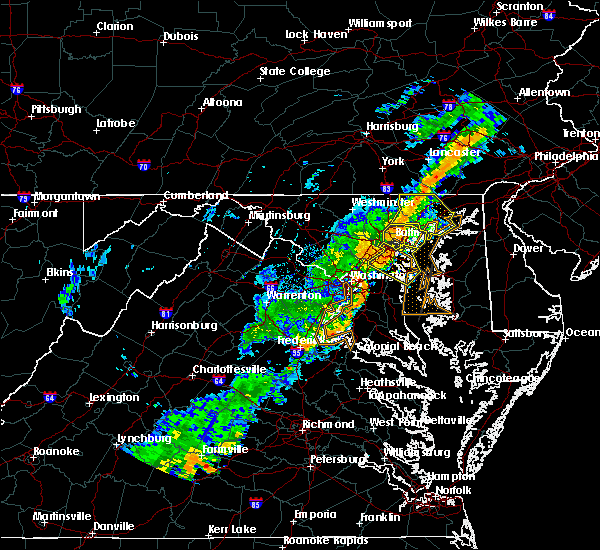 At 703 pm edt, a severe thunderstorm was located over rosedale, or near middle river, moving east at 30 mph (radar indicated). Hazards include 60 mph wind gusts. Damaging winds will cause some trees and large branches to fall. this could injure those outdoors, as well as damage homes and vehicles. roadways may become blocked by downed trees. localized power outages are possible. unsecured light objects may become projectiles. Locations impacted include, baltimore, pikesville, middle river, north point state park, back river, millers island, dundalk, towson, essex, parkville, carney, perry hall, arbutus, rosedale, rossville, brooklyn park, mays chapel, timonium, white marsh and bowleys quarters. At 703 pm edt, a severe thunderstorm was located over rosedale, or near middle river, moving east at 30 mph (radar indicated). Hazards include 60 mph wind gusts. Damaging winds will cause some trees and large branches to fall. this could injure those outdoors, as well as damage homes and vehicles. roadways may become blocked by downed trees. localized power outages are possible. unsecured light objects may become projectiles. Locations impacted include, baltimore, pikesville, middle river, north point state park, back river, millers island, dundalk, towson, essex, parkville, carney, perry hall, arbutus, rosedale, rossville, brooklyn park, mays chapel, timonium, white marsh and bowleys quarters.
|
| 9/26/2018 6:50 PM EDT |
 At 649 pm edt, severe thunderstorms were located along a line extending from lochearn to near laurel, moving southeast at 25 mph (radar indicated). Hazards include 60 mph wind gusts. Damaging winds will cause some trees and large branches to fall. this could injure those outdoors, as well as damage homes and vehicles. roadways may become blocked by downed trees. localized power outages are possible. Unsecured light objects may become projectiles. At 649 pm edt, severe thunderstorms were located along a line extending from lochearn to near laurel, moving southeast at 25 mph (radar indicated). Hazards include 60 mph wind gusts. Damaging winds will cause some trees and large branches to fall. this could injure those outdoors, as well as damage homes and vehicles. roadways may become blocked by downed trees. localized power outages are possible. Unsecured light objects may become projectiles.
|
| 9/26/2018 6:41 PM EDT |
 The national weather service in sterling virginia has issued a * severe thunderstorm warning for. baltimore city in northern maryland. southern baltimore county in northern maryland. until 730 pm edt. At 641 pm edt, a severe thunderstorm was located over lochearn, or. The national weather service in sterling virginia has issued a * severe thunderstorm warning for. baltimore city in northern maryland. southern baltimore county in northern maryland. until 730 pm edt. At 641 pm edt, a severe thunderstorm was located over lochearn, or.
|
| 8/31/2018 9:20 PM EDT | Two trees down near lakeshore drive in pasaden in anne arundel county MD, 4.4 miles NW of Pasadena, MD |
| 8/13/2018 6:12 PM EDT |
 At 612 pm edt, severe thunderstorms were located along a line extending from near cockeysville to sparrows point, moving northeast at 30 mph (radar indicated). Hazards include 60 mph wind gusts. Damaging winds will cause some trees and large branches to fall. this could injure those outdoors, as well as damage homes and vehicles. roadways may become blocked by downed trees. localized power outages are possible. unsecured light objects may become projectiles. Locations impacted include, baltimore, pikesville, middle river, cockeysville, north point state park, sparrows point, back river, millers island, glen burnie, dundalk, towson, essex, parkville, carney, perry hall, pasadena, rosedale, rossville, brooklyn park and mays chapel. At 612 pm edt, severe thunderstorms were located along a line extending from near cockeysville to sparrows point, moving northeast at 30 mph (radar indicated). Hazards include 60 mph wind gusts. Damaging winds will cause some trees and large branches to fall. this could injure those outdoors, as well as damage homes and vehicles. roadways may become blocked by downed trees. localized power outages are possible. unsecured light objects may become projectiles. Locations impacted include, baltimore, pikesville, middle river, cockeysville, north point state park, sparrows point, back river, millers island, glen burnie, dundalk, towson, essex, parkville, carney, perry hall, pasadena, rosedale, rossville, brooklyn park and mays chapel.
|
| 8/13/2018 5:49 PM EDT |
 At 548 pm edt, severe thunderstorms were located along a line extending from near woodlawn to ferndale, moving northeast at 30 mph. another severe thunderstorm was located near parkville and was nearly stationary (law enforcement reports these storms have a history of damaging winds in college park). Hazards include 60 mph wind gusts. Damaging winds will cause some trees and large branches to fall. this could injure those outdoors, as well as damage homes and vehicles. roadways may become blocked by downed trees. localized power outages are possible. Unsecured light objects may become projectiles. At 548 pm edt, severe thunderstorms were located along a line extending from near woodlawn to ferndale, moving northeast at 30 mph. another severe thunderstorm was located near parkville and was nearly stationary (law enforcement reports these storms have a history of damaging winds in college park). Hazards include 60 mph wind gusts. Damaging winds will cause some trees and large branches to fall. this could injure those outdoors, as well as damage homes and vehicles. roadways may become blocked by downed trees. localized power outages are possible. Unsecured light objects may become projectiles.
|
| 8/13/2018 5:42 PM EDT |
 At 541 pm edt, severe thunderstorms were located along a line extending from ellicott city to millersville, moving northeast at 25 mph (radar indicated). Hazards include 60 mph wind gusts. Damaging winds will cause some trees and large branches to fall. this could injure those outdoors, as well as damage homes and vehicles. roadways may become blocked by downed trees. localized power outages are possible. unsecured light objects may become projectiles. Locations impacted include, columbia, severn, elkridge, baltimore-washington airport, glen burnie, ellicott city, catonsville, woodlawn, odenton, pasadena, arbutus, ferndale, brooklyn park, fort meade, savage-guilford, pumphrey, south gate, scaggsville, ilchester and linthicum. At 541 pm edt, severe thunderstorms were located along a line extending from ellicott city to millersville, moving northeast at 25 mph (radar indicated). Hazards include 60 mph wind gusts. Damaging winds will cause some trees and large branches to fall. this could injure those outdoors, as well as damage homes and vehicles. roadways may become blocked by downed trees. localized power outages are possible. unsecured light objects may become projectiles. Locations impacted include, columbia, severn, elkridge, baltimore-washington airport, glen burnie, ellicott city, catonsville, woodlawn, odenton, pasadena, arbutus, ferndale, brooklyn park, fort meade, savage-guilford, pumphrey, south gate, scaggsville, ilchester and linthicum.
|
| 8/13/2018 5:22 PM EDT |
 At 522 pm edt, a severe thunderstorm was located over laurel, or near beltsville, moving northeast at 25 mph (radar indicated). Hazards include 60 mph wind gusts. Damaging winds will cause some trees and large branches to fall. this could injure those outdoors, as well as damage homes and vehicles. roadways may become blocked by downed trees. localized power outages are possible. Unsecured light objects may become projectiles. At 522 pm edt, a severe thunderstorm was located over laurel, or near beltsville, moving northeast at 25 mph (radar indicated). Hazards include 60 mph wind gusts. Damaging winds will cause some trees and large branches to fall. this could injure those outdoors, as well as damage homes and vehicles. roadways may become blocked by downed trees. localized power outages are possible. Unsecured light objects may become projectiles.
|
| 7/27/2018 5:34 PM EDT |
 At 517 pm edt, a severe thunderstorm was located over baltimore-washington airport, moving north at 25 mph (radar indicated). Hazards include 60 mph wind gusts. Damaging winds will cause some trees and large branches to fall. this could injure those outdoors, as well as damage homes and vehicles. roadways may become blocked by downed trees. localized power outages are possible. Unsecured light objects may become projectiles. At 517 pm edt, a severe thunderstorm was located over baltimore-washington airport, moving north at 25 mph (radar indicated). Hazards include 60 mph wind gusts. Damaging winds will cause some trees and large branches to fall. this could injure those outdoors, as well as damage homes and vehicles. roadways may become blocked by downed trees. localized power outages are possible. Unsecured light objects may become projectiles.
|
| 7/27/2018 5:17 PM EDT |
 At 517 pm edt, a severe thunderstorm was located over baltimore-washington airport, moving north at 25 mph (radar indicated). Hazards include 60 mph wind gusts. Damaging winds will cause some trees and large branches to fall. this could injure those outdoors, as well as damage homes and vehicles. roadways may become blocked by downed trees. localized power outages are possible. Unsecured light objects may become projectiles. At 517 pm edt, a severe thunderstorm was located over baltimore-washington airport, moving north at 25 mph (radar indicated). Hazards include 60 mph wind gusts. Damaging winds will cause some trees and large branches to fall. this could injure those outdoors, as well as damage homes and vehicles. roadways may become blocked by downed trees. localized power outages are possible. Unsecured light objects may become projectiles.
|
| 7/22/2018 2:53 PM EDT |
 At 252 pm edt, severe thunderstorms were located along a line extending from near savage-guilford to ferndale to bodkin point, moving north at 40 mph (radar indicated). Hazards include 60 mph wind gusts. Damaging winds will cause some trees and large branches to fall. this could injure those outdoors, as well as damage homes and vehicles. roadways may become blocked by downed trees. localized power outages are possible. Unsecured light objects may become projectiles. At 252 pm edt, severe thunderstorms were located along a line extending from near savage-guilford to ferndale to bodkin point, moving north at 40 mph (radar indicated). Hazards include 60 mph wind gusts. Damaging winds will cause some trees and large branches to fall. this could injure those outdoors, as well as damage homes and vehicles. roadways may become blocked by downed trees. localized power outages are possible. Unsecured light objects may become projectiles.
|
| 7/22/2018 2:38 PM EDT |
 At 238 pm edt, severe thunderstorms were located along a line extending from near fort meade to millersville to londontowne, moving north at 35 mph (radar indicated). Hazards include 60 mph wind gusts. Damaging winds will cause some trees and large branches to fall. this could injure those outdoors, as well as damage homes and vehicles. roadways may become blocked by downed trees. localized power outages are possible. unsecured light objects may become projectiles. Locations impacted include, bowie, severn, annapolis, crofton, riviera beach, mayo, shady side, naval academy, baltimore-washington airport, severn river, south river, fort smallwood state park, gibson island, bodkin point, sillery bay, rhode river, pinehurst, glen burnie, severna park and odenton. At 238 pm edt, severe thunderstorms were located along a line extending from near fort meade to millersville to londontowne, moving north at 35 mph (radar indicated). Hazards include 60 mph wind gusts. Damaging winds will cause some trees and large branches to fall. this could injure those outdoors, as well as damage homes and vehicles. roadways may become blocked by downed trees. localized power outages are possible. unsecured light objects may become projectiles. Locations impacted include, bowie, severn, annapolis, crofton, riviera beach, mayo, shady side, naval academy, baltimore-washington airport, severn river, south river, fort smallwood state park, gibson island, bodkin point, sillery bay, rhode river, pinehurst, glen burnie, severna park and odenton.
|
| 7/22/2018 2:17 PM EDT |
 At 217 pm edt, severe thunderstorms were located along a line extending from bowie to near kettering to near dunkirk, moving north at 30 mph (radar indicated). Hazards include 60 mph wind gusts. Damaging winds will cause some trees and large branches to fall. this could injure those outdoors, as well as damage homes and vehicles. roadways may become blocked by downed trees. localized power outages are possible. Unsecured light objects may become projectiles. At 217 pm edt, severe thunderstorms were located along a line extending from bowie to near kettering to near dunkirk, moving north at 30 mph (radar indicated). Hazards include 60 mph wind gusts. Damaging winds will cause some trees and large branches to fall. this could injure those outdoors, as well as damage homes and vehicles. roadways may become blocked by downed trees. localized power outages are possible. Unsecured light objects may become projectiles.
|
| 7/16/2018 6:07 PM EDT |
 The severe thunderstorm warning for northwestern anne arundel, southeastern howard and south central baltimore counties will expire at 615 pm edt, the storms which prompted the warning have weakened below severe limits, and no longer pose an immediate threat to life or property. therefore the warning will be allowed to expire. however gusty winds and heavy rain are still possible with these thunderstorms. to report severe weather, contact your nearest law enforcement agency. they will relay your report to the national weather service sterling virginia. The severe thunderstorm warning for northwestern anne arundel, southeastern howard and south central baltimore counties will expire at 615 pm edt, the storms which prompted the warning have weakened below severe limits, and no longer pose an immediate threat to life or property. therefore the warning will be allowed to expire. however gusty winds and heavy rain are still possible with these thunderstorms. to report severe weather, contact your nearest law enforcement agency. they will relay your report to the national weather service sterling virginia.
|
| 7/16/2018 5:50 PM EDT |
 At 550 pm edt, severe thunderstorms were located along a line extending from elkridge to millersville, moving northeast at 15 mph (radar indicated). Hazards include 60 mph wind gusts. Damaging winds will cause some trees and large branches to fall. this could injure those outdoors, as well as damage homes and vehicles. roadways may become blocked by downed trees. localized power outages are possible. unsecured light objects may become projectiles. Locations impacted include, columbia, severn, elkridge, riviera beach, baltimore-washington airport, glen burnie, catonsville, severna park, odenton, pasadena, arbutus, ferndale, brooklyn park, fort meade, south gate, pumphrey, ilchester, linthicum, lansdowne and jessup. At 550 pm edt, severe thunderstorms were located along a line extending from elkridge to millersville, moving northeast at 15 mph (radar indicated). Hazards include 60 mph wind gusts. Damaging winds will cause some trees and large branches to fall. this could injure those outdoors, as well as damage homes and vehicles. roadways may become blocked by downed trees. localized power outages are possible. unsecured light objects may become projectiles. Locations impacted include, columbia, severn, elkridge, riviera beach, baltimore-washington airport, glen burnie, catonsville, severna park, odenton, pasadena, arbutus, ferndale, brooklyn park, fort meade, south gate, pumphrey, ilchester, linthicum, lansdowne and jessup.
|
| 7/16/2018 5:35 PM EDT |
 At 534 pm edt, a severe thunderstorm was located over savage-guilford, or near elkridge, moving northeast at 10 mph (radar indicated). Hazards include 60 mph wind gusts. Damaging winds will cause some trees and large branches to fall. this could injure those outdoors, as well as damage homes and vehicles. roadways may become blocked by downed trees. localized power outages are possible. Unsecured light objects may become projectiles. At 534 pm edt, a severe thunderstorm was located over savage-guilford, or near elkridge, moving northeast at 10 mph (radar indicated). Hazards include 60 mph wind gusts. Damaging winds will cause some trees and large branches to fall. this could injure those outdoors, as well as damage homes and vehicles. roadways may become blocked by downed trees. localized power outages are possible. Unsecured light objects may become projectiles.
|
| 5/27/2018 4:52 PM EDT |
 The severe thunderstorm warning for north central anne arundel and southern baltimore counties will expire at 500 pm edt, the storms which prompted the warning have weakened below severe limits, and no longer pose an immediate threat to life or property. therefore the warning will be allowed to expire. however heavy rain is still possible with these thunderstorms. The severe thunderstorm warning for north central anne arundel and southern baltimore counties will expire at 500 pm edt, the storms which prompted the warning have weakened below severe limits, and no longer pose an immediate threat to life or property. therefore the warning will be allowed to expire. however heavy rain is still possible with these thunderstorms.
|
| 5/27/2018 4:29 PM EDT |
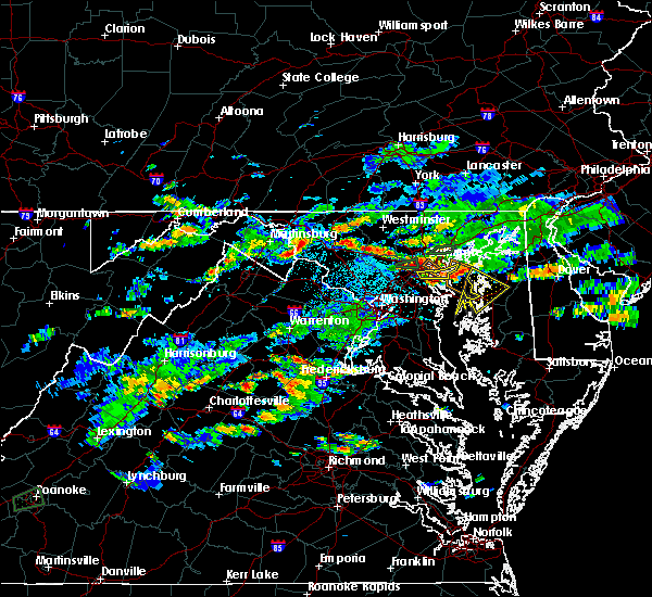 At 429 pm edt, severe thunderstorms were located along a line extending from near bowleys quarters to fort smallwood state park to glen burnie, moving southeast at 10 mph (radar indicated). Hazards include 60 mph wind gusts. Damaging winds will cause some trees and large branches to fall. this could injure those outdoors, as well as damage homes and vehicles. roadways may become blocked by downed trees. localized power outages are possible. unsecured light objects may become projectiles. Locations impacted include, severn, riviera beach, baltimore-washington airport, fort smallwood state park, north point state park, sparrows point, millers island, glen burnie, pasadena, ferndale, brooklyn park, south gate, linthicum, edgemere, fort howard and linthicum heights. At 429 pm edt, severe thunderstorms were located along a line extending from near bowleys quarters to fort smallwood state park to glen burnie, moving southeast at 10 mph (radar indicated). Hazards include 60 mph wind gusts. Damaging winds will cause some trees and large branches to fall. this could injure those outdoors, as well as damage homes and vehicles. roadways may become blocked by downed trees. localized power outages are possible. unsecured light objects may become projectiles. Locations impacted include, severn, riviera beach, baltimore-washington airport, fort smallwood state park, north point state park, sparrows point, millers island, glen burnie, pasadena, ferndale, brooklyn park, south gate, linthicum, edgemere, fort howard and linthicum heights.
|
| 5/27/2018 4:09 PM EDT |
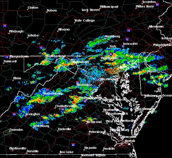 At 409 pm edt, severe thunderstorms were located along a line extending from essex to brooklyn park to elkridge, moving south at 10 mph (radar indicated). Hazards include 60 mph wind gusts. Damaging winds will cause some trees and large branches to fall. this could injure those outdoors, as well as damage homes and vehicles. roadways may become blocked by downed trees. localized power outages are possible. Unsecured light objects may become projectiles. At 409 pm edt, severe thunderstorms were located along a line extending from essex to brooklyn park to elkridge, moving south at 10 mph (radar indicated). Hazards include 60 mph wind gusts. Damaging winds will cause some trees and large branches to fall. this could injure those outdoors, as well as damage homes and vehicles. roadways may become blocked by downed trees. localized power outages are possible. Unsecured light objects may become projectiles.
|
| 5/12/2018 8:41 PM EDT |
 The severe thunderstorm warning for northeastern anne arundel county will expire at 845 pm edt, the storm which prompted the warning is moving out of the area. therefore the warning will be allowed to expire. however heavy rain is still possible with this thunderstorm. a tornado watch remains in effect until 100 am edt for central maryland. The severe thunderstorm warning for northeastern anne arundel county will expire at 845 pm edt, the storm which prompted the warning is moving out of the area. therefore the warning will be allowed to expire. however heavy rain is still possible with this thunderstorm. a tornado watch remains in effect until 100 am edt for central maryland.
|
| 5/12/2018 8:35 PM EDT |
 At 834 pm edt, a severe thunderstorm was located over riviera beach, moving east at 25 mph (radar indicated). Hazards include 60 mph wind gusts and quarter size hail. Damaging winds will cause some trees and large branches to fall. this could injure those outdoors, as well as damage homes and vehicles. roadways may become blocked by downed trees. localized power outages are possible. unsecured light objects may become projectiles. locations impacted include, severn, riviera beach, fort smallwood state park, pinehurst, gibson island, bodkin point, sillery bay, glen burnie, severna park, pasadena, arnold, lake shore, south gate, green haven, cape st. claire, gambrills, herald harbor, chelsea beach and belvedere heights. A tornado watch remains in effect until 100 am edt for central and northern maryland. At 834 pm edt, a severe thunderstorm was located over riviera beach, moving east at 25 mph (radar indicated). Hazards include 60 mph wind gusts and quarter size hail. Damaging winds will cause some trees and large branches to fall. this could injure those outdoors, as well as damage homes and vehicles. roadways may become blocked by downed trees. localized power outages are possible. unsecured light objects may become projectiles. locations impacted include, severn, riviera beach, fort smallwood state park, pinehurst, gibson island, bodkin point, sillery bay, glen burnie, severna park, pasadena, arnold, lake shore, south gate, green haven, cape st. claire, gambrills, herald harbor, chelsea beach and belvedere heights. A tornado watch remains in effect until 100 am edt for central and northern maryland.
|
| 5/12/2018 8:14 PM EDT |
 At 814 pm edt, severe thunderstorms were located along a line extending from near octoraro to pumphrey, moving southeast at 30 mph (radar indicated). Hazards include 60 mph wind gusts and quarter size hail. Damaging winds will cause some trees and large branches to fall. this could injure those outdoors, as well as damage homes and vehicles. roadways may become blocked by downed trees. localized power outages are possible. unsecured light objects may become projectiles. locations impacted include, baltimore, middle river, aberdeen, havre de grace, aberdeen proving ground, north point state park, sparrows point, back river, millers island, dundalk, bel air south, essex, parkville, bel air north, carney, perry hall, rosedale, rossville, brooklyn park and white marsh. A tornado watch remains in effect until 100 am edt for central and northern maryland. At 814 pm edt, severe thunderstorms were located along a line extending from near octoraro to pumphrey, moving southeast at 30 mph (radar indicated). Hazards include 60 mph wind gusts and quarter size hail. Damaging winds will cause some trees and large branches to fall. this could injure those outdoors, as well as damage homes and vehicles. roadways may become blocked by downed trees. localized power outages are possible. unsecured light objects may become projectiles. locations impacted include, baltimore, middle river, aberdeen, havre de grace, aberdeen proving ground, north point state park, sparrows point, back river, millers island, dundalk, bel air south, essex, parkville, bel air north, carney, perry hall, rosedale, rossville, brooklyn park and white marsh. A tornado watch remains in effect until 100 am edt for central and northern maryland.
|
| 5/12/2018 8:07 PM EDT |
 At 806 pm edt, severe thunderstorms were located along a line extending from near octoraro to pumphrey, moving southeast at 30 mph (radar indicated). Hazards include 60 mph wind gusts and quarter size hail. Damaging winds will cause some trees and large branches to fall. this could injure those outdoors, as well as damage homes and vehicles. roadways may become blocked by downed trees. localized power outages are possible. unsecured light objects may become projectiles. locations impacted include, baltimore, pikesville, middle river, cockeysville, aberdeen, havre de grace, aberdeen proving ground, millers island, north point state park, sparrows point, back river, dundalk, towson, bel air south, catonsville, essex, woodlawn, parkville, bel air north and carney. A tornado watch remains in effect until 100 am edt for central and northern maryland. At 806 pm edt, severe thunderstorms were located along a line extending from near octoraro to pumphrey, moving southeast at 30 mph (radar indicated). Hazards include 60 mph wind gusts and quarter size hail. Damaging winds will cause some trees and large branches to fall. this could injure those outdoors, as well as damage homes and vehicles. roadways may become blocked by downed trees. localized power outages are possible. unsecured light objects may become projectiles. locations impacted include, baltimore, pikesville, middle river, cockeysville, aberdeen, havre de grace, aberdeen proving ground, millers island, north point state park, sparrows point, back river, dundalk, towson, bel air south, catonsville, essex, woodlawn, parkville, bel air north and carney. A tornado watch remains in effect until 100 am edt for central and northern maryland.
|
| 5/12/2018 8:02 PM EDT |
 At 802 pm edt, a severe thunderstorm was located over elkridge, moving east at 25 mph (radar indicated). Hazards include 60 mph wind gusts and quarter to golf ball size hail. Damaging winds will cause some trees and large branches to fall. this could injure those outdoors, as well as damage homes and vehicles. roadways may become blocked by downed trees. localized power outages are possible. Unsecured light objects may become projectiles. At 802 pm edt, a severe thunderstorm was located over elkridge, moving east at 25 mph (radar indicated). Hazards include 60 mph wind gusts and quarter to golf ball size hail. Damaging winds will cause some trees and large branches to fall. this could injure those outdoors, as well as damage homes and vehicles. roadways may become blocked by downed trees. localized power outages are possible. Unsecured light objects may become projectiles.
|
| 5/12/2018 7:57 PM EDT |
 At 756 pm edt, severe thunderstorms were located along a line extending from near delta to catonsville, moving southeast at 30 mph (radar indicated. this storm has a history of producing large hail. the most intense portion of the storm is heading into downtown baltimore city). Hazards include damaging wind gusts of 60 to 75 mph wind gusts and quarter to golf ball size hail. Damaging winds will cause some trees and large branches to fall. this could injure those outdoors, as well as damage homes and vehicles. roadways may become blocked by downed trees. localized power outages are possible. unsecured light objects may become projectiles. locations impacted include, baltimore, pikesville, middle river, cockeysville, aberdeen, havre de grace, aberdeen proving ground, millers island, north point state park, sparrows point, back river, ellicott city, dundalk, towson, bel air south, catonsville, essex, woodlawn, randallstown and parkville. A tornado watch remains in effect until 100 am edt for central and northern maryland. At 756 pm edt, severe thunderstorms were located along a line extending from near delta to catonsville, moving southeast at 30 mph (radar indicated. this storm has a history of producing large hail. the most intense portion of the storm is heading into downtown baltimore city). Hazards include damaging wind gusts of 60 to 75 mph wind gusts and quarter to golf ball size hail. Damaging winds will cause some trees and large branches to fall. this could injure those outdoors, as well as damage homes and vehicles. roadways may become blocked by downed trees. localized power outages are possible. unsecured light objects may become projectiles. locations impacted include, baltimore, pikesville, middle river, cockeysville, aberdeen, havre de grace, aberdeen proving ground, millers island, north point state park, sparrows point, back river, ellicott city, dundalk, towson, bel air south, catonsville, essex, woodlawn, randallstown and parkville. A tornado watch remains in effect until 100 am edt for central and northern maryland.
|
| 5/12/2018 7:44 PM EDT |
 At 743 pm edt, severe thunderstorms were located along a line extending from near delta to near ellicott city, moving southeast at 30 mph (radar indicated. these storms have a history of producing large hail). Hazards include quarter to golf ball size hail and 60 mph wind gusts. Damaging winds will cause some trees and large branches to fall. this could injure those outdoors, as well as damage homes and vehicles. roadways may become blocked by downed trees. localized power outages are possible. Unsecured light objects may become projectiles. At 743 pm edt, severe thunderstorms were located along a line extending from near delta to near ellicott city, moving southeast at 30 mph (radar indicated. these storms have a history of producing large hail). Hazards include quarter to golf ball size hail and 60 mph wind gusts. Damaging winds will cause some trees and large branches to fall. this could injure those outdoors, as well as damage homes and vehicles. roadways may become blocked by downed trees. localized power outages are possible. Unsecured light objects may become projectiles.
|
| 8/21/2017 6:20 PM EDT |
 The severe thunderstorm warning for northeastern anne arundel county will expire at 630 pm edt, the storm which prompted the warning has weakened below severe limits, and no longer pose an immediate threat to life or property. therefore the warning will be allowed to expire. however heavy rain is still possible with this thunderstorm. The severe thunderstorm warning for northeastern anne arundel county will expire at 630 pm edt, the storm which prompted the warning has weakened below severe limits, and no longer pose an immediate threat to life or property. therefore the warning will be allowed to expire. however heavy rain is still possible with this thunderstorm.
|
| 8/21/2017 6:13 PM EDT |
 At 613 pm edt, a severe thunderstorm was located over green haven, or over riviera beach, moving south at 10 mph (radar indicated). Hazards include 60 mph wind gusts and quarter size hail. Damaging winds will cause some trees and large branches to fall. this could injure those outdoors, as well as damage homes and vehicles. roadways may become blocked by downed trees. localized power outages are possible. unsecured light objects may become projectiles. locations impacted include, annapolis, riviera beach, naval academy, fort smallwood state park, pinehurst, gibson island, bodkin point, sillery bay, severn river, glen burnie, severna park, pasadena, arnold, lake shore, green haven, cape st. Claire, chelsea beach and belvedere heights. At 613 pm edt, a severe thunderstorm was located over green haven, or over riviera beach, moving south at 10 mph (radar indicated). Hazards include 60 mph wind gusts and quarter size hail. Damaging winds will cause some trees and large branches to fall. this could injure those outdoors, as well as damage homes and vehicles. roadways may become blocked by downed trees. localized power outages are possible. unsecured light objects may become projectiles. locations impacted include, annapolis, riviera beach, naval academy, fort smallwood state park, pinehurst, gibson island, bodkin point, sillery bay, severn river, glen burnie, severna park, pasadena, arnold, lake shore, green haven, cape st. Claire, chelsea beach and belvedere heights.
|
| 8/21/2017 5:47 PM EDT |
 At 547 pm edt, a severe thunderstorm was located over pasadena, or over riviera beach, moving southeast at 15 mph (radar indicated). Hazards include 60 mph wind gusts and quarter size hail. Damaging winds will cause some trees and large branches to fall. this could injure those outdoors, as well as damage homes and vehicles. roadways may become blocked by downed trees. localized power outages are possible. Unsecured light objects may become projectiles. At 547 pm edt, a severe thunderstorm was located over pasadena, or over riviera beach, moving southeast at 15 mph (radar indicated). Hazards include 60 mph wind gusts and quarter size hail. Damaging winds will cause some trees and large branches to fall. this could injure those outdoors, as well as damage homes and vehicles. roadways may become blocked by downed trees. localized power outages are possible. Unsecured light objects may become projectiles.
|
| 8/18/2017 6:21 PM EDT |
 At 620 pm edt, severe thunderstorms were located along a line extending from near millers island to near millersville, moving east at 30 mph (radar indicated). Hazards include 60 mph wind gusts. Damaging winds will cause some trees and large branches to fall. this could injure those outdoors, as well as damage homes and vehicles. roadways may become blocked by downed trees. localized power outages are possible. unsecured light objects may become projectiles. Locations impacted include, bowie, severn, annapolis, crofton, riviera beach, naval academy, fort smallwood state park, pinehurst, gibson island, bodkin point, sillery bay, glen burnie, severna park, odenton, pasadena, arnold, lake shore, parole, millersville and green haven. At 620 pm edt, severe thunderstorms were located along a line extending from near millers island to near millersville, moving east at 30 mph (radar indicated). Hazards include 60 mph wind gusts. Damaging winds will cause some trees and large branches to fall. this could injure those outdoors, as well as damage homes and vehicles. roadways may become blocked by downed trees. localized power outages are possible. unsecured light objects may become projectiles. Locations impacted include, bowie, severn, annapolis, crofton, riviera beach, naval academy, fort smallwood state park, pinehurst, gibson island, bodkin point, sillery bay, glen burnie, severna park, odenton, pasadena, arnold, lake shore, parole, millersville and green haven.
|
| 8/18/2017 5:47 PM EDT |
 At 546 pm edt, severe thunderstorms were located along a line extending from near aberdeen to near middle river to arbutus, moving east at 25 mph (radar indicated). Hazards include 60 mph wind gusts and quarter size hail. Damaging winds will cause some trees and large branches to fall. this could injure those outdoors, as well as damage homes and vehicles. roadways may become blocked by downed trees. localized power outages are possible. unsecured light objects may become projectiles. Locations impacted include, baltimore, middle river, aberdeen, havre de grace, aberdeen proving ground, north point state park, sparrows point, back river, millers island, glen burnie, dundalk, bel air south, essex, bel air north, pasadena, rosedale, ferndale, brooklyn park, white marsh and bowleys quarters. At 546 pm edt, severe thunderstorms were located along a line extending from near aberdeen to near middle river to arbutus, moving east at 25 mph (radar indicated). Hazards include 60 mph wind gusts and quarter size hail. Damaging winds will cause some trees and large branches to fall. this could injure those outdoors, as well as damage homes and vehicles. roadways may become blocked by downed trees. localized power outages are possible. unsecured light objects may become projectiles. Locations impacted include, baltimore, middle river, aberdeen, havre de grace, aberdeen proving ground, north point state park, sparrows point, back river, millers island, glen burnie, dundalk, bel air south, essex, bel air north, pasadena, rosedale, ferndale, brooklyn park, white marsh and bowleys quarters.
|
| 8/18/2017 5:44 PM EDT |
 At 544 pm edt, severe thunderstorms were located along a line extending from elkridge to beltsville, moving east at 25 mph (radar indicated). Hazards include 60 mph wind gusts. Damaging winds will cause some trees and large branches to fall. this could injure those outdoors, as well as damage homes and vehicles. roadways may become blocked by downed trees. localized power outages are possible. unsecured light objects may become projectiles. Locations impacted include, bowie, severn, annapolis, crofton, beltsville, elkridge, riviera beach, naval academy, baltimore-washington airport, fort smallwood state park, pinehurst, gibson island, bodkin point, sillery bay, glen burnie, severna park, odenton, laurel, pasadena and arnold. At 544 pm edt, severe thunderstorms were located along a line extending from elkridge to beltsville, moving east at 25 mph (radar indicated). Hazards include 60 mph wind gusts. Damaging winds will cause some trees and large branches to fall. this could injure those outdoors, as well as damage homes and vehicles. roadways may become blocked by downed trees. localized power outages are possible. unsecured light objects may become projectiles. Locations impacted include, bowie, severn, annapolis, crofton, beltsville, elkridge, riviera beach, naval academy, baltimore-washington airport, fort smallwood state park, pinehurst, gibson island, bodkin point, sillery bay, glen burnie, severna park, odenton, laurel, pasadena and arnold.
|
| 8/18/2017 5:34 PM EDT |
 At 534 pm edt, severe thunderstorms were located along a line extending from near bel air north to arbutus, moving east at 25 mph (radar indicated). Hazards include 60 mph wind gusts and quarter size hail. Damaging winds will cause some trees and large branches to fall. this could injure those outdoors, as well as damage homes and vehicles. roadways may become blocked by downed trees. localized power outages are possible. unsecured light objects may become projectiles. Locations impacted include, baltimore, columbia, middle river, elkridge, aberdeen, havre de grace, aberdeen proving ground, millers island, north point state park, sparrows point, back river, glen burnie, dundalk, towson, bel air south, catonsville, essex, parkville, bel air north and carney. At 534 pm edt, severe thunderstorms were located along a line extending from near bel air north to arbutus, moving east at 25 mph (radar indicated). Hazards include 60 mph wind gusts and quarter size hail. Damaging winds will cause some trees and large branches to fall. this could injure those outdoors, as well as damage homes and vehicles. roadways may become blocked by downed trees. localized power outages are possible. unsecured light objects may become projectiles. Locations impacted include, baltimore, columbia, middle river, elkridge, aberdeen, havre de grace, aberdeen proving ground, millers island, north point state park, sparrows point, back river, glen burnie, dundalk, towson, bel air south, catonsville, essex, parkville, bel air north and carney.
|
| 8/18/2017 5:32 PM EDT |
 At 532 pm edt, severe thunderstorms were located along a line extending from near savage-guilford to forest glen, moving east at 25 mph (radar indicated). Hazards include 60 mph wind gusts. Damaging winds will cause some trees and large branches to fall. this could injure those outdoors, as well as damage homes and vehicles. roadways may become blocked by downed trees. localized power outages are possible. Unsecured light objects may become projectiles. At 532 pm edt, severe thunderstorms were located along a line extending from near savage-guilford to forest glen, moving east at 25 mph (radar indicated). Hazards include 60 mph wind gusts. Damaging winds will cause some trees and large branches to fall. this could injure those outdoors, as well as damage homes and vehicles. roadways may become blocked by downed trees. localized power outages are possible. Unsecured light objects may become projectiles.
|
| 8/18/2017 5:14 PM EDT |
 At 513 pm edt, severe thunderstorms were located along a line extending from cockeysville to catonsville, moving east at 20 mph (radar indicated). Hazards include 60 mph wind gusts. Damaging winds will cause some trees and large branches to fall. this could injure those outdoors, as well as damage homes and vehicles. roadways may become blocked by downed trees. localized power outages are possible. Unsecured light objects may become projectiles. At 513 pm edt, severe thunderstorms were located along a line extending from cockeysville to catonsville, moving east at 20 mph (radar indicated). Hazards include 60 mph wind gusts. Damaging winds will cause some trees and large branches to fall. this could injure those outdoors, as well as damage homes and vehicles. roadways may become blocked by downed trees. localized power outages are possible. Unsecured light objects may become projectiles.
|
| 8/12/2017 8:39 PM EDT |
 The severe thunderstorm warning for northeastern anne arundel county will expire at 845 pm edt, the storm which prompted the warning has weakened below severe limits, and no longer pose an immediate threat to life or property. therefore the warning will be allowed to expire. however gusty winds and heavy rain are still possible with this thunderstorm. a severe thunderstorm watch remains in effect until 1100 pm edt for central maryland. The severe thunderstorm warning for northeastern anne arundel county will expire at 845 pm edt, the storm which prompted the warning has weakened below severe limits, and no longer pose an immediate threat to life or property. therefore the warning will be allowed to expire. however gusty winds and heavy rain are still possible with this thunderstorm. a severe thunderstorm watch remains in effect until 1100 pm edt for central maryland.
|
| 8/12/2017 8:16 PM EDT |
 At 816 pm edt, a severe thunderstorm was located over severna park, or near riviera beach, moving southeast at 15 mph (radar indicated). Hazards include 60 mph wind gusts and quarter size hail. Damaging winds will cause some trees and large branches to fall. this could injure those outdoors, as well as damage homes and vehicles. roadways may become blocked by downed trees. localized power outages are possible. unsecured light objects may become projectiles. Locations impacted include, severn, annapolis, crofton, riviera beach, mayo, naval academy, severn river, south river, fort smallwood state park, pinehurst, gibson island, bodkin point, sillery bay, glen burnie, severna park, odenton, pasadena, arnold, lake shore and ferndale. At 816 pm edt, a severe thunderstorm was located over severna park, or near riviera beach, moving southeast at 15 mph (radar indicated). Hazards include 60 mph wind gusts and quarter size hail. Damaging winds will cause some trees and large branches to fall. this could injure those outdoors, as well as damage homes and vehicles. roadways may become blocked by downed trees. localized power outages are possible. unsecured light objects may become projectiles. Locations impacted include, severn, annapolis, crofton, riviera beach, mayo, naval academy, severn river, south river, fort smallwood state park, pinehurst, gibson island, bodkin point, sillery bay, glen burnie, severna park, odenton, pasadena, arnold, lake shore and ferndale.
|
| 8/12/2017 7:56 PM EDT |
 At 756 pm edt, a severe thunderstorm was located over south gate, or near baltimore-washington airport, moving southeast at 20 mph (radar indicated). Hazards include 60 mph wind gusts and quarter size hail. Damaging winds will cause some trees and large branches to fall. this could injure those outdoors, as well as damage homes and vehicles. roadways may become blocked by downed trees. localized power outages are possible. Unsecured light objects may become projectiles. At 756 pm edt, a severe thunderstorm was located over south gate, or near baltimore-washington airport, moving southeast at 20 mph (radar indicated). Hazards include 60 mph wind gusts and quarter size hail. Damaging winds will cause some trees and large branches to fall. this could injure those outdoors, as well as damage homes and vehicles. roadways may become blocked by downed trees. localized power outages are possible. Unsecured light objects may become projectiles.
|
| 8/12/2017 7:46 PM EDT |
 At 746 pm edt, a severe thunderstorm was located over brooklyn park, or near riviera beach, moving southeast at 20 mph (radar indicated). Hazards include 60 mph wind gusts. Damaging winds will cause some trees and large branches to fall. this could injure those outdoors, as well as damage homes and vehicles. roadways may become blocked by downed trees. localized power outages are possible. unsecured light objects may become projectiles. Locations impacted include, baltimore, severn, riviera beach, baltimore-washington airport, north point state park, sparrows point, fort smallwood state park, pinehurst, bodkin point, sillery bay, back river, millers island, glen burnie, dundalk, severna park, pasadena, arnold, lake shore, ferndale and brooklyn park. At 746 pm edt, a severe thunderstorm was located over brooklyn park, or near riviera beach, moving southeast at 20 mph (radar indicated). Hazards include 60 mph wind gusts. Damaging winds will cause some trees and large branches to fall. this could injure those outdoors, as well as damage homes and vehicles. roadways may become blocked by downed trees. localized power outages are possible. unsecured light objects may become projectiles. Locations impacted include, baltimore, severn, riviera beach, baltimore-washington airport, north point state park, sparrows point, fort smallwood state park, pinehurst, bodkin point, sillery bay, back river, millers island, glen burnie, dundalk, severna park, pasadena, arnold, lake shore, ferndale and brooklyn park.
|
| 8/12/2017 7:37 PM EDT |
 At 736 pm edt, a severe thunderstorm was located over pumphrey, or near baltimore-washington airport, moving southeast at 20 mph (radar indicated). Hazards include 60 mph wind gusts and quarter size hail. Damaging winds will cause some trees and large branches to fall. this could injure those outdoors, as well as damage homes and vehicles. roadways may become blocked by downed trees. localized power outages are possible. unsecured light objects may become projectiles. Locations impacted include, baltimore, severn, annapolis, elkridge, riviera beach, naval academy, baltimore-washington airport, north point state park, sparrows point, severn river, fort smallwood state park, pinehurst, gibson island, bodkin point, sillery bay, back river, millers island, glen burnie, dundalk and catonsville. At 736 pm edt, a severe thunderstorm was located over pumphrey, or near baltimore-washington airport, moving southeast at 20 mph (radar indicated). Hazards include 60 mph wind gusts and quarter size hail. Damaging winds will cause some trees and large branches to fall. this could injure those outdoors, as well as damage homes and vehicles. roadways may become blocked by downed trees. localized power outages are possible. unsecured light objects may become projectiles. Locations impacted include, baltimore, severn, annapolis, elkridge, riviera beach, naval academy, baltimore-washington airport, north point state park, sparrows point, severn river, fort smallwood state park, pinehurst, gibson island, bodkin point, sillery bay, back river, millers island, glen burnie, dundalk and catonsville.
|
| 8/12/2017 7:19 PM EDT |
 At 719 pm edt, a severe thunderstorm was located over catonsville, or near elkridge, moving southeast at 20 mph (radar indicated). Hazards include 60 mph wind gusts and quarter size hail. Damaging winds will cause some trees and large branches to fall. this could injure those outdoors, as well as damage homes and vehicles. roadways may become blocked by downed trees. localized power outages are possible. Unsecured light objects may become projectiles. At 719 pm edt, a severe thunderstorm was located over catonsville, or near elkridge, moving southeast at 20 mph (radar indicated). Hazards include 60 mph wind gusts and quarter size hail. Damaging winds will cause some trees and large branches to fall. this could injure those outdoors, as well as damage homes and vehicles. roadways may become blocked by downed trees. localized power outages are possible. Unsecured light objects may become projectiles.
|
| 7/24/2017 9:04 PM EDT |
 At 903 pm edt, a severe thunderstorm was located near elkridge, moving east at 30 mph (radar indicated). Hazards include 60 mph wind gusts. Damaging winds will cause some trees and large branches to fall. this could injure those outdoors, as well as damage homes and vehicles. roadways may become blocked by downed trees. localized power outages are possible. Unsecured light objects may become projectiles. At 903 pm edt, a severe thunderstorm was located near elkridge, moving east at 30 mph (radar indicated). Hazards include 60 mph wind gusts. Damaging winds will cause some trees and large branches to fall. this could injure those outdoors, as well as damage homes and vehicles. roadways may become blocked by downed trees. localized power outages are possible. Unsecured light objects may become projectiles.
|
| 7/24/2017 12:43 AM EDT |
 At 1241 am edt, a severe thunderstorm was located near londontowne, or near crofton, moving east at 25 mph (radar indicated. the prince george county 911 center has also reported tree damage with this storm). Hazards include 60 mph wind gusts. Damaging winds will cause some trees and large branches to fall. this could injure those outdoors, as well as damage homes and vehicles. roadways may become blocked by downed trees. localized power outages are possible. unsecured light objects may become projectiles. Locations impacted include, bowie, annapolis, crofton, largo, mayo, naval academy, severn river, south river, pinehurst, gibson island, bodkin point, sillery bay, fort smallwood state park, severna park, odenton, pasadena, arnold, lake shore, parole and kettering. At 1241 am edt, a severe thunderstorm was located near londontowne, or near crofton, moving east at 25 mph (radar indicated. the prince george county 911 center has also reported tree damage with this storm). Hazards include 60 mph wind gusts. Damaging winds will cause some trees and large branches to fall. this could injure those outdoors, as well as damage homes and vehicles. roadways may become blocked by downed trees. localized power outages are possible. unsecured light objects may become projectiles. Locations impacted include, bowie, annapolis, crofton, largo, mayo, naval academy, severn river, south river, pinehurst, gibson island, bodkin point, sillery bay, fort smallwood state park, severna park, odenton, pasadena, arnold, lake shore, parole and kettering.
|
| 7/24/2017 12:28 AM EDT |
 At 1227 am edt, a severe thunderstorm was located near bowie, moving east at 30 mph (radar indicated). Hazards include 60 mph wind gusts. Damaging winds will cause some trees and large branches to fall. this could injure those outdoors, as well as damage homes and vehicles. roadways may become blocked by downed trees. localized power outages are possible. unsecured light objects may become projectiles. Locations impacted include, bowie, annapolis, crofton, greenbelt, mayo, naval academy, severn river, south river, pinehurst, gibson island, bodkin point, sillery bay, severna park, odenton, pasadena, arnold, lake shore, parole, kettering and mitchellville. At 1227 am edt, a severe thunderstorm was located near bowie, moving east at 30 mph (radar indicated). Hazards include 60 mph wind gusts. Damaging winds will cause some trees and large branches to fall. this could injure those outdoors, as well as damage homes and vehicles. roadways may become blocked by downed trees. localized power outages are possible. unsecured light objects may become projectiles. Locations impacted include, bowie, annapolis, crofton, greenbelt, mayo, naval academy, severn river, south river, pinehurst, gibson island, bodkin point, sillery bay, severna park, odenton, pasadena, arnold, lake shore, parole, kettering and mitchellville.
|
| 7/24/2017 12:21 AM EDT |
 At 1221 am edt, a severe thunderstorm was located over bowie, moving east at 25 mph (radar indicated). Hazards include 60 mph wind gusts. Damaging winds will cause some trees and large branches to fall. this could injure those outdoors, as well as damage homes and vehicles. roadways may become blocked by downed trees. localized power outages are possible. Unsecured light objects may become projectiles. At 1221 am edt, a severe thunderstorm was located over bowie, moving east at 25 mph (radar indicated). Hazards include 60 mph wind gusts. Damaging winds will cause some trees and large branches to fall. this could injure those outdoors, as well as damage homes and vehicles. roadways may become blocked by downed trees. localized power outages are possible. Unsecured light objects may become projectiles.
|
| 7/22/2017 2:58 PM EDT | Tree down near the intersection of chesapeake place and dock roa in anne arundel county MD, 5.8 miles WNW of Pasadena, MD |
| 7/22/2017 2:23 PM EDT |
 At 223 pm edt, a severe thunderstorm was located over beltsville, moving east at 50 mph (radar indicated). Hazards include 60 mph wind gusts. Damaging winds will cause some trees and large branches to fall. this could injure those outdoors, as well as damage homes and vehicles. roadways may become blocked by downed trees. localized power outages are possible. Unsecured light objects may become projectiles. At 223 pm edt, a severe thunderstorm was located over beltsville, moving east at 50 mph (radar indicated). Hazards include 60 mph wind gusts. Damaging winds will cause some trees and large branches to fall. this could injure those outdoors, as well as damage homes and vehicles. roadways may become blocked by downed trees. localized power outages are possible. Unsecured light objects may become projectiles.
|
| 7/14/2017 5:40 PM EDT |
 At 540 pm edt, a severe thunderstorm was located over severn river, moving east at 20 mph (radar indicated). Hazards include 60 mph wind gusts and quarter size hail. Damaging winds will cause some trees and large branches to fall. this could injure those outdoors, as well as damage homes and vehicles. roadways may become blocked by downed trees. localized power outages are possible. unsecured light objects may become projectiles. locations impacted include, severn, annapolis, mayo, naval academy, severn river, south river, pinehurst, gibson island, sillery bay, glen burnie, severna park, pasadena, arnold, lake shore, parole, londontowne, south gate, edgewater, cape st. Claire and riva. At 540 pm edt, a severe thunderstorm was located over severn river, moving east at 20 mph (radar indicated). Hazards include 60 mph wind gusts and quarter size hail. Damaging winds will cause some trees and large branches to fall. this could injure those outdoors, as well as damage homes and vehicles. roadways may become blocked by downed trees. localized power outages are possible. unsecured light objects may become projectiles. locations impacted include, severn, annapolis, mayo, naval academy, severn river, south river, pinehurst, gibson island, sillery bay, glen burnie, severna park, pasadena, arnold, lake shore, parole, londontowne, south gate, edgewater, cape st. Claire and riva.
|
| 7/14/2017 5:24 PM EDT |
 At 524 pm edt, a severe thunderstorm was located over parole, or near annapolis, moving east at 20 mph (radar indicated). Hazards include 60 mph wind gusts and quarter size hail. Damaging winds will cause some trees and large branches to fall. this could injure those outdoors, as well as damage homes and vehicles. roadways may become blocked by downed trees. localized power outages are possible. Unsecured light objects may become projectiles. At 524 pm edt, a severe thunderstorm was located over parole, or near annapolis, moving east at 20 mph (radar indicated). Hazards include 60 mph wind gusts and quarter size hail. Damaging winds will cause some trees and large branches to fall. this could injure those outdoors, as well as damage homes and vehicles. roadways may become blocked by downed trees. localized power outages are possible. Unsecured light objects may become projectiles.
|
| 7/1/2017 4:20 PM EDT |
 At 420 pm edt, a severe thunderstorm was located over green haven, or over riviera beach, moving east at 40 mph (radar indicated). Hazards include 60 mph wind gusts. Damaging winds will cause some trees and large branches to fall. this could injure those outdoors, as well as damage homes and vehicles. roadways may become blocked by downed trees. localized power outages are possible. unsecured light objects may become projectiles. Locations impacted include, riviera beach, fort smallwood state park, pinehurst, gibson island, bodkin point, sillery bay, glen burnie, severna park, pasadena, arnold, lake shore, ferndale, green haven, herald harbor and chelsea beach. At 420 pm edt, a severe thunderstorm was located over green haven, or over riviera beach, moving east at 40 mph (radar indicated). Hazards include 60 mph wind gusts. Damaging winds will cause some trees and large branches to fall. this could injure those outdoors, as well as damage homes and vehicles. roadways may become blocked by downed trees. localized power outages are possible. unsecured light objects may become projectiles. Locations impacted include, riviera beach, fort smallwood state park, pinehurst, gibson island, bodkin point, sillery bay, glen burnie, severna park, pasadena, arnold, lake shore, ferndale, green haven, herald harbor and chelsea beach.
|
| 7/1/2017 4:14 PM EDT | Several trees down in the pasadena are in anne arundel county MD, 2.7 miles N of Pasadena, MD |
| 7/1/2017 4:01 PM EDT |
 At 400 pm edt, a severe thunderstorm was located over odenton, or near crofton, moving east at 25 mph (radar indicated). Hazards include 60 mph wind gusts. Damaging winds will cause some trees and large branches to fall. this could injure those outdoors, as well as damage homes and vehicles. roadways may become blocked by downed trees. localized power outages are possible. Unsecured light objects may become projectiles. At 400 pm edt, a severe thunderstorm was located over odenton, or near crofton, moving east at 25 mph (radar indicated). Hazards include 60 mph wind gusts. Damaging winds will cause some trees and large branches to fall. this could injure those outdoors, as well as damage homes and vehicles. roadways may become blocked by downed trees. localized power outages are possible. Unsecured light objects may become projectiles.
|
| 6/19/2017 4:37 PM EDT |
 The severe thunderstorm warning for northeastern anne arundel county will expire at 445 pm edt, the storm which prompted the warning has moved out of the area. therefore the warning will be allowed to expire. a severe thunderstorm watch remains in effect until 800 pm edt for central maryland. The severe thunderstorm warning for northeastern anne arundel county will expire at 445 pm edt, the storm which prompted the warning has moved out of the area. therefore the warning will be allowed to expire. a severe thunderstorm watch remains in effect until 800 pm edt for central maryland.
|
| 6/19/2017 4:20 PM EDT |
 At 420 pm edt, a severe thunderstorm was located over severna park, or near crofton, moving northeast at 50 mph (radar indicated). Hazards include 60 mph wind gusts. Damaging winds will cause some trees and large branches to fall. this could injure those outdoors, as well as damage homes and vehicles. roadways may become blocked by downed trees. localized power outages are possible. unsecured light objects may become projectiles. Locations impacted include, baltimore, severn, annapolis, crofton, riviera beach, mayo, naval academy, baltimore-washington airport, severn river, fort smallwood state park, pinehurst, gibson island, bodkin point, sillery bay, glen burnie, severna park, odenton, pasadena, arnold and lake shore. At 420 pm edt, a severe thunderstorm was located over severna park, or near crofton, moving northeast at 50 mph (radar indicated). Hazards include 60 mph wind gusts. Damaging winds will cause some trees and large branches to fall. this could injure those outdoors, as well as damage homes and vehicles. roadways may become blocked by downed trees. localized power outages are possible. unsecured light objects may become projectiles. Locations impacted include, baltimore, severn, annapolis, crofton, riviera beach, mayo, naval academy, baltimore-washington airport, severn river, fort smallwood state park, pinehurst, gibson island, bodkin point, sillery bay, glen burnie, severna park, odenton, pasadena, arnold and lake shore.
|
| 6/19/2017 4:00 PM EDT |
 At 400 pm edt, a severe thunderstorm was located over bowie, moving northeast at 55 mph (radar indicated). Hazards include 60 mph wind gusts. Damaging winds will cause some trees and large branches to fall. this could injure those outdoors, as well as damage homes and vehicles. roadways may become blocked by downed trees. localized power outages are possible. Unsecured light objects may become projectiles. At 400 pm edt, a severe thunderstorm was located over bowie, moving northeast at 55 mph (radar indicated). Hazards include 60 mph wind gusts. Damaging winds will cause some trees and large branches to fall. this could injure those outdoors, as well as damage homes and vehicles. roadways may become blocked by downed trees. localized power outages are possible. Unsecured light objects may become projectiles.
|
| 5/31/2017 6:34 PM EDT |
 At 633 pm edt, a severe thunderstorm was located over brooklyn park, or near baltimore-washington airport, moving northeast at 40 mph (radar indicated). Hazards include 60 mph wind gusts and quarter size hail. Damaging winds will cause some trees and large branches to fall. this could injure those outdoors, as well as damage homes and vehicles. roadways may become blocked by downed trees. localized power outages are possible. Unsecured light objects may become projectiles. At 633 pm edt, a severe thunderstorm was located over brooklyn park, or near baltimore-washington airport, moving northeast at 40 mph (radar indicated). Hazards include 60 mph wind gusts and quarter size hail. Damaging winds will cause some trees and large branches to fall. this could injure those outdoors, as well as damage homes and vehicles. roadways may become blocked by downed trees. localized power outages are possible. Unsecured light objects may become projectiles.
|
| 5/25/2017 6:52 PM EDT |
 The severe thunderstorm warning for northern anne arundel, east central howard, southern baltimore and northeastern prince georges counties and southern baltimore city will expire at 700 pm edt, the storm which prompted the warning has weakened below severe limits, and no longer pose an immediate threat to life or property. therefore the warning will be allowed to expire. however small hail, gusty winds and heavy rain are still possible with this thunderstorm. The severe thunderstorm warning for northern anne arundel, east central howard, southern baltimore and northeastern prince georges counties and southern baltimore city will expire at 700 pm edt, the storm which prompted the warning has weakened below severe limits, and no longer pose an immediate threat to life or property. therefore the warning will be allowed to expire. however small hail, gusty winds and heavy rain are still possible with this thunderstorm.
|
| 5/25/2017 6:37 PM EDT |
 At 637 pm edt, a severe thunderstorm was located over crofton, moving northeast at 25 mph (radar indicated). Hazards include 60 mph wind gusts and quarter size hail. Damaging winds will cause some trees and large branches to fall. this could injure those outdoors, as well as damage homes and vehicles. roadways may become blocked by downed trees. localized power outages are possible. unsecured light objects may become projectiles. Locations impacted include, bowie, severn, annapolis, crofton, elkridge, riviera beach, baltimore-washington airport, fort smallwood state park, pinehurst, gibson island, bodkin point, sillery bay, glen burnie, severna park, odenton, pasadena, arnold, arbutus, lake shore and ferndale. At 637 pm edt, a severe thunderstorm was located over crofton, moving northeast at 25 mph (radar indicated). Hazards include 60 mph wind gusts and quarter size hail. Damaging winds will cause some trees and large branches to fall. this could injure those outdoors, as well as damage homes and vehicles. roadways may become blocked by downed trees. localized power outages are possible. unsecured light objects may become projectiles. Locations impacted include, bowie, severn, annapolis, crofton, elkridge, riviera beach, baltimore-washington airport, fort smallwood state park, pinehurst, gibson island, bodkin point, sillery bay, glen burnie, severna park, odenton, pasadena, arnold, arbutus, lake shore and ferndale.
|
| 5/25/2017 6:25 PM EDT |
 At 625 pm edt, a severe thunderstorm was located over bowie, moving northeast at 25 mph (radar indicated). Hazards include 60 mph wind gusts and quarter size hail. Damaging winds will cause some trees and large branches to fall. this could injure those outdoors, as well as damage homes and vehicles. roadways may become blocked by downed trees. localized power outages are possible. unsecured light objects may become projectiles. Locations impacted include, bowie, severn, annapolis, crofton, elkridge, riviera beach, baltimore-washington airport, fort smallwood state park, gibson island, bodkin point, sillery bay, pinehurst, glen burnie, severna park, odenton, pasadena, arnold, arbutus, lake shore and ferndale. At 625 pm edt, a severe thunderstorm was located over bowie, moving northeast at 25 mph (radar indicated). Hazards include 60 mph wind gusts and quarter size hail. Damaging winds will cause some trees and large branches to fall. this could injure those outdoors, as well as damage homes and vehicles. roadways may become blocked by downed trees. localized power outages are possible. unsecured light objects may become projectiles. Locations impacted include, bowie, severn, annapolis, crofton, elkridge, riviera beach, baltimore-washington airport, fort smallwood state park, gibson island, bodkin point, sillery bay, pinehurst, glen burnie, severna park, odenton, pasadena, arnold, arbutus, lake shore and ferndale.
|
| 5/25/2017 6:11 PM EDT |
 At 610 pm edt, a severe thunderstorm was located over kettering, or near bowie, moving northeast at 25 mph (radar indicated). Hazards include 60 mph wind gusts and quarter size hail. Damaging winds will cause some trees and large branches to fall. this could injure those outdoors, as well as damage homes and vehicles. roadways may become blocked by downed trees. localized power outages are possible. Unsecured light objects may become projectiles. At 610 pm edt, a severe thunderstorm was located over kettering, or near bowie, moving northeast at 25 mph (radar indicated). Hazards include 60 mph wind gusts and quarter size hail. Damaging winds will cause some trees and large branches to fall. this could injure those outdoors, as well as damage homes and vehicles. roadways may become blocked by downed trees. localized power outages are possible. Unsecured light objects may become projectiles.
|
| 5/19/2017 10:49 PM EDT |
 At 1049 pm edt, a severe thunderstorm was located over catonsville, or near elkridge, moving east at 20 mph (radar indicated). Hazards include 70 mph wind gusts and quarter size hail. Damaging winds will cause some trees and large branches to fall. this could injure those outdoors, as well as damage homes and vehicles. roadways may become blocked by downed trees. localized power outages are possible. unsecured light objects may become projectiles. Locations impacted include, baltimore, columbia, severn, elkridge, riviera beach, baltimore-washington airport, glen burnie, ellicott city, catonsville, woodlawn, severna park, milford mill, lochearn, pasadena, arbutus, ferndale, brooklyn park, green haven, south gate and pumphrey. At 1049 pm edt, a severe thunderstorm was located over catonsville, or near elkridge, moving east at 20 mph (radar indicated). Hazards include 70 mph wind gusts and quarter size hail. Damaging winds will cause some trees and large branches to fall. this could injure those outdoors, as well as damage homes and vehicles. roadways may become blocked by downed trees. localized power outages are possible. unsecured light objects may become projectiles. Locations impacted include, baltimore, columbia, severn, elkridge, riviera beach, baltimore-washington airport, glen burnie, ellicott city, catonsville, woodlawn, severna park, milford mill, lochearn, pasadena, arbutus, ferndale, brooklyn park, green haven, south gate and pumphrey.
|
| 5/19/2017 10:33 PM EDT |
 At 1033 pm edt, a severe thunderstorm was located over ellicott city, or near columbia, moving east at 20 mph (radar indicated). Hazards include 60 mph wind gusts. Damaging winds will cause some trees and large branches to fall. this could injure those outdoors, as well as damage homes and vehicles. roadways may become blocked by downed trees. localized power outages are possible. Unsecured light objects may become projectiles. At 1033 pm edt, a severe thunderstorm was located over ellicott city, or near columbia, moving east at 20 mph (radar indicated). Hazards include 60 mph wind gusts. Damaging winds will cause some trees and large branches to fall. this could injure those outdoors, as well as damage homes and vehicles. roadways may become blocked by downed trees. localized power outages are possible. Unsecured light objects may become projectiles.
|
| 5/19/2017 7:21 PM EDT |
 At 721 pm edt, severe thunderstorms were located along a line extending from severna park to near goddard, moving east at 20 mph (radar indicated). Hazards include 60 mph wind gusts and quarter size hail. Damaging winds will cause some trees and large branches to fall. this could injure those outdoors, as well as damage homes and vehicles. roadways may become blocked by downed trees. localized power outages are possible. Unsecured light objects may become projectiles. At 721 pm edt, severe thunderstorms were located along a line extending from severna park to near goddard, moving east at 20 mph (radar indicated). Hazards include 60 mph wind gusts and quarter size hail. Damaging winds will cause some trees and large branches to fall. this could injure those outdoors, as well as damage homes and vehicles. roadways may become blocked by downed trees. localized power outages are possible. Unsecured light objects may become projectiles.
|
| 5/5/2017 9:34 AM EDT |
 At 933 am edt, severe thunderstorms were located along a line extending from severna park to near severn river, moving north at 45 mph (radar indicated). Hazards include 60 mph wind gusts. Damaging winds will cause some trees and large branches to fall. this could injure those outdoors, as well as damage homes and vehicles. roadways may become blocked by downed trees. localized power outages are possible. unsecured light objects may become projectiles. Locations impacted include, baltimore, middle river, riviera beach, severn river, fort smallwood state park, gibson island, bodkin point, sillery bay, millers island, north point state park, sparrows point, pinehurst, back river, glen burnie, dundalk, essex, severna park, parkville, carney and perry hall. At 933 am edt, severe thunderstorms were located along a line extending from severna park to near severn river, moving north at 45 mph (radar indicated). Hazards include 60 mph wind gusts. Damaging winds will cause some trees and large branches to fall. this could injure those outdoors, as well as damage homes and vehicles. roadways may become blocked by downed trees. localized power outages are possible. unsecured light objects may become projectiles. Locations impacted include, baltimore, middle river, riviera beach, severn river, fort smallwood state park, gibson island, bodkin point, sillery bay, millers island, north point state park, sparrows point, pinehurst, back river, glen burnie, dundalk, essex, severna park, parkville, carney and perry hall.
|
| 5/5/2017 9:20 AM EDT |
 At 920 am edt, severe thunderstorms were located along a line extending from near crofton to near south river, moving northeast at 40 mph (radar indicated). Hazards include 60 mph wind gusts. Damaging winds will cause some trees and large branches to fall. this could injure those outdoors, as well as damage homes and vehicles. roadways may become blocked by downed trees. localized power outages are possible. Unsecured light objects may become projectiles. At 920 am edt, severe thunderstorms were located along a line extending from near crofton to near south river, moving northeast at 40 mph (radar indicated). Hazards include 60 mph wind gusts. Damaging winds will cause some trees and large branches to fall. this could injure those outdoors, as well as damage homes and vehicles. roadways may become blocked by downed trees. localized power outages are possible. Unsecured light objects may become projectiles.
|
| 4/6/2017 2:36 PM EDT |
 The severe thunderstorm warning for northern anne arundel, eastern howard and southern baltimore counties and baltimore city will expire at 245 pm edt, the storms which prompted the warning have moved out of the area. therefore the warning will be allowed to expire. a severe thunderstorm watch remains in effect until 500 pm edt for central and northern maryland. The severe thunderstorm warning for northern anne arundel, eastern howard and southern baltimore counties and baltimore city will expire at 245 pm edt, the storms which prompted the warning have moved out of the area. therefore the warning will be allowed to expire. a severe thunderstorm watch remains in effect until 500 pm edt for central and northern maryland.
|
| 4/6/2017 2:21 PM EDT |
 At 220 pm edt, severe thunderstorms were located along a line extending from near towson to gibson island to romancoke, moving northeast at 50 mph (radar indicated). Hazards include 60 mph wind gusts. Damaging winds will cause some trees and large branches to fall. this could injure those outdoors, as well as damage homes and vehicles. roadways may become blocked by downed trees. localized power outages are possible. unsecured light objects may become projectiles. Locations impacted include, baltimore, columbia, severn, annapolis, pikesville, middle river, cockeysville, elkridge, riviera beach, naval academy, baltimore-washington airport, fort smallwood state park, gibson island, sillery bay, millers island, north point state park, sparrows point, pinehurst, severn river and bodkin point. At 220 pm edt, severe thunderstorms were located along a line extending from near towson to gibson island to romancoke, moving northeast at 50 mph (radar indicated). Hazards include 60 mph wind gusts. Damaging winds will cause some trees and large branches to fall. this could injure those outdoors, as well as damage homes and vehicles. roadways may become blocked by downed trees. localized power outages are possible. unsecured light objects may become projectiles. Locations impacted include, baltimore, columbia, severn, annapolis, pikesville, middle river, cockeysville, elkridge, riviera beach, naval academy, baltimore-washington airport, fort smallwood state park, gibson island, sillery bay, millers island, north point state park, sparrows point, pinehurst, severn river and bodkin point.
|
| 4/6/2017 2:01 PM EDT |
 At 201 pm edt, severe thunderstorms were located along a line extending from laurel to near deale to near breezy point, moving northeast at 50 mph (radar indicated). Hazards include 60 mph wind gusts. Damaging winds will cause some trees and large branches to fall. this could injure those outdoors, as well as damage homes and vehicles. roadways may become blocked by downed trees. localized power outages are possible. Unsecured light objects may become projectiles. At 201 pm edt, severe thunderstorms were located along a line extending from laurel to near deale to near breezy point, moving northeast at 50 mph (radar indicated). Hazards include 60 mph wind gusts. Damaging winds will cause some trees and large branches to fall. this could injure those outdoors, as well as damage homes and vehicles. roadways may become blocked by downed trees. localized power outages are possible. Unsecured light objects may become projectiles.
|
| 3/1/2017 2:05 PM EST |
 At 204 pm est, severe thunderstorms were located along a line extending from near delta to near kingsville to lake shore, moving east at 60 mph (radar indicated). Hazards include 60 mph wind gusts. Damaging winds will cause some trees and large branches to fall. this could injure those outdoors, as well as damage homes and vehicles. roadways may become blocked by downed trees. localized power outages are possible. unsecured light objects may become projectiles. Locations impacted include, baltimore, severn, pikesville, middle river, cockeysville, aberdeen, havre de grace, riviera beach, aberdeen proving ground, baltimore-washington airport, fort smallwood state park, gibson island, sillery bay, millers island, north point state park, sparrows point, pinehurst, bodkin point, back river and glen burnie. At 204 pm est, severe thunderstorms were located along a line extending from near delta to near kingsville to lake shore, moving east at 60 mph (radar indicated). Hazards include 60 mph wind gusts. Damaging winds will cause some trees and large branches to fall. this could injure those outdoors, as well as damage homes and vehicles. roadways may become blocked by downed trees. localized power outages are possible. unsecured light objects may become projectiles. Locations impacted include, baltimore, severn, pikesville, middle river, cockeysville, aberdeen, havre de grace, riviera beach, aberdeen proving ground, baltimore-washington airport, fort smallwood state park, gibson island, sillery bay, millers island, north point state park, sparrows point, pinehurst, bodkin point, back river and glen burnie.
|
| 3/1/2017 1:47 PM EST |
 At 147 pm est, severe thunderstorms were located along a line extending from near stewartstown to towson to near fort meade, moving east at 60 mph (radar indicated). Hazards include 60 mph wind gusts. Damaging winds will cause some trees and large branches to fall. this could injure those outdoors, as well as damage homes and vehicles. roadways may become blocked by downed trees. localized power outages are possible. Unsecured light objects may become projectiles. At 147 pm est, severe thunderstorms were located along a line extending from near stewartstown to towson to near fort meade, moving east at 60 mph (radar indicated). Hazards include 60 mph wind gusts. Damaging winds will cause some trees and large branches to fall. this could injure those outdoors, as well as damage homes and vehicles. roadways may become blocked by downed trees. localized power outages are possible. Unsecured light objects may become projectiles.
|
| 2/12/2017 11:24 PM EST |
 The severe thunderstorm warning for northern anne arundel, southeastern howard, harford and southeastern baltimore counties and baltimore city will expire at 1130 pm est, the storms which prompted the warning have moved out of the area. therefore the warning will be allowed to expire. to report severe weather, contact your nearest law enforcement agency. they will relay your report to the national weather service sterling virginia. remember, a severe thunderstorm warning still remains in effect for southern anne arundel county until 11:45 pm. The severe thunderstorm warning for northern anne arundel, southeastern howard, harford and southeastern baltimore counties and baltimore city will expire at 1130 pm est, the storms which prompted the warning have moved out of the area. therefore the warning will be allowed to expire. to report severe weather, contact your nearest law enforcement agency. they will relay your report to the national weather service sterling virginia. remember, a severe thunderstorm warning still remains in effect for southern anne arundel county until 11:45 pm.
|
| 2/12/2017 11:08 PM EST |
 At 1108 pm est, severe thunderstorms were located along a line extending from near bel air north to near columbia, moving east at 55 mph (radar indicated). Hazards include 60 mph wind gusts. Damaging winds will cause some trees and large branches to fall. this could injure those outdoors, as well as damage homes and vehicles. roadways may become blocked by downed trees. localized power outages are possible. unsecured light objects may become projectiles. Locations impacted include, baltimore, columbia, severn, pikesville, middle river, cockeysville, elkridge, aberdeen, havre de grace, riviera beach, aberdeen proving ground, baltimore-washington airport, fort smallwood state park, gibson island, sillery bay, millers island, north point state park, sparrows point, pinehurst and bodkin point. At 1108 pm est, severe thunderstorms were located along a line extending from near bel air north to near columbia, moving east at 55 mph (radar indicated). Hazards include 60 mph wind gusts. Damaging winds will cause some trees and large branches to fall. this could injure those outdoors, as well as damage homes and vehicles. roadways may become blocked by downed trees. localized power outages are possible. unsecured light objects may become projectiles. Locations impacted include, baltimore, columbia, severn, pikesville, middle river, cockeysville, elkridge, aberdeen, havre de grace, riviera beach, aberdeen proving ground, baltimore-washington airport, fort smallwood state park, gibson island, sillery bay, millers island, north point state park, sparrows point, pinehurst and bodkin point.
|
| 2/12/2017 10:47 PM EST |
 At 1046 pm est, severe thunderstorms were located along a line extending from near hampstead to near damascus, moving east at 55 mph (radar indicated). Hazards include 60 mph wind gusts. Damaging winds will cause some trees and large branches to fall. this could injure those outdoors, as well as damage homes and vehicles. roadways may become blocked by downed trees. localized power outages are possible. unsecured light objects may become projectiles. Locations impacted include, baltimore, columbia, germantown, severn, olney, pikesville, middle river, cockeysville, elkridge, damascus, aberdeen, havre de grace, riviera beach, aberdeen proving ground, baltimore-washington airport, fort smallwood state park, gibson island, sillery bay, millers island and north point state park. At 1046 pm est, severe thunderstorms were located along a line extending from near hampstead to near damascus, moving east at 55 mph (radar indicated). Hazards include 60 mph wind gusts. Damaging winds will cause some trees and large branches to fall. this could injure those outdoors, as well as damage homes and vehicles. roadways may become blocked by downed trees. localized power outages are possible. unsecured light objects may become projectiles. Locations impacted include, baltimore, columbia, germantown, severn, olney, pikesville, middle river, cockeysville, elkridge, damascus, aberdeen, havre de grace, riviera beach, aberdeen proving ground, baltimore-washington airport, fort smallwood state park, gibson island, sillery bay, millers island and north point state park.
|
| 2/12/2017 10:29 PM EST |
 At 1029 pm est, severe thunderstorms were located along a line extending from near littlestown to near point of rocks, moving east at 55 mph (radar indicated). Hazards include 60 mph wind gusts. Damaging winds will cause some trees and large branches to fall. this could injure those outdoors, as well as damage homes and vehicles. roadways may become blocked by downed trees. localized power outages are possible. Unsecured light objects may become projectiles. At 1029 pm est, severe thunderstorms were located along a line extending from near littlestown to near point of rocks, moving east at 55 mph (radar indicated). Hazards include 60 mph wind gusts. Damaging winds will cause some trees and large branches to fall. this could injure those outdoors, as well as damage homes and vehicles. roadways may become blocked by downed trees. localized power outages are possible. Unsecured light objects may become projectiles.
|
| 8/17/2016 9:42 PM EDT |
 At 942 pm edt, severe thunderstorms were located along a line extending from severn to marlton, moving east at 25 mph (radar indicated). Hazards include 70 mph wind gusts. Damaging winds will cause some trees and large branches to fall. this could injure those outdoors, as well as damage homes and vehicles. roadways may become blocked by downed trees. localized power outages are possible. Unsecured light objects may become projectiles. At 942 pm edt, severe thunderstorms were located along a line extending from severn to marlton, moving east at 25 mph (radar indicated). Hazards include 70 mph wind gusts. Damaging winds will cause some trees and large branches to fall. this could injure those outdoors, as well as damage homes and vehicles. roadways may become blocked by downed trees. localized power outages are possible. Unsecured light objects may become projectiles.
|
| 8/17/2016 9:36 PM EDT |
 At 935 pm edt, severe thunderstorms were located along a line extending from near beltsville to near fort washington, moving east at 35 mph (radar indicated). Hazards include 70 mph wind gusts. Damaging winds will cause some trees and large branches to fall. this could injure those outdoors, as well as damage homes and vehicles. roadways may become blocked by downed trees. localized power outages are possible. unsecured light objects may become projectiles. Locations impacted include, bowie, severn, annapolis, crofton, riviera beach, mayo, shady side, deale, naval academy, upper marlboro, fort smallwood state park, rhode river, sillery bay, glen burnie, severna park, odenton, pasadena, arnold, lake shore and parole. At 935 pm edt, severe thunderstorms were located along a line extending from near beltsville to near fort washington, moving east at 35 mph (radar indicated). Hazards include 70 mph wind gusts. Damaging winds will cause some trees and large branches to fall. this could injure those outdoors, as well as damage homes and vehicles. roadways may become blocked by downed trees. localized power outages are possible. unsecured light objects may become projectiles. Locations impacted include, bowie, severn, annapolis, crofton, riviera beach, mayo, shady side, deale, naval academy, upper marlboro, fort smallwood state park, rhode river, sillery bay, glen burnie, severna park, odenton, pasadena, arnold, lake shore and parole.
|
| 8/17/2016 9:21 PM EDT |
 At 921 pm edt, severe thunderstorms were located along a line extending from kemp mill to near fort belvoir, moving east at 35 mph (radar indicated). Hazards include 70 mph wind gusts. Damaging winds will cause some trees and large branches to fall. this could injure those outdoors, as well as damage homes and vehicles. roadways may become blocked by downed trees. localized power outages are possible. Unsecured light objects may become projectiles. At 921 pm edt, severe thunderstorms were located along a line extending from kemp mill to near fort belvoir, moving east at 35 mph (radar indicated). Hazards include 70 mph wind gusts. Damaging winds will cause some trees and large branches to fall. this could injure those outdoors, as well as damage homes and vehicles. roadways may become blocked by downed trees. localized power outages are possible. Unsecured light objects may become projectiles.
|
| 8/15/2016 6:50 PM EDT |
 At 650 pm edt, severe thunderstorms were located along a line extending from near elkridge to near fort meade to lanham- seabrook, moving east at 20 mph (radar indicated and history of damage). Hazards include 60 mph wind gusts. Damaging winds will cause some trees and large branches to fall. this could injure those outdoors, as well as damage homes and vehicles. roadways may become blocked by downed trees. localized power outages are possible. Unsecured light objects may become projectiles. At 650 pm edt, severe thunderstorms were located along a line extending from near elkridge to near fort meade to lanham- seabrook, moving east at 20 mph (radar indicated and history of damage). Hazards include 60 mph wind gusts. Damaging winds will cause some trees and large branches to fall. this could injure those outdoors, as well as damage homes and vehicles. roadways may become blocked by downed trees. localized power outages are possible. Unsecured light objects may become projectiles.
|
| 8/15/2016 6:41 PM EDT |
 At 640 pm edt, a line of severe thunderstorms were located over from elkridge to hyattsville, moving east at 20 mph (radar indicated and observed damage). Hazards include 60 mph wind gusts and quarter size hail. Damaging winds will cause some trees and large branches to fall. this could injure those outdoors, as well as damage homes and vehicles. roadways may become blocked by downed trees. localized power outages are possible. unsecured light objects may become projectiles. Locations impacted include, bowie, severn, college park, crofton, greenbelt, langley park, beltsville, elkridge, forestville, largo, bladensburg, baltimore-washington airport, byrd stadium, fedex field, glen burnie, odenton, laurel, pasadena, landover and hyattsville. At 640 pm edt, a line of severe thunderstorms were located over from elkridge to hyattsville, moving east at 20 mph (radar indicated and observed damage). Hazards include 60 mph wind gusts and quarter size hail. Damaging winds will cause some trees and large branches to fall. this could injure those outdoors, as well as damage homes and vehicles. roadways may become blocked by downed trees. localized power outages are possible. unsecured light objects may become projectiles. Locations impacted include, bowie, severn, college park, crofton, greenbelt, langley park, beltsville, elkridge, forestville, largo, bladensburg, baltimore-washington airport, byrd stadium, fedex field, glen burnie, odenton, laurel, pasadena, landover and hyattsville.
|
| 8/15/2016 6:18 PM EDT |
 At 617 pm edt, severe thunderstorms were located over fairland, or near beltsville, moving east at 15 mph (radar indicated). Hazards include 60 mph wind gusts and quarter size hail. Damaging winds will cause some trees and large branches to fall. this could injure those outdoors, as well as damage homes and vehicles. roadways may become blocked by downed trees. localized power outages are possible. Unsecured light objects may become projectiles. At 617 pm edt, severe thunderstorms were located over fairland, or near beltsville, moving east at 15 mph (radar indicated). Hazards include 60 mph wind gusts and quarter size hail. Damaging winds will cause some trees and large branches to fall. this could injure those outdoors, as well as damage homes and vehicles. roadways may become blocked by downed trees. localized power outages are possible. Unsecured light objects may become projectiles.
|
| 8/14/2016 8:31 PM EDT |
 At 830 pm edt, severe thunderstorms were located along a line extending from cockeysville to near severna park to near bowie, moving southeast at 20 mph (radar indicated). Hazards include 60 mph wind gusts. Damaging winds will cause some trees and large branches to fall. this could injure those outdoors, as well as damage homes and vehicles. roadways may become blocked by downed trees. localized power outages are possible. unsecured light objects may become projectiles. Locations impacted include, baltimore, severn, pikesville, middle river, elkridge, baltimore-washington airport, sparrows point, back river, north point state park, millers island, glen burnie, dundalk, towson, catonsville, essex, woodlawn, randallstown, parkville, carney and milford mill. At 830 pm edt, severe thunderstorms were located along a line extending from cockeysville to near severna park to near bowie, moving southeast at 20 mph (radar indicated). Hazards include 60 mph wind gusts. Damaging winds will cause some trees and large branches to fall. this could injure those outdoors, as well as damage homes and vehicles. roadways may become blocked by downed trees. localized power outages are possible. unsecured light objects may become projectiles. Locations impacted include, baltimore, severn, pikesville, middle river, elkridge, baltimore-washington airport, sparrows point, back river, north point state park, millers island, glen burnie, dundalk, towson, catonsville, essex, woodlawn, randallstown, parkville, carney and milford mill.
|
| 8/14/2016 8:22 PM EDT |
 At 822 pm edt, severe thunderstorms were located along a line extending from near arbutus to near millersville to near goddard, moving east at 35 mph (radar indicated). Hazards include 60 mph wind gusts. Damaging winds will cause some trees and large branches to fall. this could injure those outdoors, as well as damage homes and vehicles. roadways may become blocked by downed trees. localized power outages are possible. unsecured light objects may become projectiles. Locations impacted include, baltimore, columbia, severn, pikesville, middle river, elkridge, baltimore-washington airport, sparrows point, back river, north point state park, millers island, glen burnie, ellicott city, dundalk, towson, catonsville, essex, woodlawn, randallstown and parkville. At 822 pm edt, severe thunderstorms were located along a line extending from near arbutus to near millersville to near goddard, moving east at 35 mph (radar indicated). Hazards include 60 mph wind gusts. Damaging winds will cause some trees and large branches to fall. this could injure those outdoors, as well as damage homes and vehicles. roadways may become blocked by downed trees. localized power outages are possible. unsecured light objects may become projectiles. Locations impacted include, baltimore, columbia, severn, pikesville, middle river, elkridge, baltimore-washington airport, sparrows point, back river, north point state park, millers island, glen burnie, ellicott city, dundalk, towson, catonsville, essex, woodlawn, randallstown and parkville.
|
| 8/14/2016 7:57 PM EDT |
 At 757 pm edt, a severe thunderstorm was located near ellicott city, or near columbia, moving east at 30 mph (radar indicated). Hazards include 60 mph wind gusts and quarter size hail. Damaging winds will cause some trees and large branches to fall. this could injure those outdoors, as well as damage homes and vehicles. roadways may become blocked by downed trees. localized power outages are possible. Unsecured light objects may become projectiles. At 757 pm edt, a severe thunderstorm was located near ellicott city, or near columbia, moving east at 30 mph (radar indicated). Hazards include 60 mph wind gusts and quarter size hail. Damaging winds will cause some trees and large branches to fall. this could injure those outdoors, as well as damage homes and vehicles. roadways may become blocked by downed trees. localized power outages are possible. Unsecured light objects may become projectiles.
|
| 8/1/2016 4:58 PM EDT |
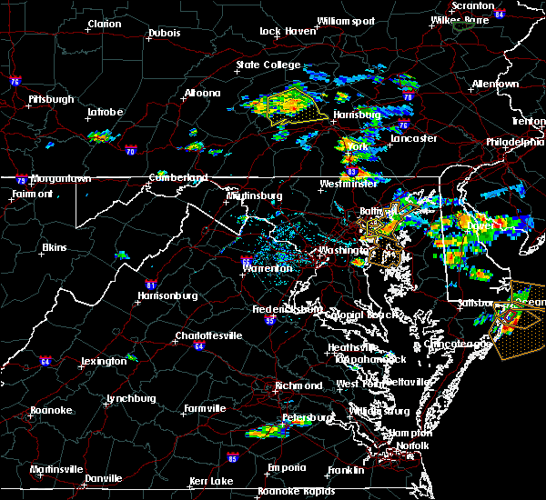 At 458 pm edt, a severe thunderstorm was located over north point state park, moving southeast at 10 mph (radar indicated). Hazards include 60 mph wind gusts. Damaging winds will cause some trees and large branches to fall. this could injure those outdoors, as well as damage homes and vehicles. roadways may become blocked by downed trees. localized power outages are possible. unsecured light objects may become projectiles. Locations impacted include, riviera beach, sparrows point, north point state park, millers island, fort smallwood state park, bodkin point, pasadena, lake shore, edgemere and fort howard. At 458 pm edt, a severe thunderstorm was located over north point state park, moving southeast at 10 mph (radar indicated). Hazards include 60 mph wind gusts. Damaging winds will cause some trees and large branches to fall. this could injure those outdoors, as well as damage homes and vehicles. roadways may become blocked by downed trees. localized power outages are possible. unsecured light objects may become projectiles. Locations impacted include, riviera beach, sparrows point, north point state park, millers island, fort smallwood state park, bodkin point, pasadena, lake shore, edgemere and fort howard.
|
| 8/1/2016 4:38 PM EDT |
 At 437 pm edt, a severe thunderstorm was located over sparrows point, moving southeast at 10 mph (radar indicated). Hazards include 60 mph wind gusts. Damaging winds will cause some trees and large branches to fall. this could injure those outdoors, as well as damage homes and vehicles. roadways may become blocked by downed trees. localized power outages are possible. Unsecured light objects may become projectiles. At 437 pm edt, a severe thunderstorm was located over sparrows point, moving southeast at 10 mph (radar indicated). Hazards include 60 mph wind gusts. Damaging winds will cause some trees and large branches to fall. this could injure those outdoors, as well as damage homes and vehicles. roadways may become blocked by downed trees. localized power outages are possible. Unsecured light objects may become projectiles.
|
| 7/30/2016 9:20 PM EDT |
 At 919 pm edt, a severe thunderstorm was located near rock hall, or near bodkin point, moving east at 30 mph (radar indicated). Hazards include 60 mph wind gusts. Damaging winds will cause some trees and large branches to fall. this could injure those outdoors, as well as damage homes and vehicles. roadways may become blocked by downed trees. localized power outages are possible. unsecured light objects may become projectiles. Locations impacted include, baltimore, severn, annapolis, crofton, riviera beach, naval academy, sparrows point, pinehurst, sillery bay, gibson island, fort smallwood state park, north point state park, bodkin point, baltimore-washington airport, glen burnie, dundalk, severna park, odenton, pasadena and arnold. At 919 pm edt, a severe thunderstorm was located near rock hall, or near bodkin point, moving east at 30 mph (radar indicated). Hazards include 60 mph wind gusts. Damaging winds will cause some trees and large branches to fall. this could injure those outdoors, as well as damage homes and vehicles. roadways may become blocked by downed trees. localized power outages are possible. unsecured light objects may become projectiles. Locations impacted include, baltimore, severn, annapolis, crofton, riviera beach, naval academy, sparrows point, pinehurst, sillery bay, gibson island, fort smallwood state park, north point state park, bodkin point, baltimore-washington airport, glen burnie, dundalk, severna park, odenton, pasadena and arnold.
|
| 7/30/2016 9:01 PM EDT |
 At 901 pm edt, a severe thunderstorm was located over lake shore, or over sillery bay, moving east at 30 mph (radar indicated). Hazards include 60 mph wind gusts. Damaging winds will cause some trees and large branches to fall. this could injure those outdoors, as well as damage homes and vehicles. roadways may become blocked by downed trees. localized power outages are possible. Unsecured light objects may become projectiles. At 901 pm edt, a severe thunderstorm was located over lake shore, or over sillery bay, moving east at 30 mph (radar indicated). Hazards include 60 mph wind gusts. Damaging winds will cause some trees and large branches to fall. this could injure those outdoors, as well as damage homes and vehicles. roadways may become blocked by downed trees. localized power outages are possible. Unsecured light objects may become projectiles.
|
| 7/18/2016 4:49 PM EDT |
 At 448 pm edt, severe thunderstorms were located along a line extending from near odenton to near waldorf, moving east at 45 mph (trained weather spotters and emergency management have confirmed trees down in fairfax county). Hazards include 60 mph wind gusts. Damaging winds will cause some trees and large branches to fall. this could injure those outdoors, as well as damage homes and vehicles. roadways may become blocked by downed trees. localized power outages are possible. unsecured light objects may become projectiles. Locations impacted include, bowie, severn, annapolis, clinton, crofton, fort washington, forestville, largo, mayo, shady side, chesapeake beach, deale, naval academy, upper marlboro, south river, severn river, andrews air force base, pinehurst, sillery bay and rhode river. At 448 pm edt, severe thunderstorms were located along a line extending from near odenton to near waldorf, moving east at 45 mph (trained weather spotters and emergency management have confirmed trees down in fairfax county). Hazards include 60 mph wind gusts. Damaging winds will cause some trees and large branches to fall. this could injure those outdoors, as well as damage homes and vehicles. roadways may become blocked by downed trees. localized power outages are possible. unsecured light objects may become projectiles. Locations impacted include, bowie, severn, annapolis, clinton, crofton, fort washington, forestville, largo, mayo, shady side, chesapeake beach, deale, naval academy, upper marlboro, south river, severn river, andrews air force base, pinehurst, sillery bay and rhode river.
|
| 7/18/2016 4:38 PM EDT |
 At 438 pm edt, severe thunderstorms were located along a line extending from near laurel to near fort belvoir, moving east at 20 mph (trained spotter confirmed). Hazards include 60 mph wind gusts. Damaging winds will cause some trees and large branches to fall. this could injure those outdoors, as well as damage homes and vehicles. roadways may become blocked by downed trees. localized power outages are possible. unsecured light objects may become projectiles. Locations impacted include, arlington, alexandria, bowie, severn, annandale, annapolis, clinton, springfield, college park, crofton, fort washington, greenbelt, langley park, beltsville, fort hunt, groveton, forestville, falls church, huntington and largo. At 438 pm edt, severe thunderstorms were located along a line extending from near laurel to near fort belvoir, moving east at 20 mph (trained spotter confirmed). Hazards include 60 mph wind gusts. Damaging winds will cause some trees and large branches to fall. this could injure those outdoors, as well as damage homes and vehicles. roadways may become blocked by downed trees. localized power outages are possible. unsecured light objects may become projectiles. Locations impacted include, arlington, alexandria, bowie, severn, annandale, annapolis, clinton, springfield, college park, crofton, fort washington, greenbelt, langley park, beltsville, fort hunt, groveton, forestville, falls church, huntington and largo.
|
| 7/18/2016 4:08 PM EDT |
 At 407 pm edt, severe thunderstorms were located along a line extending from near fairland to near lorton, moving east at 35 mph (radar indicated). Hazards include 60 mph wind gusts. Damaging winds will cause some trees and large branches to fall. this could injure those outdoors, as well as damage homes and vehicles. roadways may become blocked by downed trees. localized power outages are possible. Unsecured light objects may become projectiles. At 407 pm edt, severe thunderstorms were located along a line extending from near fairland to near lorton, moving east at 35 mph (radar indicated). Hazards include 60 mph wind gusts. Damaging winds will cause some trees and large branches to fall. this could injure those outdoors, as well as damage homes and vehicles. roadways may become blocked by downed trees. localized power outages are possible. Unsecured light objects may become projectiles.
|
| 7/16/2016 6:30 PM EDT |
 At 629 pm edt, a severe thunderstorm was located over fort smallwood state park, moving east at 15 mph (radar indicated). Hazards include 60 mph wind gusts and quarter size hail. Damaging winds will cause some trees and large branches to fall. this could injure those outdoors, as well as damage homes and vehicles. roadways may become blocked by downed trees. localized power outages are possible. unsecured light objects may become projectiles. Locations impacted include, baltimore, riviera beach, fort smallwood state park, bodkin point, glen burnie, severna park, pasadena, lake shore, brooklyn park, green haven, edgemere and chelsea beach. At 629 pm edt, a severe thunderstorm was located over fort smallwood state park, moving east at 15 mph (radar indicated). Hazards include 60 mph wind gusts and quarter size hail. Damaging winds will cause some trees and large branches to fall. this could injure those outdoors, as well as damage homes and vehicles. roadways may become blocked by downed trees. localized power outages are possible. unsecured light objects may become projectiles. Locations impacted include, baltimore, riviera beach, fort smallwood state park, bodkin point, glen burnie, severna park, pasadena, lake shore, brooklyn park, green haven, edgemere and chelsea beach.
|
| 7/16/2016 6:00 PM EDT |
 At 600 pm edt, a severe thunderstorm was located over glen burnie, or over baltimore-washington airport, moving east at 15 mph (radar indicated). Hazards include 60 mph wind gusts and quarter size hail. Damaging winds will cause some trees and large branches to fall. this could injure those outdoors, as well as damage homes and vehicles. roadways may become blocked by downed trees. localized power outages are possible. Unsecured light objects may become projectiles. At 600 pm edt, a severe thunderstorm was located over glen burnie, or over baltimore-washington airport, moving east at 15 mph (radar indicated). Hazards include 60 mph wind gusts and quarter size hail. Damaging winds will cause some trees and large branches to fall. this could injure those outdoors, as well as damage homes and vehicles. roadways may become blocked by downed trees. localized power outages are possible. Unsecured light objects may become projectiles.
|
| 7/1/2016 5:56 PM EDT |
 At 555 pm edt, a severe thunderstorm was located over lake shore, or over sillery bay, moving east at 15 mph (radar indicated). Hazards include 60 mph wind gusts. Damaging winds will cause some trees and large branches to fall. this could injure those outdoors, as well as damage homes and vehicles. roadways may become blocked by downed trees. localized power outages are possible. unsecured light objects may become projectiles. locations impacted include, riviera beach, sillery bay, gibson island, fort smallwood state park, bodkin point, pinehurst, glen burnie, severna park, pasadena, arnold, lake shore, green haven, cape st. Claire, herald harbor, crownsville, chelsea beach and belvedere heights. At 555 pm edt, a severe thunderstorm was located over lake shore, or over sillery bay, moving east at 15 mph (radar indicated). Hazards include 60 mph wind gusts. Damaging winds will cause some trees and large branches to fall. this could injure those outdoors, as well as damage homes and vehicles. roadways may become blocked by downed trees. localized power outages are possible. unsecured light objects may become projectiles. locations impacted include, riviera beach, sillery bay, gibson island, fort smallwood state park, bodkin point, pinehurst, glen burnie, severna park, pasadena, arnold, lake shore, green haven, cape st. Claire, herald harbor, crownsville, chelsea beach and belvedere heights.
|
| 7/1/2016 5:54 PM EDT | Trees down at intersection of garland and mountain road in anne arundel county MD, 4.3 miles NW of Pasadena, MD |
| 7/1/2016 5:51 PM EDT | Trees down at the intersection of woods road and 11th street in anne arundel county MD, 3.2 miles NNW of Pasadena, MD |
| 7/1/2016 5:43 PM EDT | Trees down at the intersection of catherine ave and harlem ave in anne arundel county MD, 2.7 miles N of Pasadena, MD |
| 7/1/2016 5:41 PM EDT |
 At 540 pm edt, a severe thunderstorm was located over severna park, or near riviera beach, moving east at 10 mph (radar indicated). Hazards include 60 mph wind gusts and quarter size hail. Damaging winds will cause some trees and large branches to fall. this could injure those outdoors, as well as damage homes and vehicles. roadways may become blocked by downed trees. localized power outages are possible. Unsecured light objects may become projectiles. At 540 pm edt, a severe thunderstorm was located over severna park, or near riviera beach, moving east at 10 mph (radar indicated). Hazards include 60 mph wind gusts and quarter size hail. Damaging winds will cause some trees and large branches to fall. this could injure those outdoors, as well as damage homes and vehicles. roadways may become blocked by downed trees. localized power outages are possible. Unsecured light objects may become projectiles.
|
| 6/28/2016 7:21 PM EDT |
 The severe thunderstorm warning for anne arundel, northern prince georges, southeastern howard and southeastern montgomery counties will expire at 730 pm edt, the storms which prompted the warning have weakened below severe limits, and no longer pose an immediate threat to life or property. therefore the warning will be allowed to expire. a severe thunderstorm watch remains in effect until 1000 pm edt for northern and central maryland. The severe thunderstorm warning for anne arundel, northern prince georges, southeastern howard and southeastern montgomery counties will expire at 730 pm edt, the storms which prompted the warning have weakened below severe limits, and no longer pose an immediate threat to life or property. therefore the warning will be allowed to expire. a severe thunderstorm watch remains in effect until 1000 pm edt for northern and central maryland.
|
| 6/28/2016 7:04 PM EDT |
 The national weather service in sterling virginia has issued a * severe thunderstorm warning for. central anne arundel county in central maryland. northern prince georges county in central maryland. southeastern montgomery county in central maryland. Until 745 pm edt. The national weather service in sterling virginia has issued a * severe thunderstorm warning for. central anne arundel county in central maryland. northern prince georges county in central maryland. southeastern montgomery county in central maryland. Until 745 pm edt.
|
| 6/28/2016 7:04 PM EDT |
 At 704 pm edt, a severe thunderstorm was located over beltsville, moving east at 30 mph (radar indicated). Hazards include 60 mph wind gusts. Damaging winds will cause some trees and large branches to fall. this could injure those outdoors, as well as damage homes and vehicles. roadways may become blocked by downed trees. localized power outages are possible. Unsecured light objects may become projectiles. At 704 pm edt, a severe thunderstorm was located over beltsville, moving east at 30 mph (radar indicated). Hazards include 60 mph wind gusts. Damaging winds will cause some trees and large branches to fall. this could injure those outdoors, as well as damage homes and vehicles. roadways may become blocked by downed trees. localized power outages are possible. Unsecured light objects may become projectiles.
|
| 6/28/2016 6:42 PM EDT |
 At 642 pm edt, severe thunderstorms were located along a line extending from glen burnie to forest glen, moving south at 15 mph (radar indicated). Hazards include 60 mph wind gusts and quarter size hail. Damaging winds will cause some trees and large branches to fall. this could injure those outdoors, as well as damage homes and vehicles. roadways may become blocked by downed trees. localized power outages are possible. Unsecured light objects may become projectiles. At 642 pm edt, severe thunderstorms were located along a line extending from glen burnie to forest glen, moving south at 15 mph (radar indicated). Hazards include 60 mph wind gusts and quarter size hail. Damaging winds will cause some trees and large branches to fall. this could injure those outdoors, as well as damage homes and vehicles. roadways may become blocked by downed trees. localized power outages are possible. Unsecured light objects may become projectiles.
|
| 6/28/2016 5:18 PM EDT |
 At 518 pm edt, severe thunderstorms were located along a line extending from near gamber to near sykesville, moving southeast at 25 mph (radar indicated). Hazards include 60 mph wind gusts. Damaging winds will cause some trees and large branches to fall. this could injure those outdoors, as well as damage homes and vehicles. roadways may become blocked by downed trees. localized power outages are possible. Unsecured light objects may become projectiles. At 518 pm edt, severe thunderstorms were located along a line extending from near gamber to near sykesville, moving southeast at 25 mph (radar indicated). Hazards include 60 mph wind gusts. Damaging winds will cause some trees and large branches to fall. this could injure those outdoors, as well as damage homes and vehicles. roadways may become blocked by downed trees. localized power outages are possible. Unsecured light objects may become projectiles.
|
| 6/21/2016 8:29 PM EDT |
 A severe thunderstorm warning remains in effect until 900 pm edt for anne arundel. northeastern prince georges. southeastern howard and east central montgomery counties. at 829 pm edt. a severe thunderstorm was located near olney. moving southeast at 35 mph. hazard. 60 mph wind gusts. A severe thunderstorm warning remains in effect until 900 pm edt for anne arundel. northeastern prince georges. southeastern howard and east central montgomery counties. at 829 pm edt. a severe thunderstorm was located near olney. moving southeast at 35 mph. hazard. 60 mph wind gusts.
|
| 6/21/2016 8:22 PM EDT |
 At 822 pm edt, a severe thunderstorm was located near olney, moving southeast at 35 mph (radar indicated). Hazards include 60 mph wind gusts and quarter size hail. Damaging winds will cause some trees and large branches to fall. this could injure those outdoors, as well as damage homes and vehicles. roadways may become blocked by downed trees. localized power outages are possible. Unsecured light objects may become projectiles. At 822 pm edt, a severe thunderstorm was located near olney, moving southeast at 35 mph (radar indicated). Hazards include 60 mph wind gusts and quarter size hail. Damaging winds will cause some trees and large branches to fall. this could injure those outdoors, as well as damage homes and vehicles. roadways may become blocked by downed trees. localized power outages are possible. Unsecured light objects may become projectiles.
|
| 6/21/2016 2:23 PM EDT |
 At 222 pm edt, severe thunderstorms were located along a line extending from green haven to bowie, moving southeast at 35 mph (radar indicated). Hazards include 70 mph wind gusts. Damaging winds will cause some trees and large branches to fall. this could injure those outdoors, as well as damage homes and vehicles. roadways may become blocked by downed trees. localized power outages are possible. unsecured light objects may become projectiles. Locations impacted include, baltimore, severn, annapolis, crofton, riviera beach, mayo, shady side, naval academy, south river, gibson island, fort smallwood state park, bodkin point, baltimore-washington airport, severn river, pinehurst, sillery bay, rhode river, glen burnie, severna park and odenton. At 222 pm edt, severe thunderstorms were located along a line extending from green haven to bowie, moving southeast at 35 mph (radar indicated). Hazards include 70 mph wind gusts. Damaging winds will cause some trees and large branches to fall. this could injure those outdoors, as well as damage homes and vehicles. roadways may become blocked by downed trees. localized power outages are possible. unsecured light objects may become projectiles. Locations impacted include, baltimore, severn, annapolis, crofton, riviera beach, mayo, shady side, naval academy, south river, gibson island, fort smallwood state park, bodkin point, baltimore-washington airport, severn river, pinehurst, sillery bay, rhode river, glen burnie, severna park and odenton.
|
| 6/21/2016 2:08 PM EDT |
 At 208 pm edt, severe thunderstorms were located along a line extending from ferndale to goddard, moving southeast at 35 mph (radar indicated). Hazards include 70 mph wind gusts and half dollar size hail. Damaging winds will cause some trees and large branches to fall. this could injure those outdoors, as well as damage homes and vehicles. roadways may become blocked by downed trees. localized power outages are possible. Unsecured light objects may become projectiles. At 208 pm edt, severe thunderstorms were located along a line extending from ferndale to goddard, moving southeast at 35 mph (radar indicated). Hazards include 70 mph wind gusts and half dollar size hail. Damaging winds will cause some trees and large branches to fall. this could injure those outdoors, as well as damage homes and vehicles. roadways may become blocked by downed trees. localized power outages are possible. Unsecured light objects may become projectiles.
|
| 6/21/2016 1:54 PM EDT |
 At 154 pm edt, severe thunderstorms were located along a line extending from near randallstown to near montgomery village, moving southeast at 30 mph (radar indicated). Hazards include 70 mph wind gusts and half dollar size hail. Damaging winds will cause some trees and large branches to fall. this could injure those outdoors, as well as damage homes and vehicles. roadways may become blocked by downed trees. localized power outages are possible. unsecured light objects may become projectiles. Locations impacted include, baltimore, columbia, rockville, gaithersburg, bowie, severn, olney, pikesville, college park, crofton, middle river, greenbelt, langley park, beltsville, elkridge, riviera beach, bladensburg, back river, millers island and fedex field. At 154 pm edt, severe thunderstorms were located along a line extending from near randallstown to near montgomery village, moving southeast at 30 mph (radar indicated). Hazards include 70 mph wind gusts and half dollar size hail. Damaging winds will cause some trees and large branches to fall. this could injure those outdoors, as well as damage homes and vehicles. roadways may become blocked by downed trees. localized power outages are possible. unsecured light objects may become projectiles. Locations impacted include, baltimore, columbia, rockville, gaithersburg, bowie, severn, olney, pikesville, college park, crofton, middle river, greenbelt, langley park, beltsville, elkridge, riviera beach, bladensburg, back river, millers island and fedex field.
|
| 6/21/2016 1:40 PM EDT |
 At 139 pm edt, severe thunderstorms were located along a line extending from gamber to near damascus, moving southeast at 30 mph. these are very dangerous storms (radar indicated). Hazards include 80 mph wind gusts and half dollar size hail. Expect considerable damage to trees and power lines. your life is at significant risk if outdoors. in addition to some trees falling into homes, wind damage is possible to roofs, sheds, open garages, and mobile homes. Locations impacted include, baltimore, columbia, germantown, rockville, gaithersburg, bowie, severn, olney, pikesville, college park, crofton, middle river, greenbelt, langley park, beltsville, elkridge, damascus, riviera beach, bladensburg and back river. At 139 pm edt, severe thunderstorms were located along a line extending from gamber to near damascus, moving southeast at 30 mph. these are very dangerous storms (radar indicated). Hazards include 80 mph wind gusts and half dollar size hail. Expect considerable damage to trees and power lines. your life is at significant risk if outdoors. in addition to some trees falling into homes, wind damage is possible to roofs, sheds, open garages, and mobile homes. Locations impacted include, baltimore, columbia, germantown, rockville, gaithersburg, bowie, severn, olney, pikesville, college park, crofton, middle river, greenbelt, langley park, beltsville, elkridge, damascus, riviera beach, bladensburg and back river.
|
| 6/21/2016 1:30 PM EDT |
 At 130 pm edt, severe thunderstorms were located along a line extending from near gamber to 6 miles southwest of green valley, moving southeast at 30 mph (radar indicated). Hazards include 70 mph wind gusts and quarter size hail. Damaging winds will cause some trees and large branches to fall. this could injure those outdoors, as well as damage homes and vehicles. roadways may become blocked by downed trees. localized power outages are possible. unsecured light objects may become projectiles. Locations impacted include, baltimore, columbia, germantown, rockville, gaithersburg, bowie, severn, olney, pikesville, college park, crofton, middle river, greenbelt, langley park, beltsville, elkridge, damascus, riviera beach, bladensburg and back river. At 130 pm edt, severe thunderstorms were located along a line extending from near gamber to 6 miles southwest of green valley, moving southeast at 30 mph (radar indicated). Hazards include 70 mph wind gusts and quarter size hail. Damaging winds will cause some trees and large branches to fall. this could injure those outdoors, as well as damage homes and vehicles. roadways may become blocked by downed trees. localized power outages are possible. unsecured light objects may become projectiles. Locations impacted include, baltimore, columbia, germantown, rockville, gaithersburg, bowie, severn, olney, pikesville, college park, crofton, middle river, greenbelt, langley park, beltsville, elkridge, damascus, riviera beach, bladensburg and back river.
|
| 6/21/2016 1:19 PM EDT |
 At 118 pm edt, severe thunderstorms were located along a line extending from near gamber to near ballenger creek, moving southeast at 30 mph (radar indicated). Hazards include 60 mph wind gusts. frequent lightning is also occurring with this storm. Damaging winds will cause some trees and large branches to fall. this could injure those outdoors, as well as damage homes and vehicles. roadways may become blocked by downed trees. localized power outages are possible. Unsecured light objects may become projectiles. At 118 pm edt, severe thunderstorms were located along a line extending from near gamber to near ballenger creek, moving southeast at 30 mph (radar indicated). Hazards include 60 mph wind gusts. frequent lightning is also occurring with this storm. Damaging winds will cause some trees and large branches to fall. this could injure those outdoors, as well as damage homes and vehicles. roadways may become blocked by downed trees. localized power outages are possible. Unsecured light objects may become projectiles.
|
| 6/8/2016 11:11 AM EDT |
 At 1110 am edt, showers with damaging winds were located over ferndale, or over baltimore-washington airport, moving east at 45 mph (radar indicated). Hazards include 60 mph wind gusts. Damaging winds will cause some trees and large branches to fall. this could injure those outdoors, as well as damage homes and vehicles. roadways may become blocked by downed trees. localized power outages are possible. unsecured light objects may become projectiles. Locations impacted include, baltimore, severn, riviera beach, sparrows point, sillery bay, fort smallwood state park, bodkin point, baltimore-washington airport, north point state park, glen burnie, severna park, pasadena, arnold, arbutus, lake shore, ferndale, brooklyn park, south gate, pumphrey and green haven. At 1110 am edt, showers with damaging winds were located over ferndale, or over baltimore-washington airport, moving east at 45 mph (radar indicated). Hazards include 60 mph wind gusts. Damaging winds will cause some trees and large branches to fall. this could injure those outdoors, as well as damage homes and vehicles. roadways may become blocked by downed trees. localized power outages are possible. unsecured light objects may become projectiles. Locations impacted include, baltimore, severn, riviera beach, sparrows point, sillery bay, fort smallwood state park, bodkin point, baltimore-washington airport, north point state park, glen burnie, severna park, pasadena, arnold, arbutus, lake shore, ferndale, brooklyn park, south gate, pumphrey and green haven.
|
| 6/8/2016 11:11 AM EDT |
 A severe thunderstorm warning remains in effect until 1145 am edt for south central baltimore. and northern anne arundel counties and southwestern baltimore city. at 1110 am edt. showers with damaging winds were located over ferndale. or over baltimore-washington airport. Moving east at 45 mph. A severe thunderstorm warning remains in effect until 1145 am edt for south central baltimore. and northern anne arundel counties and southwestern baltimore city. at 1110 am edt. showers with damaging winds were located over ferndale. or over baltimore-washington airport. Moving east at 45 mph.
|
| 6/8/2016 10:56 AM EDT |
 At 1055 am edt, showers with damaging winds were located over catonsville, or over elkridge, moving southeast at 45 mph (radar indicated). Hazards include 60 mph wind gusts. Damaging winds will cause some trees and large branches to fall. this could injure those outdoors, as well as damage homes and vehicles. roadways may become blocked by downed trees. localized power outages are possible. Unsecured light objects may become projectiles. At 1055 am edt, showers with damaging winds were located over catonsville, or over elkridge, moving southeast at 45 mph (radar indicated). Hazards include 60 mph wind gusts. Damaging winds will cause some trees and large branches to fall. this could injure those outdoors, as well as damage homes and vehicles. roadways may become blocked by downed trees. localized power outages are possible. Unsecured light objects may become projectiles.
|
| 6/5/2016 5:08 PM EDT |
 The severe thunderstorm warning for baltimore, northwestern anne arundel, southeastern howard and southern harford counties and baltimore city will expire at 515 pm edt, the storms which prompted the warning have weakened, and no longer pose an immediate threat to life or property. therefore the warning will be allowed to expire. however gusty winds and heavy rain are still possible with these thunderstorms. a severe thunderstorm watch remains in effect until 1000 pm edt for northern maryland. The severe thunderstorm warning for baltimore, northwestern anne arundel, southeastern howard and southern harford counties and baltimore city will expire at 515 pm edt, the storms which prompted the warning have weakened, and no longer pose an immediate threat to life or property. therefore the warning will be allowed to expire. however gusty winds and heavy rain are still possible with these thunderstorms. a severe thunderstorm watch remains in effect until 1000 pm edt for northern maryland.
|
| 6/5/2016 5:00 PM EDT |
 At 500 pm edt, severe thunderstorms were located along a line extending from rising sun to riverside to arbutus, moving east at 40 mph (radar indicated). Hazards include 60 mph wind gusts. Damaging winds will cause some trees and large branches to fall. this could injure those outdoors, as well as damage homes and vehicles. roadways may become blocked by downed trees. localized power outages are possible. unsecured light objects may become projectiles. Locations impacted include, baltimore, columbia, severn, middle river, elkridge, aberdeen, havre de grace, riviera beach, aberdeen proving ground, fort smallwood state park, baltimore-washington airport, sparrows point, back river, north point state park, millers island, glen burnie, ellicott city, dundalk, towson and bel air south. At 500 pm edt, severe thunderstorms were located along a line extending from rising sun to riverside to arbutus, moving east at 40 mph (radar indicated). Hazards include 60 mph wind gusts. Damaging winds will cause some trees and large branches to fall. this could injure those outdoors, as well as damage homes and vehicles. roadways may become blocked by downed trees. localized power outages are possible. unsecured light objects may become projectiles. Locations impacted include, baltimore, columbia, severn, middle river, elkridge, aberdeen, havre de grace, riviera beach, aberdeen proving ground, fort smallwood state park, baltimore-washington airport, sparrows point, back river, north point state park, millers island, glen burnie, ellicott city, dundalk, towson and bel air south.
|
| 6/5/2016 4:43 PM EDT |
 At 442 pm edt, severe thunderstorms were located along a line extending from delta to near hampton to 6 miles west of columbia, moving east at 35 mph (radar indicated). Hazards include 60 mph wind gusts. Damaging winds will cause some trees and large branches to fall. this could injure those outdoors, as well as damage homes and vehicles. roadways may become blocked by downed trees. localized power outages are possible. unsecured light objects may become projectiles. Locations impacted include, baltimore, columbia, severn, pikesville, middle river, cockeysville, elkridge, aberdeen, havre de grace, riviera beach, aberdeen proving ground, fort smallwood state park, back river, millers island, baltimore-washington airport, sparrows point, north point state park, glen burnie, ellicott city and dundalk. At 442 pm edt, severe thunderstorms were located along a line extending from delta to near hampton to 6 miles west of columbia, moving east at 35 mph (radar indicated). Hazards include 60 mph wind gusts. Damaging winds will cause some trees and large branches to fall. this could injure those outdoors, as well as damage homes and vehicles. roadways may become blocked by downed trees. localized power outages are possible. unsecured light objects may become projectiles. Locations impacted include, baltimore, columbia, severn, pikesville, middle river, cockeysville, elkridge, aberdeen, havre de grace, riviera beach, aberdeen proving ground, fort smallwood state park, back river, millers island, baltimore-washington airport, sparrows point, north point state park, glen burnie, ellicott city and dundalk.
|
| 6/5/2016 4:22 PM EDT |
 At 422 pm edt, severe thunderstorms were located along a line extending from near stewartstown to near cockeysville to near montgomery village, moving east at 50 mph (radar indicated). Hazards include 60 mph wind gusts. Damaging winds will cause some trees and large branches to fall. this could injure those outdoors, as well as damage homes and vehicles. roadways may become blocked by downed trees. localized power outages are possible. Unsecured light objects may become projectiles. At 422 pm edt, severe thunderstorms were located along a line extending from near stewartstown to near cockeysville to near montgomery village, moving east at 50 mph (radar indicated). Hazards include 60 mph wind gusts. Damaging winds will cause some trees and large branches to fall. this could injure those outdoors, as well as damage homes and vehicles. roadways may become blocked by downed trees. localized power outages are possible. Unsecured light objects may become projectiles.
|
| 5/2/2016 9:20 PM EDT |
 At 920 pm edt, a severe thunderstorm was located over lanham-seabrook, or near fedex field, moving east at 30 mph (radar indicated). Hazards include 60 mph wind gusts and quarter size hail. expect wind damage to trees and powerlines At 920 pm edt, a severe thunderstorm was located over lanham-seabrook, or near fedex field, moving east at 30 mph (radar indicated). Hazards include 60 mph wind gusts and quarter size hail. expect wind damage to trees and powerlines
|
| 4/7/2016 11:36 AM EDT |
 The severe thunderstorm warning for baltimore, northern anne arundel, northeastern prince georges, southeastern howard and southwestern harford counties and baltimore city will expire at 1145 am edt, the storm which prompted the warning has moved out of the area. therefore the warning will be allowed to expire. The severe thunderstorm warning for baltimore, northern anne arundel, northeastern prince georges, southeastern howard and southwestern harford counties and baltimore city will expire at 1145 am edt, the storm which prompted the warning has moved out of the area. therefore the warning will be allowed to expire.
|
| 4/7/2016 10:44 AM EDT |
 At 1043 am edt, this severe thunderstorm is capable of producing damaging winds in excess of 60 mph. this storm was located over crofton, and moving northeast at 30 mph. At 1043 am edt, this severe thunderstorm is capable of producing damaging winds in excess of 60 mph. this storm was located over crofton, and moving northeast at 30 mph.
|
| 2/24/2016 6:58 PM EST | The severe thunderstorm warning for central baltimore, northeastern charles, anne arundel, prince georges, southeastern howard and northwestern calvert counties and baltimore city will expire at 700 pm est, the storms which prompted the warning have moved to the east, therefore the warning will be allowed to expire. a tornado watch remains in effect until 11 pm. a severe thunderstorm warning still remains in effect for portions of baltimore, charles, anne arundel, prince georges, and calvert counties and baltimore city. |
| 2/24/2016 6:28 PM EST |
 At 627 pm est, doppler radar indicated a line of severe thunderstorms capable of producing damaging winds in excess of 60 mph. these storms were located along a line extending from elkridge to mitchellville to near friendly, moving northeast at 35 mph. locations impacted include, bowie, greenbelt, chesapeake beach, upper marlboro, crofton, severn, elkridge, clinton, bodkin point, severn river, largo, pinehurst, sillery bay, back river, fedex field, rhode river, south river, forestville, gibson island and baltimore-washington airport. a tornado watch remains in effect until 1100 pm est for maryland. At 627 pm est, doppler radar indicated a line of severe thunderstorms capable of producing damaging winds in excess of 60 mph. these storms were located along a line extending from elkridge to mitchellville to near friendly, moving northeast at 35 mph. locations impacted include, bowie, greenbelt, chesapeake beach, upper marlboro, crofton, severn, elkridge, clinton, bodkin point, severn river, largo, pinehurst, sillery bay, back river, fedex field, rhode river, south river, forestville, gibson island and baltimore-washington airport. a tornado watch remains in effect until 1100 pm est for maryland.
|
| 2/24/2016 5:59 PM EST |
 At 558 pm est, doppler radar indicated a line of severe thunderstorms capable of producing damaging winds in excess of 60 mph. these storms were located along a line extending from rossmoor to huntington to near woodbridge, and moving northeast at 45 mph. At 558 pm est, doppler radar indicated a line of severe thunderstorms capable of producing damaging winds in excess of 60 mph. these storms were located along a line extending from rossmoor to huntington to near woodbridge, and moving northeast at 45 mph.
|
| 8/24/2015 8:53 PM EDT |
 The severe thunderstorm warning for northwestern anne arundel, south central baltimore and east central howard counties will expire at 900 pm edt, the storms which prompted the warning have weakened below severe limits and exited the warned area. therefore the warning will be allowed to expire. however heavy rain is still possible with these thunderstorms. to report severe weather, contact your nearest law enforcement agency. they will relay your report to the national weather service sterling virginia. The severe thunderstorm warning for northwestern anne arundel, south central baltimore and east central howard counties will expire at 900 pm edt, the storms which prompted the warning have weakened below severe limits and exited the warned area. therefore the warning will be allowed to expire. however heavy rain is still possible with these thunderstorms. to report severe weather, contact your nearest law enforcement agency. they will relay your report to the national weather service sterling virginia.
|
| 8/24/2015 8:45 PM EDT |
 At 843 pm edt, doppler radar indicated a line of severe thunderstorms capable of producing damaging winds in excess of 60 mph. these storms were located along a line extending from arbutus to glen burnie to pasadena to parole. these storms were moving the northeast at 25 mph. locations impacted include, severn, elkridge, baltimore-washington airport, south gate, pumphrey, arnold, severna park, green haven, millersville, brooklyn park, glen burnie, ferndale, pasadena, arbutus, parole, odenton, fort meade, herald harbor, cape arthur and gambrills. At 843 pm edt, doppler radar indicated a line of severe thunderstorms capable of producing damaging winds in excess of 60 mph. these storms were located along a line extending from arbutus to glen burnie to pasadena to parole. these storms were moving the northeast at 25 mph. locations impacted include, severn, elkridge, baltimore-washington airport, south gate, pumphrey, arnold, severna park, green haven, millersville, brooklyn park, glen burnie, ferndale, pasadena, arbutus, parole, odenton, fort meade, herald harbor, cape arthur and gambrills.
|
| 8/24/2015 8:36 PM EDT |
 At 835 pm edt, doppler radar indicated a line of severe thunderstorms capable of producing damaging winds in excess of 60 mph. these storms were located along a line extending from baltimore-washington airport to severna park to near crofton. these storms were nearly stationary. locations impacted include, crofton, severn, elkridge, baltimore-washington airport, columbia, south gate, odenton, pumphrey, fort meade, arnold, severna park, green haven, millersville, brooklyn park, glen burnie, ferndale, pasadena, arbutus, savage-guilford and herald harbor. At 835 pm edt, doppler radar indicated a line of severe thunderstorms capable of producing damaging winds in excess of 60 mph. these storms were located along a line extending from baltimore-washington airport to severna park to near crofton. these storms were nearly stationary. locations impacted include, crofton, severn, elkridge, baltimore-washington airport, columbia, south gate, odenton, pumphrey, fort meade, arnold, severna park, green haven, millersville, brooklyn park, glen burnie, ferndale, pasadena, arbutus, savage-guilford and herald harbor.
|
| 8/24/2015 8:12 PM EDT |
 At 812 pm edt, doppler radar indicated a line of severe thunderstorms capable of producing damaging winds in excess of 60 mph. these storms were located along a line extending from laurel to near fort meade to lanham-seabrook, and moving northeast at 25 mph. At 812 pm edt, doppler radar indicated a line of severe thunderstorms capable of producing damaging winds in excess of 60 mph. these storms were located along a line extending from laurel to near fort meade to lanham-seabrook, and moving northeast at 25 mph.
|
| 8/4/2015 5:22 AM EDT |
 At 522 am edt, doppler radar indicated a severe thunderstorm capable of producing quarter size hail and damaging winds in excess of 60 mph. this storm was located over sparrows point, moving east at 45 mph. locations impacted include, baltimore, aberdeen, severn, union square, guilford, howard park, bodkin point, baltimore inner harbor, pinehurst, sillery bay, back river, camden yards, roland park, fallstaff, fells point, pikesville, gibson island, gwynns falls, baltimore-washington airport and clifton park. At 522 am edt, doppler radar indicated a severe thunderstorm capable of producing quarter size hail and damaging winds in excess of 60 mph. this storm was located over sparrows point, moving east at 45 mph. locations impacted include, baltimore, aberdeen, severn, union square, guilford, howard park, bodkin point, baltimore inner harbor, pinehurst, sillery bay, back river, camden yards, roland park, fallstaff, fells point, pikesville, gibson island, gwynns falls, baltimore-washington airport and clifton park.
|
| 8/4/2015 4:49 AM EDT |
 At 449 am edt, doppler radar indicated a severe thunderstorm capable of producing quarter size hail and damaging winds in excess of 60 mph. this storm was located near olney, and moving east at 45 mph. At 449 am edt, doppler radar indicated a severe thunderstorm capable of producing quarter size hail and damaging winds in excess of 60 mph. this storm was located near olney, and moving east at 45 mph.
|
| 7/9/2015 7:21 PM EDT |
 At 721 pm edt, doppler radar indicated a line of severe thunderstorms capable of producing damaging winds in excess of 60 mph. these storms were located along a line extending from gibson island to near bowie, and moving east at 35 mph. At 721 pm edt, doppler radar indicated a line of severe thunderstorms capable of producing damaging winds in excess of 60 mph. these storms were located along a line extending from gibson island to near bowie, and moving east at 35 mph.
|
| 7/1/2015 1:51 AM EDT |
 At 150 am edt, doppler radar indicated a severe thunderstorm capable of producing damaging winds in excess of 60 mph. this storm was located over rossville, or near clifton park, moving northeast at 40 mph. locations impacted include, baltimore, fells point, union square, guilford, gibson island, bodkin point, baltimore-washington airport, clifton park, baltimore inner harbor, riviera beach, sparrows point, pinehurst, sillery bay, back river, locust point, camden yards, north point state park, millers island, severn and essex. At 150 am edt, doppler radar indicated a severe thunderstorm capable of producing damaging winds in excess of 60 mph. this storm was located over rossville, or near clifton park, moving northeast at 40 mph. locations impacted include, baltimore, fells point, union square, guilford, gibson island, bodkin point, baltimore-washington airport, clifton park, baltimore inner harbor, riviera beach, sparrows point, pinehurst, sillery bay, back river, locust point, camden yards, north point state park, millers island, severn and essex.
|
| 7/1/2015 1:39 AM EDT |
 At 138 am edt, doppler radar indicated a severe thunderstorm capable of producing damaging winds in excess of 60 mph. this storm was located over brooklyn park, or over locust point, moving northeast at 50 mph. locations impacted include, baltimore, crofton, severn, union square, elkridge, guilford, howard park, bodkin point, baltimore inner harbor, pinehurst, sillery bay, back river, locust point, camden yards, roland park, fallstaff, millers island, cockeysville, fells point and pikesville. At 138 am edt, doppler radar indicated a severe thunderstorm capable of producing damaging winds in excess of 60 mph. this storm was located over brooklyn park, or over locust point, moving northeast at 50 mph. locations impacted include, baltimore, crofton, severn, union square, elkridge, guilford, howard park, bodkin point, baltimore inner harbor, pinehurst, sillery bay, back river, locust point, camden yards, roland park, fallstaff, millers island, cockeysville, fells point and pikesville.
|
| 7/1/2015 1:24 AM EDT |
 At 124 am edt, doppler radar indicated a severe thunderstorm capable of producing damaging winds in excess of 60 mph. this storm was located over odenton, or near severn, and moving northeast at 50 mph. At 124 am edt, doppler radar indicated a severe thunderstorm capable of producing damaging winds in excess of 60 mph. this storm was located over odenton, or near severn, and moving northeast at 50 mph.
|
| 7/1/2015 1:19 AM EDT |
 At 119 am edt, doppler radar indicated a severe thunderstorm capable of producing quarter size hail and damaging winds in excess of 60 mph. this storm was located over baltimore-washington airport, moving northeast at 50 mph. locations impacted include, baltimore, bowie, college park, greenbelt, bladensburg, crofton, severn, union square, elkridge, guilford, howard park, baltimore inner harbor, largo, back river, locust point, camden yards, roland park, fallstaff, millers island and fedex field. At 119 am edt, doppler radar indicated a severe thunderstorm capable of producing quarter size hail and damaging winds in excess of 60 mph. this storm was located over baltimore-washington airport, moving northeast at 50 mph. locations impacted include, baltimore, bowie, college park, greenbelt, bladensburg, crofton, severn, union square, elkridge, guilford, howard park, baltimore inner harbor, largo, back river, locust point, camden yards, roland park, fallstaff, millers island and fedex field.
|
| 7/1/2015 1:00 AM EDT |
 At 100 am edt, doppler radar indicated a severe thunderstorm capable of producing quarter size hail and damaging winds in excess of 60 mph. this storm was located over lanham-seabrook, or near greenbelt, and moving northeast at 50 mph. At 100 am edt, doppler radar indicated a severe thunderstorm capable of producing quarter size hail and damaging winds in excess of 60 mph. this storm was located over lanham-seabrook, or near greenbelt, and moving northeast at 50 mph.
|
| 7/1/2015 12:43 AM EDT |
 At 1243 am edt, doppler radar indicated a severe thunderstorm capable of producing quarter size hail and damaging winds in excess of 60 mph. this storm was located near upper marlboro, and moving northeast at 30 mph. At 1243 am edt, doppler radar indicated a severe thunderstorm capable of producing quarter size hail and damaging winds in excess of 60 mph. this storm was located near upper marlboro, and moving northeast at 30 mph.
|
| 6/30/2015 3:14 PM EDT |
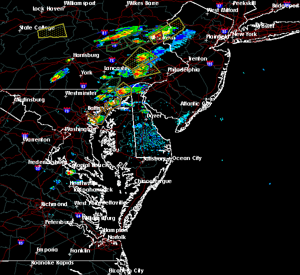 At 314 pm edt, doppler radar indicated a severe thunderstorm capable of producing half dollar size hail and damaging winds in excess of 60 mph. this storm was located over fort smallwood state park, and moving northeast at 20 mph. At 314 pm edt, doppler radar indicated a severe thunderstorm capable of producing half dollar size hail and damaging winds in excess of 60 mph. this storm was located over fort smallwood state park, and moving northeast at 20 mph.
|
| 6/23/2015 6:32 PM EDT |
 At 632 pm edt, doppler radar indicated a line of severe thunderstorms capable of producing half dollar size hail and destructive winds in excess of 60 mph. these storms were located along a line extending from near hollywood beach to clifton park, moving southeast at 20 mph. locations impacted include, baltimore, aberdeen, bel air, union square, guilford, howard park, baltimore inner harbor, back river, locust point, camden yards, roland park, fallstaff, fells point, pikesville, gwynns falls, middle river, baltimore-washington airport, clifton park, north point state park and sparrows point. At 632 pm edt, doppler radar indicated a line of severe thunderstorms capable of producing half dollar size hail and destructive winds in excess of 60 mph. these storms were located along a line extending from near hollywood beach to clifton park, moving southeast at 20 mph. locations impacted include, baltimore, aberdeen, bel air, union square, guilford, howard park, baltimore inner harbor, back river, locust point, camden yards, roland park, fallstaff, fells point, pikesville, gwynns falls, middle river, baltimore-washington airport, clifton park, north point state park and sparrows point.
|
| 6/23/2015 6:27 PM EDT |
 At 627 pm edt, trained weather spotters reported a line of severe thunderstorms producing quarter size hail and damaging winds in excess of 60 mph. these storms were located along a line extending from brooklyn park to south riding, and moving southeast at 35 mph. At 627 pm edt, trained weather spotters reported a line of severe thunderstorms producing quarter size hail and damaging winds in excess of 60 mph. these storms were located along a line extending from brooklyn park to south riding, and moving southeast at 35 mph.
|
| 6/23/2015 6:14 PM EDT |
 At 613 pm edt, doppler radar indicated a line of severe thunderstorms capable of producing half dollar size hail and destructive winds in excess of 70 mph. these storms were located along a line extending from near charlestown to howard park, and moving southeast at 20 mph. At 613 pm edt, doppler radar indicated a line of severe thunderstorms capable of producing half dollar size hail and destructive winds in excess of 70 mph. these storms were located along a line extending from near charlestown to howard park, and moving southeast at 20 mph.
|
| 6/23/2015 6:05 PM EDT |
 At 605 pm edt, doppler radar indicated a line of severe thunderstorms capable of producing large damaging hail up to golf ball size and destructive winds in excess of 70 mph. these storms were located along a line extending from near north east to howard park, moving southeast at 30 mph. locations impacted include, baltimore, aberdeen, bel air, union square, guilford, howard park, baltimore inner harbor, back river, locust point, camden yards, roland park, fallstaff, cockeysville, fells point, pikesville, gwynns falls, middle river, clifton park, sparrows point and north point state park. At 605 pm edt, doppler radar indicated a line of severe thunderstorms capable of producing large damaging hail up to golf ball size and destructive winds in excess of 70 mph. these storms were located along a line extending from near north east to howard park, moving southeast at 30 mph. locations impacted include, baltimore, aberdeen, bel air, union square, guilford, howard park, baltimore inner harbor, back river, locust point, camden yards, roland park, fallstaff, cockeysville, fells point, pikesville, gwynns falls, middle river, clifton park, sparrows point and north point state park.
|
| 6/23/2015 5:45 PM EDT |
 At 544 pm edt, doppler radar indicated a line of severe thunderstorms capable of producing large damaging hail up to golf ball size and destructive winds in excess of 70 mph. these storms were located along a line extending from woodlawn to randallstown, and moving southeast at 30 mph. At 544 pm edt, doppler radar indicated a line of severe thunderstorms capable of producing large damaging hail up to golf ball size and destructive winds in excess of 70 mph. these storms were located along a line extending from woodlawn to randallstown, and moving southeast at 30 mph.
|
| 6/20/2015 10:15 PM EDT |
 At 1015 pm edt, doppler radar indicated a severe thunderstorm capable of producing a tornado. this dangerous storm was located over sillery bay, and moving northeast at 25 mph. At 1015 pm edt, doppler radar indicated a severe thunderstorm capable of producing a tornado. this dangerous storm was located over sillery bay, and moving northeast at 25 mph.
|
| 6/20/2015 9:08 PM EDT |
 At 908 pm edt, doppler radar indicated a line of severe thunderstorms capable of producing damaging winds in excess of 60 mph. these storms were located along a line extending from roland park to near locust point to millersville, and moving northeast at 40 mph. At 908 pm edt, doppler radar indicated a line of severe thunderstorms capable of producing damaging winds in excess of 60 mph. these storms were located along a line extending from roland park to near locust point to millersville, and moving northeast at 40 mph.
|
| 6/1/2015 5:17 PM EDT | At 517 pm edt, doppler radar indicated a line of severe thunderstorms capable of producing quarter size hail and damaging winds in excess of 60 mph. these storms were located along a line extending from back river to arnold, moving northeast at 25 mph. locations impacted include, sillery bay, gibson island, fort smallwood state park, riviera beach, sparrows point, north point state park, millers island, bodkin point, pinehurst, back river, severna park, green haven, lake shore, pasadena, arnold, herald harbor, cape arthur, edgemere, riverdale and fort howard. |
| 6/1/2015 5:05 PM EDT | At 504 pm edt, doppler radar indicated a line of severe thunderstorms capable of producing quarter size hail and damaging winds in excess of 60 mph. these storms were located along a line extending from sparrows point to near parole, and moving northeast at 25 mph. |
| 4/20/2015 9:24 PM EDT | At 923 pm edt, doppler radar indicated a line of severe thunderstorms capable of producing damaging winds in excess of 60 mph. these storms were located along a line extending from rosedale to near rock hall, moving northeast at 40 mph. locations impacted include, baltimore, aberdeen, bel air, severn, fells point, turners station, m and t stadium, fort smallwood state park, armistead gardens, john hopkins university, middle river, baltimore-washington airport, baltimore inner harbor, riviera beach, josephine lee, sparrows point, back river, eastpoint, camden yards and north point state park. a tornado watch remains in effect until 1000 pm edt for northern maryland. |
| 4/20/2015 9:06 PM EDT | At 905 pm edt, doppler radar indicated a line of severe thunderstorms capable of producing damaging winds in excess of 60 mph. these storms were located along a line extending from beechfield to arnold, moving northeast at 30 mph. locations impacted include, baltimore, aberdeen, bel air, morgan state university, severn, fells point, woodring, turners station, m and t stadium, fort smallwood state park, armistead gardens, john hopkins university, middle river, baltimore-washington airport, clifton park, baltimore inner harbor, riviera beach, josephine lee, sparrows point and back river. a tornado watch remains in effect until 1000 pm edt for northern maryland. |
| 4/20/2015 8:52 PM EDT | At 851 pm edt, doppler radar indicated a line of severe thunderstorms capable of producing damaging winds in excess of 60 mph. these storms were located along a line extending from mays chapel to baltimore inner harbor to near severn, and moving northeast at 85 mph. |
| 4/20/2015 8:37 PM EDT | At 837 pm edt, doppler radar indicated a line of severe thunderstorms capable of producing quarter size hail and damaging winds in excess of 60 mph. these storms were located along a line extending from catonsville to odenton, moving northeast at 60 mph. locations impacted include, baltimore, bowie, college park, greenbelt, bladensburg, crofton, morgan state university, severn, union square, elkridge, guilford, woodring, turners station, howard park, armistead gardens, coral hills, baltimore inner harbor, back river, camden yards and roland park. a tornado watch remains in effect until 1000 pm edt for central district of columbia and northern maryland. |
| 4/20/2015 8:37 PM EDT | At 837 pm edt, doppler radar indicated a line of severe thunderstorms capable of producing quarter size hail and damaging winds in excess of 60 mph. these storms were located along a line extending from catonsville to odenton, moving northeast at 60 mph. locations impacted include, baltimore, bowie, college park, greenbelt, bladensburg, crofton, morgan state university, severn, union square, elkridge, guilford, woodring, turners station, howard park, armistead gardens, coral hills, baltimore inner harbor, back river, camden yards and roland park. a tornado watch remains in effect until 1000 pm edt for central district of columbia and northern maryland. |
| 4/20/2015 8:20 PM EDT | At 820 pm edt, doppler radar indicated a line of severe thunderstorms capable of producing quarter size hail and damaging winds in excess of 60 mph. these storms were located along a line extending from near fairland to greater landover, and moving northeast at 55 mph. |
| 4/20/2015 8:20 PM EDT | At 820 pm edt, doppler radar indicated a line of severe thunderstorms capable of producing quarter size hail and damaging winds in excess of 60 mph. these storms were located along a line extending from near fairland to greater landover, and moving northeast at 55 mph. |
| 7/15/2014 3:12 PM EDT | Quarter sized hail reported 1.4 miles NNW of Pasadena, MD |
| 8/26/2012 2:25 PM EDT | Tree down near intersection of woodlawn avenue and duvall highway in anne arundel county MD, 0.7 miles W of Pasadena, MD |
| 8/21/2011 2:41 PM EDT | Quarter sized hail reported 4.4 miles W of Pasadena, MD |
| 1/1/0001 12:00 AM | Large tree uprooted by thunderstorm wind gus in anne arundel county MD, 2.9 miles NNW of Pasadena, MD |
| 8/19/2011 6:45 PM EDT | Quarter sized hail reported 3.6 miles WNW of Pasadena, MD, wind also tore up landscaping |
| 8/19/2011 6:45 PM EDT | Quarter sized hail reported 4.3 miles WNW of Pasadena, MD |
| 8/19/2011 6:44 PM EDT | Quarter sized hail reported 3.6 miles WNW of Pasadena, MD |
Hail Maps for Pasadena, MD


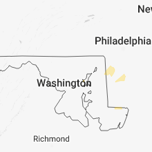


Connect with Interactive Hail Maps