

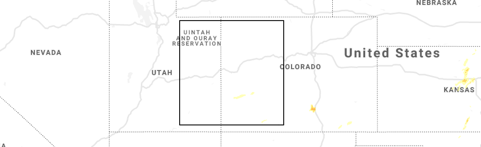
Hail Map for Piedra, CO
The Piedra, CO area has had 0 reports of on-the-ground hail by trained spotters, and has been under severe weather warnings 0 times during the past 12 months. Doppler radar has detected hail at or near Piedra, CO on 2 occasions.
| Name: | Piedra, CO |
| Where Located: | 75.9 miles NE of Farmington, NM |
| Map: | Google Map for Piedra, CO |
| Population: | 28 |
| Housing Units: | 74 |
| More Info: | Search Google for Piedra, CO |
0
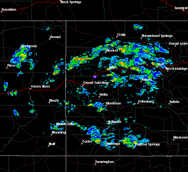
The Top Recent Hail Date for Piedra, CO is Saturday, June 22, 2019 (2nd out of 2)
Hail and Wind Damage Spotted near Piedra, CO
| Date / Time | Report Details |
|---|---|
| 6/6/2020 1:04 PM MDT |
 At 103 pm mdt, a severe thunderstorm was located near wolf creek pass, or 43 miles north of dulce, moving northeast at 55 mph. this is a very dangerous storm (radar indicated). Hazards include 80 mph wind gusts and penny size hail. Flying debris will be dangerous to those caught without shelter. mobile homes will be heavily damaged. expect considerable damage to roofs, windows, and vehicles. Extensive tree damage and power outages are likely. At 103 pm mdt, a severe thunderstorm was located near wolf creek pass, or 43 miles north of dulce, moving northeast at 55 mph. this is a very dangerous storm (radar indicated). Hazards include 80 mph wind gusts and penny size hail. Flying debris will be dangerous to those caught without shelter. mobile homes will be heavily damaged. expect considerable damage to roofs, windows, and vehicles. Extensive tree damage and power outages are likely.
|
| 7/26/2019 1:30 PM MDT |
 At 130 pm mdt, a severe thunderstorm was located 16 miles northwest of pagosa springs, or 33 miles east of durango, moving east at 10 mph (radar indicated). Hazards include 60 mph wind gusts and quarter size hail. Hail damage to vehicles is expected. expect wind damage to roofs, siding, and trees. This severe thunderstorm will remain over mainly rural areas of northwestern archuleta and southeastern hinsdale counties. At 130 pm mdt, a severe thunderstorm was located 16 miles northwest of pagosa springs, or 33 miles east of durango, moving east at 10 mph (radar indicated). Hazards include 60 mph wind gusts and quarter size hail. Hail damage to vehicles is expected. expect wind damage to roofs, siding, and trees. This severe thunderstorm will remain over mainly rural areas of northwestern archuleta and southeastern hinsdale counties.
|
Hail Maps for Piedra, CO


Connect with Interactive Hail Maps