

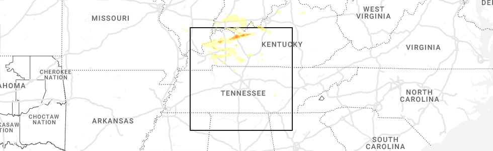
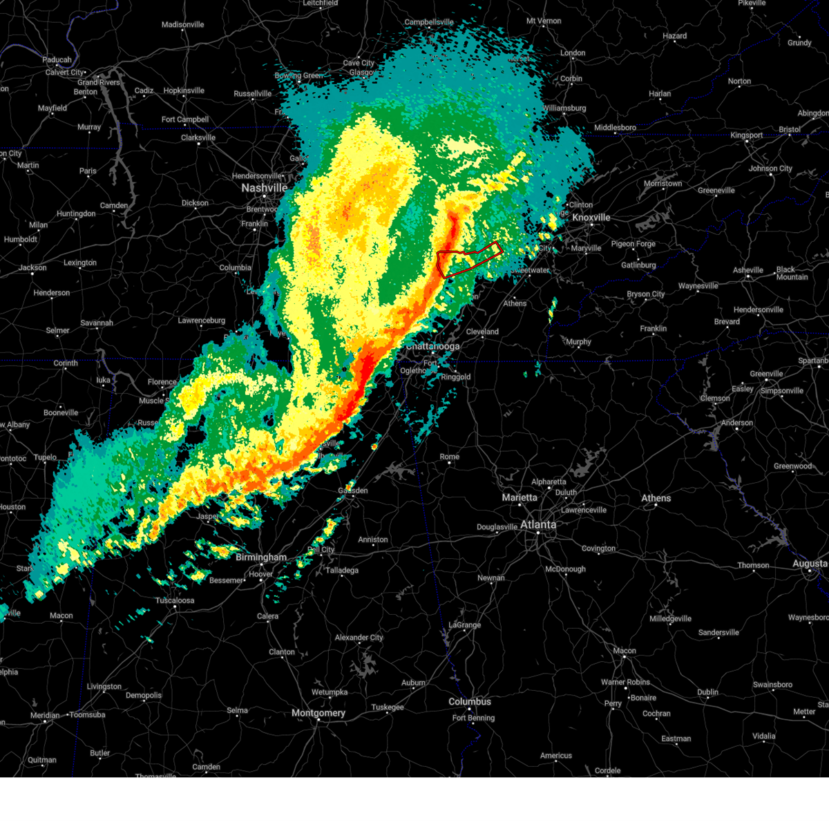
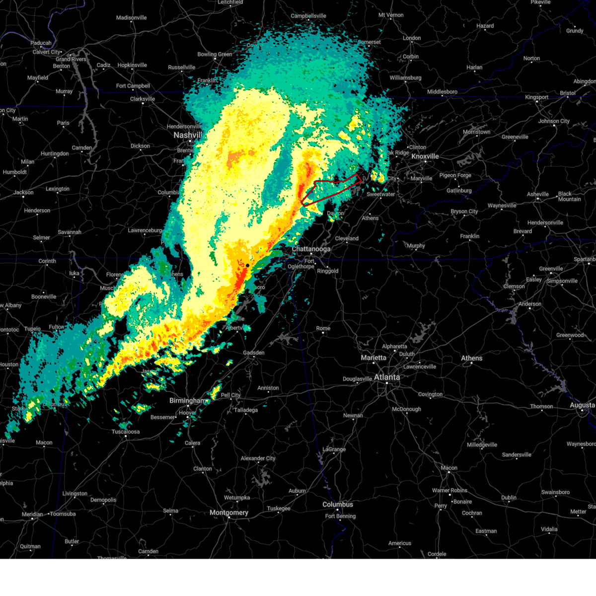
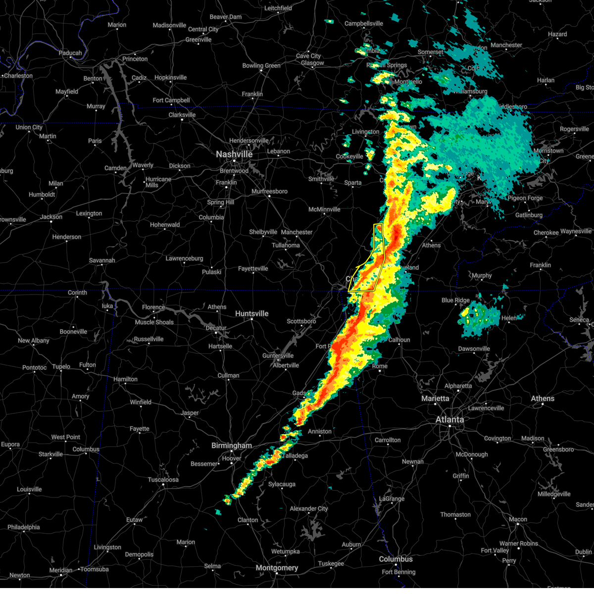
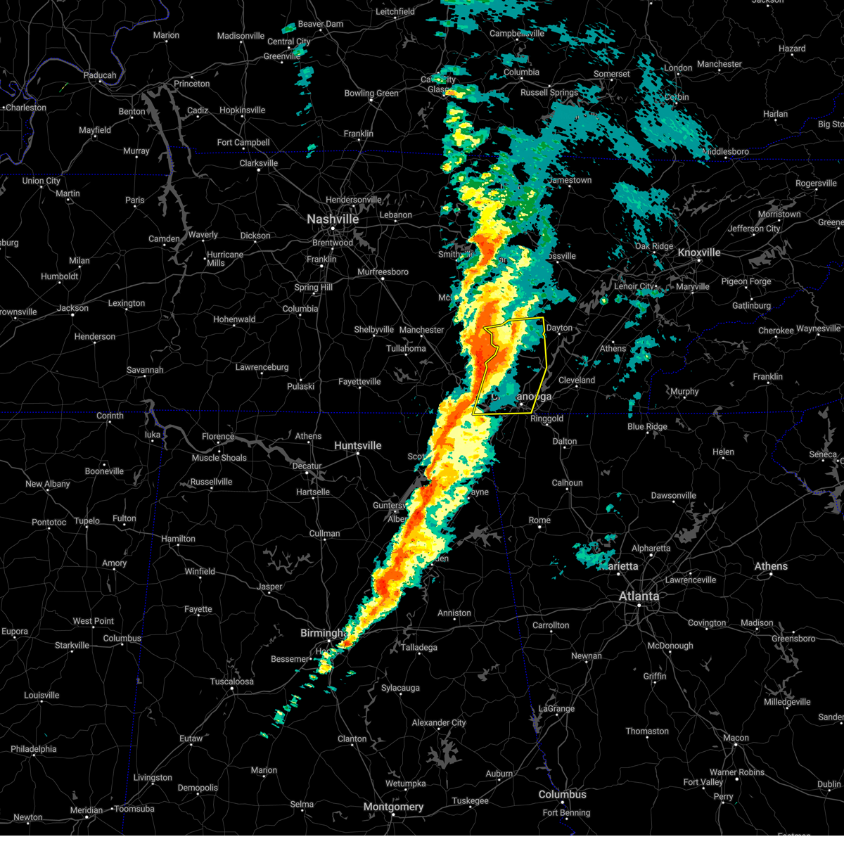
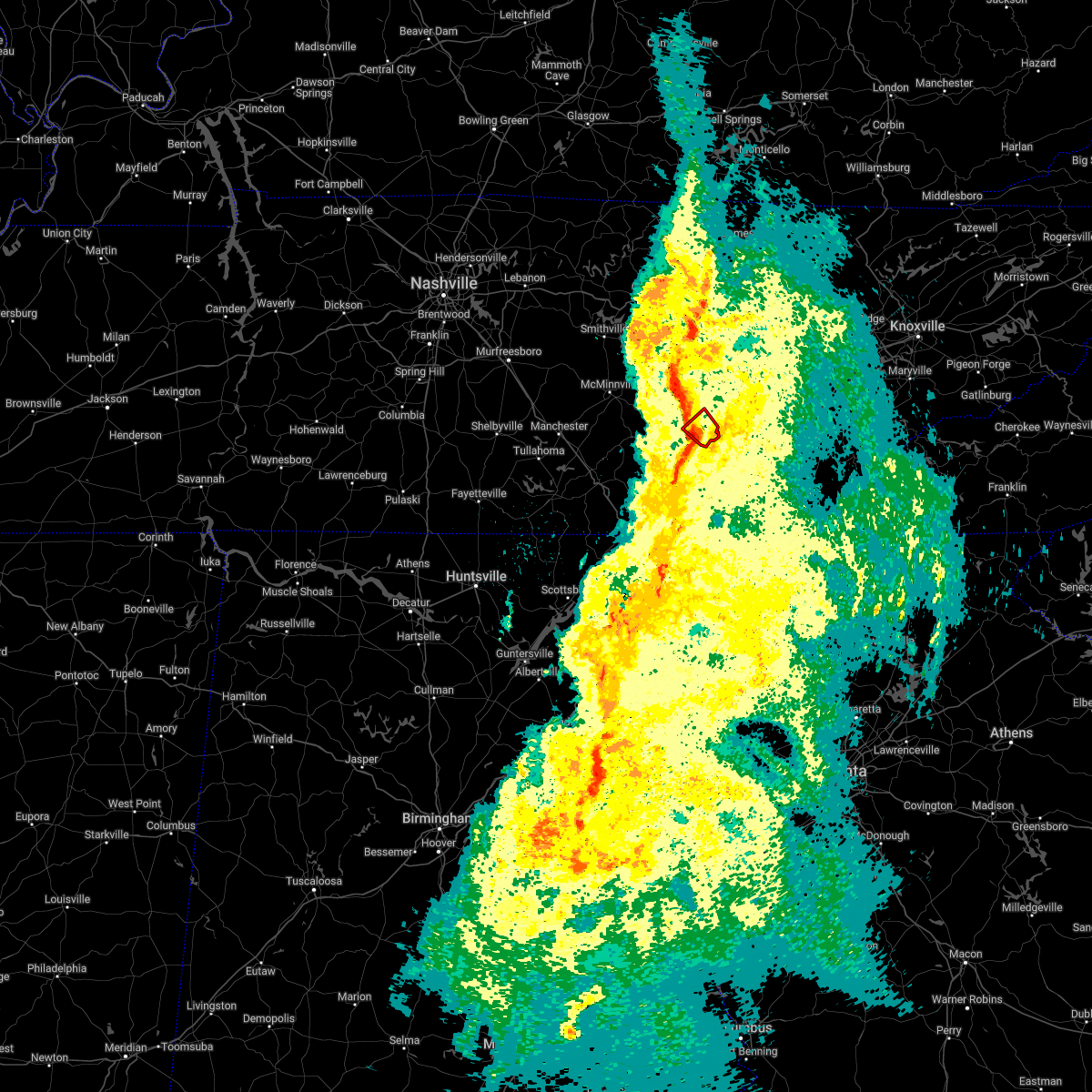
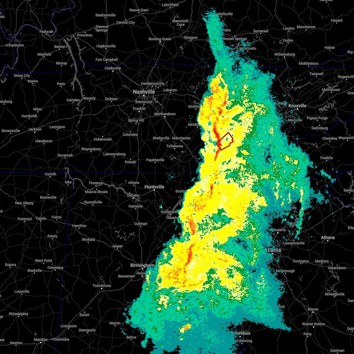
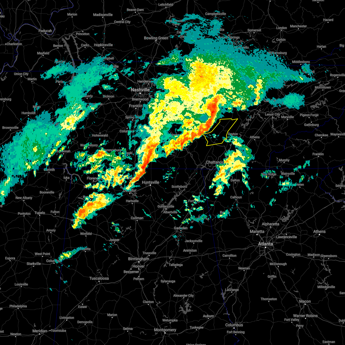
Hail Map for Pikeville, TN
The Pikeville, TN area has had 5 reports of on-the-ground hail by trained spotters, and has been under severe weather warnings 14 times during the past 12 months. Doppler radar has detected hail at or near Pikeville, TN on 35 occasions, including 4 occasions during the past year.
| Name: | Pikeville, TN |
| Where Located: | 38.7 miles N of Chattanooga, TN |
| Map: | Google Map for Pikeville, TN |
| Population: | 1608 |
| Housing Units: | 797 |
| More Info: | Search Google for Pikeville, TN |
0
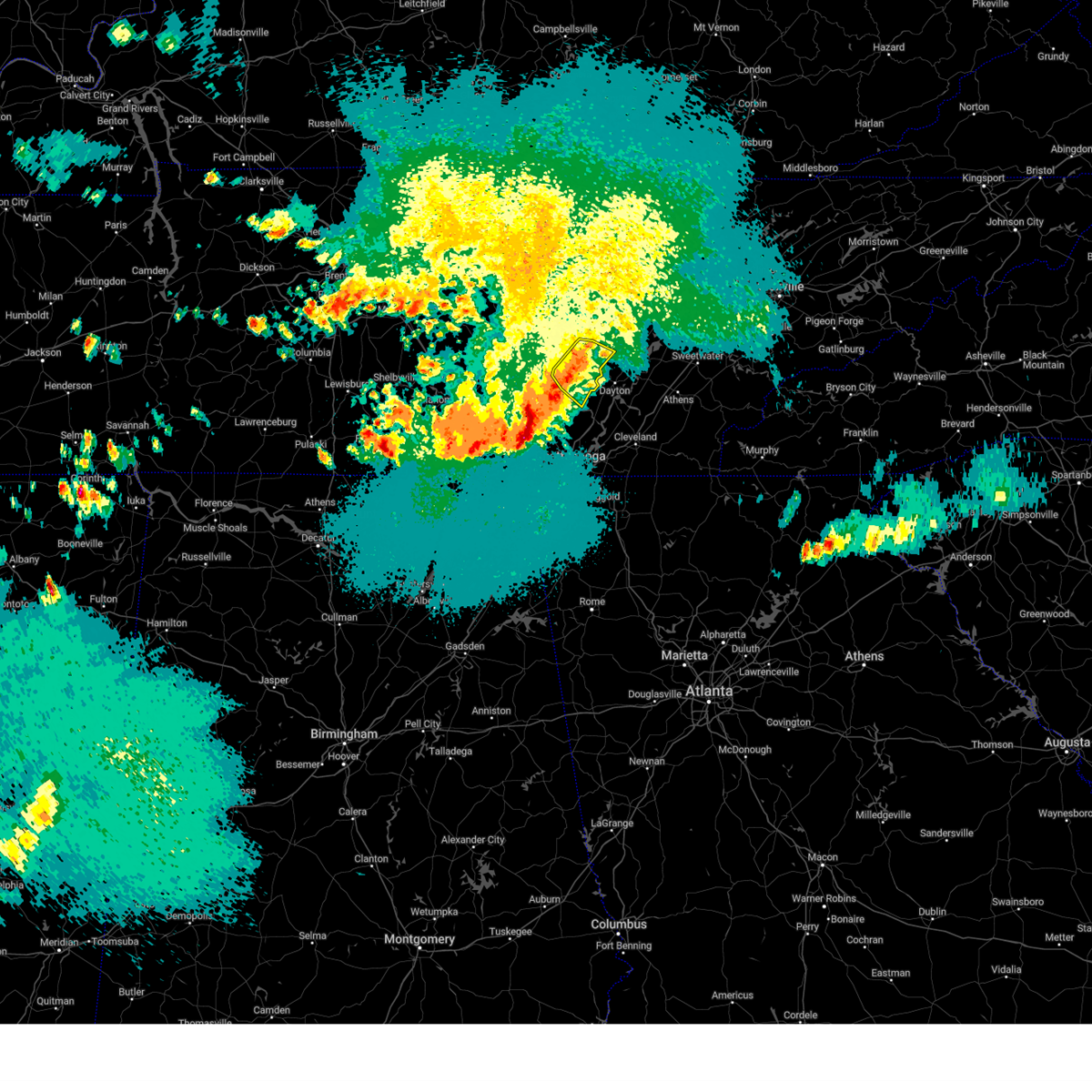
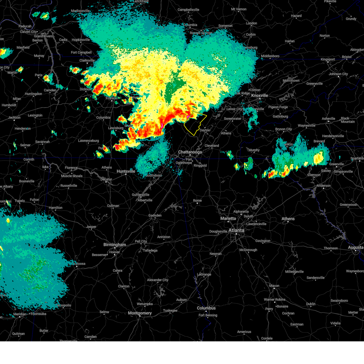
The Top Recent Hail Date for Pikeville, TN is Wednesday, September 27, 2023 (35th out of 35)
Hail and Wind Damage Spotted near Pikeville, TN
| Date / Time | Report Details |
|---|---|
| 9/27/2023 3:48 PM CDT |
 At 448 pm edt/348 pm cdt/, a severe thunderstorm was located near pikeville, moving southeast at 20 mph (radar indicated). Hazards include 60 mph wind gusts and penny size hail. Expect damage to roofs, siding, and trees. locations impacted include, dayton, pikeville, graysville, evensville, sale creek, old washington, brayton, and mount crest. hail threat, radar indicated max hail size, 0. 75 in wind threat, radar indicated max wind gust, 60 mph. At 448 pm edt/348 pm cdt/, a severe thunderstorm was located near pikeville, moving southeast at 20 mph (radar indicated). Hazards include 60 mph wind gusts and penny size hail. Expect damage to roofs, siding, and trees. locations impacted include, dayton, pikeville, graysville, evensville, sale creek, old washington, brayton, and mount crest. hail threat, radar indicated max hail size, 0. 75 in wind threat, radar indicated max wind gust, 60 mph.
|
| 9/27/2023 3:27 PM CDT |
 At 427 pm edt/327 pm cdt/, a severe thunderstorm was located near pikeville, moving southeast at 20 mph (radar indicated). Hazards include 60 mph wind gusts and nickel size hail. expect damage to roofs, siding, and trees At 427 pm edt/327 pm cdt/, a severe thunderstorm was located near pikeville, moving southeast at 20 mph (radar indicated). Hazards include 60 mph wind gusts and nickel size hail. expect damage to roofs, siding, and trees
|
| 8/12/2023 2:08 PM CDT |
 At 307 pm edt/207 pm cdt/, severe thunderstorms were located along a line extending from near spring city to near soddy-daisy to south pittsburg, moving east at 30 mph (law enforcement). Hazards include 60 mph wind gusts. expect damage to roofs, siding, and trees At 307 pm edt/207 pm cdt/, severe thunderstorms were located along a line extending from near spring city to near soddy-daisy to south pittsburg, moving east at 30 mph (law enforcement). Hazards include 60 mph wind gusts. expect damage to roofs, siding, and trees
|
| 8/12/2023 1:54 PM CDT | Several trees dow in bledsoe county TN, 6 miles ENE of Pikeville, TN |
| 8/12/2023 1:26 PM CDT |
 At 226 pm edt/126 pm cdt/, severe thunderstorms were located along a line extending from near spencer to 7 miles north of gruetli- laager to 6 miles north of monteagle, moving east at 50 mph (radar indicated). Hazards include 70 mph wind gusts. Expect considerable tree damage. Damage is likely to mobile homes, roofs, and outbuildings. At 226 pm edt/126 pm cdt/, severe thunderstorms were located along a line extending from near spencer to 7 miles north of gruetli- laager to 6 miles north of monteagle, moving east at 50 mph (radar indicated). Hazards include 70 mph wind gusts. Expect considerable tree damage. Damage is likely to mobile homes, roofs, and outbuildings.
|
| 8/7/2023 12:30 PM CDT | Numerous trees and power lines down countywid in bledsoe county TN, 0.6 miles S of Pikeville, TN |
| 8/7/2023 12:13 PM CDT | Large number of trees down near fall creek falls state par in van buren county TN, 9.8 miles ESE of Pikeville, TN |
| 8/7/2023 12:08 PM CDT |
 At 107 pm edt/1207 pm cdt/, severe thunderstorms were located along a line extending from 14 miles north of pikeville to 12 miles south of spencer to 8 miles northwest of tracy city, moving east at 65 mph (radar indicated). Hazards include 70 mph wind gusts and quarter size hail. Hail damage to vehicles is expected. expect considerable tree damage. Wind damage is also likely to mobile homes, roofs, and outbuildings. At 107 pm edt/1207 pm cdt/, severe thunderstorms were located along a line extending from 14 miles north of pikeville to 12 miles south of spencer to 8 miles northwest of tracy city, moving east at 65 mph (radar indicated). Hazards include 70 mph wind gusts and quarter size hail. Hail damage to vehicles is expected. expect considerable tree damage. Wind damage is also likely to mobile homes, roofs, and outbuildings.
|
| 7/20/2023 12:50 PM CDT | Dispatch reported trees down throughout county. time estimated from rada in bledsoe county TN, 4.5 miles WNW of Pikeville, TN |
| 7/20/2023 12:45 PM CDT | Dispatch reported trees down throughout the county. time estimated from rada in bledsoe county TN, 4.4 miles ESE of Pikeville, TN |
| 7/20/2023 1:45 PM EDT |
 At 145 pm edt/1245 pm cdt/, a severe thunderstorm was located near pikeville, moving southeast at 20 mph (radar indicated). Hazards include 60 mph wind gusts and quarter size hail. Hail damage to vehicles is expected. Expect wind damage to roofs, siding, and trees. At 145 pm edt/1245 pm cdt/, a severe thunderstorm was located near pikeville, moving southeast at 20 mph (radar indicated). Hazards include 60 mph wind gusts and quarter size hail. Hail damage to vehicles is expected. Expect wind damage to roofs, siding, and trees.
|
| 6/25/2023 2:55 PM EDT |
 The severe thunderstorm warning for rhea, meigs, northeastern bledsoe, mcminn, west central monroe and southwestern roane counties will expire at 300 pm edt/200 pm cdt/, the storms which prompted the warning have moved out of the warned area. therefore, the warning will be allowed to expire. a severe thunderstorm watch remains in effect until 700 pm edt/600 pm cdt/ for east tennessee. remember, a severe thunderstorm warning still remains in effect until 345 pm edt. The severe thunderstorm warning for rhea, meigs, northeastern bledsoe, mcminn, west central monroe and southwestern roane counties will expire at 300 pm edt/200 pm cdt/, the storms which prompted the warning have moved out of the warned area. therefore, the warning will be allowed to expire. a severe thunderstorm watch remains in effect until 700 pm edt/600 pm cdt/ for east tennessee. remember, a severe thunderstorm warning still remains in effect until 345 pm edt.
|
| 6/25/2023 2:54 PM EDT |
 At 254 pm edt/154 pm cdt/, severe thunderstorms were located along a line extending from 6 miles northeast of charleston to 10 miles southeast of dayton to 12 miles west of pikeville, moving south at 25 mph (radar indicated). Hazards include 60 mph wind gusts and quarter size hail. Hail damage to vehicles is expected. Expect wind damage to roofs, siding, and trees. At 254 pm edt/154 pm cdt/, severe thunderstorms were located along a line extending from 6 miles northeast of charleston to 10 miles southeast of dayton to 12 miles west of pikeville, moving south at 25 mph (radar indicated). Hazards include 60 mph wind gusts and quarter size hail. Hail damage to vehicles is expected. Expect wind damage to roofs, siding, and trees.
|
| 6/25/2023 1:45 PM CDT | Several trees dow in bledsoe county TN, 2.3 miles SSW of Pikeville, TN |
| 6/25/2023 2:42 PM EDT |
 At 242 pm edt/142 pm cdt/, severe thunderstorms were located along a line extending from 7 miles west of sweetwater to near decatur to near pikeville, moving southeast at 25 mph (radar indicated). Hazards include 70 mph wind gusts and quarter size hail. Hail damage to vehicles is expected. expect considerable tree damage. wind damage is also likely to mobile homes, roofs, and outbuildings. locations impacted include, athens, dayton, pikeville, decatur, etowah, spring city, englewood, graysville, niota and riceville. this includes interstate 75 in tennessee between mile markers 41 and 60. thunderstorm damage threat, considerable hail threat, radar indicated max hail size, 1. 00 in wind threat, radar indicated max wind gust, 70 mph. At 242 pm edt/142 pm cdt/, severe thunderstorms were located along a line extending from 7 miles west of sweetwater to near decatur to near pikeville, moving southeast at 25 mph (radar indicated). Hazards include 70 mph wind gusts and quarter size hail. Hail damage to vehicles is expected. expect considerable tree damage. wind damage is also likely to mobile homes, roofs, and outbuildings. locations impacted include, athens, dayton, pikeville, decatur, etowah, spring city, englewood, graysville, niota and riceville. this includes interstate 75 in tennessee between mile markers 41 and 60. thunderstorm damage threat, considerable hail threat, radar indicated max hail size, 1. 00 in wind threat, radar indicated max wind gust, 70 mph.
|
| 6/25/2023 1:40 PM CDT |
 At 240 pm edt/140 pm cdt/, a severe thunderstorm was located near spencer, moving southeast at 20 mph (radar indicated). Hazards include golf ball size hail and 60 mph wind gusts. People and animals outdoors will be injured. expect hail damage to roofs, siding, windows, and vehicles. Expect wind damage to roofs, siding, and trees. At 240 pm edt/140 pm cdt/, a severe thunderstorm was located near spencer, moving southeast at 20 mph (radar indicated). Hazards include golf ball size hail and 60 mph wind gusts. People and animals outdoors will be injured. expect hail damage to roofs, siding, windows, and vehicles. Expect wind damage to roofs, siding, and trees.
|
| 6/25/2023 2:20 PM EDT |
 At 220 pm edt/120 pm cdt/, severe thunderstorms were located along a line extending from near fairview to near spring city to 9 miles northwest of pikeville, moving southeast at 25 mph (radar indicated). Hazards include golf ball size hail and 70 mph wind gusts. People and animals outdoors will be injured. expect hail damage to roofs, siding, windows, and vehicles. expect considerable tree damage. Wind damage is also likely to mobile homes, roofs, and outbuildings. At 220 pm edt/120 pm cdt/, severe thunderstorms were located along a line extending from near fairview to near spring city to 9 miles northwest of pikeville, moving southeast at 25 mph (radar indicated). Hazards include golf ball size hail and 70 mph wind gusts. People and animals outdoors will be injured. expect hail damage to roofs, siding, windows, and vehicles. expect considerable tree damage. Wind damage is also likely to mobile homes, roofs, and outbuildings.
|
| 6/25/2023 1:05 PM CDT | A few trees dow in bledsoe county TN, 10.9 miles SW of Pikeville, TN |
| 6/11/2023 8:10 PM CDT |
 At 910 pm edt/810 pm cdt/, a severe thunderstorm was located 9 miles north of pikeville, moving east at 35 mph (radar indicated). Hazards include 60 mph wind gusts and penny size hail. expect damage to roofs, siding, and trees At 910 pm edt/810 pm cdt/, a severe thunderstorm was located 9 miles north of pikeville, moving east at 35 mph (radar indicated). Hazards include 60 mph wind gusts and penny size hail. expect damage to roofs, siding, and trees
|
| 5/7/2023 8:50 PM CDT |
 At 849 pm cdt, a severe thunderstorm was located near decatur, moving southeast at 35 mph (radar indicated). Hazards include 60 mph wind gusts. Expect damage to roofs, siding, and trees. locations impacted include, pikeville, brayton, palio, mount crest, old cumberland and fall creek falls state park. hail threat, radar indicated max hail size, <. 75 in wind threat, radar indicated max wind gust, 60 mph. At 849 pm cdt, a severe thunderstorm was located near decatur, moving southeast at 35 mph (radar indicated). Hazards include 60 mph wind gusts. Expect damage to roofs, siding, and trees. locations impacted include, pikeville, brayton, palio, mount crest, old cumberland and fall creek falls state park. hail threat, radar indicated max hail size, <. 75 in wind threat, radar indicated max wind gust, 60 mph.
|
| 5/7/2023 8:10 PM CDT |
 At 809 pm cdt, a severe thunderstorm was located over pikeville, moving southeast at 35 mph (radar indicated). Hazards include 60 mph wind gusts and quarter size hail. Hail damage to vehicles is expected. Expect wind damage to roofs, siding, and trees. At 809 pm cdt, a severe thunderstorm was located over pikeville, moving southeast at 35 mph (radar indicated). Hazards include 60 mph wind gusts and quarter size hail. Hail damage to vehicles is expected. Expect wind damage to roofs, siding, and trees.
|
| 4/1/2023 2:50 AM CDT | A tree fell onto the corner of a house on old spencer roa in bledsoe county TN, 3.2 miles SSE of Pikeville, TN |
| 3/25/2023 1:28 AM CDT |
 At 228 am edt/128 am cdt/, a severe thunderstorm was located 8 miles northeast of pikeville, moving northeast at 45 mph (radar indicated). Hazards include 60 mph wind gusts. Expect damage to roofs, siding, and trees. Locations impacted include, dayton, dunlap, pikeville, brayton, palio and melvine. At 228 am edt/128 am cdt/, a severe thunderstorm was located 8 miles northeast of pikeville, moving northeast at 45 mph (radar indicated). Hazards include 60 mph wind gusts. Expect damage to roofs, siding, and trees. Locations impacted include, dayton, dunlap, pikeville, brayton, palio and melvine.
|
| 3/25/2023 1:25 AM CDT | County dispatch reports power lines down and tree branches down near bledsoe county middle school. time estimated by rada in bledsoe county TN, 1.8 miles NE of Pikeville, TN |
| 3/25/2023 1:24 AM CDT |
 At 224 am edt/124 am cdt/, a severe thunderstorm capable of producing a tornado was located 7 miles northeast of pikeville, moving northeast at 45 mph (radar indicated rotation). Hazards include tornado. Flying debris will be dangerous to those caught without shelter. mobile homes will be damaged or destroyed. damage to roofs, windows, and vehicles will occur. tree damage is likely. This tornadic thunderstorm will remain over mainly rural areas of northeastern rhea, northeastern bledsoe and west central roane counties, including the following locations, piney falls state park, grandview, melvine, mount crest, stinging fork falls state park and eagle furnace. At 224 am edt/124 am cdt/, a severe thunderstorm capable of producing a tornado was located 7 miles northeast of pikeville, moving northeast at 45 mph (radar indicated rotation). Hazards include tornado. Flying debris will be dangerous to those caught without shelter. mobile homes will be damaged or destroyed. damage to roofs, windows, and vehicles will occur. tree damage is likely. This tornadic thunderstorm will remain over mainly rural areas of northeastern rhea, northeastern bledsoe and west central roane counties, including the following locations, piney falls state park, grandview, melvine, mount crest, stinging fork falls state park and eagle furnace.
|
| 3/25/2023 1:11 AM CDT |
 At 210 am edt/110 am cdt/, a severe thunderstorm capable of producing a tornado was located 7 miles west of pikeville, moving northeast at 45 mph (radar indicated rotation). Hazards include tornado. Flying debris will be dangerous to those caught without shelter. mobile homes will be damaged or destroyed. damage to roofs, windows, and vehicles will occur. tree damage is likely. this dangerous storm will be near, pikeville around 120 am cdt. spring city around 240 am edt. Other locations impacted by this tornadic thunderstorm include stinging fork falls state park, eagle furnace, piney falls state park, grandview, melvine, mount crest, old cumberland and fall creek falls state park. At 210 am edt/110 am cdt/, a severe thunderstorm capable of producing a tornado was located 7 miles west of pikeville, moving northeast at 45 mph (radar indicated rotation). Hazards include tornado. Flying debris will be dangerous to those caught without shelter. mobile homes will be damaged or destroyed. damage to roofs, windows, and vehicles will occur. tree damage is likely. this dangerous storm will be near, pikeville around 120 am cdt. spring city around 240 am edt. Other locations impacted by this tornadic thunderstorm include stinging fork falls state park, eagle furnace, piney falls state park, grandview, melvine, mount crest, old cumberland and fall creek falls state park.
|
| 3/25/2023 1:01 AM CDT |
 At 200 am edt/100 am cdt/, a severe thunderstorm was located 11 miles northeast of gruetli-laager, or 12 miles northwest of dunlap, moving northeast at 45 mph (radar indicated). Hazards include 60 mph wind gusts. expect damage to roofs, siding, and trees At 200 am edt/100 am cdt/, a severe thunderstorm was located 11 miles northeast of gruetli-laager, or 12 miles northwest of dunlap, moving northeast at 45 mph (radar indicated). Hazards include 60 mph wind gusts. expect damage to roofs, siding, and trees
|
| 3/3/2023 1:14 PM CST |
 At 214 pm est/114 pm cst/, a severe thunderstorm was located 8 miles northeast of decatur, moving northeast at 40 mph (radar indicated). Hazards include 70 mph wind gusts. Expect considerable tree damage. damage is likely to mobile homes, roofs, and outbuildings. Locations impacted include, chattanooga, pikeville, soddy-daisy, signal mountain, walden, lakesite, ridgeside, fairmount, harrison and red bank. At 214 pm est/114 pm cst/, a severe thunderstorm was located 8 miles northeast of decatur, moving northeast at 40 mph (radar indicated). Hazards include 70 mph wind gusts. Expect considerable tree damage. damage is likely to mobile homes, roofs, and outbuildings. Locations impacted include, chattanooga, pikeville, soddy-daisy, signal mountain, walden, lakesite, ridgeside, fairmount, harrison and red bank.
|
| 3/3/2023 2:07 PM EST |
 At 207 pm est/107 pm cst/, a severe thunderstorm was located 8 miles northeast of soddy-daisy, or 9 miles southwest of dayton, moving northeast at 40 mph (radar indicated). Hazards include 70 mph wind gusts. Expect considerable tree damage. Damage is likely to mobile homes, roofs, and outbuildings. At 207 pm est/107 pm cst/, a severe thunderstorm was located 8 miles northeast of soddy-daisy, or 9 miles southwest of dayton, moving northeast at 40 mph (radar indicated). Hazards include 70 mph wind gusts. Expect considerable tree damage. Damage is likely to mobile homes, roofs, and outbuildings.
|
| 3/3/2023 12:39 PM CST |
 At 137 pm est/1237 pm cst/, a severe thunderstorm was located over whitwell, or 12 miles northeast of jasper, moving northeast at 40 mph (radar indicated). Hazards include 70 mph wind gusts. Expect considerable tree damage. Damage is likely to mobile homes, roofs, and outbuildings. At 137 pm est/1237 pm cst/, a severe thunderstorm was located over whitwell, or 12 miles northeast of jasper, moving northeast at 40 mph (radar indicated). Hazards include 70 mph wind gusts. Expect considerable tree damage. Damage is likely to mobile homes, roofs, and outbuildings.
|
| 1/1/0001 12:00 AM | A few trees down near pikevill in bledsoe county TN, 2 miles S of Pikeville, TN |
| 4/13/2022 9:33 PM CDT |
 At 1033 pm edt/933 pm cdt/, severe thunderstorms were located along a line extending from 11 miles north of pikeville to 6 miles north of stevenson, moving east at 55 mph (radar indicated). Hazards include 60 mph wind gusts. Expect damage to roofs, siding, and trees. locations impacted include, chattanooga, dayton, dunlap, jasper, pikeville, soddy-daisy, signal mountain, south pittsburg, spring city and walden. hail threat, radar indicated max hail size, <. 75 in wind threat, radar indicated max wind gust, 60 mph. At 1033 pm edt/933 pm cdt/, severe thunderstorms were located along a line extending from 11 miles north of pikeville to 6 miles north of stevenson, moving east at 55 mph (radar indicated). Hazards include 60 mph wind gusts. Expect damage to roofs, siding, and trees. locations impacted include, chattanooga, dayton, dunlap, jasper, pikeville, soddy-daisy, signal mountain, south pittsburg, spring city and walden. hail threat, radar indicated max hail size, <. 75 in wind threat, radar indicated max wind gust, 60 mph.
|
| 4/13/2022 9:06 PM CDT |
 At 1005 pm edt/905 pm cdt/, severe thunderstorms were located along a line extending from 11 miles northwest of spencer to 8 miles south of huntland, moving east at 45 mph (radar indicated). Hazards include 60 mph wind gusts. expect damage to roofs, siding, and trees At 1005 pm edt/905 pm cdt/, severe thunderstorms were located along a line extending from 11 miles northwest of spencer to 8 miles south of huntland, moving east at 45 mph (radar indicated). Hazards include 60 mph wind gusts. expect damage to roofs, siding, and trees
|
| 3/31/2022 1:33 AM CDT | A few trees dow in bledsoe county TN, 4.2 miles N of Pikeville, TN |
| 3/31/2022 1:29 AM CDT | A few trees dow in bledsoe county TN, 5.9 miles NE of Pikeville, TN |
| 3/31/2022 1:26 AM CDT |
 At 225 am edt/125 am cdt/, a severe thunderstorm was located over pikeville, moving northeast at 50 mph (radar indicated). Hazards include 80 mph wind gusts. Flying debris will be dangerous to those caught without shelter. mobile homes will be heavily damaged. expect considerable damage to roofs, windows, and vehicles. Extensive tree damage and power outages are likely. At 225 am edt/125 am cdt/, a severe thunderstorm was located over pikeville, moving northeast at 50 mph (radar indicated). Hazards include 80 mph wind gusts. Flying debris will be dangerous to those caught without shelter. mobile homes will be heavily damaged. expect considerable damage to roofs, windows, and vehicles. Extensive tree damage and power outages are likely.
|
| 3/31/2022 1:23 AM CDT |
 At 122 am cdt, a severe thunderstorm capable of producing a tornado was located over pikeville, moving northeast at 50 mph (radar indicated rotation). Hazards include tornado. Flying debris will be dangerous to those caught without shelter. mobile homes will be damaged or destroyed. damage to roofs, windows, and vehicles will occur. tree damage is likely. This tornadic thunderstorm will remain over mainly rural areas of southwestern bledsoe county, including the following locations, brayton. At 122 am cdt, a severe thunderstorm capable of producing a tornado was located over pikeville, moving northeast at 50 mph (radar indicated rotation). Hazards include tornado. Flying debris will be dangerous to those caught without shelter. mobile homes will be damaged or destroyed. damage to roofs, windows, and vehicles will occur. tree damage is likely. This tornadic thunderstorm will remain over mainly rural areas of southwestern bledsoe county, including the following locations, brayton.
|
| 3/31/2022 1:20 AM CDT |
 At 219 am edt/119 am cdt/, a severe thunderstorm was located near dunlap, moving northeast at 45 mph (radar indicated). Hazards include 70 mph wind gusts. Expect considerable tree damage. damage is likely to mobile homes, roofs, and outbuildings. locations impacted include, dunlap, pikeville, soddy-daisy, flat top mountain, palio, north chickamauga creek gorge, mowbray mountain, brayton, old cumberland and fall creek falls state park. thunderstorm damage threat, considerable hail threat, radar indicated max hail size, <. 75 in wind threat, radar indicated max wind gust, 70 mph. At 219 am edt/119 am cdt/, a severe thunderstorm was located near dunlap, moving northeast at 45 mph (radar indicated). Hazards include 70 mph wind gusts. Expect considerable tree damage. damage is likely to mobile homes, roofs, and outbuildings. locations impacted include, dunlap, pikeville, soddy-daisy, flat top mountain, palio, north chickamauga creek gorge, mowbray mountain, brayton, old cumberland and fall creek falls state park. thunderstorm damage threat, considerable hail threat, radar indicated max hail size, <. 75 in wind threat, radar indicated max wind gust, 70 mph.
|
| 3/31/2022 1:16 AM CDT |
 At 115 am cdt, a severe thunderstorm capable of producing a tornado was located 7 miles northeast of dunlap, moving northeast at 35 mph (radar indicated rotation). Hazards include tornado. Flying debris will be dangerous to those caught without shelter. mobile homes will be damaged or destroyed. damage to roofs, windows, and vehicles will occur. tree damage is likely. this dangerous storm will be near, pikeville around 125 am cdt. Other locations impacted by this tornadic thunderstorm include palio and brayton. At 115 am cdt, a severe thunderstorm capable of producing a tornado was located 7 miles northeast of dunlap, moving northeast at 35 mph (radar indicated rotation). Hazards include tornado. Flying debris will be dangerous to those caught without shelter. mobile homes will be damaged or destroyed. damage to roofs, windows, and vehicles will occur. tree damage is likely. this dangerous storm will be near, pikeville around 125 am cdt. Other locations impacted by this tornadic thunderstorm include palio and brayton.
|
| 3/31/2022 1:10 AM CDT |
 At 209 am edt/109 am cdt/, a severe thunderstorm was located near dunlap, moving northeast at 35 mph (radar indicated). Hazards include 70 mph wind gusts. Expect considerable tree damage. Damage is likely to mobile homes, roofs, and outbuildings. At 209 am edt/109 am cdt/, a severe thunderstorm was located near dunlap, moving northeast at 35 mph (radar indicated). Hazards include 70 mph wind gusts. Expect considerable tree damage. Damage is likely to mobile homes, roofs, and outbuildings.
|
| 1/1/2022 6:38 PM CST | Several trees dow in bledsoe county TN, 5.7 miles SSE of Pikeville, TN |
| 1/1/2022 6:34 PM CST |
 At 633 pm cst, severe thunderstorms were located along a line extending from near crossville to 8 miles north of pikeville to 8 miles north of dunlap to near gruetli-laager, moving northeast at 55 mph (radar indicated). Hazards include 60 mph wind gusts and penny size hail. Expect damage to roofs, siding, and trees. Locations impacted include, dunlap, pikeville, palio, brayton, melvine, mount crest, old cumberland, cagle and fall creek falls state park. At 633 pm cst, severe thunderstorms were located along a line extending from near crossville to 8 miles north of pikeville to 8 miles north of dunlap to near gruetli-laager, moving northeast at 55 mph (radar indicated). Hazards include 60 mph wind gusts and penny size hail. Expect damage to roofs, siding, and trees. Locations impacted include, dunlap, pikeville, palio, brayton, melvine, mount crest, old cumberland, cagle and fall creek falls state park.
|
| 1/1/2022 6:10 PM CST |
 At 609 pm cst, severe thunderstorms were located along a line extending from 6 miles east of sparta to 8 miles south of spencer to near decherd, moving northeast at 50 mph (radar indicated). Hazards include 60 mph wind gusts and penny size hail. expect damage to roofs, siding, and trees At 609 pm cst, severe thunderstorms were located along a line extending from 6 miles east of sparta to 8 miles south of spencer to near decherd, moving northeast at 50 mph (radar indicated). Hazards include 60 mph wind gusts and penny size hail. expect damage to roofs, siding, and trees
|
| 1/1/2022 5:00 PM CST | Multiple trees reported down in fall creek falls par in van buren county TN, 9.3 miles ESE of Pikeville, TN |
| 12/11/2021 8:10 AM CST | Trees down in multiple locations south of pikevill in bledsoe county TN, 4.9 miles N of Pikeville, TN |
| 12/6/2021 9:08 AM CST | A few trees dow in bledsoe county TN, 4.5 miles NNE of Pikeville, TN |
| 12/6/2021 9:04 AM CST | A few trees dow in bledsoe county TN, 1.9 miles NW of Pikeville, TN |
| 12/6/2021 8:57 AM CST |
 At 956 am est/856 am cst/, severe thunderstorms were located along a line extending from 7 miles northwest of spring city to 9 miles north of dayton to 11 miles south of pikeville, moving east at 60 mph (radar indicated). Hazards include 60 mph wind gusts. Expect damage to roofs, siding, and trees. Locations impacted include, dayton, dunlap, pikeville, soddy-daisy, graysville, flat top mountain, stinging fork falls state park, evensville, sale creek and palio. At 956 am est/856 am cst/, severe thunderstorms were located along a line extending from 7 miles northwest of spring city to 9 miles north of dayton to 11 miles south of pikeville, moving east at 60 mph (radar indicated). Hazards include 60 mph wind gusts. Expect damage to roofs, siding, and trees. Locations impacted include, dayton, dunlap, pikeville, soddy-daisy, graysville, flat top mountain, stinging fork falls state park, evensville, sale creek and palio.
|
| 12/6/2021 8:19 AM CST |
 At 918 am est/818 am cst/, severe thunderstorms were located along a line extending from mcminnville to 10 miles north of gruetli-laager to 9 miles north of monteagle, moving east at 60 mph (radar indicated). Hazards include 60 mph wind gusts. expect damage to roofs, siding, and trees At 918 am est/818 am cst/, severe thunderstorms were located along a line extending from mcminnville to 10 miles north of gruetli-laager to 9 miles north of monteagle, moving east at 60 mph (radar indicated). Hazards include 60 mph wind gusts. expect damage to roofs, siding, and trees
|
| 10/6/2021 4:47 PM CDT |
 At 447 pm cdt, a severe thunderstorm capable of producing a tornado was located near pikeville, moving north at 15 mph (radar indicated rotation). Hazards include tornado. Flying debris will be dangerous to those caught without shelter. mobile homes will be damaged or destroyed. damage to roofs, windows, and vehicles will occur. tree damage is likely. This tornadic thunderstorm will remain over mainly rural areas of north central bledsoe county. At 447 pm cdt, a severe thunderstorm capable of producing a tornado was located near pikeville, moving north at 15 mph (radar indicated rotation). Hazards include tornado. Flying debris will be dangerous to those caught without shelter. mobile homes will be damaged or destroyed. damage to roofs, windows, and vehicles will occur. tree damage is likely. This tornadic thunderstorm will remain over mainly rural areas of north central bledsoe county.
|
| 8/1/2021 12:32 AM CDT |
 At 1231 am cdt, severe thunderstorms were located along a line extending from 10 miles south of spencer to near cowan, moving east at 45 mph (radar indicated). Hazards include 60 mph wind gusts. Expect damage to roofs, siding, and trees. Locations impacted include, dunlap, jasper, pikeville, signal mountain, south pittsburg, whitwell, kimball, monteagle, fairmount and powells crossroads. At 1231 am cdt, severe thunderstorms were located along a line extending from 10 miles south of spencer to near cowan, moving east at 45 mph (radar indicated). Hazards include 60 mph wind gusts. Expect damage to roofs, siding, and trees. Locations impacted include, dunlap, jasper, pikeville, signal mountain, south pittsburg, whitwell, kimball, monteagle, fairmount and powells crossroads.
|
| 8/1/2021 12:10 AM CDT |
 At 1209 am cdt, severe thunderstorms were located along a line extending from near mcminnville to near tims ford lake, moving east at 40 mph (radar indicated). Hazards include 60 mph wind gusts. expect damage to roofs, siding, and trees At 1209 am cdt, severe thunderstorms were located along a line extending from near mcminnville to near tims ford lake, moving east at 40 mph (radar indicated). Hazards include 60 mph wind gusts. expect damage to roofs, siding, and trees
|
| 5/4/2021 8:55 AM CDT | Numerous trees down and trailer blown over in the pikeville are in bledsoe county TN, 0.6 miles S of Pikeville, TN |
| 5/4/2021 8:50 AM CDT | Multiple homes damage in bledsoe county TN, 0.6 miles S of Pikeville, TN |
| 5/4/2021 9:48 AM EDT |
 At 947 am edt/847 am cdt/, a severe thunderstorm was located over pikeville, moving east at 40 mph (radar indicated). Hazards include 60 mph wind gusts and nickel size hail. expect damage to roofs, siding, and trees At 947 am edt/847 am cdt/, a severe thunderstorm was located over pikeville, moving east at 40 mph (radar indicated). Hazards include 60 mph wind gusts and nickel size hail. expect damage to roofs, siding, and trees
|
| 8/10/2020 6:09 PM CDT | A couple trees dow in bledsoe county TN, 5.2 miles SSE of Pikeville, TN |
| 8/10/2020 6:52 PM EDT |
 At 651 pm edt/551 pm cdt/, severe thunderstorms were located along a line extending from 11 miles west of spring city to 7 miles southwest of pikeville to dunlap to near gruetli-laager, moving southeast at 25 mph (radar indicated). Hazards include 60 mph wind gusts. Expect damage to roofs, siding, and trees. Locations impacted include, dayton, dunlap, pikeville, soddy-daisy, spring city, fairmount, graysville, cartwright, flat top mountain and north chickamauga creek gorge. At 651 pm edt/551 pm cdt/, severe thunderstorms were located along a line extending from 11 miles west of spring city to 7 miles southwest of pikeville to dunlap to near gruetli-laager, moving southeast at 25 mph (radar indicated). Hazards include 60 mph wind gusts. Expect damage to roofs, siding, and trees. Locations impacted include, dayton, dunlap, pikeville, soddy-daisy, spring city, fairmount, graysville, cartwright, flat top mountain and north chickamauga creek gorge.
|
| 8/10/2020 6:38 PM EDT |
 At 637 pm edt/537 pm cdt/, severe thunderstorms were located along a line extending from 11 miles southwest of crossville to 8 miles southwest of pikeville to 7 miles northwest of dunlap to near gruetli-laager, moving southeast at 25 mph (radar indicated). Hazards include 60 mph wind gusts. expect damage to roofs, siding, and trees At 637 pm edt/537 pm cdt/, severe thunderstorms were located along a line extending from 11 miles southwest of crossville to 8 miles southwest of pikeville to 7 miles northwest of dunlap to near gruetli-laager, moving southeast at 25 mph (radar indicated). Hazards include 60 mph wind gusts. expect damage to roofs, siding, and trees
|
| 7/5/2020 5:51 PM EDT |
 At 551 pm edt/451 pm cdt/, a severe thunderstorm was located 7 miles southwest of decatur, moving northwest at 15 mph (radar indicated). Hazards include 60 mph wind gusts and nickel size hail. expect damage to roofs, siding, and trees At 551 pm edt/451 pm cdt/, a severe thunderstorm was located 7 miles southwest of decatur, moving northwest at 15 mph (radar indicated). Hazards include 60 mph wind gusts and nickel size hail. expect damage to roofs, siding, and trees
|
| 6/22/2020 8:57 PM EDT |
 At 837 pm edt/737 pm cdt/, severe thunderstorms were located along a line extending from 8 miles north of pikeville to near dayton to 7 miles northwest of south cleveland, moving northeast at 25 mph (radar indicated). Hazards include 60 mph wind gusts and penny size hail. expect damage to roofs, siding, and trees At 837 pm edt/737 pm cdt/, severe thunderstorms were located along a line extending from 8 miles north of pikeville to near dayton to 7 miles northwest of south cleveland, moving northeast at 25 mph (radar indicated). Hazards include 60 mph wind gusts and penny size hail. expect damage to roofs, siding, and trees
|
| 6/22/2020 7:46 PM CDT | Trees dow in bledsoe county TN, 3.5 miles N of Pikeville, TN |
| 6/22/2020 8:38 PM EDT |
 At 837 pm edt/737 pm cdt/, severe thunderstorms were located along a line extending from 8 miles north of pikeville to near dayton to 7 miles northwest of south cleveland, moving northeast at 25 mph (radar indicated). Hazards include 60 mph wind gusts and penny size hail. expect damage to roofs, siding, and trees At 837 pm edt/737 pm cdt/, severe thunderstorms were located along a line extending from 8 miles north of pikeville to near dayton to 7 miles northwest of south cleveland, moving northeast at 25 mph (radar indicated). Hazards include 60 mph wind gusts and penny size hail. expect damage to roofs, siding, and trees
|
| 5/3/2020 6:13 PM CDT |
 At 613 pm cdt, severe thunderstorms were located along a line extending from 10 miles southwest of crossville to 10 miles south of pikeville to 6 miles southeast of jasper, moving east at 60 mph (radar indicated). Hazards include 60 mph wind gusts. Expect damage to roofs, siding, and trees. Locations impacted include, pikeville, signal mountain, fairmount, lone oak, haletown (guild), brayton, melvine, hicks gap state park and north chickamauga creek gorge. At 613 pm cdt, severe thunderstorms were located along a line extending from 10 miles southwest of crossville to 10 miles south of pikeville to 6 miles southeast of jasper, moving east at 60 mph (radar indicated). Hazards include 60 mph wind gusts. Expect damage to roofs, siding, and trees. Locations impacted include, pikeville, signal mountain, fairmount, lone oak, haletown (guild), brayton, melvine, hicks gap state park and north chickamauga creek gorge.
|
| 5/3/2020 5:44 PM CDT |
 At 544 pm cdt, severe thunderstorms were located along a line extending from 10 miles southeast of smithville to 10 miles northwest of gruetli-laager to 8 miles south of cowan, moving east at 65 mph (radar indicated). Hazards include 60 mph wind gusts. expect damage to roofs, siding, and trees At 544 pm cdt, severe thunderstorms were located along a line extending from 10 miles southeast of smithville to 10 miles northwest of gruetli-laager to 8 miles south of cowan, moving east at 65 mph (radar indicated). Hazards include 60 mph wind gusts. expect damage to roofs, siding, and trees
|
| 4/9/2020 1:06 AM EDT |
 At 106 am edt/1206 am cdt/, severe thunderstorms were located along a line extending from 13 miles southwest of rockwood to near spring city to near pikeville, moving east at 60 mph (radar indicated). Hazards include 60 mph wind gusts and penny size hail. expect damage to roofs, siding, and trees At 106 am edt/1206 am cdt/, severe thunderstorms were located along a line extending from 13 miles southwest of rockwood to near spring city to near pikeville, moving east at 60 mph (radar indicated). Hazards include 60 mph wind gusts and penny size hail. expect damage to roofs, siding, and trees
|
| 3/29/2020 4:59 AM EDT |
 At 458 am edt/358 am cdt/, a severe thunderstorm was located over spring city, or 13 miles northwest of decatur, moving northeast at 75 mph (radar indicated). Hazards include 60 mph wind gusts and penny size hail. Expect damage to roofs, siding, and trees. Locations impacted include, dayton, pikeville, spring city, evensville, stinging fork falls state park, brayton, grandview, piney falls state park and melvine. At 458 am edt/358 am cdt/, a severe thunderstorm was located over spring city, or 13 miles northwest of decatur, moving northeast at 75 mph (radar indicated). Hazards include 60 mph wind gusts and penny size hail. Expect damage to roofs, siding, and trees. Locations impacted include, dayton, pikeville, spring city, evensville, stinging fork falls state park, brayton, grandview, piney falls state park and melvine.
|
| 3/29/2020 3:48 AM CDT |
 At 447 am edt/347 am cdt/, a severe thunderstorm was located near pikeville, moving northeast at 75 mph (radar indicated). Hazards include 60 mph wind gusts and penny size hail. Expect damage to roofs, siding, and trees. Locations impacted include, dayton, dunlap, pikeville, spring city, palmer, stinging fork falls state park, piney falls state park, mount crest, evensville and palio. At 447 am edt/347 am cdt/, a severe thunderstorm was located near pikeville, moving northeast at 75 mph (radar indicated). Hazards include 60 mph wind gusts and penny size hail. Expect damage to roofs, siding, and trees. Locations impacted include, dayton, dunlap, pikeville, spring city, palmer, stinging fork falls state park, piney falls state park, mount crest, evensville and palio.
|
| 3/29/2020 3:31 AM CDT |
 At 430 am edt/330 am cdt/, a severe thunderstorm was located 7 miles northwest of dunlap, moving northeast at 70 mph (radar indicated). Hazards include 60 mph wind gusts and penny size hail. expect damage to roofs, siding, and trees At 430 am edt/330 am cdt/, a severe thunderstorm was located 7 miles northwest of dunlap, moving northeast at 70 mph (radar indicated). Hazards include 60 mph wind gusts and penny size hail. expect damage to roofs, siding, and trees
|
| 2/12/2020 7:12 PM CST |
 At 811 pm est/711 pm cst/, severe thunderstorms were located along a line extending from sparta to 11 miles southeast of mcminnville to monteagle, moving east at 50 mph (radar indicated). Hazards include 60 mph wind gusts. expect damage to roofs, siding, and trees At 811 pm est/711 pm cst/, severe thunderstorms were located along a line extending from sparta to 11 miles southeast of mcminnville to monteagle, moving east at 50 mph (radar indicated). Hazards include 60 mph wind gusts. expect damage to roofs, siding, and trees
|
| 1/11/2020 4:08 PM EST |
 At 408 pm est/308 pm cst/, severe thunderstorms were located along a line extending from 6 miles east of pikeville to near east cleveland, moving northeast at 65 mph (radar indicated). Hazards include 70 mph wind gusts. Expect considerable tree damage. damage is likely to mobile homes, roofs, and outbuildings. Locations impacted include, cleveland, dayton, pikeville, benton, charleston, south cleveland, east cleveland, wildwood lake, collegedale and graysville. At 408 pm est/308 pm cst/, severe thunderstorms were located along a line extending from 6 miles east of pikeville to near east cleveland, moving northeast at 65 mph (radar indicated). Hazards include 70 mph wind gusts. Expect considerable tree damage. damage is likely to mobile homes, roofs, and outbuildings. Locations impacted include, cleveland, dayton, pikeville, benton, charleston, south cleveland, east cleveland, wildwood lake, collegedale and graysville.
|
| 1/11/2020 3:00 PM CST | Trees and power lines down across the count in bledsoe county TN, 0.6 miles S of Pikeville, TN |
| 1/11/2020 3:49 PM EST |
 At 348 pm est/248 pm cst/, severe thunderstorms were located along a line extending from near tracy city to near trenton, moving east at 60 mph (radar indicated). Hazards include 70 mph wind gusts. Expect considerable tree damage. Damage is likely to mobile homes, roofs, and outbuildings. At 348 pm est/248 pm cst/, severe thunderstorms were located along a line extending from near tracy city to near trenton, moving east at 60 mph (radar indicated). Hazards include 70 mph wind gusts. Expect considerable tree damage. Damage is likely to mobile homes, roofs, and outbuildings.
|
| 6/21/2019 11:18 PM EDT |
 At 1118 pm edt/1018 pm cdt/, severe thunderstorms were located along a line extending from near sweetwater to 10 miles north of athens to near decatur to dayton to near soddy-daisy, moving east at 40 mph (radar indicated). Hazards include 60 mph wind gusts and nickel size hail. Expect damage to roofs, siding, and trees. Locations impacted include, dayton, dunlap, pikeville, decatur, spring city, graysville, peakland, stinging fork falls state park, piney falls state park, ten mile, big spring, sale creek, evensville, palio, brayton, old washington, birchwood, grandview, melvine and flat top mountain. At 1118 pm edt/1018 pm cdt/, severe thunderstorms were located along a line extending from near sweetwater to 10 miles north of athens to near decatur to dayton to near soddy-daisy, moving east at 40 mph (radar indicated). Hazards include 60 mph wind gusts and nickel size hail. Expect damage to roofs, siding, and trees. Locations impacted include, dayton, dunlap, pikeville, decatur, spring city, graysville, peakland, stinging fork falls state park, piney falls state park, ten mile, big spring, sale creek, evensville, palio, brayton, old washington, birchwood, grandview, melvine and flat top mountain.
|
| 6/21/2019 10:01 PM CDT | Few reports of trees down across the count in bledsoe county TN, 0.8 miles SE of Pikeville, TN |
| 6/21/2019 10:54 PM EDT |
 At 1053 pm edt/953 pm cdt/, severe thunderstorms were located along a line extending from 10 miles southwest of rockwood to near spring city to near pikeville to 13 miles west of dayton to dunlap, moving east at 55 mph (radar indicated). Hazards include 70 mph wind gusts and nickel size hail. Expect considerable tree damage. damage is likely to mobile homes, roofs, and outbuildings. Locations impacted include, dayton, dunlap, pikeville, decatur, spring city, graysville, peakland, stinging fork falls state park, piney falls state park, ten mile, mount crest, big spring, sale creek, evensville, palio, fall creek falls state park, brayton, old washington, birchwood and grandview. At 1053 pm edt/953 pm cdt/, severe thunderstorms were located along a line extending from 10 miles southwest of rockwood to near spring city to near pikeville to 13 miles west of dayton to dunlap, moving east at 55 mph (radar indicated). Hazards include 70 mph wind gusts and nickel size hail. Expect considerable tree damage. damage is likely to mobile homes, roofs, and outbuildings. Locations impacted include, dayton, dunlap, pikeville, decatur, spring city, graysville, peakland, stinging fork falls state park, piney falls state park, ten mile, mount crest, big spring, sale creek, evensville, palio, fall creek falls state park, brayton, old washington, birchwood and grandview.
|
| 6/21/2019 10:29 PM EDT |
 The national weather service in morristown has issued a * severe thunderstorm warning for. rhea county in east tennessee. northern sequatchie county in east tennessee. bledsoe county in east tennessee. Meigs county in east tennessee. The national weather service in morristown has issued a * severe thunderstorm warning for. rhea county in east tennessee. northern sequatchie county in east tennessee. bledsoe county in east tennessee. Meigs county in east tennessee.
|
| 6/20/2019 6:13 AM EDT |
 At 612 am edt/512 am cdt/, severe thunderstorms were located along a line extending from near pikeville to near dunlap to near walden to near ringgold, moving northeast at 45 mph (law enforcement). Hazards include 70 mph wind gusts. Expect considerable tree damage. damage is likely to mobile homes, roofs, and outbuildings. Locations impacted include, chattanooga, cleveland, dayton, dunlap, pikeville, decatur, soddy-daisy, signal mountain, rossville, walden, lakesite, charleston, ridgeside, harrison, east cleveland, south cleveland, fairmount, wildwood lake, red bank and collegedale. At 612 am edt/512 am cdt/, severe thunderstorms were located along a line extending from near pikeville to near dunlap to near walden to near ringgold, moving northeast at 45 mph (law enforcement). Hazards include 70 mph wind gusts. Expect considerable tree damage. damage is likely to mobile homes, roofs, and outbuildings. Locations impacted include, chattanooga, cleveland, dayton, dunlap, pikeville, decatur, soddy-daisy, signal mountain, rossville, walden, lakesite, charleston, ridgeside, harrison, east cleveland, south cleveland, fairmount, wildwood lake, red bank and collegedale.
|
| 6/20/2019 4:57 AM CDT |
 At 555 am edt/455 am cdt/, severe thunderstorms were located along a line extending from 10 miles west of pikeville to 6 miles north of whitwell to near signal mountain to near la fayette, moving northeast at 50 mph (law enforcement). Hazards include 70 mph wind gusts. Expect considerable tree damage. Damage is likely to mobile homes, roofs, and outbuildings. At 555 am edt/455 am cdt/, severe thunderstorms were located along a line extending from 10 miles west of pikeville to 6 miles north of whitwell to near signal mountain to near la fayette, moving northeast at 50 mph (law enforcement). Hazards include 70 mph wind gusts. Expect considerable tree damage. Damage is likely to mobile homes, roofs, and outbuildings.
|
| 6/20/2019 4:38 AM CDT |
 At 537 am edt/437 am cdt/, severe thunderstorms were located along a line extending from 9 miles south of mcminnville to near trenton to near gaylesville, moving east northeast at 45 mph (radar indicated). Hazards include 60 mph wind gusts. Expect damage to roofs, siding, and trees. Locations impacted include, chattanooga, dunlap, jasper, pikeville, soddy-daisy, signal mountain, south pittsburg, walden, lakesite, whitwell, kimball, monteagle, ridgeside, harrison, fairmount, red bank, collegedale, powells crossroads, orme and cartwright. At 537 am edt/437 am cdt/, severe thunderstorms were located along a line extending from 9 miles south of mcminnville to near trenton to near gaylesville, moving east northeast at 45 mph (radar indicated). Hazards include 60 mph wind gusts. Expect damage to roofs, siding, and trees. Locations impacted include, chattanooga, dunlap, jasper, pikeville, soddy-daisy, signal mountain, south pittsburg, walden, lakesite, whitwell, kimball, monteagle, ridgeside, harrison, fairmount, red bank, collegedale, powells crossroads, orme and cartwright.
|
| 6/20/2019 4:05 AM CDT |
 At 504 am edt/404 am cdt/, severe thunderstorms were located along a line extending from near tullahoma to near hollywood to near tabor road, moving east northeast at 40 mph (radar indicated). Hazards include 60 mph wind gusts. expect damage to roofs, siding, and trees At 504 am edt/404 am cdt/, severe thunderstorms were located along a line extending from near tullahoma to near hollywood to near tabor road, moving east northeast at 40 mph (radar indicated). Hazards include 60 mph wind gusts. expect damage to roofs, siding, and trees
|
| 6/17/2019 2:42 PM CDT |
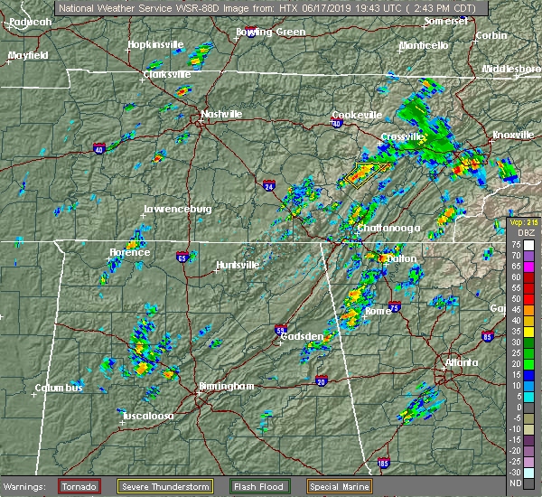 At 242 pm cdt, a severe thunderstorm was located 8 miles north of pikeville, moving northeast at 10 mph (radar indicated). Hazards include 60 mph wind gusts and quarter size hail. Hail damage to vehicles is expected. expect wind damage to roofs, siding, and trees. Locations impacted include, pikeville, melvine, fall creek falls state park and mount crest. At 242 pm cdt, a severe thunderstorm was located 8 miles north of pikeville, moving northeast at 10 mph (radar indicated). Hazards include 60 mph wind gusts and quarter size hail. Hail damage to vehicles is expected. expect wind damage to roofs, siding, and trees. Locations impacted include, pikeville, melvine, fall creek falls state park and mount crest.
|
| 6/17/2019 2:30 PM CDT | Several trees down... 1/4 inch hail... heavy rainfall occurred around 2:30 pm cd in bledsoe county TN, 4.4 miles SE of Pikeville, TN |
| 6/17/2019 2:18 PM CDT |
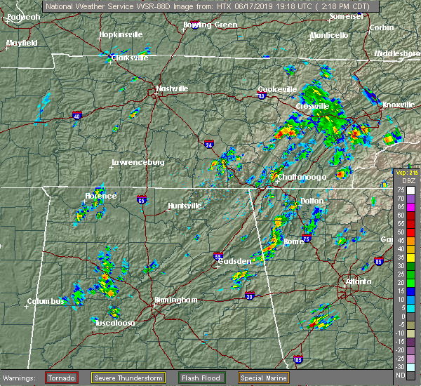 At 218 pm cdt, a severe thunderstorm was located 7 miles north of pikeville, moving northeast at 20 mph (radar indicated). Hazards include 60 mph wind gusts and quarter size hail. Hail damage to vehicles is expected. Expect wind damage to roofs, siding, and trees. At 218 pm cdt, a severe thunderstorm was located 7 miles north of pikeville, moving northeast at 20 mph (radar indicated). Hazards include 60 mph wind gusts and quarter size hail. Hail damage to vehicles is expected. Expect wind damage to roofs, siding, and trees.
|
| 4/8/2019 8:25 AM CDT |
 At 825 am cdt, a severe thunderstorm was located 8 miles northeast of gruetli-laager, or 9 miles northwest of dunlap, moving northeast at 40 mph (radar indicated). Hazards include 60 mph wind gusts. expect damage to roofs, siding, and trees At 825 am cdt, a severe thunderstorm was located 8 miles northeast of gruetli-laager, or 9 miles northwest of dunlap, moving northeast at 40 mph (radar indicated). Hazards include 60 mph wind gusts. expect damage to roofs, siding, and trees
|
| 3/9/2019 10:05 PM CDT | One tree down along highway 30 in bledsoe county TN, 0.9 miles SW of Pikeville, TN |
| 3/9/2019 9:56 PM CDT |
 At 856 pm cst, a severe thunderstorm was located 10 miles north of dunlap, moving east at 50 mph (radar indicated). Hazards include 60 mph wind gusts and penny size hail. Expect damage to roofs, siding, and trees. Locations impacted include, pikeville, brayton, palio, old cumberland and fall creek falls state park. At 856 pm cst, a severe thunderstorm was located 10 miles north of dunlap, moving east at 50 mph (radar indicated). Hazards include 60 mph wind gusts and penny size hail. Expect damage to roofs, siding, and trees. Locations impacted include, pikeville, brayton, palio, old cumberland and fall creek falls state park.
|
| 3/9/2019 9:34 PM CDT |
 At 833 pm cst, a severe thunderstorm was located 8 miles northeast of gruetli-laager, or 11 miles northwest of dunlap, moving east at 50 mph (radar indicated). Hazards include 60 mph wind gusts and penny size hail. expect damage to roofs, siding, and trees At 833 pm cst, a severe thunderstorm was located 8 miles northeast of gruetli-laager, or 11 miles northwest of dunlap, moving east at 50 mph (radar indicated). Hazards include 60 mph wind gusts and penny size hail. expect damage to roofs, siding, and trees
|
| 3/9/2019 9:05 PM CDT | One tree down along highway 30 in bledsoe county TN, 0.9 miles SW of Pikeville, TN |
| 12/1/2018 11:19 PM CST |
 At 1119 pm cst, severe thunderstorms were located along a line extending from near spencer to 10 miles west of pikeville to 9 miles northwest of dunlap, moving northeast at 40 mph (radar indicated). Hazards include 60 mph wind gusts. expect damage to roofs, siding, and trees At 1119 pm cst, severe thunderstorms were located along a line extending from near spencer to 10 miles west of pikeville to 9 miles northwest of dunlap, moving northeast at 40 mph (radar indicated). Hazards include 60 mph wind gusts. expect damage to roofs, siding, and trees
|
| 11/6/2018 2:22 AM CST |
 The tornado warning for western bledsoe county will expire at 230 am cst, the storm which prompted the warning has weakened below severe limits, and no longer appears capable of producing a tornado. therefore, the warning will be allowed to expire. however gusty winds are still possible with this thunderstorm. a tornado watch remains in effect until 600 am cst for east tennessee. to report severe weather, contact your nearest law enforcement agency. they will relay your report to the national weather service morristown. The tornado warning for western bledsoe county will expire at 230 am cst, the storm which prompted the warning has weakened below severe limits, and no longer appears capable of producing a tornado. therefore, the warning will be allowed to expire. however gusty winds are still possible with this thunderstorm. a tornado watch remains in effect until 600 am cst for east tennessee. to report severe weather, contact your nearest law enforcement agency. they will relay your report to the national weather service morristown.
|
| 11/6/2018 2:08 AM CST |
 At 208 am cst, a confirmed tornado was located 10 miles southwest of pikeville, moving east at 55 mph (radar confirmed tornado). Hazards include damaging tornado. Flying debris will be dangerous to those caught without shelter. mobile homes will be damaged or destroyed. damage to roofs, windows, and vehicles will occur. tree damage is likely. this tornado will be near, pikeville around 220 am cst. Other locations impacted by this tornadic thunderstorm include brayton, palio, fall creek falls state park, mount crest and old cumberland. At 208 am cst, a confirmed tornado was located 10 miles southwest of pikeville, moving east at 55 mph (radar confirmed tornado). Hazards include damaging tornado. Flying debris will be dangerous to those caught without shelter. mobile homes will be damaged or destroyed. damage to roofs, windows, and vehicles will occur. tree damage is likely. this tornado will be near, pikeville around 220 am cst. Other locations impacted by this tornadic thunderstorm include brayton, palio, fall creek falls state park, mount crest and old cumberland.
|
| 11/6/2018 1:59 AM CST |
 At 159 am cst, a confirmed tornado was located 9 miles northwest of dunlap, moving northeast at 55 mph (radar confirmed tornado). Hazards include damaging tornado. Flying debris will be dangerous to those caught without shelter. mobile homes will be damaged or destroyed. damage to roofs, windows, and vehicles will occur. tree damage is likely. this tornado will be near, pikeville around 220 am cst. Other locations impacted by this tornadic thunderstorm include brayton, palio, fall creek falls state park, mount crest, cagle and old cumberland. At 159 am cst, a confirmed tornado was located 9 miles northwest of dunlap, moving northeast at 55 mph (radar confirmed tornado). Hazards include damaging tornado. Flying debris will be dangerous to those caught without shelter. mobile homes will be damaged or destroyed. damage to roofs, windows, and vehicles will occur. tree damage is likely. this tornado will be near, pikeville around 220 am cst. Other locations impacted by this tornadic thunderstorm include brayton, palio, fall creek falls state park, mount crest, cagle and old cumberland.
|
| 11/6/2018 1:46 AM CST |
 At 146 am cst, a tornado producing storm was located near gruetli-laager, or 16 miles west of dunlap, moving northeast at 55 mph (radar confirmed tornado). Hazards include damaging tornado. Flying debris will be dangerous to those caught without shelter. mobile homes will be damaged or destroyed. damage to roofs, windows, and vehicles will occur. tree damage is likely. this tornadic storm will be near, pikeville around 220 am cst. Other locations impacted by this tornadic thunderstorm include brayton, palio, fall creek falls state park, mount crest, cagle and old cumberland. At 146 am cst, a tornado producing storm was located near gruetli-laager, or 16 miles west of dunlap, moving northeast at 55 mph (radar confirmed tornado). Hazards include damaging tornado. Flying debris will be dangerous to those caught without shelter. mobile homes will be damaged or destroyed. damage to roofs, windows, and vehicles will occur. tree damage is likely. this tornadic storm will be near, pikeville around 220 am cst. Other locations impacted by this tornadic thunderstorm include brayton, palio, fall creek falls state park, mount crest, cagle and old cumberland.
|
| 8/16/2018 3:50 PM CDT |
 At 350 pm cdt, a severe thunderstorm was located 7 miles north of pikeville, moving northeast at 15 mph (radar indicated). Hazards include 60 mph wind gusts and penny size hail. Expect damage to roofs, siding, and trees. Locations impacted include, pikeville, fall creek falls state park, melvine and mount crest. At 350 pm cdt, a severe thunderstorm was located 7 miles north of pikeville, moving northeast at 15 mph (radar indicated). Hazards include 60 mph wind gusts and penny size hail. Expect damage to roofs, siding, and trees. Locations impacted include, pikeville, fall creek falls state park, melvine and mount crest.
|
| 8/16/2018 3:44 PM CDT | A couple of trees and a power line down on old spencer road and another tree down on bradley wyatt roa in bledsoe county TN, 2.4 miles WSW of Pikeville, TN |
| 8/16/2018 3:33 PM CDT |
 At 333 pm cdt, a severe thunderstorm was located near pikeville, moving east at 10 mph (radar indicated). Hazards include 60 mph wind gusts and penny size hail. expect damage to roofs, siding, and trees At 333 pm cdt, a severe thunderstorm was located near pikeville, moving east at 10 mph (radar indicated). Hazards include 60 mph wind gusts and penny size hail. expect damage to roofs, siding, and trees
|
| 7/21/2018 6:10 AM CDT |
 The severe thunderstorm warning for western bledsoe county will expire at 615 am cdt, the storm which prompted the warning has moved out of the area. therefore, the warning will be allowed to expire. The severe thunderstorm warning for western bledsoe county will expire at 615 am cdt, the storm which prompted the warning has moved out of the area. therefore, the warning will be allowed to expire.
|
| 7/21/2018 6:08 AM CDT | Multiple trees dow in bledsoe county TN, 0.6 miles S of Pikeville, TN |
| 7/21/2018 5:53 AM CDT |
 At 553 am cdt, a severe thunderstorm was located near pikeville, moving southeast at 55 mph (radar indicated). Hazards include 60 mph wind gusts and quarter size hail. Hail damage to vehicles is expected. expect wind damage to roofs, siding, and trees. Locations impacted include, pikeville, brayton, palio, fall creek falls state park and old cumberland. At 553 am cdt, a severe thunderstorm was located near pikeville, moving southeast at 55 mph (radar indicated). Hazards include 60 mph wind gusts and quarter size hail. Hail damage to vehicles is expected. expect wind damage to roofs, siding, and trees. Locations impacted include, pikeville, brayton, palio, fall creek falls state park and old cumberland.
|
| 7/21/2018 5:39 AM CDT |
 The national weather service in morristown has issued a * severe thunderstorm warning for. western bledsoe county in east tennessee. until 615 am cdt. At 539 am cdt, a severe thunderstorm was located near spencer, moving southeast at 55 mph. The national weather service in morristown has issued a * severe thunderstorm warning for. western bledsoe county in east tennessee. until 615 am cdt. At 539 am cdt, a severe thunderstorm was located near spencer, moving southeast at 55 mph.
|
| 7/21/2018 3:45 AM EDT |
 At 329 am edt/229 am cdt/, a severe thunderstorm was located 9 miles south of pikeville, moving southeast at 40 mph (radar indicated). Hazards include 60 mph wind gusts. expect damage to roofs, siding, and trees At 329 am edt/229 am cdt/, a severe thunderstorm was located 9 miles south of pikeville, moving southeast at 40 mph (radar indicated). Hazards include 60 mph wind gusts. expect damage to roofs, siding, and trees
|
| 7/21/2018 2:37 AM CDT | Numerous reports of trees down across the northern part of the count in bledsoe county TN, 0.6 miles S of Pikeville, TN |
| 7/21/2018 3:30 AM EDT |
 At 329 am edt/229 am cdt/, a severe thunderstorm was located 9 miles south of pikeville, moving southeast at 40 mph (radar indicated). Hazards include 60 mph wind gusts. expect damage to roofs, siding, and trees At 329 am edt/229 am cdt/, a severe thunderstorm was located 9 miles south of pikeville, moving southeast at 40 mph (radar indicated). Hazards include 60 mph wind gusts. expect damage to roofs, siding, and trees
|
| 7/21/2018 3:22 AM EDT |
 At 322 am edt/222 am cdt/, a severe thunderstorm was located 7 miles north of pikeville, moving southeast at 45 mph (radar indicated). Hazards include 60 mph wind gusts. Expect damage to roofs, siding, and trees. Locations impacted include, dayton, pikeville, spring city, evensville, stinging fork falls state park, old washington, grandview, piney falls state park, melvine, mount crest and fall creek falls state park. At 322 am edt/222 am cdt/, a severe thunderstorm was located 7 miles north of pikeville, moving southeast at 45 mph (radar indicated). Hazards include 60 mph wind gusts. Expect damage to roofs, siding, and trees. Locations impacted include, dayton, pikeville, spring city, evensville, stinging fork falls state park, old washington, grandview, piney falls state park, melvine, mount crest and fall creek falls state park.
|
| 7/21/2018 3:06 AM EDT |
 At 306 am edt/206 am cdt/, a severe thunderstorm was located 11 miles east of spencer, moving east at 40 mph (radar indicated). Hazards include 60 mph wind gusts. expect damage to roofs, siding, and trees At 306 am edt/206 am cdt/, a severe thunderstorm was located 11 miles east of spencer, moving east at 40 mph (radar indicated). Hazards include 60 mph wind gusts. expect damage to roofs, siding, and trees
|
| 7/21/2018 12:25 AM CDT | Several trees down and a power line down across the roa in bledsoe county TN, 0.6 miles S of Pikeville, TN |
| 7/21/2018 1:21 AM EDT |
 At 120 am edt/1220 am cdt/, a severe thunderstorm was located over pikeville, moving southeast at 20 mph (radar indicated). Hazards include 60 mph wind gusts and quarter size hail. Hail damage to vehicles is expected. Expect wind damage to roofs, siding, and trees. At 120 am edt/1220 am cdt/, a severe thunderstorm was located over pikeville, moving southeast at 20 mph (radar indicated). Hazards include 60 mph wind gusts and quarter size hail. Hail damage to vehicles is expected. Expect wind damage to roofs, siding, and trees.
|
| 7/20/2018 11:35 PM CDT | Several trees down across the pikeville... tn are in bledsoe county TN, 0.6 miles S of Pikeville, TN |
| 7/20/2018 11:35 PM CDT |
 At 1235 am edt/1135 pm cdt/, a severe thunderstorm was located 9 miles south of pikeville, moving southeast at 25 mph (radar indicated). Hazards include 60 mph wind gusts and quarter size hail. Hail damage to vehicles is expected. expect wind damage to roofs, siding, and trees. locations impacted include, dayton, dunlap, pikeville, graysville, palio, fall creek falls state park, brayton, old cumberland, sale creek and flat top mountain. A tornado watch remains in effect until 400 am edt/300 am cdt/ for east tennessee. At 1235 am edt/1135 pm cdt/, a severe thunderstorm was located 9 miles south of pikeville, moving southeast at 25 mph (radar indicated). Hazards include 60 mph wind gusts and quarter size hail. Hail damage to vehicles is expected. expect wind damage to roofs, siding, and trees. locations impacted include, dayton, dunlap, pikeville, graysville, palio, fall creek falls state park, brayton, old cumberland, sale creek and flat top mountain. A tornado watch remains in effect until 400 am edt/300 am cdt/ for east tennessee.
|
| 7/20/2018 11:11 PM CDT |
 At 1211 am edt/1111 pm cdt/, a severe thunderstorm was located 7 miles west of pikeville, moving southeast at 25 mph (radar indicated). Hazards include 60 mph wind gusts and quarter size hail. Hail damage to vehicles is expected. Expect wind damage to roofs, siding, and trees. At 1211 am edt/1111 pm cdt/, a severe thunderstorm was located 7 miles west of pikeville, moving southeast at 25 mph (radar indicated). Hazards include 60 mph wind gusts and quarter size hail. Hail damage to vehicles is expected. Expect wind damage to roofs, siding, and trees.
|
| 7/20/2018 10:18 PM CDT |
 At 1118 pm edt/1018 pm cdt/, a severe thunderstorm was located 8 miles north of pikeville, moving southeast at 30 mph (radar indicated). Hazards include 60 mph wind gusts and quarter size hail. Hail damage to vehicles is expected. Expect wind damage to roofs, siding, and trees. At 1118 pm edt/1018 pm cdt/, a severe thunderstorm was located 8 miles north of pikeville, moving southeast at 30 mph (radar indicated). Hazards include 60 mph wind gusts and quarter size hail. Hail damage to vehicles is expected. Expect wind damage to roofs, siding, and trees.
|
| 6/30/2018 6:59 PM CDT |
 A severe thunderstorm warning remains in effect until 830 pm edt/730 pm cdt/ for southwestern rhea. northern sequatchie. bledsoe and north central hamilton counties. at 758 pm edt/658 pm cdt/, a severe thunderstorm was located 10 miles southwest of dayton, moving northwest at 20 mph. hazard. 60 mph wind gusts and nickel size hail. A severe thunderstorm warning remains in effect until 830 pm edt/730 pm cdt/ for southwestern rhea. northern sequatchie. bledsoe and north central hamilton counties. at 758 pm edt/658 pm cdt/, a severe thunderstorm was located 10 miles southwest of dayton, moving northwest at 20 mph. hazard. 60 mph wind gusts and nickel size hail.
|
| 6/30/2018 6:22 PM CDT |
 At 722 pm edt/622 pm cdt/, a severe thunderstorm was located 9 miles east of soddy-daisy, or 12 miles south of dayton, moving northwest at 20 mph (radar indicated). Hazards include 60 mph wind gusts and nickel size hail. expect damage to roofs, siding, and trees At 722 pm edt/622 pm cdt/, a severe thunderstorm was located 9 miles east of soddy-daisy, or 12 miles south of dayton, moving northwest at 20 mph (radar indicated). Hazards include 60 mph wind gusts and nickel size hail. expect damage to roofs, siding, and trees
|
| 6/28/2018 9:00 AM CDT | Few trees dow in bledsoe county TN, 0.6 miles S of Pikeville, TN |
| 6/28/2018 9:42 AM EDT |
 At 941 am edt/841 am cdt/, a severe thunderstorm was located near pikeville, moving southeast at 20 mph (radar indicated). Hazards include 60 mph wind gusts and penny size hail. expect damage to roofs, siding, and trees At 941 am edt/841 am cdt/, a severe thunderstorm was located near pikeville, moving southeast at 20 mph (radar indicated). Hazards include 60 mph wind gusts and penny size hail. expect damage to roofs, siding, and trees
|
| 6/26/2018 6:53 PM EDT |
 At 653 pm edt/553 pm cdt/, severe thunderstorms were located along a line extending from fontana village to 6 miles northwest of dunlap, moving southeast at 25 mph (radar indicated). Hazards include 60 mph wind gusts and quarter size hail. Hail damage to vehicles is expected. expect wind damage to roofs, siding, and trees. Locations impacted include, chattanooga, cleveland, athens, dayton, sweetwater, dunlap, madisonville, andrews, pikeville, decatur, benton, soddy-daisy, signal mountain, etowah, walden, lakesite, charleston, fairmount, englewood and graysville. At 653 pm edt/553 pm cdt/, severe thunderstorms were located along a line extending from fontana village to 6 miles northwest of dunlap, moving southeast at 25 mph (radar indicated). Hazards include 60 mph wind gusts and quarter size hail. Hail damage to vehicles is expected. expect wind damage to roofs, siding, and trees. Locations impacted include, chattanooga, cleveland, athens, dayton, sweetwater, dunlap, madisonville, andrews, pikeville, decatur, benton, soddy-daisy, signal mountain, etowah, walden, lakesite, charleston, fairmount, englewood and graysville.
|
| 6/26/2018 6:25 PM EDT |
 At 624 pm edt/524 pm cdt/, severe thunderstorms were located along a line extending from near smoky mountains-twentymile creek to 8 miles north of dunlap, moving southeast at 30 mph (radar indicated). Hazards include 60 mph wind gusts and quarter size hail. Hail damage to vehicles is expected. Expect wind damage to roofs, siding, and trees. At 624 pm edt/524 pm cdt/, severe thunderstorms were located along a line extending from near smoky mountains-twentymile creek to 8 miles north of dunlap, moving southeast at 30 mph (radar indicated). Hazards include 60 mph wind gusts and quarter size hail. Hail damage to vehicles is expected. Expect wind damage to roofs, siding, and trees.
|
| 6/26/2018 6:04 PM EDT |
 At 604 pm edt/504 pm cdt/, severe thunderstorms were located along a line extending from near eagleton village to 6 miles west of pikeville, moving southeast at 35 mph (radar indicated). Hazards include 60 mph wind gusts and quarter size hail. Hail damage to vehicles is expected. expect wind damage to roofs, siding, and trees. Locations impacted include, maryville, athens, lenoir city, alcoa, dayton, sweetwater, loudon, madisonville, pikeville, decatur, fairview, louisville, spring city, eagleton village, englewood, graysville, vonore, greenback, friendsville and niota. At 604 pm edt/504 pm cdt/, severe thunderstorms were located along a line extending from near eagleton village to 6 miles west of pikeville, moving southeast at 35 mph (radar indicated). Hazards include 60 mph wind gusts and quarter size hail. Hail damage to vehicles is expected. expect wind damage to roofs, siding, and trees. Locations impacted include, maryville, athens, lenoir city, alcoa, dayton, sweetwater, loudon, madisonville, pikeville, decatur, fairview, louisville, spring city, eagleton village, englewood, graysville, vonore, greenback, friendsville and niota.
|
| 6/26/2018 5:34 PM EDT |
 At 534 pm edt/434 pm cdt/, severe thunderstorms were located along a line extending from near louisville to near spencer, moving southeast at 40 mph (radar indicated). Hazards include 60 mph wind gusts and quarter size hail. Hail damage to vehicles is expected. Expect wind damage to roofs, siding, and trees. At 534 pm edt/434 pm cdt/, severe thunderstorms were located along a line extending from near louisville to near spencer, moving southeast at 40 mph (radar indicated). Hazards include 60 mph wind gusts and quarter size hail. Hail damage to vehicles is expected. Expect wind damage to roofs, siding, and trees.
|
| 6/25/2018 10:40 AM CDT | A few trees dow in bledsoe county TN, 11.9 miles SW of Pikeville, TN |
| 5/31/2018 7:47 PM CDT |
 The national weather service in morristown has issued a * severe thunderstorm warning for. central rhea county in east tennessee. northeastern bledsoe county in east tennessee. until 945 pm edt/845 pm cdt/. At 847 pm edt/747 pm cdt/, a severe thunderstorm was located near. The national weather service in morristown has issued a * severe thunderstorm warning for. central rhea county in east tennessee. northeastern bledsoe county in east tennessee. until 945 pm edt/845 pm cdt/. At 847 pm edt/747 pm cdt/, a severe thunderstorm was located near.
|
| 4/4/2018 12:03 AM CDT |
 At 103 am edt/1203 am cdt/, severe thunderstorms were located along a line extending from near midtown to near kimball, moving east at 60 mph (radar indicated). Hazards include 60 mph wind gusts and quarter size hail. Hail damage to vehicles is expected. expect wind damage to roofs, siding, and trees. Locations impacted include, chattanooga, dayton, dunlap, jasper, pikeville, decatur, soddy-daisy, signal mountain, south pittsburg, spring city, walden, lakesite, whitwell, kimball, monteagle, ridgeside, harrison, fairmount, red bank and collegedale. At 103 am edt/1203 am cdt/, severe thunderstorms were located along a line extending from near midtown to near kimball, moving east at 60 mph (radar indicated). Hazards include 60 mph wind gusts and quarter size hail. Hail damage to vehicles is expected. expect wind damage to roofs, siding, and trees. Locations impacted include, chattanooga, dayton, dunlap, jasper, pikeville, decatur, soddy-daisy, signal mountain, south pittsburg, spring city, walden, lakesite, whitwell, kimball, monteagle, ridgeside, harrison, fairmount, red bank and collegedale.
|
| 4/3/2018 11:38 PM CDT |
 At 1237 am edt/1137 pm cdt/, severe thunderstorms were located along a line extending from near rockwood to near gruetli-laager, moving east at 60 mph (radar indicated). Hazards include 60 mph wind gusts and quarter size hail. Hail damage to vehicles is expected. expect wind damage to roofs, siding, and trees. Locations impacted include, chattanooga, dayton, dunlap, jasper, pikeville, decatur, soddy-daisy, signal mountain, south pittsburg, spring city, walden, lakesite, whitwell, kimball, monteagle, ridgeside, harrison, fairmount, red bank and collegedale. At 1237 am edt/1137 pm cdt/, severe thunderstorms were located along a line extending from near rockwood to near gruetli-laager, moving east at 60 mph (radar indicated). Hazards include 60 mph wind gusts and quarter size hail. Hail damage to vehicles is expected. expect wind damage to roofs, siding, and trees. Locations impacted include, chattanooga, dayton, dunlap, jasper, pikeville, decatur, soddy-daisy, signal mountain, south pittsburg, spring city, walden, lakesite, whitwell, kimball, monteagle, ridgeside, harrison, fairmount, red bank and collegedale.
|
| 4/3/2018 11:08 PM CDT |
 The national weather service in morristown has issued a * severe thunderstorm warning for. rhea county in east tennessee. meigs county in east tennessee. sequatchie county in east tennessee. Bledsoe county in east tennessee. The national weather service in morristown has issued a * severe thunderstorm warning for. rhea county in east tennessee. meigs county in east tennessee. sequatchie county in east tennessee. Bledsoe county in east tennessee.
|
| 3/17/2018 5:25 PM CDT | Half Dollar sized hail reported 0.6 miles S of Pikeville, TN, quarter to half dollar size hail just south of pikeville... tn. |
| 3/17/2018 6:24 PM EDT |
 At 624 pm edt/524 pm cdt/, a severe thunderstorm was located near pikeville, moving east at 40 mph (radar indicated). Hazards include 60 mph wind gusts and quarter size hail. Hail damage to vehicles is expected. expect wind damage to roofs, siding, and trees. Locations impacted include, dayton, pikeville, decatur, spring city, graysville, evensville, peakland, old washington, brayton, mount crest and big spring. At 624 pm edt/524 pm cdt/, a severe thunderstorm was located near pikeville, moving east at 40 mph (radar indicated). Hazards include 60 mph wind gusts and quarter size hail. Hail damage to vehicles is expected. expect wind damage to roofs, siding, and trees. Locations impacted include, dayton, pikeville, decatur, spring city, graysville, evensville, peakland, old washington, brayton, mount crest and big spring.
|
| 3/17/2018 5:04 PM CDT |
 At 603 pm edt/503 pm cdt/, a severe thunderstorm was located 9 miles south of spencer, moving east at 40 mph (radar indicated). Hazards include 60 mph wind gusts and quarter size hail. Hail damage to vehicles is expected. Expect wind damage to roofs, siding, and trees. At 603 pm edt/503 pm cdt/, a severe thunderstorm was located 9 miles south of spencer, moving east at 40 mph (radar indicated). Hazards include 60 mph wind gusts and quarter size hail. Hail damage to vehicles is expected. Expect wind damage to roofs, siding, and trees.
|
| 7/5/2017 4:15 PM CDT | Several trees down across eastern bledsoe count in bledsoe county TN, 4.4 miles SW of Pikeville, TN |
| 7/5/2017 5:08 PM EDT |
 At 507 pm edt/407 pm cdt/, a severe thunderstorm was located near pikeville, moving northeast at 35 mph (radar indicated). Hazards include 60 mph wind gusts and penny size hail. expect damage to roofs, siding, and trees At 507 pm edt/407 pm cdt/, a severe thunderstorm was located near pikeville, moving northeast at 35 mph (radar indicated). Hazards include 60 mph wind gusts and penny size hail. expect damage to roofs, siding, and trees
|
| 7/1/2017 7:25 PM EDT |
 At 725 pm edt/625 pm cdt/, a severe thunderstorm was located 8 miles north of dayton, moving southeast at 35 mph (radar indicated). Hazards include 60 mph wind gusts and quarter size hail. Hail damage to vehicles is expected. expect wind damage to roofs, siding, and trees. Locations impacted include, dayton, pikeville, decatur, spring city, graysville, evensville, stinging fork falls state park, old washington, melvine and piney falls state park. At 725 pm edt/625 pm cdt/, a severe thunderstorm was located 8 miles north of dayton, moving southeast at 35 mph (radar indicated). Hazards include 60 mph wind gusts and quarter size hail. Hail damage to vehicles is expected. expect wind damage to roofs, siding, and trees. Locations impacted include, dayton, pikeville, decatur, spring city, graysville, evensville, stinging fork falls state park, old washington, melvine and piney falls state park.
|
| 7/1/2017 6:22 PM CDT | Several trees down across northern bledsoe count in bledsoe county TN, 3.4 miles S of Pikeville, TN |
| 7/1/2017 6:15 PM CDT | A few trees down in the bellview community in bledsoe county TN, 11.1 miles S of Pikeville, TN |
| 7/1/2017 7:12 PM EDT |
 At 712 pm edt/612 pm cdt/, a severe thunderstorm was located near pikeville, moving southeast at 40 mph (radar indicated). Hazards include 60 mph wind gusts and quarter size hail. Hail damage to vehicles is expected. Expect wind damage to roofs, siding, and trees. At 712 pm edt/612 pm cdt/, a severe thunderstorm was located near pikeville, moving southeast at 40 mph (radar indicated). Hazards include 60 mph wind gusts and quarter size hail. Hail damage to vehicles is expected. Expect wind damage to roofs, siding, and trees.
|
| 5/27/2017 10:14 PM EDT |
 At 1013 pm edt/913 pm cdt/, severe thunderstorms were located along a line extending from near oak ridge to fairview to 9 miles east of spring city to 7 miles northeast of dayton to 7 miles northeast of dunlap to 8 miles west of gruetli-laager, moving southeast at 65 mph (radar indicated). Hazards include 70 mph wind gusts and quarter size hail. Hail damage to vehicles is expected. expect considerable tree damage. wind damage is also likely to mobile homes, roofs, and outbuildings. locations impacted include, oak ridge, dayton, kingston, rockwood, dunlap, pikeville, fairview, spring city, midtown, harriman, graysville, cartwright, mount crest, dearmond, piney falls s. p. Old washington, brayton, melvine, paint rock and bradbury. At 1013 pm edt/913 pm cdt/, severe thunderstorms were located along a line extending from near oak ridge to fairview to 9 miles east of spring city to 7 miles northeast of dayton to 7 miles northeast of dunlap to 8 miles west of gruetli-laager, moving southeast at 65 mph (radar indicated). Hazards include 70 mph wind gusts and quarter size hail. Hail damage to vehicles is expected. expect considerable tree damage. wind damage is also likely to mobile homes, roofs, and outbuildings. locations impacted include, oak ridge, dayton, kingston, rockwood, dunlap, pikeville, fairview, spring city, midtown, harriman, graysville, cartwright, mount crest, dearmond, piney falls s. p. Old washington, brayton, melvine, paint rock and bradbury.
|
| 5/27/2017 9:00 PM CDT | Numerous trees down across the count in bledsoe county TN, 0.6 miles S of Pikeville, TN |
| 5/27/2017 8:37 PM CDT |
 At 937 pm edt/837 pm cdt/, severe thunderstorms were located along a line extending from huntsville to 12 miles southwest of jamestown to near monterey to 11 miles east of sparta to near spencer to 8 miles west of mcminnville, moving southeast at 60 mph (radar indicated). Hazards include 70 mph wind gusts and quarter size hail. Hail damage to vehicles is expected. expect considerable tree damage. wind damage is also likely to mobile homes, roofs, and outbuildings. Locations impacted include, oak ridge, dayton, kingston, rockwood, dunlap, oneida, pikeville, wartburg, fairview, spring city, huntsville, midtown, helenwood, harriman, graysville, winfield, sunbright, oakdale, rugby and high point. At 937 pm edt/837 pm cdt/, severe thunderstorms were located along a line extending from huntsville to 12 miles southwest of jamestown to near monterey to 11 miles east of sparta to near spencer to 8 miles west of mcminnville, moving southeast at 60 mph (radar indicated). Hazards include 70 mph wind gusts and quarter size hail. Hail damage to vehicles is expected. expect considerable tree damage. wind damage is also likely to mobile homes, roofs, and outbuildings. Locations impacted include, oak ridge, dayton, kingston, rockwood, dunlap, oneida, pikeville, wartburg, fairview, spring city, huntsville, midtown, helenwood, harriman, graysville, winfield, sunbright, oakdale, rugby and high point.
|
| 5/27/2017 8:25 PM CDT |
 At 925 pm edt/825 pm cdt/, severe thunderstorms were located along a line extending from 7 miles south of great meadows campsites to livingston to near algood to 6 miles south of cookeville to 9 miles southeast of smithville to near woodbury, moving southeast at 55 mph (radar indicated). Hazards include 60 mph wind gusts and quarter size hail. Hail damage to vehicles is expected. Expect wind damage to roofs, siding, and trees. At 925 pm edt/825 pm cdt/, severe thunderstorms were located along a line extending from 7 miles south of great meadows campsites to livingston to near algood to 6 miles south of cookeville to 9 miles southeast of smithville to near woodbury, moving southeast at 55 mph (radar indicated). Hazards include 60 mph wind gusts and quarter size hail. Hail damage to vehicles is expected. Expect wind damage to roofs, siding, and trees.
|
| 4/30/2017 6:07 PM CDT |
 The severe thunderstorm warning for rhea, southeastern sequatchie, bledsoe, west central meigs and northeastern hamilton counties will expire at 715 pm edt/615 pm cdt/, the storms which prompted the warning have weakened. therefore, the warning will be allowed to expire 715 pm edt. a tornado watch remains in effect until 800 pm edt/700 pm cdt/ for eastern tennessee. The severe thunderstorm warning for rhea, southeastern sequatchie, bledsoe, west central meigs and northeastern hamilton counties will expire at 715 pm edt/615 pm cdt/, the storms which prompted the warning have weakened. therefore, the warning will be allowed to expire 715 pm edt. a tornado watch remains in effect until 800 pm edt/700 pm cdt/ for eastern tennessee.
|
| 4/30/2017 5:30 PM CDT |
 At 630 pm edt/530 pm cdt/, severe thunderstorms were located along a line extending from near pikeville to near dayton to soddy-daisy, moving northeast at 45 mph (radar indicated). Hazards include 60 mph wind gusts and penny size hail. Expect damage to roofs, siding, and trees. locations impacted include, chattanooga, dayton, pikeville, soddy-daisy, spring city, walden, lakesite, fairmount, red bank, graysville, flat top mountain, north chickamauga creek gorge, mount crest, piney falls s. p. old washington, brayton, middle valley, birchwood, falling water and melvine. A tornado watch remains in effect until 800 pm edt/700 pm cdt/ for eastern tennessee. At 630 pm edt/530 pm cdt/, severe thunderstorms were located along a line extending from near pikeville to near dayton to soddy-daisy, moving northeast at 45 mph (radar indicated). Hazards include 60 mph wind gusts and penny size hail. Expect damage to roofs, siding, and trees. locations impacted include, chattanooga, dayton, pikeville, soddy-daisy, spring city, walden, lakesite, fairmount, red bank, graysville, flat top mountain, north chickamauga creek gorge, mount crest, piney falls s. p. old washington, brayton, middle valley, birchwood, falling water and melvine. A tornado watch remains in effect until 800 pm edt/700 pm cdt/ for eastern tennessee.
|
| 4/30/2017 5:14 PM CDT |
 At 614 pm edt/514 pm cdt/, severe thunderstorms were located along a line extending from 7 miles southwest of pikeville to 6 miles north of soddy-daisy to walden, moving northeast at 45 mph (radar indicated). Hazards include 60 mph wind gusts and penny size hail. expect damage to roofs, siding, and trees At 614 pm edt/514 pm cdt/, severe thunderstorms were located along a line extending from 7 miles southwest of pikeville to 6 miles north of soddy-daisy to walden, moving northeast at 45 mph (radar indicated). Hazards include 60 mph wind gusts and penny size hail. expect damage to roofs, siding, and trees
|
| 4/30/2017 5:00 PM CDT |
 At 600 pm edt/500 pm cdt/, severe thunderstorms were located along a line extending from 6 miles northeast of dunlap to near soddy-daisy to walden, moving northeast at 55 mph (radar indicated). Hazards include 60 mph wind gusts and penny size hail. Expect damage to roofs, siding, and trees. locations impacted include, chattanooga, dayton, dunlap, pikeville, soddy-daisy, signal mountain, walden, fairmount, graysville, powells crossroads, cartwright, flat top mountain, north chickamauga creek gorge, sale creek, lone oak, palio, mowbray mountain, brayton, falling water and middle valley. A tornado watch remains in effect until 800 pm edt/700 pm cdt/ for eastern tennessee. At 600 pm edt/500 pm cdt/, severe thunderstorms were located along a line extending from 6 miles northeast of dunlap to near soddy-daisy to walden, moving northeast at 55 mph (radar indicated). Hazards include 60 mph wind gusts and penny size hail. Expect damage to roofs, siding, and trees. locations impacted include, chattanooga, dayton, dunlap, pikeville, soddy-daisy, signal mountain, walden, fairmount, graysville, powells crossroads, cartwright, flat top mountain, north chickamauga creek gorge, sale creek, lone oak, palio, mowbray mountain, brayton, falling water and middle valley. A tornado watch remains in effect until 800 pm edt/700 pm cdt/ for eastern tennessee.
|
| 4/30/2017 4:52 PM CDT |
 At 551 pm edt/451 pm cdt/, severe thunderstorms were located along a line extending from near dunlap to fairmount to near signal mountain, moving northeast at 55 mph (radar indicated). Hazards include 60 mph wind gusts and penny size hail. expect damage to roofs, siding, and trees At 551 pm edt/451 pm cdt/, severe thunderstorms were located along a line extending from near dunlap to fairmount to near signal mountain, moving northeast at 55 mph (radar indicated). Hazards include 60 mph wind gusts and penny size hail. expect damage to roofs, siding, and trees
|
| 4/29/2017 6:57 PM CDT |
 At 656 pm cdt, a severe thunderstorm was located 12 miles north of dunlap, moving north at 30 mph (radar indicated). Hazards include 60 mph wind gusts and half dollar size hail. Hail damage to vehicles is expected. expect wind damage to roofs, siding, and trees. Locations impacted include, dunlap, pikeville, palio, fall creek falls state park, brayton, melvine, mount crest, old cumberland, cagle and flat top mountain. At 656 pm cdt, a severe thunderstorm was located 12 miles north of dunlap, moving north at 30 mph (radar indicated). Hazards include 60 mph wind gusts and half dollar size hail. Hail damage to vehicles is expected. expect wind damage to roofs, siding, and trees. Locations impacted include, dunlap, pikeville, palio, fall creek falls state park, brayton, melvine, mount crest, old cumberland, cagle and flat top mountain.
|
| 4/29/2017 6:48 PM CDT |
 At 746 pm edt/646 pm cdt/, a severe thunderstorm was located 8 miles north of dunlap, moving north at 35 mph (radar indicated). Hazards include 60 mph wind gusts and half dollar size hail. Hail damage to vehicles is expected. expect wind damage to roofs, siding, and trees. Locations impacted include, dunlap, pikeville, soddy-daisy, graysville, cartwright, flat top mountain, mount crest, sale creek, palio, fall creek falls state park, mowbray mountain, brayton, melvine, old cumberland, cagle and north chickamauga creek gorge. At 746 pm edt/646 pm cdt/, a severe thunderstorm was located 8 miles north of dunlap, moving north at 35 mph (radar indicated). Hazards include 60 mph wind gusts and half dollar size hail. Hail damage to vehicles is expected. expect wind damage to roofs, siding, and trees. Locations impacted include, dunlap, pikeville, soddy-daisy, graysville, cartwright, flat top mountain, mount crest, sale creek, palio, fall creek falls state park, mowbray mountain, brayton, melvine, old cumberland, cagle and north chickamauga creek gorge.
|
| 4/29/2017 6:34 PM CDT |
 At 734 pm edt/634 pm cdt/, a severe thunderstorm was located near dunlap, moving north at 30 mph (radar indicated). Hazards include ping pong ball size hail and 60 mph wind gusts. People and animals outdoors will be injured. expect hail damage to roofs, siding, windows, and vehicles. expect wind damage to roofs, siding, and trees. Locations impacted include, chattanooga, dayton, dunlap, pikeville, soddy-daisy, signal mountain, walden, lakesite, whitwell, fairmount, harrison, red bank, graysville, powells crossroads, cartwright, flat top mountain, north chickamauga creek gorge, mount crest, brayton and middle valley. At 734 pm edt/634 pm cdt/, a severe thunderstorm was located near dunlap, moving north at 30 mph (radar indicated). Hazards include ping pong ball size hail and 60 mph wind gusts. People and animals outdoors will be injured. expect hail damage to roofs, siding, windows, and vehicles. expect wind damage to roofs, siding, and trees. Locations impacted include, chattanooga, dayton, dunlap, pikeville, soddy-daisy, signal mountain, walden, lakesite, whitwell, fairmount, harrison, red bank, graysville, powells crossroads, cartwright, flat top mountain, north chickamauga creek gorge, mount crest, brayton and middle valley.
|
| 4/29/2017 6:29 PM CDT |
 At 728 pm edt/628 pm cdt/, a severe thunderstorm was located near dunlap, moving north at 30 mph (radar indicated). Hazards include 60 mph wind gusts and quarter size hail. Hail damage to vehicles is expected. Expect wind damage to roofs, siding, and trees. At 728 pm edt/628 pm cdt/, a severe thunderstorm was located near dunlap, moving north at 30 mph (radar indicated). Hazards include 60 mph wind gusts and quarter size hail. Hail damage to vehicles is expected. Expect wind damage to roofs, siding, and trees.
|
| 3/21/2017 6:01 PM CDT |
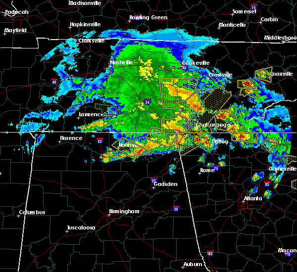 At 601 pm cdt, severe thunderstorms were located along a line extending from near spencer to pikeville to 9 miles west of dayton to 6 miles east of dunlap, moving east at 55 mph (radar indicated). Hazards include 60 mph wind gusts and quarter size hail. Hail damage to vehicles is expected. expect wind damage to roofs, siding, and trees. Locations impacted include, dunlap, pikeville, cartwright, lone oak, fall creek falls state park, palio, brayton, melvine, mount crest, old cumberland, cagle and north chickamauga creek gorge. At 601 pm cdt, severe thunderstorms were located along a line extending from near spencer to pikeville to 9 miles west of dayton to 6 miles east of dunlap, moving east at 55 mph (radar indicated). Hazards include 60 mph wind gusts and quarter size hail. Hail damage to vehicles is expected. expect wind damage to roofs, siding, and trees. Locations impacted include, dunlap, pikeville, cartwright, lone oak, fall creek falls state park, palio, brayton, melvine, mount crest, old cumberland, cagle and north chickamauga creek gorge.
|
| 3/21/2017 5:50 PM CDT | Numerous trees down at fall creek falls with many falling on campers and vehicles in van buren county TN, 9.3 miles ESE of Pikeville, TN |
| 3/21/2017 5:41 PM CDT |
 At 539 pm cdt, severe thunderstorms were located along a line extending from 8 miles northeast of mcminnville to 10 miles southwest of spencer to 13 miles northwest of dunlap to 6 miles northwest of gruetli-laager, moving east at 60 mph (radar indicated). Hazards include 60 mph wind gusts and quarter size hail. Hail damage to vehicles is expected. expect wind damage to roofs, siding, and trees. Locations impacted include, dunlap, pikeville, cartwright, lone oak, fall creek falls state park, palio, brayton, melvine, mount crest, old cumberland, cagle and north chickamauga creek gorge. At 539 pm cdt, severe thunderstorms were located along a line extending from 8 miles northeast of mcminnville to 10 miles southwest of spencer to 13 miles northwest of dunlap to 6 miles northwest of gruetli-laager, moving east at 60 mph (radar indicated). Hazards include 60 mph wind gusts and quarter size hail. Hail damage to vehicles is expected. expect wind damage to roofs, siding, and trees. Locations impacted include, dunlap, pikeville, cartwright, lone oak, fall creek falls state park, palio, brayton, melvine, mount crest, old cumberland, cagle and north chickamauga creek gorge.
|
| 3/21/2017 5:27 PM CDT |
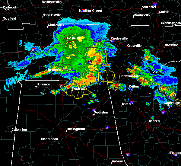 At 526 pm cdt, severe thunderstorms were located along a line extending from near woodbury to near mcminnville to 10 miles east of manchester, moving east at 50 mph (radar indicated). Hazards include 60 mph wind gusts and quarter size hail. Hail damage to vehicles is expected. Expect wind damage to roofs, siding, and trees. At 526 pm cdt, severe thunderstorms were located along a line extending from near woodbury to near mcminnville to 10 miles east of manchester, moving east at 50 mph (radar indicated). Hazards include 60 mph wind gusts and quarter size hail. Hail damage to vehicles is expected. Expect wind damage to roofs, siding, and trees.
|
| 3/10/2017 12:55 AM CST |
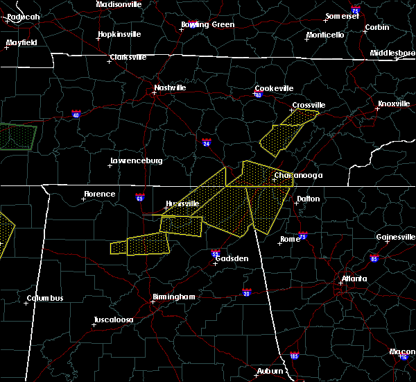 The severe thunderstorm warning for northwestern rhea and bledsoe counties will expire at 200 am est/100 am cst/, the storm which prompted the warning has weakened below severe limits, and no longer pose an immediate threat to life or property. therefore the warning will be allowed to expire. however gusty winds and heavy rain are still possible with this thunderstorm. The severe thunderstorm warning for northwestern rhea and bledsoe counties will expire at 200 am est/100 am cst/, the storm which prompted the warning has weakened below severe limits, and no longer pose an immediate threat to life or property. therefore the warning will be allowed to expire. however gusty winds and heavy rain are still possible with this thunderstorm.
|
| 3/10/2017 12:45 AM CST |
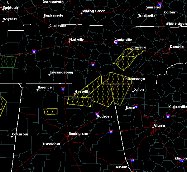 At 144 am est/1244 am cst/, a severe thunderstorm was located 7 miles north of pikeville, moving east at 55 mph (radar indicated). Hazards include 70 mph wind gusts and quarter size hail. Hail damage to vehicles is expected. expect considerable tree damage. wind damage is also likely to mobile homes, roofs, and outbuildings. locations impacted include, pikeville, stinging fork falls s. p. Fall creek falls state park, palio, brayton, melvine, mount crest and old cumberland. At 144 am est/1244 am cst/, a severe thunderstorm was located 7 miles north of pikeville, moving east at 55 mph (radar indicated). Hazards include 70 mph wind gusts and quarter size hail. Hail damage to vehicles is expected. expect considerable tree damage. wind damage is also likely to mobile homes, roofs, and outbuildings. locations impacted include, pikeville, stinging fork falls s. p. Fall creek falls state park, palio, brayton, melvine, mount crest and old cumberland.
|
| 3/10/2017 12:23 AM CST |
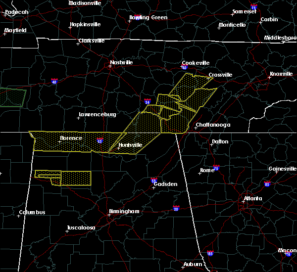 At 123 am est/1223 am cst/, a severe thunderstorm was located 10 miles south of spencer, moving east at 55 mph (radar indicated). Hazards include 70 mph wind gusts and quarter size hail. Hail damage to vehicles is expected. expect considerable tree damage. Wind damage is also likely to mobile homes, roofs, and outbuildings. At 123 am est/1223 am cst/, a severe thunderstorm was located 10 miles south of spencer, moving east at 55 mph (radar indicated). Hazards include 70 mph wind gusts and quarter size hail. Hail damage to vehicles is expected. expect considerable tree damage. Wind damage is also likely to mobile homes, roofs, and outbuildings.
|
| 3/1/2017 1:28 PM CST |
 At 227 pm est/127 pm cst/, a severe thunderstorm was located near dayton, moving east at 50 mph (radar indicated). Hazards include 60 mph wind gusts and quarter size hail. Hail damage to vehicles is expected. expect wind damage to roofs, siding, and trees. locations impacted include, dayton, dunlap, pikeville, decatur, soddy-daisy, spring city, graysville, cartwright, flat top mountain, mount crest, big spring, old washington, brayton, birchwood, melvine, griffith creek, evensville, sale creek, stinging fork falls s. p. and fall creek falls state park. A tornado watch remains in effect until 700 pm est/600 pm cst/ for eastern tennessee. At 227 pm est/127 pm cst/, a severe thunderstorm was located near dayton, moving east at 50 mph (radar indicated). Hazards include 60 mph wind gusts and quarter size hail. Hail damage to vehicles is expected. expect wind damage to roofs, siding, and trees. locations impacted include, dayton, dunlap, pikeville, decatur, soddy-daisy, spring city, graysville, cartwright, flat top mountain, mount crest, big spring, old washington, brayton, birchwood, melvine, griffith creek, evensville, sale creek, stinging fork falls s. p. and fall creek falls state park. A tornado watch remains in effect until 700 pm est/600 pm cst/ for eastern tennessee.
|
| 3/1/2017 12:58 PM CST |
 At 158 pm est/1258 pm cst/, a severe thunderstorm was located near gruetli-laager, or 11 miles west of dunlap, moving east at 45 mph (radar indicated). Hazards include golf ball size hail and 60 mph wind gusts. People and animals outdoors will be injured. expect hail damage to roofs, siding, windows, and vehicles. Expect wind damage to roofs, siding, and trees. At 158 pm est/1258 pm cst/, a severe thunderstorm was located near gruetli-laager, or 11 miles west of dunlap, moving east at 45 mph (radar indicated). Hazards include golf ball size hail and 60 mph wind gusts. People and animals outdoors will be injured. expect hail damage to roofs, siding, windows, and vehicles. Expect wind damage to roofs, siding, and trees.
|
| 3/1/2017 1:30 PM EST |
 At 130 pm est/1230 pm cst/, a severe thunderstorm was located 10 miles northwest of spring city, or 13 miles northeast of pikeville, moving east at 40 mph (radar indicated). Hazards include 60 mph wind gusts and quarter size hail. Hail damage to vehicles is expected. expect wind damage to roofs, siding, and trees. locations impacted include, pikeville, spring city, piney falls s. p. stinging fork falls s. p. fall creek falls state park, grandview, melvine and mount crest. A tornado watch remains in effect until 700 pm est/600 pm cst/ for eastern tennessee. At 130 pm est/1230 pm cst/, a severe thunderstorm was located 10 miles northwest of spring city, or 13 miles northeast of pikeville, moving east at 40 mph (radar indicated). Hazards include 60 mph wind gusts and quarter size hail. Hail damage to vehicles is expected. expect wind damage to roofs, siding, and trees. locations impacted include, pikeville, spring city, piney falls s. p. stinging fork falls s. p. fall creek falls state park, grandview, melvine and mount crest. A tornado watch remains in effect until 700 pm est/600 pm cst/ for eastern tennessee.
|
| 3/1/2017 1:11 PM EST |
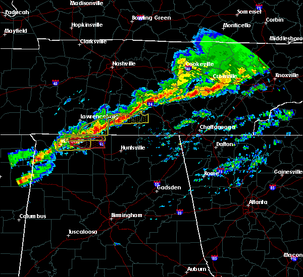 At 110 pm est/1210 pm cst/, a severe thunderstorm was located near pikeville, moving east at 40 mph (radar indicated). Hazards include 60 mph wind gusts and quarter size hail. Hail damage to vehicles is expected. Expect wind damage to roofs, siding, and trees. At 110 pm est/1210 pm cst/, a severe thunderstorm was located near pikeville, moving east at 40 mph (radar indicated). Hazards include 60 mph wind gusts and quarter size hail. Hail damage to vehicles is expected. Expect wind damage to roofs, siding, and trees.
|
| 11/30/2016 2:41 AM CST |
 At 340 am est/240 am cst/, severe thunderstorms were located along a line extending from 9 miles west of pikeville to near fairmount to near bridgeport, moving east at 55 mph (radar indicated). Hazards include 60 mph wind gusts. Expect damage to roofs. siding. And trees. At 340 am est/240 am cst/, severe thunderstorms were located along a line extending from 9 miles west of pikeville to near fairmount to near bridgeport, moving east at 55 mph (radar indicated). Hazards include 60 mph wind gusts. Expect damage to roofs. siding. And trees.
|
| 11/29/2016 10:41 PM CST |
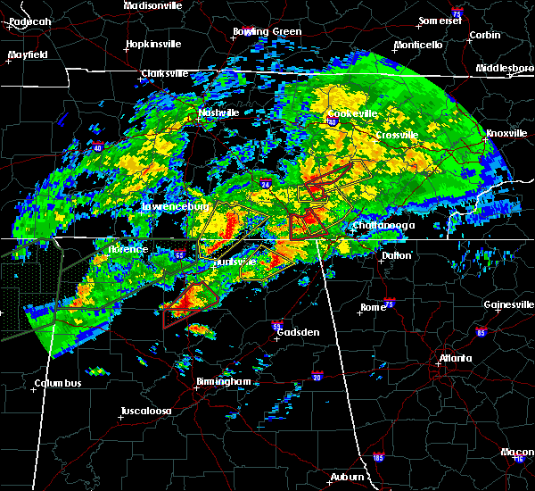 At 1041 pm cst, a severe thunderstorm was located 10 miles northeast of gruetli-laager, or 12 miles northwest of dunlap, moving northeast at 45 mph (radar indicated). Hazards include 60 mph wind gusts. Expect damage to roofs. siding. And trees. At 1041 pm cst, a severe thunderstorm was located 10 miles northeast of gruetli-laager, or 12 miles northwest of dunlap, moving northeast at 45 mph (radar indicated). Hazards include 60 mph wind gusts. Expect damage to roofs. siding. And trees.
|
| 8/18/2016 9:00 AM EDT |
 At 900 am edt/800 am cdt/, severe thunderstorms were located along a line extending from near spring city to near dayton to 7 miles north of soddy-daisy, moving east at 30 mph (radar indicated). Hazards include 60 mph wind gusts. Expect damage to roofs. siding. And trees. At 900 am edt/800 am cdt/, severe thunderstorms were located along a line extending from near spring city to near dayton to 7 miles north of soddy-daisy, moving east at 30 mph (radar indicated). Hazards include 60 mph wind gusts. Expect damage to roofs. siding. And trees.
|
| 8/18/2016 7:45 AM CDT |
 At 845 am edt/745 am cdt/, severe thunderstorms were located along a line extending from near pikeville to 12 miles west of dayton to near dunlap, moving east at 30 mph (radar indicated). Hazards include 60 mph wind gusts. Expect damage to roofs. siding. and trees. Locations impacted include, dunlap, pikeville, soddy-daisy, fall creek falls state park, brayton, flat top mountain, old cumberland, palio, mowbray mountain, mount crest, melvine, cartwright, north chickamauga creek gorge and sale creek. At 845 am edt/745 am cdt/, severe thunderstorms were located along a line extending from near pikeville to 12 miles west of dayton to near dunlap, moving east at 30 mph (radar indicated). Hazards include 60 mph wind gusts. Expect damage to roofs. siding. and trees. Locations impacted include, dunlap, pikeville, soddy-daisy, fall creek falls state park, brayton, flat top mountain, old cumberland, palio, mowbray mountain, mount crest, melvine, cartwright, north chickamauga creek gorge and sale creek.
|
| 8/18/2016 7:28 AM CDT |
 At 827 am edt/727 am cdt/, severe thunderstorms were located along a line extending from 7 miles northwest of pikeville to near old cumberland to near dunlap, moving east at 30 mph (radar indicated). Hazards include 60 mph wind gusts. Expect damage to roofs. siding. and trees. Locations impacted include, dunlap, pikeville, soddy-daisy, fall creek falls state park, brayton, flat top mountain, old cumberland, palio, mowbray mountain, cagle, mount crest, melvine, cartwright, north chickamauga creek gorge and sale creek. At 827 am edt/727 am cdt/, severe thunderstorms were located along a line extending from 7 miles northwest of pikeville to near old cumberland to near dunlap, moving east at 30 mph (radar indicated). Hazards include 60 mph wind gusts. Expect damage to roofs. siding. and trees. Locations impacted include, dunlap, pikeville, soddy-daisy, fall creek falls state park, brayton, flat top mountain, old cumberland, palio, mowbray mountain, cagle, mount crest, melvine, cartwright, north chickamauga creek gorge and sale creek.
|
| 8/18/2016 7:15 AM CDT |
 At 814 am edt/714 am cdt/, severe thunderstorms were located along a line extending from 6 miles south of spencer to 10 miles northwest of dunlap to 6 miles north of whitwell, moving east at 25 mph (radar indicated). Hazards include 60 mph wind gusts. Expect damage to roofs. siding. And trees. At 814 am edt/714 am cdt/, severe thunderstorms were located along a line extending from 6 miles south of spencer to 10 miles northwest of dunlap to 6 miles north of whitwell, moving east at 25 mph (radar indicated). Hazards include 60 mph wind gusts. Expect damage to roofs. siding. And trees.
|
| 7/16/2016 11:13 AM CDT |
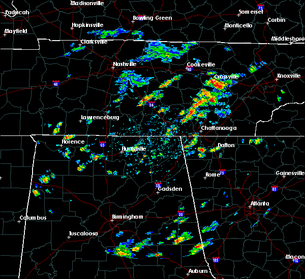 At 1212 pm edt/1112 am cdt/, a severe thunderstorm was located 7 miles east of pikeville, moving northeast at 25 mph (radar indicated). Hazards include 60 mph wind gusts and half dollar size hail. Hail damage to vehicles is expected. Expect wind damage to roofs, siding, and trees. At 1212 pm edt/1112 am cdt/, a severe thunderstorm was located 7 miles east of pikeville, moving northeast at 25 mph (radar indicated). Hazards include 60 mph wind gusts and half dollar size hail. Hail damage to vehicles is expected. Expect wind damage to roofs, siding, and trees.
|
| 7/14/2016 3:28 PM CDT |
 At 428 pm edt/328 pm cdt/, severe thunderstorms were located along a line extending from 6 miles west of spring city to 6 miles southeast of jasper, moving east at 25 mph (radar indicated). Hazards include 60 mph wind gusts and quarter size hail. Hail damage to vehicles is expected. Expect wind damage to roofs, siding, and trees. At 428 pm edt/328 pm cdt/, severe thunderstorms were located along a line extending from 6 miles west of spring city to 6 miles southeast of jasper, moving east at 25 mph (radar indicated). Hazards include 60 mph wind gusts and quarter size hail. Hail damage to vehicles is expected. Expect wind damage to roofs, siding, and trees.
|
| 7/8/2016 8:10 PM CDT | Trees down across the southern part of the count in bledsoe county TN, 2.8 miles N of Pikeville, TN |
| 7/8/2016 7:55 PM CDT |
 At 754 pm cdt, a severe thunderstorm was located 12 miles north of dunlap, moving southeast at 25 mph (radar indicated). Hazards include 60 mph wind gusts and quarter size hail. Hail damage to vehicles is expected. Expect wind damage to roofs, siding, and trees. At 754 pm cdt, a severe thunderstorm was located 12 miles north of dunlap, moving southeast at 25 mph (radar indicated). Hazards include 60 mph wind gusts and quarter size hail. Hail damage to vehicles is expected. Expect wind damage to roofs, siding, and trees.
|
| 7/7/2016 6:28 PM EDT |
 At 627 pm edt/527 pm cdt/, severe thunderstorms were located along a line extending from near fairview to 7 miles northeast of decatur to near dayton, moving southeast at 40 mph (radar indicated). Hazards include 60 mph wind gusts and penny size hail. Expect damage to roofs. siding. and trees. Locations impacted include, oak ridge, athens, lenoir city, dayton, kingston, sweetwater, rockwood, loudon, madisonville, pikeville, decatur, fairview, etowah, spring city, midtown, harriman, englewood, graysville, vonore and greenback. At 627 pm edt/527 pm cdt/, severe thunderstorms were located along a line extending from near fairview to 7 miles northeast of decatur to near dayton, moving southeast at 40 mph (radar indicated). Hazards include 60 mph wind gusts and penny size hail. Expect damage to roofs. siding. and trees. Locations impacted include, oak ridge, athens, lenoir city, dayton, kingston, sweetwater, rockwood, loudon, madisonville, pikeville, decatur, fairview, etowah, spring city, midtown, harriman, englewood, graysville, vonore and greenback.
|
| 7/7/2016 6:09 PM EDT |
 At 609 pm edt/509 pm cdt/, severe thunderstorms were located along a line extending from 7 miles east of fairfield glade to 10 miles northwest of spring city to near spencer, moving southeast at 30 mph (radar indicated). Hazards include 60 mph wind gusts and penny size hail. Expect damage to roofs. siding. And trees. At 609 pm edt/509 pm cdt/, severe thunderstorms were located along a line extending from 7 miles east of fairfield glade to 10 miles northwest of spring city to near spencer, moving southeast at 30 mph (radar indicated). Hazards include 60 mph wind gusts and penny size hail. Expect damage to roofs. siding. And trees.
|
| 7/7/2016 5:03 PM CDT |
 At 603 pm edt/503 pm cdt/, a severe thunderstorm was located 7 miles northeast of pikeville, moving southeast at 40 mph (radar indicated). Hazards include 60 mph wind gusts and nickel size hail. Expect damage to roofs. siding. and trees. locations impacted include, dayton, pikeville, spring city, stinging fork falls s. p,. mount crest, piney falls s. p,. Melvine, evensville and grandview. At 603 pm edt/503 pm cdt/, a severe thunderstorm was located 7 miles northeast of pikeville, moving southeast at 40 mph (radar indicated). Hazards include 60 mph wind gusts and nickel size hail. Expect damage to roofs. siding. and trees. locations impacted include, dayton, pikeville, spring city, stinging fork falls s. p,. mount crest, piney falls s. p,. Melvine, evensville and grandview.
|
| 7/7/2016 5:00 PM CDT | A few trees down along hwy 101 at beaver dam cree in bledsoe county TN, 8.2 miles S of Pikeville, TN |
| 7/7/2016 4:50 PM CDT |
 At 549 pm edt/449 pm cdt/, a severe thunderstorm was located 10 miles north of pikeville, moving southeast at 25 mph (radar indicated). Hazards include 60 mph wind gusts and nickel size hail. Expect damage to roofs. siding. And trees. At 549 pm edt/449 pm cdt/, a severe thunderstorm was located 10 miles north of pikeville, moving southeast at 25 mph (radar indicated). Hazards include 60 mph wind gusts and nickel size hail. Expect damage to roofs. siding. And trees.
|
| 4/27/2016 9:03 PM CDT |
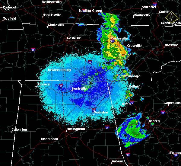 At 902 pm cdt, a severe thunderstorm was located 9 miles north of pikeville, moving east at 25 mph (radar indicated). Hazards include 60 mph wind gusts. Expect damage to roofs. siding. and trees. Locations impacted include, pikeville, mount crest and melvine. At 902 pm cdt, a severe thunderstorm was located 9 miles north of pikeville, moving east at 25 mph (radar indicated). Hazards include 60 mph wind gusts. Expect damage to roofs. siding. and trees. Locations impacted include, pikeville, mount crest and melvine.
|
| 4/27/2016 8:43 PM CDT |
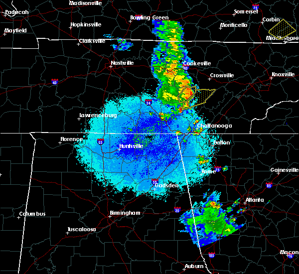 At 842 pm cdt, severe thunderstorms were located along a line extending from 5 miles west of spencer to 10 miles west of pikeville to 4 miles west of old cumberland, moving northeast at 35 mph (radar indicated). Hazards include 60 mph wind gusts. Expect damage to roofs. siding. And trees. At 842 pm cdt, severe thunderstorms were located along a line extending from 5 miles west of spencer to 10 miles west of pikeville to 4 miles west of old cumberland, moving northeast at 35 mph (radar indicated). Hazards include 60 mph wind gusts. Expect damage to roofs. siding. And trees.
|
| 2/3/2016 2:25 AM CST | Several trees down across the platea in bledsoe county TN, 1.7 miles ESE of Pikeville, TN |
| 2/3/2016 2:22 AM CST |
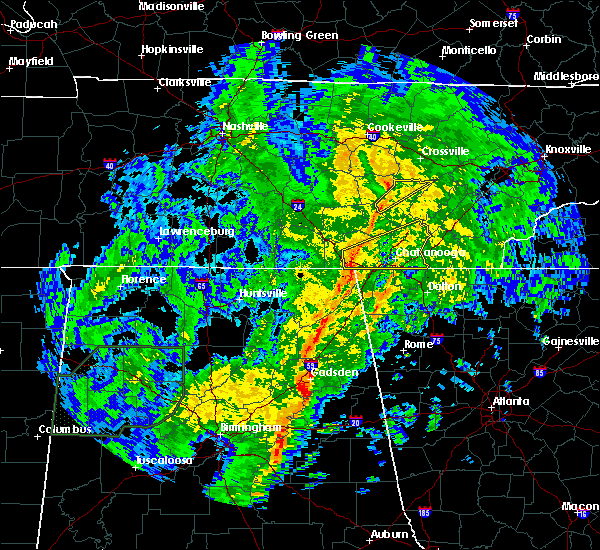 At 221 am cst, a severe thunderstorm was located near pikeville, moving northeast at 65 mph (radar indicated). Hazards include 60 mph wind gusts. Expect damage to roofs. siding and trees. Locations impacted include, pikeville, mount crest, old cumberland and melvine. At 221 am cst, a severe thunderstorm was located near pikeville, moving northeast at 65 mph (radar indicated). Hazards include 60 mph wind gusts. Expect damage to roofs. siding and trees. Locations impacted include, pikeville, mount crest, old cumberland and melvine.
|
| 2/3/2016 2:05 AM CST |
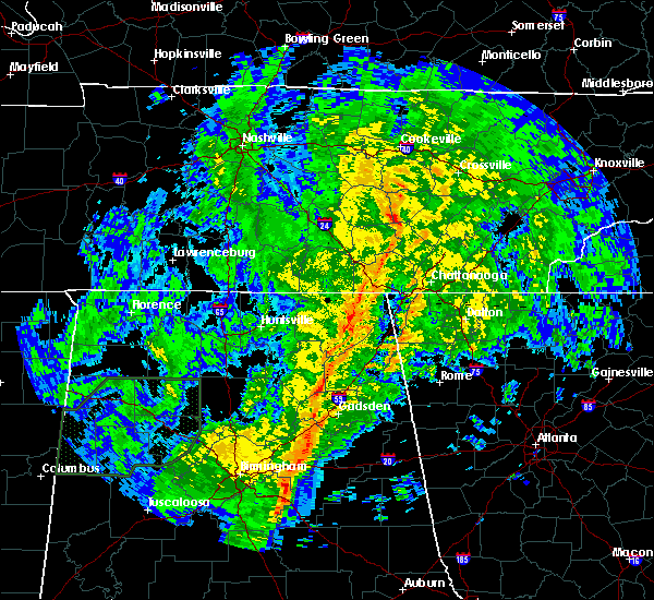 At 205 am cst, a severe thunderstorm was located 12 miles northwest of dunlap, moving northeast at 65 mph (radar indicated). Hazards include 60 mph wind gusts. Expect damage to roofs. Siding and trees. At 205 am cst, a severe thunderstorm was located 12 miles northwest of dunlap, moving northeast at 65 mph (radar indicated). Hazards include 60 mph wind gusts. Expect damage to roofs. Siding and trees.
|
| 7/14/2015 4:27 PM CDT |
 At 526 pm edt /426 pm cdt/, severe thunderstorms were located along a line extending from 6 miles southwest of decatur to 23 miles north of monteagle, moving south at 20 mph (radar indicated). Hazards include 60 mph wind gusts and half dollar size hail. Hail damage to vehicles is expected. Expect wind damage to roofs, siding and trees. At 526 pm edt /426 pm cdt/, severe thunderstorms were located along a line extending from 6 miles southwest of decatur to 23 miles north of monteagle, moving south at 20 mph (radar indicated). Hazards include 60 mph wind gusts and half dollar size hail. Hail damage to vehicles is expected. Expect wind damage to roofs, siding and trees.
|
| 7/14/2015 5:12 PM EDT |
 At 511 pm edt /411 pm cdt/, severe thunderstorms were located along a line extending from 6 miles northeast of athens to 6 miles northwest of pikeville, moving south at 25 mph (radar indicated). Hazards include 60 mph wind gusts and quarter size hail. Hail damage to vehicles is expected. expect wind damage to roofs, siding and trees. Locations impacted include, athens, dayton, sweetwater, pikeville, decatur, etowah, spring city, englewood, graysville, niota, calhoun, big spring, dentville, hillsview, old washington, murray store, melvine, ten mile, brayton and palio. At 511 pm edt /411 pm cdt/, severe thunderstorms were located along a line extending from 6 miles northeast of athens to 6 miles northwest of pikeville, moving south at 25 mph (radar indicated). Hazards include 60 mph wind gusts and quarter size hail. Hail damage to vehicles is expected. expect wind damage to roofs, siding and trees. Locations impacted include, athens, dayton, sweetwater, pikeville, decatur, etowah, spring city, englewood, graysville, niota, calhoun, big spring, dentville, hillsview, old washington, murray store, melvine, ten mile, brayton and palio.
|
| 7/14/2015 4:53 PM EDT |
 At 452 pm edt /352 pm cdt/, severe thunderstorms were located along a line extending from 7 miles west of sweetwater to 9 miles north of pikeville, moving south at 30 mph (radar indicated). Hazards include 60 mph wind gusts and quarter size hail. Hail damage to vehicles is expected. expect wind damage to roofs, siding and trees. Locations impacted include, athens, dayton, sweetwater, pikeville, decatur, etowah, spring city, englewood, graysville, niota, calhoun, big spring, dentville, hillsview, old washington, grandview, murray store, melvine, ten mile and brayton. At 452 pm edt /352 pm cdt/, severe thunderstorms were located along a line extending from 7 miles west of sweetwater to 9 miles north of pikeville, moving south at 30 mph (radar indicated). Hazards include 60 mph wind gusts and quarter size hail. Hail damage to vehicles is expected. expect wind damage to roofs, siding and trees. Locations impacted include, athens, dayton, sweetwater, pikeville, decatur, etowah, spring city, englewood, graysville, niota, calhoun, big spring, dentville, hillsview, old washington, grandview, murray store, melvine, ten mile and brayton.
|
| 7/14/2015 4:29 PM EDT |
 At 428 pm edt /328 pm cdt/, severe thunderstorms were located along a line extending from 9 miles northwest of sweetwater to 15 miles northwest of pikeville, moving south at 30 mph (radar indicated). Hazards include 60 mph wind gusts and quarter size hail. Hail damage to vehicles is expected. Expect wind damage to roofs, siding and trees. At 428 pm edt /328 pm cdt/, severe thunderstorms were located along a line extending from 9 miles northwest of sweetwater to 15 miles northwest of pikeville, moving south at 30 mph (radar indicated). Hazards include 60 mph wind gusts and quarter size hail. Hail damage to vehicles is expected. Expect wind damage to roofs, siding and trees.
|
| 6/24/2015 2:39 PM CDT |
 At 338 pm edt /238 pm cdt/, severe thunderstorms were located along a line extending from 6 miles west of etowah to monteagle, moving southeast at 10 mph (radar indicated). Hazards include 60 mph wind gusts and quarter size hail. Hail damage to vehicles is expected. Expect wind damage to roofs, siding and trees. At 338 pm edt /238 pm cdt/, severe thunderstorms were located along a line extending from 6 miles west of etowah to monteagle, moving southeast at 10 mph (radar indicated). Hazards include 60 mph wind gusts and quarter size hail. Hail damage to vehicles is expected. Expect wind damage to roofs, siding and trees.
|
| 6/8/2015 8:02 PM EDT | At 801 pm edt /701 pm cdt/, severe thunderstorms were located along a line extending from 8 miles west of rockwood to near spring city to near dayton to 6 miles northeast of dunlap, moving east at 50 mph (radar indicated). Hazards include 60 mph wind gusts and penny size hail. Expect damage to roofs. siding and trees. locations impacted include, athens, dayton, sweetwater, pikeville, decatur, etowah, spring city, charleston, graysville, niota, calhoun, riceville, peakland, big spring, stinging fork falls s. p,. evensville, clear water, fall creek falls s. p,. Dentville and old washington. |
| 6/8/2015 7:28 PM EDT | At 727 pm edt /627 pm cdt/, severe thunderstorms were located along a line extending from 9 miles east of sparta to 7 miles southeast of spencer to 12 miles west of pikeville to 11 miles south of mcminnville, moving east southeast at 45 mph (radar indicated). Hazards include 65 mph wind gusts and penny size hail. Expect damage to roofs. Siding and trees. |
| 4/20/2015 3:22 AM CDT | At 422 am edt /322 am cdt/, severe thunderstorms were located along a line extending from 9 miles west of pikeville to 8 miles east of jasper, moving northeast at 60 mph (radar indicated). Hazards include 60 mph wind gusts and penny size hail. Expect damage to roofs. siding and trees. locations impacted include, chattanooga, dunlap, jasper, pikeville, soddy-daisy, signal mountain, walden, lakesite, whitwell, ridgeside, harrison, fairmount, red bank, collegedale, powells crossroads, martin springs, ooltewah, lone oak, melvine and brayton. 0. 75in. |
| 4/20/2015 3:13 AM CDT | At 413 am edt /313 am cdt/, severe thunderstorms were located along a line extending from 12 miles north of dunlap to near jasper, moving northeast at 55 mph (radar indicated). Hazards include 60 mph wind gusts and penny size hail. Expect damage to roofs. siding and trees. locations impacted include, chattanooga, dunlap, jasper, pikeville, soddy-daisy, signal mountain, south pittsburg, walden, lakesite, whitwell, kimball, monteagle, ridgeside, harrison, fairmount, red bank, collegedale, powells crossroads, orme and martin springs. 0. 75in. |
| 4/20/2015 2:58 AM CDT | At 357 am edt /257 am cdt/, severe thunderstorms were located along a line extending from 16 miles north of monteagle to 7 miles west of south pittsburg, moving northeast at 55 mph (radar indicated). Hazards include 60 mph wind gusts and penny size hail. Expect damage to roofs. siding and trees. locations impacted include, chattanooga, dunlap, jasper, pikeville, soddy-daisy, signal mountain, south pittsburg, walden, lakesite, whitwell, kimball, monteagle, ridgeside, harrison, fairmount, red bank, collegedale, powells crossroads, orme and martin springs. 0. 75in. |
| 4/20/2015 2:44 AM CDT | At 343 am edt /243 am cdt/, severe thunderstorms were located along a line extending from 10 miles northwest of monteagle to 21 miles west of south pittsburg, moving northeast at 60 mph (radar indicated). Hazards include 60 mph wind gusts and penny size hail. Expect damage to roofs. Siding and trees. |
| 4/3/2015 8:30 PM EDT | A severe thunderstorm warning remains in effect until 900 pm edt/800 pm cdt/ for bledsoe. meigs. roane. eastern hamilton and rhea counties. at 829 pm edt /729 pm cdt/. severe thunderstorms were located along a line extending from near rockwood to 11 miles southwest of pikeville. Moving southeast at 40 mph. |
| 4/3/2015 8:12 PM EDT | The national weather service in morristown has issued a * severe thunderstorm warning for. bledsoe county in eastern tennessee. meigs county in eastern tennessee. roane county in eastern tennessee. Eastern hamilton county in eastern tennessee. |
| 6/21/2014 4:30 PM CDT | Several trees down in pikeville...upper east valley road...old dayton highway and lockford road. roof damage to tdot building in pikevill in bledsoe county TN, 0.6 miles S of Pikeville, TN |
| 4/28/2014 9:10 PM CDT | A few large trees down in the griffith community west of pikevill in bledsoe county TN, 0.6 miles S of Pikeville, TN |
| 4/17/2013 2:54 PM CDT | Several trees down in pikeville and surrounding area in bledsoe county TN, 0.6 miles S of Pikeville, TN |
| 4/17/2013 1:00 PM CDT | Half Dollar sized hail reported 9.2 miles SSE of Pikeville, TN, half dollar size hail reported...along with shredded leaves and damaged shingles. |
| 4/11/2013 6:20 PM CDT | 1 tree dow in bledsoe county TN, 0.6 miles S of Pikeville, TN |
| 7/18/2012 4:05 PM CDT | Dispatch reported a tree down in the mount crest are in bledsoe county TN, 5.2 miles SSE of Pikeville, TN |
| 6/14/2012 7:35 PM CDT | Utility company reported several locations with power lines knocked down by large tree limbs and trees including highway 127 and upper east valley roa in bledsoe county TN, 2.7 miles SW of Pikeville, TN |
| 5/29/2012 7:30 PM CDT | Dispatch reported a couple trees down in new harmon in bledsoe county TN, 2.7 miles WNW of Pikeville, TN |
| 5/19/2012 3:10 PM CDT | Quarter sized hail reported 11.4 miles E of Pikeville, TN |
| 5/19/2012 2:30 PM CDT | Quarter sized hail reported 4.4 miles NE of Pikeville, TN |
| 4/26/2012 7:20 AM CDT | Quarter sized hail reported 0.6 miles S of Pikeville, TN |
| 1/1/0001 12:00 AM | One tree down on hwy 10 in bledsoe county TN, 5.2 miles SSE of Pikeville, TN |
| 1/1/0001 12:00 AM | One tree down on big spring gap r in bledsoe county TN, 5.2 miles SSE of Pikeville, TN |
| 1/1/0001 12:00 AM | Several trees down in and around pikeville. one on highway 30e and another on college street. reported by dispatc in bledsoe county TN, 0.6 miles S of Pikeville, TN |
| 1/1/0001 12:00 AM | Trees down county wide. damage to homes in pikevill in bledsoe county TN, 0.6 miles S of Pikeville, TN |
| 1/1/0001 12:00 AM | Couple trees down on highway 127 reported by dispat in bledsoe county TN, 0.6 miles S of Pikeville, TN |
Hail Maps for Pikeville, TN


Connect with Interactive Hail Maps