

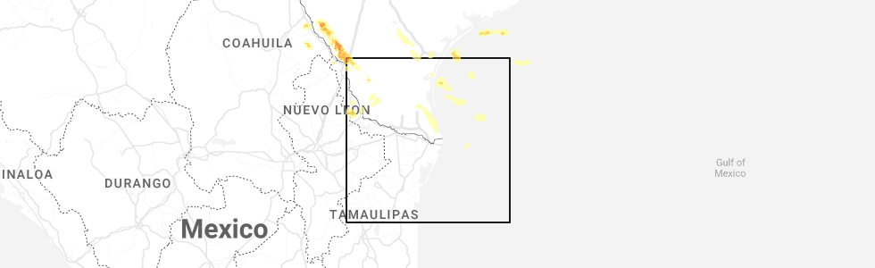
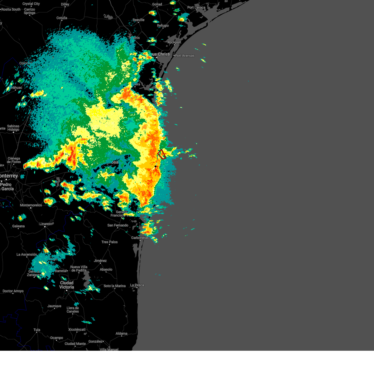
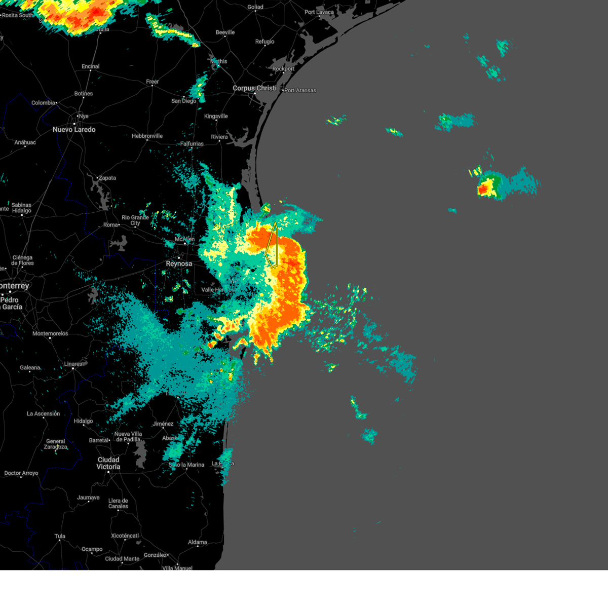
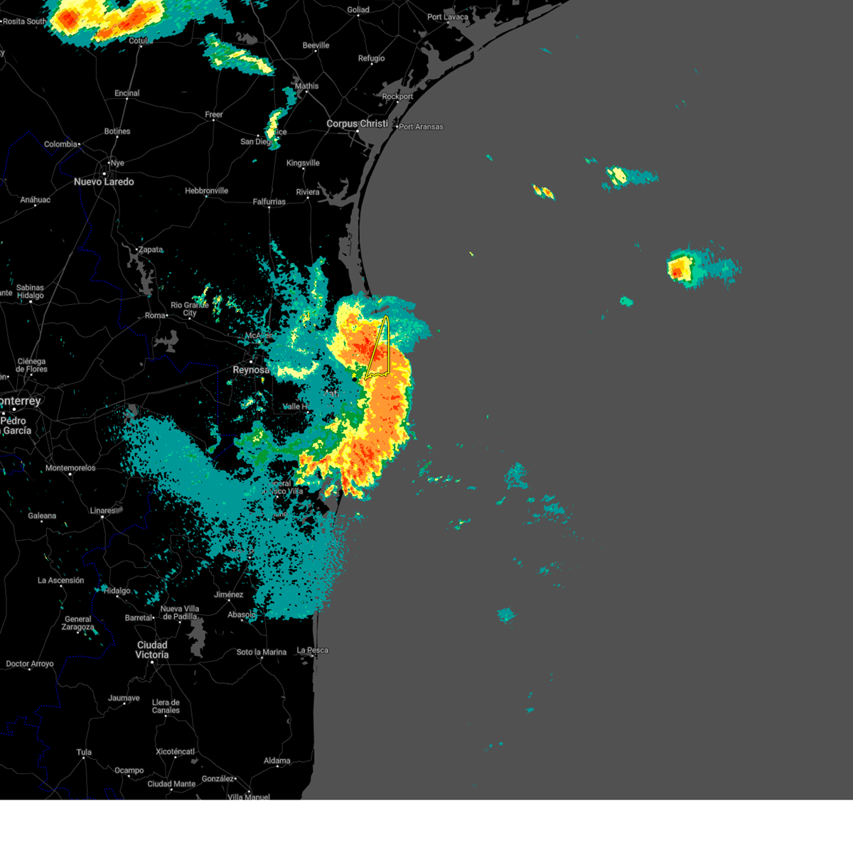
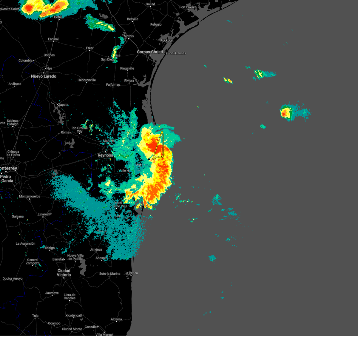
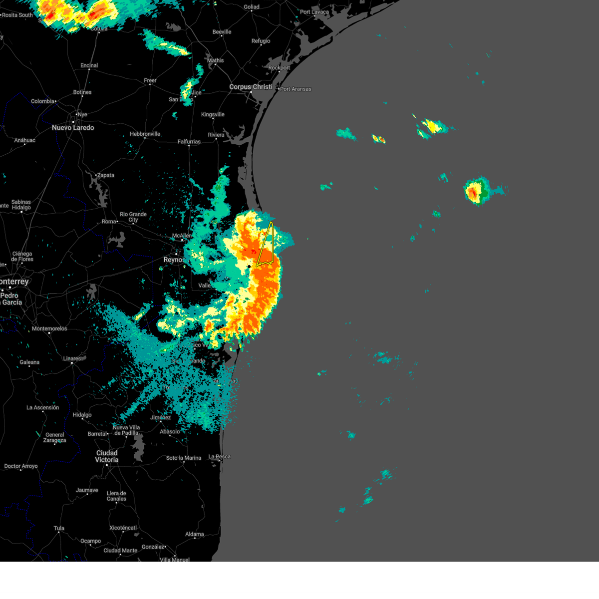
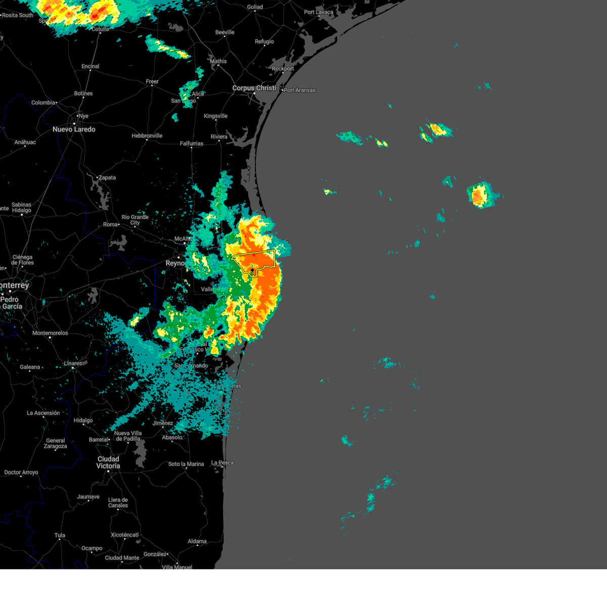
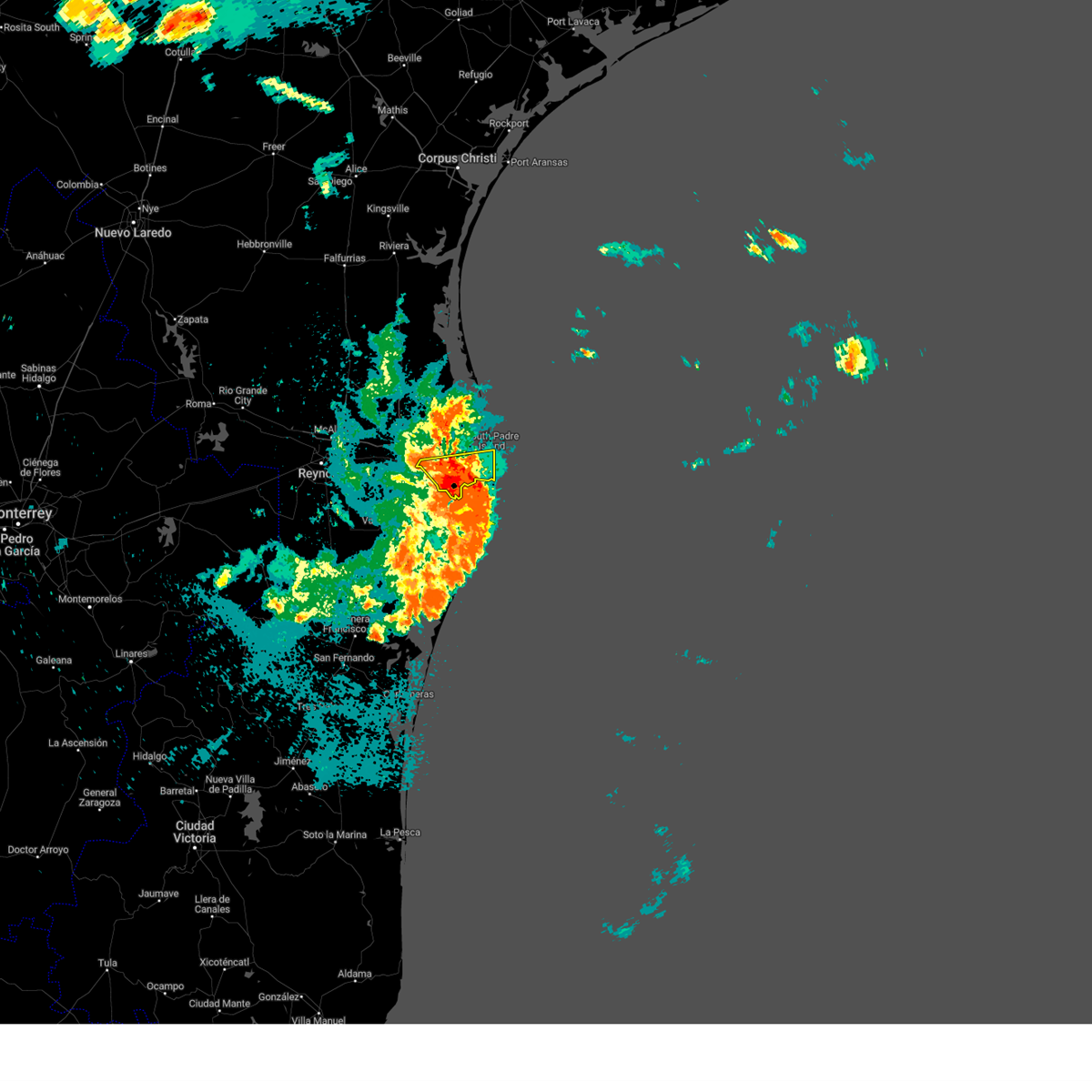
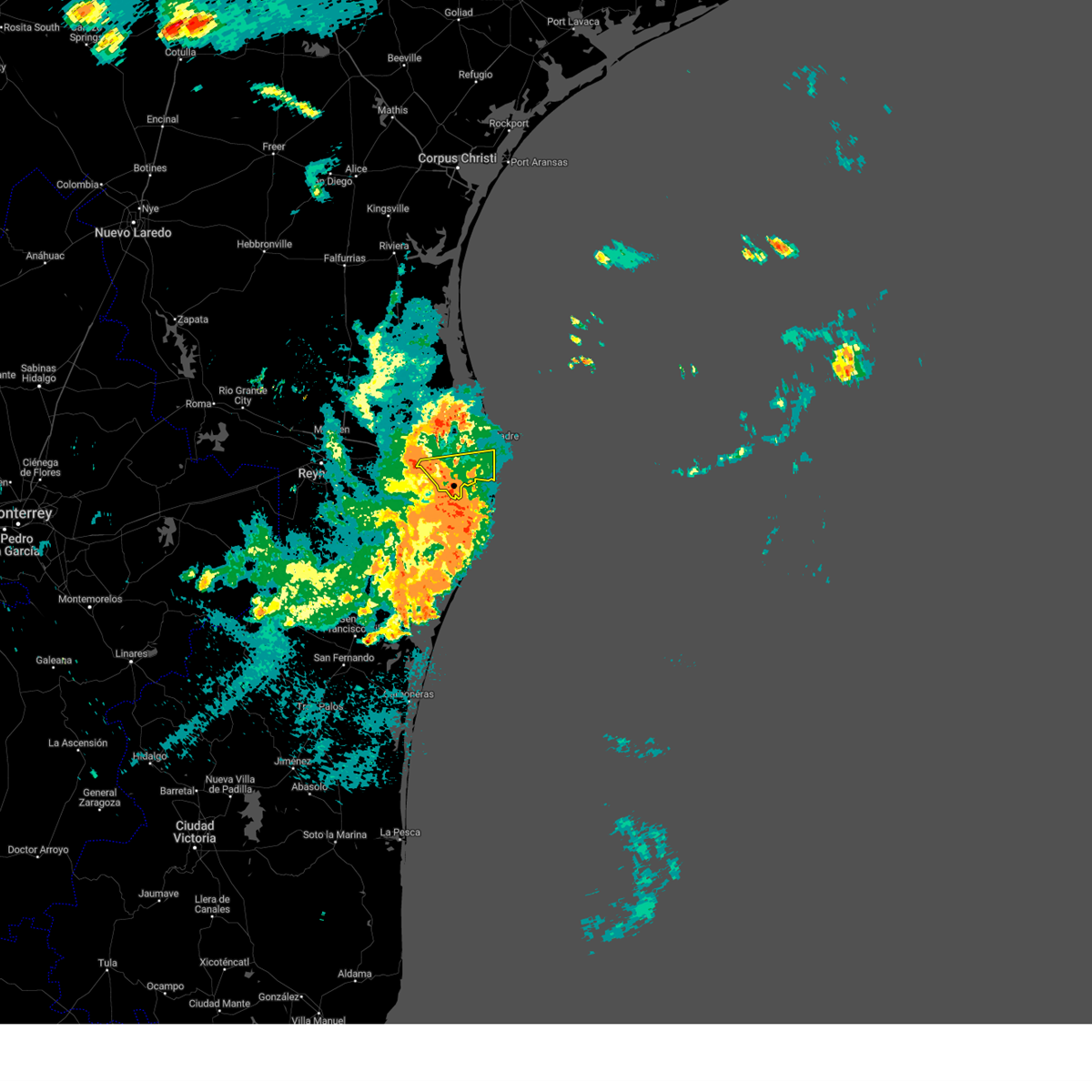
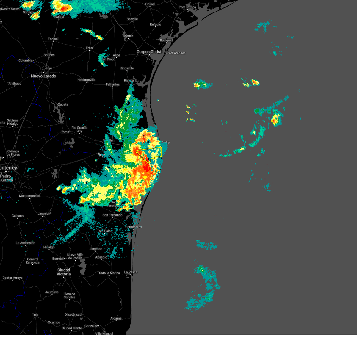
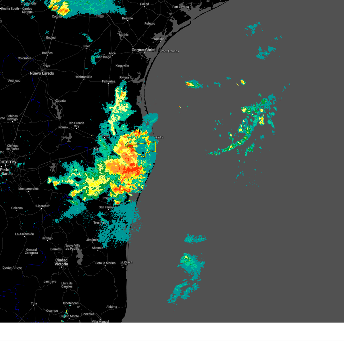
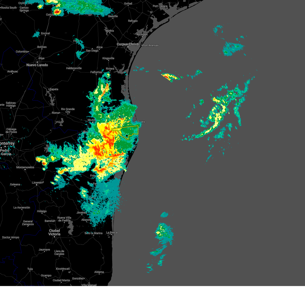
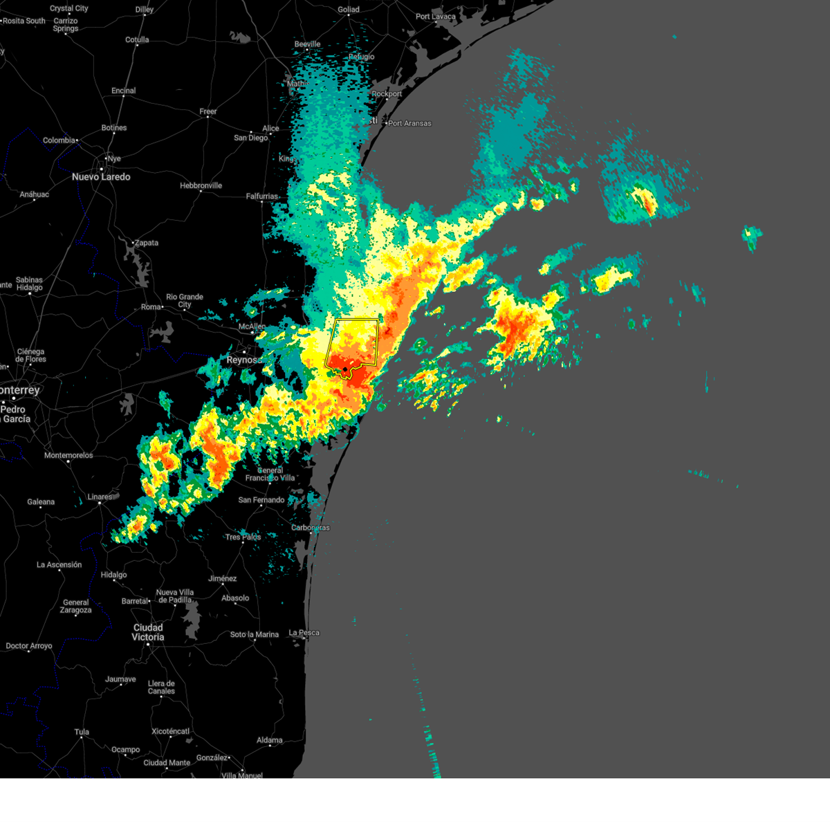
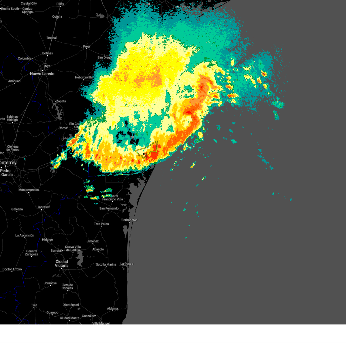
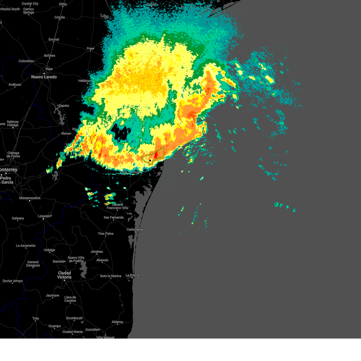
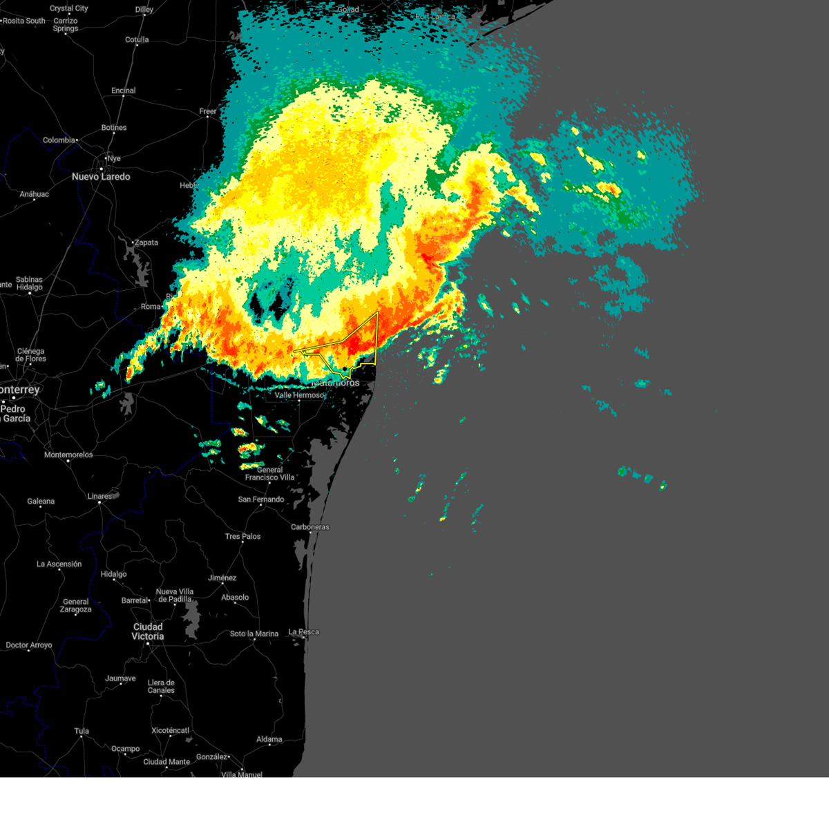
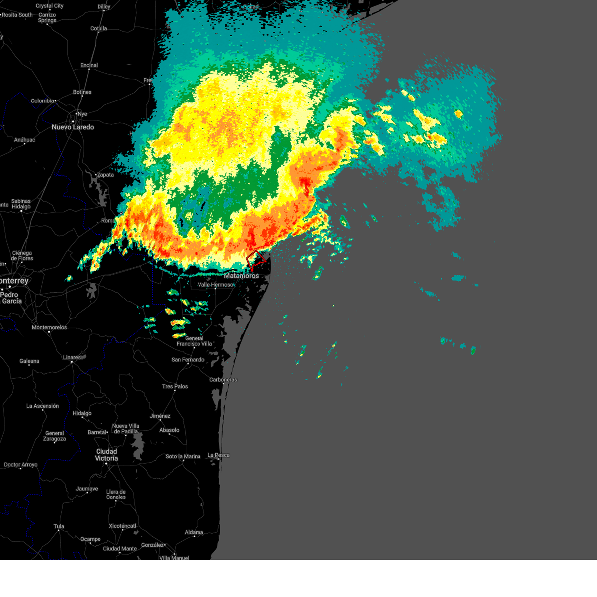
Hail Map for Port Isabel, TX
The Port Isabel, TX area has had 2 reports of on-the-ground hail by trained spotters, and has been under severe weather warnings 30 times during the past 12 months. Doppler radar has detected hail at or near Port Isabel, TX on 8 occasions, including 1 occasion during the past year.
| Name: | Port Isabel, TX |
| Where Located: | 20.4 miles NE of Brownsville, TX |
| Map: | Google Map for Port Isabel, TX |
| Population: | 5006 |
| Housing Units: | 2206 |
| More Info: | Search Google for Port Isabel, TX |
0
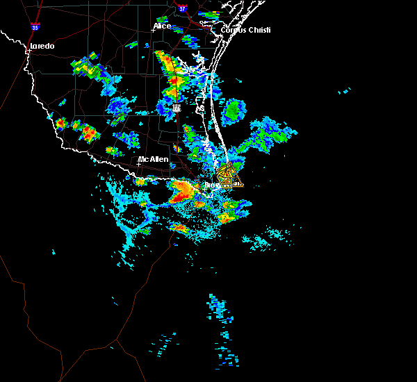
The Top Recent Hail Date for Port Isabel, TX is Sunday, April 23, 2023 (7th out of 8)
Hail and Wind Damage Spotted near Port Isabel, TX
| Date / Time | Report Details |
|---|---|
| 6/8/2023 7:04 AM CDT |
 At 703 am cdt, severe thunderstorms were located along a line extending from near beach access six to near besteiro middle school, moving southeast at 60 mph (radar indicated). Hazards include 60 mph wind gusts. Expect damage to roofs, siding, and trees. locations impacted include, harlingen, san benito, los fresnos, south padre island, rancho viejo, rio hondo, los indios, southmost, olmito and port of brownsville. hail threat, radar indicated max hail size, <. 75 in wind threat, radar indicated max wind gust, 60 mph. At 703 am cdt, severe thunderstorms were located along a line extending from near beach access six to near besteiro middle school, moving southeast at 60 mph (radar indicated). Hazards include 60 mph wind gusts. Expect damage to roofs, siding, and trees. locations impacted include, harlingen, san benito, los fresnos, south padre island, rancho viejo, rio hondo, los indios, southmost, olmito and port of brownsville. hail threat, radar indicated max hail size, <. 75 in wind threat, radar indicated max wind gust, 60 mph.
|
| 6/8/2023 6:51 AM CDT |
 At 649 am cdt, severe thunderstorms were located along a line extending from near arroyo city to near san pedro, moving southeast at 60 mph (radar indicated). Hazards include 70 mph wind gusts and penny size hail. Expect considerable tree damage. damage is likely to mobile homes, roofs, and outbuildings. locations impacted include, harlingen, san benito, mercedes, la feria, los fresnos, progreso, santa rosa, south padre island, rancho viejo and rio hondo. thunderstorm damage threat, considerable hail threat, radar indicated max hail size, 0. 75 in wind threat, radar indicated max wind gust, 70 mph. At 649 am cdt, severe thunderstorms were located along a line extending from near arroyo city to near san pedro, moving southeast at 60 mph (radar indicated). Hazards include 70 mph wind gusts and penny size hail. Expect considerable tree damage. damage is likely to mobile homes, roofs, and outbuildings. locations impacted include, harlingen, san benito, mercedes, la feria, los fresnos, progreso, santa rosa, south padre island, rancho viejo and rio hondo. thunderstorm damage threat, considerable hail threat, radar indicated max hail size, 0. 75 in wind threat, radar indicated max wind gust, 70 mph.
|
| 6/8/2023 6:35 AM CDT |
 At 635 am cdt, severe thunderstorms were located along a line extending from near willamar to relampago, moving southeast at 75 mph (radar indicated). Hazards include 70 mph wind gusts and penny size hail. Expect considerable tree damage. Damage is likely to mobile homes, roofs, and outbuildings. At 635 am cdt, severe thunderstorms were located along a line extending from near willamar to relampago, moving southeast at 75 mph (radar indicated). Hazards include 70 mph wind gusts and penny size hail. Expect considerable tree damage. Damage is likely to mobile homes, roofs, and outbuildings.
|
| 6/5/2023 3:48 PM CDT |
 At 346 pm cdt, severe thunderstorms were located along a line extending from near port of brownsville to near gallegos elementary school to brownsville fire department station six, moving south at 30 mph (radar indicated. this storm produced a wind gust of 45 mph at harlingen valley international airport at 317 pm). Hazards include 60 mph wind gusts and penny size hail. Expect minor damage to roofs, siding, and trees. locations impacted include, port of brownsville, east brownsville and loma alta lake. hail threat, radar indicated max hail size, 0. 75 in wind threat, radar indicated max wind gust, 60 mph. At 346 pm cdt, severe thunderstorms were located along a line extending from near port of brownsville to near gallegos elementary school to brownsville fire department station six, moving south at 30 mph (radar indicated. this storm produced a wind gust of 45 mph at harlingen valley international airport at 317 pm). Hazards include 60 mph wind gusts and penny size hail. Expect minor damage to roofs, siding, and trees. locations impacted include, port of brownsville, east brownsville and loma alta lake. hail threat, radar indicated max hail size, 0. 75 in wind threat, radar indicated max wind gust, 60 mph.
|
| 6/5/2023 3:34 PM CDT |
 At 333 pm cdt, severe thunderstorms were located along a line extending from near holly beach to los fresnos high school to rancho verde elementary school, moving south at 30 mph (radar indicated). Hazards include ping pong ball size hail and 60 mph wind gusts. People and animals outdoors will be injured. expect hail damage to roofs, siding, windows, and vehicles. Expect wind damage to roofs, siding, and trees. At 333 pm cdt, severe thunderstorms were located along a line extending from near holly beach to los fresnos high school to rancho verde elementary school, moving south at 30 mph (radar indicated). Hazards include ping pong ball size hail and 60 mph wind gusts. People and animals outdoors will be injured. expect hail damage to roofs, siding, windows, and vehicles. Expect wind damage to roofs, siding, and trees.
|
| 6/4/2023 7:34 PM CDT |
 At 733 pm cdt, a severe thunderstorm was located over lozano, or over rio hondo, moving south at 25 mph. this is a destructive storm for central cameron county (valley international airport gusted to 82 mph at 731 pm cdt). Hazards include 80 mph wind gusts and ping pong ball size hail. Flying debris will be dangerous to those caught without shelter. mobile homes will be heavily damaged. expect considerable damage to roofs, windows, and vehicles. Extensive tree damage and power outages are likely. At 733 pm cdt, a severe thunderstorm was located over lozano, or over rio hondo, moving south at 25 mph. this is a destructive storm for central cameron county (valley international airport gusted to 82 mph at 731 pm cdt). Hazards include 80 mph wind gusts and ping pong ball size hail. Flying debris will be dangerous to those caught without shelter. mobile homes will be heavily damaged. expect considerable damage to roofs, windows, and vehicles. Extensive tree damage and power outages are likely.
|
| 6/4/2023 7:32 PM CDT |
 At 732 pm cdt, a severe thunderstorm was located over lozano, or over rio hondo, moving south at 25 mph (radar indicated). Hazards include ping pong ball size hail and 60 mph wind gusts. People and animals outdoors will be injured. expect hail damage to roofs, siding, windows, and vehicles. Expect wind damage to roofs, siding, and trees. At 732 pm cdt, a severe thunderstorm was located over lozano, or over rio hondo, moving south at 25 mph (radar indicated). Hazards include ping pong ball size hail and 60 mph wind gusts. People and animals outdoors will be injured. expect hail damage to roofs, siding, windows, and vehicles. Expect wind damage to roofs, siding, and trees.
|
| 5/13/2023 4:21 AM CDT |
 The tornado warning for east central cameron county will expire at 430 am cdt, the storm which prompted the warning has weakened below severe limits, and no longer appears capable of producing a tornado. therefore, the warning will be allowed to expire. however gusty winds and heavy rain are still possible with this thunderstorm. The tornado warning for east central cameron county will expire at 430 am cdt, the storm which prompted the warning has weakened below severe limits, and no longer appears capable of producing a tornado. therefore, the warning will be allowed to expire. however gusty winds and heavy rain are still possible with this thunderstorm.
|
| 5/13/2023 4:04 AM CDT |
 At 404 am cdt, a severe thunderstorm capable of producing a tornado was located over laguna heights, or near south padre island, moving northwest at 15 mph (radar indicated rotation). Hazards include tornado. Flying debris will be dangerous to those caught without shelter. mobile homes will be damaged or destroyed. damage to roofs, windows, and vehicles will occur. tree damage is likely. this dangerous storm will be near, laguna vista police department around 415 am cdt. holly beach around 430 am cdt. Other locations impacted by this tornadic thunderstorm include port isabel--laguna heights. At 404 am cdt, a severe thunderstorm capable of producing a tornado was located over laguna heights, or near south padre island, moving northwest at 15 mph (radar indicated rotation). Hazards include tornado. Flying debris will be dangerous to those caught without shelter. mobile homes will be damaged or destroyed. damage to roofs, windows, and vehicles will occur. tree damage is likely. this dangerous storm will be near, laguna vista police department around 415 am cdt. holly beach around 430 am cdt. Other locations impacted by this tornadic thunderstorm include port isabel--laguna heights.
|
| 5/9/2023 2:12 AM CDT |
 At 212 am cdt, a severe thunderstorm was located 13 miles northeast of beach access six, or 16 miles northeast of south padre island, moving northeast at 50 mph (radar indicated). Hazards include 60 mph wind gusts. Expect damage to roofs, siding, and trees. locations impacted include, south padre island, port isabel city hall, u. s. coast guard station, port isabel lighthouse, beach access four, port isabel high school, port isabel fire and police department, south padre island convention center, beach access six and garria elementary school. hail threat, radar indicated max hail size, <. 75 in wind threat, radar indicated max wind gust, 60 mph. At 212 am cdt, a severe thunderstorm was located 13 miles northeast of beach access six, or 16 miles northeast of south padre island, moving northeast at 50 mph (radar indicated). Hazards include 60 mph wind gusts. Expect damage to roofs, siding, and trees. locations impacted include, south padre island, port isabel city hall, u. s. coast guard station, port isabel lighthouse, beach access four, port isabel high school, port isabel fire and police department, south padre island convention center, beach access six and garria elementary school. hail threat, radar indicated max hail size, <. 75 in wind threat, radar indicated max wind gust, 60 mph.
|
| 5/9/2023 1:58 AM CDT |
 The severe thunderstorm warning for southeastern cameron county will expire at 200 am cdt, the severe thunderstorm continues for southeastern cameron county, including south padre island and port isabel, and has been replaced by a new warning. remember, a severe thunderstorm warning still remains in effect for southeastern cameron county including south padre island and port isabel. The severe thunderstorm warning for southeastern cameron county will expire at 200 am cdt, the severe thunderstorm continues for southeastern cameron county, including south padre island and port isabel, and has been replaced by a new warning. remember, a severe thunderstorm warning still remains in effect for southeastern cameron county including south padre island and port isabel.
|
| 5/9/2023 1:56 AM CDT |
 At 156 am cdt, a severe thunderstorm was located over south padre island police department, or over south padre island, moving northeast at 50 mph (radar indicated). Hazards include 70 mph wind gusts. Expect considerable tree damage. Damage is likely to mobile homes, roofs, and outbuildings. At 156 am cdt, a severe thunderstorm was located over south padre island police department, or over south padre island, moving northeast at 50 mph (radar indicated). Hazards include 70 mph wind gusts. Expect considerable tree damage. Damage is likely to mobile homes, roofs, and outbuildings.
|
| 5/9/2023 1:54 AM CDT | Corrects previous marine tstm wind report from 1 sse port isabel. the noaa national ocean service station at port isabel recorded a wind gust of 52 knots... or 60 mph in cameron county TX, 0.4 miles NW of Port Isabel, TX |
| 5/9/2023 1:44 AM CDT |
 At 143 am cdt, a severe thunderstorm was located over south padre island, moving northeast at 45 mph. this is a destructive storm for south padre island and port isabel (radar indicated). Hazards include 80 mph wind gusts. Flying debris will be dangerous to those caught without shelter. mobile homes will be heavily damaged. expect considerable damage to roofs, windows, and vehicles. extensive tree damage and power outages are likely. locations impacted include, south padre island, port isabel city hall, u. s. coast guard station, port isabel lighthouse, beach access four, port isabel high school, port isabel fire and police department, south padre island convention center, beach access six and garria elementary school. thunderstorm damage threat, destructive hail threat, radar indicated max hail size, <. 75 in wind threat, radar indicated max wind gust, 80 mph. At 143 am cdt, a severe thunderstorm was located over south padre island, moving northeast at 45 mph. this is a destructive storm for south padre island and port isabel (radar indicated). Hazards include 80 mph wind gusts. Flying debris will be dangerous to those caught without shelter. mobile homes will be heavily damaged. expect considerable damage to roofs, windows, and vehicles. extensive tree damage and power outages are likely. locations impacted include, south padre island, port isabel city hall, u. s. coast guard station, port isabel lighthouse, beach access four, port isabel high school, port isabel fire and police department, south padre island convention center, beach access six and garria elementary school. thunderstorm damage threat, destructive hail threat, radar indicated max hail size, <. 75 in wind threat, radar indicated max wind gust, 80 mph.
|
| 5/9/2023 1:41 AM CDT | Port isabel police department reported several powerlines down around town. timing based on rada in cameron county TX, 0.9 miles WSW of Port Isabel, TX |
| 5/9/2023 1:41 AM CDT | The port isabel police department shared pictures on social media showing damage to the sunoco gas station awning at the corner of hwy48 and hwy100 and an ice chest tha in cameron county TX, 0.6 miles SE of Port Isabel, TX |
| 5/9/2023 1:41 AM CDT |
 The severe thunderstorm warning for southeastern cameron county will expire at 145 am cdt, the warning has been replaced by a new warning in eastern cameron county. gusty winds are still possible with this thunderstorm on the western side of cameron county. remember, a severe thunderstorm warning still remains in effect for eastern cameron county, including port isabel and south padre island. The severe thunderstorm warning for southeastern cameron county will expire at 145 am cdt, the warning has been replaced by a new warning in eastern cameron county. gusty winds are still possible with this thunderstorm on the western side of cameron county. remember, a severe thunderstorm warning still remains in effect for eastern cameron county, including port isabel and south padre island.
|
| 5/9/2023 1:30 AM CDT |
 At 130 am cdt, a severe thunderstorm was located near boca chica beach, or 10 miles south of south padre island, moving northeast at 45 mph. this is a destructive storm for south padre island, boca chica beach, and port isabel (radar indicated). Hazards include 80 mph wind gusts. Flying debris will be dangerous to those caught without shelter. mobile homes will be heavily damaged. expect considerable damage to roofs, windows, and vehicles. Extensive tree damage and power outages are likely. At 130 am cdt, a severe thunderstorm was located near boca chica beach, or 10 miles south of south padre island, moving northeast at 45 mph. this is a destructive storm for south padre island, boca chica beach, and port isabel (radar indicated). Hazards include 80 mph wind gusts. Flying debris will be dangerous to those caught without shelter. mobile homes will be heavily damaged. expect considerable damage to roofs, windows, and vehicles. Extensive tree damage and power outages are likely.
|
| 5/9/2023 1:28 AM CDT |
 At 127 am cdt, a severe thunderstorm was located 7 miles southwest of boca chica beach, or 9 miles east of port of brownsville, moving east at 30 mph (wind sensor at nws brownsville gusted to 69 mph as storm passed). Hazards include 70 mph wind gusts. Expect considerable tree damage. damage is likely to mobile homes, roofs, and outbuildings. locations impacted include, los fresnos, south padre island, rancho viejo, southmost, olmito, port of brownsville, cameron park, downtown brownsville, brownsville and lincoln park. thunderstorm damage threat, considerable hail threat, radar indicated max hail size, <. 75 in wind threat, observed max wind gust, 70 mph. At 127 am cdt, a severe thunderstorm was located 7 miles southwest of boca chica beach, or 9 miles east of port of brownsville, moving east at 30 mph (wind sensor at nws brownsville gusted to 69 mph as storm passed). Hazards include 70 mph wind gusts. Expect considerable tree damage. damage is likely to mobile homes, roofs, and outbuildings. locations impacted include, los fresnos, south padre island, rancho viejo, southmost, olmito, port of brownsville, cameron park, downtown brownsville, brownsville and lincoln park. thunderstorm damage threat, considerable hail threat, radar indicated max hail size, <. 75 in wind threat, observed max wind gust, 70 mph.
|
| 5/9/2023 1:17 AM CDT |
 At 116 am cdt, a severe thunderstorm was located near port of brownsville, moving east at 30 mph (wind sensor at nws brownsville gusted to 59 mph). Hazards include 70 mph wind gusts and penny size hail. Expect considerable tree damage. damage is likely to mobile homes, roofs, and outbuildings. locations impacted include, los fresnos, south padre island, rancho viejo, southmost, olmito, port of brownsville, cameron park, downtown brownsville, brownsville and lincoln park. thunderstorm damage threat, considerable hail threat, radar indicated max hail size, 0. 75 in wind threat, radar indicated max wind gust, 70 mph. At 116 am cdt, a severe thunderstorm was located near port of brownsville, moving east at 30 mph (wind sensor at nws brownsville gusted to 59 mph). Hazards include 70 mph wind gusts and penny size hail. Expect considerable tree damage. damage is likely to mobile homes, roofs, and outbuildings. locations impacted include, los fresnos, south padre island, rancho viejo, southmost, olmito, port of brownsville, cameron park, downtown brownsville, brownsville and lincoln park. thunderstorm damage threat, considerable hail threat, radar indicated max hail size, 0. 75 in wind threat, radar indicated max wind gust, 70 mph.
|
| 5/9/2023 1:10 AM CDT |
 At 110 am cdt, a severe thunderstorm was located over villa pancho, or near southmost, moving east at 30 mph (radar indicated). Hazards include 70 mph wind gusts and penny size hail. Expect considerable tree damage. damage is likely to mobile homes, roofs, and outbuildings. locations impacted include, los fresnos, south padre island, rancho viejo, southmost, olmito, port of brownsville, cameron park, downtown brownsville, brownsville and lincoln park. thunderstorm damage threat, considerable hail threat, radar indicated max hail size, 0. 75 in wind threat, radar indicated max wind gust, 70 mph. At 110 am cdt, a severe thunderstorm was located over villa pancho, or near southmost, moving east at 30 mph (radar indicated). Hazards include 70 mph wind gusts and penny size hail. Expect considerable tree damage. damage is likely to mobile homes, roofs, and outbuildings. locations impacted include, los fresnos, south padre island, rancho viejo, southmost, olmito, port of brownsville, cameron park, downtown brownsville, brownsville and lincoln park. thunderstorm damage threat, considerable hail threat, radar indicated max hail size, 0. 75 in wind threat, radar indicated max wind gust, 70 mph.
|
| 5/9/2023 12:56 AM CDT |
 At 1255 am cdt, a severe thunderstorm was located over garden park elementary school, or over downtown brownsville, moving east at 30 mph (radar indicated). Hazards include 70 mph wind gusts and penny size hail. Expect considerable tree damage. damage is likely to mobile homes, roofs, and outbuildings. locations impacted include, los fresnos, south padre island, rancho viejo, los indios, southmost, olmito, port of brownsville, la paloma, cameron park and downtown brownsville. thunderstorm damage threat, considerable hail threat, radar indicated max hail size, 0. 75 in wind threat, radar indicated max wind gust, 70 mph. At 1255 am cdt, a severe thunderstorm was located over garden park elementary school, or over downtown brownsville, moving east at 30 mph (radar indicated). Hazards include 70 mph wind gusts and penny size hail. Expect considerable tree damage. damage is likely to mobile homes, roofs, and outbuildings. locations impacted include, los fresnos, south padre island, rancho viejo, los indios, southmost, olmito, port of brownsville, la paloma, cameron park and downtown brownsville. thunderstorm damage threat, considerable hail threat, radar indicated max hail size, 0. 75 in wind threat, radar indicated max wind gust, 70 mph.
|
| 5/9/2023 12:40 AM CDT |
 At 1240 am cdt, a severe thunderstorm was located near villa nueva elementary school, or 8 miles south of la paloma, moving east at 30 mph (radar indicated). Hazards include 70 mph wind gusts and penny size hail. Expect considerable tree damage. Damage is likely to mobile homes, roofs, and outbuildings. At 1240 am cdt, a severe thunderstorm was located near villa nueva elementary school, or 8 miles south of la paloma, moving east at 30 mph (radar indicated). Hazards include 70 mph wind gusts and penny size hail. Expect considerable tree damage. Damage is likely to mobile homes, roofs, and outbuildings.
|
| 4/29/2023 1:53 AM CDT |
 At 152 am cdt, a severe thunderstorm was located near south point, or 8 miles southeast of port of brownsville, moving southeast at 55 mph (radar indicated). Hazards include 60 mph wind gusts. expect damage to roofs, siding, and trees At 152 am cdt, a severe thunderstorm was located near south point, or 8 miles southeast of port of brownsville, moving southeast at 55 mph (radar indicated). Hazards include 60 mph wind gusts. expect damage to roofs, siding, and trees
|
| 4/29/2023 1:25 AM CDT |
 At 124 am cdt, a severe thunderstorm was located over brownsville south padre island international airport, or over southmost, moving southeast at 55 mph. this is a destructive storm for eastern cameron county (radar indicated). Hazards include 80 mph wind gusts. Flying debris will be dangerous to those caught without shelter. mobile homes will be heavily damaged. expect considerable damage to roofs, windows, and vehicles. extensive tree damage and power outages are likely. locations impacted include, los fresnos, south padre island, rancho viejo, southmost, olmito, port of brownsville, cameron park, laureles, downtown brownsville and brownsville. thunderstorm damage threat, destructive hail threat, radar indicated max hail size, <. 75 in wind threat, radar indicated max wind gust, 80 mph. At 124 am cdt, a severe thunderstorm was located over brownsville south padre island international airport, or over southmost, moving southeast at 55 mph. this is a destructive storm for eastern cameron county (radar indicated). Hazards include 80 mph wind gusts. Flying debris will be dangerous to those caught without shelter. mobile homes will be heavily damaged. expect considerable damage to roofs, windows, and vehicles. extensive tree damage and power outages are likely. locations impacted include, los fresnos, south padre island, rancho viejo, southmost, olmito, port of brownsville, cameron park, laureles, downtown brownsville and brownsville. thunderstorm damage threat, destructive hail threat, radar indicated max hail size, <. 75 in wind threat, radar indicated max wind gust, 80 mph.
|
| 4/29/2023 1:01 AM CDT |
 At 101 am cdt, a severe thunderstorm was located over carricitos, or over los indios, moving southeast at 55 mph. this is a destructive storm for eastern cameron county (radar indicated). Hazards include 80 mph wind gusts. Flying debris will be dangerous to those caught without shelter. mobile homes will be heavily damaged. expect considerable damage to roofs, windows, and vehicles. Extensive tree damage and power outages are likely. At 101 am cdt, a severe thunderstorm was located over carricitos, or over los indios, moving southeast at 55 mph. this is a destructive storm for eastern cameron county (radar indicated). Hazards include 80 mph wind gusts. Flying debris will be dangerous to those caught without shelter. mobile homes will be heavily damaged. expect considerable damage to roofs, windows, and vehicles. Extensive tree damage and power outages are likely.
|
| 4/23/2023 2:09 PM CDT | Palm tree down on highway 100 near the base of the causewa in cameron county TX, 1.4 miles SW of Port Isabel, TX |
| 4/23/2023 2:08 PM CDT |
 The severe thunderstorm warning for southeastern cameron county will expire at 215 pm cdt, the storms which prompted the warning have moved out of the area. therefore, the warning will be allowed to expire. however, gusty winds are still possible with this line of thunderstorms. The severe thunderstorm warning for southeastern cameron county will expire at 215 pm cdt, the storms which prompted the warning have moved out of the area. therefore, the warning will be allowed to expire. however, gusty winds are still possible with this line of thunderstorms.
|
| 4/23/2023 1:52 PM CDT |
 At 152 pm cdt, severe thunderstorms were located along a line extending from 41 miles northeast of beach access six to 9 miles south of boca chica beach to 23 miles south of santa ana national wildlife refuge, moving south at 35 mph (radar indicated). Hazards include 70 mph wind gusts and penny size hail. Expect considerable tree damage. damage is likely to mobile homes, roofs, and outbuildings. locations impacted include, south padre island, southmost, port of brownsville, cameron park, downtown brownsville, brownsville, lincoln park, longoria elementary school, sams memorial stadium and brownsville fire department station two. thunderstorm damage threat, considerable hail threat, radar indicated max hail size, 0. 75 in wind threat, radar indicated max wind gust, 70 mph. At 152 pm cdt, severe thunderstorms were located along a line extending from 41 miles northeast of beach access six to 9 miles south of boca chica beach to 23 miles south of santa ana national wildlife refuge, moving south at 35 mph (radar indicated). Hazards include 70 mph wind gusts and penny size hail. Expect considerable tree damage. damage is likely to mobile homes, roofs, and outbuildings. locations impacted include, south padre island, southmost, port of brownsville, cameron park, downtown brownsville, brownsville, lincoln park, longoria elementary school, sams memorial stadium and brownsville fire department station two. thunderstorm damage threat, considerable hail threat, radar indicated max hail size, 0. 75 in wind threat, radar indicated max wind gust, 70 mph.
|
| 4/23/2023 1:42 PM CDT |
 At 141 pm cdt, severe thunderstorms were located along a line extending from 43 miles northeast of beach access six to near boca chica beach to 18 miles southeast of santa ana national wildlife refuge, moving south at 35 mph. these are destructive storms for southeast cameron county (radar indicated). Hazards include 80 mph wind gusts and nickel size hail. Flying debris will be dangerous to those caught without shelter. mobile homes will be heavily damaged. expect considerable damage to roofs, windows, and vehicles. extensive tree damage and power outages are likely. locations impacted include, los fresnos, south padre island, rancho viejo, los indios, southmost, olmito, port of brownsville, la paloma, cameron park and laureles. thunderstorm damage threat, destructive hail threat, radar indicated max hail size, 0. 88 in wind threat, radar indicated max wind gust, 80 mph. At 141 pm cdt, severe thunderstorms were located along a line extending from 43 miles northeast of beach access six to near boca chica beach to 18 miles southeast of santa ana national wildlife refuge, moving south at 35 mph. these are destructive storms for southeast cameron county (radar indicated). Hazards include 80 mph wind gusts and nickel size hail. Flying debris will be dangerous to those caught without shelter. mobile homes will be heavily damaged. expect considerable damage to roofs, windows, and vehicles. extensive tree damage and power outages are likely. locations impacted include, los fresnos, south padre island, rancho viejo, los indios, southmost, olmito, port of brownsville, la paloma, cameron park and laureles. thunderstorm damage threat, destructive hail threat, radar indicated max hail size, 0. 88 in wind threat, radar indicated max wind gust, 80 mph.
|
| 4/23/2023 1:35 PM CDT |
 At 135 pm cdt, severe thunderstorms capable of producing both tornadoes and extensive straight line wind damage were located near port of brownsville, moving southeast at 35 mph (radar indicated rotation). Hazards include tornado. Flying debris will be dangerous to those caught without shelter. mobile homes will be damaged or destroyed. damage to roofs, windows, and vehicles will occur. tree damage is likely. This tornadic thunderstorm will remain over mainly rural areas of southeastern cameron county, including the following locations, pedro benevides county park and loma alta lake. At 135 pm cdt, severe thunderstorms capable of producing both tornadoes and extensive straight line wind damage were located near port of brownsville, moving southeast at 35 mph (radar indicated rotation). Hazards include tornado. Flying debris will be dangerous to those caught without shelter. mobile homes will be damaged or destroyed. damage to roofs, windows, and vehicles will occur. tree damage is likely. This tornadic thunderstorm will remain over mainly rural areas of southeastern cameron county, including the following locations, pedro benevides county park and loma alta lake.
|
| 4/23/2023 1:29 PM CDT |
 At 128 pm cdt, severe thunderstorms were located along a line extending from 46 miles northeast of beach access six to near garria elementary school to 11 miles southeast of santa ana national wildlife refuge, moving south at 35 mph. these are destructive storms for southeast cameron county (radar indicated). Hazards include 80 mph wind gusts and quarter size hail. Flying debris will be dangerous to those caught without shelter. mobile homes will be heavily damaged. expect considerable damage to roofs, windows, and vehicles. Extensive tree damage and power outages are likely. At 128 pm cdt, severe thunderstorms were located along a line extending from 46 miles northeast of beach access six to near garria elementary school to 11 miles southeast of santa ana national wildlife refuge, moving south at 35 mph. these are destructive storms for southeast cameron county (radar indicated). Hazards include 80 mph wind gusts and quarter size hail. Flying debris will be dangerous to those caught without shelter. mobile homes will be heavily damaged. expect considerable damage to roofs, windows, and vehicles. Extensive tree damage and power outages are likely.
|
| 4/23/2023 1:24 PM CDT |
 At 124 pm cdt, severe thunderstorms were located along a line extending from 50 miles northeast of beach access six to near boca chica beach to 17 miles south of santa maria, moving southeast at 60 mph (radar indicated). Hazards include 70 mph wind gusts. Expect considerable tree damage. damage is likely to mobile homes, roofs, and outbuildings. locations impacted include, harlingen, weslaco, san benito, mercedes, la feria, elsa, los fresnos, progreso, edcouch and santa rosa. thunderstorm damage threat, considerable hail threat, radar indicated max hail size, <. 75 in wind threat, radar indicated max wind gust, 70 mph. At 124 pm cdt, severe thunderstorms were located along a line extending from 50 miles northeast of beach access six to near boca chica beach to 17 miles south of santa maria, moving southeast at 60 mph (radar indicated). Hazards include 70 mph wind gusts. Expect considerable tree damage. damage is likely to mobile homes, roofs, and outbuildings. locations impacted include, harlingen, weslaco, san benito, mercedes, la feria, elsa, los fresnos, progreso, edcouch and santa rosa. thunderstorm damage threat, considerable hail threat, radar indicated max hail size, <. 75 in wind threat, radar indicated max wind gust, 70 mph.
|
| 4/23/2023 12:40 PM CDT |
 At 1240 pm cdt, severe thunderstorms were located along a line extending from 36 miles southeast of malaquite beach to 7 miles south of port mansfield chamber of commerce to near b.l. garza middle school, moving southeast at 55 mph (radar indicated). Hazards include 70 mph wind gusts and penny size hail. Expect considerable tree damage. Damage is likely to mobile homes, roofs, and outbuildings. At 1240 pm cdt, severe thunderstorms were located along a line extending from 36 miles southeast of malaquite beach to 7 miles south of port mansfield chamber of commerce to near b.l. garza middle school, moving southeast at 55 mph (radar indicated). Hazards include 70 mph wind gusts and penny size hail. Expect considerable tree damage. Damage is likely to mobile homes, roofs, and outbuildings.
|
| 5/25/2022 7:09 AM CDT |
 At 708 am cdt, severe thunderstorms were located along a line extending from 26 miles northeast of port mansfield to 10 miles southeast of boca chica beach to 24 miles southwest of fort brown memorial golf course, moving southeast at 40 mph (radar indicated). Hazards include 70 mph wind gusts. Expect considerable tree damage. Damage is likely to mobile homes, roofs, and outbuildings. At 708 am cdt, severe thunderstorms were located along a line extending from 26 miles northeast of port mansfield to 10 miles southeast of boca chica beach to 24 miles southwest of fort brown memorial golf course, moving southeast at 40 mph (radar indicated). Hazards include 70 mph wind gusts. Expect considerable tree damage. Damage is likely to mobile homes, roofs, and outbuildings.
|
| 5/25/2022 7:03 AM CDT |
 At 702 am cdt, severe thunderstorms were located along a line extending from 28 miles northeast of beach access six to 8 miles south of boca chica beach to 12 miles southwest of itec campus, moving southeast at 45 mph (radar indicated). Hazards include 70 mph wind gusts. Expect considerable tree damage. Damage is likely to mobile homes, roofs, and outbuildings. At 702 am cdt, severe thunderstorms were located along a line extending from 28 miles northeast of beach access six to 8 miles south of boca chica beach to 12 miles southwest of itec campus, moving southeast at 45 mph (radar indicated). Hazards include 70 mph wind gusts. Expect considerable tree damage. Damage is likely to mobile homes, roofs, and outbuildings.
|
| 5/25/2022 6:44 AM CDT | At 644 am cdt, severe thunderstorms were located along a line extending from 26 miles east of port mansfield to near laguna heights to 10 miles south of los indios, moving southeast at 40 mph (radar indicated). Hazards include 70 mph wind gusts. Expect considerable tree damage. damage is likely to mobile homes, roofs, and outbuildings. locations impacted include, harlingen, san benito, los fresnos, south padre island, rancho viejo, rio hondo, arroyo city, southmost, olmito and port of brownsville. thunderstorm damage threat, considerable hail threat, radar indicated max hail size, <. 75 in wind threat, radar indicated max wind gust, 70 mph. |
| 5/25/2022 6:29 AM CDT |
 At 629 am cdt, severe thunderstorms were located along a line extending from 27 miles northeast of port mansfield to holly beach to near santa maria, moving southeast at 40 mph (radar indicated). Hazards include 70 mph wind gusts. Expect considerable tree damage. damage is likely to mobile homes, roofs, and outbuildings. locations impacted include, harlingen, san benito, raymondville, los fresnos, south padre island, lyford, rancho viejo, rio hondo, palm valley and arroyo city. thunderstorm damage threat, considerable hail threat, radar indicated max hail size, <. 75 in wind threat, radar indicated max wind gust, 70 mph. At 629 am cdt, severe thunderstorms were located along a line extending from 27 miles northeast of port mansfield to holly beach to near santa maria, moving southeast at 40 mph (radar indicated). Hazards include 70 mph wind gusts. Expect considerable tree damage. damage is likely to mobile homes, roofs, and outbuildings. locations impacted include, harlingen, san benito, raymondville, los fresnos, south padre island, lyford, rancho viejo, rio hondo, palm valley and arroyo city. thunderstorm damage threat, considerable hail threat, radar indicated max hail size, <. 75 in wind threat, radar indicated max wind gust, 70 mph.
|
| 5/25/2022 6:26 AM CDT |
 At 624 am cdt, severe thunderstorms were located along a line extending from 27 miles northeast of port mansfield to near holly beach to santa maria, moving southeast at 40 mph (radar indicated). Hazards include 60 mph wind gusts. expect damage to roofs, siding, and trees At 624 am cdt, severe thunderstorms were located along a line extending from 27 miles northeast of port mansfield to near holly beach to santa maria, moving southeast at 40 mph (radar indicated). Hazards include 60 mph wind gusts. expect damage to roofs, siding, and trees
|
| 5/25/2022 5:56 AM CDT |
 At 556 am cdt, a severe thunderstorm was located near sebastian, moving southeast at 50 mph (radar indicated). Hazards include 60 mph wind gusts. expect damage to roofs, siding, and trees At 556 am cdt, a severe thunderstorm was located near sebastian, moving southeast at 50 mph (radar indicated). Hazards include 60 mph wind gusts. expect damage to roofs, siding, and trees
|
| 5/24/2022 2:03 AM CDT |
 At 203 am cdt, severe thunderstorms were located along a line extending from near arroyo city to 6 miles northwest of holly beach to near palmer laasko elementary, moving southeast at 20 mph (radar indicated). Hazards include 60 mph wind gusts and quarter size hail. Hail damage to vehicles is expected. expect wind damage to roofs, siding, and trees. Locations impacted include, los fresnos, rio hondo, arroyo city, laureles, brownsville, port isabel lighthouse, palmer laasko elementary, port isabel fire and police department, laguna vista police department and garria elementary school. At 203 am cdt, severe thunderstorms were located along a line extending from near arroyo city to 6 miles northwest of holly beach to near palmer laasko elementary, moving southeast at 20 mph (radar indicated). Hazards include 60 mph wind gusts and quarter size hail. Hail damage to vehicles is expected. expect wind damage to roofs, siding, and trees. Locations impacted include, los fresnos, rio hondo, arroyo city, laureles, brownsville, port isabel lighthouse, palmer laasko elementary, port isabel fire and police department, laguna vista police department and garria elementary school.
|
| 5/24/2022 1:51 AM CDT |
 At 151 am cdt, severe thunderstorms were located along a line extending from arroyo city to 6 miles east of lozano to near palmer laasko elementary, moving southeast at 20 mph (radar indicated). Hazards include 60 mph wind gusts and quarter size hail. Hail damage to vehicles is expected. Expect wind damage to roofs, siding, and trees. At 151 am cdt, severe thunderstorms were located along a line extending from arroyo city to 6 miles east of lozano to near palmer laasko elementary, moving southeast at 20 mph (radar indicated). Hazards include 60 mph wind gusts and quarter size hail. Hail damage to vehicles is expected. Expect wind damage to roofs, siding, and trees.
|
| 10/1/2021 5:39 PM CDT |
 The severe thunderstorm warning for southeastern cameron county will expire at 545 pm cdt, the storm which prompted the warning has weakened below severe limits, and no longer poses an immediate threat to life or property. therefore, the warning will be allowed to expire. however heavy rain is still possible with this thunderstorm. The severe thunderstorm warning for southeastern cameron county will expire at 545 pm cdt, the storm which prompted the warning has weakened below severe limits, and no longer poses an immediate threat to life or property. therefore, the warning will be allowed to expire. however heavy rain is still possible with this thunderstorm.
|
| 10/1/2021 5:17 PM CDT |
 At 516 pm cdt, a severe thunderstorm was located over rivera high school, or over port of brownsville, moving southeast at 10 to 15 mph (radar indicated). Hazards include 60 mph wind gusts. Expect damage to roofs, siding, and trees. locations impacted include, cameron park, southmost, port of brownsville, downtown brownsville, brownsville, b i s d administration building, longoria elementary school, hanna high school, brownsville public library southmost branch and brownsville golf center. hail threat, radar indicated max hail size, <. 75 in wind threat, radar indicated max wind gust, 60 mph. At 516 pm cdt, a severe thunderstorm was located over rivera high school, or over port of brownsville, moving southeast at 10 to 15 mph (radar indicated). Hazards include 60 mph wind gusts. Expect damage to roofs, siding, and trees. locations impacted include, cameron park, southmost, port of brownsville, downtown brownsville, brownsville, b i s d administration building, longoria elementary school, hanna high school, brownsville public library southmost branch and brownsville golf center. hail threat, radar indicated max hail size, <. 75 in wind threat, radar indicated max wind gust, 60 mph.
|
| 10/1/2021 5:05 PM CDT |
 At 504 pm cdt, a severe thunderstorm was located over gallegos elementary school, or over cameron park, moving southeast at 5 mph (radar indicated). Hazards include 60 mph wind gusts. expect damage to roofs, siding, and trees At 504 pm cdt, a severe thunderstorm was located over gallegos elementary school, or over cameron park, moving southeast at 5 mph (radar indicated). Hazards include 60 mph wind gusts. expect damage to roofs, siding, and trees
|
| 7/9/2021 5:56 AM CDT |
 The severe thunderstorm warning for central cameron county will expire at 600 am cdt, the severe thunderstorm which prompted the warning has weakened below severe limits. therefore, the warning will be allowed to expire. torrential rainfall is still occurring with this storm!. The severe thunderstorm warning for central cameron county will expire at 600 am cdt, the severe thunderstorm which prompted the warning has weakened below severe limits. therefore, the warning will be allowed to expire. torrential rainfall is still occurring with this storm!.
|
| 7/9/2021 5:22 AM CDT |
 At 521 am cdt, a severe thunderstorm was located near veterans international bridge, or near downtown brownsville, moving north at 45 mph (radar indicated). Hazards include 60 mph wind gusts. expect damage to roofs, siding, and trees At 521 am cdt, a severe thunderstorm was located near veterans international bridge, or near downtown brownsville, moving north at 45 mph (radar indicated). Hazards include 60 mph wind gusts. expect damage to roofs, siding, and trees
|
| 5/19/2021 2:13 PM CDT | Report from mping: 3-inch tree limbs broken; power poles broke in cameron county TX, 2 miles ESE of Port Isabel, TX |
| 5/19/2021 1:00 PM CDT | Coast guard reported 3 unmanned fishing boats breaking loose from docks then capsizing and sinking in high thunderstorm winds. time estimate in cameron county TX, 1.4 miles SW of Port Isabel, TX |
| 5/16/2020 9:38 AM CDT |
 The severe thunderstorm warning for east central cameron county will expire at 945 am cdt, the storms which prompted the warning have weakened below severe limits, and have exited the warned area. therefore, the warning will be allowed to expire. however gusty winds are still possible with these thunderstorms. to report severe weather, contact your nearest law enforcement agency. they will relay your report to the national weather service brownsville. The severe thunderstorm warning for east central cameron county will expire at 945 am cdt, the storms which prompted the warning have weakened below severe limits, and have exited the warned area. therefore, the warning will be allowed to expire. however gusty winds are still possible with these thunderstorms. to report severe weather, contact your nearest law enforcement agency. they will relay your report to the national weather service brownsville.
|
| 5/16/2020 9:09 AM CDT |
 At 908 am cdt, severe thunderstorms were located near bayview, moving east at 15 mph (radar indicated). Hazards include 60 mph wind gusts. Expect damage to roofs, siding, and trees. locations impacted include, south padre island, port isabel city hall, u. s. Coast guard station, port isabel lighthouse, beach access four, port isabel high school, port isabel fire and police department, south padre island convention center, beach access six and laguna vista police department. At 908 am cdt, severe thunderstorms were located near bayview, moving east at 15 mph (radar indicated). Hazards include 60 mph wind gusts. Expect damage to roofs, siding, and trees. locations impacted include, south padre island, port isabel city hall, u. s. Coast guard station, port isabel lighthouse, beach access four, port isabel high school, port isabel fire and police department, south padre island convention center, beach access six and laguna vista police department.
|
| 5/16/2020 8:52 AM CDT |
 At 851 am cdt, severe thunderstorms were located along a line extending from near los fresnos to rio hondo, moving east at 25 mph (radar indicated). Hazards include 60 mph wind gusts. expect damage to roofs, siding, and trees At 851 am cdt, severe thunderstorms were located along a line extending from near los fresnos to rio hondo, moving east at 25 mph (radar indicated). Hazards include 60 mph wind gusts. expect damage to roofs, siding, and trees
|
| 4/29/2020 11:25 AM CDT | Social media photo of roof damage of a mobile home. estimated wind gusts 50 mp in cameron county TX, 2.5 miles ESE of Port Isabel, TX |
| 4/4/2020 9:12 AM CDT |
 At 911 am cdt, a severe thunderstorm was located over jose borrego middle school, or near arroyo city, moving southeast at 25 mph. this is a very dangerous storm (radar indicated). Hazards include three inch hail and 70 mph wind gusts. People and animals outdoors will be severely injured. Expect shattered windows, extensive damage to roofs, siding, and vehicles. At 911 am cdt, a severe thunderstorm was located over jose borrego middle school, or near arroyo city, moving southeast at 25 mph. this is a very dangerous storm (radar indicated). Hazards include three inch hail and 70 mph wind gusts. People and animals outdoors will be severely injured. Expect shattered windows, extensive damage to roofs, siding, and vehicles.
|
| 10/21/2019 2:29 AM CDT |
 At 229 am cdt, severe thunderstorms were located along a line extending from near jose borrego middle school to laguna vista police department, moving north at 40 mph (radar indicated). Hazards include 60 mph wind gusts. Expect damage to roofs, siding, and trees. locations impacted include, south padre island, port isabel city hall, u. s. Coast guard station, port isabel lighthouse, beach access four, port isabel high school, port isabel fire and police department, south padre island convention center, beach access six and laguna vista police department. At 229 am cdt, severe thunderstorms were located along a line extending from near jose borrego middle school to laguna vista police department, moving north at 40 mph (radar indicated). Hazards include 60 mph wind gusts. Expect damage to roofs, siding, and trees. locations impacted include, south padre island, port isabel city hall, u. s. Coast guard station, port isabel lighthouse, beach access four, port isabel high school, port isabel fire and police department, south padre island convention center, beach access six and laguna vista police department.
|
| 10/21/2019 2:22 AM CDT |
 At 222 am cdt, a severe thunderstorm capable of producing a tornado was located 8 miles south of u.s. coast guard station, or 11 miles south of south padre island, moving north at 40 mph (radar indicated rotation). Hazards include tornado. Flying debris will be dangerous to those caught without shelter. mobile homes will be damaged or destroyed. damage to roofs, windows, and vehicles will occur. tree damage is likely. this dangerous storm will be near, u. s. coast guard station, port isabel lighthouse, washington park, port isabel city hall, port isabel fire and police department and garria elementary school around 235 am cdt. south padre island, south padre island police department, south padre island birding center and south padre island convention center around 240 am cdt. beach access five and beach access four around 245 am cdt. Other locations impacted by this tornadic thunderstorm include port isabel--laguna heights. At 222 am cdt, a severe thunderstorm capable of producing a tornado was located 8 miles south of u.s. coast guard station, or 11 miles south of south padre island, moving north at 40 mph (radar indicated rotation). Hazards include tornado. Flying debris will be dangerous to those caught without shelter. mobile homes will be damaged or destroyed. damage to roofs, windows, and vehicles will occur. tree damage is likely. this dangerous storm will be near, u. s. coast guard station, port isabel lighthouse, washington park, port isabel city hall, port isabel fire and police department and garria elementary school around 235 am cdt. south padre island, south padre island police department, south padre island birding center and south padre island convention center around 240 am cdt. beach access five and beach access four around 245 am cdt. Other locations impacted by this tornadic thunderstorm include port isabel--laguna heights.
|
| 10/21/2019 2:10 AM CDT |
 At 210 am cdt, severe thunderstorms were located along a line extending from near palmer laasko elementary to near rivera high school, moving north at 40 mph (radar indicated). Hazards include 60 mph wind gusts. expect damage to roofs, siding, and trees At 210 am cdt, severe thunderstorms were located along a line extending from near palmer laasko elementary to near rivera high school, moving north at 40 mph (radar indicated). Hazards include 60 mph wind gusts. expect damage to roofs, siding, and trees
|
| 10/21/2019 12:58 AM CDT |
 At 1258 am cdt, a severe thunderstorm capable of producing a tornado was located over laguna heights, or 7 miles southwest of south padre island, moving north at 20 mph (radar indicated rotation). Hazards include tornado. Flying debris will be dangerous to those caught without shelter. mobile homes will be damaged or destroyed. damage to roofs, windows, and vehicles will occur. tree damage is likely. this dangerous storm will be near, laguna vista police department around 105 am cdt. holly beach around 110 am cdt. pharr central fire station around 120 am cdt. Other locations impacted by this tornadic thunderstorm include port isabel--laguna heights. At 1258 am cdt, a severe thunderstorm capable of producing a tornado was located over laguna heights, or 7 miles southwest of south padre island, moving north at 20 mph (radar indicated rotation). Hazards include tornado. Flying debris will be dangerous to those caught without shelter. mobile homes will be damaged or destroyed. damage to roofs, windows, and vehicles will occur. tree damage is likely. this dangerous storm will be near, laguna vista police department around 105 am cdt. holly beach around 110 am cdt. pharr central fire station around 120 am cdt. Other locations impacted by this tornadic thunderstorm include port isabel--laguna heights.
|
| 6/25/2019 12:28 AM CDT |
 At 1228 am cdt, severe thunderstorms were located along a line extending from brownsville to san benito, moving northeast at 30 mph (radar indicated). Hazards include 60 mph wind gusts. Expect damage to roofs, siding, and trees. Locations impacted include, san benito, los fresnos, rancho viejo, los indios, southmost, olmito, la paloma, cameron park, laureles and downtown brownsville. At 1228 am cdt, severe thunderstorms were located along a line extending from brownsville to san benito, moving northeast at 30 mph (radar indicated). Hazards include 60 mph wind gusts. Expect damage to roofs, siding, and trees. Locations impacted include, san benito, los fresnos, rancho viejo, los indios, southmost, olmito, la paloma, cameron park, laureles and downtown brownsville.
|
| 6/25/2019 12:02 AM CDT |
 At 1202 am cdt, severe thunderstorms were located along a line extending from los indios to brownsville, moving northeast at 30 mph (radar indicated). Hazards include 60 mph wind gusts. expect damage to roofs, siding, and trees At 1202 am cdt, severe thunderstorms were located along a line extending from los indios to brownsville, moving northeast at 30 mph (radar indicated). Hazards include 60 mph wind gusts. expect damage to roofs, siding, and trees
|
| 6/5/2019 3:24 PM CDT |
 At 323 pm cdt, a severe thunderstorm was located near south padre island, moving south at 20 mph (radar indicated). Hazards include 60 mph wind gusts. Expect damage to roofs, siding, and trees. locations impacted include, south padre island, port isabel city hall, u. s. Coast guard station, port isabel lighthouse, beach access four, port isabel high school, port isabel fire and police department, south padre island convention center, beach access six and laguna vista police department. At 323 pm cdt, a severe thunderstorm was located near south padre island, moving south at 20 mph (radar indicated). Hazards include 60 mph wind gusts. Expect damage to roofs, siding, and trees. locations impacted include, south padre island, port isabel city hall, u. s. Coast guard station, port isabel lighthouse, beach access four, port isabel high school, port isabel fire and police department, south padre island convention center, beach access six and laguna vista police department.
|
| 6/5/2019 3:07 PM CDT |
 At 306 pm cdt, a severe thunderstorm was located near 8 miles northwest of south padre island, moving south at 20 mph (radar indicated). Hazards include 60 mph wind gusts. expect damage to roofs, siding, and trees At 306 pm cdt, a severe thunderstorm was located near 8 miles northwest of south padre island, moving south at 20 mph (radar indicated). Hazards include 60 mph wind gusts. expect damage to roofs, siding, and trees
|
| 4/7/2019 9:45 AM CDT |
 At 943 am cdt, severe thunderstorms were located along a line extending from near port mansfield to san pedro, moving east at 30 mph. these storms have a history of producing wind gusts in excess of 70 mph (radar indicated). Hazards include 70 mph wind gusts. Expect considerable tree damage. damage is likely to mobile homes, roofs, and outbuildings. Locations impacted include, harlingen, san benito, brownsville, los fresnos, south padre island, rancho viejo, rio hondo, arroyo city, southmost, olmito and port mansfield. At 943 am cdt, severe thunderstorms were located along a line extending from near port mansfield to san pedro, moving east at 30 mph. these storms have a history of producing wind gusts in excess of 70 mph (radar indicated). Hazards include 70 mph wind gusts. Expect considerable tree damage. damage is likely to mobile homes, roofs, and outbuildings. Locations impacted include, harlingen, san benito, brownsville, los fresnos, south padre island, rancho viejo, rio hondo, arroyo city, southmost, olmito and port mansfield.
|
| 4/7/2019 9:18 AM CDT |
 At 917 am cdt, severe thunderstorms were located along a line extending from near raymondville to la feria, moving east at 40 mph. harlingen airport just reported a measured wind gust of 73 mph at 9:15 am (harlingen airport observation). Hazards include 70 mph wind gusts. Expect considerable tree damage. damage is likely to mobile homes, roofs, and outbuildings. Locations impacted include, harlingen, san benito, raymondville, la feria, brownsville, los fresnos, santa rosa, south padre island, lyford, rancho viejo and rio hondo. At 917 am cdt, severe thunderstorms were located along a line extending from near raymondville to la feria, moving east at 40 mph. harlingen airport just reported a measured wind gust of 73 mph at 9:15 am (harlingen airport observation). Hazards include 70 mph wind gusts. Expect considerable tree damage. damage is likely to mobile homes, roofs, and outbuildings. Locations impacted include, harlingen, san benito, raymondville, la feria, brownsville, los fresnos, santa rosa, south padre island, lyford, rancho viejo and rio hondo.
|
| 4/7/2019 9:08 AM CDT |
 At 906 am cdt, severe thunderstorms were located along a line extending from near raymondville to weslaco moving east at 40 mph (radar indicated). Hazards include 60 mph wind gusts. expect damage to roofs, siding, and trees At 906 am cdt, severe thunderstorms were located along a line extending from near raymondville to weslaco moving east at 40 mph (radar indicated). Hazards include 60 mph wind gusts. expect damage to roofs, siding, and trees
|
| 6/5/2017 6:10 PM CDT |
 The severe thunderstorm warning for east central cameron county will expire at 615 pm cdt, the storm which prompted the warning has moved out of the area. therefore the warning will be allowed to expire. The severe thunderstorm warning for east central cameron county will expire at 615 pm cdt, the storm which prompted the warning has moved out of the area. therefore the warning will be allowed to expire.
|
| 6/5/2017 6:06 PM CDT |
 At 605 pm cdt, a severe thunderstorm was located near garria elementary school, or 7 miles south of south padre island, moving southeast at 20 mph (radar indicated). Hazards include 60 mph wind gusts and penny size hail. Expect minor damage to mobile homes. some roofs. siding and some fences. tree limbs will blow down and small trees will be uprooted. damage to power lines and some power poles is expected. locations impacted include, port isabel city hall, u. s. Coast guard station, port isabel lighthouse, port isabel fire and police department, washington park, garria elementary school and port isabel--laguna heights. At 605 pm cdt, a severe thunderstorm was located near garria elementary school, or 7 miles south of south padre island, moving southeast at 20 mph (radar indicated). Hazards include 60 mph wind gusts and penny size hail. Expect minor damage to mobile homes. some roofs. siding and some fences. tree limbs will blow down and small trees will be uprooted. damage to power lines and some power poles is expected. locations impacted include, port isabel city hall, u. s. Coast guard station, port isabel lighthouse, port isabel fire and police department, washington park, garria elementary school and port isabel--laguna heights.
|
| 6/5/2017 5:52 PM CDT |
 At 552 pm cdt, a severe thunderstorm was located over laguna heights, or near south padre island, moving southeast at 20 mph (radar indicated). Hazards include 60 mph wind gusts and penny size hail. Expect minor damage to mobile homes. some roofs. siding and some fences. tree limbs will blow down and small trees will be uprooted. Damage to power lines and some power poles is expected. At 552 pm cdt, a severe thunderstorm was located over laguna heights, or near south padre island, moving southeast at 20 mph (radar indicated). Hazards include 60 mph wind gusts and penny size hail. Expect minor damage to mobile homes. some roofs. siding and some fences. tree limbs will blow down and small trees will be uprooted. Damage to power lines and some power poles is expected.
|
| 4/18/2016 10:33 PM CDT |
 At 1031 pm cdt, national weather service meteorologists detected severe thunderstorms located along a line extending from near rivera high school to itec campus, moving south at 10 to 15 mph (radar indicated). Hazards include 60 mph wind gusts. Expect minor damage to mobile homes. some roofs. siding and some fences. tree limbs will blow down and small trees will be uprooted. damage to power lines and some power poles is expected. Locations impacted include, harlingen, san benito, los fresnos, rancho viejo, rio hondo, laureles, downtown brownsville, cameron park, la paloma and southmost. At 1031 pm cdt, national weather service meteorologists detected severe thunderstorms located along a line extending from near rivera high school to itec campus, moving south at 10 to 15 mph (radar indicated). Hazards include 60 mph wind gusts. Expect minor damage to mobile homes. some roofs. siding and some fences. tree limbs will blow down and small trees will be uprooted. damage to power lines and some power poles is expected. Locations impacted include, harlingen, san benito, los fresnos, rancho viejo, rio hondo, laureles, downtown brownsville, cameron park, la paloma and southmost.
|
| 4/18/2016 10:14 PM CDT |
 At 1013 pm cdt, national weather service meteorologists detected severe thunderstorms located along a line extending from near holly beach to stillman middle school, moving south at 10 mph (radar indicated). Hazards include 60 mph wind gusts. Expect minor damage to mobile homes. some roofs. siding and some fences. tree limbs will blow down and small trees will be uprooted. Damage to power lines and some power poles is expected. At 1013 pm cdt, national weather service meteorologists detected severe thunderstorms located along a line extending from near holly beach to stillman middle school, moving south at 10 mph (radar indicated). Hazards include 60 mph wind gusts. Expect minor damage to mobile homes. some roofs. siding and some fences. tree limbs will blow down and small trees will be uprooted. Damage to power lines and some power poles is expected.
|
| 4/18/2016 9:18 PM CDT |
 At 917 pm cdt, national weather service meteorologists detected severe thunderstorms located along a line extending from holly beach to beach access five, moving north at 10 mph (radar indicated). Hazards include 60 mph wind gusts and half dollar size hail. Hail damage to vehicles. including cracked windshields and minor exterior dents can expected. some damage to crops and trees is expected. expect minor wind damage to mobile homes, some roofs, siding and some fences. tree limbs will blow down and small trees will be uprooted. Damage to power lines and some power poles is expected. At 917 pm cdt, national weather service meteorologists detected severe thunderstorms located along a line extending from holly beach to beach access five, moving north at 10 mph (radar indicated). Hazards include 60 mph wind gusts and half dollar size hail. Hail damage to vehicles. including cracked windshields and minor exterior dents can expected. some damage to crops and trees is expected. expect minor wind damage to mobile homes, some roofs, siding and some fences. tree limbs will blow down and small trees will be uprooted. Damage to power lines and some power poles is expected.
|
| 4/18/2016 9:03 PM CDT |
 At 901 pm cdt, national weather service meteorologists detected severe thunderstorms located along a line extending from laguna vista police department to beach access four, moving north at 10 mph (radar indicated). Hazards include ping pong ball size hail and 60 mph wind gusts. People and animals outdoors will be injured. expect hail damage to roofs, siding, windows and property. vehicle damage will include cracked or shattered windshields and major dents requiring significant repairs. expect minor wind damage to mobile homes, some roofs, siding and some fences. tree limbs will blow down and small trees will be uprooted. damage to power lines and some power poles is expected. locations impacted include, south padre island, port isabel lighthouse, u. s. Coast guard station, south padre island convention center, port isabel high school, beach access five, port isabel city hall and south padre island police department. At 901 pm cdt, national weather service meteorologists detected severe thunderstorms located along a line extending from laguna vista police department to beach access four, moving north at 10 mph (radar indicated). Hazards include ping pong ball size hail and 60 mph wind gusts. People and animals outdoors will be injured. expect hail damage to roofs, siding, windows and property. vehicle damage will include cracked or shattered windshields and major dents requiring significant repairs. expect minor wind damage to mobile homes, some roofs, siding and some fences. tree limbs will blow down and small trees will be uprooted. damage to power lines and some power poles is expected. locations impacted include, south padre island, port isabel lighthouse, u. s. Coast guard station, south padre island convention center, port isabel high school, beach access five, port isabel city hall and south padre island police department.
|
| 4/18/2016 8:48 PM CDT | Quarter sized hail reported 2.9 miles WSW of Port Isabel, TX, citizen via social media reports quarter-size hail on south padre island. |
| 4/18/2016 8:45 PM CDT | Quarter sized hail reported 2.9 miles WSW of Port Isabel, TX, citizen via social media reports quarter-size hail at whataburger location on south padre island. |
| 4/18/2016 8:45 PM CDT |
 At 843 pm cdt, national weather service doppler radar indicated a severe thunderstorm over south padre island, moving north at 5 to 10 mph (radar indicated). Hazards include ping pong ball size hail and 60 mph wind gusts. People and animals outdoors will be injured. expect hail damage to roofs, siding, windows and property. vehicle damage will include cracked or shattered windshields and major dents requiring significant repairs. expect minor wind damage to mobile homes, some roofs, siding and some fences. tree limbs will blow down and small trees will be uprooted. Damage to power lines and some power poles is expected. At 843 pm cdt, national weather service doppler radar indicated a severe thunderstorm over south padre island, moving north at 5 to 10 mph (radar indicated). Hazards include ping pong ball size hail and 60 mph wind gusts. People and animals outdoors will be injured. expect hail damage to roofs, siding, windows and property. vehicle damage will include cracked or shattered windshields and major dents requiring significant repairs. expect minor wind damage to mobile homes, some roofs, siding and some fences. tree limbs will blow down and small trees will be uprooted. Damage to power lines and some power poles is expected.
|
| 4/18/2016 8:40 PM CDT |
 The national weather service in brownsville has issued a * severe thunderstorm warning for. east central cameron county in deep south texas. until 930 pm cdt * at 839 pm cdt. national weather service doppler radar indicated a severe thunderstorm over south padre island. Moving north at 5 to. The national weather service in brownsville has issued a * severe thunderstorm warning for. east central cameron county in deep south texas. until 930 pm cdt * at 839 pm cdt. national weather service doppler radar indicated a severe thunderstorm over south padre island. Moving north at 5 to.
|
| 5/24/2015 2:53 AM CDT | At 251 am cdt, doppler radar indicated a line of severe thunderstorms capable of producing quarter size hail and damaging winds in excess of 60 mph. these storms were located along a line extending from near arroyo city to downtown brownsville. these storms were movign east at 25 mph. |
| 5/24/2015 2:34 AM CDT | At 233 am cdt, doppler radar indicated a line of severe thunderstorms capable of producing quarter size hail and damaging winds in excess of 60 mph. these storms were located along a line extending from near arroyo city to downtown brownsville, moving east at 40 mph. |
| 5/24/2015 2:15 AM CDT | At 213 am cdt, doppler radar indicated a line of severe thunderstorms capable of producing quarter size hail and damaging winds in excess of 60 mph. these storms were located along a line extending from near arroyo city to brownsville, and moving east at 40 mph. |
| 4/13/2015 12:14 AM CDT | A severe thunderstorm warning remains in effect until 1230 am cdt for kenedy. cameron and willacy counties. at 1211 am cdt. doppler radar indicated a line of severe thunderstorms capable of producing damaging winds in excess of 60 mph. These storms were located along a line extending from 7 miles east of jose borrego middle school to near holly beach to 6 miles. |
| 4/12/2015 11:57 PM CDT | A severe thunderstorm warning remains in effect until 1230 am cdt for eastern hidalgo. kenedy. cameron and willacy counties. at 1153 pm cdt. doppler radar indicated a line of severe thunderstorms capable of producing damaging winds in excess of 60 mph. These storms were located along a line extending from 14 miles northeast of port of brownsville to 9 miles northeast of port. |
| 4/12/2015 11:29 PM CDT | The national weather service in brownsville has issued a * severe thunderstorm warning for. eastern hidalgo county in deep south texas. kenedy county in deep south texas. cameron county in deep south texas. Willacy county in deep south texas. |
| 4/16/2012 5:50 PM CDT | Roof to restaurant on south padre island blown off by tstm winds. reported by local media. even time estimated by rada in cameron county TX, 2.9 miles WSW of Port Isabel, TX |
Hail Maps for Port Isabel, TX


Connect with Interactive Hail Maps