

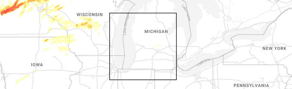
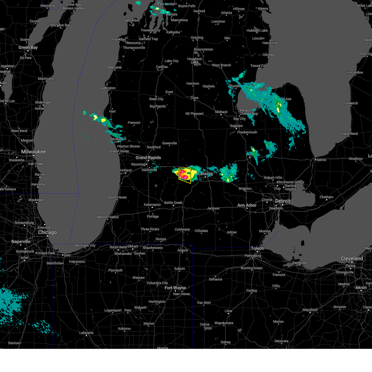
Hail Map for Portland, MI
The Portland, MI area has had 1 report of on-the-ground hail by trained spotters, and has been under severe weather warnings 10 times during the past 12 months. Doppler radar has detected hail at or near Portland, MI on 23 occasions.
| Name: | Portland, MI |
| Where Located: | 39.8 miles E of Grand Rapids, MI |
| Map: | Google Map for Portland, MI |
| Population: | 3883 |
| Housing Units: | 1797 |
| More Info: | Search Google for Portland, MI |
3
The Top Recent Hail Date for Portland, MI is Monday, May 9, 2022 (4th out of 23)
Hail and Wind Damage Spotted near Portland, MI
| Date / Time | Report Details |
|---|---|
| 8/24/2023 9:07 PM EDT |
 At 906 pm edt, severe thunderstorms were located along a line extending from 12 miles west of st. johns to 6 miles south of portland, moving east at 60 mph (radar indicated). Hazards include 70 mph wind gusts. Expect considerable tree damage. damage is likely to mobile homes, roofs, and outbuildings. locations impacted include, portland, lake odessa, sebewa, lyons, muir, mulliken, pewamo, ionia county airport, thunderstorm damage threat, considerable hail threat, radar indicated max hail size, <. 75 in wind threat, radar indicated max wind gust, 70 mph. At 906 pm edt, severe thunderstorms were located along a line extending from 12 miles west of st. johns to 6 miles south of portland, moving east at 60 mph (radar indicated). Hazards include 70 mph wind gusts. Expect considerable tree damage. damage is likely to mobile homes, roofs, and outbuildings. locations impacted include, portland, lake odessa, sebewa, lyons, muir, mulliken, pewamo, ionia county airport, thunderstorm damage threat, considerable hail threat, radar indicated max hail size, <. 75 in wind threat, radar indicated max wind gust, 70 mph.
|
| 8/24/2023 8:56 PM EDT |
 At 855 pm edt, severe thunderstorms were located along a line extending from 8 miles northeast of ionia to 7 miles west of portland to lake odessa, moving east at 25 mph. these are destructive storms especially across southern ionia county (radar indicated). Hazards include 80 mph wind gusts and quarter size hail. Flying debris will be dangerous to those caught without shelter. mobile homes will be heavily damaged. expect considerable damage to roofs, windows, and vehicles. extensive tree damage and power outages are likely. Locations impacted include, ionia, greenville, portland, belding, lake odessa, saranac, carson city, orleans, sebewa, lyons, sheridan, muir, mulliken, pewamo, hubbardston, clarksville, palo, ionia county airport, butternut, fenwick,. At 855 pm edt, severe thunderstorms were located along a line extending from 8 miles northeast of ionia to 7 miles west of portland to lake odessa, moving east at 25 mph. these are destructive storms especially across southern ionia county (radar indicated). Hazards include 80 mph wind gusts and quarter size hail. Flying debris will be dangerous to those caught without shelter. mobile homes will be heavily damaged. expect considerable damage to roofs, windows, and vehicles. extensive tree damage and power outages are likely. Locations impacted include, ionia, greenville, portland, belding, lake odessa, saranac, carson city, orleans, sebewa, lyons, sheridan, muir, mulliken, pewamo, hubbardston, clarksville, palo, ionia county airport, butternut, fenwick,.
|
| 8/24/2023 8:38 PM EDT |
 At 838 pm edt, severe thunderstorms were located along a line extending from near sparta to 5 miles northeast of grand rapids to near wyoming, moving east at 60 mph (radar indicated). Hazards include 60 mph wind gusts and quarter size hail. Hail damage to vehicles is expected. Expect wind damage to roofs, siding, and trees. At 838 pm edt, severe thunderstorms were located along a line extending from near sparta to 5 miles northeast of grand rapids to near wyoming, moving east at 60 mph (radar indicated). Hazards include 60 mph wind gusts and quarter size hail. Hail damage to vehicles is expected. Expect wind damage to roofs, siding, and trees.
|
| 7/20/2023 2:11 PM EDT |
 The severe thunderstorm warning for southeastern kent and southern ionia counties will expire at 215 pm edt, the storms which prompted the warning have weakened below severe limits, and no longer pose an immediate threat to life or property. therefore, the warning will be allowed to expire. a severe thunderstorm watch remains in effect until 800 pm edt for south central and southwestern michigan. The severe thunderstorm warning for southeastern kent and southern ionia counties will expire at 215 pm edt, the storms which prompted the warning have weakened below severe limits, and no longer pose an immediate threat to life or property. therefore, the warning will be allowed to expire. a severe thunderstorm watch remains in effect until 800 pm edt for south central and southwestern michigan.
|
| 7/20/2023 1:58 PM EDT |
 At 156 pm edt, severe thunderstorms were located along a line extending from near lyons to clarksville to near caledonia, moving southeast at 30 mph (radar indicated). Hazards include 60 mph wind gusts and penny size hail. Expect damage to roofs, siding, and trees. locations impacted include, ionia, portland, lake odessa, caledonia, sebewa, lyons, muir, mulliken, pewamo, clarksville, ionia county airport, alto, hail threat, radar indicated max hail size, 0. 75 in wind threat, radar indicated max wind gust, 60 mph. At 156 pm edt, severe thunderstorms were located along a line extending from near lyons to clarksville to near caledonia, moving southeast at 30 mph (radar indicated). Hazards include 60 mph wind gusts and penny size hail. Expect damage to roofs, siding, and trees. locations impacted include, ionia, portland, lake odessa, caledonia, sebewa, lyons, muir, mulliken, pewamo, clarksville, ionia county airport, alto, hail threat, radar indicated max hail size, 0. 75 in wind threat, radar indicated max wind gust, 60 mph.
|
| 7/20/2023 1:31 PM EDT |
 At 131 pm edt, severe thunderstorms were located along a line extending from near carson city to near grandville, moving east at 55 mph (radar indicated). Hazards include 60 mph wind gusts and penny size hail. expect damage to roofs, siding, and trees At 131 pm edt, severe thunderstorms were located along a line extending from near carson city to near grandville, moving east at 55 mph (radar indicated). Hazards include 60 mph wind gusts and penny size hail. expect damage to roofs, siding, and trees
|
| 7/12/2023 11:30 PM EDT |
 At 1129 pm edt, severe thunderstorms were located along a line extending from 10 miles east of ionia to 7 miles southwest of portland, moving east at 15 mph (radar indicated). Hazards include 60 mph wind gusts. Expect damage to roofs, siding, and trees. locations impacted include, portland, sebewa, mulliken, pewamo, hail threat, radar indicated max hail size, <. 75 in wind threat, radar indicated max wind gust, 60 mph. At 1129 pm edt, severe thunderstorms were located along a line extending from 10 miles east of ionia to 7 miles southwest of portland, moving east at 15 mph (radar indicated). Hazards include 60 mph wind gusts. Expect damage to roofs, siding, and trees. locations impacted include, portland, sebewa, mulliken, pewamo, hail threat, radar indicated max hail size, <. 75 in wind threat, radar indicated max wind gust, 60 mph.
|
| 7/12/2023 11:03 PM EDT |
 At 1102 pm edt, a severe thunderstorm was located near lake odessa, or 8 miles northeast of hastings, moving northeast at 30 mph (radar indicated). Hazards include 60 mph wind gusts. expect damage to roofs, siding, and trees At 1102 pm edt, a severe thunderstorm was located near lake odessa, or 8 miles northeast of hastings, moving northeast at 30 mph (radar indicated). Hazards include 60 mph wind gusts. expect damage to roofs, siding, and trees
|
| 6/25/2023 5:22 PM EDT |
 At 522 pm edt, a severe thunderstorm was located over portland, moving north at 30 mph (radar indicated). Hazards include 60 mph wind gusts. Expect damage to roofs, siding, and trees. locations impacted include, ionia, portland, grand ledge, lake odessa, eureka, fowler, sebewa, westphalia, lyons, maple rapids, muir, mulliken, pewamo, hubbardston, eagle, wacousta, abrams municipal air, ionia county airport, hail threat, radar indicated max hail size, <. 75 in wind threat, radar indicated max wind gust, 60 mph. At 522 pm edt, a severe thunderstorm was located over portland, moving north at 30 mph (radar indicated). Hazards include 60 mph wind gusts. Expect damage to roofs, siding, and trees. locations impacted include, ionia, portland, grand ledge, lake odessa, eureka, fowler, sebewa, westphalia, lyons, maple rapids, muir, mulliken, pewamo, hubbardston, eagle, wacousta, abrams municipal air, ionia county airport, hail threat, radar indicated max hail size, <. 75 in wind threat, radar indicated max wind gust, 60 mph.
|
| 6/25/2023 4:53 PM EDT |
 At 453 pm edt, a severe thunderstorm was located 8 miles northeast of nashville, or 10 miles northwest of charlotte, moving north at 30 mph (radar indicated). Hazards include 60 mph wind gusts. expect damage to roofs, siding, and trees At 453 pm edt, a severe thunderstorm was located 8 miles northeast of nashville, or 10 miles northwest of charlotte, moving north at 30 mph (radar indicated). Hazards include 60 mph wind gusts. expect damage to roofs, siding, and trees
|
| 4/5/2023 10:17 AM EDT |
 At 1017 am edt, severe thunderstorms were located along a line extending from lakeview to near freeport, moving east at 60 mph (radar indicated). Hazards include 60 mph wind gusts. expect damage to roofs, siding, and trees At 1017 am edt, severe thunderstorms were located along a line extending from lakeview to near freeport, moving east at 60 mph (radar indicated). Hazards include 60 mph wind gusts. expect damage to roofs, siding, and trees
|
| 4/4/2023 8:04 PM EDT |
 At 803 pm edt, a severe thunderstorm was located 7 miles southwest of portland, moving east at 30 mph (radar indicated). Hazards include tennis ball size hail and 60 mph wind gusts. People and animals outdoors will be injured. expect hail damage to roofs, siding, windows, and vehicles. expect wind damage to roofs, siding, and trees. locations impacted include, sebewa, sunfield, mulliken, thunderstorm damage threat, considerable hail threat, radar indicated max hail size, 2. 50 in wind threat, radar indicated max wind gust, 60 mph. At 803 pm edt, a severe thunderstorm was located 7 miles southwest of portland, moving east at 30 mph (radar indicated). Hazards include tennis ball size hail and 60 mph wind gusts. People and animals outdoors will be injured. expect hail damage to roofs, siding, windows, and vehicles. expect wind damage to roofs, siding, and trees. locations impacted include, sebewa, sunfield, mulliken, thunderstorm damage threat, considerable hail threat, radar indicated max hail size, 2. 50 in wind threat, radar indicated max wind gust, 60 mph.
|
| 4/4/2023 8:04 PM EDT |
 At 804 pm edt, a severe thunderstorm was located 6 miles south of portland, moving east at 25 mph (radar indicated). Hazards include golf ball size hail and 60 mph wind gusts. People and animals outdoors will be injured. expect hail damage to roofs, siding, windows, and vehicles. Expect wind damage to roofs, siding, and trees. At 804 pm edt, a severe thunderstorm was located 6 miles south of portland, moving east at 25 mph (radar indicated). Hazards include golf ball size hail and 60 mph wind gusts. People and animals outdoors will be injured. expect hail damage to roofs, siding, windows, and vehicles. Expect wind damage to roofs, siding, and trees.
|
| 4/4/2023 7:45 PM EDT |
 At 743 pm edt, a severe thunderstorm was located near lake odessa, or 9 miles northeast of hastings, moving east at 25 mph (radar indicated). Hazards include tennis ball size hail and 60 mph wind gusts. People and animals outdoors will be injured. expect hail damage to roofs, siding, windows, and vehicles. expect wind damage to roofs, siding, and trees. locations impacted include, lake odessa, freeport, sebewa, vermontville, sunfield, mulliken, woodland, clarksville, gresham, woodbury, thunderstorm damage threat, considerable hail threat, radar indicated max hail size, 2. 50 in wind threat, radar indicated max wind gust, 60 mph. At 743 pm edt, a severe thunderstorm was located near lake odessa, or 9 miles northeast of hastings, moving east at 25 mph (radar indicated). Hazards include tennis ball size hail and 60 mph wind gusts. People and animals outdoors will be injured. expect hail damage to roofs, siding, windows, and vehicles. expect wind damage to roofs, siding, and trees. locations impacted include, lake odessa, freeport, sebewa, vermontville, sunfield, mulliken, woodland, clarksville, gresham, woodbury, thunderstorm damage threat, considerable hail threat, radar indicated max hail size, 2. 50 in wind threat, radar indicated max wind gust, 60 mph.
|
| 4/4/2023 7:31 PM EDT |
 At 731 pm edt, a severe thunderstorm was located near freeport, or near hastings, moving east at 25 mph (radar indicated). Hazards include golf ball size hail and 60 mph wind gusts. People and animals outdoors will be injured. expect hail damage to roofs, siding, windows, and vehicles. Expect wind damage to roofs, siding, and trees. At 731 pm edt, a severe thunderstorm was located near freeport, or near hastings, moving east at 25 mph (radar indicated). Hazards include golf ball size hail and 60 mph wind gusts. People and animals outdoors will be injured. expect hail damage to roofs, siding, windows, and vehicles. Expect wind damage to roofs, siding, and trees.
|
| 9/21/2022 9:54 AM EDT |
 The severe thunderstorm warning for ionia county will expire at 1000 am edt, the storms which prompted the warning have weakened. therefore, the warning will be allowed to expire. a severe thunderstorm watch remains in effect until 100 pm edt for south central michigan. The severe thunderstorm warning for ionia county will expire at 1000 am edt, the storms which prompted the warning have weakened. therefore, the warning will be allowed to expire. a severe thunderstorm watch remains in effect until 100 pm edt for south central michigan.
|
| 9/21/2022 9:39 AM EDT |
 At 939 am edt, severe thunderstorms were located along a line extending from 6 miles east of carson city to 7 miles north of lake odessa, moving east at 50 mph (radar indicated). Hazards include 60 mph wind gusts and quarter size hail. Hail damage to vehicles is expected. expect wind damage to roofs, siding, and trees. locations impacted include, ionia, portland, lake odessa, saranac, sebewa, lyons, muir, mulliken, pewamo, hubbardston, clarksville, palo, ionia county airport, hail threat, radar indicated max hail size, 1. 00 in wind threat, radar indicated max wind gust, 60 mph. At 939 am edt, severe thunderstorms were located along a line extending from 6 miles east of carson city to 7 miles north of lake odessa, moving east at 50 mph (radar indicated). Hazards include 60 mph wind gusts and quarter size hail. Hail damage to vehicles is expected. expect wind damage to roofs, siding, and trees. locations impacted include, ionia, portland, lake odessa, saranac, sebewa, lyons, muir, mulliken, pewamo, hubbardston, clarksville, palo, ionia county airport, hail threat, radar indicated max hail size, 1. 00 in wind threat, radar indicated max wind gust, 60 mph.
|
| 9/21/2022 9:10 AM EDT |
 At 909 am edt, severe thunderstorms were located along a line extending from 5 miles northeast of greenville to near east grand rapids, moving east at 50 mph (radar indicated). Hazards include ping pong ball size hail and 60 mph wind gusts. People and animals outdoors will be injured. expect hail damage to roofs, siding, windows, and vehicles. Expect wind damage to roofs, siding, and trees. At 909 am edt, severe thunderstorms were located along a line extending from 5 miles northeast of greenville to near east grand rapids, moving east at 50 mph (radar indicated). Hazards include ping pong ball size hail and 60 mph wind gusts. People and animals outdoors will be injured. expect hail damage to roofs, siding, windows, and vehicles. Expect wind damage to roofs, siding, and trees.
|
| 8/29/2022 4:15 PM EDT | Report of large limb down along charlotte hwy near butler rd... via social media. time estimate in ionia county MI, 2.7 miles N of Portland, MI |
| 8/29/2022 3:47 PM EDT |
 At 345 pm edt, a line of severe thunderstorms was located along a line from grand rapids to near stanton, moving east at 45 mph. these storms have a history of producing wind damage and power outages. seek shelter inside a sturdy building (trained weather spotters). Hazards include 60 mph wind gusts and quarter size hail. Hail damage to vehicles is expected. Expect wind damage to roofs, siding, and trees. At 345 pm edt, a line of severe thunderstorms was located along a line from grand rapids to near stanton, moving east at 45 mph. these storms have a history of producing wind damage and power outages. seek shelter inside a sturdy building (trained weather spotters). Hazards include 60 mph wind gusts and quarter size hail. Hail damage to vehicles is expected. Expect wind damage to roofs, siding, and trees.
|
| 8/3/2022 3:36 PM EDT |
 The severe thunderstorm warning for ionia county will expire at 345 pm edt, the storm which prompted the warning has moved out of the area. therefore, the warning will be allowed to expire. however, gusty winds, lightning and heavy rain are still possible with this thunderstorm. a severe thunderstorm watch remains in effect until 900 pm edt for south central, central and southwestern michigan. The severe thunderstorm warning for ionia county will expire at 345 pm edt, the storm which prompted the warning has moved out of the area. therefore, the warning will be allowed to expire. however, gusty winds, lightning and heavy rain are still possible with this thunderstorm. a severe thunderstorm watch remains in effect until 900 pm edt for south central, central and southwestern michigan.
|
| 8/3/2022 3:15 PM EDT | Tree on house on charlotte hwy near butler roa in ionia county MI, 2.7 miles N of Portland, MI |
| 8/3/2022 2:48 PM EDT |
 At 248 pm edt, a severe thunderstorm was located near lake odessa, or 9 miles southeast of lowell, moving east at 35 mph (radar indicated). Hazards include 60 mph wind gusts and quarter size hail. Hail damage to vehicles is expected. Expect wind damage to roofs, siding, and trees. At 248 pm edt, a severe thunderstorm was located near lake odessa, or 9 miles southeast of lowell, moving east at 35 mph (radar indicated). Hazards include 60 mph wind gusts and quarter size hail. Hail damage to vehicles is expected. Expect wind damage to roofs, siding, and trees.
|
| 7/23/2022 11:07 PM EDT |
 The severe thunderstorm warning for ionia and southeastern montcalm counties will expire at 1115 pm edt, the storms which prompted the warning have weakened below severe limits, and have exited the warned area. therefore, the warning will be allowed to expire. a severe thunderstorm watch remains in effect until midnight edt for south central, central and southwestern michigan. The severe thunderstorm warning for ionia and southeastern montcalm counties will expire at 1115 pm edt, the storms which prompted the warning have weakened below severe limits, and have exited the warned area. therefore, the warning will be allowed to expire. a severe thunderstorm watch remains in effect until midnight edt for south central, central and southwestern michigan.
|
| 7/23/2022 10:54 PM EDT | Snapped trees and large limbs dow in ionia county MI, 2.7 miles N of Portland, MI |
| 7/23/2022 10:49 PM EDT |
 At 1048 pm edt, severe thunderstorms were located along a line extending from near stanton to 7 miles southwest of carson city to 6 miles east of lake odessa, moving east at 50 mph (radar indicated). Hazards include 60 mph wind gusts. Expect damage to roofs, siding, and trees. locations impacted include, ionia, greenville, belding, portland, stanton, lake odessa, saranac, carson city, orleans, crystal, sidney, sebewa, lyons, sheridan, muir, mulliken, pewamo, hubbardston, clarksville, gowen, hail threat, radar indicated max hail size, <. 75 in wind threat, radar indicated max wind gust, 60 mph. At 1048 pm edt, severe thunderstorms were located along a line extending from near stanton to 7 miles southwest of carson city to 6 miles east of lake odessa, moving east at 50 mph (radar indicated). Hazards include 60 mph wind gusts. Expect damage to roofs, siding, and trees. locations impacted include, ionia, greenville, belding, portland, stanton, lake odessa, saranac, carson city, orleans, crystal, sidney, sebewa, lyons, sheridan, muir, mulliken, pewamo, hubbardston, clarksville, gowen, hail threat, radar indicated max hail size, <. 75 in wind threat, radar indicated max wind gust, 60 mph.
|
| 7/23/2022 10:16 PM EDT |
 At 1016 pm edt, severe thunderstorms were located along a line extending from 5 miles southwest of howard city to 6 miles southeast of rockford to near caledonia, moving east at 40 mph (radar indicated). Hazards include 60 mph wind gusts. expect damage to roofs, siding, and trees At 1016 pm edt, severe thunderstorms were located along a line extending from 5 miles southwest of howard city to 6 miles southeast of rockford to near caledonia, moving east at 40 mph (radar indicated). Hazards include 60 mph wind gusts. expect damage to roofs, siding, and trees
|
| 7/11/2022 10:14 PM EDT |
 At 1014 pm edt, a severe thunderstorm capable of producing a tornado was located 6 miles northeast of portland, moving east at 40 mph (radar indicated rotation). Hazards include tornado. Flying debris will be dangerous to those caught without shelter. mobile homes will be damaged or destroyed. damage to roofs, windows, and vehicles will occur. tree damage is likely. this dangerous storm will be near, st. johns around 1030 pm edt. Other locations in the path of this tornadic thunderstorm include dewitt. At 1014 pm edt, a severe thunderstorm capable of producing a tornado was located 6 miles northeast of portland, moving east at 40 mph (radar indicated rotation). Hazards include tornado. Flying debris will be dangerous to those caught without shelter. mobile homes will be damaged or destroyed. damage to roofs, windows, and vehicles will occur. tree damage is likely. this dangerous storm will be near, st. johns around 1030 pm edt. Other locations in the path of this tornadic thunderstorm include dewitt.
|
| 5/10/2022 3:45 AM EDT | Quarter sized hail reported 0.2 miles SE of Portland, MI, picture from social media. relayed by wlns. |
| 9/7/2021 3:40 PM EDT |
 At 339 pm edt, severe thunderstorms were located along a line extending from 5 miles northwest of merrill to 6 miles north of ionia, moving east at 40 mph (trained weather spotters. at 336 pm quarter sized hail was reported just east of alma). Hazards include 60 mph wind gusts and quarter size hail. Hail damage to vehicles is expected. expect wind damage to roofs, siding, and trees. locations impacted include, ionia, alma, st. johns, belding, portland, ithaca, grand ledge, st. louis, lake odessa, breckenridge, saranac, elsie, dewitt, eureka, wheeler, orleans, sumner, ovid, fowler, sebewa, hail threat, observed max hail size, 1. 00 in wind threat, radar indicated max wind gust, 60 mph. At 339 pm edt, severe thunderstorms were located along a line extending from 5 miles northwest of merrill to 6 miles north of ionia, moving east at 40 mph (trained weather spotters. at 336 pm quarter sized hail was reported just east of alma). Hazards include 60 mph wind gusts and quarter size hail. Hail damage to vehicles is expected. expect wind damage to roofs, siding, and trees. locations impacted include, ionia, alma, st. johns, belding, portland, ithaca, grand ledge, st. louis, lake odessa, breckenridge, saranac, elsie, dewitt, eureka, wheeler, orleans, sumner, ovid, fowler, sebewa, hail threat, observed max hail size, 1. 00 in wind threat, radar indicated max wind gust, 60 mph.
|
| 9/7/2021 3:26 PM EDT |
 At 326 pm edt, a severe thunderstorm was located 6 miles southeast of carson city, or 12 miles southwest of ithaca, moving east at 35 mph (radar indicated). Hazards include 60 mph wind gusts and quarter size hail. Hail damage to vehicles is expected. Expect wind damage to roofs, siding, and trees. At 326 pm edt, a severe thunderstorm was located 6 miles southeast of carson city, or 12 miles southwest of ithaca, moving east at 35 mph (radar indicated). Hazards include 60 mph wind gusts and quarter size hail. Hail damage to vehicles is expected. Expect wind damage to roofs, siding, and trees.
|
| 8/29/2021 4:04 PM EDT |
 At 404 pm edt, a severe thunderstorm was located near portland, moving east at 40 mph (radar indicated). Hazards include 60 mph wind gusts and penny size hail. expect damage to roofs, siding, and trees At 404 pm edt, a severe thunderstorm was located near portland, moving east at 40 mph (radar indicated). Hazards include 60 mph wind gusts and penny size hail. expect damage to roofs, siding, and trees
|
| 8/24/2021 6:48 PM EDT |
 At 648 pm edt, a severe thunderstorm was located near grand ledge, or 9 miles north of charlotte, moving east at 25 mph (radar indicated). Hazards include 60 mph wind gusts. expect damage to roofs, siding, and trees At 648 pm edt, a severe thunderstorm was located near grand ledge, or 9 miles north of charlotte, moving east at 25 mph (radar indicated). Hazards include 60 mph wind gusts. expect damage to roofs, siding, and trees
|
| 8/11/2021 10:10 PM EDT |
 The severe thunderstorm warning for southeastern ionia, northeastern barry, southwestern clinton and eaton counties will expire at 1015 pm edt, the storms which prompted the warning have weakened below severe limits, and no longer pose an immediate threat to life or property. therefore, the warning will be allowed to expire. however, gusty winds to 40 mph, lightning strikes, and heavy rain are still possible over the area as another round of thunderstorms is currently moving into barry county. a severe thunderstorm watch remains in effect until 300 am edt for south central and southwestern michigan. The severe thunderstorm warning for southeastern ionia, northeastern barry, southwestern clinton and eaton counties will expire at 1015 pm edt, the storms which prompted the warning have weakened below severe limits, and no longer pose an immediate threat to life or property. therefore, the warning will be allowed to expire. however, gusty winds to 40 mph, lightning strikes, and heavy rain are still possible over the area as another round of thunderstorms is currently moving into barry county. a severe thunderstorm watch remains in effect until 300 am edt for south central and southwestern michigan.
|
| 8/11/2021 9:52 PM EDT |
 At 950 pm edt, severe thunderstorms were located along a line extending from portland to near nashville, moving east at 55 mph (radar indicated). Hazards include 60 mph wind gusts. Expect damage to roofs, siding, and trees. locations impacted include, lansing, charlotte, eaton rapids, portland, grand ledge, potterville, nashville, kalamo, dimondale, sebewa, vermontville, sunfield, mulliken, waverly, woodland, eagle, wacousta, gresham, dowling, woodbury, hail threat, radar indicated max hail size, <. 75 in wind threat, radar indicated max wind gust, 60 mph. At 950 pm edt, severe thunderstorms were located along a line extending from portland to near nashville, moving east at 55 mph (radar indicated). Hazards include 60 mph wind gusts. Expect damage to roofs, siding, and trees. locations impacted include, lansing, charlotte, eaton rapids, portland, grand ledge, potterville, nashville, kalamo, dimondale, sebewa, vermontville, sunfield, mulliken, waverly, woodland, eagle, wacousta, gresham, dowling, woodbury, hail threat, radar indicated max hail size, <. 75 in wind threat, radar indicated max wind gust, 60 mph.
|
| 8/11/2021 9:30 PM EDT |
 At 929 pm edt, severe thunderstorms were located along a line extending from near saranac to 10 miles north of gull lake, moving east at 55 mph (radar indicated). Hazards include 60 mph wind gusts. expect damage to roofs, siding, and trees At 929 pm edt, severe thunderstorms were located along a line extending from near saranac to 10 miles north of gull lake, moving east at 55 mph (radar indicated). Hazards include 60 mph wind gusts. expect damage to roofs, siding, and trees
|
| 8/10/2021 11:35 PM EDT |
 The severe thunderstorm warning for calhoun, ionia, osceola, eaton, mecosta and montcalm counties will expire at 1145 pm edt, the storms which prompted the warning have moved out of the area. therefore, the warning will be allowed to expire. a severe thunderstorm watch remains in effect until 300 am edt for south central, central and southwestern michigan. The severe thunderstorm warning for calhoun, ionia, osceola, eaton, mecosta and montcalm counties will expire at 1145 pm edt, the storms which prompted the warning have moved out of the area. therefore, the warning will be allowed to expire. a severe thunderstorm watch remains in effect until 300 am edt for south central, central and southwestern michigan.
|
| 8/10/2021 10:41 PM EDT |
 At 1040 pm edt, severe thunderstorms were located along a line extending from near copemish to near reed city to near rockford to middleville to portage, moving east at 55 mph (radar indicated). Hazards include 60 mph wind gusts. expect damage to roofs, siding, and trees At 1040 pm edt, severe thunderstorms were located along a line extending from near copemish to near reed city to near rockford to middleville to portage, moving east at 55 mph (radar indicated). Hazards include 60 mph wind gusts. expect damage to roofs, siding, and trees
|
| 6/26/2021 5:00 PM EDT |
 At 500 pm edt, a severe thunderstorm capable of producing a tornado was located near portland, moving northeast at 45 mph (radar indicated rotation). Hazards include tornado. Flying debris will be dangerous to those caught without shelter. mobile homes will be damaged or destroyed. damage to roofs, windows, and vehicles will occur. tree damage is likely. This tornadic thunderstorm will remain over mainly rural areas of southeastern ionia county, including the following locations, lyons, pewamo, muir and hubbardston. At 500 pm edt, a severe thunderstorm capable of producing a tornado was located near portland, moving northeast at 45 mph (radar indicated rotation). Hazards include tornado. Flying debris will be dangerous to those caught without shelter. mobile homes will be damaged or destroyed. damage to roofs, windows, and vehicles will occur. tree damage is likely. This tornadic thunderstorm will remain over mainly rural areas of southeastern ionia county, including the following locations, lyons, pewamo, muir and hubbardston.
|
| 6/26/2021 4:48 PM EDT |
 At 448 pm edt, a confirmed tornado was located near lake odessa, or 9 miles west of portland, moving northeast at 40 mph (radar confirmed tornado). Hazards include damaging tornado. Flying debris will be dangerous to those caught without shelter. mobile homes will be damaged or destroyed. damage to roofs, windows, and vehicles will occur. tree damage is likely. this tornado will be near, ionia around 455 pm edt. portland around 500 pm edt. Other locations impacted by this tornadic thunderstorm include lyons, hubbardston, pewamo and muir. At 448 pm edt, a confirmed tornado was located near lake odessa, or 9 miles west of portland, moving northeast at 40 mph (radar confirmed tornado). Hazards include damaging tornado. Flying debris will be dangerous to those caught without shelter. mobile homes will be damaged or destroyed. damage to roofs, windows, and vehicles will occur. tree damage is likely. this tornado will be near, ionia around 455 pm edt. portland around 500 pm edt. Other locations impacted by this tornadic thunderstorm include lyons, hubbardston, pewamo and muir.
|
| 6/26/2021 4:44 PM EDT |
 At 444 pm edt, a severe thunderstorm capable of producing a tornado was located near lake odessa, or 11 miles west of portland, moving northeast at 40 mph (radar indicated rotation). Hazards include tornado. Flying debris will be dangerous to those caught without shelter. mobile homes will be damaged or destroyed. damage to roofs, windows, and vehicles will occur. tree damage is likely. this dangerous storm will be near, ionia around 455 pm edt. portland around 500 pm edt. Other locations impacted by this tornadic thunderstorm include lyons, sebewa, clarksville, hubbardston, pewamo and muir. At 444 pm edt, a severe thunderstorm capable of producing a tornado was located near lake odessa, or 11 miles west of portland, moving northeast at 40 mph (radar indicated rotation). Hazards include tornado. Flying debris will be dangerous to those caught without shelter. mobile homes will be damaged or destroyed. damage to roofs, windows, and vehicles will occur. tree damage is likely. this dangerous storm will be near, ionia around 455 pm edt. portland around 500 pm edt. Other locations impacted by this tornadic thunderstorm include lyons, sebewa, clarksville, hubbardston, pewamo and muir.
|
| 10/23/2020 1:32 PM EDT |
 At 132 pm edt, severe thunderstorms were located along a line extending from 6 miles southwest of portland to 5 miles west of grand ledge to near charlotte, moving northeast at 60 mph (radar indicated). Hazards include 60 mph wind gusts and penny size hail. expect damage to roofs, siding, and trees At 132 pm edt, severe thunderstorms were located along a line extending from 6 miles southwest of portland to 5 miles west of grand ledge to near charlotte, moving northeast at 60 mph (radar indicated). Hazards include 60 mph wind gusts and penny size hail. expect damage to roofs, siding, and trees
|
| 6/10/2020 1:11 PM EDT |
 At 111 pm edt, a severe thunderstorm was located near portland, moving northeast at 35 mph (radar indicated). Hazards include 60 mph wind gusts and quarter size hail. Hail damage to vehicles is expected. expect wind damage to roofs, siding, and trees. locations impacted include, st. Johns, portland, eureka, fowler, westphalia, maple rapids, muir, pewamo, hubbardston, wacousta,. At 111 pm edt, a severe thunderstorm was located near portland, moving northeast at 35 mph (radar indicated). Hazards include 60 mph wind gusts and quarter size hail. Hail damage to vehicles is expected. expect wind damage to roofs, siding, and trees. locations impacted include, st. Johns, portland, eureka, fowler, westphalia, maple rapids, muir, pewamo, hubbardston, wacousta,.
|
| 6/10/2020 1:00 PM EDT |
 At 1259 pm edt, severe thunderstorms were located along a line extending from near carson city to 6 miles south of portland, moving east at 45 mph. another strong thunderstorm was located near st. johns moving to the northeast (radar indicated). Hazards include 60 mph wind gusts. Expect damage to roofs, siding, and trees. locations impacted include, ionia, st. Johns, portland, grand ledge, lake odessa, eureka, fowler, sebewa, westphalia, lyons, maple rapids, muir, mulliken, pewamo, hubbardston, eagle, wacousta, palo,. At 1259 pm edt, severe thunderstorms were located along a line extending from near carson city to 6 miles south of portland, moving east at 45 mph. another strong thunderstorm was located near st. johns moving to the northeast (radar indicated). Hazards include 60 mph wind gusts. Expect damage to roofs, siding, and trees. locations impacted include, ionia, st. Johns, portland, grand ledge, lake odessa, eureka, fowler, sebewa, westphalia, lyons, maple rapids, muir, mulliken, pewamo, hubbardston, eagle, wacousta, palo,.
|
| 6/10/2020 12:30 PM EDT |
 At 1229 pm edt, a severe thunderstorm was located 9 miles northwest of st. johns, moving northeast at 50 mph (radar indicated). Hazards include 60 mph wind gusts and penny size hail. Expect damage to roofs, siding, and trees. locations impacted include, ionia, st. Johns, belding, portland, grand ledge, lake odessa, saranac, eureka, orleans, fowler, sebewa, westphalia, lyons, maple rapids, muir, mulliken, pewamo, hubbardston, clarksville, eagle,. At 1229 pm edt, a severe thunderstorm was located 9 miles northwest of st. johns, moving northeast at 50 mph (radar indicated). Hazards include 60 mph wind gusts and penny size hail. Expect damage to roofs, siding, and trees. locations impacted include, ionia, st. Johns, belding, portland, grand ledge, lake odessa, saranac, eureka, orleans, fowler, sebewa, westphalia, lyons, maple rapids, muir, mulliken, pewamo, hubbardston, clarksville, eagle,.
|
| 6/10/2020 12:00 PM EDT |
 At 1159 am edt, a severe thunderstorm was located near portland, moving northeast at 55 mph. an additional severe thunderstorm was moving into the grand rapids area (radar indicated). Hazards include 60 mph wind gusts and penny size hail. expect damage to roofs, siding, and trees At 1159 am edt, a severe thunderstorm was located near portland, moving northeast at 55 mph. an additional severe thunderstorm was moving into the grand rapids area (radar indicated). Hazards include 60 mph wind gusts and penny size hail. expect damage to roofs, siding, and trees
|
| 6/3/2020 1:27 AM EDT |
 The severe thunderstorm warning for kent, ionia, southern osceola, mecosta and montcalm counties will expire at 130 am edt, the storms which prompted the warning have weakened below severe limits, and no longer pose an immediate threat to life or property. therefore, the warning will be allowed to expire. however gusty winds are still possible with these thunderstorms through 200 am. a severe thunderstorm watch remains in effect until 400 am edt for central, south central, southwestern and west central michigan. The severe thunderstorm warning for kent, ionia, southern osceola, mecosta and montcalm counties will expire at 130 am edt, the storms which prompted the warning have weakened below severe limits, and no longer pose an immediate threat to life or property. therefore, the warning will be allowed to expire. however gusty winds are still possible with these thunderstorms through 200 am. a severe thunderstorm watch remains in effect until 400 am edt for central, south central, southwestern and west central michigan.
|
| 6/3/2020 12:58 AM EDT |
 At 1255 am edt, severe thunderstorms were located along a line extending from 5 miles northwest of barryton to near belding, moving east at 35 mph (radar indicated). Hazards include 60 mph wind gusts. Expect damage to roofs, siding, and trees. Locations impacted include, grand rapids, ionia, big rapids, greenville, belding, portland, lowell, evart, stanton, wyoming, kentwood, walker, east grand rapids, rockford, sparta, reed city, lake odessa, howard city, caledonia, saranac,. At 1255 am edt, severe thunderstorms were located along a line extending from 5 miles northwest of barryton to near belding, moving east at 35 mph (radar indicated). Hazards include 60 mph wind gusts. Expect damage to roofs, siding, and trees. Locations impacted include, grand rapids, ionia, big rapids, greenville, belding, portland, lowell, evart, stanton, wyoming, kentwood, walker, east grand rapids, rockford, sparta, reed city, lake odessa, howard city, caledonia, saranac,.
|
| 6/3/2020 12:26 AM EDT |
 At 1225 am edt, severe thunderstorms were located along a line extending from near reed city to near walker, moving east at 50 mph (radar indicated). Hazards include 60 mph wind gusts. expect damage to roofs, siding, and trees At 1225 am edt, severe thunderstorms were located along a line extending from near reed city to near walker, moving east at 50 mph (radar indicated). Hazards include 60 mph wind gusts. expect damage to roofs, siding, and trees
|
| 4/7/2020 8:56 PM EDT |
 The severe thunderstorm warning for ionia county will expire at 900 pm edt, the storms which prompted the warning have moved out of the area. therefore, the warning will be allowed to expire. a severe thunderstorm watch remains in effect until 1000 pm edt for south central and southwestern michigan. The severe thunderstorm warning for ionia county will expire at 900 pm edt, the storms which prompted the warning have moved out of the area. therefore, the warning will be allowed to expire. a severe thunderstorm watch remains in effect until 1000 pm edt for south central and southwestern michigan.
|
| 4/7/2020 8:19 PM EDT |
 At 819 pm edt, severe thunderstorms were located along a line extending from near lowell to near freeport, moving east at 35 mph (radar indicated). Hazards include 60 mph wind gusts and quarter size hail. Hail damage to vehicles is expected. Expect wind damage to roofs, siding, and trees. At 819 pm edt, severe thunderstorms were located along a line extending from near lowell to near freeport, moving east at 35 mph (radar indicated). Hazards include 60 mph wind gusts and quarter size hail. Hail damage to vehicles is expected. Expect wind damage to roofs, siding, and trees.
|
| 4/7/2020 7:40 PM EDT |
 At 737 pm edt, severe thunderstorms were located along a line extending from 5 miles northeast of portland to 5 miles west of grand ledge, moving southeast at 65 mph (radar indicated). Hazards include 60 mph wind gusts and quarter size hail. Hail damage to vehicles is expected. expect wind damage to roofs, siding, and trees. Locations impacted include, ionia, portland, lake odessa, saranac, sebewa, mulliken, clarksville,. At 737 pm edt, severe thunderstorms were located along a line extending from 5 miles northeast of portland to 5 miles west of grand ledge, moving southeast at 65 mph (radar indicated). Hazards include 60 mph wind gusts and quarter size hail. Hail damage to vehicles is expected. expect wind damage to roofs, siding, and trees. Locations impacted include, ionia, portland, lake odessa, saranac, sebewa, mulliken, clarksville,.
|
| 4/7/2020 7:13 PM EDT |
 At 713 pm edt, severe thunderstorms were located along a line extending from near belding to near lowell, moving southeast at 65 mph (radar indicated). Hazards include 60 mph wind gusts and quarter size hail. Hail damage to vehicles is expected. Expect wind damage to roofs, siding, and trees. At 713 pm edt, severe thunderstorms were located along a line extending from near belding to near lowell, moving southeast at 65 mph (radar indicated). Hazards include 60 mph wind gusts and quarter size hail. Hail damage to vehicles is expected. Expect wind damage to roofs, siding, and trees.
|
| 9/11/2019 7:58 PM EDT |
 At 756 pm edt, a severe thunderstorm was located near forest hills, or near lowell, moving east at 55 mph. other strong storms were oriented along a line from belding to maple rapids and were moving south (radar indicated). Hazards include 60 mph wind gusts and penny size hail. expect damage to roofs, siding, and trees At 756 pm edt, a severe thunderstorm was located near forest hills, or near lowell, moving east at 55 mph. other strong storms were oriented along a line from belding to maple rapids and were moving south (radar indicated). Hazards include 60 mph wind gusts and penny size hail. expect damage to roofs, siding, and trees
|
| 7/20/2019 2:37 AM EDT |
 The severe thunderstorm warning for southern ionia county will expire at 245 am edt, the storms which prompted the warning have moved out of the area. therefore, the warning will be allowed to expire. however heavy rain is still possible with these thunderstorms. The severe thunderstorm warning for southern ionia county will expire at 245 am edt, the storms which prompted the warning have moved out of the area. therefore, the warning will be allowed to expire. however heavy rain is still possible with these thunderstorms.
|
| 7/20/2019 2:30 AM EDT | Tree limb blocking southbound charlotte highway just north of cutler road in portland. relayed via social media. time estimated by rada in ionia county MI, 0.7 miles NNW of Portland, MI |
| 7/20/2019 2:11 AM EDT |
 At 210 am edt, severe thunderstorms were located along a line extending from 10 miles northeast of portland to near freeport, moving southeast at 50 mph (radar indicated). Hazards include 60 mph wind gusts. Expect damage to roofs, siding, and trees. Locations impacted include, ionia, portland, lake odessa, sebewa, lyons, muir, mulliken, pewamo, clarksville,. At 210 am edt, severe thunderstorms were located along a line extending from 10 miles northeast of portland to near freeport, moving southeast at 50 mph (radar indicated). Hazards include 60 mph wind gusts. Expect damage to roofs, siding, and trees. Locations impacted include, ionia, portland, lake odessa, sebewa, lyons, muir, mulliken, pewamo, clarksville,.
|
| 7/20/2019 1:45 AM EDT |
 At 144 am edt, severe thunderstorms were located along a line extending from near rockford to near wyoming, moving southeast at 50 mph (radar indicated). Hazards include 60 mph wind gusts. expect damage to roofs, siding, and trees At 144 am edt, severe thunderstorms were located along a line extending from near rockford to near wyoming, moving southeast at 50 mph (radar indicated). Hazards include 60 mph wind gusts. expect damage to roofs, siding, and trees
|
| 7/2/2019 4:18 PM EDT |
 At 417 pm edt, a severe thunderstorm was located 7 miles east of belding, moving east at 35 mph (radar indicated). Hazards include 60 mph wind gusts and penny size hail. expect damage to roofs, siding, and trees At 417 pm edt, a severe thunderstorm was located 7 miles east of belding, moving east at 35 mph (radar indicated). Hazards include 60 mph wind gusts and penny size hail. expect damage to roofs, siding, and trees
|
| 6/1/2019 12:44 PM EDT |
 At 1244 pm edt, a severe thunderstorm was located near grand ledge, or 6 miles west of waverly, moving east at 50 mph (radar indicated). Hazards include 60 mph wind gusts. Expect damage to roofs, siding, and trees. Locations impacted include, lansing, charlotte, mason, portland, waverly, haslett, east lansing, grand ledge, williamston, potterville, edgemont park, dewitt, aurelius, webberville, dimondale, dansville, mulliken, eden, eagle, bath,. At 1244 pm edt, a severe thunderstorm was located near grand ledge, or 6 miles west of waverly, moving east at 50 mph (radar indicated). Hazards include 60 mph wind gusts. Expect damage to roofs, siding, and trees. Locations impacted include, lansing, charlotte, mason, portland, waverly, haslett, east lansing, grand ledge, williamston, potterville, edgemont park, dewitt, aurelius, webberville, dimondale, dansville, mulliken, eden, eagle, bath,.
|
| 6/1/2019 12:31 PM EDT |
 At 1231 pm edt, a severe thunderstorm was located 8 miles west of grand ledge, or 10 miles south of portland, moving east at 50 mph (radar indicated). Hazards include 60 mph wind gusts. expect damage to roofs, siding, and trees At 1231 pm edt, a severe thunderstorm was located 8 miles west of grand ledge, or 10 miles south of portland, moving east at 50 mph (radar indicated). Hazards include 60 mph wind gusts. expect damage to roofs, siding, and trees
|
| 5/19/2019 6:11 PM EDT |
 At 555 pm edt, a severe thunderstorm was located near lake odessa, or 9 miles south of ionia, moving east at 35 mph (radar indicated). Hazards include 60 mph wind gusts. Expect damage to roofs, siding, and trees. Locations impacted include, portland, lake odessa, sebewa, mulliken,. At 555 pm edt, a severe thunderstorm was located near lake odessa, or 9 miles south of ionia, moving east at 35 mph (radar indicated). Hazards include 60 mph wind gusts. Expect damage to roofs, siding, and trees. Locations impacted include, portland, lake odessa, sebewa, mulliken,.
|
| 5/19/2019 5:56 PM EDT |
 At 549 pm edt, a severe thunderstorm was located 5 miles north of lake odessa, or 9 miles south of ionia, moving east at 55 mph (radar indicated). Hazards include 60 mph wind gusts. expect damage to roofs, siding, and trees At 549 pm edt, a severe thunderstorm was located 5 miles north of lake odessa, or 9 miles south of ionia, moving east at 55 mph (radar indicated). Hazards include 60 mph wind gusts. expect damage to roofs, siding, and trees
|
| 5/19/2019 5:50 PM EDT |
 At 549 pm edt, a severe thunderstorm was located 5 miles north of lake odessa, or 9 miles south of ionia, moving east at 55 mph (radar indicated). Hazards include 60 mph wind gusts. expect damage to roofs, siding, and trees At 549 pm edt, a severe thunderstorm was located 5 miles north of lake odessa, or 9 miles south of ionia, moving east at 55 mph (radar indicated). Hazards include 60 mph wind gusts. expect damage to roofs, siding, and trees
|
| 7/7/2017 3:55 AM EDT |
 The severe thunderstorm warning for east central kent and ionia counties will expire at 400 am edt. the storms which prompted the warning have weakened below severe limits, and no longer pose an immediate threat to life or property. therefore the warning will be allowed to expire. Warnings continue for far southeast kent county, as well as far southern ionia county. The severe thunderstorm warning for east central kent and ionia counties will expire at 400 am edt. the storms which prompted the warning have weakened below severe limits, and no longer pose an immediate threat to life or property. therefore the warning will be allowed to expire. Warnings continue for far southeast kent county, as well as far southern ionia county.
|
| 7/7/2017 3:24 AM EDT |
 At 323 am edt, severe thunderstorms were located along a line extending from near northview to near kentwood, moving east at 75 mph (radar indicated). Hazards include 60 mph wind gusts. expect damage to roofs, siding, and trees At 323 am edt, severe thunderstorms were located along a line extending from near northview to near kentwood, moving east at 75 mph (radar indicated). Hazards include 60 mph wind gusts. expect damage to roofs, siding, and trees
|
| 8/20/2016 3:33 PM EDT |
 At 332 pm edt, severe thunderstorms were located along a line extending from edmore to carson city to near ionia, moving northeast at 55 mph (radar indicated). Hazards include 60 mph wind gusts. Expect damage to roofs. siding. And trees. At 332 pm edt, severe thunderstorms were located along a line extending from edmore to carson city to near ionia, moving northeast at 55 mph (radar indicated). Hazards include 60 mph wind gusts. Expect damage to roofs. siding. And trees.
|
| 8/20/2016 3:04 PM EDT |
 At 302 pm edt, a severe thunderstorm was located near nashville, moving northeast at 40 mph. other severe storms were located in a line from belding to hastings (radar indicated). Hazards include 60 mph wind gusts. Expect damage to roofs. siding. And trees. At 302 pm edt, a severe thunderstorm was located near nashville, moving northeast at 40 mph. other severe storms were located in a line from belding to hastings (radar indicated). Hazards include 60 mph wind gusts. Expect damage to roofs. siding. And trees.
|
| 7/8/2016 4:33 PM EDT |
 At 433 pm edt, a severe thunderstorm was located over portland, moving east at 40 mph (radar indicated). Hazards include 60 mph wind gusts and quarter size hail. Hail damage to vehicles is expected. Expect wind damage to roofs, siding and trees. At 433 pm edt, a severe thunderstorm was located over portland, moving east at 40 mph (radar indicated). Hazards include 60 mph wind gusts and quarter size hail. Hail damage to vehicles is expected. Expect wind damage to roofs, siding and trees.
|
| 10/24/2015 2:56 PM EDT |
 At 255 pm edt, severe thunderstorms were located along a line extending from near shepherd to ionia, moving northeast at 40 mph (radar indicated). Hazards include 60 mph wind gusts. Expect damage to roofs. Siding and trees. At 255 pm edt, severe thunderstorms were located along a line extending from near shepherd to ionia, moving northeast at 40 mph (radar indicated). Hazards include 60 mph wind gusts. Expect damage to roofs. Siding and trees.
|
| 8/14/2015 7:20 PM EDT |
 At 719 pm edt, a severe thunderstorm was located over ionia, moving southeast at 30 mph (radar indicated). Hazards include 60 mph wind gusts and quarter size hail. Hail damage to vehicles is expected. Expect wind damage to roofs, siding and trees. At 719 pm edt, a severe thunderstorm was located over ionia, moving southeast at 30 mph (radar indicated). Hazards include 60 mph wind gusts and quarter size hail. Hail damage to vehicles is expected. Expect wind damage to roofs, siding and trees.
|
| 8/14/2015 5:21 PM EDT |
 At 519 pm edt, a severe thunderstorm was located near ionia, moving southeast at 25 mph (radar indicated). Hazards include 60 mph wind gusts and quarter size hail. Hail damage to vehicles is expected. expect wind damage to roofs, siding and trees. Locations impacted include, ionia, portland, lyons, muir, pewamo, hubbardston,. At 519 pm edt, a severe thunderstorm was located near ionia, moving southeast at 25 mph (radar indicated). Hazards include 60 mph wind gusts and quarter size hail. Hail damage to vehicles is expected. expect wind damage to roofs, siding and trees. Locations impacted include, ionia, portland, lyons, muir, pewamo, hubbardston,.
|
| 8/14/2015 4:49 PM EDT |
 At 440 pm edt, hail to the size of quarters and half dollars was reported in greenville. this storm was moving southeast at 20 mph (trained weather spotters). Hazards include 60 mph wind gusts and quarter size hail. Hail damage to vehicles is expected. expect wind damage to roofs, siding and trees. Locations impacted include, orleans, and lyons. At 440 pm edt, hail to the size of quarters and half dollars was reported in greenville. this storm was moving southeast at 20 mph (trained weather spotters). Hazards include 60 mph wind gusts and quarter size hail. Hail damage to vehicles is expected. expect wind damage to roofs, siding and trees. Locations impacted include, orleans, and lyons.
|
| 8/14/2015 4:30 PM EDT |
 At 430 pm edt, a severe thunderstorm was located near greenville, moving southeast at 30 mph (radar indicated). Hazards include 60 mph wind gusts and quarter size hail. Hail damage to vehicles is expected. Expect wind damage to roofs, siding and trees. At 430 pm edt, a severe thunderstorm was located near greenville, moving southeast at 30 mph (radar indicated). Hazards include 60 mph wind gusts and quarter size hail. Hail damage to vehicles is expected. Expect wind damage to roofs, siding and trees.
|
| 8/2/2015 9:55 PM EDT |
 At 954 pm edt, severe thunderstorms were located along a line extending from near nashville to 6 miles southeast of fennville, moving south at 30 mph (radar indicated). Hazards include 60 mph wind gusts and quarter size hail. Hail damage to vehicles is expected. expect wind damage to roofs, siding and trees. Locations impacted include, charlotte, hastings, allegan, portland, wayland, middleville, lake odessa, nashville, fennville, saugatuck, martin, orangeville, irving, ganges, kalamo, hamilton, douglas, sebewa, vermontville, hopkins,. At 954 pm edt, severe thunderstorms were located along a line extending from near nashville to 6 miles southeast of fennville, moving south at 30 mph (radar indicated). Hazards include 60 mph wind gusts and quarter size hail. Hail damage to vehicles is expected. expect wind damage to roofs, siding and trees. Locations impacted include, charlotte, hastings, allegan, portland, wayland, middleville, lake odessa, nashville, fennville, saugatuck, martin, orangeville, irving, ganges, kalamo, hamilton, douglas, sebewa, vermontville, hopkins,.
|
| 8/2/2015 9:00 PM EDT |
 At 859 pm edt, severe thunderstorms were located along a line extending from near belding to 8 miles northwest of beechwood, moving south at 35 mph (radar indicated). Hazards include 60 mph wind gusts. Expect damage to roofs. Siding and trees. At 859 pm edt, severe thunderstorms were located along a line extending from near belding to 8 miles northwest of beechwood, moving south at 35 mph (radar indicated). Hazards include 60 mph wind gusts. Expect damage to roofs. Siding and trees.
|
| 7/14/2015 1:57 AM EDT | The severe thunderstorm warning for ionia county will expire at 200 am edt. the storm which prompted the warning has weakened below severe limits and exited the warned area. Therefore the warning will be allowed to expire. |
| 7/14/2015 1:11 AM EDT |
 At 111 am edt, a severe thunderstorm was located over lowell, moving east at 45 mph (radar indicated). Hazards include 60 mph wind gusts. Expect damage to roofs. siding and trees. Locations impacted include, ionia, belding, portland, lake odessa, saranac, orleans, sebewa, lyons, muir, mulliken, pewamo, hubbardston, clarksville, smyrna, palo,. At 111 am edt, a severe thunderstorm was located over lowell, moving east at 45 mph (radar indicated). Hazards include 60 mph wind gusts. Expect damage to roofs. siding and trees. Locations impacted include, ionia, belding, portland, lake odessa, saranac, orleans, sebewa, lyons, muir, mulliken, pewamo, hubbardston, clarksville, smyrna, palo,.
|
| 7/14/2015 1:09 AM EDT |
 At 109 am edt, a severe thunderstorm was located over lowell, moving northeast at 35 mph (radar indicated). Hazards include 60 mph wind gusts. Expect damage to roofs. Siding and trees. At 109 am edt, a severe thunderstorm was located over lowell, moving northeast at 35 mph (radar indicated). Hazards include 60 mph wind gusts. Expect damage to roofs. Siding and trees.
|
| 6/22/2015 2:53 PM EDT | Building collapsed on e grand river road in portlan in ionia county MI, 0.7 miles NNW of Portland, MI |
| 6/22/2015 2:41 PM EDT |
 At 240 pm edt, severe thunderstorms were located along a line extending from st. johns to near portland, moving east at 50 mph (radar indicated). Hazards include 60 mph wind gusts. Expect damage to roofs. Siding and trees. At 240 pm edt, severe thunderstorms were located along a line extending from st. johns to near portland, moving east at 50 mph (radar indicated). Hazards include 60 mph wind gusts. Expect damage to roofs. Siding and trees.
|
Hail Maps for Portland, MI


Connect with Interactive Hail Maps