

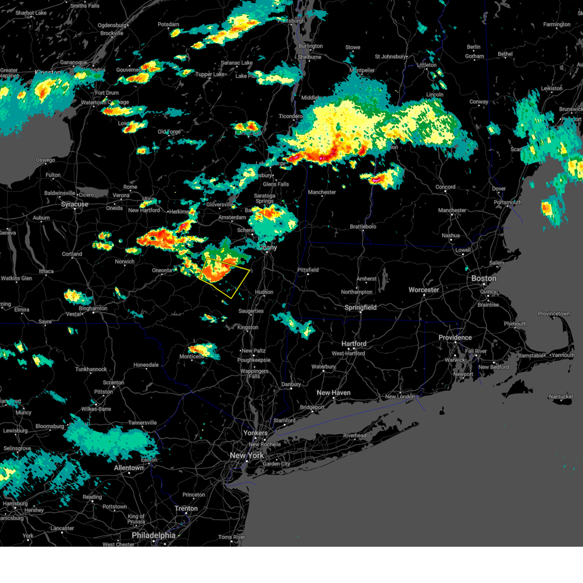
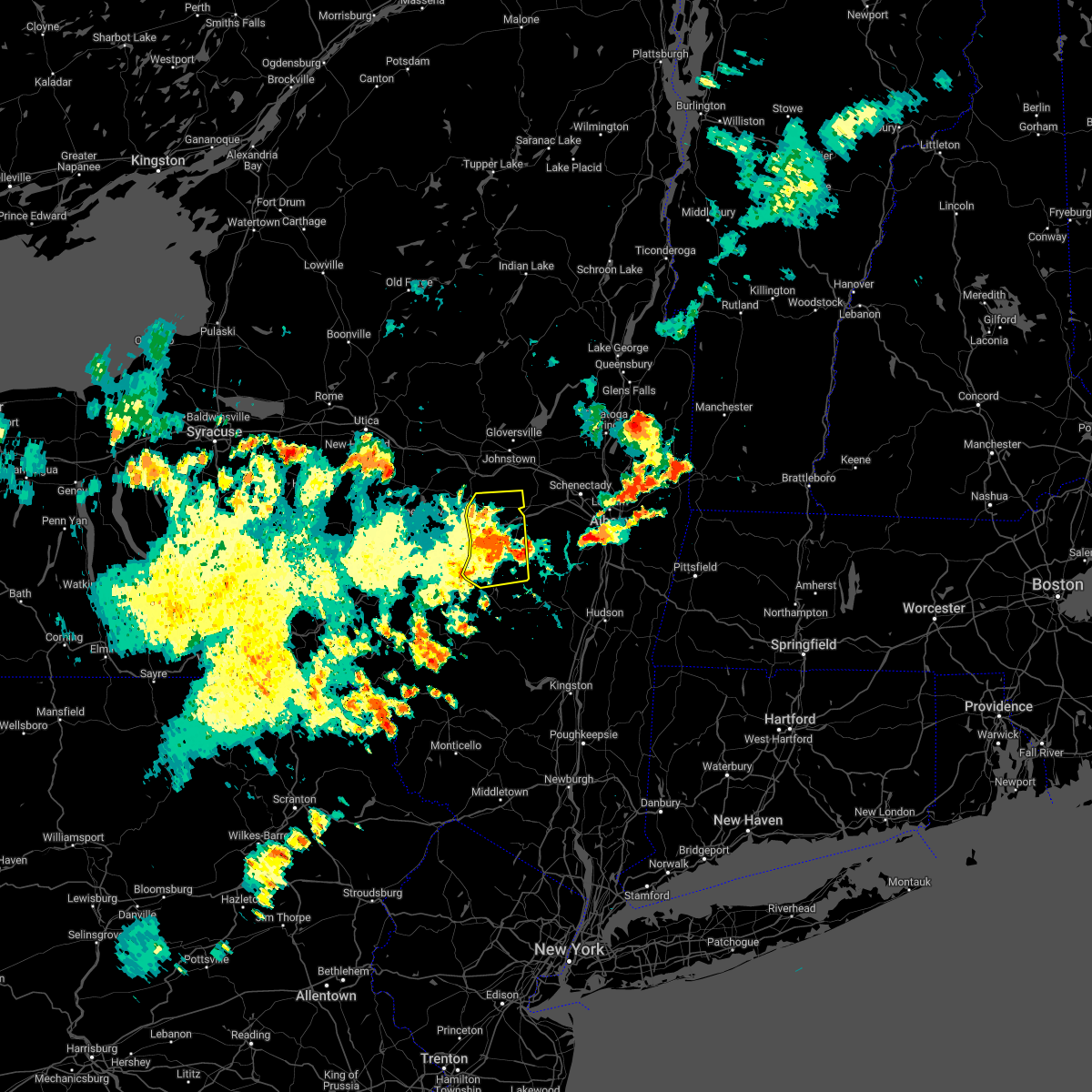
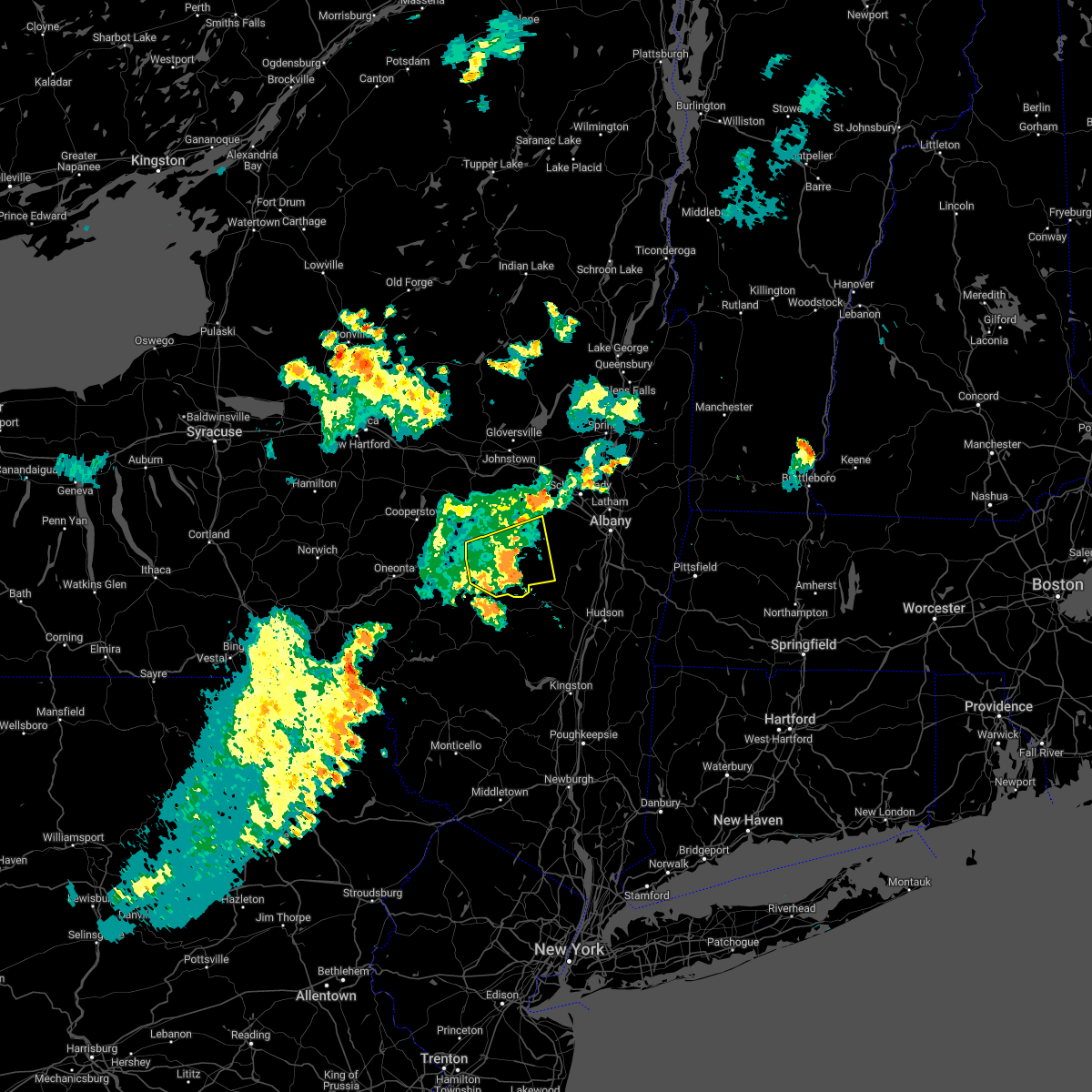
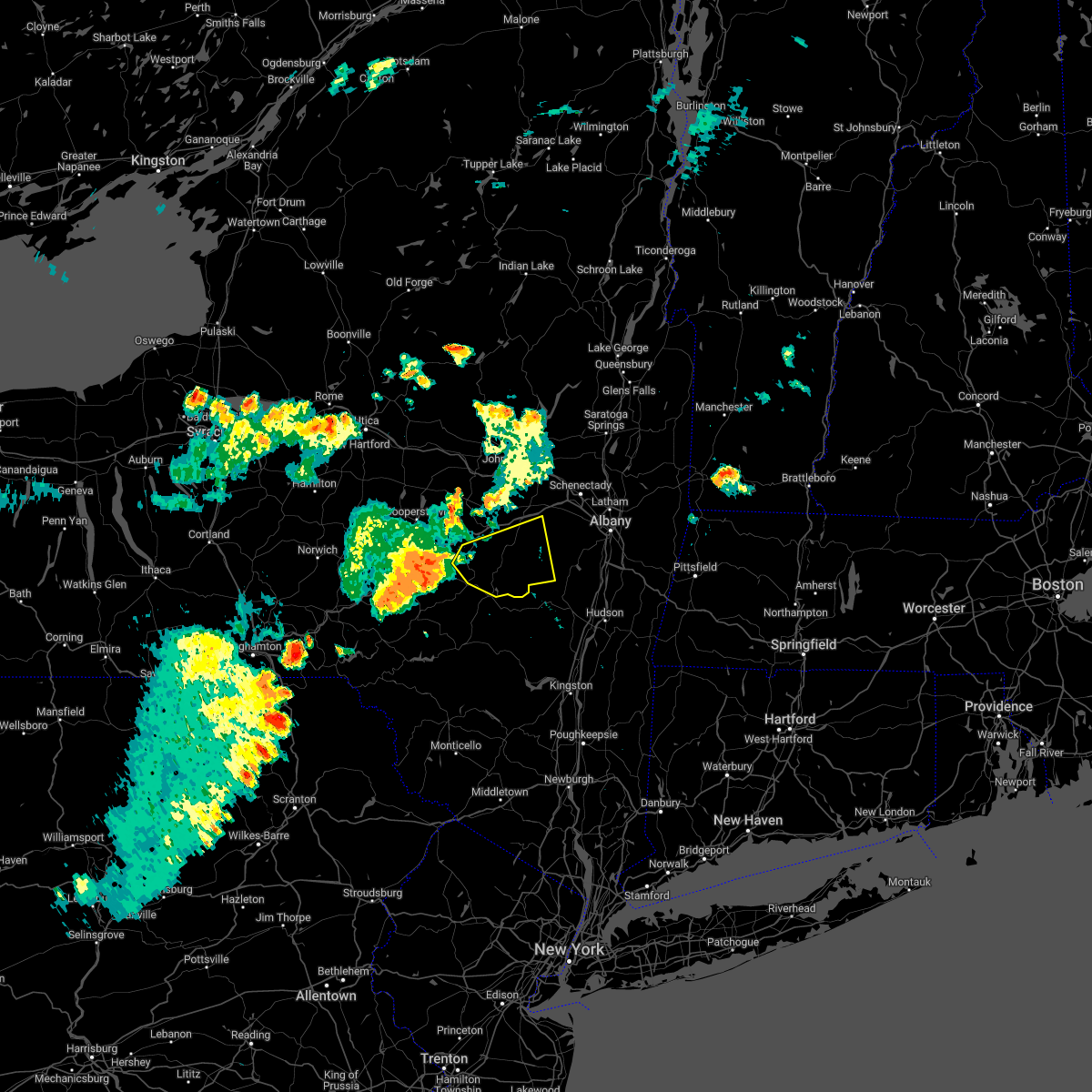
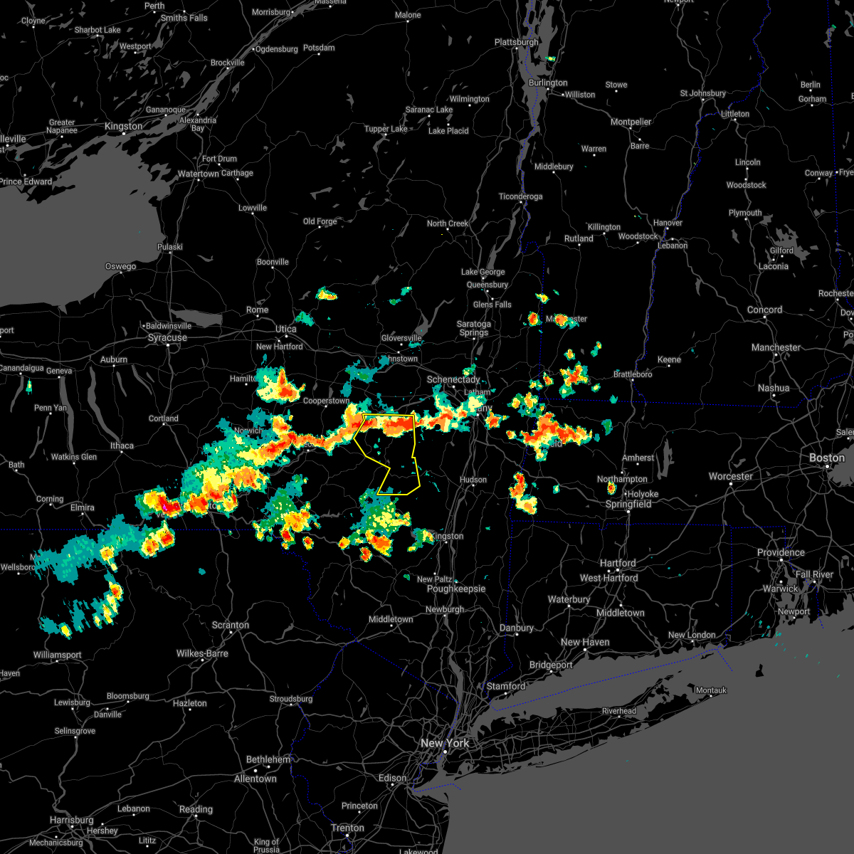
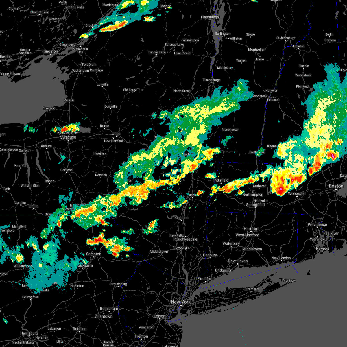
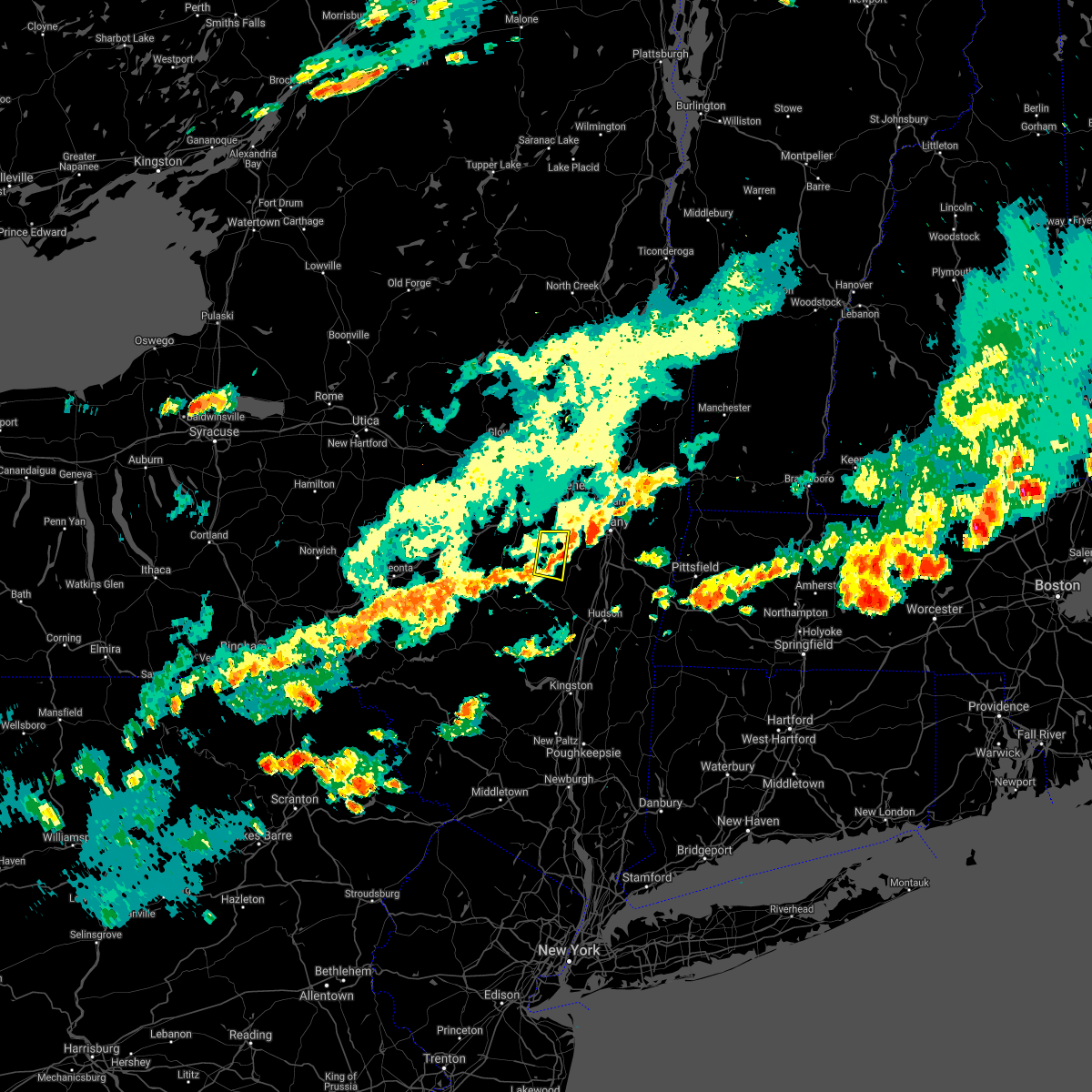
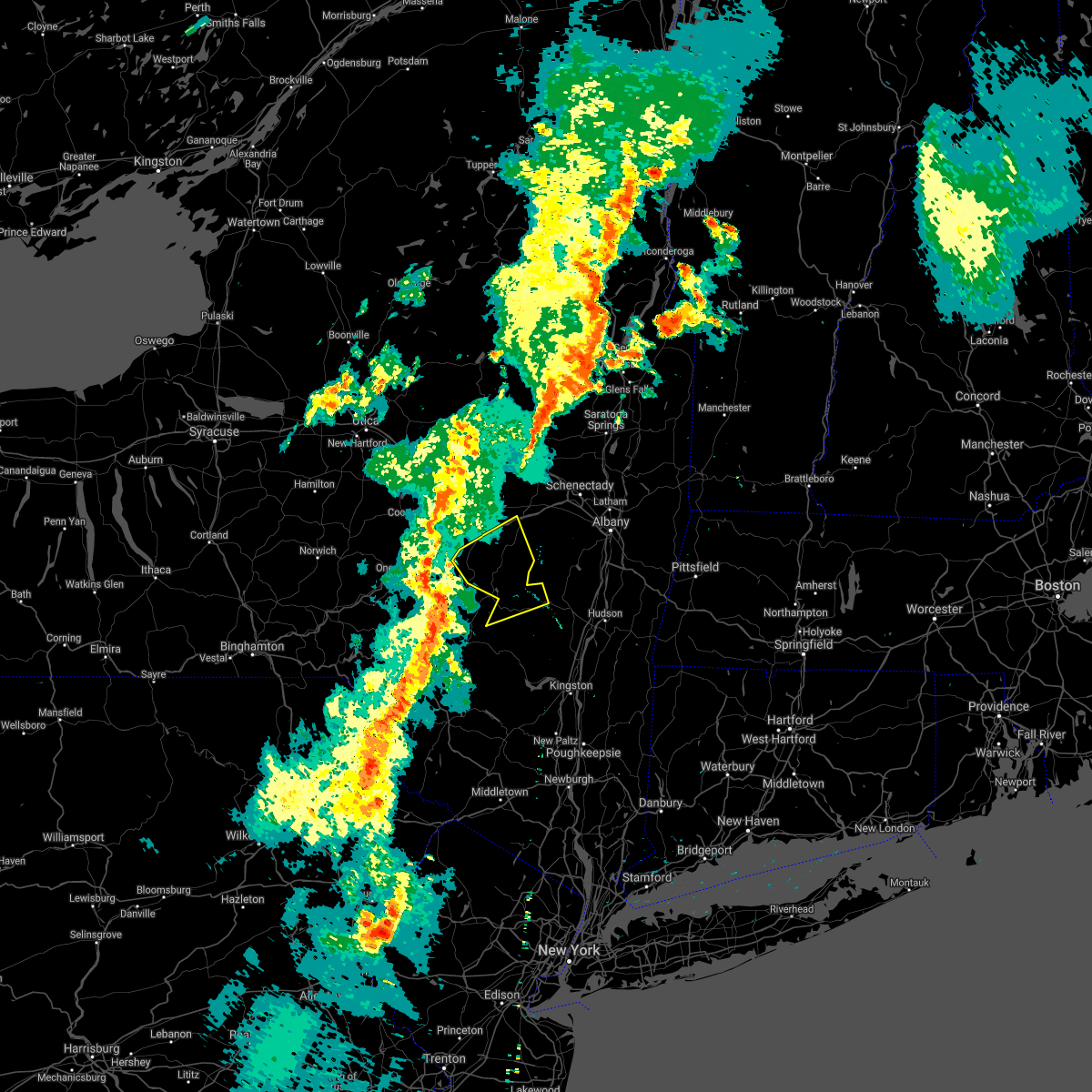
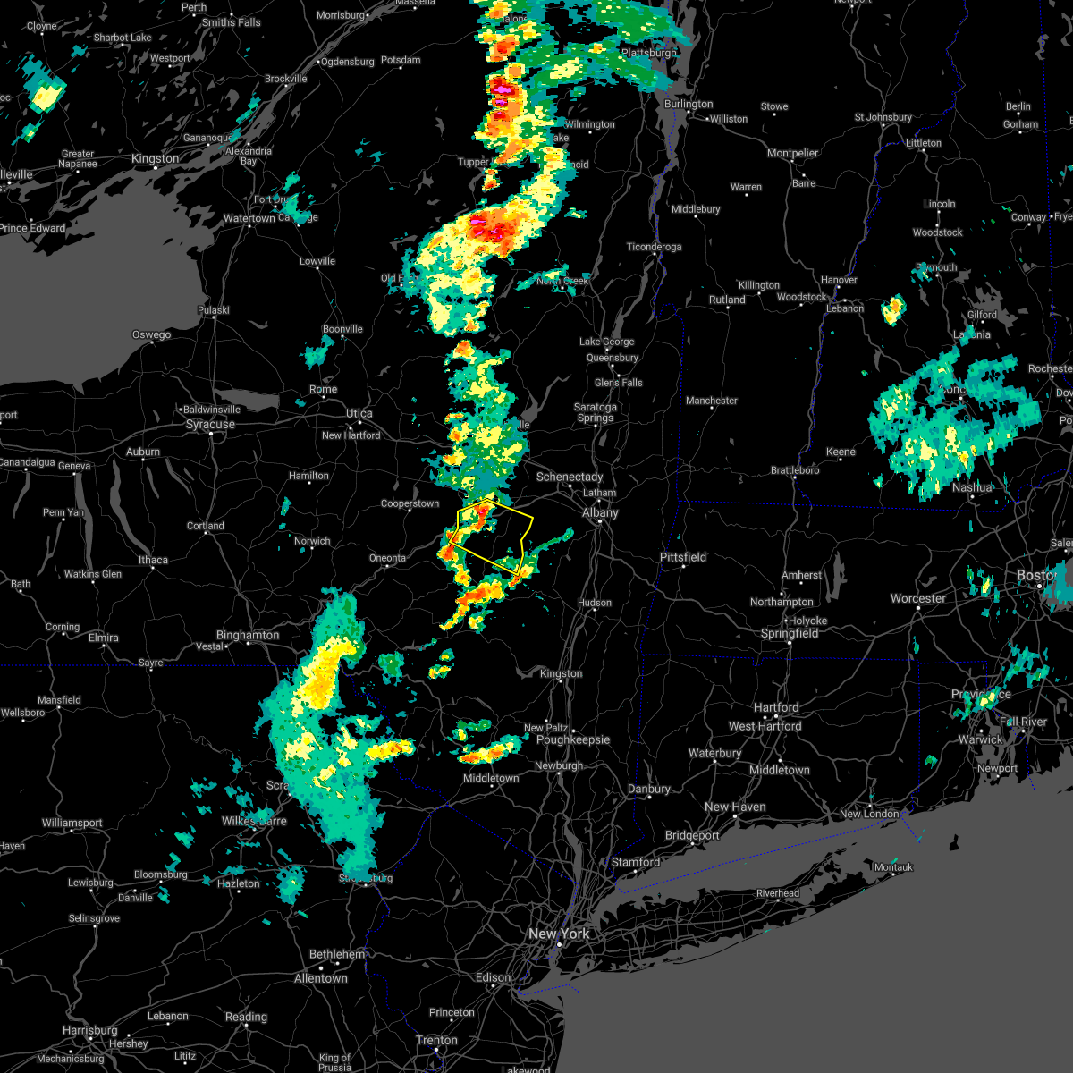
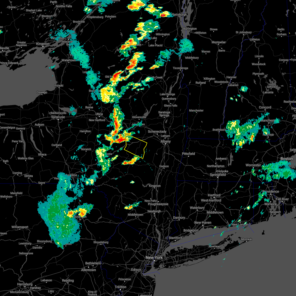
Hail Map for Preston-Potter Hollow, NY
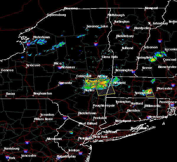
The Preston-Potter Hollow, NY area has had 0 reports of on-the-ground hail by trained spotters, and has been under severe weather warnings 7 times during the past 12 months. Doppler radar has detected hail at or near Preston-Potter Hollow, NY on 10 occasions, including 1 occasion during the past year.
| Name: | Preston-Potter Hollow, NY |
| Where Located: | 29.3 miles SSW of Schenectady, NY |
| Map: | Google Map for Preston-Potter Hollow, NY |
| Population: | 366 |
| Housing Units: | 256 |
| More Info: | Search Google for Preston-Potter Hollow, NY |
1
The Top Recent Hail Date for Preston-Potter Hollow, NY is Friday, August 4, 2023 (3rd out of 10)

Hail and Wind Damage Spotted near Preston-Potter Hollow, NY
| Date / Time | Report Details |
|---|---|
| 8/4/2023 4:54 PM EDT |
 At 454 pm edt, severe thunderstorms were located along a line extending from westerlo to 6 miles southeast of preston hollow to near windham, moving east at 35 mph (radar indicated). Hazards include 60 mph wind gusts and quarter size hail. Hail damage to vehicles is expected. Expect wind damage to roofs, siding, and trees. At 454 pm edt, severe thunderstorms were located along a line extending from westerlo to 6 miles southeast of preston hollow to near windham, moving east at 35 mph (radar indicated). Hazards include 60 mph wind gusts and quarter size hail. Hail damage to vehicles is expected. Expect wind damage to roofs, siding, and trees.
|
| 8/4/2023 4:43 PM EDT |
 At 442 pm edt, a severe thunderstorm was located over preston-potter hollow, or 14 miles north of hunter, moving southeast at 30 mph (radar indicated). Hazards include 60 mph wind gusts and quarter size hail. Hail damage to vehicles is expected. expect wind damage to roofs, siding, and trees. locations impacted include, windham, gilboa, livingstonville, north blenheim, breakabeen, preston-potter hollow, preston hollow, durham, rensselaerville, ashland, conesville, west settlement, maplecrest, broome center, west fulton, eminence, housons corners, hervey street, south gilboa and cooksburg. hail threat, radar indicated max hail size, 1. 00 in wind threat, radar indicated max wind gust, 60 mph. At 442 pm edt, a severe thunderstorm was located over preston-potter hollow, or 14 miles north of hunter, moving southeast at 30 mph (radar indicated). Hazards include 60 mph wind gusts and quarter size hail. Hail damage to vehicles is expected. expect wind damage to roofs, siding, and trees. locations impacted include, windham, gilboa, livingstonville, north blenheim, breakabeen, preston-potter hollow, preston hollow, durham, rensselaerville, ashland, conesville, west settlement, maplecrest, broome center, west fulton, eminence, housons corners, hervey street, south gilboa and cooksburg. hail threat, radar indicated max hail size, 1. 00 in wind threat, radar indicated max wind gust, 60 mph.
|
| 8/4/2023 3:57 PM EDT |
 At 357 pm edt, a severe thunderstorm was located over summit, or 10 miles southwest of cobleskill, moving southeast at 35 mph (radar indicated). Hazards include 60 mph wind gusts and quarter size hail. Hail damage to vehicles is expected. Expect wind damage to roofs, siding, and trees. At 357 pm edt, a severe thunderstorm was located over summit, or 10 miles southwest of cobleskill, moving southeast at 35 mph (radar indicated). Hazards include 60 mph wind gusts and quarter size hail. Hail damage to vehicles is expected. Expect wind damage to roofs, siding, and trees.
|
| 7/13/2023 6:54 PM EDT |
 At 654 pm edt, severe thunderstorms were located along a line extending from near ira to mechanicville to near gilboa, moving east at 40 mph (radar indicated). Hazards include 70 mph wind gusts and quarter size hail. Hail damage to vehicles is expected. expect considerable tree damage. Wind damage is also likely to mobile homes, roofs, and outbuildings. At 654 pm edt, severe thunderstorms were located along a line extending from near ira to mechanicville to near gilboa, moving east at 40 mph (radar indicated). Hazards include 70 mph wind gusts and quarter size hail. Hail damage to vehicles is expected. expect considerable tree damage. Wind damage is also likely to mobile homes, roofs, and outbuildings.
|
| 7/13/2023 6:14 PM EDT |
 At 613 pm edt, severe thunderstorms were located along a line extending from near hagaman to near jefferson, moving east at 35 mph (radar indicated). Hazards include 60 mph wind gusts and penny size hail. expect damage to roofs, siding, and trees At 613 pm edt, severe thunderstorms were located along a line extending from near hagaman to near jefferson, moving east at 35 mph (radar indicated). Hazards include 60 mph wind gusts and penny size hail. expect damage to roofs, siding, and trees
|
| 7/7/2023 5:20 PM EDT |
 At 519 pm edt, a severe thunderstorm was located near stamford, or 17 miles south of cobleskill, moving east at 25 mph (radar indicated). Hazards include 60 mph wind gusts and quarter size hail. Hail damage to vehicles is expected. expect wind damage to roofs, siding, and trees. this severe thunderstorm will be near, gilboa and north blenheim around 535 pm edt. livingstonville around 555 pm edt. preston-potter hollow and preston hollow around 600 pm edt. other locations impacted by this severe thunderstorm include west settlement, manorkill, broome center, rensselaerville, five corners, four corners, north settlement, west conesville, red falls and oak hill. please report hail size, damaging winds and reports of trees down to the national weather service by email at alb. stormreport@noaa. gov, on facebook at www. facebook. com/nwsalbany or twitter @nwsalbany hail threat, radar indicated max hail size, 1. 00 in wind threat, radar indicated max wind gust, 60 mph. At 519 pm edt, a severe thunderstorm was located near stamford, or 17 miles south of cobleskill, moving east at 25 mph (radar indicated). Hazards include 60 mph wind gusts and quarter size hail. Hail damage to vehicles is expected. expect wind damage to roofs, siding, and trees. this severe thunderstorm will be near, gilboa and north blenheim around 535 pm edt. livingstonville around 555 pm edt. preston-potter hollow and preston hollow around 600 pm edt. other locations impacted by this severe thunderstorm include west settlement, manorkill, broome center, rensselaerville, five corners, four corners, north settlement, west conesville, red falls and oak hill. please report hail size, damaging winds and reports of trees down to the national weather service by email at alb. stormreport@noaa. gov, on facebook at www. facebook. com/nwsalbany or twitter @nwsalbany hail threat, radar indicated max hail size, 1. 00 in wind threat, radar indicated max wind gust, 60 mph.
|
| 9/19/2022 4:13 PM EDT |
 At 412 pm edt, severe thunderstorms were located along a line extending from 6 miles northwest of delanson to near schoharie to near livingstonville, moving east at 65 mph (radar indicated). Hazards include 60 mph wind gusts. Expect damage to roofs, siding, and trees. locations impacted include, cobleskill, middleburgh, gilboa, schoharie, richmondville, livingstonville, north blenheim, breakabeen, central bridge, preston-potter hollow, conesville, west berne, huntersland, warnerville, broome center, becker corners, west fulton, shutts corners, barnerville and eminence. hail threat, radar indicated max hail size, <. 75 in wind threat, radar indicated max wind gust, 60 mph. At 412 pm edt, severe thunderstorms were located along a line extending from 6 miles northwest of delanson to near schoharie to near livingstonville, moving east at 65 mph (radar indicated). Hazards include 60 mph wind gusts. Expect damage to roofs, siding, and trees. locations impacted include, cobleskill, middleburgh, gilboa, schoharie, richmondville, livingstonville, north blenheim, breakabeen, central bridge, preston-potter hollow, conesville, west berne, huntersland, warnerville, broome center, becker corners, west fulton, shutts corners, barnerville and eminence. hail threat, radar indicated max hail size, <. 75 in wind threat, radar indicated max wind gust, 60 mph.
|
| 9/19/2022 3:59 PM EDT |
 At 358 pm edt, severe thunderstorms were located along a line extending from near sharon springs to near summit to stamford, moving east at 50 mph (radar indicated). Hazards include 60 mph wind gusts. expect damage to roofs, siding, and trees At 358 pm edt, severe thunderstorms were located along a line extending from near sharon springs to near summit to stamford, moving east at 50 mph (radar indicated). Hazards include 60 mph wind gusts. expect damage to roofs, siding, and trees
|
| 8/20/2022 5:36 PM EDT |
 At 536 pm edt, a severe thunderstorm was located over preston hollow, or 14 miles north of hunter, moving northeast at 10 mph (radar indicated). Hazards include 60 mph wind gusts. expect damage to roofs, siding, and trees At 536 pm edt, a severe thunderstorm was located over preston hollow, or 14 miles north of hunter, moving northeast at 10 mph (radar indicated). Hazards include 60 mph wind gusts. expect damage to roofs, siding, and trees
|
| 8/4/2022 4:59 PM EDT |
 At 459 pm edt, a severe thunderstorm was located over middleburgh, or 8 miles southeast of cobleskill, moving northeast at 25 mph (radar indicated). Hazards include 60 mph wind gusts and penny size hail. expect damage to roofs, siding, and trees At 459 pm edt, a severe thunderstorm was located over middleburgh, or 8 miles southeast of cobleskill, moving northeast at 25 mph (radar indicated). Hazards include 60 mph wind gusts and penny size hail. expect damage to roofs, siding, and trees
|
| 8/4/2022 4:46 PM EDT |
 At 446 pm edt, a severe thunderstorm was located over middleburgh, or 12 miles southeast of cobleskill, moving east at 30 mph (radar indicated). Hazards include 60 mph wind gusts and penny size hail. Expect damage to roofs, siding, and trees. locations impacted include, cobleskill, jefferson, middleburgh, summit, schoharie, richmondville, livingstonville, north blenheim, breakabeen, central bridge, carlisle, sharon, seward, zeh corners, beekman corners, rockwell corners, warnerville, gardnersville, market corners and broome center. hail threat, radar indicated max hail size, 0. 75 in wind threat, radar indicated max wind gust, 60 mph. At 446 pm edt, a severe thunderstorm was located over middleburgh, or 12 miles southeast of cobleskill, moving east at 30 mph (radar indicated). Hazards include 60 mph wind gusts and penny size hail. Expect damage to roofs, siding, and trees. locations impacted include, cobleskill, jefferson, middleburgh, summit, schoharie, richmondville, livingstonville, north blenheim, breakabeen, central bridge, carlisle, sharon, seward, zeh corners, beekman corners, rockwell corners, warnerville, gardnersville, market corners and broome center. hail threat, radar indicated max hail size, 0. 75 in wind threat, radar indicated max wind gust, 60 mph.
|
| 8/4/2022 4:06 PM EDT |
 At 405 pm edt, a severe thunderstorm was located near jefferson, or 14 miles southwest of cobleskill, moving east at 30 mph (radar indicated). Hazards include 60 mph wind gusts and penny size hail. expect damage to roofs, siding, and trees At 405 pm edt, a severe thunderstorm was located near jefferson, or 14 miles southwest of cobleskill, moving east at 30 mph (radar indicated). Hazards include 60 mph wind gusts and penny size hail. expect damage to roofs, siding, and trees
|
| 7/24/2022 7:51 PM EDT |
 At 749 pm edt, severe thunderstorms were located along a line extending from near windham to near olivebridge to near bloomingburg, moving east at 40 mph (emergency management reported trees and wires down in the towns of kerhonkson with this line of storms). Hazards include 60 mph wind gusts. expect damage to roofs, siding, and trees At 749 pm edt, severe thunderstorms were located along a line extending from near windham to near olivebridge to near bloomingburg, moving east at 40 mph (emergency management reported trees and wires down in the towns of kerhonkson with this line of storms). Hazards include 60 mph wind gusts. expect damage to roofs, siding, and trees
|
| 7/24/2022 7:41 PM EDT |
 At 741 pm edt, severe thunderstorms were located along a line extending from near prattsville to near olivebridge to near ellenville, moving east at 35 mph (emergency management reported downed trees and wires with this line of storms near ellenville). Hazards include 60 mph wind gusts. Expect damage to roofs, siding, and trees. locations impacted include, new paltz, ellenville, hunter, wallkill, hurley, woodstock, windham, prattsville, high falls, kerhonkson, tillson, west hurley, napanoch, north-south lake campground, woodland valley campground, west shokan, kenneth l wilson campground, phoenicia, mount tremper and lanesville. hail threat, radar indicated max hail size, <. 75 in wind threat, observed max wind gust, 60 mph. At 741 pm edt, severe thunderstorms were located along a line extending from near prattsville to near olivebridge to near ellenville, moving east at 35 mph (emergency management reported downed trees and wires with this line of storms near ellenville). Hazards include 60 mph wind gusts. Expect damage to roofs, siding, and trees. locations impacted include, new paltz, ellenville, hunter, wallkill, hurley, woodstock, windham, prattsville, high falls, kerhonkson, tillson, west hurley, napanoch, north-south lake campground, woodland valley campground, west shokan, kenneth l wilson campground, phoenicia, mount tremper and lanesville. hail threat, radar indicated max hail size, <. 75 in wind threat, observed max wind gust, 60 mph.
|
| 7/24/2022 7:06 PM EDT |
 At 705 pm edt, severe thunderstorms were located along a line extending from rotterdam to 6 miles southwest of voorheesville to near westerlo, moving east at 40 mph (radar indicated. at 7:00 pm, the voorheesville mesonet site reported a wind gust to 40 mph). Hazards include 60 mph wind gusts. Expect damage to roofs, siding, and trees. locations impacted include, albany, schenectady, troy, rotterdam, east greenbush, cohoes, watervliet, rensselaer, colonie, nassau, delmar, latham, guilderland, duanesburg, menands, new baltimore, westerlo, ravena, berne and voorheesville. hail threat, radar indicated max hail size, <. 75 in wind threat, observed max wind gust, 60 mph. At 705 pm edt, severe thunderstorms were located along a line extending from rotterdam to 6 miles southwest of voorheesville to near westerlo, moving east at 40 mph (radar indicated. at 7:00 pm, the voorheesville mesonet site reported a wind gust to 40 mph). Hazards include 60 mph wind gusts. Expect damage to roofs, siding, and trees. locations impacted include, albany, schenectady, troy, rotterdam, east greenbush, cohoes, watervliet, rensselaer, colonie, nassau, delmar, latham, guilderland, duanesburg, menands, new baltimore, westerlo, ravena, berne and voorheesville. hail threat, radar indicated max hail size, <. 75 in wind threat, observed max wind gust, 60 mph.
|
| 7/24/2022 6:58 PM EDT |
 At 657 pm edt, severe thunderstorms were located along a line extending from near downsville to near hazel to near narrowsburg, moving northeast at 50 mph (radar indicated). Hazards include 60 mph wind gusts. expect damage to roofs, siding, and trees At 657 pm edt, severe thunderstorms were located along a line extending from near downsville to near hazel to near narrowsburg, moving northeast at 50 mph (radar indicated). Hazards include 60 mph wind gusts. expect damage to roofs, siding, and trees
|
| 7/24/2022 6:48 PM EDT |
 At 647 pm edt, severe thunderstorms were located along a line extending from near altamont to near berne to near preston hollow, moving east at 40 mph (radar indicated. at 6:45 pm, a 40 mph wind gust was reported at the mesonet site in medusa, new york). Hazards include 60 mph wind gusts. Expect damage to roofs, siding, and trees. locations impacted include, albany, schenectady, troy, rotterdam, east greenbush, cohoes, watervliet, rensselaer, colonie, nassau, delmar, latham, guilderland, duanesburg, menands, new baltimore, westerlo, ravena, berne and voorheesville. hail threat, radar indicated max hail size, <. 75 in wind threat, observed max wind gust, 60 mph. At 647 pm edt, severe thunderstorms were located along a line extending from near altamont to near berne to near preston hollow, moving east at 40 mph (radar indicated. at 6:45 pm, a 40 mph wind gust was reported at the mesonet site in medusa, new york). Hazards include 60 mph wind gusts. Expect damage to roofs, siding, and trees. locations impacted include, albany, schenectady, troy, rotterdam, east greenbush, cohoes, watervliet, rensselaer, colonie, nassau, delmar, latham, guilderland, duanesburg, menands, new baltimore, westerlo, ravena, berne and voorheesville. hail threat, radar indicated max hail size, <. 75 in wind threat, observed max wind gust, 60 mph.
|
| 7/24/2022 6:38 PM EDT |
 At 638 pm edt, severe thunderstorms were located along a line extending from duanesburg to near berne to near preston hollow, moving east at 40 mph (radar indicated). Hazards include 60 mph wind gusts. expect damage to roofs, siding, and trees At 638 pm edt, severe thunderstorms were located along a line extending from duanesburg to near berne to near preston hollow, moving east at 40 mph (radar indicated). Hazards include 60 mph wind gusts. expect damage to roofs, siding, and trees
|
| 7/24/2022 6:35 PM EDT |
 At 635 pm edt, a severe thunderstorm was located over livingstonville, or 15 miles southeast of cobleskill, moving east at 40 mph (radar indicated). Hazards include 60 mph wind gusts. Expect damage to roofs, siding, and trees. locations impacted include, jefferson, middleburgh, gilboa, summit, schoharie, livingstonville, north blenheim, breakabeen, preston-potter hollow, preston hollow, rensselaerville, conesville, shoefelt corners, west berne, huntersland, broome center, west fulton, eminence, housons corners and zucks corners. hail threat, radar indicated max hail size, <. 75 in wind threat, radar indicated max wind gust, 60 mph. At 635 pm edt, a severe thunderstorm was located over livingstonville, or 15 miles southeast of cobleskill, moving east at 40 mph (radar indicated). Hazards include 60 mph wind gusts. Expect damage to roofs, siding, and trees. locations impacted include, jefferson, middleburgh, gilboa, summit, schoharie, livingstonville, north blenheim, breakabeen, preston-potter hollow, preston hollow, rensselaerville, conesville, shoefelt corners, west berne, huntersland, broome center, west fulton, eminence, housons corners and zucks corners. hail threat, radar indicated max hail size, <. 75 in wind threat, radar indicated max wind gust, 60 mph.
|
| 7/24/2022 6:00 PM EDT |
 At 600 pm edt, a severe thunderstorm was located near jefferson, or 17 miles northeast of delhi, moving east at 40 mph (radar indicated). Hazards include 60 mph wind gusts. expect damage to roofs, siding, and trees At 600 pm edt, a severe thunderstorm was located near jefferson, or 17 miles northeast of delhi, moving east at 40 mph (radar indicated). Hazards include 60 mph wind gusts. expect damage to roofs, siding, and trees
|
| 7/12/2022 3:53 PM EDT |
 At 353 pm edt, a severe thunderstorm was located near prattsville, or 11 miles west of hunter, moving east at 40 mph (radar indicated). Hazards include 60 mph wind gusts. expect damage to roofs, siding, and trees At 353 pm edt, a severe thunderstorm was located near prattsville, or 11 miles west of hunter, moving east at 40 mph (radar indicated). Hazards include 60 mph wind gusts. expect damage to roofs, siding, and trees
|
| 5/16/2022 4:00 PM EDT | Tree down in albany county NY, 6.8 miles SW of Preston-Potter Hollow, NY |
| 5/16/2022 3:57 PM EDT | Tree down on roa in albany county NY, 2.7 miles WSW of Preston-Potter Hollow, NY |
| 5/16/2022 3:55 PM EDT | Power pole down in albany county NY, 2.7 miles WSW of Preston-Potter Hollow, NY |
| 5/16/2022 3:13 PM EDT |
 At 313 pm edt, severe thunderstorms were located along a line extending from near east meredith to near arkville to swan lake, moving northeast at 50 mph (radar indicated). Hazards include 60 mph wind gusts and quarter size hail. Hail damage to vehicles is expected. Expect wind damage to roofs, siding, and trees. At 313 pm edt, severe thunderstorms were located along a line extending from near east meredith to near arkville to swan lake, moving northeast at 50 mph (radar indicated). Hazards include 60 mph wind gusts and quarter size hail. Hail damage to vehicles is expected. Expect wind damage to roofs, siding, and trees.
|
| 5/16/2022 3:10 PM EDT |
 At 309 pm edt, severe thunderstorms were located along a line extending from near exeter center to near milford to near east meredith, moving east at 40 mph (radar indicated). Hazards include 60 mph wind gusts and quarter size hail. Hail damage to vehicles is expected. Expect wind damage to roofs, siding, and trees. At 309 pm edt, severe thunderstorms were located along a line extending from near exeter center to near milford to near east meredith, moving east at 40 mph (radar indicated). Hazards include 60 mph wind gusts and quarter size hail. Hail damage to vehicles is expected. Expect wind damage to roofs, siding, and trees.
|
| 3/7/2022 8:15 PM EST | Tree down at willsey rd and fleming rd in albany county NY, 5.6 miles WSW of Preston-Potter Hollow, NY |
| 3/7/2022 8:15 PM EST | Tree down on wires willsey rd and route 351 in albany county NY, 6.4 miles WSW of Preston-Potter Hollow, NY |
| 3/7/2022 8:07 PM EST |
 At 807 pm est, severe thunderstorms were located along a line extending from near altamont to near livingstonville to near margaretville, moving east at 65 mph (radar indicated). Hazards include 60 mph wind gusts. Expect damage to roofs, siding, and trees. severe thunderstorms will be near, duanesburg, altamont, windham, delanson and livingstonville around 810 pm est. schenectady, rotterdam, guilderland, voorheesville, preston hollow and preston-potter hollow around 815 pm est. albany, colonie, delmar and westerlo around 820 pm est. cohoes, watervliet, latham, menands, green island, loudonville and lanesville around 825 pm est. hunter, ravena and coxsackie around 830 pm est. new baltimore, north-south lake campground and selkirk around 835 pm est. catskill around 845 pm est. athens around 850 pm est. other locations impacted by these severe thunderstorms include shakers, west settlement, bleecker stadium, clarksville, east berne, shoefelt corners, north lexington, west berne, huntersland and dormansville. please report hail size, damaging winds and reports of trees down to the national weather service by email at alb. stormreport@noaa. gov, on facebook at www. facebook. com/nwsalbany or twitter @nwsalbany hail threat, radar indicated max hail size, <. 75 in wind threat, radar indicated max wind gust, 60 mph. At 807 pm est, severe thunderstorms were located along a line extending from near altamont to near livingstonville to near margaretville, moving east at 65 mph (radar indicated). Hazards include 60 mph wind gusts. Expect damage to roofs, siding, and trees. severe thunderstorms will be near, duanesburg, altamont, windham, delanson and livingstonville around 810 pm est. schenectady, rotterdam, guilderland, voorheesville, preston hollow and preston-potter hollow around 815 pm est. albany, colonie, delmar and westerlo around 820 pm est. cohoes, watervliet, latham, menands, green island, loudonville and lanesville around 825 pm est. hunter, ravena and coxsackie around 830 pm est. new baltimore, north-south lake campground and selkirk around 835 pm est. catskill around 845 pm est. athens around 850 pm est. other locations impacted by these severe thunderstorms include shakers, west settlement, bleecker stadium, clarksville, east berne, shoefelt corners, north lexington, west berne, huntersland and dormansville. please report hail size, damaging winds and reports of trees down to the national weather service by email at alb. stormreport@noaa. gov, on facebook at www. facebook. com/nwsalbany or twitter @nwsalbany hail threat, radar indicated max hail size, <. 75 in wind threat, radar indicated max wind gust, 60 mph.
|
| 3/7/2022 7:39 PM EST |
 At 739 pm est, severe thunderstorms were located along a line extending from sharon springs to 7 miles northwest of richmondville to near emmons, moving east at 55 mph (radar indicated). Hazards include 60 mph wind gusts. Expect damage to roofs, siding, and trees. these severe storms will be near, summit, richmondville, sharon springs and ames around 745 pm est. cobleskill around 750 pm est. central bridge around 755 pm est. jefferson, middleburgh and schoharie around 800 pm est. duanesburg and delanson around 805 pm est. gilboa and north blenheim around 810 pm est. preston-potter hollow around 820 pm est. other locations impacted by these severe thunderstorms include zeh corners, beekman corners, west richmondville, baird corners, seward, rockwell corners, huntersland, warnerville, flat creek and carlisle. hail threat, radar indicated max hail size, <. 75 in wind threat, radar indicated max wind gust, 60 mph. At 739 pm est, severe thunderstorms were located along a line extending from sharon springs to 7 miles northwest of richmondville to near emmons, moving east at 55 mph (radar indicated). Hazards include 60 mph wind gusts. Expect damage to roofs, siding, and trees. these severe storms will be near, summit, richmondville, sharon springs and ames around 745 pm est. cobleskill around 750 pm est. central bridge around 755 pm est. jefferson, middleburgh and schoharie around 800 pm est. duanesburg and delanson around 805 pm est. gilboa and north blenheim around 810 pm est. preston-potter hollow around 820 pm est. other locations impacted by these severe thunderstorms include zeh corners, beekman corners, west richmondville, baird corners, seward, rockwell corners, huntersland, warnerville, flat creek and carlisle. hail threat, radar indicated max hail size, <. 75 in wind threat, radar indicated max wind gust, 60 mph.
|
| 3/7/2022 7:22 PM EST |
 At 721 pm est, severe thunderstorms were located along a line extending from near caroga lake to near gilbertsville, moving east at 55 mph (radar indicated). Hazards include 60 mph wind gusts. Expect damage to roofs, siding, and trees. severe thunderstorms will be near, jefferson around 755 pm est. north blenheim around 805 pm est. gilboa around 810 pm est. other locations impacted by these severe thunderstorms include beekman corners, west richmondville, rockwell corners, huntersland, engleville, gardnersville, quaker street, broome center, west fulton and eminence. please report hail size, damaging winds and reports of trees down to the national weather service by email at alb. stormreport@noaa. gov, on facebook at www. facebook. com/nwsalbany or twitter @nwsalbany hail threat, radar indicated max hail size, <. 75 in wind threat, radar indicated max wind gust, 60 mph. At 721 pm est, severe thunderstorms were located along a line extending from near caroga lake to near gilbertsville, moving east at 55 mph (radar indicated). Hazards include 60 mph wind gusts. Expect damage to roofs, siding, and trees. severe thunderstorms will be near, jefferson around 755 pm est. north blenheim around 805 pm est. gilboa around 810 pm est. other locations impacted by these severe thunderstorms include beekman corners, west richmondville, rockwell corners, huntersland, engleville, gardnersville, quaker street, broome center, west fulton and eminence. please report hail size, damaging winds and reports of trees down to the national weather service by email at alb. stormreport@noaa. gov, on facebook at www. facebook. com/nwsalbany or twitter @nwsalbany hail threat, radar indicated max hail size, <. 75 in wind threat, radar indicated max wind gust, 60 mph.
|
| 7/27/2021 4:34 PM EDT |
 At 433 pm edt, a severe thunderstorm was located over livingstonville, or 16 miles southeast of cobleskill, moving east at 50 mph (radar indicated). Hazards include 60 mph wind gusts. expect damage to roofs, siding, and trees At 433 pm edt, a severe thunderstorm was located over livingstonville, or 16 miles southeast of cobleskill, moving east at 50 mph (radar indicated). Hazards include 60 mph wind gusts. expect damage to roofs, siding, and trees
|
| 7/8/2021 12:22 AM EDT |
 At 1221 am edt, severe thunderstorms were located along a line extending from near westerlo to near milton to near rhinebeck, moving northeast at 45 mph (radar indicated). Hazards include 60 mph wind gusts and penny size hail. Expect damage to roofs, siding, and trees. locations impacted include, kingston, east greenbush, hudson, catskill, saugerties, rhinebeck, chatham, hunter, delmar, hurley, claverack, woodstock, livingston, new baltimore, westerlo, ravena, coxsackie, berne, voorheesville and pine plains. These storms have a history of producing tree damage in ulster county. At 1221 am edt, severe thunderstorms were located along a line extending from near westerlo to near milton to near rhinebeck, moving northeast at 45 mph (radar indicated). Hazards include 60 mph wind gusts and penny size hail. Expect damage to roofs, siding, and trees. locations impacted include, kingston, east greenbush, hudson, catskill, saugerties, rhinebeck, chatham, hunter, delmar, hurley, claverack, woodstock, livingston, new baltimore, westerlo, ravena, coxsackie, berne, voorheesville and pine plains. These storms have a history of producing tree damage in ulster county.
|
| 7/8/2021 12:00 AM EDT |
 At 1159 pm edt, severe thunderstorms were located along a line extending from gilboa to west hurley to near new paltz, moving northeast at 50 mph (radar indicated). Hazards include 60 mph wind gusts and penny size hail. expect damage to roofs, siding, and trees At 1159 pm edt, severe thunderstorms were located along a line extending from gilboa to west hurley to near new paltz, moving northeast at 50 mph (radar indicated). Hazards include 60 mph wind gusts and penny size hail. expect damage to roofs, siding, and trees
|
| 7/7/2021 11:42 PM EDT |
 At 1142 pm edt, severe thunderstorms were located along a line extending from near jordanville to near richmondville to roxbury, moving northeast at 45 mph (radar indicated). Hazards include 60 mph wind gusts. Expect damage to roofs, siding, and trees. locations impacted include, johnstown, ilion, herkimer, little falls, cobleskill, canajoharie, fonda, jefferson, mohawk, frankfort, fort plain, dolgeville, st. Johnsville, ephratah, middleburgh, gilboa, summit, schoharie, richmondville and west winfield. At 1142 pm edt, severe thunderstorms were located along a line extending from near jordanville to near richmondville to roxbury, moving northeast at 45 mph (radar indicated). Hazards include 60 mph wind gusts. Expect damage to roofs, siding, and trees. locations impacted include, johnstown, ilion, herkimer, little falls, cobleskill, canajoharie, fonda, jefferson, mohawk, frankfort, fort plain, dolgeville, st. Johnsville, ephratah, middleburgh, gilboa, summit, schoharie, richmondville and west winfield.
|
| 7/7/2021 11:20 PM EDT |
 At 1119 pm edt, severe thunderstorms were located along a line extending from near exeter center to davenport to near andes, moving northeast at 45 mph (radar indicated). Hazards include 60 mph wind gusts and penny size hail. expect damage to roofs, siding, and trees At 1119 pm edt, severe thunderstorms were located along a line extending from near exeter center to davenport to near andes, moving northeast at 45 mph (radar indicated). Hazards include 60 mph wind gusts and penny size hail. expect damage to roofs, siding, and trees
|
| 7/7/2021 6:25 PM EDT |
 At 625 pm edt, a severe thunderstorm was located near middleburgh, or 12 miles southeast of cobleskill, moving east at 25 mph (radar indicated). Hazards include 60 mph wind gusts and nickel size hail. expect damage to roofs, siding, and trees At 625 pm edt, a severe thunderstorm was located near middleburgh, or 12 miles southeast of cobleskill, moving east at 25 mph (radar indicated). Hazards include 60 mph wind gusts and nickel size hail. expect damage to roofs, siding, and trees
|
| 7/7/2021 2:25 PM EDT |
 At 225 pm edt, a severe thunderstorm was located near berne, or 17 miles west of delmar, moving east at 35 mph (radar indicated). Hazards include 60 mph wind gusts and penny size hail. expect damage to roofs, siding, and trees At 225 pm edt, a severe thunderstorm was located near berne, or 17 miles west of delmar, moving east at 35 mph (radar indicated). Hazards include 60 mph wind gusts and penny size hail. expect damage to roofs, siding, and trees
|
| 7/6/2021 3:23 PM EDT |
 At 323 pm edt, a severe thunderstorm was located near berne, or 14 miles west of delmar, moving east at 30 mph (radar indicated). Hazards include 60 mph wind gusts. expect damage to roofs, siding, and trees At 323 pm edt, a severe thunderstorm was located near berne, or 14 miles west of delmar, moving east at 30 mph (radar indicated). Hazards include 60 mph wind gusts. expect damage to roofs, siding, and trees
|
| 7/6/2021 3:06 PM EDT |
 At 306 pm edt, severe thunderstorms were located along a line extending from near breakabeen to near worcester to near schenevus, moving southeast at 35 mph (radar indicated). Hazards include 60 mph wind gusts and penny size hail. expect damage to roofs, siding, and trees At 306 pm edt, severe thunderstorms were located along a line extending from near breakabeen to near worcester to near schenevus, moving southeast at 35 mph (radar indicated). Hazards include 60 mph wind gusts and penny size hail. expect damage to roofs, siding, and trees
|
| 6/30/2021 5:22 PM EDT |
 The severe thunderstorm warning for southwestern albany county will expire at 530 pm edt, the storm which prompted the warning has weakened below severe limits, and no longer poses an immediate threat to life or property. therefore, the warning will be allowed to expire. however gusty winds and heavy rain are still possible with this thunderstorm. a severe thunderstorm watch remains in effect until 800 pm edt for east central new york. a severe thunderstorm watch also remains in effect until 1000 pm edt for east central new york. The severe thunderstorm warning for southwestern albany county will expire at 530 pm edt, the storm which prompted the warning has weakened below severe limits, and no longer poses an immediate threat to life or property. therefore, the warning will be allowed to expire. however gusty winds and heavy rain are still possible with this thunderstorm. a severe thunderstorm watch remains in effect until 800 pm edt for east central new york. a severe thunderstorm watch also remains in effect until 1000 pm edt for east central new york.
|
| 6/30/2021 5:17 PM EDT |
 At 516 pm edt, a severe thunderstorm was located near berne, or 16 miles west of delmar, moving east at 30 mph (radar indicated). Hazards include 60 mph wind gusts and penny size hail. Expect damage to roofs, siding, and trees. Locations impacted include, westerlo, berne, rensselaerville, east berne, snyders corners, shoefelt corners, bensons corners, west berne, thompsons lake, smith corner, thatcher state park, south berne, bramans corners, helderberg, lambs corner, reidsville and medusa. At 516 pm edt, a severe thunderstorm was located near berne, or 16 miles west of delmar, moving east at 30 mph (radar indicated). Hazards include 60 mph wind gusts and penny size hail. Expect damage to roofs, siding, and trees. Locations impacted include, westerlo, berne, rensselaerville, east berne, snyders corners, shoefelt corners, bensons corners, west berne, thompsons lake, smith corner, thatcher state park, south berne, bramans corners, helderberg, lambs corner, reidsville and medusa.
|
| 6/30/2021 4:47 PM EDT |
 At 447 pm edt, a severe thunderstorm was located near breakabeen, or 7 miles south of cobleskill, moving east at 30 mph (radar indicated). Hazards include 60 mph wind gusts and penny size hail. expect damage to roofs, siding, and trees At 447 pm edt, a severe thunderstorm was located near breakabeen, or 7 miles south of cobleskill, moving east at 30 mph (radar indicated). Hazards include 60 mph wind gusts and penny size hail. expect damage to roofs, siding, and trees
|
| 6/21/2021 9:04 PM EDT |
 At 904 pm edt, a severe thunderstorm was located near berne, or 11 miles southwest of rotterdam, moving northeast at 40 mph (radar indicated). Hazards include 60 mph wind gusts. Expect damage to roofs, siding, and trees. Locations impacted include, albany, schenectady, rotterdam, colonie, delmar, guilderland, niskayuna, duanesburg, westerlo, berne, voorheesville, altamont, delanson, preston-potter hollow, feura bush, preston hollow, new scotland, knox, princetown and rensselaerville. At 904 pm edt, a severe thunderstorm was located near berne, or 11 miles southwest of rotterdam, moving northeast at 40 mph (radar indicated). Hazards include 60 mph wind gusts. Expect damage to roofs, siding, and trees. Locations impacted include, albany, schenectady, rotterdam, colonie, delmar, guilderland, niskayuna, duanesburg, westerlo, berne, voorheesville, altamont, delanson, preston-potter hollow, feura bush, preston hollow, new scotland, knox, princetown and rensselaerville.
|
| 6/21/2021 8:59 PM EDT |
 At 858 pm edt, a severe thunderstorm was located over berne, or 16 miles southwest of rotterdam, moving northeast at 35 mph (radar indicated). Hazards include 60 mph wind gusts. Expect damage to roofs, siding, and trees. Locations impacted include, jefferson, windham, middleburgh, gilboa, summit, schoharie, prattsville, livingstonville, breakabeen, central bridge, durham, ashland, conesville, north lexington, and huntersland. At 858 pm edt, a severe thunderstorm was located over berne, or 16 miles southwest of rotterdam, moving northeast at 35 mph (radar indicated). Hazards include 60 mph wind gusts. Expect damage to roofs, siding, and trees. Locations impacted include, jefferson, windham, middleburgh, gilboa, summit, schoharie, prattsville, livingstonville, breakabeen, central bridge, durham, ashland, conesville, north lexington, and huntersland.
|
| 6/21/2021 8:49 PM EDT |
 At 849 pm edt, a severe thunderstorm was located near middleburgh, or 13 miles southeast of cobleskill, moving northeast at 55 mph (radar indicated). Hazards include 60 mph wind gusts. expect damage to roofs, siding, and trees At 849 pm edt, a severe thunderstorm was located near middleburgh, or 13 miles southeast of cobleskill, moving northeast at 55 mph (radar indicated). Hazards include 60 mph wind gusts. expect damage to roofs, siding, and trees
|
| 6/21/2021 8:12 PM EDT |
 At 810 pm edt, a severe thunderstorm was located near hobart, or 8 miles northeast of delhi, moving northeast at 45 mph (radar indicated). Hazards include 60 mph wind gusts. expect damage to roofs, siding, and trees At 810 pm edt, a severe thunderstorm was located near hobart, or 8 miles northeast of delhi, moving northeast at 45 mph (radar indicated). Hazards include 60 mph wind gusts. expect damage to roofs, siding, and trees
|
| 6/14/2021 5:52 PM EDT |
 The severe thunderstorm warning for southern albany, northern greene and southeastern schoharie counties will expire at 600 pm edt, the storm which prompted the warning has weakened below severe limits, and no longer poses an immediate threat to life or property. therefore, the warning will be allowed to expire. The severe thunderstorm warning for southern albany, northern greene and southeastern schoharie counties will expire at 600 pm edt, the storm which prompted the warning has weakened below severe limits, and no longer poses an immediate threat to life or property. therefore, the warning will be allowed to expire.
|
| 6/14/2021 5:07 PM EDT |
 At 507 pm edt, a severe thunderstorm was located over cobleskill, moving east at 20 mph (trained weather spotters. at 453 pm, quarter size hail was reporte 4 miles north of richmondville). Hazards include 60 mph wind gusts and quarter size hail. Hail damage to vehicles is expected. expect wind damage to roofs, siding, and trees. Locations impacted include, cobleskill, middleburgh, summit, schoharie, richmondville, livingstonville, breakabeen, central bridge, north blenheim, preston-potter hollow, west richmondville, old central bridge, lawyersville, huntersland, warnerville, grovenor corners, old stone fort, lutheranville, broome center and west fulton. At 507 pm edt, a severe thunderstorm was located over cobleskill, moving east at 20 mph (trained weather spotters. at 453 pm, quarter size hail was reporte 4 miles north of richmondville). Hazards include 60 mph wind gusts and quarter size hail. Hail damage to vehicles is expected. expect wind damage to roofs, siding, and trees. Locations impacted include, cobleskill, middleburgh, summit, schoharie, richmondville, livingstonville, breakabeen, central bridge, north blenheim, preston-potter hollow, west richmondville, old central bridge, lawyersville, huntersland, warnerville, grovenor corners, old stone fort, lutheranville, broome center and west fulton.
|
| 6/14/2021 5:02 PM EDT |
 At 501 pm edt, a severe thunderstorm was located over roxbury, or 17 miles west of hunter, moving east at 35 mph (radar indicated). Hazards include 60 mph wind gusts and quarter size hail. Hail damage to vehicles is expected. Expect wind damage to roofs, siding, and trees. At 501 pm edt, a severe thunderstorm was located over roxbury, or 17 miles west of hunter, moving east at 35 mph (radar indicated). Hazards include 60 mph wind gusts and quarter size hail. Hail damage to vehicles is expected. Expect wind damage to roofs, siding, and trees.
|
| 6/14/2021 4:17 PM EDT |
 At 417 pm edt, a severe thunderstorm was located near middlefield, or 9 miles east of cooperstown, moving east at 25 mph (radar indicated). Hazards include ping pong ball size hail and 60 mph wind gusts. People and animals outdoors will be injured. expect hail damage to roofs, siding, windows, and vehicles. Expect wind damage to roofs, siding, and trees. At 417 pm edt, a severe thunderstorm was located near middlefield, or 9 miles east of cooperstown, moving east at 25 mph (radar indicated). Hazards include ping pong ball size hail and 60 mph wind gusts. People and animals outdoors will be injured. expect hail damage to roofs, siding, windows, and vehicles. Expect wind damage to roofs, siding, and trees.
|
| 10/7/2020 4:10 PM EDT | Several trees down in albany county NY, 4.9 miles W of Preston-Potter Hollow, NY |
| 10/7/2020 4:09 PM EDT |
 At 408 pm edt, a severe thunderstorm was located near pownal, or near bennington, moving east at 70 mph. this is a very dangerous storm (radar indicated). Hazards include 80 mph wind gusts and nickel size hail. Flying debris will be dangerous to those caught without shelter. mobile homes will be heavily damaged. expect considerable damage to roofs, windows, and vehicles. extensive tree damage and power outages are likely. Locations impacted include, albany, troy, pittsfield, bennington, kingston, east greenbush, cohoes, north adams, brattleboro, watervliet, rensselaer, colonie, great barrington, new paltz, hudson, ellenville, catskill, saugerties, hoosick falls and bellows falls. At 408 pm edt, a severe thunderstorm was located near pownal, or near bennington, moving east at 70 mph. this is a very dangerous storm (radar indicated). Hazards include 80 mph wind gusts and nickel size hail. Flying debris will be dangerous to those caught without shelter. mobile homes will be heavily damaged. expect considerable damage to roofs, windows, and vehicles. extensive tree damage and power outages are likely. Locations impacted include, albany, troy, pittsfield, bennington, kingston, east greenbush, cohoes, north adams, brattleboro, watervliet, rensselaer, colonie, great barrington, new paltz, hudson, ellenville, catskill, saugerties, hoosick falls and bellows falls.
|
| 10/7/2020 3:56 PM EDT |
 At 356 pm edt, severe thunderstorms were located along a line extending from near pawlet to center brunswick to near davenport, moving southeast at 80 mph (radar indicated). Hazards include 70 mph wind gusts. Expect considerable tree damage. Damage is likely to mobile homes, roofs, and outbuildings. At 356 pm edt, severe thunderstorms were located along a line extending from near pawlet to center brunswick to near davenport, moving southeast at 80 mph (radar indicated). Hazards include 70 mph wind gusts. Expect considerable tree damage. Damage is likely to mobile homes, roofs, and outbuildings.
|
| 10/7/2020 3:40 PM EDT |
 At 340 pm edt, severe thunderstorms were located along a line extending from richmondville to near milford, moving southeast at 50 mph (radar indicated). Hazards include 60 mph wind gusts. expect damage to roofs, siding, and trees At 340 pm edt, severe thunderstorms were located along a line extending from richmondville to near milford, moving southeast at 50 mph (radar indicated). Hazards include 60 mph wind gusts. expect damage to roofs, siding, and trees
|
| 8/29/2020 6:12 PM EDT |
 At 612 pm edt, a severe thunderstorm was located over davenport, or 12 miles east of oneonta, moving east at 40 mph (radar indicated). Hazards include 60 mph wind gusts. expect damage to roofs, siding, and trees At 612 pm edt, a severe thunderstorm was located over davenport, or 12 miles east of oneonta, moving east at 40 mph (radar indicated). Hazards include 60 mph wind gusts. expect damage to roofs, siding, and trees
|
| 8/27/2020 1:50 PM EDT |
 At 149 pm edt, severe thunderstorms were located along a line extending from 6 miles northeast of windham to east meredith, moving southeast at 45 mph (radar indicated). Hazards include 60 mph wind gusts and quarter size hail. Hail damage to vehicles is expected. Expect wind damage to roofs, siding, and trees. At 149 pm edt, severe thunderstorms were located along a line extending from 6 miles northeast of windham to east meredith, moving southeast at 45 mph (radar indicated). Hazards include 60 mph wind gusts and quarter size hail. Hail damage to vehicles is expected. Expect wind damage to roofs, siding, and trees.
|
| 8/11/2020 8:57 PM EDT |
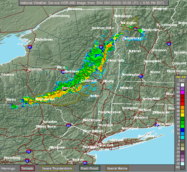 The national weather service in albany has issued a * severe thunderstorm warning for. southwestern albany county in east central new york. northwestern greene county in east central new york. southern schoharie county in east central new york. Until 930 pm edt. The national weather service in albany has issued a * severe thunderstorm warning for. southwestern albany county in east central new york. northwestern greene county in east central new york. southern schoharie county in east central new york. Until 930 pm edt.
|
| 7/27/2020 10:25 PM EDT |
 The severe thunderstorm warning for southwestern albany, northwestern greene and southern schoharie counties will expire at 1030 pm edt, the storm which prompted the warning has moved out of the area. therefore, the warning will be allowed to expire. The severe thunderstorm warning for southwestern albany, northwestern greene and southern schoharie counties will expire at 1030 pm edt, the storm which prompted the warning has moved out of the area. therefore, the warning will be allowed to expire.
|
| 7/27/2020 10:22 PM EDT |
 At 1022 pm edt, a severe thunderstorm was located near preston hollow, or 19 miles north of hunter, moving east at 35 mph (radar indicated). Hazards include 60 mph wind gusts. Expect damage to roofs, siding, and trees. Locations impacted include, new baltimore, westerlo, ravena, coxsackie, voorheesville, preston-potter hollow, feura bush, preston hollow, selkirk, new scotland, coeymans, durham, rensselaerville, clarksville, coeymans hollow, east berne, shoefelt corners, spawn hollow, dormansville and beckers corners. At 1022 pm edt, a severe thunderstorm was located near preston hollow, or 19 miles north of hunter, moving east at 35 mph (radar indicated). Hazards include 60 mph wind gusts. Expect damage to roofs, siding, and trees. Locations impacted include, new baltimore, westerlo, ravena, coxsackie, voorheesville, preston-potter hollow, feura bush, preston hollow, selkirk, new scotland, coeymans, durham, rensselaerville, clarksville, coeymans hollow, east berne, shoefelt corners, spawn hollow, dormansville and beckers corners.
|
| 7/27/2020 10:12 PM EDT |
 At 1011 pm edt, a severe thunderstorm was located over preston-potter hollow, or 16 miles north of hunter, moving east at 35 mph (radar indicated). Hazards include 60 mph wind gusts. expect damage to roofs, siding, and trees At 1011 pm edt, a severe thunderstorm was located over preston-potter hollow, or 16 miles north of hunter, moving east at 35 mph (radar indicated). Hazards include 60 mph wind gusts. expect damage to roofs, siding, and trees
|
| 7/27/2020 9:38 PM EDT |
 At 937 pm edt, a severe thunderstorm was located over hobart, or 14 miles east of delhi, moving east at 30 mph (radar indicated). Hazards include 60 mph wind gusts. expect damage to roofs, siding, and trees At 937 pm edt, a severe thunderstorm was located over hobart, or 14 miles east of delhi, moving east at 30 mph (radar indicated). Hazards include 60 mph wind gusts. expect damage to roofs, siding, and trees
|
| 7/19/2020 6:47 PM EDT |
 At 646 pm edt, severe thunderstorms were located along a line extending from near richmondville to near davenport, moving east at 35 mph (radar indicated). Hazards include 60 mph wind gusts. Expect damage to roofs, siding, and trees. severe thunderstorms will be near, richmondville around 650 pm edt. cobleskill around 700 pm edt. jefferson around 705 pm edt. central bridge around 710 pm edt. schoharie and north blenheim around 715 pm edt. gilboa and breakabeen around 720 pm edt. livingstonville around 730 pm edt. preston-potter hollow around 735 pm edt. please report hail size, damaging winds and reports of trees down to the national weather service by email at alb. stormreport@noaa. gov, on facebook at www. facebook. Com/nwsalbany or twitter @nwsalbany. At 646 pm edt, severe thunderstorms were located along a line extending from near richmondville to near davenport, moving east at 35 mph (radar indicated). Hazards include 60 mph wind gusts. Expect damage to roofs, siding, and trees. severe thunderstorms will be near, richmondville around 650 pm edt. cobleskill around 700 pm edt. jefferson around 705 pm edt. central bridge around 710 pm edt. schoharie and north blenheim around 715 pm edt. gilboa and breakabeen around 720 pm edt. livingstonville around 730 pm edt. preston-potter hollow around 735 pm edt. please report hail size, damaging winds and reports of trees down to the national weather service by email at alb. stormreport@noaa. gov, on facebook at www. facebook. Com/nwsalbany or twitter @nwsalbany.
|
| 7/2/2020 6:07 PM EDT |
 At 607 pm edt, a severe thunderstorm was located 10 miles north of north-south lake campground, or 11 miles northwest of catskill, moving south at 15 mph (radar indicated). Hazards include 60 mph wind gusts. expect damage to roofs, siding, and trees At 607 pm edt, a severe thunderstorm was located 10 miles north of north-south lake campground, or 11 miles northwest of catskill, moving south at 15 mph (radar indicated). Hazards include 60 mph wind gusts. expect damage to roofs, siding, and trees
|
| 7/2/2020 6:06 PM EDT |
 At 605 pm edt, a severe thunderstorm was located over berne, or 13 miles southwest of rotterdam, moving south at 15 mph (radar indicated). Hazards include 60 mph wind gusts. Expect damage to roofs, siding, and trees. Locations impacted include, westerlo, berne, rensselaerville, east berne, snyders corners, shoefelt corners, bensons corners, south westerlo, dormansville, smith corner, south berne, reidsville, medusa, bramans corners, helderberg and lambs corner. At 605 pm edt, a severe thunderstorm was located over berne, or 13 miles southwest of rotterdam, moving south at 15 mph (radar indicated). Hazards include 60 mph wind gusts. Expect damage to roofs, siding, and trees. Locations impacted include, westerlo, berne, rensselaerville, east berne, snyders corners, shoefelt corners, bensons corners, south westerlo, dormansville, smith corner, south berne, reidsville, medusa, bramans corners, helderberg and lambs corner.
|
| 7/2/2020 5:55 PM EDT |
 At 555 pm edt, a severe thunderstorm was located over berne, or 10 miles southwest of rotterdam, moving south at 15 mph (radar indicated). Hazards include 60 mph wind gusts. expect damage to roofs, siding, and trees At 555 pm edt, a severe thunderstorm was located over berne, or 10 miles southwest of rotterdam, moving south at 15 mph (radar indicated). Hazards include 60 mph wind gusts. expect damage to roofs, siding, and trees
|
| 5/15/2020 6:42 PM EDT |
 At 642 pm edt, severe thunderstorms were located along a line extending from near ravena to kenneth l wilson campground, moving east at 50 mph (radar indicated). Hazards include 60 mph wind gusts and penny size hail. expect damage to roofs, siding, and trees At 642 pm edt, severe thunderstorms were located along a line extending from near ravena to kenneth l wilson campground, moving east at 50 mph (radar indicated). Hazards include 60 mph wind gusts and penny size hail. expect damage to roofs, siding, and trees
|
| 5/15/2020 6:22 PM EDT |
 At 622 pm edt, severe thunderstorms were located along a line extending from near mechanicville to near westerlo, moving east at 60 mph (radar indicated). Hazards include 60 mph wind gusts and penny size hail. expect damage to roofs, siding, and trees At 622 pm edt, severe thunderstorms were located along a line extending from near mechanicville to near westerlo, moving east at 60 mph (radar indicated). Hazards include 60 mph wind gusts and penny size hail. expect damage to roofs, siding, and trees
|
| 5/15/2020 6:20 PM EDT |
 At 619 pm edt, severe thunderstorms were located along a line extending from near north blenheim to near fleischmanns to 7 miles southwest of margaretville, moving east at 55 mph (radar indicated). Hazards include 60 mph wind gusts and penny size hail. expect damage to roofs, siding, and trees At 619 pm edt, severe thunderstorms were located along a line extending from near north blenheim to near fleischmanns to 7 miles southwest of margaretville, moving east at 55 mph (radar indicated). Hazards include 60 mph wind gusts and penny size hail. expect damage to roofs, siding, and trees
|
| 5/15/2020 5:48 PM EDT |
 At 547 pm edt, severe thunderstorms were located along a line extending from near ames to near worcester to near east meredith, moving east at 50 mph (radar indicated). Hazards include 60 mph wind gusts and penny size hail. expect damage to roofs, siding, and trees At 547 pm edt, severe thunderstorms were located along a line extending from near ames to near worcester to near east meredith, moving east at 50 mph (radar indicated). Hazards include 60 mph wind gusts and penny size hail. expect damage to roofs, siding, and trees
|
| 4/13/2020 5:27 PM EDT |
 The severe thunderstorm warning for southwestern schenectady, western albany, central greene, eastern schoharie and southeastern montgomery counties will expire at 530 pm edt, the storms which prompted the warning have weakened below severe limits, and no longer pose an immediate threat to life or property. therefore, the warning will be allowed to expire. The severe thunderstorm warning for southwestern schenectady, western albany, central greene, eastern schoharie and southeastern montgomery counties will expire at 530 pm edt, the storms which prompted the warning have weakened below severe limits, and no longer pose an immediate threat to life or property. therefore, the warning will be allowed to expire.
|
| 4/13/2020 5:15 PM EDT |
 At 515 pm edt, severe thunderstorms were located along a line extending from 7 miles northwest of delanson to 6 miles west of hunter, moving east at 50 mph (radar indicated). Hazards include 60 mph wind gusts. Expect damage to roofs, siding, and trees. Locations impacted include, schenectady, rotterdam, scotia, hunter, duanesburg, westerlo, berne, altamont, windham, middleburgh, schoharie, delanson, north-south lake campground, livingstonville, preston-potter hollow, central bridge, preston hollow, lanesville, cairo and durham. At 515 pm edt, severe thunderstorms were located along a line extending from 7 miles northwest of delanson to 6 miles west of hunter, moving east at 50 mph (radar indicated). Hazards include 60 mph wind gusts. Expect damage to roofs, siding, and trees. Locations impacted include, schenectady, rotterdam, scotia, hunter, duanesburg, westerlo, berne, altamont, windham, middleburgh, schoharie, delanson, north-south lake campground, livingstonville, preston-potter hollow, central bridge, preston hollow, lanesville, cairo and durham.
|
| 4/13/2020 4:45 PM EDT |
 At 445 pm edt, severe thunderstorms were located along a line extending from near springfield to near andes, moving east at 45 mph (radar indicated). Hazards include 60 mph wind gusts. expect damage to roofs, siding, and trees At 445 pm edt, severe thunderstorms were located along a line extending from near springfield to near andes, moving east at 45 mph (radar indicated). Hazards include 60 mph wind gusts. expect damage to roofs, siding, and trees
|
| 8/21/2019 5:05 PM EDT |
 The national weather service in albany has issued a * severe thunderstorm warning for. northeastern columbia county in east central new york. southern albany county in east central new york. northeastern greene county in east central new york. Southwestern rensselaer county in east central new york. The national weather service in albany has issued a * severe thunderstorm warning for. northeastern columbia county in east central new york. southern albany county in east central new york. northeastern greene county in east central new york. Southwestern rensselaer county in east central new york.
|
| 8/18/2019 7:05 PM EDT |
 The national weather service in albany has issued a * severe thunderstorm warning for. southeastern schenectady county in east central new york. albany county in east central new york. northern greene county in east central new york. Southeastern saratoga county in east central new york. The national weather service in albany has issued a * severe thunderstorm warning for. southeastern schenectady county in east central new york. albany county in east central new york. northern greene county in east central new york. Southeastern saratoga county in east central new york.
|
| 8/8/2019 4:46 PM EDT |
 At 446 pm edt, severe thunderstorms were located along a line extending from near johnstown to near middleburgh to near prattsville, moving east at 45 mph (radar indicated). Hazards include 60 mph wind gusts. Expect damage to roofs, siding, and trees. these severe storms will be near, berne and tribes hill around 455 pm edt. amsterdam, mayfield and fort johnson around 500 pm edt. broadalbin and hagaman around 505 pm edt. Other locations impacted by these severe thunderstorms include meco, charleston, west perth, east berne, shoefelt corners, fultonville, rockwell corners, west berne, huntersland and young corners. At 446 pm edt, severe thunderstorms were located along a line extending from near johnstown to near middleburgh to near prattsville, moving east at 45 mph (radar indicated). Hazards include 60 mph wind gusts. Expect damage to roofs, siding, and trees. these severe storms will be near, berne and tribes hill around 455 pm edt. amsterdam, mayfield and fort johnson around 500 pm edt. broadalbin and hagaman around 505 pm edt. Other locations impacted by these severe thunderstorms include meco, charleston, west perth, east berne, shoefelt corners, fultonville, rockwell corners, west berne, huntersland and young corners.
|
| 8/8/2019 4:39 PM EDT |
 The national weather service in albany has issued a * severe thunderstorm warning for. ulster county in east central new york. greene county in east central new york. until 545 pm edt. At 438 pm edt, severe thunderstorms were located along a line. The national weather service in albany has issued a * severe thunderstorm warning for. ulster county in east central new york. greene county in east central new york. until 545 pm edt. At 438 pm edt, severe thunderstorms were located along a line.
|
| 8/8/2019 4:09 PM EDT |
 At 408 pm edt, severe thunderstorms were located along a line extending from near jordanville to near worcester to near delhi, moving east at 45 mph (radar indicated). Hazards include 60 mph wind gusts. Expect damage to roofs, siding, and trees. severe thunderstorms will be near, summit around 420 pm edt. fort plain, st. johnsville and richmondville around 425 pm edt. cobleskill, canajoharie and ames around 430 pm edt. ephratah and breakabeen around 435 pm edt. middleburgh, schoharie and central bridge around 440 pm edt. gloversville, johnstown and fonda around 445 pm edt. tribes hill around 450 pm edt. amsterdam, berne and fort johnson around 455 pm edt. Other locations impacted by these severe thunderstorms include meco, charleston, east berne, west berne, huntersland, engleville, quaker street, broome center, west fulton and mindenville. At 408 pm edt, severe thunderstorms were located along a line extending from near jordanville to near worcester to near delhi, moving east at 45 mph (radar indicated). Hazards include 60 mph wind gusts. Expect damage to roofs, siding, and trees. severe thunderstorms will be near, summit around 420 pm edt. fort plain, st. johnsville and richmondville around 425 pm edt. cobleskill, canajoharie and ames around 430 pm edt. ephratah and breakabeen around 435 pm edt. middleburgh, schoharie and central bridge around 440 pm edt. gloversville, johnstown and fonda around 445 pm edt. tribes hill around 450 pm edt. amsterdam, berne and fort johnson around 455 pm edt. Other locations impacted by these severe thunderstorms include meco, charleston, east berne, west berne, huntersland, engleville, quaker street, broome center, west fulton and mindenville.
|
| 8/3/2019 3:56 PM EDT |
 At 356 pm edt, a severe thunderstorm was located near preston hollow, or 12 miles north of hunter, moving southeast at 20 mph (radar indicated). Hazards include 60 mph wind gusts and penny size hail. Expect damage to roofs, siding, and trees. Locations impacted include, jefferson, windham, gilboa, livingstonville, north blenheim, breakabeen, preston-potter hollow, preston hollow, durham, conesville, west settlement, maplecrest, broome center, sunside, housons corners, hervey street, south durham, south gilboa, cooksburg and bates. At 356 pm edt, a severe thunderstorm was located near preston hollow, or 12 miles north of hunter, moving southeast at 20 mph (radar indicated). Hazards include 60 mph wind gusts and penny size hail. Expect damage to roofs, siding, and trees. Locations impacted include, jefferson, windham, gilboa, livingstonville, north blenheim, breakabeen, preston-potter hollow, preston hollow, durham, conesville, west settlement, maplecrest, broome center, sunside, housons corners, hervey street, south durham, south gilboa, cooksburg and bates.
|
| 8/3/2019 3:17 PM EDT |
 At 317 pm edt, a severe thunderstorm was located near livingstonville, or 15 miles southeast of cobleskill, moving east at 45 mph (radar indicated). Hazards include 60 mph wind gusts. expect damage to roofs, siding, and trees At 317 pm edt, a severe thunderstorm was located near livingstonville, or 15 miles southeast of cobleskill, moving east at 45 mph (radar indicated). Hazards include 60 mph wind gusts. expect damage to roofs, siding, and trees
|
| 7/29/2019 7:59 PM EDT | Route 85 in the town of rensselaerville has all lanes closed at county route 351 due to a downed tre in albany county NY, 6.8 miles SW of Preston-Potter Hollow, NY |
| 7/20/2019 8:24 PM EDT |
 At 823 pm edt, a severe thunderstorm was located over duanesburg, or 9 miles west of rotterdam, moving southeast at 30 mph (radar indicated). Hazards include 60 mph wind gusts. expect damage to roofs, siding, and trees At 823 pm edt, a severe thunderstorm was located over duanesburg, or 9 miles west of rotterdam, moving southeast at 30 mph (radar indicated). Hazards include 60 mph wind gusts. expect damage to roofs, siding, and trees
|
| 6/30/2019 12:53 PM EDT | Trees down route 20 in greene county NY, 7 miles NW of Preston-Potter Hollow, NY |
| 5/19/2019 6:20 PM EDT |
 At 619 pm edt, a severe thunderstorm was located over windham, or 8 miles northwest of hunter, moving northeast at 25 mph (radar indicated). Hazards include 60 mph wind gusts and quarter size hail. Hail damage to vehicles is expected. Expect wind damage to roofs, siding, and trees. At 619 pm edt, a severe thunderstorm was located over windham, or 8 miles northwest of hunter, moving northeast at 25 mph (radar indicated). Hazards include 60 mph wind gusts and quarter size hail. Hail damage to vehicles is expected. Expect wind damage to roofs, siding, and trees.
|
| 8/17/2018 6:52 PM EDT |
 At 650 pm edt, severe thunderstorms were located along a line extending from ballston spa to near country knolls to near guilderland to 6 miles southeast of westerlo to near windham, moving east at 40 mph (radar indicated). Hazards include 60 mph wind gusts and quarter size hail. Hail damage to vehicles is expected. expect wind damage to roofs, siding, and trees. these severe storms will be near, albany, clifton park, colonie, delmar, guilderland, milton, ballston spa, round lake, north ballston spa and country knolls around 655 pm edt. saratoga springs, rensselaer, mechanicville, latham, menands, new baltimore, ravena, loudonville and selkirk around 700 pm edt. cohoes, watervliet, green island, waterford, castleton-on-hudson and wyantskill around 705 pm edt. troy, center brunswick, west sand lake and averill park around 710 pm edt. East greenbush, nassau, coxsackie, grafton, cambridge and greenwich around 715 pm edt. At 650 pm edt, severe thunderstorms were located along a line extending from ballston spa to near country knolls to near guilderland to 6 miles southeast of westerlo to near windham, moving east at 40 mph (radar indicated). Hazards include 60 mph wind gusts and quarter size hail. Hail damage to vehicles is expected. expect wind damage to roofs, siding, and trees. these severe storms will be near, albany, clifton park, colonie, delmar, guilderland, milton, ballston spa, round lake, north ballston spa and country knolls around 655 pm edt. saratoga springs, rensselaer, mechanicville, latham, menands, new baltimore, ravena, loudonville and selkirk around 700 pm edt. cohoes, watervliet, green island, waterford, castleton-on-hudson and wyantskill around 705 pm edt. troy, center brunswick, west sand lake and averill park around 710 pm edt. East greenbush, nassau, coxsackie, grafton, cambridge and greenwich around 715 pm edt.
|
| 8/17/2018 6:22 PM EDT |
 At 621 pm edt, severe thunderstorms were located along a line extending from near amsterdam to near duanesburg to near berne to near preston-potter hollow to near fleischmanns, moving east at 40 mph (radar indicated). Hazards include 60 mph wind gusts and quarter size hail. Hail damage to vehicles is expected. expect wind damage to roofs, siding, and trees. severe thunderstorms will be near, amsterdam, duanesburg, berne, delanson and pattersonville-rotterdam junction around 625 pm edt. rotterdam, glenville and rotterdam junction around 630 pm edt. schenectady, scotia, niskayuna, altamont, alplaus and east glenville around 635 pm edt. westerlo, voorheesville, burnt hills and feura bush around 640 pm edt. clifton park, guilderland, ballston spa, north ballston spa and country knolls around 645 pm edt. albany, colonie, delmar, milton and round lake around 650 pm edt. saratoga springs, rensselaer, mechanicville, latham, new baltimore, ravena and loudonville around 655 pm edt. Cohoes, watervliet, menands, green island, selkirk and wyantskill around 700 pm edt. At 621 pm edt, severe thunderstorms were located along a line extending from near amsterdam to near duanesburg to near berne to near preston-potter hollow to near fleischmanns, moving east at 40 mph (radar indicated). Hazards include 60 mph wind gusts and quarter size hail. Hail damage to vehicles is expected. expect wind damage to roofs, siding, and trees. severe thunderstorms will be near, amsterdam, duanesburg, berne, delanson and pattersonville-rotterdam junction around 625 pm edt. rotterdam, glenville and rotterdam junction around 630 pm edt. schenectady, scotia, niskayuna, altamont, alplaus and east glenville around 635 pm edt. westerlo, voorheesville, burnt hills and feura bush around 640 pm edt. clifton park, guilderland, ballston spa, north ballston spa and country knolls around 645 pm edt. albany, colonie, delmar, milton and round lake around 650 pm edt. saratoga springs, rensselaer, mechanicville, latham, new baltimore, ravena and loudonville around 655 pm edt. Cohoes, watervliet, menands, green island, selkirk and wyantskill around 700 pm edt.
|
| 8/17/2018 6:03 PM EDT |
 At 539 pm edt, severe thunderstorms were located along a line extending from richmondville to near stamford to near roxbury, moving northeast at 35 mph (radar indicated). Hazards include 60 mph wind gusts and quarter size hail. Hail damage to vehicles is expected. expect wind damage to roofs, siding, and trees. severe thunderstorms will be near, summit and richmondville around 545 pm edt. cobleskill around 550 pm edt. north blenheim around 555 pm edt. schoharie, prattsville, central bridge and breakabeen around 600 pm edt. gilboa and livingstonville around 605 pm edt. middleburgh around 610 pm edt. windham and delanson around 615 pm edt. Duanesburg and preston hollow around 620 pm edt. At 539 pm edt, severe thunderstorms were located along a line extending from richmondville to near stamford to near roxbury, moving northeast at 35 mph (radar indicated). Hazards include 60 mph wind gusts and quarter size hail. Hail damage to vehicles is expected. expect wind damage to roofs, siding, and trees. severe thunderstorms will be near, summit and richmondville around 545 pm edt. cobleskill around 550 pm edt. north blenheim around 555 pm edt. schoharie, prattsville, central bridge and breakabeen around 600 pm edt. gilboa and livingstonville around 605 pm edt. middleburgh around 610 pm edt. windham and delanson around 615 pm edt. Duanesburg and preston hollow around 620 pm edt.
|
| 8/17/2018 5:40 PM EDT |
 At 539 pm edt, severe thunderstorms were located along a line extending from richmondville to near stamford to near roxbury, moving northeast at 35 mph (radar indicated). Hazards include 60 mph wind gusts and quarter size hail. Hail damage to vehicles is expected. expect wind damage to roofs, siding, and trees. severe thunderstorms will be near, summit and richmondville around 545 pm edt. cobleskill around 550 pm edt. north blenheim around 555 pm edt. schoharie, prattsville, central bridge and breakabeen around 600 pm edt. gilboa and livingstonville around 605 pm edt. middleburgh around 610 pm edt. windham and delanson around 615 pm edt. Duanesburg and preston hollow around 620 pm edt. At 539 pm edt, severe thunderstorms were located along a line extending from richmondville to near stamford to near roxbury, moving northeast at 35 mph (radar indicated). Hazards include 60 mph wind gusts and quarter size hail. Hail damage to vehicles is expected. expect wind damage to roofs, siding, and trees. severe thunderstorms will be near, summit and richmondville around 545 pm edt. cobleskill around 550 pm edt. north blenheim around 555 pm edt. schoharie, prattsville, central bridge and breakabeen around 600 pm edt. gilboa and livingstonville around 605 pm edt. middleburgh around 610 pm edt. windham and delanson around 615 pm edt. Duanesburg and preston hollow around 620 pm edt.
|
| 7/14/2018 7:12 PM EDT |
 The severe thunderstorm warning for southwestern albany and central schoharie counties will expire at 715 pm edt, the storm which prompted the warning has moved out of the area. therefore, the warning will be allowed to expire. The severe thunderstorm warning for southwestern albany and central schoharie counties will expire at 715 pm edt, the storm which prompted the warning has moved out of the area. therefore, the warning will be allowed to expire.
|
| 7/14/2018 6:44 PM EDT |
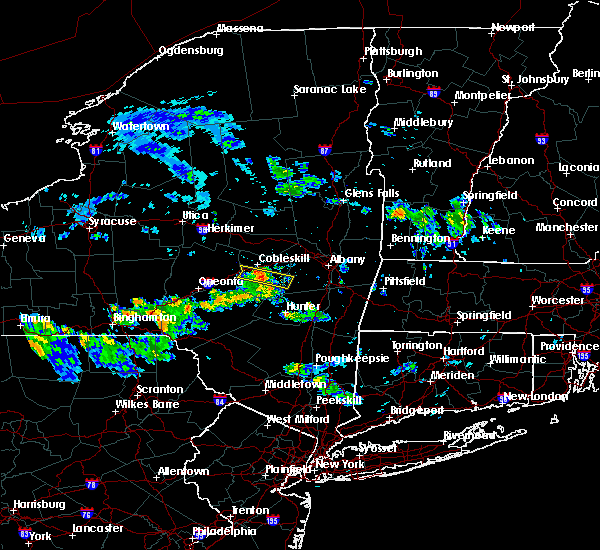 At 644 pm edt, a severe thunderstorm was located over breakabeen, or 9 miles southeast of cobleskill, moving east at 30 mph (radar indicated). Hazards include 60 mph wind gusts and quarter size hail. Hail damage to vehicles is expected. expect wind damage to roofs, siding, and trees. this severe storm will be near, middleburgh around 650 pm edt. livingstonville around 700 pm edt. preston-potter hollow around 710 pm edt. Other locations impacted by this severe thunderstorm include west fulton, west middleburgh, hawversville, vintonton, zucks corners, watsonville, patria, huntersland, franklinton and fultonham. At 644 pm edt, a severe thunderstorm was located over breakabeen, or 9 miles southeast of cobleskill, moving east at 30 mph (radar indicated). Hazards include 60 mph wind gusts and quarter size hail. Hail damage to vehicles is expected. expect wind damage to roofs, siding, and trees. this severe storm will be near, middleburgh around 650 pm edt. livingstonville around 700 pm edt. preston-potter hollow around 710 pm edt. Other locations impacted by this severe thunderstorm include west fulton, west middleburgh, hawversville, vintonton, zucks corners, watsonville, patria, huntersland, franklinton and fultonham.
|
| 7/14/2018 6:13 PM EDT |
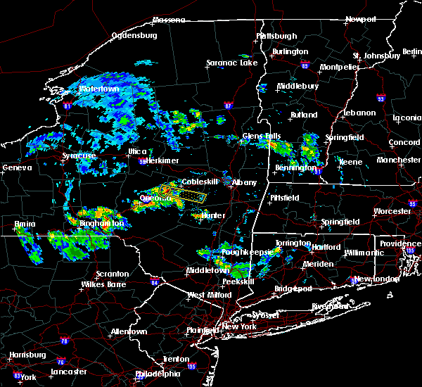 At 613 pm edt, a severe thunderstorm was located near worcester, or 10 miles west of cobleskill, moving east at 30 mph (radar indicated). Hazards include 60 mph wind gusts and quarter size hail. Hail damage to vehicles is expected. expect wind damage to roofs, siding, and trees. this severe thunderstorm will be near, summit and richmondville around 625 pm edt. breakabeen around 645 pm edt. middleburgh around 650 pm edt. livingstonville around 700 pm edt. preston-potter hollow around 710 pm edt. Other locations impacted by this severe thunderstorm include beards hollow, zucks corners, watsonville, west richmondville, huntersland, lutheranville, west fulton, west middleburgh, hawversville and vintonton. At 613 pm edt, a severe thunderstorm was located near worcester, or 10 miles west of cobleskill, moving east at 30 mph (radar indicated). Hazards include 60 mph wind gusts and quarter size hail. Hail damage to vehicles is expected. expect wind damage to roofs, siding, and trees. this severe thunderstorm will be near, summit and richmondville around 625 pm edt. breakabeen around 645 pm edt. middleburgh around 650 pm edt. livingstonville around 700 pm edt. preston-potter hollow around 710 pm edt. Other locations impacted by this severe thunderstorm include beards hollow, zucks corners, watsonville, west richmondville, huntersland, lutheranville, west fulton, west middleburgh, hawversville and vintonton.
|
| 5/4/2018 8:37 PM EDT |
 At 835 pm edt, severe thunderstorms were located along a line extending from near guilderland to near feura bush to near windham, moving east at 45 mph (radar indicated). Hazards include 60 mph wind gusts. Expect damage to roofs, siding, and trees. these storms have a history of producing wind damage. trees and wires are reported down in clifton park, guilderland, rotterdam and schenectady. these severe storms will be near, albany, delmar and feura bush around 840 pm edt. east greenbush, rensselaer, menands, new baltimore, ravena, castleton-on-hudson and selkirk around 845 pm edt. kinderhook and wynantskill around 850 pm edt. nassau, valatie, west sand lake and averill park around 855 pm edt. chatham and coxsackie around 900 pm edt. stephentown around 905 pm edt. Other locations impacted by these severe thunderstorms include bleecker stadium, clarksville, east berne, brookview, shoefelt corners, van hoesen station, west berne, dormansville, beckers corners and millers corners. At 835 pm edt, severe thunderstorms were located along a line extending from near guilderland to near feura bush to near windham, moving east at 45 mph (radar indicated). Hazards include 60 mph wind gusts. Expect damage to roofs, siding, and trees. these storms have a history of producing wind damage. trees and wires are reported down in clifton park, guilderland, rotterdam and schenectady. these severe storms will be near, albany, delmar and feura bush around 840 pm edt. east greenbush, rensselaer, menands, new baltimore, ravena, castleton-on-hudson and selkirk around 845 pm edt. kinderhook and wynantskill around 850 pm edt. nassau, valatie, west sand lake and averill park around 855 pm edt. chatham and coxsackie around 900 pm edt. stephentown around 905 pm edt. Other locations impacted by these severe thunderstorms include bleecker stadium, clarksville, east berne, brookview, shoefelt corners, van hoesen station, west berne, dormansville, beckers corners and millers corners.
|
| 5/4/2018 8:19 PM EDT |
 At 818 pm edt, severe thunderstorms were located along a line extending from near altamont to near berne to near gilboa, moving east at 50 mph (radar indicated). Hazards include 60 mph wind gusts. Expect damage to roofs, siding, and trees. severe thunderstorms will be near, westerlo and voorheesville around 830 pm edt. albany, delmar, feura bush, preston hollow and preston-potter hollow around 835 pm edt. rensselaer, ravena and selkirk around 840 pm edt. east greenbush, menands, new baltimore, castleton-on-hudson and wynantskill around 845 pm edt. valatie, kinderhook and west sand lake around 850 pm edt. nassau and averill park around 855 pm edt. chatham, stephentown and coxsackie around 900 pm edt. Other locations impacted by these severe thunderstorms include bleecker stadium, clarksville, east berne, brookview, shoefelt corners, van hoesen station, west berne, dormansville, beckers corners and millers corners. At 818 pm edt, severe thunderstorms were located along a line extending from near altamont to near berne to near gilboa, moving east at 50 mph (radar indicated). Hazards include 60 mph wind gusts. Expect damage to roofs, siding, and trees. severe thunderstorms will be near, westerlo and voorheesville around 830 pm edt. albany, delmar, feura bush, preston hollow and preston-potter hollow around 835 pm edt. rensselaer, ravena and selkirk around 840 pm edt. east greenbush, menands, new baltimore, castleton-on-hudson and wynantskill around 845 pm edt. valatie, kinderhook and west sand lake around 850 pm edt. nassau and averill park around 855 pm edt. chatham, stephentown and coxsackie around 900 pm edt. Other locations impacted by these severe thunderstorms include bleecker stadium, clarksville, east berne, brookview, shoefelt corners, van hoesen station, west berne, dormansville, beckers corners and millers corners.
|
| 5/4/2018 7:34 PM EDT |
 At 733 pm edt, severe thunderstorms were located along a line extending from ephratah to middlefield to emmons, moving east at 55 mph (radar indicated). Hazards include 60 mph wind gusts. Expect damage to roofs, siding, and trees. severe thunderstorms will be near, sharon springs around 745 pm edt. amsterdam, cobleskill and ames around 750 pm edt. jefferson and hagaman around 755 pm edt. summit, richmondville and central bridge around 800 pm edt. breakabeen and north blenheim around 805 pm edt. duanesburg, middleburgh and delanson around 810 pm edt. schoharie, pattersonville-rotterdam junction and livingstonville around 815 pm edt. berne around 825 pm edt. Other locations impacted by these severe thunderstorms include charleston, east berne, beekman corners, west richmondville, shoefelt corners, hoffmans, rockwell corners, west berne, huntersland and engleville. At 733 pm edt, severe thunderstorms were located along a line extending from ephratah to middlefield to emmons, moving east at 55 mph (radar indicated). Hazards include 60 mph wind gusts. Expect damage to roofs, siding, and trees. severe thunderstorms will be near, sharon springs around 745 pm edt. amsterdam, cobleskill and ames around 750 pm edt. jefferson and hagaman around 755 pm edt. summit, richmondville and central bridge around 800 pm edt. breakabeen and north blenheim around 805 pm edt. duanesburg, middleburgh and delanson around 810 pm edt. schoharie, pattersonville-rotterdam junction and livingstonville around 815 pm edt. berne around 825 pm edt. Other locations impacted by these severe thunderstorms include charleston, east berne, beekman corners, west richmondville, shoefelt corners, hoffmans, rockwell corners, west berne, huntersland and engleville.
|
| 8/12/2017 6:38 PM EDT |
 At 638 pm edt, a severe thunderstorm was located over delmar, moving east at 35 mph (radar indicated). Hazards include 60 mph wind gusts and quarter size hail. Minor damage to vehicles is possible. expect wind damage to trees, and power lines. Locations impacted include, albany, schenectady, troy, clifton park, rotterdam, cohoes, watervliet, rensselaer, colonie, scotia, mechanicville, delmar, latham, guilderland, niskayuna, duanesburg, menands, westerlo, ravena and berne. At 638 pm edt, a severe thunderstorm was located over delmar, moving east at 35 mph (radar indicated). Hazards include 60 mph wind gusts and quarter size hail. Minor damage to vehicles is possible. expect wind damage to trees, and power lines. Locations impacted include, albany, schenectady, troy, clifton park, rotterdam, cohoes, watervliet, rensselaer, colonie, scotia, mechanicville, delmar, latham, guilderland, niskayuna, duanesburg, menands, westerlo, ravena and berne.
|
| 8/12/2017 6:03 PM EDT |
 At 603 pm edt, a severe thunderstorm was located near berne, or 14 miles southwest of rotterdam, moving east at 40 mph (trained weather spotters). Hazards include 60 mph wind gusts and quarter size hail. Minor damage to vehicles is possible. expect wind damage to trees, and power lines. this severe thunderstorm will be near, altamont around 615 pm edt. voorheesville around 620 pm edt. albany, rotterdam and guilderland around 625 pm edt. schenectady, colonie, delmar and niskayuna around 630 pm edt. clifton park and loudonville around 635 pm edt. cohoes, watervliet, rensselaer, latham and menands around 640 pm edt. troy, green island and waterford around 645 pm edt. Other locations impacted by this severe thunderstorm include shakers, bleecker stadium, clarksville, east berne, shoefelt corners, glenridge, hoffmans, west berne, harding crossing and willow glen. At 603 pm edt, a severe thunderstorm was located near berne, or 14 miles southwest of rotterdam, moving east at 40 mph (trained weather spotters). Hazards include 60 mph wind gusts and quarter size hail. Minor damage to vehicles is possible. expect wind damage to trees, and power lines. this severe thunderstorm will be near, altamont around 615 pm edt. voorheesville around 620 pm edt. albany, rotterdam and guilderland around 625 pm edt. schenectady, colonie, delmar and niskayuna around 630 pm edt. clifton park and loudonville around 635 pm edt. cohoes, watervliet, rensselaer, latham and menands around 640 pm edt. troy, green island and waterford around 645 pm edt. Other locations impacted by this severe thunderstorm include shakers, bleecker stadium, clarksville, east berne, shoefelt corners, glenridge, hoffmans, west berne, harding crossing and willow glen.
|
| 6/5/2017 2:55 PM EDT |
 At 253 pm edt, a severe thunderstorm was located over north blenheim, or 13 miles south of cobleskill, moving east at 30 mph (trained weather spotters). Hazards include 60 mph wind gusts and quarter size hail. Minor damage to vehicles is possible. expect wind damage to trees, and power lines. this severe storm will be near, livingstonville around 310 pm edt. preston-potter hollow around 315 pm edt. Other locations impacted by this severe thunderstorm include zeh corners, beekman corners, west richmondville, baird corners, seward, rockwell corners, huntersland, warnerville, carlisle and engleville. At 253 pm edt, a severe thunderstorm was located over north blenheim, or 13 miles south of cobleskill, moving east at 30 mph (trained weather spotters). Hazards include 60 mph wind gusts and quarter size hail. Minor damage to vehicles is possible. expect wind damage to trees, and power lines. this severe storm will be near, livingstonville around 310 pm edt. preston-potter hollow around 315 pm edt. Other locations impacted by this severe thunderstorm include zeh corners, beekman corners, west richmondville, baird corners, seward, rockwell corners, huntersland, warnerville, carlisle and engleville.
|
| 6/5/2017 2:27 PM EDT |
 At 226 pm edt, a severe thunderstorm was located near worcester, or 13 miles southwest of cobleskill, moving east at 35 mph (trained weather spotters). Hazards include 60 mph wind gusts and quarter size hail. Minor damage to vehicles is possible. expect wind damage to trees, and power lines. this severe thunderstorm will be near, jefferson, summit and richmondville around 235 pm edt. north blenheim and breakabeen around 250 pm edt. gilboa around 255 pm edt. livingstonville around 305 pm edt. preston-potter hollow around 310 pm edt. Other locations impacted by this severe thunderstorm include zeh corners, beekman corners, west richmondville, baird corners, seward, rockwell corners, huntersland, warnerville, carlisle and engleville. At 226 pm edt, a severe thunderstorm was located near worcester, or 13 miles southwest of cobleskill, moving east at 35 mph (trained weather spotters). Hazards include 60 mph wind gusts and quarter size hail. Minor damage to vehicles is possible. expect wind damage to trees, and power lines. this severe thunderstorm will be near, jefferson, summit and richmondville around 235 pm edt. north blenheim and breakabeen around 250 pm edt. gilboa around 255 pm edt. livingstonville around 305 pm edt. preston-potter hollow around 310 pm edt. Other locations impacted by this severe thunderstorm include zeh corners, beekman corners, west richmondville, baird corners, seward, rockwell corners, huntersland, warnerville, carlisle and engleville.
|
| 5/31/2017 4:25 PM EDT |
 At 424 pm edt, a severe thunderstorm was located near westerlo, or 16 miles southwest of delmar, moving east at 35 mph (radar indicated). Hazards include 60 mph wind gusts and quarter size hail. Hail damage to vehicles is expected. expect wind damage to roofs, siding, and trees. this severe thunderstorm will be near, new baltimore, ravena and feura bush around 445 pm edt. delmar and selkirk around 450 pm edt. castleton-on-hudson around 455 pm edt. east greenbush around 500 pm edt. nassau around 505 pm edt. west sand lake around 510 pm edt. averill park around 515 pm edt. Stephentown around 520 pm edt. At 424 pm edt, a severe thunderstorm was located near westerlo, or 16 miles southwest of delmar, moving east at 35 mph (radar indicated). Hazards include 60 mph wind gusts and quarter size hail. Hail damage to vehicles is expected. expect wind damage to roofs, siding, and trees. this severe thunderstorm will be near, new baltimore, ravena and feura bush around 445 pm edt. delmar and selkirk around 450 pm edt. castleton-on-hudson around 455 pm edt. east greenbush around 500 pm edt. nassau around 505 pm edt. west sand lake around 510 pm edt. averill park around 515 pm edt. Stephentown around 520 pm edt.
|
| 5/18/2017 8:33 PM EDT |
 At 833 pm edt, severe thunderstorms were located along a line extending from near westerlo to 6 miles southeast of preston hollow to near windham, moving east at 50 mph (radar indicated). Hazards include 60 mph wind gusts and quarter size hail. Hail damage to vehicles is expected. expect wind damage to roofs, siding, and trees. severe thunderstorms will be near, new baltimore, ravena and selkirk around 845 pm edt. coxsackie and castleton-on-hudson around 850 pm edt. catskill and nassau around 855 pm edt. hudson, valatie, athens, kinderhook and lorenz park around 900 pm edt. chatham, claverack and claverack-red mills around 905 pm edt. new lebanon and philmont around 910 pm edt. pittsfield and austerlitz around 915 pm edt. Other locations impacted by these severe thunderstorms include van hoesen station, burden, dormansville, rossman, rayville, otter hook, riders mills, north hillsdale, kiskatom and sunside. At 833 pm edt, severe thunderstorms were located along a line extending from near westerlo to 6 miles southeast of preston hollow to near windham, moving east at 50 mph (radar indicated). Hazards include 60 mph wind gusts and quarter size hail. Hail damage to vehicles is expected. expect wind damage to roofs, siding, and trees. severe thunderstorms will be near, new baltimore, ravena and selkirk around 845 pm edt. coxsackie and castleton-on-hudson around 850 pm edt. catskill and nassau around 855 pm edt. hudson, valatie, athens, kinderhook and lorenz park around 900 pm edt. chatham, claverack and claverack-red mills around 905 pm edt. new lebanon and philmont around 910 pm edt. pittsfield and austerlitz around 915 pm edt. Other locations impacted by these severe thunderstorms include van hoesen station, burden, dormansville, rossman, rayville, otter hook, riders mills, north hillsdale, kiskatom and sunside.
|
| 5/1/2017 9:25 PM EDT |
 At 925 pm edt, severe thunderstorms were located along a line extending from near galway to duanesburg to near windham to hortonville, moving east at 65 mph (radar indicated). Hazards include 70 mph wind gusts. Expect considerable tree damage. Damage is likely to mobile homes, roofs, and outbuildings. At 925 pm edt, severe thunderstorms were located along a line extending from near galway to duanesburg to near windham to hortonville, moving east at 65 mph (radar indicated). Hazards include 70 mph wind gusts. Expect considerable tree damage. Damage is likely to mobile homes, roofs, and outbuildings.
|
| 5/1/2017 9:18 PM EDT |
 At 918 pm edt, severe thunderstorms were located along a line extending from near central bridge to middleburgh to near gilboa, moving east at 55 mph. these are very dangerous storms (radar indicated). Hazards include 80 mph wind gusts and penny size hail. Flying debris will be dangerous to those caught without shelter. mobile homes will be heavily damaged. expect considerable damage to roofs, windows, and vehicles. extensive tree damage and power outages are likely. Locations impacted include, cobleskill, middleburgh, gilboa, schoharie, livingstonville, north blenheim, breakabeen, central bridge, preston-potter hollow, carlisle, conesville, esperance, huntersland, warnerville, broome center, becker corners, west fulton, shutts corners, barnerville and eminence. At 918 pm edt, severe thunderstorms were located along a line extending from near central bridge to middleburgh to near gilboa, moving east at 55 mph. these are very dangerous storms (radar indicated). Hazards include 80 mph wind gusts and penny size hail. Flying debris will be dangerous to those caught without shelter. mobile homes will be heavily damaged. expect considerable damage to roofs, windows, and vehicles. extensive tree damage and power outages are likely. Locations impacted include, cobleskill, middleburgh, gilboa, schoharie, livingstonville, north blenheim, breakabeen, central bridge, preston-potter hollow, carlisle, conesville, esperance, huntersland, warnerville, broome center, becker corners, west fulton, shutts corners, barnerville and eminence.
|
| 5/1/2017 8:49 PM EDT |
 At 849 pm edt, severe thunderstorms were located along a line extending from near fort plain to near schenevus to downsville, moving east at 60 mph (radar indicated). Hazards include 70 mph wind gusts and penny size hail. Expect considerable tree damage. damage is likely to mobile homes, roofs, and outbuildings. severe thunderstorms will be near, sharon springs around 855 pm edt. jefferson and summit around 900 pm edt. richmondville and north blenheim around 905 pm edt. cobleskill and breakabeen around 910 pm edt. middleburgh, schoharie and central bridge around 915 pm edt. Other locations impacted by these severe thunderstorms include zeh corners, beekman corners, west richmondville, baird corners, seward, huntersland, warnerville, carlisle, gardnersville and broome center. At 849 pm edt, severe thunderstorms were located along a line extending from near fort plain to near schenevus to downsville, moving east at 60 mph (radar indicated). Hazards include 70 mph wind gusts and penny size hail. Expect considerable tree damage. damage is likely to mobile homes, roofs, and outbuildings. severe thunderstorms will be near, sharon springs around 855 pm edt. jefferson and summit around 900 pm edt. richmondville and north blenheim around 905 pm edt. cobleskill and breakabeen around 910 pm edt. middleburgh, schoharie and central bridge around 915 pm edt. Other locations impacted by these severe thunderstorms include zeh corners, beekman corners, west richmondville, baird corners, seward, huntersland, warnerville, carlisle, gardnersville and broome center.
|
| 3/8/2017 1:45 PM EST |
 At 145 pm est, severe thunderstorms were located along a line extending from edinburg to near hunter, moving east at 55 mph (radar indicated). Hazards include 60 mph wind gusts. Expect damage to roofs, siding, and trees. severe thunderstorms will be near, corinth around 200 pm est. saratoga springs and catskill around 205 pm est. hudson, claverack, livingston, athens, claverack-red mills and lorenz park around 210 pm est. fort edward and philmont around 215 pm est. austerlitz around 225 pm est. salem around 230 pm est. Other locations impacted by these severe thunderstorms include deans corners, charleston, bleecker stadium, glenridge, hoffmans, west berne, huntersland, wayville, broome center and wiley corners. At 145 pm est, severe thunderstorms were located along a line extending from edinburg to near hunter, moving east at 55 mph (radar indicated). Hazards include 60 mph wind gusts. Expect damage to roofs, siding, and trees. severe thunderstorms will be near, corinth around 200 pm est. saratoga springs and catskill around 205 pm est. hudson, claverack, livingston, athens, claverack-red mills and lorenz park around 210 pm est. fort edward and philmont around 215 pm est. austerlitz around 225 pm est. salem around 230 pm est. Other locations impacted by these severe thunderstorms include deans corners, charleston, bleecker stadium, glenridge, hoffmans, west berne, huntersland, wayville, broome center and wiley corners.
|
| 9/8/2016 6:41 PM EDT |
 The severe thunderstorm warning for schoharie county will expire at 645 pm edt, the storms which prompted the warning have weakened below severe limits, and no longer pose an immediate threat to life or property. therefore, the warning will be allowed to expire. however heavy rain is still possible with these thunderstorms. please report hail size, damaging winds and reports of trees down to the national weather service by email at [email protected], on facebook at www.facebook.com/nwsalbany or twitter @nwsalbany. The severe thunderstorm warning for schoharie county will expire at 645 pm edt, the storms which prompted the warning have weakened below severe limits, and no longer pose an immediate threat to life or property. therefore, the warning will be allowed to expire. however heavy rain is still possible with these thunderstorms. please report hail size, damaging winds and reports of trees down to the national weather service by email at [email protected], on facebook at www.facebook.com/nwsalbany or twitter @nwsalbany.
|
| 9/8/2016 6:22 PM EDT |
 At 621 pm edt, severe thunderstorms were located along a line extending from central bridge to near livingstonville to gilboa, moving east at 30 mph (radar indicated). Hazards include 60 mph wind gusts. Expect damage to roofs. siding. and trees. these severe storms will be near, livingstonville around 625 pm edt. Preston-potter hollow around 630 pm edt. At 621 pm edt, severe thunderstorms were located along a line extending from central bridge to near livingstonville to gilboa, moving east at 30 mph (radar indicated). Hazards include 60 mph wind gusts. Expect damage to roofs. siding. and trees. these severe storms will be near, livingstonville around 625 pm edt. Preston-potter hollow around 630 pm edt.
|
| 9/8/2016 5:42 PM EDT |
 The national weather service in albany has issued a * severe thunderstorm warning for. schoharie county in east central new york. until 645 pm edt * at 541 pm edt. Severe thunderstorms were located along a line extending from near sharon springs to 6 miles northwest of. The national weather service in albany has issued a * severe thunderstorm warning for. schoharie county in east central new york. until 645 pm edt * at 541 pm edt. Severe thunderstorms were located along a line extending from near sharon springs to 6 miles northwest of.
|
| 7/18/2016 1:00 PM EDT |
 At 100 pm edt, a severe thunderstorm was located over west sand lake, or near troy, moving east at 60 mph (radar indicated). Hazards include 60 mph wind gusts. Expect damage to roofs. siding. and trees. Locations impacted include, albany, troy, cohoes, watervliet, colonie, latham, delmar, guilderland, menands, westerlo, ravena, berne, voorheesville, green island, altamont, middleburgh, schoharie, feura bush, loudonville and preston-potter hollow. At 100 pm edt, a severe thunderstorm was located over west sand lake, or near troy, moving east at 60 mph (radar indicated). Hazards include 60 mph wind gusts. Expect damage to roofs. siding. and trees. Locations impacted include, albany, troy, cohoes, watervliet, colonie, latham, delmar, guilderland, menands, westerlo, ravena, berne, voorheesville, green island, altamont, middleburgh, schoharie, feura bush, loudonville and preston-potter hollow.
|
| 7/18/2016 12:28 PM EDT |
 At 1227 pm edt, a severe thunderstorm was located near livingstonville, or 17 miles southeast of cobleskill, moving east at 55 mph (radar indicated). Hazards include 60 mph wind gusts. Expect damage to roofs. siding. And trees. At 1227 pm edt, a severe thunderstorm was located near livingstonville, or 17 miles southeast of cobleskill, moving east at 55 mph (radar indicated). Hazards include 60 mph wind gusts. Expect damage to roofs. siding. And trees.
|
| 7/18/2016 12:16 PM EDT |
 At 1215 pm edt, a severe thunderstorm was located over middleburgh, or 7 miles southeast of cobleskill, moving northeast at 50 mph (radar indicated). Hazards include 60 mph wind gusts. Expect damage to roofs. siding. and trees. Locations impacted include, cobleskill, jefferson, middleburgh, gilboa, summit, schoharie, richmondville, central bridge, north blenheim, breakabeen, livingstonville, preston-potter hollow, carlisle, sharon, seward, conesville, sloansville, west richmondville, east jefferson and huntersland. At 1215 pm edt, a severe thunderstorm was located over middleburgh, or 7 miles southeast of cobleskill, moving northeast at 50 mph (radar indicated). Hazards include 60 mph wind gusts. Expect damage to roofs. siding. and trees. Locations impacted include, cobleskill, jefferson, middleburgh, gilboa, summit, schoharie, richmondville, central bridge, north blenheim, breakabeen, livingstonville, preston-potter hollow, carlisle, sharon, seward, conesville, sloansville, west richmondville, east jefferson and huntersland.
|
| 7/18/2016 11:51 AM EDT |
 At 1150 am edt, a severe thunderstorm was located near davenport, or 15 miles east of oneonta, moving northeast at 50 mph (radar indicated). Hazards include 60 mph wind gusts. Expect damage to roofs. siding. And trees. At 1150 am edt, a severe thunderstorm was located near davenport, or 15 miles east of oneonta, moving northeast at 50 mph (radar indicated). Hazards include 60 mph wind gusts. Expect damage to roofs. siding. And trees.
|
| 6/21/2016 2:45 AM EDT |
 At 244 am edt, a severe thunderstorm was located near westerlo, or 11 miles southwest of delmar, moving east at 50 mph (radar indicated). Hazards include 60 mph wind gusts and quarter size hail. Hail damage to vehicles is expected. expect wind damage to roofs, siding, and trees. Locations impacted include, westerlo, ravena, coxsackie, preston hollow, preston-potter hollow, coeymans, durham, rensselaerville, south westerlo, lambs corner, freehold, east durham, oak hill, alcove, smith corner, roberts hill, dormansville, norton hill, coeymans hollow and cooksburg. At 244 am edt, a severe thunderstorm was located near westerlo, or 11 miles southwest of delmar, moving east at 50 mph (radar indicated). Hazards include 60 mph wind gusts and quarter size hail. Hail damage to vehicles is expected. expect wind damage to roofs, siding, and trees. Locations impacted include, westerlo, ravena, coxsackie, preston hollow, preston-potter hollow, coeymans, durham, rensselaerville, south westerlo, lambs corner, freehold, east durham, oak hill, alcove, smith corner, roberts hill, dormansville, norton hill, coeymans hollow and cooksburg.
|
| 6/21/2016 2:22 AM EDT |
 At 221 am edt, a severe thunderstorm was located near north blenheim, or 14 miles south of cobleskill, moving east at 45 mph (radar indicated). Hazards include 60 mph wind gusts and quarter size hail. Hail damage to vehicles is expected. Expect wind damage to roofs, siding, and trees. At 221 am edt, a severe thunderstorm was located near north blenheim, or 14 miles south of cobleskill, moving east at 45 mph (radar indicated). Hazards include 60 mph wind gusts and quarter size hail. Hail damage to vehicles is expected. Expect wind damage to roofs, siding, and trees.
|
| 6/23/2015 9:39 AM EDT |
 At 938 am edt, severe thunderstorms were located along a line extending from near westerlo to near west hurley, moving east at 40 mph (radar indicated). Hazards include 60 mph wind gusts. Expect damage to roofs. siding and trees. these severe storms will be near, saugerties, lake katrine, saugerties south and feura bush around 945 am edt. Other locations impacted by these severe thunderstorms include maplecrest, south westerlo, edgewood, lambs corner, lakes mills bridge, halihan hill, oak hill, blue mountain, hensonville and fitchs wharf. At 938 am edt, severe thunderstorms were located along a line extending from near westerlo to near west hurley, moving east at 40 mph (radar indicated). Hazards include 60 mph wind gusts. Expect damage to roofs. siding and trees. these severe storms will be near, saugerties, lake katrine, saugerties south and feura bush around 945 am edt. Other locations impacted by these severe thunderstorms include maplecrest, south westerlo, edgewood, lambs corner, lakes mills bridge, halihan hill, oak hill, blue mountain, hensonville and fitchs wharf.
|
| 6/23/2015 9:22 AM EDT |
 At 920 am edt, severe thunderstorms were located along a line extending from near breakabeen to near west shokan, moving east at 40 mph (radar indicated). Hazards include 60 mph wind gusts. Expect damage to roofs. siding and trees. severe thunderstorms will be near, livingstonville around 925 am edt. kenneth l wilson campground, olivebridge, preston-potter hollow and preston hollow around 930 am edt. woodstock, berne and west hurley around 935 am edt. saugerties, westerlo, lake katrine, saugerties south and feura bush around 945 am edt. Other locations impacted by these severe thunderstorms include maplecrest, south westerlo, edgewood, lakes mills bridge, oak hill, shandaken, huntersland, fitchs wharf, brooksburg and hawversville. At 920 am edt, severe thunderstorms were located along a line extending from near breakabeen to near west shokan, moving east at 40 mph (radar indicated). Hazards include 60 mph wind gusts. Expect damage to roofs. siding and trees. severe thunderstorms will be near, livingstonville around 925 am edt. kenneth l wilson campground, olivebridge, preston-potter hollow and preston hollow around 930 am edt. woodstock, berne and west hurley around 935 am edt. saugerties, westerlo, lake katrine, saugerties south and feura bush around 945 am edt. Other locations impacted by these severe thunderstorms include maplecrest, south westerlo, edgewood, lakes mills bridge, oak hill, shandaken, huntersland, fitchs wharf, brooksburg and hawversville.
|
| 6/12/2015 8:56 PM EDT |
 At 856 pm edt, severe thunderstorms were located along a line extending from schoharie to near gilboa to near arkville, moving east at 40 mph (radar indicated). Hazards include 60 mph wind gusts and penny size hail. Expect damage to roofs. siding and trees. severe thunderstorms will be near, middleburgh around 900 pm edt. berne, windham, preston hollow and preston-potter hollow around 910 pm edt. westerlo around 920 pm edt. voorheesville and lanesville around 925 pm edt. hunter and feura bush around 930 pm edt. delmar, ravena and selkirk around 935 pm edt. rensselaer, woodstock, coxsackie, castleton-on-hudson and north-south lake campground around 940 pm edt. east greenbush, hudson, catskill and athens around 945 pm edt. other locations impacted by these severe thunderstorms include maplecrest, south westerlo, edgewood, cheviot, denault corners, lakes mills bridge, oak hill, shandaken, huntersland and fitchs wharf. A tornado watch remains in effect until 1100 pm edt for east central new york. At 856 pm edt, severe thunderstorms were located along a line extending from schoharie to near gilboa to near arkville, moving east at 40 mph (radar indicated). Hazards include 60 mph wind gusts and penny size hail. Expect damage to roofs. siding and trees. severe thunderstorms will be near, middleburgh around 900 pm edt. berne, windham, preston hollow and preston-potter hollow around 910 pm edt. westerlo around 920 pm edt. voorheesville and lanesville around 925 pm edt. hunter and feura bush around 930 pm edt. delmar, ravena and selkirk around 935 pm edt. rensselaer, woodstock, coxsackie, castleton-on-hudson and north-south lake campground around 940 pm edt. east greenbush, hudson, catskill and athens around 945 pm edt. other locations impacted by these severe thunderstorms include maplecrest, south westerlo, edgewood, cheviot, denault corners, lakes mills bridge, oak hill, shandaken, huntersland and fitchs wharf. A tornado watch remains in effect until 1100 pm edt for east central new york.
|
| 6/12/2015 8:27 PM EDT |
 At 826 pm edt, a severe thunderstorm was located near worcester, or 10 miles east of cooperstown, moving east at 45 mph (radar indicated). Hazards include 60 mph wind gusts and penny size hail. Expect damage to roofs. siding and trees. this severe thunderstorm will be near, summit around 835 pm edt. richmondville around 840 pm edt. cobleskill around 845 pm edt. breakabeen and central bridge around 850 pm edt. middleburgh and schoharie around 855 pm edt. other locations impacted by this severe thunderstorm include west richmondville, gallupville, east jefferson, huntersland, zeh corners, west conesville, schoharie junction, bramanville, carlisle center and ruth. A tornado watch remains in effect until 1100 pm edt for east central new york. At 826 pm edt, a severe thunderstorm was located near worcester, or 10 miles east of cooperstown, moving east at 45 mph (radar indicated). Hazards include 60 mph wind gusts and penny size hail. Expect damage to roofs. siding and trees. this severe thunderstorm will be near, summit around 835 pm edt. richmondville around 840 pm edt. cobleskill around 845 pm edt. breakabeen and central bridge around 850 pm edt. middleburgh and schoharie around 855 pm edt. other locations impacted by this severe thunderstorm include west richmondville, gallupville, east jefferson, huntersland, zeh corners, west conesville, schoharie junction, bramanville, carlisle center and ruth. A tornado watch remains in effect until 1100 pm edt for east central new york.
|
Hail Maps for Preston-Potter Hollow, NY


Connect with Interactive Hail Maps