

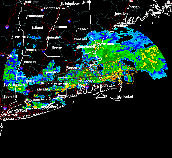
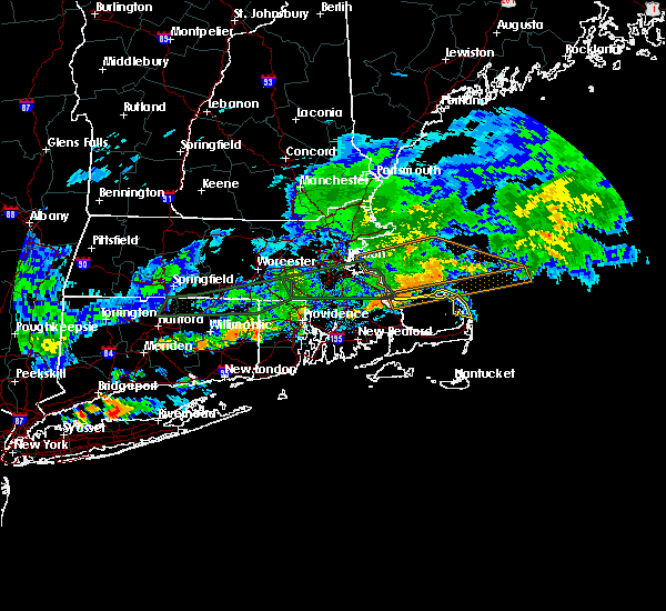
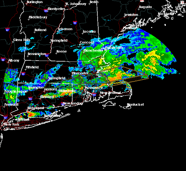
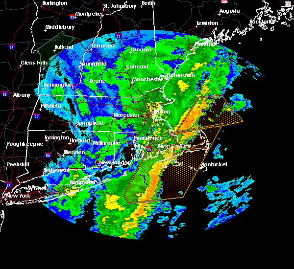
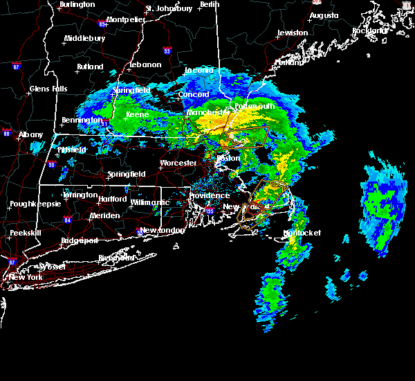
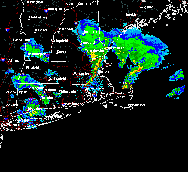
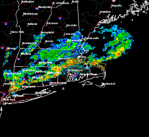
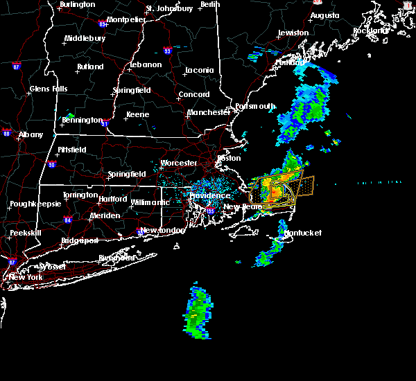
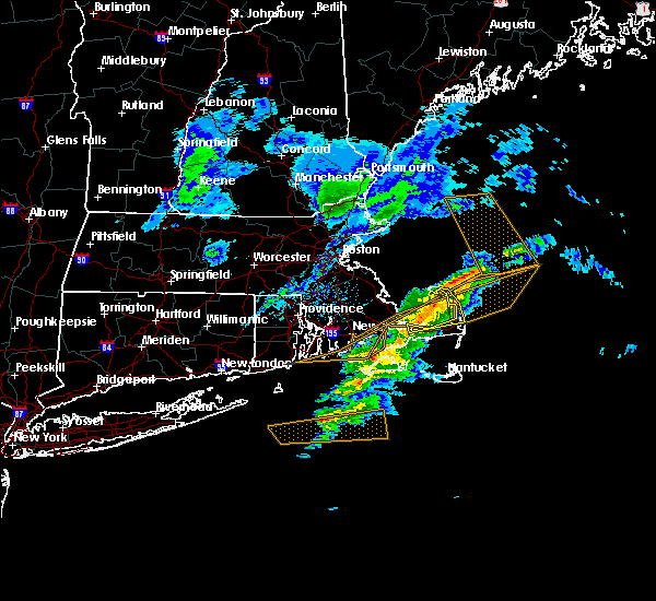
Hail Map for Provincetown, MA
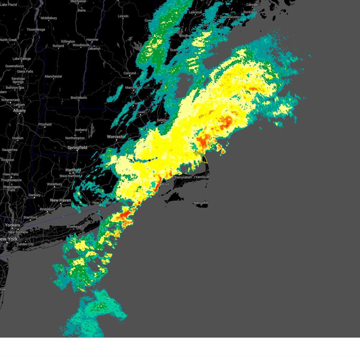
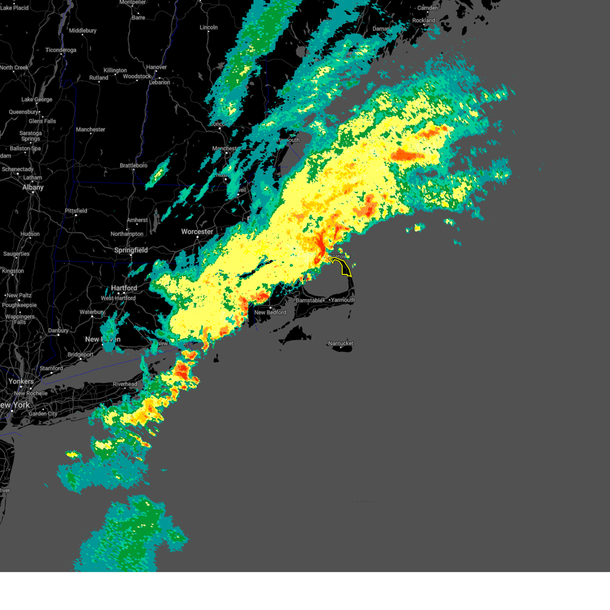
The Provincetown, MA area has had 0 reports of on-the-ground hail by trained spotters, and has been under severe weather warnings 6 times during the past 12 months. Doppler radar has detected hail at or near Provincetown, MA on 3 occasions.
| Name: | Provincetown, MA |
| Where Located: | 65 miles ENE of Providence, RI |
| Map: | Google Map for Provincetown, MA |
| Population: | 2642 |
| Housing Units: | 4263 |
| More Info: | Search Google for Provincetown, MA |
0
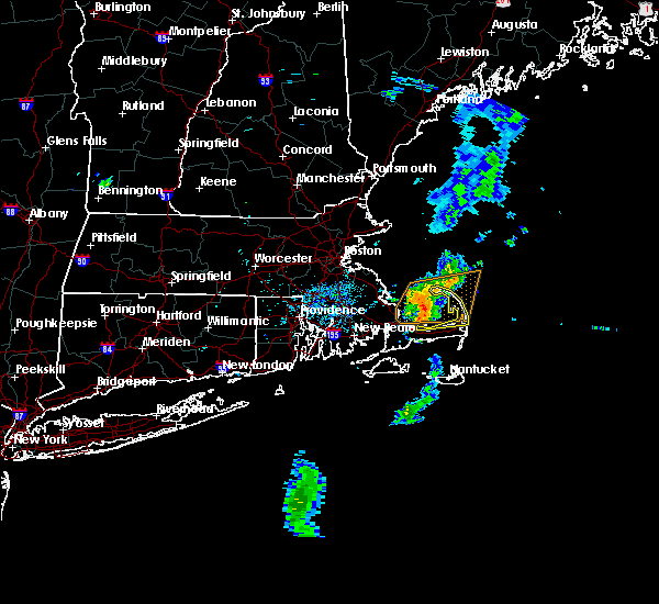
The Top Recent Hail Date for Provincetown, MA is Sunday, March 29, 2020 (3rd out of 3)

Hail and Wind Damage Spotted near Provincetown, MA
| Date / Time | Report Details |
|---|---|
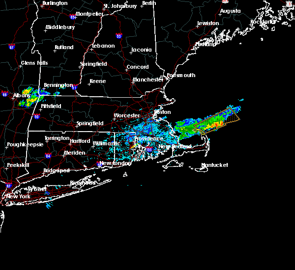
| 8/8/2023 12:36 PM EDT |
 At 1236 pm edt, severe thunderstorms were located along a line extending from near truro to eastham to near barnstable, moving northeast at 40 mph (radar indicated). Hazards include 60 mph wind gusts. Expect damage to roofs, siding, and trees. Locations impacted include, barnstable, brewster, provincetown, yarmouth, dennis, harwich, chatham, orleans, eastham, wellfleet, truro, and hyannis. At 1236 pm edt, severe thunderstorms were located along a line extending from near truro to eastham to near barnstable, moving northeast at 40 mph (radar indicated). Hazards include 60 mph wind gusts. Expect damage to roofs, siding, and trees. Locations impacted include, barnstable, brewster, provincetown, yarmouth, dennis, harwich, chatham, orleans, eastham, wellfleet, truro, and hyannis.
|
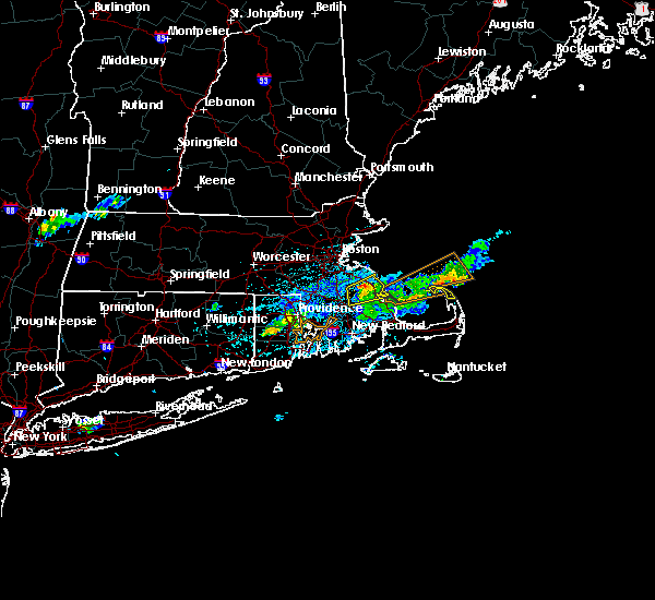
| 8/8/2023 12:19 PM EDT |
 At 1218 pm edt, severe thunderstorms were located along a line extending from 6 miles south of provincetown to near dennis to 6 miles south of mashpee, moving northeast at 40 mph (radar indicated). Hazards include 60 mph wind gusts. expect damage to roofs, siding, and trees At 1218 pm edt, severe thunderstorms were located along a line extending from 6 miles south of provincetown to near dennis to 6 miles south of mashpee, moving northeast at 40 mph (radar indicated). Hazards include 60 mph wind gusts. expect damage to roofs, siding, and trees
|
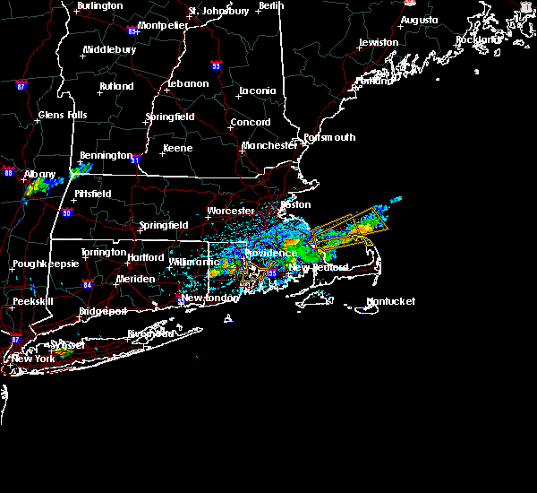
| 8/8/2023 12:05 PM EDT |
 At 1204 pm edt, severe thunderstorms were located along a line extending from 7 miles north of plymouth to 7 miles northeast of sandwich to near barnstable to near falmouth, moving northeast at 30 mph (radar indicated). Hazards include 60 mph wind gusts. Expect damage to roofs, siding, and trees. Locations impacted include, barnstable, falmouth, brewster, provincetown, yarmouth, sandwich, bourne, dennis, mashpee, harwich, chatham, orleans, eastham, wellfleet, truro, and hyannis. At 1204 pm edt, severe thunderstorms were located along a line extending from 7 miles north of plymouth to 7 miles northeast of sandwich to near barnstable to near falmouth, moving northeast at 30 mph (radar indicated). Hazards include 60 mph wind gusts. Expect damage to roofs, siding, and trees. Locations impacted include, barnstable, falmouth, brewster, provincetown, yarmouth, sandwich, bourne, dennis, mashpee, harwich, chatham, orleans, eastham, wellfleet, truro, and hyannis.
|
| 8/8/2023 11:37 AM EDT |
 At 1137 am edt, severe thunderstorms were located along a line extending from near carver to near bourne to near falmouth to near gosnold, moving northeast at 30 mph (radar indicated). Hazards include 60 mph wind gusts. expect damage to roofs, siding, and trees At 1137 am edt, severe thunderstorms were located along a line extending from near carver to near bourne to near falmouth to near gosnold, moving northeast at 30 mph (radar indicated). Hazards include 60 mph wind gusts. expect damage to roofs, siding, and trees
|
| 7/29/2023 9:42 PM EDT |
 The severe thunderstorm warning for northeastern barnstable county will expire at 945 pm edt, the storm which prompted the warning has moved out of the area. therefore, the warning will be allowed to expire. however gusty winds are still possible with this thunderstorm. The severe thunderstorm warning for northeastern barnstable county will expire at 945 pm edt, the storm which prompted the warning has moved out of the area. therefore, the warning will be allowed to expire. however gusty winds are still possible with this thunderstorm.
|
| 7/29/2023 9:16 PM EDT |
 At 916 pm edt, a severe thunderstorm was located near provincetown, moving east at 40 mph (radar indicated). Hazards include 60 mph wind gusts. expect damage to trees and power lines At 916 pm edt, a severe thunderstorm was located near provincetown, moving east at 40 mph (radar indicated). Hazards include 60 mph wind gusts. expect damage to trees and power lines
|
| 9/1/2021 11:56 PM EDT |
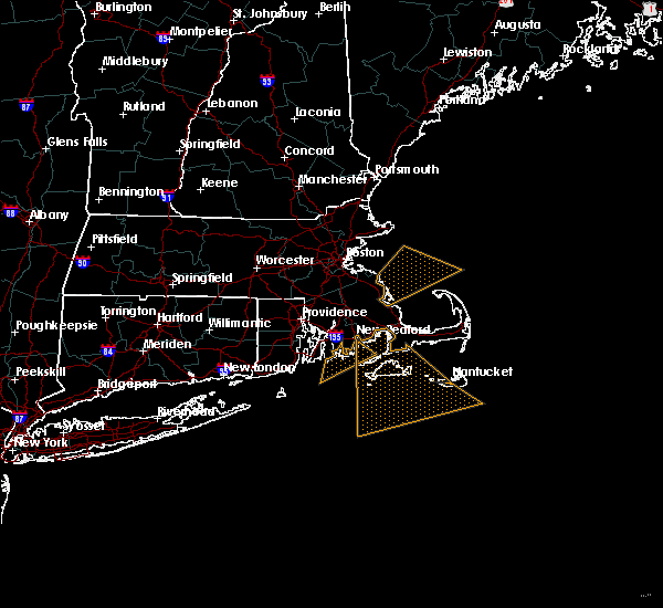
 At 1156 pm edt, a severe thunderstorm capable of producing a tornado was located near gosnold, or 7 miles west of tisbury, moving northeast at 40 mph (radar indicated rotation). Hazards include tornado. Flying debris will be dangerous to those caught without shelter. mobile homes will be damaged or destroyed. damage to roofs, windows, and vehicles will occur. tree damage is likely. this dangerous storm will be near, tisbury around 1200 am edt. falmouth around 1215 am edt. mashpee around 1225 am edt. sandwich and bourne around 1230 am edt. Barnstable around 1235 am edt. At 1156 pm edt, a severe thunderstorm capable of producing a tornado was located near gosnold, or 7 miles west of tisbury, moving northeast at 40 mph (radar indicated rotation). Hazards include tornado. Flying debris will be dangerous to those caught without shelter. mobile homes will be damaged or destroyed. damage to roofs, windows, and vehicles will occur. tree damage is likely. this dangerous storm will be near, tisbury around 1200 am edt. falmouth around 1215 am edt. mashpee around 1225 am edt. sandwich and bourne around 1230 am edt. Barnstable around 1235 am edt.
|
| 10/7/2020 6:45 PM EDT | Storm damage reported in barnstable county MA, 2.2 miles SE of Provincetown, MA |
| 10/7/2020 6:36 PM EDT |
 At 635 pm edt, severe thunderstorms were located along a line extending from 18 miles north of provincetown to near plymouth to near somerset, moving east at 60 mph (radar indicated). Hazards include 60 mph wind gusts. expect damage to trees and power lines At 635 pm edt, severe thunderstorms were located along a line extending from 18 miles north of provincetown to near plymouth to near somerset, moving east at 60 mph (radar indicated). Hazards include 60 mph wind gusts. expect damage to trees and power lines
|
| 3/29/2020 10:13 PM EDT |
 At 1012 pm edt, a severe thunderstorm was located over marion, moving northeast at 55 mph (radar indicated). Hazards include quarter size hail. minor hail damage to vehicles is possible At 1012 pm edt, a severe thunderstorm was located over marion, moving northeast at 55 mph (radar indicated). Hazards include quarter size hail. minor hail damage to vehicles is possible
|
| 8/8/2019 3:34 AM EDT |
 At 334 am edt, a severe thunderstorm was located near truro, or near provincetown, moving northeast at 30 mph (radar indicated). Hazards include 60 mph wind gusts. expect damage to trees and power lines At 334 am edt, a severe thunderstorm was located near truro, or near provincetown, moving northeast at 30 mph (radar indicated). Hazards include 60 mph wind gusts. expect damage to trees and power lines
|
| 7/17/2019 7:22 PM EDT |
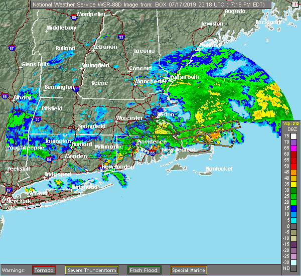 The severe thunderstorm warning for northeastern barnstable county will expire at 730 pm edt, the storms which prompted the warning were moving off the outer cape. therefore, the warning will be allowed to expire. however heavy rain is still possible with these thunderstorms. a severe thunderstorm watch remains in effect until 1000 pm edt for southeastern massachusetts. &&. The severe thunderstorm warning for northeastern barnstable county will expire at 730 pm edt, the storms which prompted the warning were moving off the outer cape. therefore, the warning will be allowed to expire. however heavy rain is still possible with these thunderstorms. a severe thunderstorm watch remains in effect until 1000 pm edt for southeastern massachusetts. &&.
|
| 7/17/2019 7:00 PM EDT |
 At 659 pm edt, severe thunderstorms were located near provincetown and truro, moving east at 45 mph (radar indicated). Hazards include 60 mph wind gusts. Expect damage to trees and power lines. These severe storms will be near, wellfleet around 715 pm edt. At 659 pm edt, severe thunderstorms were located near provincetown and truro, moving east at 45 mph (radar indicated). Hazards include 60 mph wind gusts. Expect damage to trees and power lines. These severe storms will be near, wellfleet around 715 pm edt.
|
| 7/17/2019 6:43 PM EDT |
 At 642 pm edt, severe thunderstorms were located over the coastal waters east of duxbury and plymouth, moving east at 45 mph (radar indicated). Hazards include 60 mph wind gusts. Expect damage to trees and power lines. these severe storms will be near, provincetown and truro around 650 pm edt. Eastham and wellfleet around 720 pm edt. At 642 pm edt, severe thunderstorms were located over the coastal waters east of duxbury and plymouth, moving east at 45 mph (radar indicated). Hazards include 60 mph wind gusts. Expect damage to trees and power lines. these severe storms will be near, provincetown and truro around 650 pm edt. Eastham and wellfleet around 720 pm edt.
|
| 7/17/2019 6:33 PM EDT |
 At 633 pm edt, severe thunderstorms were located along a line extending from 14 miles northwest of truro to 7 miles northwest of provincetown to 7 miles east of duxbury, moving east at 45 mph (radar indicated). Hazards include 60 mph wind gusts. Expect damage to trees and power lines. severe thunderstorms will be near, provincetown around 640 pm edt. truro around 645 pm edt. wellfleet around 715 pm edt. Eastham around 720 pm edt. At 633 pm edt, severe thunderstorms were located along a line extending from 14 miles northwest of truro to 7 miles northwest of provincetown to 7 miles east of duxbury, moving east at 45 mph (radar indicated). Hazards include 60 mph wind gusts. Expect damage to trees and power lines. severe thunderstorms will be near, provincetown around 640 pm edt. truro around 645 pm edt. wellfleet around 715 pm edt. Eastham around 720 pm edt.
|
| 4/15/2019 8:09 AM EDT | Storm damage reported in barnstable county MA, 2.2 miles SE of Provincetown, MA |
| 4/15/2019 8:00 AM EDT |
 At 758 am edt, a severe thunderstorm was located over cape cod bay approaching provincetown, moving northeast at 60 mph (radar indicated). Hazards include 60 mph wind gusts. expect damage to trees and power lines At 758 am edt, a severe thunderstorm was located over cape cod bay approaching provincetown, moving northeast at 60 mph (radar indicated). Hazards include 60 mph wind gusts. expect damage to trees and power lines
|
| 10/29/2018 10:21 AM EDT |
 At 1020 am edt, a severe thunderstorm was located near provincetown, moving northeast at 30 mph (radar indicated). Hazards include 60 mph wind gusts. expect damage to trees and power lines At 1020 am edt, a severe thunderstorm was located near provincetown, moving northeast at 30 mph (radar indicated). Hazards include 60 mph wind gusts. expect damage to trees and power lines
|
| 10/23/2018 6:44 PM EDT |
 At 643 pm edt, a severe thunderstorm was located 9 miles west of wellfleet, or 9 miles south of provincetown, moving northeast at 30 mph (radar indicated. however this storm has also had a history of producing waterspouts over cape cod bay). Hazards include 60 mph wind gusts. expect damage to trees and power lines At 643 pm edt, a severe thunderstorm was located 9 miles west of wellfleet, or 9 miles south of provincetown, moving northeast at 30 mph (radar indicated. however this storm has also had a history of producing waterspouts over cape cod bay). Hazards include 60 mph wind gusts. expect damage to trees and power lines
|
| 9/6/2018 4:51 PM EDT |
 At 451 pm edt, a severe thunderstorm was located over the coastal waters 8 miles northwest of provincetown, moving east at 30 mph (radar indicated). Hazards include 60 mph wind gusts and quarter size hail. Hail damage to vehicles is possible. Expect damage to trees and power lines. At 451 pm edt, a severe thunderstorm was located over the coastal waters 8 miles northwest of provincetown, moving east at 30 mph (radar indicated). Hazards include 60 mph wind gusts and quarter size hail. Hail damage to vehicles is possible. Expect damage to trees and power lines.
|
| 8/9/2018 9:13 AM EDT |
 At 912 am edt, severe thunderstorms were located over cape cod bay just west of truro and wellfleet, moving east at 25 mph. the strongest winds will reach truro and wellfleet before 930 am. get inside now! (radar indicated). Hazards include 60 mph wind gusts. Expect damage to trees and power lines. Locations impacted include, barnstable, brewster, provincetown, dennis, orleans, eastham, wellfleet and truro. At 912 am edt, severe thunderstorms were located over cape cod bay just west of truro and wellfleet, moving east at 25 mph. the strongest winds will reach truro and wellfleet before 930 am. get inside now! (radar indicated). Hazards include 60 mph wind gusts. Expect damage to trees and power lines. Locations impacted include, barnstable, brewster, provincetown, dennis, orleans, eastham, wellfleet and truro.
|
| 8/9/2018 9:00 AM EDT |
 At 858 am edt, severe thunderstorms were located along a line over cape cod bay, moving east at 25 mph. damaging winds are expected on the outer cape, especially between wellfleet and provincetown (radar indicated). Hazards include 60 mph wind gusts. expect damage to trees and power lines At 858 am edt, severe thunderstorms were located along a line over cape cod bay, moving east at 25 mph. damaging winds are expected on the outer cape, especially between wellfleet and provincetown (radar indicated). Hazards include 60 mph wind gusts. expect damage to trees and power lines
|
| 1/23/2018 3:08 PM EST |
 At 308 pm est, severe thunderstorms were located along a line extending from near falmouth to 30 miles south of chilmark, moving northeast at 75 mph (radar indicated). Hazards include 60 mph wind gusts. expect damage to trees and power lines At 308 pm est, severe thunderstorms were located along a line extending from near falmouth to 30 miles south of chilmark, moving northeast at 75 mph (radar indicated). Hazards include 60 mph wind gusts. expect damage to trees and power lines
|
| 7/22/2016 10:31 PM EDT |
 At 1030 pm edt, a severe thunderstorm was located near brewster, moving east at 30 mph (radar indicated). Hazards include 60 mph wind gusts and penny size hail. Expect damage to roofs. siding. and trees. Locations impacted include, brewster, provincetown, yarmouth, dennis, harwich, chatham, orleans, eastham, wellfleet and truro. At 1030 pm edt, a severe thunderstorm was located near brewster, moving east at 30 mph (radar indicated). Hazards include 60 mph wind gusts and penny size hail. Expect damage to roofs. siding. and trees. Locations impacted include, brewster, provincetown, yarmouth, dennis, harwich, chatham, orleans, eastham, wellfleet and truro.
|
| 7/22/2016 10:05 PM EDT |
 At 1005 pm edt, a severe thunderstorm was located 8 miles northeast of sandwich, or 8 miles north of barnstable, moving east at 30 mph (radar indicated). Hazards include 60 mph wind gusts and penny size hail. Expect damage to roofs. siding. And trees. At 1005 pm edt, a severe thunderstorm was located 8 miles northeast of sandwich, or 8 miles north of barnstable, moving east at 30 mph (radar indicated). Hazards include 60 mph wind gusts and penny size hail. Expect damage to roofs. siding. And trees.
|
| 7/15/2016 4:07 PM EDT |
 The severe thunderstorm warning for northeastern barnstable county will expire at 415 pm edt, the storm which prompted the warning has moved out of the area. therefore, the warning will be allowed to expire. The severe thunderstorm warning for northeastern barnstable county will expire at 415 pm edt, the storm which prompted the warning has moved out of the area. therefore, the warning will be allowed to expire.
|
| 7/15/2016 3:45 PM EDT | Beach sign blow down on the east side of race point road near ocean view hill in barnstable county MA, 0.4 miles W of Provincetown, MA |
| 7/15/2016 3:42 PM EDT |
 At 341 pm edt, a severe thunderstorm was located over provincetown, moving northeast at 15 mph (this is a very dangerous storm. provincetown just had an official wind gusts to 63 mph! take shelter immediately). Hazards include 65 mph wind gusts and penny size hail. Expect considerable tree damage. damage is likely to mobile homes, roofs, and outbuildings. Locations impacted include, provincetown and truro. At 341 pm edt, a severe thunderstorm was located over provincetown, moving northeast at 15 mph (this is a very dangerous storm. provincetown just had an official wind gusts to 63 mph! take shelter immediately). Hazards include 65 mph wind gusts and penny size hail. Expect considerable tree damage. damage is likely to mobile homes, roofs, and outbuildings. Locations impacted include, provincetown and truro.
|
| 7/15/2016 3:35 PM EDT | Storm damage reported in barnstable county MA, 2.2 miles SE of Provincetown, MA |
| 7/15/2016 3:28 PM EDT |
 At 328 pm edt, a severe thunderstorm was located near provincetown, moving east at 15 mph (radar indicated). Hazards include 60 mph wind gusts and quarter size hail. Hail damage to vehicles is expected. Expect wind damage to roofs, siding, and trees. At 328 pm edt, a severe thunderstorm was located near provincetown, moving east at 15 mph (radar indicated). Hazards include 60 mph wind gusts and quarter size hail. Hail damage to vehicles is expected. Expect wind damage to roofs, siding, and trees.
|
| 7/1/2016 11:16 PM EDT |
 At 1115 pm edt, severe thunderstorms were located along a line extending from near oak bluffs to 20 miles south of edgartown, moving northeast at 50 mph (radar indicated). Hazards include 60 mph wind gusts. Expect damage to roofs. siding. And trees. At 1115 pm edt, severe thunderstorms were located along a line extending from near oak bluffs to 20 miles south of edgartown, moving northeast at 50 mph (radar indicated). Hazards include 60 mph wind gusts. Expect damage to roofs. siding. And trees.
|
| 10/16/2015 9:46 AM EDT |
 At 940 am edt, doppler radar indicated a cluster of severe thunderstormss capable of producing quarter size hail and damaging winds of 60 to 70 mph. this storm was centered over cape cod bay and will likely produce one or more swaths of damaging winds across truro, wellfleet, eastham, and orleans between 955 am and 1015 am. hail up to an inch in size is also possible. these storms may cause damage to moored boats including the wellfleet harbor area. the storms were moving rapidly northeast at 55 to 60 mph. locations impacted include, barnstable, brewster, provincetown, yarmouth, sandwich, dennis, orleans, eastham, wellfleet and truro. At 940 am edt, doppler radar indicated a cluster of severe thunderstormss capable of producing quarter size hail and damaging winds of 60 to 70 mph. this storm was centered over cape cod bay and will likely produce one or more swaths of damaging winds across truro, wellfleet, eastham, and orleans between 955 am and 1015 am. hail up to an inch in size is also possible. these storms may cause damage to moored boats including the wellfleet harbor area. the storms were moving rapidly northeast at 55 to 60 mph. locations impacted include, barnstable, brewster, provincetown, yarmouth, sandwich, dennis, orleans, eastham, wellfleet and truro.
|
| 10/16/2015 9:36 AM EDT |
 At 935 am edt, doppler radar indicated a severe thunderstorm capable of producing quarter size hail and damaging winds in excess of 60 mph. this storm was located near sandwich, or 7 miles north of barnstable, and was moving east at 65 mph. At 935 am edt, doppler radar indicated a severe thunderstorm capable of producing quarter size hail and damaging winds in excess of 60 mph. this storm was located near sandwich, or 7 miles north of barnstable, and was moving east at 65 mph.
|
| 8/4/2015 7:55 AM EDT |
 At 753 am edt, doppler radar indicated a line of severe thunderstorms capable of producing destructive winds up to 80 mph. these storms were located along a line extending from 11 miles northwest of provincetown to near dennis, moving east at 50 mph. this is a very dangerous situation. widespread significant wind damage is likely from provincetown to wellfleet. locations impacted include, barnstable, brewster, provincetown, yarmouth, dennis, harwich, chatham, orleans, eastham, wellfleet and truro. At 753 am edt, doppler radar indicated a line of severe thunderstorms capable of producing destructive winds up to 80 mph. these storms were located along a line extending from 11 miles northwest of provincetown to near dennis, moving east at 50 mph. this is a very dangerous situation. widespread significant wind damage is likely from provincetown to wellfleet. locations impacted include, barnstable, brewster, provincetown, yarmouth, dennis, harwich, chatham, orleans, eastham, wellfleet and truro.
|
| 8/4/2015 7:45 AM EDT |
 At 744 am edt, doppler radar indicated a line of severe thunderstorms capable of producing destructive winds in excess of 70 mph. these storms were located along a line extending from 13 miles northwest of provincetown to near barnstable, moving east at 45 mph. this is a dangerous situation. widespread wind damage is likely. locations impacted include, plymouth, barnstable, falmouth, brewster, provincetown, yarmouth, sandwich, bourne, dennis, mashpee, harwich, chatham, orleans, eastham, wellfleet, truro and hyannis. At 744 am edt, doppler radar indicated a line of severe thunderstorms capable of producing destructive winds in excess of 70 mph. these storms were located along a line extending from 13 miles northwest of provincetown to near barnstable, moving east at 45 mph. this is a dangerous situation. widespread wind damage is likely. locations impacted include, plymouth, barnstable, falmouth, brewster, provincetown, yarmouth, sandwich, bourne, dennis, mashpee, harwich, chatham, orleans, eastham, wellfleet, truro and hyannis.
|
| 8/4/2015 7:25 AM EDT |
 At 724 am edt, doppler radar indicated a severe thunderstorm capable of producing destructive winds in excess of 70 mph. this storm was located just west of falmouth, moving east at 50 mph. locations impacted include, plymouth, barnstable, falmouth, brewster, provincetown, yarmouth, sandwich, bourne, dennis, mashpee, harwich, chatham, orleans, eastham, wellfleet, truro and hyannis. At 724 am edt, doppler radar indicated a severe thunderstorm capable of producing destructive winds in excess of 70 mph. this storm was located just west of falmouth, moving east at 50 mph. locations impacted include, plymouth, barnstable, falmouth, brewster, provincetown, yarmouth, sandwich, bourne, dennis, mashpee, harwich, chatham, orleans, eastham, wellfleet, truro and hyannis.
|
| 8/4/2015 7:15 AM EDT |
 At 714 am edt, doppler radar indicated a severe thunderstorm capable of producing damaging winds in excess of 60 mph. this storm was located over fairhaven, or near new bedford, and was moving east at 50 mph. * some locations impacted include, plymouth, barnstable, falmouth, brewster, provincetown, yarmouth, sandwich, bourne, dennis, mashpee, harwich, chatham, orleans, eastham, wellfleet, truro and hyannis. At 714 am edt, doppler radar indicated a severe thunderstorm capable of producing damaging winds in excess of 60 mph. this storm was located over fairhaven, or near new bedford, and was moving east at 50 mph. * some locations impacted include, plymouth, barnstable, falmouth, brewster, provincetown, yarmouth, sandwich, bourne, dennis, mashpee, harwich, chatham, orleans, eastham, wellfleet, truro and hyannis.
|
Hail Maps for Provincetown, MA


Connect with Interactive Hail Maps