

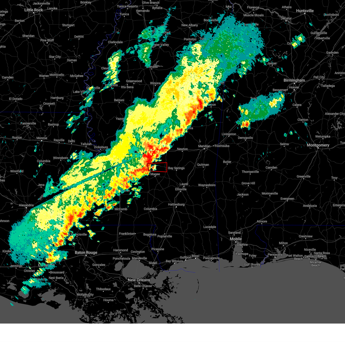
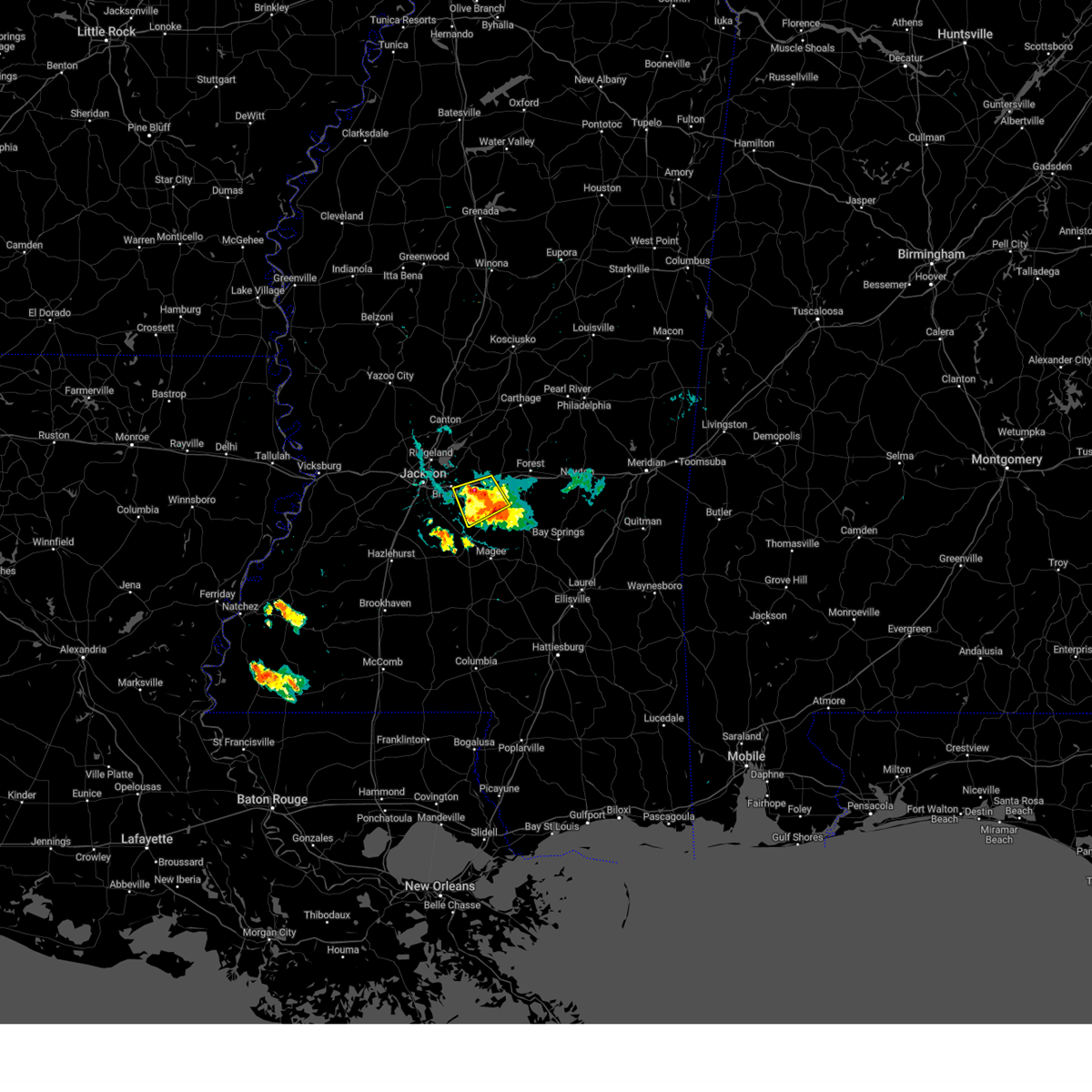
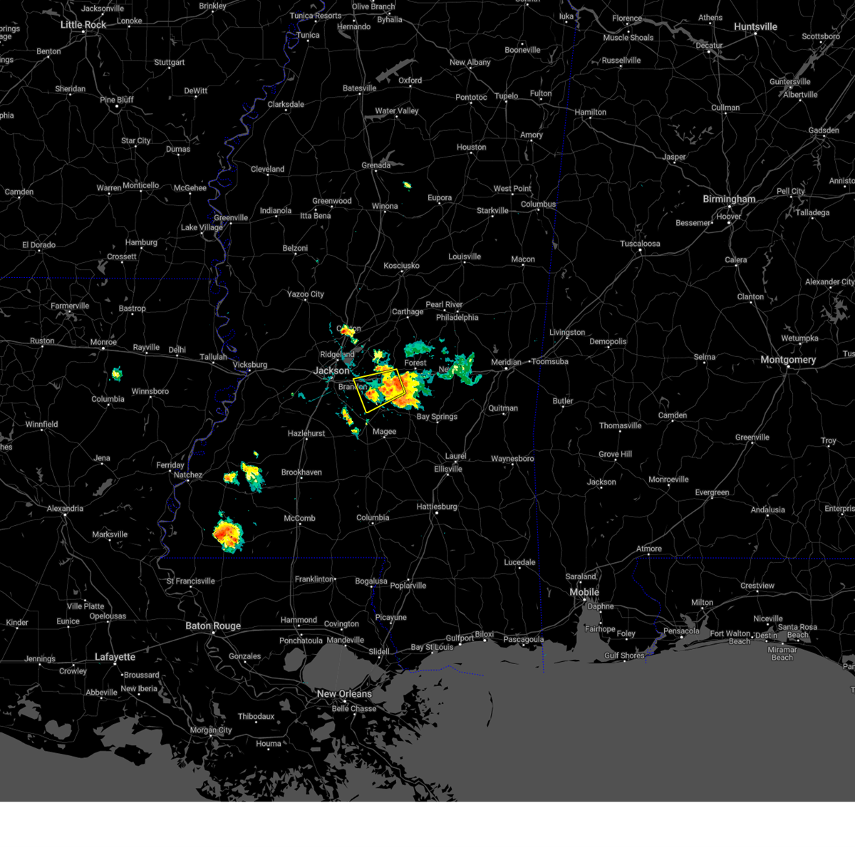
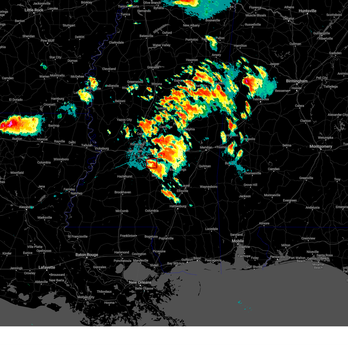
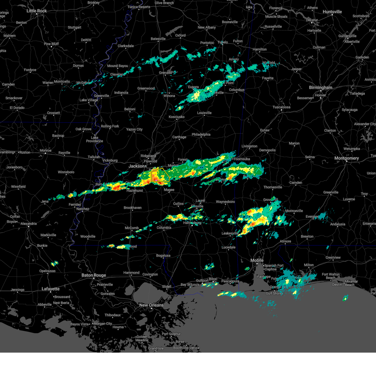
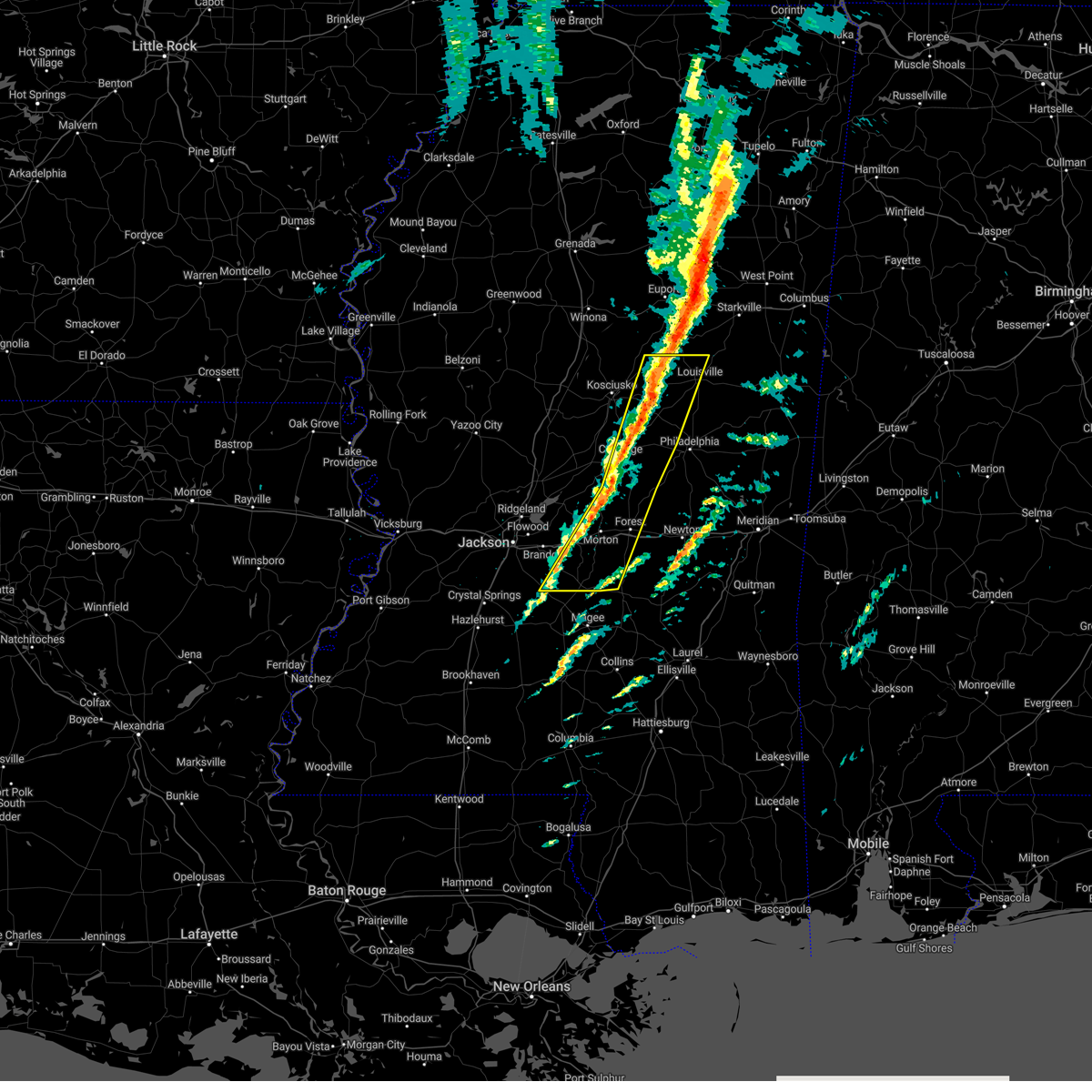
Hail Map for Puckett, MS
The Puckett, MS area has had 0 reports of on-the-ground hail by trained spotters, and has been under severe weather warnings 37 times during the past 12 months. Doppler radar has detected hail at or near Puckett, MS on 51 occasions, including 7 occasions during the past year.
| Name: | Puckett, MS |
| Where Located: | 27.8 miles ESE of Jackson, MS |
| Map: | Google Map for Puckett, MS |
| Population: | 316 |
| Housing Units: | 139 |
| More Info: | Search Google for Puckett, MS |
1
The Top Recent Hail Date for Puckett, MS is Tuesday, July 4, 2023 (11th out of 51)
Hail and Wind Damage Spotted near Puckett, MS
| Date / Time | Report Details |
|---|---|
| 4/9/2024 9:22 PM CDT |
 At 922 pm cdt, severe thunderstorms were located along a line extending from near sharon to pisgah to near florence, moving east at 35 mph (emergency managment reported. this line has a history of producing wind damage). Hazards include 60 mph wind gusts and half dollar size hail. Hail damage to vehicles is expected. expect wind damage to roofs, siding, and trees. these severe storms will be near, jackson, brandon, florence, farmhaven, star, leesburg, monterey, and pisgah around 925 pm cdt. pelahatchie, branch, and ludlow around 930 pm cdt. forkville and piney woods around 935 pm cdt. morton around 940 pm cdt. lena, johns, and cato around 945 pm cdt. Puckett around 955 pm cdt. At 922 pm cdt, severe thunderstorms were located along a line extending from near sharon to pisgah to near florence, moving east at 35 mph (emergency managment reported. this line has a history of producing wind damage). Hazards include 60 mph wind gusts and half dollar size hail. Hail damage to vehicles is expected. expect wind damage to roofs, siding, and trees. these severe storms will be near, jackson, brandon, florence, farmhaven, star, leesburg, monterey, and pisgah around 925 pm cdt. pelahatchie, branch, and ludlow around 930 pm cdt. forkville and piney woods around 935 pm cdt. morton around 940 pm cdt. lena, johns, and cato around 945 pm cdt. Puckett around 955 pm cdt.
|
| 4/9/2024 9:00 PM CDT |
 Svrjan the national weather service in jackson has issued a * severe thunderstorm warning for, southwestern leake county in central mississippi, rankin county in central mississippi, western scott county in central mississippi, southeastern hinds county in central mississippi, southeastern madison county in central mississippi, * until 1000 pm cdt. * at 900 pm cdt, severe thunderstorms were located along a line extending from near canton to gluckstadt to near byram, moving east at 35 mph (radar indicated). Hazards include 60 mph wind gusts and half dollar size hail. Hail damage to vehicles is expected. expect wind damage to roofs, siding, and trees. severe thunderstorms will be near, jackson, pearl, canton, flowood, richland, florence, and monterey around 905 pm cdt. brandon, fannin, sharon, and goshen springs around 910 pm cdt. star and pisgah around 915 pm cdt. farmhaven around 920 pm cdt. pelahatchie and leesburg around 925 pm cdt. johns, branch, cato, and ludlow around 930 pm cdt. forkville around 935 pm cdt. Morton, puckett, and lena around 940 pm cdt. Svrjan the national weather service in jackson has issued a * severe thunderstorm warning for, southwestern leake county in central mississippi, rankin county in central mississippi, western scott county in central mississippi, southeastern hinds county in central mississippi, southeastern madison county in central mississippi, * until 1000 pm cdt. * at 900 pm cdt, severe thunderstorms were located along a line extending from near canton to gluckstadt to near byram, moving east at 35 mph (radar indicated). Hazards include 60 mph wind gusts and half dollar size hail. Hail damage to vehicles is expected. expect wind damage to roofs, siding, and trees. severe thunderstorms will be near, jackson, pearl, canton, flowood, richland, florence, and monterey around 905 pm cdt. brandon, fannin, sharon, and goshen springs around 910 pm cdt. star and pisgah around 915 pm cdt. farmhaven around 920 pm cdt. pelahatchie and leesburg around 925 pm cdt. johns, branch, cato, and ludlow around 930 pm cdt. forkville around 935 pm cdt. Morton, puckett, and lena around 940 pm cdt.
|
| 1/12/2024 8:53 AM CST |
 At 853 am cst, a severe thunderstorm was located near walnut grove, or 13 miles southeast of carthage, moving northeast at 55 mph (radar indicated). Hazards include 60 mph wind gusts. Expect damage to roofs, siding, and trees. this severe storm will be near, madden around 900 am cst. hail threat, radar indicated max hail size, <. 75 in wind threat, radar indicated max wind gust, 60 mph. At 853 am cst, a severe thunderstorm was located near walnut grove, or 13 miles southeast of carthage, moving northeast at 55 mph (radar indicated). Hazards include 60 mph wind gusts. Expect damage to roofs, siding, and trees. this severe storm will be near, madden around 900 am cst. hail threat, radar indicated max hail size, <. 75 in wind threat, radar indicated max wind gust, 60 mph.
|
| 1/12/2024 8:26 AM CST |
 At 826 am cst, a severe thunderstorm was located over pelahatchie, or 9 miles west of morton, moving northeast at 50 mph (radar indicated). Hazards include 60 mph wind gusts. Expect damage to roofs, siding, and trees. this severe thunderstorm will be near, morton, branch, leesburg, and forkville around 830 am cst. hillsboro and ludlow around 840 am cst. harperville and lena around 845 am cst. walnut grove, tuscola, and steele around 850 am cst. standing pine around 855 am cst. sebastopol and madden around 900 am cst. edinburg around 910 am cst. hail threat, radar indicated max hail size, <. 75 in wind threat, radar indicated max wind gust, 60 mph. At 826 am cst, a severe thunderstorm was located over pelahatchie, or 9 miles west of morton, moving northeast at 50 mph (radar indicated). Hazards include 60 mph wind gusts. Expect damage to roofs, siding, and trees. this severe thunderstorm will be near, morton, branch, leesburg, and forkville around 830 am cst. hillsboro and ludlow around 840 am cst. harperville and lena around 845 am cst. walnut grove, tuscola, and steele around 850 am cst. standing pine around 855 am cst. sebastopol and madden around 900 am cst. edinburg around 910 am cst. hail threat, radar indicated max hail size, <. 75 in wind threat, radar indicated max wind gust, 60 mph.
|
| 12/9/2023 9:30 PM CST |
 At 930 pm cst, a confirmed tornado was located over puckett, or 7 miles northeast of mendenhall, moving east at 50 mph (radar confirmed tornado). Hazards include damaging tornado. Flying debris will be dangerous to those caught without shelter. mobile homes will be damaged or destroyed. damage to roofs, windows, and vehicles will occur. tree damage is likely. this tornado will be near, puckett, white oak, and martinville around 935 pm cst. Raleigh around 940 pm cst. At 930 pm cst, a confirmed tornado was located over puckett, or 7 miles northeast of mendenhall, moving east at 50 mph (radar confirmed tornado). Hazards include damaging tornado. Flying debris will be dangerous to those caught without shelter. mobile homes will be damaged or destroyed. damage to roofs, windows, and vehicles will occur. tree damage is likely. this tornado will be near, puckett, white oak, and martinville around 935 pm cst. Raleigh around 940 pm cst.
|
| 12/9/2023 9:25 PM CST |
 At 924 pm cst, a confirmed tornado was located over cato, or near mendenhall, moving east at 50 mph (radar confirmed tornado). Hazards include damaging tornado. Flying debris will be dangerous to those caught without shelter. mobile homes will be damaged or destroyed. damage to roofs, windows, and vehicles will occur. tree damage is likely. this tornado will be near, puckett, white oak, and martinville around 930 pm cst. Raleigh around 940 pm cst. At 924 pm cst, a confirmed tornado was located over cato, or near mendenhall, moving east at 50 mph (radar confirmed tornado). Hazards include damaging tornado. Flying debris will be dangerous to those caught without shelter. mobile homes will be damaged or destroyed. damage to roofs, windows, and vehicles will occur. tree damage is likely. this tornado will be near, puckett, white oak, and martinville around 930 pm cst. Raleigh around 940 pm cst.
|
| 12/9/2023 9:20 PM CST |
 At 919 pm cst, a severe thunderstorm capable of producing a tornado was located over braxton, or 7 miles northwest of mendenhall, moving east at 30 mph (radar indicated rotation). Hazards include tornado. Flying debris will be dangerous to those caught without shelter. mobile homes will be damaged or destroyed. damage to roofs, windows, and vehicles will occur. tree damage is likely. this dangerous storm will be near, d`lo, puckett, and cato around 925 pm cst. martinville around 930 pm cst. white oak around 935 pm cst. Raleigh around 955 pm cst. At 919 pm cst, a severe thunderstorm capable of producing a tornado was located over braxton, or 7 miles northwest of mendenhall, moving east at 30 mph (radar indicated rotation). Hazards include tornado. Flying debris will be dangerous to those caught without shelter. mobile homes will be damaged or destroyed. damage to roofs, windows, and vehicles will occur. tree damage is likely. this dangerous storm will be near, d`lo, puckett, and cato around 925 pm cst. martinville around 930 pm cst. white oak around 935 pm cst. Raleigh around 955 pm cst.
|
| 7/8/2023 7:37 PM CDT |
 At 736 pm cdt, a severe thunderstorm was located over richland, moving east at 35 mph (radar indicated). Hazards include 60 mph wind gusts and quarter size hail. Hail damage to vehicles is expected. expect wind damage to roofs, siding, and trees. this severe storm will be near, richland around 740 pm cdt. pearl, flowood and florence around 745 pm cdt. monterey around 750 pm cdt. brandon around 755 pm cdt. pelahatchie and johns around 815 pm cdt. hail threat, radar indicated max hail size, 1. 00 in wind threat, radar indicated max wind gust, 60 mph. At 736 pm cdt, a severe thunderstorm was located over richland, moving east at 35 mph (radar indicated). Hazards include 60 mph wind gusts and quarter size hail. Hail damage to vehicles is expected. expect wind damage to roofs, siding, and trees. this severe storm will be near, richland around 740 pm cdt. pearl, flowood and florence around 745 pm cdt. monterey around 750 pm cdt. brandon around 755 pm cdt. pelahatchie and johns around 815 pm cdt. hail threat, radar indicated max hail size, 1. 00 in wind threat, radar indicated max wind gust, 60 mph.
|
| 7/8/2023 7:19 PM CDT |
 At 719 pm cdt, a severe thunderstorm was located over raymond, moving east at 35 mph (radar indicated). Hazards include 60 mph wind gusts and quarter size hail. Hail damage to vehicles is expected. expect wind damage to roofs, siding, and trees. this severe thunderstorm will be near, jackson around 725 pm cdt. byram around 730 pm cdt. richland around 740 pm cdt. pearl, flowood and florence around 745 pm cdt. monterey around 750 pm cdt. brandon around 755 pm cdt. pelahatchie and johns around 815 pm cdt. hail threat, radar indicated max hail size, 1. 00 in wind threat, radar indicated max wind gust, 60 mph. At 719 pm cdt, a severe thunderstorm was located over raymond, moving east at 35 mph (radar indicated). Hazards include 60 mph wind gusts and quarter size hail. Hail damage to vehicles is expected. expect wind damage to roofs, siding, and trees. this severe thunderstorm will be near, jackson around 725 pm cdt. byram around 730 pm cdt. richland around 740 pm cdt. pearl, flowood and florence around 745 pm cdt. monterey around 750 pm cdt. brandon around 755 pm cdt. pelahatchie and johns around 815 pm cdt. hail threat, radar indicated max hail size, 1. 00 in wind threat, radar indicated max wind gust, 60 mph.
|
| 6/30/2023 7:34 PM CDT |
 At 734 pm cdt, a severe thunderstorm was located near polkville, or 11 miles southwest of morton, moving west at 15 mph (radar indicated). Hazards include 60 mph wind gusts and nickel size hail. Expect damage to roofs, siding, and trees. this severe storm will be near, johns around 755 pm cdt. cato around 810 pm cdt. hail threat, radar indicated max hail size, 0. 88 in wind threat, radar indicated max wind gust, 60 mph. At 734 pm cdt, a severe thunderstorm was located near polkville, or 11 miles southwest of morton, moving west at 15 mph (radar indicated). Hazards include 60 mph wind gusts and nickel size hail. Expect damage to roofs, siding, and trees. this severe storm will be near, johns around 755 pm cdt. cato around 810 pm cdt. hail threat, radar indicated max hail size, 0. 88 in wind threat, radar indicated max wind gust, 60 mph.
|
| 6/30/2023 7:06 PM CDT |
 At 706 pm cdt, a severe thunderstorm was located near pulaski, or near morton, moving west at 15 mph (radar indicated). Hazards include 60 mph wind gusts and nickel size hail. Expect damage to roofs, siding, and trees. this severe thunderstorm will be near, polkville around 715 pm cdt. pelahatchie around 730 pm cdt. johns around 745 pm cdt. hail threat, radar indicated max hail size, 0. 88 in wind threat, radar indicated max wind gust, 60 mph. At 706 pm cdt, a severe thunderstorm was located near pulaski, or near morton, moving west at 15 mph (radar indicated). Hazards include 60 mph wind gusts and nickel size hail. Expect damage to roofs, siding, and trees. this severe thunderstorm will be near, polkville around 715 pm cdt. pelahatchie around 730 pm cdt. johns around 745 pm cdt. hail threat, radar indicated max hail size, 0. 88 in wind threat, radar indicated max wind gust, 60 mph.
|
| 6/25/2023 11:41 PM CDT |
 The severe thunderstorm warning for east central warren, rankin and hinds counties will expire at 1145 pm cdt, the storms which prompted the warning have moved out of the area. therefore, the warning will be allowed to expire. however, gusty winds are still possible with these thunderstorms. a severe thunderstorm watch remains in effect until 200 am cdt for central mississippi. a severe thunderstorm watch also remains in effect until 500 am cdt for central, southwestern and west central mississippi. The severe thunderstorm warning for east central warren, rankin and hinds counties will expire at 1145 pm cdt, the storms which prompted the warning have moved out of the area. therefore, the warning will be allowed to expire. however, gusty winds are still possible with these thunderstorms. a severe thunderstorm watch remains in effect until 200 am cdt for central mississippi. a severe thunderstorm watch also remains in effect until 500 am cdt for central, southwestern and west central mississippi.
|
| 6/25/2023 11:30 PM CDT |
 At 1130 pm cdt, severe thunderstorms were located along a line extending from forkville to puckett to near hopewell, moving southeast at 40 mph (observed. a wind gust of 76 mph was observed reported at the jackson medgar evers wiley international airport). Hazards include 80 mph wind gusts and quarter size hail. Flying debris will be dangerous to those caught without shelter. mobile homes will be heavily damaged. expect considerable damage to roofs, windows, and vehicles. extensive tree damage and power outages are likely. these severe storms will be near, puckett around 1135 pm cdt. thunderstorm damage threat, destructive hail threat, radar indicated max hail size, 1. 00 in wind threat, observed max wind gust, 80 mph. At 1130 pm cdt, severe thunderstorms were located along a line extending from forkville to puckett to near hopewell, moving southeast at 40 mph (observed. a wind gust of 76 mph was observed reported at the jackson medgar evers wiley international airport). Hazards include 80 mph wind gusts and quarter size hail. Flying debris will be dangerous to those caught without shelter. mobile homes will be heavily damaged. expect considerable damage to roofs, windows, and vehicles. extensive tree damage and power outages are likely. these severe storms will be near, puckett around 1135 pm cdt. thunderstorm damage threat, destructive hail threat, radar indicated max hail size, 1. 00 in wind threat, observed max wind gust, 80 mph.
|
| 6/25/2023 11:29 PM CDT |
 At 1128 pm cdt, severe thunderstorms were located along a line extending from near branch to near polkville to johns to near harrisville, moving southeast at 40 mph (observed. a wind gust of 76 mph was observed reported at the jackson medgar evers wiley international airport). Hazards include 80 mph wind gusts and penny size hail. Flying debris will be dangerous to those caught without shelter. mobile homes will be heavily damaged. expect considerable damage to roofs, windows, and vehicles. extensive tree damage and power outages are likely. these severe storms will be near, puckett around 1140 pm cdt. thunderstorm damage threat, destructive hail threat, radar indicated max hail size, 0. 75 in wind threat, observed max wind gust, 80 mph. At 1128 pm cdt, severe thunderstorms were located along a line extending from near branch to near polkville to johns to near harrisville, moving southeast at 40 mph (observed. a wind gust of 76 mph was observed reported at the jackson medgar evers wiley international airport). Hazards include 80 mph wind gusts and penny size hail. Flying debris will be dangerous to those caught without shelter. mobile homes will be heavily damaged. expect considerable damage to roofs, windows, and vehicles. extensive tree damage and power outages are likely. these severe storms will be near, puckett around 1140 pm cdt. thunderstorm damage threat, destructive hail threat, radar indicated max hail size, 0. 75 in wind threat, observed max wind gust, 80 mph.
|
| 6/25/2023 11:20 PM CDT |
 At 1119 pm cdt, severe thunderstorms were located along a line extending from branch to near pelahatchie to near johns to near whites, moving southeast at 45 mph (observed. a wind gust of 76 mph was observed reported at the jackson medgar evers wiley international airport). Hazards include 80 mph wind gusts. Flying debris will be dangerous to those caught without shelter. mobile homes will be heavily damaged. expect considerable damage to roofs, windows, and vehicles. extensive tree damage and power outages are likely. these severe storms will be near, johns and cato around 1125 pm cdt. puckett around 1135 pm cdt. thunderstorm damage threat, destructive hail threat, observed max hail size, <. 75 in wind threat, radar indicated max wind gust, 80 mph. At 1119 pm cdt, severe thunderstorms were located along a line extending from branch to near pelahatchie to near johns to near whites, moving southeast at 45 mph (observed. a wind gust of 76 mph was observed reported at the jackson medgar evers wiley international airport). Hazards include 80 mph wind gusts. Flying debris will be dangerous to those caught without shelter. mobile homes will be heavily damaged. expect considerable damage to roofs, windows, and vehicles. extensive tree damage and power outages are likely. these severe storms will be near, johns and cato around 1125 pm cdt. puckett around 1135 pm cdt. thunderstorm damage threat, destructive hail threat, observed max hail size, <. 75 in wind threat, radar indicated max wind gust, 80 mph.
|
| 6/25/2023 11:18 PM CDT |
 At 1117 pm cdt, severe thunderstorms were located along a line extending from near farmhaven to near brandon to near dry grove, moving southeast at 40 mph (radar indicated). Hazards include 80 mph wind gusts and quarter size hail. Flying debris will be dangerous to those caught without shelter. mobile homes will be heavily damaged. expect considerable damage to roofs, windows, and vehicles. extensive tree damage and power outages are likely. these severe storms will be near, johns around 1130 pm cdt. cato around 1135 pm cdt. puckett around 1140 pm cdt. thunderstorm damage threat, destructive hail threat, radar indicated max hail size, 1. 00 in wind threat, observed max wind gust, 80 mph. At 1117 pm cdt, severe thunderstorms were located along a line extending from near farmhaven to near brandon to near dry grove, moving southeast at 40 mph (radar indicated). Hazards include 80 mph wind gusts and quarter size hail. Flying debris will be dangerous to those caught without shelter. mobile homes will be heavily damaged. expect considerable damage to roofs, windows, and vehicles. extensive tree damage and power outages are likely. these severe storms will be near, johns around 1130 pm cdt. cato around 1135 pm cdt. puckett around 1140 pm cdt. thunderstorm damage threat, destructive hail threat, radar indicated max hail size, 1. 00 in wind threat, observed max wind gust, 80 mph.
|
| 6/25/2023 11:11 PM CDT |
 At 1109 pm cdt, severe thunderstorms were located along a line extending from near farmhaven to near brandon to near dry grove, moving southeast at 40 mph (observed. a wind gust of 76 mph was observed reported at the jackson medgar evers wiley international airport). Hazards include 80 mph wind gusts and quarter size hail. Flying debris will be dangerous to those caught without shelter. mobile homes will be heavily damaged. expect considerable damage to roofs, windows, and vehicles. extensive tree damage and power outages are likely. these severe storms will be near, johns around 1125 pm cdt. leesburg and cato around 1130 pm cdt. puckett around 1135 pm cdt. thunderstorm damage threat, destructive hail threat, radar indicated max hail size, 1. 00 in wind threat, observed max wind gust, 80 mph. At 1109 pm cdt, severe thunderstorms were located along a line extending from near farmhaven to near brandon to near dry grove, moving southeast at 40 mph (observed. a wind gust of 76 mph was observed reported at the jackson medgar evers wiley international airport). Hazards include 80 mph wind gusts and quarter size hail. Flying debris will be dangerous to those caught without shelter. mobile homes will be heavily damaged. expect considerable damage to roofs, windows, and vehicles. extensive tree damage and power outages are likely. these severe storms will be near, johns around 1125 pm cdt. leesburg and cato around 1130 pm cdt. puckett around 1135 pm cdt. thunderstorm damage threat, destructive hail threat, radar indicated max hail size, 1. 00 in wind threat, observed max wind gust, 80 mph.
|
| 6/25/2023 11:06 PM CDT |
 At 1106 pm cdt, severe thunderstorms were located along a line extending from near sharon to near brandon to near dry grove, moving southeast at 40 mph (radar indicated). Hazards include 80 mph wind gusts and quarter size hail. Flying debris will be dangerous to those caught without shelter. mobile homes will be heavily damaged. expect considerable damage to roofs, windows, and vehicles. extensive tree damage and power outages are likely. these severe storms will be near, brandon around 1110 pm cdt. johns, leesburg and cato around 1130 pm cdt. puckett around 1135 pm cdt. thunderstorm damage threat, destructive hail threat, radar indicated max hail size, 1. 00 in wind threat, observed max wind gust, 80 mph. At 1106 pm cdt, severe thunderstorms were located along a line extending from near sharon to near brandon to near dry grove, moving southeast at 40 mph (radar indicated). Hazards include 80 mph wind gusts and quarter size hail. Flying debris will be dangerous to those caught without shelter. mobile homes will be heavily damaged. expect considerable damage to roofs, windows, and vehicles. extensive tree damage and power outages are likely. these severe storms will be near, brandon around 1110 pm cdt. johns, leesburg and cato around 1130 pm cdt. puckett around 1135 pm cdt. thunderstorm damage threat, destructive hail threat, radar indicated max hail size, 1. 00 in wind threat, observed max wind gust, 80 mph.
|
| 6/25/2023 10:57 PM CDT |
 At 1057 pm cdt, severe thunderstorms were located along a line extending from cameron to near goshen springs to near raymond, moving southeast at 40 mph (radar indicated). Hazards include 80 mph wind gusts and quarter size hail. Flying debris will be dangerous to those caught without shelter. mobile homes will be heavily damaged. expect considerable damage to roofs, windows, and vehicles. extensive tree damage and power outages are likely. these severe storms will be near, fannin and goshen springs around 1100 pm cdt. pisgah around 1105 pm cdt. jackson, dry grove and leesburg around 1110 pm cdt. byram and farmhaven around 1115 pm cdt. pelahatchie and terry around 1120 pm cdt. whites around 1125 pm cdt. thunderstorm damage threat, destructive hail threat, radar indicated max hail size, 1. 00 in wind threat, radar indicated max wind gust, 80 mph. At 1057 pm cdt, severe thunderstorms were located along a line extending from cameron to near goshen springs to near raymond, moving southeast at 40 mph (radar indicated). Hazards include 80 mph wind gusts and quarter size hail. Flying debris will be dangerous to those caught without shelter. mobile homes will be heavily damaged. expect considerable damage to roofs, windows, and vehicles. extensive tree damage and power outages are likely. these severe storms will be near, fannin and goshen springs around 1100 pm cdt. pisgah around 1105 pm cdt. jackson, dry grove and leesburg around 1110 pm cdt. byram and farmhaven around 1115 pm cdt. pelahatchie and terry around 1120 pm cdt. whites around 1125 pm cdt. thunderstorm damage threat, destructive hail threat, radar indicated max hail size, 1. 00 in wind threat, radar indicated max wind gust, 80 mph.
|
| 6/25/2023 10:45 PM CDT |
 At 1044 pm cdt, severe thunderstorms were located along a line extending from near pickens to gluckstadt to edwards, moving southeast at 40 mph (radar indicated). Hazards include 80 mph wind gusts. Flying debris will be dangerous to those caught without shelter. mobile homes will be heavily damaged. expect considerable damage to roofs, windows, and vehicles. extensive tree damage and power outages are likely. these severe storms will be near, madison, canton, gluckstadt and annandale around 1050 pm cdt. ridgeland, bolton and way around 1055 pm cdt. learned and goshen springs around 1100 pm cdt. raymond, fannin, camden and pisgah around 1105 pm cdt. brandon, dry grove and sharon around 1110 pm cdt. farmhaven around 1115 pm cdt. pelahatchie and terry around 1120 pm cdt. whites around 1130 pm cdt. thunderstorm damage threat, destructive hail threat, radar indicated max hail size, <. 75 in wind threat, radar indicated max wind gust, 80 mph. At 1044 pm cdt, severe thunderstorms were located along a line extending from near pickens to gluckstadt to edwards, moving southeast at 40 mph (radar indicated). Hazards include 80 mph wind gusts. Flying debris will be dangerous to those caught without shelter. mobile homes will be heavily damaged. expect considerable damage to roofs, windows, and vehicles. extensive tree damage and power outages are likely. these severe storms will be near, madison, canton, gluckstadt and annandale around 1050 pm cdt. ridgeland, bolton and way around 1055 pm cdt. learned and goshen springs around 1100 pm cdt. raymond, fannin, camden and pisgah around 1105 pm cdt. brandon, dry grove and sharon around 1110 pm cdt. farmhaven around 1115 pm cdt. pelahatchie and terry around 1120 pm cdt. whites around 1130 pm cdt. thunderstorm damage threat, destructive hail threat, radar indicated max hail size, <. 75 in wind threat, radar indicated max wind gust, 80 mph.
|
| 6/25/2023 10:34 PM CDT |
 At 1034 pm cdt, severe thunderstorms were located along a line extending from near howard to near annandale to near redwood, moving southeast at 40 mph (radar indicated). Hazards include 80 mph wind gusts. Flying debris will be dangerous to those caught without shelter. mobile homes will be heavily damaged. expect considerable damage to roofs, windows, and vehicles. extensive tree damage and power outages are likely. severe thunderstorms will be near, annandale around 1040 pm cdt. canton and gluckstadt around 1045 pm cdt. madison and ridgeland around 1050 pm cdt. goodman around 1055 pm cdt. pickens, edwards, fannin, newman and goshen springs around 1100 pm cdt. vaughan around 1105 pm cdt. brandon, learned and cameron around 1110 pm cdt. utica and camden around 1115 pm cdt. thunderstorm damage threat, destructive hail threat, radar indicated max hail size, <. 75 in wind threat, radar indicated max wind gust, 80 mph. At 1034 pm cdt, severe thunderstorms were located along a line extending from near howard to near annandale to near redwood, moving southeast at 40 mph (radar indicated). Hazards include 80 mph wind gusts. Flying debris will be dangerous to those caught without shelter. mobile homes will be heavily damaged. expect considerable damage to roofs, windows, and vehicles. extensive tree damage and power outages are likely. severe thunderstorms will be near, annandale around 1040 pm cdt. canton and gluckstadt around 1045 pm cdt. madison and ridgeland around 1050 pm cdt. goodman around 1055 pm cdt. pickens, edwards, fannin, newman and goshen springs around 1100 pm cdt. vaughan around 1105 pm cdt. brandon, learned and cameron around 1110 pm cdt. utica and camden around 1115 pm cdt. thunderstorm damage threat, destructive hail threat, radar indicated max hail size, <. 75 in wind threat, radar indicated max wind gust, 80 mph.
|
| 6/25/2023 10:19 PM CDT |
 At 1019 pm cdt, severe thunderstorms were located along a line extending from eden to near yazoo city to near satartia to 6 miles north of redwood, moving southeast at 40 mph (radar indicated). Hazards include 70 mph wind gusts. Expect considerable tree damage. damage is likely to mobile homes, roofs, and outbuildings. severe thunderstorms will be near, little yazoo and phoenix around 1025 pm cdt. bentonia, oak ridge and myrleville around 1030 pm cdt. flora, bovina, flowers and youngton around 1040 pm cdt. brownsville around 1045 pm cdt. edwards, pocahontas and annandale around 1050 pm cdt. clinton, canton, gluckstadt and bolton around 1055 pm cdt. madison, ridgeland and learned around 1100 pm cdt. raymond around 1105 pm cdt. thunderstorm damage threat, considerable hail threat, radar indicated max hail size, <. 75 in wind threat, radar indicated max wind gust, 70 mph. At 1019 pm cdt, severe thunderstorms were located along a line extending from eden to near yazoo city to near satartia to 6 miles north of redwood, moving southeast at 40 mph (radar indicated). Hazards include 70 mph wind gusts. Expect considerable tree damage. damage is likely to mobile homes, roofs, and outbuildings. severe thunderstorms will be near, little yazoo and phoenix around 1025 pm cdt. bentonia, oak ridge and myrleville around 1030 pm cdt. flora, bovina, flowers and youngton around 1040 pm cdt. brownsville around 1045 pm cdt. edwards, pocahontas and annandale around 1050 pm cdt. clinton, canton, gluckstadt and bolton around 1055 pm cdt. madison, ridgeland and learned around 1100 pm cdt. raymond around 1105 pm cdt. thunderstorm damage threat, considerable hail threat, radar indicated max hail size, <. 75 in wind threat, radar indicated max wind gust, 70 mph.
|
| 6/18/2023 9:58 PM CDT |
 At 958 pm cdt, a severe thunderstorm capable of producing a tornado was located over puckett, or 11 miles northeast of mendenhall, moving east at 30 mph (radar indicated rotation). Hazards include tornado. Flying debris will be dangerous to those caught without shelter. mobile homes will be damaged or destroyed. damage to roofs, windows, and vehicles will occur. tree damage is likely. this dangerous storm will be near, burns around 1020 pm cdt. raleigh around 1025 pm cdt. center ridge around 1030 pm cdt. Sylvarena around 1040 pm cdt. At 958 pm cdt, a severe thunderstorm capable of producing a tornado was located over puckett, or 11 miles northeast of mendenhall, moving east at 30 mph (radar indicated rotation). Hazards include tornado. Flying debris will be dangerous to those caught without shelter. mobile homes will be damaged or destroyed. damage to roofs, windows, and vehicles will occur. tree damage is likely. this dangerous storm will be near, burns around 1020 pm cdt. raleigh around 1025 pm cdt. center ridge around 1030 pm cdt. Sylvarena around 1040 pm cdt.
|
| 6/18/2023 9:40 PM CDT |
 At 940 pm cdt, a severe thunderstorm capable of producing a tornado was located over cato, or 10 miles north of mendenhall, moving east at 25 mph (radar indicated rotation). Hazards include tornado and golf ball size hail. Flying debris will be dangerous to those caught without shelter. mobile homes will be damaged or destroyed. damage to roofs, windows, and vehicles will occur. tree damage is likely. this dangerous storm will be near, johns around 950 pm cdt. Puckett around 1000 pm cdt. At 940 pm cdt, a severe thunderstorm capable of producing a tornado was located over cato, or 10 miles north of mendenhall, moving east at 25 mph (radar indicated rotation). Hazards include tornado and golf ball size hail. Flying debris will be dangerous to those caught without shelter. mobile homes will be damaged or destroyed. damage to roofs, windows, and vehicles will occur. tree damage is likely. this dangerous storm will be near, johns around 950 pm cdt. Puckett around 1000 pm cdt.
|
| 6/18/2023 9:21 PM CDT |
 At 921 pm cdt, a confirmed tornado was located over star, or near florence, moving east at 25 mph (radar confirmed tornado). Hazards include damaging tornado and golf ball size hail. Flying debris will be dangerous to those caught without shelter. mobile homes will be damaged or destroyed. damage to roofs, windows, and vehicles will occur. tree damage is likely. this tornado will be near, cato around 945 pm cdt. johns around 950 pm cdt. Puckett around 1000 pm cdt. At 921 pm cdt, a confirmed tornado was located over star, or near florence, moving east at 25 mph (radar confirmed tornado). Hazards include damaging tornado and golf ball size hail. Flying debris will be dangerous to those caught without shelter. mobile homes will be damaged or destroyed. damage to roofs, windows, and vehicles will occur. tree damage is likely. this tornado will be near, cato around 945 pm cdt. johns around 950 pm cdt. Puckett around 1000 pm cdt.
|
| 6/18/2023 9:10 PM CDT |
 At 910 pm cdt, a confirmed tornado was located over florence, moving east at 25 mph (radar confirmed tornado). Hazards include damaging tornado and golf ball size hail. Flying debris will be dangerous to those caught without shelter. mobile homes will be damaged or destroyed. damage to roofs, windows, and vehicles will occur. tree damage is likely. this tornado will be near, monterey around 915 pm cdt. star around 920 pm cdt. piney woods around 930 pm cdt. cato around 945 pm cdt. johns around 950 pm cdt. Puckett around 1000 pm cdt. At 910 pm cdt, a confirmed tornado was located over florence, moving east at 25 mph (radar confirmed tornado). Hazards include damaging tornado and golf ball size hail. Flying debris will be dangerous to those caught without shelter. mobile homes will be damaged or destroyed. damage to roofs, windows, and vehicles will occur. tree damage is likely. this tornado will be near, monterey around 915 pm cdt. star around 920 pm cdt. piney woods around 930 pm cdt. cato around 945 pm cdt. johns around 950 pm cdt. Puckett around 1000 pm cdt.
|
| 6/18/2023 9:00 PM CDT |
 At 900 pm cdt, a severe thunderstorm capable of producing a tornado was located over whites, or near florence, moving east at 25 mph (radar indicated rotation). Hazards include tornado and golf ball size hail. Flying debris will be dangerous to those caught without shelter. mobile homes will be damaged or destroyed. damage to roofs, windows, and vehicles will occur. tree damage is likely. this dangerous storm will be near, florence around 910 pm cdt. monterey around 915 pm cdt. star around 920 pm cdt. piney woods around 930 pm cdt. cato around 945 pm cdt. johns around 950 pm cdt. Puckett around 1000 pm cdt. At 900 pm cdt, a severe thunderstorm capable of producing a tornado was located over whites, or near florence, moving east at 25 mph (radar indicated rotation). Hazards include tornado and golf ball size hail. Flying debris will be dangerous to those caught without shelter. mobile homes will be damaged or destroyed. damage to roofs, windows, and vehicles will occur. tree damage is likely. this dangerous storm will be near, florence around 910 pm cdt. monterey around 915 pm cdt. star around 920 pm cdt. piney woods around 930 pm cdt. cato around 945 pm cdt. johns around 950 pm cdt. Puckett around 1000 pm cdt.
|
| 6/18/2023 5:49 AM CDT |
 At 549 am cdt, severe thunderstorms were located along a line extending from near clinton to near byram to near dry grove, moving southeast at 45 mph (radar indicated). Hazards include golf ball size hail and 70 mph wind gusts. People and animals outdoors will be injured. expect hail damage to roofs, siding, windows, and vehicles. expect considerable tree damage. wind damage is also likely to mobile homes, roofs, and outbuildings. severe thunderstorms will be near, jackson and byram around 555 am cdt. pearl, flowood and richland around 600 am cdt. florence, terry, monterey and whites around 605 am cdt. brandon around 610 am cdt. star and hopewell around 615 am cdt. braxton and piney woods around 620 am cdt. georgetown, johns, cato and harrisville around 625 am cdt. mendenhall, d`lo and union around 630 am cdt. thunderstorm damage threat, considerable hail threat, radar indicated max hail size, 1. 75 in wind threat, radar indicated max wind gust, 70 mph. At 549 am cdt, severe thunderstorms were located along a line extending from near clinton to near byram to near dry grove, moving southeast at 45 mph (radar indicated). Hazards include golf ball size hail and 70 mph wind gusts. People and animals outdoors will be injured. expect hail damage to roofs, siding, windows, and vehicles. expect considerable tree damage. wind damage is also likely to mobile homes, roofs, and outbuildings. severe thunderstorms will be near, jackson and byram around 555 am cdt. pearl, flowood and richland around 600 am cdt. florence, terry, monterey and whites around 605 am cdt. brandon around 610 am cdt. star and hopewell around 615 am cdt. braxton and piney woods around 620 am cdt. georgetown, johns, cato and harrisville around 625 am cdt. mendenhall, d`lo and union around 630 am cdt. thunderstorm damage threat, considerable hail threat, radar indicated max hail size, 1. 75 in wind threat, radar indicated max wind gust, 70 mph.
|
| 6/16/2023 10:12 PM CDT |
 At 1012 pm cdt, severe thunderstorms were located along a line extending from near polkville to near piney woods to near whites, moving south at 40 mph (radar indicated). Hazards include 70 mph wind gusts and quarter size hail. Hail damage to vehicles is expected. expect considerable tree damage. wind damage is also likely to mobile homes, roofs, and outbuildings. severe thunderstorms will be near, piney woods and cato around 1015 pm cdt. braxton and harrisville around 1020 pm cdt. d`lo and puckett around 1025 pm cdt. mendenhall, white oak and union around 1030 pm cdt. sanatorium, martinville and pinola around 1035 pm cdt. shivers around 1040 pm cdt. new hebron around 1045 pm cdt. magee and mize around 1050 pm cdt. thunderstorm damage threat, considerable hail threat, radar indicated max hail size, 1. 00 in wind threat, radar indicated max wind gust, 70 mph. At 1012 pm cdt, severe thunderstorms were located along a line extending from near polkville to near piney woods to near whites, moving south at 40 mph (radar indicated). Hazards include 70 mph wind gusts and quarter size hail. Hail damage to vehicles is expected. expect considerable tree damage. wind damage is also likely to mobile homes, roofs, and outbuildings. severe thunderstorms will be near, piney woods and cato around 1015 pm cdt. braxton and harrisville around 1020 pm cdt. d`lo and puckett around 1025 pm cdt. mendenhall, white oak and union around 1030 pm cdt. sanatorium, martinville and pinola around 1035 pm cdt. shivers around 1040 pm cdt. new hebron around 1045 pm cdt. magee and mize around 1050 pm cdt. thunderstorm damage threat, considerable hail threat, radar indicated max hail size, 1. 00 in wind threat, radar indicated max wind gust, 70 mph.
|
| 6/16/2023 5:55 AM CDT |
 The severe thunderstorm warning for rankin, east central yazoo, eastern hinds and madison counties will expire at 600 am cdt, the storms which prompted the warning have moved out of the area. therefore, the warning will be allowed to expire. a severe thunderstorm watch remains in effect until 1000 am cdt for central mississippi. The severe thunderstorm warning for rankin, east central yazoo, eastern hinds and madison counties will expire at 600 am cdt, the storms which prompted the warning have moved out of the area. therefore, the warning will be allowed to expire. a severe thunderstorm watch remains in effect until 1000 am cdt for central mississippi.
|
| 6/16/2023 5:42 AM CDT |
 At 541 am cdt, severe thunderstorms were located along a line extending from near way to near pelahatchie to near puckett, moving east at 55 mph. these are destructive storms for madison and rankin counties (radar indicated). Hazards include 80 mph wind gusts and quarter size hail. Flying debris will be dangerous to those caught without shelter. mobile homes will be heavily damaged. expect considerable damage to roofs, windows, and vehicles. extensive tree damage and power outages are likely. these severe storms will be near, pelahatchie, puckett and johns around 545 am cdt. Leesburg around 550 am cdt. At 541 am cdt, severe thunderstorms were located along a line extending from near way to near pelahatchie to near puckett, moving east at 55 mph. these are destructive storms for madison and rankin counties (radar indicated). Hazards include 80 mph wind gusts and quarter size hail. Flying debris will be dangerous to those caught without shelter. mobile homes will be heavily damaged. expect considerable damage to roofs, windows, and vehicles. extensive tree damage and power outages are likely. these severe storms will be near, pelahatchie, puckett and johns around 545 am cdt. Leesburg around 550 am cdt.
|
| 6/16/2023 5:15 AM CDT |
 At 514 am cdt, severe thunderstorms were located along a line extending from near flora to near clinton to near whites, moving east at 55 mph. these are destructive storms for parts of central mississippi including the jackson metro (radar indicated). Hazards include 80 mph wind gusts and quarter size hail. Flying debris will be dangerous to those caught without shelter. mobile homes will be heavily damaged. expect considerable damage to roofs, windows, and vehicles. extensive tree damage and power outages are likely. these severe storms will be near, richland and florence around 520 am cdt. pearl, ridgeland, flowood, annandale, star and monterey around 525 am cdt. madison, brandon, canton, gluckstadt and piney woods around 530 am cdt. cato and fannin around 535 am cdt. puckett, johns, sharon and goshen springs around 540 am cdt. Pelahatchie, leesburg and pisgah around 545 am cdt. At 514 am cdt, severe thunderstorms were located along a line extending from near flora to near clinton to near whites, moving east at 55 mph. these are destructive storms for parts of central mississippi including the jackson metro (radar indicated). Hazards include 80 mph wind gusts and quarter size hail. Flying debris will be dangerous to those caught without shelter. mobile homes will be heavily damaged. expect considerable damage to roofs, windows, and vehicles. extensive tree damage and power outages are likely. these severe storms will be near, richland and florence around 520 am cdt. pearl, ridgeland, flowood, annandale, star and monterey around 525 am cdt. madison, brandon, canton, gluckstadt and piney woods around 530 am cdt. cato and fannin around 535 am cdt. puckett, johns, sharon and goshen springs around 540 am cdt. Pelahatchie, leesburg and pisgah around 545 am cdt.
|
| 6/16/2023 4:43 AM CDT |
 At 442 am cdt, severe thunderstorms were located along a line extending from near eagle bend to near vicksburg to near rocky springs, moving east at 65 mph. these are destructive storms for parts of central mississippi including the jackson metro (radar indicated). Hazards include 80 mph wind gusts and quarter size hail. Flying debris will be dangerous to those caught without shelter. mobile homes will be heavily damaged. expect considerable damage to roofs, windows, and vehicles. extensive tree damage and power outages are likely. severe thunderstorms will be near, dry grove around 500 am cdt. raymond, bolton, phoenix and brownsville around 505 am cdt. jackson, clinton and terry around 510 am cdt. byram, pocahontas and whites around 515 am cdt. richland, florence, flora, bentonia, little yazoo and annandale around 520 am cdt. pearl, madison, ridgeland, flowood, gluckstadt, monterey and myrleville around 525 am cdt. brandon around 530 am cdt. goshen springs and fannin around 535 am cdt. thunderstorm damage threat, destructive hail threat, radar indicated max hail size, 1. 00 in wind threat, radar indicated max wind gust, 80 mph. At 442 am cdt, severe thunderstorms were located along a line extending from near eagle bend to near vicksburg to near rocky springs, moving east at 65 mph. these are destructive storms for parts of central mississippi including the jackson metro (radar indicated). Hazards include 80 mph wind gusts and quarter size hail. Flying debris will be dangerous to those caught without shelter. mobile homes will be heavily damaged. expect considerable damage to roofs, windows, and vehicles. extensive tree damage and power outages are likely. severe thunderstorms will be near, dry grove around 500 am cdt. raymond, bolton, phoenix and brownsville around 505 am cdt. jackson, clinton and terry around 510 am cdt. byram, pocahontas and whites around 515 am cdt. richland, florence, flora, bentonia, little yazoo and annandale around 520 am cdt. pearl, madison, ridgeland, flowood, gluckstadt, monterey and myrleville around 525 am cdt. brandon around 530 am cdt. goshen springs and fannin around 535 am cdt. thunderstorm damage threat, destructive hail threat, radar indicated max hail size, 1. 00 in wind threat, radar indicated max wind gust, 80 mph.
|
| 6/14/2023 6:42 PM CDT |
 At 641 pm cdt, a severe thunderstorm was located near clinton, moving east at 60 mph (radar indicated). Hazards include 60 mph wind gusts and quarter size hail. Hail damage to vehicles is expected. expect wind damage to roofs, siding, and trees. this severe thunderstorm will be near, jackson around 645 pm cdt. byram around 650 pm cdt. richland around 655 pm cdt. pearl, flowood, florence and monterey around 700 pm cdt. brandon around 705 pm cdt. johns around 715 pm cdt. puckett around 720 pm cdt. hail threat, radar indicated max hail size, 1. 00 in wind threat, radar indicated max wind gust, 60 mph. At 641 pm cdt, a severe thunderstorm was located near clinton, moving east at 60 mph (radar indicated). Hazards include 60 mph wind gusts and quarter size hail. Hail damage to vehicles is expected. expect wind damage to roofs, siding, and trees. this severe thunderstorm will be near, jackson around 645 pm cdt. byram around 650 pm cdt. richland around 655 pm cdt. pearl, flowood, florence and monterey around 700 pm cdt. brandon around 705 pm cdt. johns around 715 pm cdt. puckett around 720 pm cdt. hail threat, radar indicated max hail size, 1. 00 in wind threat, radar indicated max wind gust, 60 mph.
|
| 5/12/2023 4:14 PM CDT |
 At 414 pm cdt, severe thunderstorms were located along a line extending from mendenhall to rockport, moving north at 10 mph (radar indicated). Hazards include 60 mph wind gusts and quarter size hail. Hail damage to vehicles is expected. Expect wind damage to roofs, siding, and trees. At 414 pm cdt, severe thunderstorms were located along a line extending from mendenhall to rockport, moving north at 10 mph (radar indicated). Hazards include 60 mph wind gusts and quarter size hail. Hail damage to vehicles is expected. Expect wind damage to roofs, siding, and trees.
|
| 5/11/2023 3:31 PM CDT |
 At 330 pm cdt, severe thunderstorms were located along a line extending from edinburg to near sebastopol to burns, moving northeast at 35 mph (radar indicated). Hazards include 60 mph wind gusts. Expect damage to roofs, siding, and trees. these severe storms will be near, sebastopol and edinburg around 335 pm cdt. lake around 400 pm cdt. hail threat, radar indicated max hail size, <. 75 in wind threat, radar indicated max wind gust, 60 mph. At 330 pm cdt, severe thunderstorms were located along a line extending from edinburg to near sebastopol to burns, moving northeast at 35 mph (radar indicated). Hazards include 60 mph wind gusts. Expect damage to roofs, siding, and trees. these severe storms will be near, sebastopol and edinburg around 335 pm cdt. lake around 400 pm cdt. hail threat, radar indicated max hail size, <. 75 in wind threat, radar indicated max wind gust, 60 mph.
|
| 5/11/2023 2:43 PM CDT |
 At 242 pm cdt, severe thunderstorms were located along a line extending from farmhaven to near pelahatchie to near star, moving east at 50 mph (radar indicated). Hazards include 60 mph wind gusts. Expect damage to roofs, siding, and trees. severe thunderstorms will be near, branch, leesburg and ludlow around 250 pm cdt. morton, lena and forkville around 255 pm cdt. carthage and tuscola around 300 pm cdt. forest, walnut grove, hillsboro, standing pine and puckett around 305 pm cdt. lake, sebastopol and madden around 315 pm cdt. burns around 320 pm cdt. hail threat, radar indicated max hail size, <. 75 in wind threat, radar indicated max wind gust, 60 mph. At 242 pm cdt, severe thunderstorms were located along a line extending from farmhaven to near pelahatchie to near star, moving east at 50 mph (radar indicated). Hazards include 60 mph wind gusts. Expect damage to roofs, siding, and trees. severe thunderstorms will be near, branch, leesburg and ludlow around 250 pm cdt. morton, lena and forkville around 255 pm cdt. carthage and tuscola around 300 pm cdt. forest, walnut grove, hillsboro, standing pine and puckett around 305 pm cdt. lake, sebastopol and madden around 315 pm cdt. burns around 320 pm cdt. hail threat, radar indicated max hail size, <. 75 in wind threat, radar indicated max wind gust, 60 mph.
|
| 4/21/2023 7:06 PM CDT |
 At 706 pm cdt, a severe thunderstorm was located near johns, or 9 miles southeast of brandon, moving east at 25 mph (radar indicated). Hazards include 60 mph wind gusts and half dollar size hail. Hail damage to vehicles is expected. expect wind damage to roofs, siding, and trees. this severe storm will be near, cato around 710 pm cdt. johns around 720 pm cdt. puckett around 725 pm cdt. hail threat, radar indicated max hail size, 1. 25 in wind threat, radar indicated max wind gust, 60 mph. At 706 pm cdt, a severe thunderstorm was located near johns, or 9 miles southeast of brandon, moving east at 25 mph (radar indicated). Hazards include 60 mph wind gusts and half dollar size hail. Hail damage to vehicles is expected. expect wind damage to roofs, siding, and trees. this severe storm will be near, cato around 710 pm cdt. johns around 720 pm cdt. puckett around 725 pm cdt. hail threat, radar indicated max hail size, 1. 25 in wind threat, radar indicated max wind gust, 60 mph.
|
| 4/21/2023 6:52 PM CDT |
 At 652 pm cdt, a severe thunderstorm was located near monterey, or 7 miles east of florence, moving east at 25 mph (radar indicated). Hazards include 60 mph wind gusts and half dollar size hail. Hail damage to vehicles is expected. expect wind damage to roofs, siding, and trees. this severe storm will be near, cato around 710 pm cdt. johns around 720 pm cdt. puckett around 725 pm cdt. hail threat, radar indicated max hail size, 1. 25 in wind threat, radar indicated max wind gust, 60 mph. At 652 pm cdt, a severe thunderstorm was located near monterey, or 7 miles east of florence, moving east at 25 mph (radar indicated). Hazards include 60 mph wind gusts and half dollar size hail. Hail damage to vehicles is expected. expect wind damage to roofs, siding, and trees. this severe storm will be near, cato around 710 pm cdt. johns around 720 pm cdt. puckett around 725 pm cdt. hail threat, radar indicated max hail size, 1. 25 in wind threat, radar indicated max wind gust, 60 mph.
|
| 4/21/2023 6:30 PM CDT |
 At 629 pm cdt, a severe thunderstorm was located over florence, moving east at 25 mph (radar indicated). Hazards include 60 mph wind gusts and half dollar size hail. Hail damage to vehicles is expected. expect wind damage to roofs, siding, and trees. this severe thunderstorm will be near, monterey around 640 pm cdt. star around 645 pm cdt. piney woods around 655 pm cdt. cato around 710 pm cdt. puckett and johns around 715 pm cdt. hail threat, radar indicated max hail size, 1. 25 in wind threat, radar indicated max wind gust, 60 mph. At 629 pm cdt, a severe thunderstorm was located over florence, moving east at 25 mph (radar indicated). Hazards include 60 mph wind gusts and half dollar size hail. Hail damage to vehicles is expected. expect wind damage to roofs, siding, and trees. this severe thunderstorm will be near, monterey around 640 pm cdt. star around 645 pm cdt. piney woods around 655 pm cdt. cato around 710 pm cdt. puckett and johns around 715 pm cdt. hail threat, radar indicated max hail size, 1. 25 in wind threat, radar indicated max wind gust, 60 mph.
|
| 4/3/2023 4:54 AM CDT |
 At 454 am cdt, a severe thunderstorm was located over pinola, moving east at 35 mph (radar indicated). Hazards include 60 mph wind gusts and quarter size hail. Hail damage to vehicles is expected. expect wind damage to roofs, siding, and trees. this severe thunderstorm will remain over mainly rural areas of southeastern rankin, simpson, east central copiah and northwestern jefferson davis counties, including the following locations, d`lo, braxton, puckett and georgetown. hail threat, radar indicated max hail size, 1. 00 in wind threat, radar indicated max wind gust, 60 mph. At 454 am cdt, a severe thunderstorm was located over pinola, moving east at 35 mph (radar indicated). Hazards include 60 mph wind gusts and quarter size hail. Hail damage to vehicles is expected. expect wind damage to roofs, siding, and trees. this severe thunderstorm will remain over mainly rural areas of southeastern rankin, simpson, east central copiah and northwestern jefferson davis counties, including the following locations, d`lo, braxton, puckett and georgetown. hail threat, radar indicated max hail size, 1. 00 in wind threat, radar indicated max wind gust, 60 mph.
|
| 4/3/2023 4:32 AM CDT |
 At 432 am cdt, a severe thunderstorm was located near hopewell, or 11 miles west of pinola, moving east at 35 mph (radar indicated). Hazards include 60 mph wind gusts and half dollar size hail. Hail damage to vehicles is expected. expect wind damage to roofs, siding, and trees. this severe storm will be near, union and harrisville around 440 am cdt. pinola and shivers around 450 am cdt. mendenhall around 500 am cdt. other locations impacted by this severe thunderstorm include d`lo, braxton, puckett and georgetown. hail threat, radar indicated max hail size, 1. 25 in wind threat, radar indicated max wind gust, 60 mph. At 432 am cdt, a severe thunderstorm was located near hopewell, or 11 miles west of pinola, moving east at 35 mph (radar indicated). Hazards include 60 mph wind gusts and half dollar size hail. Hail damage to vehicles is expected. expect wind damage to roofs, siding, and trees. this severe storm will be near, union and harrisville around 440 am cdt. pinola and shivers around 450 am cdt. mendenhall around 500 am cdt. other locations impacted by this severe thunderstorm include d`lo, braxton, puckett and georgetown. hail threat, radar indicated max hail size, 1. 25 in wind threat, radar indicated max wind gust, 60 mph.
|
| 4/3/2023 4:15 AM CDT |
 At 414 am cdt, a severe thunderstorm was located over crystal springs, moving east at 35 mph (radar indicated). Hazards include ping pong ball size hail and 60 mph wind gusts. People and animals outdoors will be injured. expect hail damage to roofs, siding, windows, and vehicles. expect wind damage to roofs, siding, and trees. this severe thunderstorm will be near, hopewell around 425 am cdt. union and harrisville around 440 am cdt. pinola and shivers around 450 am cdt. mendenhall around 500 am cdt. other locations impacted by this severe thunderstorm include d`lo, braxton, puckett and georgetown. hail threat, radar indicated max hail size, 1. 50 in wind threat, radar indicated max wind gust, 60 mph. At 414 am cdt, a severe thunderstorm was located over crystal springs, moving east at 35 mph (radar indicated). Hazards include ping pong ball size hail and 60 mph wind gusts. People and animals outdoors will be injured. expect hail damage to roofs, siding, windows, and vehicles. expect wind damage to roofs, siding, and trees. this severe thunderstorm will be near, hopewell around 425 am cdt. union and harrisville around 440 am cdt. pinola and shivers around 450 am cdt. mendenhall around 500 am cdt. other locations impacted by this severe thunderstorm include d`lo, braxton, puckett and georgetown. hail threat, radar indicated max hail size, 1. 50 in wind threat, radar indicated max wind gust, 60 mph.
|
| 4/3/2023 3:37 AM CDT |
 At 337 am cdt, a severe thunderstorm was located over piney woods, or near star, moving northeast at 50 mph (radar indicated). Hazards include 60 mph wind gusts and quarter size hail. Hail damage to vehicles is expected. expect wind damage to roofs, siding, and trees. this severe thunderstorm will be near, johns around 350 am cdt. white oak around 355 am cdt. burns around 405 am cdt. pulaski around 410 am cdt. homewood around 415 am cdt. forest around 420 am cdt. other locations impacted by this severe thunderstorm include polkville, braxton and puckett. hail threat, radar indicated max hail size, 1. 00 in wind threat, radar indicated max wind gust, 60 mph. At 337 am cdt, a severe thunderstorm was located over piney woods, or near star, moving northeast at 50 mph (radar indicated). Hazards include 60 mph wind gusts and quarter size hail. Hail damage to vehicles is expected. expect wind damage to roofs, siding, and trees. this severe thunderstorm will be near, johns around 350 am cdt. white oak around 355 am cdt. burns around 405 am cdt. pulaski around 410 am cdt. homewood around 415 am cdt. forest around 420 am cdt. other locations impacted by this severe thunderstorm include polkville, braxton and puckett. hail threat, radar indicated max hail size, 1. 00 in wind threat, radar indicated max wind gust, 60 mph.
|
| 3/26/2023 6:28 PM CDT |
 At 628 pm cdt, severe thunderstorms were located along a line extending from near stratton to near pineville, moving east at 60 mph (radar indicated). Hazards include 60 mph wind gusts and quarter size hail. Hail damage to vehicles is expected. expect wind damage to roofs, siding, and trees. locations impacted include, jackson, forest, morton, star, harperville, florence, pelahatchie, homewood, cato, pulaski, johns, steele, piney woods, hillsboro, pineville, burns, monterey, polkville, lake and puckett. hail threat, radar indicated max hail size, 1. 00 in wind threat, radar indicated max wind gust, 60 mph. At 628 pm cdt, severe thunderstorms were located along a line extending from near stratton to near pineville, moving east at 60 mph (radar indicated). Hazards include 60 mph wind gusts and quarter size hail. Hail damage to vehicles is expected. expect wind damage to roofs, siding, and trees. locations impacted include, jackson, forest, morton, star, harperville, florence, pelahatchie, homewood, cato, pulaski, johns, steele, piney woods, hillsboro, pineville, burns, monterey, polkville, lake and puckett. hail threat, radar indicated max hail size, 1. 00 in wind threat, radar indicated max wind gust, 60 mph.
|
| 3/26/2023 6:04 PM CDT |
 At 603 pm cdt, severe thunderstorms were located along a line extending from near hillsboro to near terry, moving east at 35 mph (trained weather spotters. at 540 pm, trees and power lines were reported down across highway 43 north of pelahatchie. there have been numerous reports of large hail across the greater jackson area). Hazards include 60 mph wind gusts and quarter size hail. Hail damage to vehicles is expected. expect wind damage to roofs, siding, and trees. locations impacted include, jackson, pearl, brandon, flowood, richland, forest, morton, star, harperville, florence, raymond, pelahatchie, homewood, leesburg, goshen springs, ludlow, pulaski, piney woods, pisgah and forkville. hail threat, observed max hail size, 1. 00 in wind threat, observed max wind gust, 60 mph. At 603 pm cdt, severe thunderstorms were located along a line extending from near hillsboro to near terry, moving east at 35 mph (trained weather spotters. at 540 pm, trees and power lines were reported down across highway 43 north of pelahatchie. there have been numerous reports of large hail across the greater jackson area). Hazards include 60 mph wind gusts and quarter size hail. Hail damage to vehicles is expected. expect wind damage to roofs, siding, and trees. locations impacted include, jackson, pearl, brandon, flowood, richland, forest, morton, star, harperville, florence, raymond, pelahatchie, homewood, leesburg, goshen springs, ludlow, pulaski, piney woods, pisgah and forkville. hail threat, observed max hail size, 1. 00 in wind threat, observed max wind gust, 60 mph.
|
| 3/26/2023 5:49 PM CDT |
 At 549 pm cdt, severe thunderstorms were located along a line extending from near forkville to near dry grove, moving east at 35 mph (emergency management). Hazards include ping pong ball size hail and 60 mph wind gusts. People and animals outdoors will be injured. expect hail damage to roofs, siding, windows, and vehicles. expect wind damage to roofs, siding, and trees. locations impacted include, jackson, pearl, brandon, flowood, richland, forest, morton, star, harperville, florence, raymond, pelahatchie, homewood, leesburg, goshen springs, ludlow, pulaski, piney woods, pisgah and forkville. hail threat, observed max hail size, 1. 50 in wind threat, observed max wind gust, 60 mph. At 549 pm cdt, severe thunderstorms were located along a line extending from near forkville to near dry grove, moving east at 35 mph (emergency management). Hazards include ping pong ball size hail and 60 mph wind gusts. People and animals outdoors will be injured. expect hail damage to roofs, siding, windows, and vehicles. expect wind damage to roofs, siding, and trees. locations impacted include, jackson, pearl, brandon, flowood, richland, forest, morton, star, harperville, florence, raymond, pelahatchie, homewood, leesburg, goshen springs, ludlow, pulaski, piney woods, pisgah and forkville. hail threat, observed max hail size, 1. 50 in wind threat, observed max wind gust, 60 mph.
|
| 3/26/2023 5:35 PM CDT |
 At 535 pm cdt, a severe thunderstorm was located near fannin, or near brandon, moving east at 35 mph (emergency management). Hazards include golf ball size hail and 70 mph wind gusts. People and animals outdoors will be injured. expect hail damage to roofs, siding, windows, and vehicles. expect considerable tree damage. Wind damage is also likely to mobile homes, roofs, and outbuildings. At 535 pm cdt, a severe thunderstorm was located near fannin, or near brandon, moving east at 35 mph (emergency management). Hazards include golf ball size hail and 70 mph wind gusts. People and animals outdoors will be injured. expect hail damage to roofs, siding, windows, and vehicles. expect considerable tree damage. Wind damage is also likely to mobile homes, roofs, and outbuildings.
|
| 3/24/2023 6:49 PM CDT |
 At 649 pm cdt, a severe thunderstorm capable of producing a tornado was located near white oak, or 14 miles northeast of mendenhall, moving northeast at 35 mph (radar indicated rotation). Hazards include tornado. Flying debris will be dangerous to those caught without shelter. mobile homes will be damaged or destroyed. damage to roofs, windows, and vehicles will occur. tree damage is likely. This tornadic thunderstorm will remain over mainly rural areas of southeastern rankin and northwestern smith counties, including the following locations, polkville and puckett. At 649 pm cdt, a severe thunderstorm capable of producing a tornado was located near white oak, or 14 miles northeast of mendenhall, moving northeast at 35 mph (radar indicated rotation). Hazards include tornado. Flying debris will be dangerous to those caught without shelter. mobile homes will be damaged or destroyed. damage to roofs, windows, and vehicles will occur. tree damage is likely. This tornadic thunderstorm will remain over mainly rural areas of southeastern rankin and northwestern smith counties, including the following locations, polkville and puckett.
|
| 3/24/2023 6:35 PM CDT |
 At 635 pm cdt, a severe thunderstorm capable of producing a tornado was located near cato, or near mendenhall, moving northeast at 40 mph (radar indicated rotation). Hazards include tornado. Flying debris will be dangerous to those caught without shelter. mobile homes will be damaged or destroyed. damage to roofs, windows, and vehicles will occur. tree damage is likely. this dangerous storm will be near, johns around 640 pm cdt. white oak around 650 pm cdt. burns around 700 pm cdt. Other locations impacted by this tornadic thunderstorm include polkville and puckett. At 635 pm cdt, a severe thunderstorm capable of producing a tornado was located near cato, or near mendenhall, moving northeast at 40 mph (radar indicated rotation). Hazards include tornado. Flying debris will be dangerous to those caught without shelter. mobile homes will be damaged or destroyed. damage to roofs, windows, and vehicles will occur. tree damage is likely. this dangerous storm will be near, johns around 640 pm cdt. white oak around 650 pm cdt. burns around 700 pm cdt. Other locations impacted by this tornadic thunderstorm include polkville and puckett.
|
| 3/24/2023 6:27 PM CDT |
 At 627 pm cdt, a severe thunderstorm capable of producing a tornado was located over mendenhall, moving northeast at 35 mph (radar indicated rotation). Hazards include tornado. Flying debris will be dangerous to those caught without shelter. mobile homes will be damaged or destroyed. damage to roofs, windows, and vehicles will occur. tree damage is likely. this dangerous storm will be near, cato around 635 pm cdt. martinville and johns around 640 pm cdt. white oak around 650 pm cdt. burns around 705 pm cdt. Other locations impacted by this tornadic thunderstorm include polkville, d`lo, braxton and puckett. At 627 pm cdt, a severe thunderstorm capable of producing a tornado was located over mendenhall, moving northeast at 35 mph (radar indicated rotation). Hazards include tornado. Flying debris will be dangerous to those caught without shelter. mobile homes will be damaged or destroyed. damage to roofs, windows, and vehicles will occur. tree damage is likely. this dangerous storm will be near, cato around 635 pm cdt. martinville and johns around 640 pm cdt. white oak around 650 pm cdt. burns around 705 pm cdt. Other locations impacted by this tornadic thunderstorm include polkville, d`lo, braxton and puckett.
|
| 3/24/2023 6:17 PM CDT |
 At 617 pm cdt, a severe thunderstorm capable of producing a tornado was located over pinola, moving northeast at 35 mph (radar indicated rotation). Hazards include tornado. Flying debris will be dangerous to those caught without shelter. mobile homes will be damaged or destroyed. damage to roofs, windows, and vehicles will occur. tree damage is likely. this dangerous storm will be near, mendenhall around 630 pm cdt. cato around 635 pm cdt. martinville and johns around 640 pm cdt. white oak around 650 pm cdt. burns around 705 pm cdt. Other locations impacted by this tornadic thunderstorm include polkville, d`lo, braxton and puckett. At 617 pm cdt, a severe thunderstorm capable of producing a tornado was located over pinola, moving northeast at 35 mph (radar indicated rotation). Hazards include tornado. Flying debris will be dangerous to those caught without shelter. mobile homes will be damaged or destroyed. damage to roofs, windows, and vehicles will occur. tree damage is likely. this dangerous storm will be near, mendenhall around 630 pm cdt. cato around 635 pm cdt. martinville and johns around 640 pm cdt. white oak around 650 pm cdt. burns around 705 pm cdt. Other locations impacted by this tornadic thunderstorm include polkville, d`lo, braxton and puckett.
|
| 3/24/2023 6:11 PM CDT |
 At 611 pm cdt, a severe thunderstorm capable of producing a tornado was located over union, or near pinola, moving northeast at 45 mph (radar indicated rotation). Hazards include tornado. Flying debris will be dangerous to those caught without shelter. mobile homes will be damaged or destroyed. damage to roofs, windows, and vehicles will occur. tree damage is likely. this dangerous storm will be near, pinola around 615 pm cdt. mendenhall and piney woods around 625 pm cdt. cato and martinville around 635 pm cdt. johns around 640 pm cdt. white oak around 645 pm cdt. burns around 655 pm cdt. Other locations impacted by this tornadic thunderstorm include polkville, d`lo, braxton and puckett. At 611 pm cdt, a severe thunderstorm capable of producing a tornado was located over union, or near pinola, moving northeast at 45 mph (radar indicated rotation). Hazards include tornado. Flying debris will be dangerous to those caught without shelter. mobile homes will be damaged or destroyed. damage to roofs, windows, and vehicles will occur. tree damage is likely. this dangerous storm will be near, pinola around 615 pm cdt. mendenhall and piney woods around 625 pm cdt. cato and martinville around 635 pm cdt. johns around 640 pm cdt. white oak around 645 pm cdt. burns around 655 pm cdt. Other locations impacted by this tornadic thunderstorm include polkville, d`lo, braxton and puckett.
|
| 3/12/2023 4:09 PM CDT |
 At 409 pm cdt, a severe thunderstorm was located over raleigh, or 14 miles northeast of magee, moving east at 55 mph (radar indicated). Hazards include quarter size hail. Damage to vehicles is expected. this severe thunderstorm will be near, center ridge around 415 pm cdt. bay springs around 430 pm cdt. turnerville around 435 pm cdt. paulding around 445 pm cdt. orange around 450 pm cdt. other locations impacted by this severe thunderstorm include sylvarena, d`lo, louin, braxton and puckett. hail threat, radar indicated max hail size, 1. 00 in wind threat, radar indicated max wind gust, <50 mph. At 409 pm cdt, a severe thunderstorm was located over raleigh, or 14 miles northeast of magee, moving east at 55 mph (radar indicated). Hazards include quarter size hail. Damage to vehicles is expected. this severe thunderstorm will be near, center ridge around 415 pm cdt. bay springs around 430 pm cdt. turnerville around 435 pm cdt. paulding around 445 pm cdt. orange around 450 pm cdt. other locations impacted by this severe thunderstorm include sylvarena, d`lo, louin, braxton and puckett. hail threat, radar indicated max hail size, 1. 00 in wind threat, radar indicated max wind gust, <50 mph.
|
| 3/12/2023 3:54 PM CDT |
 At 354 pm cdt, a severe thunderstorm was located over cato, or 9 miles north of mendenhall, moving east at 45 mph (radar indicated). Hazards include quarter size hail. Damage to vehicles is expected. this severe thunderstorm will remain over mainly rural areas of southeastern rankin county, including the following locations, puckett. hail threat, radar indicated max hail size, 1. 00 in wind threat, radar indicated max wind gust, <50 mph. At 354 pm cdt, a severe thunderstorm was located over cato, or 9 miles north of mendenhall, moving east at 45 mph (radar indicated). Hazards include quarter size hail. Damage to vehicles is expected. this severe thunderstorm will remain over mainly rural areas of southeastern rankin county, including the following locations, puckett. hail threat, radar indicated max hail size, 1. 00 in wind threat, radar indicated max wind gust, <50 mph.
|
| 3/12/2023 3:41 PM CDT |
 At 341 pm cdt, a severe thunderstorm was located over star, moving east at 45 mph (radar indicated). Hazards include quarter size hail. Damage to vehicles is expected. this severe storm will be near, piney woods around 345 pm cdt. cato around 355 pm cdt. johns around 400 pm cdt. other locations impacted by this severe thunderstorm include puckett. hail threat, radar indicated max hail size, 1. 00 in wind threat, radar indicated max wind gust, <50 mph. At 341 pm cdt, a severe thunderstorm was located over star, moving east at 45 mph (radar indicated). Hazards include quarter size hail. Damage to vehicles is expected. this severe storm will be near, piney woods around 345 pm cdt. cato around 355 pm cdt. johns around 400 pm cdt. other locations impacted by this severe thunderstorm include puckett. hail threat, radar indicated max hail size, 1. 00 in wind threat, radar indicated max wind gust, <50 mph.
|
| 3/12/2023 3:29 PM CDT |
 At 329 pm cdt, a severe thunderstorm was located over whites, or 7 miles southeast of byram, moving east at 45 mph (radar indicated). Hazards include 60 mph wind gusts and half dollar size hail. Hail damage to vehicles is expected. expect wind damage to roofs, siding, and trees. this severe thunderstorm will be near, florence around 335 pm cdt. star and monterey around 340 pm cdt. piney woods around 345 pm cdt. cato and johns around 355 pm cdt. other locations impacted by this severe thunderstorm include puckett. hail threat, radar indicated max hail size, 1. 25 in wind threat, radar indicated max wind gust, 60 mph. At 329 pm cdt, a severe thunderstorm was located over whites, or 7 miles southeast of byram, moving east at 45 mph (radar indicated). Hazards include 60 mph wind gusts and half dollar size hail. Hail damage to vehicles is expected. expect wind damage to roofs, siding, and trees. this severe thunderstorm will be near, florence around 335 pm cdt. star and monterey around 340 pm cdt. piney woods around 345 pm cdt. cato and johns around 355 pm cdt. other locations impacted by this severe thunderstorm include puckett. hail threat, radar indicated max hail size, 1. 25 in wind threat, radar indicated max wind gust, 60 mph.
|
| 3/3/2023 8:58 AM CST |
 At 858 am cst, severe thunderstorms were located along a line extending from 8 miles west of mcmillan to tuscola to near pelahatchie, moving east at 50 mph (radar indicated). Hazards include 60 mph wind gusts. Expect damage to roofs, siding, and trees. locations impacted include, philadelphia, louisville, forest, carthage, morton, edinburg, harperville, pearl river, pelahatchie, mcmillan, homewood, renfroe, pulaski, piney woods, forkville, branch, white oak, smyrna, tuscola and cato. hail threat, radar indicated max hail size, <. 75 in wind threat, observed max wind gust, 60 mph. At 858 am cst, severe thunderstorms were located along a line extending from 8 miles west of mcmillan to tuscola to near pelahatchie, moving east at 50 mph (radar indicated). Hazards include 60 mph wind gusts. Expect damage to roofs, siding, and trees. locations impacted include, philadelphia, louisville, forest, carthage, morton, edinburg, harperville, pearl river, pelahatchie, mcmillan, homewood, renfroe, pulaski, piney woods, forkville, branch, white oak, smyrna, tuscola and cato. hail threat, radar indicated max hail size, <. 75 in wind threat, observed max wind gust, 60 mph.
|
| 3/3/2023 8:26 AM CST |
 At 825 am cst, severe thunderstorms were located along a line extending from near kosciusko to near goshen springs to near whites, moving northeast at 55 mph (radar indicated. at 823 am cst, wind gusts of 60 mph were reported at the jackson-evers international airport). Hazards include 60 mph wind gusts. expect damage to roofs, siding, and trees At 825 am cst, severe thunderstorms were located along a line extending from near kosciusko to near goshen springs to near whites, moving northeast at 55 mph (radar indicated. at 823 am cst, wind gusts of 60 mph were reported at the jackson-evers international airport). Hazards include 60 mph wind gusts. expect damage to roofs, siding, and trees
|
| 2/8/2023 9:11 PM CST |
 The tornado warning for southeastern rankin and northwestern smith counties will expire at 915 pm cst, the storm which prompted the warning has weakened below severe limits, and no longer appears capable of producing a tornado. therefore, the warning will be allowed to expire. a tornado watch remains in effect until 1100 pm cst for central mississippi. to report severe weather, contact your nearest law enforcement agency. they will relay your report to the national weather service jackson. The tornado warning for southeastern rankin and northwestern smith counties will expire at 915 pm cst, the storm which prompted the warning has weakened below severe limits, and no longer appears capable of producing a tornado. therefore, the warning will be allowed to expire. a tornado watch remains in effect until 1100 pm cst for central mississippi. to report severe weather, contact your nearest law enforcement agency. they will relay your report to the national weather service jackson.
|
| 2/8/2023 8:59 PM CST |
 At 859 pm cst, a severe thunderstorm capable of producing a tornado was located near johns, or 10 miles northeast of mendenhall, moving north at 35 mph (radar indicated rotation). Hazards include tornado. Flying debris will be dangerous to those caught without shelter. mobile homes will be damaged or destroyed. damage to roofs, windows, and vehicles will occur. tree damage is likely. Locations impacted include, polkville and puckett. At 859 pm cst, a severe thunderstorm capable of producing a tornado was located near johns, or 10 miles northeast of mendenhall, moving north at 35 mph (radar indicated rotation). Hazards include tornado. Flying debris will be dangerous to those caught without shelter. mobile homes will be damaged or destroyed. damage to roofs, windows, and vehicles will occur. tree damage is likely. Locations impacted include, polkville and puckett.
|
| 2/8/2023 8:51 PM CST |
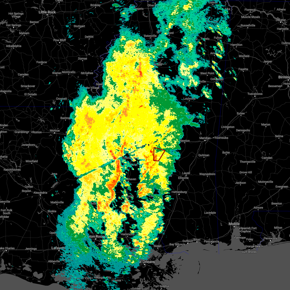 At 851 pm cst, a severe thunderstorm capable of producing a tornado was located near martinville, or near mendenhall, moving north at 35 mph (radar indicated rotation). Hazards include tornado. Flying debris will be dangerous to those caught without shelter. mobile homes will be damaged or destroyed. damage to roofs, windows, and vehicles will occur. tree damage is likely. Locations impacted include, white oak, johns and puckett. At 851 pm cst, a severe thunderstorm capable of producing a tornado was located near martinville, or near mendenhall, moving north at 35 mph (radar indicated rotation). Hazards include tornado. Flying debris will be dangerous to those caught without shelter. mobile homes will be damaged or destroyed. damage to roofs, windows, and vehicles will occur. tree damage is likely. Locations impacted include, white oak, johns and puckett.
|
| 2/8/2023 8:37 PM CST |
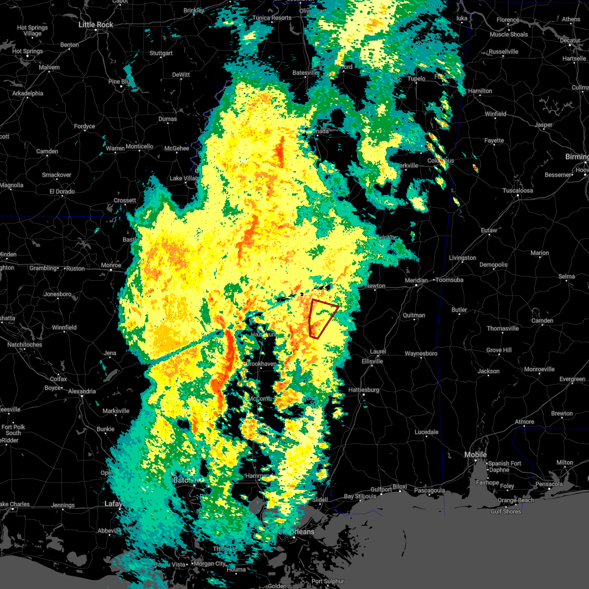 At 837 pm cst, a severe thunderstorm capable of producing a tornado was located over sanatorium, or near mendenhall, moving north at 35 mph (radar indicated rotation). Hazards include tornado. Flying debris will be dangerous to those caught without shelter. mobile homes will be damaged or destroyed. damage to roofs, windows, and vehicles will occur. tree damage is likely. Locations impacted include, mendenhall, white oak, martinville, johns, cato and puckett. At 837 pm cst, a severe thunderstorm capable of producing a tornado was located over sanatorium, or near mendenhall, moving north at 35 mph (radar indicated rotation). Hazards include tornado. Flying debris will be dangerous to those caught without shelter. mobile homes will be damaged or destroyed. damage to roofs, windows, and vehicles will occur. tree damage is likely. Locations impacted include, mendenhall, white oak, martinville, johns, cato and puckett.
|
| 2/8/2023 8:27 PM CST |
 At 827 pm cst, a confirmed tornado was located 7 miles southwest of sanatorium, or 7 miles southeast of pinola, moving north at 30 mph (radar confirmed tornado). Hazards include damaging tornado. Flying debris will be dangerous to those caught without shelter. mobile homes will be damaged or destroyed. damage to roofs, windows, and vehicles will occur. tree damage is likely. this tornado will be near, sanatorium around 840 pm cst. mendenhall around 845 pm cst. martinville around 850 pm cst. white oak and johns around 905 pm cst. Other locations impacted by this tornadic thunderstorm include d`lo and puckett. At 827 pm cst, a confirmed tornado was located 7 miles southwest of sanatorium, or 7 miles southeast of pinola, moving north at 30 mph (radar confirmed tornado). Hazards include damaging tornado. Flying debris will be dangerous to those caught without shelter. mobile homes will be damaged or destroyed. damage to roofs, windows, and vehicles will occur. tree damage is likely. this tornado will be near, sanatorium around 840 pm cst. mendenhall around 845 pm cst. martinville around 850 pm cst. white oak and johns around 905 pm cst. Other locations impacted by this tornadic thunderstorm include d`lo and puckett.
|
| 2/8/2023 8:23 PM CST |
 At 823 pm cst, a severe thunderstorm capable of producing a tornado was located near pinola, moving north at 35 mph (radar indicated rotation). Hazards include tornado. Flying debris will be dangerous to those caught without shelter. mobile homes will be damaged or destroyed. damage to roofs, windows, and vehicles will occur. tree damage is likely. this dangerous storm will be near, sanatorium around 835 pm cst. mendenhall around 840 pm cst. martinville around 845 pm cst. cato around 855 pm cst. johns and white oak around 900 pm cst. Other locations impacted by this tornadic thunderstorm include d`lo and puckett. At 823 pm cst, a severe thunderstorm capable of producing a tornado was located near pinola, moving north at 35 mph (radar indicated rotation). Hazards include tornado. Flying debris will be dangerous to those caught without shelter. mobile homes will be damaged or destroyed. damage to roofs, windows, and vehicles will occur. tree damage is likely. this dangerous storm will be near, sanatorium around 835 pm cst. mendenhall around 840 pm cst. martinville around 845 pm cst. cato around 855 pm cst. johns and white oak around 900 pm cst. Other locations impacted by this tornadic thunderstorm include d`lo and puckett.
|
| 2/8/2023 8:19 PM CST |
 At 819 pm cst, a severe thunderstorm capable of producing a tornado was located near shivers, or 8 miles southeast of pinola, moving north at 35 mph (radar indicated rotation). Hazards include tornado. Flying debris will be dangerous to those caught without shelter. mobile homes will be damaged or destroyed. damage to roofs, windows, and vehicles will occur. tree damage is likely. this dangerous storm will be near, magee around 830 pm cst. sanatorium around 835 pm cst. mendenhall around 840 pm cst. martinville around 845 pm cst. cato around 855 pm cst. white oak and johns around 900 pm cst. Other locations impacted by this tornadic thunderstorm include d`lo and puckett. At 819 pm cst, a severe thunderstorm capable of producing a tornado was located near shivers, or 8 miles southeast of pinola, moving north at 35 mph (radar indicated rotation). Hazards include tornado. Flying debris will be dangerous to those caught without shelter. mobile homes will be damaged or destroyed. damage to roofs, windows, and vehicles will occur. tree damage is likely. this dangerous storm will be near, magee around 830 pm cst. sanatorium around 835 pm cst. mendenhall around 840 pm cst. martinville around 845 pm cst. cato around 855 pm cst. white oak and johns around 900 pm cst. Other locations impacted by this tornadic thunderstorm include d`lo and puckett.
|
| 2/8/2023 8:10 PM CST |
 At 810 pm cst, a confirmed tornado was located near piney woods, or near mendenhall, moving north at 20 mph (radar confirmed tornado). Hazards include damaging tornado. Flying debris will be dangerous to those caught without shelter. mobile homes will be damaged or destroyed. damage to roofs, windows, and vehicles will occur. tree damage is likely. this tornado will be near, piney woods around 820 pm cst. cato around 835 pm cst. johns around 845 pm cst. Other locations impacted by this tornadic thunderstorm include d`lo and braxton. At 810 pm cst, a confirmed tornado was located near piney woods, or near mendenhall, moving north at 20 mph (radar confirmed tornado). Hazards include damaging tornado. Flying debris will be dangerous to those caught without shelter. mobile homes will be damaged or destroyed. damage to roofs, windows, and vehicles will occur. tree damage is likely. this tornado will be near, piney woods around 820 pm cst. cato around 835 pm cst. johns around 845 pm cst. Other locations impacted by this tornadic thunderstorm include d`lo and braxton.
|
| 2/8/2023 8:08 PM CST |
 At 808 pm cst, a severe thunderstorm capable of producing a tornado was located near mendenhall, moving north at 20 mph (radar indicated rotation). Hazards include tornado. Flying debris will be dangerous to those caught without shelter. mobile homes will be damaged or destroyed. damage to roofs, windows, and vehicles will occur. tree damage is likely. this dangerous storm will be near, piney woods around 820 pm cst. cato around 835 pm cst. johns around 845 pm cst. Other locations impacted by this tornadic thunderstorm include d`lo and braxton. At 808 pm cst, a severe thunderstorm capable of producing a tornado was located near mendenhall, moving north at 20 mph (radar indicated rotation). Hazards include tornado. Flying debris will be dangerous to those caught without shelter. mobile homes will be damaged or destroyed. damage to roofs, windows, and vehicles will occur. tree damage is likely. this dangerous storm will be near, piney woods around 820 pm cst. cato around 835 pm cst. johns around 845 pm cst. Other locations impacted by this tornadic thunderstorm include d`lo and braxton.
|
| 1/3/2023 9:52 AM CST |
 At 952 am cst, a severe thunderstorm was located near hopewell, or 7 miles east of crystal springs, moving northeast at 50 mph (radar indicated). Hazards include 60 mph wind gusts and nickel size hail. Expect damage to roofs, siding, and trees. this severe storm will be near, whites around 955 am cst. star and florence around 1005 am cst. piney woods and monterey around 1010 am cst. johns and cato around 1020 am cst. other locations impacted by this severe thunderstorm include braxton and puckett. hail threat, radar indicated max hail size, 0. 88 in wind threat, radar indicated max wind gust, 60 mph. At 952 am cst, a severe thunderstorm was located near hopewell, or 7 miles east of crystal springs, moving northeast at 50 mph (radar indicated). Hazards include 60 mph wind gusts and nickel size hail. Expect damage to roofs, siding, and trees. this severe storm will be near, whites around 955 am cst. star and florence around 1005 am cst. piney woods and monterey around 1010 am cst. johns and cato around 1020 am cst. other locations impacted by this severe thunderstorm include braxton and puckett. hail threat, radar indicated max hail size, 0. 88 in wind threat, radar indicated max wind gust, 60 mph.
|
| 1/3/2023 9:36 AM CST |
 At 936 am cst, a severe thunderstorm was located near gallman, or near hazlehurst, moving northeast at 45 mph (radar indicated). Hazards include 60 mph wind gusts and quarter size hail. Hail damage to vehicles is expected. expect wind damage to roofs, siding, and trees. this severe thunderstorm will be near, gallman around 940 am cst. crystal springs around 945 am cst. terry and hopewell around 955 am cst. whites around 1000 am cst. florence and harrisville around 1005 am cst. star and monterey around 1010 am cst. piney woods around 1015 am cst. cato around 1020 am cst. other locations impacted by this severe thunderstorm include d`lo, braxton, puckett and georgetown. hail threat, radar indicated max hail size, 1. 00 in wind threat, radar indicated max wind gust, 60 mph. At 936 am cst, a severe thunderstorm was located near gallman, or near hazlehurst, moving northeast at 45 mph (radar indicated). Hazards include 60 mph wind gusts and quarter size hail. Hail damage to vehicles is expected. expect wind damage to roofs, siding, and trees. this severe thunderstorm will be near, gallman around 940 am cst. crystal springs around 945 am cst. terry and hopewell around 955 am cst. whites around 1000 am cst. florence and harrisville around 1005 am cst. star and monterey around 1010 am cst. piney woods around 1015 am cst. cato around 1020 am cst. other locations impacted by this severe thunderstorm include d`lo, braxton, puckett and georgetown. hail threat, radar indicated max hail size, 1. 00 in wind threat, radar indicated max wind gust, 60 mph.
|
| 12/14/2022 6:46 AM CST |
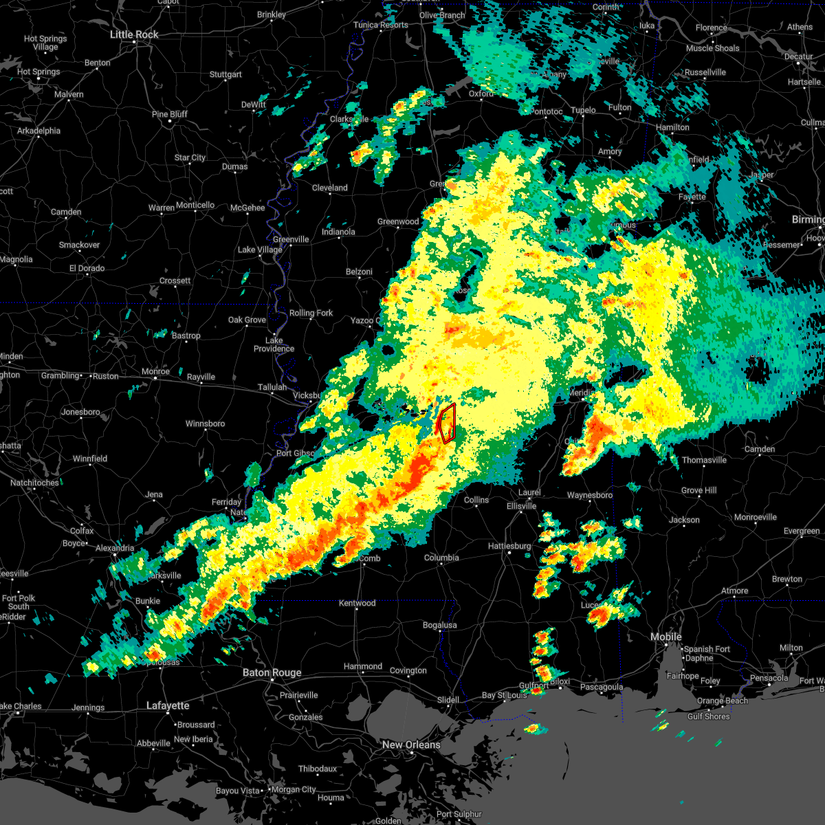 At 646 am cst, a confirmed tornado was located near johns, or 12 miles southwest of morton, moving northeast at 25 mph (radar confirmed tornado). Hazards include damaging tornado. Flying debris will be dangerous to those caught without shelter. mobile homes will be damaged or destroyed. damage to roofs, windows, and vehicles will occur. tree damage is likely. This tornadic thunderstorm will remain over mainly rural areas of southeastern rankin county. At 646 am cst, a confirmed tornado was located near johns, or 12 miles southwest of morton, moving northeast at 25 mph (radar confirmed tornado). Hazards include damaging tornado. Flying debris will be dangerous to those caught without shelter. mobile homes will be damaged or destroyed. damage to roofs, windows, and vehicles will occur. tree damage is likely. This tornadic thunderstorm will remain over mainly rural areas of southeastern rankin county.
|
| 12/14/2022 6:34 AM CST |
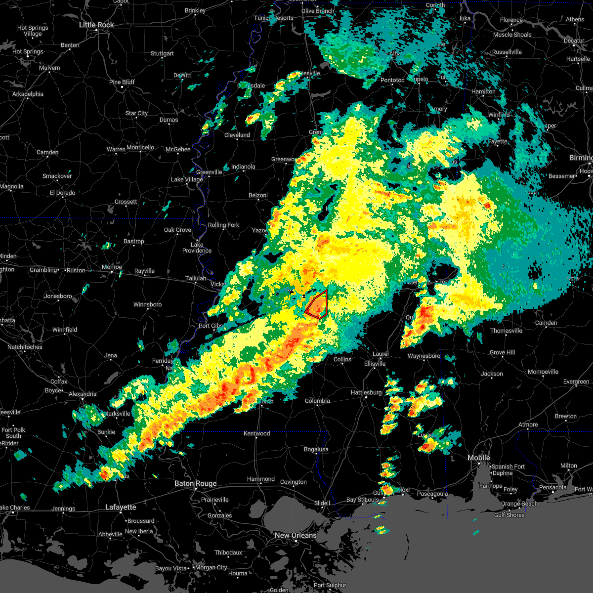 At 634 am cst, a confirmed tornado was located over johns, or 9 miles east of star, moving northeast at 30 mph (radar confirmed tornado). Hazards include damaging tornado. Flying debris will be dangerous to those caught without shelter. mobile homes will be damaged or destroyed. damage to roofs, windows, and vehicles will occur. tree damage is likely. This tornadic thunderstorm will remain over mainly rural areas of southeastern rankin county. At 634 am cst, a confirmed tornado was located over johns, or 9 miles east of star, moving northeast at 30 mph (radar confirmed tornado). Hazards include damaging tornado. Flying debris will be dangerous to those caught without shelter. mobile homes will be damaged or destroyed. damage to roofs, windows, and vehicles will occur. tree damage is likely. This tornadic thunderstorm will remain over mainly rural areas of southeastern rankin county.
|
| 12/14/2022 6:27 AM CST |
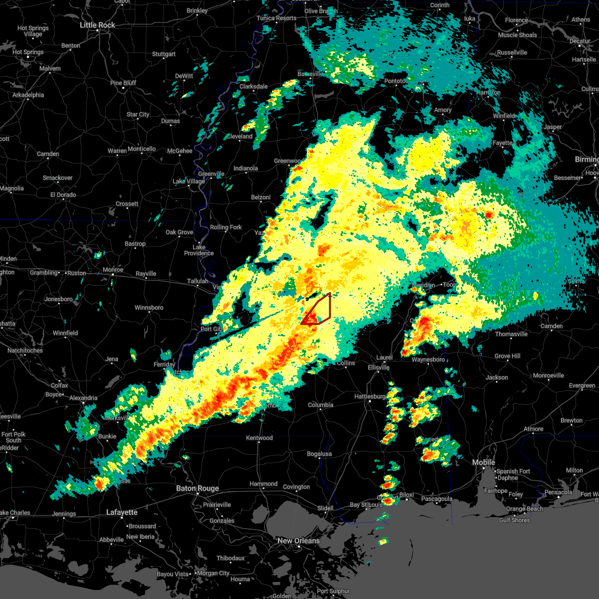 At 627 am cst, a severe thunderstorm capable of producing a tornado was located near cato, or near star, moving northeast at 30 mph (radar indicated rotation). Hazards include tornado. Flying debris will be dangerous to those caught without shelter. mobile homes will be damaged or destroyed. damage to roofs, windows, and vehicles will occur. tree damage is likely. this dangerous storm will be near, cato around 630 am cst. Johns around 640 am cst. At 627 am cst, a severe thunderstorm capable of producing a tornado was located near cato, or near star, moving northeast at 30 mph (radar indicated rotation). Hazards include tornado. Flying debris will be dangerous to those caught without shelter. mobile homes will be damaged or destroyed. damage to roofs, windows, and vehicles will occur. tree damage is likely. this dangerous storm will be near, cato around 630 am cst. Johns around 640 am cst.
|
| 12/14/2022 6:10 AM CST |
 At 610 am cst, a severe thunderstorm capable of producing a tornado was located over harrisville, or near star, moving northeast at 30 mph (radar indicated rotation). Hazards include tornado. Flying debris will be dangerous to those caught without shelter. mobile homes will be damaged or destroyed. damage to roofs, windows, and vehicles will occur. tree damage is likely. this dangerous storm will be near, star around 620 am cst. piney woods around 625 am cst. cato around 635 am cst. johns around 645 am cst. pelahatchie around 705 am cst. Other locations impacted by this tornadic thunderstorm include braxton and puckett. At 610 am cst, a severe thunderstorm capable of producing a tornado was located over harrisville, or near star, moving northeast at 30 mph (radar indicated rotation). Hazards include tornado. Flying debris will be dangerous to those caught without shelter. mobile homes will be damaged or destroyed. damage to roofs, windows, and vehicles will occur. tree damage is likely. this dangerous storm will be near, star around 620 am cst. piney woods around 625 am cst. cato around 635 am cst. johns around 645 am cst. pelahatchie around 705 am cst. Other locations impacted by this tornadic thunderstorm include braxton and puckett.
|
| 6/10/2022 12:33 PM CDT |
 At 1232 pm cdt, severe thunderstorms were located along a line extending from near johns to oma, moving southeast at 40 mph (radar indicated). Hazards include 60 mph wind gusts. Expect damage to roofs, siding, and trees. These severe thunderstorms will remain over mainly rural areas of southeastern rankin and simpson counties, including the following locations, d`lo, braxton and puckett. At 1232 pm cdt, severe thunderstorms were located along a line extending from near johns to oma, moving southeast at 40 mph (radar indicated). Hazards include 60 mph wind gusts. Expect damage to roofs, siding, and trees. These severe thunderstorms will remain over mainly rural areas of southeastern rankin and simpson counties, including the following locations, d`lo, braxton and puckett.
|
| 6/10/2022 12:03 PM CDT |
 At 1202 pm cdt, severe thunderstorms were located along a line extending from near florence to near glancy, moving east at 45 mph (radar indicated). Hazards include 60 mph wind gusts. Expect damage to roofs, siding, and trees. severe thunderstorms will be near, richland, star, florence and monterey around 1210 pm cdt. brandon around 1215 pm cdt. cato around 1225 pm cdt. rockport and johns around 1230 pm cdt. union and pelahatchie around 1235 pm cdt. pinola and shivers around 1245 pm cdt. magee and sanatorium around 100 pm cdt. Other locations impacted by these severe thunderstorms include d`lo, beauregard, braxton, puckett and georgetown. At 1202 pm cdt, severe thunderstorms were located along a line extending from near florence to near glancy, moving east at 45 mph (radar indicated). Hazards include 60 mph wind gusts. Expect damage to roofs, siding, and trees. severe thunderstorms will be near, richland, star, florence and monterey around 1210 pm cdt. brandon around 1215 pm cdt. cato around 1225 pm cdt. rockport and johns around 1230 pm cdt. union and pelahatchie around 1235 pm cdt. pinola and shivers around 1245 pm cdt. magee and sanatorium around 100 pm cdt. Other locations impacted by these severe thunderstorms include d`lo, beauregard, braxton, puckett and georgetown.
|
| 5/13/2022 6:11 PM CDT |
 The severe thunderstorm warning for rankin county will expire at 615 pm cdt, the storms which prompted the warning have weakened below severe limits and the warning will be allowed to expire. The severe thunderstorm warning for rankin county will expire at 615 pm cdt, the storms which prompted the warning have weakened below severe limits and the warning will be allowed to expire.
|
| 5/13/2022 6:00 PM CDT |
 At 559 pm cdt, severe thunderstorms were located along a line extending from near richland to pelahatchie, and are nearly stationary (radar indicated). Hazards include 60 mph wind gusts. Expect damage to roofs, siding, and trees. these severe storms will be near, flowood around 605 pm cdt. pearl and brandon around 625 pm cdt. pisgah around 635 pm cdt. richland, florence and monterey around 645 pm cdt. other locations impacted by these severe thunderstorms include puckett. hail threat, radar indicated max hail size, <. 75 in wind threat, radar indicated max wind gust, 60 mph. At 559 pm cdt, severe thunderstorms were located along a line extending from near richland to pelahatchie, and are nearly stationary (radar indicated). Hazards include 60 mph wind gusts. Expect damage to roofs, siding, and trees. these severe storms will be near, flowood around 605 pm cdt. pearl and brandon around 625 pm cdt. pisgah around 635 pm cdt. richland, florence and monterey around 645 pm cdt. other locations impacted by these severe thunderstorms include puckett. hail threat, radar indicated max hail size, <. 75 in wind threat, radar indicated max wind gust, 60 mph.
|
| 5/13/2022 5:34 PM CDT |
 At 534 pm cdt, severe thunderstorms were located along a line extending from near ludlow to flowood, moving south at 10 mph (radar indicated). Hazards include 60 mph wind gusts and nickel size hail. Expect damage to roofs, siding, and trees. severe thunderstorms will be near, flowood around 540 pm cdt. brandon around 555 pm cdt. pearl around 600 pm cdt. pisgah around 610 pm cdt. richland, florence and monterey around 615 pm cdt. other locations impacted by these severe thunderstorms include puckett. hail threat, radar indicated max hail size, 0. 88 in wind threat, radar indicated max wind gust, 60 mph. At 534 pm cdt, severe thunderstorms were located along a line extending from near ludlow to flowood, moving south at 10 mph (radar indicated). Hazards include 60 mph wind gusts and nickel size hail. Expect damage to roofs, siding, and trees. severe thunderstorms will be near, flowood around 540 pm cdt. brandon around 555 pm cdt. pearl around 600 pm cdt. pisgah around 610 pm cdt. richland, florence and monterey around 615 pm cdt. other locations impacted by these severe thunderstorms include puckett. hail threat, radar indicated max hail size, 0. 88 in wind threat, radar indicated max wind gust, 60 mph.
|
| 5/12/2022 8:02 PM CDT |
 At 802 pm cdt, a severe thunderstorm was located over mendenhall, moving southwest at 40 mph (radar indicated). Hazards include 60 mph wind gusts. Expect damage to roofs, siding, and trees. this severe storm will be near, pinola around 810 pm cdt. union around 815 pm cdt. shivers around 820 pm cdt. other locations impacted by this severe thunderstorm include d`lo and puckett. hail threat, radar indicated max hail size, <. 75 in wind threat, radar indicated max wind gust, 60 mph. At 802 pm cdt, a severe thunderstorm was located over mendenhall, moving southwest at 40 mph (radar indicated). Hazards include 60 mph wind gusts. Expect damage to roofs, siding, and trees. this severe storm will be near, pinola around 810 pm cdt. union around 815 pm cdt. shivers around 820 pm cdt. other locations impacted by this severe thunderstorm include d`lo and puckett. hail threat, radar indicated max hail size, <. 75 in wind threat, radar indicated max wind gust, 60 mph.
|
| 5/12/2022 7:48 PM CDT |
 At 748 pm cdt, a severe thunderstorm was located near cato, or 8 miles northeast of mendenhall, moving southwest at 40 mph (radar indicated). Hazards include 60 mph wind gusts. Expect damage to roofs, siding, and trees. this severe thunderstorm will be near, mendenhall and sanatorium around 800 pm cdt. pinola around 815 pm cdt. union and shivers around 820 pm cdt. other locations impacted by this severe thunderstorm include d`lo and puckett. hail threat, radar indicated max hail size, <. 75 in wind threat, radar indicated max wind gust, 60 mph. At 748 pm cdt, a severe thunderstorm was located near cato, or 8 miles northeast of mendenhall, moving southwest at 40 mph (radar indicated). Hazards include 60 mph wind gusts. Expect damage to roofs, siding, and trees. this severe thunderstorm will be near, mendenhall and sanatorium around 800 pm cdt. pinola around 815 pm cdt. union and shivers around 820 pm cdt. other locations impacted by this severe thunderstorm include d`lo and puckett. hail threat, radar indicated max hail size, <. 75 in wind threat, radar indicated max wind gust, 60 mph.
|
| 4/17/2022 7:03 PM CDT |
 At 703 pm cdt, a severe thunderstorm was located near mendenhall, moving southeast at 30 mph (radar indicated). Hazards include 70 mph wind gusts and quarter size hail. Hail damage to vehicles is expected. expect considerable tree damage. wind damage is also likely to mobile homes, roofs, and outbuildings. this severe storm will be near, martinville, sanatorium and white oak around 715 pm cdt. magee around 725 pm cdt. center ridge around 740 pm cdt. Other locations impacted by this severe thunderstorm include sylvarena, d`lo, mize, braxton and puckett. At 703 pm cdt, a severe thunderstorm was located near mendenhall, moving southeast at 30 mph (radar indicated). Hazards include 70 mph wind gusts and quarter size hail. Hail damage to vehicles is expected. expect considerable tree damage. wind damage is also likely to mobile homes, roofs, and outbuildings. this severe storm will be near, martinville, sanatorium and white oak around 715 pm cdt. magee around 725 pm cdt. center ridge around 740 pm cdt. Other locations impacted by this severe thunderstorm include sylvarena, d`lo, mize, braxton and puckett.
|
| 4/17/2022 6:52 PM CDT |
 At 652 pm cdt, a severe thunderstorm was located near cato, or 7 miles east of star, moving southeast at 30 mph (radar indicated). Hazards include 60 mph wind gusts and quarter size hail. Hail damage to vehicles is expected. expect wind damage to roofs, siding, and trees. this severe thunderstorm will be near, cato and johns around 655 pm cdt. mendenhall around 705 pm cdt. martinville, sanatorium and white oak around 715 pm cdt. magee around 725 pm cdt. center ridge around 740 pm cdt. Other locations impacted by this severe thunderstorm include sylvarena, d`lo, mize, braxton and puckett. At 652 pm cdt, a severe thunderstorm was located near cato, or 7 miles east of star, moving southeast at 30 mph (radar indicated). Hazards include 60 mph wind gusts and quarter size hail. Hail damage to vehicles is expected. expect wind damage to roofs, siding, and trees. this severe thunderstorm will be near, cato and johns around 655 pm cdt. mendenhall around 705 pm cdt. martinville, sanatorium and white oak around 715 pm cdt. magee around 725 pm cdt. center ridge around 740 pm cdt. Other locations impacted by this severe thunderstorm include sylvarena, d`lo, mize, braxton and puckett.
|
| 4/17/2022 6:34 PM CDT |
 At 633 pm cdt, a severe thunderstorm capable of producing a tornado was located over monterey, or near star, moving east at 30 mph (radar indicated rotation). Hazards include tornado and quarter size hail. Flying debris will be dangerous to those caught without shelter. mobile homes will be damaged or destroyed. damage to roofs, windows, and vehicles will occur. tree damage is likely. this dangerous storm will be near, piney woods around 645 pm cdt. cato and johns around 700 pm cdt. martinville around 715 pm cdt. white oak around 720 pm cdt. Other locations impacted by this tornadic thunderstorm include braxton and puckett. At 633 pm cdt, a severe thunderstorm capable of producing a tornado was located over monterey, or near star, moving east at 30 mph (radar indicated rotation). Hazards include tornado and quarter size hail. Flying debris will be dangerous to those caught without shelter. mobile homes will be damaged or destroyed. damage to roofs, windows, and vehicles will occur. tree damage is likely. this dangerous storm will be near, piney woods around 645 pm cdt. cato and johns around 700 pm cdt. martinville around 715 pm cdt. white oak around 720 pm cdt. Other locations impacted by this tornadic thunderstorm include braxton and puckett.
|
| 4/17/2022 6:15 PM CDT |
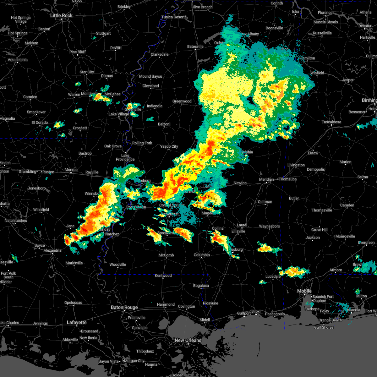 At 614 pm cdt, a severe thunderstorm was located near white oak, or 11 miles northeast of mendenhall, moving east at 30 mph (radar indicated). Hazards include 60 mph wind gusts and quarter size hail. Hail damage to vehicles is expected. expect wind damage to roofs, siding, and trees. this severe thunderstorm will be near, white oak around 625 pm cdt. other locations impacted by this severe thunderstorm include puckett. hail threat, radar indicated max hail size, 1. 00 in wind threat, radar indicated max wind gust, 60 mph. At 614 pm cdt, a severe thunderstorm was located near white oak, or 11 miles northeast of mendenhall, moving east at 30 mph (radar indicated). Hazards include 60 mph wind gusts and quarter size hail. Hail damage to vehicles is expected. expect wind damage to roofs, siding, and trees. this severe thunderstorm will be near, white oak around 625 pm cdt. other locations impacted by this severe thunderstorm include puckett. hail threat, radar indicated max hail size, 1. 00 in wind threat, radar indicated max wind gust, 60 mph.
|
| 4/17/2022 5:29 PM CDT |
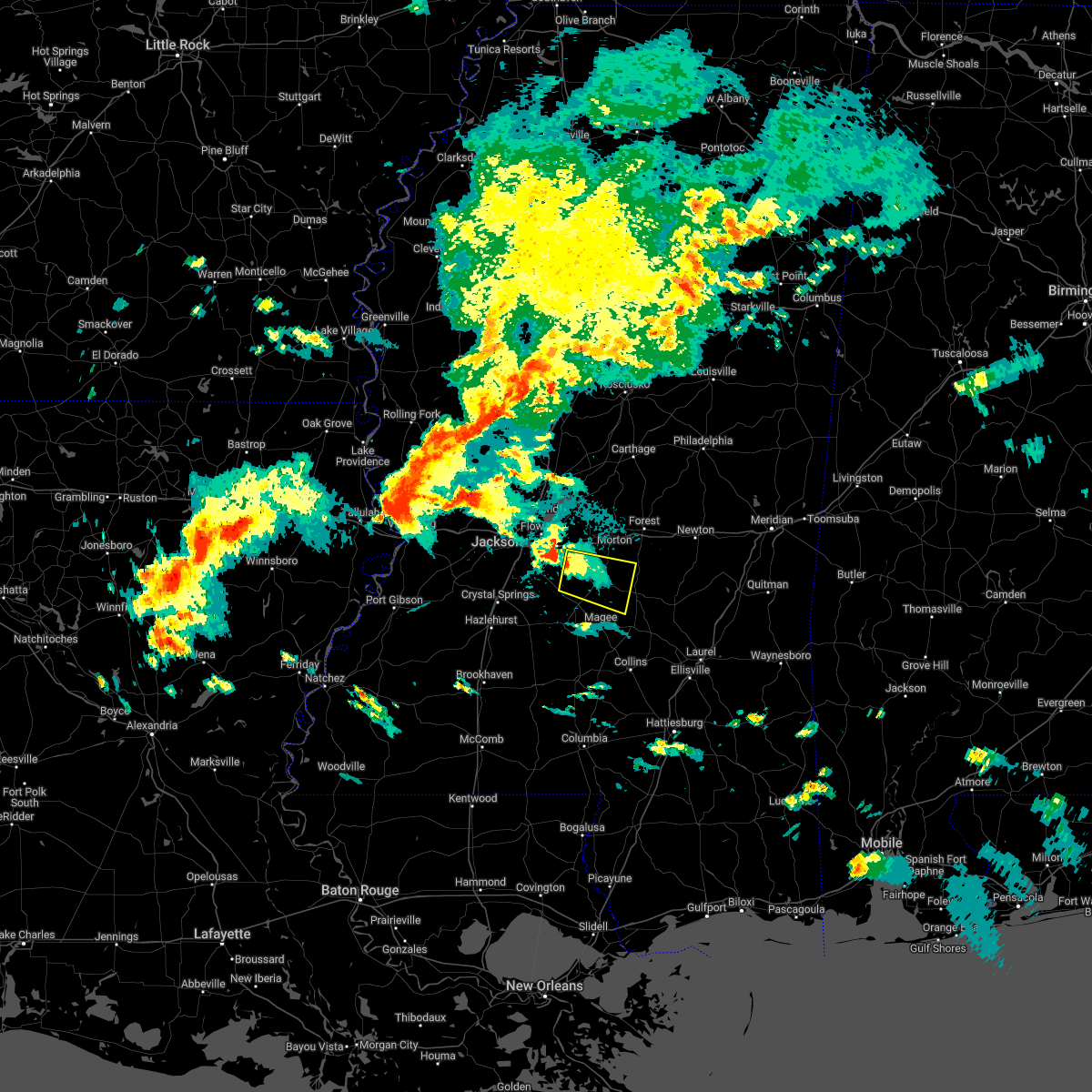 At 528 pm cdt, a severe thunderstorm was located over monterey, or near pearl, moving east at 30 mph (radar indicated). Hazards include ping pong ball size hail. People and animals outdoors will be injured. expect damage to roofs, siding, windows, and vehicles. this severe thunderstorm will be near, cato around 550 pm cdt. johns around 555 pm cdt. white oak around 610 pm cdt. burns around 615 pm cdt. Other locations impacted by this severe thunderstorm include polkville and puckett. At 528 pm cdt, a severe thunderstorm was located over monterey, or near pearl, moving east at 30 mph (radar indicated). Hazards include ping pong ball size hail. People and animals outdoors will be injured. expect damage to roofs, siding, windows, and vehicles. this severe thunderstorm will be near, cato around 550 pm cdt. johns around 555 pm cdt. white oak around 610 pm cdt. burns around 615 pm cdt. Other locations impacted by this severe thunderstorm include polkville and puckett.
|
| 4/13/2022 7:53 PM CDT |
 At 752 pm cdt, a severe thunderstorm was located near pelahatchie, or 8 miles east of brandon, moving east at 70 mph (radar indicated). Hazards include 70 mph wind gusts. Expect considerable tree damage. damage is likely to mobile homes, roofs, and outbuildings. this severe thunderstorm will be near, morton and pulaski around 805 pm cdt. forest and homewood around 810 pm cdt. Other locations impacted by this severe thunderstorm include polkville, lake, sebastopol and puckett. At 752 pm cdt, a severe thunderstorm was located near pelahatchie, or 8 miles east of brandon, moving east at 70 mph (radar indicated). Hazards include 70 mph wind gusts. Expect considerable tree damage. damage is likely to mobile homes, roofs, and outbuildings. this severe thunderstorm will be near, morton and pulaski around 805 pm cdt. forest and homewood around 810 pm cdt. Other locations impacted by this severe thunderstorm include polkville, lake, sebastopol and puckett.
|
| 4/13/2022 7:45 PM CDT |
 At 744 pm cdt, a severe thunderstorm was located over brandon, moving east at 70 mph (radar indicated). Hazards include 70 mph wind gusts. Expect considerable tree damage. damage is likely to mobile homes, roofs, and outbuildings. this severe storm will be near, pelahatchie around 755 pm cdt. Other locations impacted by this severe thunderstorm include puckett. At 744 pm cdt, a severe thunderstorm was located over brandon, moving east at 70 mph (radar indicated). Hazards include 70 mph wind gusts. Expect considerable tree damage. damage is likely to mobile homes, roofs, and outbuildings. this severe storm will be near, pelahatchie around 755 pm cdt. Other locations impacted by this severe thunderstorm include puckett.
|
| 4/13/2022 7:28 PM CDT |
 At 728 pm cdt, a severe thunderstorm was located over byram, moving east at 65 mph (radar indicated). Hazards include 70 mph wind gusts. Expect considerable tree damage. damage is likely to mobile homes, roofs, and outbuildings. this severe storm will be near, pearl and florence around 735 pm cdt. flowood and monterey around 740 pm cdt. brandon around 745 pm cdt. pelahatchie around 755 pm cdt. Other locations impacted by this severe thunderstorm include puckett. At 728 pm cdt, a severe thunderstorm was located over byram, moving east at 65 mph (radar indicated). Hazards include 70 mph wind gusts. Expect considerable tree damage. damage is likely to mobile homes, roofs, and outbuildings. this severe storm will be near, pearl and florence around 735 pm cdt. flowood and monterey around 740 pm cdt. brandon around 745 pm cdt. pelahatchie around 755 pm cdt. Other locations impacted by this severe thunderstorm include puckett.
|
| 4/13/2022 7:12 PM CDT |
 At 712 pm cdt, a severe thunderstorm was located over raymond, or 10 miles southwest of clinton, moving east at 70 mph (radar indicated). Hazards include 70 mph wind gusts. Expect considerable tree damage. damage is likely to mobile homes, roofs, and outbuildings. this severe thunderstorm will be near, jackson, clinton and byram around 720 pm cdt. richland around 725 pm cdt. pearl, flowood, florence and monterey around 730 pm cdt. brandon around 735 pm cdt. pelahatchie around 745 pm cdt. other locations impacted by this severe thunderstorm include puckett. thunderstorm damage threat, considerable hail threat, radar indicated max hail size, <. 75 in wind threat, radar indicated max wind gust, 70 mph. At 712 pm cdt, a severe thunderstorm was located over raymond, or 10 miles southwest of clinton, moving east at 70 mph (radar indicated). Hazards include 70 mph wind gusts. Expect considerable tree damage. damage is likely to mobile homes, roofs, and outbuildings. this severe thunderstorm will be near, jackson, clinton and byram around 720 pm cdt. richland around 725 pm cdt. pearl, flowood, florence and monterey around 730 pm cdt. brandon around 735 pm cdt. pelahatchie around 745 pm cdt. other locations impacted by this severe thunderstorm include puckett. thunderstorm damage threat, considerable hail threat, radar indicated max hail size, <. 75 in wind threat, radar indicated max wind gust, 70 mph.
|
| 4/5/2022 6:35 AM CDT |
 At 635 am cdt, severe thunderstorms were located along a line extending from near farmhaven to near whites, moving east at 55 mph (radar indicated). Hazards include 60 mph wind gusts. Expect damage to roofs, siding, and trees. these severe storms will be near, ludlow around 640 am cdt. cato and johns around 655 am cdt. white oak around 705 am cdt. burns around 715 am cdt. pineville around 725 am cdt. other locations impacted by these severe thunderstorms include polkville, lake, sebastopol and puckett. hail threat, radar indicated max hail size, <. 75 in wind threat, radar indicated max wind gust, 60 mph. At 635 am cdt, severe thunderstorms were located along a line extending from near farmhaven to near whites, moving east at 55 mph (radar indicated). Hazards include 60 mph wind gusts. Expect damage to roofs, siding, and trees. these severe storms will be near, ludlow around 640 am cdt. cato and johns around 655 am cdt. white oak around 705 am cdt. burns around 715 am cdt. pineville around 725 am cdt. other locations impacted by these severe thunderstorms include polkville, lake, sebastopol and puckett. hail threat, radar indicated max hail size, <. 75 in wind threat, radar indicated max wind gust, 60 mph.
|
| 4/5/2022 6:21 AM CDT |
 At 621 am cdt, severe thunderstorms were located along a line extending from near canton to near crystal springs, moving east at 55 mph (radar indicated). Hazards include 60 mph wind gusts. Expect damage to roofs, siding, and trees. these severe storms will be near, florence around 635 am cdt. star and ludlow around 640 am cdt. piney woods around 645 am cdt. cato around 650 am cdt. johns around 655 am cdt. white oak around 705 am cdt. burns around 715 am cdt. pineville around 720 am cdt. other locations impacted by these severe thunderstorms include polkville, lake, sebastopol and puckett. hail threat, radar indicated max hail size, <. 75 in wind threat, radar indicated max wind gust, 60 mph. At 621 am cdt, severe thunderstorms were located along a line extending from near canton to near crystal springs, moving east at 55 mph (radar indicated). Hazards include 60 mph wind gusts. Expect damage to roofs, siding, and trees. these severe storms will be near, florence around 635 am cdt. star and ludlow around 640 am cdt. piney woods around 645 am cdt. cato around 650 am cdt. johns around 655 am cdt. white oak around 705 am cdt. burns around 715 am cdt. pineville around 720 am cdt. other locations impacted by these severe thunderstorms include polkville, lake, sebastopol and puckett. hail threat, radar indicated max hail size, <. 75 in wind threat, radar indicated max wind gust, 60 mph.
|
| 4/5/2022 5:53 AM CDT |
 At 553 am cdt, severe thunderstorms were located along a line extending from 6 miles southwest of little yazoo to near rocky springs, moving east at 55 mph (radar indicated). Hazards include 60 mph wind gusts. Expect damage to roofs, siding, and trees. severe thunderstorms will be near, flora around 600 am cdt. annandale around 610 am cdt. canton, dry grove and gluckstadt around 615 am cdt. terry around 625 am cdt. whites around 630 am cdt. florence around 635 am cdt. star and ludlow around 640 am cdt. piney woods around 645 am cdt. other locations impacted by these severe thunderstorms include polkville, lake, sebastopol, learned and puckett. hail threat, radar indicated max hail size, <. 75 in wind threat, radar indicated max wind gust, 60 mph. At 553 am cdt, severe thunderstorms were located along a line extending from 6 miles southwest of little yazoo to near rocky springs, moving east at 55 mph (radar indicated). Hazards include 60 mph wind gusts. Expect damage to roofs, siding, and trees. severe thunderstorms will be near, flora around 600 am cdt. annandale around 610 am cdt. canton, dry grove and gluckstadt around 615 am cdt. terry around 625 am cdt. whites around 630 am cdt. florence around 635 am cdt. star and ludlow around 640 am cdt. piney woods around 645 am cdt. other locations impacted by these severe thunderstorms include polkville, lake, sebastopol, learned and puckett. hail threat, radar indicated max hail size, <. 75 in wind threat, radar indicated max wind gust, 60 mph.
|
| 3/30/2022 6:29 PM CDT |
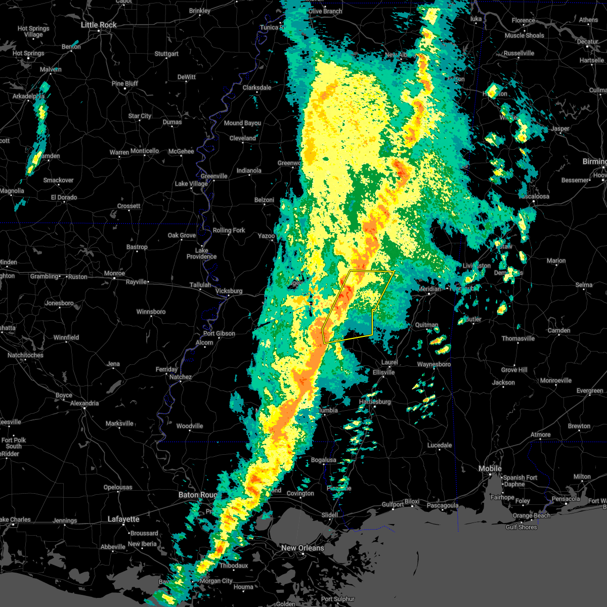 At 627 pm cdt, severe thunderstorms were located along a line extending from steele to near martinville, moving east at 30 mph (radar indicated). Hazards include 60 mph wind gusts. Expect damage to roofs, siding, and trees. severe thunderstorms will be near, harperville and steele around 635 pm cdt. conehatta around 645 pm cdt. prospect around 650 pm cdt. raleigh and burns around 655 pm cdt. stratton around 700 pm cdt. pineville around 715 pm cdt. Other locations impacted by these severe thunderstorms include sylvarena, polkville, lake, sebastopol and puckett. At 627 pm cdt, severe thunderstorms were located along a line extending from steele to near martinville, moving east at 30 mph (radar indicated). Hazards include 60 mph wind gusts. Expect damage to roofs, siding, and trees. severe thunderstorms will be near, harperville and steele around 635 pm cdt. conehatta around 645 pm cdt. prospect around 650 pm cdt. raleigh and burns around 655 pm cdt. stratton around 700 pm cdt. pineville around 715 pm cdt. Other locations impacted by these severe thunderstorms include sylvarena, polkville, lake, sebastopol and puckett.
|
| 3/30/2022 6:21 PM CDT |
 At 621 pm cdt, severe thunderstorms were located along a line extending from harperville to near martinville, moving northeast at 25 mph (radar indicated). Hazards include 60 mph wind gusts. Expect damage to roofs, siding, and trees. these severe storms will be near, harperville, steele and hillsboro around 625 pm cdt. burns around 650 pm cdt. other locations impacted by these severe thunderstorms include polkville, d`lo, sebastopol and puckett. hail threat, radar indicated max hail size, <. 75 in wind threat, radar indicated max wind gust, 60 mph. At 621 pm cdt, severe thunderstorms were located along a line extending from harperville to near martinville, moving northeast at 25 mph (radar indicated). Hazards include 60 mph wind gusts. Expect damage to roofs, siding, and trees. these severe storms will be near, harperville, steele and hillsboro around 625 pm cdt. burns around 650 pm cdt. other locations impacted by these severe thunderstorms include polkville, d`lo, sebastopol and puckett. hail threat, radar indicated max hail size, <. 75 in wind threat, radar indicated max wind gust, 60 mph.
|
| 3/30/2022 5:44 PM CDT |
 At 544 pm cdt, severe thunderstorms were located along a line extending from near leesburg to near harrisville, moving east at 40 mph (radar indicated). Hazards include 60 mph wind gusts. Expect damage to roofs, siding, and trees. severe thunderstorms will be near, forkville, ludlow, branch and leesburg around 550 pm cdt. cato around 600 pm cdt. harperville and hillsboro around 605 pm cdt. martinville and steele around 610 pm cdt. white oak around 620 pm cdt. burns around 630 pm cdt. other locations impacted by these severe thunderstorms include polkville, d`lo, sebastopol, braxton and puckett. hail threat, radar indicated max hail size, <. 75 in wind threat, radar indicated max wind gust, 60 mph. At 544 pm cdt, severe thunderstorms were located along a line extending from near leesburg to near harrisville, moving east at 40 mph (radar indicated). Hazards include 60 mph wind gusts. Expect damage to roofs, siding, and trees. severe thunderstorms will be near, forkville, ludlow, branch and leesburg around 550 pm cdt. cato around 600 pm cdt. harperville and hillsboro around 605 pm cdt. martinville and steele around 610 pm cdt. white oak around 620 pm cdt. burns around 630 pm cdt. other locations impacted by these severe thunderstorms include polkville, d`lo, sebastopol, braxton and puckett. hail threat, radar indicated max hail size, <. 75 in wind threat, radar indicated max wind gust, 60 mph.
|
| 3/30/2022 4:57 PM CDT |
 At 456 pm cdt, severe thunderstorms were located along a line extending from near canton to near gallman, moving east at 30 mph (radar indicated). Hazards include 60 mph wind gusts. Expect damage to roofs, siding, and trees. severe thunderstorms will be near, goshen springs around 505 pm cdt. pisgah around 510 pm cdt. harrisville around 525 pm cdt. ludlow around 530 pm cdt. mendenhall and tuscola around 545 pm cdt. other locations impacted by these severe thunderstorms include lena, d`lo, braxton and puckett. hail threat, radar indicated max hail size, <. 75 in wind threat, radar indicated max wind gust, 60 mph. At 456 pm cdt, severe thunderstorms were located along a line extending from near canton to near gallman, moving east at 30 mph (radar indicated). Hazards include 60 mph wind gusts. Expect damage to roofs, siding, and trees. severe thunderstorms will be near, goshen springs around 505 pm cdt. pisgah around 510 pm cdt. harrisville around 525 pm cdt. ludlow around 530 pm cdt. mendenhall and tuscola around 545 pm cdt. other locations impacted by these severe thunderstorms include lena, d`lo, braxton and puckett. hail threat, radar indicated max hail size, <. 75 in wind threat, radar indicated max wind gust, 60 mph.
|
| 3/22/2022 2:10 PM CDT |
 At 210 pm cdt, severe thunderstorms were located along a line extending from near steele to near martinville, moving east at 35 mph. a tornado warning is also in effect for portions of smith county (radar indicated). Hazards include 60 mph wind gusts and penny size hail. Expect damage to roofs, siding, and trees. these severe storms will be near, steele around 215 pm cdt. prospect and conehatta around 225 pm cdt. stratton around 240 pm cdt. decatur around 245 pm cdt. little rock around 250 pm cdt. Other locations impacted by these severe thunderstorms include polkville, lake, sebastopol and puckett. At 210 pm cdt, severe thunderstorms were located along a line extending from near steele to near martinville, moving east at 35 mph. a tornado warning is also in effect for portions of smith county (radar indicated). Hazards include 60 mph wind gusts and penny size hail. Expect damage to roofs, siding, and trees. these severe storms will be near, steele around 215 pm cdt. prospect and conehatta around 225 pm cdt. stratton around 240 pm cdt. decatur around 245 pm cdt. little rock around 250 pm cdt. Other locations impacted by these severe thunderstorms include polkville, lake, sebastopol and puckett.
|
| 3/22/2022 1:56 PM CDT |
 At 156 pm cdt, severe thunderstorms were located along a line extending from near harperville to near cato, moving east at 35 mph (radar indicated). Hazards include 60 mph wind gusts. Expect damage to roofs, siding, and trees. these severe storms will be near, hillsboro around 200 pm cdt. harperville around 205 pm cdt. steele and white oak around 210 pm cdt. prospect and conehatta around 225 pm cdt. stratton around 240 pm cdt. decatur around 245 pm cdt. little rock around 250 pm cdt. Other locations impacted by these severe thunderstorms include polkville, lake, sebastopol and puckett. At 156 pm cdt, severe thunderstorms were located along a line extending from near harperville to near cato, moving east at 35 mph (radar indicated). Hazards include 60 mph wind gusts. Expect damage to roofs, siding, and trees. these severe storms will be near, hillsboro around 200 pm cdt. harperville around 205 pm cdt. steele and white oak around 210 pm cdt. prospect and conehatta around 225 pm cdt. stratton around 240 pm cdt. decatur around 245 pm cdt. little rock around 250 pm cdt. Other locations impacted by these severe thunderstorms include polkville, lake, sebastopol and puckett.
|
| 3/22/2022 1:42 PM CDT |
 At 142 pm cdt, severe thunderstorms were located along a line extending from near ludlow to near piney woods, moving east at 35 mph (radar indicated). Hazards include 60 mph wind gusts. Expect damage to roofs, siding, and trees. severe thunderstorms will be near, hillsboro around 200 pm cdt. harperville around 205 pm cdt. steele and white oak around 210 pm cdt. prospect and conehatta around 225 pm cdt. stratton around 240 pm cdt. decatur around 245 pm cdt. little rock around 250 pm cdt. Other locations impacted by these severe thunderstorms include polkville, lake, sebastopol and puckett. At 142 pm cdt, severe thunderstorms were located along a line extending from near ludlow to near piney woods, moving east at 35 mph (radar indicated). Hazards include 60 mph wind gusts. Expect damage to roofs, siding, and trees. severe thunderstorms will be near, hillsboro around 200 pm cdt. harperville around 205 pm cdt. steele and white oak around 210 pm cdt. prospect and conehatta around 225 pm cdt. stratton around 240 pm cdt. decatur around 245 pm cdt. little rock around 250 pm cdt. Other locations impacted by these severe thunderstorms include polkville, lake, sebastopol and puckett.
|
| 3/22/2022 1:32 PM CDT |
 At 131 pm cdt, severe thunderstorms capable of producing tornadoes were located along a line extending from 7 miles east of monterey to harrisville, moving east at 40 mph (radar indicated rotation). Hazards include tornado. Flying debris will be dangerous to those caught without shelter. mobile homes will be damaged or destroyed. damage to roofs, windows, and vehicles will occur. tree damage is likely. these dangerous storms will be near, cato around 135 pm cdt. johns around 140 pm cdt. Other locations impacted by these tornadic storms include d`lo, braxton and puckett. At 131 pm cdt, severe thunderstorms capable of producing tornadoes were located along a line extending from 7 miles east of monterey to harrisville, moving east at 40 mph (radar indicated rotation). Hazards include tornado. Flying debris will be dangerous to those caught without shelter. mobile homes will be damaged or destroyed. damage to roofs, windows, and vehicles will occur. tree damage is likely. these dangerous storms will be near, cato around 135 pm cdt. johns around 140 pm cdt. Other locations impacted by these tornadic storms include d`lo, braxton and puckett.
|
| 3/22/2022 1:15 PM CDT |
 At 114 pm cdt, severe thunderstorms capable of producing tornadoes were located along a line extending from florence to hopewell, moving east at 35 mph (radar indicated rotation). Hazards include tornado. Flying debris will be dangerous to those caught without shelter. mobile homes will be damaged or destroyed. damage to roofs, windows, and vehicles will occur. tree damage is likely. these dangerous storms will be near, star around 120 pm cdt. harrisville around 125 pm cdt. cato and piney woods around 135 pm cdt. johns around 140 pm cdt. Other locations impacted by these tornadic storms include d`lo, braxton and puckett. At 114 pm cdt, severe thunderstorms capable of producing tornadoes were located along a line extending from florence to hopewell, moving east at 35 mph (radar indicated rotation). Hazards include tornado. Flying debris will be dangerous to those caught without shelter. mobile homes will be damaged or destroyed. damage to roofs, windows, and vehicles will occur. tree damage is likely. these dangerous storms will be near, star around 120 pm cdt. harrisville around 125 pm cdt. cato and piney woods around 135 pm cdt. johns around 140 pm cdt. Other locations impacted by these tornadic storms include d`lo, braxton and puckett.
|
| 3/22/2022 1:02 PM CDT |
 At 102 pm cdt, severe thunderstorms capable of producing tornadoes were located along a line extending from near byram to near gallman, moving east at 45 mph (radar indicated rotation). Hazards include tornado. Flying debris will be dangerous to those caught without shelter. mobile homes will be damaged or destroyed. damage to roofs, windows, and vehicles will occur. tree damage is likely. these dangerous storms will be near, whites around 105 pm cdt. hopewell around 110 pm cdt. florence and monterey around 115 pm cdt. star and harrisville around 120 pm cdt. cato and piney woods around 130 pm cdt. johns around 135 pm cdt. Other locations impacted by these tornadic storms include d`lo, braxton and puckett. At 102 pm cdt, severe thunderstorms capable of producing tornadoes were located along a line extending from near byram to near gallman, moving east at 45 mph (radar indicated rotation). Hazards include tornado. Flying debris will be dangerous to those caught without shelter. mobile homes will be damaged or destroyed. damage to roofs, windows, and vehicles will occur. tree damage is likely. these dangerous storms will be near, whites around 105 pm cdt. hopewell around 110 pm cdt. florence and monterey around 115 pm cdt. star and harrisville around 120 pm cdt. cato and piney woods around 130 pm cdt. johns around 135 pm cdt. Other locations impacted by these tornadic storms include d`lo, braxton and puckett.
|
| 3/22/2022 12:49 PM CDT |
 At 1249 pm cdt, severe thunderstorms capable of producing a tornado were located along a line extending from dry grove to near hazlehurst, moving east at 45 mph (radar indicated rotation). Hazards include tornado. Flying debris will be dangerous to those caught without shelter. mobile homes will be damaged or destroyed. damage to roofs, windows, and vehicles will occur. tree damage is likely. these dangerous storms will be near, crystal springs around 1255 pm cdt. terry around 100 pm cdt. hopewell around 105 pm cdt. whites around 110 pm cdt. florence, harrisville and monterey around 115 pm cdt. star around 120 pm cdt. piney woods around 125 pm cdt. cato around 130 pm cdt. Other locations impacted by these tornadic storms include d`lo, braxton and puckett. At 1249 pm cdt, severe thunderstorms capable of producing a tornado were located along a line extending from dry grove to near hazlehurst, moving east at 45 mph (radar indicated rotation). Hazards include tornado. Flying debris will be dangerous to those caught without shelter. mobile homes will be damaged or destroyed. damage to roofs, windows, and vehicles will occur. tree damage is likely. these dangerous storms will be near, crystal springs around 1255 pm cdt. terry around 100 pm cdt. hopewell around 105 pm cdt. whites around 110 pm cdt. florence, harrisville and monterey around 115 pm cdt. star around 120 pm cdt. piney woods around 125 pm cdt. cato around 130 pm cdt. Other locations impacted by these tornadic storms include d`lo, braxton and puckett.
|
| 12/6/2021 11:07 AM CST |
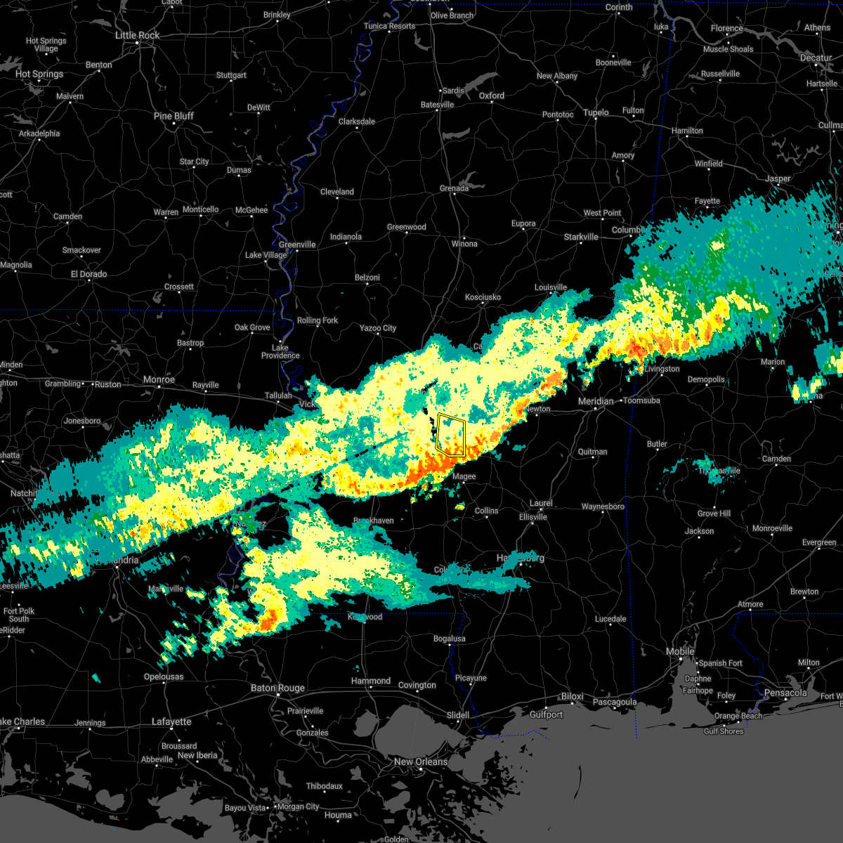 The severe thunderstorm warning for southeastern rankin county will expire at 1115 am cst, the storm which prompted the warning has weakened below severe limits, and no longer poses an immediate threat to life or property. therefore, the warning will be allowed to expire. The severe thunderstorm warning for southeastern rankin county will expire at 1115 am cst, the storm which prompted the warning has weakened below severe limits, and no longer poses an immediate threat to life or property. therefore, the warning will be allowed to expire.
|
| 12/6/2021 10:44 AM CST |
 At 1043 am cst, a severe thunderstorm was located near pelahatchie, or 11 miles southwest of morton, moving east at 35 mph (radar indicated). Hazards include 60 mph wind gusts and penny size hail. Expect damage to roofs, siding, and trees. this severe thunderstorm will remain over mainly rural areas of southeastern rankin county, including the following locations, puckett. hail threat, radar indicated max hail size, 0. 75 in wind threat, radar indicated max wind gust, 60 mph. At 1043 am cst, a severe thunderstorm was located near pelahatchie, or 11 miles southwest of morton, moving east at 35 mph (radar indicated). Hazards include 60 mph wind gusts and penny size hail. Expect damage to roofs, siding, and trees. this severe thunderstorm will remain over mainly rural areas of southeastern rankin county, including the following locations, puckett. hail threat, radar indicated max hail size, 0. 75 in wind threat, radar indicated max wind gust, 60 mph.
|
| 12/6/2021 10:13 AM CST |
 At 1012 am cst, a severe thunderstorm was located over pearl, moving southeast at 35 mph (radar indicated). Hazards include 60 mph wind gusts and penny size hail. Expect damage to roofs, siding, and trees. this severe thunderstorm will be near, monterey around 1020 am cst. brandon around 1025 am cst. johns and cato around 1045 am cst. Other locations impacted by this severe thunderstorm include puckett. At 1012 am cst, a severe thunderstorm was located over pearl, moving southeast at 35 mph (radar indicated). Hazards include 60 mph wind gusts and penny size hail. Expect damage to roofs, siding, and trees. this severe thunderstorm will be near, monterey around 1020 am cst. brandon around 1025 am cst. johns and cato around 1045 am cst. Other locations impacted by this severe thunderstorm include puckett.
|
| 9/1/2021 7:12 PM CDT |
 At 711 pm cdt, a severe thunderstorm was located near cato, or near mendenhall, moving south at 40 mph (law enforcement. several trees have been downed with these storms in madison and rankin counties). Hazards include 60 mph wind gusts. Expect damage to roofs, siding, and trees. locations impacted include, jackson, star, florence, cato, whites, monterey, johns, piney woods and puckett. hail threat, radar indicated max hail size, <. 75 in wind threat, observed max wind gust, 60 mph. At 711 pm cdt, a severe thunderstorm was located near cato, or near mendenhall, moving south at 40 mph (law enforcement. several trees have been downed with these storms in madison and rankin counties). Hazards include 60 mph wind gusts. Expect damage to roofs, siding, and trees. locations impacted include, jackson, star, florence, cato, whites, monterey, johns, piney woods and puckett. hail threat, radar indicated max hail size, <. 75 in wind threat, observed max wind gust, 60 mph.
|
| 9/1/2021 6:54 PM CDT |
 At 654 pm cdt, a severe thunderstorm was located near brandon, moving south at 30 mph (law enforcement. several trees have been reported down with this line of storms). Hazards include 60 mph wind gusts. Expect damage to roofs, siding, and trees. locations impacted include, jackson, pearl, brandon, byram, flowood, richland, star, florence, pelahatchie, terry, cato, whites, johns, piney woods, monterey and puckett. hail threat, radar indicated max hail size, <. 75 in wind threat, observed max wind gust, 60 mph. At 654 pm cdt, a severe thunderstorm was located near brandon, moving south at 30 mph (law enforcement. several trees have been reported down with this line of storms). Hazards include 60 mph wind gusts. Expect damage to roofs, siding, and trees. locations impacted include, jackson, pearl, brandon, byram, flowood, richland, star, florence, pelahatchie, terry, cato, whites, johns, piney woods, monterey and puckett. hail threat, radar indicated max hail size, <. 75 in wind threat, observed max wind gust, 60 mph.
|
| 9/1/2021 6:41 PM CDT |
 At 640 pm cdt, a severe thunderstorm was located near flowood, moving south at 30 mph (radar indicated. several trees have been reported down across madison county with these storms). Hazards include 60 mph wind gusts. Expect damage to roofs, siding, and trees. locations impacted include, jackson, pearl, brandon, byram, flowood, richland, star, florence, pelahatchie, terry, leesburg, cato, goshen springs, whites, johns, piney woods, pisgah, monterey, fannin and puckett. hail threat, radar indicated max hail size, <. 75 in wind threat, radar indicated max wind gust, 60 mph. At 640 pm cdt, a severe thunderstorm was located near flowood, moving south at 30 mph (radar indicated. several trees have been reported down across madison county with these storms). Hazards include 60 mph wind gusts. Expect damage to roofs, siding, and trees. locations impacted include, jackson, pearl, brandon, byram, flowood, richland, star, florence, pelahatchie, terry, leesburg, cato, goshen springs, whites, johns, piney woods, pisgah, monterey, fannin and puckett. hail threat, radar indicated max hail size, <. 75 in wind threat, radar indicated max wind gust, 60 mph.
|
| 9/1/2021 6:14 PM CDT |
 At 613 pm cdt, a severe thunderstorm was located over gluckstadt, or near madison, moving south at 35 mph (radar indicated. yazoo county ema reports several trees downed across the county). Hazards include 60 mph wind gusts. expect damage to roofs, siding, and trees At 613 pm cdt, a severe thunderstorm was located over gluckstadt, or near madison, moving south at 35 mph (radar indicated. yazoo county ema reports several trees downed across the county). Hazards include 60 mph wind gusts. expect damage to roofs, siding, and trees
|
| 7/16/2021 11:19 AM CDT |
 At 1118 am cdt, a severe thunderstorm was located over white oak, or 11 miles northeast of mendenhall, moving east at 5 mph (radar indicated). Hazards include 60 mph wind gusts and quarter size hail. Hail damage to vehicles is expected. expect wind damage to roofs, siding, and trees. this severe thunderstorm will be near, white oak around 1130 am cdt. raleigh and burns around 1215 pm cdt. Other locations impacted by this severe thunderstorm include polkville and puckett. At 1118 am cdt, a severe thunderstorm was located over white oak, or 11 miles northeast of mendenhall, moving east at 5 mph (radar indicated). Hazards include 60 mph wind gusts and quarter size hail. Hail damage to vehicles is expected. expect wind damage to roofs, siding, and trees. this severe thunderstorm will be near, white oak around 1130 am cdt. raleigh and burns around 1215 pm cdt. Other locations impacted by this severe thunderstorm include polkville and puckett.
|
| 5/4/2021 3:39 PM CDT |
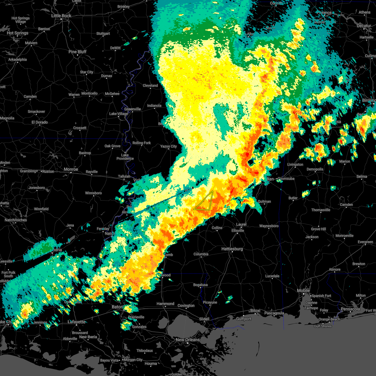 The severe thunderstorm warning for southeastern rankin, northeastern simpson and northwestern smith counties will expire at 345 pm cdt, the storms which prompted the warning have moved out of the area. therefore, the warning will be allowed to expire. a tornado watch remains in effect until 1000 pm cdt for central mississippi. The severe thunderstorm warning for southeastern rankin, northeastern simpson and northwestern smith counties will expire at 345 pm cdt, the storms which prompted the warning have moved out of the area. therefore, the warning will be allowed to expire. a tornado watch remains in effect until 1000 pm cdt for central mississippi.
|
| 5/4/2021 3:34 PM CDT |
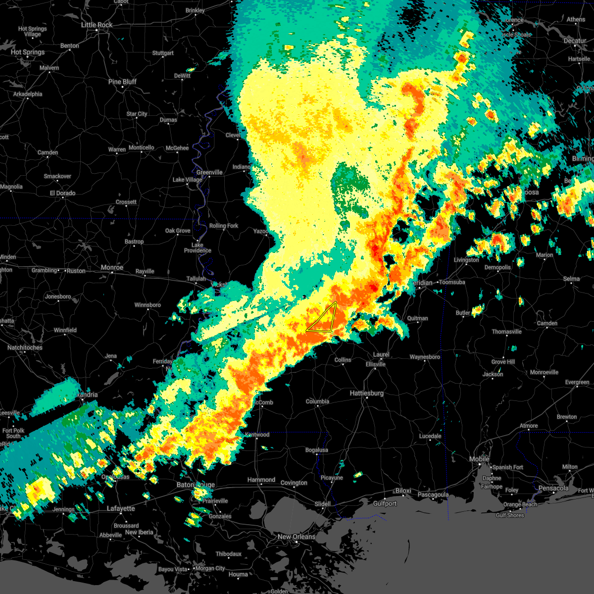 At 333 pm cdt, severe thunderstorms were located along a line extending from near homewood to near pinola, moving southeast at 40 mph (radar indicated). Hazards include 70 mph wind gusts and quarter size hail. Hail damage to vehicles is expected. expect considerable tree damage. wind damage is also likely to mobile homes, roofs, and outbuildings. these severe thunderstorms will remain over mainly rural areas of southeastern rankin, northeastern simpson and northwestern smith counties, including the following locations, d`lo and puckett. A tornado watch remains in effect until 1000 pm cdt for central mississippi. At 333 pm cdt, severe thunderstorms were located along a line extending from near homewood to near pinola, moving southeast at 40 mph (radar indicated). Hazards include 70 mph wind gusts and quarter size hail. Hail damage to vehicles is expected. expect considerable tree damage. wind damage is also likely to mobile homes, roofs, and outbuildings. these severe thunderstorms will remain over mainly rural areas of southeastern rankin, northeastern simpson and northwestern smith counties, including the following locations, d`lo and puckett. A tornado watch remains in effect until 1000 pm cdt for central mississippi.
|
| 5/4/2021 3:19 PM CDT |
 At 319 pm cdt, severe thunderstorms were located along a line extending from near pulaski to near union, moving east at 65 mph. these are very dangerous storms (radar indicated). Hazards include 80 mph wind gusts and quarter size hail. Flying debris will be dangerous to those caught without shelter. mobile homes will be heavily damaged. expect considerable damage to roofs, windows, and vehicles. extensive tree damage and power outages are likely. these severe storms will be near, martinville around 335 pm cdt. other locations impacted by these severe thunderstorms include polkville, d`lo, braxton and puckett. A tornado watch remains in effect until 400 pm cdt for central mississippi. At 319 pm cdt, severe thunderstorms were located along a line extending from near pulaski to near union, moving east at 65 mph. these are very dangerous storms (radar indicated). Hazards include 80 mph wind gusts and quarter size hail. Flying debris will be dangerous to those caught without shelter. mobile homes will be heavily damaged. expect considerable damage to roofs, windows, and vehicles. extensive tree damage and power outages are likely. these severe storms will be near, martinville around 335 pm cdt. other locations impacted by these severe thunderstorms include polkville, d`lo, braxton and puckett. A tornado watch remains in effect until 400 pm cdt for central mississippi.
|
| 5/4/2021 3:02 PM CDT |
 At 301 pm cdt, severe thunderstorms were located along a line extending from near pisgah to near hopewell, moving east at 60 mph. these are very dangerous storms (radar indicated). Hazards include 80 mph wind gusts and quarter size hail. Flying debris will be dangerous to those caught without shelter. mobile homes will be heavily damaged. expect considerable damage to roofs, windows, and vehicles. extensive tree damage and power outages are likely. these severe storms will be near, leesburg and pisgah around 305 pm cdt. morton, forkville and branch around 310 pm cdt. piney woods around 315 pm cdt. mendenhall around 320 pm cdt. martinville around 325 pm cdt. white oak around 330 pm cdt. other locations impacted by these severe thunderstorms include polkville, d`lo, braxton and puckett. A tornado watch remains in effect until 400 pm cdt for central mississippi. At 301 pm cdt, severe thunderstorms were located along a line extending from near pisgah to near hopewell, moving east at 60 mph. these are very dangerous storms (radar indicated). Hazards include 80 mph wind gusts and quarter size hail. Flying debris will be dangerous to those caught without shelter. mobile homes will be heavily damaged. expect considerable damage to roofs, windows, and vehicles. extensive tree damage and power outages are likely. these severe storms will be near, leesburg and pisgah around 305 pm cdt. morton, forkville and branch around 310 pm cdt. piney woods around 315 pm cdt. mendenhall around 320 pm cdt. martinville around 325 pm cdt. white oak around 330 pm cdt. other locations impacted by these severe thunderstorms include polkville, d`lo, braxton and puckett. A tornado watch remains in effect until 400 pm cdt for central mississippi.
|
| 5/4/2021 2:12 PM CDT |
 At 212 pm cdt, severe thunderstorms were located along a line extending from near oak ridge to 7 miles northwest of port gibson, moving east at 60 mph. these are very dangerous storms (radar indicated). Hazards include 80 mph wind gusts and nickel size hail. Flying debris will be dangerous to those caught without shelter. mobile homes will be heavily damaged. expect considerable damage to roofs, windows, and vehicles. extensive tree damage and power outages are likely. severe thunderstorms will be near, brownsville around 230 pm cdt. pocahontas and dentville around 240 pm cdt. dry grove around 250 pm cdt. crystal springs around 255 pm cdt. byram, terry and goshen springs around 300 pm cdt. whites and pisgah around 305 pm cdt. florence, harrisville and monterey around 310 pm cdt. star and piney woods around 315 pm cdt. other locations impacted by these severe thunderstorms include polkville, d`lo, learned, braxton and puckett. A tornado watch remains in effect until 400 pm cdt for central mississippi. At 212 pm cdt, severe thunderstorms were located along a line extending from near oak ridge to 7 miles northwest of port gibson, moving east at 60 mph. these are very dangerous storms (radar indicated). Hazards include 80 mph wind gusts and nickel size hail. Flying debris will be dangerous to those caught without shelter. mobile homes will be heavily damaged. expect considerable damage to roofs, windows, and vehicles. extensive tree damage and power outages are likely. severe thunderstorms will be near, brownsville around 230 pm cdt. pocahontas and dentville around 240 pm cdt. dry grove around 250 pm cdt. crystal springs around 255 pm cdt. byram, terry and goshen springs around 300 pm cdt. whites and pisgah around 305 pm cdt. florence, harrisville and monterey around 310 pm cdt. star and piney woods around 315 pm cdt. other locations impacted by these severe thunderstorms include polkville, d`lo, learned, braxton and puckett. A tornado watch remains in effect until 400 pm cdt for central mississippi.
|
| 5/4/2021 2:08 PM CDT |
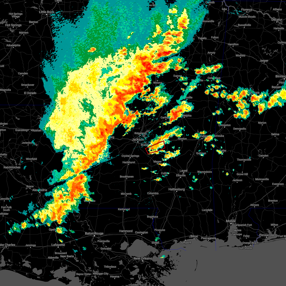 At 207 pm cdt, a severe thunderstorm capable of producing a tornado was located near cato, or 7 miles northeast of star, moving northeast at 30 mph (radar indicated rotation). Hazards include tornado and quarter size hail. Flying debris will be dangerous to those caught without shelter. mobile homes will be damaged or destroyed. damage to roofs, windows, and vehicles will occur. tree damage is likely. this dangerous storm will be near, johns around 215 pm cdt. pulaski around 250 pm cdt. Other locations impacted by this tornadic thunderstorm include polkville. At 207 pm cdt, a severe thunderstorm capable of producing a tornado was located near cato, or 7 miles northeast of star, moving northeast at 30 mph (radar indicated rotation). Hazards include tornado and quarter size hail. Flying debris will be dangerous to those caught without shelter. mobile homes will be damaged or destroyed. damage to roofs, windows, and vehicles will occur. tree damage is likely. this dangerous storm will be near, johns around 215 pm cdt. pulaski around 250 pm cdt. Other locations impacted by this tornadic thunderstorm include polkville.
|
| 5/4/2021 1:52 PM CDT |
 At 151 pm cdt, a severe thunderstorm capable of producing a tornado was located over star, moving east at 30 mph (radar indicated rotation). Hazards include tornado and ping pong ball size hail. Flying debris will be dangerous to those caught without shelter. mobile homes will be damaged or destroyed. damage to roofs, windows, and vehicles will occur. tree damage is likely. this dangerous storm will be near, cato around 210 pm cdt. johns around 215 pm cdt. white oak around 230 pm cdt. pulaski and burns around 245 pm cdt. Other locations impacted by this tornadic thunderstorm include polkville and puckett. At 151 pm cdt, a severe thunderstorm capable of producing a tornado was located over star, moving east at 30 mph (radar indicated rotation). Hazards include tornado and ping pong ball size hail. Flying debris will be dangerous to those caught without shelter. mobile homes will be damaged or destroyed. damage to roofs, windows, and vehicles will occur. tree damage is likely. this dangerous storm will be near, cato around 210 pm cdt. johns around 215 pm cdt. white oak around 230 pm cdt. pulaski and burns around 245 pm cdt. Other locations impacted by this tornadic thunderstorm include polkville and puckett.
|
| 5/4/2021 1:19 PM CDT |
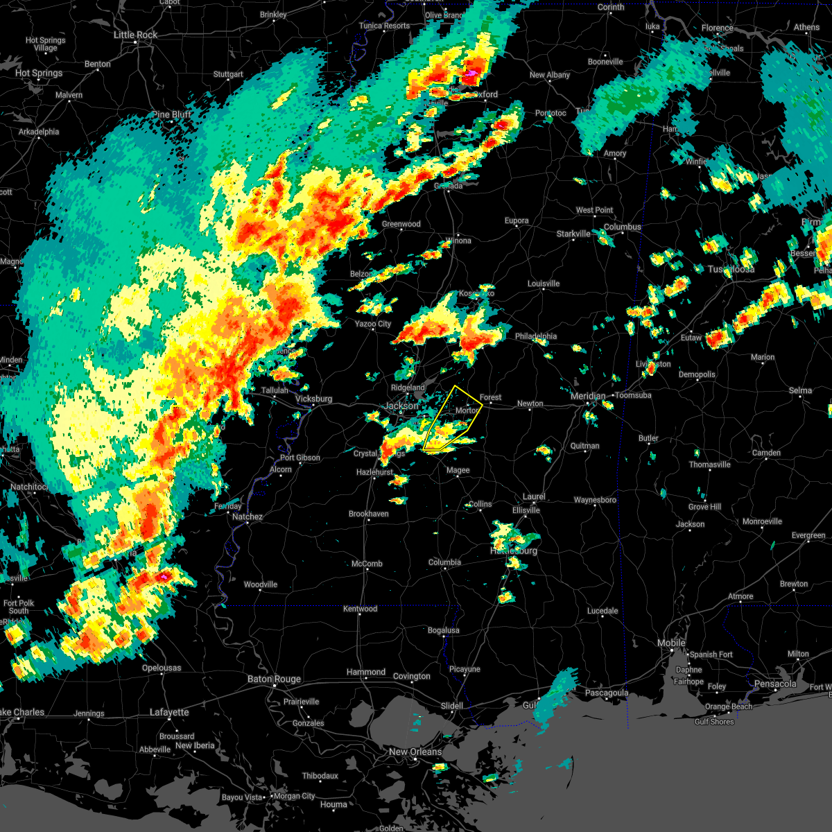 At 119 pm cdt, a severe thunderstorm was located near johns, or 11 miles southeast of brandon, moving northeast at 30 mph (radar indicated). Hazards include 60 mph wind gusts and quarter size hail. Hail damage to vehicles is expected. expect wind damage to roofs, siding, and trees. this severe thunderstorm will be near, pelahatchie around 140 pm cdt. pulaski around 150 pm cdt. morton, branch and leesburg around 155 pm cdt. other locations impacted by this severe thunderstorm include polkville. A tornado watch remains in effect until 400 pm cdt for central mississippi. At 119 pm cdt, a severe thunderstorm was located near johns, or 11 miles southeast of brandon, moving northeast at 30 mph (radar indicated). Hazards include 60 mph wind gusts and quarter size hail. Hail damage to vehicles is expected. expect wind damage to roofs, siding, and trees. this severe thunderstorm will be near, pelahatchie around 140 pm cdt. pulaski around 150 pm cdt. morton, branch and leesburg around 155 pm cdt. other locations impacted by this severe thunderstorm include polkville. A tornado watch remains in effect until 400 pm cdt for central mississippi.
|
| 5/4/2021 9:53 AM CDT |
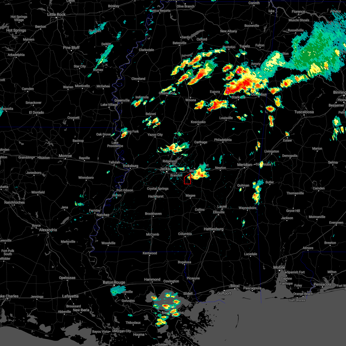 The tornado warning for southeastern rankin county will expire at 1000 am cdt, the storm which prompted the warning has weakened below severe limits, and has exited the warned area. therefore, the warning will be allowed to expire. a tornado watch remains in effect until 400 pm cdt for central mississippi. The tornado warning for southeastern rankin county will expire at 1000 am cdt, the storm which prompted the warning has weakened below severe limits, and has exited the warned area. therefore, the warning will be allowed to expire. a tornado watch remains in effect until 400 pm cdt for central mississippi.
|
| 5/4/2021 9:44 AM CDT |
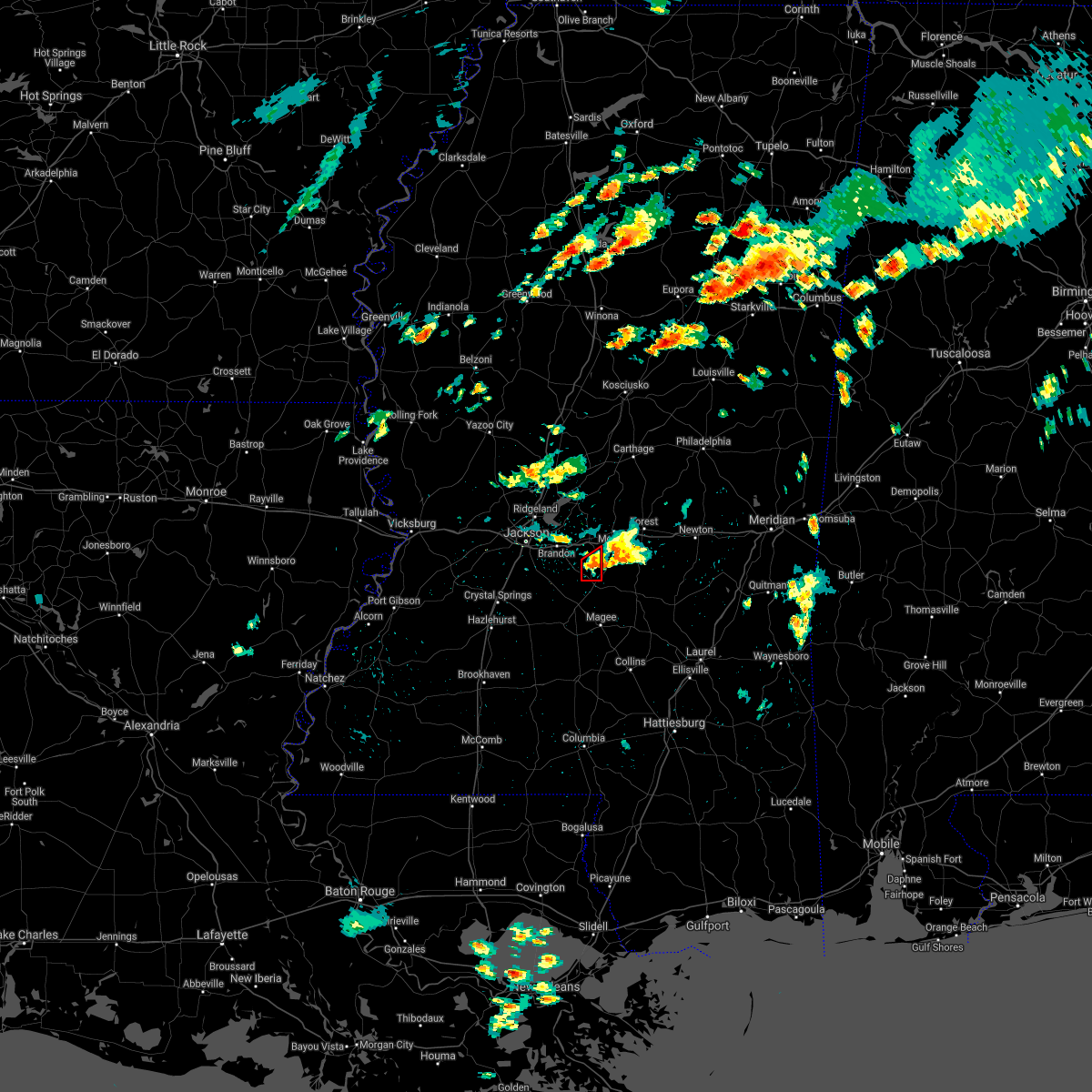 At 944 am cdt, a severe thunderstorm capable of producing a tornado was located near johns, or 13 miles northeast of mendenhall, moving east at 25 mph (radar indicated rotation). Hazards include tornado. Flying debris will be dangerous to those caught without shelter. mobile homes will be damaged or destroyed. damage to roofs, windows, and vehicles will occur. tree damage is likely. This tornadic thunderstorm will remain over mainly rural areas of southeastern rankin county. At 944 am cdt, a severe thunderstorm capable of producing a tornado was located near johns, or 13 miles northeast of mendenhall, moving east at 25 mph (radar indicated rotation). Hazards include tornado. Flying debris will be dangerous to those caught without shelter. mobile homes will be damaged or destroyed. damage to roofs, windows, and vehicles will occur. tree damage is likely. This tornadic thunderstorm will remain over mainly rural areas of southeastern rankin county.
|
| 5/4/2021 9:26 AM CDT |
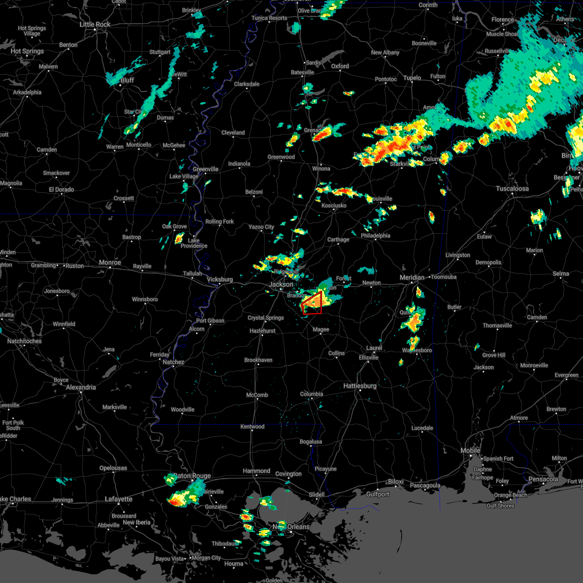 At 926 am cdt, a severe thunderstorm capable of producing a tornado was located over cato, or 8 miles east of star, moving east at 25 mph (radar indicated rotation). Hazards include tornado. Flying debris will be dangerous to those caught without shelter. mobile homes will be damaged or destroyed. damage to roofs, windows, and vehicles will occur. tree damage is likely. this dangerous storm will be near, johns around 935 am cdt. Other locations impacted by this tornadic thunderstorm include puckett. At 926 am cdt, a severe thunderstorm capable of producing a tornado was located over cato, or 8 miles east of star, moving east at 25 mph (radar indicated rotation). Hazards include tornado. Flying debris will be dangerous to those caught without shelter. mobile homes will be damaged or destroyed. damage to roofs, windows, and vehicles will occur. tree damage is likely. this dangerous storm will be near, johns around 935 am cdt. Other locations impacted by this tornadic thunderstorm include puckett.
|
| 5/4/2021 9:16 AM CDT |
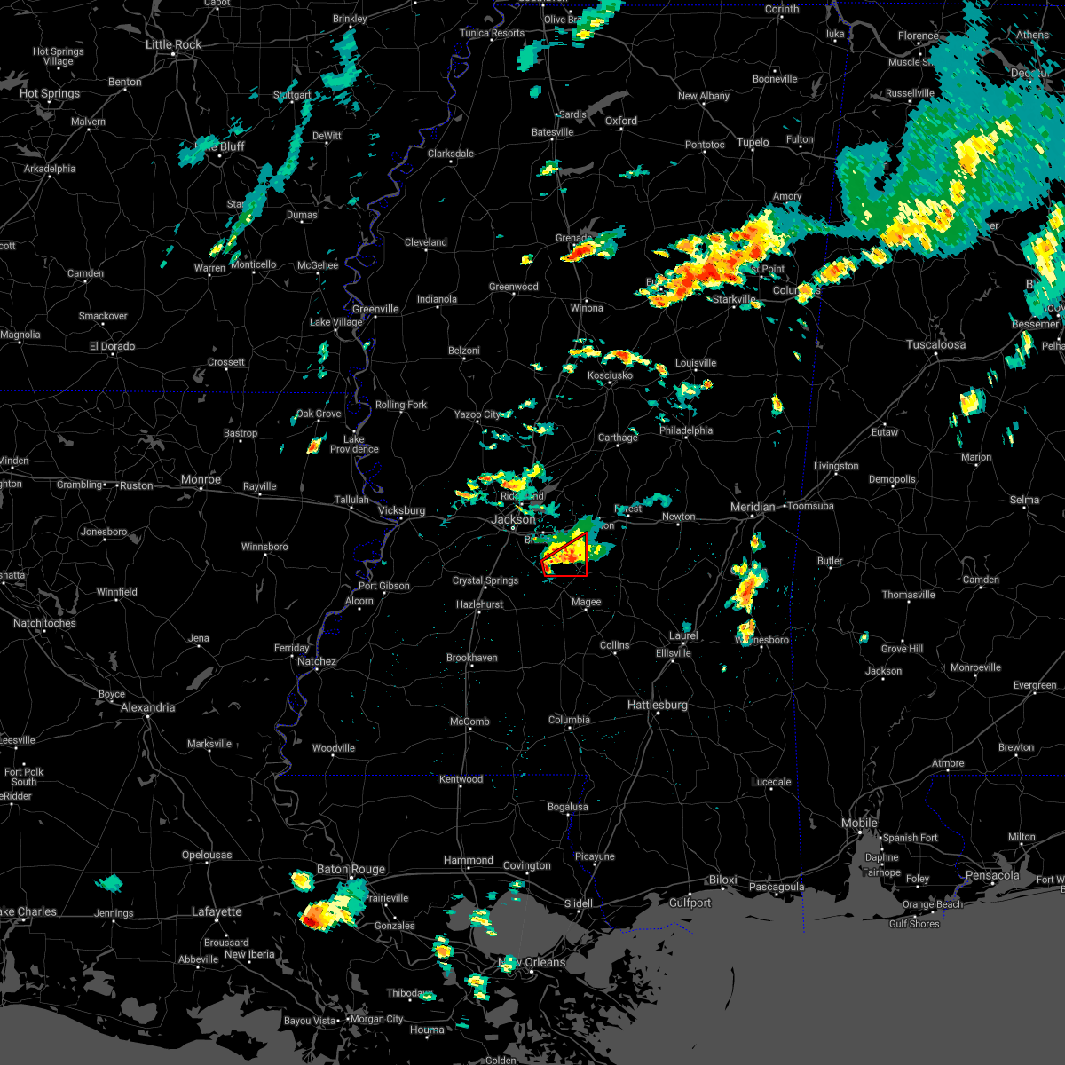 At 916 am cdt, a confirmed tornado was located over piney woods, or near star, moving east at 20 mph (weather spotters confirmed tornado). Hazards include damaging tornado and quarter size hail. Flying debris will be dangerous to those caught without shelter. mobile homes will be damaged or destroyed. damage to roofs, windows, and vehicles will occur. tree damage is likely. this tornado will be near, cato around 930 am cdt. johns around 940 am cdt. Other locations impacted by this tornadic thunderstorm include puckett. At 916 am cdt, a confirmed tornado was located over piney woods, or near star, moving east at 20 mph (weather spotters confirmed tornado). Hazards include damaging tornado and quarter size hail. Flying debris will be dangerous to those caught without shelter. mobile homes will be damaged or destroyed. damage to roofs, windows, and vehicles will occur. tree damage is likely. this tornado will be near, cato around 930 am cdt. johns around 940 am cdt. Other locations impacted by this tornadic thunderstorm include puckett.
|
| 5/4/2021 9:13 AM CDT |
 At 912 am cdt, a confirmed tornado was located over piney woods, or near star, moving east at 25 mph (radar confirmed tornado). Hazards include damaging tornado and quarter size hail. Flying debris will be dangerous to those caught without shelter. mobile homes will be damaged or destroyed. damage to roofs, windows, and vehicles will occur. tree damage is likely. this tornado will be near, cato around 930 am cdt. johns around 935 am cdt. Other locations impacted by this tornadic thunderstorm include braxton and puckett. At 912 am cdt, a confirmed tornado was located over piney woods, or near star, moving east at 25 mph (radar confirmed tornado). Hazards include damaging tornado and quarter size hail. Flying debris will be dangerous to those caught without shelter. mobile homes will be damaged or destroyed. damage to roofs, windows, and vehicles will occur. tree damage is likely. this tornado will be near, cato around 930 am cdt. johns around 935 am cdt. Other locations impacted by this tornadic thunderstorm include braxton and puckett.
|
| 5/4/2021 9:06 AM CDT |
 At 905 am cdt, a severe thunderstorm capable of producing a tornado was located over piney woods, or over star, moving east at 25 mph (radar indicated rotation). Hazards include tornado and quarter size hail. Flying debris will be dangerous to those caught without shelter. mobile homes will be damaged or destroyed. damage to roofs, windows, and vehicles will occur. tree damage is likely. this dangerous storm will be near, piney woods around 910 am cdt. cato around 930 am cdt. johns around 940 am cdt. Other locations impacted by this tornadic thunderstorm include braxton and puckett. At 905 am cdt, a severe thunderstorm capable of producing a tornado was located over piney woods, or over star, moving east at 25 mph (radar indicated rotation). Hazards include tornado and quarter size hail. Flying debris will be dangerous to those caught without shelter. mobile homes will be damaged or destroyed. damage to roofs, windows, and vehicles will occur. tree damage is likely. this dangerous storm will be near, piney woods around 910 am cdt. cato around 930 am cdt. johns around 940 am cdt. Other locations impacted by this tornadic thunderstorm include braxton and puckett.
|
| 4/24/2021 3:25 AM CDT |
 At 325 am cdt, severe thunderstorms were located along a line extending from near forkville to near piney woods, moving east at 45 mph (radar indicated). Hazards include 60 mph wind gusts. Expect damage to roofs, siding, and trees. these severe storms will be near, forkville, branch and leesburg around 330 am cdt. harperville and hillsboro around 340 am cdt. steele and white oak around 345 am cdt. burns around 400 am cdt. pineville around 410 am cdt. other locations impacted by these severe thunderstorms include polkville, puckett and lake. A tornado watch remains in effect until 400 am cdt for central mississippi. At 325 am cdt, severe thunderstorms were located along a line extending from near forkville to near piney woods, moving east at 45 mph (radar indicated). Hazards include 60 mph wind gusts. Expect damage to roofs, siding, and trees. these severe storms will be near, forkville, branch and leesburg around 330 am cdt. harperville and hillsboro around 340 am cdt. steele and white oak around 345 am cdt. burns around 400 am cdt. pineville around 410 am cdt. other locations impacted by these severe thunderstorms include polkville, puckett and lake. A tornado watch remains in effect until 400 am cdt for central mississippi.
|
| 4/24/2021 3:08 AM CDT |
 At 308 am cdt, severe thunderstorms were located along a line extending from near fannin to near star, moving east at 50 mph (radar indicated). Hazards include 60 mph wind gusts. Expect damage to roofs, siding, and trees. these severe storms will be near, fannin and goshen springs around 315 am cdt. pisgah around 320 am cdt. pelahatchie, johns, cato and leesburg around 325 am cdt. branch around 330 am cdt. morton, white oak and forkville around 335 am cdt. forest, harperville, burns and hillsboro around 345 am cdt. steele around 350 am cdt. pineville around 355 am cdt. other locations impacted by these severe thunderstorms include polkville, puckett and lake. A tornado watch remains in effect until 400 am cdt for central mississippi. At 308 am cdt, severe thunderstorms were located along a line extending from near fannin to near star, moving east at 50 mph (radar indicated). Hazards include 60 mph wind gusts. Expect damage to roofs, siding, and trees. these severe storms will be near, fannin and goshen springs around 315 am cdt. pisgah around 320 am cdt. pelahatchie, johns, cato and leesburg around 325 am cdt. branch around 330 am cdt. morton, white oak and forkville around 335 am cdt. forest, harperville, burns and hillsboro around 345 am cdt. steele around 350 am cdt. pineville around 355 am cdt. other locations impacted by these severe thunderstorms include polkville, puckett and lake. A tornado watch remains in effect until 400 am cdt for central mississippi.
|
| 4/24/2021 2:58 AM CDT |
 At 258 am cdt, severe thunderstorms were located along a line extending from ridgeland to near whites, moving east at 50 mph (radar indicated). Hazards include 60 mph wind gusts. Expect damage to roofs, siding, and trees. severe thunderstorms will be near, star, fannin and monterey around 310 am cdt. goshen springs around 315 am cdt. pisgah around 320 am cdt. pelahatchie, johns, leesburg and cato around 325 am cdt. morton, branch and forkville around 330 am cdt. white oak around 335 am cdt. forest, harperville, burns and hillsboro around 345 am cdt. steele around 350 am cdt. other locations impacted by these severe thunderstorms include polkville, puckett and lake. A tornado watch remains in effect until 400 am cdt for central mississippi. At 258 am cdt, severe thunderstorms were located along a line extending from ridgeland to near whites, moving east at 50 mph (radar indicated). Hazards include 60 mph wind gusts. Expect damage to roofs, siding, and trees. severe thunderstorms will be near, star, fannin and monterey around 310 am cdt. goshen springs around 315 am cdt. pisgah around 320 am cdt. pelahatchie, johns, leesburg and cato around 325 am cdt. morton, branch and forkville around 330 am cdt. white oak around 335 am cdt. forest, harperville, burns and hillsboro around 345 am cdt. steele around 350 am cdt. other locations impacted by these severe thunderstorms include polkville, puckett and lake. A tornado watch remains in effect until 400 am cdt for central mississippi.
|
| 4/9/2021 7:59 PM CDT |
 A severe thunderstorm warning remains in effect until 845 pm cdt for southeastern rankin and southwestern scott counties. at 758 pm cdt, a severe thunderstorm was located over johns, or 11 miles southeast of brandon, moving north at 20 mph. hazard. ping pong ball size hail and 60 mph wind gusts. source. Radar indicated. A severe thunderstorm warning remains in effect until 845 pm cdt for southeastern rankin and southwestern scott counties. at 758 pm cdt, a severe thunderstorm was located over johns, or 11 miles southeast of brandon, moving north at 20 mph. hazard. ping pong ball size hail and 60 mph wind gusts. source. Radar indicated.
|
| 4/9/2021 7:38 PM CDT |
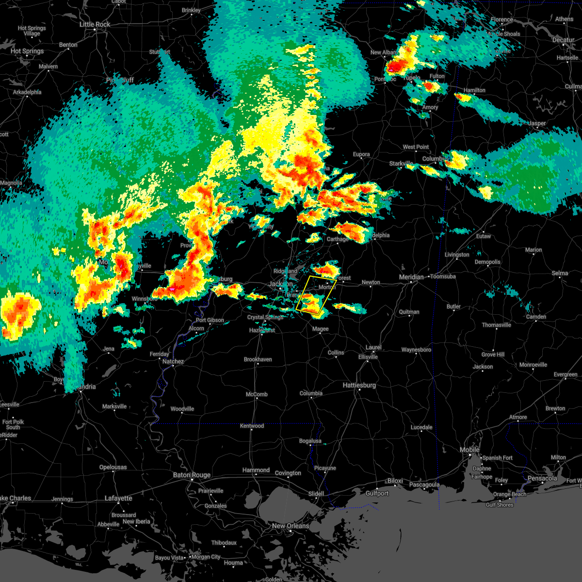 At 737 pm cdt, a severe thunderstorm was located over cato, or 10 miles north of mendenhall, moving northeast at 25 mph (radar indicated). Hazards include 60 mph wind gusts and half dollar size hail. Hail damage to vehicles is expected. expect wind damage to roofs, siding, and trees. this severe thunderstorm will be near, pelahatchie around 810 pm cdt. morton around 825 pm cdt. Other locations impacted by this severe thunderstorm include polkville and puckett. At 737 pm cdt, a severe thunderstorm was located over cato, or 10 miles north of mendenhall, moving northeast at 25 mph (radar indicated). Hazards include 60 mph wind gusts and half dollar size hail. Hail damage to vehicles is expected. expect wind damage to roofs, siding, and trees. this severe thunderstorm will be near, pelahatchie around 810 pm cdt. morton around 825 pm cdt. Other locations impacted by this severe thunderstorm include polkville and puckett.
|
| 3/30/2021 7:47 PM CDT |
 At 747 pm cdt, a severe thunderstorm was located near whites, or 8 miles southwest of star, moving northeast at 20 mph (radar indicated). Hazards include 60 mph wind gusts. Expect damage to roofs, siding, and trees. this severe thunderstorm will be near, star around 810 pm cdt. piney woods around 815 pm cdt. cato around 835 pm cdt. Johns around 845 pm cdt. At 747 pm cdt, a severe thunderstorm was located near whites, or 8 miles southwest of star, moving northeast at 20 mph (radar indicated). Hazards include 60 mph wind gusts. Expect damage to roofs, siding, and trees. this severe thunderstorm will be near, star around 810 pm cdt. piney woods around 815 pm cdt. cato around 835 pm cdt. Johns around 845 pm cdt.
|
| 3/25/2021 3:51 PM CDT |
 At 351 pm cdt, a severe thunderstorm was located near shivers, or near pinola, moving northeast at 65 mph (radar indicated). Hazards include 60 mph wind gusts and quarter size hail. Hail damage to vehicles is expected. expect wind damage to roofs, siding, and trees. this severe storm will be near, magee, mendenhall and sanatorium around 400 pm cdt. martinville around 405 pm cdt. white oak around 410 pm cdt. burns around 420 pm cdt. other locations impacted by this severe thunderstorm include polkville, d`lo and puckett. A tornado watch remains in effect until 800 pm cdt for central and east central mississippi. At 351 pm cdt, a severe thunderstorm was located near shivers, or near pinola, moving northeast at 65 mph (radar indicated). Hazards include 60 mph wind gusts and quarter size hail. Hail damage to vehicles is expected. expect wind damage to roofs, siding, and trees. this severe storm will be near, magee, mendenhall and sanatorium around 400 pm cdt. martinville around 405 pm cdt. white oak around 410 pm cdt. burns around 420 pm cdt. other locations impacted by this severe thunderstorm include polkville, d`lo and puckett. A tornado watch remains in effect until 800 pm cdt for central and east central mississippi.
|
| 3/25/2021 3:40 PM CDT |
 At 340 pm cdt, a severe thunderstorm was located near wanilla, or 15 miles southwest of pinola, moving northeast at 65 mph (radar indicated). Hazards include 60 mph wind gusts and quarter size hail. Hail damage to vehicles is expected. expect wind damage to roofs, siding, and trees. this severe thunderstorm will be near, shivers around 350 pm cdt. pinola around 355 pm cdt. mendenhall and sanatorium around 400 pm cdt. martinville around 405 pm cdt. white oak around 415 pm cdt. burns around 420 pm cdt. other locations impacted by this severe thunderstorm include polkville, new hebron, d`lo and puckett. A tornado watch remains in effect until 800 pm cdt for central, south central and east central mississippi. At 340 pm cdt, a severe thunderstorm was located near wanilla, or 15 miles southwest of pinola, moving northeast at 65 mph (radar indicated). Hazards include 60 mph wind gusts and quarter size hail. Hail damage to vehicles is expected. expect wind damage to roofs, siding, and trees. this severe thunderstorm will be near, shivers around 350 pm cdt. pinola around 355 pm cdt. mendenhall and sanatorium around 400 pm cdt. martinville around 405 pm cdt. white oak around 415 pm cdt. burns around 420 pm cdt. other locations impacted by this severe thunderstorm include polkville, new hebron, d`lo and puckett. A tornado watch remains in effect until 800 pm cdt for central, south central and east central mississippi.
|
| 3/17/2021 5:52 PM CDT |
 At 552 pm cdt, severe thunderstorms were located along a line extending from ebenezer to near camden to near brandon, moving northeast at 60 mph (radar indicated). Hazards include 60 mph wind gusts. Expect damage to roofs, siding, and trees. these severe storms will be near, camden and cameron around 600 pm cdt. leesburg around 610 pm cdt. other locations impacted by these severe thunderstorms include puckett. a tornado watch remains in effect until 700 pm cdt for central mississippi. A tornado watch also remains in effect until 700 pm cdt for central mississippi. At 552 pm cdt, severe thunderstorms were located along a line extending from ebenezer to near camden to near brandon, moving northeast at 60 mph (radar indicated). Hazards include 60 mph wind gusts. Expect damage to roofs, siding, and trees. these severe storms will be near, camden and cameron around 600 pm cdt. leesburg around 610 pm cdt. other locations impacted by these severe thunderstorms include puckett. a tornado watch remains in effect until 700 pm cdt for central mississippi. A tornado watch also remains in effect until 700 pm cdt for central mississippi.
|
| 3/17/2021 5:32 PM CDT |
 At 532 pm cdt, severe thunderstorms were located along a line extending from near yazoo city to near annandale to terry, moving northeast at 60 mph (radar indicated). Hazards include 60 mph wind gusts. Expect damage to roofs, siding, and trees. these severe storms will be near, yazoo city, annandale and gluckstadt around 535 pm cdt. canton and benton around 540 pm cdt. richland, star, monterey and way around 545 pm cdt. pearl and sharon around 550 pm cdt. brandon, camden and cameron around 555 pm cdt. pelahatchie around 605 pm cdt. leesburg around 610 pm cdt. other locations impacted by these severe thunderstorms include puckett and bentonia. a tornado watch remains in effect until 700 pm cdt for central mississippi. A tornado watch also remains in effect until 700 pm cdt for central mississippi. At 532 pm cdt, severe thunderstorms were located along a line extending from near yazoo city to near annandale to terry, moving northeast at 60 mph (radar indicated). Hazards include 60 mph wind gusts. Expect damage to roofs, siding, and trees. these severe storms will be near, yazoo city, annandale and gluckstadt around 535 pm cdt. canton and benton around 540 pm cdt. richland, star, monterey and way around 545 pm cdt. pearl and sharon around 550 pm cdt. brandon, camden and cameron around 555 pm cdt. pelahatchie around 605 pm cdt. leesburg around 610 pm cdt. other locations impacted by these severe thunderstorms include puckett and bentonia. a tornado watch remains in effect until 700 pm cdt for central mississippi. A tornado watch also remains in effect until 700 pm cdt for central mississippi.
|
| 3/17/2021 5:15 PM CDT |
 At 515 pm cdt, severe thunderstorms were located along a line extending from near phoenix to near bolton to near utica, moving northeast at 55 mph (radar indicated). Hazards include 60 mph wind gusts. Expect damage to roofs, siding, and trees. severe thunderstorms will be near, clinton, tinsley and brownsville around 525 pm cdt. terry, little yazoo and pocahontas around 530 pm cdt. jackson, byram, myrleville and whites around 535 pm cdt. madison, ridgeland, benton and annandale around 540 pm cdt. pearl, canton, richland, florence, monterey and gluckstadt around 545 pm cdt. flowood, vaughan, way and fannin around 550 pm cdt. brandon, goshen springs and pisgah around 555 pm cdt. cameron and camden around 600 pm cdt. other locations impacted by these severe thunderstorms include satartia, puckett and bentonia. a tornado watch remains in effect until 700 pm cdt for central mississippi. A tornado watch also remains in effect until 700 pm cdt for central and west central mississippi. At 515 pm cdt, severe thunderstorms were located along a line extending from near phoenix to near bolton to near utica, moving northeast at 55 mph (radar indicated). Hazards include 60 mph wind gusts. Expect damage to roofs, siding, and trees. severe thunderstorms will be near, clinton, tinsley and brownsville around 525 pm cdt. terry, little yazoo and pocahontas around 530 pm cdt. jackson, byram, myrleville and whites around 535 pm cdt. madison, ridgeland, benton and annandale around 540 pm cdt. pearl, canton, richland, florence, monterey and gluckstadt around 545 pm cdt. flowood, vaughan, way and fannin around 550 pm cdt. brandon, goshen springs and pisgah around 555 pm cdt. cameron and camden around 600 pm cdt. other locations impacted by these severe thunderstorms include satartia, puckett and bentonia. a tornado watch remains in effect until 700 pm cdt for central mississippi. A tornado watch also remains in effect until 700 pm cdt for central and west central mississippi.
|
| 12/13/2020 9:19 PM CST |
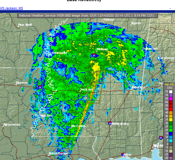 At 919 pm cst, severe thunderstorms were located along a line extending from near ludlow to near mendenhall, moving east at 35 mph (radar indicated). Hazards include 60 mph wind gusts. Expect damage to roofs, siding, and trees. these severe storms will be near, ludlow around 925 pm cst. white oak around 940 pm cst. Other locations impacted by these severe thunderstorms include polkville, d`lo and puckett. At 919 pm cst, severe thunderstorms were located along a line extending from near ludlow to near mendenhall, moving east at 35 mph (radar indicated). Hazards include 60 mph wind gusts. Expect damage to roofs, siding, and trees. these severe storms will be near, ludlow around 925 pm cst. white oak around 940 pm cst. Other locations impacted by these severe thunderstorms include polkville, d`lo and puckett.
|
| 12/13/2020 8:48 PM CST |
 At 848 pm cst, severe thunderstorms were located along a line extending from near sharon to hopewell, moving east at 35 mph (radar indicated). Hazards include 60 mph wind gusts. Expect damage to roofs, siding, and trees. severe thunderstorms will be near, piney woods and ludlow around 910 pm cst. cato around 920 pm cst. johns around 925 pm cst. white oak around 940 pm cst. Other locations impacted by these severe thunderstorms include polkville, d`lo, braxton and puckett. At 848 pm cst, severe thunderstorms were located along a line extending from near sharon to hopewell, moving east at 35 mph (radar indicated). Hazards include 60 mph wind gusts. Expect damage to roofs, siding, and trees. severe thunderstorms will be near, piney woods and ludlow around 910 pm cst. cato around 920 pm cst. johns around 925 pm cst. white oak around 940 pm cst. Other locations impacted by these severe thunderstorms include polkville, d`lo, braxton and puckett.
|
| 8/16/2020 6:24 PM CDT |
 At 623 pm cdt, a severe thunderstorm was located over fannin, or 8 miles north of brandon, moving south at 30 mph (radar indicated). Hazards include 60 mph wind gusts and penny size hail. Expect damage to roofs, siding, and trees. Locations impacted include, jackson, pearl, brandon, flowood, richland, star, pelahatchie, cato, goshen springs, johns, piney woods, monterey, fannin and puckett. At 623 pm cdt, a severe thunderstorm was located over fannin, or 8 miles north of brandon, moving south at 30 mph (radar indicated). Hazards include 60 mph wind gusts and penny size hail. Expect damage to roofs, siding, and trees. Locations impacted include, jackson, pearl, brandon, flowood, richland, star, pelahatchie, cato, goshen springs, johns, piney woods, monterey, fannin and puckett.
|
| 8/16/2020 5:44 PM CDT |
 At 542 pm cdt, severe thunderstorms were located along a line extending from near canton to pisgah to near morton, moving south at 35 mph (radar indicated). Hazards include 60 mph wind gusts and nickel size hail. Expect damage to roofs, siding, and trees. severe thunderstorms will be near, forest and morton around 550 pm cdt. pelahatchie and pulaski around 600 pm cdt. fannin around 605 pm cdt. burns around 615 pm cdt. flowood around 620 pm cdt. pearl, brandon, white oak and johns around 625 pm cdt. richland, star, cato, monterey and piney woods around 630 pm cdt. Other locations impacted by these severe thunderstorms include polkville, puckett, and the ross barnett reservoir. At 542 pm cdt, severe thunderstorms were located along a line extending from near canton to pisgah to near morton, moving south at 35 mph (radar indicated). Hazards include 60 mph wind gusts and nickel size hail. Expect damage to roofs, siding, and trees. severe thunderstorms will be near, forest and morton around 550 pm cdt. pelahatchie and pulaski around 600 pm cdt. fannin around 605 pm cdt. burns around 615 pm cdt. flowood around 620 pm cdt. pearl, brandon, white oak and johns around 625 pm cdt. richland, star, cato, monterey and piney woods around 630 pm cdt. Other locations impacted by these severe thunderstorms include polkville, puckett, and the ross barnett reservoir.
|
| 7/1/2020 8:39 PM CDT |
 At 838 pm cdt, severe thunderstorms were located along a line extending from near little rock to near forest to fannin, moving south at 40 mph (radar indicated). Hazards include 60 mph wind gusts and penny size hail. Expect damage to roofs, siding, and trees. severe thunderstorms will be near, pulaski around 845 pm cdt. homewood around 850 pm cdt. pineville and burns around 900 pm cdt. raleigh around 910 pm cdt. cato, johns and rose hill around 915 pm cdt. bay springs, center ridge and piney woods around 920 pm cdt. orange around 925 pm cdt. mendenhall and martinville around 930 pm cdt. Other locations impacted by these severe thunderstorms include sylvarena, mize, louin, puckett, polkville, d`lo, chunky, montrose, braxton and hickory. At 838 pm cdt, severe thunderstorms were located along a line extending from near little rock to near forest to fannin, moving south at 40 mph (radar indicated). Hazards include 60 mph wind gusts and penny size hail. Expect damage to roofs, siding, and trees. severe thunderstorms will be near, pulaski around 845 pm cdt. homewood around 850 pm cdt. pineville and burns around 900 pm cdt. raleigh around 910 pm cdt. cato, johns and rose hill around 915 pm cdt. bay springs, center ridge and piney woods around 920 pm cdt. orange around 925 pm cdt. mendenhall and martinville around 930 pm cdt. Other locations impacted by these severe thunderstorms include sylvarena, mize, louin, puckett, polkville, d`lo, chunky, montrose, braxton and hickory.
|
| 6/25/2020 5:45 PM CDT |
 At 544 pm cdt, severe thunderstorms were located along a line extending from near youngton to near jackson to near leesburg to near forest, moving north at 40 mph (radar indicated). Hazards include 60 mph wind gusts. Expect damage to roofs, siding, and trees. these severe storms will be near, forest, leesburg and forkville around 550 pm cdt. ludlow around 555 pm cdt. hillsboro around 600 pm cdt. harperville, steele and gluckstadt around 605 pm cdt. canton around 610 pm cdt. Other locations impacted by these severe thunderstorms include polkville, mize, sebastopol, learned and puckett. At 544 pm cdt, severe thunderstorms were located along a line extending from near youngton to near jackson to near leesburg to near forest, moving north at 40 mph (radar indicated). Hazards include 60 mph wind gusts. Expect damage to roofs, siding, and trees. these severe storms will be near, forest, leesburg and forkville around 550 pm cdt. ludlow around 555 pm cdt. hillsboro around 600 pm cdt. harperville, steele and gluckstadt around 605 pm cdt. canton around 610 pm cdt. Other locations impacted by these severe thunderstorms include polkville, mize, sebastopol, learned and puckett.
|
| 6/25/2020 5:24 PM CDT |
 At 524 pm cdt, severe thunderstorms were located along a line extending from edwards to byram to pelahatchie to burns, moving northeast at 45 mph (radar indicated). Hazards include 60 mph wind gusts. Expect damage to roofs, siding, and trees. these severe storms will be near, morton, pelahatchie and burns around 530 pm cdt. pearl, leesburg, homewood, branch and pisgah around 535 pm cdt. flowood, forkville and brownsville around 540 pm cdt. forest, ludlow and pocahontas around 545 pm cdt. madison and ridgeland around 550 pm cdt. gluckstadt, annandale and steele around 555 pm cdt. canton around 600 pm cdt. Other locations impacted by these severe thunderstorms include polkville, mize, sebastopol, learned and puckett. At 524 pm cdt, severe thunderstorms were located along a line extending from edwards to byram to pelahatchie to burns, moving northeast at 45 mph (radar indicated). Hazards include 60 mph wind gusts. Expect damage to roofs, siding, and trees. these severe storms will be near, morton, pelahatchie and burns around 530 pm cdt. pearl, leesburg, homewood, branch and pisgah around 535 pm cdt. flowood, forkville and brownsville around 540 pm cdt. forest, ludlow and pocahontas around 545 pm cdt. madison and ridgeland around 550 pm cdt. gluckstadt, annandale and steele around 555 pm cdt. canton around 600 pm cdt. Other locations impacted by these severe thunderstorms include polkville, mize, sebastopol, learned and puckett.
|
| 6/25/2020 4:52 PM CDT |
 At 452 pm cdt, severe thunderstorms were located along a line extending from near carpenter to near gallman to piney woods to near magee, moving northeast at 35 mph (radar indicated). Hazards include 60 mph wind gusts. Expect damage to roofs, siding, and trees. severe thunderstorms will be near, star and piney woods around 455 pm cdt. cato around 500 pm cdt. johns around 505 pm cdt. raleigh, dry grove, newman and white oak around 515 pm cdt. terry and whites around 520 pm cdt. byram, pelahatchie and burns around 525 pm cdt. jackson and edwards around 530 pm cdt. richland, morton and homewood around 535 pm cdt. Other locations impacted by these severe thunderstorms include polkville, mize, sebastopol, learned and puckett. At 452 pm cdt, severe thunderstorms were located along a line extending from near carpenter to near gallman to piney woods to near magee, moving northeast at 35 mph (radar indicated). Hazards include 60 mph wind gusts. Expect damage to roofs, siding, and trees. severe thunderstorms will be near, star and piney woods around 455 pm cdt. cato around 500 pm cdt. johns around 505 pm cdt. raleigh, dry grove, newman and white oak around 515 pm cdt. terry and whites around 520 pm cdt. byram, pelahatchie and burns around 525 pm cdt. jackson and edwards around 530 pm cdt. richland, morton and homewood around 535 pm cdt. Other locations impacted by these severe thunderstorms include polkville, mize, sebastopol, learned and puckett.
|
| 6/5/2020 7:04 PM CDT |
 At 704 pm cdt, severe thunderstorms were located along a line extending from near dry grove to near star to white oak, moving south at 35 mph (radar indicated). Hazards include 60 mph wind gusts. Expect damage to roofs, siding, and trees. these severe storms will be near, harrisville around 715 pm cdt. crystal springs and hopewell around 720 pm cdt. magee, union, gallman, sanatorium and dentville around 725 pm cdt. hazlehurst and shivers around 730 pm cdt. rockport around 735 pm cdt. glancy and martinsville around 740 pm cdt. wesson around 750 pm cdt. Other locations impacted by these severe thunderstorms include d`lo, beauregard, learned, braxton and georgetown. At 704 pm cdt, severe thunderstorms were located along a line extending from near dry grove to near star to white oak, moving south at 35 mph (radar indicated). Hazards include 60 mph wind gusts. Expect damage to roofs, siding, and trees. these severe storms will be near, harrisville around 715 pm cdt. crystal springs and hopewell around 720 pm cdt. magee, union, gallman, sanatorium and dentville around 725 pm cdt. hazlehurst and shivers around 730 pm cdt. rockport around 735 pm cdt. glancy and martinsville around 740 pm cdt. wesson around 750 pm cdt. Other locations impacted by these severe thunderstorms include d`lo, beauregard, learned, braxton and georgetown.
|
| 6/5/2020 6:41 PM CDT |
 At 641 pm cdt, severe thunderstorms were located along a line extending from near clinton to near pearl to 6 miles west of pulaski, moving south at 35 mph (radar indicated). Hazards include 60 mph wind gusts. Expect damage to roofs, siding, and trees. severe thunderstorms will be near, star around 700 pm cdt. dry grove and whites around 705 pm cdt. martinville and harrisville around 715 pm cdt. mendenhall and hopewell around 720 pm cdt. union and sanatorium around 725 pm cdt. dentville around 730 pm cdt. pinola and rockport around 735 pm cdt. glancy around 740 pm cdt. Other locations impacted by these severe thunderstorms include d`lo, beauregard, learned, braxton and georgetown. At 641 pm cdt, severe thunderstorms were located along a line extending from near clinton to near pearl to 6 miles west of pulaski, moving south at 35 mph (radar indicated). Hazards include 60 mph wind gusts. Expect damage to roofs, siding, and trees. severe thunderstorms will be near, star around 700 pm cdt. dry grove and whites around 705 pm cdt. martinville and harrisville around 715 pm cdt. mendenhall and hopewell around 720 pm cdt. union and sanatorium around 725 pm cdt. dentville around 730 pm cdt. pinola and rockport around 735 pm cdt. glancy around 740 pm cdt. Other locations impacted by these severe thunderstorms include d`lo, beauregard, learned, braxton and georgetown.
|
| 6/5/2020 6:33 PM CDT |
 At 633 pm cdt, severe thunderstorms were located along a line extending from pulaski to near brandon to near jackson, moving southwest at 40 mph (radar indicated). Hazards include 60 mph wind gusts. Expect damage to roofs, siding, and trees. these severe storms will be near, clinton, brandon and flowood around 640 pm cdt. jackson and pearl around 645 pm cdt. byram, richland, raymond and monterey around 650 pm cdt. star, florence and piney woods around 655 pm cdt. white oak and johns around 700 pm cdt. cato around 705 pm cdt. Other locations impacted by these severe thunderstorms include polkville, puckett and lake. At 633 pm cdt, severe thunderstorms were located along a line extending from pulaski to near brandon to near jackson, moving southwest at 40 mph (radar indicated). Hazards include 60 mph wind gusts. Expect damage to roofs, siding, and trees. these severe storms will be near, clinton, brandon and flowood around 640 pm cdt. jackson and pearl around 645 pm cdt. byram, richland, raymond and monterey around 650 pm cdt. star, florence and piney woods around 655 pm cdt. white oak and johns around 700 pm cdt. cato around 705 pm cdt. Other locations impacted by these severe thunderstorms include polkville, puckett and lake.
|
| 6/5/2020 6:15 PM CDT |
 At 615 pm cdt, severe thunderstorms were located along a line extending from near hillsboro to near leesburg to near annandale, moving south at 30 mph (radar indicated). Hazards include 60 mph wind gusts. Expect damage to roofs, siding, and trees. these severe storms will be near, ridgeland and forest around 625 pm cdt. pelahatchie around 630 pm cdt. clinton and flowood around 635 pm cdt. homewood and pulaski around 640 pm cdt. jackson and richland around 650 pm cdt. byram, johns, burns and pineville around 655 pm cdt. florence and cato around 700 pm cdt. Other locations impacted by these severe thunderstorms include polkville, lake, sebastopol and puckett. At 615 pm cdt, severe thunderstorms were located along a line extending from near hillsboro to near leesburg to near annandale, moving south at 30 mph (radar indicated). Hazards include 60 mph wind gusts. Expect damage to roofs, siding, and trees. these severe storms will be near, ridgeland and forest around 625 pm cdt. pelahatchie around 630 pm cdt. clinton and flowood around 635 pm cdt. homewood and pulaski around 640 pm cdt. jackson and richland around 650 pm cdt. byram, johns, burns and pineville around 655 pm cdt. florence and cato around 700 pm cdt. Other locations impacted by these severe thunderstorms include polkville, lake, sebastopol and puckett.
|
| 6/5/2020 5:48 PM CDT |
 At 547 pm cdt, severe thunderstorms were located along a line extending from near tuscola to near farmhaven to 6 miles east of myrleville, moving south at 35 mph (radar indicated). Hazards include 60 mph wind gusts. Expect damage to roofs, siding, and trees. severe thunderstorms will be near, ludlow around 555 pm cdt. steele around 605 pm cdt. harperville, annandale, hillsboro, leesburg, pisgah, branch and goshen springs around 610 pm cdt. madison, ridgeland and pocahontas around 620 pm cdt. forest and pelahatchie around 625 pm cdt. clinton, homewood and pulaski around 635 pm cdt. jackson, richland and johns around 645 pm cdt. byram, raymond, burns and cato around 650 pm cdt. Other locations impacted by these severe thunderstorms include polkville, lake, sebastopol and puckett. At 547 pm cdt, severe thunderstorms were located along a line extending from near tuscola to near farmhaven to 6 miles east of myrleville, moving south at 35 mph (radar indicated). Hazards include 60 mph wind gusts. Expect damage to roofs, siding, and trees. severe thunderstorms will be near, ludlow around 555 pm cdt. steele around 605 pm cdt. harperville, annandale, hillsboro, leesburg, pisgah, branch and goshen springs around 610 pm cdt. madison, ridgeland and pocahontas around 620 pm cdt. forest and pelahatchie around 625 pm cdt. clinton, homewood and pulaski around 635 pm cdt. jackson, richland and johns around 645 pm cdt. byram, raymond, burns and cato around 650 pm cdt. Other locations impacted by these severe thunderstorms include polkville, lake, sebastopol and puckett.
|
| 5/27/2020 4:01 PM CDT |
 At 401 pm cdt, a severe thunderstorm was located 7 miles northeast of johns, or 12 miles south of morton, moving east at 20 mph (radar indicated). Hazards include 60 mph wind gusts and nickel size hail. Expect damage to roofs, siding, and trees. this severe thunderstorm will be near, pulaski and burns around 425 pm cdt. Other locations impacted by this severe thunderstorm include polkville and puckett. At 401 pm cdt, a severe thunderstorm was located 7 miles northeast of johns, or 12 miles south of morton, moving east at 20 mph (radar indicated). Hazards include 60 mph wind gusts and nickel size hail. Expect damage to roofs, siding, and trees. this severe thunderstorm will be near, pulaski and burns around 425 pm cdt. Other locations impacted by this severe thunderstorm include polkville and puckett.
|
| 4/23/2020 2:05 AM CDT |
 At 205 am cdt, a severe thunderstorm was located near cato, or near mendenhall, moving east at 55 mph (radar indicated). Hazards include 60 mph wind gusts. Expect damage to roofs, siding, and trees. this severe storm will be near, johns around 210 am cdt. white oak around 220 am cdt. other locations impacted by this severe thunderstorm include polkville and puckett. A tornado watch remains in effect until 500 am cdt for central mississippi. At 205 am cdt, a severe thunderstorm was located near cato, or near mendenhall, moving east at 55 mph (radar indicated). Hazards include 60 mph wind gusts. Expect damage to roofs, siding, and trees. this severe storm will be near, johns around 210 am cdt. white oak around 220 am cdt. other locations impacted by this severe thunderstorm include polkville and puckett. A tornado watch remains in effect until 500 am cdt for central mississippi.
|
| 4/23/2020 1:33 AM CDT |
 At 132 am cdt, a severe thunderstorm was located near dry grove, or 7 miles northwest of crystal springs, moving east at 55 mph (radar indicated). Hazards include 60 mph wind gusts. Expect damage to roofs, siding, and trees. this severe thunderstorm will be near, terry around 140 am cdt. whites around 150 am cdt. florence and harrisville around 155 am cdt. star and piney woods around 200 am cdt. cato and johns around 210 am cdt. martinville around 215 am cdt. white oak around 220 am cdt. other locations impacted by this severe thunderstorm include polkville, d`lo, braxton and puckett. A tornado watch remains in effect until 500 am cdt for central mississippi. At 132 am cdt, a severe thunderstorm was located near dry grove, or 7 miles northwest of crystal springs, moving east at 55 mph (radar indicated). Hazards include 60 mph wind gusts. Expect damage to roofs, siding, and trees. this severe thunderstorm will be near, terry around 140 am cdt. whites around 150 am cdt. florence and harrisville around 155 am cdt. star and piney woods around 200 am cdt. cato and johns around 210 am cdt. martinville around 215 am cdt. white oak around 220 am cdt. other locations impacted by this severe thunderstorm include polkville, d`lo, braxton and puckett. A tornado watch remains in effect until 500 am cdt for central mississippi.
|
| 4/23/2020 12:43 AM CDT |
 At 1243 am cdt, severe thunderstorms were located along a line extending from near white oak to shivers, moving east at 40 mph (radar indicated). Hazards include 60 mph wind gusts and nickel size hail. Expect damage to roofs, siding, and trees. severe thunderstorms will be near, white oak around 1250 am cdt. burns around 1255 am cdt. raleigh around 100 am cdt. magee and sanatorium around 105 am cdt. pineville around 110 am cdt. center ridge around 130 am cdt. other locations impacted by these severe thunderstorms include sylvarena, polkville, d`lo, braxton and puckett. A tornado watch remains in effect until 500 am cdt for central mississippi. At 1243 am cdt, severe thunderstorms were located along a line extending from near white oak to shivers, moving east at 40 mph (radar indicated). Hazards include 60 mph wind gusts and nickel size hail. Expect damage to roofs, siding, and trees. severe thunderstorms will be near, white oak around 1250 am cdt. burns around 1255 am cdt. raleigh around 100 am cdt. magee and sanatorium around 105 am cdt. pineville around 110 am cdt. center ridge around 130 am cdt. other locations impacted by these severe thunderstorms include sylvarena, polkville, d`lo, braxton and puckett. A tornado watch remains in effect until 500 am cdt for central mississippi.
|
| 4/19/2020 4:14 PM CDT |
 At 414 pm cdt, severe thunderstorms were located along a line extending from near pulaski to white oak to near mendenhall, moving east at 55 mph (radar indicated). Hazards include 60 mph wind gusts. Expect damage to roofs, siding, and trees. these severe storms will be near, burns around 420 pm cdt. raleigh and pineville around 425 pm cdt. center ridge around 435 pm cdt. bay springs and taylorsville around 440 pm cdt. turnerville and garlandville around 445 pm cdt. other locations impacted by these severe thunderstorms include sylvarena, polkville, mize, montrose, louin and puckett. A tornado watch remains in effect until 700 pm cdt for central, southeastern and east central mississippi. At 414 pm cdt, severe thunderstorms were located along a line extending from near pulaski to white oak to near mendenhall, moving east at 55 mph (radar indicated). Hazards include 60 mph wind gusts. Expect damage to roofs, siding, and trees. these severe storms will be near, burns around 420 pm cdt. raleigh and pineville around 425 pm cdt. center ridge around 435 pm cdt. bay springs and taylorsville around 440 pm cdt. turnerville and garlandville around 445 pm cdt. other locations impacted by these severe thunderstorms include sylvarena, polkville, mize, montrose, louin and puckett. A tornado watch remains in effect until 700 pm cdt for central, southeastern and east central mississippi.
|
| 4/19/2020 4:00 PM CDT |
 At 400 pm cdt, severe thunderstorms were located along a line extending from pelahatchie to near johns to near piney woods, moving east at 50 mph (radar indicated). Hazards include 60 mph wind gusts. Expect damage to roofs, siding, and trees. severe thunderstorms will be near, martinville, white oak and sanatorium around 415 pm cdt. magee and burns around 420 pm cdt. raleigh around 425 pm cdt. pineville around 430 pm cdt. center ridge around 435 pm cdt. taylorsville around 440 pm cdt. bay springs and garlandville around 445 pm cdt. turnerville around 450 pm cdt. other locations impacted by these severe thunderstorms include sylvarena, mize, louin, puckett, polkville, d`lo, montrose and braxton. A tornado watch remains in effect until 700 pm cdt for central, southeastern and east central mississippi. At 400 pm cdt, severe thunderstorms were located along a line extending from pelahatchie to near johns to near piney woods, moving east at 50 mph (radar indicated). Hazards include 60 mph wind gusts. Expect damage to roofs, siding, and trees. severe thunderstorms will be near, martinville, white oak and sanatorium around 415 pm cdt. magee and burns around 420 pm cdt. raleigh around 425 pm cdt. pineville around 430 pm cdt. center ridge around 435 pm cdt. taylorsville around 440 pm cdt. bay springs and garlandville around 445 pm cdt. turnerville around 450 pm cdt. other locations impacted by these severe thunderstorms include sylvarena, mize, louin, puckett, polkville, d`lo, montrose and braxton. A tornado watch remains in effect until 700 pm cdt for central, southeastern and east central mississippi.
|
| 4/12/2020 4:25 PM CDT |
 At 425 pm cdt, a severe thunderstorm was located over piney woods, or near star, moving northeast at 80 mph (radar indicated). Hazards include 60 mph wind gusts and nickel size hail. Expect damage to roofs, siding, and trees. this severe thunderstorm will be near, johns around 430 pm cdt. pelahatchie around 440 pm cdt. morton, branch and pulaski around 445 pm cdt. forkville around 450 pm cdt. other locations impacted by this severe thunderstorm include polkville, d`lo, braxton and puckett. A tornado watch remains in effect until 800 pm cdt for central mississippi. At 425 pm cdt, a severe thunderstorm was located over piney woods, or near star, moving northeast at 80 mph (radar indicated). Hazards include 60 mph wind gusts and nickel size hail. Expect damage to roofs, siding, and trees. this severe thunderstorm will be near, johns around 430 pm cdt. pelahatchie around 440 pm cdt. morton, branch and pulaski around 445 pm cdt. forkville around 450 pm cdt. other locations impacted by this severe thunderstorm include polkville, d`lo, braxton and puckett. A tornado watch remains in effect until 800 pm cdt for central mississippi.
|
| 3/31/2020 5:30 AM CDT |
 At 530 am cdt, severe thunderstorms were located along a line extending from near pelahatchie to near brandon to near star, moving east at 50 mph (radar indicated). Hazards include 60 mph wind gusts. Expect damage to roofs, siding, and trees. severe thunderstorms will be near, pelahatchie around 535 am cdt. morton and cato around 545 am cdt. johns around 550 am cdt. pulaski around 555 am cdt. forest and white oak around 600 am cdt. homewood around 605 am cdt. burns around 610 am cdt. pineville around 620 am cdt. Other locations impacted by these severe thunderstorms include polkville, puckett and lake. At 530 am cdt, severe thunderstorms were located along a line extending from near pelahatchie to near brandon to near star, moving east at 50 mph (radar indicated). Hazards include 60 mph wind gusts. Expect damage to roofs, siding, and trees. severe thunderstorms will be near, pelahatchie around 535 am cdt. morton and cato around 545 am cdt. johns around 550 am cdt. pulaski around 555 am cdt. forest and white oak around 600 am cdt. homewood around 605 am cdt. burns around 610 am cdt. pineville around 620 am cdt. Other locations impacted by these severe thunderstorms include polkville, puckett and lake.
|
| 3/4/2020 10:23 AM CST |
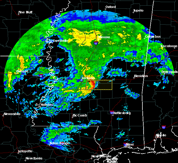 At 1023 am cst, severe thunderstorms were located along a line extending from near pelahatchie to cato, moving east at 60 mph (radar indicated). Hazards include 60 mph wind gusts and half dollar size hail. Hail damage to vehicles is expected. expect wind damage to roofs, siding, and trees. these severe storms will be near, white oak around 1035 am cst. pulaski and burns around 1040 am cst. homewood around 1045 am cst. pineville around 1050 am cst. Other locations impacted by these severe thunderstorms include polkville and puckett. At 1023 am cst, severe thunderstorms were located along a line extending from near pelahatchie to cato, moving east at 60 mph (radar indicated). Hazards include 60 mph wind gusts and half dollar size hail. Hail damage to vehicles is expected. expect wind damage to roofs, siding, and trees. these severe storms will be near, white oak around 1035 am cst. pulaski and burns around 1040 am cst. homewood around 1045 am cst. pineville around 1050 am cst. Other locations impacted by these severe thunderstorms include polkville and puckett.
|
| 3/4/2020 10:08 AM CST |
 At 1007 am cst, severe thunderstorms were located along a line extending from pearl to near star, moving east at 65 mph (radar indicated). Hazards include 60 mph wind gusts and quarter size hail. Hail damage to vehicles is expected. expect wind damage to roofs, siding, and trees. severe thunderstorms will be near, cato and johns around 1020 am cst. pelahatchie around 1025 am cst. white oak around 1030 am cst. pulaski and burns around 1035 am cst. homewood around 1040 am cst. pineville around 1045 am cst. Other locations impacted by these severe thunderstorms include polkville and puckett. At 1007 am cst, severe thunderstorms were located along a line extending from pearl to near star, moving east at 65 mph (radar indicated). Hazards include 60 mph wind gusts and quarter size hail. Hail damage to vehicles is expected. expect wind damage to roofs, siding, and trees. severe thunderstorms will be near, cato and johns around 1020 am cst. pelahatchie around 1025 am cst. white oak around 1030 am cst. pulaski and burns around 1035 am cst. homewood around 1040 am cst. pineville around 1045 am cst. Other locations impacted by these severe thunderstorms include polkville and puckett.
|
| 2/5/2020 2:32 PM CST |
 At 232 pm cst, a severe thunderstorm capable of producing a tornado was located near shivers, or near pinola, moving northeast at 45 mph (radar indicated rotation). Hazards include tornado and quarter size hail. Flying debris will be dangerous to those caught without shelter. mobile homes will be damaged or destroyed. damage to roofs, windows, and vehicles will occur. tree damage is likely. this dangerous storm will be near, mendenhall and sanatorium around 250 pm cst. martinville around 255 pm cst. Other locations impacted by this tornadic thunderstorm include d`lo. At 232 pm cst, a severe thunderstorm capable of producing a tornado was located near shivers, or near pinola, moving northeast at 45 mph (radar indicated rotation). Hazards include tornado and quarter size hail. Flying debris will be dangerous to those caught without shelter. mobile homes will be damaged or destroyed. damage to roofs, windows, and vehicles will occur. tree damage is likely. this dangerous storm will be near, mendenhall and sanatorium around 250 pm cst. martinville around 255 pm cst. Other locations impacted by this tornadic thunderstorm include d`lo.
|
| 2/5/2020 2:24 PM CST |
 At 224 pm cst, a severe thunderstorm capable of producing a tornado was located near rockport, or 9 miles southwest of pinola, moving northeast at 40 mph (radar indicated rotation). Hazards include tornado and quarter size hail. Flying debris will be dangerous to those caught without shelter. mobile homes will be damaged or destroyed. damage to roofs, windows, and vehicles will occur. tree damage is likely. this dangerous storm will be near, shivers around 230 pm cst. pinola around 240 pm cst. mendenhall and sanatorium around 250 pm cst. martinville around 255 pm cst. Other locations impacted by this tornadic thunderstorm include d`lo and braxton. At 224 pm cst, a severe thunderstorm capable of producing a tornado was located near rockport, or 9 miles southwest of pinola, moving northeast at 40 mph (radar indicated rotation). Hazards include tornado and quarter size hail. Flying debris will be dangerous to those caught without shelter. mobile homes will be damaged or destroyed. damage to roofs, windows, and vehicles will occur. tree damage is likely. this dangerous storm will be near, shivers around 230 pm cst. pinola around 240 pm cst. mendenhall and sanatorium around 250 pm cst. martinville around 255 pm cst. Other locations impacted by this tornadic thunderstorm include d`lo and braxton.
|
| 2/5/2020 2:07 PM CST |
 At 207 pm cst, a severe thunderstorm capable of producing a tornado was located near sontag, or 13 miles northeast of brookhaven, moving northeast at 45 mph (radar indicated rotation). Hazards include tornado and golf ball size hail. Flying debris will be dangerous to those caught without shelter. mobile homes will be damaged or destroyed. damage to roofs, windows, and vehicles will occur. tree damage is likely. this dangerous storm will be near, oma around 215 pm cst. rockport around 220 pm cst. union and shivers around 230 pm cst. pinola around 235 pm cst. mendenhall around 245 pm cst. magee and sanatorium around 250 pm cst. martinville around 255 pm cst. Other locations impacted by this tornadic thunderstorm include new hebron, d`lo and braxton. At 207 pm cst, a severe thunderstorm capable of producing a tornado was located near sontag, or 13 miles northeast of brookhaven, moving northeast at 45 mph (radar indicated rotation). Hazards include tornado and golf ball size hail. Flying debris will be dangerous to those caught without shelter. mobile homes will be damaged or destroyed. damage to roofs, windows, and vehicles will occur. tree damage is likely. this dangerous storm will be near, oma around 215 pm cst. rockport around 220 pm cst. union and shivers around 230 pm cst. pinola around 235 pm cst. mendenhall around 245 pm cst. magee and sanatorium around 250 pm cst. martinville around 255 pm cst. Other locations impacted by this tornadic thunderstorm include new hebron, d`lo and braxton.
|
| 1/11/2020 9:08 AM CST |
 At 907 am cst, severe thunderstorms were located along a line extending from near renfroe to near ludlow to near johns, moving northeast at 40 mph (radar indicated). Hazards include 60 mph wind gusts. Expect damage to roofs, siding, and trees. these severe storms will be near, harperville and renfroe around 915 am cst. tuscola around 920 am cst. madden and stallo around 935 am cst. dowdville and pulaski around 940 am cst. philadelphia, forest, pearl river, neshoba, dixon and homewood around 945 am cst. other locations impacted by these severe thunderstorms include walnut grove, redwater, sebastopol, standing pine, puckett, polkville and lena. a tornado watch remains in effect until 1100 am cst for central mississippi. A tornado watch also remains in effect until 400 pm cst for central and east central mississippi. At 907 am cst, severe thunderstorms were located along a line extending from near renfroe to near ludlow to near johns, moving northeast at 40 mph (radar indicated). Hazards include 60 mph wind gusts. Expect damage to roofs, siding, and trees. these severe storms will be near, harperville and renfroe around 915 am cst. tuscola around 920 am cst. madden and stallo around 935 am cst. dowdville and pulaski around 940 am cst. philadelphia, forest, pearl river, neshoba, dixon and homewood around 945 am cst. other locations impacted by these severe thunderstorms include walnut grove, redwater, sebastopol, standing pine, puckett, polkville and lena. a tornado watch remains in effect until 1100 am cst for central mississippi. A tornado watch also remains in effect until 400 pm cst for central and east central mississippi.
|
| 1/11/2020 9:00 AM CST |
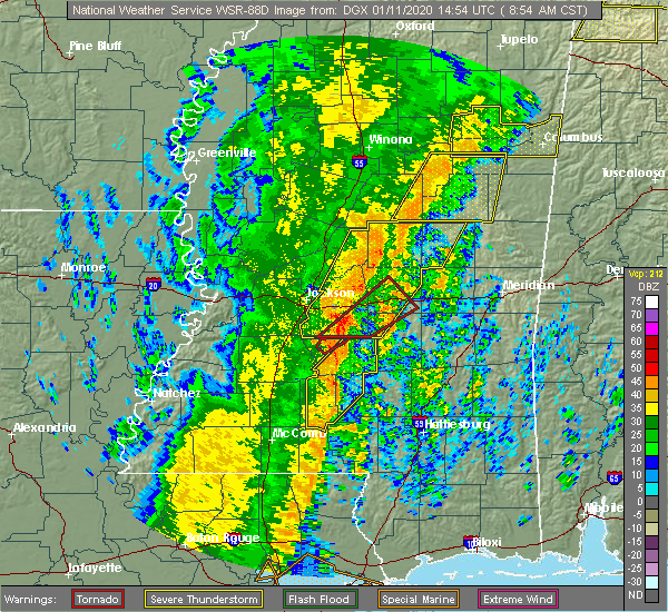 At 859 am cst, a severe thunderstorm capable of producing a tornado was located over cato, or 7 miles east of star, moving northeast at 45 mph (radar indicated rotation). Hazards include tornado. Flying debris will be dangerous to those caught without shelter. mobile homes will be damaged or destroyed. damage to roofs, windows, and vehicles will occur. tree damage is likely. this dangerous storm will be near, johns around 905 am cst. pelahatchie around 920 am cst. morton, pulaski and homewood around 930 am cst. Other locations impacted by this tornadic thunderstorm include polkville and puckett. At 859 am cst, a severe thunderstorm capable of producing a tornado was located over cato, or 7 miles east of star, moving northeast at 45 mph (radar indicated rotation). Hazards include tornado. Flying debris will be dangerous to those caught without shelter. mobile homes will be damaged or destroyed. damage to roofs, windows, and vehicles will occur. tree damage is likely. this dangerous storm will be near, johns around 905 am cst. pelahatchie around 920 am cst. morton, pulaski and homewood around 930 am cst. Other locations impacted by this tornadic thunderstorm include polkville and puckett.
|
| 1/11/2020 8:49 AM CST |
 At 849 am cst, a severe thunderstorm capable of producing a tornado was located near piney woods, or near star, moving northeast at 45 mph (radar indicated rotation). Hazards include tornado. Flying debris will be dangerous to those caught without shelter. mobile homes will be damaged or destroyed. damage to roofs, windows, and vehicles will occur. tree damage is likely. this dangerous storm will be near, cato around 900 am cst. johns around 905 am cst. morton, pulaski and homewood around 930 am cst. forest around 940 am cst. Other locations impacted by this tornadic thunderstorm include polkville and puckett. At 849 am cst, a severe thunderstorm capable of producing a tornado was located near piney woods, or near star, moving northeast at 45 mph (radar indicated rotation). Hazards include tornado. Flying debris will be dangerous to those caught without shelter. mobile homes will be damaged or destroyed. damage to roofs, windows, and vehicles will occur. tree damage is likely. this dangerous storm will be near, cato around 900 am cst. johns around 905 am cst. morton, pulaski and homewood around 930 am cst. forest around 940 am cst. Other locations impacted by this tornadic thunderstorm include polkville and puckett.
|
| 1/11/2020 8:43 AM CST |
 At 843 am cst, severe thunderstorms were located along a line extending from near thomastown to near pisgah to near star, moving east at 30 mph (radar indicated). Hazards include 60 mph wind gusts. Expect damage to roofs, siding, and trees. these severe storms will be near, carthage, leesburg, thomastown and branch around 850 am cst. singleton and ludlow around 855 am cst. renfroe and forkville around 900 am cst. cato around 905 am cst. edinburg around 910 am cst. harperville, johns and tuscola around 915 am cst. other locations impacted by these severe thunderstorms include walnut grove, redwater, sebastopol, standing pine, puckett, polkville and lena. a tornado watch remains in effect until 900 am cst for central mississippi. A tornado watch also remains in effect until 400 pm cst for central and east central mississippi. At 843 am cst, severe thunderstorms were located along a line extending from near thomastown to near pisgah to near star, moving east at 30 mph (radar indicated). Hazards include 60 mph wind gusts. Expect damage to roofs, siding, and trees. these severe storms will be near, carthage, leesburg, thomastown and branch around 850 am cst. singleton and ludlow around 855 am cst. renfroe and forkville around 900 am cst. cato around 905 am cst. edinburg around 910 am cst. harperville, johns and tuscola around 915 am cst. other locations impacted by these severe thunderstorms include walnut grove, redwater, sebastopol, standing pine, puckett, polkville and lena. a tornado watch remains in effect until 900 am cst for central mississippi. A tornado watch also remains in effect until 400 pm cst for central and east central mississippi.
|
| 1/11/2020 8:14 AM CST |
 At 814 am cst, severe thunderstorms were located along a line extending from near kosciusko to near goshen springs to whites, moving east at 40 mph (radar indicated). Hazards include 60 mph wind gusts. Expect damage to roofs, siding, and trees. severe thunderstorms will be near, piney woods and farmhaven around 830 am cst. ludlow and forkville around 835 am cst. cato around 840 am cst. johns around 845 am cst. tuscola around 850 am cst. pelahatchie around 855 am cst. morton, pulaski, dowdville and madden around 910 am cst. philadelphia, forest, edinburg, pearl river, dixon and homewood around 915 am cst. other locations impacted by these severe thunderstorms include walnut grove, redwater, sebastopol, standing pine, puckett, polkville and lena. a tornado watch remains in effect until 900 am cst for central mississippi. A tornado watch also remains in effect until 400 pm cst for central and east central mississippi. At 814 am cst, severe thunderstorms were located along a line extending from near kosciusko to near goshen springs to whites, moving east at 40 mph (radar indicated). Hazards include 60 mph wind gusts. Expect damage to roofs, siding, and trees. severe thunderstorms will be near, piney woods and farmhaven around 830 am cst. ludlow and forkville around 835 am cst. cato around 840 am cst. johns around 845 am cst. tuscola around 850 am cst. pelahatchie around 855 am cst. morton, pulaski, dowdville and madden around 910 am cst. philadelphia, forest, edinburg, pearl river, dixon and homewood around 915 am cst. other locations impacted by these severe thunderstorms include walnut grove, redwater, sebastopol, standing pine, puckett, polkville and lena. a tornado watch remains in effect until 900 am cst for central mississippi. A tornado watch also remains in effect until 400 pm cst for central and east central mississippi.
|
| 11/27/2019 12:30 AM CST |
 At 1230 am cst, a confirmed tornado was located just north of puckett, or 14 miles northeast of mendenhall, moving east at 40 mph (radar confirmed tornado). Hazards include damaging tornado. Flying debris will be dangerous to those caught without shelter. mobile homes will be damaged or destroyed. damage to roofs, windows, and vehicles will occur. tree damage is likely. this tornadic storm will be near, pulaski and burns around 1245 am cst. homewood around 1255 am cst. forest and pineville around 100 am cst. Other locations impacted by this tornadic thunderstorm include polkville and puckett. At 1230 am cst, a confirmed tornado was located just north of puckett, or 14 miles northeast of mendenhall, moving east at 40 mph (radar confirmed tornado). Hazards include damaging tornado. Flying debris will be dangerous to those caught without shelter. mobile homes will be damaged or destroyed. damage to roofs, windows, and vehicles will occur. tree damage is likely. this tornadic storm will be near, pulaski and burns around 1245 am cst. homewood around 1255 am cst. forest and pineville around 100 am cst. Other locations impacted by this tornadic thunderstorm include polkville and puckett.
|
| 11/27/2019 12:21 AM CST |
 At 1221 am cst, severe thunderstorms were located along a line extending from near pelahatchie to johns to near mendenhall, moving northeast at 45 mph (radar indicated). Hazards include 60 mph wind gusts. Expect damage to roofs, siding, and trees. severe thunderstorms will be near, pelahatchie around 1225 am cst. morton around 1235 am cst. white oak and pulaski around 1245 am cst. forest, homewood and hillsboro around 1250 am cst. burns around 1255 am cst. steele around 100 am cst. pineville around 105 am cst. Other locations impacted by these severe thunderstorms include polkville, d`lo, lake and puckett. At 1221 am cst, severe thunderstorms were located along a line extending from near pelahatchie to johns to near mendenhall, moving northeast at 45 mph (radar indicated). Hazards include 60 mph wind gusts. Expect damage to roofs, siding, and trees. severe thunderstorms will be near, pelahatchie around 1225 am cst. morton around 1235 am cst. white oak and pulaski around 1245 am cst. forest, homewood and hillsboro around 1250 am cst. burns around 1255 am cst. steele around 100 am cst. pineville around 105 am cst. Other locations impacted by these severe thunderstorms include polkville, d`lo, lake and puckett.
|
| 9/9/2019 5:36 PM CDT |
 The severe thunderstorm warning for southeastern rankin county will expire at 545 pm cdt, the storm which prompted the warning has weakened below severe limits, and no longer poses an immediate threat to life or property. therefore, the warning will be allowed to expire. however, gusty winds are still possible with this thunderstorm. The severe thunderstorm warning for southeastern rankin county will expire at 545 pm cdt, the storm which prompted the warning has weakened below severe limits, and no longer poses an immediate threat to life or property. therefore, the warning will be allowed to expire. however, gusty winds are still possible with this thunderstorm.
|
| 9/9/2019 5:27 PM CDT |
 At 527 pm cdt, a severe thunderstorm was located near johns, or 13 miles southeast of brandon, moving northwest at 15 mph (radar indicated). Hazards include 60 mph wind gusts and penny size hail. Expect damage to roofs, siding, and trees. This severe thunderstorm will remain over mainly rural areas of southeastern rankin county, including the following locations, puckett. At 527 pm cdt, a severe thunderstorm was located near johns, or 13 miles southeast of brandon, moving northwest at 15 mph (radar indicated). Hazards include 60 mph wind gusts and penny size hail. Expect damage to roofs, siding, and trees. This severe thunderstorm will remain over mainly rural areas of southeastern rankin county, including the following locations, puckett.
|
| 9/9/2019 5:13 PM CDT |
 At 513 pm cdt, a severe thunderstorm was located near johns, or 14 miles northeast of mendenhall, moving west at 15 mph (radar indicated). Hazards include 60 mph wind gusts and penny size hail. Expect damage to roofs, siding, and trees. this severe storm will be near, johns around 535 pm cdt. cato around 540 pm cdt. Other locations impacted by this severe thunderstorm include polkville and puckett. At 513 pm cdt, a severe thunderstorm was located near johns, or 14 miles northeast of mendenhall, moving west at 15 mph (radar indicated). Hazards include 60 mph wind gusts and penny size hail. Expect damage to roofs, siding, and trees. this severe storm will be near, johns around 535 pm cdt. cato around 540 pm cdt. Other locations impacted by this severe thunderstorm include polkville and puckett.
|
| 9/9/2019 4:44 PM CDT |
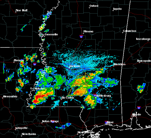 At 444 pm cdt, a severe thunderstorm was located near white oak, or 9 miles northeast of mendenhall, moving northwest at 15 mph (radar indicated). Hazards include 60 mph wind gusts and penny size hail. Expect damage to roofs, siding, and trees. this severe thunderstorm will be near, johns and cato around 515 pm cdt. Other locations impacted by this severe thunderstorm include polkville and puckett. At 444 pm cdt, a severe thunderstorm was located near white oak, or 9 miles northeast of mendenhall, moving northwest at 15 mph (radar indicated). Hazards include 60 mph wind gusts and penny size hail. Expect damage to roofs, siding, and trees. this severe thunderstorm will be near, johns and cato around 515 pm cdt. Other locations impacted by this severe thunderstorm include polkville and puckett.
|
| 6/27/2019 3:51 PM CDT |
 At 350 pm cdt, severe thunderstorms were located along a line extending from branch to near gluckstadt, moving south at 15 mph (radar indicated). Hazards include 60 mph wind gusts. Expect damage to roofs, siding, and trees. Locations impacted include, jackson, clinton, pearl, madison, ridgeland, brandon, canton, byram, flowood, richland, morton, star, florence, raymond, pelahatchie, terry, leesburg, pocahontas, goshen springs and ludlow. At 350 pm cdt, severe thunderstorms were located along a line extending from branch to near gluckstadt, moving south at 15 mph (radar indicated). Hazards include 60 mph wind gusts. Expect damage to roofs, siding, and trees. Locations impacted include, jackson, clinton, pearl, madison, ridgeland, brandon, canton, byram, flowood, richland, morton, star, florence, raymond, pelahatchie, terry, leesburg, pocahontas, goshen springs and ludlow.
|
| 6/27/2019 3:34 PM CDT |
 At 333 pm cdt, severe thunderstorms were located along a line extending from near ludlow to near myrleville, moving south at 20 mph (radar indicated). Hazards include 60 mph wind gusts and nickel size hail. expect damage to roofs, siding, and trees At 333 pm cdt, severe thunderstorms were located along a line extending from near ludlow to near myrleville, moving south at 20 mph (radar indicated). Hazards include 60 mph wind gusts and nickel size hail. expect damage to roofs, siding, and trees
|
| 6/24/2019 4:41 AM CDT |
 At 441 am cdt, severe thunderstorms were located along a line extending from near gluckstadt to near monterey, moving east at 40 mph (radar indicated). Hazards include 60 mph wind gusts. Expect damage to roofs, siding, and trees. these severe storms will be near, canton around 445 am cdt. goshen springs, pisgah and johns around 455 am cdt. pelahatchie and farmhaven around 505 am cdt. Other locations impacted by these severe thunderstorms include puckett. At 441 am cdt, severe thunderstorms were located along a line extending from near gluckstadt to near monterey, moving east at 40 mph (radar indicated). Hazards include 60 mph wind gusts. Expect damage to roofs, siding, and trees. these severe storms will be near, canton around 445 am cdt. goshen springs, pisgah and johns around 455 am cdt. pelahatchie and farmhaven around 505 am cdt. Other locations impacted by these severe thunderstorms include puckett.
|
| 6/24/2019 4:29 AM CDT |
 At 409 am cdt, severe thunderstorms were located along a line extending from near brownsville to near terry, moving east at 45 mph (radar indicated. at 408 am, a 56 mph wind gust was recorded at the raymond airport). Hazards include 60 mph wind gusts. Expect damage to roofs, siding, and trees. these severe storms will be near, jackson and pocahontas around 415 am cdt. byram and whites around 420 am cdt. richland and annandale around 425 am cdt. pearl, madison, ridgeland, florence and monterey around 430 am cdt. canton, star and gluckstadt around 435 am cdt. brandon and fannin around 440 am cdt. goshen springs around 445 am cdt. pisgah and johns around 450 am cdt. Other locations impacted by these severe thunderstorms include puckett. At 409 am cdt, severe thunderstorms were located along a line extending from near brownsville to near terry, moving east at 45 mph (radar indicated. at 408 am, a 56 mph wind gust was recorded at the raymond airport). Hazards include 60 mph wind gusts. Expect damage to roofs, siding, and trees. these severe storms will be near, jackson and pocahontas around 415 am cdt. byram and whites around 420 am cdt. richland and annandale around 425 am cdt. pearl, madison, ridgeland, florence and monterey around 430 am cdt. canton, star and gluckstadt around 435 am cdt. brandon and fannin around 440 am cdt. goshen springs around 445 am cdt. pisgah and johns around 450 am cdt. Other locations impacted by these severe thunderstorms include puckett.
|
| 6/24/2019 4:10 AM CDT |
 At 409 am cdt, severe thunderstorms were located along a line extending from near brownsville to near terry, moving east at 45 mph (radar indicated. at 408 am, a 56 mph wind gust was recorded at the raymond airport). Hazards include 60 mph wind gusts. Expect damage to roofs, siding, and trees. these severe storms will be near, jackson and pocahontas around 415 am cdt. byram and whites around 420 am cdt. richland and annandale around 425 am cdt. pearl, madison, ridgeland, florence and monterey around 430 am cdt. canton, star and gluckstadt around 435 am cdt. brandon and fannin around 440 am cdt. goshen springs around 445 am cdt. pisgah and johns around 450 am cdt. Other locations impacted by these severe thunderstorms include puckett. At 409 am cdt, severe thunderstorms were located along a line extending from near brownsville to near terry, moving east at 45 mph (radar indicated. at 408 am, a 56 mph wind gust was recorded at the raymond airport). Hazards include 60 mph wind gusts. Expect damage to roofs, siding, and trees. these severe storms will be near, jackson and pocahontas around 415 am cdt. byram and whites around 420 am cdt. richland and annandale around 425 am cdt. pearl, madison, ridgeland, florence and monterey around 430 am cdt. canton, star and gluckstadt around 435 am cdt. brandon and fannin around 440 am cdt. goshen springs around 445 am cdt. pisgah and johns around 450 am cdt. Other locations impacted by these severe thunderstorms include puckett.
|
| 6/24/2019 4:01 AM CDT |
 At 401 am cdt, severe thunderstorms were located along a line extending from near brownsville to near dry grove, moving east at 35 mph (radar indicated). Hazards include 60 mph wind gusts. Expect damage to roofs, siding, and trees. severe thunderstorms will be near, bolton and brownsville around 405 am cdt. raymond around 410 am cdt. jackson and terry around 415 am cdt. byram and pocahontas around 420 am cdt. whites around 425 am cdt. richland and annandale around 430 am cdt. madison, ridgeland and florence around 435 am cdt. pearl, canton, star, gluckstadt and monterey around 440 am cdt. Other locations impacted by these severe thunderstorms include puckett. At 401 am cdt, severe thunderstorms were located along a line extending from near brownsville to near dry grove, moving east at 35 mph (radar indicated). Hazards include 60 mph wind gusts. Expect damage to roofs, siding, and trees. severe thunderstorms will be near, bolton and brownsville around 405 am cdt. raymond around 410 am cdt. jackson and terry around 415 am cdt. byram and pocahontas around 420 am cdt. whites around 425 am cdt. richland and annandale around 430 am cdt. madison, ridgeland and florence around 435 am cdt. pearl, canton, star, gluckstadt and monterey around 440 am cdt. Other locations impacted by these severe thunderstorms include puckett.
|
| 5/9/2019 11:08 AM CDT |
 At 1108 am cdt, a severe thunderstorm was located near johns, or 9 miles northeast of mendenhall, moving northeast at 35 mph (radar indicated). Hazards include golf ball size hail and 60 mph wind gusts. People and animals outdoors will be injured. expect hail damage to roofs, siding, windows, and vehicles. expect wind damage to roofs, siding, and trees. this severe storm will be near, white oak around 1115 am cdt. burns around 1130 am cdt. Other locations impacted by this severe thunderstorm include polkville and puckett. At 1108 am cdt, a severe thunderstorm was located near johns, or 9 miles northeast of mendenhall, moving northeast at 35 mph (radar indicated). Hazards include golf ball size hail and 60 mph wind gusts. People and animals outdoors will be injured. expect hail damage to roofs, siding, windows, and vehicles. expect wind damage to roofs, siding, and trees. this severe storm will be near, white oak around 1115 am cdt. burns around 1130 am cdt. Other locations impacted by this severe thunderstorm include polkville and puckett.
|
| 5/9/2019 10:58 AM CDT |
 At 1058 am cdt, a severe thunderstorm was located near cato, or near mendenhall, moving northeast at 25 mph (radar indicated). Hazards include 60 mph wind gusts and quarter size hail. Hail damage to vehicles is expected. expect wind damage to roofs, siding, and trees. this severe storm will be near, johns around 1110 am cdt. white oak around 1125 am cdt. burns around 1145 am cdt. Other locations impacted by this severe thunderstorm include polkville, d`lo, braxton and puckett. At 1058 am cdt, a severe thunderstorm was located near cato, or near mendenhall, moving northeast at 25 mph (radar indicated). Hazards include 60 mph wind gusts and quarter size hail. Hail damage to vehicles is expected. expect wind damage to roofs, siding, and trees. this severe storm will be near, johns around 1110 am cdt. white oak around 1125 am cdt. burns around 1145 am cdt. Other locations impacted by this severe thunderstorm include polkville, d`lo, braxton and puckett.
|
| 5/9/2019 10:37 AM CDT |
 At 1037 am cdt, a severe thunderstorm was located near harrisville, or near pinola, moving northeast at 35 mph (radar indicated). Hazards include 60 mph wind gusts. Expect damage to roofs, siding, and trees. this severe thunderstorm will be near, mendenhall around 1050 am cdt. cato around 1100 am cdt. johns around 1105 am cdt. white oak around 1115 am cdt. burns around 1130 am cdt. Other locations impacted by this severe thunderstorm include polkville, d`lo, braxton and puckett. At 1037 am cdt, a severe thunderstorm was located near harrisville, or near pinola, moving northeast at 35 mph (radar indicated). Hazards include 60 mph wind gusts. Expect damage to roofs, siding, and trees. this severe thunderstorm will be near, mendenhall around 1050 am cdt. cato around 1100 am cdt. johns around 1105 am cdt. white oak around 1115 am cdt. burns around 1130 am cdt. Other locations impacted by this severe thunderstorm include polkville, d`lo, braxton and puckett.
|
| 5/9/2019 8:22 AM CDT |
 At 822 am cdt, severe thunderstorms were located along a line extending from near brownsville to raymond to near carpenter, moving east at 60 mph (radar indicated). Hazards include 60 mph wind gusts and quarter size hail. Hail damage to vehicles is expected. expect wind damage to roofs, siding, and trees. severe thunderstorms will be near, clinton and raymond around 825 am cdt. jackson and pocahontas around 830 am cdt. byram and dry grove around 835 am cdt. pearl, madison, ridgeland, flowood, richland and florence around 840 am cdt. brandon, terry and monterey around 845 am cdt. fannin and whites around 850 am cdt. cato around 855 am cdt. pelahatchie, johns and piney woods around 900 am cdt. Other locations impacted by these severe thunderstorms include polkville and puckett. At 822 am cdt, severe thunderstorms were located along a line extending from near brownsville to raymond to near carpenter, moving east at 60 mph (radar indicated). Hazards include 60 mph wind gusts and quarter size hail. Hail damage to vehicles is expected. expect wind damage to roofs, siding, and trees. severe thunderstorms will be near, clinton and raymond around 825 am cdt. jackson and pocahontas around 830 am cdt. byram and dry grove around 835 am cdt. pearl, madison, ridgeland, flowood, richland and florence around 840 am cdt. brandon, terry and monterey around 845 am cdt. fannin and whites around 850 am cdt. cato around 855 am cdt. pelahatchie, johns and piney woods around 900 am cdt. Other locations impacted by these severe thunderstorms include polkville and puckett.
|
| 5/3/2019 4:59 PM CDT |
 At 458 pm cdt, a severe thunderstorm was located over cato, or 7 miles north of mendenhall, moving north at 15 mph (radar indicated). Hazards include ping pong ball size hail and 60 mph wind gusts. People and animals outdoors will be injured. expect hail damage to roofs, siding, windows, and vehicles. expect wind damage to roofs, siding, and trees. this severe storm will be near, johns around 515 pm cdt. Other locations impacted by this severe thunderstorm include d`lo and puckett. At 458 pm cdt, a severe thunderstorm was located over cato, or 7 miles north of mendenhall, moving north at 15 mph (radar indicated). Hazards include ping pong ball size hail and 60 mph wind gusts. People and animals outdoors will be injured. expect hail damage to roofs, siding, windows, and vehicles. expect wind damage to roofs, siding, and trees. this severe storm will be near, johns around 515 pm cdt. Other locations impacted by this severe thunderstorm include d`lo and puckett.
|
| 5/3/2019 4:28 PM CDT |
 At 428 pm cdt, a severe thunderstorm was located over mendenhall, moving north at 15 mph (radar indicated). Hazards include 60 mph wind gusts and quarter size hail. Hail damage to vehicles is expected. expect wind damage to roofs, siding, and trees. this severe thunderstorm will be near, martinville around 440 pm cdt. cato around 505 pm cdt. johns around 515 pm cdt. Other locations impacted by this severe thunderstorm include d`lo and puckett. At 428 pm cdt, a severe thunderstorm was located over mendenhall, moving north at 15 mph (radar indicated). Hazards include 60 mph wind gusts and quarter size hail. Hail damage to vehicles is expected. expect wind damage to roofs, siding, and trees. this severe thunderstorm will be near, martinville around 440 pm cdt. cato around 505 pm cdt. johns around 515 pm cdt. Other locations impacted by this severe thunderstorm include d`lo and puckett.
|
| 4/18/2019 3:17 PM CDT |
 At 317 pm cdt, a confirmed large and extremely dangerous tornado was located near johns, or 14 miles southwest of morton, moving northeast at 45 mph. this is a particularly dangerous situation. take cover now! (radar confirmed tornado). Hazards include damaging tornado. You are in a life-threatening situation. flying debris may be deadly to those caught without shelter. mobile homes will be destroyed. considerable damage to homes, businesses, and vehicles is likely and complete destruction is possible. Locations impacted include, johns, cato, piney woods and puckett. At 317 pm cdt, a confirmed large and extremely dangerous tornado was located near johns, or 14 miles southwest of morton, moving northeast at 45 mph. this is a particularly dangerous situation. take cover now! (radar confirmed tornado). Hazards include damaging tornado. You are in a life-threatening situation. flying debris may be deadly to those caught without shelter. mobile homes will be destroyed. considerable damage to homes, businesses, and vehicles is likely and complete destruction is possible. Locations impacted include, johns, cato, piney woods and puckett.
|
| 4/18/2019 3:08 PM CDT |
 At 308 pm cdt, a confirmed tornado was located near johns, or 13 miles northeast of mendenhall, moving northeast at 60 mph (radar confirmed tornado). Hazards include damaging tornado. Flying debris will be dangerous to those caught without shelter. mobile homes will be damaged or destroyed. damage to roofs, windows, and vehicles will occur. tree damage is likely. This tornadic thunderstorm will remain over mainly rural areas of southeastern rankin county, including the following locations, puckett. At 308 pm cdt, a confirmed tornado was located near johns, or 13 miles northeast of mendenhall, moving northeast at 60 mph (radar confirmed tornado). Hazards include damaging tornado. Flying debris will be dangerous to those caught without shelter. mobile homes will be damaged or destroyed. damage to roofs, windows, and vehicles will occur. tree damage is likely. This tornadic thunderstorm will remain over mainly rural areas of southeastern rankin county, including the following locations, puckett.
|
| 4/18/2019 2:59 PM CDT |
 At 259 pm cdt, a confirmed tornado was located near cato, or near mendenhall, moving northeast at 50 mph (radar confirmed tornado). Hazards include damaging tornado. Flying debris will be dangerous to those caught without shelter. mobile homes will be damaged or destroyed. damage to roofs, windows, and vehicles will occur. tree damage is likely. this tornado will be near, johns around 310 pm cdt. Other locations impacted by this tornadic thunderstorm include d`lo, braxton and puckett. At 259 pm cdt, a confirmed tornado was located near cato, or near mendenhall, moving northeast at 50 mph (radar confirmed tornado). Hazards include damaging tornado. Flying debris will be dangerous to those caught without shelter. mobile homes will be damaged or destroyed. damage to roofs, windows, and vehicles will occur. tree damage is likely. this tornado will be near, johns around 310 pm cdt. Other locations impacted by this tornadic thunderstorm include d`lo, braxton and puckett.
|
| 4/18/2019 2:40 PM CDT |
 At 240 pm cdt, a tornado producing storm was located near harrisville, or 10 miles west of pinola, moving northeast at 35 mph (radar confirmed tornado). Hazards include damaging tornado. Flying debris will be dangerous to those caught without shelter. mobile homes will be damaged or destroyed. damage to roofs, windows, and vehicles will occur. tree damage is likely. this tornadic storm will be near, harrisville around 245 pm cdt. pinola around 250 pm cdt. piney woods around 300 pm cdt. mendenhall around 305 pm cdt. cato around 310 pm cdt. johns and martinville around 315 pm cdt. Other locations impacted by this tornadic thunderstorm include d`lo, braxton and puckett. At 240 pm cdt, a tornado producing storm was located near harrisville, or 10 miles west of pinola, moving northeast at 35 mph (radar confirmed tornado). Hazards include damaging tornado. Flying debris will be dangerous to those caught without shelter. mobile homes will be damaged or destroyed. damage to roofs, windows, and vehicles will occur. tree damage is likely. this tornadic storm will be near, harrisville around 245 pm cdt. pinola around 250 pm cdt. piney woods around 300 pm cdt. mendenhall around 305 pm cdt. cato around 310 pm cdt. johns and martinville around 315 pm cdt. Other locations impacted by this tornadic thunderstorm include d`lo, braxton and puckett.
|
| 4/18/2019 2:16 PM CDT |
 At 216 pm cdt, severe thunderstorms were located along a line extending from edwards to near crystal springs to near martinsville, moving northeast at 45 mph (radar indicated). Hazards include 60 mph wind gusts. Expect damage to roofs, siding, and trees. severe thunderstorms will be near, whites around 230 pm cdt. richland and florence around 240 pm cdt. pearl, star, union and monterey around 245 pm cdt. harrisville and shivers around 250 pm cdt. ridgeland, brandon, pinola and annandale around 255 pm cdt. madison, gluckstadt and johns around 300 pm cdt. canton and mendenhall around 305 pm cdt. pelahatchie and sanatorium around 310 pm cdt. other locations impacted by these severe thunderstorms include d`lo, braxton and puckett. a tornado watch remains in effect until 700 pm cdt for central and south central mississippi. A tornado watch also remains in effect until 900 pm cdt for south central, central and southeastern mississippi. At 216 pm cdt, severe thunderstorms were located along a line extending from edwards to near crystal springs to near martinsville, moving northeast at 45 mph (radar indicated). Hazards include 60 mph wind gusts. Expect damage to roofs, siding, and trees. severe thunderstorms will be near, whites around 230 pm cdt. richland and florence around 240 pm cdt. pearl, star, union and monterey around 245 pm cdt. harrisville and shivers around 250 pm cdt. ridgeland, brandon, pinola and annandale around 255 pm cdt. madison, gluckstadt and johns around 300 pm cdt. canton and mendenhall around 305 pm cdt. pelahatchie and sanatorium around 310 pm cdt. other locations impacted by these severe thunderstorms include d`lo, braxton and puckett. a tornado watch remains in effect until 700 pm cdt for central and south central mississippi. A tornado watch also remains in effect until 900 pm cdt for south central, central and southeastern mississippi.
|
| 4/13/2019 7:43 PM CDT |
 At 743 pm cdt, severe thunderstorms were located along a line extending from near sharon to monterey to near rockport, moving northeast at 35 mph (radar indicated). Hazards include 60 mph wind gusts and quarter size hail. Hail damage to vehicles is expected. expect wind damage to roofs, siding, and trees. these severe storms will be near, brandon around 800 pm cdt. harrisville and shivers around 805 pm cdt. pinola around 810 pm cdt. pelahatchie around 815 pm cdt. mendenhall and leesburg around 825 pm cdt. sanatorium and cato around 830 pm cdt. martinville around 835 pm cdt. other locations impacted by these severe thunderstorms include d`lo, braxton, puckett and georgetown. A tornado watch remains in effect until 900 pm cdt for central and south central mississippi. At 743 pm cdt, severe thunderstorms were located along a line extending from near sharon to monterey to near rockport, moving northeast at 35 mph (radar indicated). Hazards include 60 mph wind gusts and quarter size hail. Hail damage to vehicles is expected. expect wind damage to roofs, siding, and trees. these severe storms will be near, brandon around 800 pm cdt. harrisville and shivers around 805 pm cdt. pinola around 810 pm cdt. pelahatchie around 815 pm cdt. mendenhall and leesburg around 825 pm cdt. sanatorium and cato around 830 pm cdt. martinville around 835 pm cdt. other locations impacted by these severe thunderstorms include d`lo, braxton, puckett and georgetown. A tornado watch remains in effect until 900 pm cdt for central and south central mississippi.
|
| 4/13/2019 7:22 PM CDT |
 At 722 pm cdt, severe thunderstorms were located along a line extending from gluckstadt to terry to near wesson, moving northeast at 35 mph (radar indicated). Hazards include 60 mph wind gusts and quarter size hail. Hail damage to vehicles is expected. expect wind damage to roofs, siding, and trees. severe thunderstorms will be near, goshen springs around 735 pm cdt. richland, florence and pisgah around 740 pm cdt. star and monterey around 745 pm cdt. pearl and rockport around 750 pm cdt. brandon around 755 pm cdt. union around 800 pm cdt. harrisville and shivers around 805 pm cdt. pinola around 810 pm cdt. other locations impacted by these severe thunderstorms include d`lo, beauregard, braxton, puckett and georgetown. A tornado watch remains in effect until 900 pm cdt for central and south central mississippi. At 722 pm cdt, severe thunderstorms were located along a line extending from gluckstadt to terry to near wesson, moving northeast at 35 mph (radar indicated). Hazards include 60 mph wind gusts and quarter size hail. Hail damage to vehicles is expected. expect wind damage to roofs, siding, and trees. severe thunderstorms will be near, goshen springs around 735 pm cdt. richland, florence and pisgah around 740 pm cdt. star and monterey around 745 pm cdt. pearl and rockport around 750 pm cdt. brandon around 755 pm cdt. union around 800 pm cdt. harrisville and shivers around 805 pm cdt. pinola around 810 pm cdt. other locations impacted by these severe thunderstorms include d`lo, beauregard, braxton, puckett and georgetown. A tornado watch remains in effect until 900 pm cdt for central and south central mississippi.
|
| 4/13/2019 12:21 AM CDT |
 At 1221 am cdt, a severe thunderstorm was located over johns, or 12 miles north of mendenhall, moving northeast at 55 mph (radar indicated). Hazards include 60 mph wind gusts and quarter size hail. Hail damage to vehicles is expected. expect wind damage to roofs, siding, and trees. This severe thunderstorm will remain over mainly rural areas of southeastern rankin, northwestern smith and southwestern scott counties, including the following locations, polkville and puckett. At 1221 am cdt, a severe thunderstorm was located over johns, or 12 miles north of mendenhall, moving northeast at 55 mph (radar indicated). Hazards include 60 mph wind gusts and quarter size hail. Hail damage to vehicles is expected. expect wind damage to roofs, siding, and trees. This severe thunderstorm will remain over mainly rural areas of southeastern rankin, northwestern smith and southwestern scott counties, including the following locations, polkville and puckett.
|
| 4/13/2019 12:09 AM CDT |
 At 1208 am cdt, a severe thunderstorm was located over piney woods, or near star, moving northeast at 55 mph (radar indicated). Hazards include 60 mph wind gusts and quarter size hail. Hail damage to vehicles is expected. expect wind damage to roofs, siding, and trees. this severe storm will be near, johns around 1215 am cdt. pelahatchie around 1225 am cdt. Other locations impacted by this severe thunderstorm include polkville and puckett. At 1208 am cdt, a severe thunderstorm was located over piney woods, or near star, moving northeast at 55 mph (radar indicated). Hazards include 60 mph wind gusts and quarter size hail. Hail damage to vehicles is expected. expect wind damage to roofs, siding, and trees. this severe storm will be near, johns around 1215 am cdt. pelahatchie around 1225 am cdt. Other locations impacted by this severe thunderstorm include polkville and puckett.
|
| 4/12/2019 11:52 PM CDT |
 At 1151 pm cdt, a severe thunderstorm was located over hopewell, or 9 miles southeast of crystal springs, moving northeast at 55 mph (radar indicated). Hazards include 60 mph wind gusts and quarter size hail. Hail damage to vehicles is expected. expect wind damage to roofs, siding, and trees. this severe thunderstorm will be near, union around 1155 pm cdt. harrisville around 1200 am cdt. star around 1205 am cdt. piney woods around 1210 am cdt. cato around 1215 am cdt. johns around 1220 am cdt. white oak around 1225 am cdt. Other locations impacted by this severe thunderstorm include polkville, d`lo, braxton, puckett and georgetown. At 1151 pm cdt, a severe thunderstorm was located over hopewell, or 9 miles southeast of crystal springs, moving northeast at 55 mph (radar indicated). Hazards include 60 mph wind gusts and quarter size hail. Hail damage to vehicles is expected. expect wind damage to roofs, siding, and trees. this severe thunderstorm will be near, union around 1155 pm cdt. harrisville around 1200 am cdt. star around 1205 am cdt. piney woods around 1210 am cdt. cato around 1215 am cdt. johns around 1220 am cdt. white oak around 1225 am cdt. Other locations impacted by this severe thunderstorm include polkville, d`lo, braxton, puckett and georgetown.
|
| 4/6/2019 5:18 PM CDT |
 At 518 pm cdt, severe thunderstorms were located along a line extending from near tuscola to near pulaski to near white oak, moving east at 30 mph (radar indicated). Hazards include 60 mph wind gusts and quarter size hail. Hail damage to vehicles is expected. expect wind damage to roofs, siding, and trees. severe thunderstorms will be near, pulaski and hillsboro around 525 pm cdt. harperville around 530 pm cdt. steele around 535 pm cdt. forest, burns and homewood around 540 pm cdt. prospect and conehatta around 555 pm cdt. lawrence, pineville, roberts and stratton around 600 pm cdt. Other locations impacted by these severe thunderstorms include polkville, lake, sebastopol, montrose, louin and puckett. At 518 pm cdt, severe thunderstorms were located along a line extending from near tuscola to near pulaski to near white oak, moving east at 30 mph (radar indicated). Hazards include 60 mph wind gusts and quarter size hail. Hail damage to vehicles is expected. expect wind damage to roofs, siding, and trees. severe thunderstorms will be near, pulaski and hillsboro around 525 pm cdt. harperville around 530 pm cdt. steele around 535 pm cdt. forest, burns and homewood around 540 pm cdt. prospect and conehatta around 555 pm cdt. lawrence, pineville, roberts and stratton around 600 pm cdt. Other locations impacted by these severe thunderstorms include polkville, lake, sebastopol, montrose, louin and puckett.
|
| 2/20/2019 8:02 AM CST |
 At 802 am cst, a severe thunderstorm was located over martinville, or 8 miles northeast of mendenhall, moving northeast at 45 mph (radar indicated). Hazards include 60 mph wind gusts and quarter size hail. Hail damage to vehicles is expected. expect wind damage to roofs, siding, and trees. this severe storm will be near, white oak around 810 am cst. raleigh and burns around 815 am cst. Other locations impacted by this severe thunderstorm include sylvarena and puckett. At 802 am cst, a severe thunderstorm was located over martinville, or 8 miles northeast of mendenhall, moving northeast at 45 mph (radar indicated). Hazards include 60 mph wind gusts and quarter size hail. Hail damage to vehicles is expected. expect wind damage to roofs, siding, and trees. this severe storm will be near, white oak around 810 am cst. raleigh and burns around 815 am cst. Other locations impacted by this severe thunderstorm include sylvarena and puckett.
|
| 2/20/2019 7:53 AM CST |
 At 751 am cst, a severe thunderstorm was located over mendenhall, moving northeast at 45 mph (radar indicated). Hazards include 60 mph wind gusts and quarter size hail. Hail damage to vehicles is expected. expect wind damage to roofs, siding, and trees. this severe storm will be near, mendenhall around 800 am cst. Other locations impacted by this severe thunderstorm include sylvarena and puckett. At 751 am cst, a severe thunderstorm was located over mendenhall, moving northeast at 45 mph (radar indicated). Hazards include 60 mph wind gusts and quarter size hail. Hail damage to vehicles is expected. expect wind damage to roofs, siding, and trees. this severe storm will be near, mendenhall around 800 am cst. Other locations impacted by this severe thunderstorm include sylvarena and puckett.
|
| 2/20/2019 7:37 AM CST |
 At 737 am cst, a severe thunderstorm was located over martinville, or near mendenhall, moving east at 45 mph (radar indicated). Hazards include 60 mph wind gusts and quarter size hail. Hail damage to vehicles is expected. expect wind damage to roofs, siding, and trees. this severe thunderstorm will be near, white oak around 745 am cst. raleigh around 755 am cst. burns around 800 am cst. pineville around 810 am cst. Other locations impacted by this severe thunderstorm include sylvarena and puckett. At 737 am cst, a severe thunderstorm was located over martinville, or near mendenhall, moving east at 45 mph (radar indicated). Hazards include 60 mph wind gusts and quarter size hail. Hail damage to vehicles is expected. expect wind damage to roofs, siding, and trees. this severe thunderstorm will be near, white oak around 745 am cst. raleigh around 755 am cst. burns around 800 am cst. pineville around 810 am cst. Other locations impacted by this severe thunderstorm include sylvarena and puckett.
|
| 1/19/2019 8:01 AM CST |
 At 801 am cst, severe thunderstorms were located along a line extending from forest to near martinville to near oma, moving northeast at 65 mph (radar indicated). Hazards include 60 mph wind gusts. Expect damage to roofs, siding, and trees. these severe storms will be near, pinola around 810 am cst. other locations impacted by these severe thunderstorms include d`lo, braxton, puckett and georgetown. A tornado watch remains in effect until 100 pm cst for central and south central mississippi. At 801 am cst, severe thunderstorms were located along a line extending from forest to near martinville to near oma, moving northeast at 65 mph (radar indicated). Hazards include 60 mph wind gusts. Expect damage to roofs, siding, and trees. these severe storms will be near, pinola around 810 am cst. other locations impacted by these severe thunderstorms include d`lo, braxton, puckett and georgetown. A tornado watch remains in effect until 100 pm cst for central and south central mississippi.
|
| 1/19/2019 7:45 AM CST |
 At 745 am cst, severe thunderstorms were located along a line extending from near pelahatchie to near harrisville to 6 miles west of sontag, moving northeast at 65 mph (radar indicated). Hazards include 60 mph wind gusts. Expect damage to roofs, siding, and trees. these severe storms will be near, mendenhall and cato around 755 am cst. shivers around 805 am cst. other locations impacted by these severe thunderstorms include d`lo, beauregard, braxton, puckett and georgetown. A tornado watch remains in effect until 100 pm cst for central and south central mississippi. At 745 am cst, severe thunderstorms were located along a line extending from near pelahatchie to near harrisville to 6 miles west of sontag, moving northeast at 65 mph (radar indicated). Hazards include 60 mph wind gusts. Expect damage to roofs, siding, and trees. these severe storms will be near, mendenhall and cato around 755 am cst. shivers around 805 am cst. other locations impacted by these severe thunderstorms include d`lo, beauregard, braxton, puckett and georgetown. A tornado watch remains in effect until 100 pm cst for central and south central mississippi.
|
| 1/19/2019 7:11 AM CST |
 At 711 am cst, severe thunderstorms were located along a line extending from near terry to near caseyville to near bude, moving northeast at 65 mph (radar indicated). Hazards include 60 mph wind gusts. Expect damage to roofs, siding, and trees. severe thunderstorms will be near, wesson and glancy around 720 am cst. hazlehurst, star, martinsville, mccall creek and center point around 725 am cst. west lincoln and vaughn around 730 am cst. rockport, hopewell, bogue chitto and johns around 735 am cst. brookhaven, union and enterprise around 740 am cst. pinola and harrisville around 745 am cst. sontag around 750 am cst. mendenhall, wanilla, oma and cato around 755 am cst. other locations impacted by these severe thunderstorms include d`lo, beauregard, braxton, puckett and georgetown. A tornado watch remains in effect until 100 pm cst for central, south central and southwestern mississippi. At 711 am cst, severe thunderstorms were located along a line extending from near terry to near caseyville to near bude, moving northeast at 65 mph (radar indicated). Hazards include 60 mph wind gusts. Expect damage to roofs, siding, and trees. severe thunderstorms will be near, wesson and glancy around 720 am cst. hazlehurst, star, martinsville, mccall creek and center point around 725 am cst. west lincoln and vaughn around 730 am cst. rockport, hopewell, bogue chitto and johns around 735 am cst. brookhaven, union and enterprise around 740 am cst. pinola and harrisville around 745 am cst. sontag around 750 am cst. mendenhall, wanilla, oma and cato around 755 am cst. other locations impacted by these severe thunderstorms include d`lo, beauregard, braxton, puckett and georgetown. A tornado watch remains in effect until 100 pm cst for central, south central and southwestern mississippi.
|
| 11/1/2018 4:14 AM CDT |
 At 414 am cdt, severe thunderstorms were located along a line extending from mcadams to near johns, moving east at 35 mph (radar indicated). Hazards include 60 mph wind gusts. Expect damage to roofs, siding, and trees. locations impacted include, pelahatchie, leesburg, pisgah, farmhaven, cato, goshen springs, johns, piney woods and puckett. A tornado watch remains in effect until 700 am cdt for central mississippi. At 414 am cdt, severe thunderstorms were located along a line extending from mcadams to near johns, moving east at 35 mph (radar indicated). Hazards include 60 mph wind gusts. Expect damage to roofs, siding, and trees. locations impacted include, pelahatchie, leesburg, pisgah, farmhaven, cato, goshen springs, johns, piney woods and puckett. A tornado watch remains in effect until 700 am cdt for central mississippi.
|
| 11/1/2018 3:21 AM CDT |
 At 320 am cdt, severe thunderstorms were located along a line extending from near yazoo city to near utica, moving east at 35 mph (radar indicated). Hazards include 60 mph wind gusts. expect damage to roofs, siding, and trees At 320 am cdt, severe thunderstorms were located along a line extending from near yazoo city to near utica, moving east at 35 mph (radar indicated). Hazards include 60 mph wind gusts. expect damage to roofs, siding, and trees
|
| 8/29/2018 3:03 PM CDT |
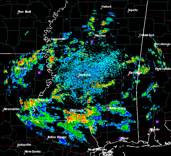 At 303 pm cdt, a severe thunderstorm was located near white oak, or 15 miles northeast of magee, moving west at 5 mph (radar indicated). Hazards include 60 mph wind gusts and quarter size hail. Hail damage to vehicles is expected. expect wind damage to roofs, siding, and trees. this severe thunderstorm will be near, white oak around 345 pm cdt. Other locations impacted by this severe thunderstorm include puckett. At 303 pm cdt, a severe thunderstorm was located near white oak, or 15 miles northeast of magee, moving west at 5 mph (radar indicated). Hazards include 60 mph wind gusts and quarter size hail. Hail damage to vehicles is expected. expect wind damage to roofs, siding, and trees. this severe thunderstorm will be near, white oak around 345 pm cdt. Other locations impacted by this severe thunderstorm include puckett.
|
| 7/21/2018 6:21 AM CDT |
 At 621 am cdt, severe thunderstorms were located along a line extending from near fannin to near jackson, moving south at 45 mph (radar indicated). Hazards include 60 mph wind gusts. Expect damage to roofs, siding, and trees. these severe storms will be near, brandon around 625 am cdt. pearl and richland around 630 am cdt. byram around 635 am cdt. florence, terry and johns around 640 am cdt. star, whites and cato around 645 am cdt. Other locations impacted by these severe thunderstorms include puckett, lake and sebastopol. At 621 am cdt, severe thunderstorms were located along a line extending from near fannin to near jackson, moving south at 45 mph (radar indicated). Hazards include 60 mph wind gusts. Expect damage to roofs, siding, and trees. these severe storms will be near, brandon around 625 am cdt. pearl and richland around 630 am cdt. byram around 635 am cdt. florence, terry and johns around 640 am cdt. star, whites and cato around 645 am cdt. Other locations impacted by these severe thunderstorms include puckett, lake and sebastopol.
|
| 7/21/2018 6:02 AM CDT |
 At 602 am cdt, severe thunderstorms were located along a line extending from near farmhaven to near pocahontas, moving south at 50 mph (radar indicated). Hazards include 60 mph wind gusts. Expect damage to roofs, siding, and trees. severe thunderstorms will be near, pisgah and goshen springs around 610 am cdt. clinton, leesburg and branch around 615 am cdt. flowood around 620 am cdt. pearl, richland, morton and pelahatchie around 625 am cdt. byram, florence and monterey around 630 am cdt. whites and johns around 635 am cdt. star around 640 am cdt. Other locations impacted by these severe thunderstorms include puckett, lake and sebastopol. At 602 am cdt, severe thunderstorms were located along a line extending from near farmhaven to near pocahontas, moving south at 50 mph (radar indicated). Hazards include 60 mph wind gusts. Expect damage to roofs, siding, and trees. severe thunderstorms will be near, pisgah and goshen springs around 610 am cdt. clinton, leesburg and branch around 615 am cdt. flowood around 620 am cdt. pearl, richland, morton and pelahatchie around 625 am cdt. byram, florence and monterey around 630 am cdt. whites and johns around 635 am cdt. star around 640 am cdt. Other locations impacted by these severe thunderstorms include puckett, lake and sebastopol.
|
| 6/22/2018 6:44 PM CDT |
 At 643 pm cdt, severe thunderstorms were located along a line extending from near brandon to monterey to piney woods, moving east at 35 mph (radar indicated). Hazards include 60 mph wind gusts and nickel size hail. Expect damage to roofs, siding, and trees. these severe storms will be near, piney woods around 650 pm cdt. pelahatchie and cato around 705 pm cdt. johns around 710 pm cdt. Other locations impacted by these severe thunderstorms include puckett. At 643 pm cdt, severe thunderstorms were located along a line extending from near brandon to monterey to piney woods, moving east at 35 mph (radar indicated). Hazards include 60 mph wind gusts and nickel size hail. Expect damage to roofs, siding, and trees. these severe storms will be near, piney woods around 650 pm cdt. pelahatchie and cato around 705 pm cdt. johns around 710 pm cdt. Other locations impacted by these severe thunderstorms include puckett.
|
| 6/22/2018 6:17 PM CDT |
 At 616 pm cdt, severe thunderstorms were located along a line extending from near clinton to near jackson to near byram, moving east at 35 mph (radar indicated). Hazards include 60 mph wind gusts and quarter size hail. Hail damage to vehicles is expected. expect wind damage to roofs, siding, and trees. severe thunderstorms will be near, jackson around 620 pm cdt. byram around 625 pm cdt. pearl and richland around 630 pm cdt. flowood, florence and whites around 635 pm cdt. monterey around 640 pm cdt. brandon and star around 645 pm cdt. piney woods around 650 pm cdt. johns and cato around 700 pm cdt. Other locations impacted by these severe thunderstorms include puckett. At 616 pm cdt, severe thunderstorms were located along a line extending from near clinton to near jackson to near byram, moving east at 35 mph (radar indicated). Hazards include 60 mph wind gusts and quarter size hail. Hail damage to vehicles is expected. expect wind damage to roofs, siding, and trees. severe thunderstorms will be near, jackson around 620 pm cdt. byram around 625 pm cdt. pearl and richland around 630 pm cdt. flowood, florence and whites around 635 pm cdt. monterey around 640 pm cdt. brandon and star around 645 pm cdt. piney woods around 650 pm cdt. johns and cato around 700 pm cdt. Other locations impacted by these severe thunderstorms include puckett.
|
| 6/22/2018 5:16 PM CDT |
 At 516 pm cdt, a severe thunderstorm was located near madison, moving southeast at 45 mph (radar indicated). Hazards include 60 mph wind gusts. Expect damage to roofs, siding, and trees. this severe thunderstorm will be near, goshen springs around 520 pm cdt. fannin around 525 pm cdt. brandon around 530 pm cdt. pelahatchie around 540 pm cdt. johns around 550 pm cdt. white oak around 600 pm cdt. Other locations impacted by this severe thunderstorm include polkville and puckett. At 516 pm cdt, a severe thunderstorm was located near madison, moving southeast at 45 mph (radar indicated). Hazards include 60 mph wind gusts. Expect damage to roofs, siding, and trees. this severe thunderstorm will be near, goshen springs around 520 pm cdt. fannin around 525 pm cdt. brandon around 530 pm cdt. pelahatchie around 540 pm cdt. johns around 550 pm cdt. white oak around 600 pm cdt. Other locations impacted by this severe thunderstorm include polkville and puckett.
|
| 6/9/2018 4:45 PM CDT |
 At 445 pm cdt, a severe thunderstorm was located 7 miles north of white oak, or 13 miles south of morton, and is nearly stationary (radar indicated). Hazards include 60 mph wind gusts and penny size hail. expect damage to roofs, siding, and trees At 445 pm cdt, a severe thunderstorm was located 7 miles north of white oak, or 13 miles south of morton, and is nearly stationary (radar indicated). Hazards include 60 mph wind gusts and penny size hail. expect damage to roofs, siding, and trees
|
| 6/9/2018 4:31 PM CDT |
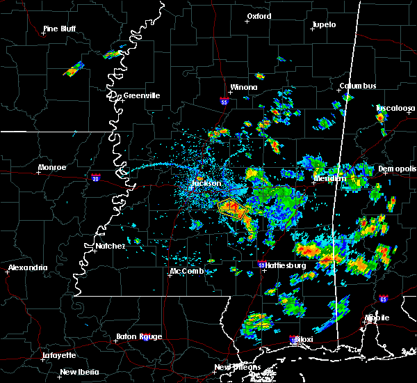 At 430 pm cdt, a severe thunderstorm was located over white oak, or 14 miles northeast of mendenhall, and is nearly stationary (radar indicated). Hazards include 60 mph wind gusts. Expect damage to trees. Locations impacted include, white oak, johns and puckett. At 430 pm cdt, a severe thunderstorm was located over white oak, or 14 miles northeast of mendenhall, and is nearly stationary (radar indicated). Hazards include 60 mph wind gusts. Expect damage to trees. Locations impacted include, white oak, johns and puckett.
|
| 6/9/2018 4:11 PM CDT |
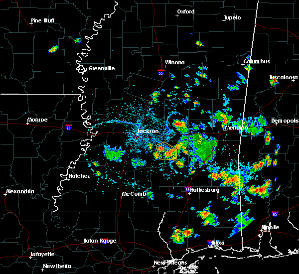 At 410 pm cdt, a severe thunderstorm was located near white oak, or 11 miles northeast of magee, and is nearly stationary (radar indicated). Hazards include 60 mph wind gusts and penny size hail. expect damage to trees At 410 pm cdt, a severe thunderstorm was located near white oak, or 11 miles northeast of magee, and is nearly stationary (radar indicated). Hazards include 60 mph wind gusts and penny size hail. expect damage to trees
|
| 4/22/2018 12:59 PM CDT |
 At 1259 pm cdt, a severe thunderstorm capable of producing a tornado was located near martinville, or 8 miles northeast of mendenhall, moving northeast at 20 mph (radar indicated rotation). Hazards include tornado. Flying debris will be dangerous to those caught without shelter. mobile homes will be damaged or destroyed. damage to roofs, windows, and vehicles will occur. tree damage is likely. this dangerous storm will be near, white oak around 115 pm cdt. Other locations impacted by this tornadic thunderstorm include puckett. At 1259 pm cdt, a severe thunderstorm capable of producing a tornado was located near martinville, or 8 miles northeast of mendenhall, moving northeast at 20 mph (radar indicated rotation). Hazards include tornado. Flying debris will be dangerous to those caught without shelter. mobile homes will be damaged or destroyed. damage to roofs, windows, and vehicles will occur. tree damage is likely. this dangerous storm will be near, white oak around 115 pm cdt. Other locations impacted by this tornadic thunderstorm include puckett.
|
| 4/14/2018 8:28 AM CDT |
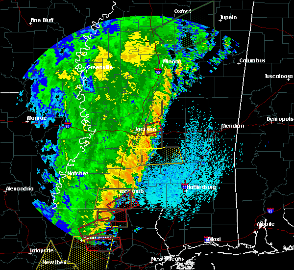 At 828 am cdt, a severe thunderstorm capable of producing a tornado was located near cato, or near mendenhall, moving east at 35 mph (radar indicated rotation). Hazards include tornado. Flying debris will be dangerous to those caught without shelter. mobile homes will be damaged or destroyed. damage to roofs, windows, and vehicles will occur. tree damage is likely. this dangerous storm will be near, white oak around 845 am cdt. raleigh and burns around 900 am cdt. pineville around 915 am cdt. Other locations impacted by this tornadic thunderstorm include polkville and puckett. At 828 am cdt, a severe thunderstorm capable of producing a tornado was located near cato, or near mendenhall, moving east at 35 mph (radar indicated rotation). Hazards include tornado. Flying debris will be dangerous to those caught without shelter. mobile homes will be damaged or destroyed. damage to roofs, windows, and vehicles will occur. tree damage is likely. this dangerous storm will be near, white oak around 845 am cdt. raleigh and burns around 900 am cdt. pineville around 915 am cdt. Other locations impacted by this tornadic thunderstorm include polkville and puckett.
|
| 4/14/2018 8:08 AM CDT |
 At 807 am cdt, severe thunderstorms were located along a line extending from near camden to near fannin to near star, moving east at 25 mph (radar indicated). Hazards include 60 mph wind gusts. Expect damage to roofs, siding, and trees. these severe storms will be near, camden, farmhaven and goshen springs around 815 am cdt. pisgah around 820 am cdt. pelahatchie around 825 am cdt. cato and leesburg around 835 am cdt. johns around 845 am cdt. other locations impacted by these severe thunderstorms include puckett. A tornado watch remains in effect until 200 pm cdt for central mississippi. At 807 am cdt, severe thunderstorms were located along a line extending from near camden to near fannin to near star, moving east at 25 mph (radar indicated). Hazards include 60 mph wind gusts. Expect damage to roofs, siding, and trees. these severe storms will be near, camden, farmhaven and goshen springs around 815 am cdt. pisgah around 820 am cdt. pelahatchie around 825 am cdt. cato and leesburg around 835 am cdt. johns around 845 am cdt. other locations impacted by these severe thunderstorms include puckett. A tornado watch remains in effect until 200 pm cdt for central mississippi.
|
| 4/14/2018 7:43 AM CDT |
 At 743 am cdt, severe thunderstorms were located along a line extending from near way to near flowood to near crystal springs, moving east at 35 mph (radar indicated). Hazards include 60 mph wind gusts. Expect damage to roofs, siding, and trees. severe thunderstorms will be near, madison and way around 750 am cdt. brandon and sharon around 755 am cdt. fannin, camden, farmhaven and cameron around 805 am cdt. star and goshen springs around 810 am cdt. pelahatchie, piney woods and pisgah around 815 am cdt. leesburg around 825 am cdt. cato around 830 am cdt. johns around 835 am cdt. other locations impacted by these severe thunderstorms include puckett. a tornado watch remains in effect until 800 am cdt for central mississippi. A tornado watch also remains in effect until 200 pm cdt for central mississippi. At 743 am cdt, severe thunderstorms were located along a line extending from near way to near flowood to near crystal springs, moving east at 35 mph (radar indicated). Hazards include 60 mph wind gusts. Expect damage to roofs, siding, and trees. severe thunderstorms will be near, madison and way around 750 am cdt. brandon and sharon around 755 am cdt. fannin, camden, farmhaven and cameron around 805 am cdt. star and goshen springs around 810 am cdt. pelahatchie, piney woods and pisgah around 815 am cdt. leesburg around 825 am cdt. cato around 830 am cdt. johns around 835 am cdt. other locations impacted by these severe thunderstorms include puckett. a tornado watch remains in effect until 800 am cdt for central mississippi. A tornado watch also remains in effect until 200 pm cdt for central mississippi.
|
| 4/6/2018 7:09 PM CDT |
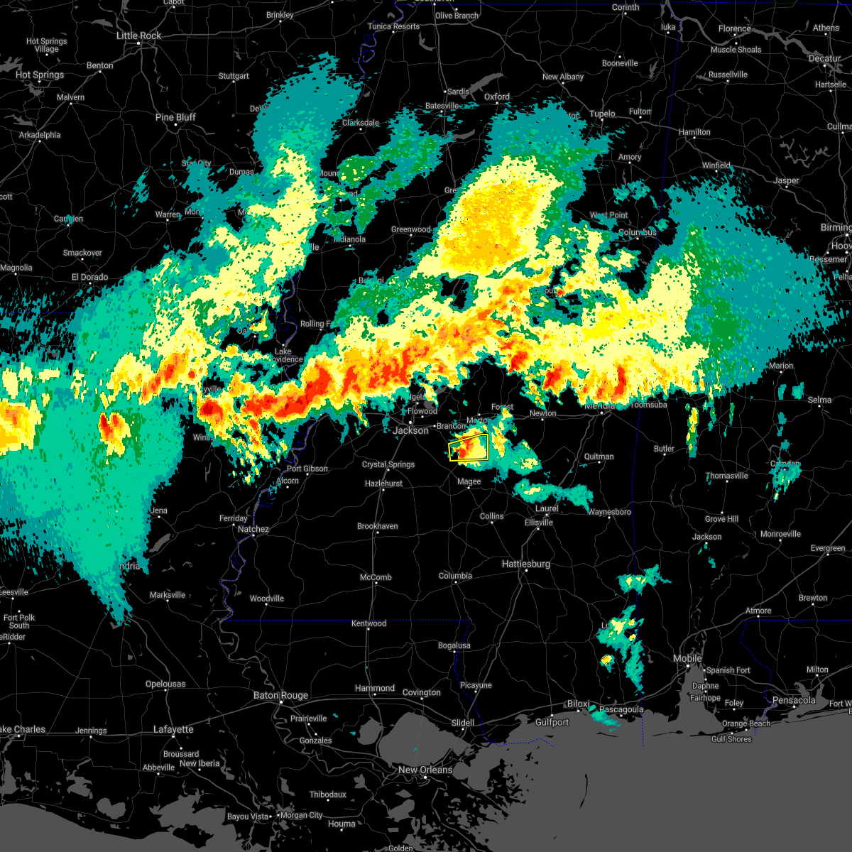 At 708 pm cdt, a severe thunderstorm was located over cato, or 8 miles north of mendenhall, moving east at 30 mph (radar indicated). Hazards include 60 mph wind gusts and quarter size hail. Hail damage to vehicles is expected. expect wind damage to roofs, siding, and trees. this severe storm will be near, white oak around 725 pm cdt. other locations impacted by this severe thunderstorm include polkville and puckett. A tornado watch remains in effect until 1100 pm cdt for central mississippi. At 708 pm cdt, a severe thunderstorm was located over cato, or 8 miles north of mendenhall, moving east at 30 mph (radar indicated). Hazards include 60 mph wind gusts and quarter size hail. Hail damage to vehicles is expected. expect wind damage to roofs, siding, and trees. this severe storm will be near, white oak around 725 pm cdt. other locations impacted by this severe thunderstorm include polkville and puckett. A tornado watch remains in effect until 1100 pm cdt for central mississippi.
|
| 4/6/2018 6:50 PM CDT |
 At 649 pm cdt, a severe thunderstorm was located over piney woods, or near star, moving east at 30 mph (radar indicated). Hazards include 60 mph wind gusts and half dollar size hail. Hail damage to vehicles is expected. expect wind damage to roofs, siding, and trees. this severe thunderstorm will be near, cato around 705 pm cdt. johns around 710 pm cdt. white oak around 730 pm cdt. other locations impacted by this severe thunderstorm include polkville, braxton and puckett. A tornado watch remains in effect until 1100 pm cdt for central mississippi. At 649 pm cdt, a severe thunderstorm was located over piney woods, or near star, moving east at 30 mph (radar indicated). Hazards include 60 mph wind gusts and half dollar size hail. Hail damage to vehicles is expected. expect wind damage to roofs, siding, and trees. this severe thunderstorm will be near, cato around 705 pm cdt. johns around 710 pm cdt. white oak around 730 pm cdt. other locations impacted by this severe thunderstorm include polkville, braxton and puckett. A tornado watch remains in effect until 1100 pm cdt for central mississippi.
|
| 4/3/2018 9:48 PM CDT |
 At 946 pm cdt, severe thunderstorms were located along a line extending from near homewood to near sanatorium to rockport, moving east at 30 mph (emergency management). Hazards include 60 mph wind gusts. Expect damage to roofs, siding, and trees. these severe storms will be near, sanatorium, martinville and burns around 950 pm cdt. magee around 1000 pm cdt. pineville around 1005 pm cdt. shivers around 1010 pm cdt. center ridge around 1025 pm cdt. taylorsville, clem and lone star around 1030 pm cdt. Other locations impacted by these severe thunderstorms include sylvarena, new hebron, mize, silver creek, louin, puckett, polkville, d`lo, montrose and braxton. At 946 pm cdt, severe thunderstorms were located along a line extending from near homewood to near sanatorium to rockport, moving east at 30 mph (emergency management). Hazards include 60 mph wind gusts. Expect damage to roofs, siding, and trees. these severe storms will be near, sanatorium, martinville and burns around 950 pm cdt. magee around 1000 pm cdt. pineville around 1005 pm cdt. shivers around 1010 pm cdt. center ridge around 1025 pm cdt. taylorsville, clem and lone star around 1030 pm cdt. Other locations impacted by these severe thunderstorms include sylvarena, new hebron, mize, silver creek, louin, puckett, polkville, d`lo, montrose and braxton.
|
| 4/3/2018 9:11 PM CDT |
 At 910 pm cdt, severe thunderstorms were located along a line extending from 7 miles southeast of pelahatchie to hazlehurst, moving southeast at 30 mph (emergency management). Hazards include 60 mph wind gusts. Expect damage to roofs, siding, and trees. severe thunderstorms will be near, white oak around 930 pm cdt. burns around 935 pm cdt. rockport around 940 pm cdt. oma and sontag around 945 pm cdt. raleigh around 950 pm cdt. wanilla around 955 pm cdt. center ridge around 1000 pm cdt. monticello around 1005 pm cdt. Other locations impacted by these severe thunderstorms include sylvarena, new hebron, mize, silver creek, beauregard, louin, puckett, polkville, d`lo and montrose. At 910 pm cdt, severe thunderstorms were located along a line extending from 7 miles southeast of pelahatchie to hazlehurst, moving southeast at 30 mph (emergency management). Hazards include 60 mph wind gusts. Expect damage to roofs, siding, and trees. severe thunderstorms will be near, white oak around 930 pm cdt. burns around 935 pm cdt. rockport around 940 pm cdt. oma and sontag around 945 pm cdt. raleigh around 950 pm cdt. wanilla around 955 pm cdt. center ridge around 1000 pm cdt. monticello around 1005 pm cdt. Other locations impacted by these severe thunderstorms include sylvarena, new hebron, mize, silver creek, beauregard, louin, puckett, polkville, d`lo and montrose.
|
| 4/3/2018 8:57 PM CDT |
 At 856 pm cdt, severe thunderstorms were located along a line extending from 6 miles northeast of farmhaven to near pelahatchie to terry, moving east at 45 mph (emergency management. at 825 pm cdt, trees were reported down in raymond). Hazards include 60 mph wind gusts. Expect damage to roofs, siding, and trees. these severe storms will be near, pelahatchie and pisgah around 900 pm cdt. leesburg around 905 pm cdt. florence around 910 pm cdt. star, piney woods and monterey around 915 pm cdt. Other locations impacted by these severe thunderstorms include puckett. At 856 pm cdt, severe thunderstorms were located along a line extending from 6 miles northeast of farmhaven to near pelahatchie to terry, moving east at 45 mph (emergency management. at 825 pm cdt, trees were reported down in raymond). Hazards include 60 mph wind gusts. Expect damage to roofs, siding, and trees. these severe storms will be near, pelahatchie and pisgah around 900 pm cdt. leesburg around 905 pm cdt. florence around 910 pm cdt. star, piney woods and monterey around 915 pm cdt. Other locations impacted by these severe thunderstorms include puckett.
|
| 4/3/2018 8:44 PM CDT |
 At 844 pm cdt, severe thunderstorms were located along a line extending from near farmhaven to near fannin to near dry grove, moving east at 50 mph (radar indicated). Hazards include 60 mph wind gusts. Expect damage to roofs, siding, and trees. these severe storms will be near, brandon, fannin, farmhaven and goshen springs around 850 pm cdt. pisgah around 855 pm cdt. byram, pelahatchie and leesburg around 900 pm cdt. whites around 905 pm cdt. florence and monterey around 910 pm cdt. star and piney woods around 915 pm cdt. Other locations impacted by these severe thunderstorms include learned and puckett. At 844 pm cdt, severe thunderstorms were located along a line extending from near farmhaven to near fannin to near dry grove, moving east at 50 mph (radar indicated). Hazards include 60 mph wind gusts. Expect damage to roofs, siding, and trees. these severe storms will be near, brandon, fannin, farmhaven and goshen springs around 850 pm cdt. pisgah around 855 pm cdt. byram, pelahatchie and leesburg around 900 pm cdt. whites around 905 pm cdt. florence and monterey around 910 pm cdt. star and piney woods around 915 pm cdt. Other locations impacted by these severe thunderstorms include learned and puckett.
|
| 4/3/2018 7:55 PM CDT |
 At 754 pm cdt, severe thunderstorms were located along a line extending from phoenix to flowers to near vicksburg, moving east at 45 mph (radar indicated). Hazards include 60 mph wind gusts and penny size hail. Expect damage to roofs, siding, and trees. severe thunderstorms will be near, edwards around 800 pm cdt. bolton and brownsville around 810 pm cdt. flora around 815 pm cdt. clinton and pocahontas around 820 pm cdt. annandale around 825 pm cdt. madison, ridgeland, raymond, gluckstadt and dry grove around 830 pm cdt. jackson and canton around 835 pm cdt. pearl, byram, flowood and terry around 840 pm cdt. Other locations impacted by these severe thunderstorms include learned and puckett. At 754 pm cdt, severe thunderstorms were located along a line extending from phoenix to flowers to near vicksburg, moving east at 45 mph (radar indicated). Hazards include 60 mph wind gusts and penny size hail. Expect damage to roofs, siding, and trees. severe thunderstorms will be near, edwards around 800 pm cdt. bolton and brownsville around 810 pm cdt. flora around 815 pm cdt. clinton and pocahontas around 820 pm cdt. annandale around 825 pm cdt. madison, ridgeland, raymond, gluckstadt and dry grove around 830 pm cdt. jackson and canton around 835 pm cdt. pearl, byram, flowood and terry around 840 pm cdt. Other locations impacted by these severe thunderstorms include learned and puckett.
|
| 2/7/2018 4:26 AM CST |
 At 426 am cst, a severe thunderstorm was located over florence, or near star, moving east at 45 mph (radar indicated). Hazards include 60 mph wind gusts and quarter size hail. Hail damage to vehicles is expected. expect wind damage to roofs, siding, and trees. this severe storm will be near, star around 430 am cst. piney woods around 435 am cst. johns and cato around 445 am cst. pelahatchie around 455 am cst. Other locations impacted by this severe thunderstorm include puckett. At 426 am cst, a severe thunderstorm was located over florence, or near star, moving east at 45 mph (radar indicated). Hazards include 60 mph wind gusts and quarter size hail. Hail damage to vehicles is expected. expect wind damage to roofs, siding, and trees. this severe storm will be near, star around 430 am cst. piney woods around 435 am cst. johns and cato around 445 am cst. pelahatchie around 455 am cst. Other locations impacted by this severe thunderstorm include puckett.
|
| 2/7/2018 4:12 AM CST |
 At 411 am cst, a severe thunderstorm was located over terry, or near byram, moving east at 45 mph (radar indicated). Hazards include 60 mph wind gusts and quarter size hail. Hail damage to vehicles is expected. expect wind damage to roofs, siding, and trees. this severe thunderstorm will be near, byram around 415 am cst. whites around 420 am cst. richland and florence around 425 am cst. star and monterey around 430 am cst. piney woods around 435 am cst. cato around 445 am cst. johns around 450 am cst. pelahatchie around 455 am cst. Other locations impacted by this severe thunderstorm include puckett. At 411 am cst, a severe thunderstorm was located over terry, or near byram, moving east at 45 mph (radar indicated). Hazards include 60 mph wind gusts and quarter size hail. Hail damage to vehicles is expected. expect wind damage to roofs, siding, and trees. this severe thunderstorm will be near, byram around 415 am cst. whites around 420 am cst. richland and florence around 425 am cst. star and monterey around 430 am cst. piney woods around 435 am cst. cato around 445 am cst. johns around 450 am cst. pelahatchie around 455 am cst. Other locations impacted by this severe thunderstorm include puckett.
|
| 6/16/2017 7:48 PM CDT |
 At 748 pm cdt, severe thunderstorms were located along a line extending from near sharon to near flora to near oak ridge, moving southeast at 45 mph (radar indicated). Hazards include 60 mph wind gusts. Expect damage to roofs, siding, and trees. severe thunderstorms will be near, flowood, edwards and leesburg around 815 pm cdt. pearl, richland and bolton around 820 pm cdt. brandon and pelahatchie around 825 pm cdt. florence, raymond and monterey around 830 pm cdt. dry grove around 835 pm cdt. star around 840 pm cdt. terry, cato, piney woods and johns around 845 pm cdt. Other locations impacted by these severe thunderstorms include learned and puckett. At 748 pm cdt, severe thunderstorms were located along a line extending from near sharon to near flora to near oak ridge, moving southeast at 45 mph (radar indicated). Hazards include 60 mph wind gusts. Expect damage to roofs, siding, and trees. severe thunderstorms will be near, flowood, edwards and leesburg around 815 pm cdt. pearl, richland and bolton around 820 pm cdt. brandon and pelahatchie around 825 pm cdt. florence, raymond and monterey around 830 pm cdt. dry grove around 835 pm cdt. star around 840 pm cdt. terry, cato, piney woods and johns around 845 pm cdt. Other locations impacted by these severe thunderstorms include learned and puckett.
|
| 5/21/2017 4:11 PM CDT |
 At 411 pm cdt, severe thunderstorms were located along a line extending from 6 miles southeast of fannin to near mendenhall to rockport, moving east at 40 mph (radar indicated). Hazards include 60 mph wind gusts and quarter size hail. Hail damage to vehicles is expected. expect wind damage to roofs, siding, and trees. severe thunderstorms will be near, mendenhall and pelahatchie around 420 pm cdt. sanatorium, branch and leesburg around 425 pm cdt. magee, morton and martinville around 430 pm cdt. pulaski around 440 pm cdt. forest, raleigh and homewood around 445 pm cdt. center ridge around 450 pm cdt. taylorsville around 455 pm cdt. Other locations impacted by these severe thunderstorms include sylvarena, mize, puckett, polkville, d`lo, lake and braxton. At 411 pm cdt, severe thunderstorms were located along a line extending from 6 miles southeast of fannin to near mendenhall to rockport, moving east at 40 mph (radar indicated). Hazards include 60 mph wind gusts and quarter size hail. Hail damage to vehicles is expected. expect wind damage to roofs, siding, and trees. severe thunderstorms will be near, mendenhall and pelahatchie around 420 pm cdt. sanatorium, branch and leesburg around 425 pm cdt. magee, morton and martinville around 430 pm cdt. pulaski around 440 pm cdt. forest, raleigh and homewood around 445 pm cdt. center ridge around 450 pm cdt. taylorsville around 455 pm cdt. Other locations impacted by these severe thunderstorms include sylvarena, mize, puckett, polkville, d`lo, lake and braxton.
|
| 5/21/2017 4:06 PM CDT |
 At 405 pm cdt, severe thunderstorms were located along a line extending from near piney woods to near wesson, moving east at 45 mph (radar indicated). Hazards include 60 mph wind gusts and nickel size hail. Expect damage to roofs, siding, and trees. these severe storms will be near, piney woods around 410 pm cdt. mendenhall and cato around 415 pm cdt. rockport around 420 pm cdt. shivers around 430 pm cdt. Other locations impacted by these severe thunderstorms include d`lo, beauregard, braxton, puckett and georgetown. At 405 pm cdt, severe thunderstorms were located along a line extending from near piney woods to near wesson, moving east at 45 mph (radar indicated). Hazards include 60 mph wind gusts and nickel size hail. Expect damage to roofs, siding, and trees. these severe storms will be near, piney woods around 410 pm cdt. mendenhall and cato around 415 pm cdt. rockport around 420 pm cdt. shivers around 430 pm cdt. Other locations impacted by these severe thunderstorms include d`lo, beauregard, braxton, puckett and georgetown.
|
| 5/21/2017 4:04 PM CDT |
 At 404 pm cdt, a severe thunderstorm was located near jackson, moving east at 15 mph (radar indicated). Hazards include 60 mph wind gusts and nickel size hail. Expect damage to roofs, siding, and trees. This severe storm will be near, pearl, brandon and flowood around 415 pm cdt. At 404 pm cdt, a severe thunderstorm was located near jackson, moving east at 15 mph (radar indicated). Hazards include 60 mph wind gusts and nickel size hail. Expect damage to roofs, siding, and trees. This severe storm will be near, pearl, brandon and flowood around 415 pm cdt.
|
| 5/21/2017 3:31 PM CDT |
 At 331 pm cdt, severe thunderstorms were located along a line extending from near dry grove to caseyville, moving southeast at 30 mph (radar indicated). Hazards include 60 mph wind gusts and quarter size hail. Hail damage to vehicles is expected. expect wind damage to roofs, siding, and trees. severe thunderstorms will be near, gallman around 355 pm cdt. hazlehurst around 400 pm cdt. hopewell around 405 pm cdt. rockport around 430 pm cdt. Other locations impacted by these severe thunderstorms include d`lo, beauregard, braxton, puckett and georgetown. At 331 pm cdt, severe thunderstorms were located along a line extending from near dry grove to caseyville, moving southeast at 30 mph (radar indicated). Hazards include 60 mph wind gusts and quarter size hail. Hail damage to vehicles is expected. expect wind damage to roofs, siding, and trees. severe thunderstorms will be near, gallman around 355 pm cdt. hazlehurst around 400 pm cdt. hopewell around 405 pm cdt. rockport around 430 pm cdt. Other locations impacted by these severe thunderstorms include d`lo, beauregard, braxton, puckett and georgetown.
|
| 5/21/2017 3:12 PM CDT |
 At 312 pm cdt, a severe thunderstorm was located near clinton, moving east at 25 mph (radar indicated). Hazards include 70 mph wind gusts and quarter size hail. Hail damage to vehicles is expected. expect considerable tree damage. wind damage is also likely to mobile homes, roofs, and outbuildings. this severe thunderstorm will be near, clinton around 325 pm cdt. jackson around 330 pm cdt. richland around 405 pm cdt. Pearl, brandon and flowood around 415 pm cdt. At 312 pm cdt, a severe thunderstorm was located near clinton, moving east at 25 mph (radar indicated). Hazards include 70 mph wind gusts and quarter size hail. Hail damage to vehicles is expected. expect considerable tree damage. wind damage is also likely to mobile homes, roofs, and outbuildings. this severe thunderstorm will be near, clinton around 325 pm cdt. jackson around 330 pm cdt. richland around 405 pm cdt. Pearl, brandon and flowood around 415 pm cdt.
|
| 5/20/2017 1:41 PM CDT |
 The severe thunderstorm warning for southeastern rankin and northeastern simpson counties will expire at 145 pm cdt, the storm which prompted the warning has weakened below severe limits, and no longer poses an immediate threat to life or property. therefore the warning will be allowed to expire. however small hail and gusty winds up to 55mph are still possible with this thunderstorm. The severe thunderstorm warning for southeastern rankin and northeastern simpson counties will expire at 145 pm cdt, the storm which prompted the warning has weakened below severe limits, and no longer poses an immediate threat to life or property. therefore the warning will be allowed to expire. however small hail and gusty winds up to 55mph are still possible with this thunderstorm.
|
| 5/20/2017 1:32 PM CDT |
 At 132 pm cdt, a severe thunderstorm was located near martinville, or near mendenhall, moving north at 35 mph (radar indicated). Hazards include 60 mph wind gusts and quarter size hail. Hail damage to vehicles is expected. expect wind damage to roofs, siding, and trees. this severe storm will be near, cato around 140 pm cdt. johns around 145 pm cdt. Other locations impacted by this severe thunderstorm include d`lo and puckett. At 132 pm cdt, a severe thunderstorm was located near martinville, or near mendenhall, moving north at 35 mph (radar indicated). Hazards include 60 mph wind gusts and quarter size hail. Hail damage to vehicles is expected. expect wind damage to roofs, siding, and trees. this severe storm will be near, cato around 140 pm cdt. johns around 145 pm cdt. Other locations impacted by this severe thunderstorm include d`lo and puckett.
|
| 5/20/2017 1:11 PM CDT |
 At 111 pm cdt, a severe thunderstorm was located near pinola, moving north at 60 mph (radar indicated). Hazards include 60 mph wind gusts and quarter size hail. Hail damage to vehicles is expected. expect wind damage to roofs, siding, and trees. this severe thunderstorm will be near, mendenhall and martinville around 120 pm cdt. cato and piney woods around 125 pm cdt. johns around 130 pm cdt. Other locations impacted by this severe thunderstorm include d`lo, braxton and puckett. At 111 pm cdt, a severe thunderstorm was located near pinola, moving north at 60 mph (radar indicated). Hazards include 60 mph wind gusts and quarter size hail. Hail damage to vehicles is expected. expect wind damage to roofs, siding, and trees. this severe thunderstorm will be near, mendenhall and martinville around 120 pm cdt. cato and piney woods around 125 pm cdt. johns around 130 pm cdt. Other locations impacted by this severe thunderstorm include d`lo, braxton and puckett.
|
| 4/30/2017 9:06 AM CDT |
 At 906 am cdt, severe thunderstorms were located along a line extending from near goshen springs to near pelahatchie to near pinola, moving northeast at 45 mph (radar indicated). Hazards include 60 mph wind gusts. Expect damage to roofs, siding, and trees. locations impacted include, forest, magee, morton, mendenhall, pinola, harperville, raleigh, taylorsville, pelahatchie, homewood, leesburg, ludlow, pulaski, sanatorium, forkville, pisgah, branch, shivers, white oak and martinville. A tornado watch remains in effect until 300 pm cdt for central, southeastern and east central mississippi. At 906 am cdt, severe thunderstorms were located along a line extending from near goshen springs to near pelahatchie to near pinola, moving northeast at 45 mph (radar indicated). Hazards include 60 mph wind gusts. Expect damage to roofs, siding, and trees. locations impacted include, forest, magee, morton, mendenhall, pinola, harperville, raleigh, taylorsville, pelahatchie, homewood, leesburg, ludlow, pulaski, sanatorium, forkville, pisgah, branch, shivers, white oak and martinville. A tornado watch remains in effect until 300 pm cdt for central, southeastern and east central mississippi.
|
| 4/30/2017 8:59 AM CDT |
 At 859 am cdt, severe thunderstorms were located along a line extending from near goshen springs to pelahatchie to near shivers, moving northeast at 55 mph (radar indicated). Hazards include 60 mph wind gusts. expect damage to roofs, siding, and trees At 859 am cdt, severe thunderstorms were located along a line extending from near goshen springs to pelahatchie to near shivers, moving northeast at 55 mph (radar indicated). Hazards include 60 mph wind gusts. expect damage to roofs, siding, and trees
|
| 4/30/2017 8:47 AM CDT |
 At 846 am cdt, severe thunderstorms were located along a line extending from near gluckstadt to 6 miles northwest of cato, moving northeast at 50 mph. a tornado warning remains in effect for portions of madison county (radar indicated). Hazards include 60 mph wind gusts and penny size hail. Expect damage to roofs, siding, and trees. locations impacted include, jackson, pearl, madison, ridgeland, brandon, flowood, richland, star, florence, union, cato, gluckstadt, whites, johns, harrisville, piney woods, annandale, monterey, d`lo and puckett. A tornado watch remains in effect until 300 pm cdt for central mississippi. At 846 am cdt, severe thunderstorms were located along a line extending from near gluckstadt to 6 miles northwest of cato, moving northeast at 50 mph. a tornado warning remains in effect for portions of madison county (radar indicated). Hazards include 60 mph wind gusts and penny size hail. Expect damage to roofs, siding, and trees. locations impacted include, jackson, pearl, madison, ridgeland, brandon, flowood, richland, star, florence, union, cato, gluckstadt, whites, johns, harrisville, piney woods, annandale, monterey, d`lo and puckett. A tornado watch remains in effect until 300 pm cdt for central mississippi.
|
| 4/30/2017 7:56 AM CDT |
 At 756 am cdt, severe thunderstorms were located along a line extending from near carpenter to martinsville, moving northeast at 55 mph (radar indicated). Hazards include 60 mph wind gusts and quarter size hail. Hail damage to vehicles is expected. Expect wind damage to roofs, siding, and trees. At 756 am cdt, severe thunderstorms were located along a line extending from near carpenter to martinsville, moving northeast at 55 mph (radar indicated). Hazards include 60 mph wind gusts and quarter size hail. Hail damage to vehicles is expected. Expect wind damage to roofs, siding, and trees.
|
| 4/3/2017 2:53 AM CDT |
 The severe thunderstorm warning for southeastern rankin, eastern simpson, western smith, covington, south central scott and east central jefferson davis counties will expire at 300 am cdt, the storms which prompted the warning have moved out of the warned area. therefore, the warning will be allowed to expire. a tornado watch remains in effect until 900 am cdt for south central, central and southeastern mississippi. The severe thunderstorm warning for southeastern rankin, eastern simpson, western smith, covington, south central scott and east central jefferson davis counties will expire at 300 am cdt, the storms which prompted the warning have moved out of the warned area. therefore, the warning will be allowed to expire. a tornado watch remains in effect until 900 am cdt for south central, central and southeastern mississippi.
|
| 4/3/2017 2:24 AM CDT |
 At 224 am cdt, severe thunderstorms were located along a line extending from near johns to near lone star, moving east at 35 mph (radar indicated). Hazards include 60 mph wind gusts and quarter size hail. Hail damage to vehicles is expected. expect wind damage to roofs, siding, and trees. these severe storms will be near, collins around 235 am cdt. pulaski around 245 am cdt. burns around 250 am cdt. homewood around 255 am cdt. other locations impacted by these severe thunderstorms include polkville, seminary, mize, bassfield and puckett. A tornado watch remains in effect until 900 am cdt for south central, central and southeastern mississippi. At 224 am cdt, severe thunderstorms were located along a line extending from near johns to near lone star, moving east at 35 mph (radar indicated). Hazards include 60 mph wind gusts and quarter size hail. Hail damage to vehicles is expected. expect wind damage to roofs, siding, and trees. these severe storms will be near, collins around 235 am cdt. pulaski around 245 am cdt. burns around 250 am cdt. homewood around 255 am cdt. other locations impacted by these severe thunderstorms include polkville, seminary, mize, bassfield and puckett. A tornado watch remains in effect until 900 am cdt for south central, central and southeastern mississippi.
|
| 4/3/2017 1:54 AM CDT |
 At 154 am cdt, severe thunderstorms were located along a line extending from near florence to near hebron, moving east at 35 mph (radar indicated). Hazards include 70 mph wind gusts and quarter size hail. Hail damage to vehicles is expected. expect considerable tree damage. wind damage is also likely to mobile homes, roofs, and outbuildings. severe thunderstorms will be near, prentiss around 200 am cdt. clem around 210 am cdt. lone star and cato around 215 am cdt. johns around 220 am cdt. mount olive around 225 am cdt. A tornado watch remains in effect until 900 am cdt for south central, central and southeastern mississippi. At 154 am cdt, severe thunderstorms were located along a line extending from near florence to near hebron, moving east at 35 mph (radar indicated). Hazards include 70 mph wind gusts and quarter size hail. Hail damage to vehicles is expected. expect considerable tree damage. wind damage is also likely to mobile homes, roofs, and outbuildings. severe thunderstorms will be near, prentiss around 200 am cdt. clem around 210 am cdt. lone star and cato around 215 am cdt. johns around 220 am cdt. mount olive around 225 am cdt. A tornado watch remains in effect until 900 am cdt for south central, central and southeastern mississippi.
|
| 3/27/2017 7:25 PM CDT |
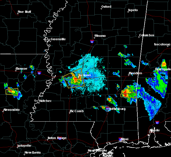 At 725 pm cdt, a severe thunderstorm was located near richland, moving east at 50 mph (radar indicated). Hazards include golf ball size hail and 70 mph wind gusts. People and animals outdoors will be injured. expect hail damage to roofs, siding, windows, and vehicles. expect considerable tree damage. wind damage is also likely to mobile homes, roofs, and outbuildings. this severe thunderstorm will be near, brandon around 735 pm cdt. fannin around 740 pm cdt. pelahatchie around 750 pm cdt. leesburg around 755 pm cdt. morton and branch around 800 pm cdt. pulaski and forkville around 805 pm cdt. forest, harperville and hillsboro around 815 pm cdt. Other locations impacted by this severe thunderstorm include polkville, lena, walnut grove and redwater. At 725 pm cdt, a severe thunderstorm was located near richland, moving east at 50 mph (radar indicated). Hazards include golf ball size hail and 70 mph wind gusts. People and animals outdoors will be injured. expect hail damage to roofs, siding, windows, and vehicles. expect considerable tree damage. wind damage is also likely to mobile homes, roofs, and outbuildings. this severe thunderstorm will be near, brandon around 735 pm cdt. fannin around 740 pm cdt. pelahatchie around 750 pm cdt. leesburg around 755 pm cdt. morton and branch around 800 pm cdt. pulaski and forkville around 805 pm cdt. forest, harperville and hillsboro around 815 pm cdt. Other locations impacted by this severe thunderstorm include polkville, lena, walnut grove and redwater.
|
| 3/1/2017 2:57 PM CST |
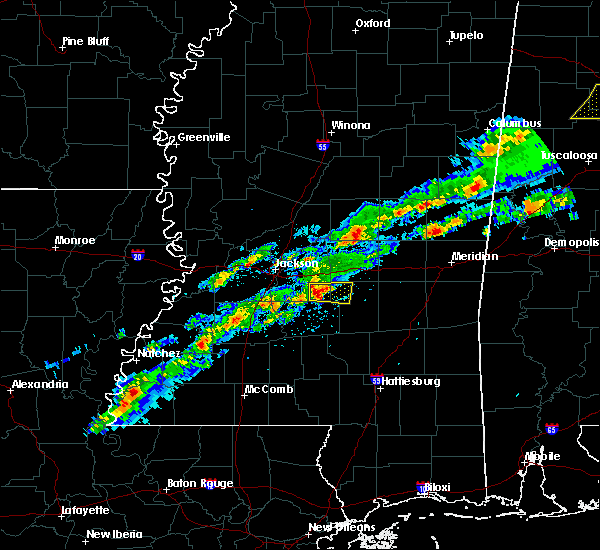 At 256 pm cst, a severe thunderstorm was located over johns, or 10 miles north of mendenhall, moving east at 40 mph (radar indicated). Hazards include ping pong ball size hail and 60 mph wind gusts. People and animals outdoors will be injured. expect hail damage to roofs, siding, windows, and vehicles. expect wind damage to roofs, siding, and trees. this severe storm will be near, white oak around 310 pm cst. Other locations impacted by this severe thunderstorm include polkville and puckett. At 256 pm cst, a severe thunderstorm was located over johns, or 10 miles north of mendenhall, moving east at 40 mph (radar indicated). Hazards include ping pong ball size hail and 60 mph wind gusts. People and animals outdoors will be injured. expect hail damage to roofs, siding, windows, and vehicles. expect wind damage to roofs, siding, and trees. this severe storm will be near, white oak around 310 pm cst. Other locations impacted by this severe thunderstorm include polkville and puckett.
|
| 3/1/2017 2:53 PM CST |
 At 253 pm cst, a severe thunderstorm was located over johns, or 10 miles north of mendenhall, moving east at 35 mph (radar indicated). Hazards include 60 mph wind gusts and quarter size hail. Hail damage to vehicles is expected. expect wind damage to roofs, siding, and trees. this severe storm will be near, white oak around 310 pm cst. Other locations impacted by this severe thunderstorm include polkville and puckett. At 253 pm cst, a severe thunderstorm was located over johns, or 10 miles north of mendenhall, moving east at 35 mph (radar indicated). Hazards include 60 mph wind gusts and quarter size hail. Hail damage to vehicles is expected. expect wind damage to roofs, siding, and trees. this severe storm will be near, white oak around 310 pm cst. Other locations impacted by this severe thunderstorm include polkville and puckett.
|
| 3/1/2017 2:41 PM CST |
 At 241 pm cst, a severe thunderstorm was located near piney woods, or near star, moving east at 40 mph (radar indicated). Hazards include 60 mph wind gusts and quarter size hail. Hail damage to vehicles is expected. expect wind damage to roofs, siding, and trees. this severe thunderstorm will be near, cato around 250 pm cst. johns around 255 pm cst. white oak around 310 pm cst. Other locations impacted by this severe thunderstorm include polkville and puckett. At 241 pm cst, a severe thunderstorm was located near piney woods, or near star, moving east at 40 mph (radar indicated). Hazards include 60 mph wind gusts and quarter size hail. Hail damage to vehicles is expected. expect wind damage to roofs, siding, and trees. this severe thunderstorm will be near, cato around 250 pm cst. johns around 255 pm cst. white oak around 310 pm cst. Other locations impacted by this severe thunderstorm include polkville and puckett.
|
| 1/21/2017 9:44 PM CST |
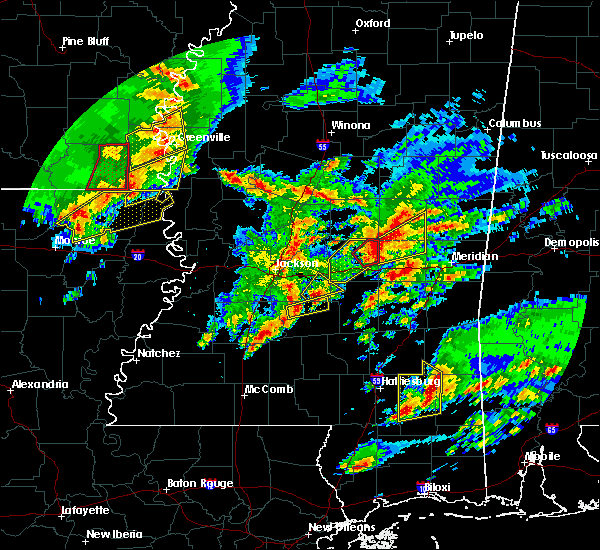 At 943 pm cst, a severe thunderstorm was located over cato, or 9 miles north of mendenhall, moving northeast at 40 mph (radar indicated). Hazards include ping pong ball size hail and 60 mph wind gusts. People and animals outdoors will be injured. expect hail damage to roofs, siding, windows, and vehicles. expect wind damage to roofs, siding, and trees. this severe thunderstorm will remain over mainly rural areas of southeastern rankin and northwestern smith counties, including the following locations: polkville. A tornado watch remains in effect until 300 am cst for central mississippi. At 943 pm cst, a severe thunderstorm was located over cato, or 9 miles north of mendenhall, moving northeast at 40 mph (radar indicated). Hazards include ping pong ball size hail and 60 mph wind gusts. People and animals outdoors will be injured. expect hail damage to roofs, siding, windows, and vehicles. expect wind damage to roofs, siding, and trees. this severe thunderstorm will remain over mainly rural areas of southeastern rankin and northwestern smith counties, including the following locations: polkville. A tornado watch remains in effect until 300 am cst for central mississippi.
|
| 1/21/2017 9:38 PM CST |
 At 938 pm cst, a severe thunderstorm was located near mendenhall, moving northeast at 30 mph (radar indicated). Hazards include 60 mph wind gusts and half dollar size hail. Hail damage to vehicles is expected. expect wind damage to roofs, siding, and trees. this severe thunderstorm will remain over mainly rural areas of southeastern rankin and northeastern simpson counties, including the following locations: braxton, puckett and d`lo. A tornado watch remains in effect until 300 am cst for central mississippi. At 938 pm cst, a severe thunderstorm was located near mendenhall, moving northeast at 30 mph (radar indicated). Hazards include 60 mph wind gusts and half dollar size hail. Hail damage to vehicles is expected. expect wind damage to roofs, siding, and trees. this severe thunderstorm will remain over mainly rural areas of southeastern rankin and northeastern simpson counties, including the following locations: braxton, puckett and d`lo. A tornado watch remains in effect until 300 am cst for central mississippi.
|
| 1/21/2017 9:26 PM CST |
 At 926 pm cst, a severe thunderstorm was located over harrisville, or 7 miles northwest of pinola, moving east at 30 mph (radar indicated). Hazards include 60 mph wind gusts and half dollar size hail. Hail damage to vehicles is expected. expect wind damage to roofs, siding, and trees. this severe thunderstorm will be near, mendenhall around 945 pm cst. martinville around 1000 pm cst. other locations impacted by this severe thunderstorm include braxton, puckett and d`lo. A tornado watch remains in effect until 300 am cst for central mississippi. At 926 pm cst, a severe thunderstorm was located over harrisville, or 7 miles northwest of pinola, moving east at 30 mph (radar indicated). Hazards include 60 mph wind gusts and half dollar size hail. Hail damage to vehicles is expected. expect wind damage to roofs, siding, and trees. this severe thunderstorm will be near, mendenhall around 945 pm cst. martinville around 1000 pm cst. other locations impacted by this severe thunderstorm include braxton, puckett and d`lo. A tornado watch remains in effect until 300 am cst for central mississippi.
|
| 1/21/2017 2:45 AM CST |
 At 245 am cst, severe thunderstorms were located along a line extending from near goshen springs to near pelahatchie to cato, moving northeast at 45 mph (radar indicated). Hazards include 60 mph wind gusts and quarter size hail. Hail damage to vehicles is expected. expect wind damage to roofs, siding, and trees. these severe storms will be near, pelahatchie, goshen springs and pisgah around 250 am cst. leesburg around 255 am cst. A tornado watch remains in effect until 700 am cst for central mississippi. At 245 am cst, severe thunderstorms were located along a line extending from near goshen springs to near pelahatchie to cato, moving northeast at 45 mph (radar indicated). Hazards include 60 mph wind gusts and quarter size hail. Hail damage to vehicles is expected. expect wind damage to roofs, siding, and trees. these severe storms will be near, pelahatchie, goshen springs and pisgah around 250 am cst. leesburg around 255 am cst. A tornado watch remains in effect until 700 am cst for central mississippi.
|
| 1/21/2017 2:02 AM CST |
 At 202 am cst, a severe thunderstorm was located near crystal springs, moving northeast at 45 mph (radar indicated). Hazards include 60 mph wind gusts and quarter size hail. Hail damage to vehicles is expected. expect wind damage to roofs, siding, and trees. this severe thunderstorm will be near, whites around 210 am cst. richland, star and florence around 220 am cst. pearl and monterey around 225 am cst. brandon around 235 am cst. pelahatchie and fannin around 245 am cst. pisgah around 250 am cst. leesburg around 255 am cst. other locations impacted by this severe thunderstorm include braxton. A tornado watch remains in effect until 700 am cst for central mississippi. At 202 am cst, a severe thunderstorm was located near crystal springs, moving northeast at 45 mph (radar indicated). Hazards include 60 mph wind gusts and quarter size hail. Hail damage to vehicles is expected. expect wind damage to roofs, siding, and trees. this severe thunderstorm will be near, whites around 210 am cst. richland, star and florence around 220 am cst. pearl and monterey around 225 am cst. brandon around 235 am cst. pelahatchie and fannin around 245 am cst. pisgah around 250 am cst. leesburg around 255 am cst. other locations impacted by this severe thunderstorm include braxton. A tornado watch remains in effect until 700 am cst for central mississippi.
|
| 1/2/2017 2:33 PM CST |
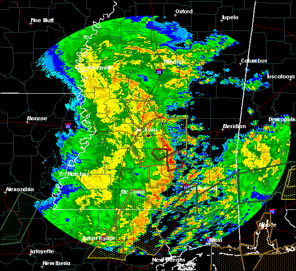 At 233 pm cst, severe thunderstorms were located along a line extending from fannin to near white oak, moving northeast at 45 mph (radar indicated). Hazards include 60 mph wind gusts. Expect damage to roofs, siding, and trees. these severe storms will be near, goshen springs and pisgah around 240 pm cst. leesburg around 245 pm cst. other locations impacted by these severe thunderstorms include puckett. A tornado watch remains in effect until 800 pm cst for central mississippi. At 233 pm cst, severe thunderstorms were located along a line extending from fannin to near white oak, moving northeast at 45 mph (radar indicated). Hazards include 60 mph wind gusts. Expect damage to roofs, siding, and trees. these severe storms will be near, goshen springs and pisgah around 240 pm cst. leesburg around 245 pm cst. other locations impacted by these severe thunderstorms include puckett. A tornado watch remains in effect until 800 pm cst for central mississippi.
|
| 1/2/2017 1:46 PM CST |
 At 145 pm cst, severe thunderstorms were located along a line extending from near dry grove to rockport, moving northeast at 50 mph (radar indicated). Hazards include 70 mph wind gusts. Expect considerable tree damage. damage is likely to mobile homes, roofs, and outbuildings. severe thunderstorms will be near, jackson, union and shivers around 155 pm cst. pinola and whites around 200 pm cst. richland and florence around 205 pm cst. pearl, mendenhall, monterey and sanatorium around 210 pm cst. flowood and martinville around 215 pm cst. brandon around 220 pm cst. fannin around 225 pm cst. Pelahatchie around 230 pm cst. At 145 pm cst, severe thunderstorms were located along a line extending from near dry grove to rockport, moving northeast at 50 mph (radar indicated). Hazards include 70 mph wind gusts. Expect considerable tree damage. damage is likely to mobile homes, roofs, and outbuildings. severe thunderstorms will be near, jackson, union and shivers around 155 pm cst. pinola and whites around 200 pm cst. richland and florence around 205 pm cst. pearl, mendenhall, monterey and sanatorium around 210 pm cst. flowood and martinville around 215 pm cst. brandon around 220 pm cst. fannin around 225 pm cst. Pelahatchie around 230 pm cst.
|
| 11/28/2016 5:49 PM CST |
 At 549 pm cst, severe thunderstorms were located along a line extending from forest to 8 miles northeast of johns, moving east at 45 mph (radar indicated). Hazards include 60 mph wind gusts and penny size hail. Expect damage to roofs. siding. and trees. these severe storms will be near, homewood around 605 pm cst. other locations impacted by these severe thunderstorms include lake, puckett and polkville. A tornado watch remains in effect until 900 pm cst for central and east central mississippi. At 549 pm cst, severe thunderstorms were located along a line extending from forest to 8 miles northeast of johns, moving east at 45 mph (radar indicated). Hazards include 60 mph wind gusts and penny size hail. Expect damage to roofs. siding. and trees. these severe storms will be near, homewood around 605 pm cst. other locations impacted by these severe thunderstorms include lake, puckett and polkville. A tornado watch remains in effect until 900 pm cst for central and east central mississippi.
|
| 11/28/2016 5:27 PM CST |
 At 526 pm cst, severe thunderstorms were located along a line extending from near pelahatchie to near star, moving east at 50 mph (radar indicated). Hazards include 60 mph wind gusts and penny size hail. Expect damage to roofs. siding. and trees. severe thunderstorms will be near, pulaski around 600 pm cst. homewood around 605 pm cst. other locations impacted by these severe thunderstorms include puckett, polkville, lake, braxton and d`lo. A tornado watch remains in effect until 900 pm cst for east central and central mississippi. At 526 pm cst, severe thunderstorms were located along a line extending from near pelahatchie to near star, moving east at 50 mph (radar indicated). Hazards include 60 mph wind gusts and penny size hail. Expect damage to roofs. siding. and trees. severe thunderstorms will be near, pulaski around 600 pm cst. homewood around 605 pm cst. other locations impacted by these severe thunderstorms include puckett, polkville, lake, braxton and d`lo. A tornado watch remains in effect until 900 pm cst for east central and central mississippi.
|
| 7/14/2016 10:20 PM CDT |
 At 1018 pm cdt, a cluster of severe thunderstorms was located over flora, or 13 miles north of clinton, moving southeast at 40 mph (radar indicated). Hazards include 60 mph wind gusts. Expect damage to roofs. siding. and trees. this severe thunderstorm will be near, flowood around 1040 pm cdt. fannin around 1045 pm cdt. brandon around 1050 pm cdt. pelahatchie around 1100 pm cdt. Other locations impacted by this severe thunderstorm include puckett. At 1018 pm cdt, a cluster of severe thunderstorms was located over flora, or 13 miles north of clinton, moving southeast at 40 mph (radar indicated). Hazards include 60 mph wind gusts. Expect damage to roofs. siding. and trees. this severe thunderstorm will be near, flowood around 1040 pm cdt. fannin around 1045 pm cdt. brandon around 1050 pm cdt. pelahatchie around 1100 pm cdt. Other locations impacted by this severe thunderstorm include puckett.
|
| 7/14/2016 9:44 PM CDT |
 At 943 pm cdt, a severe thunderstorm was located over richland, moving southeast at 25 mph (radar indicated). Hazards include 60 mph wind gusts and penny size hail. Expect damage to roofs. siding. And trees. At 943 pm cdt, a severe thunderstorm was located over richland, moving southeast at 25 mph (radar indicated). Hazards include 60 mph wind gusts and penny size hail. Expect damage to roofs. siding. And trees.
|
| 7/4/2016 4:08 PM CDT |
 At 408 pm cdt, a severe thunderstorm was located near cato, or near star, moving northeast at 30 mph (radar indicated). Hazards include 60 mph wind gusts and quarter size hail. Hail damage to vehicles is expected. expect wind damage to roofs, siding, and trees. this severe storm will be near, johns around 420 pm cdt. Other locations impacted by this severe thunderstorm include puckett. At 408 pm cdt, a severe thunderstorm was located near cato, or near star, moving northeast at 30 mph (radar indicated). Hazards include 60 mph wind gusts and quarter size hail. Hail damage to vehicles is expected. expect wind damage to roofs, siding, and trees. this severe storm will be near, johns around 420 pm cdt. Other locations impacted by this severe thunderstorm include puckett.
|
| 7/4/2016 4:02 PM CDT |
 At 401 pm cdt, a severe thunderstorm was located near star, moving northeast at 30 mph (radar indicated). Hazards include 60 mph wind gusts and quarter size hail. Hail damage to vehicles is expected. expect wind damage to roofs, siding, and trees. this severe storm will be near, cato around 415 pm cdt. johns around 420 pm cdt. Other locations impacted by this severe thunderstorm include puckett. At 401 pm cdt, a severe thunderstorm was located near star, moving northeast at 30 mph (radar indicated). Hazards include 60 mph wind gusts and quarter size hail. Hail damage to vehicles is expected. expect wind damage to roofs, siding, and trees. this severe storm will be near, cato around 415 pm cdt. johns around 420 pm cdt. Other locations impacted by this severe thunderstorm include puckett.
|
| 7/4/2016 3:44 PM CDT |
 At 344 pm cdt, a severe thunderstorm was located near whites, or near star, moving northeast at 30 mph (radar indicated). Hazards include 60 mph wind gusts and quarter size hail. Hail damage to vehicles is expected. expect wind damage to roofs, siding, and trees. this severe thunderstorm will be near, star and monterey around 355 pm cdt. piney woods around 400 pm cdt. cato around 410 pm cdt. johns around 420 pm cdt. Other locations impacted by this severe thunderstorm include braxton and puckett. At 344 pm cdt, a severe thunderstorm was located near whites, or near star, moving northeast at 30 mph (radar indicated). Hazards include 60 mph wind gusts and quarter size hail. Hail damage to vehicles is expected. expect wind damage to roofs, siding, and trees. this severe thunderstorm will be near, star and monterey around 355 pm cdt. piney woods around 400 pm cdt. cato around 410 pm cdt. johns around 420 pm cdt. Other locations impacted by this severe thunderstorm include braxton and puckett.
|
| 6/17/2016 6:52 PM CDT |
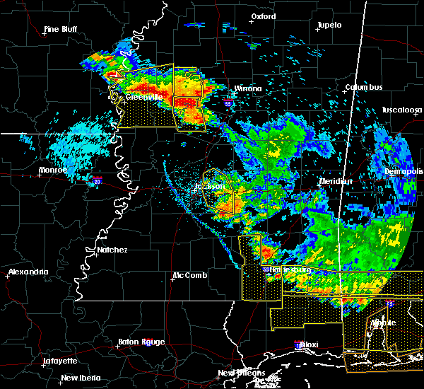 The severe thunderstorm warning for rankin and south central madison counties will expire at 700 pm cdt, the storms which prompted the warning have weakened below severe limits, and no longer pose an immediate threat to life or property. therefore the warning will be allowed to expire. a severe thunderstorm watch remains in effect until 900 pm cdt for central mississippi. The severe thunderstorm warning for rankin and south central madison counties will expire at 700 pm cdt, the storms which prompted the warning have weakened below severe limits, and no longer pose an immediate threat to life or property. therefore the warning will be allowed to expire. a severe thunderstorm watch remains in effect until 900 pm cdt for central mississippi.
|
| 6/17/2016 6:42 PM CDT |
 At 641 pm cdt, a few severe thunderstorms were located along a line extending from near johns to canton, moving southeast at 15 mph (radar indicated). Hazards include 60 mph wind gusts and quarter size hail. Hail damage to vehicles is expected. Expect wind damage to roofs, siding, and trees. At 641 pm cdt, a few severe thunderstorms were located along a line extending from near johns to canton, moving southeast at 15 mph (radar indicated). Hazards include 60 mph wind gusts and quarter size hail. Hail damage to vehicles is expected. Expect wind damage to roofs, siding, and trees.
|
| 6/17/2016 6:15 PM CDT |
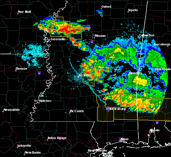 At 615 pm cdt, a severe thunderstorm was located over the ross barnett reservoir area, moving south at 15 mph (radar indicated). Hazards include 60 mph wind gusts and quarter size hail. Hail damage to vehicles is expected. expect wind damage to roofs, siding, and trees. this severe thunderstorm will be near, brandon around 655 pm cdt. Other locations impacted by this severe thunderstorm include puckett. At 615 pm cdt, a severe thunderstorm was located over the ross barnett reservoir area, moving south at 15 mph (radar indicated). Hazards include 60 mph wind gusts and quarter size hail. Hail damage to vehicles is expected. expect wind damage to roofs, siding, and trees. this severe thunderstorm will be near, brandon around 655 pm cdt. Other locations impacted by this severe thunderstorm include puckett.
|
| 4/14/2016 2:29 PM CDT |
 At 228 pm cdt, a severe thunderstorm was located over johns, or 11 miles north of mendenhall, moving east at 15 mph (radar indicated). Hazards include 60 mph wind gusts and quarter size hail. Hail damage to vehicles is expected. expect wind damage to roofs, siding, and trees. This severe thunderstorm will remain over mainly rural areas of southeastern rankin county, including the following locations: puckett. At 228 pm cdt, a severe thunderstorm was located over johns, or 11 miles north of mendenhall, moving east at 15 mph (radar indicated). Hazards include 60 mph wind gusts and quarter size hail. Hail damage to vehicles is expected. expect wind damage to roofs, siding, and trees. This severe thunderstorm will remain over mainly rural areas of southeastern rankin county, including the following locations: puckett.
|
| 4/14/2016 2:15 PM CDT |
 At 214 pm cdt, a severe thunderstorm was located near cato, or 8 miles east of star, moving east at 25 mph (radar indicated). Hazards include 60 mph wind gusts and quarter size hail. Hail damage to vehicles is expected. expect wind damage to roofs, siding, and trees. this severe thunderstorm will be near, johns around 225 pm cdt. Other locations impacted by this severe thunderstorm include puckett. At 214 pm cdt, a severe thunderstorm was located near cato, or 8 miles east of star, moving east at 25 mph (radar indicated). Hazards include 60 mph wind gusts and quarter size hail. Hail damage to vehicles is expected. expect wind damage to roofs, siding, and trees. this severe thunderstorm will be near, johns around 225 pm cdt. Other locations impacted by this severe thunderstorm include puckett.
|
| 4/11/2016 6:09 PM CDT |
 At 609 pm cdt, severe thunderstorms were located along a line extending from near pineville to near raleigh, moving east at 70 mph (radar indicated). Hazards include 70 mph wind gusts and quarter size hail. Hail damage to vehicles is expected. expect considerable tree damage. wind damage is also likely to mobile homes, roofs, and outbuildings. These severe thunderstorms will remain over mainly rural areas of southeastern rankin and northern smith counties, including the following locations: puckett and polkville. At 609 pm cdt, severe thunderstorms were located along a line extending from near pineville to near raleigh, moving east at 70 mph (radar indicated). Hazards include 70 mph wind gusts and quarter size hail. Hail damage to vehicles is expected. expect considerable tree damage. wind damage is also likely to mobile homes, roofs, and outbuildings. These severe thunderstorms will remain over mainly rural areas of southeastern rankin and northern smith counties, including the following locations: puckett and polkville.
|
| 4/11/2016 5:57 PM CDT |
 At 557 pm cdt, severe thunderstorms were located along a line extending from near pulaski to near cato, moving southeast at 45 mph (radar indicated). Hazards include 60 mph wind gusts and quarter size hail. Hail damage to vehicles is expected. expect wind damage to roofs, siding, and trees. these severe storms will be near, burns around 610 pm cdt. raleigh around 615 pm cdt. pineville around 620 pm cdt. Other locations impacted by these severe thunderstorms include puckett and polkville. At 557 pm cdt, severe thunderstorms were located along a line extending from near pulaski to near cato, moving southeast at 45 mph (radar indicated). Hazards include 60 mph wind gusts and quarter size hail. Hail damage to vehicles is expected. expect wind damage to roofs, siding, and trees. these severe storms will be near, burns around 610 pm cdt. raleigh around 615 pm cdt. pineville around 620 pm cdt. Other locations impacted by these severe thunderstorms include puckett and polkville.
|
| 4/11/2016 5:28 PM CDT |
 At 528 pm cdt, severe thunderstorms were located along a line extending from near leesburg to pearl, moving southeast at 75 mph (radar indicated). Hazards include 60 mph wind gusts and quarter size hail. Hail damage to vehicles is expected. expect wind damage to roofs, siding, and trees. severe thunderstorms will be near, cato and piney woods around 540 pm cdt. johns around 545 pm cdt. white oak around 550 pm cdt. raleigh around 600 pm cdt. Other locations impacted by these severe thunderstorms include puckett and polkville. At 528 pm cdt, severe thunderstorms were located along a line extending from near leesburg to pearl, moving southeast at 75 mph (radar indicated). Hazards include 60 mph wind gusts and quarter size hail. Hail damage to vehicles is expected. expect wind damage to roofs, siding, and trees. severe thunderstorms will be near, cato and piney woods around 540 pm cdt. johns around 545 pm cdt. white oak around 550 pm cdt. raleigh around 600 pm cdt. Other locations impacted by these severe thunderstorms include puckett and polkville.
|
| 4/1/2016 1:55 AM CDT |
 The severe thunderstorm warning for southeastern rankin county will expire at 200 am cdt, the storm which prompted the warning has moved out of the area. therefore the warning will be allowed to expire. The severe thunderstorm warning for southeastern rankin county will expire at 200 am cdt, the storm which prompted the warning has moved out of the area. therefore the warning will be allowed to expire.
|
| 4/1/2016 1:39 AM CDT |
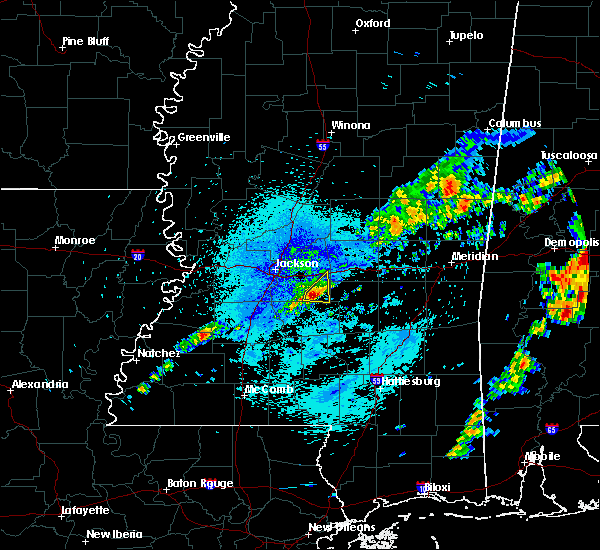 At 138 am cdt, a severe thunderstorm was located over cato, or 10 miles north of mendenhall, moving east at 45 mph (radar indicated). Hazards include ping pong ball size hail and 60 mph wind gusts. People and animals outdoors will be injured. expect hail damage to roofs, siding, windows and vehicles. expect wind damage to roofs, siding and trees. This severe thunderstorm will remain over mainly rural areas of southeastern rankin county, including the following locations, puckett. At 138 am cdt, a severe thunderstorm was located over cato, or 10 miles north of mendenhall, moving east at 45 mph (radar indicated). Hazards include ping pong ball size hail and 60 mph wind gusts. People and animals outdoors will be injured. expect hail damage to roofs, siding, windows and vehicles. expect wind damage to roofs, siding and trees. This severe thunderstorm will remain over mainly rural areas of southeastern rankin county, including the following locations, puckett.
|
| 4/1/2016 1:17 AM CDT |
 At 117 am cdt, a severe thunderstorm was located near whites, or near star, moving east at 35 mph (radar indicated). Hazards include ping pong ball size hail and 60 mph wind gusts. People and animals outdoors will be injured. expect hail damage to roofs, siding, windows and vehicles. expect wind damage to roofs, siding and trees. this severe thunderstorm will be near, florence and harrisville around 120 am cdt. star and monterey around 125 am cdt. piney woods around 130 am cdt. cato around 140 am cdt. johns around 145 am cdt. Other locations impacted by this severe thunderstorm include braxton, puckett and d`lo. At 117 am cdt, a severe thunderstorm was located near whites, or near star, moving east at 35 mph (radar indicated). Hazards include ping pong ball size hail and 60 mph wind gusts. People and animals outdoors will be injured. expect hail damage to roofs, siding, windows and vehicles. expect wind damage to roofs, siding and trees. this severe thunderstorm will be near, florence and harrisville around 120 am cdt. star and monterey around 125 am cdt. piney woods around 130 am cdt. cato around 140 am cdt. johns around 145 am cdt. Other locations impacted by this severe thunderstorm include braxton, puckett and d`lo.
|
| 3/31/2016 7:21 PM CDT |
 The severe thunderstorm warning for southeastern rankin and northern simpson counties will expire at 730 pm cdt, the storm which prompted the warning has moved out of the area. therefore the warning will be allowed to expire. a tornado watch remains in effect until 1000 pm cdt for central mississippi. The severe thunderstorm warning for southeastern rankin and northern simpson counties will expire at 730 pm cdt, the storm which prompted the warning has moved out of the area. therefore the warning will be allowed to expire. a tornado watch remains in effect until 1000 pm cdt for central mississippi.
|
| 3/31/2016 6:53 PM CDT |
 At 653 pm cdt, a severe thunderstorm was located over piney woods, or near star, moving east at 60 mph (radar indicated). Hazards include two inch hail and 60 mph wind gusts. People and animals outdoors will be injured. expect hail damage to roofs, siding, windows and vehicles. expect wind damage to roofs, siding and trees. this severe storm will be near, johns around 705 pm cdt. other locations impacted by this severe thunderstorm include braxton, puckett and d`lo. A tornado watch remains in effect until 1000 pm cdt for central mississippi. At 653 pm cdt, a severe thunderstorm was located over piney woods, or near star, moving east at 60 mph (radar indicated). Hazards include two inch hail and 60 mph wind gusts. People and animals outdoors will be injured. expect hail damage to roofs, siding, windows and vehicles. expect wind damage to roofs, siding and trees. this severe storm will be near, johns around 705 pm cdt. other locations impacted by this severe thunderstorm include braxton, puckett and d`lo. A tornado watch remains in effect until 1000 pm cdt for central mississippi.
|
| 3/31/2016 6:47 PM CDT |
 At 646 pm cdt, a severe thunderstorm was located over star, moving east at 45 mph (radar indicated). Hazards include two inch hail and 60 mph wind gusts. People and animals outdoors will be injured. expect hail damage to roofs, siding, windows and vehicles. expect wind damage to roofs, siding and trees. this severe storm will be near, piney woods around 650 pm cdt. cato around 700 pm cdt. johns around 705 pm cdt. other locations impacted by this severe thunderstorm include braxton, puckett and d`lo. A tornado watch remains in effect until 1000 pm cdt for central mississippi. At 646 pm cdt, a severe thunderstorm was located over star, moving east at 45 mph (radar indicated). Hazards include two inch hail and 60 mph wind gusts. People and animals outdoors will be injured. expect hail damage to roofs, siding, windows and vehicles. expect wind damage to roofs, siding and trees. this severe storm will be near, piney woods around 650 pm cdt. cato around 700 pm cdt. johns around 705 pm cdt. other locations impacted by this severe thunderstorm include braxton, puckett and d`lo. A tornado watch remains in effect until 1000 pm cdt for central mississippi.
|
| 3/31/2016 6:40 PM CDT |
 At 640 pm cdt, a severe thunderstorm was located near whites, or near star, moving east at 45 mph (radar indicated). Hazards include 60 mph wind gusts and half dollar size hail. Hail damage to vehicles is expected. expect wind damage to roofs, siding and trees. this severe thunderstorm will be near, monterey around 645 pm cdt. star and piney woods around 650 pm cdt. cato around 700 pm cdt. johns around 705 pm cdt. other locations impacted by this severe thunderstorm include braxton, puckett and d`lo. A tornado watch remains in effect until 1000 pm cdt for central mississippi. At 640 pm cdt, a severe thunderstorm was located near whites, or near star, moving east at 45 mph (radar indicated). Hazards include 60 mph wind gusts and half dollar size hail. Hail damage to vehicles is expected. expect wind damage to roofs, siding and trees. this severe thunderstorm will be near, monterey around 645 pm cdt. star and piney woods around 650 pm cdt. cato around 700 pm cdt. johns around 705 pm cdt. other locations impacted by this severe thunderstorm include braxton, puckett and d`lo. A tornado watch remains in effect until 1000 pm cdt for central mississippi.
|
| 3/3/2016 4:27 PM CST | The severe thunderstorm warning for southern rankin and north central simpson counties will expire at 430 pm cst, the severe thunderstorm which prompted the warning has moved out of the warned area. therefore the warning will be allowed to expire. |
| 3/3/2016 4:14 PM CST |
 At 414 pm cst, a severe thunderstorm was located near cato, or 7 miles north of mendenhall, moving east at 50 mph (radar indicated). Hazards include 60 mph wind gusts and quarter size hail. Hail damage to vehicles is expected. expect wind damage to roofs, siding and trees. This severe thunderstorm will remain over mainly rural areas of southern rankin and north central simpson counties, including the following locations, braxton, puckett and d`lo. At 414 pm cst, a severe thunderstorm was located near cato, or 7 miles north of mendenhall, moving east at 50 mph (radar indicated). Hazards include 60 mph wind gusts and quarter size hail. Hail damage to vehicles is expected. expect wind damage to roofs, siding and trees. This severe thunderstorm will remain over mainly rural areas of southern rankin and north central simpson counties, including the following locations, braxton, puckett and d`lo.
|
| 3/3/2016 3:45 PM CST |
 At 344 pm cst, a severe thunderstorm was located near richland, moving southeast at 35 mph (radar indicated). Hazards include 60 mph wind gusts and quarter size hail. Hail damage to vehicles is expected. expect wind damage to roofs, siding and trees. this severe thunderstorm will be near, florence around 350 pm cst. monterey around 355 pm cst. star around 400 pm cst. piney woods around 405 pm cst. cato and johns around 415 pm cst. mendenhall around 425 pm cst. Other locations impacted by this severe thunderstorm include braxton, puckett and d`lo. At 344 pm cst, a severe thunderstorm was located near richland, moving southeast at 35 mph (radar indicated). Hazards include 60 mph wind gusts and quarter size hail. Hail damage to vehicles is expected. expect wind damage to roofs, siding and trees. this severe thunderstorm will be near, florence around 350 pm cst. monterey around 355 pm cst. star around 400 pm cst. piney woods around 405 pm cst. cato and johns around 415 pm cst. mendenhall around 425 pm cst. Other locations impacted by this severe thunderstorm include braxton, puckett and d`lo.
|
| 2/23/2016 9:54 PM CST |
 At 954 pm cst, severe thunderstorms were located along a line extending from pearl to near monterey to whites, moving northeast at 70 mph (radar indicated). Hazards include 60 mph wind gusts and nickel size hail. Expect damage to roofs. siding and trees. these severe storms will be near, brandon and flowood around 1000 pm cst. fannin around 1005 pm cst. pisgah and goshen springs around 1010 pm cst. leesburg around 1015 pm cst. pelahatchie around 1020 pm cst. Other locations impacted by these severe thunderstorms include puckett. At 954 pm cst, severe thunderstorms were located along a line extending from pearl to near monterey to whites, moving northeast at 70 mph (radar indicated). Hazards include 60 mph wind gusts and nickel size hail. Expect damage to roofs. siding and trees. these severe storms will be near, brandon and flowood around 1000 pm cst. fannin around 1005 pm cst. pisgah and goshen springs around 1010 pm cst. leesburg around 1015 pm cst. pelahatchie around 1020 pm cst. Other locations impacted by these severe thunderstorms include puckett.
|
| 2/23/2016 9:21 PM CST |
 At 921 pm cst, a severe thunderstorm was located near ridgeland, moving northeast at 60 mph (radar indicated). Hazards include 60 mph wind gusts and quarter size hail. Hail damage to vehicles is expected. expect wind damage to roofs, siding and trees. this severe thunderstorm will be near, madison and annandale around 925 pm cst. gluckstadt around 930 pm cst. canton and goshen springs around 935 pm cst. sharon around 945 pm cst. farmhaven around 950 pm cst. Other locations impacted by this severe thunderstorm include puckett. At 921 pm cst, a severe thunderstorm was located near ridgeland, moving northeast at 60 mph (radar indicated). Hazards include 60 mph wind gusts and quarter size hail. Hail damage to vehicles is expected. expect wind damage to roofs, siding and trees. this severe thunderstorm will be near, madison and annandale around 925 pm cst. gluckstadt around 930 pm cst. canton and goshen springs around 935 pm cst. sharon around 945 pm cst. farmhaven around 950 pm cst. Other locations impacted by this severe thunderstorm include puckett.
|
| 2/2/2016 8:35 PM CST |
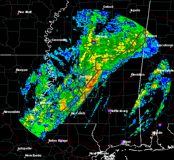 At 834 pm cst, a severe thunderstorm was located near cato, or near mendenhall, moving northeast at 30 mph (radar indicated). Hazards include 60 mph wind gusts. Expect damage to roofs. siding and trees. this severe thunderstorm will be near, cato around 840 pm cst. johns around 845 pm cst. morton and pulaski around 920 pm cst. homewood around 925 pm cst. other locations impacted by this severe thunderstorm include puckett and polkville. A tornado watch remains in effect until 300 am cst for central mississippi. At 834 pm cst, a severe thunderstorm was located near cato, or near mendenhall, moving northeast at 30 mph (radar indicated). Hazards include 60 mph wind gusts. Expect damage to roofs. siding and trees. this severe thunderstorm will be near, cato around 840 pm cst. johns around 845 pm cst. morton and pulaski around 920 pm cst. homewood around 925 pm cst. other locations impacted by this severe thunderstorm include puckett and polkville. A tornado watch remains in effect until 300 am cst for central mississippi.
|
| 2/2/2016 5:54 PM CST |
 The severe thunderstorm warning for southeastern rankin, northeastern simpson and northwestern smith counties will expire at 600 pm cst, the storm which prompted the warning has weakened below severe limits and exited the warned area. therefore the warning will be allowed to expire. a tornado watch remains in effect until 700 pm cst for central mississippi. The severe thunderstorm warning for southeastern rankin, northeastern simpson and northwestern smith counties will expire at 600 pm cst, the storm which prompted the warning has weakened below severe limits and exited the warned area. therefore the warning will be allowed to expire. a tornado watch remains in effect until 700 pm cst for central mississippi.
|
| 2/2/2016 5:14 PM CST |
 At 514 pm cst, a severe thunderstorm was located near martinville, or near mendenhall, moving northeast at 40 mph (radar indicated). Hazards include 60 mph wind gusts. Expect damage to roofs. siding and trees. this severe thunderstorm will be near, johns around 520 pm cst. white oak around 525 pm cst. burns around 535 pm cst. other locations impacted by this severe thunderstorm include puckett, d`lo and polkville. A tornado watch remains in effect until 700 pm cst for central mississippi. At 514 pm cst, a severe thunderstorm was located near martinville, or near mendenhall, moving northeast at 40 mph (radar indicated). Hazards include 60 mph wind gusts. Expect damage to roofs. siding and trees. this severe thunderstorm will be near, johns around 520 pm cst. white oak around 525 pm cst. burns around 535 pm cst. other locations impacted by this severe thunderstorm include puckett, d`lo and polkville. A tornado watch remains in effect until 700 pm cst for central mississippi.
|
| 2/2/2016 2:45 PM CST |
 The national weather service in jackson has issued a * severe thunderstorm warning for. northeastern copiah county in central mississippi. rankin county in central mississippi. northwestern simpson county in central mississippi. Southeastern hinds county in central mississippi. The national weather service in jackson has issued a * severe thunderstorm warning for. northeastern copiah county in central mississippi. rankin county in central mississippi. northwestern simpson county in central mississippi. Southeastern hinds county in central mississippi.
|
| 2/2/2016 1:18 PM CST |
 At 118 pm cst, a severe thunderstorm was located 7 miles east of johns, or 13 miles south of morton, moving northeast at 40 mph (radar indicated). Hazards include 60 mph wind gusts and penny size hail. Expect damage to roofs. siding and trees. this severe storm will be near, morton and pulaski around 135 pm cst. other locations impacted by this severe thunderstorm include puckett and polkville. A tornado watch remains in effect until 700 pm cst for central mississippi. At 118 pm cst, a severe thunderstorm was located 7 miles east of johns, or 13 miles south of morton, moving northeast at 40 mph (radar indicated). Hazards include 60 mph wind gusts and penny size hail. Expect damage to roofs. siding and trees. this severe storm will be near, morton and pulaski around 135 pm cst. other locations impacted by this severe thunderstorm include puckett and polkville. A tornado watch remains in effect until 700 pm cst for central mississippi.
|
| 2/2/2016 1:08 PM CST |
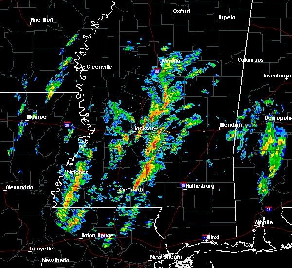 At 107 pm cst, a severe thunderstorm was located near johns, or 9 miles northeast of mendenhall, moving northeast at 35 mph (radar indicated). Hazards include 60 mph wind gusts. Expect damage to roofs. siding and trees. this severe storm will be near, pulaski around 135 pm cst. morton around 140 pm cst. Other locations impacted by this severe thunderstorm include puckett and polkville. At 107 pm cst, a severe thunderstorm was located near johns, or 9 miles northeast of mendenhall, moving northeast at 35 mph (radar indicated). Hazards include 60 mph wind gusts. Expect damage to roofs. siding and trees. this severe storm will be near, pulaski around 135 pm cst. morton around 140 pm cst. Other locations impacted by this severe thunderstorm include puckett and polkville.
|
| 2/2/2016 12:59 PM CST |
 The national weather service in jackson has issued a * severe thunderstorm warning for. southeastern rankin county in central mississippi. southwestern scott county in central mississippi. northeastern simpson county in central mississippi. Northwestern smith county in central mississippi. The national weather service in jackson has issued a * severe thunderstorm warning for. southeastern rankin county in central mississippi. southwestern scott county in central mississippi. northeastern simpson county in central mississippi. Northwestern smith county in central mississippi.
|
| 12/28/2015 5:35 AM CST |
 At 535 am cst, severe thunderstorms were located along a line extending from pelahatchie to sanatorium, moving northeast at 25 mph (radar indicated). Hazards include 60 mph wind gusts. Expect damage to roofs. siding and trees. these severe storms will be near, pelahatchie around 540 am cst. leesburg around 555 am cst. other locations impacted by these severe thunderstorms include puckett. A tornado watch remains in effect until 800 am cst for southeastern mississippi. At 535 am cst, severe thunderstorms were located along a line extending from pelahatchie to sanatorium, moving northeast at 25 mph (radar indicated). Hazards include 60 mph wind gusts. Expect damage to roofs. siding and trees. these severe storms will be near, pelahatchie around 540 am cst. leesburg around 555 am cst. other locations impacted by these severe thunderstorms include puckett. A tornado watch remains in effect until 800 am cst for southeastern mississippi.
|
| 12/28/2015 5:01 AM CST |
 At 500 am cst, severe thunderstorms were located along a line extending from ridgeland to near shivers, moving east at 30 mph (radar indicated). Hazards include 60 mph wind gusts. Expect damage to roofs. siding and trees. severe thunderstorms will be near, pinola and fannin around 515 am cst. goshen springs around 525 am cst. pisgah around 530 am cst. sanatorium around 535 am cst. magee and leesburg around 540 am cst. other locations impacted by these severe thunderstorms include braxton, puckett and d`lo. A tornado watch remains in effect until 800 am cst for southeastern mississippi. At 500 am cst, severe thunderstorms were located along a line extending from ridgeland to near shivers, moving east at 30 mph (radar indicated). Hazards include 60 mph wind gusts. Expect damage to roofs. siding and trees. severe thunderstorms will be near, pinola and fannin around 515 am cst. goshen springs around 525 am cst. pisgah around 530 am cst. sanatorium around 535 am cst. magee and leesburg around 540 am cst. other locations impacted by these severe thunderstorms include braxton, puckett and d`lo. A tornado watch remains in effect until 800 am cst for southeastern mississippi.
|
| 6/15/2015 5:29 PM CDT |
 At 529 pm cdt, a severe thunderstorm was located near cato, or 7 miles east of star, moving north at 25 mph (radar indicated). Hazards include 60 mph wind gusts. Expect damage to roofs. siding and trees. this severe thunderstorm will be near, brandon around 555 pm cdt. pelahatchie around 600 pm cdt. fannin around 615 pm cdt. Other locations impacted by this severe thunderstorm include puckett. At 529 pm cdt, a severe thunderstorm was located near cato, or 7 miles east of star, moving north at 25 mph (radar indicated). Hazards include 60 mph wind gusts. Expect damage to roofs. siding and trees. this severe thunderstorm will be near, brandon around 555 pm cdt. pelahatchie around 600 pm cdt. fannin around 615 pm cdt. Other locations impacted by this severe thunderstorm include puckett.
|
| 6/15/2015 5:14 PM CDT |
 At 513 pm cdt, severe thunderstorms were located along a line extending from near star to mendenhall, moving north at 30 mph (radar indicated). Hazards include 60 mph wind gusts. Expect damage to roofs. siding and trees. these severe storms will be near, star and florence around 520 pm cdt. johns around 530 pm cdt. Other locations impacted by these severe thunderstorms include braxton, puckett and d`lo. At 513 pm cdt, severe thunderstorms were located along a line extending from near star to mendenhall, moving north at 30 mph (radar indicated). Hazards include 60 mph wind gusts. Expect damage to roofs. siding and trees. these severe storms will be near, star and florence around 520 pm cdt. johns around 530 pm cdt. Other locations impacted by these severe thunderstorms include braxton, puckett and d`lo.
|
| 6/15/2015 5:03 PM CDT |
 At 502 pm cdt, a severe thunderstorm was located near mendenhall, moving north at 35 mph (radar indicated). Hazards include 60 mph wind gusts. Expect damage to roofs. siding and trees. this severe thunderstorm will be near, piney woods around 520 pm cdt. cato around 525 pm cdt. johns around 530 pm cdt. Other locations impacted by this severe thunderstorm include braxton, puckett and d`lo. At 502 pm cdt, a severe thunderstorm was located near mendenhall, moving north at 35 mph (radar indicated). Hazards include 60 mph wind gusts. Expect damage to roofs. siding and trees. this severe thunderstorm will be near, piney woods around 520 pm cdt. cato around 525 pm cdt. johns around 530 pm cdt. Other locations impacted by this severe thunderstorm include braxton, puckett and d`lo.
|
| 6/10/2015 8:45 PM CDT |
 The national weather service in jackson has issued a * severe thunderstorm warning for. southeastern rankin county in central mississippi. until 930 pm cdt * at 845 pm cdt. a severe thunderstorm was located near johns. or 11 miles southeast of brandon. And is nearly stationary. The national weather service in jackson has issued a * severe thunderstorm warning for. southeastern rankin county in central mississippi. until 930 pm cdt * at 845 pm cdt. a severe thunderstorm was located near johns. or 11 miles southeast of brandon. And is nearly stationary.
|
| 6/10/2015 8:29 PM CDT |
 At 829 pm cdt, a severe thunderstorm was located near pearl, and is nearly stationary (radar indicated). Hazards include 60 mph wind gusts and penny size hail. Expect damage to roofs. siding and trees. this severe storm will be near, pearl, brandon, flowood and richland around 845 pm cdt. Other locations impacted by this severe thunderstorm include puckett. At 829 pm cdt, a severe thunderstorm was located near pearl, and is nearly stationary (radar indicated). Hazards include 60 mph wind gusts and penny size hail. Expect damage to roofs. siding and trees. this severe storm will be near, pearl, brandon, flowood and richland around 845 pm cdt. Other locations impacted by this severe thunderstorm include puckett.
|
| 6/10/2015 7:57 PM CDT |
 At 757 pm cdt, severe thunderstorms were located along a line extending from near flowood to piney woods, moving north at 10 mph (radar indicated). Hazards include 60 mph wind gusts and penny size hail. Expect damage to roofs. siding and trees. severe thunderstorms will be near, pearl and flowood around 805 pm cdt. brandon, florence and monterey around 845 pm cdt. Other locations impacted by these severe thunderstorms include puckett. At 757 pm cdt, severe thunderstorms were located along a line extending from near flowood to piney woods, moving north at 10 mph (radar indicated). Hazards include 60 mph wind gusts and penny size hail. Expect damage to roofs. siding and trees. severe thunderstorms will be near, pearl and flowood around 805 pm cdt. brandon, florence and monterey around 845 pm cdt. Other locations impacted by these severe thunderstorms include puckett.
|
| 5/26/2015 2:47 AM CDT | At 246 am cdt, severe thunderstorms were located along a line extending from goshen springs to johns, moving east at 35 mph (radar indicated). Hazards include 60 mph wind gusts. Expect damage to roofs. siding and trees. these severe storms will be near, pisgah around 255 am cdt. Leesburg around 300 am cdt. |
| 5/26/2015 2:32 AM CDT | At 232 am cdt, severe thunderstorms were located along a line extending from near way to piney woods, moving east at 30 mph (radar indicated). Hazards include 60 mph wind gusts. Expect damage to roofs. siding and trees. these severe storms will be near, way around 240 am cdt. sharon around 245 am cdt. cato around 250 am cdt. Johns around 255 am cdt. |
| 5/26/2015 2:06 AM CDT | At 206 am cdt, severe thunderstorms were located along a line extending from pocahontas to near rockport, moving northeast at 40 mph (radar indicated). Hazards include 60 mph wind gusts. Expect damage to roofs. siding and trees. severe thunderstorms will be near, pocahontas around 210 am cdt. annandale around 215 am cdt. gluckstadt around 220 am cdt. canton around 225 am cdt. star and piney woods around 235 am cdt. sharon and way around 240 am cdt. cato around 245 am cdt. johns around 255 am cdt. Other locations impacted by these severe thunderstorms include puckett. |
| 5/18/2015 12:39 AM CDT | At 1239 am cdt, a severe thunderstorm was located near whites, or 7 miles east of crystal springs, moving northeast at 50 mph (radar indicated). Hazards include 60 mph wind gusts. Expect damage to roofs. siding and trees. this severe thunderstorm will be near, harrisville around 1245 am cdt. florence around 1250 am cdt. star, piney woods and monterey around 1255 am cdt. cato around 105 am cdt. johns around 110 am cdt. other locations impacted by this severe thunderstorm include puckett, braxton, d`lo and georgetown. 75in. |
| 4/15/2015 8:12 PM CDT | A severe thunderstorm warning remains in effect until 830 pm cdt for southeastern rankin and northeastern simpson counties. at 812 pm cdt. a severe thunderstorm was located near cato. or near mendenhall. moving northeast at 30 mph. hazard. golf ball size hail and 60 mph wind gusts. source. Trained weather spotters. |
| 4/15/2015 7:51 PM CDT | The national weather service in jackson has issued a * severe thunderstorm warning for. southeastern rankin county in central mississippi. northeastern simpson county in central mississippi. until 830 pm cdt * at 751 pm cdt. A severe thunderstorm was located near pinola. |
| 3/18/2015 7:27 PM CDT | A severe thunderstorm warning remains in effect for southeastern rankin. northeastern simpson and northwestern smith counties until 745 pm cdt. at 727 pm cdt. a severe thunderstorm was located near white oak. and moving northeast at 40 mph. hazard. 60 mph wind gusts and quarter size hail. |
| 3/18/2015 7:16 PM CDT | The national weather service in jackson has issued a * severe thunderstorm warning for. southeastern rankin county in central mississippi. northeastern simpson county in central mississippi. northwestern smith county in central mississippi. Until 745 pm cdt. |
| 10/13/2014 4:15 PM CDT | A couple trees down in rankin county MS, 4.8 miles SE of Puckett, MS |
| 4/28/2014 8:10 PM CDT | Trees down in smith county MS, 5.3 miles W of Puckett, MS |
| 12/20/2012 6:05 AM CST | Reports of a tree down at rose hill road and county line roa in rankin county MS, 4.2 miles E of Puckett, MS |
| 1/1/0001 12:00 AM | Trees down along highway 18 in smith county MS, 5.3 miles W of Puckett, MS |
Hail Maps for Puckett, MS


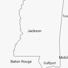


Connect with Interactive Hail Maps