

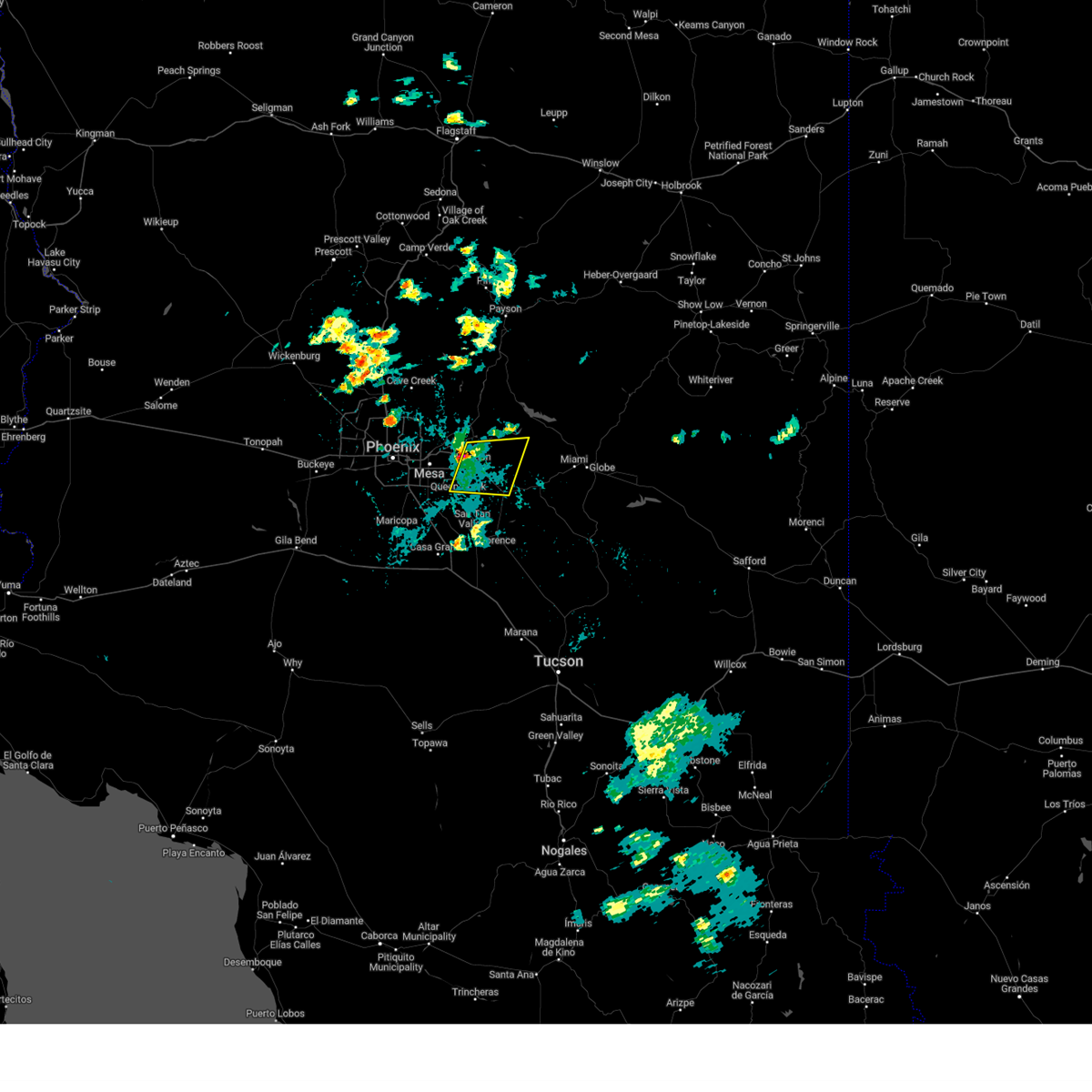
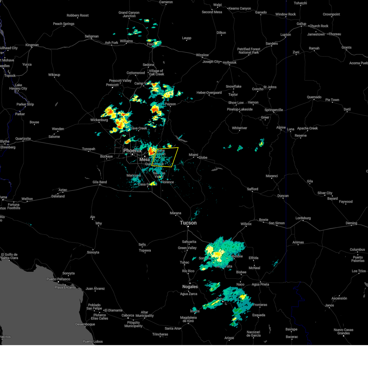
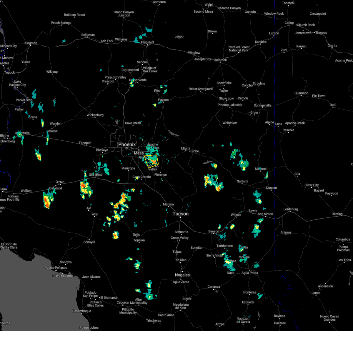
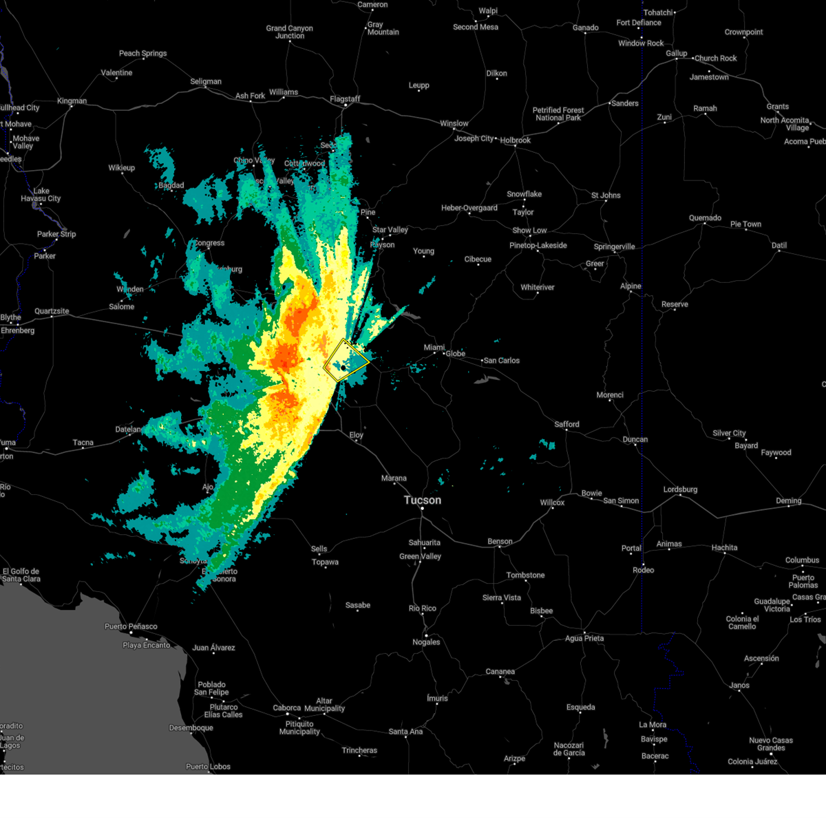
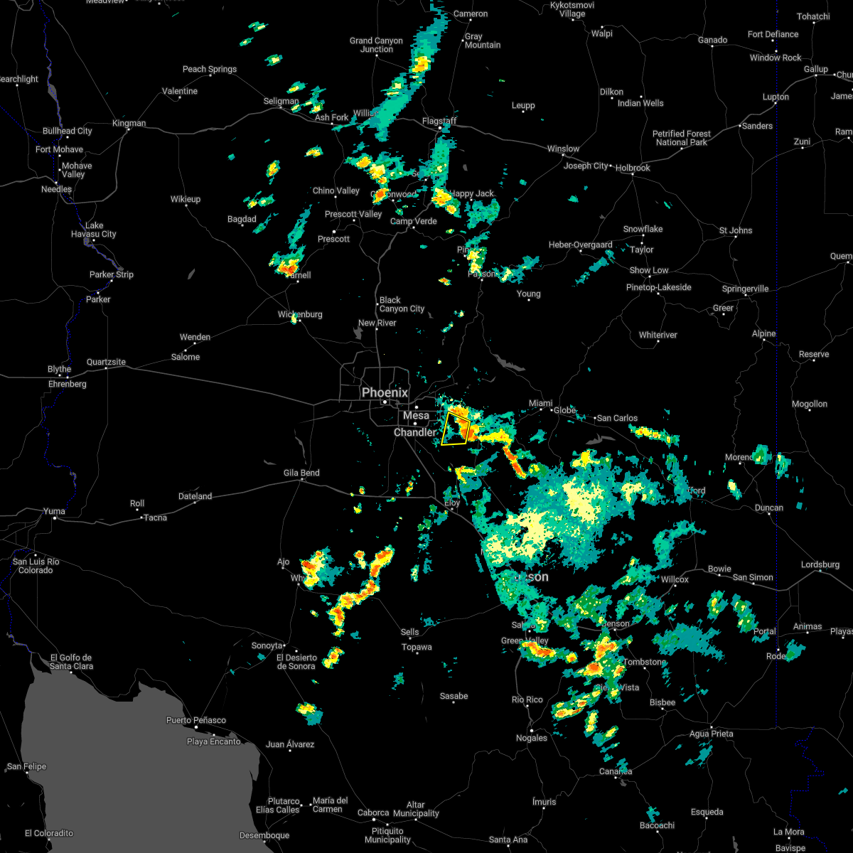
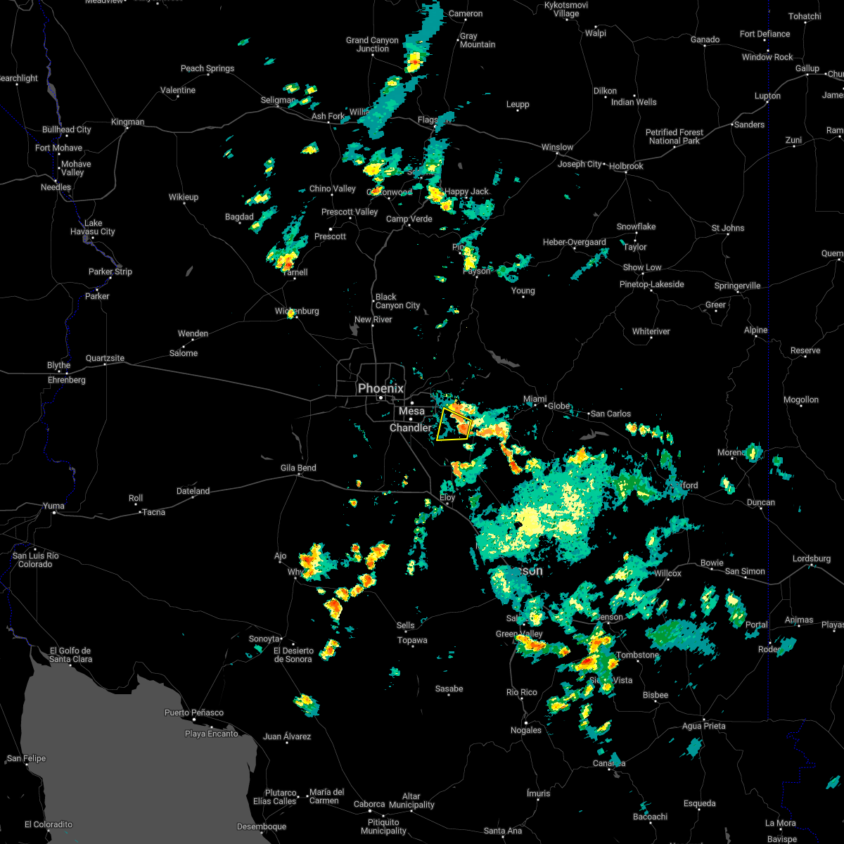
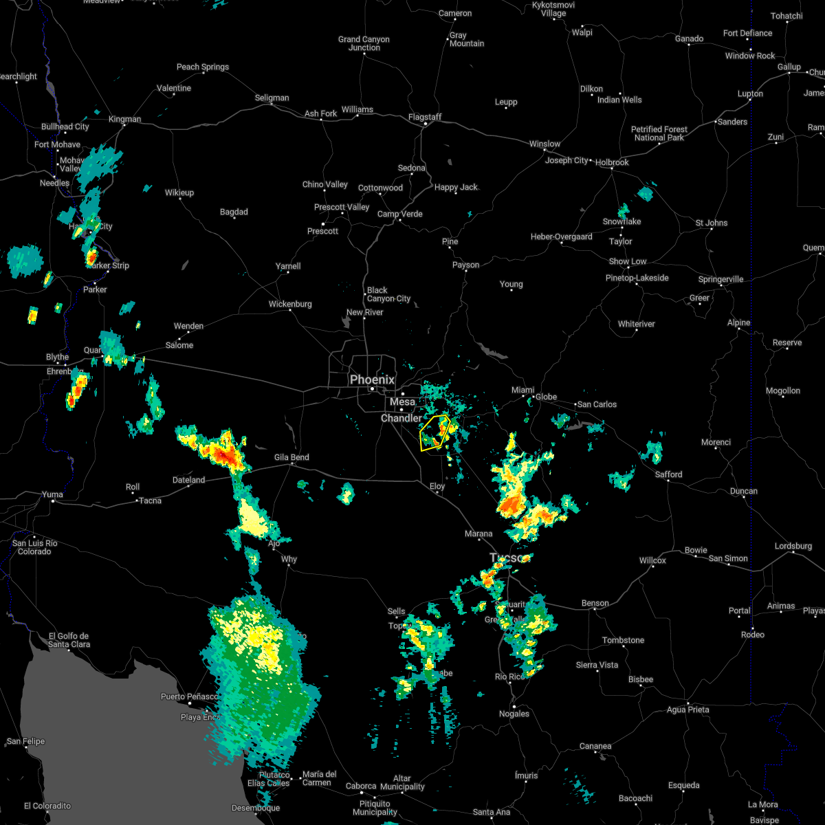
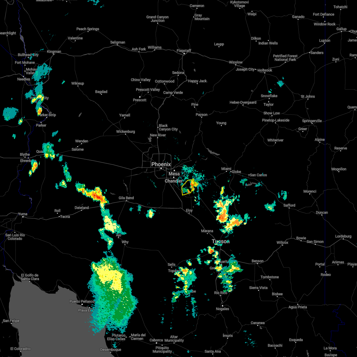
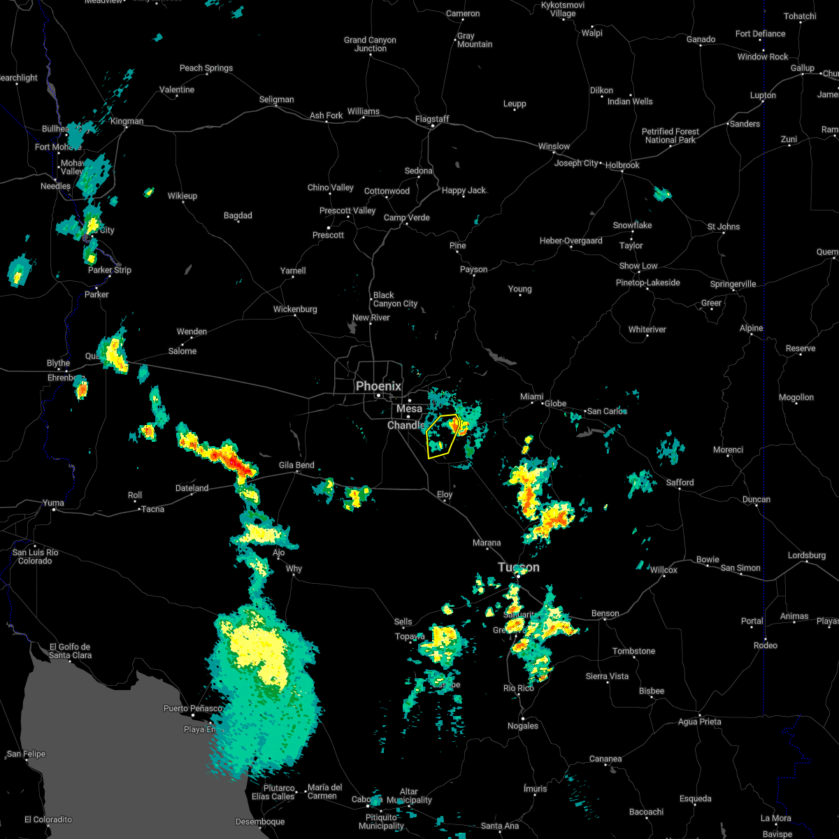
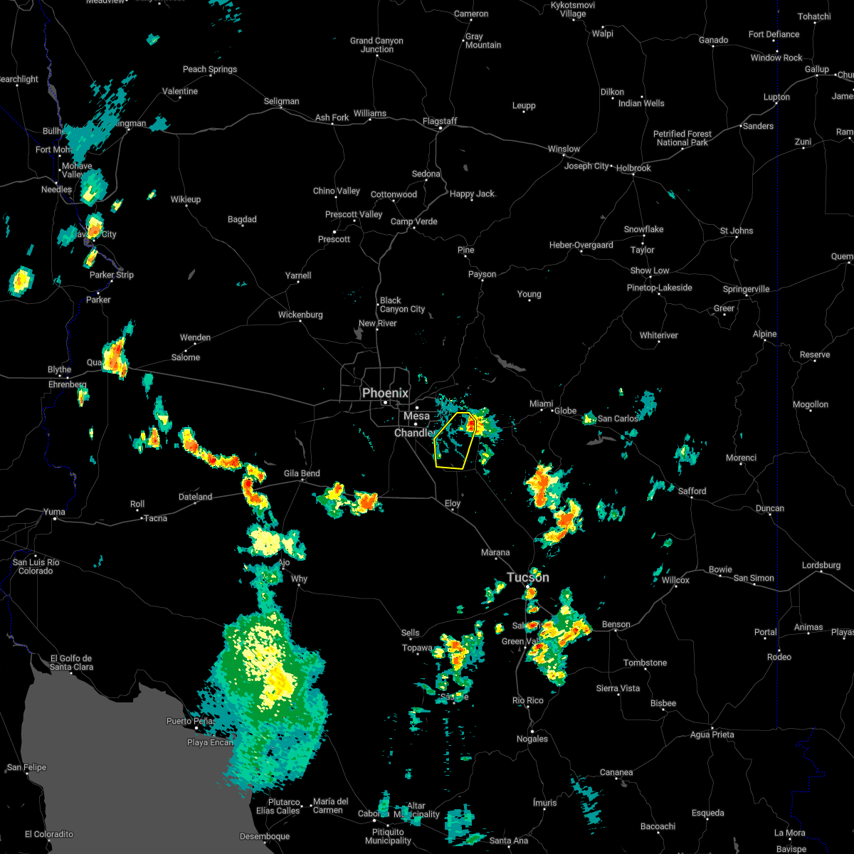
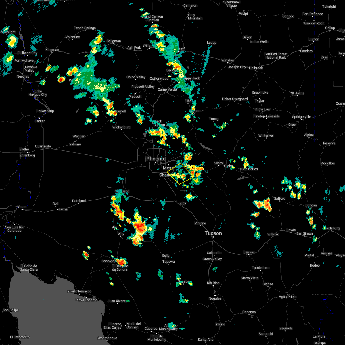
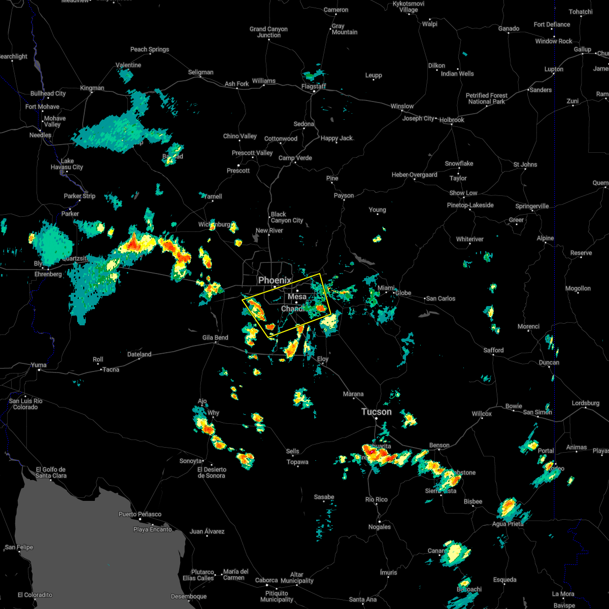
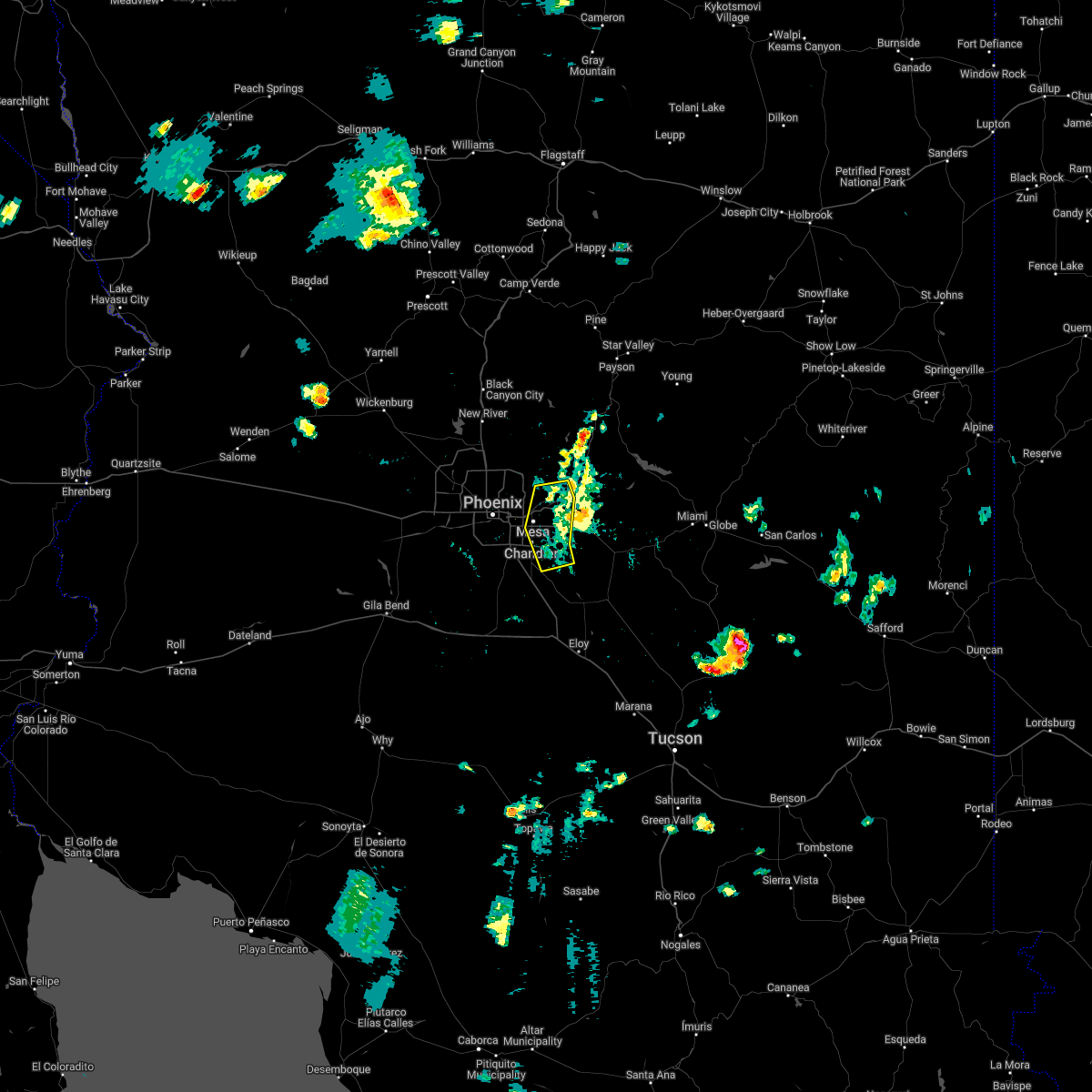
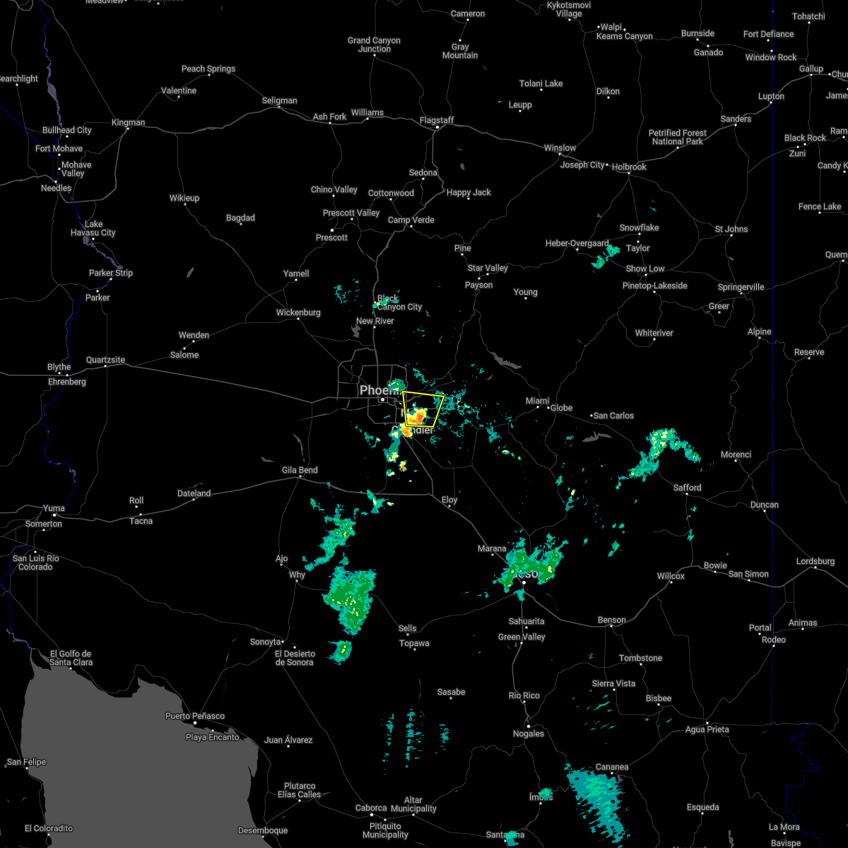
Hail Map for Queen Creek, AZ
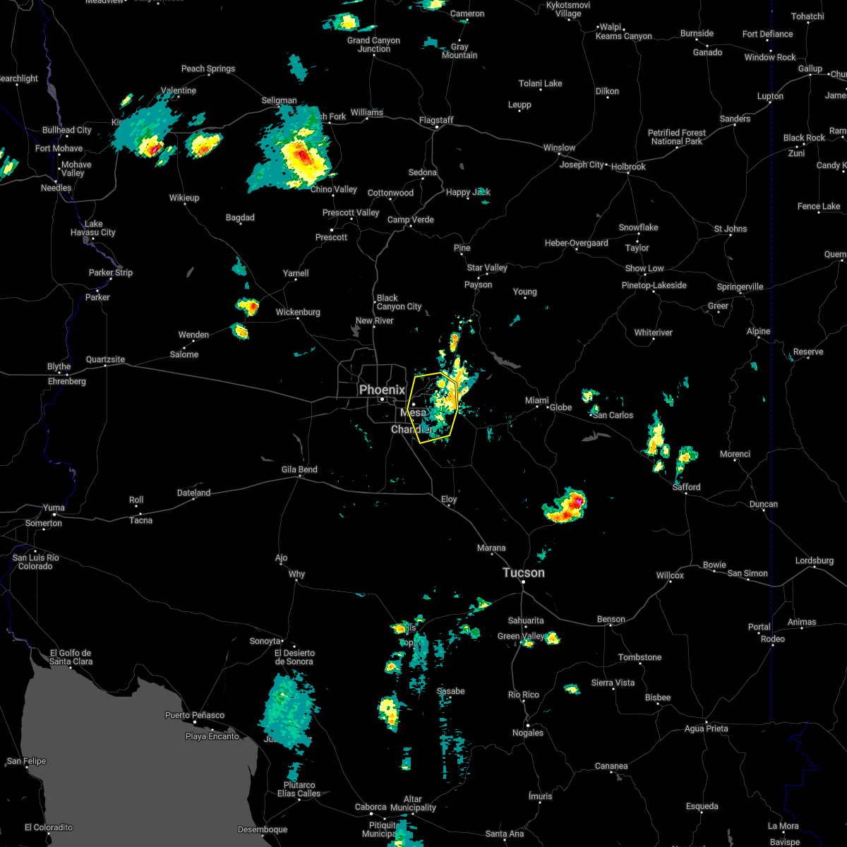
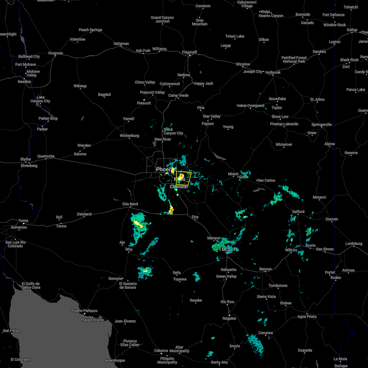
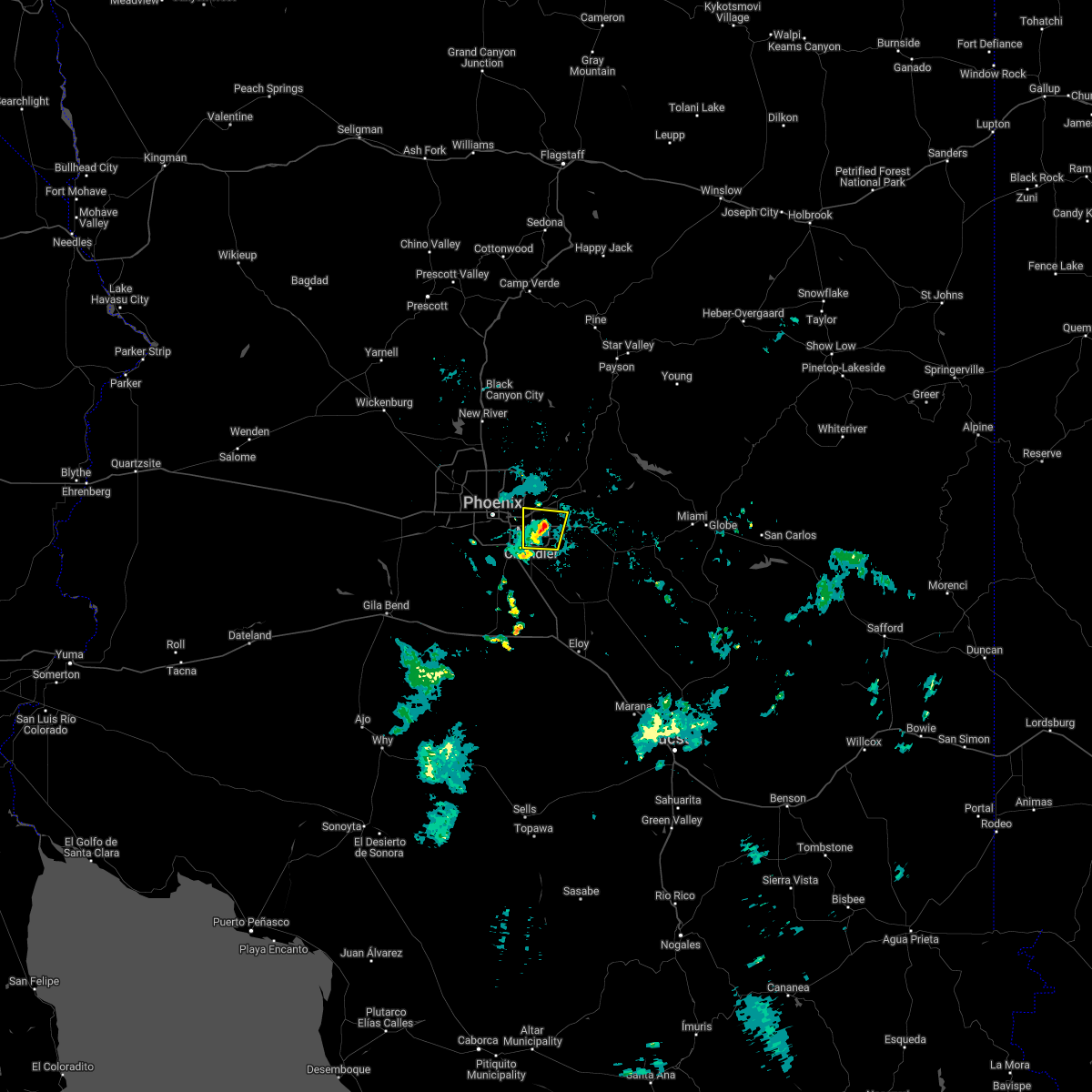
The Queen Creek, AZ area has had 2 reports of on-the-ground hail by trained spotters, and has been under severe weather warnings 19 times during the past 12 months. Doppler radar has detected hail at or near Queen Creek, AZ on 21 occasions.
| Name: | Queen Creek, AZ |
| Where Located: | 29.3 miles ESE of Phoenix, AZ |
| Map: | Google Map for Queen Creek, AZ |
| Population: | 26361 |
| Housing Units: | 8557 |
| More Info: | Search Google for Queen Creek, AZ |
1
The Top Recent Hail Date for Queen Creek, AZ is Friday, August 12, 2022 (9th out of 21)

Hail and Wind Damage Spotted near Queen Creek, AZ
| Date / Time | Report Details |
|---|---|
| 9/12/2023 9:17 PM MST |
 At 916 pm mst, a severe thunderstorm was located over apache junction, moving east at 35 mph. this is a destructive storm for east mesa and apache junction (trained weather spotters). Hazards include 80 mph wind gusts and penny size hail. Flying debris will be dangerous to those caught without shelter. mobile homes will be heavily damaged. expect considerable damage to roofs, windows, and vehicles. extensive tree damage and power outages are likely. locations impacted include, mesa, apache junction, gold canyon, queen creek, gold camp, lost dutchman state park, goldfield, florence junction, queen valley, superstition mountains, kings ranch, phoenix mesa gateway airport, canyon lake, and tortilla flat. this includes the following highways, us highway 60 between mile markers 191 and 214. az route 202 between mile markers 32 and 35. az route 79 near mile marker 150. thunderstorm damage threat, destructive hail threat, radar indicated max hail size, 0. 75 in wind threat, radar indicated max wind gust, 80 mph. At 916 pm mst, a severe thunderstorm was located over apache junction, moving east at 35 mph. this is a destructive storm for east mesa and apache junction (trained weather spotters). Hazards include 80 mph wind gusts and penny size hail. Flying debris will be dangerous to those caught without shelter. mobile homes will be heavily damaged. expect considerable damage to roofs, windows, and vehicles. extensive tree damage and power outages are likely. locations impacted include, mesa, apache junction, gold canyon, queen creek, gold camp, lost dutchman state park, goldfield, florence junction, queen valley, superstition mountains, kings ranch, phoenix mesa gateway airport, canyon lake, and tortilla flat. this includes the following highways, us highway 60 between mile markers 191 and 214. az route 202 between mile markers 32 and 35. az route 79 near mile marker 150. thunderstorm damage threat, destructive hail threat, radar indicated max hail size, 0. 75 in wind threat, radar indicated max wind gust, 80 mph.
|
| 9/12/2023 9:10 PM MST |
 At 909 pm mst, a severe thunderstorm was located near usery mountain park, or near apache junction, moving east at 35 mph (radar indicated). Hazards include 60 mph wind gusts and penny size hail. expect damage to roofs, siding, and trees At 909 pm mst, a severe thunderstorm was located near usery mountain park, or near apache junction, moving east at 35 mph (radar indicated). Hazards include 60 mph wind gusts and penny size hail. expect damage to roofs, siding, and trees
|
| 9/12/2023 3:53 PM MST |
 The severe thunderstorm warning for maricopa and pinal counties will expire at 400 pm mst, the storm which prompted the warning has weakened below severe limits, and has exited the warned area. therefore, the warning will be allowed to expire. however gusty winds and heavy rain are still possible with this thunderstorm. The severe thunderstorm warning for maricopa and pinal counties will expire at 400 pm mst, the storm which prompted the warning has weakened below severe limits, and has exited the warned area. therefore, the warning will be allowed to expire. however gusty winds and heavy rain are still possible with this thunderstorm.
|
| 9/12/2023 3:20 PM MST |
 At 320 pm mst, a severe thunderstorm was located over chandler, moving northeast at 35 mph (radar indicated). Hazards include 60 mph wind gusts and quarter size hail. Hail damage to vehicles is expected. expect wind damage to roofs, siding, and trees. locations impacted include, mesa, chandler, gilbert, sun lakes, queen creek, gilbert city hall, tumbleweed park, chandler city hall, san tan village mall, seville, freestone park, chandler fashion center mall, phoenix mesa gateway airport, firebird lake, and higley. this includes the following highways, az interstate 10 between mile markers 162 and 170. us highway 60 between mile markers 183 and 187. az route 87 between mile markers 159 and 169. hail threat, radar indicated max hail size, 1. 00 in wind threat, radar indicated max wind gust, 60 mph. At 320 pm mst, a severe thunderstorm was located over chandler, moving northeast at 35 mph (radar indicated). Hazards include 60 mph wind gusts and quarter size hail. Hail damage to vehicles is expected. expect wind damage to roofs, siding, and trees. locations impacted include, mesa, chandler, gilbert, sun lakes, queen creek, gilbert city hall, tumbleweed park, chandler city hall, san tan village mall, seville, freestone park, chandler fashion center mall, phoenix mesa gateway airport, firebird lake, and higley. this includes the following highways, az interstate 10 between mile markers 162 and 170. us highway 60 between mile markers 183 and 187. az route 87 between mile markers 159 and 169. hail threat, radar indicated max hail size, 1. 00 in wind threat, radar indicated max wind gust, 60 mph.
|
| 9/12/2023 3:08 PM MST |
 At 308 pm mst, a severe thunderstorm was located near sun lakes, moving east at 20 mph (radar indicated). Hazards include 60 mph wind gusts and nickel size hail. expect damage to roofs, siding, and trees At 308 pm mst, a severe thunderstorm was located near sun lakes, moving east at 20 mph (radar indicated). Hazards include 60 mph wind gusts and nickel size hail. expect damage to roofs, siding, and trees
|
| 8/31/2023 9:42 PM MST |
 The severe thunderstorm warning for maricopa and pinal counties will expire at 945 pm mst, the storm which prompted the warning has weakened below severe limits, and no longer poses an immediate threat to life or property. therefore, the warning will be allowed to expire. The severe thunderstorm warning for maricopa and pinal counties will expire at 945 pm mst, the storm which prompted the warning has weakened below severe limits, and no longer poses an immediate threat to life or property. therefore, the warning will be allowed to expire.
|
| 8/31/2023 9:12 PM MST |
 The severe thunderstorm warning for maricopa and pinal counties will expire at 915 pm mst, the storms which prompted the warning have weakened below severe limits, and no longer pose an immediate threat to life or property. therefore, the warning will be allowed to expire. The severe thunderstorm warning for maricopa and pinal counties will expire at 915 pm mst, the storms which prompted the warning have weakened below severe limits, and no longer pose an immediate threat to life or property. therefore, the warning will be allowed to expire.
|
| 8/31/2023 8:47 PM MST |
 At 846 pm mst, a severe thunderstorm was located near sun lakes, moving northwest at 30 mph (radar indicated). Hazards include 70 mph wind gusts. Expect considerable tree damage. Damage is likely to mobile homes, roofs, and outbuildings. At 846 pm mst, a severe thunderstorm was located near sun lakes, moving northwest at 30 mph (radar indicated). Hazards include 70 mph wind gusts. Expect considerable tree damage. Damage is likely to mobile homes, roofs, and outbuildings.
|
| 8/31/2023 8:02 PM MST |
 At 802 pm mst, severe thunderstorms were located along a line extending from near florence to near casa grande to 11 miles south of freeman, moving north at 40 mph (radar indicated). Hazards include 70 mph wind gusts and penny size hail. Expect considerable tree damage. Damage is likely to mobile homes, roofs, and outbuildings. At 802 pm mst, severe thunderstorms were located along a line extending from near florence to near casa grande to 11 miles south of freeman, moving north at 40 mph (radar indicated). Hazards include 70 mph wind gusts and penny size hail. Expect considerable tree damage. Damage is likely to mobile homes, roofs, and outbuildings.
|
| 8/17/2023 6:40 PM MST |
 The severe thunderstorm warning for maricopa and pinal counties will expire at 645 pm mst, the storm which prompted the warning has weakened below severe limits, and no longer poses an immediate threat to life or property. therefore, the warning will be allowed to expire. however gusty winds are still possible with this thunderstorm. The severe thunderstorm warning for maricopa and pinal counties will expire at 645 pm mst, the storm which prompted the warning has weakened below severe limits, and no longer poses an immediate threat to life or property. therefore, the warning will be allowed to expire. however gusty winds are still possible with this thunderstorm.
|
| 8/17/2023 6:28 PM MST |
 At 628 pm mst, a severe thunderstorm was located near queen creek, or 10 miles southwest of gold canyon, and is nearly stationary (radar indicated). Hazards include 60 mph wind gusts. Expect damage to roofs, siding, and trees. locations impacted include, mesa, gilbert, queen creek, phoenix mesa gateway airport, san tan mountain park, and san tan valley. hail threat, radar indicated max hail size, <. 75 in wind threat, radar indicated max wind gust, 60 mph. At 628 pm mst, a severe thunderstorm was located near queen creek, or 10 miles southwest of gold canyon, and is nearly stationary (radar indicated). Hazards include 60 mph wind gusts. Expect damage to roofs, siding, and trees. locations impacted include, mesa, gilbert, queen creek, phoenix mesa gateway airport, san tan mountain park, and san tan valley. hail threat, radar indicated max hail size, <. 75 in wind threat, radar indicated max wind gust, 60 mph.
|
| 8/17/2023 6:11 PM MST |
 At 610 pm mst, a severe thunderstorm was located near san tan valley, or 10 miles southwest of gold canyon, and is nearly stationary (radar indicated). Hazards include 60 mph wind gusts and quarter size hail. Hail damage to vehicles is expected. Expect wind damage to roofs, siding, and trees. At 610 pm mst, a severe thunderstorm was located near san tan valley, or 10 miles southwest of gold canyon, and is nearly stationary (radar indicated). Hazards include 60 mph wind gusts and quarter size hail. Hail damage to vehicles is expected. Expect wind damage to roofs, siding, and trees.
|
| 8/17/2023 5:43 PM MST |
 At 543 pm mst, a severe thunderstorm was located over san tan valley, or 12 miles southwest of gold canyon, and is nearly stationary (radar indicated). Hazards include 60 mph wind gusts and quarter size hail. Hail damage to vehicles is expected. Expect wind damage to roofs, siding, and trees. At 543 pm mst, a severe thunderstorm was located over san tan valley, or 12 miles southwest of gold canyon, and is nearly stationary (radar indicated). Hazards include 60 mph wind gusts and quarter size hail. Hail damage to vehicles is expected. Expect wind damage to roofs, siding, and trees.
|
| 8/17/2023 5:29 PM MST |
 At 529 pm mst, a severe thunderstorm was located near san tan valley, or 11 miles southwest of gold canyon, moving northwest at 5 mph (radar indicated). Hazards include 60 mph wind gusts and penny size hail. Expect damage to roofs, siding, and trees. locations impacted include, mesa, queen creek, phoenix mesa gateway airport, magma, san tan valley, and san tan mountain park. hail threat, radar indicated max hail size, 0. 75 in wind threat, radar indicated max wind gust, 60 mph. At 529 pm mst, a severe thunderstorm was located near san tan valley, or 11 miles southwest of gold canyon, moving northwest at 5 mph (radar indicated). Hazards include 60 mph wind gusts and penny size hail. Expect damage to roofs, siding, and trees. locations impacted include, mesa, queen creek, phoenix mesa gateway airport, magma, san tan valley, and san tan mountain park. hail threat, radar indicated max hail size, 0. 75 in wind threat, radar indicated max wind gust, 60 mph.
|
| 8/17/2023 5:06 PM MST |
 At 506 pm mst, a severe thunderstorm was located over san tan valley, or 12 miles southwest of gold canyon, moving north at 5 mph (radar indicated). Hazards include 60 mph wind gusts and penny size hail. expect damage to roofs, siding, and trees At 506 pm mst, a severe thunderstorm was located over san tan valley, or 12 miles southwest of gold canyon, moving north at 5 mph (radar indicated). Hazards include 60 mph wind gusts and penny size hail. expect damage to roofs, siding, and trees
|
| 7/30/2023 5:30 PM MST |
 At 530 pm mst, severe thunderstorms were located along a line extending from four peaks to near queen valley, moving west at 15 mph (radar indicated). Hazards include 60 mph wind gusts. Expect damage to roofs, siding, and trees. locations impacted include, mesa, apache junction, gold canyon, sugarloaf mountain, queen creek, granite reef dam, gold camp, lost dutchman state park, goldfield, usery mountain park, san tan valley, florence junction, saguaro lake, queen valley, and canyon lake. this includes the following highways, us highway 60 between mile markers 190 and 216. az route 87 between mile markers 190 and 210. az route 202 between mile markers 23 and 34. hail threat, radar indicated max hail size, <. 75 in wind threat, radar indicated max wind gust, 60 mph. At 530 pm mst, severe thunderstorms were located along a line extending from four peaks to near queen valley, moving west at 15 mph (radar indicated). Hazards include 60 mph wind gusts. Expect damage to roofs, siding, and trees. locations impacted include, mesa, apache junction, gold canyon, sugarloaf mountain, queen creek, granite reef dam, gold camp, lost dutchman state park, goldfield, usery mountain park, san tan valley, florence junction, saguaro lake, queen valley, and canyon lake. this includes the following highways, us highway 60 between mile markers 190 and 216. az route 87 between mile markers 190 and 210. az route 202 between mile markers 23 and 34. hail threat, radar indicated max hail size, <. 75 in wind threat, radar indicated max wind gust, 60 mph.
|
| 7/30/2023 5:11 PM MST |
 At 511 pm mst, severe thunderstorms were located along a line extending from near four peaks to near boyce thompson arboretum, moving west at 15 mph (radar indicated). Hazards include 60 mph wind gusts and quarter size hail. Hail damage to vehicles is expected. Expect wind damage to roofs, siding, and trees. At 511 pm mst, severe thunderstorms were located along a line extending from near four peaks to near boyce thompson arboretum, moving west at 15 mph (radar indicated). Hazards include 60 mph wind gusts and quarter size hail. Hail damage to vehicles is expected. Expect wind damage to roofs, siding, and trees.
|
| 7/26/2023 10:14 PM MST |
 At 1014 pm mst, a severe thunderstorm was located over kings ranch, or over gold canyon, moving north at 10 mph (radar indicated). Hazards include 60 mph wind gusts. Expect damage to roofs, siding, and trees. locations impacted include, mesa, chandler, gilbert, apache junction, gold canyon, east mesa, queen creek, gold camp, lost dutchman state park, goldfield, usery mountain park, san tan village mall, san tan valley, seville, and florence junction. this includes the following highways, us highway 60 between mile markers 186 and 219. az route 87 between mile markers 156 and 160. az route 202 between mile markers 24 and 44. hail threat, radar indicated max hail size, <. 75 in wind threat, radar indicated max wind gust, 60 mph. At 1014 pm mst, a severe thunderstorm was located over kings ranch, or over gold canyon, moving north at 10 mph (radar indicated). Hazards include 60 mph wind gusts. Expect damage to roofs, siding, and trees. locations impacted include, mesa, chandler, gilbert, apache junction, gold canyon, east mesa, queen creek, gold camp, lost dutchman state park, goldfield, usery mountain park, san tan village mall, san tan valley, seville, and florence junction. this includes the following highways, us highway 60 between mile markers 186 and 219. az route 87 between mile markers 156 and 160. az route 202 between mile markers 24 and 44. hail threat, radar indicated max hail size, <. 75 in wind threat, radar indicated max wind gust, 60 mph.
|
| 7/26/2023 9:49 PM MST |
 At 949 pm mst, a severe thunderstorm was located over apache junction, moving northwest at 20 mph (radar indicated). Hazards include 60 mph wind gusts. expect damage to roofs, siding, and trees At 949 pm mst, a severe thunderstorm was located over apache junction, moving northwest at 20 mph (radar indicated). Hazards include 60 mph wind gusts. expect damage to roofs, siding, and trees
|
| 3/1/2023 7:38 PM MST |
 The severe thunderstorm warning for maricopa and pinal counties will expire at 745 pm mst, the storm which prompted the warning has moved out of the area. therefore, the warning will be allowed to expire. The severe thunderstorm warning for maricopa and pinal counties will expire at 745 pm mst, the storm which prompted the warning has moved out of the area. therefore, the warning will be allowed to expire.
|
| 3/1/2023 7:36 PM MST |
 The severe thunderstorm warning for maricopa and pinal counties will expire at 745 pm mst, the storm which prompted the warning has weakened below severe limits, and no longer poses an immediate threat to life or property. therefore, the warning will be allowed to expire. The severe thunderstorm warning for maricopa and pinal counties will expire at 745 pm mst, the storm which prompted the warning has weakened below severe limits, and no longer poses an immediate threat to life or property. therefore, the warning will be allowed to expire.
|
| 3/1/2023 7:30 PM MST |
 At 730 pm mst, a severe thunderstorm was located over phoenix mesa gateway airport, or near gilbert, moving northeast at 45 mph (radar indicated). Hazards include 60 mph wind gusts. expect damage to roofs, siding, and trees At 730 pm mst, a severe thunderstorm was located over phoenix mesa gateway airport, or near gilbert, moving northeast at 45 mph (radar indicated). Hazards include 60 mph wind gusts. expect damage to roofs, siding, and trees
|
| 3/1/2023 7:15 PM MST |
 At 715 pm mst, a severe thunderstorm was located over bapchule, or near sun lakes, moving northeast at 50 mph (radar indicated). Hazards include 60 mph wind gusts. expect damage to roofs, siding, and trees At 715 pm mst, a severe thunderstorm was located over bapchule, or near sun lakes, moving northeast at 50 mph (radar indicated). Hazards include 60 mph wind gusts. expect damage to roofs, siding, and trees
|
| 3/1/2023 7:13 PM MST |
 At 712 pm mst, a severe thunderstorm was located over chandler fashion center mall, or over chandler, moving northeast at 45 mph (radar indicated). Hazards include 60 mph wind gusts. expect damage to roofs, siding, and trees At 712 pm mst, a severe thunderstorm was located over chandler fashion center mall, or over chandler, moving northeast at 45 mph (radar indicated). Hazards include 60 mph wind gusts. expect damage to roofs, siding, and trees
|
| 10/16/2022 1:36 AM MST |
 At 136 am mst, a severe thunderstorm was located near bapchule, or near sun lakes, moving northwest at 15 mph (radar indicated). Hazards include quarter size hail. damage to vehicles is expected At 136 am mst, a severe thunderstorm was located near bapchule, or near sun lakes, moving northwest at 15 mph (radar indicated). Hazards include quarter size hail. damage to vehicles is expected
|
| 10/15/2022 11:50 PM MST | Quarter sized hail reported 1 miles NW of Queen Creek, AZ, hailstones up to 1 inch in diameter reported near ellsworth rd. and riggs rd. most of the hail was pea sized. |
| 10/15/2022 6:10 PM MST |
 At 609 pm mst, severe thunderstorms were located along a line extending from 7 miles west of round valley to near mcdowell mountain park to near fountain hills to downtown mesa, moving north at 35 mph (radar indicated). Hazards include 60 mph wind gusts. Expect damage to roofs, siding, and trees. locations impacted include, phoenix, mesa, chandler, scottsdale, gilbert, tempe, apache junction, fountain hills, paradise valley, east mesa, sugarloaf mountain, sun lakes, ballantine trailhead, round valley and tempe marketplace. this includes the following highways, az interstate 10 between mile markers 146 and 158. az route 51 between mile markers 1 and 4. us highway 60 between mile markers 173 and 195. hail threat, radar indicated max hail size, <. 75 in wind threat, radar indicated max wind gust, 60 mph. At 609 pm mst, severe thunderstorms were located along a line extending from 7 miles west of round valley to near mcdowell mountain park to near fountain hills to downtown mesa, moving north at 35 mph (radar indicated). Hazards include 60 mph wind gusts. Expect damage to roofs, siding, and trees. locations impacted include, phoenix, mesa, chandler, scottsdale, gilbert, tempe, apache junction, fountain hills, paradise valley, east mesa, sugarloaf mountain, sun lakes, ballantine trailhead, round valley and tempe marketplace. this includes the following highways, az interstate 10 between mile markers 146 and 158. az route 51 between mile markers 1 and 4. us highway 60 between mile markers 173 and 195. hail threat, radar indicated max hail size, <. 75 in wind threat, radar indicated max wind gust, 60 mph.
|
| 10/15/2022 5:41 PM MST |
 At 540 pm mst, severe thunderstorms were located along a line extending from saguaro lake to near granite reef dam to gilbert to near seville, moving north at 35 mph (radar indicated). Hazards include 60 mph wind gusts. expect damage to roofs, siding, and trees At 540 pm mst, severe thunderstorms were located along a line extending from saguaro lake to near granite reef dam to gilbert to near seville, moving north at 35 mph (radar indicated). Hazards include 60 mph wind gusts. expect damage to roofs, siding, and trees
|
| 10/15/2022 5:01 PM MST |
 At 501 pm mst, severe thunderstorms were located along a line extending from near florence junction to magma to near blackwater to near coolidge, moving north at 45 mph (radar indicated). Hazards include 70 mph wind gusts. Expect considerable tree damage. Damage is likely to mobile homes, roofs, and outbuildings. At 501 pm mst, severe thunderstorms were located along a line extending from near florence junction to magma to near blackwater to near coolidge, moving north at 45 mph (radar indicated). Hazards include 70 mph wind gusts. Expect considerable tree damage. Damage is likely to mobile homes, roofs, and outbuildings.
|
| 10/15/2022 4:00 PM MST |
 At 400 pm mst, severe thunderstorms were located along a line extending from 6 miles southeast of la palma to near chui-chu, moving north at 35 mph (radar indicated). Hazards include 70 mph wind gusts and quarter size hail. Hail damage to vehicles is expected. expect considerable tree damage. wind damage is also likely to mobile homes, roofs, and outbuildings. locations impacted include, casa grande, florence, coolidge, maricopa, queen creek, arizona city, la palma, blackwater, toltec, magma, san tan valley, coolidge airport, bapchule, olberg and arizola. this includes the following highways, az interstate 10 between mile markers 172 and 204. az interstate 8 between mile markers 160 and 178. Us highway 60 between mile markers 214 and 217. At 400 pm mst, severe thunderstorms were located along a line extending from 6 miles southeast of la palma to near chui-chu, moving north at 35 mph (radar indicated). Hazards include 70 mph wind gusts and quarter size hail. Hail damage to vehicles is expected. expect considerable tree damage. wind damage is also likely to mobile homes, roofs, and outbuildings. locations impacted include, casa grande, florence, coolidge, maricopa, queen creek, arizona city, la palma, blackwater, toltec, magma, san tan valley, coolidge airport, bapchule, olberg and arizola. this includes the following highways, az interstate 10 between mile markers 172 and 204. az interstate 8 between mile markers 160 and 178. Us highway 60 between mile markers 214 and 217.
|
| 10/15/2022 3:49 PM MST |
 At 349 pm mst, severe thunderstorms were located along a line extending from near picacho to near chui-chu, moving north at 35 mph (radar indicated). Hazards include 60 mph wind gusts and quarter size hail. Hail damage to vehicles is expected. Expect wind damage to roofs, siding, and trees. At 349 pm mst, severe thunderstorms were located along a line extending from near picacho to near chui-chu, moving north at 35 mph (radar indicated). Hazards include 60 mph wind gusts and quarter size hail. Hail damage to vehicles is expected. Expect wind damage to roofs, siding, and trees.
|
| 10/15/2022 12:54 PM MST |
 At 1253 pm mst, severe thunderstorms were located along a line extending from near sun lakes to freestone park to apache junction, moving north at 30 mph (radar indicated). Hazards include 60 mph wind gusts. expect damage to roofs, siding, and trees At 1253 pm mst, severe thunderstorms were located along a line extending from near sun lakes to freestone park to apache junction, moving north at 30 mph (radar indicated). Hazards include 60 mph wind gusts. expect damage to roofs, siding, and trees
|
| 10/15/2022 12:42 PM MST |
 The severe thunderstorm warning for maricopa and pinal counties will expire at 1245 pm mst, the storms which prompted the warning have weakened below severe limits. therefore, the warning will be allowed to expire. however gusty winds are still possible with these thunderstorms. The severe thunderstorm warning for maricopa and pinal counties will expire at 1245 pm mst, the storms which prompted the warning have weakened below severe limits. therefore, the warning will be allowed to expire. however gusty winds are still possible with these thunderstorms.
|
| 10/15/2022 12:29 PM MST |
 At 1229 pm mst, severe thunderstorms were located along a line extending from near bapchule to chandler heights to near florence junction, moving north at 35 mph (radar indicated). Hazards include 60 mph wind gusts. Expect damage to roofs, siding, and trees. locations impacted include, mesa, chandler, gilbert, casa grande, apache junction, florence, coolidge, gold canyon, sun lakes, east mesa, queen creek, gold camp, lost dutchman state park, goldfield and san tan village mall. this includes the following highways, az interstate 10 between mile markers 170 and 188. us highway 60 between mile markers 187 and 215. az route 87 between mile markers 135 and 164. hail threat, radar indicated max hail size, <. 75 in wind threat, radar indicated max wind gust, 60 mph. At 1229 pm mst, severe thunderstorms were located along a line extending from near bapchule to chandler heights to near florence junction, moving north at 35 mph (radar indicated). Hazards include 60 mph wind gusts. Expect damage to roofs, siding, and trees. locations impacted include, mesa, chandler, gilbert, casa grande, apache junction, florence, coolidge, gold canyon, sun lakes, east mesa, queen creek, gold camp, lost dutchman state park, goldfield and san tan village mall. this includes the following highways, az interstate 10 between mile markers 170 and 188. us highway 60 between mile markers 187 and 215. az route 87 between mile markers 135 and 164. hail threat, radar indicated max hail size, <. 75 in wind threat, radar indicated max wind gust, 60 mph.
|
| 10/15/2022 12:19 PM MST |
 At 1219 pm mst, severe thunderstorms were located along a line extending from near casa grande to near blackwater to 6 miles north of florence, moving north at 35 mph (radar indicated). Hazards include 60 mph wind gusts. Expect damage to roofs, siding, and trees. locations impacted include, mesa, chandler, gilbert, casa grande, apache junction, florence, coolidge, gold canyon, sun lakes, east mesa, queen creek, gold camp, lost dutchman state park, goldfield and san tan village mall. this includes the following highways, az interstate 10 between mile markers 168 and 195. us highway 60 between mile markers 187 and 216. az route 87 between mile markers 128 and 164. hail threat, radar indicated max hail size, <. 75 in wind threat, radar indicated max wind gust, 60 mph. At 1219 pm mst, severe thunderstorms were located along a line extending from near casa grande to near blackwater to 6 miles north of florence, moving north at 35 mph (radar indicated). Hazards include 60 mph wind gusts. Expect damage to roofs, siding, and trees. locations impacted include, mesa, chandler, gilbert, casa grande, apache junction, florence, coolidge, gold canyon, sun lakes, east mesa, queen creek, gold camp, lost dutchman state park, goldfield and san tan village mall. this includes the following highways, az interstate 10 between mile markers 168 and 195. us highway 60 between mile markers 187 and 216. az route 87 between mile markers 128 and 164. hail threat, radar indicated max hail size, <. 75 in wind threat, radar indicated max wind gust, 60 mph.
|
| 10/15/2022 12:08 PM MST |
 At 1208 pm mst, severe thunderstorms were located along a line extending from near casa grande to near blackwater to 8 miles south of boyce thompson arboretum, moving north at 35 mph (radar indicated). Hazards include 60 mph wind gusts. expect damage to roofs, siding, and trees At 1208 pm mst, severe thunderstorms were located along a line extending from near casa grande to near blackwater to 8 miles south of boyce thompson arboretum, moving north at 35 mph (radar indicated). Hazards include 60 mph wind gusts. expect damage to roofs, siding, and trees
|
| 10/15/2022 11:04 AM MST |
 At 1104 am mst, a severe thunderstorm was located over san tan village mall, or over gilbert, moving north at 35 mph (radar indicated). Hazards include 60 mph wind gusts. Expect damage to roofs, siding, and trees. locations impacted include, phoenix, mesa, chandler, scottsdale, gilbert, tempe, fountain hills, paradise valley, sun lakes, east mesa, queen creek, tempe marketplace, papago park, piestewa peak park and falcon field airport. this includes the following highways, az interstate 10 between mile markers 152 and 157. az route 51 between mile markers 1 and 6. us highway 60 between mile markers 173 and 189. hail threat, radar indicated max hail size, <. 75 in wind threat, radar indicated max wind gust, 60 mph. At 1104 am mst, a severe thunderstorm was located over san tan village mall, or over gilbert, moving north at 35 mph (radar indicated). Hazards include 60 mph wind gusts. Expect damage to roofs, siding, and trees. locations impacted include, phoenix, mesa, chandler, scottsdale, gilbert, tempe, fountain hills, paradise valley, sun lakes, east mesa, queen creek, tempe marketplace, papago park, piestewa peak park and falcon field airport. this includes the following highways, az interstate 10 between mile markers 152 and 157. az route 51 between mile markers 1 and 6. us highway 60 between mile markers 173 and 189. hail threat, radar indicated max hail size, <. 75 in wind threat, radar indicated max wind gust, 60 mph.
|
| 10/15/2022 10:56 AM MST |
 At 1055 am mst, a severe thunderstorm was located over seville, or near gilbert, moving north at 45 mph (radar indicated). Hazards include 60 mph wind gusts and penny size hail. expect damage to roofs, siding, and trees At 1055 am mst, a severe thunderstorm was located over seville, or near gilbert, moving north at 45 mph (radar indicated). Hazards include 60 mph wind gusts and penny size hail. expect damage to roofs, siding, and trees
|
| 10/3/2022 5:12 PM MST |
 At 512 pm mst, severe thunderstorms were located along a line extending from magma to near san tan mountain park to near chandler heights, moving south at 40 mph (radar indicated). Hazards include 60 mph wind gusts. Expect damage to roofs, siding, and trees. locations impacted include, mesa, chandler, gilbert, casa grande, apache junction, florence, coolidge, gold canyon, east mesa, sun lakes, queen creek, gold camp, falcon field airport, lost dutchman state park and goldfield. this includes the following highways, az interstate 10 between mile markers 173 and 190. us highway 60 between mile markers 179 and 212. az route 87 between mile markers 131 and 176. hail threat, radar indicated max hail size, <. 75 in wind threat, radar indicated max wind gust, 60 mph. At 512 pm mst, severe thunderstorms were located along a line extending from magma to near san tan mountain park to near chandler heights, moving south at 40 mph (radar indicated). Hazards include 60 mph wind gusts. Expect damage to roofs, siding, and trees. locations impacted include, mesa, chandler, gilbert, casa grande, apache junction, florence, coolidge, gold canyon, east mesa, sun lakes, queen creek, gold camp, falcon field airport, lost dutchman state park and goldfield. this includes the following highways, az interstate 10 between mile markers 173 and 190. us highway 60 between mile markers 179 and 212. az route 87 between mile markers 131 and 176. hail threat, radar indicated max hail size, <. 75 in wind threat, radar indicated max wind gust, 60 mph.
|
| 10/3/2022 4:43 PM MST |
 At 442 pm mst, severe outflow winds from thunderstorms was located along a line extending from apache junction to near superstition springs mall to near freestone park, moving south at 40 mph (radar indicated). Hazards include 60 mph wind gusts. Expect damage to roofs, siding, and trees. Dense blowing dust also anticipated. At 442 pm mst, severe outflow winds from thunderstorms was located along a line extending from apache junction to near superstition springs mall to near freestone park, moving south at 40 mph (radar indicated). Hazards include 60 mph wind gusts. Expect damage to roofs, siding, and trees. Dense blowing dust also anticipated.
|
| 9/23/2022 6:27 PM MST |
 The severe thunderstorm warning for maricopa and pinal counties will expire at 630 pm mst, the storm which prompted the warning has weakened below severe limits, and no longer poses an immediate threat to life or property. therefore, the warning will be allowed to expire. The severe thunderstorm warning for maricopa and pinal counties will expire at 630 pm mst, the storm which prompted the warning has weakened below severe limits, and no longer poses an immediate threat to life or property. therefore, the warning will be allowed to expire.
|
| 9/23/2022 5:59 PM MST |
 At 559 pm mst, a severe thunderstorm was located over seville, or near gilbert, moving southeast at 10 mph (radar indicated). Hazards include 60 mph wind gusts and quarter size hail. Hail damage to vehicles is expected. expect wind damage to roofs, siding, and trees. locations impacted include, mesa, chandler, gilbert, sun lakes, queen creek, chandler heights, gilbert city hall, tumbleweed park, chandler city hall, san tan village mall, seville, freestone park, phoenix mesa gateway airport, san tan mountain park and higley. this includes the following highways, us highway 60 between mile markers 179 and 184. az route 87 between mile markers 160 and 173. az route 202 between mile markers 33 and 50. hail threat, radar indicated max hail size, 1. 00 in wind threat, radar indicated max wind gust, 60 mph. At 559 pm mst, a severe thunderstorm was located over seville, or near gilbert, moving southeast at 10 mph (radar indicated). Hazards include 60 mph wind gusts and quarter size hail. Hail damage to vehicles is expected. expect wind damage to roofs, siding, and trees. locations impacted include, mesa, chandler, gilbert, sun lakes, queen creek, chandler heights, gilbert city hall, tumbleweed park, chandler city hall, san tan village mall, seville, freestone park, phoenix mesa gateway airport, san tan mountain park and higley. this includes the following highways, us highway 60 between mile markers 179 and 184. az route 87 between mile markers 160 and 173. az route 202 between mile markers 33 and 50. hail threat, radar indicated max hail size, 1. 00 in wind threat, radar indicated max wind gust, 60 mph.
|
| 9/23/2022 5:45 PM MST |
 At 545 pm mst, a severe thunderstorm was located over tumbleweed park, or near gilbert, moving southeast at 10 mph (radar indicated). Hazards include 60 mph wind gusts. expect damage to roofs, siding, and trees At 545 pm mst, a severe thunderstorm was located over tumbleweed park, or near gilbert, moving southeast at 10 mph (radar indicated). Hazards include 60 mph wind gusts. expect damage to roofs, siding, and trees
|
| 9/11/2022 8:48 PM MST |
 At 848 pm mst, a severe thunderstorm was located near san tan valley, or 10 miles southwest of gold canyon, moving north at 15 mph (radar indicated). Hazards include 60 mph wind gusts and quarter size hail. Hail damage to vehicles is expected. Expect wind damage to roofs, siding, and trees. At 848 pm mst, a severe thunderstorm was located near san tan valley, or 10 miles southwest of gold canyon, moving north at 15 mph (radar indicated). Hazards include 60 mph wind gusts and quarter size hail. Hail damage to vehicles is expected. Expect wind damage to roofs, siding, and trees.
|
| 9/11/2022 8:11 PM MST |
 At 811 pm mst, a severe thunderstorm was located near bapchule, or near sun lakes, moving north at 15 mph (radar indicated). Hazards include 60 mph wind gusts and quarter size hail. Hail damage to vehicles is expected. Expect wind damage to roofs, siding, and trees. At 811 pm mst, a severe thunderstorm was located near bapchule, or near sun lakes, moving north at 15 mph (radar indicated). Hazards include 60 mph wind gusts and quarter size hail. Hail damage to vehicles is expected. Expect wind damage to roofs, siding, and trees.
|
| 9/2/2022 6:23 PM MST |
 The severe thunderstorm warning for maricopa and pinal counties will expire at 630 pm mst, the storm which prompted the warning has weakened below severe limits, and no longer poses an immediate threat to life or property. therefore, the warning will be allowed to expire. however gusty winds are still possible with this thunderstorm. a dust storm warning remains in effect for parts of eastern maricopa and northern pinal counties until 700 pm mst. a severe thunderstorm watch remains in effect until 1100 pm mst for south central and southeastern arizona. The severe thunderstorm warning for maricopa and pinal counties will expire at 630 pm mst, the storm which prompted the warning has weakened below severe limits, and no longer poses an immediate threat to life or property. therefore, the warning will be allowed to expire. however gusty winds are still possible with this thunderstorm. a dust storm warning remains in effect for parts of eastern maricopa and northern pinal counties until 700 pm mst. a severe thunderstorm watch remains in effect until 1100 pm mst for south central and southeastern arizona.
|
| 9/2/2022 6:18 PM MST |
 At 618 pm mst, a severe thunderstorm was located over seville, or near gilbert, moving west at 35 mph (radar indicated. this storm is producing dust storm conditions with one-quarter mile visibility just reported near chandler). Hazards include 60 mph wind gusts. Expect damage to roofs, siding, and trees. locations impacted include, mesa, chandler, gilbert, tempe, sun lakes, queen creek, san tan village mall, san tan valley, seville, freestone park, bapchule, fiesta mall, olberg, phoenix mesa gateway airport and san tan mountain park. this includes the following highways, az interstate 10 between mile markers 156 and 160, and between mile markers 165 and 180. us highway 60 between mile markers 175 and 190. az route 87 between mile markers 149 and 171. hail threat, radar indicated max hail size, <. 75 in wind threat, radar indicated max wind gust, 60 mph. At 618 pm mst, a severe thunderstorm was located over seville, or near gilbert, moving west at 35 mph (radar indicated. this storm is producing dust storm conditions with one-quarter mile visibility just reported near chandler). Hazards include 60 mph wind gusts. Expect damage to roofs, siding, and trees. locations impacted include, mesa, chandler, gilbert, tempe, sun lakes, queen creek, san tan village mall, san tan valley, seville, freestone park, bapchule, fiesta mall, olberg, phoenix mesa gateway airport and san tan mountain park. this includes the following highways, az interstate 10 between mile markers 156 and 160, and between mile markers 165 and 180. us highway 60 between mile markers 175 and 190. az route 87 between mile markers 149 and 171. hail threat, radar indicated max hail size, <. 75 in wind threat, radar indicated max wind gust, 60 mph.
|
| 9/2/2022 6:12 PM MST | Quarter sized hail reported 2.7 miles WSW of Queen Creek, AZ |
| 9/2/2022 6:11 PM MST |
 At 610 pm mst, a severe thunderstorm was located over queen creek, or 8 miles southeast of gilbert, moving west at 30 mph (radar indicated. winds from this storm are producing dust storm conditions with near-zero visibility near mesa gateway airport). Hazards include 70 mph wind gusts. Expect considerable tree damage. damage is likely to mobile homes, roofs, and outbuildings. locations impacted include, mesa, chandler, gilbert, tempe, apache junction, sun lakes, queen creek, san tan village mall, san tan valley, seville, freestone park, bapchule, fiesta mall, olberg and phoenix mesa gateway airport. this includes the following highways, az interstate 10 between mile markers 156 and 160, and between mile markers 165 and 181. us highway 60 between mile markers 175 and 195. az route 87 between mile markers 148 and 171. thunderstorm damage threat, considerable hail threat, radar indicated max hail size, <. 75 in wind threat, radar indicated max wind gust, 70 mph. At 610 pm mst, a severe thunderstorm was located over queen creek, or 8 miles southeast of gilbert, moving west at 30 mph (radar indicated. winds from this storm are producing dust storm conditions with near-zero visibility near mesa gateway airport). Hazards include 70 mph wind gusts. Expect considerable tree damage. damage is likely to mobile homes, roofs, and outbuildings. locations impacted include, mesa, chandler, gilbert, tempe, apache junction, sun lakes, queen creek, san tan village mall, san tan valley, seville, freestone park, bapchule, fiesta mall, olberg and phoenix mesa gateway airport. this includes the following highways, az interstate 10 between mile markers 156 and 160, and between mile markers 165 and 181. us highway 60 between mile markers 175 and 195. az route 87 between mile markers 148 and 171. thunderstorm damage threat, considerable hail threat, radar indicated max hail size, <. 75 in wind threat, radar indicated max wind gust, 70 mph.
|
| 9/2/2022 6:10 PM MST | Social media picture of a large uprooted tre in maricopa county AZ, 2.1 miles WSW of Queen Creek, AZ |
| 9/2/2022 6:01 PM MST |
 At 600 pm mst, a severe thunderstorm was located over phoenix mesa gateway airport, or 7 miles east of gilbert, moving west at 35 mph (trained weather spotters are estimating wind gusts to 60 mph in queen creek, along with dust storm conditions and near-zero visibility). Hazards include 70 mph wind gusts. Expect considerable tree damage. damage is likely to mobile homes, roofs, and outbuildings. locations impacted include, mesa, chandler, gilbert, tempe, apache junction, gold canyon, sun lakes, queen creek, gold camp, san tan village mall, san tan valley, seville, freestone park, florence junction and bapchule. this includes the following highways, az interstate 10 between mile markers 156 and 160, and between mile markers 165 and 181. us highway 60 between mile markers 174 and 214. az route 87 between mile markers 148 and 172. thunderstorm damage threat, considerable hail threat, radar indicated max hail size, <. 75 in wind threat, observed max wind gust, 70 mph. At 600 pm mst, a severe thunderstorm was located over phoenix mesa gateway airport, or 7 miles east of gilbert, moving west at 35 mph (trained weather spotters are estimating wind gusts to 60 mph in queen creek, along with dust storm conditions and near-zero visibility). Hazards include 70 mph wind gusts. Expect considerable tree damage. damage is likely to mobile homes, roofs, and outbuildings. locations impacted include, mesa, chandler, gilbert, tempe, apache junction, gold canyon, sun lakes, queen creek, gold camp, san tan village mall, san tan valley, seville, freestone park, florence junction and bapchule. this includes the following highways, az interstate 10 between mile markers 156 and 160, and between mile markers 165 and 181. us highway 60 between mile markers 174 and 214. az route 87 between mile markers 148 and 172. thunderstorm damage threat, considerable hail threat, radar indicated max hail size, <. 75 in wind threat, observed max wind gust, 70 mph.
|
| 9/2/2022 5:51 PM MST |
 At 550 pm mst, a severe thunderstorm was located near gold canyon, moving west at 35 mph (trained weather spotters. at 550 pm mst, 65 mph wind gusts were estimated near gold canyon). Hazards include 70 mph wind gusts. Expect considerable tree damage. damage is likely to mobile homes, roofs, and outbuildings. locations impacted include, mesa, chandler, gilbert, tempe, apache junction, gold canyon, sun lakes, queen creek, gold camp, san tan village mall, san tan valley, seville, freestone park, florence junction and queen valley. this includes the following highways, az interstate 10 between mile markers 156 and 160, and between mile markers 165 and 181. us highway 60 between mile markers 175 and 219. az route 87 between mile markers 148 and 171. thunderstorm damage threat, considerable hail threat, radar indicated max hail size, <. 75 in wind threat, observed max wind gust, 70 mph. At 550 pm mst, a severe thunderstorm was located near gold canyon, moving west at 35 mph (trained weather spotters. at 550 pm mst, 65 mph wind gusts were estimated near gold canyon). Hazards include 70 mph wind gusts. Expect considerable tree damage. damage is likely to mobile homes, roofs, and outbuildings. locations impacted include, mesa, chandler, gilbert, tempe, apache junction, gold canyon, sun lakes, queen creek, gold camp, san tan village mall, san tan valley, seville, freestone park, florence junction and queen valley. this includes the following highways, az interstate 10 between mile markers 156 and 160, and between mile markers 165 and 181. us highway 60 between mile markers 175 and 219. az route 87 between mile markers 148 and 171. thunderstorm damage threat, considerable hail threat, radar indicated max hail size, <. 75 in wind threat, observed max wind gust, 70 mph.
|
| 9/2/2022 5:43 PM MST |
 At 543 pm mst, a severe thunderstorm was located over gold canyon, moving west at 30 mph (radar indicated). Hazards include 70 mph wind gusts. Expect considerable tree damage. damage is likely to mobile homes, roofs, and outbuildings. locations impacted include, mesa, chandler, gilbert, tempe, apache junction, gold canyon, sun lakes, queen creek, gold camp, san tan village mall, san tan valley, seville, freestone park, florence junction and queen valley. this includes the following highways, az interstate 10 between mile markers 156 and 160, and between mile markers 165 and 181. us highway 60 between mile markers 174 and 221. az route 87 between mile markers 148 and 172. thunderstorm damage threat, considerable hail threat, radar indicated max hail size, <. 75 in wind threat, radar indicated max wind gust, 70 mph. At 543 pm mst, a severe thunderstorm was located over gold canyon, moving west at 30 mph (radar indicated). Hazards include 70 mph wind gusts. Expect considerable tree damage. damage is likely to mobile homes, roofs, and outbuildings. locations impacted include, mesa, chandler, gilbert, tempe, apache junction, gold canyon, sun lakes, queen creek, gold camp, san tan village mall, san tan valley, seville, freestone park, florence junction and queen valley. this includes the following highways, az interstate 10 between mile markers 156 and 160, and between mile markers 165 and 181. us highway 60 between mile markers 174 and 221. az route 87 between mile markers 148 and 172. thunderstorm damage threat, considerable hail threat, radar indicated max hail size, <. 75 in wind threat, radar indicated max wind gust, 70 mph.
|
| 9/2/2022 5:39 PM MST |
 At 538 pm mst, a severe thunderstorm was located near gold canyon, moving west at 35 mph (radar indicated). Hazards include 60 mph wind gusts. expect damage to roofs, siding, and trees At 538 pm mst, a severe thunderstorm was located near gold canyon, moving west at 35 mph (radar indicated). Hazards include 60 mph wind gusts. expect damage to roofs, siding, and trees
|
| 9/1/2022 10:01 PM MST |
 At 1000 pm mst, severe thunderstorms were located along a line extending from near apache junction to 12 miles east of florence, moving southwest at 25 mph (radar indicated). Hazards include 70 mph wind gusts. Expect considerable tree damage. damage is likely to mobile homes, roofs, and outbuildings. locations impacted include, mesa, chandler, gilbert, apache junction, florence, coolidge, superior, gold canyon, queen creek, gold camp, lost dutchman state park, goldfield, san tan village mall, san tan valley and seville. this includes the following highways, us highway 60 between mile markers 186 and 225. az route 87 between mile markers 133 and 136, and between mile markers 161 and 168. az route 202 between mile markers 28 and 52. thunderstorm damage threat, considerable hail threat, radar indicated max hail size, <. 75 in wind threat, radar indicated max wind gust, 70 mph. At 1000 pm mst, severe thunderstorms were located along a line extending from near apache junction to 12 miles east of florence, moving southwest at 25 mph (radar indicated). Hazards include 70 mph wind gusts. Expect considerable tree damage. damage is likely to mobile homes, roofs, and outbuildings. locations impacted include, mesa, chandler, gilbert, apache junction, florence, coolidge, superior, gold canyon, queen creek, gold camp, lost dutchman state park, goldfield, san tan village mall, san tan valley and seville. this includes the following highways, us highway 60 between mile markers 186 and 225. az route 87 between mile markers 133 and 136, and between mile markers 161 and 168. az route 202 between mile markers 28 and 52. thunderstorm damage threat, considerable hail threat, radar indicated max hail size, <. 75 in wind threat, radar indicated max wind gust, 70 mph.
|
| 9/1/2022 9:43 PM MST |
 At 943 pm mst, severe thunderstorms were located along a line extending from gold camp to 10 miles south of superior, moving southwest at 25 mph (radar indicated). Hazards include 60 mph wind gusts. expect damage to roofs, siding, and trees At 943 pm mst, severe thunderstorms were located along a line extending from gold camp to 10 miles south of superior, moving southwest at 25 mph (radar indicated). Hazards include 60 mph wind gusts. expect damage to roofs, siding, and trees
|
| 8/27/2022 3:45 PM MST | At 344 pm mst, a severe thunderstorm was located near sun lakes, moving east at 15 mph (radar indicated). Hazards include 60 mph wind gusts. Expect damage to roofs, siding, and trees. locations impacted include, mesa, chandler, gilbert, sun lakes, queen creek, chandler heights, tumbleweed park, san tan village mall, seville, bapchule, phoenix mesa gateway airport, san tan mountain park, chandler city hall, firebird lake and santan. this includes the following highways, az interstate 10 between mile markers 163 and 177. az route 87 between mile markers 148 and 166. az route 202 between mile markers 34 and 37, and between mile markers 40 and 50. hail threat, radar indicated max hail size, <. 75 in wind threat, radar indicated max wind gust, 60 mph. |
| 8/27/2022 3:21 PM MST | At 321 pm mst, a severe thunderstorm was located over sun lakes, moving east at 15 mph (radar indicated). Hazards include 60 mph wind gusts. expect damage to roofs, siding, and trees |
| 8/23/2022 4:21 PM MST | At 421 pm mst, a severe thunderstorm was located over lost dutchman state park, or near apache junction, moving west at 10 mph (radar indicated). Hazards include 60 mph wind gusts and quarter size hail. Hail damage to vehicles is expected. expect wind damage to roofs, siding, and trees. locations impacted include, mesa, gilbert, apache junction, east mesa, gold canyon, queen creek, granite reef dam, gold camp, falcon field airport, lost dutchman state park, goldfield, usery mountain park, superstition springs mall, superstition mountains and kings ranch. this includes the following highways, us highway 60 between mile markers 186 and 204. az route 87 between mile markers 185 and 187. az route 202 between mile markers 20 and 38. hail threat, radar indicated max hail size, 1. 00 in wind threat, radar indicated max wind gust, 60 mph. |
| 8/23/2022 3:56 PM MST | At 356 pm mst, a severe thunderstorm was located over lost dutchman state park, or near apache junction, moving west at 10 mph (radar indicated). Hazards include 60 mph wind gusts and quarter size hail. Hail damage to vehicles is expected. Expect wind damage to roofs, siding, and trees. |
| 8/21/2022 7:39 PM MST | The severe thunderstorm warning for maricopa and pinal counties will expire at 745 pm mst, the storm which prompted the warning has weakened below severe limits, and has exited the warned area. therefore, the warning will be allowed to expire. however gusty winds are still possible with this thunderstorm. |
| 8/21/2022 7:17 PM MST | At 717 pm mst, a severe thunderstorm was located near san tan mountain park, or 10 miles northwest of coolidge, moving southeast at 10 mph (radar indicated). Hazards include 60 mph wind gusts and penny size hail. Expect damage to roofs, siding, and trees. locations impacted include, casa grande, coolidge, queen creek, blackwater, chandler heights, san tan mountain park, san tan valley, sacaton and santan. this includes the following highways, az interstate 10 between mile markers 177 and 190. az route 87 between mile markers 132 and 157. hail threat, radar indicated max hail size, 0. 75 in wind threat, radar indicated max wind gust, 60 mph. |
| 8/21/2022 7:02 PM MST | At 701 pm mst, a severe thunderstorm was located near san tan mountain park, or 12 miles northwest of coolidge, moving south at 10 mph (radar indicated). Hazards include 60 mph wind gusts and penny size hail. expect damage to roofs, siding, and trees |
| 8/21/2022 6:54 PM MST | The severe thunderstorm warning for maricopa and pinal counties will expire at 700 pm mst, the storms which prompted the warning have weakened below severe limits, and no longer pose an immediate threat to life or property. therefore, the warning will be allowed to expire. however gusty winds and heavy rain are still possible with these thunderstorms. |
| 8/21/2022 6:07 PM MST | At 607 pm mst, severe thunderstorms were located along a line extending from paradise valley to granite reef dam, moving south at 30 mph (radar indicated). Hazards include 60 mph wind gusts. expect damage to roofs, siding, and trees |
| 8/19/2022 3:15 PM MST |
 At 315 pm mst, a severe thunderstorm was located over seville, or near gilbert, and is nearly stationary (radar indicated). Hazards include 60 mph wind gusts. Expect damage to roofs, siding, and trees. locations impacted include, chandler, gilbert, sun lakes, queen creek, chandler heights, phoenix mesa gateway airport, seville, sacaton, santan and higley. this includes the following highways, az interstate 10 between mile markers 166 and 174. az route 87 between mile markers 150 and 164. az route 202 between mile markers 41 and 46. hail threat, radar indicated max hail size, <. 75 in wind threat, radar indicated max wind gust, 60 mph. At 315 pm mst, a severe thunderstorm was located over seville, or near gilbert, and is nearly stationary (radar indicated). Hazards include 60 mph wind gusts. Expect damage to roofs, siding, and trees. locations impacted include, chandler, gilbert, sun lakes, queen creek, chandler heights, phoenix mesa gateway airport, seville, sacaton, santan and higley. this includes the following highways, az interstate 10 between mile markers 166 and 174. az route 87 between mile markers 150 and 164. az route 202 between mile markers 41 and 46. hail threat, radar indicated max hail size, <. 75 in wind threat, radar indicated max wind gust, 60 mph.
|
| 8/19/2022 3:02 PM MST |
 At 301 pm mst, a severe thunderstorm was located over seville, or near gilbert, and is nearly stationary (radar indicated). Hazards include 60 mph wind gusts. expect damage to roofs, siding, and trees At 301 pm mst, a severe thunderstorm was located over seville, or near gilbert, and is nearly stationary (radar indicated). Hazards include 60 mph wind gusts. expect damage to roofs, siding, and trees
|
| 8/19/2022 2:51 PM MST |
 At 251 pm mst, a severe thunderstorm was located near queen creek, or 7 miles southwest of gold canyon, moving southwest at 15 mph (radar indicated). Hazards include 60 mph wind gusts. Expect damage to roofs, siding, and trees. locations impacted include, apache junction and queen creek. hail threat, radar indicated max hail size, <. 75 in wind threat, radar indicated max wind gust, 60 mph. At 251 pm mst, a severe thunderstorm was located near queen creek, or 7 miles southwest of gold canyon, moving southwest at 15 mph (radar indicated). Hazards include 60 mph wind gusts. Expect damage to roofs, siding, and trees. locations impacted include, apache junction and queen creek. hail threat, radar indicated max hail size, <. 75 in wind threat, radar indicated max wind gust, 60 mph.
|
| 8/19/2022 2:40 PM MST |
 At 240 pm mst, a severe thunderstorm was located near gold canyon, moving west at 15 mph (radar indicated). Hazards include 60 mph wind gusts. Expect damage to roofs, siding, and trees. locations impacted include, apache junction, queen creek and gold camp. hail threat, radar indicated max hail size, <. 75 in wind threat, radar indicated max wind gust, 60 mph. At 240 pm mst, a severe thunderstorm was located near gold canyon, moving west at 15 mph (radar indicated). Hazards include 60 mph wind gusts. Expect damage to roofs, siding, and trees. locations impacted include, apache junction, queen creek and gold camp. hail threat, radar indicated max hail size, <. 75 in wind threat, radar indicated max wind gust, 60 mph.
|
| 8/19/2022 2:35 PM MST |
 At 235 pm mst, a severe thunderstorm was located near florence junction, or 7 miles south of gold canyon, moving west at 10 mph (radar indicated). Hazards include 60 mph wind gusts. expect damage to roofs, siding, and trees At 235 pm mst, a severe thunderstorm was located near florence junction, or 7 miles south of gold canyon, moving west at 10 mph (radar indicated). Hazards include 60 mph wind gusts. expect damage to roofs, siding, and trees
|
| 8/18/2022 6:48 PM MST |
 At 648 pm mst, a severe thunderstorm was located over magma, or 11 miles northwest of florence, moving west at 25 mph (radar indicated). Hazards include 60 mph wind gusts. Expect damage to roofs, siding, and trees. locations impacted include, chandler, florence, coolidge, queen creek, blackwater, chandler heights, san tan mountain park, magma, san tan valley, seville and sacaton. this includes the following highways, us highway 60 near mile marker 208. az route 87 between mile markers 133 and 154. az route 79 between mile markers 136 and 146. hail threat, radar indicated max hail size, <. 75 in wind threat, radar indicated max wind gust, 60 mph. At 648 pm mst, a severe thunderstorm was located over magma, or 11 miles northwest of florence, moving west at 25 mph (radar indicated). Hazards include 60 mph wind gusts. Expect damage to roofs, siding, and trees. locations impacted include, chandler, florence, coolidge, queen creek, blackwater, chandler heights, san tan mountain park, magma, san tan valley, seville and sacaton. this includes the following highways, us highway 60 near mile marker 208. az route 87 between mile markers 133 and 154. az route 79 between mile markers 136 and 146. hail threat, radar indicated max hail size, <. 75 in wind threat, radar indicated max wind gust, 60 mph.
|
| 8/18/2022 6:47 PM MST |
 At 647 pm mst, a severe thunderstorm was located over magma, or 11 miles northwest of florence, moving west at 25 mph (radar indicated). Hazards include 60 mph wind gusts. Expect damage to roofs, siding, and trees. locations impacted include, chandler, florence, coolidge, queen creek, blackwater, chandler heights, san tan mountain park, magma, san tan valley, seville and sacaton. this includes the following highways, us highway 60 near mile marker 208. az route 87 between mile markers 133 and 154. az route 79 between mile markers 136 and 146. hail threat, radar indicated max hail size, <. 75 in wind threat, radar indicated max wind gust, 60 mph. At 647 pm mst, a severe thunderstorm was located over magma, or 11 miles northwest of florence, moving west at 25 mph (radar indicated). Hazards include 60 mph wind gusts. Expect damage to roofs, siding, and trees. locations impacted include, chandler, florence, coolidge, queen creek, blackwater, chandler heights, san tan mountain park, magma, san tan valley, seville and sacaton. this includes the following highways, us highway 60 near mile marker 208. az route 87 between mile markers 133 and 154. az route 79 between mile markers 136 and 146. hail threat, radar indicated max hail size, <. 75 in wind threat, radar indicated max wind gust, 60 mph.
|
| 8/18/2022 6:35 PM MST |
 At 635 pm mst, a severe thunderstorm was located near magma, or 10 miles north of florence, moving west at 25 mph (radar indicated). Hazards include 60 mph wind gusts. expect damage to roofs, siding, and trees At 635 pm mst, a severe thunderstorm was located near magma, or 10 miles north of florence, moving west at 25 mph (radar indicated). Hazards include 60 mph wind gusts. expect damage to roofs, siding, and trees
|
| 8/17/2022 6:54 PM MST |
 The severe thunderstorm warning for maricopa and pinal counties will expire at 700 pm mst, the storms which prompted the warning have weakened below severe limits, and no longer pose an immediate threat to life or property. therefore, the warning will be allowed to expire. however gusty winds and heavy rain are still possible with these thunderstorms. The severe thunderstorm warning for maricopa and pinal counties will expire at 700 pm mst, the storms which prompted the warning have weakened below severe limits, and no longer pose an immediate threat to life or property. therefore, the warning will be allowed to expire. however gusty winds and heavy rain are still possible with these thunderstorms.
|
| 8/17/2022 6:46 PM MST |
 At 646 pm mst, severe thunderstorms were located along a line extending from near chandler heights to near san tan mountain park to magma, moving southwest at 25 mph (radar indicated). Hazards include 60 mph wind gusts. Expect damage to roofs, siding, and trees. locations impacted include, queen creek, san tan mountain park, san tan valley, magma and blackwater. this includes az route 87 near mile marker 144. hail threat, radar indicated max hail size, <. 75 in wind threat, radar indicated max wind gust, 60 mph. At 646 pm mst, severe thunderstorms were located along a line extending from near chandler heights to near san tan mountain park to magma, moving southwest at 25 mph (radar indicated). Hazards include 60 mph wind gusts. Expect damage to roofs, siding, and trees. locations impacted include, queen creek, san tan mountain park, san tan valley, magma and blackwater. this includes az route 87 near mile marker 144. hail threat, radar indicated max hail size, <. 75 in wind threat, radar indicated max wind gust, 60 mph.
|
| 8/17/2022 6:35 PM MST |
 At 635 pm mst, severe thunderstorms were located along a line extending from queen creek to san tan mountain park to magma, moving southwest at 30 mph (radar indicated). Hazards include 60 mph wind gusts. Expect damage to roofs, siding, and trees. locations impacted include, queen creek, chandler heights, san tan mountain park, san tan valley, magma and blackwater. this includes az route 87 between mile markers 144 and 145. hail threat, radar indicated max hail size, <. 75 in wind threat, radar indicated max wind gust, 60 mph. At 635 pm mst, severe thunderstorms were located along a line extending from queen creek to san tan mountain park to magma, moving southwest at 30 mph (radar indicated). Hazards include 60 mph wind gusts. Expect damage to roofs, siding, and trees. locations impacted include, queen creek, chandler heights, san tan mountain park, san tan valley, magma and blackwater. this includes az route 87 between mile markers 144 and 145. hail threat, radar indicated max hail size, <. 75 in wind threat, radar indicated max wind gust, 60 mph.
|
| 8/17/2022 6:21 PM MST |
 At 621 pm mst, severe thunderstorms were located along a line extending from near phoenix mesa gateway airport to near san tan valley to 6 miles northeast of magma, moving southwest at 35 mph (radar indicated). Hazards include 60 mph wind gusts. Expect damage to roofs, siding, and trees. locations impacted include, apache junction, gold canyon, queen creek, blackwater, chandler heights, gold camp, san tan mountain park, magma and san tan valley. this includes the following highways, us highway 60 between mile markers 200 and 209. az route 87 between mile markers 143 and 145. hail threat, radar indicated max hail size, <. 75 in wind threat, radar indicated max wind gust, 60 mph. At 621 pm mst, severe thunderstorms were located along a line extending from near phoenix mesa gateway airport to near san tan valley to 6 miles northeast of magma, moving southwest at 35 mph (radar indicated). Hazards include 60 mph wind gusts. Expect damage to roofs, siding, and trees. locations impacted include, apache junction, gold canyon, queen creek, blackwater, chandler heights, gold camp, san tan mountain park, magma and san tan valley. this includes the following highways, us highway 60 between mile markers 200 and 209. az route 87 between mile markers 143 and 145. hail threat, radar indicated max hail size, <. 75 in wind threat, radar indicated max wind gust, 60 mph.
|
| 8/17/2022 6:12 PM MST |
 At 612 pm mst, severe thunderstorms were located along a line extending from near gold canyon to 6 miles south of gold camp to near florence junction, moving southwest at 30 mph (radar indicated). Hazards include 60 mph wind gusts. expect damage to roofs, siding, and trees At 612 pm mst, severe thunderstorms were located along a line extending from near gold canyon to 6 miles south of gold camp to near florence junction, moving southwest at 30 mph (radar indicated). Hazards include 60 mph wind gusts. expect damage to roofs, siding, and trees
|
| 8/14/2022 5:55 PM MST |
 The severe thunderstorm warning for maricopa and pinal counties will expire at 600 pm mst, the storm which prompted the warning has weakened below severe limits, and no longer poses an immediate threat to life or property. therefore, the warning will be allowed to expire. however gusty winds below severe limits and heavy rain are still possible with this and other nearby thunderstorms. The severe thunderstorm warning for maricopa and pinal counties will expire at 600 pm mst, the storm which prompted the warning has weakened below severe limits, and no longer poses an immediate threat to life or property. therefore, the warning will be allowed to expire. however gusty winds below severe limits and heavy rain are still possible with this and other nearby thunderstorms.
|
| 8/14/2022 5:35 PM MST |
 At 535 pm mst, a severe thunderstorm was located near chandler fashion center mall, or near chandler, moving east at 15 mph (radar indicated). Hazards include 60 mph wind gusts and penny size hail. Expect damage to roofs, siding, and trees. locations impacted include, mesa, chandler, gilbert, tempe, sun lakes, queen creek, chandler heights, gilbert city hall, tumbleweed park, chandler city hall, san tan village mall, seville, freestone park, bapchule and olberg. this includes the following highways, az interstate 10 between mile markers 157 and 182. us highway 60 between mile markers 184 and 185. az route 87 between mile markers 146 and 171. hail threat, radar indicated max hail size, 0. 75 in wind threat, radar indicated max wind gust, 60 mph. At 535 pm mst, a severe thunderstorm was located near chandler fashion center mall, or near chandler, moving east at 15 mph (radar indicated). Hazards include 60 mph wind gusts and penny size hail. Expect damage to roofs, siding, and trees. locations impacted include, mesa, chandler, gilbert, tempe, sun lakes, queen creek, chandler heights, gilbert city hall, tumbleweed park, chandler city hall, san tan village mall, seville, freestone park, bapchule and olberg. this includes the following highways, az interstate 10 between mile markers 157 and 182. us highway 60 between mile markers 184 and 185. az route 87 between mile markers 146 and 171. hail threat, radar indicated max hail size, 0. 75 in wind threat, radar indicated max wind gust, 60 mph.
|
| 8/14/2022 5:14 PM MST |
 At 514 pm mst, a severe thunderstorm was located near sun lakes, moving east at 15 mph (radar indicated). Hazards include 60 mph wind gusts and penny size hail. expect damage to roofs, siding, and trees At 514 pm mst, a severe thunderstorm was located near sun lakes, moving east at 15 mph (radar indicated). Hazards include 60 mph wind gusts and penny size hail. expect damage to roofs, siding, and trees
|
| 8/12/2022 2:36 PM MST |
 At 236 pm mst, a severe thunderstorm was located near phoenix mesa gateway airport, or 7 miles southwest of apache junction, moving northwest at 5 mph (radar indicated). Hazards include 60 mph wind gusts and penny size hail. expect damage to roofs, siding, and trees At 236 pm mst, a severe thunderstorm was located near phoenix mesa gateway airport, or 7 miles southwest of apache junction, moving northwest at 5 mph (radar indicated). Hazards include 60 mph wind gusts and penny size hail. expect damage to roofs, siding, and trees
|
| 7/30/2022 5:02 PM MST |
 At 501 pm mst, severe thunderstorms were located along a line extending from queen creek to near estrella sailport, moving northwest at 15 mph (radar indicated). Hazards include 60 mph wind gusts. expect damage to roofs, siding, and trees At 501 pm mst, severe thunderstorms were located along a line extending from queen creek to near estrella sailport, moving northwest at 15 mph (radar indicated). Hazards include 60 mph wind gusts. expect damage to roofs, siding, and trees
|
| 7/16/2022 6:26 PM MST |
 The severe thunderstorm warning for maricopa and pinal counties will expire at 630 pm mst, the storm which prompted the warning has weakened below severe limits, and no longer poses an immediate threat to life or property. therefore, the warning will be allowed to expire. The severe thunderstorm warning for maricopa and pinal counties will expire at 630 pm mst, the storm which prompted the warning has weakened below severe limits, and no longer poses an immediate threat to life or property. therefore, the warning will be allowed to expire.
|
| 7/16/2022 6:16 PM MST |
 At 616 pm mst, a severe thunderstorm was located over chandler city hall, or near gilbert, moving southwest at 30 mph (radar indicated). Hazards include 60 mph wind gusts. Expect damage to roofs, siding, and trees. locations impacted include, mesa, chandler, gilbert, fountain hills, east mesa, queen creek, chandler heights, granite reef dam, gilbert city hall, falcon field airport, downtown mesa, tumbleweed park, usery mountain park, superstition springs mall and chandler city hall. this includes the following highways, us highway 60 between mile markers 178 and 193. az route 87 between mile markers 166 and 195. az route 202 between mile markers 12 and 47. hail threat, radar indicated max hail size, <. 75 in wind threat, radar indicated max wind gust, 60 mph. At 616 pm mst, a severe thunderstorm was located over chandler city hall, or near gilbert, moving southwest at 30 mph (radar indicated). Hazards include 60 mph wind gusts. Expect damage to roofs, siding, and trees. locations impacted include, mesa, chandler, gilbert, fountain hills, east mesa, queen creek, chandler heights, granite reef dam, gilbert city hall, falcon field airport, downtown mesa, tumbleweed park, usery mountain park, superstition springs mall and chandler city hall. this includes the following highways, us highway 60 between mile markers 178 and 193. az route 87 between mile markers 166 and 195. az route 202 between mile markers 12 and 47. hail threat, radar indicated max hail size, <. 75 in wind threat, radar indicated max wind gust, 60 mph.
|
| 7/16/2022 6:09 PM MST |
 At 609 pm mst, a severe thunderstorm was located over freestone park, or near gilbert, moving southwest at 30 mph (radar indicated). Hazards include 60 mph wind gusts. Expect damage to roofs, siding, and trees. locations impacted include, mesa, chandler, gilbert, apache junction, fountain hills, east mesa, queen creek, chandler heights, granite reef dam, gilbert city hall, falcon field airport, downtown mesa, tumbleweed park, usery mountain park and superstition springs mall. this includes the following highways, us highway 60 between mile markers 178 and 199. az route 87 between mile markers 166 and 196. az route 202 between mile markers 12 and 47. hail threat, radar indicated max hail size, <. 75 in wind threat, radar indicated max wind gust, 60 mph. At 609 pm mst, a severe thunderstorm was located over freestone park, or near gilbert, moving southwest at 30 mph (radar indicated). Hazards include 60 mph wind gusts. Expect damage to roofs, siding, and trees. locations impacted include, mesa, chandler, gilbert, apache junction, fountain hills, east mesa, queen creek, chandler heights, granite reef dam, gilbert city hall, falcon field airport, downtown mesa, tumbleweed park, usery mountain park and superstition springs mall. this includes the following highways, us highway 60 between mile markers 178 and 199. az route 87 between mile markers 166 and 196. az route 202 between mile markers 12 and 47. hail threat, radar indicated max hail size, <. 75 in wind threat, radar indicated max wind gust, 60 mph.
|
| 7/16/2022 5:55 PM MST |
 At 555 pm mst, a severe thunderstorm was located near usery mountain park, or near east mesa, moving southwest at 30 mph (radar indicated). Hazards include 60 mph wind gusts. expect damage to roofs, siding, and trees At 555 pm mst, a severe thunderstorm was located near usery mountain park, or near east mesa, moving southwest at 30 mph (radar indicated). Hazards include 60 mph wind gusts. expect damage to roofs, siding, and trees
|
| 7/14/2022 8:20 PM MST | Several palo verde trees down. time estimate in maricopa county AZ, 2.4 miles SSE of Queen Creek, AZ |
| 7/13/2022 9:07 PM MST |
 The severe thunderstorm warning for maricopa county will expire at 915 pm mst, the storm which prompted the warning has weakened below severe limits, and no longer poses an immediate threat to life or property. therefore, the warning will be allowed to expire. however gusty winds and heavy rain are still possible with this thunderstorm. The severe thunderstorm warning for maricopa county will expire at 915 pm mst, the storm which prompted the warning has weakened below severe limits, and no longer poses an immediate threat to life or property. therefore, the warning will be allowed to expire. however gusty winds and heavy rain are still possible with this thunderstorm.
|
| 7/13/2022 8:47 PM MST |
 At 847 pm mst, a severe thunderstorm was located over freestone park, or over gilbert, and is nearly stationary (radar indicated). Hazards include 60 mph wind gusts. Expect damage to roofs, siding, and trees. locations impacted include, mesa, chandler, gilbert, east mesa, mesa riverview mall, gilbert city hall, falcon field airport, downtown mesa, superstition springs mall, chandler city hall, san tan village mall, freestone park, fiesta mall, phoenix mesa gateway airport and higley. this includes the following highways, us highway 60 between mile markers 177 and 190. az route 87 between mile markers 165 and 178. az route 202 between mile markers 10 and 17, between mile markers 24 and 31, and between mile markers 36 and 50. hail threat, radar indicated max hail size, <. 75 in wind threat, radar indicated max wind gust, 60 mph. At 847 pm mst, a severe thunderstorm was located over freestone park, or over gilbert, and is nearly stationary (radar indicated). Hazards include 60 mph wind gusts. Expect damage to roofs, siding, and trees. locations impacted include, mesa, chandler, gilbert, east mesa, mesa riverview mall, gilbert city hall, falcon field airport, downtown mesa, superstition springs mall, chandler city hall, san tan village mall, freestone park, fiesta mall, phoenix mesa gateway airport and higley. this includes the following highways, us highway 60 between mile markers 177 and 190. az route 87 between mile markers 165 and 178. az route 202 between mile markers 10 and 17, between mile markers 24 and 31, and between mile markers 36 and 50. hail threat, radar indicated max hail size, <. 75 in wind threat, radar indicated max wind gust, 60 mph.
|
| 7/13/2022 8:29 PM MST |
 At 829 pm mst, a severe thunderstorm was located over freestone park, or over gilbert, and is nearly stationary (radar indicated). Hazards include 60 mph wind gusts. expect damage to roofs, siding, and trees At 829 pm mst, a severe thunderstorm was located over freestone park, or over gilbert, and is nearly stationary (radar indicated). Hazards include 60 mph wind gusts. expect damage to roofs, siding, and trees
|
| 6/26/2022 5:35 PM MST |
 The severe thunderstorm warning for maricopa and pinal counties will expire at 545 pm mst, the storm which prompted the warning has weakened below severe limits, and no longer poses an immediate threat to life or property. therefore, the warning will be allowed to expire. however gusty winds are still possible with this thunderstorm. to report severe weather, contact your nearest law enforcement agency. they will relay your report to the national weather service phoenix. The severe thunderstorm warning for maricopa and pinal counties will expire at 545 pm mst, the storm which prompted the warning has weakened below severe limits, and no longer poses an immediate threat to life or property. therefore, the warning will be allowed to expire. however gusty winds are still possible with this thunderstorm. to report severe weather, contact your nearest law enforcement agency. they will relay your report to the national weather service phoenix.
|
| 6/26/2022 5:10 PM MST |
 At 510 pm mst, a severe thunderstorm was located over chandler heights, or 9 miles southeast of gilbert, and is nearly stationary (radar indicated). Hazards include 60 mph wind gusts. Expect damage to roofs, siding, and trees. locations impacted include, mesa, chandler, gilbert, sun lakes, queen creek, chandler heights, san tan village mall, san tan valley, seville, bapchule, phoenix mesa gateway airport, san tan mountain park, sacaton, santan and higley. this includes the following highways, az interstate 10 between mile markers 172 and 178. az route 87 between mile markers 146 and 160. az route 202 between mile markers 32 and 45. hail threat, radar indicated max hail size, <. 75 in wind threat, radar indicated max wind gust, 60 mph. At 510 pm mst, a severe thunderstorm was located over chandler heights, or 9 miles southeast of gilbert, and is nearly stationary (radar indicated). Hazards include 60 mph wind gusts. Expect damage to roofs, siding, and trees. locations impacted include, mesa, chandler, gilbert, sun lakes, queen creek, chandler heights, san tan village mall, san tan valley, seville, bapchule, phoenix mesa gateway airport, san tan mountain park, sacaton, santan and higley. this includes the following highways, az interstate 10 between mile markers 172 and 178. az route 87 between mile markers 146 and 160. az route 202 between mile markers 32 and 45. hail threat, radar indicated max hail size, <. 75 in wind threat, radar indicated max wind gust, 60 mph.
|
| 6/26/2022 4:55 PM MST |
 At 455 pm mst, a severe thunderstorm was located over chandler heights, or 10 miles southeast of gilbert, and is nearly stationary (radar indicated). Hazards include 60 mph wind gusts. expect damage to roofs, siding, and trees At 455 pm mst, a severe thunderstorm was located over chandler heights, or 10 miles southeast of gilbert, and is nearly stationary (radar indicated). Hazards include 60 mph wind gusts. expect damage to roofs, siding, and trees
|
| 6/24/2022 10:22 PM MST |
 At 1022 pm mst, a severe thunderstorm was located over tumbleweed park, or over chandler, moving east at 5 mph (radar indicated). Hazards include 60 mph wind gusts. Expect damage to roofs, siding, and trees. locations impacted include, mesa, chandler, gilbert, tempe, sun lakes, queen creek, gilbert city hall, tumbleweed park, chandler city hall, san tan village mall, fiesta mall, chandler fashion center mall, guadalupe, firebird lake and higley. this includes the following highways, az interstate 10 between mile markers 157 and 172. us highway 60 between mile markers 173 and 180. az route 87 between mile markers 158 and 172. hail threat, radar indicated max hail size, <. 75 in wind threat, radar indicated max wind gust, 60 mph. At 1022 pm mst, a severe thunderstorm was located over tumbleweed park, or over chandler, moving east at 5 mph (radar indicated). Hazards include 60 mph wind gusts. Expect damage to roofs, siding, and trees. locations impacted include, mesa, chandler, gilbert, tempe, sun lakes, queen creek, gilbert city hall, tumbleweed park, chandler city hall, san tan village mall, fiesta mall, chandler fashion center mall, guadalupe, firebird lake and higley. this includes the following highways, az interstate 10 between mile markers 157 and 172. us highway 60 between mile markers 173 and 180. az route 87 between mile markers 158 and 172. hail threat, radar indicated max hail size, <. 75 in wind threat, radar indicated max wind gust, 60 mph.
|
| 6/24/2022 10:07 PM MST |
 At 1006 pm mst, a severe thunderstorm was located over chandler, moving east at 5 mph (radar indicated). Hazards include 60 mph wind gusts. expect damage to roofs, siding, and trees At 1006 pm mst, a severe thunderstorm was located over chandler, moving east at 5 mph (radar indicated). Hazards include 60 mph wind gusts. expect damage to roofs, siding, and trees
|
| 6/23/2022 3:36 PM MST |
 The severe thunderstorm warning for maricopa and pinal counties will expire at 345 pm mst, the storm which prompted the warning has weakened below severe limits, and no longer poses an immediate threat to life or property. therefore, the warning will be allowed to expire. however gusty winds and blowing dust are still possible with this thunderstorm. to report severe weather, contact your nearest law enforcement agency. they will relay your report to the national weather service phoenix. The severe thunderstorm warning for maricopa and pinal counties will expire at 345 pm mst, the storm which prompted the warning has weakened below severe limits, and no longer poses an immediate threat to life or property. therefore, the warning will be allowed to expire. however gusty winds and blowing dust are still possible with this thunderstorm. to report severe weather, contact your nearest law enforcement agency. they will relay your report to the national weather service phoenix.
|
| 6/23/2022 3:28 PM MST |
 At 328 pm mst, a severe thunderstorm was located near blackwater, or 9 miles northwest of coolidge, moving northeast at 15 mph (radar indicated). Hazards include 60 mph wind gusts. Expect damage to roofs, siding, and trees. locations impacted include, chandler, casa grande, sun lakes, queen creek, blackwater, chandler heights, san tan valley, seville, bapchule, olberg, san tan mountain park, sacaton and santan. this includes the following highways, az interstate 10 between mile markers 172 and 190. az route 87 between mile markers 137 and 162. hail threat, radar indicated max hail size, <. 75 in wind threat, radar indicated max wind gust, 60 mph. At 328 pm mst, a severe thunderstorm was located near blackwater, or 9 miles northwest of coolidge, moving northeast at 15 mph (radar indicated). Hazards include 60 mph wind gusts. Expect damage to roofs, siding, and trees. locations impacted include, chandler, casa grande, sun lakes, queen creek, blackwater, chandler heights, san tan valley, seville, bapchule, olberg, san tan mountain park, sacaton and santan. this includes the following highways, az interstate 10 between mile markers 172 and 190. az route 87 between mile markers 137 and 162. hail threat, radar indicated max hail size, <. 75 in wind threat, radar indicated max wind gust, 60 mph.
|
| 6/23/2022 3:00 PM MST |
 At 300 pm mst, a severe thunderstorm was located near casa grande, moving northeast at 10 mph (radar indicated). Hazards include 60 mph wind gusts. expect damage to roofs, siding, and trees At 300 pm mst, a severe thunderstorm was located near casa grande, moving northeast at 10 mph (radar indicated). Hazards include 60 mph wind gusts. expect damage to roofs, siding, and trees
|
| 9/18/2021 3:20 PM MST |
 At 320 pm mst, a severe thunderstorm was located over sun lakes, moving northeast at 40 mph (radar indicated). Hazards include 60 mph wind gusts. Expect damage to roofs, siding, and trees. locations impacted include, chandler, gilbert, sun lakes, maricopa, queen creek, chandler heights, gilbert city hall, tumbleweed park, chandler city hall, san tan village mall, seville, bapchule, olberg, phoenix mesa gateway airport and san tan mountain park. this includes the following highways, az interstate 10 between mile markers 164 and 181. az route 87 between mile markers 149 and 166. az route 202 between mile markers 39 and 50. hail threat, radar indicated max hail size, <. 75 in wind threat, radar indicated max wind gust, 60 mph. At 320 pm mst, a severe thunderstorm was located over sun lakes, moving northeast at 40 mph (radar indicated). Hazards include 60 mph wind gusts. Expect damage to roofs, siding, and trees. locations impacted include, chandler, gilbert, sun lakes, maricopa, queen creek, chandler heights, gilbert city hall, tumbleweed park, chandler city hall, san tan village mall, seville, bapchule, olberg, phoenix mesa gateway airport and san tan mountain park. this includes the following highways, az interstate 10 between mile markers 164 and 181. az route 87 between mile markers 149 and 166. az route 202 between mile markers 39 and 50. hail threat, radar indicated max hail size, <. 75 in wind threat, radar indicated max wind gust, 60 mph.
|
| 9/18/2021 3:00 PM MST |
 At 300 pm mst, a severe thunderstorm was located near maricopa, or 11 miles southwest of sun lakes, moving northeast at 40 mph (radar indicated). Hazards include 60 mph wind gusts. expect damage to roofs, siding, and trees At 300 pm mst, a severe thunderstorm was located near maricopa, or 11 miles southwest of sun lakes, moving northeast at 40 mph (radar indicated). Hazards include 60 mph wind gusts. expect damage to roofs, siding, and trees
|
| 8/16/2021 11:33 PM MST |
 At 1133 pm mst, severe thunderstorms were located along a line extending from near white tank mountain park to near liberty to 9 miles south of estrella mountain ranch to 7 miles west of estrella sailport to 8 miles northwest of chui-chu, moving southwest at 35 mph (radar indicated). Hazards include 70 mph wind gusts and nickel size hail. Expect considerable tree damage. damage is likely to mobile homes, roofs, and outbuildings. locations impacted include, phoenix, mesa, chandler, glendale, scottsdale, gilbert, tempe, peoria, surprise, avondale, goodyear, buckeye, casa grande, el mirage and paradise valley. this includes the following highways, az interstate 10 between mile markers 117 and 204. az interstate 17 between mile markers 195 and 219. az interstate 8 between mile markers 146 and 178. thunderstorm damage threat, considerable hail threat, radar indicated max hail size, 0. 88 in wind threat, radar indicated max wind gust, 70 mph. At 1133 pm mst, severe thunderstorms were located along a line extending from near white tank mountain park to near liberty to 9 miles south of estrella mountain ranch to 7 miles west of estrella sailport to 8 miles northwest of chui-chu, moving southwest at 35 mph (radar indicated). Hazards include 70 mph wind gusts and nickel size hail. Expect considerable tree damage. damage is likely to mobile homes, roofs, and outbuildings. locations impacted include, phoenix, mesa, chandler, glendale, scottsdale, gilbert, tempe, peoria, surprise, avondale, goodyear, buckeye, casa grande, el mirage and paradise valley. this includes the following highways, az interstate 10 between mile markers 117 and 204. az interstate 17 between mile markers 195 and 219. az interstate 8 between mile markers 146 and 178. thunderstorm damage threat, considerable hail threat, radar indicated max hail size, 0. 88 in wind threat, radar indicated max wind gust, 70 mph.
|
| 8/16/2021 10:54 PM MST |
 At 1054 pm mst, severe thunderstorms were located along a line extending from near deer valley airport to arizona state fairgrounds to south phoenix to 6 miles east of bapchule, moving southwest at 30 mph. these are destructive storms for phoenix metro area (radar indicated). Hazards include 80 mph wind gusts and quarter size hail. Flying debris will be dangerous to those caught without shelter. mobile homes will be heavily damaged. expect considerable damage to roofs, windows, and vehicles. Extensive tree damage and power outages are likely. At 1054 pm mst, severe thunderstorms were located along a line extending from near deer valley airport to arizona state fairgrounds to south phoenix to 6 miles east of bapchule, moving southwest at 30 mph. these are destructive storms for phoenix metro area (radar indicated). Hazards include 80 mph wind gusts and quarter size hail. Flying debris will be dangerous to those caught without shelter. mobile homes will be heavily damaged. expect considerable damage to roofs, windows, and vehicles. Extensive tree damage and power outages are likely.
|
| 8/16/2021 10:14 PM MST |
 At 1014 pm mst, severe thunderstorms were located along a line extending from near camp creek to near rio verde to near apache junction to near gold canyon to near superior, moving southwest at 30 mph (radar indicated). Hazards include 70 mph wind gusts and quarter size hail. Hail damage to vehicles is expected. expect considerable tree damage. Wind damage is also likely to mobile homes, roofs, and outbuildings. At 1014 pm mst, severe thunderstorms were located along a line extending from near camp creek to near rio verde to near apache junction to near gold canyon to near superior, moving southwest at 30 mph (radar indicated). Hazards include 70 mph wind gusts and quarter size hail. Hail damage to vehicles is expected. expect considerable tree damage. Wind damage is also likely to mobile homes, roofs, and outbuildings.
|
| 8/15/2021 10:31 PM MST |
 At 1030 pm mst, a severe thunderstorm was located over usery mountain park, or near east mesa, moving southwest at 20 mph (radar indicated). Hazards include 60 mph wind gusts and nickel size hail. expect damage to roofs, siding, and trees At 1030 pm mst, a severe thunderstorm was located over usery mountain park, or near east mesa, moving southwest at 20 mph (radar indicated). Hazards include 60 mph wind gusts and nickel size hail. expect damage to roofs, siding, and trees
|
| 8/13/2021 11:27 PM MST |
 The severe thunderstorm warning for maricopa and pinal counties will expire at 1130 pm mst, the storms which prompted the warning have weakened below severe limits, and no longer pose an immediate threat to life or property. therefore, the warning will be allowed to expire. however gusty winds and heavy rain are still possible with these thunderstorms. a severe thunderstorm watch remains in effect until 300 am mst for south central and southeastern arizona. The severe thunderstorm warning for maricopa and pinal counties will expire at 1130 pm mst, the storms which prompted the warning have weakened below severe limits, and no longer pose an immediate threat to life or property. therefore, the warning will be allowed to expire. however gusty winds and heavy rain are still possible with these thunderstorms. a severe thunderstorm watch remains in effect until 300 am mst for south central and southeastern arizona.
|
| 8/13/2021 11:11 PM MST |
 At 1111 pm mst, severe thunderstorms were located along a line extending from tempe marketplace to chandler city hall to near chandler heights, moving southwest at 45 mph (radar indicated). Hazards include 60 mph wind gusts. Expect damage to roofs, siding, and trees. locations impacted include, phoenix, mesa, chandler, scottsdale, gilbert, tempe, apache junction, fountain hills, paradise valley, east mesa, gold canyon, sun lakes, queen creek, tempe marketplace and gold camp. this includes the following highways, az interstate 10 between mile markers 144 and 186. az interstate 17 between mile markers 195 and 197. az route 51 between mile markers 1 and 3. hail threat, radar indicated max hail size, <. 75 in wind threat, radar indicated max wind gust, 60 mph. At 1111 pm mst, severe thunderstorms were located along a line extending from tempe marketplace to chandler city hall to near chandler heights, moving southwest at 45 mph (radar indicated). Hazards include 60 mph wind gusts. Expect damage to roofs, siding, and trees. locations impacted include, phoenix, mesa, chandler, scottsdale, gilbert, tempe, apache junction, fountain hills, paradise valley, east mesa, gold canyon, sun lakes, queen creek, tempe marketplace and gold camp. this includes the following highways, az interstate 10 between mile markers 144 and 186. az interstate 17 between mile markers 195 and 197. az route 51 between mile markers 1 and 3. hail threat, radar indicated max hail size, <. 75 in wind threat, radar indicated max wind gust, 60 mph.
|
| 8/13/2021 11:01 PM MST |
 At 1100 pm mst, severe thunderstorms were located along a line extending from granite reef dam to near superstition springs mall to near queen creek, moving southwest at 40 mph (radar indicated). Hazards include 70 mph wind gusts and penny size hail. Expect considerable tree damage. damage is likely to mobile homes, roofs, and outbuildings. locations impacted include, phoenix, mesa, chandler, scottsdale, gilbert, tempe, apache junction, fountain hills, paradise valley, east mesa, gold canyon, sugarloaf mountain, sun lakes, queen creek and tempe marketplace. this includes the following highways, az interstate 10 between mile markers 144 and 186. az interstate 17 between mile markers 195 and 197. az route 51 between mile markers 1 and 15. thunderstorm damage threat, considerable hail threat, radar indicated max hail size, 0. 75 in wind threat, radar indicated max wind gust, 70 mph. At 1100 pm mst, severe thunderstorms were located along a line extending from granite reef dam to near superstition springs mall to near queen creek, moving southwest at 40 mph (radar indicated). Hazards include 70 mph wind gusts and penny size hail. Expect considerable tree damage. damage is likely to mobile homes, roofs, and outbuildings. locations impacted include, phoenix, mesa, chandler, scottsdale, gilbert, tempe, apache junction, fountain hills, paradise valley, east mesa, gold canyon, sugarloaf mountain, sun lakes, queen creek and tempe marketplace. this includes the following highways, az interstate 10 between mile markers 144 and 186. az interstate 17 between mile markers 195 and 197. az route 51 between mile markers 1 and 15. thunderstorm damage threat, considerable hail threat, radar indicated max hail size, 0. 75 in wind threat, radar indicated max wind gust, 70 mph.
|
| 8/13/2021 10:44 PM MST |
 At 1043 pm mst, severe thunderstorms were located along a line extending from saguaro lake to goldfield to near gold canyon, moving southwest at 45 mph (radar indicated). Hazards include 70 mph wind gusts and nickel size hail. Expect considerable tree damage. Damage is likely to mobile homes, roofs, and outbuildings. At 1043 pm mst, severe thunderstorms were located along a line extending from saguaro lake to goldfield to near gold canyon, moving southwest at 45 mph (radar indicated). Hazards include 70 mph wind gusts and nickel size hail. Expect considerable tree damage. Damage is likely to mobile homes, roofs, and outbuildings.
|
| 7/15/2021 5:12 PM MST |
 At 511 pm mst, a severe thunderstorm was located over superstition springs mall, or over east mesa, moving southeast at 20 mph (radar indicated). Hazards include 60 mph wind gusts and penny size hail. expect damage to roofs, siding, and trees At 511 pm mst, a severe thunderstorm was located over superstition springs mall, or over east mesa, moving southeast at 20 mph (radar indicated). Hazards include 60 mph wind gusts and penny size hail. expect damage to roofs, siding, and trees
|
| 7/10/2021 8:41 PM MST |
 At 840 pm mst, the leading edge of very strong outflow winds from thunderstorms was located along a line extending from 7 miles west of south mountain park to 11 miles southeast of estrella mountain park to near estrella sailport to 11 miles east of freeman, moving west at 40 mph (radar indicated). Hazards include 70 mph wind gusts and penny size hail. Expect considerable tree damage. damage is likely to mobile homes, roofs, and outbuildings. locations impacted include, phoenix, mesa, chandler, glendale, scottsdale, gilbert, tempe, avondale, goodyear, buckeye, casa grande, apache junction, paradise valley, coolidge and tolleson. this includes the following highways, az interstate 10 between mile markers 121 and 199. az interstate 17 between mile markers 195 and 209. Az interstate 8 between mile markers 135 and 178. At 840 pm mst, the leading edge of very strong outflow winds from thunderstorms was located along a line extending from 7 miles west of south mountain park to 11 miles southeast of estrella mountain park to near estrella sailport to 11 miles east of freeman, moving west at 40 mph (radar indicated). Hazards include 70 mph wind gusts and penny size hail. Expect considerable tree damage. damage is likely to mobile homes, roofs, and outbuildings. locations impacted include, phoenix, mesa, chandler, glendale, scottsdale, gilbert, tempe, avondale, goodyear, buckeye, casa grande, apache junction, paradise valley, coolidge and tolleson. this includes the following highways, az interstate 10 between mile markers 121 and 199. az interstate 17 between mile markers 195 and 209. Az interstate 8 between mile markers 135 and 178.
|
| 7/10/2021 8:16 PM MST |
 At 816 pm mst, severe thunderstorms were located along a line extending from falcon field airport to queen creek to blackwater, moving west at 20 mph (radar indicated). Hazards include 60 mph wind gusts and penny size hail. expect damage to roofs, siding, and trees At 816 pm mst, severe thunderstorms were located along a line extending from falcon field airport to queen creek to blackwater, moving west at 20 mph (radar indicated). Hazards include 60 mph wind gusts and penny size hail. expect damage to roofs, siding, and trees
|
| 7/10/2021 7:45 PM MST |
 At 744 pm mst, severe thunderstorms were located along a line extending from downtown peoria to fiesta mall to near san tan mountain park, moving southwest at 40 mph (radar indicated). Hazards include 70 mph wind gusts and nickel size hail. Expect considerable tree damage. Damage is likely to mobile homes, roofs, and outbuildings. At 744 pm mst, severe thunderstorms were located along a line extending from downtown peoria to fiesta mall to near san tan mountain park, moving southwest at 40 mph (radar indicated). Hazards include 70 mph wind gusts and nickel size hail. Expect considerable tree damage. Damage is likely to mobile homes, roofs, and outbuildings.
|
| 7/10/2021 7:00 PM MST |
 At 659 pm mst, severe thunderstorms were located along a line extending from 7 miles southeast of apache lake to near superior to 9 miles south of globe, moving southwest at 40 mph (radar indicated). Hazards include 70 mph wind gusts and quarter size hail. Hail damage to vehicles is expected. expect considerable tree damage. Wind damage is also likely to mobile homes, roofs, and outbuildings. At 659 pm mst, severe thunderstorms were located along a line extending from 7 miles southeast of apache lake to near superior to 9 miles south of globe, moving southwest at 40 mph (radar indicated). Hazards include 70 mph wind gusts and quarter size hail. Hail damage to vehicles is expected. expect considerable tree damage. Wind damage is also likely to mobile homes, roofs, and outbuildings.
|
| 7/9/2021 10:36 PM MST |
 At 1036 pm mst, severe thunderstorms were located along a line extending from 6 miles southwest of chandler fashion center mall to near maricopa to near casa grande, moving west at 55 mph (radar indicated). Hazards include 70 mph wind gusts. Expect considerable tree damage. damage is likely to mobile homes, roofs, and outbuildings. locations impacted include, phoenix, mesa, chandler, gilbert, tempe, casa grande, apache junction, florence, coolidge, gold canyon, sun lakes, east mesa, maricopa, queen creek and south phoenix. this includes the following highways, az interstate 10 between mile markers 154 and 197. az interstate 8 between mile markers 156 and 176. Us highway 60 between mile markers 173 and 207. At 1036 pm mst, severe thunderstorms were located along a line extending from 6 miles southwest of chandler fashion center mall to near maricopa to near casa grande, moving west at 55 mph (radar indicated). Hazards include 70 mph wind gusts. Expect considerable tree damage. damage is likely to mobile homes, roofs, and outbuildings. locations impacted include, phoenix, mesa, chandler, gilbert, tempe, casa grande, apache junction, florence, coolidge, gold canyon, sun lakes, east mesa, maricopa, queen creek and south phoenix. this includes the following highways, az interstate 10 between mile markers 154 and 197. az interstate 8 between mile markers 156 and 176. Us highway 60 between mile markers 173 and 207.
|
| 7/9/2021 10:06 PM MST |
 At 1006 pm mst, severe thunderstorms were located along a line extending from near apache junction to near san tan valley to near florence, moving west at 55 mph (radar indicated). Hazards include 70 mph wind gusts and nickel size hail. Expect considerable tree damage. Damage is likely to mobile homes, roofs, and outbuildings. At 1006 pm mst, severe thunderstorms were located along a line extending from near apache junction to near san tan valley to near florence, moving west at 55 mph (radar indicated). Hazards include 70 mph wind gusts and nickel size hail. Expect considerable tree damage. Damage is likely to mobile homes, roofs, and outbuildings.
|
| 7/9/2021 9:48 PM MST |
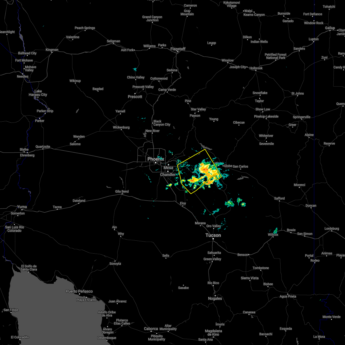 At 948 pm mst, severe thunderstorms were located along a line extending from near superstition mountains to queen valley to near superior, moving southwest at 45 mph (radar indicated). Hazards include 70 mph wind gusts and nickel size hail. Expect considerable tree damage. damage is likely to mobile homes, roofs, and outbuildings. locations impacted include, mesa, apache junction, florence, superior, gold canyon, queen creek, gold camp, lost dutchman state park, goldfield, magma, san tan valley, top-of-the-world, florence junction, queen valley and superstition mountains. this includes the following highways, us highway 60 between mile markers 191 and 240. az route 202 between mile markers 29 and 32. Az route 79 between mile markers 130 and 150. At 948 pm mst, severe thunderstorms were located along a line extending from near superstition mountains to queen valley to near superior, moving southwest at 45 mph (radar indicated). Hazards include 70 mph wind gusts and nickel size hail. Expect considerable tree damage. damage is likely to mobile homes, roofs, and outbuildings. locations impacted include, mesa, apache junction, florence, superior, gold canyon, queen creek, gold camp, lost dutchman state park, goldfield, magma, san tan valley, top-of-the-world, florence junction, queen valley and superstition mountains. this includes the following highways, us highway 60 between mile markers 191 and 240. az route 202 between mile markers 29 and 32. Az route 79 between mile markers 130 and 150.
|
| 7/9/2021 9:39 PM MST |
 At 939 pm mst, severe thunderstorms were located along a line extending from near apache lake to near boyce thompson arboretum to 8 miles southeast of superior, moving southwest at 35 mph (radar indicated). Hazards include 60 mph wind gusts and nickel size hail. expect damage to roofs, siding, and trees At 939 pm mst, severe thunderstorms were located along a line extending from near apache lake to near boyce thompson arboretum to 8 miles southeast of superior, moving southwest at 35 mph (radar indicated). Hazards include 60 mph wind gusts and nickel size hail. expect damage to roofs, siding, and trees
|
| 7/8/2021 6:04 PM MST |
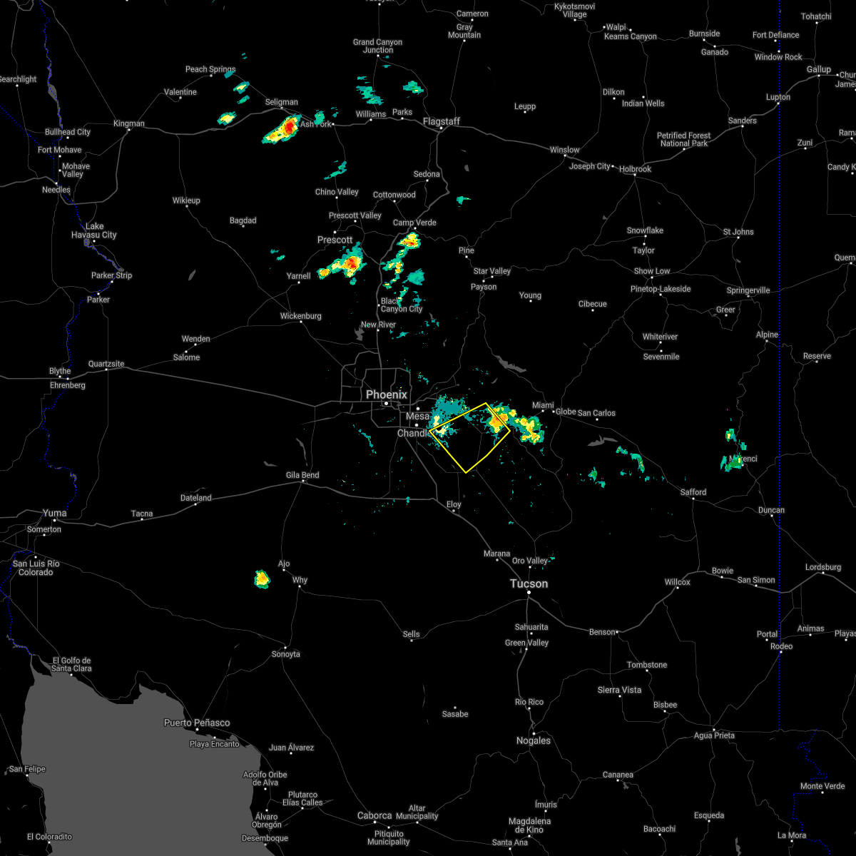 At 604 pm mst, a severe thunderstorm was located over queen valley, or 8 miles southeast of gold canyon, moving southwest at 35 mph (radar indicated). Hazards include 60 mph wind gusts and penny size hail. expect damage to roofs, siding, and trees At 604 pm mst, a severe thunderstorm was located over queen valley, or 8 miles southeast of gold canyon, moving southwest at 35 mph (radar indicated). Hazards include 60 mph wind gusts and penny size hail. expect damage to roofs, siding, and trees
|
| 9/8/2020 5:58 PM MST |
 The severe thunderstorm warning for maricopa and pinal counties will expire at 600 pm mst, the storm which prompted the warning has moved out of the area. therefore, the warning will be allowed to expire. The severe thunderstorm warning for maricopa and pinal counties will expire at 600 pm mst, the storm which prompted the warning has moved out of the area. therefore, the warning will be allowed to expire.
|
| 9/8/2020 5:47 PM MST |
 At 546 pm mst, a severe thunderstorm was located over queen creek, or 12 miles southeast of gilbert, moving east at 35 mph (radar indicated). Hazards include 60 mph wind gusts and penny size hail. Expect damage to roofs, siding, and trees. locations impacted include, chandler, gilbert, sun lakes, queen creek, chandler heights, bapchule, olberg, san tan mountain park, san tan valley, seville, sacaton and santan. this includes the following highways, az interstate 10 between mile markers 169 and 179. Az route 87 between mile markers 145 and 163. At 546 pm mst, a severe thunderstorm was located over queen creek, or 12 miles southeast of gilbert, moving east at 35 mph (radar indicated). Hazards include 60 mph wind gusts and penny size hail. Expect damage to roofs, siding, and trees. locations impacted include, chandler, gilbert, sun lakes, queen creek, chandler heights, bapchule, olberg, san tan mountain park, san tan valley, seville, sacaton and santan. this includes the following highways, az interstate 10 between mile markers 169 and 179. Az route 87 between mile markers 145 and 163.
|
| 9/8/2020 5:29 PM MST |
 At 529 pm mst, a severe thunderstorm was located over sun lakes, moving east at 35 mph (radar indicated). Hazards include 60 mph wind gusts and penny size hail. expect damage to roofs, siding, and trees At 529 pm mst, a severe thunderstorm was located over sun lakes, moving east at 35 mph (radar indicated). Hazards include 60 mph wind gusts and penny size hail. expect damage to roofs, siding, and trees
|
| 9/8/2020 5:26 PM MST |
 The severe thunderstorm warning for maricopa and pinal counties will expire at 530 pm mst, the storm that was over southeast mesa which prompted the warning has weakened below severe limits, and no longer poses an immediate threat to life or property. therefore, the warning will be allowed to expire. however heavy rain is still possible with this thunderstorm. The severe thunderstorm warning for maricopa and pinal counties will expire at 530 pm mst, the storm that was over southeast mesa which prompted the warning has weakened below severe limits, and no longer poses an immediate threat to life or property. therefore, the warning will be allowed to expire. however heavy rain is still possible with this thunderstorm.
|
| 9/8/2020 5:14 PM MST |
 At 514 pm mst, a severe thunderstorm was located near apache junction, moving east at 30 mph (radar indicated). Hazards include 60 mph wind gusts and quarter size hail. Hail damage to vehicles is expected. expect wind damage to roofs, siding, and trees. locations impacted include, mesa, gilbert, apache junction, gold canyon, queen creek, chandler heights, gold camp, san tan village mall, seville, freestone park, florence junction, kings ranch, phoenix mesa gateway airport, queen valley and higley. this includes the following highways, us highway 60 between mile markers 191 and 214. az route 202 between mile markers 31 and 44. Az route 79 between mile markers 145 and 150. At 514 pm mst, a severe thunderstorm was located near apache junction, moving east at 30 mph (radar indicated). Hazards include 60 mph wind gusts and quarter size hail. Hail damage to vehicles is expected. expect wind damage to roofs, siding, and trees. locations impacted include, mesa, gilbert, apache junction, gold canyon, queen creek, chandler heights, gold camp, san tan village mall, seville, freestone park, florence junction, kings ranch, phoenix mesa gateway airport, queen valley and higley. this includes the following highways, us highway 60 between mile markers 191 and 214. az route 202 between mile markers 31 and 44. Az route 79 between mile markers 145 and 150.
|
| 9/8/2020 4:58 PM MST |
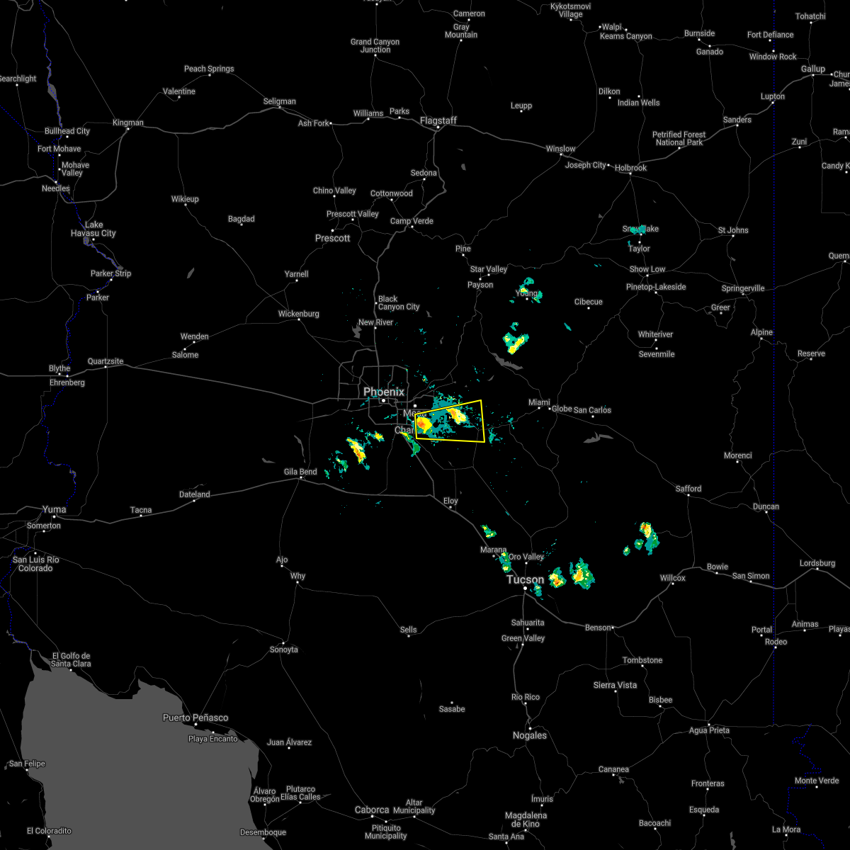 At 458 pm mst, a severe thunderstorm was located over phoenix mesa gateway airport, or near gilbert, moving east at 30 mph (radar indicated). Hazards include 60 mph wind gusts and quarter size hail. Hail damage to vehicles is expected. Expect wind damage to roofs, siding, and trees. At 458 pm mst, a severe thunderstorm was located over phoenix mesa gateway airport, or near gilbert, moving east at 30 mph (radar indicated). Hazards include 60 mph wind gusts and quarter size hail. Hail damage to vehicles is expected. Expect wind damage to roofs, siding, and trees.
|
| 11/29/2019 5:10 AM MST |
 The severe thunderstorm warning for maricopa and pinal counties will expire at 515 am mst, the storm which prompted the warning has moved out of the area. therefore, the warning will be allowed to expire. however gusty winds and heavy rain are still possible with this thunderstorm. The severe thunderstorm warning for maricopa and pinal counties will expire at 515 am mst, the storm which prompted the warning has moved out of the area. therefore, the warning will be allowed to expire. however gusty winds and heavy rain are still possible with this thunderstorm.
|
| 11/29/2019 5:00 AM MST |
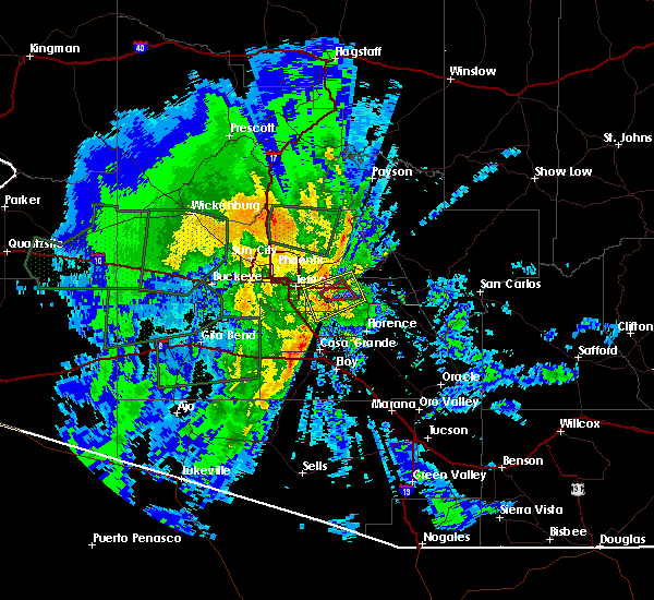 At 500 am mst, a severe thunderstorm was located near apache junction, moving east at 40 mph (radar indicated). Hazards include 60 mph wind gusts. Expect damage to roofs, siding, and trees. locations impacted include, mesa, apache junction, gold canyon, queen creek, superstition mountains, gold camp, kings ranch, lost dutchman state park and goldfield. this includes the following highways, us highway 60 between mile markers 192 and 209. Az route 202 between mile markers 27 and 28. At 500 am mst, a severe thunderstorm was located near apache junction, moving east at 40 mph (radar indicated). Hazards include 60 mph wind gusts. Expect damage to roofs, siding, and trees. locations impacted include, mesa, apache junction, gold canyon, queen creek, superstition mountains, gold camp, kings ranch, lost dutchman state park and goldfield. this includes the following highways, us highway 60 between mile markers 192 and 209. Az route 202 between mile markers 27 and 28.
|
| 11/29/2019 4:44 AM MST |
 At 443 am mst, a severe thunderstorm capable of producing a tornado was located over san tan village mall, or near gilbert, moving east at 45 mph (radar indicated rotation). Hazards include tornado. Flying debris will be dangerous to those caught without shelter. mobile homes will be damaged or destroyed. damage to roofs, windows, and vehicles will occur. tree damage is likely. this tornadic thunderstorm will remain over mainly rural areas of maricopa and pinal counties, including the following locations, higley. this includes the following highways, us highway 60 between mile markers 189 and 199. Az route 202 between mile markers 30 and 42. At 443 am mst, a severe thunderstorm capable of producing a tornado was located over san tan village mall, or near gilbert, moving east at 45 mph (radar indicated rotation). Hazards include tornado. Flying debris will be dangerous to those caught without shelter. mobile homes will be damaged or destroyed. damage to roofs, windows, and vehicles will occur. tree damage is likely. this tornadic thunderstorm will remain over mainly rural areas of maricopa and pinal counties, including the following locations, higley. this includes the following highways, us highway 60 between mile markers 189 and 199. Az route 202 between mile markers 30 and 42.
|
| 11/29/2019 4:41 AM MST |
 The national weather service in phoenix has issued a * severe thunderstorm warning for. maricopa county in south central arizona. pinal county in southeastern arizona. until 515 am mst. At 441 am mst, a severe thunderstorm was located over san tan. The national weather service in phoenix has issued a * severe thunderstorm warning for. maricopa county in south central arizona. pinal county in southeastern arizona. until 515 am mst. At 441 am mst, a severe thunderstorm was located over san tan.
|
| 9/1/2019 5:40 PM MST |
 At 539 pm mst, a severe thunderstorm was located over san tan mountain park, or 11 miles east of sun lakes, moving west at 5 mph (radar indicated). Hazards include 60 mph wind gusts. expect damage to roofs, siding, and trees At 539 pm mst, a severe thunderstorm was located over san tan mountain park, or 11 miles east of sun lakes, moving west at 5 mph (radar indicated). Hazards include 60 mph wind gusts. expect damage to roofs, siding, and trees
|
| 9/1/2019 5:12 PM MST |
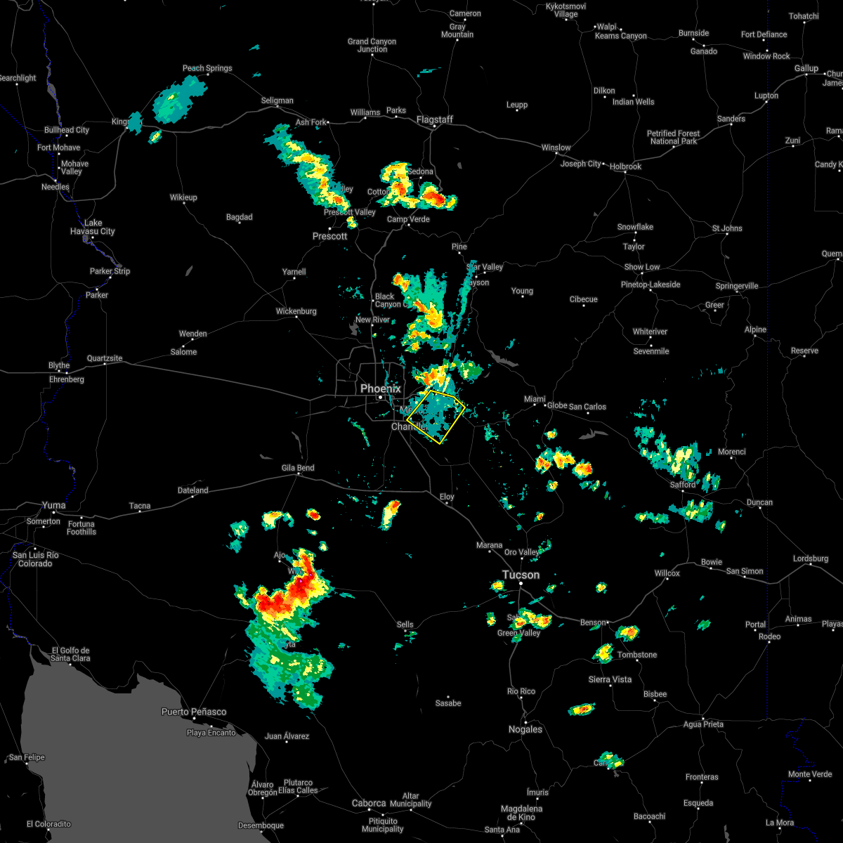 The severe thunderstorm warning for maricopa and pinal counties will expire at 515 pm mst, the storm which prompted the warning has weakened below severe limits, and no longer poses an immediate threat to life or property. therefore, the warning will be allowed to expire. however gusty winds up to 50 mph are still possible as the storm further weakens. a severe thunderstorm watch remains in effect until 1100 pm mst for south central and southeastern arizona. The severe thunderstorm warning for maricopa and pinal counties will expire at 515 pm mst, the storm which prompted the warning has weakened below severe limits, and no longer poses an immediate threat to life or property. therefore, the warning will be allowed to expire. however gusty winds up to 50 mph are still possible as the storm further weakens. a severe thunderstorm watch remains in effect until 1100 pm mst for south central and southeastern arizona.
|
| 9/1/2019 5:04 PM MST |
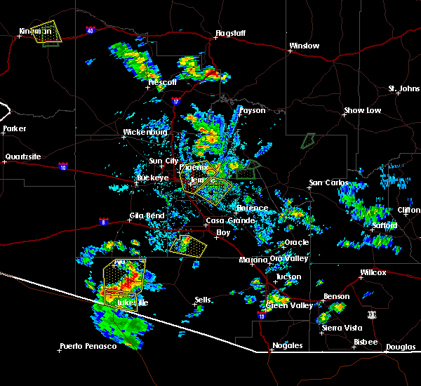 At 504 pm mst, a severe thunderstorm was located over seville, or near gilbert, moving southwest at 35 mph (radar indicated). Hazards include 60 mph wind gusts. Expect damage to roofs, siding, and trees. locations impacted include, mesa, chandler, gilbert, apache junction, east mesa, gold canyon, queen creek, chandler heights, gold camp, gilbert city hall, usery mountain park, superstition springs mall, chandler city hall, san tan village mall and seville. this includes the following highways, us highway 60 between mile markers 183 and 203. az route 87 between mile markers 165 and 167. Az route 202 between mile markers 23 and 48. At 504 pm mst, a severe thunderstorm was located over seville, or near gilbert, moving southwest at 35 mph (radar indicated). Hazards include 60 mph wind gusts. Expect damage to roofs, siding, and trees. locations impacted include, mesa, chandler, gilbert, apache junction, east mesa, gold canyon, queen creek, chandler heights, gold camp, gilbert city hall, usery mountain park, superstition springs mall, chandler city hall, san tan village mall and seville. this includes the following highways, us highway 60 between mile markers 183 and 203. az route 87 between mile markers 165 and 167. Az route 202 between mile markers 23 and 48.
|
| 9/1/2019 4:51 PM MST |
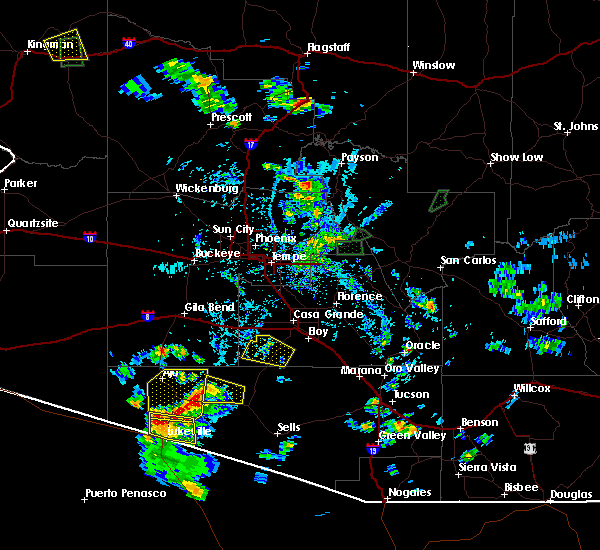 At 450 pm mst, a severe thunderstorm was located near apache junction, moving southwest at 30 mph (radar indicated). Hazards include 60 mph wind gusts. expect damage to roofs, siding, and trees At 450 pm mst, a severe thunderstorm was located near apache junction, moving southwest at 30 mph (radar indicated). Hazards include 60 mph wind gusts. expect damage to roofs, siding, and trees
|
| 7/30/2019 5:54 PM MST |
 The severe thunderstorm warning for maricopa and pinal counties will expire at 600 pm mst, the storm which prompted the warning has weakened below severe limits, and no longer poses an immediate threat to life or property. therefore, the warning will be allowed to expire. The severe thunderstorm warning for maricopa and pinal counties will expire at 600 pm mst, the storm which prompted the warning has weakened below severe limits, and no longer poses an immediate threat to life or property. therefore, the warning will be allowed to expire.
|
| 7/30/2019 5:43 PM MST |
 At 543 pm mst, a severe thunderstorm was located near olberg, or 8 miles southeast of sun lakes, moving northwest at 5 mph (radar indicated). Hazards include 70 mph wind gusts. Expect considerable tree damage. damage is likely to mobile homes, roofs, and outbuildings. locations impacted include, casa grande, queen creek, chandler heights, bapchule, olberg, blackwater, sacaton and santan. this includes the following highways, az interstate 10 between mile markers 172 and 186. Az route 87 between mile markers 142 and 157. At 543 pm mst, a severe thunderstorm was located near olberg, or 8 miles southeast of sun lakes, moving northwest at 5 mph (radar indicated). Hazards include 70 mph wind gusts. Expect considerable tree damage. damage is likely to mobile homes, roofs, and outbuildings. locations impacted include, casa grande, queen creek, chandler heights, bapchule, olberg, blackwater, sacaton and santan. this includes the following highways, az interstate 10 between mile markers 172 and 186. Az route 87 between mile markers 142 and 157.
|
| 7/30/2019 5:24 PM MST |
 At 524 pm mst, a severe thunderstorm was located near olberg, or 11 miles north of casa grande, moving northwest at 5 mph (radar indicated). Hazards include 70 mph wind gusts. Expect considerable tree damage. Damage is likely to mobile homes, roofs, and outbuildings. At 524 pm mst, a severe thunderstorm was located near olberg, or 11 miles north of casa grande, moving northwest at 5 mph (radar indicated). Hazards include 70 mph wind gusts. Expect considerable tree damage. Damage is likely to mobile homes, roofs, and outbuildings.
|
| 7/22/2019 8:08 PM MST |
 The severe thunderstorm warning for maricopa and pinal counties will expire at 815 pm mst, the storm which prompted the warning has weakened below severe limits, and has exited the warned area. therefore, the warning will be allowed to expire. however gusty winds are still possible with this thunderstorm. a severe thunderstorm watch remains in effect until 1100 pm mst for south central and southeastern arizona. The severe thunderstorm warning for maricopa and pinal counties will expire at 815 pm mst, the storm which prompted the warning has weakened below severe limits, and has exited the warned area. therefore, the warning will be allowed to expire. however gusty winds are still possible with this thunderstorm. a severe thunderstorm watch remains in effect until 1100 pm mst for south central and southeastern arizona.
|
| 7/22/2019 7:18 PM MST |
 At 717 pm mst, a severe thunderstorm was located 10 miles east of florence, moving west at 35 mph (radar indicated). Hazards include 60 mph wind gusts. expect damage to roofs, siding, and trees At 717 pm mst, a severe thunderstorm was located 10 miles east of florence, moving west at 35 mph (radar indicated). Hazards include 60 mph wind gusts. expect damage to roofs, siding, and trees
|
| 10/21/2018 7:04 PM MST |
 At 704 pm mst, a severe thunderstorm was located over olberg, or 8 miles south of sun lakes, moving north at 30 mph (radar indicated). Hazards include 60 mph wind gusts and quarter size hail. Hail damage to vehicles is expected. Expect wind damage to roofs, siding, and trees. At 704 pm mst, a severe thunderstorm was located over olberg, or 8 miles south of sun lakes, moving north at 30 mph (radar indicated). Hazards include 60 mph wind gusts and quarter size hail. Hail damage to vehicles is expected. Expect wind damage to roofs, siding, and trees.
|
| 10/21/2018 4:57 PM MST |
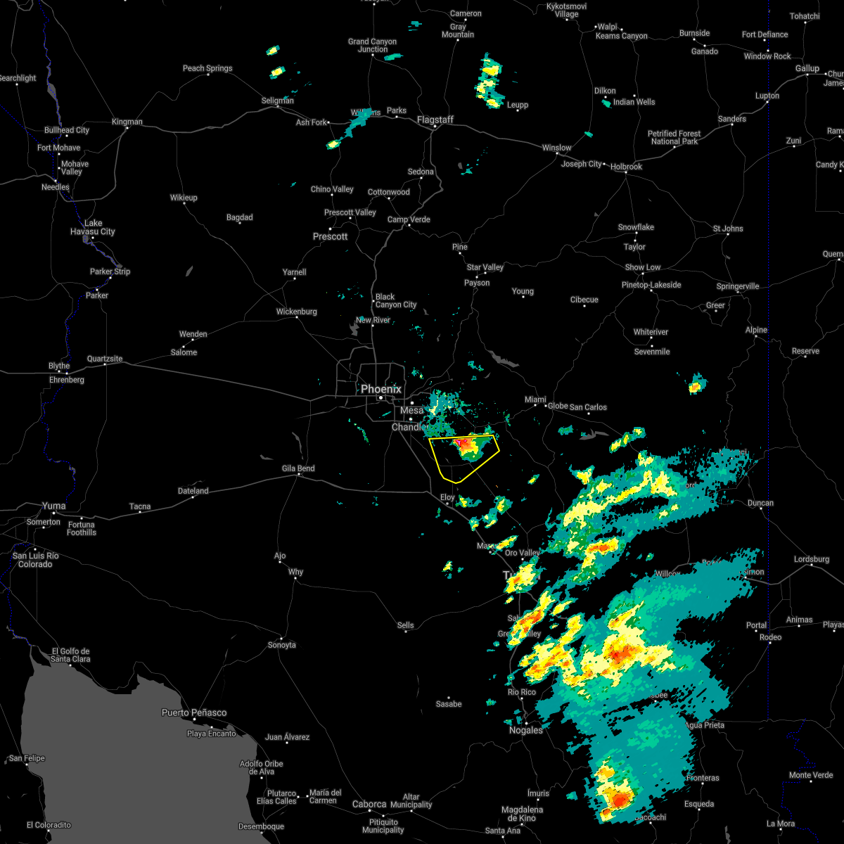 The severe thunderstorm warning for pinal county will expire at 500 pm mst, the storm which prompted the warning has moved out of the area. therefore, the warning will be allowed to expire. however small hail and gusty winds are still possible with this thunderstorm. The severe thunderstorm warning for pinal county will expire at 500 pm mst, the storm which prompted the warning has moved out of the area. therefore, the warning will be allowed to expire. however small hail and gusty winds are still possible with this thunderstorm.
|
| 10/21/2018 4:45 PM MST |
 At 445 pm mst, a severe thunderstorm was located over florence junction, or 13 miles west of superior, moving north at 45 mph (trained weather spotters). Hazards include 70 mph wind gusts and quarter size hail. Hail damage to vehicles is expected. expect considerable tree damage. wind damage is also likely to mobile homes, roofs, and outbuildings. locations impacted include, florence, coolidge, queen creek, blackwater, san tan mountain park, magma, san tan valley, randolph, coolidge airport, valley farms and cactus forest. this includes the following highways, az route 87 between mile markers 128 and 141. Az route 79 between mile markers 129 and 145. At 445 pm mst, a severe thunderstorm was located over florence junction, or 13 miles west of superior, moving north at 45 mph (trained weather spotters). Hazards include 70 mph wind gusts and quarter size hail. Hail damage to vehicles is expected. expect considerable tree damage. wind damage is also likely to mobile homes, roofs, and outbuildings. locations impacted include, florence, coolidge, queen creek, blackwater, san tan mountain park, magma, san tan valley, randolph, coolidge airport, valley farms and cactus forest. this includes the following highways, az route 87 between mile markers 128 and 141. Az route 79 between mile markers 129 and 145.
|
| 10/21/2018 4:17 PM MST |
 At 416 pm mst, a severe thunderstorm was located over coolidge airport, or 7 miles south of florence, moving north at 45 mph (radar indicated). Hazards include 70 mph wind gusts and quarter size hail. Hail damage to vehicles is expected. expect considerable tree damage. Wind damage is also likely to mobile homes, roofs, and outbuildings. At 416 pm mst, a severe thunderstorm was located over coolidge airport, or 7 miles south of florence, moving north at 45 mph (radar indicated). Hazards include 70 mph wind gusts and quarter size hail. Hail damage to vehicles is expected. expect considerable tree damage. Wind damage is also likely to mobile homes, roofs, and outbuildings.
|
| 9/2/2018 6:42 PM MST | Multiple reports of storm damage/trees down in the villages subdivision in queen cree in maricopa county AZ, 2.1 miles WSW of Queen Creek, AZ |
| 9/2/2018 6:36 PM MST |
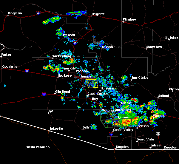 At 635 pm mst, a severe thunderstorm was located over queen creek, or 10 miles southeast of gilbert, and is nearly stationary (radar indicated). Hazards include 60 mph wind gusts and quarter size hail. Hail damage to vehicles is expected. expect wind damage to roofs, siding, and trees. locations impacted include, mesa, gilbert, apache junction, queen creek, chandler heights, magma, san tan village mall, san tan valley, seville, phoenix mesa gateway airport, san tan mountain park, freestone park, gold camp and higley. This includes az route 202 between mile markers 33 and 42. At 635 pm mst, a severe thunderstorm was located over queen creek, or 10 miles southeast of gilbert, and is nearly stationary (radar indicated). Hazards include 60 mph wind gusts and quarter size hail. Hail damage to vehicles is expected. expect wind damage to roofs, siding, and trees. locations impacted include, mesa, gilbert, apache junction, queen creek, chandler heights, magma, san tan village mall, san tan valley, seville, phoenix mesa gateway airport, san tan mountain park, freestone park, gold camp and higley. This includes az route 202 between mile markers 33 and 42.
|
| 9/2/2018 6:04 PM MST | Several large trees down at 23425 s. 223rd p in maricopa county AZ, 2.1 miles WSW of Queen Creek, AZ |
| 9/2/2018 6:00 PM MST | Corrects previous tstm wnd dmg report from 2 e queen creek. multiple reports of storm damage/trees down in the villages subdivision in queen cree in maricopa county AZ, 2.1 miles WSW of Queen Creek, AZ |
| 9/2/2018 6:00 PM MST |
 The national weather service in phoenix has issued a * severe thunderstorm warning for. maricopa county in south central arizona. pinal county in southeastern arizona. until 645 pm mst. At 600 pm mst, a severe thunderstorm was located over queen creek,. The national weather service in phoenix has issued a * severe thunderstorm warning for. maricopa county in south central arizona. pinal county in southeastern arizona. until 645 pm mst. At 600 pm mst, a severe thunderstorm was located over queen creek,.
|
| 9/2/2018 5:08 PM MST |
 At 508 pm mst, a severe thunderstorm was located over florence, moving northwest at 25 mph (radar indicated). Hazards include 60 mph wind gusts and quarter size hail. Hail damage to vehicles is expected. expect wind damage to roofs, siding, and trees. locations impacted include, florence, florence junction, queen valley, magma, san tan valley, valley farms and cactus forest. this includes the following highways, us highway 60 between mile markers 211 and 219. Az route 79 between mile markers 129 and 150. At 508 pm mst, a severe thunderstorm was located over florence, moving northwest at 25 mph (radar indicated). Hazards include 60 mph wind gusts and quarter size hail. Hail damage to vehicles is expected. expect wind damage to roofs, siding, and trees. locations impacted include, florence, florence junction, queen valley, magma, san tan valley, valley farms and cactus forest. this includes the following highways, us highway 60 between mile markers 211 and 219. Az route 79 between mile markers 129 and 150.
|
| 9/2/2018 5:00 PM MST |
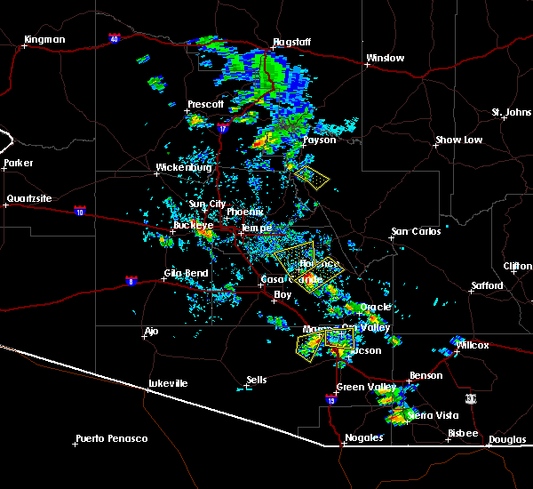 At 459 pm mst, a severe thunderstorm was located near florence, moving northwest at 25 mph (radar indicated). Hazards include 60 mph wind gusts and quarter size hail. Hail damage to vehicles is expected. Expect wind damage to roofs, siding, and trees. At 459 pm mst, a severe thunderstorm was located near florence, moving northwest at 25 mph (radar indicated). Hazards include 60 mph wind gusts and quarter size hail. Hail damage to vehicles is expected. Expect wind damage to roofs, siding, and trees.
|
| 8/23/2018 8:12 PM MST |
 At 812 pm mst, a severe thunderstorm was located over superstition mountains, or 7 miles east of apache junction, moving south at 30 mph (radar indicated). Hazards include 60 mph wind gusts. expect damage to roofs, siding, and trees At 812 pm mst, a severe thunderstorm was located over superstition mountains, or 7 miles east of apache junction, moving south at 30 mph (radar indicated). Hazards include 60 mph wind gusts. expect damage to roofs, siding, and trees
|
| 8/23/2018 7:53 PM MST |
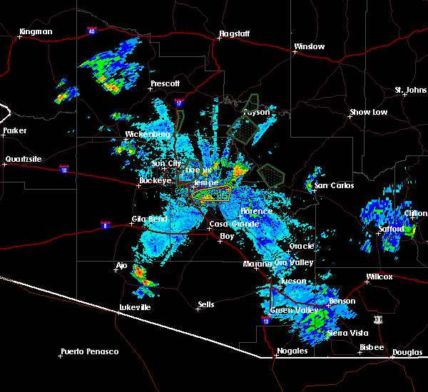 At 752 pm mst, a severe thunderstorm was located near gold camp, or near apache junction, moving east at 15 mph (radar indicated). Hazards include 60 mph wind gusts. Expect damage to roofs, siding, and trees. this severe thunderstorm will remain over mainly rural areas of maricopa and pinal counties, which includes higley. this includes the following highways, us highway 60 between mile markers 187 and 201. az route 87 between mile markers 163 and 170. Az route 202 between mile markers 30 and 53. At 752 pm mst, a severe thunderstorm was located near gold camp, or near apache junction, moving east at 15 mph (radar indicated). Hazards include 60 mph wind gusts. Expect damage to roofs, siding, and trees. this severe thunderstorm will remain over mainly rural areas of maricopa and pinal counties, which includes higley. this includes the following highways, us highway 60 between mile markers 187 and 201. az route 87 between mile markers 163 and 170. Az route 202 between mile markers 30 and 53.
|
| 8/23/2018 7:32 PM MST |
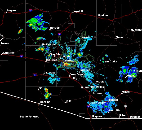 At 732 pm mst, a severe thunderstorm was located over apache junction, moving east at 15 mph (radar indicated). Hazards include 60 mph wind gusts. Expect damage to roofs, siding, and trees. this severe thunderstorm will remain over mainly rural areas of maricopa and pinal counties, which includes higley. this includes the following highways, us highway 60 between mile markers 174 and 201. az route 87 between mile markers 163 and 172. Az route 202 between mile markers 29 and 53. At 732 pm mst, a severe thunderstorm was located over apache junction, moving east at 15 mph (radar indicated). Hazards include 60 mph wind gusts. Expect damage to roofs, siding, and trees. this severe thunderstorm will remain over mainly rural areas of maricopa and pinal counties, which includes higley. this includes the following highways, us highway 60 between mile markers 174 and 201. az route 87 between mile markers 163 and 172. Az route 202 between mile markers 29 and 53.
|
| 8/23/2018 7:12 PM MST |
 At 712 pm mst, a severe thunderstorm was located over superstition springs mall, or over east mesa, moving east at 15 mph (radar indicated). Hazards include 60 mph wind gusts. Expect damage to roofs, siding, and trees. this severe thunderstorm will remain over mainly rural areas of maricopa and pinal counties, including the following locations: guadalupe and higley. this includes the following highways, az interstate 10 between mile markers 151 and 161. us highway 60 between mile markers 173 and 201. Az route 87 between mile markers 163 and 179. At 712 pm mst, a severe thunderstorm was located over superstition springs mall, or over east mesa, moving east at 15 mph (radar indicated). Hazards include 60 mph wind gusts. Expect damage to roofs, siding, and trees. this severe thunderstorm will remain over mainly rural areas of maricopa and pinal counties, including the following locations: guadalupe and higley. this includes the following highways, az interstate 10 between mile markers 151 and 161. us highway 60 between mile markers 173 and 201. Az route 87 between mile markers 163 and 179.
|
| 8/12/2018 6:39 PM MST |
 At 639 pm mst, a severe thunderstorm was located near bapchule, or 7 miles southeast of sun lakes, moving southwest at 30 mph (radar indicated). Hazards include 60 mph wind gusts and penny size hail. expect damage to roofs, siding, and trees At 639 pm mst, a severe thunderstorm was located near bapchule, or 7 miles southeast of sun lakes, moving southwest at 30 mph (radar indicated). Hazards include 60 mph wind gusts and penny size hail. expect damage to roofs, siding, and trees
|
| 8/12/2018 6:22 PM MST |
 At 622 pm mst, a severe thunderstorm was located near seville, or 7 miles east of sun lakes, moving west at 30 mph (trained weather spotters). Hazards include 70 mph wind gusts. Expect considerable tree damage. damage is likely to mobile homes, roofs, and outbuildings. locations impacted include, mesa, chandler, gilbert, casa grande, coolidge, sun lakes, queen creek, san tan village mall, san tan valley, seville, bapchule, olberg, phoenix mesa gateway airport, san tan mountain park and chandler heights. this includes the following highways, az interstate 10 between mile markers 163 and 194. az route 87 between mile markers 134 and 167. Az route 202 between mile markers 32 and 53. At 622 pm mst, a severe thunderstorm was located near seville, or 7 miles east of sun lakes, moving west at 30 mph (trained weather spotters). Hazards include 70 mph wind gusts. Expect considerable tree damage. damage is likely to mobile homes, roofs, and outbuildings. locations impacted include, mesa, chandler, gilbert, casa grande, coolidge, sun lakes, queen creek, san tan village mall, san tan valley, seville, bapchule, olberg, phoenix mesa gateway airport, san tan mountain park and chandler heights. this includes the following highways, az interstate 10 between mile markers 163 and 194. az route 87 between mile markers 134 and 167. Az route 202 between mile markers 32 and 53.
|
| 8/12/2018 6:11 PM MST |
 At 611 pm mst, a severe thunderstorm was located over chandler heights, or 10 miles southeast of gilbert, moving west at 30 mph (trained weather spotters). Hazards include 60 mph wind gusts. expect damage to roofs, siding, and trees At 611 pm mst, a severe thunderstorm was located over chandler heights, or 10 miles southeast of gilbert, moving west at 30 mph (trained weather spotters). Hazards include 60 mph wind gusts. expect damage to roofs, siding, and trees
|
| 8/12/2018 6:09 PM MST | Corrects previous tstm wnd gst report from 2 ne queen creek. measured 58 mph wind gust. estimated 1/2 inch of rai in maricopa county AZ, 2.6 miles SSW of Queen Creek, AZ |
| 8/12/2018 6:09 PM MST | Corrects previous tstm wnd gst report from 2 ne queen creek. measured 58 mph wind gust. estimated 1/2 inch of rai in maricopa county AZ, 2.6 miles SSW of Queen Creek, AZ |
| 8/9/2018 7:23 AM MST | **delayed report** 6 power poles down near hunt hwy and gary rd. time est. on repor in pinal county AZ, 4.5 miles NW of Queen Creek, AZ |
| 8/8/2018 8:09 PM MST |
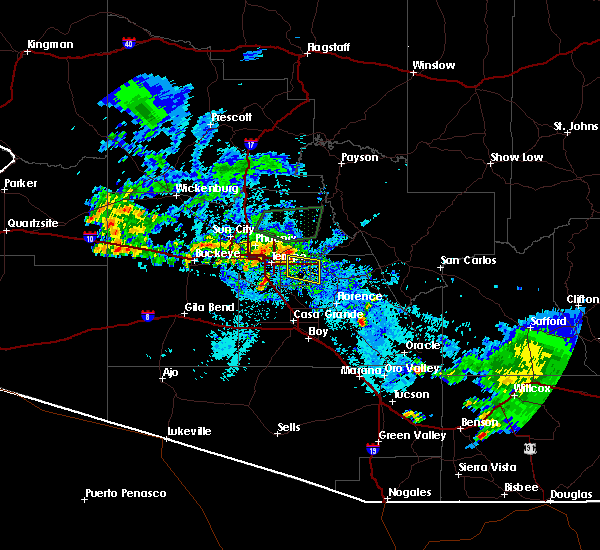 At 808 pm mst, a severe thunderstorm was located over east mesa, or near gilbert, moving south at 10 mph (radar indicated). Hazards include 60 mph wind gusts. Expect damage to roofs, siding, and trees. locations impacted include, mesa, gilbert, apache junction, east mesa, queen creek, freestone park, phoenix mesa gateway airport, superstition springs mall, san tan village mall and higley. this includes the following highways, us highway 60 between mile markers 183 and 198. Az route 202 between mile markers 26 and 44. At 808 pm mst, a severe thunderstorm was located over east mesa, or near gilbert, moving south at 10 mph (radar indicated). Hazards include 60 mph wind gusts. Expect damage to roofs, siding, and trees. locations impacted include, mesa, gilbert, apache junction, east mesa, queen creek, freestone park, phoenix mesa gateway airport, superstition springs mall, san tan village mall and higley. this includes the following highways, us highway 60 between mile markers 183 and 198. Az route 202 between mile markers 26 and 44.
|
| 8/8/2018 7:39 PM MST |
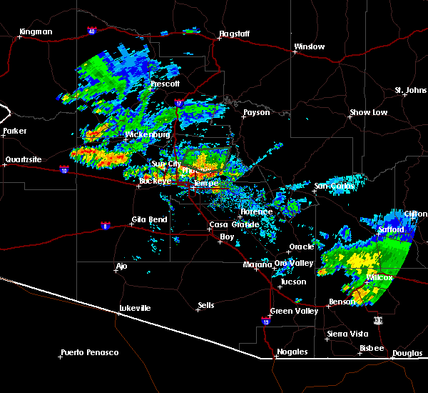 At 738 pm mst, a severe thunderstorm was located near phoenix mesa gateway airport, or near east mesa, moving south at 10 mph (radar indicated). Hazards include 60 mph wind gusts and penny size hail. expect damage to roofs, siding, and trees At 738 pm mst, a severe thunderstorm was located near phoenix mesa gateway airport, or near east mesa, moving south at 10 mph (radar indicated). Hazards include 60 mph wind gusts and penny size hail. expect damage to roofs, siding, and trees
|
| 7/9/2018 4:18 PM MST |
 At 418 pm mst, a severe thunderstorm was located over blackwater, or near coolidge, moving west at 10 mph (radar indicated). Hazards include 60 mph wind gusts and penny size hail. Expect damage to roofs, siding, and trees. locations impacted include, casa grande, florence, coolidge, queen creek, blackwater, san tan mountain park, magma, san tan valley, randolph, valley farms and sacaton. this includes the following highways, az interstate 10 between mile markers 184 and 195. Az route 87 between mile markers 129 and 153. At 418 pm mst, a severe thunderstorm was located over blackwater, or near coolidge, moving west at 10 mph (radar indicated). Hazards include 60 mph wind gusts and penny size hail. Expect damage to roofs, siding, and trees. locations impacted include, casa grande, florence, coolidge, queen creek, blackwater, san tan mountain park, magma, san tan valley, randolph, valley farms and sacaton. this includes the following highways, az interstate 10 between mile markers 184 and 195. Az route 87 between mile markers 129 and 153.
|
| 7/9/2018 4:04 PM MST |
 At 403 pm mst, a severe thunderstorm was located over mesa, moving west at 20 mph. downed trees have been reported in mesa due to the storm (trained weather spotters). Hazards include 60 mph wind gusts and penny size hail. Expect damage to roofs, siding, and trees. locations impacted include, mesa, chandler, gilbert, tempe, apache junction, east mesa, mesa riverview mall, granite reef dam, gilbert city hall, falcon field airport, downtown mesa, lost dutchman state park, usery mountain park, superstition springs mall and chandler city hall. this includes the following highways, us highway 60 between mile markers 177 and 200. az route 87 between mile markers 165 and 187. Az route 202 between mile markers 11 and 42, and between mile markers 52 and 53. At 403 pm mst, a severe thunderstorm was located over mesa, moving west at 20 mph. downed trees have been reported in mesa due to the storm (trained weather spotters). Hazards include 60 mph wind gusts and penny size hail. Expect damage to roofs, siding, and trees. locations impacted include, mesa, chandler, gilbert, tempe, apache junction, east mesa, mesa riverview mall, granite reef dam, gilbert city hall, falcon field airport, downtown mesa, lost dutchman state park, usery mountain park, superstition springs mall and chandler city hall. this includes the following highways, us highway 60 between mile markers 177 and 200. az route 87 between mile markers 165 and 187. Az route 202 between mile markers 11 and 42, and between mile markers 52 and 53.
|
| 7/9/2018 3:59 PM MST |
 At 359 pm mst, a severe thunderstorm was located over blackwater, or near coolidge, moving west at 10 mph (radar indicated). Hazards include 60 mph wind gusts and penny size hail. expect damage to roofs, siding, and trees At 359 pm mst, a severe thunderstorm was located over blackwater, or near coolidge, moving west at 10 mph (radar indicated). Hazards include 60 mph wind gusts and penny size hail. expect damage to roofs, siding, and trees
|
| 7/9/2018 3:40 PM MST |
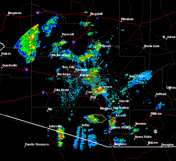 At 339 pm mst, a severe thunderstorm was located near east mesa, moving west at 20 mph (radar indicated). Hazards include 60 mph wind gusts and penny size hail. expect damage to roofs, siding, and trees At 339 pm mst, a severe thunderstorm was located near east mesa, moving west at 20 mph (radar indicated). Hazards include 60 mph wind gusts and penny size hail. expect damage to roofs, siding, and trees
|
| 8/27/2017 6:11 PM MST |
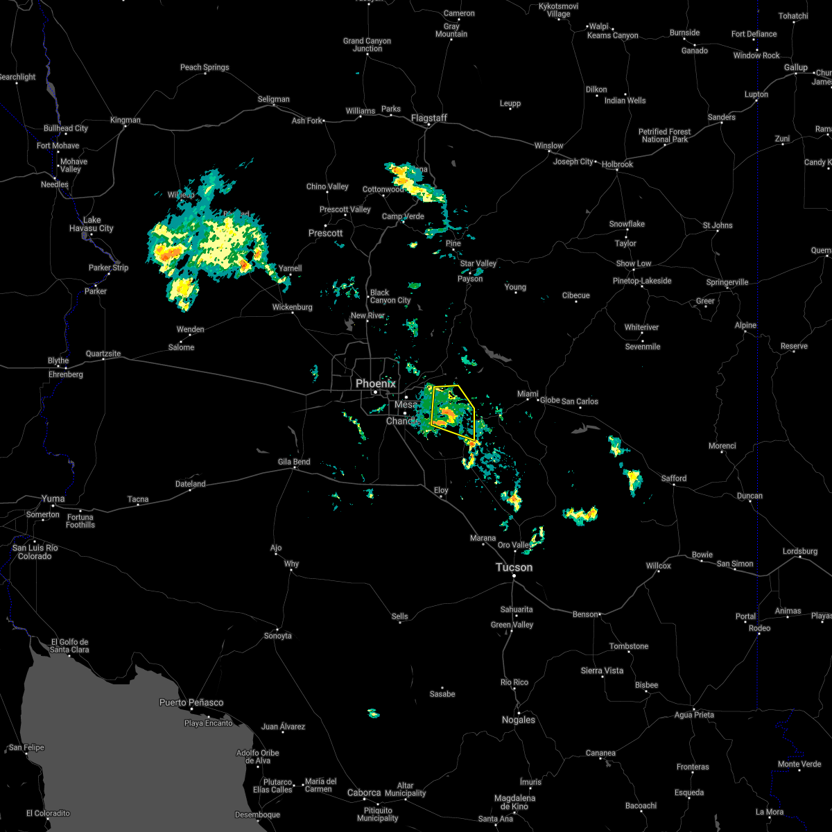 The severe thunderstorm warning for maricopa and pinal counties will expire at 615 pm mst, the storm which prompted the warning has weakened below severe limits, and no longer poses an immediate threat to life or property. therefore the warning will be allowed to expire. however gusty winds and heavy rain are still possible with this thunderstorm. The severe thunderstorm warning for maricopa and pinal counties will expire at 615 pm mst, the storm which prompted the warning has weakened below severe limits, and no longer poses an immediate threat to life or property. therefore the warning will be allowed to expire. however gusty winds and heavy rain are still possible with this thunderstorm.
|
| 8/27/2017 6:03 PM MST |
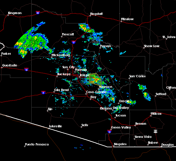 At 603 pm mst, a severe thunderstorm was located near gold camp, or 7 miles southeast of apache junction, moving west at 15 mph (radar indicated). Hazards include 60 mph wind gusts. Expect damage to roofs, siding, and trees. Locations impacted include, mesa, apache junction, queen creek, florence junction, superstition mountains, gold camp, kings ranch, lost dutchman state park and queen valley. At 603 pm mst, a severe thunderstorm was located near gold camp, or 7 miles southeast of apache junction, moving west at 15 mph (radar indicated). Hazards include 60 mph wind gusts. Expect damage to roofs, siding, and trees. Locations impacted include, mesa, apache junction, queen creek, florence junction, superstition mountains, gold camp, kings ranch, lost dutchman state park and queen valley.
|
| 8/27/2017 5:44 PM MST |
 At 544 pm mst, a severe thunderstorm was located near kings ranch, or 9 miles southeast of apache junction, moving west at 15 mph (radar indicated). Hazards include 60 mph wind gusts. expect damage to roofs, siding, and trees At 544 pm mst, a severe thunderstorm was located near kings ranch, or 9 miles southeast of apache junction, moving west at 15 mph (radar indicated). Hazards include 60 mph wind gusts. expect damage to roofs, siding, and trees
|
| 8/3/2017 6:41 PM MST | Measured by trained spotte in maricopa county AZ, 3.1 miles SSE of Queen Creek, AZ |
| 8/3/2017 6:11 PM MST |
 The severe thunderstorm warning for maricopa and pinal counties will expire at 615 pm mst, the severe thunderstorm which prompted the warning has weakened below severe thunderstorm criteria; therefore, the severe thunderstorm warning is going to expire. however, the storms are under a significant weather advisory. heavy rain and strong rain is continuing. The severe thunderstorm warning for maricopa and pinal counties will expire at 615 pm mst, the severe thunderstorm which prompted the warning has weakened below severe thunderstorm criteria; therefore, the severe thunderstorm warning is going to expire. however, the storms are under a significant weather advisory. heavy rain and strong rain is continuing.
|
| 8/3/2017 5:51 PM MST |
 At 551 pm mst, a severe thunderstorm was located over downtown scottsdale, or near paradise valley, moving east at 10 mph. several storms in the area are contained in the warning (radar indicated). Hazards include 60 mph wind gusts. Expect damage to roofs, siding, and trees. Locations impacted include, phoenix, mesa, chandler, scottsdale, gilbert, tempe, apache junction, florence, fountain hills, paradise valley, east mesa, sun lakes, queen creek, tempe marketplace and piestewa peak park. At 551 pm mst, a severe thunderstorm was located over downtown scottsdale, or near paradise valley, moving east at 10 mph. several storms in the area are contained in the warning (radar indicated). Hazards include 60 mph wind gusts. Expect damage to roofs, siding, and trees. Locations impacted include, phoenix, mesa, chandler, scottsdale, gilbert, tempe, apache junction, florence, fountain hills, paradise valley, east mesa, sun lakes, queen creek, tempe marketplace and piestewa peak park.
|
| 8/3/2017 5:45 PM MST | Trained spotter reports at least 6 large trees down and shingles off peoples house in maricopa county AZ, 2.7 miles WSW of Queen Creek, AZ |
| 8/3/2017 5:41 PM MST |
 At 541 pm mst, a severe thunderstorm was located over papago park, or near paradise valley, moving east at 10 mph. this warning covers several storms in the warned area (radar indicated). Hazards include 60 mph wind gusts. Expect damage to roofs, siding, and trees. Locations impacted include, phoenix, mesa, chandler, scottsdale, gilbert, tempe, apache junction, florence, fountain hills, paradise valley, east mesa, sun lakes, queen creek, tempe marketplace and piestewa peak park. At 541 pm mst, a severe thunderstorm was located over papago park, or near paradise valley, moving east at 10 mph. this warning covers several storms in the warned area (radar indicated). Hazards include 60 mph wind gusts. Expect damage to roofs, siding, and trees. Locations impacted include, phoenix, mesa, chandler, scottsdale, gilbert, tempe, apache junction, florence, fountain hills, paradise valley, east mesa, sun lakes, queen creek, tempe marketplace and piestewa peak park.
|
| 8/3/2017 5:27 PM MST |
 At 527 pm mst, a severe thunderstorm was located over papago park, or near paradise valley, moving east at 10 mph. this warning covers several storm cores in the area (radar indicated). Hazards include 60 mph wind gusts. expect damage to roofs, siding, and trees At 527 pm mst, a severe thunderstorm was located over papago park, or near paradise valley, moving east at 10 mph. this warning covers several storm cores in the area (radar indicated). Hazards include 60 mph wind gusts. expect damage to roofs, siding, and trees
|
| 8/3/2017 5:18 PM MST |
 At 518 pm mst, a severe thunderstorm was located over salt river indian community, or near paradise valley, moving east at 25 mph (radar indicated). Hazards include 60 mph wind gusts. Expect damage to roofs, siding, and trees. Locations impacted include, phoenix, mesa, chandler, scottsdale, gilbert, tempe, fountain hills, paradise valley, east mesa, queen creek, tempe marketplace, papago park, piestewa peak park, granite reef dam and falcon field airport. At 518 pm mst, a severe thunderstorm was located over salt river indian community, or near paradise valley, moving east at 25 mph (radar indicated). Hazards include 60 mph wind gusts. Expect damage to roofs, siding, and trees. Locations impacted include, phoenix, mesa, chandler, scottsdale, gilbert, tempe, fountain hills, paradise valley, east mesa, queen creek, tempe marketplace, papago park, piestewa peak park, granite reef dam and falcon field airport.
|
| 8/3/2017 5:15 PM MST | Delayed report. numerous larger trees snapped. time estimate in maricopa county AZ, 2.1 miles SW of Queen Creek, AZ |
| 8/3/2017 5:06 PM MST |
 At 506 pm mst, a severe thunderstorm was located over papago park, or near paradise valley, moving east at 25 mph (radar indicated). Hazards include 60 mph wind gusts. expect damage to roofs, siding, and trees At 506 pm mst, a severe thunderstorm was located over papago park, or near paradise valley, moving east at 25 mph (radar indicated). Hazards include 60 mph wind gusts. expect damage to roofs, siding, and trees
|
| 8/21/2016 5:54 PM MST |
 At 553 pm mst, doppler radar indicated a severe thunderstorm capable of producing damaging winds in excess of 60 mph. this storm was located over tempe marketplace, or near tempe. this storm was nearly stationary. this severe thunderstorm continues to redevelop in the area. locations impacted include, phoenix, mesa, chandler, scottsdale, gilbert, tempe, fountain hills, paradise valley, east mesa, sky harbor airport, piestewa peak park, arizona state fairgrounds, mesa riverview mall, gilbert city hall, tempe marketplace, camelback mountain, papago park, downtown scottsdale, freestone park and superstition springs mall. At 553 pm mst, doppler radar indicated a severe thunderstorm capable of producing damaging winds in excess of 60 mph. this storm was located over tempe marketplace, or near tempe. this storm was nearly stationary. this severe thunderstorm continues to redevelop in the area. locations impacted include, phoenix, mesa, chandler, scottsdale, gilbert, tempe, fountain hills, paradise valley, east mesa, sky harbor airport, piestewa peak park, arizona state fairgrounds, mesa riverview mall, gilbert city hall, tempe marketplace, camelback mountain, papago park, downtown scottsdale, freestone park and superstition springs mall.
|
| 8/21/2016 5:41 PM MST |
 At 541 pm mst, doppler radar indicated a severe thunderstorm capable of producing damaging winds in excess of 60 mph. this storm was located over tempe marketplace, or over tempe. this storm was nearly stationary. At 541 pm mst, doppler radar indicated a severe thunderstorm capable of producing damaging winds in excess of 60 mph. this storm was located over tempe marketplace, or over tempe. this storm was nearly stationary.
|
| 7/29/2016 8:03 PM MST |
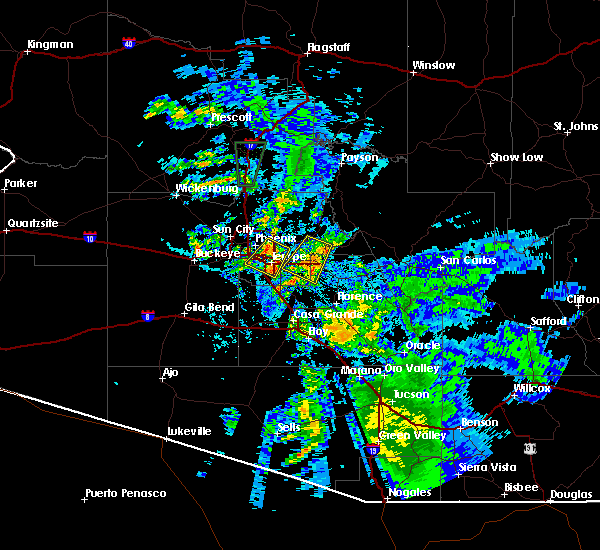 At 802 pm mst, doppler radar indicated a severe thunderstorm capable of producing damaging winds in excess of 60 mph. this storm was located near east mesa, moving southwest at 30 mph. locations impacted include, mesa, gilbert, apache junction, east mesa, queen creek, salt river tubing recreation area, freestone park, usery mountain park, superstition springs mall, canyon lake, goldfield ranch, lost dutchman state park, falcon field airport, saguaro lake, phoenix mesa gateway airport, granite reef dam, gilbert city hall, gold camp and higley. At 802 pm mst, doppler radar indicated a severe thunderstorm capable of producing damaging winds in excess of 60 mph. this storm was located near east mesa, moving southwest at 30 mph. locations impacted include, mesa, gilbert, apache junction, east mesa, queen creek, salt river tubing recreation area, freestone park, usery mountain park, superstition springs mall, canyon lake, goldfield ranch, lost dutchman state park, falcon field airport, saguaro lake, phoenix mesa gateway airport, granite reef dam, gilbert city hall, gold camp and higley.
|
| 7/29/2016 7:46 PM MST |
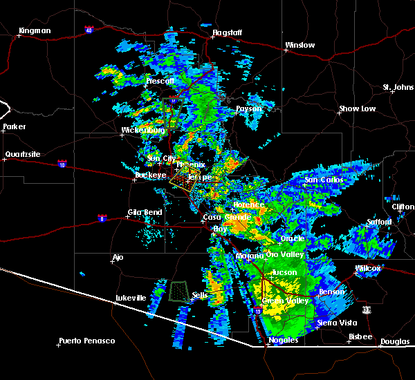 At 745 pm mst, doppler radar indicated a severe thunderstorm capable of producing damaging winds in excess of 60 mph. this storm was located near salt river tubing recreation area, or 7 miles north of apache junction, and moving southwest at 30 mph. At 745 pm mst, doppler radar indicated a severe thunderstorm capable of producing damaging winds in excess of 60 mph. this storm was located near salt river tubing recreation area, or 7 miles north of apache junction, and moving southwest at 30 mph.
|
| 9/12/2015 5:52 PM MST |
 At 551 pm mst, doppler radar indicated a severe thunderstorm capable of producing damaging winds in excess of 60 mph. this storm was located near san tan mountain park, or 11 miles southeast of sun lakes, and moving southwest. small hail may also accompany the damaging winds. At 551 pm mst, doppler radar indicated a severe thunderstorm capable of producing damaging winds in excess of 60 mph. this storm was located near san tan mountain park, or 11 miles southeast of sun lakes, and moving southwest. small hail may also accompany the damaging winds.
|
| 8/31/2015 8:35 PM MST |
 At 835 pm mst, doppler radar indicated a line of severe thunderstorms capable of producing damaging winds in excess of 60 mph. these storms were located along a line extending from near salt river tubing recreation area to near queen creek to near san tan mountain park, moving southeast at 25 mph. locations impacted include, mesa, chandler, scottsdale, gilbert, tempe, apache junction, fountain hills, sun lakes, east mesa, queen creek, seville, san tan mountain park, mesa riverview mall, gilbert city hall, tempe marketplace, freestone park, usery mountain park, superstition springs mall, san tan village mall and downtown mesa. At 835 pm mst, doppler radar indicated a line of severe thunderstorms capable of producing damaging winds in excess of 60 mph. these storms were located along a line extending from near salt river tubing recreation area to near queen creek to near san tan mountain park, moving southeast at 25 mph. locations impacted include, mesa, chandler, scottsdale, gilbert, tempe, apache junction, fountain hills, sun lakes, east mesa, queen creek, seville, san tan mountain park, mesa riverview mall, gilbert city hall, tempe marketplace, freestone park, usery mountain park, superstition springs mall, san tan village mall and downtown mesa.
|
| 8/31/2015 8:17 PM MST |
 At 816 pm mst, doppler radar indicated a line of severe thunderstorms capable of producing damaging winds in excess of 60 mph. these storms were located along a line extending from near falcon field airport to phoenix mesa gateway airport to near olberg, and moving southeast at 35 mph. At 816 pm mst, doppler radar indicated a line of severe thunderstorms capable of producing damaging winds in excess of 60 mph. these storms were located along a line extending from near falcon field airport to phoenix mesa gateway airport to near olberg, and moving southeast at 35 mph.
|
| 8/29/2015 9:09 PM MST |
 The severe thunderstorm warning for central maricopa and central pinal counties will expire at 915 pm mst, the storm which prompted the warning has weakened below severe limits, and no longer poses an immediate threat to life or property. therefore the warning will be allowed to expire. however heavy rain is still possible with this thunderstorm. The severe thunderstorm warning for central maricopa and central pinal counties will expire at 915 pm mst, the storm which prompted the warning has weakened below severe limits, and no longer poses an immediate threat to life or property. therefore the warning will be allowed to expire. however heavy rain is still possible with this thunderstorm.
|
| 8/29/2015 8:49 PM MST |
 At 847 pm mst, doppler radar continued to indicate severe thunderstorms capable of producing damaging winds in excess of 60 mph, small hail, and very heavy rain. these storms were nearly stationary. locations impacted include, gilbert, east mesa, queen creek, san tan valley, sacaton. At 847 pm mst, doppler radar continued to indicate severe thunderstorms capable of producing damaging winds in excess of 60 mph, small hail, and very heavy rain. these storms were nearly stationary. locations impacted include, gilbert, east mesa, queen creek, san tan valley, sacaton.
|
| 8/29/2015 8:36 PM MST |
 At 834 pm mst, doppler radar indicated a severe thunderstorm capable of producing damaging winds in excess of 60 mph. this storm was centered over south of gilbert. another storm was centered over san tan valley. both are nearly stationary. penny size hail may also accompany the damaging winds. At 834 pm mst, doppler radar indicated a severe thunderstorm capable of producing damaging winds in excess of 60 mph. this storm was centered over south of gilbert. another storm was centered over san tan valley. both are nearly stationary. penny size hail may also accompany the damaging winds.
|
| 8/29/2015 7:54 PM MST |
 At 752 pm mst, doppler radar continued to indicate a severe thunderstorm capable of producing damaging winds in excess of 60 mph over gilbert. this storm was nearly stationary. locations impacted include, gilbert, east mesa, freestone park, superstition springs mall, san tan village mall, mesa gateway airport. At 752 pm mst, doppler radar continued to indicate a severe thunderstorm capable of producing damaging winds in excess of 60 mph over gilbert. this storm was nearly stationary. locations impacted include, gilbert, east mesa, freestone park, superstition springs mall, san tan village mall, mesa gateway airport.
|
| 8/29/2015 7:27 PM MST |
 At 725 pm mst, doppler radar indicated a severe thunderstorm capable of producing damaging winds in excess of 60 mph. this storm was located over gilbert. this storm was nearly stationary. small hail may also accompany the damaging winds. At 725 pm mst, doppler radar indicated a severe thunderstorm capable of producing damaging winds in excess of 60 mph. this storm was located over gilbert. this storm was nearly stationary. small hail may also accompany the damaging winds.
|
| 8/11/2015 9:41 PM MST |
 At 940 pm mst, doppler radar indicated severe thunderstorms with a broad outflow boundary of 40 to 60 mph winds moving across the phoenix area from the south. damaging winds are possible along with torrential rainfall. At 940 pm mst, doppler radar indicated severe thunderstorms with a broad outflow boundary of 40 to 60 mph winds moving across the phoenix area from the south. damaging winds are possible along with torrential rainfall.
|
| 8/11/2015 9:30 PM MST |
 At 926 pm mst, fast moving severe thunderstorms were moving northwest across tempe and chandler after producing damaging 50 to 60 mph winds in mesa, queen creek, and gilbert. thunderstorms are forecast to move through downtown phoenix, scottsdale, and surrounding communities. the severe thunderstorm warning is posted until 945 pm. locations impacted include, phoenix, mesa, chandler, scottsdale, gilbert, tempe, apache junction, fountain hills, paradise valley, laveen, sun lakes, east mesa, queen creek, goldfield ranch, bapchule, mesa riverview mall, gilbert city hall, camelback mountain, downtown mesa and arizona state university. At 926 pm mst, fast moving severe thunderstorms were moving northwest across tempe and chandler after producing damaging 50 to 60 mph winds in mesa, queen creek, and gilbert. thunderstorms are forecast to move through downtown phoenix, scottsdale, and surrounding communities. the severe thunderstorm warning is posted until 945 pm. locations impacted include, phoenix, mesa, chandler, scottsdale, gilbert, tempe, apache junction, fountain hills, paradise valley, laveen, sun lakes, east mesa, queen creek, goldfield ranch, bapchule, mesa riverview mall, gilbert city hall, camelback mountain, downtown mesa and arizona state university.
|
| 8/11/2015 9:06 PM MST | Palm tree uprooted near rittenhouse road and ocotillo road. visibilitiy down to one quarter mile in blowing dus in maricopa county AZ, 2.5 miles W of Queen Creek, AZ |
| 8/11/2015 9:01 PM MST |
 At 900 pm mst, doppler radar indicated severe thunderstorms capable of producing damaging winds in excess of 60 mph. thunderstorms will move across a large portion of the phoenix east valley, then into central phoenix between 9 and 945 pm. At 900 pm mst, doppler radar indicated severe thunderstorms capable of producing damaging winds in excess of 60 mph. thunderstorms will move across a large portion of the phoenix east valley, then into central phoenix between 9 and 945 pm.
|
| 8/11/2015 8:43 PM MST |
 At 843 pm mst, doppler radar indicated a severe thunderstorm capable of producing damaging winds in excess of 60 mph. this storm was located near coolidge, and moving north at 25 mph. torrential rainfall is also expected. At 843 pm mst, doppler radar indicated a severe thunderstorm capable of producing damaging winds in excess of 60 mph. this storm was located near coolidge, and moving north at 25 mph. torrential rainfall is also expected.
|
| 8/11/2015 9:33 AM MST |
 At 931 am mst, doppler radar indicated a severe thunderstorm capable of producing damaging winds in excess of 60 mph. this storm was located over gilbert, moving northwest at 35 mph. locations impacted include, mesa, chandler, gilbert, apache junction, sun lakes, east mesa, queen creek, san tan mountain park, seville, san tan valley, superstition springs mall, san tan village mall, downtown mesa, fiesta mall, falcon field airport, chandler fashion center mall. At 931 am mst, doppler radar indicated a severe thunderstorm capable of producing damaging winds in excess of 60 mph. this storm was located over gilbert, moving northwest at 35 mph. locations impacted include, mesa, chandler, gilbert, apache junction, sun lakes, east mesa, queen creek, san tan mountain park, seville, san tan valley, superstition springs mall, san tan village mall, downtown mesa, fiesta mall, falcon field airport, chandler fashion center mall.
|
| 8/11/2015 9:09 AM MST |
 At 908 am mst, doppler radar indicated a severe thunderstorm capable of producing damaging winds in excess of 60 mph. this storm was located near queen creek, or 10 miles south of apache junction, and moving northwest at 35 mph. At 908 am mst, doppler radar indicated a severe thunderstorm capable of producing damaging winds in excess of 60 mph. this storm was located near queen creek, or 10 miles south of apache junction, and moving northwest at 35 mph.
|
| 7/12/2013 1:00 PM MST | *** 1 inj *** 6-7 ft high steel wall blown over on top of an individual by 60 plus mph est thunderstorm winds in maricopa county AZ, 1.6 miles WSW of Queen Creek, AZ |
Hail Maps for Queen Creek, AZ


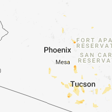


Connect with Interactive Hail Maps