

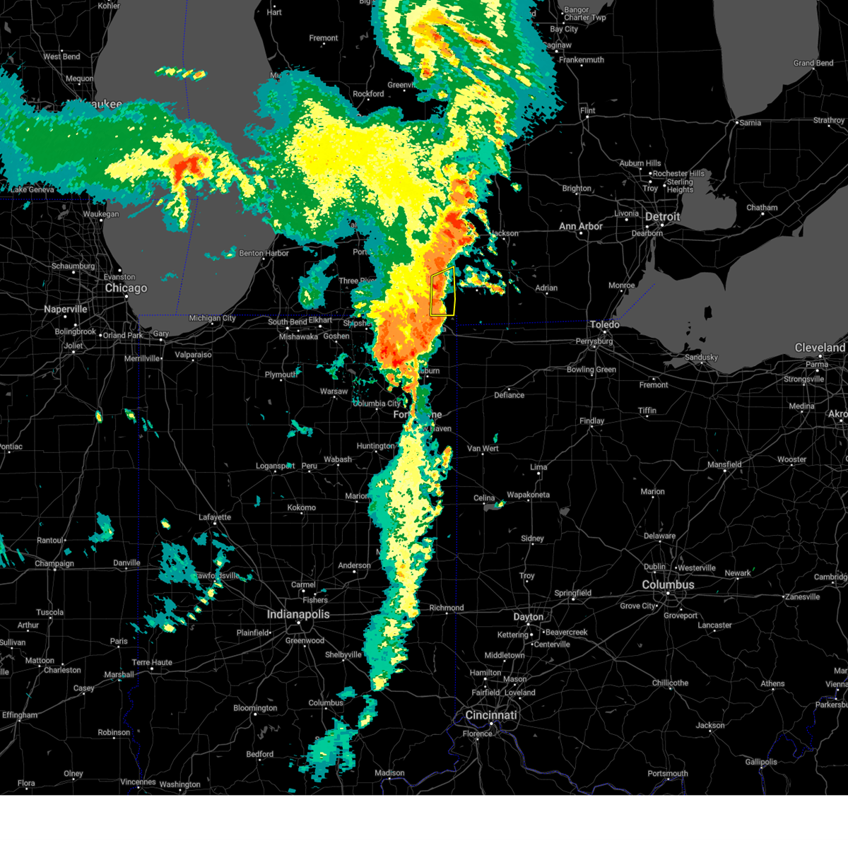
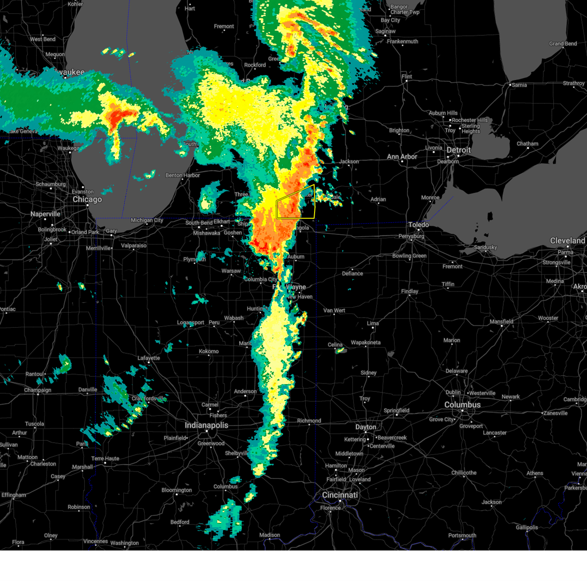
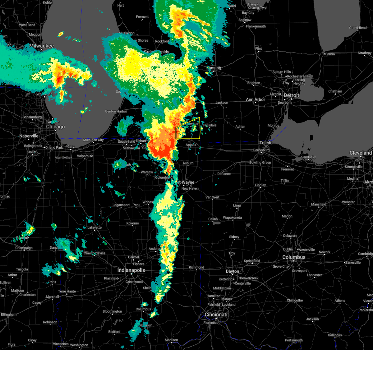
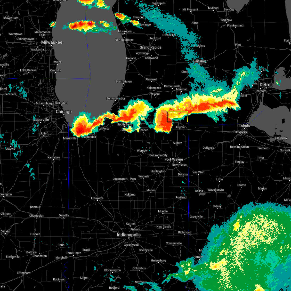
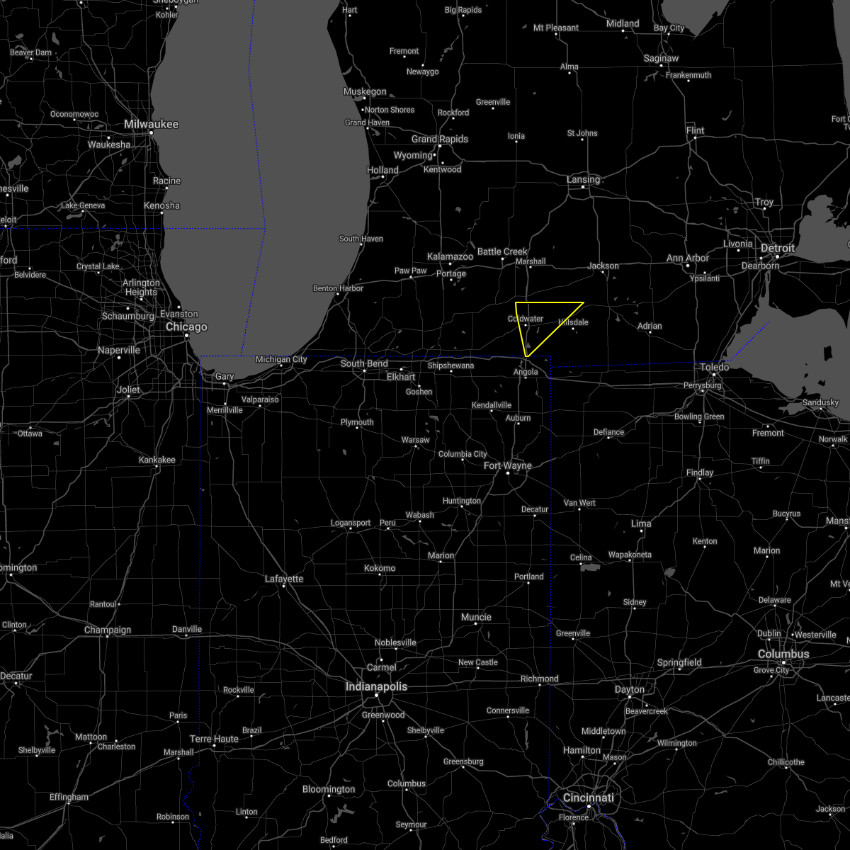
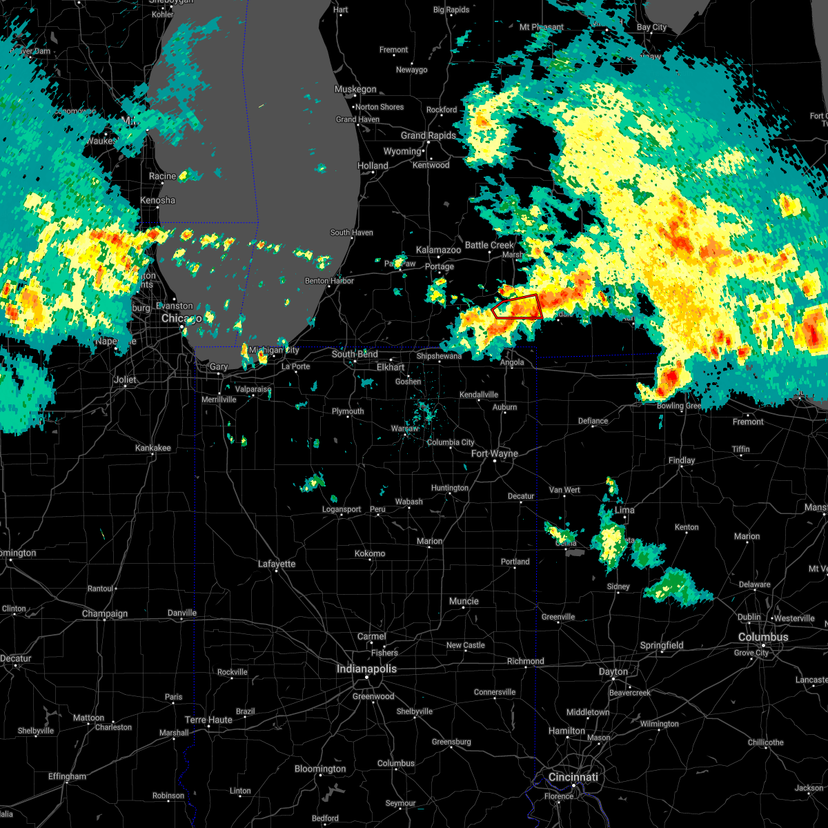
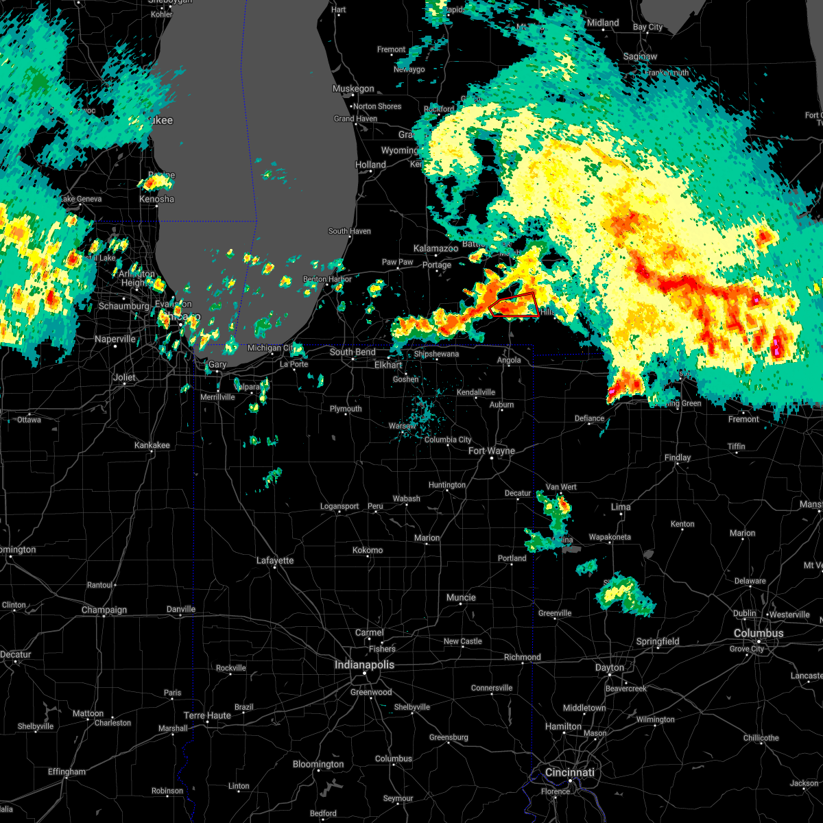
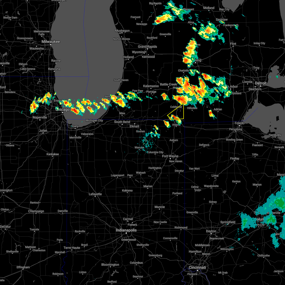
Hail Map for Quincy, MI
The Quincy, MI area has had 2 reports of on-the-ground hail by trained spotters, and has been under severe weather warnings 15 times during the past 12 months. Doppler radar has detected hail at or near Quincy, MI on 25 occasions, including 1 occasion during the past year.
| Name: | Quincy, MI |
| Where Located: | 60.7 miles N of Fort Wayne, IN |
| Map: | Google Map for Quincy, MI |
| Population: | 1652 |
| Housing Units: | 743 |
| More Info: | Search Google for Quincy, MI |
0
The Top Recent Hail Date for Quincy, MI is Wednesday, September 6, 2023 (23rd out of 25)

Hail and Wind Damage Spotted near Quincy, MI
| Date / Time | Report Details |
|---|---|
| 7/26/2023 7:26 PM EDT |
 The severe thunderstorm warning for northwestern steuben, southeastern st. joseph and southern branch counties will expire at 730 pm edt, the storm which prompted the warning has weakened below severe limits, and no longer poses an immediate threat to life or property. therefore, the warning will be allowed to expire. however, heavy rain is still possible with this thunderstorm. a severe thunderstorm watch remains in effect until 1000 pm edt for northeastern indiana. The severe thunderstorm warning for northwestern steuben, southeastern st. joseph and southern branch counties will expire at 730 pm edt, the storm which prompted the warning has weakened below severe limits, and no longer poses an immediate threat to life or property. therefore, the warning will be allowed to expire. however, heavy rain is still possible with this thunderstorm. a severe thunderstorm watch remains in effect until 1000 pm edt for northeastern indiana.
|
| 7/26/2023 7:01 PM EDT |
 At 701 pm edt, a severe thunderstorm was located near bronson, or near sturgis, moving east at 45 mph (radar indicated). Hazards include 60 mph wind gusts. Expect damage to roofs, siding, and trees. this severe storm will be near, bronson around 705 pm edt. other locations impacted by this severe thunderstorm include east gilead, nevada mills, burr oak, california, fawn river, kinderhook, batavia, findley, matteson lake, and marble lake. this includes the following highways, interstate 69 in indiana between mile markers 355 and 357. interstate 69 in michigan between mile markers 1 and 13. interstate 80 in indiana between mile markers 133 and 149. hail threat, radar indicated max hail size, <. 75 in wind threat, radar indicated max wind gust, 60 mph. At 701 pm edt, a severe thunderstorm was located near bronson, or near sturgis, moving east at 45 mph (radar indicated). Hazards include 60 mph wind gusts. Expect damage to roofs, siding, and trees. this severe storm will be near, bronson around 705 pm edt. other locations impacted by this severe thunderstorm include east gilead, nevada mills, burr oak, california, fawn river, kinderhook, batavia, findley, matteson lake, and marble lake. this includes the following highways, interstate 69 in indiana between mile markers 355 and 357. interstate 69 in michigan between mile markers 1 and 13. interstate 80 in indiana between mile markers 133 and 149. hail threat, radar indicated max hail size, <. 75 in wind threat, radar indicated max wind gust, 60 mph.
|
| 7/26/2023 6:45 PM EDT |
 At 645 pm edt, a severe thunderstorm was located near centreville, or 7 miles northwest of sturgis, moving east at 45 mph (radar indicated). Hazards include 60 mph wind gusts and penny size hail. Expect damage to roofs, siding, and trees. this severe thunderstorm will be near, sturgis around 650 pm edt. bronson around 705 pm edt. Other locations impacted by this severe thunderstorm include nottawa, east gilead, nevada mills, burr oak, klinger lake, california, fairfax, fawn river, kinderhook, and batavia. At 645 pm edt, a severe thunderstorm was located near centreville, or 7 miles northwest of sturgis, moving east at 45 mph (radar indicated). Hazards include 60 mph wind gusts and penny size hail. Expect damage to roofs, siding, and trees. this severe thunderstorm will be near, sturgis around 650 pm edt. bronson around 705 pm edt. Other locations impacted by this severe thunderstorm include nottawa, east gilead, nevada mills, burr oak, klinger lake, california, fairfax, fawn river, kinderhook, and batavia.
|
| 7/26/2023 6:18 PM EDT |
 At 617 pm edt, a severe thunderstorm was located near union city, or 9 miles west of coldwater, moving east at 55 mph. storm spotters reported 70 mph winds and tree damage in colon michigan at 611 pm edt (trained spotters). Hazards include 70 mph wind gusts. Expect considerable tree damage. damage is likely to mobile homes, roofs, and outbuildings. this severe storm will be near, coldwater around 620 pm edt. quincy around 630 pm edt. other locations impacted by this severe thunderstorm include nottawa, girard, burr oak, allen, sherwood, fairfax, leonidas, batavia, south butler, and wasepi. This includes interstate 69 in michigan between mile markers 6 and 21. At 617 pm edt, a severe thunderstorm was located near union city, or 9 miles west of coldwater, moving east at 55 mph. storm spotters reported 70 mph winds and tree damage in colon michigan at 611 pm edt (trained spotters). Hazards include 70 mph wind gusts. Expect considerable tree damage. damage is likely to mobile homes, roofs, and outbuildings. this severe storm will be near, coldwater around 620 pm edt. quincy around 630 pm edt. other locations impacted by this severe thunderstorm include nottawa, girard, burr oak, allen, sherwood, fairfax, leonidas, batavia, south butler, and wasepi. This includes interstate 69 in michigan between mile markers 6 and 21.
|
| 7/26/2023 6:11 PM EDT |
 At 611 pm edt, a severe thunderstorm was located near colon, or 14 miles northeast of sturgis, moving east at 55 mph (radar indicated). Hazards include 60 mph wind gusts. Expect damage to roofs, siding, and trees. this severe thunderstorm will be near, coldwater around 620 pm edt. quincy around 630 pm edt. Other locations impacted by this severe thunderstorm include nottawa, girard, burr oak, allen, sherwood, fairfax, leonidas, batavia, south butler, and wasepi. At 611 pm edt, a severe thunderstorm was located near colon, or 14 miles northeast of sturgis, moving east at 55 mph (radar indicated). Hazards include 60 mph wind gusts. Expect damage to roofs, siding, and trees. this severe thunderstorm will be near, coldwater around 620 pm edt. quincy around 630 pm edt. Other locations impacted by this severe thunderstorm include nottawa, girard, burr oak, allen, sherwood, fairfax, leonidas, batavia, south butler, and wasepi.
|
| 7/26/2023 2:02 PM EDT |
 At 202 pm edt, a severe thunderstorm was located near reading, or 9 miles southeast of coldwater, moving east at 50 mph (radar indicated). Hazards include 60 mph wind gusts and penny size hail. Expect damage to roofs, siding, and trees. locations impacted include, coldwater, quincy, ray, kinderhook, california, south butler, marble lake, and coldwater lake. this includes interstate 69 in michigan between mile markers 1 and 18. hail threat, radar indicated max hail size, 0. 75 in wind threat, radar indicated max wind gust, 60 mph. At 202 pm edt, a severe thunderstorm was located near reading, or 9 miles southeast of coldwater, moving east at 50 mph (radar indicated). Hazards include 60 mph wind gusts and penny size hail. Expect damage to roofs, siding, and trees. locations impacted include, coldwater, quincy, ray, kinderhook, california, south butler, marble lake, and coldwater lake. this includes interstate 69 in michigan between mile markers 1 and 18. hail threat, radar indicated max hail size, 0. 75 in wind threat, radar indicated max wind gust, 60 mph.
|
| 7/26/2023 1:48 PM EDT |
 At 148 pm edt, a severe thunderstorm was located near coldwater, moving east at 55 mph (radar indicated). Hazards include 60 mph wind gusts and penny size hail. Expect damage to roofs, siding, and trees. locations impacted include, coldwater, bronson, quincy, ray, kinderhook, batavia, california, gilead, east gilead, south butler, matteson lake, marble lake, lake of the woods, and coldwater lake. this includes interstate 69 in michigan between mile markers 1 and 18. hail threat, radar indicated max hail size, 0. 75 in wind threat, radar indicated max wind gust, 60 mph. At 148 pm edt, a severe thunderstorm was located near coldwater, moving east at 55 mph (radar indicated). Hazards include 60 mph wind gusts and penny size hail. Expect damage to roofs, siding, and trees. locations impacted include, coldwater, bronson, quincy, ray, kinderhook, batavia, california, gilead, east gilead, south butler, matteson lake, marble lake, lake of the woods, and coldwater lake. this includes interstate 69 in michigan between mile markers 1 and 18. hail threat, radar indicated max hail size, 0. 75 in wind threat, radar indicated max wind gust, 60 mph.
|
| 7/26/2023 1:38 PM EDT |
 At 137 pm edt, a severe thunderstorm was located over bronson, or 11 miles southwest of coldwater, moving east at 55 mph (radar indicated). Hazards include 60 mph wind gusts and penny size hail. Expect damage to roofs, siding, and trees. this severe thunderstorm will remain over mainly rural areas of branch county, including the following locations, kinderhook, batavia, south butler, east gilead, matteson lake, marble lake, lake of the woods, california, gilead, and coldwater lake. hail threat, radar indicated max hail size, 0. 75 in wind threat, radar indicated max wind gust, 60 mph. At 137 pm edt, a severe thunderstorm was located over bronson, or 11 miles southwest of coldwater, moving east at 55 mph (radar indicated). Hazards include 60 mph wind gusts and penny size hail. Expect damage to roofs, siding, and trees. this severe thunderstorm will remain over mainly rural areas of branch county, including the following locations, kinderhook, batavia, south butler, east gilead, matteson lake, marble lake, lake of the woods, california, gilead, and coldwater lake. hail threat, radar indicated max hail size, 0. 75 in wind threat, radar indicated max wind gust, 60 mph.
|
| 7/20/2023 3:29 PM EDT |
 At 328 pm edt, a severe thunderstorm was located over quincy, or near coldwater, moving east at 45 mph (radar indicated). Hazards include 60 mph wind gusts and quarter size hail. Hail damage to vehicles is expected. expect wind damage to roofs, siding, and trees. locations impacted include, coldwater, hillsdale, jonesville, quincy, litchfield, jerome, somerset, pittsford, moscow, north adams, bear lake, allen, lake wilson, shadyside, osseo, south butler, and somerset center. this includes interstate 69 in michigan between mile markers 13 and 16. hail threat, radar indicated max hail size, 1. 00 in wind threat, radar indicated max wind gust, 60 mph. At 328 pm edt, a severe thunderstorm was located over quincy, or near coldwater, moving east at 45 mph (radar indicated). Hazards include 60 mph wind gusts and quarter size hail. Hail damage to vehicles is expected. expect wind damage to roofs, siding, and trees. locations impacted include, coldwater, hillsdale, jonesville, quincy, litchfield, jerome, somerset, pittsford, moscow, north adams, bear lake, allen, lake wilson, shadyside, osseo, south butler, and somerset center. this includes interstate 69 in michigan between mile markers 13 and 16. hail threat, radar indicated max hail size, 1. 00 in wind threat, radar indicated max wind gust, 60 mph.
|
| 7/20/2023 3:14 PM EDT |
 At 313 pm edt, a severe thunderstorm was located near union city, or near coldwater, moving east at 45 mph (radar indicated). Hazards include two inch hail and 60 mph wind gusts. People and animals outdoors will be injured. expect hail damage to roofs, siding, windows, and vehicles. Expect wind damage to roofs, siding, and trees. At 313 pm edt, a severe thunderstorm was located near union city, or near coldwater, moving east at 45 mph (radar indicated). Hazards include two inch hail and 60 mph wind gusts. People and animals outdoors will be injured. expect hail damage to roofs, siding, windows, and vehicles. Expect wind damage to roofs, siding, and trees.
|
| 7/20/2023 3:13 PM EDT |
 At 312 pm edt, a severe thunderstorm was located near union city, or 7 miles northwest of coldwater, moving east at 45 mph (radar indicated). Hazards include two inch hail and 60 mph wind gusts. People and animals outdoors will be injured. expect hail damage to roofs, siding, windows, and vehicles. Expect wind damage to roofs, siding, and trees. At 312 pm edt, a severe thunderstorm was located near union city, or 7 miles northwest of coldwater, moving east at 45 mph (radar indicated). Hazards include two inch hail and 60 mph wind gusts. People and animals outdoors will be injured. expect hail damage to roofs, siding, windows, and vehicles. Expect wind damage to roofs, siding, and trees.
|
| 7/12/2023 11:40 PM EDT |
 At 1139 pm edt, a severe thunderstorm capable of producing a tornado was located near coldwater, moving east at 50 mph (radar indicated rotation). Hazards include tornado. Flying debris will be dangerous to those caught without shelter. mobile homes will be damaged or destroyed. damage to roofs, windows, and vehicles will occur. tree damage is likely. this dangerous storm will be near, quincy around 1150 pm edt. reading around 1200 am edt. hillsdale and jonesville around 1205 am edt. other locations impacted by this tornadic thunderstorm include batavia, lake wilson, long lake, marble lake, lake of the woods, allen and bear lake. This includes interstate 69 in michigan between mile markers 6 and 14. At 1139 pm edt, a severe thunderstorm capable of producing a tornado was located near coldwater, moving east at 50 mph (radar indicated rotation). Hazards include tornado. Flying debris will be dangerous to those caught without shelter. mobile homes will be damaged or destroyed. damage to roofs, windows, and vehicles will occur. tree damage is likely. this dangerous storm will be near, quincy around 1150 pm edt. reading around 1200 am edt. hillsdale and jonesville around 1205 am edt. other locations impacted by this tornadic thunderstorm include batavia, lake wilson, long lake, marble lake, lake of the woods, allen and bear lake. This includes interstate 69 in michigan between mile markers 6 and 14.
|
| 8/29/2022 4:42 PM EDT |
 At 441 pm edt, severe thunderstorms were located along a line extending from near quincy to 6 miles west of hamilton, moving east at 55 mph (radar indicated). Hazards include 60 mph wind gusts. expect damage to roofs, siding, and trees At 441 pm edt, severe thunderstorms were located along a line extending from near quincy to 6 miles west of hamilton, moving east at 55 mph (radar indicated). Hazards include 60 mph wind gusts. expect damage to roofs, siding, and trees
|
| 8/29/2022 4:27 PM EDT |
 At 427 pm edt, severe thunderstorms were located along a line extending from near union city to near rome city, moving east at 60 mph (radar indicated). Hazards include 60 mph wind gusts. Expect damage to roofs, siding, and trees. locations impacted include, sturgis, coldwater, kendallville, angola, lagrange, bronson, fremont, quincy, union city, hamilton, rome city, colon, topeka, ray, girard, kinderhook, fawn river, batavia, leonidas and california. this includes the following highways, interstate 69 in indiana between mile markers 335 and 357. interstate 69 in michigan between mile markers 1 and 21. interstate 80 in indiana between mile markers 119 and 156. interstate 80 in ohio near mile marker 0. hail threat, radar indicated max hail size, <. 75 in wind threat, radar indicated max wind gust, 60 mph. At 427 pm edt, severe thunderstorms were located along a line extending from near union city to near rome city, moving east at 60 mph (radar indicated). Hazards include 60 mph wind gusts. Expect damage to roofs, siding, and trees. locations impacted include, sturgis, coldwater, kendallville, angola, lagrange, bronson, fremont, quincy, union city, hamilton, rome city, colon, topeka, ray, girard, kinderhook, fawn river, batavia, leonidas and california. this includes the following highways, interstate 69 in indiana between mile markers 335 and 357. interstate 69 in michigan between mile markers 1 and 21. interstate 80 in indiana between mile markers 119 and 156. interstate 80 in ohio near mile marker 0. hail threat, radar indicated max hail size, <. 75 in wind threat, radar indicated max wind gust, 60 mph.
|
| 8/29/2022 4:07 PM EDT |
 At 407 pm edt, severe thunderstorms were located along a line extending from 6 miles north of centreville to millersburg, moving east at 55 mph (radar indicated). Hazards include 60 mph wind gusts. expect damage to roofs, siding, and trees At 407 pm edt, severe thunderstorms were located along a line extending from 6 miles north of centreville to millersburg, moving east at 55 mph (radar indicated). Hazards include 60 mph wind gusts. expect damage to roofs, siding, and trees
|
| 8/3/2022 5:39 PM EDT |
 At 539 pm edt, severe thunderstorms were located along a line extending from near union city to near sturgis, moving east at 35 mph (radar indicated). Hazards include 60 mph wind gusts. Expect damage to roofs, siding, and trees. locations impacted include, sturgis, coldwater, bronson, constantine, quincy, union city, white pigeon, centreville, colon, nottawa, girard, fawn river, batavia, leonidas, mendon, burr oak, gilead, sherwood, klinger lake and matteson lake. this includes interstate 69 in michigan between mile markers 5 and 21. hail threat, radar indicated max hail size, <. 75 in wind threat, radar indicated max wind gust, 60 mph. At 539 pm edt, severe thunderstorms were located along a line extending from near union city to near sturgis, moving east at 35 mph (radar indicated). Hazards include 60 mph wind gusts. Expect damage to roofs, siding, and trees. locations impacted include, sturgis, coldwater, bronson, constantine, quincy, union city, white pigeon, centreville, colon, nottawa, girard, fawn river, batavia, leonidas, mendon, burr oak, gilead, sherwood, klinger lake and matteson lake. this includes interstate 69 in michigan between mile markers 5 and 21. hail threat, radar indicated max hail size, <. 75 in wind threat, radar indicated max wind gust, 60 mph.
|
| 8/3/2022 5:09 PM EDT |
 At 509 pm edt, severe thunderstorms were located along a line extending from near vicksburg to bristol, moving east at 45 mph (radar indicated). Hazards include 60 mph wind gusts. expect damage to roofs, siding, and trees At 509 pm edt, severe thunderstorms were located along a line extending from near vicksburg to bristol, moving east at 45 mph (radar indicated). Hazards include 60 mph wind gusts. expect damage to roofs, siding, and trees
|
| 6/13/2022 8:56 PM EDT |
 At 856 pm edt, a severe thunderstorm was located near bronson, or 11 miles northwest of angola, moving east at 45 mph (radar indicated). Hazards include 60 mph wind gusts and quarter size hail. Hail damage to vehicles is expected. Expect wind damage to roofs, siding, and trees. At 856 pm edt, a severe thunderstorm was located near bronson, or 11 miles northwest of angola, moving east at 45 mph (radar indicated). Hazards include 60 mph wind gusts and quarter size hail. Hail damage to vehicles is expected. Expect wind damage to roofs, siding, and trees.
|
| 8/12/2021 6:42 AM EDT |
 The severe thunderstorm warning for northeastern steuben, eastern branch and hillsdale counties will expire at 645 am edt, the storms which prompted the warning have moved out of the area. therefore, the warning will be allowed to expire. however gusty winds are still possible with these thunderstorms through 7 am edt. The severe thunderstorm warning for northeastern steuben, eastern branch and hillsdale counties will expire at 645 am edt, the storms which prompted the warning have moved out of the area. therefore, the warning will be allowed to expire. however gusty winds are still possible with these thunderstorms through 7 am edt.
|
| 8/12/2021 6:12 AM EDT |
 At 612 am edt, severe thunderstorms were located along a line extending from near litchfield to near fremont, moving northeast at 60 mph (radar indicated). Hazards include 60 mph wind gusts. Expect damage to roofs, siding, and trees. severe thunderstorms will be near, litchfield around 615 am edt. jonesville around 620 am edt. hillsdale around 625 am edt. hail threat, radar indicated max hail size, <. 75 in wind threat, radar indicated max wind gust, 60 mph. At 612 am edt, severe thunderstorms were located along a line extending from near litchfield to near fremont, moving northeast at 60 mph (radar indicated). Hazards include 60 mph wind gusts. Expect damage to roofs, siding, and trees. severe thunderstorms will be near, litchfield around 615 am edt. jonesville around 620 am edt. hillsdale around 625 am edt. hail threat, radar indicated max hail size, <. 75 in wind threat, radar indicated max wind gust, 60 mph.
|
| 8/12/2021 5:52 AM EDT |
 At 552 am edt, severe thunderstorms were located along a line extending from centreville to bronson, moving northeast at 45 mph (radar indicated). Hazards include 60 mph wind gusts. Expect damage to roofs, siding, and trees. severe thunderstorms will be near, bronson around 555 am edt. coldwater around 605 am edt. other locations in the path of these severe thunderstorms include quincy, union city and litchfield. this includes interstate 69 in michigan between mile markers 11 and 21. hail threat, radar indicated max hail size, <. 75 in wind threat, radar indicated max wind gust, 60 mph. At 552 am edt, severe thunderstorms were located along a line extending from centreville to bronson, moving northeast at 45 mph (radar indicated). Hazards include 60 mph wind gusts. Expect damage to roofs, siding, and trees. severe thunderstorms will be near, bronson around 555 am edt. coldwater around 605 am edt. other locations in the path of these severe thunderstorms include quincy, union city and litchfield. this includes interstate 69 in michigan between mile markers 11 and 21. hail threat, radar indicated max hail size, <. 75 in wind threat, radar indicated max wind gust, 60 mph.
|
| 8/11/2021 2:24 PM EDT |
 At 224 pm edt, severe thunderstorms were located along a line extending from near litchfield to 8 miles north of pioneer to near bryan, moving east at 45 mph (radar indicated). Hazards include 60 mph wind gusts and penny size hail. Expect damage to roofs, siding, and trees. locations impacted include, napoleon, bryan, hillsdale, wauseon, archbold, montpelier, butler, jonesville, waterloo, edgerton, west unity, hamilton, pioneer, litchfield, stryker, fayette, reading, edon, holiday city and edgerton in williams county. this includes the following highways, interstate 80 in indiana between mile markers 150 and 156. interstate 80 in ohio between mile markers 0 and 36. hail threat, radar indicated max hail size, 0. 75 in wind threat, radar indicated max wind gust, 60 mph. At 224 pm edt, severe thunderstorms were located along a line extending from near litchfield to 8 miles north of pioneer to near bryan, moving east at 45 mph (radar indicated). Hazards include 60 mph wind gusts and penny size hail. Expect damage to roofs, siding, and trees. locations impacted include, napoleon, bryan, hillsdale, wauseon, archbold, montpelier, butler, jonesville, waterloo, edgerton, west unity, hamilton, pioneer, litchfield, stryker, fayette, reading, edon, holiday city and edgerton in williams county. this includes the following highways, interstate 80 in indiana between mile markers 150 and 156. interstate 80 in ohio between mile markers 0 and 36. hail threat, radar indicated max hail size, 0. 75 in wind threat, radar indicated max wind gust, 60 mph.
|
| 8/11/2021 2:02 PM EDT |
 At 202 pm edt, severe thunderstorms were located along a line extending from near burlington to near reading to butler, moving east at 45 mph (radar indicated). Hazards include 60 mph wind gusts and penny size hail. expect damage to roofs, siding, and trees At 202 pm edt, severe thunderstorms were located along a line extending from near burlington to near reading to butler, moving east at 45 mph (radar indicated). Hazards include 60 mph wind gusts and penny size hail. expect damage to roofs, siding, and trees
|
| 8/11/2021 1:59 PM EDT |
 At 159 pm edt, severe thunderstorms were located along a line extending from 6 miles southeast of climax to near coldwater to 6 miles northwest of fremont, moving northeast at 50 mph (radar indicated). Hazards include 60 mph wind gusts. Expect damage to roofs, siding, and trees. locations impacted include, coldwater, bronson, fremont, quincy, union city, litchfield, reading, long lake, ray, girard, kinderhook, batavia, california, montgomery, sherwood, allen, east gilead, nevada mills, south butler and marble lake. this includes the following highways, interstate 69 in indiana between mile markers 356 and 357. interstate 69 in michigan between mile markers 1 and 21. interstate 80 in indiana between mile markers 137 and 145. hail threat, radar indicated max hail size, <. 75 in wind threat, radar indicated max wind gust, 60 mph. At 159 pm edt, severe thunderstorms were located along a line extending from 6 miles southeast of climax to near coldwater to 6 miles northwest of fremont, moving northeast at 50 mph (radar indicated). Hazards include 60 mph wind gusts. Expect damage to roofs, siding, and trees. locations impacted include, coldwater, bronson, fremont, quincy, union city, litchfield, reading, long lake, ray, girard, kinderhook, batavia, california, montgomery, sherwood, allen, east gilead, nevada mills, south butler and marble lake. this includes the following highways, interstate 69 in indiana between mile markers 356 and 357. interstate 69 in michigan between mile markers 1 and 21. interstate 80 in indiana between mile markers 137 and 145. hail threat, radar indicated max hail size, <. 75 in wind threat, radar indicated max wind gust, 60 mph.
|
| 8/11/2021 1:39 PM EDT |
 At 139 pm edt, severe thunderstorms were located along a line extending from near vicksburg to near bronson to 7 miles northeast of lagrange, moving northeast at 50 mph (radar indicated). Hazards include 60 mph wind gusts. expect damage to roofs, siding, and trees At 139 pm edt, severe thunderstorms were located along a line extending from near vicksburg to near bronson to 7 miles northeast of lagrange, moving northeast at 50 mph (radar indicated). Hazards include 60 mph wind gusts. expect damage to roofs, siding, and trees
|
| 8/6/2021 8:59 PM EDT |
 At 859 pm edt, severe thunderstorms were located along a line extending from near coldwater to 6 miles north of fremont, moving northeast at 20 mph (radar indicated). Hazards include 60 mph wind gusts. Expect damage to roofs, siding, and trees. locations impacted include, coldwater, jonesville, quincy, litchfield, girard, kinderhook, allen, south butler, marble lake, hodunk and coldwater lake. this includes interstate 69 in michigan between mile markers 1 and 21. hail threat, radar indicated max hail size, <. 75 in wind threat, radar indicated max wind gust, 60 mph. At 859 pm edt, severe thunderstorms were located along a line extending from near coldwater to 6 miles north of fremont, moving northeast at 20 mph (radar indicated). Hazards include 60 mph wind gusts. Expect damage to roofs, siding, and trees. locations impacted include, coldwater, jonesville, quincy, litchfield, girard, kinderhook, allen, south butler, marble lake, hodunk and coldwater lake. this includes interstate 69 in michigan between mile markers 1 and 21. hail threat, radar indicated max hail size, <. 75 in wind threat, radar indicated max wind gust, 60 mph.
|
| 8/6/2021 8:33 PM EDT |
 At 832 pm edt, a severe thunderstorm was located near coldwater, moving northeast at 30 mph (radar indicated). Hazards include 60 mph wind gusts. expect damage to roofs, siding, and trees At 832 pm edt, a severe thunderstorm was located near coldwater, moving northeast at 30 mph (radar indicated). Hazards include 60 mph wind gusts. expect damage to roofs, siding, and trees
|
| 8/6/2021 6:03 PM EDT | Additional information reports of numerous trees down and powerlines down in the marble lake area. extensive damage at two campgrounds and golf course. trees onto conve in branch county MI, 2.2 miles NNW of Quincy, MI |
| 8/6/2021 6:03 PM EDT | Tree and large branches down with extensive damage to fifth wheel traile in branch county MI, 0.9 miles NNW of Quincy, MI |
| 6/20/2021 10:23 PM EDT |
 The severe thunderstorm warning for northern branch and northwestern hillsdale counties will expire at 1030 pm edt, the severe thunderstorm which prompted the warning has weakened and moved out of the warning area. therefore, the warning will be allowed to expire. additional thunderstorms remain possible through midnight edt. a severe thunderstorm watch remains in effect until 100 am edt for southeastern and southwestern michigan. The severe thunderstorm warning for northern branch and northwestern hillsdale counties will expire at 1030 pm edt, the severe thunderstorm which prompted the warning has weakened and moved out of the warning area. therefore, the warning will be allowed to expire. additional thunderstorms remain possible through midnight edt. a severe thunderstorm watch remains in effect until 100 am edt for southeastern and southwestern michigan.
|
| 6/20/2021 10:21 PM EDT |
 The tornado warning for northeastern branch and northwestern hillsdale counties will expire at 1030 pm edt, the storm which prompted the warning has moved out of the area. therefore, the warning will be allowed to expire. however gusty winds and heavy rain are still possible with this thunderstorm. a severe thunderstorm watch remains in effect until 100 am edt for southeastern and southwestern michigan. The tornado warning for northeastern branch and northwestern hillsdale counties will expire at 1030 pm edt, the storm which prompted the warning has moved out of the area. therefore, the warning will be allowed to expire. however gusty winds and heavy rain are still possible with this thunderstorm. a severe thunderstorm watch remains in effect until 100 am edt for southeastern and southwestern michigan.
|
| 6/20/2021 10:15 PM EDT |
 At 1014 pm edt, a severe thunderstorm capable of producing a tornado was located near quincy, or 8 miles east of coldwater, moving east at 35 mph (radar indicated rotation). Hazards include tornado. Flying debris will be dangerous to those caught without shelter. mobile homes will be damaged or destroyed. damage to roofs, windows, and vehicles will occur. tree damage is likely. this dangerous storm will be near, litchfield around 1025 pm edt. Hillsdale and jonesville around 1030 pm edt. At 1014 pm edt, a severe thunderstorm capable of producing a tornado was located near quincy, or 8 miles east of coldwater, moving east at 35 mph (radar indicated rotation). Hazards include tornado. Flying debris will be dangerous to those caught without shelter. mobile homes will be damaged or destroyed. damage to roofs, windows, and vehicles will occur. tree damage is likely. this dangerous storm will be near, litchfield around 1025 pm edt. Hillsdale and jonesville around 1030 pm edt.
|
| 6/20/2021 9:57 PM EDT |
 At 957 pm edt, a confirmed tornado was located over coldwater, moving east at 35 mph (weather spotters confirmed tornado). Hazards include damaging tornado and quarter size hail. Flying debris will be dangerous to those caught without shelter. mobile homes will be damaged or destroyed. damage to roofs, windows, and vehicles will occur. tree damage is likely. the tornado will be near, quincy around 1010 pm edt. This includes interstate 69 in michigan between mile markers 13 and 20. At 957 pm edt, a confirmed tornado was located over coldwater, moving east at 35 mph (weather spotters confirmed tornado). Hazards include damaging tornado and quarter size hail. Flying debris will be dangerous to those caught without shelter. mobile homes will be damaged or destroyed. damage to roofs, windows, and vehicles will occur. tree damage is likely. the tornado will be near, quincy around 1010 pm edt. This includes interstate 69 in michigan between mile markers 13 and 20.
|
| 6/20/2021 9:53 PM EDT |
 At 951 pm edt, a severe thunderstorm was located over coldwater, moving east at 35 mph. another strong thunderstorm was located east of constantine, moving east north east that could also become severe (radar indicated). Hazards include 60 mph wind gusts and quarter size hail. Hail damage to vehicles is expected. expect wind damage to roofs, siding, and trees. Locations impacted include, coldwater, quincy, girard, batavia, sherwood, allen, south butler, matteson lake and hodunk. At 951 pm edt, a severe thunderstorm was located over coldwater, moving east at 35 mph. another strong thunderstorm was located east of constantine, moving east north east that could also become severe (radar indicated). Hazards include 60 mph wind gusts and quarter size hail. Hail damage to vehicles is expected. expect wind damage to roofs, siding, and trees. Locations impacted include, coldwater, quincy, girard, batavia, sherwood, allen, south butler, matteson lake and hodunk.
|
| 6/20/2021 9:38 PM EDT |
 At 937 pm edt, a severe thunderstorm was located near colon, or 11 miles west of coldwater, moving east at 40 mph (radar indicated). Hazards include 60 mph wind gusts and quarter size hail. Hail damage to vehicles is expected. Expect wind damage to roofs, siding, and trees. At 937 pm edt, a severe thunderstorm was located near colon, or 11 miles west of coldwater, moving east at 40 mph (radar indicated). Hazards include 60 mph wind gusts and quarter size hail. Hail damage to vehicles is expected. Expect wind damage to roofs, siding, and trees.
|
| 6/20/2021 8:40 PM EDT |
 At 839 pm edt, severe thunderstorms were located along a line extending from near marshall to 6 miles west of litchfield to near quincy, moving northeast at 50 mph (radar indicated). Hazards include 60 mph wind gusts and penny size hail. Expect damage to roofs, siding, and trees. Locations impacted include, coldwater, quincy, union city, girard, south butler, marble lake and hodunk. At 839 pm edt, severe thunderstorms were located along a line extending from near marshall to 6 miles west of litchfield to near quincy, moving northeast at 50 mph (radar indicated). Hazards include 60 mph wind gusts and penny size hail. Expect damage to roofs, siding, and trees. Locations impacted include, coldwater, quincy, union city, girard, south butler, marble lake and hodunk.
|
| 6/20/2021 8:28 PM EDT |
 At 826 pm edt, severe thunderstorms were located along a line extending from near burlington to near coldwater to near bronson, moving northeast at 50 mph (radar indicated). Hazards include 60 mph wind gusts and penny size hail. Expect damage to roofs, siding, and trees. Locations impacted include, coldwater, quincy, union city, girard, batavia, sherwood, south butler, marble lake, matteson lake, lake of the woods and hodunk. At 826 pm edt, severe thunderstorms were located along a line extending from near burlington to near coldwater to near bronson, moving northeast at 50 mph (radar indicated). Hazards include 60 mph wind gusts and penny size hail. Expect damage to roofs, siding, and trees. Locations impacted include, coldwater, quincy, union city, girard, batavia, sherwood, south butler, marble lake, matteson lake, lake of the woods and hodunk.
|
| 6/20/2021 8:11 PM EDT |
 At 810 pm edt, severe thunderstorms were located along a line extending from 6 miles west of union city to near bronson to 8 miles east of sturgis, moving northeast at 50 mph (fire department reported power lines down in sturgis near 800 pm edt). Hazards include 60 mph wind gusts and penny size hail. expect damage to roofs, siding, and trees At 810 pm edt, severe thunderstorms were located along a line extending from 6 miles west of union city to near bronson to 8 miles east of sturgis, moving northeast at 50 mph (fire department reported power lines down in sturgis near 800 pm edt). Hazards include 60 mph wind gusts and penny size hail. expect damage to roofs, siding, and trees
|
| 6/20/2021 8:05 PM EDT |
 At 803 pm edt, severe thunderstorms were located along a line extending from 9 miles east of vicksburg to near colon to near sturgis, moving northeast at 50 mph (fire department reported power lines down in sturgis near 800 pm edt). Hazards include 60 mph wind gusts and penny size hail. Expect damage to roofs, siding, and trees. Locations impacted include, sturgis, coldwater, bronson, quincy, union city, centreville, colon, ray, nottawa, girard, kinderhook, fawn river, batavia, leonidas, california, mendon, burr oak, gilead, sherwood and fishers lake. At 803 pm edt, severe thunderstorms were located along a line extending from 9 miles east of vicksburg to near colon to near sturgis, moving northeast at 50 mph (fire department reported power lines down in sturgis near 800 pm edt). Hazards include 60 mph wind gusts and penny size hail. Expect damage to roofs, siding, and trees. Locations impacted include, sturgis, coldwater, bronson, quincy, union city, centreville, colon, ray, nottawa, girard, kinderhook, fawn river, batavia, leonidas, california, mendon, burr oak, gilead, sherwood and fishers lake.
|
| 6/20/2021 7:58 PM EDT |
 At 758 pm edt, severe thunderstorms were located along a line extending from 7 miles northwest of colon to near sturgis, moving northeast at 50 mph (radar indicated). Hazards include 60 mph wind gusts and penny size hail. expect damage to roofs, siding, and trees At 758 pm edt, severe thunderstorms were located along a line extending from 7 miles northwest of colon to near sturgis, moving northeast at 50 mph (radar indicated). Hazards include 60 mph wind gusts and penny size hail. expect damage to roofs, siding, and trees
|
| 6/26/2020 10:46 PM EDT |
 At 1046 pm edt, severe thunderstorms were located along a line extending from near litchfield to near coldwater, moving east at 55 mph (radar indicated). Hazards include 70 mph wind gusts. Expect considerable tree damage. damage is likely to mobile homes, roofs, and outbuildings. these severe storms will be near, litchfield around 1050 pm edt. hillsdale and jonesville around 1055 pm edt. reading around 1100 pm edt. Hudson around 1120 pm edt. At 1046 pm edt, severe thunderstorms were located along a line extending from near litchfield to near coldwater, moving east at 55 mph (radar indicated). Hazards include 70 mph wind gusts. Expect considerable tree damage. damage is likely to mobile homes, roofs, and outbuildings. these severe storms will be near, litchfield around 1050 pm edt. hillsdale and jonesville around 1055 pm edt. reading around 1100 pm edt. Hudson around 1120 pm edt.
|
| 6/26/2020 10:26 PM EDT |
 At 1026 pm edt, severe thunderstorms were located along a line extending from union city to near sturgis, moving east at 50 mph (radar indicated). Hazards include 70 mph wind gusts. Expect considerable tree damage. damage is likely to mobile homes, roofs, and outbuildings. severe thunderstorms will be near, union city around 1030 pm edt. coldwater around 1045 pm edt. litchfield around 1050 pm edt. jonesville and quincy around 1055 pm edt. reading around 1100 pm edt. hillsdale around 1105 pm edt. hudson around 1125 pm edt. other locations impacted by these severe thunderstorms include prattville, girard, north adams, lake wilson, waldron, ransom, moscow, kinderhook, shadyside and osseo. This includes interstate 69 in michigan between mile markers 3 and 21. At 1026 pm edt, severe thunderstorms were located along a line extending from union city to near sturgis, moving east at 50 mph (radar indicated). Hazards include 70 mph wind gusts. Expect considerable tree damage. damage is likely to mobile homes, roofs, and outbuildings. severe thunderstorms will be near, union city around 1030 pm edt. coldwater around 1045 pm edt. litchfield around 1050 pm edt. jonesville and quincy around 1055 pm edt. reading around 1100 pm edt. hillsdale around 1105 pm edt. hudson around 1125 pm edt. other locations impacted by these severe thunderstorms include prattville, girard, north adams, lake wilson, waldron, ransom, moscow, kinderhook, shadyside and osseo. This includes interstate 69 in michigan between mile markers 3 and 21.
|
| 6/10/2020 3:16 PM EDT |
 At 315 pm edt, severe thunderstorms were located along a line extending from near reading to near butler, moving northeast at 65 mph. these are very dangerous storms (radar indicated). Hazards include 80 mph wind gusts and quarter size hail. Flying debris will be dangerous to those caught without shelter. mobile homes will be heavily damaged. expect considerable damage to roofs, windows, and vehicles. extensive tree damage and power outages are likely. severe thunderstorms will be near, quincy and reading around 320 pm edt. hillsdale, jonesville and litchfield around 325 pm edt. montpelier around 330 pm edt. pioneer around 335 pm edt. other locations impacted by these severe thunderstorms include york, alvarado, north adams, lake wilson, ransom, pleasant lake, ray, hamilton lake, moscow and lake seneca. this includes the following highways, interstate 69 in indiana between mile markers 331 and 336, and between mile markers 352 and 357. interstate 69 in michigan between mile markers 1 and 2. interstate 80 in indiana between mile markers 144 and 156. Interstate 80 in ohio between mile markers 0 and 12. At 315 pm edt, severe thunderstorms were located along a line extending from near reading to near butler, moving northeast at 65 mph. these are very dangerous storms (radar indicated). Hazards include 80 mph wind gusts and quarter size hail. Flying debris will be dangerous to those caught without shelter. mobile homes will be heavily damaged. expect considerable damage to roofs, windows, and vehicles. extensive tree damage and power outages are likely. severe thunderstorms will be near, quincy and reading around 320 pm edt. hillsdale, jonesville and litchfield around 325 pm edt. montpelier around 330 pm edt. pioneer around 335 pm edt. other locations impacted by these severe thunderstorms include york, alvarado, north adams, lake wilson, ransom, pleasant lake, ray, hamilton lake, moscow and lake seneca. this includes the following highways, interstate 69 in indiana between mile markers 331 and 336, and between mile markers 352 and 357. interstate 69 in michigan between mile markers 1 and 2. interstate 80 in indiana between mile markers 144 and 156. Interstate 80 in ohio between mile markers 0 and 12.
|
| 6/10/2020 2:40 PM EDT | Several trees dow in branch county MI, 8.2 miles S of Quincy, MI |
| 6/10/2020 2:29 PM EDT |
 At 229 pm edt, a severe thunderstorm was located near coldwater, moving northeast at 60 mph (radar indicated). Hazards include 70 mph wind gusts and penny size hail. Expect considerable tree damage. damage is likely to mobile homes, roofs, and outbuildings. this severe thunderstorm will remain over mainly rural areas of northern branch and northwestern hillsdale counties, including the following locations, batavia, south butler, girard, marble lake, hodunk, sherwood and allen. This includes interstate 69 in michigan between mile markers 8 and 21. At 229 pm edt, a severe thunderstorm was located near coldwater, moving northeast at 60 mph (radar indicated). Hazards include 70 mph wind gusts and penny size hail. Expect considerable tree damage. damage is likely to mobile homes, roofs, and outbuildings. this severe thunderstorm will remain over mainly rural areas of northern branch and northwestern hillsdale counties, including the following locations, batavia, south butler, girard, marble lake, hodunk, sherwood and allen. This includes interstate 69 in michigan between mile markers 8 and 21.
|
| 4/7/2020 10:30 PM EDT |
 At 1029 pm edt, a severe thunderstorm was located 7 miles southeast of hillsdale, moving southeast at 40 mph (radar indicated). Hazards include 60 mph wind gusts and half dollar size hail. Hail damage to vehicles is expected. expect wind damage to roofs, siding, and trees. Locations impacted include, hillsdale, hudson, jonesville, quincy, pioneer, litchfield, reading, long lake, jerome, somerset, cambria, girard, pittsford, moscow, ransom, waldron, north adams, bear lake, allen and prattville. At 1029 pm edt, a severe thunderstorm was located 7 miles southeast of hillsdale, moving southeast at 40 mph (radar indicated). Hazards include 60 mph wind gusts and half dollar size hail. Hail damage to vehicles is expected. expect wind damage to roofs, siding, and trees. Locations impacted include, hillsdale, hudson, jonesville, quincy, pioneer, litchfield, reading, long lake, jerome, somerset, cambria, girard, pittsford, moscow, ransom, waldron, north adams, bear lake, allen and prattville.
|
| 4/7/2020 9:57 PM EDT |
 At 957 pm edt, a severe thunderstorm was located near litchfield, or 11 miles northeast of coldwater, moving southeast at 50 mph (radar indicated). Hazards include ping pong ball size hail and 60 mph wind gusts. People and animals outdoors will be injured. expect hail damage to roofs, siding, windows, and vehicles. Expect wind damage to roofs, siding, and trees. At 957 pm edt, a severe thunderstorm was located near litchfield, or 11 miles northeast of coldwater, moving southeast at 50 mph (radar indicated). Hazards include ping pong ball size hail and 60 mph wind gusts. People and animals outdoors will be injured. expect hail damage to roofs, siding, windows, and vehicles. Expect wind damage to roofs, siding, and trees.
|
| 7/20/2019 3:26 AM EDT |
 At 324 am edt, severe thunderstorms were located along a line extending from near grass lake to near colon to near centreville, moving southeast at 55 mph (radar indicated). Hazards include 60 mph wind gusts. Expect damage to roofs, siding, and trees. Locations impacted include, sturgis, coldwater, hillsdale, bronson, jonesville, quincy, union city, centreville, litchfield, colon, long lake, jerome, somerset, nottawa, girard, moscow, batavia, leonidas, mendon and burr oak. At 324 am edt, severe thunderstorms were located along a line extending from near grass lake to near colon to near centreville, moving southeast at 55 mph (radar indicated). Hazards include 60 mph wind gusts. Expect damage to roofs, siding, and trees. Locations impacted include, sturgis, coldwater, hillsdale, bronson, jonesville, quincy, union city, centreville, litchfield, colon, long lake, jerome, somerset, nottawa, girard, moscow, batavia, leonidas, mendon and burr oak.
|
| 7/20/2019 2:56 AM EDT |
 At 255 am edt, severe thunderstorms were located along a line extending from near leslie to near battle creek to near mattawan, moving southeast at 65 mph (radar indicated). Hazards include 60 mph wind gusts. expect damage to roofs, siding, and trees At 255 am edt, severe thunderstorms were located along a line extending from near leslie to near battle creek to near mattawan, moving southeast at 65 mph (radar indicated). Hazards include 60 mph wind gusts. expect damage to roofs, siding, and trees
|
| 7/2/2019 7:21 PM EDT |
 At 720 pm edt, a severe thunderstorm was located over coldwater, moving east at 40 mph (radar indicated). Hazards include 60 mph wind gusts and penny size hail. expect damage to roofs, siding, and trees At 720 pm edt, a severe thunderstorm was located over coldwater, moving east at 40 mph (radar indicated). Hazards include 60 mph wind gusts and penny size hail. expect damage to roofs, siding, and trees
|
| 6/1/2019 8:04 PM EDT |
 At 804 pm edt, severe thunderstorms were located along a line extending from near vandercook lake to near jonesville to near union city, moving east at 30 mph (radar indicated). Hazards include 60 mph wind gusts and half dollar size hail. Hail damage to vehicles is expected. expect wind damage to roofs, siding, and trees. Locations impacted include, coldwater, hillsdale, jonesville, quincy, union city, litchfield, jerome, somerset, girard, moscow, north adams, allen, south butler, somerset center and hodunk. At 804 pm edt, severe thunderstorms were located along a line extending from near vandercook lake to near jonesville to near union city, moving east at 30 mph (radar indicated). Hazards include 60 mph wind gusts and half dollar size hail. Hail damage to vehicles is expected. expect wind damage to roofs, siding, and trees. Locations impacted include, coldwater, hillsdale, jonesville, quincy, union city, litchfield, jerome, somerset, girard, moscow, north adams, allen, south butler, somerset center and hodunk.
|
| 6/1/2019 7:39 PM EDT |
 At 738 pm edt, severe thunderstorms were located along a line extending from 6 miles east of albion to near homer to near union city, moving east at 30 mph (radar indicated). Hazards include 60 mph wind gusts and half dollar size hail. Hail damage to vehicles is expected. Expect wind damage to roofs, siding, and trees. At 738 pm edt, severe thunderstorms were located along a line extending from 6 miles east of albion to near homer to near union city, moving east at 30 mph (radar indicated). Hazards include 60 mph wind gusts and half dollar size hail. Hail damage to vehicles is expected. Expect wind damage to roofs, siding, and trees.
|
| 5/23/2019 5:19 AM EDT |
 At 518 am edt, severe thunderstorms were located along a line extending from near burlington to near fremont to near grabill, moving east at 65 mph (radar indicated). Hazards include 60 mph wind gusts. expect damage to roofs, siding, and trees At 518 am edt, severe thunderstorms were located along a line extending from near burlington to near fremont to near grabill, moving east at 65 mph (radar indicated). Hazards include 60 mph wind gusts. expect damage to roofs, siding, and trees
|
| 9/1/2018 7:53 PM EDT |
 At 753 pm edt, a severe thunderstorm was located 7 miles northwest of fremont, or 10 miles south of coldwater, moving northeast at 20 mph (radar indicated). Hazards include 60 mph wind gusts and quarter size hail. Hail damage to vehicles is expected. Expect wind damage to roofs, siding, and trees. At 753 pm edt, a severe thunderstorm was located 7 miles northwest of fremont, or 10 miles south of coldwater, moving northeast at 20 mph (radar indicated). Hazards include 60 mph wind gusts and quarter size hail. Hail damage to vehicles is expected. Expect wind damage to roofs, siding, and trees.
|
| 8/6/2018 5:31 PM EDT |
 At 531 pm edt, a severe thunderstorm was located near fremont, or 8 miles north of angola, moving northeast at 35 mph (radar indicated). Hazards include 60 mph wind gusts and quarter size hail. Hail damage to vehicles is expected. Expect wind damage to roofs, siding, and trees. At 531 pm edt, a severe thunderstorm was located near fremont, or 8 miles north of angola, moving northeast at 35 mph (radar indicated). Hazards include 60 mph wind gusts and quarter size hail. Hail damage to vehicles is expected. Expect wind damage to roofs, siding, and trees.
|
| 5/2/2018 9:20 PM EDT |
 A severe thunderstorm warning remains in effect until 930 pm edt for northern steuben and southern branch counties. at 917 pm edt, a severe thunderstorm was located near reading, or 8 miles southwest of hillsdale, moving east at 55 mph. hazard. 70 mph wind gusts. source. The awos at coldwater reported a 72 mph wind gust at 920 pm. A severe thunderstorm warning remains in effect until 930 pm edt for northern steuben and southern branch counties. at 917 pm edt, a severe thunderstorm was located near reading, or 8 miles southwest of hillsdale, moving east at 55 mph. hazard. 70 mph wind gusts. source. The awos at coldwater reported a 72 mph wind gust at 920 pm.
|
| 5/2/2018 9:20 PM EDT |
 At 917 pm edt, a severe thunderstorm was located near reading, or 8 miles southwest of hillsdale, moving east at 55 mph (the awos at coldwater reported a 72 mph wind gust at 920 pm edt). Hazards include 70 mph wind gusts. Expect considerable tree damage. damage is likely to mobile homes, roofs, and outbuildings. Locations impacted include, coldwater, fremont, batavia, lake gauge, coldwater lake and flint. At 917 pm edt, a severe thunderstorm was located near reading, or 8 miles southwest of hillsdale, moving east at 55 mph (the awos at coldwater reported a 72 mph wind gust at 920 pm edt). Hazards include 70 mph wind gusts. Expect considerable tree damage. damage is likely to mobile homes, roofs, and outbuildings. Locations impacted include, coldwater, fremont, batavia, lake gauge, coldwater lake and flint.
|
| 5/2/2018 9:16 PM EDT |
 At 916 pm edt, a severe thunderstorm was located near quincy, or 9 miles west of hillsdale, moving east at 60 mph (radar indicated). Hazards include 70 mph wind gusts. Expect considerable tree damage. Damage is likely to mobile homes, roofs, and outbuildings. At 916 pm edt, a severe thunderstorm was located near quincy, or 9 miles west of hillsdale, moving east at 60 mph (radar indicated). Hazards include 70 mph wind gusts. Expect considerable tree damage. Damage is likely to mobile homes, roofs, and outbuildings.
|
| 5/2/2018 9:02 PM EDT |
 At 901 pm edt, a severe thunderstorm was located near bronson, or near coldwater, moving east at 40 mph (radar indicated). Hazards include 70 mph wind gusts. Expect considerable tree damage. Damage is likely to mobile homes, roofs, and outbuildings. At 901 pm edt, a severe thunderstorm was located near bronson, or near coldwater, moving east at 40 mph (radar indicated). Hazards include 70 mph wind gusts. Expect considerable tree damage. Damage is likely to mobile homes, roofs, and outbuildings.
|
| 5/2/2018 8:44 PM EDT |
 At 843 pm edt, a severe thunderstorm was located near sturgis, moving east at 55 mph (radar indicated). Hazards include 70 mph wind gusts. Expect considerable tree damage. Damage is likely to mobile homes, roofs, and outbuildings. At 843 pm edt, a severe thunderstorm was located near sturgis, moving east at 55 mph (radar indicated). Hazards include 70 mph wind gusts. Expect considerable tree damage. Damage is likely to mobile homes, roofs, and outbuildings.
|
| 9/4/2017 5:11 PM EDT |
 The severe thunderstorm warning for northeastern branch and northern hillsdale counties will expire at 515 pm edt, the storm which prompted the warning has weakened below severe limits, and no longer poses an immediate threat to life or property. therefore the warning will be allowed to expire. a severe thunderstorm watch remains in effect until 1100 pm edt for southeastern and southwestern michigan. The severe thunderstorm warning for northeastern branch and northern hillsdale counties will expire at 515 pm edt, the storm which prompted the warning has weakened below severe limits, and no longer poses an immediate threat to life or property. therefore the warning will be allowed to expire. a severe thunderstorm watch remains in effect until 1100 pm edt for southeastern and southwestern michigan.
|
| 9/4/2017 4:52 PM EDT |
 At 452 pm edt, a severe thunderstorm was located near coldwater, moving east at 45 mph (radar indicated). Hazards include 60 mph wind gusts and quarter size hail. Hail damage to vehicles is expected. expect wind damage to roofs, siding, and trees. Locations impacted include, coldwater, hillsdale, jonesville, quincy, litchfield, girard, moscow, north adams, allen, south butler and marble lake. At 452 pm edt, a severe thunderstorm was located near coldwater, moving east at 45 mph (radar indicated). Hazards include 60 mph wind gusts and quarter size hail. Hail damage to vehicles is expected. expect wind damage to roofs, siding, and trees. Locations impacted include, coldwater, hillsdale, jonesville, quincy, litchfield, girard, moscow, north adams, allen, south butler and marble lake.
|
| 9/4/2017 4:31 PM EDT |
 At 431 pm edt, a severe thunderstorm was located near colon, or 13 miles west of coldwater, moving east at 45 mph (radar indicated). Hazards include 60 mph wind gusts and quarter size hail. Hail damage to vehicles is expected. Expect wind damage to roofs, siding, and trees. At 431 pm edt, a severe thunderstorm was located near colon, or 13 miles west of coldwater, moving east at 45 mph (radar indicated). Hazards include 60 mph wind gusts and quarter size hail. Hail damage to vehicles is expected. Expect wind damage to roofs, siding, and trees.
|
| 2/28/2017 10:24 PM EST |
 The tornado warning for eastern branch and northwestern hillsdale counties will expire at 1030 pm est, the storms which prompted the warning have weakened below severe limits, and no longer appear capable of producing a tornado. therefore, the warning will be allowed to expire. however gusty winds are still possible with these thunderstorms. a severe thunderstorm watch remains in effect until 400 am est for southeastern and southwestern michigan. The tornado warning for eastern branch and northwestern hillsdale counties will expire at 1030 pm est, the storms which prompted the warning have weakened below severe limits, and no longer appear capable of producing a tornado. therefore, the warning will be allowed to expire. however gusty winds are still possible with these thunderstorms. a severe thunderstorm watch remains in effect until 400 am est for southeastern and southwestern michigan.
|
| 2/28/2017 10:11 PM EST |
 At 1011 pm est, a severe squall line capable of producing both tornadoes and extensive straight line wind damage was located along a line extending from 6 miles east of burlington to near coldwater to 6 miles southeast of bronson, moving east at 40 mph (radar indicated rotation). Hazards include tornado and quarter size hail. Flying debris will be dangerous to those caught without shelter. mobile homes will be damaged or destroyed. damage to roofs, windows, and vehicles will occur. tree damage is likely. these dangerous storms will be near, quincy around 1020 pm est. litchfield around 1025 pm est. hillsdale, jonesville and reading around 1030 pm est. other locations impacted by these tornadic storms include montgomery, girard, east gilead, california, allen, kinderhook, south butler, long lake, marble lake and lake of the woods. This includes interstate 69 in michigan between mile markers 2 and 21. At 1011 pm est, a severe squall line capable of producing both tornadoes and extensive straight line wind damage was located along a line extending from 6 miles east of burlington to near coldwater to 6 miles southeast of bronson, moving east at 40 mph (radar indicated rotation). Hazards include tornado and quarter size hail. Flying debris will be dangerous to those caught without shelter. mobile homes will be damaged or destroyed. damage to roofs, windows, and vehicles will occur. tree damage is likely. these dangerous storms will be near, quincy around 1020 pm est. litchfield around 1025 pm est. hillsdale, jonesville and reading around 1030 pm est. other locations impacted by these tornadic storms include montgomery, girard, east gilead, california, allen, kinderhook, south butler, long lake, marble lake and lake of the woods. This includes interstate 69 in michigan between mile markers 2 and 21.
|
| 2/28/2017 9:54 PM EST |
 At 954 pm est, severe thunderstorms capable of producing a tornado were located along a line extending from union city to bronson to near sturgis, moving east at 40 mph (radar indicated rotation). Hazards include tornado. Flying debris will be dangerous to those caught without shelter. mobile homes will be damaged or destroyed. damage to roofs, windows, and vehicles will occur. tree damage is likely. these dangerous storms will be near, union city around 1000 pm est. coldwater around 1010 pm est. quincy around 1020 pm est. litchfield around 1025 pm est. hillsdale, jonesville and reading around 1030 pm est. Other locations impacted by these tornadic storms include montgomery, girard, east gilead, california, allen, kinderhook, batavia, south butler, long lake and matteson lake. At 954 pm est, severe thunderstorms capable of producing a tornado were located along a line extending from union city to bronson to near sturgis, moving east at 40 mph (radar indicated rotation). Hazards include tornado. Flying debris will be dangerous to those caught without shelter. mobile homes will be damaged or destroyed. damage to roofs, windows, and vehicles will occur. tree damage is likely. these dangerous storms will be near, union city around 1000 pm est. coldwater around 1010 pm est. quincy around 1020 pm est. litchfield around 1025 pm est. hillsdale, jonesville and reading around 1030 pm est. Other locations impacted by these tornadic storms include montgomery, girard, east gilead, california, allen, kinderhook, batavia, south butler, long lake and matteson lake.
|
| 2/28/2017 9:40 PM EST |
 At 940 pm est, severe thunderstorms were located along a line extending from 9 miles west of union city to 6 miles south of colon to near sturgis, moving east at 50 mph (radar indicated). Hazards include 60 mph wind gusts and penny size hail. expect damage to roofs, siding, and trees At 940 pm est, severe thunderstorms were located along a line extending from 9 miles west of union city to 6 miles south of colon to near sturgis, moving east at 50 mph (radar indicated). Hazards include 60 mph wind gusts and penny size hail. expect damage to roofs, siding, and trees
|
| 3/24/2016 4:21 PM EDT |
 At 420 pm edt, a line of showers producing damaging winds were located along a line extending from near union city to near bronson to 8 miles east of lagrange, moving northeast at 45 mph (radar indicated). Hazards include 60 mph wind gusts. Expect damage to roofs. siding and trees. locations impacted include, coldwater, angola, bronson, fremont, quincy, union city, ray, girard, kinderhook, batavia, california, gilead, orland, clear lake, sherwood, adams lake, marble lake, brighton, nevada mills and lake of the woods. this includes the following highways, interstate 69 in indiana between mile markers 344 and 357. interstate 69 in michigan between mile markers 1 and 21. Interstate 80 in indiana between mile markers 125 and 154. At 420 pm edt, a line of showers producing damaging winds were located along a line extending from near union city to near bronson to 8 miles east of lagrange, moving northeast at 45 mph (radar indicated). Hazards include 60 mph wind gusts. Expect damage to roofs. siding and trees. locations impacted include, coldwater, angola, bronson, fremont, quincy, union city, ray, girard, kinderhook, batavia, california, gilead, orland, clear lake, sherwood, adams lake, marble lake, brighton, nevada mills and lake of the woods. this includes the following highways, interstate 69 in indiana between mile markers 344 and 357. interstate 69 in michigan between mile markers 1 and 21. Interstate 80 in indiana between mile markers 125 and 154.
|
| 3/24/2016 3:55 PM EDT |
 At 354 pm edt, a line of showers producing wind damage were located along a line extending from near schoolcraft to near white pigeon to near millersburg, moving east at 45 mph (radar indicated). Hazards include 60 mph wind gusts. Expect damage to roofs. Siding and trees. At 354 pm edt, a line of showers producing wind damage were located along a line extending from near schoolcraft to near white pigeon to near millersburg, moving east at 45 mph (radar indicated). Hazards include 60 mph wind gusts. Expect damage to roofs. Siding and trees.
|
| 7/18/2015 8:19 PM EDT |
 At 817 pm edt, severe thunderstorms were located along a line extending from near litchfield to angola, moving east at 35 mph (emergency management. at 813 pm edt...emergency management reported trees down in bronson). Hazards include 60 mph wind gusts. Expect damage to roofs. siding and trees. locations impacted include, coldwater, angola, hillsdale, hudson, jonesville, fremont, quincy, pioneer, litchfield, reading, holiday city, long lake, jerome, somerset, columbia, ray, cambria, girard, pittsford and kinderhook. this includes the following highways, interstate 69 in indiana between mile markers 346 and 357. interstate 69 in michigan between mile markers 1 and 21. interstate 80 in indiana between mile markers 136 and 156. interstate 80 in ohio between mile markers 0 and 15. A tornado watch remains in effect until midnight edt for northeastern indiana, southern michigan and northwestern ohio. At 817 pm edt, severe thunderstorms were located along a line extending from near litchfield to angola, moving east at 35 mph (emergency management. at 813 pm edt...emergency management reported trees down in bronson). Hazards include 60 mph wind gusts. Expect damage to roofs. siding and trees. locations impacted include, coldwater, angola, hillsdale, hudson, jonesville, fremont, quincy, pioneer, litchfield, reading, holiday city, long lake, jerome, somerset, columbia, ray, cambria, girard, pittsford and kinderhook. this includes the following highways, interstate 69 in indiana between mile markers 346 and 357. interstate 69 in michigan between mile markers 1 and 21. interstate 80 in indiana between mile markers 136 and 156. interstate 80 in ohio between mile markers 0 and 15. A tornado watch remains in effect until midnight edt for northeastern indiana, southern michigan and northwestern ohio.
|
| 7/18/2015 8:10 PM EDT |
 At 806 pm edt, severe thunderstorms were located along a line extending from near homer to 8 miles west of angola, moving east at 40 mph (trained spotters. at 805 pm edt...trained spotters reported numerous trees down in and near coldwater). Hazards include 60 mph wind gusts. Expect damage to roofs. siding and trees. locations impacted include, coldwater, angola, hillsdale, lagrange, bronson, hudson, jonesville, fremont, quincy, union city, pioneer, litchfield, reading, holiday city, long lake, jerome, somerset, columbia, ray and cambria. this includes the following highways, interstate 69 in indiana between mile markers 346 and 357. interstate 69 in michigan between mile markers 1 and 21. interstate 80 in indiana between mile markers 124 and 156. interstate 80 in ohio between mile markers 0 and 15. A tornado watch remains in effect until midnight edt for northeastern indiana, southern michigan and northwestern ohio. At 806 pm edt, severe thunderstorms were located along a line extending from near homer to 8 miles west of angola, moving east at 40 mph (trained spotters. at 805 pm edt...trained spotters reported numerous trees down in and near coldwater). Hazards include 60 mph wind gusts. Expect damage to roofs. siding and trees. locations impacted include, coldwater, angola, hillsdale, lagrange, bronson, hudson, jonesville, fremont, quincy, union city, pioneer, litchfield, reading, holiday city, long lake, jerome, somerset, columbia, ray and cambria. this includes the following highways, interstate 69 in indiana between mile markers 346 and 357. interstate 69 in michigan between mile markers 1 and 21. interstate 80 in indiana between mile markers 124 and 156. interstate 80 in ohio between mile markers 0 and 15. A tornado watch remains in effect until midnight edt for northeastern indiana, southern michigan and northwestern ohio.
|
| 7/18/2015 7:57 PM EDT |
 At 756 pm edt, severe thunderstorms were located along a line extending from near burlington to 7 miles east of lagrange, moving east at 40 mph (radar indicated). Hazards include 60 mph wind gusts. Expect damage to roofs. Siding and trees. At 756 pm edt, severe thunderstorms were located along a line extending from near burlington to 7 miles east of lagrange, moving east at 40 mph (radar indicated). Hazards include 60 mph wind gusts. Expect damage to roofs. Siding and trees.
|
| 7/18/2015 7:33 PM EDT |
 At 731 pm edt, severe thunderstorms were located along a line extending from near vicksburg to 6 miles east of middlebury, moving east at 35 mph (trained weather spotters. at 720 pm edt...numerous downed trees were reported east southeast of white pigeon, with estimated wind gusts to 65 mph). Hazards include 70 mph wind gusts. Expect considerable tree damage. damage is likely to mobile homes, roofs and outbuildings. locations impacted include, sturgis, coldwater, three rivers, middlebury, bronson, constantine, quincy, union city, white pigeon, centreville, colon, nottawa, girard, scott, kinderhook, fawn river, batavia, leonidas, california and mendon. this includes the following highways, interstate 69 in michigan between mile markers 1 and 21. interstate 80 in indiana between mile markers 104 and 132. A tornado watch remains in effect until midnight edt for northeastern indiana and southwestern michigan. At 731 pm edt, severe thunderstorms were located along a line extending from near vicksburg to 6 miles east of middlebury, moving east at 35 mph (trained weather spotters. at 720 pm edt...numerous downed trees were reported east southeast of white pigeon, with estimated wind gusts to 65 mph). Hazards include 70 mph wind gusts. Expect considerable tree damage. damage is likely to mobile homes, roofs and outbuildings. locations impacted include, sturgis, coldwater, three rivers, middlebury, bronson, constantine, quincy, union city, white pigeon, centreville, colon, nottawa, girard, scott, kinderhook, fawn river, batavia, leonidas, california and mendon. this includes the following highways, interstate 69 in michigan between mile markers 1 and 21. interstate 80 in indiana between mile markers 104 and 132. A tornado watch remains in effect until midnight edt for northeastern indiana and southwestern michigan.
|
| 7/18/2015 7:14 PM EDT |
 At 714 pm edt, severe thunderstorms were located along a line extending from near schoolcraft to near middlebury, moving east at 35 mph (radar indicated). Hazards include 60 mph wind gusts. Expect damage to roofs. Siding and trees. At 714 pm edt, severe thunderstorms were located along a line extending from near schoolcraft to near middlebury, moving east at 35 mph (radar indicated). Hazards include 60 mph wind gusts. Expect damage to roofs. Siding and trees.
|
| 5/26/2015 4:45 PM EDT | Measured with an anemometer. additional gusts 50-55 mph. no damage... it was in an open fiel in branch county MI, 0.4 miles WNW of Quincy, MI |
| 6/25/2013 8:32 PM EDT | Tree down on power line in branch county MI, 1.1 miles WSW of Quincy, MI |
| 6/25/2013 8:32 PM EDT | Tree down on power line in branch county MI, 0.8 miles SE of Quincy, MI |
| 6/21/2012 3:29 PM EDT | Public report of trees down in quincy. time estimated from rada in branch county MI, 0.4 miles WNW of Quincy, MI |
| 9/3/2011 6:23 PM EDT | Quarter sized hail reported 0.4 miles WNW of Quincy, MI |
| 9/3/2011 6:20 PM EDT | Quarter sized hail reported 4.5 miles SW of Quincy, MI, at corner of jonesville road and squires road |
Hail Maps for Quincy, MI


Connect with Interactive Hail Maps